Hike Mt. Shasta

Exploring the Mount Shasta Region

  • Home
  • Trails
    • Mount Shasta Trails
      • Brewer Creek Trail
      • Clear Creek Trail
      • Gray Butte Trail
      • Green Butte Ridge Trail
      • Horse Camp Trail
      • North Gate Trail
      • Old Ski Bowl Trail
      • Panther Meadow Trail
      • South Gate/Squaw Meadow Trail
      • Whitney Falls Trail
    • Trinity Divide Trails
      • Blue Divide Trail
      • Castle Lake Trail
      • Castle Lake Shore Trail
      • Cliff Lake Trail
      • Deadfall Lakes Trail
      • Gray Rock Lakes Trail
      • Gumboot Trail
      • Heart Lake Trail
      • Porcupine & Toad Lakes Via Pacific Crest Trail
      • Seven Lakes Basin Via Pacific Crest Trail
      • Sisson-Callahan Trail
      • Soapstone Trail
      • South Mumbo Scramble
      • Tamarack Lake Trail
      • Toad Lake Trail
    • Castle Crags Trails
      • Burstarse Falls Via Pacific Crest Trail
      • Castle Dome Trail
      • Flume Trail
      • Lower Castle Crags Via Pacific Crest Trail
      • Root Creek Trail
    • Scott Mountains Trails
      • Bluff Lake & Cement Bluff via Pacific Crest Trail
      • Caldwell Lakes Trail
      • China Mountain Scramble
      • Cory Peak and Bull Lake via Pacific Crest Trail
    • Cascade Crest
      • Ash Creek Butte Scramble
      • Goosenest Trail
      • Juanita Lake Trail
      • Orr Lake Trail
    • Mount Shasta City Area Trails
      • Black Butte Trail
      • Box Canyon Trail
      • Gateway Trail
      • Lake Siskiyou Trail
      • Mount Shasta City Short Trails
      • Ney Springs Canyon Trail
      • Spring Hill Trail
    • Shasta Valley Trails
      • Black Lava Trail
      • Haystack Trail
      • Lake Shastina Trail
      • Pluto Cave Trail
      • Trout Lake Trail
      • Yellow Butte Trail
    • Sacramento River Trails
      • Dunsmuir Trail
      • Hedge Creek Falls Trail
      • Sacramento River Trail
      • Sims History Trail
    • McCloud River Trails
      • Ash Camp To Ah-Di-Na Via Pacific Crest Trail
      • McCloud River Falls Trail
      • McCloud River Preserve Trail
      • Squaw Valley Creek Trail
      • McCloud River Trail: Algoma Camp to Nitwit Camp
      • McCloud River Trail: Nitwit Camp to Cattle Camp Swimming Hole
      • McCloud River Trail: Cattle Camp Swimming Hole to Camp 4
      • McCloud River Trail: Camp 4 to Upper McCloud Falls
      • McCloud River Trail: Pine Tree Hollow Loop
    • Trails Further Afield
      • Trinity Alps Trails
        • Bear Lakes Trail
        • Billys Peak Trail
        • Boulder Creek Lakes Trail
        • Boulder Lake Trail
        • Canyon Creek Trail
        • Caribou Lakes Trail
        • East Boulder Lake Loop
        • East Weaver Lake Trail
        • Four Lakes Loop
        • Granite Peak Trail
        • Grizzly Creek Trail
        • Gulch Lakes Loop
        • Hidden Lake Trail
        • South Fork Lakes Trail
        • Stoddard Lake Trail
        • Stoney Ridge Trail
        • Tangle Blue Lake Trail
      • Warner Mountains
        • Emerson Creek Trail
        • Highgrade Trail
        • Patterson Lake Via Warner Summit Trail
        • Pine Creek Trail
        • Squaw Peak Trail
  • Articles
    • Trails By Area
      • Mount Shasta
        • Vistas, Meadows And Waterfalls: Three Best Hikes On Mount Shasta
        • The End Of The Road: Three Hikes In The Old Ski Bowl Area
        • Two Trails From Bunny Flat
        • Three Trails On Mount Shasta’s East Side
        • Mount Shasta’s Hummingbirds
      • Trinity Divide
        • Great Lakes: Top Five Lake Basins In The Trinity Divide
        • The Headwaters Of The South Fork Of The Sacramento River
        • Neglected Headwaters: Two Lesser Lake Basins On The South Fork
        • Gumboot Saddle: Two Hikes On The PCT
        • Descent Into Mystery: The Sisson-Callahan Trail
        • Mumbo Basin – Overlooked On The West Side
        • The Headwaters Loop: A Proposed Backpacking Loop In The Trinity Divide
      • The McCloud River
        • The McCloud River Trail
      • Shasta Valley
        • Jewels In The Desert
      • Scott Mountains
        • Great Scott! Two Scott Mountains Hikes On The PCT
      • Trinity Alps
        • Carubou Lakes: Trinity Alps On A Grand Scale
        • Switchbacks To Heaven: The Trinity Alps’ Stoney Ridge Trail and Four Lakes Loop
        • Trinities In Proximity: Two Trinity Alps Trails With Easy Access From Mount Shasta
        • Trails in the Carter Meadows Area
        • Trinity Alps Views of Mount Shasta
        • The Psychological Value Of The Trinity Alps
    • Waterfalls
      • Three Waterfalls On Mount Shasta
      • McCloud River Waterfalls
      • Sacramento River Waterfalls
      • Trinity Divide Waterfalls
      • Trinity Alps Waterfalls
      • Avoiding A Dry Whitney Falls
    • Off Season Trails
      • Three Winter Hikes Near Mount Shasta City
      • Winter Hikes In Shasta Valley
      • Winter Hiking In The Shasta Valley Wildlife Refuge
      • Winter Hikes On The Sacramento River
      • Winter Hikes On The Lake Siskiyou Trail
      • Spring Hikes In The Castle Crags
      • Spring Hikes On the Upper McCloud
      • Spring Hikes On The Lower McCloud River
    • Points Of Interest
      • Mount Eddy: Overshadowed, Underrated
      • Black Butte: Hiding In Plain Sight
      • Castle Dome: Steadfast And Staggering
      • Mount Shasta Hoodoos
      • Sacramento Scrambling
      • The Shasta River
      • The Castle Creek Watershed
      • Mount Shasta East Side Glacier View
      • 5 Fantastic Mount Shasta Vistas
      • 5 Highest Peaks Around Mount Shasta
      • 5 Best Hikes On Creeks And Rivers
      • 5 Interesting Footbridges
      • Three Spectacular Drive-To Sunset Vistas
    • North State Geography
      • Introduction
      • Seven Major Regions
      • The California Cascades
      • Klamath Mountains Pt. I
      • Klamath Mountains Pt. II
      • The Great Canyons Of Mount Shasta
      • Mount Shasta, Timberline, And The Relative Size Of Cascade Volcanos
      • Four Eruption Cones Of Mount Shasta
      • Mount Shasta’s Medial Moraine
    • Northern California Review
      • North Table Mountain
      • Lakes Basin Recreation Area
      • Eastern Sierra Fall Color
      • Sonoma County
      • Central Sierra Nevada
      • Orland Buttes
    • Seldom Seen
      • Ash Creek Falls
      • Mud Creek Canyon
      • Lower Mud Creek Canyon
      • Diller Canyon
      • Lower Cascade Gulch
      • The Grey Rocks
      • Castle Creek
      • Upper Wagon Creek
      • Fawn Creek Canyon
      • Confluence of the Sacramento River and Castle Creek
      • Upper Klamath River Canyon
      • Hole In The Ground Geologic Area
      • Ash Creek Butte Fossil Rock Glacier
    • Mount Shasta History
      • Vantage Lost: The Everitt Memorial Vista
      • A Yosemite-Mount Shasta Connection
      • Whitney – What’s In A Name?
      • Mount Shasta Area and the 1838 Exploring Expedition
      • A 19th Century Engraving Of An Epic Mount Shasta Vista
      • Vintage 1907 Color Photos
      • A Misleading Painting
      • A Mysterious Painting
      • A Mysterious Painting Pt. II
      • Stereographic Mt. Shasta
      • Year One Of Hike Mt Shasta
      • Year Two Of Hike Mt Shasta
      • Year Three Of Hike Mt Shasta
      • Year Four Of Hike Mt Shasta
      • Year Five Of Hike Mt Shasta
      • Year Six Of Hike Mt Shasta
      • Year Seven Of Hike Mt Shasta
    • Image Galleries
      • Mount Shasta Trails Gallery
      • Mount Shasta Sunrise Gallery
      • Mount Shasta Sunset Gallery
      • Lenticular Cloud Gallery
      • Mount Shasta NON-Lenticular Clouds
      • Mount Shasta Reflection Gallery
      • Telephoto Gallery
      • Mount Shasta Area Fall Color
      • Castle Crags Gallery
      • Waterfalls Gallery
      • Trinity Divide Lakes Gallery
      • Mount Shasta Area Rivers Gallery
      • Shasta High Desert Gallery
      • Mount Shasta GIF Gallery
    • Random Notes
      • Revew: Three Mount Shasta Trail Maps
      • A Mount Eddy Wilderness?
      • New Land Additions For The Castle Crags
      • Book Plug: Mount Shasta Area Rock Climbing
      • Exile: How I Came To Love Wilderness
  • Mt. Shasta Trail Map
  • Blog
  • About/Contact
  • Links
  • Truchas Ridge

Imprint Of An Arid Land Pt. I

Posted by bubbasuess on December 29, 2024
Posted in: Desert, Hiking, Mount Shasta. Tagged: Canadian River, Gila River, Gila Wilderness, Mills Canyon. 2 Comments

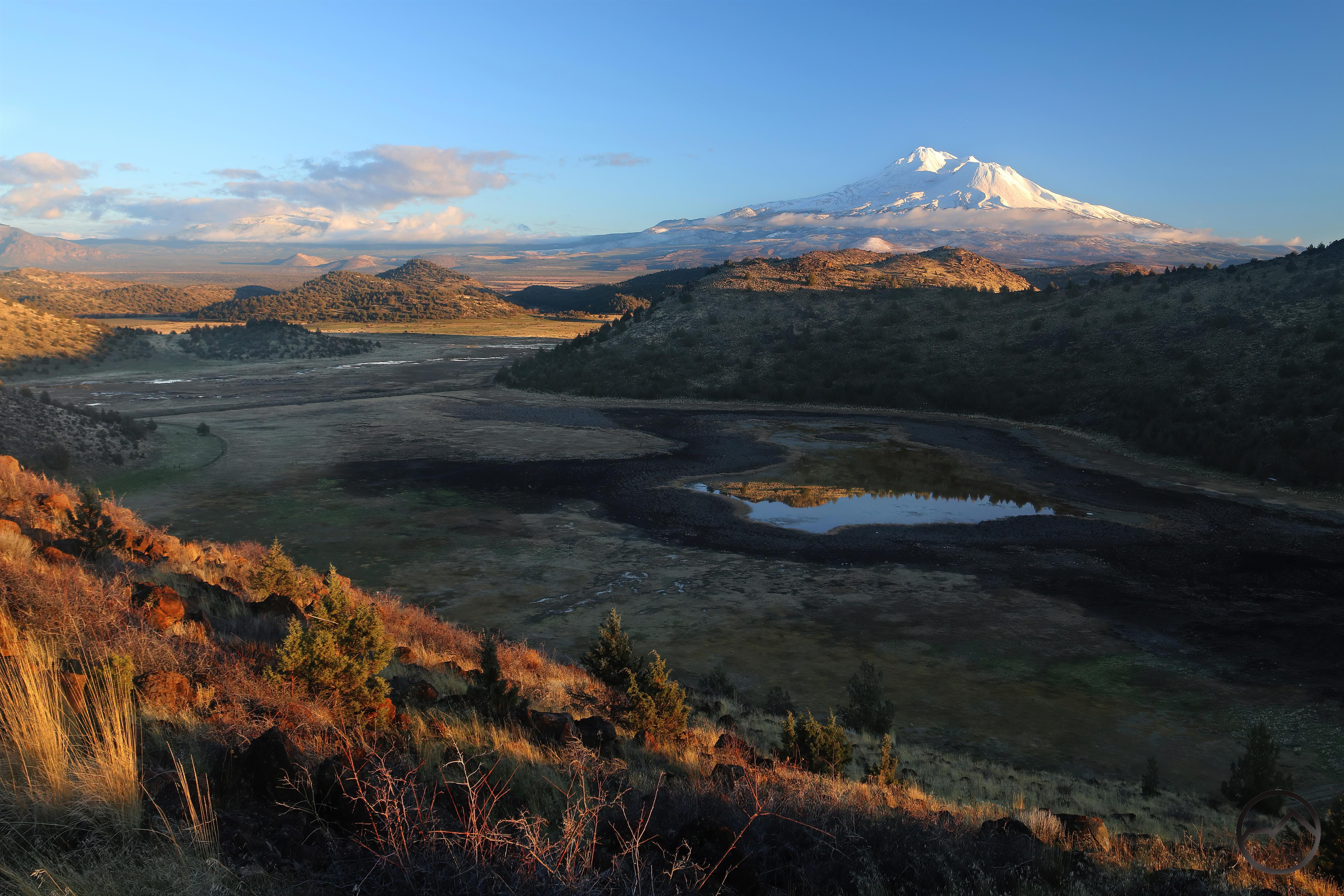
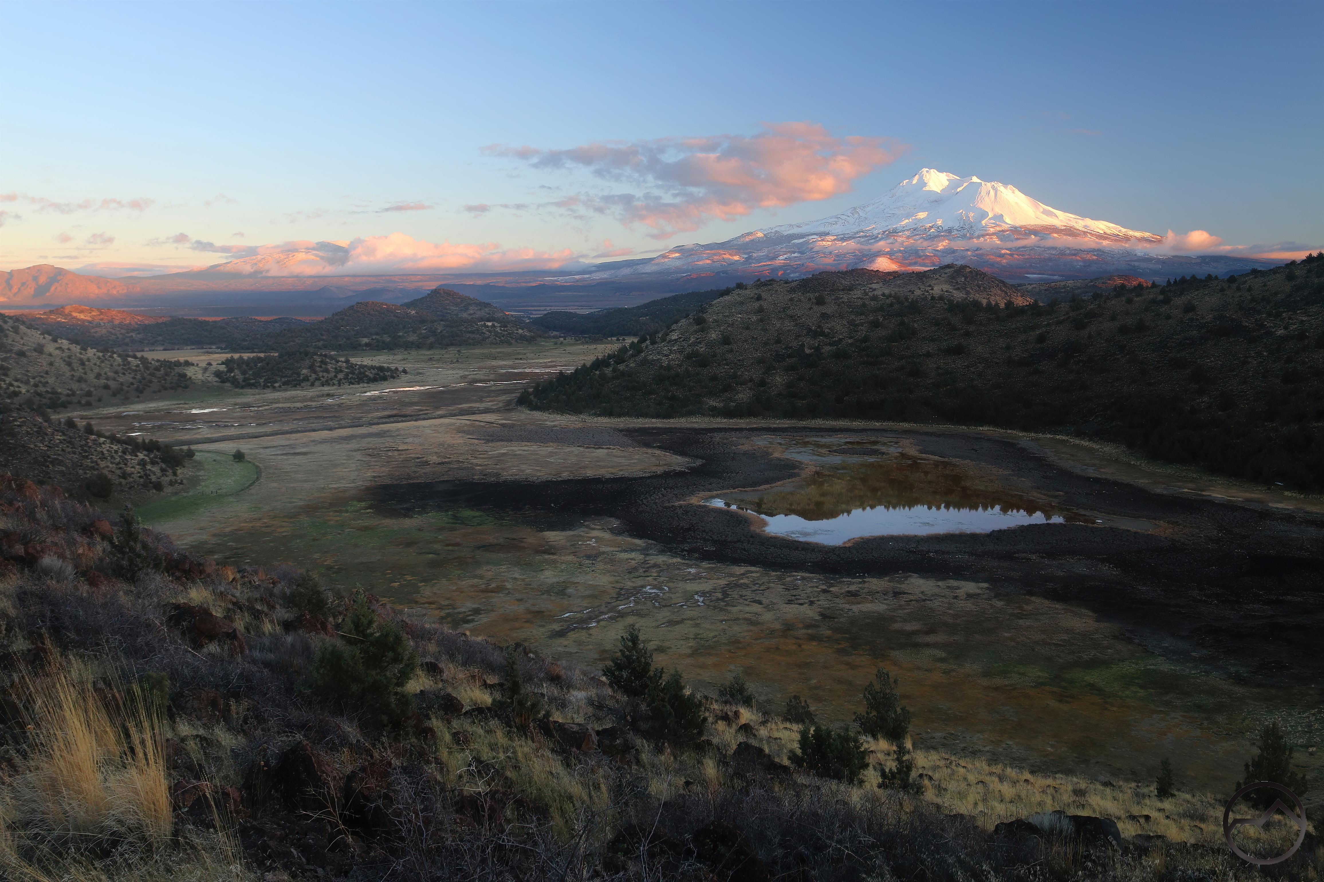
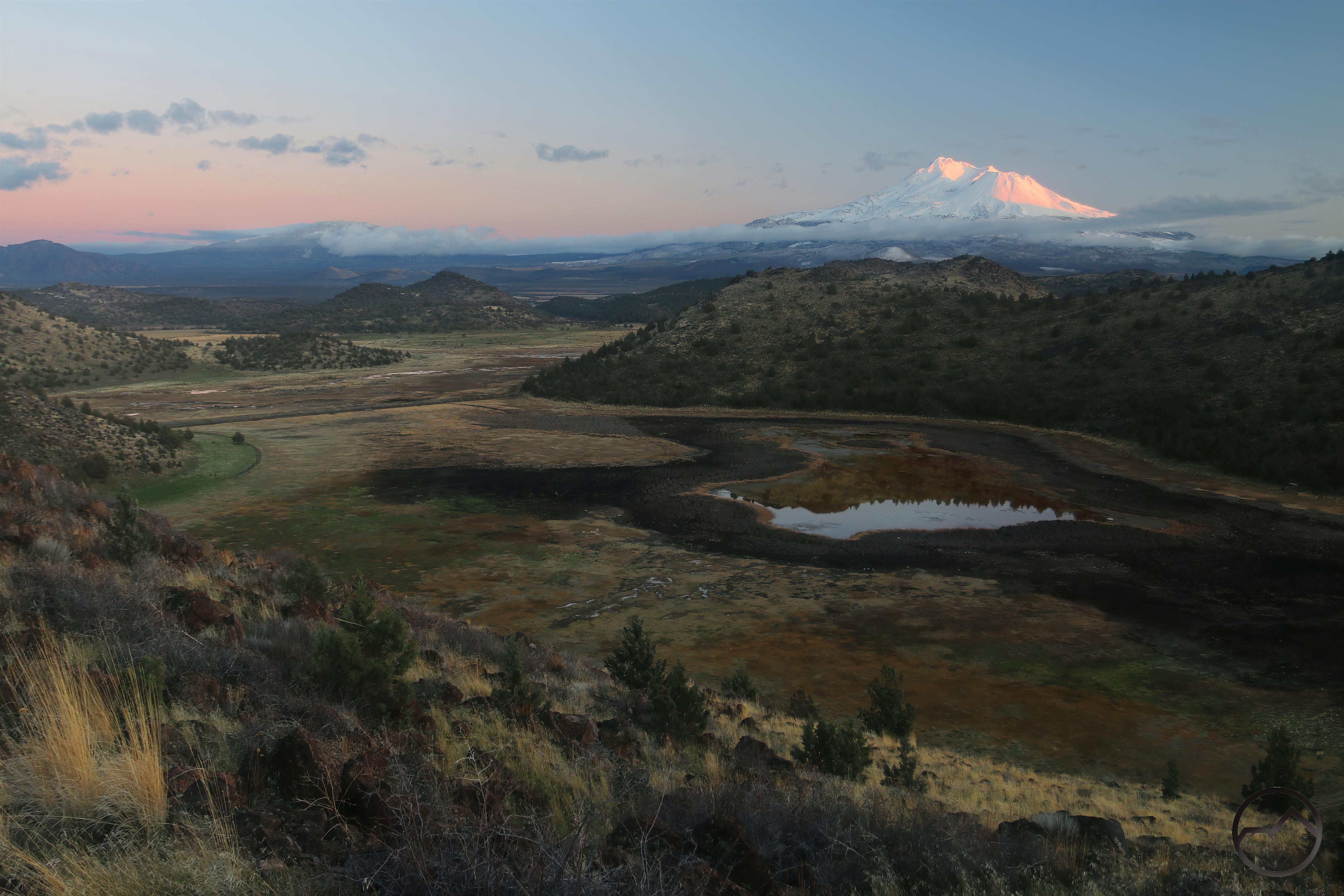
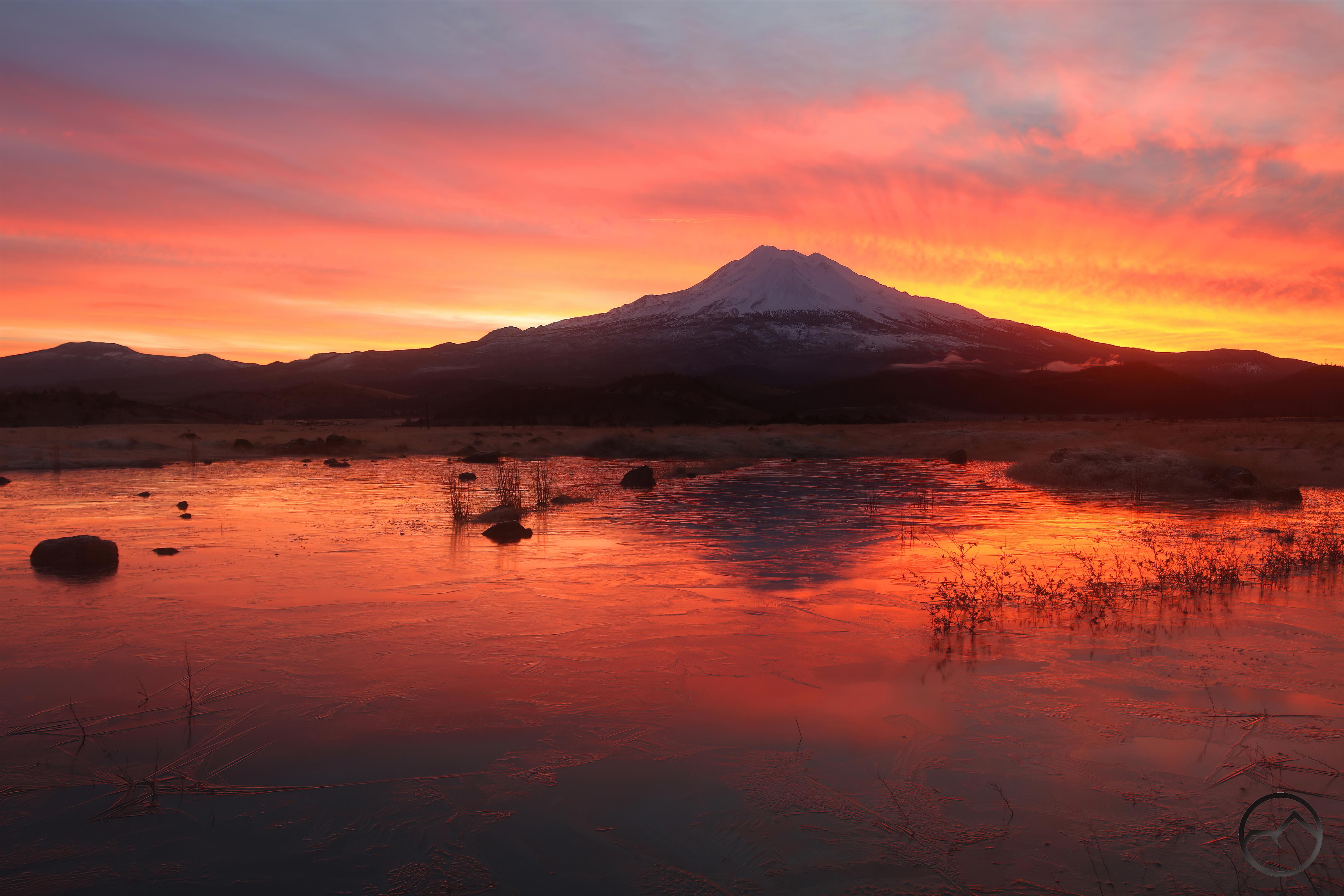
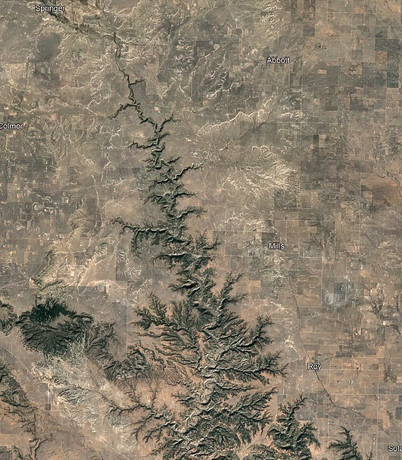
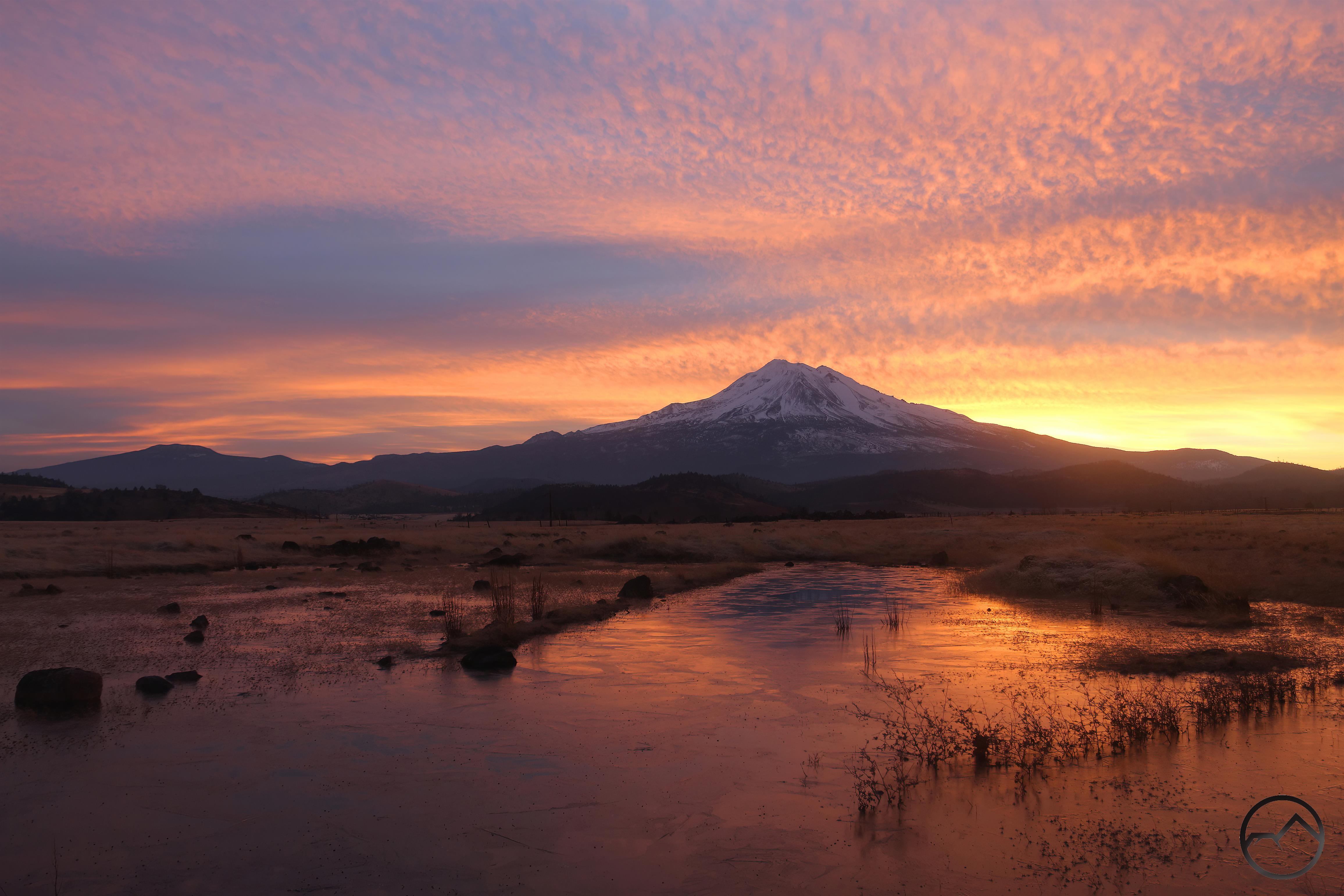
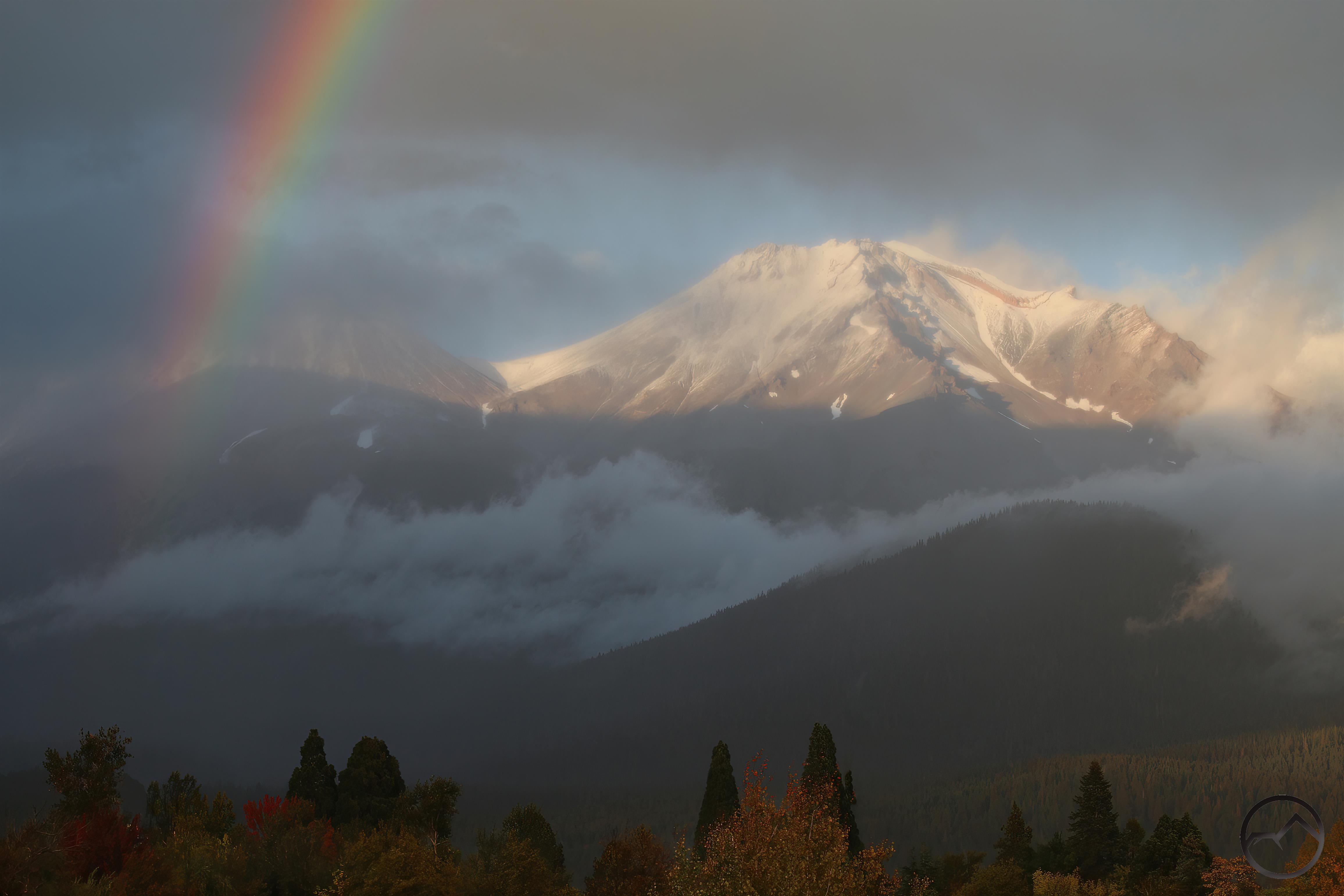
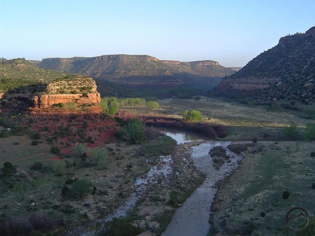
The Canadian River flows through eastern New Mexico’s Mills Canyon.

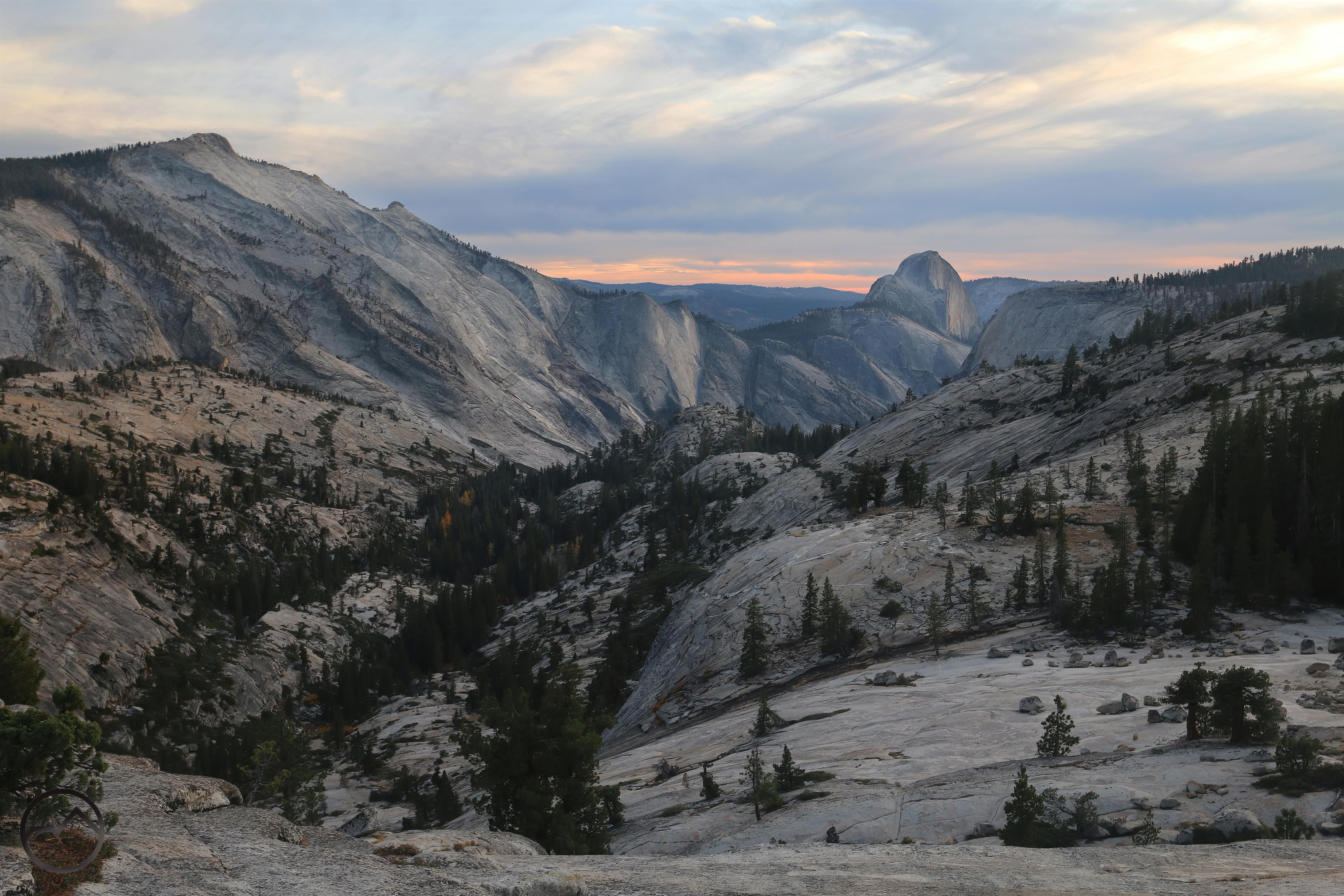
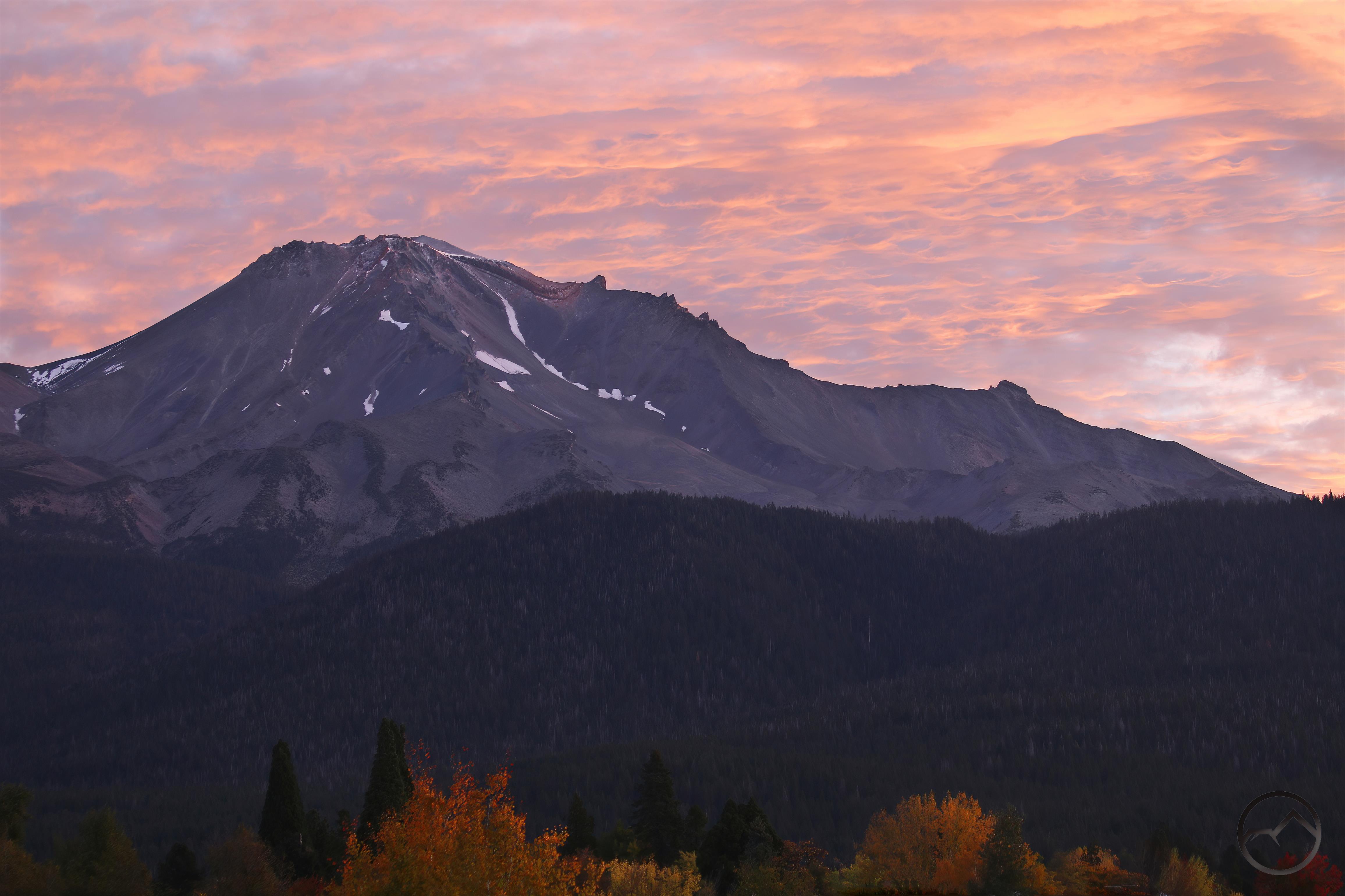
I have wanted to write something along these lines for a long time now. I have always kept HikeMtShasta focused on the Mount Shasta area, with occasional deviations into the Sierra Nevada or some other long trip we took. However, I have had a desire to write a bit about places that have had an impact on me, the formation of my views on nature, my wilderness ethic and that were formative for me as a person. Naturally, a lot of locations that would fall into this category would be in California since I am a California native. Yet the Golden State was my home, its mountains my playground where I was comfortable. This formed me in fundamental ways that drew my heart to the mountains and the vast expanses of the wild. It took being wrenched away from these that made me ponder and consider these things from a perspective oblique to the what I had always maintained.

At first I was pulled away willingly, thinking adventure in Texas (gradschool) was what I needed but I was quickly disabused of this romance of this endeavor. My time there became more of a tension between my love of my studies and my yearning to leave the city and return to the mountains…except there were no mountains, at least not of the sort I was used to within any sort of striking distance. That forced me to explore outside my alpine comfort zone and to recalibrate what I was looking for, what I was satisfied with and what I found pleasing to my eye. After four years, this project was an unmitigated success, as I discovered myself to be able to enjoy a wild expanse of plains or secluded canyon nearly as much as I longed for the soaring towers of the mountains. I still do.

Of singular importance to my development in this regard was the discovery of the Wichita Mountains in Oklahoma (this was the place that prompted me to first explore photography). I want to reserve discussion of this for another post but suffice it to say, this was a watershed discovery for me, knowing there was topography of this nature within relatively easy striking distance of where I lived. Yet, it was another discovery of nearly equal importance that broadened my horizons beyond anything I had anticipated. A chance discovery of Dan Flores’ book “Caprock Canyonlands” at a bookstore made me aware of places in what was essentially an enormous dark spot on my mental map. Reading this book, looking at the images of hidden canyons and red cliffs in the midst of the Plains, my imagination was seized by this seemingly lost (if ever really known) beauty and I was filled with a compulsion to visit and explore, and thus began my quest.

Note: all photographs were taken on primitive digital cameras 20 years ago. I apologize for the poor skill with which they were taken and the lack of resolution of the images. Mostly the poor skill though.

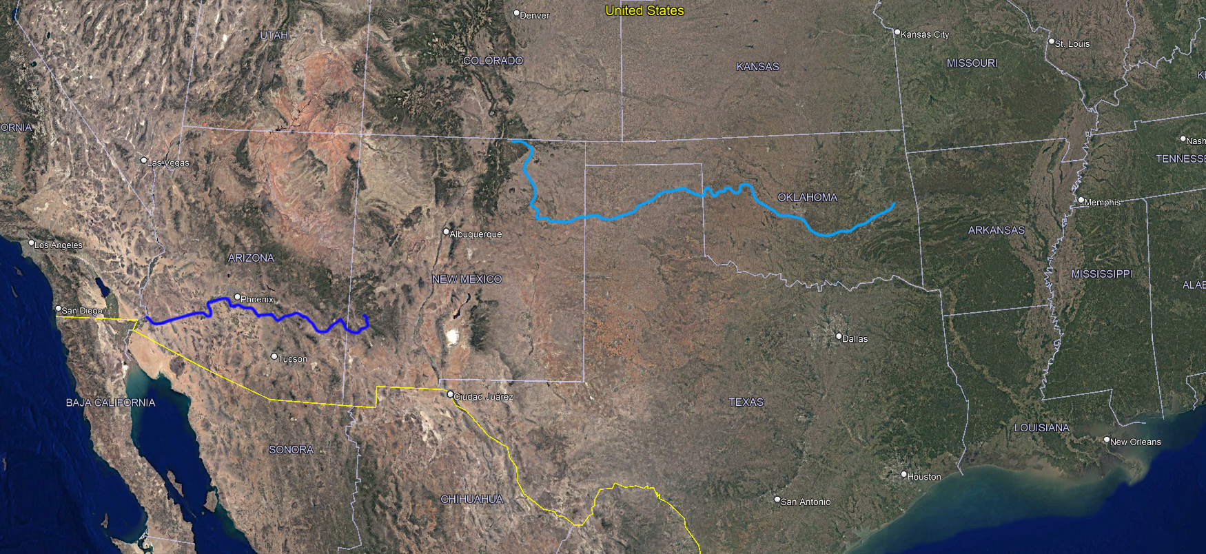
The Canadian River (light blue) flows east to the Arkansas River. The Gila River flows west to the Colorado River.

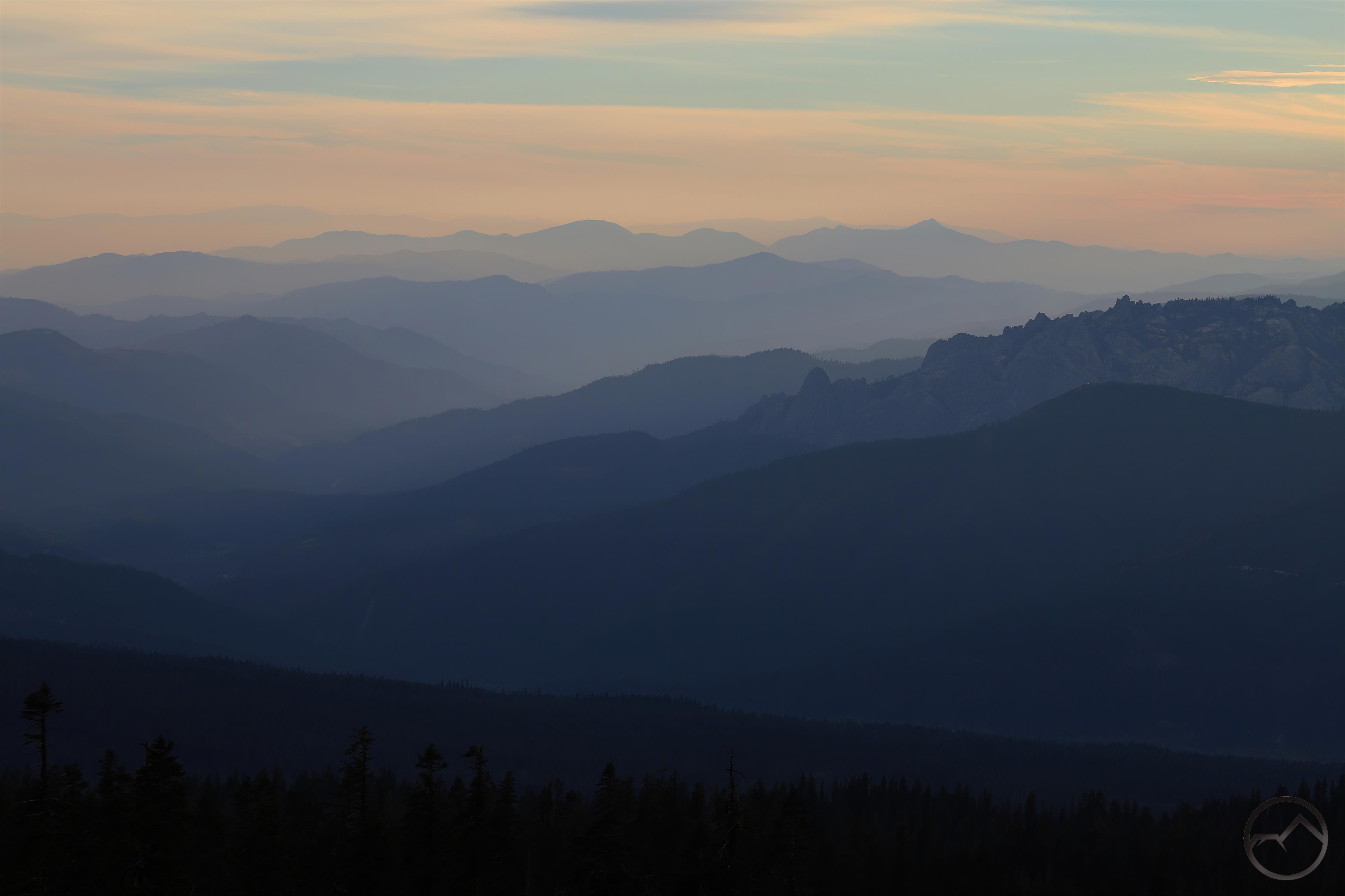
In Flores’ Caprock Canyonlands he explores via his legs, his camera and the written word, the canyons of the Caprock Escarpment in Texas. The lone outlier to this was his inclusion of the canyon of the Canadian River, that cuts through eastern New Mexico. This vast “horizontal yellow” has few notable features but hidden below the expanse, nearly invisible from the level land is a deep canyon of red sandstone through which flows a Rocky Mountain river.

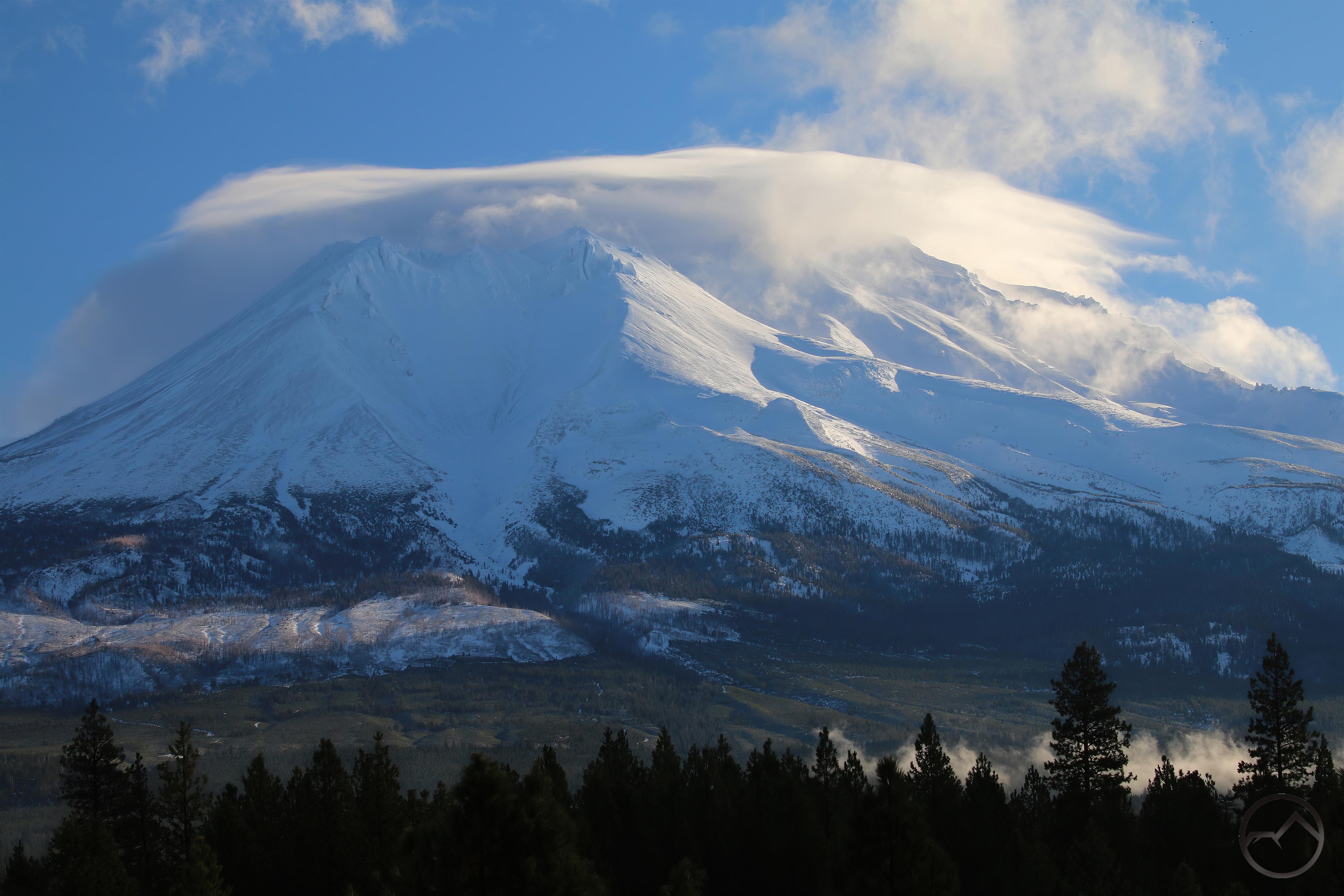
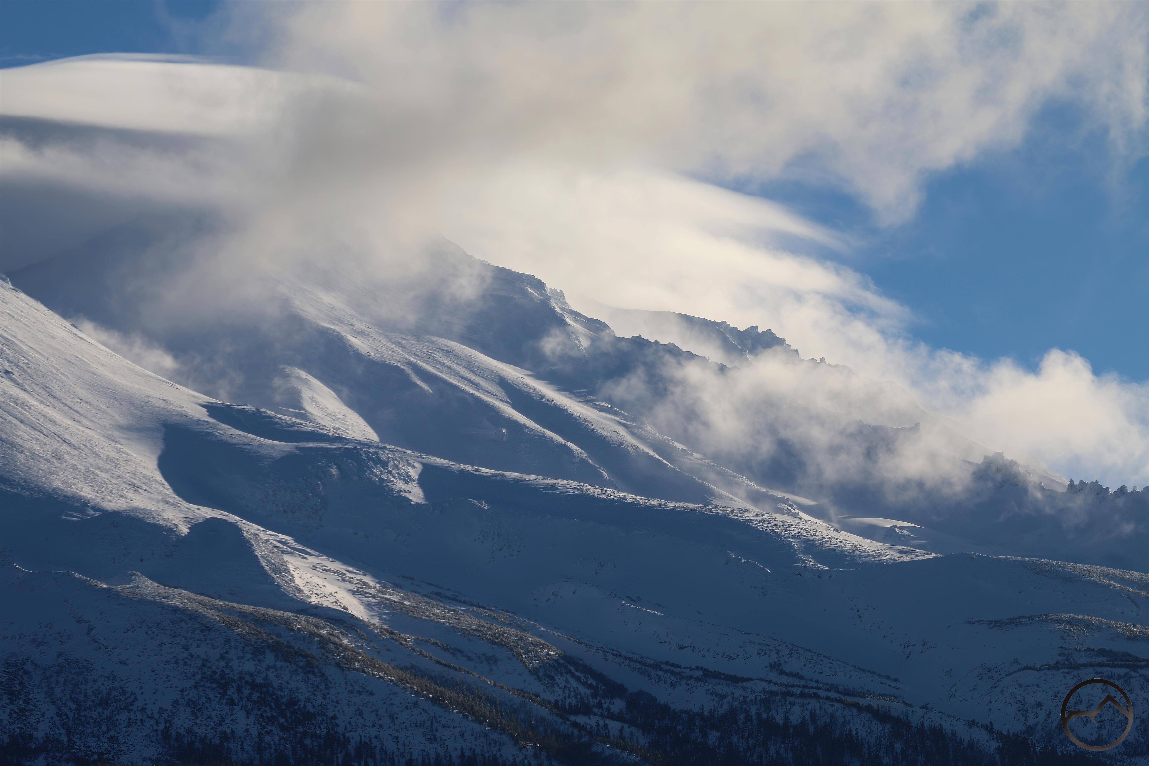
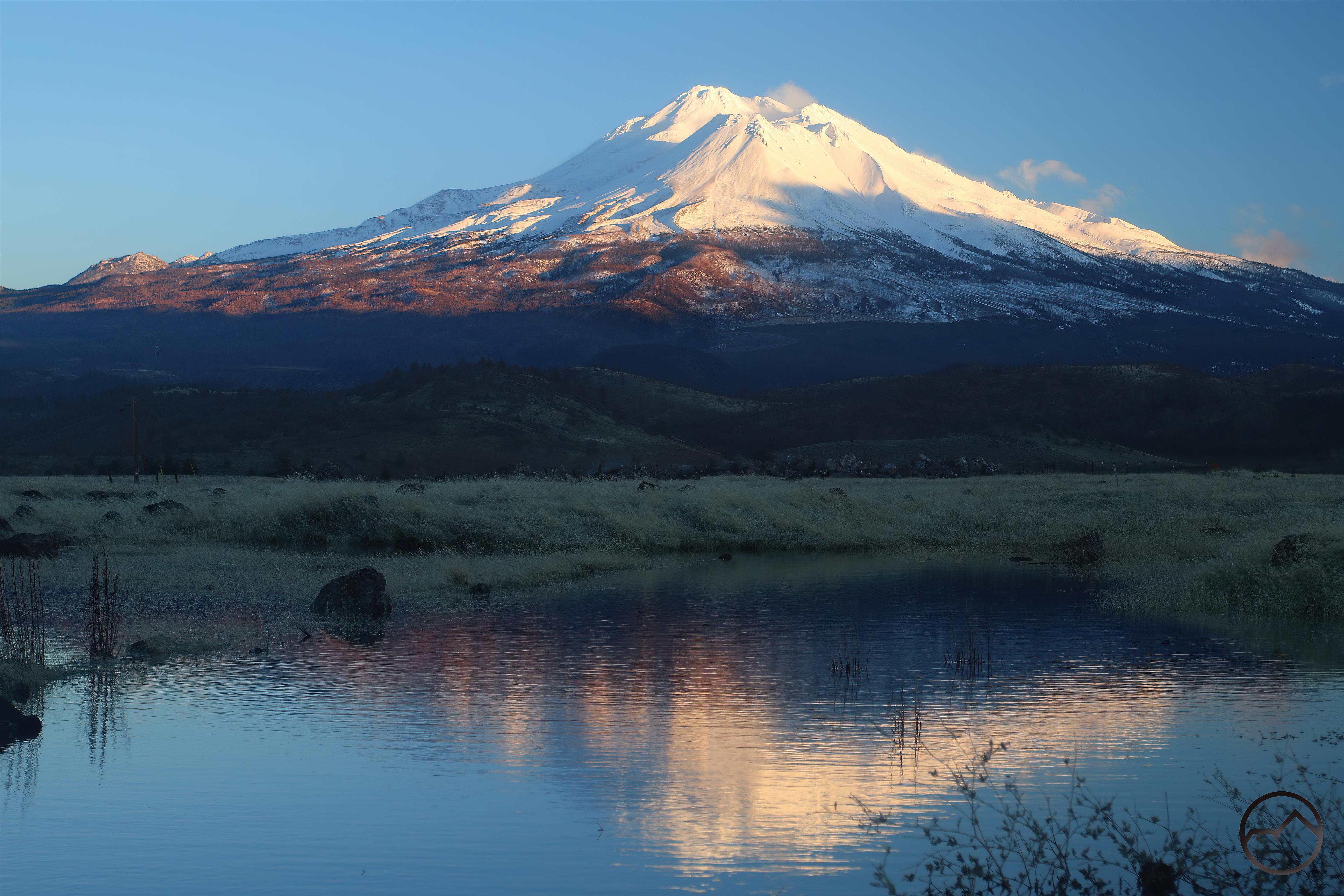
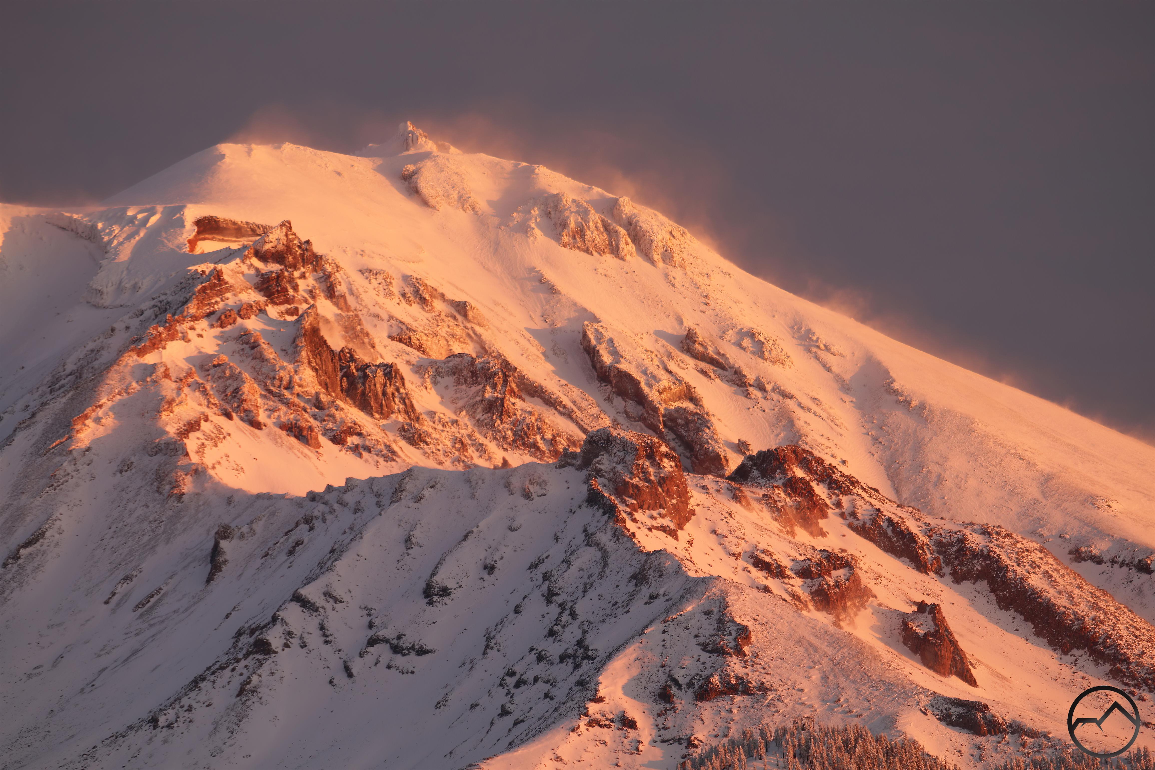
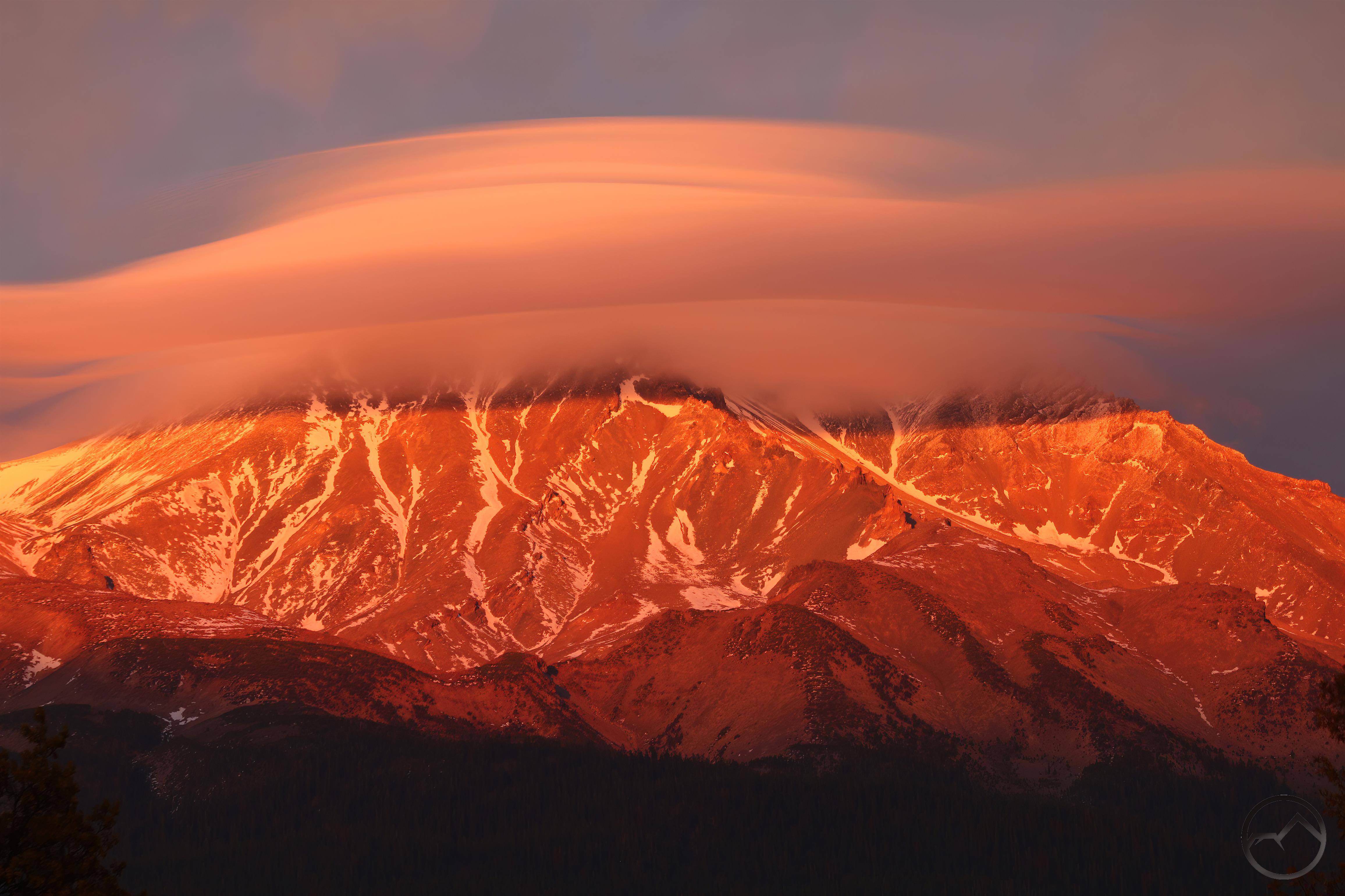
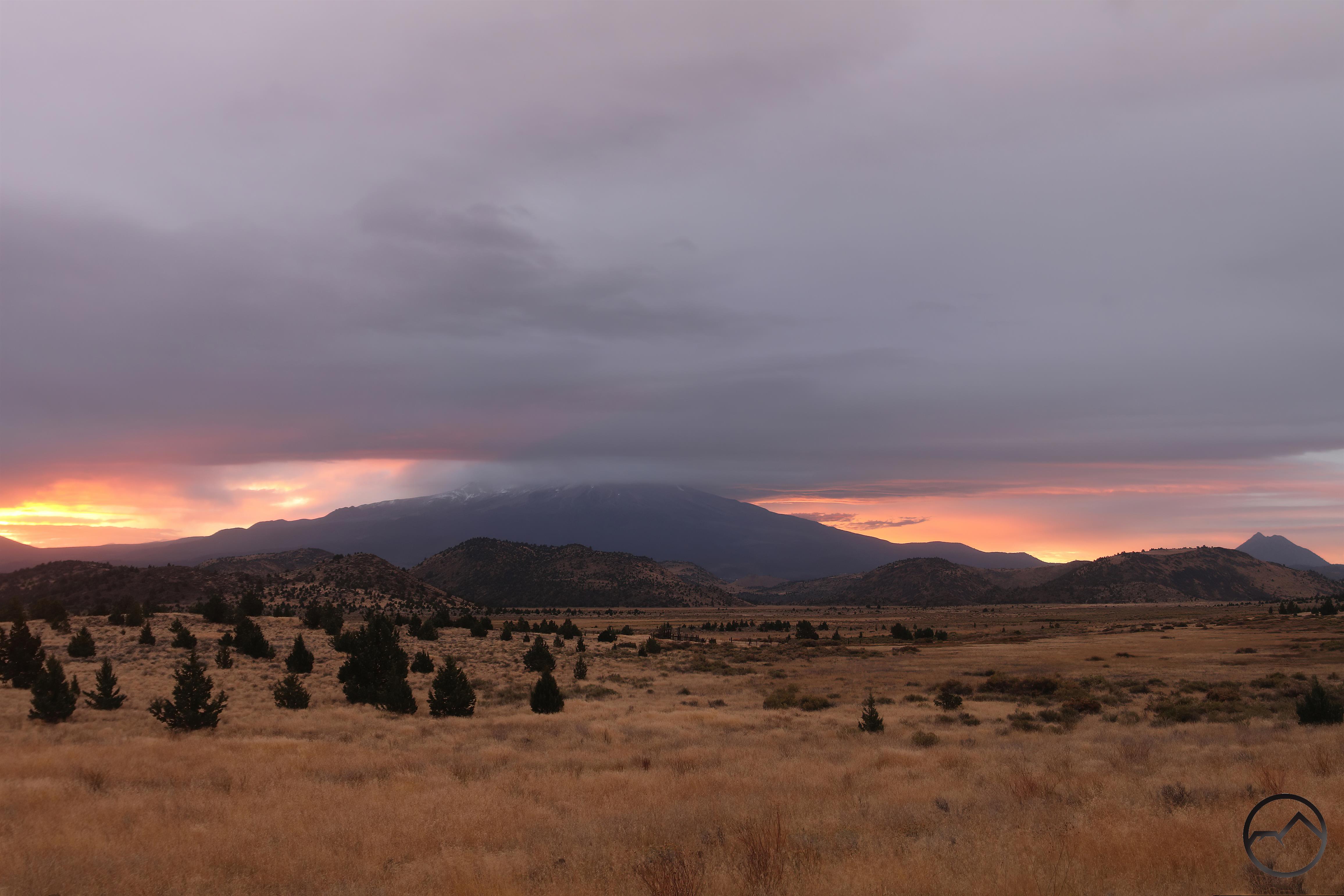
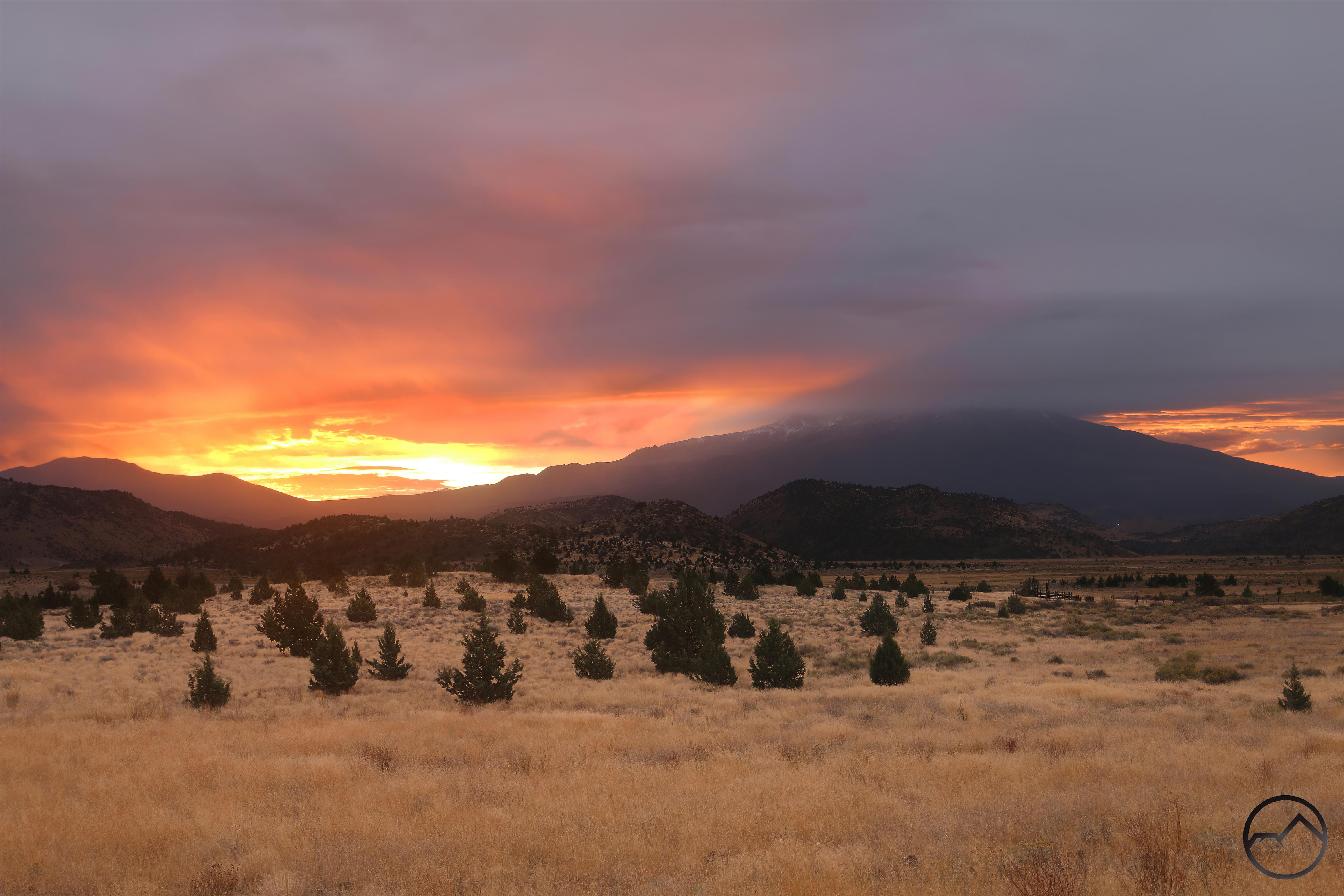
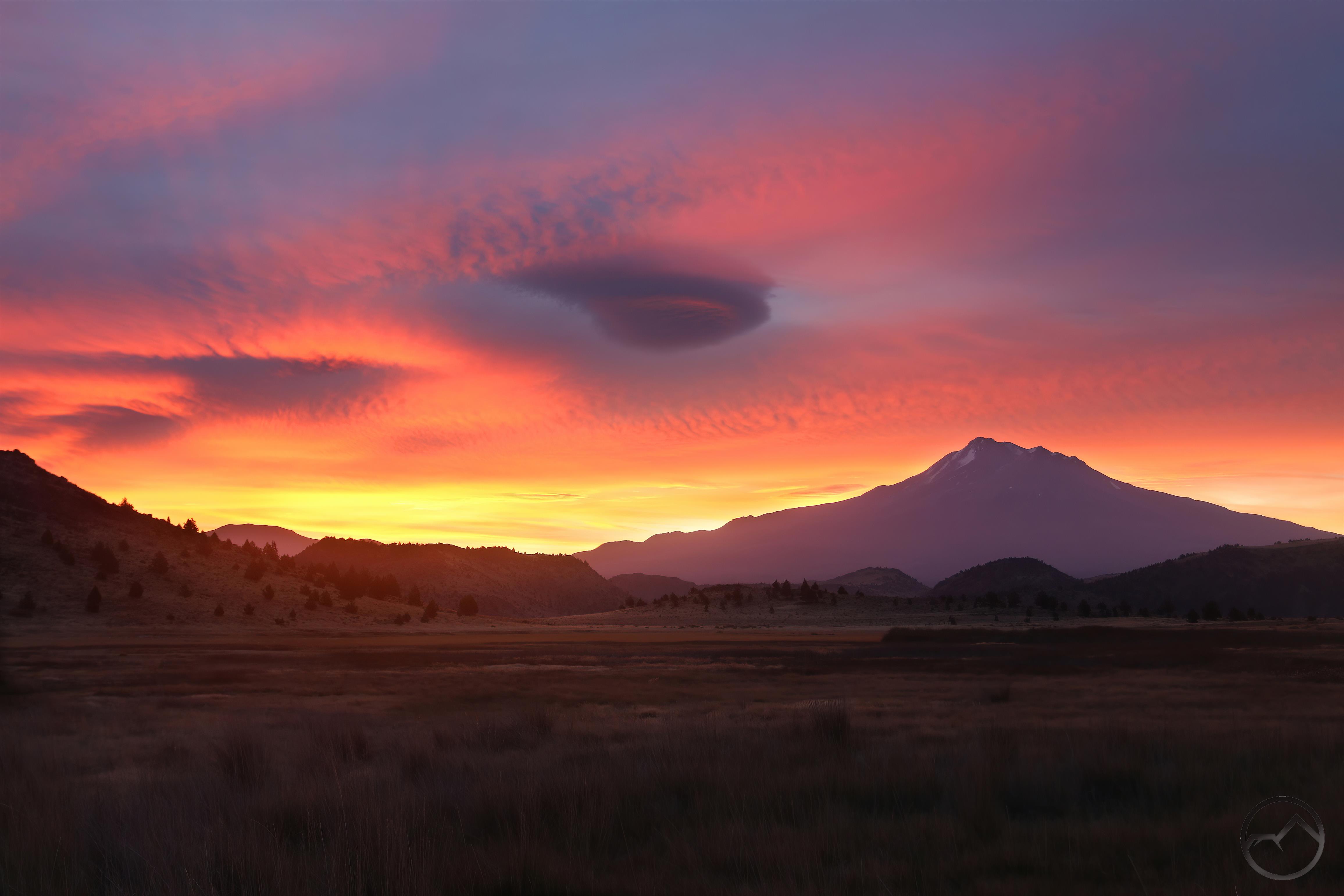
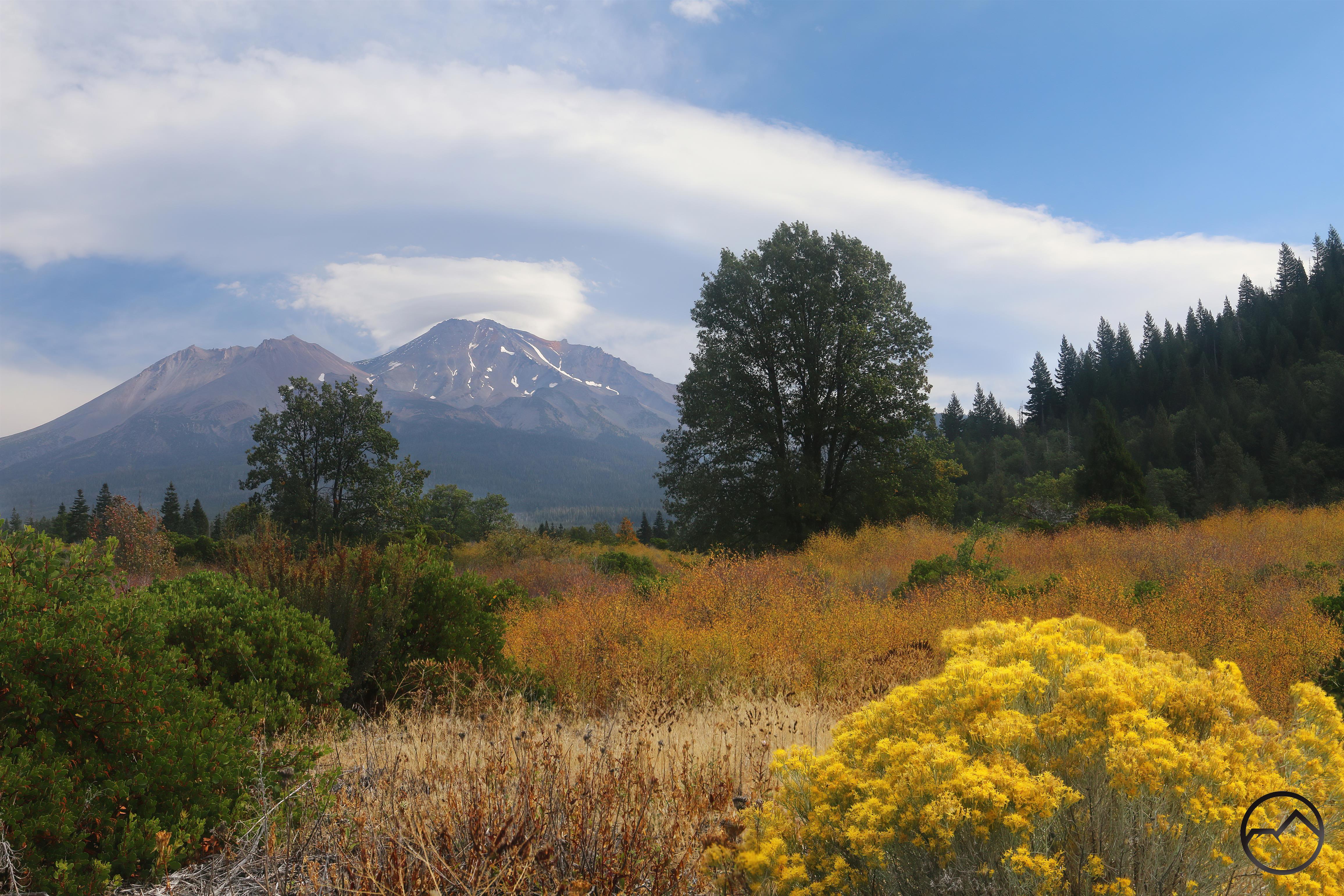
The Canadian River rises in the Sangre de Cristo Mountains a little more than a mile north of the New Mexico border. It flows out of the mountains and into the flat lands of eastern New Mexico near Raton (for a good read about the canyon for beyond this beautiful area at its headwaters, read John Ericksen’s “Through Time And A Valley“). About 20 miles to the south, it begins to cut a deeper channel into the land and soon it is flowing through a 600 foot deep chasm. This canyon, known as Mills Canyon an so named for the nearby the small farming “village” of Mills, is composed of horizontal layers or rock, the deepest of which consists of red sandstone. The crimson stone imbues the canyon with an appearance akin to canyons found in the Four Corners region, not the High Plains. Of course, as noted by Flores, the nearby canyons in Texas’ caprock have a similar quality. The greatest difference between those and Mills Canyon is the presence of the Canadian River, which blesses the New Mexico chasm with far more lushness amidst the arid landscape.

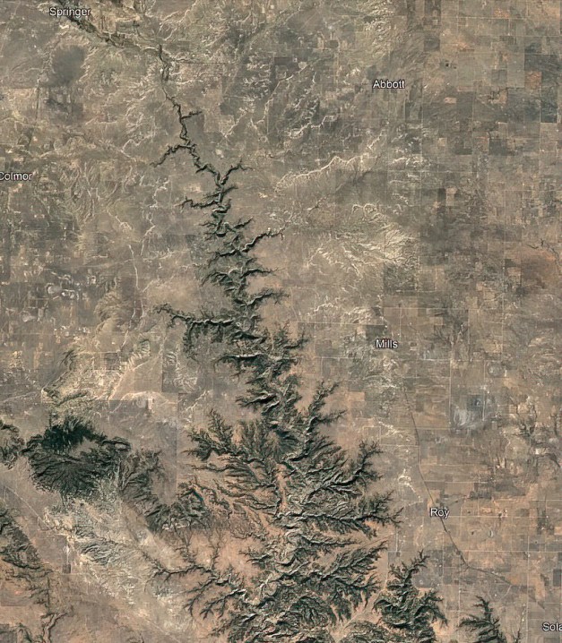
Satellite view of the Canadian River’s canyon cut into the High Plains.

Mills Canyon has, for a long time, been lost to the vast majority of Americans. Like much of the west’s intricate geology it was just one more place in the midst of an innumerable number of places that draw the eye, inspire awe, and imprint themselves on the hearts and minds of people who yearn to see the grandeur and beauty of creation. Like so many of these places, it was just too far, too remote or too overlooked in favor of it’s neighbors. Consequently the canyon was lost to all but those few that happened upon it by whatever means.

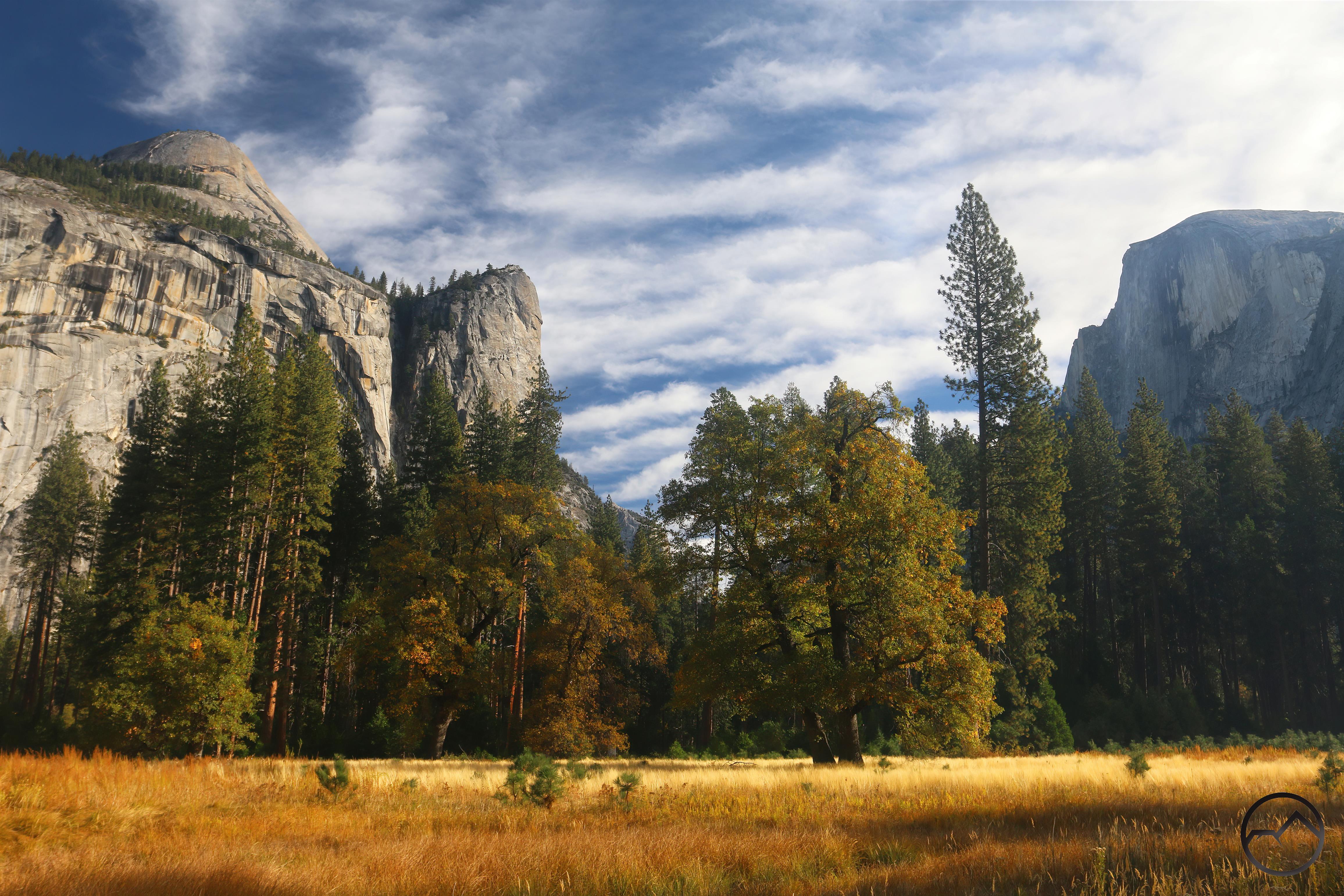
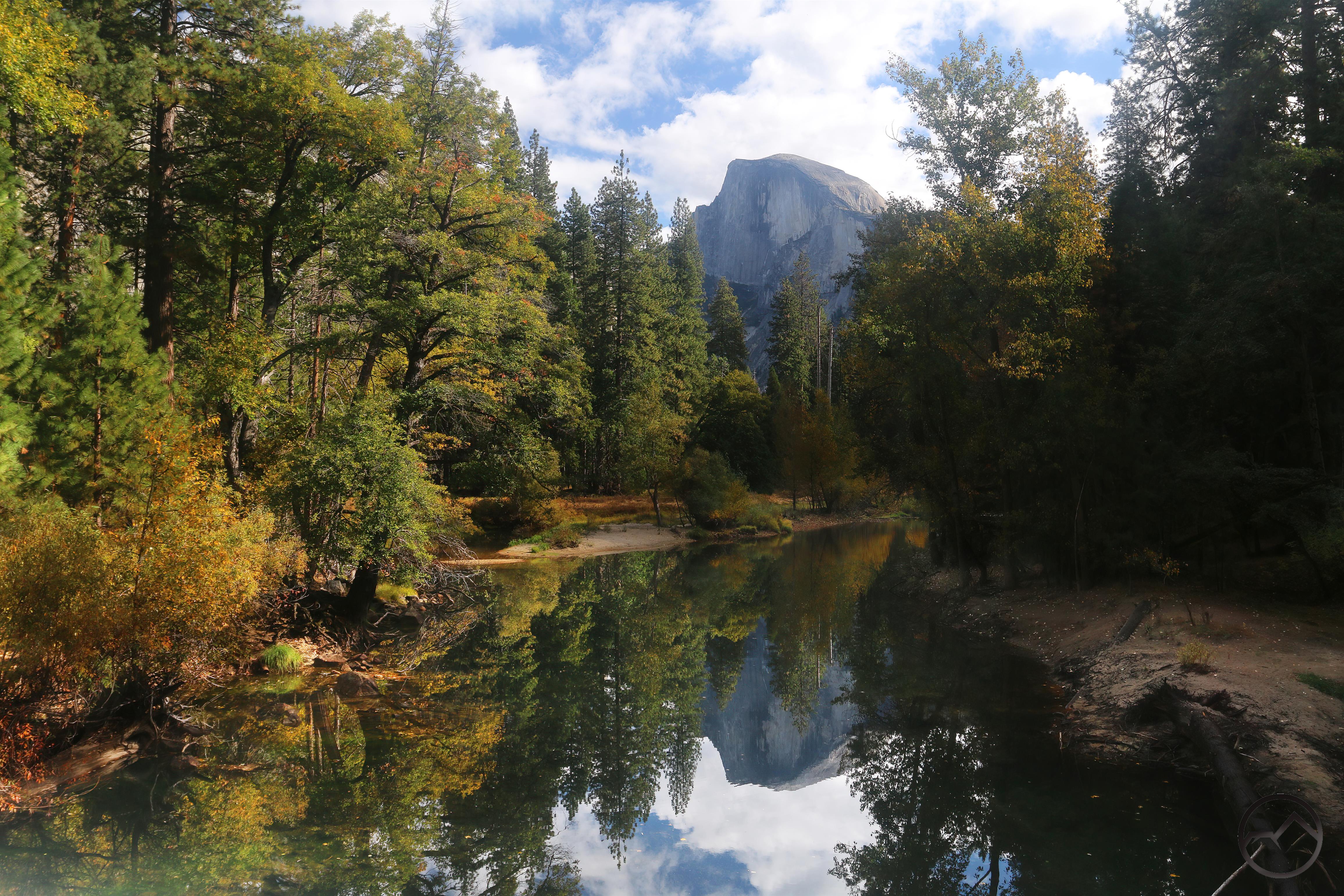
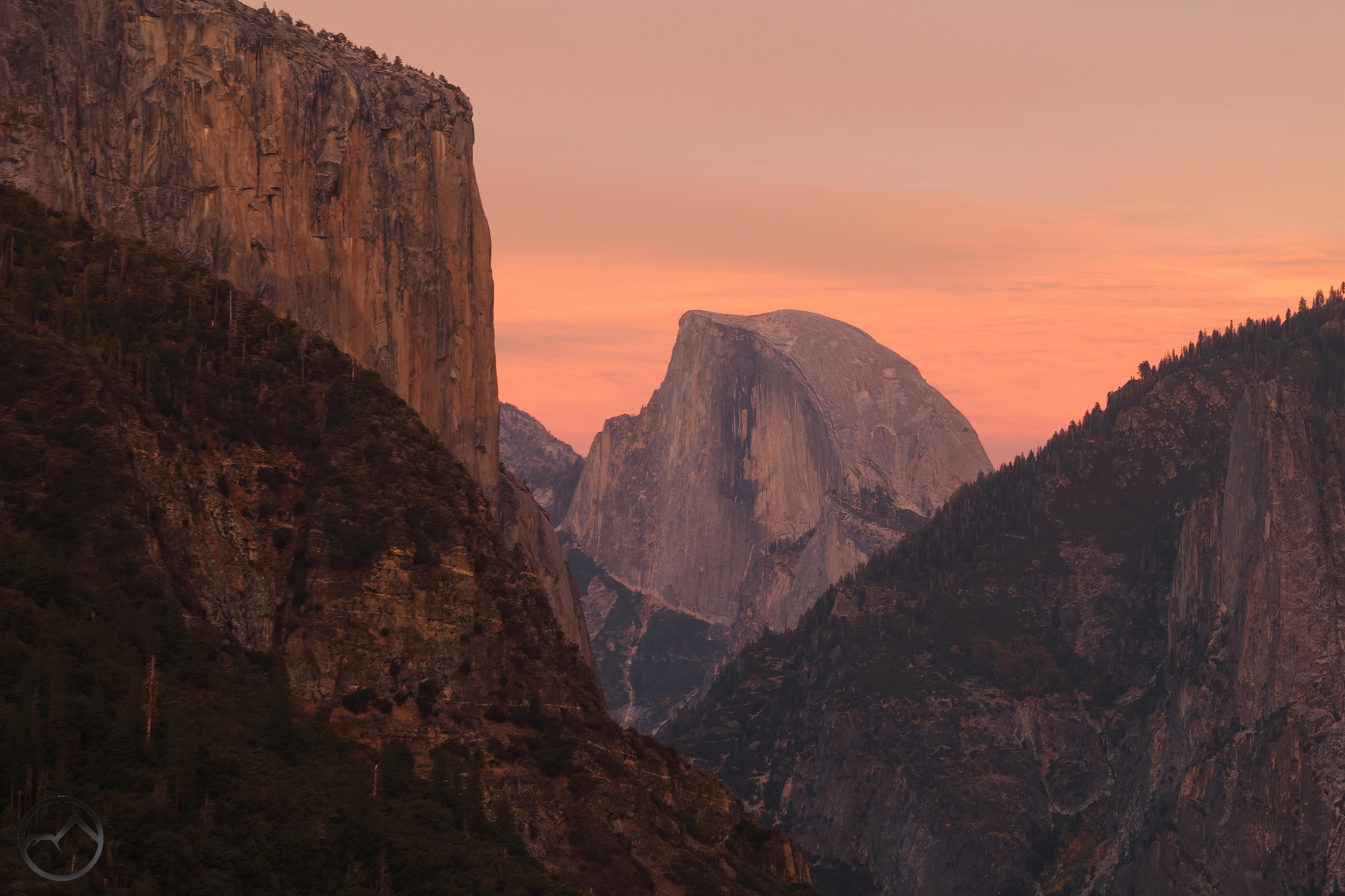
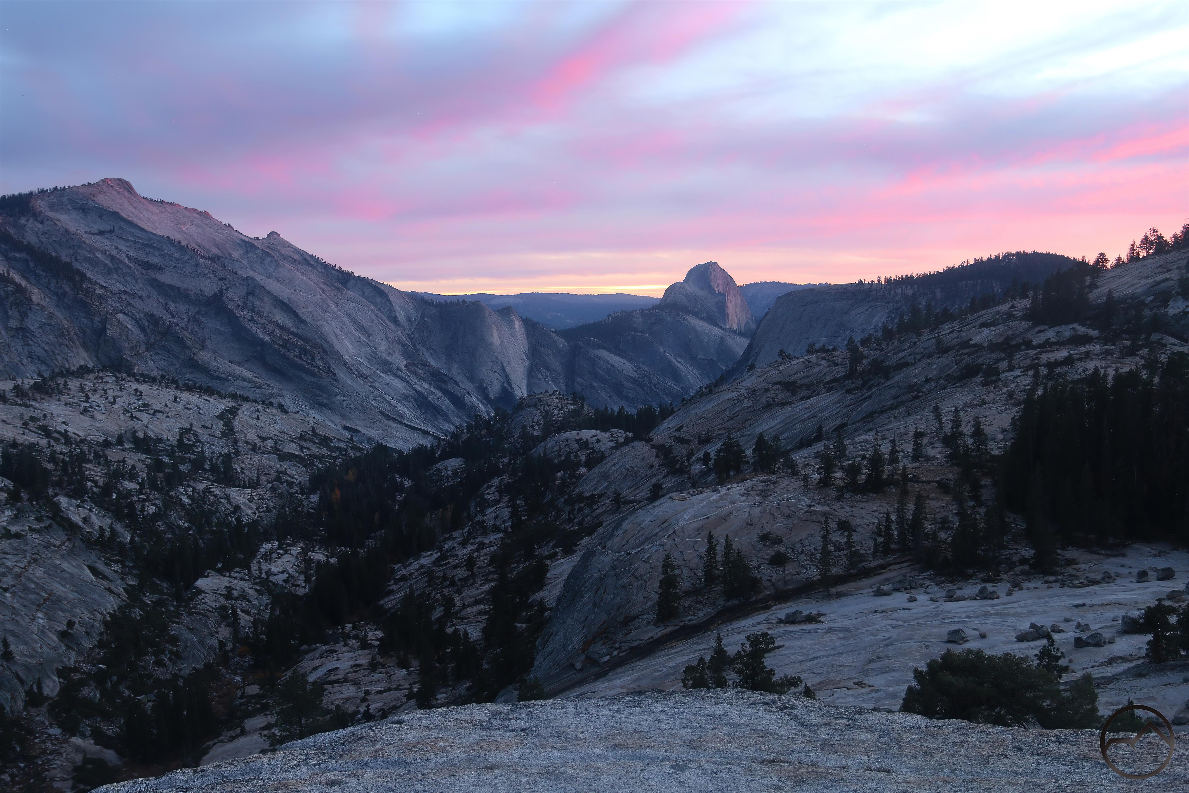
I was one of those few and the means was Dan Flores’ book. It became a quest for me. I was stuck in Dallas and many, many places had become subjects of fascination and fantasy to a young student stranded in the heart of urban sprawl. Coming from Northern California and raised with Yosemite as the archetype of natural beauty (which it still is, of course!) my sojourn in the Metroplex was forcing me to reevaluate what I considered beautiful, what I considered spectacular and where I wanted to go. Yosemite might be out of my reach but there was a whole new world of magical destinations that were within my grasp. It was time to go explore!


To me, there are few things as exciting as filling in the blank spots on my mental map. It’s even better if they happen to be interesting and beautiful! Mills Canyon was one such place. It became a priority for me to get there, to know the land, to see its ruins and history and to perceive its beauty with my own eyes.

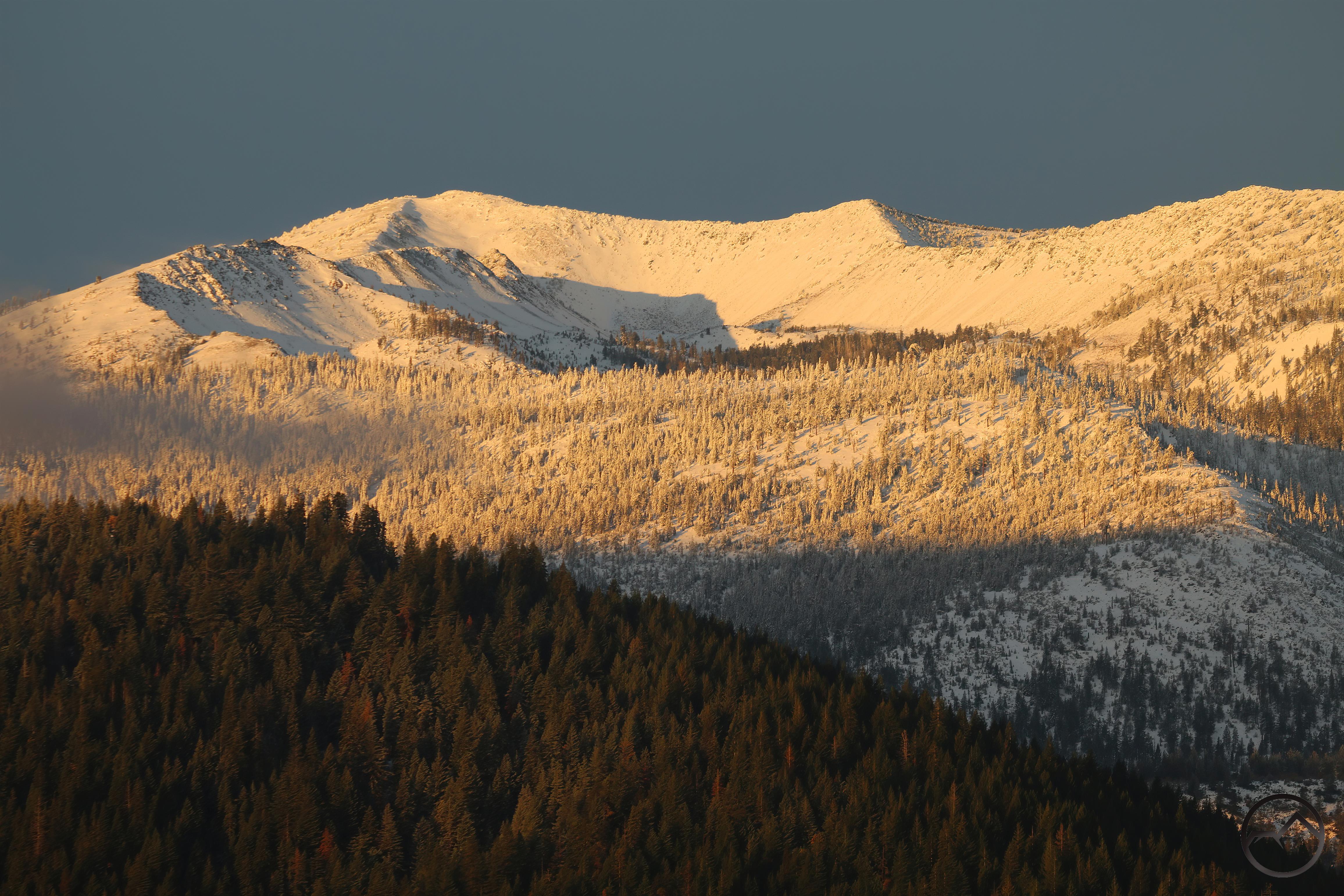
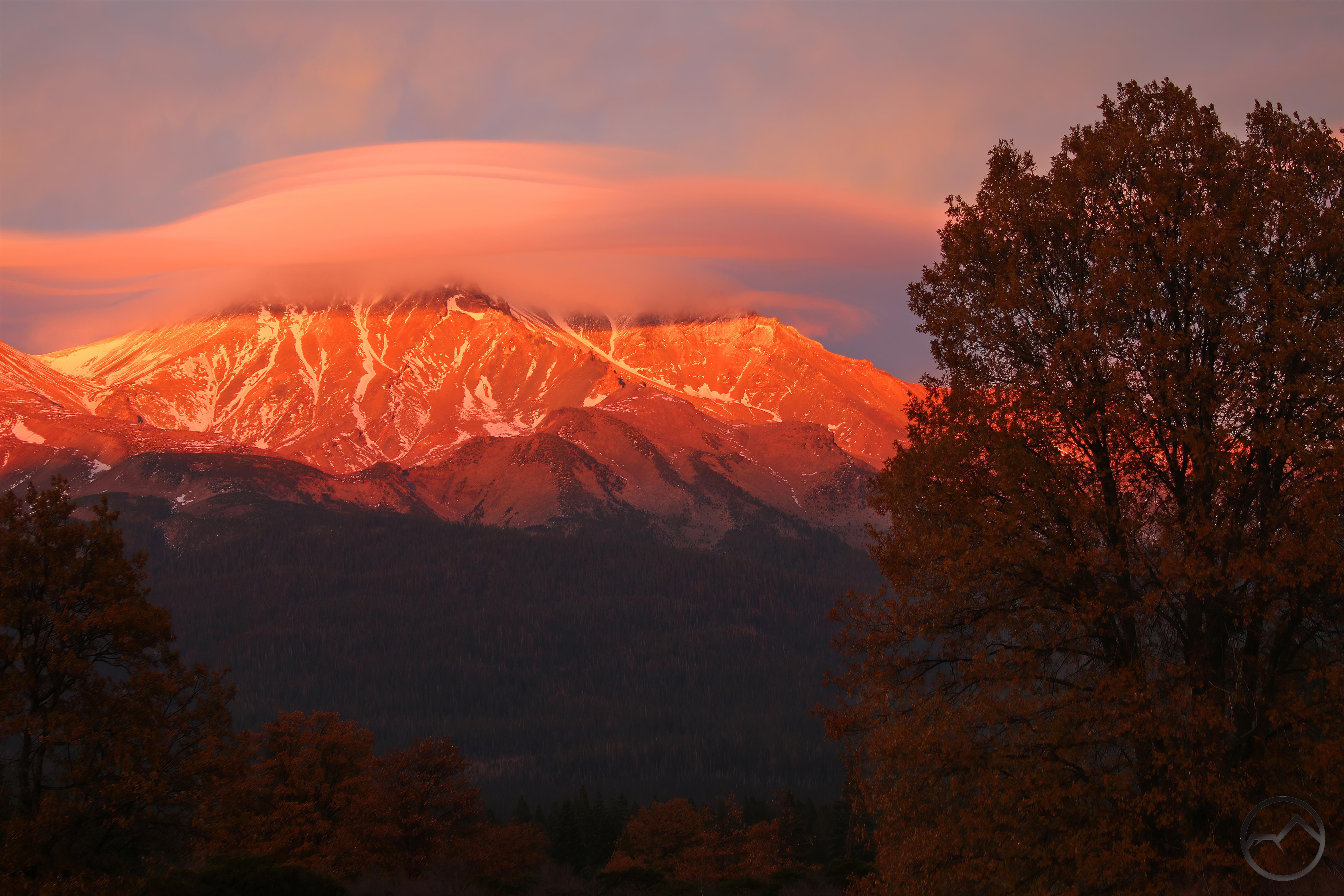
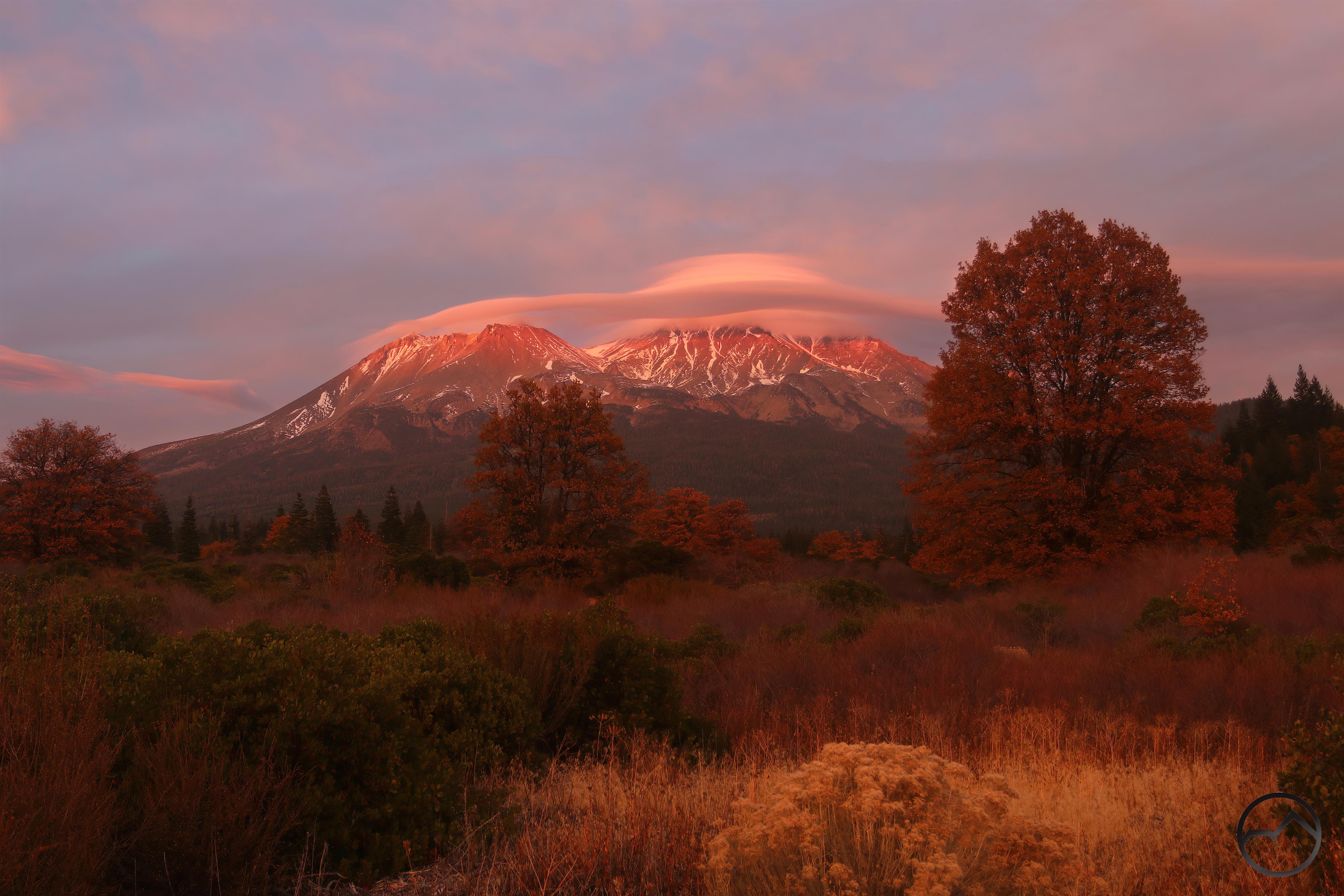
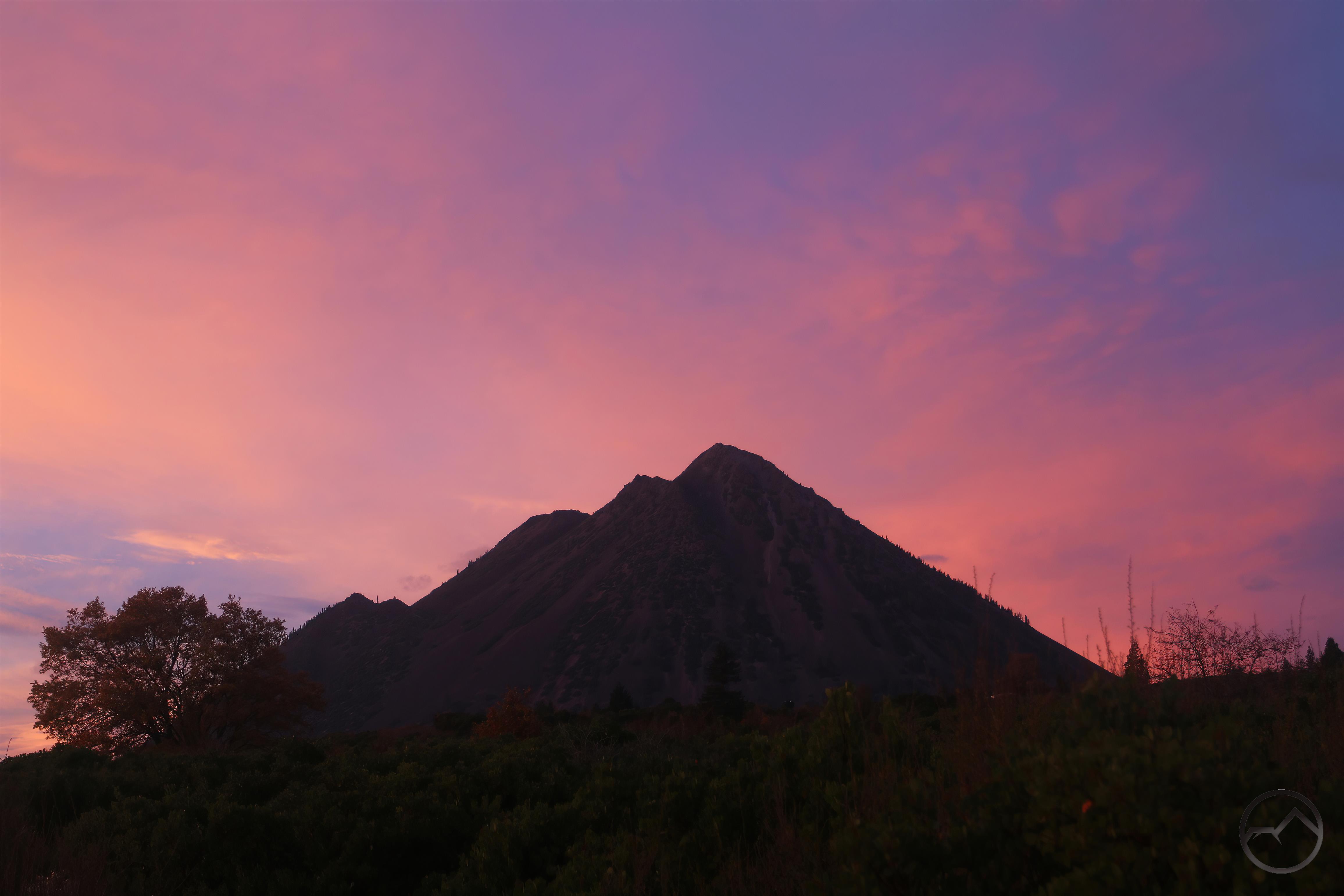
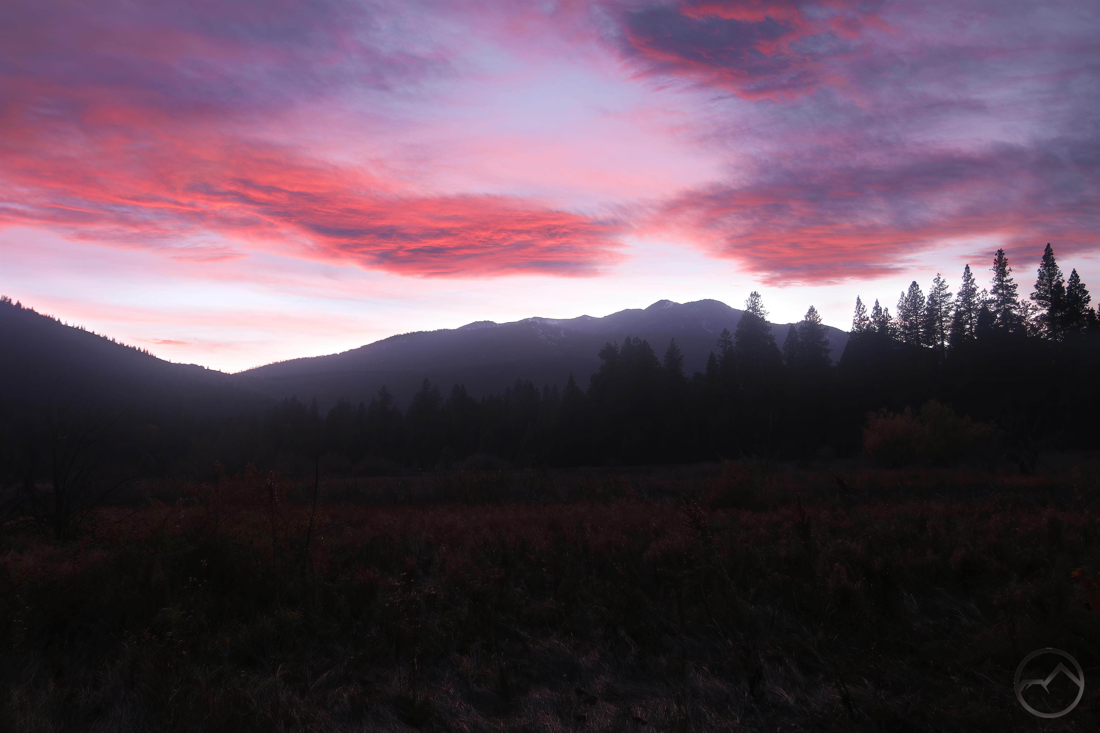
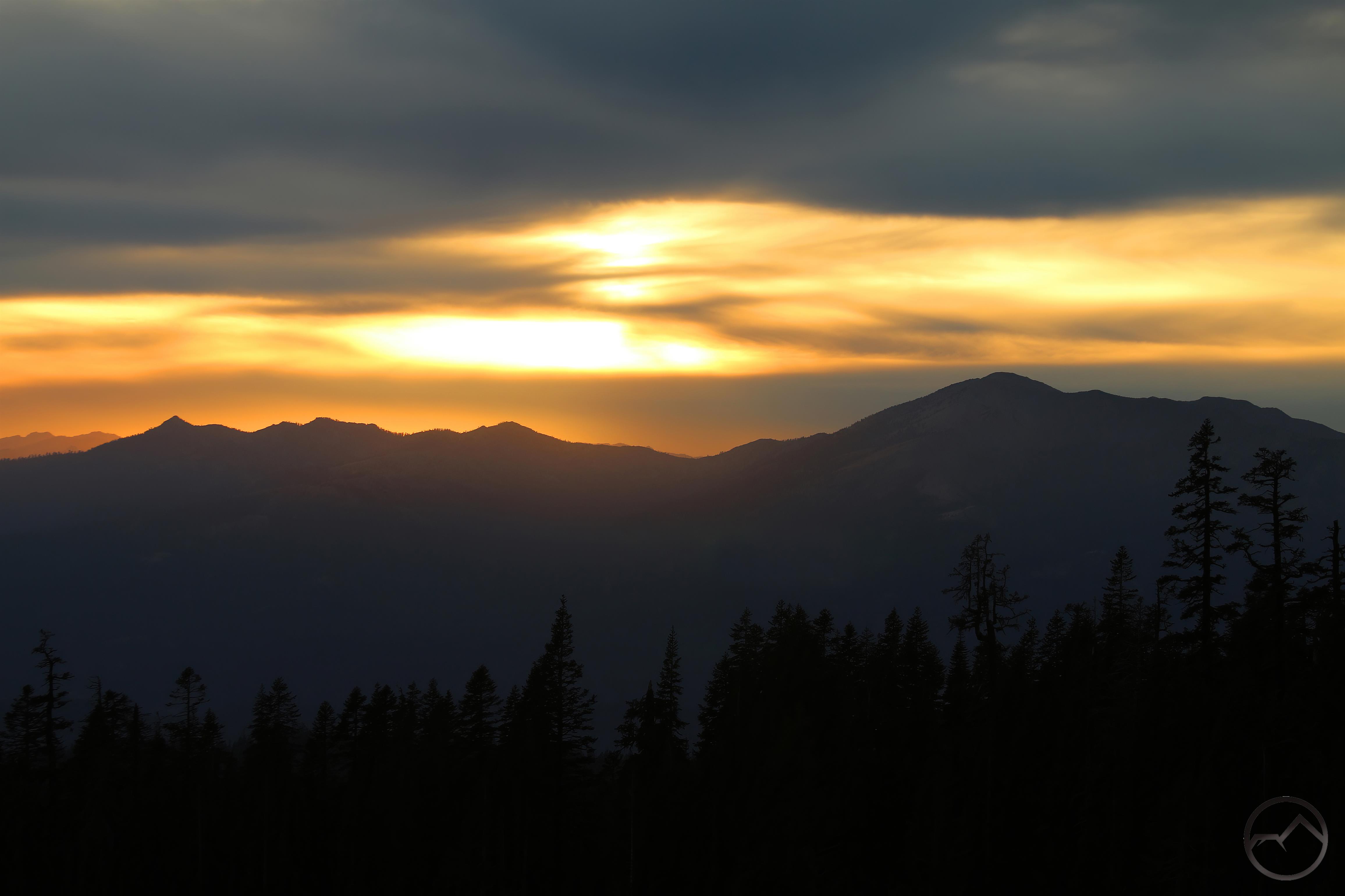
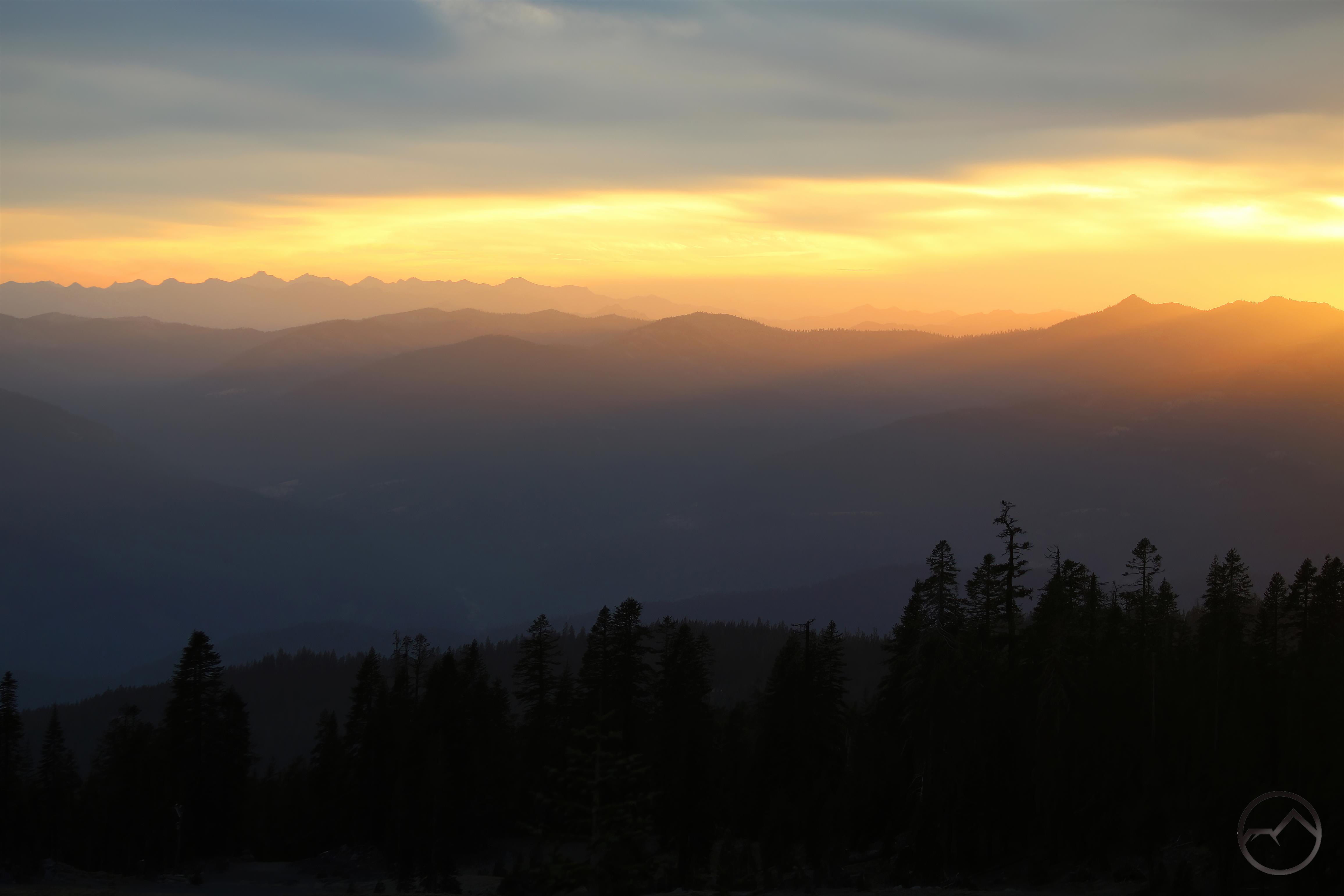
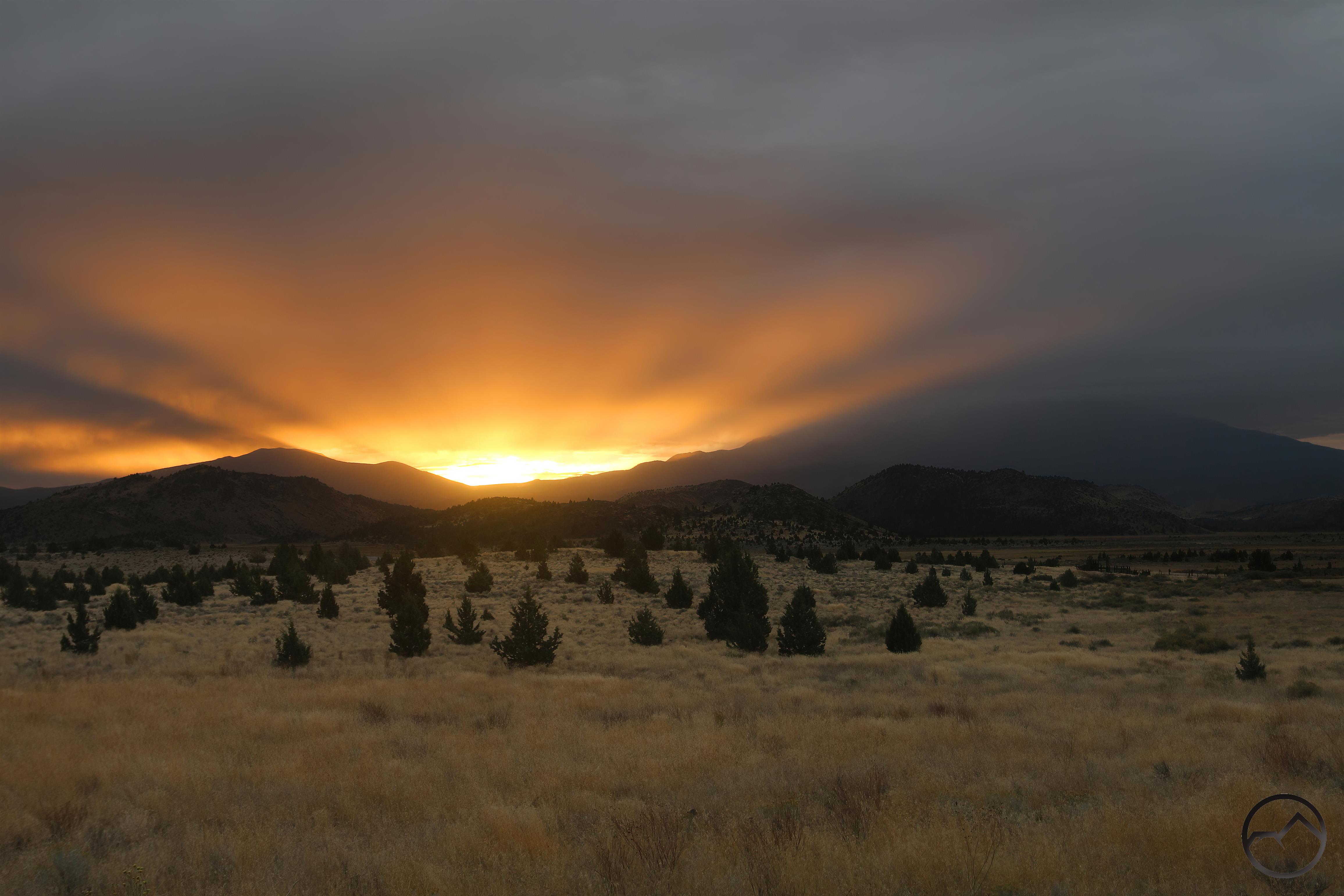
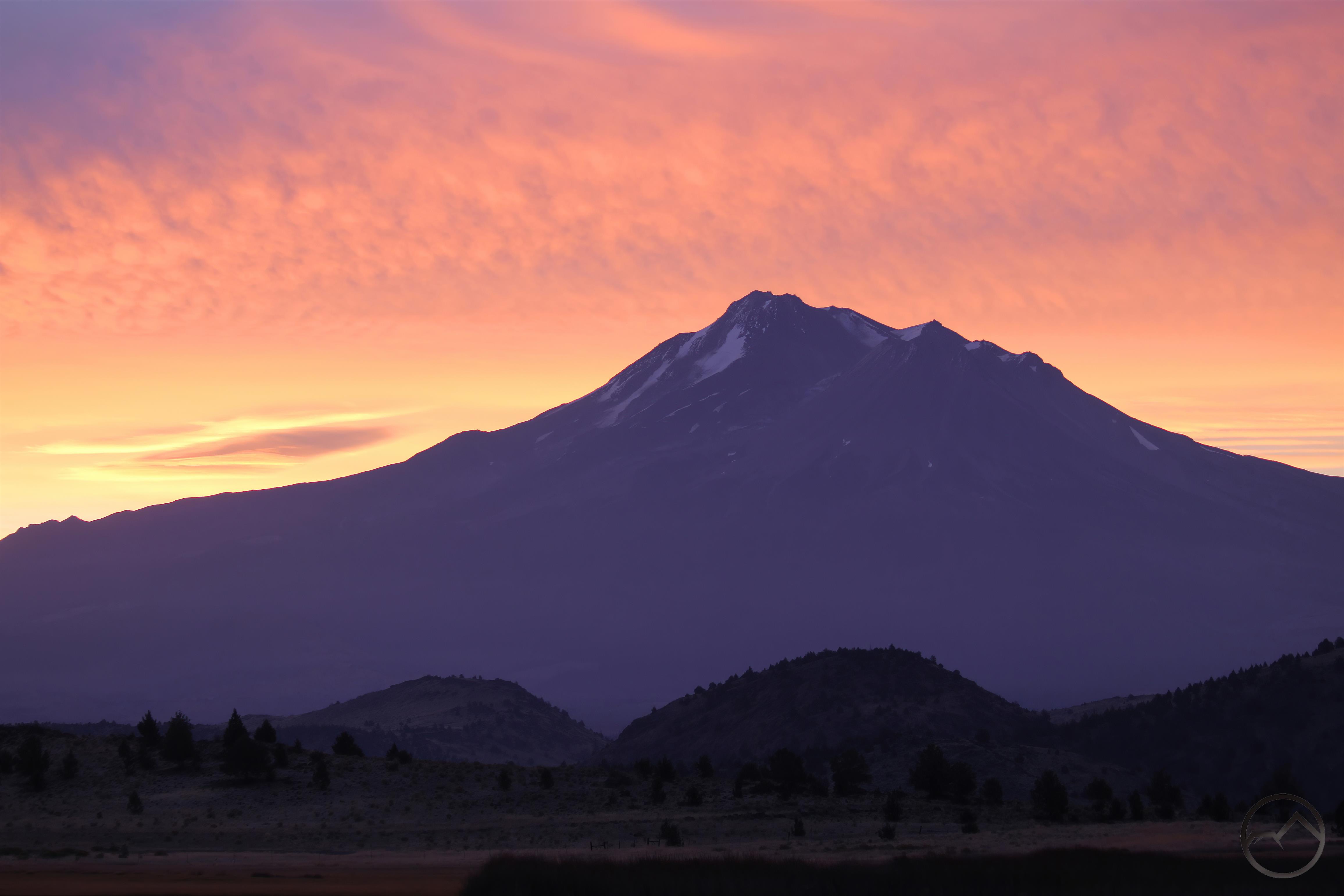
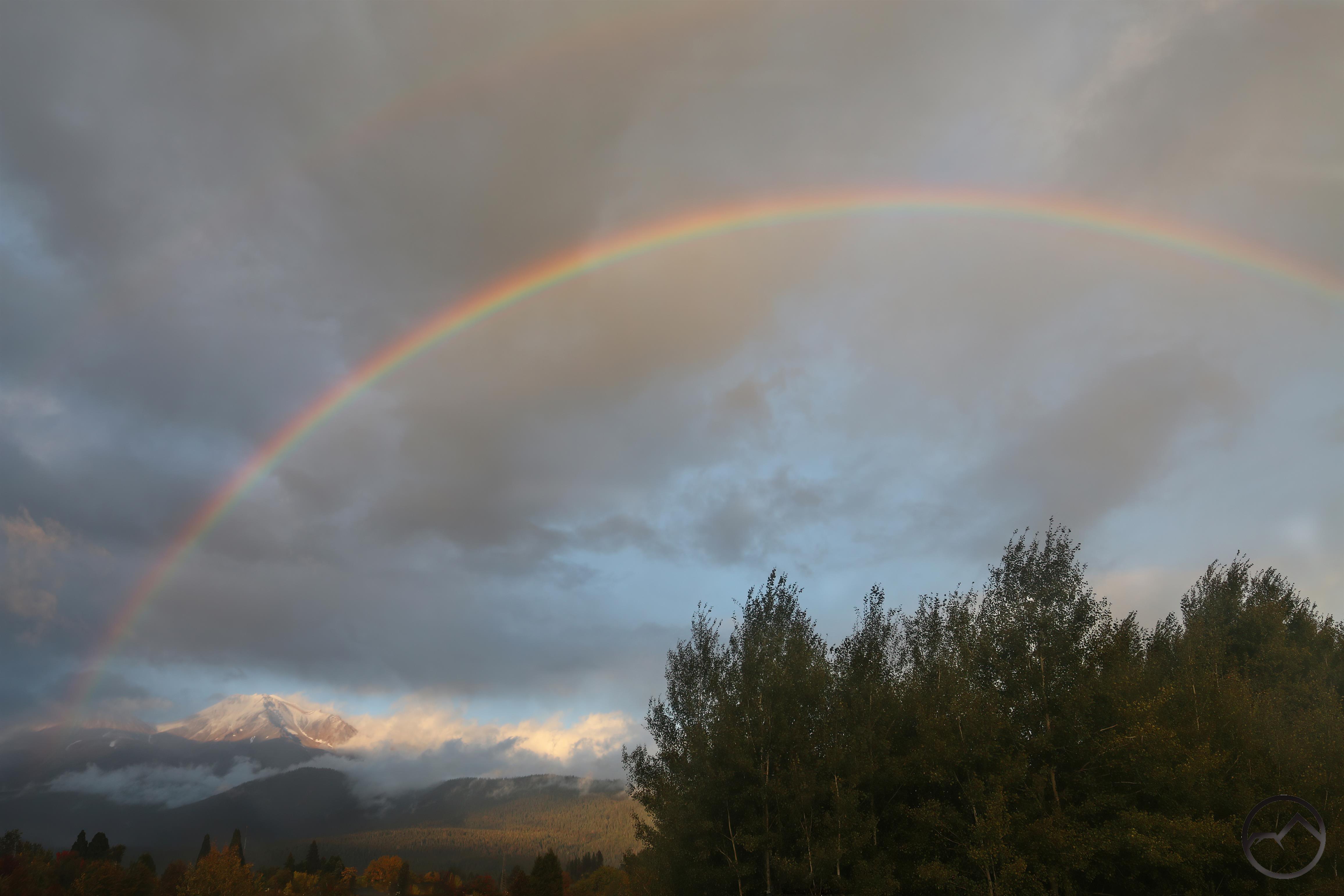
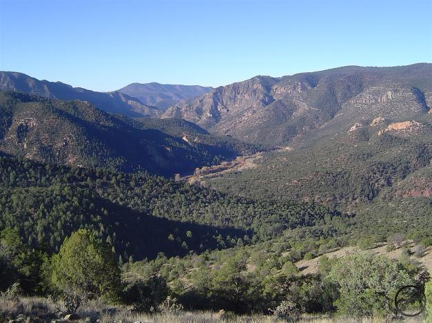
This I was able to do on one of my return trips from Dallas back to California for the summer. Being the end of the spring semester, I arrived at Mills Canyon in May. The spring thaw had swelled the Canadian River and the normally small river was flowing powerfully. I arrived at the edge of the canyon and gazed in, overwhelmed by the chasm unfolding before me. On the rim of the canyon, I was the only soul present. With a bit of trepidation, I began to drive the rough road down into the Mills Canyon. Arriving at the bottom, the beauty of the canyon was striking. Bands of red cliffs stretched to the north and south, flanked by green slopes of juniper and occasional ponderosa pine. It was less than a mile from the plains above the rim but a world away.

There is a small campground at the bottom of the canyon. I was the only one there, meaning that, more than likely, I was the only one in the entire canyon. Given that I was that alone but in a place the nearly the entire world did not know existed, it was the most isolated and alone I had ever felt. It is one thing to be alone in the wilderness and another to be alone and essentially off-planet. It was a unique and powerful experience, one that has continued to permeate my mind to this day. The rugged canyon amidst the plains, its swollen river and arid cliffs left their imprint upon me in an irrevocable manner.

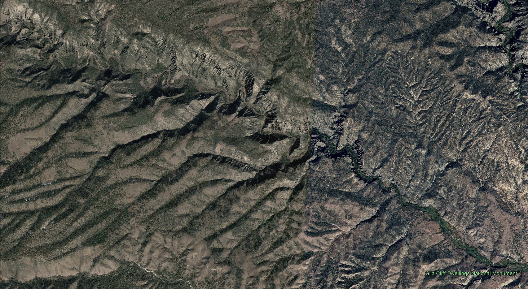
The Gila River winds its way toward rugged Murtocks Hole in the Gila Wilderness.

I had a similar experience in a river canyon in the Gila Wilderness, one of New Mexico’s premier wilderness areas. Rather than a Rocky Mountain river, the Gila River rises in the Mogollon Mountains of southwestern New Mexico, near Silver City. The Gila Wilderness is the largest wild area in the state and the very first area in the world set aside to be preserved in its wild state. This was due to the writings and advocacy of forester Aldo Leopold, whose influence on this land is profound. In his essay “Thinking Like A Mountain”, Leopold states:

“A deep chesty bawl echoes from rimrock to rimrock, rolls down the mountain, and fades into the far blackness of the night. It is an outburst of wild defiant sorrow, and of contempt for all the adversities of the world. Every living thing (and perhaps many a dead one as well) pays heed to that call. To the deer it is a reminder of the way of all flesh, to the pine a forecast of midnight scuffles and of blood upon the snow, to the coyote a promise of gleanings to come, to the cowman a threat of red ink at the bank, to the hunter a challenge of fang against bullet. Yet behind these obvious and immediate hopes and fears there lies a deeper meaning, known only to the mountain itself. Only the mountain has lived long enough to listen objectively to the howl of a wolf.”

In his writing, Aldo Leopold had taped into a rich vein of thought, advocating for preserving the land in its primeval state. In such condition it is a reservoir of sorts for nature and humanity to recharge in the natural order of the world. It was for this purpose that I was compelled to head to southwestern New Mexico to immerse myself in the Gila Wilderness. My plan was to pack into the West Fork of the Gila River, camp for a few days and then head back out. The Gila River was once the boundary between the United States and Mexico (until the 1854 Gadsden Purchase) and the headwaters, into which I would be venturing, were the birthplace of the famed Geronimo.

It was a long drive from Dallas, but I had a week during Thanksgiving break. That meant the canyon would be in some kind of autumn condition. With great weather and no school, it proved to be a fantastic week in southern New Mexico.

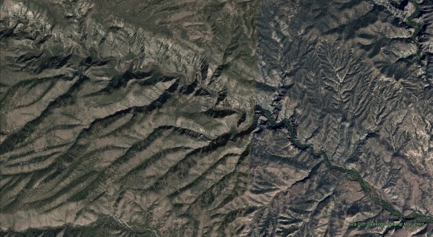
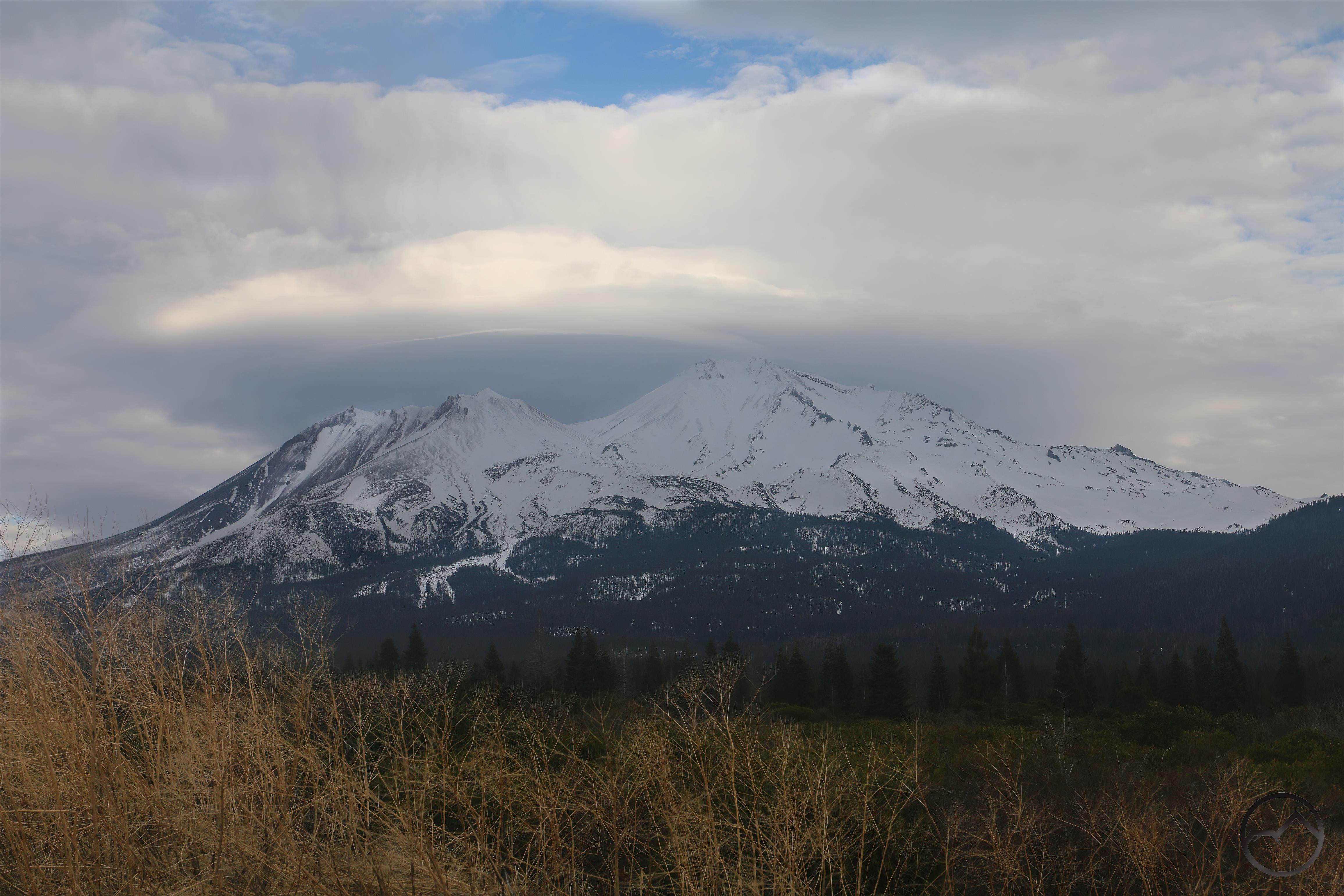
The canyon of the West Fork of the Gila River. Note the hoodoo spires lining the cliffs.

The West For of the Gila River was everything I had hoped it would be. After visiting the Gila Cliff Dwellings, I slipped into Aldo Leopold’s wilderness and out of time. For the next few days, I felt like I was time traveling, as though Geronimo may still have been lurking in the rocks, watching my progress through his domain. I wasn’t that far off. In the days I was camped along the Gila River, I saw only one other soul, who turned out to be a local guide, whom I gratified is still present in those mountains and canyons.

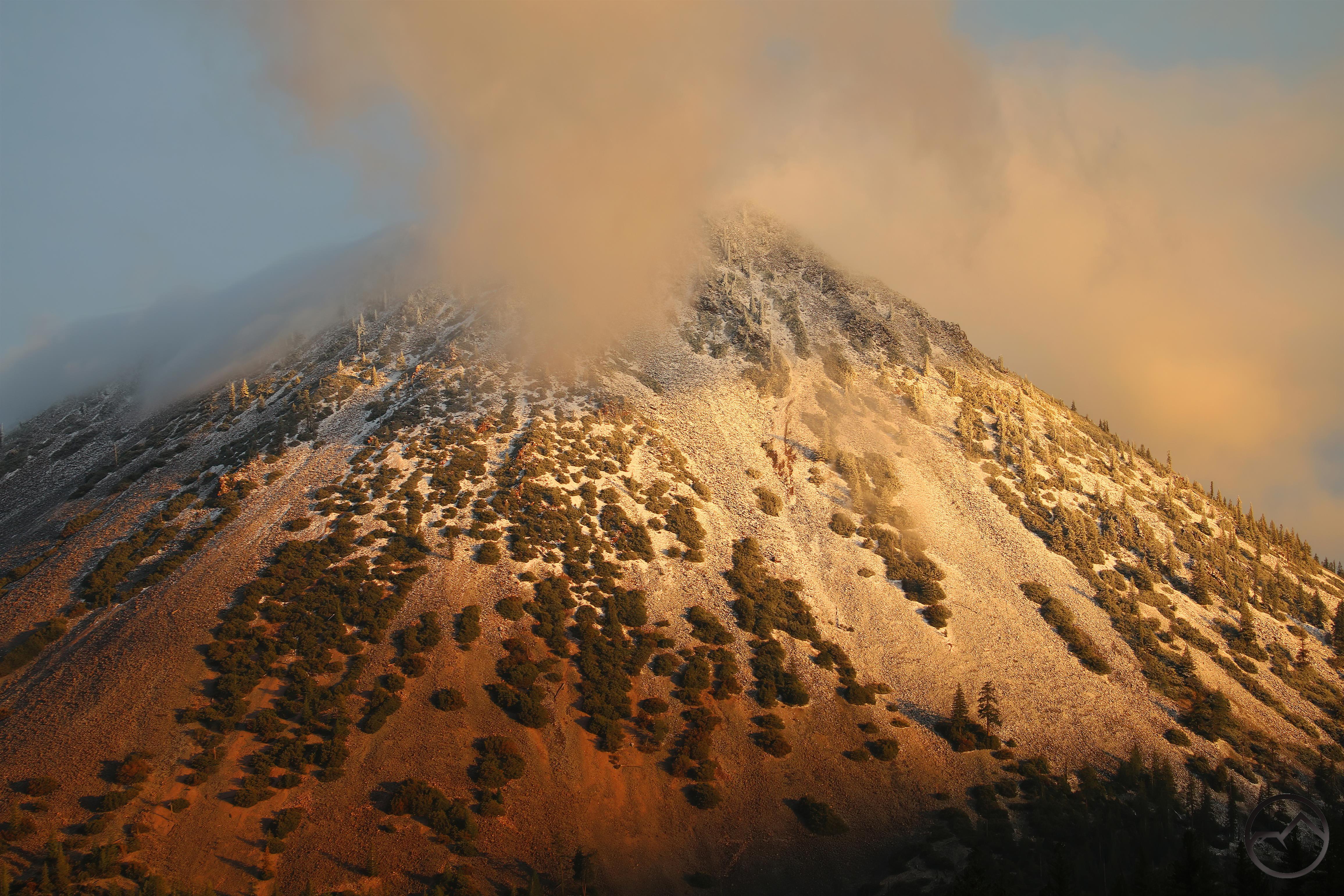
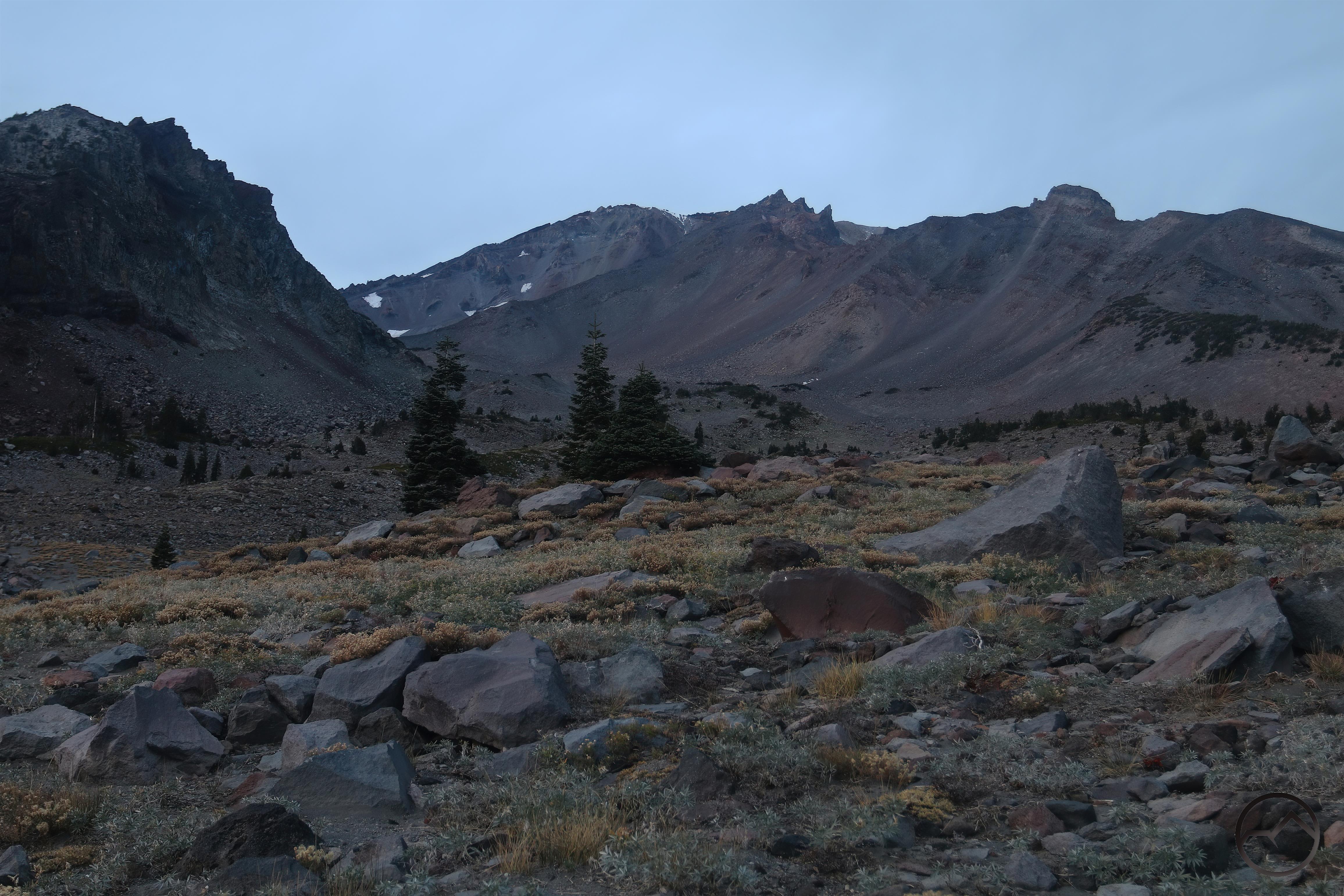
The canyon through which the Gila River flows is a marvel of unique geology. The steep cliffs are punctuated with spectacular clusters of rhyolite hoodoos. In many ways it is similar to the terrific hoodoo formations of Chiricahua National Monument except these hoodoos are spikes jutting upward rather rounded towers. Of course, the presence of the river completely alters the dynamic of the hoodoos from the more famous counterpart in Arizona. Hidden amongst the rhyolite cliffs are ancient cliff dwellings. Smaller than the ones preserved by the park service, these are lost in the wilderness, bearing testimony that, though wild, this land has many human stories to tell. I felt like an explorer in an alien land.


After months in the urban sweep of Dallas, this was exactly what I needed. Moreover, this fantastic canyon left its imprint on me. It was not just the mountains that I loved but the great diversity of the land, the many manifestations of the astonishing and the wonderful. I had never seen a canyon like that of the Gila River. I don’t know if there is another like it but it is a jewel of the west.

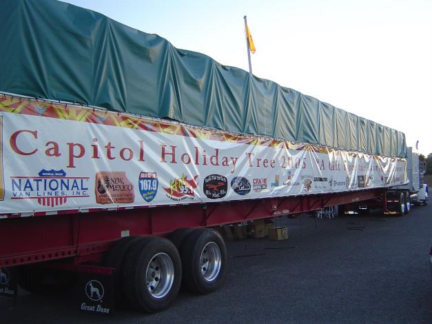
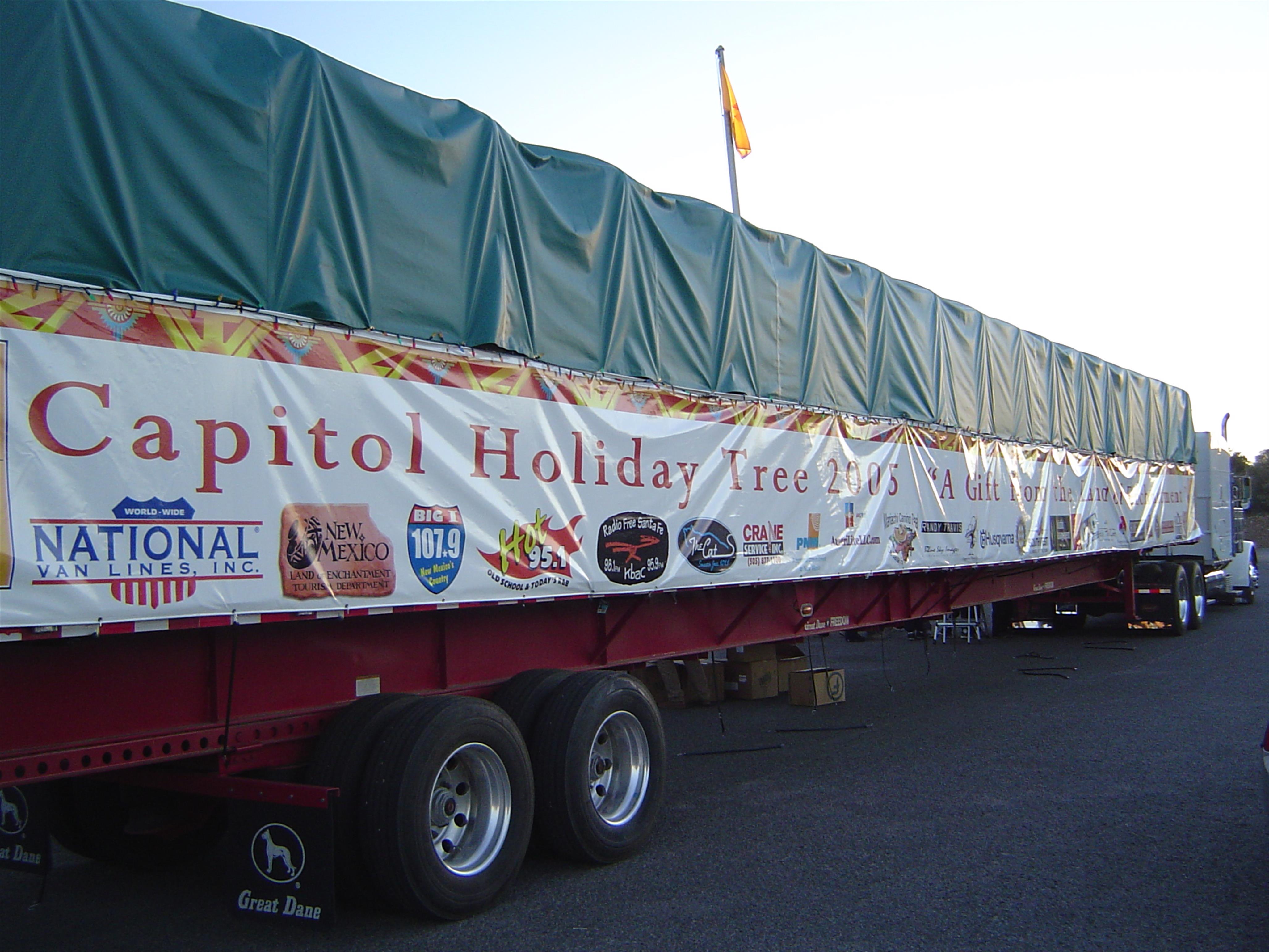
Strangely enough, when I got back to Silver City, I was searching for a place to sleep for the night when I noticed a large number of the community’s citizens congregating. Curious at what had drawn so many people out, I stopped and found that they were gathering to send the nation’s Christmas tree for that year off to Washington D.C. with the town’s blessing. The tree had been harvested specifically for this purpose somewhere in the Mogollon Mountains and was now beginning its journey to the nation’s capitol. It was a serendipity of an encounter.

Thus these two canyons in New Mexico were integral to my development as one who appreciates the natural world. I was no longer devoted solely to the grandeur of the mountains. I had stumbled upon other qualities of place that stirred my soul. Wildness was one, but it was not the only quality. I had made forays east from Dallas and while I did develop a deep appreciation for the Ozarks, it was not just the terrain and the wildness (and the waterfalls, which are plentiful there!). It was the aridity of the west that truly captured my imagination. This was the hidden aspect that I hungered for. I was just beginning to understand that aridity, in its many, many forms was what I yearned for. It was life west of the 100th meridian that I desired. The canyons of the Canadian and Gila Rivers had helped imprint that upon me.

An Almost-Solstice Event Over Mount Shasta

Posted by bubbasuess on December 21, 2024
Posted in: Cascade Range, Glaciers, Lenticular Clouds, Mount Eddy, sunrise, Yosemite. 8 Comments

A frozen but glorious sunrise over Mount Shasta.

December has been a bit of a strange duck of a month. I have barely captured any images of the mountain whatsoever. I know this is partly because there has been so much weather (which is good!) that the mountain has not been visible. Furthermore, I know this is partly because I have been exceedingly busy. Even so, I know there have been morning when I was up early and the mountain was visible and yet, there were no clouds or other interesting features to compel to head out and observe it. Consequently, it has been a slow month in terms of documenting the passage of time over the mountain. Prior to the last few days, the only image I had captured was a technicolor sunrise over a frozen reflecting pool in the Shasta Valley. That was it.

I do like to head out on the solstices and I knew that winter’s would be rainy if the forecast held. Fortunately, the approach to the solstice – and the storm that would obscure it – would be more than memorable enough. The incoming storm was heralded by the finest lenticular display Mount Shasta has had in a while.

The day started with nothing noteworthy in the sky. Clouds coalesced over the mountain and by early afternoon, it was evident something interesting was afoot. My son called me from his youth group Christmas party to alert me to the presence of a lenticular forming and catching the afternoon light (holy kinarsy, my kids are old enough to be lenticular spotters now!). I headed out briefly to some land we had closed escrow on the day before and was able get a quick shot of the mountain with its illuminated cloud cap. It was nice but the overcast sky filtered out most of the light and partly obscured the cloud itself while Mount Shasta was drenched in shadow. I was hopeful things would clear up by sunset.

Indeed, the skies cleared considerably before the sun had set. This meant it was now a moral imperative to head out to try to get the sunset. I had initially planned on heading to Echo Point out at Truchas Ridge but when I saw the reflecting pools all glassy and the wind that normally buffets the valley was absent, I opted to stop at the pool. The reflection was nearly perfect and, despite Mount Shasta never getting any color, it made for a fantastic sunset. It felt like all the lost time in December was finally paying off…as if there was some kind of moral connection.

Considering how strong the lenticular had been the night before and how clear the sky was around it, it was a foregone conclusion that I was going to head out early in the morning to see if I could catch some color on the lenticular over Mount Shasta. Once again, I my planned destination was Echo Point. If some low fog occupied the valley and glowed in the predawn color, so much the better! However, as I headed north, I could see fog, but far more than I had hoped. I was confident that it was so deep Echo Point would have been enveloped and visibility of Mount Shasta nonexistent. Since I was about out of time, that meant the same reflecting pool from the night before was my only real option. Though the wind was now active, the pool still offered the opportunity to capture some great color at sunrise. I was not disappointed. It was epic.

Part of me was confident that the morning lightshow would be the end. With weather incoming for the solstice the next day, the odds of a good sunset were lower. During the day the sky got pretty cloudy but in the late afternoon, it cleared up a bit and the lenticular on Mount Shasta had hung on. It had, however, moved over the mountain rather than northeast of it as it had been in the morning. Such are the vicissitudes of a lenticular cloud’s fortunes. As always, it was a moral imperative to get out to capture it. For a third time, I was intent on getting to Echo Point. This time I did not even look at the reflecting pools as I drove by and the fog that had smothered the valley in the morning was long gone. Yet, the clouds were now closing in on Mount Shasta and it was obvious that light and visibility were getting short. I stopped and capture one image before heading up to the point. I am glad I did. Conditions continued to deteriorate but that fleeting moment, with its great cloud and interplay of light and dark, was beautiful!

Finally I made it up to Echo Point! I never get tired of the view from up there. It was very windy, as the valley often is but the howl of the wind was wild and the lonely basin felt abandoned and gloriously desolate. Even though the light has long since left the land was was fading from the sky prematurely it was edifying just being there.

I waited for a last burst of light as the sun sank beyond the horizon but it was for not. Nonetheless, seeing the last glow beyond Cabezon Peak, beyond the distant Little Scott Mountains, it was mesmerizing. It may not have been the solstice proper but it was as close as it was going to get. The last 24 hour had seen some extraordinary lenticular activity. It was a great way to end the short days. Now they can get longer, at long last!

One Wild Storm

Posted by bubbasuess on November 25, 2024
Posted in: Cascade Range, Hiking, Mount Shasta. 3 Comments

Powerful winds whip the clouds around the summit of Mount Shasta.

Over the last week, the Pacific Northwest has seen some intense winter weather. What some reports considered the equivalent of a class 3 hurricane slammed into the states of Washington, Oregon and (the northern part of) California. I have lived in Mount Shasta for 17 years now and I have nor recollection of a storm of this magnitude hammering this area this early in the season. There have been other notable storms a little earlier, most recently in 2022 but even that storm, heralding the coming of the Long Winter did not measure up to this unusual event.


Things started off rather benign. The day before the storm, which was forecasted to leave 10 inches or so, was beautiful. The powerful winds that buffeted Mount Shasta were the only real indicator that the weather was in a state of considerable flux. Sunrise was beautiful, with the clouds swirling around the mountain and the sunlight reflecting off the recent snow.

By the time I got back into town, the sun had swung far enough to the south that Mount Shasta was bathed in the glorious, autumn morning light. I love these kind of conditions on the mountain. All the details seem to pop and the entire mass of the volcano just seems to glow. However, the lenticulish clouds that formed around the summit were prophesying the incoming onslaught.

The forecast for the storm was for a night and a day of intense wind and snow. After that, it was supposed to turn to rain for a couple of days with warmer temperatures. The rain was expected to be copious, with the report anticipating 3 inches. When you get a lot of snow and then a heap of warm rain, that is the recipe for a sloppy, sloppy mess. And so it was.

The snow started slowly on Tuesday and only a couple inches had accumulated when I went to bed. That night in continued to snow but only a few more inches were added before sunrise. However, throughout the day the snowfall increased and by the afternoon, when I went out to plow, it had piled up to 25 inches. It snowed a couple more inches after that and around 8pm I measured 27 inches. Then at 10pm the rain began. The snow was already heavy, with very high water content. The rain was going to make it worse.


The above progression of the snow accumulation in my backyard is somewhat deceptive. The winds were so intense that it kept it from accumulating too much in open areas, while deep drifts were built up elsewhere. The front of my house is more sheltered and does not get the wind manipulation. We therefore take our measurements there, rather than the back. However, what this progression does show is the damage done by the snow. 5 frames into the gallery, note the massive chunk of oak that fell. This is the top of one of our favorite trees. Several other trees lost limbs massive and small, weighted down by the wet, heavy snow.

Once the rain set in, clearing the snow was a mess. As I sheared off the top 24 inches, I exposed 3 inches of standing water wherever I went. This was by far the sloppiest conditions I have had at my house.

Needless to say, this feels about right. I believe the inches in Mount Shasta reflects the water content of the snow as well as the inches of rain we received. No matter what, it felt like a lot. It’s nice to see that Alturas could take it easy though. I know that is high desert out there, but sheesh!

Saturday morning, the storm finally broke up and Mount Shasta started to emerge from the storm. Though clouds still partially obscured the mountain, it was gloriously white as it has not been since the end of last winter. I can only imagine how much snow accumulated at the higher elevations. It must be fantastic up there.

20241123_091736

20241123_091736

20241123_091822

20241123_091822

I headed out into the Shasta Valley to see how things looked. There was water surging through every drainage possible. I love the valley when it is like this. It is typically so dry, but when water is everywhere, it is like a paradise.

20241123_092320

20241123_092320

The Shasta River was running strongly. No doubt Lake Shastina is rising substantially right now.

20241123_092956

20241123_092956

Parks Creek was also in fine form, though I expected it to have a bit more water in it. Regardless, it is a great start to the winter for these watersheds.

All the rain that fell meant a return of the pools that form in the Shasta Valley. While conditions weren’t right for any great sunset shots, it was nice just to have the reflections back.

When the sun set on Mount Shasta, I knew it would be a few more days until I saw the mountain again. More weather, though much gentler in nature was coming through. The next week or so though, especially around Thanksgiving, will be gorgeous. I can’t wait to get out and see how things look. It will also be a needed respite from the intense weather we just went through.

Mount Shasta Is A White Mountain Again

Posted by bubbasuess on November 16, 2024
Posted in: Cascade Range, Hiking, Mount Shasta, sunrise. 8 Comments

Amazingly, Mount Shasta has been receiving a fair amount of snow since August. However, between the heat of summer and the strong winds of autumn, not much snow has been able to accumulate on the mountain. That has all changed with this past storm. It was sustained, had a lot of precipitation and it was cold. It snowed all the way down to 3,500 feet. My house had a couple of inches of snow, though most of it melted off when the precipitation turned to rain. Needless to say, Mount Shasta got a lot more than that!

Though it was overcast most of Friday, the clouds broke just before sunset and revealed Mount Shasta finally laden with a deep blanket of snow. Given the temperature, and the large storm that is incoming in a few days, this snow will not be blowing away or melting. Instead, it will get buried under further layers of snow, deepening the snowpack and seeing the sun again until summer.

Cloud cover was the forecast for Saturday but the morning was just clear enough to make a good sunrise on Mount Shasta possible. These are just about ideal conditions. I like it when the trees at the higher elevations have snow on them but the rocks and crags of Mount Shasta don’t. The latter condition really allows the geography of Mount Shasta to be highlighted. This was certainly the case Saturday morning, with the crags lightly frosted but generally brilliantly exposed. Snow banners sailed off the high slopes in grand fashion, propelled by strong winds and highlighted by the pink light of the rising sun. Whether snow on the mountain, clouds in the sky or snow thrown of slopes, the air just seemed to glow around Mount Shasta.

Not to be left out and indicative of the onset of true winter conditions, Mount Eddy and Black Butte also had varying, though notable, amounts of snow as well. Interestingly, the snow on Black Butte appeared tilted to the east, as though the storm was more severe on that side or the temperatures were lower. Mount Eddy looked to have settled comfortably into winter’s embrace and glowed in the morning light.

These conditions on all three peaks are fleeting, as the incoming storm looks to potentially drop a few feet of snow and last for the better part of a week. We’ll see what things look like on the other side.

A Quality Autumn Lenticular

Posted by bubbasuess on November 13, 2024
Posted in: Cascade Range, Hiking, Lenticular Clouds, Mount Shasta, sunset. 1 Comment

It has been a beautiful autumn with great weather and fall color. However, the one things lacking have been great lenticulars, the presence of which typically increases this time of year. This past weekend a beautiful formation manifested just before sunset. The sky had been overcast all day and it seemed unlikely that there would be a colorful sunset to compliment the excellent cloud. Fortunately, things aligned just right and we got the most spectacular sunset Mount Shasta has had in a while.

Though the kind of clouds that sit on the summit are not my favorite, this one was just high enough to allow most of Mount Shasta to be visible. It also had numerous layers, both focused on the summit and some spreading out over the entire area above the treeline. When the setting sun was below the western horizon, the angle was just right for the light to pass beneath the cloud layer and it lit both Mount Shasta and the lenticular up with a blazing orange light. It was an epic sight.

Even as the sunlight faded on Mount Shasta, the sky itself turned pink and purple. This caused the light to bounce around a bit, illuminating the entire landscape in a warm red glow. The oak trees, already yellow, smoldered in a deep red, marking the entire image as indelibly autumn-ish. It was fantastic and I was glad to have witnessed it from this particular vantage point (one I have been spending a lot of time at, but for reasons that may be revealed soon).

Though there were no lenticulars above Black Butte, the sky was gorgeous and worth pausing to appreciate as well.

On the way home, things still glowed purple and as I rounded Deadman’s Curve, I could see Mount Eddy looming above Kaiser Meadow. I wasn’t quick enough to capture the warm glow but, though that light faded quickly, I did manage to document the beautiful sky above the highest peak in the Klamath Mountains.

Now, as I write this, what maybe the first major storm of the winter is rolling through the area. It is expected to deposit several inches of snow on Mount Shasta, all the way down to 5,000 feet. We need a few more of these to really get winter going, but this is a great start!

Yosemite And Shasta After

Posted by bubbasuess on November 11, 2024
Posted in: Cascade Range, Hiking, Lenticular Clouds, Mount Shasta, Sierra Nevada, sunset, Yosemite. 3 Comments

It’s been a busy few weeks here in Mount Shasta. Autumn is at its beautiful peak and the end of the year events have already begun (we cut 155 Christmas trees last weekend!). The business has been compounded by not actually being in Mount Shasta part of the time. With fall getting into full-swing, I took my family down to Yosemite in the hopes of enjoying some fall color and warm weather. We were, to some degree, awarded with both.

Unfortunately, we were a little early for great color, but the oaks were starting to turn yellow, adding just a little interest to the scenery. Interestingly, the dogwoods at the west end of the valley were in excellent fall form, turning the less-visited area vibrant gold. The real highlight was the autumn light. Its lower angle made everything glow.

The high country was where the color was really evident. From Washburn Point, we could look up Ilillouette Creek and see the trees turning gold. I shouldn’t think of it as an unusual sight, given the awesome fall color set against the towering spires of the eastern Sierra but the view from here, with the gold trees against the western slope of the Clark Range just seemed strange to me. It was beautiful nonetheless.

On the way down from Glacier Point, the sunset presented a glorious opportunity for a shot of Half Dome, El Capitan and Sentinel Rock. Yosemite just doesn’t disappoint.

On another day, we were up at Tuolumne Meadows. We stopped at Olmstead Point to watch the sunset. While the point has a good view of Half Dome and Clouds Rest the best views are from the dome above the point or the slabs below. We opted for the latter. From here we could look down on the small valley that leads to the rugged route down to the base of Pywiack Cascade. Now that is an adventure…

My family carried out various elements of dinner and my amazing wife made Chicken a la Nass, the best, easiest, most filling and convenient camp dinner ever. Great food with an incredible view. It does not get better than that! (email if you want to know what Chicken a la Nass is!)

A glorious sunset at the end of a great day. Yosemite was good to us this year.

We returned home to Mount Shasta to find autumn in full effect. The color was excellent and the fall weather changes led to interesting formations in the sky. The mountain had been turned white once again, meaning all the elements of my favorite time of year were in place.

The timing of our return was perfect and the beauty was evident right away. On the way to taking the kids to school, I had to stop a couple of times to document the terrific sunrise. This was not an amazing sunrise, but it was beautiful and felt like Mount Shasta was greeting our return home.


Election Day came and the spectacle on the mountain was great. Though the clouds that obscure the summit of Mount Shasta are not my favorite lenticulars, this one had nice layers, which added to its interest. The oak trees, to which we now have an…attachment, were nearing their peak and made a decent foreground to the cloud enshrouded volcano.

That evening, a second, semi-lenticular cloud had formed to the south. Though Mount Shasta was covered by the lenticular, the whole scene was magnificent, with the sky lit up in pinks and purples.

The days after Tuesday and through the following weekend were sunny and marked by gorgeous fall color and light. But now the rain has come and will remain, off and on, for several days. The color won’t last much longer and winter nears…

Last Sunset From The Old Ski Bowl (And Some Bonus Sunrises)

Posted by bubbasuess on October 24, 2024
Posted in: Cascade Range, Hiking, Mount Shasta, sunrise. 3 Comments

I really should say likely the last sunset from the Old Ski Bowl, at least for me, at least for 2024. It is customary for the gates to the Old Ski Bowl at Bunny Flat to be closed on November 1st. If this is the case this year, I probably will not have time to head up there again this season (we are heading to Yosemite on Friday, so the last few days of it being open are not happening for me!). My wife and I took some of our kids up there for a picnic dinner and then we lingered to enjoy the sunset. It did not disappoint…sort of.

The sky was filled with interesting cloud formations and we enjoyed the layers of mountains stretching to the south. The Castle Crags always cast a grand silhouette from this perspective (well, from any perspective, really).

Looking west, Mount Eddy protruded into the sky and the rest of the Eddy Range made a fine horizon as the sun sank down towards the mountains. The clouds filtered out the sun but the bright light was visible moving behind the cloud layer.

Finally the sun sank below the horizon but beams of light burst through the clouds. The light was shaped and channeled by the peaks of the Eddy Range. It highlighted the distance between Mount Shasta and the Trinity Alps, a couple dozen miles to the west. For this particular view west, overlooking the vast Klamath Mountains, this was about as beautiful a sunset I had witnessed from the Old Ski Bowl.

Despite all the gorgeous light and beautiful color to the west, Mount Shasta remained drably unilluminated. I guess the mountain can’t win them all.

I had a sense that the next morning might bring a beautiful sunrise and I was not disappointed. However, I had a bit of a conundrum. There were compelling reasons to witness it from the south, east and north (honestly, the west was a good option too, but I wanted to go somewhere I hadn’t been the last few days). Though I initially went east, I ended up going back and heading north. Too my surprise, however, it began raining and a thick layer of cloud was sailing south toward Mount Shasta. A thick cloud also seemed to have consumed the mountain.

While Mount Shasta never broke free of the clouds that were camping on it, a gap developed in the clouds east of the mountain. As the sun rose, this allowed the light to radiate through, lighting up the clouds themselves, as well as the hills and even the grass of the valley. Everything seemed to be pulsing and radiating pink and orange. I could see the clouds south of Mount Shasta catching the light, showing for the spectacle I would have witnessed had I followed the compass thus.

Finally the sun rose just high enough to blast beams through the cloud gap and blast across the sky. It was a magnificent sight and one I surely would have missed had I gone south. I don’t know if I made the best choice, but at least I had made a good one!

Bonus sunrise 1: the next day, while taking my kids to school, I had to pull over to the side of the road and capture another colorful sunrise. It is hard to believe this kind of beauty can be had while doing something as mundane as transporting kids to school!

Bonus sunrise 2: Though I had not captured any images of the next day, but it also yielded a great sunrise. Then again, for the fourth day in a row, I was once again taking my kids to school and, once again, I had to stop and capture the sunrise with my camera. This time the beautiful sky was augmented by aspens, as the fall color has finally started to set in over the last couple days.

Bonus sunrise 3: Not on the way to school and we’re leaving for Yosemite, but I had to get one more, since the sunrise presented itself!

A beautiful sunset and four five awesome sunrises in a row. I love autumn!

What October Has Been Up To In Mount Shasta

Posted by bubbasuess on October 20, 2024
Posted in: Cascade Range, Hiking, Lenticular Clouds, Mount Shasta, sunrise, sunset. 1 Comment

It is hard to believe that we have charged this far into October already. The days are shorter but the light is so glorious now. It is no longer the harsh, high angle summer. Now things just seem to glow. However, the days have been perfectly warm and the night temperatures are only just now coming down toward freezing at night. This means we have not seen much in the way of fall color…yet. Despite not having the autumn palette splashed across the landscape and the weather generally stable and warm, there have been a few noteworthy incidents this month.

Early in the month, I went up to Castle Lake for the sunrise, hoping to see some comets, clouds or something. Nothing of the sort was to be found. However, the Big Dipper was located perfectly centered over Mount Shasta. The clarity, even as the horizon was lightening. All the stars were visible, even the Alcor (the Rider above Mizar’s Horse). It was a nice consolation prize after getting up early, heading up to the high country and getting skunked on all I had hoped to see.

A few days later, the forecast called for some disturbed weather. I anticipated this might yield a lenticular, so once again I was up well before dawn. This time, rather than heading to the high country, I went to the Shasta Valley, always a good bet for sunrise and sunset. I knew even when it was dark that I was correct, since a huge disk hung in the sky over Mount Shasta. As dawn approached, the disk began to shrink but it was still a spectacular sunrise, with a colorful sky and interesting patterns in the clouds.

The lenticular persisted all day and was still maintaining its presence over Mount Shasta as the sun went down. The sunset was no where near as colorful as the sunrise but it was still a fascinating view of the mountain, cast in shadow by the cloud but with the tall lenticular still absorbing the fading light.

A few days later, we had some rain and Mount Shasta got a light dusting of fresh snow at the higher elevations. However, most fortunately, as the storm broke just before sunset, the lingering showers and low sunlight produced an fantastic rainbow over Mount Shasta. The precipitation made focusing on the peak difficult but just getting a good rainbow and the mountain in the same frame a happy incident.

As the rainbow faded, the clouds began to swallow up Mount Shasta, just as the alpenglow began to light up the snowy parts of the mountain. Within minutes, it was practically gone, leaving only a cloudy sky as it began to grow dark.

The next morning the sky was clear but there was a vaguely lenticularly-shaped formation over the summit. The snow left from the previous storm was still present. I was taking my kids to school when I stopped I captured this shot of Mount Shasta. I was hopeful this might portend a growing lenticular throughout the day.

Unfortunately, this was not to be. The lenticularish cloud faded in the late morning. However, formless clouds continued to linger throughout the day. By sunset snow was blowing off the summit and mixing with the small clouds that were still sailing past the higher parts of the mountain. Not grand in the way the unusual meteorological formations are but still magnificent in its own, Mount Shasta way.

Lastly, just as we began careening through the second half of October, a surprise lenticular made a brief appearance. There had been nothing noteworthy in the sky at all throughout the day. No clouds were visible anywhere. However in the afternoon, a cloud began blanketing the summit of the mountain. From the west, it did not look like much but the outer corners curled up just enough to make me think a lenticular was visible from the Shasta Valley. Sure enough, this was the case and the layered disks were visible extending to the northeast. Furthermore, quite unexpectedly, a small free-floating formation also arrived from nowhere!

The alpenglow intensified on Mount Shasta, heralding the sun’s final descent and the arrival of the enveloping darkness. I had not anticipated any such formation but Mount Shasta remains predictably unpredictable.

An Augury Of Autumn

Posted by bubbasuess on September 26, 2024
Posted in: Cascade Range, Hiking, Lenticular Clouds, Mount Shasta, sunset. 3 Comments

In my last post, I hoped that the snow that came in August and September augured favorably for a good winter. Now, having just passed the autumnal equinox and officially entered fall, another sign appeared in the sky that, hopefully, points toward an eventful autumn and winter season (truth be told, at this point, any emphasis on signs is more a function of my son reading the Iliad, Odyssey and Aeneid for school). This time, seemingly out of nowhere, a fantastic lenticular appeared over Mount Shasta. The days have been warm, minimal cloud presence has been the norm and no precipitation is in sight. Nonetheless, the day was, at times, cloudy and the formation that developed over Mount Shasta was far more than anything I had anticipated. Though unexpected, it made for an exciting day in the sky.

When it began, there were clouds gathered over Mount Shasta but no sign of a lenticular forming. The thing that really interested me was the horizontal beams of light passing through the saddle between Green Butte Ridge and Jack Flat. It can be very dramatic if you time it right, especially if the summit of Green Butte cuts into the beam and casts its long shadow across the west face of Mount Shasta. This, plus the presence of blooming sage and the chokecherry turning gold made it feel like fall was indeed arriving.

Little did I know that, though the foliage was heralding the arrival of fall, so too was the spectacle over Mount Shasta. The clouds that had been present early on coalesced into a set of lenticulars. One small stack hovered over the summit while another massive cloud arched across the mountain higher in the sky. I could tell something interesting was afoot.

By the early afternoon the formation had tightened up considerably and now presented a single massive, layered set of discs over Mount Shasta. The small stack had collapsed and its cloudy detritus still lingered around Mount Shasta’s summit. This cloud looked like it had staying power and I was hopeful we were going to get a good sunset.

The late afternoon had gotten very overcast and the pall that hung over the sky nearly rendered the lenticular indistinguishable. However, I still headed out to see if, somehow, the sun would conquer the clouds and light things up as it set. When I got to a spot that I liked, Mount Shasta was nearly in shadow and the lenticular was lacking the distinct form it had had earlier in the day.

To my good fortune, as the sun set behind the Little Scott Mountains behind me, the light on Mount Shasta (and all the clouds too!) as well as the shape of the lenticular both improved. Further blessing this beautiful scene was the developing presence of a second, larger lenticular. It manifested out of a layer of cloud that had not given any hint of lenticular aspirations.

Now with both lenticular formations lighting up and the rest of the sky pulsing with alpenglow, it was an utterly magnificent sunset, the kind that makes one cheer the coming of the fall season and thank the Lord for the opportunity to witness such a grand performance. More of this all fall please!

As the scene to the east went dark, the show to the west was reaching its triumphal moment. I felt like a Roman general celebrating my own triumphal parade through the streets of the eternal city, witnessing the pinnacle of Roman glory. Yet in the midst of the revelry was the message being whispered in my ear “remember thou art mortal”. A scene like this makes one feel small and mortal, but in the healthiest of ways. This is the glory of the one far greater than I.

September’s Summer Snow

Posted by bubbasuess on September 21, 2024
Posted in: Cascade Range, Hiking, Mount Shasta, sunset. 5 Comments

I have lived in Mount Shasta for quite a while now and, as this blog will testify, I have made it a practice to watch the patterns of weather over the courses of the seasons. One of things I have noticed over the last few years is the increasing frequency of a storm to sail through the region and deposit a fair amount of snow on Mount Shasta in the latter half of September. This was true in 2021, 2022 and 2023. Of those three years, 2022 was the most impressive, looking almost wintery rather than a late-summer glazing. This year the trend escalated even further, with a near-wintery deposit of snow in August! The early arrival of the snow has not meant that September was ignored either. We have had one notable storm hit, and it did indeed leave more snow on the mountain in summer.

The night before the storm hit, I took the boy scout troop up to Heart Lake for a sunset hike. The timing, both date and time, was engineered to have good conditions for a sunset. However, with the storm gathering strength the skies were overcast and we resigned ourselves to hiking up even if the sunset side of things wasn’t really going to happen. As is sometimes the case, however, the overcast conditions amplify the beauty if the sun is able to slip under the cloud cover for just a moment or two and everything explodes with color. Such was the case this time, thankfully. After enjoying the magnificent display, we all happily hiked down in the dark. The storm was on its way.

While not as powerful as other September storms of the last few years, this one did leave its mark on Mount Shasta and the upper flanks were once again white. However, below 11,000 feet it really was just an icy glaze and that melted off the first day the clouds were gone. The thicker snow has hung on for the last 5 days. This was something of a surprise, since the temperature has climbed back up to the high 70’s and the snow didn’t seem that deep.

By Friday, much of the snow on the southern exposure of Mount Shasta had finally disappeared. However, the north side of the mountain managed to retain a fair amount of coverage at the higher elevations. For a relatively light amount of snow, for it to sustain for 5 plus days is impressive.

Now, as the autumnal equinox approaches and fall will well and truly begin, it is amazing to think that decent amounts of snow has fallen on Mount Shasta in both August and September. I hope that this augurs a good winter with plenty of snow!

Posts navigation

← Older Entries
Newer Entries →
    • Recent Posts

      • Winter Shows Up When It Will
      • January Rolled By With Mud, Then Very Dry
      • Mount Shasta 2025 – A Year In Images
      • Mount Shasta On Either Side Of Christmas
      • Adrift In An Ocean Of Fog
      • December Has Been Spectacular Thus Far Pt. II (A Magnificent Lenticular)
      • December Has Been Spectacular Thus Far Pt. I
      • Lenticular Interrupted
      • A Stormy Wave And A Truchas Sunset
      • Aurora Lenticularis
    • Enter your email address to follow Hike Mt Shasta and receive notifications of new posts by email.

    • Archives

      • February 2026
      • January 2026
      • December 2025
      • November 2025
      • October 2025
      • September 2025
      • August 2025
      • July 2025
      • June 2025
      • May 2025
      • April 2025
      • March 2025
      • February 2025
      • January 2025
      • December 2024
      • November 2024
      • October 2024
      • September 2024
      • August 2024
      • July 2024
      • June 2024
      • May 2024
      • April 2024
      • March 2024
      • February 2024
      • January 2024
      • December 2023
      • November 2023
      • October 2023
      • September 2023
      • August 2023
      • July 2023
      • June 2023
      • May 2023
      • April 2023
      • March 2023
      • February 2023
      • January 2023
      • December 2022
      • November 2022
      • October 2022
      • September 2022
      • August 2022
      • July 2022
      • June 2022
      • May 2022
      • April 2022
      • March 2022
      • February 2022
      • January 2022
      • December 2021
      • November 2021
      • October 2021
      • September 2021
      • August 2021
      • June 2021
      • May 2021
      • April 2021
      • March 2021
      • February 2021
      • January 2021
      • December 2020
      • November 2020
      • October 2020
      • September 2020
      • August 2020
      • July 2020
      • June 2020
      • May 2020
      • April 2020
      • March 2020
      • February 2020
      • January 2020
      • December 2019
      • November 2019
      • October 2019
      • September 2019
      • August 2019
      • July 2019
      • June 2019
      • May 2019
      • April 2019
      • March 2019
      • February 2019
      • January 2019
      • December 2018
      • November 2018
      • October 2018
      • September 2018
      • August 2018
      • July 2018
      • June 2018
      • May 2018
      • April 2018
      • March 2018
      • February 2018
      • January 2018
      • December 2017
      • November 2017
      • October 2017
      • September 2017
      • August 2017
      • July 2017
      • June 2017
      • May 2017
      • April 2017
      • March 2017
      • February 2017
      • January 2017
      • December 2016
      • November 2016
      • September 2016
      • August 2016
      • July 2016
      • June 2016
      • May 2016
      • April 2016
      • March 2016
      • February 2016
      • January 2016
      • December 2015
      • November 2015
      • September 2015
      • August 2015
      • July 2015
      • June 2015
      • May 2015
      • April 2015
      • March 2015
      • February 2015
      • January 2015
      • December 2014
      • November 2014
      • July 2014
      • June 2014
      • May 2014
      • April 2014
      • March 2014
      • February 2014
      • January 2014
      • December 2013
      • November 2013
      • October 2013
      • September 2013
      • August 2013
      • July 2013
      • June 2013
      • May 2013
      • April 2013
      • March 2013
      • February 2013
      • January 2013
    • Categories

      • Boy Scouts
      • Cascade Range
      • Castle Crags
      • Desert
      • Echo Point
      • Glaciers
      • Hiking
      • How things came to be…
      • Klamath Mountains
      • Konwakiton Outdoor Designs
      • Lakes
      • Lenticular Clouds
      • Maps
      • Marble Mountains
      • Meadows
      • Mount Eddy
      • Mount Shasta
      • Mount Shasta History
      • Napa County
      • Off Season Trails
      • Pacific Crest Trail
      • Peaks
      • Rivers
      • Rock Climbing
      • Scott Mountains
      • Seldom Seen
      • Shasta Valley
      • Sierra Nevada
      • Siskiyou Mountains
      • Sonoma County
      • Spring Trails
      • sunrise
      • sunset
      • Trinity Alps
      • Trinity Divide
      • Truchas Ridge
      • Uncategorized
      • Water
      • Waterfalls
      • Wilderness
      • Wildflowers
      • Wine Country
      • Winter Trails
      • Yosemite
    • Meta

      • Create account
      • Log in
      • Entries feed
      • Comments feed
      • WordPress.com
    • Copyright © 2013-2024 by Bubba Suess

      DISCLAIMER: Any use of the information contained in this site by any and all persons is done at their own risk. The operator of this site shall be held harmless from any and all alleged claims, demands, causes of action, liability, loss, damage and/or injury to property or persons whether brought by an individual or other entity. This indemnification applies, without limitation, to all actions by an individual or other entity as a result of their use of information contained in this site.

    Blog at WordPress.com.
    Hike Mt. Shasta
    Blog at WordPress.com.
    • Subscribe Subscribed
      • Hike Mt. Shasta
      • Join 983 other subscribers
      • Already have a WordPress.com account? Log in now.
      • Hike Mt. Shasta
      • Subscribe Subscribed
      • Sign up
      • Log in
      • Report this content
      • View site in Reader
      • Manage subscriptions
      • Collapse this bar
     

    Loading Comments...