
At A Glance
A short hike up a small butte that is at times an island in Lake Shastina. Awesome views and high desert landscapes are highlights of this easy trip.
Total Distance: 1.2 miles
Elevation Gain: 260 feet
Season: all year
A Desert Oasis
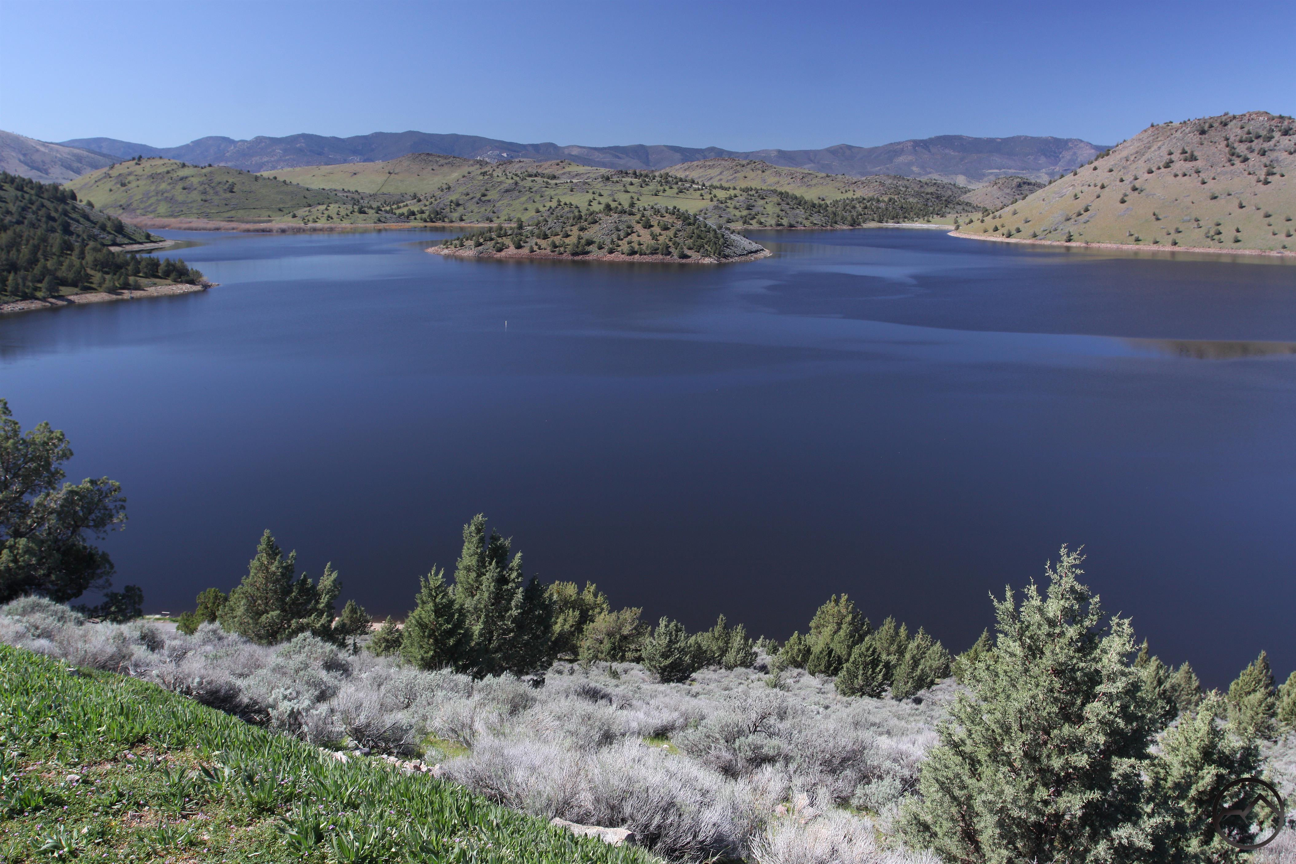
Lake Shastina
Lake Shastina is one of the major landmarks of the Shasta Valley. Its cool blue waters form a marked contrast against the arid, sage and juniper covered hills that form the heart of the valley. The north end of the lake’s shoreline is lined with houses which are part of the larger Lake Shastina community, which is centered on a well-known golf course. Yet, despite the number of people that live a short distance from the lake, few people actually recreate at the lake itself. Part of this is due to the fact that in drier years water in the lake can be scarce. More importantly, is the lack of opportunities for public access to the lakeshore. The one place with public access is at the southwest end of Lake Shastina, where there is a public campground and a boat launch. Due to the lack of developed trails in this area, it often gets overlooked as a hiking destination. However, for those who enjoy the high desert terrain, great views of much of the Mount Shasta region and desire to hit the trail when the higher mountains are still snowed in, the public access area at Lake Shastina has a small, hidden gem of a trail that yields phenomenal views for minimal effort.
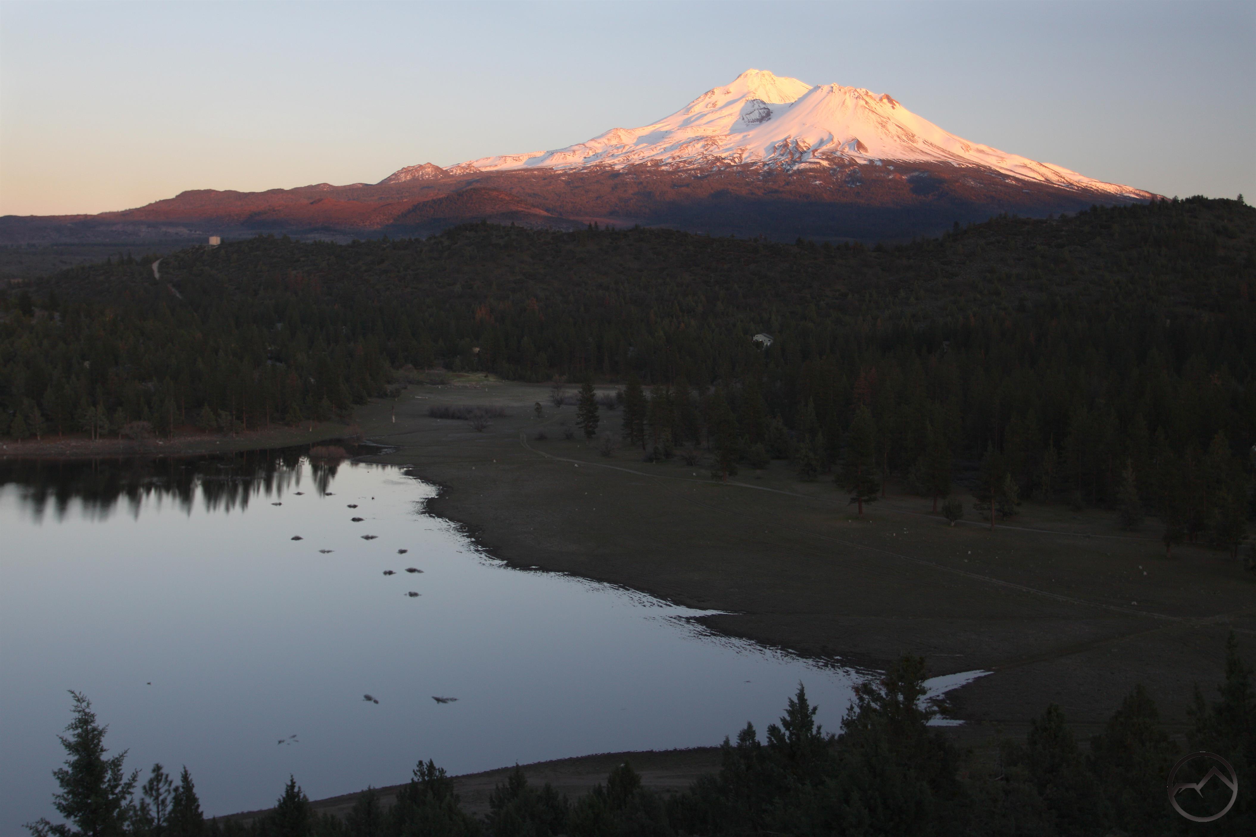
Sunset on Mount Shasta from the Lake Shastina Trail
Though unofficial and unmaintained, the trail at Lake Shastina’s public access area is well established and very easy to follow. The trail is in fact an old road that climbs up a short butte that rises over 200 feet above the lake. When the lake is full, this small butte is an island connected to the mainland by a short causeway. The conditions for this hike are best when the lake is full, but it is still very, very scenic if the water level has dropped. Signs near the beginning of the hike indicate that only foot traffic is permitted on the old road. Although the hike is not very long and the trail has a very moderate grade, the payoff for this hike is tremendous. The views are fantastic. In addition to Mount Shasta, numerous landmarks stretching from Oregon down to the Trinity Divide are all revealed during the ascent. Indeed, this is a hike that offers a lot for very little effort invested. While it is not well known, this short hike presents a favorable idea of the scenic potential of Lake Shastina.
The Trail
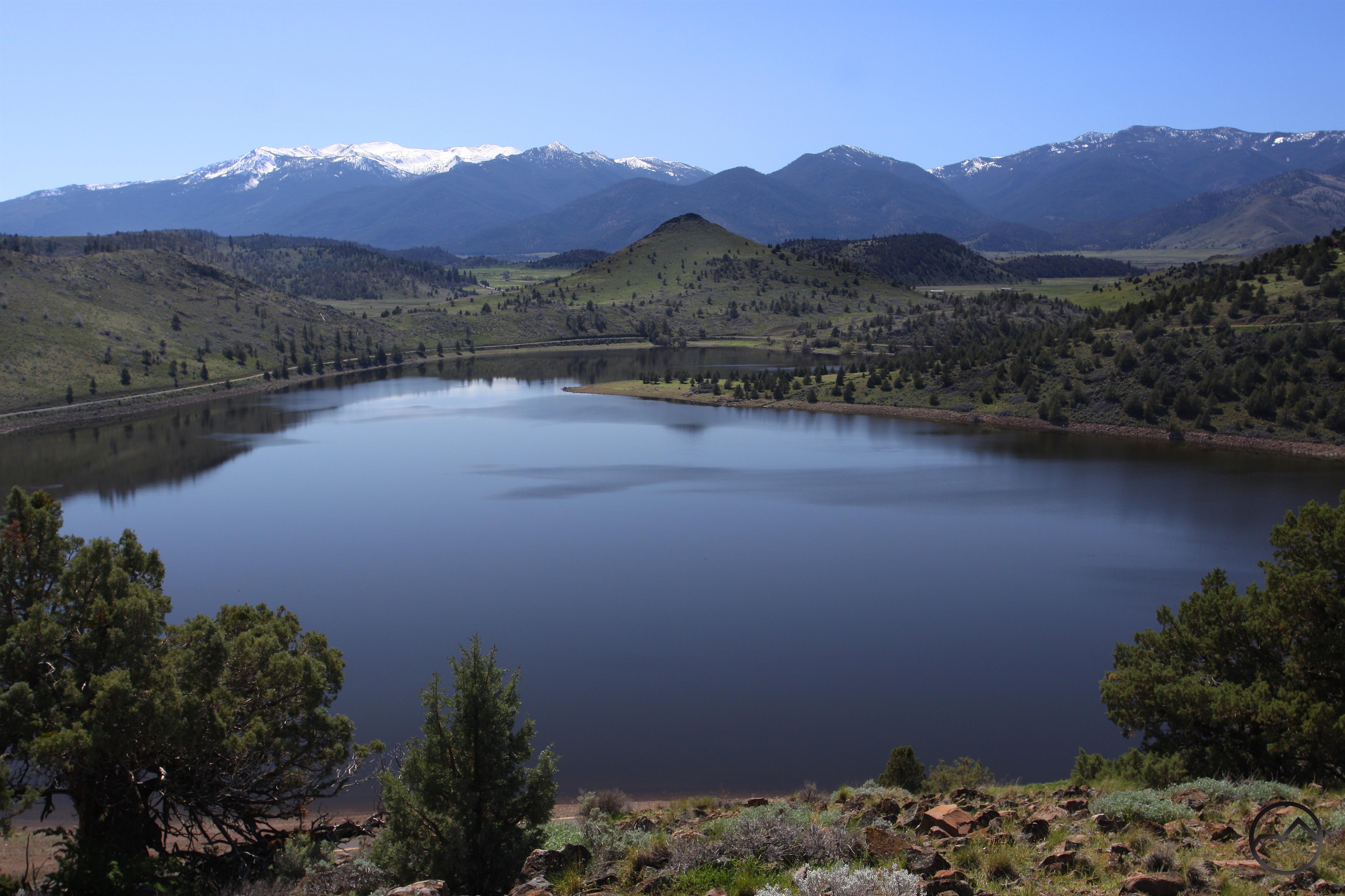
The Eddy Range looms beyond Lake Shastina
To begin the hike, follow the path past the collapsed fence section. The trail immediately makes a sharp turn to the left. This is the first of three switchbacks the route makes on the way to the top. Though the road is wide, it is rough, rutted and would be rough going on anything other than a rugged 4×4. The presence of foot traffic and the absence of vehicular travel are evident. After the first switchback, the trail climbs moderately to the west. Note the narrow foot path on the outer edge of the road. For those who are not fans of road hiking, this offers a single track alternative. Views are excellent from the outset. To the south, the southeastern arm of Lake Shastina spreads out below the butte. In addition to Mount Shasta, the high peaks of the Eddy Range are visible to the west. In the spring, the contrast of these snow-capped peaks against the green fields and hills is gorgeous. After 0.15 miles from the trailhead, the old road makes its second switchback.
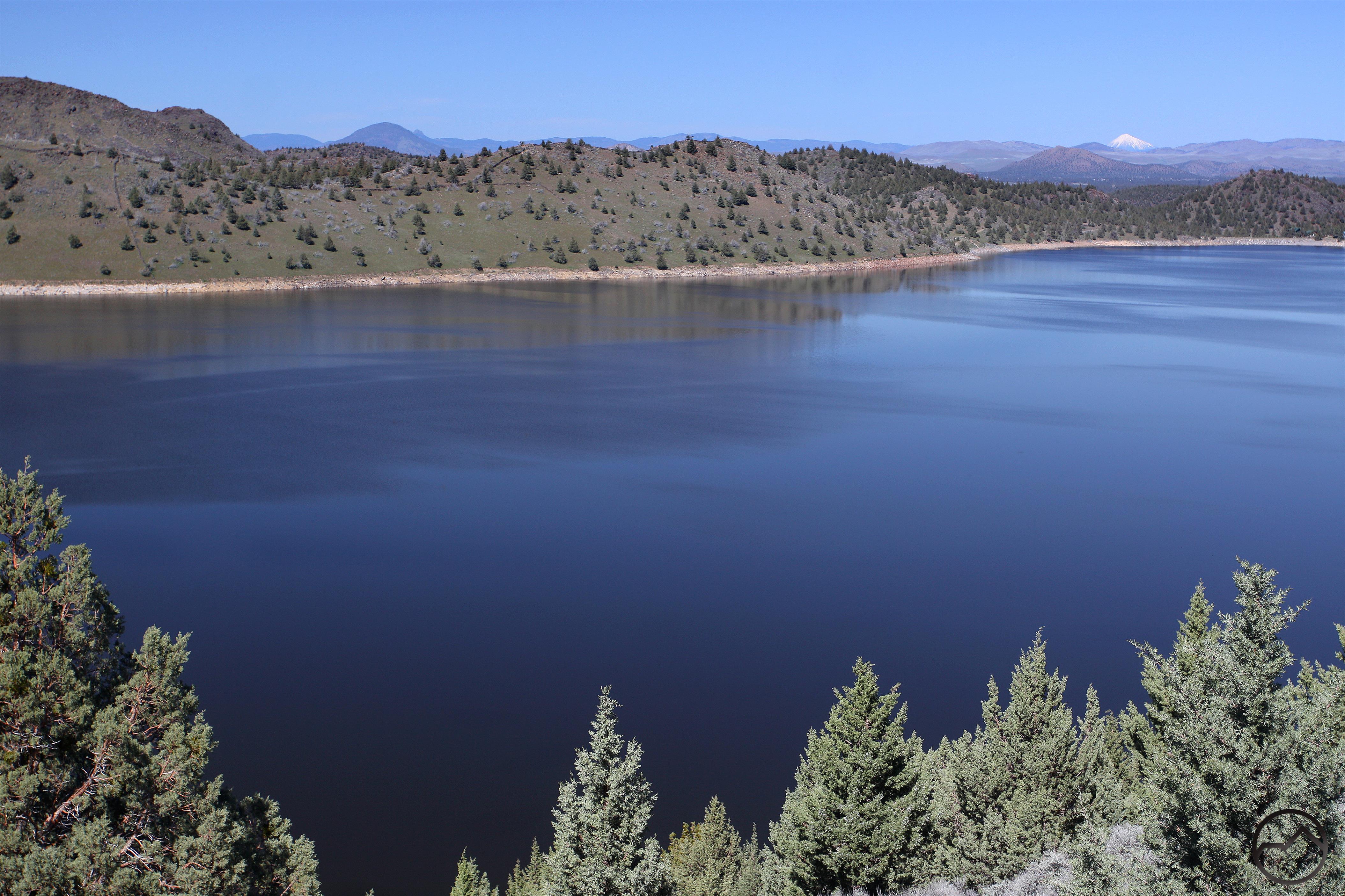
Oregon landmarks visible beyond Lake Shastina
Now, climbing to the east, the trail’s grade is a little easier. The crest of the Cascade Range comes into view and the notable cliffs of Sheep Rock are prominent. Mount Shasta towers majestically to the south. When the lake is full, the water forms a great foreground to the mountain. If the water had receded a large meadow is revealed. Tracks from vehicles driving through the dry parts of the lake are also discernable. About 0.3 miles from the trailhead, the old road reaches the third and final switchback and turns back to the west. Higher than it was previously, more of Lake Shastina is now revealed, including the brush-choked inlet of the Shasta River. Scarface Ridge and Antelope Mountain line the horizon to the west. As the trail rounds the west side of the butte slowly turns back to the east but is now located on the north side of the butte for the first time. The full extent of Lake Shastina is finally revealed. When full, the lake is surprisingly large. Many Oregon landmarks, including Mount McLoughlin, Pilot Rock and Soda Mountain are visible. The peaks of the northernmost part of the California Cascades, particularly the Goosenest and Willow Creek Mountain, can also be seen. In addition to junipers, a few ponderosa pines line the old road as it finally curls around the east side of the butte and arrives at the large, flat summit. The views are great in all directions.
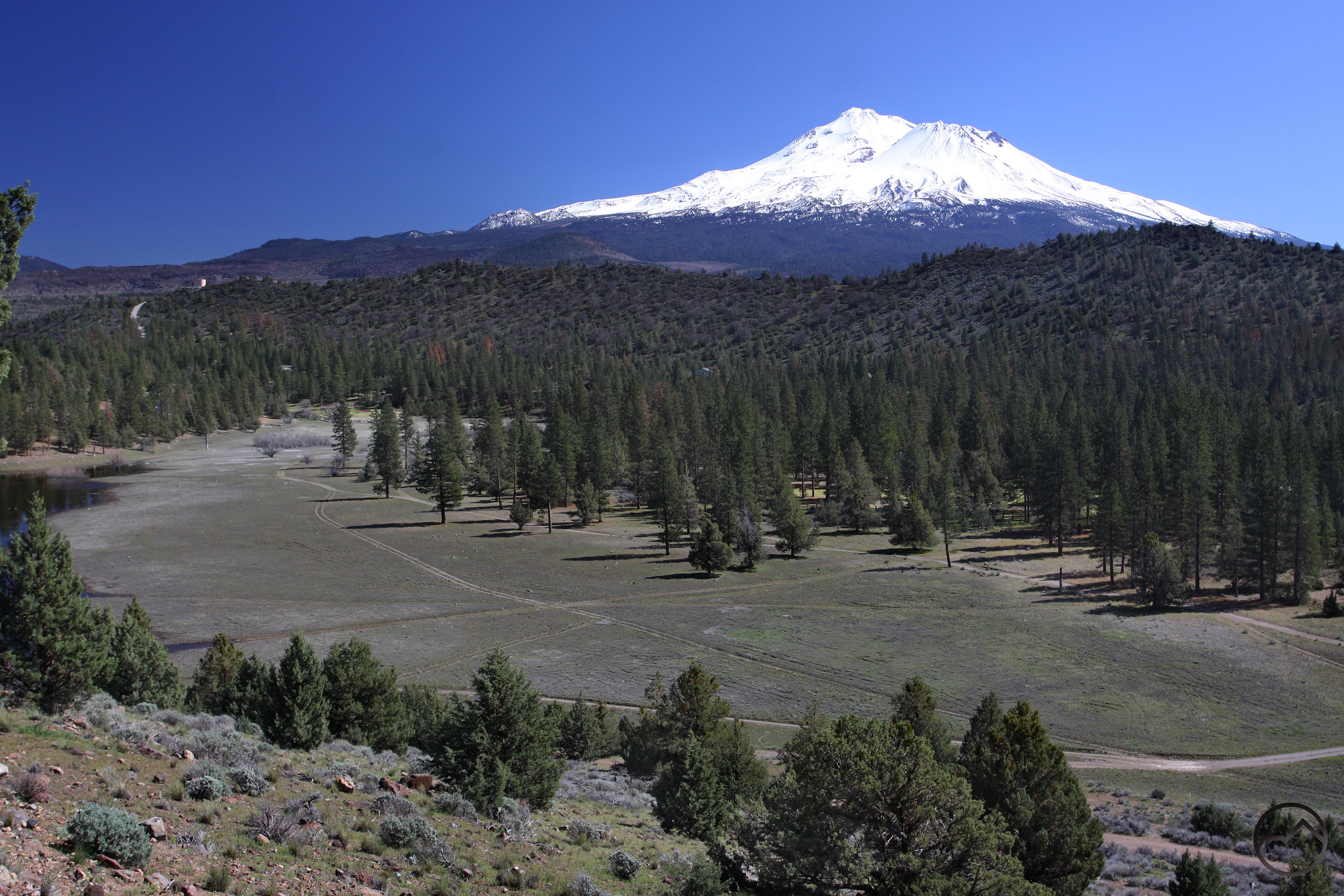
Mount Shasta rises beyond the dry meadow area
For hikers looking for more time on the trail in addition to the short hike to the top of the butte, there are a few other options in the area when the lake has receded a bit. The most obvious places to walk are along the dry parts of the lakebed, both near the campground and also in the meadow to the north. The meadow area has a well-established path that skirts its northern edge. On this path it is important note to explore the area north of the path, since it is private property. The campground and public access area are all the property of the Montague Irrigation District. The path along the meadow leads to a small cove near the golf course. Another good option for hikers is to hike around the perimeter of the butte from the trailhead to the boat launch.

Directions
From downtown Weed at the beginning of Highway 97, drive east on Highway 97 for 4.4 miles. Turn left onto Big Springs Road and proceed 1.7 miles. Turn left onto Jackson Rand Road and drive another 1 mile. Turn right onto Dwinnell Way, marked for the campground and boat launch. Follow the road for 1.3 miles. On the far end of the campground, stay right on the paved road and follow it to the boat launch parking area. From there walk a short distance back down the road to the trailhead, marked by a broken fence. It is also possible to park one or two cars here as long as they are not blocking the service road.

Pingback: Jewels In The Desert | Hike Mt. Shasta