
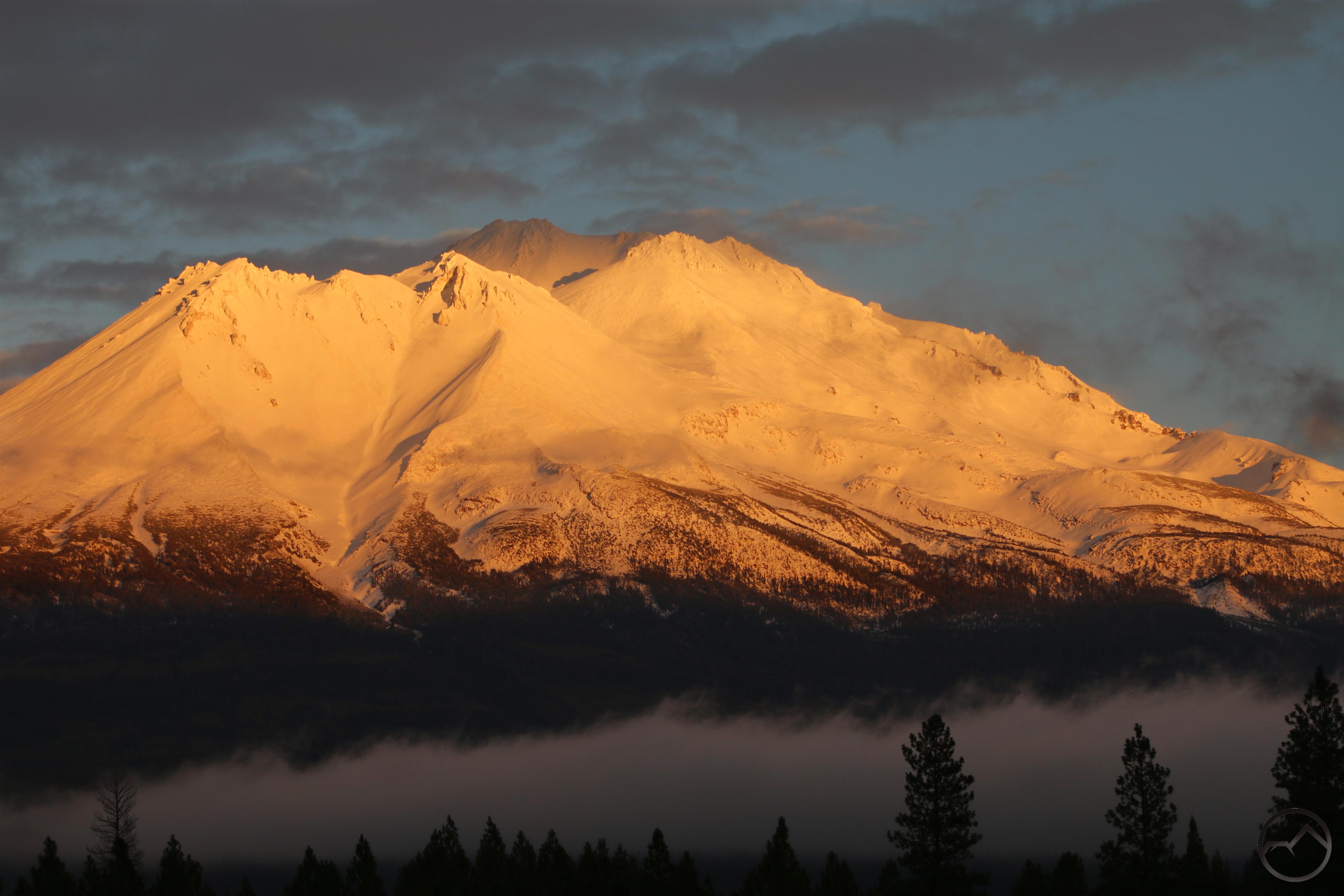
Evening light reveals the layered depth of Mount Shasta 4 eruptive cones.
The geology of Northern California is a subject of endless fascination, with its many mountain ranges, varied geologic compositions and complex associations that these create. Mount Shasta is a microcosm of many of the features, condensed down into a single mountain. While there are indeed different types of rock within the mountain, it remains relatively homogeneous in the sense that all the types are of volcanic origin. However, the volcanic genesis of Mount Shasta is, in fact far more varied than many casual observers might suspect. Yet even the quickest of surveys of the mountain cannot help but notice the mighty satellite cone of Shastina protruding abruptly from Mount Shasta’s northwest flank. This is ready evidence that there have been more than one eruptive period for California’s great volcano. Indeed, this unmissable landmark is the gateway observation to a far more complex geologic history.

Three eruptive cones viewed from the north.
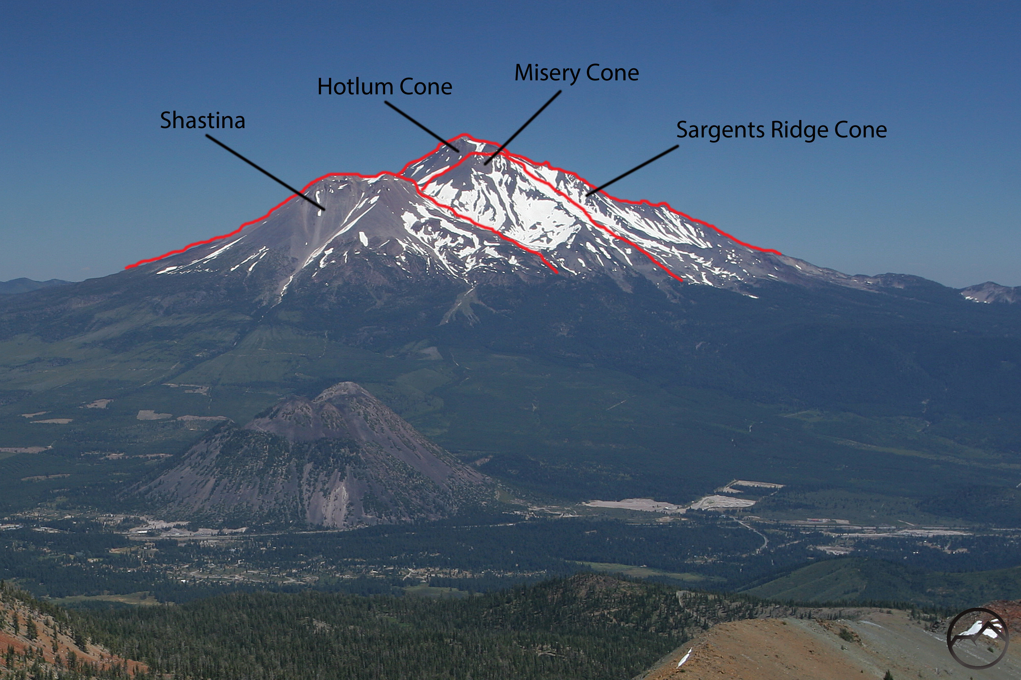
A more in depth study of Mount Shasta’s geography will yield some more detailed elements of the mountain’s structure. Things worth noting are the presence of four large glaciers on the north and east sides, the presence of large, craggy ridges on the west and south sides, the absence of such ridges on the north and east and the relatively smooth curvature of the mountain’s flank on those sides. All of these elements are indicative of the complex eruptive history of Mount Shasta. Specifically, these observations are indicative of the fact that the mountain is not merely a main volcanic cone with the large Shastina a single satellite cone, but rather, a complex joining of 4 different cones, each representing a different eruptive period.
 The four eruptive cones of Mount Shasta, viewed from above.
The 4 cones of Mount Shasta are, in large measure, the source of the mountain’s splendidly diverse appearance. Depending on the location from which the mountain is viewed, it can have an utterly different appearance. Much of this is due to the presence of Shastina but the arrangement of the other cones also plays an important role in the mountain’s continually changing appearance. At first glance, the other three cones seem indistinguishable. Further observation, however, may expose the truth of the matter. All three cones that compose the main part of Mount Shasta are best viewed from the west. The cones take their names from prominent features related to them. They are the Hotlum Cone, Misery Cone and Sargents Ridge Cone. The first of these is the main summit and it, by itself, makes up roughly half the mass of the entire mountain. Next, the Misery Cone, is actually prominently visible from Mount Shasta City, obscuring the actual summit and composing most of the highest visible reaches of the mountain. It takes its name from Misery Hill, which lies just west of the actual summit and torments climbers exhausted from the ascent of Avalanche Gulch. The final cone, the Sargents Ridge Cone, is the oldest part of Mount Shasta. Its rugged striations seen above Avalanche Gulch and even more prominently at the head of Mud Creek Canyon are a mosaic of the detritus of past eruptions.
The following illustrations make the distinction between the cones more obvious:


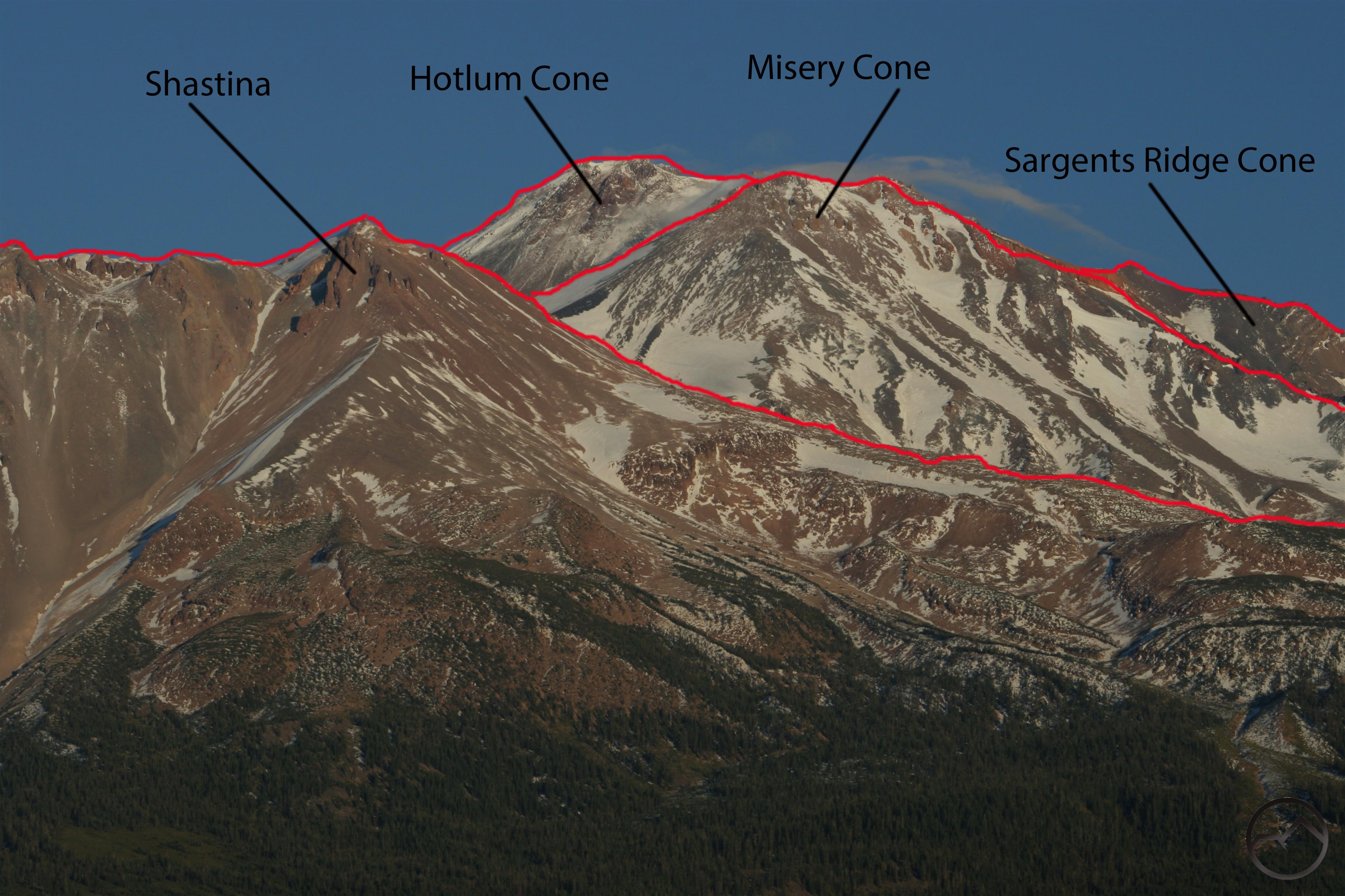


When viewed from the east, only the Hotlum Cone is visible, making Mount Shasta appear as a more typical, conical volcano.

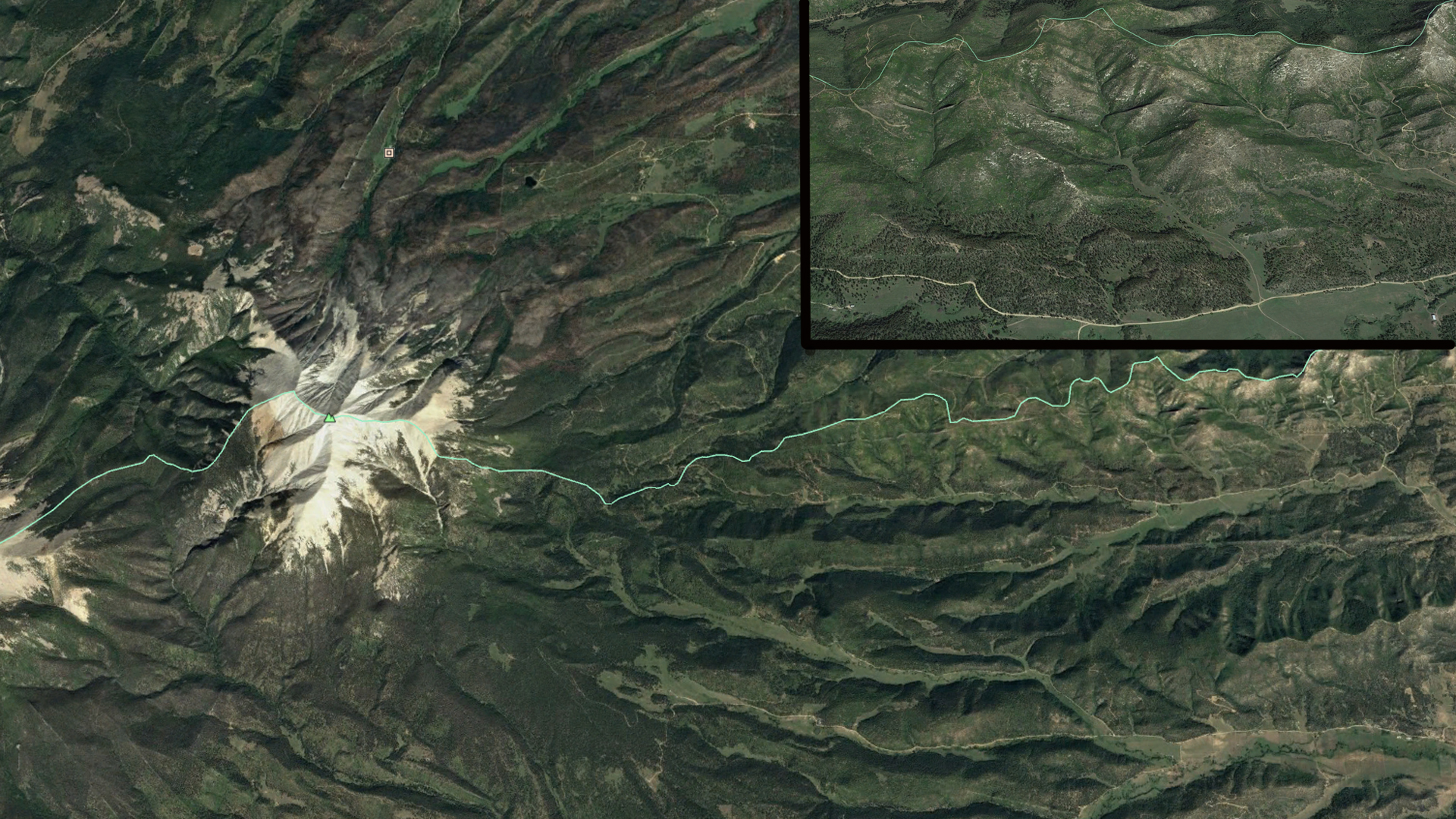
Thumb Rock at the head of Mud Creek Canyon.
Of the four cones, Sargents Ridge Cone is the oldest. Features like Thumb Rock are the necks of old volcanoes. Erosion and glaciers have cut away at this ancient volcano and exposed the convoluted innards of the old giant. Mud Creek Canyon is often described as being a part of prehistoric Mount Shasta. This is because it formed on the oldest part of Mount Shasta and may have predated the later eruptions. Misery Cone is the second oldest, followed by Shastina, which is believed to have formed only in the last 10,000 years. Astonishingly, Hotlum Cone, which makes up the bulk of Mount Shasta, is the newest, formation, having pushed up through all the other eruption cones. Though it dominates the mountain now, it is a recent addition to the neighborhood. Though they may have emerged at separate times, the four cones together combine to make Mount Shasta an utterly awe-inspiring mountain.
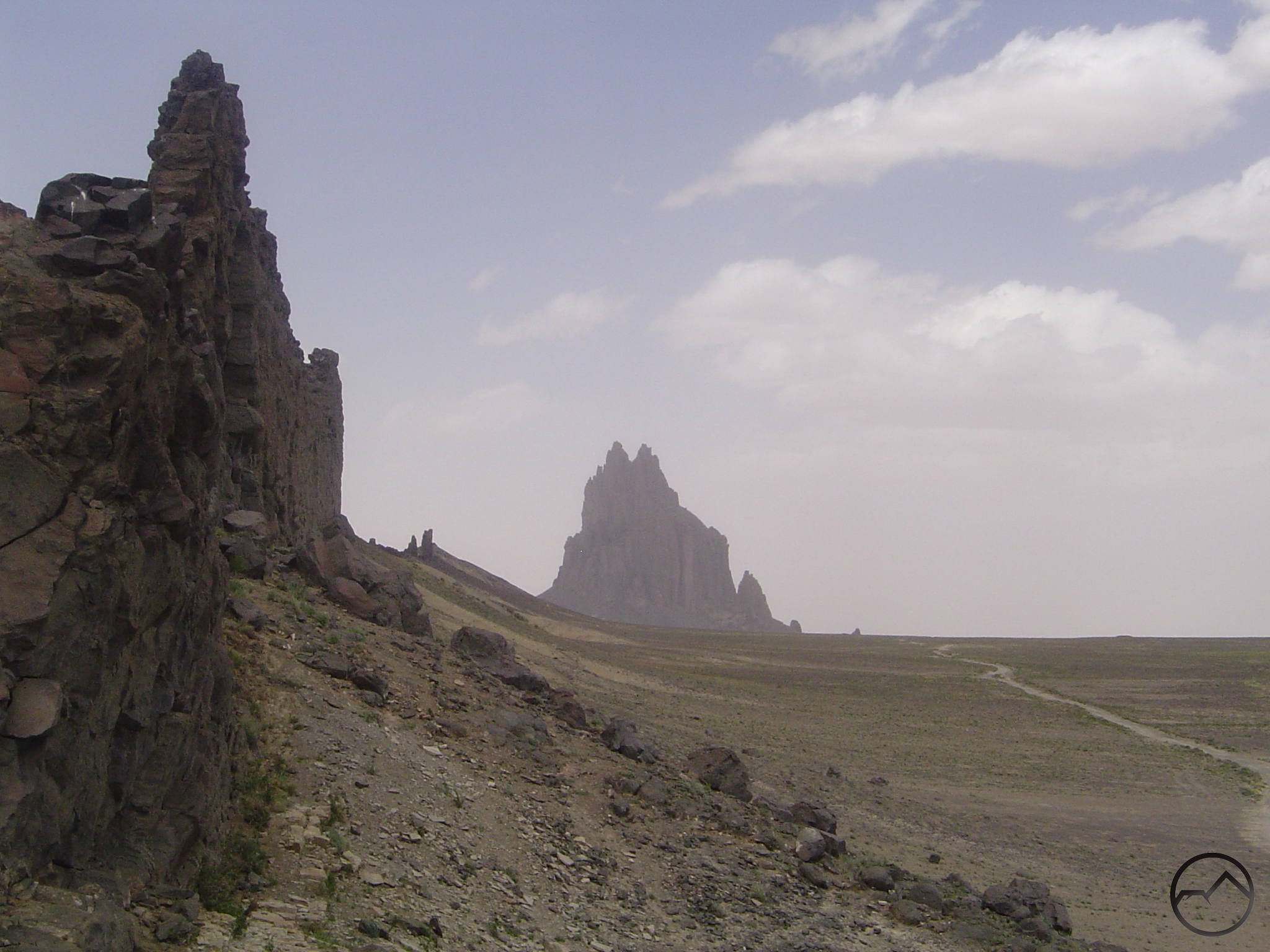
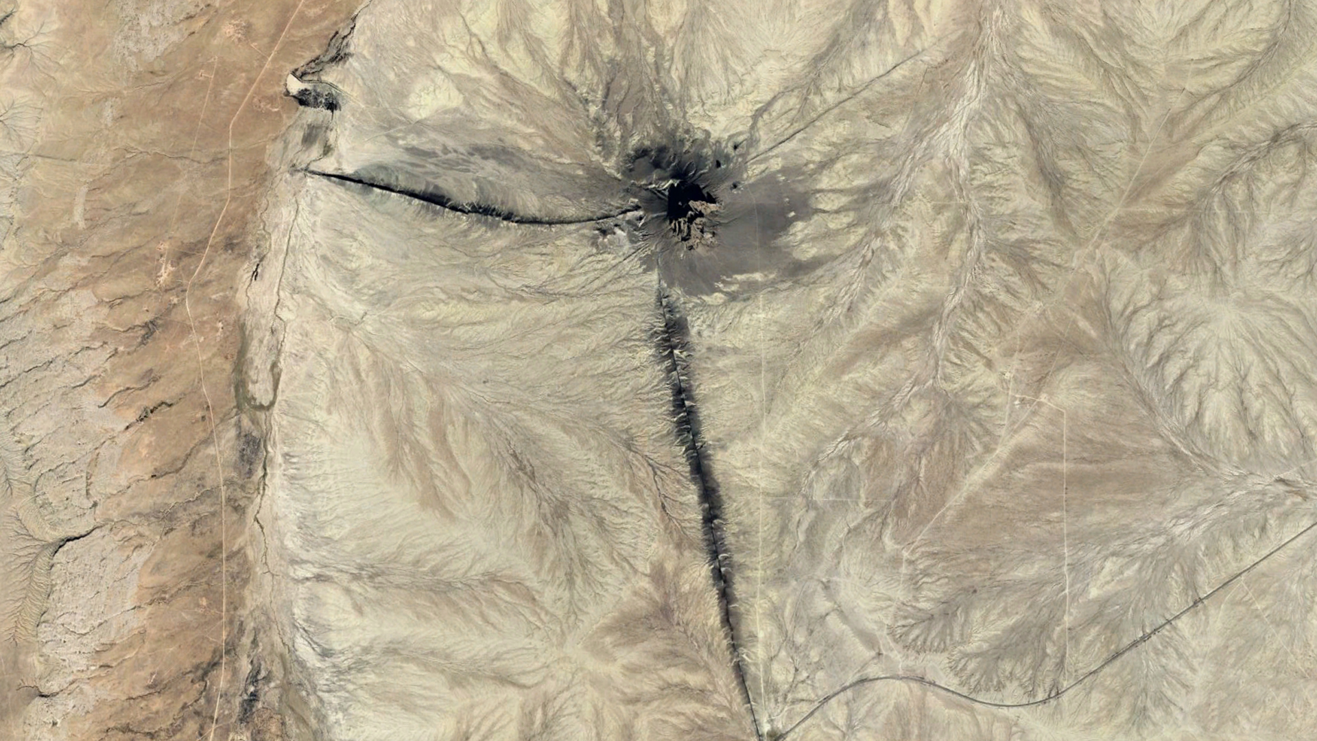
A large dike radiates from Shiprock.
Once one perceives the existence of the four different cones, an interesting possibility emerges. The rugged ridges that extend from eruption points seem like they may in fact be magmatic dikes. These formations occur when magma emanating internally from a volcano intrudes into a crack or fissure. The magma then cools and is exposed via erosion. The way that these features radiate out from the center point of the old eruptions, as well as the ragged crest of the ridges, looks awfully similar to other, well known magma dikes. The most notable ones are those that are formed by the mysterious Shiprock in New Mexico. East and West Spanish Peaks in Colorado also have prominent dikes. In both cases, there are central eruptive cones (or their remnants, as in the case of Shiprock) from which radiate large magmatic dikes.
Observe both:
Shiprock

West Spanish Peak
East Spanish Peak (note inlay close-up of the dikes in upper right)
Compare these formations with ridges on Mount Shasta:
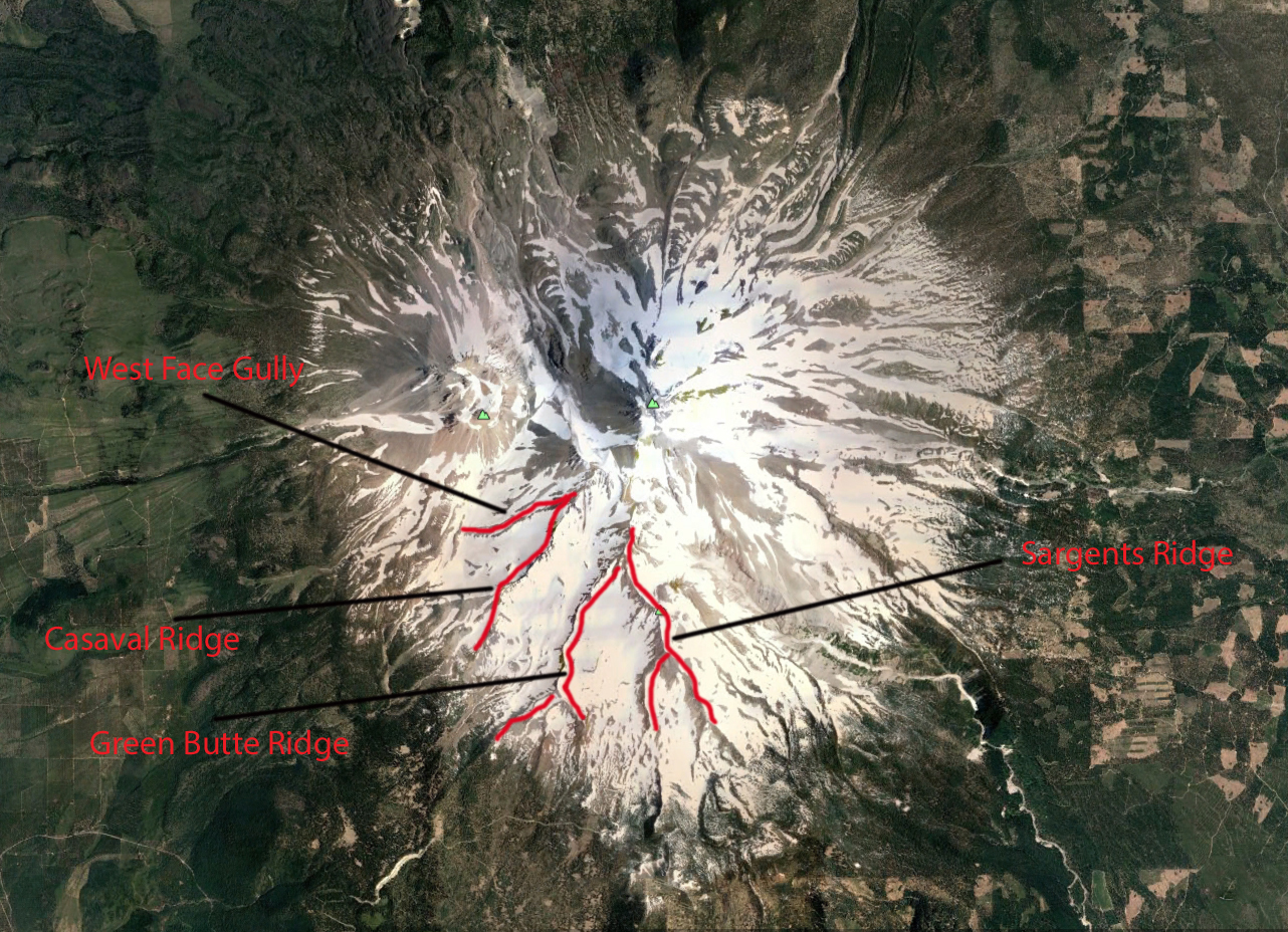


The ridges on Mount Shasta seem quite similar to the magmatic dikes present with Shiprock and the Spanish Peaks. In particular, the southern dike of Shiprock strongly resembles Casaval Ridge on Mount Shasta. The way these ridges connect to the eruption areas on the cones seems to indicated that they are, in some way related to the former volcanoes, just as the dikes on the other peaks are remnants of the volcanic activity in those areas. In both cases the cooled lava has extruded from the larger mass. This would also explain why ridges are exposed on Mount Shasta’s south and west sides but not on the north and east sides. The older volcanoes, Misery Cone and Sargents Ridge Cone, were already formed during the Ice Age and were consequently heavily glaciated. The large rivers of ice cut away at the mountain and made apparent the dikes formed during ancient eruptions. Conversely, Shastina and the Hotlum Cone are believed to postdate the Ice Age and, therefore, have not had glaciers open the mountain up and declare the volcanic dikes that may be present. Of course, Hotlum Cone is currently experiencing the ministry of the Whitney, Bolam, Hotlum and Wintun Glaciers, so the possibility of dikes or rugged ridges being revealed in the future remains. Of course, this is all speculation, but the appearance of the formations seems to fit the theory.
Hopefully the recognition of the various eruption cones on Mount Shasta will help admirers identify and distinguish landmarks on the mountain. The mountain’s geography demands to be studied and everyone who admires the Mount Shasta appreciates the combined beauty of the 4 cones.

Great blog. I’ve always found Mt. Shasta an interesting place and love how you explore it in detail
Pingback: Avalanches In Avalanche Gulch | Hike Mt. Shasta
Pingback: A Mount Shasta Reader | Hike Mt. Shasta
Pingback: Hike Mt. Shasta
Pingback: Mount Shasta, The Castle Crags And The 1838-42 Unite States Exploring Expedition | Hike Mt. Shasta
Pingback: Gazing Into The Heart Of Mount Shasta | Hike Mt. Shasta
Pingback: Appreciating Mount Shasta’s Stunning Whitney Glacier Icefall | Hike Mt. Shasta
Pingback: Memorial Day on Mount Shasta, May 2019 | inthegooey
Pingback: Palisades At Daybreak | Hike Mt. Shasta
Pingback: Cut Into The Heart Of The Mountain: The Great Canyons Of Mount Shasta | Hike Mt. Shasta
Pingback: Mount Shasta Geography Articles | Hike Mt. Shasta
Pingback: Mount Shasta, California, USA |
Pingback: Icy Heights And Chaotic Skies | Hike Mt. Shasta