
At A Glance
The Black Butte Trail winds its way around the north side of the pinnacle of Black Butte, revealing surprises and amazing views en route to a fantastic 360 degree vista at the summit.
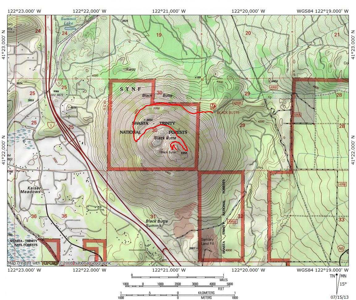
Total Length: 5.2 miles
Elevation Gain: 1,800 feet
Season: Summer, Fall
Climbing The Cone

Mount Shasta highlights the view from the Black Butte Trail.
Black Butte, the largest of Mount Shasta’s satellite volcanic peaks, is itself an iconic image of the Mount Shasta area. Situated at the north end of the Strawberry Valley, the nearly perfectly conical peak is visible from almost everywhere in the Mount Shasta area. When driving north on I-5 from Mount Shasta City, Black Butte rises directly over the interstate and it seems that the freeway is destined to run right into the peak’s rocky base. Only a quick jog to the left prevents this from happening but the freeway comes within such close quarters to the base of the peak that it is easy to make out numerous interesting observations about Black Butte while just passing by at high speed in a car. Chief among the quick assessments of the mountain is the fact that it is essentially a massive pile of rock. In truth the rock is piled up around a few of solid volcanic necks but the steep sides are all loose rock that seems to have come to an unlikely angle of repose. Though the peak does have a pyramid-like appearance, keen observers will notice that there are in fact multiple peaks, each the result of a separate eruption. It should also be obvious that, given Black Butte’s height and central position between Mount Shasta and the Klamath Mountains and between the Strawberry and Shasta Valleys, the views from the summit must be exceptional.

The Cascade Crest and Shasta Valley from Black Butte.
Given the steep slopes, it may be a bit of a surprise that there is a trail that climbs all the way to the top of Black Butte. Not only is there a trail, but it is not excessively steep. The trail is also easily visible making a long traverse of the northern flank of the butte. It is interesting to gaze up and the peak while driving along I-5 and seeing the narrow path slung precariously onto the side of Black Butte. The trail was original built to access a Forest Service lookout that once occupies the summit. Now the trail is enjoyed by hikers seeking amazing 360 degree views on what has become one of the Mount Shasta area’s iconic hikes. It is easy to see why the trail is so popular. The path maintains a steady but reasonable grade all the way to the summit, has incredible views all for its entire duration, includes a few surprises on Black Butte’s higher flanks and ultimately ends at the very summit where all of the immediate Mount Shasta environs unfold like a giant 3-D map. Moreover, the trail is popular simply because Black Butte is a dramatic peak in its own right and naturally draws the attention of hikers and nature-lovers, despite the monumental presence of Mount Shasta.
The Trail

Mount Eddy comes into view from the Black Butte Trail.
The Black Butte Trail trailhead is located on a large bulge on the northeast side of the butte. The fortuitous bulge cuts 300 feet of elevation off of the trail. The area surrounding Black Butte has seen significant logging activity and it is a bit refreshing to arrive at the trailhead where the types of trees are diversified and are growing in a naturally haphazard way. This is in marked contrast to the rank and file plantations one passed while driving to the trailhead. The trail sets off due west from the parking area and immediately begins to climb at a moderate but steady grade. Though the trail is under forest canopy initially, it does not take long for it to emerge into the open air with views to the north. Among the many peaks visible are Sheeprock, the Goosenest and Willow Creek Mountain. Mount McLoughlin in Oregon is the large Fuji-like cone in the distance. Epic views of Mount Shasta also bless the early part of the trail. In emerging from the trees, the trail passes into a large talus field. The rocks have been cleared in such a way as to have produced a level path amidst the scree and dirt and gravel have been added to create a relatively level walking surface. Enjoy it now because future sections will not enjoy this benefit. As the trail continues to the west, Mount Shasta disappears behind Black Butte and Mount Eddy moves into view, with sprawling Mills Meadow stretching out at the foot of the large, if underappreciated, mountain. The sound of Interstate 5 is audible for a little while but soon the trail reaches the far, western side of Black Butte and makes a switchback.

Black Butte’s hidden canyon.
At the first switchback, the Black Butte Trail enters an extremely unlikely, rocky canyon. From down below, this large canyon is very difficult to perceive. Upon arriving at the end of the canyon, it is shocking that such a hidden feature exists this high up on the mountain, just as it is shocking how many trees have managed to eek out an existence midst the talus that fills the canyon. Having switched back, the trail now heads east, continually climbing as it parallels the canyon. In terms of footing, this is the most difficult part of the trail. Though the direction of the path is never in doubt, it is often reduced to an alignment of large rocks. Rock-hopping is necessary to make it through this rugged area. When the trail reaches the east end of the canyon the views to the north return and are highlighted by the rim of the canyon.

Looking up at the summit from the Black Butte Trail.
Beyond the canyon, the trail continues to arc to the east. Soon the main summit tower comes into view. Like everywhere else on Black Butte, it looks like a giant pile of talus. Though it is obscured from this vantage, the trail climbs about halfway up the summit tower. A short distance from when the summit comes into view, the trail enters and area where the slope is loose and unstable. A large wire retaining net has been constructed and is holding back an immense amount of rock. Touching the wire reveals there is almost no give in it. This is indicative of how much force the net is under. A little further beyond the retaining net the trail approaches a rocky outcropping and makes another switchback. From here it is just possible to observe Lassen Peak and Crater Peak to the south. Of course, Mount Shasta is a nearly overpowering presence just a few miles to the east. Shortly after the switchback, the trail crosses over the loose area that, again, is being held back by more wire. This time, however, the debris is overwhelming netting and the trail is being smothered. This is the most unstable part of the entire Black Butte Trail. Caution is necessary while crossing the loose area.

Views to the west from the highest sections of the Black Butte Trail.
With the trail heading back to the west, it is possible to look down, to the north, and observe some of the subordinate peaks that were the result of some of the numerous eruptions. The rock in this area also takes on a bit more of a lava-like appearance. A small canyon exists between the main summit tower and the subordinate peaks but it is now far below. In short order the trail has reached the west side of the summit tower and it is now possible to see cones from four different eruptions. Sharp eyes reveal a few pieces of piping and other debris down at the base of the subordinate peaks. It is surprising to see debris like this high up on the mountain. It is, in fact, remnants of the lookout tower that was removed 40 years ago. With the trail swinging this far to the west, views once again include Mount Eddy, but now take in the area to the southwest, including the Castle Crags, Grey Rocks, the Harry Watkins/Gray Rock Dome area and the three canyons of the Upper Sacramento’s headwaters.

The lookout tower foundation.
Yet another switchback sends the trail back to the east. This time the trail is slung a bit more precariously between some cliffs and the little canyon below the trail. The summit is within sight at this point and four more switchbacks come in quick succession deposit hikers at the very top of Black Butte. During this section of trail several clearly defined use-trails have been established, making the actual route a bit confusing. It does not matter because the mountain has narrowed to such a point that one is naturally funneled right to the summit, no matter which trail one actually uses. The top of Black Butte is a large rocky crest that narrows as it moves south. The last 20 feet lacks a trail completely and is just a rocky edge that requires careful scrambling. The goal of this endeavor is the square foundation of the old lookout tower, which is situated on the highest point of Black Butte. Reaching the foundation and the 360 degree views is not difficult or particularly dangerous but there is a bit of exposure and care should be taken while scrambling to the foundation.

Mount Shasta from the summit of Black Butte.
The view from the summit of Black Butte is naturally amazing. To the south, the southernmost part of the Cascade Range, including Burney Mountain, Crater Peak and Lassen Peak. Much of the Upper Sacramento River’s watershed is obvious, stretching south from the slopes of Mount Eddy and onward to the Central Valley through its canyon. Aside from Mount Eddy, the high peaks of the river’s headwaters, including the Grey Rocks, Boulder Peak, the Castle Crags, Harry Watkins, Gray Rock Dome and Porcupine Peak all line the horizon to the west. Mount Shasta City and the Strawberry Valley lie at the foot of Black Butte To the north is the sprawling Shasta Valley, which turns to high desert not far to the north of Black Butte. In the distance, Oregon peaks such as Mount Ashland, Pilot Rock, Soda Mountain, towering Mount McLoughlin and Browns Mountain are all easily observed. Lining the eastern rim of the Shasta Valley are other great Cascade peaks including Willow Creek Mountain and the Goosenest. Finally, to the east is majestic Mount Shasta, seemingly so close you can reach out and grab it. It is an unforgettable vista.
Directions
From the beginning of the Everitt Memorial Highway in front of Mount Shasta High School, drive north for 2.1 miles to the signed left turn onto a dirt road. The sign indicates the Black Butte Trail. Just past this point, the Everitt Memorial Highway makes a sharp right turn and begins to climb up Mount Shasta. If you reach this turn, you have gone too far. Once on the dirt road, it makes a right hand turn after 100 yards. The road is easily passable but it is bumpy. Though there are side roads, the route is obvious the rest of the way to the trailhead. Follow the obvious path. It does make a left turn after mile and a right turn after another 0.4 miles. Turn left again after 0.8 miles. A short distance from here the road comes to a junction with numerous roads. Follow the obvious road, staying left. The route then makes a quick climb up to the trailhead parking area.

Pingback: Hiking Black Butte | heatherhomefaker
Wow, that’s some drive to the trailhead, no signs except the one off Everitt Highway, really rough in places. No “parking area” to speak of, just park where you can fit your ride between the trees..
Pingback: Five High Country Hikes To Enjoy This Weekend | Hike Mt. Shasta
I tried to find it, ended up geting stuck on a rocky road. oh well
Pingback: Two Months Until The Old Ski Bowl Opens | Hike Mt. Shasta
Pingback: 5 Trails To Peaks Around Mount Shasta | Hike Mt. Shasta
The road to the trail is pretty rough. When we got back we got lost using google maps and damaged our car because branches were scratching the sides.
The hike was very doable but not if you’re afraid of heights. I think it hasn’t been maintained for a while because the rocky trail at the end was sometimes hard to spot. Big rocks had blocked the way and a lot of lost smaller rocks.
But at the end it was well worth it. Beautiful view of Mt. Shasta.
Pingback: Black Butte: Hiding In Plain Sight | Hike Mt. Shasta
Looking forward to this trail with my kiddos in a couple months.
Great! You need to get them up to South Gate Meadow with them if they haven’t already! (Got a book coming too…)
Pingback: Spectacular Hidden Valley on Mt. Shasta - Anne's Travels
Pingback: Black Butte, Horse Camp, and McCloud River Falls | wanderingyuncks
Thank you! I just completed the hike and this site was totally helpful. The views and the hike were amazing.
Thanks for the great directions to the trailhead. I am from out of state, and had no problem driving to the parking area. Road was in good shape, but did have a few big rocks. Trail is great for an avid hiker, but is not for someone who can’t navigate the oversized rocks.
The day We went to the summit, clouds were covering the top 1/3 of Black Butte, but there are great views of Stasta before we were in the clouds.
We are anxious to do this hike. Is it 5.2 miles one way? Or round trip? Thank you
That is the round trip mileage. Have fun up there!
Did this hike for the first time on Memorial Day. What an incredible hike. Almost the entire trail has stunning views. The summit has what may be my favorite view of Shasta I’ve ever seen. Its immensity is on full display. With the Trinity Divide, Mount Eddy, and Castle Crags areas still having decent snow the ridgeline opposite Shasta and Black Butte was a sight to behold.