
At A Glance
A short, easy loop along one of the most beautiful sections of the McCloud River. Despite the great scenery and good access to the river, this loop sees little use.
Total Distance: 1 mile
Elevation Gain: 50 feet
Season: All year
Along The River Running Pt. V
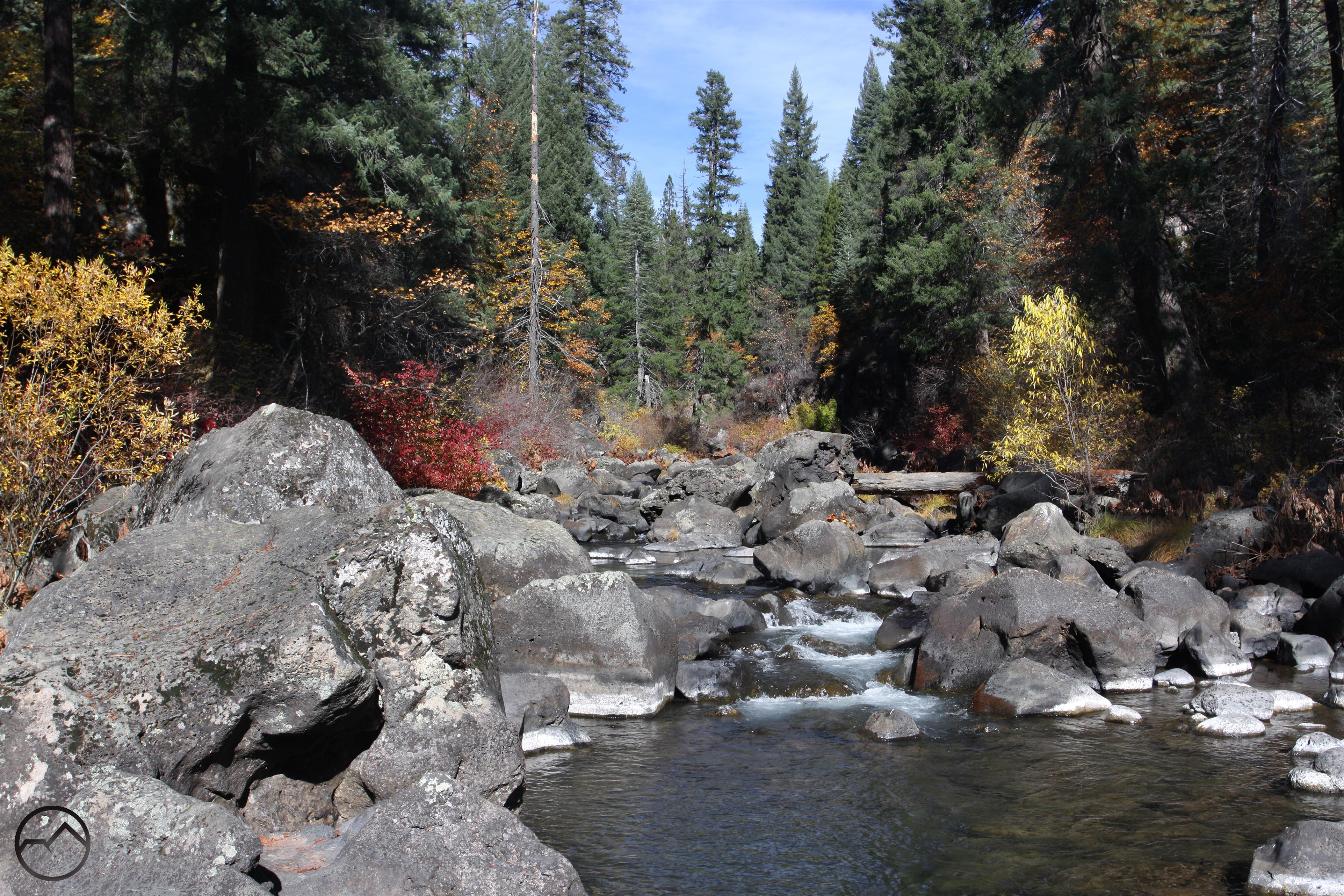
Large boulders dot a section of the McCloud River
The McCloud River is one of the great waterways of Northern California. Known for its fantastic fishing and trio of excellent waterfalls, it is a river steeped in primeval beauty. With the exception of the impoundment that forms Lake McCloud, it is a wild, free-flowing river until finally being stilled at Shasta Lake. The McCloud River rises in the lowlands around the division between the Lassen and Shasta Cascade regions to the east of Mount Shasta. It flows west, passing through the McCloud Flats before finally pouring into the McCloud River Canyon, the end of which concludes its journey to Shasta Lake. Over the course of the river’s 77 miles most hikers intent on exploring the river do so via the McCloud River Preserve Trail and the McCloud River Falls Trail. However, this is by no means the extent of the trails that explore the river. The latter of the two in particular is only a small section of a larger trail system that sees little use and even less notoriety. The trail to the three McCloud Falls is a 2.5 miles segment of the more extensive McCloud River Trail, which stretches along more than 15 miles of the McCloud River. Hikers justifiably gravitate to the spectacular waterfalls to the exclusion of the rest of the McCloud River Trail. This leaves over 12.5 miles of riparian pathway left almost unused and a perfect opportunity to enjoy a beautiful river with some quality isolation

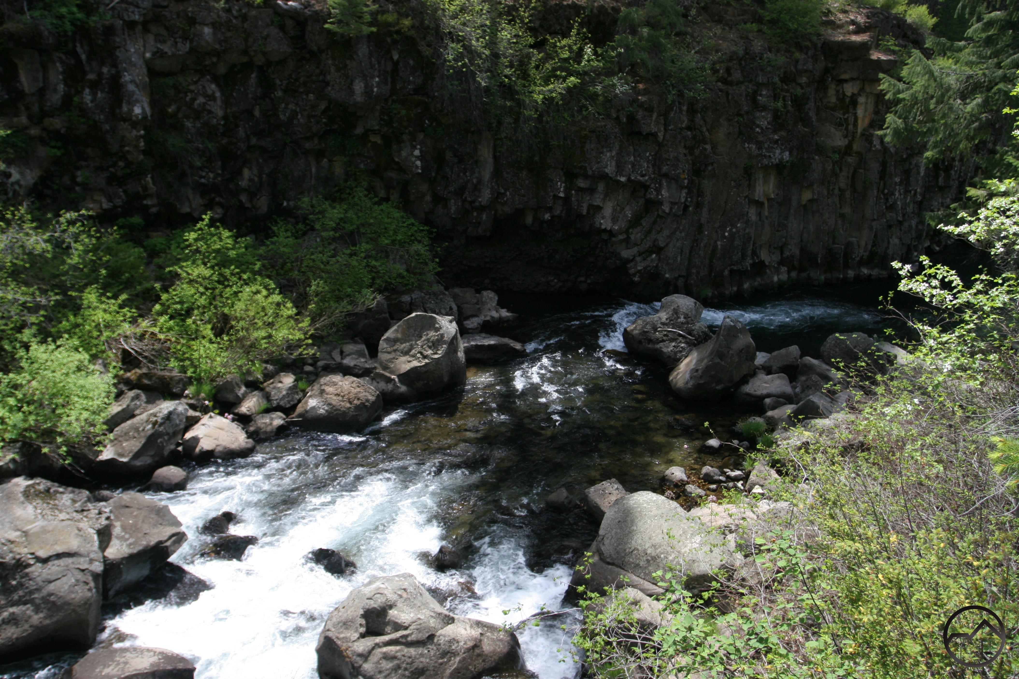
Looking down on the McCloud River
Most hikers who visit the McCloud River naturally head to the section of the McCloud River Trail along the falls. The typical starting point for a hike to the river’s cataracts begins at the Lower Falls picnic area. With the large stone stairs, high vista point and numerous picnic tables, this seems like the natural western terminus for the River Trail. However, what most hikers are unaware of the the continuation of the trail for another mile downstream from the picnic area. Despite beginning at one of the busiest trailheads in the entire Mount Shasta region, this last, short leg of the River Trail sees very little use. What the trail lacks in hikers it more than makes up for in scenery. Indeed, other than the section along the falls themselves, this is the prettiest section of the entire 15 miles of the of the River Trail. The McCloud flows through a narrow, rocky gorge filled with large boulders. The swift moving water and rock walls make this a particularly memorable section of the river. Making the hike even better, it forms a short loop. The trail initially follows the rim of the canyon with great views down to the McCloud. After reaching Pine Tree Hollow, a large flat bench with good access to the river for kayakers to launch, the trail doubles back toward the trailhead. On the return, the trail runs parallel to the river, along the base of the cliffs.
This hike is a great option for spending a little more time on the trail before or after making the hike to the falls. It is also a great trail to take little kids on. Whoever makes the short trip on the loop will be surprised that such a nice section of trail remains off the radar, despite setting out from such a busy trailhead.
The Trail
Rim view of columnar basalt along the McCloud River
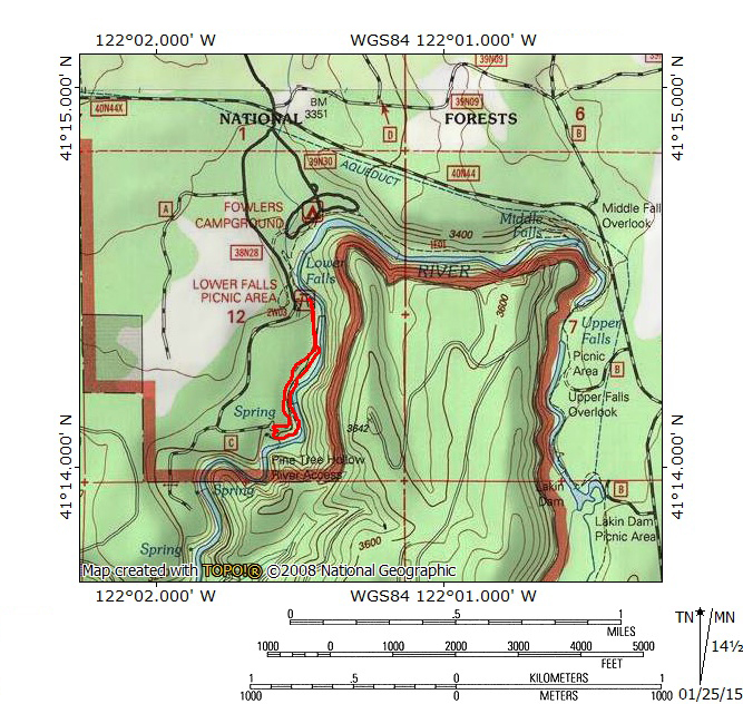
The Pine Tree Hollow Loop begins at the east end of the Lower Falls picnic area. A small, plastic sign indicates the beginning of the trail. The path cuts through trees and low brush very briefly before pulling alongside the rim of the canyon. Looking across the river, note the shafts of columnar basalt rising out of the water. Follow the trail for a short distance along the rim before arriving at a subtle trail junction. The route to the left descends down to the river via a series of well-built switchbacks. This is the return route that completes the loop. Stay to the right and continue along the rim of the canyon. There are good views of the water as it is propelled through a maze of large rocks strewn about the bottom of the narrow gorge. After nearly 0.5 miles the trail veers away from the canyon rim and cuts into the interior of the forest. The path then crosses over an old road that descends into Pine Tree Hollow. It is possible to follow this down and rejoin the trail in the hollow. Rather than taking this route, the trail continues a few dozen yards before beginning an easy descent down a set of mildly graded switchbacks. Once at the bottom, the trail has arrived at Pine Tree Hollow.
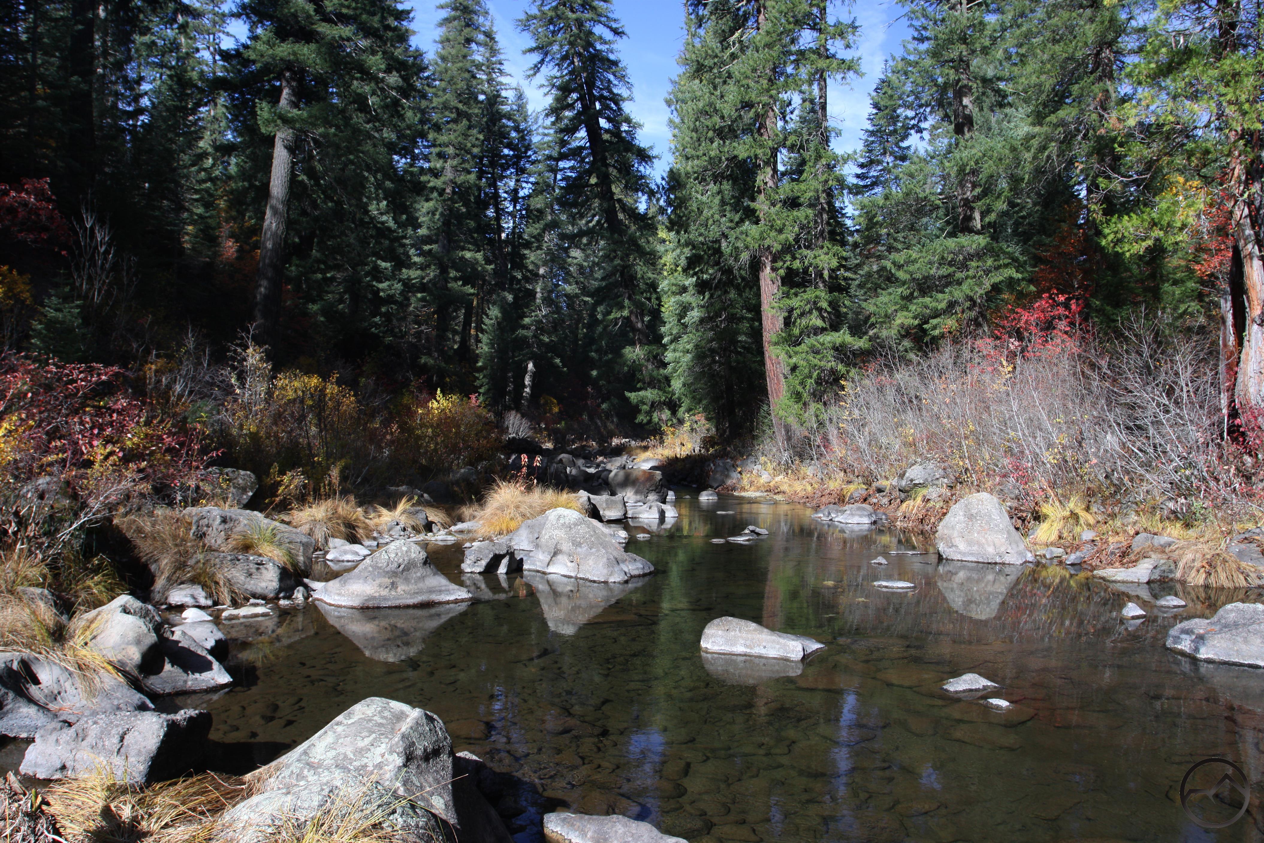
Hiking alongside the McCloud River
The hollow is a good place to pause and explore. There is good access to the river, though some areas are choked with brush. This area is sometimes used by kayakers to begin the journey down to Lake McCloud. Just downstream from this point the McCloud River flows into private property owned by the Hearst family (of newspaper magnate fame). The river itself remains public property and floating the swift moving water is the only legal means of viewing the incredible Big Springs of the McCloud, a large complex of springs gushing a staggering amount of water out of the hillside and into the river. The size and volume of the springs is far more impressive than Mossbrae Falls (though the grace and beauty of Mossbrae Falls elevates if above the power of the Big Springs). From Pine Tree Hollow follow the trail to the east, where it quickly pulls alongside the McCloud. From here it runs parallel to the river at the base of the gorge’s cliffs. There are plenty of opportunities to access the water or climb on large boulders in the middle of the river. This section in the bottom of the gorge is one of the best parts of the McCloud River Trail. The only drawback to is its short duration. All too quickly the trail arrives at the switchbacks climbing back up to the canyon rim. From the top of these it is only a few minutes walk back to the Lower Falls picnic area.
Directions
From the main intersection in the town of McCloud, drive east on Highway 89 for 5.5 miles. Turn right on the signed road for the McCloud River Loop. Continue for 0.7 miles. Stay right at the first intersection (turning left leads to Middle and Upper Falls). Pass the Fowlers Camp campground and turn left into the signed parking lot for the Lower Falls picnic area.

Pingback: The McCloud River Trail | Hike Mt. Shasta
Pingback: Fall Color Is Very Erratic This Year | Hike Mt. Shasta