
At A Glance
A pleasant walk along the Sacramento River that connects Tauhindauli Park to the Dunsmuir Botanical Gardens.
Total Length: 1.4 miles
Elevation Gain: 60 feet
Season: All year
A River Runs Between Them
 The city of Dunsmuir is inseparable from the Sacramento River. The community is nestled into the steep-walled river canyon, filling in a few level areas and climbing up the precipitous slopes. Through it flows the river, dividing the city into distinct neighborhoods and giving Dunsmuir a riparian flare absent from all the other communities around Mount Shasta. Through most of the city the river front is well-developed by both the urban development and the presence of the railroad. Nonetheless some natural areas remain and the most extensive and notable is the section from Cave Springs to Interstate 5 overpass over the river. Conveniently, this area also lies between two notable city parks, the Dunsmuir Botanical Gardens and the less well-known Tauhindauli Park. A pleasant trail runs between the two parks, offering great river access, good views of the the river canyon and all the amenities at both parks. The hike can be a destination on its own but is close enough to downtown Dunsmuir that it can be reached by foot as well.
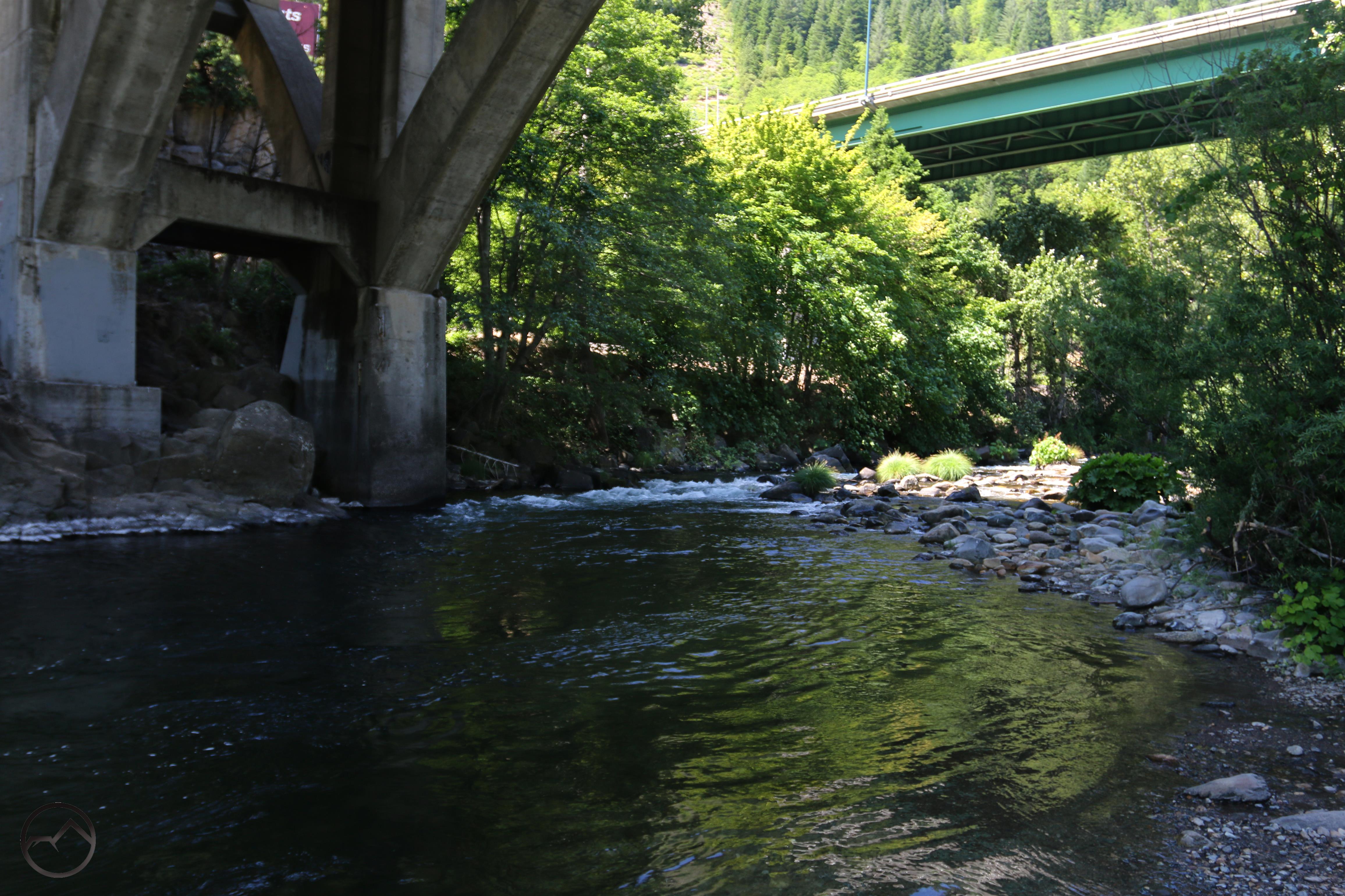
Under the bridges.
The Dunsmuir Botanical Gardens are part of a large city park complex and are well known in the community. Among other features, the park contains a baseball field where Babe Ruth once played. Tauhindauli Park, on the other hand, is not well known outside of Dunsmuir. Despite its relative anonymity, it is a great spot from which to enjoy the river. There are a few things that stand out and make the park less than ideal, among them a small sub station and the large bridges that support I-5 and Dunsmuir Avenue. These latter features make their presence felt and draw the eye instantly upon arrival. Despite these disruptions of the natural setting, the park remains beautiful and offers great access to the Sacramento River. More information about the park can be found here.
The Trail
This hike can be completed in either direction but beginning at Tauhindauli Park makes more sense because it begins the hike in a less-natural setting and the botanical gardens features some fine loop trails and large rocks by the river that make a good destination for the hike. If starting at Tauhindauli Park, be sure to cross over the small footbridge just east of the parking area and follow the path to the river right under the I-5 bridge. It is an unusual and oddly beautiful, albeit not natural, location.
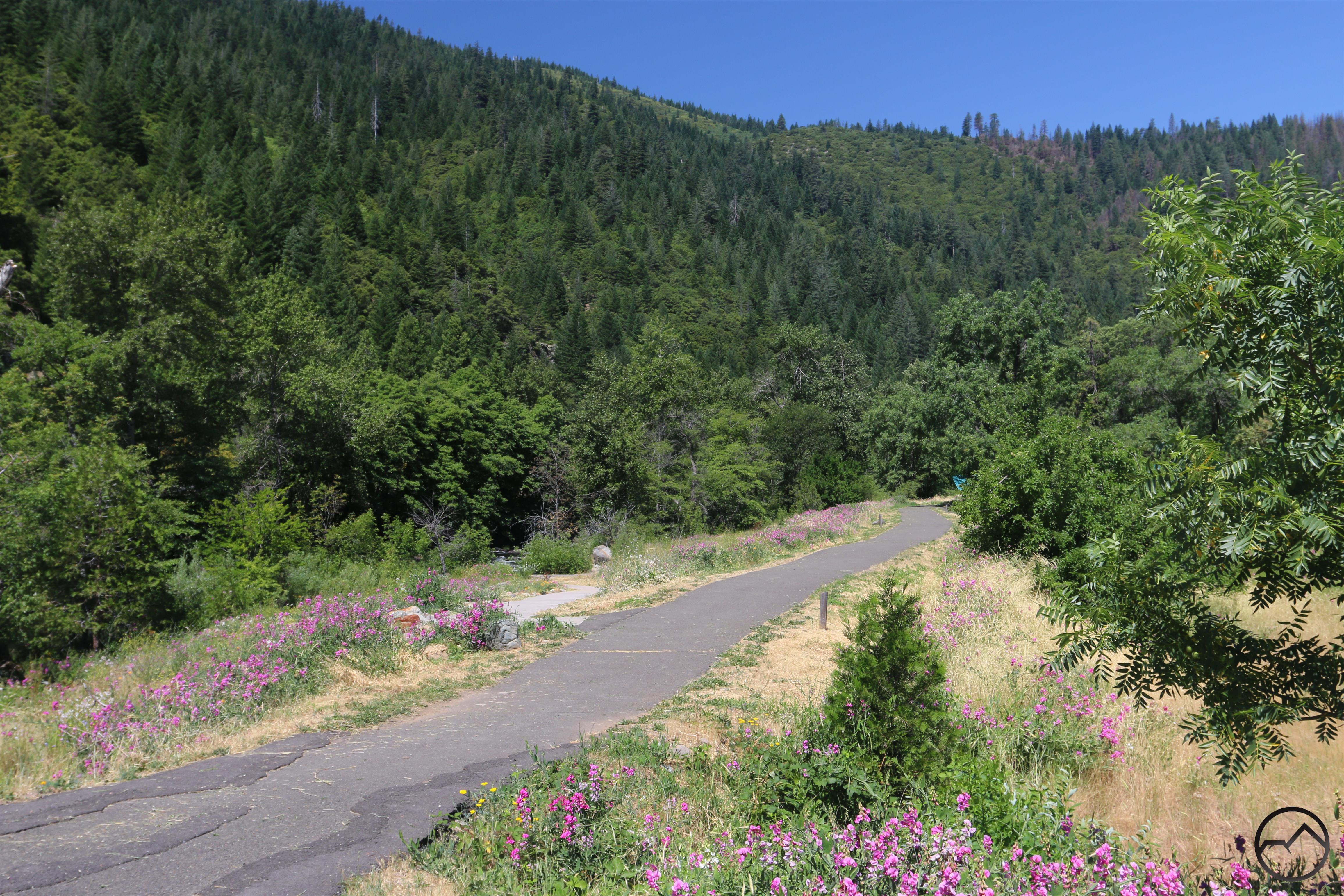
The trail through Tauhindauli Park.
Once it is time to begin the hike, follow the paved path down to the river and pass the softly humming sub station. A sidewalk splits off to the left and drops gently down to the river where there is a ADA accessible platform right by the water. The park was developed as part of the river rehabilitation from the 1991 Cantera railroad spill. Accessible features were added as part of the parks improvement. On the main path, which runs parallel to the river, pass through some grassy fields, where the steep cliffs of the river canyon rise ahead. This is the most open part of the hike and has the most far-reaching views.
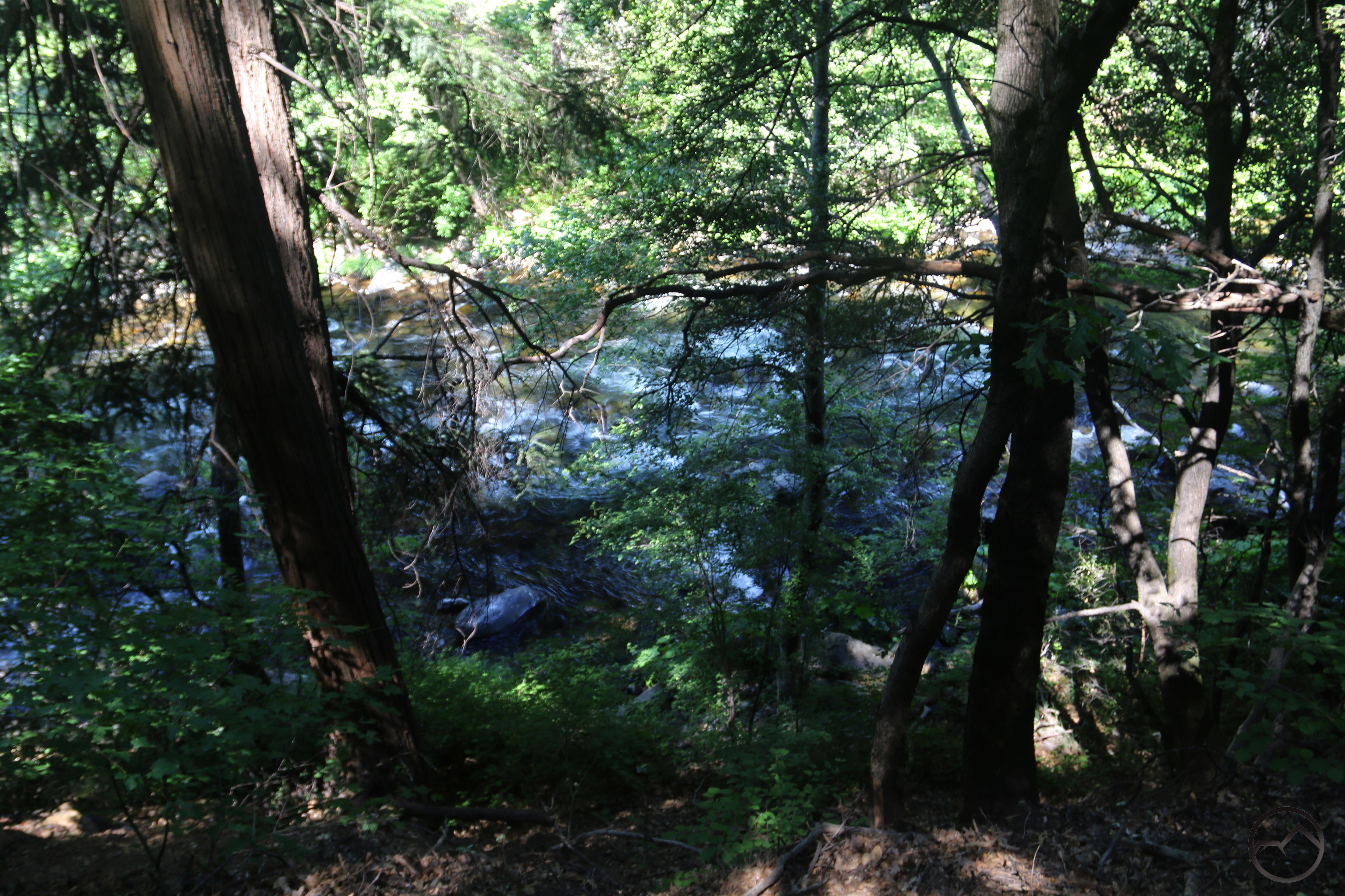
View of the river from an elevated section of trail.
Once the trail passes a private residence on the right it runs up against a low bluff. Here the pavement ends the trail becomes a single track path. It instantly begins climbing up a gently graded slope. It makes one switchback and continues climbing a little further before leveling off. Once atop the bluff, the path skirts a neighborhood for only a handful of yards before crossing a small wooden bridge and cutting onto the side of the bluff again, this time directly above the Sacramento River. Though the views of the river are filtered by trees, this is nonetheless a very pretty part of the hike. Be sure to use caution since the slope drops off steeply from the trail.
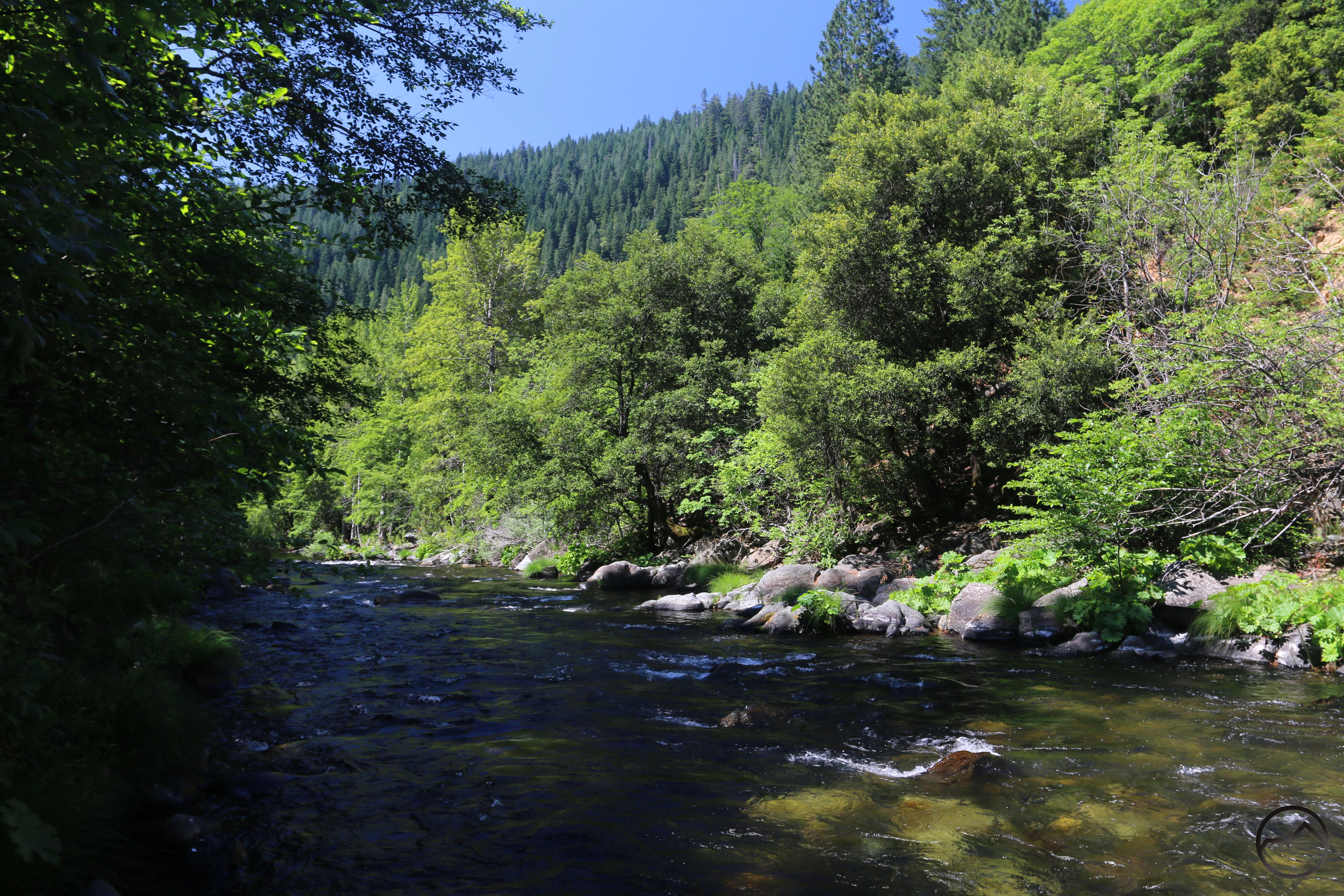
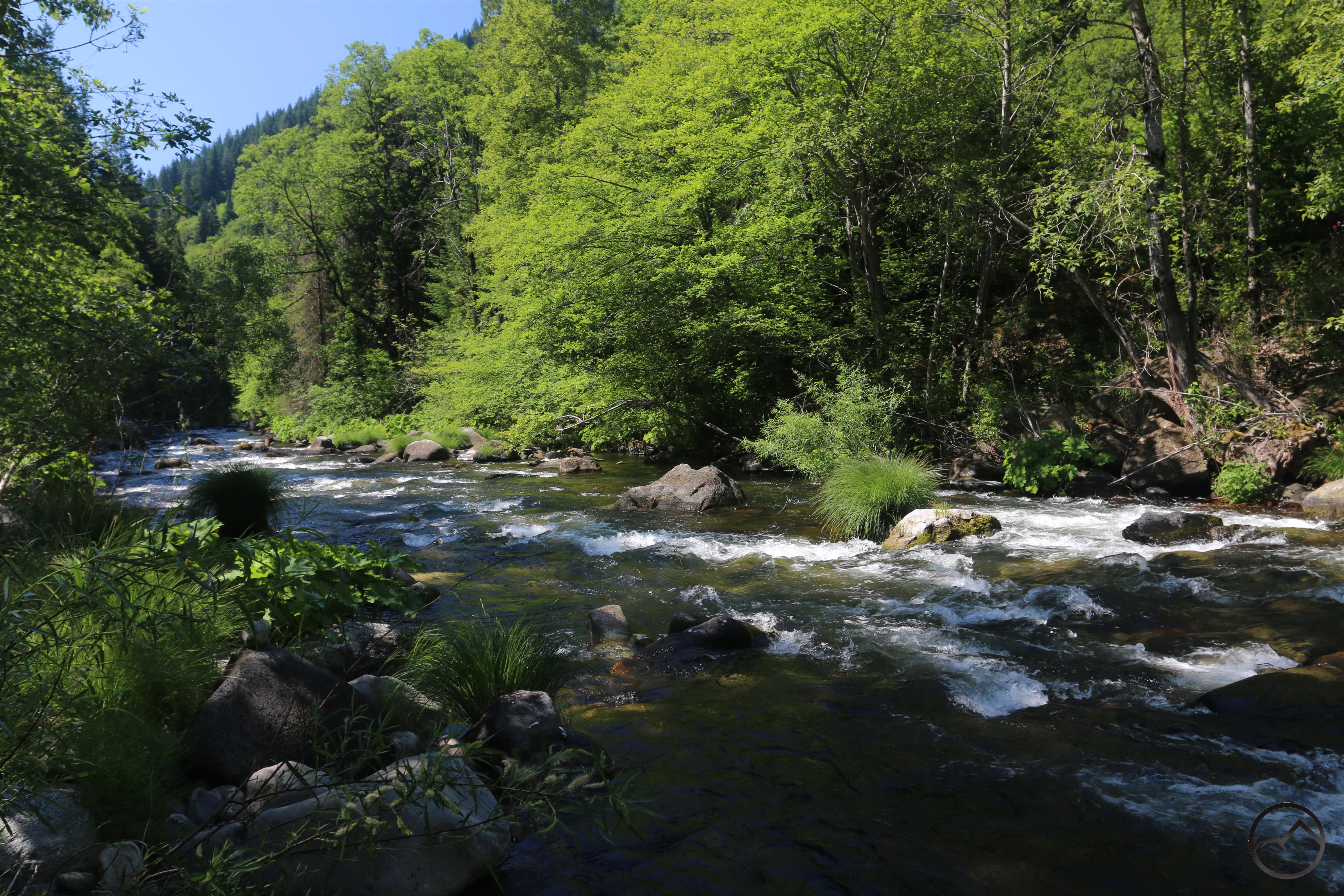
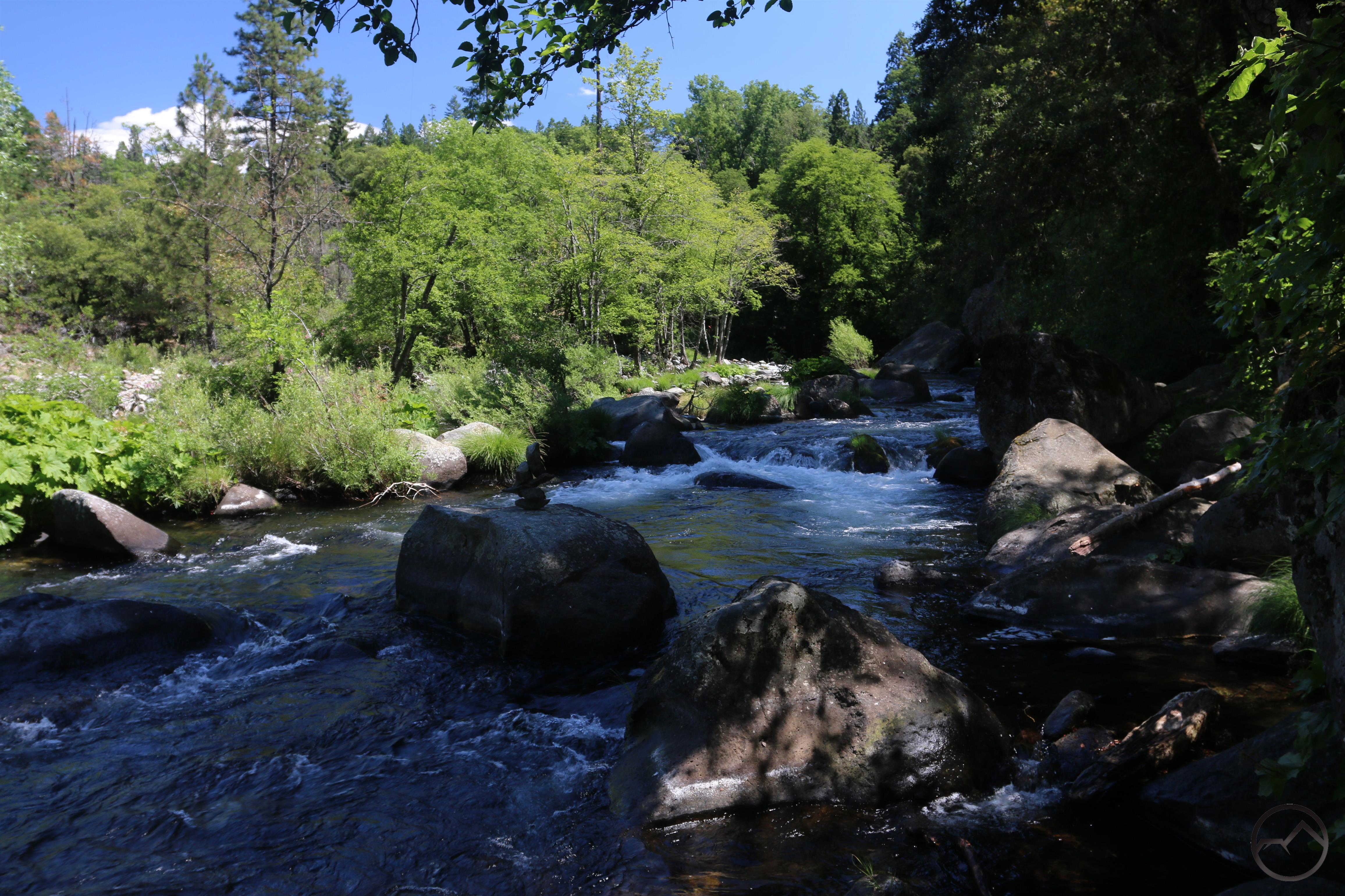
Along the Sacramento River.
As the path descends, it goes beneath a canopy of vegetation so dense it resembles a small tunnel. The trail finally levels off right along the swift-flowing river. Continuing upstream, numerous side trails lead a few feet away to access the river. Large rocks, wildflowers and lush grasses all line the water. Though the railroad tracks lie just across the river they are largely undetectable unless a train is passing by. This means that this section of river appears to be essentially wild in character. Some moderate rapids add interest to the area as well. Maintain course alongside the river for a short distance before arriving at a small amphitheater. Here the trail splits. Stay left to continue along the river.

The lush Dunsmuir Botanical Gardens.
Shortly after passing the amphitheater, the trail passes alongside a number of very large boulders, many of which are adorned with plaques commemorating various people who had important relationships with the river and the botanical gardens. This marks the arrival at the botanical gardens. The area is extremely lush and has many park amenities including picnic areas, a playground, restrooms and various artworks. Most notable, however, is the gardens itself, which are lush and nicely kept. A beautiful trail loops up onto the hillside and makes a great addition to the hike. Perhaps the most interesting feature of the gardens is the alpine plant area. Here plants that thrive in rocky environments grow on a large rock outcropping surrounded by trail. It is an unusual but noteworthy element to a botanical garden.
The end of the trail.
For those who want to hike a bit further, stay alongside the river and follow the trail until it comes level with the road. Continue to parallel both road and river past a couple of isolated picnic tables. From there a trail is visible beyond a curve in the road, passing through the garden’s slash heaps. This level path continues for a relatively short distance until it comes to an end at the edge of a collection of extremely large boulders. Here there is good river access once again, beautiful views upstream and even a subtle glimpse of Mount Shasta. This makes a great place to enjoy the river, the views and beauty of the entire area before turning around and retracing the trail back to Tauhindauli Park.

Directions:
This hike can be completed in either direction, with each trailhead accessible via car.
Tauhindauli Park:
Driving north from downtown Dunsmuir, cross over the Sacremento River and turn left onto Pioneer Way. When it dead ends, turn left onto Masson Avenue then veer right onto Upper Soda Road. Follow this to the signed trailhead parking area.
Dunsmuir Botanical Gardens:
Driving north from downtown Dunsmuir, cross over the Sacremento River and turn into the signed entrance for the botanical gardens. Pass the baseball field and drive up and over a low ridge, passing a tennis court. Follow the road down the other side until it reaches the parking area.
