
At A Glance
A long traverse of the lower section of the stunning Castle Crags on the Pacific Crest Trail. Though it does not travel through the high granite towers that the Crags are known for, this section of the PCT offers great views of the Castle Crags as well as surrounding peaks like the Grey Rocks. Numerous creek crossings also add to the great scenery.
Total Distance: 6.75 miles
Elevation Gain: 1,575
Season: All year
Clinging To The Crags

Battle Mountain in the Castle Crags.
Next to Mount Shasta, the Castle Crags are the most recognizable landmark in the Mount Shasta area. The chaotic jumble of granite spires is an unforgettably awesome sight that beckons hikers to explore the gray towers and hidden canyons. Unfortunately, few of the Crags’ trails venture into the granite wonderland, leaving hiker’s searching for opportunities to get as close as possible or hunting for vistas of that expose the formation’s grandeur. While the best option to accomplish this is to hike the Castle Dome Trail, the Pacific Crest Trail does provide the next best option. Most who make use of the access provided by the PCT head in via the Dog Trail and then go west to Burstarse Falls, an excellent waterfall tucked away in classic Castle Crags canyon. This leaves the lower, eastern section of the PCT relatively lightly traveled. For hikers in search of good views of the great citadel of the Castle Crags, this is as good an option as one is likely to find from a trail without climbing up the steep Castle Dome Trail. Views of the Crags are not the only highlight of this section of the PCT. In addition to excellent vistas of the Castle Creek Drainage and the mysterious Grey Rocks, the lower Crags section of the PCT also boasts six major creek crossings. In the spring when the water is flowing strong these are attractive, refreshing sights. This is also the best time to hike this section of trail because temperatures are cooler and the higher trails are typically still blanketed in snow. It should be noted that the best way to hike this trail is to utilize a shuttle. Park one vehicle at the PCT trailhead at the Soda Creek exit on I-5 then drive to the trailhead for the Dog Trail and begin the trip.
The Trail

Sulphur Creek.
The Dog trailhead is located at an old quarry. The east half of the parking clearing is often used as a firing range, so be sure to park on the west side if possible. The Dog Trail connects to the PCT in 0.5 miles. It is so named because people hiking the Pacific Crest Trail in the company of dogs use it. To the east of the Dog Trail, the PCT passes through Castle Crags State Park, which does not allow dogs on its trails. The Dog Trail thus provides a bypass through the park. Unfortunately it also bypasses a lot of great scenery. Although the trail climbs at a moderately steep grade (nearly 600 feet in 0.5 miles) this is the steepest part of the entire journey. Initially open and climbing an old road, the trail eventually swings to the east as it passes beneath the forest canopy. Watch for a pile of rough hewn timbers just above the trail. This is the remains of an old mine. The original road that the Dog Trail now follows was constructed to access this mine. When the trail intersects the PCT, head right, to the east. Immediately after the junction the trail rounds a corner and reveals a spectacular view of Battle Mountain, one of the largest towers in the Castle Crags. The trail then reenters the forest canopy and makes a descent down to Sulphur Creek.

High towers of the Castle Crags.
Though the creek is quite scenic it lacks much of the sulfuric odor for which it is named. The smell is quite evident from Castle Creek Road, further downstream. As the path climbs away from the creek crossing be alert for a well-established path coming up the creek’s canyon and continuing northward into the crags. This is a popular rock climber’s route into the heart of the Castle Crags. As the trail makes a gradual ascent it crosses the east fork of Sulphur Creek. This is also a very scenic stream. Near the top of the long grade the PCT arrives at a junction with the Flume Trail. This trail begins at Castle Crags State Park. After making its way across the valley bottom the trail steepens and makes its way up to a pair of junctions with the PCT. This is the first of the two intersections. A short distance further the trail begins to descend into another creek drainage, blessing hikers with yet another incredible view of sheer face of Battle Mountain. Soon the trail arrives at small Dump Creek. Despite its small size, the creek has numerous scenic cascades and clear pools. This is a good example of why this trail is best hiked in the spring, when small waterways such as Dump Creek are flush with rainwater and snowmelt.

Castle Creek and the Grey Rocks.
Just beyond Dump Creek the PCT arrives at the second junction with the Flume Trail. For those hiking up from the state park, a nice little loop along the PCT can be done. Hikers continuing on the PCT soon emerge from the forest cover to great views to the west. Nearly 400 feet below the trail flows Castle Creek, the largest early tributary of the Sacramento River. Towering high above the valley are the dark towers of the Grey Rocks. These seldom climbed peaks harbor spectacular, isolated canyons and some tiny but gorgeous lakes. Few venture into that mountain stronghold. Continuing east on the PCT, the trail rounds a small shoulder and briefly dips into Castle Crags State Park for the first time. Having rounded the corner and making a steep climb the trail again leaves the forest canopy, revealing even better views. For the first time the trail also crosses open granite as it skirts the top of an impressive cliff. Far below the Castle Creek Valley unfolds, this time topped not only by the Grey Rocks but also Soapstone Peak (aka Harry Watkins, the highpoint of the Castle Crags Wilderness, though not in the Crags themselves) and the Crags’ own Battle Mountain. It is a memorable vista and a highlight of the hike.

The backside of Mount Hubris from the PCT.
The PCT now begins its descent to I-5 in earnest. Another view of the Crags, this time the back side of Mount Hubris, a popular rock climbing spot, is revealed before the trail heads under the forest canopy, this time for the duration of the trip. At this point the trail is entering the Indian Creek drainage. The path first crosses the west fork of the creek. Like previous crossings, this is a lush, cool spot and the racing water beckons hot hikers to stop and enjoy the refreshing water. The trail continues and soon arrives at a bridge across a steep, narrow creek. Though a tributary of Indian Creek, a sign identifies the creek as Winton Canyon. Though unclear, it is probable that this may be referred to as Winton Creek. The bridge is a noteworthy structure. Note the thick central beam on the bridges railings. This is actually the load bearing support on the bridge and the walkway is, in fact, slung beneath it. In effect, the bridge is a short suspension bridge. Presumably this was done to eliminate any support structure beneath the bridge to allow rocks and logs to flow down the steep creek without hitting the bridge. There is little clearance between the water and the structure and this bridge design was an ingenious way to create more space. Once across the bridge, the trail soon crosses the east fork of Indian Creek. This fork begins 700 feet higher, emerging from Indian Spring at the foot of Six Toe Rock, another popular rock climbing destination. This marks the final creek crossing for the duration of the trail.

One view of Mount Shasta at trail’s end.
Continuing past the final crossing over Indian Creek, the PCT soon arrives at the first of many junctions that mark the last leg of the trip. The first is with the Bob’s Farm Trail. This descends down to the state park headquarters. Stay on the PCT, following the well-marked signs. The trail soon arrives at a second junction, this time with the Castle Dome Trail underneath a large powerline. Again, follow the signs to stay on the PCT. A third intersection soon joins the PCT to the Root Creek Trail. Stay to the left at the junction. These trail then split and the PCT begins the final descent down to the interstate. It crosses beneath the powerline again and then passes a final trail junction, this time with the Kettlebelly Ridge Trail, which leads to the state park’s campground. As the sound of the freeway becomes audible, the trail makes one last, sharp switchback to the left. At this point look for a use trail cutting through the brush to the right. This path enters an old clear cut where hikers get the only view of Mount Shasta from this low section of the PCT. Back on the main trail the journey ends after walking a short distance on a decaying asphalt road and then passing through a hiker’s gate at the Soda Creek trailhead.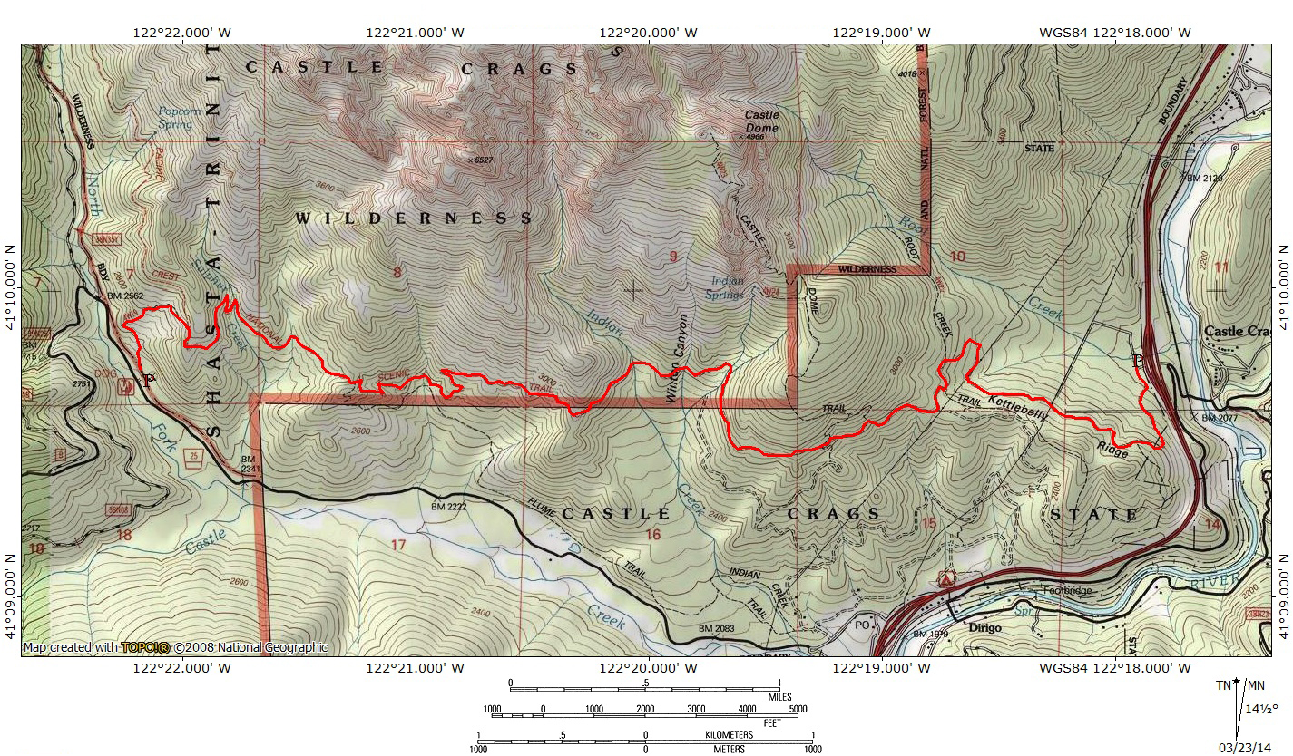
Directions
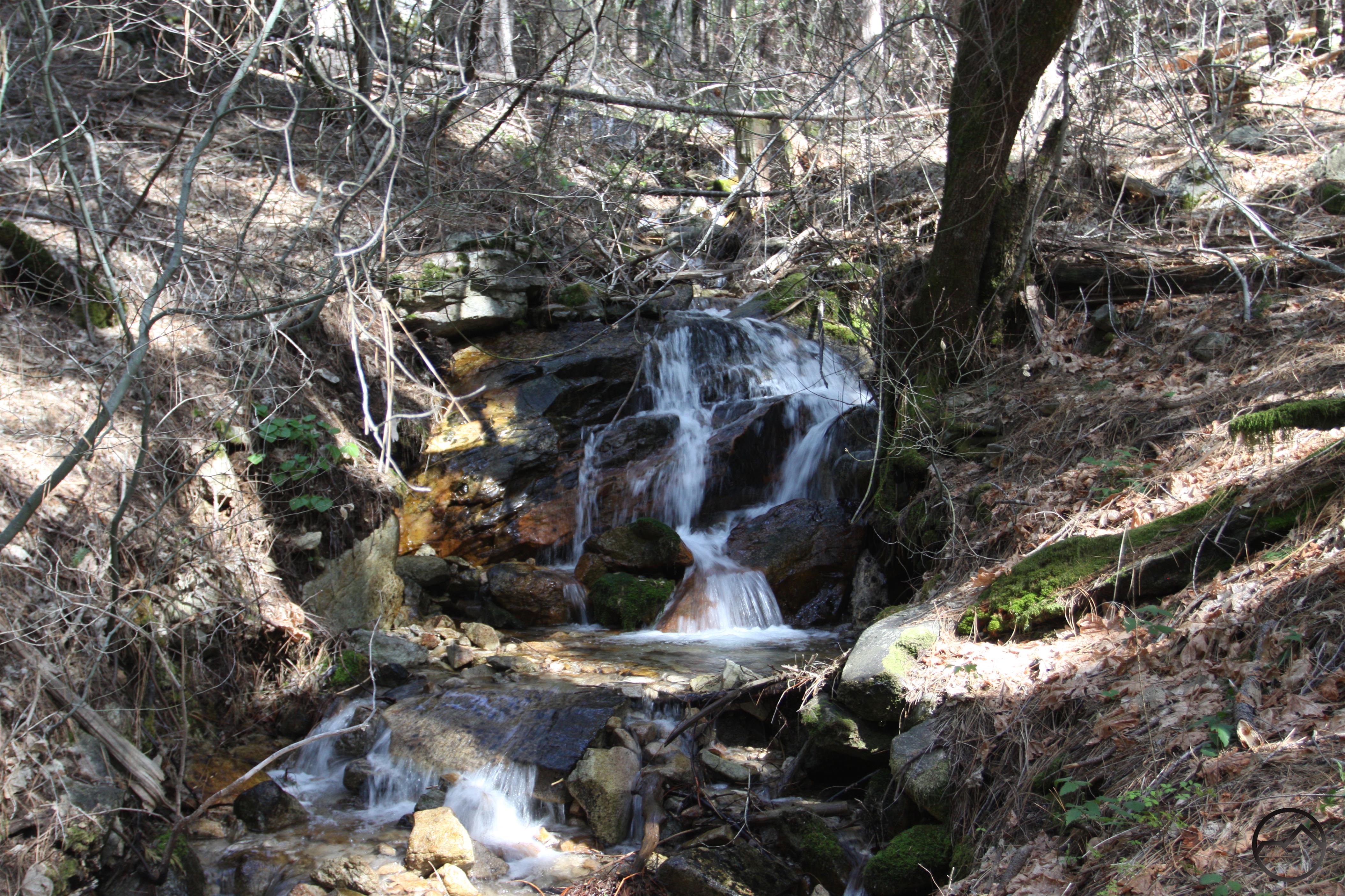
Cataract on Indian Creek.
Dog Trailhead
From I-5, take the Castella exit. Head west on Castle Creek Road for 3.3 miles. Turn right into the clearing that serves as a parking area. A PCT sign marks the parking area.
Soda Creek Trailhead
Traveling on Interstate 5 south of Dunsmuir, take the Soda Creek exit. Go to the west side of the freeway and park at the Pacific Crest Trial trailhead. The trailhead is only yards from the southbound freeway exit.

Pingback: Off Season Trails: Spring Hikes In The Castle Crags | Hike Mt. Shasta
Pingback: Off Season Trails: Spring Hikes In The Castle Crags | Hike Mt. Shasta
Pingback: Shasta Spans: 5 Interesting Footbridges | Hike Mt. Shasta
Pingback: Three Excellent Hikes For Memorial Weekend | Hike Mt. Shasta
Pingback: Three Awesome Hikes For Memorial Weekend | Hike Mt. Shasta
Pingback: Seldom Seen: Castle Creek | Hike Mt. Shasta
Do you think this would make a nice spring backpacking trip in April? If not, are there any others you’d recommend in the area?