
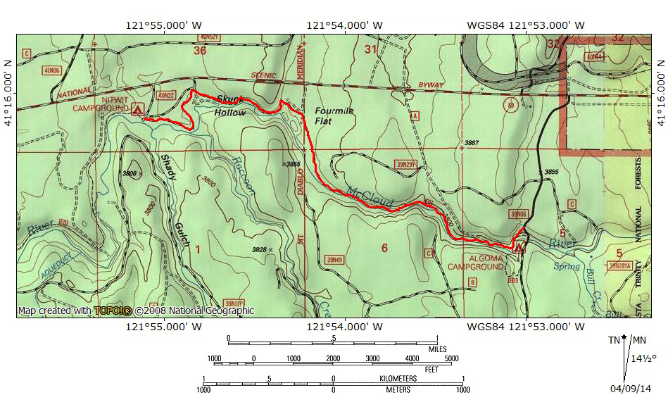
At A Glance
A scenic portion of the larger McCloud River Trail, beginning at the Algoma campground and ending at the primitive Nitwit campground. Along the way, the trail passes through a canyon, through pleasant meadows and cool forests. It generally stays within sight of the beautiful McCloud River.
Total Distance: 5.5 miles
Elevation Gain: Minimal
Season: All year
Along The River Running
The McCloud River from the bridge at Algoma.
The McCloud River is one of the great waterways of Northern California. Known for its fantastic fishing and trio of excellent waterfalls, it is a river steeped in primeval beauty. With the exception of the impoundment that forms Lake McCloud, it is a wild, free-flowing river until finally being stilled at Shasta Lake. The McCloud River rises in the lowlands around the division between the Lassen and Shasta Cascade regions to the east of Mount Shasta. It flows west, passing through the McCloud Flats before finally pouring into the McCloud River Canyon, the end of which concludes its journey to Shasta Lake. Over the course of the river’s 77 miles most hikers intent on exploring the river do so via the McCloud River Preserve Trail and the McCloud River Falls Trail. However, this is by no means the extent of the trails that explore the river. The latter of the two in particular is only a small section of a larger trail system that sees little use and even less notoriety. The trail to the three McCloud Falls is a 2.5 miles segment of the more extensive McCloud River Trail, which stretches along more than 15 miles of the McCloud River. Hikers justifiably gravitate to the spectacular waterfalls to the exclusion of the rest of the McCloud River Trail. This leaves over 12.5 miles of riparian pathway left almost unused and a perfect opportunity to enjoy a beautiful river with some quality isolation
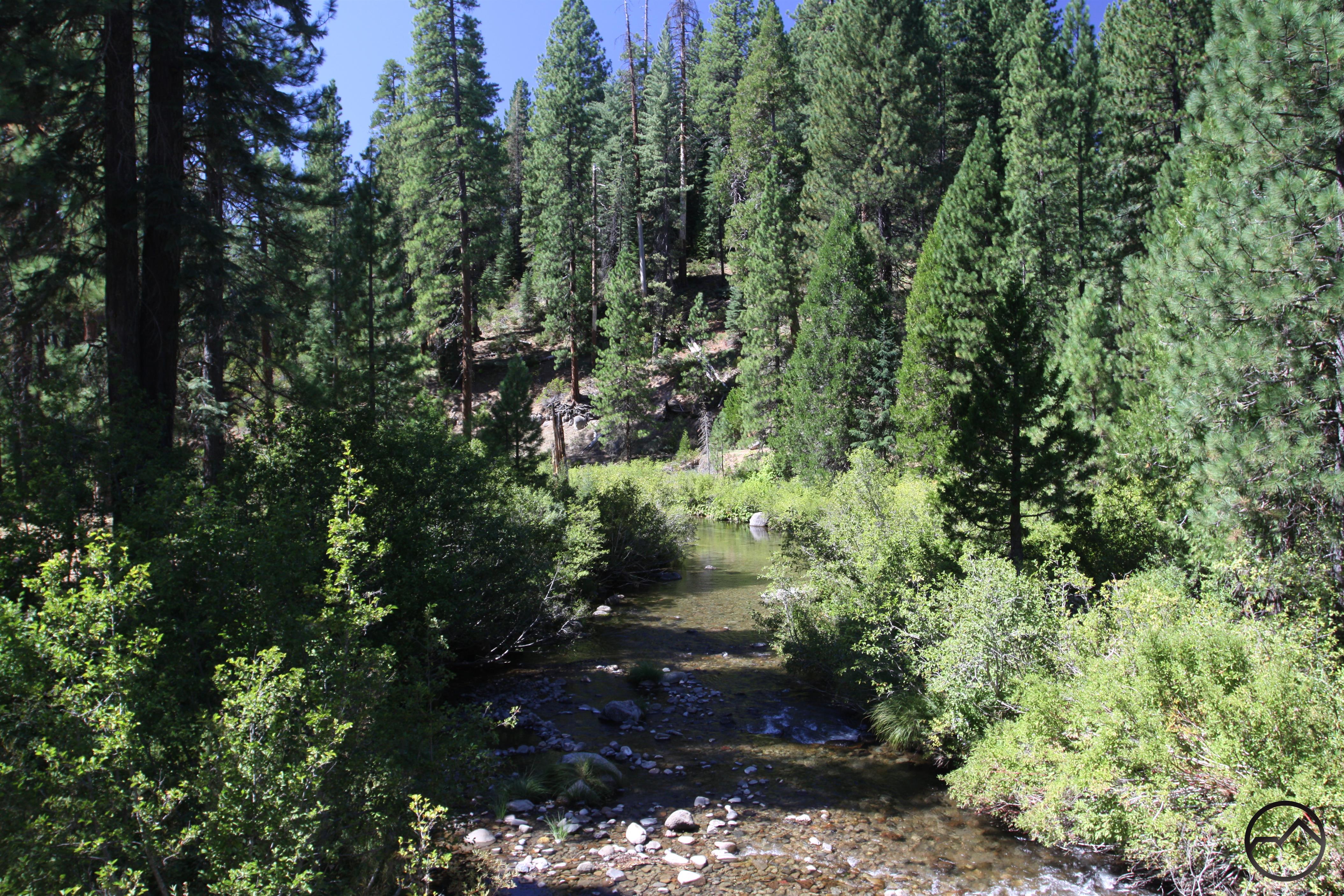
Through the canyon near Algoma.
The McCloud River Trail can at times be a bit of a mixed bag. There are times when the river passes through less interesting terrain and passage through these areas are not as exciting as sections along the falls or through large meadows. Furthermore, the trail engineers that designed the trail often route the path away from the river. The intent was to stay above the river’s high water mark. While in most cases this simply means being slung on steep slopes directly above the McCloud, some instances mean the trail swings well away from the water in order to pass low, flat flood plains. This means that the trail, as nice as it is, does not always offer consistent access to the river and the commensurate beauty and interest. Of all the sections of the McCloud River Trail other than the obvious portion along the waterfalls, one of the best is the segment that begins at the trail’s eastern terminus at the Algoma campground and continues west to the undeveloped Nitwit campground. This constitutes the first 2.75 miles of the McCloud River Trail and offers some of the most scenic and interesting terrain covered by the route. The trail initially passes through a shallow canyon where the river maintains a consistently swift moving course. Once emerging from the canyon the water’s speed is reduced for a while as it winds its way through a small flood plain before it once again regains its current and speeds on its way west. The trail remains close to the river for most of the journey.
The Trail
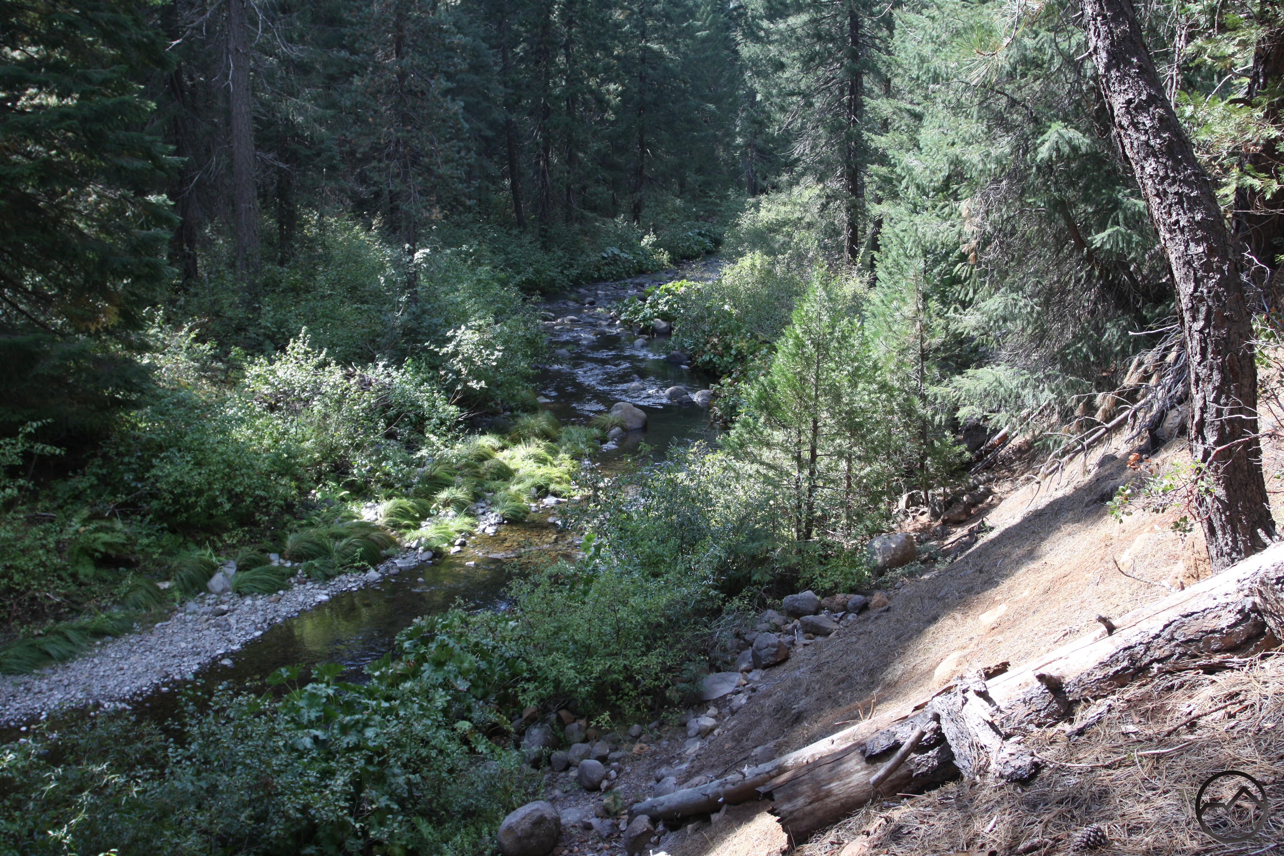
The McCloud River in the shallow canyon.
The McCloud River Trail begins across the river from the Algoma campground. From the parking area on the north side of the bridge, cross the road and find the trail, marked by brown plastic posts. Though the trail follows an old roadbed, it is now pretty well-established as a single-track path. The river races about 20 feet or so below the river. The campground is visible on the opposite side of the water, occupying a flat tucked into a broad river’s bend. As the trail arcs around broad bend, it traverses a steep slope that rises well above the river. A short distance later the McCloud finally enters a shallow canyon. Even though the forested walls of the canyon are only about 150 feet deep, it is enough to block out the surrounding area and hikers on the trail are instantly blessed with a sense of isolation. The river at the beginning of the trail is not nearly as large as it is 15 miles distant at its conclusion. Numerous springs and seeps and the contribution of several tributaries significantly increase the river’s volume. No matter how fire hikers intend to go, the trip through the canyon near Algoma is a great way to begin the journey.
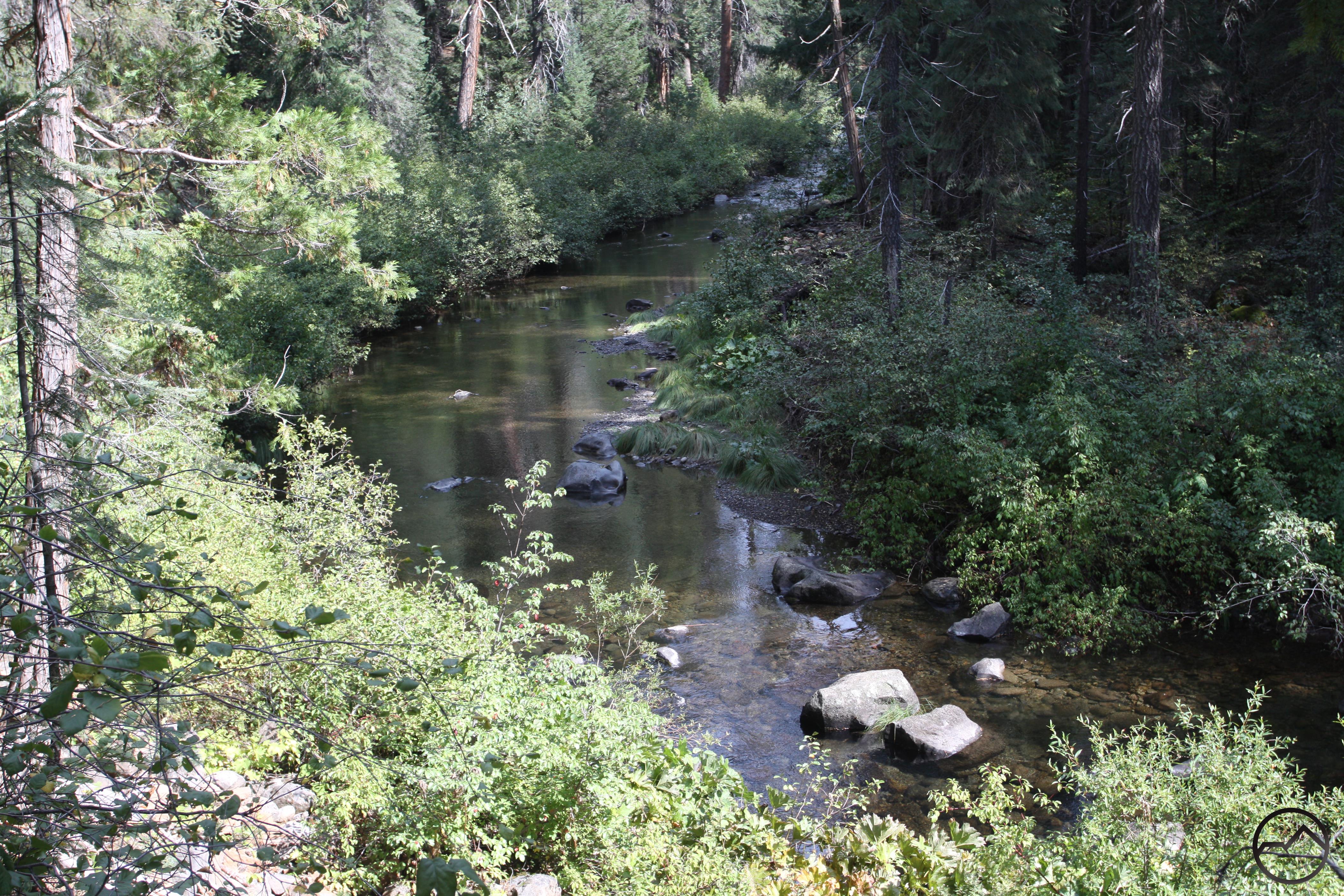
A placid McCloud River.
About 1.2 miles from the trailhead, the McCloud River emerges from its shallow canyon. The landscape opens up and the trail drops down to the river’s level. Initially it stays close to the river and passes through some grassy areas before riparian shrubbery becomes extremely thick and forces the trail away from the water. As the trail turns to the north it moves further away from the water. This small flood plain, the first of many along the McCloud River Trail, is called Four Mile Flat. After continuing north for 0.4 miles the trail crosses an old road before once again turning to the west. Just after crossing the road the trail reaches its nearest point to Highway 89. If large trucks are passing by, they can be heard briefly. Fortunately this is the only time along the entire trail that the highway can make itself known to hikers. The rest of the McCloud River Trail continues to move further away from the busy road. Once the trail has returned to its westward orientation it rejoins the river. While there is a nice riffle where the trail and river meet, the McCloud’s general demeanor in this area is placid.
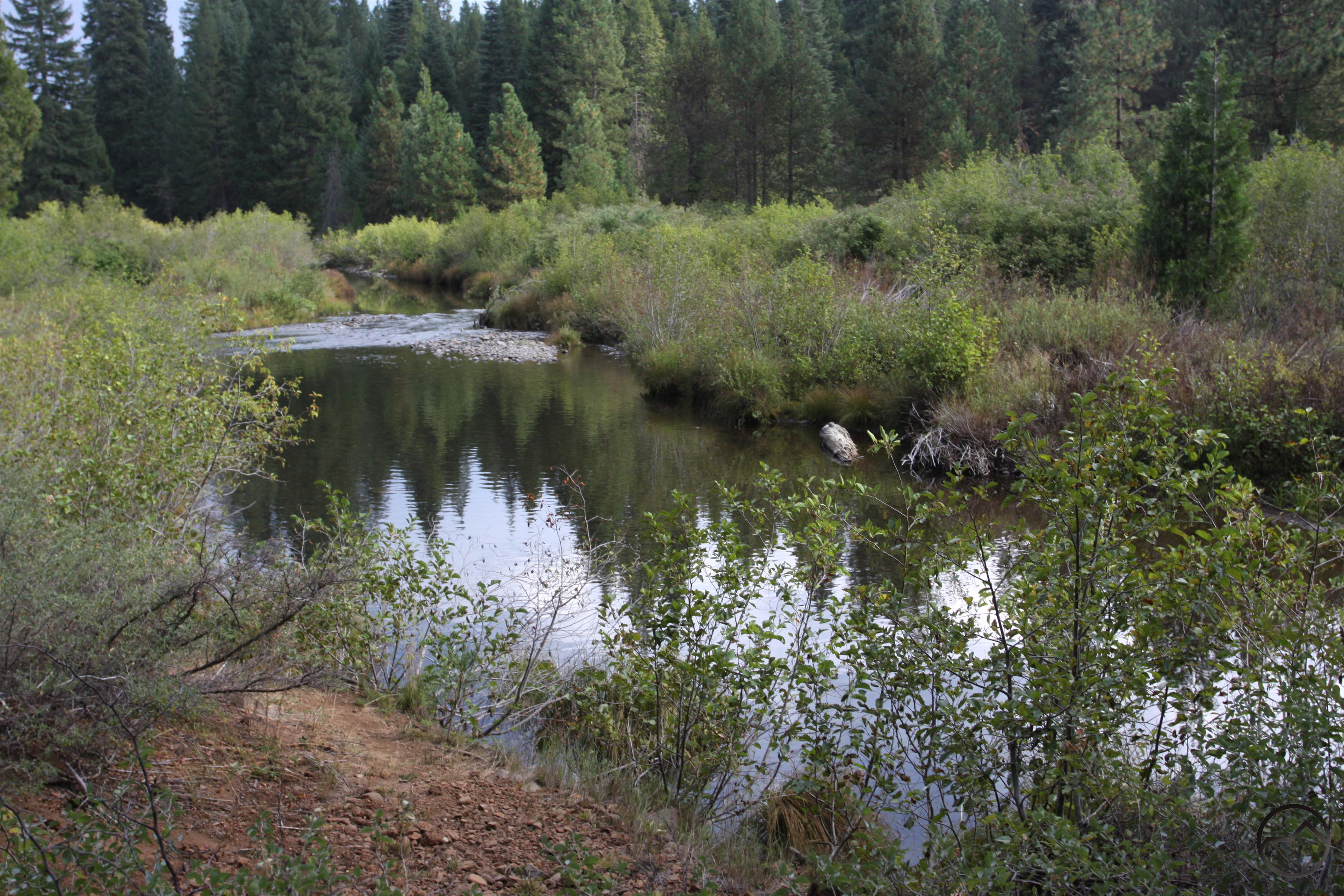
The river between Skunk Hollow and Nitwit.
A further 0.4 miles beyond the old road crossing the trail arrives at Skunk Hollow. This is an undeveloped campground with minimal maintenance from the Forest Service. There are some picnic tables and fire rings and plenty of flat areas to pitch tents. There are no designated campsites, trash or restroom facilities or fees. Though the campground is marked on the map, there is no signage on Highway 89. Still, for those who enjoy primitive camping, it is a fantastic spot. The McCloud is immediately adjacent to the camping area and there is great swimming and fishing access. Like the previous section of the river, there are placid areas but they are more frequently punctuated with small rapids, giving the river a swifter feel. There is also a nice meadow at the west end of Skunk Hollow. The primitive campground makes a good turning around point for those looking for a shorter hike. To add a little length, consider hiking further to the Nitwit campground, a similar primitive campground. To do so, find the trail at the far end of the meadow and follow it west for 0.5 miles. The trail is initially close to the river then departs it as the path makes a tighter turn where the river’s is broad. They rejoin soon in another large flat. This time the flat’s northern perimeter is marked by both the river and a small rise. This permits the trail to stay close to the water while other flat’s force the trail further away to avoid the flood plain.
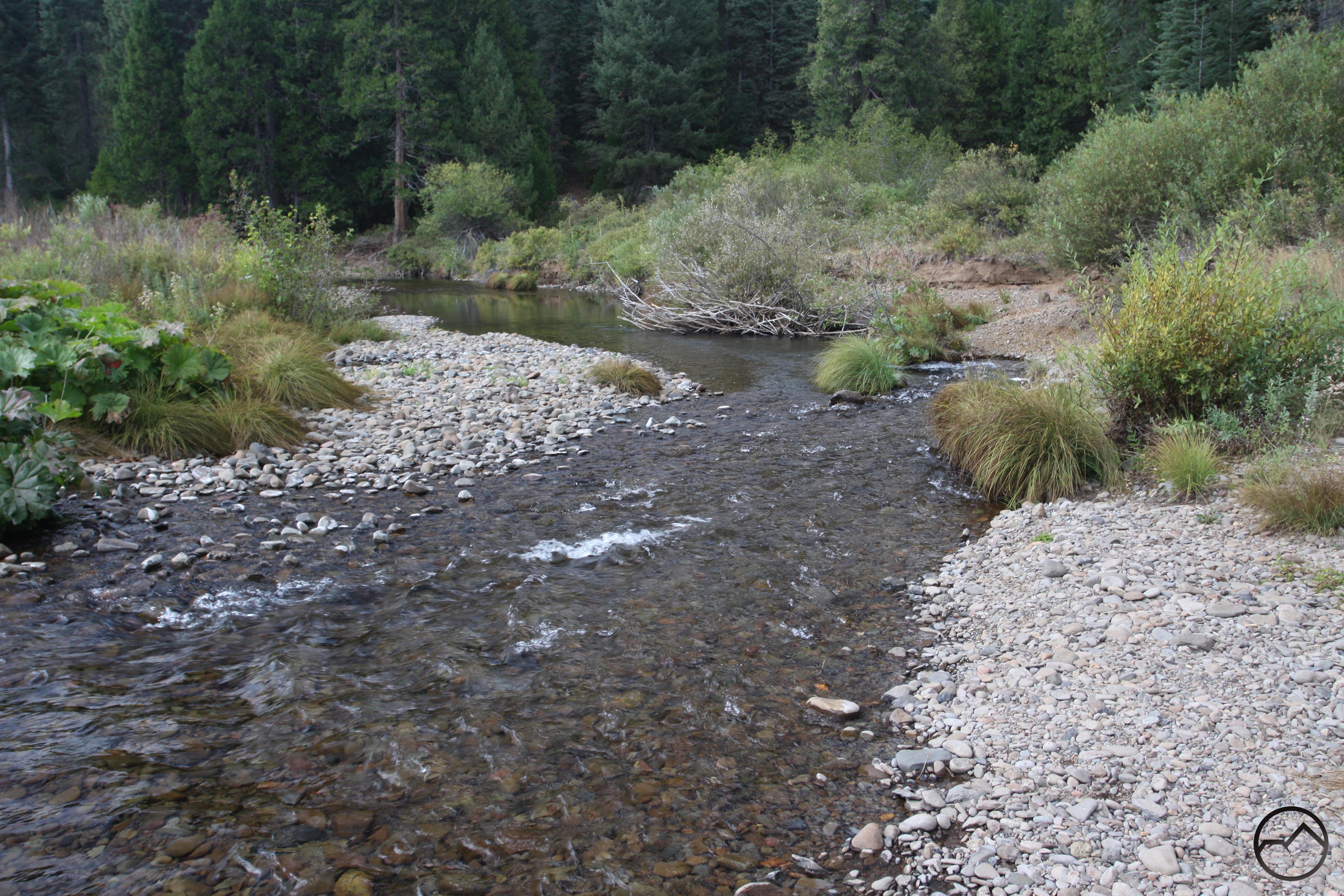
The McCloud alongside Nitwit camp.
The McCloud River finally arrives at the Nitwit campground. Here the river moves with greater speed than it has since the initial canyon by the Algoma campground. Like the Skunk Hollow campground, Nitwit is a primitive campground. There are some picnic tables and fire rings but little else in the way of infrastructure. Beyond Nitwit, the trail stays close to the river for a little while before make a broad arc through the forest, well away from river. It passes the Cattle Camp campground along the arc and proceeds to the Cattle Camp swimming hole. Though there are some fine sights along this stretch of trail and river, it is one of the least interesting portions of the McCloud River Trail. Consequently, Nitiwit makes a good place to turn around and head back to Algoma. It gives the trail a since of destination and makes a scenic conclusion to a scenic hike along the McCloud River. Though the section approaching Cattle Camp is one of the least interesting of the entire McCloud River Trail, the hike from Nitwit to the Cattle Camp swimming hole is a fine hike in its own right, particularly after it leaves Nitwit and again, near the end, in the swimming hole area.
Read about the next section of the McCloud River Trail from Nitwit Camp to Cattle Camp swimming hole here.
Directions
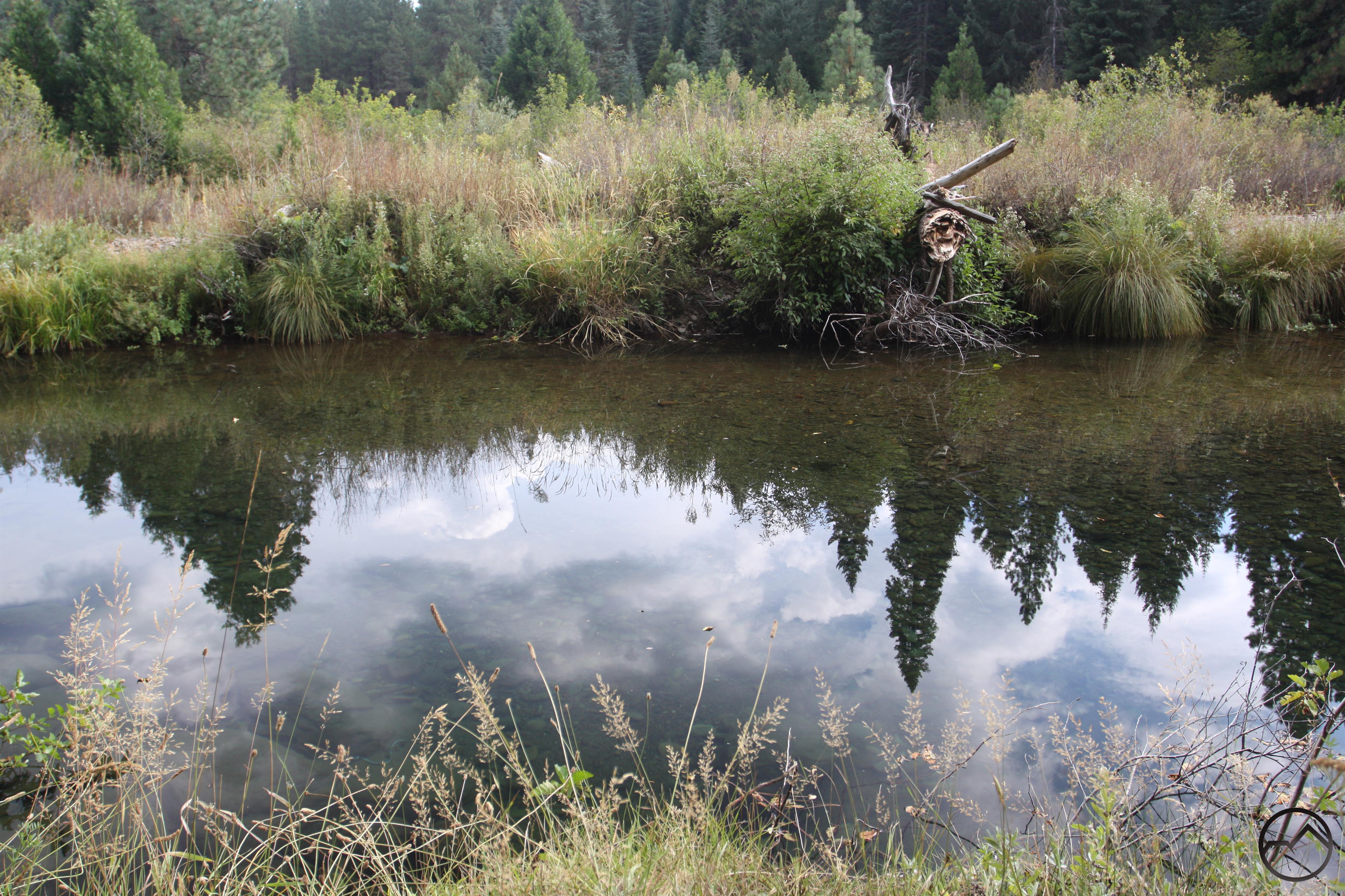
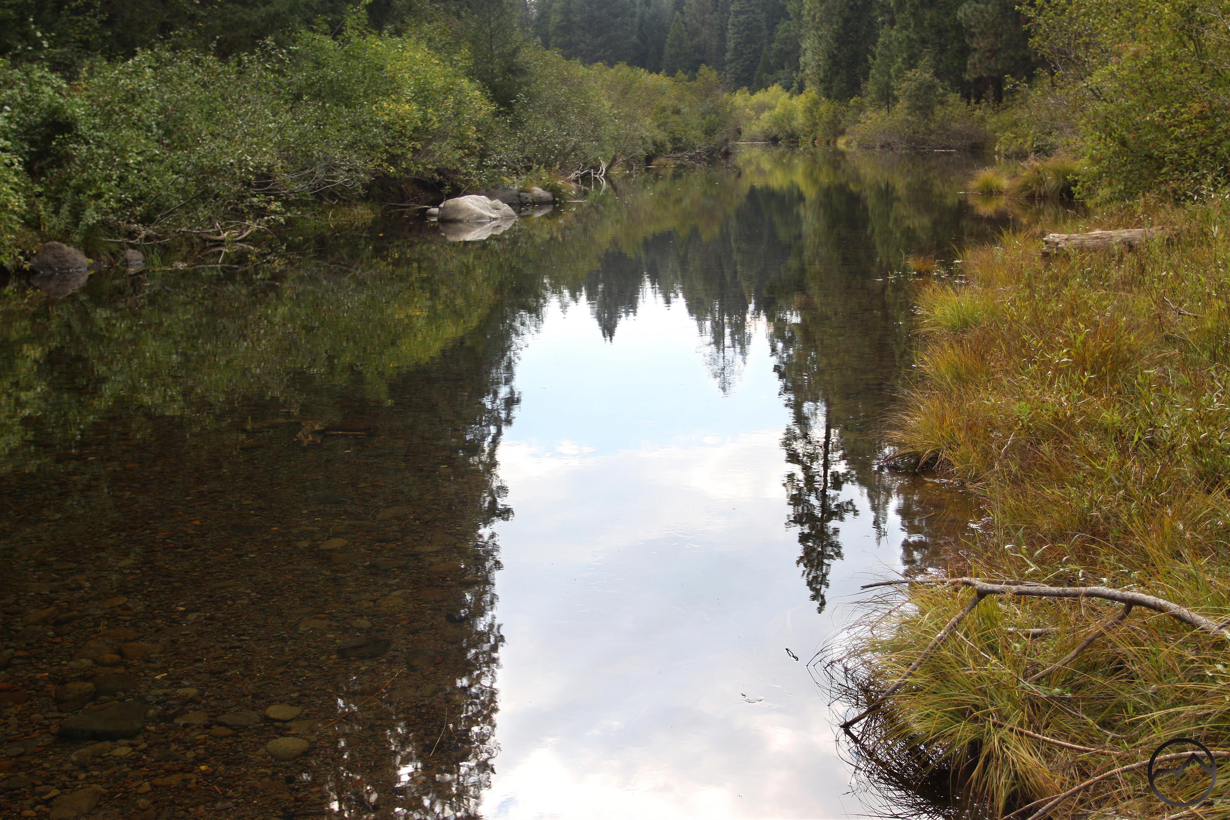
A peaceful reflection on the McCloud River.
From the main intersection in the town of McCloud, drive east on Highway 89 for 13.4 miles. Turn right on paved Forest Road 39N06. Continue for 0.8 miles to a bridge over the McCloud River. Park off the road, just before the bridge, on the north side of the river. Cross the road to find the beginning of the McCloud River Trail.

Pingback: The McCloud River Trail | Hike Mt. Shasta
Pingback: Three More (Shorter) Trails For Memorial Weekend | Hike Mt. Shasta
Pingback: Three More (Easier) Trails For Memorial Weekend | Hike Mt. Shasta
Pingback: Spring Hikes On The Upper McCloud River | Hike Mt. Shasta
Pingback: Off Season Trails: Spring Hikes On The Upper McCloud River | Hike Mt. Shasta