
At A Glance
The short hike along the shore of Castle Lake is a great introduction to the Trinity Divide. Full of awesome views of the massive cliffs above the lake, the trail is easy and level.
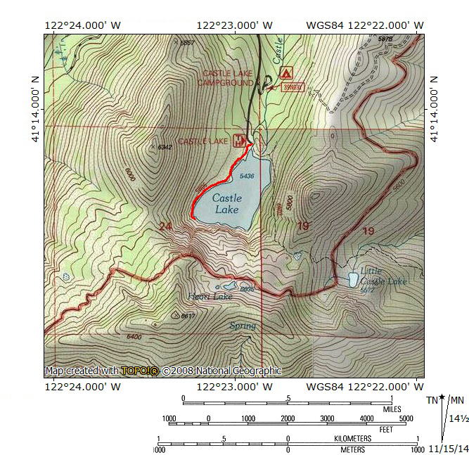
Total Length: 1 mile
Elevation Gain: none
Season: all year
The Great Lake

Castle Lake
Castle Lake is one of the most spectacular landmarks around Mount Shasta. The largest lake in the Trinity Divide, it is the third largest in the entire Klamath Mountains range. It occupies a deep basin surrounded by towering walls on the three sides. The southern wall is particularly memorable, rising 1,200 feet out of the water to the summit of Castle Lake. The beautiful alpine lake has always attracted visitors and today this still holds true. The presence of a paved road leading up from Lake Siskiyou enables everyone to visit the lake. The trail along the lake’s shore is a fantastic opportunity to enjoy the lake and observe many of its beautiful features from different angles. The road to the lake is plow in the winter so it is possible to come here even when there is a lot of snow and hike the trail on snowshoes. Whether you come up for mountain serenity or to enjoy the lake with your family, lake shore trail is a great option and offers beautiful scenery and quick easy access to the lake for minimal effort.
The Trail
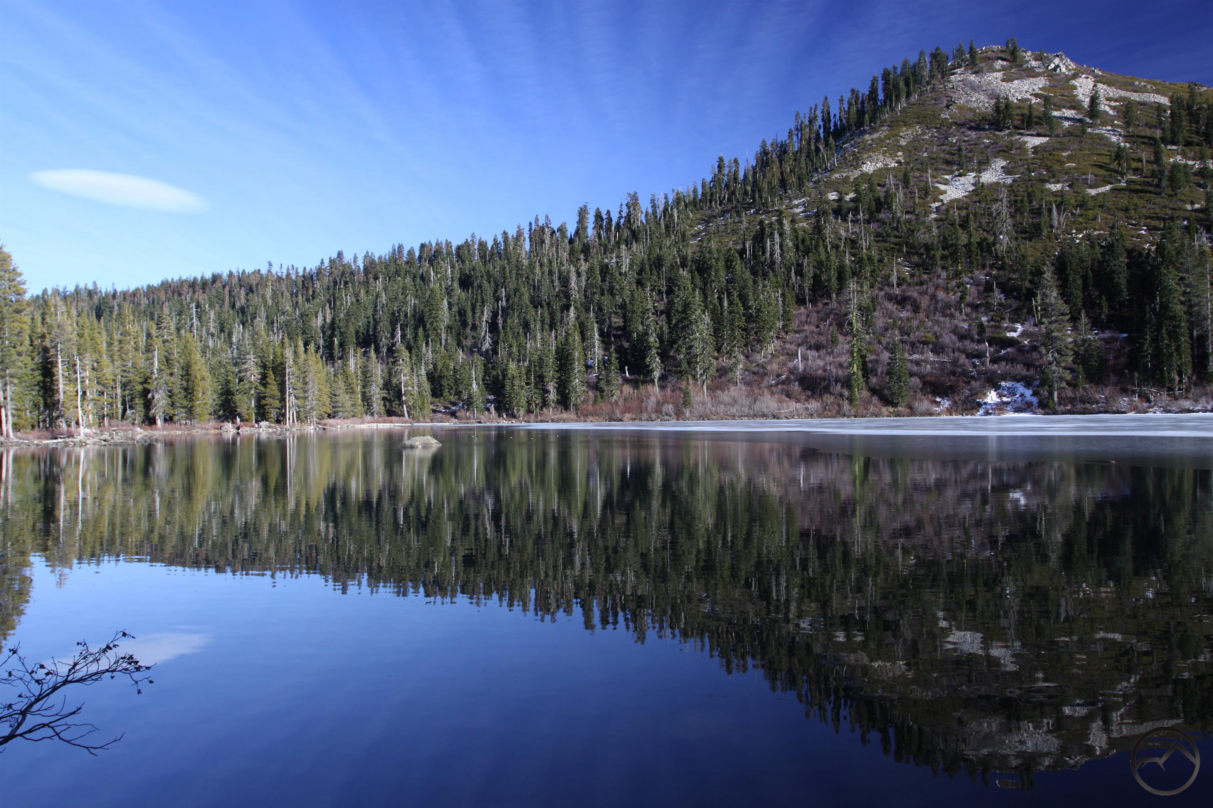
Castle Lake from the beginning of the hike
The Castle Lake Shore Trail begins at the north end of the large trailhead parking lot. Just past the trailhead sign there is a ranger’s cabin. It is seldom occupied. The path begins by passing through brush and rocks as it rounds a little finger of the lake. A small, grassy clearing lies just off the trail. When the water level is very high this area is flooded and part of the lake. As the water recedes, it forms a little pond and eventually the grassy clearing. Past the little clearing the trail finally comes alongside the lake and runs parallel to the shore. Beautiful lodgepole pines line the trail. Away from the lake, there are some nice large boulders that present great scrambling opportunities for kids. Soon the trail emerges from the trees and crosses a brushy area. Beyond this lies the U.C. Davis Limnoligical Station. A small pier lies below the station where boats can be docked. The research station was established to study the lake’s exceptional purity. It must be miserable assignment.
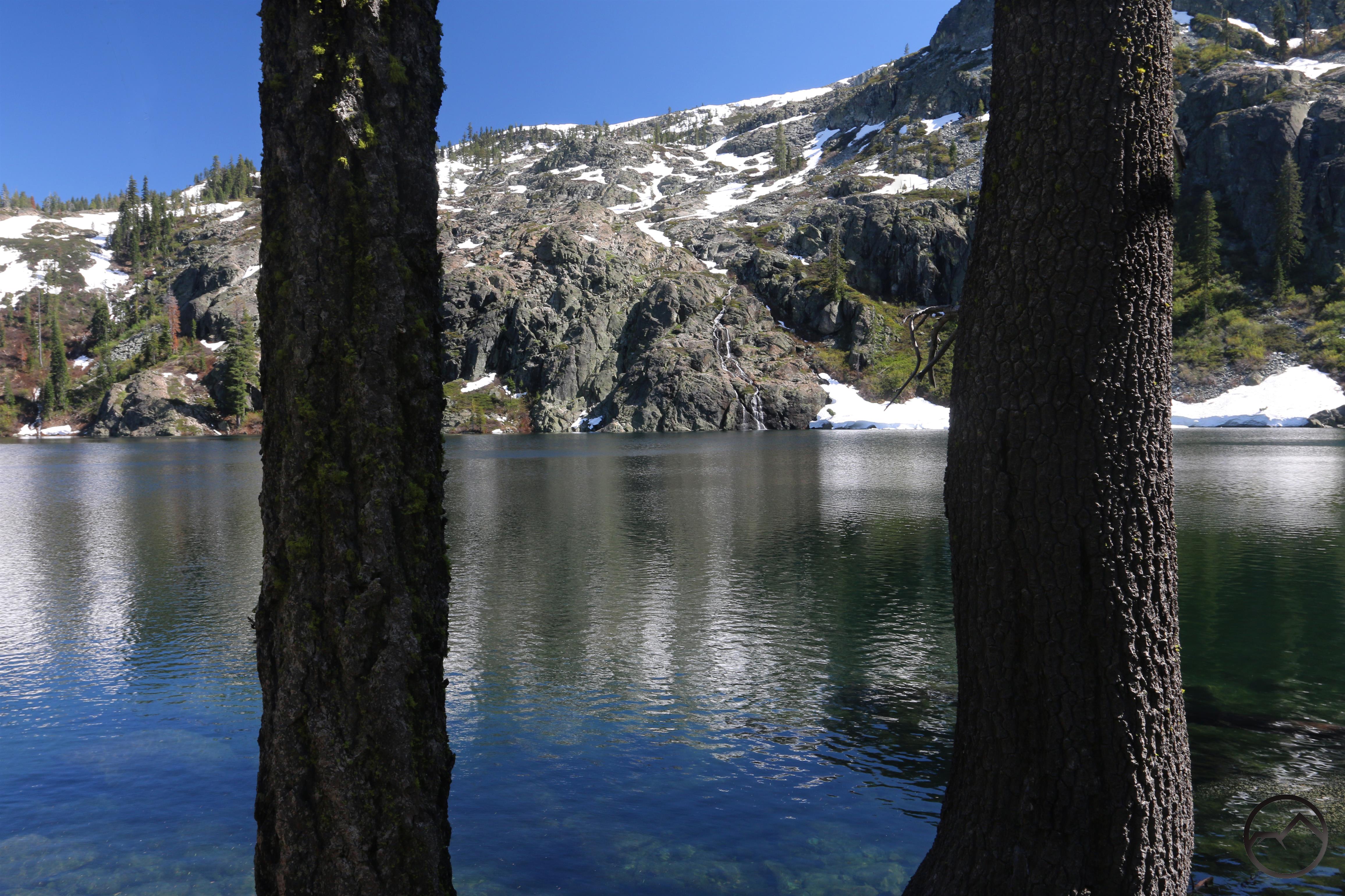
Spring on the Castle Lake Shore Train.
Continuing past the research station, the nature of the trail changes considerably. The first half of the hike was a pleasant path through the woods at the edge of the lake. This part of the hike is slung on the edge of the steep wall that forms the western side of Castle Lake’s large basin. The lake is about 10 feet below the trail. Despite brush encroaching on the path, it is still easily passable. The only obstacles are the sections of trail that have partially washed out. They are not difficult but caution should still be employed. Near the end of the trail there is a nice little beach. Scramble down the rocks to the pebbly beach and enjoy a fantastic spot to sit and enjoy the soaring cliffs that rise directly overhead. In the spring, giant cascades thunder down the cliffs and crash loudly into the lake. This makes a logical destination to end the hike. The trail continues a little further but ends on a rock outcropping near the base of the cliffs at the lake’s south end. Below the outcropping, a large garden of carnivorous Darlingtonia plants clings to the rocks. Insects land in their large pitchers, are stuck to a sticky resin and are then absorbed into the plant. Past the outcropping, a narrow, precarious track weaves through the brush, leading to a talus slope that collapsed into the water. A very steep, rough route climbs from there up the cliffs to Heart Lake. Only experienced climbers should attempt this route.
Directions
From the town of Mt. Shasta, head west on W. Lake, crossing over I-5. At the stop sign, turn left onto Old Stage Road. After 0.25 miles, veer right onto WA Barr Road. Continue south, crossing over the dam that impounds the Sacramento River and forms Lake Siskiyou. Just past the dam, make a left hand turn onto Castle Lake Road which climbs for 7 miles to the roads end at Castle Lake.

Pingback: Fall Color Is Very Erratic This Year | Hike Mt. Shasta