Hike Mt. Shasta

Exploring the Mount Shasta Region

  • Home
  • Trails
    • Mount Shasta Trails
      • Brewer Creek Trail
      • Clear Creek Trail
      • Gray Butte Trail
      • Green Butte Ridge Trail
      • Horse Camp Trail
      • North Gate Trail
      • Old Ski Bowl Trail
      • Panther Meadow Trail
      • South Gate/Squaw Meadow Trail
      • Whitney Falls Trail
    • Trinity Divide Trails
      • Blue Divide Trail
      • Castle Lake Trail
      • Castle Lake Shore Trail
      • Cliff Lake Trail
      • Deadfall Lakes Trail
      • Gray Rock Lakes Trail
      • Gumboot Trail
      • Heart Lake Trail
      • Porcupine & Toad Lakes Via Pacific Crest Trail
      • Seven Lakes Basin Via Pacific Crest Trail
      • Sisson-Callahan Trail
      • Soapstone Trail
      • South Mumbo Scramble
      • Tamarack Lake Trail
      • Toad Lake Trail
    • Castle Crags Trails
      • Burstarse Falls Via Pacific Crest Trail
      • Castle Dome Trail
      • Flume Trail
      • Lower Castle Crags Via Pacific Crest Trail
      • Root Creek Trail
    • Scott Mountains Trails
      • Bluff Lake & Cement Bluff via Pacific Crest Trail
      • Caldwell Lakes Trail
      • China Mountain Scramble
      • Cory Peak and Bull Lake via Pacific Crest Trail
    • Cascade Crest
      • Ash Creek Butte Scramble
      • Goosenest Trail
      • Juanita Lake Trail
      • Orr Lake Trail
    • Mount Shasta City Area Trails
      • Black Butte Trail
      • Box Canyon Trail
      • Gateway Trail
      • Lake Siskiyou Trail
      • Mount Shasta City Short Trails
      • Ney Springs Canyon Trail
      • Spring Hill Trail
    • Shasta Valley Trails
      • Black Lava Trail
      • Haystack Trail
      • Lake Shastina Trail
      • Pluto Cave Trail
      • Trout Lake Trail
      • Yellow Butte Trail
    • Sacramento River Trails
      • Dunsmuir Trail
      • Hedge Creek Falls Trail
      • Sacramento River Trail
      • Sims History Trail
    • McCloud River Trails
      • Ash Camp To Ah-Di-Na Via Pacific Crest Trail
      • McCloud River Falls Trail
      • McCloud River Preserve Trail
      • Squaw Valley Creek Trail
      • McCloud River Trail: Algoma Camp to Nitwit Camp
      • McCloud River Trail: Nitwit Camp to Cattle Camp Swimming Hole
      • McCloud River Trail: Cattle Camp Swimming Hole to Camp 4
      • McCloud River Trail: Camp 4 to Upper McCloud Falls
      • McCloud River Trail: Pine Tree Hollow Loop
    • Trails Further Afield
      • Trinity Alps Trails
        • Bear Lakes Trail
        • Billys Peak Trail
        • Boulder Creek Lakes Trail
        • Boulder Lake Trail
        • Canyon Creek Trail
        • Caribou Lakes Trail
        • East Boulder Lake Loop
        • East Weaver Lake Trail
        • Four Lakes Loop
        • Granite Peak Trail
        • Grizzly Creek Trail
        • Gulch Lakes Loop
        • Hidden Lake Trail
        • South Fork Lakes Trail
        • Stoddard Lake Trail
        • Stoney Ridge Trail
        • Tangle Blue Lake Trail
      • Warner Mountains
        • Emerson Creek Trail
        • Highgrade Trail
        • Patterson Lake Via Warner Summit Trail
        • Pine Creek Trail
        • Squaw Peak Trail
  • Articles
    • Trails By Area
      • Mount Shasta
        • Vistas, Meadows And Waterfalls: Three Best Hikes On Mount Shasta
        • The End Of The Road: Three Hikes In The Old Ski Bowl Area
        • Two Trails From Bunny Flat
        • Three Trails On Mount Shasta’s East Side
        • Mount Shasta’s Hummingbirds
      • Trinity Divide
        • Great Lakes: Top Five Lake Basins In The Trinity Divide
        • The Headwaters Of The South Fork Of The Sacramento River
        • Neglected Headwaters: Two Lesser Lake Basins On The South Fork
        • Gumboot Saddle: Two Hikes On The PCT
        • Descent Into Mystery: The Sisson-Callahan Trail
        • Mumbo Basin – Overlooked On The West Side
        • The Headwaters Loop: A Proposed Backpacking Loop In The Trinity Divide
      • The McCloud River
        • The McCloud River Trail
      • Shasta Valley
        • Jewels In The Desert
      • Scott Mountains
        • Great Scott! Two Scott Mountains Hikes On The PCT
      • Trinity Alps
        • Carubou Lakes: Trinity Alps On A Grand Scale
        • Switchbacks To Heaven: The Trinity Alps’ Stoney Ridge Trail and Four Lakes Loop
        • Trinities In Proximity: Two Trinity Alps Trails With Easy Access From Mount Shasta
        • Trails in the Carter Meadows Area
        • Trinity Alps Views of Mount Shasta
        • The Psychological Value Of The Trinity Alps
    • Waterfalls
      • Three Waterfalls On Mount Shasta
      • McCloud River Waterfalls
      • Sacramento River Waterfalls
      • Trinity Divide Waterfalls
      • Trinity Alps Waterfalls
      • Avoiding A Dry Whitney Falls
    • Off Season Trails
      • Three Winter Hikes Near Mount Shasta City
      • Winter Hikes In Shasta Valley
      • Winter Hiking In The Shasta Valley Wildlife Refuge
      • Winter Hikes On The Sacramento River
      • Winter Hikes On The Lake Siskiyou Trail
      • Spring Hikes In The Castle Crags
      • Spring Hikes On the Upper McCloud
      • Spring Hikes On The Lower McCloud River
    • Points Of Interest
      • Mount Eddy: Overshadowed, Underrated
      • Black Butte: Hiding In Plain Sight
      • Castle Dome: Steadfast And Staggering
      • Mount Shasta Hoodoos
      • Sacramento Scrambling
      • The Shasta River
      • The Castle Creek Watershed
      • Mount Shasta East Side Glacier View
      • 5 Fantastic Mount Shasta Vistas
      • 5 Highest Peaks Around Mount Shasta
      • 5 Best Hikes On Creeks And Rivers
      • 5 Interesting Footbridges
      • Three Spectacular Drive-To Sunset Vistas
    • North State Geography
      • Introduction
      • Seven Major Regions
      • The California Cascades
      • Klamath Mountains Pt. I
      • Klamath Mountains Pt. II
      • The Great Canyons Of Mount Shasta
      • Mount Shasta, Timberline, And The Relative Size Of Cascade Volcanos
      • Four Eruption Cones Of Mount Shasta
      • Mount Shasta’s Medial Moraine
    • Northern California Review
      • North Table Mountain
      • Lakes Basin Recreation Area
      • Eastern Sierra Fall Color
      • Sonoma County
      • Central Sierra Nevada
      • Orland Buttes
    • Seldom Seen
      • Ash Creek Falls
      • Mud Creek Canyon
      • Lower Mud Creek Canyon
      • Diller Canyon
      • Lower Cascade Gulch
      • The Grey Rocks
      • Castle Creek
      • Upper Wagon Creek
      • Fawn Creek Canyon
      • Confluence of the Sacramento River and Castle Creek
      • Upper Klamath River Canyon
      • Hole In The Ground Geologic Area
      • Ash Creek Butte Fossil Rock Glacier
    • Mount Shasta History
      • Vantage Lost: The Everitt Memorial Vista
      • A Yosemite-Mount Shasta Connection
      • Whitney – What’s In A Name?
      • Mount Shasta Area and the 1838 Exploring Expedition
      • A 19th Century Engraving Of An Epic Mount Shasta Vista
      • Vintage 1907 Color Photos
      • A Misleading Painting
      • A Mysterious Painting
      • A Mysterious Painting Pt. II
      • Stereographic Mt. Shasta
      • Year One Of Hike Mt Shasta
      • Year Two Of Hike Mt Shasta
      • Year Three Of Hike Mt Shasta
      • Year Four Of Hike Mt Shasta
      • Year Five Of Hike Mt Shasta
      • Year Six Of Hike Mt Shasta
      • Year Seven Of Hike Mt Shasta
    • Image Galleries
      • Mount Shasta Trails Gallery
      • Mount Shasta Sunrise Gallery
      • Mount Shasta Sunset Gallery
      • Lenticular Cloud Gallery
      • Mount Shasta NON-Lenticular Clouds
      • Mount Shasta Reflection Gallery
      • Telephoto Gallery
      • Mount Shasta Area Fall Color
      • Castle Crags Gallery
      • Waterfalls Gallery
      • Trinity Divide Lakes Gallery
      • Mount Shasta Area Rivers Gallery
      • Shasta High Desert Gallery
      • Mount Shasta GIF Gallery
    • Random Notes
      • Revew: Three Mount Shasta Trail Maps
      • A Mount Eddy Wilderness?
      • New Land Additions For The Castle Crags
      • Book Plug: Mount Shasta Area Rock Climbing
      • Exile: How I Came To Love Wilderness
  • Mt. Shasta Trail Map
  • Blog
  • About/Contact
  • Links
  • Truchas Ridge

Off Season Trails: Spring Hikes In The Castle Crags

Posted by bubbasuess on May 4, 2013
Posted in: Castle Crags, Hiking, Mount Shasta, Off Season Trails, Spring Trails, Waterfalls. 12 Comments
Trinity Divide, Castle Crags - April2013 091_edited-1 (Custom)

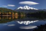
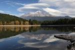
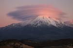
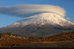
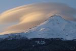
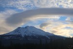
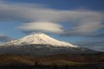
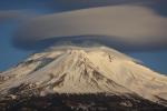
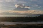
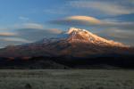
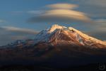
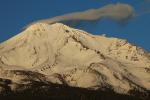
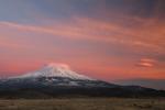
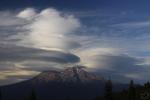
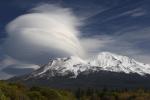
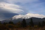
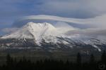
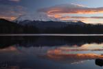
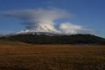
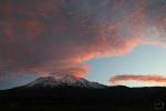
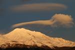
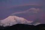
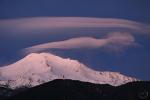
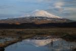
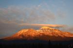
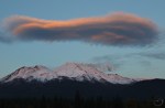
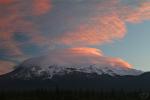
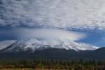
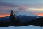
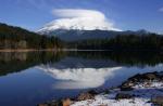
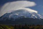
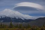
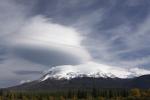
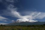
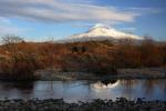
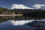
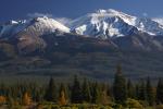
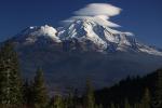
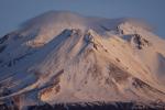
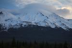
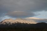
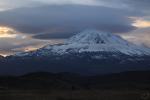
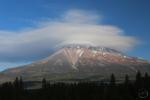
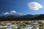
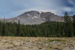
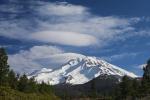
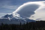
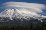
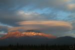
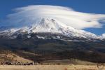
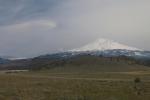
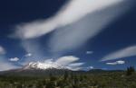
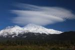
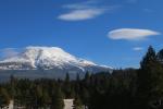
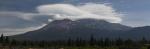
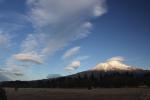
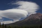
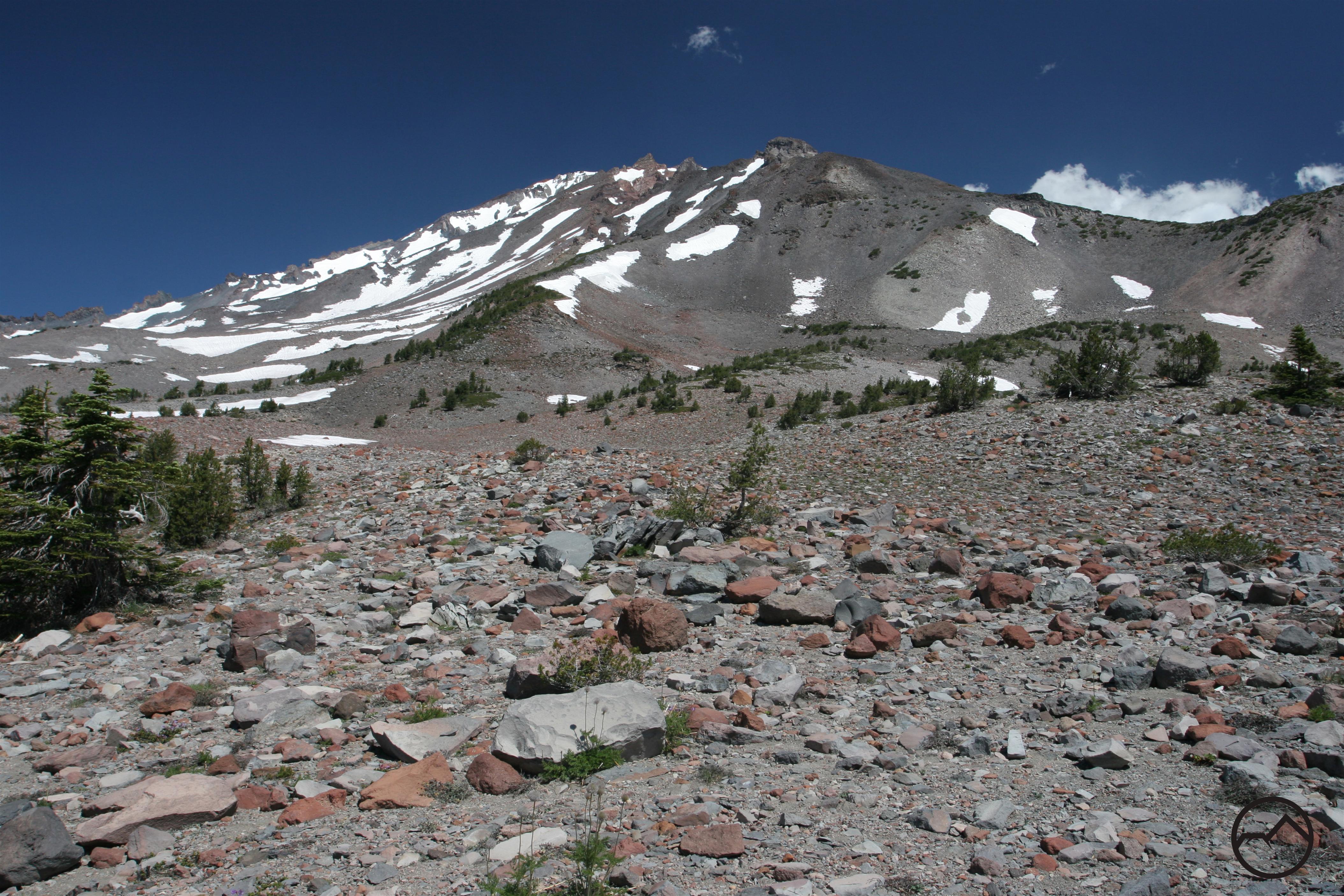
Mount Shasta from the Observation Deck on the Castle Dome Trail.

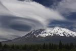
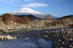
Winter snows deprive hikers of the alpine scenery they crave and force them to find more creative alternatives in order to hit the trail. Spring, on the other hand, is the perfect time to hike the trails in the Castle Crags, one of Northern California’s most stunning features. The Castle Crags are most often viewed while driving north on Interstate 5. Since leaving Redding, the freeway passes through seemingly unending forestland as it winds first around Shasta Lake and then up the canyon of the Upper Sacramento River. Eventually I-5 rounds a bend and suddenly the Crags present themselves. The soaring granite spires, too numerous to count, huddle together to form a massive rampart towering thousands of feet above the highway. Then, nearly as suddenly the freeway rounds another bend and the Castle Crags disappear, to appear only in tantalizingly brief moments before reaching Dunsmuir. With the sole exception of majestic Mount Shasta, the Castle Crags are the most recognizable landmark in California north of Redding. Their rugged towers seem to be alone amidst a sea of densely forested ridges and they beckon hikers and adventurers to explore them.

Trinity Divide, Castle Crags - April2013 070_edited-2 copya (Custom)

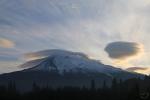
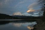
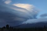
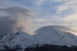
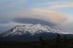
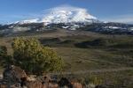
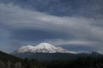
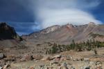
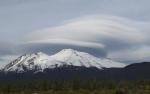
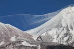
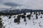
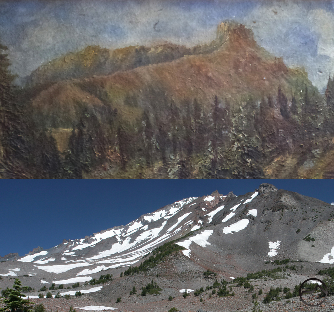
Granite towers of the Castle Crags.

Spring is the best time to hike the Castle Crags because, despite their alpine appearance, they are very low elevation mountains. The highest point in the crags barely exceeds 6,000 feet and this highest point accessible by a maintained trail is only 4,700. Consequently, while the high country is still snowbound in spring, the trails in the Castle Crags are usually clear, the creeks are running strong and the leaves are beginning to come out. Most importantly, the temperatures are typically pleasant. The lower elevation means that in the summer the temperatures can be hot and are often too much so for comfortable hiking. Of course, if should be noted that autumn also has great weather for hiking in the Castle Crags but by then the creeks have usually dried up.

The Castle Crags are administered by two separate agencies. Most of the territory is controlled by the Shasta-Trinity National Forest which has designated the area as the Castle Crags Wilderness. This means that the area is set aside as a wild preserve and only primitive recreation (hiking, horseback riding, rock climbing) is permitted within its boundaries. A smaller section of the Crags is run by Castle Crags State Park. Unfortunately, the park contains almost none of the granite spires that draw people to the Crags. Instead, the park functions as a gatekeeper, extracting an entrance fee in order for people to hike through state land to access the national forest.

756084 copy (Custom)

Racing waters of Burstarse Creek.

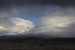
There are several trails in the Castle Crags that offer great springtime destinations. The most well-known is the Castle Dome Trail. If the desire is to climb (steeply!) into the high granite reaches of the Crags, this is the trail to hike. Although the views are not great for the first two thirds of the hike, the latter third is exceptionally scenic, offering great views of the Grey Rocks, Castle Dome, the Castle Crags and Mount Shasta. It also provides an opportunity to do some exploring in the granite spire-filled hinterland. Although the Castle Dome Trail is the most popular hike in the Castle Crags it is not the most well known. The Pacific Crest Trail completely traverses the southern side of the Crags, totaling 12.5 miles. Most of this trail is of interest to hikers, especially in the spring. A great 2.5 mile stretch of the trail heading east leads to a cross country route accessing Burstarse Falls. The easternmost 6.75 miles is also a great spring hike and boasts great views of the Crags and the jagged Grey Rocks as well as several attractive creeks that have excellent flow in the spring. The Root Creek Trail, on the east side of the Castle Crags leads to Root Creek. There is a cross country route up the creek to a vista below awesome Root Creek Falls.
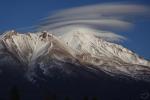
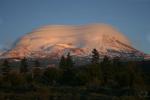
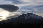
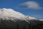
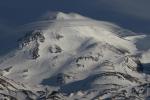
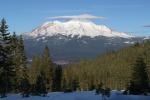
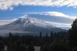
Castle Dome Trail:

Trinity Divide, Castle Crags - April2013 066_edited-1 (Custom)

Castle Dome

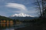
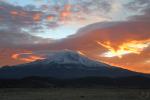
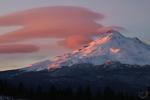
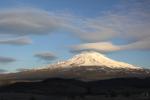
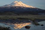
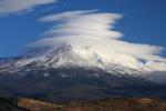
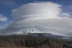
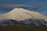
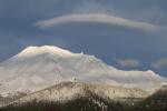
Easily the most popular trail in the Castle Crags, the Castle Dome Trail is the only trail that delivers an intimate exposure to the spectacular scenery Crags have to offer. Climbing through the forested ridges below the granite spires, the trail is at first a monotonous slog with little in the way of scenery. Eventually the effort pays off as the path breaks out of the woods and offers amazing views of the surrounding area, most notably the Castle Creek drainage, the Grey Rocks and the granite walls of Six-Toe Rock. A side trip to Indian Spring is a well-watered and relaxing oasis. From this point on, the trail is a scenic and exciting ascent through rocky pinnacles and along narrow cliffs. Along the way there are more views, this time of Castle Dome and awesome Mount Shasta. When the route finally reaches the saddle slung between the main body of the Castle Crags and Castle Dome, there are a few different options. Besides attempting to reach the summit of Castle Dome, hikers can climb atop the Observation Deck, which offers amazing views of Mount Shasta, peer down into the depths of Root Creek Canyon or scramble to the base of sheer Mount Hubris. Whatever the decision, this is as close as most people get to the towering granite splendor of the Castle Crags. Spring is the ideal time to do this hike. Though the forest cover provides ample shade this trail is low enough that is can get very hot during the summer. The lack of shade on the saddle is also notable. During spring, the temperatures are comfortable and the weather is generally pleasant.

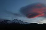
Pacific Crest Trail to Burstarse Falls:

Trinity Divide, Castle Crags - April2011 030 copy (Custom)

Burstarse Falls

Although the PCT traverses over 12 miles of the lower flanks of the Castle Crags, little of it offers taps the scenic potential the Crags offer. Much of it is through the thick forest that cloaks the feet of the mighty towers. There are occasional glimpses of the spires but hiking most of it with the expectation of experiencing the majesty of these mountains. Only the highest portion of the trail’s passage through the Castle Crags reveals the kind of views one might anticipate. Still, there is one section of the PCT, accessed by the short Dog Trail, that is a worthy day hiking, culminating with a scramble through the beautiful canyon of Burstarse Creek. Here the granite finally makes an appearance. The creek swiftly descends a series of rocky sluices and over several beautiful cataracts. At the head of the canyon is Burstarse Falls, one of the finer waterfalls in the Mount Shasta area. Spring is ideal for this hike since the water in Burstarse Creek will be at full flow. Later in the year the volume subsides significantly. This trail is also free of snow fairly early.

Pacific Crest Trail along lower Castle Crags:

Trinity Divide, Castle Crags - March2014 004 (Custom)

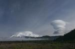
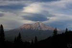
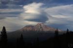
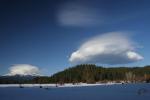
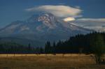
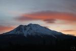
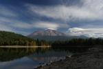
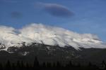
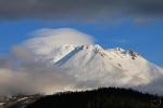
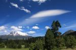
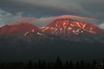
Battle Mountain towers above the PCT.

The eastern section of the Pacific Crest Trail’s traverse of the Castle Crags makes a great shuttle hike. Also accessed via the Dog Trail, the long traverse passes through lower mountain forests that are a mix of pine, fir and oak. Thankfully it is not just a trip through the forest since frequent open areas provide amazing views of the Castle Crags, specifically the Battle Mountain towers. There are also tremendous views of the Castle Creek valley crowned by the rugged peaks known as the Grey Rocks. Crossings of two forks of Indian Creek, Dump Creek and multiple forks of Indian Creek also make for refreshing and scenic hiking. Though this section of the PCT is not known for waterfalls, most of the creeks have very pleasant cataracts on them. A full traverse of this section of the trail normally ends at the Soda Creek trailhead at I-5. However, junctions with the Flume Trail, Bob’s Hat Trail, Castle Dome Trail, Root Creek Trail and Kettlebelly Ridge Trail all lead back to trailheads in Castle Crags State Park, which give campers at that park multiple options to modify the journey. For hikers not able to shuttle, the hike to Indian Creek is still a great option for an out and back via the Dog Trail.

Root Creek Trail:

Trinity Divide, Castle Crags - April2011 050 copy (Custom)

Root Creek Falls

This trail is something of a mixed bag. While not steep, the trail is extremely monotonous for all but the very end of the hike. It is essential a romp through seemingly unending forest. This may in fact be just the ticket for those who have been housebound for much of the winter. Just stretching the legs in the woods can be a great warm-up for better things to come as the season progresses. This may especially be the case because this trail has the easiest access and the lowest elevation of all the paths in the Castle Crags. The trailhead is right at the exit off of I-5, so there is no need to wait for roads to be cleared to reach this hike. What is the payoff for the not-so-exciting trail? Root Creek Falls is the reward for making the trek to the end of the trail. When the path ends at Root Creek, there is a short cross country scramble to a view of the awesome waterfall. The multi-tiered cascade is best viewed in spring when the water levels are high. Towering overhead is the smooth granite tower of Castle Dome. The scene is incredible and the perfect cure to the winter doldrums.

Flume Trail:

Flume 1

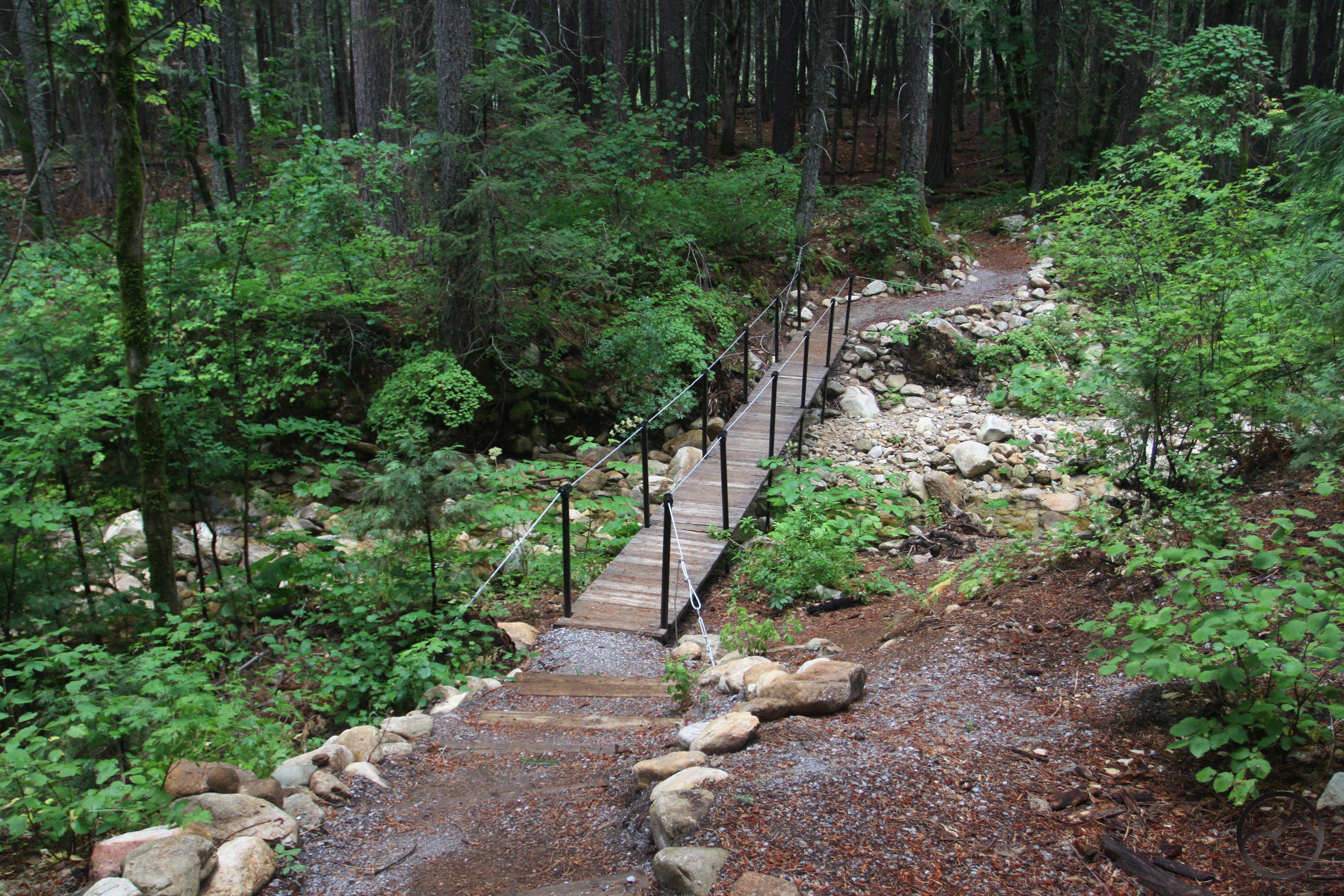
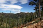
Crossing over Indian Creek.

One of the easier hikes in the Castle Crags, this trail travels along the lowest reaches of the Crags. It begins on the Indian Creek Nature Trail, crosses the eponymously named creek before reaching a junction at the proper beginning of the Flume Trail. At this point, the path follows the route of a 19th century flume, the remnants of which are still visible in many places. The trail passes beautiful forests, a primitive campground and expansive groves of oaks. The latter part of the trail combines with a short section of the Pacific Crest Trail to form a nice loop. This part of the hike is highlighted by the crossing over Dump Creek, some spectacular views of the Castle Crags and a dramatic overlook where most of Castle Creek’s watershed is revealed. On the return, the junction with the Indian Creek Nature Trail includes the option to return via the second half of that trail’s short loop. This includes another crossing of the lovely creek amidst granite boulders. This is a great place to relax and put your feet in the water.

Off Season Trails: Winter Hiking In The Shasta Valley

Posted by bubbasuess on April 30, 2013
Posted in: Desert, Hiking, Mount Shasta, Off Season Trails, Winter Trails. 11 Comments
Cascades, Pluto's Cave - March2013 144 copy (Custom)

Mount Shasta, Yellow Butte and Pluto Cave.

As noted here, winter is often a maddening time of the year for hikers. The high country, so close in proximity yet exasperatingly inaccessible beneath its mantle of snow, is not a viable option for hitting the trail. Still, the Mount Shasta area is blessed with numerous winter alternatives for off season hiking. The best of these options lies to the north of Mount Shasta, in the Shasta Valley. The valley is a wide gap between the Klamath Mountains on the west and the Cascade Range on the east. Mount Shasta, which is actually an outlier on the west side of the Cascade’s crest, bottles up the southern end. The Shasta River, with its headwaters on the flanks of Mount Eddy, drains the valley. The key feature of the Shasta Valley is that it falls within Mount Shasta’s rainshadow, making the valley a pocket of high desert terrain surrounded on all sides by higher alpine and forest clad mountains. Consequently, even when most places are being pounded by winter storms, the valley receives very little precipitation and the trails are wide open for great hiking. Of course, the high desert environment, characterized by the ubiquitous juniper and sage, may not be to everyone’s liking but for those who relish this change of pace from the dark forests just a few miles to the north, the Shasta Valley offers a winter oasis with seldom hiked trails and spectacular views.

699283 copy (Custom)

Yellow Butte

What is possibly the best day of off season hiking can be constructed out of two of the trails in the southeast corner of the Shasta Valley. The Pluto Cave Trail and the Yellow Butte Trail are only two miles apart but offer very different hiking experiences. Neither is long enough to occupy a full day but when strung together, one in the morning, the second after lunch, a fantastic and magnificently scenic day on the trail. The two trails are the Pluto Cave Trail and the Yellow Butte Trail. As noted previously, these two trails are found in the southeast corner of Shasta Valley, near where the eastern base of Mount Shasta and the Cascades crest meet. While most of the valley is privately owned, there is a small knot of national forest and BLM land here. This is fortuitous for hikers, as it provides a great day of winter hiking. The trails include one of the most unusual attractions in the Mount Shasta region as well as nearly constant, spectacular views of Mount Shasta. Views of the Cascade Crest, Trinity Divide, Siskiyou Mountains and even the Marble Mountains compliment these trails as well.

In between the two trails, there is a small picnic area at the Pluto Cave Trailhead. This is a great spot to have a lunch in between the two hikes.

Pluto Cave Trail:

Cascades, Pluto's Cave - March2013 040 copy (Custom)

Trinity Divide from the Pluto Cave Trail.

The best day of winter hiking in the Mount Shasta area begins at the Pluto Cave. This trail has something of a split personality. It consists of a short, 1 mile loop through classic, high desert terrain. The trail passes through great stands of juniper. Views of Mount Shasta at the beginning of the trail and remain consistent for most of the route. After passing the entrance to the Pluto Cave, the path parallels a few sinkholes that provide an opportunity to peer down into collapsed sections of the cave. Beyond the final hole in the cave, the trail passes through more high desert with views toward the Siskiyou Mountains, some of which lie in Oregon. Eventually the route comes upon a large uplifted fracture in the lava that covers the area. The trail climbs to the top of the fracture and runs eastward along its rim. This section has some of the best views of the trail. On the far end of the fracture the trail drops back down to ground level and the proceeds back to the trailhead.

Cascades, Pluto's Cave - Feb2013 047 copy (Custom)

Collapsed ceiling inside Pluto Cave.

As nice a trail as the loop is, the real attraction is the Pluto Cave itself. The entrance is a collapsed section of the cave’s ceiling. One drops down into the collapsed ruins, passes under an uncollapsed section that forms a natural arch and walks through more ruined ceiling sections before finally coming to the actual entrance to the Pluto Cave. Once inside the trail drops down as the cave descends a bit. There is a large section of exposed lava but the route is easy to negotiate. As one delves deeper into the cave, the light from the entrance begins to fade. Just as it does, a light appears ahead from another collapse in the cave roof. This one is only 10 feet or so in diameter and is just enough to illuminate the cave’s walls and allow a thick beam of light to come down from the world above. Pushing still further into the cave leads to another section where the roof has completely caved in and tree are growing on the cavern floor. On the far side of this opening, the ultimate entrance to the cave is found. From here the light fades quickly and the Pluto Cave extends for another mile underground.

The temperatures in the cave are fairly constant in the upper 40’s, no matter whether it is hot or cold on the surface. If one is set to explore Pluto Cave, be sure to bring a couple of lights per person. This can be a lengthy endeavor and a picnic lunch at the trailhead will be a great break before hiking to the summit of Yellow Butte.

Yellow Butte Trail:

699294 copy (Custom)

Mount Shasta from the summit of Yellow Butte.

Of all the color-themed buttes that surround Mount Shasta, Yellow Butte is the lowest in elevation and the only one found on Mount Shasta’s north side. The trail up to the summit is 3 miles round trip, which makes for a leisurely afternoon stroll. Even though the butte is a classic high desert peak, the landscape is markedly different from that encountered along the Pluto Cave Trail. While juniper is present it appears infrequently. The butte is covered in an expansive layer of gold grass, the genesis of the butte’s appellation. The trail winds around small drainages and peaks en route to the summit. Slung on the peak’s flanks and high above the surrounding forest of juniper, the views from the trail are as excellent as they are relentless. One is never out of eyeshot of Mount Shasta and all the mountains that ring the Shasta Valley. Still, the best views are from the summit, where there is a 360 degree unobstructed view of the surrounding region. Hiking this trail in the afternoon means the light on Mount Shasta and the Cascade crest to the east is optimal. Staying up on Yellow Butte for sunset is an experience not soon forgotten.

Honorable Mention – Haystack Trail:

699285 copy (Custom)

The Haystack from the beginning of the Yellow Butte Trail.

Immediately to the west of Yellow Butte is another small peak, appropriately named the Haystack. There is a great trail up to the summit of this butte as well and its proximity to Yellow Butte means it can easily be included to lengthen a day of hike. It was not included in the suggested day of winter hiking in the Shasta Valley only because its views are similar to those on Yellow Butte. Rather than having a single 360 degree view from a pointed summit, the Haystack has a broad, round summit with a trail circling the rim. The Haystack is certainly a worthy trail and can easily supplement the suggested Pluto Cave Trail – Yellow Butte Combination.

Off Season Trails: Three Winter Hikes Near Mount Shasta City

Posted by bubbasuess on April 22, 2013
Posted in: Hiking, Mount Shasta, Mount Shasta History, Off Season Trails, Winter Trails. 12 Comments
Trinity Divide, Box Canyon - Feb2013 025 copy

Box Canyon of the Sacramento River.

Winter is usually a frustrating season when it comes to finding good trails. The alpine country we often seek out as good hiking territory is smothered under a thick blanket of snow. Even if we were prepared to snowshoe or hike on the snow, just accessing the high country can be impossible. For those still intent on hiking one must maximize the options at hand. The Mount Shasta area is blessed with several excellent winter hiking options. This is, in part, due to the fact that most of the populated areas are in lower elevation settings while still being surrounded with fantastic mountains. This means that during the winter there are several good trails that will usually be snow free for the duration of the season. Of course, immediately after a large storm these options will also be snowbound but they generally melt out quickly are accessible fairly soon after the storm.

694722 (Custom)

Faery Falls.

There are three good, short trails immediately around town that provide a variety of scenery: the Ney Springs Canyon Trail, the Box Canyon Trail and the Spring Hill Trail. When strung together throughout a day they make up a solid day of hiking with a variety of interesting scenery including historical ruins, a swift and rocky creek, a turbulent river in a narrow chasm, waterfalls, and epic views of Mount Shasta and the Trinity Divide. In short, this is for more scenery than one generally expects to find on snow-free trails in the winter. With a total distance of nearly six miles, the combination of these trails makes for a pleasant day of hiking (note: there are short drives between each trailhead). However, they also make pleasant morning or afternoon hikes and can generally be fit into small chunks of time on different days if one desires to meter out the scenery.

The following is a proposed order for the three trails and brief description of what to expect to see:

Ney Springs Canyon Trail:

694718 (Custom)

Ruins along Ney Springs Creek.

Set in the shadow depths of Ney Springs Canyon, this trail follows a rough road built in the 19th century to access the now lost Ney Springs Resort. Below the trail the boisterous creek flows through a boulder filled channel. Ruins of the old resort are scattered throughout the mid-section of the trail. Particularly noteworthy is an old retaining wall with an ornate stone basin which once held spring water and a large landing along the creek with another retaining wall, concrete stairs leading down into the creek a pair of cisterns built into the landing. Beyond the ruins the trail continues along the creek before ending at attractive Faery Falls, a 40 foot waterfall that falls in two tiers. For those interested in rock climbing, the trail continues up the north side of the canyon to a use trail that leads to a series of crags. South facing, these crags are generally snow free year round and are popular with climbers in the winter.

If making a full day of hiking, this trail is best done in the morning. It is in shadow much of the day no matter when one hikes it and there are compelling reasons to hike the other trails later in the day. It can be especially cold in the canyon so dress appropriately. This is the only trail of the three that is not accessed via a plowed road. After a storm it can be more difficult to reach. However, if one is willing, the dirt road can easily be hiked from where it is plowed, adding an extra 3 miles round trip.

Box Canyon Trail:

Trinity Divide, Box Canyon - Jan2012 044 copy

Inside the Box Canyon of the Sacramento River.

Just minutes away from the trailhead for the Ney Springs Canyon Trail, the Box Canyon Trail follows the rim of the Box Canyon of the Sacramento River, just below the dam that impounds Lake Siskiyou. This is the most unusual of the three trails. It follows the rim of the Box Canyon for just shy of a mile. Along the way, the trail crosses a couple of streams flowing through interesting gullies before reaching one of the highlights of the trail. The route passes through a large car and appliance dump that was made in the 1940’s and 50’s. Folks used to push their old cars and appliances off of a treeless hill when they were finished using them. Since the practice came to a halt, the once treeless slope has been covered with young fir, cedar and pine trees, some of which are growing out of the old cars that are ensconced forever on the rim of the canyon. Beyond the vehicular graveyard, the trail continues past good views down into the canyon before culminating at the opportunity to climb out onto a rocky precipice hanging dramatically over the river and the canyon. A bonus to this trail is the opportunity to use a rope and via ferrata system to climb down into the canyon and observe the river and a small waterfall up close. The route for the river access is at an obvious trail junction about 100 yards from the trailhead.

For the full day of hiking, this trail is best done second. The route is on the north side of the box canyon which means it has a southern exposure. Once the sun has risen higher in the sky, the trail gets more direct sunlight, making it much warmer than it would be earlier in the day.

Spring Hill Trail:

Cascades, Spring Hill - Feb2013 013 copy (Custom)

Mount Shasta viewed from Rocky Point on Spring Hill.

After a morning of hiking and a leisurely lunch (preferably at Poncho and Lefkowitz!), the trail climbing to the summit of Spring Hill is a pleasant afternoon endeavor. While the two previous trails are interesting because of the physical features they explore (Ney Springs Creek and the Box Canyon) as well as their historical curiosities, the hike up Spring Hill is a hike with views. Chief among the views is awesome Mount Shasta, finally getting its due after a morning in the canyons. The trail is not just dedicated to the great mountain however, as there are fine views of the Trinity Divide, Black Butte and Mount Shasta City. On a clear day, it is possible to observe distant Crater Peak and even more distant Lassen Peak to the south. Though the trail starts off as single track, it soon follows an old road that is closed to motorized traffic. The route switchbacks up the side of Spring Hill, often under tree cover. There are numerous vistas where the trees break and great views are to be had. Benches often mark these spots. Near the summit, there is a junction for the Rocky Point Loop, which is 0.5 miles of single track and leads to a rock outcropping that has a fantastic view of Mount Shasta.

The views of Crater Peak, Lassen Peak and Mount Shasta are best had in the afternoon. Though it does not put Mount Eddy in the best light (pun intended) these other features are the most interesting. For this reason, this hike should be done last of the three suggested short trails around Mount Shasta City.

A Mysterious Painting Pt. II

Posted by bubbasuess on April 5, 2013
Posted in: Mount Shasta, Mount Shasta History. 8 Comments
ShastaPainting

The old painting of Mount Shasta.

In an earlier post I described the search for details on a previously unknown painting of Mount Shasta. The post concluded on the eve of meeting with two experts on the art of Mount Shasta. One of the gentlemen was the recently retired librarian at the College of the Siskiyous. He maintains the Mount Shasta Collection, which contains an extensive gathering of works relating to Mount Shasta. There is a substantial volume of historical works in the collection. The other gentleman I met with was the author of the book Sudden and Solitary, the definitive work on the art of Mount Shasta. He also headed up the exhibit held at the Turtle Bay Museum in Redding that featured numerous works found in the book. He also put on the lenticular cloud gallery and the recently opened Joaquin Miller exhibit at the Sisson Museum in Mount Shasta. Both men were interested in the historic and unusual nature of the painting my mom had found in a Bay Area thrift store and we arranged a meeting at the College of the Siskiyous library.

ShastaTag

The backside of the painting, showing the canvas board.

The meeting took place in one of the rooms that contains the Mount Shasta Collection. Aside from all the books about Mount Shasta and the area’s inhabitants and history, there were also a few very early paintings of the mountain. After brief conversation, I produced the painting and we set about to examining the painting. The most notable thing we established was the composition of the board that the canvas was stretched over. This was composed of a cardboard like material. This was significant because it was not composed of Masonite, which is a denser material. This dated the painting to some time prior to the 20’s, when Masonite became the standard material for canvas boards. This conformed to what had previously been speculated regarding the establishment of Rocky Mountain National Park. Knowing when the park was founded and the lack of any references to it as well as the absence of Masonite made us confident the painting was made at some point prior to the 20’s. As previously noted, a reference to Kodak film set the low end of the date to the late 1880’s.

Scan0002 copy

The page from the 1920 Census, showing E.S. Evans.

Despite establishing more parameters for the painting’s date, we were still unable to find any information on the artist. After consulting numerous books in the library, the librarian stood up and said he knew where to look and he guaranteed we would find information about the artist there. The other gentleman and I continued to discuss Mount Shasta and its history. Soon the librarian returned triumphantly with a series of photocopied papers. As he predicted, there on the page was the name E.S. Evans, occupation listed as painter. The documents showing the artist was the 1920 U.S. Census. According to the census information, E.S Evans was born in Iowa and was married to his wife Clara in 1893 in Muskatine Iowa. He shows up in Boulder in the 1900, 1910 and 1920 censuses. These dates aligned with what we already knew about the painting. Based on this evidence we concluded the painting was made sometime between 1895 and 1915. Though we had no firm evidence, we figured a more precise guess was sometime between 1900 and 1910. This guess is based on the fact that Evans had to have time to establish his catalogue listed on the label affixed to the back of the painting. Therefore a date prior to 1900 seemed unlikely, since he had only been in Boulder a few years by that point. A date later than 1910 starts to inch closer to the formation of Rocky Mountain National Park.

Pleased with the result of the meeting I headed home with the painting. Even though the painting was not as old as initially estimated, it is still over 100 years old and a worthy artifact of the Mount Shasta area. The fact remains that it is an early depiction of the mountain from on the mountain rather than somewhere in the surrounding area. It will hang proudly on our wall, a pleasant reminder of Mount Shasta’s past.

Lenticular Clouds

Posted by bubbasuess on March 30, 2013
Posted in: Lenticular Clouds, Mount Shasta. 12 Comments

One of the pleasures of living near Mount Shasta is the opportunity to observe the lenticular clouds that often form around the mountain. Mount Shasta is so massive, high and solitary it disrupts the air currents that flow around it and frequently develops large, oddly shaped clouds. Sometimes they appear on or above the mountain while other times they orbit nearby the great volcano. These formations form near other prominent mountains but Mount Shasta is particularly noted for the frequency and size with which they appear. The clouds enhance what is an already amazing spectacle by adding unusual forms to the mountain’s appearance. Any time one is fortunate enough to capture the mountain with a lenticular, it is an exciting opportunity. Conversely, any time a one develops and circumstances prevent going to a good point to observe the mountain and its clouds it is supremely frustrating.

The following is a gallery of some of the more interesting lenticular clouds I have encountered around Mount Shasta.

Click to enlarge:


January

October
October
December
December


December
December


Looking south

December


Diller Canyon at sunset.

March

March


January
February

Bunny Flat
October

January
November


December


Seldom Seen: Ash Creek Falls

Posted by bubbasuess on March 2, 2013
Posted in: Hiking, Mount Shasta, Seldom Seen, Waterfalls. 8 Comments

As has been recounted here, I came to an appreciation of the land and the wild through my deprivation from it while in school in Dallas. That time provided me the opportunity to explore places I never would have otherwise and to learn to appreciate their beauty, even if it was different from the Sierra Nevada, the range I considered my mountain home. (These mountains really were home in a way: my parents met climbing Half Dome and both of their families already had a generational attachment to Yosemite by that point). My travels refined which landscapes I preferred. While the environments I found interesting continued to evolve, I developed a penchant for heading to places that people were not often aware of. As I journeyed through new places, I discovered that there was an added measure of edification in finding places of great beauty that were seen by few eyes.

Here in Mount Shasta, there is a tremendous amount of natural beauty that has escaped attention from all but a handful of dedicated explorers. Most of these destinations have little or no information written about them, and are generally off the beaten path in a very literal way. For those who are even aware of their existence, finding sound information on these hidden jewels is next to impossible. Figuring out the best way to get there is part of the experience and it often takes multiple attempts to successful reach the goal. Is spite of this, the thrill of reaching a scene seldom seen is a rich reward for the effort expended.

Cascades, Mt Shasta, Brewer Creek - July2012 039 (Custom)

Mount Shasta and Brewer Creek en route to Ash Creek Falls.

My favorite spot on Mount Shasta, Ash Creek Falls, is one such unappreciated vista. Granted, the falls are marked on the map and, for those who think about such things, there is an awareness of the falls but that has not translated into crowds of people visiting the falls. There are a few reasons for this. First and overshadowing all the others, Ash Creek Falls is on the east side of Mount Shasta. This is the side of the volcano that is most remote and least visited. All other sides of the mountain are, at the least, visible from a highway. The south and west sides are served by a paved road that climbs nearly to treeline. Even the rugged north side is observed from Highway 97 and accessed by two well-traveled trails, the Whitney Falls and North Gate Trails. It is the east side, home to the massive Hotlum and Wintun Glaciers, that remains out of sight and hidden away from all but the very few who make the long, rugged drive to the trailhead of the east side’s lone trail, the Brewer Creek Trail. Isolation and a lack of awareness of the falls are not the only attribute that prevents people from visiting Ash Creek Falls. The falls, or even a view of the falls is not reached by an official trail, nor is there any improvised, user created path. To reach a good view of Ash Creek Falls requires cross-country travel that necessitates good route finding skills. Even once one reaches the rim of Ash Creek Canyon, finding a safe place from which to enjoy the memorable scene requires some precarious exploration.

813945 copy (Custom)

Ash Creek Canyon below Ash Creek Falls.

These challenges aside, Ash Creek Falls is a marvelous place. When the correct vantage has been found (an easy task if one knows where to look) the scene is incredible. Standing at the precipice, 400 feet above the canyon bottom, an incredible panorama awaits. The wide canyon V-shaped canyon is composed of loose scree with rocky crags protruding from the higher area on the canyon walls. Clumps of trees cling to the loose talus and strands of green grass and small brush mark the path of springs flowing down toward Ash Creek. The creek itself roils down the canyon, though it is often obscured by thick bridges of ice that completely cover the canyon bottom. Looking upstream, the canyon narrows swiftly. About 0.3 miles from the vantage point, the canyon butts into a band of hard, erosion-resistant rock. It is here that Ash Creek plunges 300 feet over the band of rock. It is a powerful yet graceful waterfall. It pours over the edge of the cliff as a horsetail, all of its power concentrated in a single channel of water. Halfway down it crashes against a bulge in the cliff face, running down a steep sluice in the rock before it shatters into multiple, wispy veils of water.

Cascades, Mt Shasta - July2012 067_edited-1

Mount Shasta and the Wintun Glacier from above Ash Creek Falls.

As beautiful as Ash Creek Falls are, they are only a part of this neglected vista. Soaring 7,000 feet above the falls is mighty Mount Shasta. The massive volcano presides majestically over Ash Creek Canyon and Ash Creek Falls. The mountain is cloaked by the hulking Wintun Glacier, the 3rd largest and highest in California. Though the lower portions of the glacier are out of sight at the best place to observe the waterfall, the lowest point is only 1,000 feet above and 0.8 miles away from where the falls tumble over the hard band of rock. There are vantages farther up the canyon that offer better views of the glacier flowing down the canyon but they are not great places to view the falls.

Cascades, Mt Shasta, Brewer Creek - July2012 099 (Custom)

Ash Creek Falls and Mount Shasta.

Though individually beautiful, taken as a whole the canyon, Ash Creek Falls, the Wintun Glacier and Mount Shasta are an epic sight to behold. It is amazing that such a view has remained so seldom seen for so long. For a waterfall junkie like me, it is particularly gratifying to have such an awesome cataract in the proverbial backyard. I am not the only one who thinks so. John Muir made several trips up to Mount Shasta and had an abiding love for California’s great volcano. The vista taking in Ash Creek Falls with the mountain looming high overhead is purported to have been his favorite view of Mount Shasta too.

A Mysterious Painting

Posted by bubbasuess on February 23, 2013
Posted in: Mount Shasta, Mount Shasta History. 9 Comments

My mother’s primary hobby, aside from grandmothering, is thrift shopping. She is a predator, in search of cheap prey. This always yielded a mother lode of good things for me when I was growing up. Clothes, toys, you name it, I had it and most of it came from thrift stores. In the last few years, she discovered what she named the “wild thrift shop”, which is the distribution hub for the Goodwill. At this particular thrift store, they roll in all the new deliveries in large, unsorted bins. Things are bought by the inch and by the pound. The quality and quantity of goods acquired from this place by my mother is tremendous.

ShastaPaintingWhat do thrift stores have to do with Mount Shasta? Last week my parents came up to Mount Shasta to stay for a few days. My mother brought with her a painting that she found at the “wild thrift shop” a few days earlier. The painting is obviously old, but it is not the most attractive work. At first glance, the mountain depicted does not look like Mount Shasta. What caught her eye was a printed label that identified the artist, E.S. Evans, and listed a number of landscapes that he had painted. At the bottom of the list was a blank spot where the location could be written and “Mt. Shasta Calif” was hand printed in that spot. Despite its not looking anything like Mount Shasta she bought the painting and brought it up to my house.

807114 copy (Custom)Just days before my parents arrived, I had been uploading pictures to Hikemtshasta and just happened to have uploaded an image that featured the great volcano from the same perspective as it was painted in the old picture. When I saw the picture I instantly recognized it for what it was. Rather than being a painting of Mount Shasta from somewhere down below or from a distance, it was a portrayal of the mountain from on the mountain. Specifically, it was the view from the top of Hummingbird Saddle, which is the divide between the Old Ski Bowl and the Valley of the Moon. In an act of artist’s license, the painter added far more trees than are actually present and included a cabin that may or may not have existed at that spot. The unusual angle, the trees and the cabin all contributed to obscuring the fact that is really was Mount Shasta.

Comparison2I was intrigued and wanted to know more about it. The obvious first place to go for information is the Sisson Museum in Mount Shasta. Unfortunately the museum is closed for the winter. On a whim, my dad and I went to the Forest Service to see if anyone there was keen on the art of Mount Shasta. Not surprisingly, there was no one there with the knowledge necessary to find out more about the painting. However, I was directed to the two gentlemen most knowledgeable on the subject, one the head of the Sisson Museum and the author of Sudden and Solitary, the definitive book on the art of Mount Shasta, and the other the recently retired head of the College of the Siskiyous Library. I spoke with the latter on the phone and they are both extremely curious about the painting. Of particular note to them is that depending on the paintings’ as yet undetermined age, it is possibly the oldest depiction of Mount Shasta from on the mountain. We agreed to meet and examine the painting together to try to determine the age.

ShastaTagSince speaking with them, I noticed two bits of information that will help set the painting’s age. Both are found on the printed label on the back. First, there is a solicitation from the artist for paintings based on pictures or postcards. In particular, it mentions Kodak pictures. Since Kodak was founded in 1889, it can be no older than that. The second data point gleaned from the label is found in the list of subjects regularly painted by the artist, E.S. Evans. He was located in Boulder, Colorado, which is not far from Estes Park. Nowadays, Estes Park is the gateway community to Rocky Mountain National Park. The park was created in 1915. Several of the locations that are now in the park are listed as being in Estes Park. Many of them are pretty far from Estes Park and are in the heart of the mountains that now make up the national park. It seems likely that if the park had been created at the time of the painting was completed it would have indicated those locations were in the park rather than distant and generally unrelated Estes Park.

I meet with the two gentlemen next week and we will work on dating the painting. I will write another post afterwards, detailing our findings.

Part Two of my investigation of the painting can be read here.

Exile: How I Came To Love Wilderness

Posted by bubbasuess on February 17, 2013
Posted in: Hiking, How things came to be.... 12 Comments

“All America lies at the end of the wilderness road, and our past is not a dead past, but still lives in us. Our forefathers had civilization inside themselves, the wild outside. We live in the civilization they created, but within us the wilderness still lingers. What they dreamed, we live, and what they lived, we dream.”

T.K. Whipple wrote these words in his essay “Myths of the West”, which is found in a book entitled “Study Out The Land”, a collection of his writings regarding the American West and the wilderness therein. The book is extremely difficult to find. I have only had it in my hands in the libraries of universities that have large collections of books about the West. The quote, though, is more famous than Whipple’s book because of its inclusion as the epigraph in Larry McMurtry’s excellent book “Lonesome Dove”. For those who have not read the novel, I strenuously recommend it, not just for the epic, excellent storytelling rife with adventure, humor and tragedy, but because of what it sees in its rear-view mirror and mourns. More than anything else, the book is a paean to the old west that has passed away, and to the nature of friendship.

g01 Cadillac Ranch copy (Custom)

Exiled in Texas: Cadillac Ranch, near Amarillo.

Lonesome Dove had a significant impact on my development as a writer and outdoorsman. Although I had seen the television mini-series (which is an excellent adaptation of the book and, for my money, the best western of all time) several times, I had never read the book. When life took me to Dallas, Texas for graduate school, I was ripped away from the land and mountains that I had grown up in and loved. Having spent my entire life in northern California, I had become dangerously complacent about how much the rocks and rivers of the wild had meant to me. I remember my third week (out of four years!) in Dallas, driving down a busy city street, thinking “what have I done?”  Four years in the concrete labyrinth was a suddenly depressing prospect.

Texas, Palo Duro Canyon - July2008 001 copy (Custom)

The Texas Caprock loomed large in the story of Gus and Woodrow.

To cope with my new reality, I stretched beyond my normal comfort zone, and began reading books that I had not bothered with before. Chief among these was Lonesome Dove. I was familiar with the story since I had seen the movie, but, as great an adaptation as the movie is, it falls short for one significant reason. The film justifiably focuses on the characters, particularly Gus and Woodrow, though the others get their due as well. However, one critically important character present in the book is missed in the movie. That is the land. The land, the place, is as much a character in the book as the people are. Being stuck in Texas, the land where much of Lonesome Dove takes place, made the book resonate with me in a way it would not have if I were back in California. I realized the wilderness is not just mountains and beauty is not just waterfalls, though those things were still preferred. Now I had a growing sense of what the land meant, what it means to me, and how the things I now missed were present in Texas too, but only in a different form and often more difficult to find.

Oklahoma, Wichita Mountains - April2012 299 copy (Custom)

Wichita Mountains, Oklahoma.

Having recalibrated my expectations, I set about traveling, exploring, and hiking the land I was in. Needless to say, most of the Texas landscape does not inspire a sense of awe, save for the sheer size of it (as the old adage says, “the sun is riz and the sun is set and we ain’t left Texas yet”). It was by means of these explorations that I came to love some places of unexpected beauty, one in the unyielding flatness of the Texas Panhandle (they say it is so flat you can stand on a can of tuna and see the curvature of the earth), the other across the “international” border in Oklahoma: the Caprock and the Wichita Mountains. It was in these places that I found the wildness I missed and yearned for and the solitude and wonder I had recently found I needed. I also discovered that I loved wilderness for another reason, one I had not realized was present before my reading Lonesome Dove. In addition to the adventure, isolation and beauty present in the wilds, I learned that it was in those places more than any other where I came into contact with the past. As a historian, this was a moment of great personal discovery. Through immersion in the wild land, I was immersed in the land as it was when Kit Carson or Charlie Goodnight would have seen it when they passed through. Going forward, there was a new perspective that would enable me to appreciate lands far different from the alpine grandeur of the mountains I grew up in.

Cascades, Mt. Shasta - Dec2011 041 copy (Custom)

Safely home: Mount Shasta from an overlook near my house.

Now I have left Texas and Oklahoma behind me and I live in a mountain paradise, the kind of place I dreamed of while being stuck in Dallas. I still think fondly of the refuges of wilderness I found and hope to return to them in the future (I did make it back to the Wichita Mountains for a day in April2012) but more than those places themselves, it was the awareness of what the wildness means to me and how essential it is to my person. Like the Whipple quote says, I live what the mountain men dreamed, a life of civilization and progress, but in the midst of modernity, it is the life untamed that they lived that resides within me.

Welcome!

Posted by bubbasuess on January 30, 2013
Posted in: Uncategorized. 3 Comments

Welcome to Hike Mt. Shasta, the (soon to be) complete guide for hiking the Mount Shasta region!Cascades, Mt. Shasta - Dec2012 060 copy (Custom)

Posts navigation

Newer Entries →
    • Recent Posts

      • Winter Shows Up When It Will
      • January Rolled By With Mud, Then Very Dry
      • Mount Shasta 2025 – A Year In Images
      • Mount Shasta On Either Side Of Christmas
      • Adrift In An Ocean Of Fog
      • December Has Been Spectacular Thus Far Pt. II (A Magnificent Lenticular)
      • December Has Been Spectacular Thus Far Pt. I
      • Lenticular Interrupted
      • A Stormy Wave And A Truchas Sunset
      • Aurora Lenticularis
    • Enter your email address to follow Hike Mt Shasta and receive notifications of new posts by email.

    • Archives

      • February 2026
      • January 2026
      • December 2025
      • November 2025
      • October 2025
      • September 2025
      • August 2025
      • July 2025
      • June 2025
      • May 2025
      • April 2025
      • March 2025
      • February 2025
      • January 2025
      • December 2024
      • November 2024
      • October 2024
      • September 2024
      • August 2024
      • July 2024
      • June 2024
      • May 2024
      • April 2024
      • March 2024
      • February 2024
      • January 2024
      • December 2023
      • November 2023
      • October 2023
      • September 2023
      • August 2023
      • July 2023
      • June 2023
      • May 2023
      • April 2023
      • March 2023
      • February 2023
      • January 2023
      • December 2022
      • November 2022
      • October 2022
      • September 2022
      • August 2022
      • July 2022
      • June 2022
      • May 2022
      • April 2022
      • March 2022
      • February 2022
      • January 2022
      • December 2021
      • November 2021
      • October 2021
      • September 2021
      • August 2021
      • June 2021
      • May 2021
      • April 2021
      • March 2021
      • February 2021
      • January 2021
      • December 2020
      • November 2020
      • October 2020
      • September 2020
      • August 2020
      • July 2020
      • June 2020
      • May 2020
      • April 2020
      • March 2020
      • February 2020
      • January 2020
      • December 2019
      • November 2019
      • October 2019
      • September 2019
      • August 2019
      • July 2019
      • June 2019
      • May 2019
      • April 2019
      • March 2019
      • February 2019
      • January 2019
      • December 2018
      • November 2018
      • October 2018
      • September 2018
      • August 2018
      • July 2018
      • June 2018
      • May 2018
      • April 2018
      • March 2018
      • February 2018
      • January 2018
      • December 2017
      • November 2017
      • October 2017
      • September 2017
      • August 2017
      • July 2017
      • June 2017
      • May 2017
      • April 2017
      • March 2017
      • February 2017
      • January 2017
      • December 2016
      • November 2016
      • September 2016
      • August 2016
      • July 2016
      • June 2016
      • May 2016
      • April 2016
      • March 2016
      • February 2016
      • January 2016
      • December 2015
      • November 2015
      • September 2015
      • August 2015
      • July 2015
      • June 2015
      • May 2015
      • April 2015
      • March 2015
      • February 2015
      • January 2015
      • December 2014
      • November 2014
      • July 2014
      • June 2014
      • May 2014
      • April 2014
      • March 2014
      • February 2014
      • January 2014
      • December 2013
      • November 2013
      • October 2013
      • September 2013
      • August 2013
      • July 2013
      • June 2013
      • May 2013
      • April 2013
      • March 2013
      • February 2013
      • January 2013
    • Categories

      • Boy Scouts
      • Cascade Range
      • Castle Crags
      • Desert
      • Echo Point
      • Glaciers
      • Hiking
      • How things came to be…
      • Klamath Mountains
      • Konwakiton Outdoor Designs
      • Lakes
      • Lenticular Clouds
      • Maps
      • Marble Mountains
      • Meadows
      • Mount Eddy
      • Mount Shasta
      • Mount Shasta History
      • Napa County
      • Off Season Trails
      • Pacific Crest Trail
      • Peaks
      • Rivers
      • Rock Climbing
      • Scott Mountains
      • Seldom Seen
      • Shasta Valley
      • Sierra Nevada
      • Siskiyou Mountains
      • Sonoma County
      • Spring Trails
      • sunrise
      • sunset
      • Trinity Alps
      • Trinity Divide
      • Truchas Ridge
      • Uncategorized
      • Water
      • Waterfalls
      • Wilderness
      • Wildflowers
      • Wine Country
      • Winter Trails
      • Yosemite
    • Meta

      • Create account
      • Log in
      • Entries feed
      • Comments feed
      • WordPress.com
    • Copyright © 2013-2024 by Bubba Suess

      DISCLAIMER: Any use of the information contained in this site by any and all persons is done at their own risk. The operator of this site shall be held harmless from any and all alleged claims, demands, causes of action, liability, loss, damage and/or injury to property or persons whether brought by an individual or other entity. This indemnification applies, without limitation, to all actions by an individual or other entity as a result of their use of information contained in this site.

    Blog at WordPress.com.
    • Subscribe Subscribed
      • Hike Mt. Shasta
      • Join 985 other subscribers
      • Already have a WordPress.com account? Log in now.
      • Hike Mt. Shasta
      • Subscribe Subscribed
      • Sign up
      • Log in
      • Report this content
      • View site in Reader
      • Manage subscriptions
      • Collapse this bar
     

    Loading Comments...