Hike Mt. Shasta

Exploring the Mount Shasta Region

  • Home
  • Trails
    • Mount Shasta Trails
      • Brewer Creek Trail
      • Clear Creek Trail
      • Gray Butte Trail
      • Green Butte Ridge Trail
      • Horse Camp Trail
      • North Gate Trail
      • Old Ski Bowl Trail
      • Panther Meadow Trail
      • South Gate/Squaw Meadow Trail
      • Whitney Falls Trail
    • Trinity Divide Trails
      • Blue Divide Trail
      • Castle Lake Trail
      • Castle Lake Shore Trail
      • Cliff Lake Trail
      • Deadfall Lakes Trail
      • Gray Rock Lakes Trail
      • Gumboot Trail
      • Heart Lake Trail
      • Porcupine & Toad Lakes Via Pacific Crest Trail
      • Seven Lakes Basin Via Pacific Crest Trail
      • Sisson-Callahan Trail
      • Soapstone Trail
      • South Mumbo Scramble
      • Tamarack Lake Trail
      • Toad Lake Trail
    • Castle Crags Trails
      • Burstarse Falls Via Pacific Crest Trail
      • Castle Dome Trail
      • Flume Trail
      • Lower Castle Crags Via Pacific Crest Trail
      • Root Creek Trail
    • Scott Mountains Trails
      • Bluff Lake & Cement Bluff via Pacific Crest Trail
      • Caldwell Lakes Trail
      • China Mountain Scramble
      • Cory Peak and Bull Lake via Pacific Crest Trail
    • Cascade Crest
      • Ash Creek Butte Scramble
      • Goosenest Trail
      • Juanita Lake Trail
      • Orr Lake Trail
    • Mount Shasta City Area Trails
      • Black Butte Trail
      • Box Canyon Trail
      • Gateway Trail
      • Lake Siskiyou Trail
      • Mount Shasta City Short Trails
      • Ney Springs Canyon Trail
      • Spring Hill Trail
    • Shasta Valley Trails
      • Black Lava Trail
      • Haystack Trail
      • Lake Shastina Trail
      • Pluto Cave Trail
      • Trout Lake Trail
      • Yellow Butte Trail
    • Sacramento River Trails
      • Dunsmuir Trail
      • Hedge Creek Falls Trail
      • Sacramento River Trail
      • Sims History Trail
    • McCloud River Trails
      • Ash Camp To Ah-Di-Na Via Pacific Crest Trail
      • McCloud River Falls Trail
      • McCloud River Preserve Trail
      • Squaw Valley Creek Trail
      • McCloud River Trail: Algoma Camp to Nitwit Camp
      • McCloud River Trail: Nitwit Camp to Cattle Camp Swimming Hole
      • McCloud River Trail: Cattle Camp Swimming Hole to Camp 4
      • McCloud River Trail: Camp 4 to Upper McCloud Falls
      • McCloud River Trail: Pine Tree Hollow Loop
    • Trails Further Afield
      • Trinity Alps Trails
        • Bear Lakes Trail
        • Billys Peak Trail
        • Boulder Creek Lakes Trail
        • Boulder Lake Trail
        • Canyon Creek Trail
        • Caribou Lakes Trail
        • East Boulder Lake Loop
        • East Weaver Lake Trail
        • Four Lakes Loop
        • Granite Peak Trail
        • Grizzly Creek Trail
        • Gulch Lakes Loop
        • Hidden Lake Trail
        • South Fork Lakes Trail
        • Stoddard Lake Trail
        • Stoney Ridge Trail
        • Tangle Blue Lake Trail
      • Warner Mountains
        • Emerson Creek Trail
        • Highgrade Trail
        • Patterson Lake Via Warner Summit Trail
        • Pine Creek Trail
        • Squaw Peak Trail
  • Articles
    • Trails By Area
      • Mount Shasta
        • Vistas, Meadows And Waterfalls: Three Best Hikes On Mount Shasta
        • The End Of The Road: Three Hikes In The Old Ski Bowl Area
        • Two Trails From Bunny Flat
        • Three Trails On Mount Shasta’s East Side
        • Mount Shasta’s Hummingbirds
      • Trinity Divide
        • Great Lakes: Top Five Lake Basins In The Trinity Divide
        • The Headwaters Of The South Fork Of The Sacramento River
        • Neglected Headwaters: Two Lesser Lake Basins On The South Fork
        • Gumboot Saddle: Two Hikes On The PCT
        • Descent Into Mystery: The Sisson-Callahan Trail
        • Mumbo Basin – Overlooked On The West Side
        • The Headwaters Loop: A Proposed Backpacking Loop In The Trinity Divide
      • The McCloud River
        • The McCloud River Trail
      • Shasta Valley
        • Jewels In The Desert
      • Scott Mountains
        • Great Scott! Two Scott Mountains Hikes On The PCT
      • Trinity Alps
        • Carubou Lakes: Trinity Alps On A Grand Scale
        • Switchbacks To Heaven: The Trinity Alps’ Stoney Ridge Trail and Four Lakes Loop
        • Trinities In Proximity: Two Trinity Alps Trails With Easy Access From Mount Shasta
        • Trails in the Carter Meadows Area
        • Trinity Alps Views of Mount Shasta
        • The Psychological Value Of The Trinity Alps
    • Waterfalls
      • Three Waterfalls On Mount Shasta
      • McCloud River Waterfalls
      • Sacramento River Waterfalls
      • Trinity Divide Waterfalls
      • Trinity Alps Waterfalls
      • Avoiding A Dry Whitney Falls
    • Off Season Trails
      • Three Winter Hikes Near Mount Shasta City
      • Winter Hikes In Shasta Valley
      • Winter Hiking In The Shasta Valley Wildlife Refuge
      • Winter Hikes On The Sacramento River
      • Winter Hikes On The Lake Siskiyou Trail
      • Spring Hikes In The Castle Crags
      • Spring Hikes On the Upper McCloud
      • Spring Hikes On The Lower McCloud River
    • Points Of Interest
      • Mount Eddy: Overshadowed, Underrated
      • Black Butte: Hiding In Plain Sight
      • Castle Dome: Steadfast And Staggering
      • Mount Shasta Hoodoos
      • Sacramento Scrambling
      • The Shasta River
      • The Castle Creek Watershed
      • Mount Shasta East Side Glacier View
      • 5 Fantastic Mount Shasta Vistas
      • 5 Highest Peaks Around Mount Shasta
      • 5 Best Hikes On Creeks And Rivers
      • 5 Interesting Footbridges
      • Three Spectacular Drive-To Sunset Vistas
    • North State Geography
      • Introduction
      • Seven Major Regions
      • The California Cascades
      • Klamath Mountains Pt. I
      • Klamath Mountains Pt. II
      • The Great Canyons Of Mount Shasta
      • Mount Shasta, Timberline, And The Relative Size Of Cascade Volcanos
      • Four Eruption Cones Of Mount Shasta
      • Mount Shasta’s Medial Moraine
    • Northern California Review
      • North Table Mountain
      • Lakes Basin Recreation Area
      • Eastern Sierra Fall Color
      • Sonoma County
      • Central Sierra Nevada
      • Orland Buttes
    • Seldom Seen
      • Ash Creek Falls
      • Mud Creek Canyon
      • Lower Mud Creek Canyon
      • Diller Canyon
      • Lower Cascade Gulch
      • The Grey Rocks
      • Castle Creek
      • Upper Wagon Creek
      • Fawn Creek Canyon
      • Confluence of the Sacramento River and Castle Creek
      • Upper Klamath River Canyon
      • Hole In The Ground Geologic Area
      • Ash Creek Butte Fossil Rock Glacier
    • Mount Shasta History
      • Vantage Lost: The Everitt Memorial Vista
      • A Yosemite-Mount Shasta Connection
      • Whitney – What’s In A Name?
      • Mount Shasta Area and the 1838 Exploring Expedition
      • A 19th Century Engraving Of An Epic Mount Shasta Vista
      • Vintage 1907 Color Photos
      • A Misleading Painting
      • A Mysterious Painting
      • A Mysterious Painting Pt. II
      • Stereographic Mt. Shasta
      • Year One Of Hike Mt Shasta
      • Year Two Of Hike Mt Shasta
      • Year Three Of Hike Mt Shasta
      • Year Four Of Hike Mt Shasta
      • Year Five Of Hike Mt Shasta
      • Year Six Of Hike Mt Shasta
      • Year Seven Of Hike Mt Shasta
    • Image Galleries
      • Mount Shasta Trails Gallery
      • Mount Shasta Sunrise Gallery
      • Mount Shasta Sunset Gallery
      • Lenticular Cloud Gallery
      • Mount Shasta NON-Lenticular Clouds
      • Mount Shasta Reflection Gallery
      • Telephoto Gallery
      • Mount Shasta Area Fall Color
      • Castle Crags Gallery
      • Waterfalls Gallery
      • Trinity Divide Lakes Gallery
      • Mount Shasta Area Rivers Gallery
      • Shasta High Desert Gallery
      • Mount Shasta GIF Gallery
    • Random Notes
      • Revew: Three Mount Shasta Trail Maps
      • A Mount Eddy Wilderness?
      • New Land Additions For The Castle Crags
      • Book Plug: Mount Shasta Area Rock Climbing
      • Exile: How I Came To Love Wilderness
  • Mt. Shasta Trail Map
  • Blog
  • About/Contact
  • Links
  • Truchas Ridge

The Warner Mountains: Star Of The True Pacific Crest

Posted by bubbasuess on May 12, 2023
Posted in: Hiking, Mount Shasta, Pacific Crest Trail. Tagged: Warner Mountains. 3 Comments

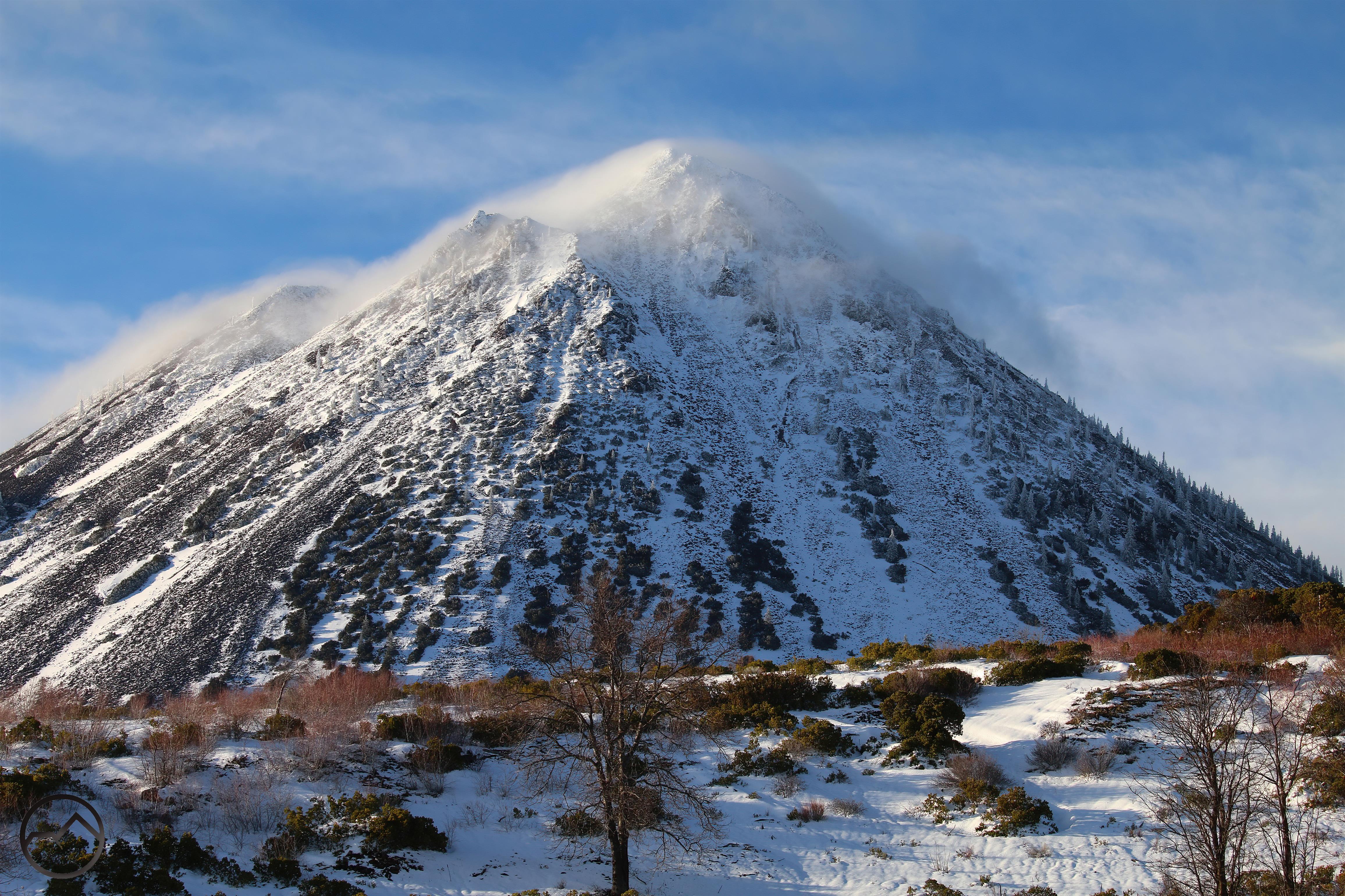
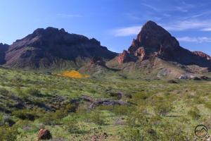
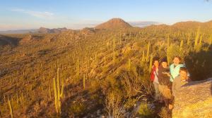
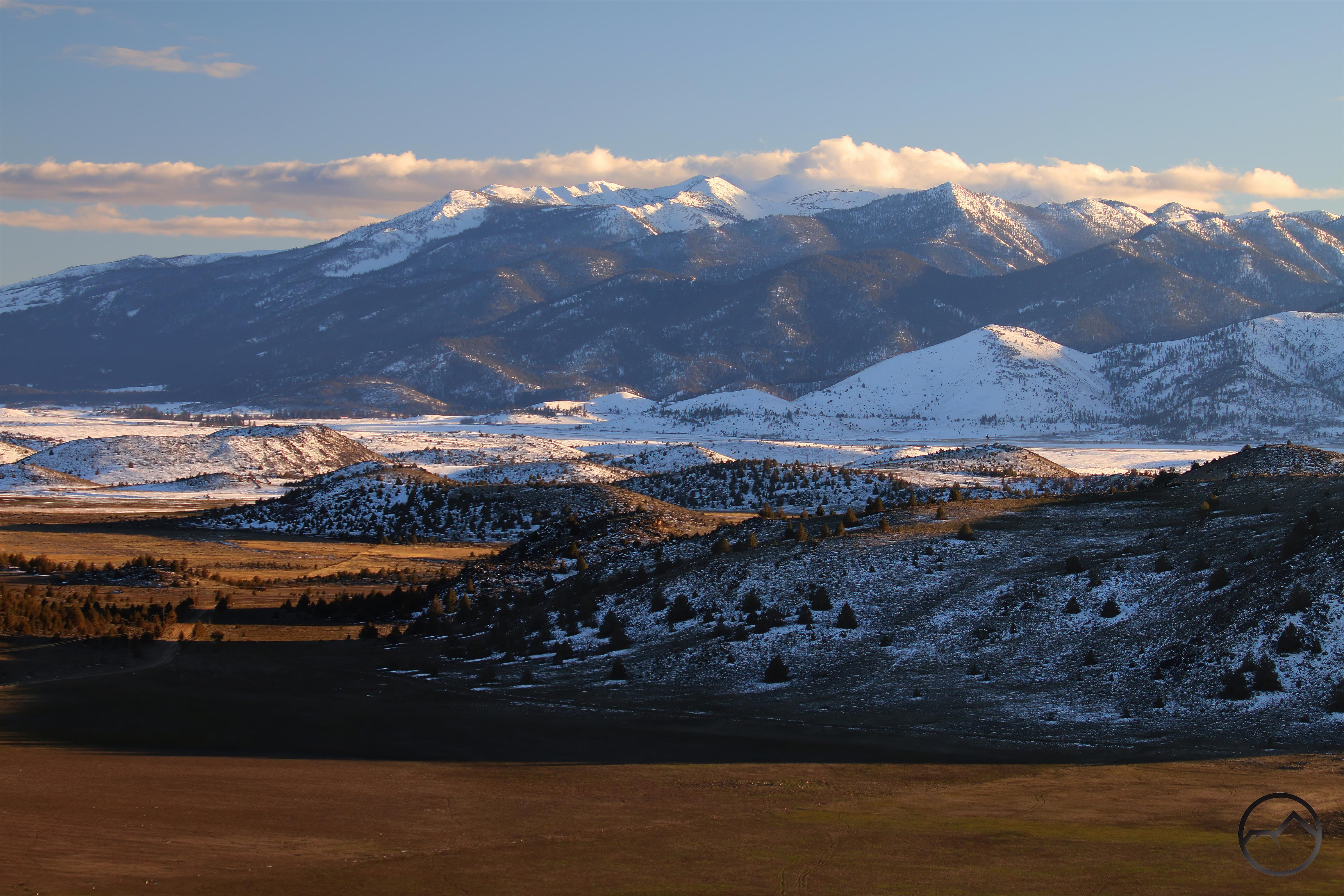
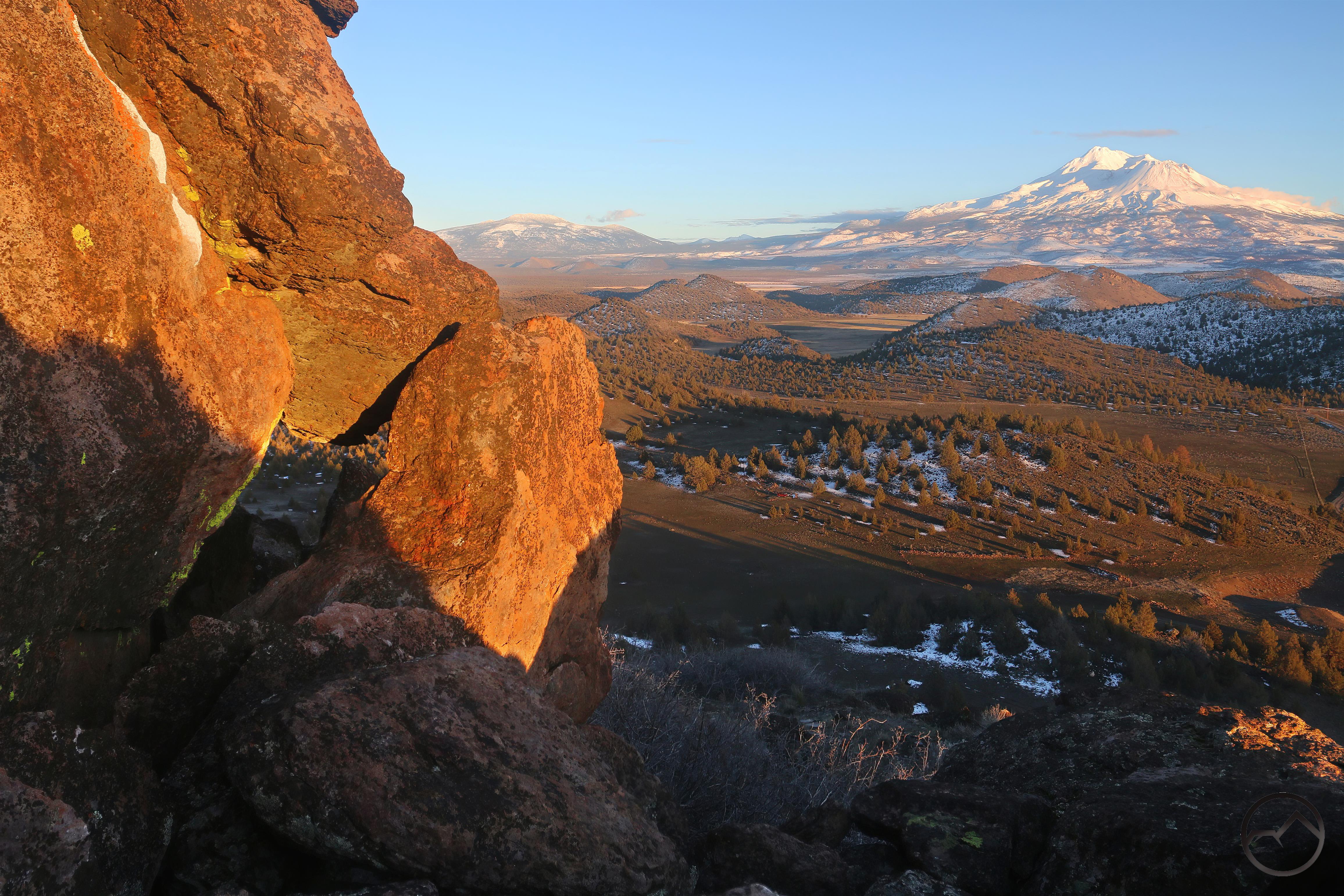
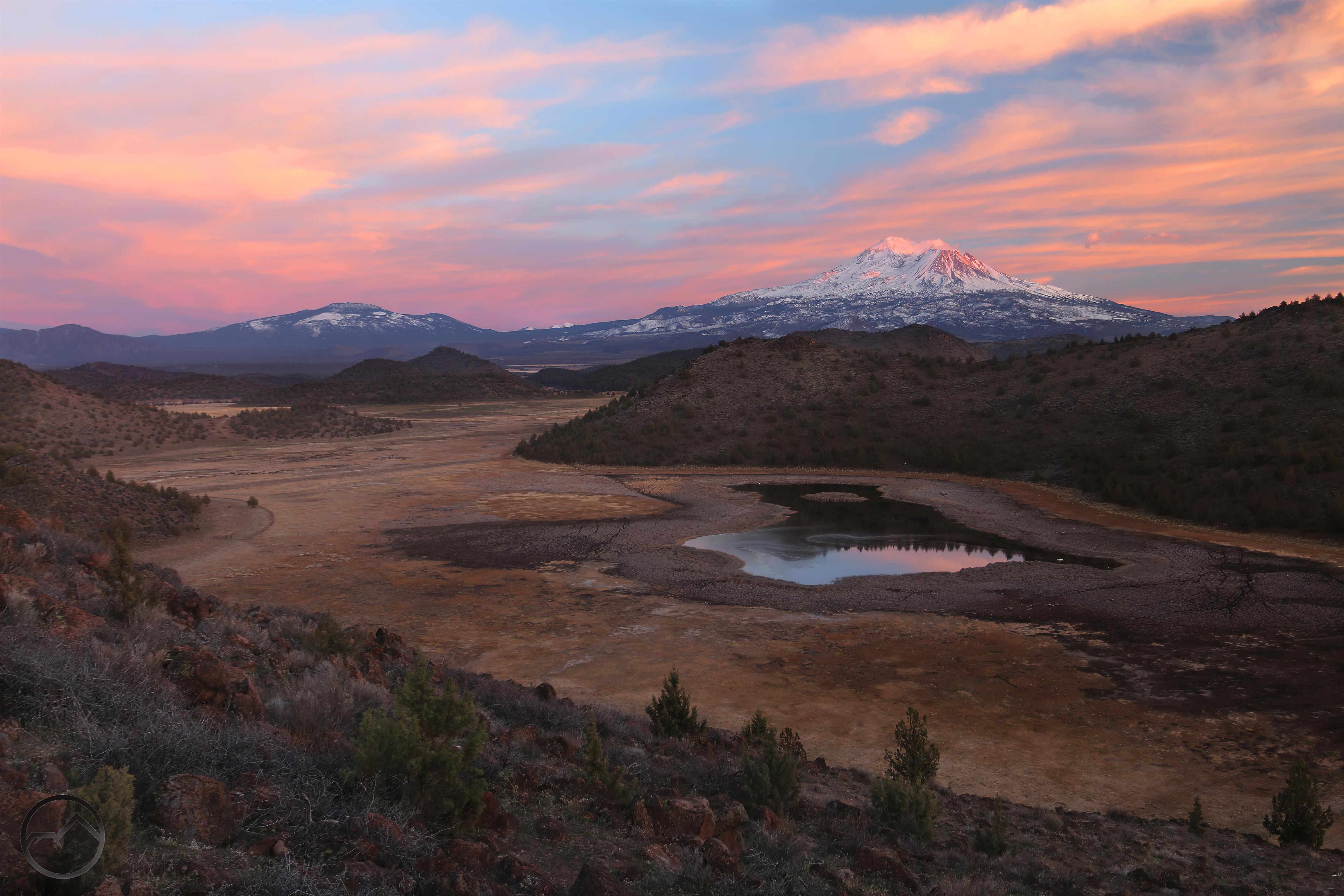
An epic sunrise view along the crest of California’s remote Warner Mountains.

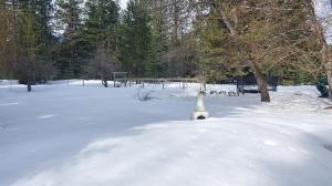
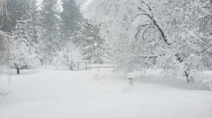
With spring finally here, the Pacific Crest Trail season has begun. Down on the border in Southern California, hikers are beginning to make their way north on the PCT. For 700 miles, they will be winding through deserts, sky islands and boulders fields, working their way toward Kennedy Meadows, the gateway to the glorious Sierra Nevada. However, this year, the Sierra poses unusual circumstances for thruhikers. The Long Winter has piled feet upon feet of snow in the High Sierra to the point of breaking records throughout the range. This makes sections of the trail treacherous not just because the path is buried in snow but also because passes are difficult to traverse and creek and river crossings are nearly impossible. Such are the conditions in spades this year on the PCT.

For hikers on the PCT then, it becomes a delicate balance of making it through the desert during the cooler spring months while reaching Kennedy Meadows late enough for the Sierra Nevada to have thawed out enough to make travel reasonably feasible. The conditions this spring are such that it is causing significant consternation amongst the hikers. Many have already abandoned the PCT while some have shifted to the Appalachian Trail. Still others, the hardened ambitious few, are committed to the PCT in 2023. Within this group, a number will hike the trail in segments, hitting the desert first, then heading somewhere northerly, where the conditions are less snowy and many miles can be strung together in different areas before finally heading back to the Sierra to pass through America’s greatest mountain range.

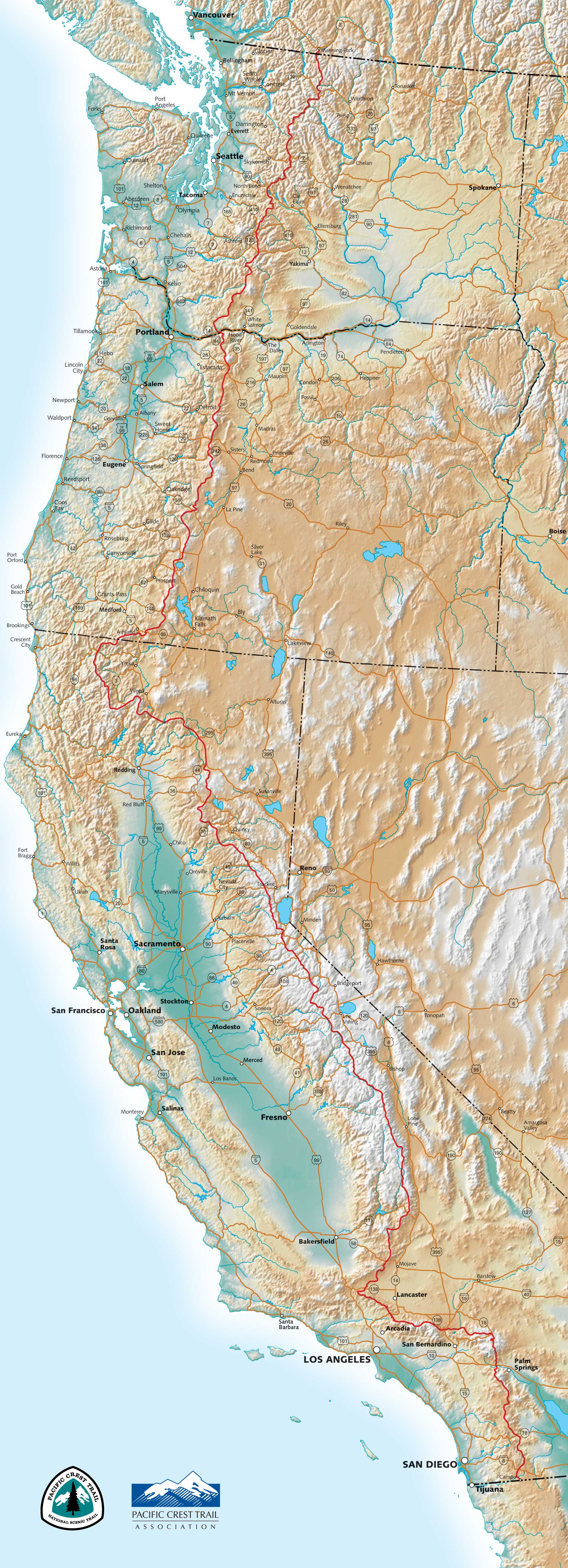
The Pacific Crest Trail travels through California, Oregon and Washington, from Mexico to Canada.

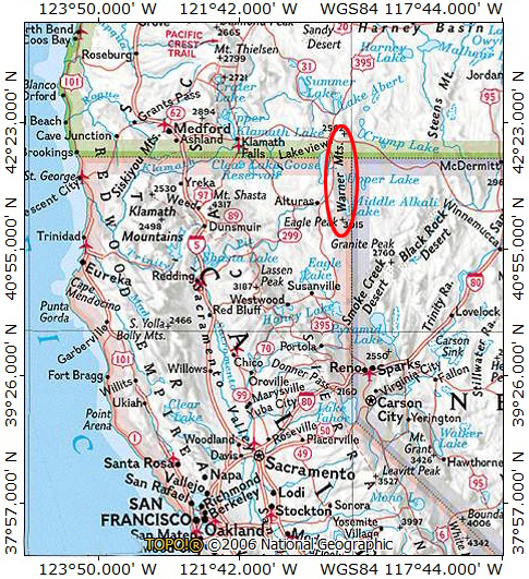
These conditions have led me to wonder what the plan would be for thruhikers if the PCT followed the true Pacific crest. The crest is one of a few major divides that through America along a north-south axis, creating significant continental divisions in the way water flows. Along with the Pacific Crest, the Continental Divide and the Appalachian Mountains are also major divisions. Roughly speaking, the trail as conceived, is intended to run along the mountain divide that separates the waters that flow directly into the Pacific Ocean from those that flow into Colorado River, the Great Basin or into the Columbia River watershed. Thus, the Pacific crest sets the general route of the Pacific Crest Trail.

Except that, for nearly 700 miles, the PCT deviates from the Pacific crest. Though not many people consider this when thinking about the route of the PCT, but a significant chunk of the route runs far, far to the west of the true divide. At times it ranges nearly 160 miles west of the true Pacific crest. The deviation runs through a substantial chunk of Northern California and the two do not reunite until central Oregon. Indeed, if the PCT followed the true Pacific divide, 25% of the trail would be very, very different.

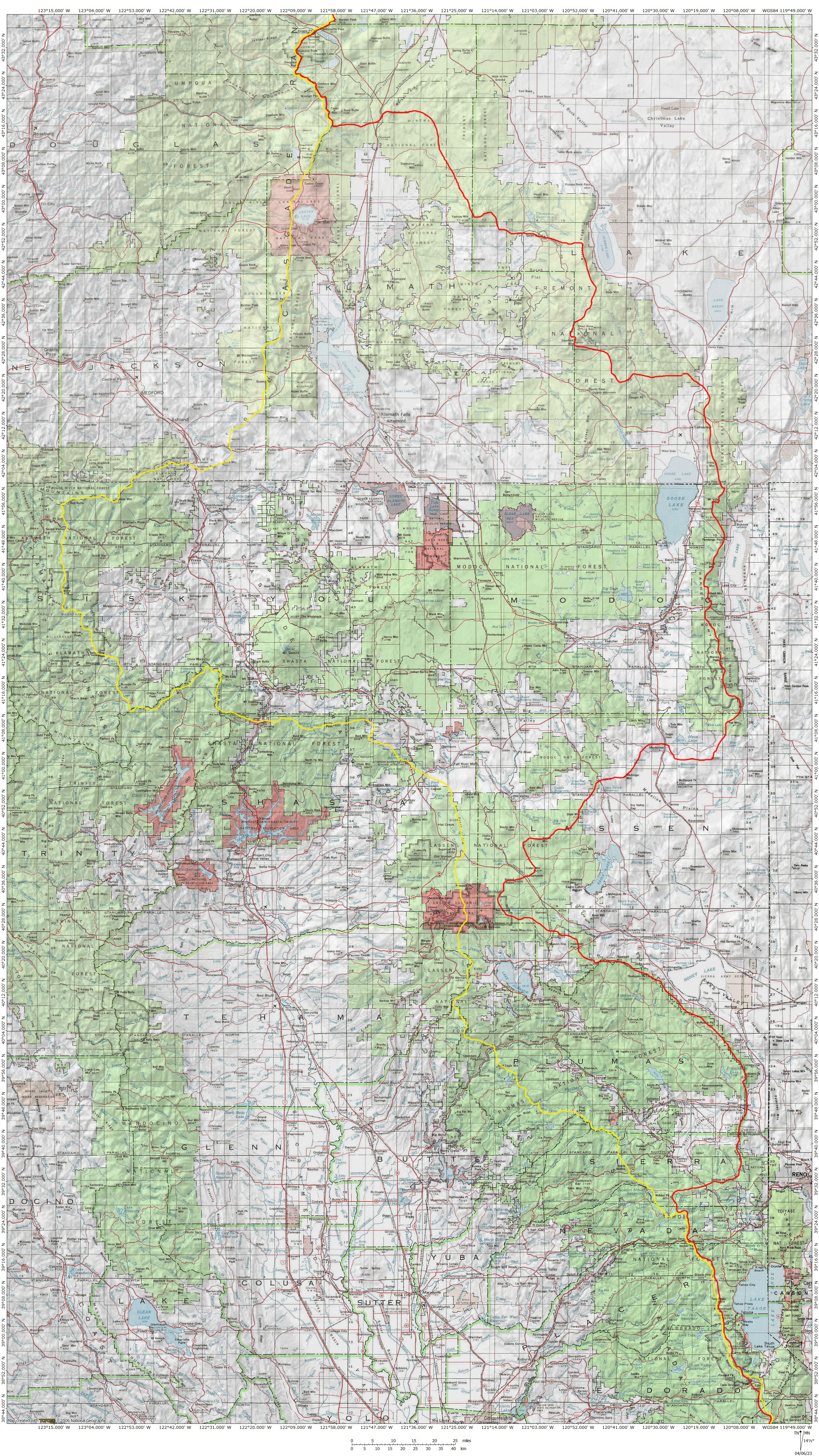
The PCT and the true Pacific Crest. The PCT is marked in yellow, the true crest in red.

The route of the PCT deviates from the true Pacific crest just north of Donner Pass. It veers west and heads through the headwaters of the Yuba River. At this point, it follows the crest of the Sierra Nevada, rather than the true watershed divide. This means the trail cuts across the heart of the Feather River watershed rather than along the edge of it. This continues to be the case as the trail descends into the Almanor Basin, a depression in the mountains that forms the divide between the Sierra Nevada and the Cascade Range. Beyond this point, the PCT traverses Lassen Volcanic National Park and then crosses the Pit River. The Pit River is one of the three rivers that traverse the Cascade Range. This means that a significant amount the rivers’ watersheds are east of the Cascades even though the rivers ultimately reach the Pacific Ocean. The other rivers that achieve this are the Klamath and Columbia Rivers.

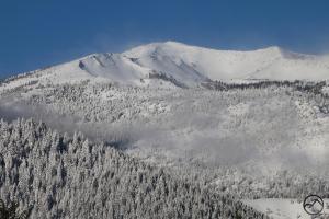
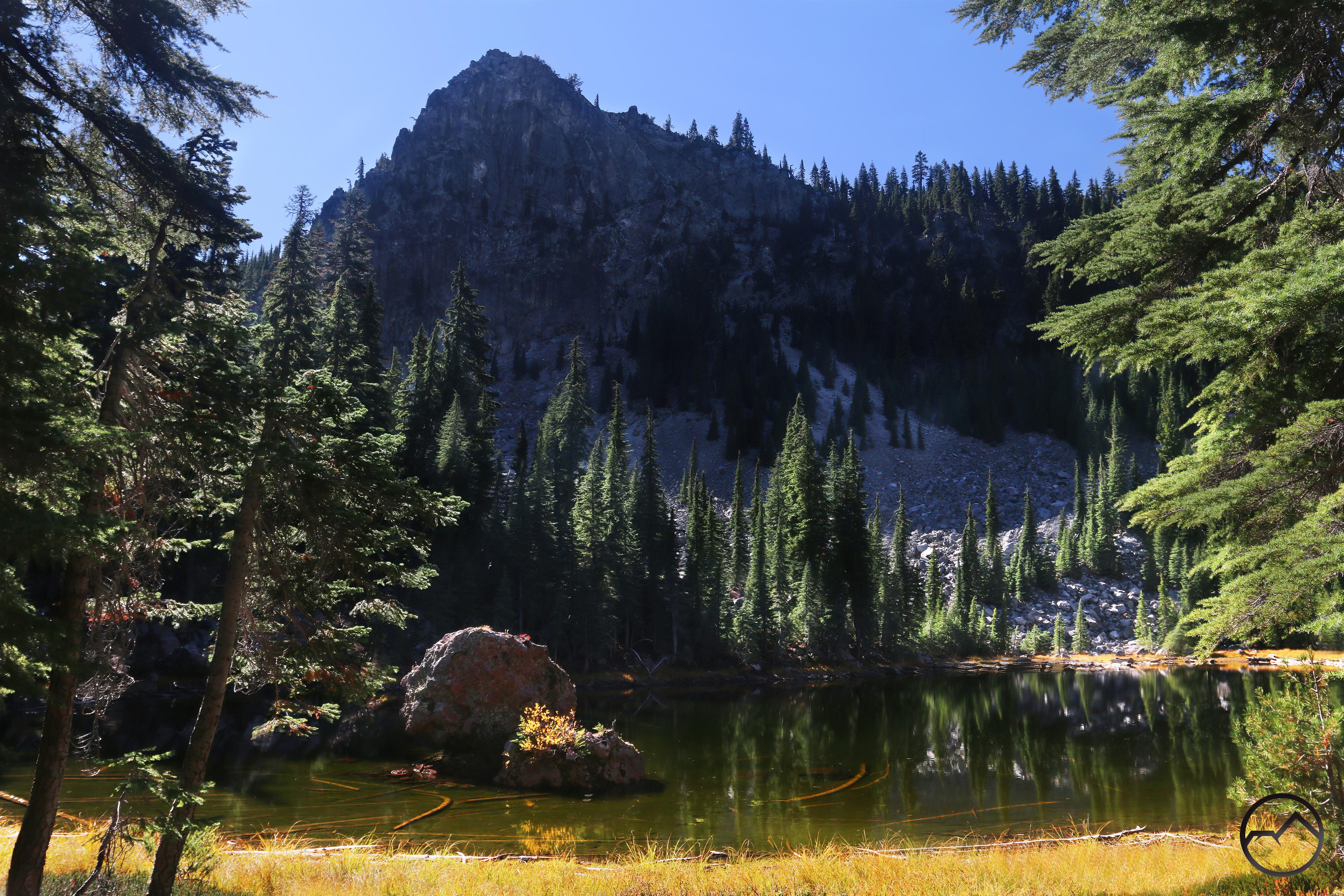
Looking into the heart of the Klamath Knot.

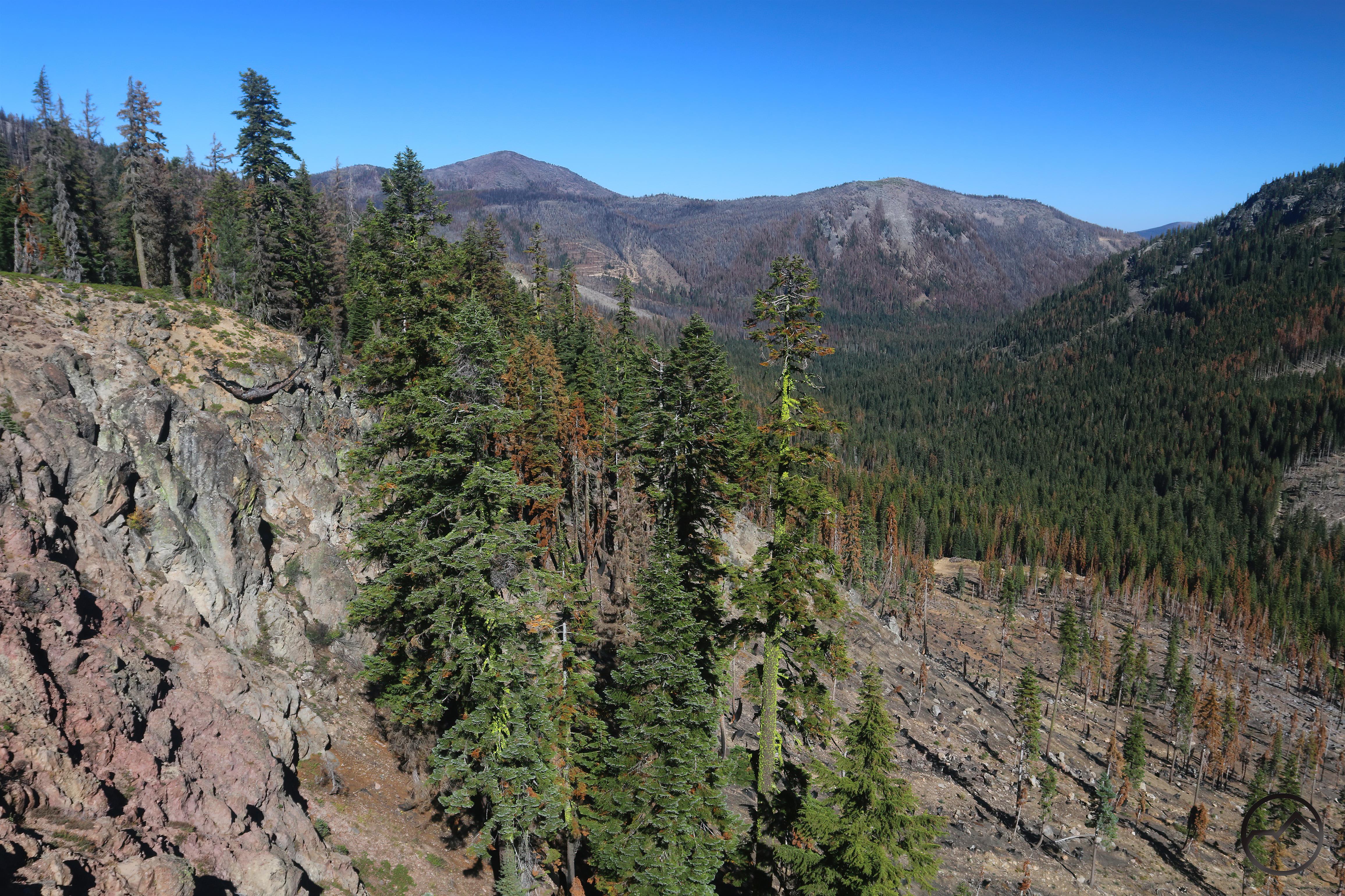
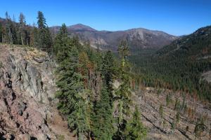
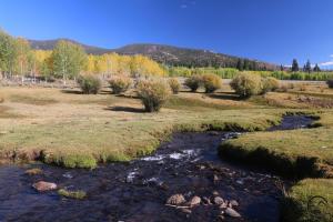
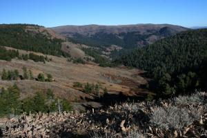
It is at this point the trail once again begins to return to its original purpose and begins following the crest of river watersheds again. Here it follows the divide between the Pit and McCloud Rivers. It does so all the way to the Sacramento River, where it then follows a series of divides that separate the Sacramento, Trinity, Scott, Salmon and Klamath Rivers. This area is often referred to as the Klamath Knot, as it is a tangle of mountain crests and river headwaters. After climbing out of the Klamath River canyon, the PCT continues along the divide that distinguishes the Klamath River from the Rogue River. Beyond this point, the trail resumes its trajectory along the Cascade Crest. However, since the Klamath River is one of the rivers that traverse the Cascades then, like the Pit, much of its watershed, and thus the true Pacific Crest, lies east of the mountains.

The meaning of this is that the outer edges of the Pit and Klamath Rivers represents the true Pacific crest, the divide between the waters that flow to the Pacific Ocean and those waters that flow into the Great Basin. If the Pacific Crest Trail were to follow the true Pacific Crest, then the trail would range far east of where it does, following the edge of the Great Basin. Instead, it courses inland, into the heart of the Klamath Knot. It is an interesting deviation and makes for a remarkably different trail than would have been the case if the true crest marked the route.


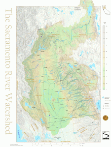
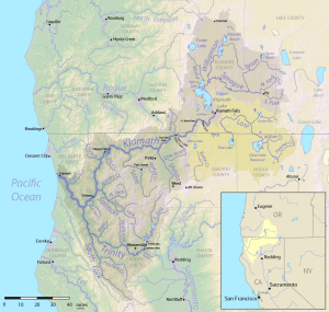
Maps showing the Sacramento and Klamath River watersheds. Much of the rivers’ waters originate east of the Sierra Nevada and Cascade Range. This means that the true Pacific crest lies along the eastern fringes of the watersheds. 

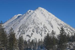
The Marble Mountain, along the PCT.

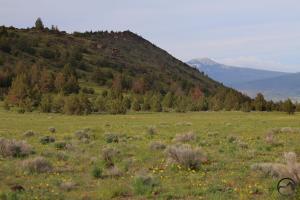
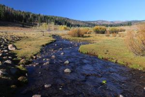
I have not been able to ferret out documented evidence for why the decision was made to deviate so far off of the divide but I can speculate on several reasons, some practical, others more aesthetic. Practically, the current route simply has far more water than the true divide. The northern Sierra and the Klamath Mountains are loaded with creeks, lakes and springs. It is a lush mountain garden through which the trail winds, with water’s availability being of little concern (aside from the Hat Creek Rim, of course). This route also had several existing trails that could be incorporated the PCT, resulting in far less trail construction. On the aesthetic side, the current trail travels through far more wilderness than the route would if it followed the true Pacific divide. There are currently 10 established wilderness areas (including Crater Lake National Park, which, while not officially wilderness, is managed as one) along this section of the PCT. In addition to this, there are also several mountain areas like the Yuba headwaters and the Trinity Divide that are wilderness in all but name. The wilderness character of the true PCT is very different. Only two established wilderness areas are found along the true divide. Certainly, some areas are de facto wilderness but the lack of legal protections and the overall gentler terrain means that roads and civilization have encroached closer than would otherwise be ideal.

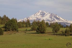
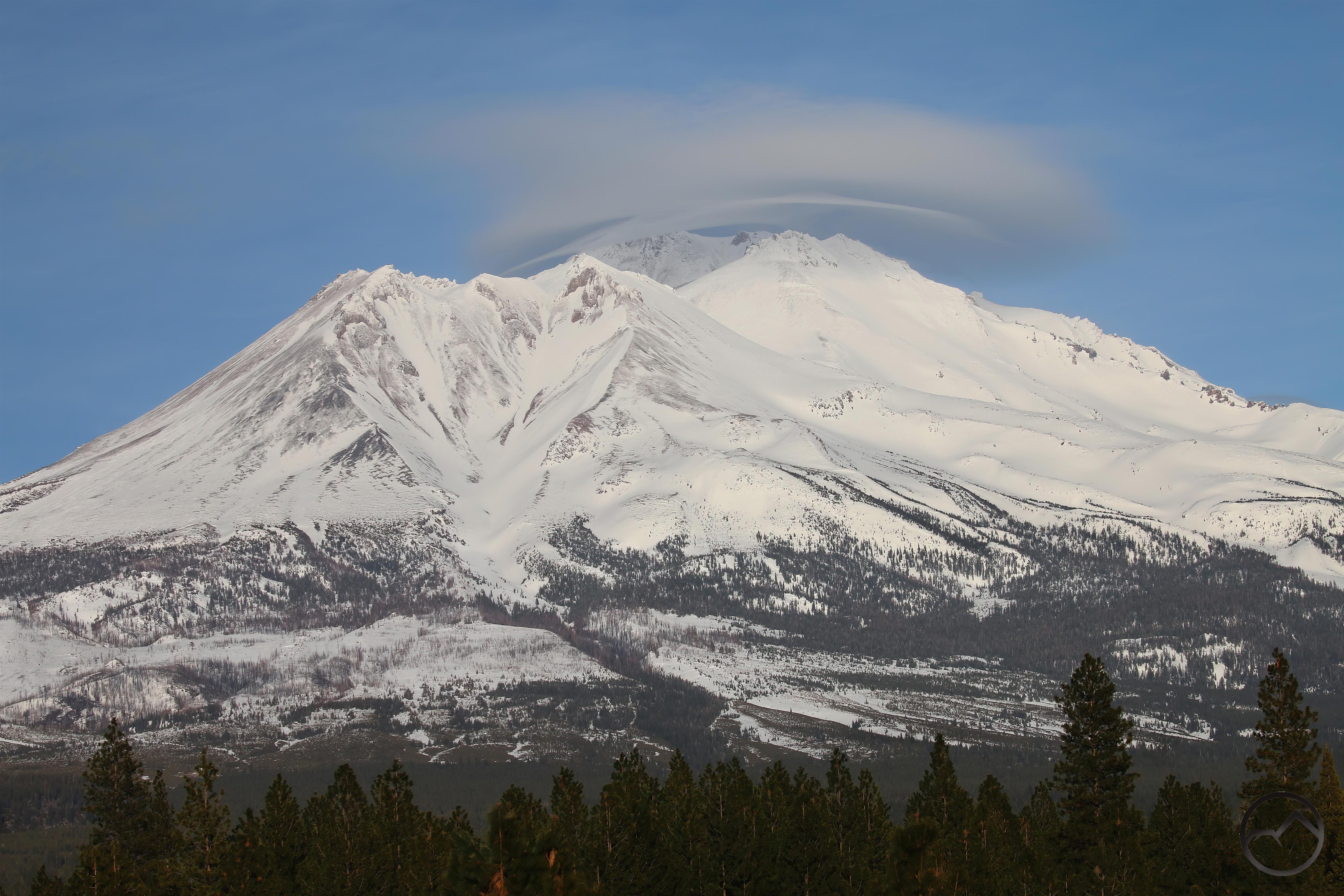
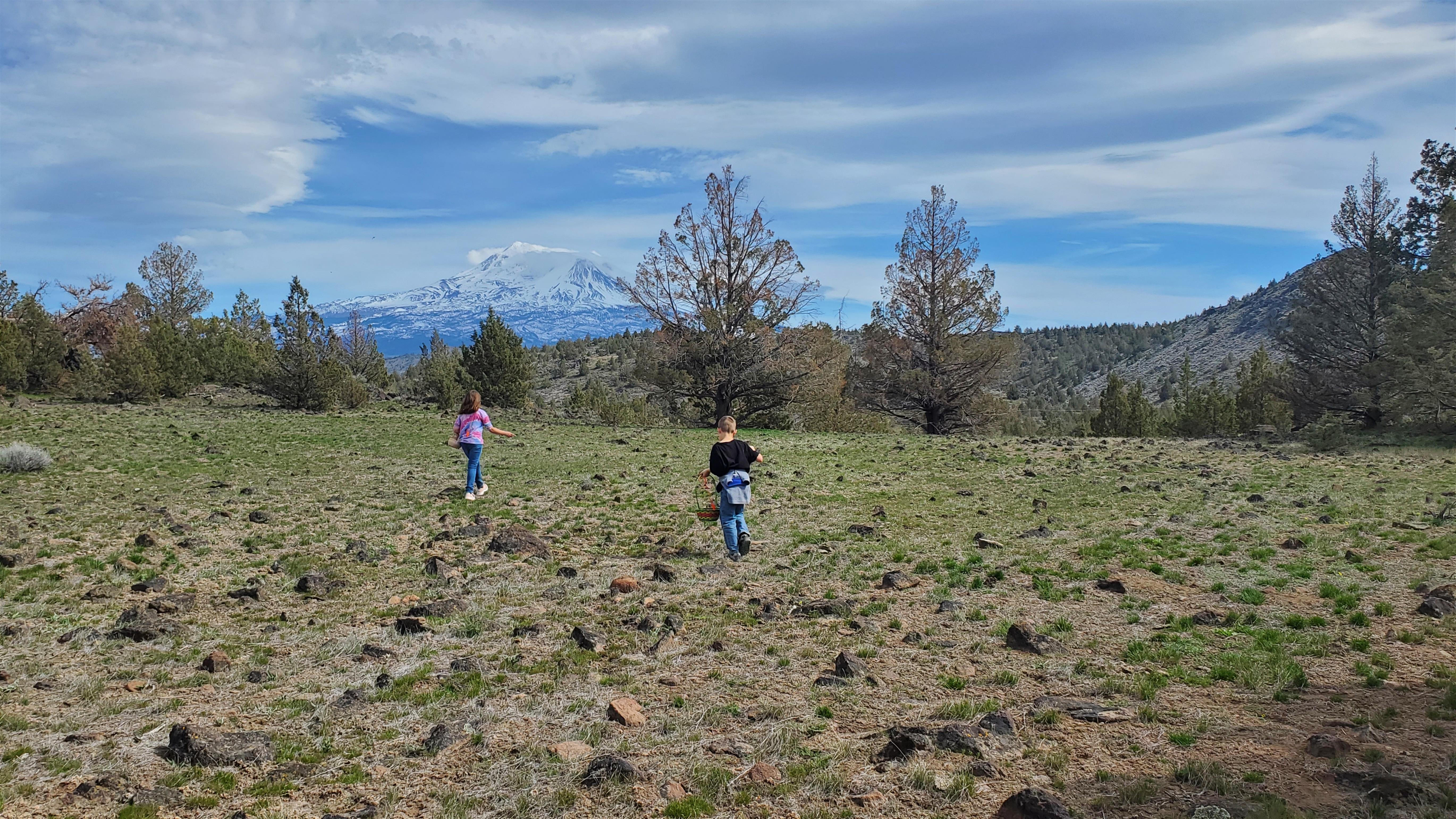
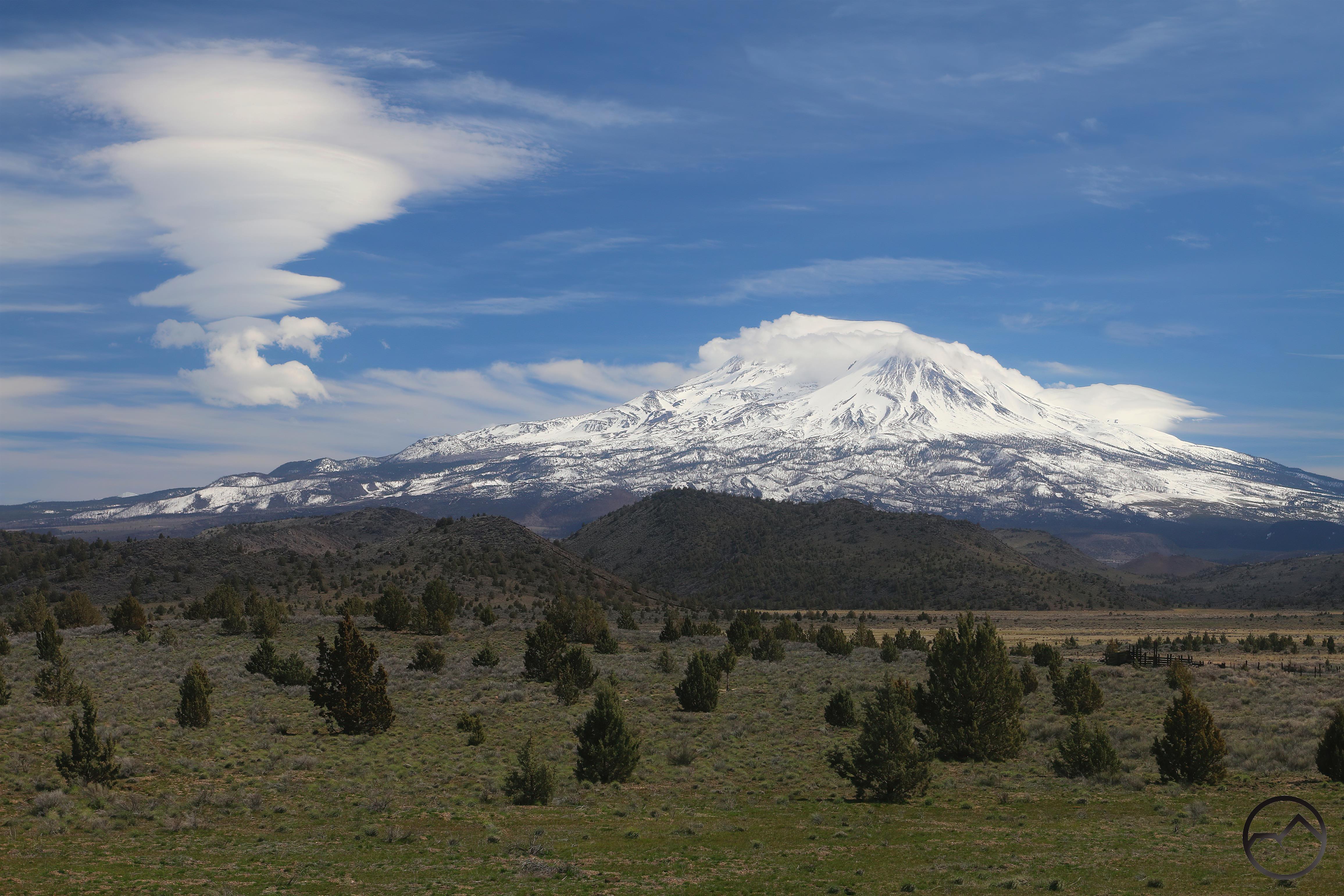
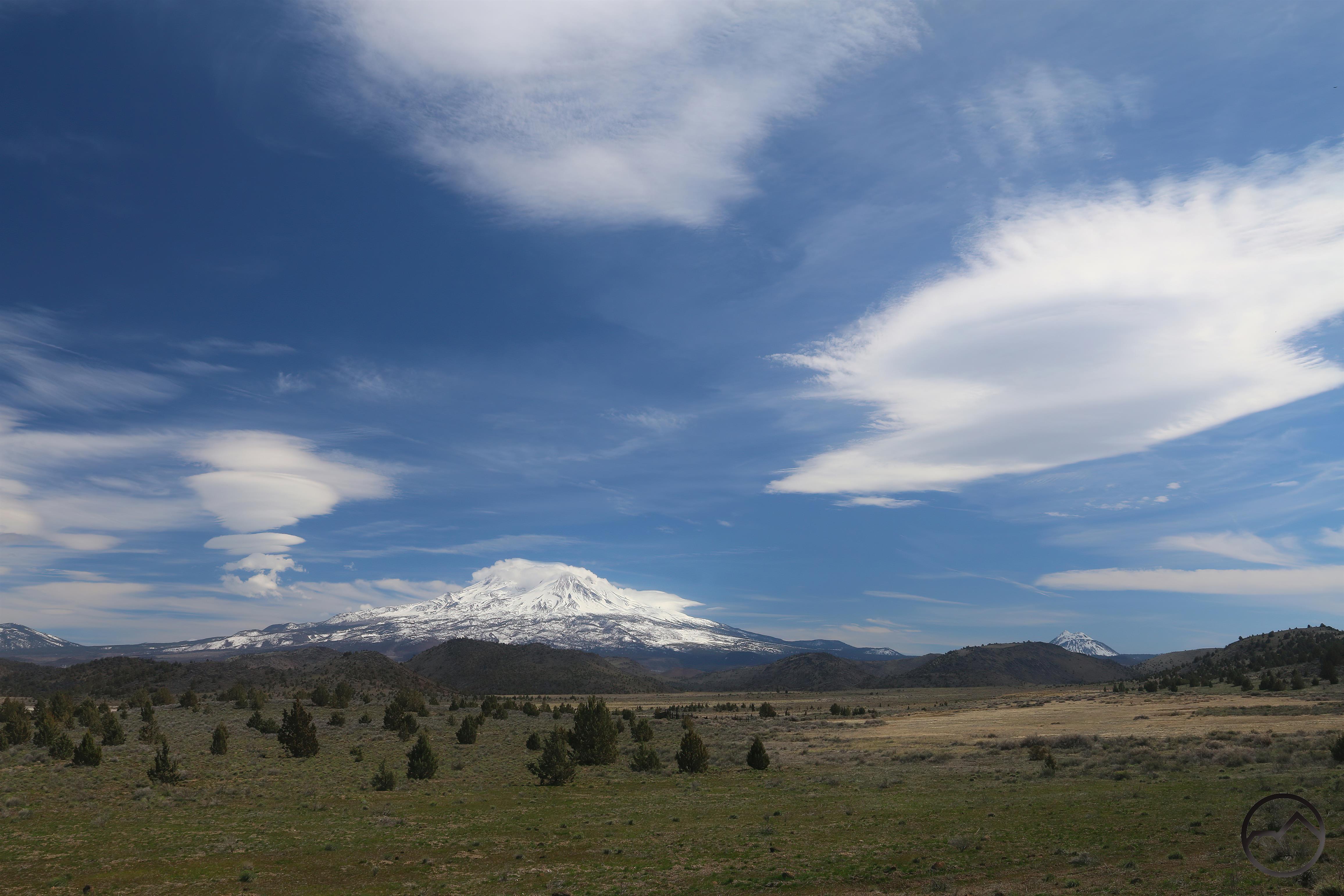
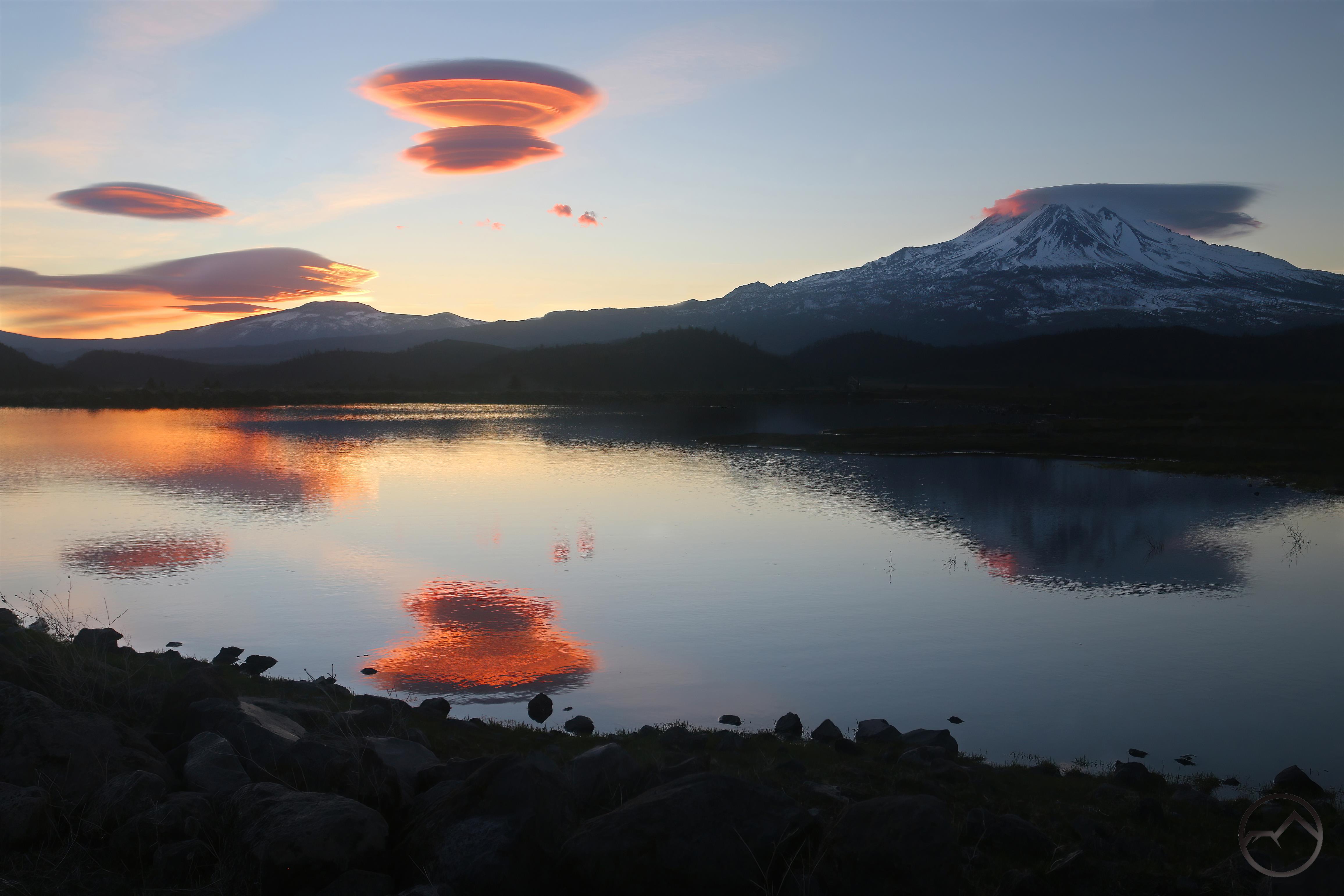
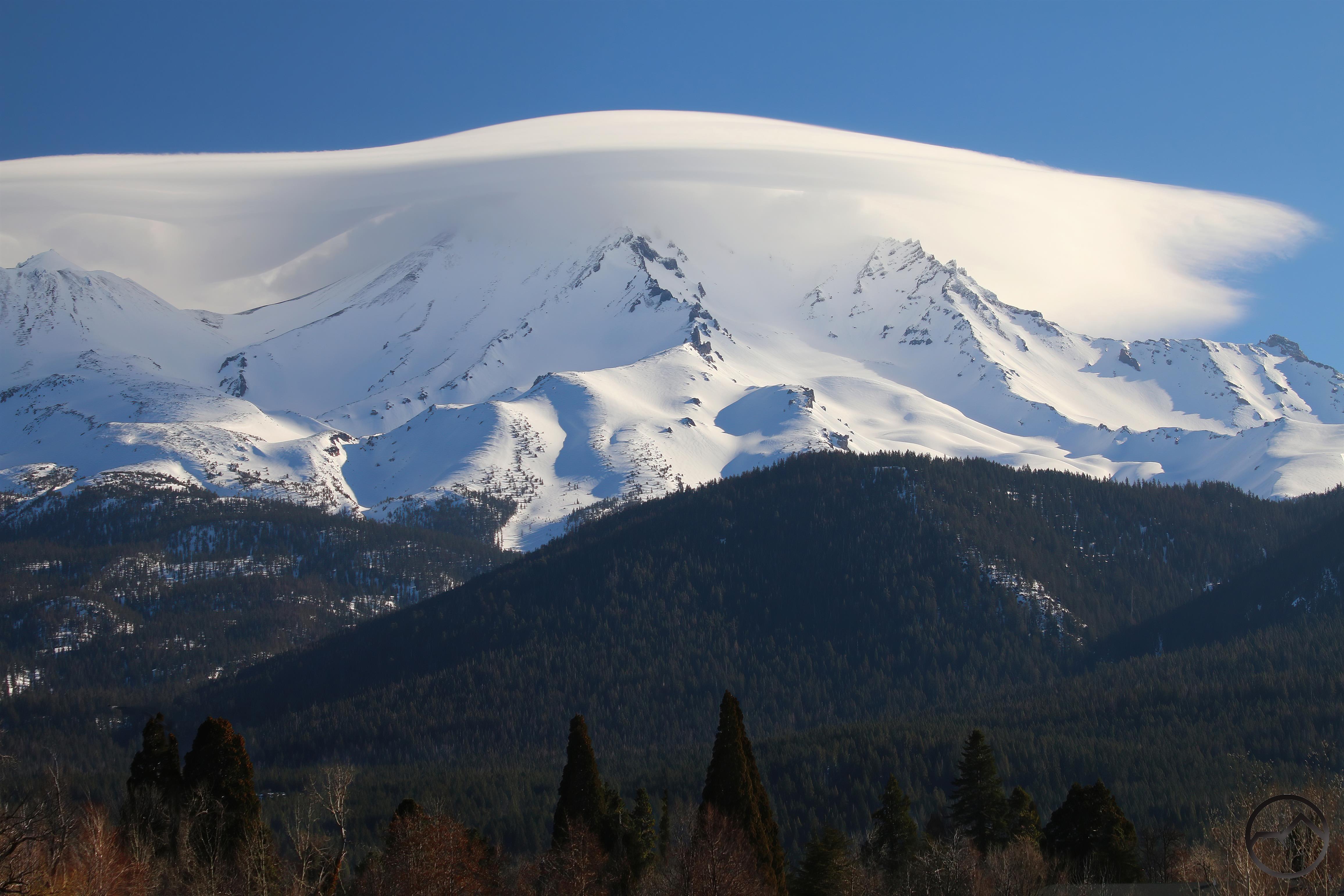
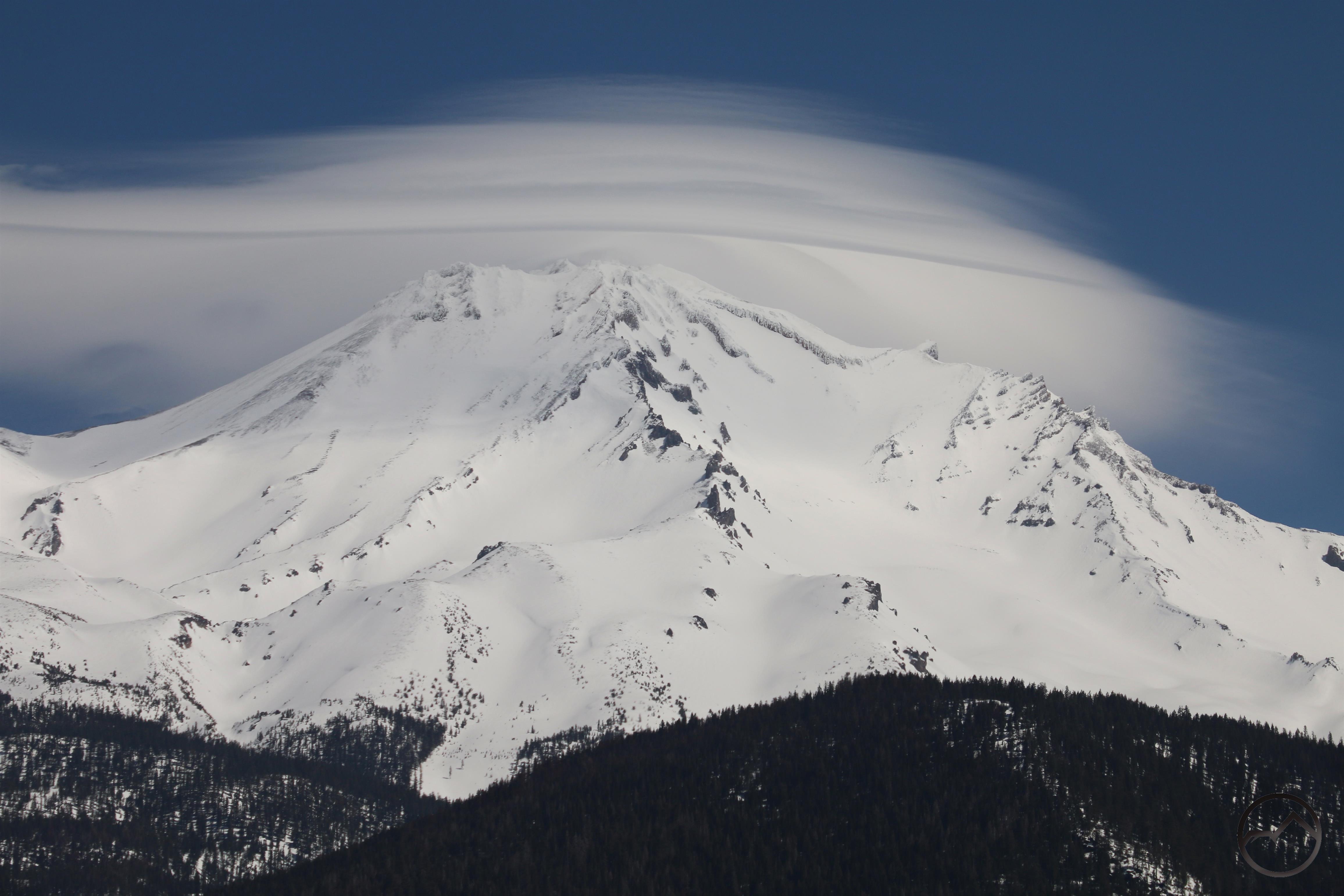
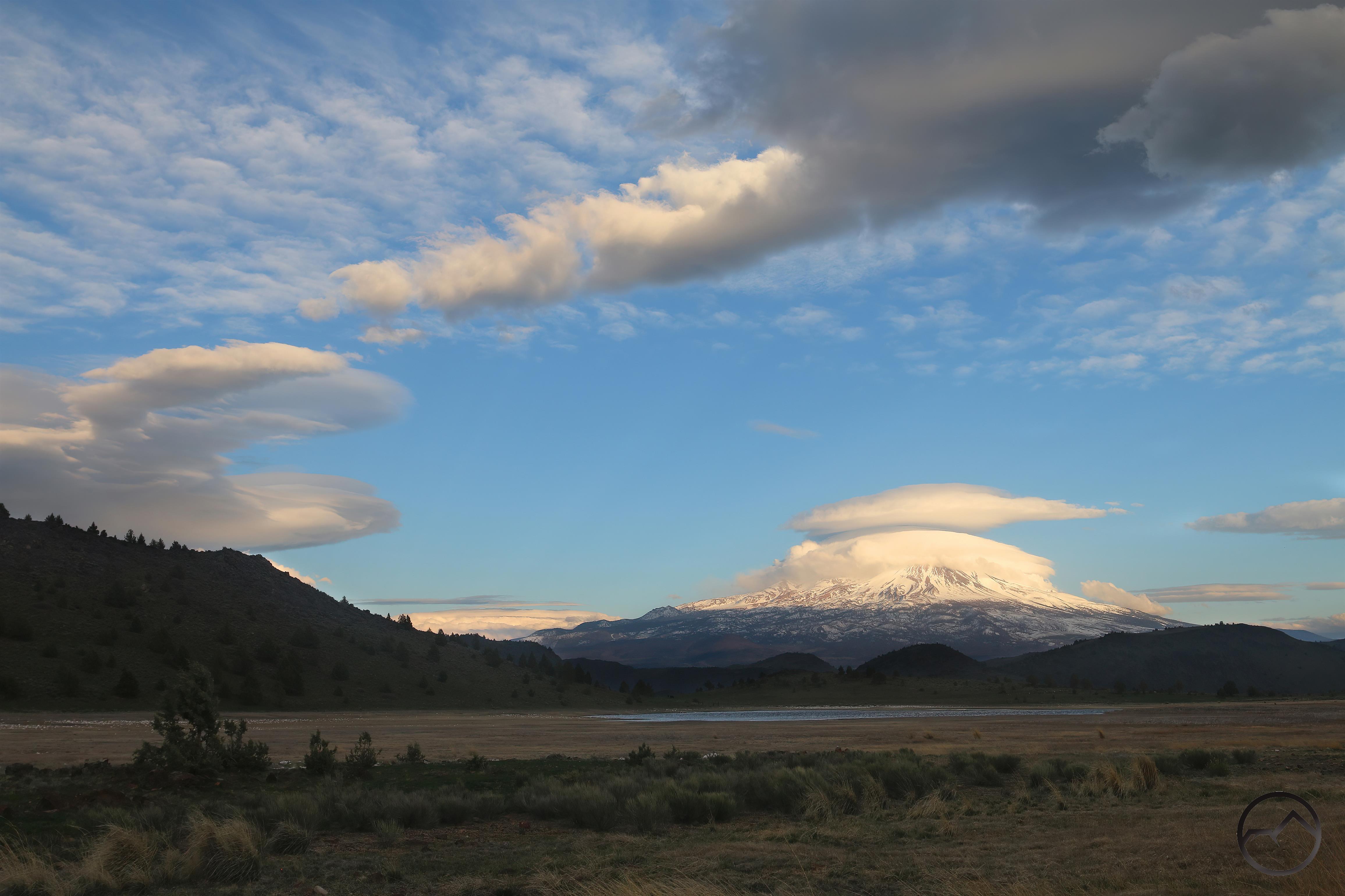
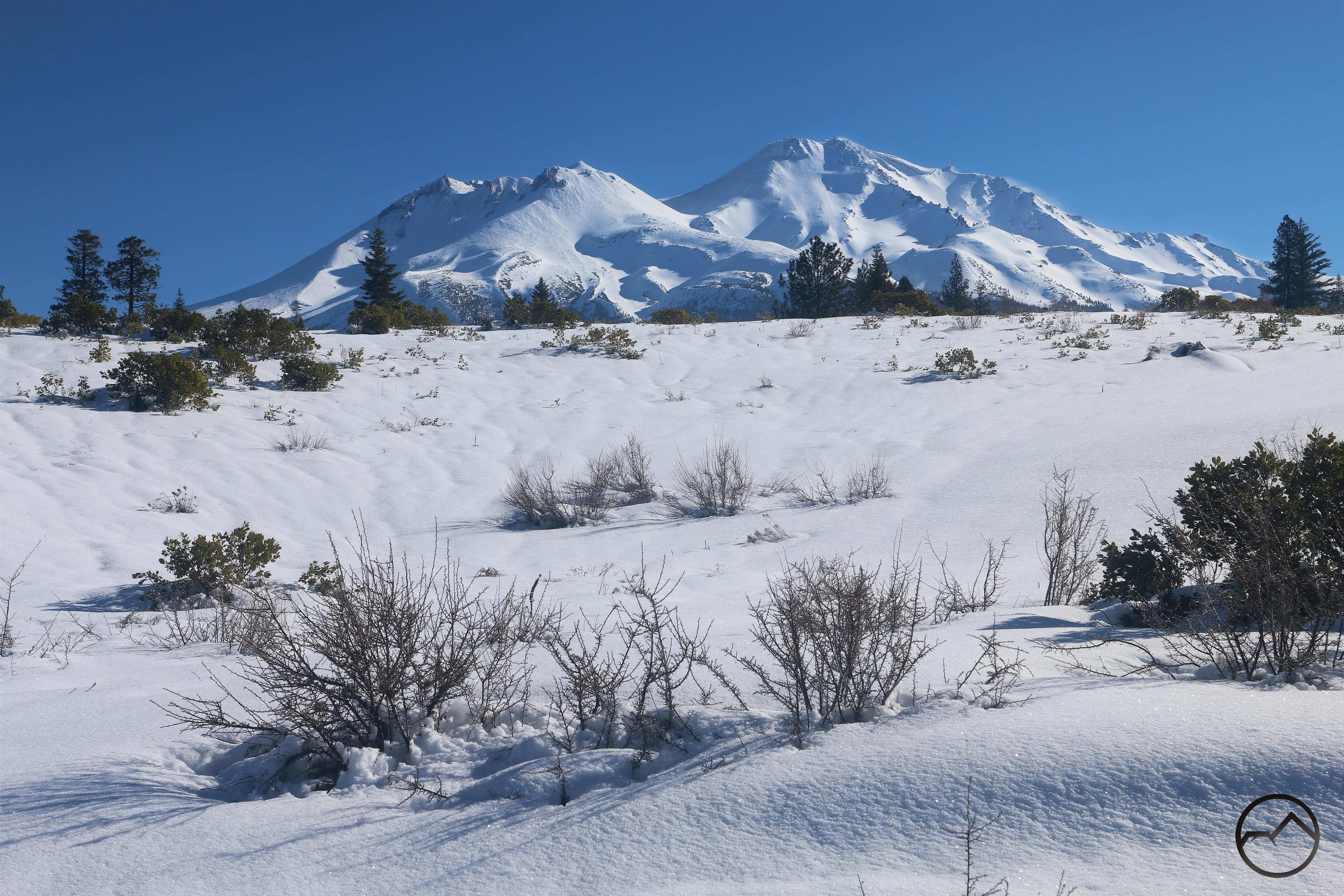
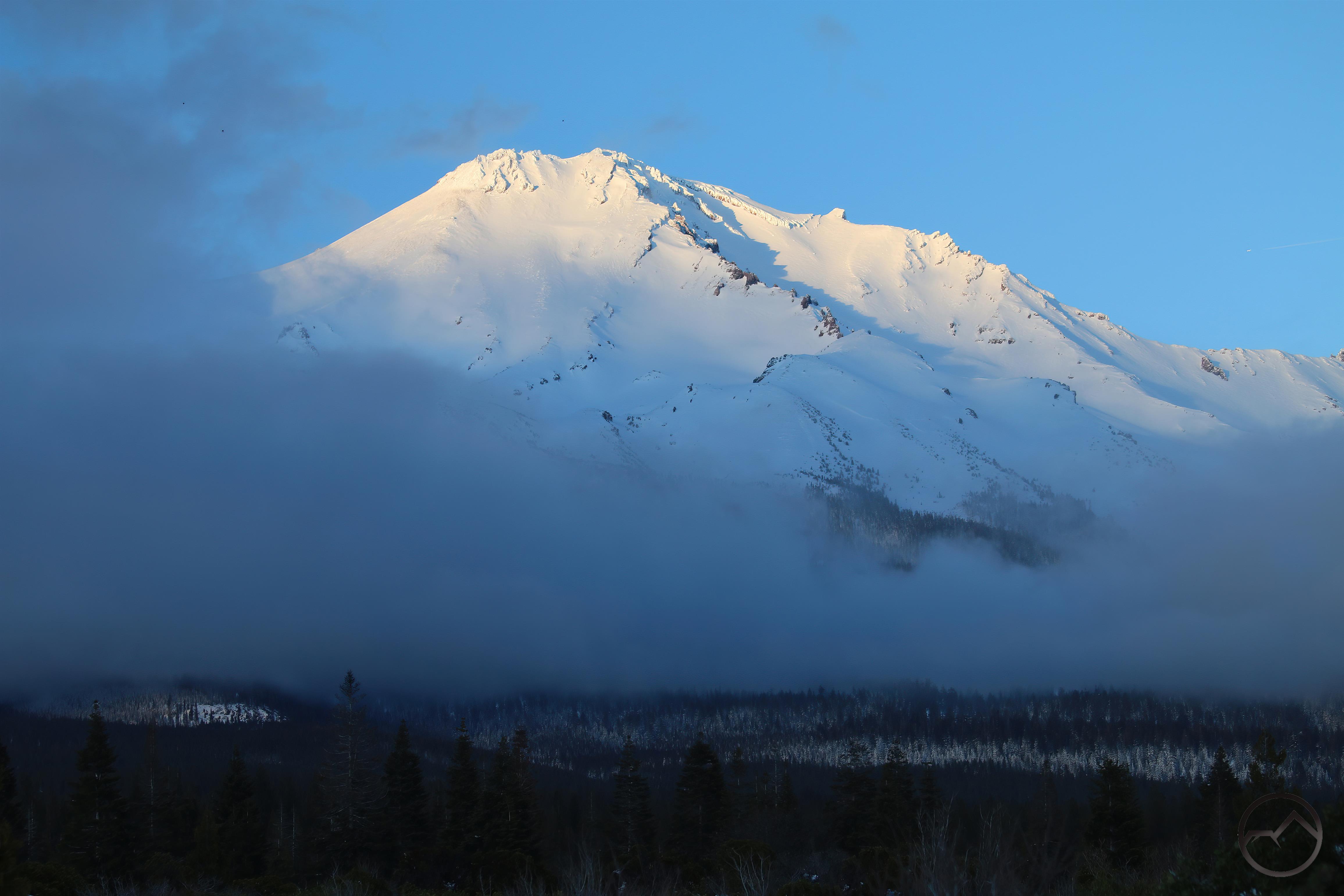
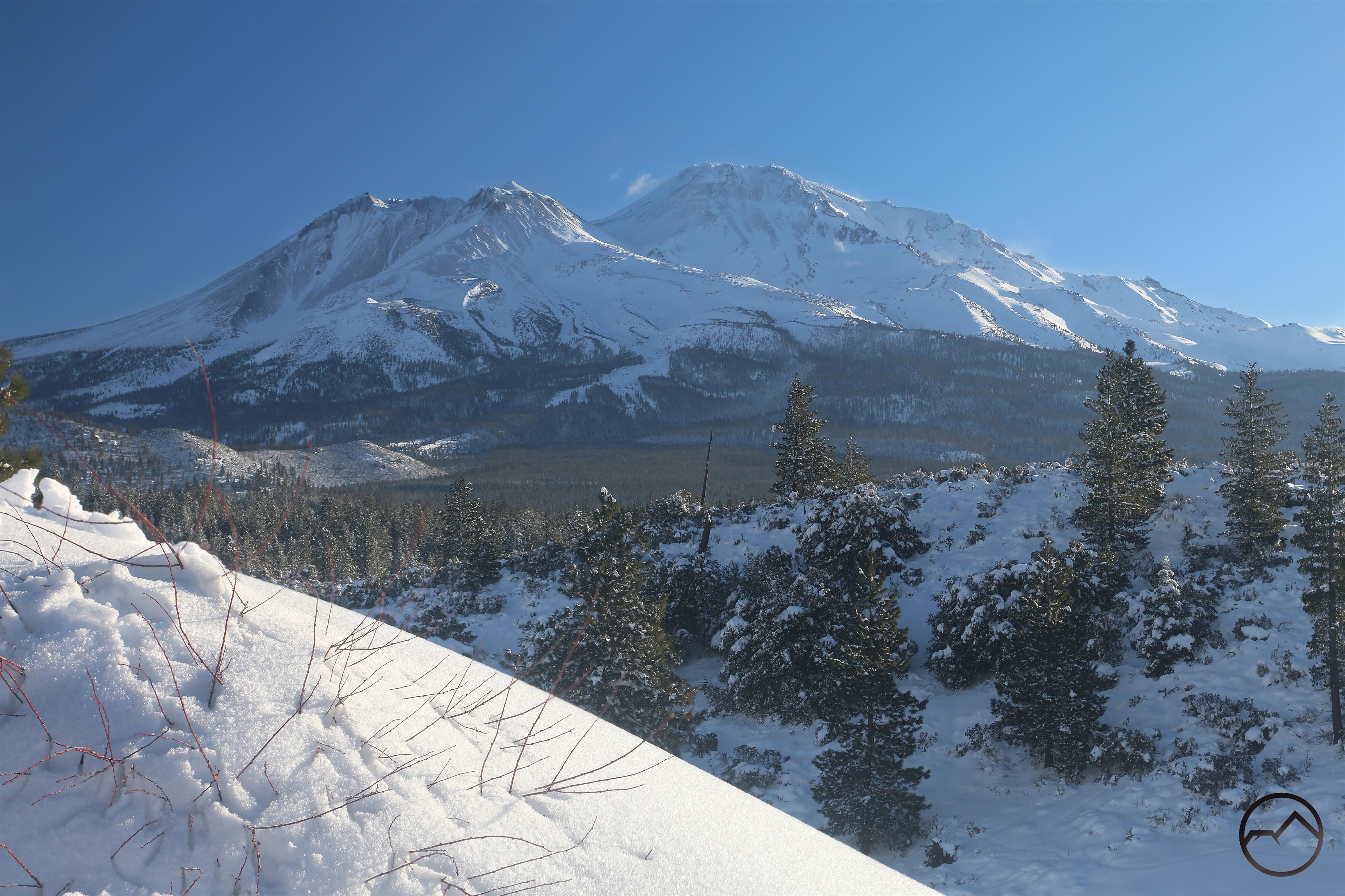
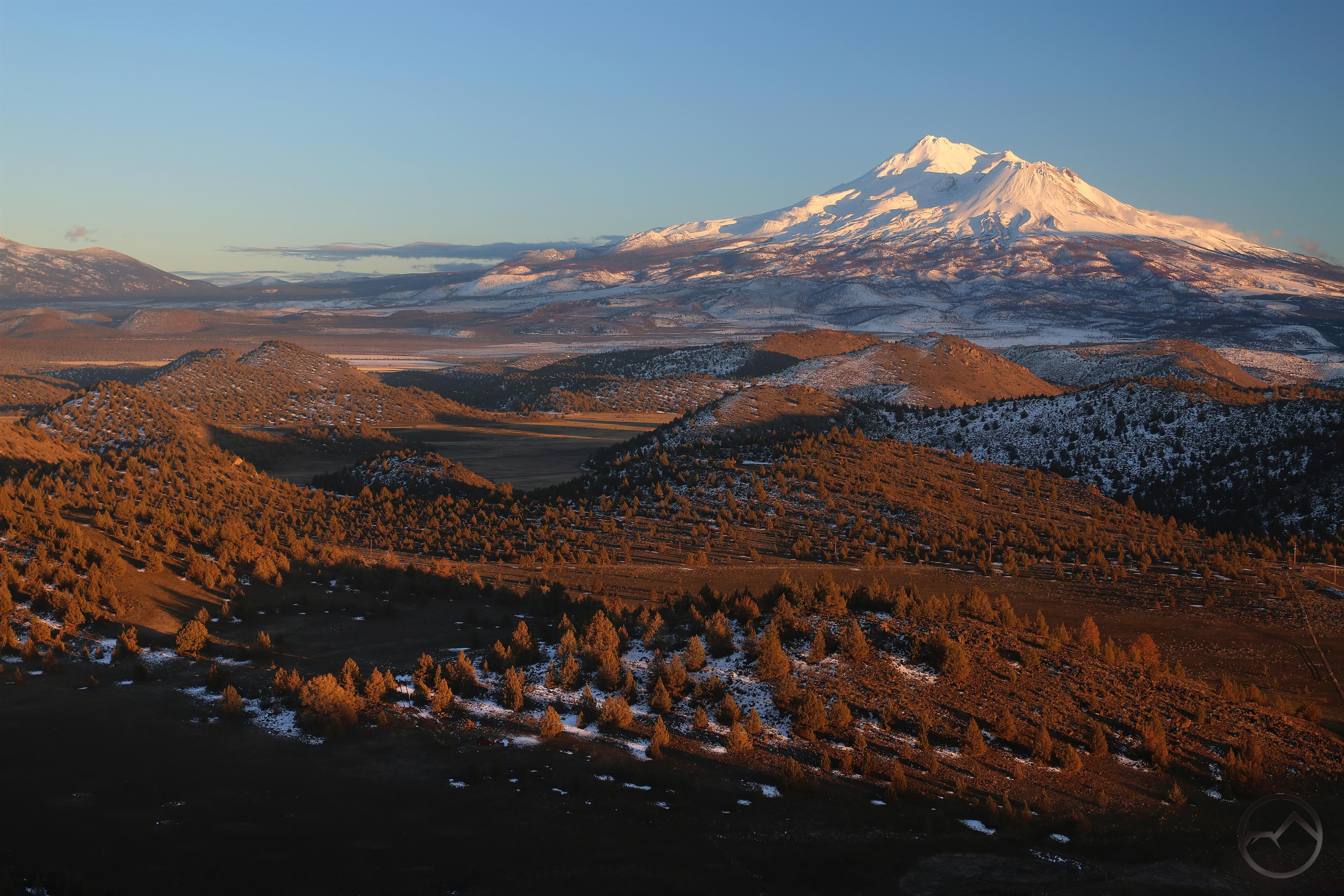
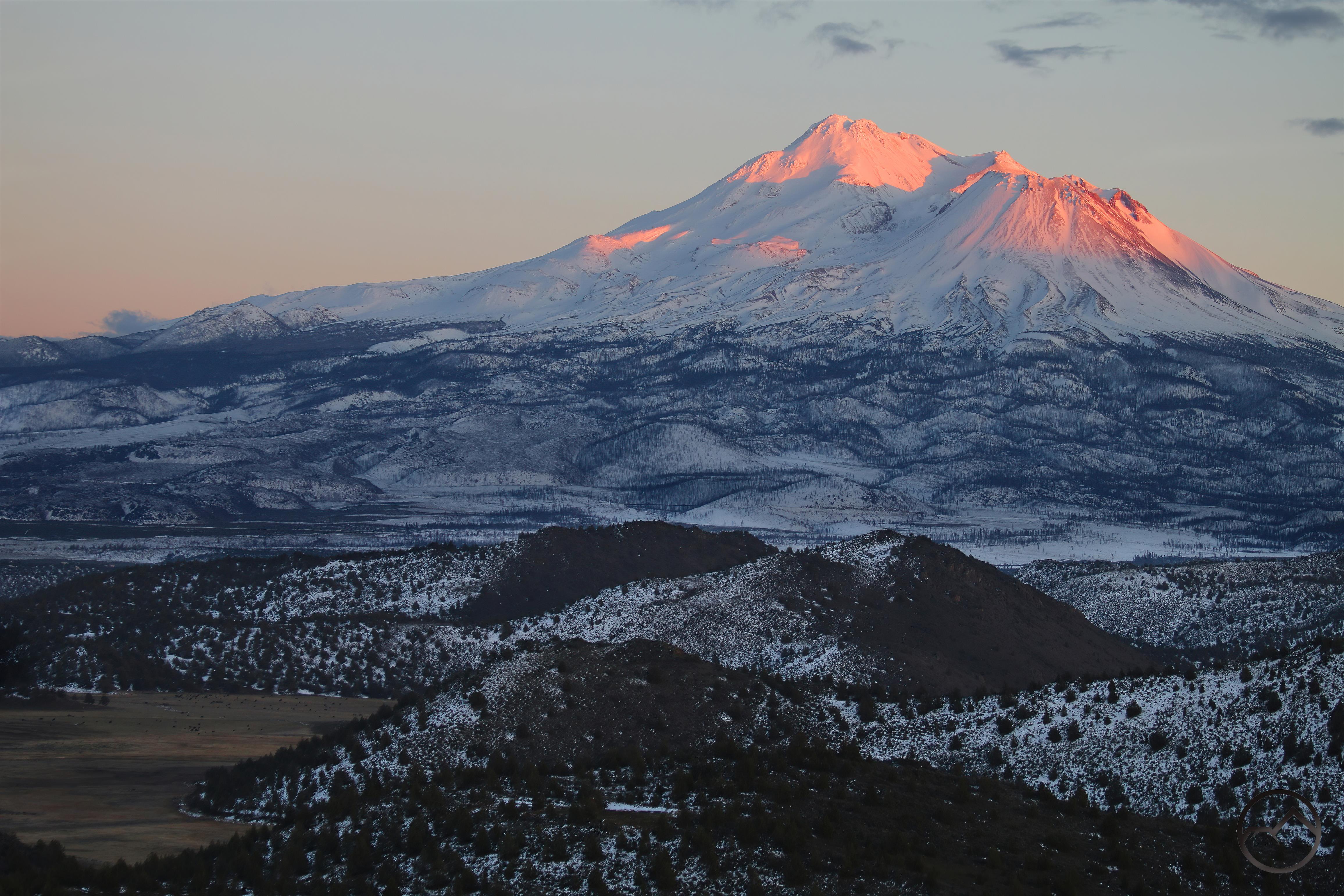
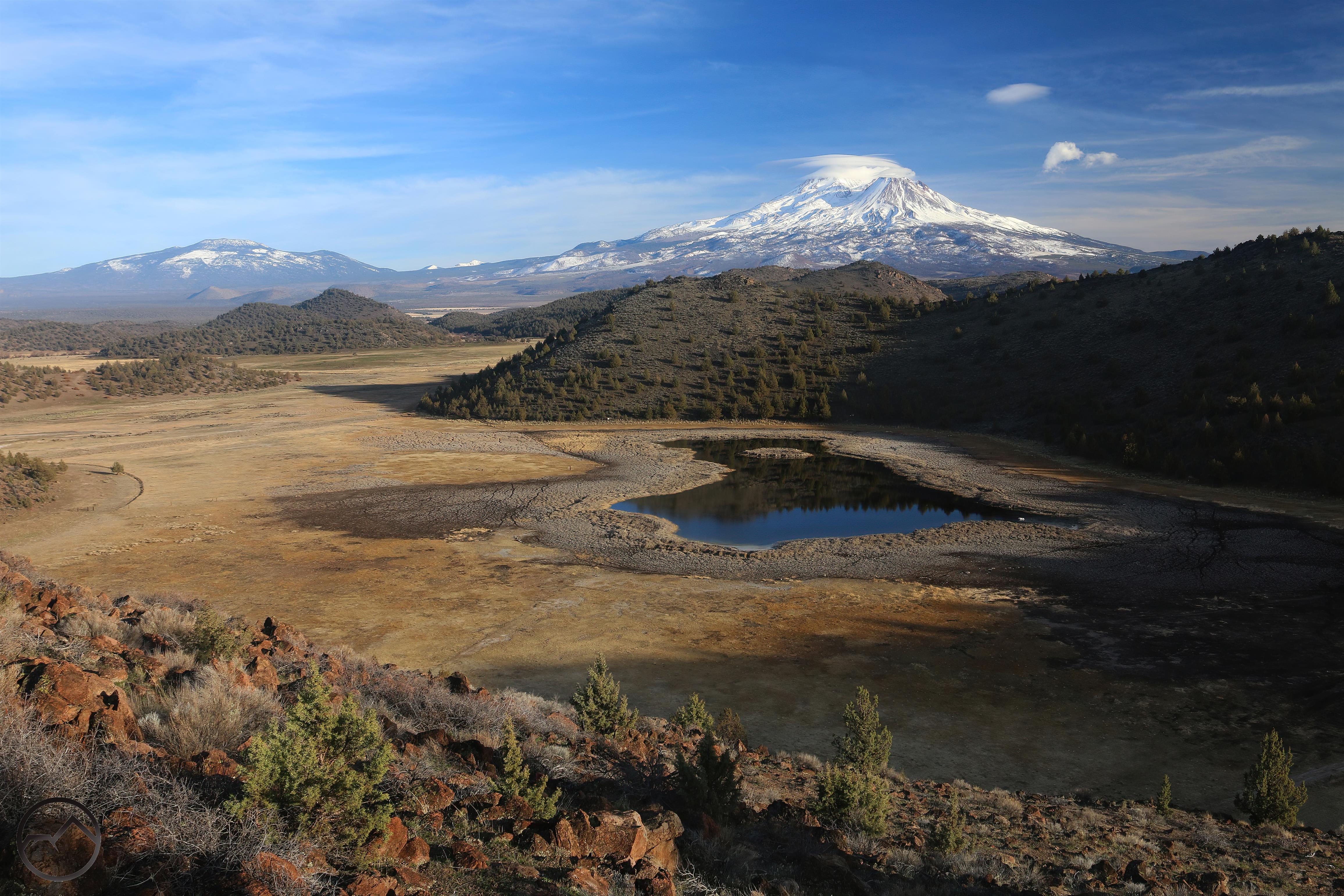
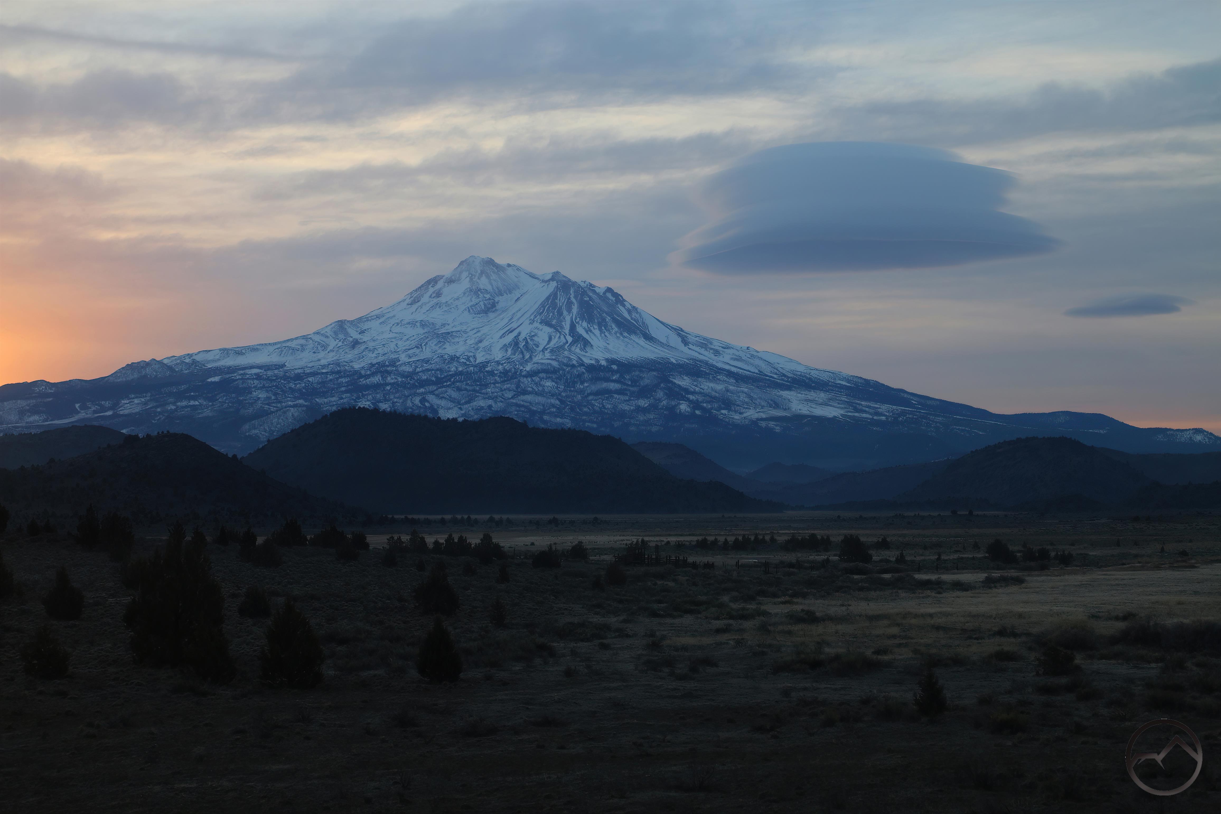
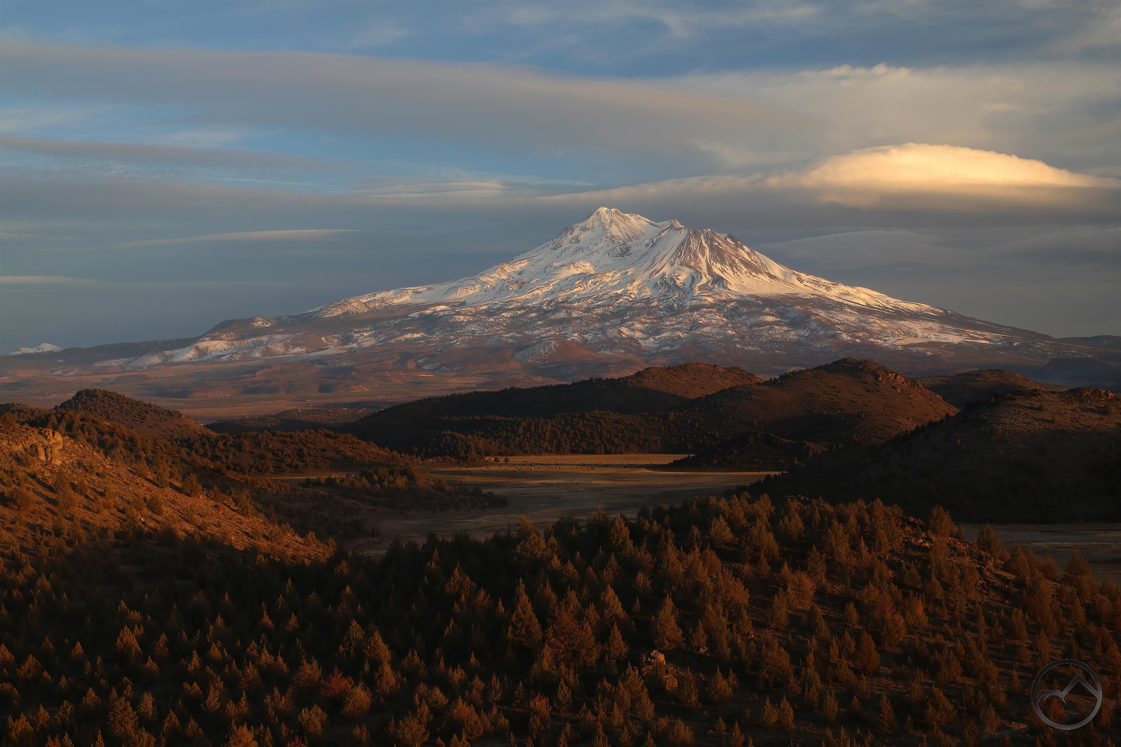
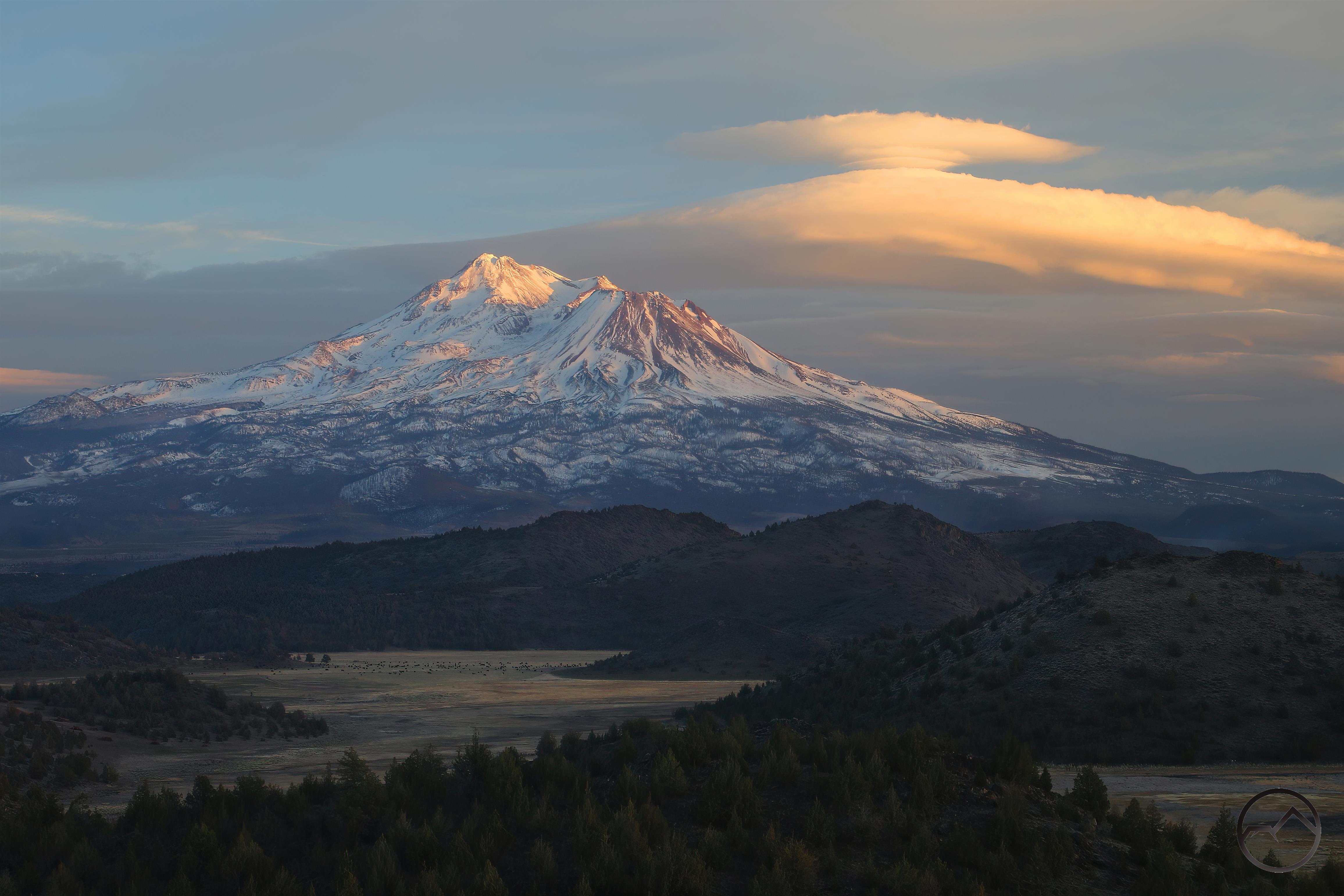
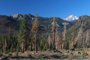
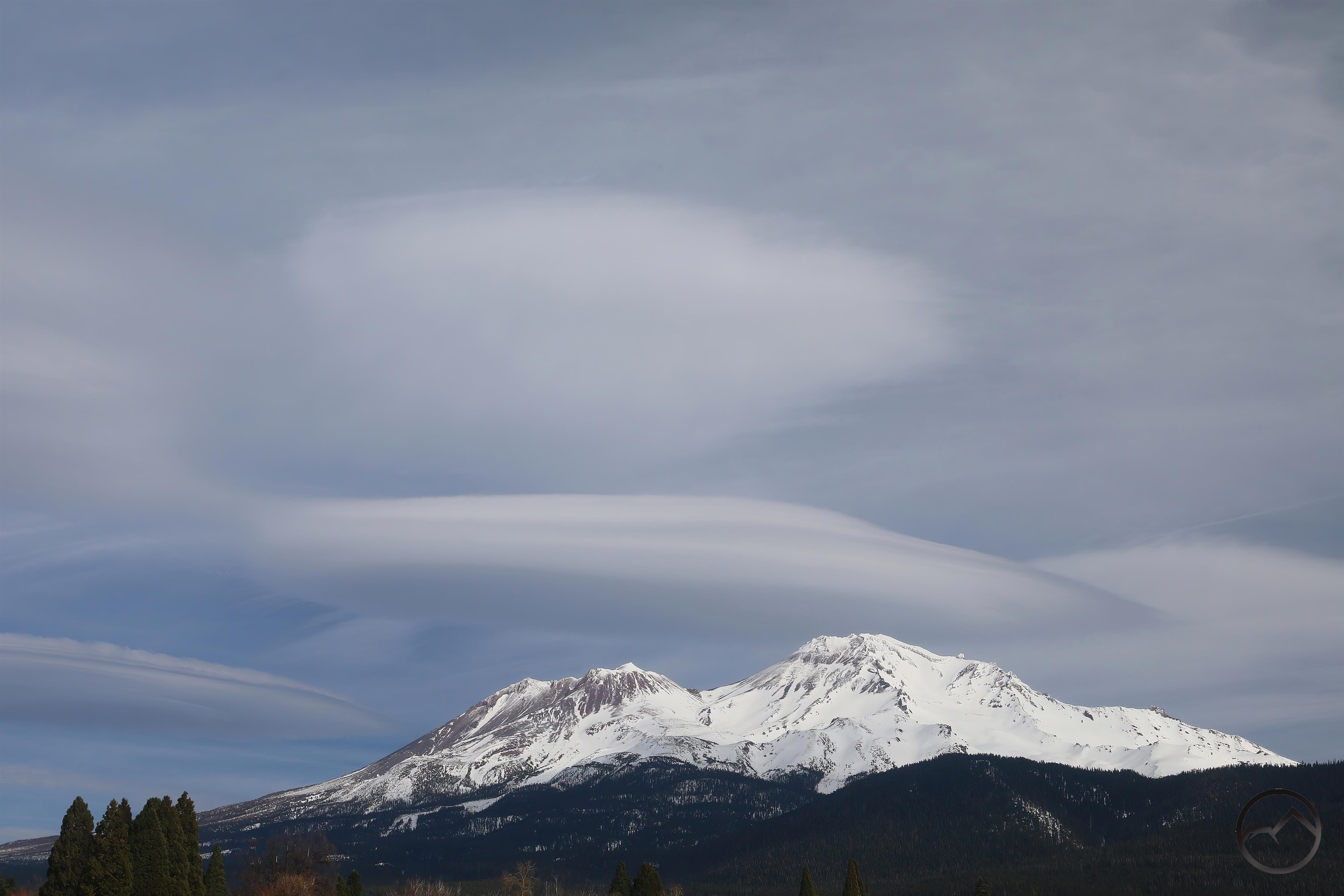
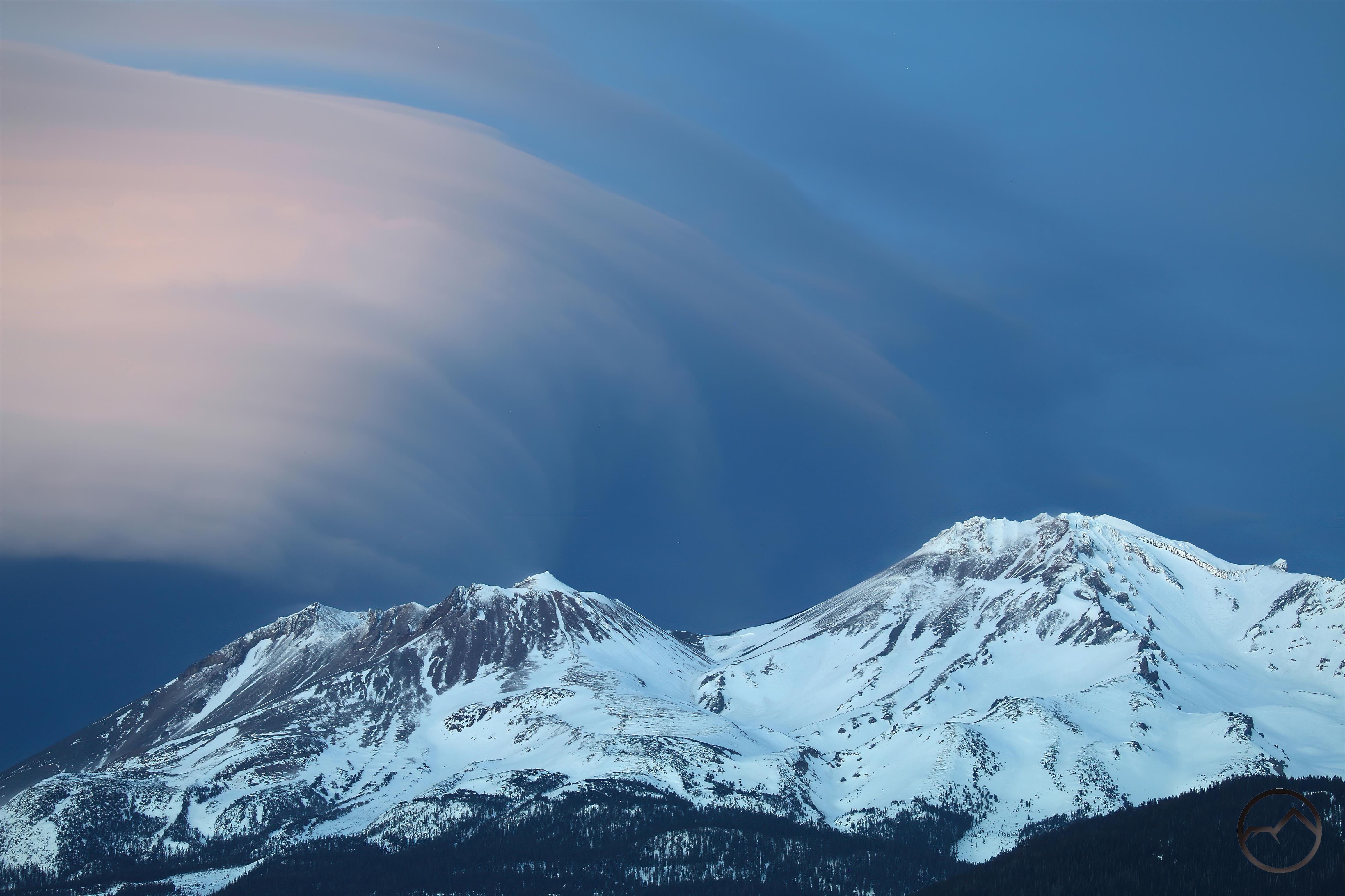
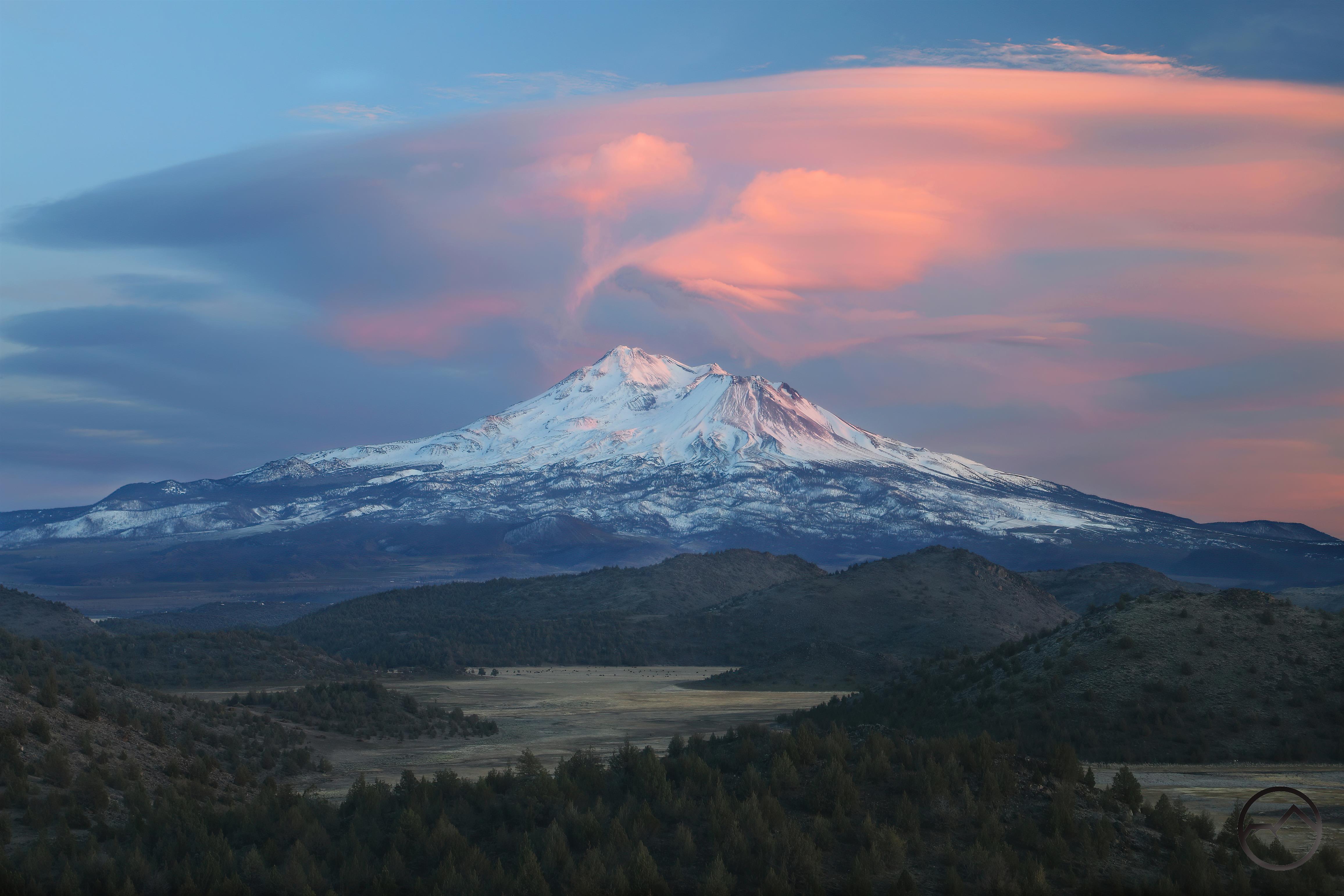
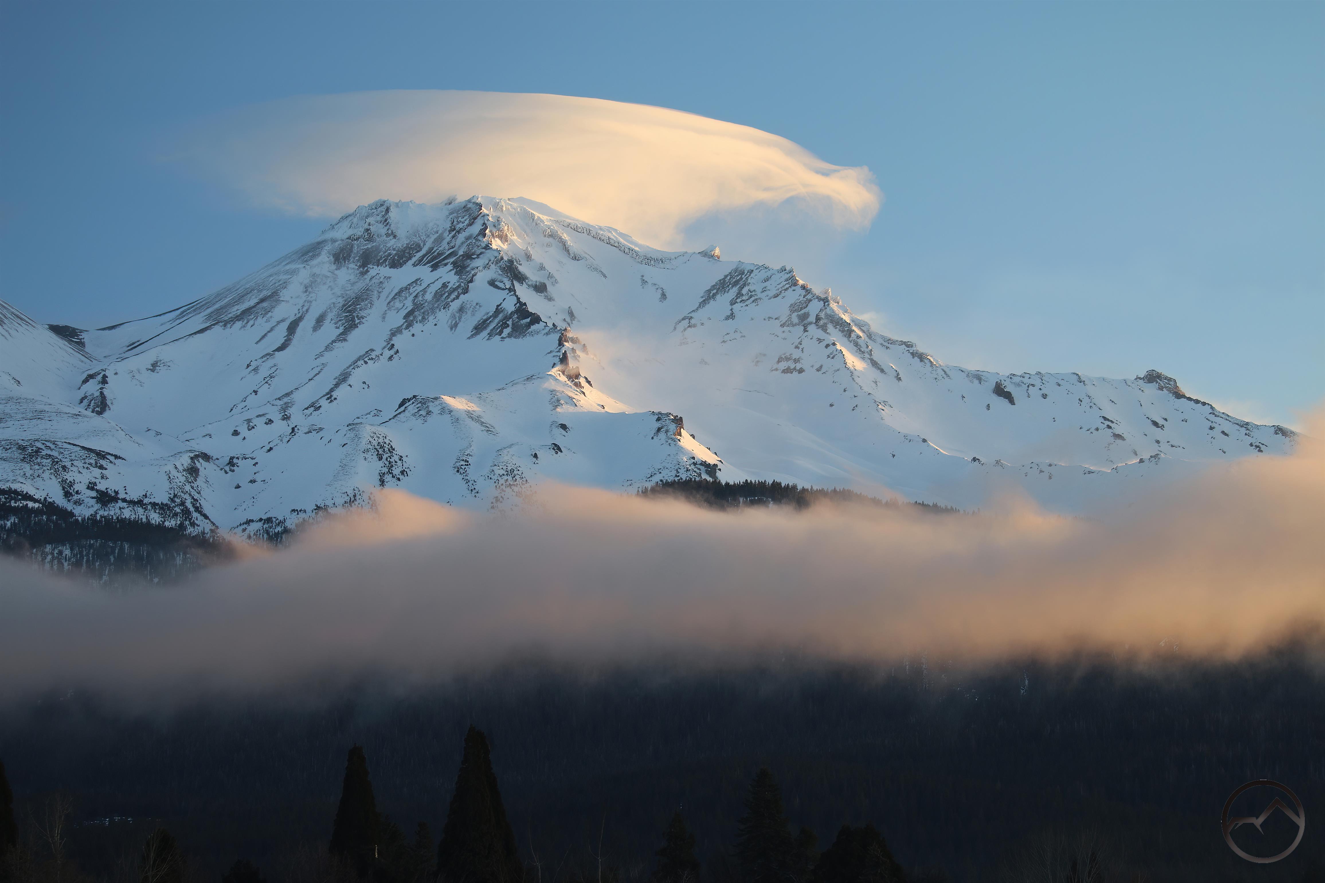
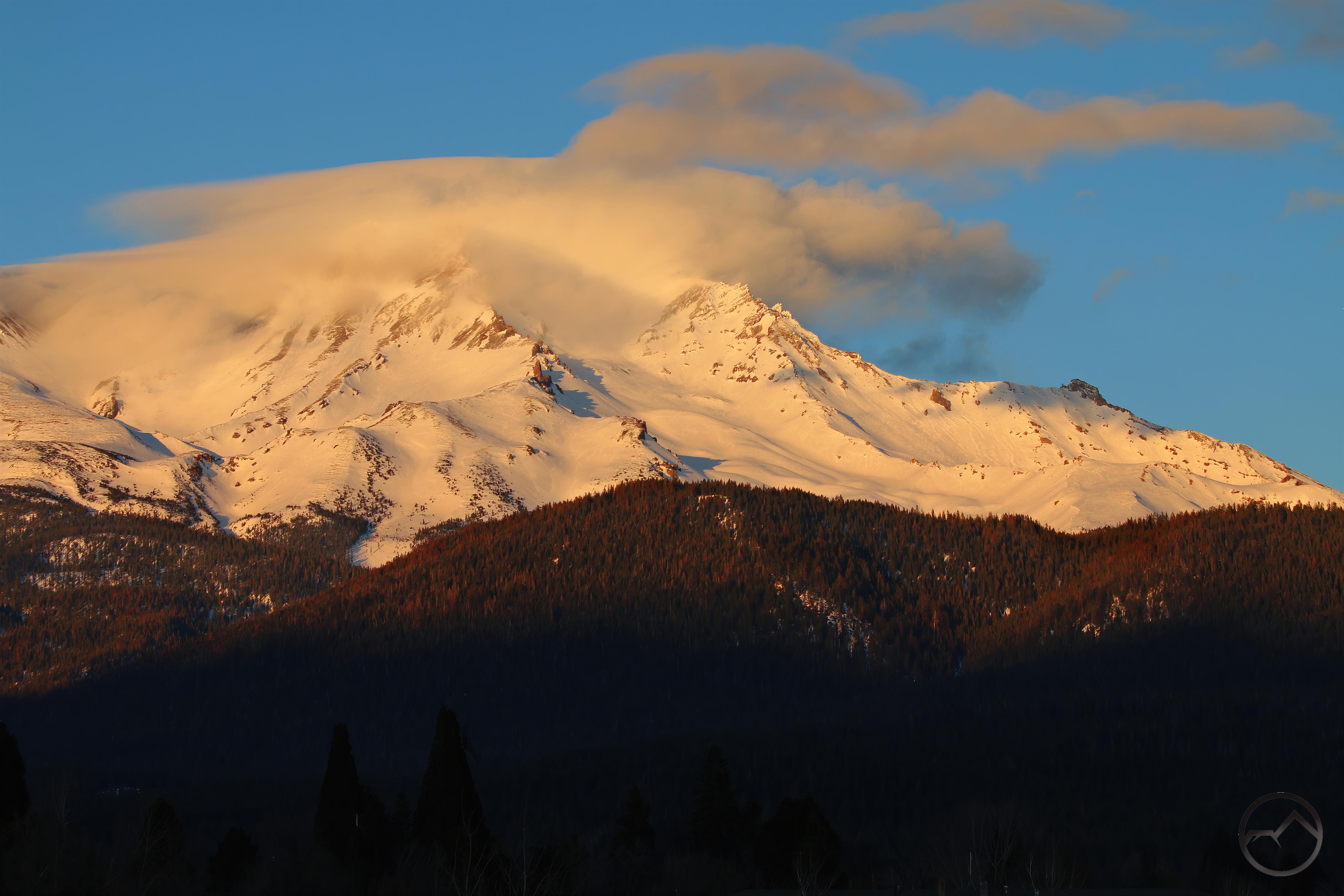
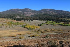
The other aesthetic consideration for the PCT’s route is scenic. Passage through the northern Sierra and the Klamath Knot means a journey through some of the most spectacular mountain scenery of the entire PCT. The lakes, creeks, rivers and rugged mountain peaks all add character and beauty to this section of trail. Another great feature is the near ubiquitous presence of Mount Shasta, which remains visible from the PCT for nearly 500 miles, something no other mountain can claim. In contrast, the true Pacific crest is drier but more forested, with a more subdued landscape of rolling hills along with a few higher mountain ranges thrown in for good measure. Overall, there is little scenery that would equal or surpass the grand mountains of the northern Sierra or the Klamath Mountains.

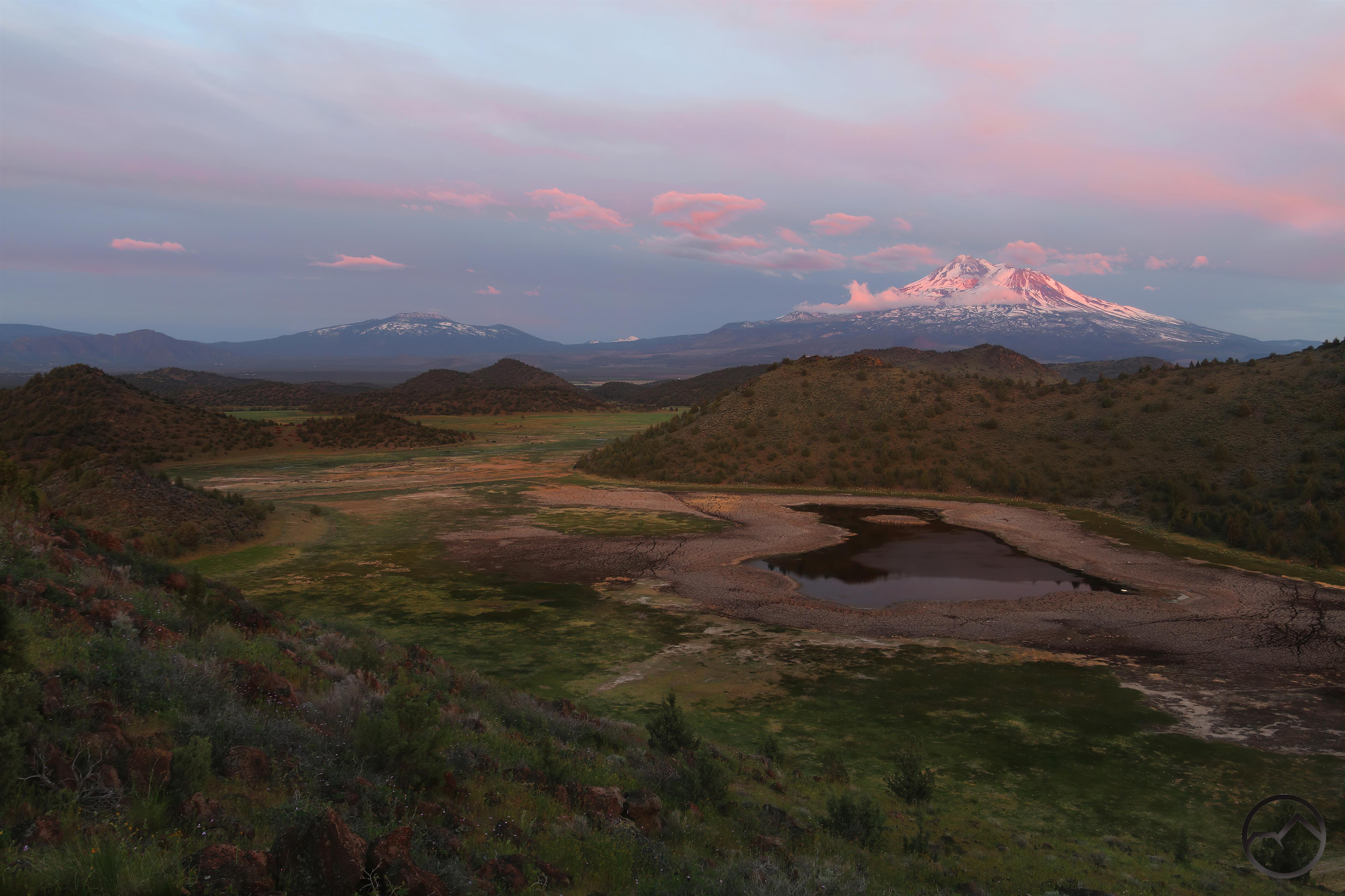
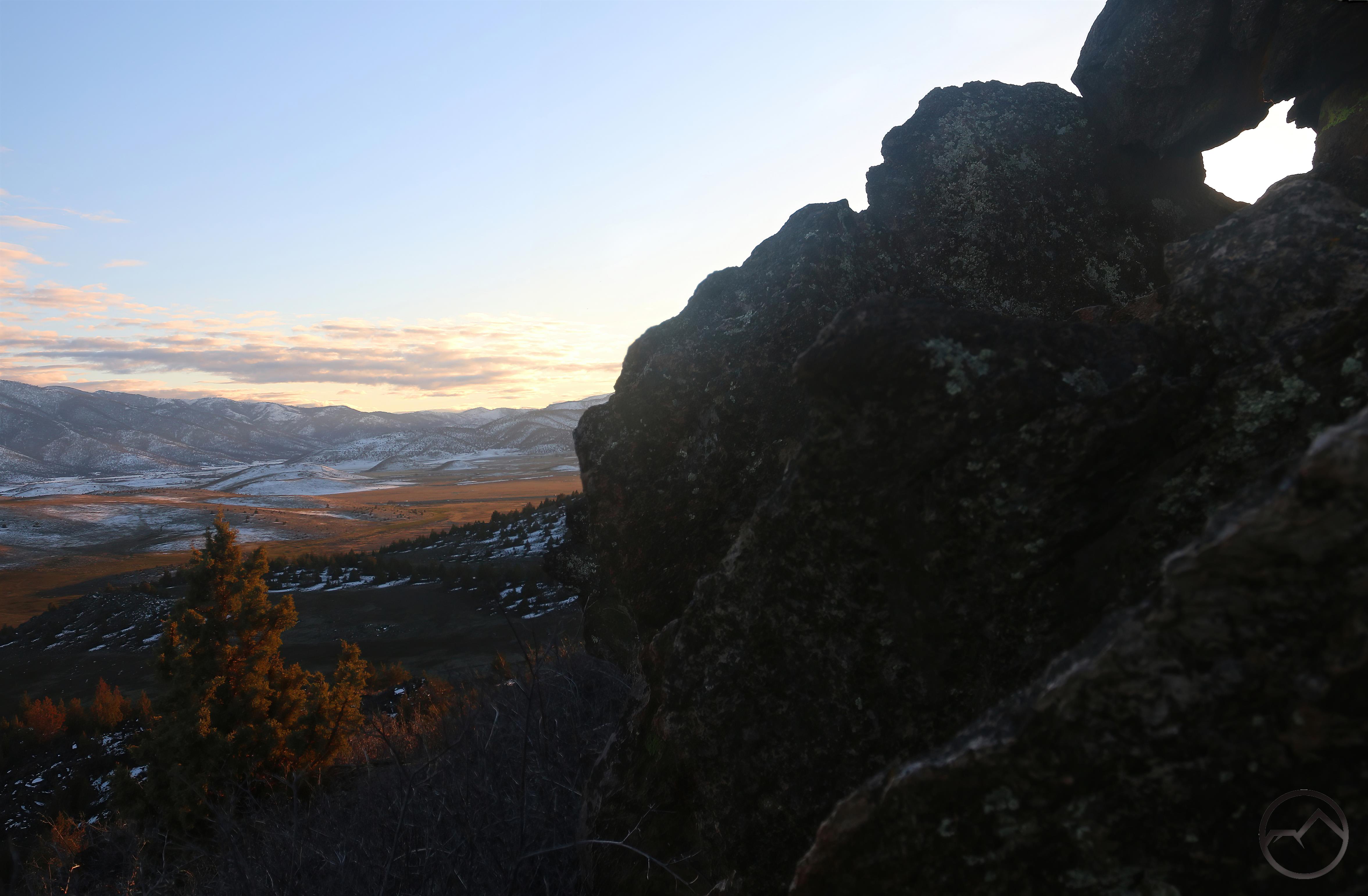
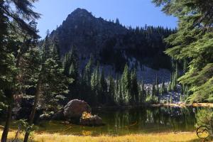
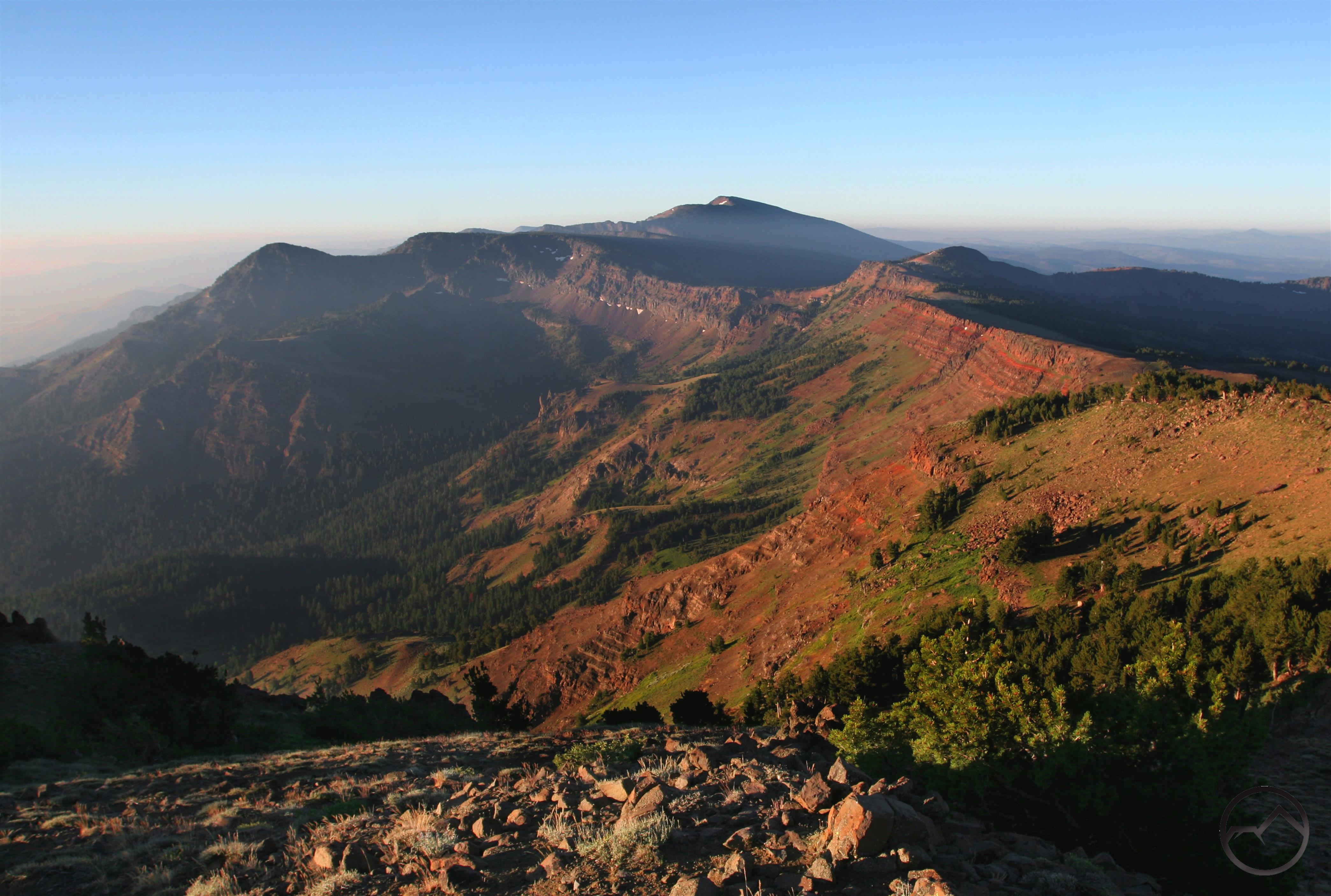
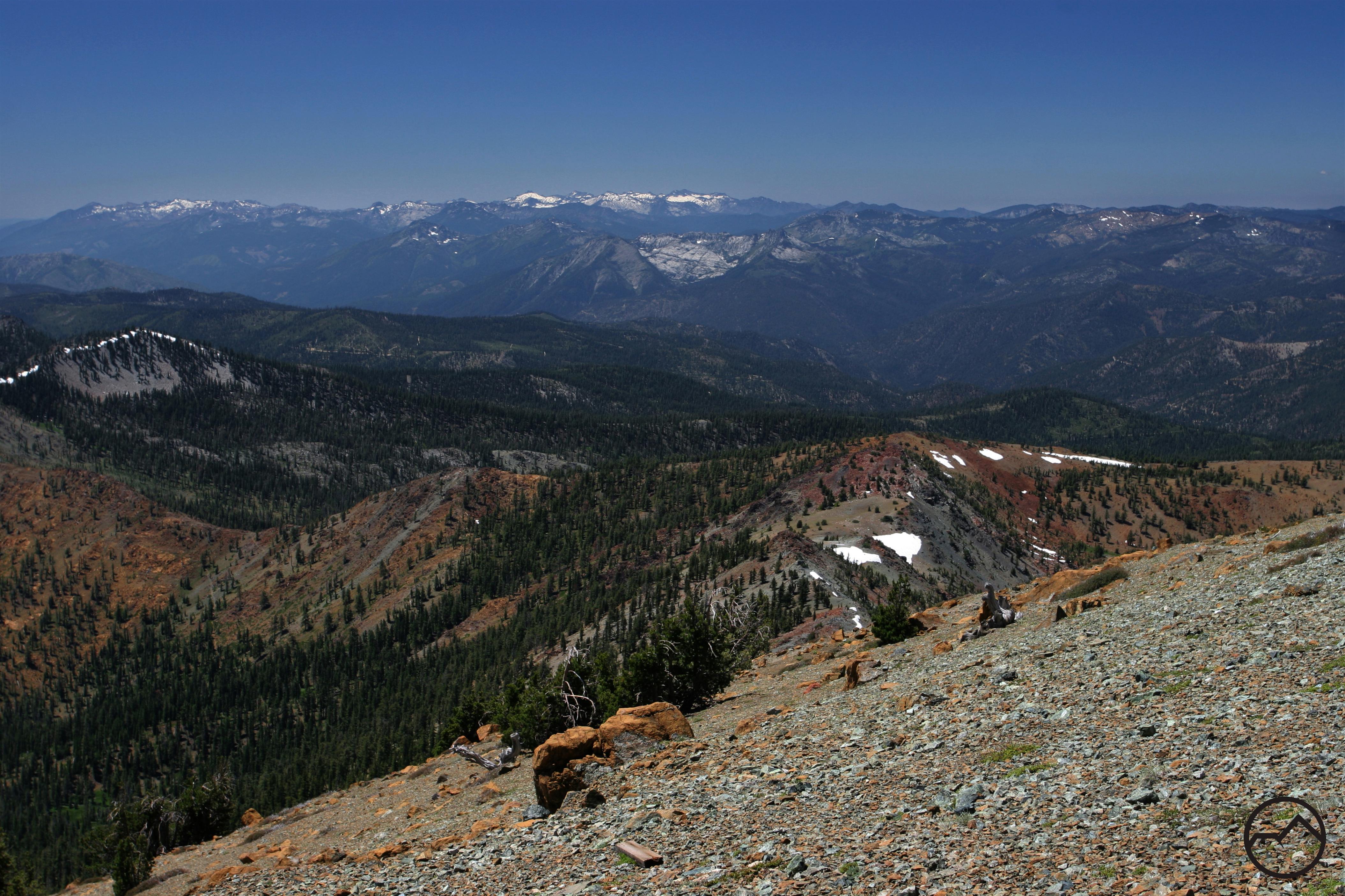
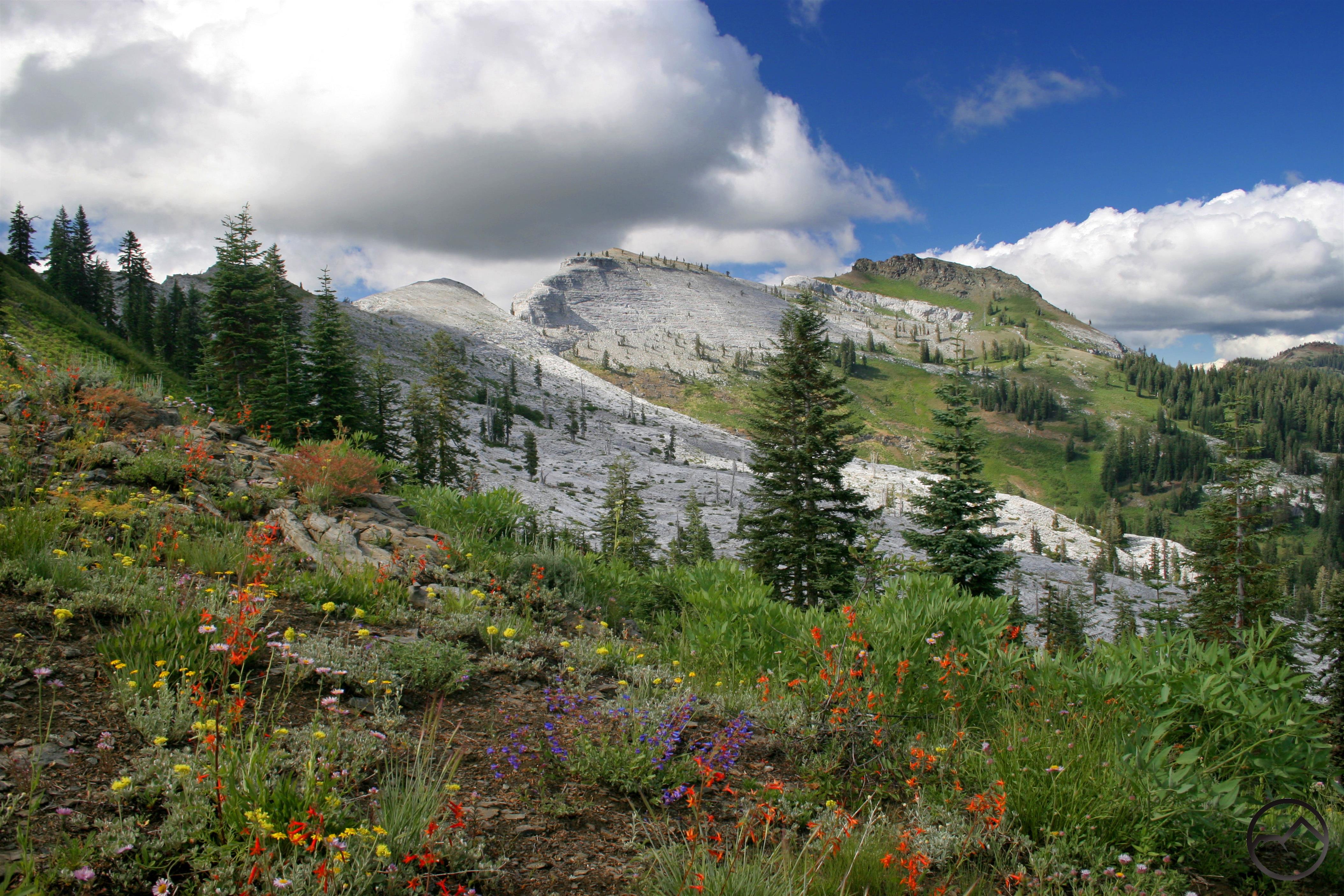
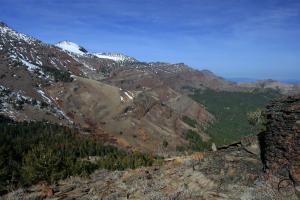
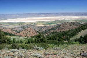
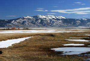
There is one significant exception to this, however. That is the Warner Mountains, a remote mountain range that lies in the far northeast corner of California and extending into southern Oregon. Other than Mount Shasta, they are higher than any mountains between Lassen Peak in California and the Three Sisters in Oregon. Rising nearly 10,000 feet above sea level, they are the highest mountains on the true Pacific Divide. In terms of grand scenery and rugged alpine terrain, this is the pinnacle of the actual Pacific crest.

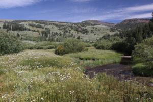
Though much of the terrain on the true divide is somewhat subdued, the opposite is the case with the Warners. The range is a classic monocline, with a long, gradual western slope on the west side. The range climbs gently to the crest and then plunges dramatically and steeply into a large graben named Surprise Valley. The highest part of the Warners is a feast of mountain grandeur. There are craggy peaks, alpine lakes, abundant creeks, lush meadows and fantastic vistas. The forests are unique among California mountains, dominated by ponderosa, white bark pine, white fir, aspen and mountain mahogany but missing typical Golden State forest stalwarts like incense cedar and douglas fir. It is an unusual mix indicative of the fact that the Warners exist on the edge of numerous different regions.

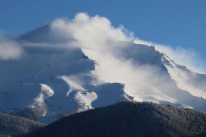
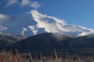
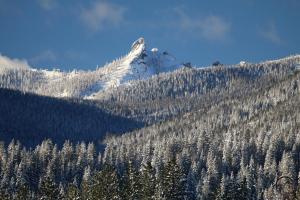
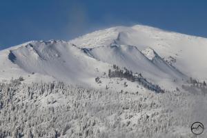
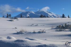
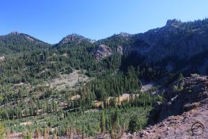
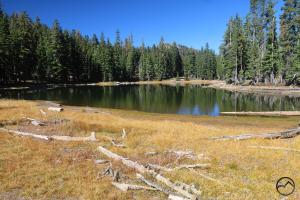
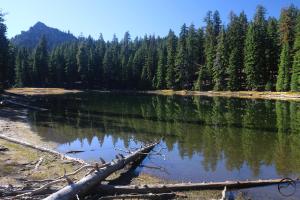
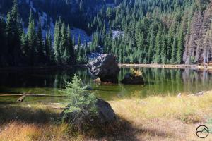
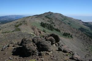
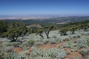
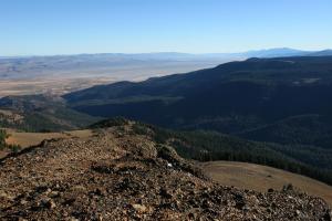
Warner Mountains Gallery (Click to enlarge):
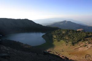
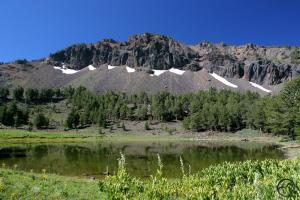
North Emerson Lake
Warner Mountain’s escarpment.
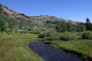
Mill Creek
Mill Creek Valley

Eagle Peak above Mill Creek Valley
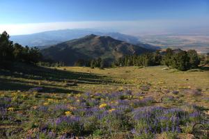
Pine Creek Basin

Sunrise on the Warners
Patterson Lake and Squaw Peak

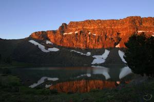
Patterson Lake sunrise
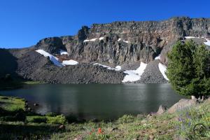
Patterson Lake morning

Squaw Peak
Cottonwood Creek

Cottonwood Creek
Warren Peak and Cottonwood Basin

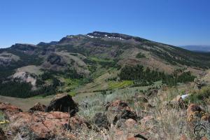
Looking north on the Warner Crest
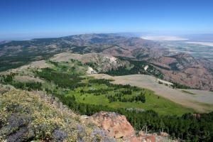
Surprise Valley and distant Nevada.

The Warner Crest
Looking west toward Mt. Shasta

Surprise Valley from Mt. Vida
Mount Bidwell

Crane Mountain in Oregon

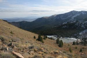
The epicenter of the Warner Mountains is in the South Warner Wilderness. At 70,385 acres, it is the largest tract of wild land in the Warners and has the highest concentration of tall peaks, alpine lakes and trails. This is among the most wilderness areas in California, boasting unusual geology, unusual biodiversity and spectacular views. The trails that wind through these mountains offer incredible opportunities for solitude.

In the end, I think the current route, passing through the Klamath Knot was the right way to go. It has plenty of water, posed minimal land ownership issues for trail construction, incorporated many existing trails, has abundant water and has spectacular scenery nearly every step of the way. It also passes through more wilderness areas while also maintaining good access to resupply points. I still can’t help wonder what the PCT would be like if it were routed along the true Pacific crest. If it were, then the Warner Mountains would be the highlight of this section of the trail. Though there are other beautiful and interesting sections along this route, nothing else approaches its level of scenery and solitude. Perhaps a secondary route could be constructed, affording thruhikers the opportunity to pick which route they want, hike both, or even allow northbound hikers to follow one route and southbound hikers to take another. No matter what happens, the Warner Mountains are a hidden gem on the true Pacific crest.


Mount Shasta Spring In Full Swing

Posted by bubbasuess on April 30, 2023
Posted in: Cascade Range, Hiking, Mount Shasta. Leave a comment

Snowy Mount Shasta, a full lake and green vale mark spring in the Shasta Valley.

I just wanted to note the passing of April and the deepening of the spring season. The grass is green, the air warm and the snow melting. The Long Winter is finally past and the present has been beautiful. The creeks and rivers are swollen with snowmelt but the high country is still buried deep in snow. It will be a while yet before the higher elevations have cleared enough to get out there and hike the trails and explore. Nonetheless, down in the valleys looking up, it is a grand scene and one long anticipated through the epic winter.


Green is the dominant color now. Even places normally dry like the Shasta Valley are lush and filled with wildflowers. Considering the copious moisture that fell this winter, I reckon the valley will sustain the green landscape for a lot longer than normal. There will certainly be no complaints from me!

Easter Sunday
Last day of April

It is hard to believe the difference made by three weeks. On Eastern Sunday, I still had a few feet of snow in my backyard. In much of the yard, it was piled nearly 3 feet. Not so now. All but the smallest patches of snow are gone, the leaves racked up (since they never got cleared in the fall due to the snow falling while the leaves were still on the trees!), the immense number of broken branches cleaned up and green finally returning to the yard, it finally feels like spring has really arrived. Thank you Lord!

It Begins: An Easter Lenticular Heralds The Coming Of Spring

Posted by bubbasuess on April 10, 2023
Posted in: Cascade Range, Hiking, Mount Shasta, Shasta Valley, Truchas Ridge. 6 Comments

The Long Winter is finally coming to an end! After over 5 months of nearly constant rain and snow we may have finally turned the corner and entered into the spring season. It’s been over a week since the last major storm passed through the Mount Shasta. Though we have gotten a bit of rain and some small dustings of snow, the precipitation finally abated and, as befitting Easter, the sun came out, the temperatures climbed until they were almost warm and the snow began to melt. It was a glorious burst of new life and reinvigorated those who were exhausted from the seemingly interminable Long Winter.

Making the coming of spring even greater than it already would have been, there was a spectacular three day lenticular gracing Mount Shasta over the Easter weekend. Indeed, this was perhaps the finest lenticular event of the entire winter season. The lenticular ended up having a surprising amount of durability and it changed pretty dramatically over the three days it clung to the mountain. What a glorious way to leave the winter behind!

The formation began as a simple, subtle stack over the summit of the mountain. It wasn’t a grand sight but it was reassuring, since it had been a while since Mount Shasta had even been visible, let alone have anything noteworthy in the sky around it. The cloud cover had been fairly constant for a long time this winter.

Easter was the next morning and after church it was time for an Easter egg hunt. However, there was still a couple feet of snow on the ground around my house. It wasn’t exactly egg hunting conditions.

Not to be deterred, my wife and I loaded the kids up and headed out to Truchas Ridge. It was blissfully warm, the sky was blue and the grass was green. Spring had been hard at work in the Shasta Valley and the conditions were perfect. With the eggs set up, the kids had a fantastic hunt. Meanwhile, the lenticular provided a spectacular backdrop.

While on the way out to the ridge, we stopped to capture a shot of the lenticular that had formed to the northeast of Mount Shasta. The original cloud was still present on the summit, but it had lost some of its definition. There were other, lenticular-like formations elsewhere in the sky as well but the stack near the mountain was by far the most interesting.

As always with lenticulars, the formation is not static and the stack kept growing, replicating, shrinking, separating and constantly changing from one form to another. It is the kind of show you can lose a hour in easily.

It was obvious that big things were afoot, since the sky was active throughout the area. It was a pretty amazing spectacle and one that only made the Easter egg hunt more fun (at least for my wife and I).

Later that day, as sunset approached, I headed back to Truchas Ridge and made my way up to Echo Point. The sky had gotten overcast, but I was hopeful that the sun might break through and cast some great light. It was not meant to be, but the view of Mount Shasta and the lenticulars lining the horizon over Echo Park was inspiring. It was an excellent end to an excellent Easter.

I wasn’t sure if the lenticular would survive the overcast sky during the night but rain was actually forecasted for Monday night so I though there was a reasonable chance that the lenticular would stick around until then. I got up early in the morning and my suspicions were confirmed. Not only had the cap over Mount Shasta and the stack to the northeast persisted through the night, but there were additional lenticular forming further east. Needless to say, it was a magnificent sunrise.

On my way home after sunrise, I had to stop and capture an image of the stack. Though the size had shrunk dramatically, it was now augmented by a fine example of cloud iridescence. The rainbow fringe of the cloud contrasted against the dark formation and the blue sky. I thought the sunrise had been awesome, but this was a fine conclusion to the morning.

As I was in and out of town today, I had a continuous string of opportunities to observe the lenticular and it changed. The stack had gone by mid-morning but the cap over the summit continued to fluctuate throughout the day.

Naturally, I had to head out in the evening again. My wife, ever gracious and patient with me, let me go and I headed north. The sky was full of interesting formations again. The cap had grown and covered a significant amount of Mount Shasta. Another collection of lenticulars had formed northeast of the mountain again, this time a bit further away the the previous stack. Other clouds in a variety of shapes crowded the sky, casting ominous shadows on the valley’s hills.

Though Mount Shasta was largely covered, the lenticular proved to be entertaining and seemed to perpetually spin, separating out into new layers before they collapsed in on each other before another new series of layers coalesced again. It is a hypnotic performance.

In the end the stack came together in magnificent form, even if it was further away from Mount Shasta than I would have liked. The clouds to the west kept the sunlight from generating much alpenglow but the scale of the clouds was spectacle enough. In fact, it was more than enough. It was terrific.

It really feels like we have turned a corner here in Mount Shasta. The sun has been constant, the temperatures noticeably warmer and the snow is melting. Even though it is raining as I write this (Monday night) it is not cold. The winter may have been long but the land has been given the moisture it needed and for that I am quite grateful. I am also grateful that spring is here. It should up in dramatic fashion.

And They Said It Was Spring!

Posted by bubbasuess on March 30, 2023
Posted in: Cascade Range, Hiking, Mount Shasta. 1 Comment

Fresh snow glitters in the morning sun the day after the latest storm ended. 

The Long Winter seemed like it might have been winding down. Snow began on November 1st and continued to fall, along with powerful bouts of rain, for three months. In February there was a bit of a respite but on February 23rd it began snowing again and over the course of two weeks nearly 100 inches was deposited at my house. This was on top of a couple of feet of snow already packed down from the previous storms. It was an immense amount of snow and I was glad to leave it by escaping to Arizona for a week. It snowed 6-7 more inches while we were gone but then things started melting a bit. The calendar said it was officially spring. The deep pack of snow outside felt otherwise, but who is to argue with the calendar?

The Long Winter, that is who will argue with the calendar. It seems the the old Russian generals January and February are a triumvirate this year, with March packing a significant punch. With just a few days left in the month, a major storm walloped the region, leaving over 30 more inches of snow before it was all done. For the winter-weary, it was a bit disheartening, as it was necessary to clear a major dump of snow yet again. It’s been a lot this winter…

Before the storm, with a lot of snow left over from February’s storms.
Midway through the onslaught.

A few more inches would fall, but this was nearing the end of the storm.
Buried…

I often try to keep track of the snow as I clear it:

20 inches and rising.
26 inches, with more to fall…

Coming out of my front door and greeted by a wall of snow.
My jeep, buried beneath the snow.

After a couple days of snow, it topped off at nearly 35 inches. My house is higher up than in town, but in Mount Shasta, it looked like a midwinter day rather than one at the beginning of spring:

As is typical, the snow had been pushed to the center of the wide boulevard so curbside parking could be maintained. This was not the way spring was supposed to look!

When the sun finally broke through the clouds, the storm was weakening. I headed out to see if I could see the mountain. Unsurpisingly, Black Butte was the first landmark visible. It is often easy to overlook the great cone, but in this light, with fresh snow and rime ice, Black Butte was a striking and beautiful presence in the snowy landscape.

The clouds around Mount Shasta were a lot thicker than in other areas but eventually they parted enough to see the mountain as the sun set. It was the first time I had seen light on Mount Shasta since before I had left for Arizona. Hopefully a herald of the coming spring. Hopefully, but the way things have unfolded this winter, I reckon the old Russian generals have a little more in store for us yet.

Back at home, the snow has already started to melt with alacrity. There’s plenty to fix and clean up once there is less of the white stuff. Broken tree branches need to be cleared, the fall’s leaves (never raked since the snow fell while many were still on the trees) need to be cleared. At the guest cabin, a section of the party lights came off the trees and were buried in the snow. I like the effect. Perhaps I will leave them. I feel that if I hang them up now, I am just inviting another storm…


There’s Less Snow In Arizona

Posted by bubbasuess on March 26, 2023
Posted in: Cascade Range, Hiking, Mount Shasta. Tagged: Arizona, Saguaro National Park, Sedona. 9 Comments

Pusch Ridge, rising 3,500 feet above Sutherland Wash, lights up just before sunset.

My wife and I had no idea how the winter would go when we first planned on taking spring trip to Arizona in March. As far as we were concerned, our kids had spring break, late winter/early spring is a great time to be in the desert, and we figured it would be a welcome change of pace if we happened to have a really stormy season. We planned the trip in October and November. When snow started falling early in November, we had no idea that the Long Winter lay before us and how welcome a trip to the desert would be. Needless to say, an escape to the desert was quite rejuvenating after nearly 5 months of snow.

The lead up to the trip was challenging, but once we hit the road, it was smooth sailing. Smooth, except for being evacuated from our campground in Sedona. We had one of the few campsites near town, which was located on the banks of Oak Creek, the main watershed draining the red sandstone wonderland. Its headwaters are located north of Sedona on the Coconino Plateau, where the higher elevation receives a lot more snow. On our trip there was a fair amount of snow in the high country and the warmer weather was melting the it at a swift rate. Consequently, Oak Creek was swollen and raging. Once we got there, we enjoyed our time in Sedona, hiking the red sandstone and soaking in the magnificent scenery, all the while Oak Creek was rising. On our last night in Sedona, we headed back to our camp, only to find it eerily dark. On closer inspection, only three tents were standing in the campground and in front of our tent we found this:

It quickly became evident that the rising creek had forced the campground to be evacuated. We quickly broke camp and headed out, saying a speedy goodbye to Sedona a little earlier than planned. So the trip was smooth sailing other than being evacuated out of our campground before it flooded.

So, it was smooth, except for the evacuation from camp and the time we went into one of our other campsites, driving through another rising creek with the warning that it may crest too high to drive through and we may be stuck in the campground for, as we were told “a few hours or a few days”. Fortunately for us, it crested and subsided and we were never stuck but it was an interesting conundrum.

Other than those seasonal incidents, the rest of the trip was fantastic. The weather was, for the most part, warm and beautiful. The desert was green, wildflowers were often abundant and the scenery, whether the sandstone of Sedona or the saguaro of the Sonoran Desert, was uniformly spectacular. We were all rejuvenated by being free of snow and out of our normal landscapes. We already can’t wait to go back.

A few images from the trip:

Poppies and green grass cover the expanse below Boundary Cone, on the edge of the Mojave Desert.
Bell Rock’s shadow falls on Courthouse Butte as the setting sun lights up the Munds Mountain Wilderness.

It doesn’t get too much better than this. Sandstone, both red and white, is a paradise for hikers.
Angel Falls pours into a secluded grotto on the flanks of Wilson Mountain.

The Sonoran Desert was incredibly green in the Superstition Mountains.
Spring green and profuse wildflowers at the base of Picacho Peak.

Sutherland Wash flows beneath the Catalina Mountains.
Pusch Ridge rises high above the creek flowing through Sutherland Wash.

It is incredible how diverse the Sonoran Desert is. Even in the dry seasons, it is still so green compared to the other desert environments found in America. In spring, it is downright lush. Perhaps my favorite spot from the trip was this one above Sutherland Wash:

20230316_173824

20230316_173824

Standing there surrounded by saguaro cacti, the icon of the American West, as well as multiple types of cholla, prickly pear, barrel cactus, ocotillo and palo verde, with grand, rocky mountains looming in the distance and yet, being able to hear the sound of steadily running water was a feast.

The scenery wasn’t all that was great. The family had a grand time as well, exploring, climbing, and enjoying the beauty of the desert:

“I know you have something good in here!”
Enjoying the views and the native flora in Sedona.

A great climb with a great view.
Proving to dad that he can lick a cactus.

An organ pipe cactus fort at the Desert Botanical Garden.
Last sunset in the saguaros.

Now back home in Mount Shasta, the Long Winter continues, with up to 20 inches of snow forecasted to come down Monday and Tuesday. Hopefully, perhaps even sometime in the near future, the thaw will come. Until then, we are grateful for a week in the desert.

A Bluebird Reprieve

Posted by bubbasuess on March 9, 2023
Posted in: Cascade Range, Hiking, Mount Shasta. 4 Comments

Fresh snow blows off of Mount Shasta on a glorious bluebird morning.

Tonight marks 2 weeks of steady snow in the Mount Shasta area. As I write this, it is snowing yet again, with nearly a foot having come down already today. Prior to the storm today, I have gotten 74 inches of snow since the night of February 23rd (I live at a higher elevation than Mount Shasta City and get more snow because of it). It has been a lot of work, to say the least. Not only has there been a lot of snow, but the cloud cover has been nearly constant, blotting out the sun the sun and mountain. At times, it has felt oppressive, even though the precipitation remains a welcome blessing. Thankfully, a lull in the storm Wednesday morning yielded the first clear blue sky in almost two weeks. With fresh snow abundant, it was the very blessing of a “bluebird day”.  It was a welcome respite from the gloom of the storm.

On my way home from taking my daughter to school, I could not resist stopping and pulling out my camera and catching the beauty that makes the drive to and from school such a treat. The landscape is always glorious on days like this, when the snow is deep and the sunlight warming. The ice glitters, giving the land a dazzling magnificence. By noon the clouds were gathering and early afternoon saw the snow falling again. This last round of the storm is the cresendo, as tomorrow is supposed to be clear. I may have a second round of bluebird images. After this, a week of rain is forecast. This is hopeful, as it will quickly melt the snow (though I hate the rainy slop that comes) and means the temperatures are starting to warm, a harbinger that spring is nearly here. Hasten the day!

Cloud and wind-driven snow catch the morning light on Mount Shasta.
The grand mountain, it all its winter glory.

Castle Spire aka Battle Rock, the highest point in the Castle Crags looked like an inverted icicle from town.
White Butte

A closer look at the wind-scored cliffs above Eddy Bowl. I reckon the trees were free of snow because of the wind.

Mount Shasta’s winter wonderland from the Twin Cedars.

It Snowed A Little Bit

Posted by bubbasuess on February 25, 2023
Posted in: Cascade Range, Hiking, Mount Shasta, Truchas Ridge. 1 Comment

While careening toward the end of February it was easy to start jumping ahead to spring. The snow, which had piled up during January had been only minimally replenished and was melting off at a good clip. On the other side of March the spring could begin in earnest and since the snow had started falling on November 1st, it has really felt like a long winter. It should not come as a surprise then that winter wanted to let us know that it still holds sway for another month. To do this, it summoned a storm of swift and deep proportions.

Most forecasts before the storm called for a foot or so of snow. That is certainly nothing to scoff at and necessitated all the normal pre-storm preparations. Some forecasts doubled the amount of snow but those were definitely in the minority. In the end, both were wrong and were underestimating the storm’s yield.

There were 31 inches outside my front door. Another 3 inches came down before the storm let up.
My backyard was barely visible beyond the mound of fresh snow.

The first run down the driveway.
There’s a car under there. Is that a munchkin?

I woke up in the morning and, looking out my front door, saw a wall of snow much higher than I had anticipated. The yard stick showed 31 inches. Yikes. That was a heap of snow and it was still coming down. Indeed, it continued to snow for a few more hours and ultimately add another three inches to what had already come down during the night. The road in front of our house was no where near plowed and I5 was no doubt a mess but my wife felt like she needed to get to the clinic even though we could have just closed for the day. That meant I had to get and start clearing snow. I admire her dedication. I got her out, sent her off and spent much of the day moving snow around while managing kids diffing snow caves and such.

Fresh snow and Mount Shasta on a winter’s morning.

The day after the storm ended I was out early and enjoyed the fresh snow smothering everything. It was a glorious bluebird day, with fresh snow, blue sky and a warm sun. On my way home pulled out my camera to document the white conditions. I was surprised to see that the strange accumulation of snow on Mount Shasta’s west face had persisted despite the copious snow that had just fallen. Still, in most areas on the mountain it was clear that a lot of snow had fallen.

I knew that a lot of snow (for that arid area) had fallen out in the Shasta Valley and I wanted to get out there to catch it while it was white. My family and I headed out in the afternoon and found the southernmost end of the valley quite white but by the time we got to Truchas Ridge the snow was found only on the northern exposures and in the shadows. While not quite what I was hoping for, it was still really beautiful. We climbed to the summit of Cerro Pedernal and from there we could see that the western fringe of the valley was still pretty snowy.

The view from the summit of Cerro Pedernal is one of the best. Mount Shasta is the obvious center of attention but the cluster of peaks and valleys adds a great deal of interest to the views. This time, with the snow still lingering in the shadowy areas it was a slightly different texture than the typical vista.

While on the summit, I decided to climb around to the Pedernal Ventana, a small arch on the peak’s southwest side. The low sun makes the arch stand out and this time the sun was near sunset. The view of Mount Shasta and the southern Shasta Valley from the arch is great. Since the arch is on Pedernal’s southern aspect the snow had melted off quite a while before I got there but it was worth checking out nonetheless.

My family and I enjoyed the view and as the alpenglow began to fade over the white valley, we began our return. We descended to the sound of howling coyotes (not my daughter howling) and within sight of great horned owls flying nearby. It was a great end to a great day yet as we arrived home the clouds had already come back in and it is supposed to continue snowing tonight and for the next few days. I wonder how much will fall this time…

60 Hours Before The Storm

Posted by bubbasuess on February 21, 2023
Posted in: Cascade Range, Hiking, Lenticular Clouds, Mount Shasta, Truchas Ridge. Leave a comment

I noted earlier that this past fall and winter had not been a very good season for lenticulars. That assessment has certainly changed over the last couple weeks. I previously wrote about a series of lenticular episodes that all occurred within a week’s time. Now, with a large snow storm looming, there has been another series of clouds, which have, at times, been quite impressive. However, if a complaint were to be lodged against this particular series of formations, it is that getting the clouds to take shape when the light is best has been elusive. Nonetheless, this has produced some truly spectacular sunsets, for which I have been grateful to witness!

The first cloud manifested on Sunday. Not only was there a nice cap on Mount Shasta but there was a nicely formed stack hovering to the southwest. Frustratingly, by the time I headed out to capture some images, the stack had diminished to a single disk. Still, the cap remained nicely formed and still felt worth the effort to get out and prepare for sunset. I decided to head up to Echo Point, which has a particularly spectacular vista and settled in to watch the light shift and see what the cloud had in store.

Unfortunately, the cloud had nothing in store at all. It continued to dissipate to near insignificance. There was just a vestigial crown clinging to the summit and little else to indicate there had been an excellent lenticular. Even the lone disk, which hovered to the southwest had gone. However, what was lacking in lenticulars was more than made up for in the warm glow of a truly marvelous sunset. The alpenglow was magnificent and the entire landscape seemed to radiate a warm sensation. Echo Point did not disappoint!

The next morning I headed north again, feeling the clouds weren’t done. I was correct, as the southwestern stack was back in force, with a firmly coalesced shape and a commanding presence near Mount Shasta. Where the previous night had been a stunning light show, this time the light was barely evident and the land was drab since clouds to the east blocked most of the sunlight. It was still a good morning, graced with a notable cloud.

Around midday, the stack was still persisting and even the cap on Mount Shasta was threatening to reform. Unfortunately it never really gathered enough strength to advance past the wispy tendrils of a delicate formation. Still, I anticipated the sunset would be grand and determined to head back out to Truchas Ridge.

Climbing up to Panorama Point, the light was great and the view was terrific as always. However, the lenticular stack had flattened out and lost much of its definition. Still, it caught the afternoon light well and glowed as the sun sank. I was hopeful things might change before all the light was gone.

My hope was not in vain. At the last minute, before all the light had faded, the cloud began to form a new stack of disks over the old one. These had nice layers that still caught the last bit of light that was being offered before dark set in. Not only this, but a concave cavity had opened up on the bottom of the cloud, returning something of the lenticular’s previous shape to the formation. Though the light had faded on the hills of the Shasta Valley, it was still a nice finish.

Yet, all was not done. With the storm set to arrive on Tuesday around noon, there was one last bit of a lenticular over the mountain, heralding the arrival of the storm. By noon, Mount Shasta was lost to the storm clouds and rain and snow had begun to fall. We are in for another round of cold and snow, which is welcome, after the nice break we have had after January’s deluge. Still, the winter had been long, considering snow fell November 1st and has been consistent since. Spring fever is setting in…

Seldom Seen – Antelope Creek Headwaters

Posted by bubbasuess on February 18, 2023
Posted in: Cascade Range, Hiking, Mount Shasta, Seldom Seen. 1 Comment

A rocky point hides in shadow above Lower Antelope Creek Lake. 

While the west side of Mount Shasta is well documented in terms of the many spectacular destinations that are found there, the east side of the mountain is far less well known. In fact, it is safe to say that it is almost totally unknown, except by a handful of people that have some kind of connection to the land and communities that are tucked away in this vast region. Nonetheless, some of the Mount Shasta area’s most spectacular landscapes and interesting geologic landmarks are to be found hidden away in this dark part of the map.

Part of the reason why the area is not well known is that it remains a vast patchwork of private timberlands interspersed with properties owned by the USFS. This makes access to some areas challenging and thus, far less visited than other destinations around Mount Mount Shasta. There are, nonetheless, some fascinating and spectacular sights to behold in the mountain’s eastern demesnes.

The glacial valley of Antelope Creek.

One of the most beautiful and intriguing areas is the headwaters of Antelope Creek. This is one of two creeks that flow out of the Cascade crest east of Mount Shasta that drain into endorheic basins. Butte Creek is further west and flows north before turning east, passing beautiful Orr Lake and draining into the eponymously named Butte Valley. Here it dissipates in the wetlands of Meiss Lake. Antelope Creek begins further east, but in the most rugged section of the Cascade crest. Here several small lakes and meadows contribute water the burgeoning creek as it flows through a wide glacial canyon. Once exiting the canyon the creek flows north past Tennant and hits a sink at the base of Cedar Mountain.

A hoodoo emerges from the lake.

The lakes that constitute the headwaters of Antelope Creek are some of the prettiest in the area. This is in part due to their unusual geology. Most of the lakes in the Mount Shasta region are found in the Trinity Divide and are set granite and ultramafic rock basins. The mountains east of Mount Shasta are volcanic and have far fewer lakes. Most of these are small, shallow and ringed with trees. The lakes at the headwaters of Antelope Creek are exceptions to this rule, being bound by tall volcanic cliffs, talus slopes and one even boasts an unusual, mushroom-like volcanic hoodoo emerging from the waters. It is a unexpected and unusual features to behold. The other lakes, though not quite as distinct are still beautiful and rarely visited specimens.

If there is a problem with this lovely setting, it is that significant portions of it burned a few years ago. Where once pristine forests marched up the slopes of the U-shaped valley, now many swaths of trees are burned. Beautiful groves of aspen lined the creek at the bottom of the valley and many of these are reduced to charred stumps. Thankfully some remain since the fire moves in irregular paths at times. The lakes and meadows were spared the fire’s wrath as well, leaving some of the area’s highlights untouched.

Though as the crow flies, it is not far from Mount Shasta, in terms of access, the Antelope Creek Headwaters are distant and remote and access is difficult in some areas. Nonetheless, it remains an incredible destination where great rewards await for those few who seek to explore it.

Click to enlarge:


Three Lenticulars In A Week

Posted by bubbasuess on February 11, 2023
Posted in: Cascade Range, Hiking, Lenticular Clouds, Mount Shasta. 1 Comment

An epic cloud stakes its claim to some dramatic sky above Mount Shasta.

Last week there was a series of great lenticular clouds over Mount Shasta. We haven’t had collection this good in this concentrated a time in quite a while. Although there have been some great formations over the mountain the last few years, overall it the last couple of lenticular seasons have been somewhat lackluster. This past week certainly helped to right that ship.

The first cloud began early in the morning and continued to morph throughout the day. It changed shape rapidly and, at times, was joined by other scattered around Mount Shasta. Towards the end of the day the clouds coalesced into one large stack the was located somewhat northeast of the mountain.

Unfortunately I missed its peak formation and the sunset color since I was in a meeting that went on far too long. It pained me, as I knew what was going on out there and I was missing it. At least I was able to get a shot as the last bit of color faded off of the lenticular at sunset. Oh well…

The next one came a few days later and was another excellent specimen. This one consisted of two distinct stacks that seemed linked together in an oblique alignment. This is one of my favorite kinds of clouds. The unique shape can be so appealing, especially when it is aligned above Mount Shasta. This was one of the most interesting clouds I have seen over the mountain in quite a while.

By the time the sun had set it had dissipated quite a bit, losing its distinct appearance. Nonetheless, the clouds were moving in unusual ways and soaked up the alpenglow in glorious fashion. In the end, this lenticular was a disappointment in terms of how it maintained its integrity but it was a spectacular sunset nonetheless.

A couple days later Mount Shasta was graced with another attractive formation over the summit. It caught the sunrise light nicely. A fine set of tendrils streamed off to south, reeling outward before dissipating and then the whole process repeating itself. The other clouds around the mountain added a great deal of color and texture to the entire scene.

Thought the cloud lingered through out the day, it never looked as good as it had at sunrise. It still made for interesting scenes above Mount Shasta. Even in the evening as the sun was setting, the lenticular dome persisted, though it had flattened out and settled on the mountain a bit. It was the quiet end of a great week of lenticulars.

I find it unlikely that there will be another run of clouds like this for a while. Hopefully, though, we will still get one or two more great cloud formations before we get to summer!

Posts navigation

← Older Entries
Newer Entries →
    • Recent Posts

      • Winter Shows Up When It Will
      • January Rolled By With Mud, Then Very Dry
      • Mount Shasta 2025 – A Year In Images
      • Mount Shasta On Either Side Of Christmas
      • Adrift In An Ocean Of Fog
      • December Has Been Spectacular Thus Far Pt. II (A Magnificent Lenticular)
      • December Has Been Spectacular Thus Far Pt. I
      • Lenticular Interrupted
      • A Stormy Wave And A Truchas Sunset
      • Aurora Lenticularis
    • Enter your email address to follow Hike Mt Shasta and receive notifications of new posts by email.

    • Archives

      • February 2026
      • January 2026
      • December 2025
      • November 2025
      • October 2025
      • September 2025
      • August 2025
      • July 2025
      • June 2025
      • May 2025
      • April 2025
      • March 2025
      • February 2025
      • January 2025
      • December 2024
      • November 2024
      • October 2024
      • September 2024
      • August 2024
      • July 2024
      • June 2024
      • May 2024
      • April 2024
      • March 2024
      • February 2024
      • January 2024
      • December 2023
      • November 2023
      • October 2023
      • September 2023
      • August 2023
      • July 2023
      • June 2023
      • May 2023
      • April 2023
      • March 2023
      • February 2023
      • January 2023
      • December 2022
      • November 2022
      • October 2022
      • September 2022
      • August 2022
      • July 2022
      • June 2022
      • May 2022
      • April 2022
      • March 2022
      • February 2022
      • January 2022
      • December 2021
      • November 2021
      • October 2021
      • September 2021
      • August 2021
      • June 2021
      • May 2021
      • April 2021
      • March 2021
      • February 2021
      • January 2021
      • December 2020
      • November 2020
      • October 2020
      • September 2020
      • August 2020
      • July 2020
      • June 2020
      • May 2020
      • April 2020
      • March 2020
      • February 2020
      • January 2020
      • December 2019
      • November 2019
      • October 2019
      • September 2019
      • August 2019
      • July 2019
      • June 2019
      • May 2019
      • April 2019
      • March 2019
      • February 2019
      • January 2019
      • December 2018
      • November 2018
      • October 2018
      • September 2018
      • August 2018
      • July 2018
      • June 2018
      • May 2018
      • April 2018
      • March 2018
      • February 2018
      • January 2018
      • December 2017
      • November 2017
      • October 2017
      • September 2017
      • August 2017
      • July 2017
      • June 2017
      • May 2017
      • April 2017
      • March 2017
      • February 2017
      • January 2017
      • December 2016
      • November 2016
      • September 2016
      • August 2016
      • July 2016
      • June 2016
      • May 2016
      • April 2016
      • March 2016
      • February 2016
      • January 2016
      • December 2015
      • November 2015
      • September 2015
      • August 2015
      • July 2015
      • June 2015
      • May 2015
      • April 2015
      • March 2015
      • February 2015
      • January 2015
      • December 2014
      • November 2014
      • July 2014
      • June 2014
      • May 2014
      • April 2014
      • March 2014
      • February 2014
      • January 2014
      • December 2013
      • November 2013
      • October 2013
      • September 2013
      • August 2013
      • July 2013
      • June 2013
      • May 2013
      • April 2013
      • March 2013
      • February 2013
      • January 2013
    • Categories

      • Boy Scouts
      • Cascade Range
      • Castle Crags
      • Desert
      • Echo Point
      • Glaciers
      • Hiking
      • How things came to be…
      • Klamath Mountains
      • Konwakiton Outdoor Designs
      • Lakes
      • Lenticular Clouds
      • Maps
      • Marble Mountains
      • Meadows
      • Mount Eddy
      • Mount Shasta
      • Mount Shasta History
      • Napa County
      • Off Season Trails
      • Pacific Crest Trail
      • Peaks
      • Rivers
      • Rock Climbing
      • Scott Mountains
      • Seldom Seen
      • Shasta Valley
      • Sierra Nevada
      • Siskiyou Mountains
      • Sonoma County
      • Spring Trails
      • sunrise
      • sunset
      • Trinity Alps
      • Trinity Divide
      • Truchas Ridge
      • Uncategorized
      • Water
      • Waterfalls
      • Wilderness
      • Wildflowers
      • Wine Country
      • Winter Trails
      • Yosemite
    • Meta

      • Create account
      • Log in
      • Entries feed
      • Comments feed
      • WordPress.com
    • Copyright © 2013-2024 by Bubba Suess

      DISCLAIMER: Any use of the information contained in this site by any and all persons is done at their own risk. The operator of this site shall be held harmless from any and all alleged claims, demands, causes of action, liability, loss, damage and/or injury to property or persons whether brought by an individual or other entity. This indemnification applies, without limitation, to all actions by an individual or other entity as a result of their use of information contained in this site.

    Blog at WordPress.com.
    Hike Mt. Shasta
    Blog at WordPress.com.
    • Subscribe Subscribed
      • Hike Mt. Shasta
      • Join 983 other subscribers
      • Already have a WordPress.com account? Log in now.
      • Hike Mt. Shasta
      • Subscribe Subscribed
      • Sign up
      • Log in
      • Report this content
      • View site in Reader
      • Manage subscriptions
      • Collapse this bar
     

    Loading Comments...