Hike Mt. Shasta

Exploring the Mount Shasta Region

  • Home
  • Trails
    • Mount Shasta Trails
      • Brewer Creek Trail
      • Clear Creek Trail
      • Gray Butte Trail
      • Green Butte Ridge Trail
      • Horse Camp Trail
      • North Gate Trail
      • Old Ski Bowl Trail
      • Panther Meadow Trail
      • South Gate/Squaw Meadow Trail
      • Whitney Falls Trail
    • Trinity Divide Trails
      • Blue Divide Trail
      • Castle Lake Trail
      • Castle Lake Shore Trail
      • Cliff Lake Trail
      • Deadfall Lakes Trail
      • Gray Rock Lakes Trail
      • Gumboot Trail
      • Heart Lake Trail
      • Porcupine & Toad Lakes Via Pacific Crest Trail
      • Seven Lakes Basin Via Pacific Crest Trail
      • Sisson-Callahan Trail
      • Soapstone Trail
      • South Mumbo Scramble
      • Tamarack Lake Trail
      • Toad Lake Trail
    • Castle Crags Trails
      • Burstarse Falls Via Pacific Crest Trail
      • Castle Dome Trail
      • Flume Trail
      • Lower Castle Crags Via Pacific Crest Trail
      • Root Creek Trail
    • Scott Mountains Trails
      • Bluff Lake & Cement Bluff via Pacific Crest Trail
      • Caldwell Lakes Trail
      • China Mountain Scramble
      • Cory Peak and Bull Lake via Pacific Crest Trail
    • Cascade Crest
      • Ash Creek Butte Scramble
      • Goosenest Trail
      • Juanita Lake Trail
      • Orr Lake Trail
    • Mount Shasta City Area Trails
      • Black Butte Trail
      • Box Canyon Trail
      • Gateway Trail
      • Lake Siskiyou Trail
      • Mount Shasta City Short Trails
      • Ney Springs Canyon Trail
      • Spring Hill Trail
    • Shasta Valley Trails
      • Black Lava Trail
      • Haystack Trail
      • Lake Shastina Trail
      • Pluto Cave Trail
      • Trout Lake Trail
      • Yellow Butte Trail
    • Sacramento River Trails
      • Dunsmuir Trail
      • Hedge Creek Falls Trail
      • Sacramento River Trail
      • Sims History Trail
    • McCloud River Trails
      • Ash Camp To Ah-Di-Na Via Pacific Crest Trail
      • McCloud River Falls Trail
      • McCloud River Preserve Trail
      • Squaw Valley Creek Trail
      • McCloud River Trail: Algoma Camp to Nitwit Camp
      • McCloud River Trail: Nitwit Camp to Cattle Camp Swimming Hole
      • McCloud River Trail: Cattle Camp Swimming Hole to Camp 4
      • McCloud River Trail: Camp 4 to Upper McCloud Falls
      • McCloud River Trail: Pine Tree Hollow Loop
    • Trails Further Afield
      • Trinity Alps Trails
        • Bear Lakes Trail
        • Billys Peak Trail
        • Boulder Creek Lakes Trail
        • Boulder Lake Trail
        • Canyon Creek Trail
        • Caribou Lakes Trail
        • East Boulder Lake Loop
        • East Weaver Lake Trail
        • Four Lakes Loop
        • Granite Peak Trail
        • Grizzly Creek Trail
        • Gulch Lakes Loop
        • Hidden Lake Trail
        • South Fork Lakes Trail
        • Stoddard Lake Trail
        • Stoney Ridge Trail
        • Tangle Blue Lake Trail
      • Warner Mountains
        • Emerson Creek Trail
        • Highgrade Trail
        • Patterson Lake Via Warner Summit Trail
        • Pine Creek Trail
        • Squaw Peak Trail
  • Articles
    • Trails By Area
      • Mount Shasta
        • Vistas, Meadows And Waterfalls: Three Best Hikes On Mount Shasta
        • The End Of The Road: Three Hikes In The Old Ski Bowl Area
        • Two Trails From Bunny Flat
        • Three Trails On Mount Shasta’s East Side
        • Mount Shasta’s Hummingbirds
      • Trinity Divide
        • Great Lakes: Top Five Lake Basins In The Trinity Divide
        • The Headwaters Of The South Fork Of The Sacramento River
        • Neglected Headwaters: Two Lesser Lake Basins On The South Fork
        • Gumboot Saddle: Two Hikes On The PCT
        • Descent Into Mystery: The Sisson-Callahan Trail
        • Mumbo Basin – Overlooked On The West Side
        • The Headwaters Loop: A Proposed Backpacking Loop In The Trinity Divide
      • The McCloud River
        • The McCloud River Trail
      • Shasta Valley
        • Jewels In The Desert
      • Scott Mountains
        • Great Scott! Two Scott Mountains Hikes On The PCT
      • Trinity Alps
        • Carubou Lakes: Trinity Alps On A Grand Scale
        • Switchbacks To Heaven: The Trinity Alps’ Stoney Ridge Trail and Four Lakes Loop
        • Trinities In Proximity: Two Trinity Alps Trails With Easy Access From Mount Shasta
        • Trails in the Carter Meadows Area
        • Trinity Alps Views of Mount Shasta
        • The Psychological Value Of The Trinity Alps
    • Waterfalls
      • Three Waterfalls On Mount Shasta
      • McCloud River Waterfalls
      • Sacramento River Waterfalls
      • Trinity Divide Waterfalls
      • Trinity Alps Waterfalls
      • Avoiding A Dry Whitney Falls
    • Off Season Trails
      • Three Winter Hikes Near Mount Shasta City
      • Winter Hikes In Shasta Valley
      • Winter Hiking In The Shasta Valley Wildlife Refuge
      • Winter Hikes On The Sacramento River
      • Winter Hikes On The Lake Siskiyou Trail
      • Spring Hikes In The Castle Crags
      • Spring Hikes On the Upper McCloud
      • Spring Hikes On The Lower McCloud River
    • Points Of Interest
      • Mount Eddy: Overshadowed, Underrated
      • Black Butte: Hiding In Plain Sight
      • Castle Dome: Steadfast And Staggering
      • Mount Shasta Hoodoos
      • Sacramento Scrambling
      • The Shasta River
      • The Castle Creek Watershed
      • Mount Shasta East Side Glacier View
      • 5 Fantastic Mount Shasta Vistas
      • 5 Highest Peaks Around Mount Shasta
      • 5 Best Hikes On Creeks And Rivers
      • 5 Interesting Footbridges
      • Three Spectacular Drive-To Sunset Vistas
    • North State Geography
      • Introduction
      • Seven Major Regions
      • The California Cascades
      • Klamath Mountains Pt. I
      • Klamath Mountains Pt. II
      • The Great Canyons Of Mount Shasta
      • Mount Shasta, Timberline, And The Relative Size Of Cascade Volcanos
      • Four Eruption Cones Of Mount Shasta
      • Mount Shasta’s Medial Moraine
    • Northern California Review
      • North Table Mountain
      • Lakes Basin Recreation Area
      • Eastern Sierra Fall Color
      • Sonoma County
      • Central Sierra Nevada
      • Orland Buttes
    • Seldom Seen
      • Ash Creek Falls
      • Mud Creek Canyon
      • Lower Mud Creek Canyon
      • Diller Canyon
      • Lower Cascade Gulch
      • The Grey Rocks
      • Castle Creek
      • Upper Wagon Creek
      • Fawn Creek Canyon
      • Confluence of the Sacramento River and Castle Creek
      • Upper Klamath River Canyon
      • Hole In The Ground Geologic Area
      • Ash Creek Butte Fossil Rock Glacier
    • Mount Shasta History
      • Vantage Lost: The Everitt Memorial Vista
      • A Yosemite-Mount Shasta Connection
      • Whitney – What’s In A Name?
      • Mount Shasta Area and the 1838 Exploring Expedition
      • A 19th Century Engraving Of An Epic Mount Shasta Vista
      • Vintage 1907 Color Photos
      • A Misleading Painting
      • A Mysterious Painting
      • A Mysterious Painting Pt. II
      • Stereographic Mt. Shasta
      • Year One Of Hike Mt Shasta
      • Year Two Of Hike Mt Shasta
      • Year Three Of Hike Mt Shasta
      • Year Four Of Hike Mt Shasta
      • Year Five Of Hike Mt Shasta
      • Year Six Of Hike Mt Shasta
      • Year Seven Of Hike Mt Shasta
    • Image Galleries
      • Mount Shasta Trails Gallery
      • Mount Shasta Sunrise Gallery
      • Mount Shasta Sunset Gallery
      • Lenticular Cloud Gallery
      • Mount Shasta NON-Lenticular Clouds
      • Mount Shasta Reflection Gallery
      • Telephoto Gallery
      • Mount Shasta Area Fall Color
      • Castle Crags Gallery
      • Waterfalls Gallery
      • Trinity Divide Lakes Gallery
      • Mount Shasta Area Rivers Gallery
      • Shasta High Desert Gallery
      • Mount Shasta GIF Gallery
    • Random Notes
      • Revew: Three Mount Shasta Trail Maps
      • A Mount Eddy Wilderness?
      • New Land Additions For The Castle Crags
      • Book Plug: Mount Shasta Area Rock Climbing
      • Exile: How I Came To Love Wilderness
  • Mt. Shasta Trail Map
  • Blog
  • About/Contact
  • Links
  • Truchas Ridge

Parks Creek: An Underappreciated Shasta Gem

Posted by bubbasuess on August 11, 2025
Posted in: Cascade Range, Hiking, Klamath Mountains, Meadows, Mount Shasta, Scott Mountains, Truchas Ridge. Tagged: Parks Creek. 2 Comments

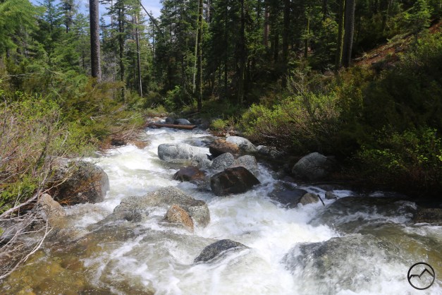
Parks Creek races toward the Shasta Valley. 

There are many creek and rivers that arise around Mount Shasta. Some are short and flow only a few miles before merging with larger waterways while others, notably the rivers, flow for great lengths (the Sacramento River being the longest river in California, of course). One of the few creeks that has substantial flow for many miles is Parks Creek. This large creek flows for a surprising 22 miles before it finally joins the Shasta River. Indeed, it is only a bit shorter than the 26 miles long Little Shasta River, the Shasta River’s longest tributary.

Parks Creek is among the most beautiful and diverse of the creeks in the Mount Shasta area. Its journey passes through alpine lakes, rocky basins, lush meadows, narrow canyons, and vast valleys. It’s upper regions are an explorer’s paradise while its final miles are prime salmon spawning ground. In that sense, it can be seen as a prime source of renewal. However, the creek goes relatively unnoticed. When most people hear the words “Parks Creek”, they think of the PCT trailhead from which Deadfall Meadows and Mount Eddy are reached. Typically, little thought is given to the creek from which the trailhead derives its name. Nonetheless, the creek itself is a destination worthy of exploration.

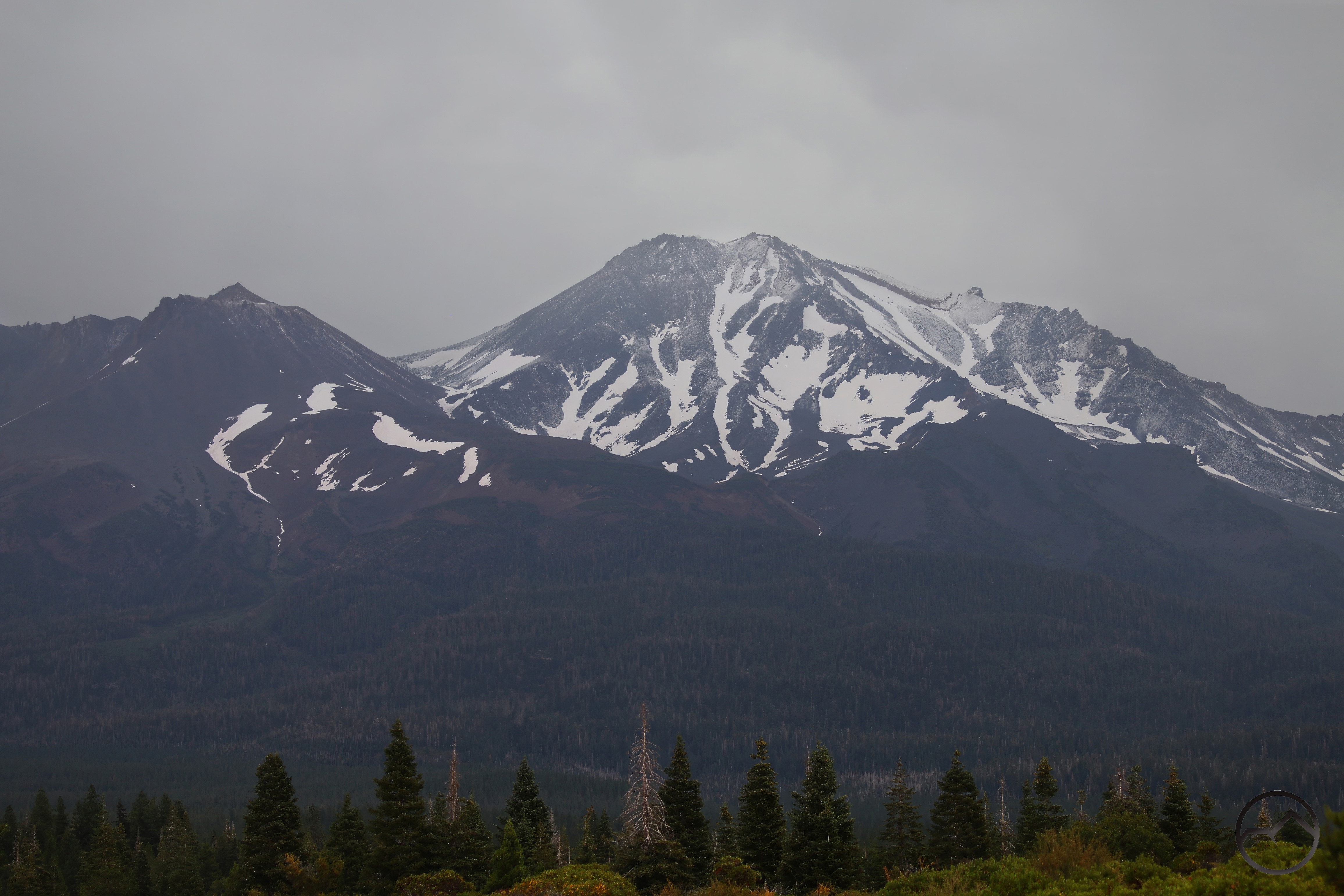
Parks Creek begins on the highest flanks of China Mountain, the fourth highest summit in the Mount Shasta area (after Mount Shasta, Shastina and Mount Eddy). This makes it a product of the Scott Mountains rather than the nearby Trinity Divide. It gathers in numerous alpine basins, the largest of which contains the Caldwell Lakes. In addition to lakes, large complexes of meadows and springs feed the creek at the highest elevations. Once these headwaters are collected into the primary channel, Parks Creek flows through a steep and remote canyon. By the time the creek exits the canyon and flows into the broad Shasta Valley, it has lost nearly 3,000 feet. From this point, Parks Creek flows through the arid valley, passing cattle ranches and remote vales. It is fed by a few large, productive springs before finally completing its journey at the confluence with the Shasta River. It is a spectacular passage from high mountain to dry desert.

Source

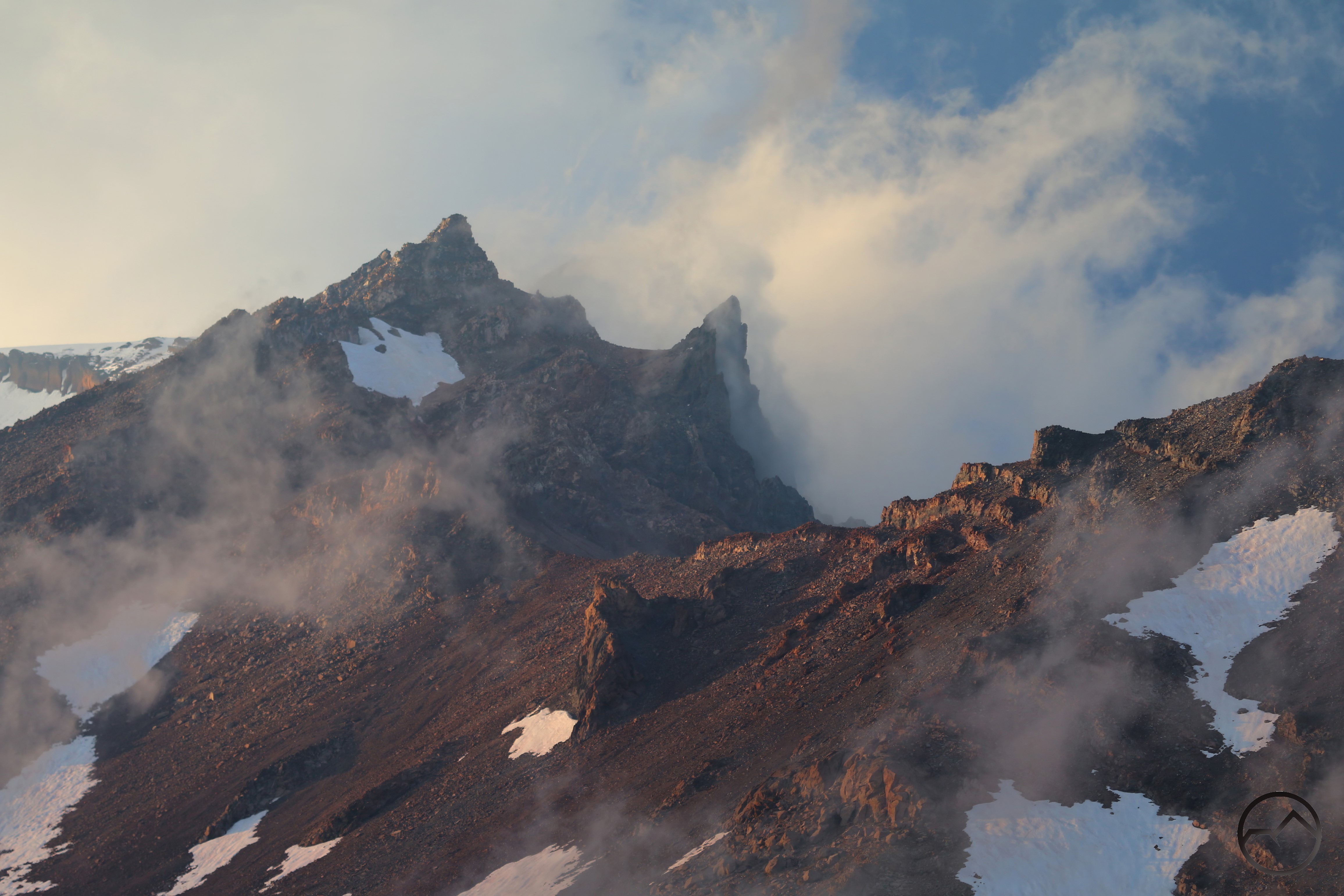
The ultimate source of Parks Creek is the upper flanks of China Mountain. This area was once the domain of copper miners (and the ruins of these operations can still be found by intrepid hikers). The water cascades down the rocky slopes of China Mountain and collects in the basins containing the Caldwell Lakes and West Park Lakes. A third basin is home to the large complex of meadows found in Tamarack Flat. Trails and roads do wind through these areas, make it easy for hikers to enjoy them, though none these areas are particularly well known. In none of them is the Creek a primary feature except for the trail to the Caldwell Lakes. Indeed, this is the only time a trail passes anywhere near the creek.

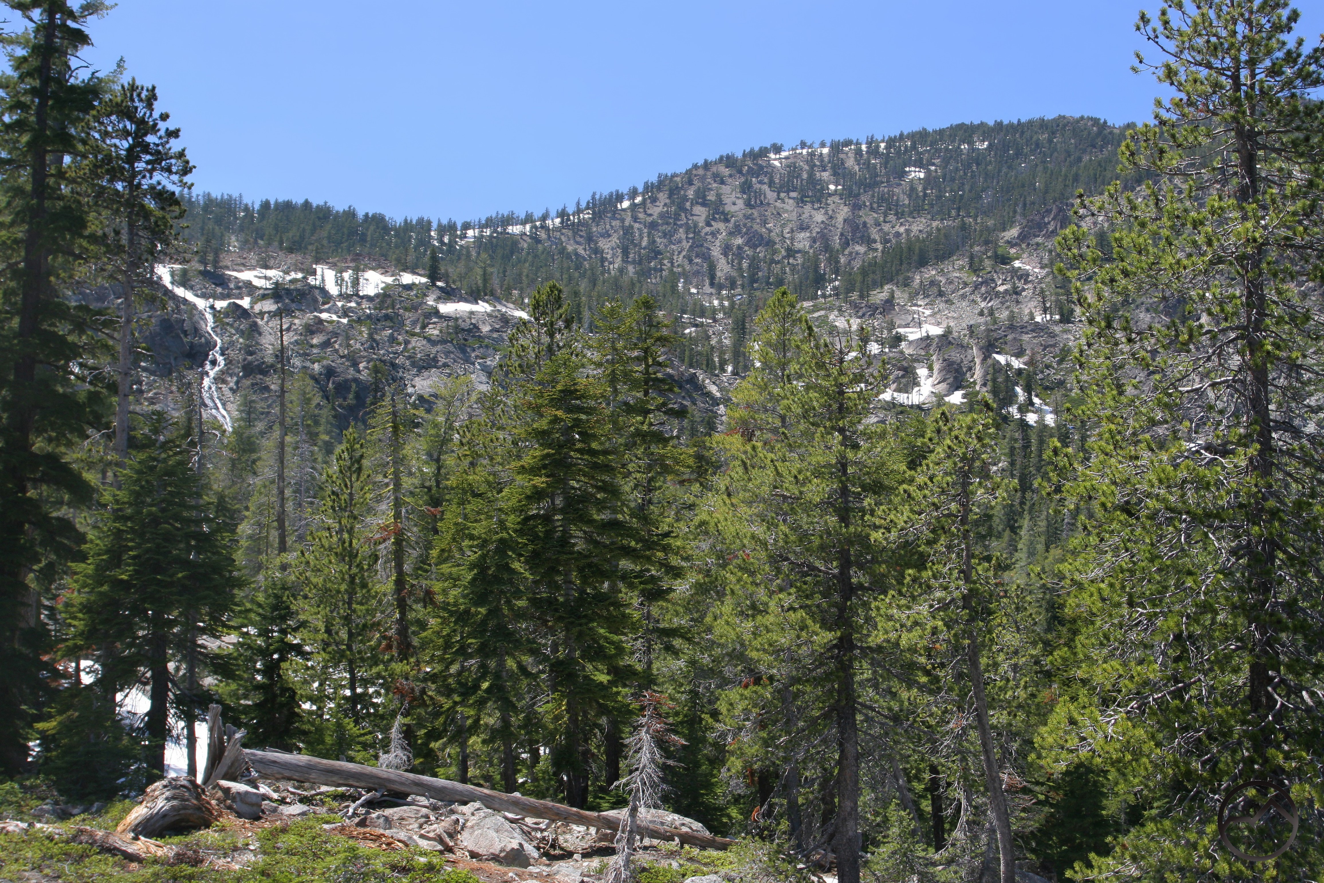
A cascade pours off of the higher flanks of China Mountain. Water from this high basin sustains meadows and the Caldwell Lakes, and thus Parks Creek, well into summer. 

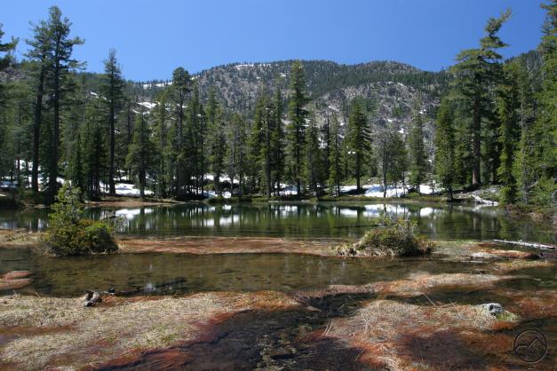
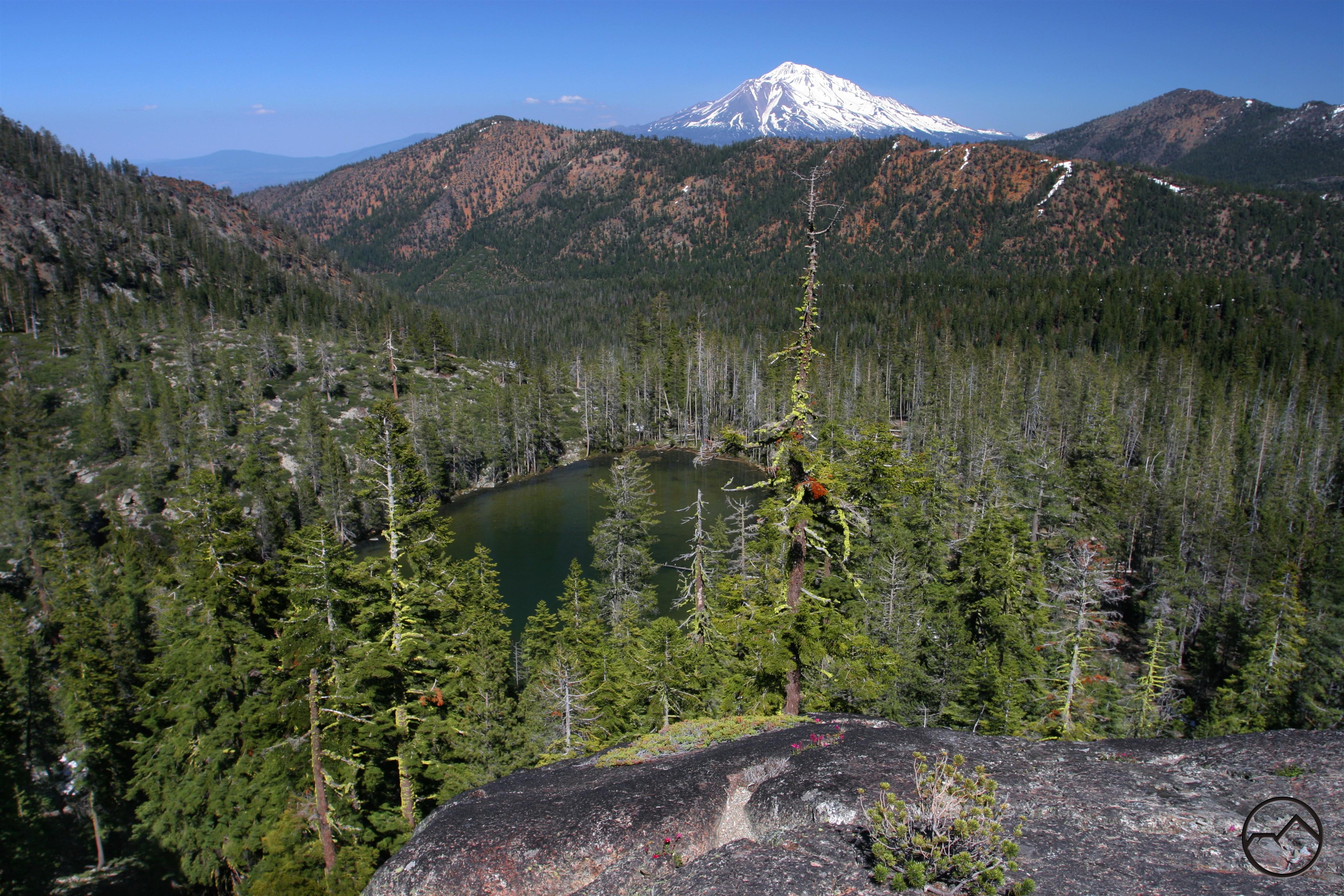
Upper Caldwell Lake lies in a broad basin below China Mountain. Just a few feet away lies Middle Caldwell Lake, which is significantly larger but has some extensive shallow areas. Parks Creek proper emerges from these lakes.

Lower Caldwell Lake is found nearly 200 feet lower than its siblings, at the base of a band of cliffs. Parks Creek flows between the lakes, cascading down a gully adjacent to the cliffs. The trail up to the lakes switchbacks along this section of the creek.

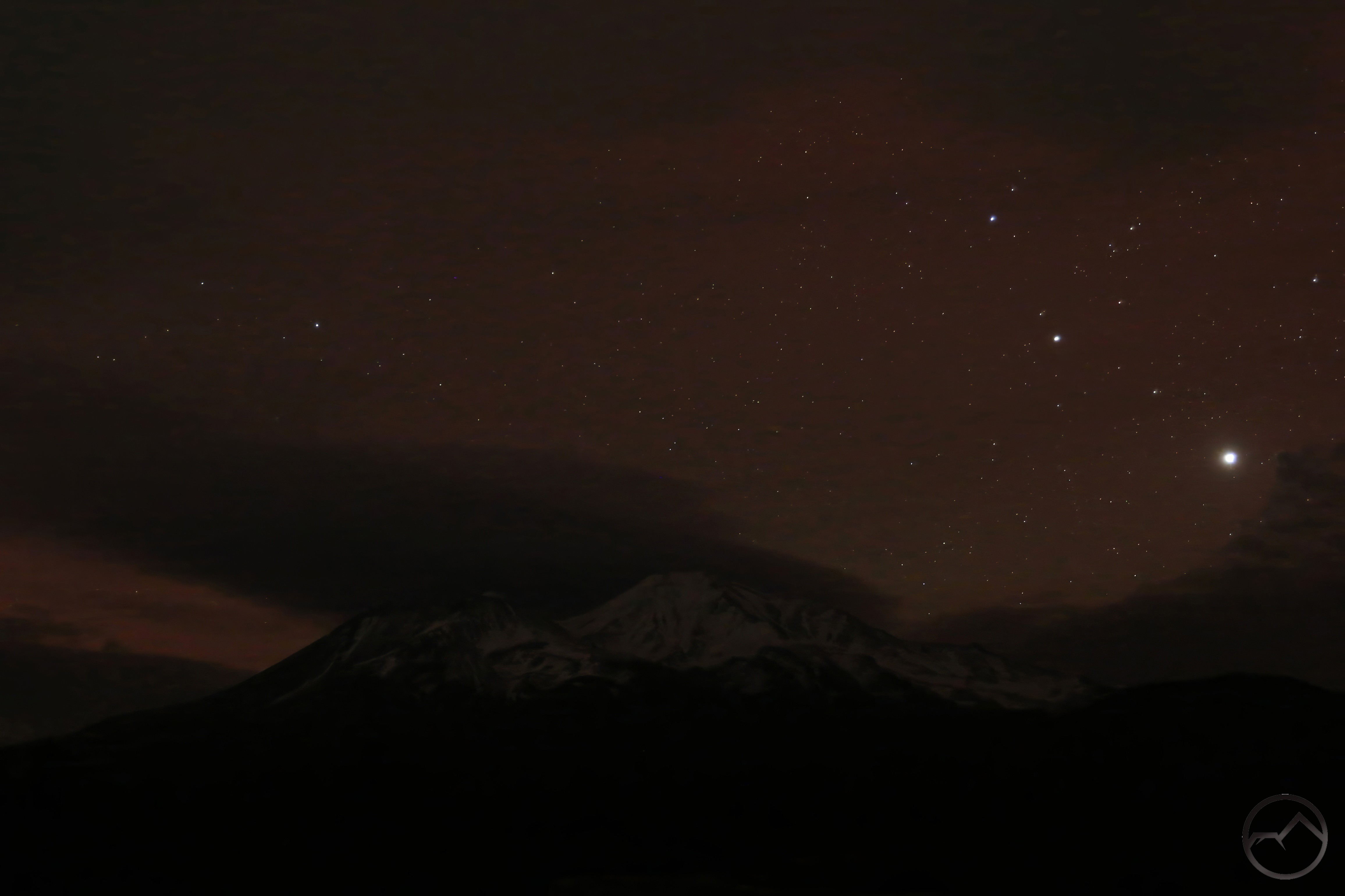
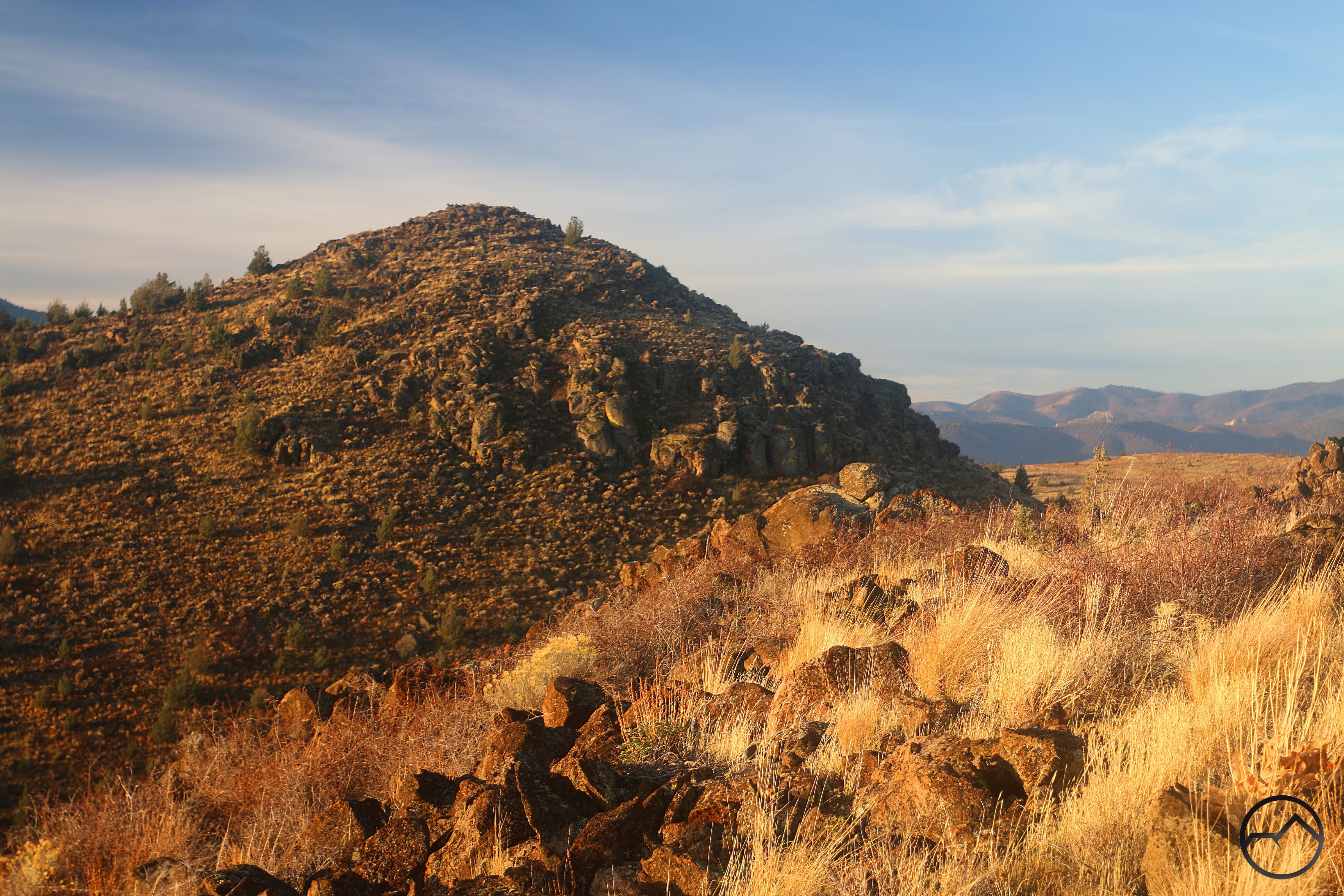
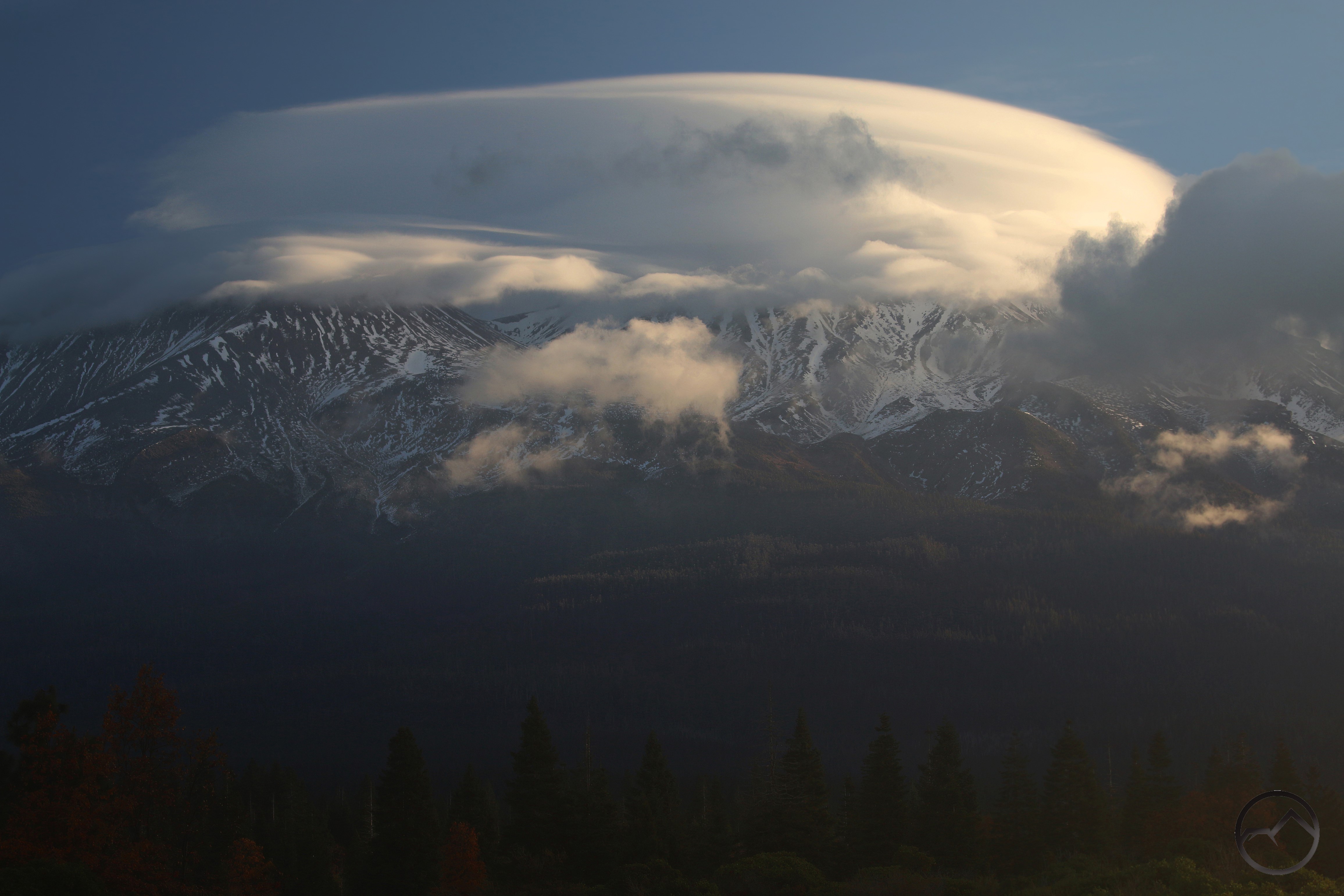
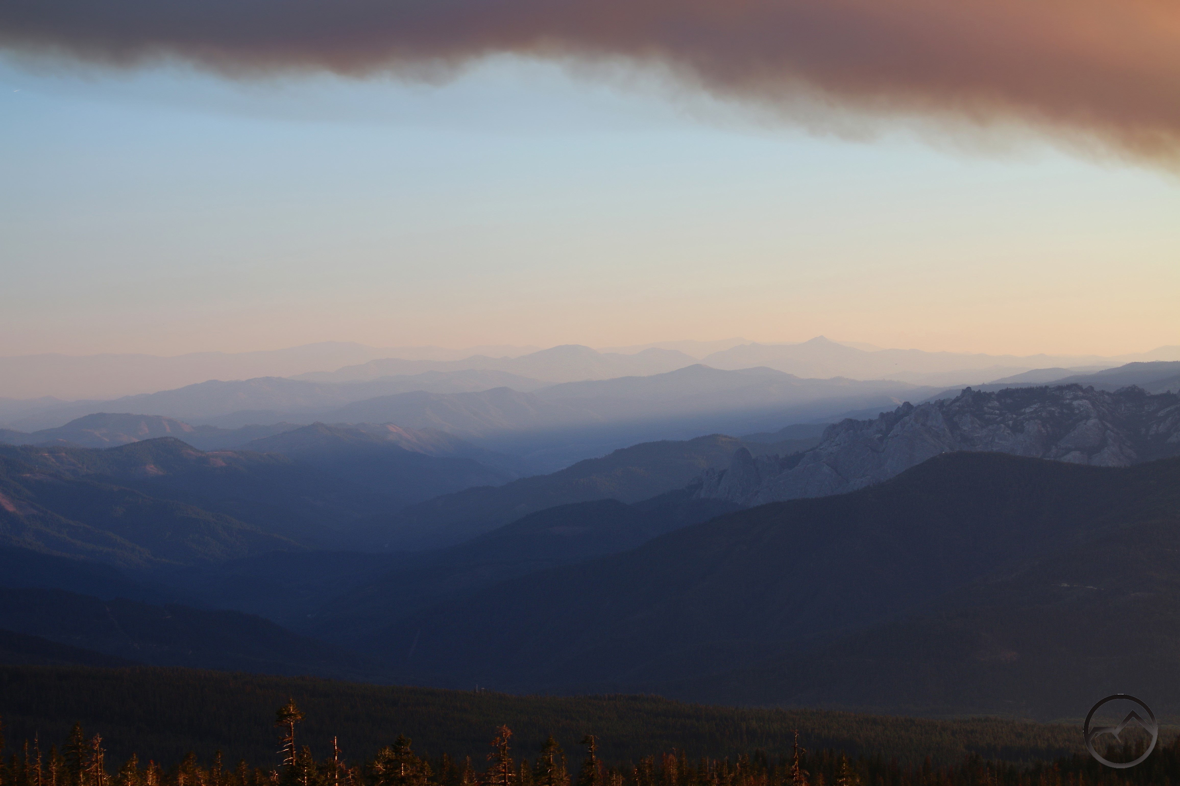
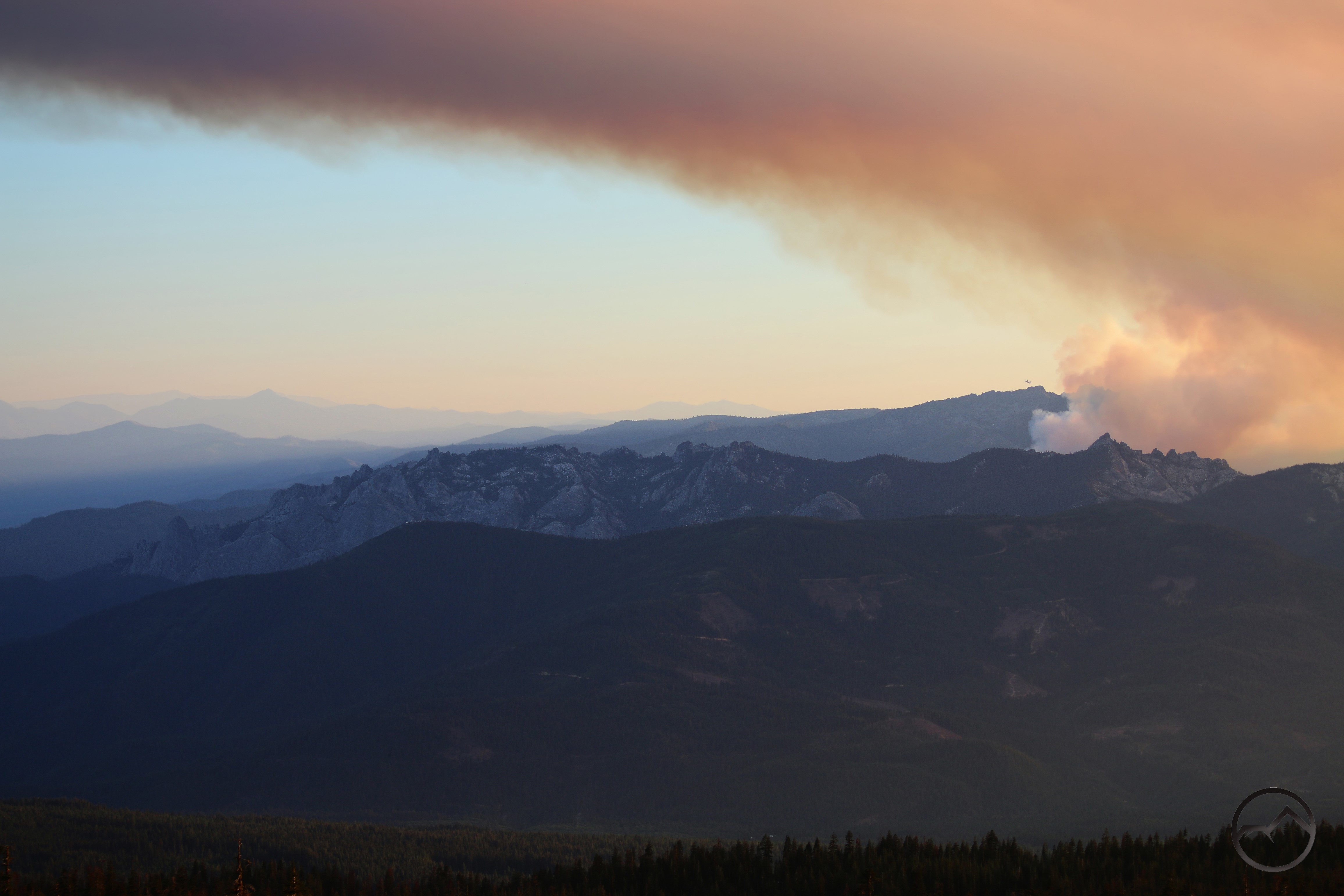
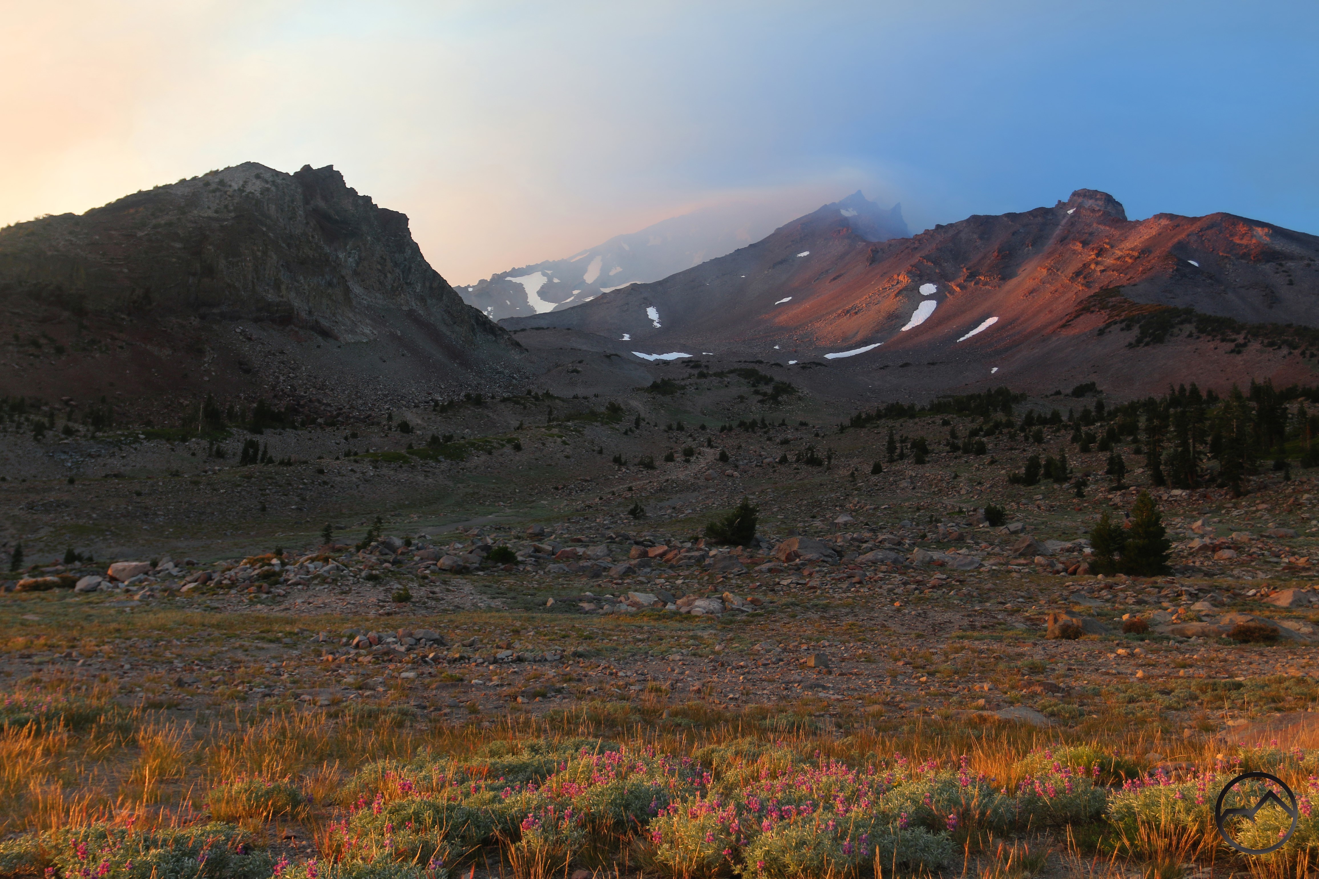
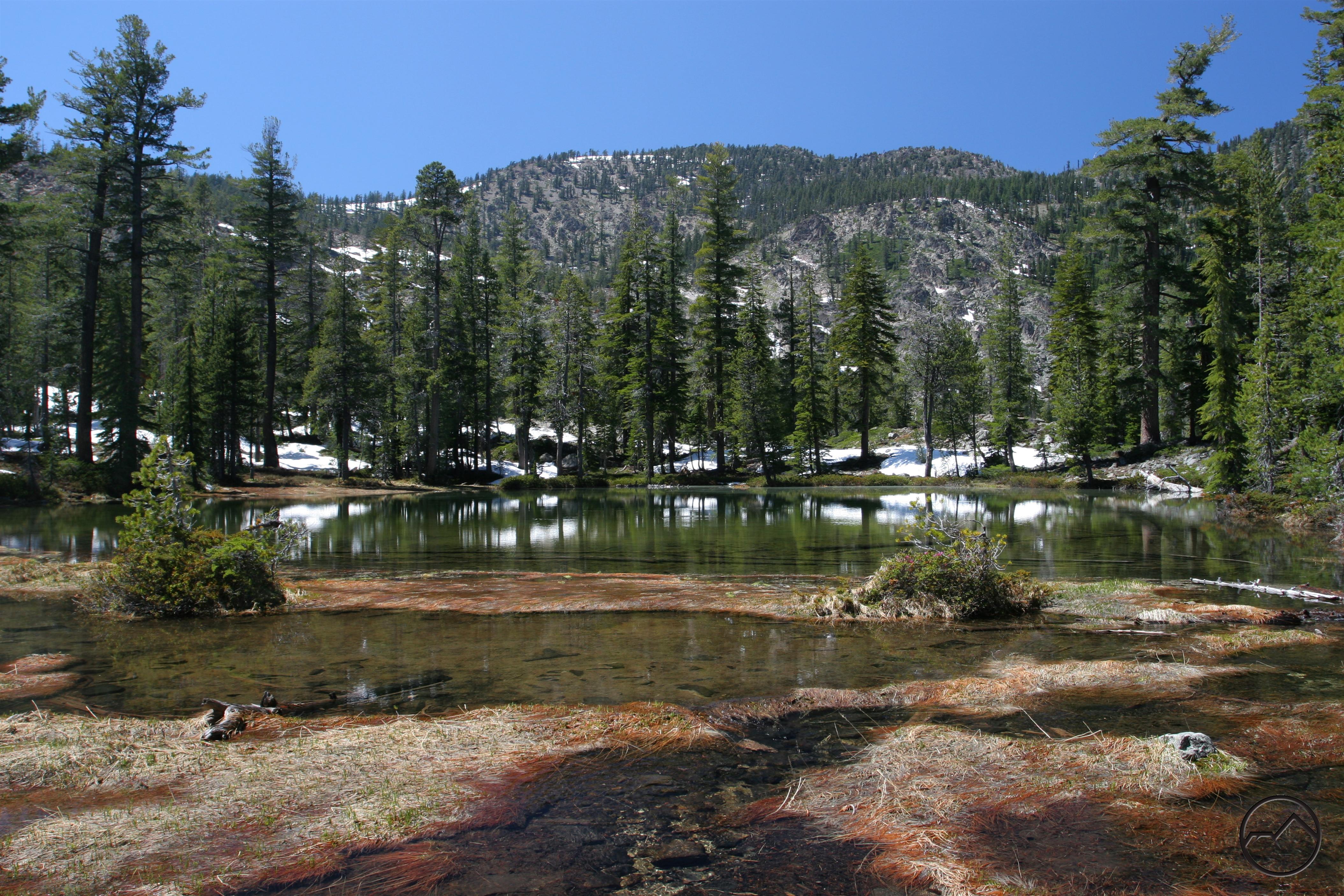
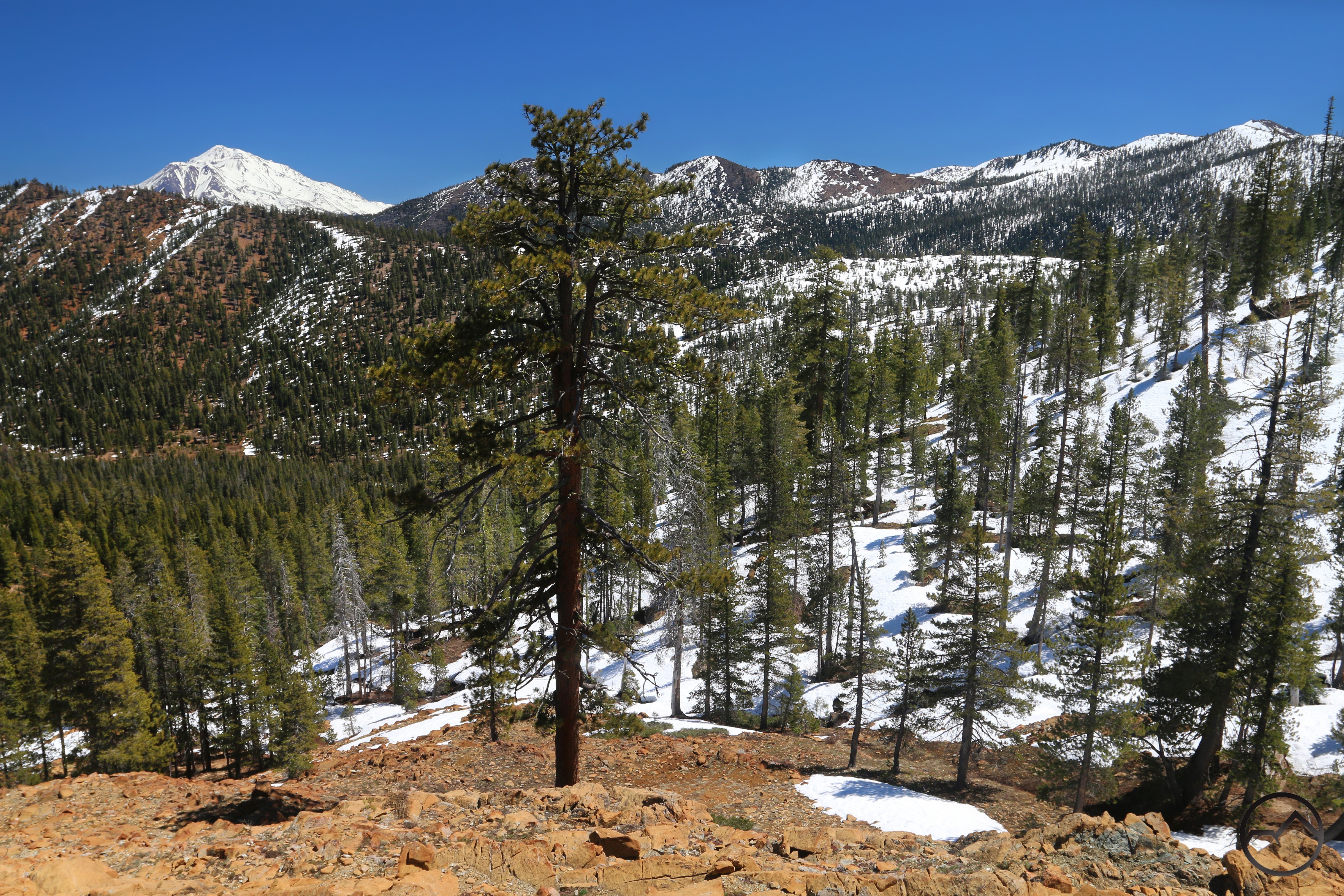
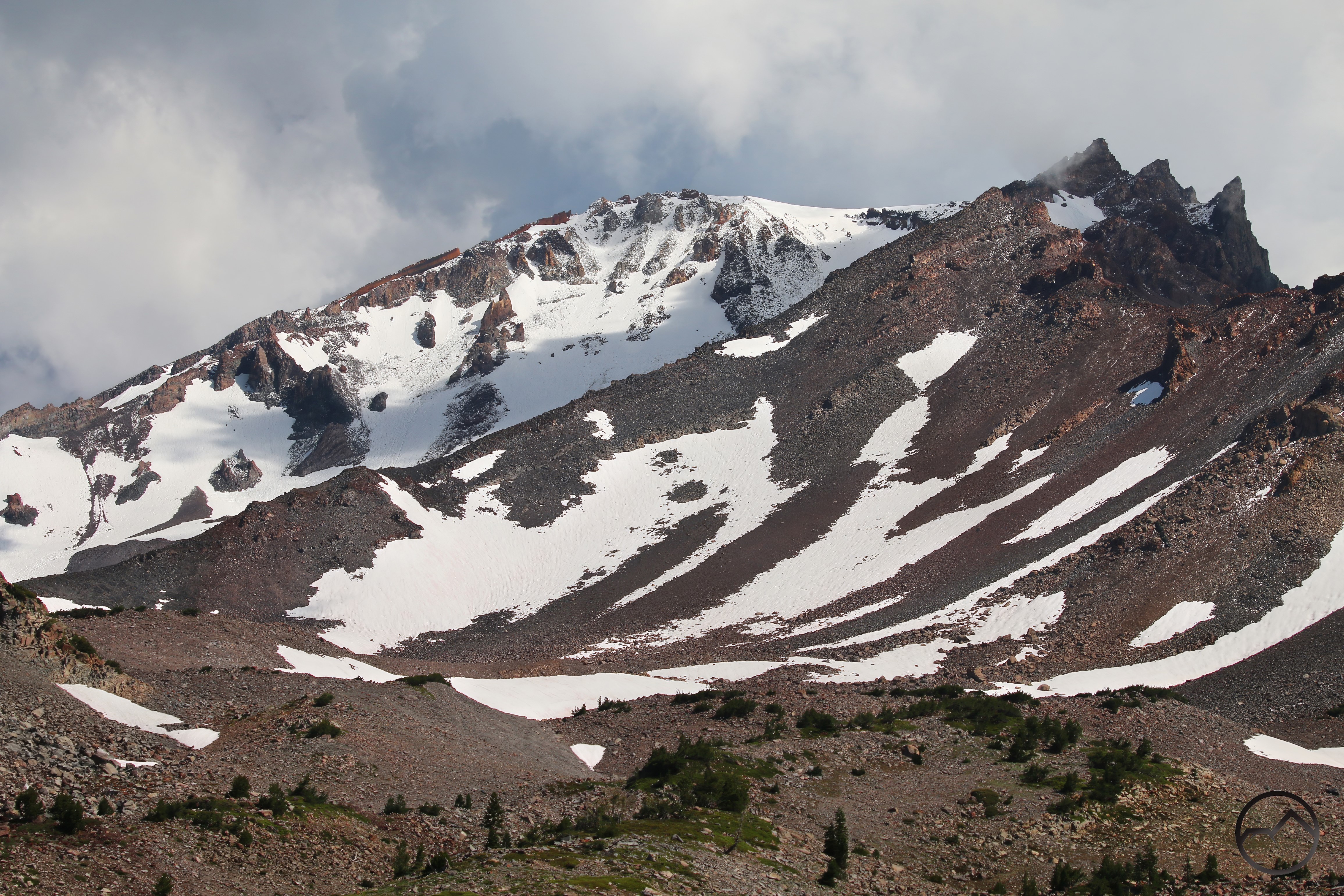
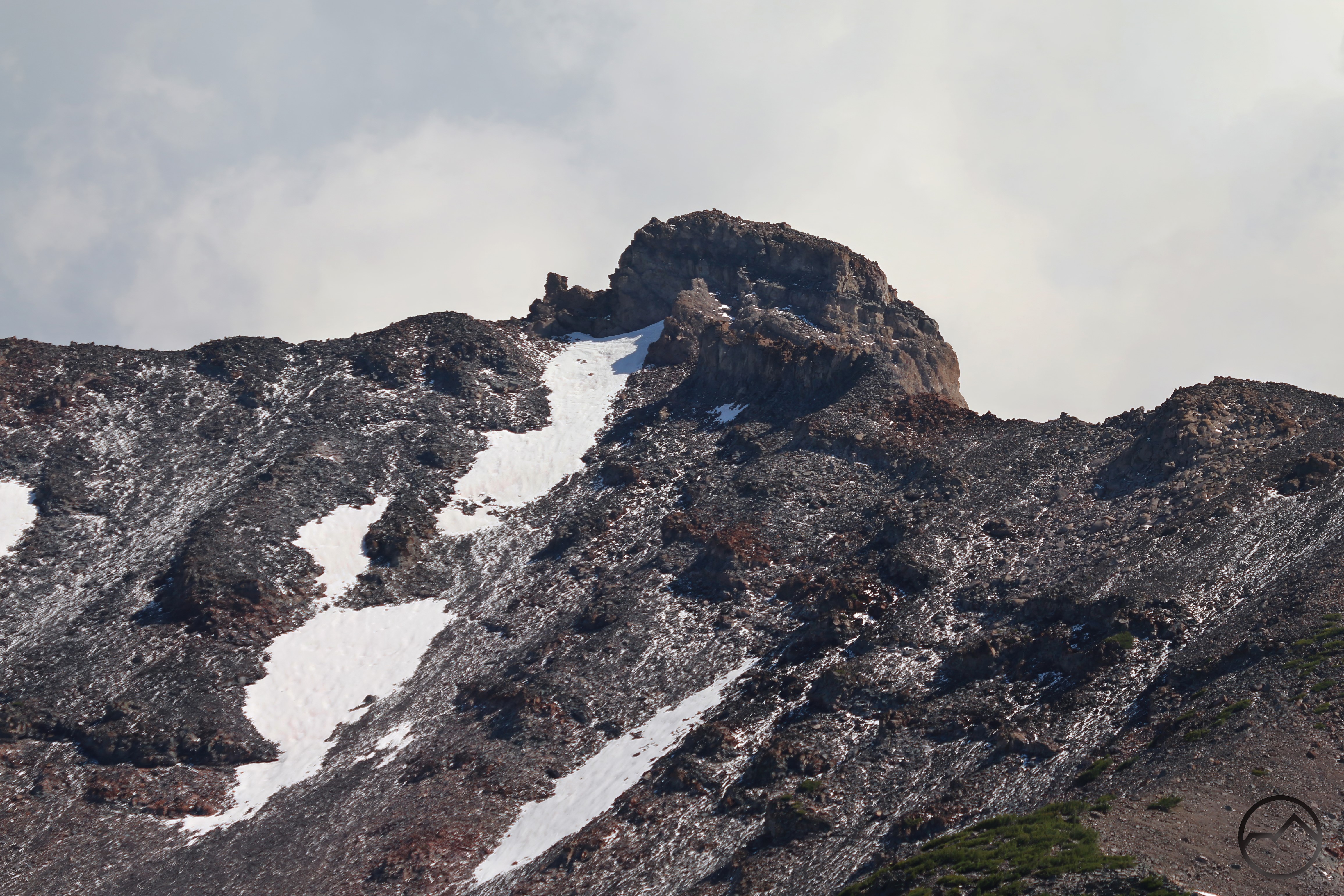
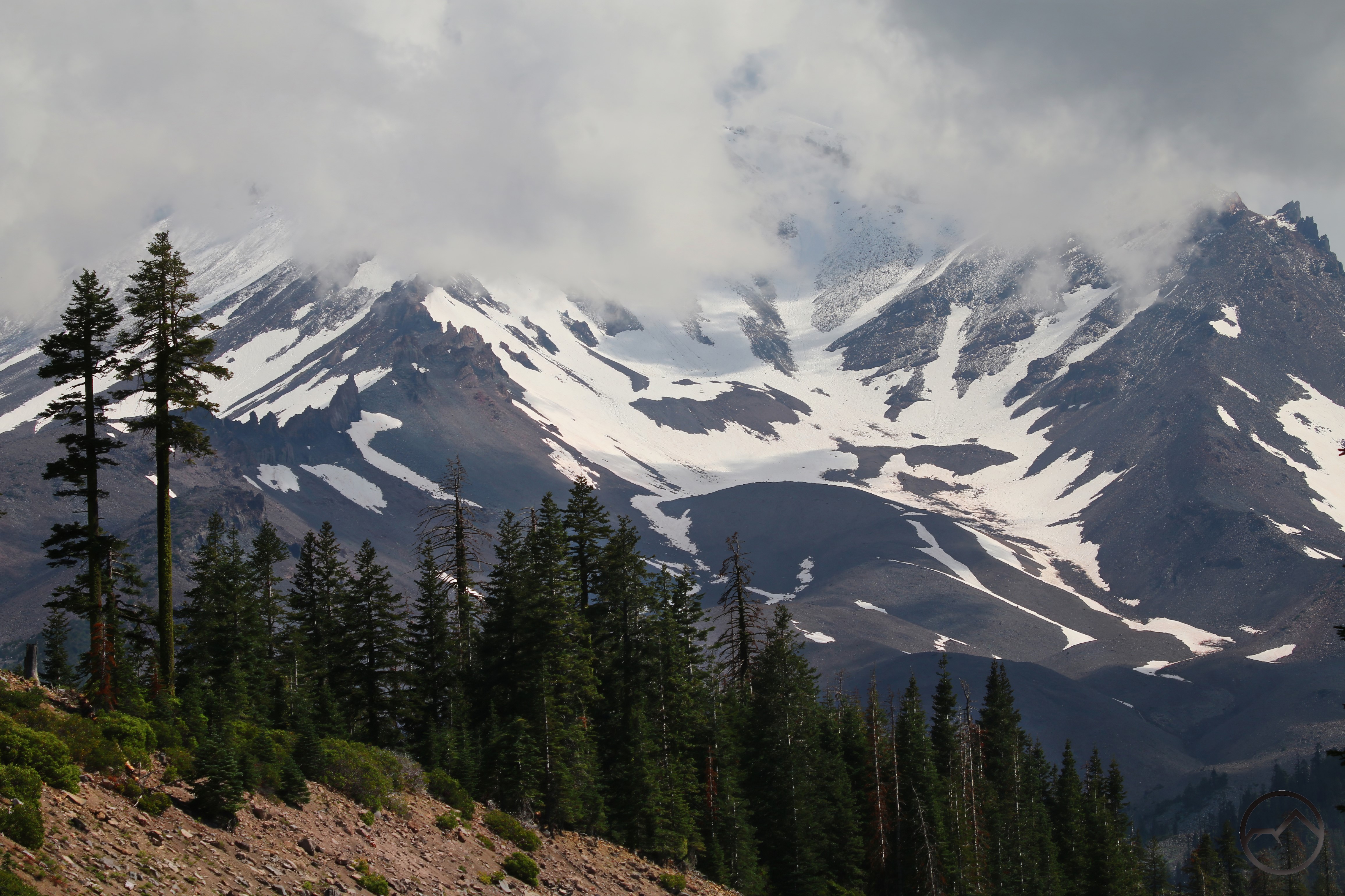
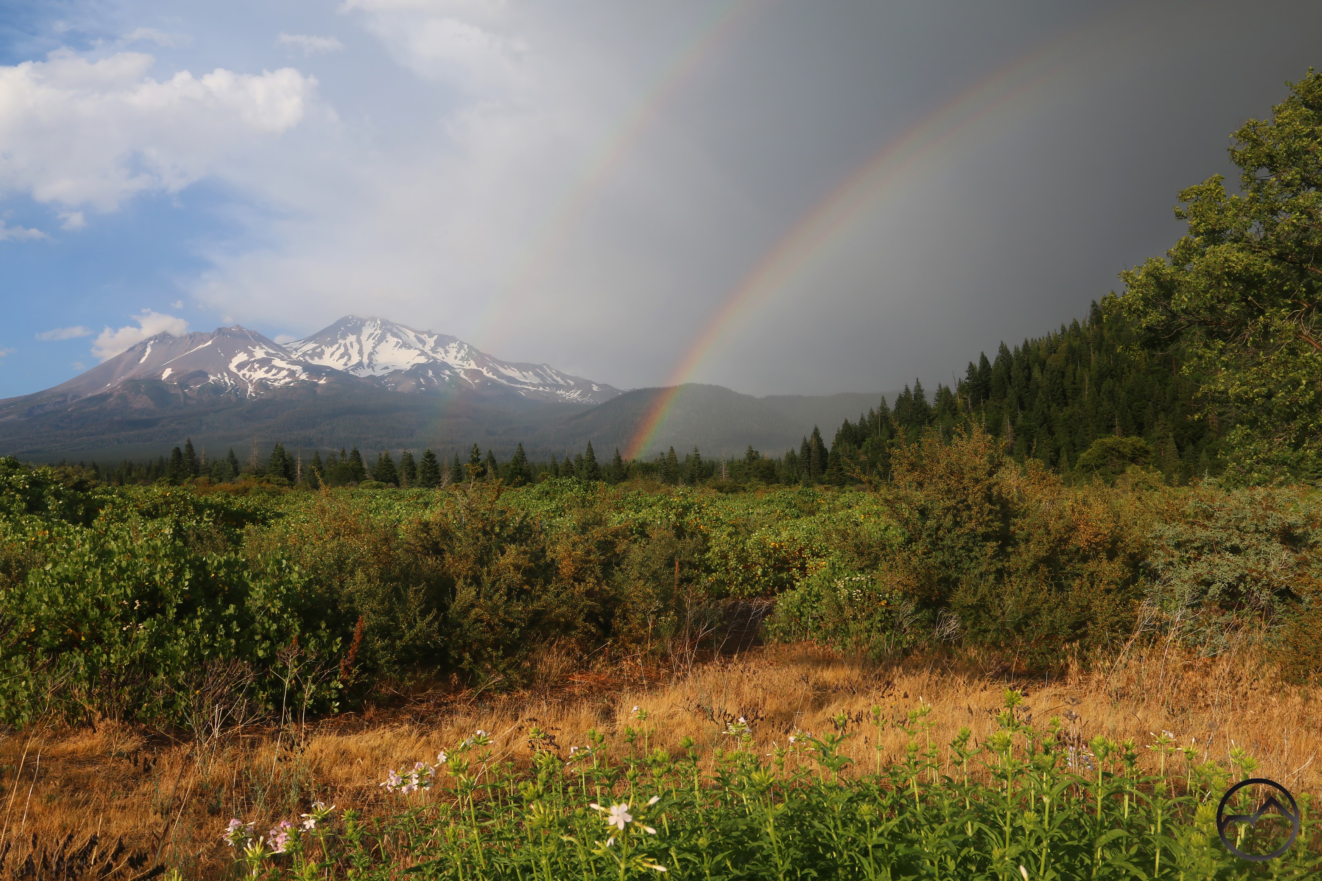
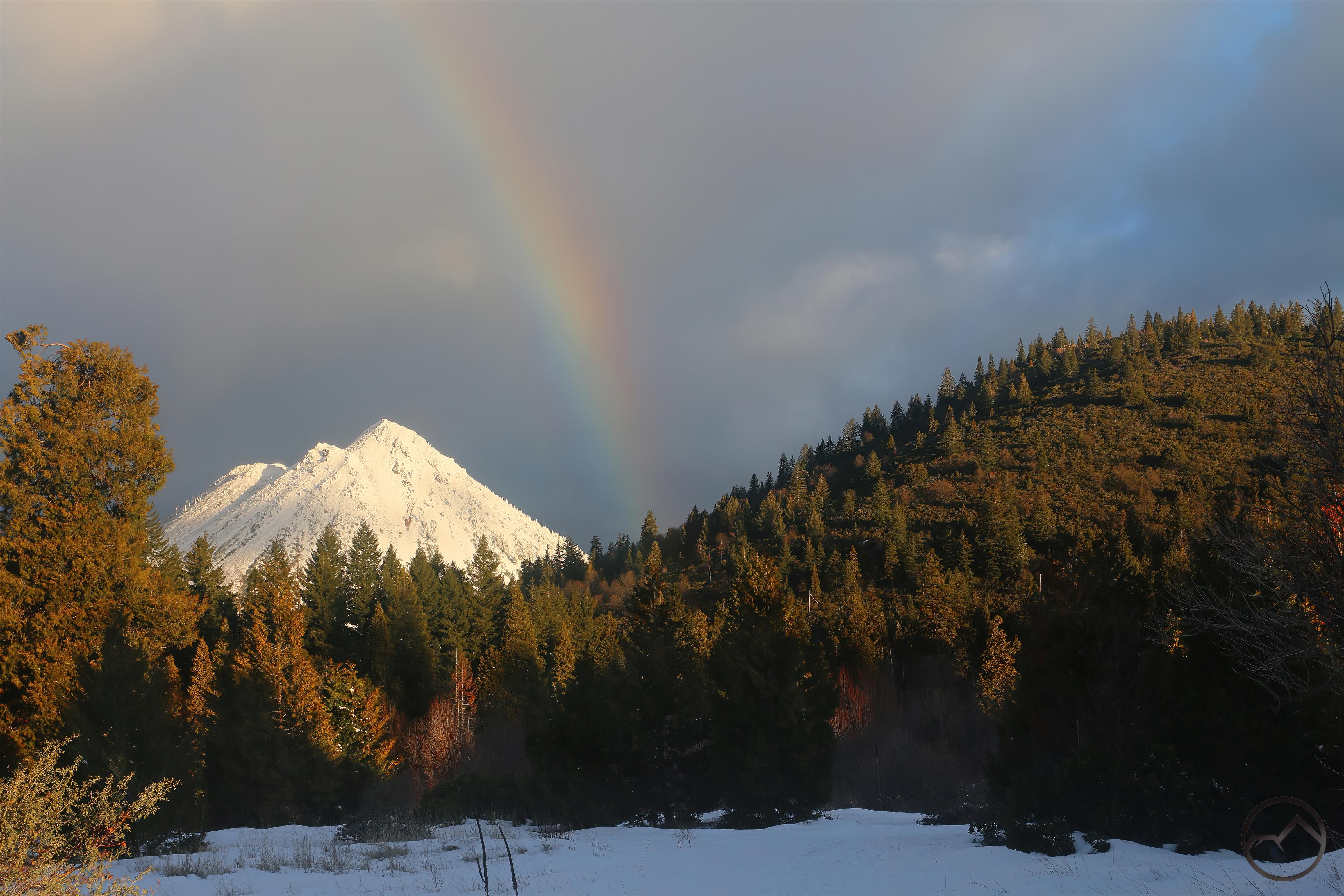
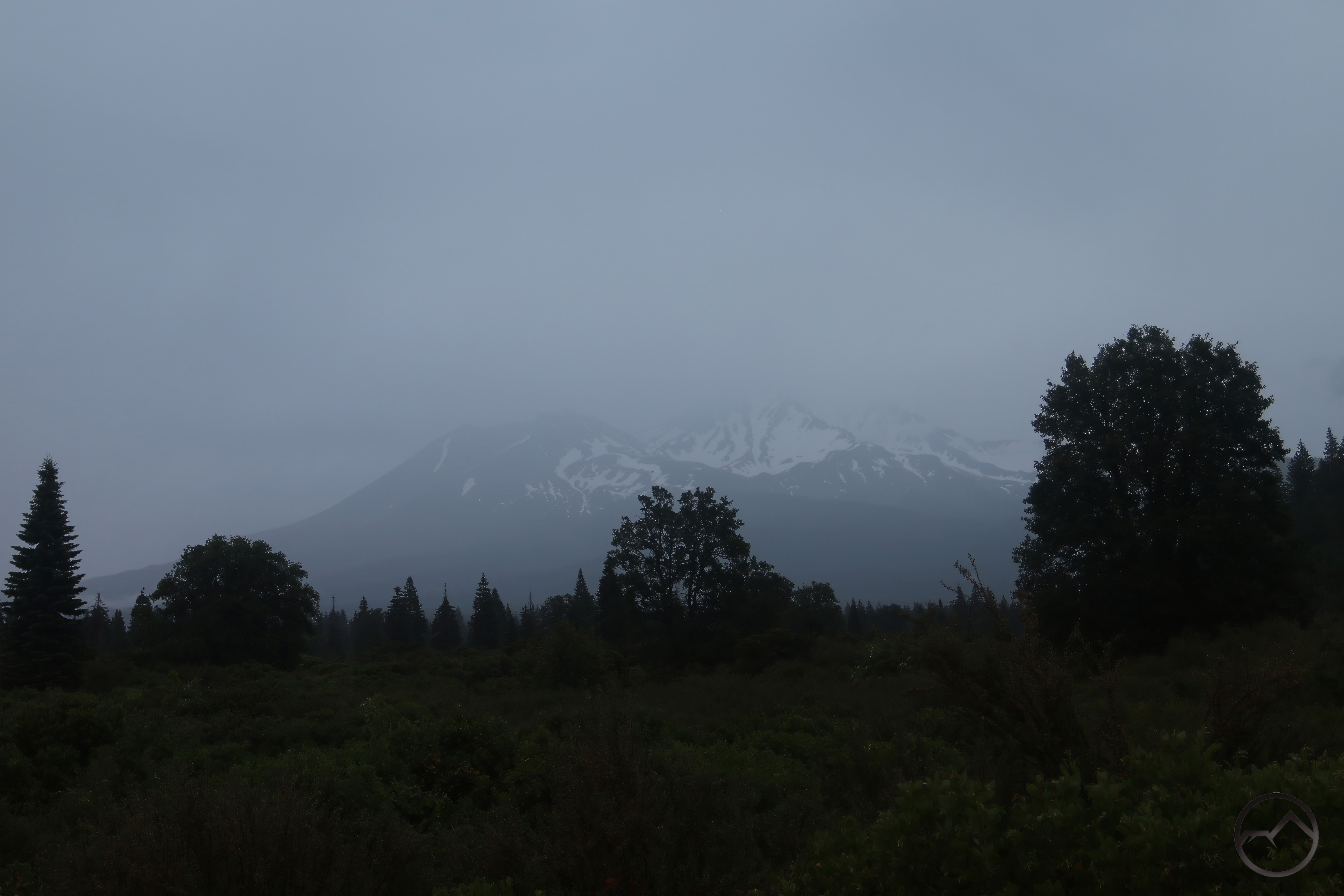
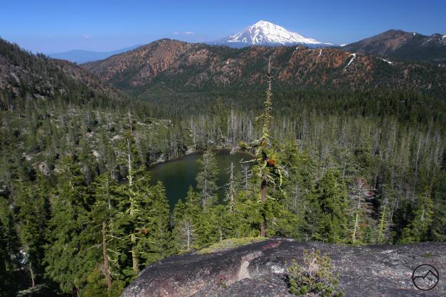
In addition to the Caldwell Lakes, other basins contribute water to Parks Creek. These start high up in the mountains where snow can linger well into summer. These rocky basins gather water from meadows and springs and send it down the mountains towards the creek. Here Mount Shasta and Mount Eddy are both visible from a remote headwaters basin.

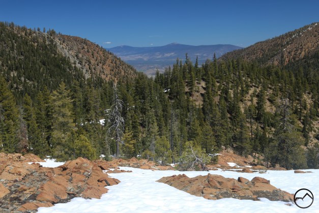
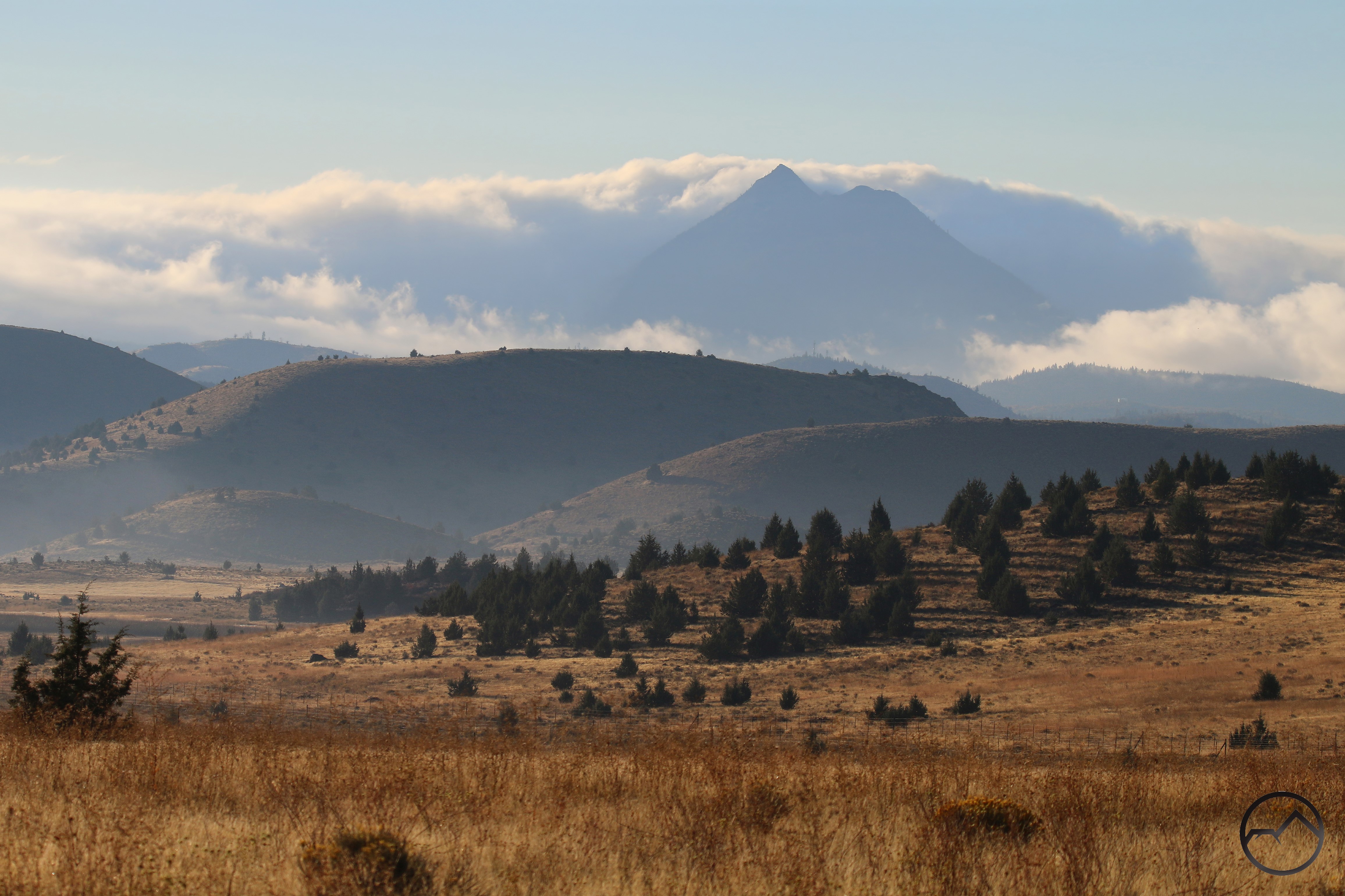
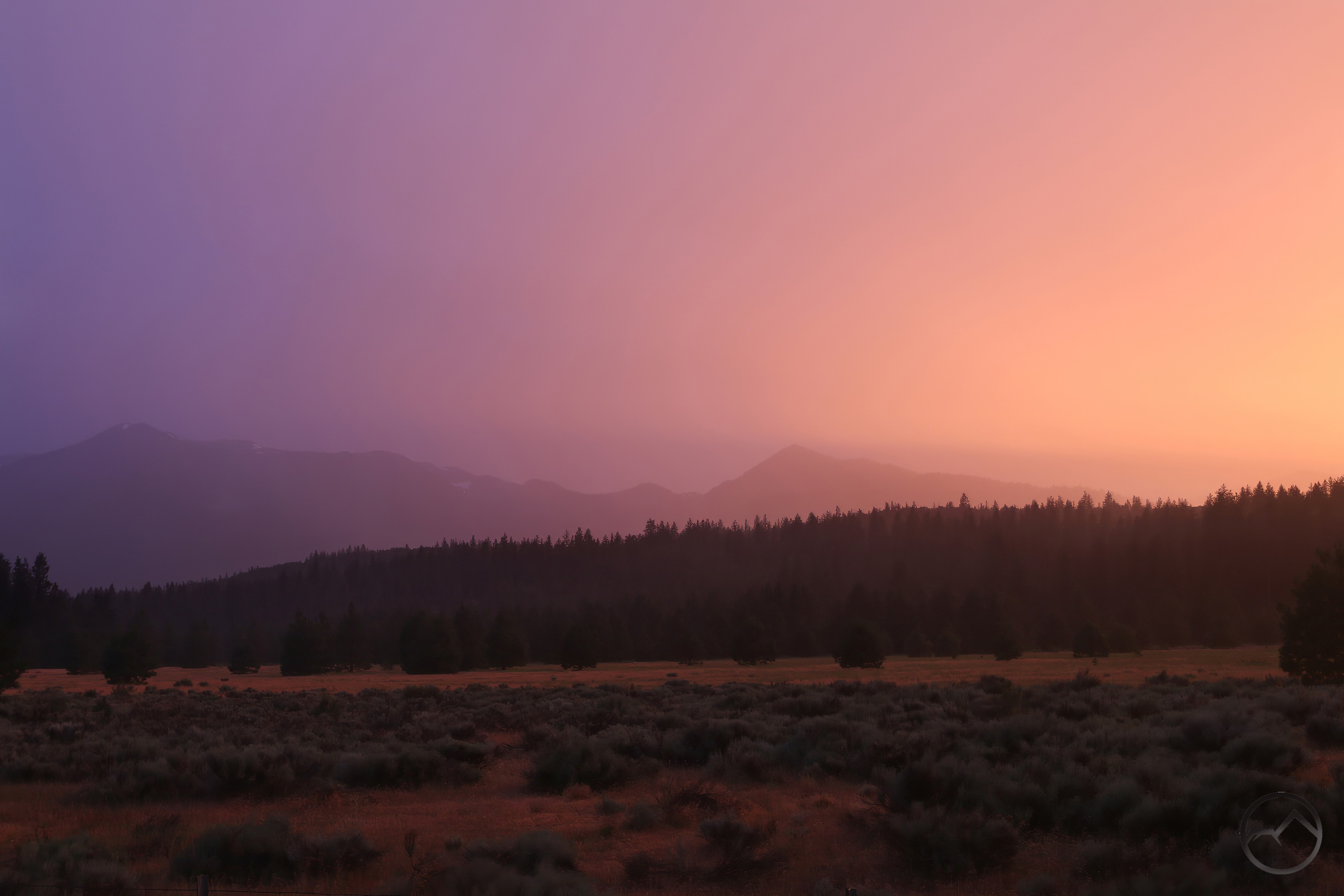
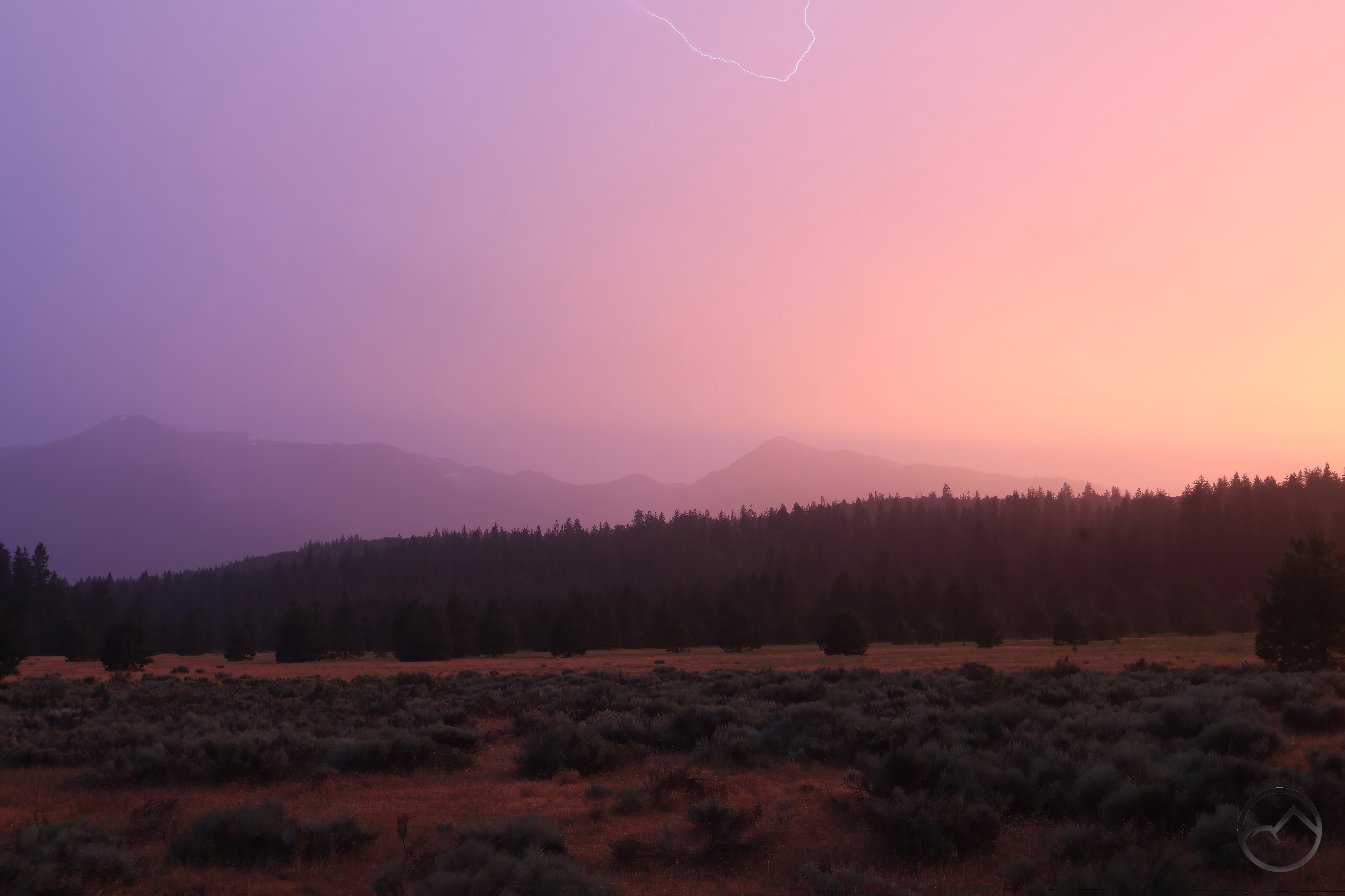
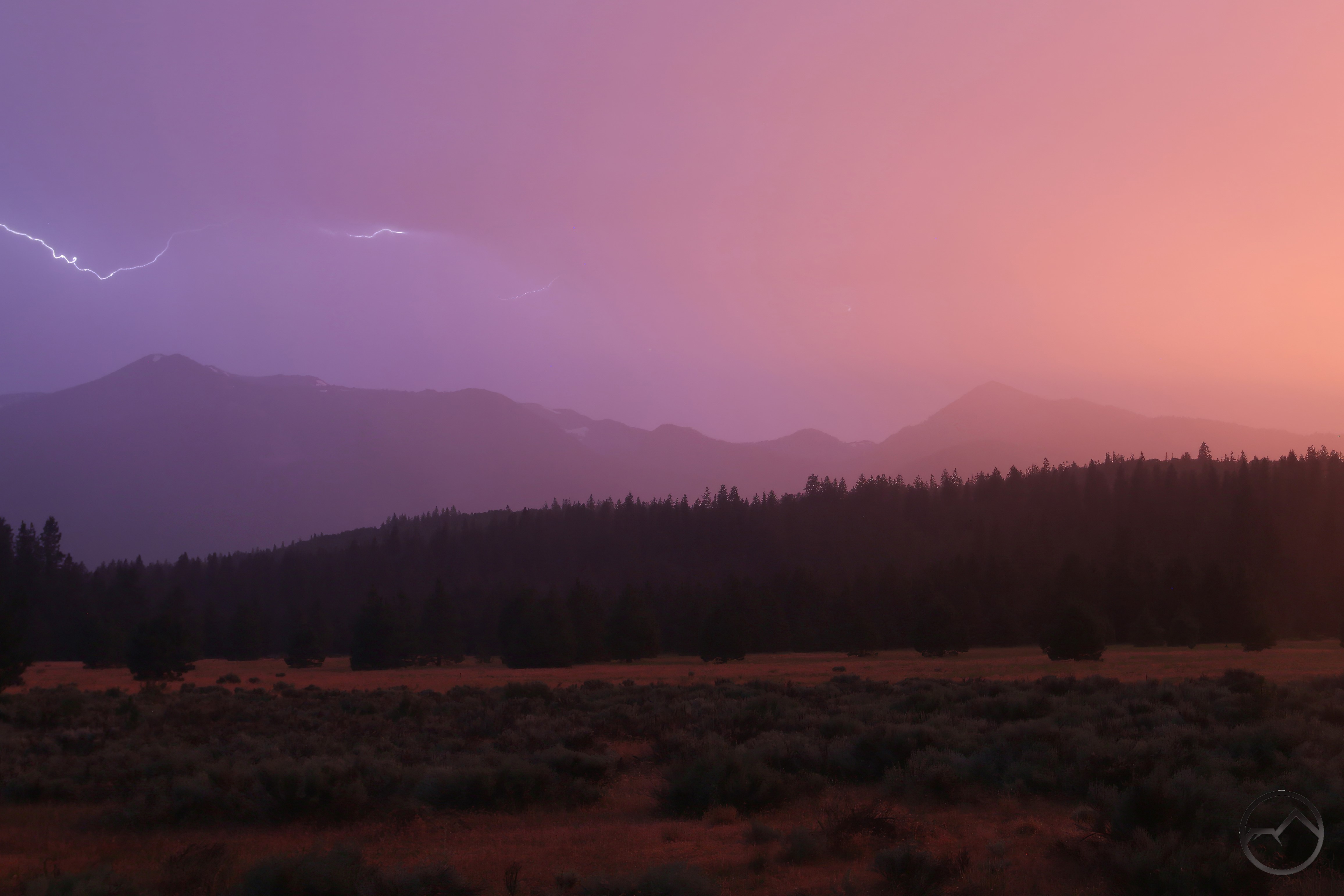
From near a headwaters source, the view looks down Parks Creek’s watershed to the Shasta Valley8 miles distant and 3,000 feet below. The Goosenest, one of the tallest peaks in the Mount Shasta area is visible on the far side of the Shasta Valley. 

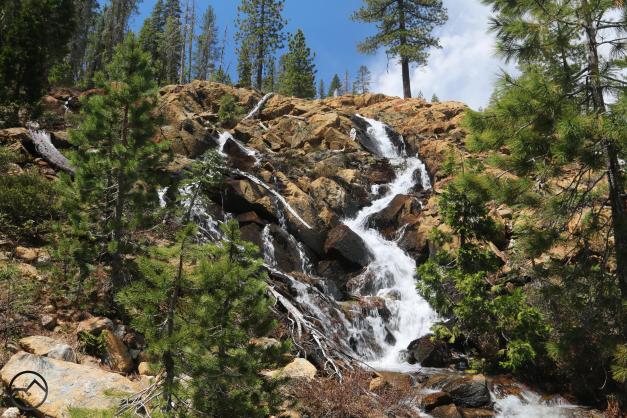
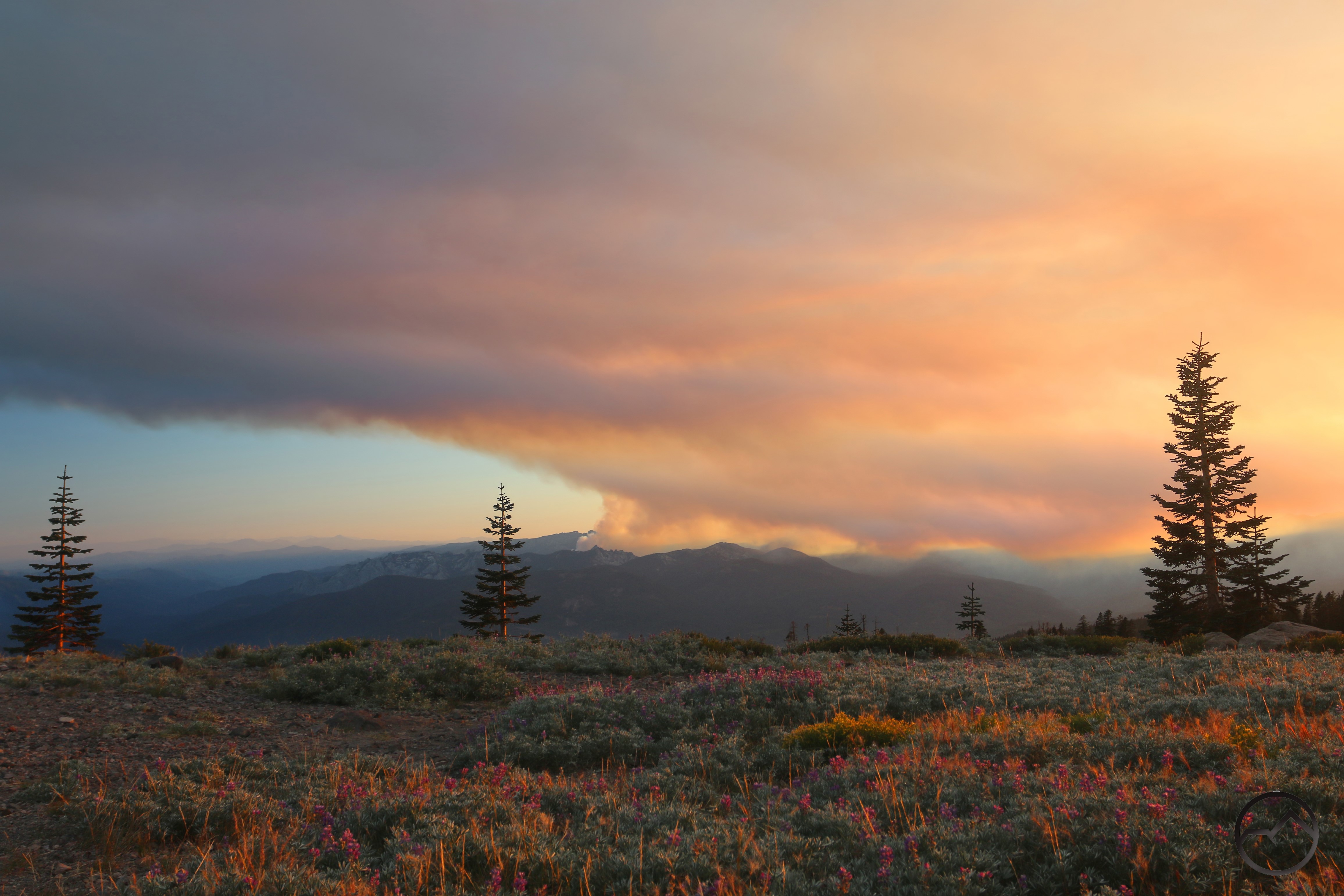
While journeying toward Parks Creek, numerous cascades and small waterfalls highlight these early tributaries. Though often dry by midsummer, they are a fantastic place to explore in the spring. 

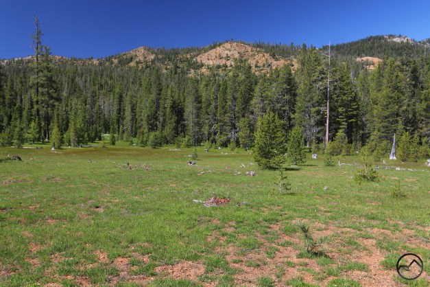
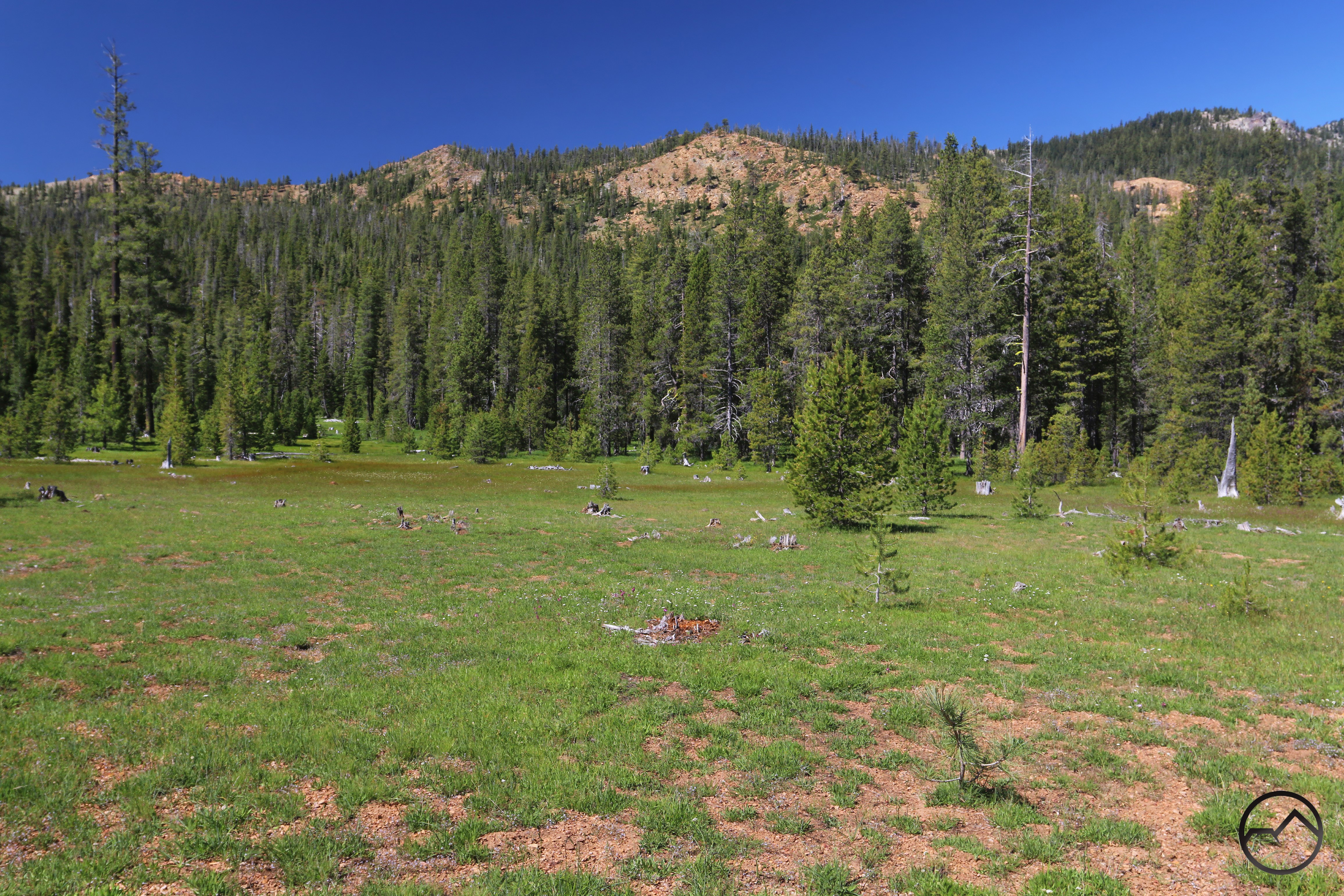
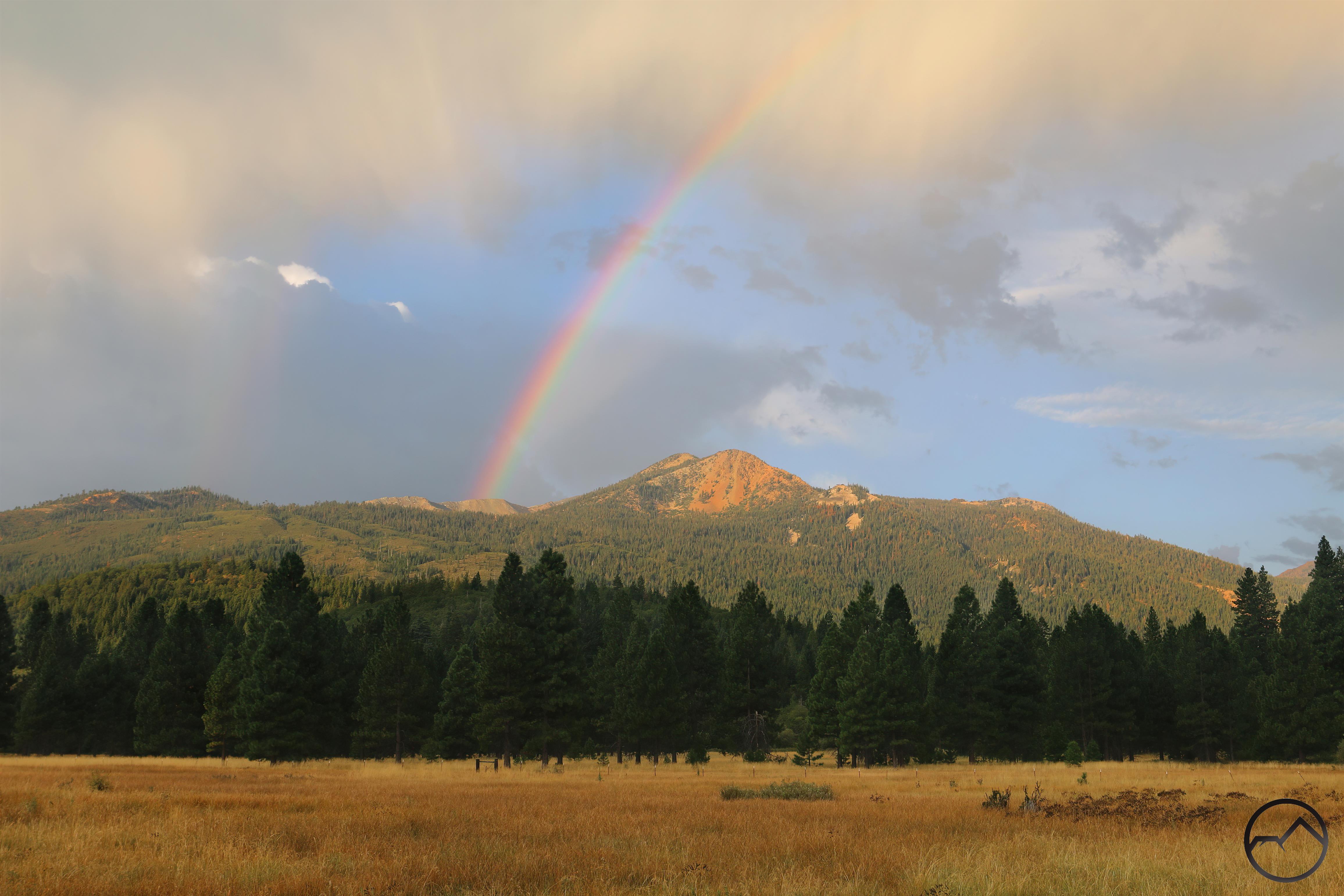
Below the cascades large meadows fill broad valleys. The tributaries flow into the meadow, which holds the waters deep into summer, sustaining Parks Creek longer than many other creeks in the area. The creek flowing through these meadows is blessed with extraordinary serenity and one of the healthiest watercourses around Mount Shasta.

The Canyon

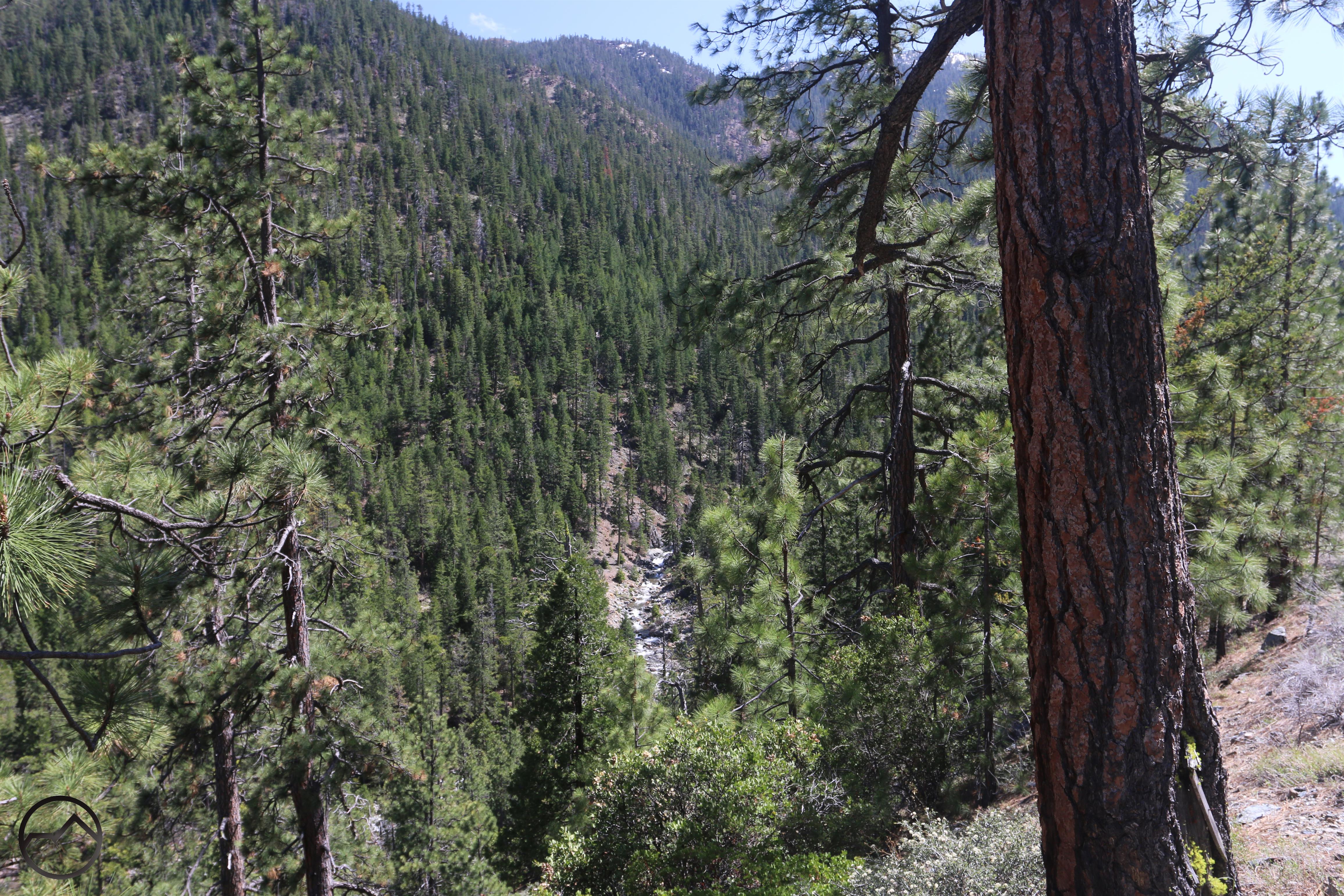
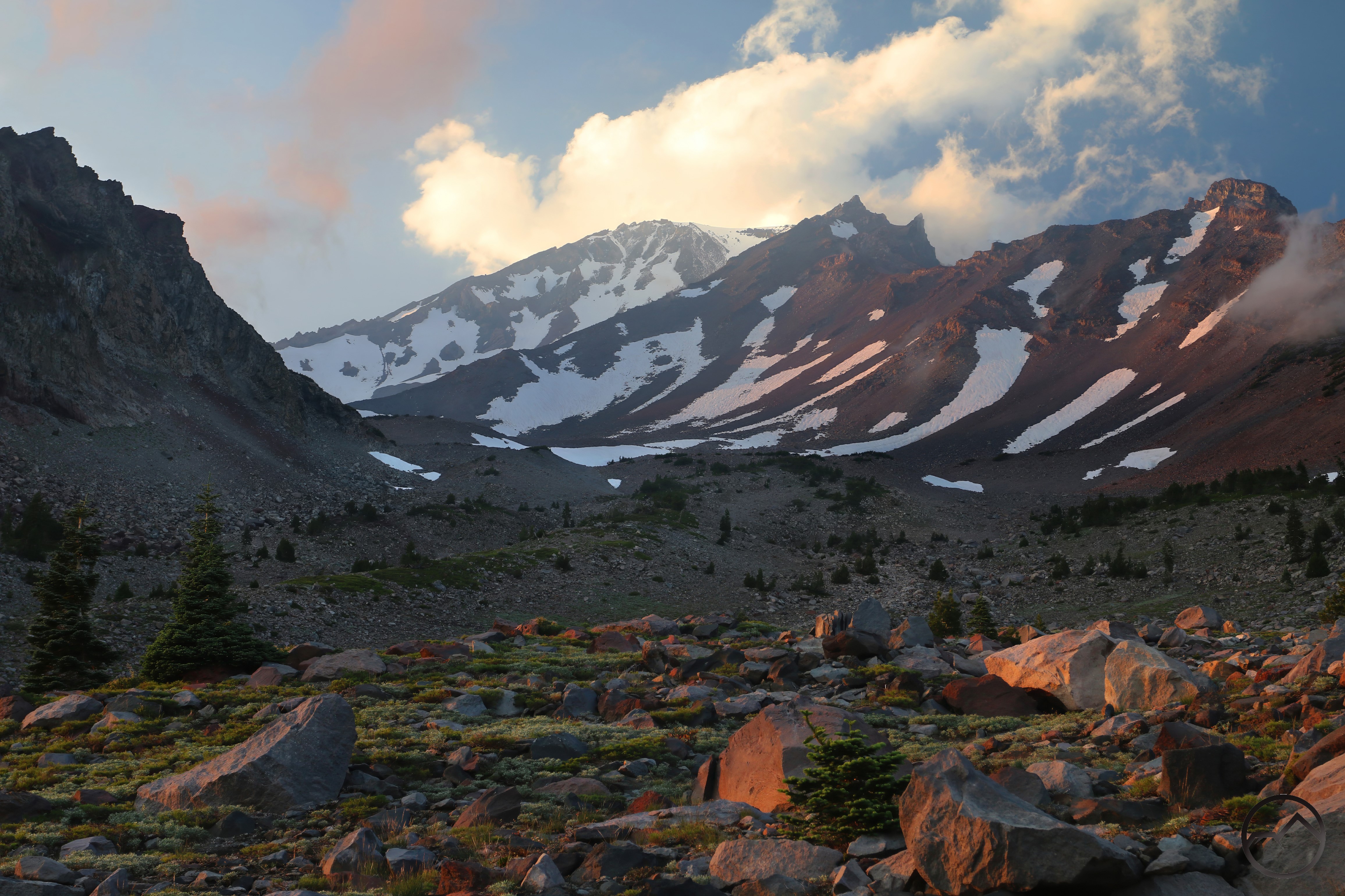
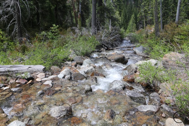
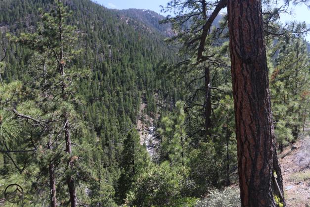
Once the waters from the various headwater channels meets, Parks Creek flows into its deep canyon. As it flows through this remote section, it loses over 1,000 feet in about 2 miles. While not the steepest stretch of water, that is still a steady drop that produces great rapids and even a hidden waterfall. Though there are no trails in the canyon, the clever hiker can figure out the route down to the creek and follow it a fair distance. There are ample rewards for those who do…

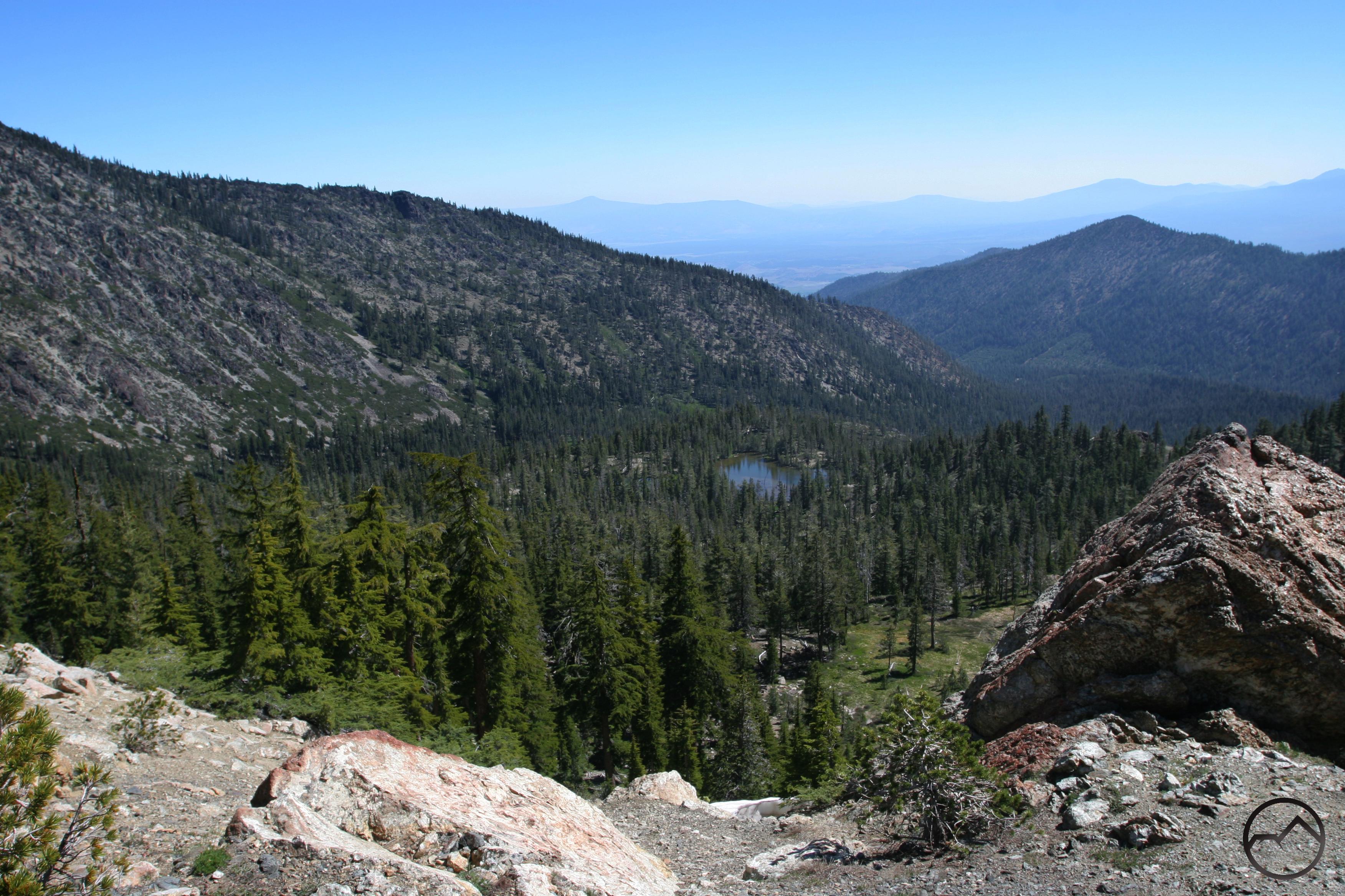
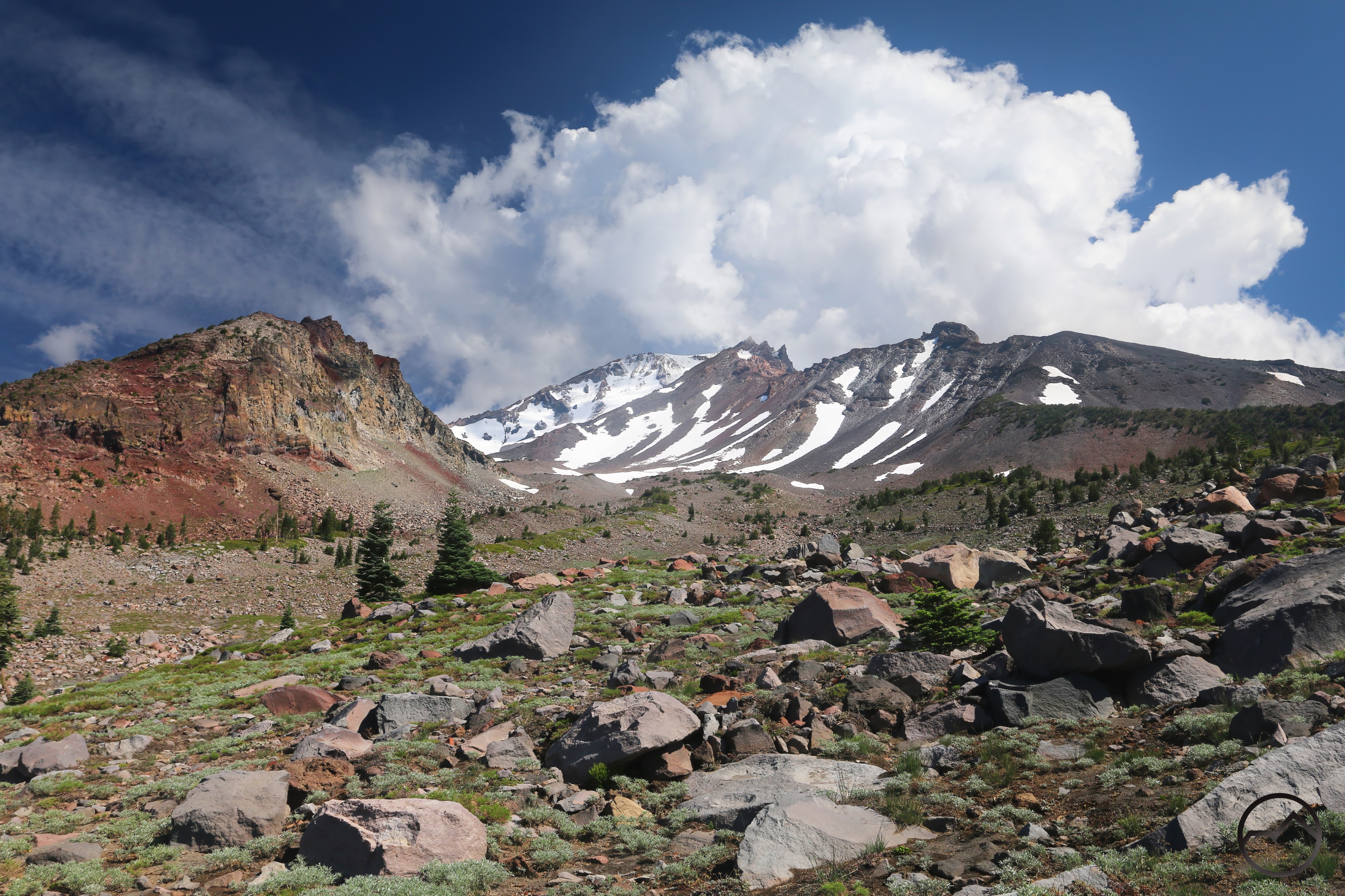
The view from above Caldwell Lakes, looking down the upper course of Parks Creek, into the higher section of the canyon. The distant Shasta Valley, the ultimate destination of Parks Creek, can be seen below.

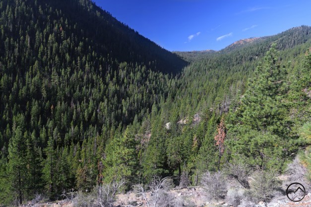
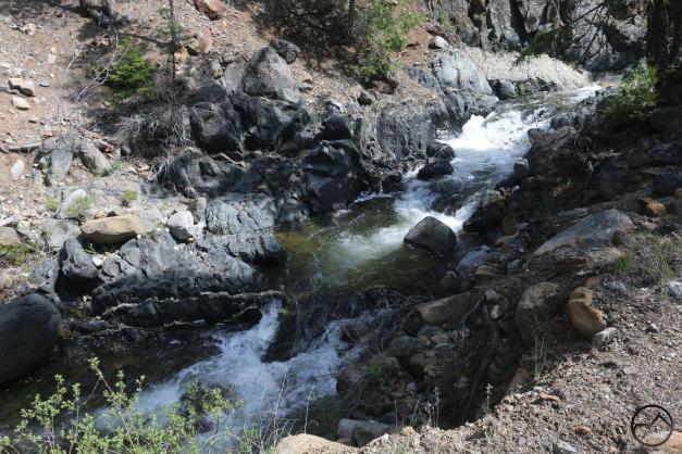
Looking up the canyon of Parks Creek from near the midpoint of its 2 mile run. The sound of the creek is quite audible from this point and at high water a bit of the creek’s hidden waterfall is visible. 

Parks Creek races precipitously through its remote canyon. One thing that really surprised me about the canyon section of Parks Creek was how abundant the yew trees were. Almost the entire 2 miles of the canyon run the banks are choked with yew. 

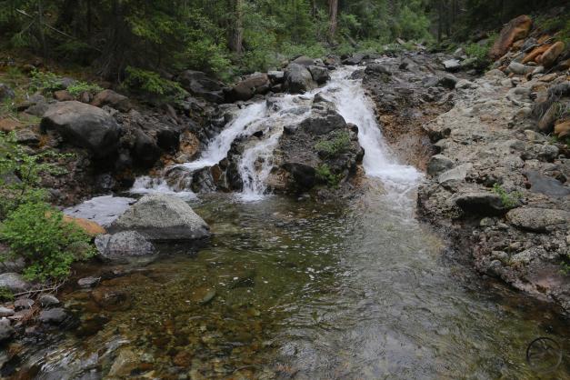
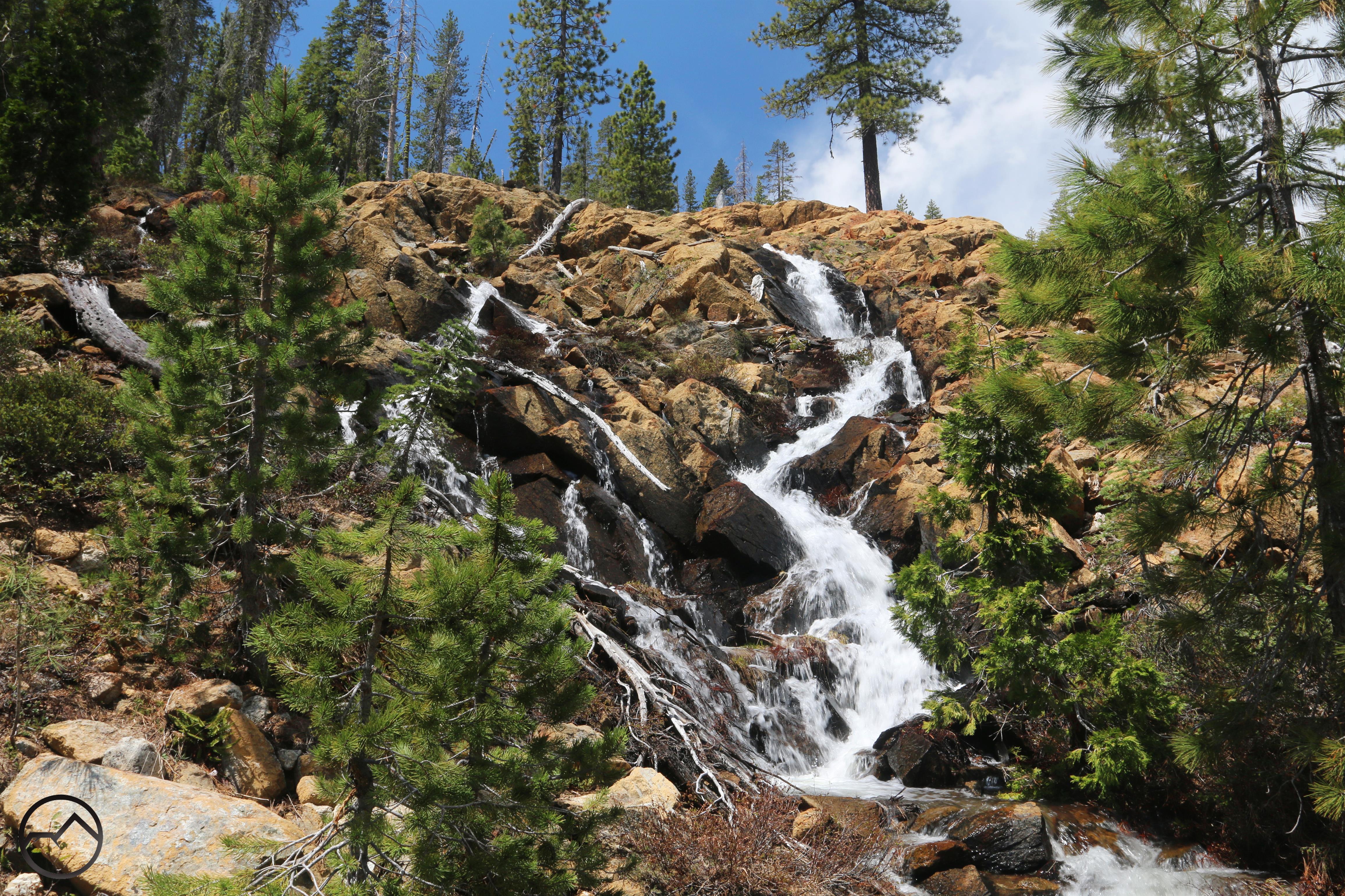
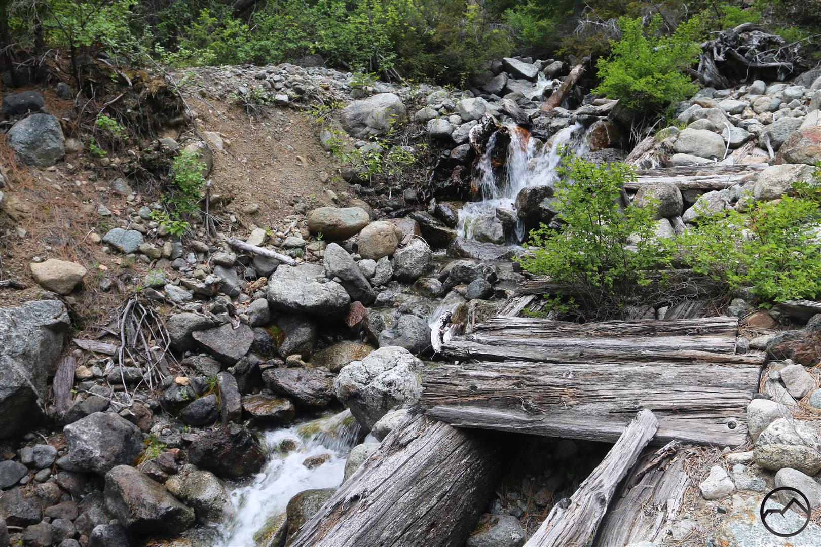
Hidden deep Parks Creek’s canyon is the small cataract I call “Beargrass Falls”. It was so named for the abundant, blossoming bear grass that was growing around the waterfall the first time I found it. Not only is the falls an attractive spot on the creek, it is also a point of fascinating geology, with large natural cement formations carved by the water.

Another interesting landmark found in the canyon is the ruins of an old 19th century wagon bridge. The bridge once crossed a tributary of Parks Creek. It was constructed of two large trees with wooden planks nailed across them to form a roadway. The creek has since pushed the bridge out of the way and washed out numerous planks but the bridge is still there. The creek must be crossed on foot now, of course.

Near the canyon’s lower terminus, Parks Creek flows through a tight bedrock channel. Though not a steep waterfall, the cliffs around it are steep and the water is fierce. This is one of the prettiest sections of Parks Creek and a good send off to this remote section of the creek. 

One last view of Parks Creek at the lower end of the canyon. From here on out, the creek travels through tamer, though still scenic, terrain. 

The Valley

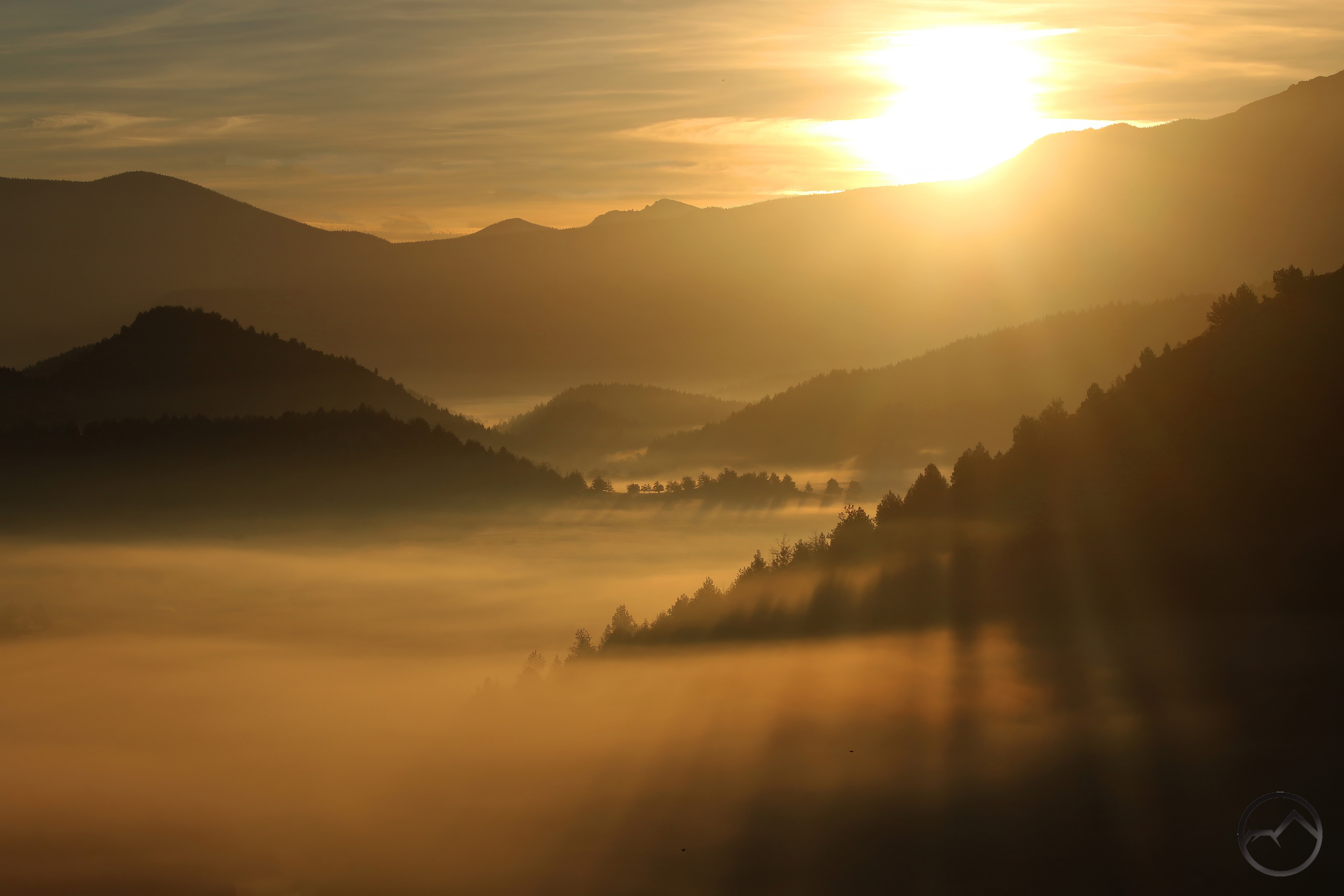
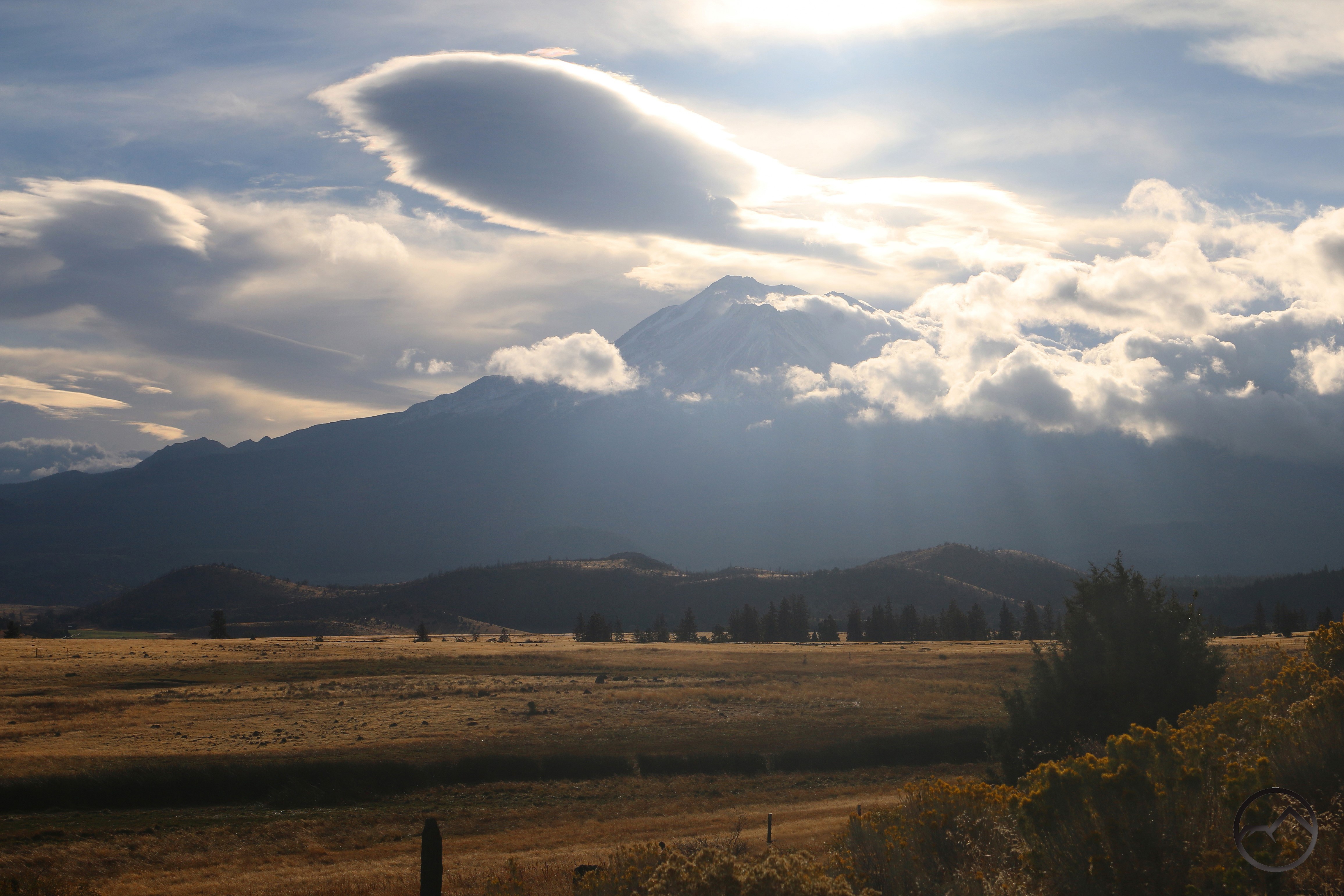
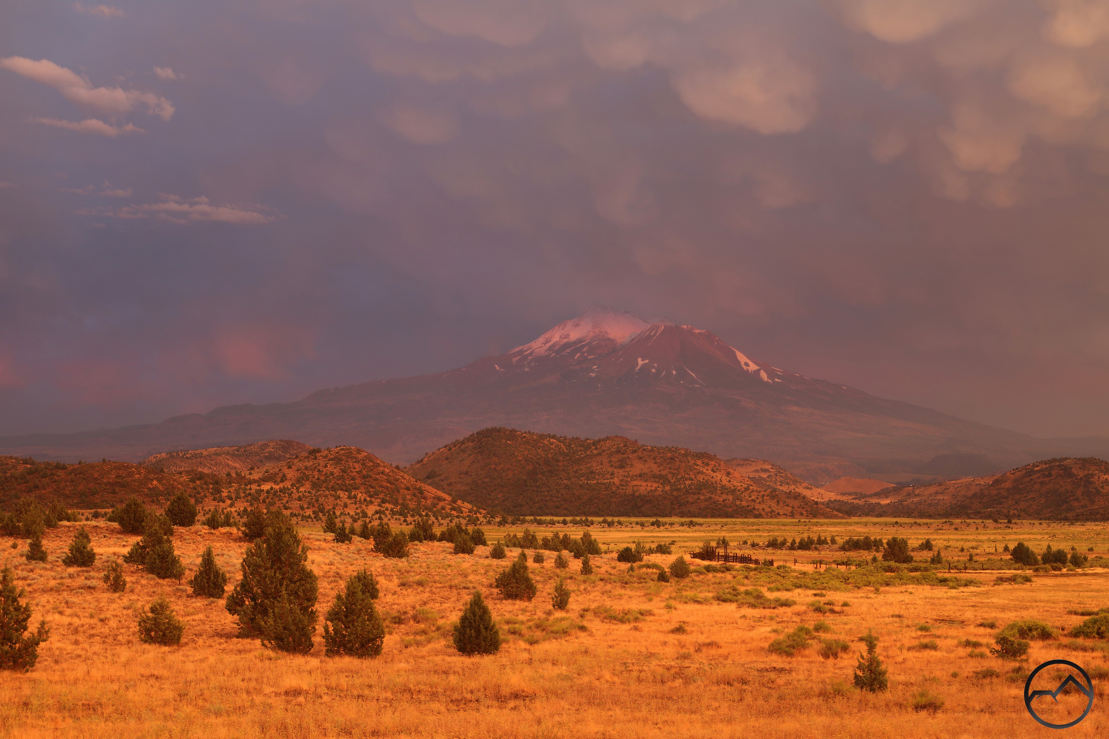
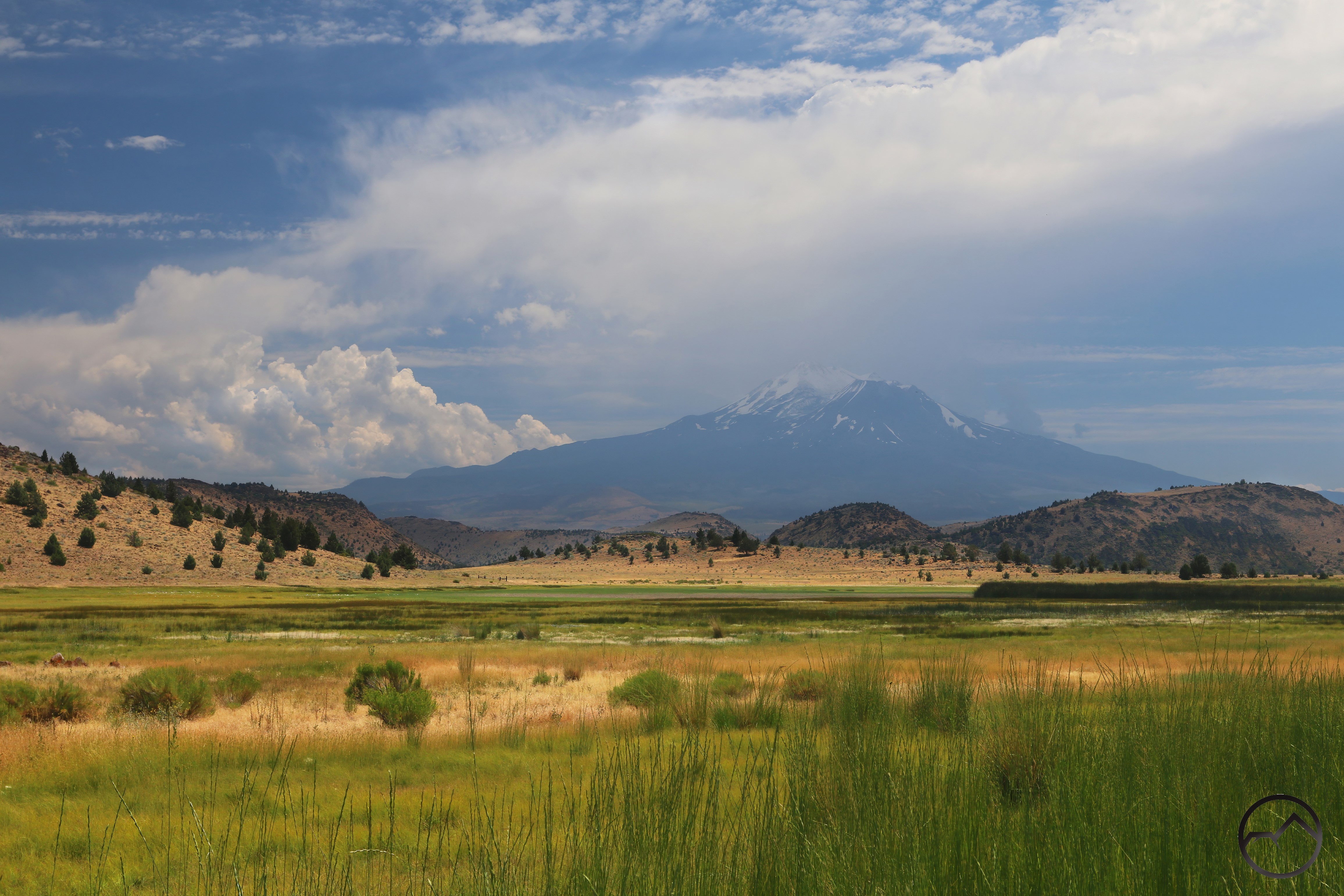
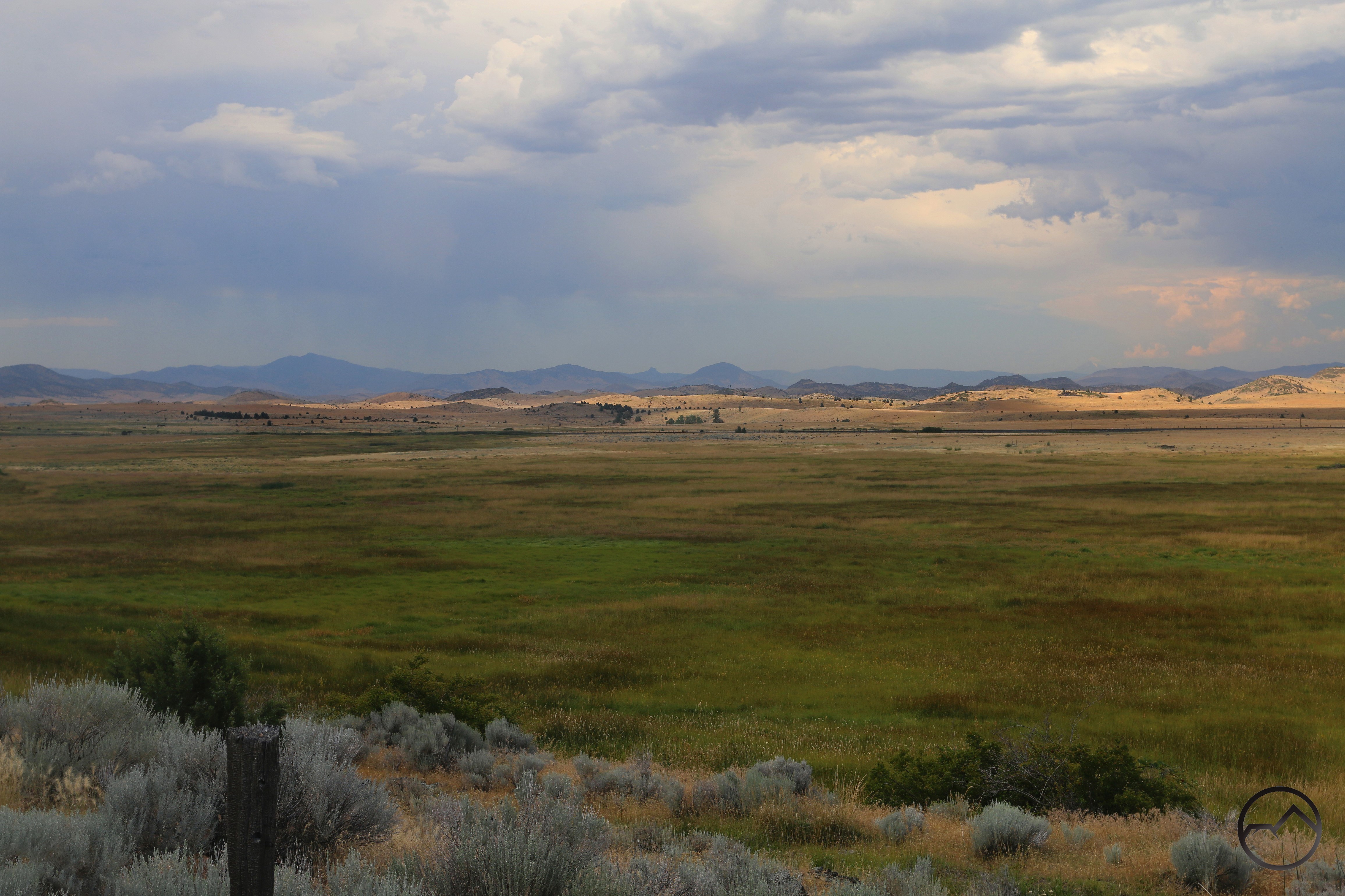
Once Parks Creek exits its canyon, it passes into the Shasta Valley. This area is dominated by cattle ranches and thus the creek has lost it wild character that defined its higher sections. However, that does not mean it lacks an essential wildness that is found in benign neglect. There is a single diversion channel that has been added to it in order to contribute water to Lake Shastina. Other than that, there are not real impounds on the creek now. Until a few years ago there was a ranching impound that formed a small lake. However, this has been removed in coordination with the California Department of Fish and Wildlife in order to open the lowest 8 miles of the creek to salmon spawning. This section is also augmented by large, productive springs, which swell the creek’s flow. Also notable it the creeks final 8 mile passage through a lush, spring and meadow filled vale that is rarely visible to the casual observer.

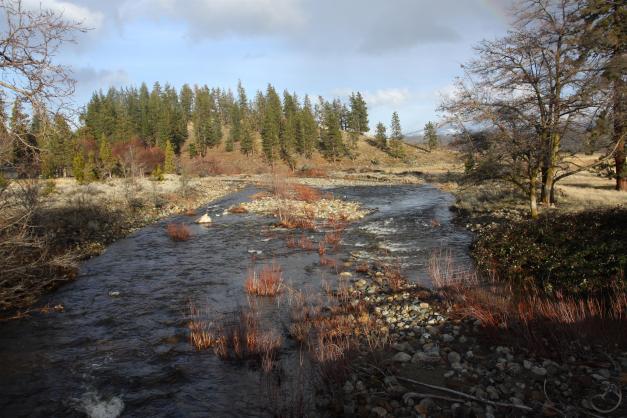
As Parks Creek enters the Shasta Valley, there are still stands of ponderosa pine. However, these quickly give way to grassland punctuated by juniper, the dominant ecosystem of the arid valley. 

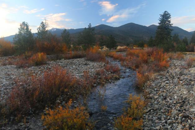
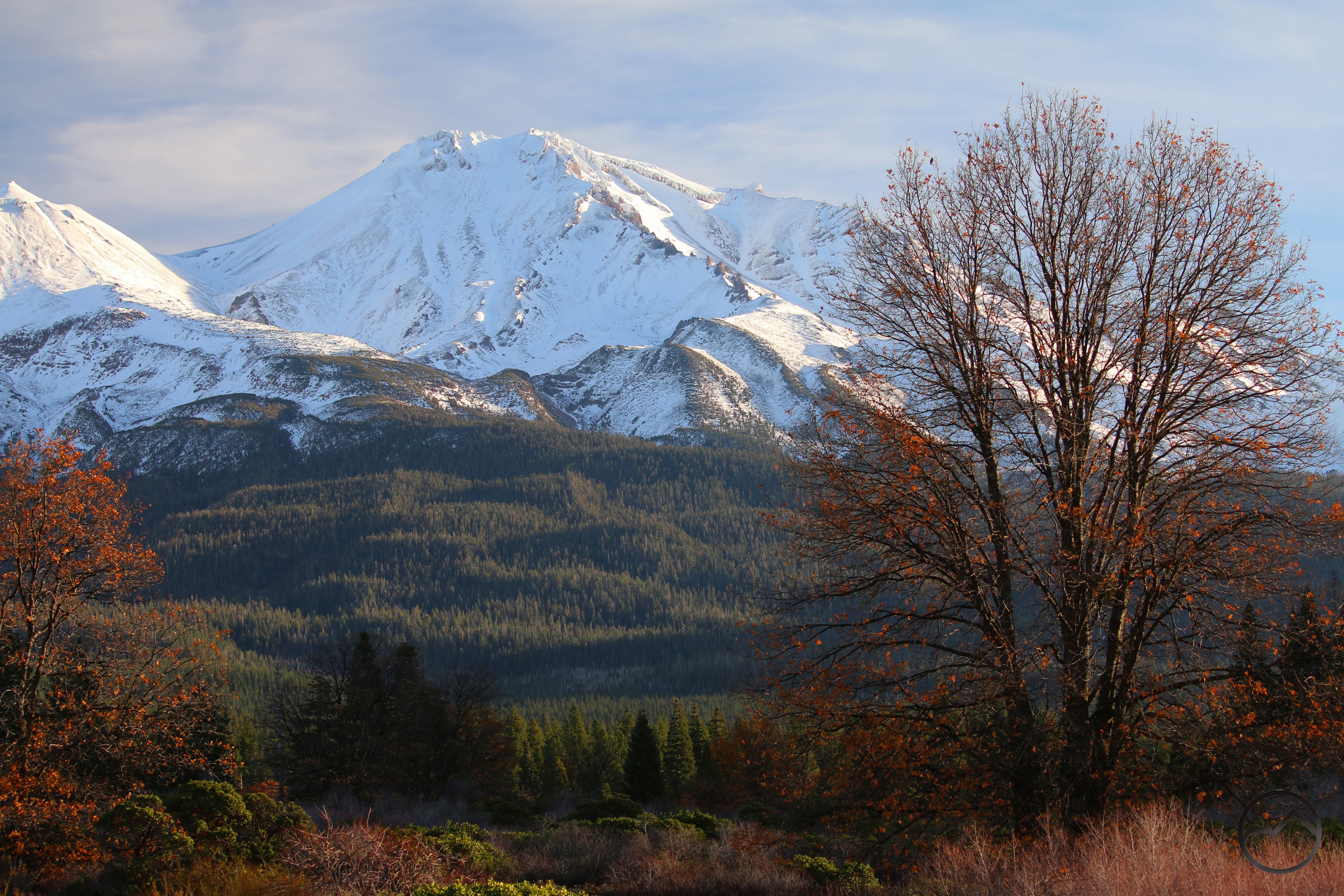
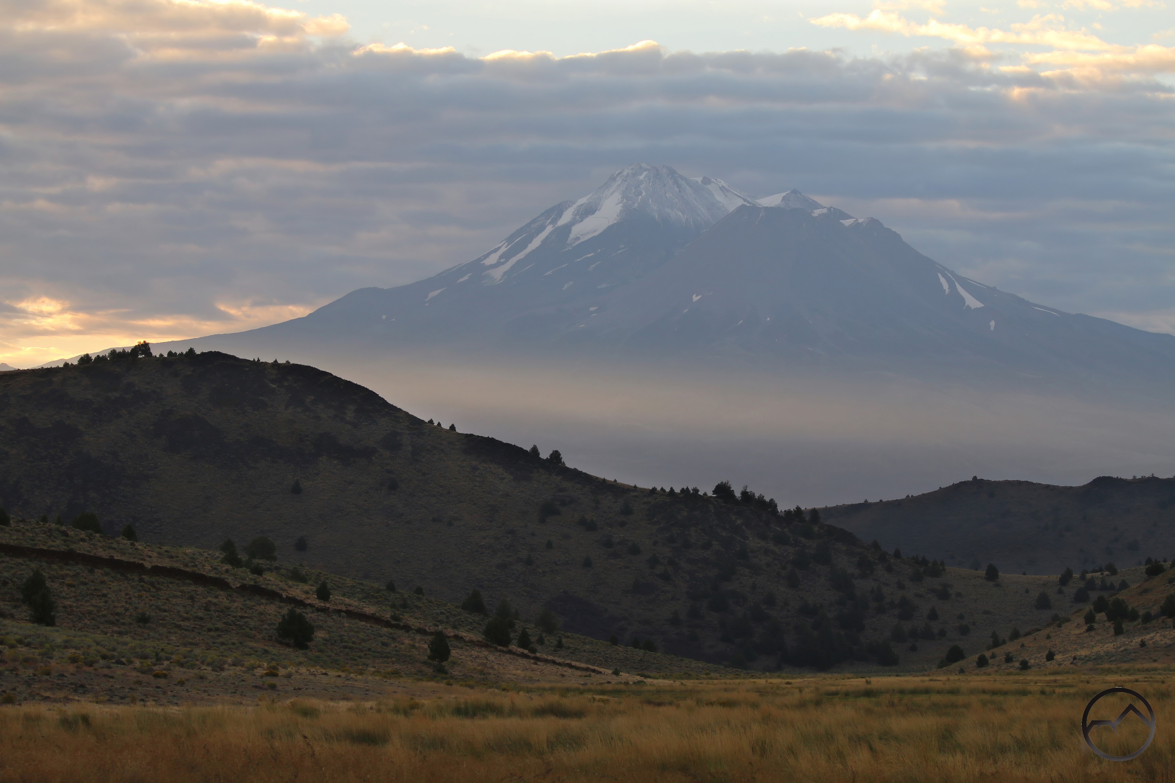
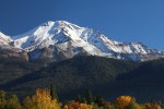
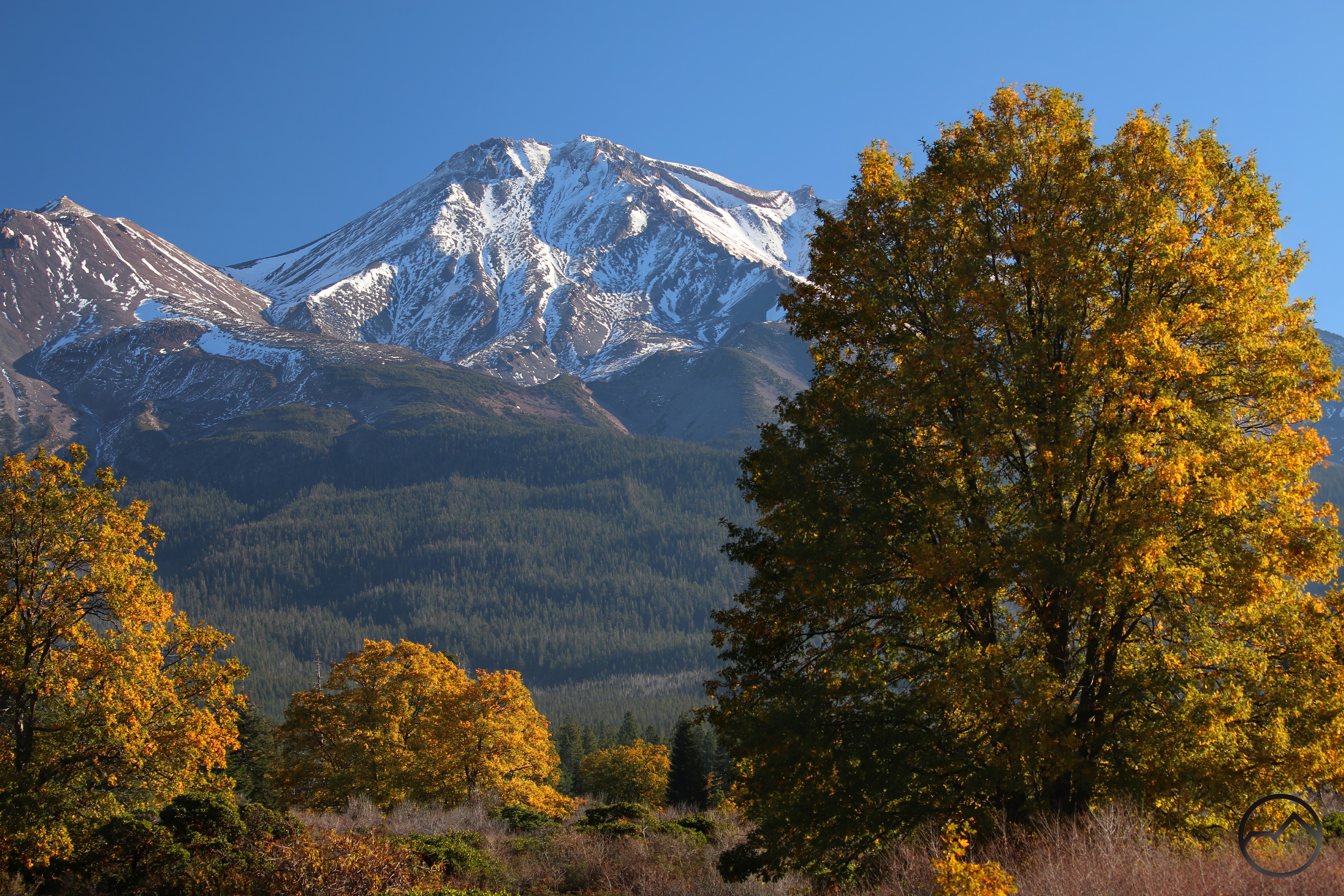
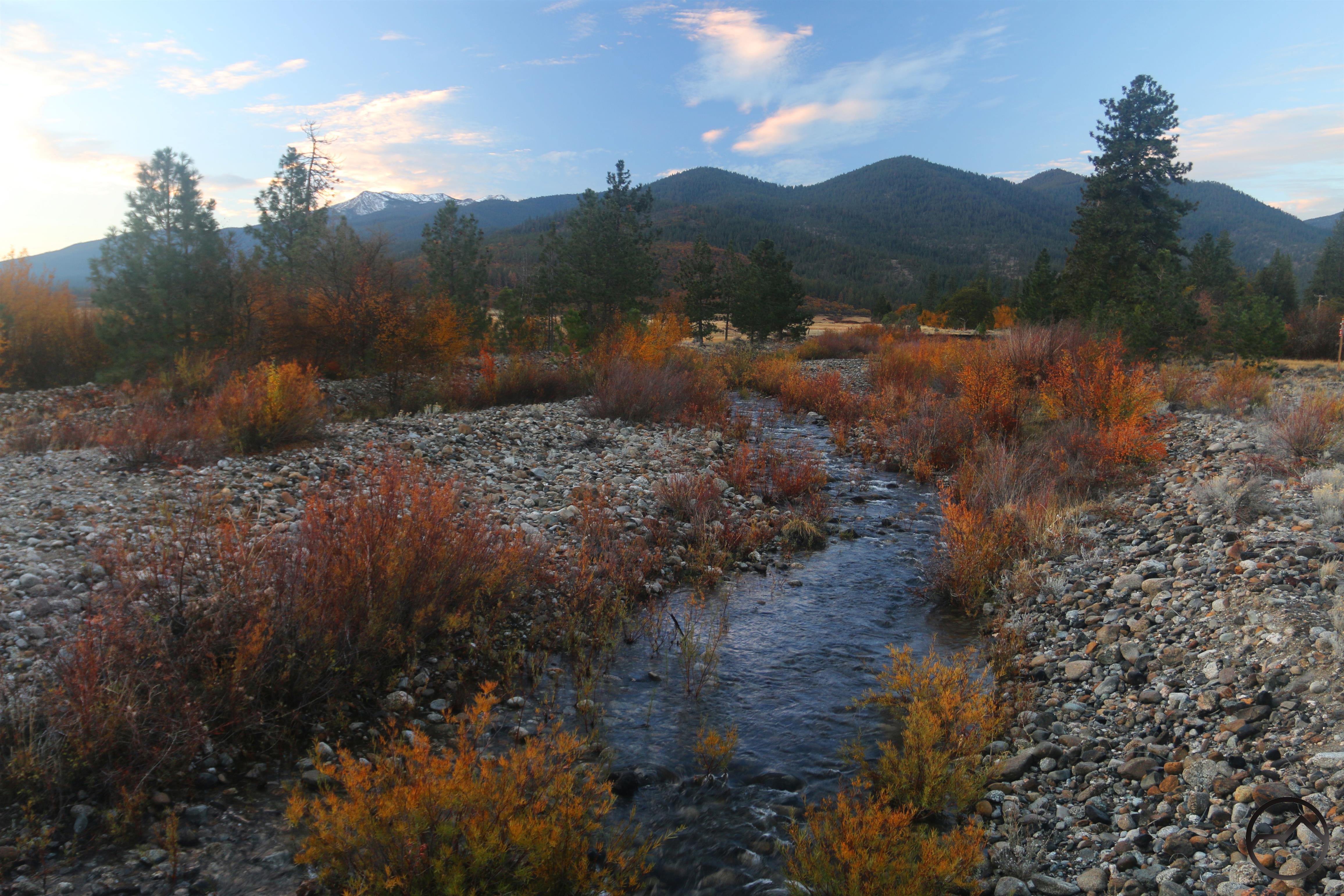
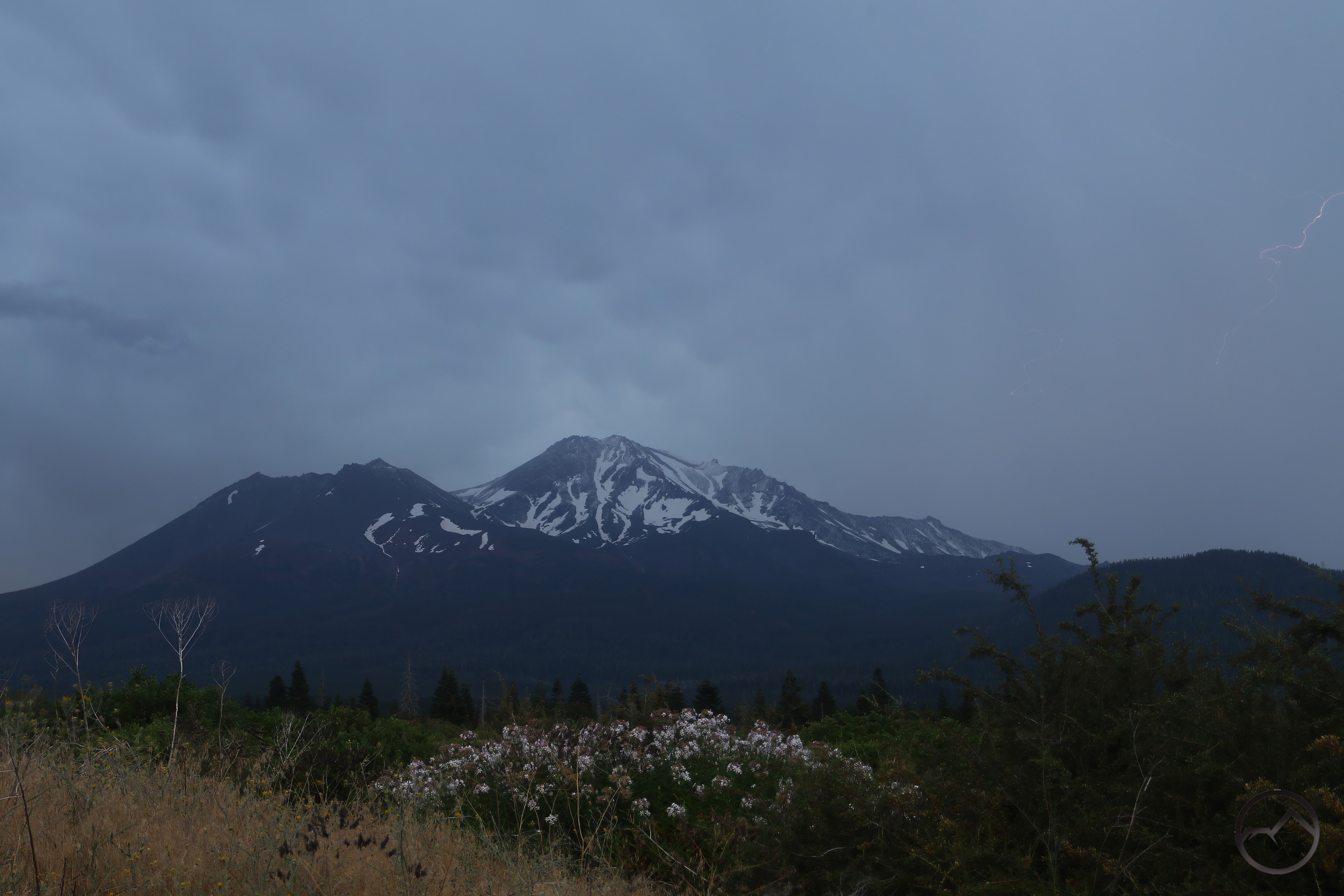
An autumn view looking back to the mountains that Parks Creek flows out of. Mount Eddy, the highest point in the Klamath Mountains is visible with snow on it on the left horizon. Note the river cobbles. These are telltale signs of the creek’s mountain passage. They quickly fade as Parks Creek flows deeper into the valley. 

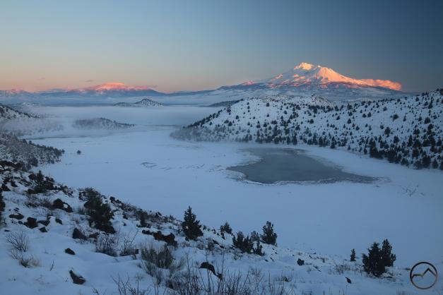
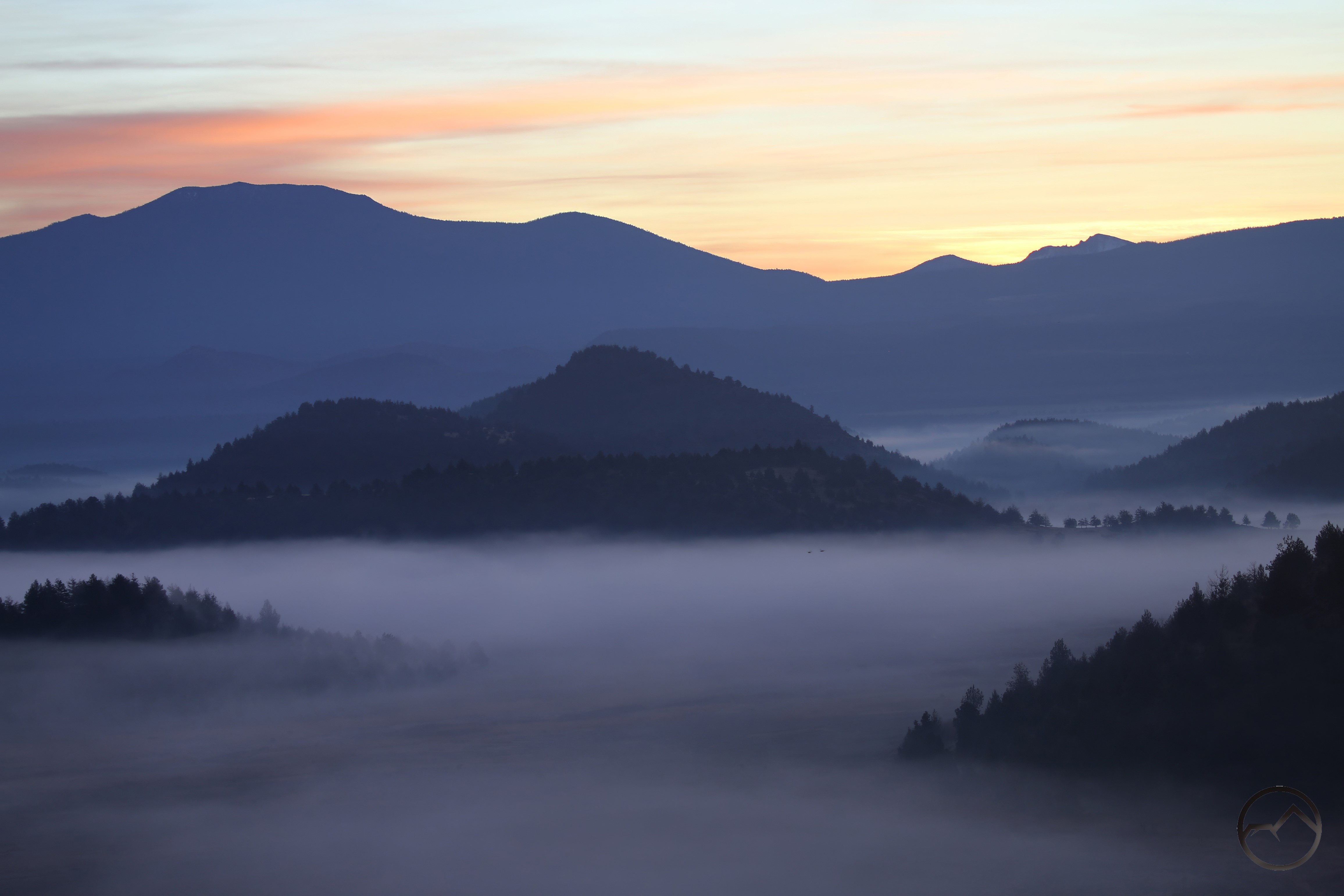
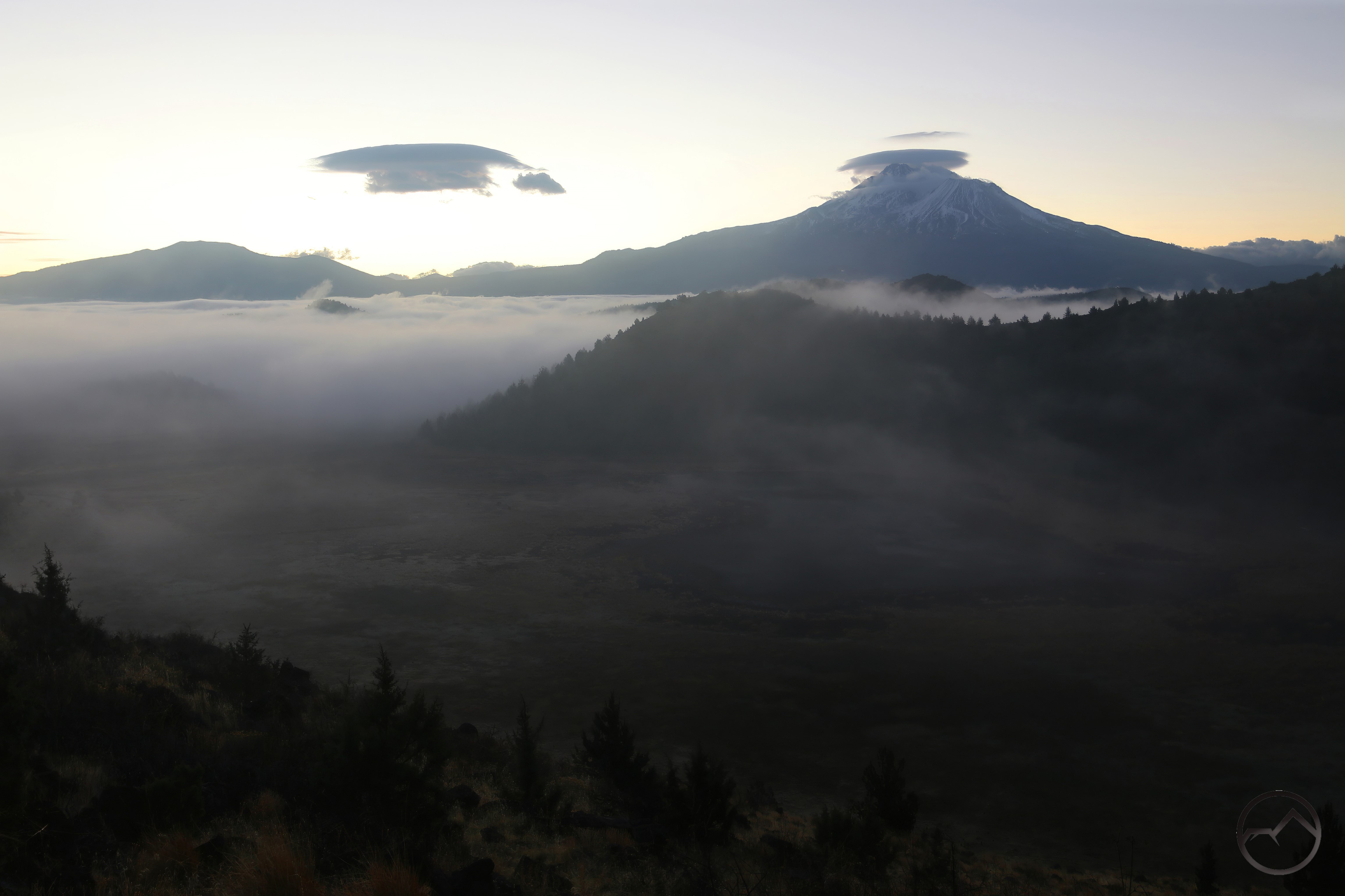
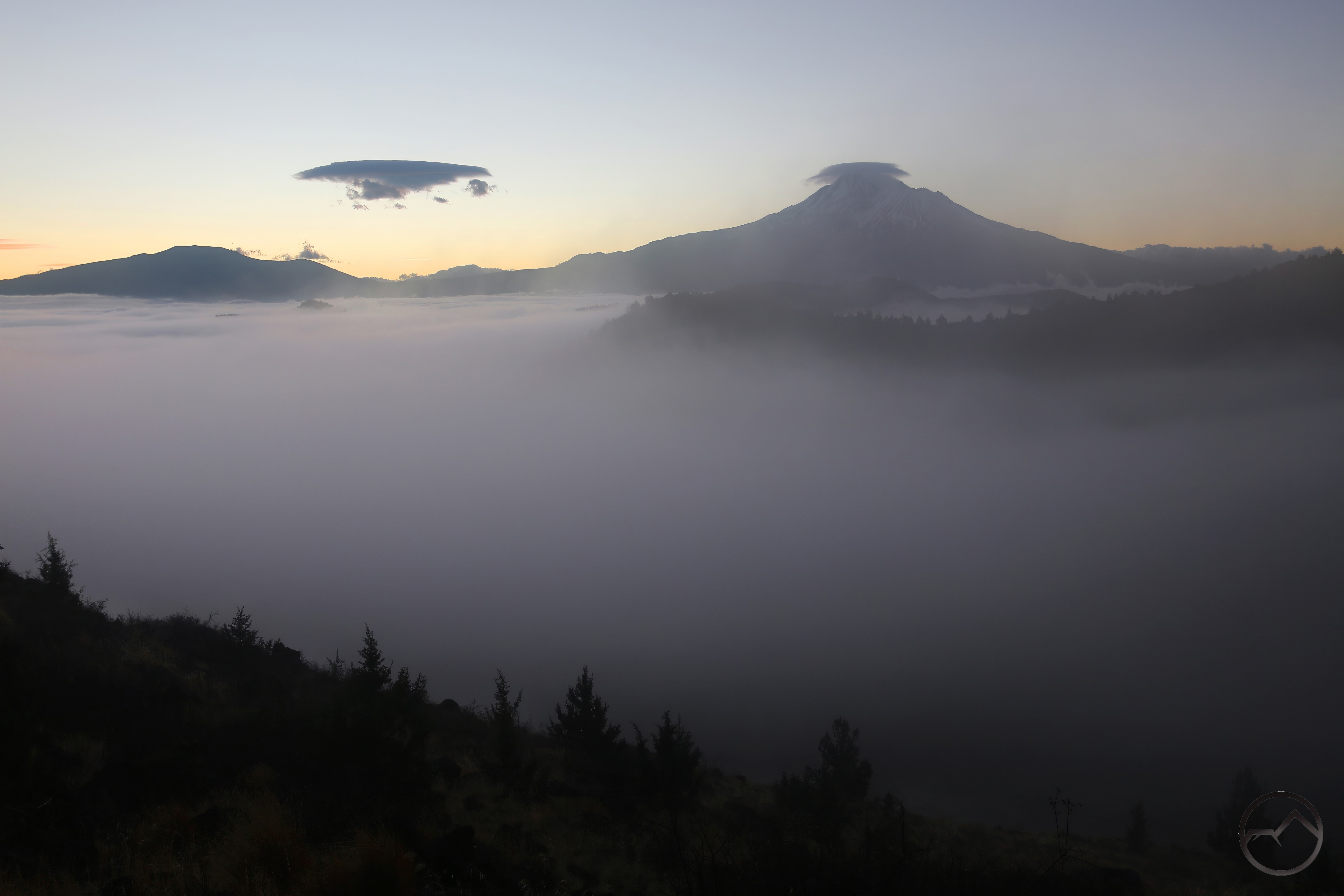
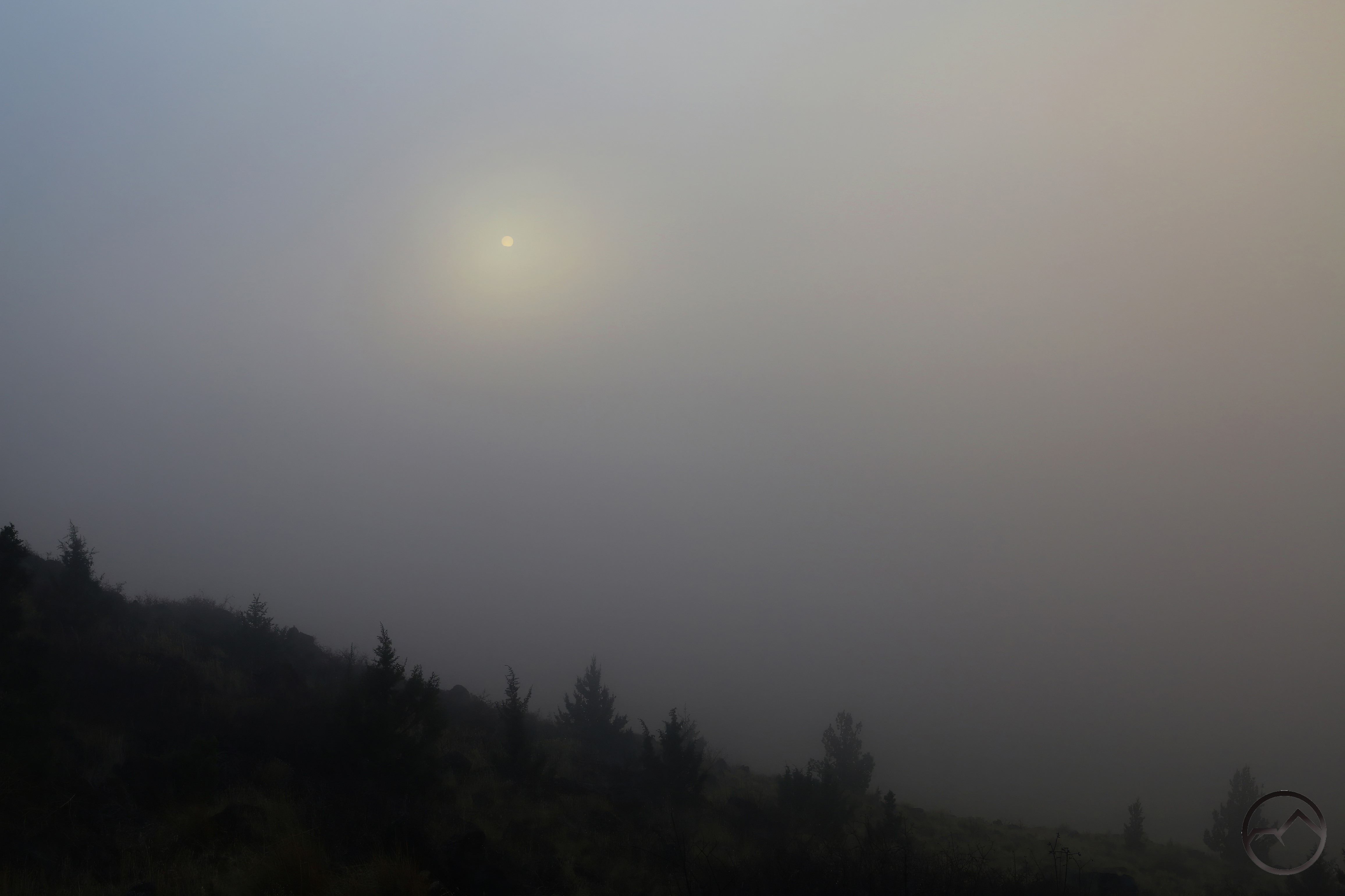
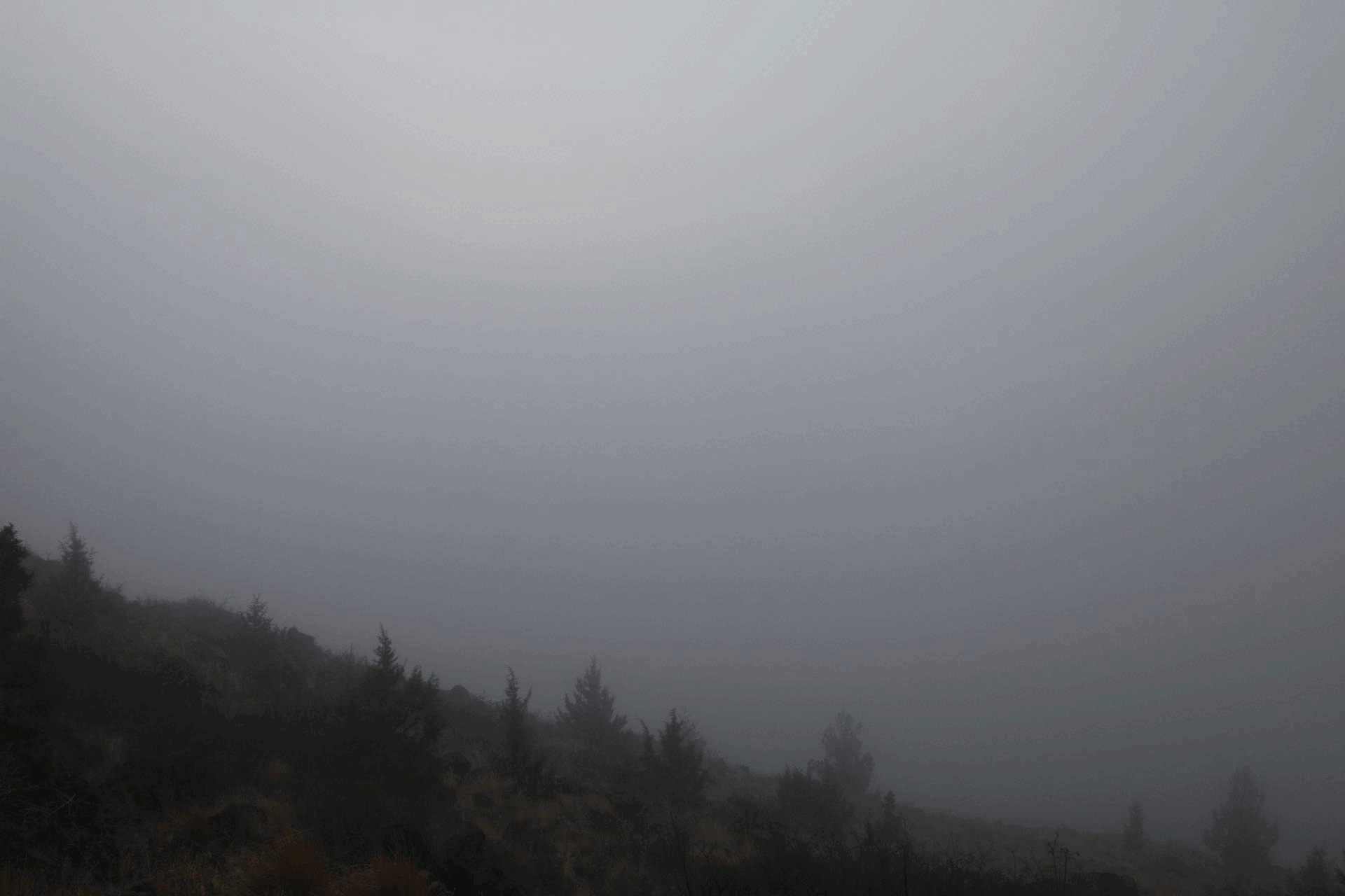
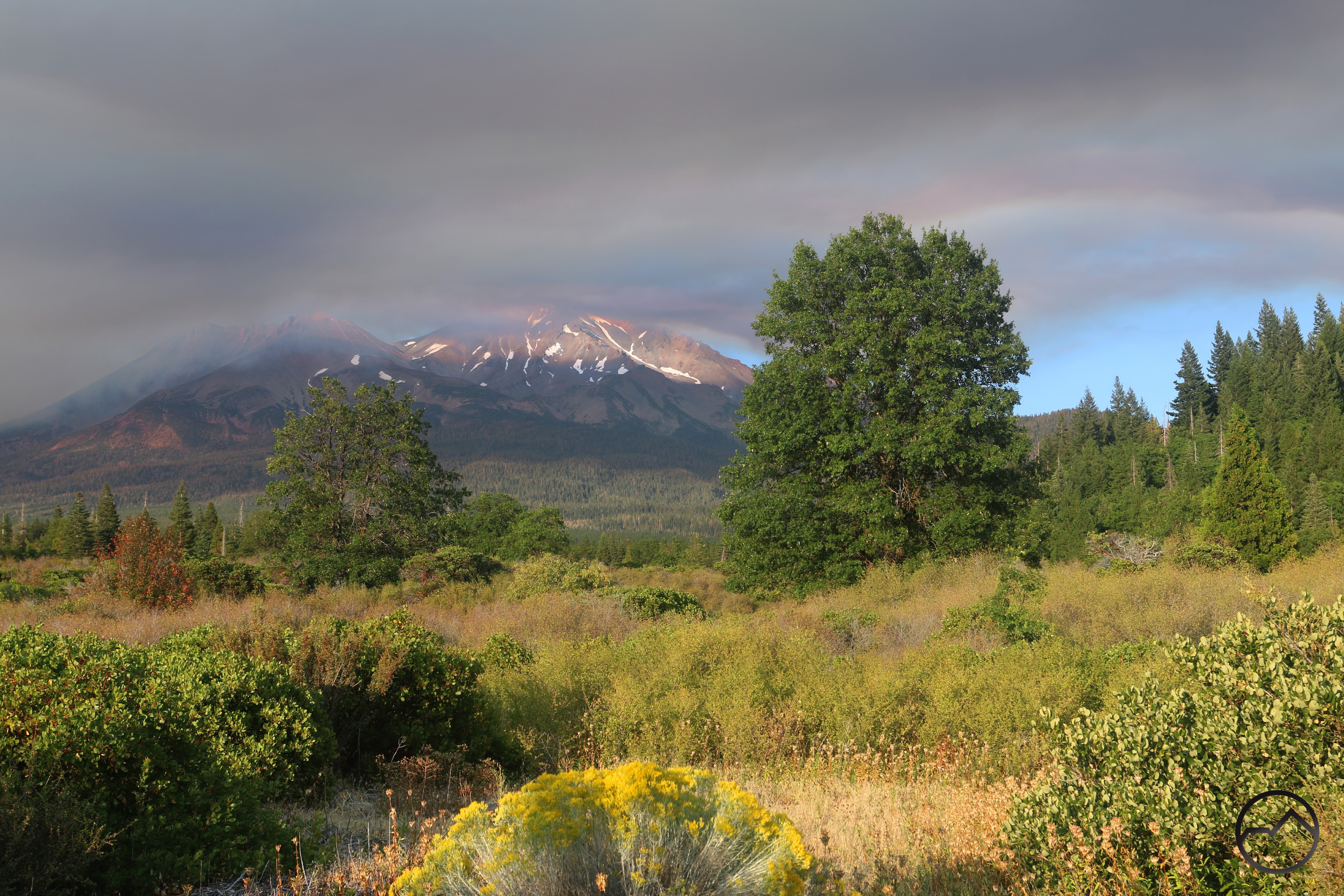
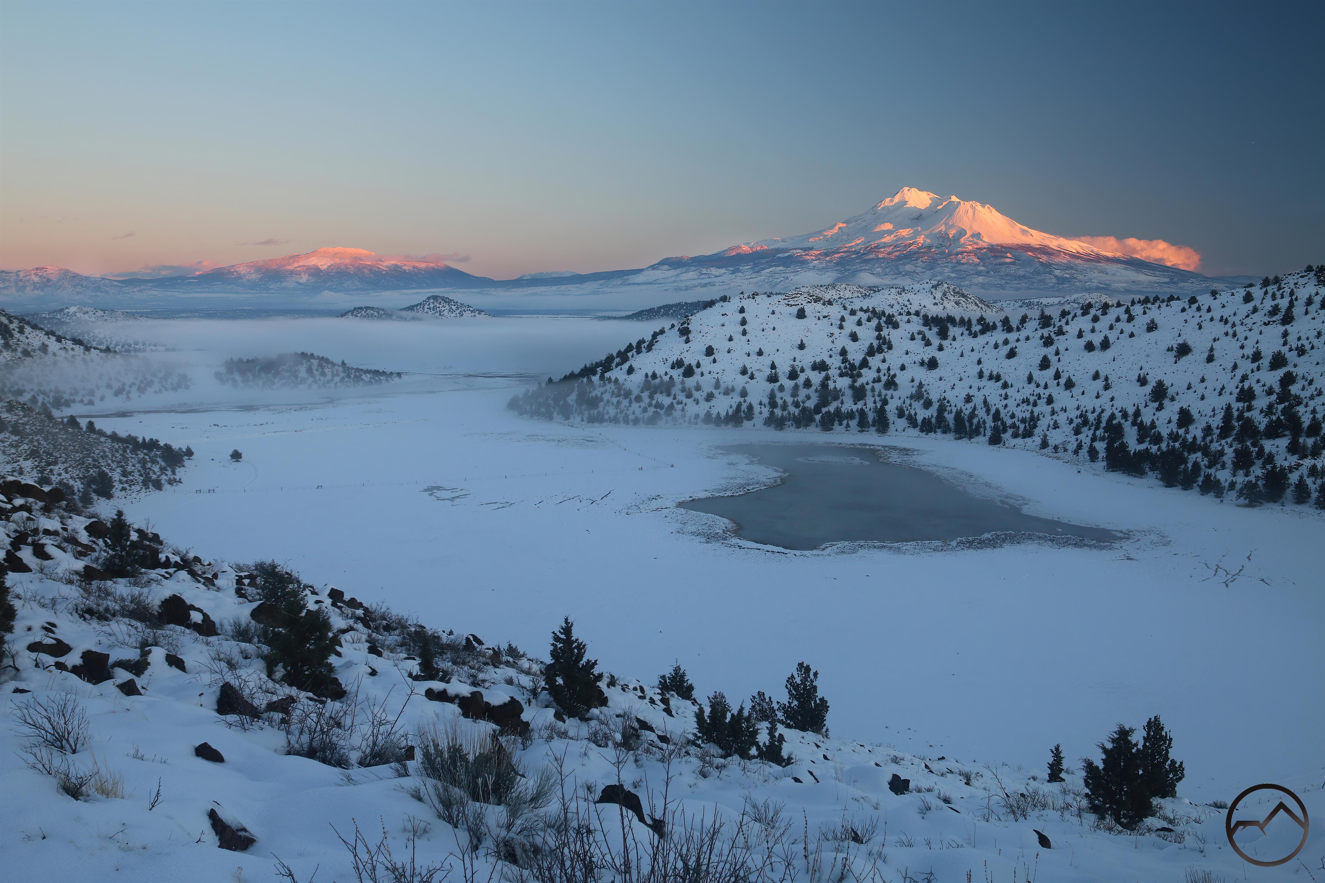
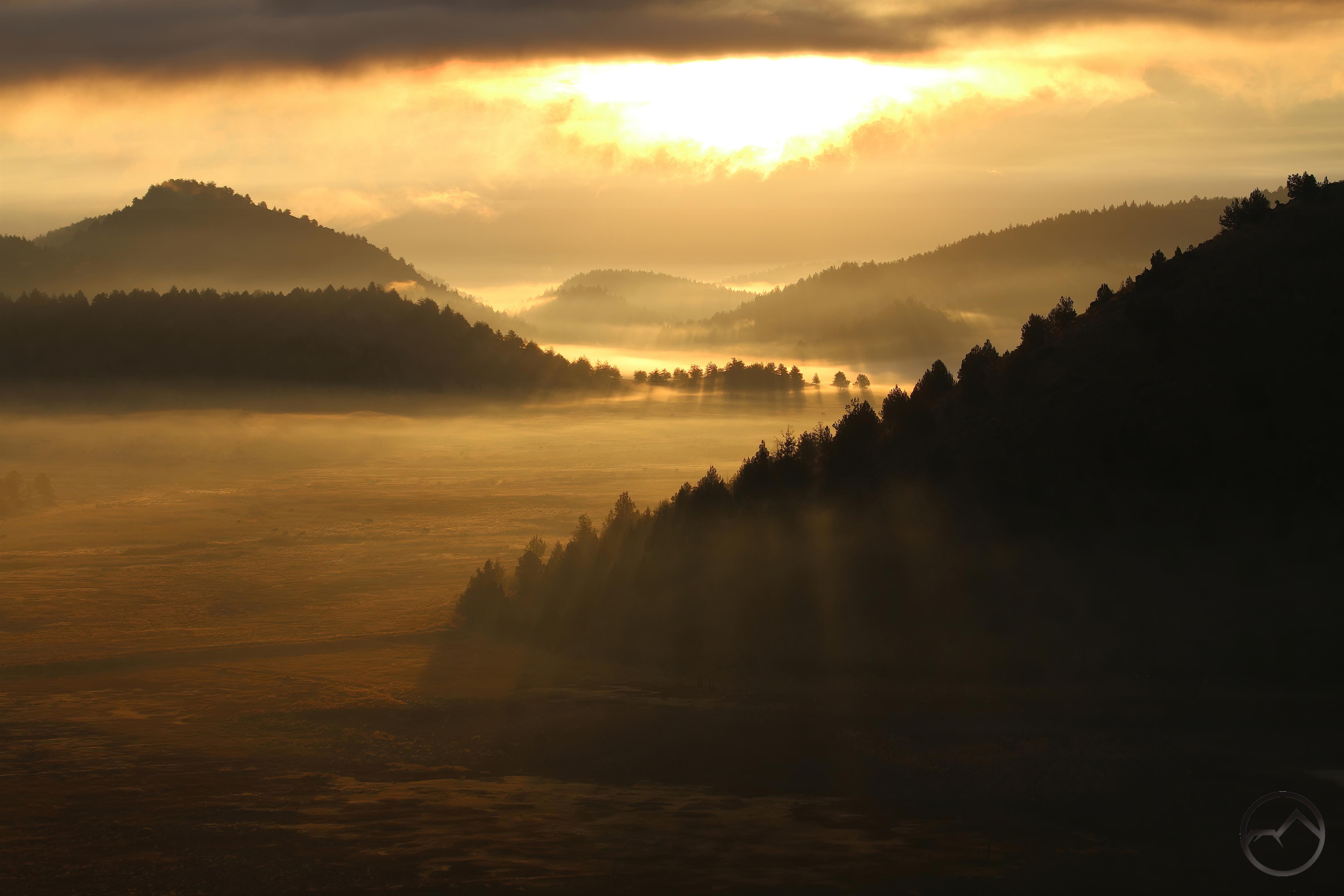
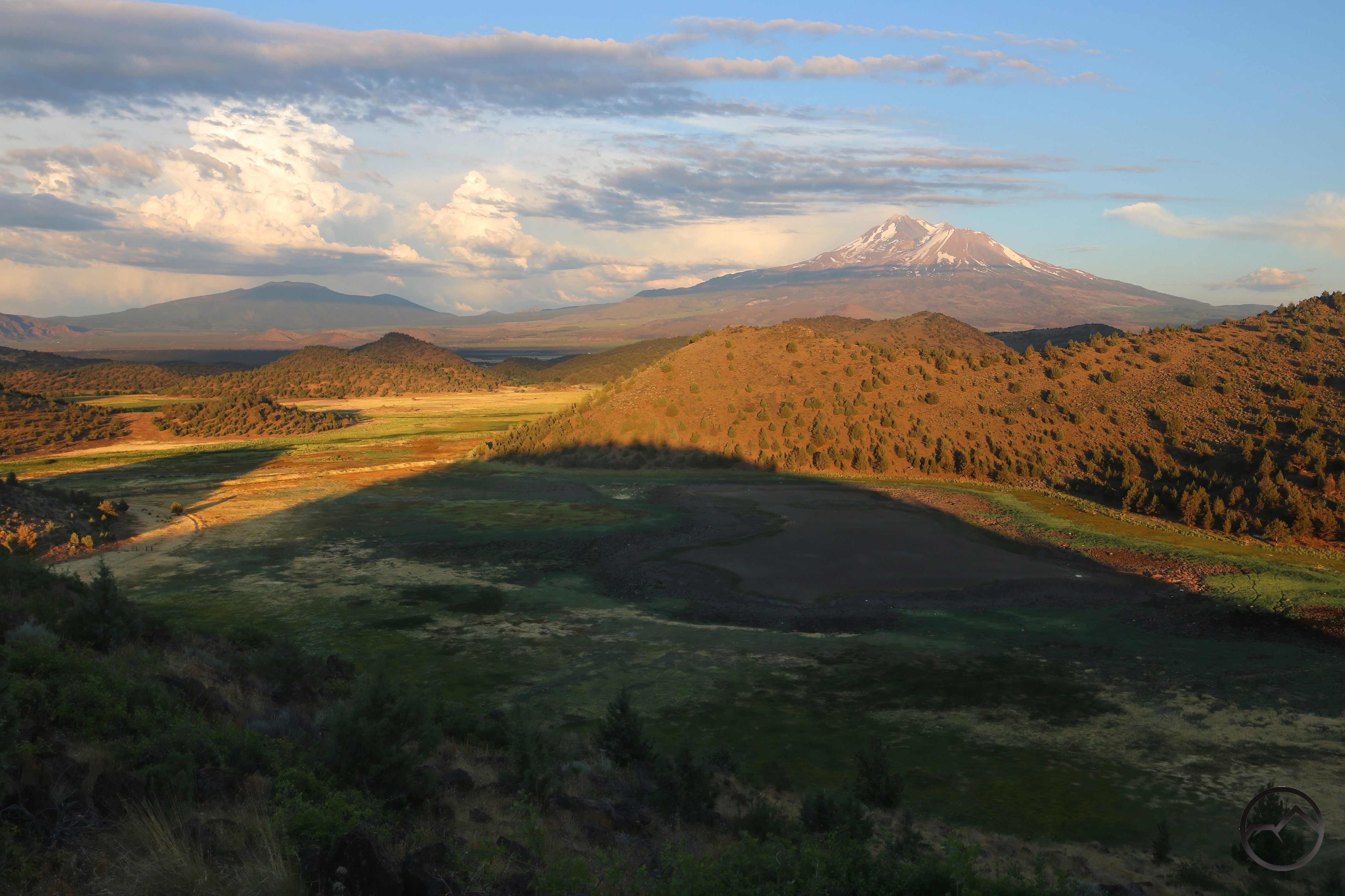
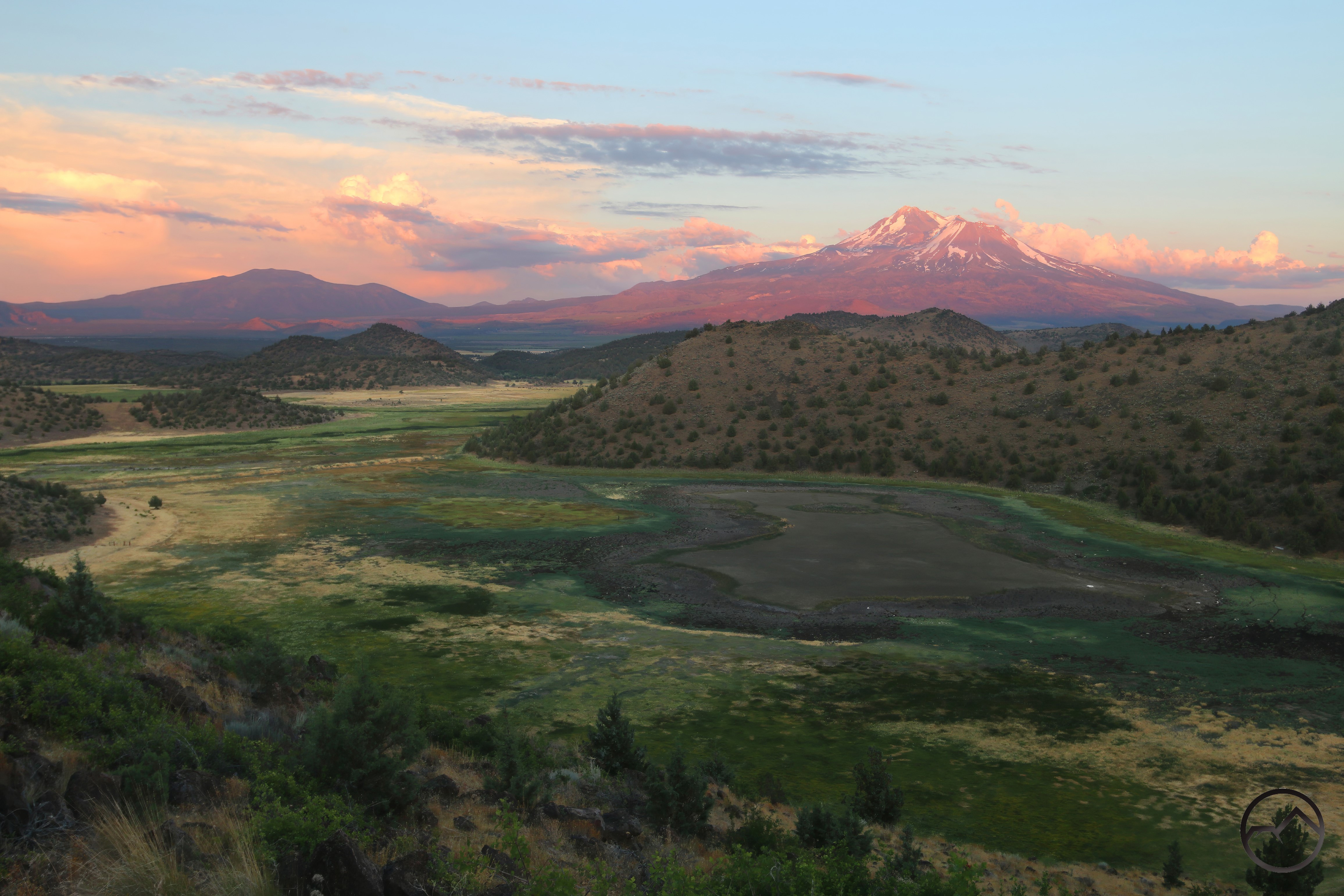
Snow this deep rarely falls in the Shasta Valley. However, it highlights Parks Creek as it flows through its rarely seen vale. The creek is visible middle left, just below the fog line. It has melted the snow as it flows through the vast meadow. The nearby lake is only connected to Parks Creek at the highest water of the year, otherwise it is isolated from the rest of the creek’s watershed. 

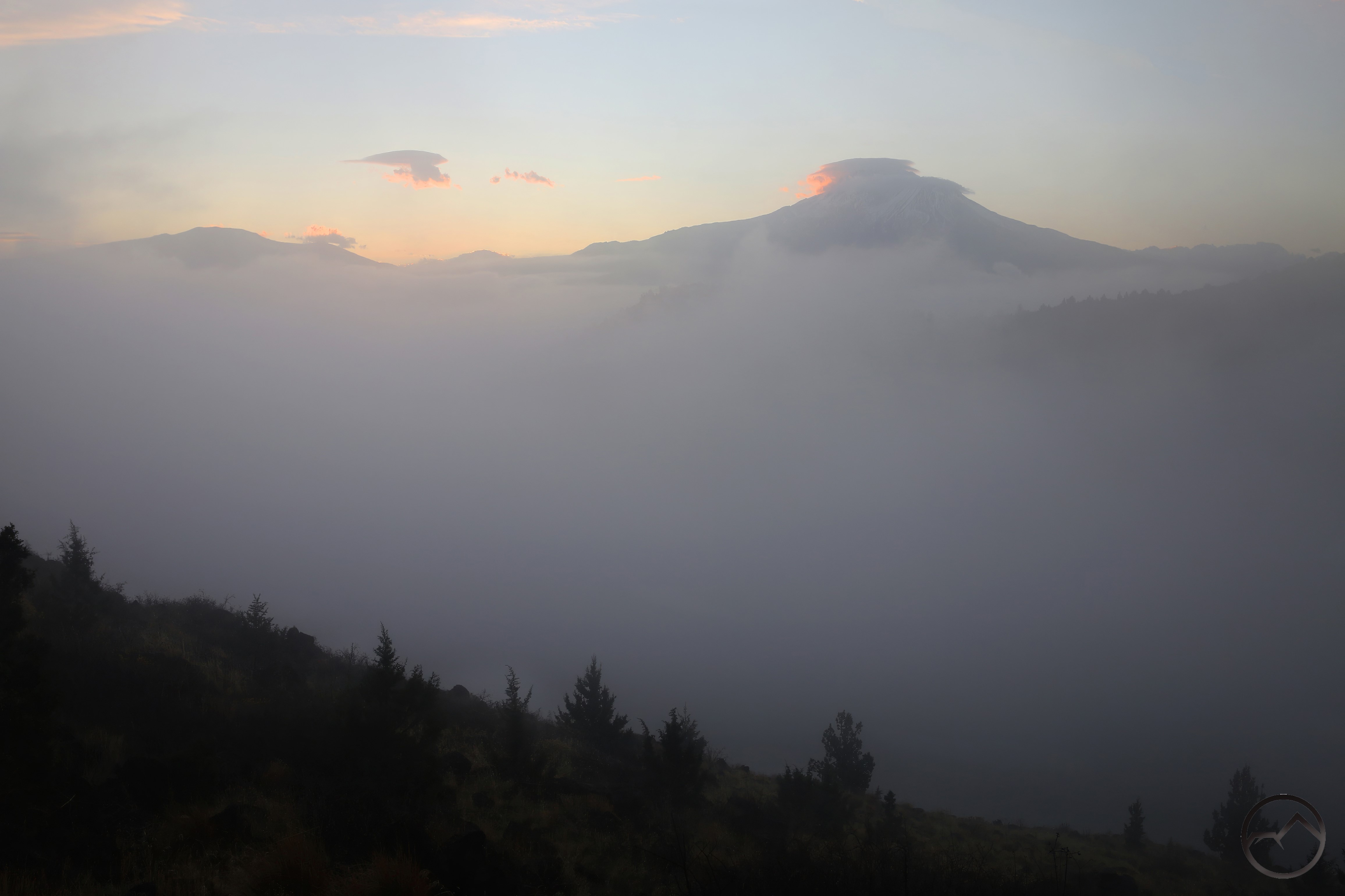
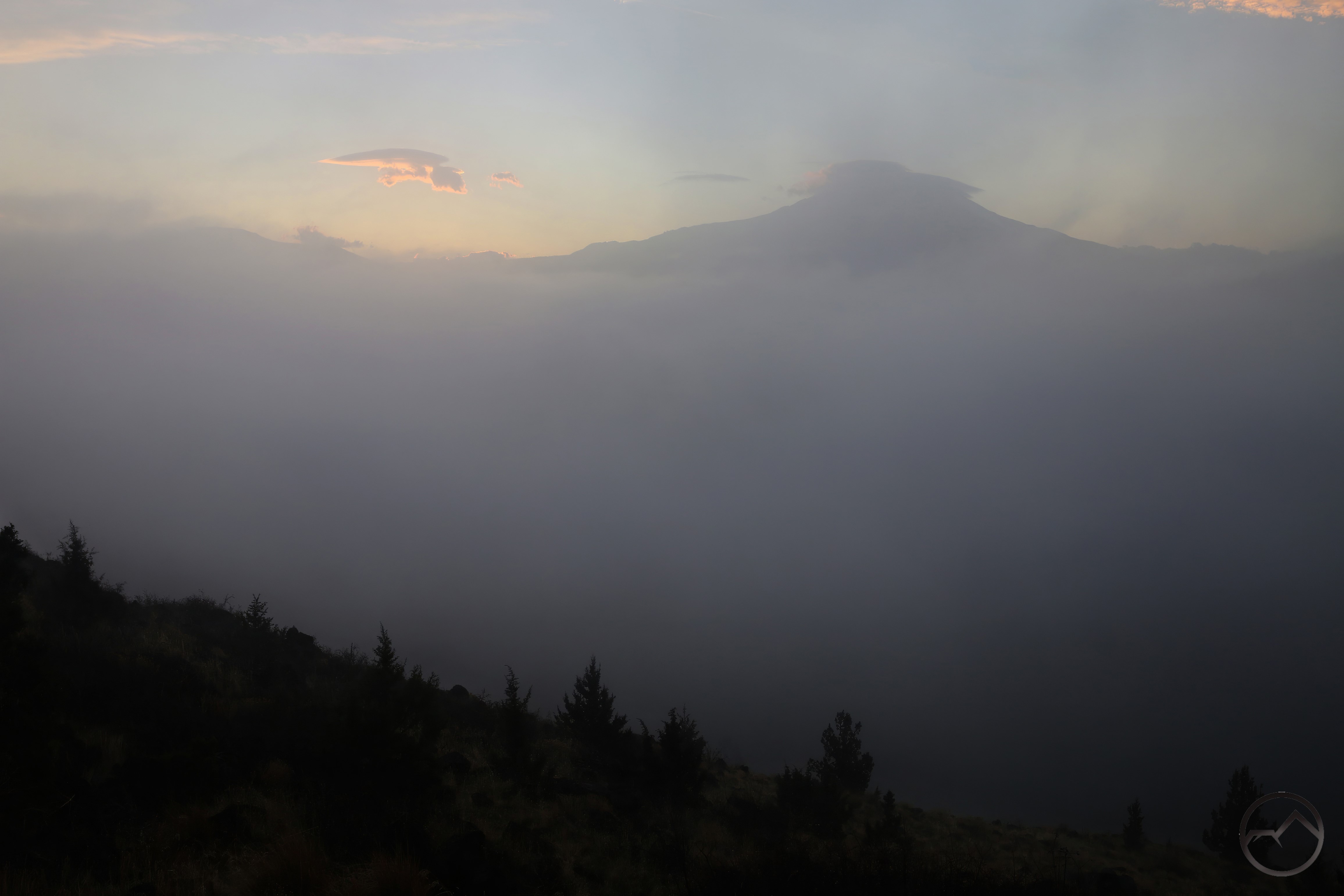
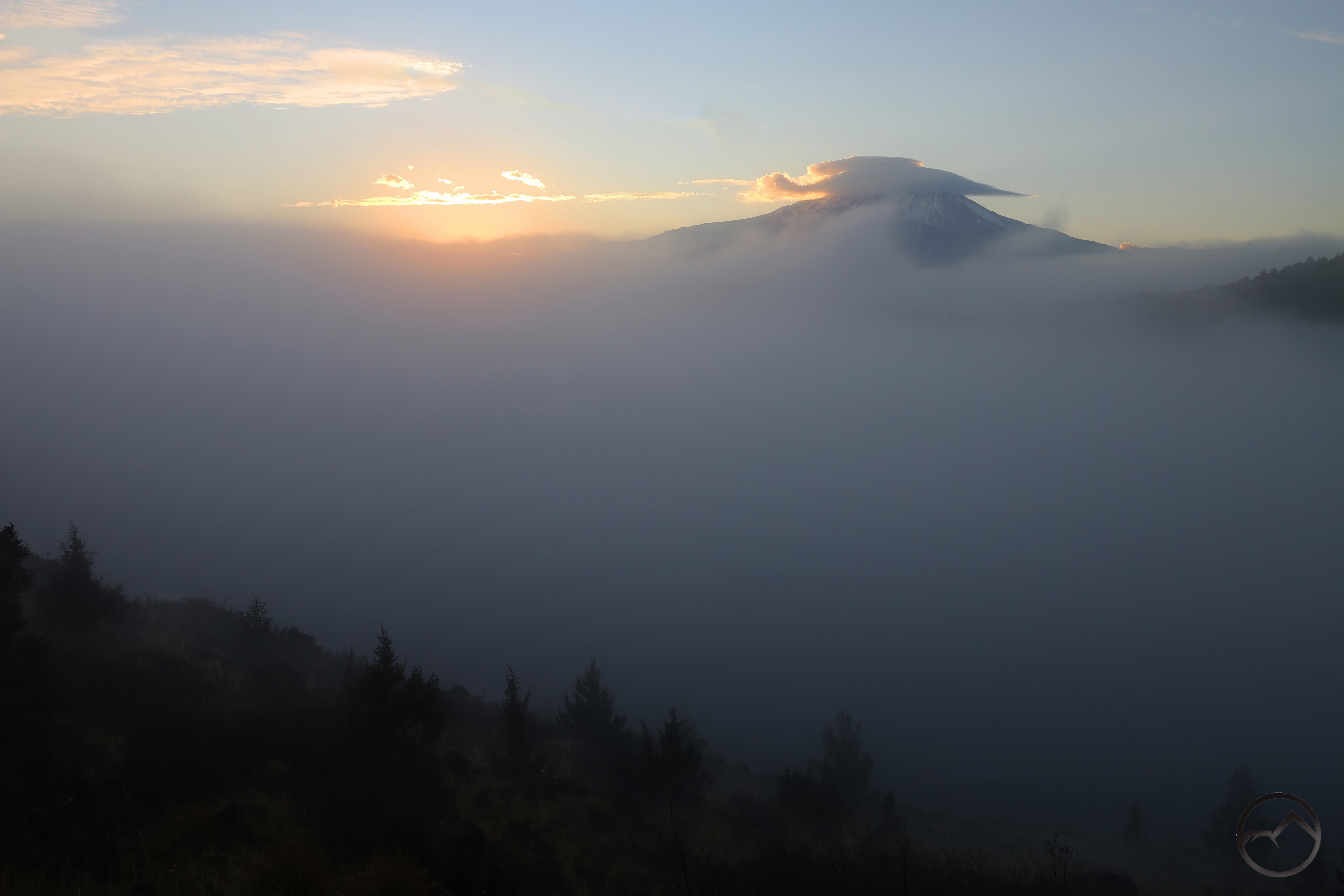
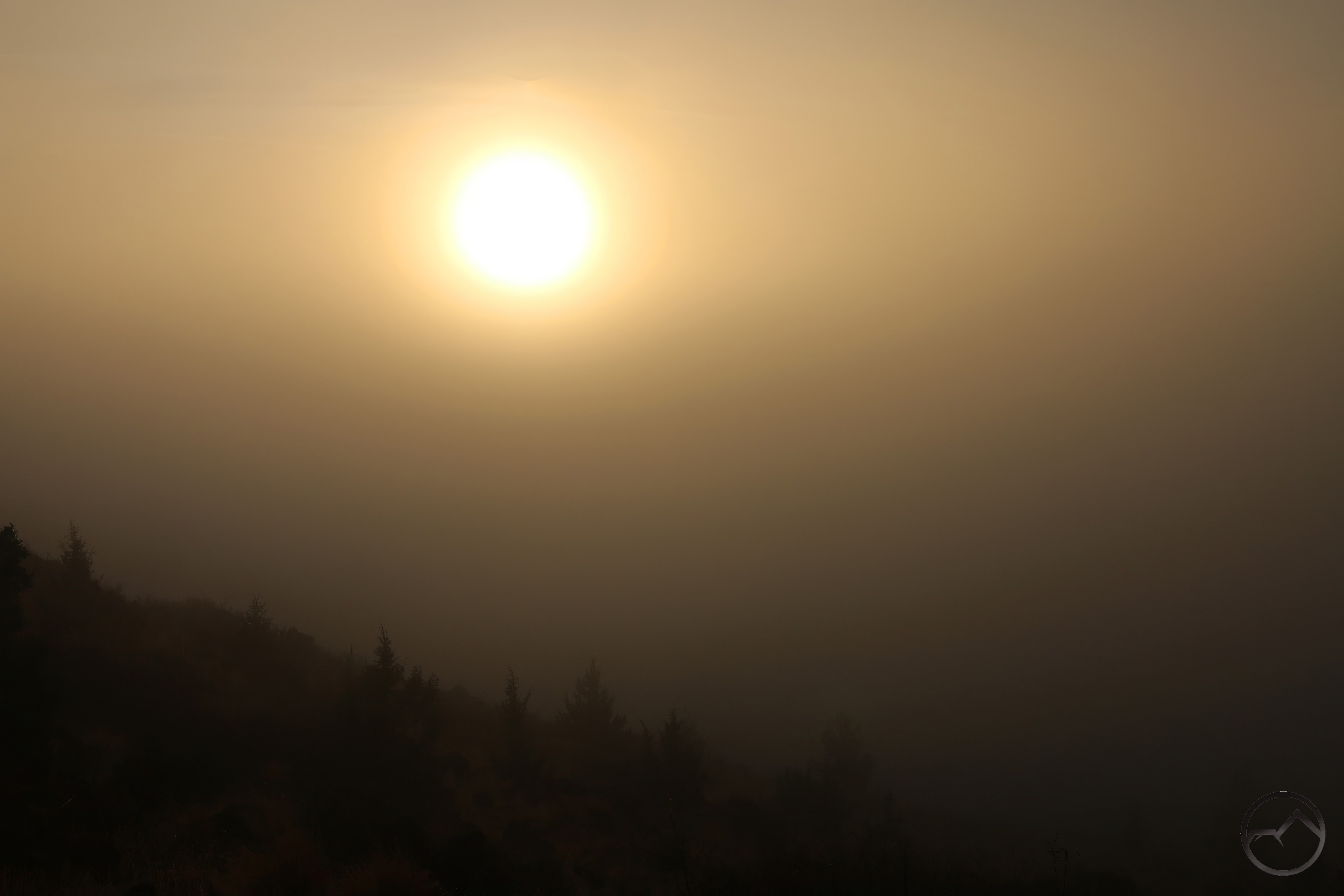
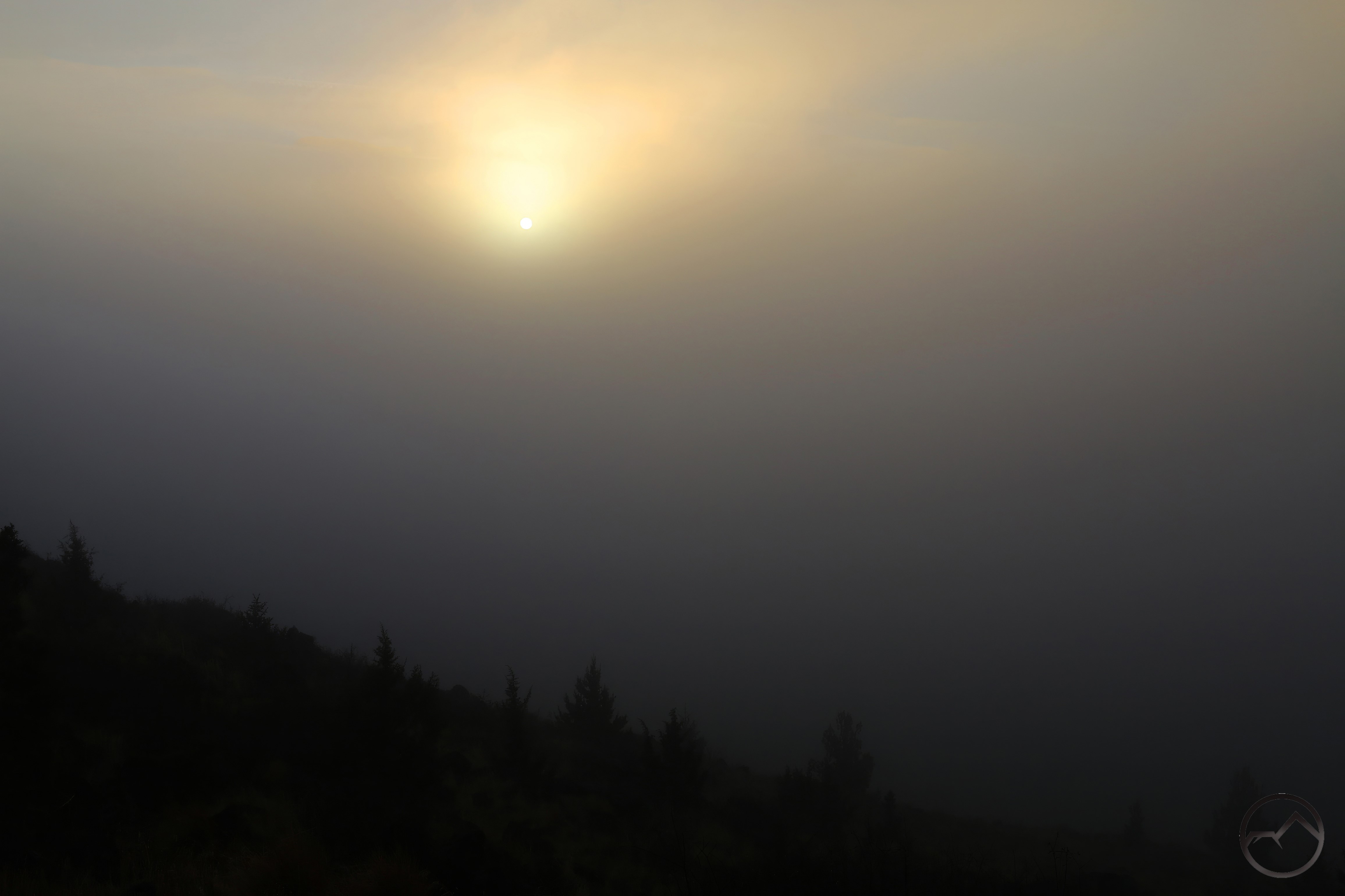
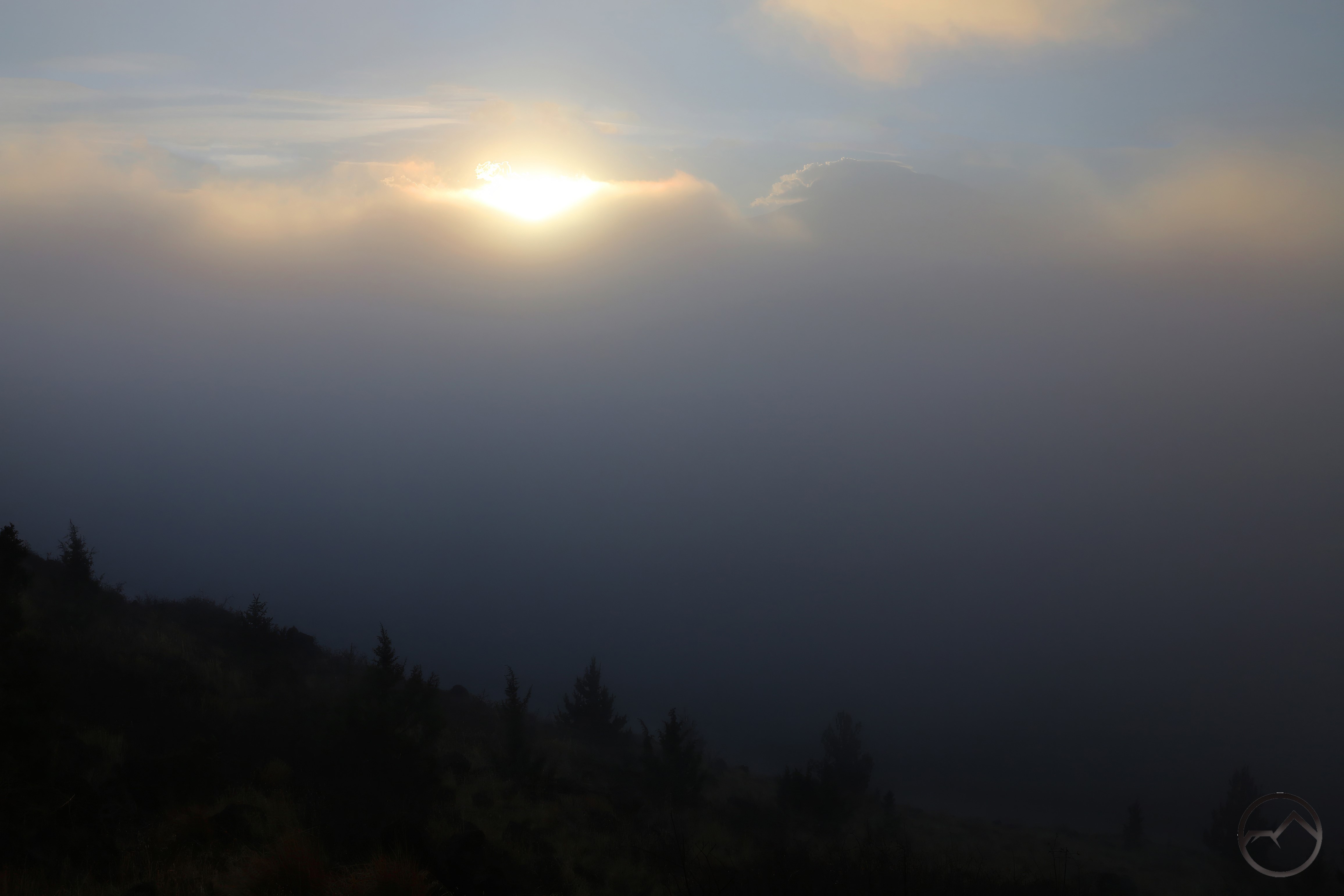
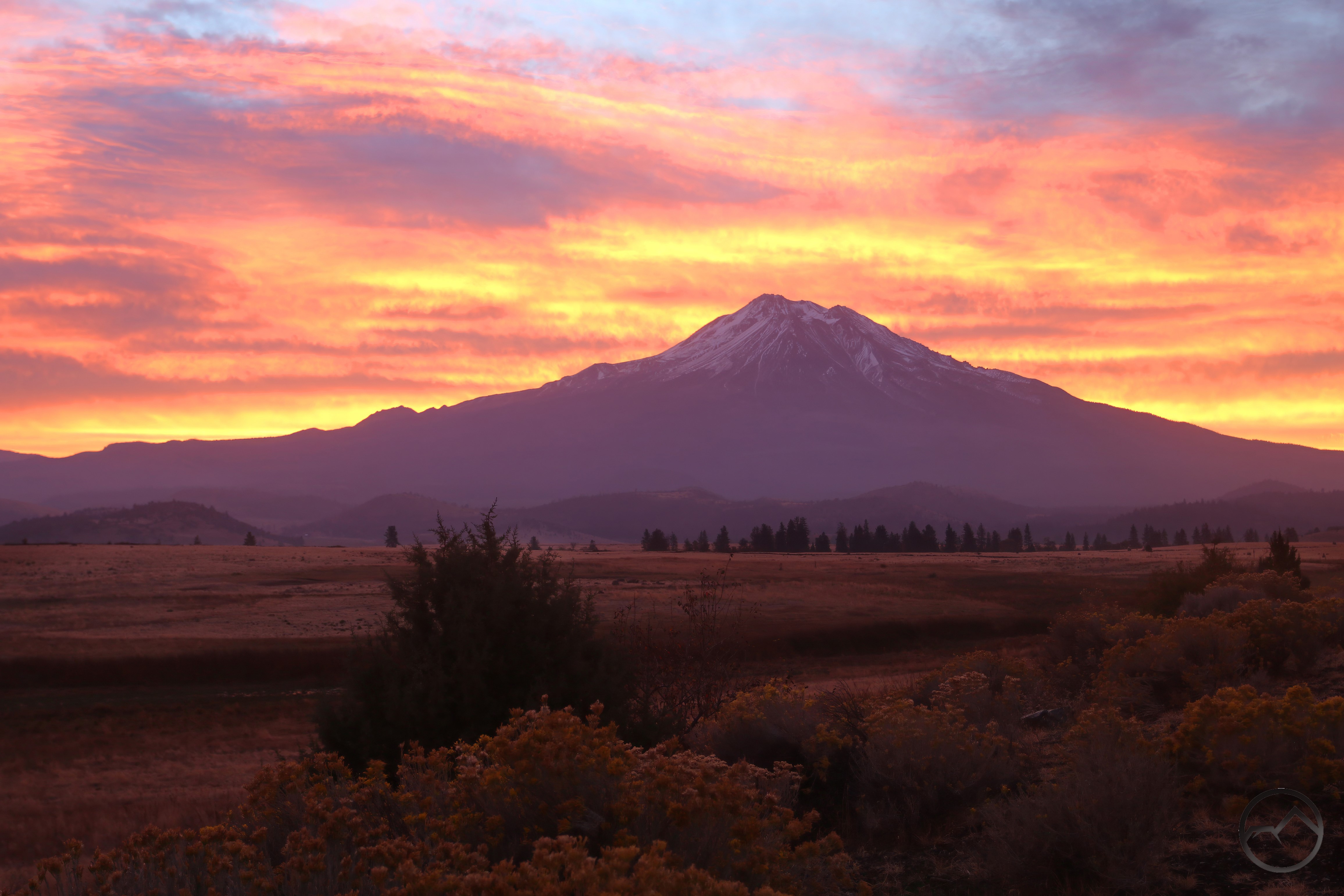
A sunrise view of the Parks Creek vale. The creek is barely visible through the fog, just above the levee on the left. As it nears it confluence with the Shasta River, Parks Creek divides into two distinct channels that flow into the river independently of each other. 

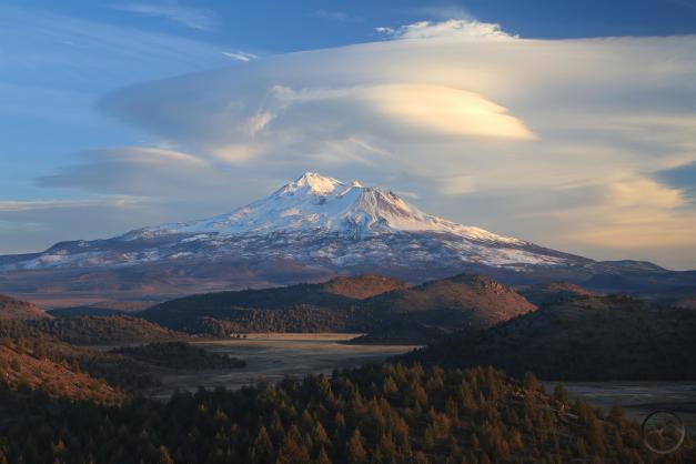
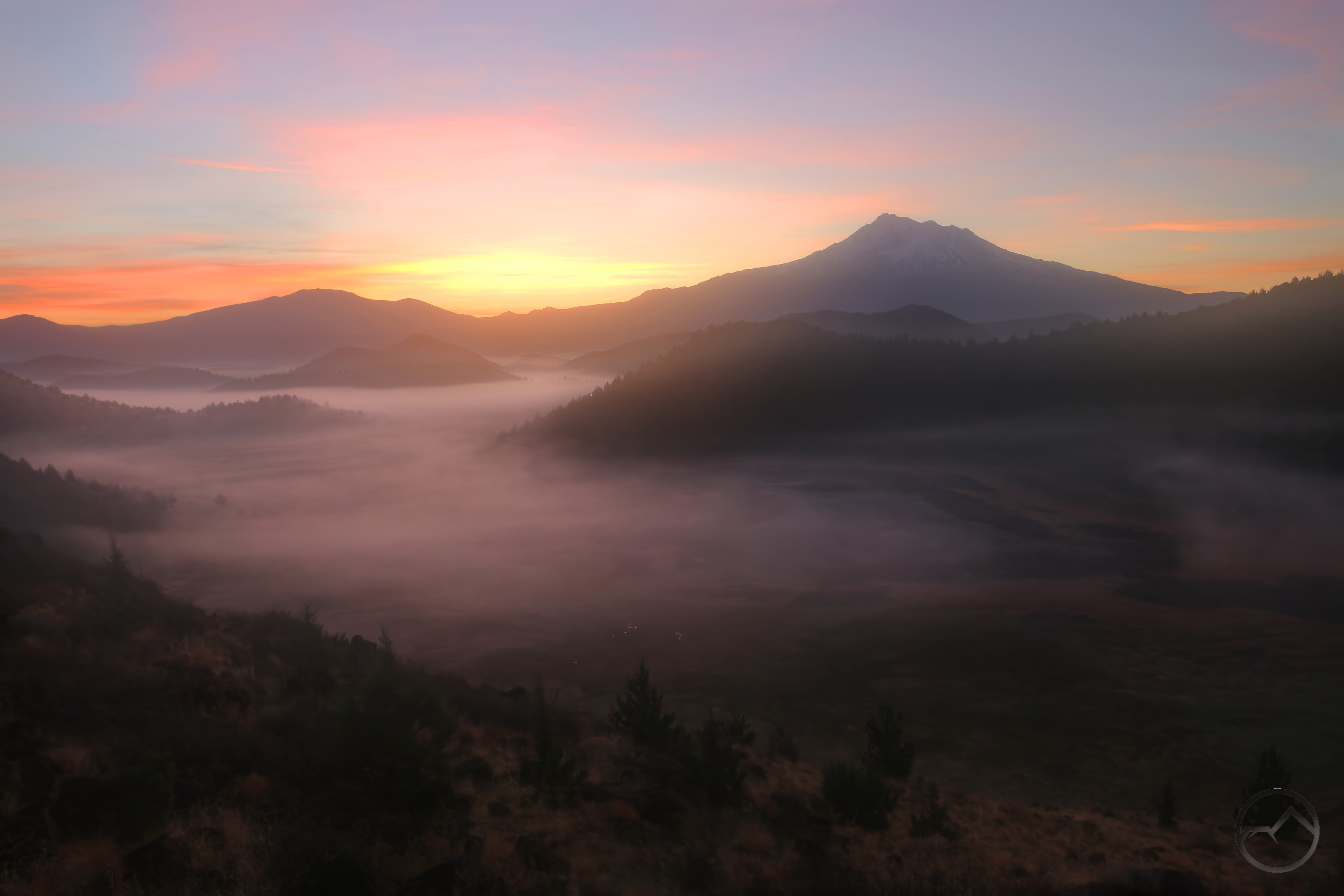
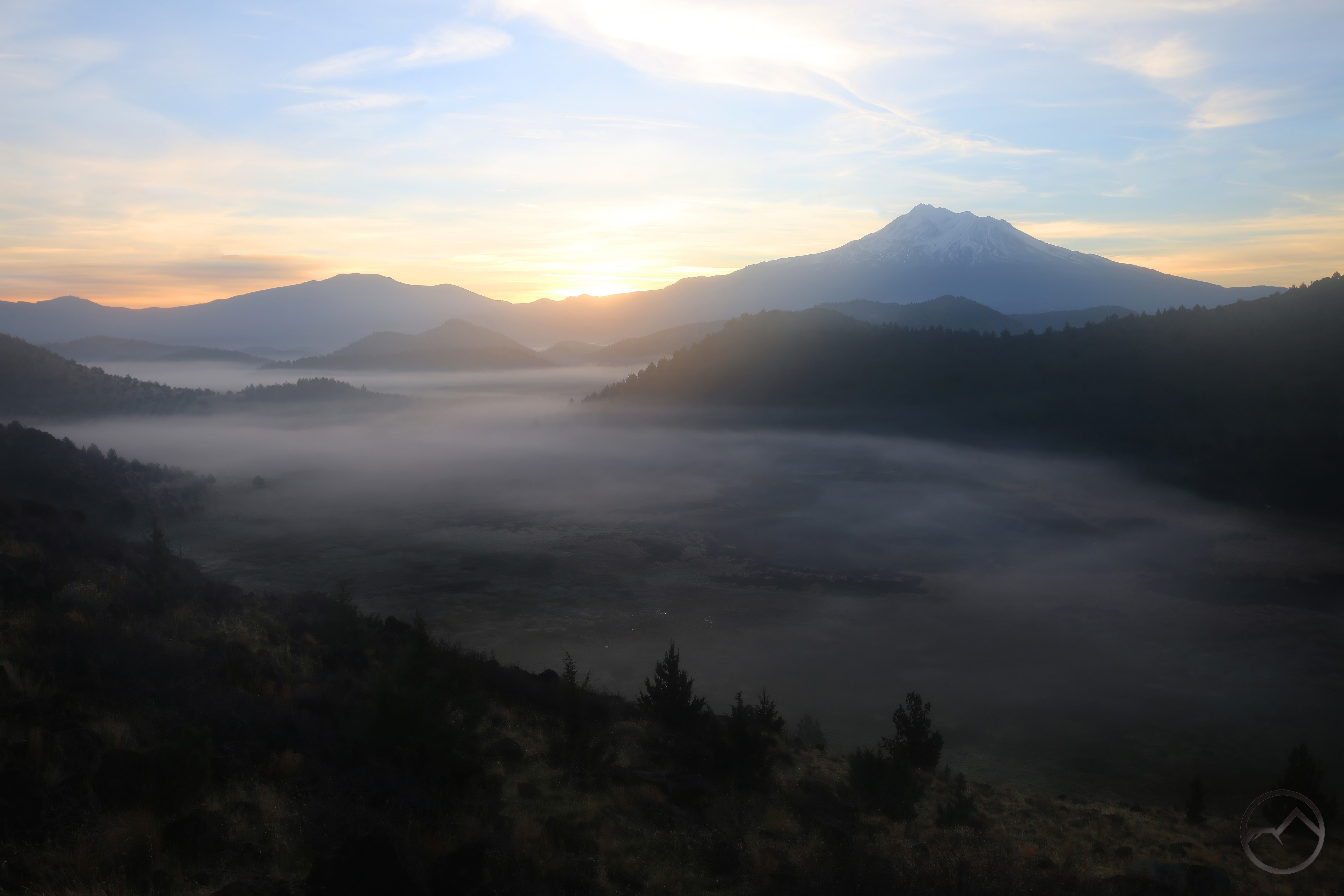
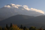
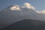
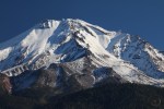
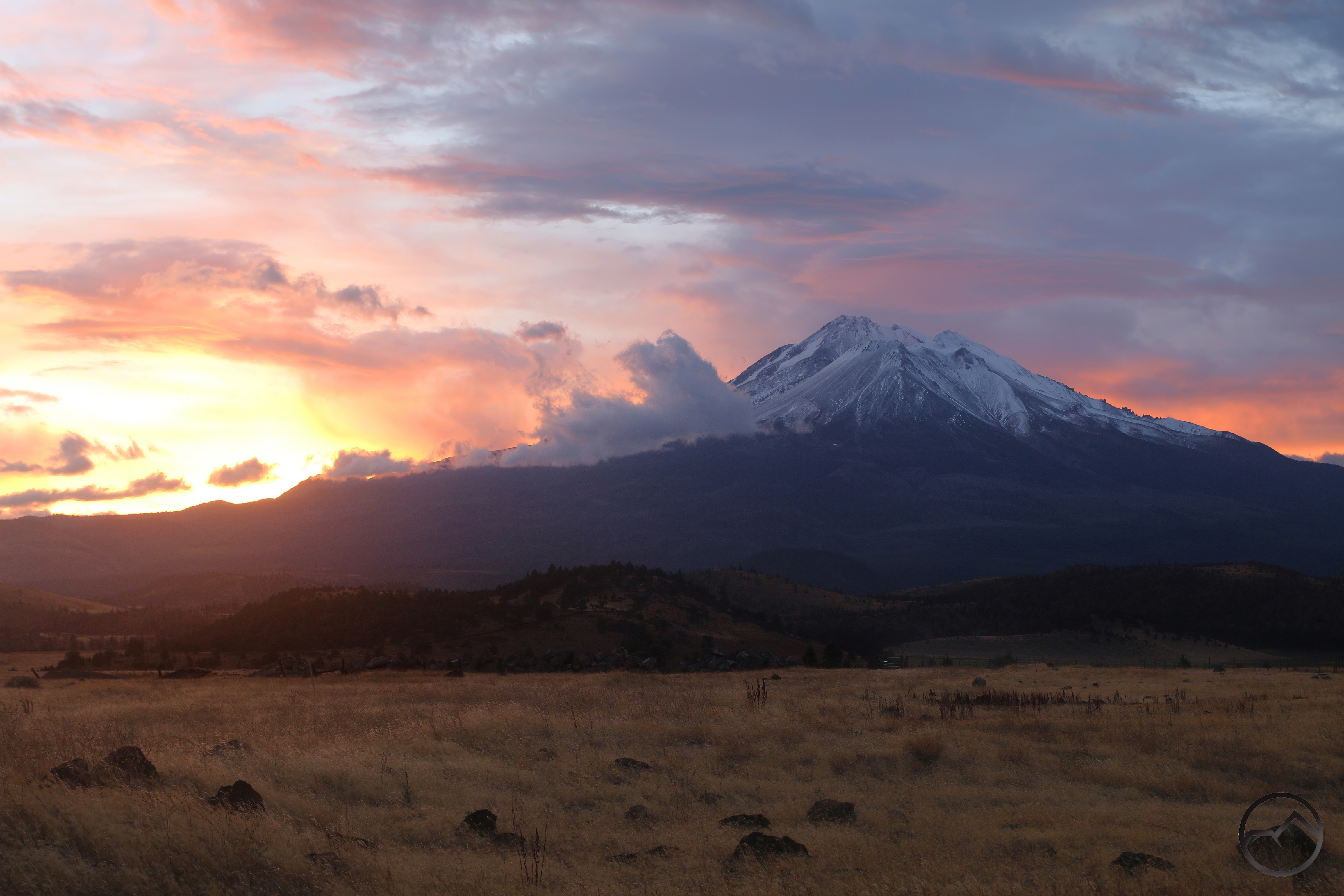
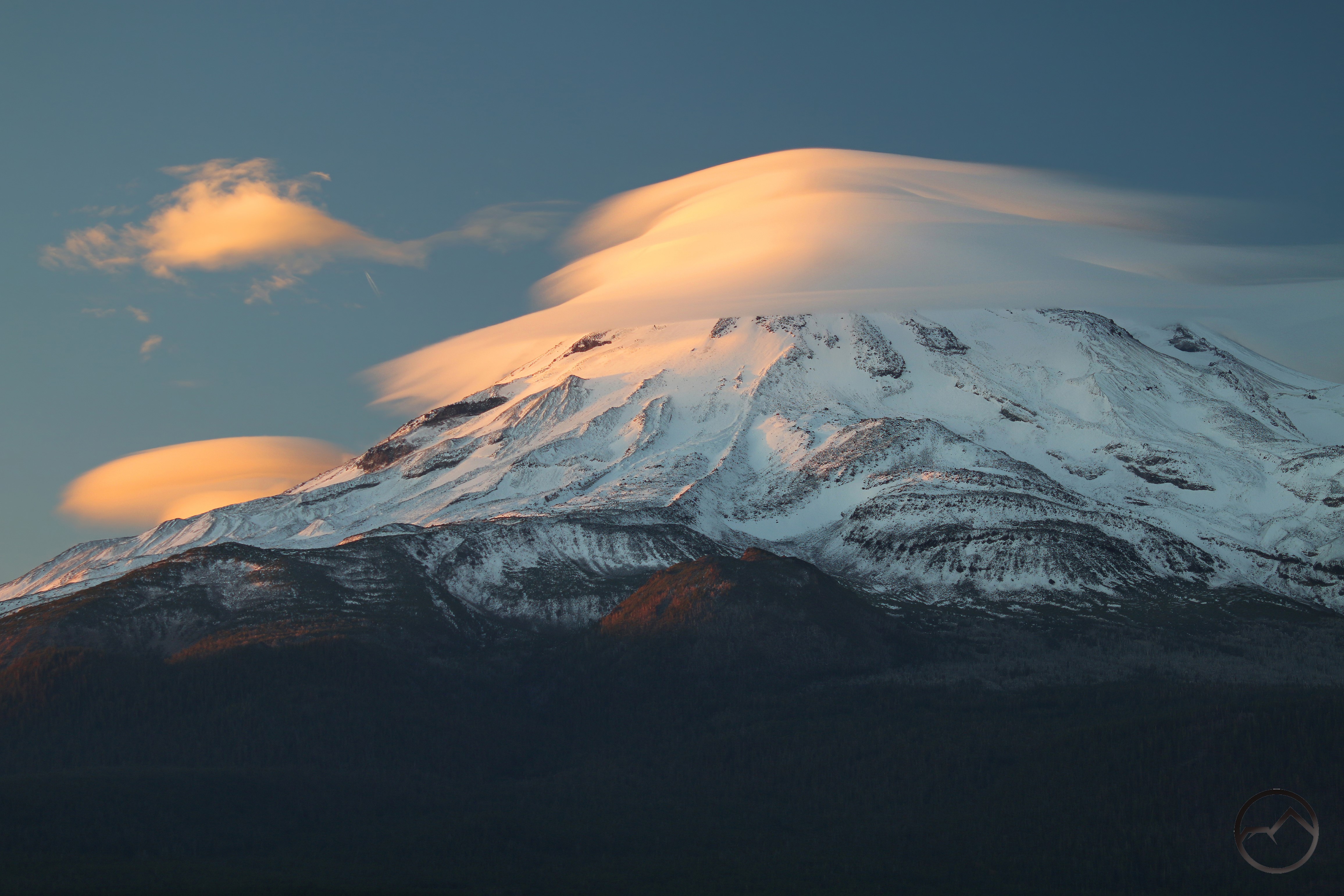
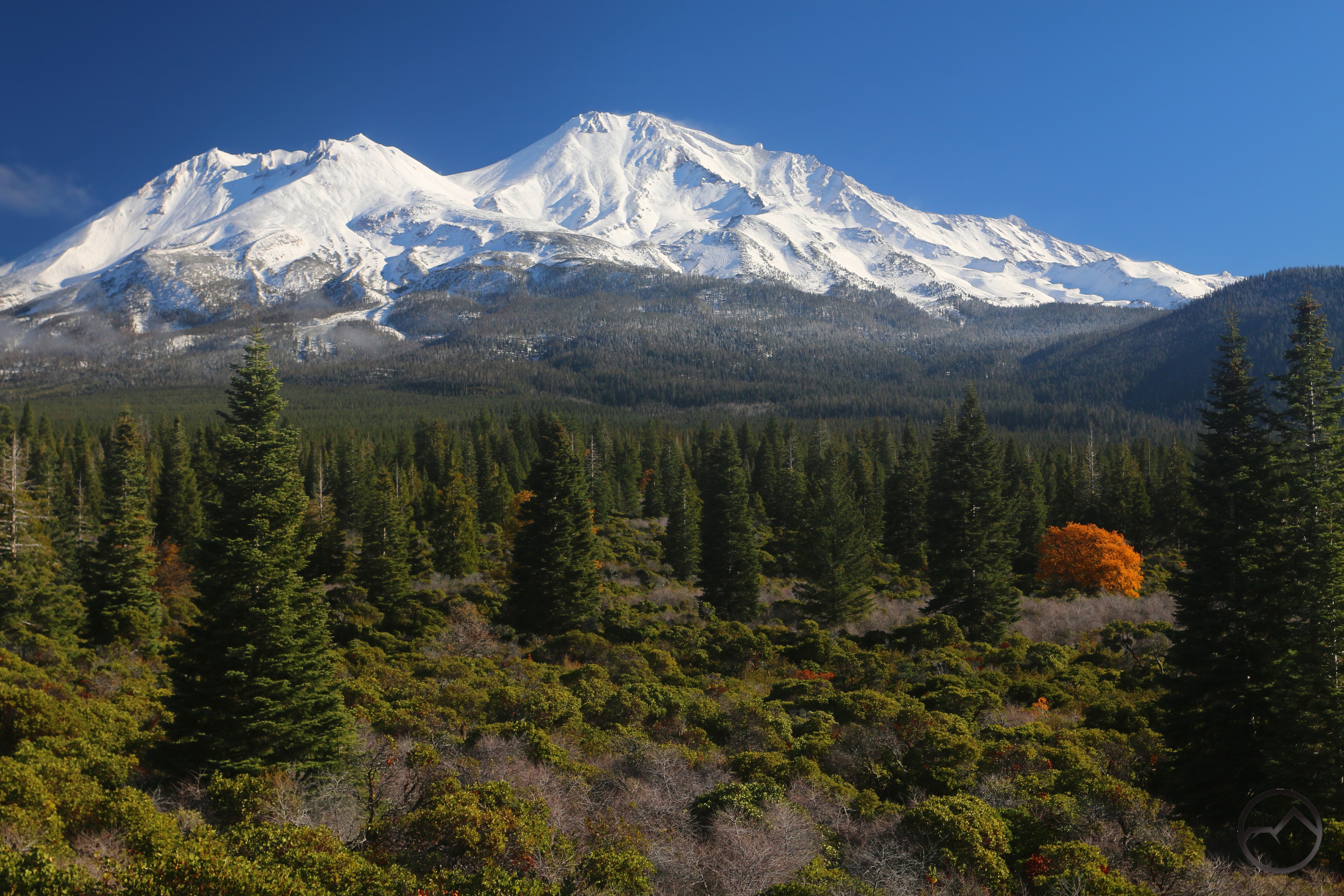
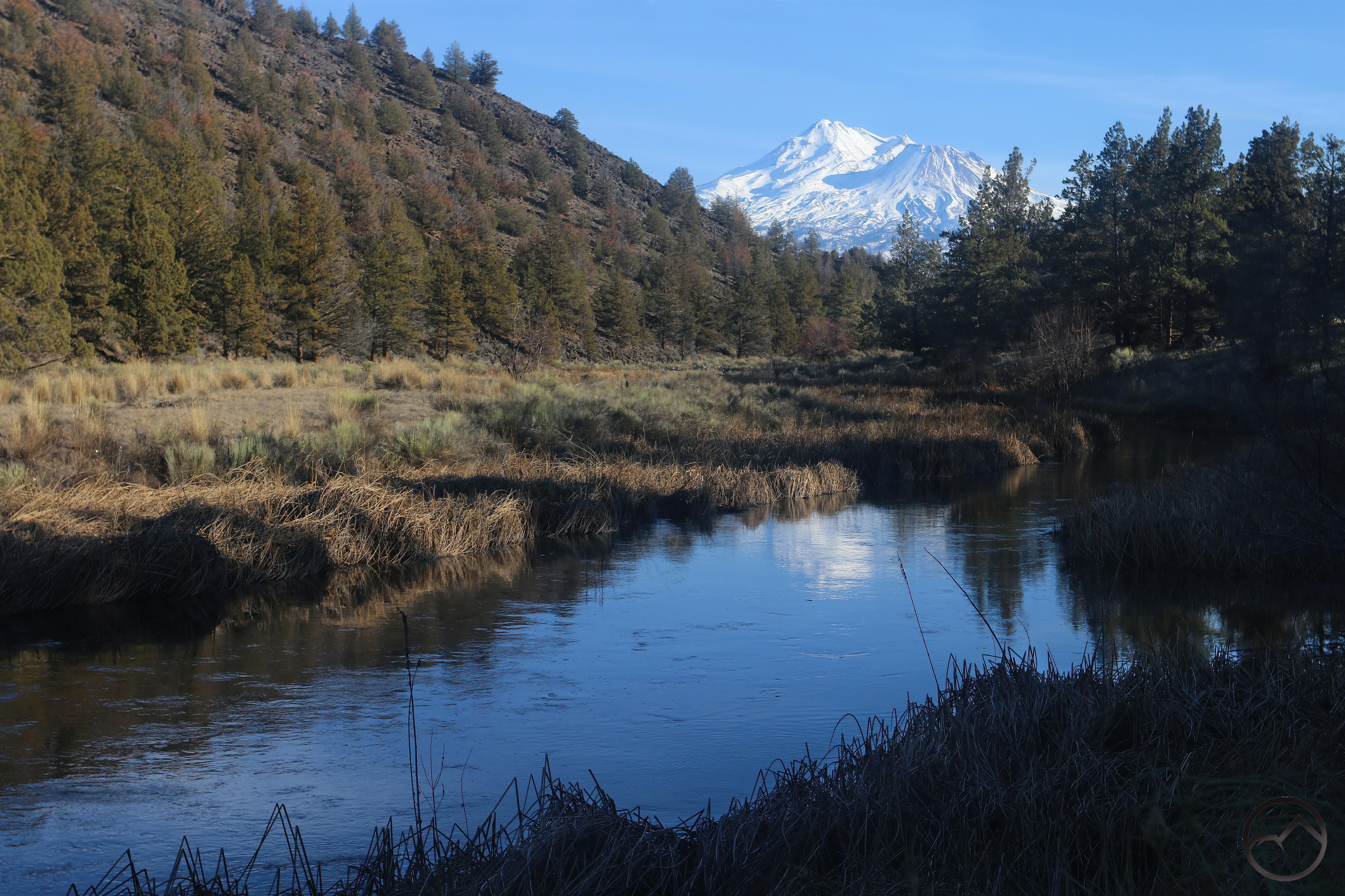
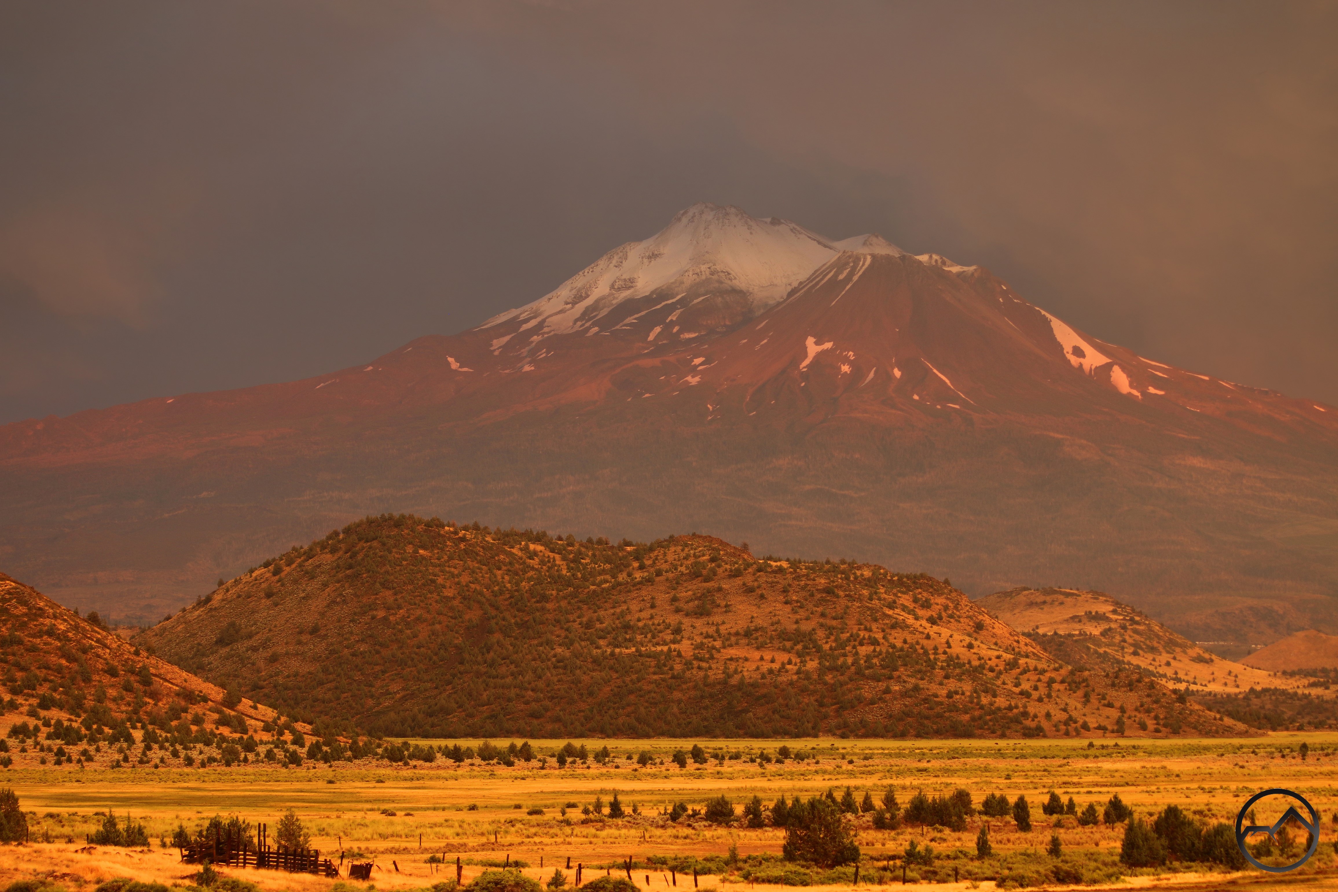
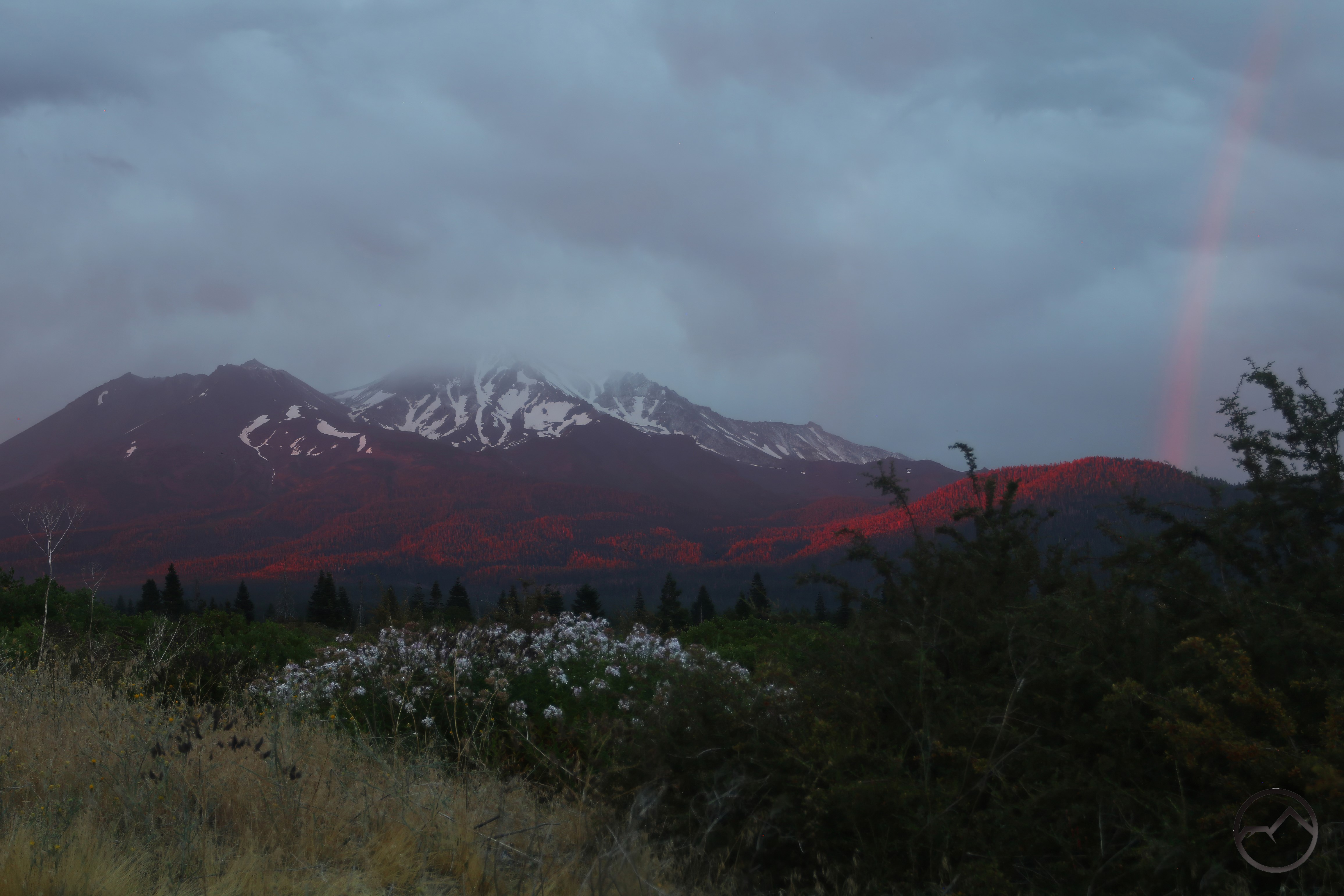
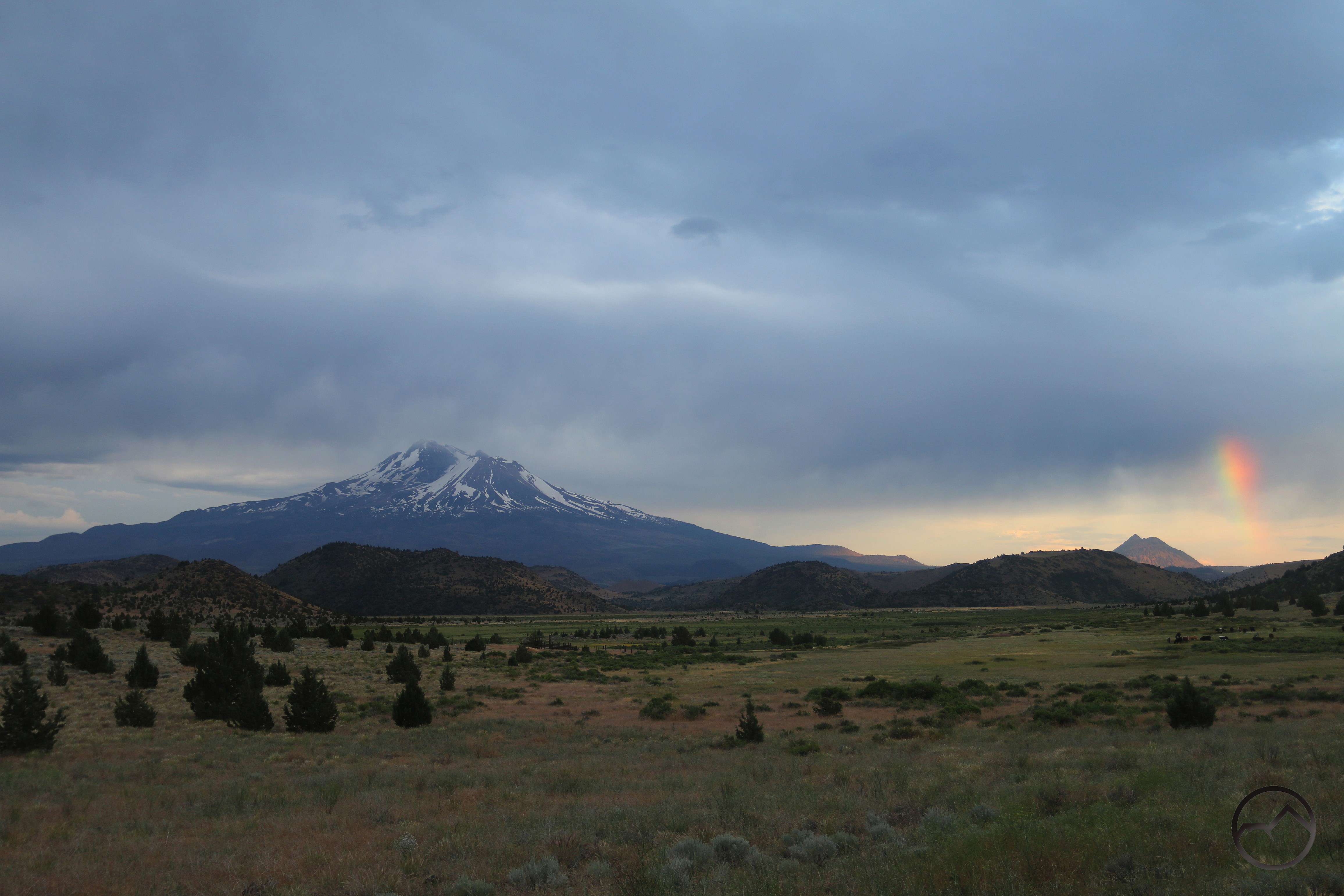
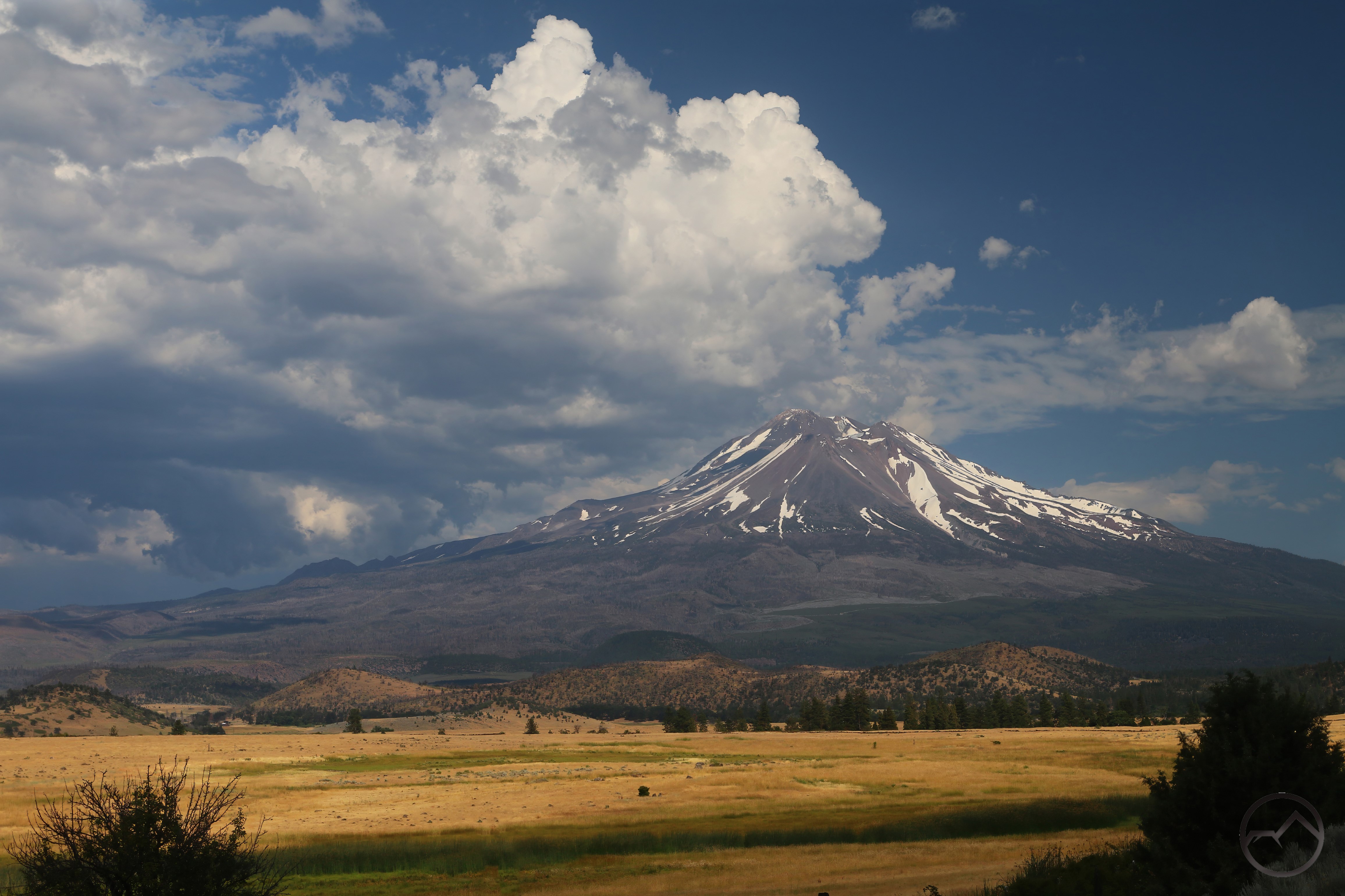
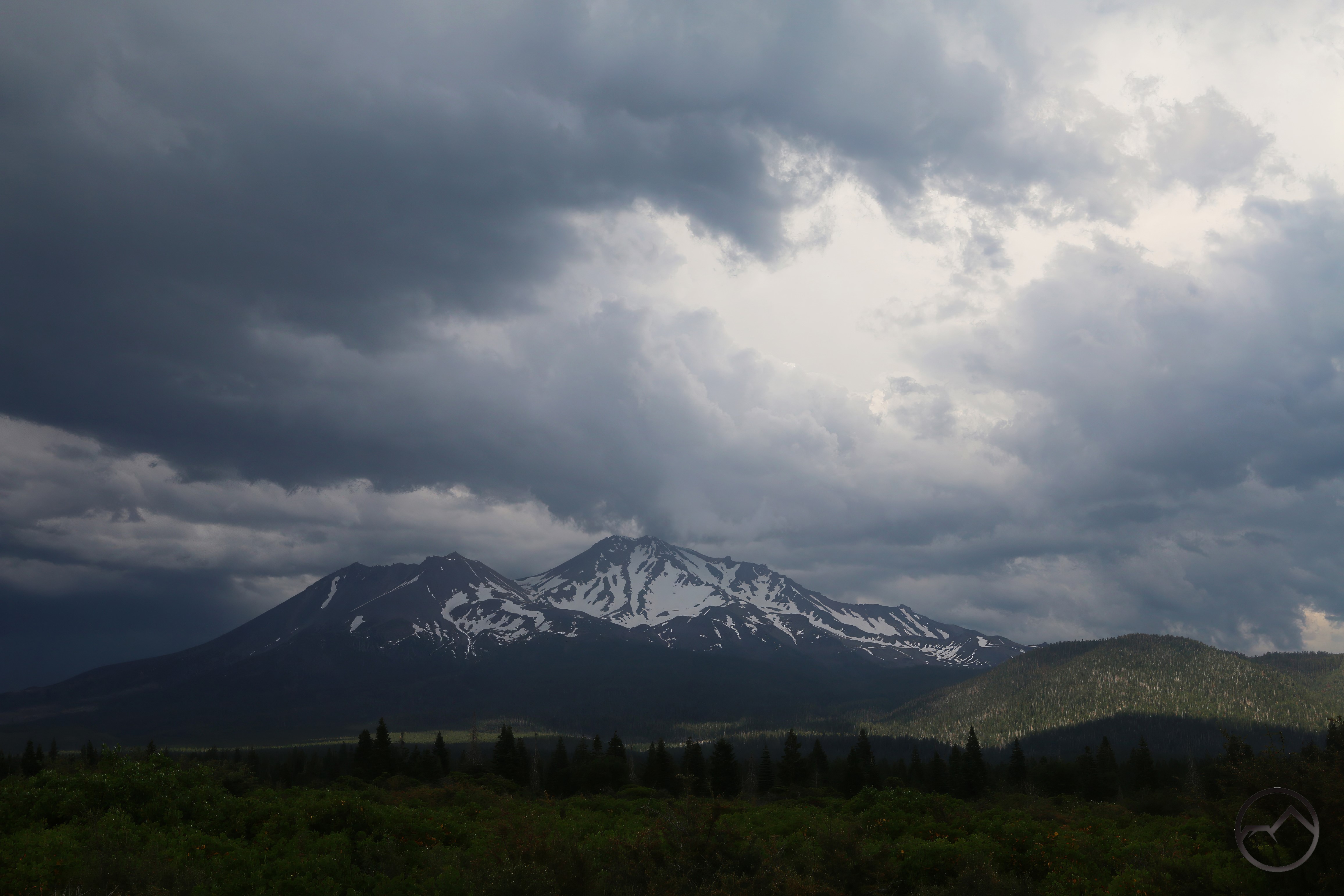
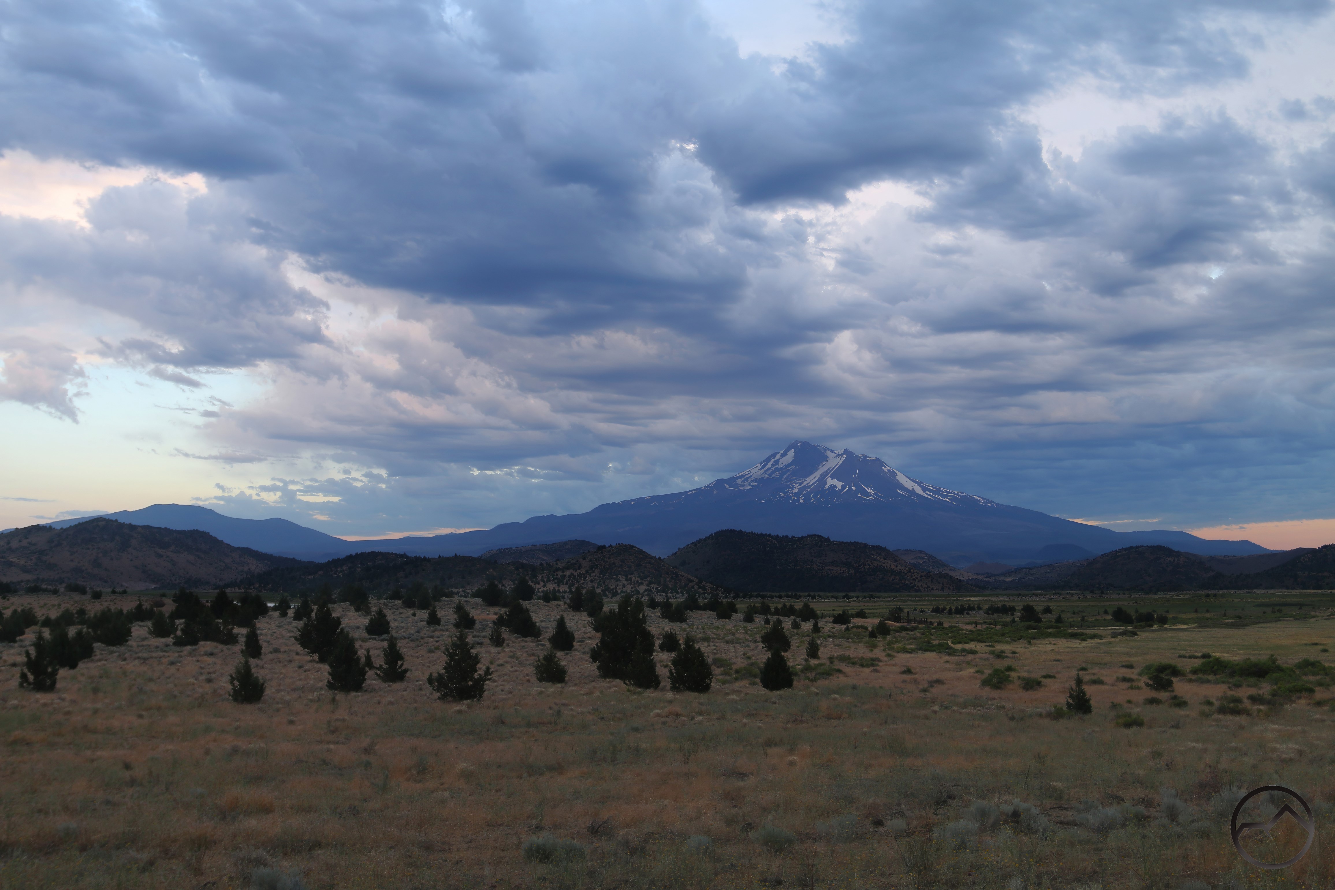
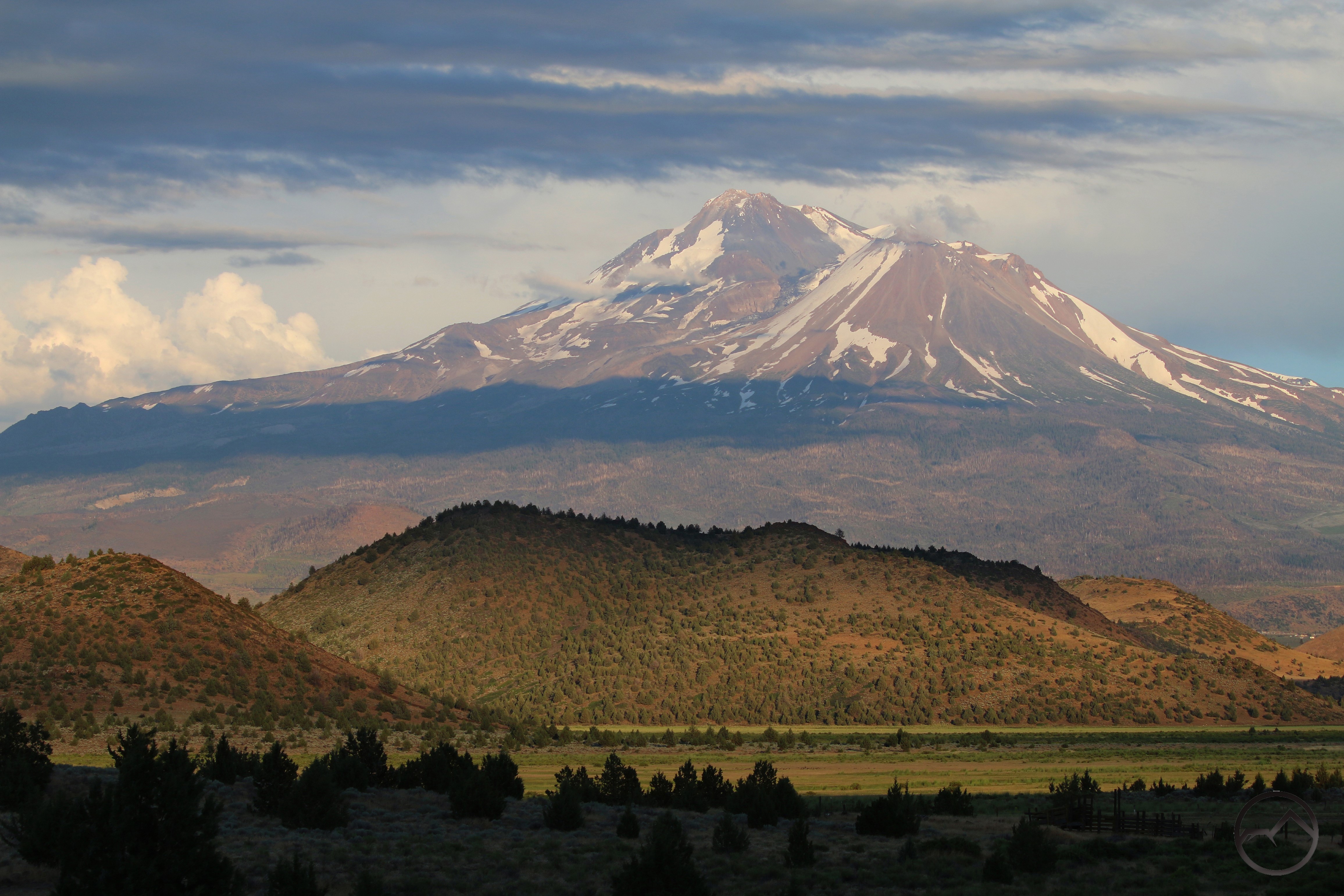
Other than when Parks Creek flows through its canyon, Mount Shasta is a visual companion for much of the creek’s journey. This is never more true than in the Shasta Valley. Here the broad vale of Parks Creek is visible from Truchas Ridge, just before Parks Creek flows into the Shasta River. A spectacular finish for a beautiful waterway. 

Once joined to the Shasta River, the waters flow through another remote canyon, this time with a high desert environment giving it a unique appeal. Mount Shasta, as always, stands vigil over these beautiful waters, watching and waiting for the salmon to arrive…

Last Sunset Of July 2025

Posted by bubbasuess on August 3, 2025
Posted in: Cascade Range, Hiking, Mount Shasta, Shasta Valley, sunset. 1 Comment

In the past summer months in Mount Shasta are months for getting up into the high country and enjoying the alpine landscapes and sublime natural settings. Generally, they were not great months for enjoying the views of the mountain in spectacular weather conditions (which is often the key to capturing great images). July 2025 was certainly an outlier for that trend. The continuous stream of thunderstorms made the month memorable and numerous images were captured, highlighting awesome clouds and beautiful light augmented by the dramatic presence of lightning and rainbows. This trend continued right up to the very last sunset of the month, which was once again a spectacular one.

As with the last thunderstorm a few days earlier, there were more rainbows to be had. Mount Shasta was partially covered by cloud and not well lit but the rainbow was excellent and the light and cloud around it made for a rather sublime scene. The position of the clouds made the Shasta Valley seem like the best option for a good sunset.

By the time I got out to the valley, the clouds had opened up and fresh snow from the previous day was visible on Mount Shasta’s highest elevations. Even more interesting, however, was the enormous shadow being cast by something somewhere in the west. The clouds pulsated with color as they churned but no light touched the vast shadow.

Soon the shadow seemed to expand and the clouds turned very, very dark. At the same time Mount Shasta and the hills of the Shasta Valley glowed orange from the setting sun. The sunset color seemed to drench everything and a most surreal feeling permeated the landscape.

Though the glow on the ground continued, the clouds finally lit back up as the sun sank lower beneath the horizon. The brooding clouds looked ready to burst open with a deluge for the desert valley. Meanwhile, lightning continue to flash off to the south behind the mountain. Thunder could be heard faintly in the distance. It was an unusual sight and the perfect stormy ending to a magnificent month of storms.

August looks to be warming up. We’ll see if the higher temps last and it is finally time to abandon the desert and head up into the high country.

Trifecta Unexpected: Lightning, Rainbows and Snow

Posted by bubbasuess on July 27, 2025
Posted in: Cascade Range, Hiking, Mount Shasta. 3 Comments

No sooner did I put up an up-to-date collection of rainbows around Mount Shasta then another storm sailed through the area and provided another fascinating specimen, as well as a number of other interesting sights.

Thus far this summer, the temperatures have not been too hot and there has been a staccato rhythm of thunderstorms, each yielding up color temperatures, rain, copious lightning and all the other hallmarks of quality summer storm weather. I honestly can’t remember a series of storms like this in the recent past. This last series of storms, however, was unusual in that it brought a lot of lightning, a totally unique rainbow and fresh snow on Mount Shasta. That is a trio of phenomena that I have not seen before and as Mount Shasta always does, it surprises and defies expectations.

The first wave of the storm was not too exciting but it did leave a very gentle dusting of snow on Mount Shasta. Yet the clouds continued to gather and it was obvious that some exciting weather was building up.

Thunderstorm 24July25

Thunderstorm 24July25

The storm itself was pretty epic. There was so much water coming down that some areas, especially at the north end of the Shasta Valley and Yreka there was a fair amount of flooding. This time lapse (I don’t know if anyone likes these as much as I do, but I really enjoy them!) shows the intensity of the storm and how it develops out of nothing. I especially like at how about 0:35 the clouds stop there westward movement and then suddenly turn and blow eastward. It’s a pretty dramatic reversal.

Like the storm just before the 4th of July, this event had quite a bit of lightning. It wasn’t as intense as the earlier storm but still exciting to witness. It was made even better by the fact that a great deal of the lightning was flying over Mount Shasta. I set up my camera to try to capture it in the evening but it seemed like every bolt was coming in between when my camera was capturing an image. It was frustrating but awesome. The above image was the best I managed to get. Someday, I will get a good shot of the mountain with a fat bolt of lightning.

All of a sudden, as the sun was sinking below the horizon, light red light washed over the mountain and it looking like the forest had burst into flames. The alpenglow was intense. However, even more surprising was that right in the narrow path of the light a rainbow extended upwards. I have never seen a rainbow when it was this dark out. Even more striking was the presence of a faint but discernable second rainbow right in from of Shastarama Point. As the alpenglow faded, the rainbow lingered, since the sun was too low to light the mountain it was still barely high enough to cast light into the rainy sky. Finally the sun was too low the rainbow disappeared and it was dark but for a fleeting moment there had been a truly magical sight to behold.

The next day another storm was forecasted. I headed up to the Old Ski Bowl in the morning to get a shot of the mountain with fresh snow. It had rained a fair amount after the sun set and there was a solid layer on the shady exposures of Mount Shasta above 12,000 feet. I was up there fairly early and it was already beginning to melt off in the sunnier areas. Still, it was pretty spectacular up there, with a new, massive thunderhead building over the mountain’s summit.

The fresh now highlighted the crags of the mountain nicely. It was naturally thicker higher up but even below 11,000 feet there was a surprising amount of snow. It is hard to believe that the snow had come down in the peak of summer but there it was glistening on the slopes.

Heading down, I had hoped to capture a shot of the upper part of Avalanche Gulch and the West Face Gully area, where the snow was especially thick. Unfortunately, I had not factored in the alacrity with which the next storm was brewing and by the time I got down to one of my favorite vantage points, the clouds had built up and covered the summit. Glimpses of fresh snow were visible through the fast moving clouds but, for the most part, it was obscured.

While returning from Yreka later in the day, the new snow was still visible on the cooler north side. Though not obscured by clouds, it was shadowed by the clouds that continued to increase in size. It looked like it was going to be another good storm. It was, however, a storm I wasn’t meant to see, since I was in the hospital with my son (he’s fine) all evening when the lightning and rain really got going.

The next day I headed up to the Old Ski Bowl for the sunset. Most of the snow was gone but the clouds were still clearing. It was absolutely gorgeous. The crags, particularly Thumb Rock and Shastarama Point were highlighted in magnificent fashion by the bits of clouds racing past the cliffs.

All in all, it was a stunning sunset, the kind that is hard to believe we can witness just a short drive from town. Of course, there are amazing sunsets to be witnessed from in town, but each is great in its own way. It was another fascinating round of storms, with some unusual sights to witness. There may be yet another storm next week, before July draws to a close. I hope it is a good one.

Rainbows Around Mount Shasta

Posted by bubbasuess on July 24, 2025
Posted in: Cascade Range, Hiking, Mount Shasta. Tagged: Rainbows. 5 Comments

My last post, about the thunderstorms prior to the 4th of July, included an image of Mount Shasta graced by a pair rainbows emerging from an intense thunderstorm to the south. This particular storm saw Mount Shasta on the northern fringe of the storm, with the mountain’s northern flanks under blue sky. That meant that the mountain was well positioned to be photographed fairly clearly, with the rainbows beautifully arranged against it. It was a rare and satisfying treat.

I have been trying to photograph Mount Shasta with rainbows for a long time. The ephemeral nature of these brilliant spectacles means the moments where I can catch them are fleeting. This is compounded by the fact that they are only visible from certain angles, so location options are limited in the midst of limited time. The result is I have only captured a few rainbows with Mount Shasta over the years I have been photographing the mountain. Having caught one recently, I thought it would be good to collect them altogether in one place, and thus, this post.

Up until recently, I thought this was the best instance of the mountain and a rainbow I had captured. The sunset color, the pouring rain catching the light and the presence of the rainbow made this one a particularly memorable sight. I got a number of good shots before the sun sank low enough for the rainbow to dissipate but it was fairly long lasting and a lot of fun to photograph, especially with the thunder still booming.

A recent one, this one had good framing and a really strong rainbow but Mount Shasta was so deep in the storm it almost seemed like the mountain was out of focus, even though it was actually the opposite. The out of focus effect really bothered me even though it was a great event.

I got rained on hard for this image. It was difficult to catch a moment when I was not being deluged and the rain not really blocking out the view of the mountain. However, the payoff was worth it, with a double (almost triple) rainbow. If you zoom in, you can see all the rain flying through the air.

This one was especially fast moving. When I saw there was a rainbow I hopped in my car and headed out to try to catch it. My first destination was overtaken by the storm and I had to race down I-5 to get to where I could see the mountain. Even then, it was so fast moving by the time I got my camera set up, the mountain was being consumed by the cloud. Even though Mount Shasta is partially obscured, I really appreciate how the rainbow delineated between the stormy sky and the blue sky.

This was another near miss. Good color on the trees, a quality rainbow and a white mountain. However, there was so much rain, the mountain is hazed out and the light wasn’t very good. Beautiful nonetheless.

I’ve gotten a pair of images of Mount Shasta with a rainbow (the second one, just barely too, as the rainbow was fast disappearing) from the Shasta Valley. Interesting, they were both from the same place and the rainbow appeared at the same point. File that away for the future, I guess. I really want a good rainbow shot from Truchas Ridge…

I have seen rainbows near Mount Shasta on other parts of the Shasta Valley. This one was to the east, near Sheeprock. Thunderstorms in the valley can be tricky and getting the rainbows closer to the mountain has been a difficult objective.

Speaking of the Shasta Valley, I have managed to capture a few good rainbows out there over the years. I think I have actually seen more out there than I have photographed. I will have to be more attentive in the future…

I have gotten a good one of Black Butte with a rainbow from the Shasta Valley. That spot seems to be a good position for the light from the setting sun to cast some good rainbows.


A few excellent rainbows have manifested over Black Butte when I was home to capture them. These were particularly intense specimens. On the latter of these two images, the rainbow appeared when I happened to be photographing my friend and his son on top of Black Butte from the front of my house. I don’t know how often it has happened but surely taking pictures of people on top of a mountain through a rainbow is not something that happens very often!

Somehow I even managed to capture a snow rainbow over Black Butte. It happens rarely, but rainbows can form through snow crystals rather than raindrops. On the morning a got this image, there was a very light, very fine snow coming down and it was bitter cold. I was not expecting a rainbow at all but it flamed out of the sky and demanded my attention.

Lastly, fortune gave me one opportunity to capture a rainbow over Mount Eddy. Fortunately I was near a meadow and could get a clear shot of it without having heavy filtration from a bunch of trees. The timing was indeed lucky.

Now that I have pulled it all together, I can see it is not a bad collection of images. Rainbows being what they are, they are difficult to capture in a quality image. Of course, they are much easier than lightning. I am still waiting for my good shot of Mount Shasta with some lightning strikes…

Three Days Of Fireworks (Before The 4th)

Posted by bubbasuess on July 12, 2025
Posted in: Cascade Range, Echo Point, Hiking, Mount Shasta, sunset, Truchas Ridge. 2 Comments

Thunderheads build over Mount Shasta.

Like the beginning of June, July opened up with some thunderstorms. However, while the ones in the previous month yielded some great clouds and the booms of thunder, it paled in comparison to the ones the ushered out June and welcomed us to July. Whatever excellent fireworks were on display on the 4th of July were dwarfed by the natural pyrotechnics. Indeed, this was probably the most spectacular lightning display I have witnessed in the Mount Shasta area.

Things started quickly during the day, with clouds spreading out to the north towards Oregon and massive storm clouds building over Mount Shasta.

In the late afternoon, massive plumes rose over the west side of the Shasta Valley. The clouds themselves were pretty amazing but watching the strange shadows cast by the billowing towers added to their fascination. These harbingers really elevated my expectations for the forecasted storm that evening.

Eventually the storm came and the thunder rumbled but overall, it ultimately left me wanting more. The rain was very light and the lightning was minimal. However, the clouds were still copious, but left little room for light to really make things interesting. Mount Shasta was left in shadow. However, west of Black Butte an opening in the clouds allowed the light of the setting sun to blast through and light the landscape up. It was the most dramatic sight of the day.

Hopeful that the eruption of sunlight might mean a better sunset from the north, I raced into the valley but the mountain had very little light on it. Though disappointing, I watched with envy at the color scene on the western horizon. You can’t always get the best light by the mountain but it was a colorful end to June.

The next, day the storm clouds built throughout the day but the afternoon brought conditions that shocked me. The forecast made it look like the next day was the bigger storm but the wind was powerful and it felt like something massive was brewing. Mount Shasta was visible throughout, but the clouds swirled around the summit throughout the evening.

2025-07-01 Storm

2025-07-01 Storm

This video shows how rapidly the storm built and the dramatic way Mount Shasta was swallowed up by the storm and the rain surged out of the clouds.

When the storm finally peaked, the lightning was fast and came down all around. I saw it hit multiple peaks around Mount Shasta. When it came, the rain also came hard and lasted well into the night. This was good, because the lightning was so abundant it doubtless would have started numerous fires. This was definitely not going to be the case given how much precipitation came down.

In the midst of this storm the setting sun burst through the cloud and lit everything up in magnificent fashion. Oddly enough, Mount Shasta was still dark, untouched by the explosion of light. Mount Eddy was bathed in purple while it was a flaming orange further to the north.

Even in the midst of the light of the setting sun, the lightning continued to flash and I was able to capture some of it while getting images of Mount Eddy in the stormy alpenglow. It was all really amazing.

2025-07-02 Storm

2025-07-02 Storm

July 2nd was the last day forecasted to have thunderstorms and true to this expectation, the storm grew throughout the day. However, unlike the previ0us days’ storms, the focus was south of Mount Shasta, rather than north of it.

This meant that the afternoon deluge was focused on the south side of the mountain. The result was the western position of the sun yielding fantastic rainbows around Mount Shasta. I have tried to get shots of the mountain with rainbows for years and I think these were the best ones I have been able to capture. This alone would have meant the storm had given me high rewards. Everything after this was just icing on the cake!

I headed out into the Shasta Valley once again. The rainbow, now visible over Black Butte, was finally fading when I got there.

Even though the rainbow was gone, the clouds continued to swirl around Mount Shasta. This meant awesome shadows sailing across the landscape, providing a lot of visual interest around the mountain.

Heading up to Echo Point, I watched the clouds finally fade away and the sun light up Mount Shasta, brining a close to 3 epic days of storms. The alpenglow on the mountain marked the closing moments, capping an awesome lead of to the fireworks of Independence Day.

A (Beautiful) Menace In The Sky

Posted by bubbasuess on June 10, 2025
Posted in: Cascade Range, Desert, Hiking, Mount Shasta, Shasta Valley, sunset. 6 Comments

It is pretty obvious from a quick perusal of this site that I am a huge fan of cloud activity. The landscape is the canvas but atmospherics and light are the paints that make the image on the canvas special. Perhaps it is the fleeting aspect of the clouds and light in tension with the interminable constant of the landscape that I find so captivating.

The 9th of June was witness to some epic cloud activity in the sky over Mount Shasta. It wasn’t lenticulars or some other odd spectacle in the sky. This time it was a classic thunderstorm, but one in which the clouds were overwhelmingly magnificent in both scale and arrangement. Naturally, I had to get out and document it in the midst of all the other things I needed to get done.

2025-06-10 08-37-33

2025-06-10 08-37-33

This time lapse taken from a fire alert camera shows the incredible growth and maturation of the storm. Watching the clear skies fill with brooding towers and then seeing those swallowed up by the thunderstorms is rather startling. Some other highlights come at the end, when the setting sun finds some breaches in the moving clouds and the beams of sunset light can be seen traveling across the Shasta Valley and Mount Shasta. Missing from the time lapse were lightning strikes and rainbows, both of which were visible from the valley floor. Regardless, it is an awesome bit of footage.

Though I wanted to get out earlier, I wasn’t able to break away until just after noon. By that time the clouds had expanded to a massive tower above Mount Shasta and were starting to extend northward in a tumultuous sheet.

Heading north into the Shasta Valley to get a different perspective, the size of the thunderheads forming over the mountain were humbling. Considering the mountain looms nearly 12,000 feet over the Shasta Valley, these clouds were easily 30,000 feet high.

As the sunset approached, I headed back out into the valley. Though it was my planned destination, I opted not to go to Truchas Ridge this time. I stopped short in order to capture a fleeting rainbow that appeared over Black Butte. It had not been raining when I had come from Mount Shasta, so the precipitation bringing the rainbow had to have just started.

The rainbow faded quickly, but was promptly followed by the sunset light racing across the valley. The sun had nearly set and the low angle of the light found a gap in the clouds that allowed it to shine on Mount Shasta and the hills of the valley. The movement of the clouds and the sun’s rapid descent meant the light moved quickly across the landscape. I was hoping the clouds would light up but it was not to be. Nonetheless, the sailing light was a magnificent sight to witness.

Finally, the sun well below the horizon, only Mount Shasta and some nearby clouds had any of the fading color left on them. In the midst of this, the storm continued, intensifying over the Whaleback. A few bolts of lightning streaked down. I think one hit Ash Creek Butte. I wasn’t fast enough to capture any of them. It left me wanting a bit but the entire sequence of events in the sky was pretty hard to be ungrateful for. It was tremendous.


Blooming But Burning In Mount Shasta

Posted by bubbasuess on May 23, 2025
Posted in: Cascade Range, Echo Point, Hiking, Mount Shasta, Shasta Valley, sunset, Truchas Ridge. 2 Comments

Spring at Truchas Ridge in the Shasta Valley.

Yikes, things just fly out of control sometimes. School is out and the summer travel season has started earlier than normal. The end of the school year brought a lot of other changes quickly, some welcome, some not. Chief among them has been the weather, which has been gorgeous. Spring has been glorious, especially in the Shasta Valley. However, there has been some unexpected peril…

The southern exposure of the hills around the valley are exploding with bright yellow flowers. These are the common woolly sunflower and they really brighten the arid landscape of the valley nicely.

Echo Point 2024
Echo Point 2025

As lush as it is, it is nowhere near as explosive as the growth was last year. It was sort of a superbloom last year, with flowers, grasses and other kinds of growth nearly choking the landscape in a green blanket. Fortunately, the incredible amount of snow that fell in February flattened all the grass down and let the land recover a little.

Though the winter wasn’t as heavy as the previous two or three, this year the water has been high in the valley, with numerous lakes filling basins that have been dry for years. Some used to be filled for years but for the last decade they have been sporadic at best and typically not full. For reasons yet to be determined, this year these lakes have all been quite full. It is a great addition to the landscape!

Through all of this, Mount Shasta has risen in solitary splendor over the valley. There has been some interesting weather but nothing too dramatic. While the landscape may be lush and the water high, the skies have been fairly tame, with a few lenticulars thrown in but nothing particularly dramatic.

Instead, the drama sprang from the most unexpected place: Spring Hill. Reported around 9pm on May 19th, the fire spread quickly around the western flank of the small butte that hems in the northern side of Mount Shasta City. The flames were dramatic in the dark of night and the glow was eerie. Naturally I had to pull out my camera and document the the conflagration. However, it was infuriating being unable to help control the flames.

MVI_2027

MVI_2027

MVI_2085

MVI_2085

As awful as the fire seemed while it was blazing, amazingly the next morning it seemed as though far less ground had burned than I had though. This was a sentiment shared by many friends who had also observed the flames. I think it was because the night highlights the flames while no landmarks are visible to provide a frame of reference.

The worst of the damage is visible from the northwest. However, even here there are more green trees and unburned brush than I would have expected. In a few years, I am willing to guess that manzanita will already be encroaching again.

From the south, the damage was less obvious. The most noticeable result of the fire was the break cut in with a tractor. We had watched the bulldozer’s lights as it moved up the Spring Hill Trail until it was near the fire. No doubt the trail will have to be rehabbed after the damage necessarily inflicted upon it.

The day after the fire, crews were still visible dousing the flames. This was made easier by the presence of a well at the summit of Spring Hill (at least I am assuming they are using the well, otherwise it would be a long way to run their hoses up there).

In the end, the fire wasn’t as destructive as it looked like it would be. Nonetheless, it was a sober reminder that even in the lush spring months fire is still a danger in this dry climate.

Smoke And Storm

Posted by bubbasuess on May 5, 2025
Posted in: Cascade Range, Hiking, Mount Shasta. 2 Comments

May sprang upon us with a surprising combination of smoke and storm. The former was brought to us by way of a controlled burn in the McBride Springs area along Everitt Memorial Highway. A lot of work as gone into this area, both thinning the forest and constructing trails as part of the Gateway trail network. There were a few controlled burns in this area before, but these were a little further south, closer to the Gateway trailhead. This burn was no doubt implemented because wet weather was in the forecast for the weekend.

The day following the burn, thin smoke still wafted up from the fired area. The incoming precipitation was heralded by a nice lenticular that capped Mount Shasta. The smokey haze with the layered mountain made an interesting sight and I had to stop at our new property to capture an image of it. Unfortunately, the lenticular did not last and by the time the weather arrived, it had long since been given over to overcast skies.

When the storm finally arrived, it showed it fury to the area north of Mount Shasta first. It was not very photogenic from down below but observing the rain come in from a webcam high over the Shasta Valley was fascinating. The sunlight cut through the clouds and falling water and made a rainbow-like spectrum visible along the horizon. Watching the deluge shift across the hills of the valley was surreal. The webcam isn’t as good as the experiencing everything firsthand but every now and again, it offers a perspective that is hard to beat.

By sunset the next day, Mount Shasta emerged from the storm and was looking stately in the evening light. It was a odd beginning to the month but beautiful. I hope that somewhere along the way, we get a real lenticular display. We haven’t had a good one in a while and we are due. Here’s to hoping…


A Tale Of Two Arches

Posted by bubbasuess on April 27, 2025
Posted in: Cascade Range, Castle Crags, Hiking, Klamath Mountains, Mount Shasta, Trinity Divide, Truchas Ridge. 5 Comments

Sunset on Mount Shasta, seen from next to the arch on Cerro Pedernal.

There are a lot of unknown and mysterious landmarks all around Mount Shasta. Ice caves on the mountain’s east flanks (on the mountain, not near Medicine Lake!), hidden waterfalls, unusual geologic features like the Hole In The Ground and a host of other sites add beauty and a sense of the unknown all around Mount Shasta. One kind of geologic curiosity that tends to slip under the radar in the Mount Shasta area is rock arches. Well known on the Colorado Plateau and other parts of the west, they never enter the discussion as points of interest around the mountain. There are two arches near Mount Shasta that I find particularly interesting. One is “known” and the other virtually unknown but to a literal handful of people.

One of the arches is high in the Castle Crags, just below the highest point in the giant granite pluton. It is unnamed, but I generally refer to it as the Crags Arch. It is genuinely surprising to me that this arch remains generally unknown. I find this surprising because the arch is visible to the naked eye from Mount Shasta City. However, it is difficult to recognize it as an arch from town when you don’t even know it exists. Nonetheless, if you know where to look, it is obvious.

It is certainly frequented by local hikers but outside but the numbers are few. The hike there is fantastic, with great views the whole way. The highlight is the traverse along the crest of the crags with granite spires thrusting into the air. Though there is no trail the route is obvious and travel is fairly easy. This section is the only place I have found where Brewers Spruce is the dominant tree in the forest.

Naturally, the view of Mount Shasta from the arch is excellent, as is the perspective of the Grey Rock, which can be seen through the arch when looking south. Overall, this is a magnificent destination and one of my favorite hikes in the region. There are also many more mysterious features to the east, along the crest of the crags…

The second arch is far, far more secretive. Located on the north side of Mount Shasta in the Shasta Valley, it lies on land that is traveled by only a very few people and those with permission from those who own the land through which it is accessed. Nonetheless, the arch itself is on public land. Like the Crags Arch, it is near the summit of a peak that towers high above the landscape. My family refers to the officially unnamed peak as Cerro Pedernal due to its vague resemblance to the New Mexico peak famously painted by Georgia O’Keefe. The arch one is not visible when looking from below. Instead, one must climb up to it in order to recognize the formation for what it is.

Also like the Crags Arch, the view from the Cerro Pedernal arch is spectacular. Indeed, this northern vista is among the best vantages from which to enjoy Mount Shasta and the surrounding landscape. Not only Mount Shasta but all the other major peaks in the immediate region are visible. The prominence of Mount Eddy is particularly noteworthy when viewed from the Shasta Valley. Other peaks further afield, such as Mount Ashland and Mount McLoughlin in Oregon are visible from just above the arch.

No doubt there are other arches around Mount Shasta that wait to be discovered (or have been by secretive explorers!). They are just a few among the many amazing geologic features that surround the North State’s most magnificent peak. The lure of the unknown treasure are part of the siren call that draws adventurers to the mountain.

Cascading Crags

Posted by bubbasuess on April 23, 2025
Posted in: Cascade Range, Castle Crags, Hiking, Klamath Mountains, Mount Shasta, Trinity Divide, Waterfalls. 2 Comments

An anonymous waterfall thunders over a precipice, deep in the Castle Crags. 

Spring is Castle Crags season and April in particular is the best month of the year to venture into the vas granite wonderland. The Castle Crags are steep and rugged and composed of erosion resistant granite, which is perfect country for waterfalls. The only downside is that with few exceptions, the waterways in the Castle Crags are very seasonal due to the fact that the same geology that makes for great waterfall country also limits the size of the watersheds.  This means you have to hit the falls in the spring when the snow is melting or after a rain. Timing it right for either circumstance will yield fantastic cataracts.

The Castle Crags are an incredibly rugged, nearly in accessible and utterly spectacular granite wilderness.

Only a couple of the numerous waterfalls in the Castle Crags are accessed by trails. These two, Burstarse Falls and Root Creek Falls, are among the largest and prettiest. The rest of the waterfalls in the Crags must be reached by unofficial trails, scrambling routes and, in some cases, some rough cross country travel. The effort, however, is very worth it. There is very little as beautiful and soothing as the sound of wild water running over granite and spring in the Castle Crags offers this in abundance. Add to this the beautiful spring weather, which is usually just the right temperature, seeing how the Crags are lower elevation than most areas around Mount Shasta, and this is the regions perfect spring hiking destination.


The above images are just a sampling of the large and small waterfalls found in the Castle Crags. Most are unknown or unnamed. When hiking in the Castle Crags, whether along the PCT or on the mysterious north side, every creek crossing could be downstream from a cataract. These are the domain of the explorer.

Aside from the waterfalls themselves, the thing I love most about hiking to the waterfalls in the Castle Crags is how it feels like Yosemite and the Sierra Nevada. The geology, dominated as it is by granite, is akin to California’s most famous mountains. It has always been comforting to this Sierra lover that even though they are more hours further away than I would like, their long-lost cousin is just minutes away. And that is to say nothing of the Trinity Alps. But that is another story…

Posts navigation

← Older Entries
Newer Entries →
    • Recent Posts

      • Adrift In An Ocean Of Fog
      • December Has Been Spectacular Thus Far Pt. II (A Magnificent Lenticular)
      • December Has Been Spectacular Thus Far Pt. I
      • Lenticular Interrupted
      • A Stormy Wave And A Truchas Sunset
      • Aurora Lenticularis
      • Fog Redux: Getting It Right This Time
      • Swallowed By Fog
      • Autumn Is Upon Us
      • 2 Days Of Fire Near The Castle Crags
    • Enter your email address to follow Hike Mt Shasta and receive notifications of new posts by email.

    • Archives

      • December 2025
      • November 2025
      • October 2025
      • September 2025
      • August 2025
      • July 2025
      • June 2025
      • May 2025
      • April 2025
      • March 2025
      • February 2025
      • January 2025
      • December 2024
      • November 2024
      • October 2024
      • September 2024
      • August 2024
      • July 2024
      • June 2024
      • May 2024
      • April 2024
      • March 2024
      • February 2024
      • January 2024
      • December 2023
      • November 2023
      • October 2023
      • September 2023
      • August 2023
      • July 2023
      • June 2023
      • May 2023
      • April 2023
      • March 2023
      • February 2023
      • January 2023
      • December 2022
      • November 2022
      • October 2022
      • September 2022
      • August 2022
      • July 2022
      • June 2022
      • May 2022
      • April 2022
      • March 2022
      • February 2022
      • January 2022
      • December 2021
      • November 2021
      • October 2021
      • September 2021
      • August 2021
      • June 2021
      • May 2021
      • April 2021
      • March 2021
      • February 2021
      • January 2021
      • December 2020
      • November 2020
      • October 2020
      • September 2020
      • August 2020
      • July 2020
      • June 2020
      • May 2020
      • April 2020
      • March 2020
      • February 2020
      • January 2020
      • December 2019
      • November 2019
      • October 2019
      • September 2019
      • August 2019
      • July 2019
      • June 2019
      • May 2019
      • April 2019
      • March 2019
      • February 2019
      • January 2019
      • December 2018
      • November 2018
      • October 2018
      • September 2018
      • August 2018
      • July 2018
      • June 2018
      • May 2018
      • April 2018
      • March 2018
      • February 2018
      • January 2018
      • December 2017
      • November 2017
      • October 2017
      • September 2017
      • August 2017
      • July 2017
      • June 2017
      • May 2017
      • April 2017
      • March 2017
      • February 2017
      • January 2017
      • December 2016
      • November 2016
      • September 2016
      • August 2016
      • July 2016
      • June 2016
      • May 2016
      • April 2016
      • March 2016
      • February 2016
      • January 2016
      • December 2015
      • November 2015
      • September 2015
      • August 2015
      • July 2015
      • June 2015
      • May 2015
      • April 2015
      • March 2015
      • February 2015
      • January 2015
      • December 2014
      • November 2014
      • July 2014
      • June 2014
      • May 2014
      • April 2014
      • March 2014
      • February 2014
      • January 2014
      • December 2013
      • November 2013
      • October 2013
      • September 2013
      • August 2013
      • July 2013
      • June 2013
      • May 2013
      • April 2013
      • March 2013
      • February 2013
      • January 2013
    • Categories

      • Boy Scouts
      • Cascade Range
      • Castle Crags
      • Desert
      • Echo Point
      • Glaciers
      • Hiking
      • How things came to be…
      • Klamath Mountains
      • Konwakiton Outdoor Designs
      • Lakes
      • Lenticular Clouds
      • Maps
      • Marble Mountains
      • Meadows
      • Mount Eddy
      • Mount Shasta
      • Mount Shasta History
      • Napa County
      • Off Season Trails
      • Pacific Crest Trail
      • Peaks
      • Rivers
      • Rock Climbing
      • Scott Mountains
      • Seldom Seen
      • Shasta Valley
      • Sierra Nevada
      • Siskiyou Mountains
      • Sonoma County
      • Spring Trails
      • sunrise
      • sunset
      • Trinity Alps
      • Trinity Divide
      • Truchas Ridge
      • Uncategorized
      • Water
      • Waterfalls
      • Wilderness
      • Wildflowers
      • Wine Country
      • Winter Trails
      • Yosemite
    • Meta

      • Create account
      • Log in
      • Entries feed
      • Comments feed
      • WordPress.com
    • Copyright © 2013-2024 by Bubba Suess

      DISCLAIMER: Any use of the information contained in this site by any and all persons is done at their own risk. The operator of this site shall be held harmless from any and all alleged claims, demands, causes of action, liability, loss, damage and/or injury to property or persons whether brought by an individual or other entity. This indemnification applies, without limitation, to all actions by an individual or other entity as a result of their use of information contained in this site.

    Blog at WordPress.com.
    Hike Mt. Shasta
    Blog at WordPress.com.
    • Subscribe Subscribed
      • Hike Mt. Shasta
      • Join 981 other subscribers
      • Already have a WordPress.com account? Log in now.
      • Hike Mt. Shasta
      • Subscribe Subscribed
      • Sign up
      • Log in
      • Report this content
      • View site in Reader
      • Manage subscriptions
      • Collapse this bar
     

    Loading Comments...