Hike Mt. Shasta

Exploring the Mount Shasta Region

  • Home
  • Trails
    • Mount Shasta Trails
      • Brewer Creek Trail
      • Clear Creek Trail
      • Gray Butte Trail
      • Green Butte Ridge Trail
      • Horse Camp Trail
      • North Gate Trail
      • Old Ski Bowl Trail
      • Panther Meadow Trail
      • South Gate/Squaw Meadow Trail
      • Whitney Falls Trail
    • Trinity Divide Trails
      • Blue Divide Trail
      • Castle Lake Trail
      • Castle Lake Shore Trail
      • Cliff Lake Trail
      • Deadfall Lakes Trail
      • Gray Rock Lakes Trail
      • Gumboot Trail
      • Heart Lake Trail
      • Porcupine & Toad Lakes Via Pacific Crest Trail
      • Seven Lakes Basin Via Pacific Crest Trail
      • Sisson-Callahan Trail
      • Soapstone Trail
      • South Mumbo Scramble
      • Tamarack Lake Trail
      • Toad Lake Trail
    • Castle Crags Trails
      • Burstarse Falls Via Pacific Crest Trail
      • Castle Dome Trail
      • Flume Trail
      • Lower Castle Crags Via Pacific Crest Trail
      • Root Creek Trail
    • Scott Mountains Trails
      • Bluff Lake & Cement Bluff via Pacific Crest Trail
      • Caldwell Lakes Trail
      • China Mountain Scramble
      • Cory Peak and Bull Lake via Pacific Crest Trail
    • Cascade Crest
      • Ash Creek Butte Scramble
      • Goosenest Trail
      • Juanita Lake Trail
      • Orr Lake Trail
    • Mount Shasta City Area Trails
      • Black Butte Trail
      • Box Canyon Trail
      • Gateway Trail
      • Lake Siskiyou Trail
      • Mount Shasta City Short Trails
      • Ney Springs Canyon Trail
      • Spring Hill Trail
    • Shasta Valley Trails
      • Black Lava Trail
      • Haystack Trail
      • Lake Shastina Trail
      • Pluto Cave Trail
      • Trout Lake Trail
      • Yellow Butte Trail
    • Sacramento River Trails
      • Dunsmuir Trail
      • Hedge Creek Falls Trail
      • Sacramento River Trail
      • Sims History Trail
    • McCloud River Trails
      • Ash Camp To Ah-Di-Na Via Pacific Crest Trail
      • McCloud River Falls Trail
      • McCloud River Preserve Trail
      • Squaw Valley Creek Trail
      • McCloud River Trail: Algoma Camp to Nitwit Camp
      • McCloud River Trail: Nitwit Camp to Cattle Camp Swimming Hole
      • McCloud River Trail: Cattle Camp Swimming Hole to Camp 4
      • McCloud River Trail: Camp 4 to Upper McCloud Falls
      • McCloud River Trail: Pine Tree Hollow Loop
    • Trails Further Afield
      • Trinity Alps Trails
        • Bear Lakes Trail
        • Billys Peak Trail
        • Boulder Creek Lakes Trail
        • Boulder Lake Trail
        • Canyon Creek Trail
        • Caribou Lakes Trail
        • East Boulder Lake Loop
        • East Weaver Lake Trail
        • Four Lakes Loop
        • Granite Peak Trail
        • Grizzly Creek Trail
        • Gulch Lakes Loop
        • Hidden Lake Trail
        • South Fork Lakes Trail
        • Stoddard Lake Trail
        • Stoney Ridge Trail
        • Tangle Blue Lake Trail
      • Warner Mountains
        • Emerson Creek Trail
        • Highgrade Trail
        • Patterson Lake Via Warner Summit Trail
        • Pine Creek Trail
        • Squaw Peak Trail
  • Articles
    • Trails By Area
      • Mount Shasta
        • Vistas, Meadows And Waterfalls: Three Best Hikes On Mount Shasta
        • The End Of The Road: Three Hikes In The Old Ski Bowl Area
        • Two Trails From Bunny Flat
        • Three Trails On Mount Shasta’s East Side
        • Mount Shasta’s Hummingbirds
      • Trinity Divide
        • Great Lakes: Top Five Lake Basins In The Trinity Divide
        • The Headwaters Of The South Fork Of The Sacramento River
        • Neglected Headwaters: Two Lesser Lake Basins On The South Fork
        • Gumboot Saddle: Two Hikes On The PCT
        • Descent Into Mystery: The Sisson-Callahan Trail
        • Mumbo Basin – Overlooked On The West Side
        • The Headwaters Loop: A Proposed Backpacking Loop In The Trinity Divide
      • The McCloud River
        • The McCloud River Trail
      • Shasta Valley
        • Jewels In The Desert
      • Scott Mountains
        • Great Scott! Two Scott Mountains Hikes On The PCT
      • Trinity Alps
        • Carubou Lakes: Trinity Alps On A Grand Scale
        • Switchbacks To Heaven: The Trinity Alps’ Stoney Ridge Trail and Four Lakes Loop
        • Trinities In Proximity: Two Trinity Alps Trails With Easy Access From Mount Shasta
        • Trails in the Carter Meadows Area
        • Trinity Alps Views of Mount Shasta
        • The Psychological Value Of The Trinity Alps
    • Waterfalls
      • Three Waterfalls On Mount Shasta
      • McCloud River Waterfalls
      • Sacramento River Waterfalls
      • Trinity Divide Waterfalls
      • Trinity Alps Waterfalls
      • Avoiding A Dry Whitney Falls
    • Off Season Trails
      • Three Winter Hikes Near Mount Shasta City
      • Winter Hikes In Shasta Valley
      • Winter Hiking In The Shasta Valley Wildlife Refuge
      • Winter Hikes On The Sacramento River
      • Winter Hikes On The Lake Siskiyou Trail
      • Spring Hikes In The Castle Crags
      • Spring Hikes On the Upper McCloud
      • Spring Hikes On The Lower McCloud River
    • Points Of Interest
      • Mount Eddy: Overshadowed, Underrated
      • Black Butte: Hiding In Plain Sight
      • Castle Dome: Steadfast And Staggering
      • Mount Shasta Hoodoos
      • Sacramento Scrambling
      • The Shasta River
      • The Castle Creek Watershed
      • Mount Shasta East Side Glacier View
      • 5 Fantastic Mount Shasta Vistas
      • 5 Highest Peaks Around Mount Shasta
      • 5 Best Hikes On Creeks And Rivers
      • 5 Interesting Footbridges
      • Three Spectacular Drive-To Sunset Vistas
    • North State Geography
      • Introduction
      • Seven Major Regions
      • The California Cascades
      • Klamath Mountains Pt. I
      • Klamath Mountains Pt. II
      • The Great Canyons Of Mount Shasta
      • Mount Shasta, Timberline, And The Relative Size Of Cascade Volcanos
      • Four Eruption Cones Of Mount Shasta
      • Mount Shasta’s Medial Moraine
    • Northern California Review
      • North Table Mountain
      • Lakes Basin Recreation Area
      • Eastern Sierra Fall Color
      • Sonoma County
      • Central Sierra Nevada
      • Orland Buttes
    • Seldom Seen
      • Ash Creek Falls
      • Mud Creek Canyon
      • Lower Mud Creek Canyon
      • Diller Canyon
      • Lower Cascade Gulch
      • The Grey Rocks
      • Castle Creek
      • Upper Wagon Creek
      • Fawn Creek Canyon
      • Confluence of the Sacramento River and Castle Creek
      • Upper Klamath River Canyon
      • Hole In The Ground Geologic Area
      • Ash Creek Butte Fossil Rock Glacier
    • Mount Shasta History
      • Vantage Lost: The Everitt Memorial Vista
      • A Yosemite-Mount Shasta Connection
      • Whitney – What’s In A Name?
      • Mount Shasta Area and the 1838 Exploring Expedition
      • A 19th Century Engraving Of An Epic Mount Shasta Vista
      • Vintage 1907 Color Photos
      • A Misleading Painting
      • A Mysterious Painting
      • A Mysterious Painting Pt. II
      • Stereographic Mt. Shasta
      • Year One Of Hike Mt Shasta
      • Year Two Of Hike Mt Shasta
      • Year Three Of Hike Mt Shasta
      • Year Four Of Hike Mt Shasta
      • Year Five Of Hike Mt Shasta
      • Year Six Of Hike Mt Shasta
      • Year Seven Of Hike Mt Shasta
    • Image Galleries
      • Mount Shasta Trails Gallery
      • Mount Shasta Sunrise Gallery
      • Mount Shasta Sunset Gallery
      • Lenticular Cloud Gallery
      • Mount Shasta NON-Lenticular Clouds
      • Mount Shasta Reflection Gallery
      • Telephoto Gallery
      • Mount Shasta Area Fall Color
      • Castle Crags Gallery
      • Waterfalls Gallery
      • Trinity Divide Lakes Gallery
      • Mount Shasta Area Rivers Gallery
      • Shasta High Desert Gallery
      • Mount Shasta GIF Gallery
    • Random Notes
      • Revew: Three Mount Shasta Trail Maps
      • A Mount Eddy Wilderness?
      • New Land Additions For The Castle Crags
      • Book Plug: Mount Shasta Area Rock Climbing
      • Exile: How I Came To Love Wilderness
  • Mt. Shasta Trail Map
  • Blog
  • About/Contact
  • Links
  • Truchas Ridge

Winter’s Sudden Arrival In Mount Shasta

Posted by bubbasuess on November 27, 2019
Posted in: Cascade Range, Hiking, Mount Shasta. 2 Comments

Mount Shasta, white once again after a major winter storm.

In my opinion, this has been the perfect fall season. The days have been warm and the nights cold, meaning there are crisp mornings and evenings. The good weather persisted almost until the end of November and then, with a sudden fury, winter arrived in an abrupt and meaningful way, drawing a clear demarcation between the autumn conditions and those of winter. It is one thing, and then it is a different thing. It is one season, and then it is a different season. It is winter in Mount Shasta.

This was especially true for my family. We spent the weekend down in Sonoma County, giving me an opportunity to get some images of fall color for my upcoming second edition of my Wine Country hiking guide as well as check out the conditions at the recently singed Foothill Regional Park. My family and I enjoyed the great weather, with days in the upper 60’s and clear, beautiful skies.


We then headed back to Mount Shasta and arrived home Monday night, just in time to prepare for the storm. The following day the storm hit with a great deal of snow and a potent onslaught of wind. Over the course of the day and into the  night, it piles up over 14 inches at my house.

Tuesday morning
Wednesday morning

On Tuesday night I headed out from my house up to Weed in my jeep. With the wind howling and the snow light powder, the visibility was almost zero. When I got onto the freeway, I found a half dozen cars slid off the road and a CHP cruiser stuck in the snow. He had a dad and son in the back seat of his car who had been stranded for nearly 4 hours. They lived near me, so I happily had them load into the jeep and braved the 1 mile to the next exit and the 1 mile back in the southbound lane. Marooned cars littered the highway. I had never seen so many cars off the road as in this storm. Fortunately I was able to get the dad and son home without incident!

Naturally, my kids were thrilled by the snow’s advent. They all headed out and played happily in the snow. However, this year my oldest son, who recently turned 10, got an introduction to the art of clearing snow. He took to it admirably. I can’t wait for him to take care of that task on his own in the future!

In the afternoon it looked like the sky had cleared enough to the north that I might get a chance to see the mountain. This proved to be the case but the conditions on the road were awful. The snow was falling lightly but the traffic on the freeway was the worst I have seen. Jack-knifed trucks and other incidents were making progress on alternate routes difficult as well.

Southbound I5 north of weed.

Southbound on Old 99 near Edgewood.
Northbound I5.

A little local knowledge of the back roads kept me out of the traffic and I could safely enjoy views of Mount Shasta with a fresh coat of snow. It’s good to have the white mountain back again. It will be months before it starts melting off again.


Some Nice Lenticulars Today

Posted by bubbasuess on November 14, 2019
Posted in: Cascade Range, Hiking, Lenticular Clouds, Mount Shasta. Leave a comment

I got up early this morning and headed out to see if the rising sun might illuminate the clouds. The sky was too overcast and no color ever showed up and I headed home empty handed. The cloudy sky continued until just after noon when it finally partially cleared, leaving some cool lenticulars above Mount Shasta. I headed out to try to capture them but when I arrived at a good spot, the light was spotty. Then, when the light improved the clouds collapsed into a somewhat underwhelming jumble. The lenticulars were impressive while they lasted.

It was my hope that things would improve around sunset so I headed out again. The clouds were interesting but lacked real definition as sunset approached. I was relieved that they finally begain to coalesce as the color began to improve. It wasn’t the greatest sunset, but it was a pretty nice scene regardless of any comparison to previous lenticular events. I think the turbulence in the sky is presaging a coming change in the weather and the real arrival of some wintry weather. Time will tell.

Click to enlarge:

November

November


The HikeMtShasta kids had a fun time running around while I was taking pictures. They were more interested in flowers and forts than the incredible show behind them.

Three Spectacular Perspectives On Mount Shasta (And Some Other Pictures Too)

Posted by bubbasuess on November 6, 2019
Posted in: Cascade Range, Castle Crags, Hiking, Mount Shasta. 2 Comments

A spectacular fall view of Mount Shasta.

The last two days I have made the time to head up to three elevated vistas of Mount Shasta at sunset, sunrise and then the following sunset. It has been a spectacular way to spend the last couple of days, which have been exceedingly beautiful autumn days. Once again, it is hard for me to express how sublime the mountain and the region are this time of year. The weather has been quite warm and though we certainly are at the point where precipitation is needed, I am enjoying the conditions we have been dealt.

Monday sunset:

Monday’s sunset was spent up on Gumboot Point, on the PCT. This view, high above the Gumboot Lakes and the South Fork of the Sacramento, is one of my favorites. With an epic view of Mount Shasta to the east and good perspectives on parts of the Trinity Alps, you can’t ask much more for this. Indeed, this vantage was a bit of two-for, since I was able to get a good view of the Trinities as the sun set.

Thankfully, my family was able to join me for this sunset too!

While the kids had their headlamps on, my wife and I really enjoyed the fading light as we hiked back to the car. The glow over the Trinity Alps set just the right tone as we hiked on the trail, the kids dancing in the light of their headlamps.

Tuesday sunrise:

The next morning I left early and headed up to the Whaleback to watch the sunrise. This might very well be the most spectacular sunrise vista in the Mount Shasta area. The view of the mountain is great, with the light-catching east side readily visible. This side of the mountain is also much whiter than the others. Not only are the mountain’s massive glaciers blanketing the upper flanks, but snow from a couple of weeks ago was still present at the lower elevations.

Another great feature of the view from the Whaleback is the ability to really make out a lot of the great detail on the Hotlum Glacier. In particular, crevasses and the large icefalls are easy to observe. In the end, however, the sum of the parts of the Whaleback view is greater than they are individually. It really is one of the most epic spots in the area.

Tuesday sunset: 

For Tuesday’s sunset, I headed up onto Girard Ridge, which has a particularly pleasing perspective on Mount Shasta. This view is also blessed with a lot of good fall color. While most of the trees around the base of the mountain have faded in the fall show, many of the trees above the Sacramento River are still clinging to their leaves, giving the forest bright spots of color. The addition of clouds to catch the evening light made this view even better!

Of course, if one is on Girard Ridge, then Mount Shasta is by no means the only spectacular sight. The view of the Castle Crags from the ridge is one of the few that can give Mount Shasta a real run for its money. This is a down right jaw-dropping perspective on one of the most magnificent landmarks in Northern California. I don’t think it is as iconic as it should be!

In the end, though, Mount Shasta always wins out. As the sun set and the light on the mountain went away, I was once again amazed at how diverse the mountain and the landscapes around are. It was grateful to have had the opportunity to enjoy all of these spots in such short span of time. I hope others have been able to get out in this great weather and enjoy the incredible creation we have all been blessed with!

Mount Shasta Area Fall Color Gallery

Posted by bubbasuess on October 31, 2019
Posted in: Cascade Range, Hiking, Mount Shasta, Uncategorized. 1 Comment


A lenticular cloud hovers above Mount Shasta while fall color lines its base.

Fall may be my favorite season of the year. The shorter days, the cooler, crisp air, the lower angle of the light all add up to a magical time. This is obviously highlighted by the changing color in the trees as well. The Mount Shasta area is not well known for having great fall color like other parts of the country but we do get a fair amount nonetheless. One will not generally find it in vast forests that have exploded with orange and red and yellow. Instead, one must look along the rivers and creeks, near lakes, in lower elevation oak forests or in those rare aspen groves that occur around the mountain. However, once finding these islands of color, they can make for gorgeous scenes, complimenting beautiful rivers and other landscapes, as well as Mount Shasta itself. Enjoying a splendid lenticular cloud or amazing view of the mountain with some beautiful punctuation of fall color can be a highlight to the entire year!

October


October

October


A Last Beautiful Week Of Autumn In Mount Shasta

Posted by bubbasuess on October 27, 2019
Posted in: Cascade Range, Hiking, Mount Shasta. Tagged: Autumn. 2 Comments

It has been a fantastic fall season here in Mount Shasta. The color has been vivid, the weather near perfect and there has been some excellent cloud displays over Mount Shasta. It has been a great way to cap what was already a memorably ideal summer here around the mountain.

While this week was indeed beautiful, it did mark the beginning of the long slide into winter. The previous week the colors were at their peak but over the last few days, it was evident that it had started to fade, though it retained its gorgeous appearance. By the end of the week, the winds had stirred up significantly and many of the trees were stripped bare. The warm weather conditions will continue for another week, but with the trees shedding their leaves rapidly now, it is only a matter of time before winter’s desolation will have arrived.

Nonetheless, I want to celebrate the week we were blessed with. To the pictures!

Things kicked off with a bang. Last Sunday night had one of the best lenticular displays the mountain has offered up in a long time. It was a glorious sunset.

Though nowhere near as epic the next day, the mountain retained a delicate, lacy band of a cloud that was wrapped around the summit of the mountain. It was quite a sight.

I took my family back to Squaw Valley Creek. It was quite beautiful but it was obvious that the color, just a few days before at its peak, had now begun to fade. We enjoyed the hike in despite this!

Tuesday morning the sun came up with fire in the sky. It was one of the most spectacular sunrises I have seen.

Midweek, the clouds had been reduced to a wisp being strained out of the air currents by the summit. I never get tired of watching the air dance above the mountain. This pretty much marked the end of the clouds over Mount Shasta for the week.

With November coming soon, my wife and I reckoned we needed to get our kids up to the Old Ski Bowl one more time before that part of the mountain is closed off for the winter. Picnicking up there is one of our favorite summer activities. Our kids like to scramble amongst the rocks and set up “villages”. I am not sure how that started but they love it. Though cold, it was good to get the clan up there one more time.

Saturday morning saw a return of the clouds but they were far more interesting over Black Butte than Mount Shasta. Fortunately, I was able to clamber out to a series of rocks that offer what is possibly the best perspective on this often underappreciated peak. It was a great change of pace.

My family ended the week at Sisson Meadow for a leaf-collecting excursion. The color may have been in decline but it was still lovely. It was a good end to a beautiful autumn week here in Mount Shasta.

Mount Shasta Sunday Spectacular

Posted by bubbasuess on October 21, 2019
Posted in: Cascade Range, Hiking, Lenticular Clouds, Mount Shasta. 4 Comments

The true potential of lenticular season was finally realized Sunday night as Mount Shasta put on an epic cloud display. It was easily the best incident since last February. I was fortunate to be able to capture a few images of the cloud around sunset. I will keep the words to a minimum on this post and let the images speak for themselves.

The day began overcast in Mount Shasta but I was able to catch the sunrise over in McCloud. From there it was evident that a lenticular was present above the mountain, but it was not strong enough to overwhelm the other clouds that were present. Not a great specimen but it was a portent of things to come.

The rest of the day in Mount Shasta was cloudy but in the afternoon the sky cleared and the lenticular was revealed above the mountain in full strength. Since there was both a large stack above Mount Shasta and a distinct semi-lentincular to the south, I decided to head north to try to get both into frame.

Unfortunately, this cloud never really came together, so I generally focused on the one above the mountain. I am glad I did. It was magnificent.

It was a fantastic sunset. Watching the cloud change as the light slowly crept up the mountain, its color shifting from bright white to orange to pink to purple. This was everything I love about Mount Shasta sunset. Teddy Roosevelt said the evening light on Mount Shasta was one of the grandest sights he had ever seen. I bet it didn’t have a lenticular of this magnitude when he set eyes on it!

One thing I have become increasingly interested in is exploring the textures of the clouds. Looking closer at the lenticulars is a fascinating study in currents and shapes. When I look up at events like these, I often imagine what it must be like to be in the cavity beneath the cloud’s dome. It is a wondrous world we live in…

This was a really great way to kick off the lenticular season. November through February are usually the peak of the season but October usually brings at least one really good one. I can’t wait to see what comes next!

Another Spectacular Week Of Autumn Around Mount Shasta

Posted by bubbasuess on October 19, 2019
Posted in: Cascade Range, Hiking, Lenticular Clouds, Mount Shasta. Tagged: Autumn, Fall. 10 Comments

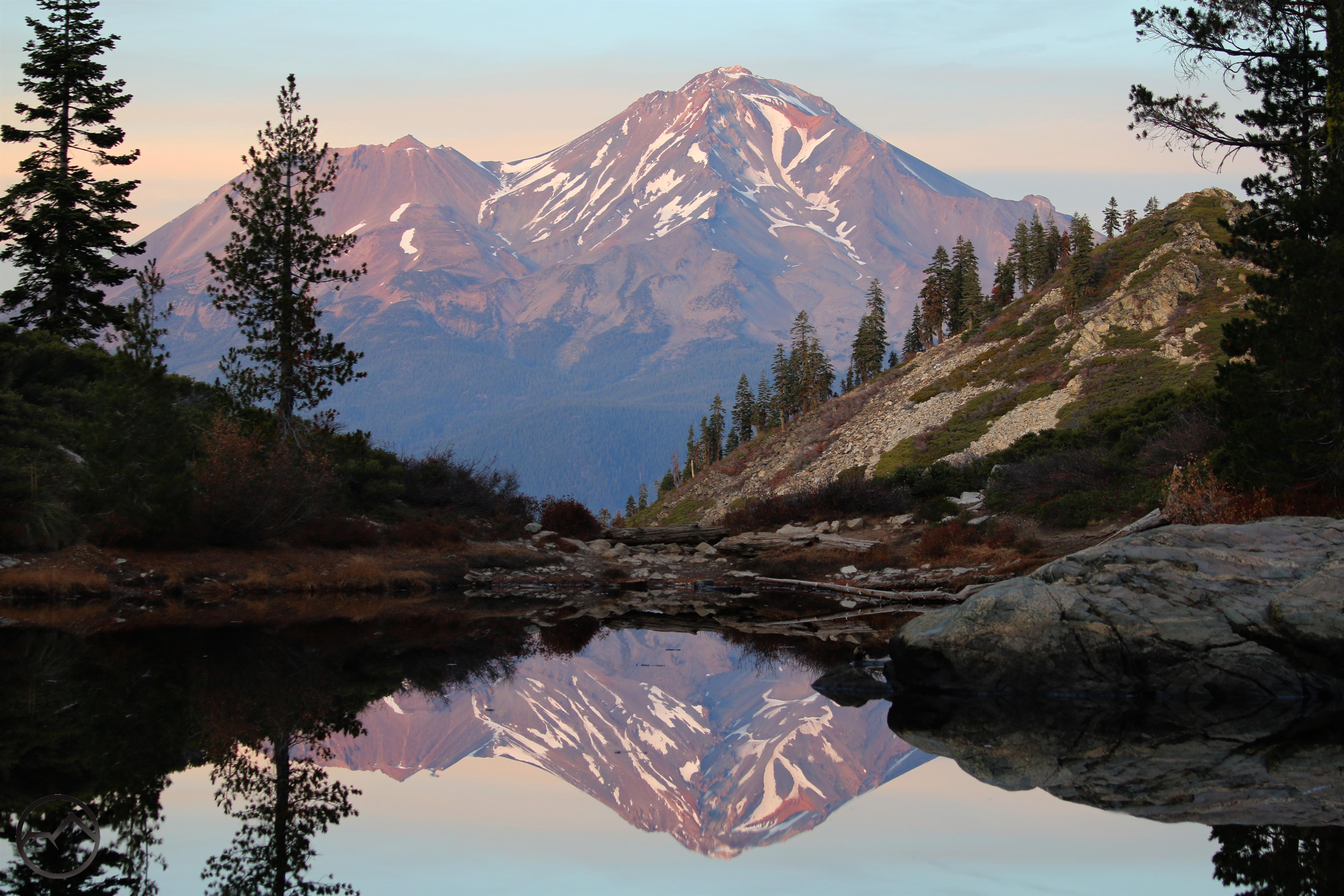
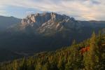
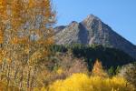
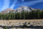
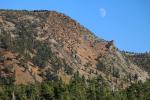
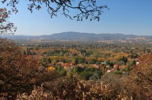
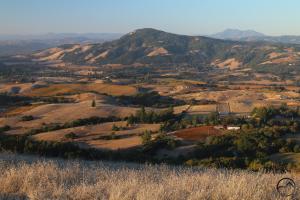
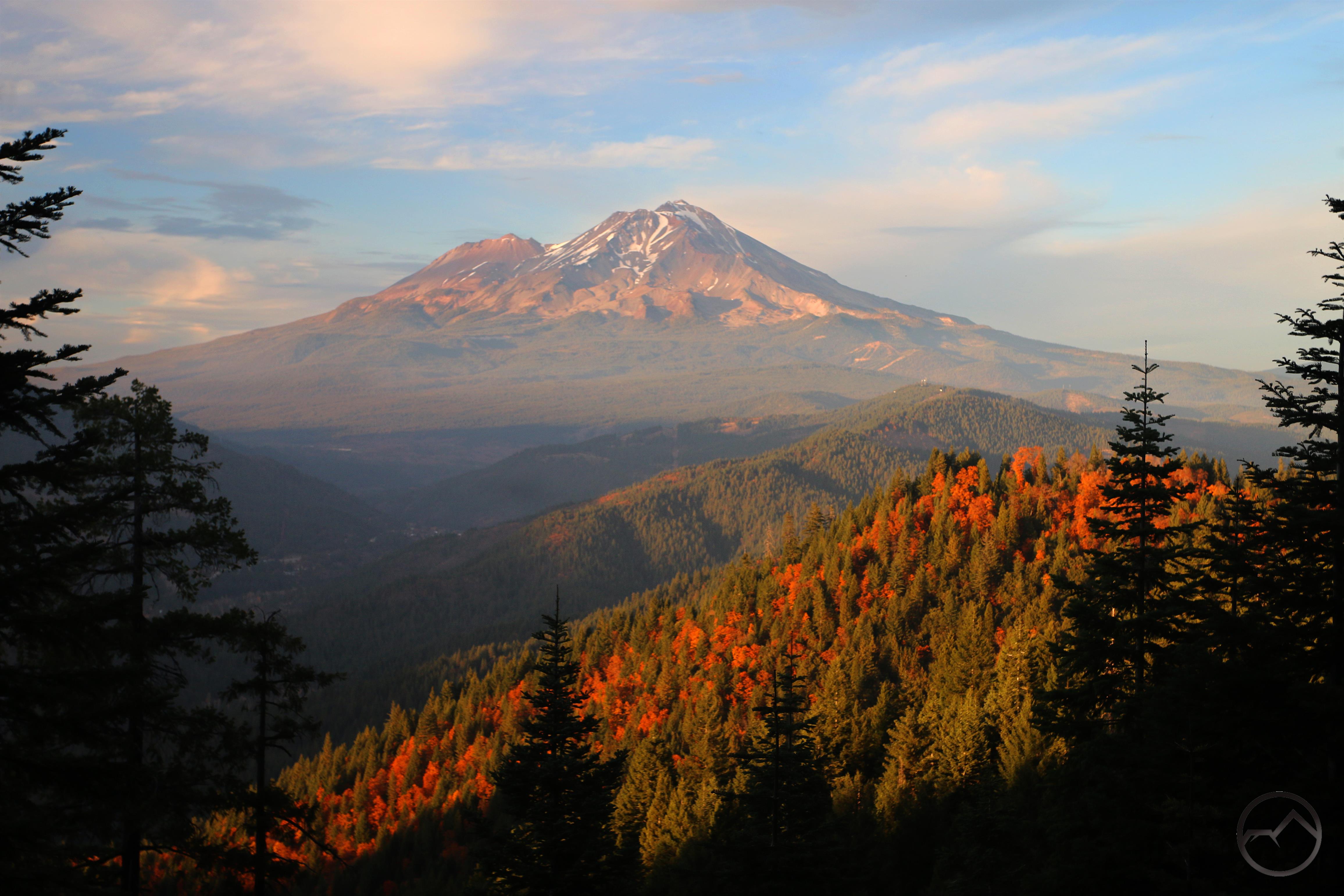
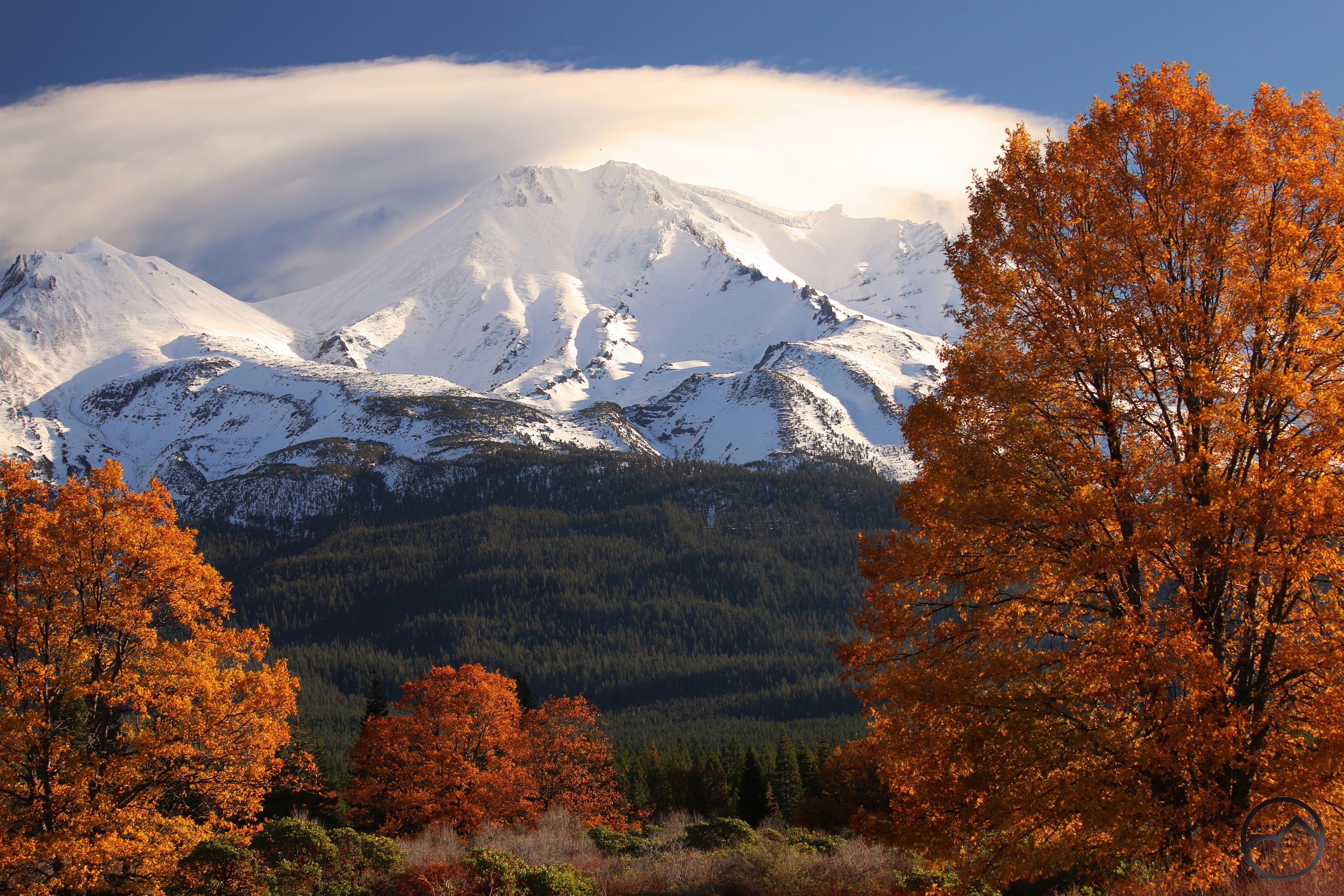
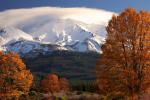
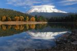
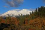
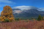
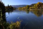
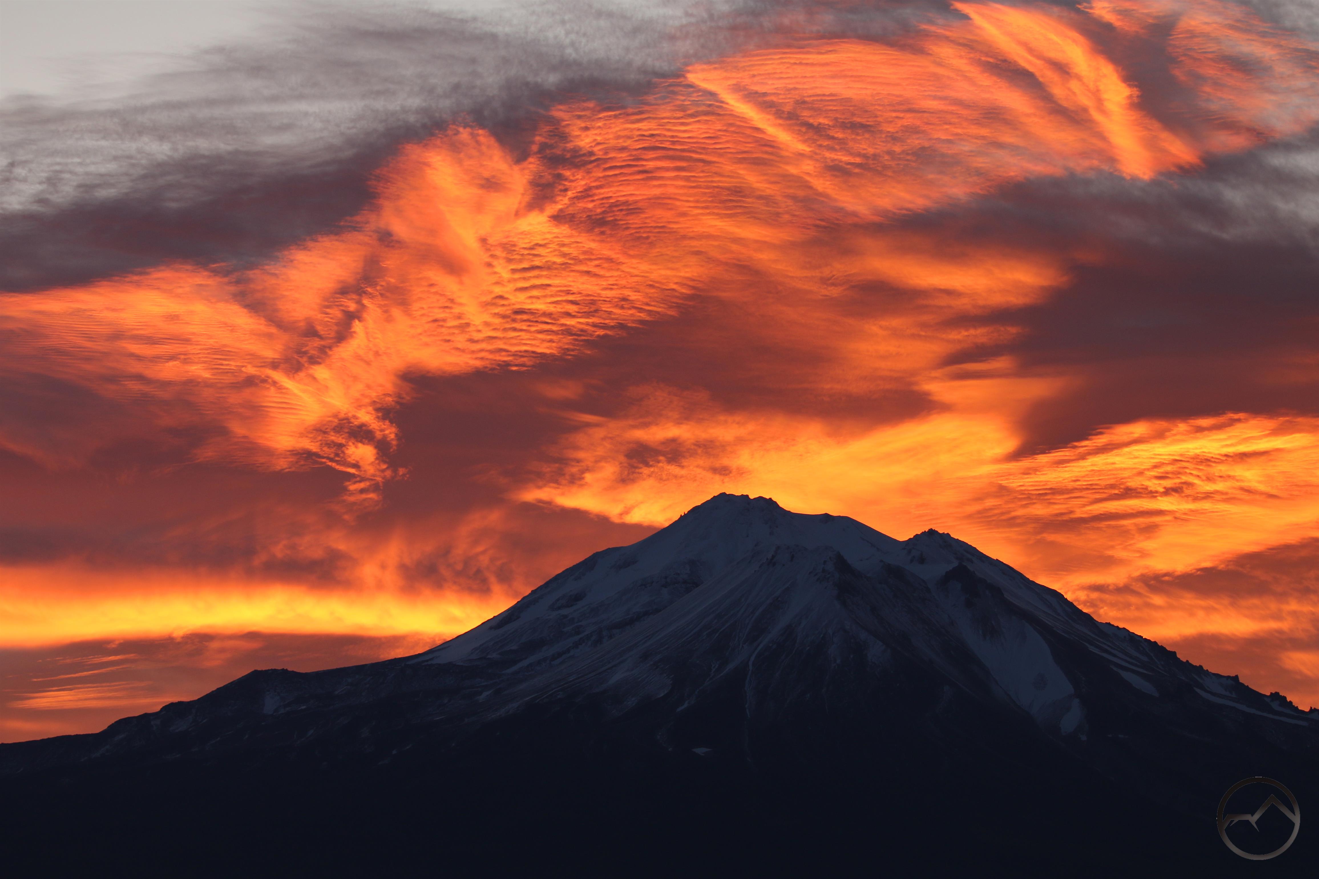
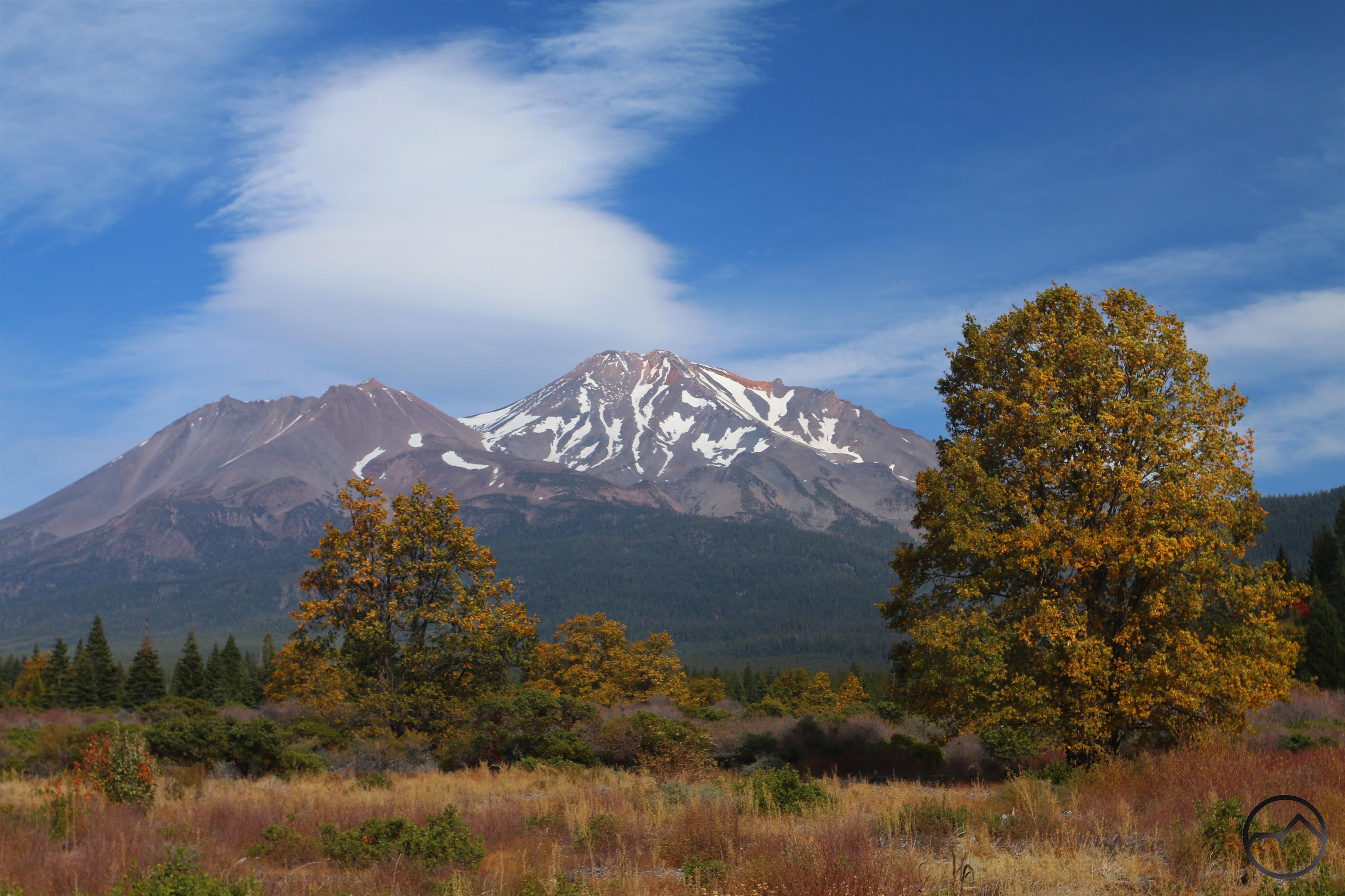
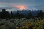
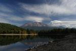
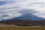
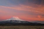
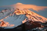
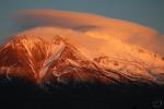
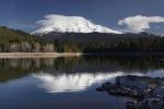
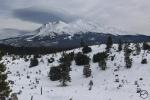
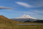
A spectacular autumn view of Mount Shasta. This was taken at a super secret spot!

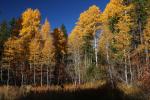
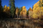
The past week was an almost indescribably beautiful week in Mount Shasta. The weather has been beautiful and the fall color has been at its apogee. If you can make it to Mount Shasta some time in the next week, with temperatures near 70 and the color nearly riotous, it will very nearly be paradise.

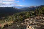
Words don’t really do the conditions justice so I will jump to images and add a few descriptions below.

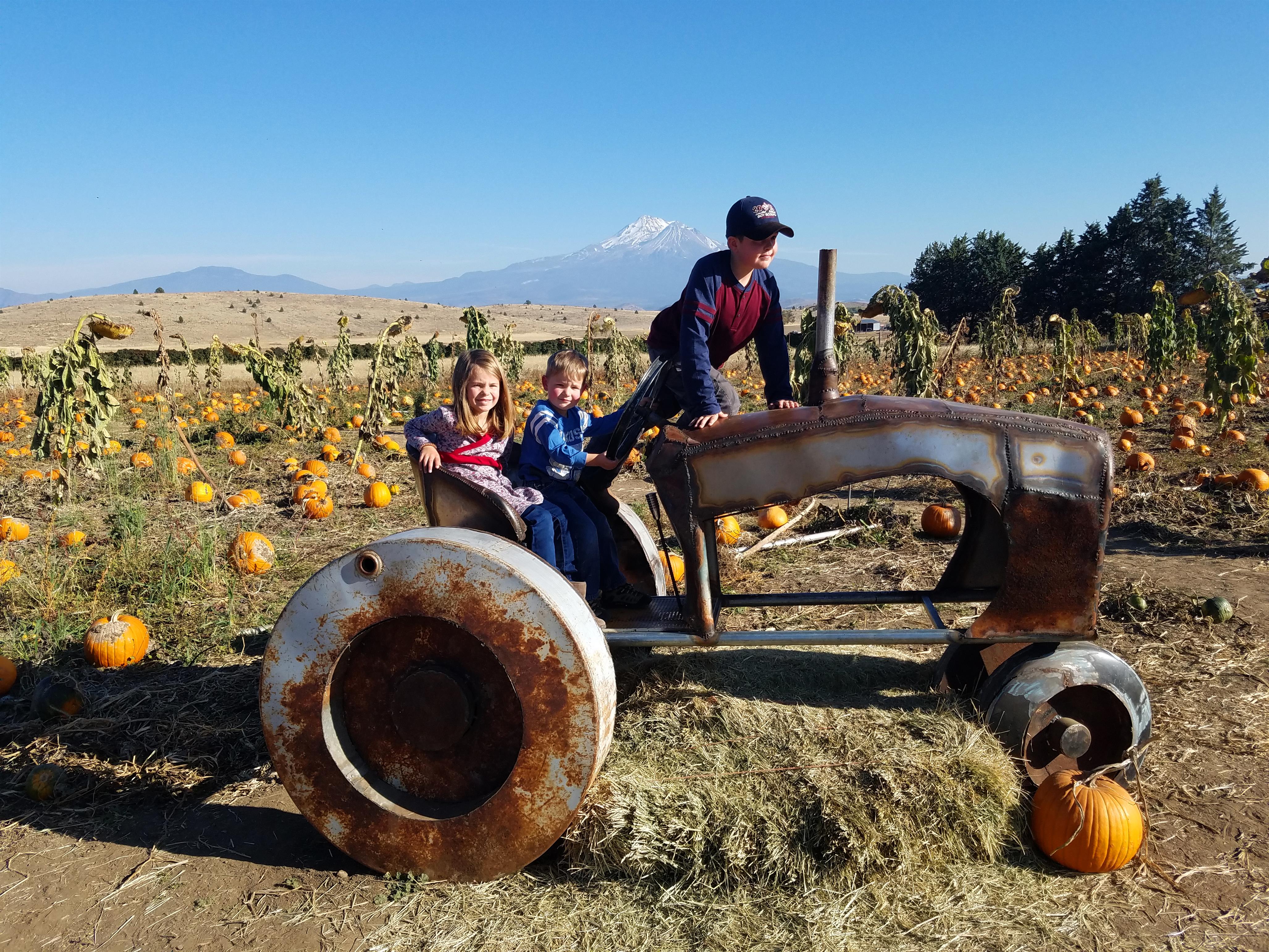
The week began with a trip to the pumpkin patch with my family. The kids naturally had a grand time and several pumpkins were acquired.

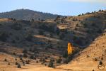
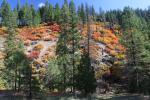
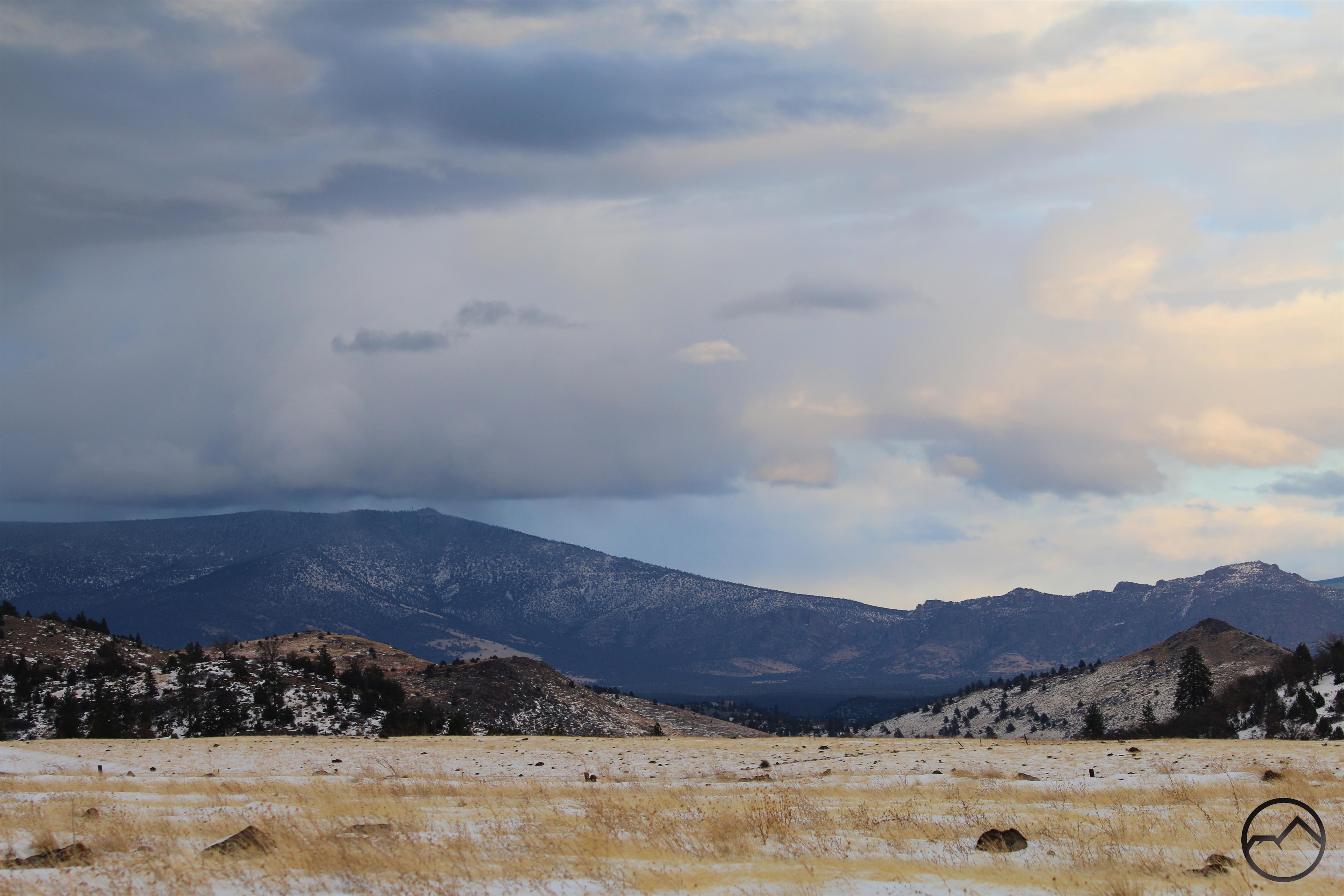
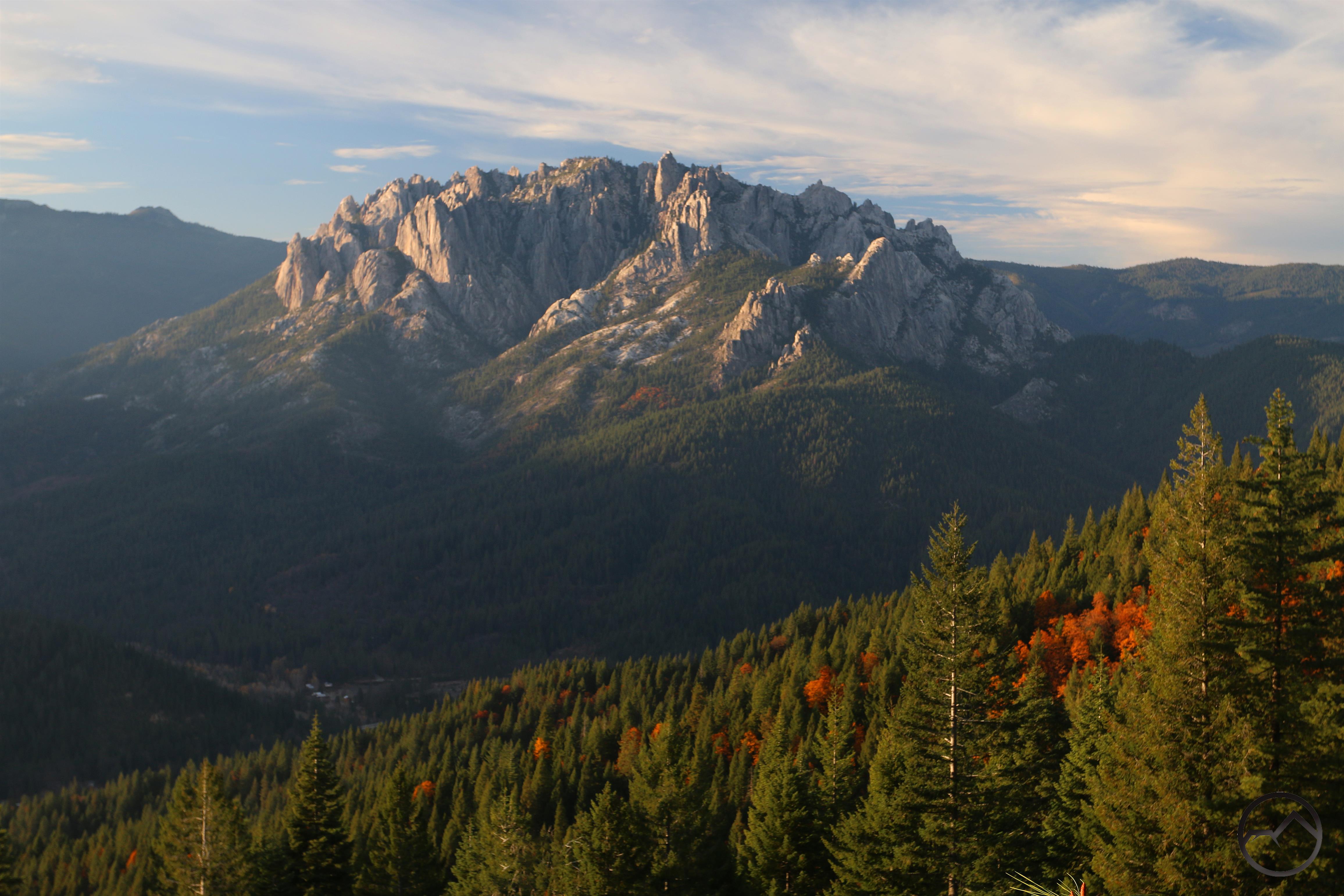
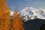
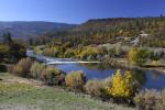
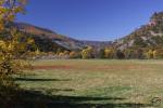
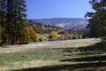
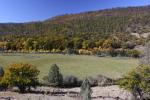
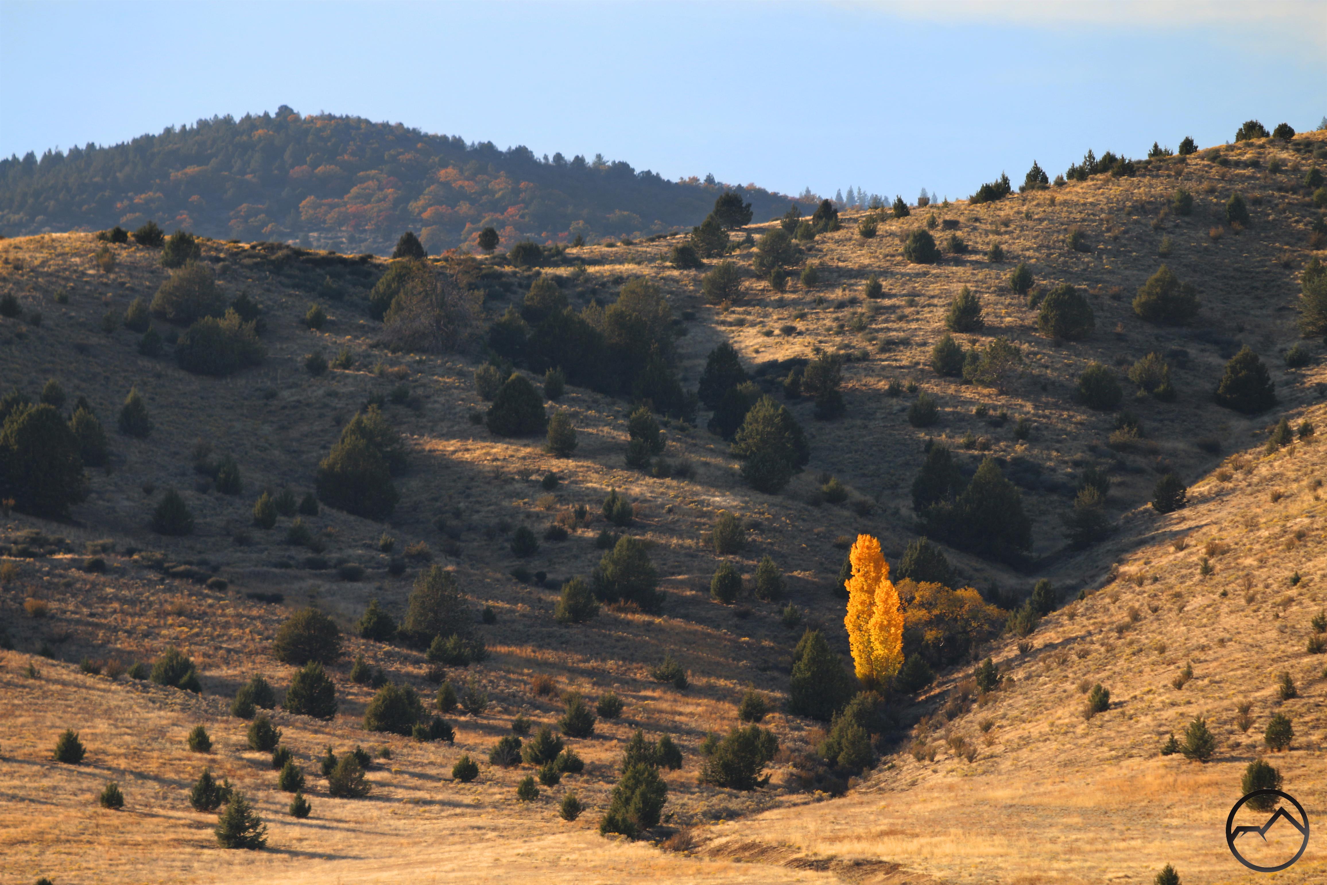
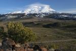
On the way home there were several instances of isolated trees flashing their showy color amidst the high desert juniper. The oaks in the hills above were starting to turn color as well.

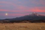
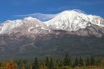
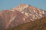
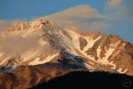
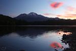
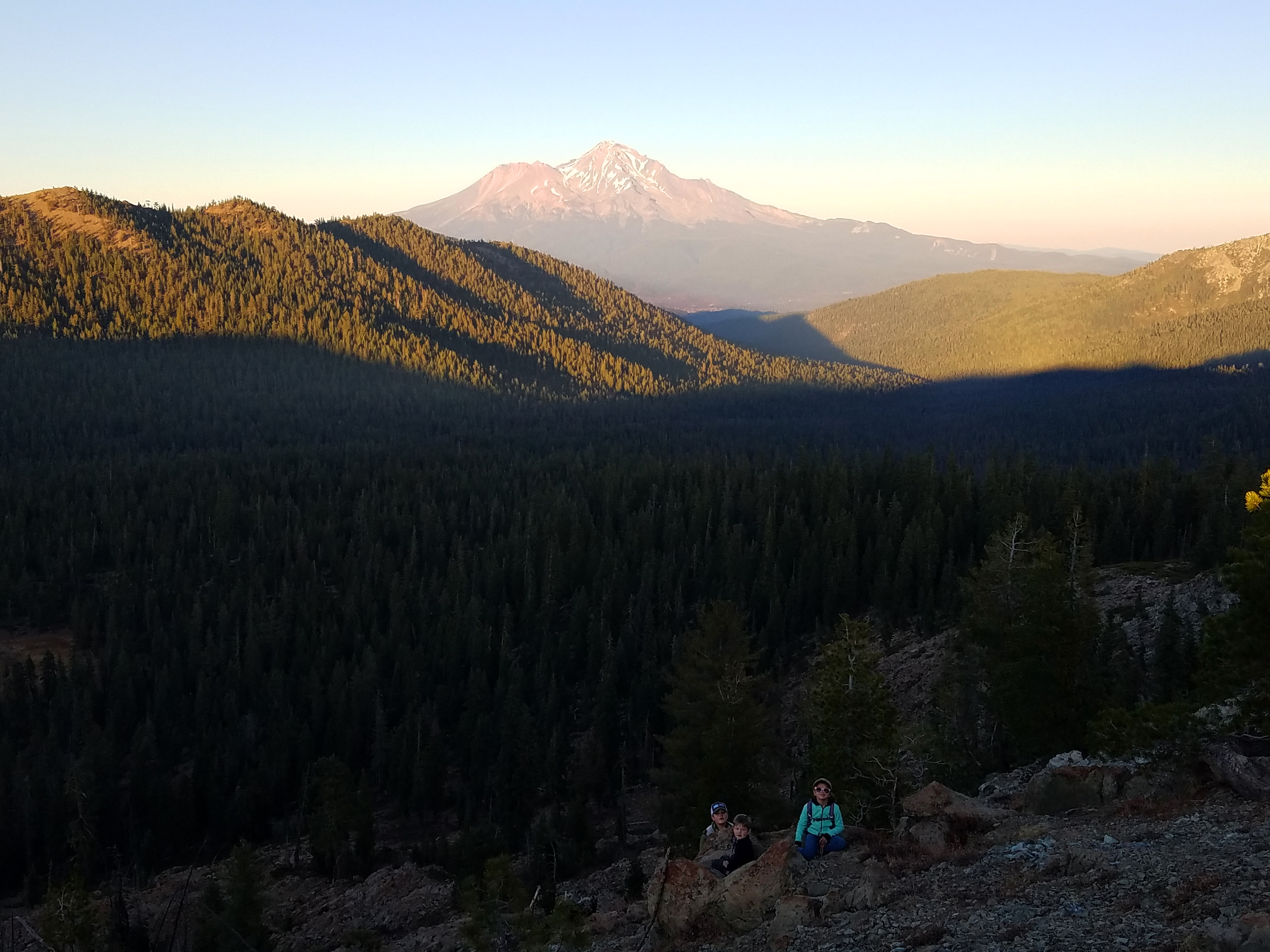
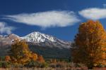
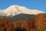
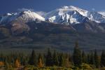
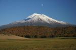
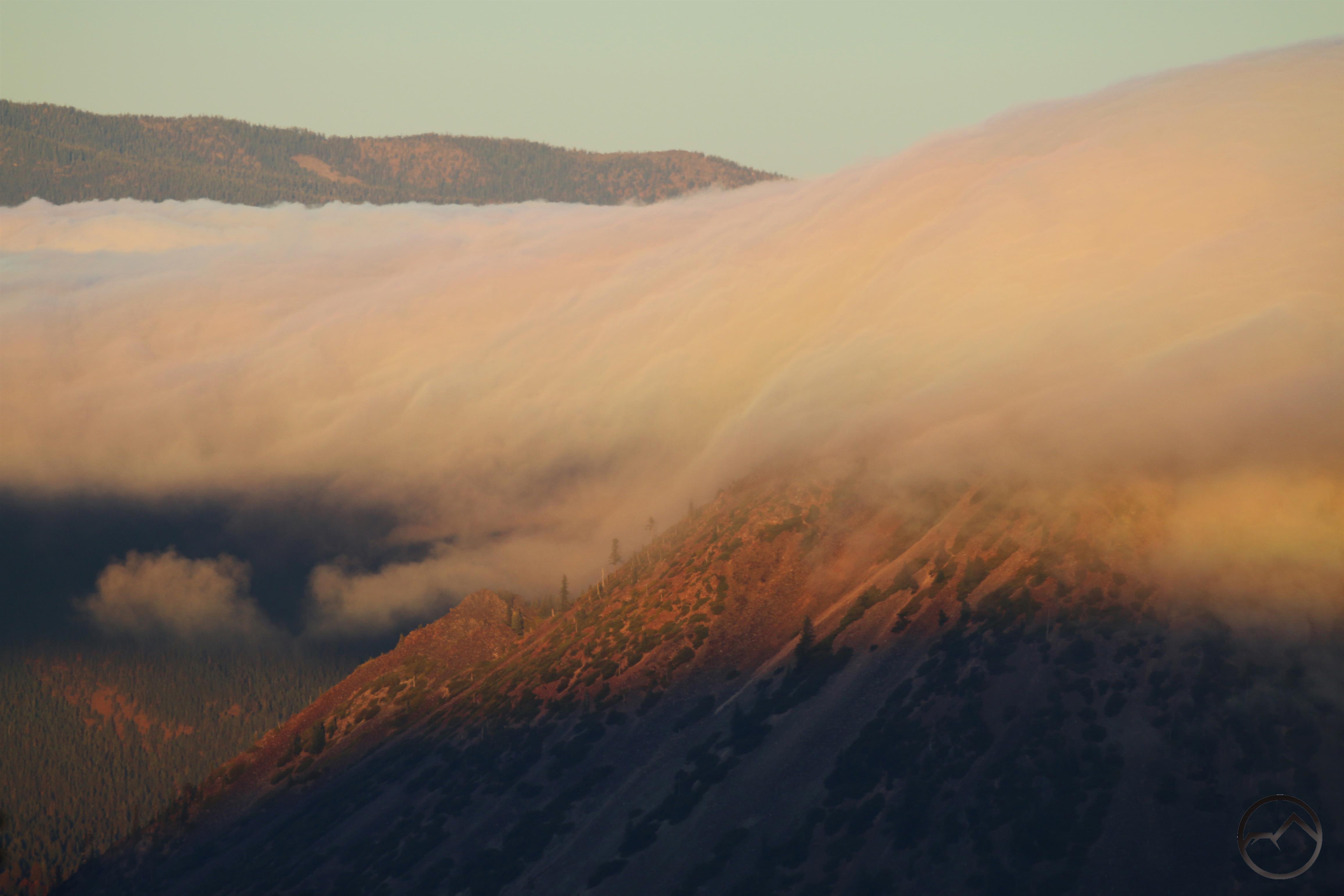
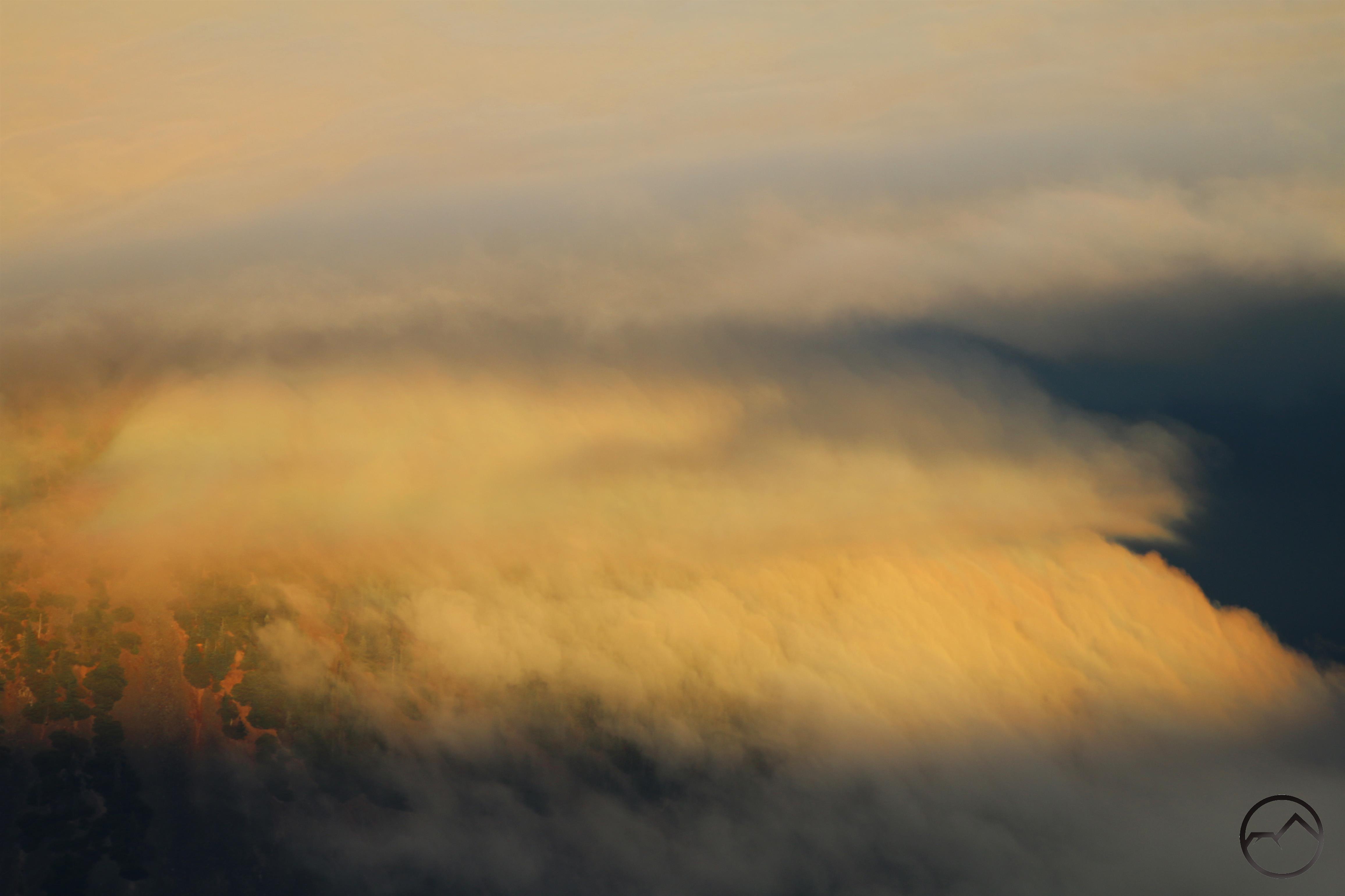
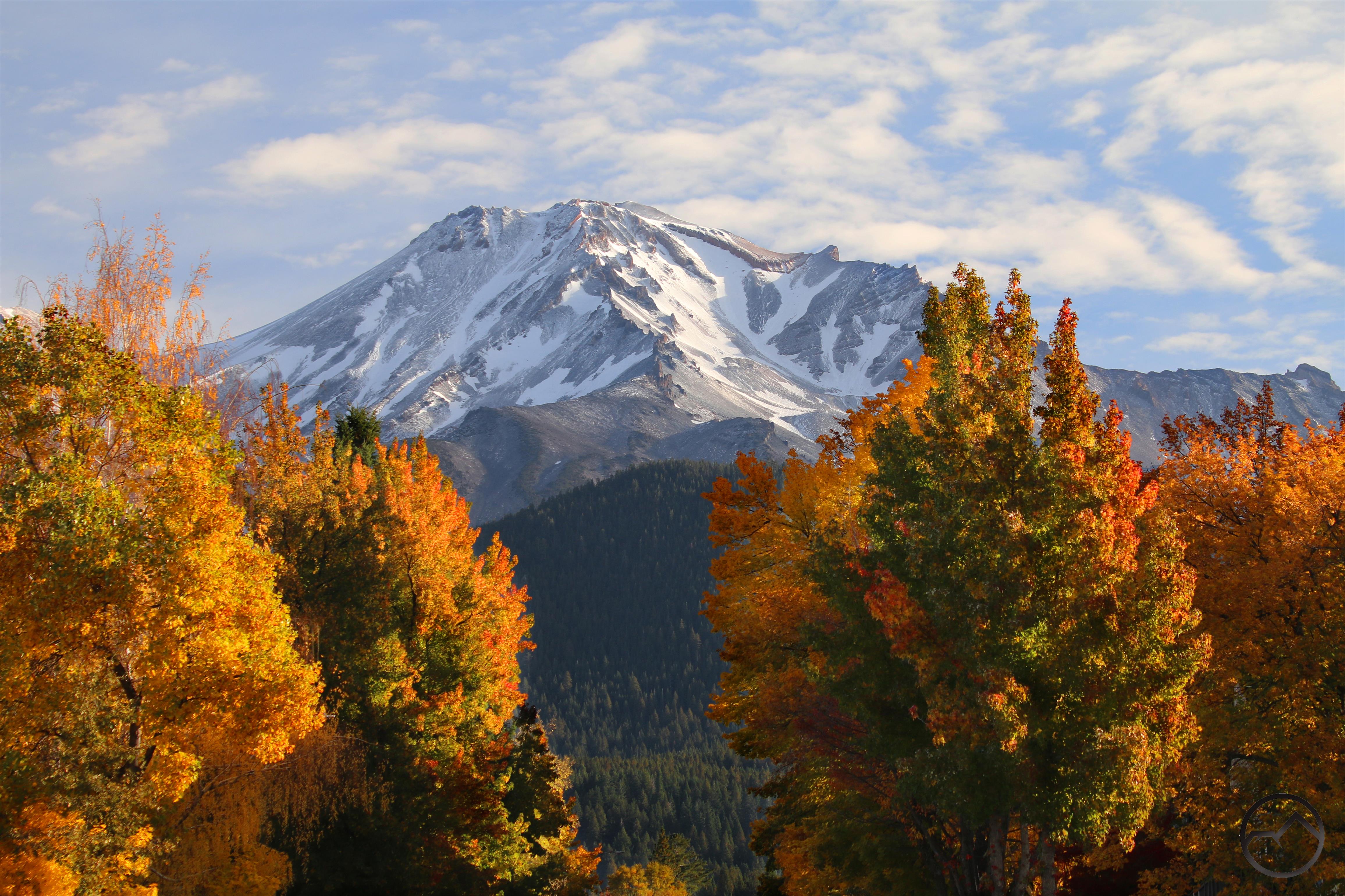
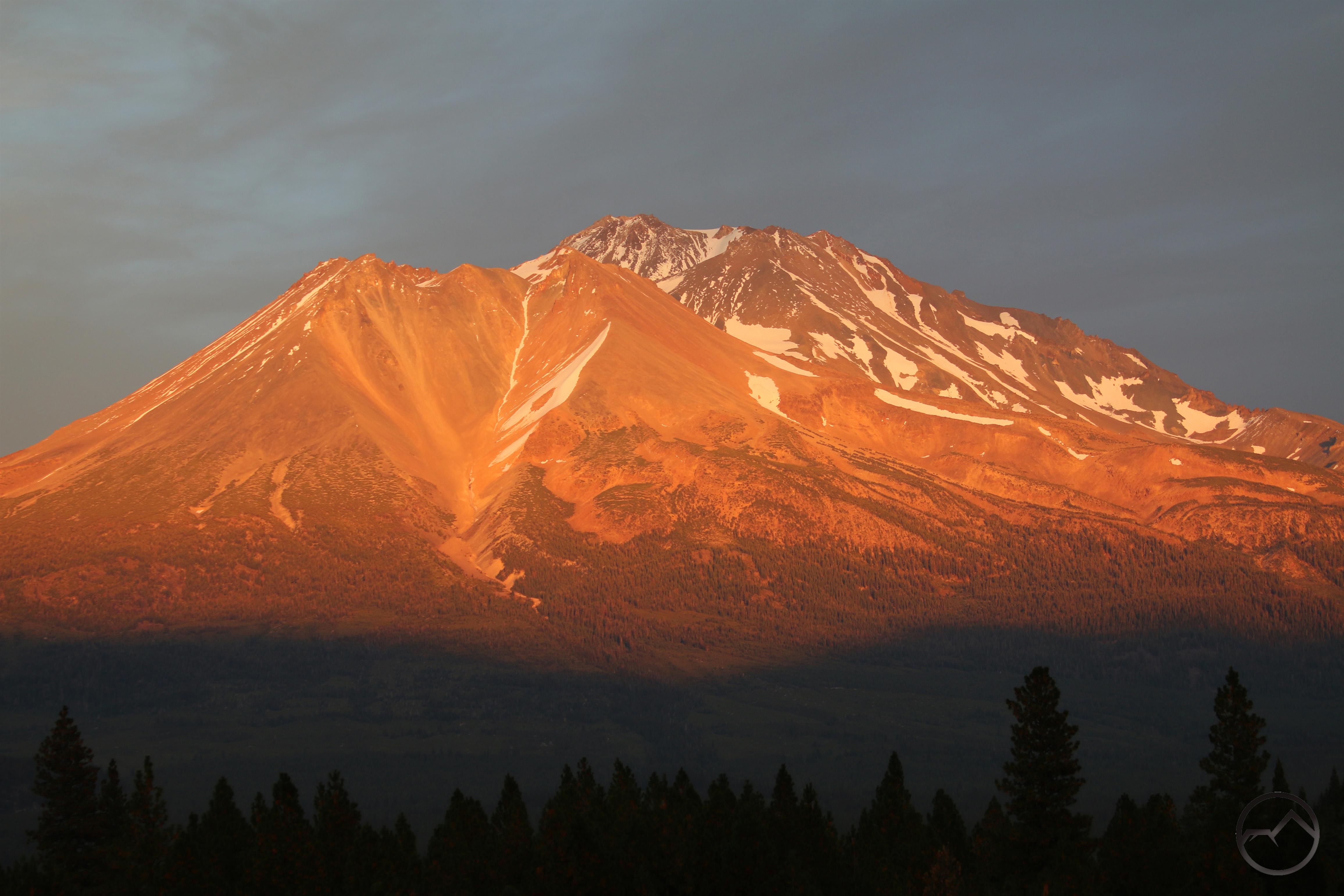
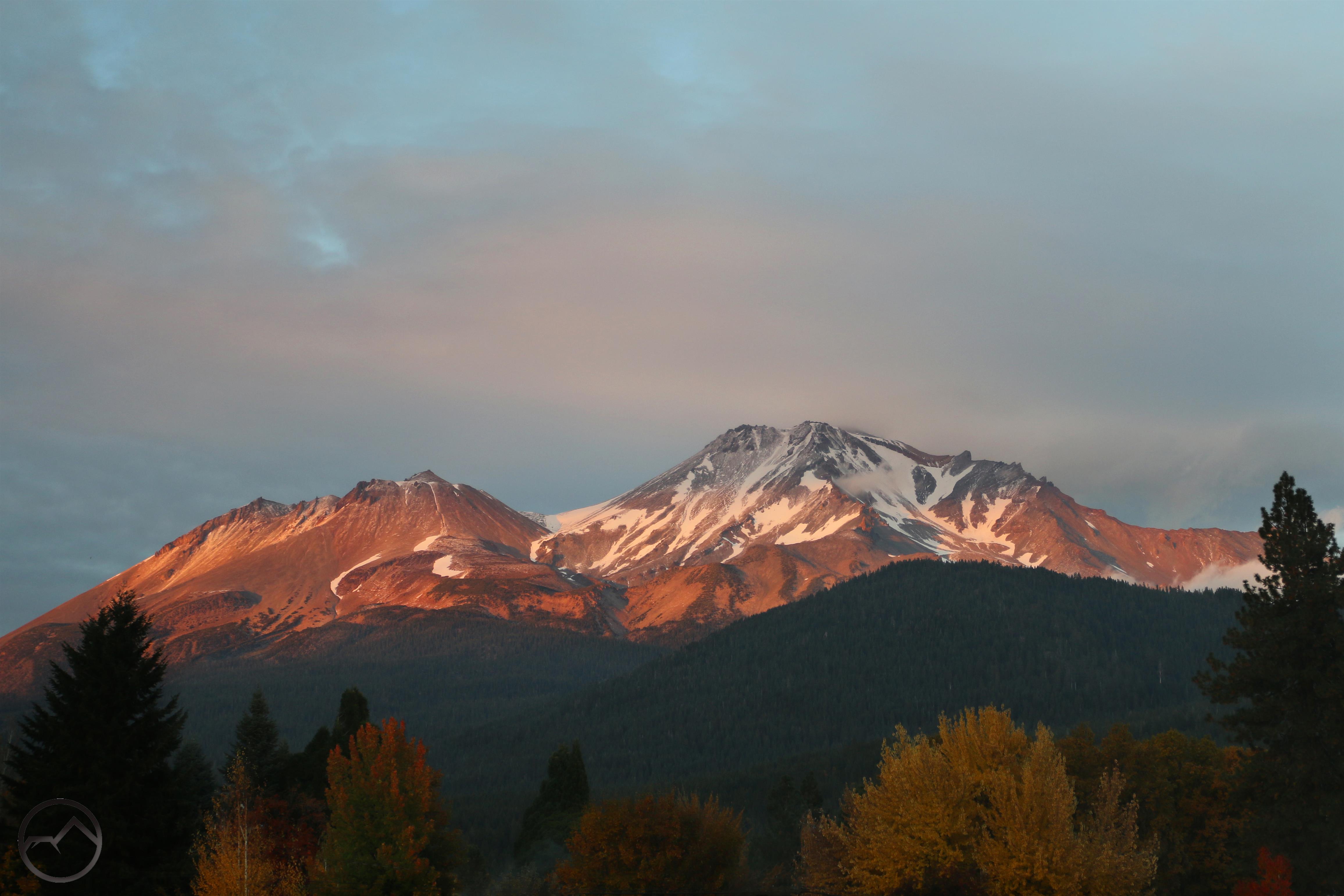
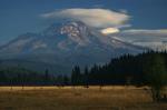
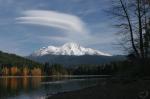
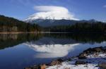
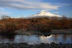
Sunsets were beautiful though Mount Shasta had lost most of the snow that had fallen on the mountain in the recent rains.

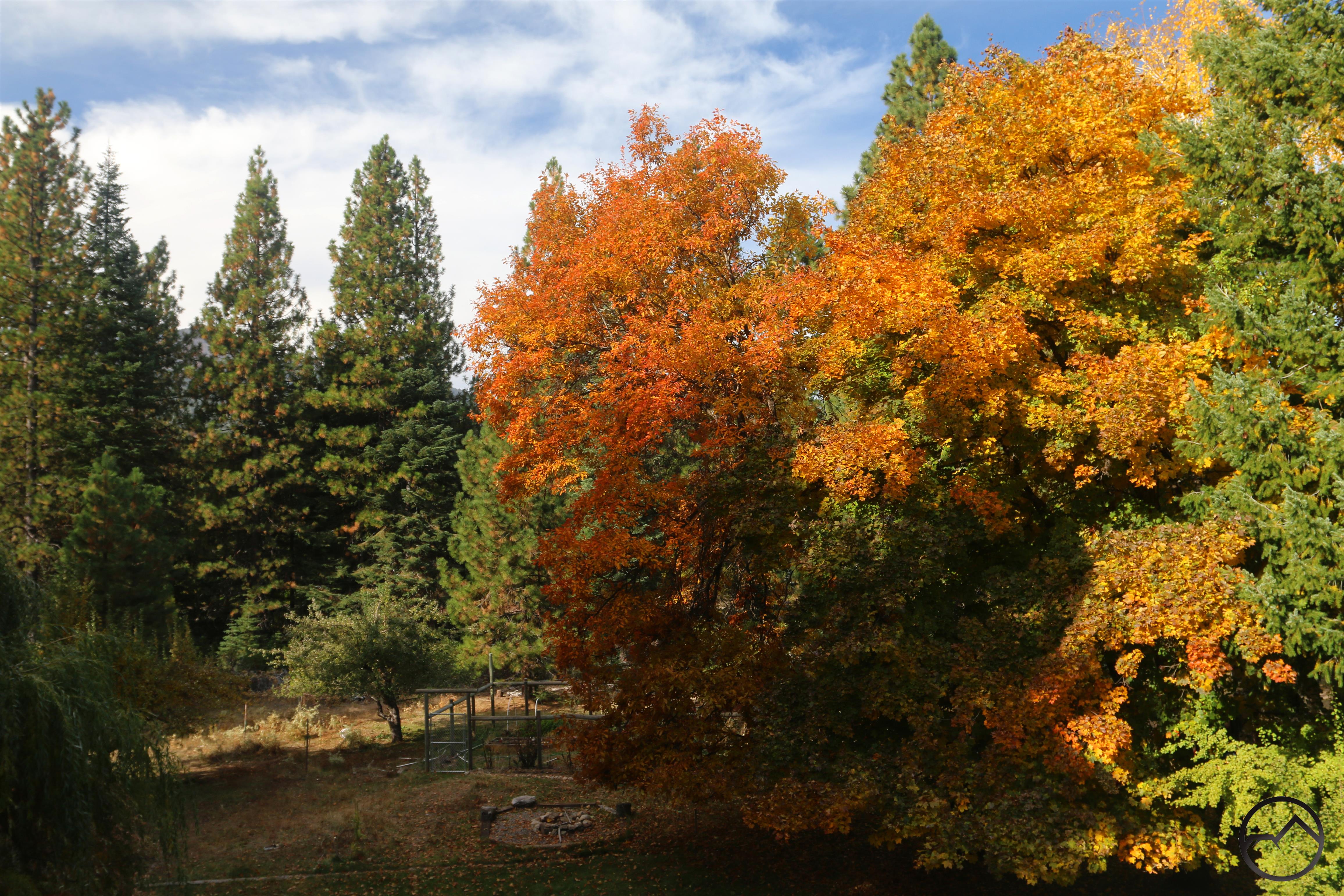
Cleaning out gutters at my house provided an elevated opportunity to appreciate the large oak and maple trees we have in our backyard. Raking leaves is a hassle but while they are still on the trees this time of year is sublime.

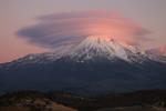
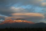
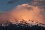
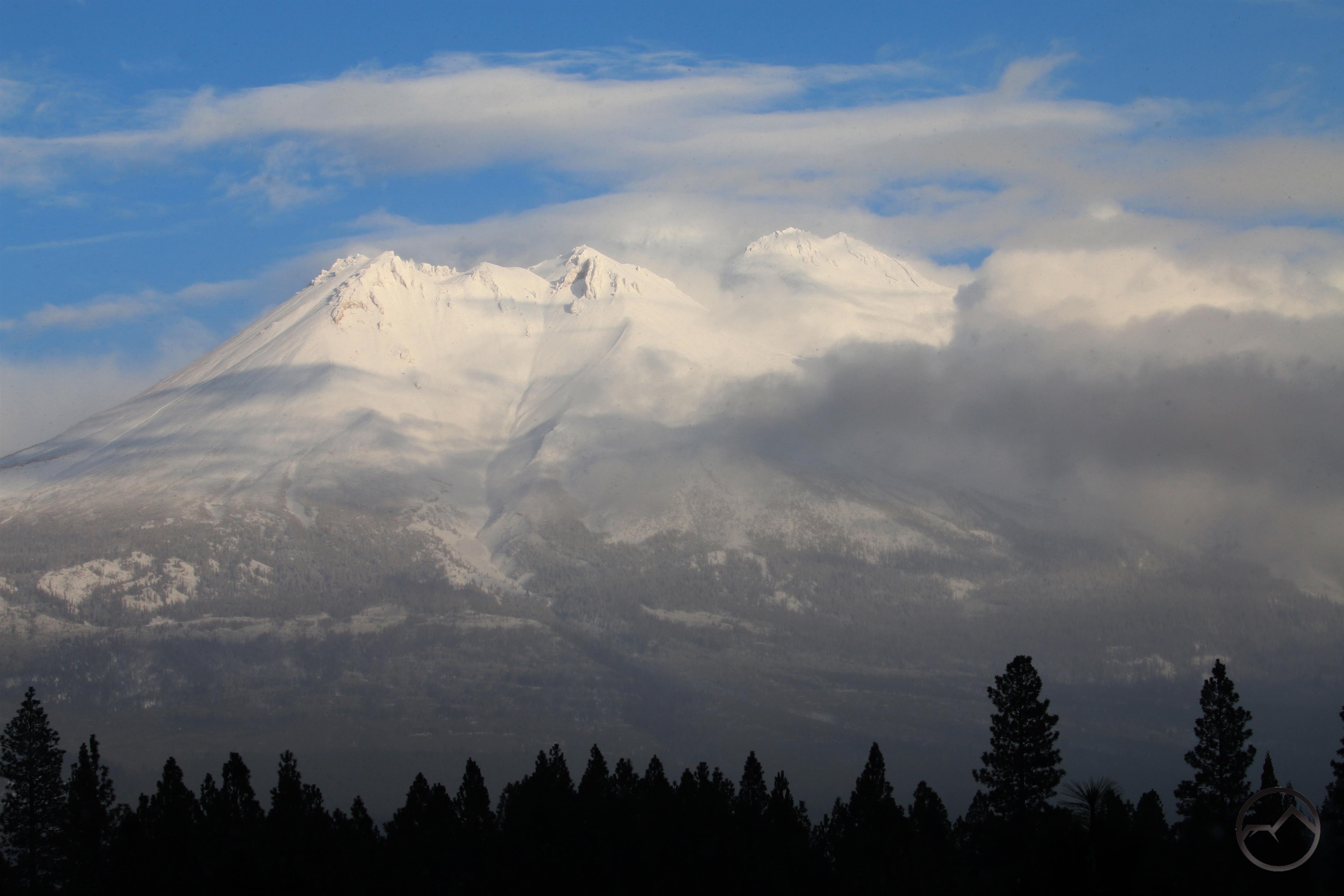
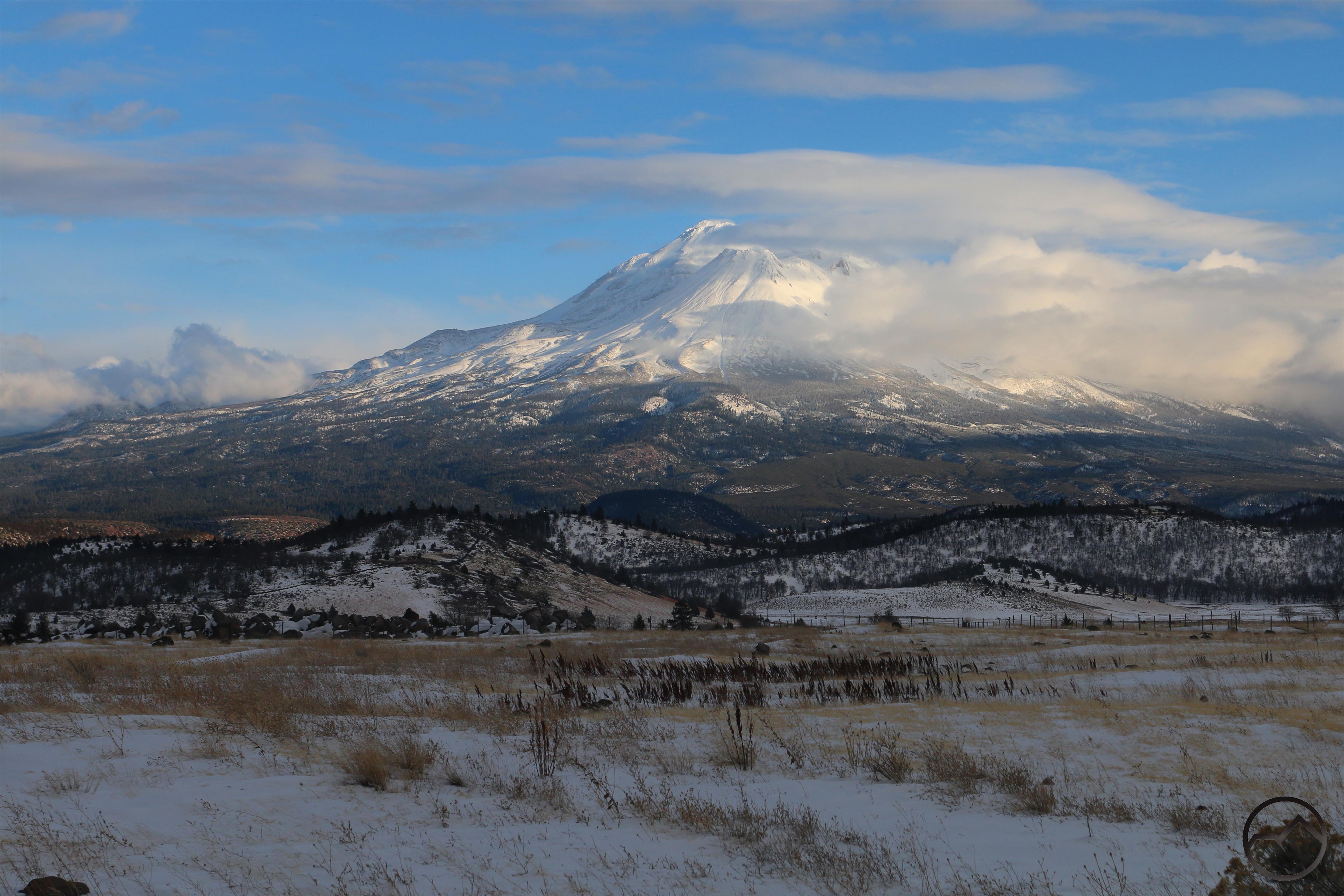
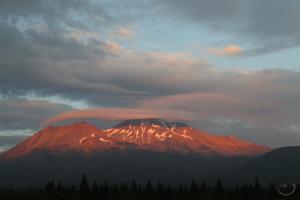
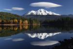
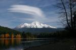
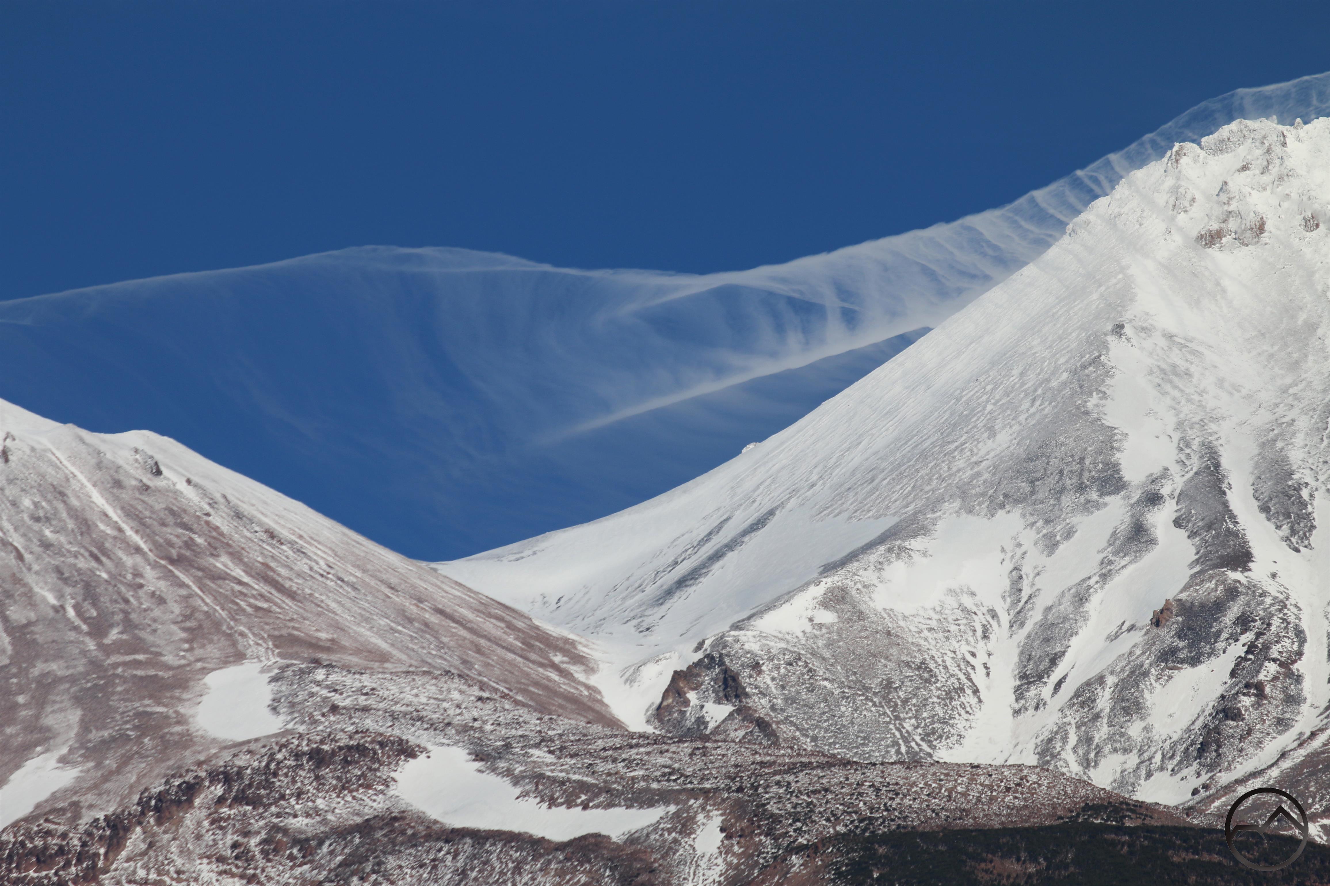
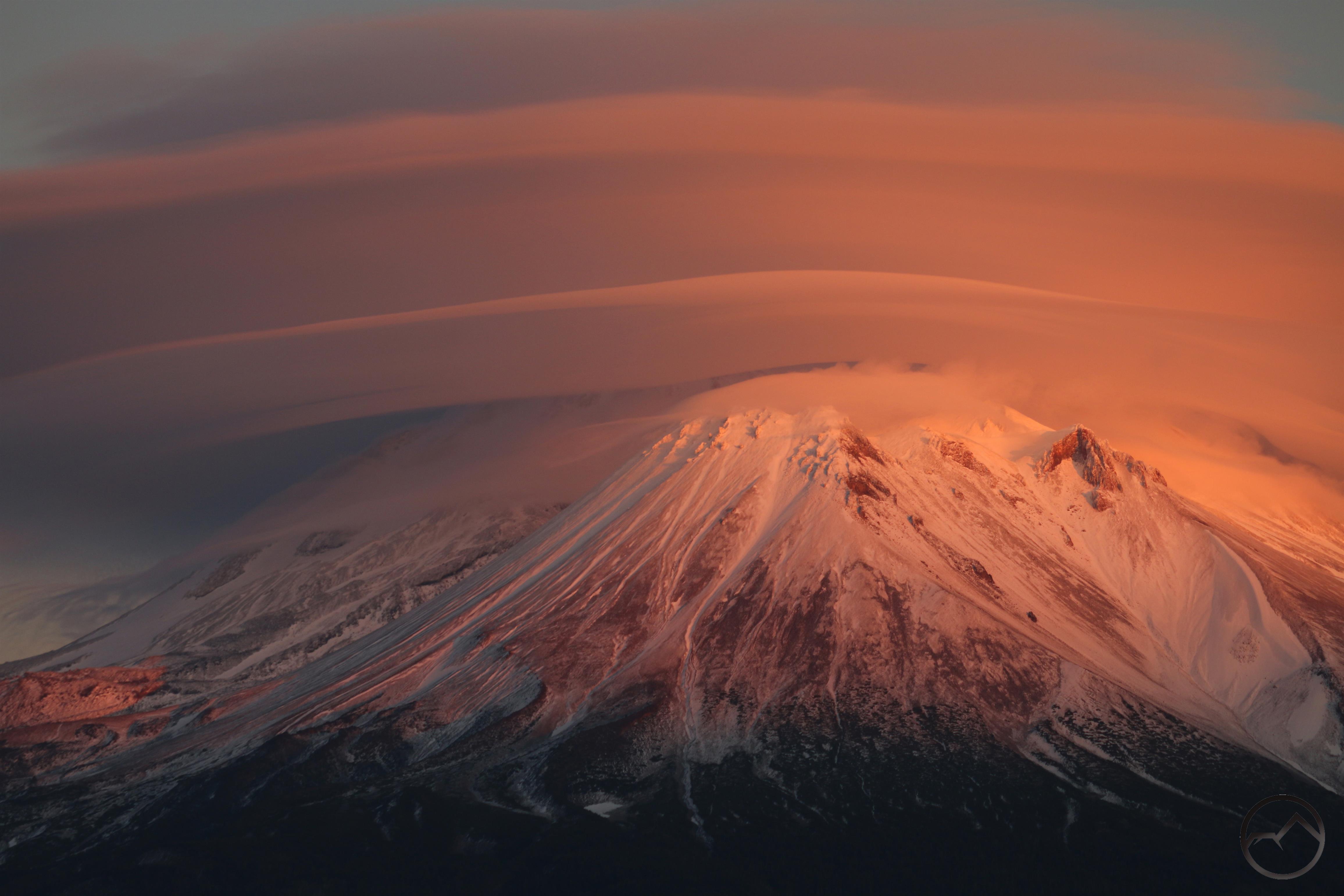
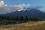
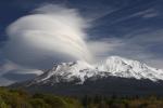
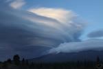
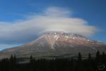
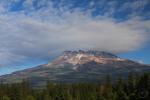
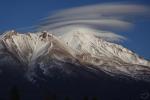
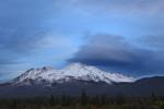
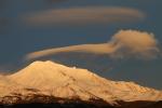
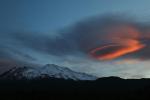
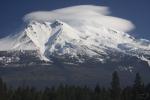
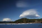
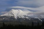
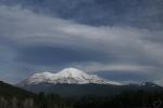
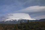
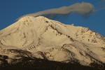
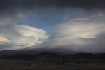
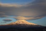
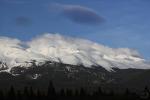
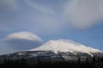
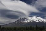
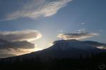
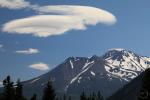
By Wednesday a lenticular was trying to form on Mount Shasta. The cloud certainly added interest but it could never quite pull itself together into a well-defined set of discs. It did, however, presage some rain that came during the night.

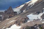
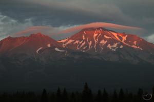
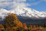
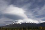
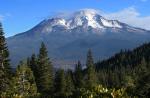
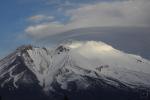
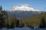
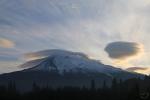
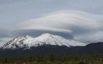
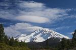
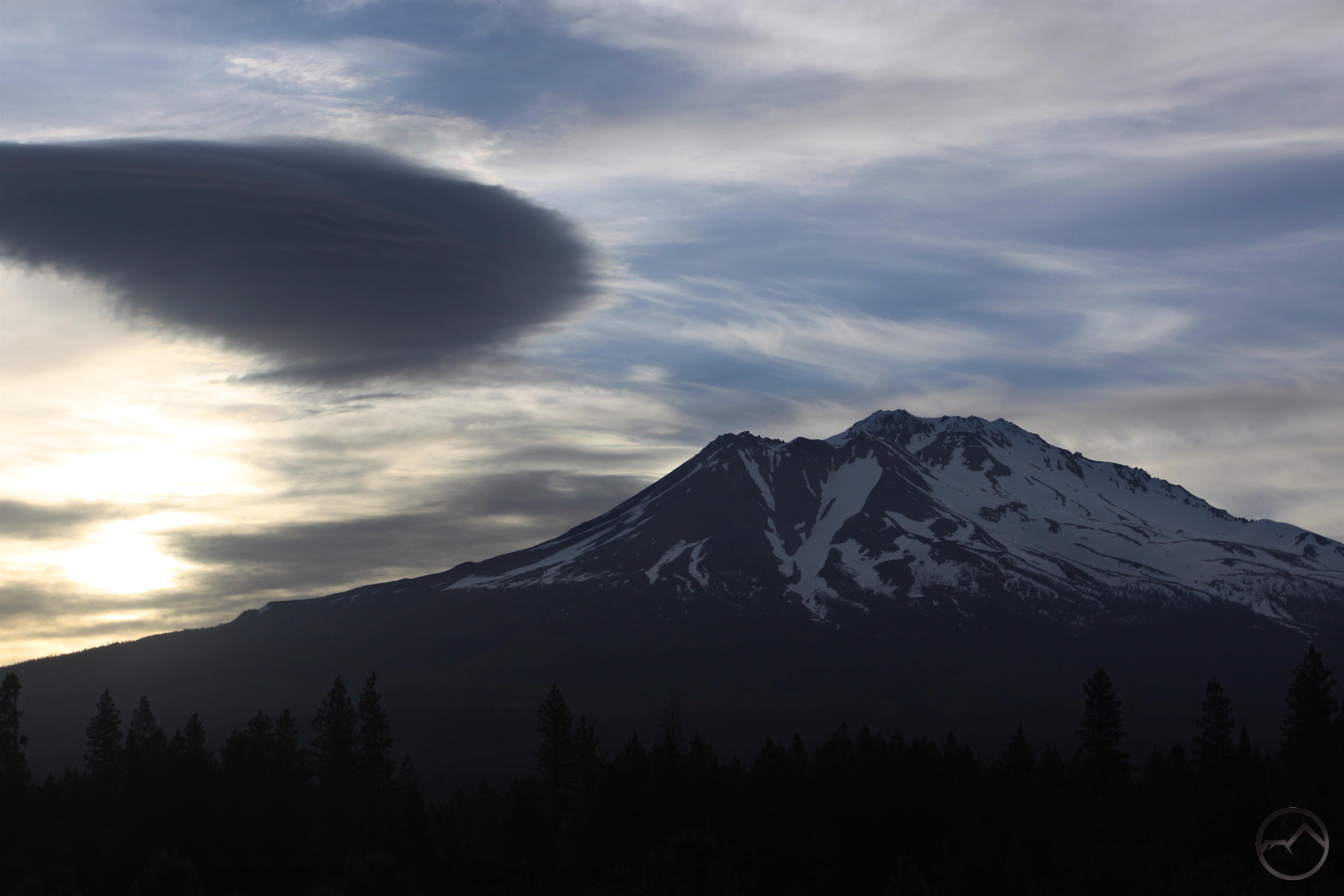
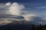
The next day Mount Shasta had a little bit more snow on it and the lenticulars were still trying to form on the mountain. Once again, things never really became fully formed and the sky eventually became filled with clouds, edging out the lenticulars altogether.

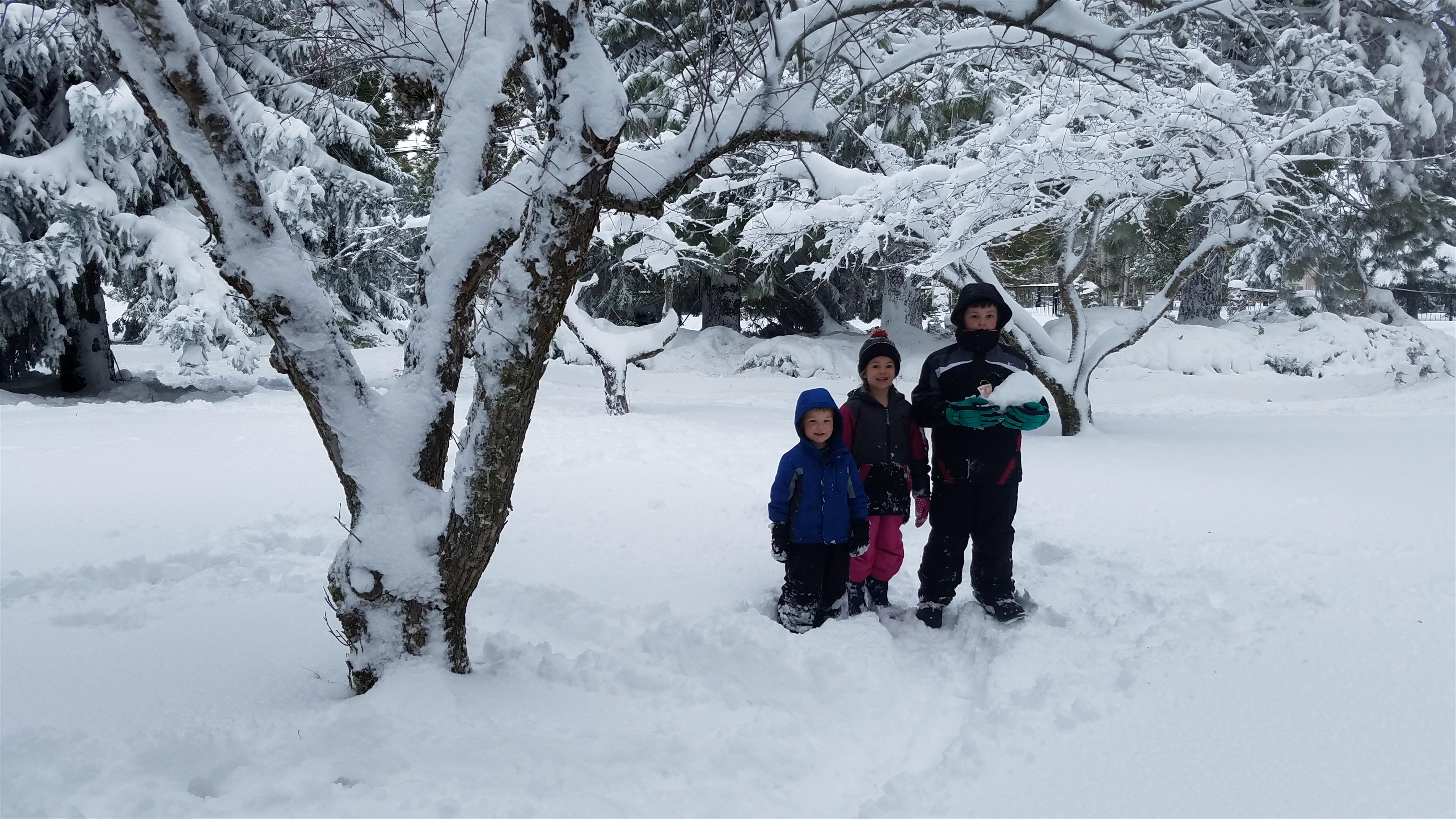
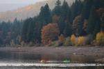
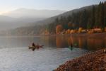
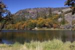
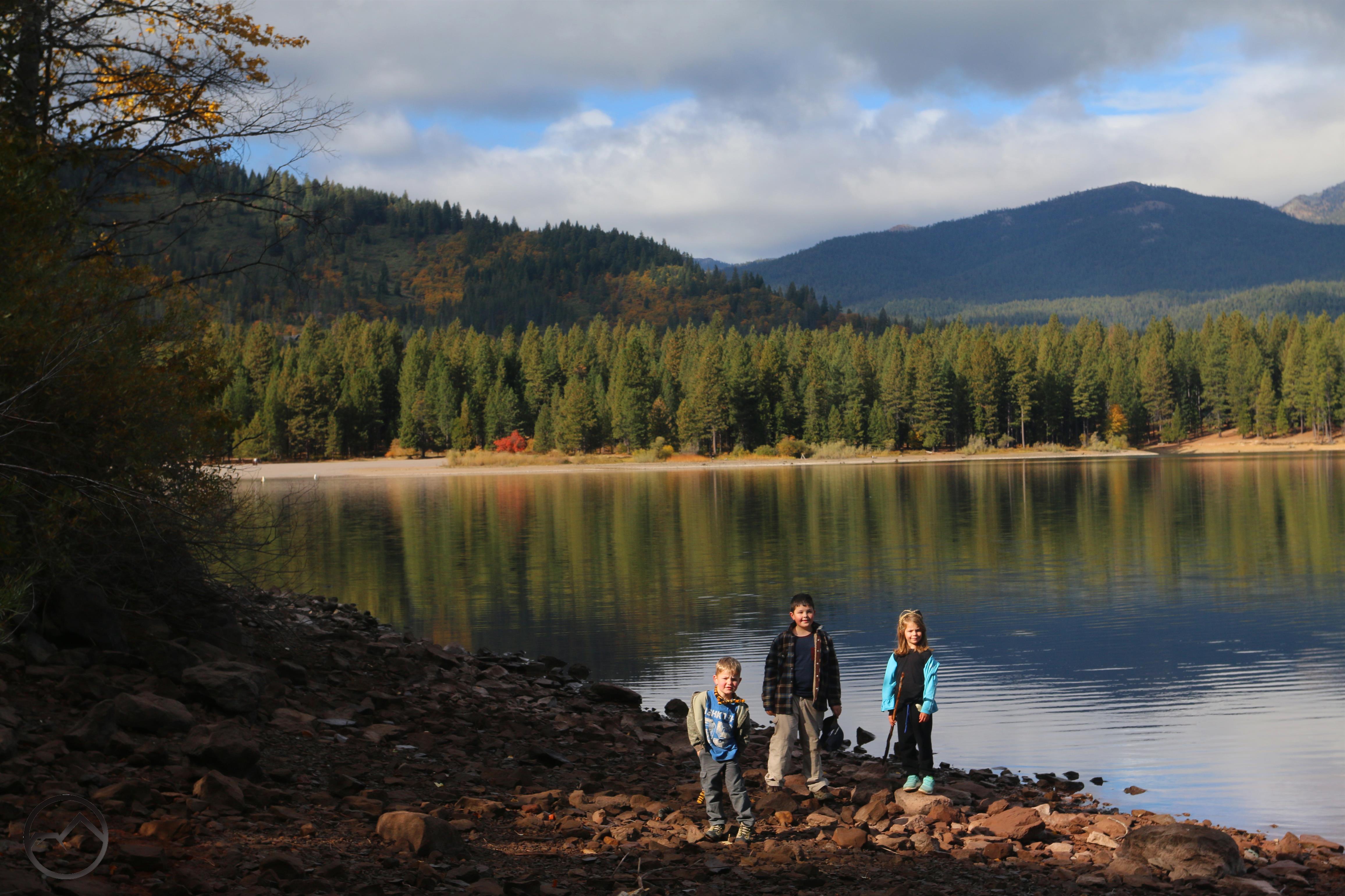
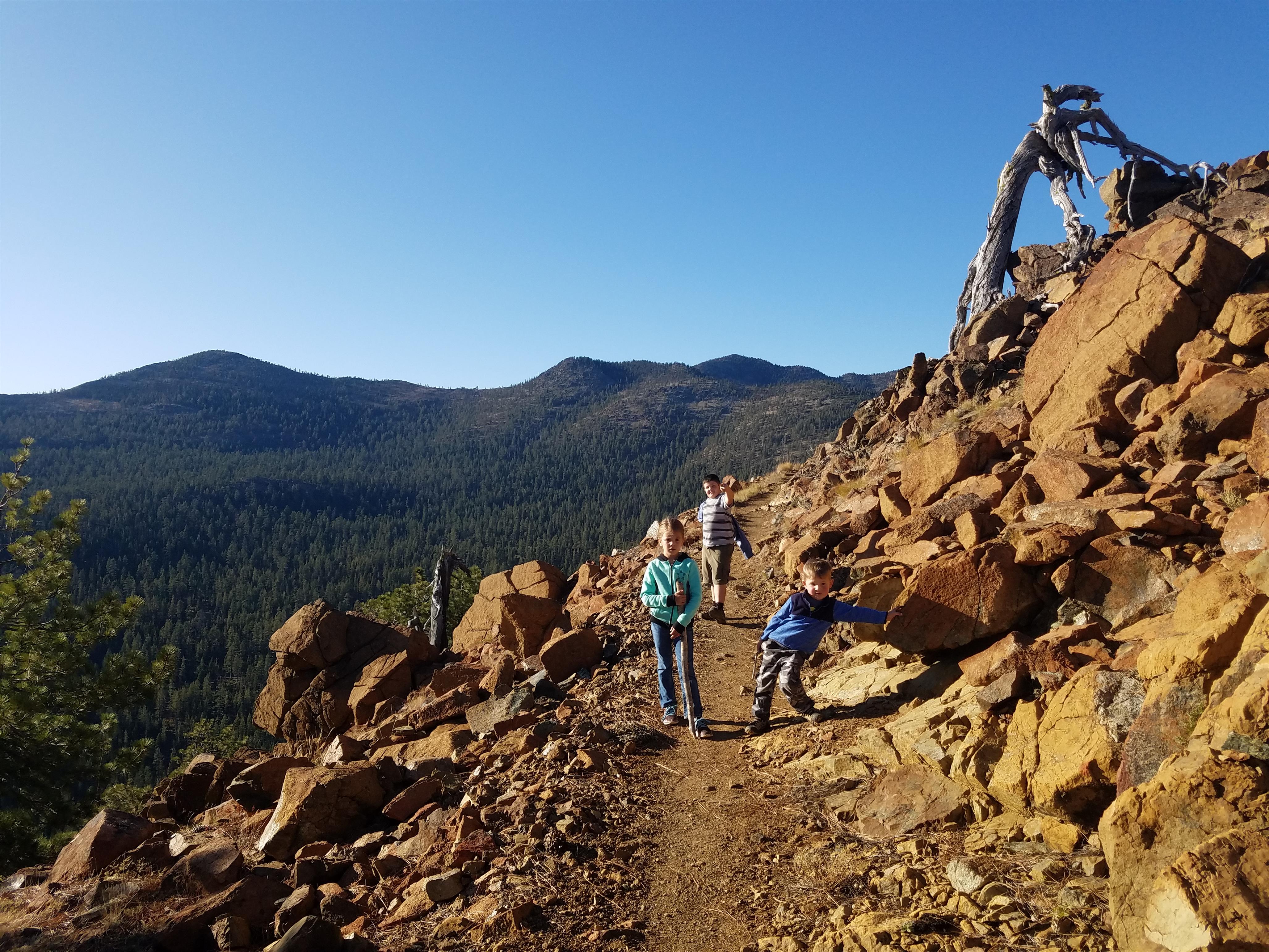
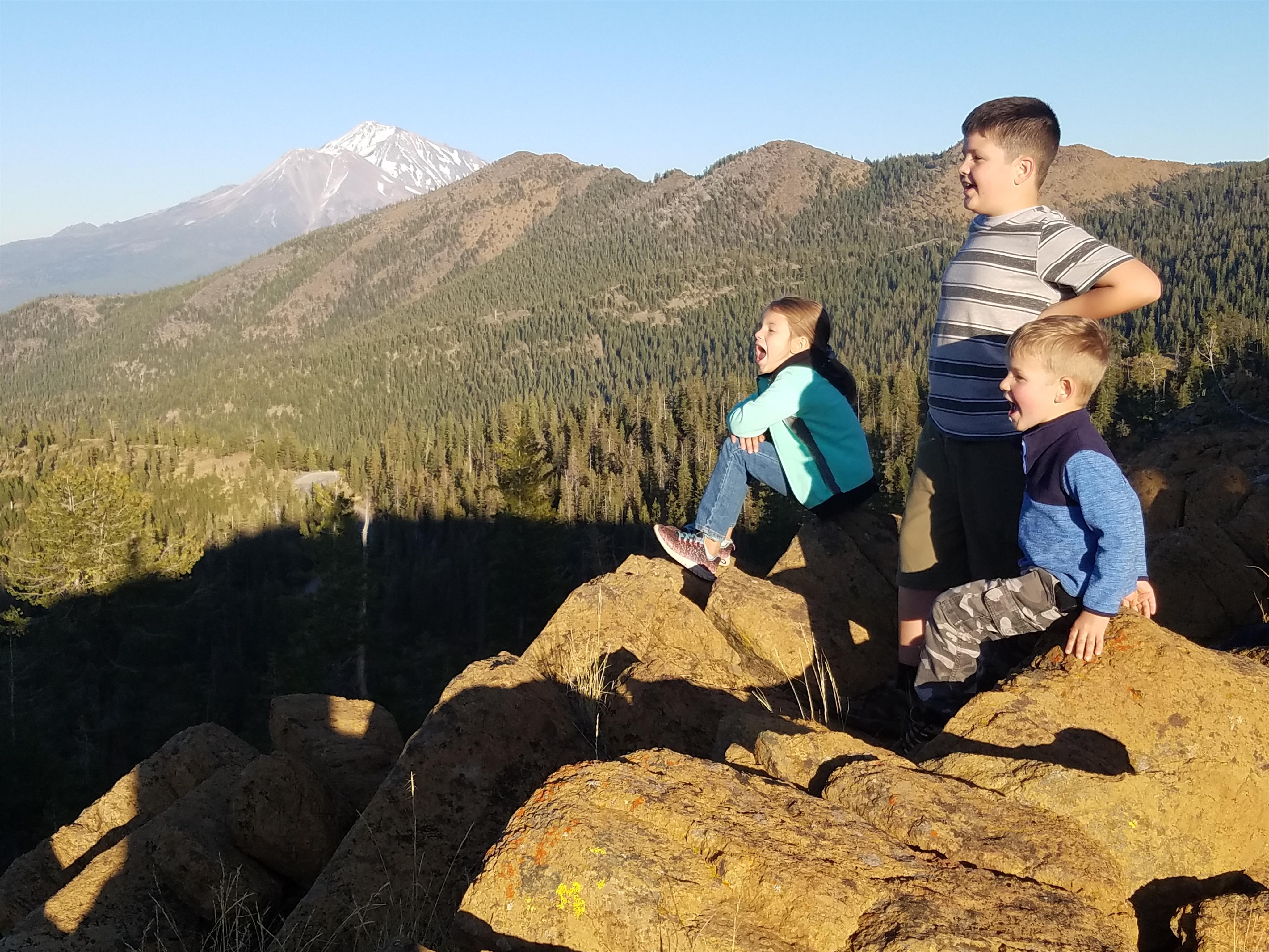
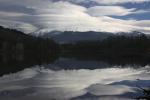
As frustrated as I was, my kids were quite happy to be at the lake, where they set up a minting operation, making clay balls and then pressing pressing them into “coins”. It was quite amusing.

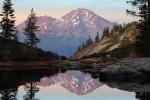
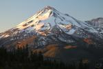
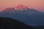
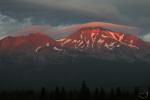
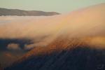
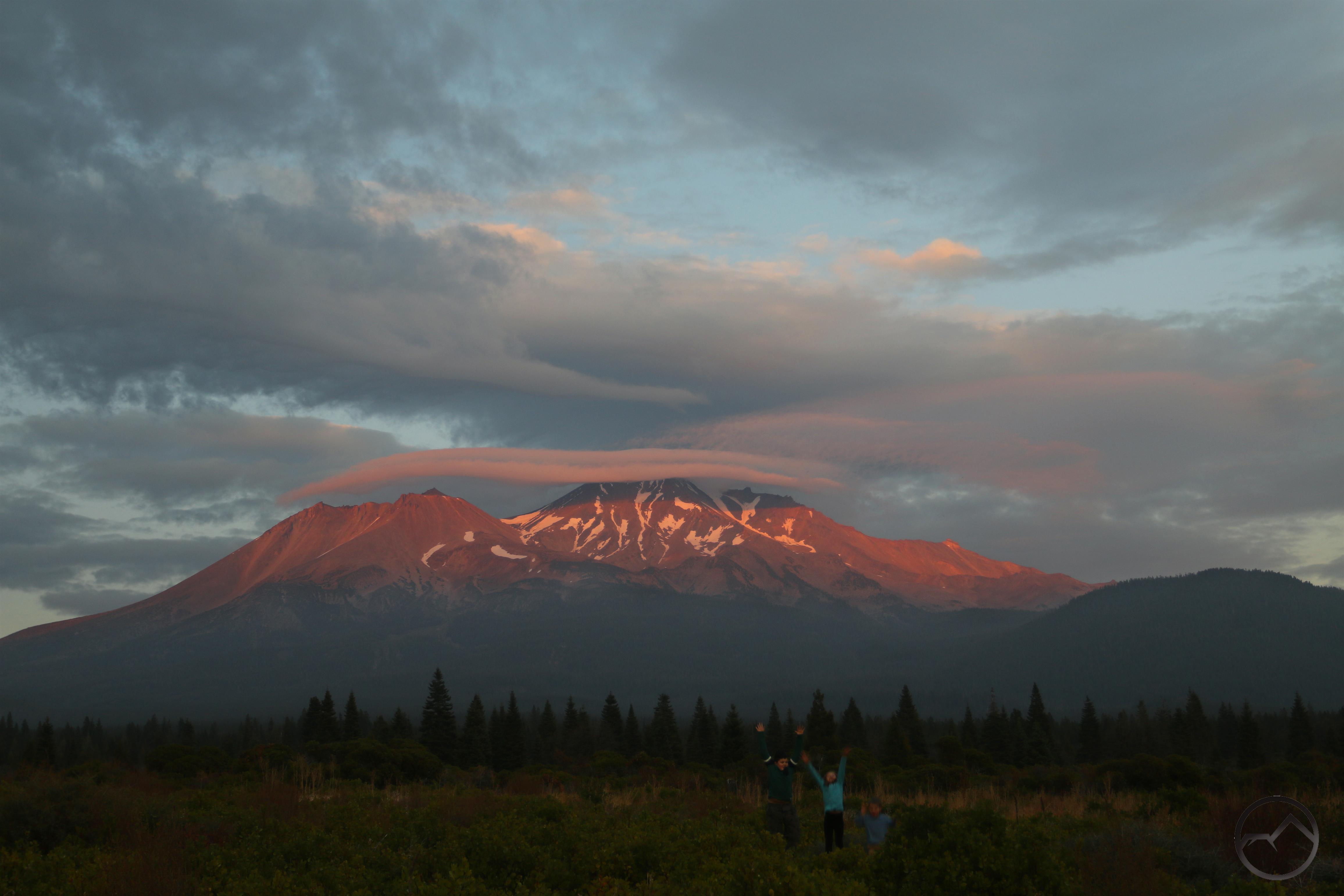
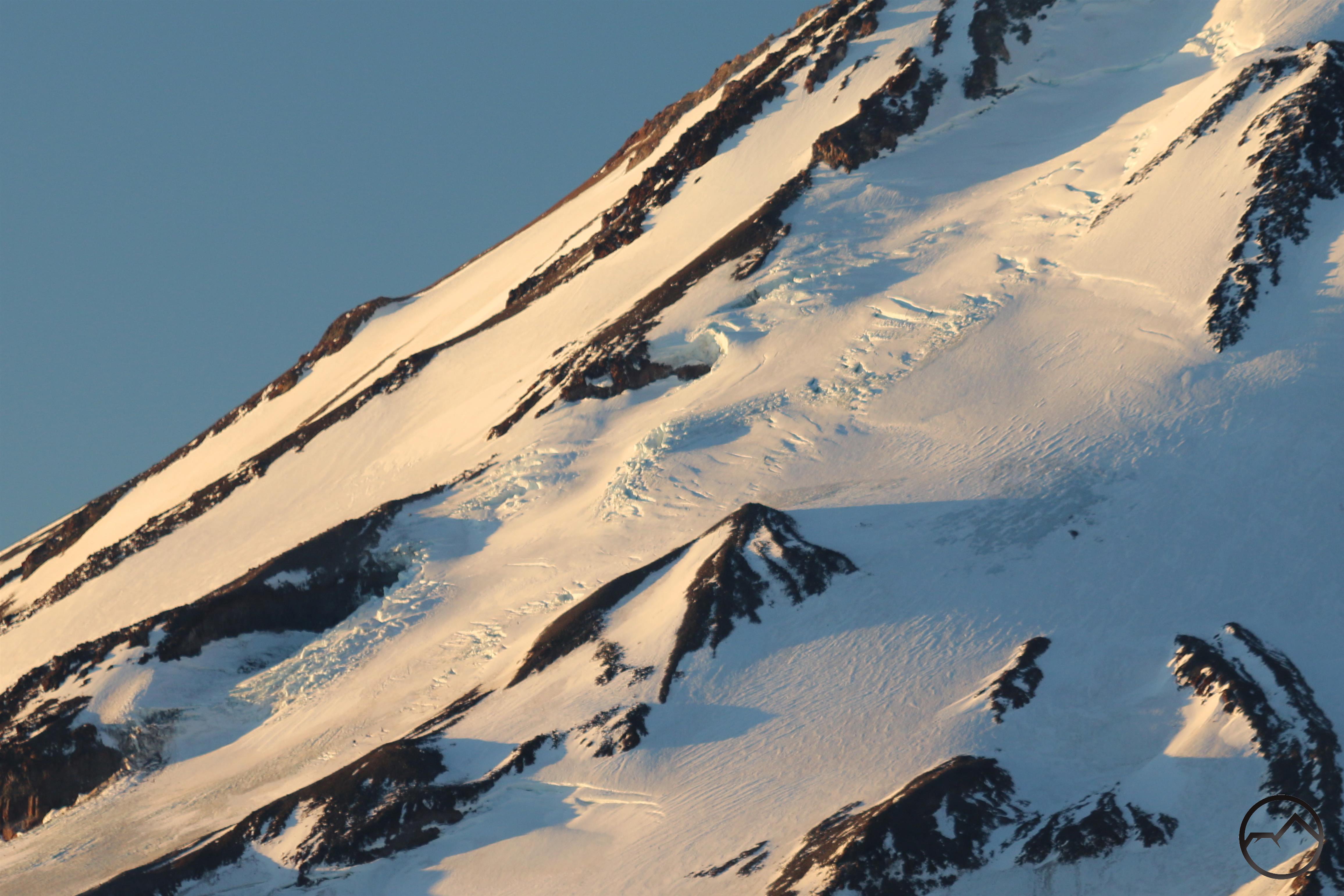
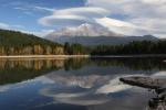
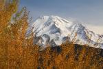
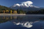
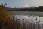
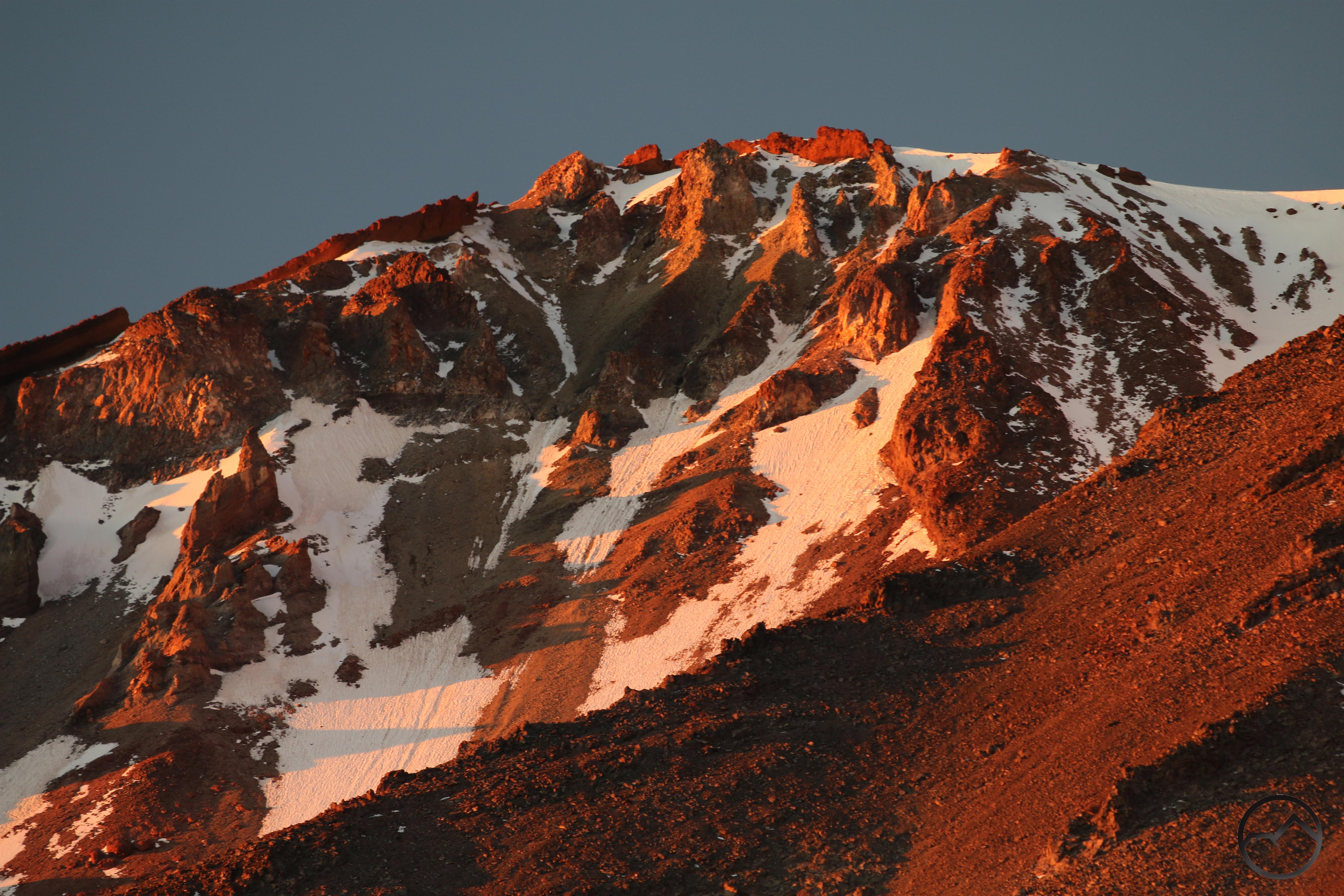
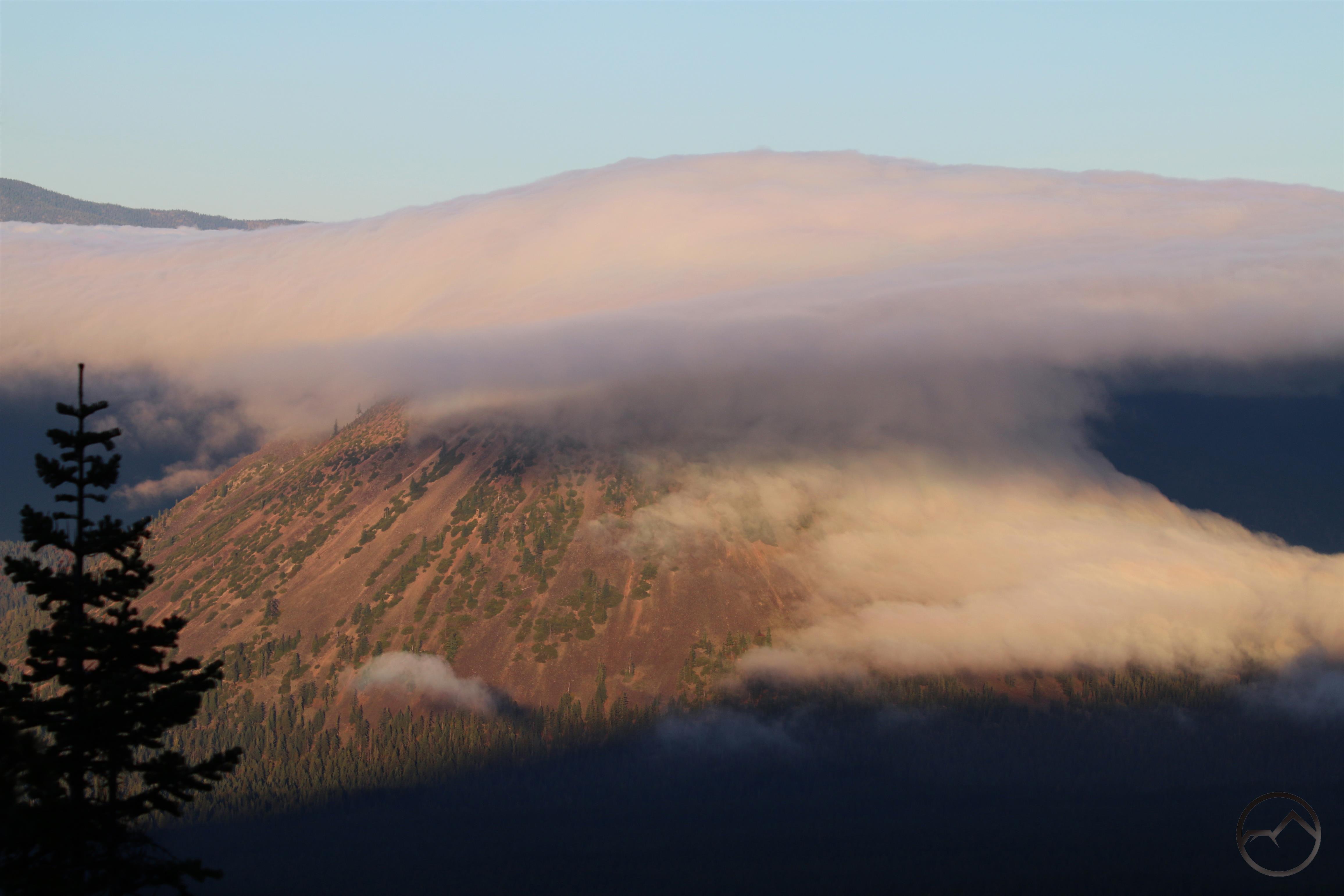
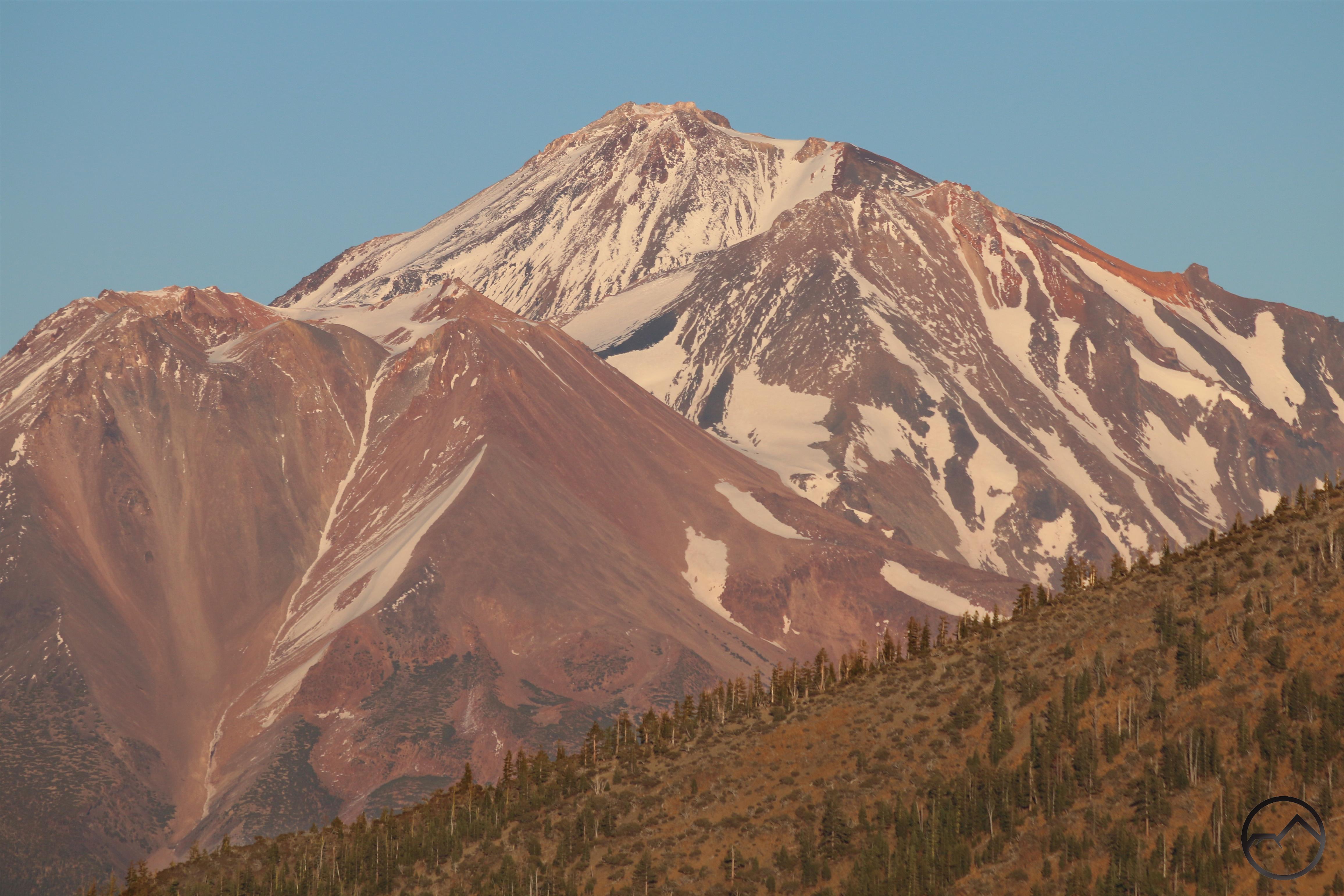
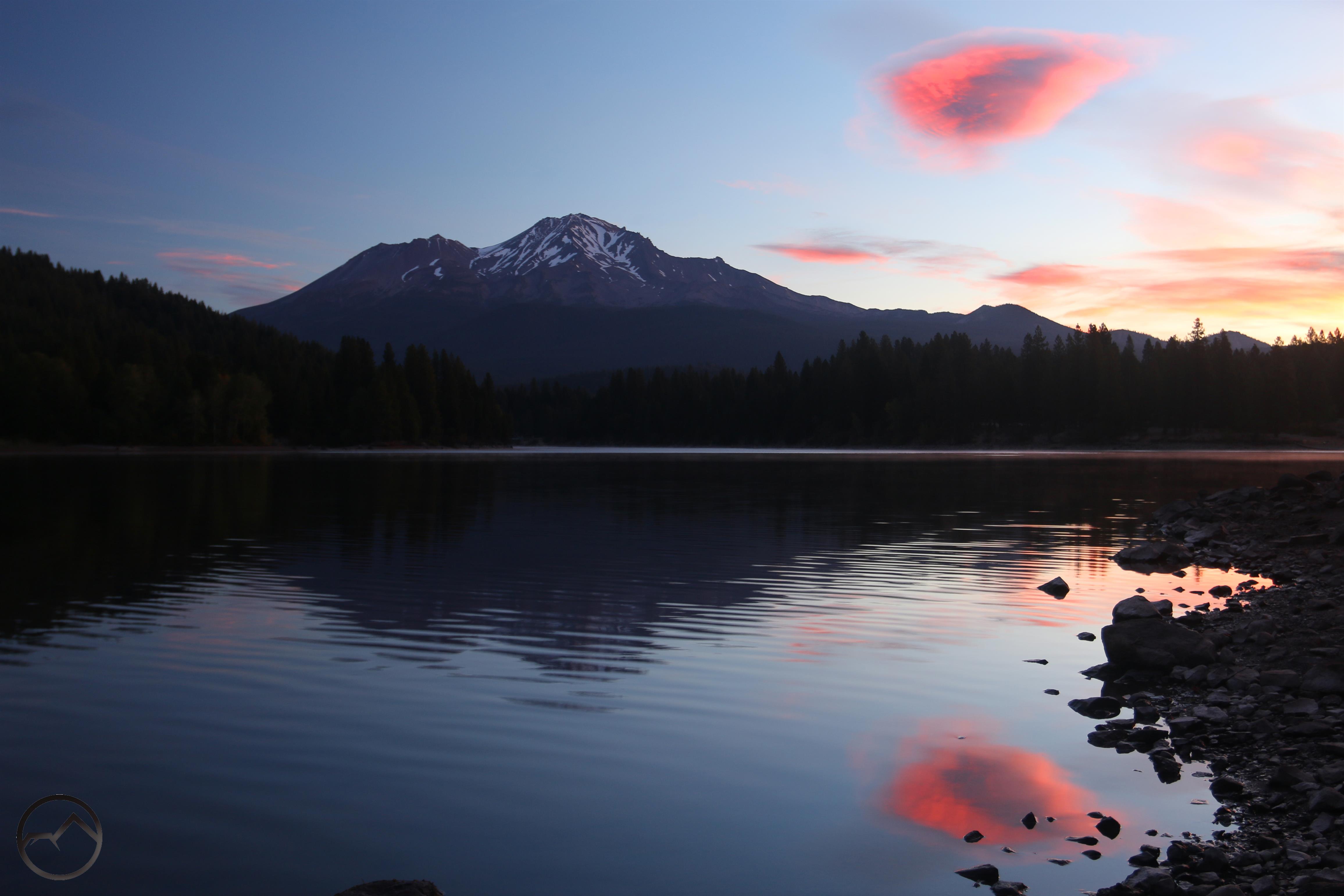
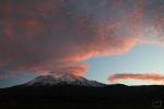
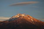
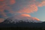
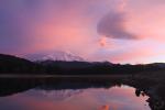
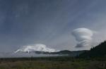
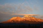
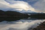
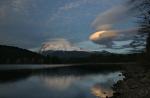
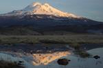
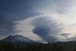
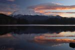
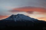
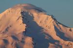
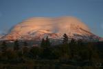
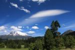
The sky eventually cleared in time for sunset and a vestigial lenticular lingered over the mountain. The fresh snow that had fallen had melted to some degree but there was still a slight patina of white glowing on Mount Shasta’s andesite crags.


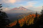
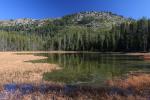
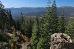
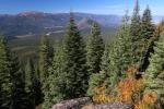
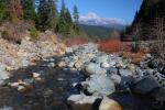
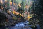
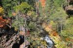
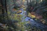
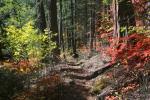
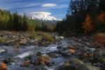
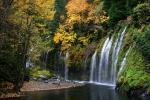
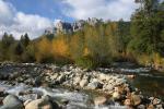
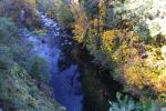
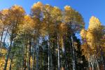
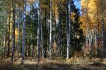
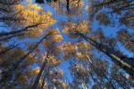
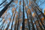
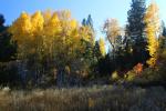
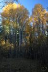
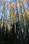
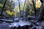
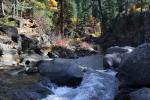
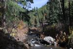
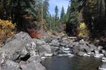
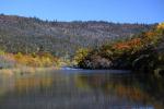
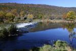
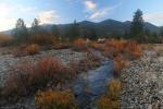
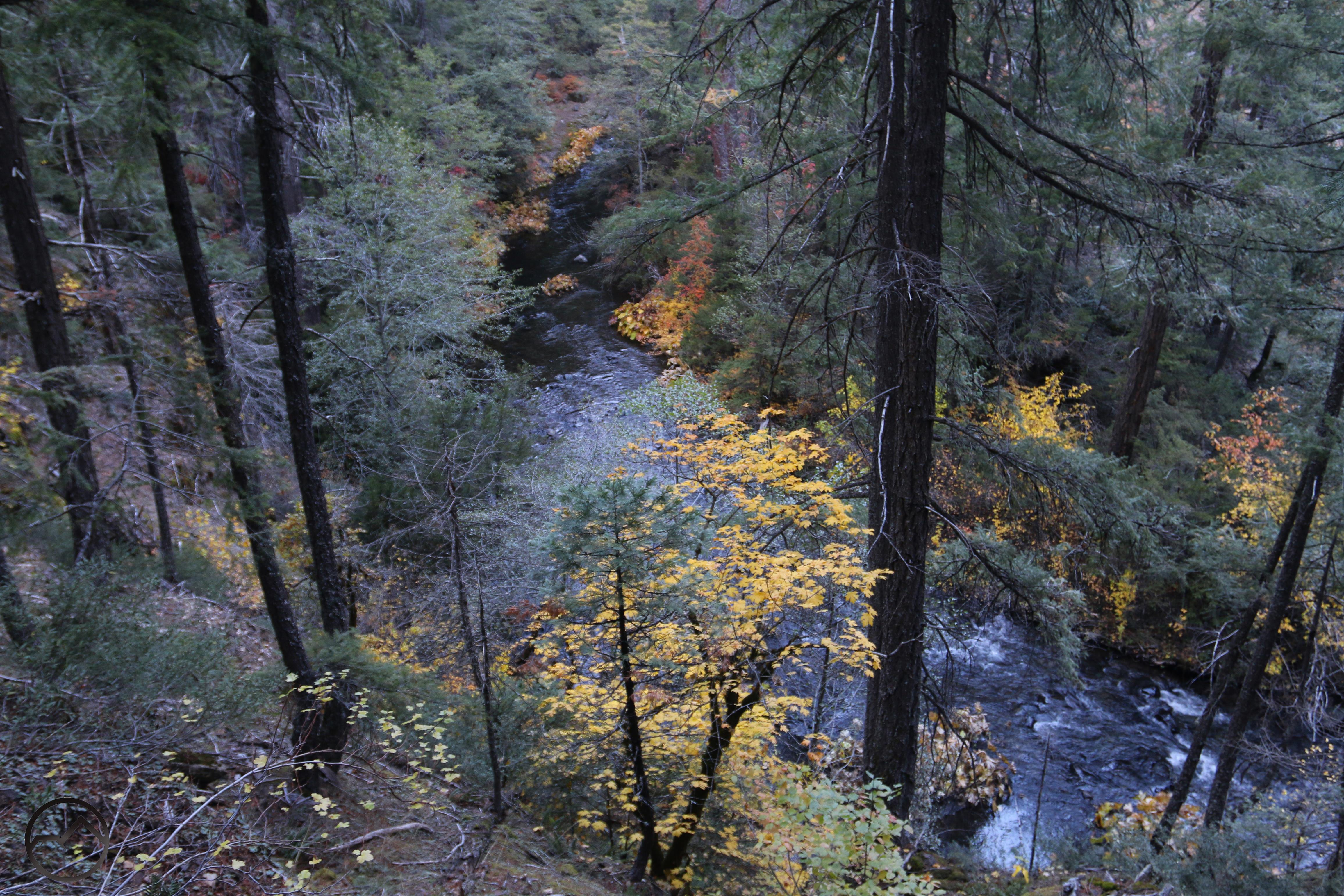
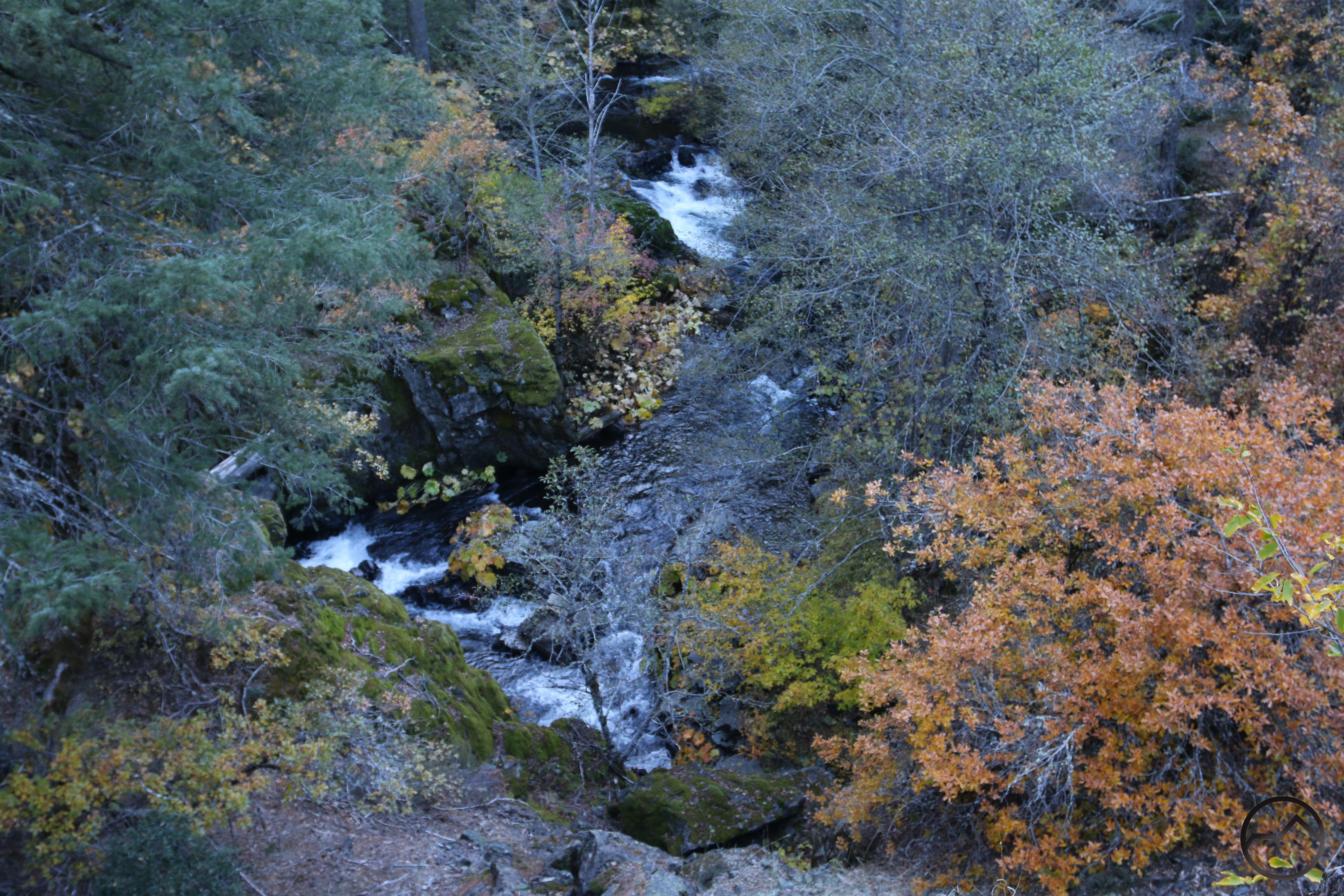
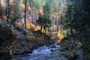
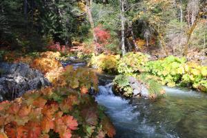
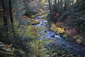
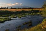
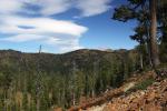
Friday brought a trip to Squaw Valley Creek. The color was absolutely riotous, especially near the trailhead. The first several miles had consistently great color. The creek also had plenty of water in it. This is simply the best time of year to hike the area’s riparian trails.

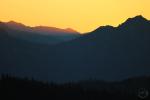
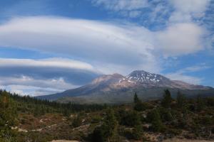
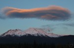
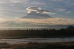
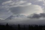
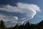
Friday evening brought another clouds that really wanted to be a lenticular but couldn’t quite pull itself together. Nonetheless, the sunset was beautiful. The non-lenticular did mean that more wet weather was on the way and Saturday morning was wet and overcast.

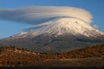
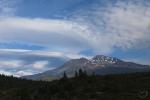
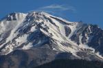
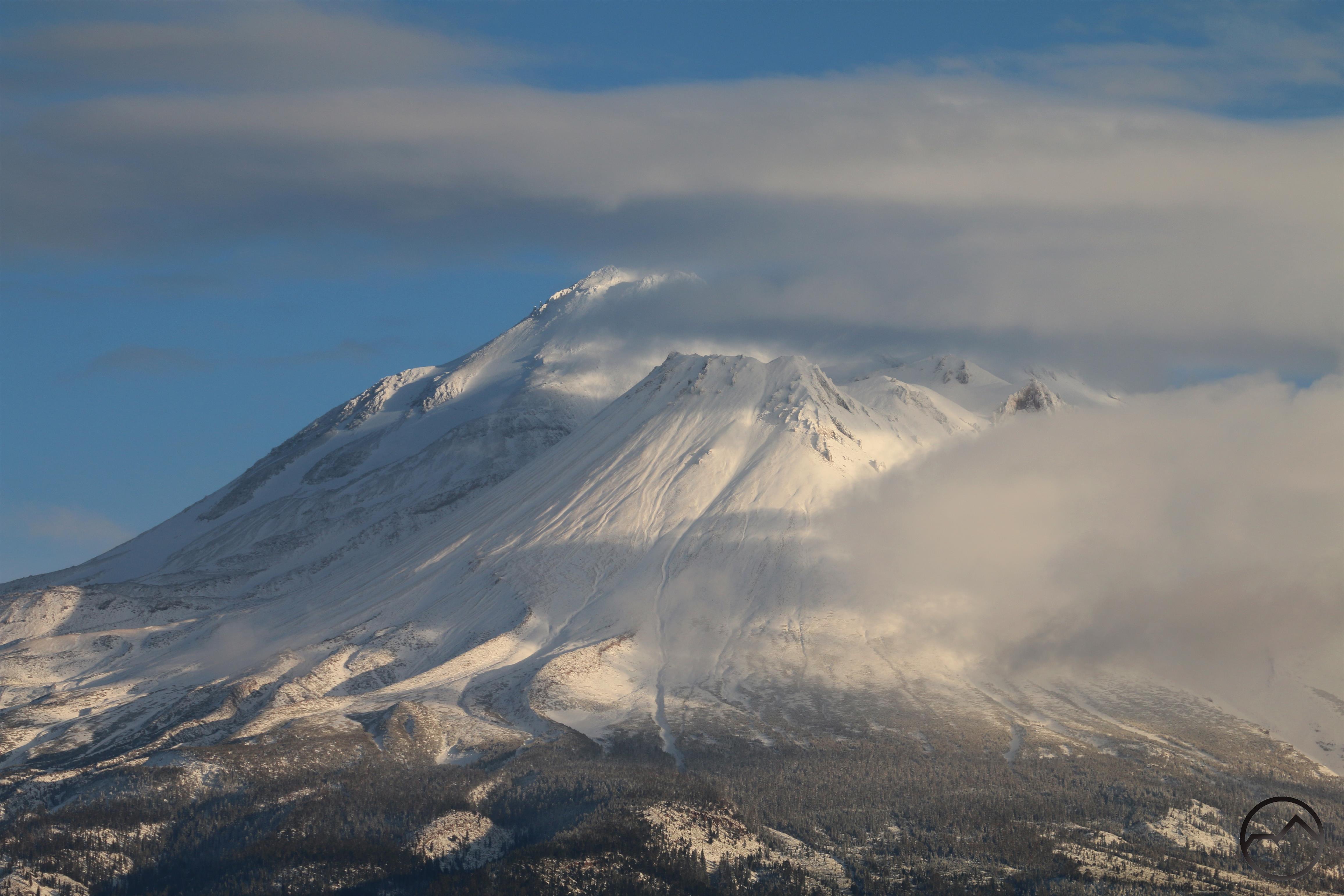
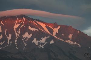
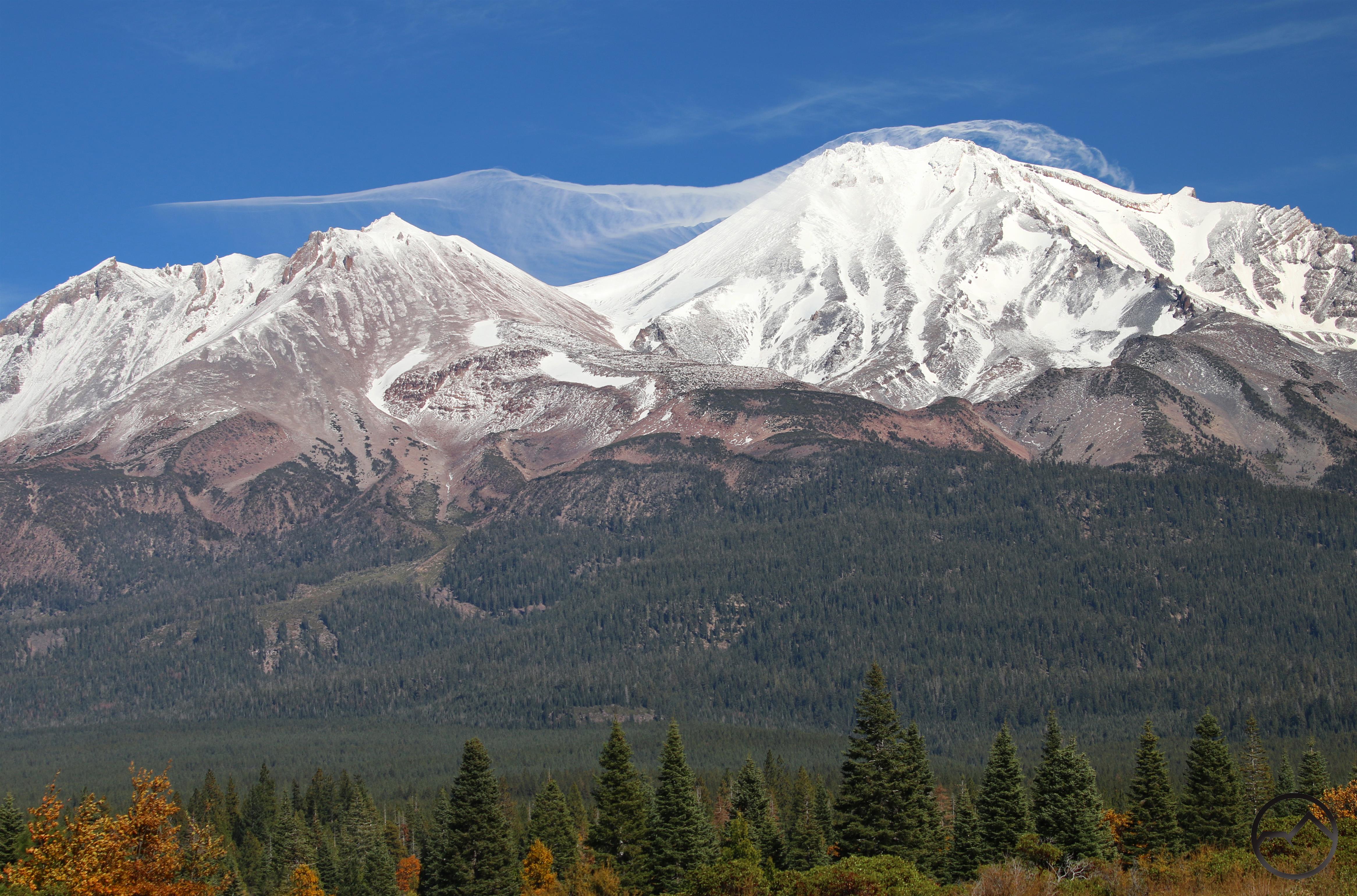
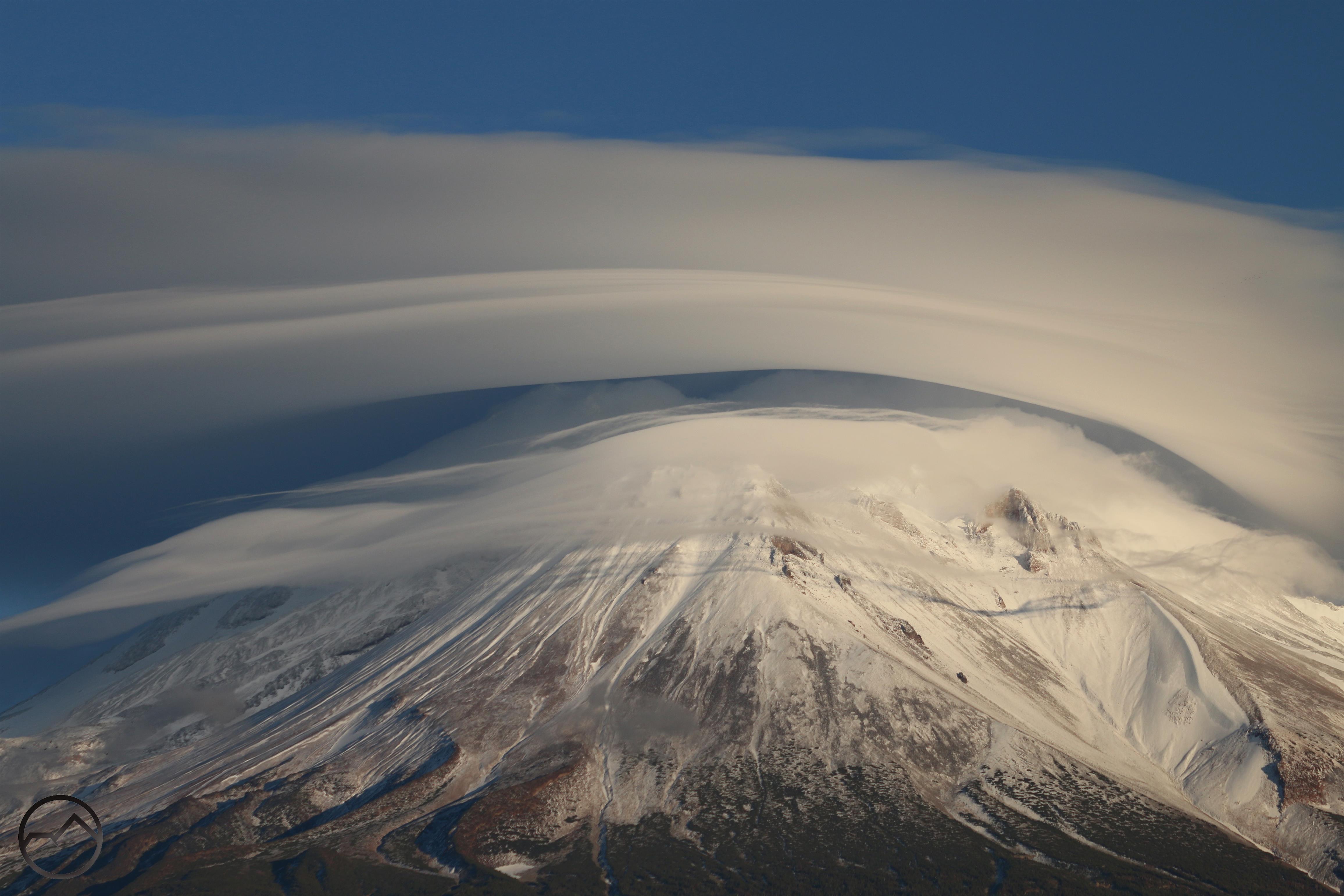
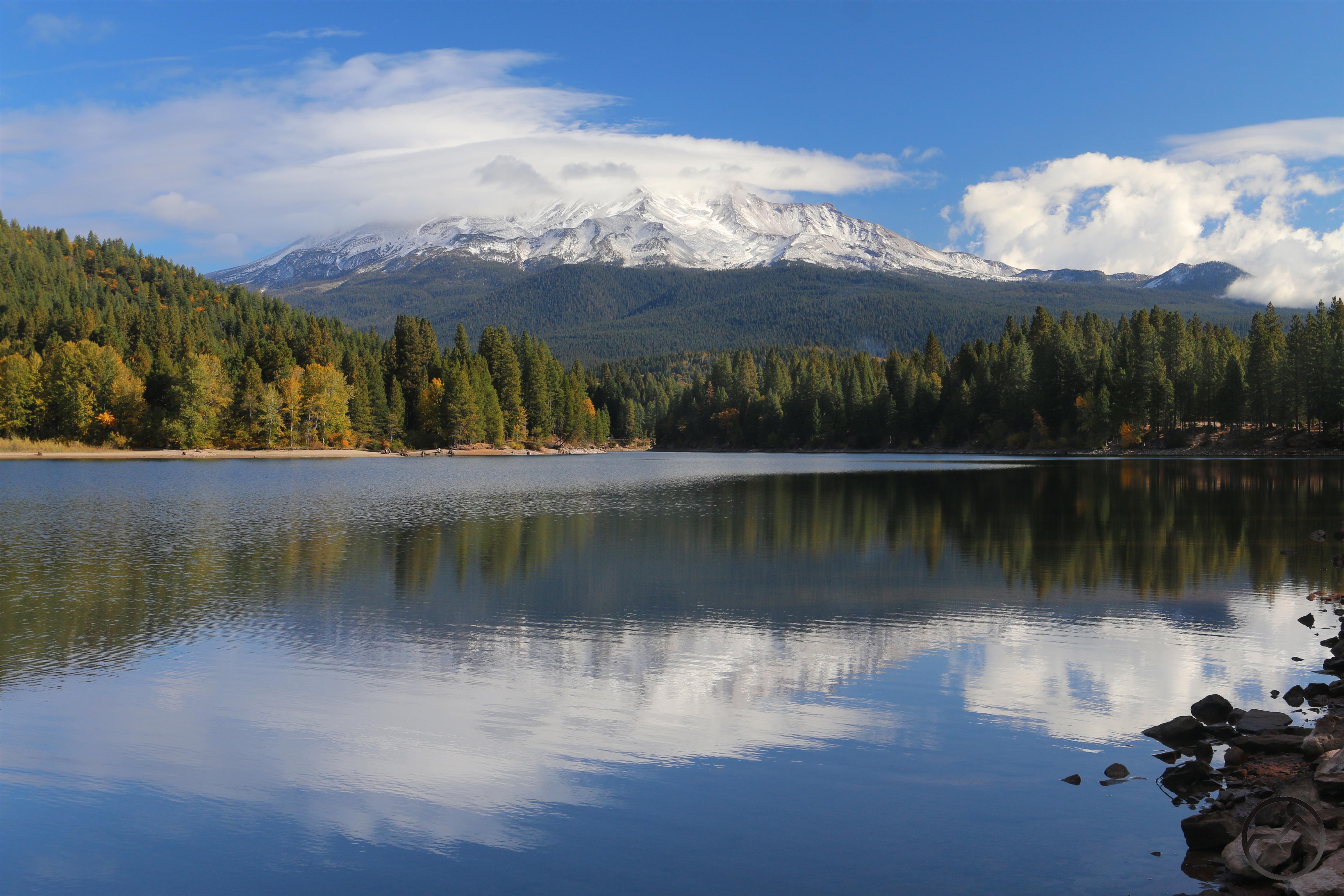
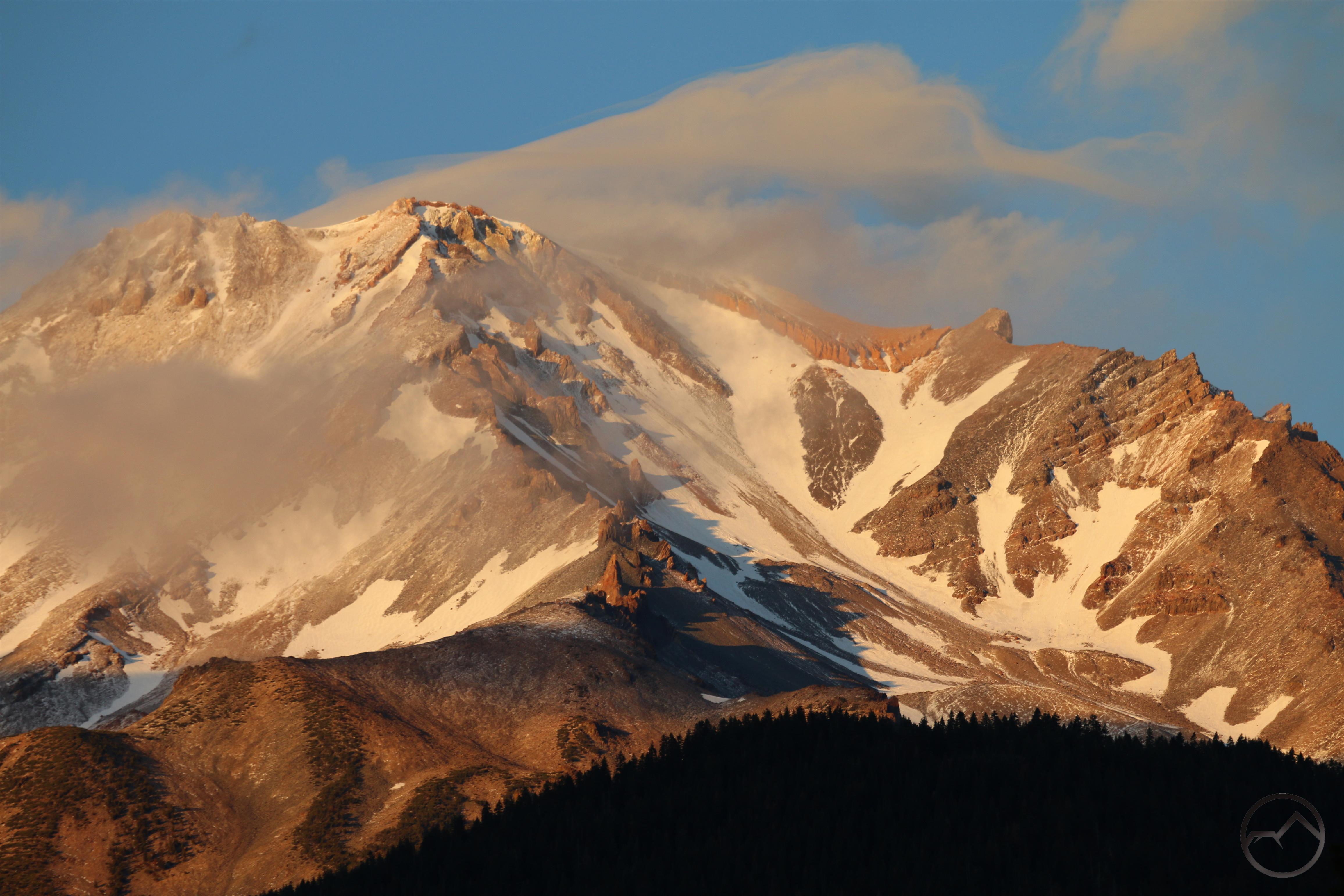
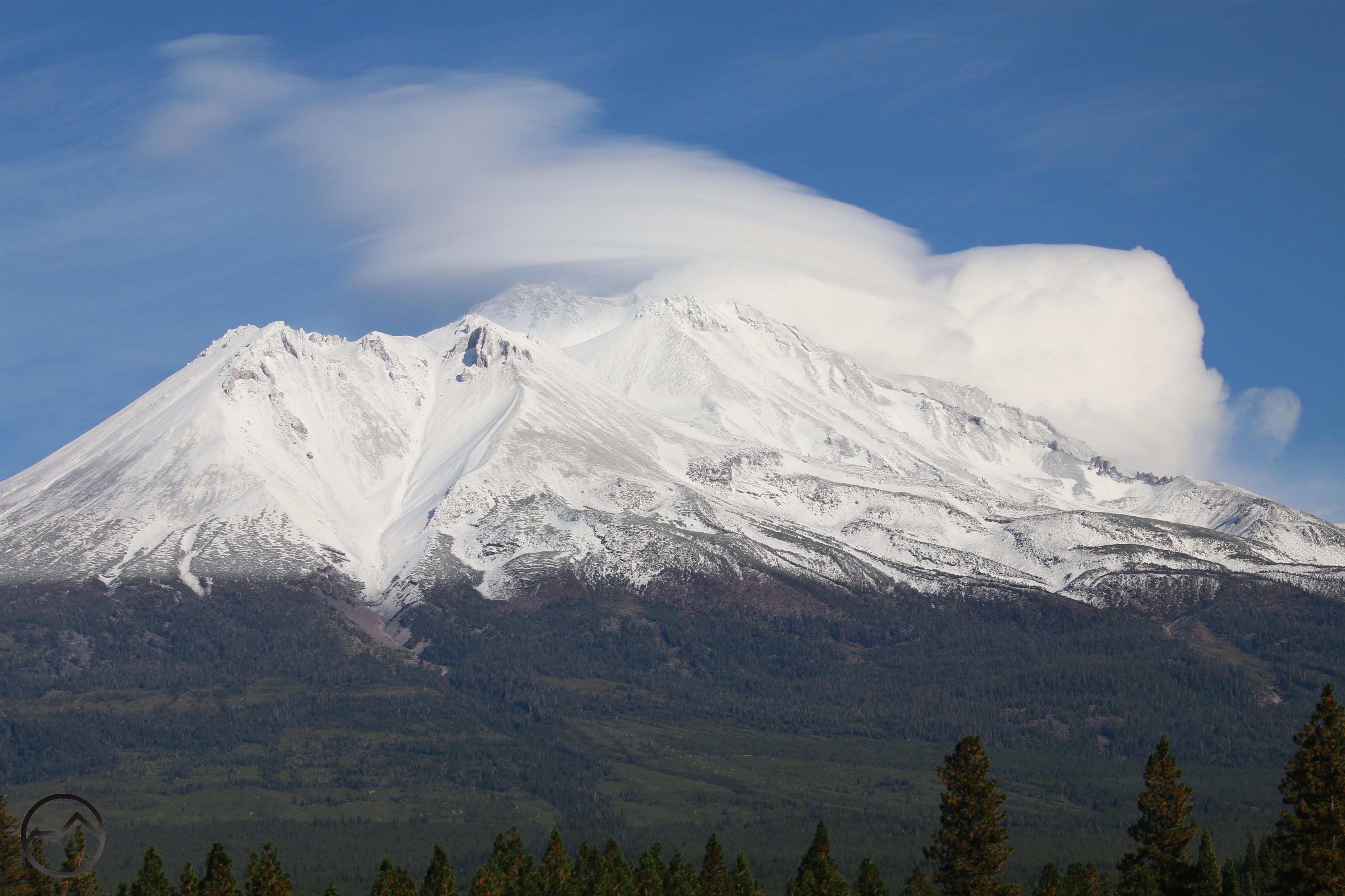
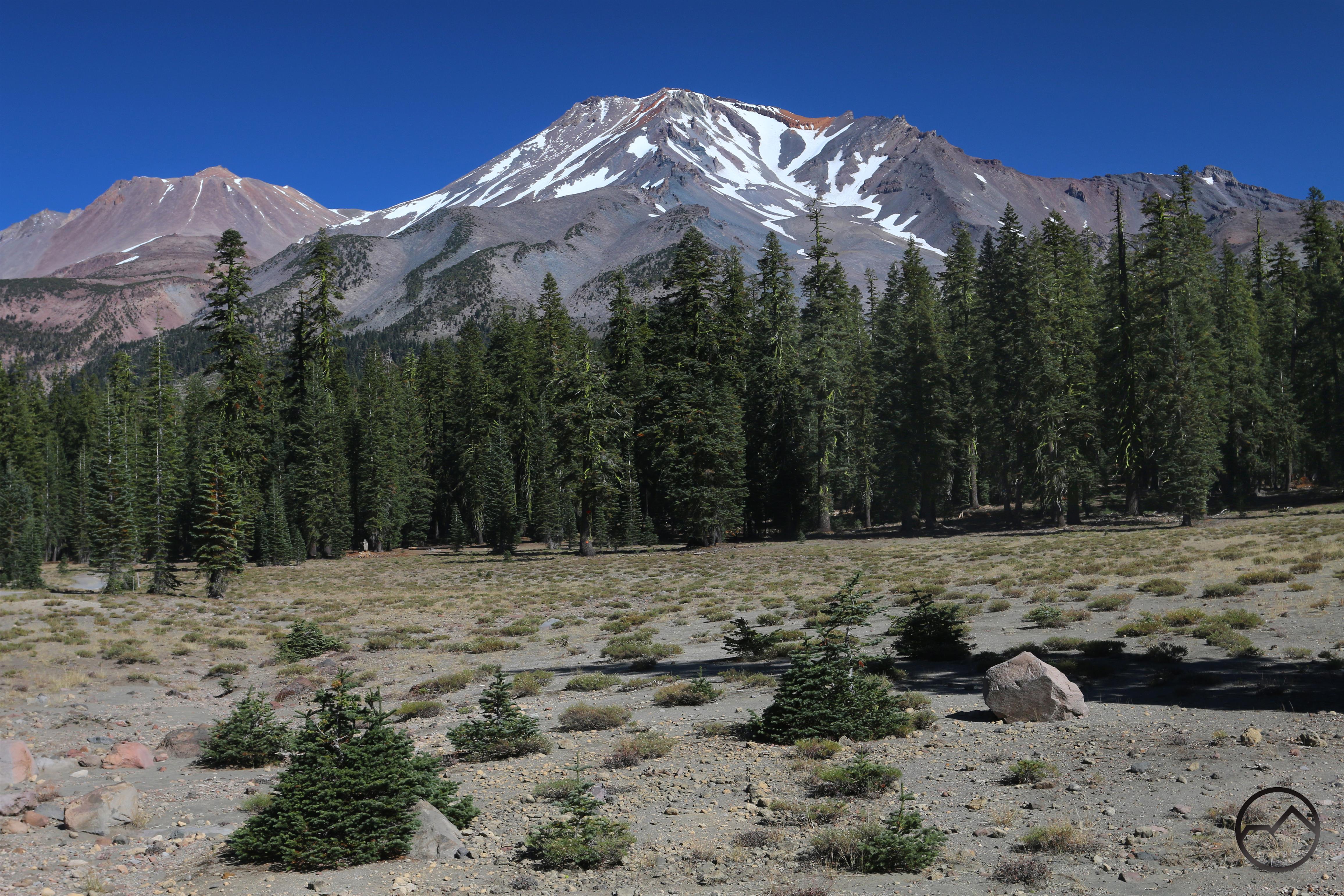
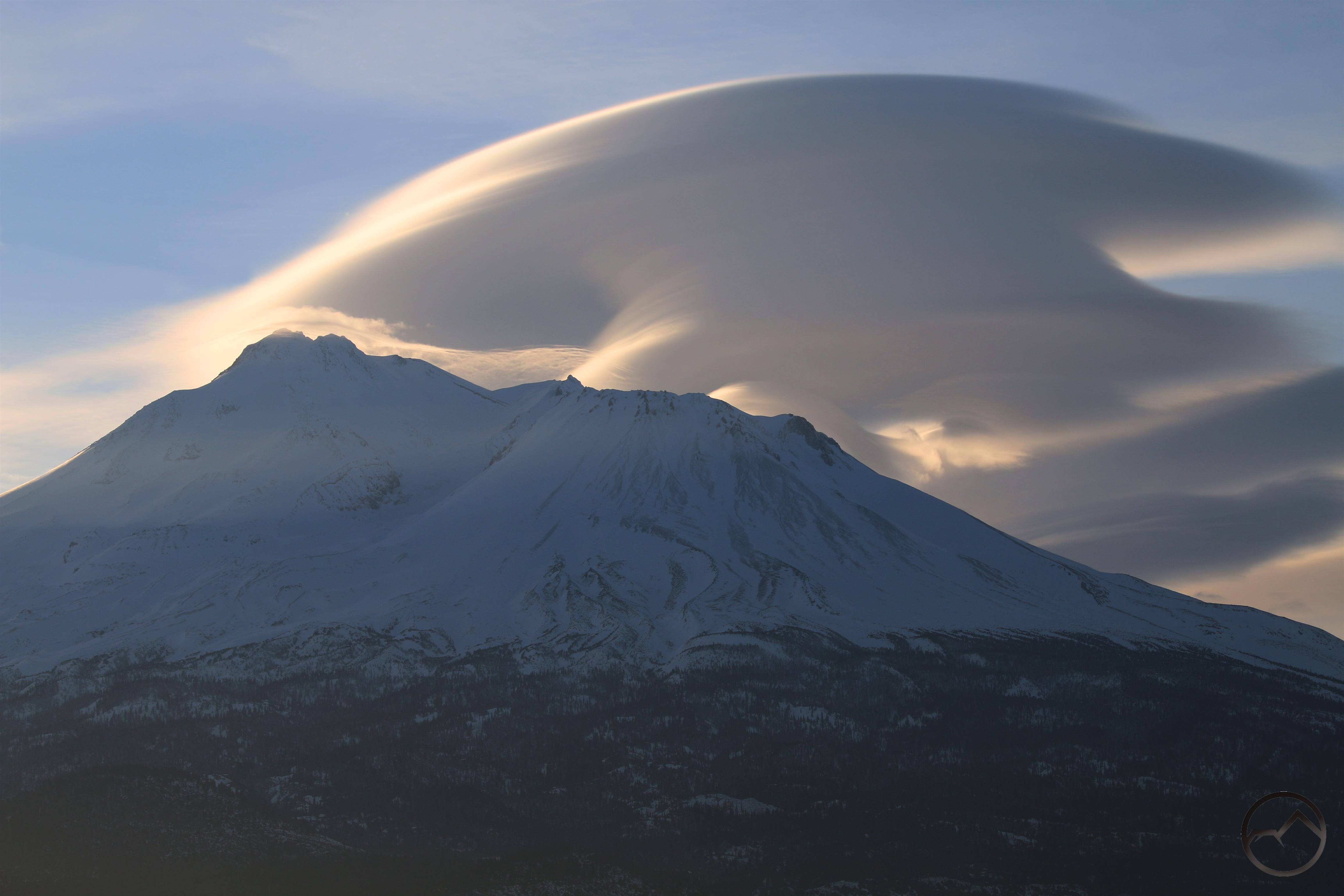
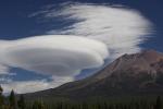
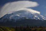
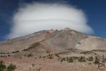
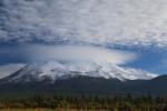
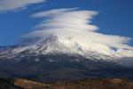
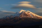
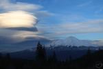
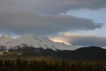
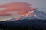
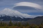
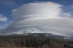
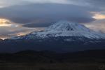
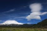
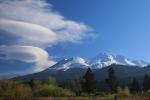
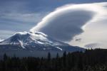
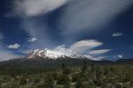
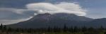
Fortunately the sky cleared up and the temperature went up. As the clouds dissipated, an actual, full formed lenticular was revealed on Mount Shasta. It was not the grandest specimen but it was great to see a fully-formed stack finally manifest on the mountain. After a week of near-misses it was a good to finally get something to coalesce into a good formation.

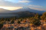
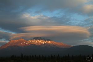
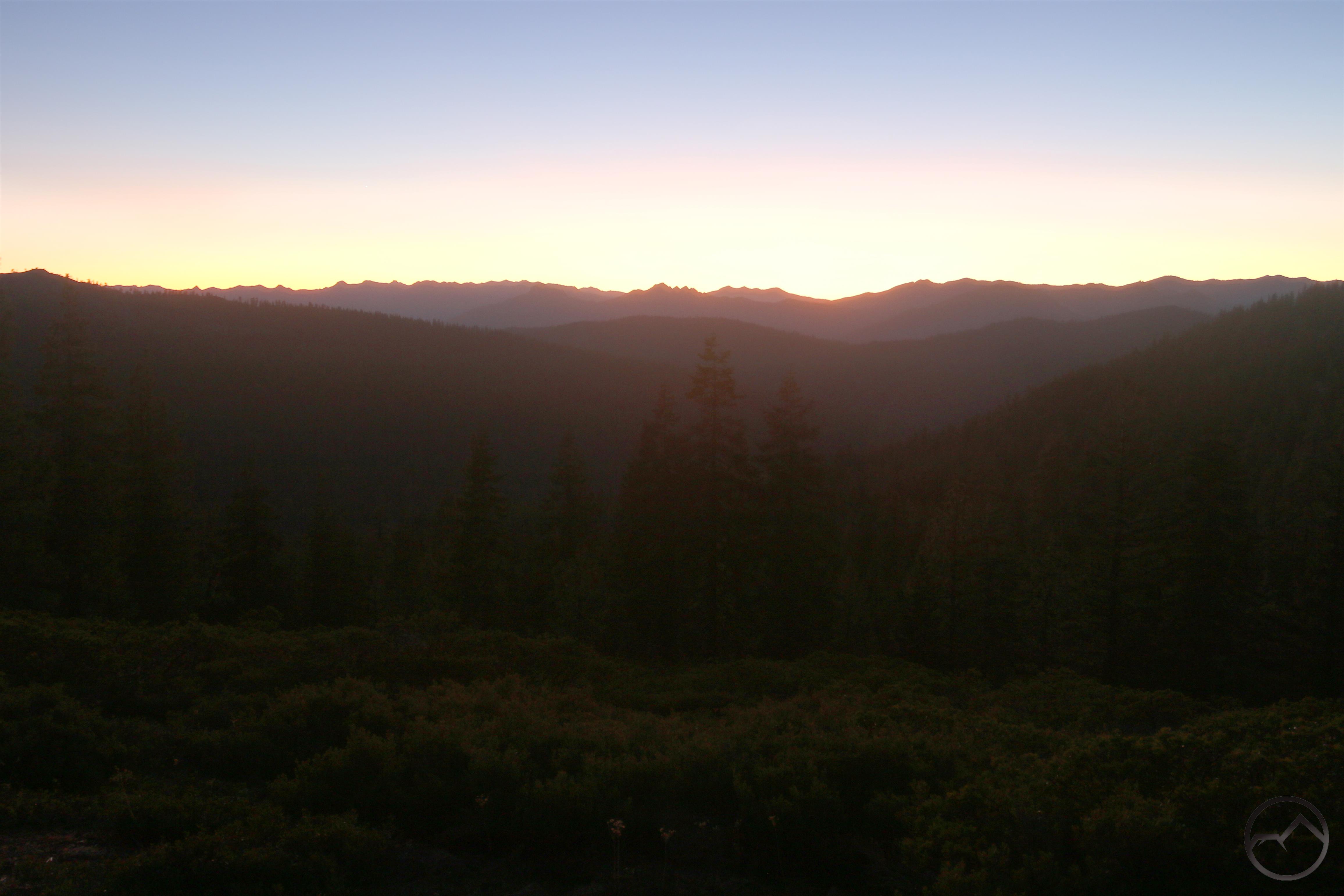
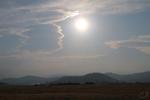
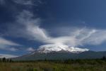
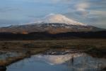
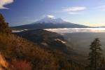
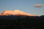
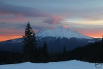
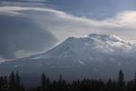
Sunday morning has been overcast on the west side of Mount Shasta but the was clear over McCloud. Though the upper portion of Mount Shasta was obscured by clouds, but it was still a pretty spectacular sunrise. If you look close, there is still a lenticular hidden up above the summit of the mountain.

The next week is supposed to warm up and have sunny sky. This may be the last, best week of the year to get outside and enjoy the tremendous beauty that is erupting all over the Mount Shasta area. Have a great week and stay blessed!

A Week Of Autumn Around Mount Shasta

Posted by bubbasuess on October 14, 2019
Posted in: Cascade Range, Hiking, Mount Shasta. 3 Comments

I love fall. If there was more water in the creeks and rivers, it would be my undisputed favorite season. The crisp air, the colored trees, the lower angle of the sun and the sense of having finished something all add up to make it a magical time of the year. Obviously, this is a time to get outside and enjoy the incredible beauty and gorgeous weather. This has certainly been the case this past week. I didn’t hit a lot of fall color (yet) but the weather has been sublime and demanded I get out and enjoy the mountains. With a tip of the hat to John Muir, the mountains called and I answered.

Last Monday I headed out with my family to the PCT as it enters the Scott Mountains. Straddling the divide between the Shasta River and the headwaters of the mighty Trinity River, this is a gorgeous and lightly used section of trail. There is a spot where it is easy to scramble up to the top of the ridge and get spectacular vistas that range from Bully Choop and the Trinity Alps to the south all the way to Mount McLoughlin to the north in Oregon. Weed, the Shasta Valley and Mounts Eddy and Shasta all fill out the incredible vista. There is no shortage of rocks for my kids to climb on as we all enjoy this magnificent spot.

A couple days later, I headed out for a sunrise. It was beautiful but both the clouds and Lake Siskiyou were very uncooperative. I did manage to at least document a little lenticular that hovered above the mountain.

On Friday, the opportunity presented itself to do some exploring in the Sand Flat area on Mount Shasta. While this area has winter trails, it is not well known as a great hiking destination. Nonetheless, it is a great place for easy cross country travel and this was certainly the case when i was there.

The the best part of this particular afternoon was at Jack Flat, where the views of town and the surrounding mountains were enhanced by the fall color that has appeared on the flanks of Mount Shasta. Even when the view of town does not include Mount Shasta, it is striking how awesome this area is. It Mount Shasta was not here, Mount Shasta City would still have a beautiful location and an enviable array of mountains around it. We are very fortunate indeed.

The real highlight of the week, however, came on Sunday morning. I headed up to the flanks of Herd Peak for the dawn and was rewarded with one of the best sunrises I have enjoyed in quite a while. It was absolutely tremendous.

The next week should present more of the same. With a little precipitation in the forecast, I think there is a chance for a lenticular or two, but the temps are supposed to be in the upper 60’s again, so there ought to be plenty more opportunities to enjoy this incredible region.

Stay blessed and hit the trail if you can!


Lenticular Season Is Here

Posted by bubbasuess on October 6, 2019
Posted in: Cascade Range, Hiking, Lenticular Clouds, Mount Shasta. Leave a comment

A spectacular lenticular above Mount Shasta on a cold winter morning.

With summer at an end, we can look forward to the gorgeous fall hiking season here in Mount Shasta. While the we may lament the approaching winter and the passing of this year’s amazing summer weather, there is another thing we can look forward with a great deal of anticipation. Fall marks the beginning of the time of year when lenticular clouds occur with a notably higher degree of frequency on Mount Shasta. This means that, while we may not be able to hike the trails in the Trinity Divide, high up on Mount Shasta, or in the surrounding mountain ranges like the Trinity Alps, we do have the opportunity to enjoy the grand spectacle of these magnificent cloud formations heightening the mountain’s unique grandeur. Indeed, uniqueness and beauty of these strange clouds makes this one of the highlights of the year.

As is often noted, the mountain creates its own weather and it can do so at any time of the year. Naturally this means lenticular clouds can occur throughout the year as well. However, fall and winter have a demonstrably higher frequency of the clouds’ manifestation. To show this, I collated all the images I have from the last 10 years and broke them out into the months when they occurred. Some of the clouds are exactly lenticular clouds, but they are unusual in shape and exhibit at least some of the qualities of the famed formations. Obviously this is not exactly scientific documentation since I have missed some of the clouds. Nonetheless, generally speaking, if there is a lenticular I try to capture it in some fashion. Taking the fact that I have missed some of the clouds, this display still demonstrates what months have greater likelihood of lenticular clouds appearing around Mount Shasta. Hopefully the upcoming lenticular season produces some exceptional specimens!

September


September

October


November


December

December


December


January


February


March


April


May


June

July


August


Northern California Review: Central Sierra Nevada

Posted by bubbasuess on September 28, 2019
Posted in: Hiking, Mount Shasta, Sierra Nevada, Uncategorized. 5 Comments

The Sierra Nevada is one of the most acclaimed mountain ranges in the world and the preeminent range of California. It is the longest single range in the coterminous 48 states and a land of iconic landscapes that include Yosemite, Lake Tahoe and the High Sierra. Towering waterfalls, granite domes, jagged, sawtooth peaks and roaring rivers are all essential elements of this alpine paradise. The range is so vast it can be difficult to appreciate all of its features and perceive them in their proper position.

This difficulty is particularly true of what could loosely be referred to as the Central Sierra Nevada. This area is, in many ways, the forgotten Sierra Nevada. They occupy a 55 mile expanse between the southern end of Lake Tahoe and the northern end of Yosemite. Accessed by long, winding roads and without famed destinations that permeate the public consciousness, this central part of the Sierra Nevada often forms a blank spot on people’s mental maps of the range. In spite of this, there is a great deal of exceptional beauty to be found here, and much of it with minimal crowds. The region also boasts intriguing geology that gives it a visual appeal that is quite distinct from the rest of the Sierra Nevada. Anyone looking for a chance to enjoy grand mountains, wilderness settings and great beauty will be more than satisfied by their time in the Central Sierra.

To say that there is a section of the Sierra Nevada is to imply that there are parts to which it sits astride. In this case, there is a Northern Sierra and a Southern Sierra. These are the areas typically thought of when considering the Sierra Nevada. It should be noted that there are other taxonomies for the regions of the Sierra Nevada, but in geologic make up, as well as human use patterns, these categories are generally applicable.

The Southern Sierra is the most recognizable part of the Sierra Nevada. Composed of vast expanses of glaciated granite, this is generally the area that most people think of when they consider the Sierra. World-renowned destinations like Yosemite, the Mammoth Lakes and Sequoia and Kings Canyon National Parks are all found in this part of the range. In size and scale, this is the grandest part of of the Sierra Nevada. In area, this encompasses nearly half of the entire mountain range. However, it is a cohesive whole for a few reasons. First is the geologic unity, nearly all of it being a single granite pluton. Only the Ritter Range and the northeastern border areas of the Sherwin Range and the Ansel Adams and Hoover Wildernesses include other types of rocks. The second critical unity is one of scale and wildness. This is the area that is properly referred to as the High Sierra. All of the Sierra Nevada peaks that reach or exceed 12,000 feet are located here, found between the northern border of Yosemite and the southern end of the Golden Trout Wilderness. This area is also the largest unbroken block of wilderness in California, stretching from the Domeland Wilderness in the south all the way to Highway 120 in Yosemite. This part of the Sierra truly is a wild, spectacular landscape.

The Northern Sierra is home to Lake Tahoe, another of California’s most famous mountain landmarks. In fact, the large lake anchors the southern end of this area, which extends north to the Lake Almanor area, where the Sierra Nevada ends and the Cascades begin. Geologically, this region is remarkably different from the southern part of the range. Rather than a vast granitic batholith, the Northern Sierra is composed primarily of sedimentary rocks, with significant intrusions of smaller granite batholiths. In some areas this rocky melange is then overlaid with lava flows. Ironically, many of this areas most iconic landscapes are granite, so to many visitors, there seems to be little difference between the Northern Sierra and what lies to the south. This is especially the case in the Desolation Wilderness and along the southern half of Lake Tahoe. Interestingly, the complex geology of the Northern Sierra is strikingly similar to that of the Klamath Mountains. This latter range is believed to have once been a part of the Sierra Nevada and was wrenched away from the rest of the range and deposited closer to the coast. Anyone who has traveled through the granite heart of the Trinity Alps and felt like they were in Desolation Valley near Lake Tahoe would be well within their rights to think so.

Separated at birth:

Northern Sierra
Klamath Mountains

Lying between these two well-known sections of the Sierra Nevada is the Central Sierra. This area is, in many ways, the lost Sierra, overlooked in favor of its more famous and accessible neighbors. Despite the relative anonymity, this area features some truly magical destinations and is loaded with spectacular landscapes.

The pink areas are granite. The brown and tan areas represent volcanic mudflows that overlay the granite areas.

Geologically, at its core, the Central Sierra is a continuation of the large granite pluton that is the defining feature of the Southern Sierra. Granite dominates the high country of the Central Sierra and is nearly ubiquitous. However, over the granite there are several large volcanic mudflows that have been hardened into a cap of dark brown rock. It is not unusual to see dark ramparts and brown peaks sitting like islands above a sea of gleaming white granite. This is the essential appearance of the landscapes of the Central Sierra. Some examples can be seen below:

This is a classic example of Central Sierra terrain. The dark walls of the Dardanelles stand on top of the granite that surrounds Sword Lake.

Still looking at the Dardanelles, this time pulled back to see the expanse of granite and the higher mudflow layers that make up the western portion of the Carson-Iceberg Wilderness. The image is taken from Inspiration Point, which is a smaller formation that is similar to the Dardanelles. 

This is the view north from Burst Rock in the Emigrant Wilderness, looking towards Castle Rock and the Chimneys. The entire ridge is composed of volcanic mudlows that have overlain the granite landscape.

Similar formations are found from the headwaters of the Little Truckee River south of Lake Tahoe all the way to the Emigrant Wilderness, which abuts the northern border of Yosemite. Throughout the entire Central Sierra the dark volcanic mudflows dot the granite landscape. The most dramatic manifestation of this landscape is in the southeastern corner of this region, in the Sonora Pass area. Here the volcanic mudflows have been minimally scoured by glaciers rather than having been ground to pieces by them. Consequently much of the mudflow geology remains intact. Unique to the Sierra Nevada are towering peaks, many exceeding 11,000 feet, rise high above lakes in dramatic glacial cirques. Yet even in the midst of this intact mudflow landscape, the granite core is exposed in areas and the mudflow formations are still visible above it. Some examples:

Here in Blue Canyon, which is located just west of Sonora Pass, the light granite layer is briefly visible beneath the dark rocks of Sonora Peak. 

At the very edge of Central Sierra, the West Walker River has carved out a profile view of the granite beneath the mudflow layer. In some areas the mudflow has been washed away completely, with only the granite remaining. 

Hiking and exploring the Central Sierra is a great delight. Trails are abundant but see far fewer visitors than other parts of the Sierra Nevada. Some areas, like the Carson Pass area do get a fair amount of pressure but the Ebbets and Sonora Pass areas are far less busy and it is easy to disappear into untraveled country. The Pacific Crest Trail winds through the region and the sections through the high mudflow peaks as well as the Meiss Meadows are particularly memorable sections. Lakes are numerous and peaks abundant. The fascinating geology adds a unique flare that distinguishes the area from the rest of the Sierra Nevada and gives it its own, distinct character. Hikers who venture into this region will not be disappointed.

Central Sierra Gallery (north to south)

Click to enlarge: 

Dardanelles Roadless Area

Dardanelles Roadless Area

Mokelmune Wilderness

Mokelmune Wilderness
Ebbets Pass
Ebbets Pass

Carson-Iceberg Wilderness

Emigrant Wilderness
Emigrant Wilderness
Emigrant Wilderness

Emigrant Wilderness
Emigrant Wilderness
Emigrant Wilderness

Sonora Pass
Sonora Pass
Sonora Pass

Posts navigation

← Older Entries
Newer Entries →
    • Recent Posts

      • Winter Shows Up When It Will
      • January Rolled By With Mud, Then Very Dry
      • Mount Shasta 2025 – A Year In Images
      • Mount Shasta On Either Side Of Christmas
      • Adrift In An Ocean Of Fog
      • December Has Been Spectacular Thus Far Pt. II (A Magnificent Lenticular)
      • December Has Been Spectacular Thus Far Pt. I
      • Lenticular Interrupted
      • A Stormy Wave And A Truchas Sunset
      • Aurora Lenticularis
    • Enter your email address to follow Hike Mt Shasta and receive notifications of new posts by email.

    • Archives

      • February 2026
      • January 2026
      • December 2025
      • November 2025
      • October 2025
      • September 2025
      • August 2025
      • July 2025
      • June 2025
      • May 2025
      • April 2025
      • March 2025
      • February 2025
      • January 2025
      • December 2024
      • November 2024
      • October 2024
      • September 2024
      • August 2024
      • July 2024
      • June 2024
      • May 2024
      • April 2024
      • March 2024
      • February 2024
      • January 2024
      • December 2023
      • November 2023
      • October 2023
      • September 2023
      • August 2023
      • July 2023
      • June 2023
      • May 2023
      • April 2023
      • March 2023
      • February 2023
      • January 2023
      • December 2022
      • November 2022
      • October 2022
      • September 2022
      • August 2022
      • July 2022
      • June 2022
      • May 2022
      • April 2022
      • March 2022
      • February 2022
      • January 2022
      • December 2021
      • November 2021
      • October 2021
      • September 2021
      • August 2021
      • June 2021
      • May 2021
      • April 2021
      • March 2021
      • February 2021
      • January 2021
      • December 2020
      • November 2020
      • October 2020
      • September 2020
      • August 2020
      • July 2020
      • June 2020
      • May 2020
      • April 2020
      • March 2020
      • February 2020
      • January 2020
      • December 2019
      • November 2019
      • October 2019
      • September 2019
      • August 2019
      • July 2019
      • June 2019
      • May 2019
      • April 2019
      • March 2019
      • February 2019
      • January 2019
      • December 2018
      • November 2018
      • October 2018
      • September 2018
      • August 2018
      • July 2018
      • June 2018
      • May 2018
      • April 2018
      • March 2018
      • February 2018
      • January 2018
      • December 2017
      • November 2017
      • October 2017
      • September 2017
      • August 2017
      • July 2017
      • June 2017
      • May 2017
      • April 2017
      • March 2017
      • February 2017
      • January 2017
      • December 2016
      • November 2016
      • September 2016
      • August 2016
      • July 2016
      • June 2016
      • May 2016
      • April 2016
      • March 2016
      • February 2016
      • January 2016
      • December 2015
      • November 2015
      • September 2015
      • August 2015
      • July 2015
      • June 2015
      • May 2015
      • April 2015
      • March 2015
      • February 2015
      • January 2015
      • December 2014
      • November 2014
      • July 2014
      • June 2014
      • May 2014
      • April 2014
      • March 2014
      • February 2014
      • January 2014
      • December 2013
      • November 2013
      • October 2013
      • September 2013
      • August 2013
      • July 2013
      • June 2013
      • May 2013
      • April 2013
      • March 2013
      • February 2013
      • January 2013
    • Categories

      • Boy Scouts
      • Cascade Range
      • Castle Crags
      • Desert
      • Echo Point
      • Glaciers
      • Hiking
      • How things came to be…
      • Klamath Mountains
      • Konwakiton Outdoor Designs
      • Lakes
      • Lenticular Clouds
      • Maps
      • Marble Mountains
      • Meadows
      • Mount Eddy
      • Mount Shasta
      • Mount Shasta History
      • Napa County
      • Off Season Trails
      • Pacific Crest Trail
      • Peaks
      • Rivers
      • Rock Climbing
      • Scott Mountains
      • Seldom Seen
      • Shasta Valley
      • Sierra Nevada
      • Siskiyou Mountains
      • Sonoma County
      • Spring Trails
      • sunrise
      • sunset
      • Trinity Alps
      • Trinity Divide
      • Truchas Ridge
      • Uncategorized
      • Water
      • Waterfalls
      • Wilderness
      • Wildflowers
      • Wine Country
      • Winter Trails
      • Yosemite
    • Meta

      • Create account
      • Log in
      • Entries feed
      • Comments feed
      • WordPress.com
    • Copyright © 2013-2024 by Bubba Suess

      DISCLAIMER: Any use of the information contained in this site by any and all persons is done at their own risk. The operator of this site shall be held harmless from any and all alleged claims, demands, causes of action, liability, loss, damage and/or injury to property or persons whether brought by an individual or other entity. This indemnification applies, without limitation, to all actions by an individual or other entity as a result of their use of information contained in this site.

    Blog at WordPress.com.
    Hike Mt. Shasta
    Blog at WordPress.com.
    • Subscribe Subscribed
      • Hike Mt. Shasta
      • Join 983 other subscribers
      • Already have a WordPress.com account? Log in now.
      • Hike Mt. Shasta
      • Subscribe Subscribed
      • Sign up
      • Log in
      • Report this content
      • View site in Reader
      • Manage subscriptions
      • Collapse this bar
     

    Loading Comments...