Hike Mt. Shasta

Exploring the Mount Shasta Region

  • Home
  • Trails
    • Mount Shasta Trails
      • Brewer Creek Trail
      • Clear Creek Trail
      • Gray Butte Trail
      • Green Butte Ridge Trail
      • Horse Camp Trail
      • North Gate Trail
      • Old Ski Bowl Trail
      • Panther Meadow Trail
      • South Gate/Squaw Meadow Trail
      • Whitney Falls Trail
    • Trinity Divide Trails
      • Blue Divide Trail
      • Castle Lake Trail
      • Castle Lake Shore Trail
      • Cliff Lake Trail
      • Deadfall Lakes Trail
      • Gray Rock Lakes Trail
      • Gumboot Trail
      • Heart Lake Trail
      • Porcupine & Toad Lakes Via Pacific Crest Trail
      • Seven Lakes Basin Via Pacific Crest Trail
      • Sisson-Callahan Trail
      • Soapstone Trail
      • South Mumbo Scramble
      • Tamarack Lake Trail
      • Toad Lake Trail
    • Castle Crags Trails
      • Burstarse Falls Via Pacific Crest Trail
      • Castle Dome Trail
      • Flume Trail
      • Lower Castle Crags Via Pacific Crest Trail
      • Root Creek Trail
    • Scott Mountains Trails
      • Bluff Lake & Cement Bluff via Pacific Crest Trail
      • Caldwell Lakes Trail
      • China Mountain Scramble
      • Cory Peak and Bull Lake via Pacific Crest Trail
    • Cascade Crest
      • Ash Creek Butte Scramble
      • Goosenest Trail
      • Juanita Lake Trail
      • Orr Lake Trail
    • Mount Shasta City Area Trails
      • Black Butte Trail
      • Box Canyon Trail
      • Gateway Trail
      • Lake Siskiyou Trail
      • Mount Shasta City Short Trails
      • Ney Springs Canyon Trail
      • Spring Hill Trail
    • Shasta Valley Trails
      • Black Lava Trail
      • Haystack Trail
      • Lake Shastina Trail
      • Pluto Cave Trail
      • Trout Lake Trail
      • Yellow Butte Trail
    • Sacramento River Trails
      • Dunsmuir Trail
      • Hedge Creek Falls Trail
      • Sacramento River Trail
      • Sims History Trail
    • McCloud River Trails
      • Ash Camp To Ah-Di-Na Via Pacific Crest Trail
      • McCloud River Falls Trail
      • McCloud River Preserve Trail
      • Squaw Valley Creek Trail
      • McCloud River Trail: Algoma Camp to Nitwit Camp
      • McCloud River Trail: Nitwit Camp to Cattle Camp Swimming Hole
      • McCloud River Trail: Cattle Camp Swimming Hole to Camp 4
      • McCloud River Trail: Camp 4 to Upper McCloud Falls
      • McCloud River Trail: Pine Tree Hollow Loop
    • Trails Further Afield
      • Trinity Alps Trails
        • Bear Lakes Trail
        • Billys Peak Trail
        • Boulder Creek Lakes Trail
        • Boulder Lake Trail
        • Canyon Creek Trail
        • Caribou Lakes Trail
        • East Boulder Lake Loop
        • East Weaver Lake Trail
        • Four Lakes Loop
        • Granite Peak Trail
        • Grizzly Creek Trail
        • Gulch Lakes Loop
        • Hidden Lake Trail
        • South Fork Lakes Trail
        • Stoddard Lake Trail
        • Stoney Ridge Trail
        • Tangle Blue Lake Trail
      • Warner Mountains
        • Emerson Creek Trail
        • Highgrade Trail
        • Patterson Lake Via Warner Summit Trail
        • Pine Creek Trail
        • Squaw Peak Trail
  • Articles
    • Trails By Area
      • Mount Shasta
        • Vistas, Meadows And Waterfalls: Three Best Hikes On Mount Shasta
        • The End Of The Road: Three Hikes In The Old Ski Bowl Area
        • Two Trails From Bunny Flat
        • Three Trails On Mount Shasta’s East Side
        • Mount Shasta’s Hummingbirds
      • Trinity Divide
        • Great Lakes: Top Five Lake Basins In The Trinity Divide
        • The Headwaters Of The South Fork Of The Sacramento River
        • Neglected Headwaters: Two Lesser Lake Basins On The South Fork
        • Gumboot Saddle: Two Hikes On The PCT
        • Descent Into Mystery: The Sisson-Callahan Trail
        • Mumbo Basin – Overlooked On The West Side
        • The Headwaters Loop: A Proposed Backpacking Loop In The Trinity Divide
      • The McCloud River
        • The McCloud River Trail
      • Shasta Valley
        • Jewels In The Desert
      • Scott Mountains
        • Great Scott! Two Scott Mountains Hikes On The PCT
      • Trinity Alps
        • Carubou Lakes: Trinity Alps On A Grand Scale
        • Switchbacks To Heaven: The Trinity Alps’ Stoney Ridge Trail and Four Lakes Loop
        • Trinities In Proximity: Two Trinity Alps Trails With Easy Access From Mount Shasta
        • Trails in the Carter Meadows Area
        • Trinity Alps Views of Mount Shasta
        • The Psychological Value Of The Trinity Alps
    • Waterfalls
      • Three Waterfalls On Mount Shasta
      • McCloud River Waterfalls
      • Sacramento River Waterfalls
      • Trinity Divide Waterfalls
      • Trinity Alps Waterfalls
      • Avoiding A Dry Whitney Falls
    • Off Season Trails
      • Three Winter Hikes Near Mount Shasta City
      • Winter Hikes In Shasta Valley
      • Winter Hiking In The Shasta Valley Wildlife Refuge
      • Winter Hikes On The Sacramento River
      • Winter Hikes On The Lake Siskiyou Trail
      • Spring Hikes In The Castle Crags
      • Spring Hikes On the Upper McCloud
      • Spring Hikes On The Lower McCloud River
    • Points Of Interest
      • Mount Eddy: Overshadowed, Underrated
      • Black Butte: Hiding In Plain Sight
      • Castle Dome: Steadfast And Staggering
      • Mount Shasta Hoodoos
      • Sacramento Scrambling
      • The Shasta River
      • The Castle Creek Watershed
      • Mount Shasta East Side Glacier View
      • 5 Fantastic Mount Shasta Vistas
      • 5 Highest Peaks Around Mount Shasta
      • 5 Best Hikes On Creeks And Rivers
      • 5 Interesting Footbridges
      • Three Spectacular Drive-To Sunset Vistas
    • North State Geography
      • Introduction
      • Seven Major Regions
      • The California Cascades
      • Klamath Mountains Pt. I
      • Klamath Mountains Pt. II
      • The Great Canyons Of Mount Shasta
      • Mount Shasta, Timberline, And The Relative Size Of Cascade Volcanos
      • Four Eruption Cones Of Mount Shasta
      • Mount Shasta’s Medial Moraine
    • Northern California Review
      • North Table Mountain
      • Lakes Basin Recreation Area
      • Eastern Sierra Fall Color
      • Sonoma County
      • Central Sierra Nevada
      • Orland Buttes
    • Seldom Seen
      • Ash Creek Falls
      • Mud Creek Canyon
      • Lower Mud Creek Canyon
      • Diller Canyon
      • Lower Cascade Gulch
      • The Grey Rocks
      • Castle Creek
      • Upper Wagon Creek
      • Fawn Creek Canyon
      • Confluence of the Sacramento River and Castle Creek
      • Upper Klamath River Canyon
      • Hole In The Ground Geologic Area
      • Ash Creek Butte Fossil Rock Glacier
    • Mount Shasta History
      • Vantage Lost: The Everitt Memorial Vista
      • A Yosemite-Mount Shasta Connection
      • Whitney – What’s In A Name?
      • Mount Shasta Area and the 1838 Exploring Expedition
      • A 19th Century Engraving Of An Epic Mount Shasta Vista
      • Vintage 1907 Color Photos
      • A Misleading Painting
      • A Mysterious Painting
      • A Mysterious Painting Pt. II
      • Stereographic Mt. Shasta
      • Year One Of Hike Mt Shasta
      • Year Two Of Hike Mt Shasta
      • Year Three Of Hike Mt Shasta
      • Year Four Of Hike Mt Shasta
      • Year Five Of Hike Mt Shasta
      • Year Six Of Hike Mt Shasta
      • Year Seven Of Hike Mt Shasta
    • Image Galleries
      • Mount Shasta Trails Gallery
      • Mount Shasta Sunrise Gallery
      • Mount Shasta Sunset Gallery
      • Lenticular Cloud Gallery
      • Mount Shasta NON-Lenticular Clouds
      • Mount Shasta Reflection Gallery
      • Telephoto Gallery
      • Mount Shasta Area Fall Color
      • Castle Crags Gallery
      • Waterfalls Gallery
      • Trinity Divide Lakes Gallery
      • Mount Shasta Area Rivers Gallery
      • Shasta High Desert Gallery
      • Mount Shasta GIF Gallery
    • Random Notes
      • Revew: Three Mount Shasta Trail Maps
      • A Mount Eddy Wilderness?
      • New Land Additions For The Castle Crags
      • Book Plug: Mount Shasta Area Rock Climbing
      • Exile: How I Came To Love Wilderness
  • Mt. Shasta Trail Map
  • Blog
  • About/Contact
  • Links
  • Truchas Ridge

Appreciating Mount Shasta’s Stunning Whitney Glacier Icefall

Posted by bubbasuess on August 2, 2019
Posted in: Cascade Range, Glaciers, Hiking, Mount Shasta. Tagged: Whitney Glacier. 2 Comments

Whitney Glacier makes a slow-motion tumble down a high cliff on Mount Shasta.

The Whitney Glacier, on Mount Shasta’s north side, is one of the mountain’s great features. The glacier flows through the chasm formed between Hotlum Cone, the main cone of Mount Shasta, and the secondary cone of Shastina. It is the longest glacier in California and the 2nd largest in volume. It is a magnificent river of ice, forming just below the summit and snaking over 2 miles down the volcano’s flank. It is one of the most awe-inspiring parts of Mount Shasta. However, the massive scale of Mount Shasta is such that it is often to overlook individual features in favor of the mountain as a whole. This is definitely the case with the Whitney Glacier and even more so with the glacier’s most noteworthy feature, its spectacular icefall.

The icefall is formed when the glacier encounters cliff composed of a large band of rock that is harder than other rocks in the vicinity. This hard band has resisted the scouring of the glacier more than the surrounding rocks. It is then necessary for the ice to pour off of the cliff in a spectacular cascade of crevasses and seracs. As the ice slowly descends the dense band of rock, it fractures and splits, opening up gaping cracks. These are dramatic evidence of the ice’s momentum. It is one of the most astounding sights on Mount Shasta and, though it is visible with the naked eye, it is one of those grand features that is overshadowed by the mountain’s overwhelming stature.

A view of the Whitney Glacier and its icefall between the Hotlum Cone and Shastina.

Glaciers are inherently dynamic, living ice perpetually carving away at the earth around them. They have helped create iconic landscapes like Yosemite Valley, as well as lesser known but momentous sights like Steens Mountain’s Kiger Gorge. Most of the large volcanoes in the Cascade Range are glaciated. Mount Shasta is no different, boasting 7 glaciers on its flanks. There are 3 small glaciers located on the southern flank while the 4 large ones are located on the north and east flanks. All of them continue to wear away at Mount Shasta, cutting into the rock as they creep slowly downward.

The glacier’s continual shaping of Mount Shasta is most readily visible just above the icefall. The creeping sheet of ice is slowly but inexorably cutting into the western slope of the Hotlum Cone, about 2,500 feet below the summit of Mount Shasta. As the ice cuts into flanks, it undermines the loose scree that forms much of Mount Shasta. The scree then collapses onto the river of ice, only to be carried away as the glacier flows down the side of the mountain.

The red lines indicate the flow of the Whitney Glacier. The yellow area is the collapsed zone. The orange line is the path of the debris being carried away as the glacier descends Mount Shasta.

The undermining of the side of the Hotlum Cone is not an event of the past. It is a process that continues at this very moment. Like at Mud Creek Canyon on Mount Shasta’s south side, the clatter of boulders falling out of the undermined area onto the glacial ice is a nearly constant sound. It is an awesome reminder that Mount Shasta has not reached its final shape. Regardless of whether the mountain ever erupts again, other natural forces are at work on its appearance. The mountain may have been forged by fire but now it is carved by ice.

The large terminal moraine of the Whitney Glacier.

The debris that is carried off by the glacier is ultimately deposited couple thousand feet lower down the mountain, forming large glacial moraines. A moraine is the leavings of the glacier’s carving activities. It can either be pushed ahead by the ice like a bulldozer or it can land on top of the ice sheet and be carried away and eventually deposited further down the mountain. The Whitney Glacier has a large, wedge-shaped terminal moraine, located at about 9,500 feet. This debris field is flanked by more typical moraines that have been pushed out of the way of the advancing glacier and now form lines of rock and other ice-cut detritus that lie alongside the still active ice. This is one of the two terrific examples of glacial moraines on Mount Shasta, along with the Hotlum Glacier’s incredible medial moraine.

Though not a well-known landmark, the Whitney Glacier icefall is one of the most remarkable features on Mount Shasta. As one gazes up at the north side of the mountain, be sure to look for the river of ice flowing between the peak’s main cone and Shastina. It is easy to spot the icefall. As you look up at this incredible formation, know that at that very moment Mount Shasta is still being formed. It is a living mountain, its angle of repose not yet reached, its form is still being refined, just as we are.


Old Ski Bowl Projected To Open In A Week

Posted by bubbasuess on August 2, 2019
Posted in: Cascade Range, Hiking, Mount Shasta. Tagged: Old Ski Bowl. 5 Comments

A lush wonderland at the Old Ski Bowl

The last winter was extremely heavy and deep snows have persisted throughout the state all summer. As in years past, this leads to a late opening of the road to the Old Ski Bowl on Mount Shasta. When conditions are normal, the road typically opens on July 1st. This allows for the snow to melt, the road to be cleared of debris and for sensitive sites like Panther Meadow to dry out somewhat, so that the delicate environment will be a bit more durable. When the snows are heavy, this entire process is necessarily delayed. This is the case this year.

Fortunately, the conditions have finally aligned for a projected opening for the road. According to the Forest Service, the gate at Bunny Flat is slated to be opened on August 8th. At that time, Panther Meadow, the Old Ski Bowl and all the excellent back country destinations reached via those trailheads will be accessible.

The Old Ski Bowl is arguably the most spectacular trailhead not just in the Mount Shasta Area but also in the entire North State. It is among the highest in elevation, it has staggering views not just of Mount Shasta but of the entire region and the trails that begin there are some of the most beautiful in the area. Whether going up to hike or just enjoy the view, it is worth the investment of time to head up there.

There are 4 trails that begin in the Old Ski Bowl/Panther Meadow area:

Panther Meadow

Gray Butte

South Gate Meadow

Old Ski Bowl

An Old Ski Bowl Area Gallery:


Smoke, Lenticulars, Updates And Other Odds And Ends

Posted by bubbasuess on July 26, 2019
Posted in: Cascade Range, Hiking, Lenticular Clouds, Mount Shasta, Yosemite. 2 Comments

Mount Shasta and a beautiful morning sky, just after sunrise.

Compared to July in the summer of 2018, this month has been quite mild. The temperature has been fairly mild with few lighting storms. This obviously reduces the danger of fire, a threat further mitigated by the long, wet winter we were blessed. That by no means removes the danger, but it does improve conditions. Unfortunately it does not remove the threat completely.

When I woke up this morning, I was surprised to see a lenticular cloud above Mount Shasta. Given the forecast for high temperatures, I had not anticipated a formation today. Nonetheless, there it was. I headed out, hoping to catch it before sunrise. Clouds to the east frustrated by efforts, and the light never really hit any of the clouds. In spite of this disappointment, it was great to see a morning on the mountain, after having been gone for as long as I have been.

A free-floating lenticular hovers above Mount Shasta. 

I decided to head further north, in the hopes that the rising sun would work its way through the clouds. This ended up being the case, and numerous other clouds also joined the lenticular, giving the sky a busy, energetic look. However, I was shocked to find the Shasta Valley choked with smoke. Around the mountain, and even just north of Edgewood, there was no smoke. Beyond that, the haze was thick and even crept up toward the northeast corner of the mountain itself. While the presence of smoke was dismaying, it actually made for a very beautiful morning in the valley.

The Goosenest through the haze.
Sheeprock in the smoke.

As for the source of the smoke, it turns out that it is from the Milepost 97 Fire up near Canyonville in Oregon. At this point the fire has burned about 6,000 acres (much of it in a previously burned area) and is thankfully a long ways from Mount Shasta. Around the mountain, the air is clear and there is no hint of smoke. Even areas further north, closer or adjacent to the smokey zone, the high country is well above the haze layer and trails in that area are seemingly unaffected.

Meanwhile, the lenticular cloud persisted above Mount Shasta for much of the day. Seeing a cloud of this nature on a hot day in July is somewhat unusual. Strange currents are afoot in the sky above the mountain.


The hiking season around Mount Shasta is in full swing now, with most of the trails accessible. The biggest exception is the Old Ski Bowl area. The road remains closed and the Forest Service does not anticipate it opening until after August 1st. Last week there was still up to 2 feet of snow at Panther Meadow. That needs to melt off, the meadows dry out and the road cleared of debris before the gate is opened. Let’s hope this happens swiftly. In the summer of 2017, after the last really heavy winter, it took them a few weeks to open the gates, even though all the aforementioned conditions had been achieved.

Lastly, I just wanted to note that I am back in Mount Shasta for the summer. After my family’s cross-country roadtrip, we turned around and headed off to Yosemite for a few days. It was great to be back. We joined the rest of my family during the annual week-long stay. I am thankful that my kids are able to connect with Yosemite, just as I did. They had a ball. Aside from living life in Mount Shasta, they capped their summer adventures at what is arguably the most beautiful place on earth. Life is rough.


Across America: From Mount Shasta To Indiana And Back

Posted by bubbasuess on July 14, 2019
Posted in: Hiking, Mount Shasta. Tagged: America, Roadtrip. 6 Comments

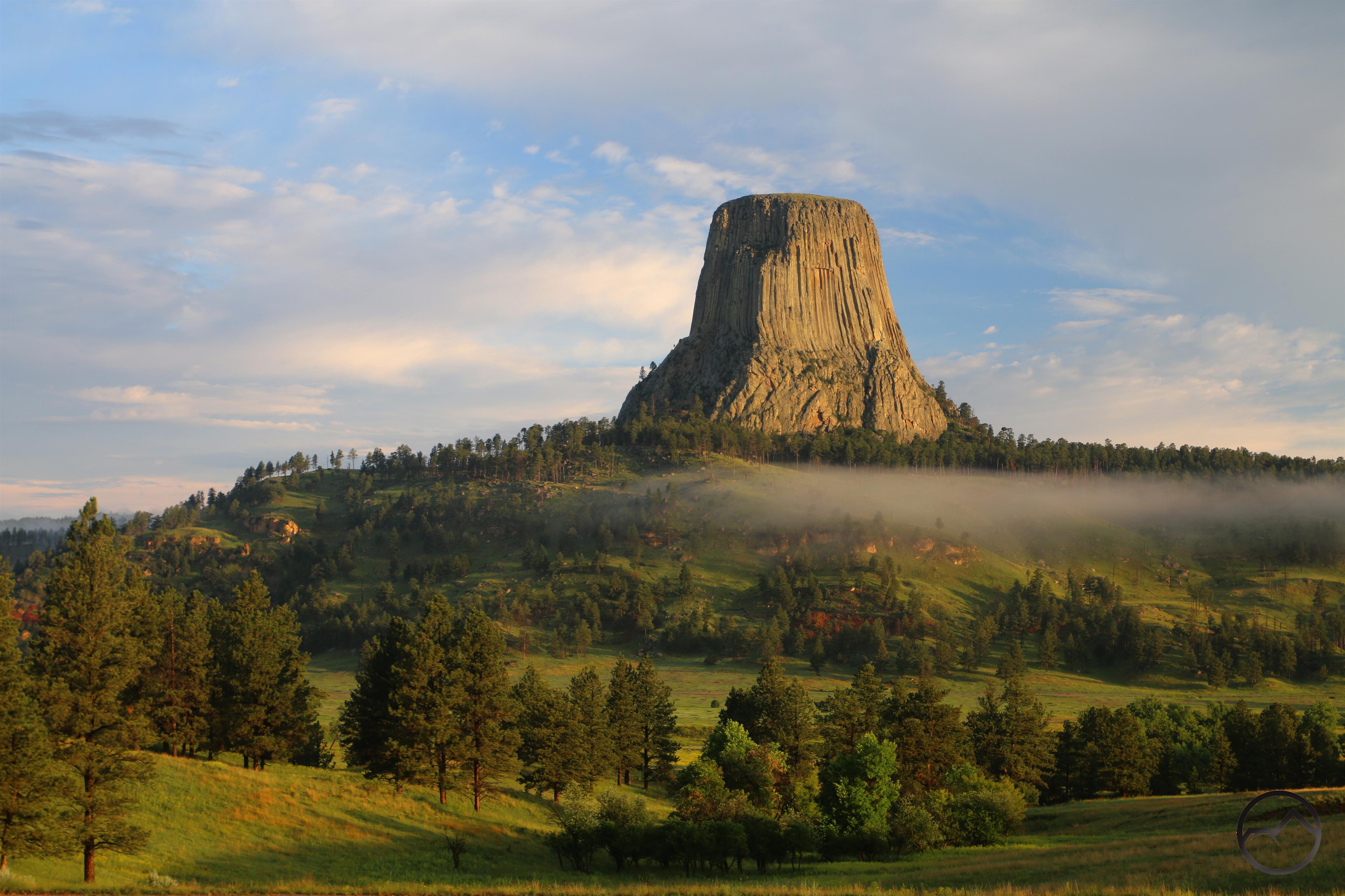
A western icon: Devils Tower in northeast Wyoming.

It’s been nearly a week since my family and I returned from our incredible roadtrip across America. We were all exhausted after this magnificent trip and it has taken a few days to return to our Mount Shasta equilibrium but having done so I have finally been able to digest just how much we saw in did in our long but all-too-short trip. To close this chapter, I want to write a post to commemorate this experience and possibly use it as a jumping off point on some future posts of a more philosophic nature.

In terms of destination, the goal of the trip was to visit family and friends in Colorado, Indiana and Wisconsin. This served as a useful motivator to drag our three kids 3/4’s of the way across the country. In deeper purpose, we wanted them to get a sense of how vast America is, how people in other parts of the country live, and how diverse this majestic land really is. On all three accounts, I believe we accomplished this in spades.

To review a trip of this scope, I think the easiest way is to post a bunch of images of the kids in action at various places along the way, along with a short description. After that I will have some other images to use as a platform to expand upon a few of the memorable places and events along the way. I hope that this gives some feel of how we fared and that it is, even in some small part, a vicarious journey across America. Also, for those of you who know my wife, I swiped a few of her images for this gallery!

Click to enlarge:

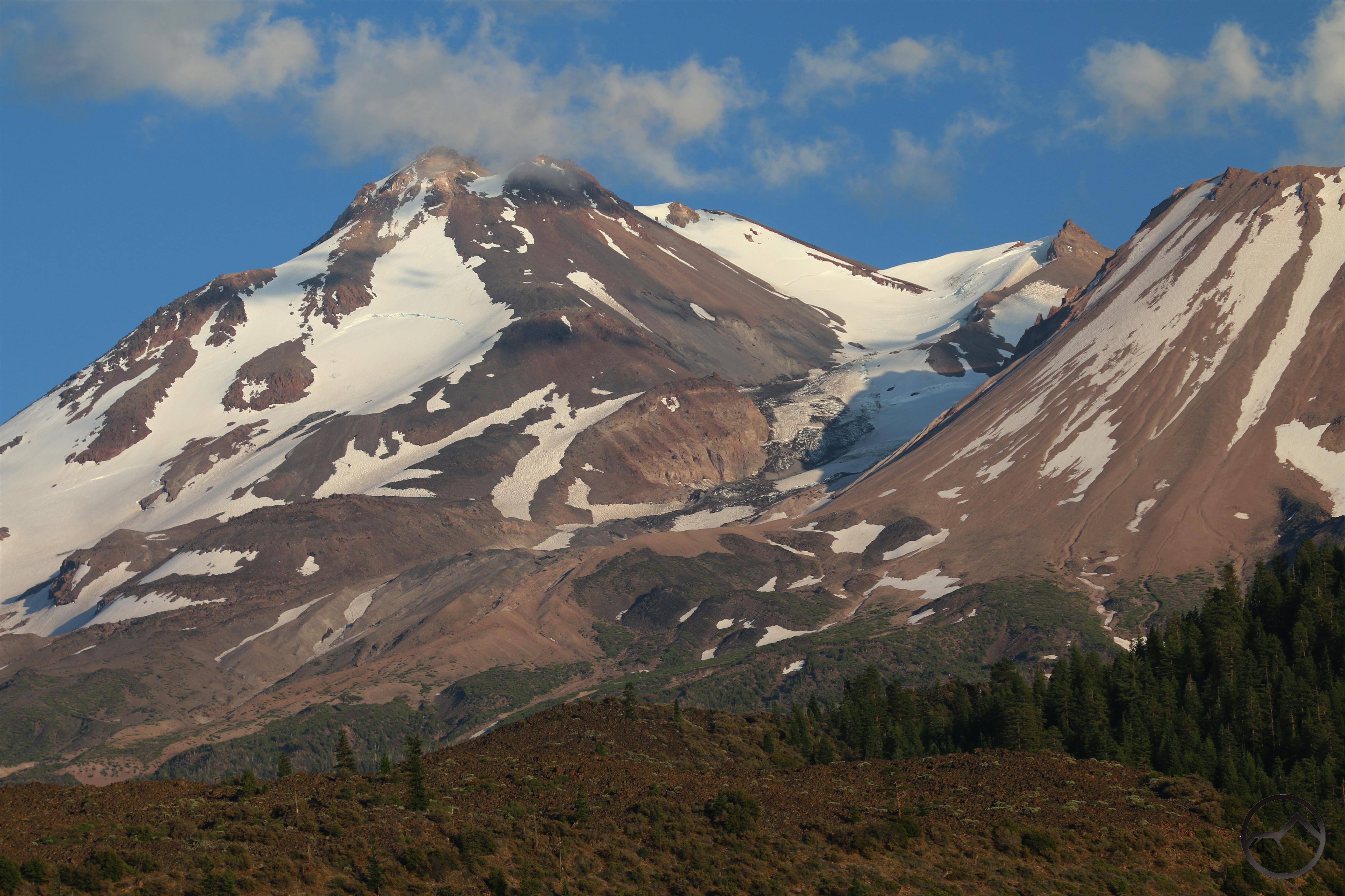
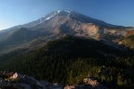
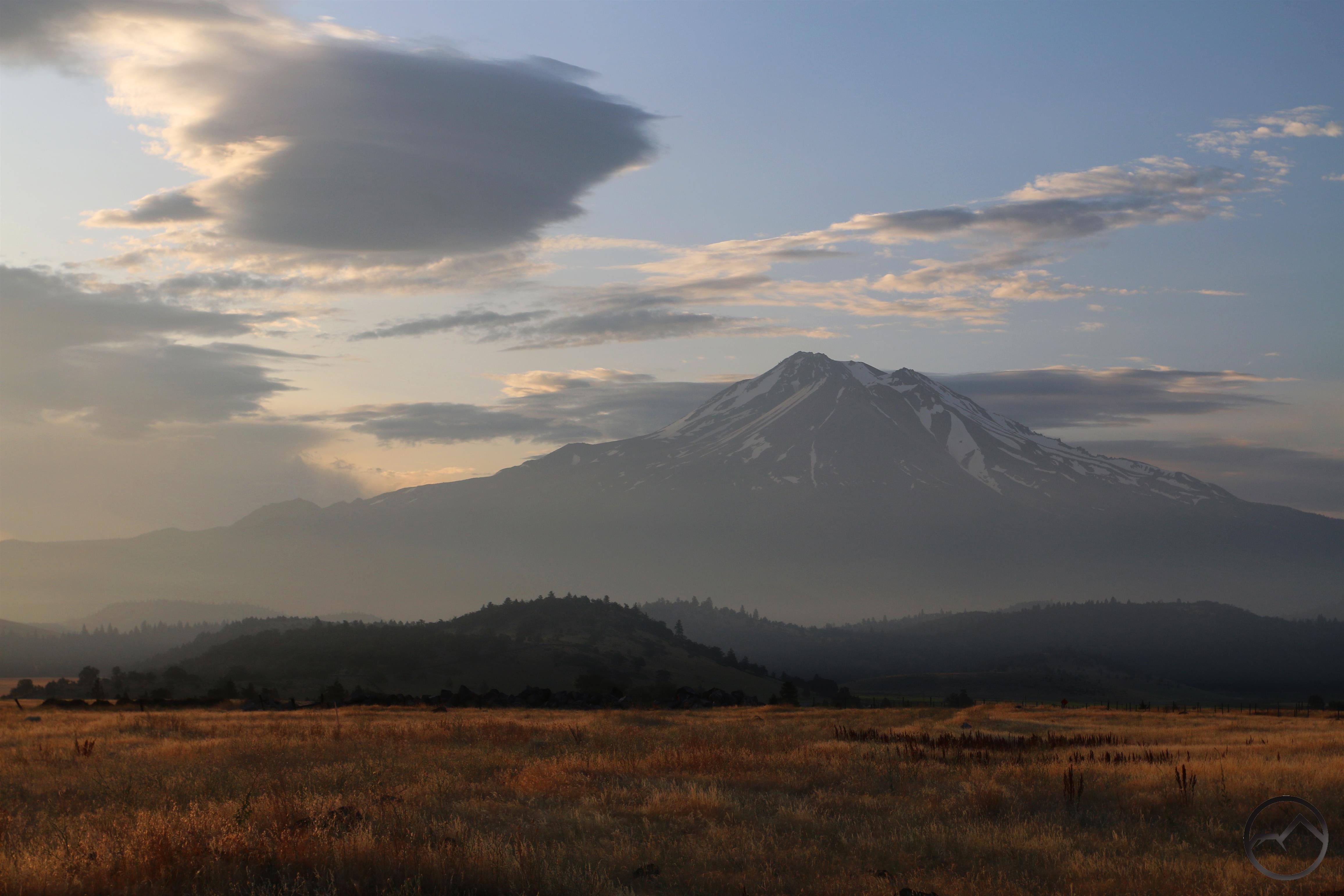
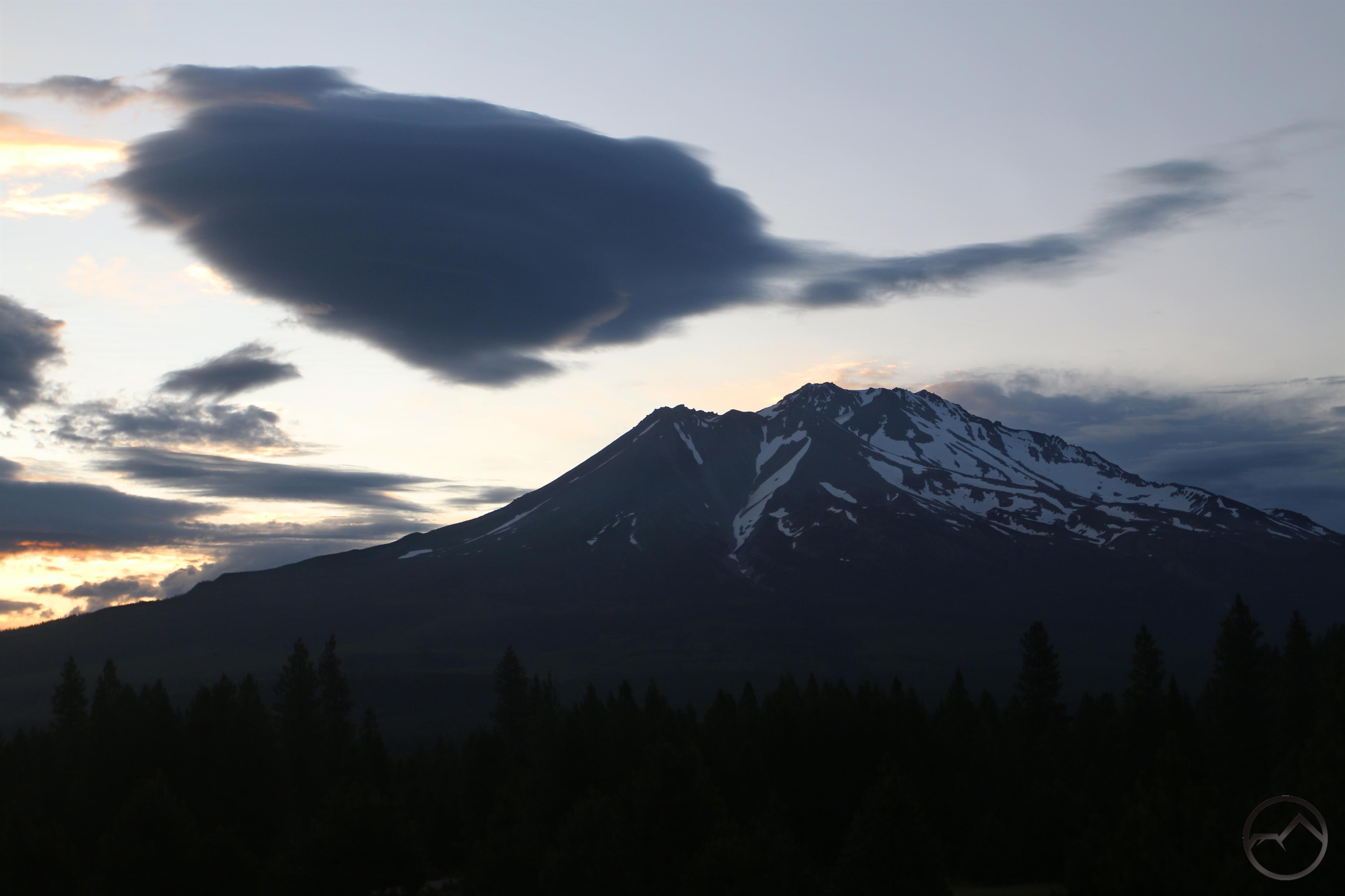
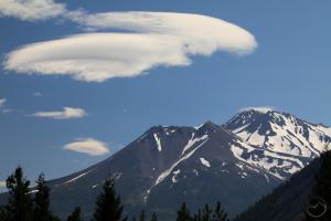
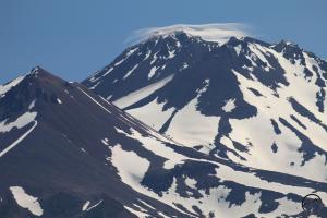
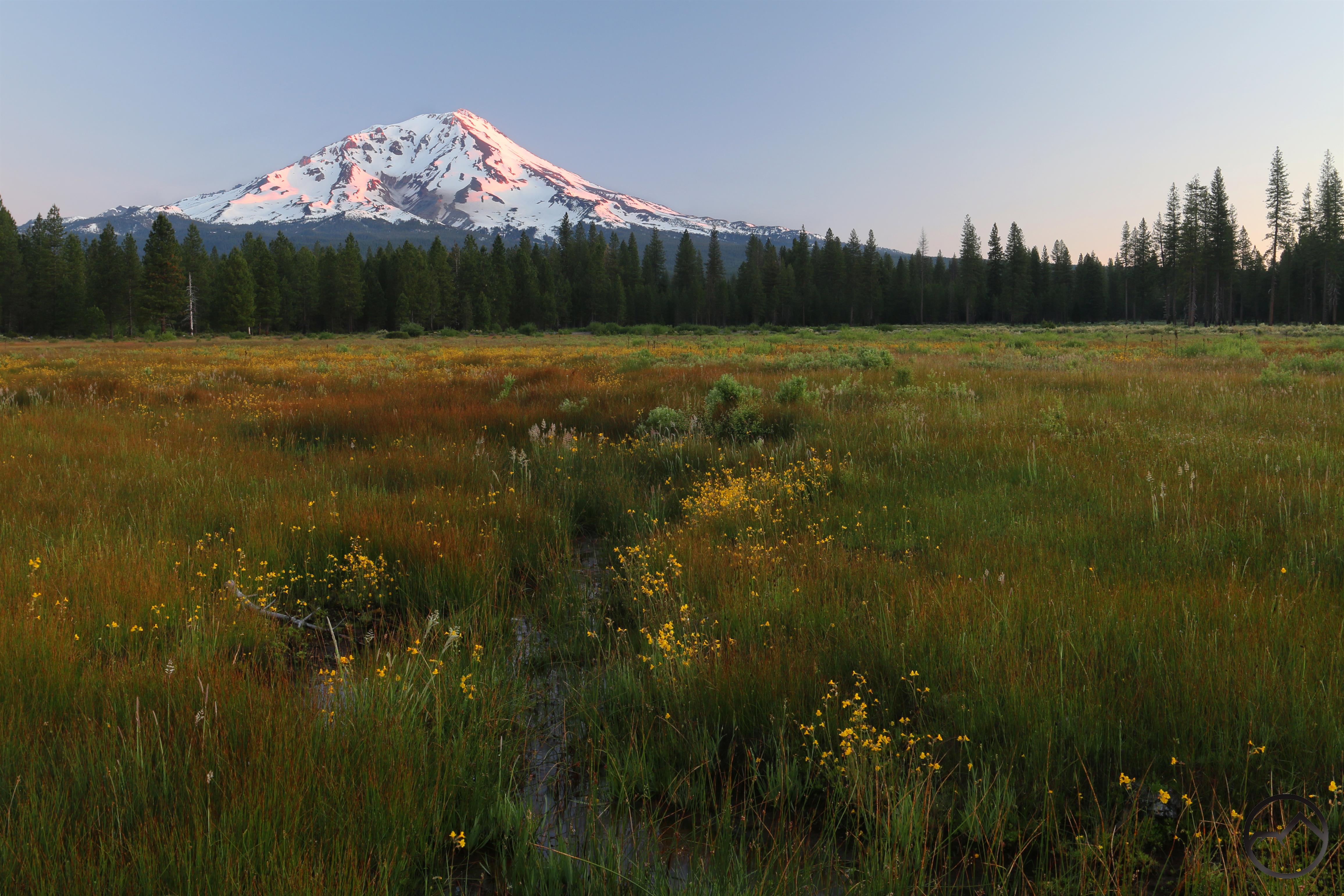
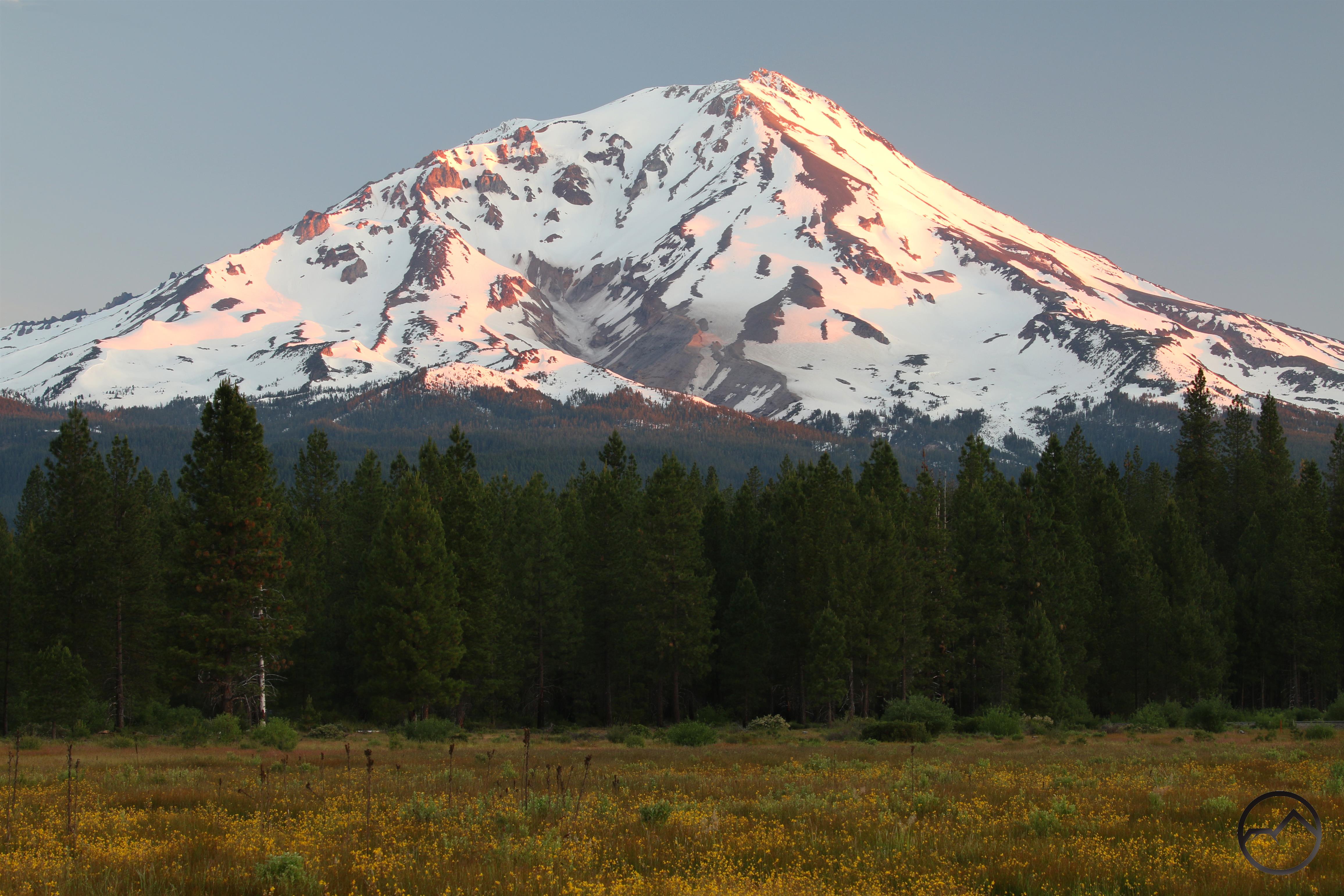
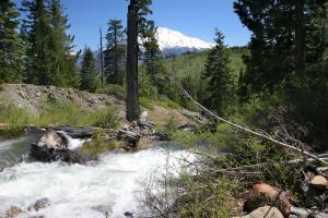
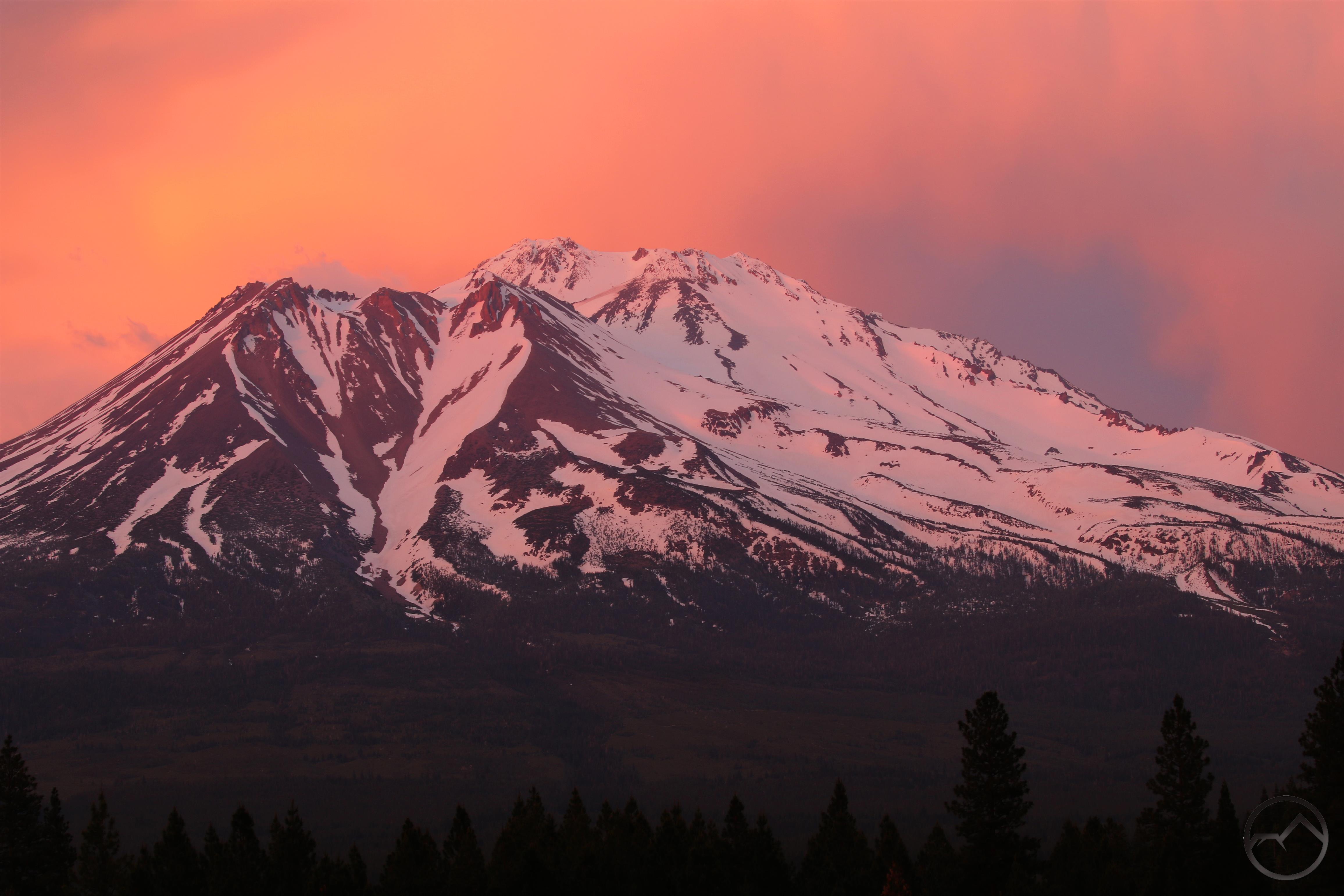
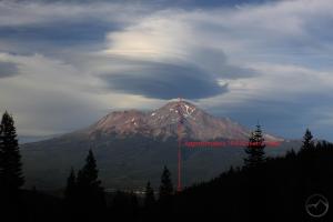
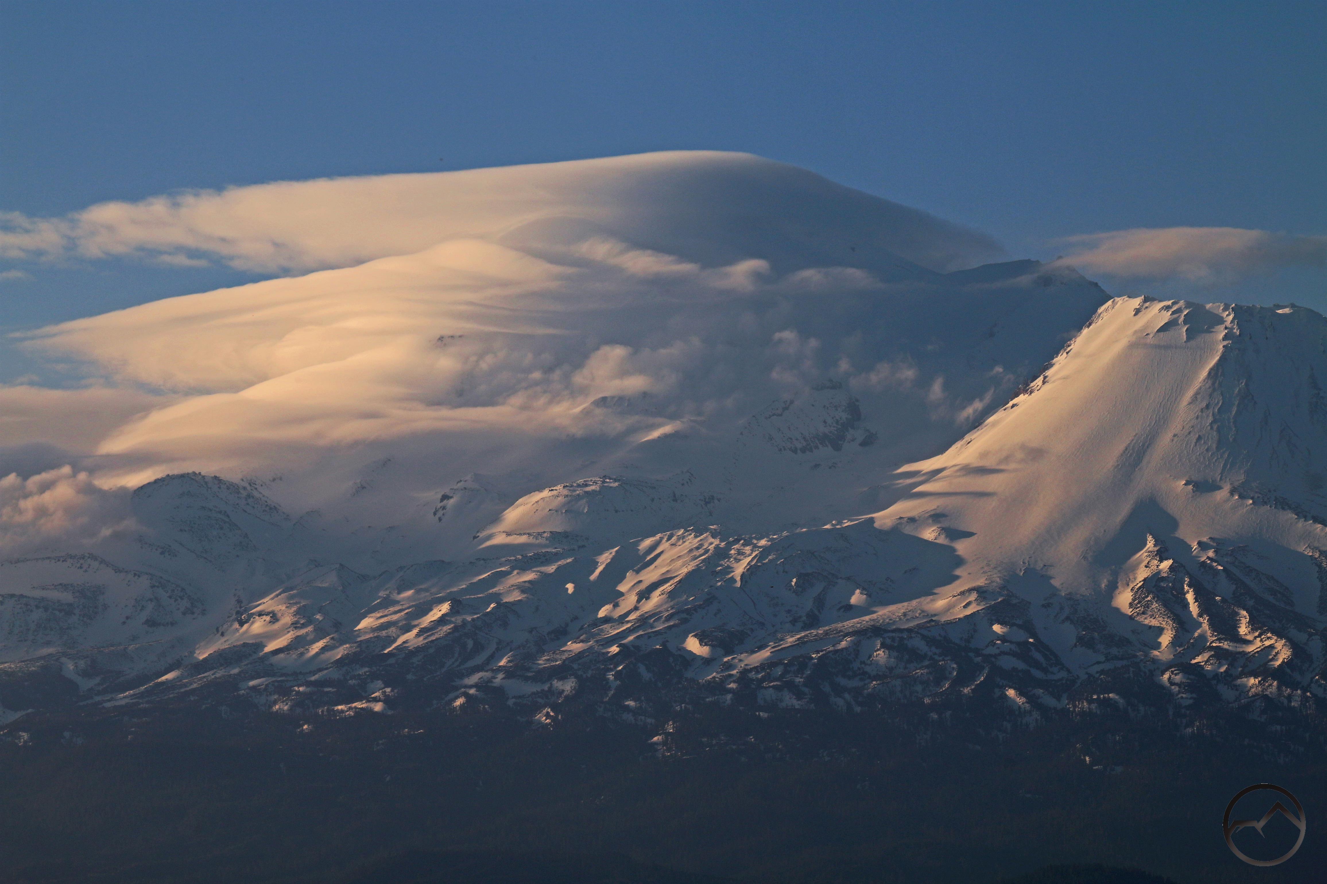
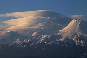
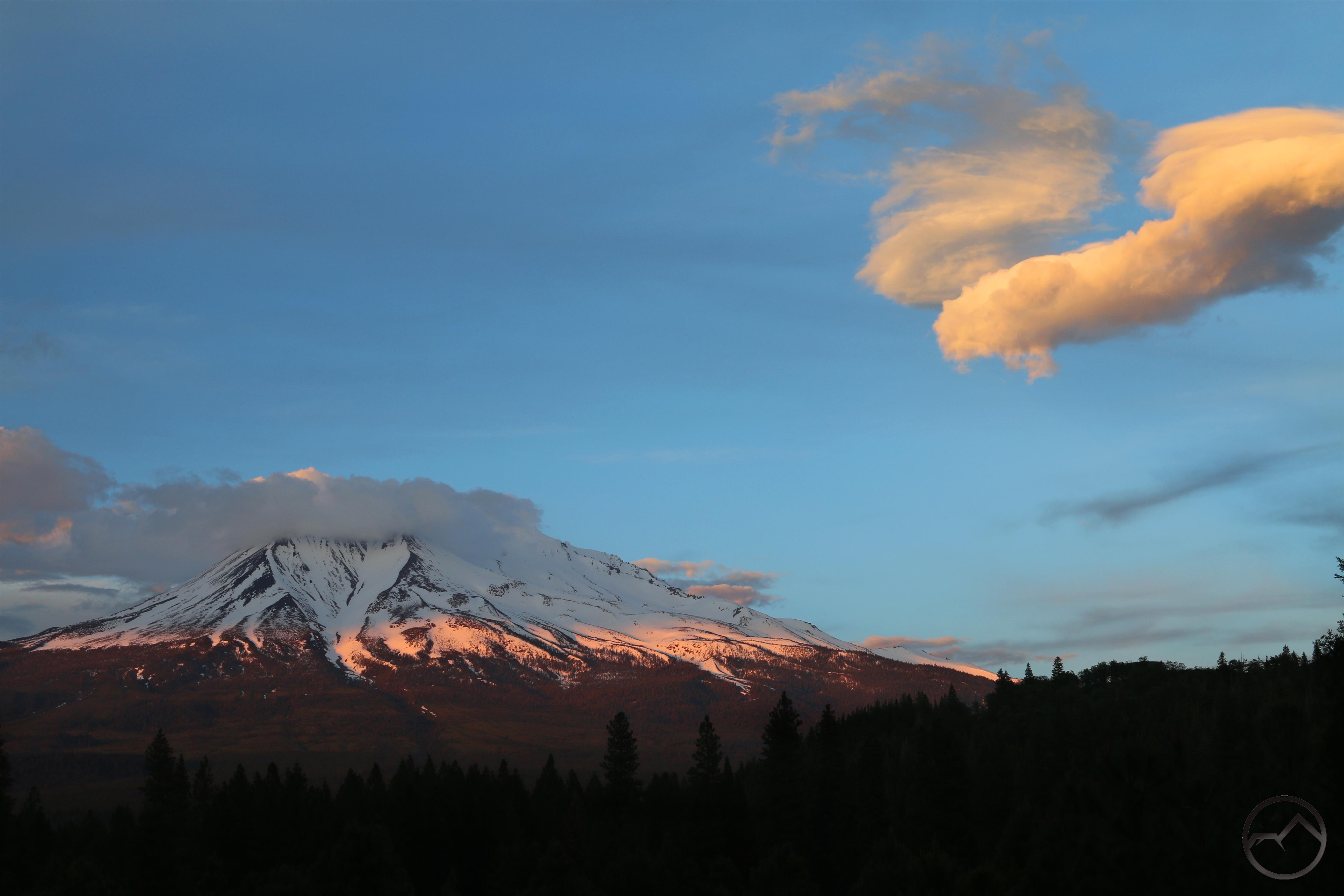
Saying good bye to Mount Shasta. The last view for a few weeks.
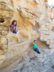
Climbing on rocks at the Hickson Petroglyphs in central Nevada.
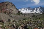
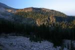
Nevada’s mighty Toiyabe Range.
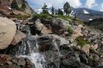
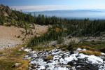
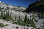
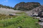
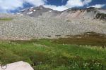
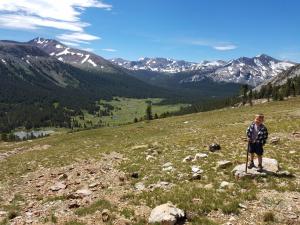
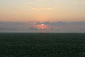
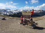
Morning at Great Basin National Park.

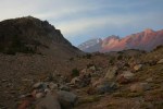
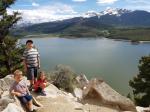
Sunrise at Grandview Point, Canyonlands National Park.
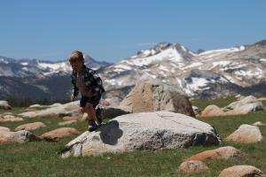
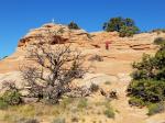
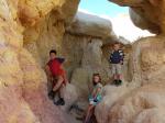
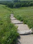
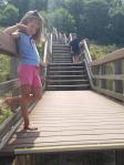
First climb on Moab sandstone!
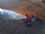
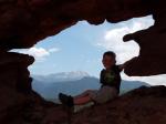
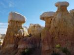
A whole new world unfolds at Mesa Arch.
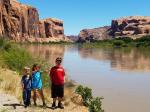
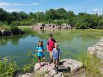
Hamming it up on the banks of a very full Colorado River.

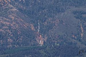
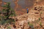
Specks on the cliff?
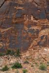
Petroglyphs!
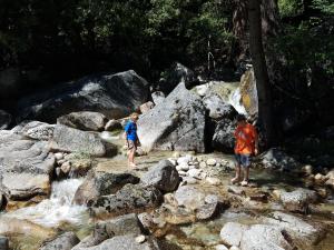
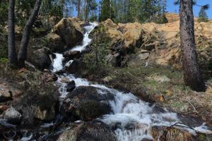
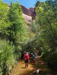
Afternoon playing in a Moab creek.
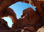
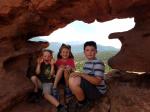
Can you spot the three kids in Double Arch?

Sunset at Delicate Arch view.
Mom’s the best!
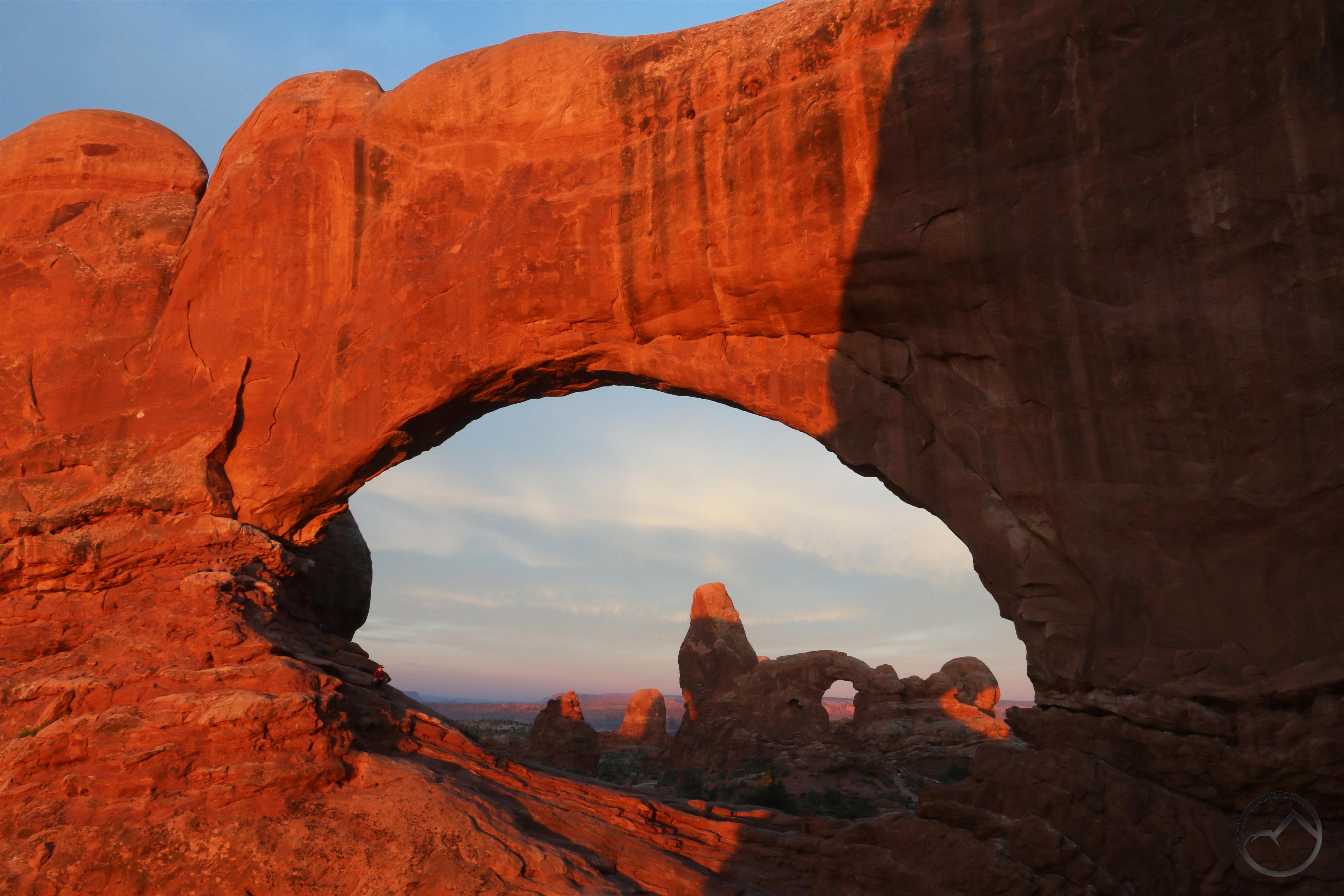
Sunrise at the Windows.
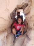
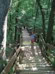
Exploring a sandstone tunnel.

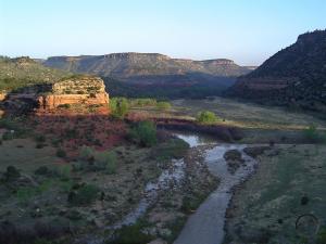
Farewell to the sandstone, Colorado National Monument.
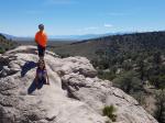
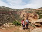
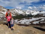
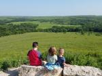
Sapphire Point and the Ten Mile Range.
Loveland Pass on the Continental Divide.
Pacific side

Atlantic side! First time the kids were in the Atlantic watershed.
Fun at the Air Force Academy.
A little ham at the Garden of the Gods.
Happy to be at the Garden.

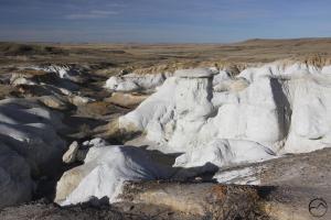
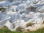
Scrambling at the Paint Mines.
Lots of colors at the Paint Mines.
A little more ham at the Paint Mines.
Enjoying Kansas.

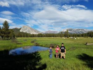
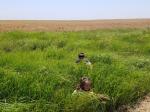
Experiencing the Great Plains at Konza Prairie.
Prairie hiking in Kansas.
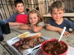
Let’s get serious: Kansas City barbecue.
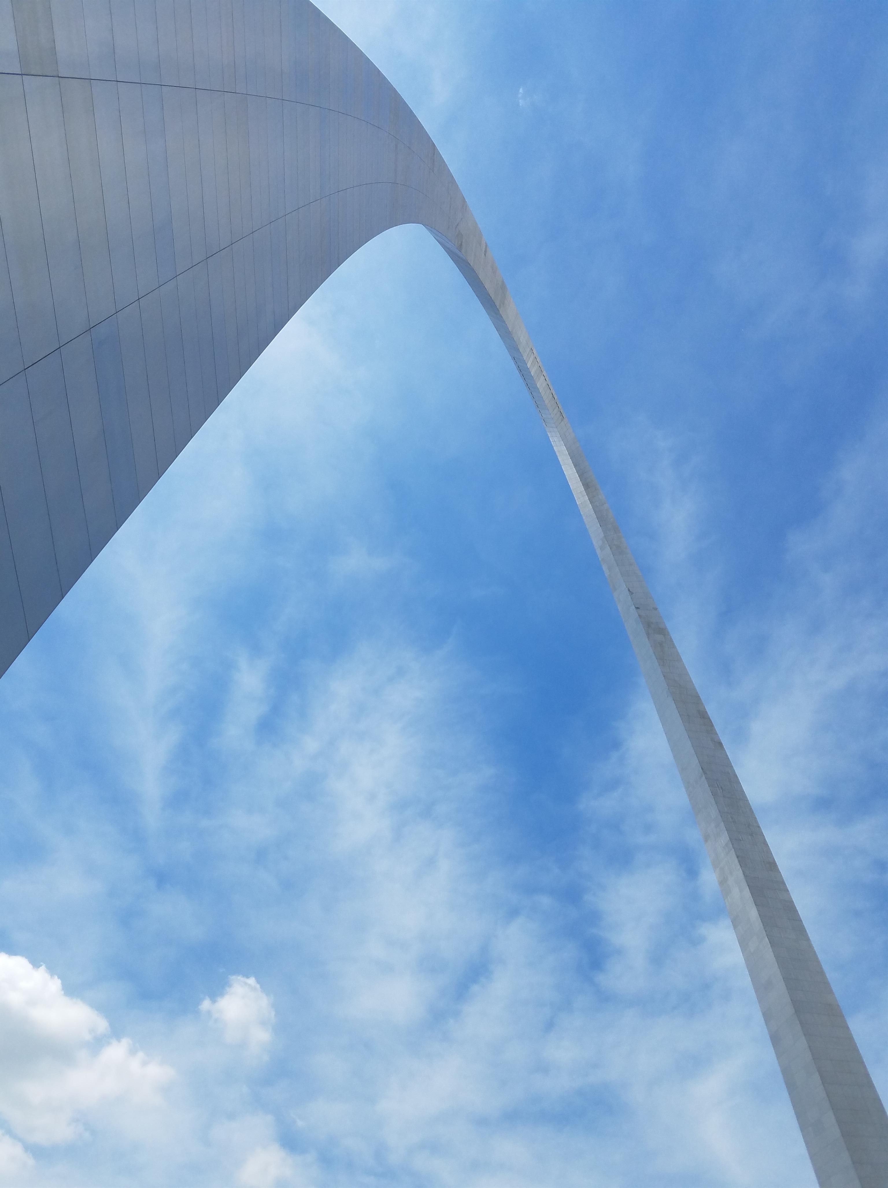
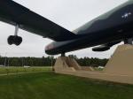
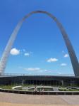
Cooler than expected: Gateway Arch.

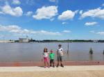
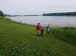
An exceedingly full Mississippi River.
Hiking barefoot at the Indiana Dunes.
Surprisingly diverse trail at the dunes.
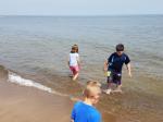
Indiana Dunes: first swim in Lake Michigan!

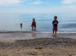
Another swim in Lake Michigan, this time in Port Washington, Wisonsin.
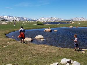
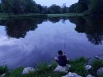
Fishing near the Milwaukee River.
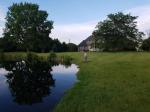
Fishing in backyard lake, Wisconsin.
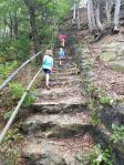
Climbing the Mill Bluff, a rare island of rough terrain in central Wisconsin.

Goodbye Mississippi River!
A quick hike into Gitchie Manitou State Park, Iowa.
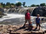
Hot and humid at Sioux Falls.
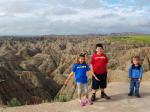
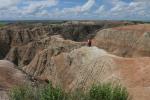
Epic Badlands.

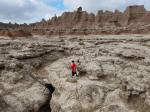
Exploring draws and channels in the Badlands.
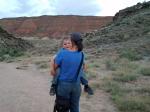
Mom and son in the Badlands.
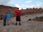
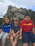
American icon on Independence Day!
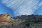
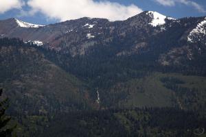
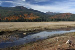
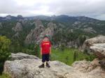
The Black Elk Wilderness of the Black Hills.

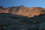
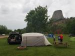
The calm before the storm at Devils Tower.
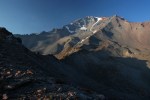
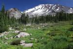
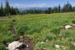
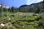
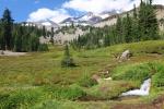
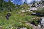
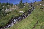
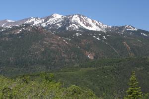
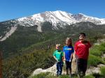
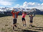
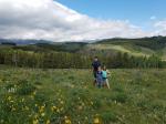
Profuse wildflowers in Wyoming’s Big Horn Mountains.
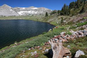
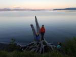
Evening stroll along Yellowstone Lake.
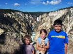
Spectacular Yellowstone.

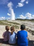
Old Faithful lives up to its name.
I’m going to get you dad!
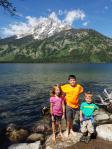
Playing in Jenny Lake at the Grand Tetons.
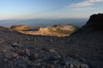
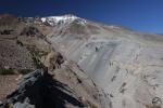
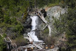
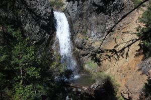
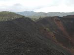
Hiking on the rim of the Giant Craters, Craters of the Moon.

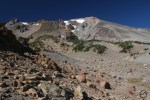
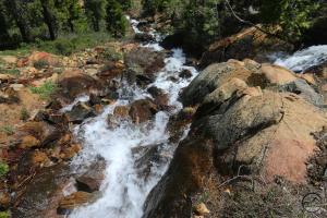
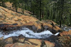
The first leg of our trip took us across the Loneliest Road in America to Great Basin National Park. From there it was off to Moab, Utah. If I wasn’t living in Northern California, this would be my home (somehow, someway). It had been a few years since I had been there and was shocked how much it had grown. For my kids, this was a major milestone. They have heard me extolling its virtues their entire lives. Now they got to experience it themselves.

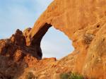
Moab did not disappoint them and it remains one of the high points of the trip. Our time there was full, as we hit both Canyonlands and Arches National Parks, as well as some other favorites amidst the red sandstone. My older son and I, both early risers, did a sunrise in each of the national parks. The second one, in Arches, was especially memorable for me, as I photographed my son in the North Window (enlarge the image to see him on the left side of the arch). He cried when we left, a feeling I remember sharing at his age when my family would leave Yosemite.

From there, it was across the Rockies and then the Great Plains, eventually making our way to St. Louis. I had fairly low expectations for the Gateway Arch but it seemed like a good place to stop so the kids could see the Mississippi River. The river was flooding, as the whole promenade along the bank was under several feet of water. The real highlight, however, was the visitor center beneath the arch, which was focused on the westward expansion of the United States. This whole complex was recently remodeled and the new museum is fantastic. The whole family was enthralled by many of the displays and we could have spent far more than the scant hour we had allotted to it. We had no idea how well done and engaging it would be.

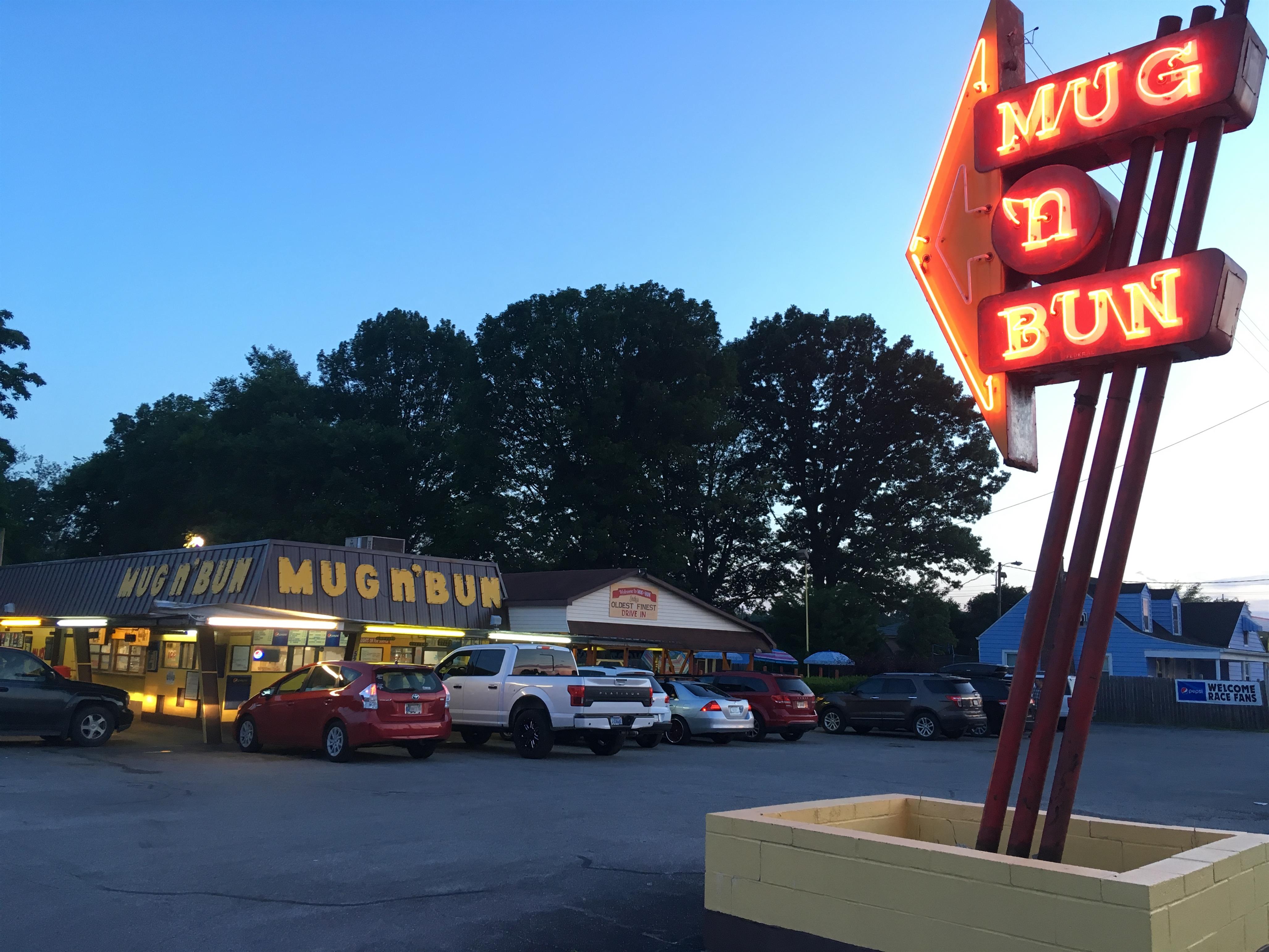
Finally, we arrived in Indiana, our easternmost state on this trip. In Indianapolis we ate dinner at the Mug N Bun, our favorite meal of the trip. Breaded pork tenderloins our a mainstay in Indiana and it was a goal to enjoy some. This diner is classic Americana and visiting it is a moral imperative to anyone who finds themselves in the area!

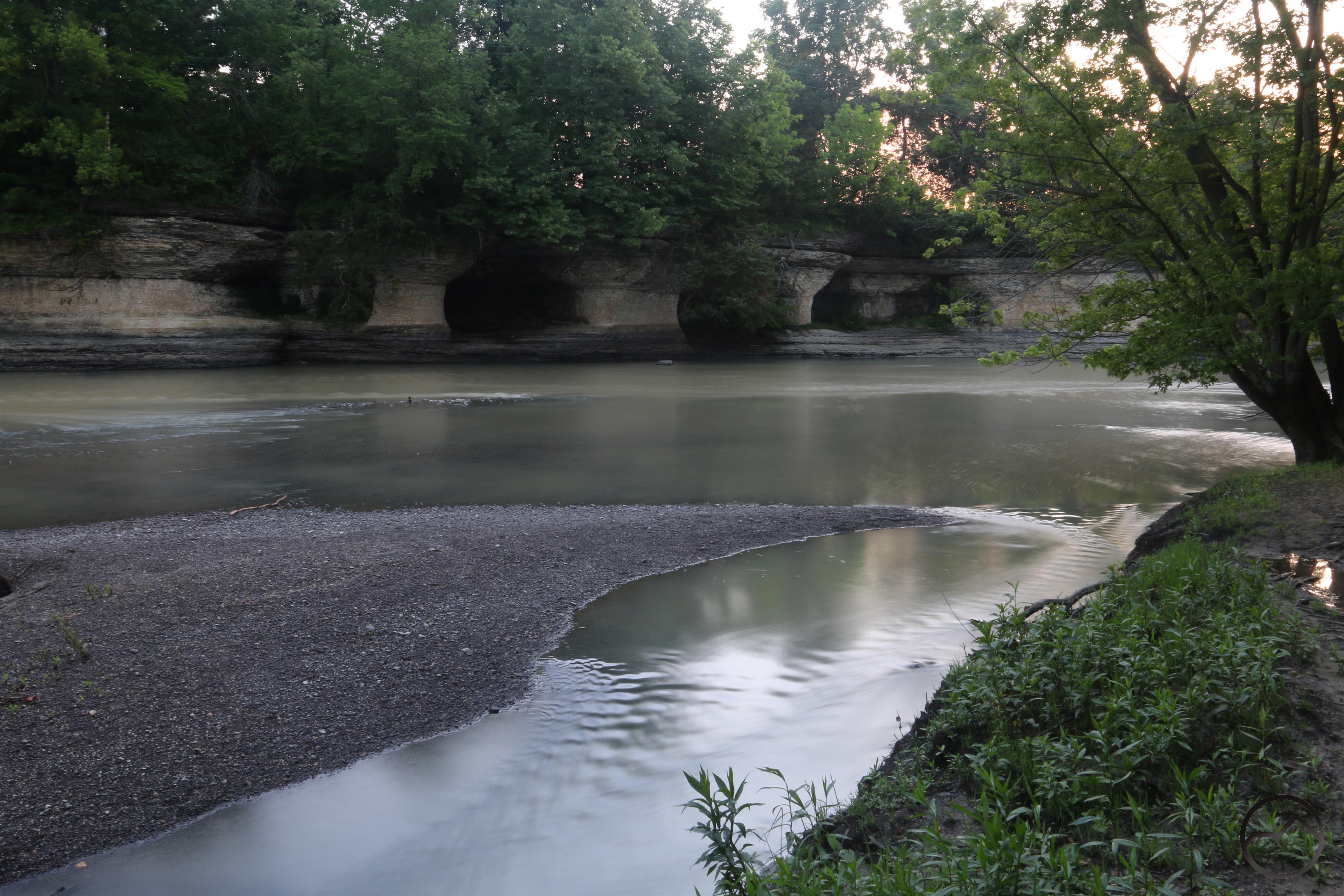
Further north in Indiana my son and I once again rose early to head to the Seven Pillars of the Mississenawa River. While heading there, we caught a gorgeous sunrise on the Wabash River.

After the sunrise, we arrived at the Mississenawa and walked out to the banks where we could observe the Seven Pillars. This was the furthest point east of the trip and a surprisingly beautiful place. The limestone columns that made up the far bank of the river were fascinating and made a great backdrop to the steadily flowing river. These kinds of places of more subtle beauty have been on my mind more and more. Living in the shadow of a mountain like Mount Shasta tends to desensitize one to other aspects of Creation that are worthy of appreciation. This is especially so for kids like mine, who know nothing but the grandeur of the mountain. It was good for my son to ponder a place like Seven Pillars and recognize that it too deserves to be enjoyed.

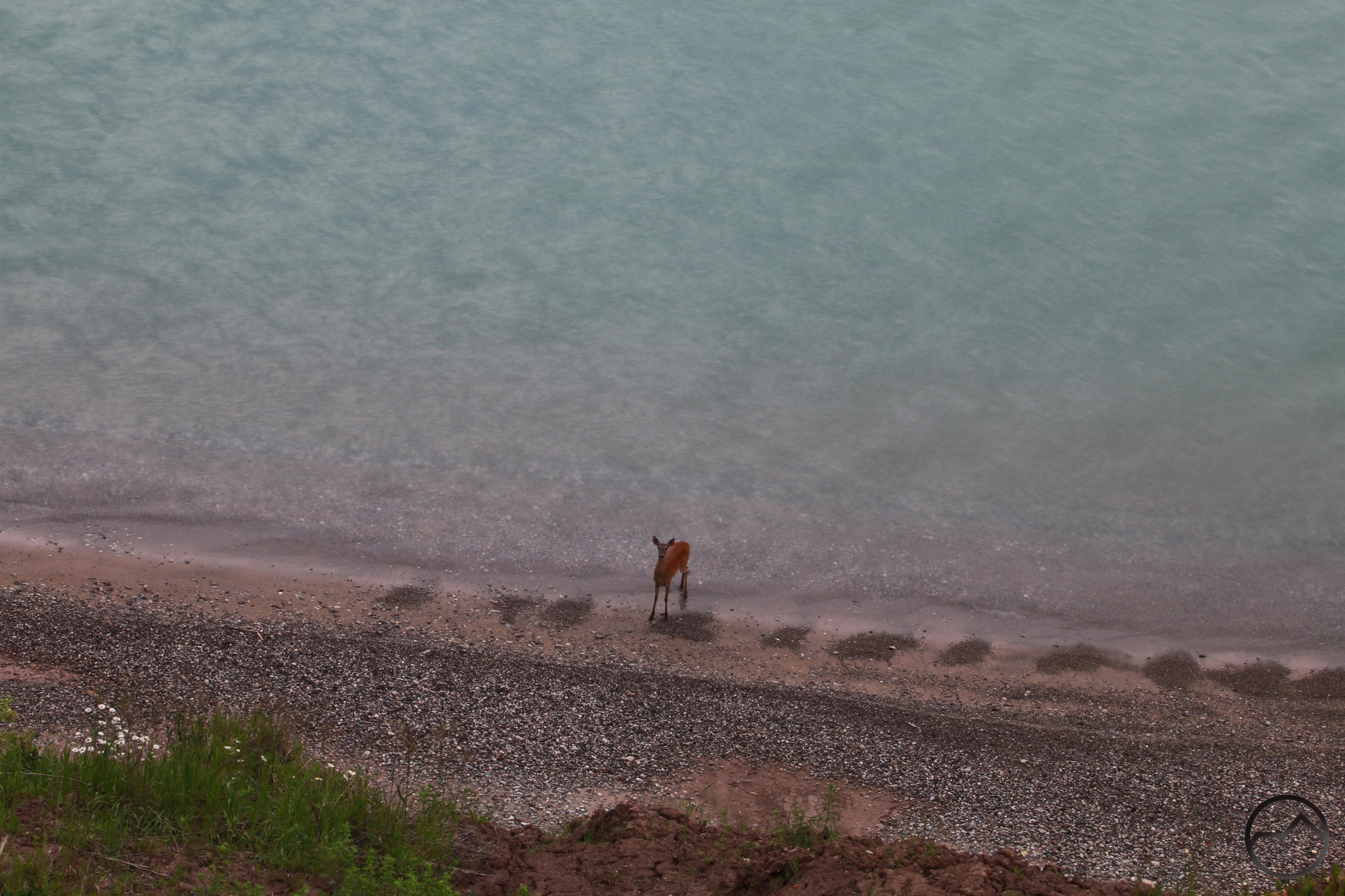
From Indiana we headed up to my sister-in-law’s house in Wisconsin, just north of Milwaukee. It was a rich family time and a great break from being on the road. We enjoyed our stay immensely. My brother-in-law took my kids out to the lake behind their house and got them all fishing. I have neglected to take my kids fishing, as I have never enjoyed it. My kids, however, took to it instantly and are clamoring to go here in Shasta. During our stay, I got up alone one morning and headed out to Lake Michigan for the sunrise. I had not anticipated the amount of wildlife on the lakeshore but enjoyed it nonetheless. The highlight came when a deer appeared,  galloping along the beach. I whistled at it and we met each other’s eyes for a bit before it continued sprinting down the lakeshore.

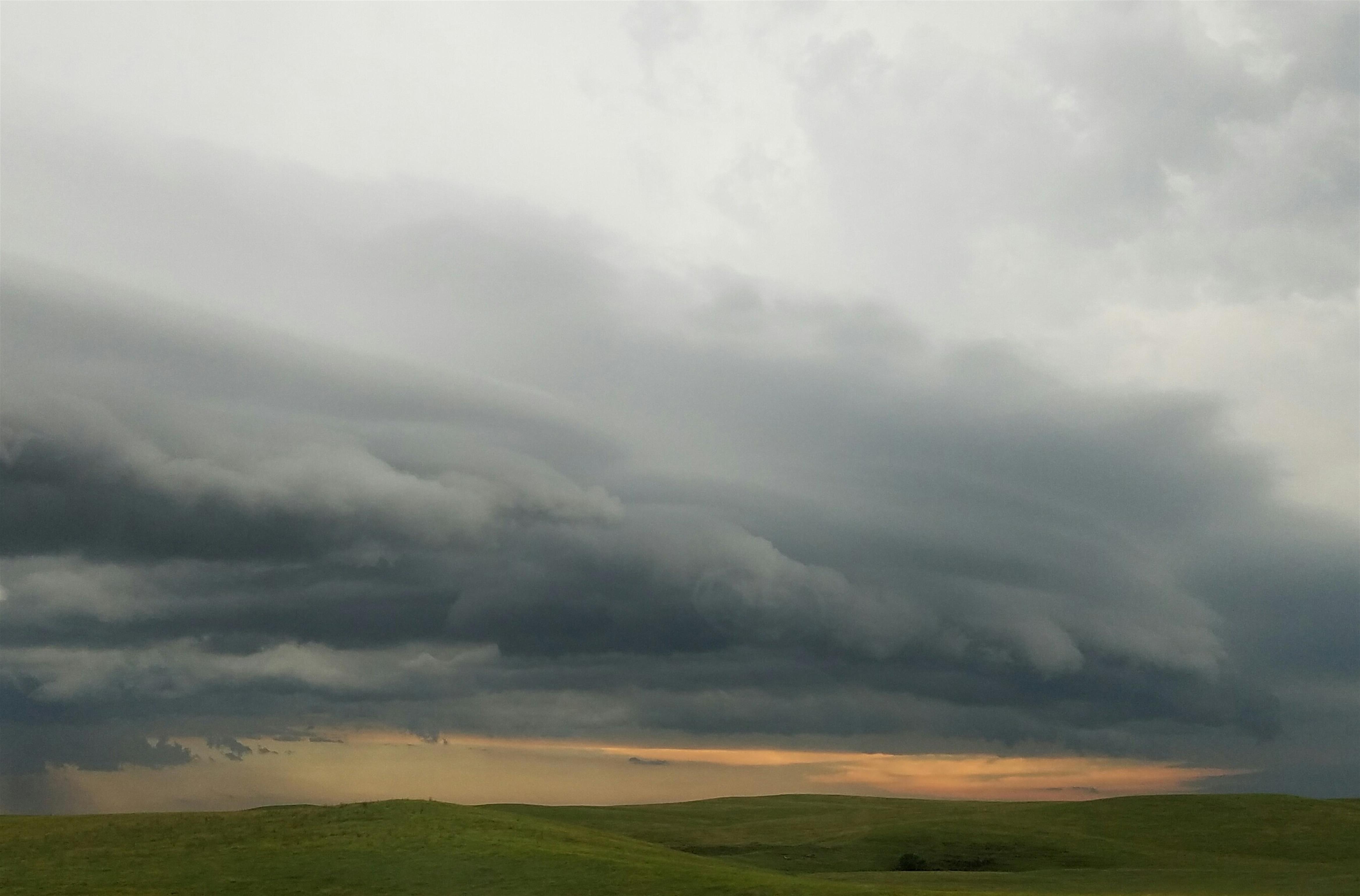
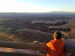
Eventually it was time to leave and begin the journey back to Mount Shasta. The drive from Wisconsin to Badlands National Park was the longest single day’s drive of the trip. Though hot and humid on the East River side of South Dakota, West River was being submerged in what turned out to be a thunderstorm of seemingly Biblical proportions. We had hoped we would get a lightning storm at some point on the trip but we had not anticipated anything quite like this. We wimped out and got a hotel room for the night rather than camp but decided to push a little past the town we were to stay in and see how things looked at the Badlands. About halfway through the 15 minute drive to the park, the sky was ripped open and the rain fell so hard that visibility was reduced to literal zero. I could not see past the front of our van. We limped off the road at a rest stop and waited for the storm to slacken. Lightning crashed all around us and the din was incredible. Never having experienced the like, the kids were not impressed.

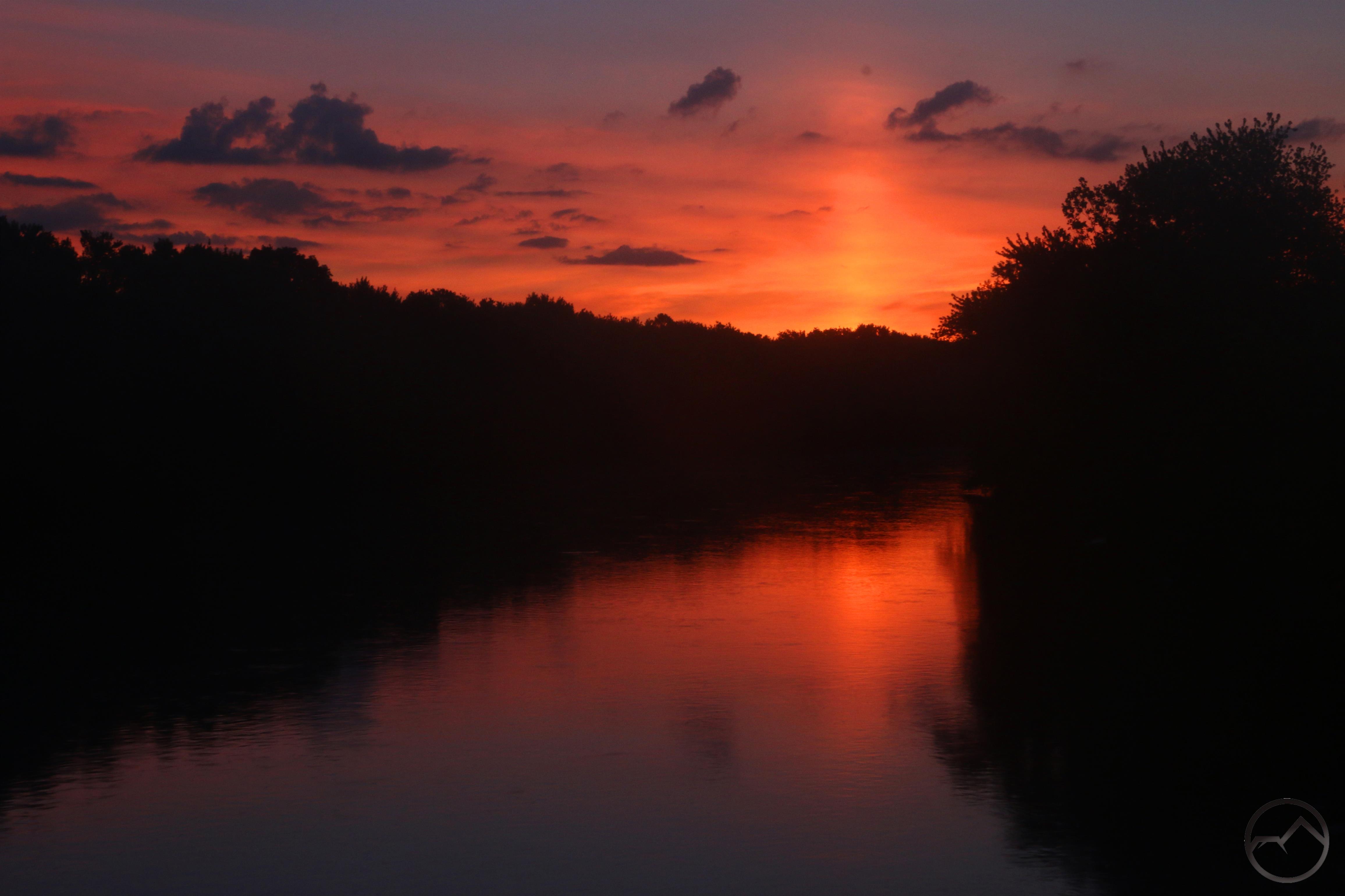
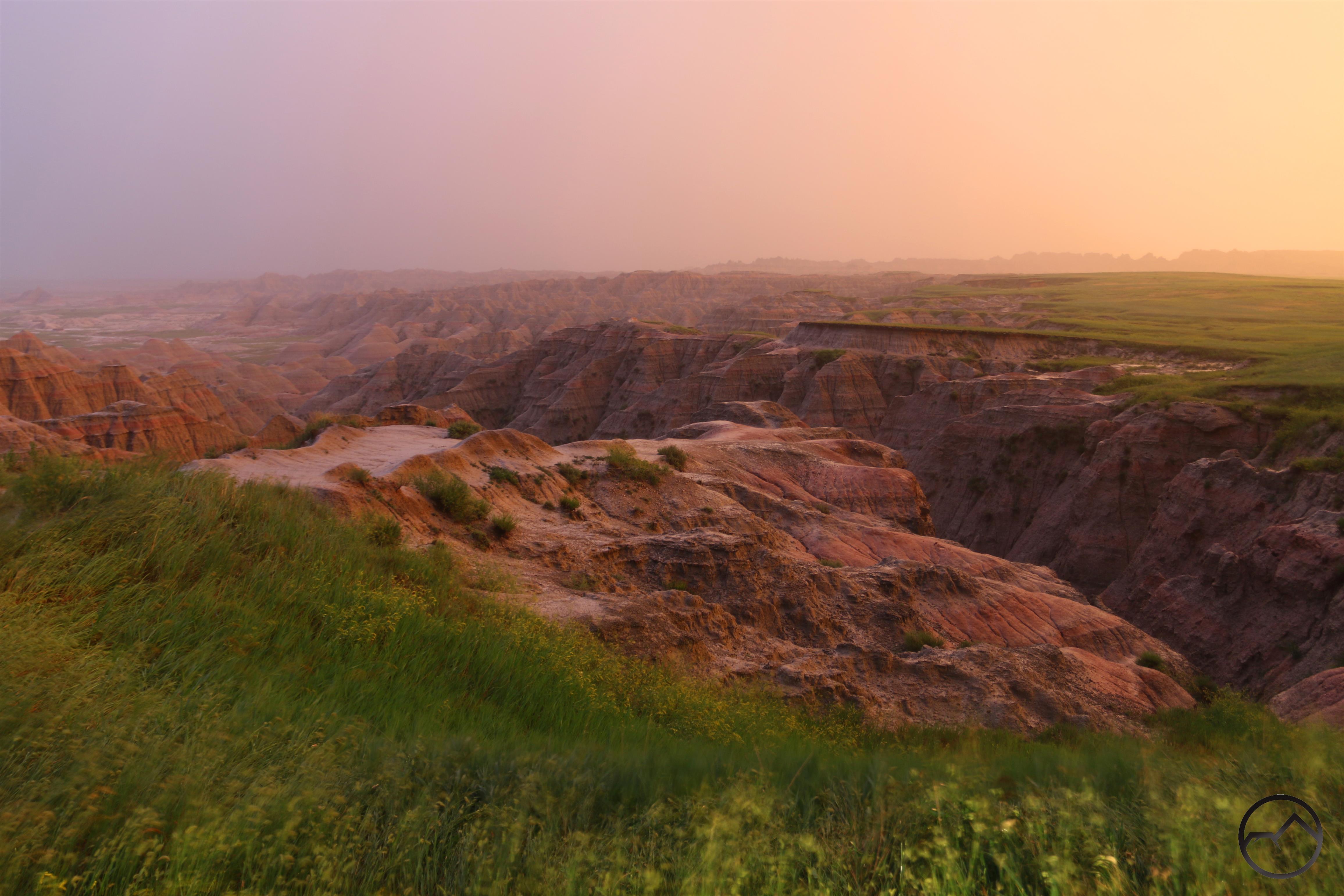
To get back to our hotel, we had to go all the way to the Badlands exit and turn around. Upon our arrival, the sun just happened to start slipping beneath the storm clouds as it was setting. For a precious few minutes, South Dakota was aglow in the sinking sun even as the rain continued to fall, the wind whipped us and lightning crashed around the plains. Inspired by this gorgeous display, we sped into Badlands to the first (and best, in my opinion) overlook. I hopped out of the van, set up my camera and got one quick image. It was my favorite of the trip.

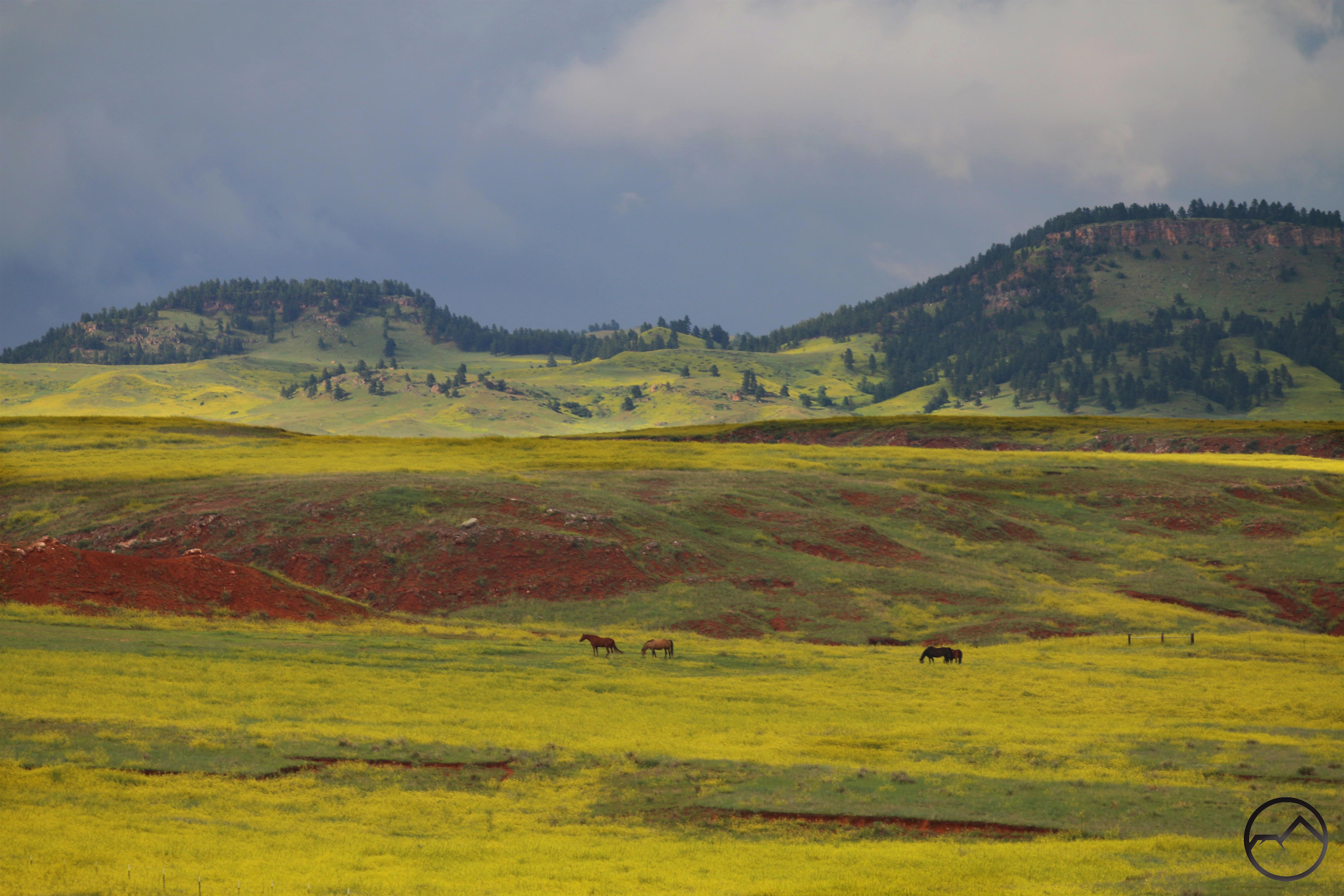
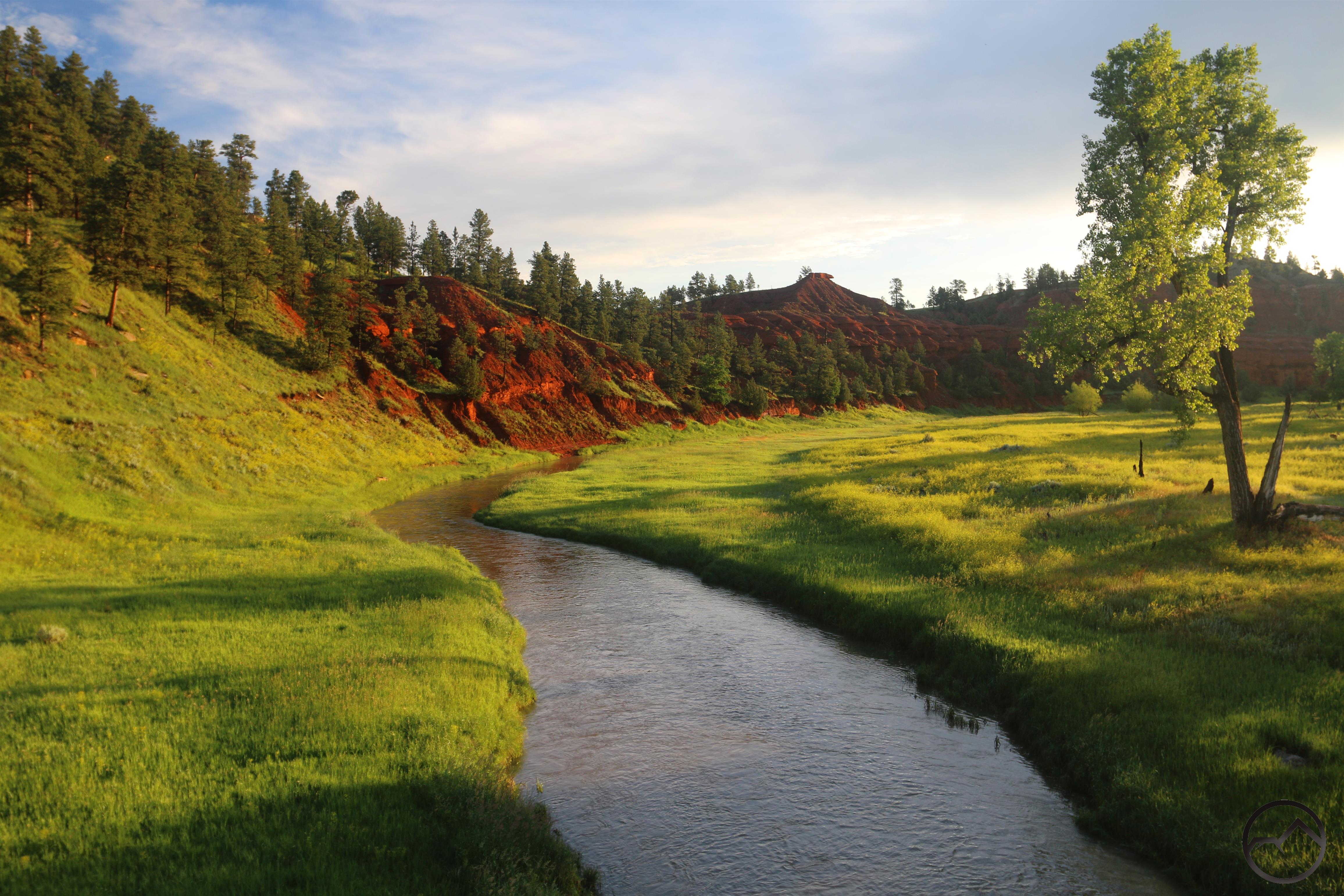
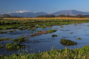
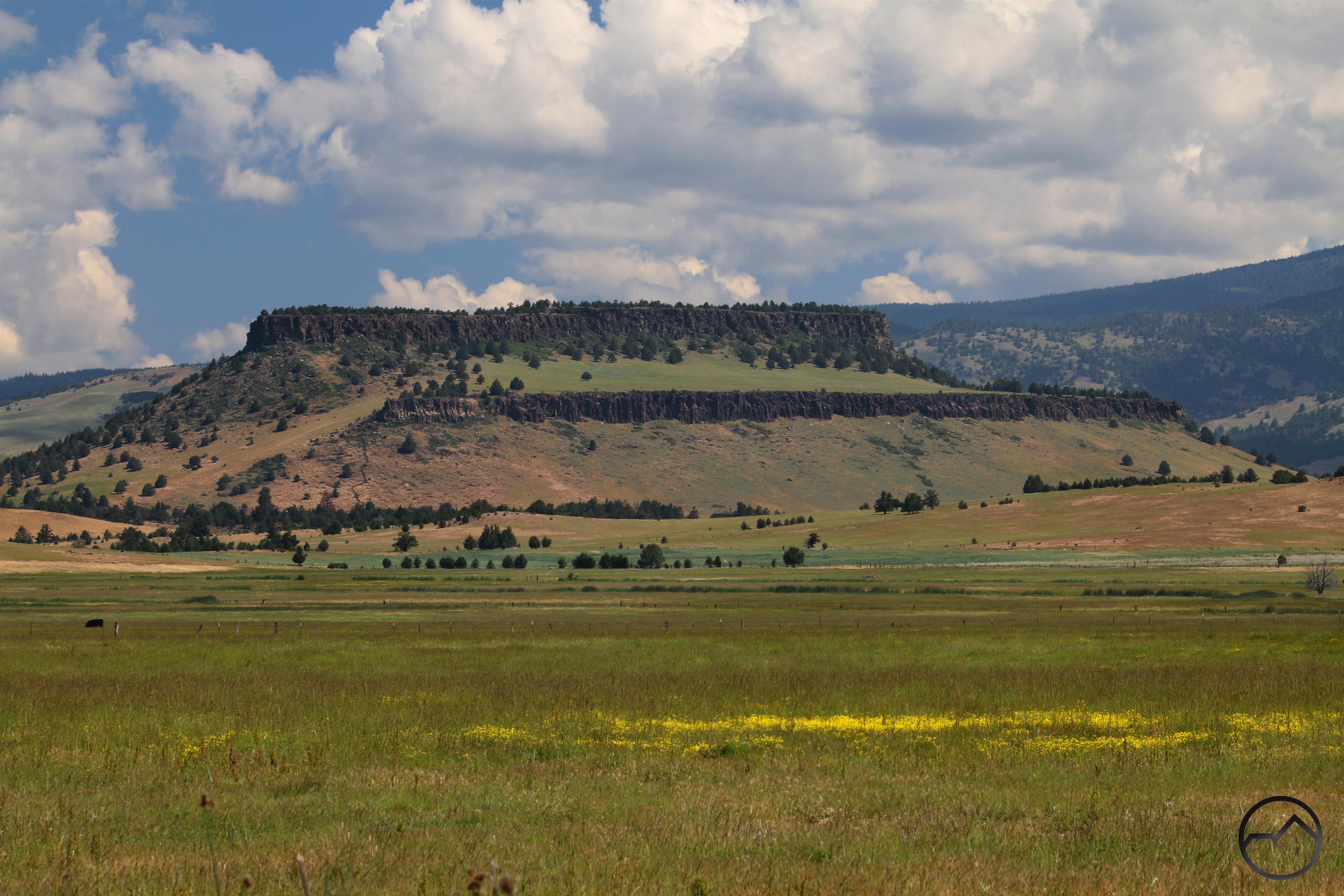
Thankfully the storm passed and the next morning was gorgeous at the Badlands. We explored the park and the Black Hills before continuing on to Devil Tower in Wyoming. Throughout western South Dakota, the plains were glowing with yellow flowers in the grasses. Wyoming was no different and the yellow fields were a stupendous contrast to the red earth and green trees of the region. The same was true at Devils Tower:

This whole area was one of our favorites of the trip. The beauty of the Plains reached their apex here, the vastness of the landscape moved me and it has been a fixture in my mind since passing through it. I am already plotting my return.

20190704_213040_1b

20190704_213040_1b

We arrived at Devils Tower on the 4th of July. The whole community was infused with a festival atmosphere but another round of severe thunderstorms was predicted. We checked out the tower and then headed to camp, managing to pitch our tent just as the storm really started in earnest. Lightning crashed all around is once again and the wind was furious. However, this was not to be the only pyrotechnics. The fireworks display went on as planned in spite of the storm. We sat in our tent, the rain nearly deafening, and watched out the window as lightning and fireworks alternated in lighting up the sky. It was the most memorable Independence Day I have ever had.

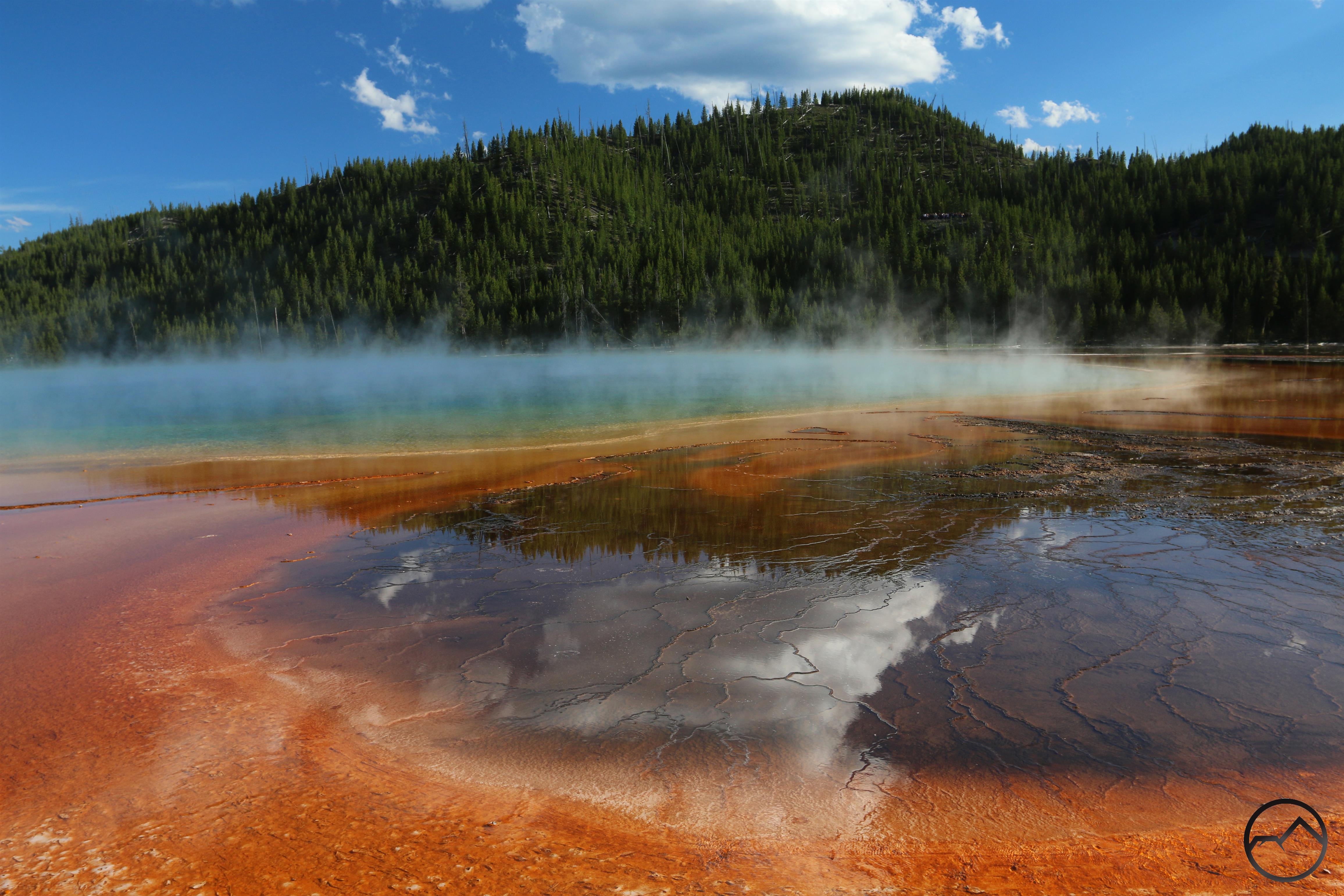
We eventually made it across Wyoming and arrived in Yellowstone. It was a great time, viewing the wildlife (especially the bison!), wondering at the geothermal features and marveling at the Grand Canyon of the Yellowstone. It was a few more days until we reached home, tired and satisfied. Our Odyessean journey was completed. For my kids, their horizons were extended and their appreciation for their home, for Mount Shasta was greatly enhanced. For my wife and I, it was a fantastic adventure of lifelong memories for our family.

I can’t wait for our next one. We’re headed to Yosemite in a week.


Solstice Sunrise / Why I Am Excited To Drive Across The Plains

Posted by bubbasuess on June 21, 2019
Posted in: Cascade Range, Hiking, Mount Shasta. Tagged: great plains, plains, solstice. 4 Comments

Sunrise on Mount Shasta on the summer solstice.

No doubt everyone is aware that today is the summer solstice. I was up early once again so I headed out to watch the sunrise on Mount Shasta one more time before heading east on my family’s roadtrip. With no clouds in the sky to create an interesting scene above the shadow-cloaked west side of the mountain, the eastern side was the natural place to go. I didn’t have time to swing all the way around to the east before the sun came up but I did make it to the south side, where i could see the crags of Sargents Ridge catching the morning light. There was not a lot of color but there was plenty of snow. Rime ice on the summit and the blue ice of the Konwakiton Glacier were also visible. I’ll catch one more sunrise on the mountain tomorrow, but this time it will be from the PCT vista point on the Hat Creek Rim while on our way east to catch Highway 50 across Nevada.

Speaking of snow, this is how the Old Ski Bowl looked on the solstice. There is a heap of snow still up there. I would not be surprised if the road up there doesn’t open until early August. Nonetheless, whoever hikes up to the bowl when that snow starts melting in earnest is in for a treat!

Aside from the solstice sunrise, I wanted to spend a few moments considering my anticipation of driving my family across the plains. Even though we will be visiting several national parks and other spectacular spots and making a few crossings of the Rockies, one of the things I am most excited about on this trip is driving my family across the Great Plains. 15 years ago I would never have thought I could make such a claim but it is true. This is rooted in my time in Texas and exposure to different kinds of beauty. I have written about this a little bit but for the last few years it is a theme I have wanted to expand on but never seem to have the mental energy to sit down and really do my thoughts justice. Nonetheless, the subject of beauty and where and what it looks like is something I am keenly interested in. I am particularly keen on the intangibles like how wildness alters one’s perception of what is and is not beautiful.

The Wichita Mountains, an island of rugged terrain in the sea of the High Plains.

Another feature of the plains that I have great affection for is the seemingly “hidden” place of surprising topography. These features are principally buttes and canyons but there are also punctuated plutons like Vedauwoo and the Wichita Mountains. The latter is particularly dear to my heart, as it was my refuge during my four year exile to Dallas. Despite my acquired affinity for the vast expanses at the center of our country, I was surprised at how few images I have collected. Most of the ones I do have are from plains canyons like the Palo Duro or Mills Canyon in New Mexico. Those places, rightly thought of as “mountains in reverse” are epic not just for their intrinsic beauty but also for the sudden and unexpected nature of their advent as one move across the horizontal yellow.

Anywhere in the great expanse…
Paint Mines, Colorado

Palo Duro Canyon, Texas Panhandle
Mills Canyon, Eastern New Mexico

Hopefully, when I return I will have a few more images of the great prairie that lies at the heart of our nation. I know I appreciate them more now and will be more deliberate in capturing their beauty when the opportunity arises. Of course, there will be plenty of other places like Moab and the Beartooth Mountains, places of immense beauty, on our trip. I am excited to have the opportunity to expose my kids to the great world with which we have been gifted and blessed with.

Gazing Into The Heart Of Mount Shasta

Posted by bubbasuess on June 17, 2019
Posted in: Cascade Range, Hiking, Meadows, Mount Shasta. Tagged: Hoodoos, Mud Creek Canyon. Leave a comment

Sunrise from the muddy meadow. 

A couple of days ago I go up before 5AM in order to catch the sunrise. Normally if I don’t see any interesting clouds on the mountain I will stay in bed but this time I planned to go to Mud Creek Meadow, which I prefer to call to Konwakiton Meadow (Konwakiton meaning ‘muddy’ in Wintu). The meadow has a fantastic view of Mount Shasta. This particular perspective is appealing for a couple of reasons. First, it is one of the few perspectives from which Shastina is not visible. Obviously I have nothing against Mount Shasta’s awesome secondary cone. However, Shastina does have a tendency to strike Mount Shasta’s profile into a particular form balance. It is a nice change of pace to view Mount Shasta as a solitary cone possessing simple lines climbing inexorably towards the summit. The best such view, and the one the looks the least “Mount Shasta” is from Ash Creek Butte but the one from Konwakiton is quite pleasing as well. The second reason the view from the meadow is excellent is due to the opportunity it presents to examine the magnificent features found in Mount Shasta’s Mud Creek basin.

Geologists believe that Mud Creek Basin is cut into “proto Mount Shasta”, the earliest parts of the mountain as we know it. Of the four major cones that form Mount Shasta, the Sargents Ridge Cone is the oldest. The flanks of the cone have been excavated by the Konwakiton Glacier, exposing towers, strata and stone the were once on the interior of the primordial Shasta heap. In the center of this geologic timescape is cut spectacular Mud Creek Canyon. This great trough cuts further into the mountain, forming the longest, deepest canyon on Mount Shasta. Wildness of the canyon cannot be overstated. Its unstable slopes still seek their angle of repose and are augmented by the unlikely presence of large hoodoos. It is one of the mountains grandest features.

Mud Creek Canyon viewed from Konwakiton Meadow.

A view of Mud Creek Canyon from the rim (image from November 2013).

Standing in the meadow at dawn, I was struck at how apparent so many of the landmarks around the Mud Creek basin were. Shastarama Point, Thumb Rock and the Konwakiton Glacier were all obvious. Most obvious, however, was Mud Creek Canyon. The great chasm was so striking one could not help but observe it piercing into the heart of Mount Shasta. Filled with snow dirtied by scree still sloughing off the canyons walls, it is a window into the mountain’s violent, eruptive past. Even 10 miles away from the canyon it inspires awe and humility.

Mount Shasta has many outstanding features but Mud Creek Canyon is one of its greatest. I would encourage anyone to explore the canyon, either from its rim high up on Mount Shasta or from below, observing it from one of the few vantages at which it is visible. It is “national park caliber” scenery and typically goes unappreciated from most of the mountain’s admirers. It certainly deserves renown that it has.

Mud Creek Canyon plainly visible cutting deep into Mount Shasta.

Wagon Creek: The Wildest Water

Posted by bubbasuess on June 16, 2019
Posted in: Hiking, Klamath Mountains, Mount Eddy, Mount Shasta, Trinity Divide, Waterfalls. Tagged: Wagon Creek. 1 Comment

The lowest section of the Wagon Creek Cascades

One of my favorite sights of spring in Mount Shasta is the awesome Wagon Creek Cascades flowing down the east side of Mount Eddy. This striking ribbon of white water is visible from parts of the Everitt Memorial Highway or from spots around the Abrams Lake exit on I-5. Gazing up and watching the distant cascade fills one with a yearning to journey to it and enjoy its thundering power, to get soaked in the clouds of mist it kicks up and to witness its beauty. Yet, in spite of its allure and being easily visible, the upper section of Wagon Creek is one of the most obscure stretches of water in the Trinity Divide.

The Wagon Creek Cascades

I have written about the upper section of Wagon Creek in the past, but largely in the context of their obscurity and the difficulty accessing them. It did not necessarily take the time to recognize the singularity of Wagon Creeks wildness. Few waterways around Mount Shasta can match the sheer ferocity with which Wagon Creeks plummets of the flanks of Mount Eddy. For those who have seen them from afar, the most common response is appreciation and wonder. I am often asked about the waterfall visible on the side of Mount Eddy. As impressive as they are, the remain mysterious and largely anonymous feature.

Wagon Creek Falls

Whether obscure or not, I would contend that the first 6 miles of Wagon Creek may be the wildest stretch of water in the Mount Shasta area. Some creeks on Mount Shasta, especially Mud and Ash Creeks certainly vie for this distinctions as well, crashing untamed through inaccessible canyons and plunging over spectacular waterfalls. However, neither of these creeks have the precipitous and dramatic descent as Wagon Creek. At its cascades, Wagon Creek drops an incredible 1,100 feet in less than 0.75 miles. It is an awesome display of whitewater raging down the mountain. This is crowned by excellent Wagon Creek Falls, one of the finest waterfalls in the Mount Shasta area. Below the falls other sections of the descent are not quite so steep but still descend at a rapid rate.

Wagon Creek floods Mills Meadow.

Once on flatter ground, Wagon Creek remains just as wild, only in more subtle ways. As the creek flows through large Mills Meadow, it is unchecked by flood control and regularly floods the meadow in the spring time. It is rare for a creek of this size to have the opportunity to naturally and regularly run over its banks in this manner. To the best of my knowledge, this is one of the only spots in the Mount Shasta area where this happens. I am confident Butte Creek, over by Orr Lake, does as well but i have not confirmed it myself. Nonetheless, setting itself apart from Butte Creek, Wagon Creek’s sudden transition from tremendous cascades and waterfall to gently flooding a massive meadow sets it apart from any other creek in the area. It is a wonderful set of contrasts that elevate Wagon Creek.

The next you are in the Abrams Lake area on I-5 or driving past McBride Springs on Everitt Memorial Highway, be sure to look up and appreciate the elegance and power of the Wagon Creek Cascades. Right now, as the snow melts out, they are at their peak and are a truly impressive sight. Even better, have a little adventure and make the journey into the falls themselves. You won’t regret seeing things up close.

Click to enlarge:

Mount Eddy and the Wagon Creek Cascades.
The full length of the Cascades.

Approaching the Wagon Creek Cascades.
A view of the Wagon Creek cascades from the Abrams Lake exit on I-5.

A section of the surging Wagon Creek cascades.
Upper Wagon Creek Falls

Wagon Creek flowing toward Mount Shasta.
Mount Shasta, visible from Wagon Creek.

Wagon Creek Falls
The top of Wagon Creek Falls

Wagon Creek floods Mills Meadow.
Fall along Wagon Creek in Mills Meadow.


Snow, Waterfalls and Mountain Trails: Current Mount Shasta Area Conditions

Posted by bubbasuess on June 13, 2019
Posted in: Cascade Range, Hiking, Klamath Mountains, Mount Shasta, Trinity Divide, Waterfalls. 3 Comments

Mount Shasta aglow on a fiery mid-June evening.

Summer is finally in full swing here in Mount Shasta and conditions in the high country are gorgeous. Though the winter left a deep snowpack, the warm weather has arrived it is melting off rapidly. For those who hunger to get into the high country, conditions are improving by the day, opening up access to a variety of high elevation destinations and trails. The land is in a sublime state, as life explodes as the snow recedes and beauty abounds wherever one looks. Now is the time to start heading high and enjoying the raucous creeks the rejuvenating meadows and spectacular vistas of Mount Shasta.

One of my favorite aspects of the late spring, when the snow is melting swiftly, is the fantastic seasonal waterfalls found throughout the area. I have already discussed one of the most picturesque, which graces the Old Ski Bowl. There are several found throughout the Trinity Divide as well. While there are numerous found throughout the Castle Crags, most are challenging to get to. Others are easy to get to and found along the rugged cliffs of parts of the Divide further north. One such is well known, flowing down the cliffs above Castle Lake. The roar of the cascade while hiking around the lake is a wonderful spring rite for my kids. Though the falls don’t last long, they are a welcome addition to the already terrific Castle Lake area.


Another of my favorites in the Trinity Divide is more obscure but is a blast to explore once it has become accessible. Though not particularly hidden, I think it is generally overlooked and remains unappreciated, for the most part. The cascades, descending a few hundred feet,  certainly deserve more renown.


Conditions:

At this point, circumstances are quite good for hiking, considering how much snow fell during the winter.

  • Castle Lake Road is naturally open. The trails in the lake area are open, even if there are a few patches of lingering snow. As noted, the waterfall at the lake is lovely but it will not last long as the snow on Castle Lake melts out.
  • South Fork Road is open and clear all the way to Gumboot Lake (if not to the saddle by now). Cliff Lake and other destinations in that area are accessible. The PCT is also a good trail option in this area.
  • Parks Creek Road is open to about 6,500 feet before the snow starts to get iffy on the road. Needless to say, the deep snowdrift that always lingers just before the pass is still there. However, the trail to the Caldwell Lakes is open and there are plenty of other areas to explore in the vicinity.
  • Everitt Memorial Highway is open to Bunny Flat. The road is gated there and a few feet of snow still lingers on the road just beyond. Though the lodge at Horse Camp is still buried in snow, it is possible to hike out there, though on snow. The entire area is melting out swiftly, so it won’t take too long before the entire area is opened up. Note the conditions in the two images below for comparison:
June 6
June 13

On a personal note, I have one or two more blog posts planned for this weekend before I sign off for a month. Next week I am taking my wife and three kids on a roadtrip to Indiana and back. We are going to hit a number of national parks and other destinations. My kids have never been further east than Carson City and I am excited for them to experience Moab, the Great Plains (I will expand on this in a post this weekend), humidity, fire flies, cardinals and pork tenderloin sandwiches*. After that we will be in Yosemite for a while. It is going to be a long, great month. I look forward to checking in with everyone when I get back.

*Bonus points to whoever watches the pork tenderloin link.

Appreciating Mount Shasta’s Topographic Prominence

Posted by bubbasuess on June 1, 2019
Posted in: Cascade Range, Hiking, Mount Shasta. Tagged: Prominence. Leave a comment

Mount Shasta towers majestically above the Shasta Valley. 

It is obvious to anyone who has seen Mount Shasta that the mountain is huge. It is not simply big or tall, though both of those things are evident. Rather, I believe that the mountains scale is an order of magnitude greater than what we are used to mountains being. It is the cumulative aspect of height, circumference and volume, coupled with a few intangibles, that make Mount Shasta the giant that it is.

There is one useful metric that does help measure the combined qualities that make Mount Shasta great. That measurement is prominence. That is how far the summit of the mountain stands above the lowest point within a particular peaks topographical isolation. In other words, and this is not a precise definition, but it means how far the top of a mountain stands above the surrounding landscape. The measurement a mountain’s prominence helps give some idea of just how high and massive a peak is. Typically, a peak must have at least 300 feet of prominence to be considered an independent peak. This being the case, Shastina also has prominence of its own but considering that it is not isolated and falls withing Mount Shasta’s topographical ring, it is usually still considered part of Mount Shasta.

Mount Saint Helens – ultraprominent no longer.

The upper echelon of prominent mountains are those that exceed 5,000 feet of prominence. These elite mountains are known as ultraprominent peaks. There are currently 57 ultra prominent peaks in the lower 48 states. Mount Saint Helens used to be the 58th but its eruption blow the final 1,300 feet off the mountain and removed the peak from the ranks of the ultraprominent. Worth noting is that Mount Eddy, the next highest peak after Mount Shasta, is also among the 57 ultraprominent peaks. Mount Eddy just barely clears the 5,000 feet of prominence threshold. Mount Shasta has nearly 10,000 feet of official prominence, though it is more than that on some sides of the mountain.

It is precisely this that I want to highlight in this article. The prominence with which Mount Shasta towers above the surrounding landscape is what makes Joaquin Miller’s claim that it is “lonely as God” true. It is manifestly alone, topographically isolated and without prominent peer.

Below is a gallery of different perspectives of Mount Shasta, each with measurements of the mountain’s prominence from a certain location. I was able determine the rough location of a given spot and determine the summit’s relief from that point. Each image is annotated in both feet and miles. I hope this gives some sense of just how prominent, massive and high Mount Shasta is.

Click to enlarge:


When considering the mountain from the perspective of prominence and isolation, it is evident that Mount Shasta is a tremendously prominent peak. For perspective, it may be useful to consider a different mountain. At 13,114 feet, Mount Lyell is the highest peak in Yosemite. Mount Shasta is over 1,000 feet higher. Concurrently, Yosemite Valley is approximately 4,000 feet in elevation. Thus, from Yosemite Valley to the top of the highest point in Yosemite is a rise of 9,114 feet.

This is not a precise measurement from the valley floor, being a bit higher up, but the line of sight from Mount Lyell to the Merced River gives good perspective. Yosemite Valley is 300 feet lower than this point on the river.

While Mount Shasta is 1,000 feet higher than Mount Lyell, at about 3,500 feet, Mount Shasta City is roughly 500 feet lower than Yosemite Valley. Therefore, the total rise from Mount Shasta City to the summit of Mount Shasta is 10,679 feet, a full 1,565 feet more rise than is found from Yosemite Valley to the highest point in the park. Adding to the grandeur of the scale, from Mount Lyell to the marked point on the Merced River is approximately 15.5 miles while the distance from the Central Mount Shasta exit on I-5 to the summit is 9.6 miles. Mount Shasta has greater rise in nearly half the distance.

No matter how you measure Mount Shasta, whether height nor volume, prominence or diameter, it is a staggering mountain, worthy of admiration and awe.


Final Sunrise And Sunset Of May 2019

Posted by bubbasuess on May 31, 2019
Posted in: Cascade Range, Hiking, Lenticular Clouds, Mount Shasta. Leave a comment

Lenticular clouds roil around Mount Shasta during the last sunrise of May.

I have been working on another post on Mount Shasta’s topographic prominence but I wanted to put this up now to memorialize the awesome clouds that appeared around Mount Shasta today. This morning I was granted the opportunity to go on an early morning hike with a friend out in the Shasta Valley. We hit the trail just as the sun started to appear on the horizon. As we drove out there, it appeared as though there was minimal cloud on the mountain. However, as we swung around to the north, it was evident that there was quite a bit of ongoing drama at the mountain’s upper reaches. It was a spectacular sight.

We hit the trail and as we walked, we watched the clouds continue to change and morph. They eventually grew until Mount Shasta was no longer visible. There were plenty of other interesting clouds in the sky too. Even Mount Eddy was home to a small lenticular formation.


While the spectacle played out on Mount Shasta, the northern half of the Shasta Valley was covered by typical white clouds that just hinted at the possibility of thunderstorms developing in the area.

Beautiful clouds form above Table Mountain.

Storms certainly proved to be the case. By late afternoon the clouds had grown and the sky turned dark. The rain came down hard for about 30 minutes before it finally slackened a bit. An hour later, just as the sun began to set the clouds cleared, leaving a gorgeous, colorful sky at the end of the day. I had the chance to go to one of my nearby vistas and capture the sunset on the mountain. It was a beautiful memorial to the wet year we have had so far and the coming of the summer weather. May be it be a fantastic season!

The final sunset of May 2019.

Posts navigation

← Older Entries
Newer Entries →
    • Recent Posts

      • Winter Shows Up When It Will
      • January Rolled By With Mud, Then Very Dry
      • Mount Shasta 2025 – A Year In Images
      • Mount Shasta On Either Side Of Christmas
      • Adrift In An Ocean Of Fog
      • December Has Been Spectacular Thus Far Pt. II (A Magnificent Lenticular)
      • December Has Been Spectacular Thus Far Pt. I
      • Lenticular Interrupted
      • A Stormy Wave And A Truchas Sunset
      • Aurora Lenticularis
    • Enter your email address to follow Hike Mt Shasta and receive notifications of new posts by email.

    • Archives

      • February 2026
      • January 2026
      • December 2025
      • November 2025
      • October 2025
      • September 2025
      • August 2025
      • July 2025
      • June 2025
      • May 2025
      • April 2025
      • March 2025
      • February 2025
      • January 2025
      • December 2024
      • November 2024
      • October 2024
      • September 2024
      • August 2024
      • July 2024
      • June 2024
      • May 2024
      • April 2024
      • March 2024
      • February 2024
      • January 2024
      • December 2023
      • November 2023
      • October 2023
      • September 2023
      • August 2023
      • July 2023
      • June 2023
      • May 2023
      • April 2023
      • March 2023
      • February 2023
      • January 2023
      • December 2022
      • November 2022
      • October 2022
      • September 2022
      • August 2022
      • July 2022
      • June 2022
      • May 2022
      • April 2022
      • March 2022
      • February 2022
      • January 2022
      • December 2021
      • November 2021
      • October 2021
      • September 2021
      • August 2021
      • June 2021
      • May 2021
      • April 2021
      • March 2021
      • February 2021
      • January 2021
      • December 2020
      • November 2020
      • October 2020
      • September 2020
      • August 2020
      • July 2020
      • June 2020
      • May 2020
      • April 2020
      • March 2020
      • February 2020
      • January 2020
      • December 2019
      • November 2019
      • October 2019
      • September 2019
      • August 2019
      • July 2019
      • June 2019
      • May 2019
      • April 2019
      • March 2019
      • February 2019
      • January 2019
      • December 2018
      • November 2018
      • October 2018
      • September 2018
      • August 2018
      • July 2018
      • June 2018
      • May 2018
      • April 2018
      • March 2018
      • February 2018
      • January 2018
      • December 2017
      • November 2017
      • October 2017
      • September 2017
      • August 2017
      • July 2017
      • June 2017
      • May 2017
      • April 2017
      • March 2017
      • February 2017
      • January 2017
      • December 2016
      • November 2016
      • September 2016
      • August 2016
      • July 2016
      • June 2016
      • May 2016
      • April 2016
      • March 2016
      • February 2016
      • January 2016
      • December 2015
      • November 2015
      • September 2015
      • August 2015
      • July 2015
      • June 2015
      • May 2015
      • April 2015
      • March 2015
      • February 2015
      • January 2015
      • December 2014
      • November 2014
      • July 2014
      • June 2014
      • May 2014
      • April 2014
      • March 2014
      • February 2014
      • January 2014
      • December 2013
      • November 2013
      • October 2013
      • September 2013
      • August 2013
      • July 2013
      • June 2013
      • May 2013
      • April 2013
      • March 2013
      • February 2013
      • January 2013
    • Categories

      • Boy Scouts
      • Cascade Range
      • Castle Crags
      • Desert
      • Echo Point
      • Glaciers
      • Hiking
      • How things came to be…
      • Klamath Mountains
      • Konwakiton Outdoor Designs
      • Lakes
      • Lenticular Clouds
      • Maps
      • Marble Mountains
      • Meadows
      • Mount Eddy
      • Mount Shasta
      • Mount Shasta History
      • Napa County
      • Off Season Trails
      • Pacific Crest Trail
      • Peaks
      • Rivers
      • Rock Climbing
      • Scott Mountains
      • Seldom Seen
      • Shasta Valley
      • Sierra Nevada
      • Siskiyou Mountains
      • Sonoma County
      • Spring Trails
      • sunrise
      • sunset
      • Trinity Alps
      • Trinity Divide
      • Truchas Ridge
      • Uncategorized
      • Water
      • Waterfalls
      • Wilderness
      • Wildflowers
      • Wine Country
      • Winter Trails
      • Yosemite
    • Meta

      • Create account
      • Log in
      • Entries feed
      • Comments feed
      • WordPress.com
    • Copyright © 2013-2024 by Bubba Suess

      DISCLAIMER: Any use of the information contained in this site by any and all persons is done at their own risk. The operator of this site shall be held harmless from any and all alleged claims, demands, causes of action, liability, loss, damage and/or injury to property or persons whether brought by an individual or other entity. This indemnification applies, without limitation, to all actions by an individual or other entity as a result of their use of information contained in this site.

    Blog at WordPress.com.
    Hike Mt. Shasta
    Blog at WordPress.com.
    • Subscribe Subscribed
      • Hike Mt. Shasta
      • Join 983 other subscribers
      • Already have a WordPress.com account? Log in now.
      • Hike Mt. Shasta
      • Subscribe Subscribed
      • Sign up
      • Log in
      • Report this content
      • View site in Reader
      • Manage subscriptions
      • Collapse this bar
     

    Loading Comments...