Hike Mt. Shasta

Exploring the Mount Shasta Region

  • Home
  • Trails
    • Mount Shasta Trails
      • Brewer Creek Trail
      • Clear Creek Trail
      • Gray Butte Trail
      • Green Butte Ridge Trail
      • Horse Camp Trail
      • North Gate Trail
      • Old Ski Bowl Trail
      • Panther Meadow Trail
      • South Gate/Squaw Meadow Trail
      • Whitney Falls Trail
    • Trinity Divide Trails
      • Blue Divide Trail
      • Castle Lake Trail
      • Castle Lake Shore Trail
      • Cliff Lake Trail
      • Deadfall Lakes Trail
      • Gray Rock Lakes Trail
      • Gumboot Trail
      • Heart Lake Trail
      • Porcupine & Toad Lakes Via Pacific Crest Trail
      • Seven Lakes Basin Via Pacific Crest Trail
      • Sisson-Callahan Trail
      • Soapstone Trail
      • South Mumbo Scramble
      • Tamarack Lake Trail
      • Toad Lake Trail
    • Castle Crags Trails
      • Burstarse Falls Via Pacific Crest Trail
      • Castle Dome Trail
      • Flume Trail
      • Lower Castle Crags Via Pacific Crest Trail
      • Root Creek Trail
    • Scott Mountains Trails
      • Bluff Lake & Cement Bluff via Pacific Crest Trail
      • Caldwell Lakes Trail
      • China Mountain Scramble
      • Cory Peak and Bull Lake via Pacific Crest Trail
    • Cascade Crest
      • Ash Creek Butte Scramble
      • Goosenest Trail
      • Juanita Lake Trail
      • Orr Lake Trail
    • Mount Shasta City Area Trails
      • Black Butte Trail
      • Box Canyon Trail
      • Gateway Trail
      • Lake Siskiyou Trail
      • Mount Shasta City Short Trails
      • Ney Springs Canyon Trail
      • Spring Hill Trail
    • Shasta Valley Trails
      • Black Lava Trail
      • Haystack Trail
      • Lake Shastina Trail
      • Pluto Cave Trail
      • Trout Lake Trail
      • Yellow Butte Trail
    • Sacramento River Trails
      • Dunsmuir Trail
      • Hedge Creek Falls Trail
      • Sacramento River Trail
      • Sims History Trail
    • McCloud River Trails
      • Ash Camp To Ah-Di-Na Via Pacific Crest Trail
      • McCloud River Falls Trail
      • McCloud River Preserve Trail
      • Squaw Valley Creek Trail
      • McCloud River Trail: Algoma Camp to Nitwit Camp
      • McCloud River Trail: Nitwit Camp to Cattle Camp Swimming Hole
      • McCloud River Trail: Cattle Camp Swimming Hole to Camp 4
      • McCloud River Trail: Camp 4 to Upper McCloud Falls
      • McCloud River Trail: Pine Tree Hollow Loop
    • Trails Further Afield
      • Trinity Alps Trails
        • Bear Lakes Trail
        • Billys Peak Trail
        • Boulder Creek Lakes Trail
        • Boulder Lake Trail
        • Canyon Creek Trail
        • Caribou Lakes Trail
        • East Boulder Lake Loop
        • East Weaver Lake Trail
        • Four Lakes Loop
        • Granite Peak Trail
        • Grizzly Creek Trail
        • Gulch Lakes Loop
        • Hidden Lake Trail
        • South Fork Lakes Trail
        • Stoddard Lake Trail
        • Stoney Ridge Trail
        • Tangle Blue Lake Trail
      • Warner Mountains
        • Emerson Creek Trail
        • Highgrade Trail
        • Patterson Lake Via Warner Summit Trail
        • Pine Creek Trail
        • Squaw Peak Trail
  • Articles
    • Trails By Area
      • Mount Shasta
        • Vistas, Meadows And Waterfalls: Three Best Hikes On Mount Shasta
        • The End Of The Road: Three Hikes In The Old Ski Bowl Area
        • Two Trails From Bunny Flat
        • Three Trails On Mount Shasta’s East Side
        • Mount Shasta’s Hummingbirds
      • Trinity Divide
        • Great Lakes: Top Five Lake Basins In The Trinity Divide
        • The Headwaters Of The South Fork Of The Sacramento River
        • Neglected Headwaters: Two Lesser Lake Basins On The South Fork
        • Gumboot Saddle: Two Hikes On The PCT
        • Descent Into Mystery: The Sisson-Callahan Trail
        • Mumbo Basin – Overlooked On The West Side
        • The Headwaters Loop: A Proposed Backpacking Loop In The Trinity Divide
      • The McCloud River
        • The McCloud River Trail
      • Shasta Valley
        • Jewels In The Desert
      • Scott Mountains
        • Great Scott! Two Scott Mountains Hikes On The PCT
      • Trinity Alps
        • Carubou Lakes: Trinity Alps On A Grand Scale
        • Switchbacks To Heaven: The Trinity Alps’ Stoney Ridge Trail and Four Lakes Loop
        • Trinities In Proximity: Two Trinity Alps Trails With Easy Access From Mount Shasta
        • Trails in the Carter Meadows Area
        • Trinity Alps Views of Mount Shasta
        • The Psychological Value Of The Trinity Alps
    • Waterfalls
      • Three Waterfalls On Mount Shasta
      • McCloud River Waterfalls
      • Sacramento River Waterfalls
      • Trinity Divide Waterfalls
      • Trinity Alps Waterfalls
      • Avoiding A Dry Whitney Falls
    • Off Season Trails
      • Three Winter Hikes Near Mount Shasta City
      • Winter Hikes In Shasta Valley
      • Winter Hiking In The Shasta Valley Wildlife Refuge
      • Winter Hikes On The Sacramento River
      • Winter Hikes On The Lake Siskiyou Trail
      • Spring Hikes In The Castle Crags
      • Spring Hikes On the Upper McCloud
      • Spring Hikes On The Lower McCloud River
    • Points Of Interest
      • Mount Eddy: Overshadowed, Underrated
      • Black Butte: Hiding In Plain Sight
      • Castle Dome: Steadfast And Staggering
      • Mount Shasta Hoodoos
      • Sacramento Scrambling
      • The Shasta River
      • The Castle Creek Watershed
      • Mount Shasta East Side Glacier View
      • 5 Fantastic Mount Shasta Vistas
      • 5 Highest Peaks Around Mount Shasta
      • 5 Best Hikes On Creeks And Rivers
      • 5 Interesting Footbridges
      • Three Spectacular Drive-To Sunset Vistas
    • North State Geography
      • Introduction
      • Seven Major Regions
      • The California Cascades
      • Klamath Mountains Pt. I
      • Klamath Mountains Pt. II
      • The Great Canyons Of Mount Shasta
      • Mount Shasta, Timberline, And The Relative Size Of Cascade Volcanos
      • Four Eruption Cones Of Mount Shasta
      • Mount Shasta’s Medial Moraine
    • Northern California Review
      • North Table Mountain
      • Lakes Basin Recreation Area
      • Eastern Sierra Fall Color
      • Sonoma County
      • Central Sierra Nevada
      • Orland Buttes
    • Seldom Seen
      • Ash Creek Falls
      • Mud Creek Canyon
      • Lower Mud Creek Canyon
      • Diller Canyon
      • Lower Cascade Gulch
      • The Grey Rocks
      • Castle Creek
      • Upper Wagon Creek
      • Fawn Creek Canyon
      • Confluence of the Sacramento River and Castle Creek
      • Upper Klamath River Canyon
      • Hole In The Ground Geologic Area
      • Ash Creek Butte Fossil Rock Glacier
    • Mount Shasta History
      • Vantage Lost: The Everitt Memorial Vista
      • A Yosemite-Mount Shasta Connection
      • Whitney – What’s In A Name?
      • Mount Shasta Area and the 1838 Exploring Expedition
      • A 19th Century Engraving Of An Epic Mount Shasta Vista
      • Vintage 1907 Color Photos
      • A Misleading Painting
      • A Mysterious Painting
      • A Mysterious Painting Pt. II
      • Stereographic Mt. Shasta
      • Year One Of Hike Mt Shasta
      • Year Two Of Hike Mt Shasta
      • Year Three Of Hike Mt Shasta
      • Year Four Of Hike Mt Shasta
      • Year Five Of Hike Mt Shasta
      • Year Six Of Hike Mt Shasta
      • Year Seven Of Hike Mt Shasta
    • Image Galleries
      • Mount Shasta Trails Gallery
      • Mount Shasta Sunrise Gallery
      • Mount Shasta Sunset Gallery
      • Lenticular Cloud Gallery
      • Mount Shasta NON-Lenticular Clouds
      • Mount Shasta Reflection Gallery
      • Telephoto Gallery
      • Mount Shasta Area Fall Color
      • Castle Crags Gallery
      • Waterfalls Gallery
      • Trinity Divide Lakes Gallery
      • Mount Shasta Area Rivers Gallery
      • Shasta High Desert Gallery
      • Mount Shasta GIF Gallery
    • Random Notes
      • Revew: Three Mount Shasta Trail Maps
      • A Mount Eddy Wilderness?
      • New Land Additions For The Castle Crags
      • Book Plug: Mount Shasta Area Rock Climbing
      • Exile: How I Came To Love Wilderness
  • Mt. Shasta Trail Map
  • Blog
  • About/Contact
  • Links
  • Truchas Ridge

Blooming But Burning In Mount Shasta

Posted by bubbasuess on May 23, 2025
Posted in: Cascade Range, Echo Point, Hiking, Mount Shasta, Shasta Valley, sunset, Truchas Ridge. 2 Comments

Spring at Truchas Ridge in the Shasta Valley.

Yikes, things just fly out of control sometimes. School is out and the summer travel season has started earlier than normal. The end of the school year brought a lot of other changes quickly, some welcome, some not. Chief among them has been the weather, which has been gorgeous. Spring has been glorious, especially in the Shasta Valley. However, there has been some unexpected peril…

The southern exposure of the hills around the valley are exploding with bright yellow flowers. These are the common woolly sunflower and they really brighten the arid landscape of the valley nicely.

Echo Point 2024
Echo Point 2025

As lush as it is, it is nowhere near as explosive as the growth was last year. It was sort of a superbloom last year, with flowers, grasses and other kinds of growth nearly choking the landscape in a green blanket. Fortunately, the incredible amount of snow that fell in February flattened all the grass down and let the land recover a little.

Though the winter wasn’t as heavy as the previous two or three, this year the water has been high in the valley, with numerous lakes filling basins that have been dry for years. Some used to be filled for years but for the last decade they have been sporadic at best and typically not full. For reasons yet to be determined, this year these lakes have all been quite full. It is a great addition to the landscape!

Through all of this, Mount Shasta has risen in solitary splendor over the valley. There has been some interesting weather but nothing too dramatic. While the landscape may be lush and the water high, the skies have been fairly tame, with a few lenticulars thrown in but nothing particularly dramatic.

Instead, the drama sprang from the most unexpected place: Spring Hill. Reported around 9pm on May 19th, the fire spread quickly around the western flank of the small butte that hems in the northern side of Mount Shasta City. The flames were dramatic in the dark of night and the glow was eerie. Naturally I had to pull out my camera and document the the conflagration. However, it was infuriating being unable to help control the flames.

MVI_2027

MVI_2027

MVI_2085

MVI_2085

As awful as the fire seemed while it was blazing, amazingly the next morning it seemed as though far less ground had burned than I had though. This was a sentiment shared by many friends who had also observed the flames. I think it was because the night highlights the flames while no landmarks are visible to provide a frame of reference.

The worst of the damage is visible from the northwest. However, even here there are more green trees and unburned brush than I would have expected. In a few years, I am willing to guess that manzanita will already be encroaching again.

From the south, the damage was less obvious. The most noticeable result of the fire was the break cut in with a tractor. We had watched the bulldozer’s lights as it moved up the Spring Hill Trail until it was near the fire. No doubt the trail will have to be rehabbed after the damage necessarily inflicted upon it.

The day after the fire, crews were still visible dousing the flames. This was made easier by the presence of a well at the summit of Spring Hill (at least I am assuming they are using the well, otherwise it would be a long way to run their hoses up there).

In the end, the fire wasn’t as destructive as it looked like it would be. Nonetheless, it was a sober reminder that even in the lush spring months fire is still a danger in this dry climate.

Smoke And Storm

Posted by bubbasuess on May 5, 2025
Posted in: Cascade Range, Hiking, Mount Shasta. 2 Comments

May sprang upon us with a surprising combination of smoke and storm. The former was brought to us by way of a controlled burn in the McBride Springs area along Everitt Memorial Highway. A lot of work as gone into this area, both thinning the forest and constructing trails as part of the Gateway trail network. There were a few controlled burns in this area before, but these were a little further south, closer to the Gateway trailhead. This burn was no doubt implemented because wet weather was in the forecast for the weekend.

The day following the burn, thin smoke still wafted up from the fired area. The incoming precipitation was heralded by a nice lenticular that capped Mount Shasta. The smokey haze with the layered mountain made an interesting sight and I had to stop at our new property to capture an image of it. Unfortunately, the lenticular did not last and by the time the weather arrived, it had long since been given over to overcast skies.

When the storm finally arrived, it showed it fury to the area north of Mount Shasta first. It was not very photogenic from down below but observing the rain come in from a webcam high over the Shasta Valley was fascinating. The sunlight cut through the clouds and falling water and made a rainbow-like spectrum visible along the horizon. Watching the deluge shift across the hills of the valley was surreal. The webcam isn’t as good as the experiencing everything firsthand but every now and again, it offers a perspective that is hard to beat.

By sunset the next day, Mount Shasta emerged from the storm and was looking stately in the evening light. It was a odd beginning to the month but beautiful. I hope that somewhere along the way, we get a real lenticular display. We haven’t had a good one in a while and we are due. Here’s to hoping…


A Tale Of Two Arches

Posted by bubbasuess on April 27, 2025
Posted in: Cascade Range, Castle Crags, Hiking, Klamath Mountains, Mount Shasta, Trinity Divide, Truchas Ridge. 5 Comments

Sunset on Mount Shasta, seen from next to the arch on Cerro Pedernal.

There are a lot of unknown and mysterious landmarks all around Mount Shasta. Ice caves on the mountain’s east flanks (on the mountain, not near Medicine Lake!), hidden waterfalls, unusual geologic features like the Hole In The Ground and a host of other sites add beauty and a sense of the unknown all around Mount Shasta. One kind of geologic curiosity that tends to slip under the radar in the Mount Shasta area is rock arches. Well known on the Colorado Plateau and other parts of the west, they never enter the discussion as points of interest around the mountain. There are two arches near Mount Shasta that I find particularly interesting. One is “known” and the other virtually unknown but to a literal handful of people.

One of the arches is high in the Castle Crags, just below the highest point in the giant granite pluton. It is unnamed, but I generally refer to it as the Crags Arch. It is genuinely surprising to me that this arch remains generally unknown. I find this surprising because the arch is visible to the naked eye from Mount Shasta City. However, it is difficult to recognize it as an arch from town when you don’t even know it exists. Nonetheless, if you know where to look, it is obvious.

It is certainly frequented by local hikers but outside but the numbers are few. The hike there is fantastic, with great views the whole way. The highlight is the traverse along the crest of the crags with granite spires thrusting into the air. Though there is no trail the route is obvious and travel is fairly easy. This section is the only place I have found where Brewers Spruce is the dominant tree in the forest.

Naturally, the view of Mount Shasta from the arch is excellent, as is the perspective of the Grey Rock, which can be seen through the arch when looking south. Overall, this is a magnificent destination and one of my favorite hikes in the region. There are also many more mysterious features to the east, along the crest of the crags…

The second arch is far, far more secretive. Located on the north side of Mount Shasta in the Shasta Valley, it lies on land that is traveled by only a very few people and those with permission from those who own the land through which it is accessed. Nonetheless, the arch itself is on public land. Like the Crags Arch, it is near the summit of a peak that towers high above the landscape. My family refers to the officially unnamed peak as Cerro Pedernal due to its vague resemblance to the New Mexico peak famously painted by Georgia O’Keefe. The arch one is not visible when looking from below. Instead, one must climb up to it in order to recognize the formation for what it is.

Also like the Crags Arch, the view from the Cerro Pedernal arch is spectacular. Indeed, this northern vista is among the best vantages from which to enjoy Mount Shasta and the surrounding landscape. Not only Mount Shasta but all the other major peaks in the immediate region are visible. The prominence of Mount Eddy is particularly noteworthy when viewed from the Shasta Valley. Other peaks further afield, such as Mount Ashland and Mount McLoughlin in Oregon are visible from just above the arch.

No doubt there are other arches around Mount Shasta that wait to be discovered (or have been by secretive explorers!). They are just a few among the many amazing geologic features that surround the North State’s most magnificent peak. The lure of the unknown treasure are part of the siren call that draws adventurers to the mountain.

Cascading Crags

Posted by bubbasuess on April 23, 2025
Posted in: Cascade Range, Castle Crags, Hiking, Klamath Mountains, Mount Shasta, Trinity Divide, Waterfalls. 2 Comments

An anonymous waterfall thunders over a precipice, deep in the Castle Crags. 

Spring is Castle Crags season and April in particular is the best month of the year to venture into the vas granite wonderland. The Castle Crags are steep and rugged and composed of erosion resistant granite, which is perfect country for waterfalls. The only downside is that with few exceptions, the waterways in the Castle Crags are very seasonal due to the fact that the same geology that makes for great waterfall country also limits the size of the watersheds.  This means you have to hit the falls in the spring when the snow is melting or after a rain. Timing it right for either circumstance will yield fantastic cataracts.

The Castle Crags are an incredibly rugged, nearly in accessible and utterly spectacular granite wilderness.

Only a couple of the numerous waterfalls in the Castle Crags are accessed by trails. These two, Burstarse Falls and Root Creek Falls, are among the largest and prettiest. The rest of the waterfalls in the Crags must be reached by unofficial trails, scrambling routes and, in some cases, some rough cross country travel. The effort, however, is very worth it. There is very little as beautiful and soothing as the sound of wild water running over granite and spring in the Castle Crags offers this in abundance. Add to this the beautiful spring weather, which is usually just the right temperature, seeing how the Crags are lower elevation than most areas around Mount Shasta, and this is the regions perfect spring hiking destination.


The above images are just a sampling of the large and small waterfalls found in the Castle Crags. Most are unknown or unnamed. When hiking in the Castle Crags, whether along the PCT or on the mysterious north side, every creek crossing could be downstream from a cataract. These are the domain of the explorer.

Aside from the waterfalls themselves, the thing I love most about hiking to the waterfalls in the Castle Crags is how it feels like Yosemite and the Sierra Nevada. The geology, dominated as it is by granite, is akin to California’s most famous mountains. It has always been comforting to this Sierra lover that even though they are more hours further away than I would like, their long-lost cousin is just minutes away. And that is to say nothing of the Trinity Alps. But that is another story…

Mount Shasta Moon Shadow

Posted by bubbasuess on April 16, 2025
Posted in: Cascade Range, Hiking, Mount Shasta. 3 Comments

The full moon for the month of April rose a few nights ago. A great tool for these kinds of events is Mooncalc, which not only gives all the when and where the moon will rise, its phase and all sorts of other salient lunar data. Even better, the map feature helps determine the best places to observe the moon’s rise over certain features. It is no surprise that I am after shots of Mount Shasta with the moon. Mooncalc is what I used to determine when the best time to observe the moon coming over the mountain from Truchas Ridge, allowing me to get this shot in June of 2022:

This time, I reckoned the best place to capture the view of moon and mountain was from the southwest side of the Shasta Valley. I headed out well before sunset and got myself in position. There weren’t many clouds in the sky so the sunset wasn’t particularly noteworthy. In spite of this, one can’t help clicking away when the camera is set up facing a 14,000 foot icy spire thrust into the warm spring dusk. What a pleasant way to spend an evening…

I fiddled with my settings, waiting for the moon to come up over the mountain. Mooncalc stated that the moon would rise at 8:53. However, that is only the time that the lunar body breaks the horizon of the curvature of the earth. This would be useful in Iowa but it does not calculate the additional terrain and Mount Shasta presents unusually large “additional terrain”. Thus I waited an indefinite amount of time for the moon to pass beyond the earth’s curved horizon and to then breach the visible horizon created by Mount Shasta.

It was only about 15 or 20 minutes, though it seemed like far longer, before a steady glow began to come from beyond Casaval Ridge. Slow in growing, the intensity finally illuminated much of the area around Mount Shasta. Then, just as the moon began to break the crenellated horizon of the ridge, a feature I had never observed over Mount Shasta suddenly became evident. The moon was bright enough and at just the right angle and position that Mount Shasta case a shadow in the moonlight across the night sky.

I have seen the mountain cast all manner of shadows at sunrise and a handful of them at sunset but never have a seen it cast a shadow into the night sky in the moonlight. Though it was faint, it was easily visible with the naked eye. If I didn’t know the mountain had an endless bag of wonders it has yet revealed, I would say now I have seen everything (I’ll say that when I finally get an image of lightning striking the mountain!).

In the end, the moon was as bright as expected and pictures of moon and mountain were had. However, the most interesting was with the sun so bright it looked like the sun itself. Yet, in the amazing way that things work, the moon’s reflection was on my lens and even in the small green spot that wasn’t really there, you could see an ocean of storms and seas of serenity and tranquility…

What Happened To March?

Posted by bubbasuess on March 31, 2025
Posted in: Cascade Range, Hiking, Mount Shasta, Shasta Valley, Truchas Ridge. 2 Comments

Afternoon light glows on Mount Shasta’s fresh snow.

It’s hard to believe March is over. It slipped by so fast that the routine of life – and the dreary weather – hardly made it notable. We had a few days that inched up toward the 70’s but otherwise Mount Shasta was socked into a perpetual stream of storms. One would abate, the sun would appear and then be gone the next day as the next round of weather moved in. It never offered up interesting formations and the light was rarely of note, as the sky was too laden with storms to yield much memorable.

That said, there were a few rare occasions where the clouds cleared enough to get some light on the mountain and something more than the meteorological equivalent of a ritz cracker. The above image is about as interesting as it got. Of course, any color, clouds and other conditions on Mount Shasta are still exceptional. I am fully aware of how spoiled I have become… Still, the storms have been good to us. The rivers are in full, the snowpack is deep and Shasta Lake, ever the litmus test of a good winter, is only 17 feet below its crest. That the lake is practically full, and before the wet weather has past and the thaw set in, is testimony to how good this, and the two previous, winters have been.

The most notable thing that happened in March was my family returning to Pecos Point on Truchas Ridge. It is very, very difficult to believe that we have not been out there for nearly two years. This was a place we visited almost weekly until it was…violated…in April of 2023. In some ways, the trauma of that event snapped the spell the ridge had my family under. It was good to go back, despite the changes and the pervasive sense of loss we still feel there.

The site of much trauma, the scars on the land are getting harder to see…

However, despite the hurts inflicted wantonly on the land, it is also gratifying to see the healing touch creation has and to see how much the land has actually recovered in our absence. It will never go back to what it was but it can still be a place of goodness. We all look forward to returning again, especially as the land continues to heal. Perhaps I will write of this saga soon…

As if to welcome us back, our time at the ridge was met with a newcomer to the avian denizens. At least, a newcomer in terms of our experience there. A host of cedar waxwings fluttered all about the junipers at the bottom of the ridge. These crested fellows were a welcome sign that things are alright at Truchas Ridge. As were the abundant elk prints…

An Enchanted Land: Truchas Snow

Posted by bubbasuess on February 15, 2025
Posted in: Echo Point, Hiking, Mount Shasta, Shasta Valley, Truchas Ridge. 9 Comments

Over the last couple of weeks the Mount Shasta area has hosted a series of heavy storms that have left a heavy deposit of snow. After the exceedingly dry January, this has been a welcome and necessary change of pace. What really set the storms apart, however, was the amount of precipitation that fell in the high desert of the Shasta Valley. It’s not unusual to see rain fall in this arid area. That happens a few times each winter. It is not unheard of for snow to fall in the valley. That seems to occur every few years, though the snow is light and fleeting. What is unusual is for a winter storm to dump deep snow and for it to remain cold enough for the snow to stick around for days. This is what precisely happened and the conditions were such that thick fog shrouded the magically white land, cloaking the snowy landscape in mystery. The conditions left by the most recent storm in the Shasta Valley were rare indeed.

Naturally, I need to get out there to see it for myself and there was not question that my destination was Truchas Ridge. I have been trying to photograph this area in the snow for a few years now. The closest I have come was in February 2023. The valley got a couple inches of snow but by the time the sky cleared and Mount Shasta was visible, the snow had melted off most areas and only the northern exposures and the far west side of the valley (where the shade of the Scott Mountains keeps it cooler). While beautiful, it was still not quite what I was hungering for. This time would be a bit different.

Cerro Pedernal rises behind a snowy Truchas Ridge. The fog is creeping back into the valley…

Heading toward the preserve, the snow was thick and the road was really, really muddy. I was guessing there would be 4-6 inches tops. It looked about right on the broad flat areas and the southern exposures. The northern side of the hills looked deeper. After surveying the situation, I decided to head up to Echo Point, which is not on Truchas Ridge proper. It does have “easier” access and the view from there is epic. I knew I had to hurry though, as the fog which had blanketed the valley was creeping back in and my opportunity to get a view of Mount Shasta was slipping away.

Getting up to Echo Point proved to take longer than I expected on account of the snow being 14 inches deep. I could see the northern exposures were snowier but I was not expecting that much show. It had never even occurred to me to bring snowshoes but now I was wishing I had. When I finally got to the summit, the fog was sailing over my head, but it had not obscured the view yet, thankfully. The light of the setting sun was hitting the mist as it filled the gap between Echo Point and Cabezon. The flowing glow filling the gap was magnificent and was worth the climb all on its own.

The rest of the view of the Shasta Valley was incredible as well. Most of the clouds had cleared but the fog was racing in. The setting sun was drenching the peaks around the valley in alpenglow. Ice-encrusted Sheep Rock was a spectacular snare for the pink light, highlighting the crags and canyons of that underappreciated set of cliffs. Even Deer Mountain, normally an assuming hump on the horizon was now a crystalline dome pulsating with light. What a scene…

Without question, the greatest spectacle of all was Mount Shasta rising magisterially above the valley. The snow was thick in Echo Basin, though the lake was frozen and not offering a reflection. The fog flowing in gave the entire area an ethereal atmospheric. With the snow and fog on the ground and the darkening sky, it seemed the land and sky were merging. Only along the horizon, where the alpenglow burst on the flanks of Mount Shasta and the Whaleback did a different array of colors break up this most spectacular of sights. This was the snowy view I had long been after. Finally.

Heading back, the beauty of this magic land remained unrelenting. The alpenglow was fading but purple lingered in the sky and reflected off the snow. Looking out over the snowy domes at the distant peaks that lined the eastern side of the Shasta Valley, I was struck how in these conditions the Goosenest (at just 8,294 feet, one of the tallest peaks around the foot of Mount Shasta) is a really impressive mountain. With its upper flanks frozen in ice, it seemed more immense than it usually does.

While I was up on Echo Point, the fog had really taken over in the lower parts of the valley. Heading back now, it was getting noticeably thicker. I retraced my steps through the deep snow on the northside.

Following my path back, my tracks ran parallel to those of a coyote. I knew I was not alone out there. At least, based on the size of the footprint, I am assuming it was a coyote. I had seen a wolf not far from here so it could have been that canine neighbor instead. There is a wolfpack up around Goosenest and Whaleback and they do come into the Shasta Valley at times. I knew they were out there, but I had never seen one around Truchas Ridge. It was a nice finish to an incredible sunset. Thank you Lord!

The next few days were busy and I had no time to make a serious attempt out in the valley again. I felt a certain amount of urgency, since the snow was bound to melt at some point and the this rarest of opportunities would be gone. Fortunately, the fog continued to be thick and the temperatures were frigid. At my house it got down to 1*, the coldest I have ever seen it there.

This meant that not only was the snow lingering in the valley, thanks to the fog and low temps, the junipers were laden with rime ice. At the next clearing of the skies I was ready to take another bite at the apple. I was headed out to the valley again but not with plans to climb Echo Point. Time demanded I head to and easier vista but I was not complaining. From there the sight of the moon rising over Herd Peak was terrific and the trip more than worthwhile.

At the same time, the view south of a winter scene was also grand. Low clouds to the west kept the light off of the landscape and even the high flanks of Mount Shasta but the entire scene was still strangely soothing. Only the clouds offered a colorful break to the blue sequence. It was strange but comforting.

By the end of the week it had warmed considerably and I knew the snow was melting. I decided to much the apple core and head out one more time. The magic had passed. The snow was going fast and clouds were blocking the mountain. The generational snow event in the Shasta Valley was past.

Heading home, I stopped at my favorite pools to see their scope after the storm. As expected, they were very large but very frozen. Small openings in the ice gave me a bit of a reflection of Mount Shasta aflame. I couldn’t resist pulling my camera out one last time. I never can resist, really.

Nothing Happened Until It Did

Posted by bubbasuess on February 10, 2025
Posted in: Cascade Range, Hiking, Lenticular Clouds, Mount Shasta. 9 Comments

January was a strange month. It started off with some storms and then, just like that, it dried up. It was cold but the sky was clear. Only a couple days in the latter 3 weeks of the month had any activity in the sky, let alone precipitation, of which there was none. This meant that it was a boring month, once the storms departed. I know a good photographer can make something happen no matter what the conditions but it was hard to break up all the other busy (and it was really busy!) things going on to get out there when the conditions weren’t compelling. Still, the month did start off with some beautiful sights:

The pools were quite full and made for great reflections. However, once the storms left, the started to dry up quickly.

We had a sunrise with a bit of a lenticular, which is always a welcome spectacle. They just haven’t been showing up like they used to the last few years…

This particular image wasn’t that amazing (or at least the conditions weren’t), but it was nice to say that as of that day, we owned the land I took the image from. Not a bad view!

Same spot as before, but note how much the pool has receded. The dry, boring weather was arriving.

It took nearly a month, but weather finally made it back to the area. Folks were ready for a storm, but that didn’t change the amount of work it takes to clear the snow. As welcome as the snow is, the work that comes with it is always a pill one has to swallow.

Here is my usual storm progression in my backyard. The first one is NOT a filter. There was a break in the storm at sunset and the light got really crazy.


In the end, we got a little over 2 feet of snow. However, it has been frigid, so it is most definitely not melting off any time soon.

I love the look of Mount Shasta City after a good snow. I think we have a pretty nice little town here.

When the snow finally stopped, the day was just coming to an end and though the sky had cleared, the clouds still clung to Mount Shasta and the mountain was not visible. That would have to wait for the next day, which was a bluebird day:

Needless to say, it was gorgeous. It was both frigid and glorious all at once. However, the real treat was what happened in Shasta Valley. Normally that area gets little to no snow. It got nearly a foot. That will have to wait for its own post though…


Mount Shasta 2024 – A Year In Images

Posted by bubbasuess on January 1, 2025
Posted in: Cascade Range, Hiking, Mount Shasta. 3 Comments

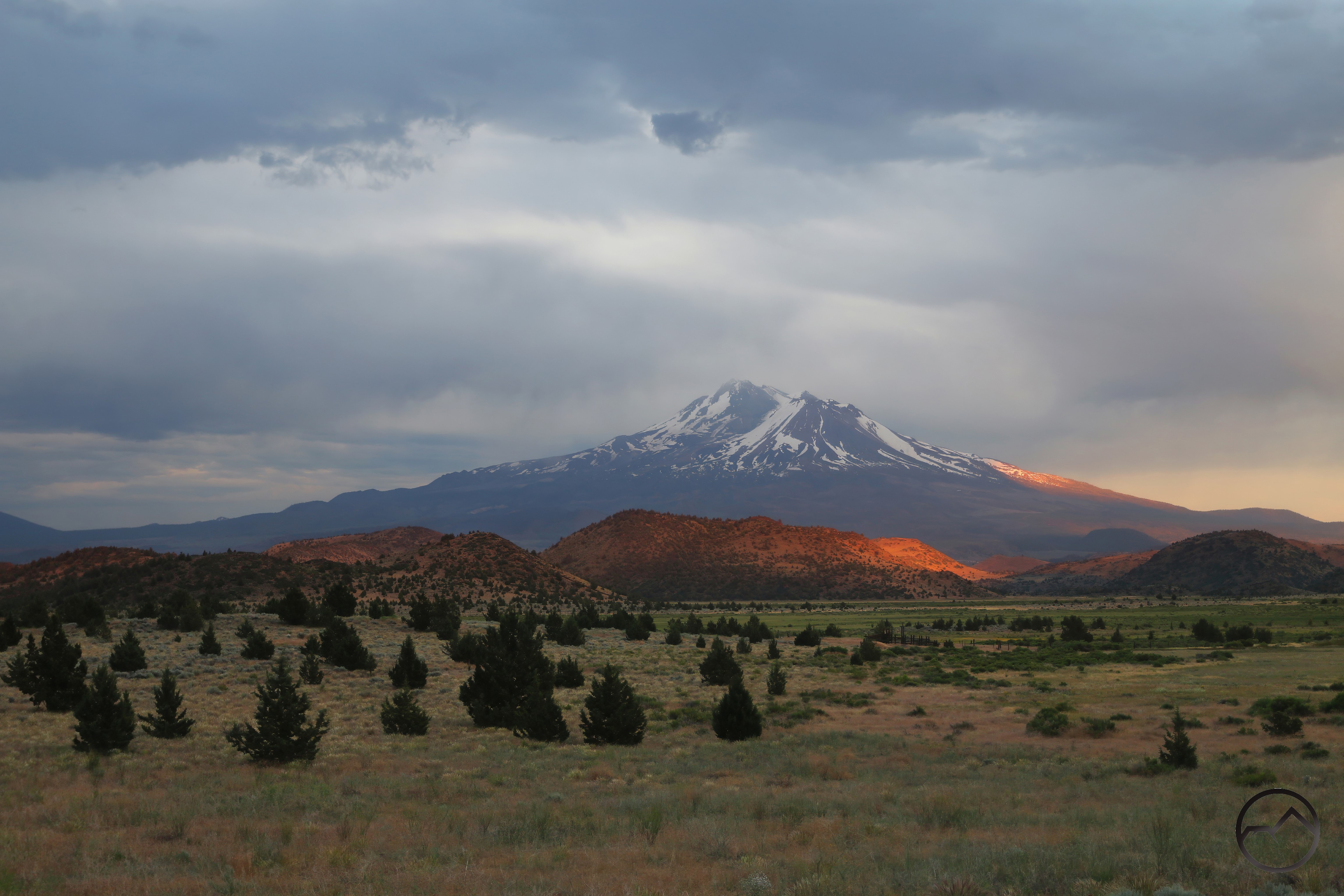
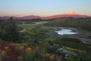
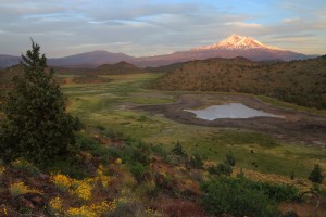
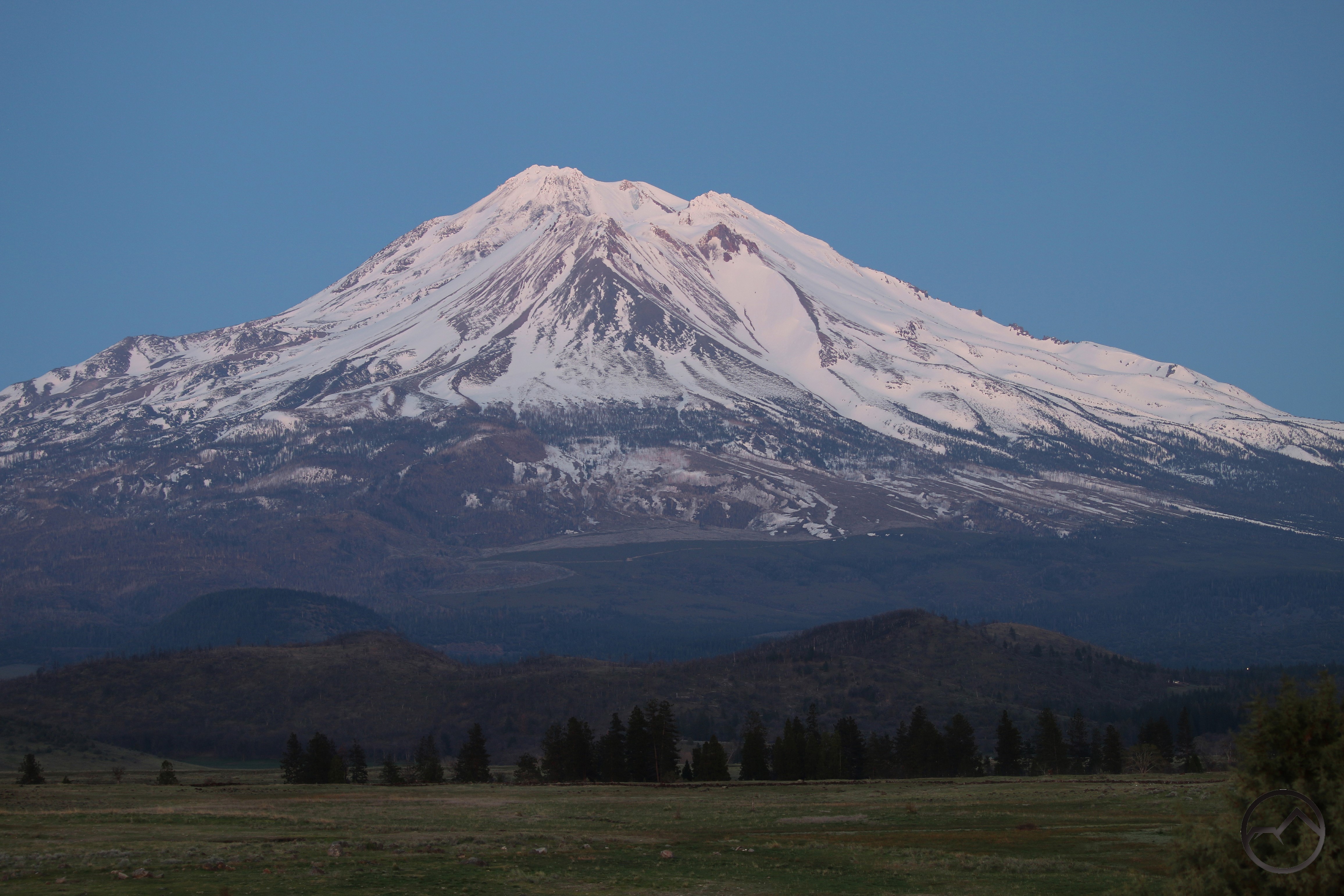
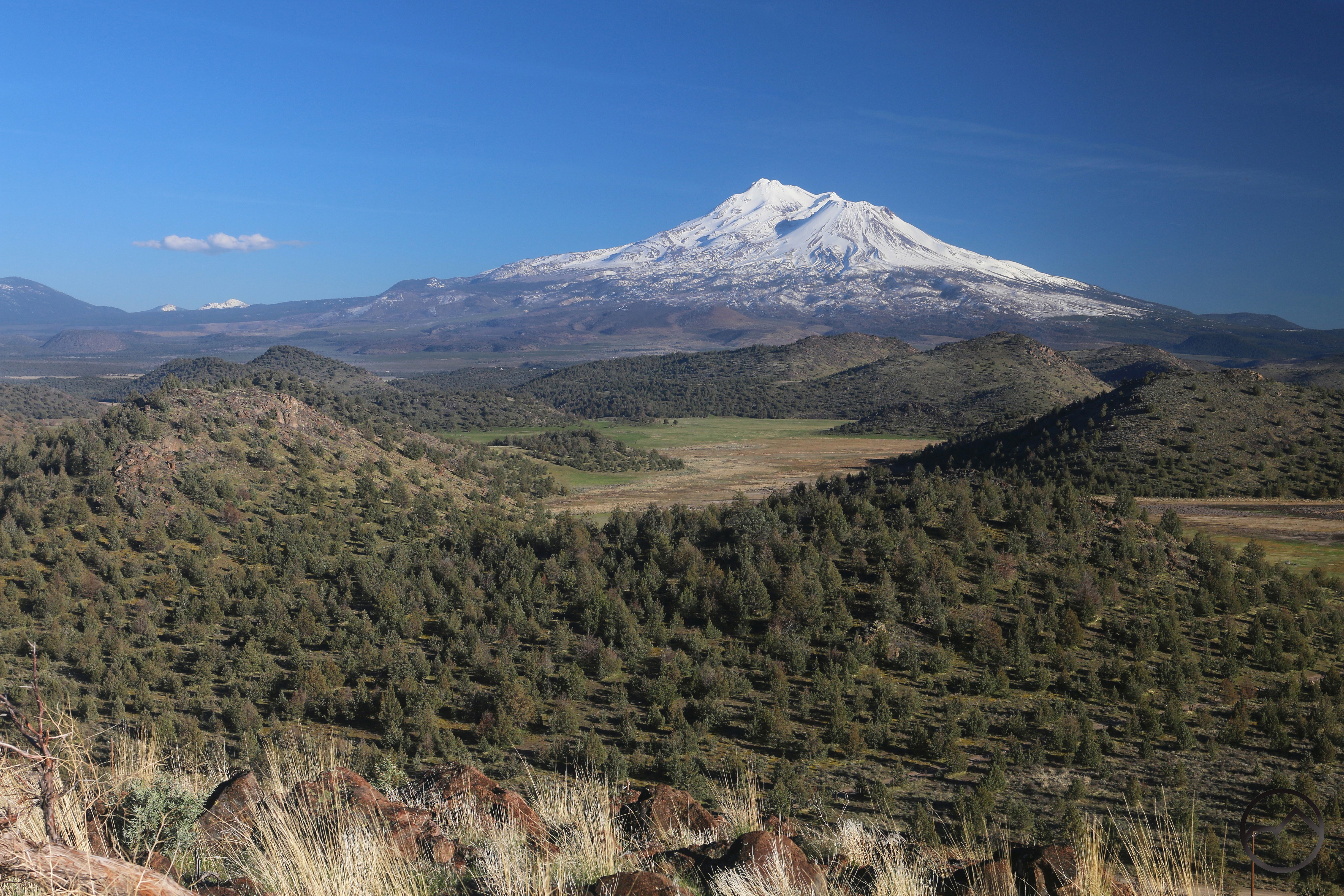
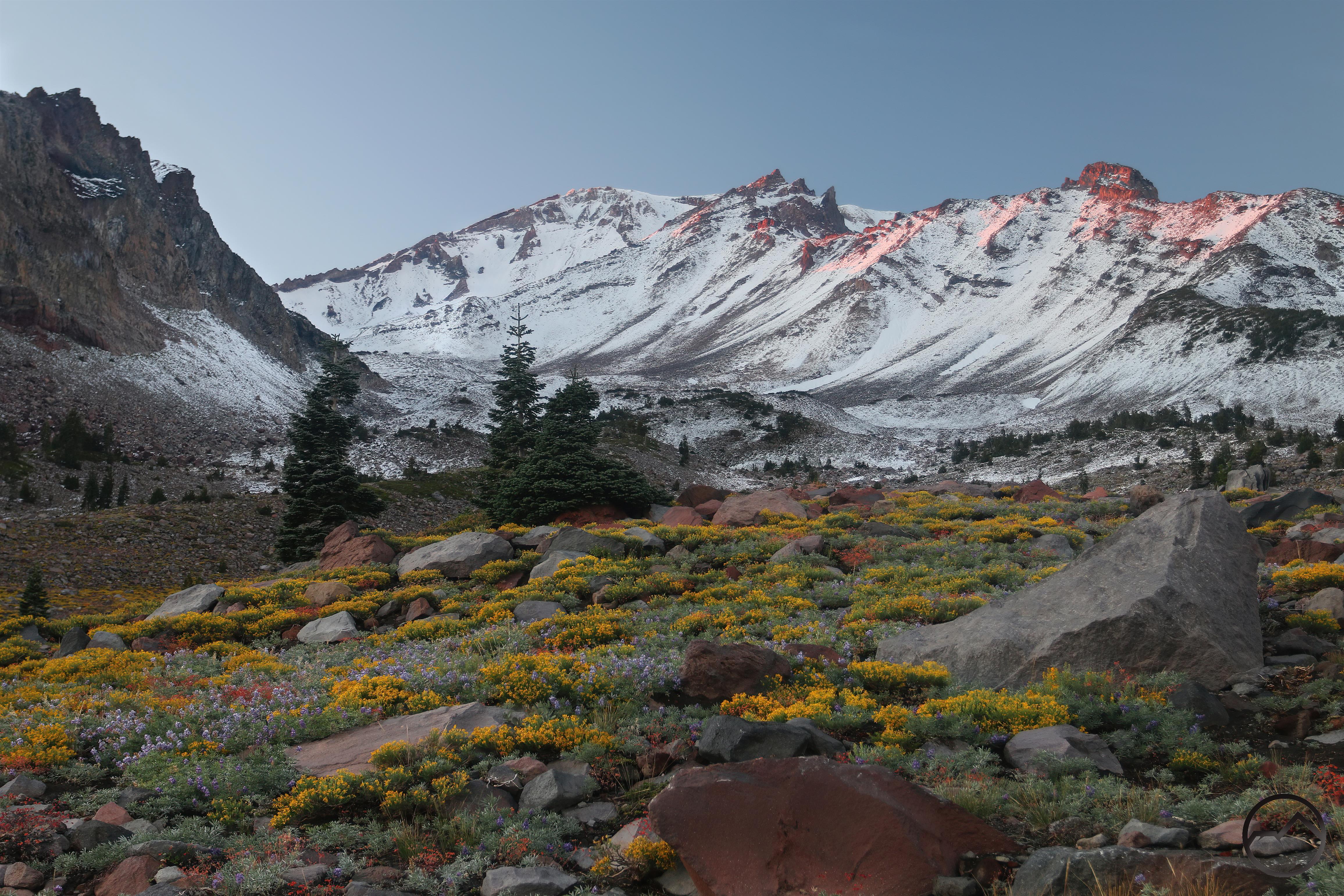
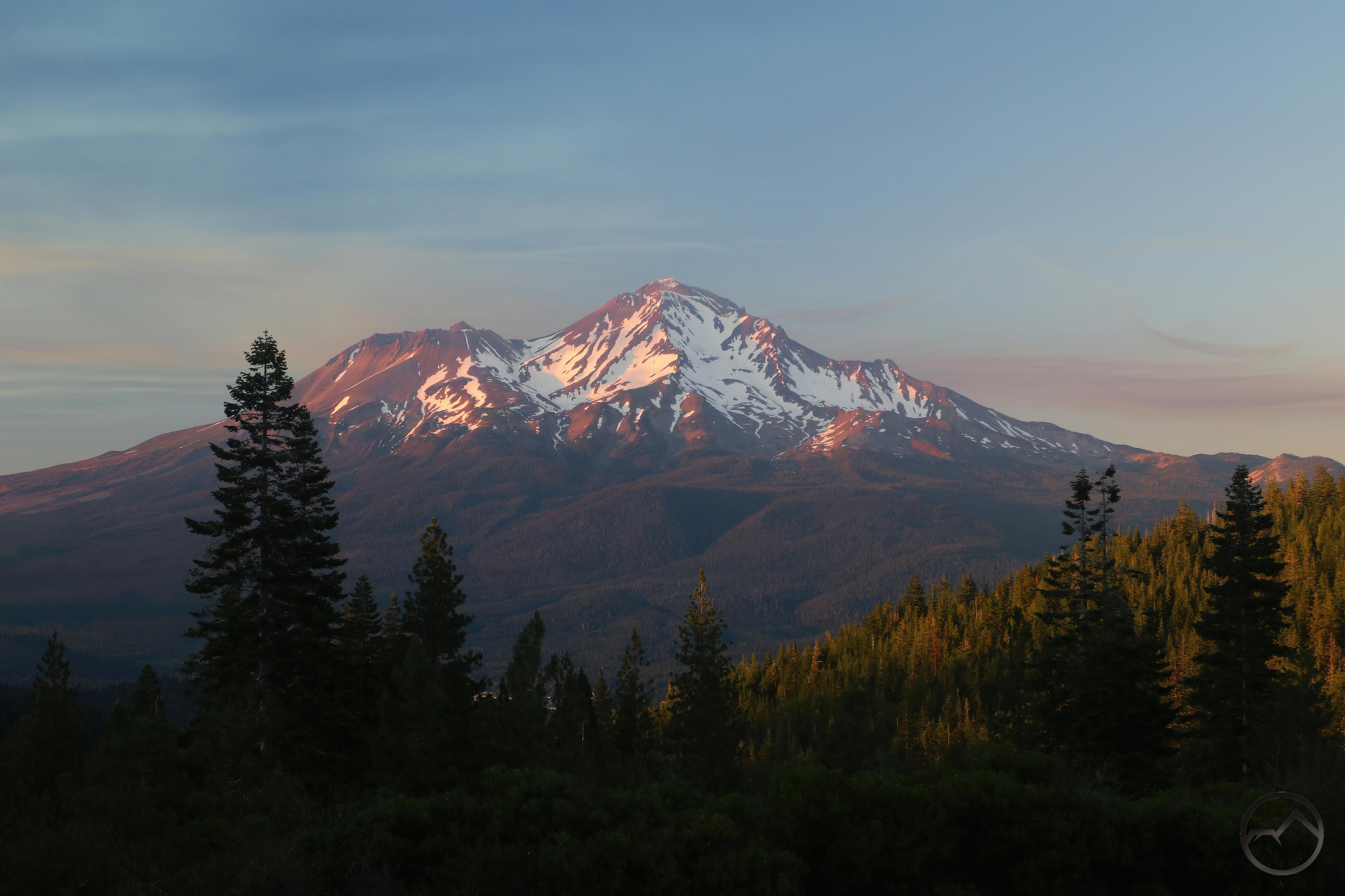
Alpenglow, summer snow and wildflowers blanket Mount Shasta.

We have now completed the year of our Lord 2024’s orbit around the sun. It has been a very odd year here at the Hike Mt Shasta homestead. It was a year of change in many, many ways, much of it with loss. Yet blessings still abound and we are grateful that the path lying before us is the such, as many others would be the poorer options. Like the previous year, 2024 kept me busy enough that I did not get out like I desire. Even my work out at Truchas Ridge suffered from the weight of responsibility. Despite the changes and obligations, there were some memorable highlights this year. I managed to take my son’s boy scout troop down to Yosemite for 4 days and my family out to eastern Oregon and Idaho for a week as well as Yosemite in the fall. I even managed a solo trip into the Oregon Cascades. Now that I come to think about it, it was actually a pretty full year, despite all the “real life” that had to get done.

Enough of me yapping. On to the retrospective!
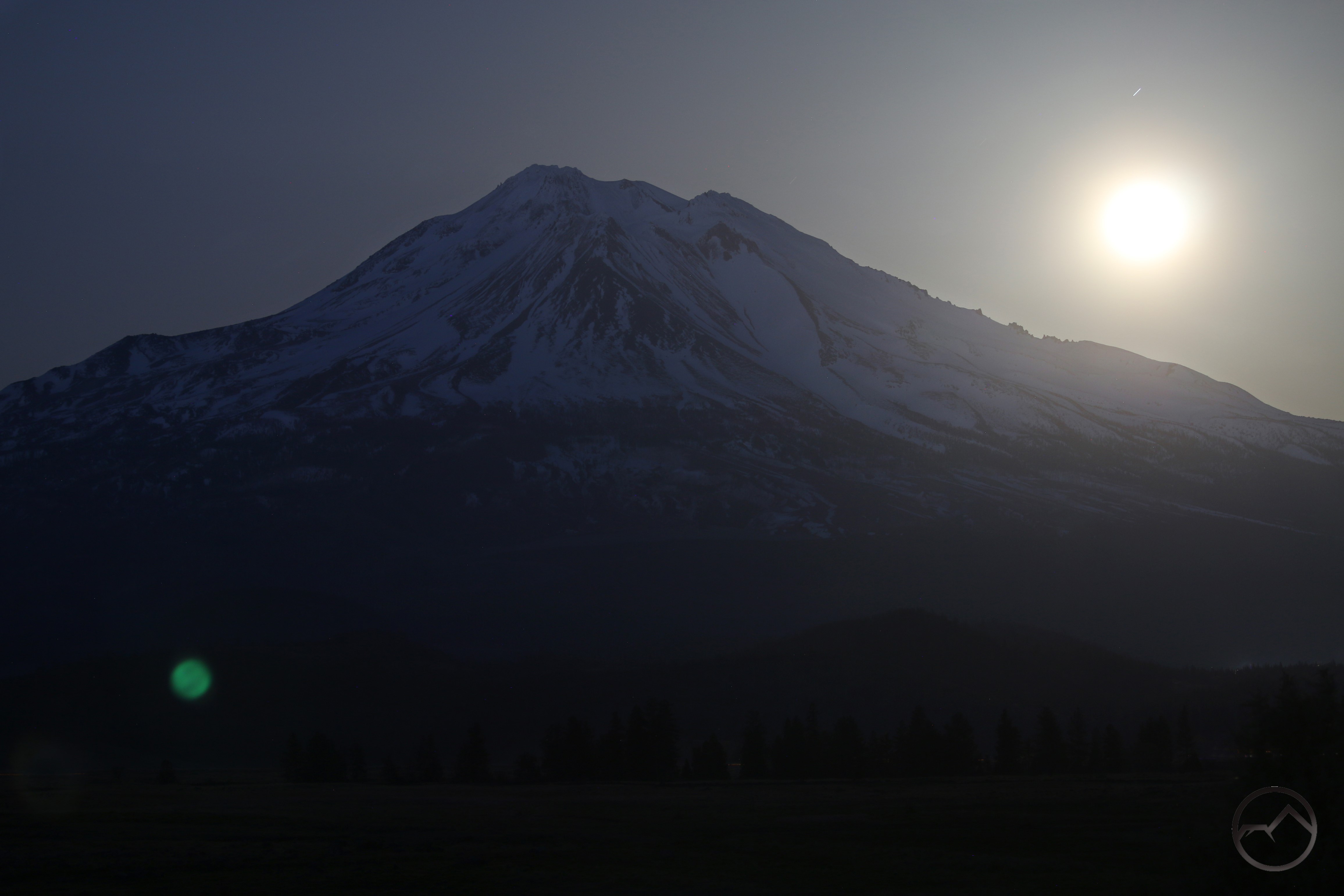
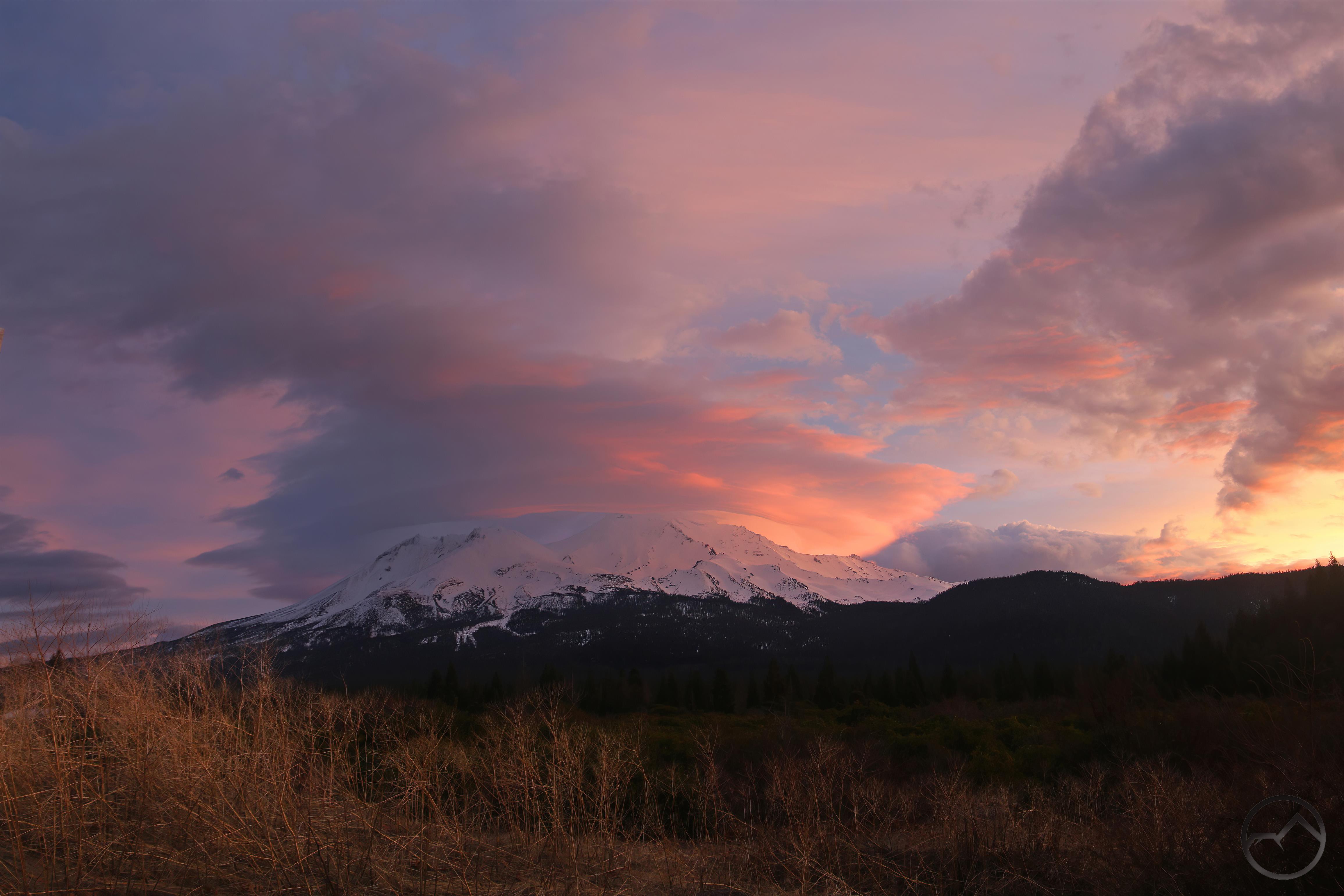
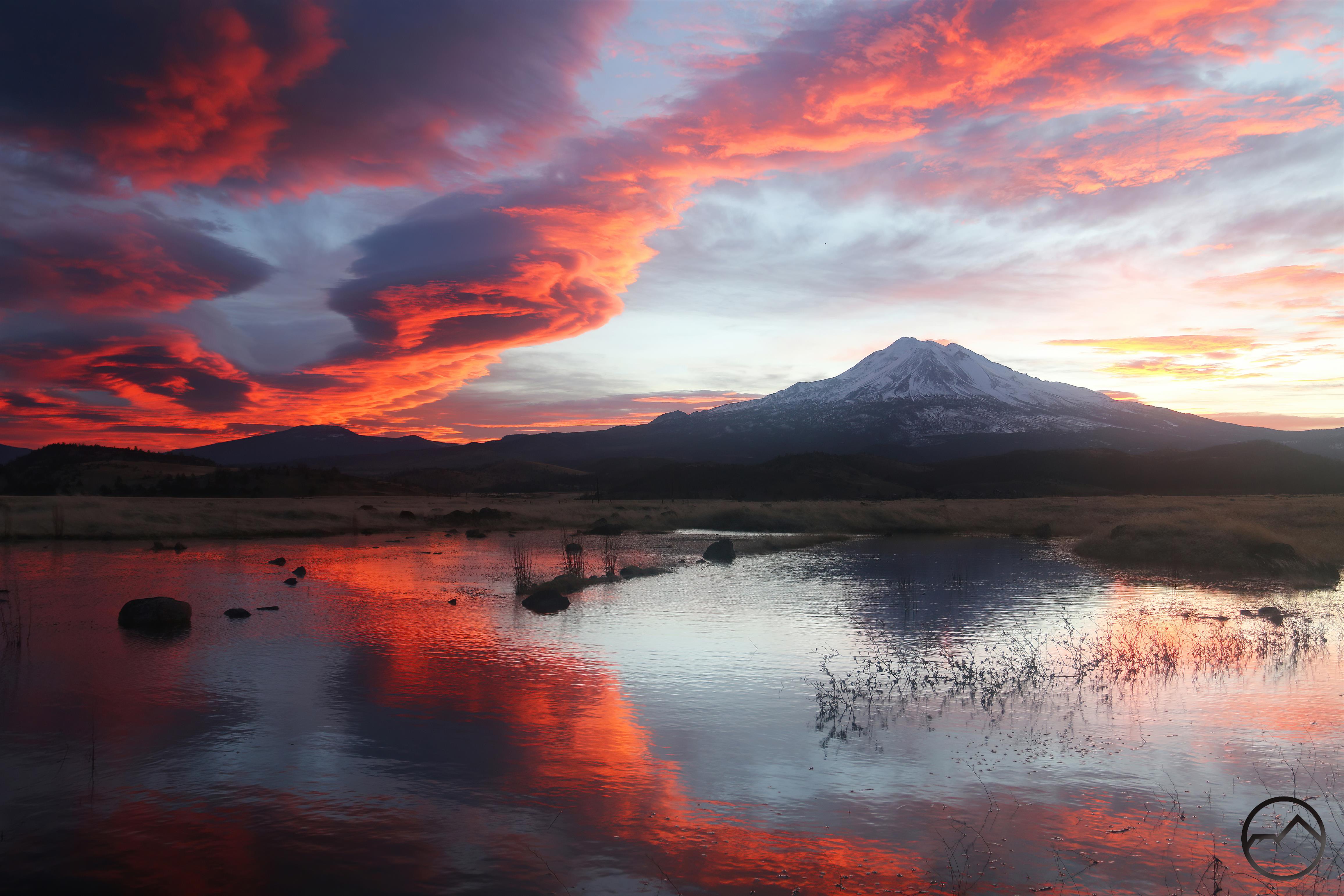
January:

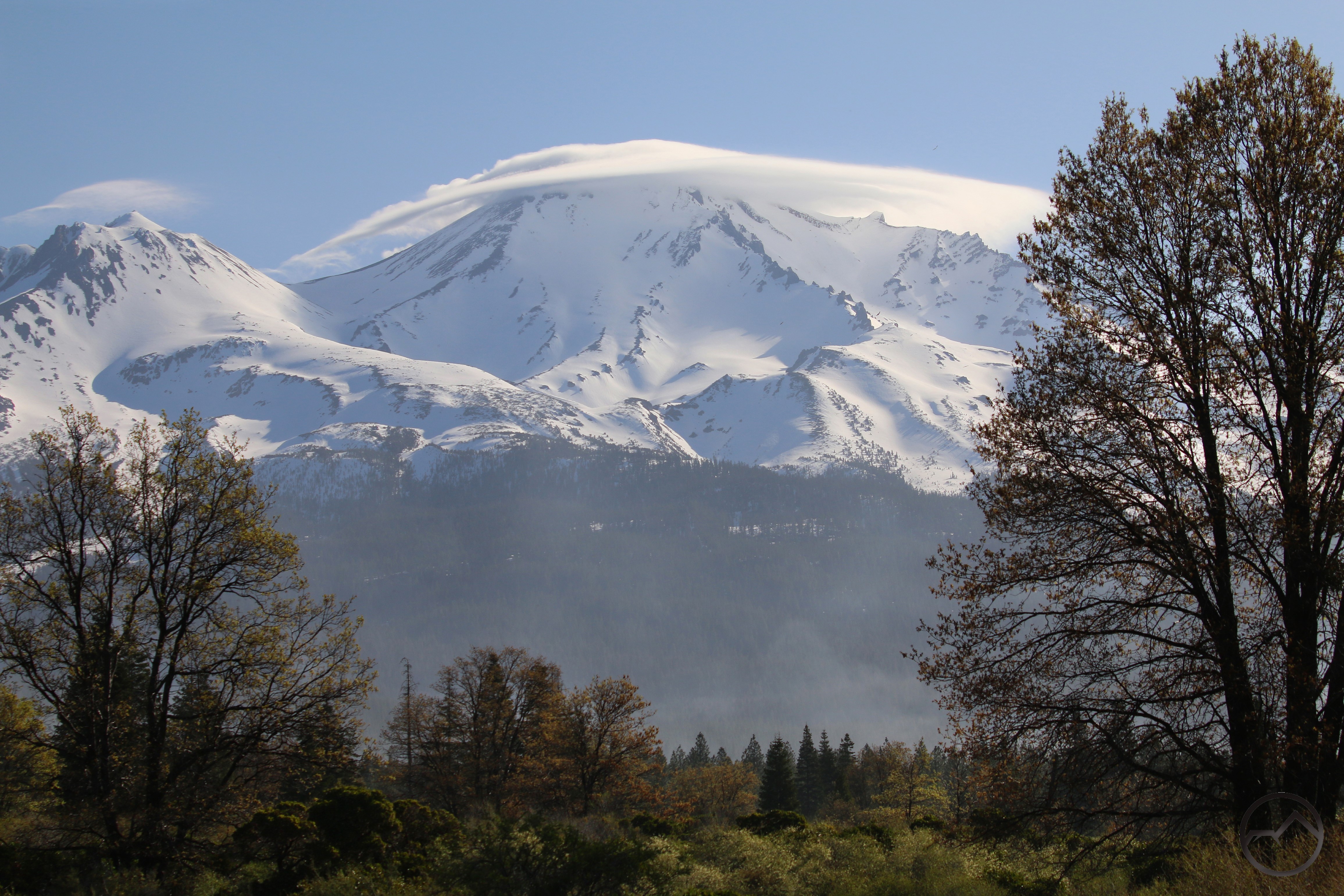
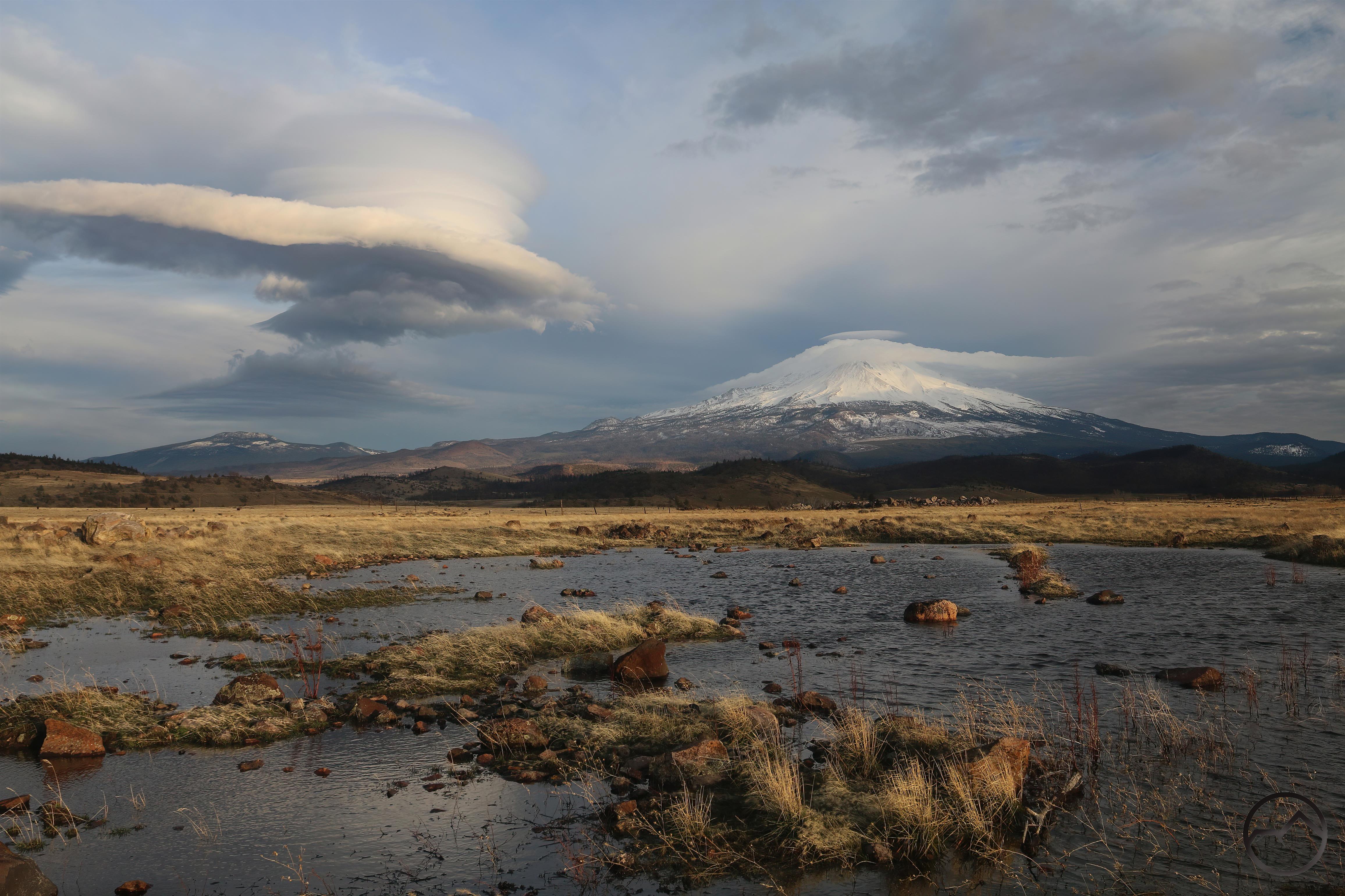
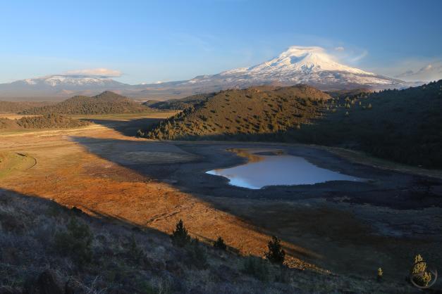
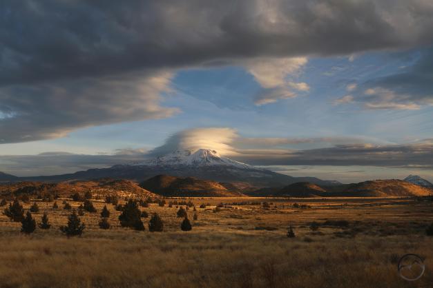
The year started off with a bang, with some pretty impressive lenticular formations in the midst of the storms that continually pelted the Northstate. As always, when the precipitation gets to be such and the pools in the Shasta Valley fill up, I am too weak to resist the temptation for reflections. Such has been the case at the end of 2024 as well. I am making a resolution to force myself to branch out…
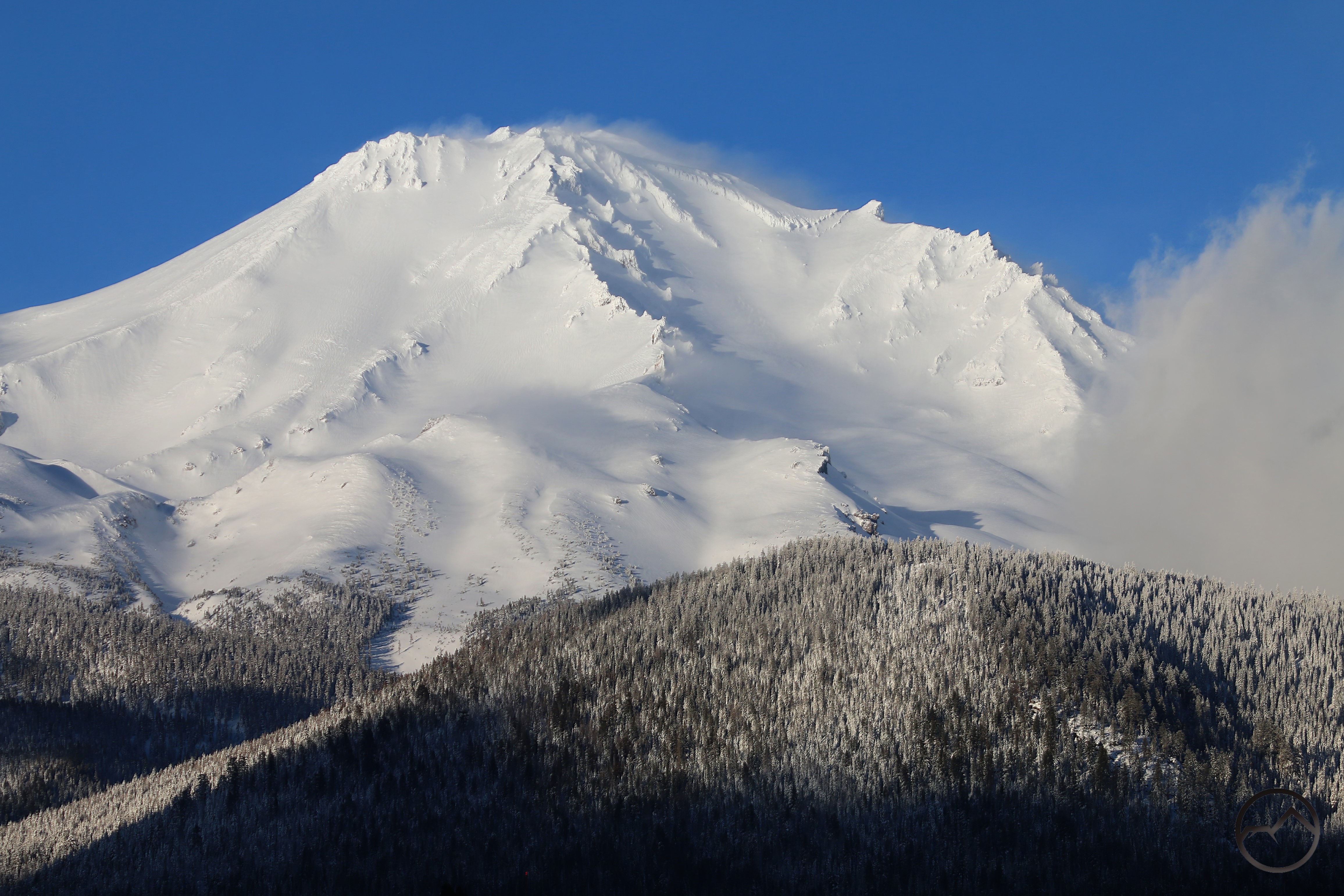
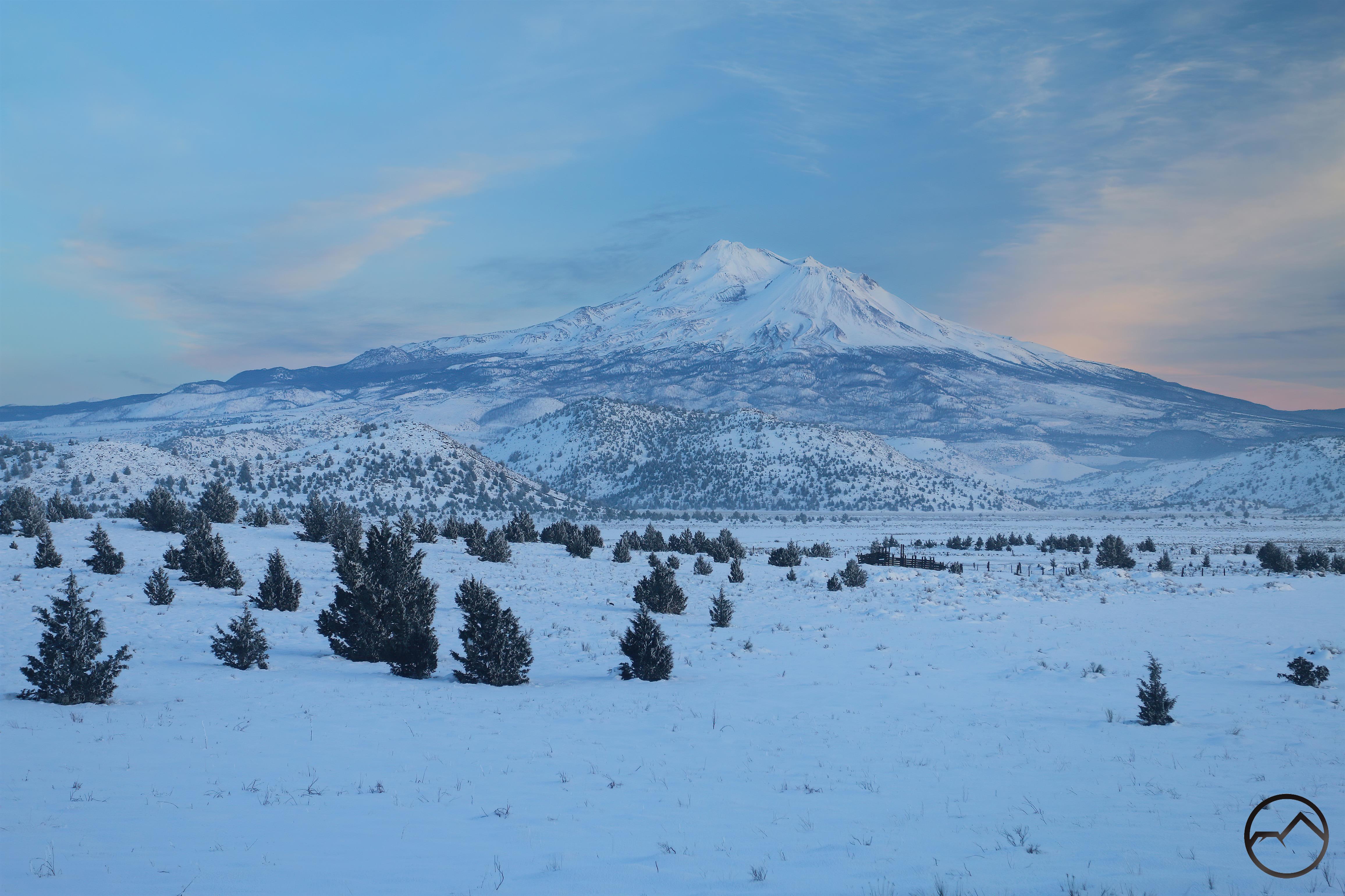
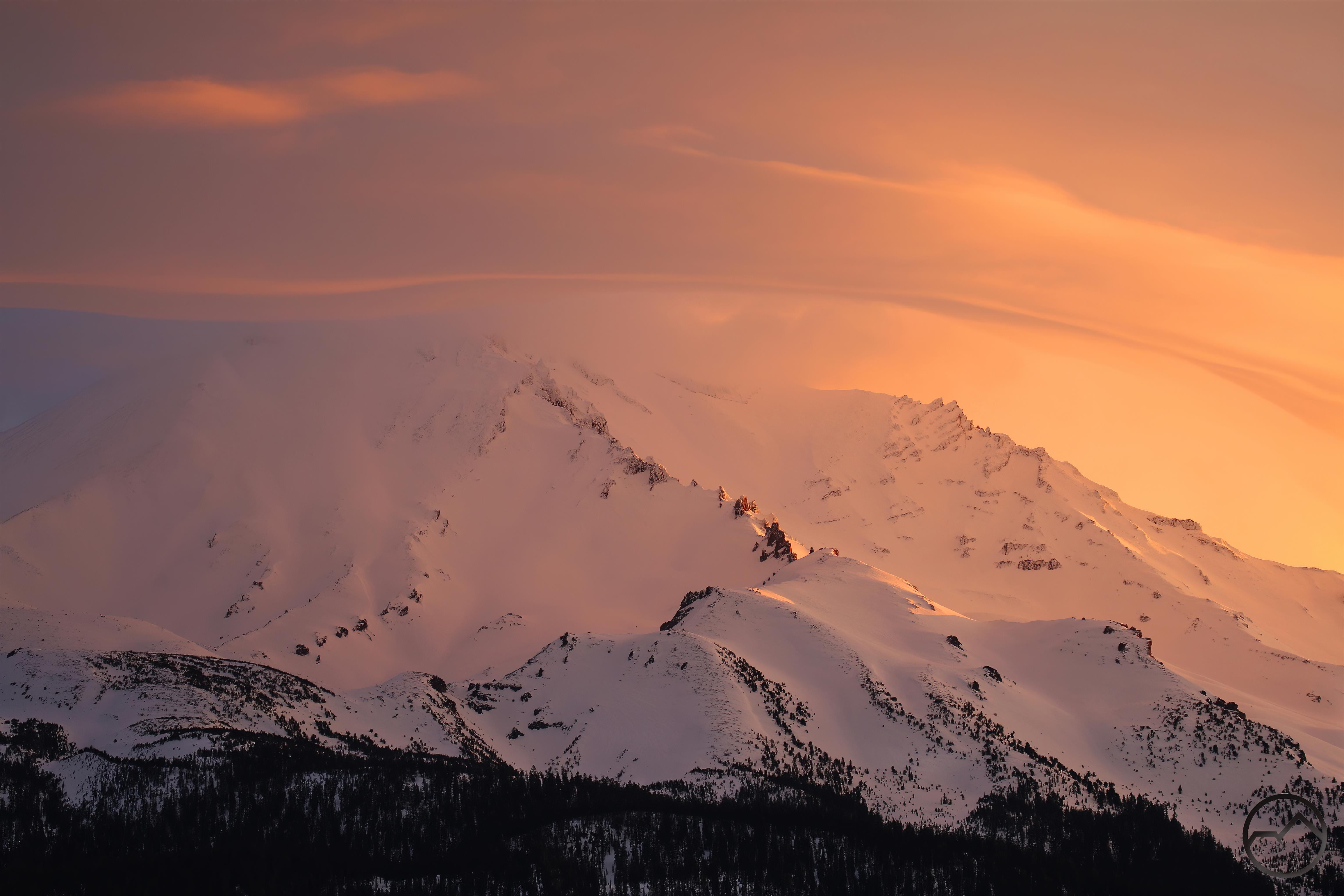
February:

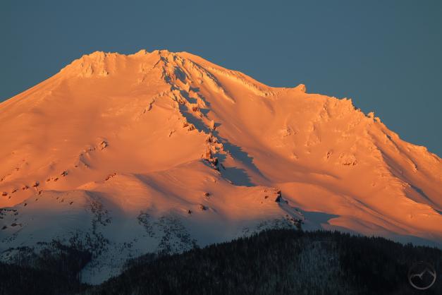
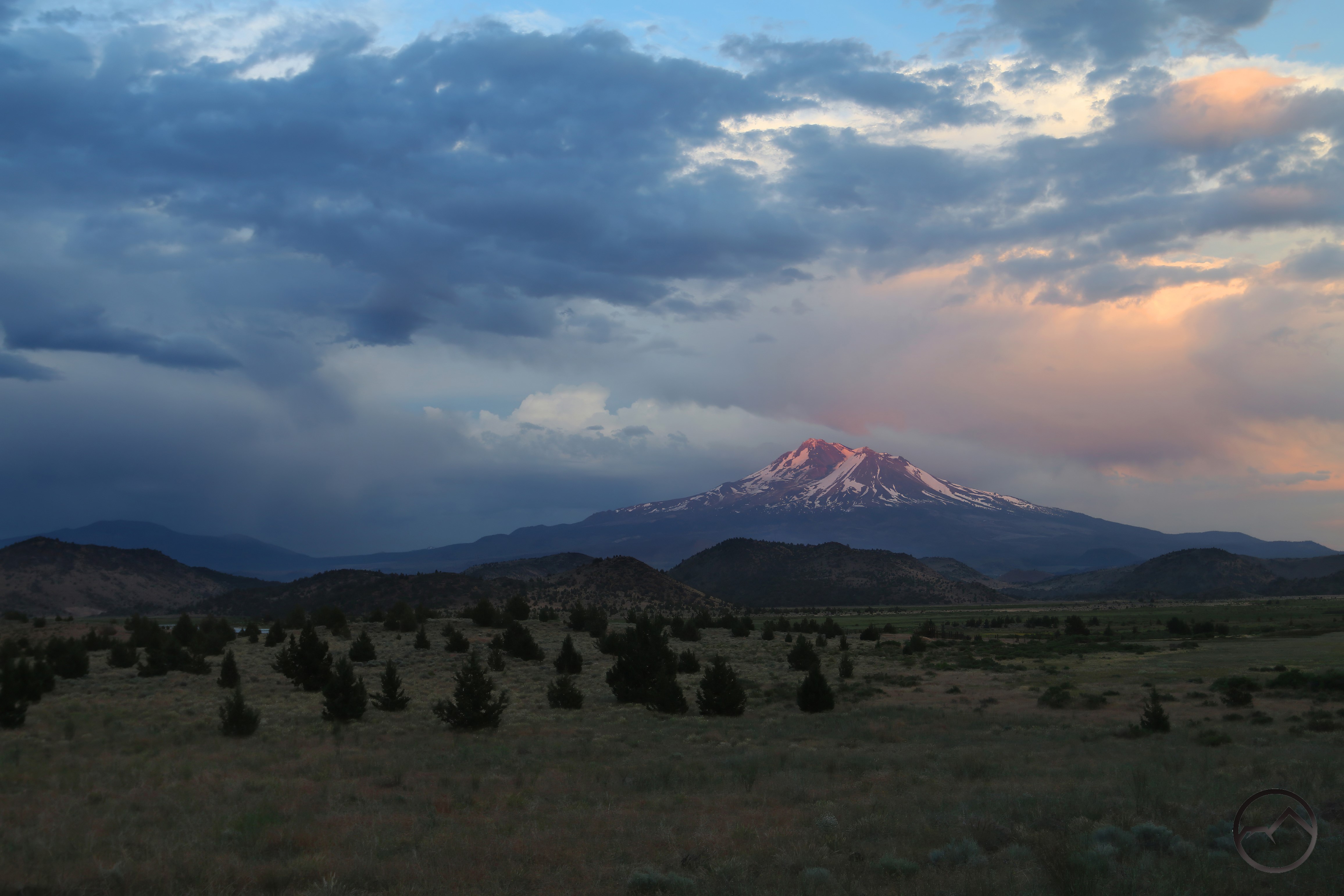
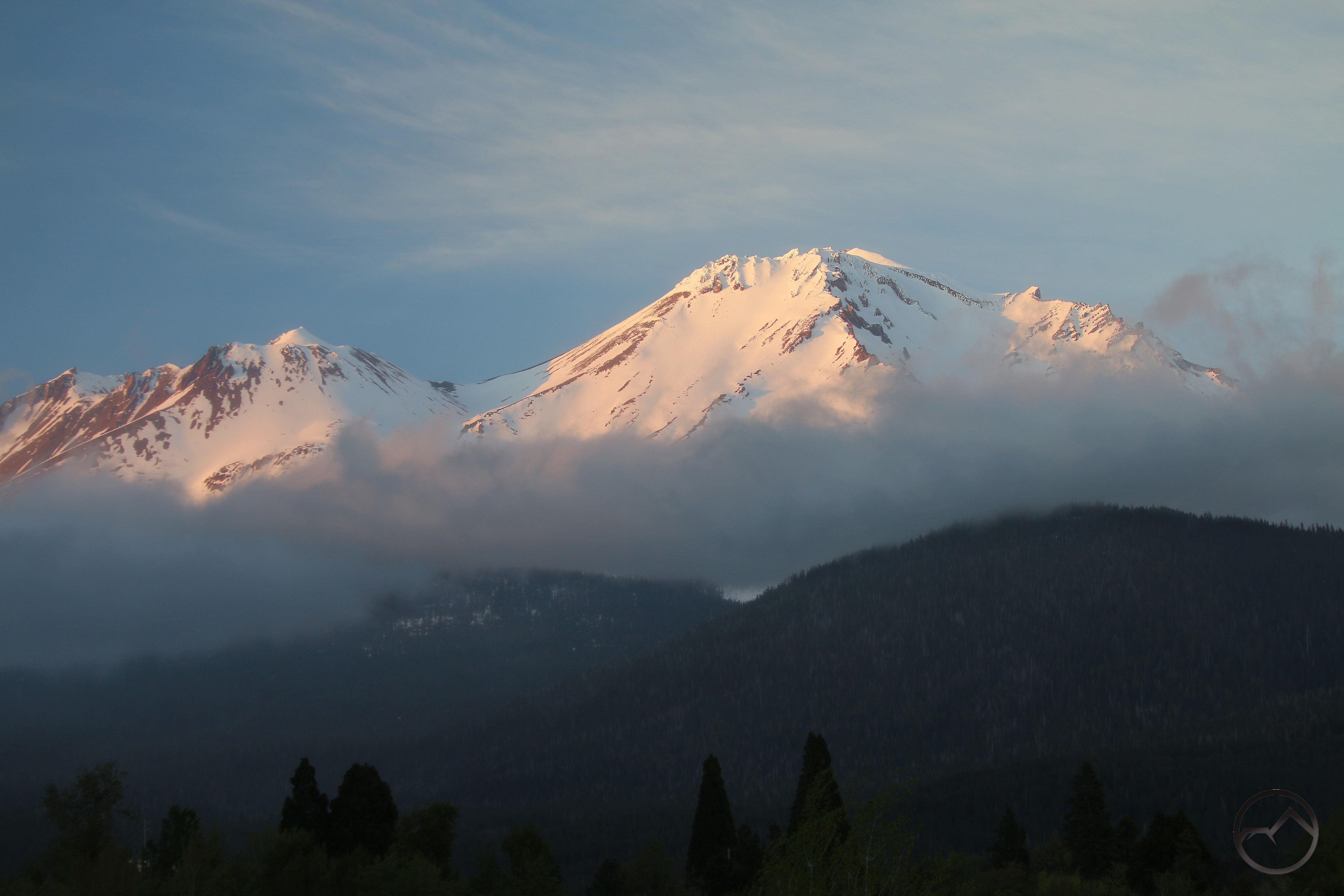
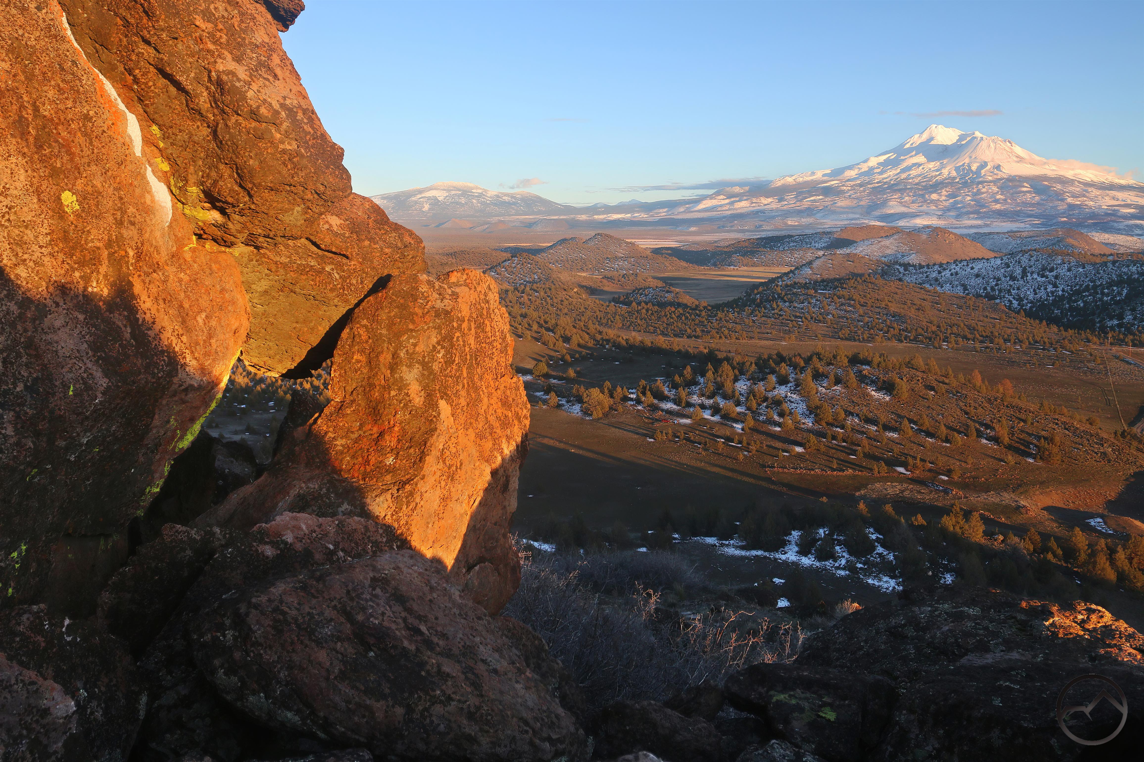
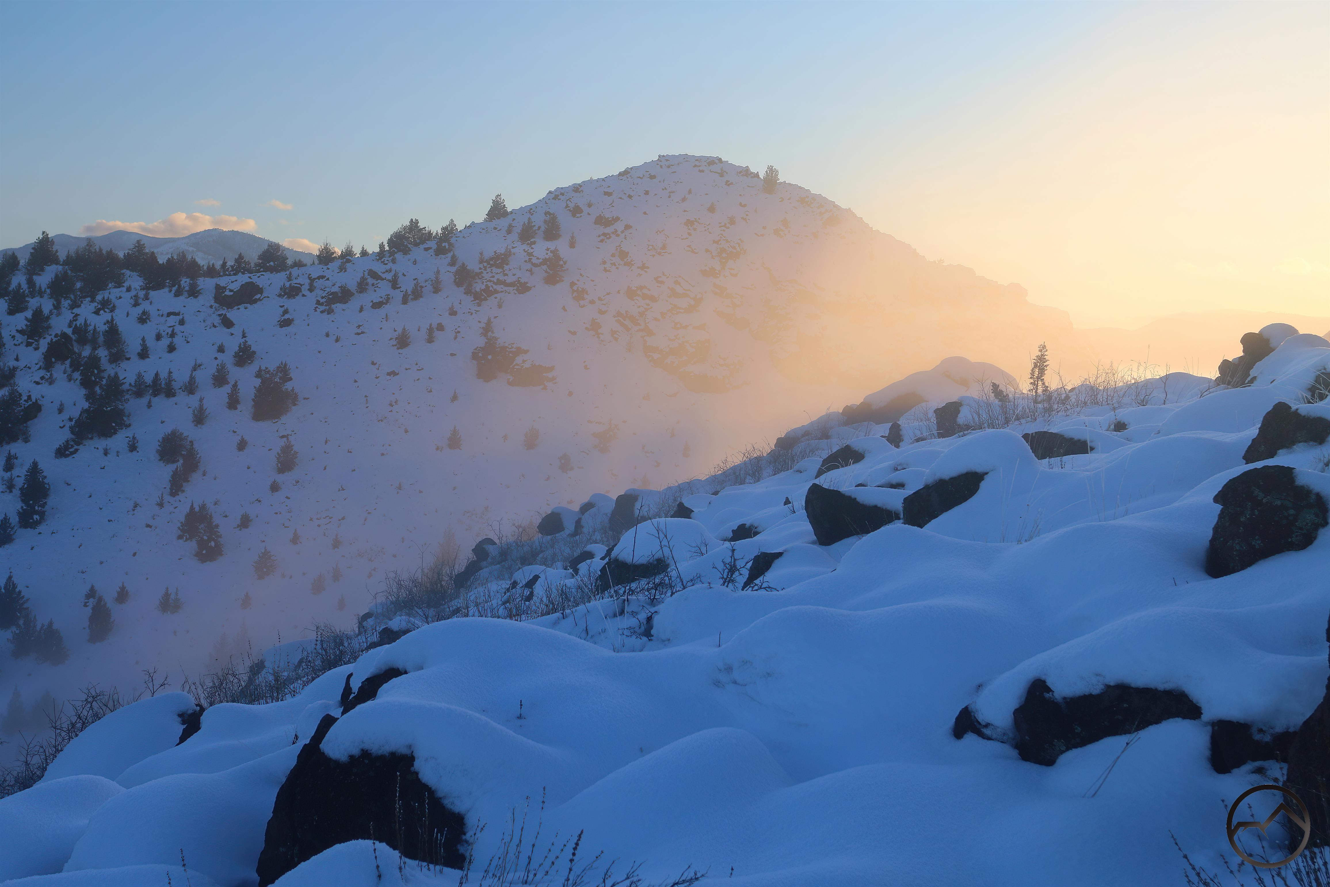
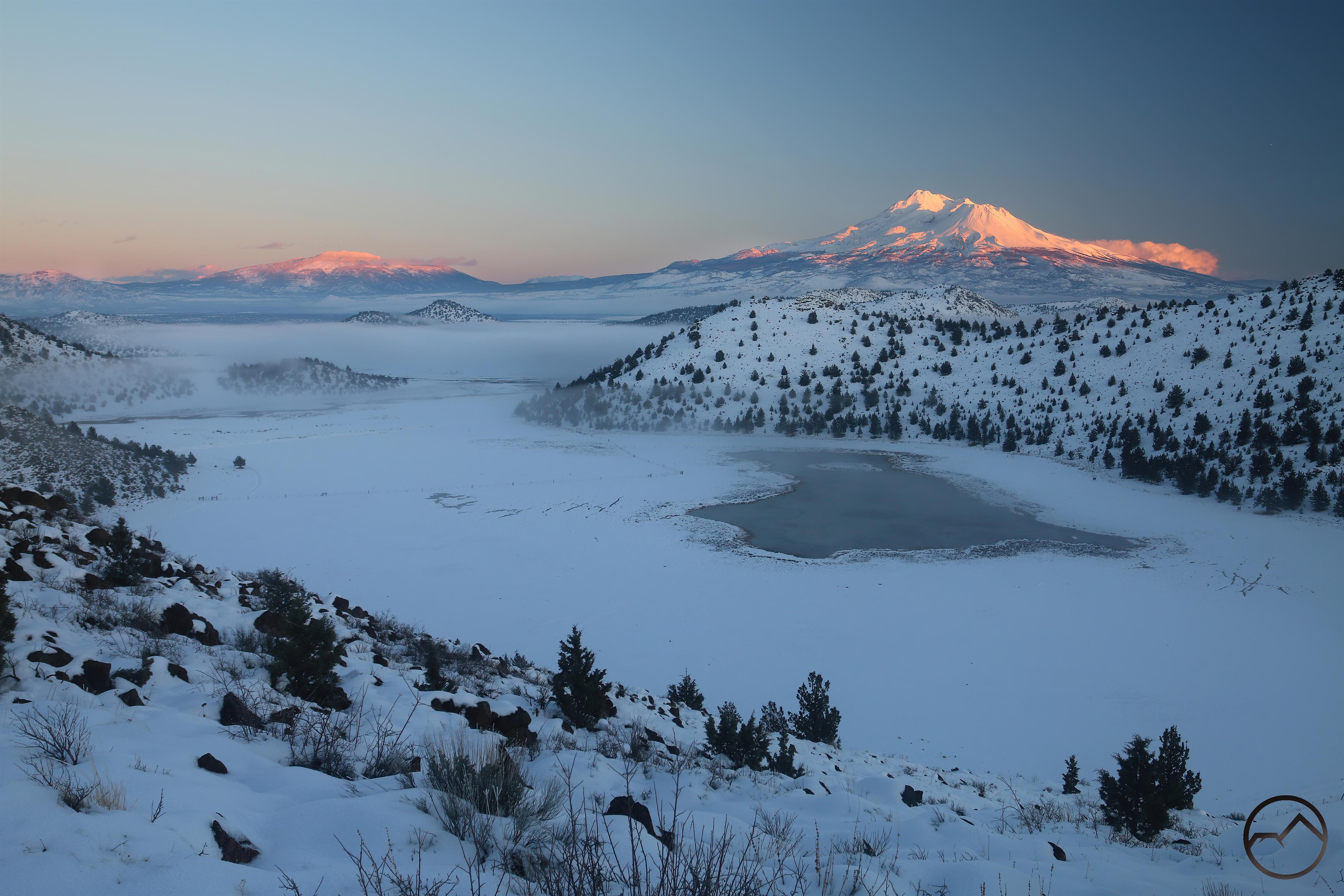
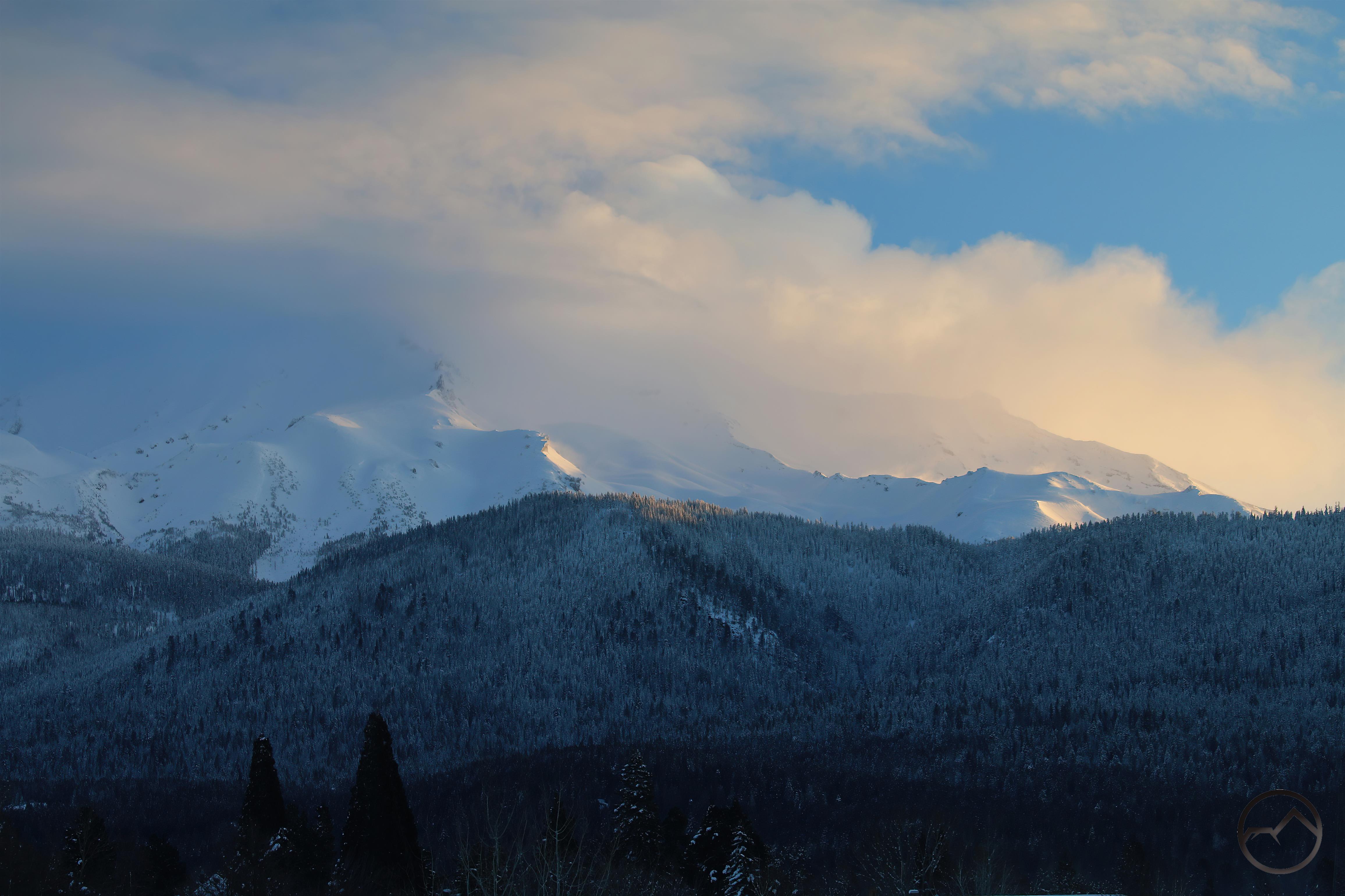
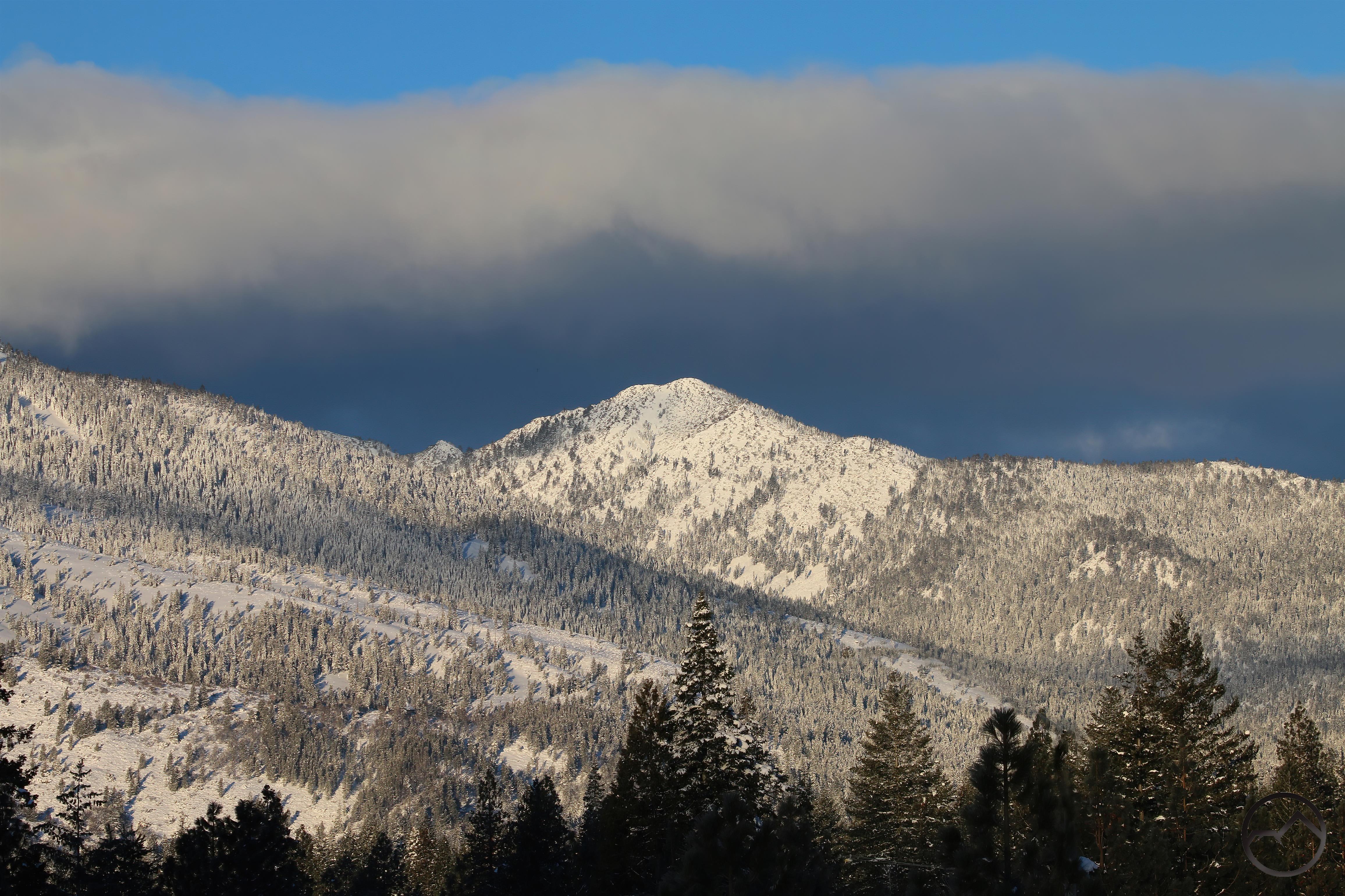
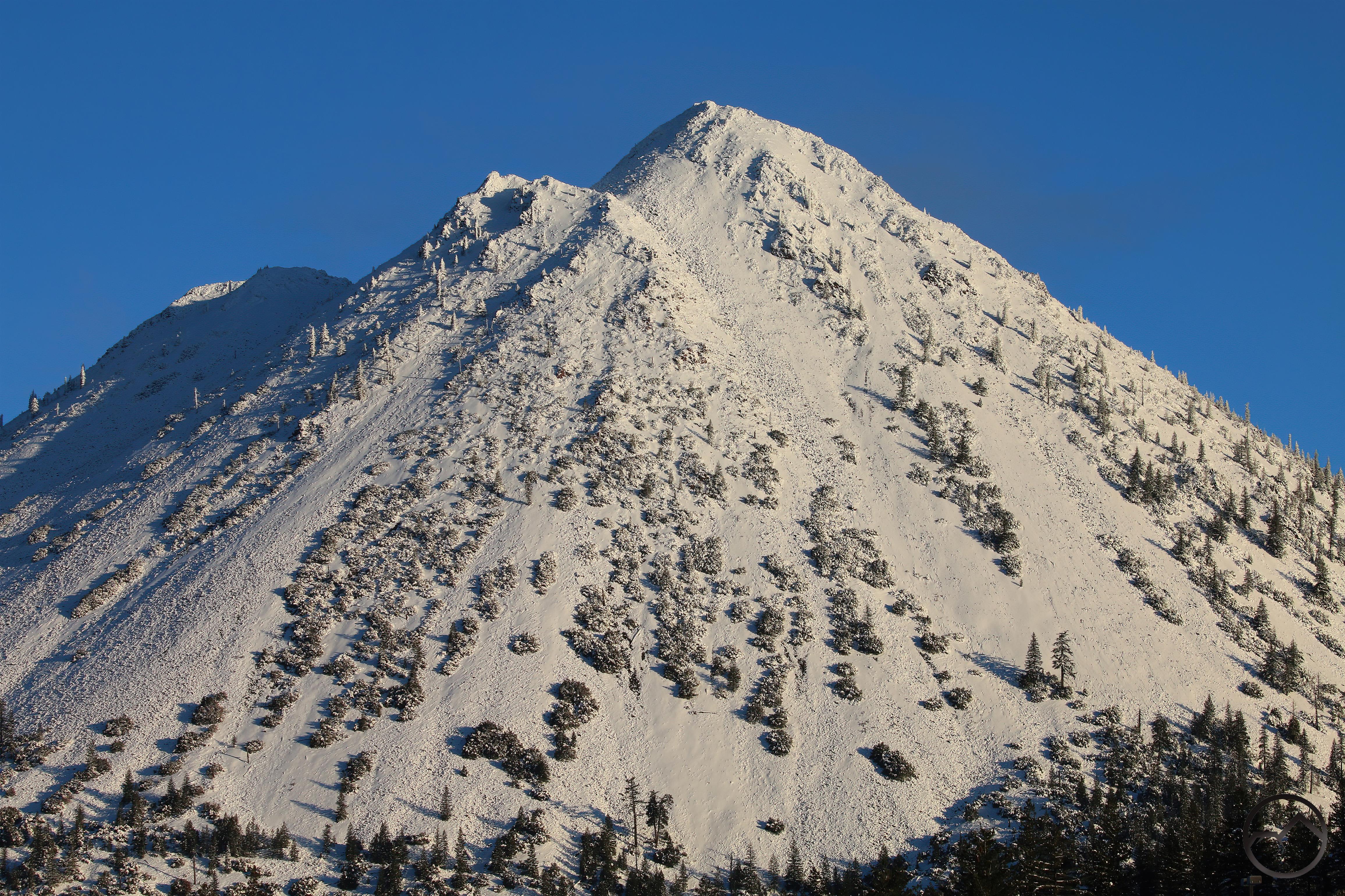
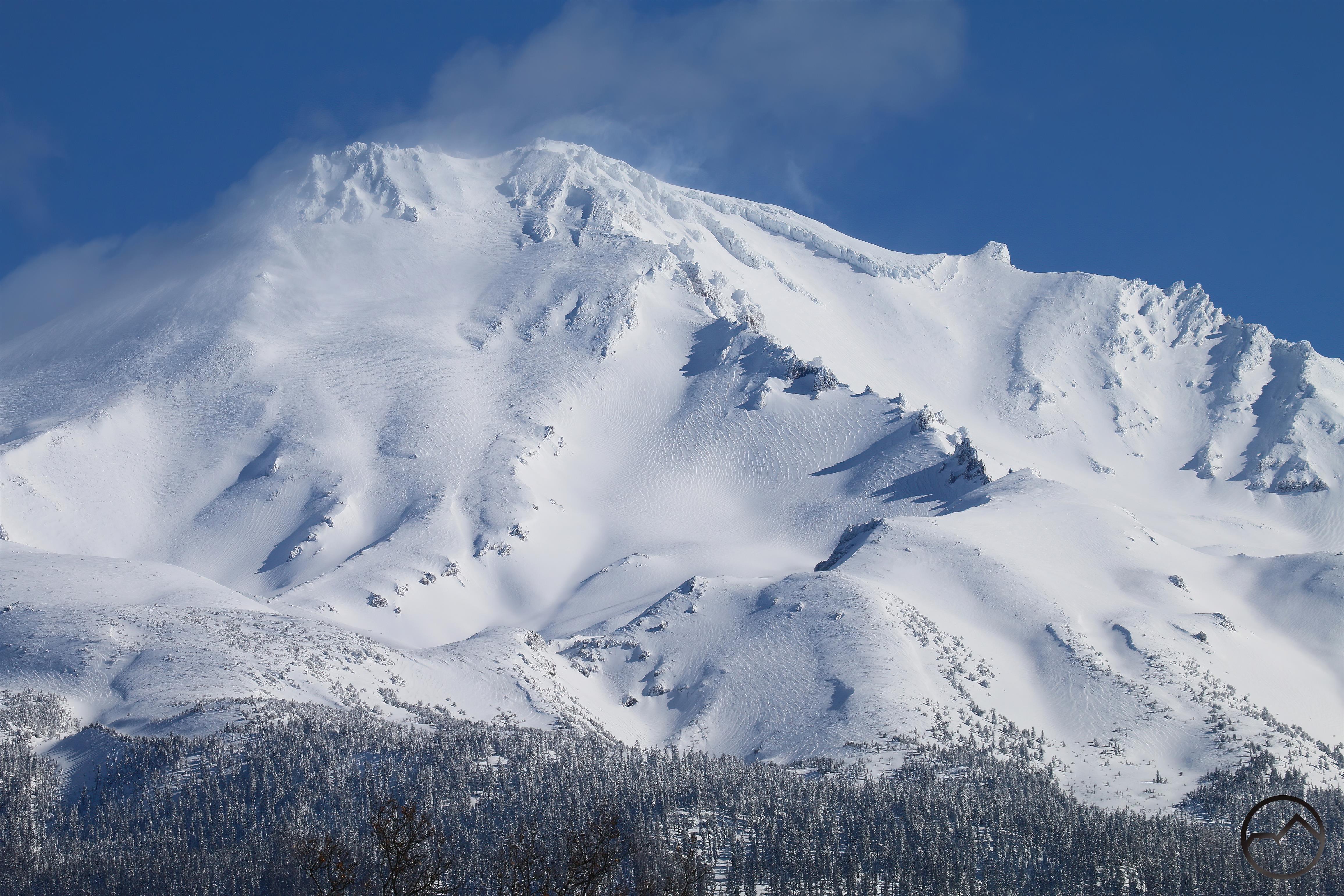
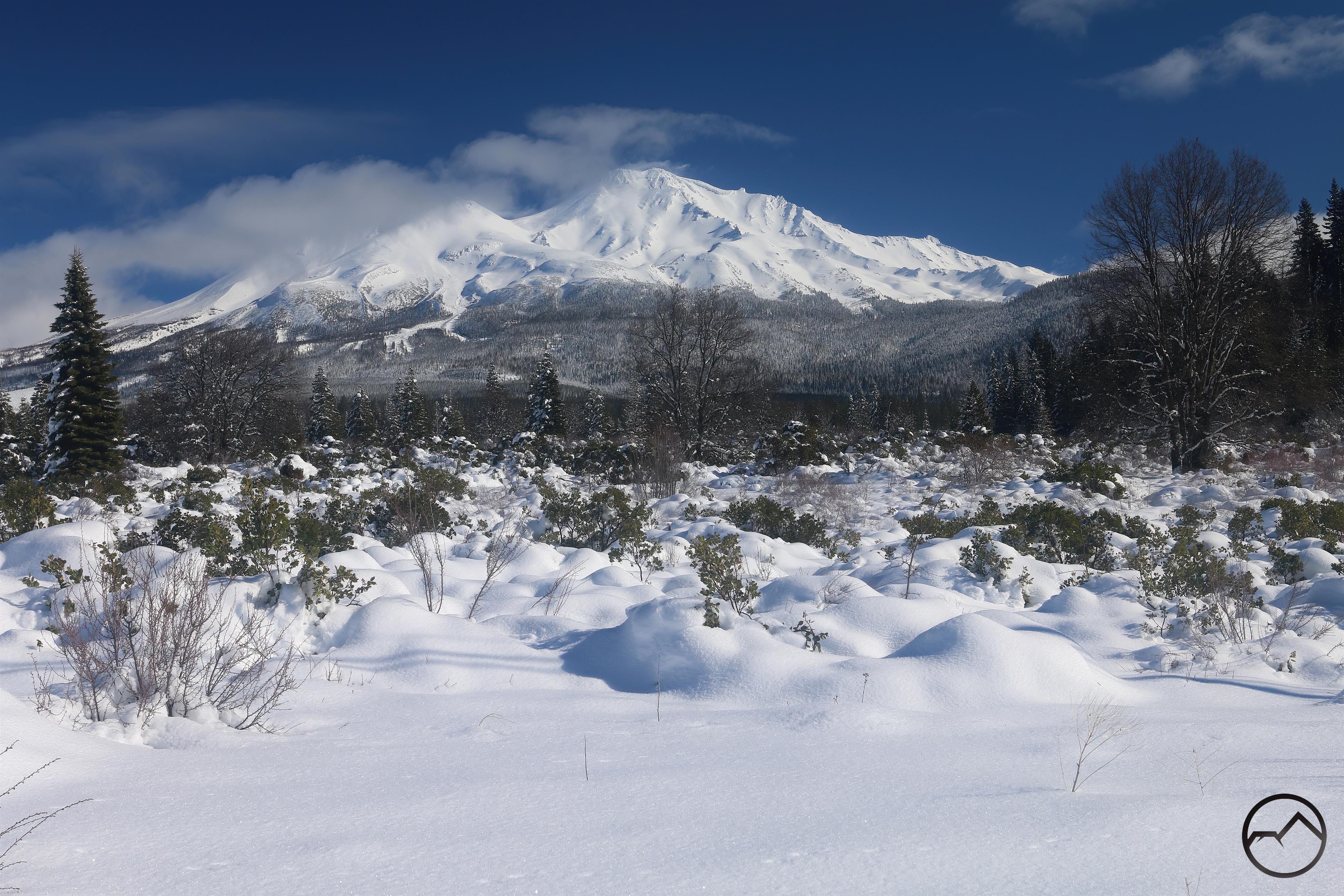
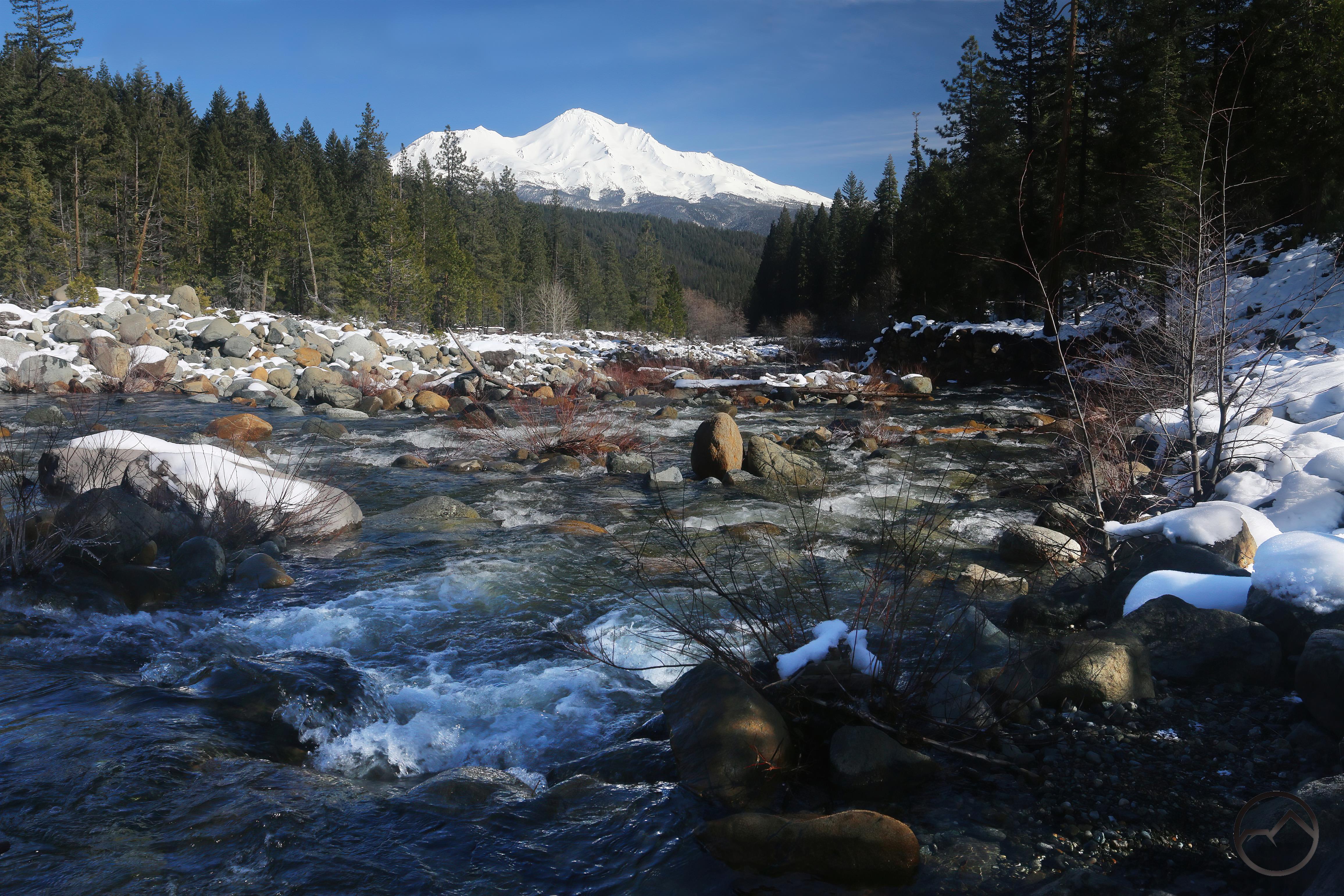
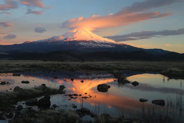
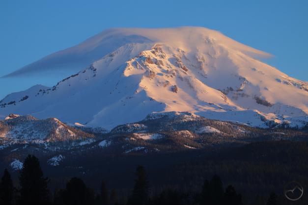
February was icy. Much fell from the sky and then it froze. Still, the river flowed despite the cold and Mount Shasta stood icy sentinel, the frozen flanks catching the beautiful alpenglow…when the clouds cleared enough to actually see the mountain.
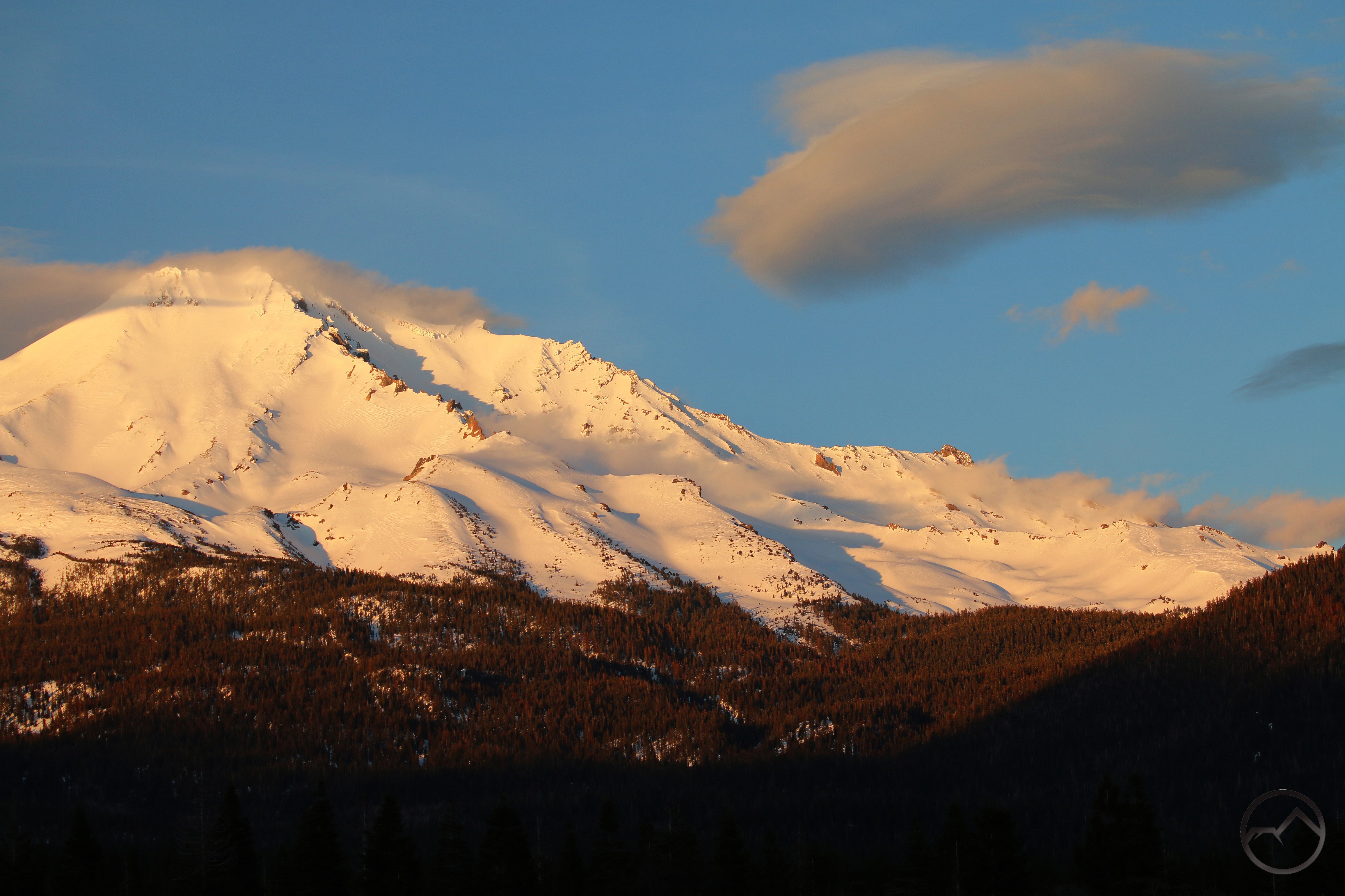
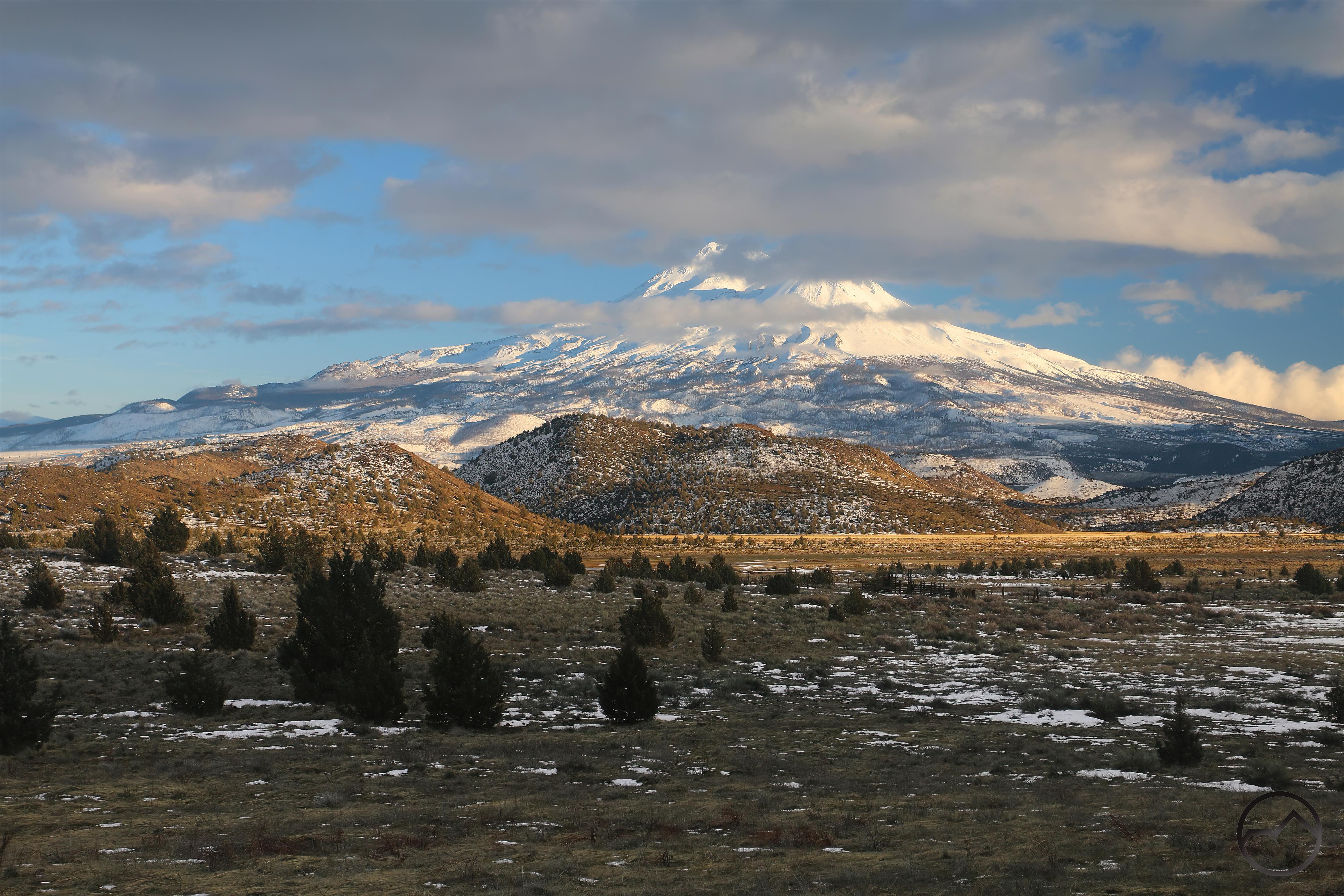
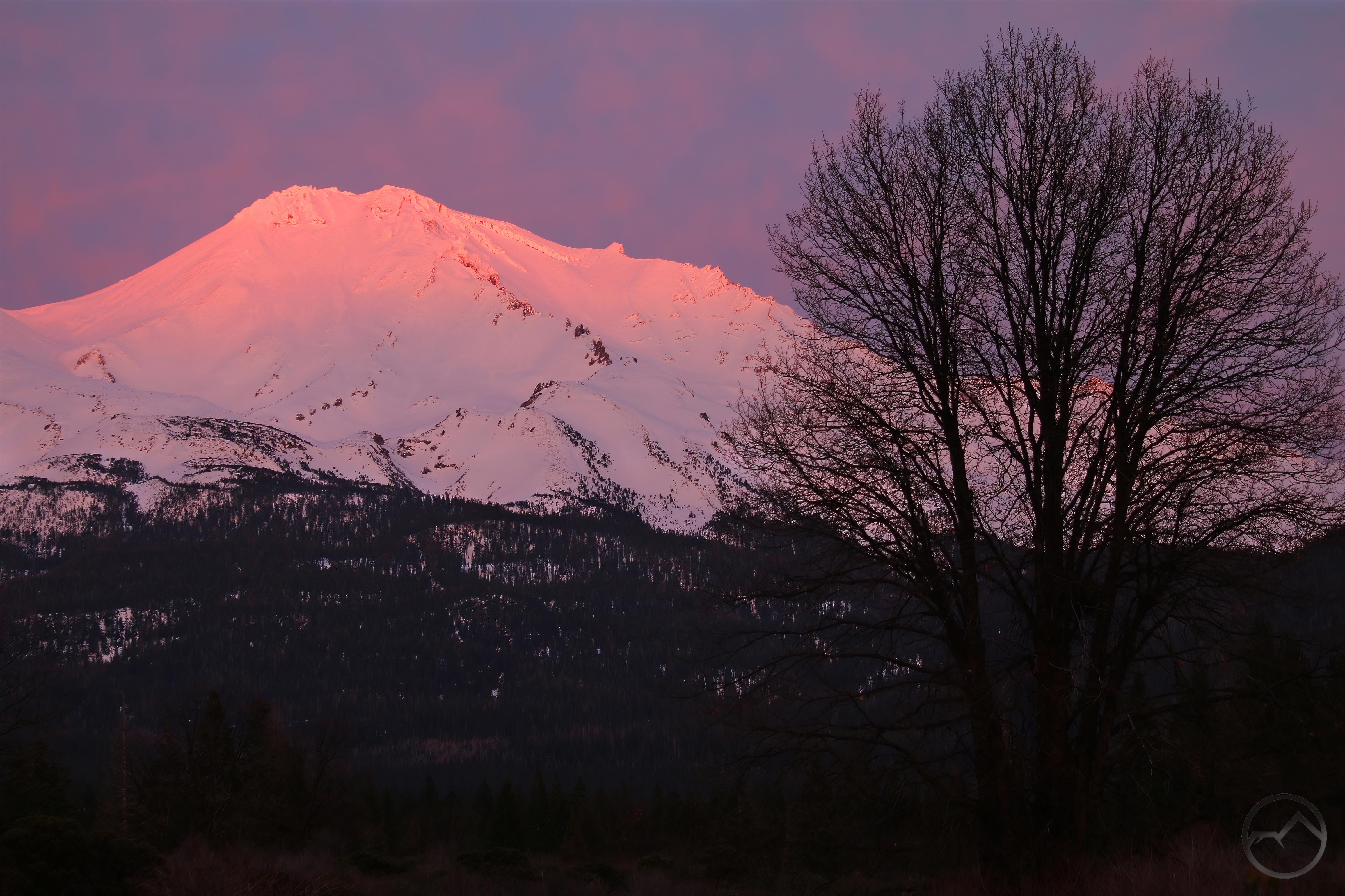
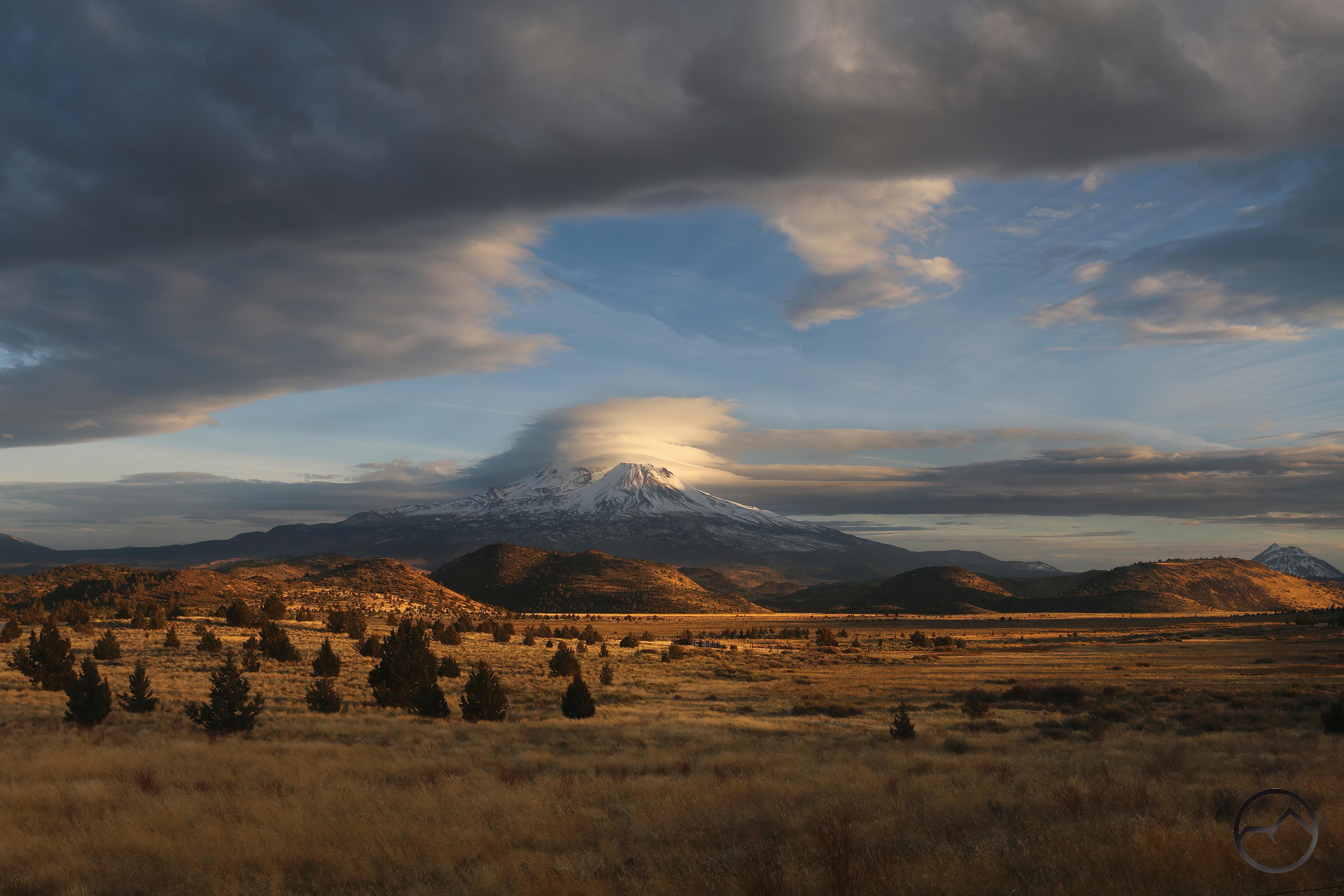
March:

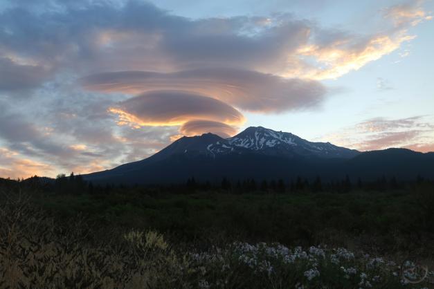
Things started to get busy in March. I did not get out often. When I did, it was usually in pursuit of fleeting lenticulars. Even this endeavor was frequently stymied. I only got a few of note and even these were a bit disappointing. However, it is always good to get out, so even for these I was thankful.
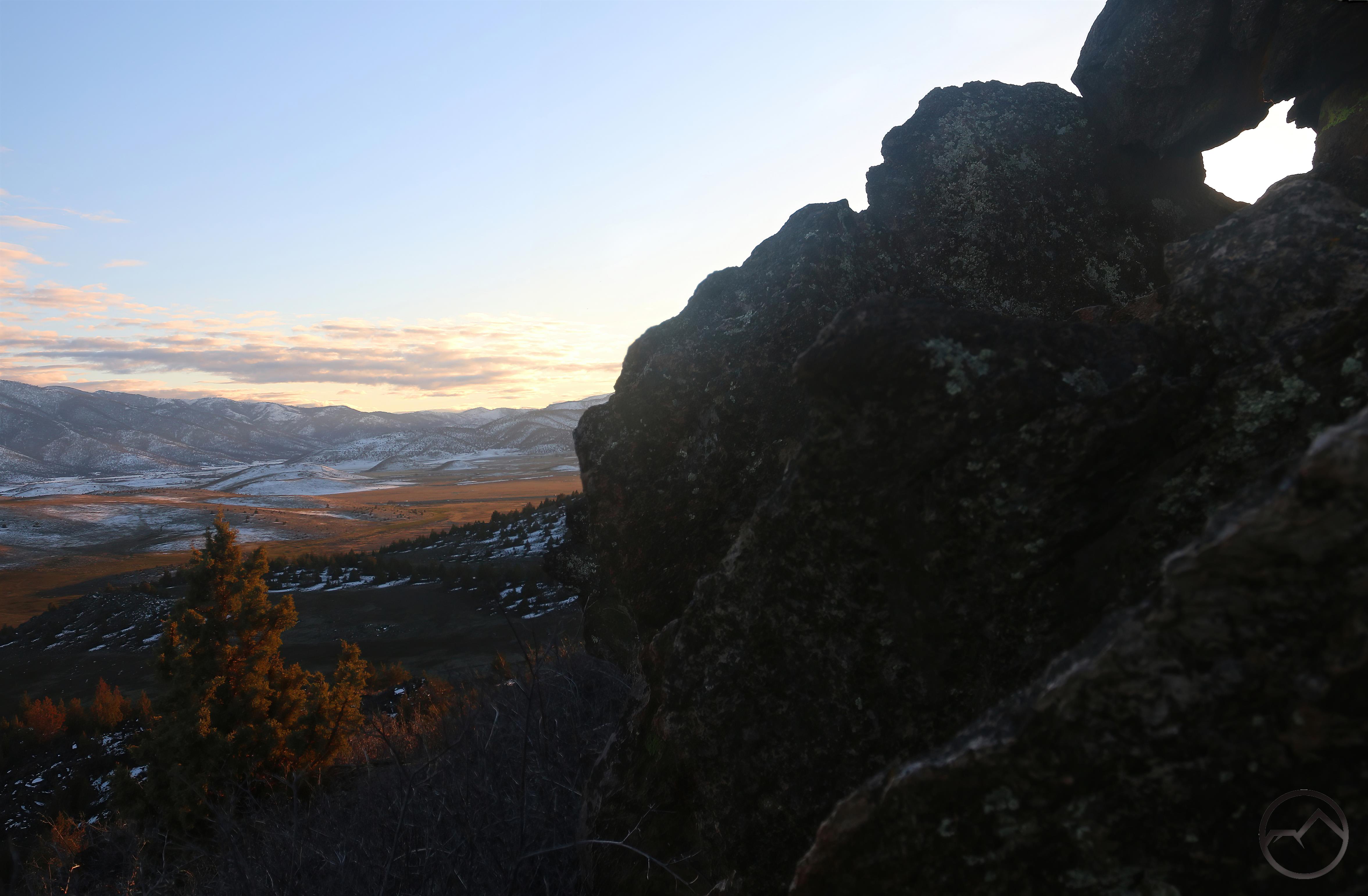
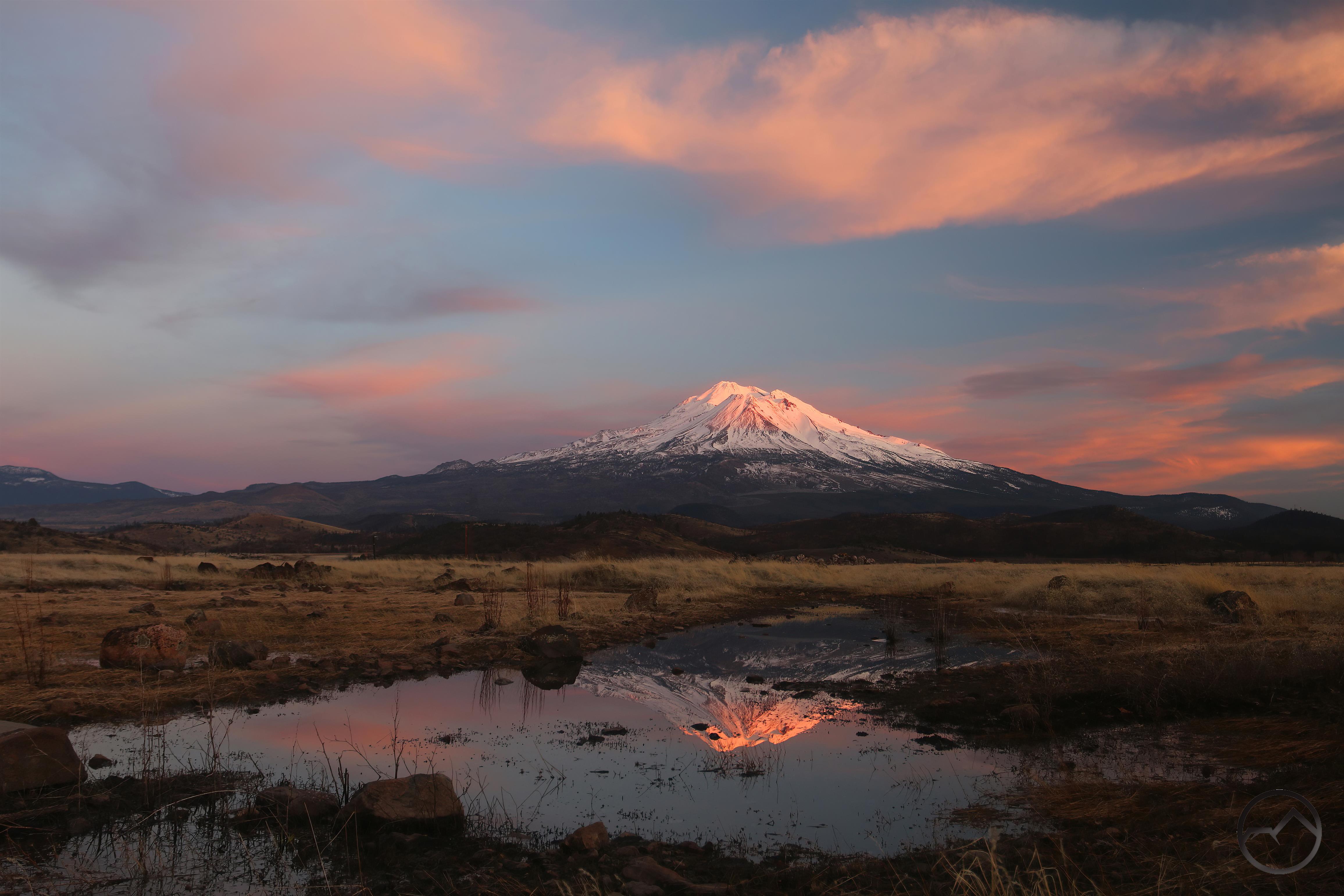
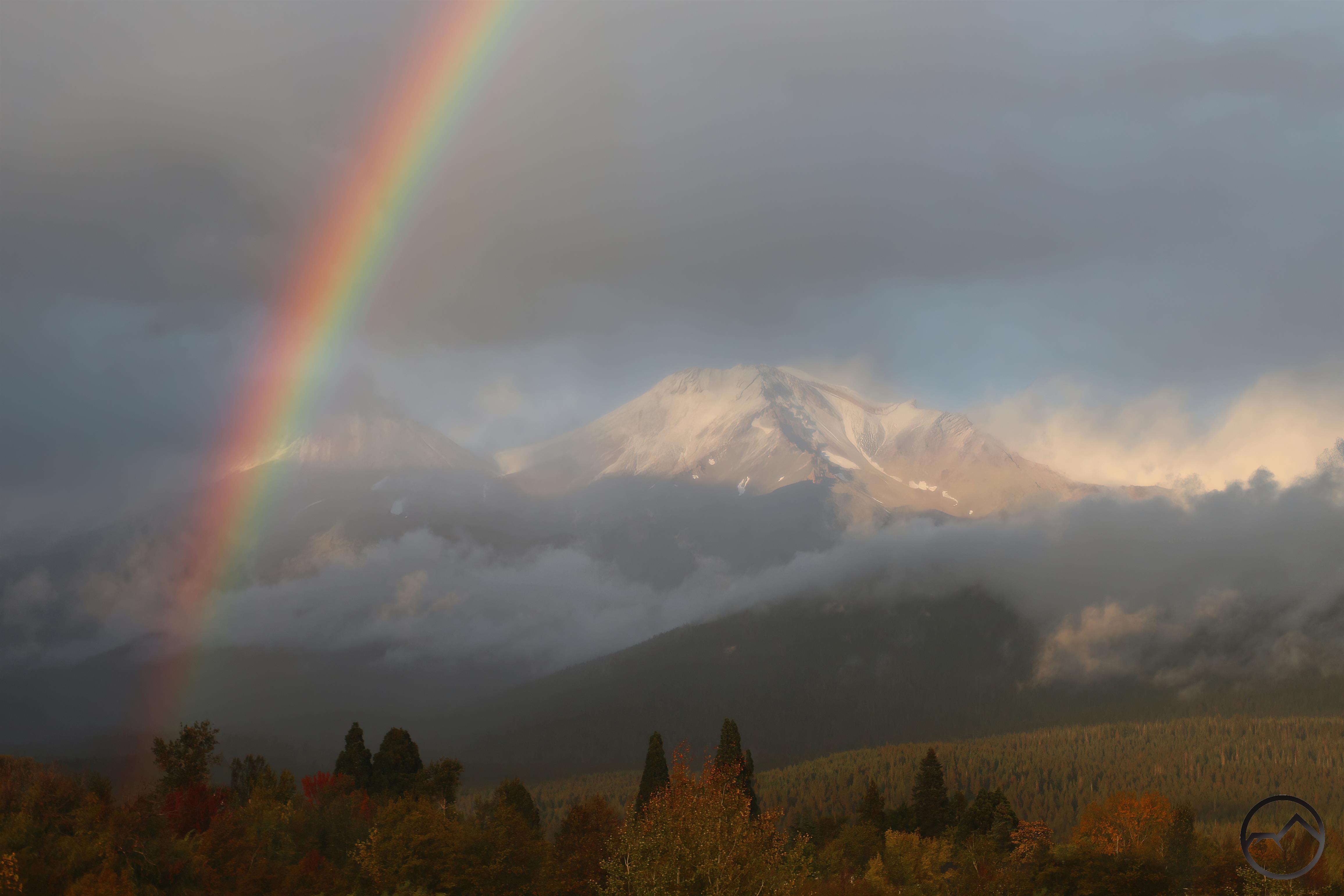
April:

This was the roughest month in many ways. I hardly got out at all. I did get the boy scouts to Yosemite however so there was some sense of accomplishment. Even then, responsibility took first position and didn’t get any images from that trip. I was too busy wrangling. I essentially got no images of Mount Shasta the entire month. On the evening of the last day, I told my wife I had to go out at sunset, just to get something, whatever it might be. It wasn’t a particularly good sunset, but I got it.
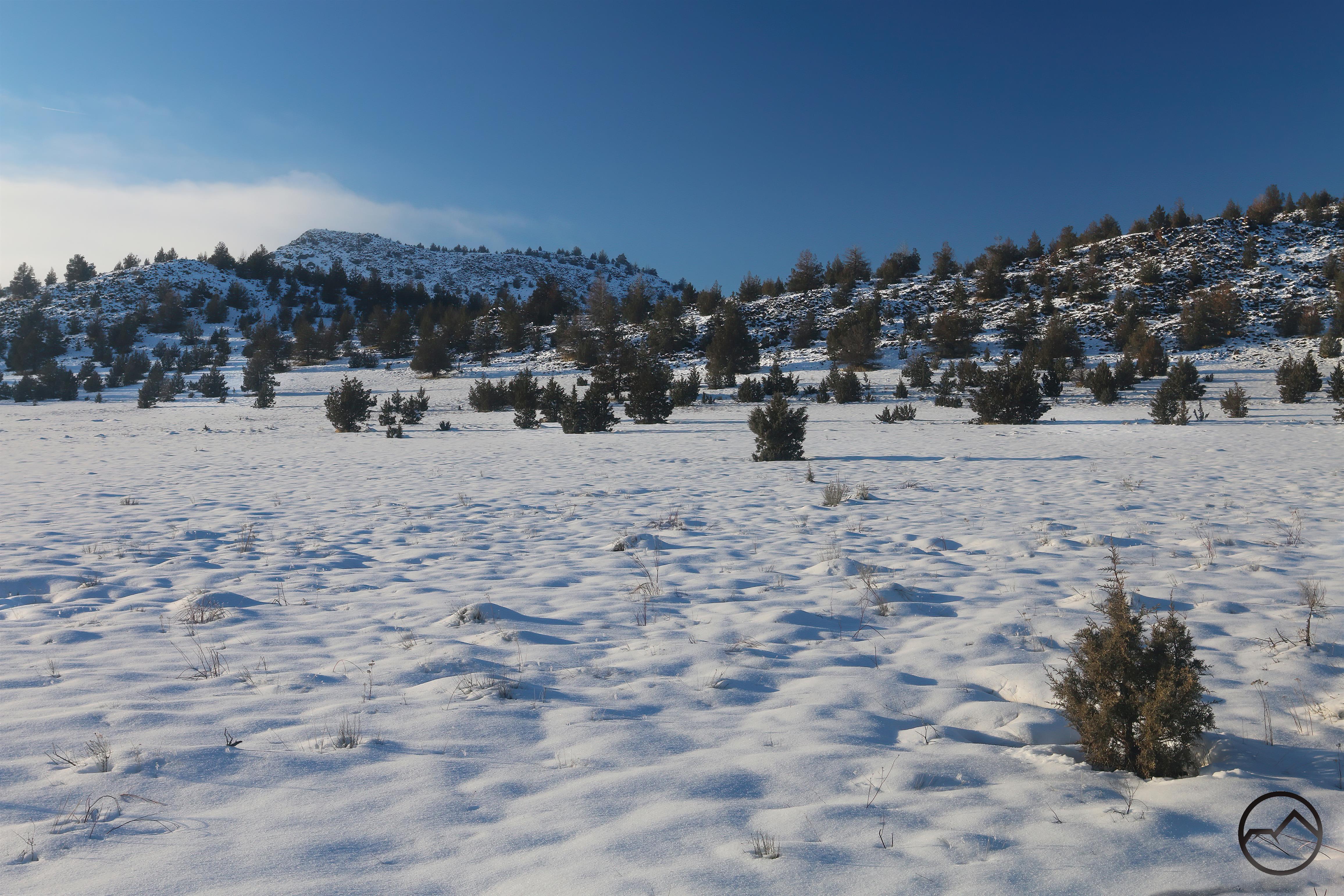
May:

Things started to get interesting in May. The sun decided to have some pretty big solar flares that managed to drag the aurora borealis all the way down to Mount Shasta. Visible to the naked eye, a slightly longer exposure yielded some pretty extraordinary color in the sky. At the same time, the two years of copious precipitation yielded a super bloom in the Shasta Valley that, though beautiful, was pretty inconvenient. I still haven’t cut all the roads clear.
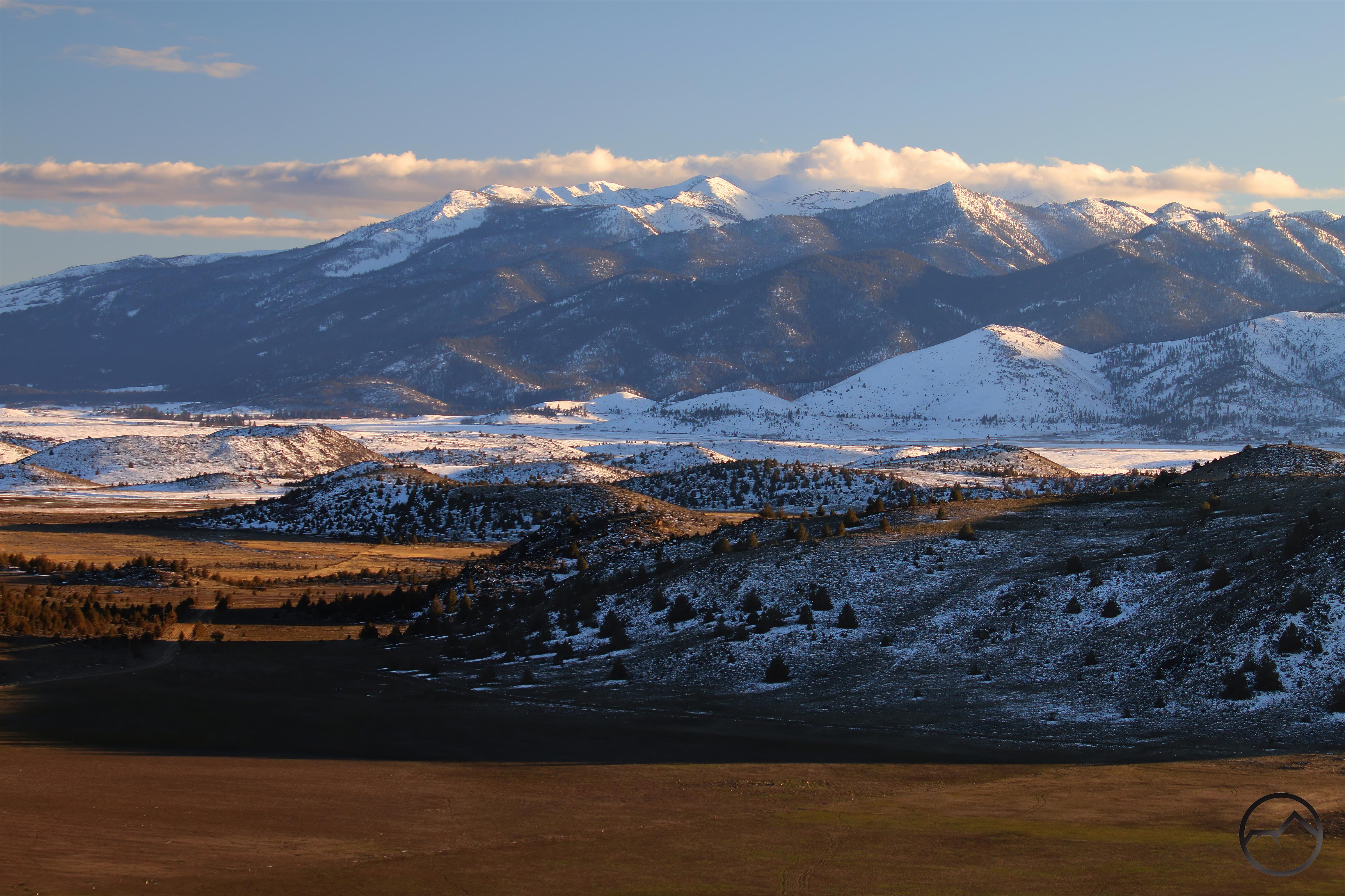
June:

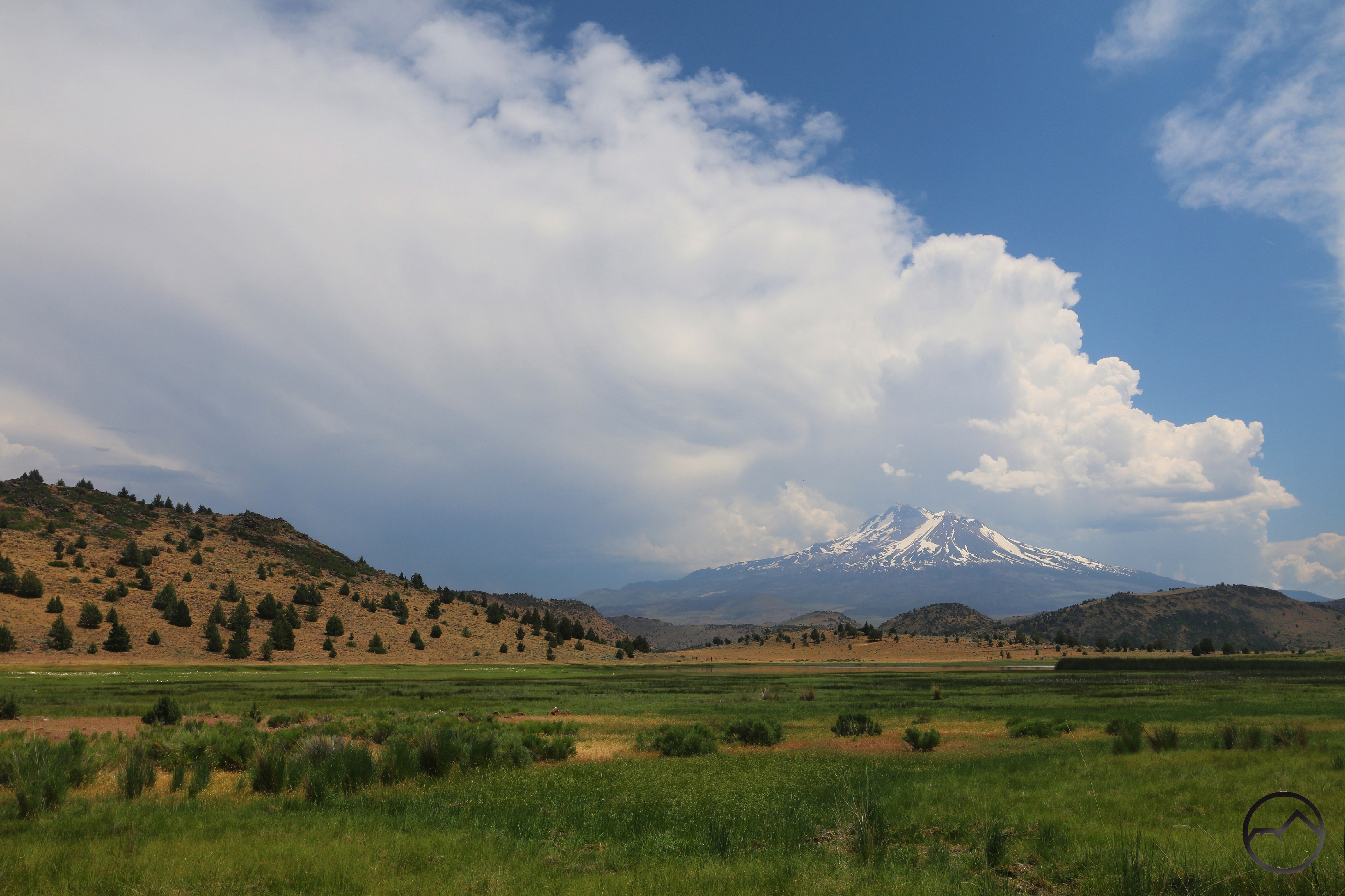
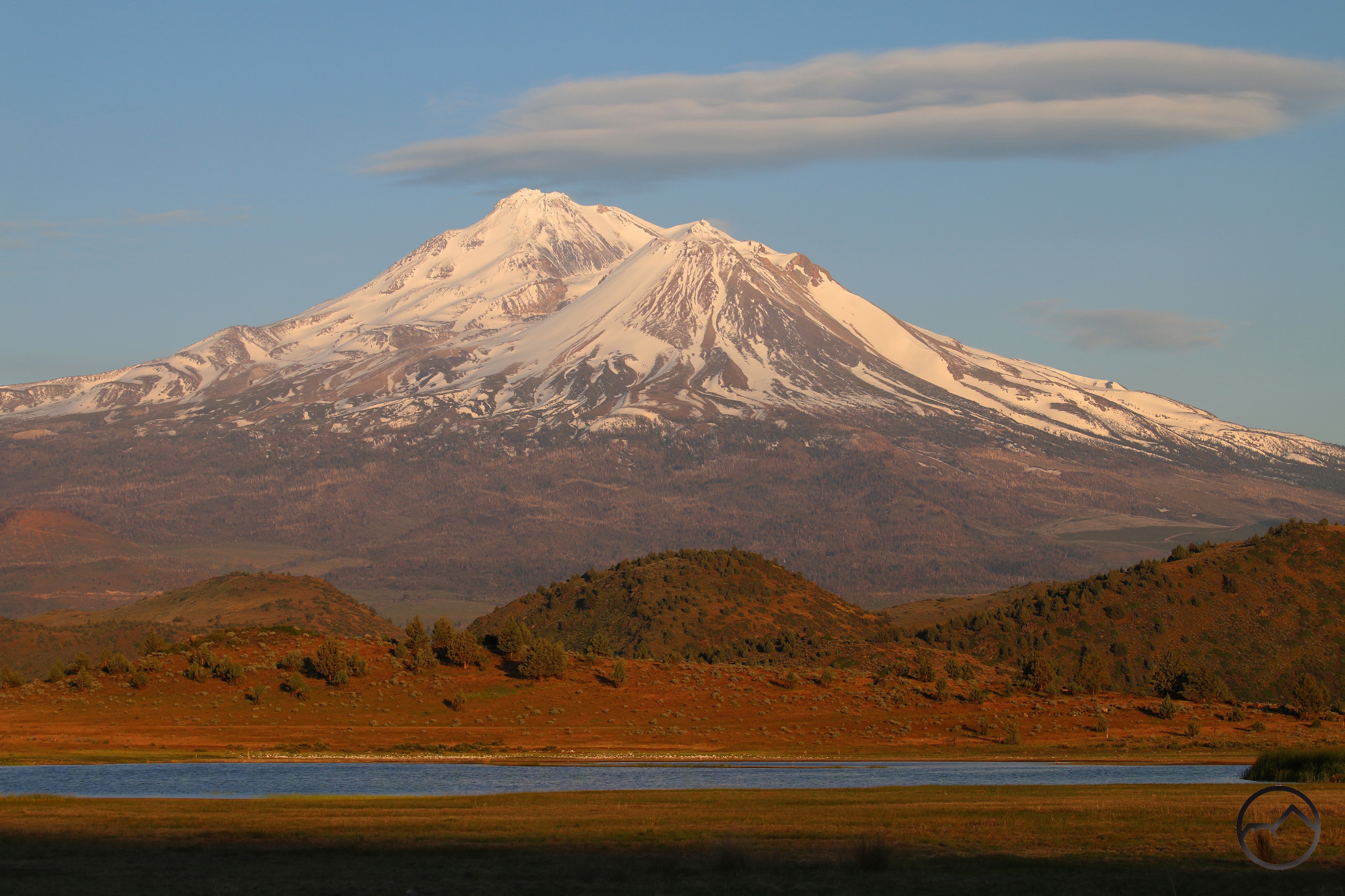
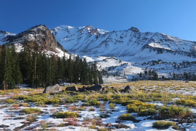
June brought more blooming in the Shasta Valley. Driving through these kinds of conditions, hiking through the flowers and gazing up at the snowy mountain was delightful. Places that often seem dreary were anything but! The winter snow still clung to Mount Shasta and it was a white mountain throughout the month.
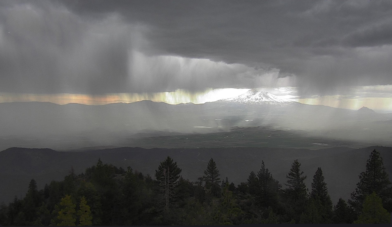
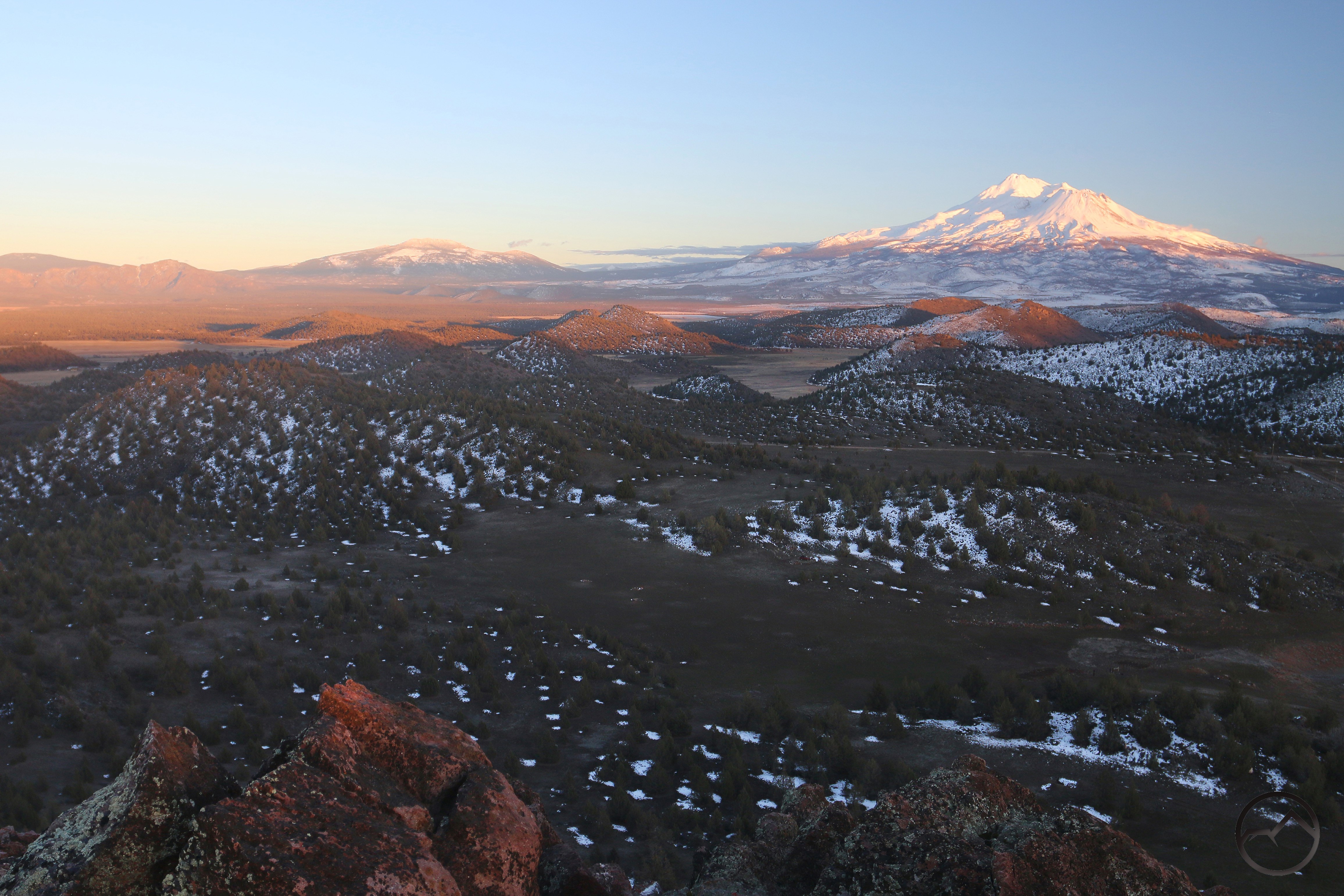
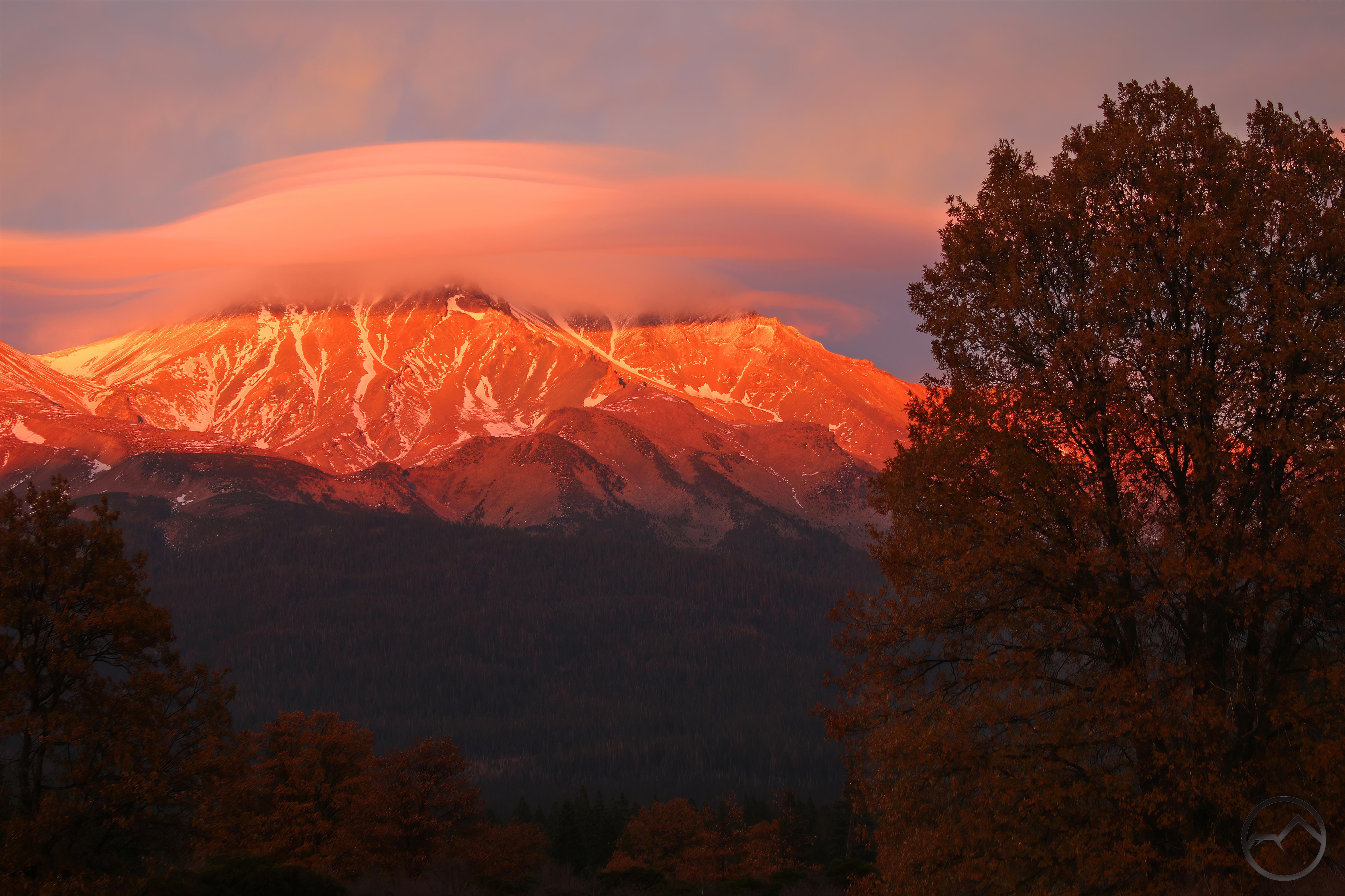
July:

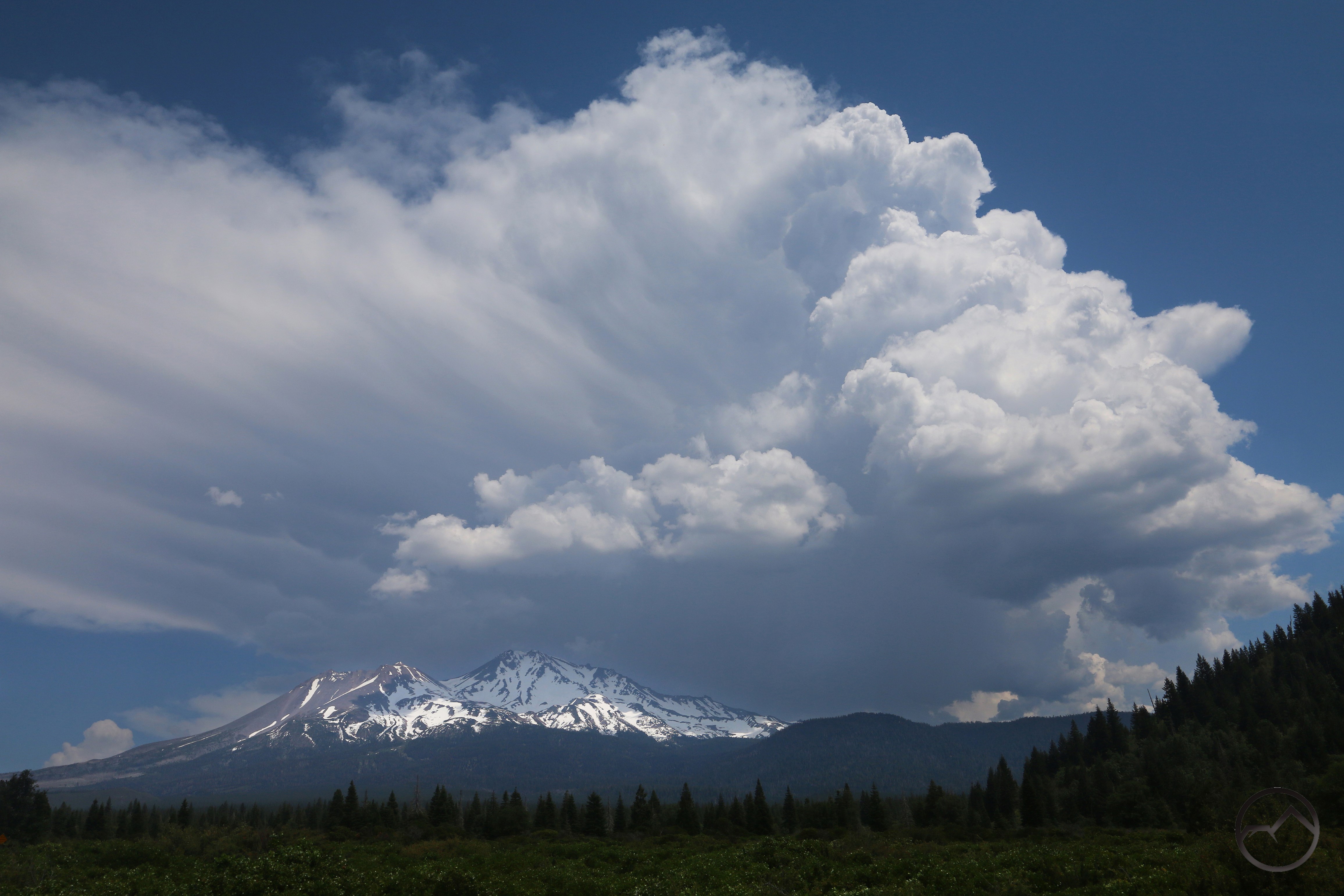
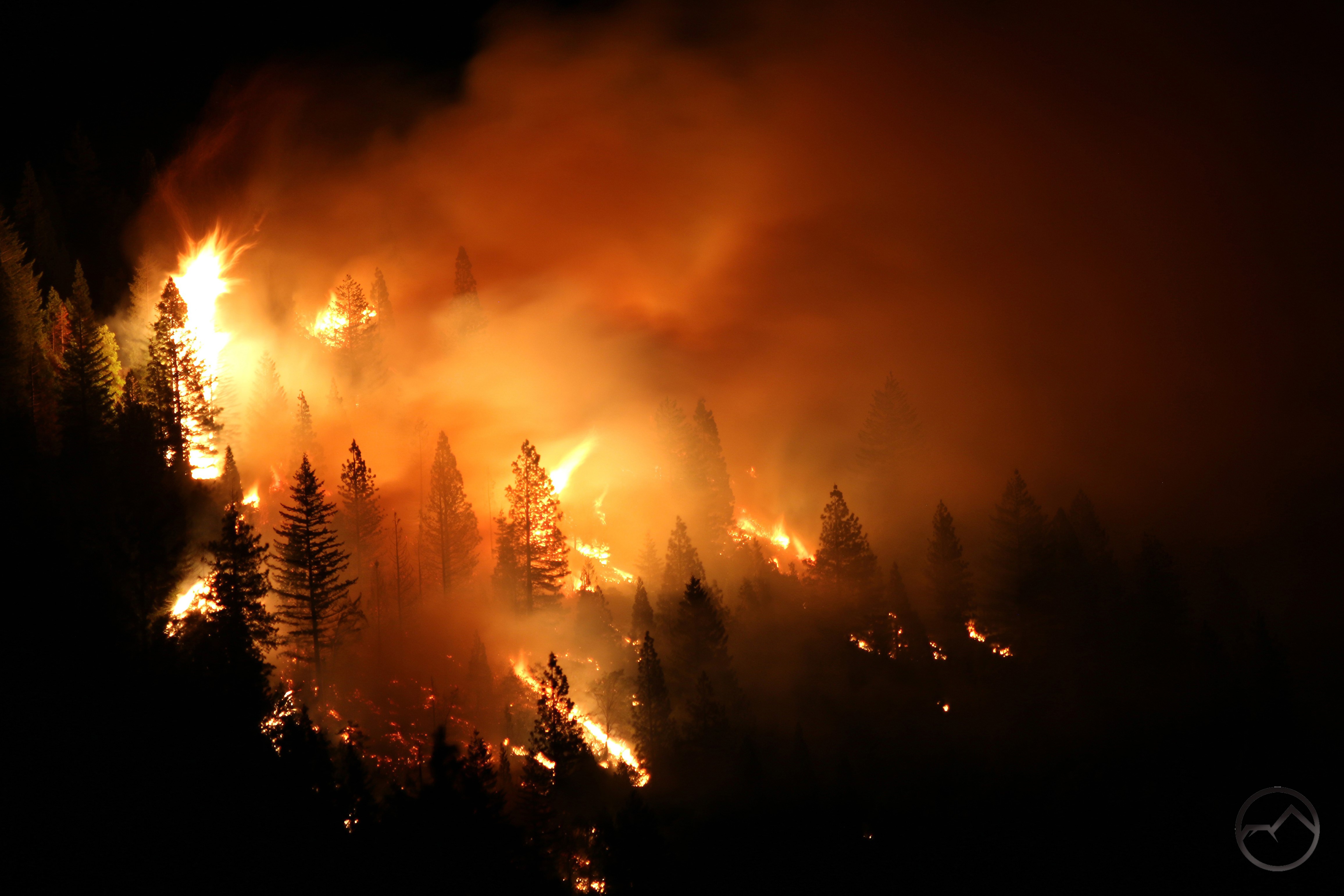
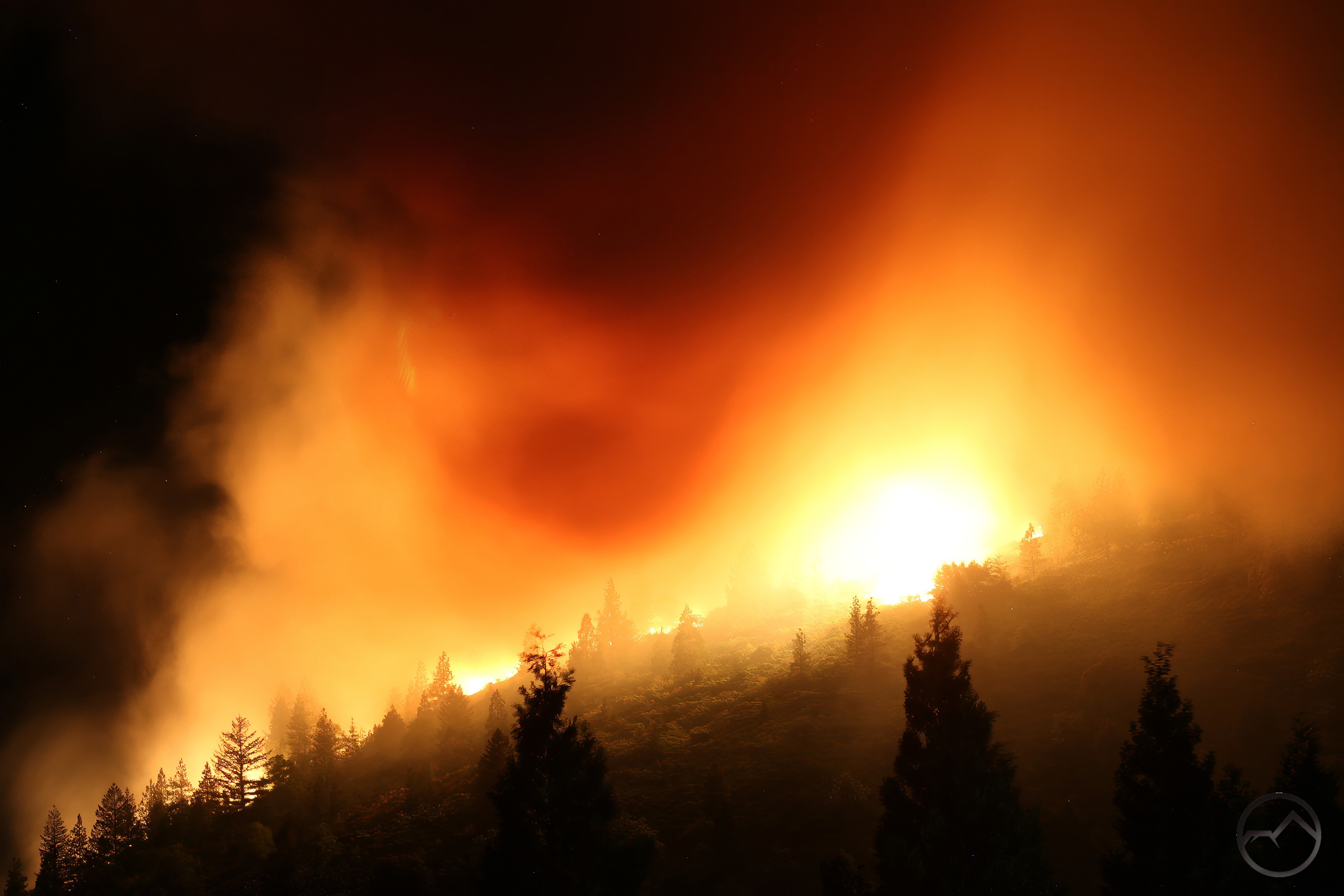
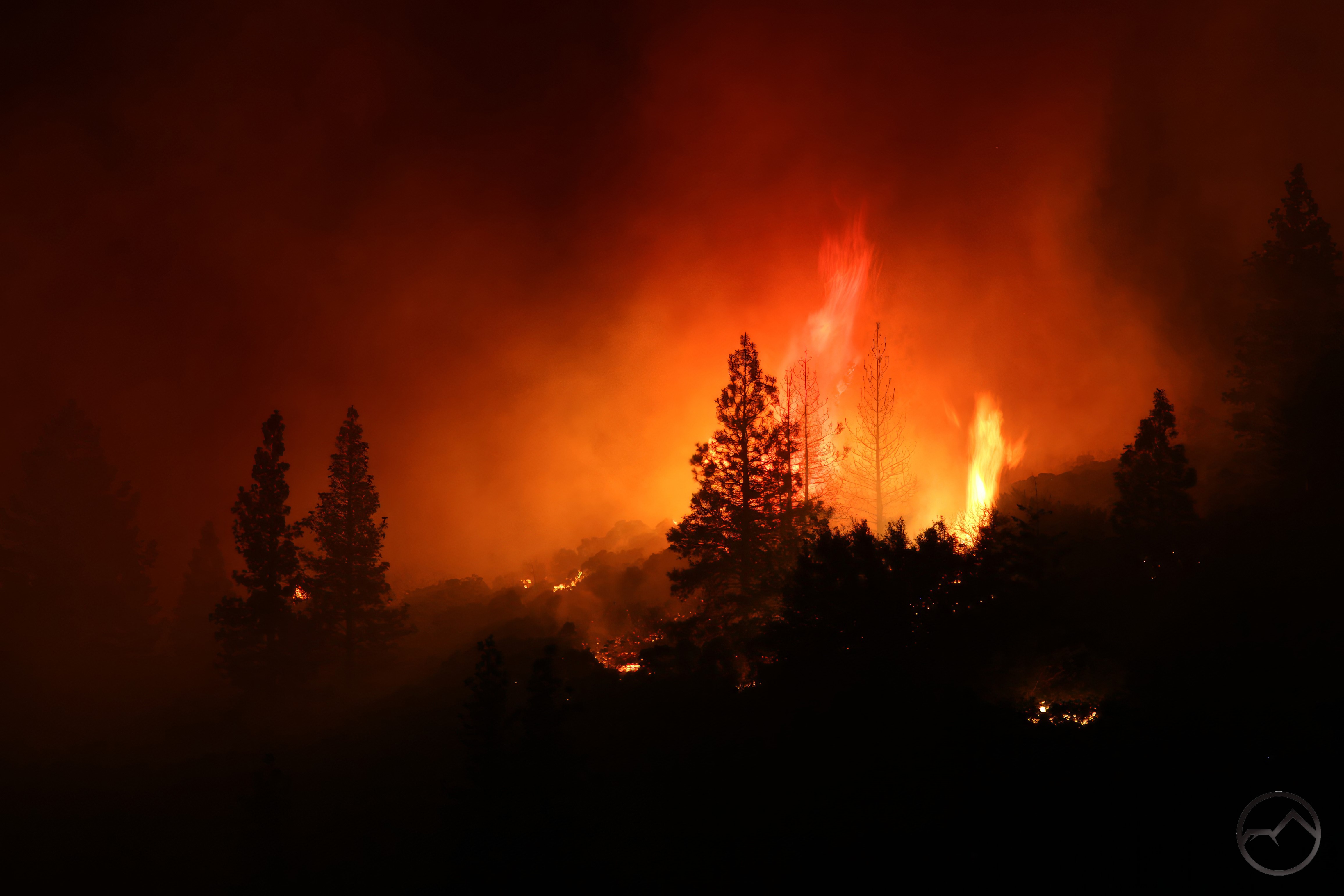
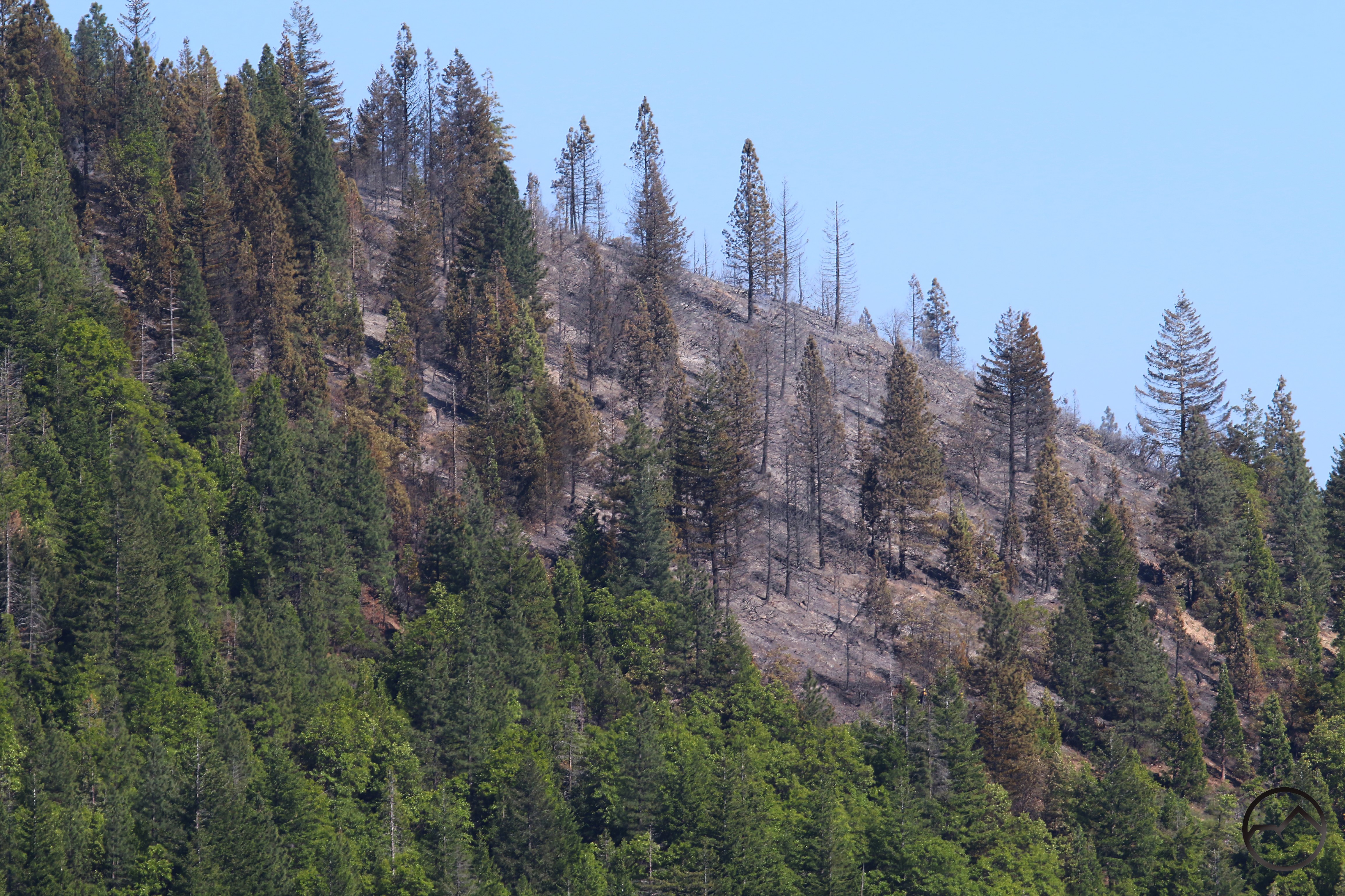
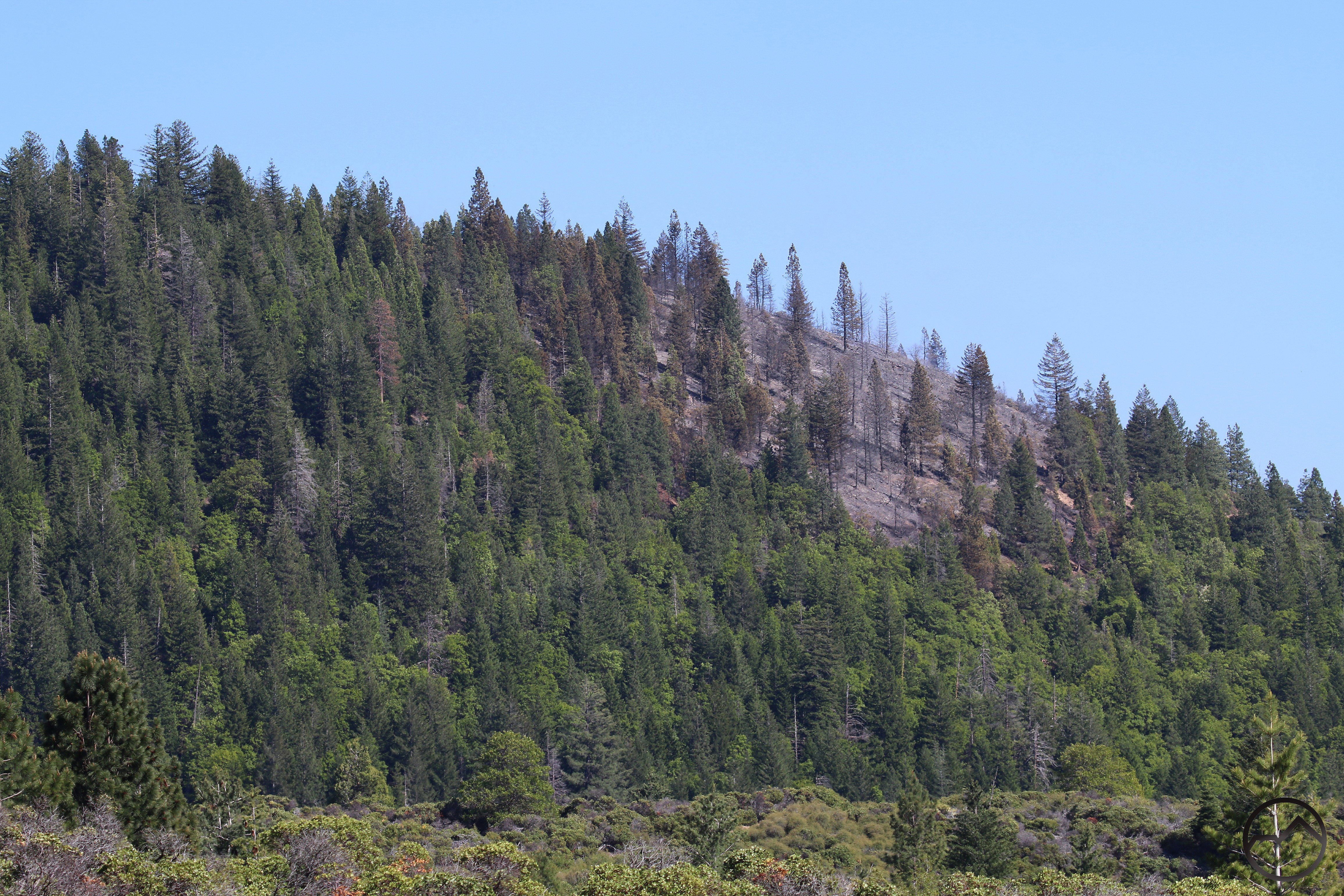
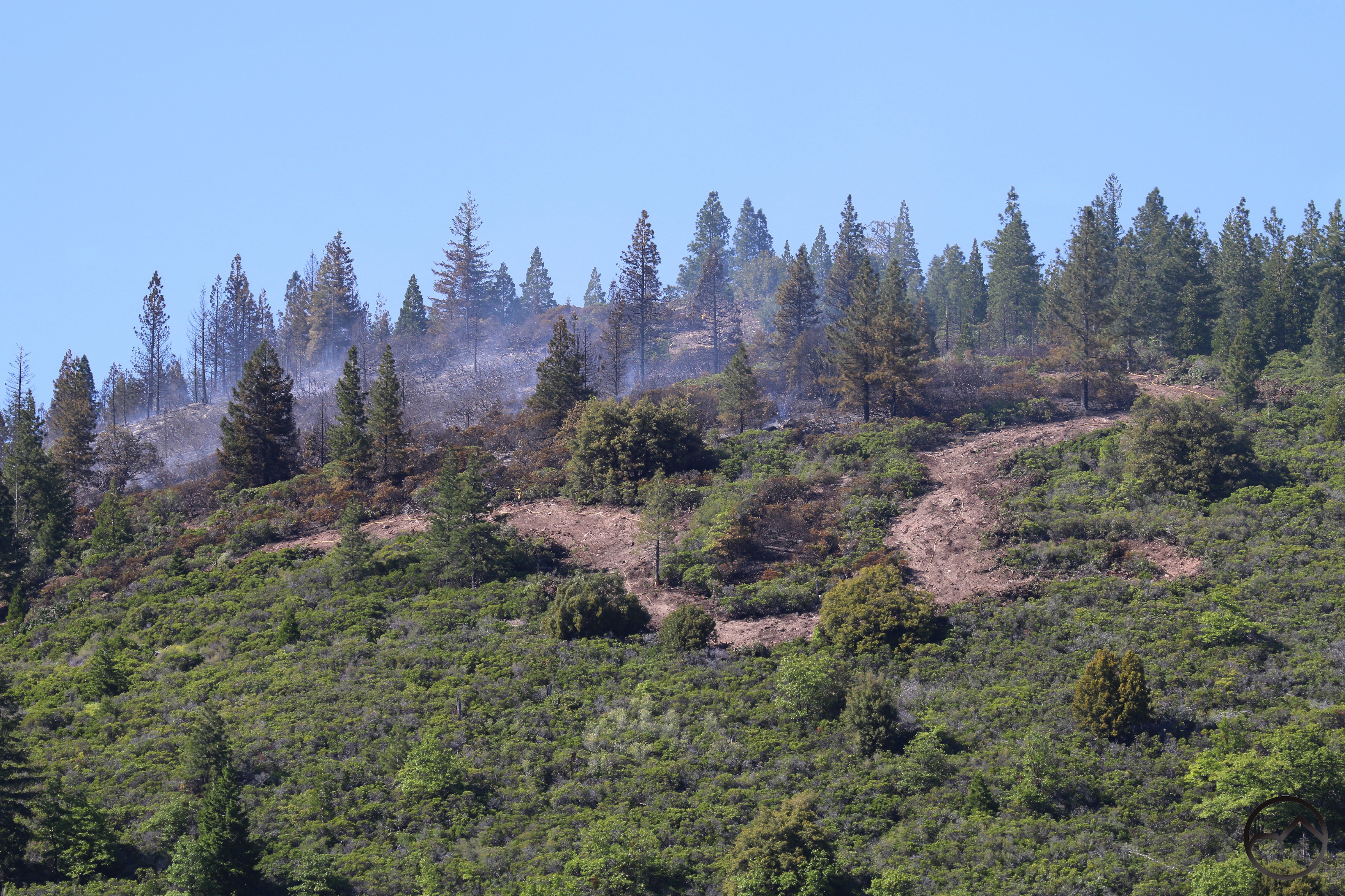
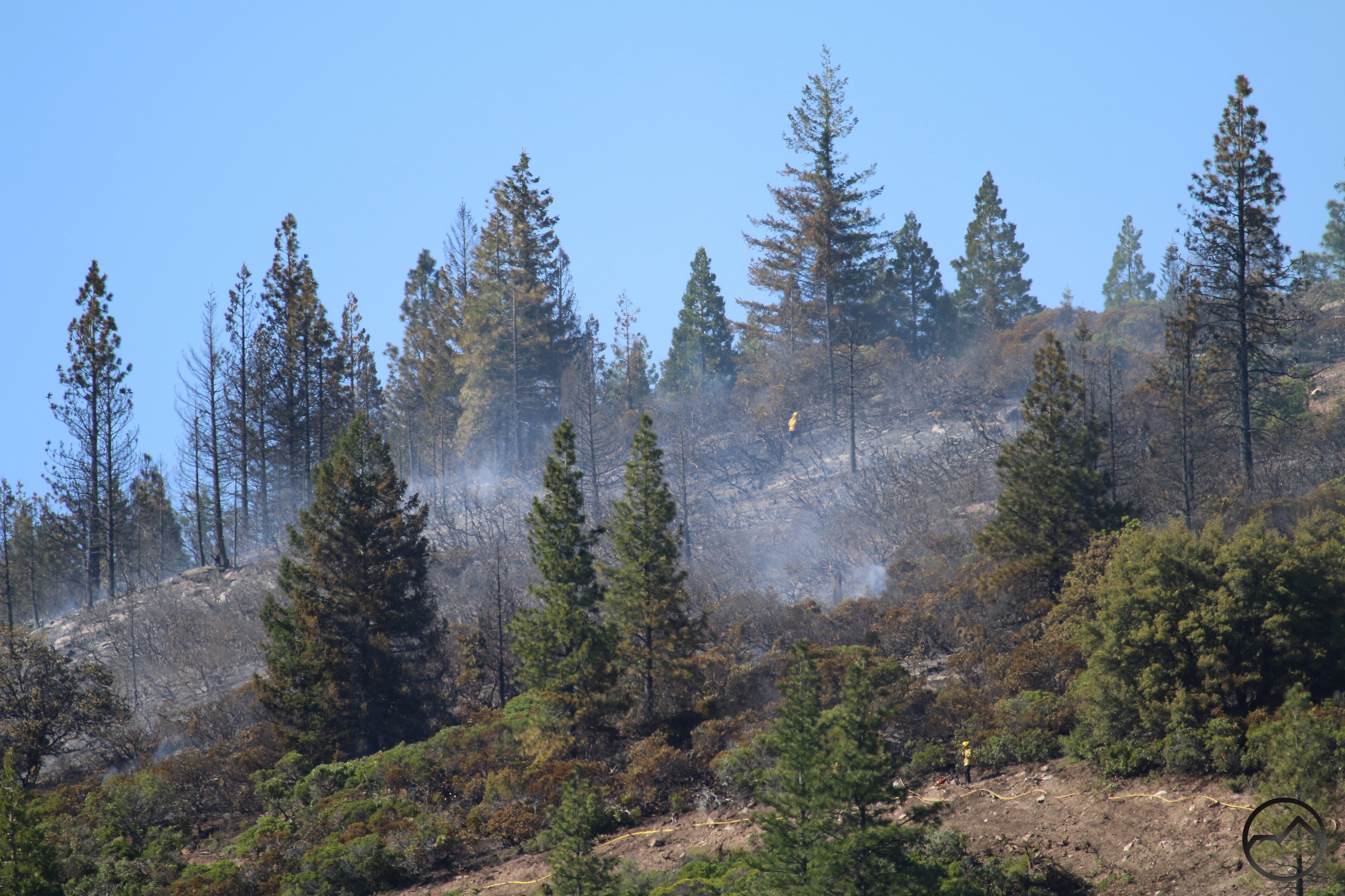
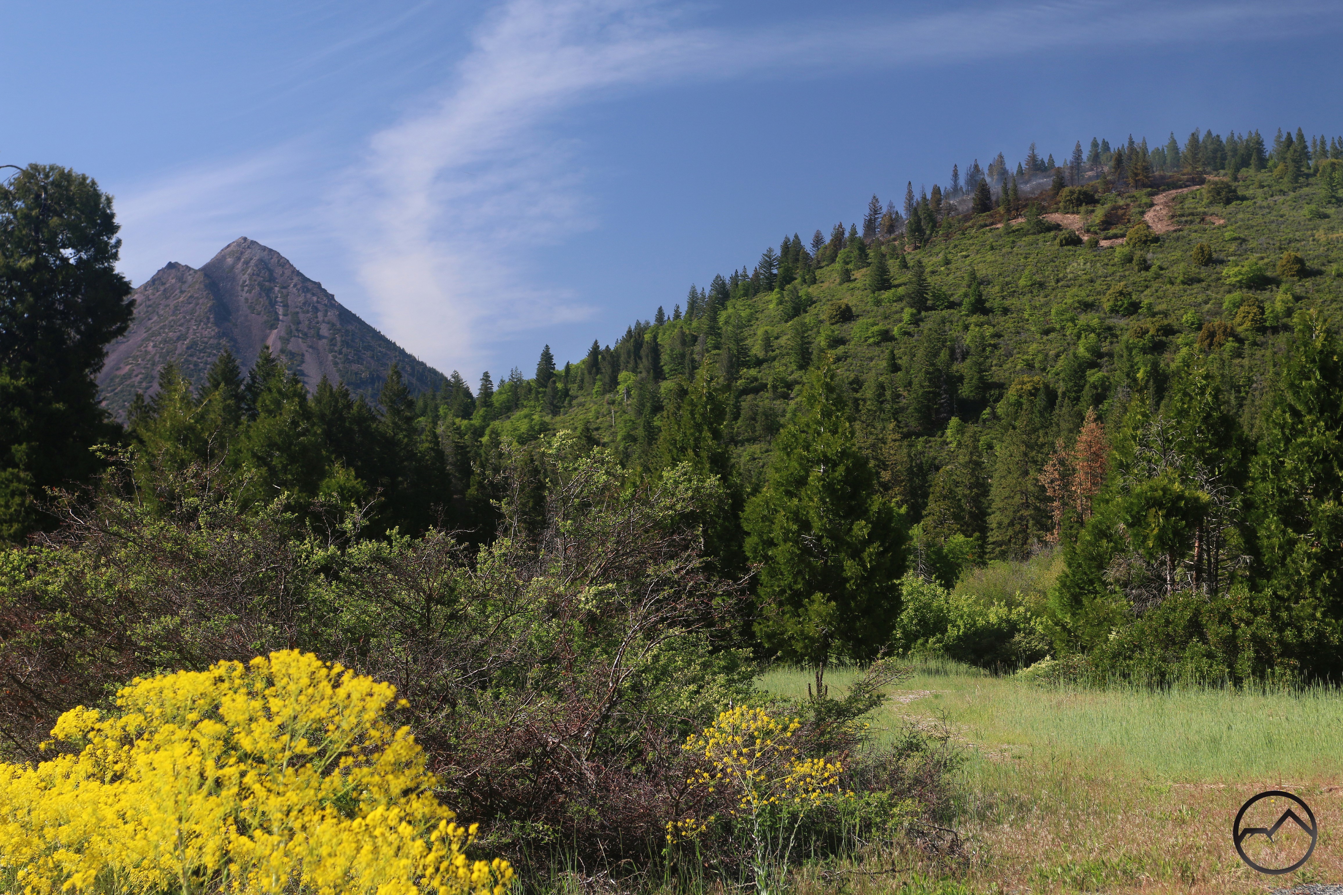
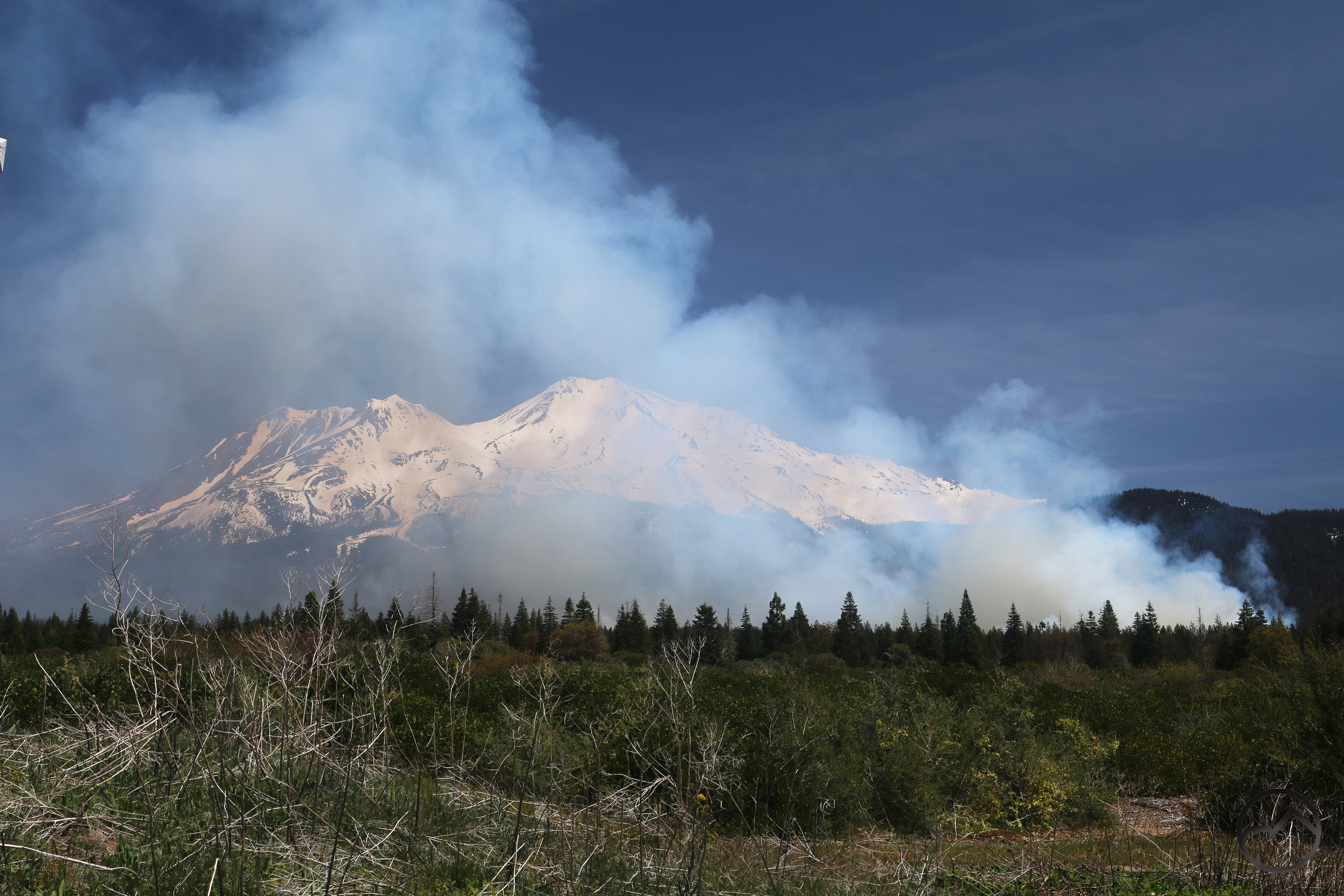
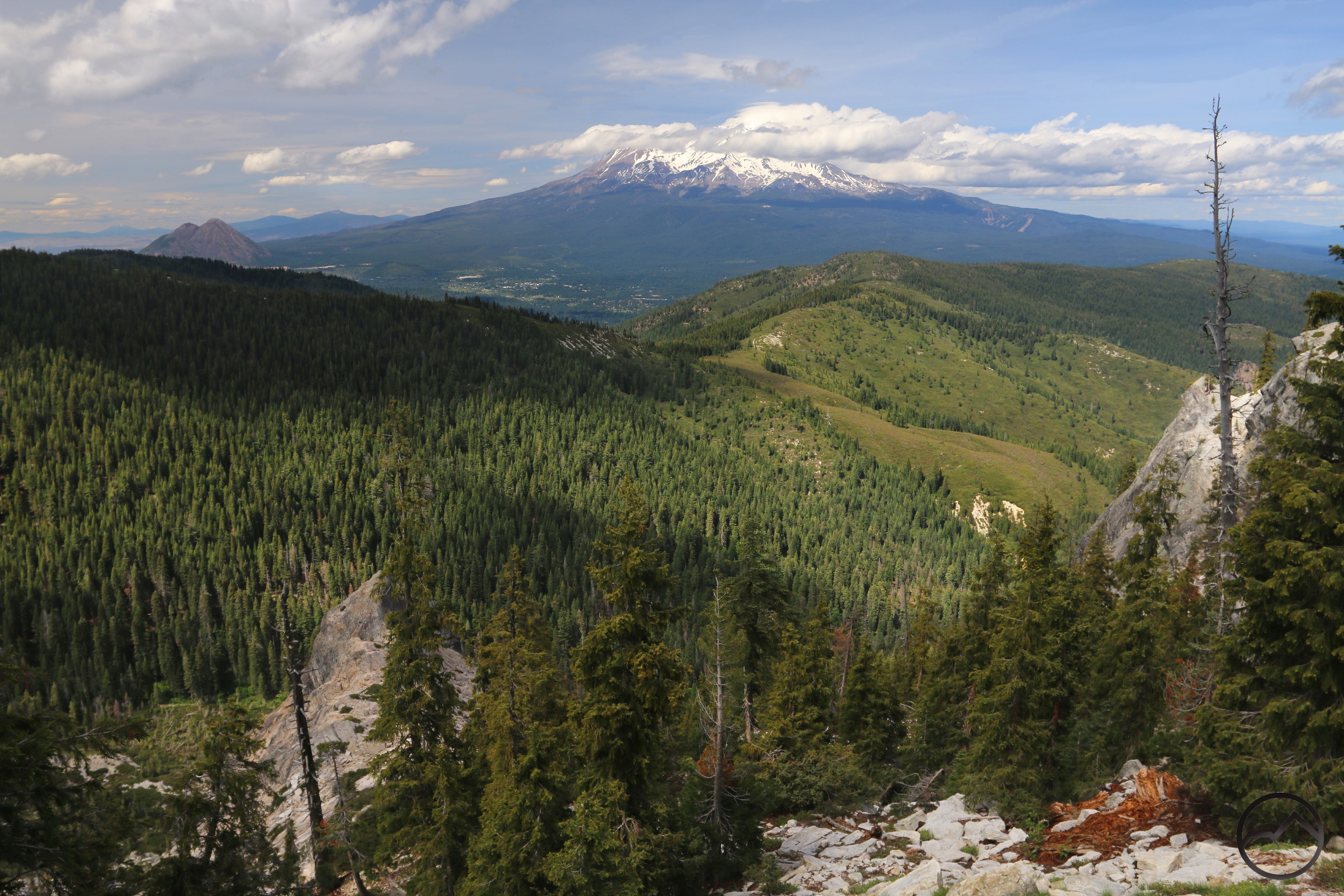
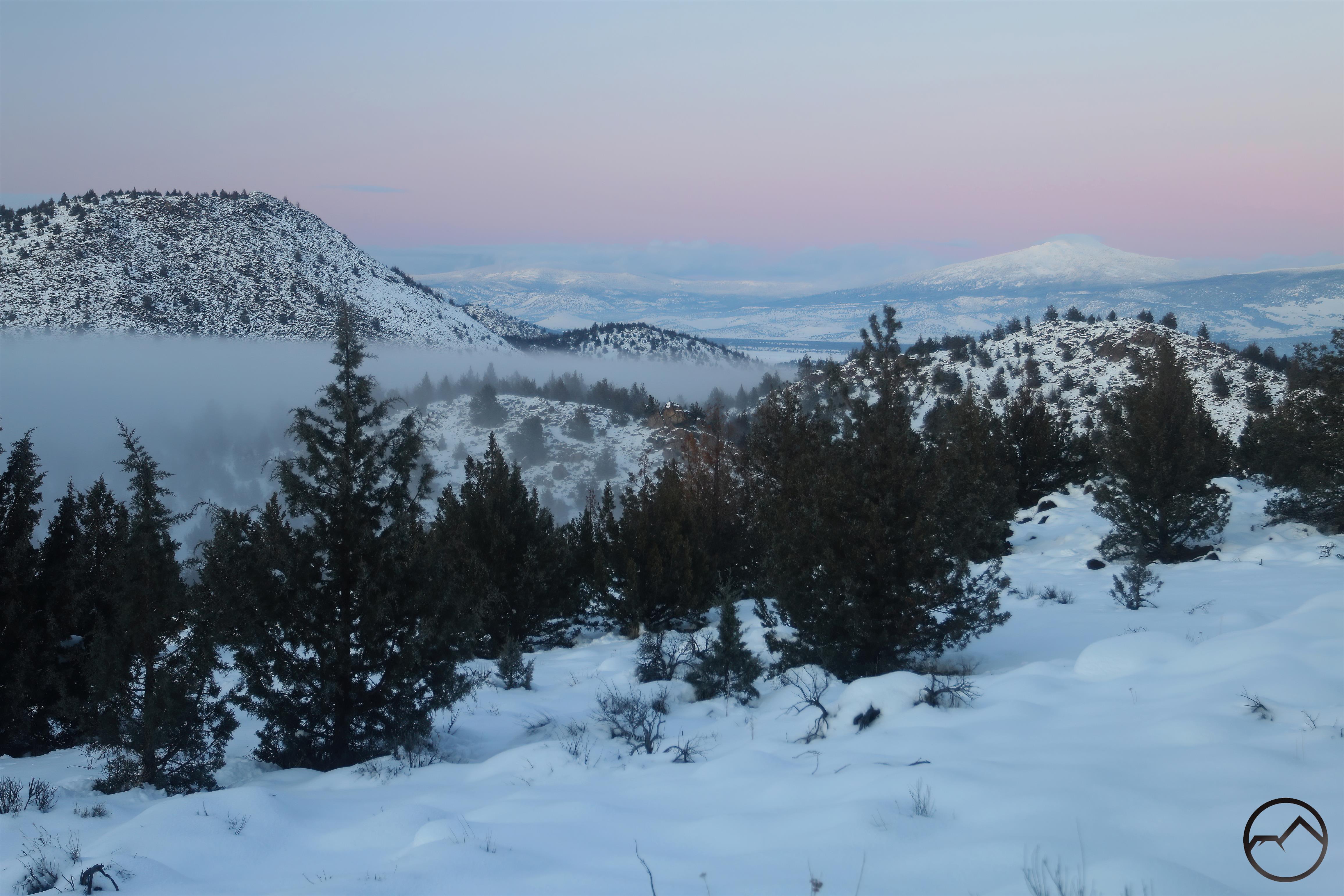
Smoke arrived in July and the heat got turned up and it was hot. Extra hot. The snow melted on Mount Shasta in earnest. This was a month of work, with a variety of obligations just keeping me out of the game. However, when a surprising summer lenticular appeared, it got my attention for the whole day. The mountain even burped out another mudflow down Cascade Gulch. These kinds of things don’t happy frequently this time of year, so it was a welcome intrusion into the summer meteorological doldrums. It was also a sign of interesting weather to come.

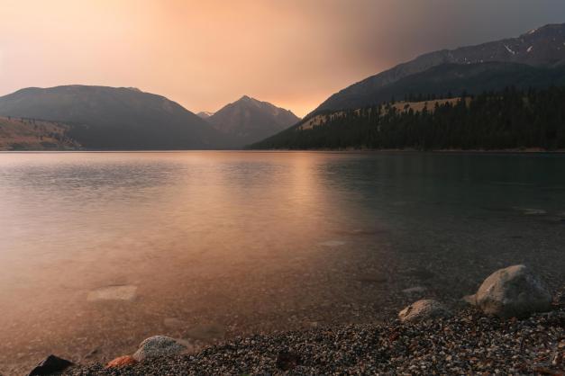
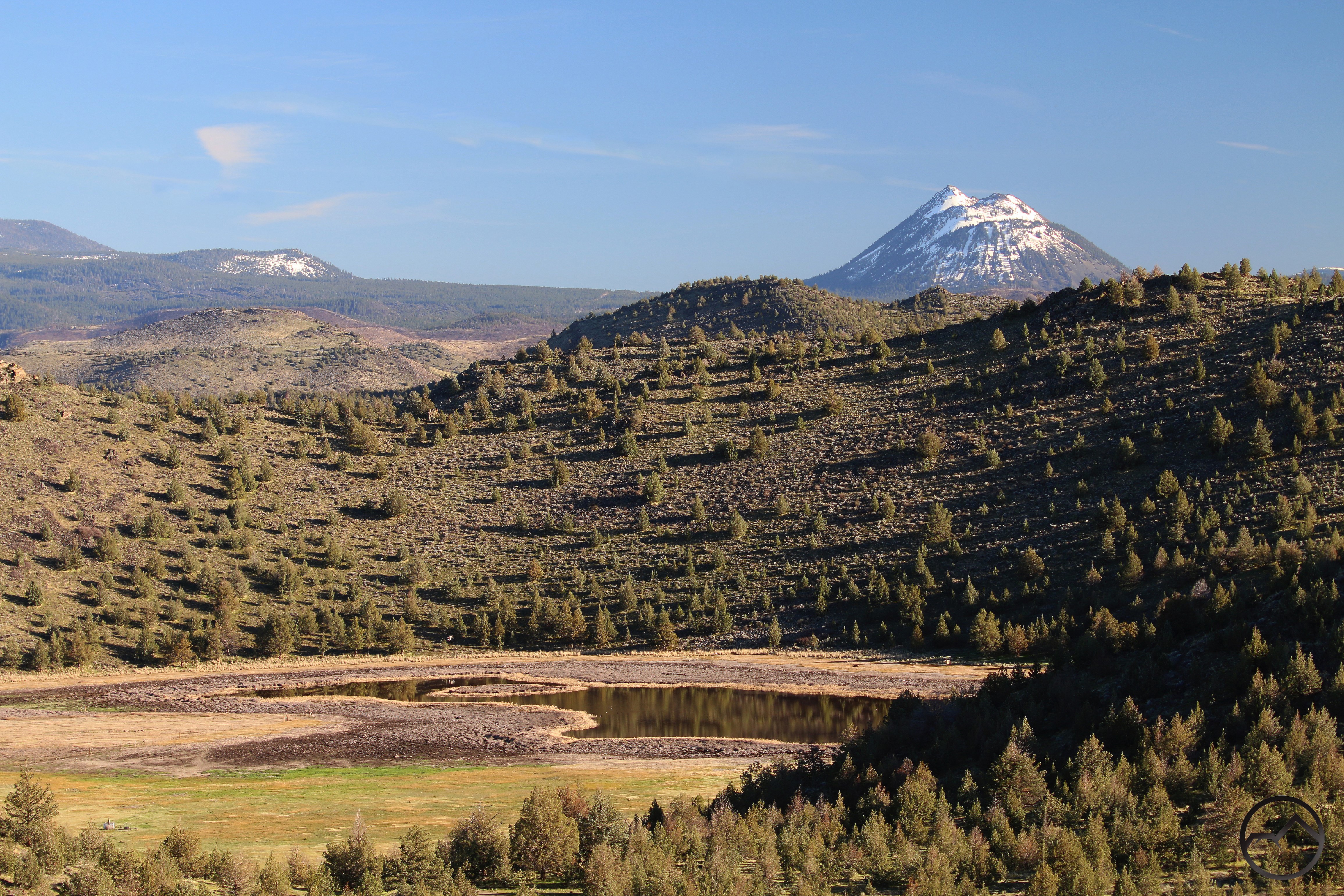
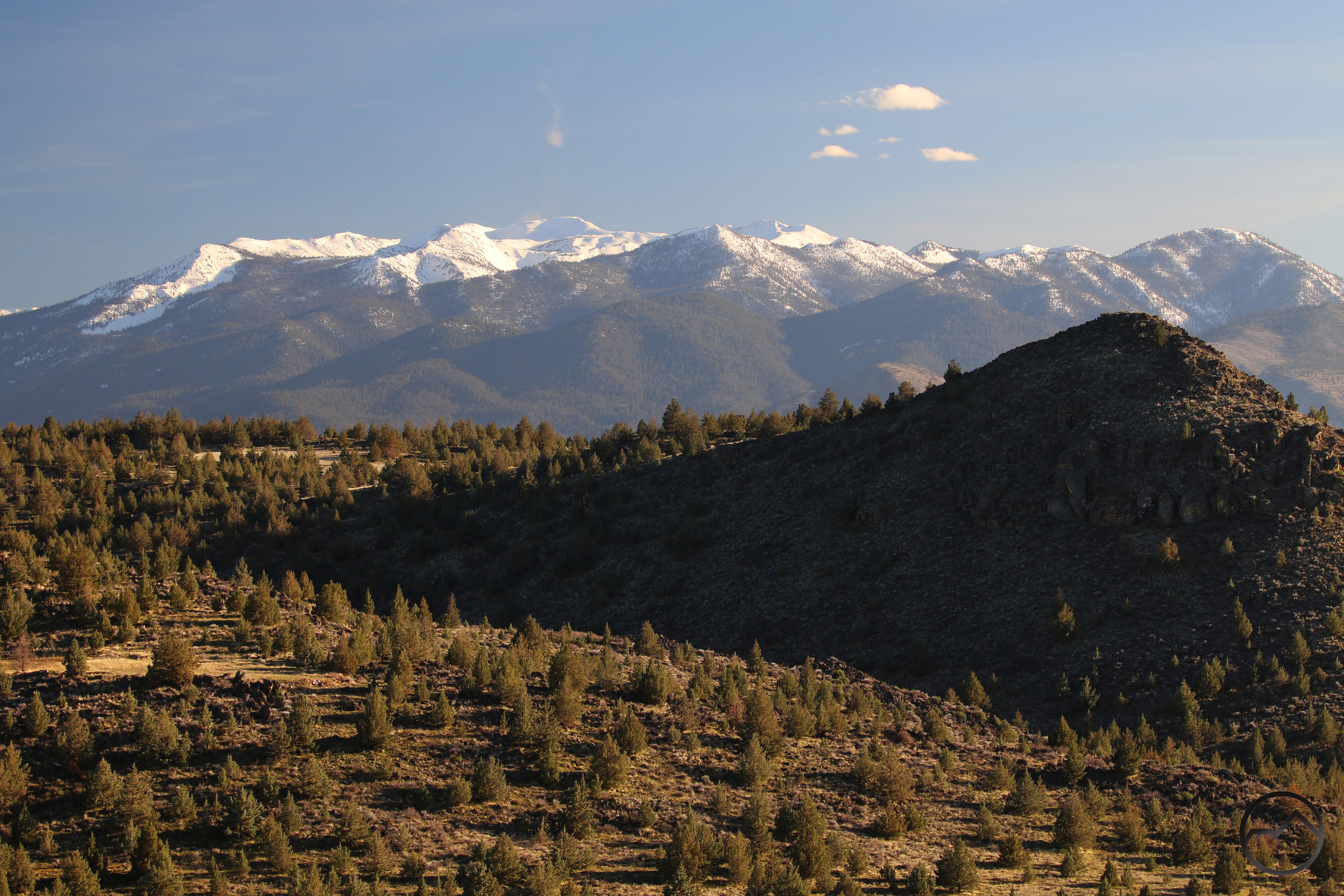
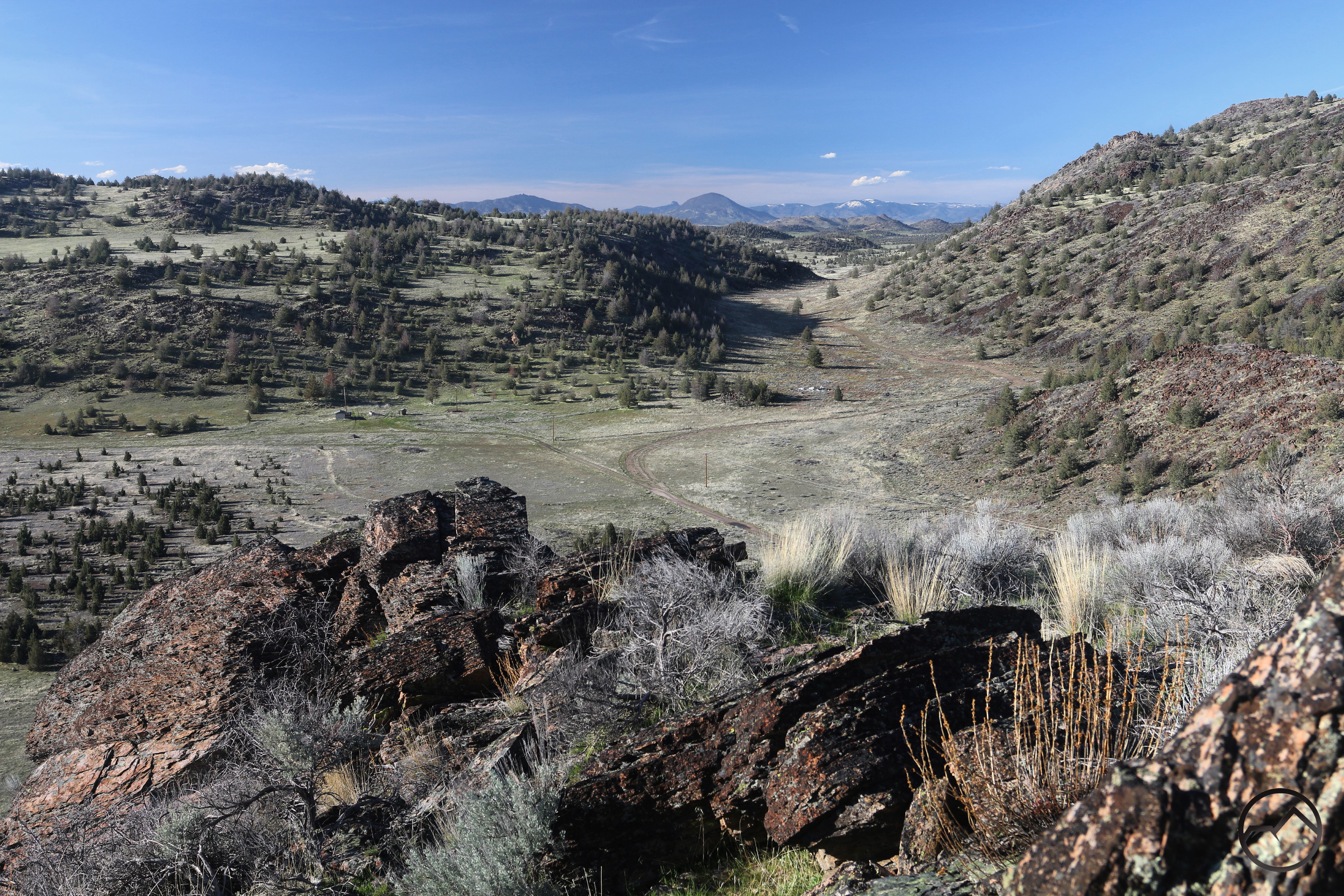
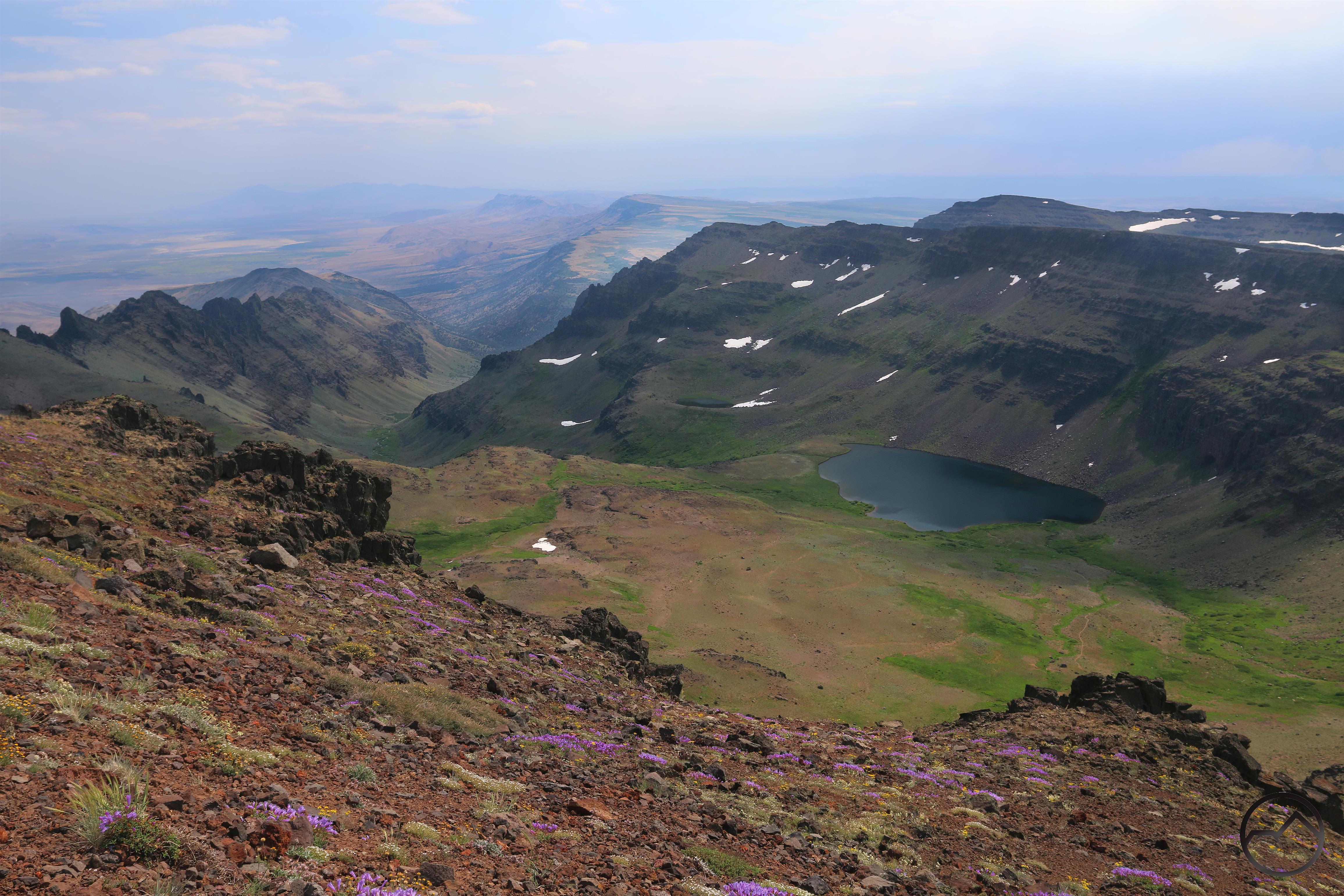
In the midst of all the business, I did manage to take my family up to my brother’s home in Idaho. On the way we camped at Steens Mountain in eastern Oregon and reveled in the fantastic beauty of that incredible landscape. Our planned trip to the Sawtooths was nixed by a fire near Redfish Lake and our campground was turned into a staging area. We quickly shifted gears and went up to Joseph, Oregon and enjoyed a short stay at Wallowa Lake. That turned out to be a good move for a variety of reasons, even though the Wallowas are a backpacker’s mountain range, our quick taste at once satisfying but left us hungry for more.

August:

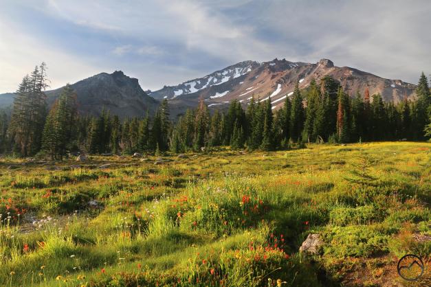
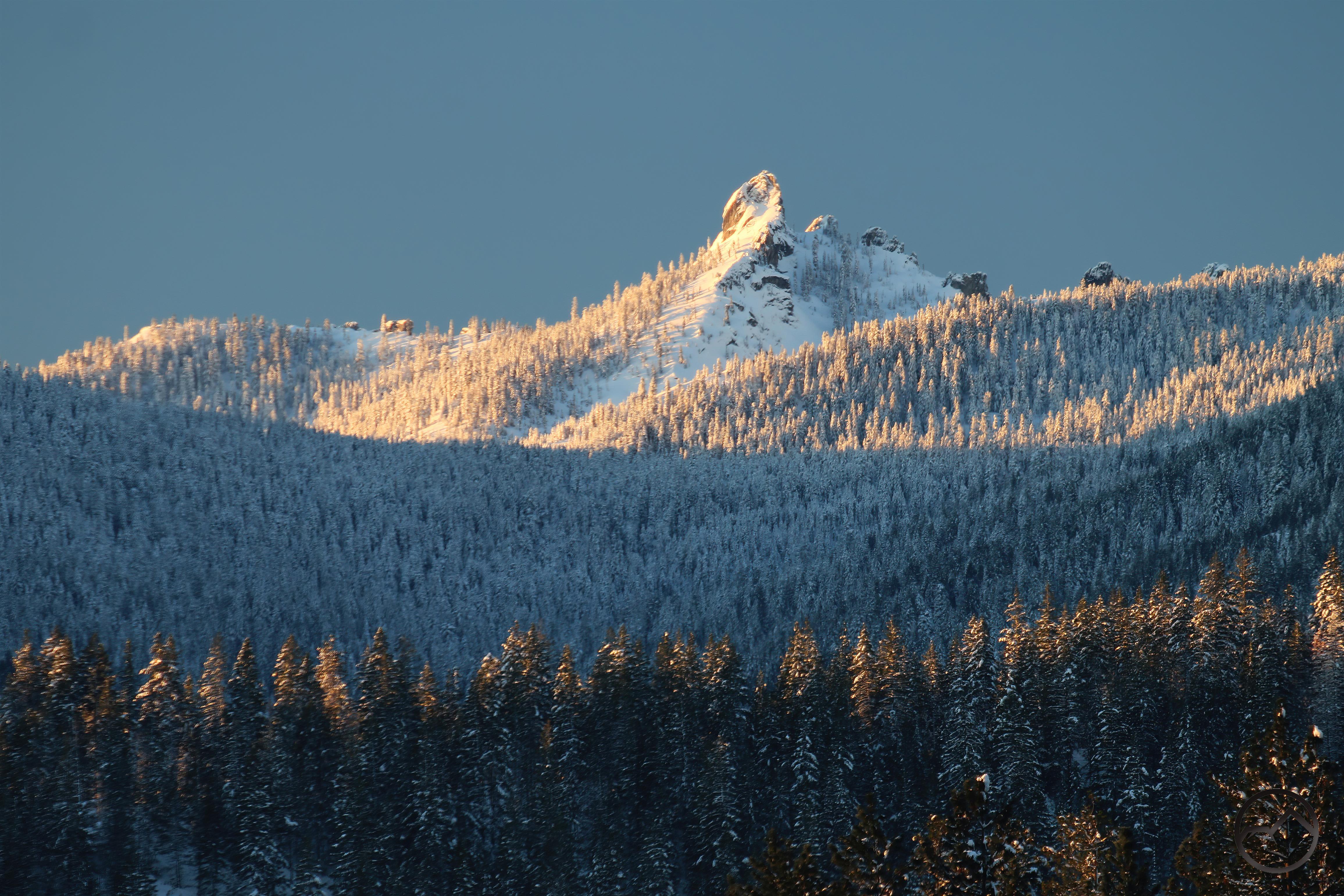
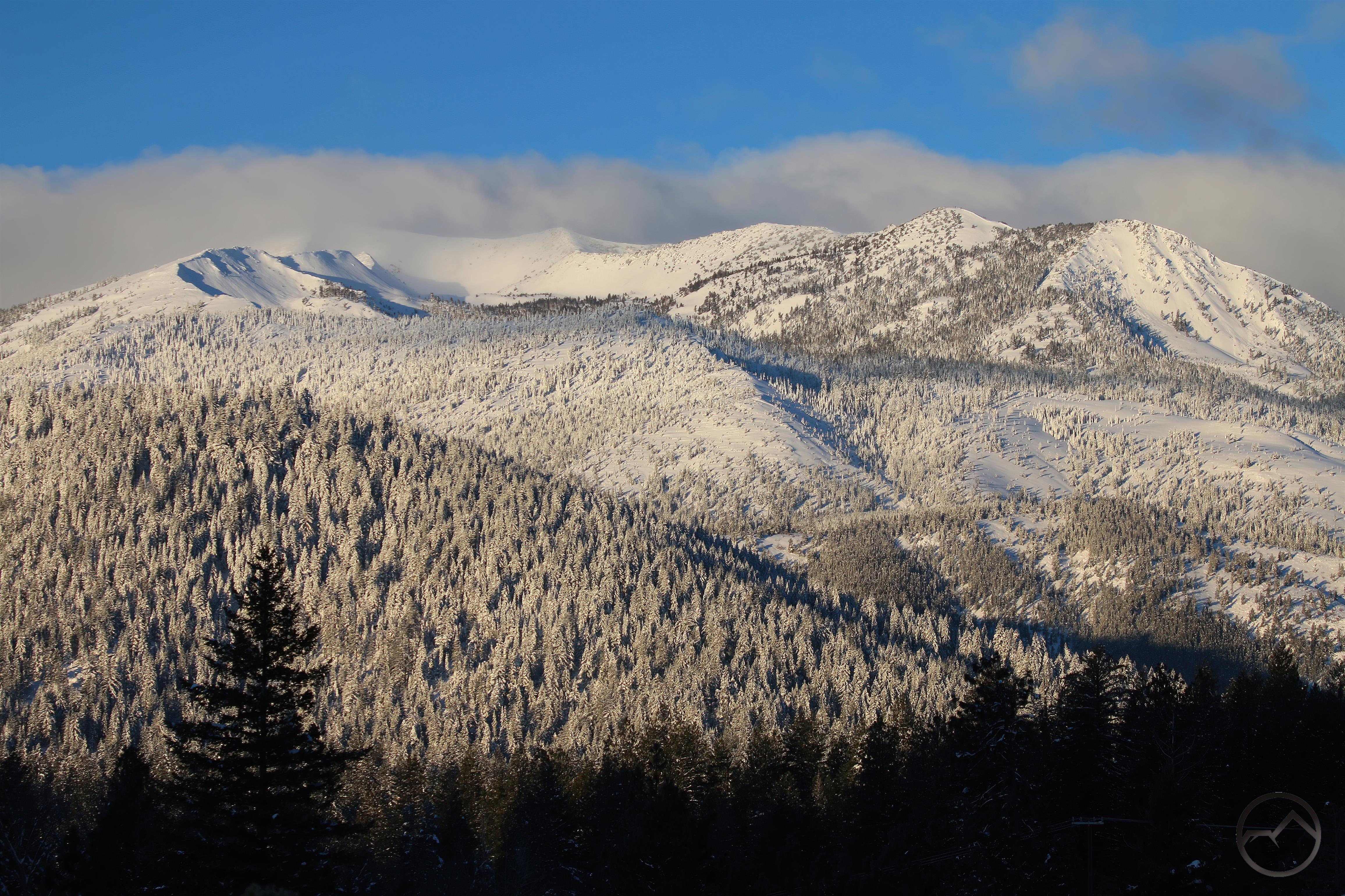
In an unusual turn of events, August turned out to be one of the prettiest months of the year in Mount Shasta. Typically a month frequently choked with smoke and heat, this year it turned out to have a few snow storms pass through. The unusual, out-of-season snow complimented the riotous eruption of wildflowers that was the customary highlight at the higher elevations. The already beautiful wildflower displays were elevated orders of magnitude by the snow. It was an unusual and memorable combination.

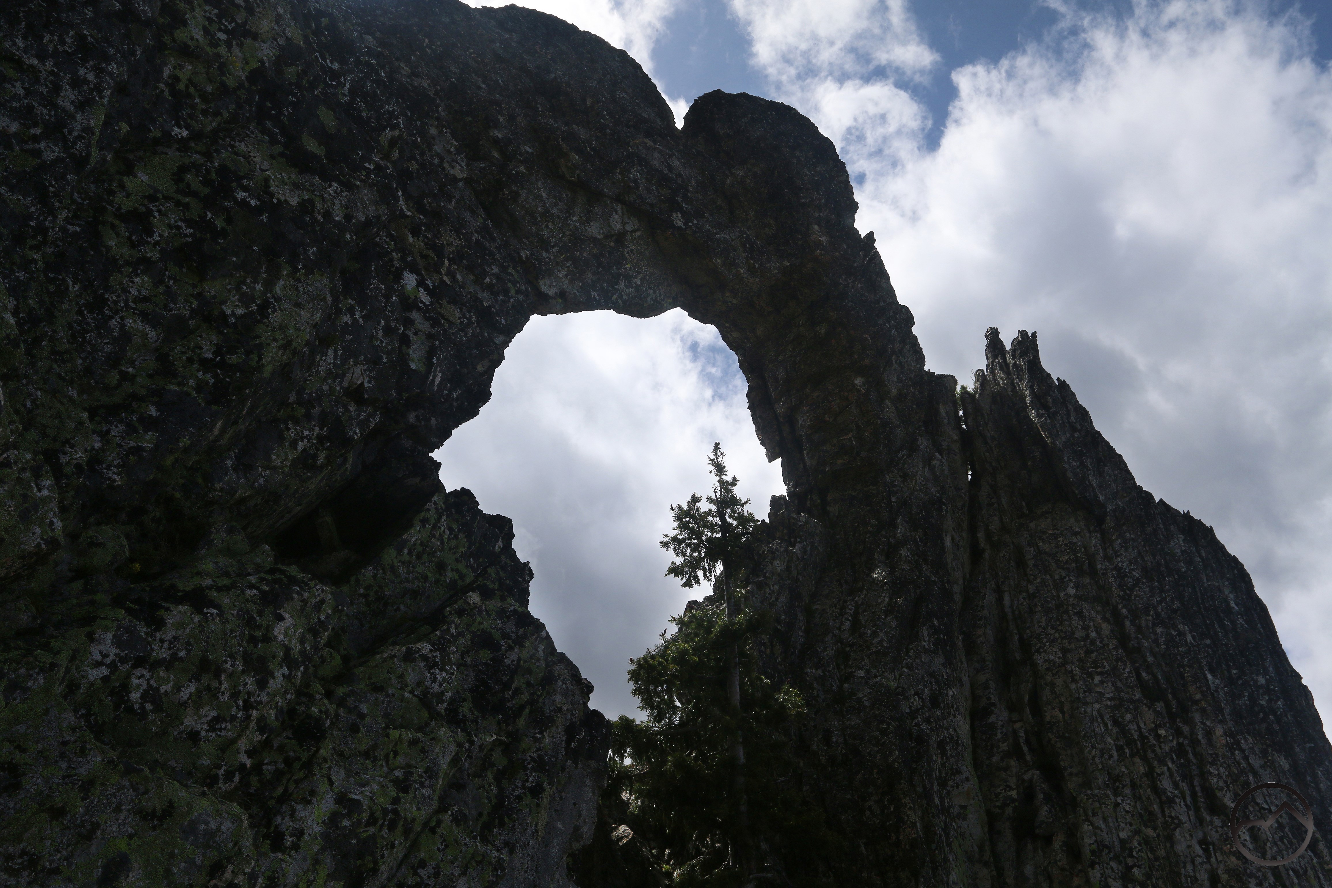
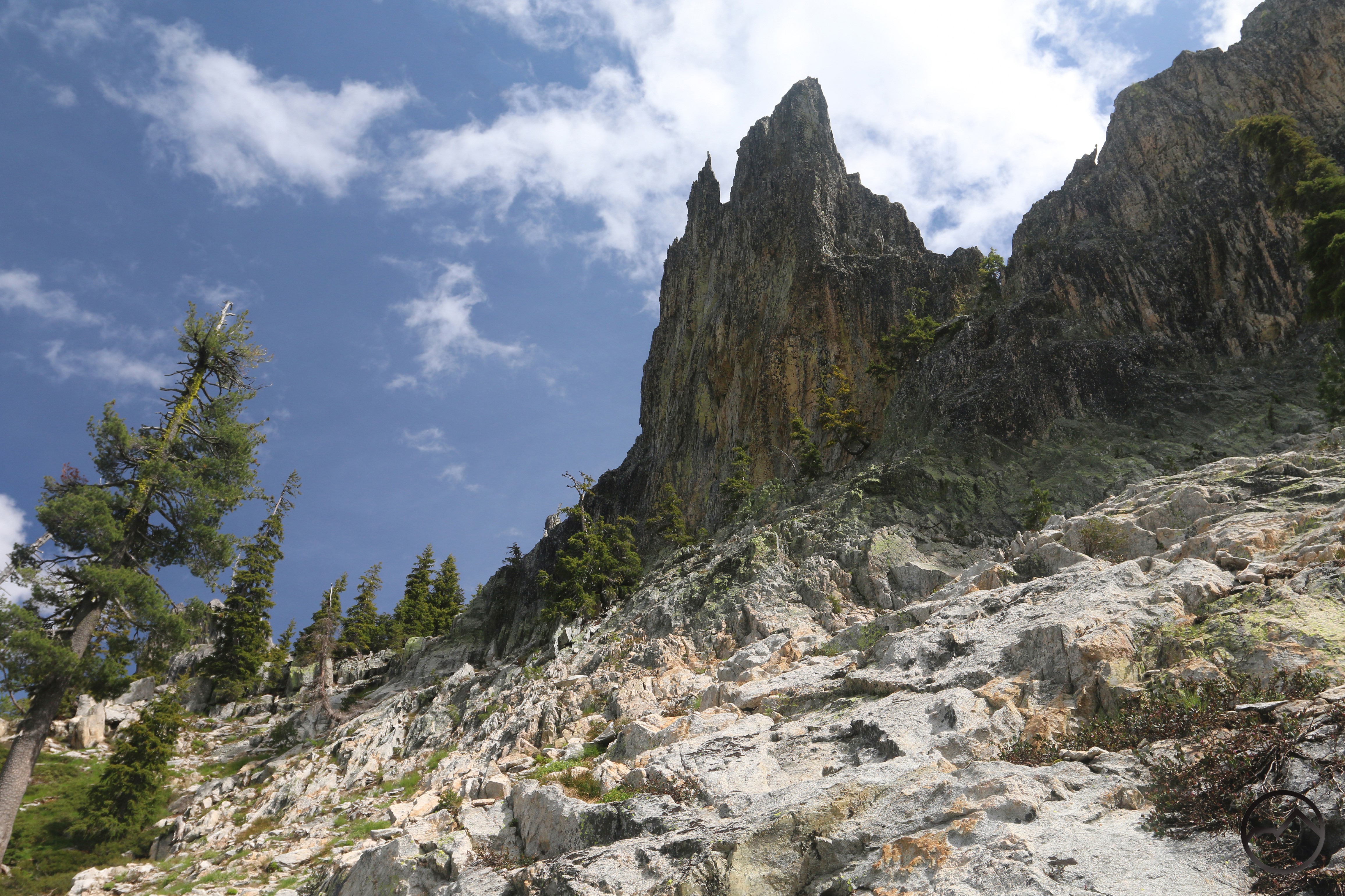
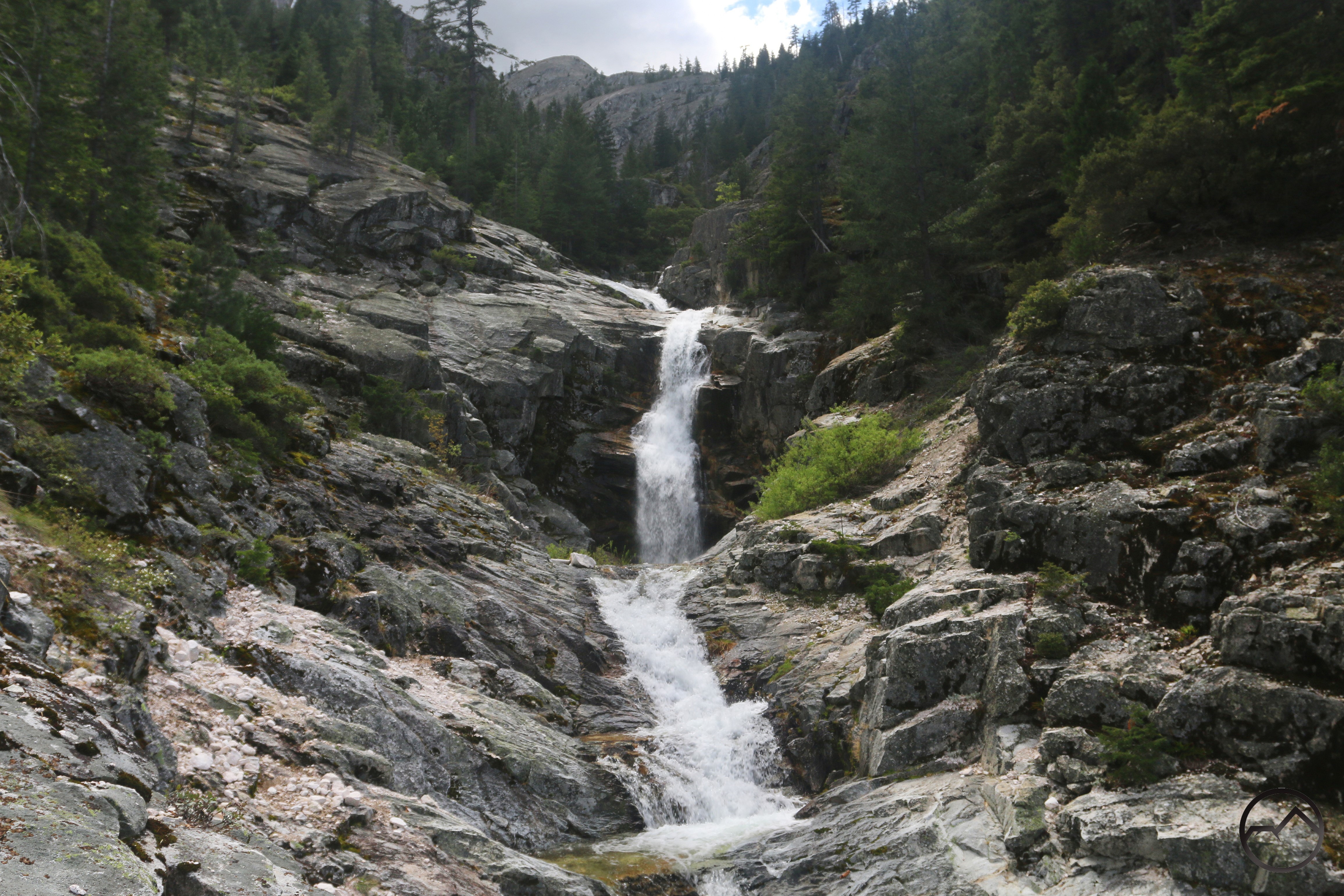
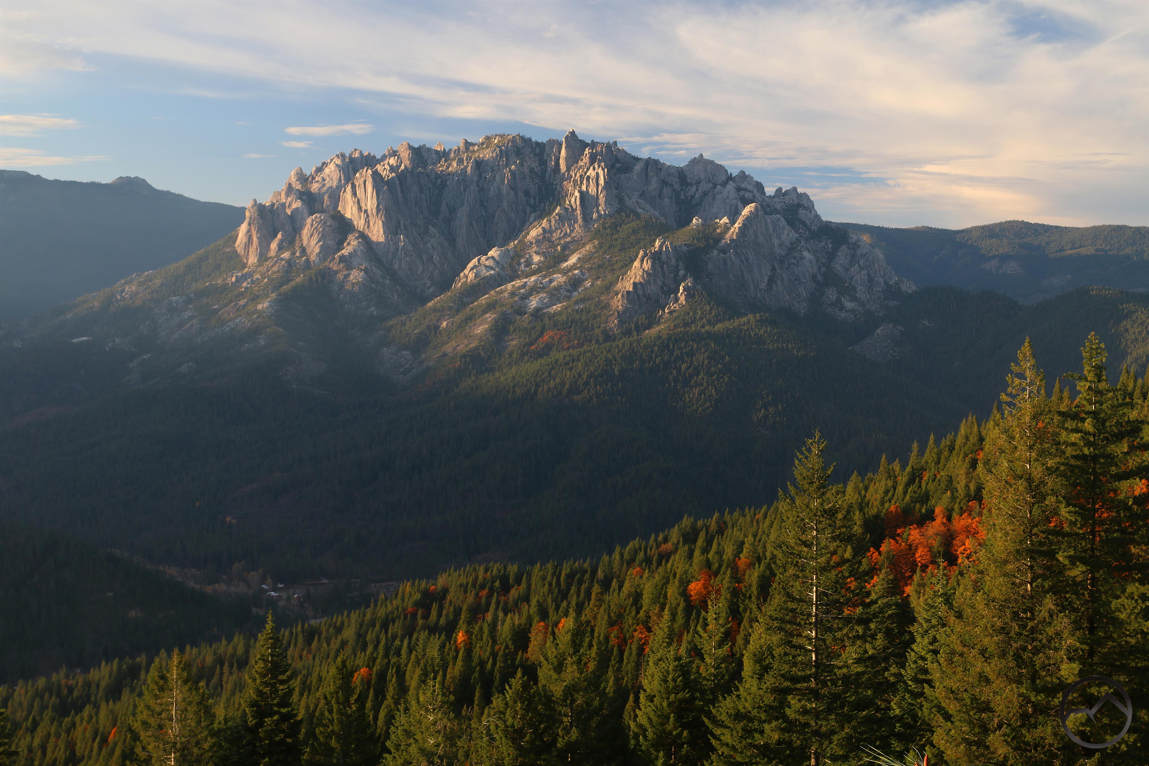
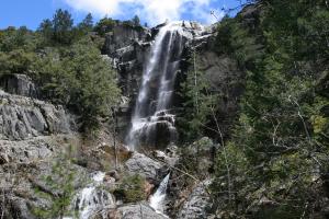
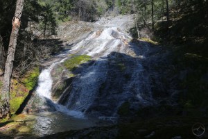
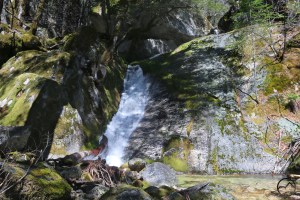
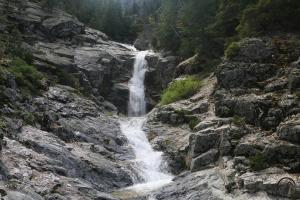
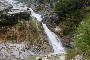
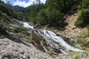
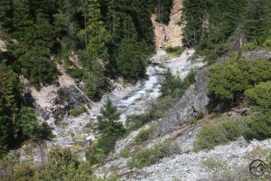
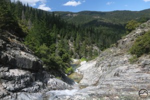
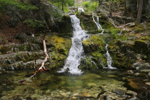
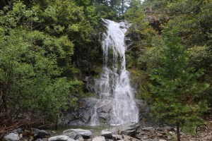
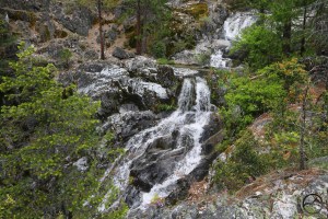
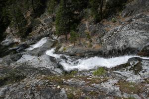
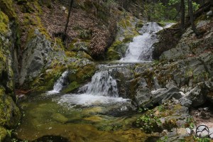
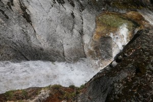
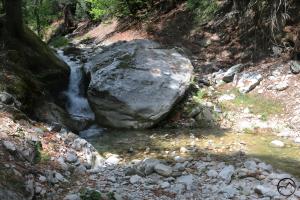
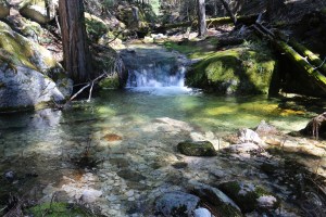
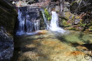
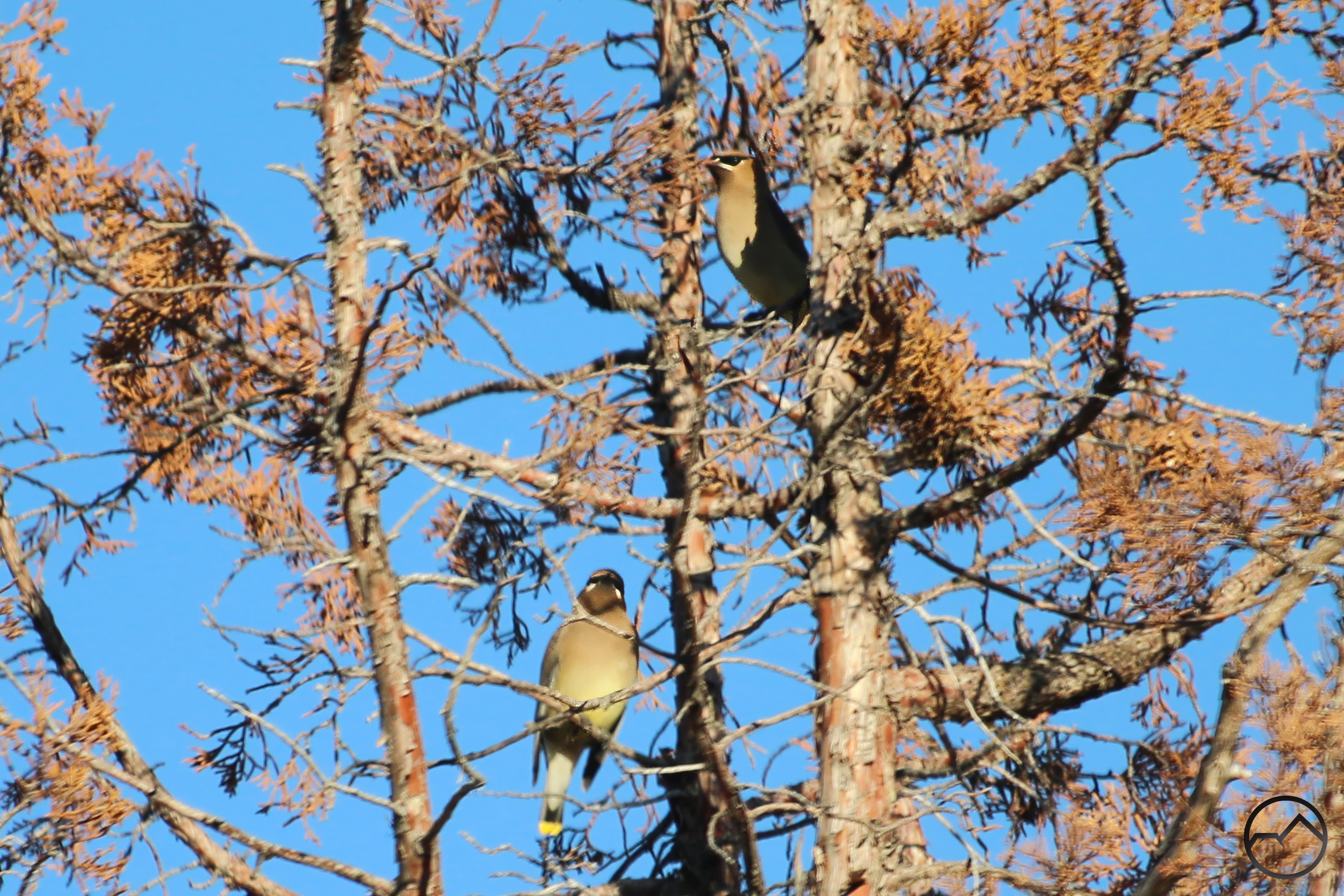
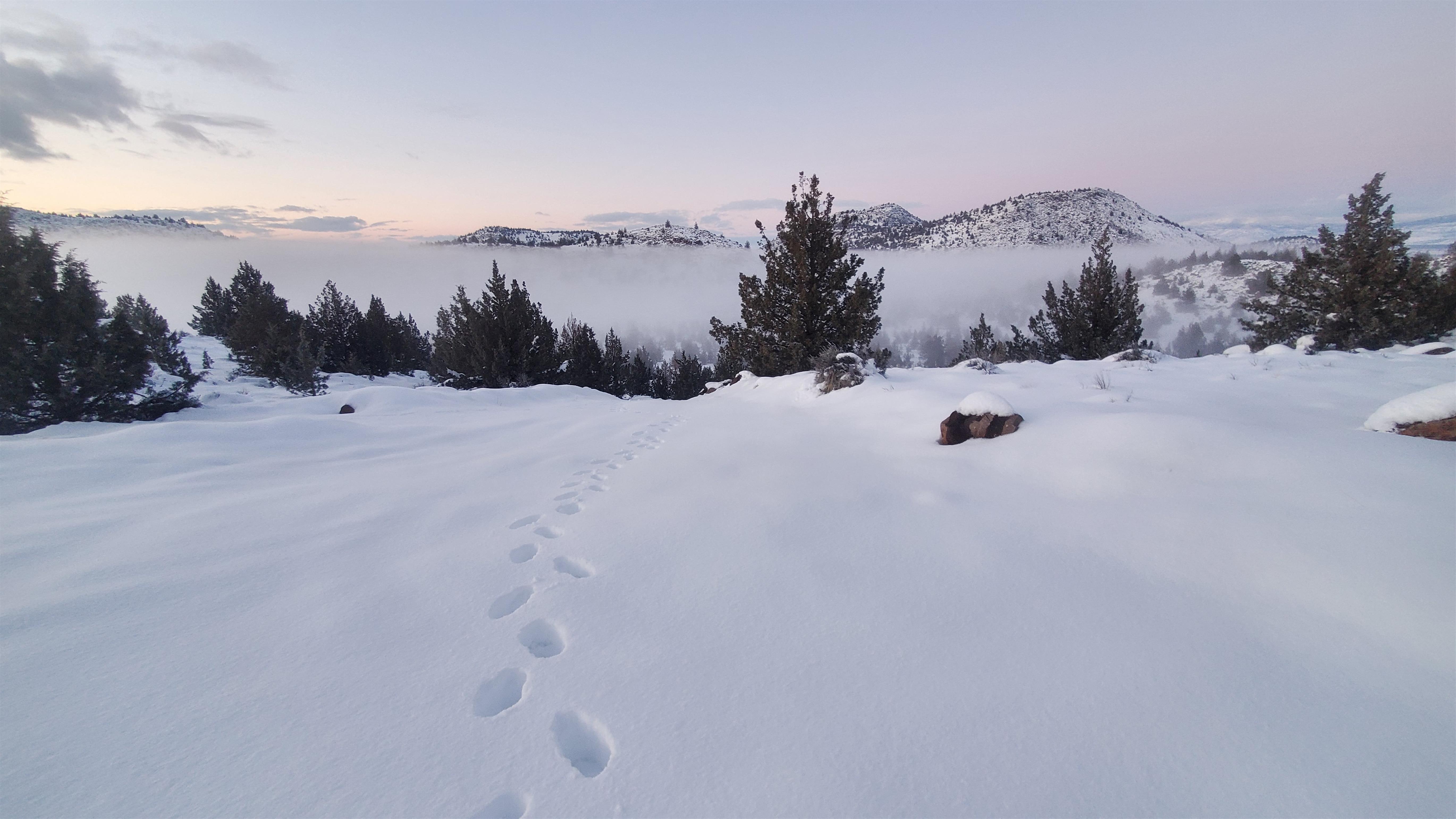
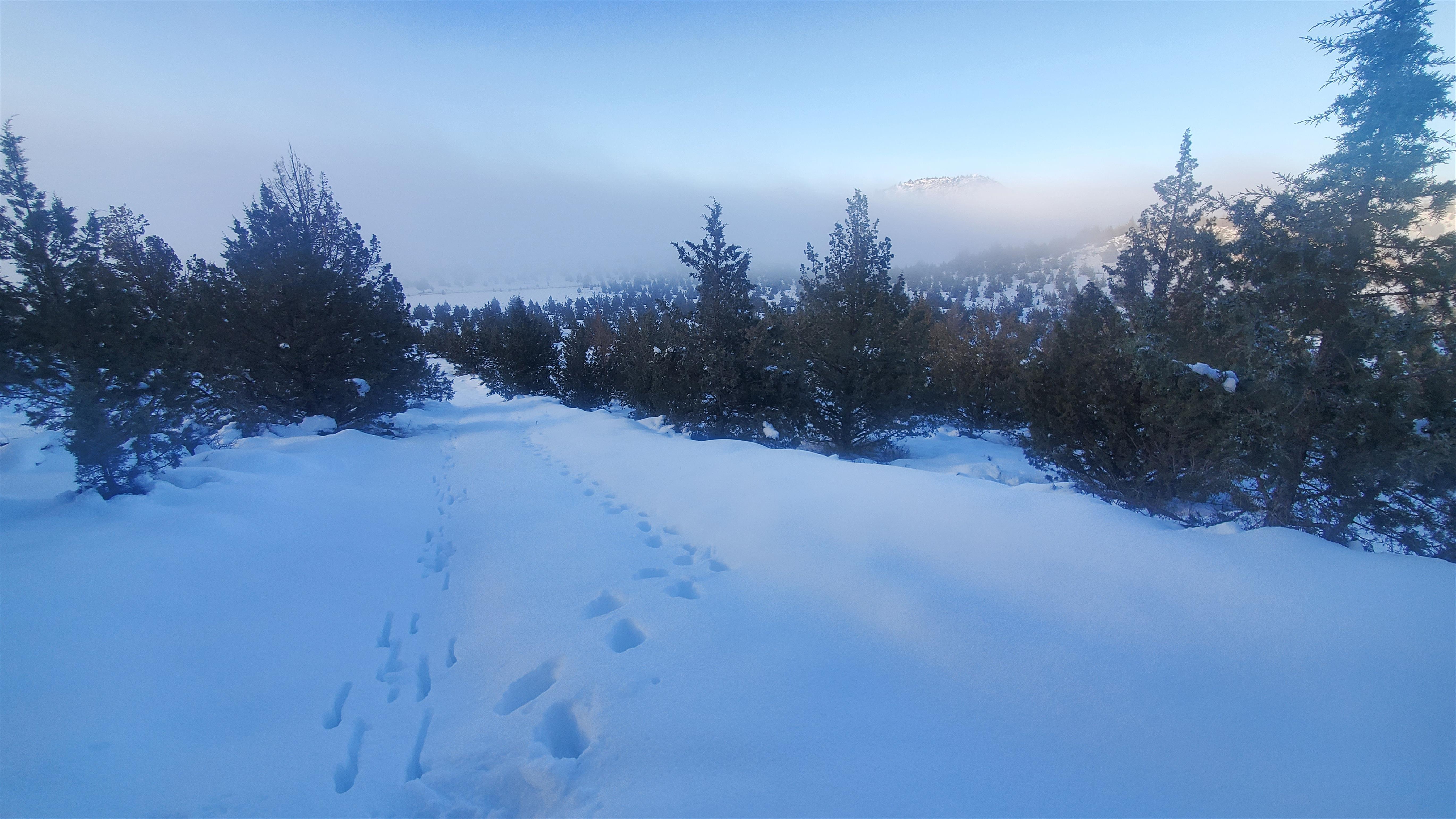
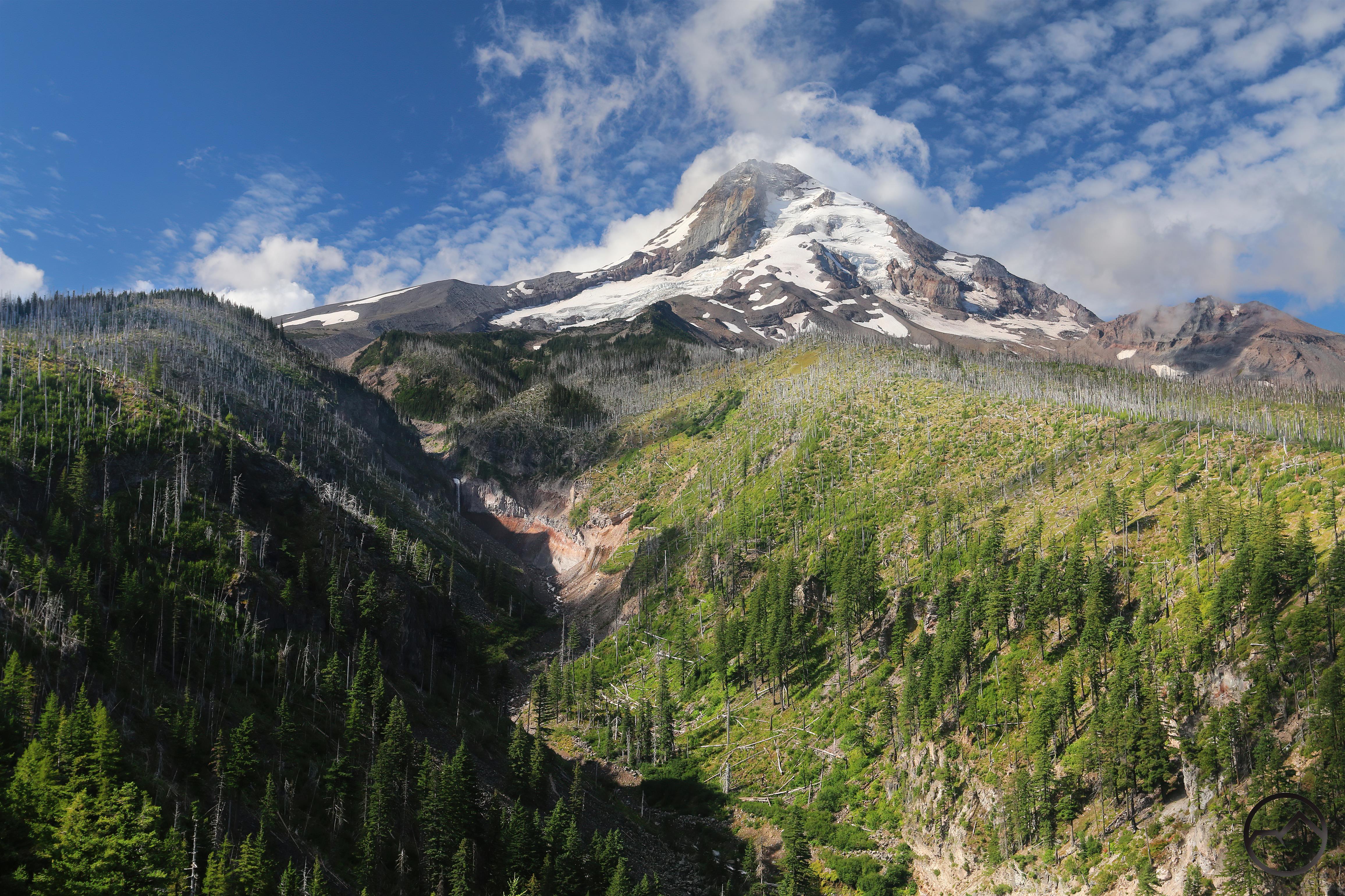
Circumstances aligned for me to be able to get away solo for a few days. I headed up into the Oregon Cascades, ultimately reaching just south of Mount Adams in Washington. Along the way, I explored an isolated section of the Deschutes River’s canyon (that had a phenomenal view of the Three Sisters) and marveled at some great waterfalls on Mount Hood. The trip ultimately proved bittersweet but it was good nonetheless.
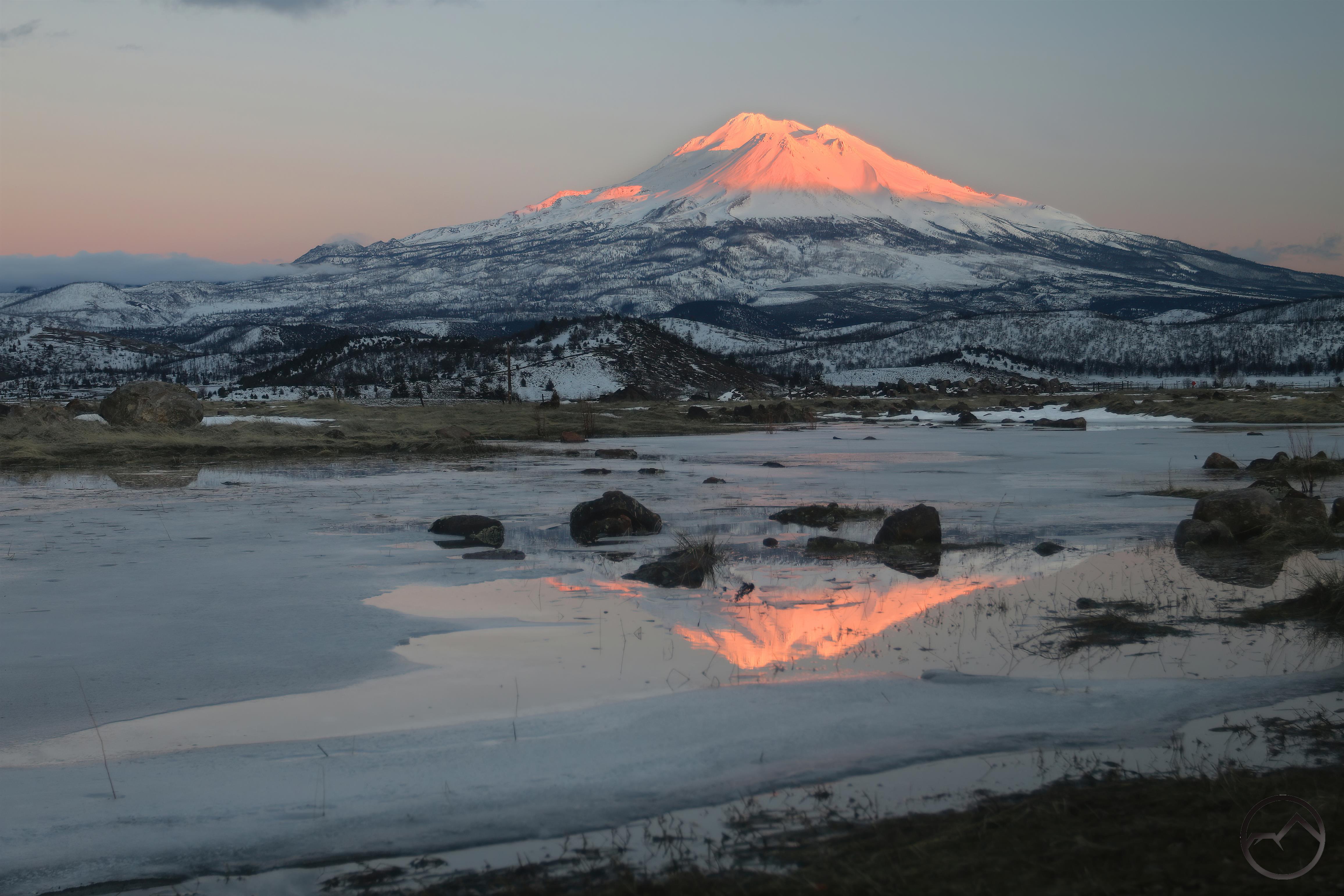
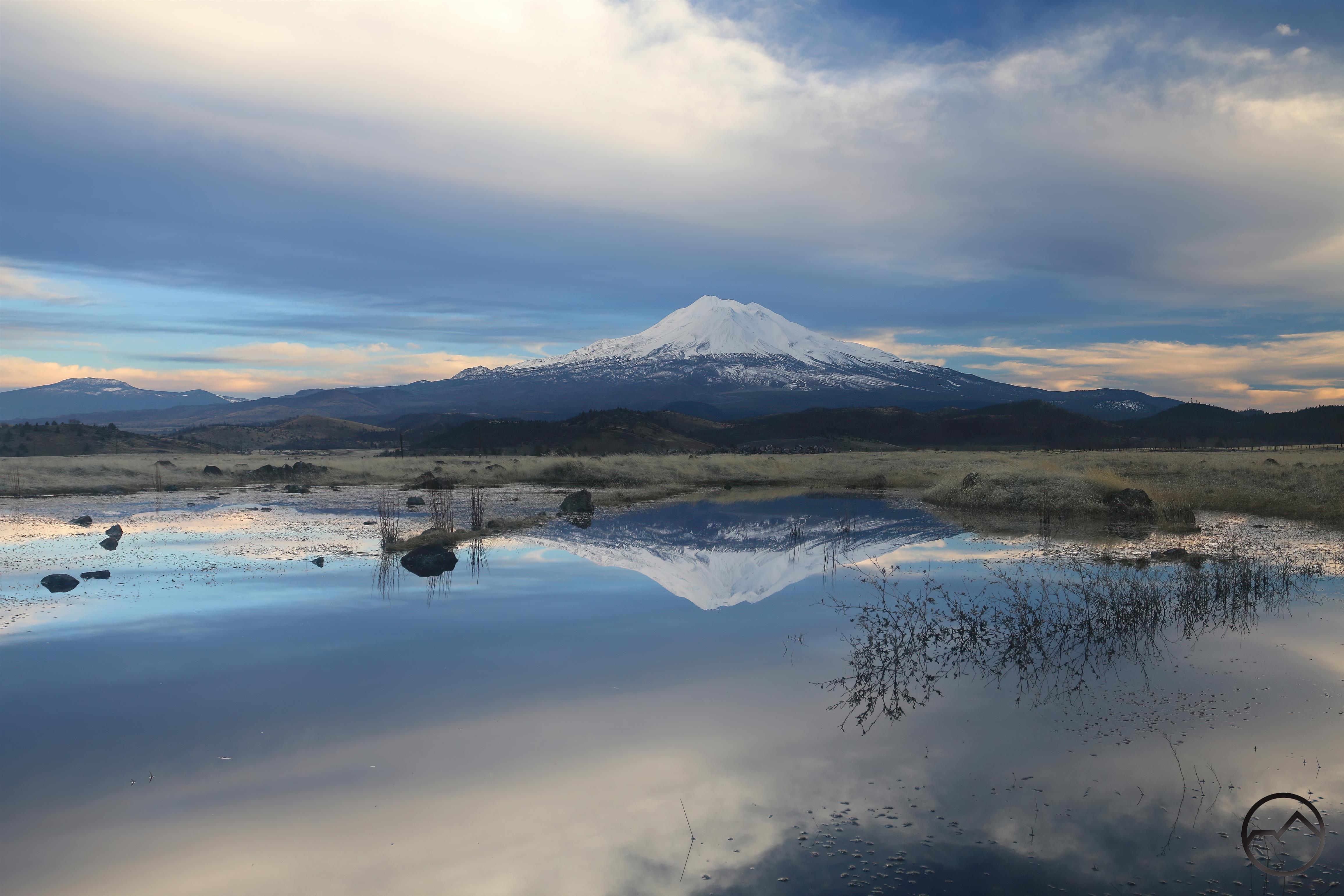
September:

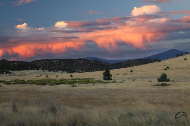
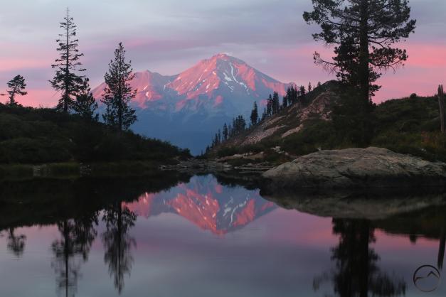
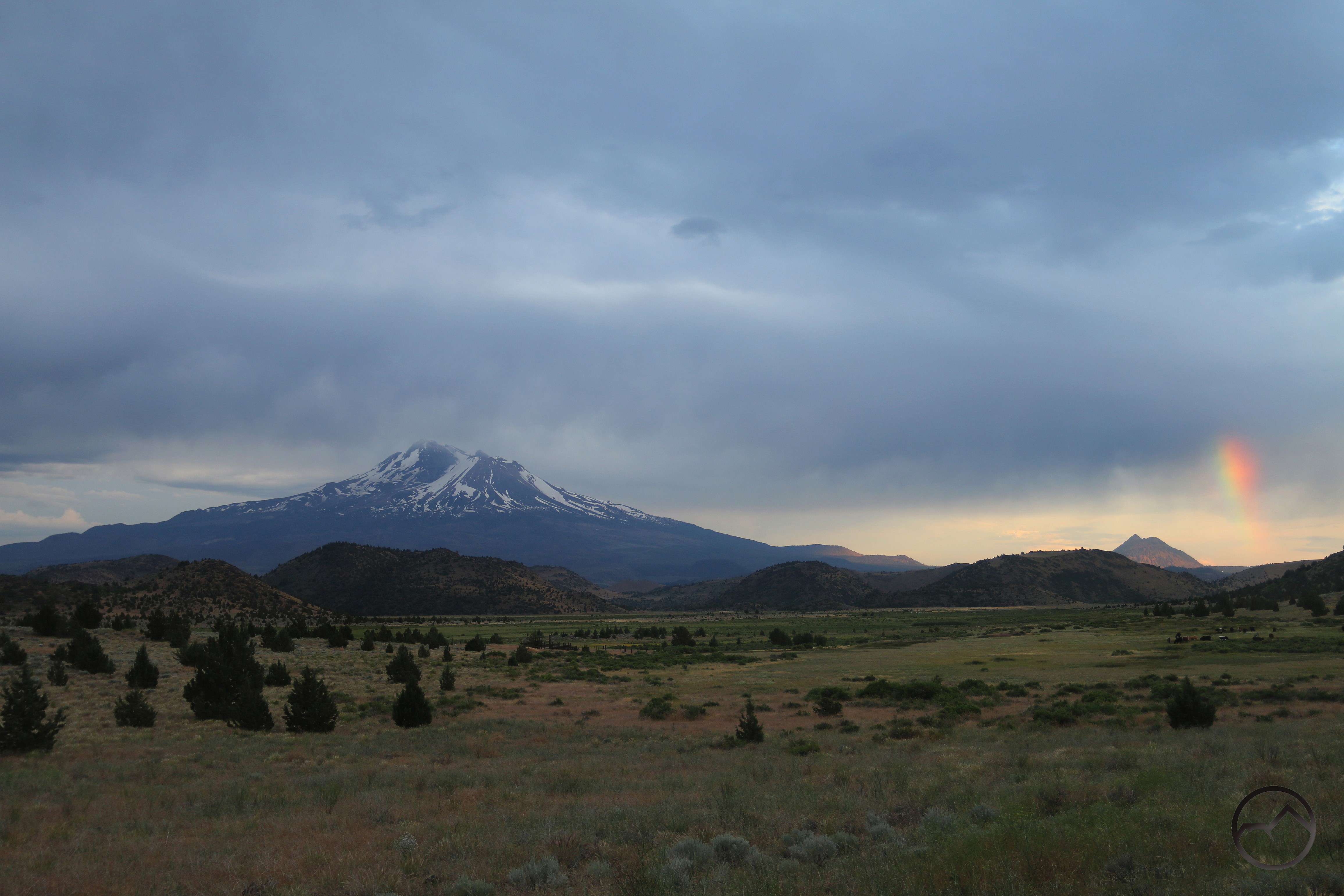
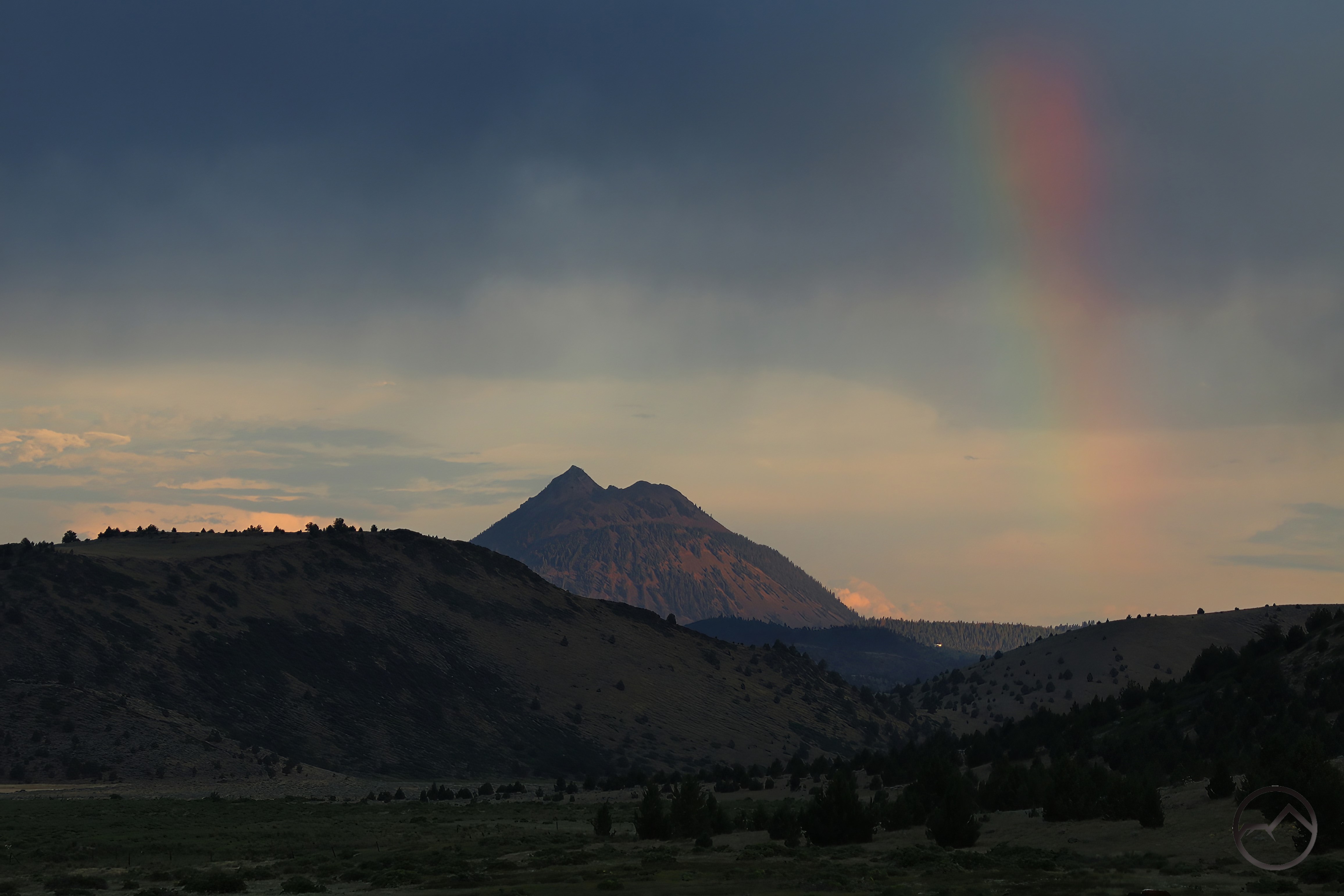
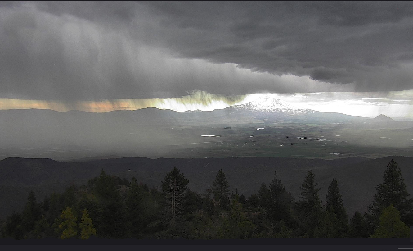
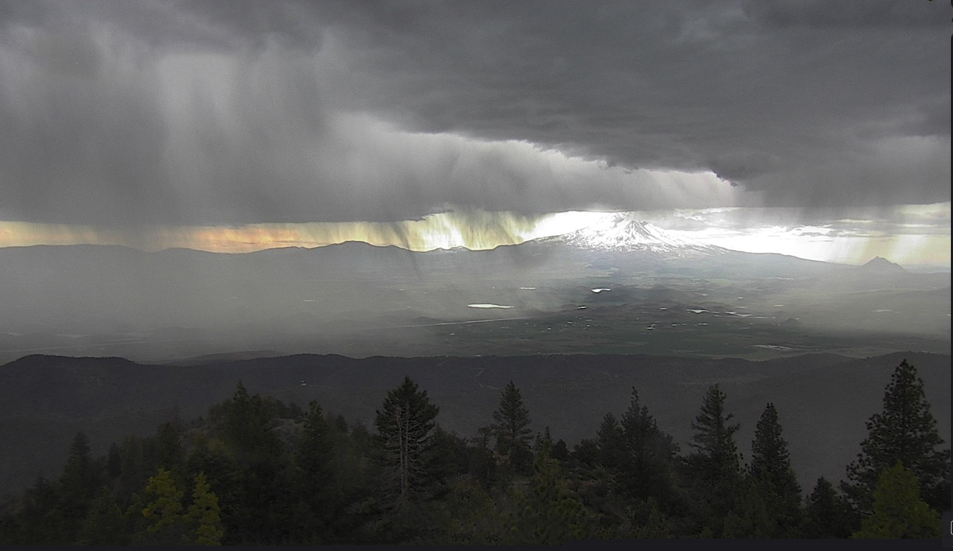
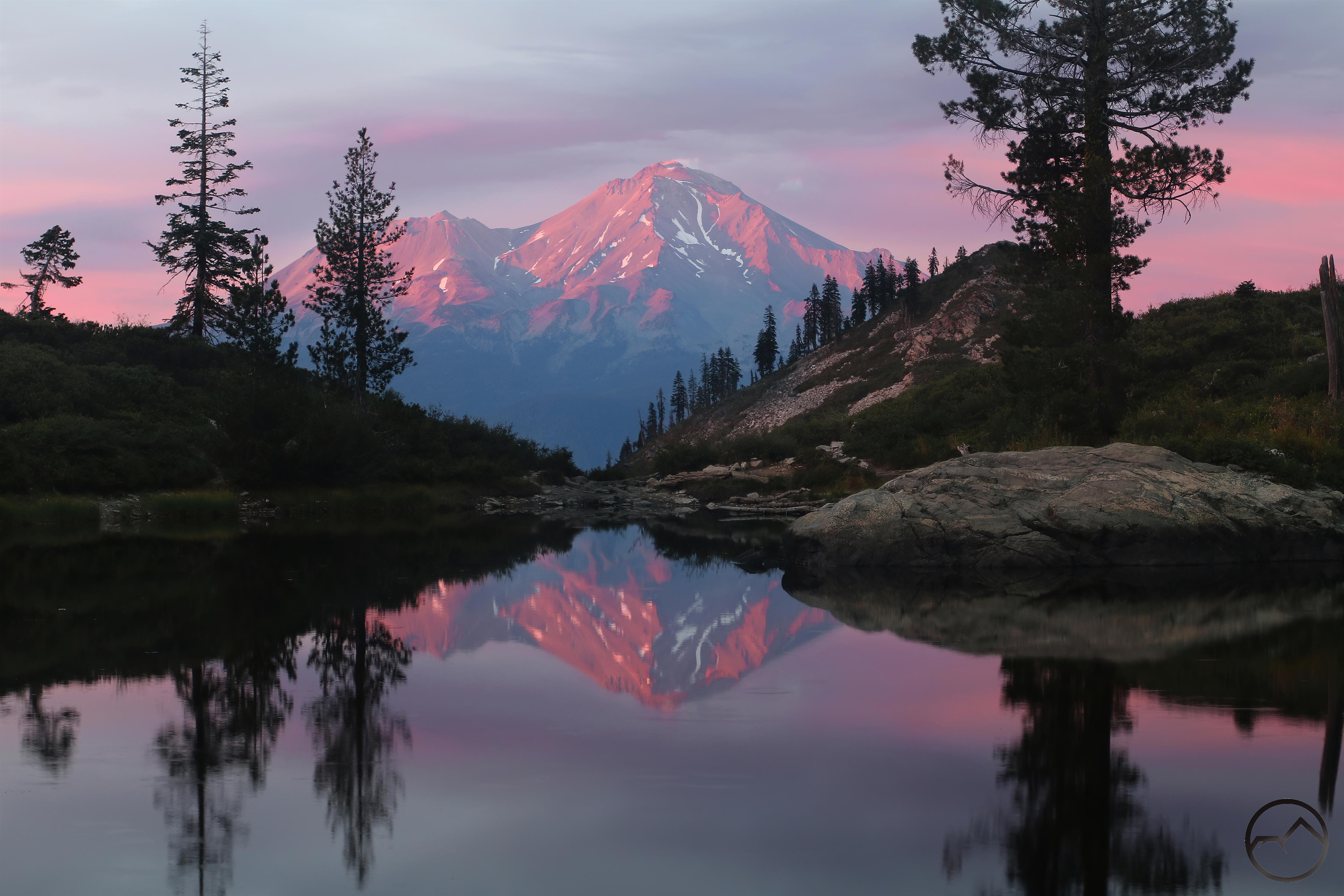
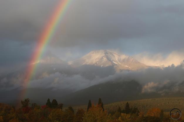
The wet weather continued into September and there were some pretty spectacular storms, particularly out over the Shasta Valley. Still, by this time the mountain had lost most of its winter snow and the summer snow, though surprisingly copious, was fleeting in the higher temperatures. Though with great light and a reflection, who needs snow to make things look beautiful?

October:

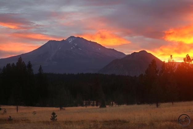
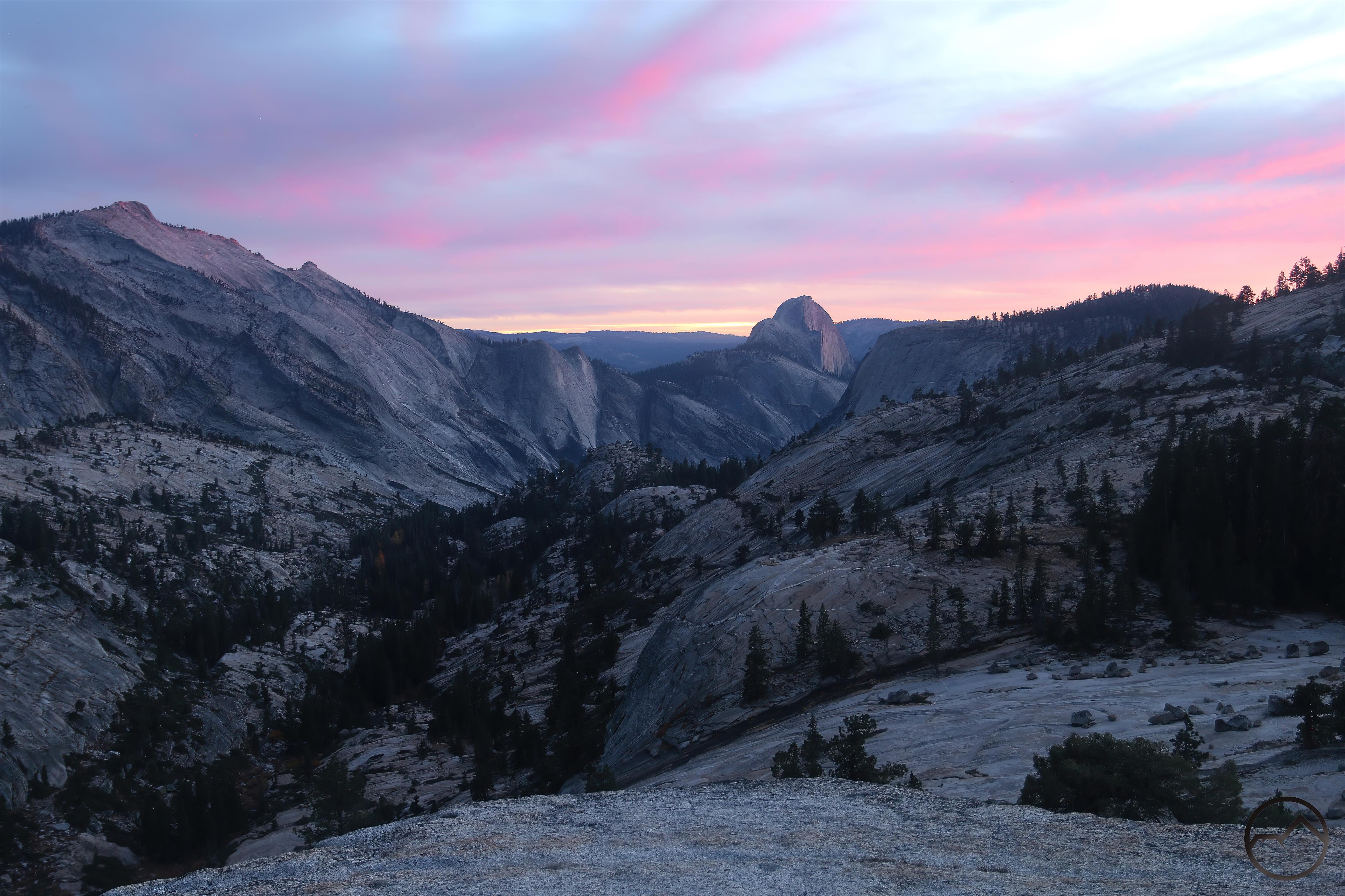
The previous two months’ unusually wet weather continued into October, and provided numerous great sunrises and sunsets. The frustrating part of it was that in the mornings, these now coincided with delivery time at school. I could often stop and get a good shot on the way as there is no shortage of great views between my house and their school but no infrequently was the timing just a bit off for the best light. I did make them late once though, when the conditions were too good to pass up!

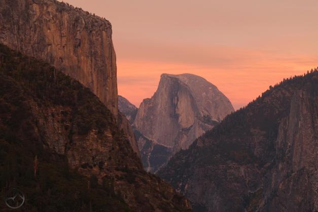
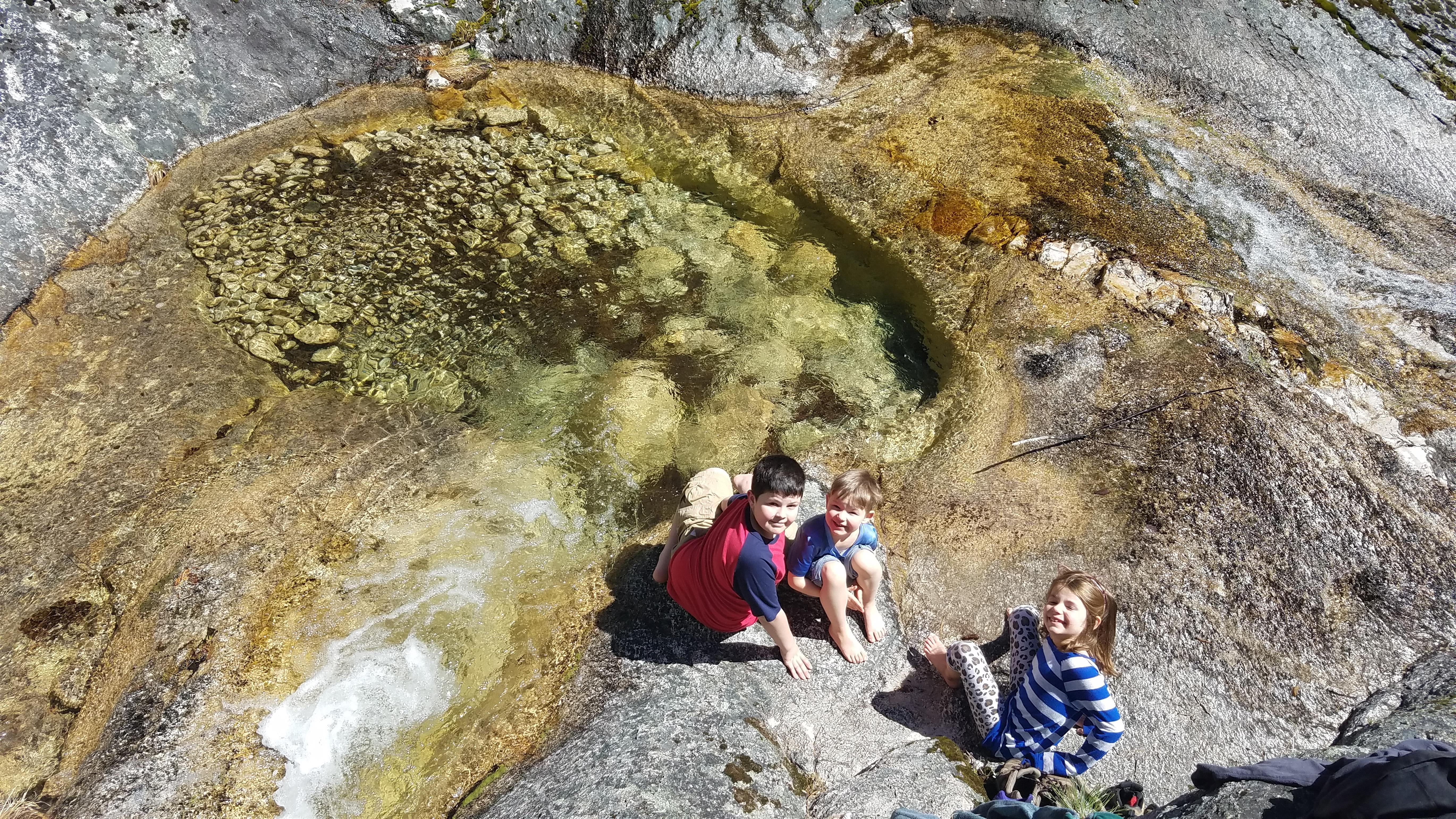
My family and I made it back to Yosemite yet again. We had some rain but also some beautiful autumn weather. Parts of the valley (particularly the western half) had excellent fall color, as did high country areas like Illilouette Creek. Yosemite is simply the best. I am grateful my kids have not missed a year without visiting it thus far.
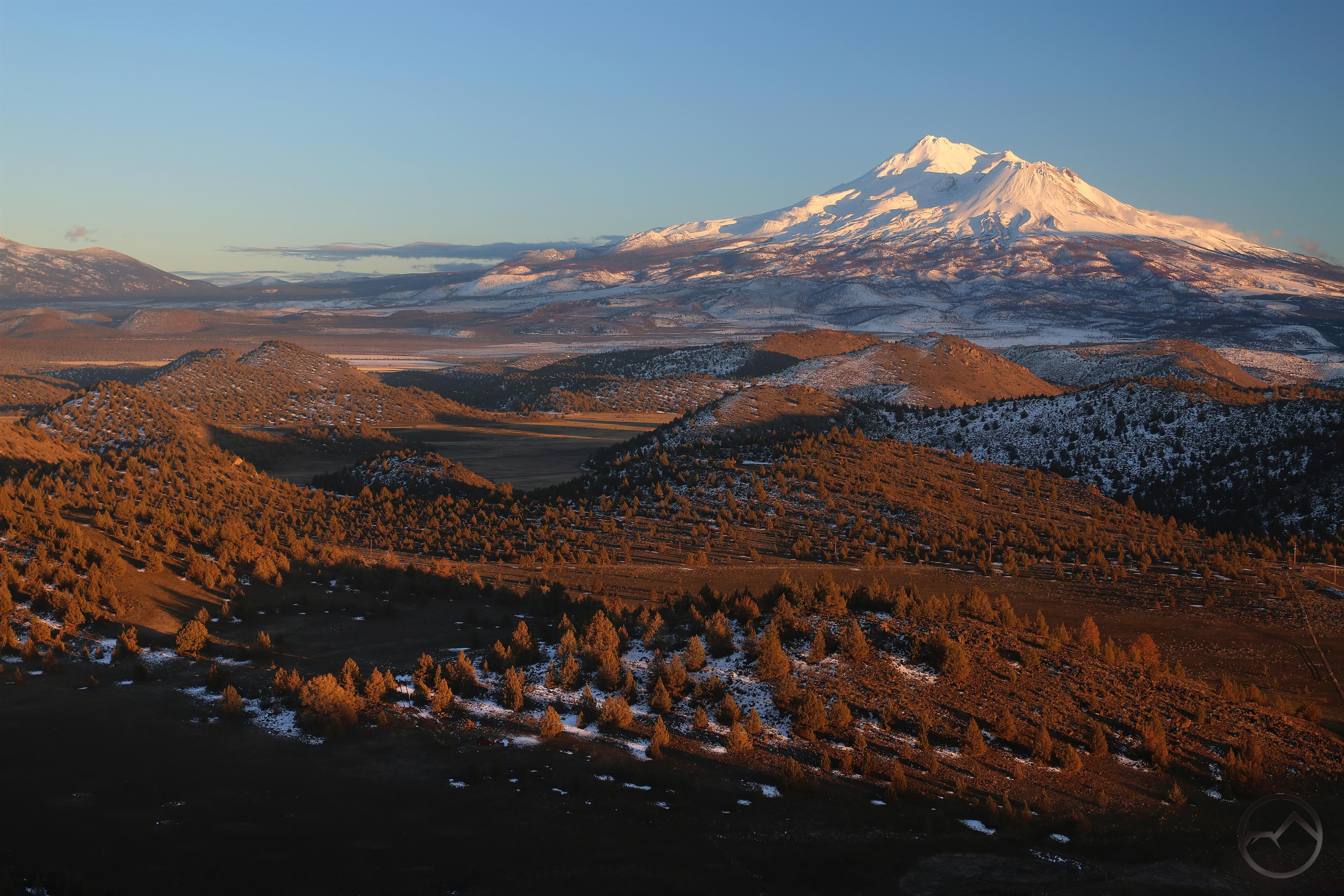
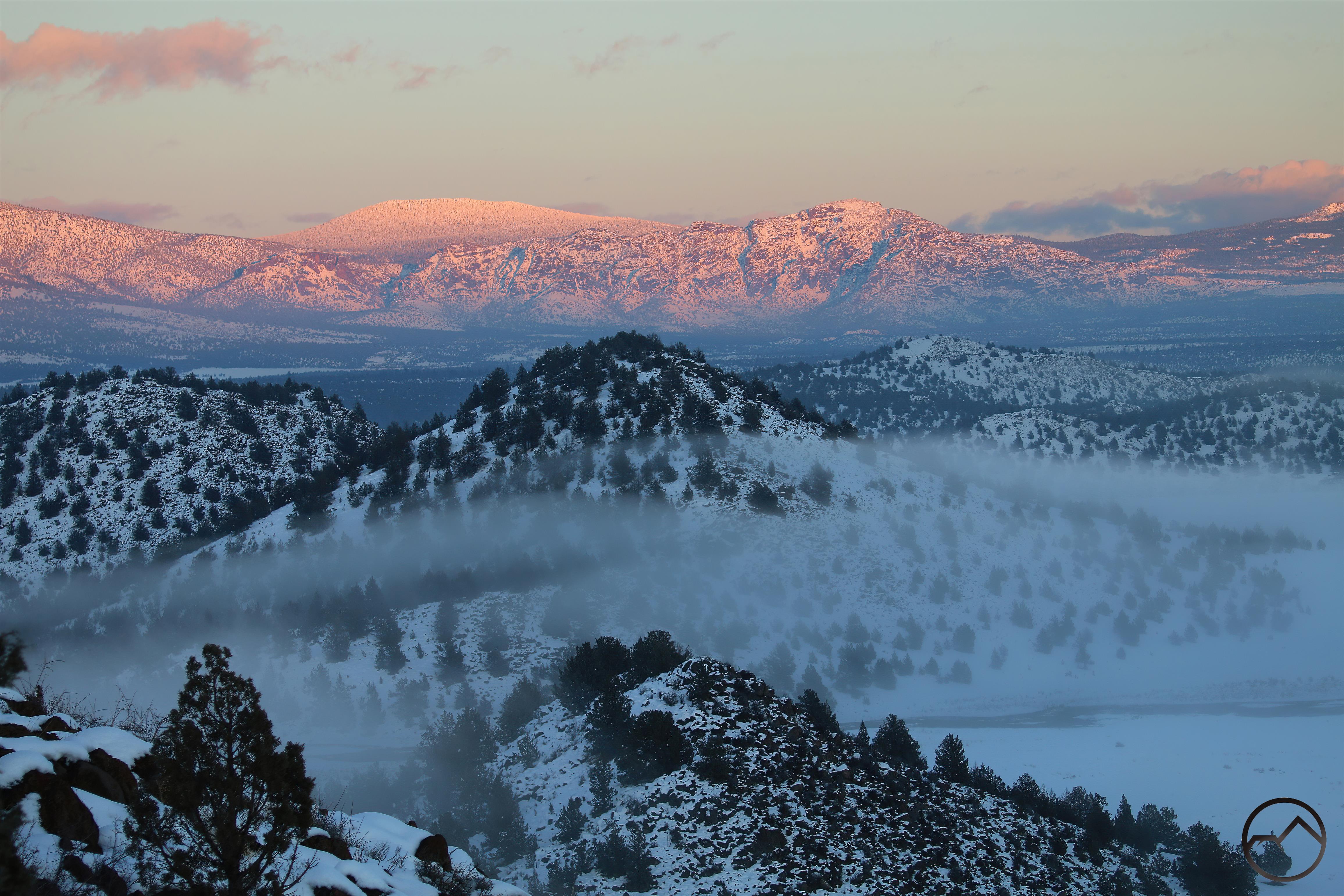
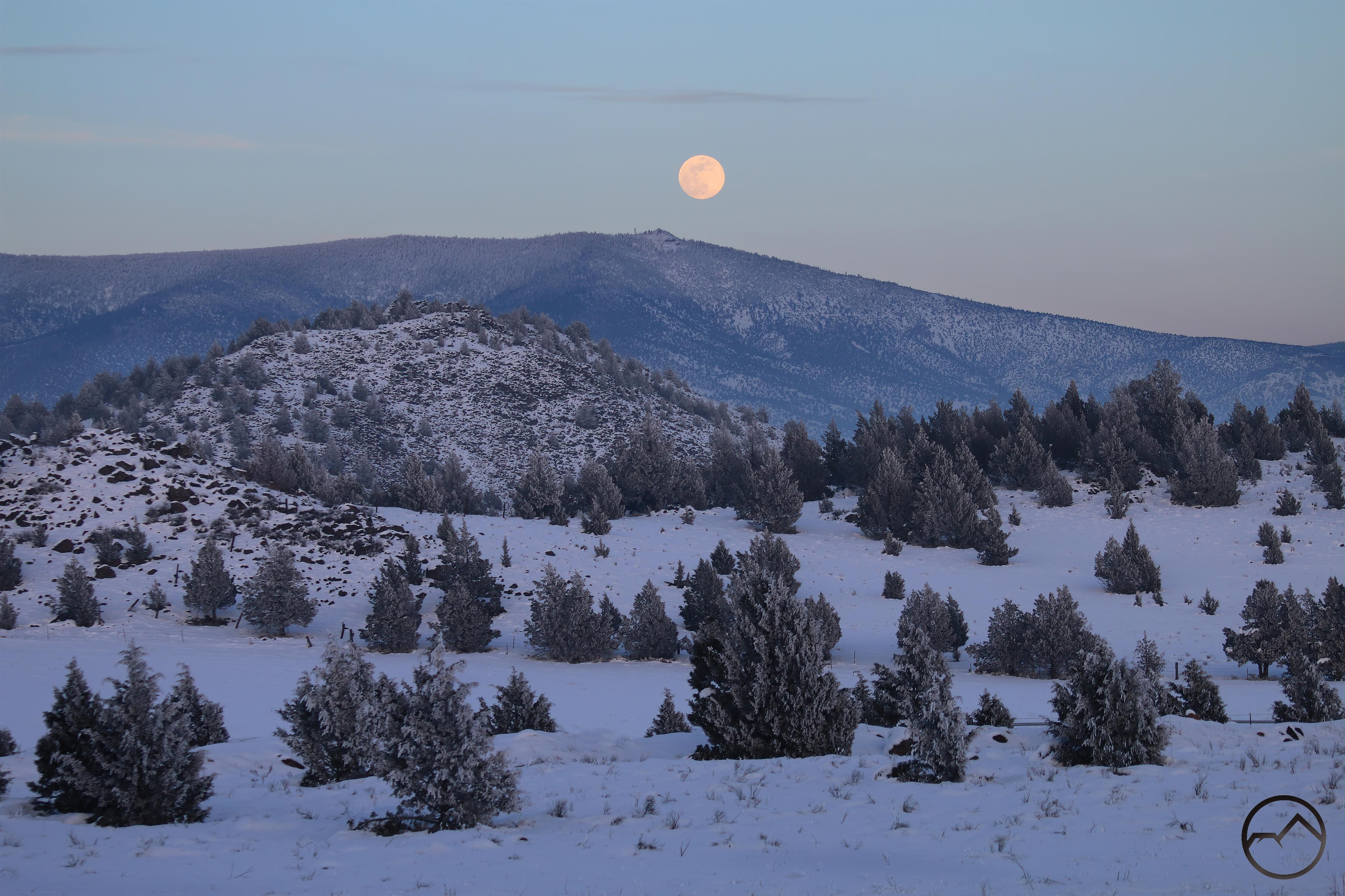
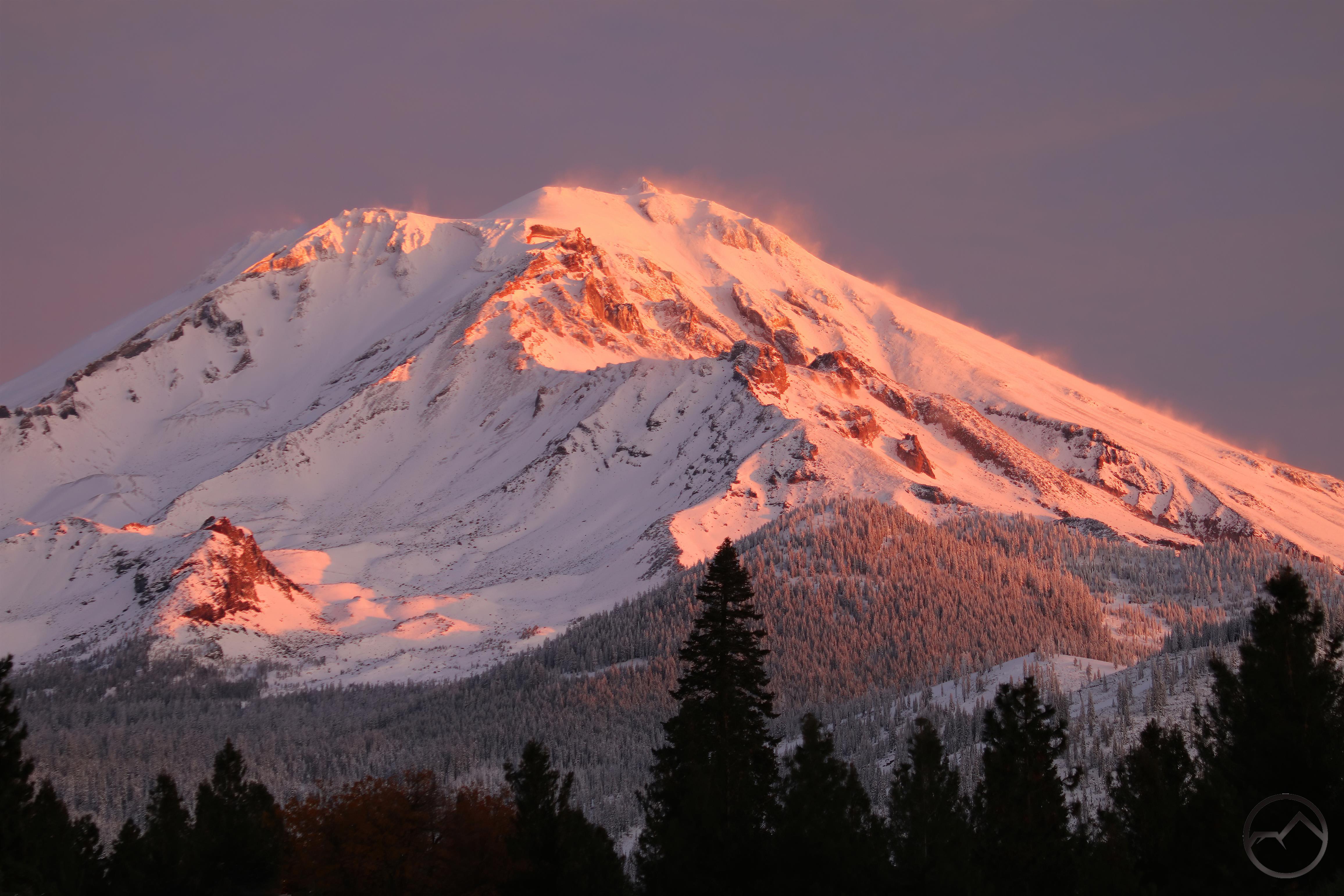
November:

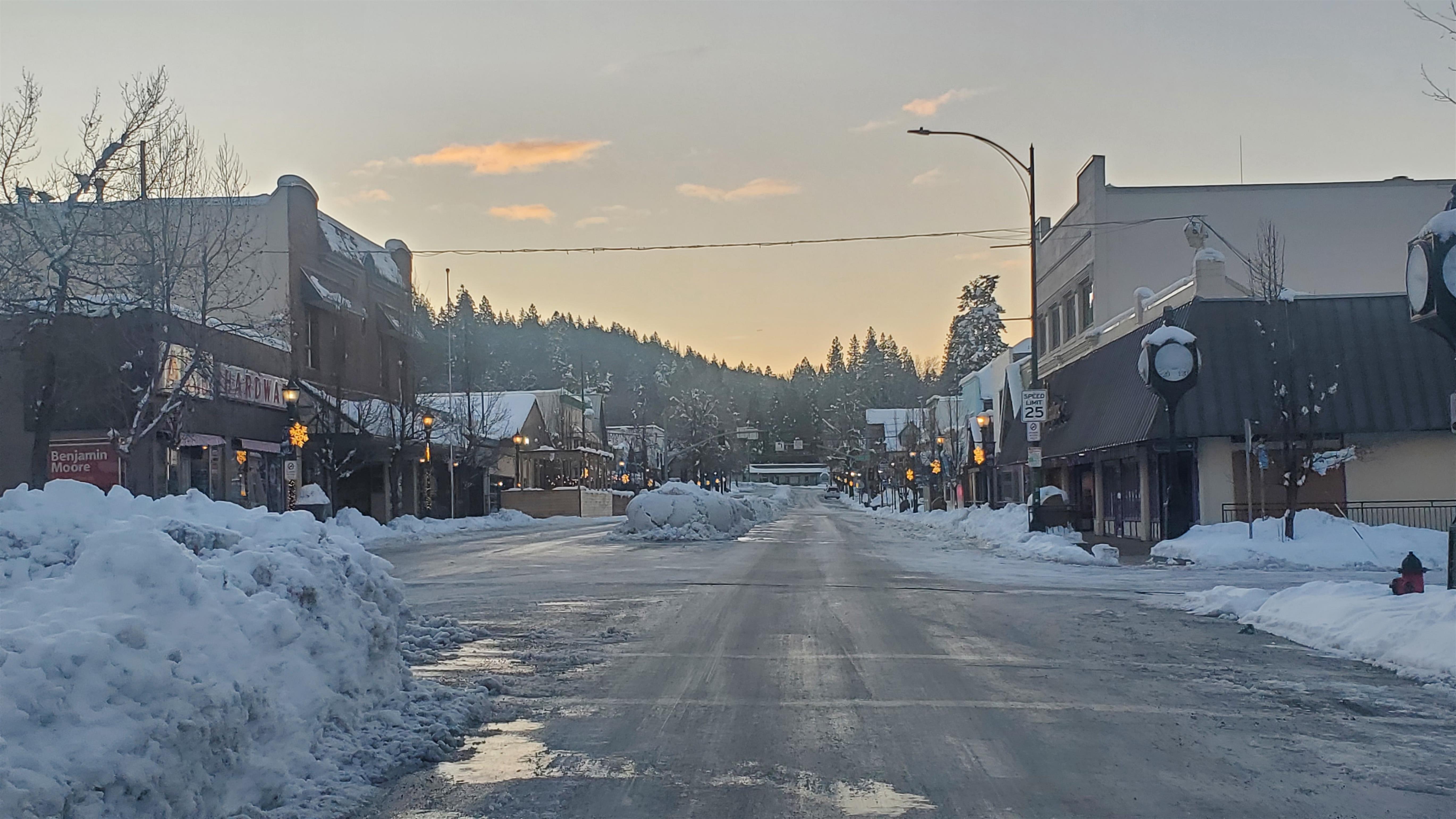
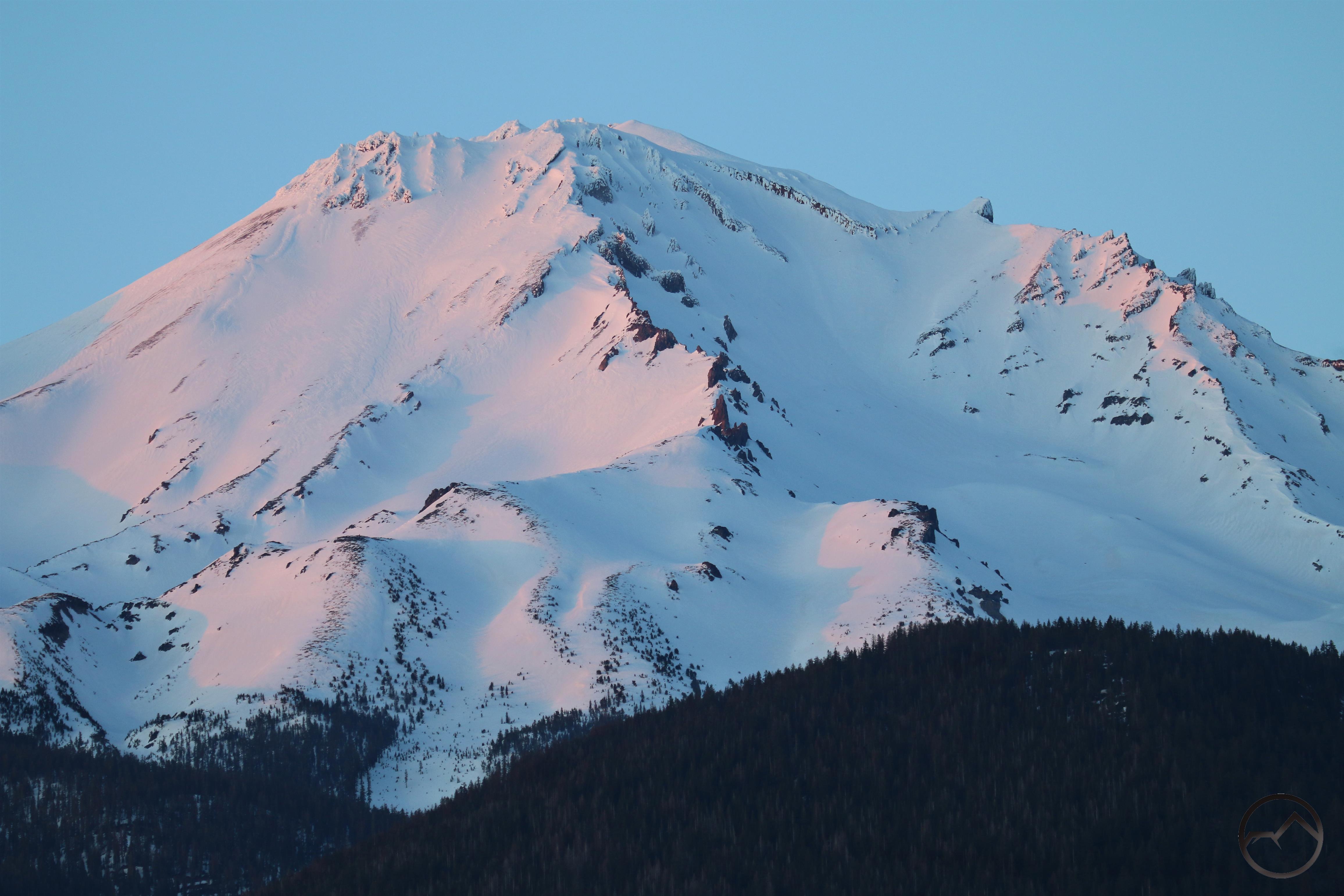
November was a good month, with the mountain being restored to its white condition on a seasonally permanent basis. Some good lenticulars and a lot of family made it a month that sailed by faster than it should have. The most notable event was the earliest large storm I can remember in Mount Shasta. Just two weeks into the month, we had 27 inches of snow at my house. Thankfully the boy scouts had harvested our Christmas trees the weekend before. The heavy snow blocking the high country and the late position of Thanksgiving in the month meant we had a ready market for trees and we sold out in 2 days and 2.5 hours, a record.

December:

The year came to a close beautifully. More snow, more lenticulars, more activity and more family. A quick trip down to Sonoma County to see family, even family that lives in Argentina broke things up a bit and made Christmas a bit busier than normal but it was a good Christmas nonetheless. It was a good year too…

May the Lord bless as we careen into what may be a tumultuous and interesting 2025!

Howling At Echo Point (And The Last Sunrise Of 2024)

Posted by bubbasuess on December 31, 2024
Posted in: Cascade Range, Echo Point, Hiking, Mount Shasta, sunrise, Truchas Ridge. 1 Comment

The second to last day of 2024 was a beautiful one. The sky was beautifully blue and layers of clouds created visual strata climbing up toward Mount Shasta’s summit. Unfortunately I wasn’t able to stop and capture images of the beauty but I did secure time in the afternoon to head to Echo Point at Truchas Ridge to enjoy the sunset with my family. In a second unfortunate circumstance, most of the clouds had dissipated. However, this is not to sound ungrateful as any opportunity to visit Echo Point is time well spent.

Truchas Ridge was exceedingly muddy but the top of the ridges and the south facing exposure is rocky and travel is much easier. We climbed up to Echo Point in time for sunset and even without the clouds from earlier it was a marvelous sight.

Echo Point is so called because it overlooks what we call Echo Basin. The basin holds large meadows and a lake in addition to extensive meadows. More than 300 feet above, the point has a grand vista that includes almost every major peak around the Shasta Valley, as well as Parks Creek and the more hard-to-see Shasta River.

The shape of the basin make its acoustics fantastic. As the name implies, echoes occur very prominently there. It is customary for my daughter, in her youthful fancy, to step out onto the rocky prominence and howl, preferably at sunset. Occasionally, the coyotes answer.

20241230_165703

20241230_165703

My crummy phone microphone did not pick up the echo, but you get the idea. It’s a fun way for her to end the trip out there. It really ended the whole of 2024, in terms of sunsets. Clouds were forecasted to come in on New Years Eve and obscure any heavenly theatrics over Mount Shasta and this was the case so this was effectively the final sunset of 2024.

Thankfully, there was one final sunrise for the year, as the incoming clouds lit up very briefly before the storm gloom enveloped everything. Though the pool was frozen, it still caught a lot of light and the intricate lines of the ice made for some interesting texture in the image. It was a good morning and a good end to the year. May 2025 be a good one!

Posts navigation

← Older Entries
Newer Entries →
    • Recent Posts

      • Winter Shows Up When It Will
      • January Rolled By With Mud, Then Very Dry
      • Mount Shasta 2025 – A Year In Images
      • Mount Shasta On Either Side Of Christmas
      • Adrift In An Ocean Of Fog
      • December Has Been Spectacular Thus Far Pt. II (A Magnificent Lenticular)
      • December Has Been Spectacular Thus Far Pt. I
      • Lenticular Interrupted
      • A Stormy Wave And A Truchas Sunset
      • Aurora Lenticularis
    • Enter your email address to follow Hike Mt Shasta and receive notifications of new posts by email.

    • Archives

      • February 2026
      • January 2026
      • December 2025
      • November 2025
      • October 2025
      • September 2025
      • August 2025
      • July 2025
      • June 2025
      • May 2025
      • April 2025
      • March 2025
      • February 2025
      • January 2025
      • December 2024
      • November 2024
      • October 2024
      • September 2024
      • August 2024
      • July 2024
      • June 2024
      • May 2024
      • April 2024
      • March 2024
      • February 2024
      • January 2024
      • December 2023
      • November 2023
      • October 2023
      • September 2023
      • August 2023
      • July 2023
      • June 2023
      • May 2023
      • April 2023
      • March 2023
      • February 2023
      • January 2023
      • December 2022
      • November 2022
      • October 2022
      • September 2022
      • August 2022
      • July 2022
      • June 2022
      • May 2022
      • April 2022
      • March 2022
      • February 2022
      • January 2022
      • December 2021
      • November 2021
      • October 2021
      • September 2021
      • August 2021
      • June 2021
      • May 2021
      • April 2021
      • March 2021
      • February 2021
      • January 2021
      • December 2020
      • November 2020
      • October 2020
      • September 2020
      • August 2020
      • July 2020
      • June 2020
      • May 2020
      • April 2020
      • March 2020
      • February 2020
      • January 2020
      • December 2019
      • November 2019
      • October 2019
      • September 2019
      • August 2019
      • July 2019
      • June 2019
      • May 2019
      • April 2019
      • March 2019
      • February 2019
      • January 2019
      • December 2018
      • November 2018
      • October 2018
      • September 2018
      • August 2018
      • July 2018
      • June 2018
      • May 2018
      • April 2018
      • March 2018
      • February 2018
      • January 2018
      • December 2017
      • November 2017
      • October 2017
      • September 2017
      • August 2017
      • July 2017
      • June 2017
      • May 2017
      • April 2017
      • March 2017
      • February 2017
      • January 2017
      • December 2016
      • November 2016
      • September 2016
      • August 2016
      • July 2016
      • June 2016
      • May 2016
      • April 2016
      • March 2016
      • February 2016
      • January 2016
      • December 2015
      • November 2015
      • September 2015
      • August 2015
      • July 2015
      • June 2015
      • May 2015
      • April 2015
      • March 2015
      • February 2015
      • January 2015
      • December 2014
      • November 2014
      • July 2014
      • June 2014
      • May 2014
      • April 2014
      • March 2014
      • February 2014
      • January 2014
      • December 2013
      • November 2013
      • October 2013
      • September 2013
      • August 2013
      • July 2013
      • June 2013
      • May 2013
      • April 2013
      • March 2013
      • February 2013
      • January 2013
    • Categories

      • Boy Scouts
      • Cascade Range
      • Castle Crags
      • Desert
      • Echo Point
      • Glaciers
      • Hiking
      • How things came to be…
      • Klamath Mountains
      • Konwakiton Outdoor Designs
      • Lakes
      • Lenticular Clouds
      • Maps
      • Marble Mountains
      • Meadows
      • Mount Eddy
      • Mount Shasta
      • Mount Shasta History
      • Napa County
      • Off Season Trails
      • Pacific Crest Trail
      • Peaks
      • Rivers
      • Rock Climbing
      • Scott Mountains
      • Seldom Seen
      • Shasta Valley
      • Sierra Nevada
      • Siskiyou Mountains
      • Sonoma County
      • Spring Trails
      • sunrise
      • sunset
      • Trinity Alps
      • Trinity Divide
      • Truchas Ridge
      • Uncategorized
      • Water
      • Waterfalls
      • Wilderness
      • Wildflowers
      • Wine Country
      • Winter Trails
      • Yosemite
    • Meta

      • Create account
      • Log in
      • Entries feed
      • Comments feed
      • WordPress.com
    • Copyright © 2013-2024 by Bubba Suess

      DISCLAIMER: Any use of the information contained in this site by any and all persons is done at their own risk. The operator of this site shall be held harmless from any and all alleged claims, demands, causes of action, liability, loss, damage and/or injury to property or persons whether brought by an individual or other entity. This indemnification applies, without limitation, to all actions by an individual or other entity as a result of their use of information contained in this site.

    Blog at WordPress.com.
    Hike Mt. Shasta
    Blog at WordPress.com.
    • Subscribe Subscribed
      • Hike Mt. Shasta
      • Join 983 other subscribers
      • Already have a WordPress.com account? Log in now.
      • Hike Mt. Shasta
      • Subscribe Subscribed
      • Sign up
      • Log in
      • Report this content
      • View site in Reader
      • Manage subscriptions
      • Collapse this bar
     

    Loading Comments...