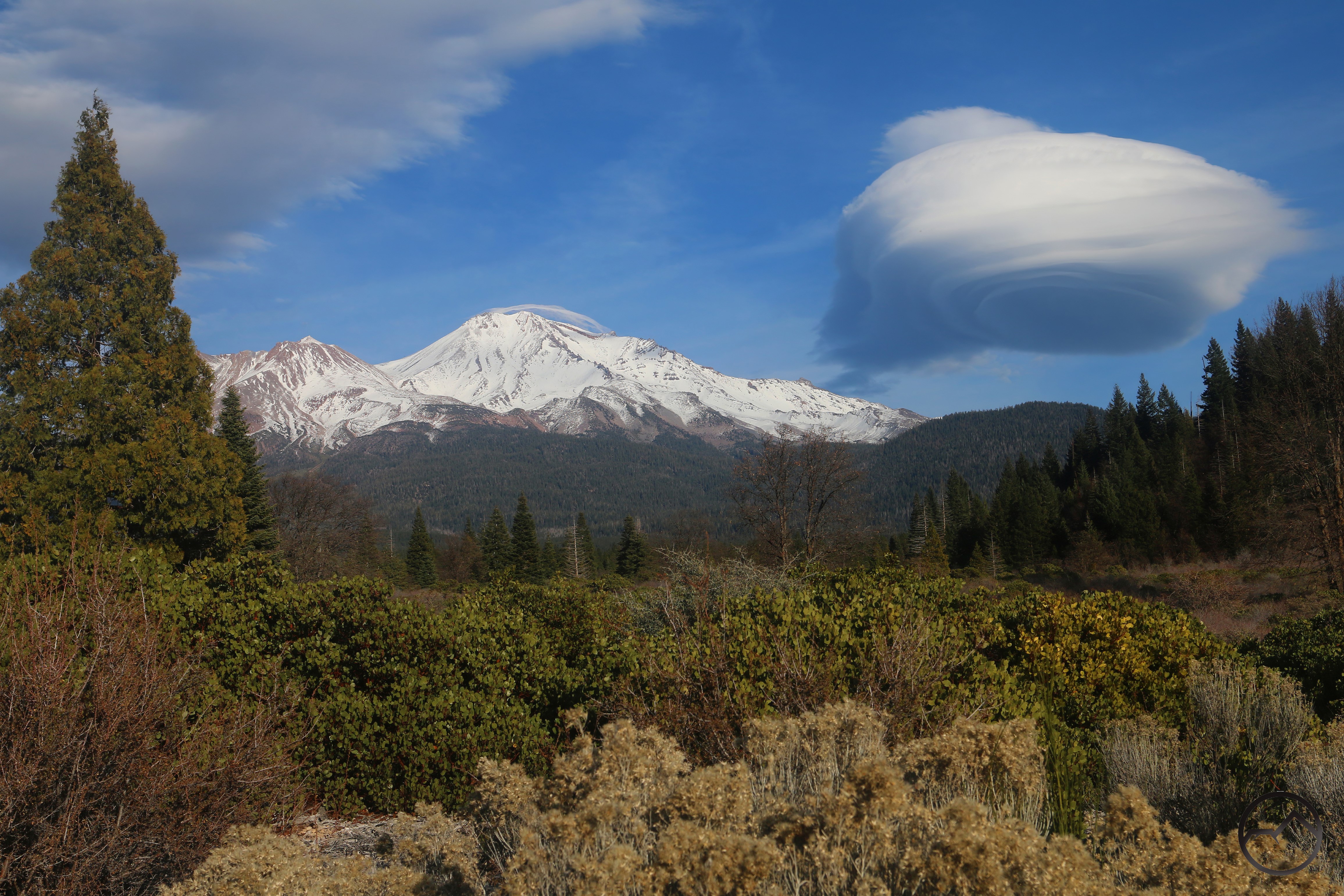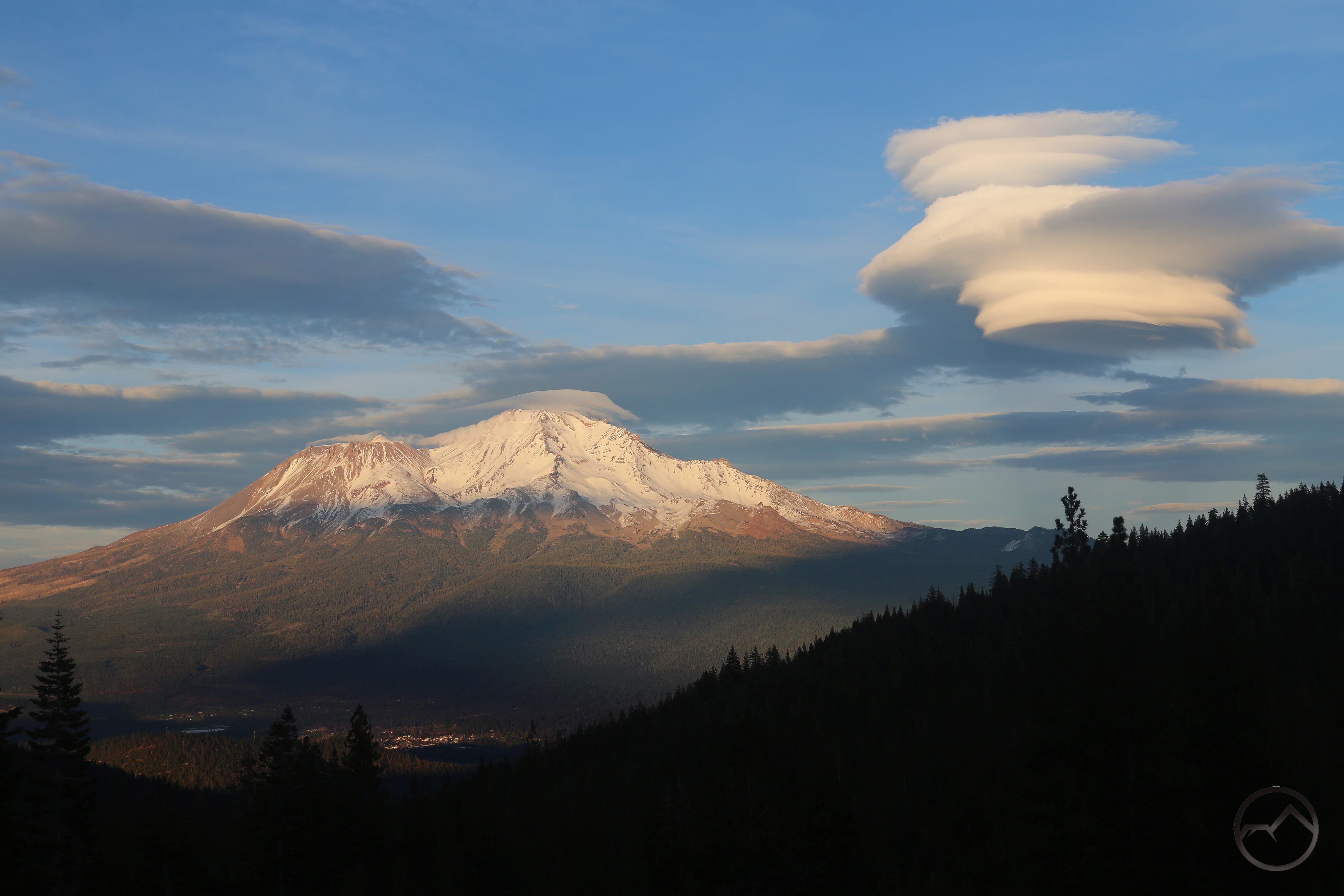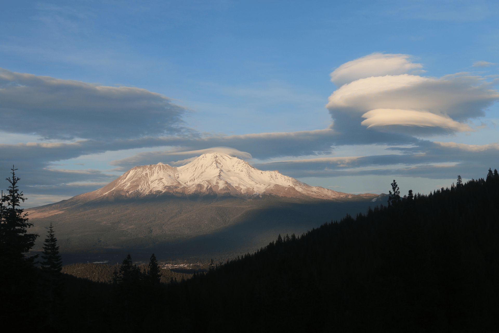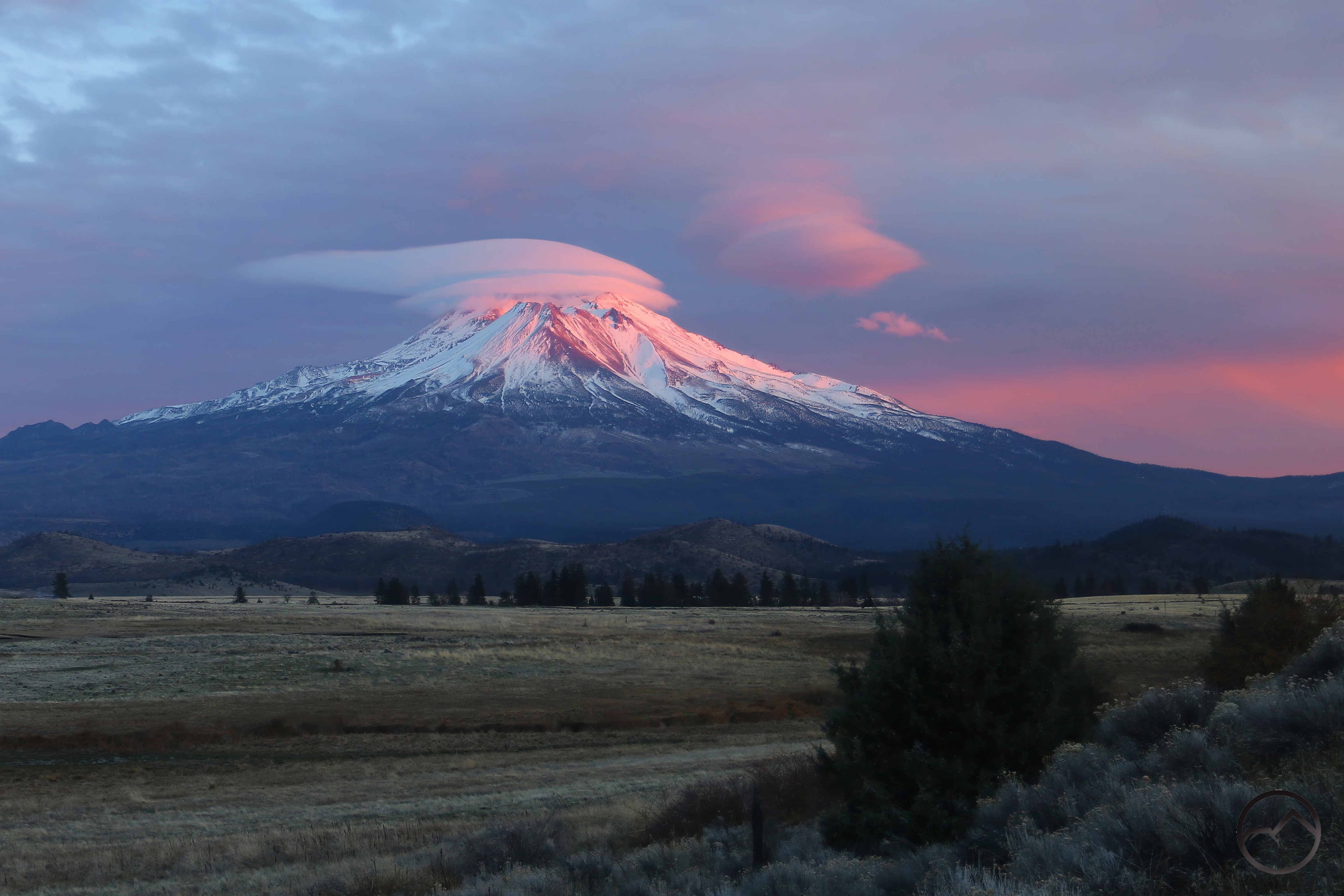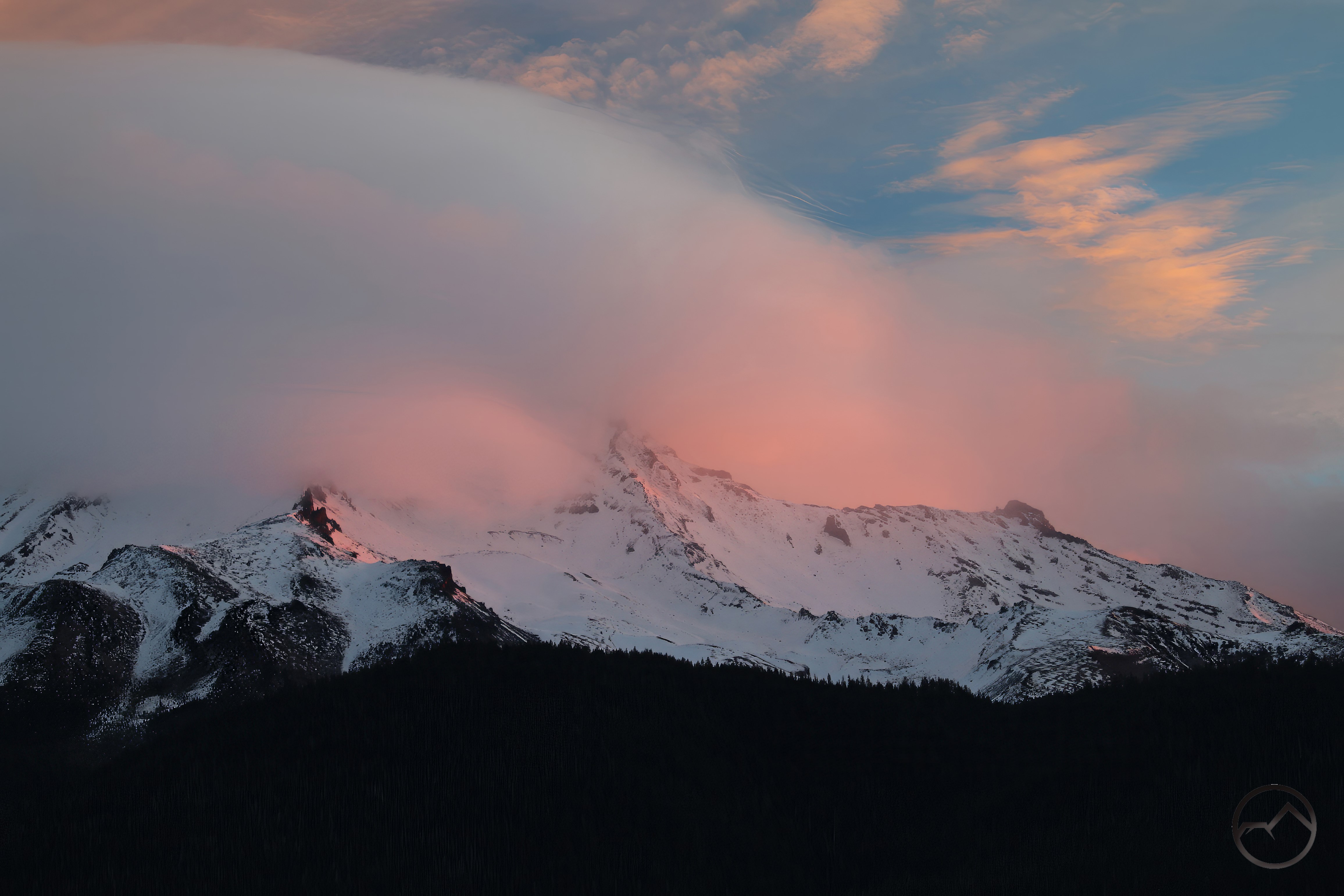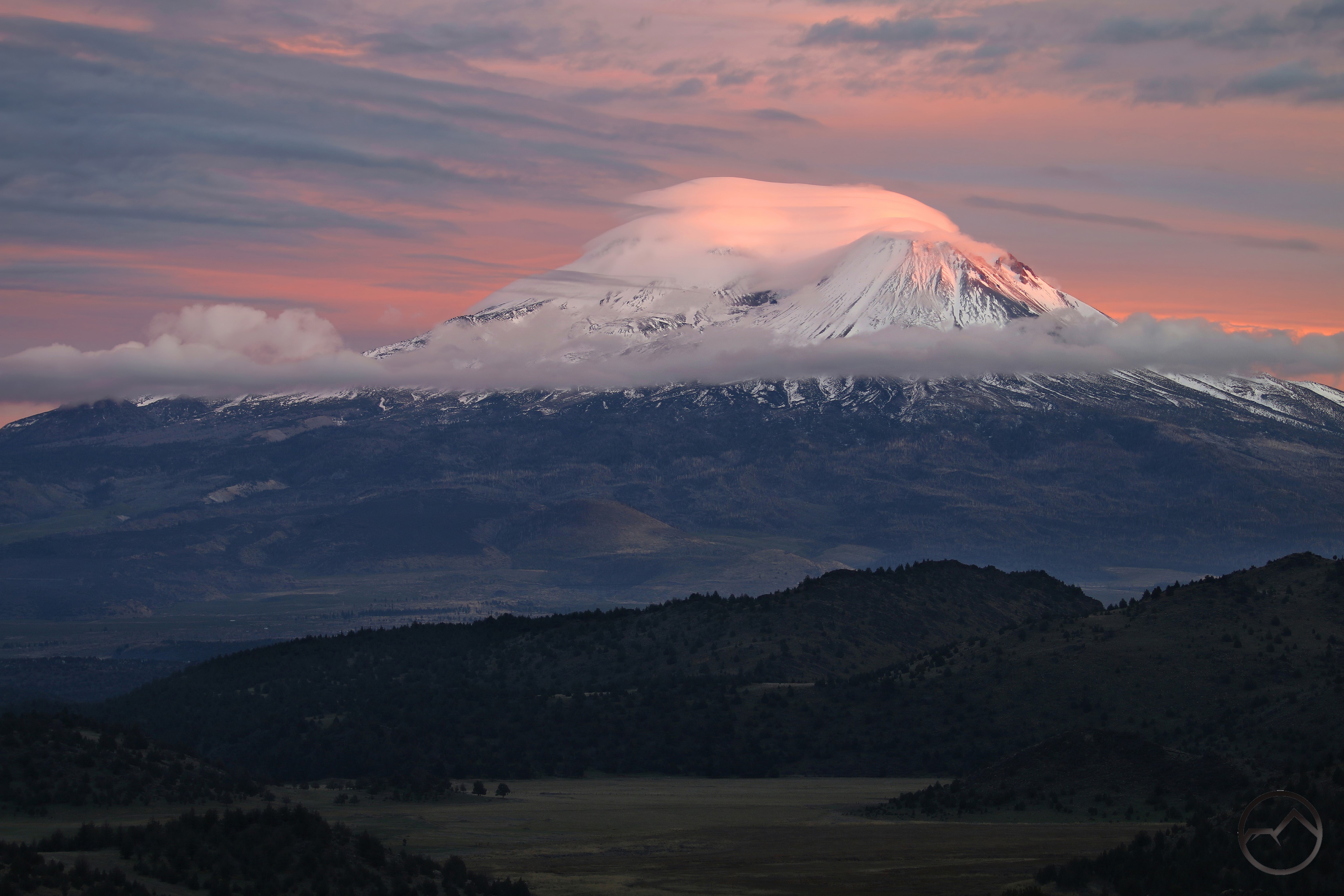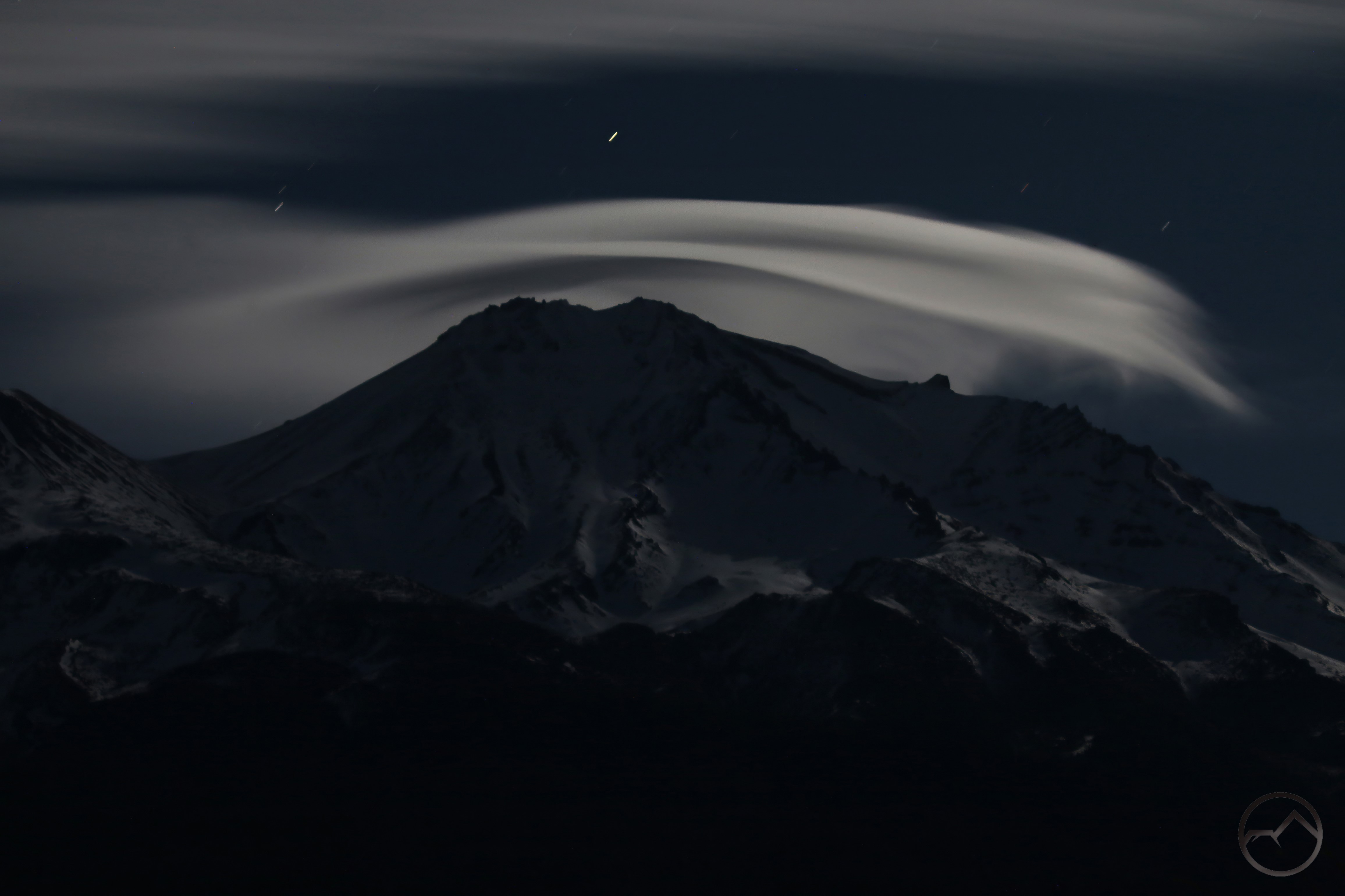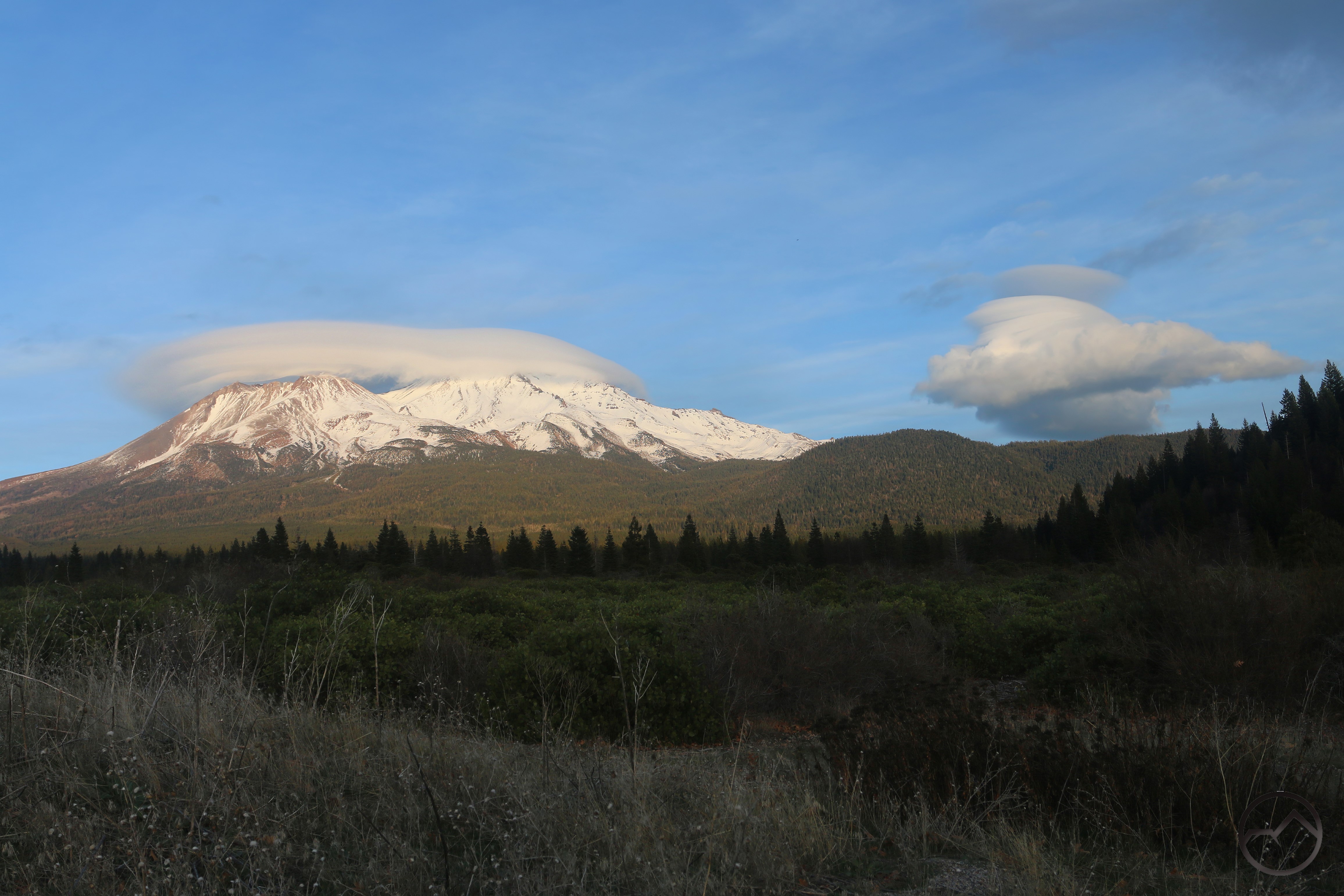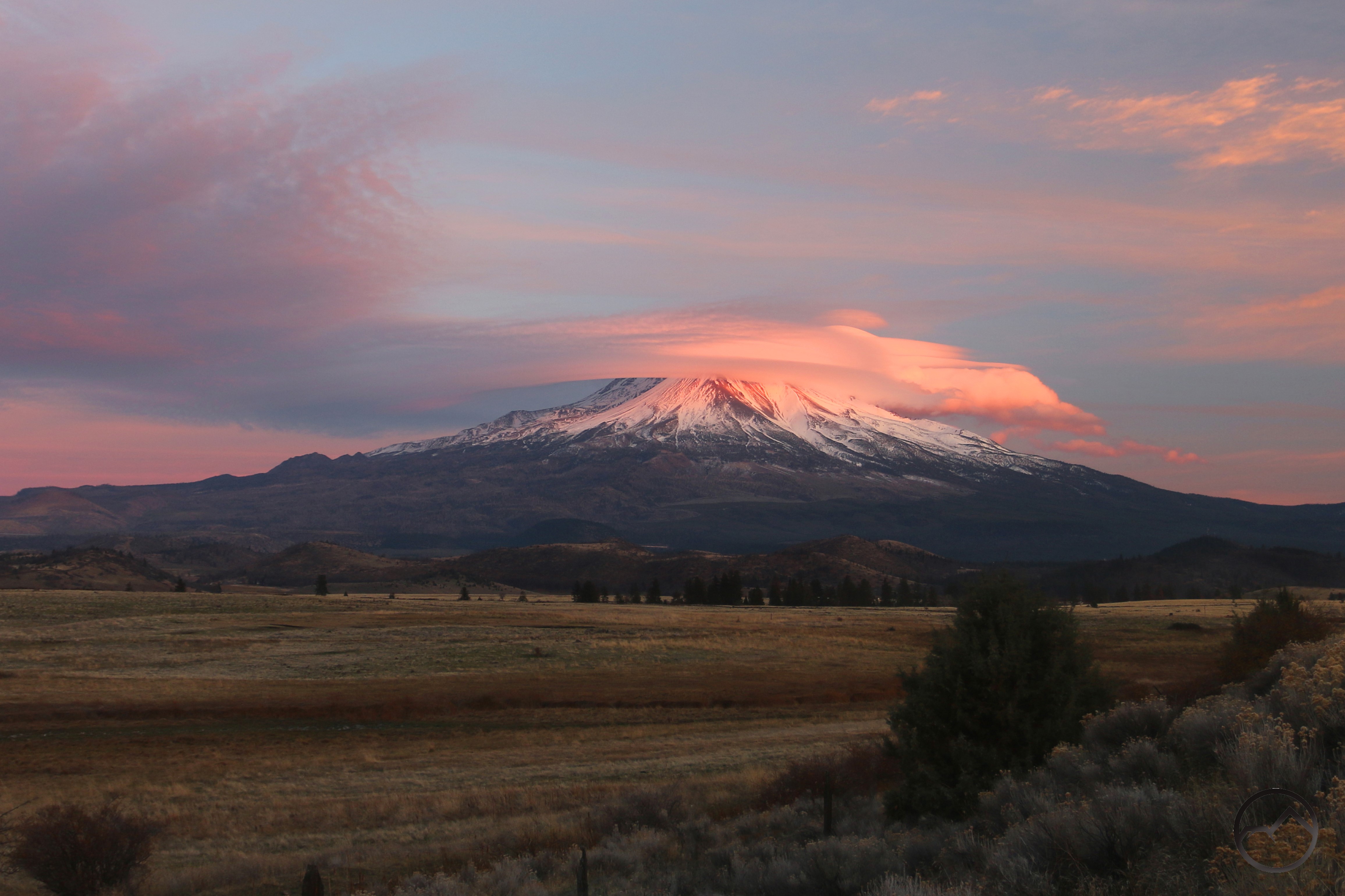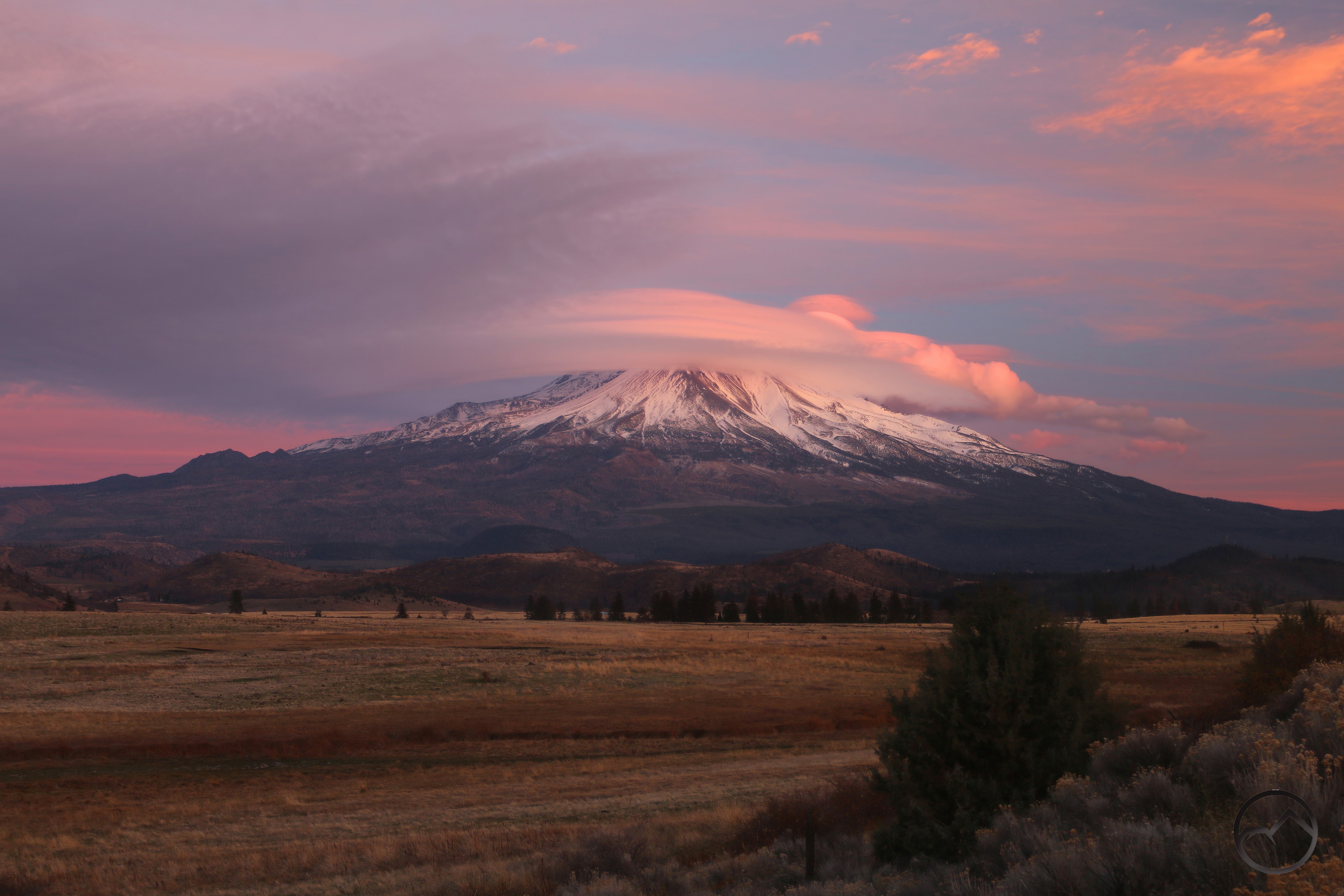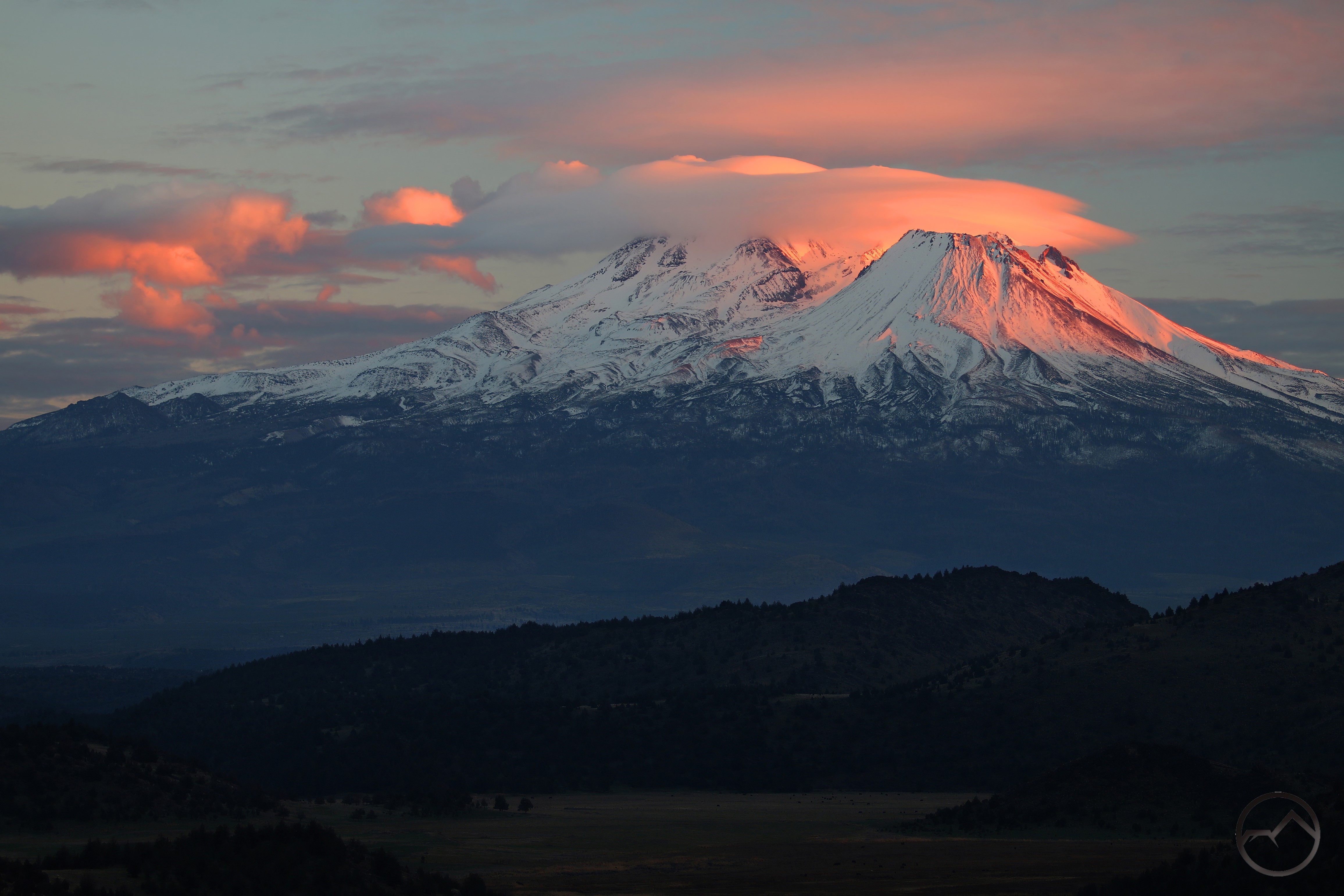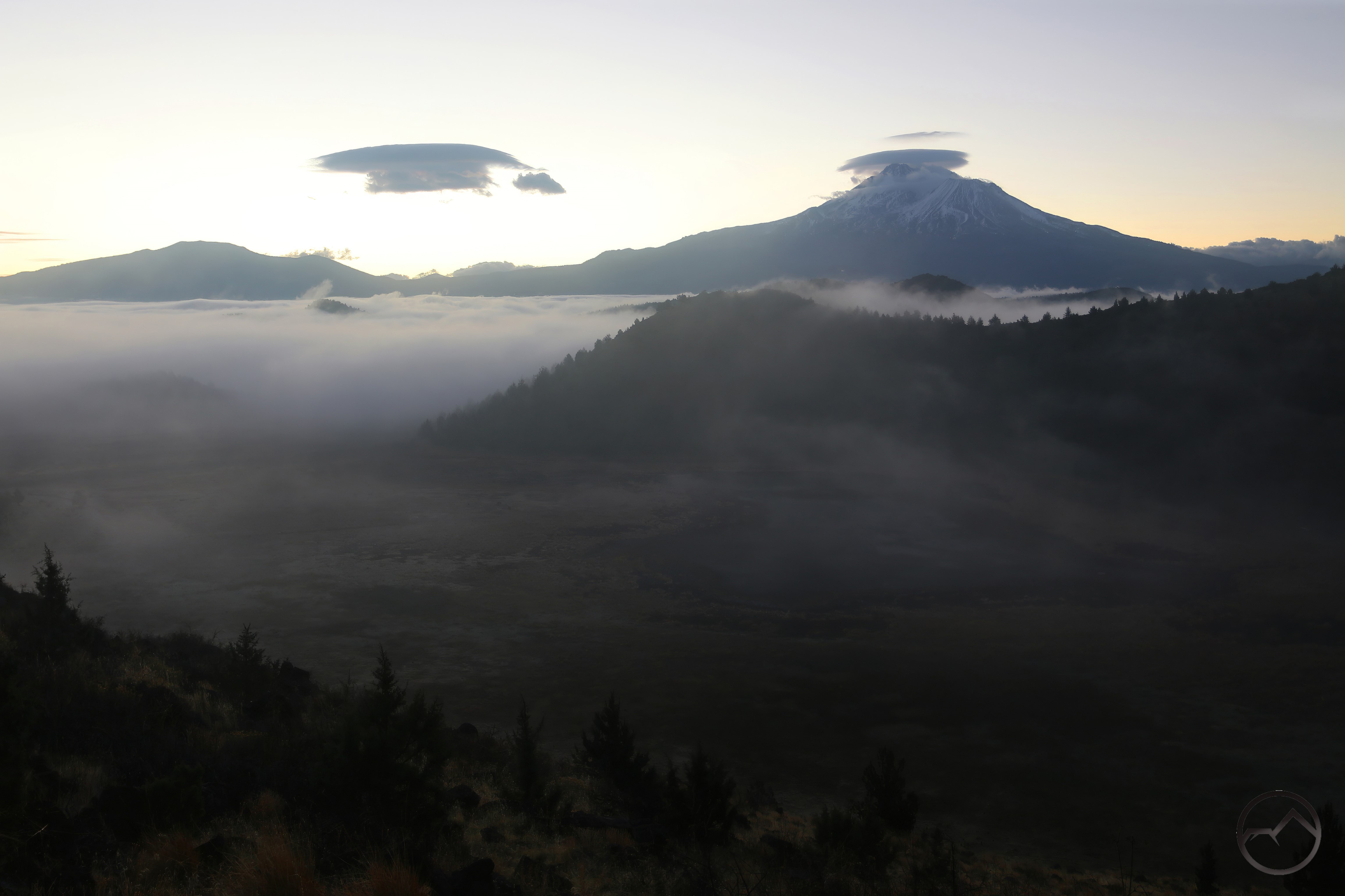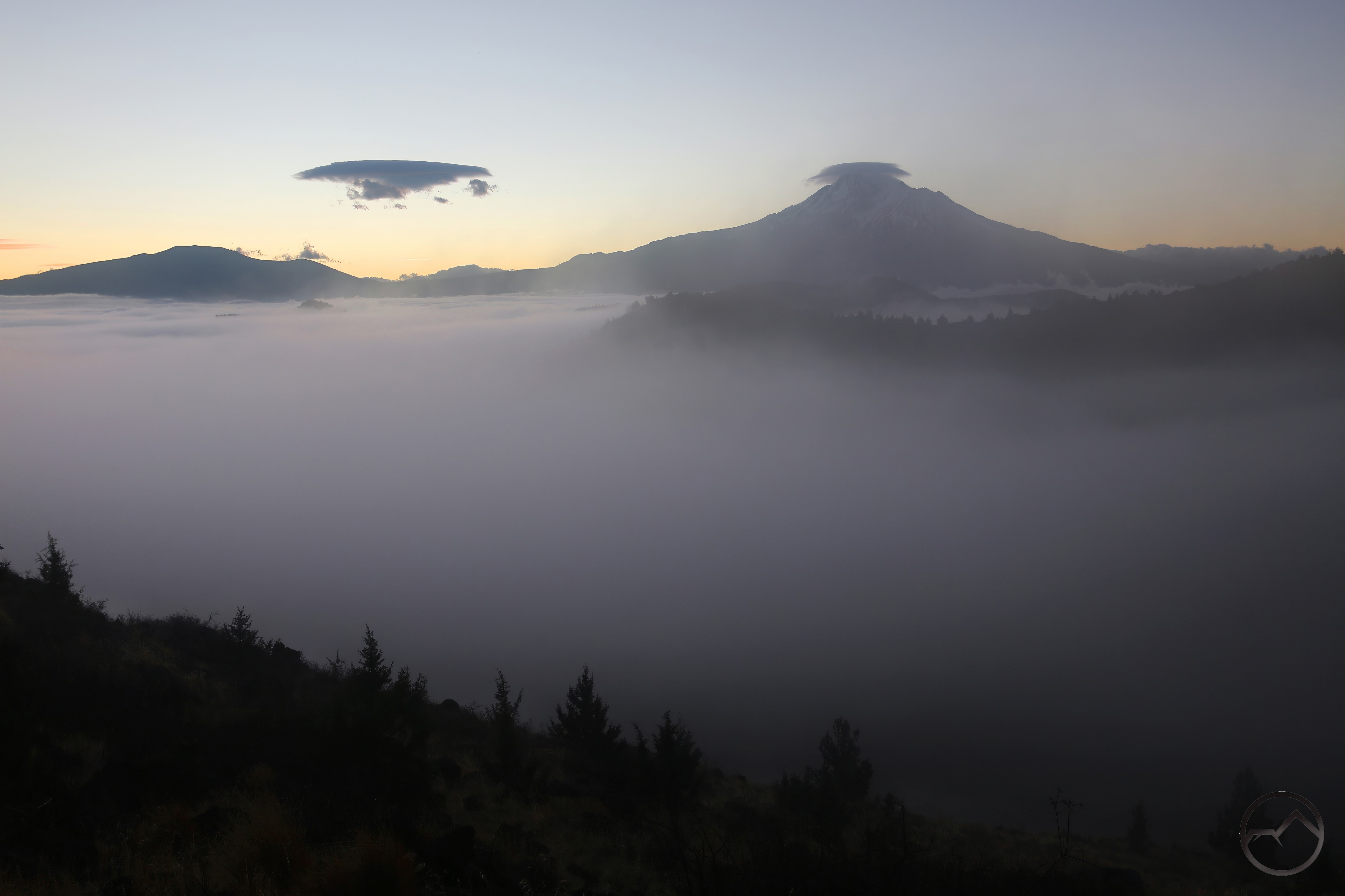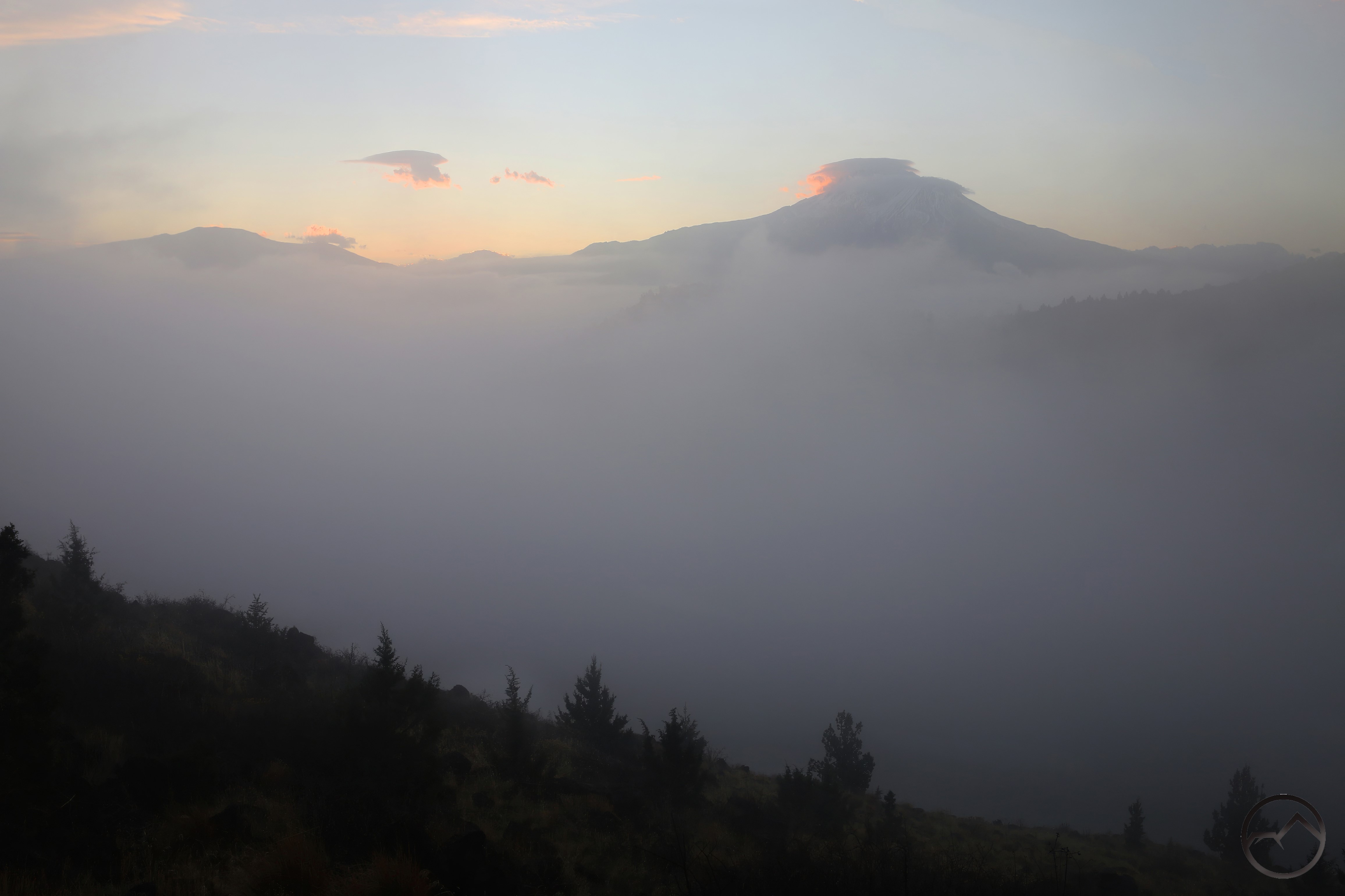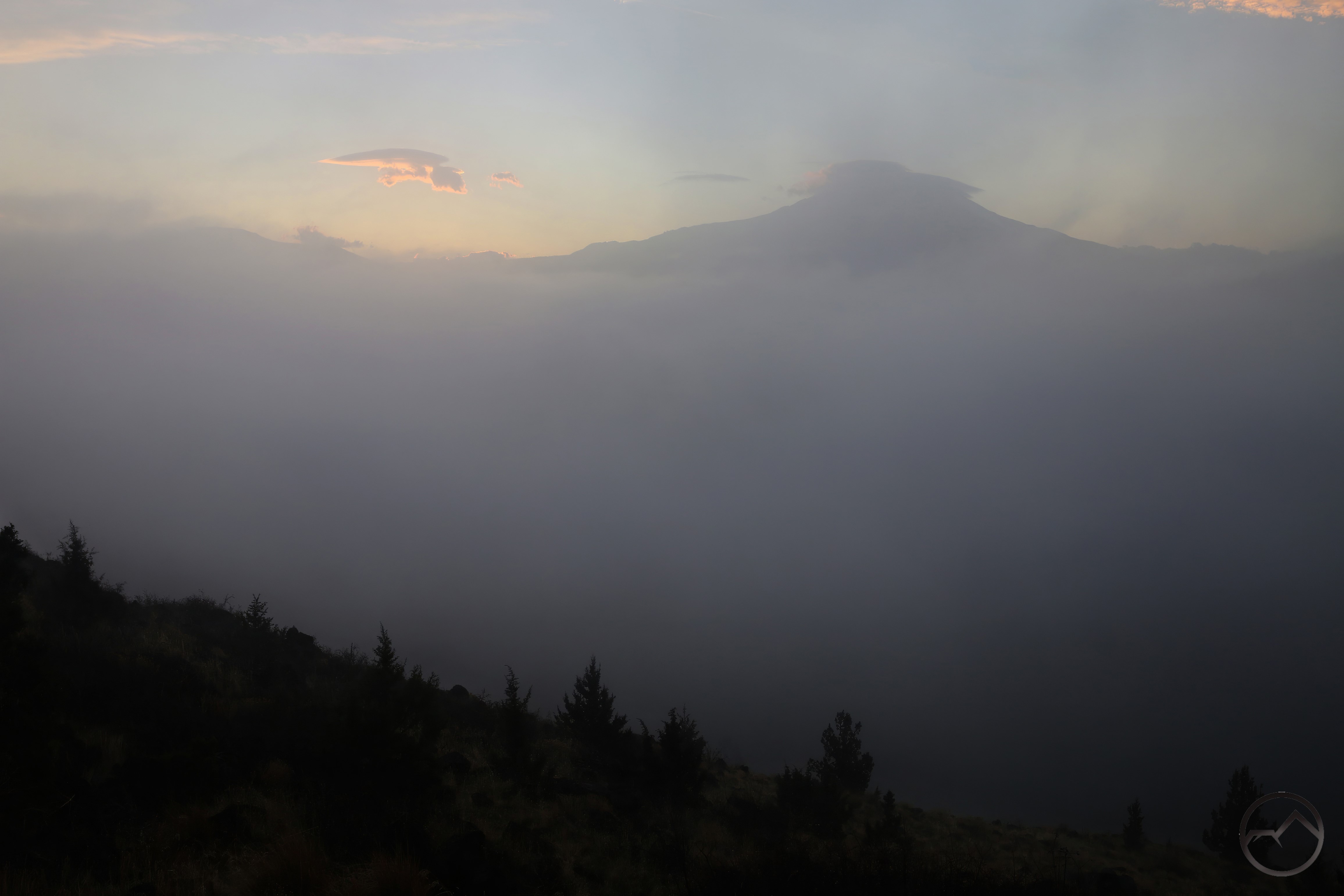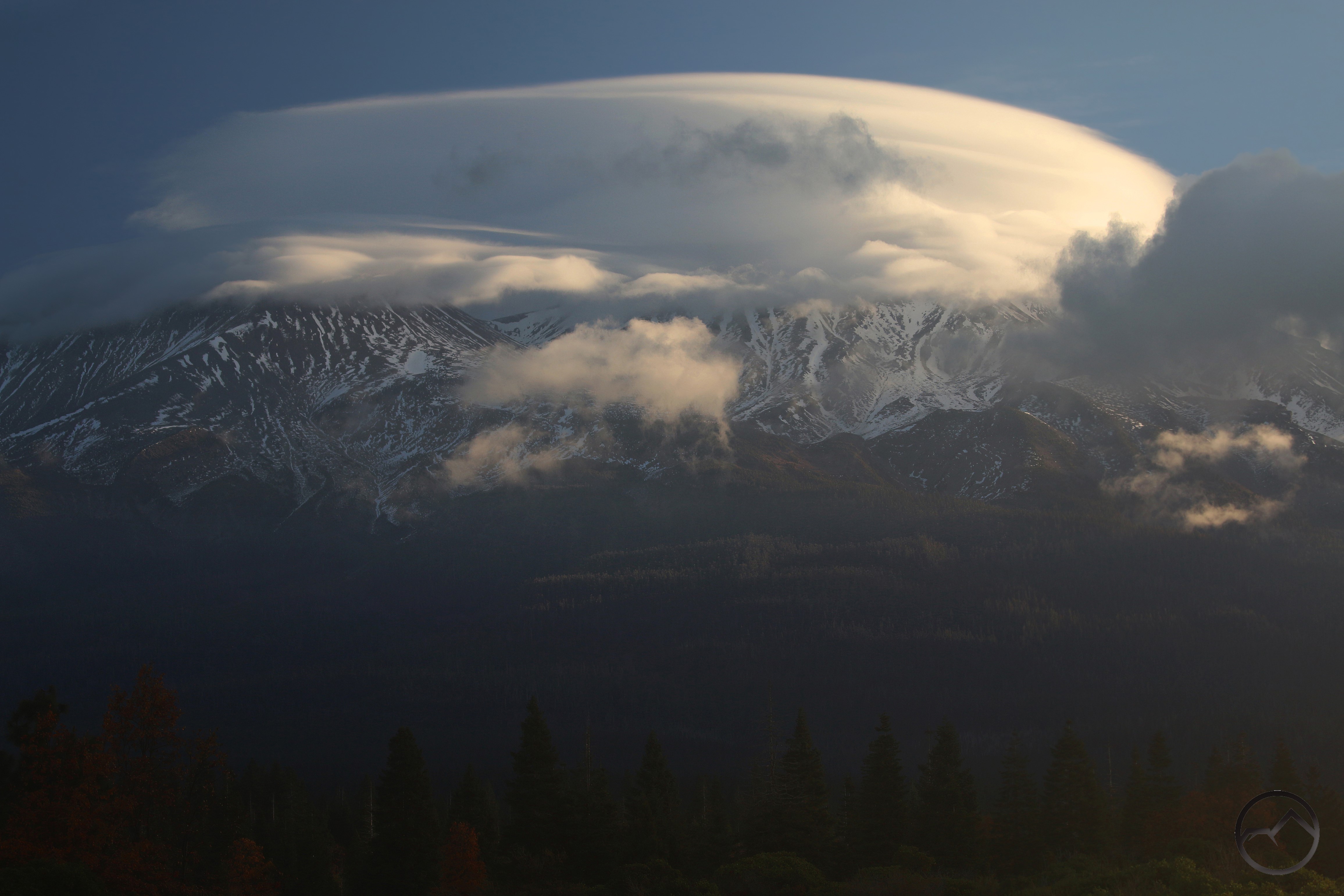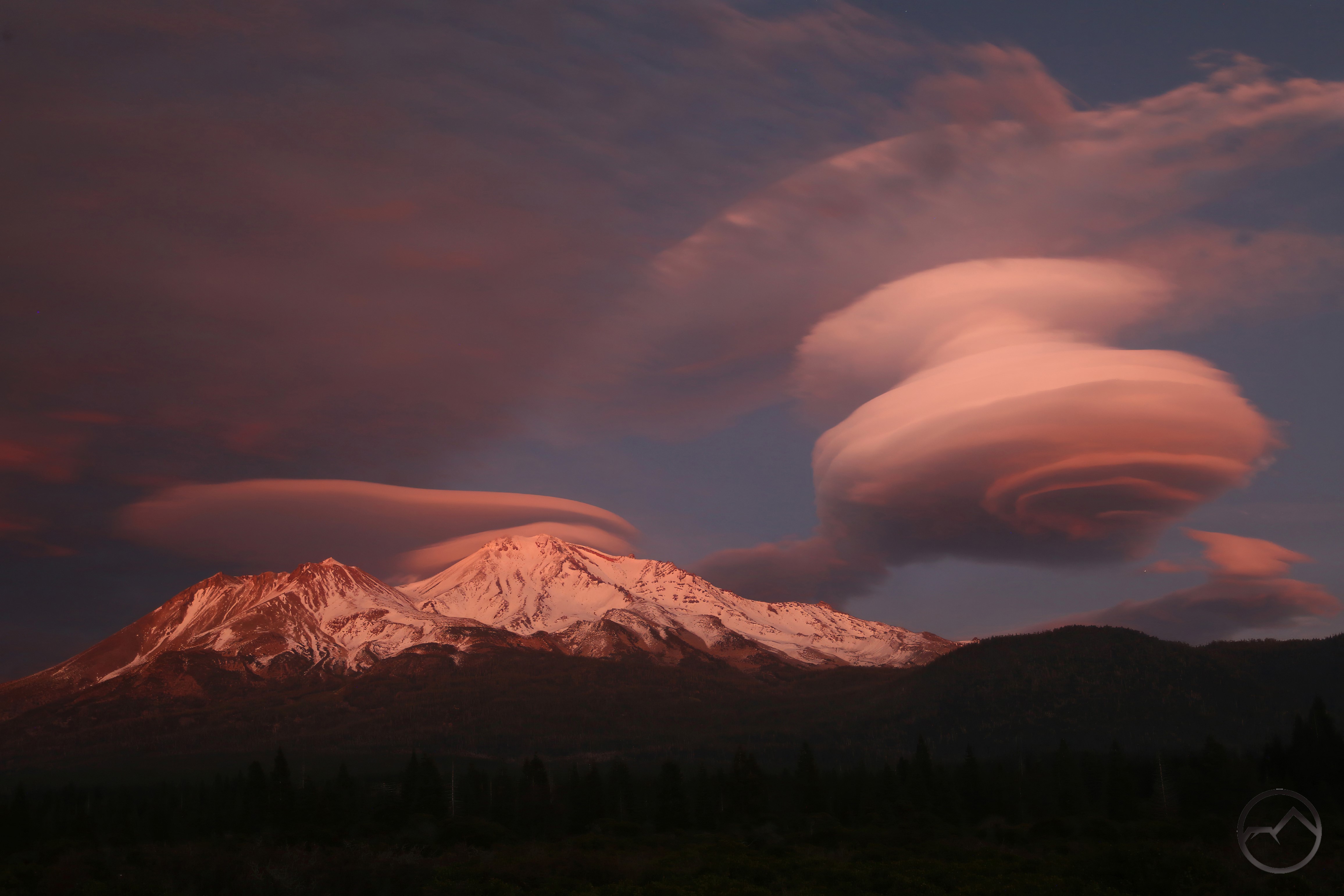
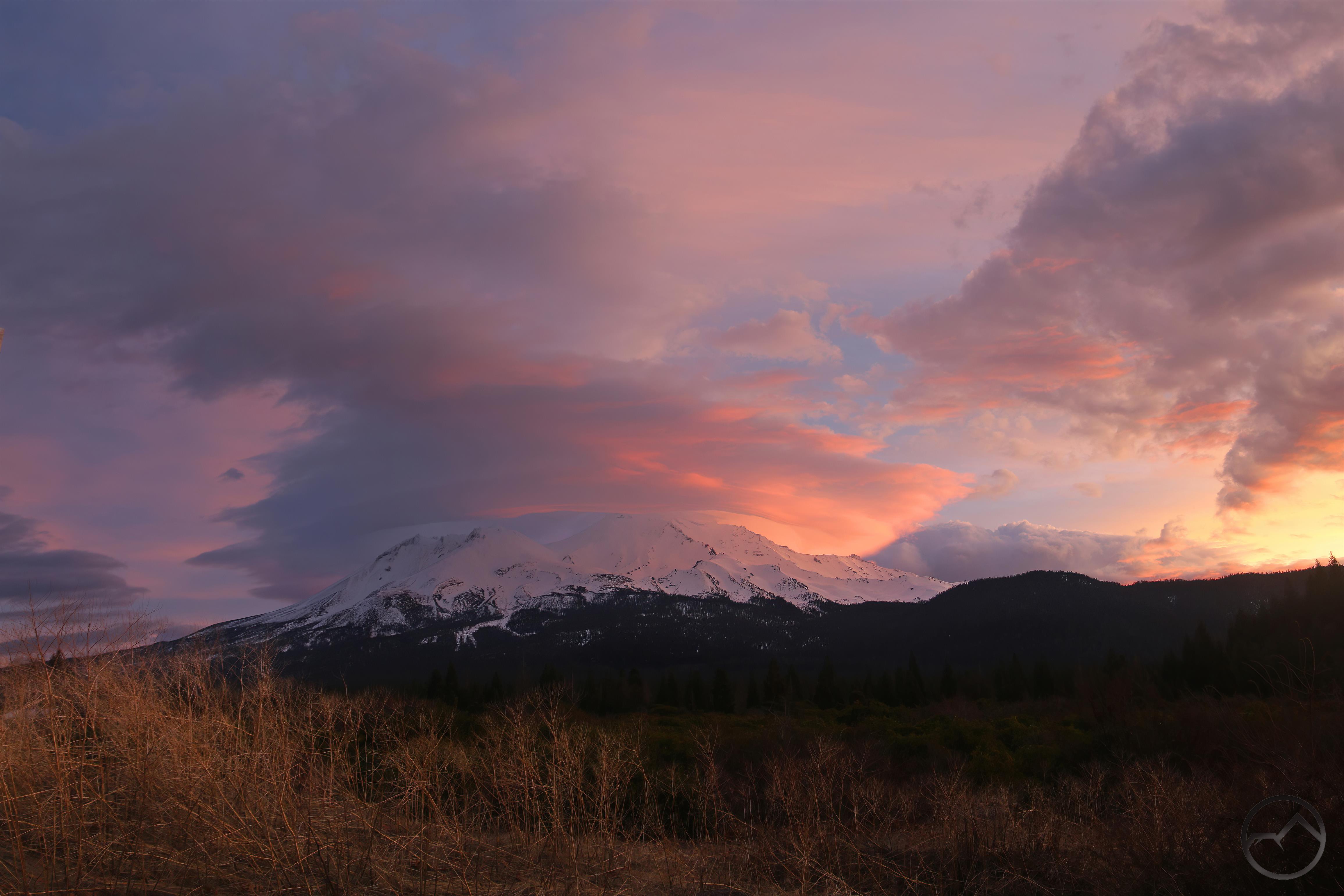
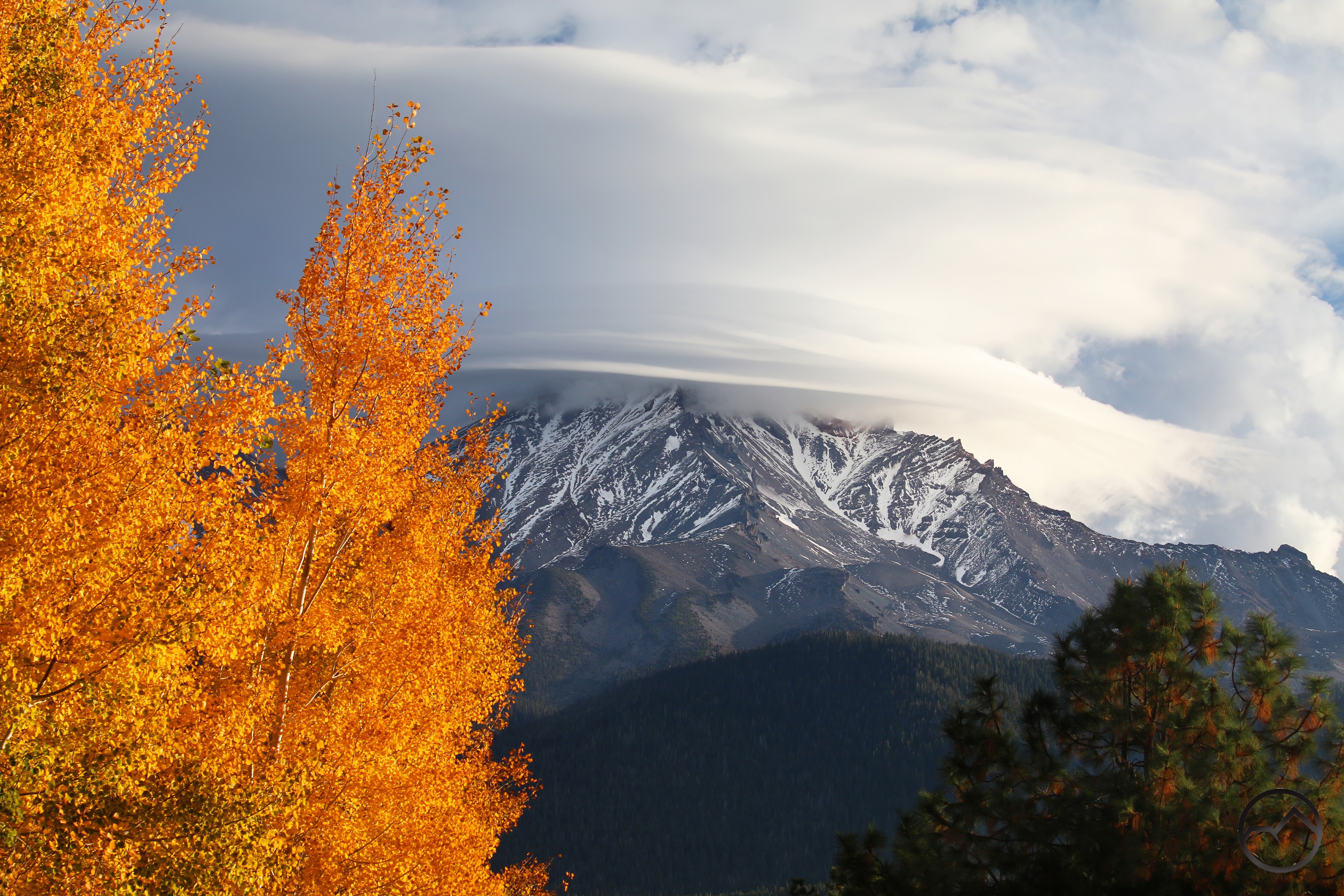
December 2025 produced some awesome lenticular clouds.
We have now completed the year of our Lord 2025’s orbit around the sun. It has been a very busy year here at the Hike Mt Shasta homestead. It was another strange year, with an odd mix of work, volunteering and some personal endeavors thrown in for good measure. Our business has grown immensely and demanded a lot more of my time this year. Concurrently, my involvement with my kids’ school has also grown, and the investment of time and effort has produced some good fruit. This has meant that I have had far less time than years past to get out on the trail (or off the trail, is it tends to be these days). Even my work at Truchas Ridge has suffered and things have ground to a halt there, though this has been more a product of an…outside intrusion than my own prioritization of my goals there. Still, I have been able to get out here and there and my quest to document Mount Shasta in all conditions continues.
In the midst of the busyness it is hard to believe that I have continued to post at least one post a month on this site, missing only a handful of months over the last 13 years. Sometimes I just get a bug and post a lot, sometimes it is a struggle just to force myself to sit and write something, anything. I feel like I have a few big things left to write about. Maybe I can force myself to tackle them in the coming year.
Regardless, blessings abound in the midst of the craziness and I am grateful for that.
Enough of me yapping. On to the retrospective:
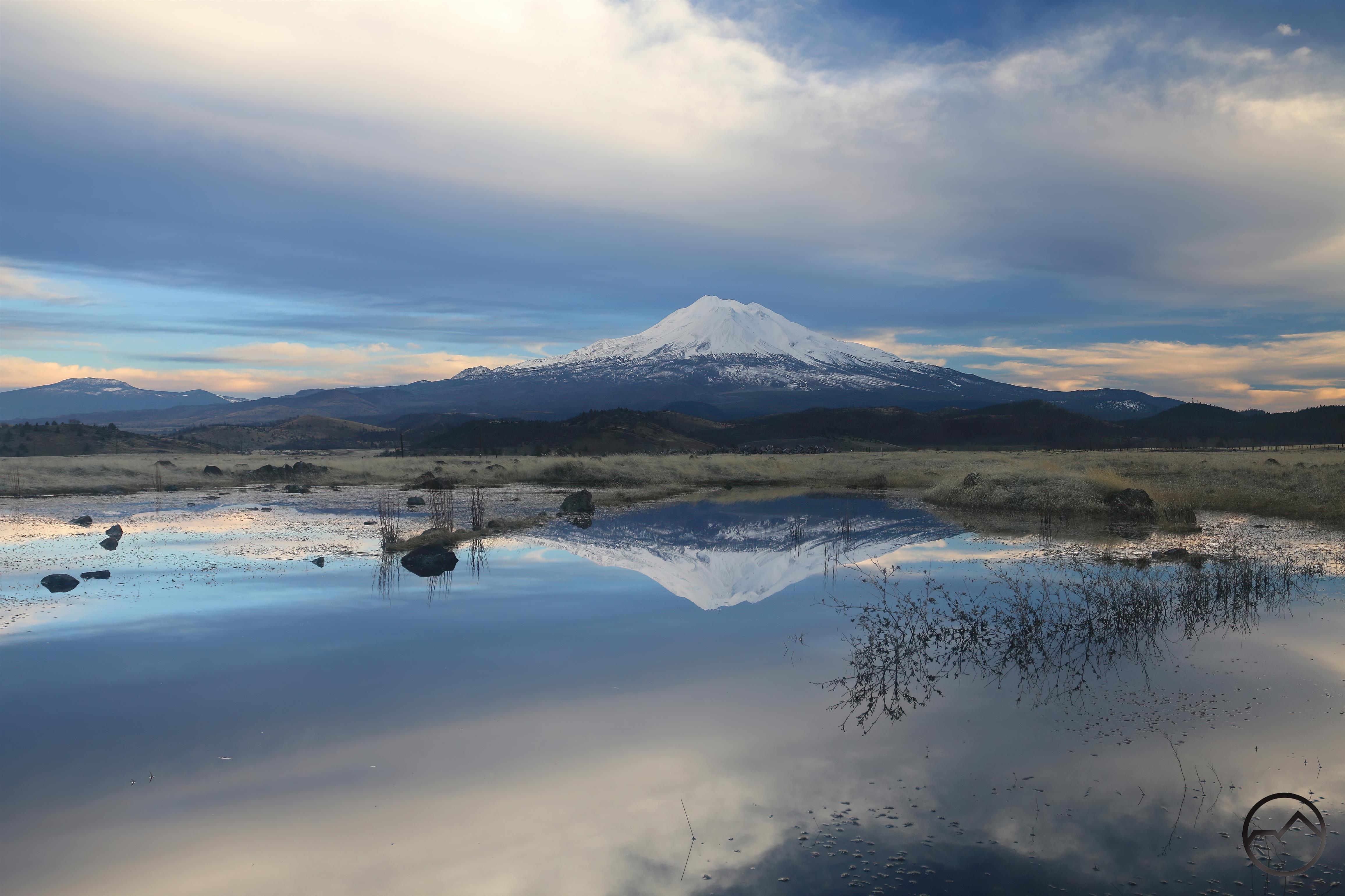
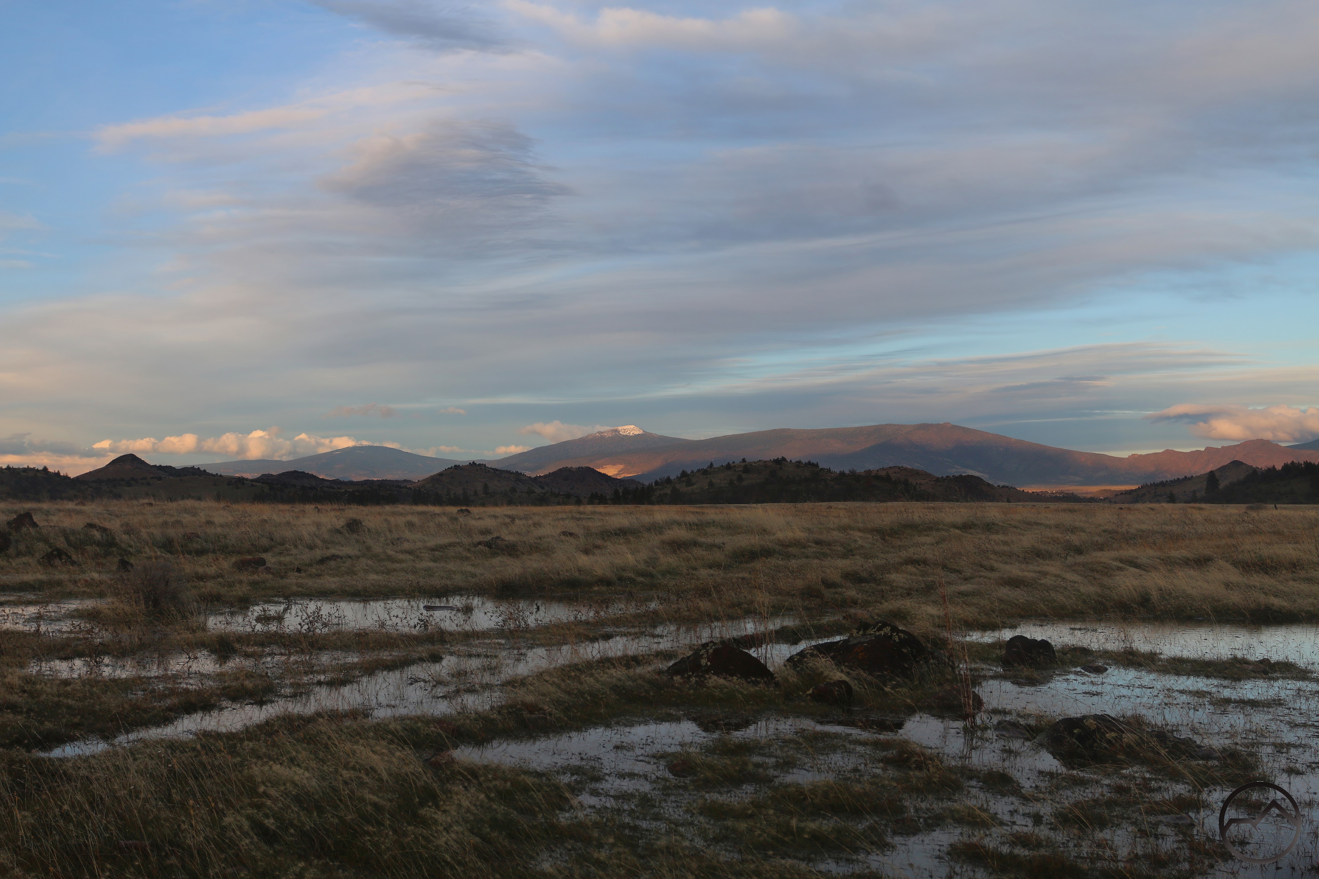
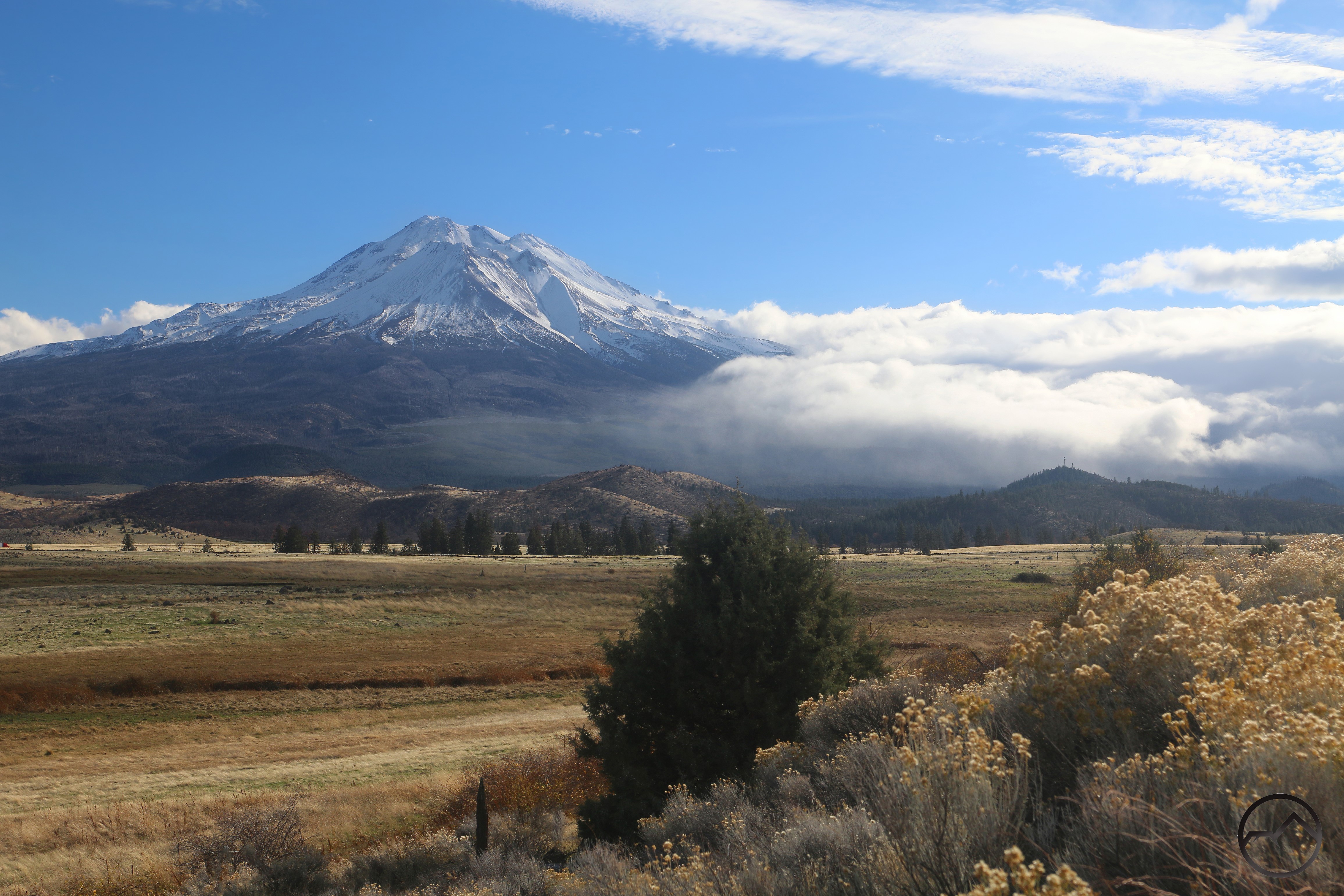
In 2025 January kicked off to a wet start. No surprise, given the new year starts in winter, but then I have seen waterless winters that edged up into the 60’s. This was not that. Cold with some snow and rain. Perhaps somewhat unusual, the rain was particularly copious in the Shasta Valley. Atypical for the high desert terrain, it produced great reflecting pools, one of my favorite benefits of the winter season. However, the storms were…uneventful, at least in terms of unusual or beautiful conditions. There was only one notable lenticular and not much in terms of sunrises and sunsets. Still, that is nitpicking. The most boring of conditions are still exceptional around Mount Shasta.
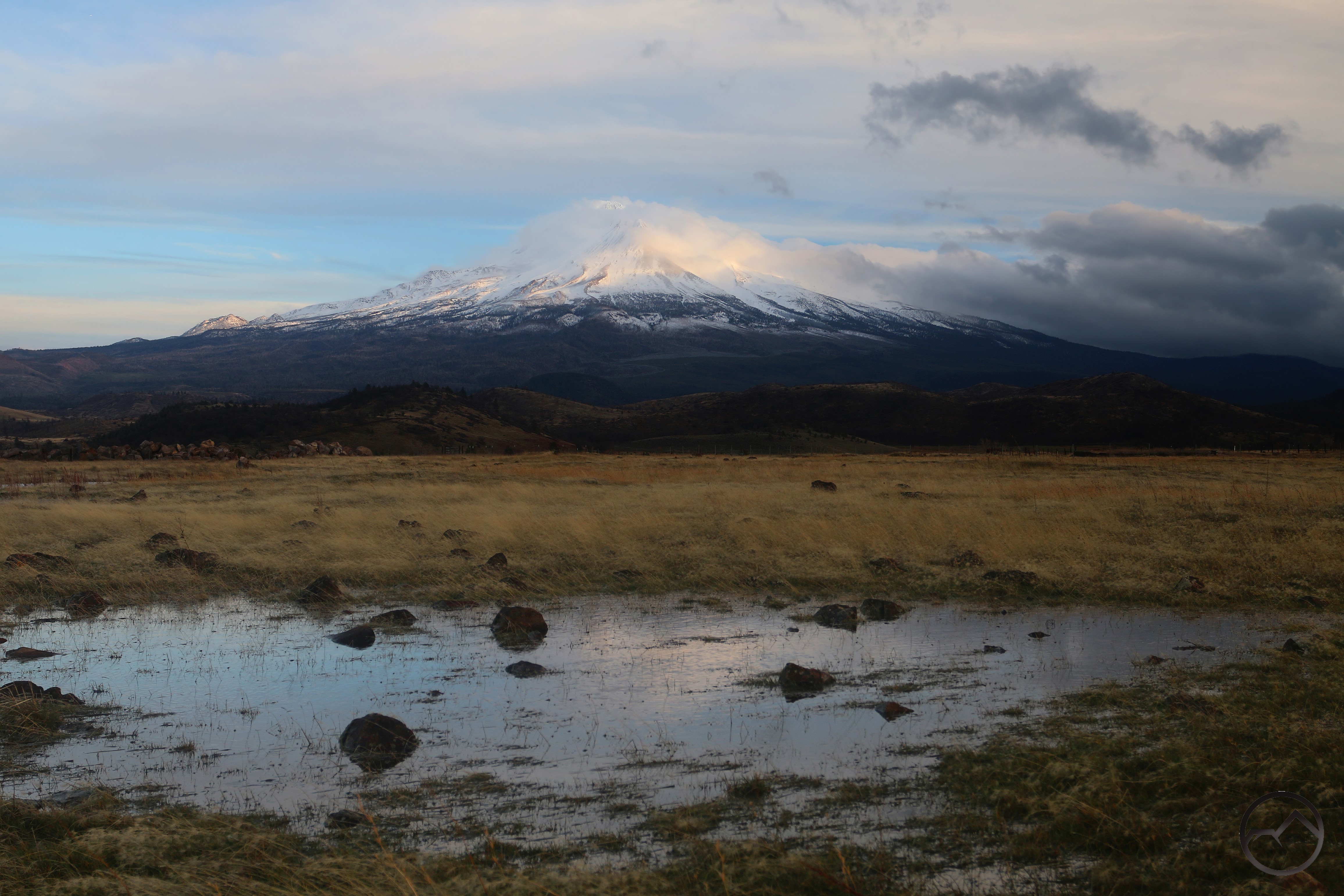
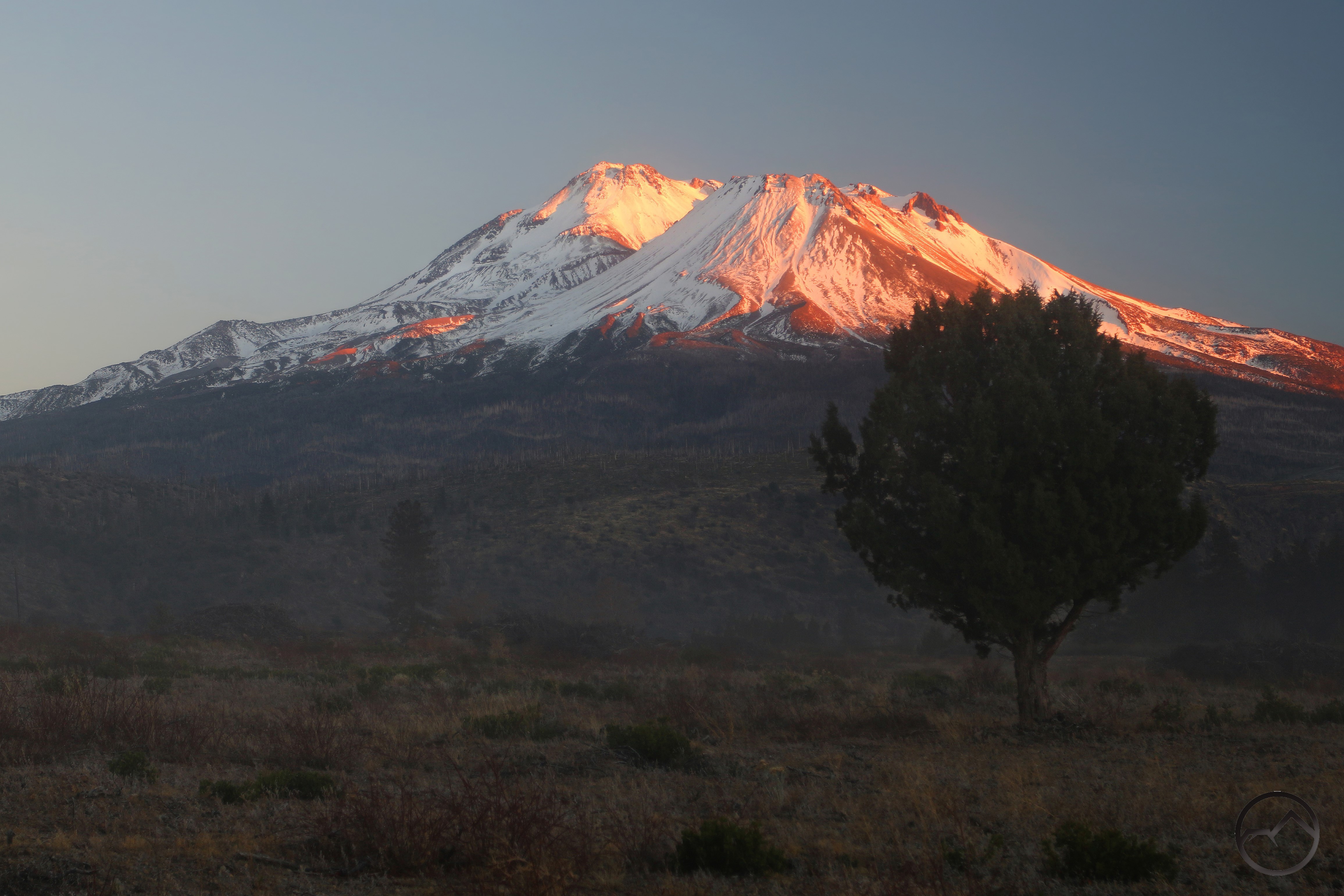
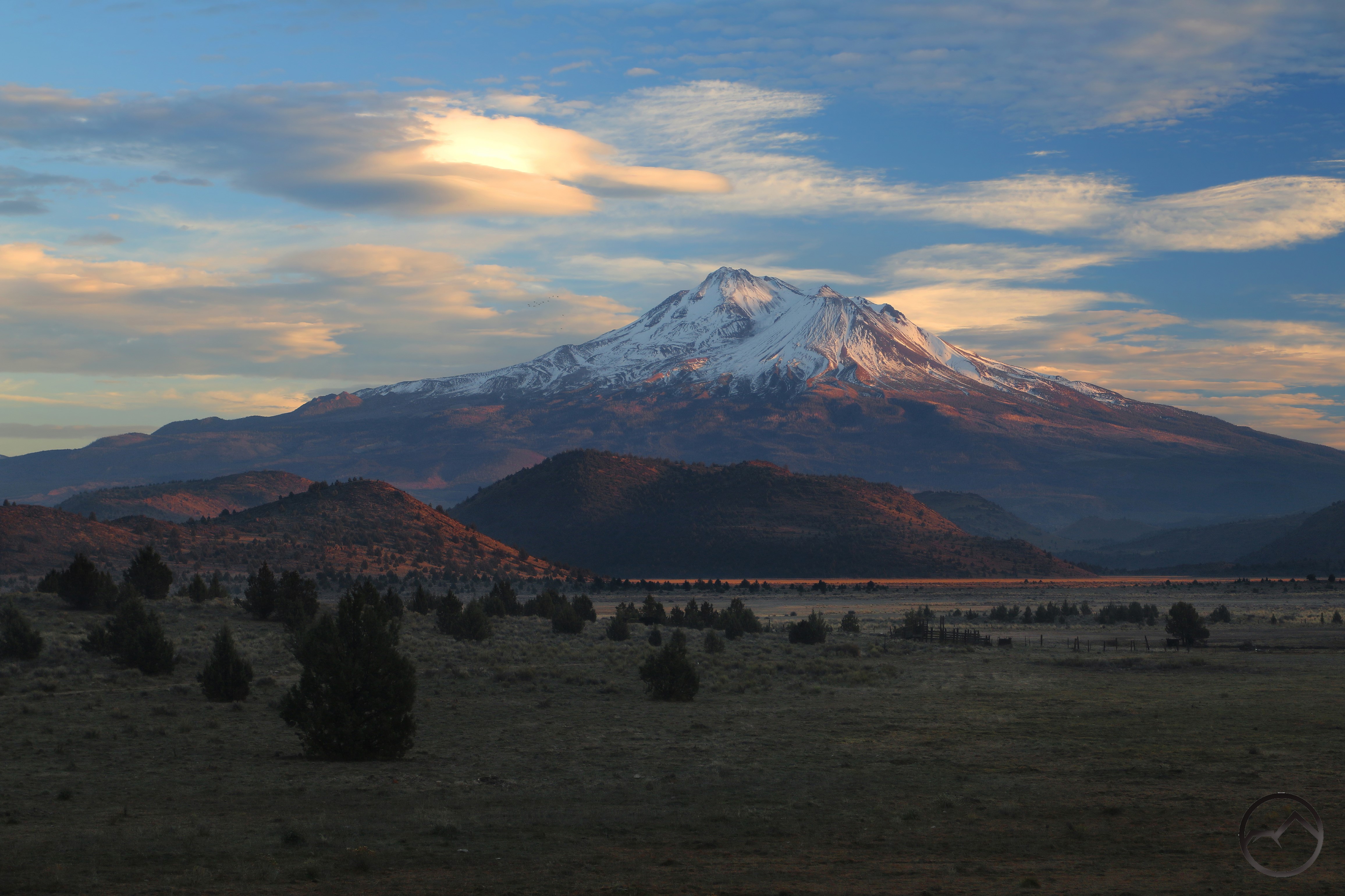
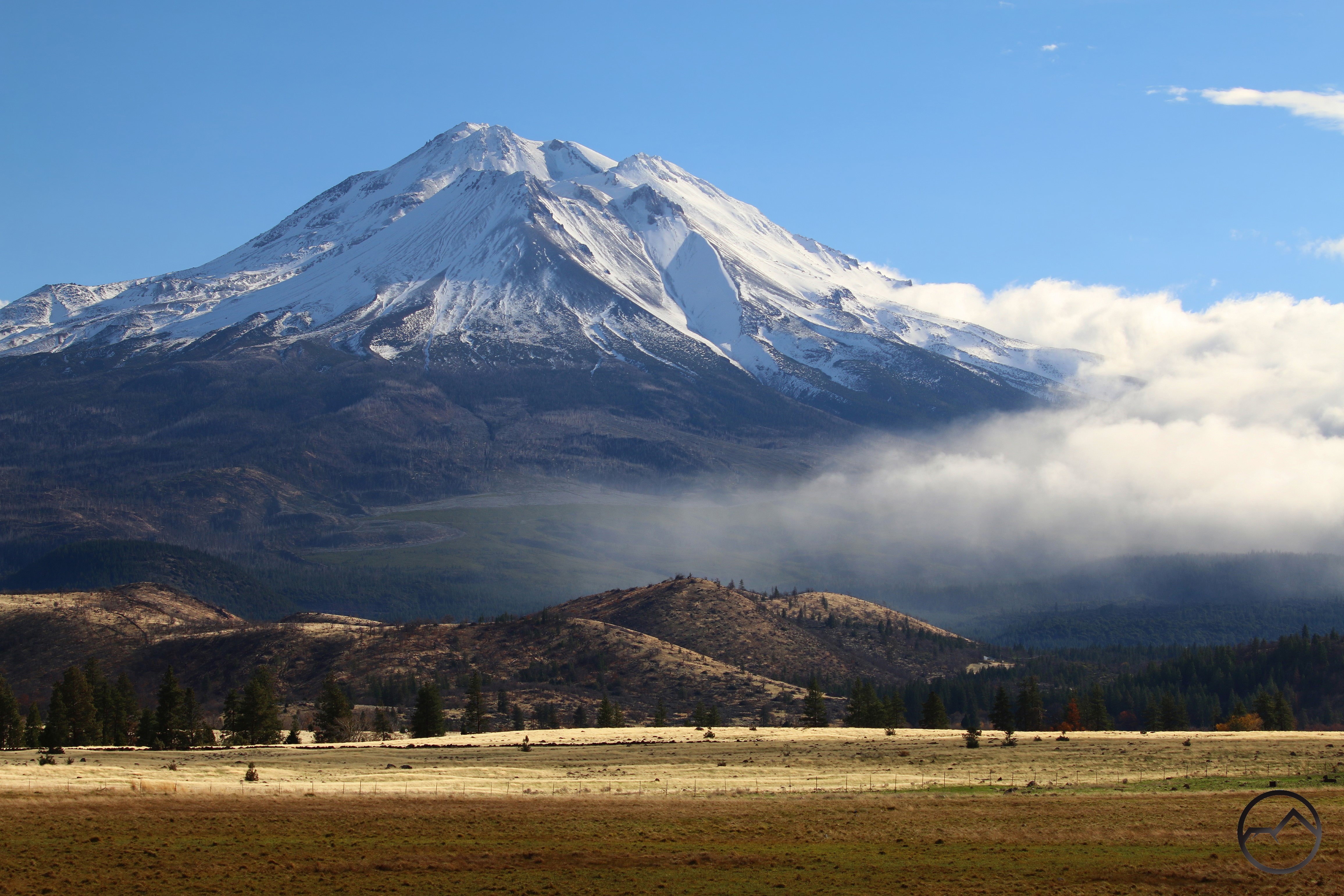
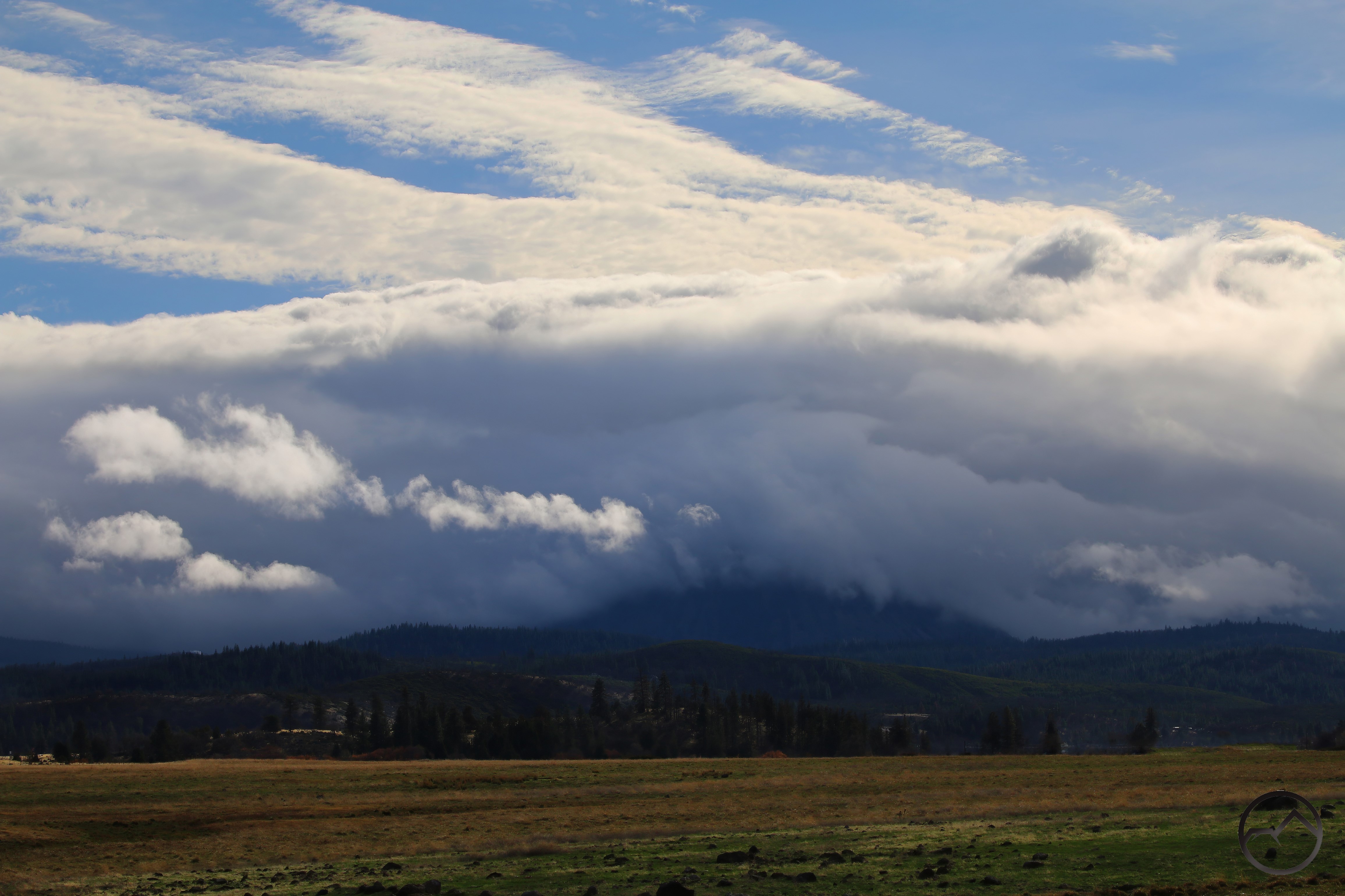
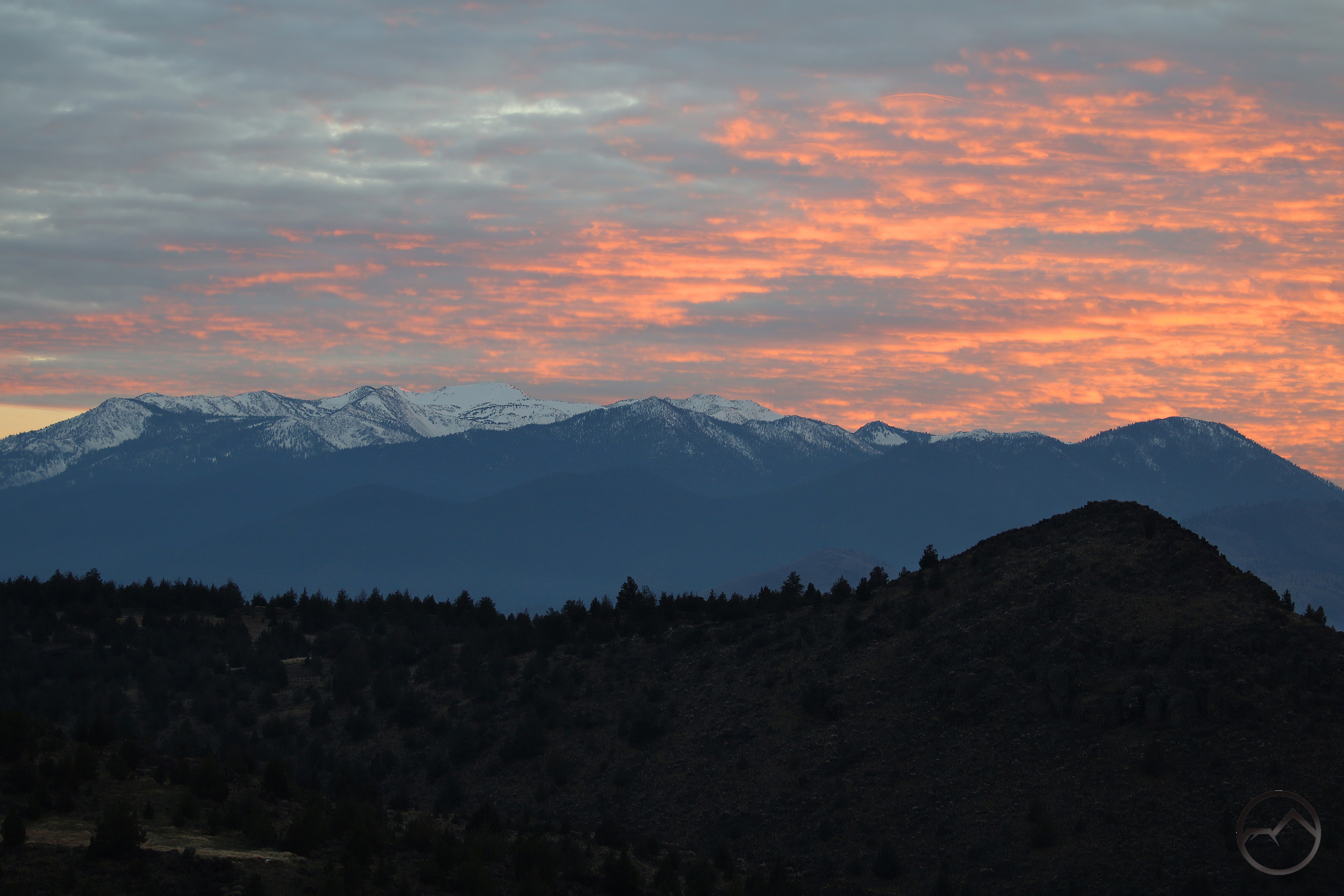
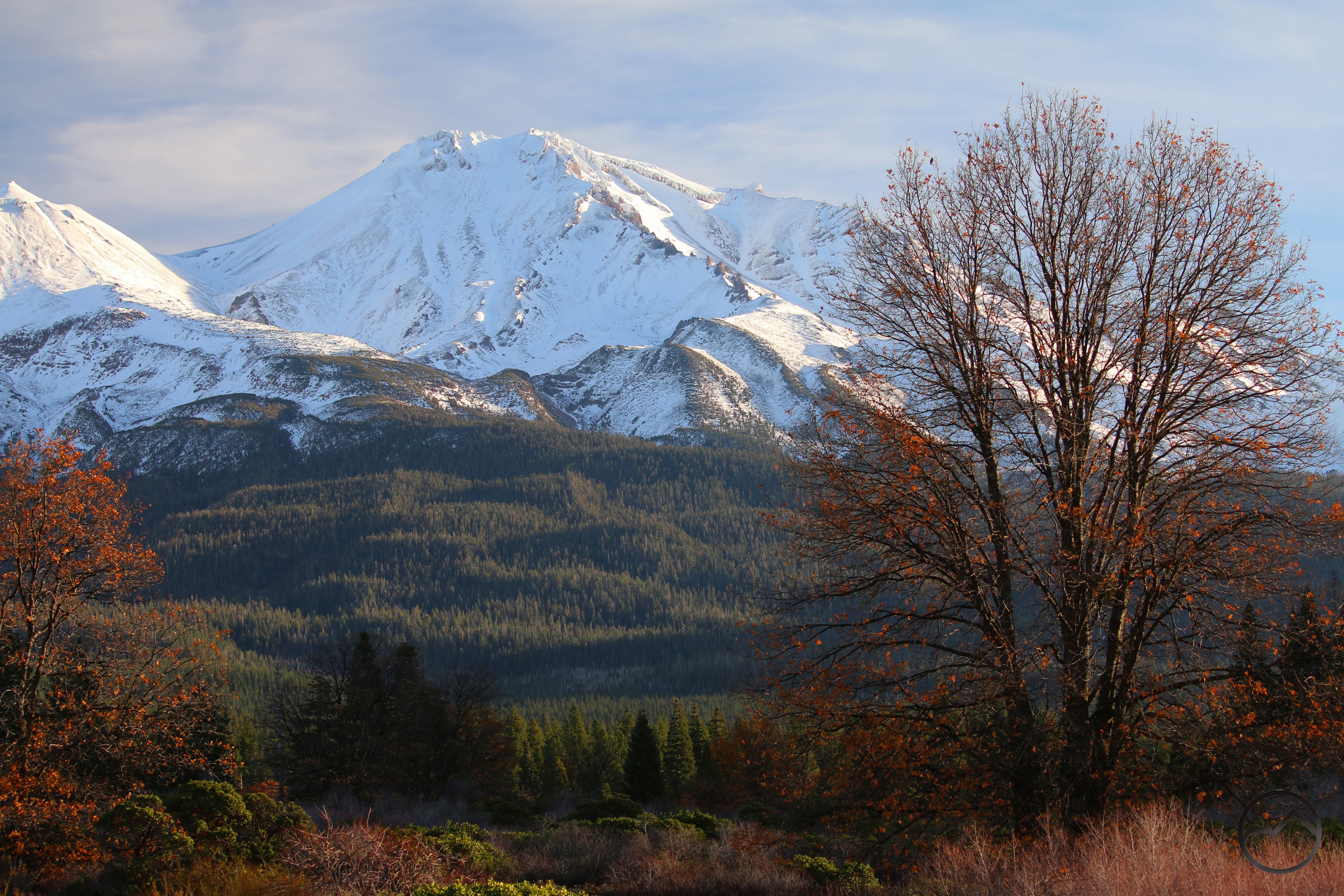
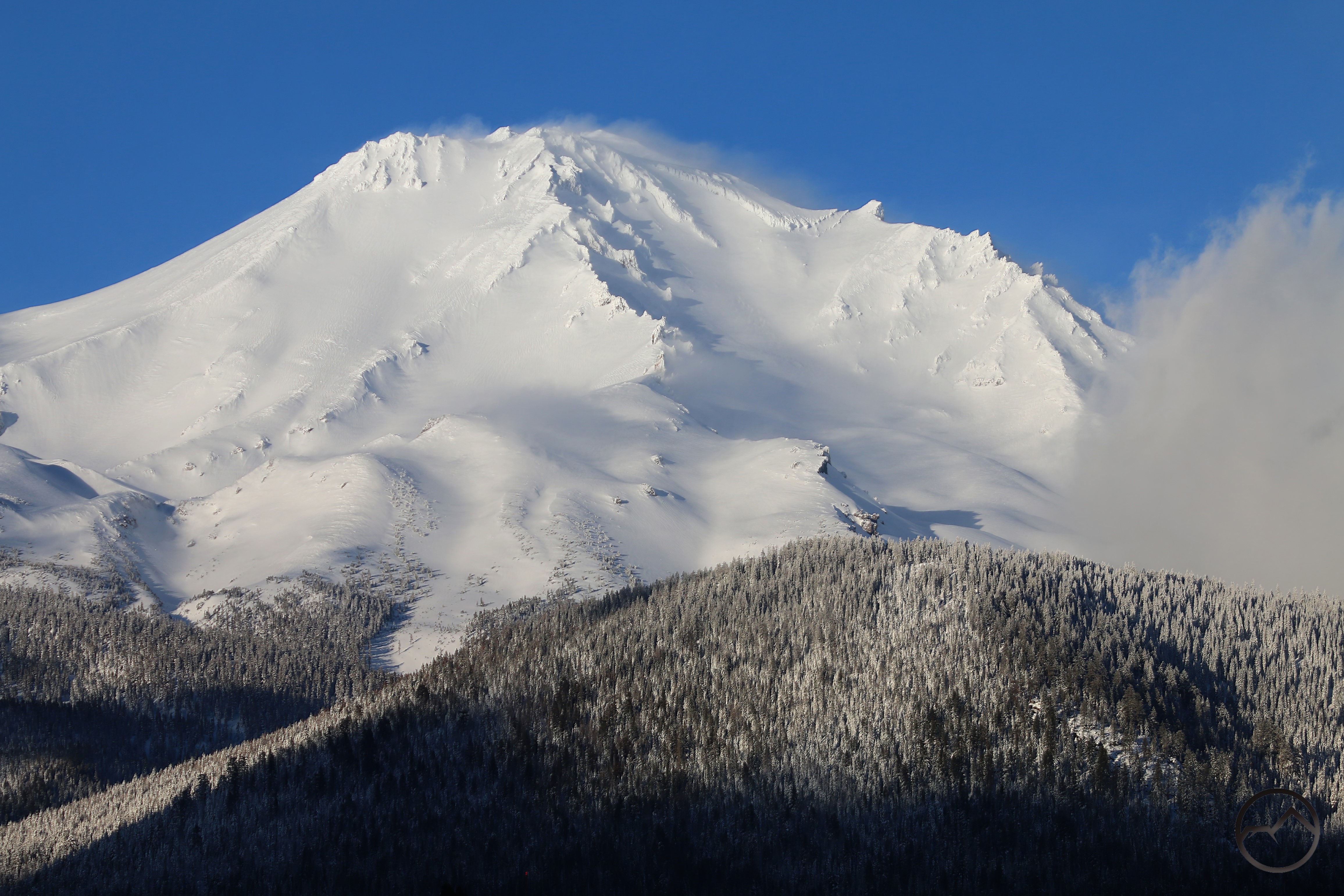
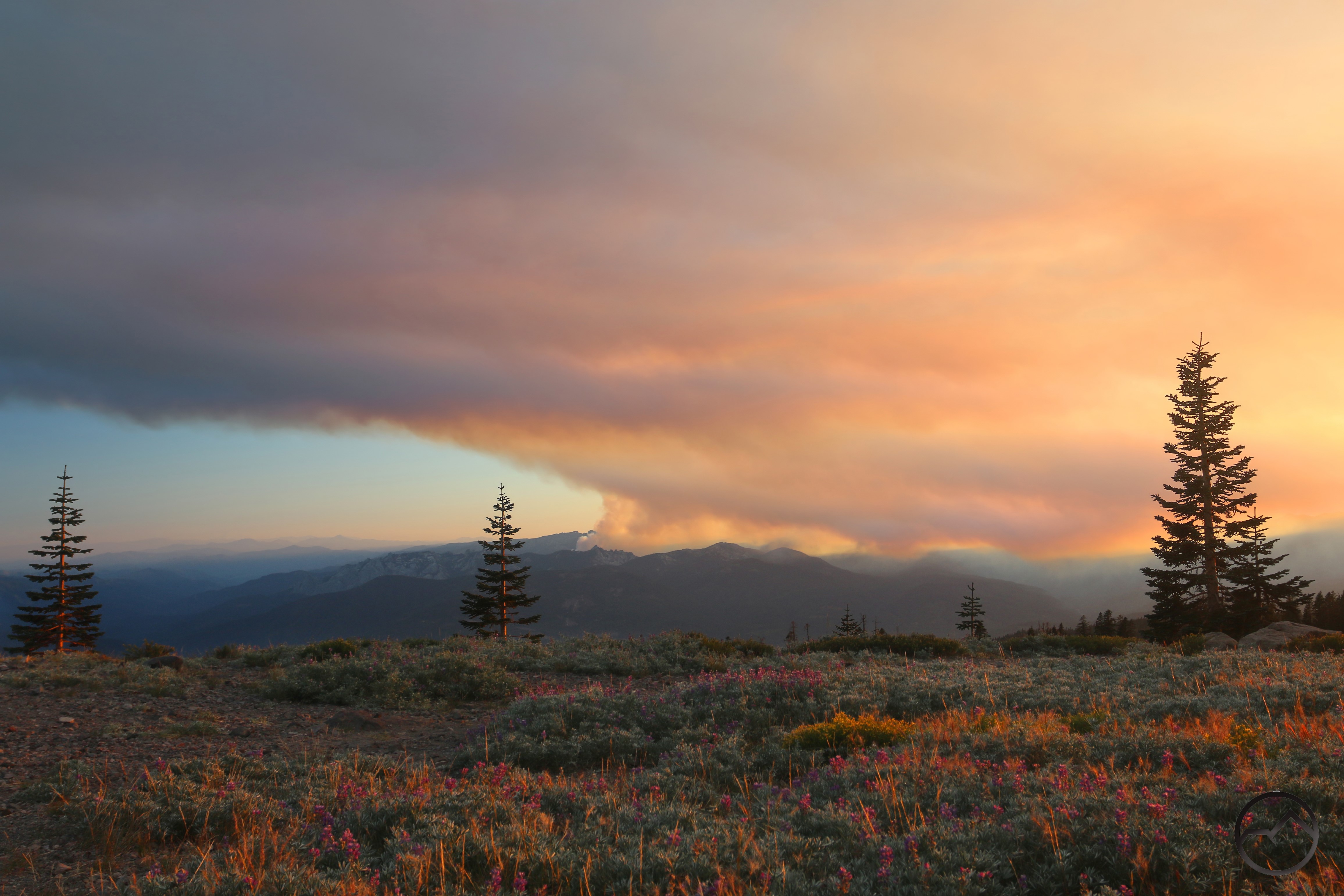
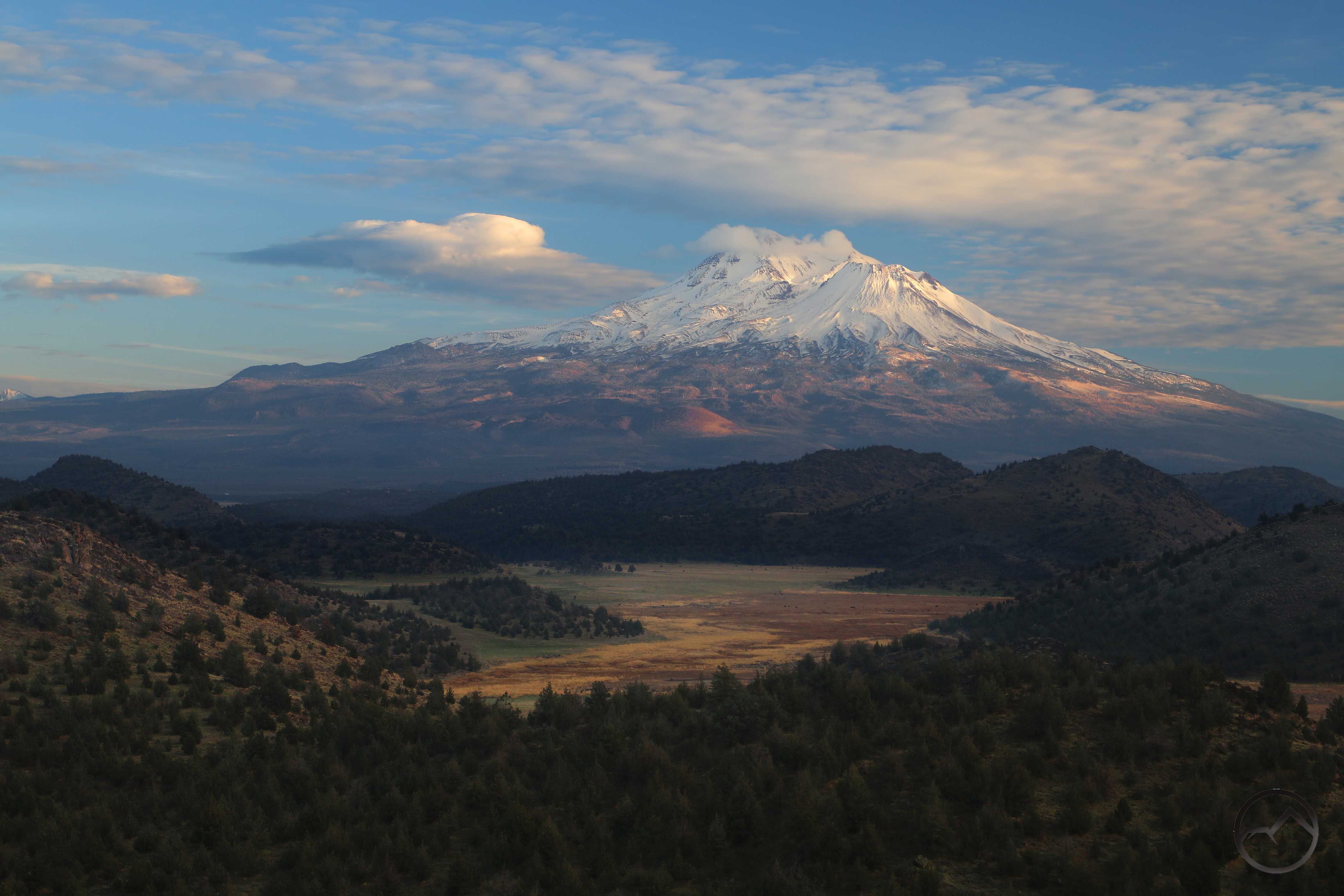
February was most memorable for the massive snow storm that hit the region. While a large and powerful storm, such things are not unusual around Mount Shasta. What was unusual was the scale of the storm – particularly the snowfall – that hit the Shasta Valley. At Truchas Ridge, there was an incredible 14-16 inches of snow. These conditions were consistent all over the valley. Indeed, this was a generational amount of snow in the desert land. Determined to capture images of this unique event, I climbed out to Echo Point for a sunset. I had anticipated 6 inches at the most. I should have brought snowshoes for what I found there. I made it up to the point and got some of the most memorable images of Mount Shasta from that epic vista. I will never forget this one.
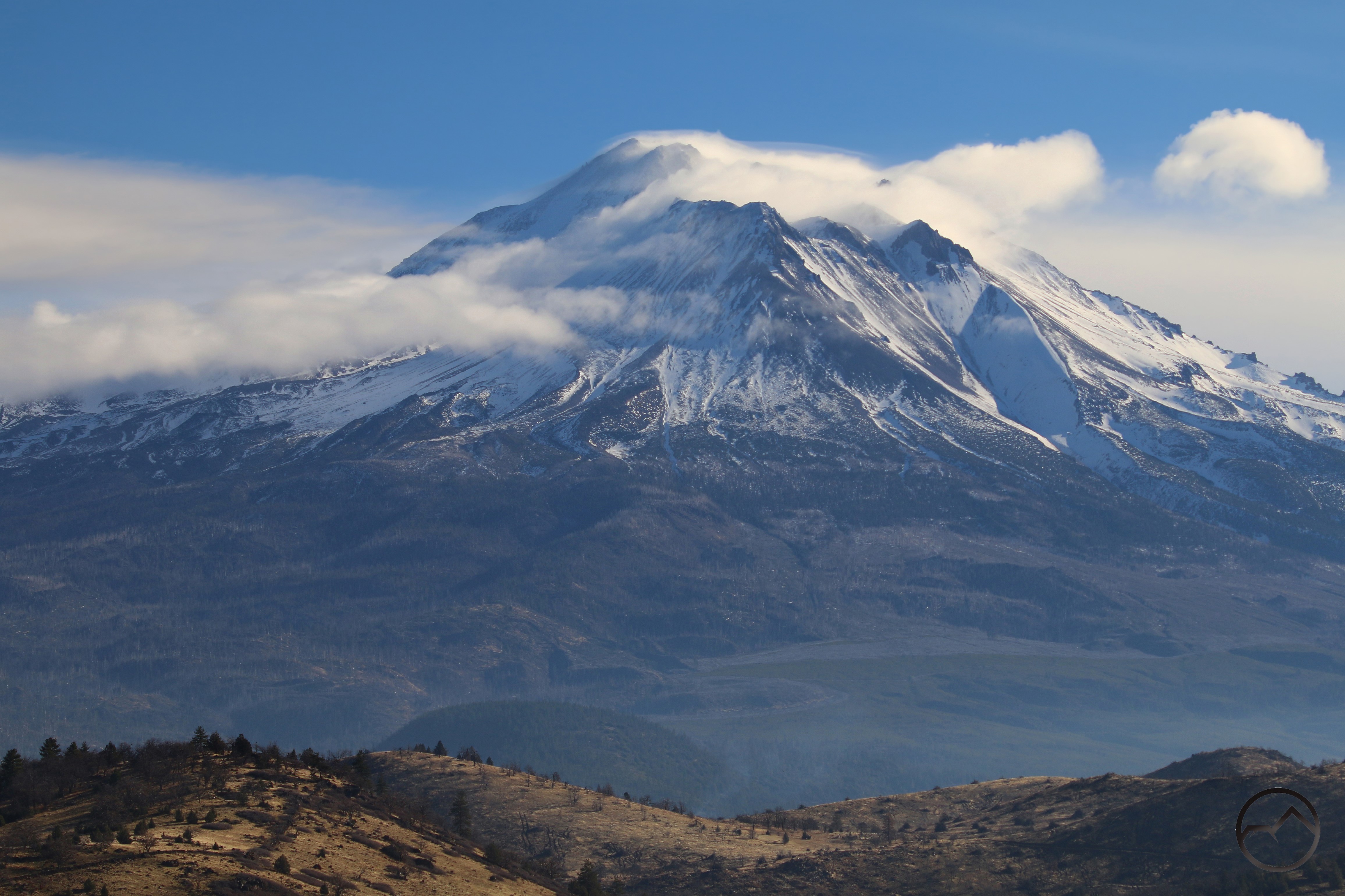
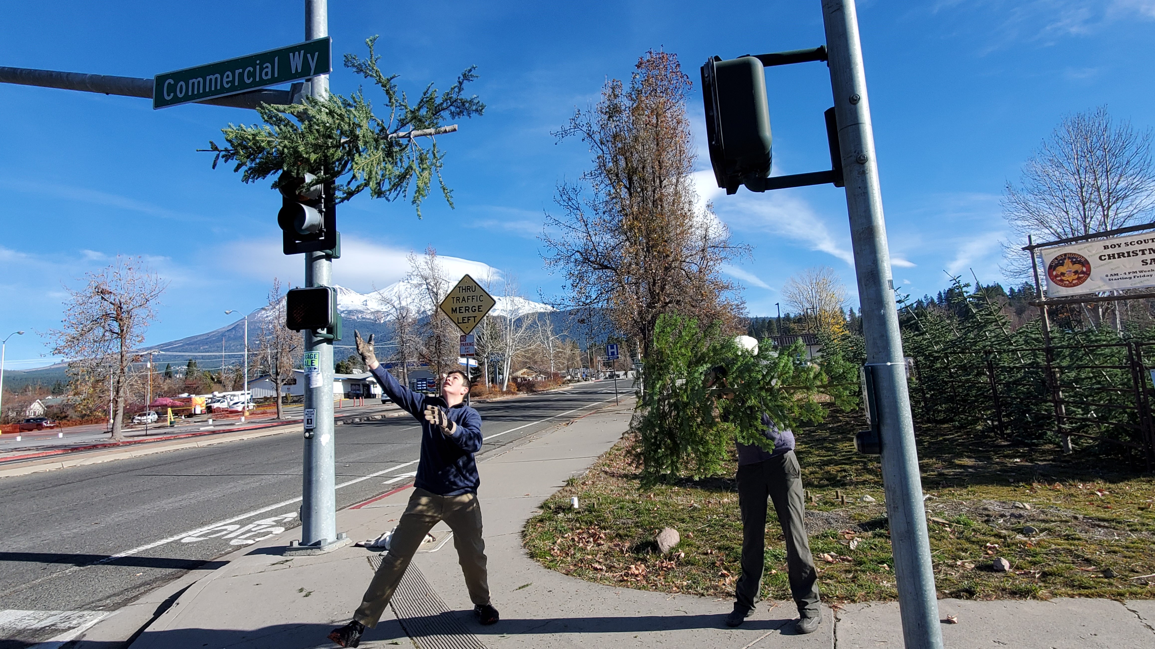
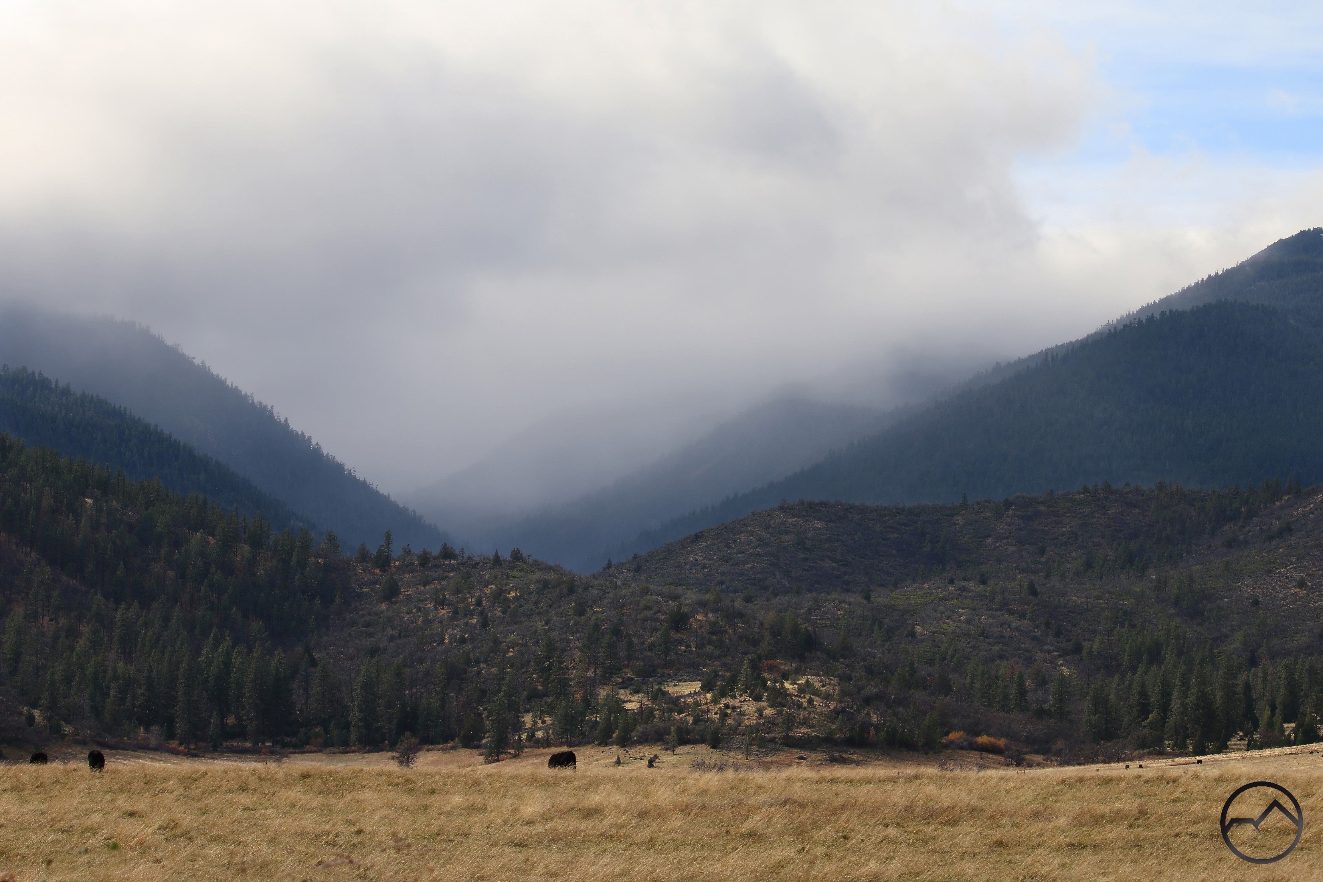
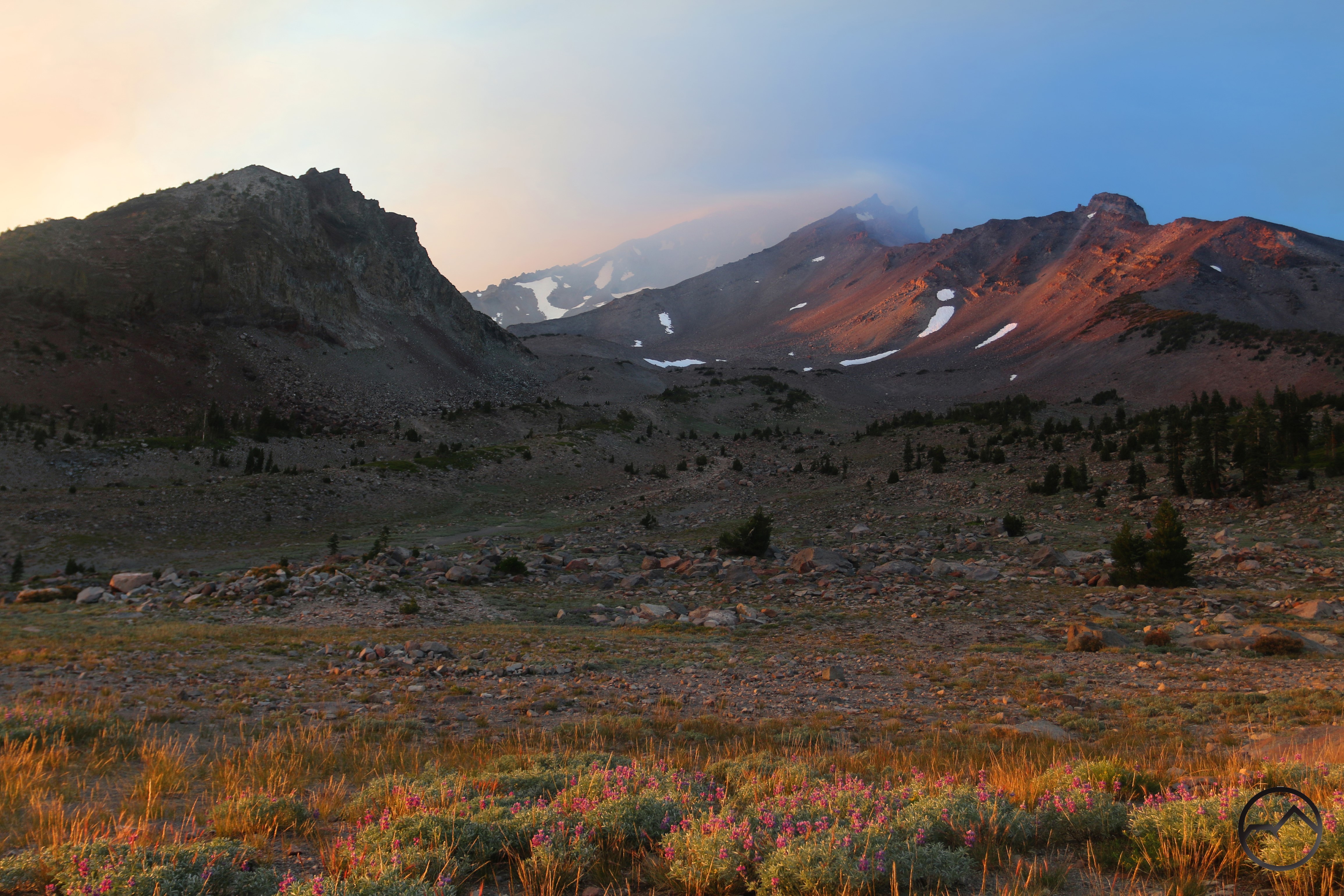
The winter continued well into March, leaving layers of fresh, crispy snow on the mountain. It felt like the month was snowed in with work, as I hardly got out at all. The only real notable trip was to Pecos Point on Truchas Ridge with the family. It is shocking how something that was once a weekly or more event was now noteworthy because of how infrequent I was able to get out.

The loaded schedule continued into April. I was out not at all. The only pictures of Mount Shasta I took the entire month was of the rising moon over the mountain, which produced a moon shadow. Other than that, I felt disconnected from my camera and Mount Shasta.
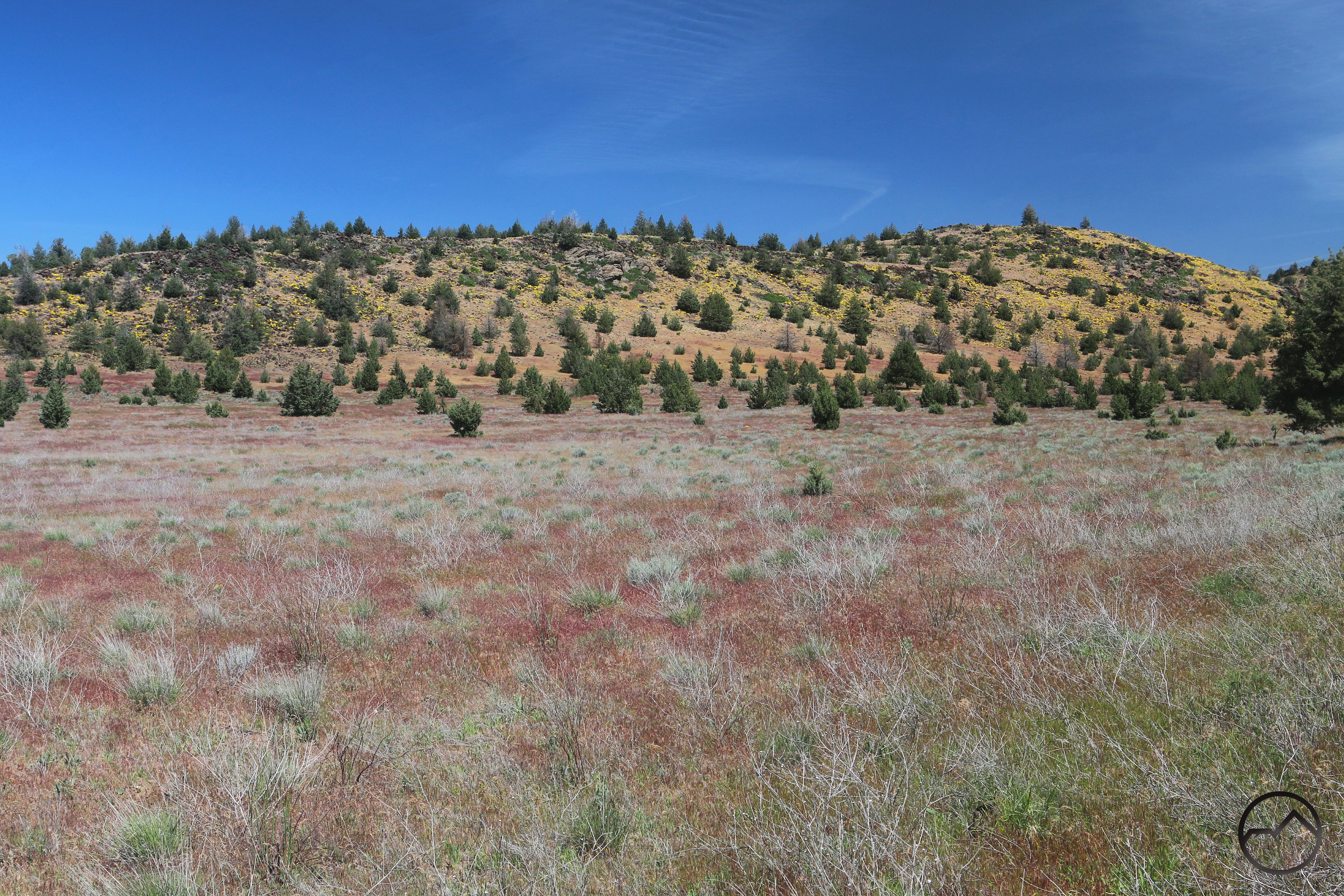
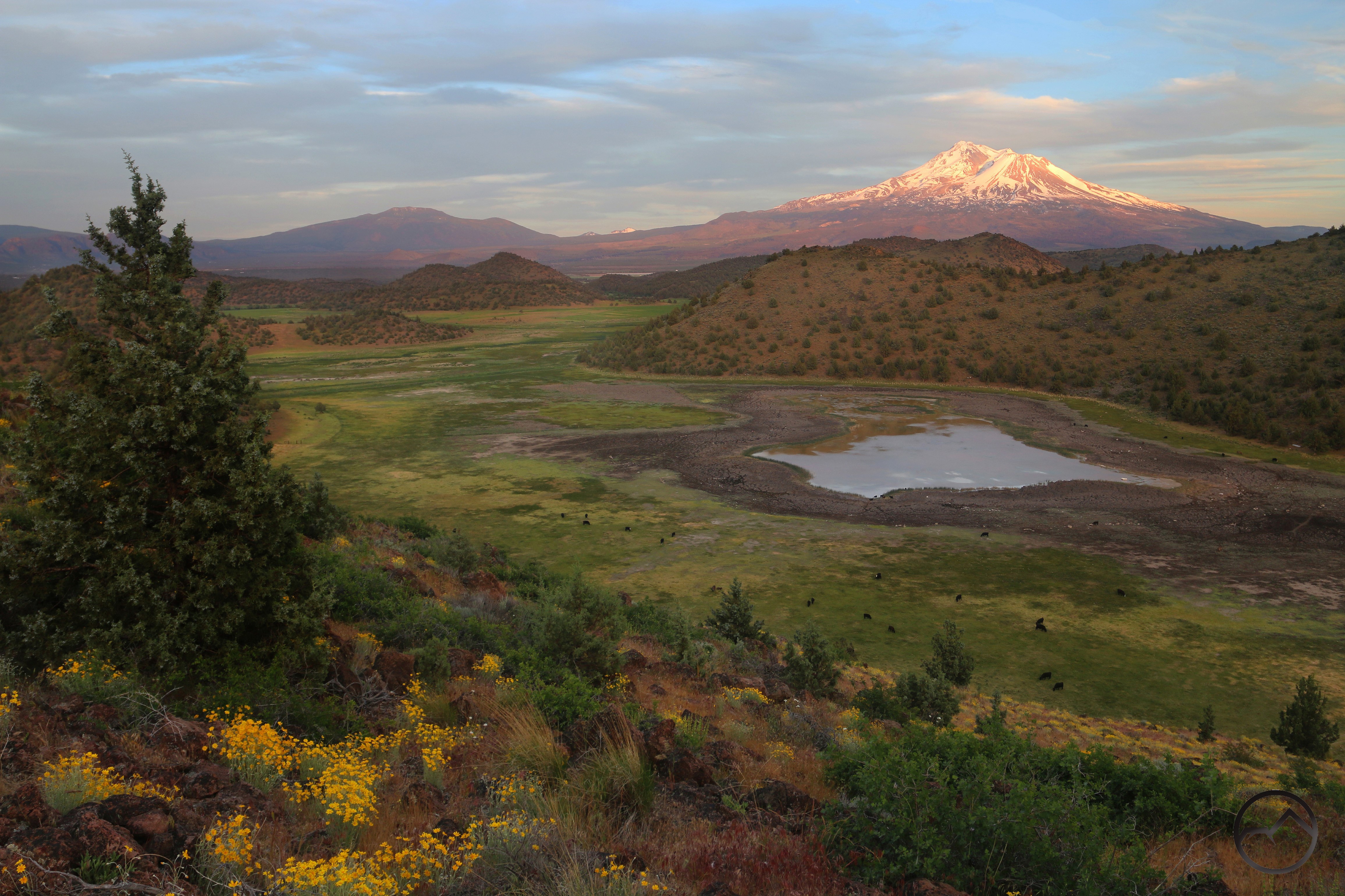
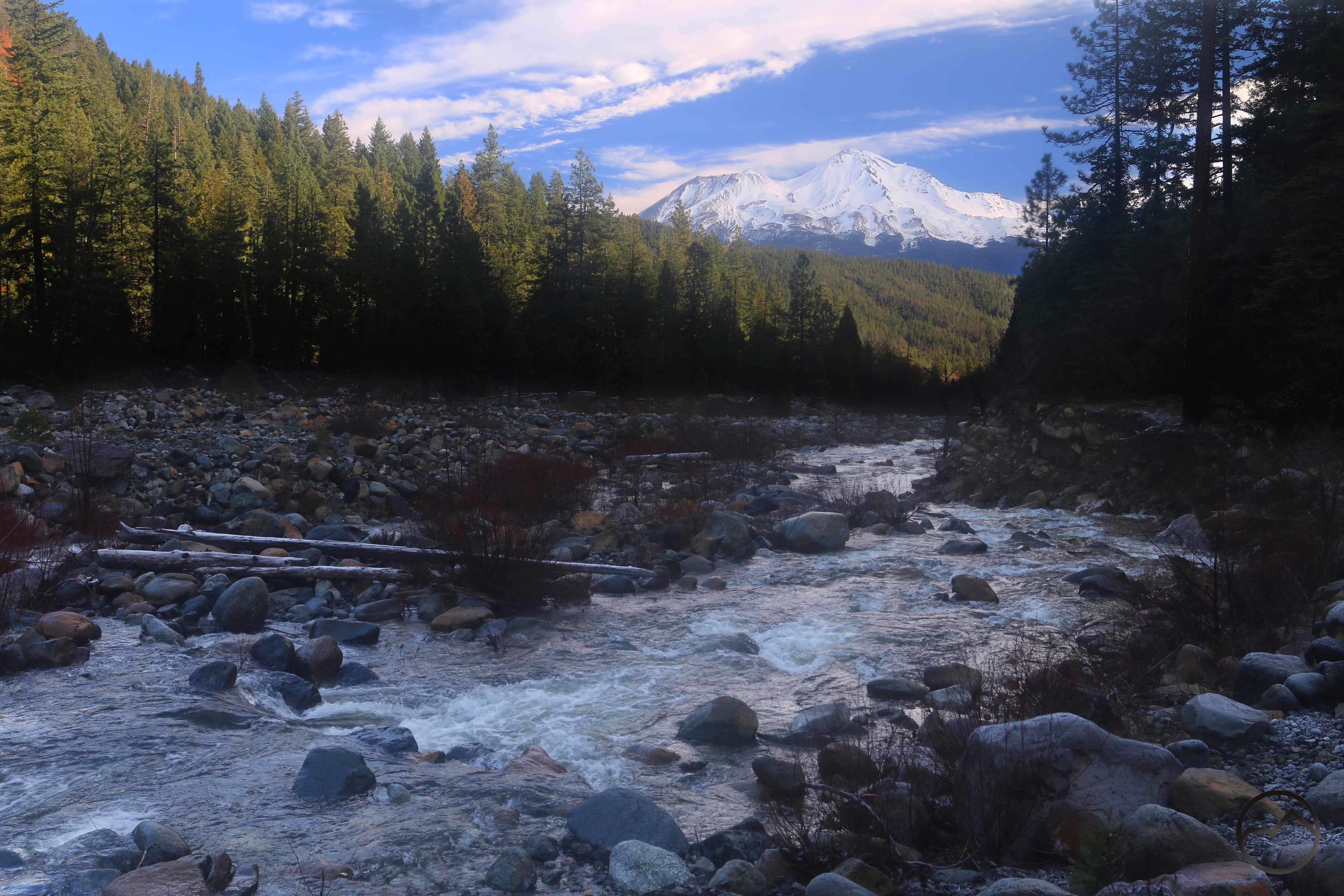
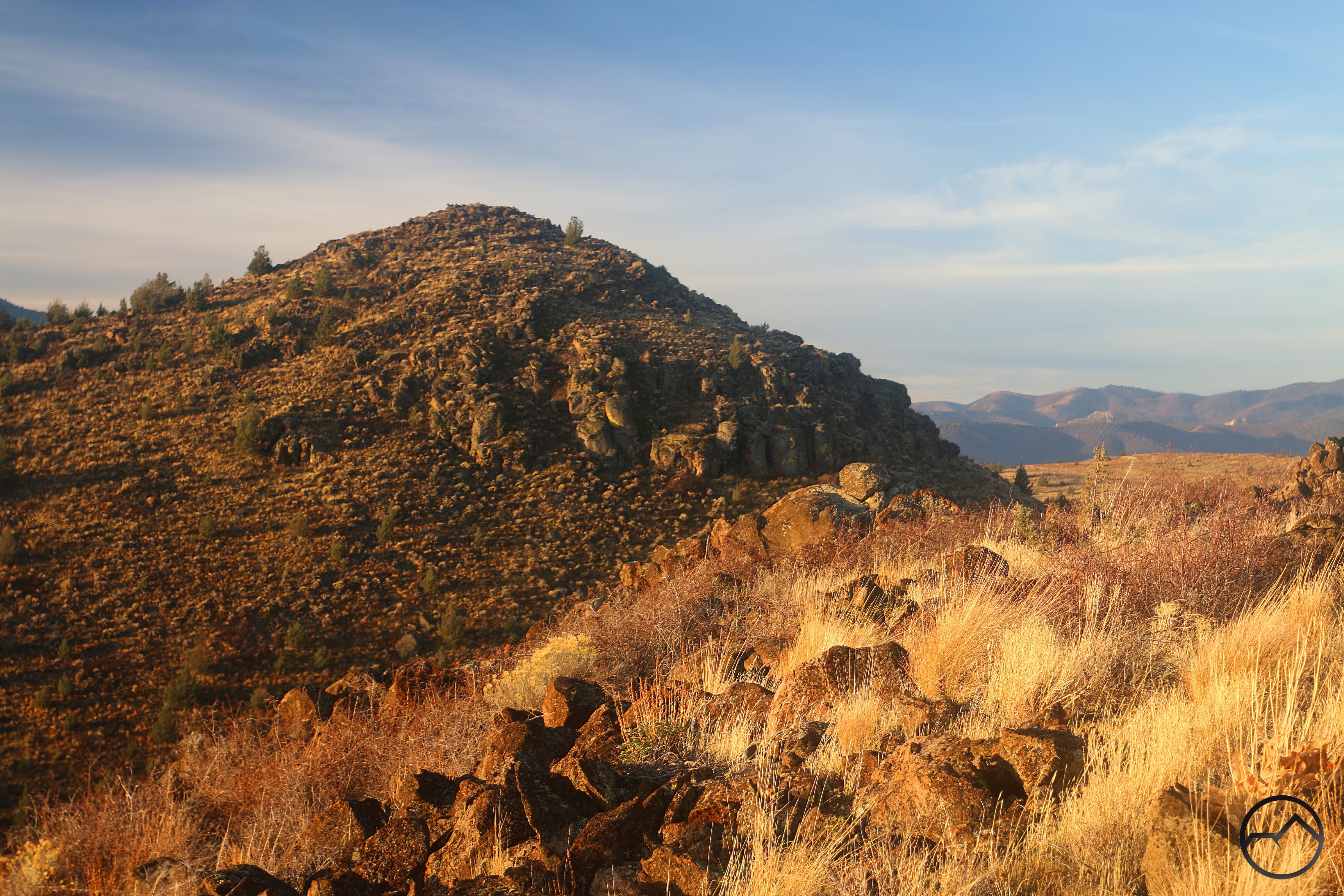
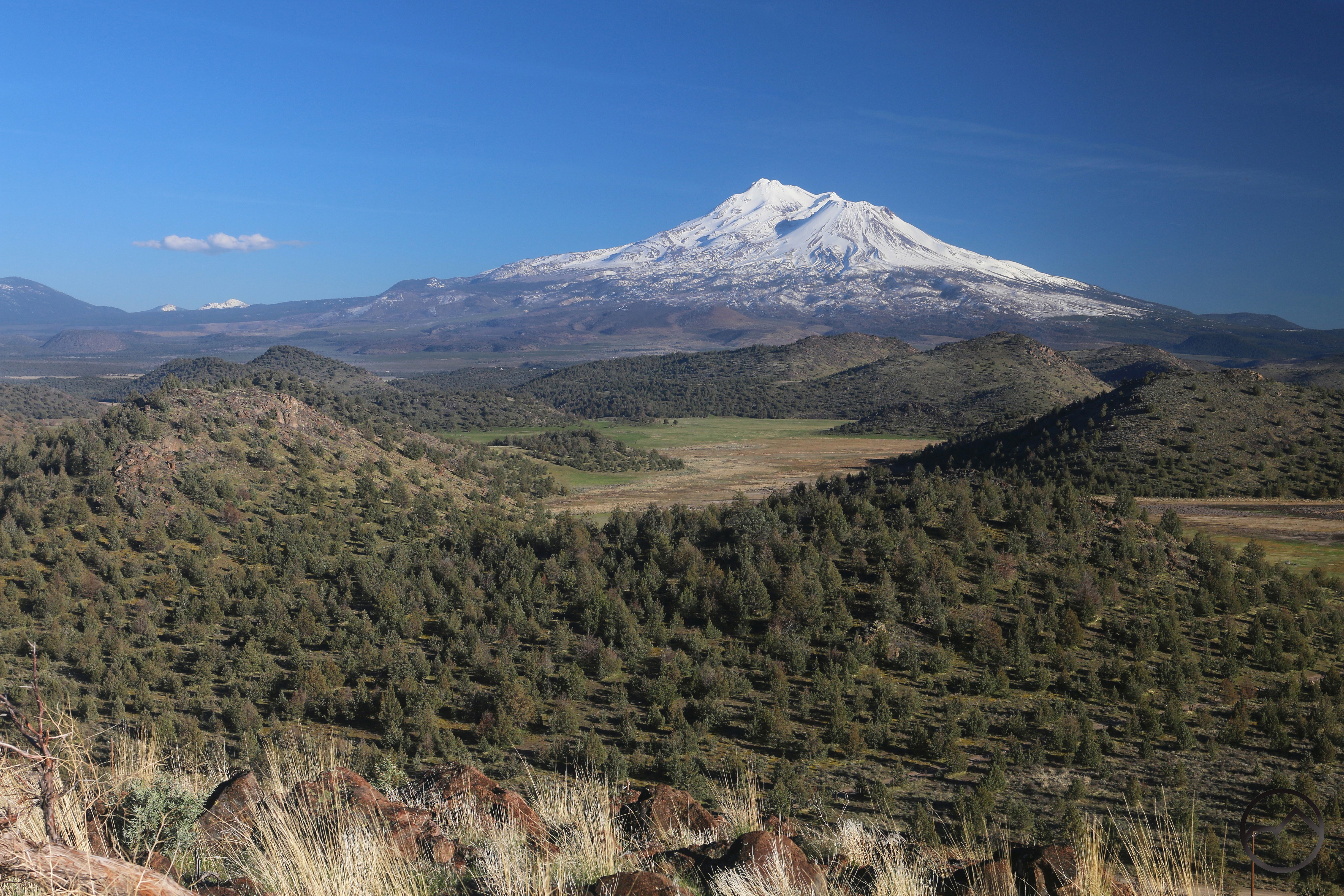
Things seemed to turn in May. The weather was getting more interesting and my schedule loosened up a bit. It also started inauspiciously. A fire flared up on Spring Hill, burning the western flank of the small peak. It was visible from all over. It seemed like a dangerous harbinger to come for the summer. Despite the fire, other elements of spring augured well for the summer. In particular, the bloom in the Shasta Valley was great, with yellow flowers popping up everywhere. The green hills, copious flowers and flowing creeks make spring in the valley a paradise.
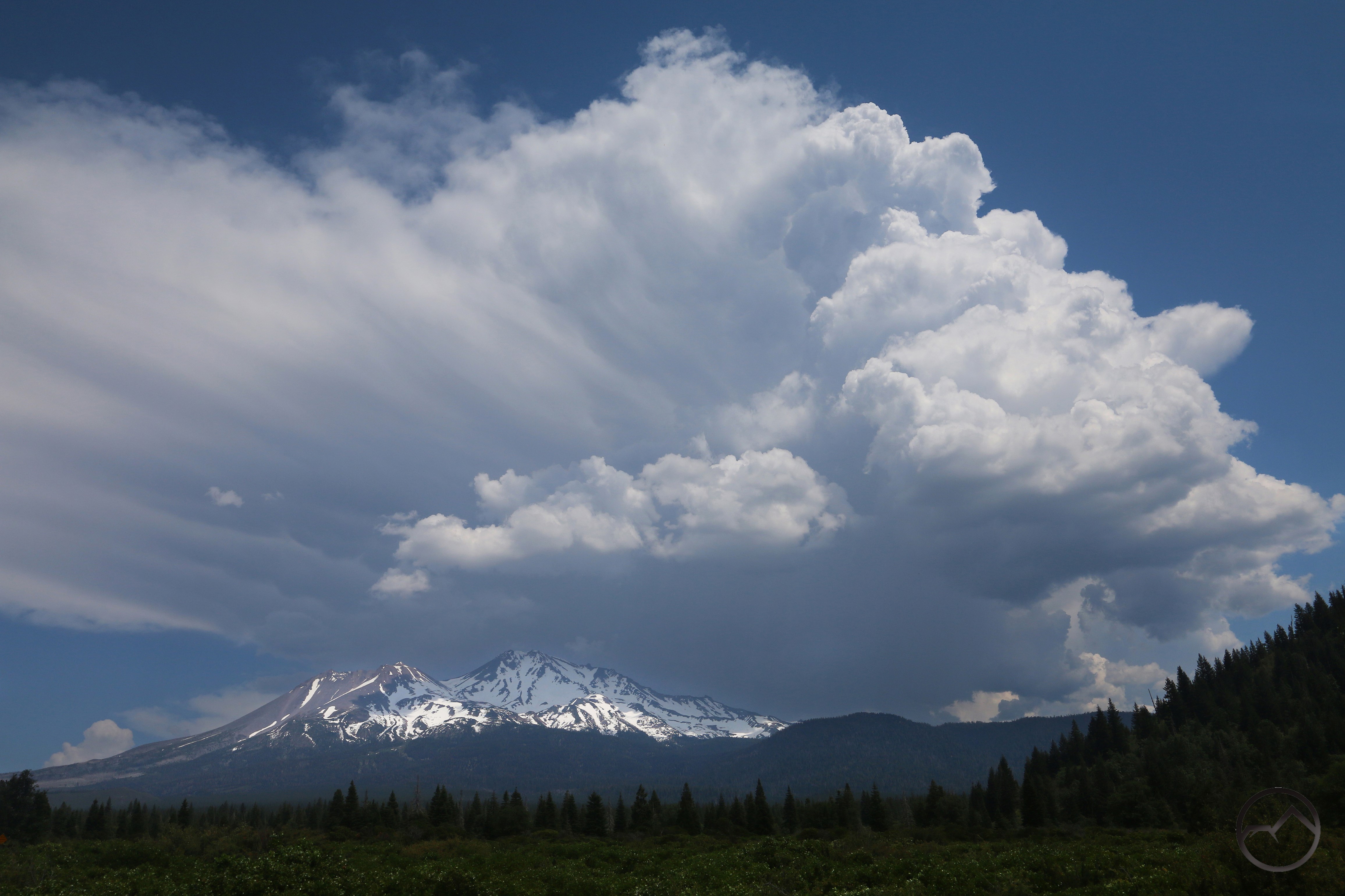
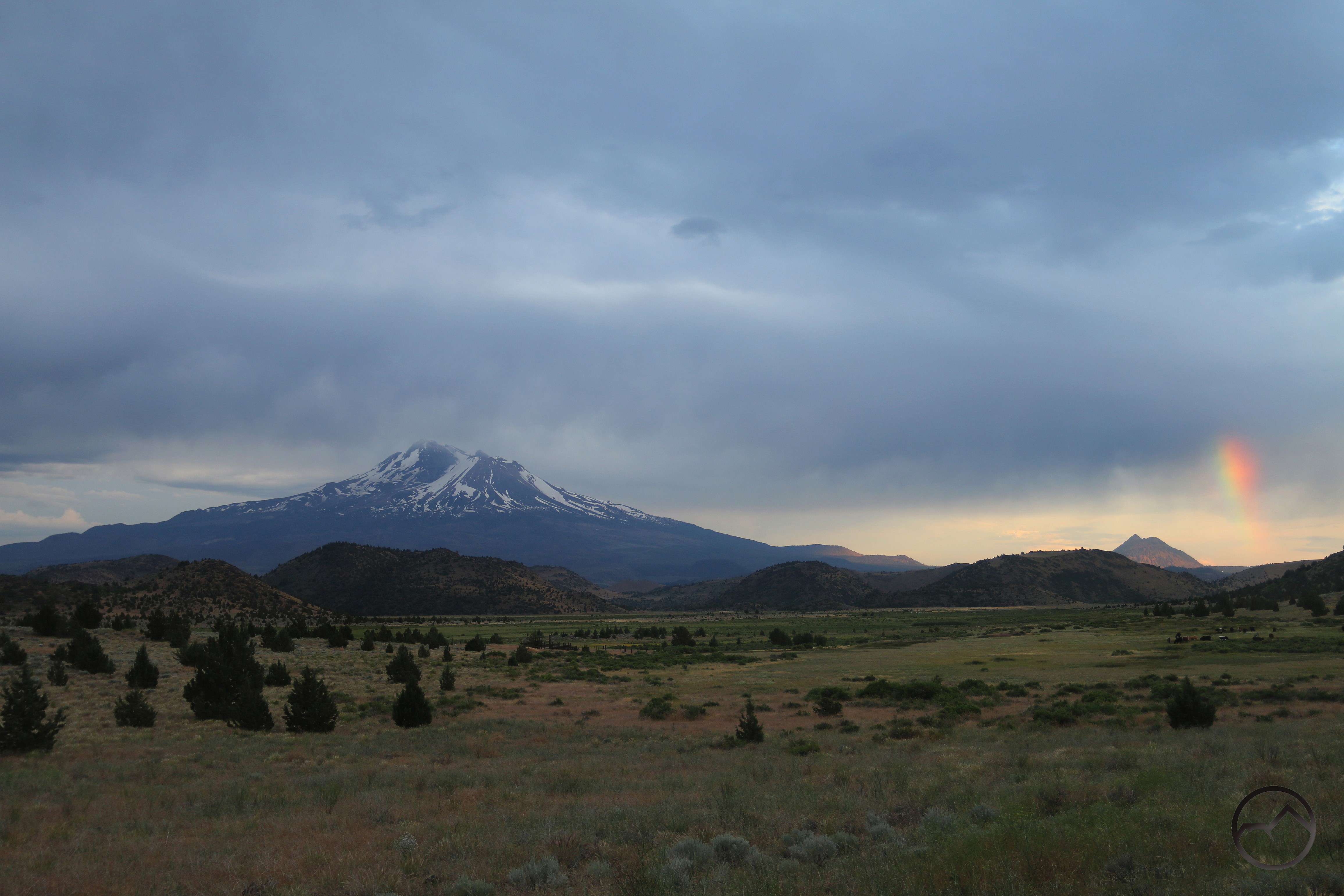
As spring faded into summer, June brought the beginning of a trend that would stretch through the summer. In particular, the summer was a wet one, with one thunderstorm after another rumbling through. This meant mighty clouds and interesting light and rainbows. It also meant the danger for fires was greater from the lightning strikes but the storms always seemed to bring plenty of rain and now conflagrations appeared. We held our breath anyway.
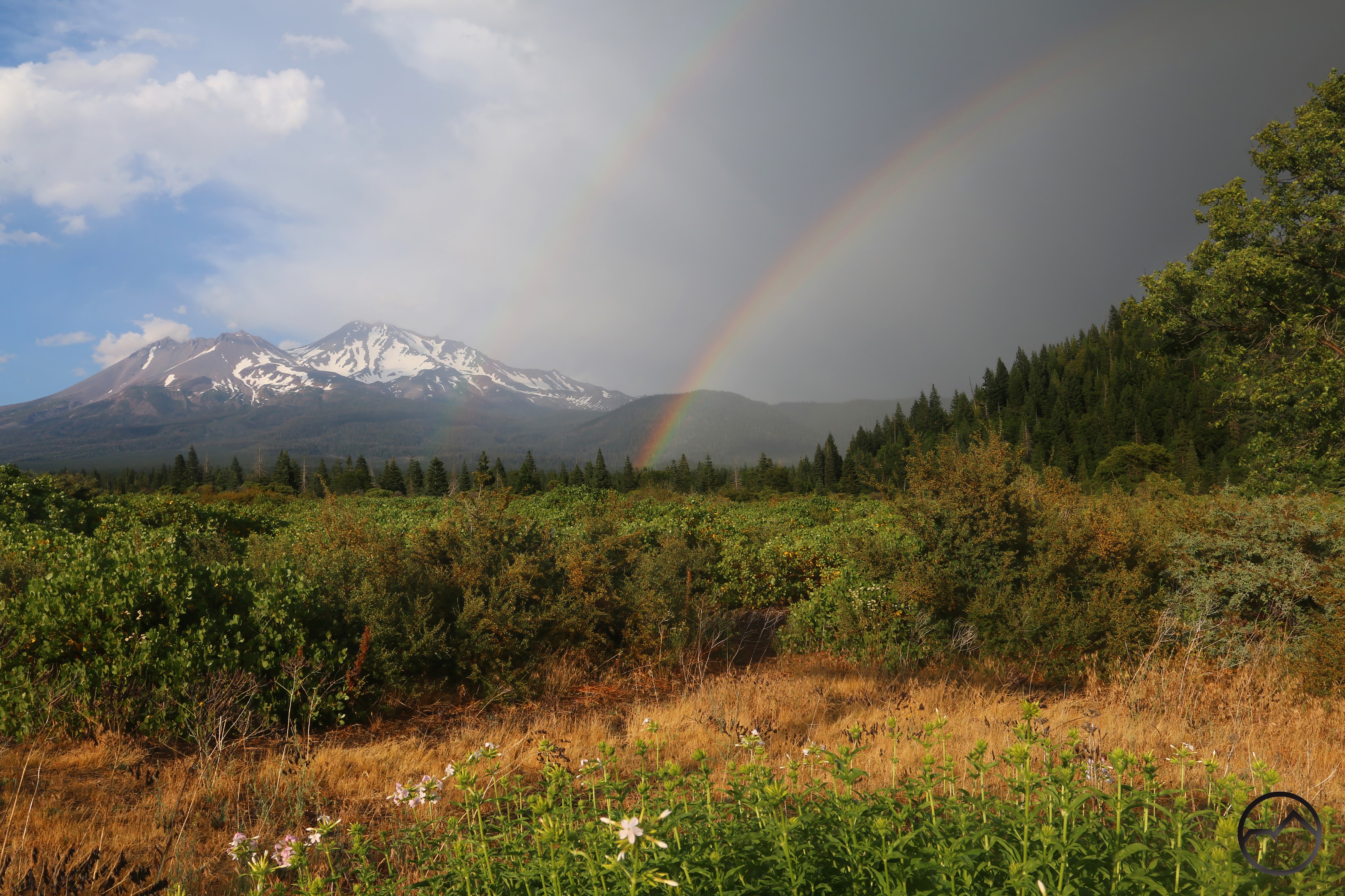
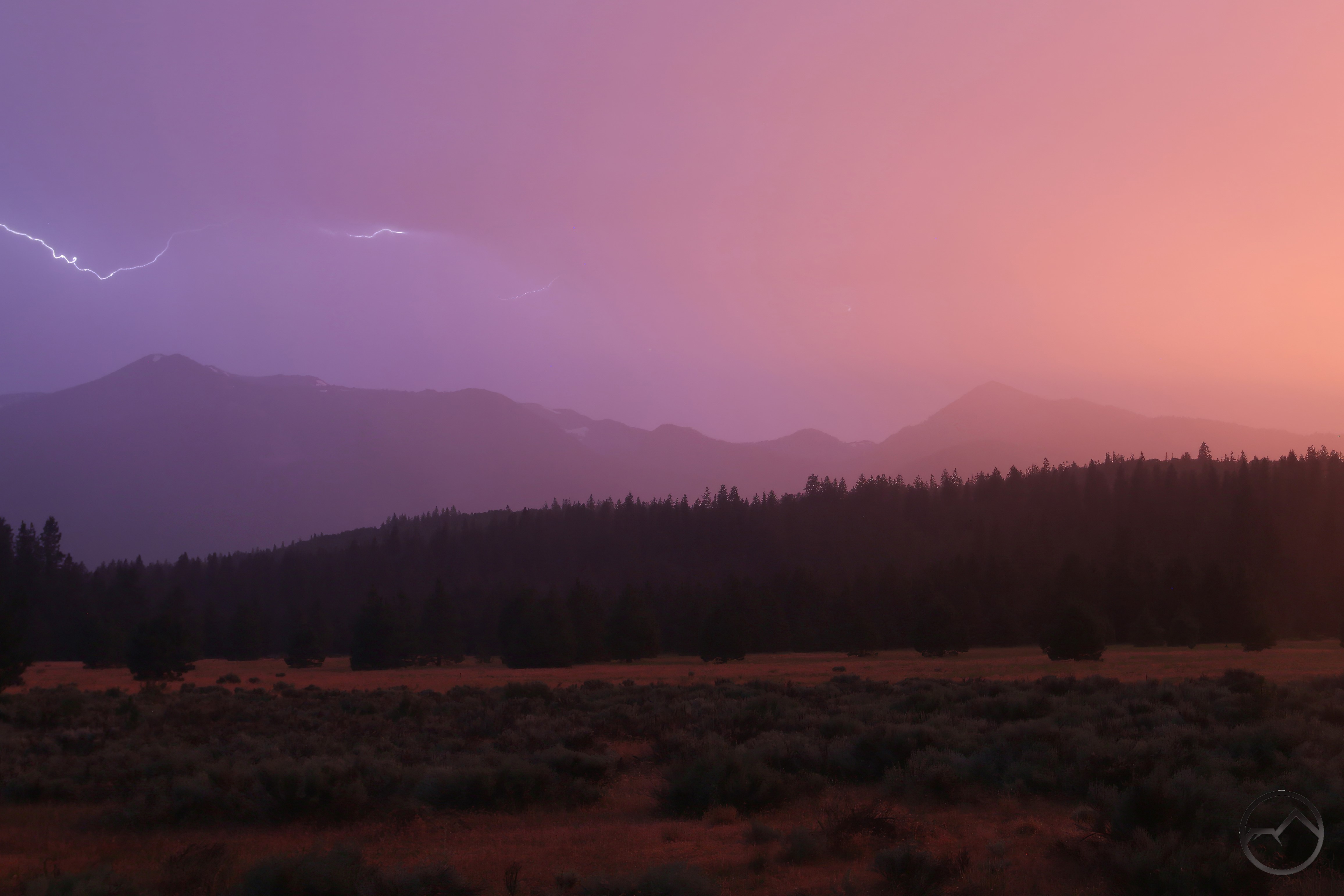
July continued the pattern established in June. Thunderstorms were the order of the month and there was plenty of lightning and rainbows. As if such things can really be had in excess. They are beautiful and awe-inspiring and when they occur around Mount Shasta, it is difficult to top. July was an unusually wet summer month and the temperatures were low as well. Summer was shaping up nicely!
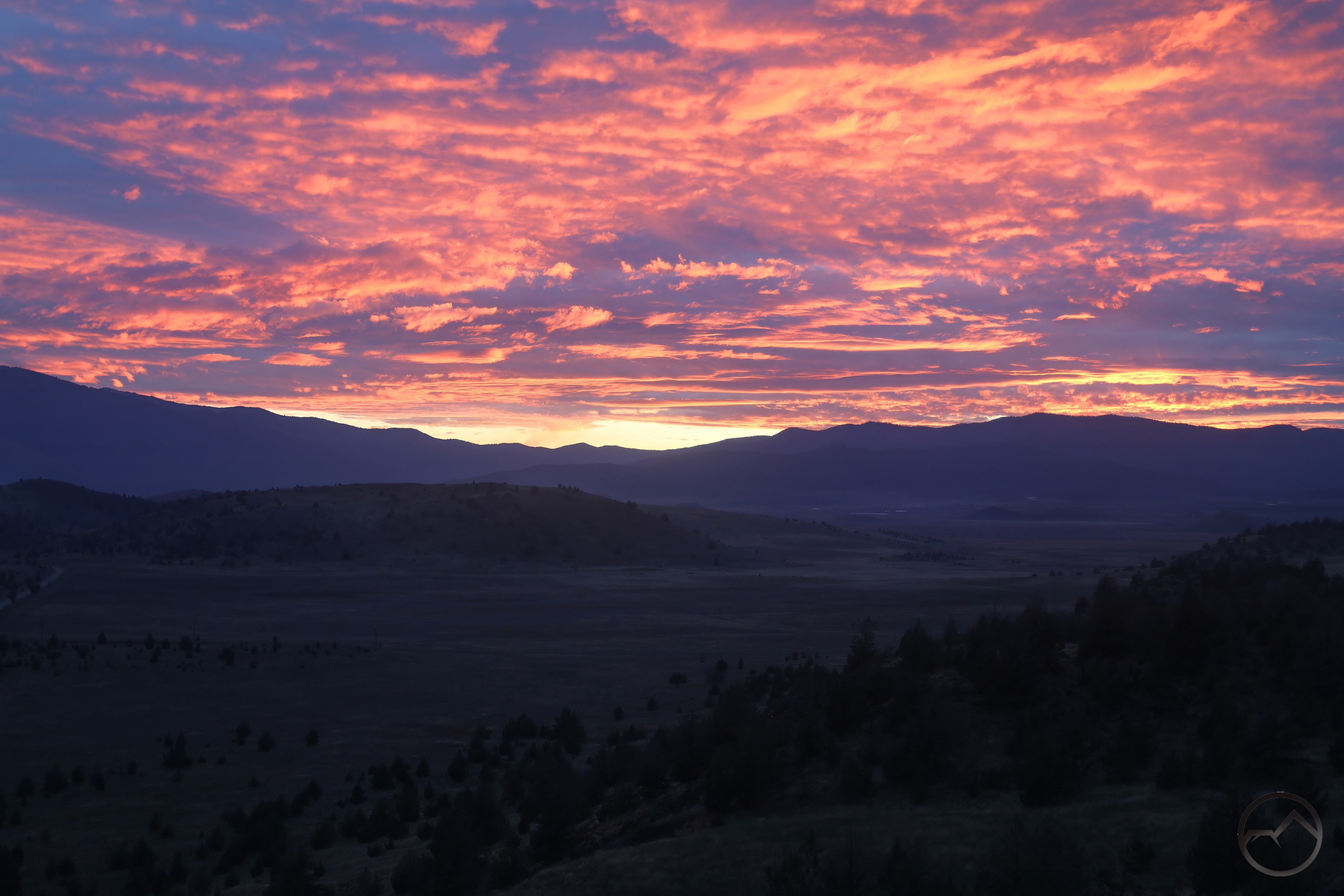
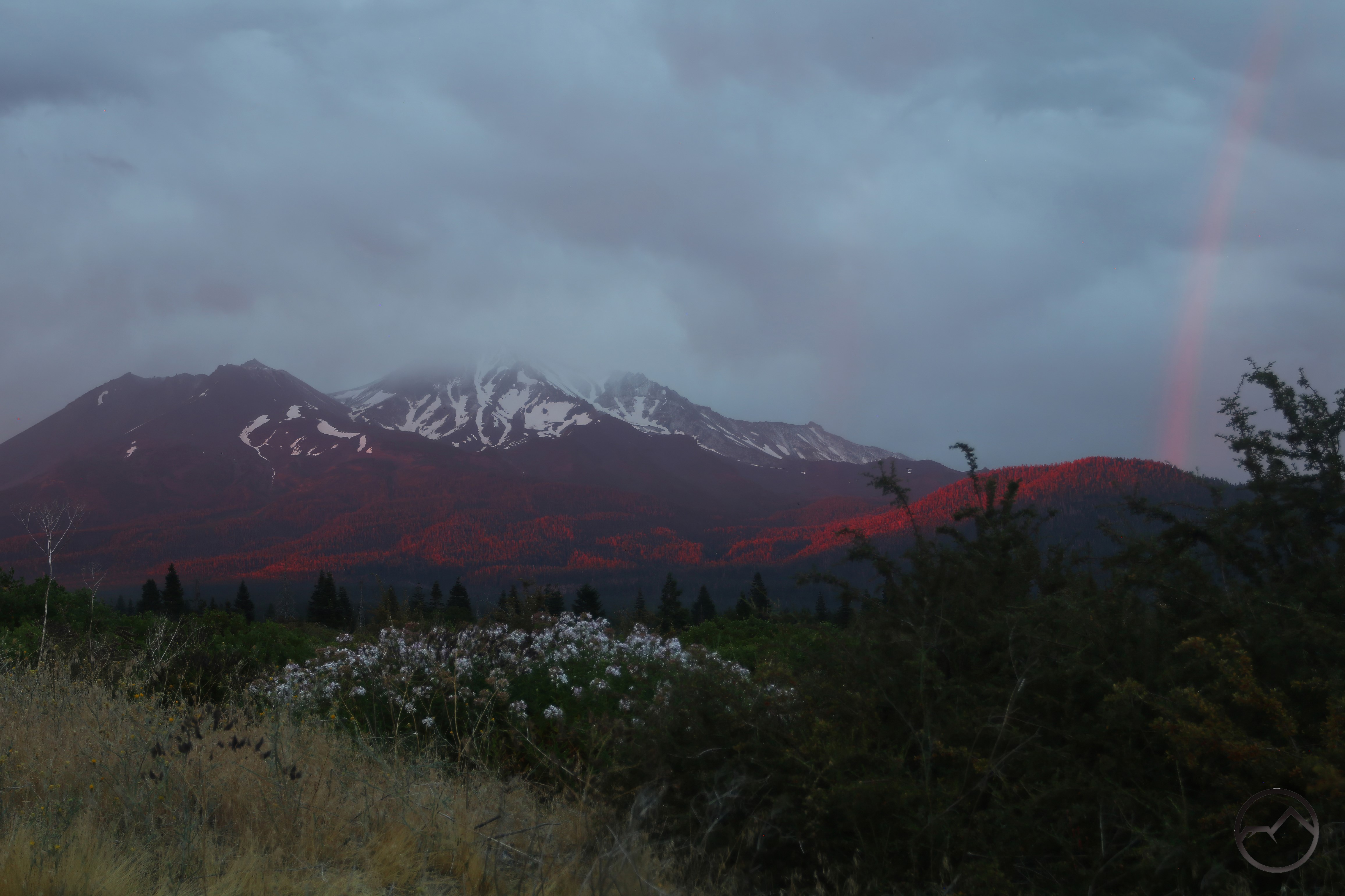
As the summer wore on into August, so did the thunderstorms continue. There was a little less rain and fewer rainbows but there was still some incredible cloud formations and some phenomenal lighting. The sunsets were awesome, even as fresh snow was still being deposited on Mount Shasta. This was, in fact, the coolest summer we have had in Mount Shasta in some time.
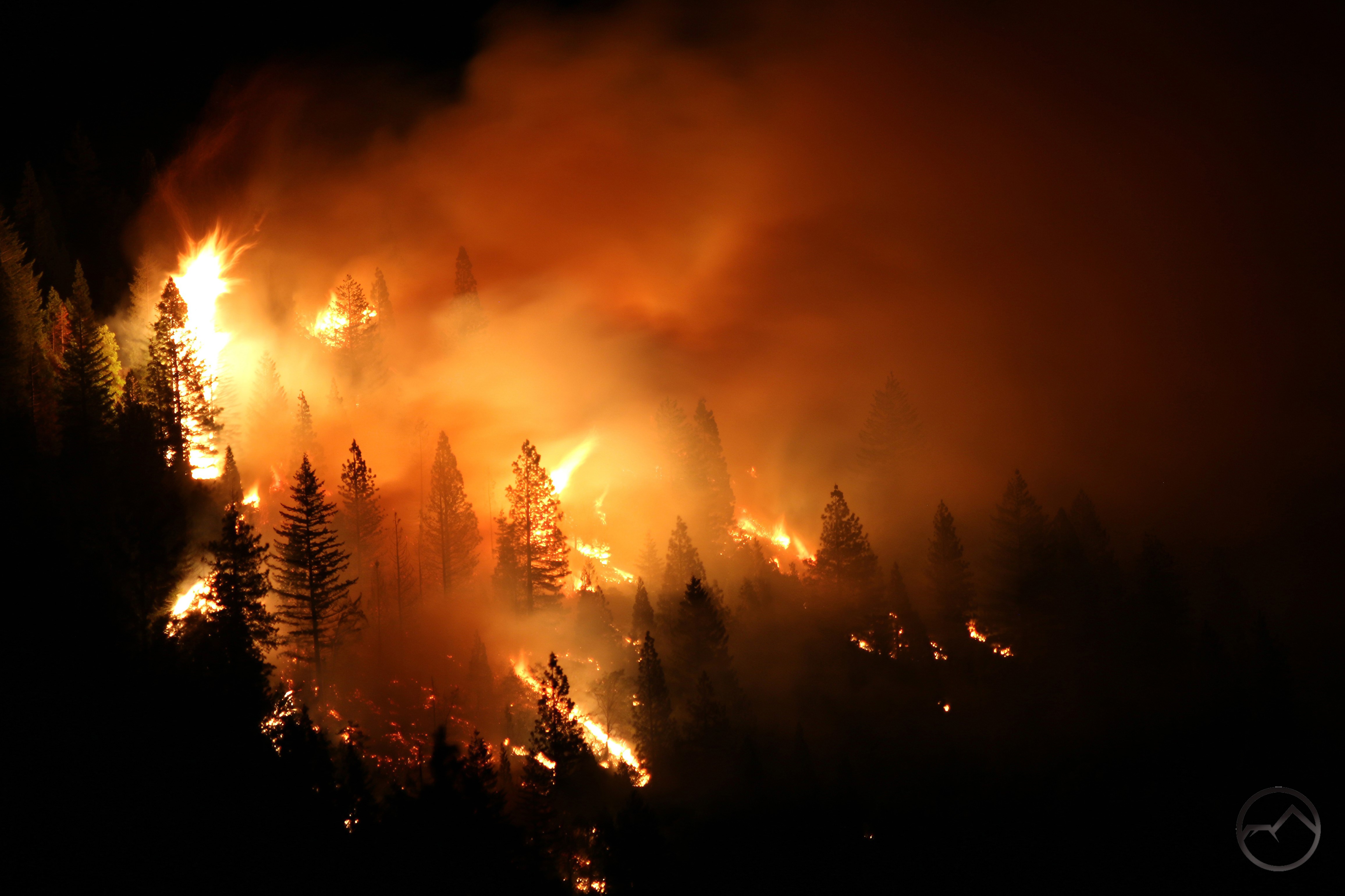
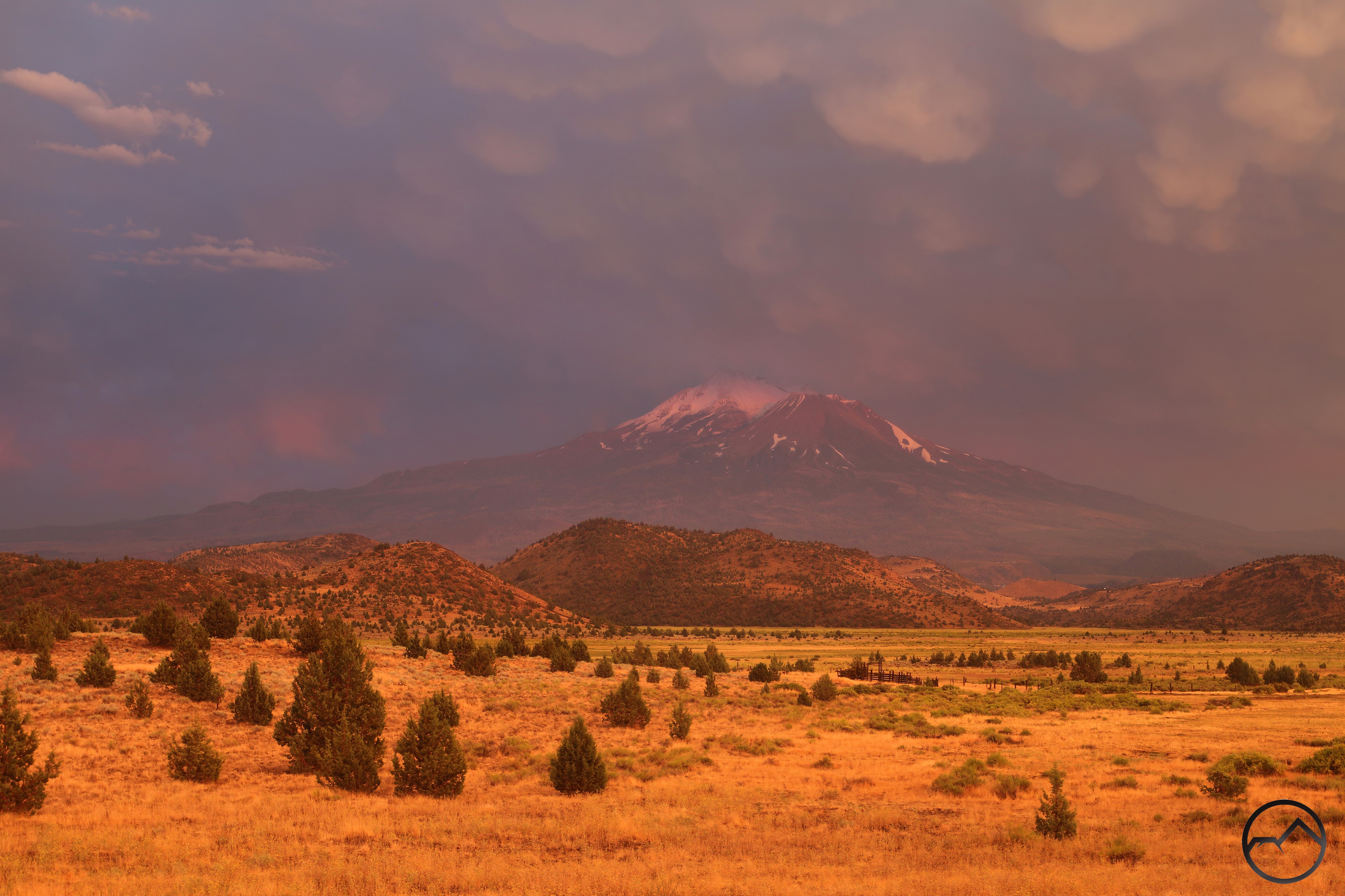
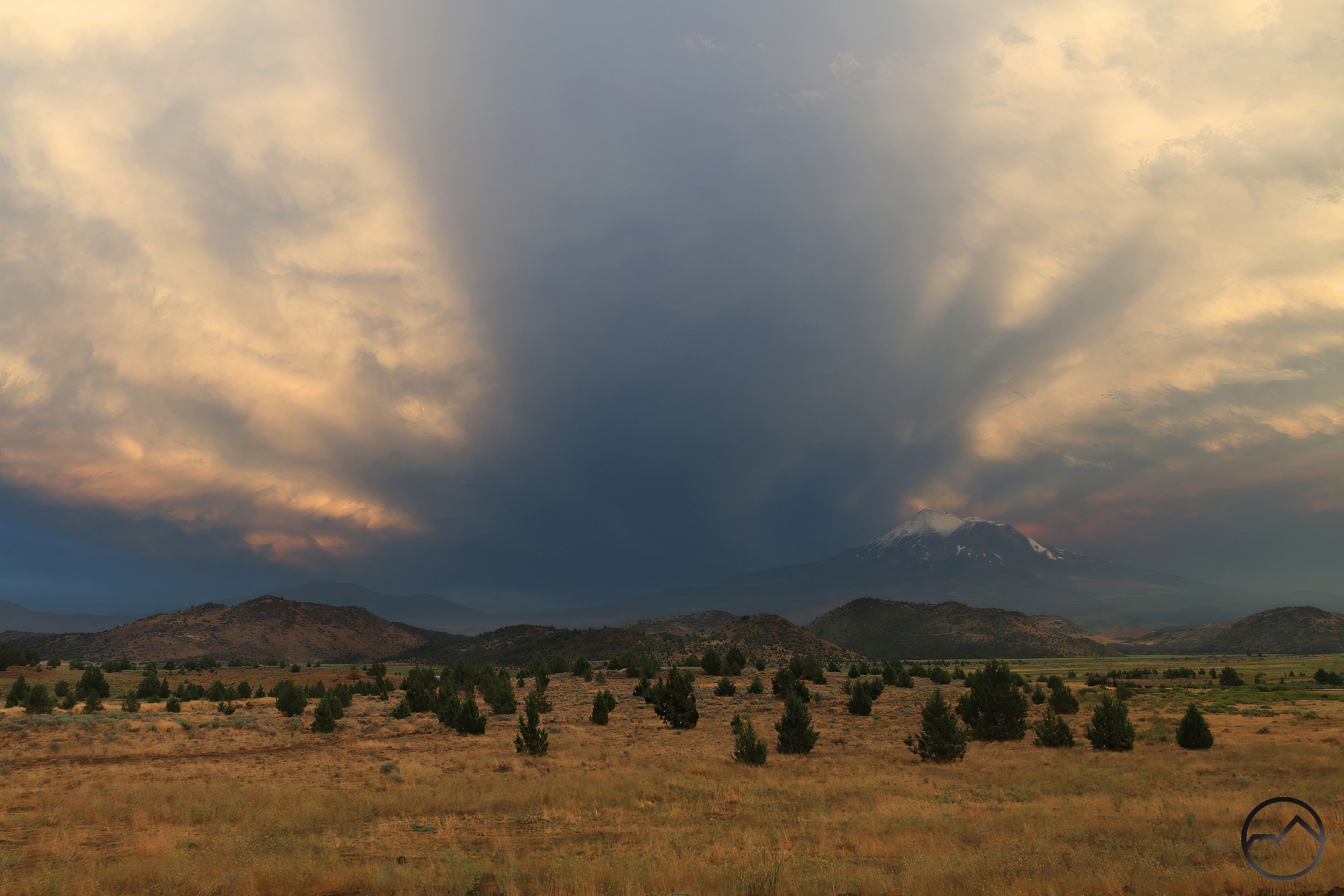
It was in September that fire finally returned to threaten the Mount Shasta area. Not from lightning but from wind and a careless camper. The fire burned in the Castle Creek drainage, near the Castle Crags. Though it flared up fast, driven by powerful winds, resources were thrown at it quickly and it was stopped in its tracks. Thankfully the Crags themselves were spared.
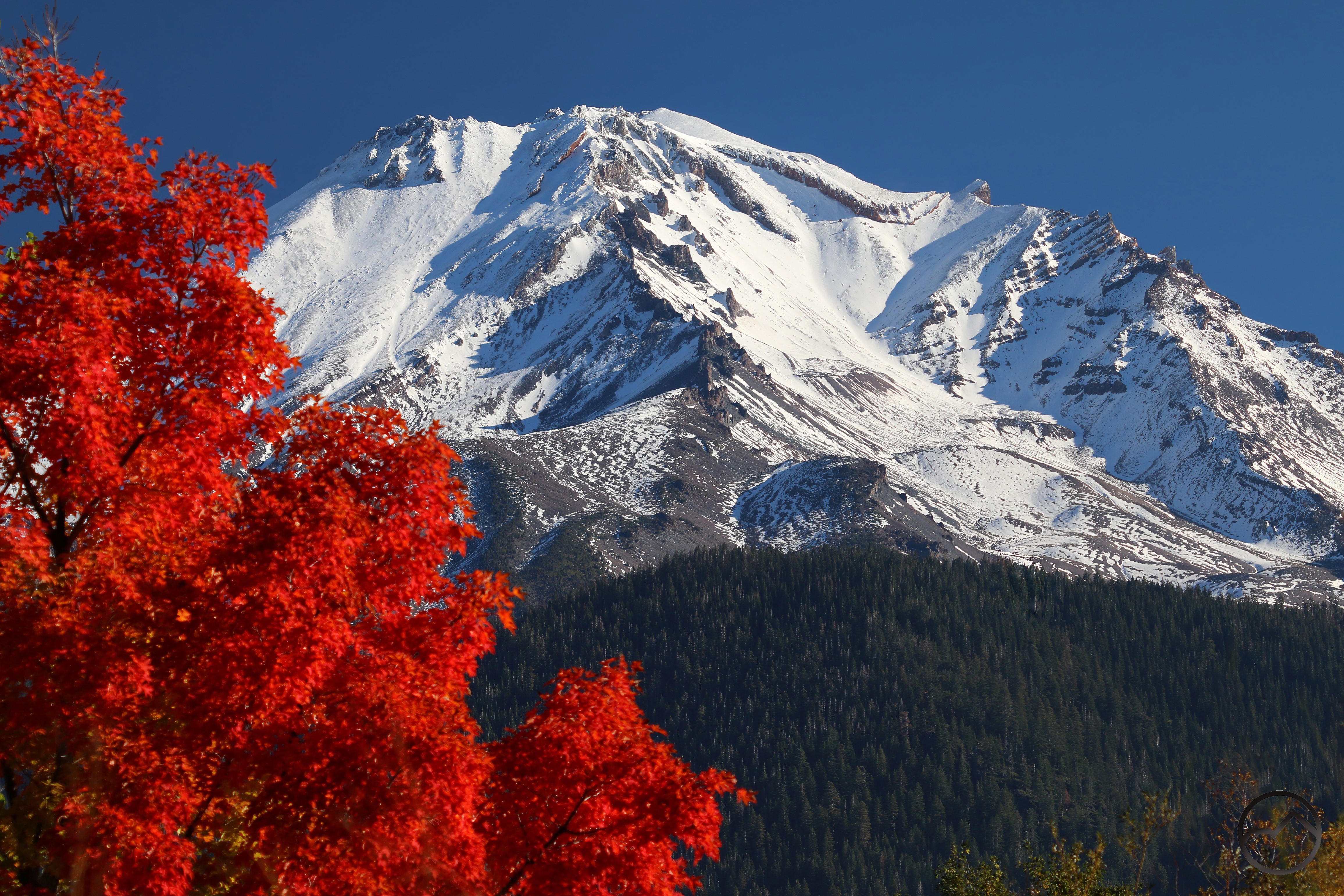

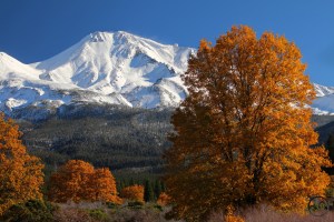
Autumn erupted in October and this year brought some great fall color. Though the many of the aspen trees didn’t do much, the oaks were fantastic, turning a vivid gold. which always offers a magnificent contrast to Mount Shasta, especially as the mountain is blanketed with fresh snow. The lower angle of the light just seems to make everything glow in October. It is my favorite month.
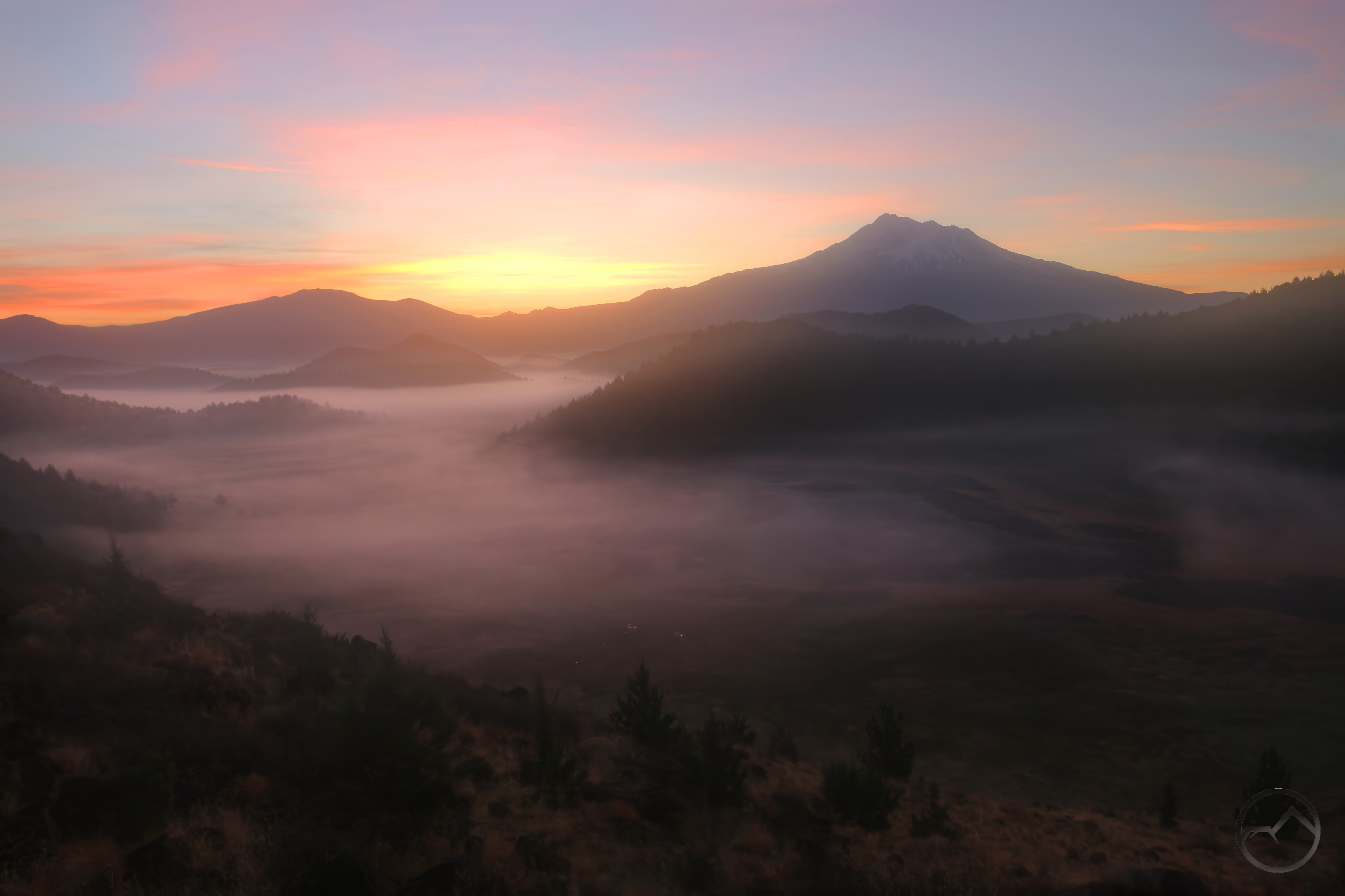
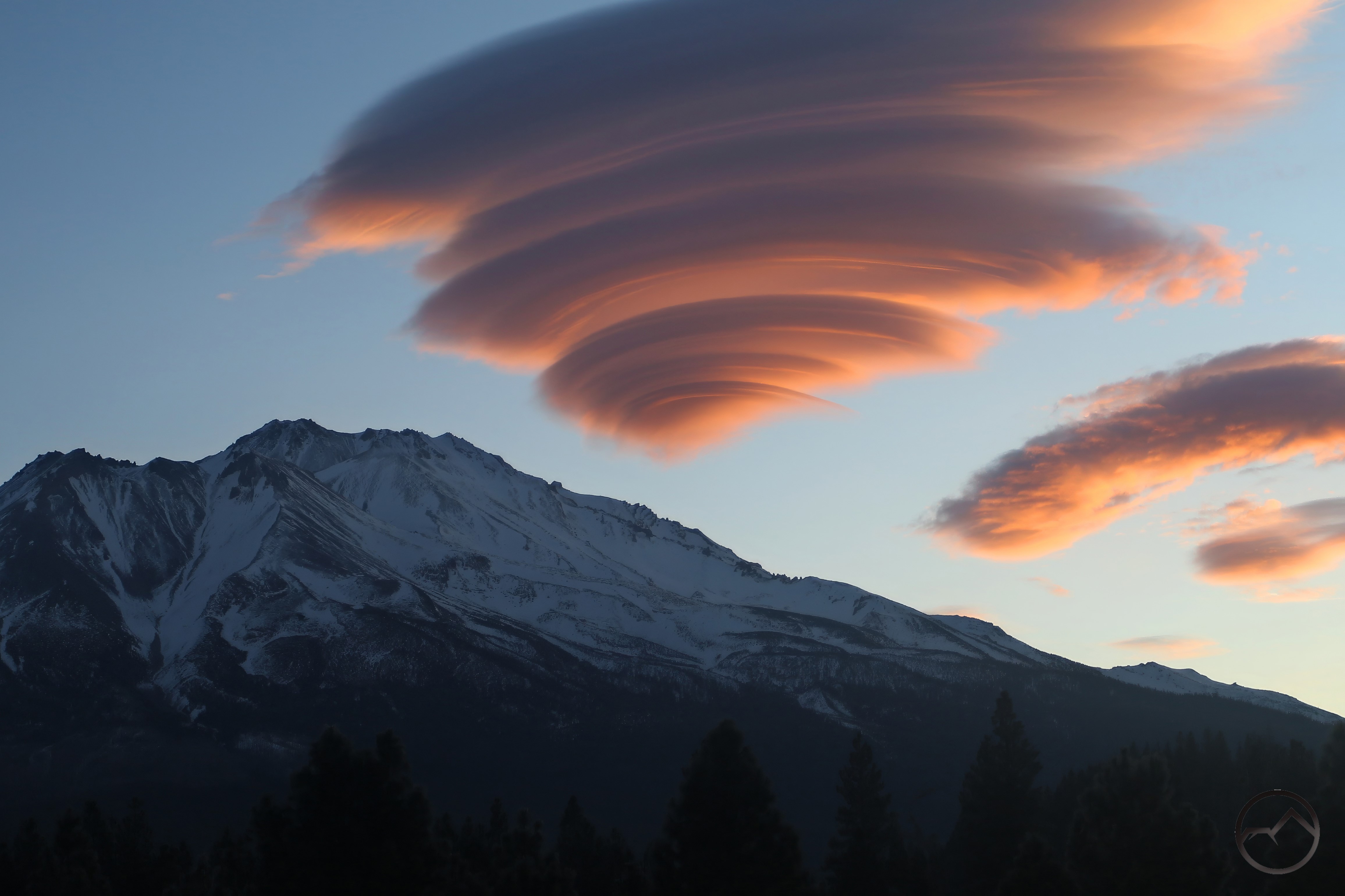
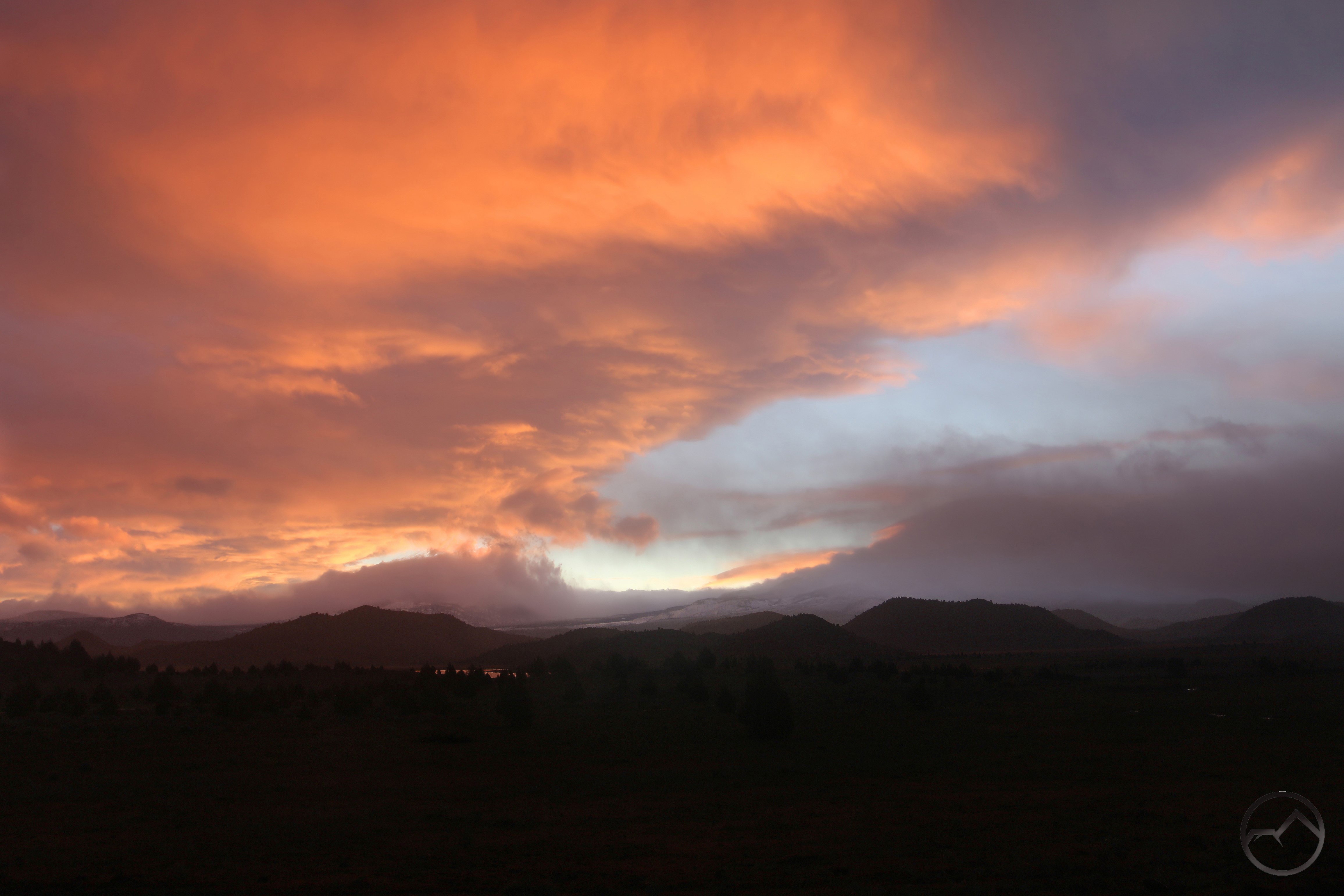
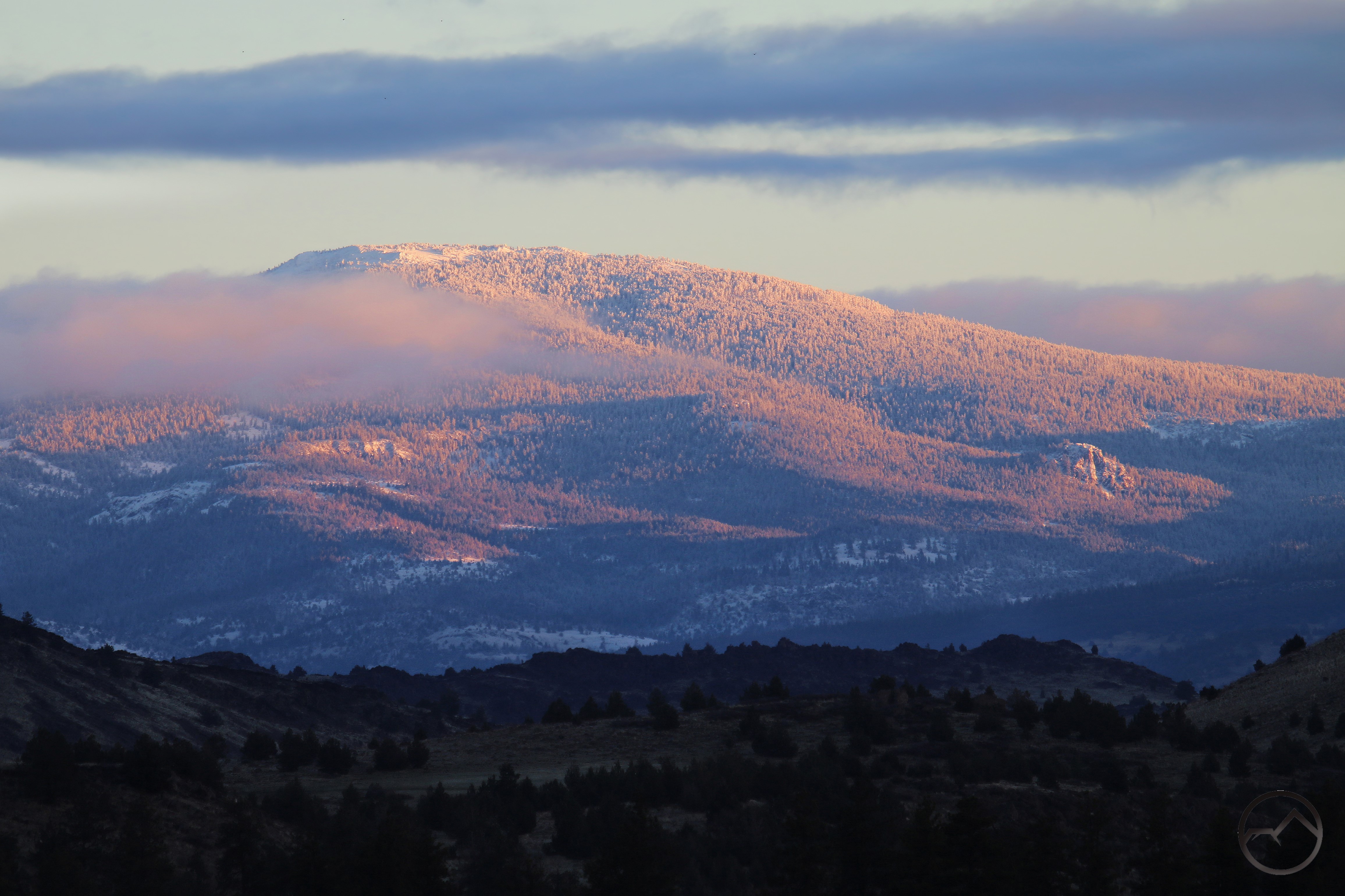
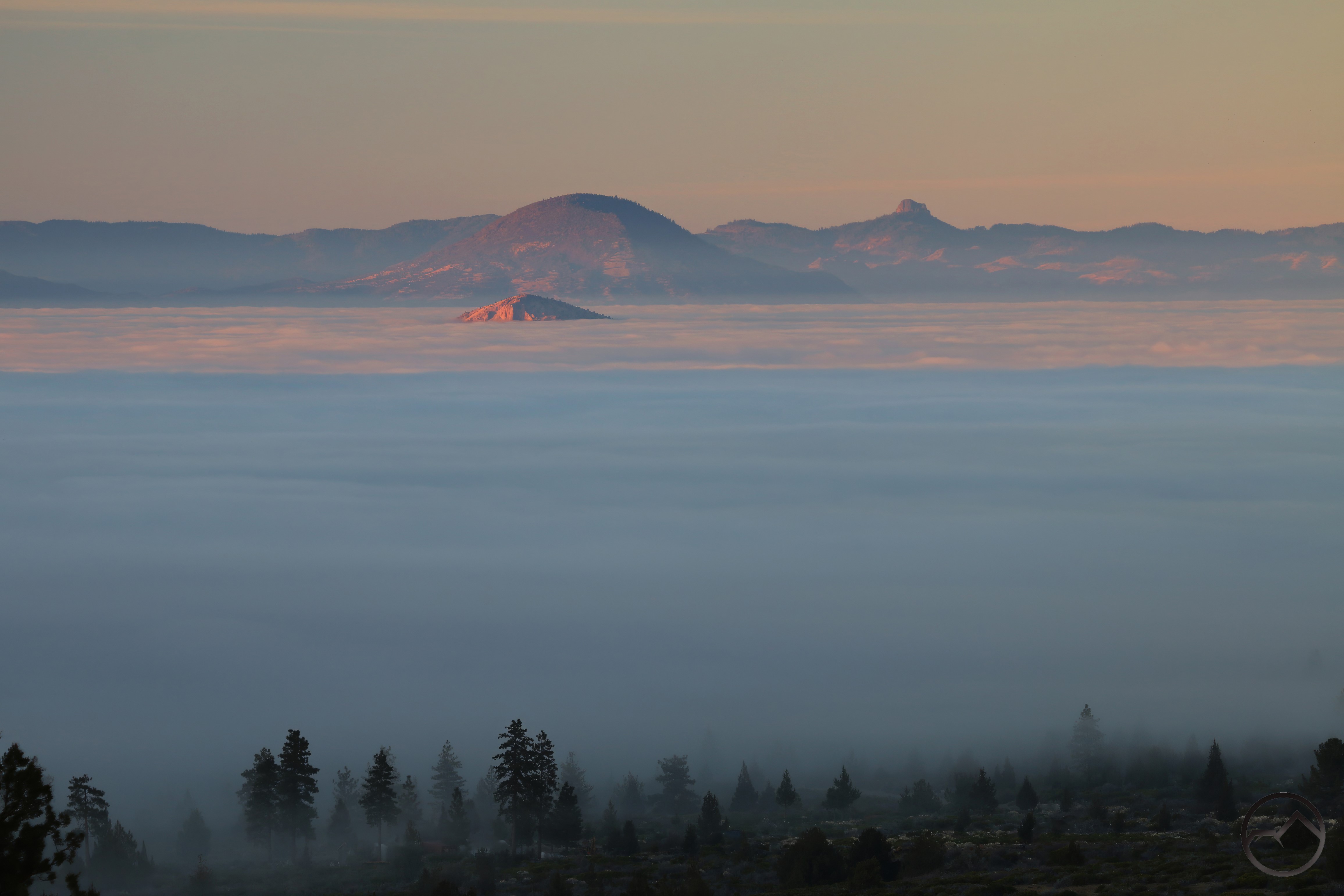
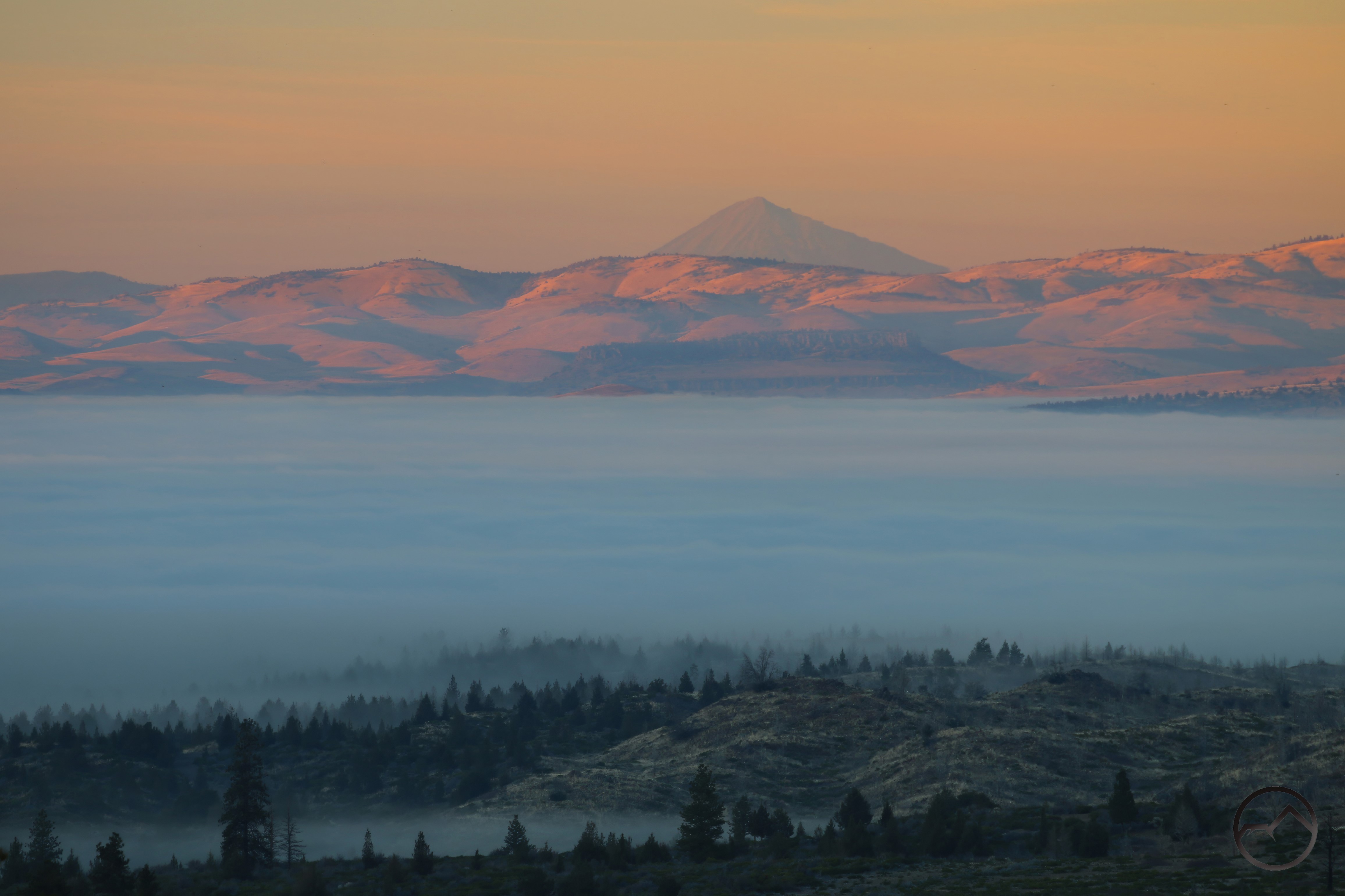
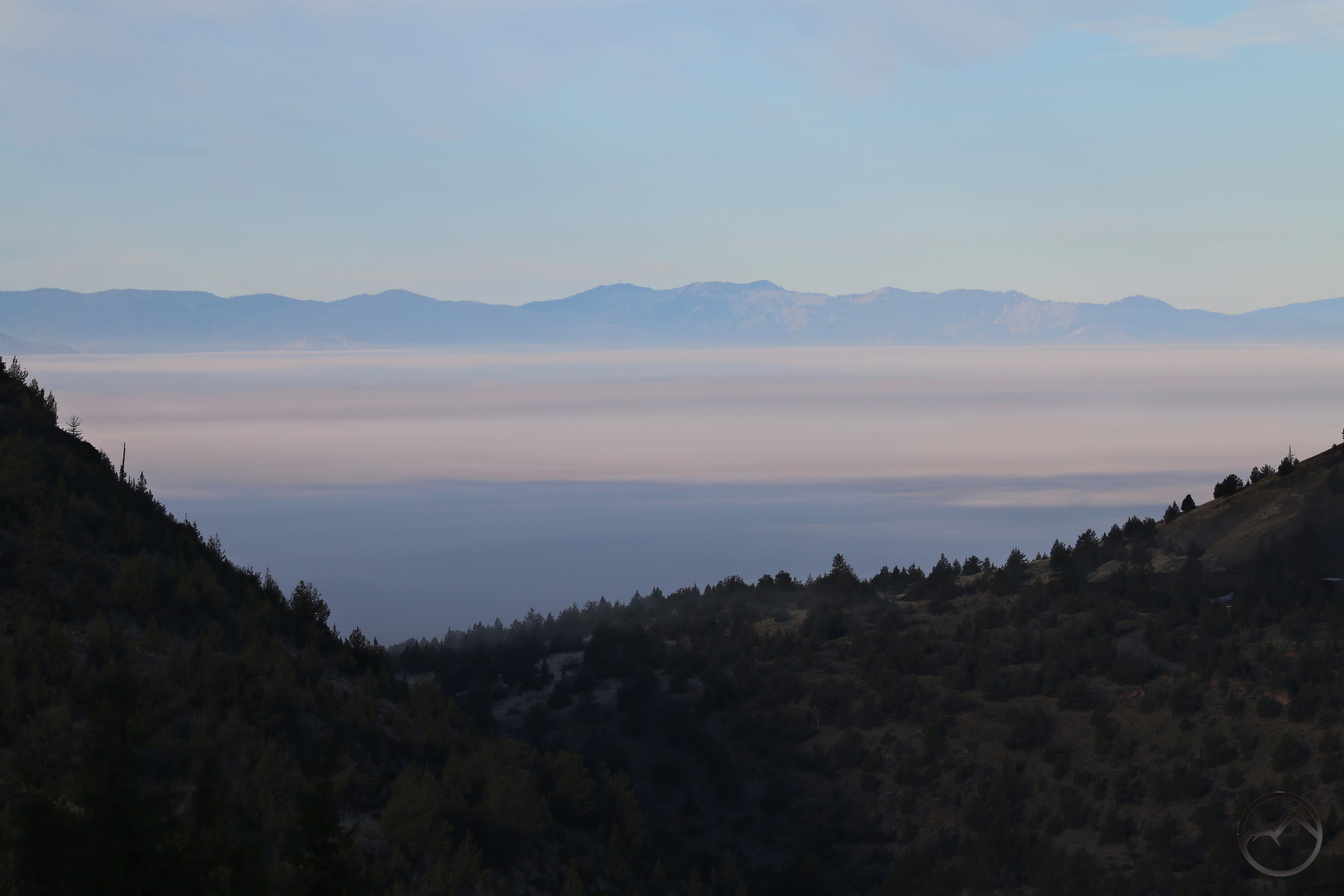
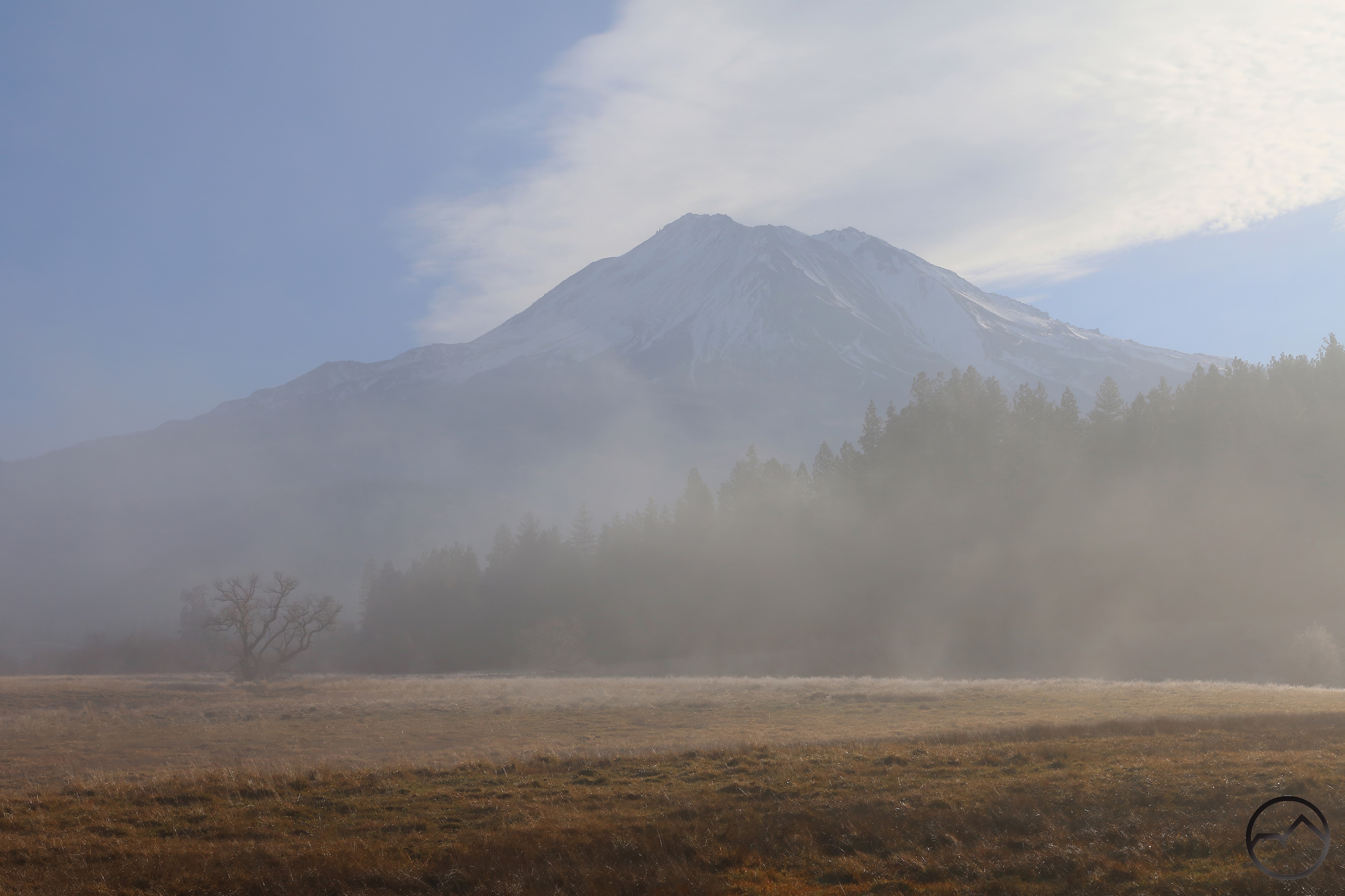
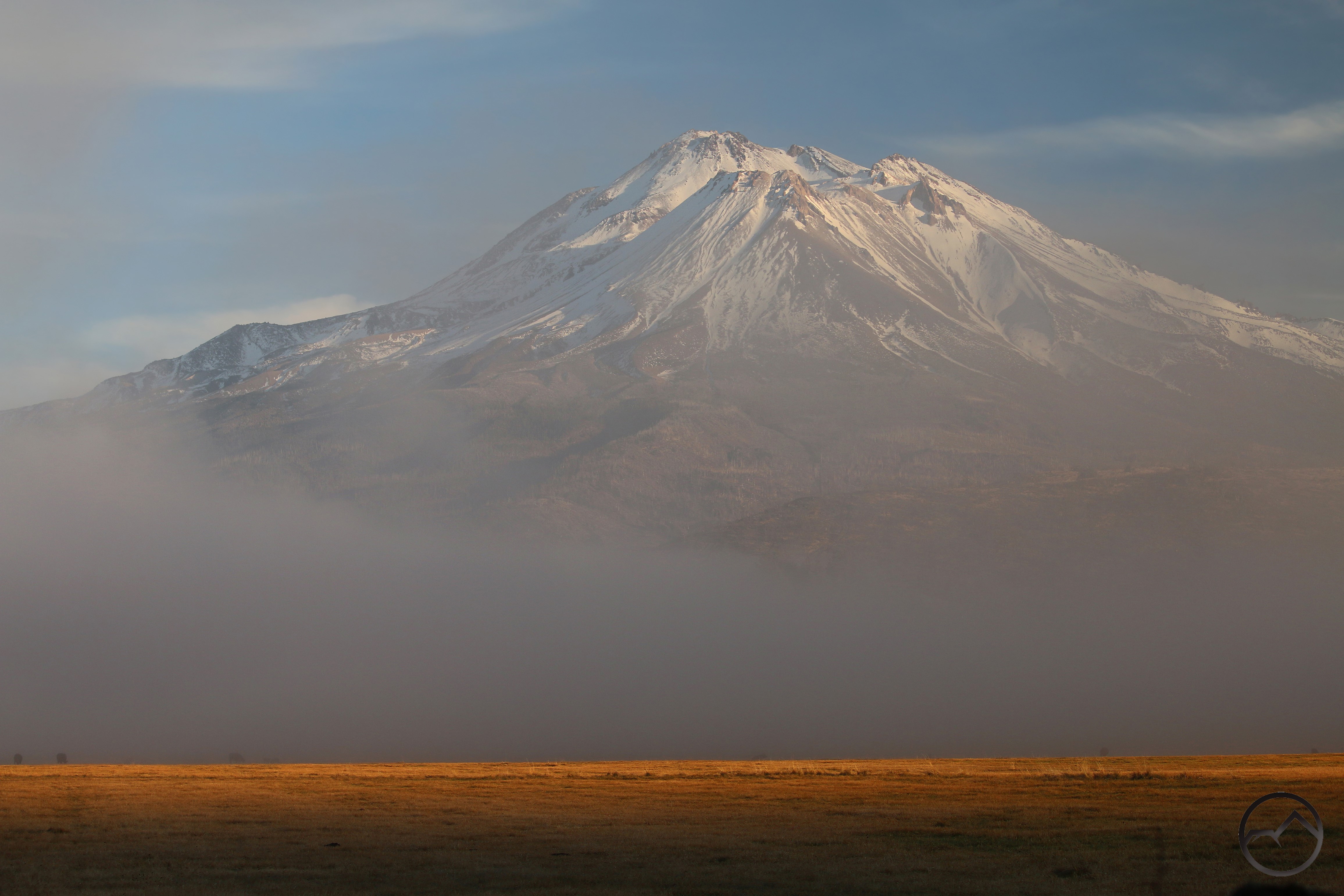
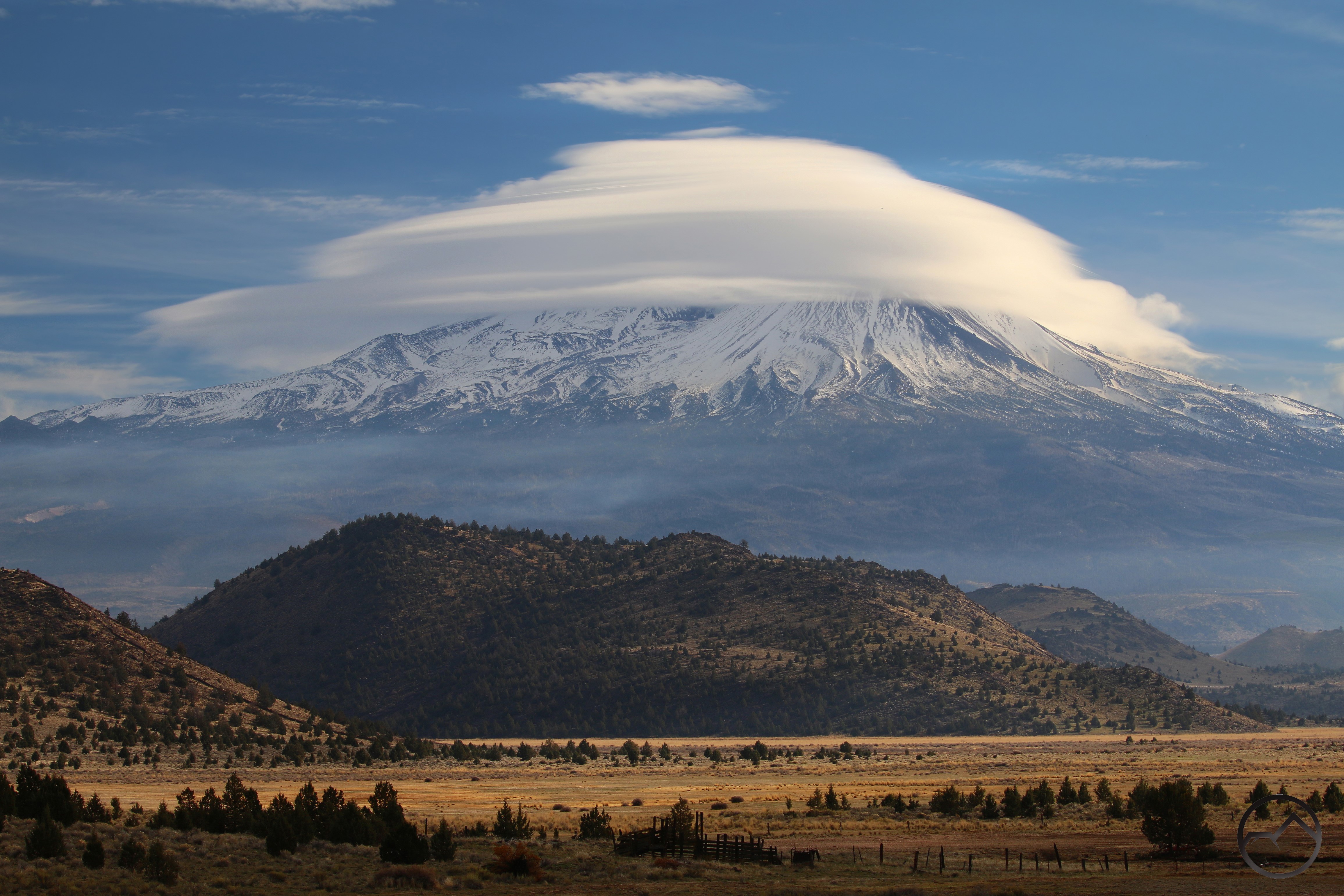
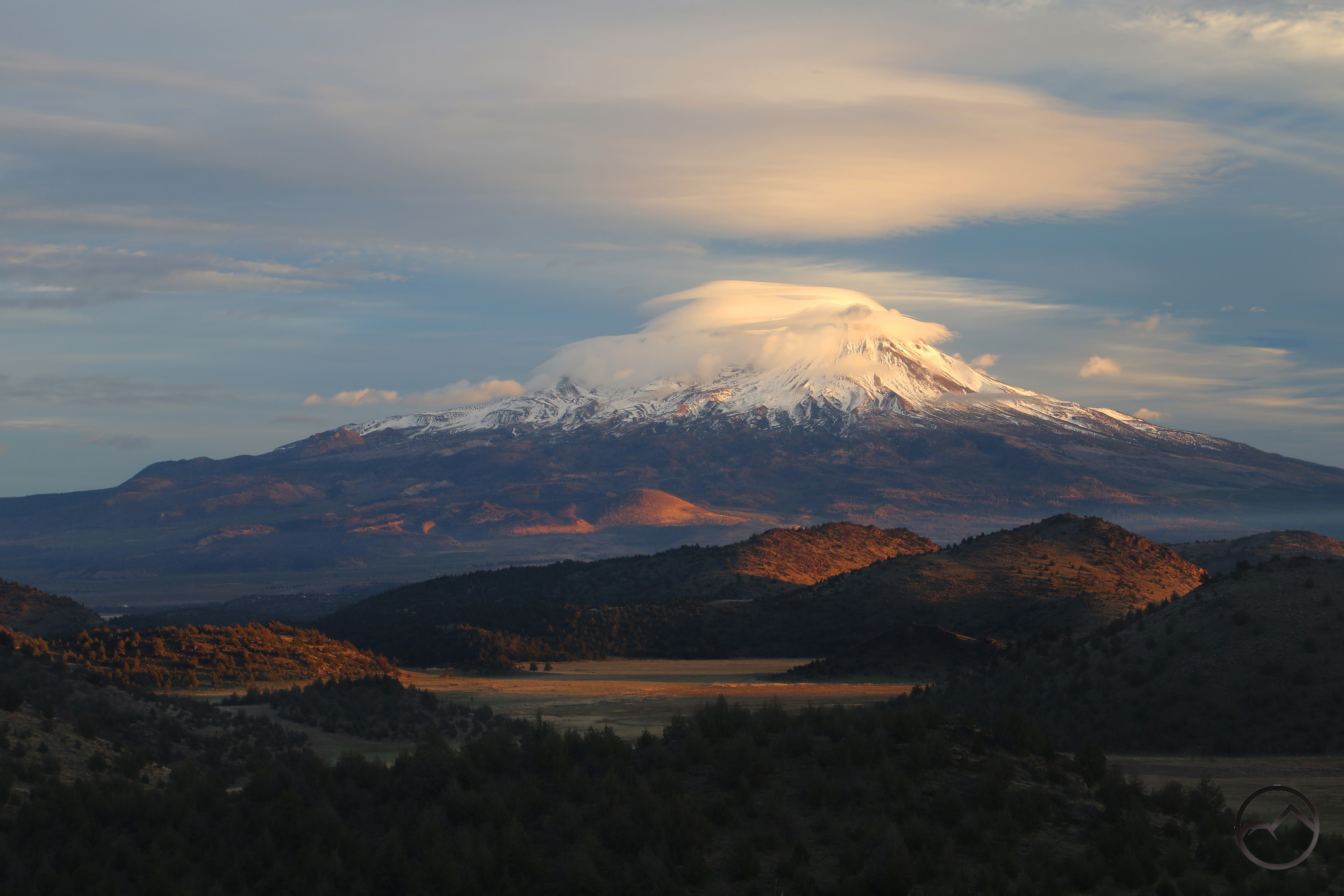
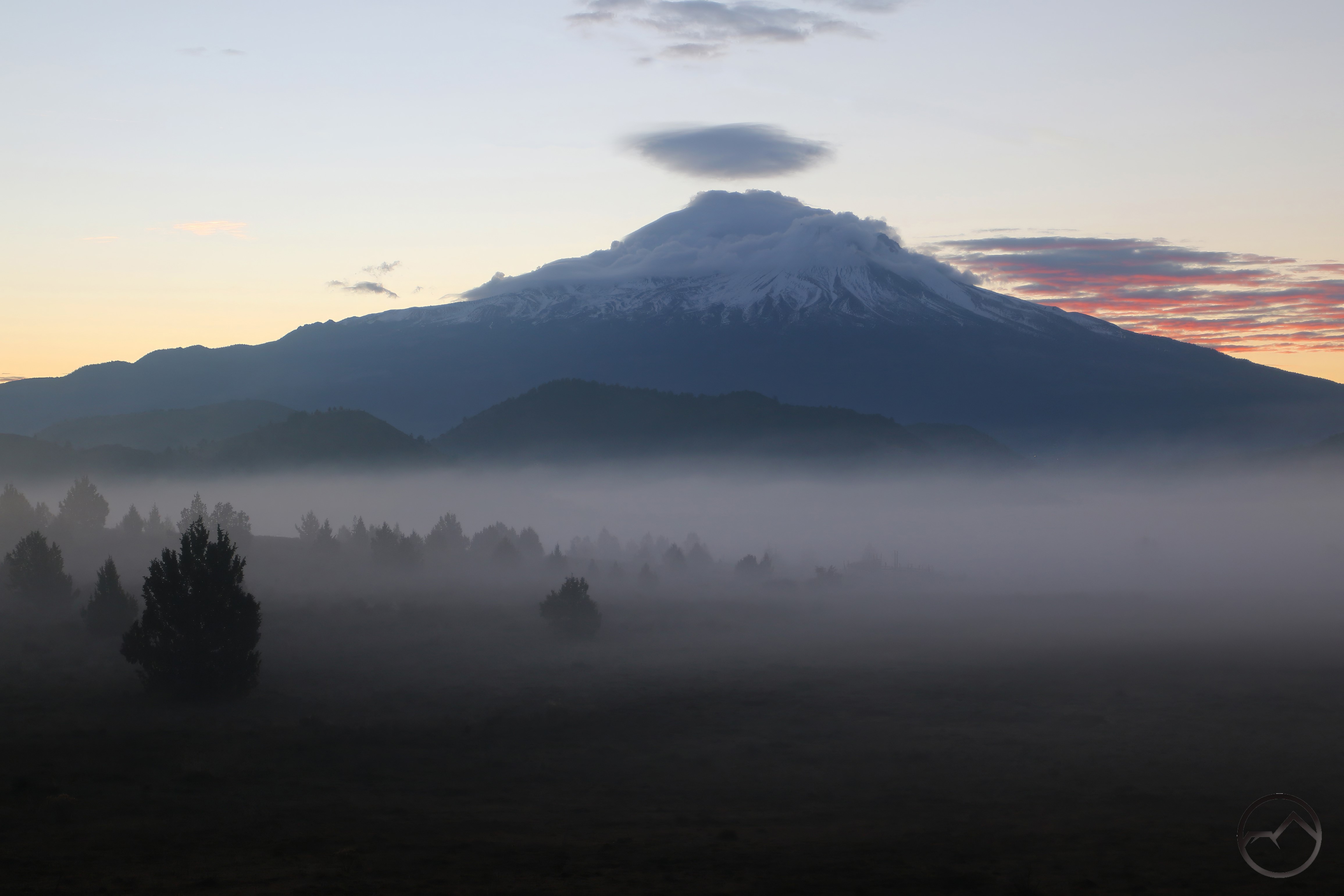
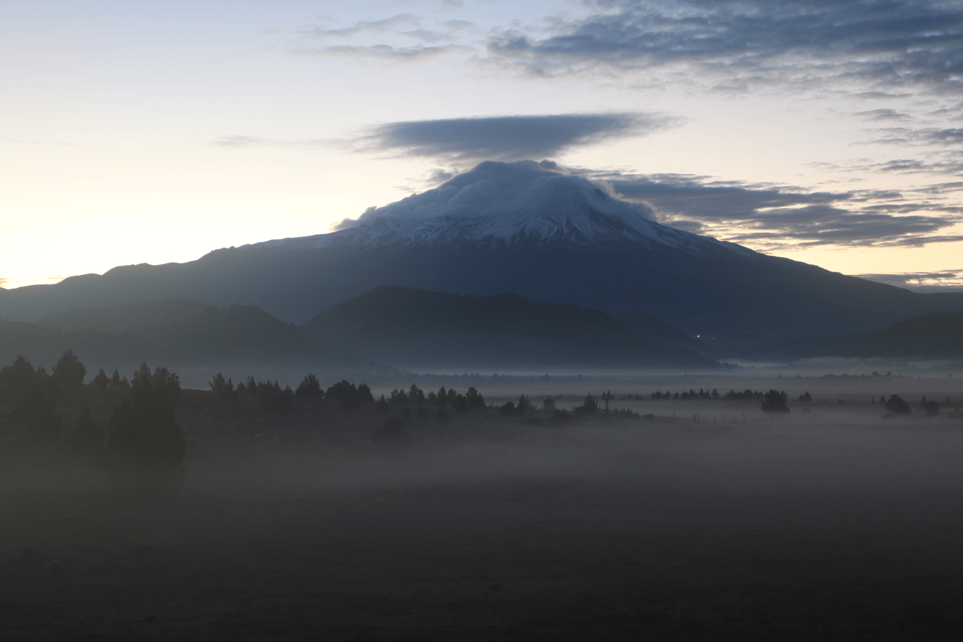
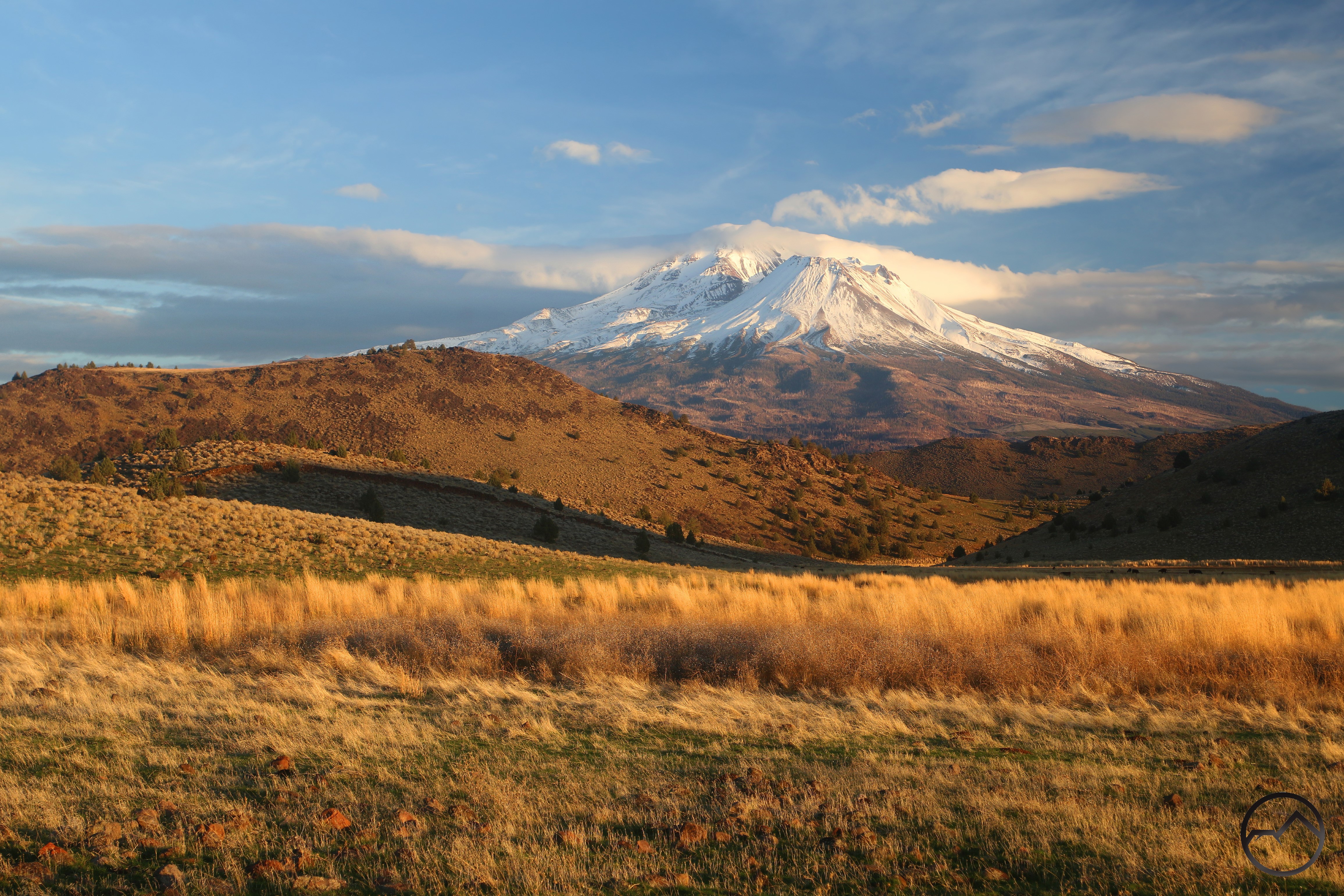
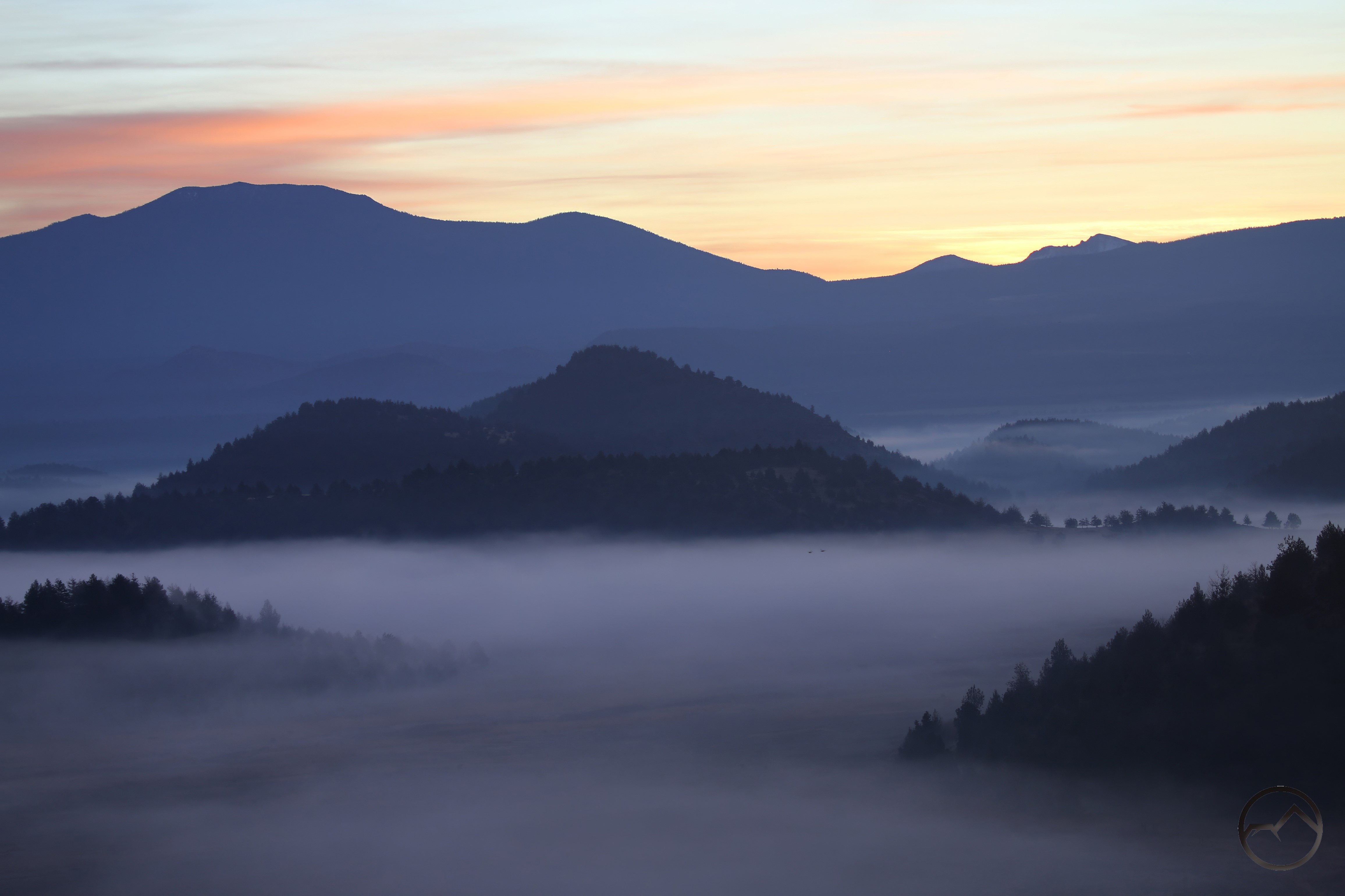
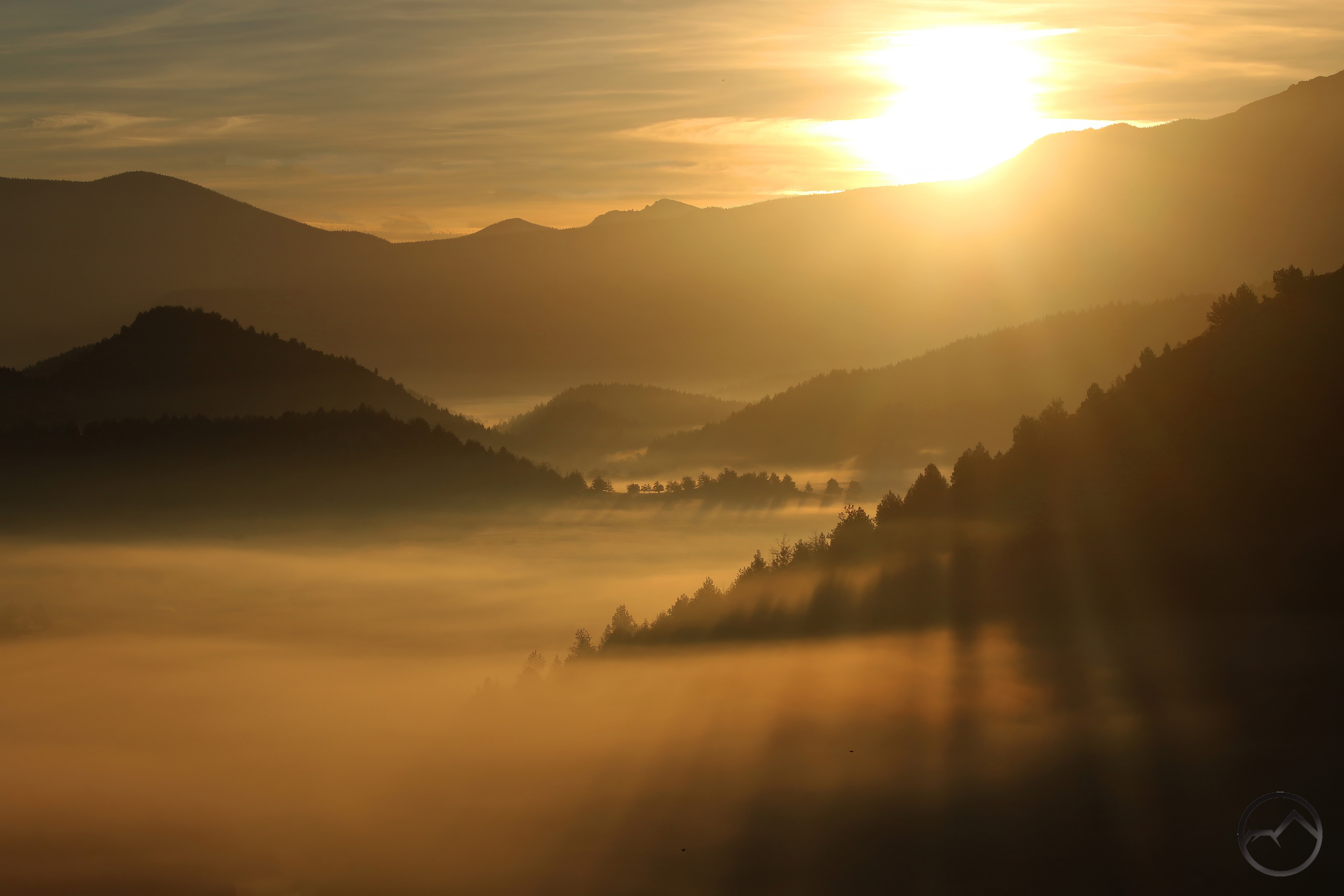
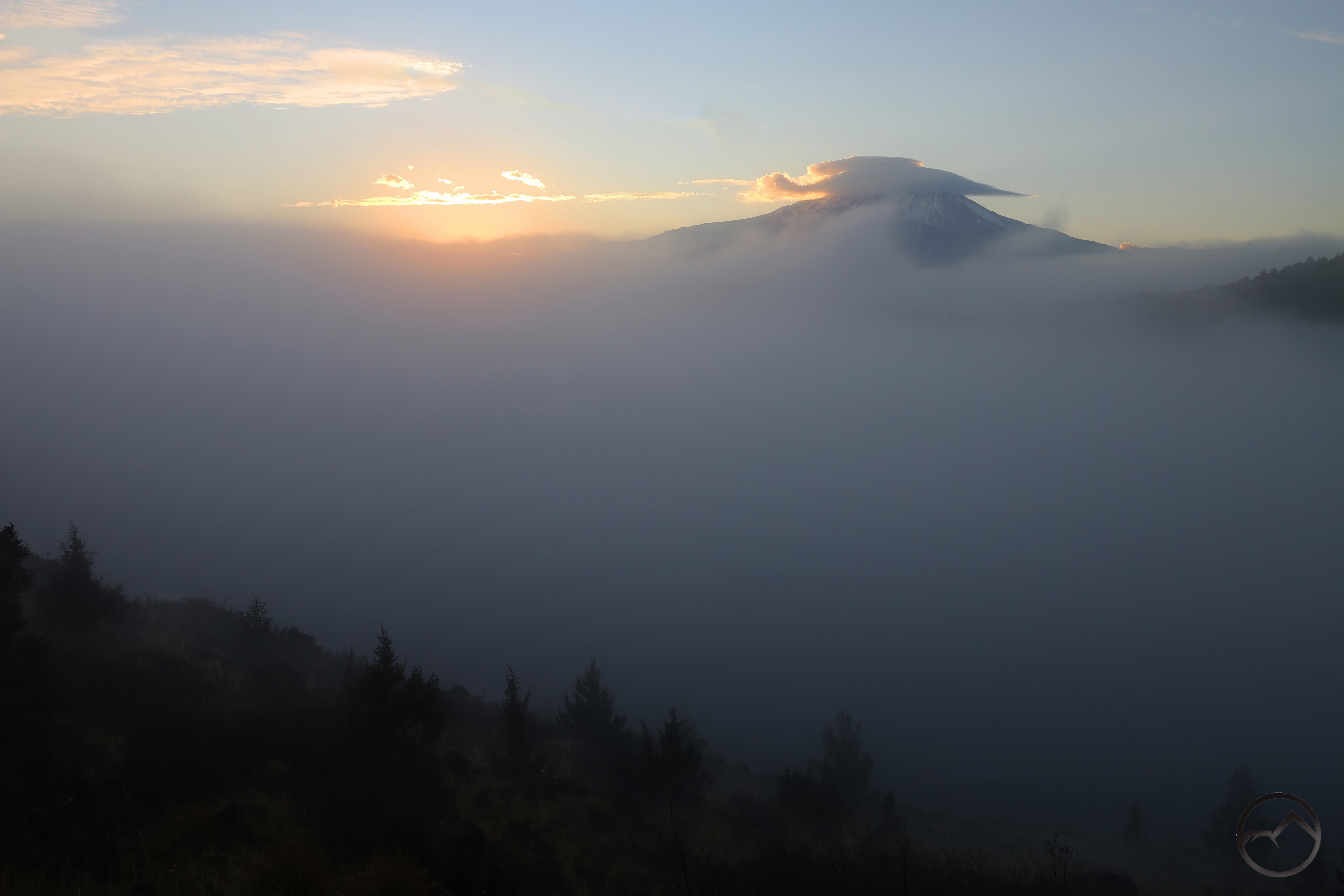
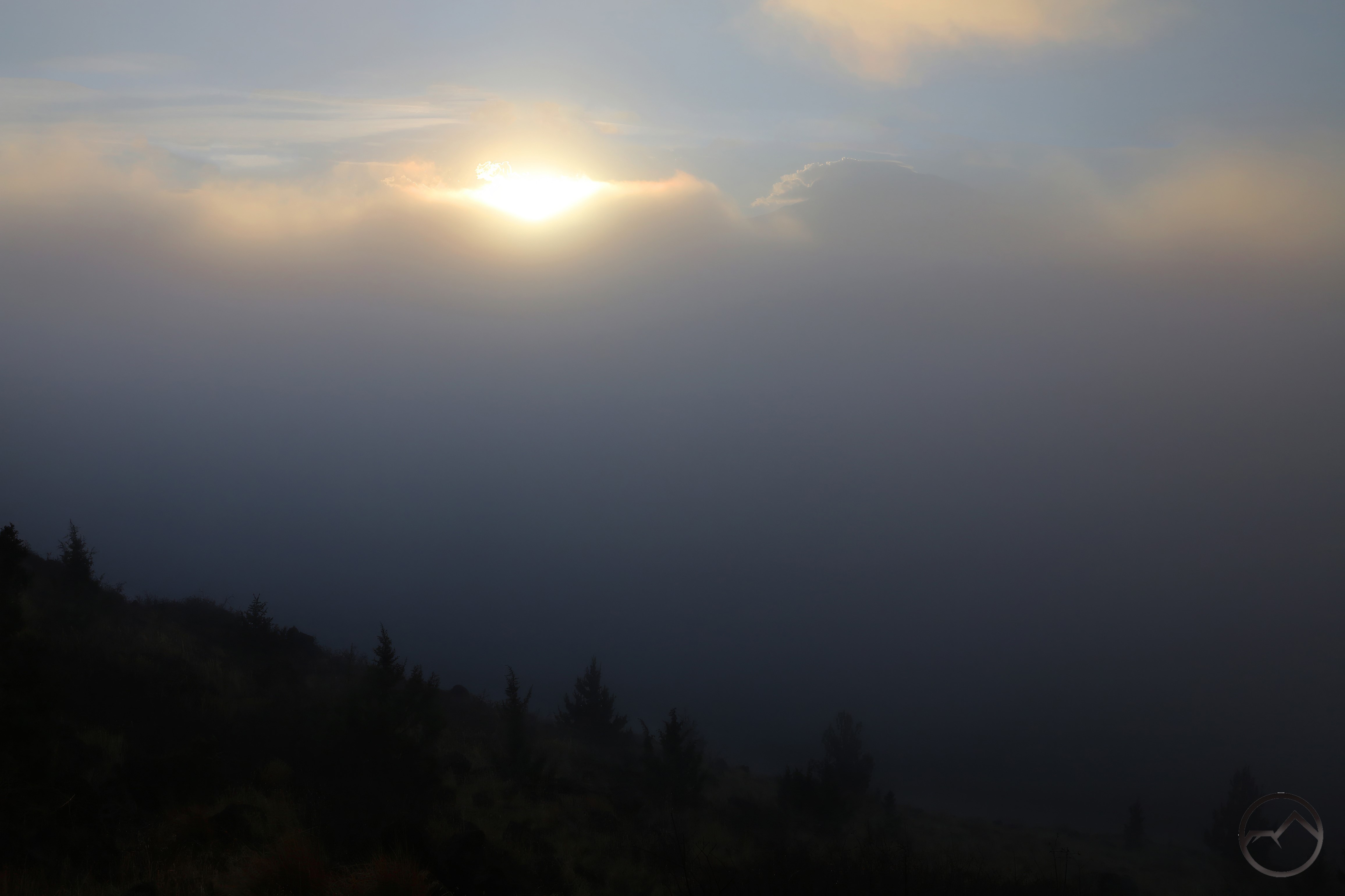
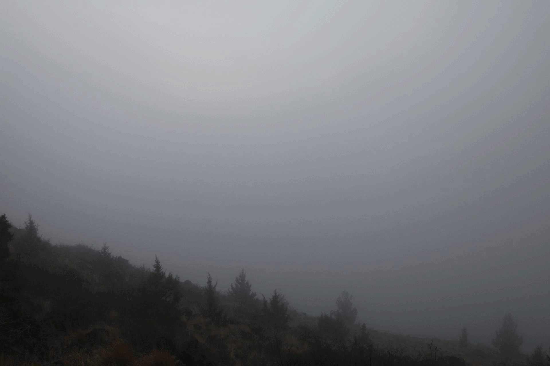
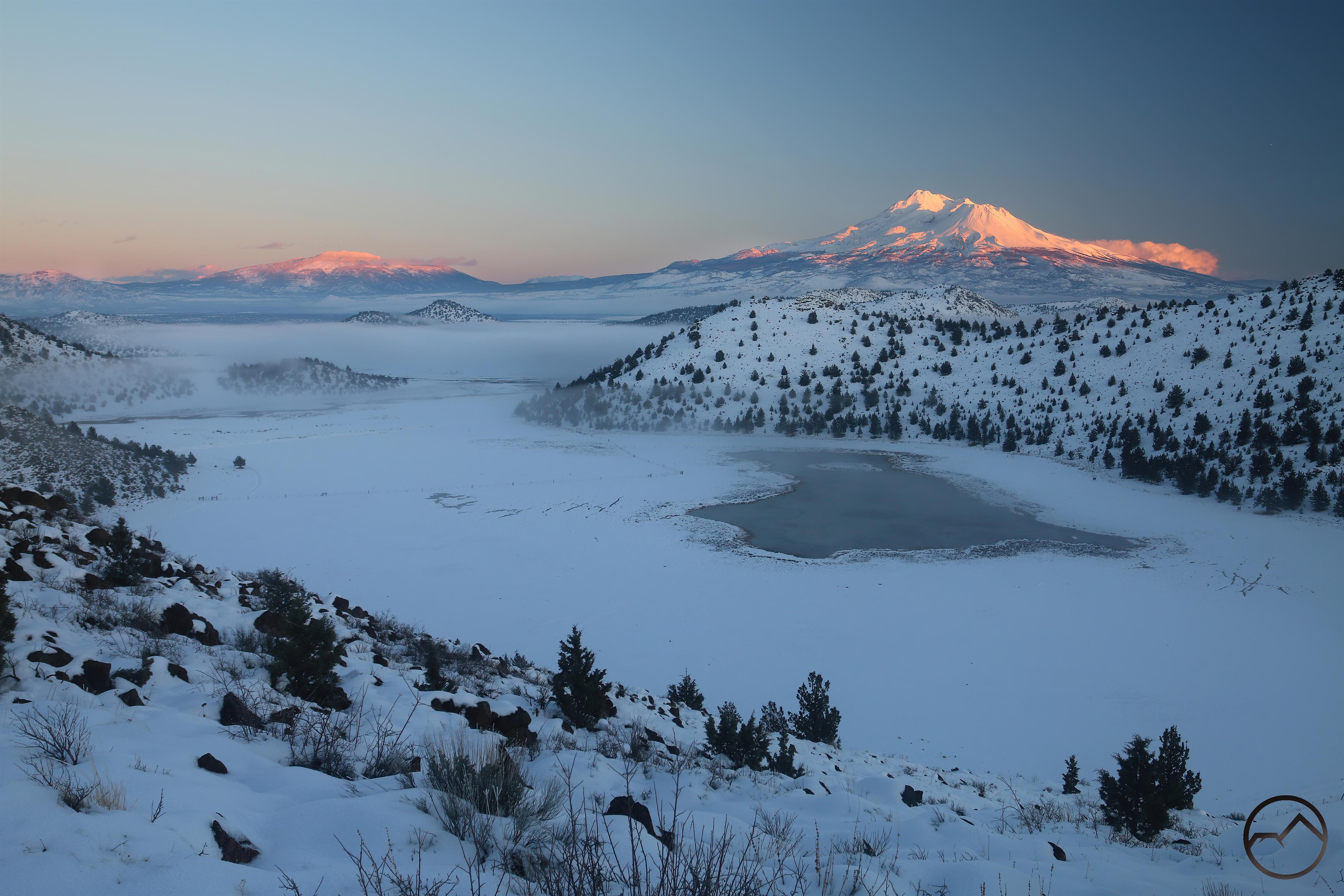
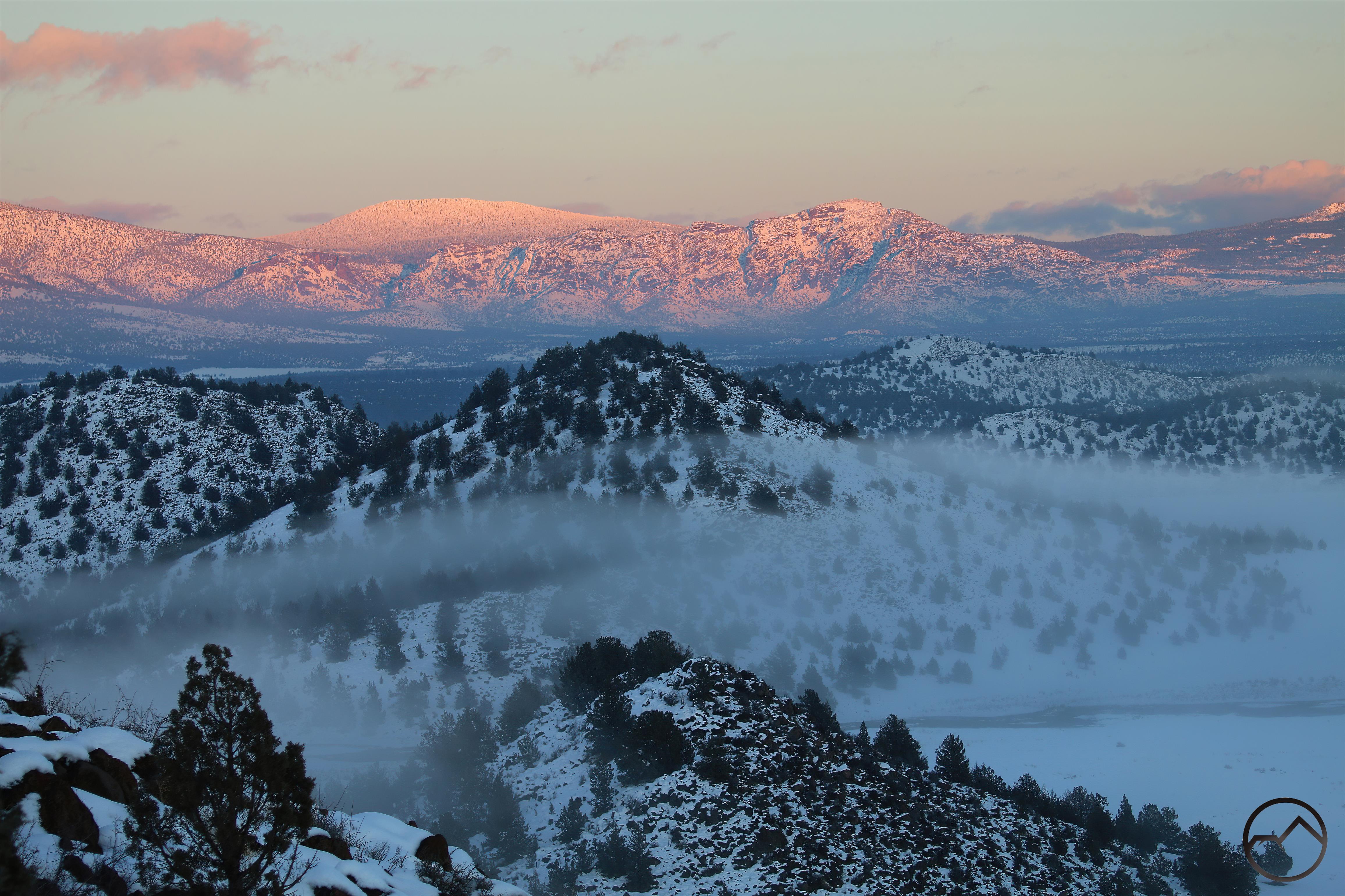
November brought thick fog to the Shasta Valley, fog that continually tried to creep up toward the base of Mount Shasta. Around the mountain, the weather proved to be very interesting with beautiful cloud formations highlighting the great fall light. This culminated, at the end of the month, with a fantastic lenticular, the first of what has proven to be a consistent stream of the magnificent lens-like clouds.
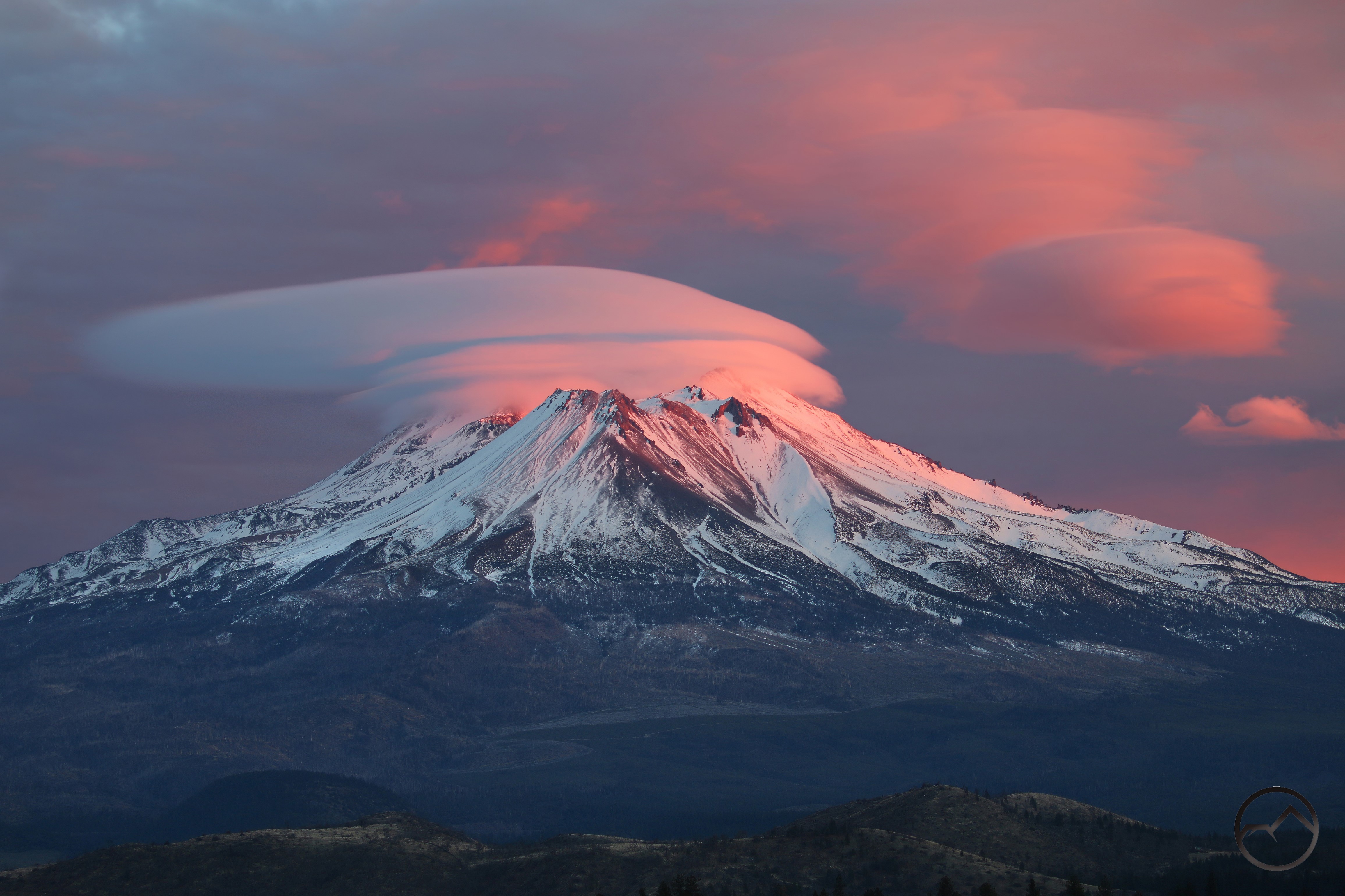
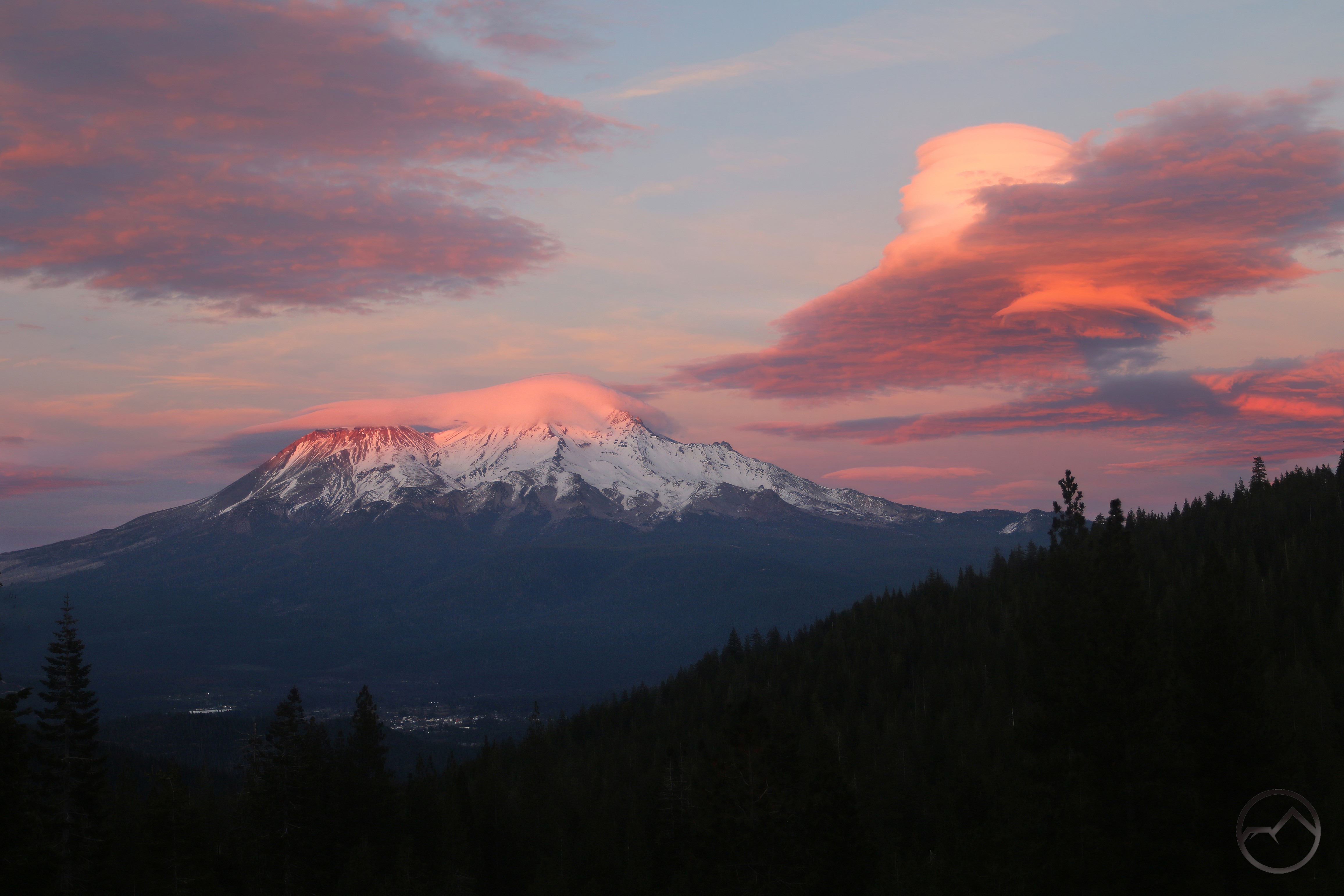

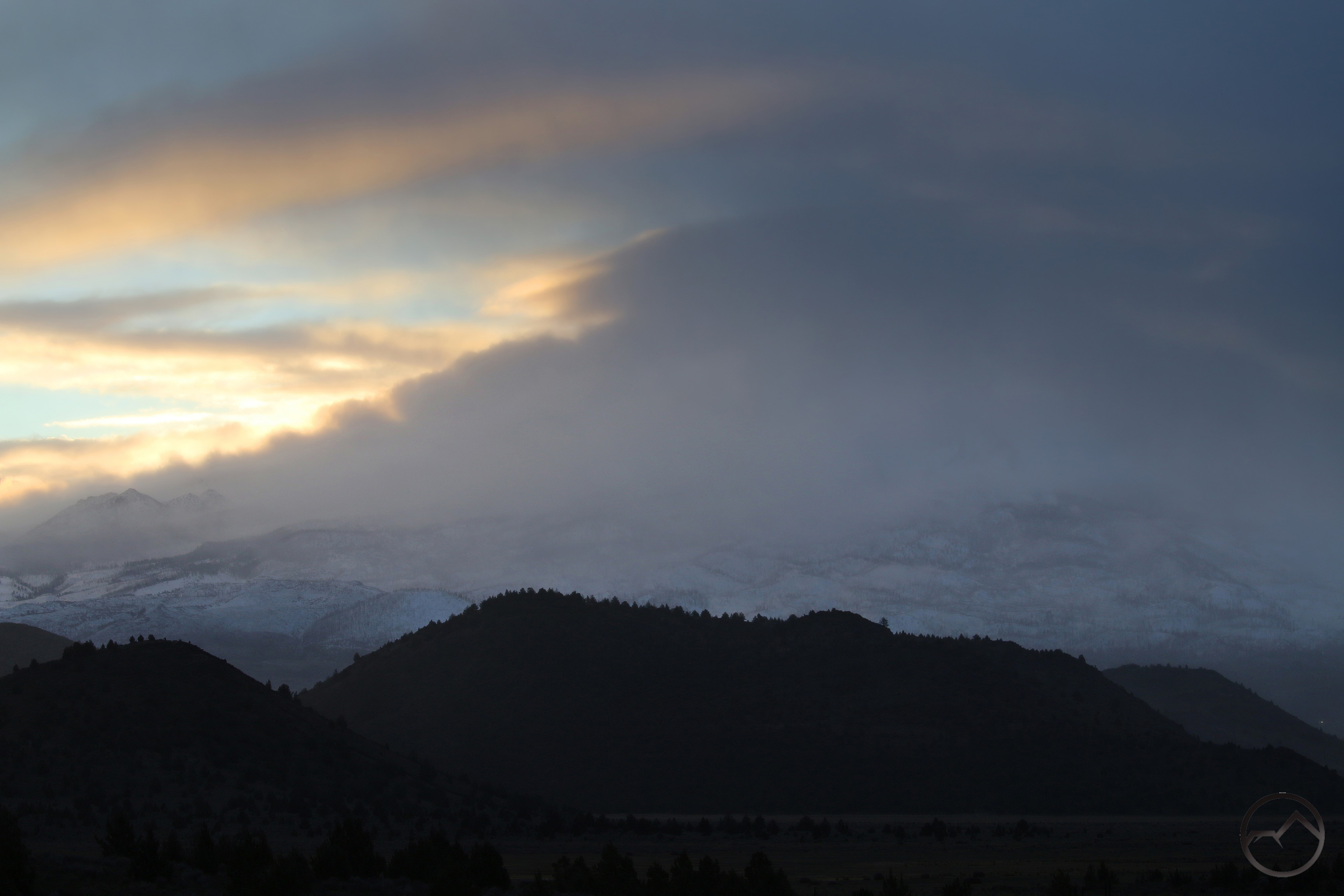
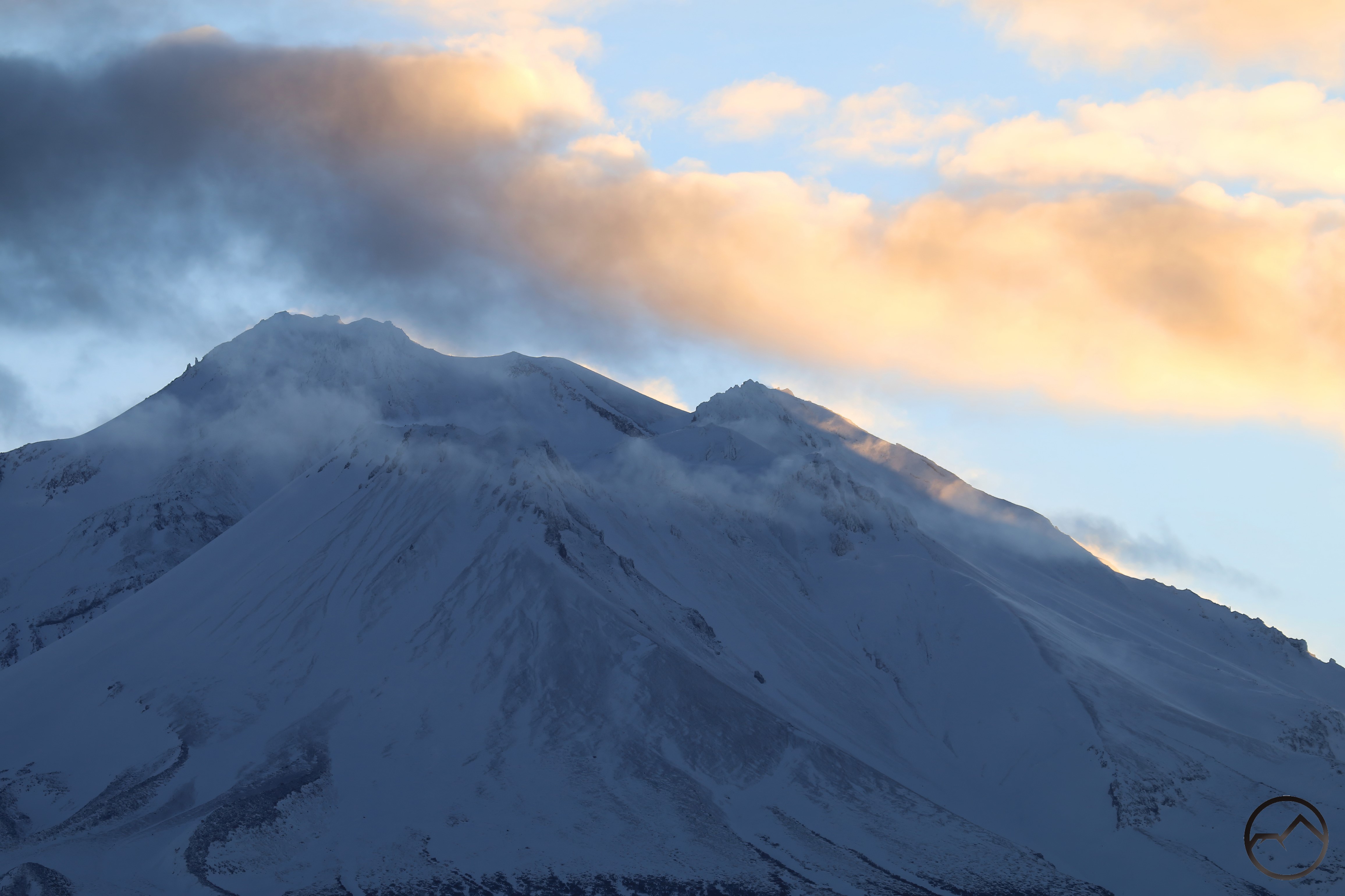
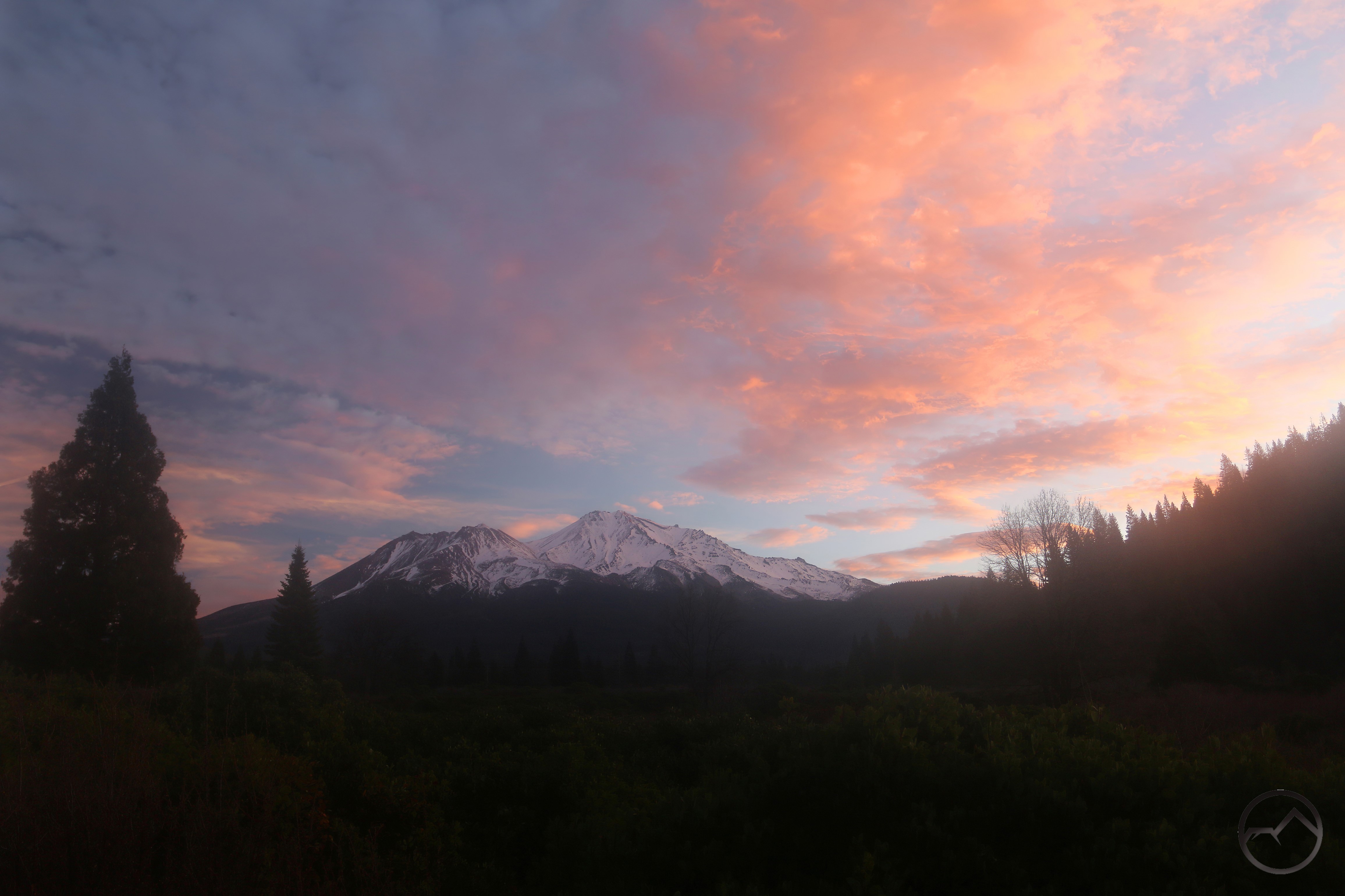
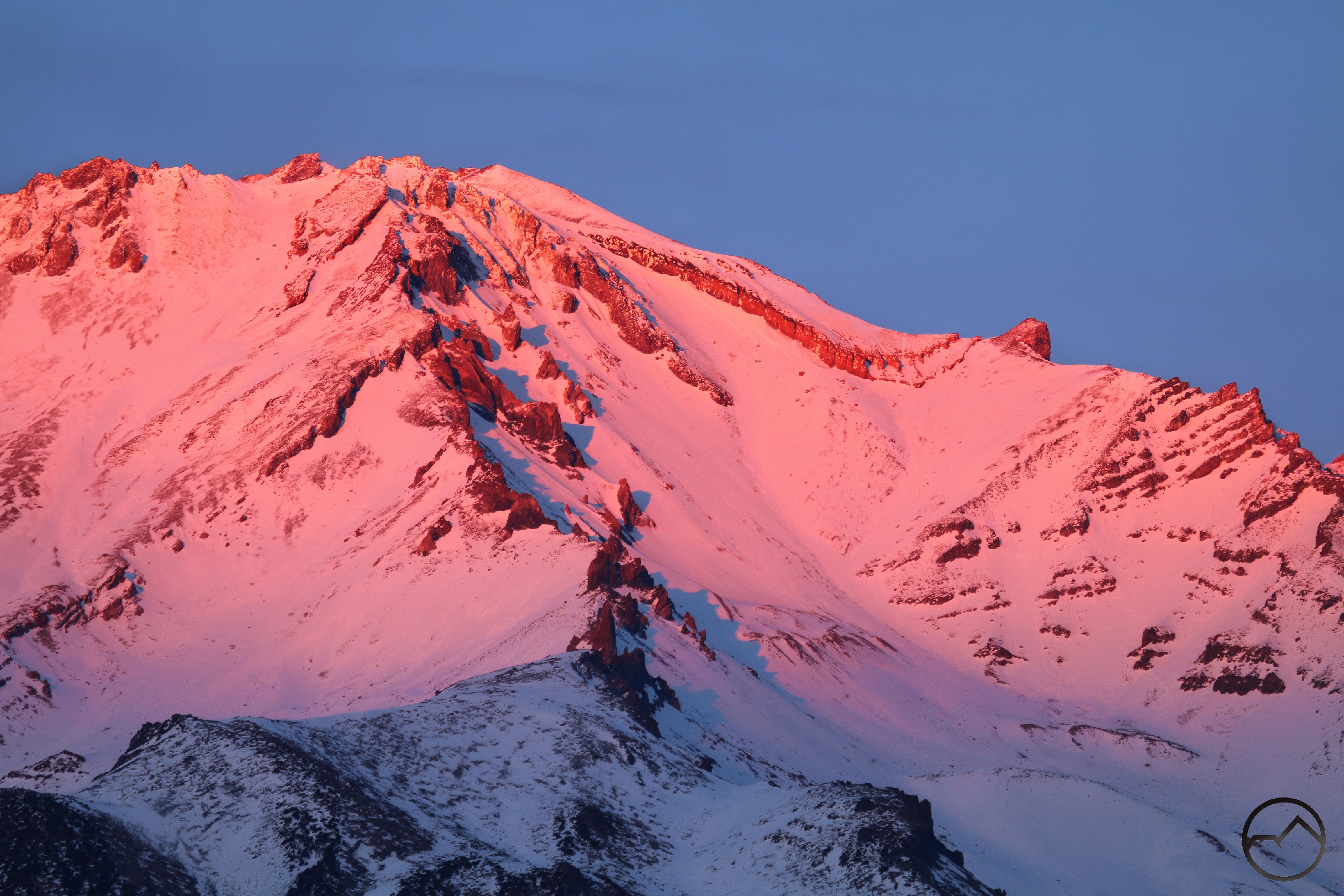
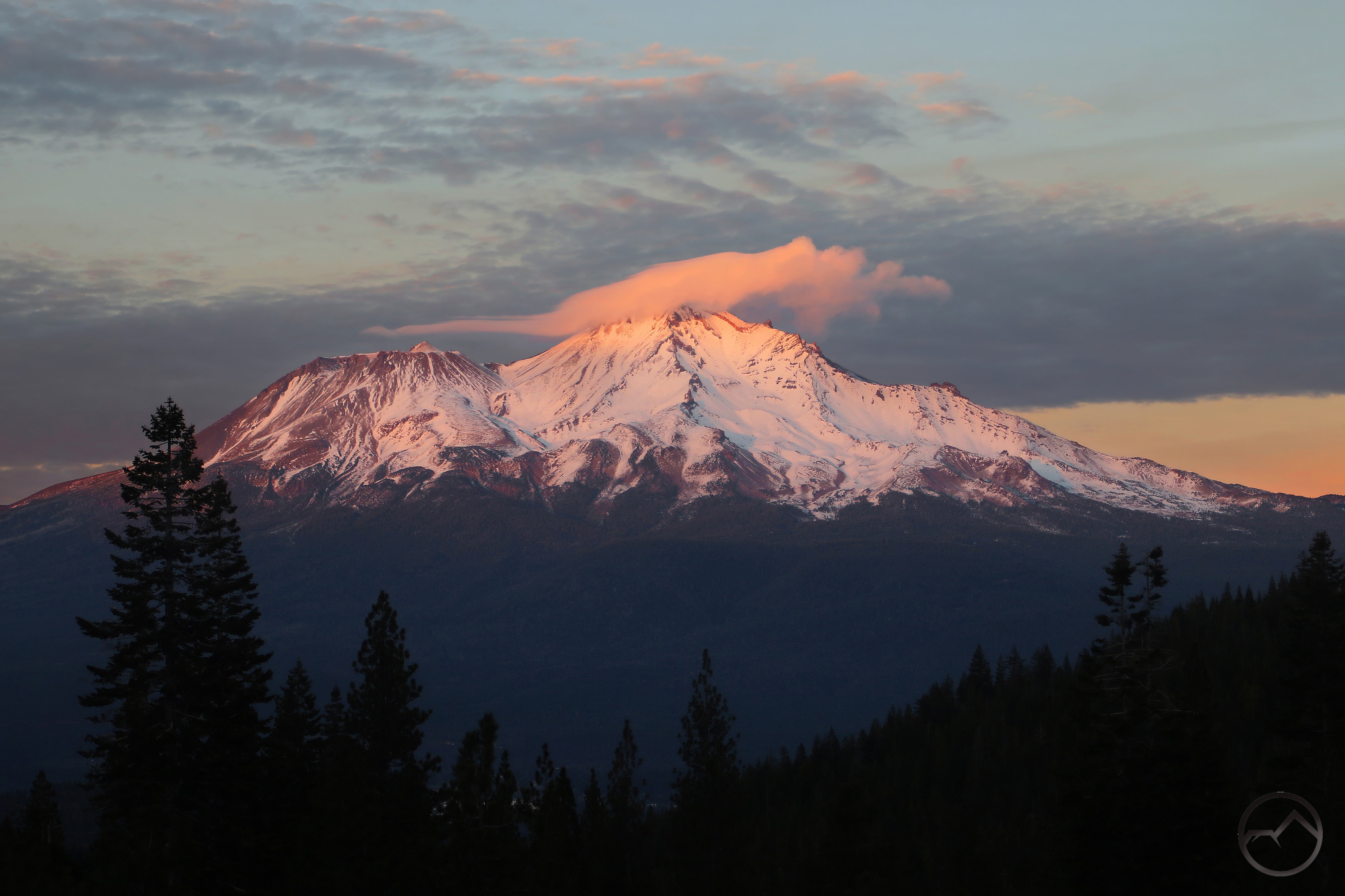
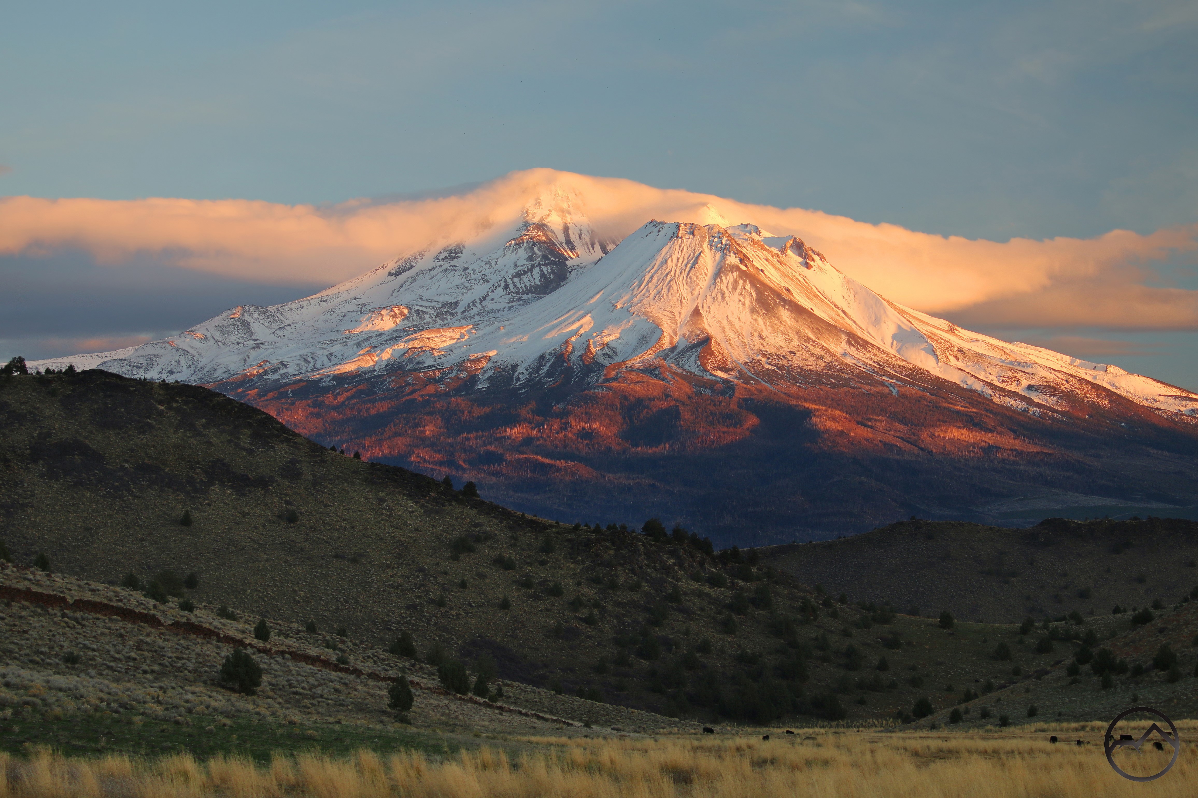
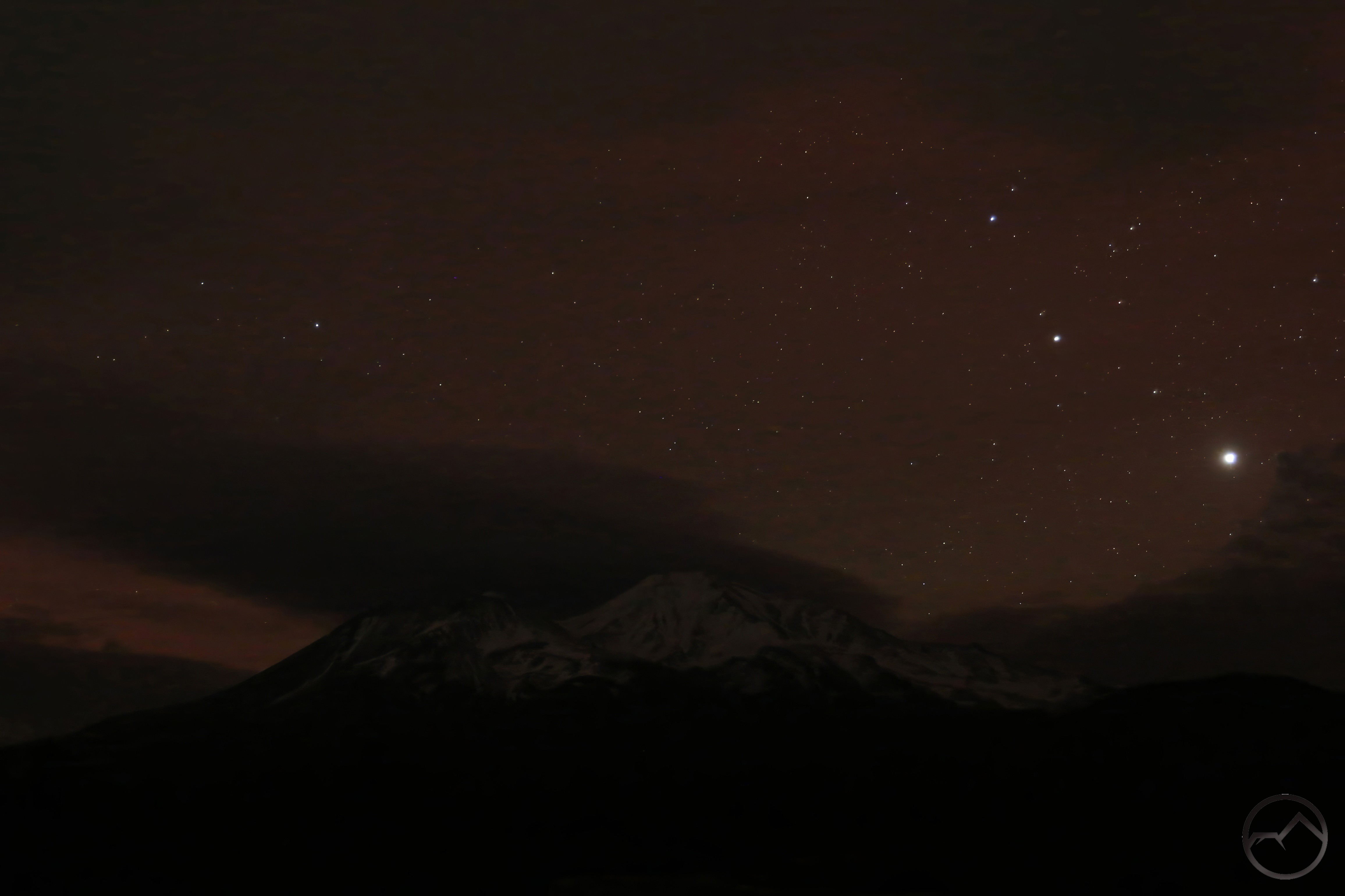
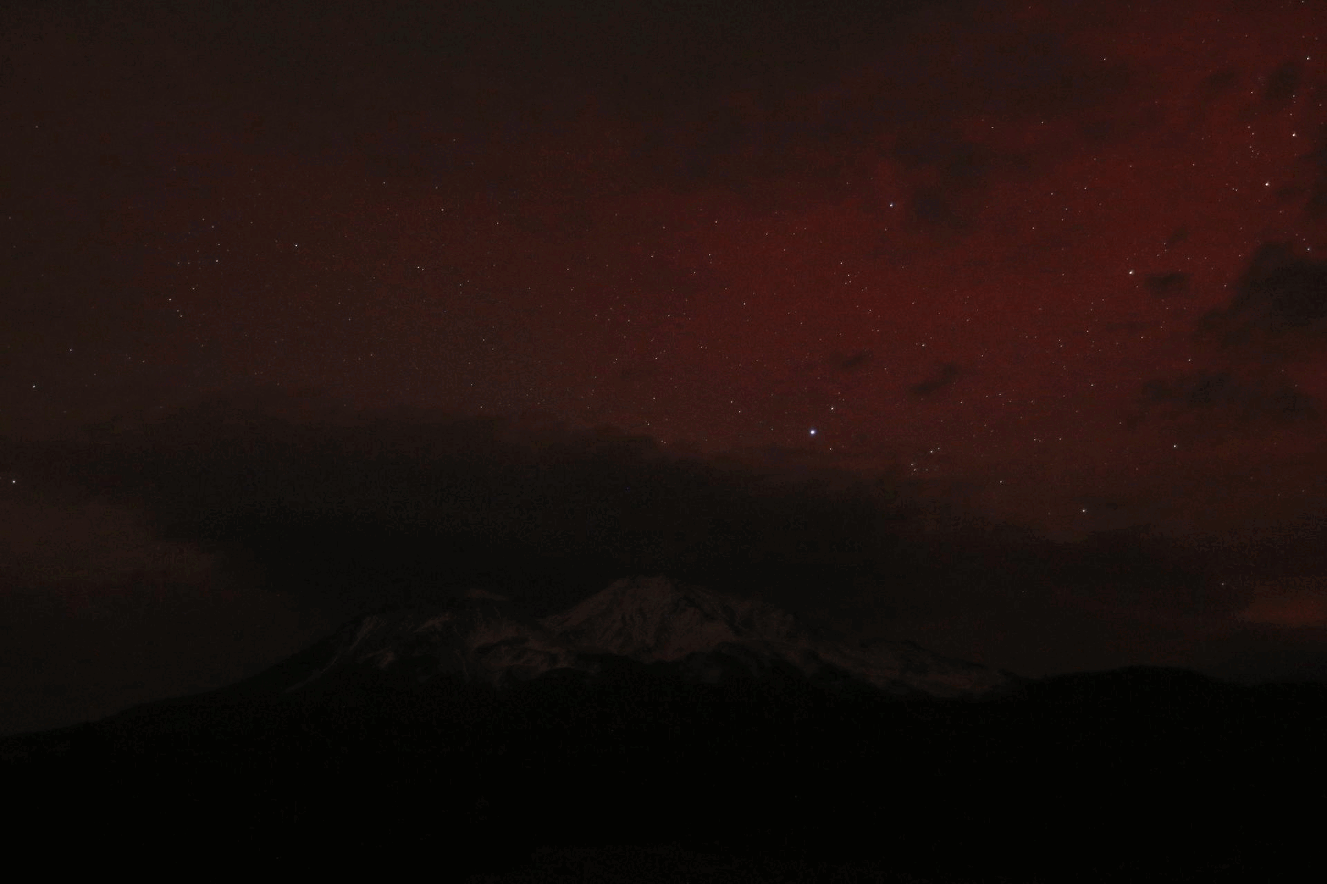
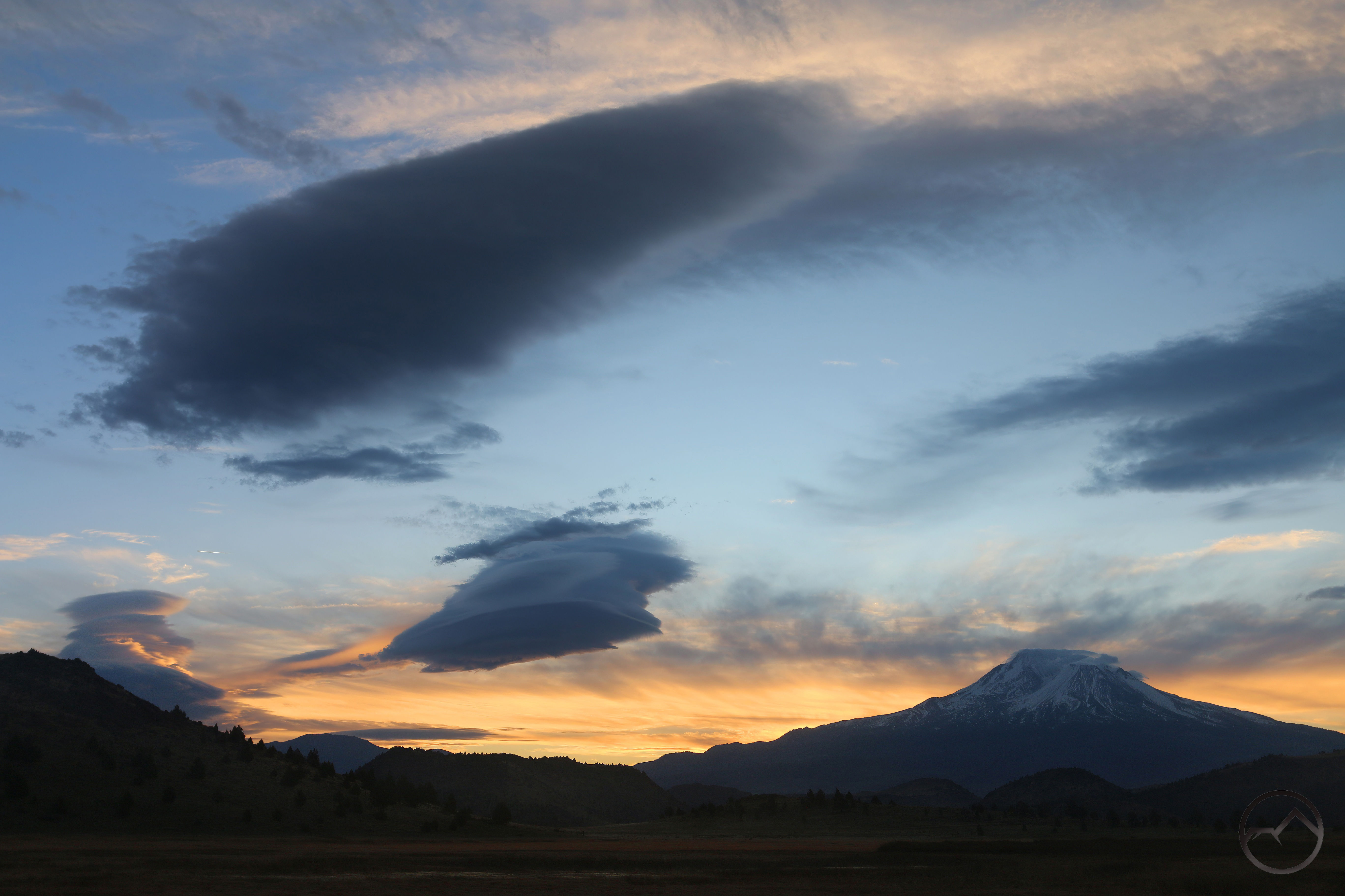
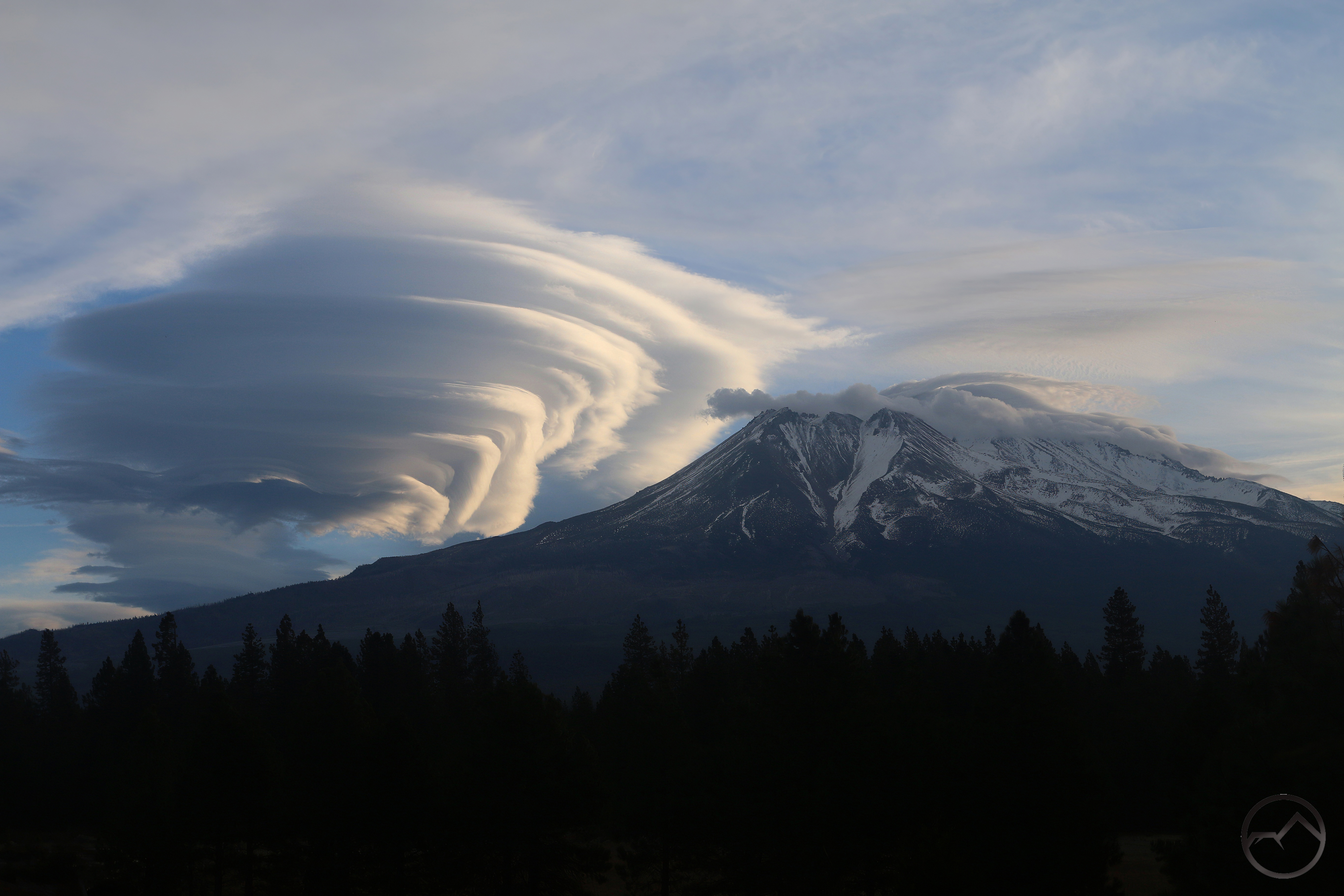
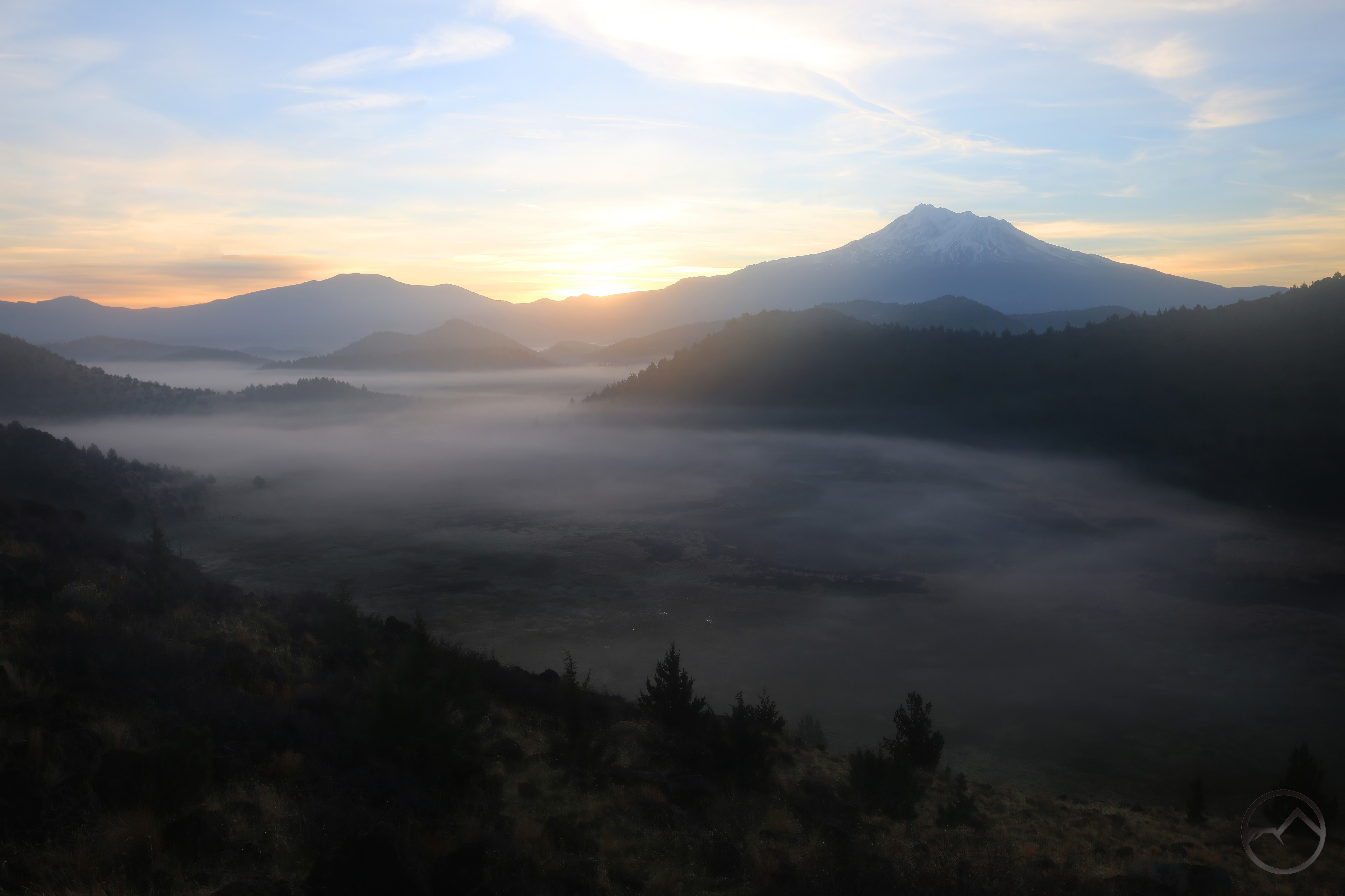
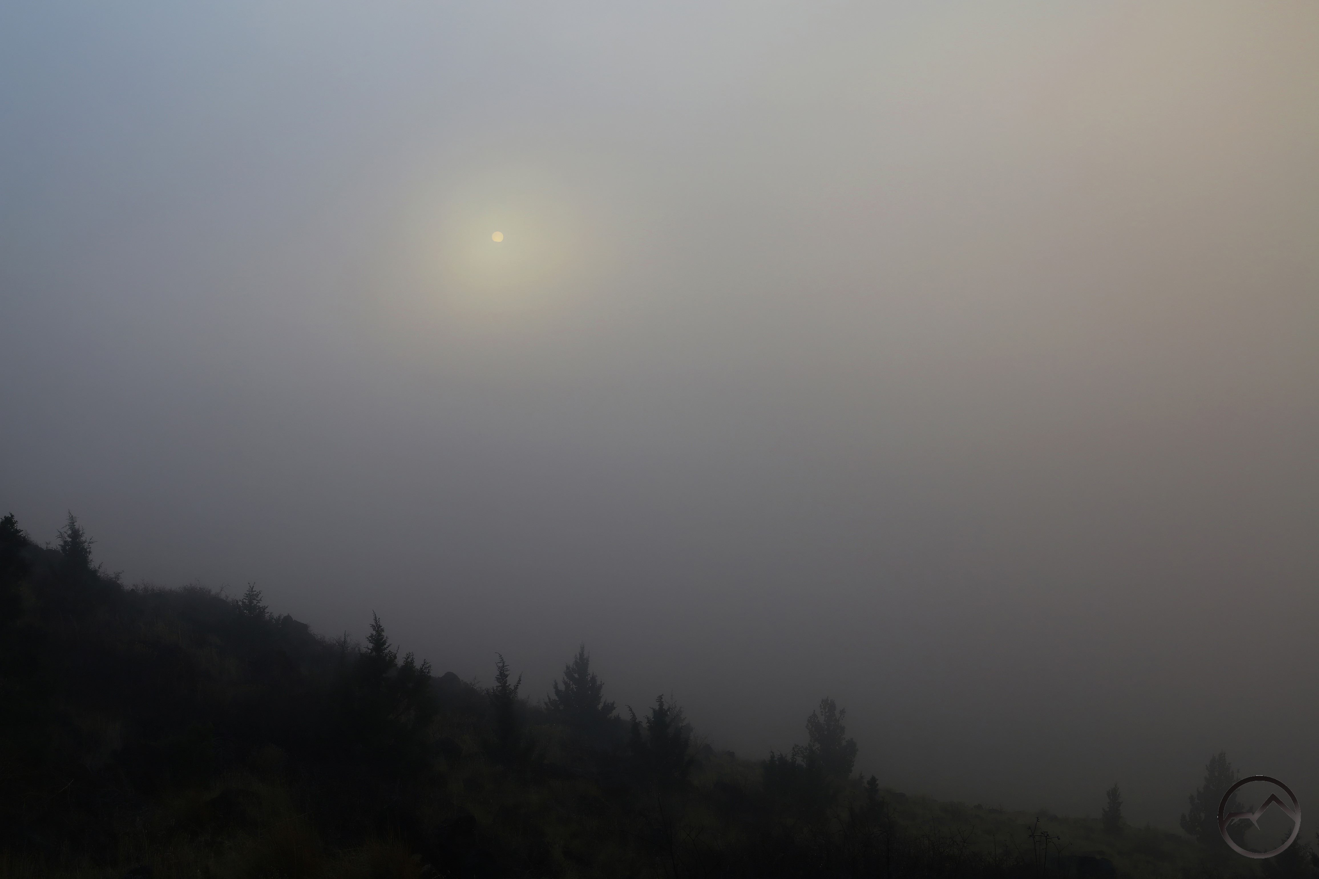
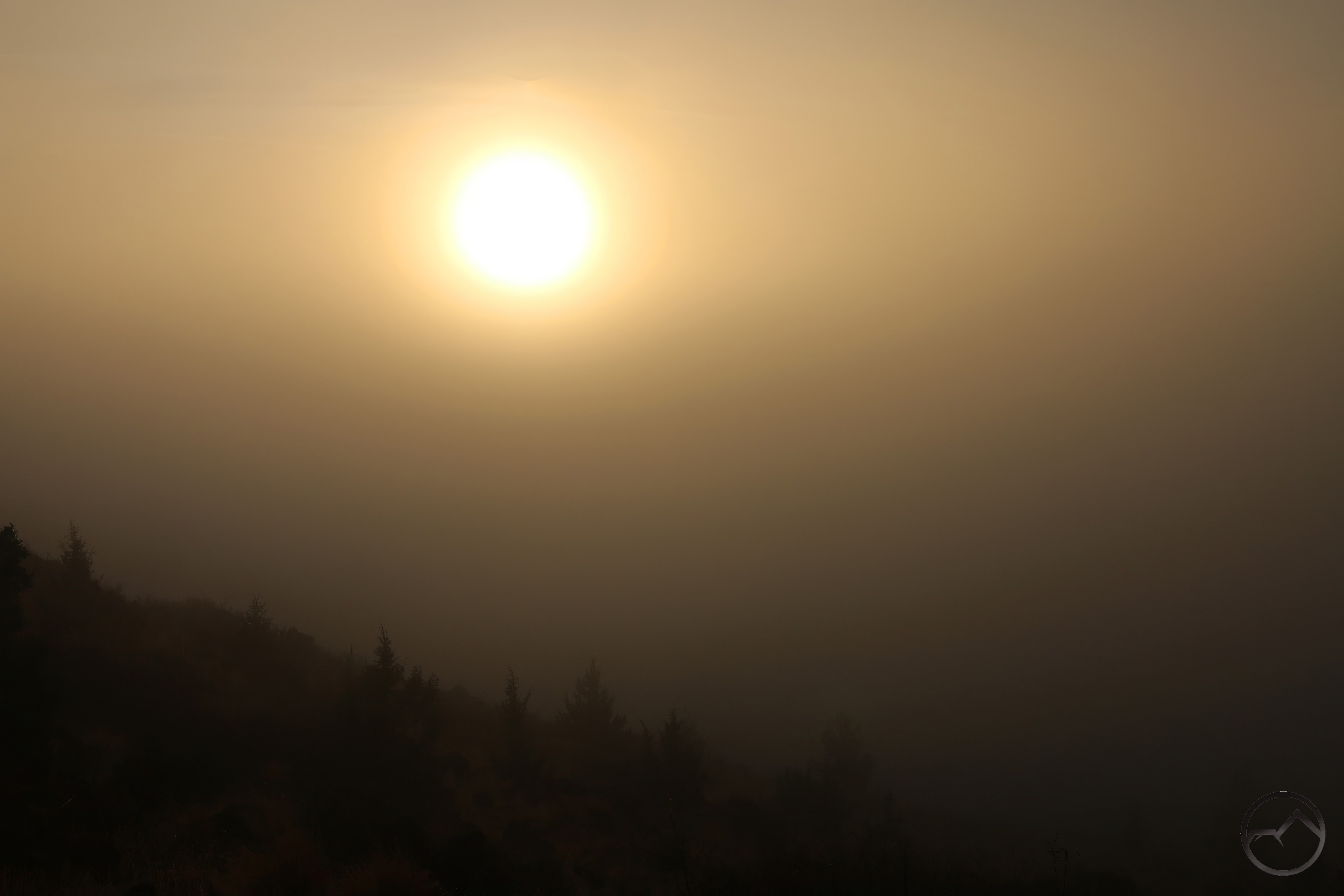
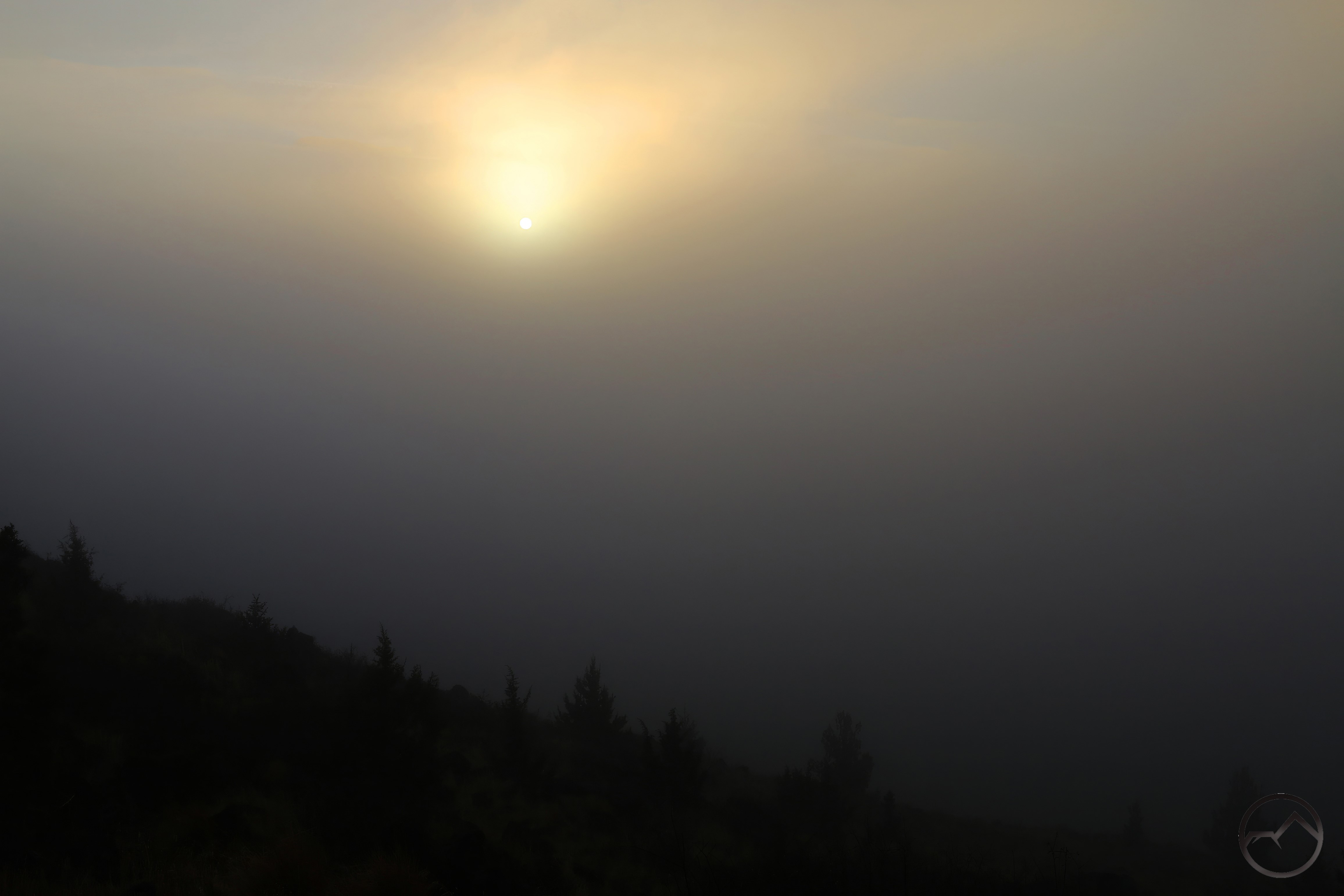
The run of awesome clouds and fog continued into December. This included one of the most stupendous lenticular formations to grace Mount Shasta in quite a while. It was not alone either, as other events formed around the mountain throughout the month. Dense fog also reigned in the valley, filling the basin like a vast, slow-motion sea. While at times oppressive, the edges of the fog brought some great beauty. Snow finally came too, falling on Christmas Day. It was a good month and a good end to a hard year but beautiful year. Thank the Lord and may His blessings abound in 2026!