Hike Mt. Shasta

Exploring the Mount Shasta Region

  • Home
  • Trails
    • Mount Shasta Trails
      • Brewer Creek Trail
      • Clear Creek Trail
      • Gray Butte Trail
      • Green Butte Ridge Trail
      • Horse Camp Trail
      • North Gate Trail
      • Old Ski Bowl Trail
      • Panther Meadow Trail
      • South Gate/Squaw Meadow Trail
      • Whitney Falls Trail
    • Trinity Divide Trails
      • Blue Divide Trail
      • Castle Lake Trail
      • Castle Lake Shore Trail
      • Cliff Lake Trail
      • Deadfall Lakes Trail
      • Gray Rock Lakes Trail
      • Gumboot Trail
      • Heart Lake Trail
      • Porcupine & Toad Lakes Via Pacific Crest Trail
      • Seven Lakes Basin Via Pacific Crest Trail
      • Sisson-Callahan Trail
      • Soapstone Trail
      • South Mumbo Scramble
      • Tamarack Lake Trail
      • Toad Lake Trail
    • Castle Crags Trails
      • Burstarse Falls Via Pacific Crest Trail
      • Castle Dome Trail
      • Flume Trail
      • Lower Castle Crags Via Pacific Crest Trail
      • Root Creek Trail
    • Scott Mountains Trails
      • Bluff Lake & Cement Bluff via Pacific Crest Trail
      • Caldwell Lakes Trail
      • China Mountain Scramble
      • Cory Peak and Bull Lake via Pacific Crest Trail
    • Cascade Crest
      • Ash Creek Butte Scramble
      • Goosenest Trail
      • Juanita Lake Trail
      • Orr Lake Trail
    • Mount Shasta City Area Trails
      • Black Butte Trail
      • Box Canyon Trail
      • Gateway Trail
      • Lake Siskiyou Trail
      • Mount Shasta City Short Trails
      • Ney Springs Canyon Trail
      • Spring Hill Trail
    • Shasta Valley Trails
      • Black Lava Trail
      • Haystack Trail
      • Lake Shastina Trail
      • Pluto Cave Trail
      • Trout Lake Trail
      • Yellow Butte Trail
    • Sacramento River Trails
      • Dunsmuir Trail
      • Hedge Creek Falls Trail
      • Sacramento River Trail
      • Sims History Trail
    • McCloud River Trails
      • Ash Camp To Ah-Di-Na Via Pacific Crest Trail
      • McCloud River Falls Trail
      • McCloud River Preserve Trail
      • Squaw Valley Creek Trail
      • McCloud River Trail: Algoma Camp to Nitwit Camp
      • McCloud River Trail: Nitwit Camp to Cattle Camp Swimming Hole
      • McCloud River Trail: Cattle Camp Swimming Hole to Camp 4
      • McCloud River Trail: Camp 4 to Upper McCloud Falls
      • McCloud River Trail: Pine Tree Hollow Loop
    • Trails Further Afield
      • Trinity Alps Trails
        • Bear Lakes Trail
        • Billys Peak Trail
        • Boulder Creek Lakes Trail
        • Boulder Lake Trail
        • Canyon Creek Trail
        • Caribou Lakes Trail
        • East Boulder Lake Loop
        • East Weaver Lake Trail
        • Four Lakes Loop
        • Granite Peak Trail
        • Grizzly Creek Trail
        • Gulch Lakes Loop
        • Hidden Lake Trail
        • South Fork Lakes Trail
        • Stoddard Lake Trail
        • Stoney Ridge Trail
        • Tangle Blue Lake Trail
      • Warner Mountains
        • Emerson Creek Trail
        • Highgrade Trail
        • Patterson Lake Via Warner Summit Trail
        • Pine Creek Trail
        • Squaw Peak Trail
  • Articles
    • Trails By Area
      • Mount Shasta
        • Vistas, Meadows And Waterfalls: Three Best Hikes On Mount Shasta
        • The End Of The Road: Three Hikes In The Old Ski Bowl Area
        • Two Trails From Bunny Flat
        • Three Trails On Mount Shasta’s East Side
        • Mount Shasta’s Hummingbirds
      • Trinity Divide
        • Great Lakes: Top Five Lake Basins In The Trinity Divide
        • The Headwaters Of The South Fork Of The Sacramento River
        • Neglected Headwaters: Two Lesser Lake Basins On The South Fork
        • Gumboot Saddle: Two Hikes On The PCT
        • Descent Into Mystery: The Sisson-Callahan Trail
        • Mumbo Basin – Overlooked On The West Side
        • The Headwaters Loop: A Proposed Backpacking Loop In The Trinity Divide
      • The McCloud River
        • The McCloud River Trail
      • Shasta Valley
        • Jewels In The Desert
      • Scott Mountains
        • Great Scott! Two Scott Mountains Hikes On The PCT
      • Trinity Alps
        • Carubou Lakes: Trinity Alps On A Grand Scale
        • Switchbacks To Heaven: The Trinity Alps’ Stoney Ridge Trail and Four Lakes Loop
        • Trinities In Proximity: Two Trinity Alps Trails With Easy Access From Mount Shasta
        • Trails in the Carter Meadows Area
        • Trinity Alps Views of Mount Shasta
        • The Psychological Value Of The Trinity Alps
    • Waterfalls
      • Three Waterfalls On Mount Shasta
      • McCloud River Waterfalls
      • Sacramento River Waterfalls
      • Trinity Divide Waterfalls
      • Trinity Alps Waterfalls
      • Avoiding A Dry Whitney Falls
    • Off Season Trails
      • Three Winter Hikes Near Mount Shasta City
      • Winter Hikes In Shasta Valley
      • Winter Hiking In The Shasta Valley Wildlife Refuge
      • Winter Hikes On The Sacramento River
      • Winter Hikes On The Lake Siskiyou Trail
      • Spring Hikes In The Castle Crags
      • Spring Hikes On the Upper McCloud
      • Spring Hikes On The Lower McCloud River
    • Points Of Interest
      • Mount Eddy: Overshadowed, Underrated
      • Black Butte: Hiding In Plain Sight
      • Castle Dome: Steadfast And Staggering
      • Mount Shasta Hoodoos
      • Sacramento Scrambling
      • The Shasta River
      • The Castle Creek Watershed
      • Mount Shasta East Side Glacier View
      • 5 Fantastic Mount Shasta Vistas
      • 5 Highest Peaks Around Mount Shasta
      • 5 Best Hikes On Creeks And Rivers
      • 5 Interesting Footbridges
      • Three Spectacular Drive-To Sunset Vistas
    • North State Geography
      • Introduction
      • Seven Major Regions
      • The California Cascades
      • Klamath Mountains Pt. I
      • Klamath Mountains Pt. II
      • The Great Canyons Of Mount Shasta
      • Mount Shasta, Timberline, And The Relative Size Of Cascade Volcanos
      • Four Eruption Cones Of Mount Shasta
      • Mount Shasta’s Medial Moraine
    • Northern California Review
      • North Table Mountain
      • Lakes Basin Recreation Area
      • Eastern Sierra Fall Color
      • Sonoma County
      • Central Sierra Nevada
      • Orland Buttes
    • Seldom Seen
      • Ash Creek Falls
      • Mud Creek Canyon
      • Lower Mud Creek Canyon
      • Diller Canyon
      • Lower Cascade Gulch
      • The Grey Rocks
      • Castle Creek
      • Upper Wagon Creek
      • Fawn Creek Canyon
      • Confluence of the Sacramento River and Castle Creek
      • Upper Klamath River Canyon
      • Hole In The Ground Geologic Area
      • Ash Creek Butte Fossil Rock Glacier
    • Mount Shasta History
      • Vantage Lost: The Everitt Memorial Vista
      • A Yosemite-Mount Shasta Connection
      • Whitney – What’s In A Name?
      • Mount Shasta Area and the 1838 Exploring Expedition
      • A 19th Century Engraving Of An Epic Mount Shasta Vista
      • Vintage 1907 Color Photos
      • A Misleading Painting
      • A Mysterious Painting
      • A Mysterious Painting Pt. II
      • Stereographic Mt. Shasta
      • Year One Of Hike Mt Shasta
      • Year Two Of Hike Mt Shasta
      • Year Three Of Hike Mt Shasta
      • Year Four Of Hike Mt Shasta
      • Year Five Of Hike Mt Shasta
      • Year Six Of Hike Mt Shasta
      • Year Seven Of Hike Mt Shasta
    • Image Galleries
      • Mount Shasta Trails Gallery
      • Mount Shasta Sunrise Gallery
      • Mount Shasta Sunset Gallery
      • Lenticular Cloud Gallery
      • Mount Shasta NON-Lenticular Clouds
      • Mount Shasta Reflection Gallery
      • Telephoto Gallery
      • Mount Shasta Area Fall Color
      • Castle Crags Gallery
      • Waterfalls Gallery
      • Trinity Divide Lakes Gallery
      • Mount Shasta Area Rivers Gallery
      • Shasta High Desert Gallery
      • Mount Shasta GIF Gallery
    • Random Notes
      • Revew: Three Mount Shasta Trail Maps
      • A Mount Eddy Wilderness?
      • New Land Additions For The Castle Crags
      • Book Plug: Mount Shasta Area Rock Climbing
      • Exile: How I Came To Love Wilderness
  • Mt. Shasta Trail Map
  • Blog
  • About/Contact
  • Links
  • Truchas Ridge

An Odd Autumn Snow On Mount Shasta

Posted by bubbasuess on October 2, 2023
Posted in: Cascade Range, Hiking, Mount Shasta. Leave a comment

During the last round of weather, Mount Shasta was lost in the clouds. Both sides of the mountain were equally blanketed by the storm. Nothing seemed off when, in the morning, I headed up towards Castle Lake and watched the sunrise from the great perch up there.

Though the clouds were pretty, with a lenticular threatening to manifest high over the summit and a band of turbulent clouds racing through the valley between my location and Mount Shasta, the sun never produced any vivid color during the sunrise. It was still beautiful and I was glad to be up there. The mountain itself had some fresh snow covering its flanks for at few thousand feet below the summit.

At closer inspection, below the snow level there was another layer of ice. Given its location and its thin appearance, I figured it to be rime ice, formed by freezing bits of cloud as the cloud cover clung to the slopes. It may not have been as magnificent as the rime ice display from back in December but it still added a little more texture to the mountain.

All in all, not a bad morning, but certainly nothing particularly noteworthy. I continued on with my day, which ultimately led me over to Scott Valley for the afternoon.

While driving to Scott Valley, I was dealing with kids and had not paid a lot of attention to the conditions on Mount Shasta’s north side. However, while driving back, the mountain is a looming presence and cannot be avoided. I was struck at how white it was in contrast to the southwestern side visible from Castle Lake.

Though the snow was thin and the white of the glaciers augmented what fell in the storm, Mount Shasta was solidly white all the way down to the tree line. I had not anticipated such a display, as the north side of Mount Shasta, being on the edge of the rain shadow, typically gets less snow than the mountain’s other sides. This time was different and the unusual conditions seemed to vindicate the arrival of autumn, when the weather turns turbulent and unpredictable. We will have to wait to see what the mountain has in store for us next!

Autumn Is Upon Us: Addendum

Posted by bubbasuess on September 30, 2023
Posted in: Cascade Range, Hiking, Mount Shasta. 2 Comments

Though Mount Shasta was lost in the clouds, the view from Sisson Meadow was sublime.

I posted the other day that the autumn season had arrived. As I wrote another system of rain was arriving. I don’t have much to add to that except that the clearing storm around the mountain was a glorious spectacle. Mount Shasta was only partially visible at best but the spiraling clouds, low light and emerging fall color in the meadow were captivating. However, an excellent rainbow burst from the storm, punctuating the scene in magnificent fashion.

The clouds blotted out most of Mount Shasta but they put on a show of their own. Pinwheeling across the sky, they mottled the light and occasionally let bits of the mountain reveal themselves.

The crags of Mount Shasta’s Casaval Ridge can be seen through the rainbow.

As the rainbow faded, a little more of Mount Shasta became visible. 

As we move into October, the weather looks to be warming up, just as it did last year. We shall see whether the coming winter matches the last. Even if it come close, it would be a blessing unlooked for. It will be nice to give Mount Shasta’s glaciers a chance to replenish two years in a row.

One extra note with regard to Sisson Meadow. My boy scout troop recently took the benches apart and transported the beams back to Scout Hall. We planed them down, revealing the beautiful cedar wood and then refinished them. They have now been reinstalled. They are much prettier than they were and no longer run the risk of splinters. The scouts did a great job refinishing them!

Autumn Is Upon Us

Posted by bubbasuess on September 29, 2023
Posted in: Cascade Range, Hiking, Mount Shasta. 4 Comments

The summer has passed and autumn is now upon us. This is not just a fact of the calendar but a fact that can be felt in the air and seen in the light. Summer slipped away so gently that it is easy to excuse one forgetting that summer still lingered. September was so mild, with some rain and a few thin layers of snow on Mount Shasta, about the only reminder that it was summer were a few days of hazy smoke giving the days a small measure of opaqueness. When autumn did begin and summer finally did fall away officially, that was the only real change that took place, as fall had already arrived in all but the formal sense.

When fall did begin, we awoke to find Mount Shasta had received a subtle dusting of snow at its highest elevation. This was, however, just a harbinger of the real commencement of autumn, for autumn is not only marked by great weather but also the beginning of lenticular season.

Honestly, the last few years have been a little lackluster in terms of lenticular. I have no idea what this season holds with regards to these great clouds, but it was nice to see that fall this year was beginning with a a fine display over Mount Shasta. Though the sky was overcast, filtered light did break through here and there, illuminating rocks, fields in clouds in mottled patterns. Over the mountain, there was a shifting stack but it never really presented in distinct form. To the northeast, however, was an excellent, layered plume that was catching a nice bit of afternoon light. With another dose of rain in the forecast, this was a nice way to greet the coming weather.

Naturally, I had to get up in the morning for sunrise. This was the first time the conditions at dawn were interesting enough to get me to climb out of bed early enough to catch it. I was glad I did, as it was a really fiery sunrise. Though the clouds nearest Mount Shasta were pretty great, the best part of the sunrise was to the northeast, where the sky burned over the crest of the Cascade Range.

Later in the day, as the storm was to gather, I headed north to Yreka for business. The conditions on the way north were extremely windy, which is often the case in the Shasta Valley. Looking south, the sky was dusty, with large gusts of wind kicking up sandy waves on Mount Shasta. It made it seem as though the mountain was steaming like a lawn where a thin layer of frost is melting off as the sun slides onto it. Wispy lenticulars clung to the summit of Mount Shasta, indicators of the storm was gathering strength.

By morning, the mountain had a nice dusting of snow on it. I think this was the third time in September that Mount Shasta had fresh snow. Not too bad considering how hot and smoky the month has been in years past. Along with the September snow we got last year (a real, winter caliber storm during summer!), that is two very mild Septembers in a row. Perhaps this pattern will continue with another winter of heavy snow.

Now, less than a week since the last round of precipitation, a little more is moving in. Much of the previous snow has melted off but the higher elevations on Mount Shasta still host fresh snow along with patches left over from last winter. In a couple days a little more will have fallen and autumn will well and truly be underway. I can’t wait for the leaves to start turning…

The Rise And Fall Of Mud Creek Pt. I

Posted by bubbasuess on September 22, 2023
Posted in: Cascade Range, Hiking, Mount Shasta. Tagged: Mud Creek. 1 Comment

Mount Shasta looms beyond an eastern branch of Mud Creek.

Mud Creek is the largest creek to spring from Mount Shasta. It begins at the Konwakiton Glacier and flows into the gaping maw of massive Mud Creek Canyon, the largest canyon on the mountain. It is quickly joined by runoff from the nearby Mud Creek Glacier as the creek enters the canyon. Midway down the canyon, Clear Creek adds to its flow and then on south, through the lower canyon until Mud Creek enters the McCloud Flats. From there the creek flows south, passing beneath Highway 89 and onto Hearst land, where it eventually flows into the McCloud River.

Over the years, the glaciers at the head of the creek have awakened periodically and belched out mud and rock, crashing down the canyon and depositing the debris into the McCloud River. After many years of relative inactivity, in 2014 the Konwakiton Glacier spewed forth another large debris flow caused significant damage to Forest Road 31 and nearly overwhelmed the bridge on Pilgrim Creek Road. This led to another bridge being installed, one with significantly more clearance that made allowances for large mud flows like the 2014 event to pass underneath.

Sunrise at Mud Creek Meadow, 2019.

Near this bridge was a large meadow with a spectacular view of Mount Shasta. Unofficially known as Mud Creek Meadow, it was a great spot to witness sunrises on Mount Shasta. Several seeps at the south end of the meadow would combine to form small streams flowing north, contra the southward flow of Mud Creek. Though the setting was often graced with a bovine presence, the majesty of Mount Shasta, the sound of nearby Mud Creek and the lush green of the meadow combined to make one of the prettiest spots on the south side of Mount Shasta…until the summer of 2022.

The bridge over the mud-choked former channel of Mud Creek.

Though the winter had not been a drought level winter, the snowpack was not particularly deep and the summer temperatures were high. Early in the summer season of 2022 the Konwakiton glacier begin to spit out large amounts of debris again. This time, however, it was not a singular event but a sustained issuance of rock and sand. Soon the bridge that had been built was overwhelmed, the debris filling the channel all the way to the level of the bridge. Upstream from the bridge, the rocks and mud that flowed down the creek built up dams, causing the creek to leap out of its banks and flood the forest, spreading debris everywhere. The creek carved new channels, only to have them soon block up and it would seek out a new route elsewhere.

https://hikemtshasta.com/wp-content/uploads/2023/09/20221009_113431.mp4

On one visit to Mud Creek, I happened to witness the creek changing flows, as it jumped out of one channel and began to flow into an older channel that had previously been blocked off. In the background, the sound of Mud Creek’s main channel can be heard.

Once the creek was outside of its original channel, it had nothing to keep it from burying the road under tons of rock and sand. Moreover, the flat terrain meant that the creek was free to spread out over the landscape at will. Consequently, the meadow was fair game for Mud Creek. By early summer a new channel was being cut along the west side of Mud Creek Meadow. The water would fan out in waves, covering more and more of the grass under the detritus of Mount Shasta. By midsummer nearly half the meadow was inundated, by the end of the summer three quarters was consumed. Only the cooler weather and the cessation of the glacier’s steady output kept the meadow from being completely over run.

Before the mudflows:

Halfway through summer:

End of summer:

In the above images, note that not only was the meadow buried, but significant amounts of mud flowed through the forest on its west side as well. In some places the flows were over 5 feet deep. The roots and the base of the trees in the overrun forest were smothered in mud and all but the large old growth trees died, giving the forest a ghostly feeling, as ashen mud mixed with the orange of dried pine needles.

20221003_074332

20221003_074332

Mud Creek flows through the ghost forest. Note the layers of mud around the creek.

By the end of the summer, Mud Creek had split into two channels. The main flow had jumped the banks and flowed on the west side of the old bridge. A secondary, but still significant, channel had worked its way to the far eastern side of the the meadow, depositing ever-more debris on the once lush landscape.

20220927_085313

20220927_085313

The secondary branch of Mud Creek flows into what was once Mud Creek Meadows. Note the water flowing over the edge of the road.

20220927_082758

20220927_082758

The muddy east branch of Mud Creek flows through the mud washed off of Mount Shasta.

It seemed the entire meadow was doomed. However, the cooler weather of autumn finally arrived and the flow of the creek decreased. As a result, the main channel west of the old bridge was now the only channel with water flowing through it. It was uncertain what the fate of the meadow was or what the creek would do when it rose again during the next warm season but for now, the landscape had been altered in bizarre and fascinating ways.

What had once been a lush meadow was now a moonscape, a ruined land where nothing grew. By summer’s end, even the water no longer flowed through Mud Creek Moonscape. The meadow was now silent and desolate. It was time now time for the other, gentler aspect of nature to take over and heal. In a few years, there may be meadows on this moon…

Click to enlarge:

Late summer flow through the meadow.
The creek cuts new channels through the mud.

Numerous path of water flow through older mud deposits.
Mount Shasta and Mud Creek.

A wide fan of water through the mud.
Mud Creek flows through the mud-smothered meadow.

Muddy channels.
Mud Creek flows through what was once a meadow.

Mount Shasta rises above Mud Creek’s original channel.
The new route of the creek, west of the bridge.

Sunrise over the Mud Creek moonscape.
This was once a vast meadow.

Geology in action…
Beauty is still to be found in the harsh new landscape.

The barren moonscape of the old meadow.
What was once lush…

Part II of the account of Mud Creek to follow soon…

Of Mudflows And Summer Snows

Posted by bubbasuess on September 16, 2023
Posted in: Cascade Range, Hiking, Mount Shasta. 2 Comments

Arabians graze beneath snow-capped Mount Shasta.

This post is a few weeks overdue. With the start of school and a few other things going on, it has been on my list of things to get done but never high enough to actually sit an do it…until now. However, I have other things I want to write about so I am going to keep this brief, light on commentary and image heavy.

First, after the initial set of images I posted on the wild mudflows we had here in Mount Shasta, I was able to capture a few others that showed the deep channels the water carved as well as some other large mudflows.

Here are the first ones:


The next day I was able to capture a few others:

In Avalanche Gulch, deep channels were cut and another large mudslide came off of the Heart and covered some of the snow.

Another view of the large mudslide and deep channels on the west face.

The upper sections of Cascade Gulch, both above and below Hidden Valley, were enlarged.

The gully inside Diller Canyon looks noticeably larger.

Morning, after another round of storms.

As if the rain from Hurricane Hilary wasn’t unusual enough, the next weekend saw another round of rain. This time, however, the temperatures were much colder and rather than melting Mount Shasta’s snow, it added a fresh layer to the mountain’s upper 5,000 feet.

It was gratifying to see the mountain white again, especially after swaths of snow were melted by the earlier storm. Since the hurricane hit in August and the next storm arrived at the the beginning of September, this meant that it has snowed on Mount Shasta every single month thus far in 2023 except the month of July. Not too bad, considering last year had fresh snow on the mountain every single month of the year!

Though vestiges of this summer snow still lingers on the mountain, it was not destined to last too long. Nonetheless, it was an odd, but interesting episode in summer weather here in Mount Shasta!

Hurricane’s Edge

Posted by bubbasuess on August 26, 2023
Posted in: Cascade Range, Hiking, Mount Shasta. Tagged: Hurricane. 8 Comments

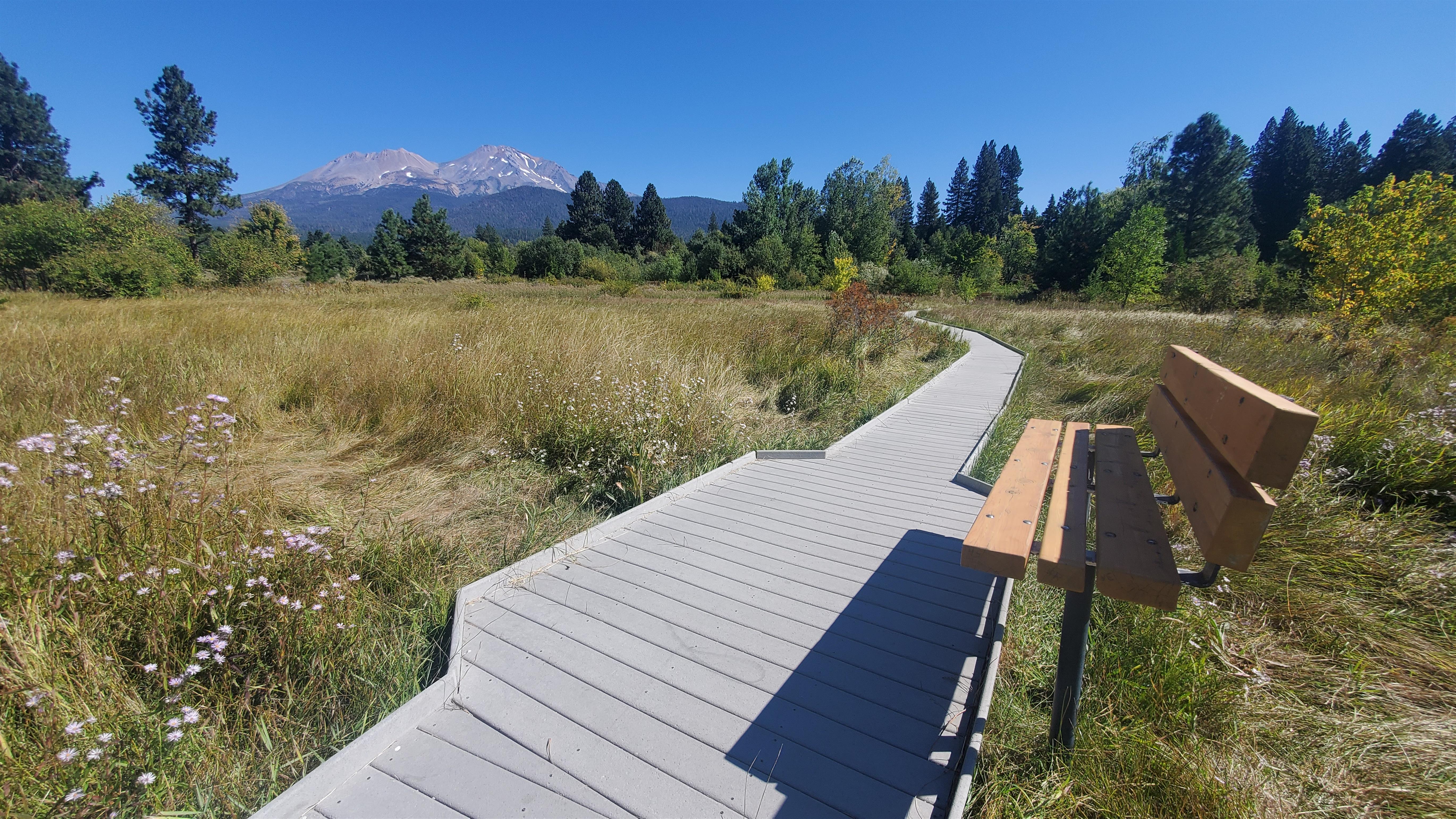
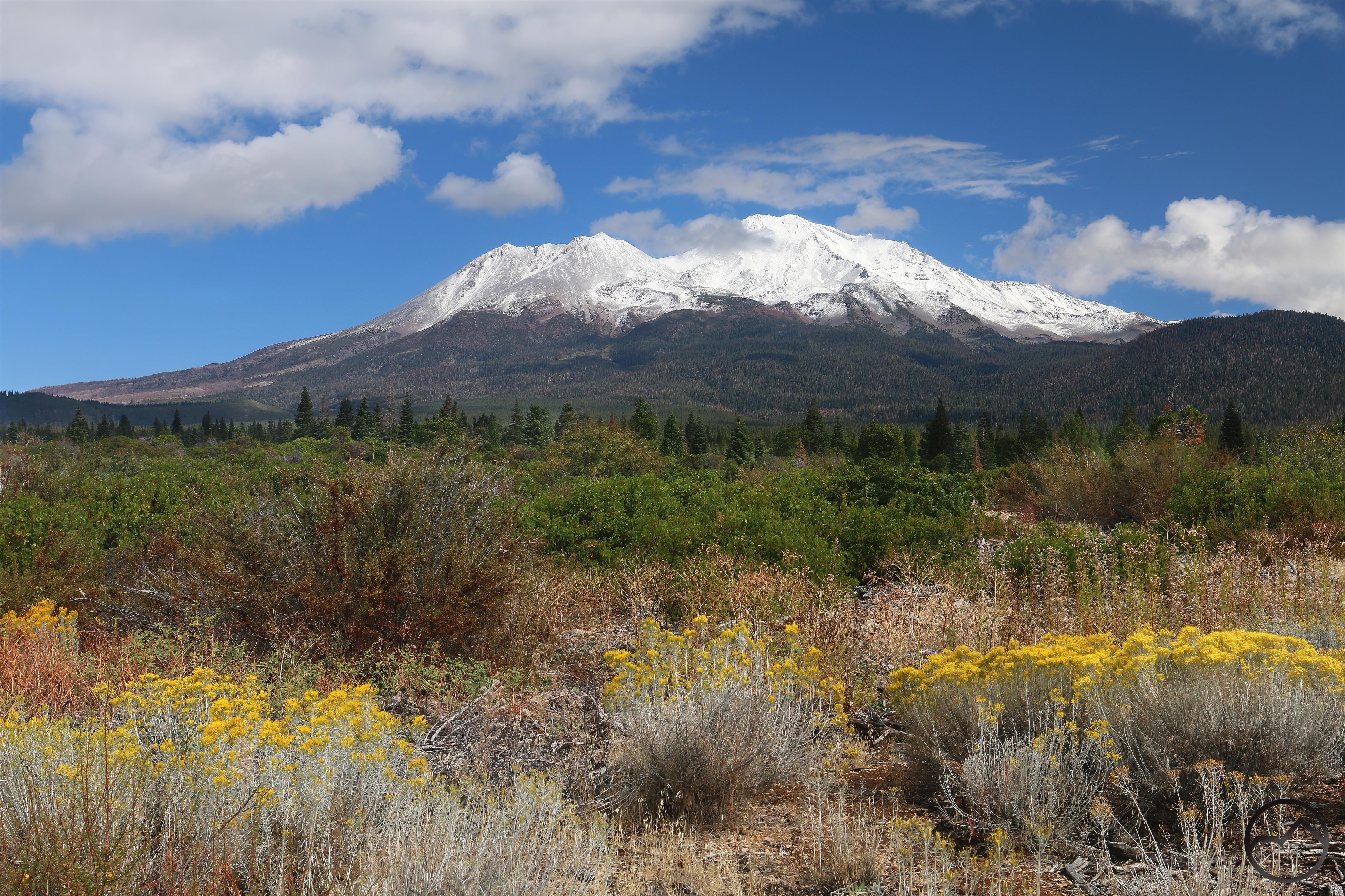
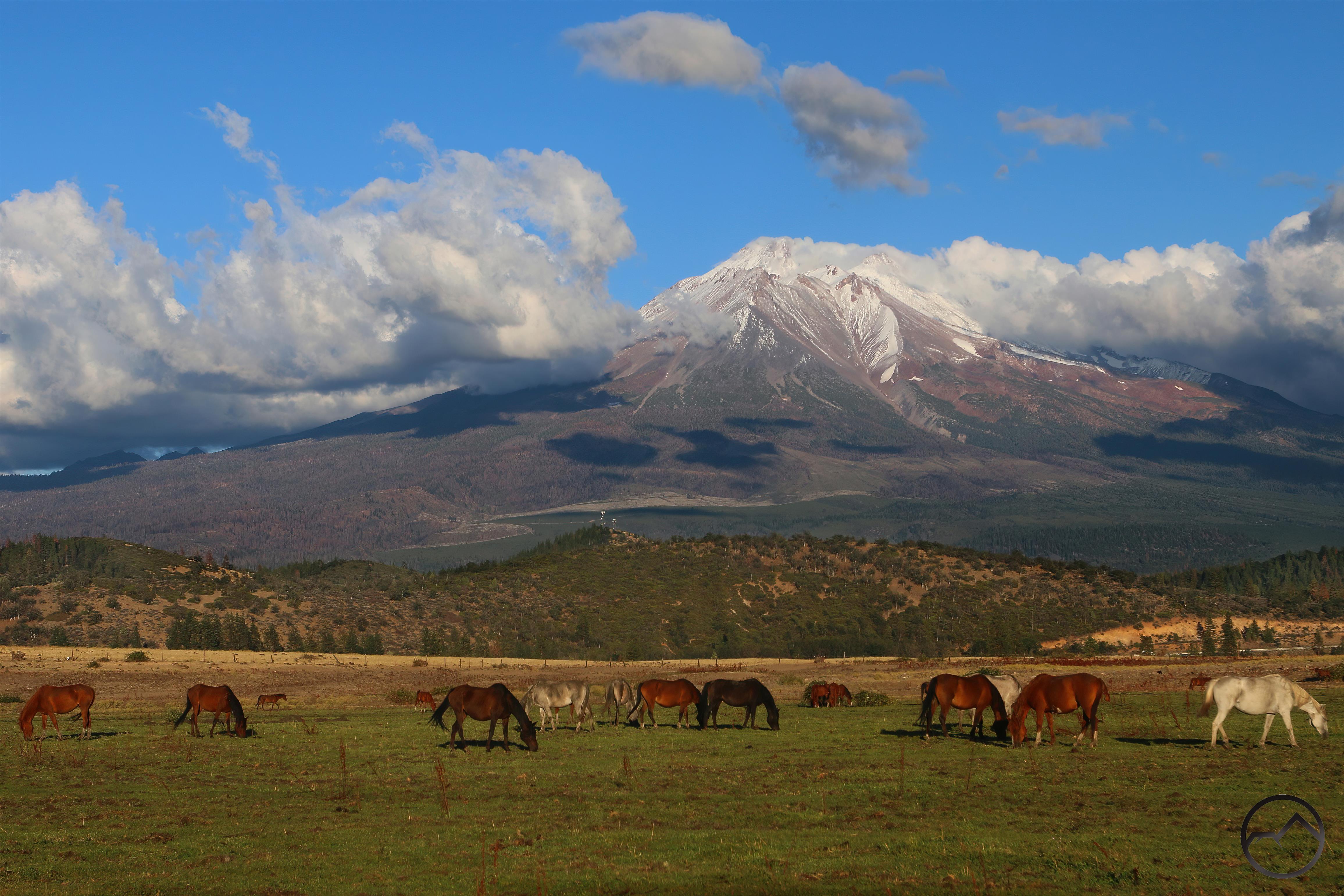
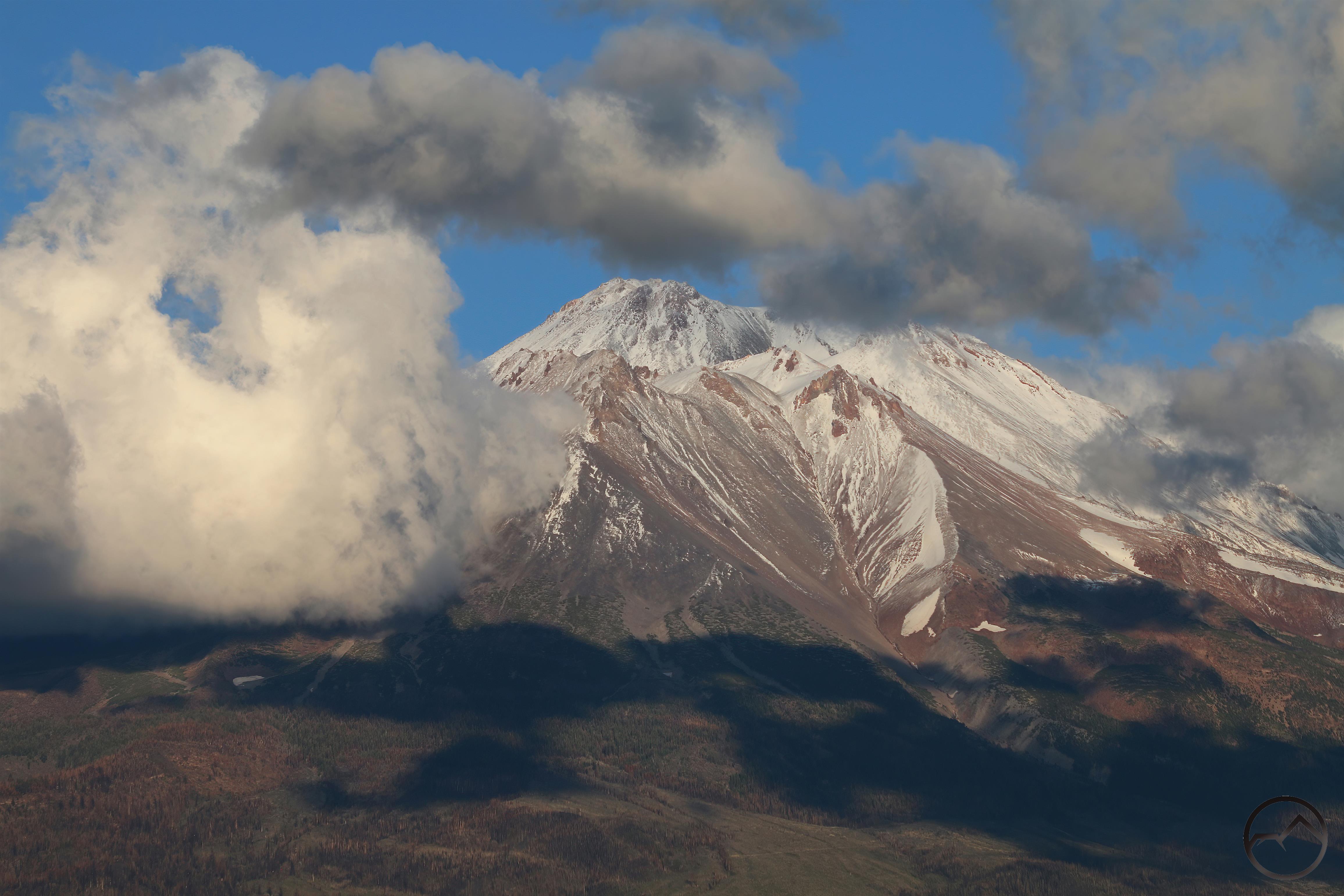
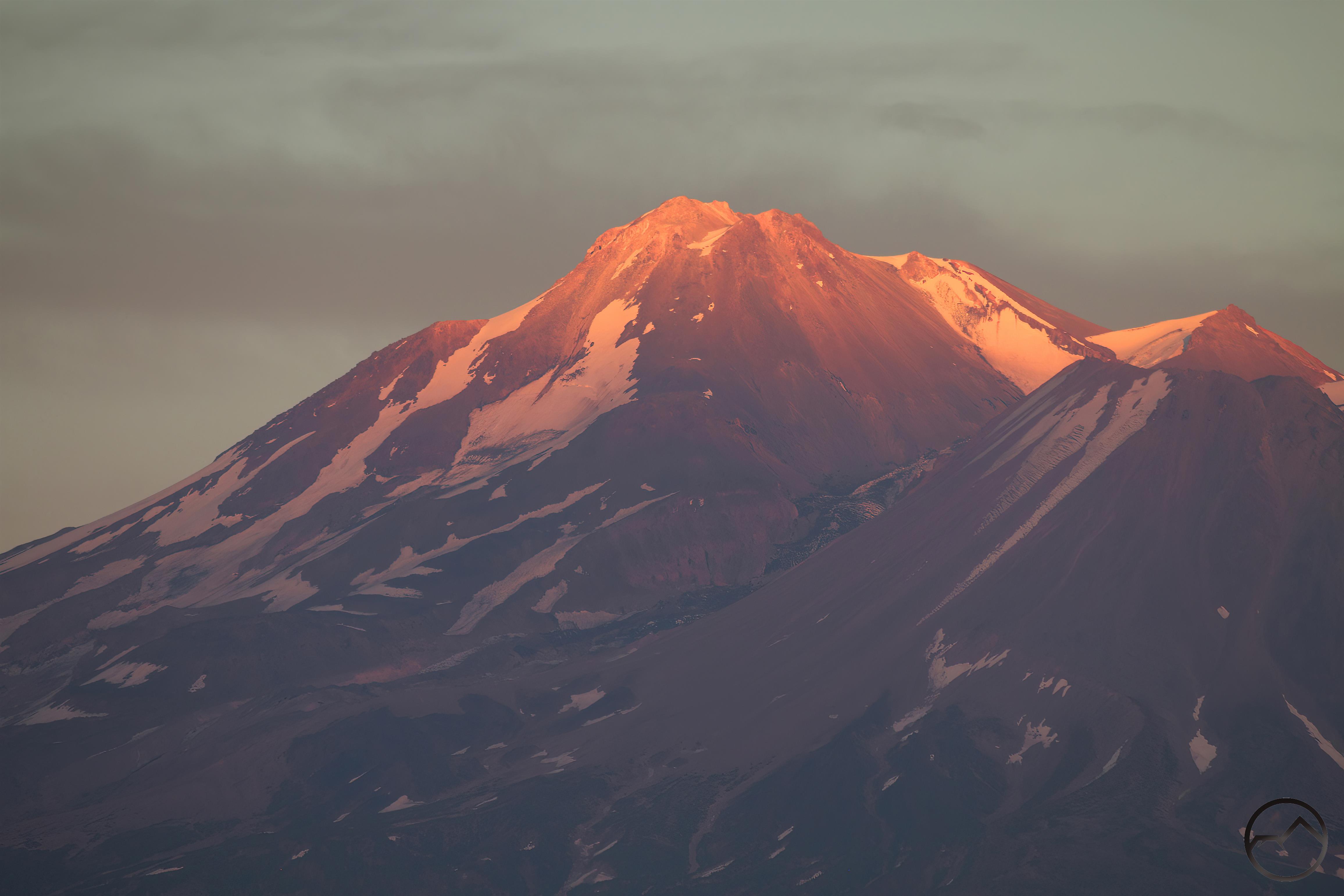
Fresh August snow lingers at Mount Shasta’s higher elevation.

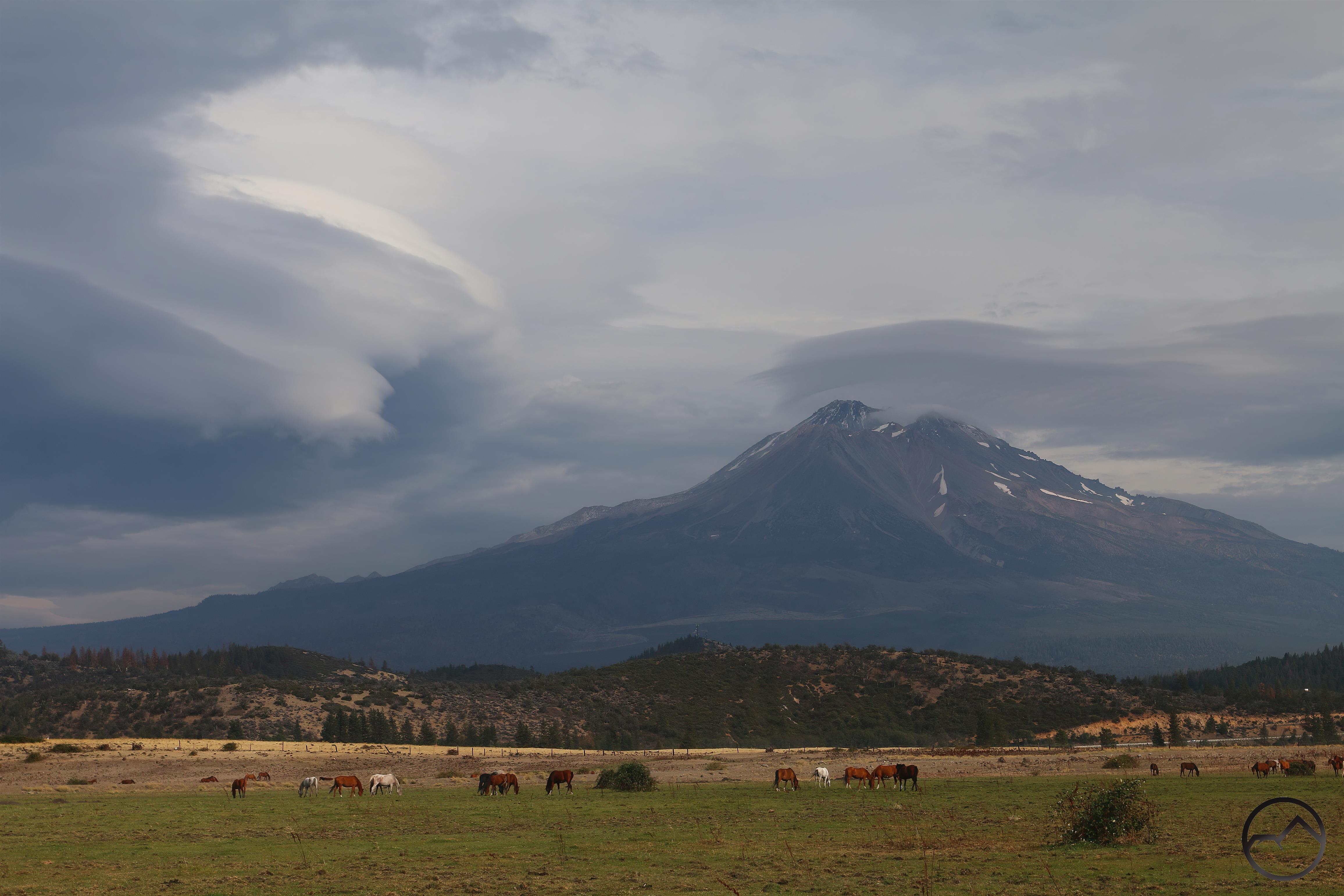
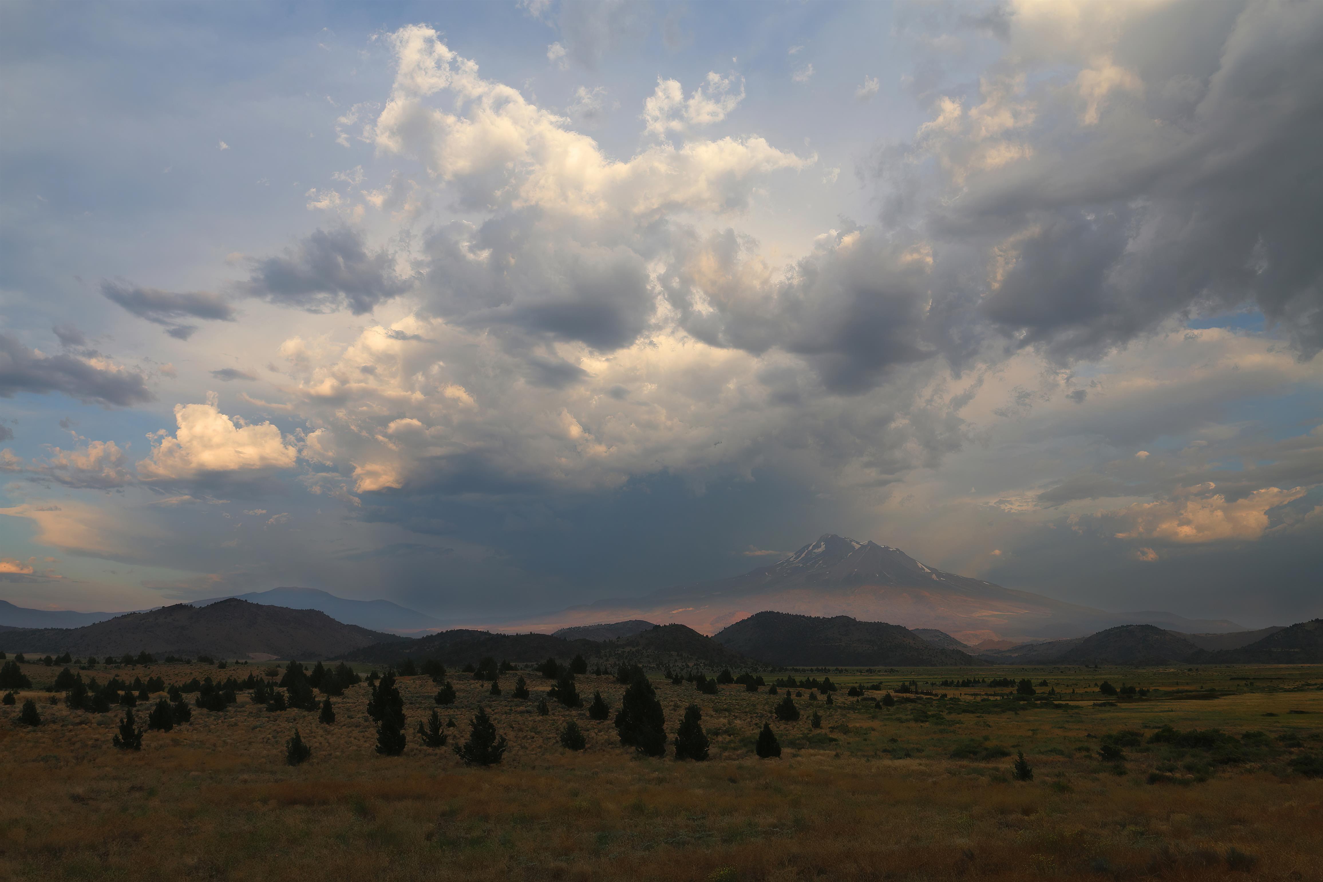
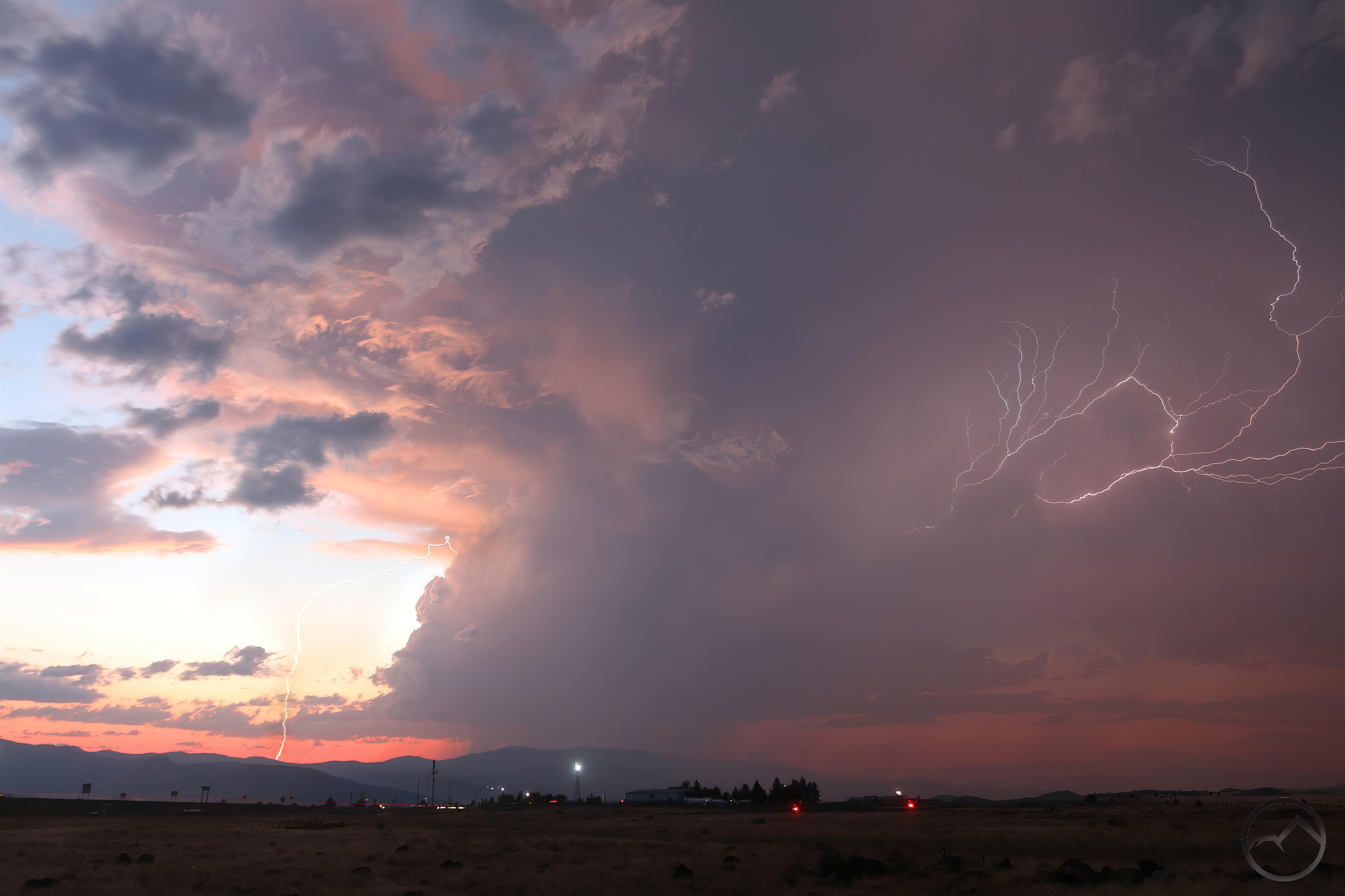
This past week California experienced some unusual weather conditions. As most likely know, Hurricane Hilary slammed ashore in southern California and proceeded to pierce into the heart of the Great Basin, bringing torrential rain. The powerful rain resulted in shattered records, flooding and mudslides as well as other damages. Little did we anticipate that this was true for Mount Shasta too.

Here in Mount Shasta, the forecast predicted that the storm would weaken once it made landfall and then head straight north, across the Mojave Desert and then north, through the Great Basin. Some predictions called for a year’s worth of precipitation to fall in this single storm in some areas. It was time to batten down the hatches and wait and see what would happen.

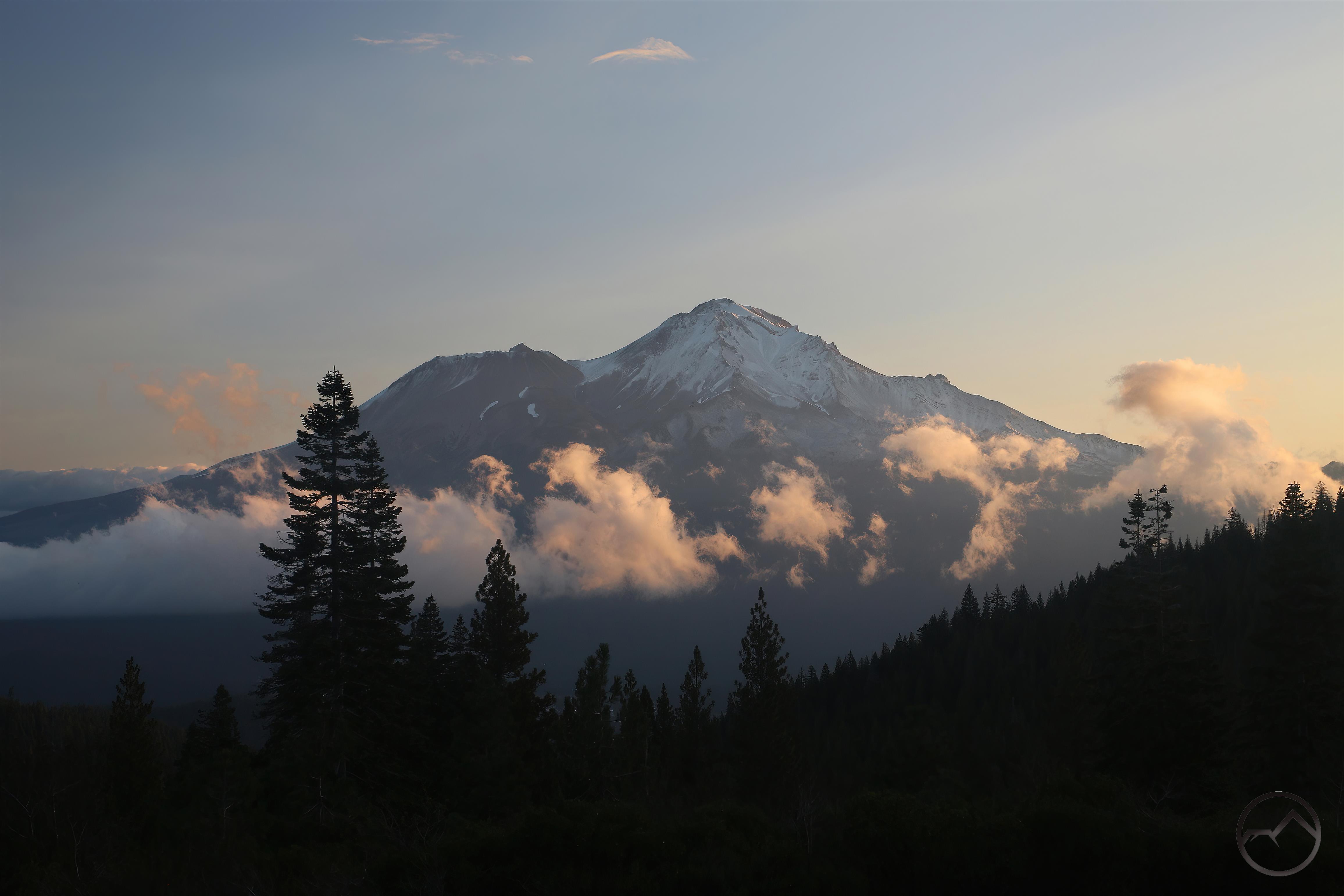
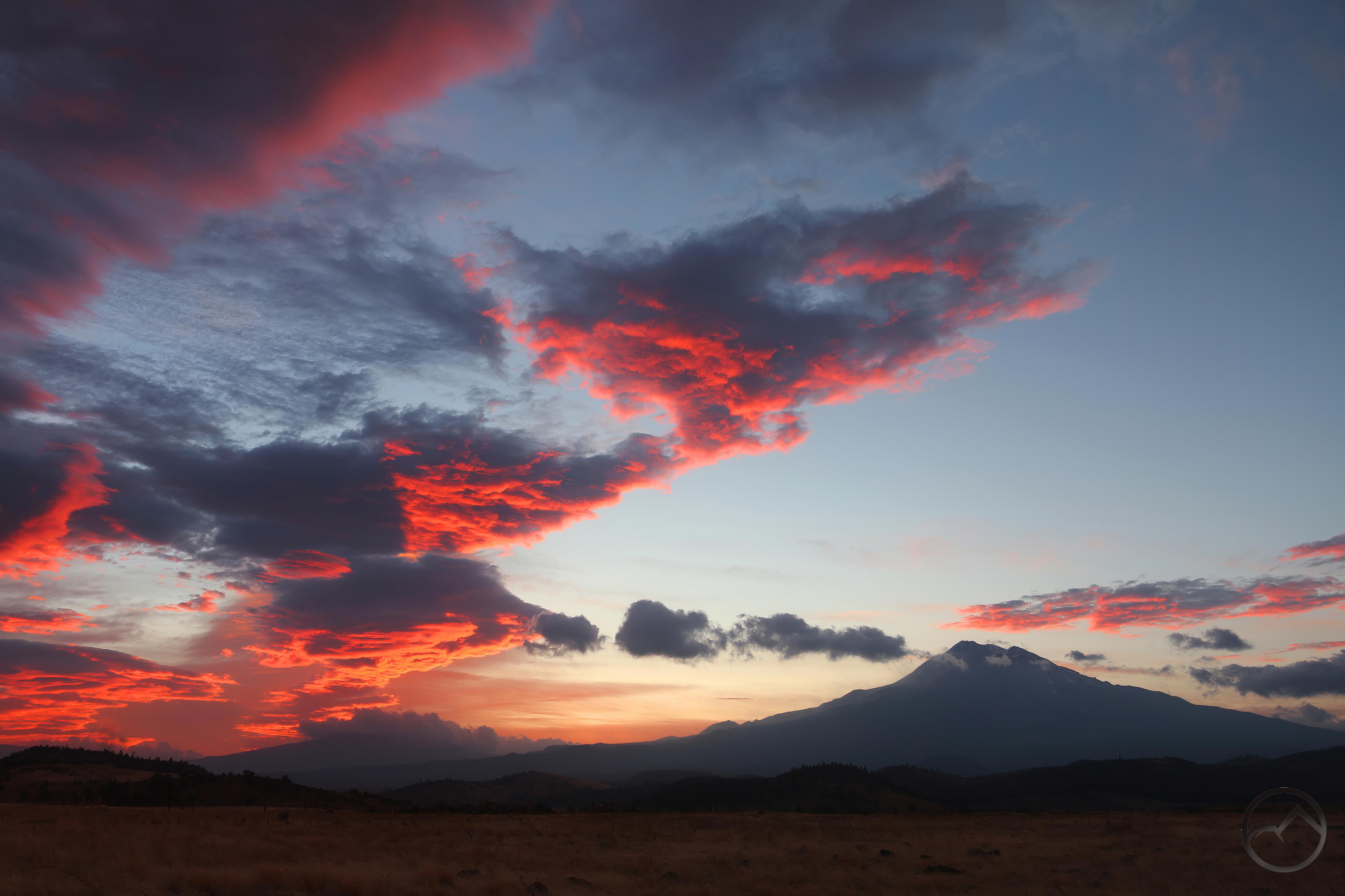
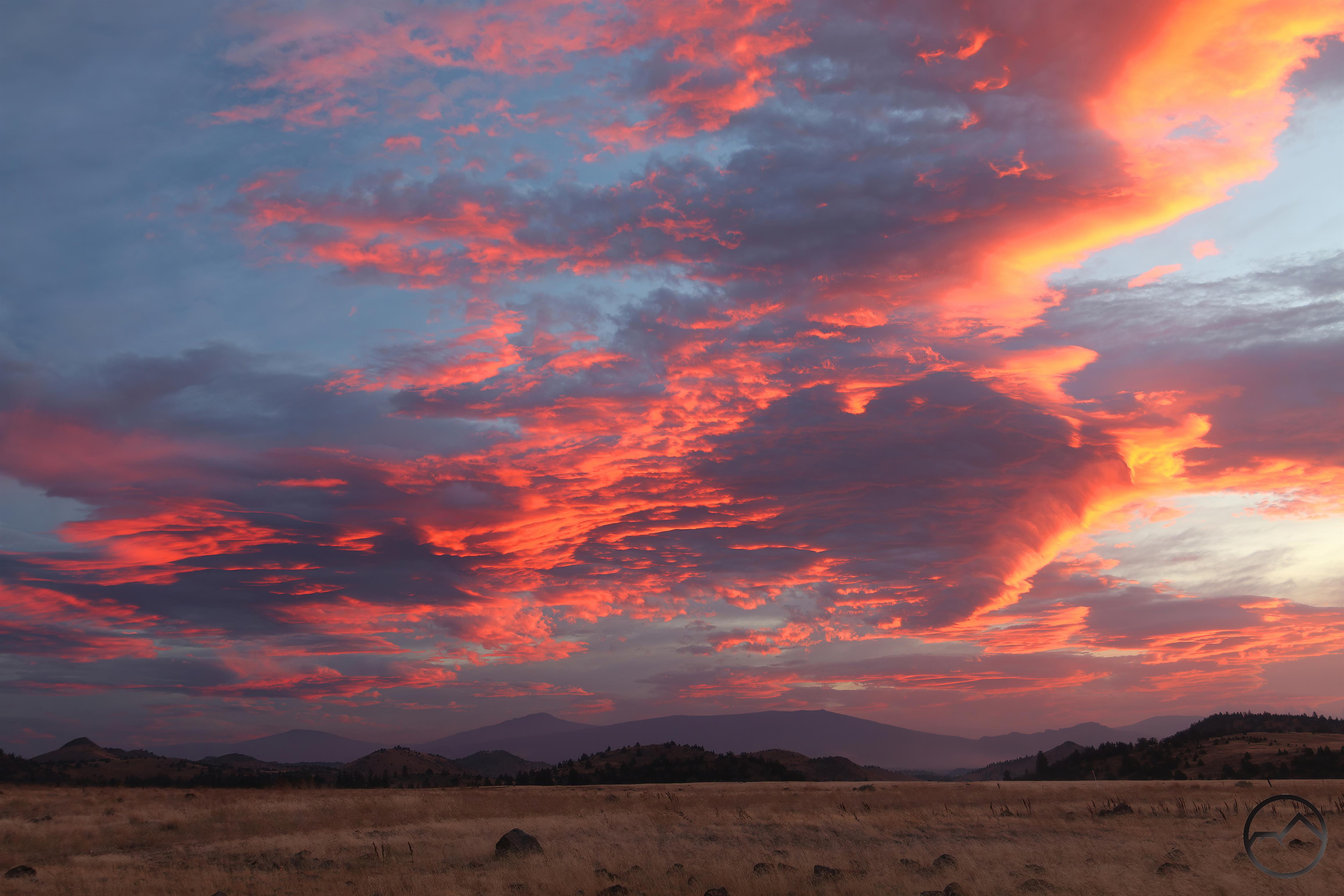
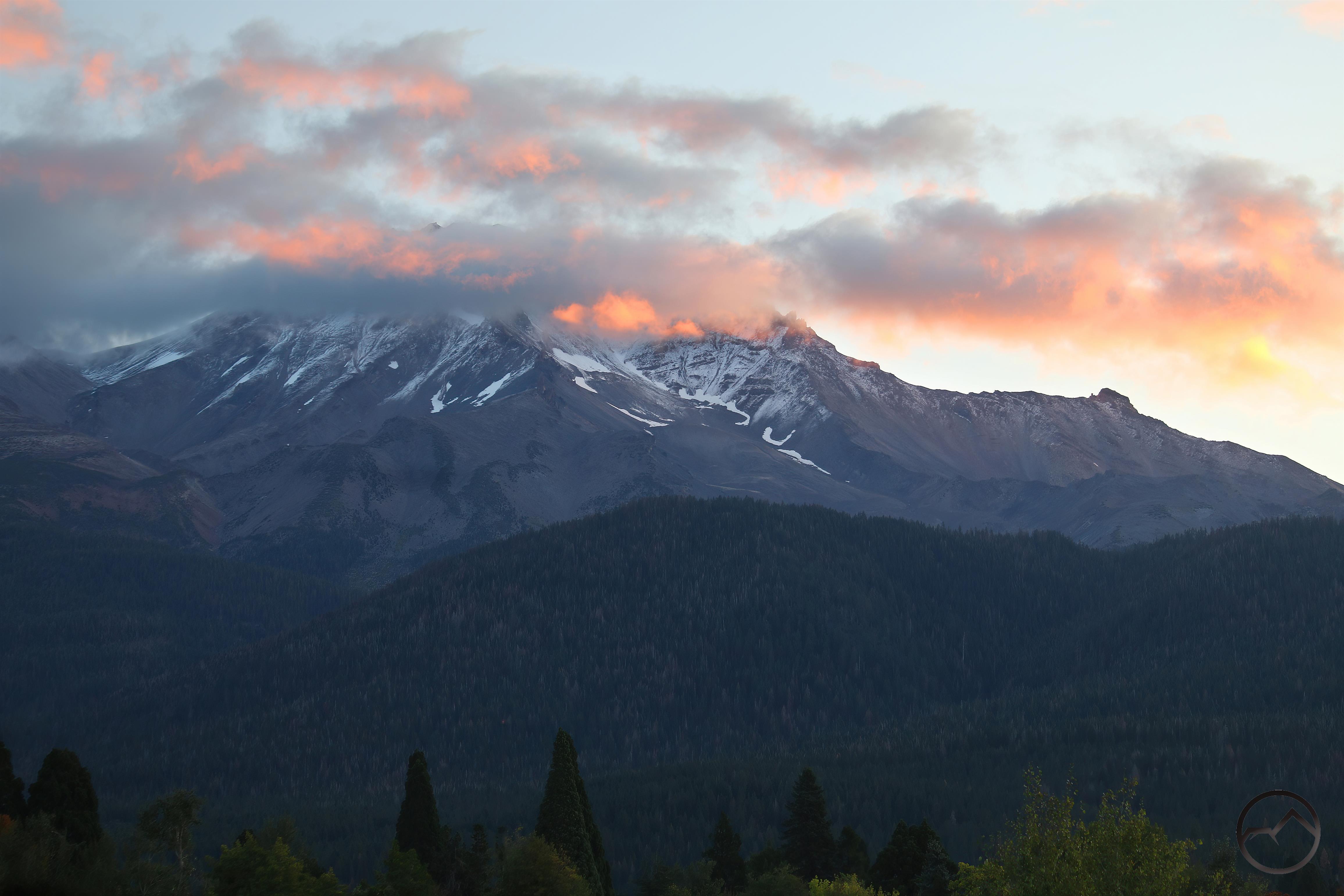
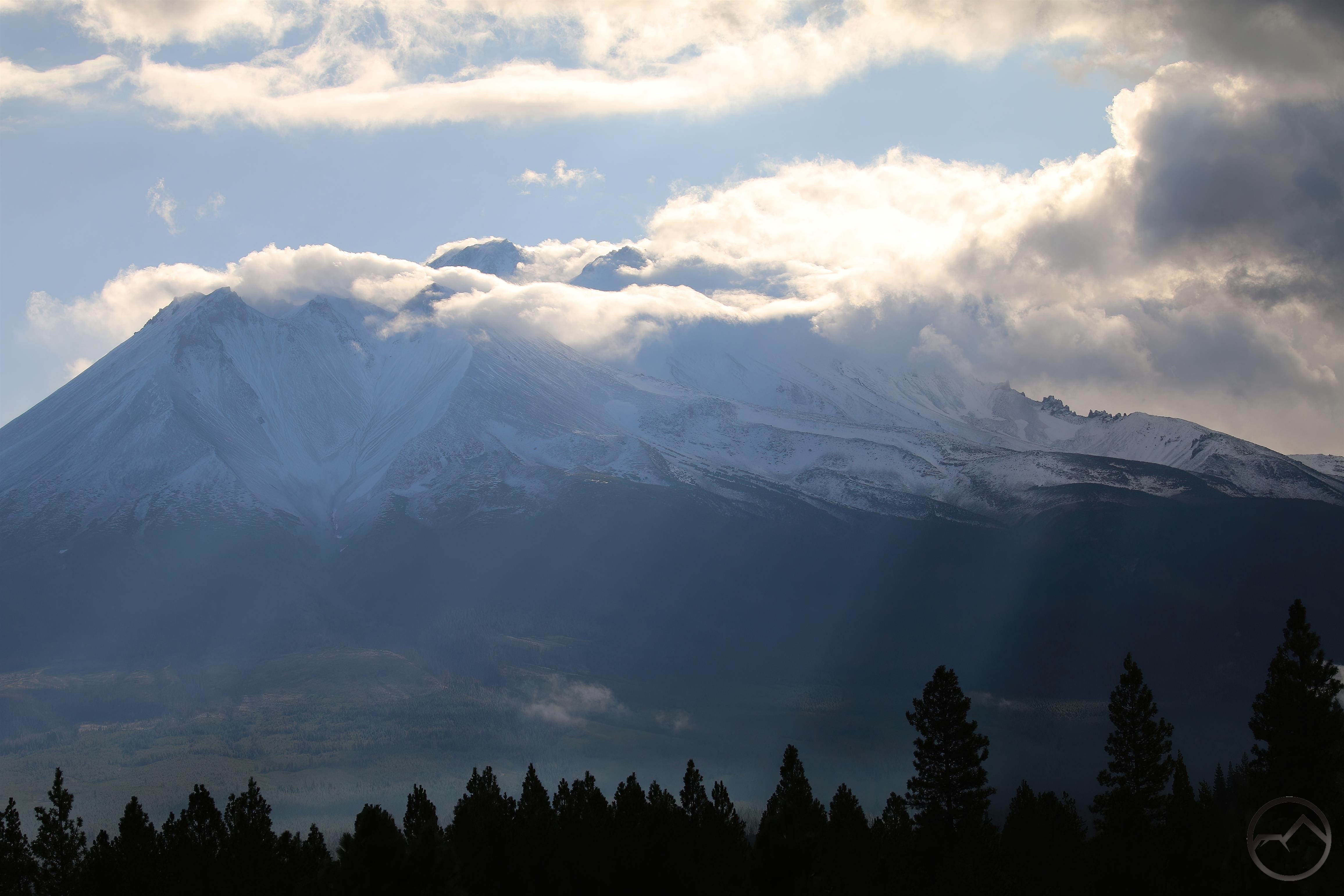
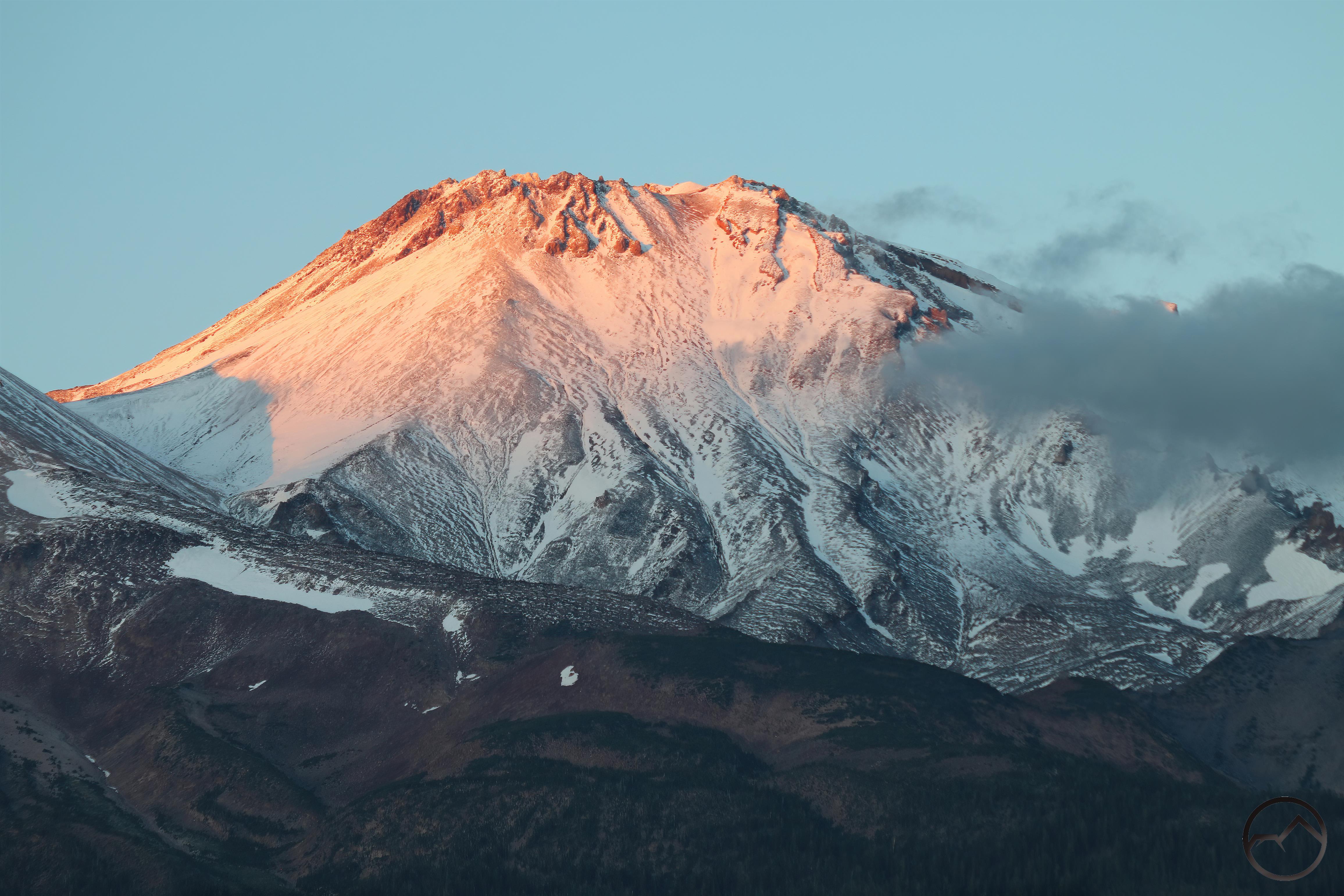
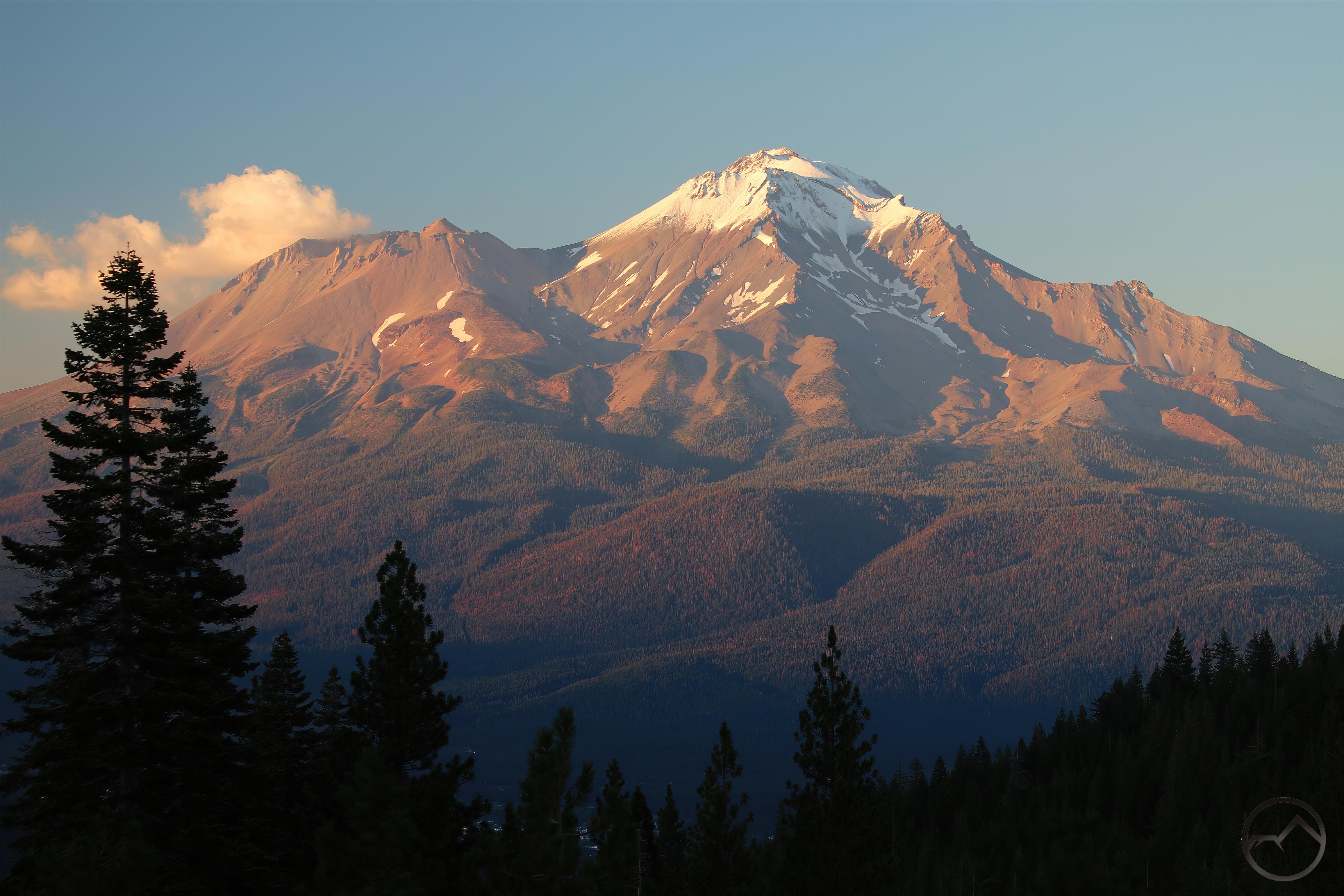
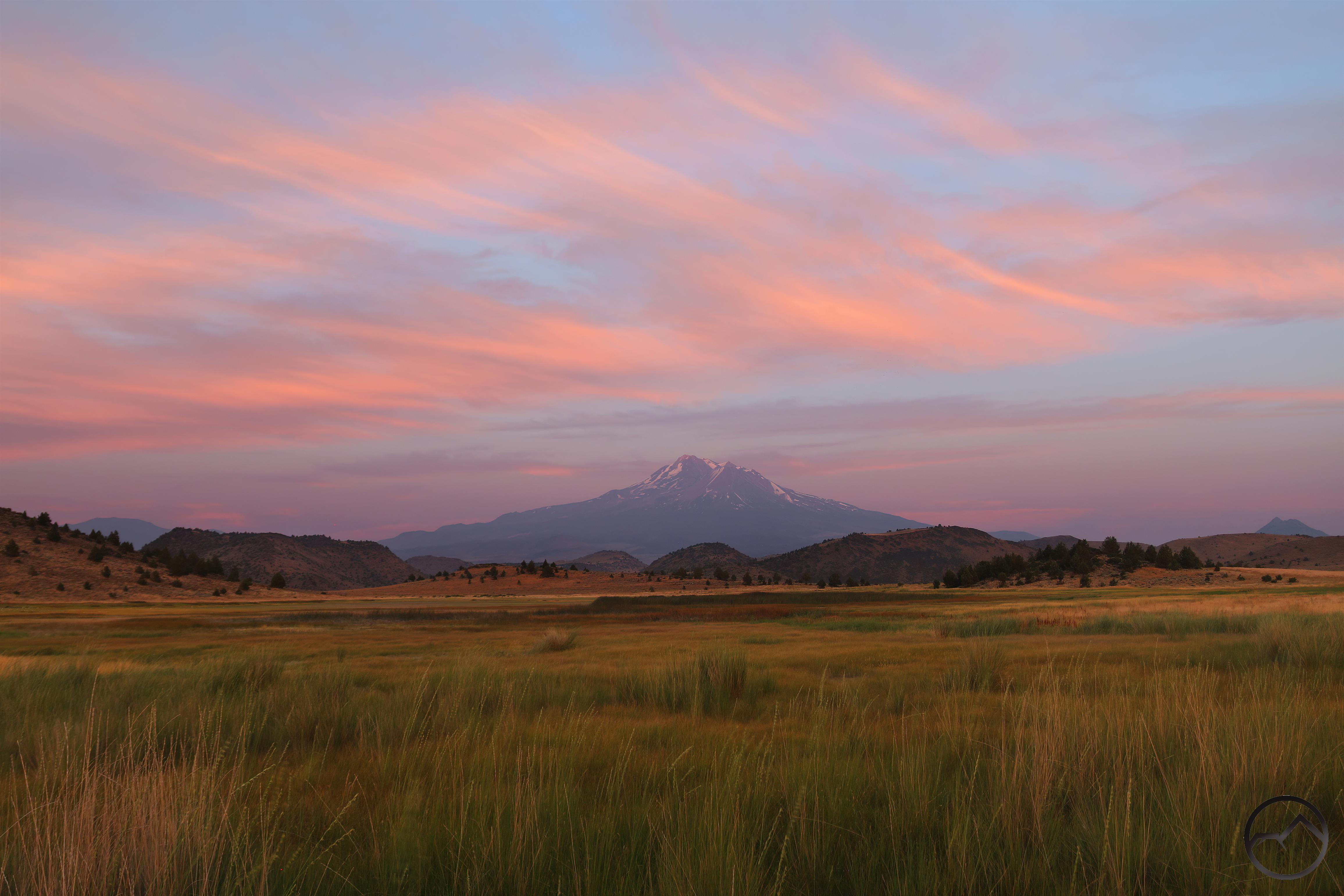
A streak of alpenglow lights up treeline on Mount Shasta.

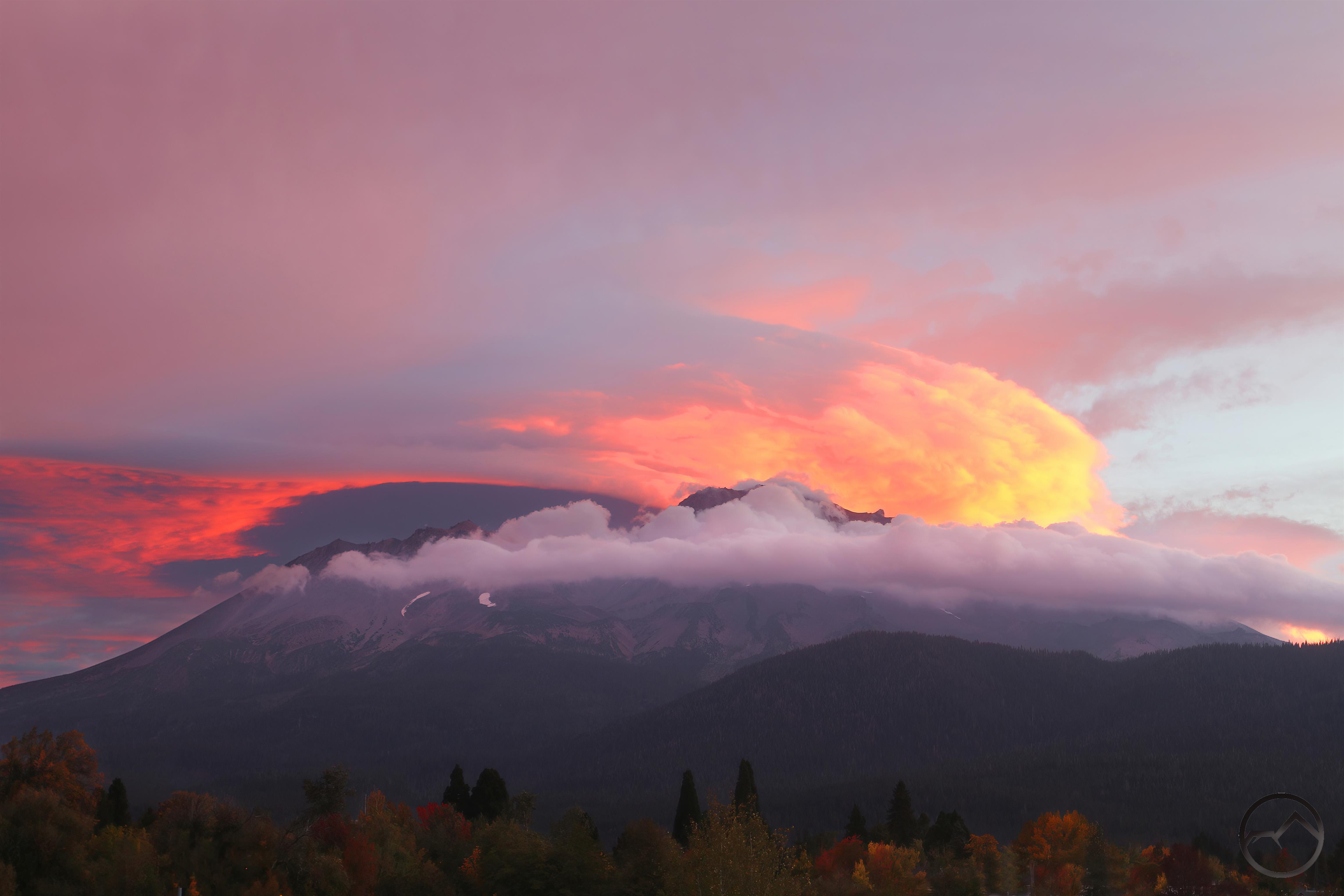
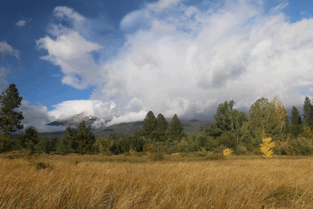
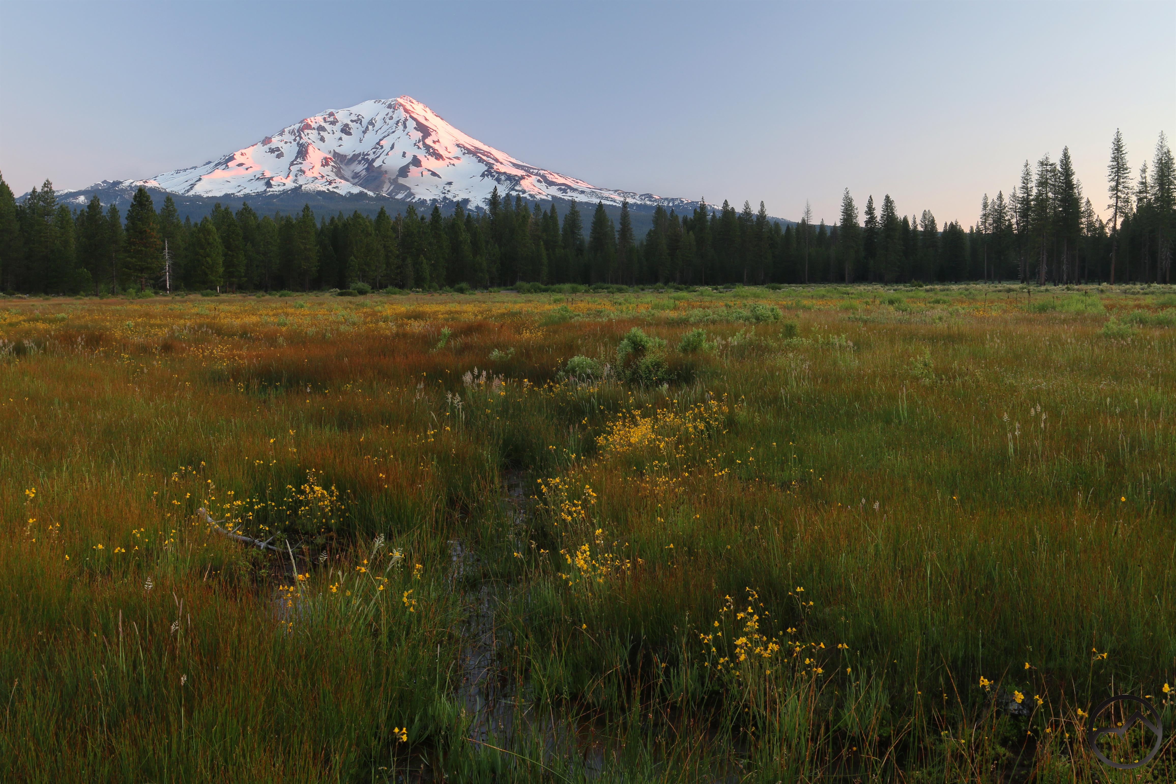
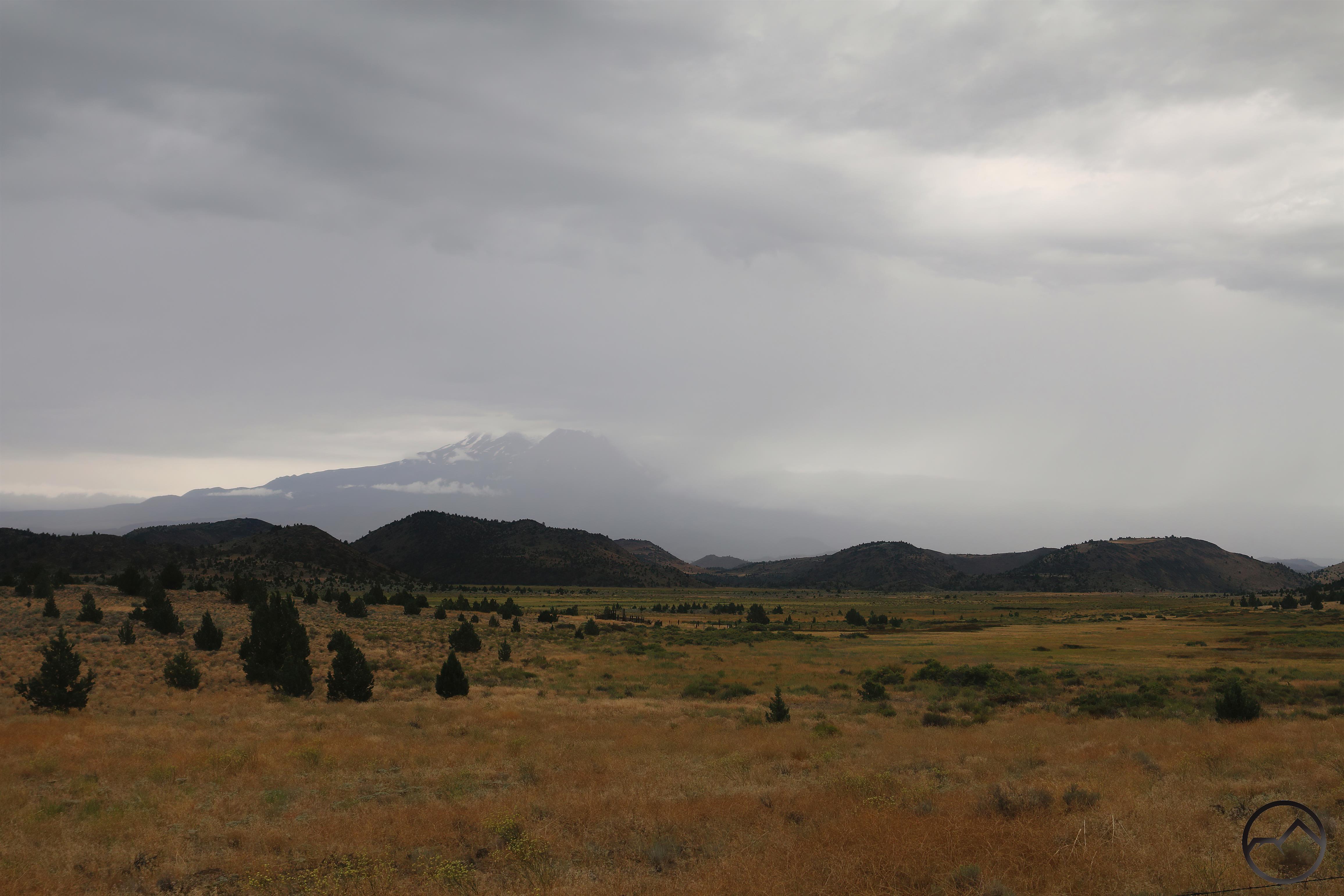
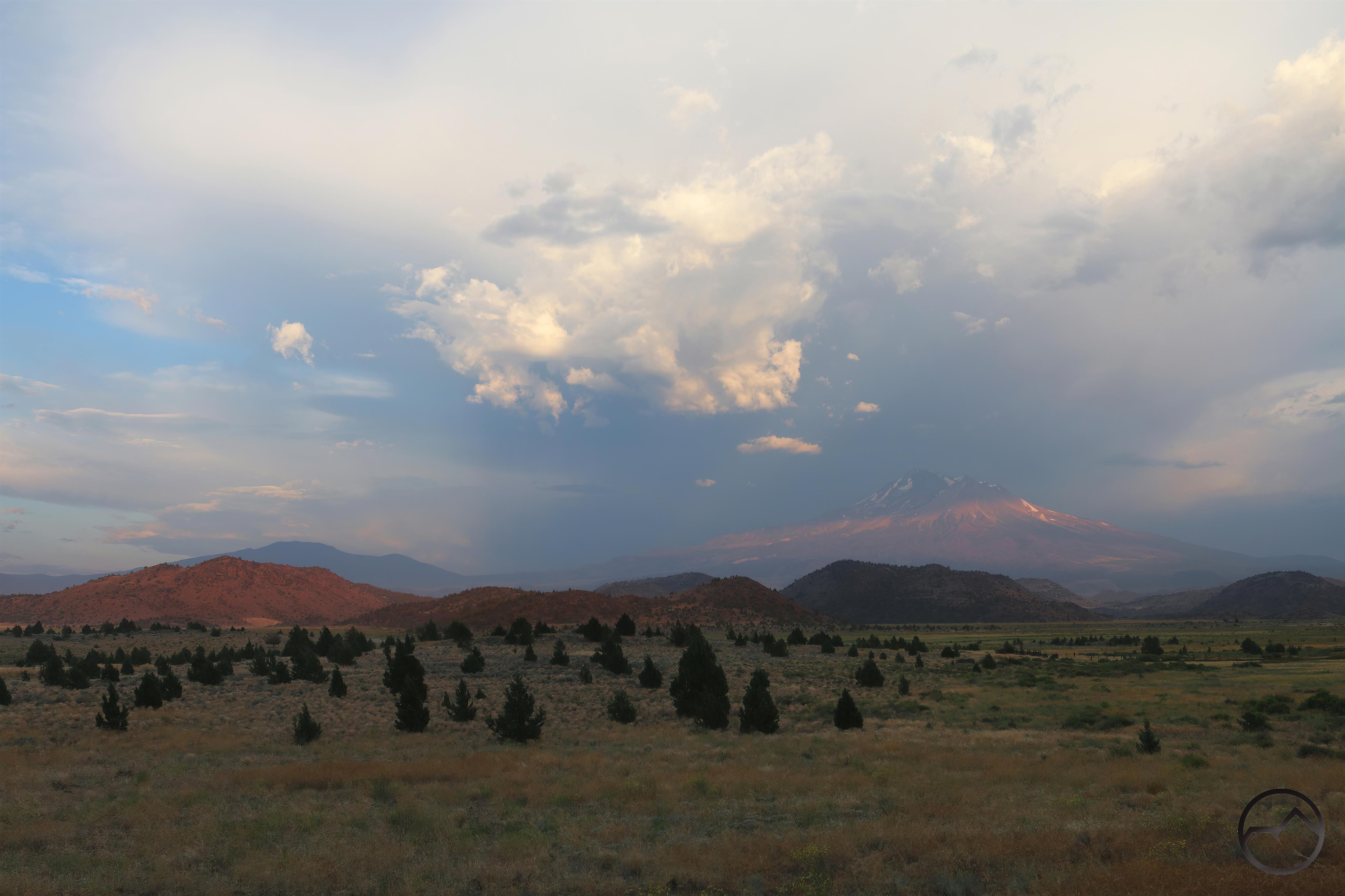
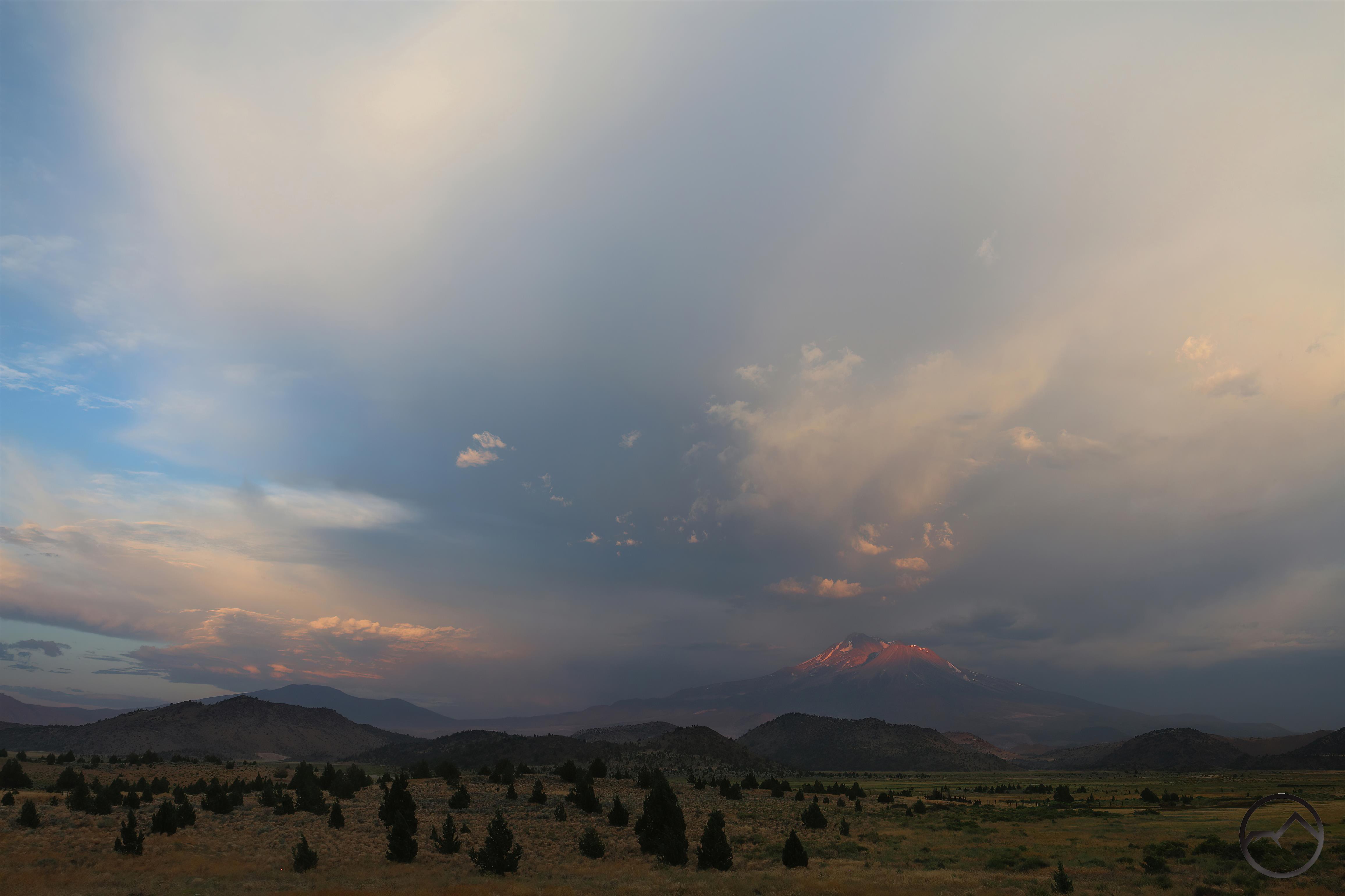
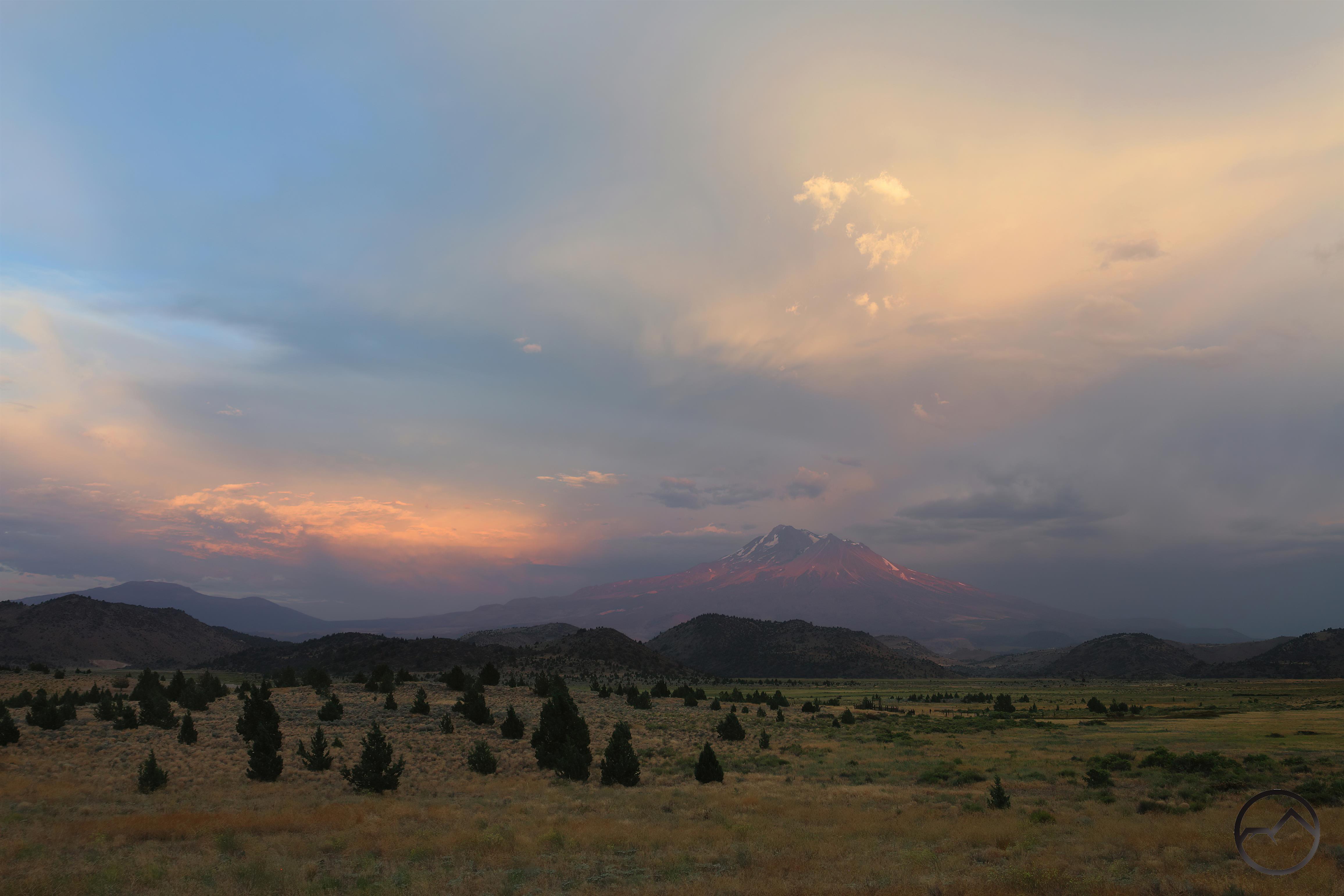
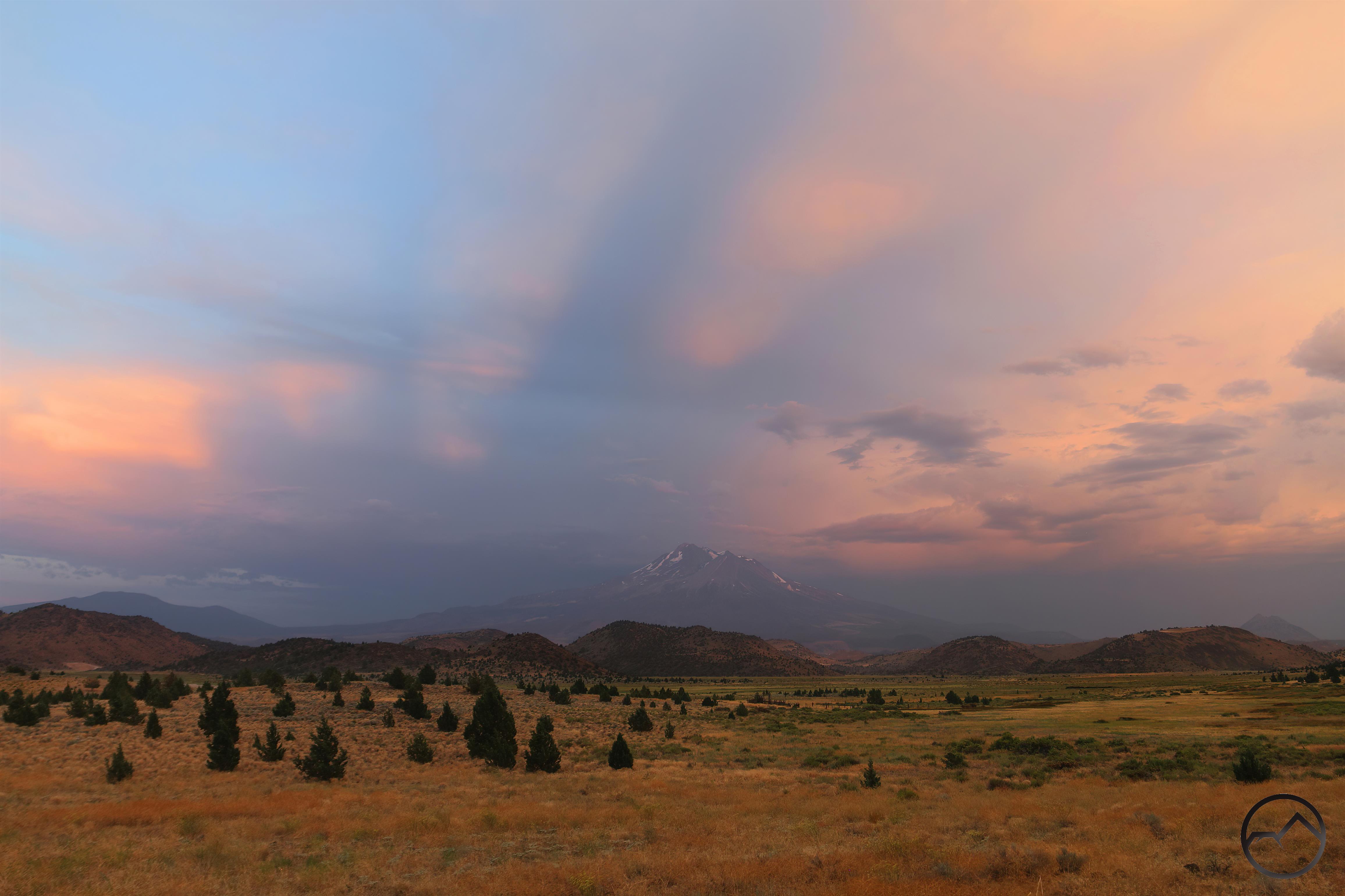
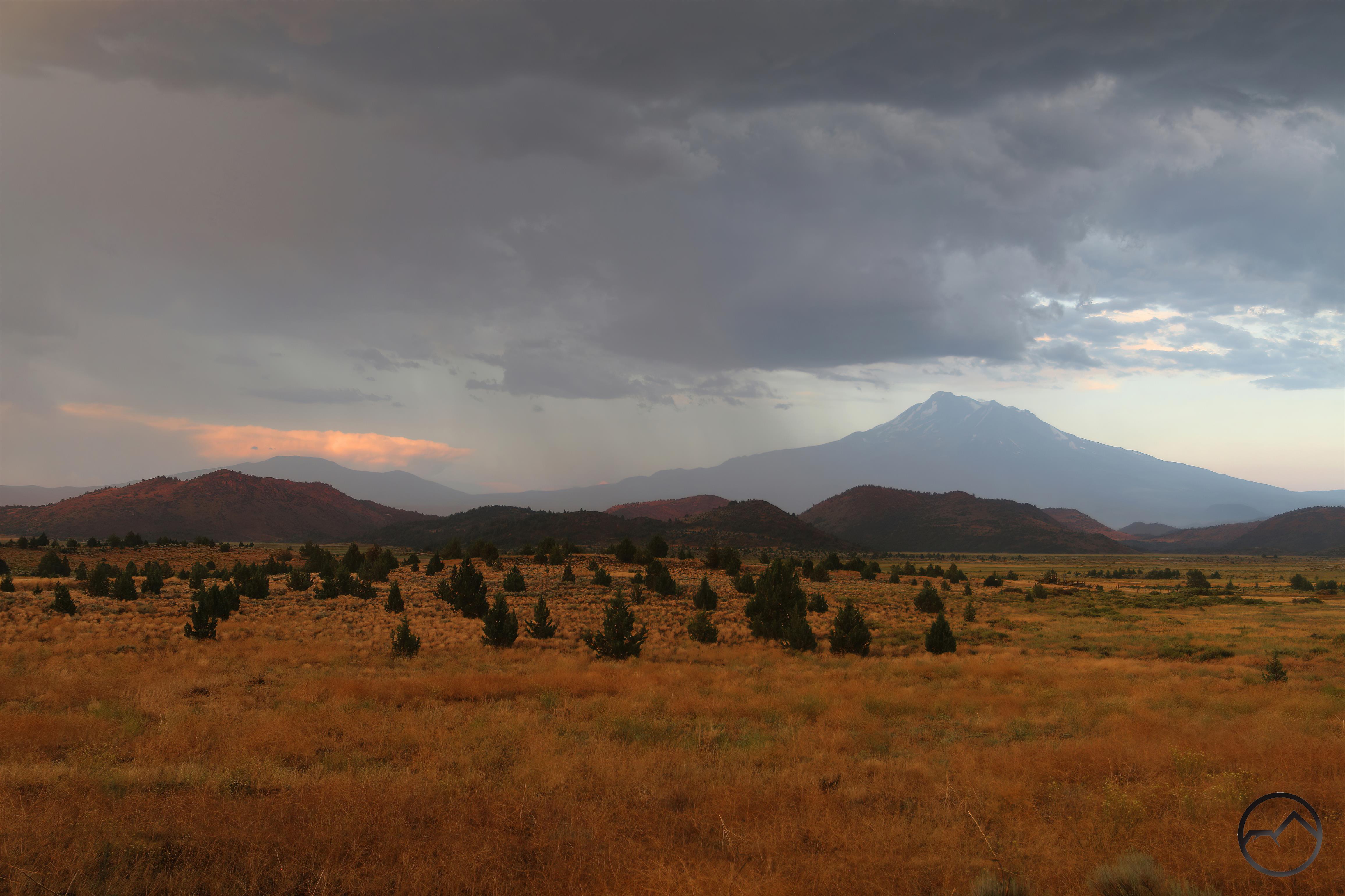
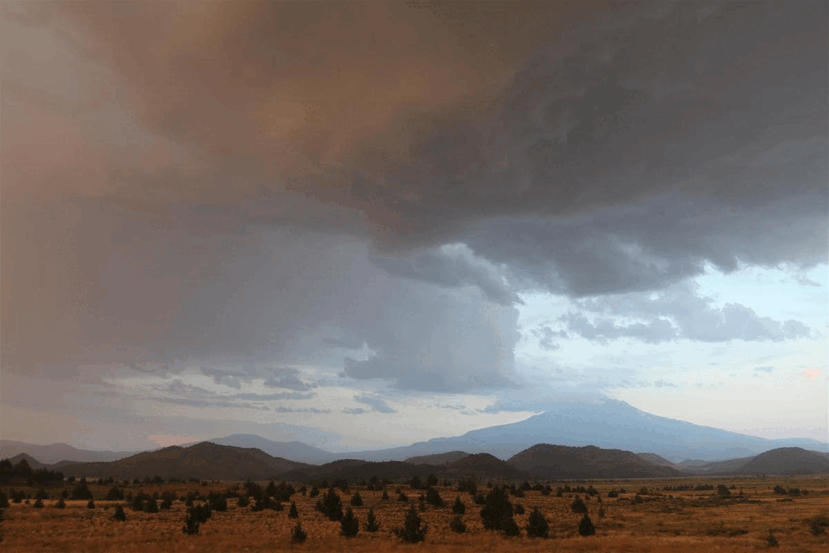
Prior to the storm’s arrival the Mount Shasta area had been hot, with temps in the low 90’s. The heat held but the day before the storm arrived the clouds began to gather. We were only to get hit by the outer flanks of the storm. Any further west and there wouldn’t be much precipitation. Around the mountain, a little less than 0.7 inches was called for. As the clouds coalesced, I made sure to try to capture the sunset, as it would be the last for a day or two. The mountain was partially obscured but the light still hit the mountain at the tree line. Nothing fancy, but still a beautiful sunset.

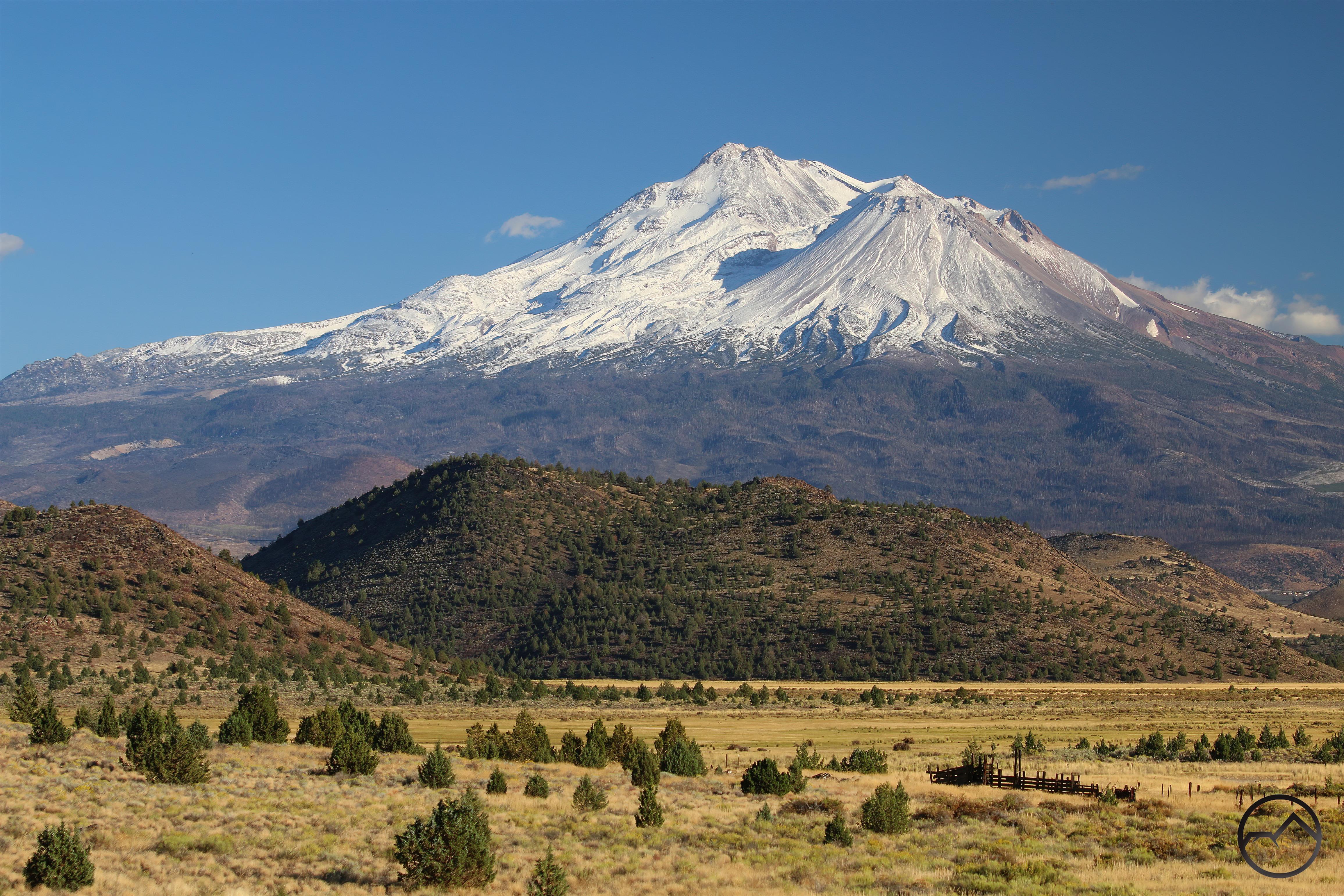
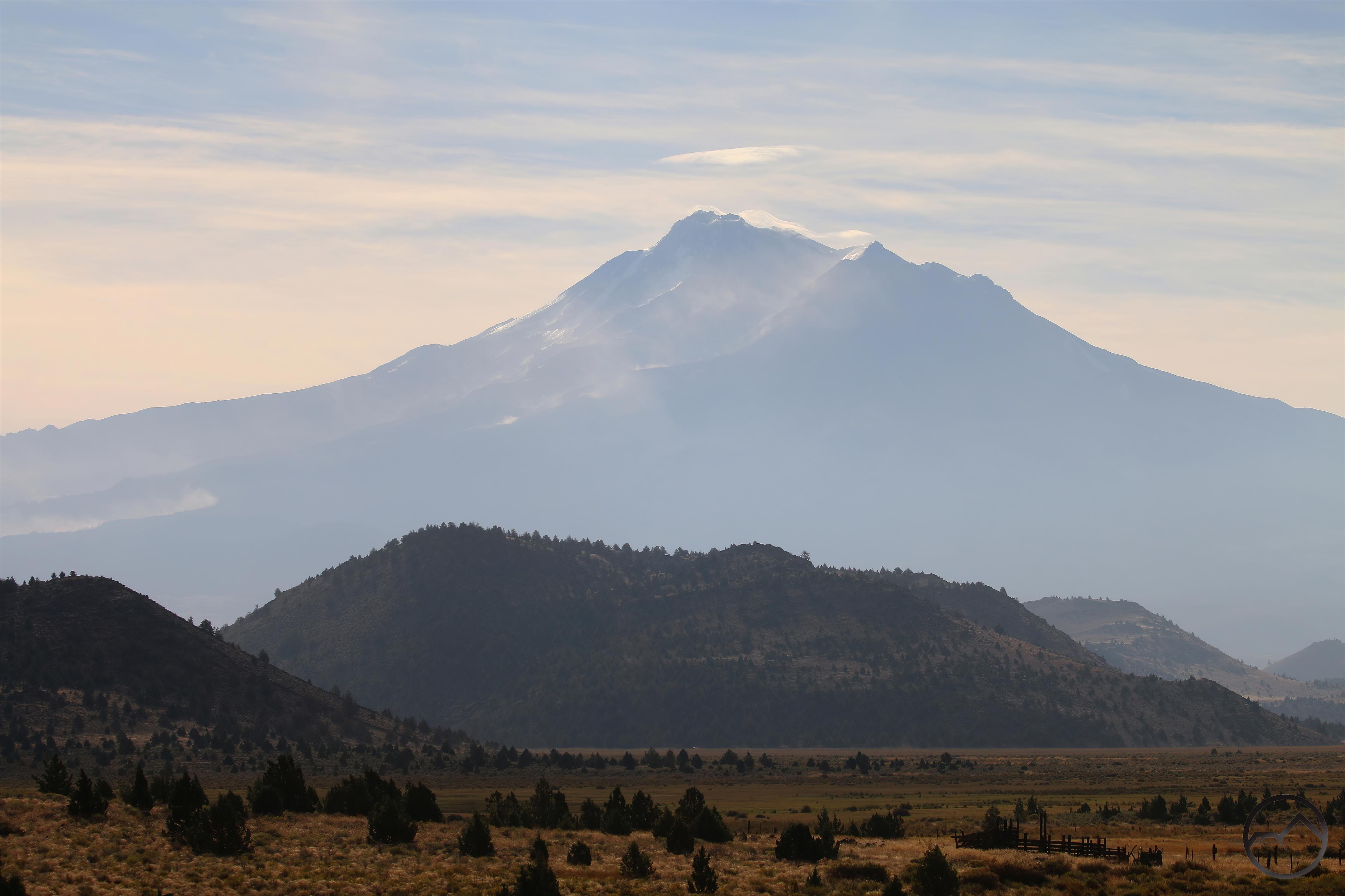
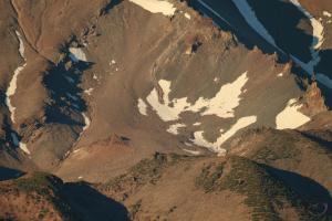
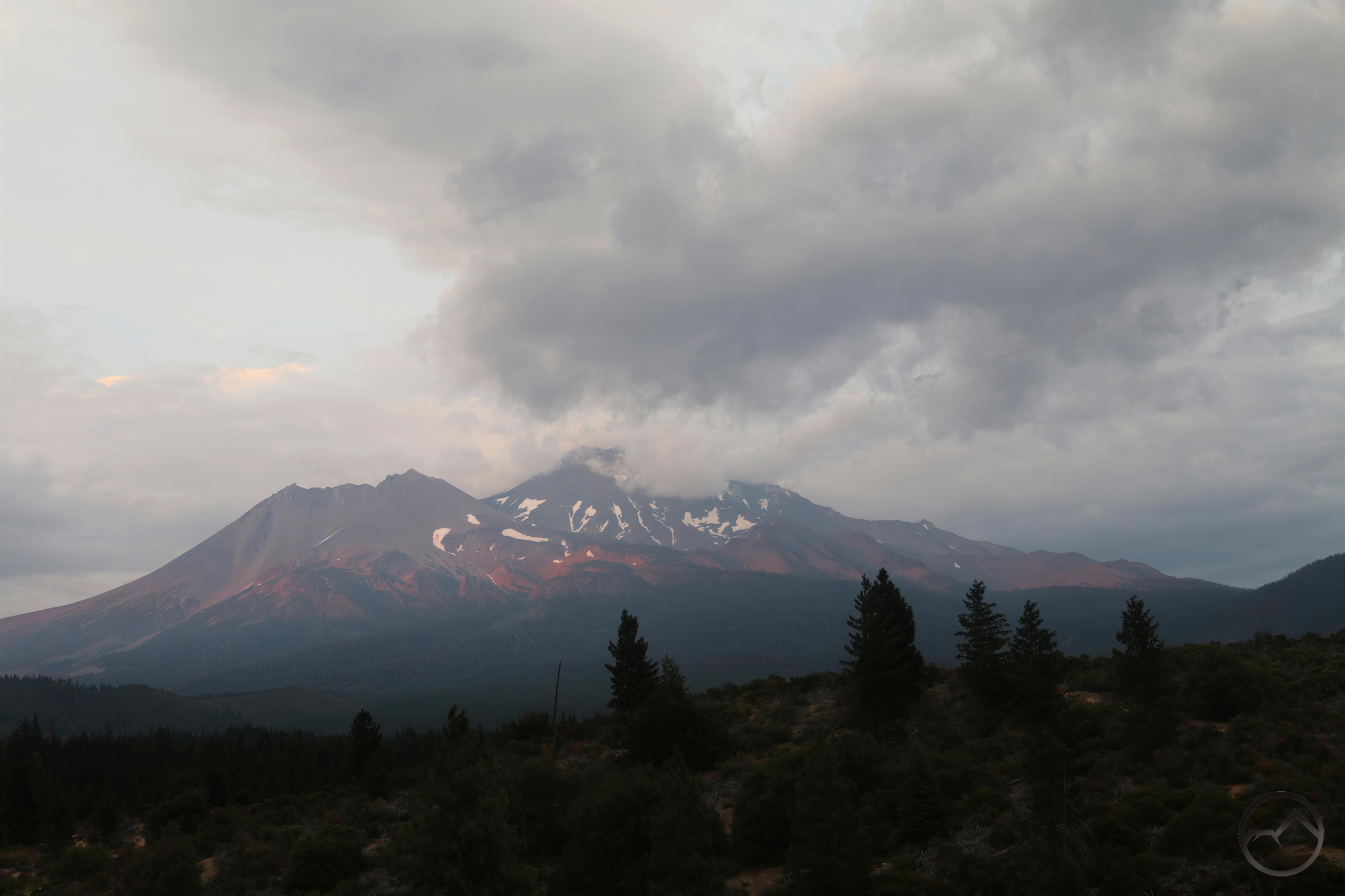
Mount Shasta holds back the storm.

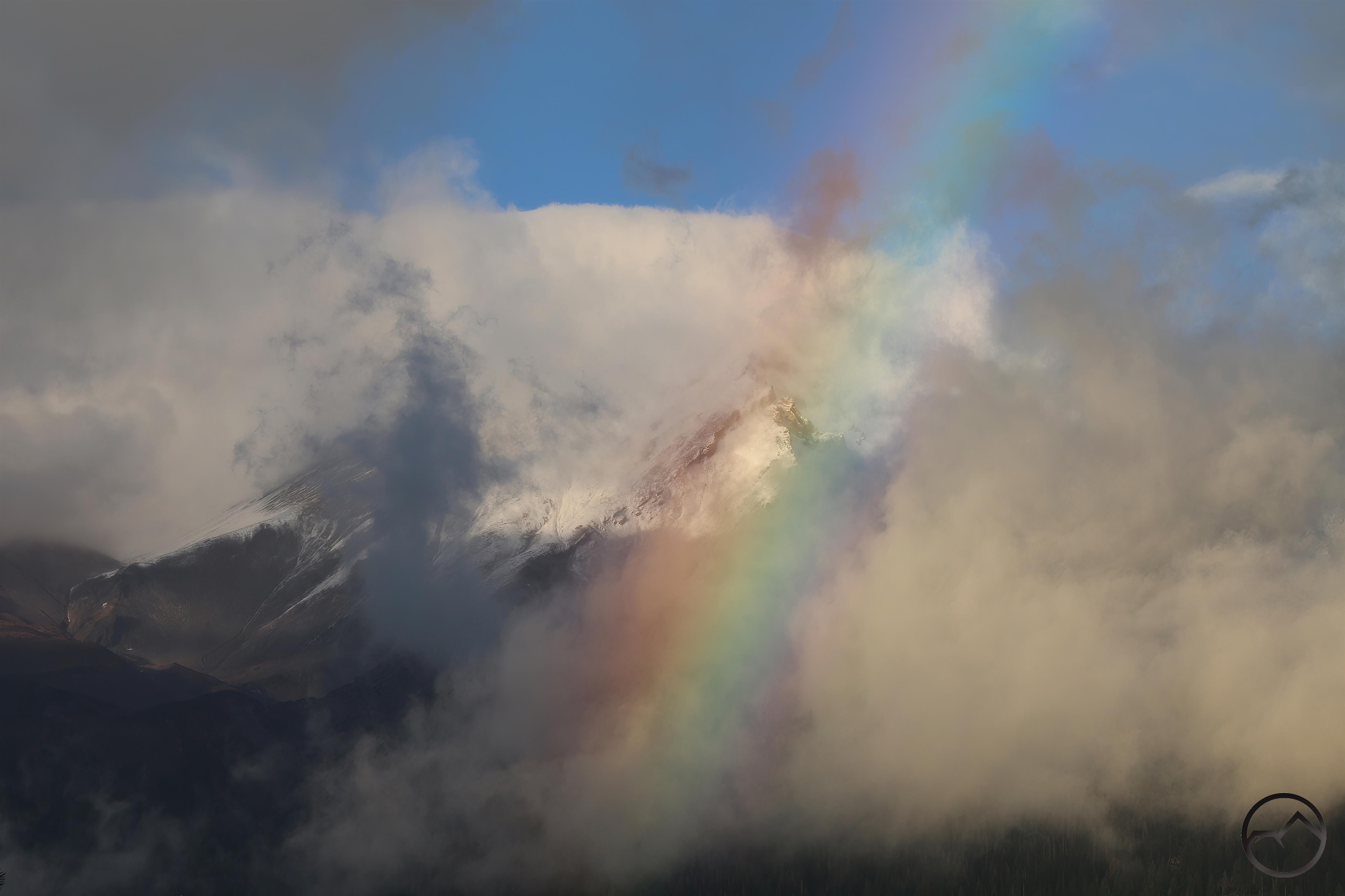
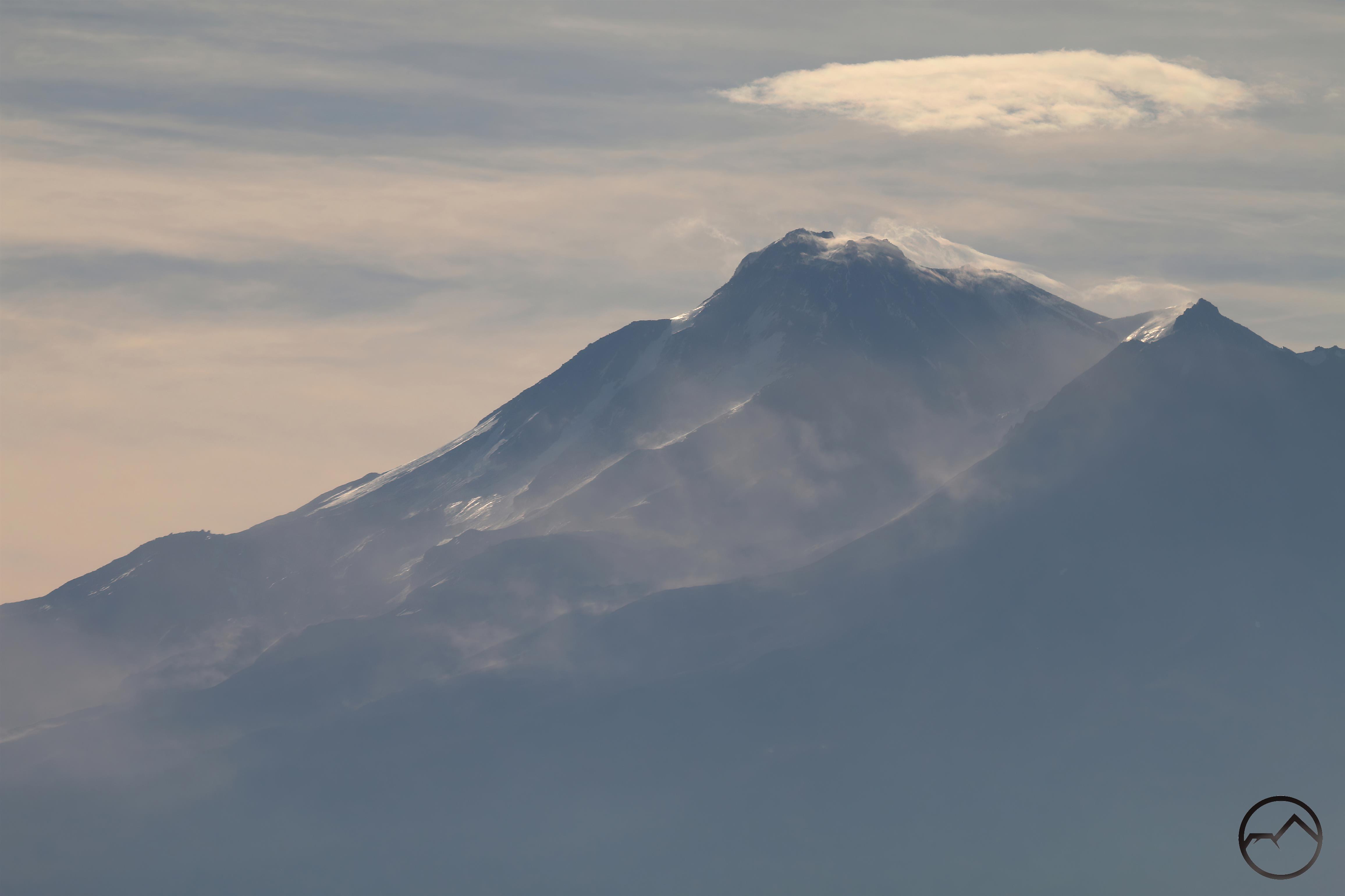
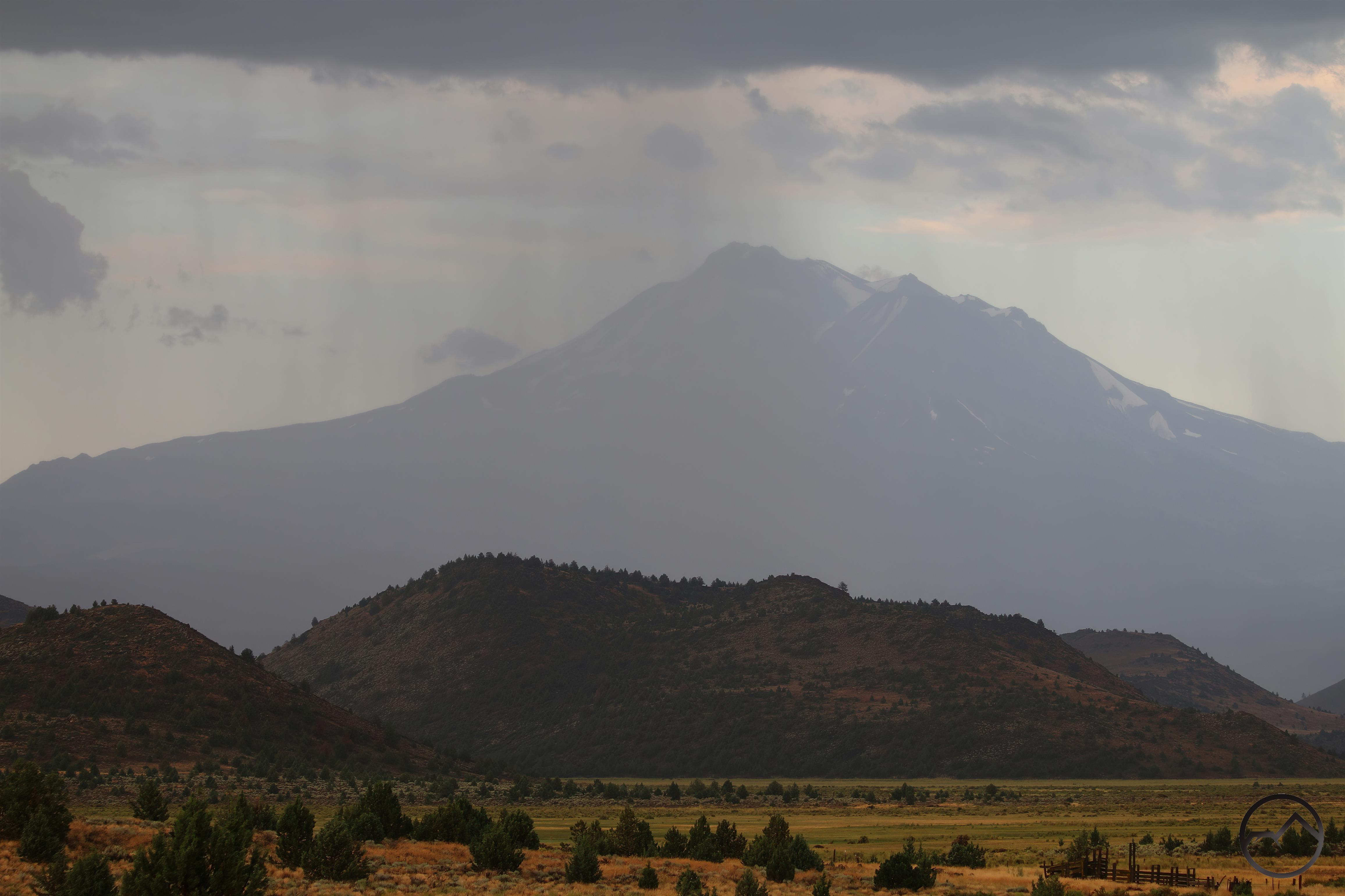
The day of the storm I headed up to Yreka in the afternoon. As is typical, though raining hard in Mount Shasta, the precipitation came to a screeching halt when I reached the edge of the Shasta Valley. Further north, I could look south and see the mountain pushing up into the clouds, with only its final 1,000 feet or so obscured by the storm. It always amazes me how much weather Mount Shasta holds back and it makes sense why the valley is a desert.

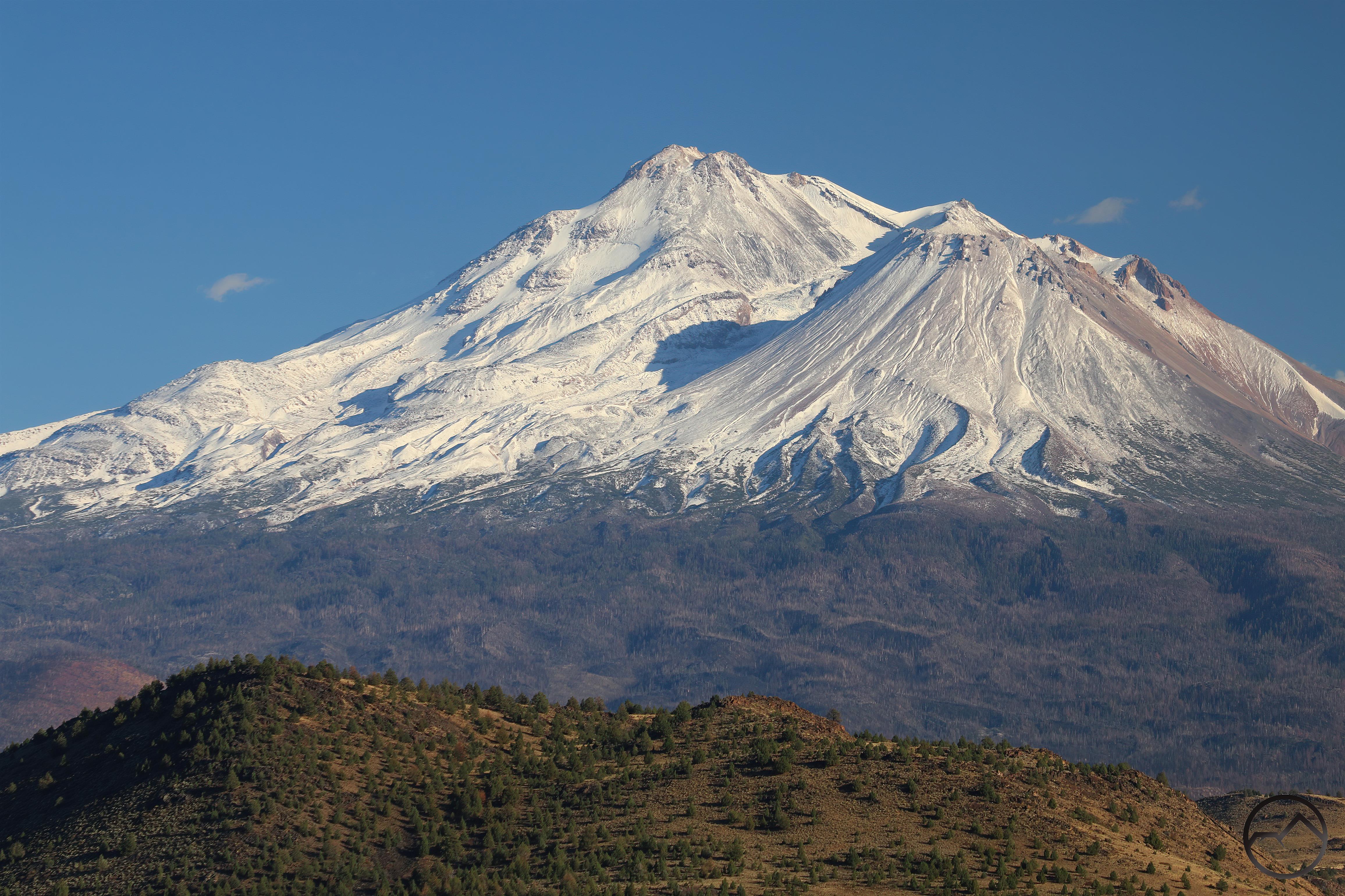
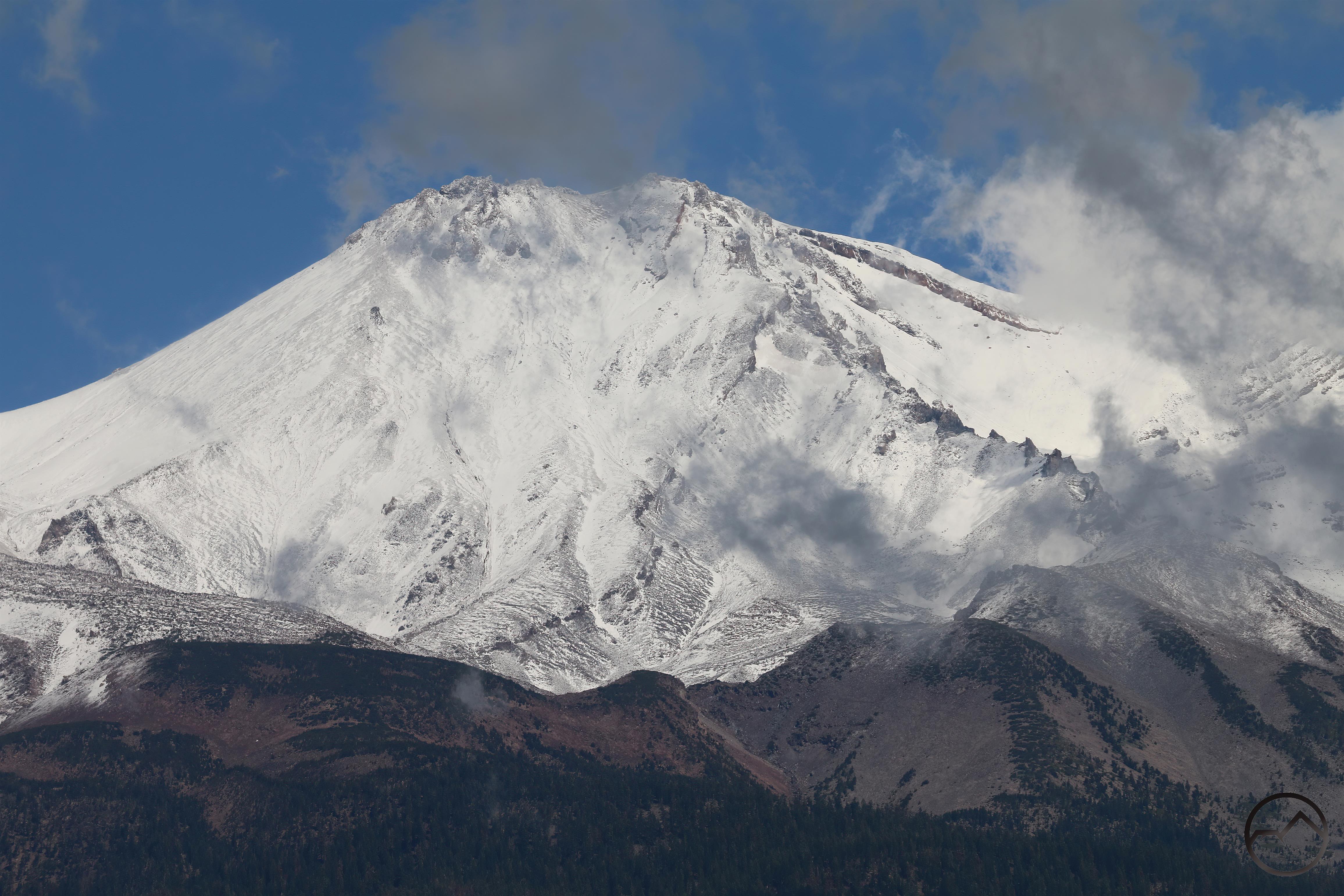
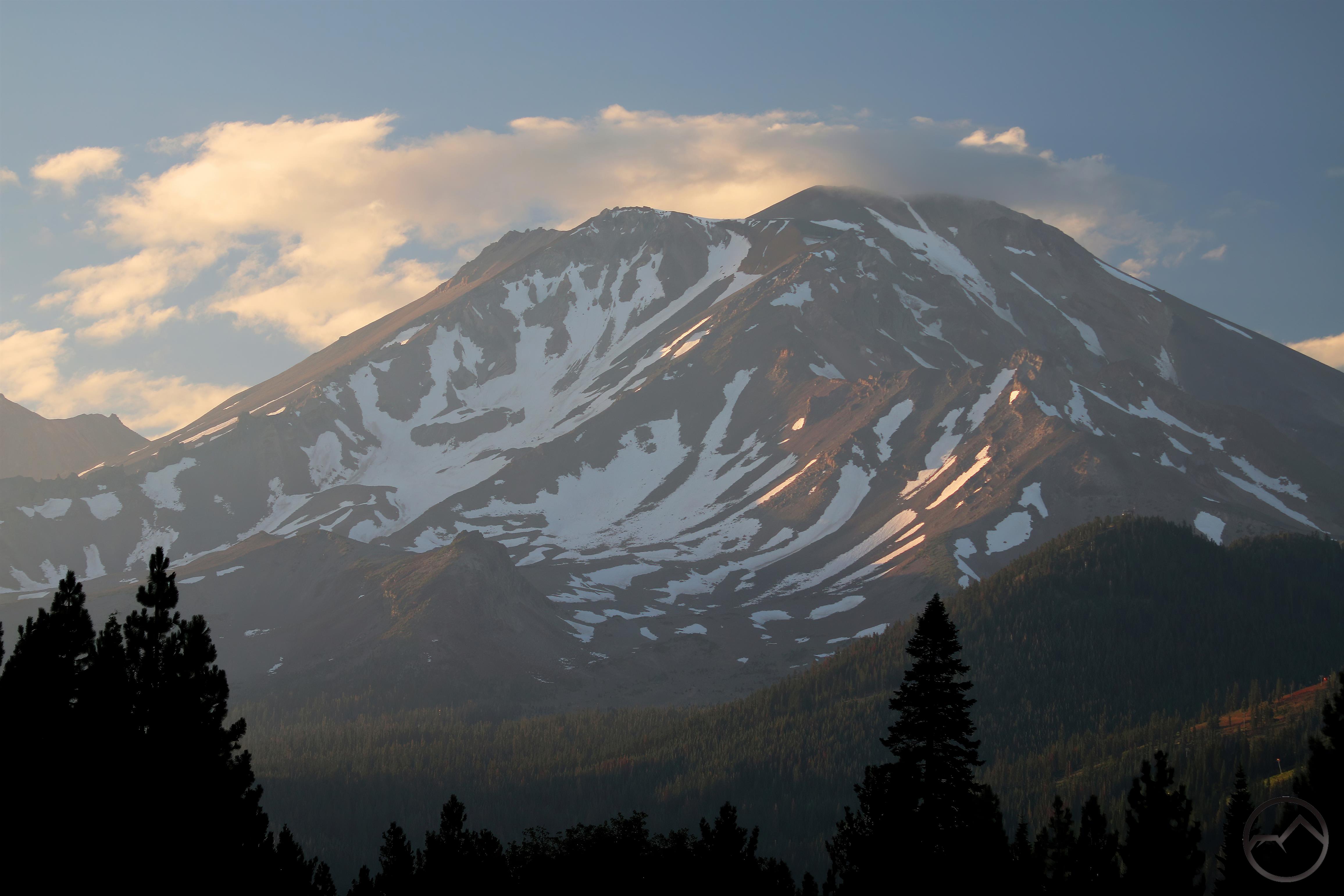
Even the summit of Shastina received a little snow.

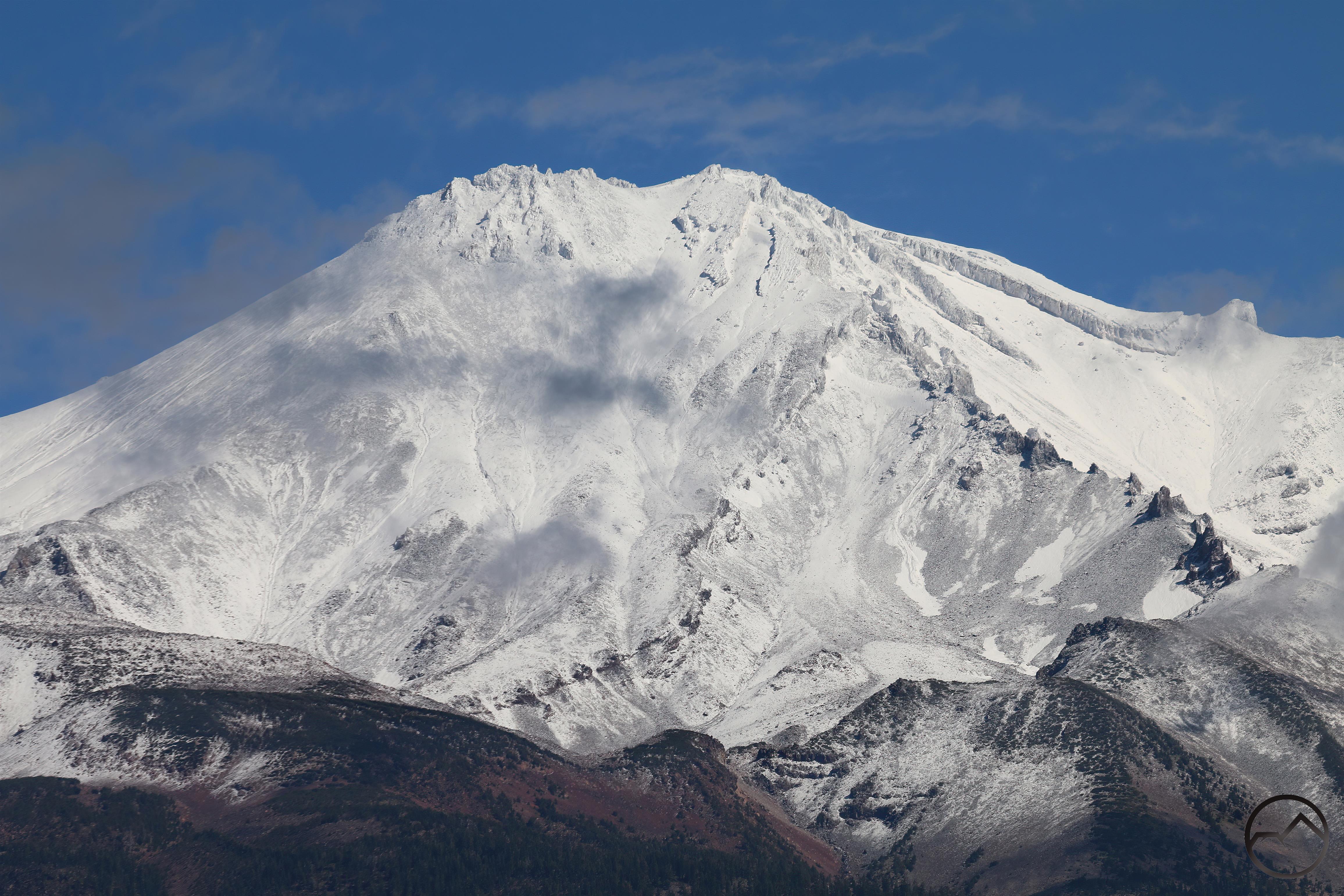
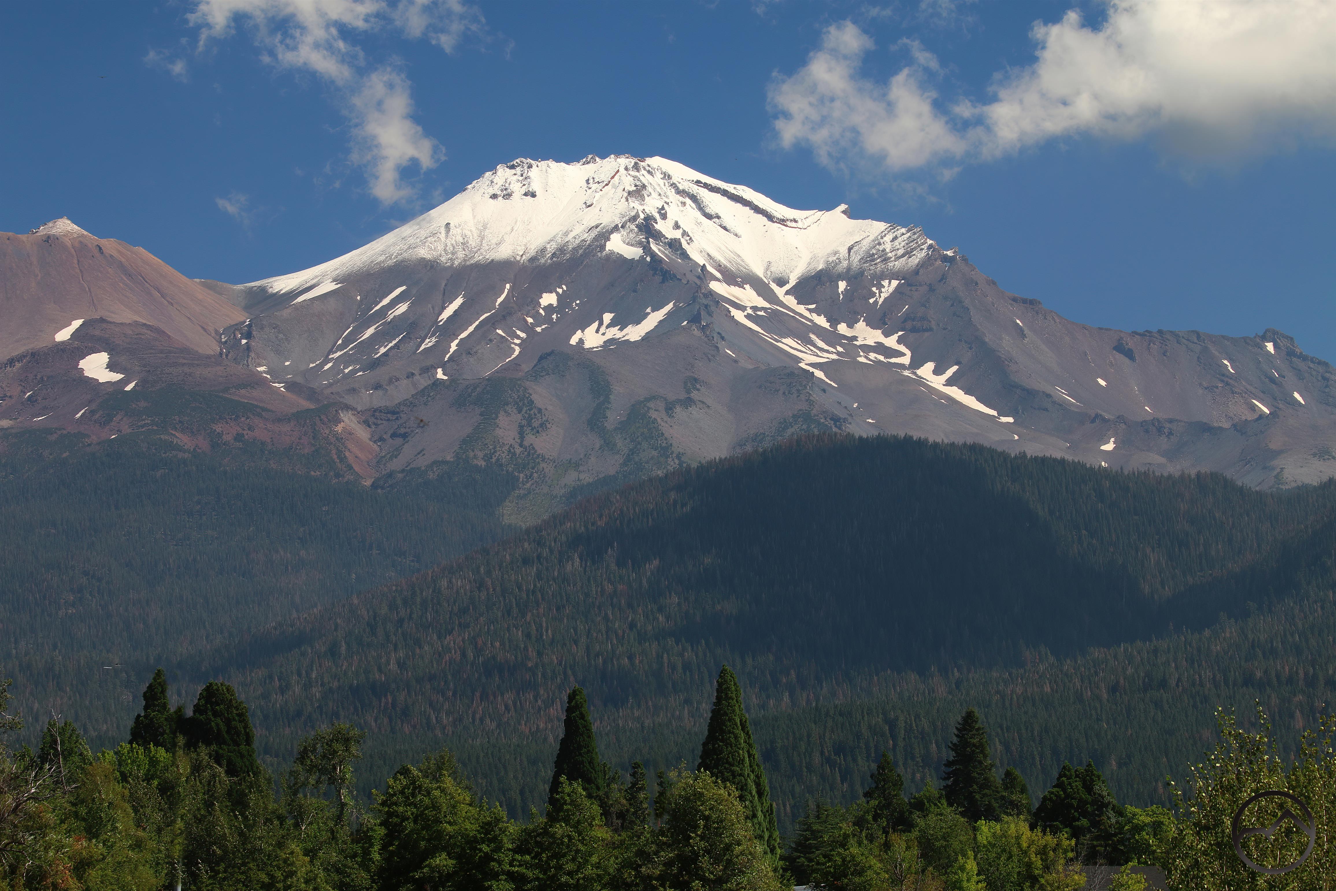
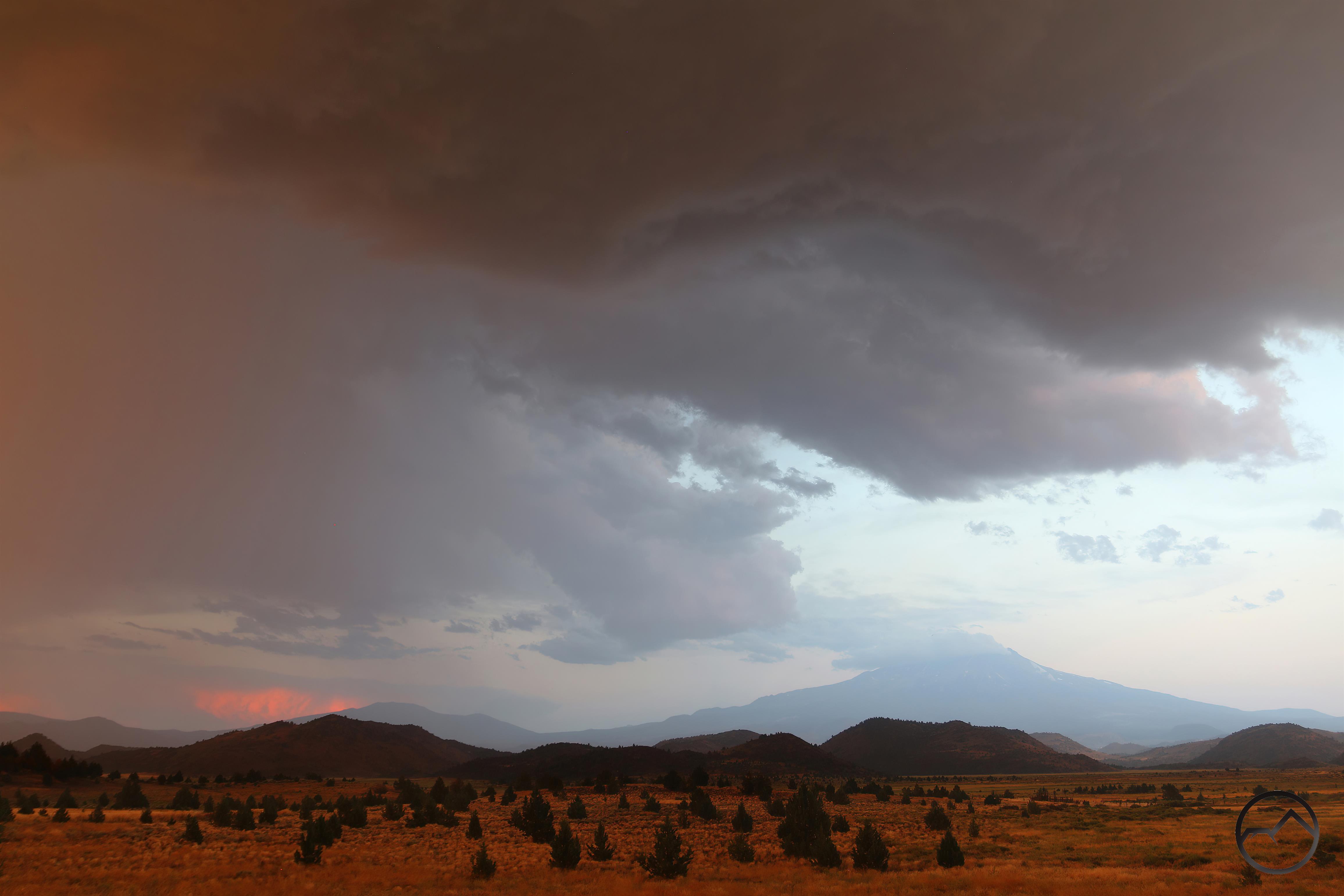
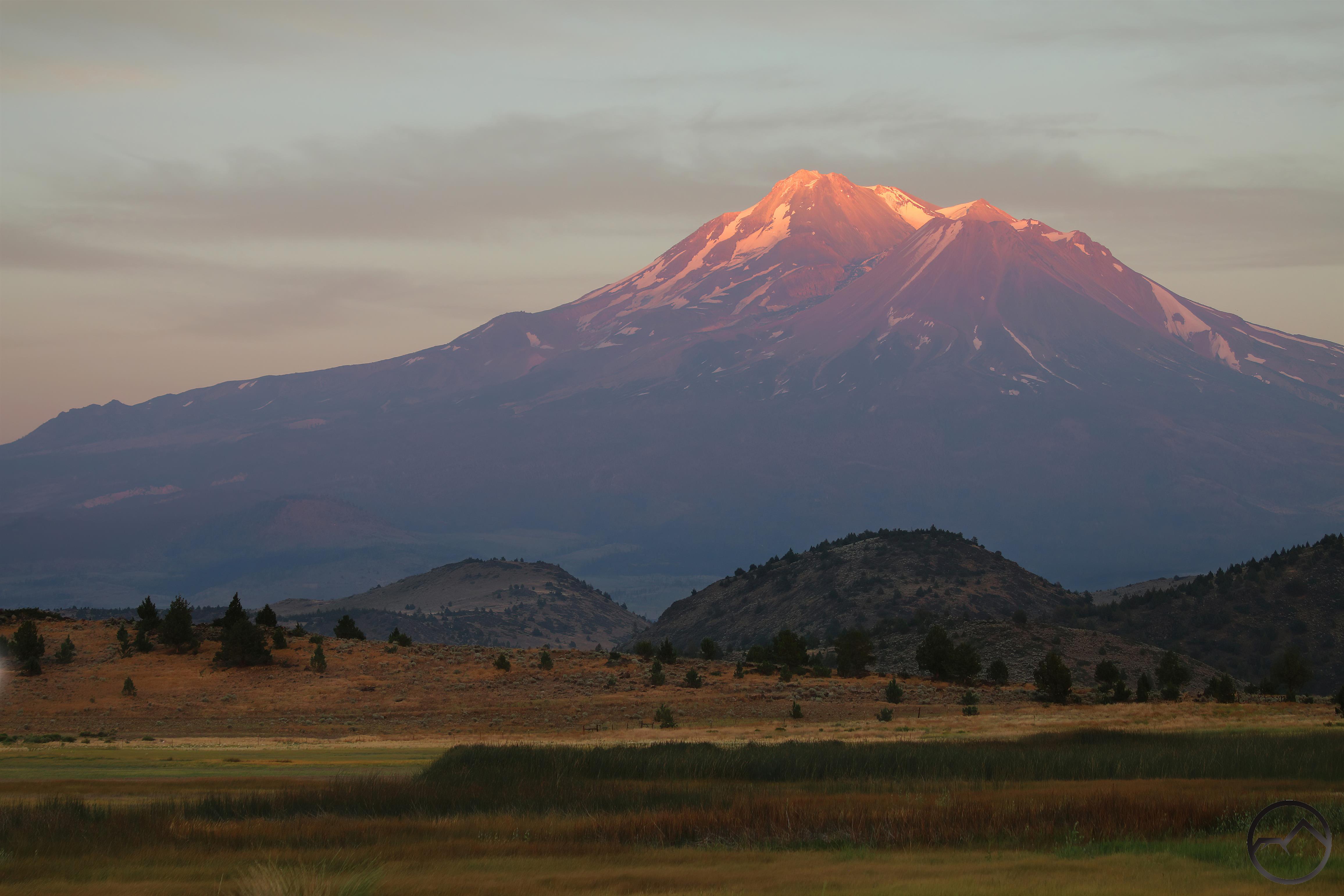
Though the storm definitely cooled things off (in town it felt downright cold), it was warm enough that new snow only fell at the highest elevations on the mountain, where the summit was covered by cloud. While it hasn’t been the rare year like last year where it snowed on Mount Shasta every month of the year, seeing a decent layer of fresh snow in August is still pretty impressive.

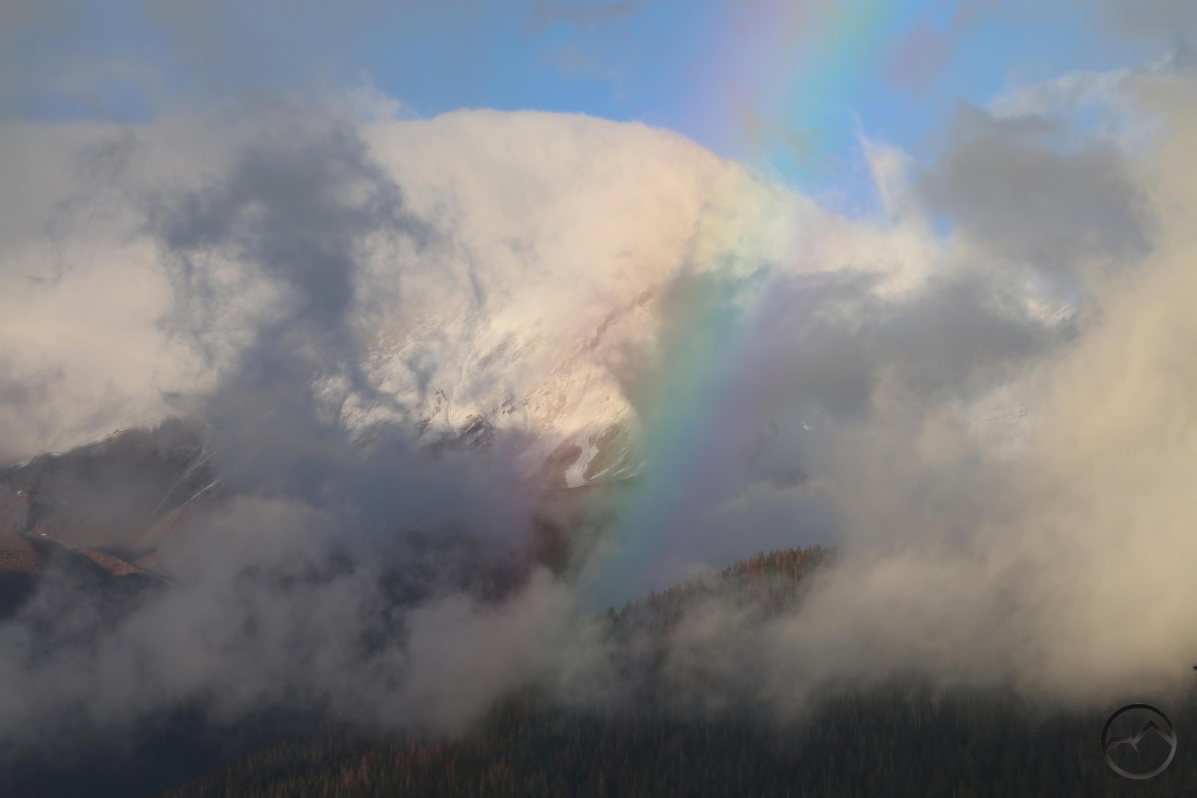
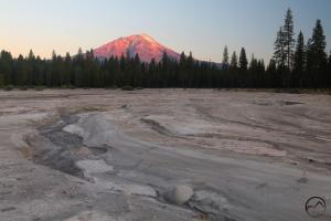
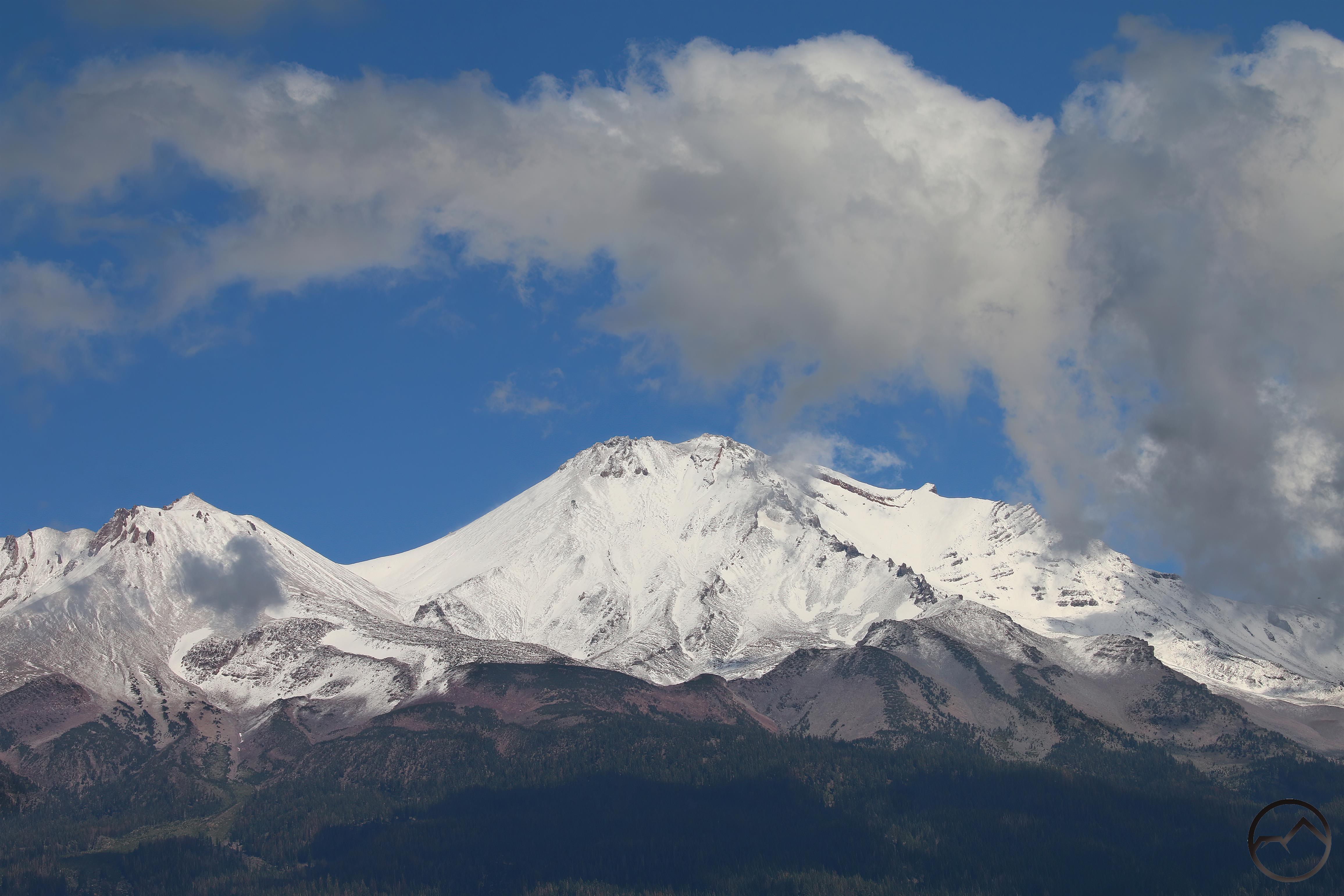
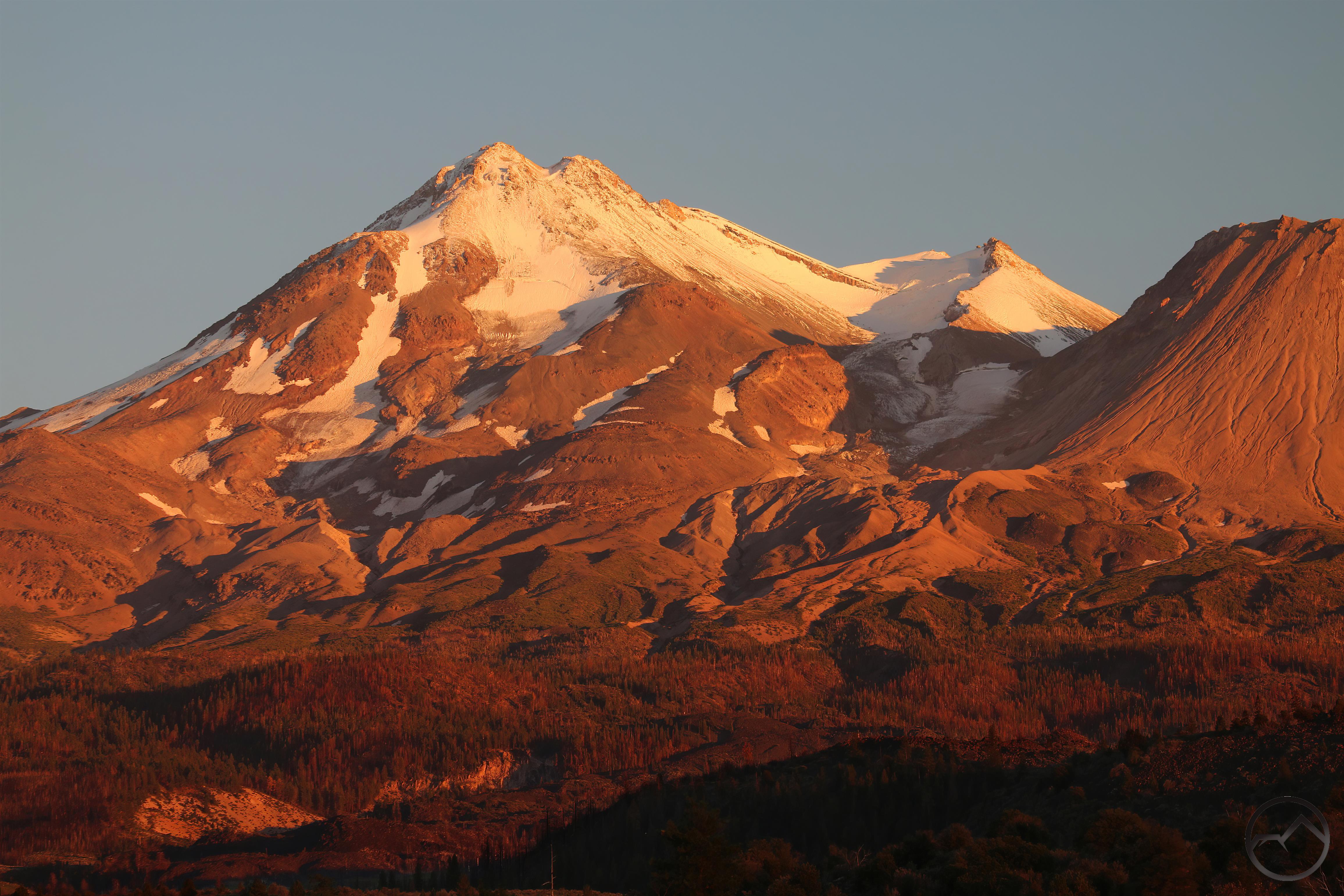
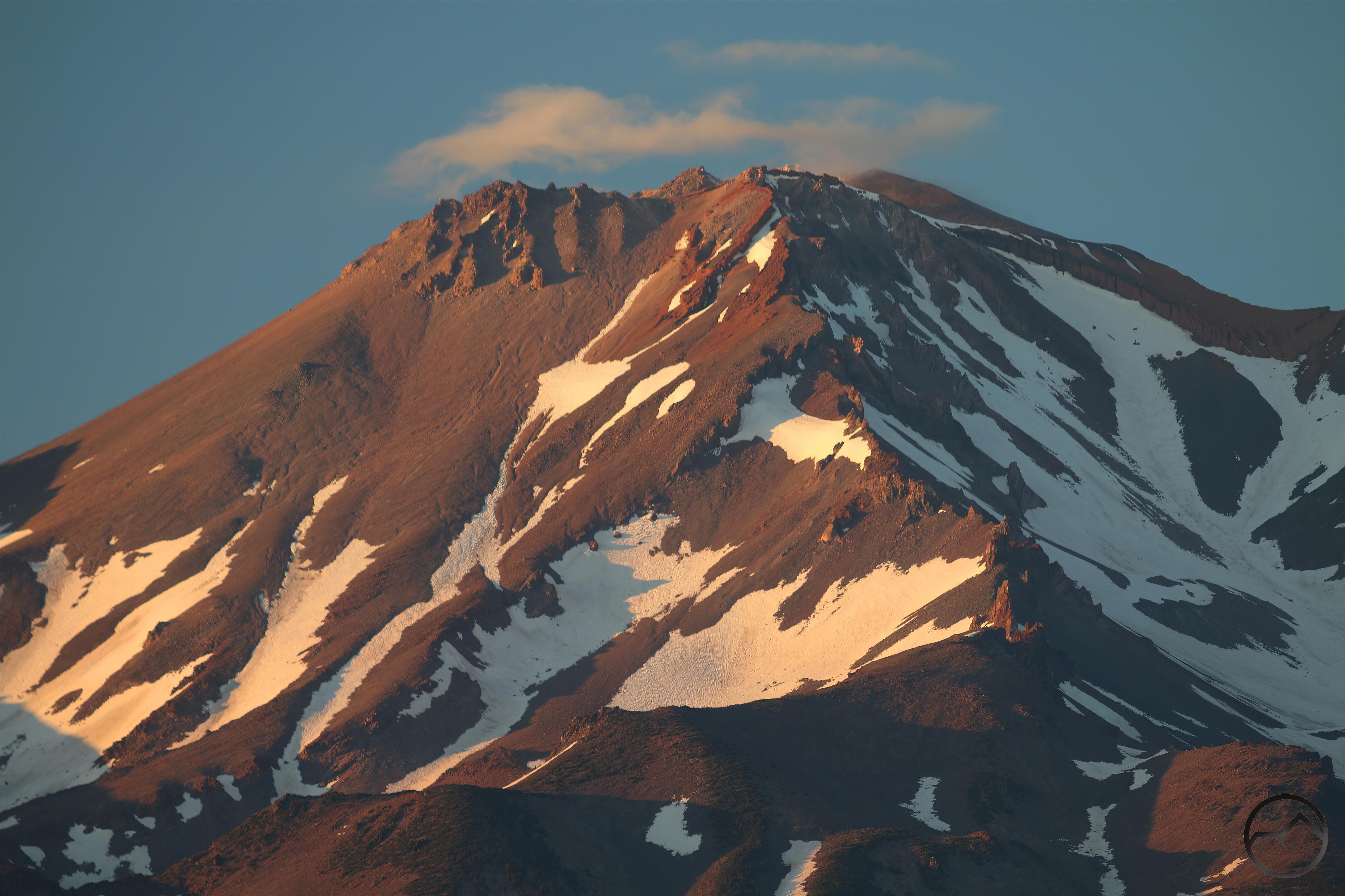
Evening light and summer snow on Mount Shasta. 

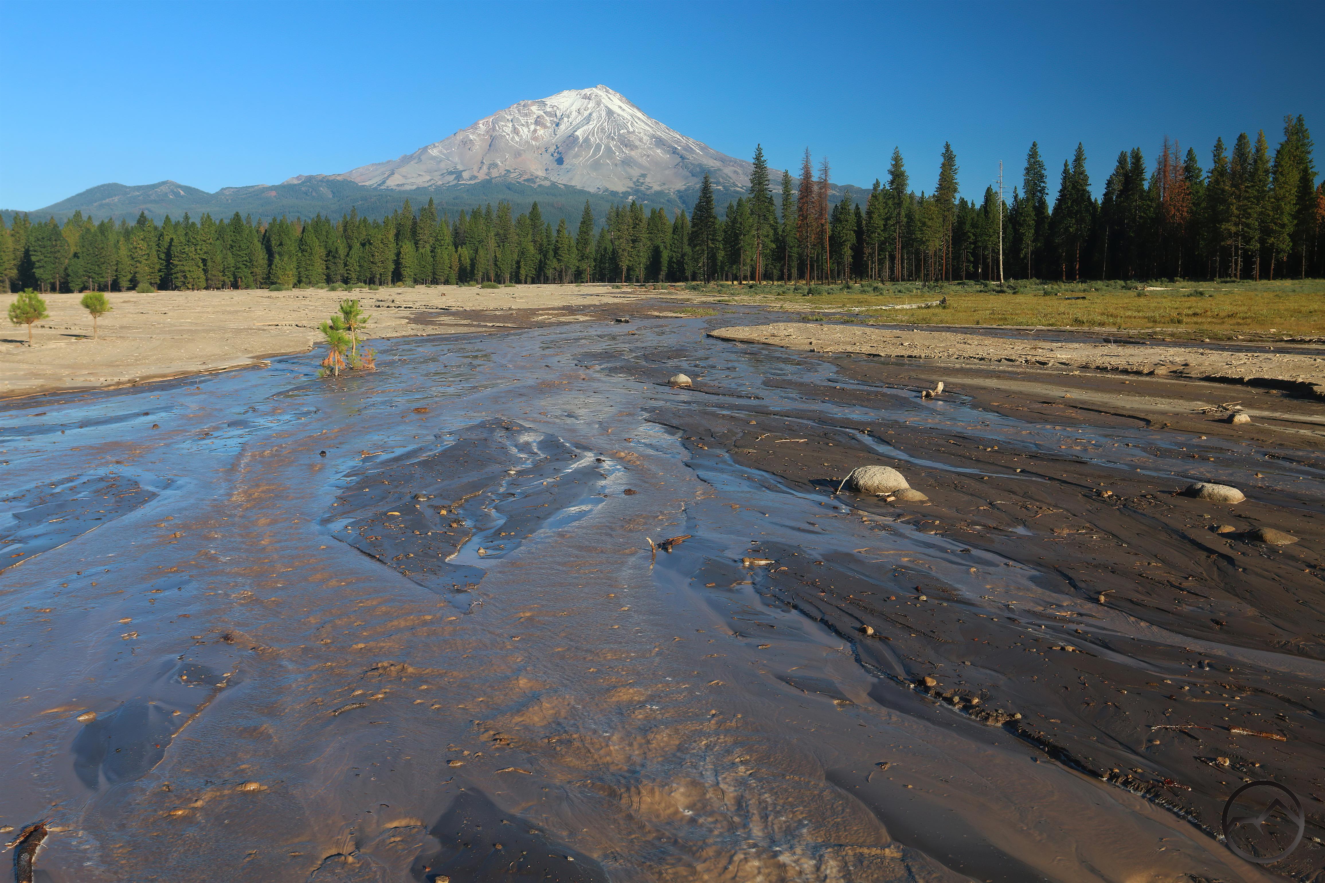
While the snow on the mountain was a fantastic touch, it drew the eye away from the deep channels cut into Mount Shasta by the storm’s runoff. Moreover, it gave little indication to the mess at the mountain’s foot in the wake of the degrading hurricane.

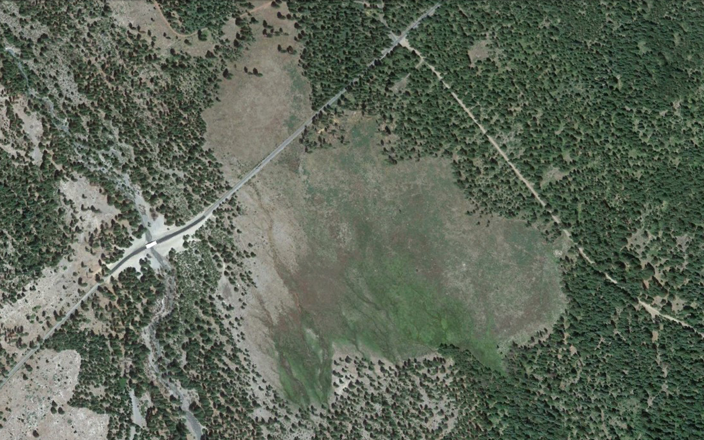
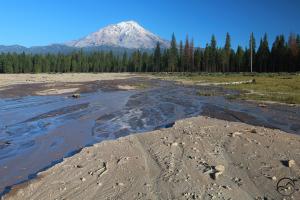
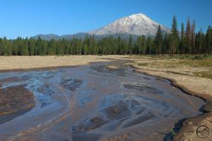
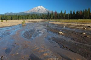
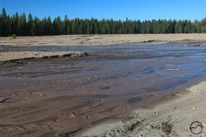
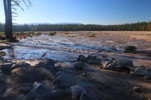
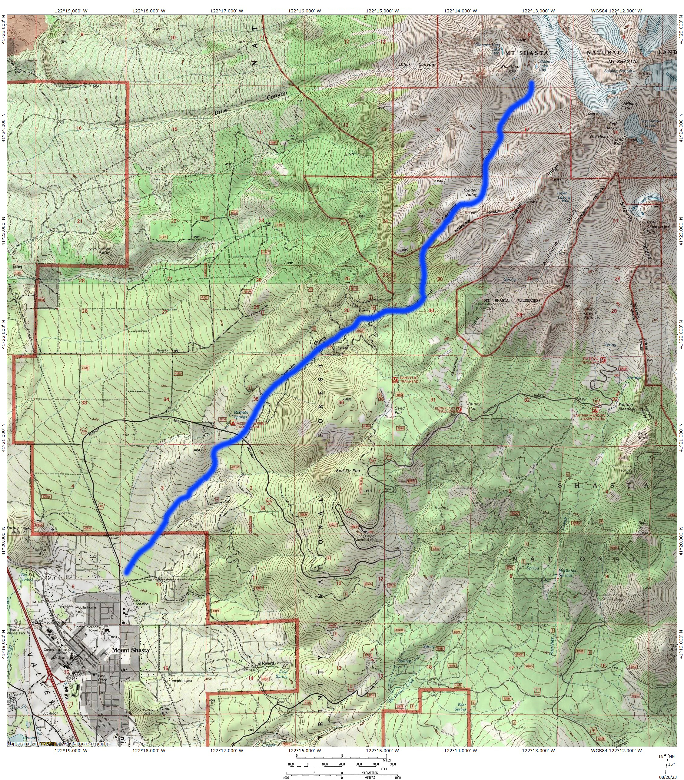
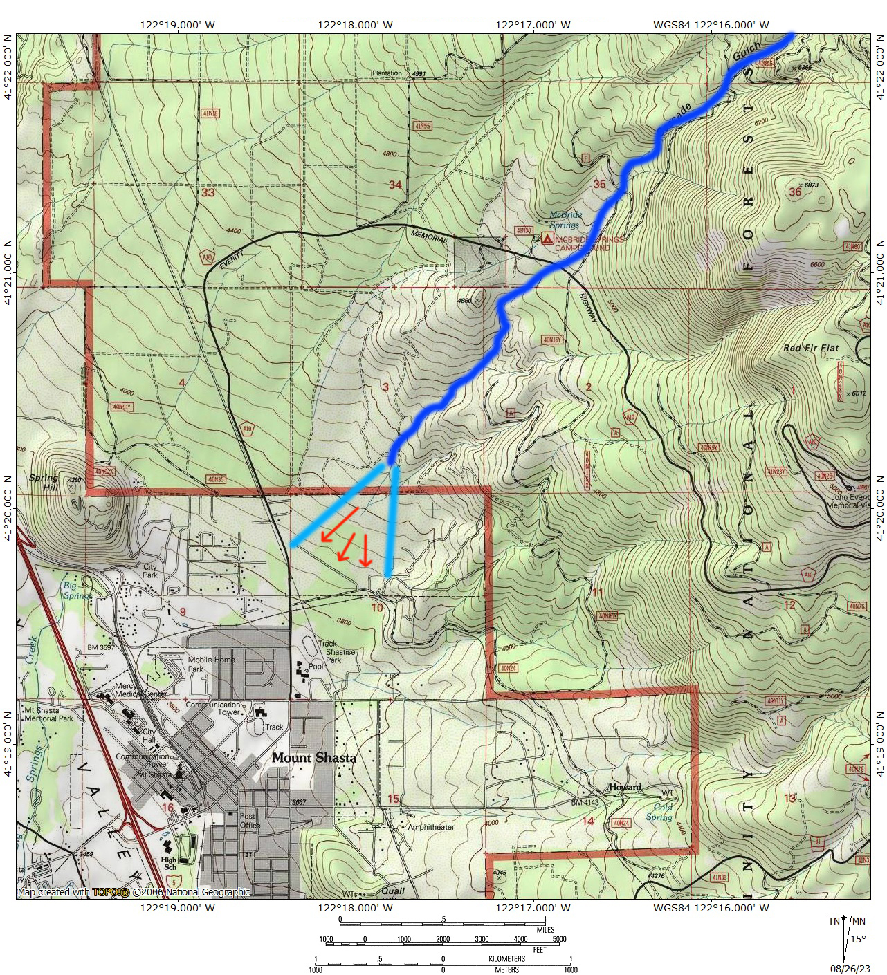
What transpired at the foot of Mount Shasta was an unusual event, one that seemingly only happens on rare occasions once in a generation or so (truth be told, I have no idea of the frequency, but it seems to be rare in living memory). Though no longer graded as a hurricane, the storm was still strong enough to bring a healthy dose of warm rain in the middle of summer. With last year’s long winter, there was still a fair amount of snow lingering on Mount Shasta and when the rain hit it, it began melting rapidly. This led to extremely heavy runoff pouring down the side of Mount Shasta. In particular, the numerous large patches of snow on the mountain’s west face are all above Hidden Valley. The drainage for this area is funneled into the single channel of Cascade Gulch.

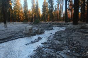
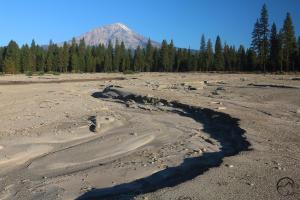
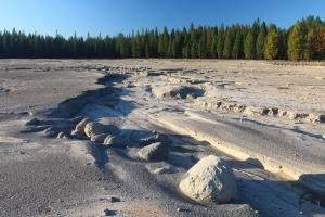
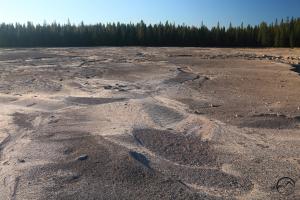
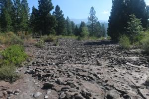
Cascade Gulch on Mount Shasta.

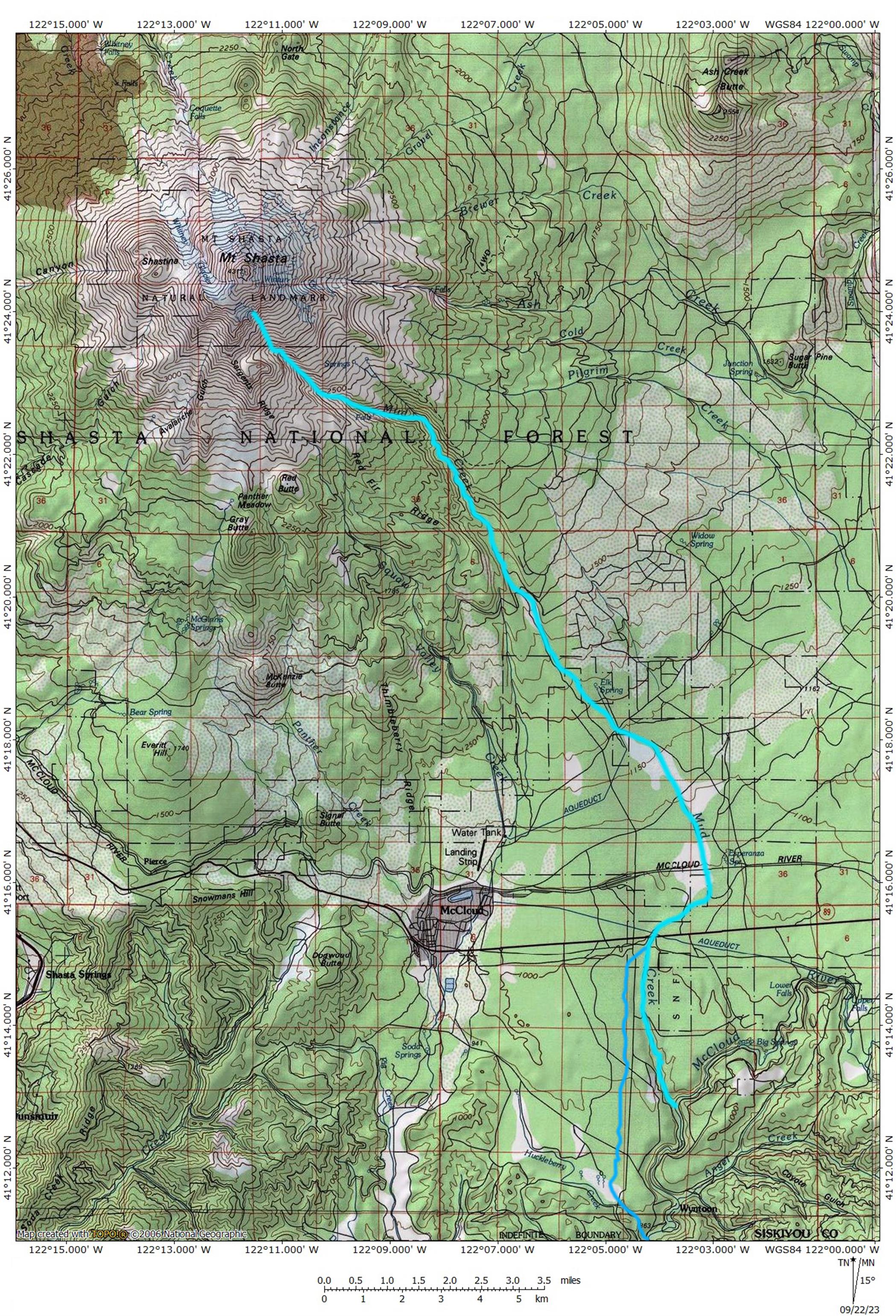
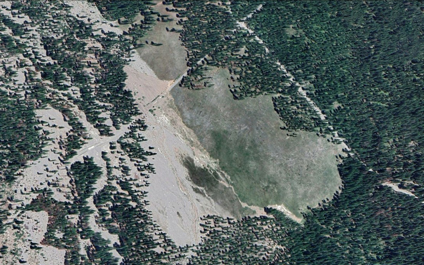
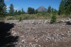
Cascade Gulch begins on the saddle between the summits of Mount Shasta and Shastina. It flows approximately 7.4 miles, descending about 8,000 feet before dissipating on a dispersal fan.

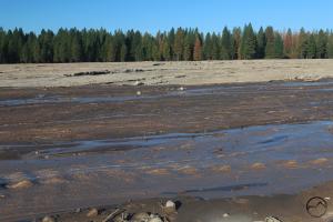
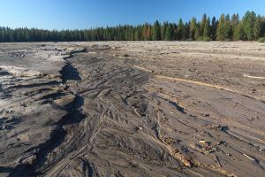
The flow down the gulch is relatively small and rarely reaches the final dispersal area. This year, with the heavy snowpack, saw the lower channel fill with water for the first time in quite a while. However, this flow fed by snowmelt was nothing compared to the runoff from the storm. While the rain itself was steady, it was never extremely heavy. Nonetheless, the steady downpour with warm temperatures melted the snowpack swiftly and the runoff from the snow was far, far heavier than anything the storm produced. So powerful was the runoff that it rapidly transcended a simple runoff event. The force of the water over Mount Shasta’s loose volcanic terrain turned the running water into a roiling mudslide, churning down the side of the mountain and into Mount Shasta City itself.

20230821_212035

20230821_212035

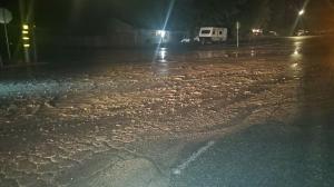
By nightfall, the storm had produced steady mudflow into the head of Mount Shasta City. The video begins facing the high school and national guard armory. As it pans, the view turns south, looking down Lake St toward downtown. The mud in the street is nearly 2 inches deep. The water flow is in addition to that. 

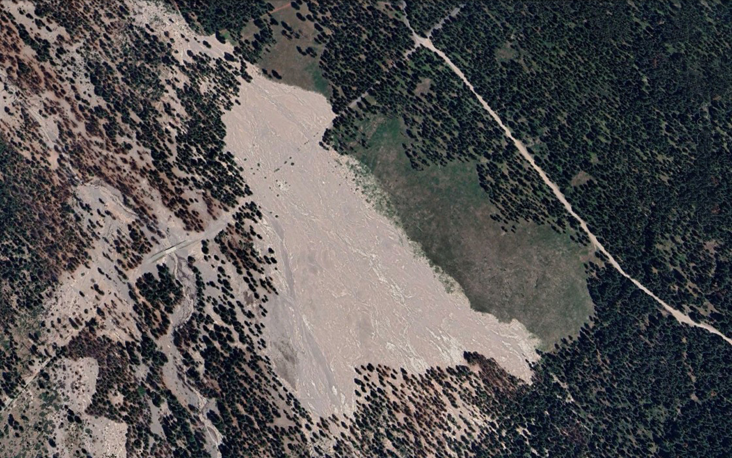
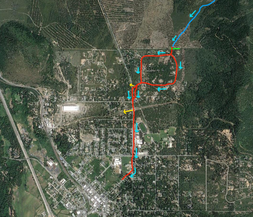
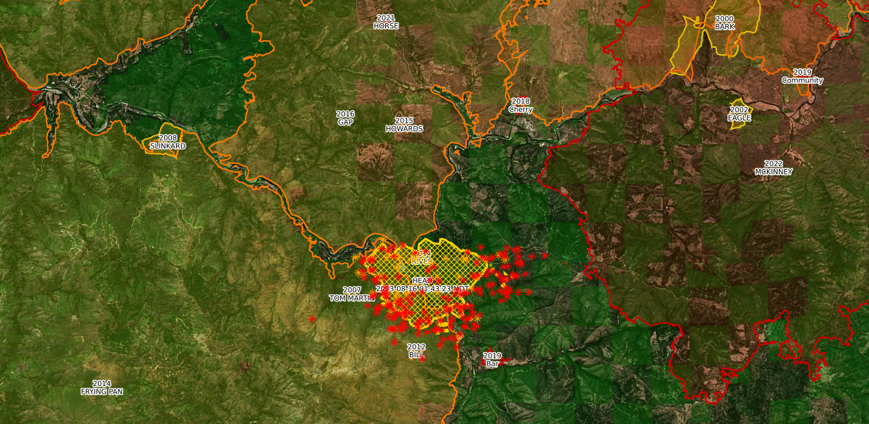
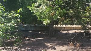
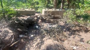
In the past, this kind of event would have still experienced a natural dissipation on the dispersal fan at the base of Cascade Gulch. Perhaps not all of the mud and runoff would have spread out there but the force and urgency of the flow would have lessened considerably. It was for this reason (full disclosure: I have been told this from a resident, though this is unsubstantiated) that development of the property where the dispersal fan is located was protracted. Zoning was delayed because of the known danger of the flood plain. To compensate for this when the property was developed, a series of large concrete blocks were laid out, stacked two high, to act as a barrier against a future flood event. In theory, this would divert the flood away from the new development. As there is a tendency to occur, nature often has different ideas.

The green line marks the concrete blocks. The red line indicates the path the water and mud traveled, as shown with the light blue arrows. The yellow areas show where additional flooding traveled. 

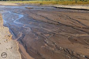
In this instance, the enhanced runoff from the storm and snowmelt traveled down Cascade Gulch. Just above the concrete blocks the flood began to fan out, as nature intended. In so doing, it crossed over a wide gravel road that is a main artery of the Gateway Trail network. However, once it hit the concrete blocks on the other side of the road, it was initially held back but soon overwhelmed them, traveling through gaps in the wall and over the tops of them in some places. Mud rapidly built up on the north side of the wall and then flowed into the new housing development. Fortunately, the development’s loop road is lined with ditches and while they were generally inadequate for handling the flow, it did manage to generally channel the water away from the houses. The drainage ditches all reconvened at the entrance, where the flood partially flowed down Everitt Memorial and partially cut through large brush fields until it too intersected Everitt Memorial.

The water then flowed down the road and past the high school. It crossed Rockfellow, flowed down Washington and then followed the contour of the road onto Lake Street. As the water and mud traveled down the road, it poured into storm drains and channels leading down into Sisson Meadow. Finally, on Lake Street, the flood had subsided enough that it disappeared altogether down one final storm drain, about 0.25 miles from the main part of downtown. All in all, it was an impressive display of power that began with a hurricane passing through the Mount Shasta area.

Click to enlarge:

Mudslide at night.
During the day, the water and mud had initially traveled down the old train tracks. Some diversion work occurred but that led to the water running further down Everitt Memorial.

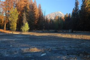
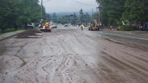
Clean up in the morning.
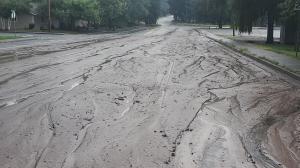
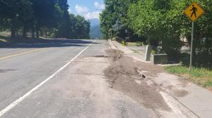
Look down Washington to Lake Street. The road is covered with mud.

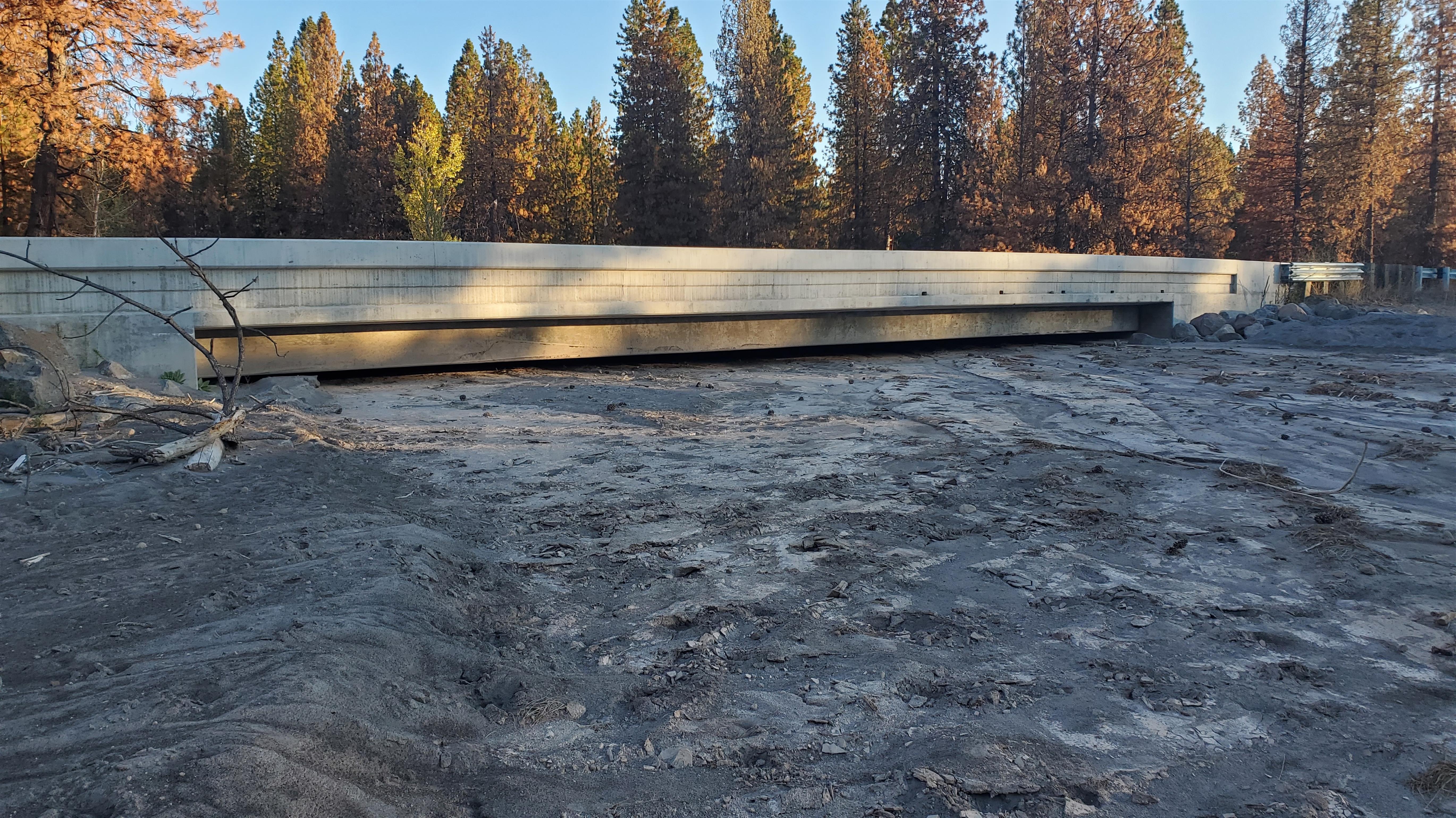
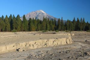
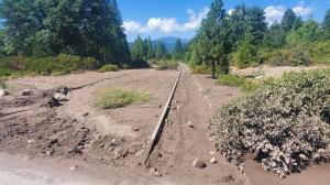
The remains of the Forest Service road. Rock and mud are pretty deep.
Black Butte is visible above the slide-covered roadbed.

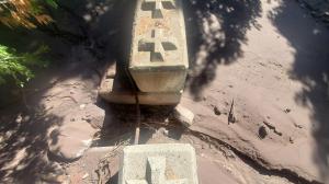
Looking south from the gravel road to the wall of concrete blocks. Note the bottom layer is buried.
A closer view of mud and debris built up behind the concrete wall.

The gaps in the wall were rapidly exploited by the flood.
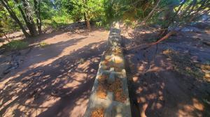
Mud on both sides of the wall, though the north (right) side is twice as deep.

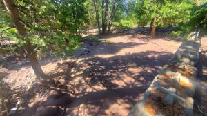
Downstream from the concrete wall.
The final storm drain where the flood came to an end.

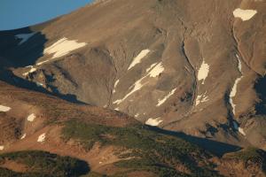
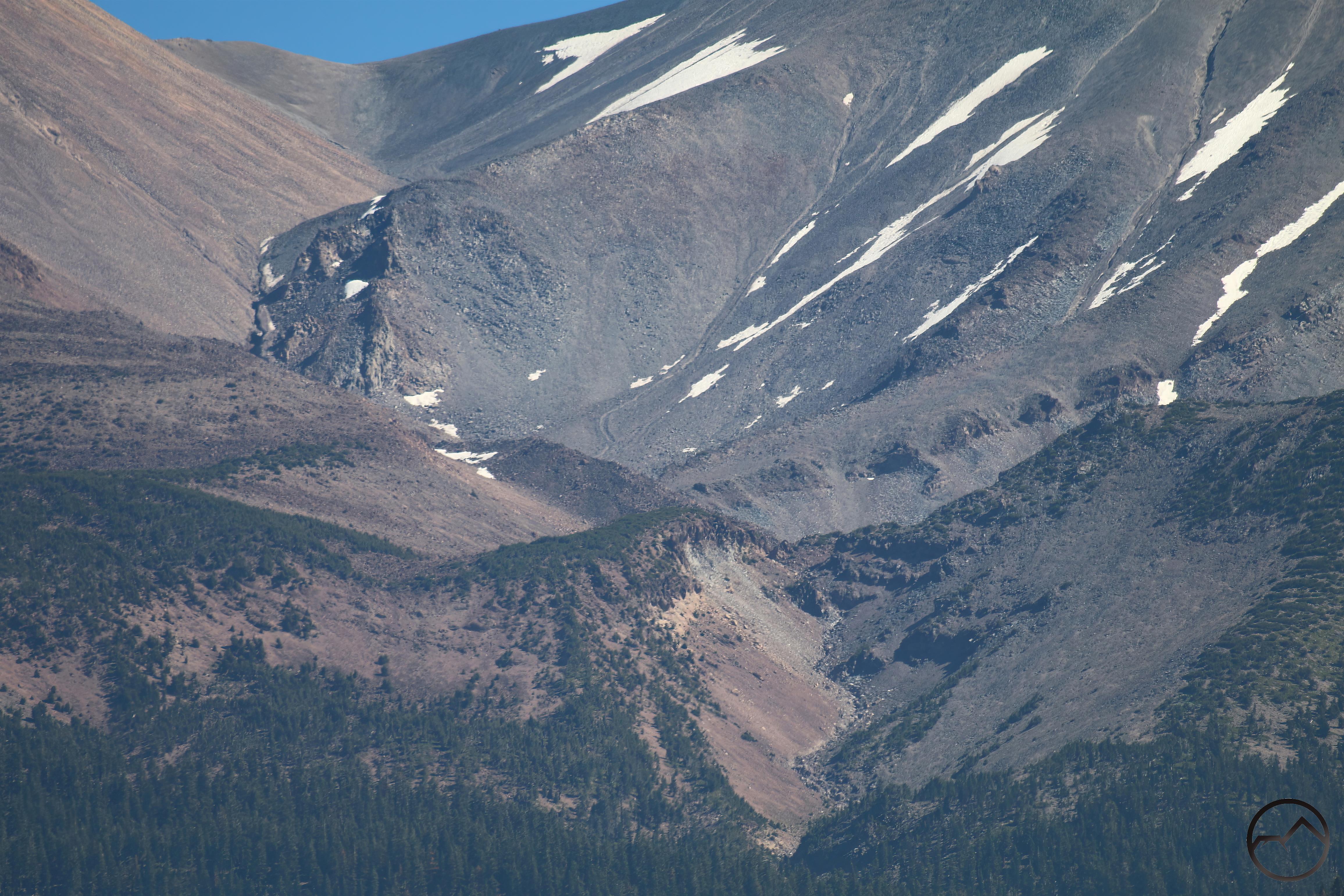
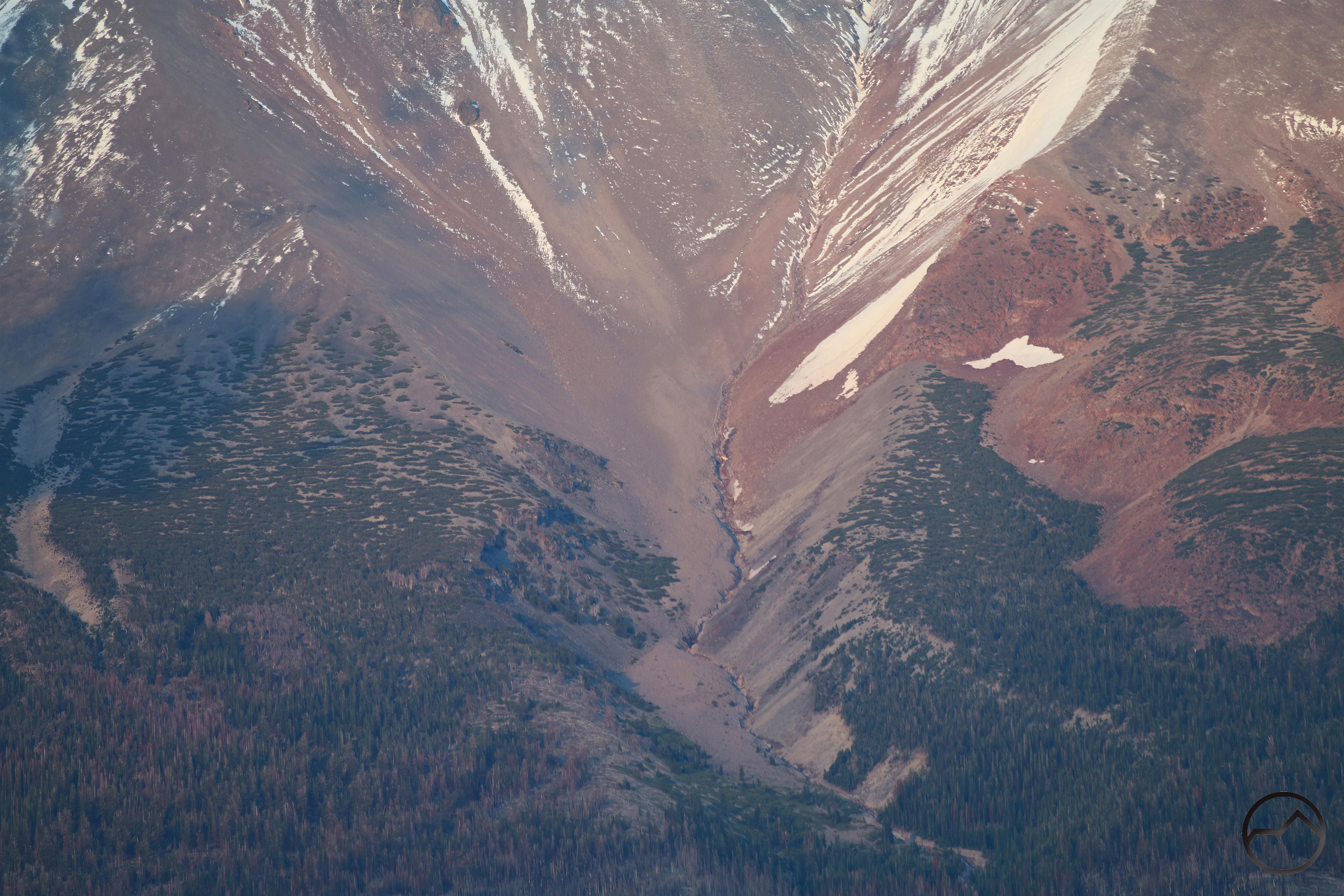
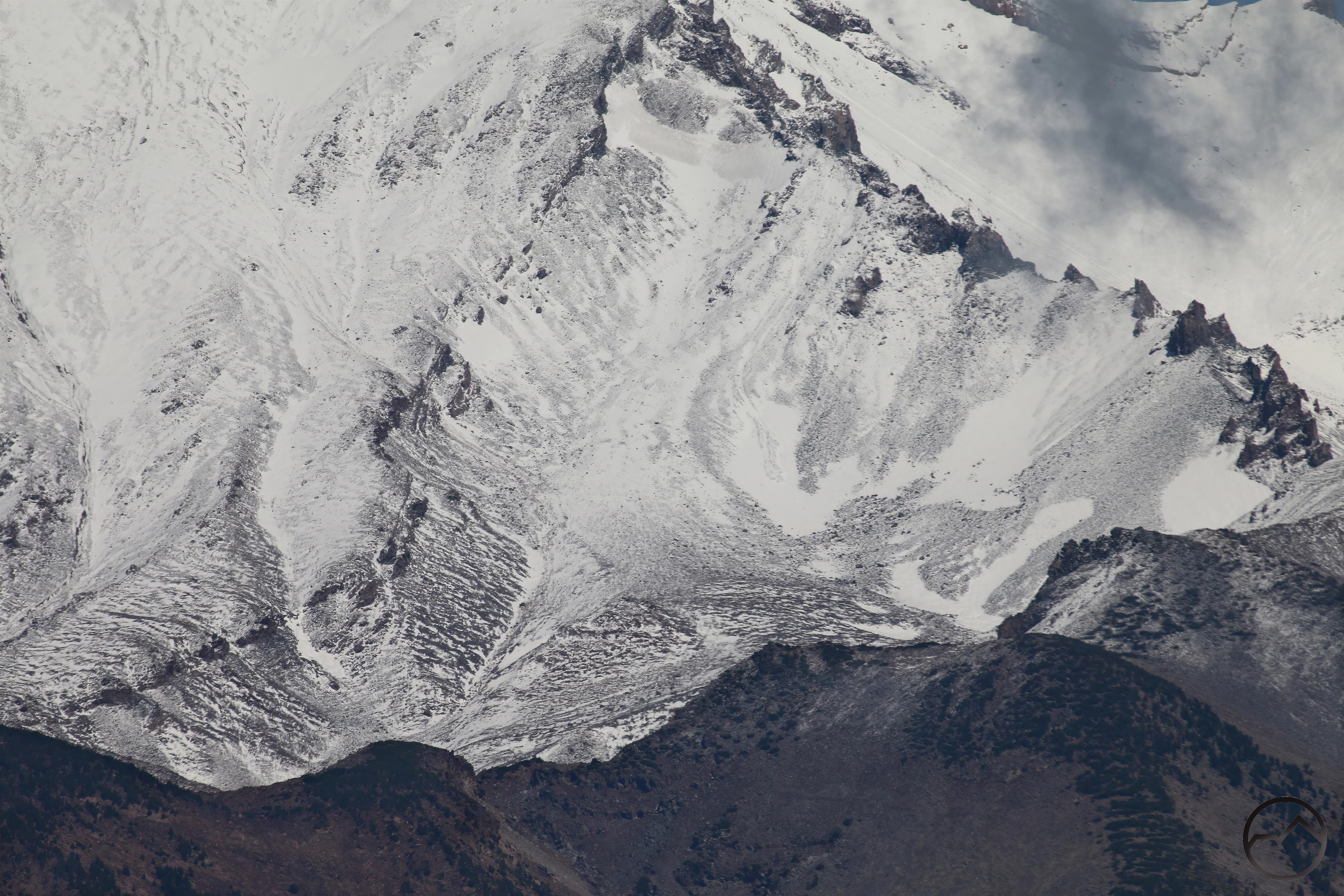
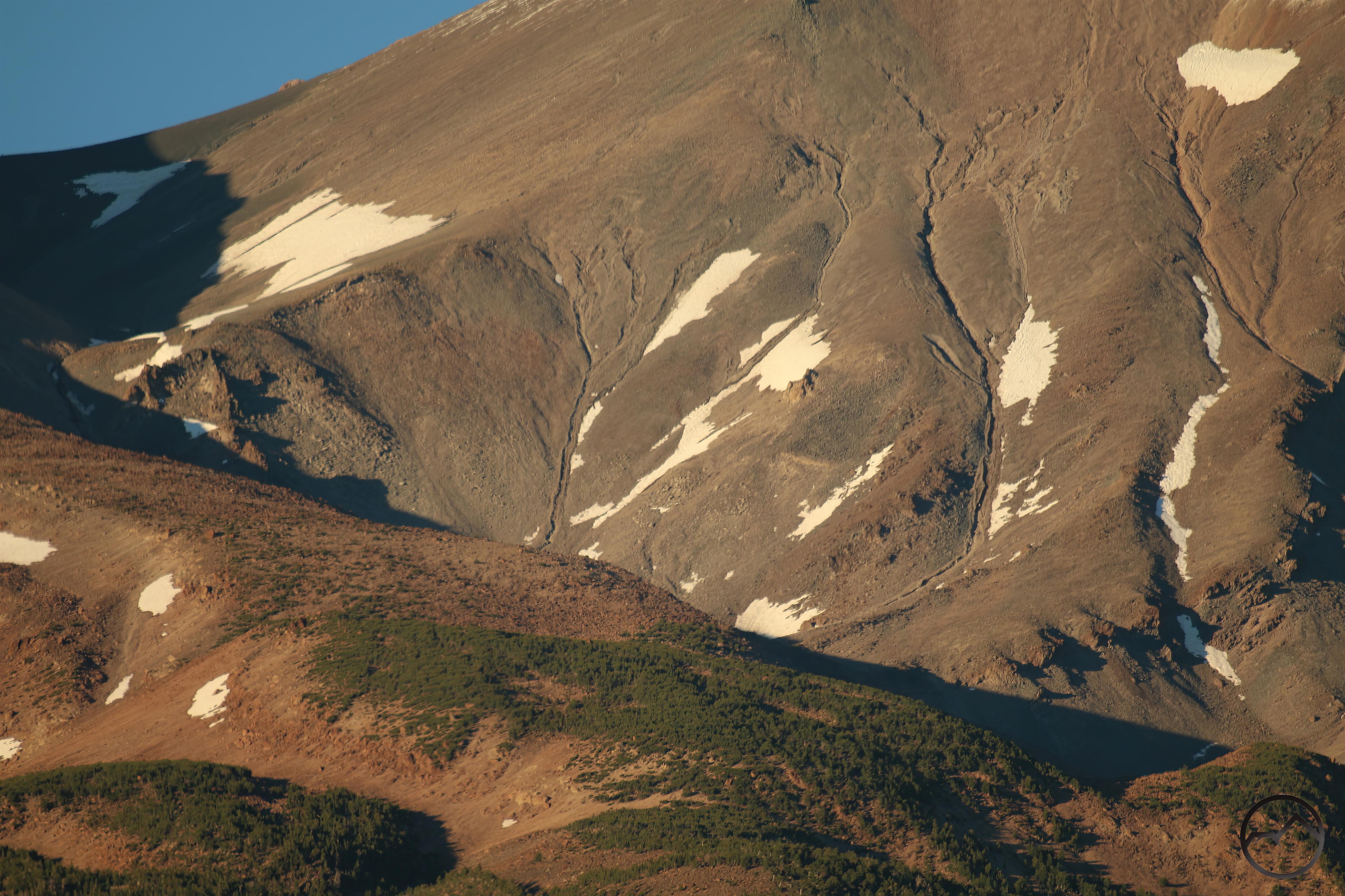
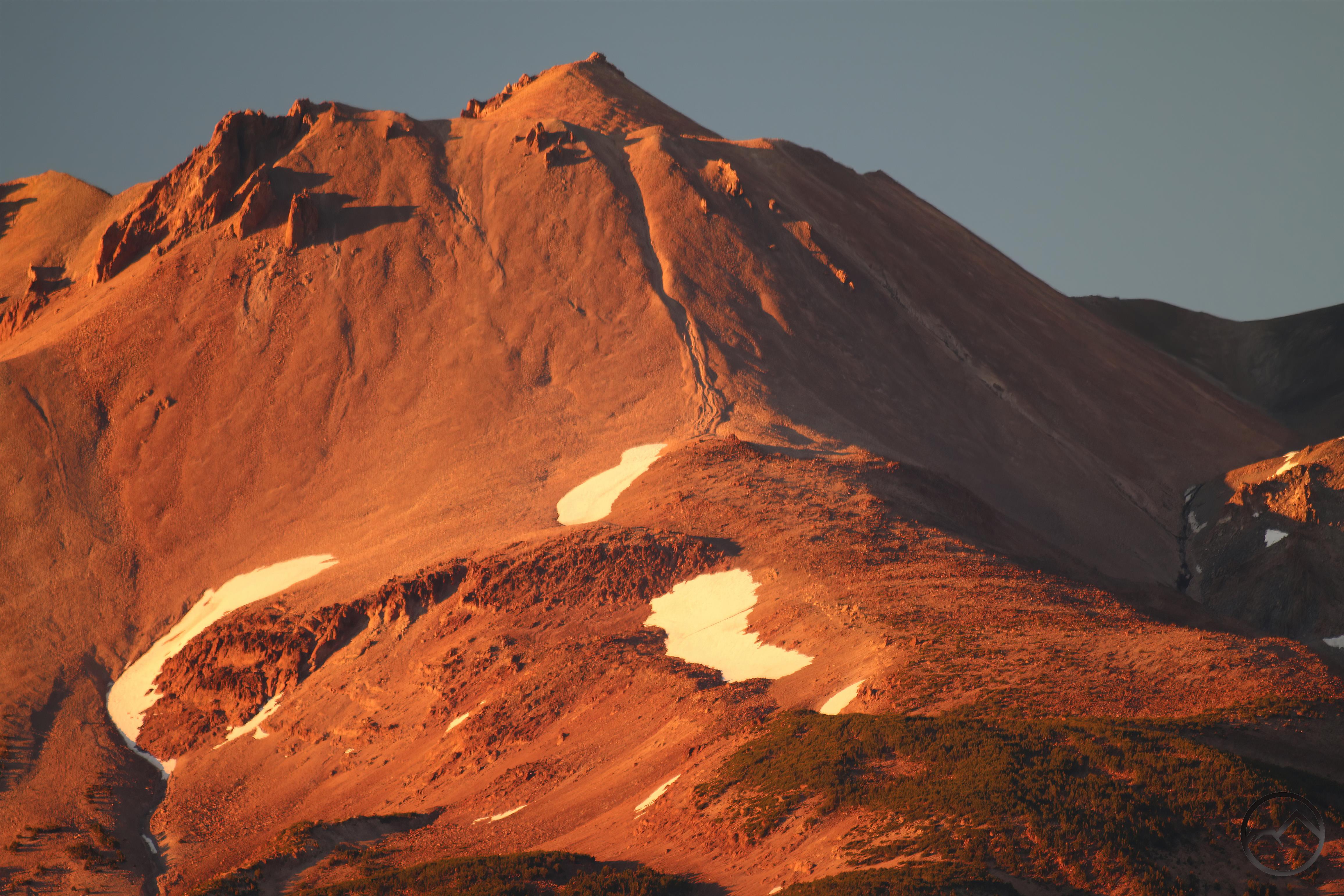
While Mount Shasta City was unexpectedly subjected to a muddy inundation, Mount Shasta itself also experienced some significant alterations due to the passing storm’s fury. Several places, particularly on the mountain’s west side, several drainages were significantly enlarged and massive mudslides occurred even at higher elevations.

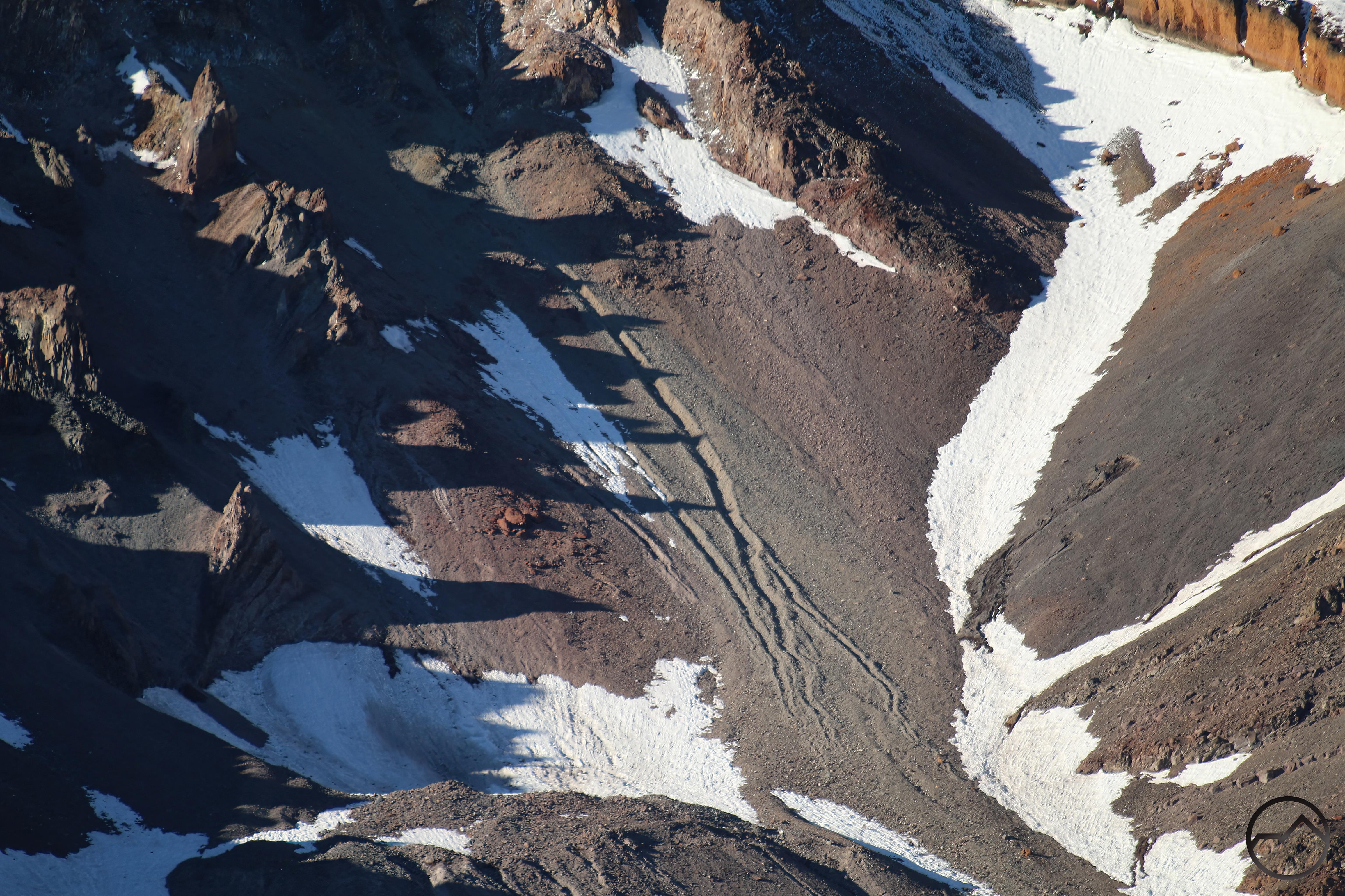
Note the substantial mudslide that partially covered the large patch of snow.

Several gulches were deepened by the massive runoff on Mount Shasta.

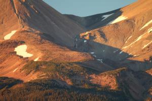
The uppermost part of Cascade Gulch was cut into a deeper channel by the storm. 

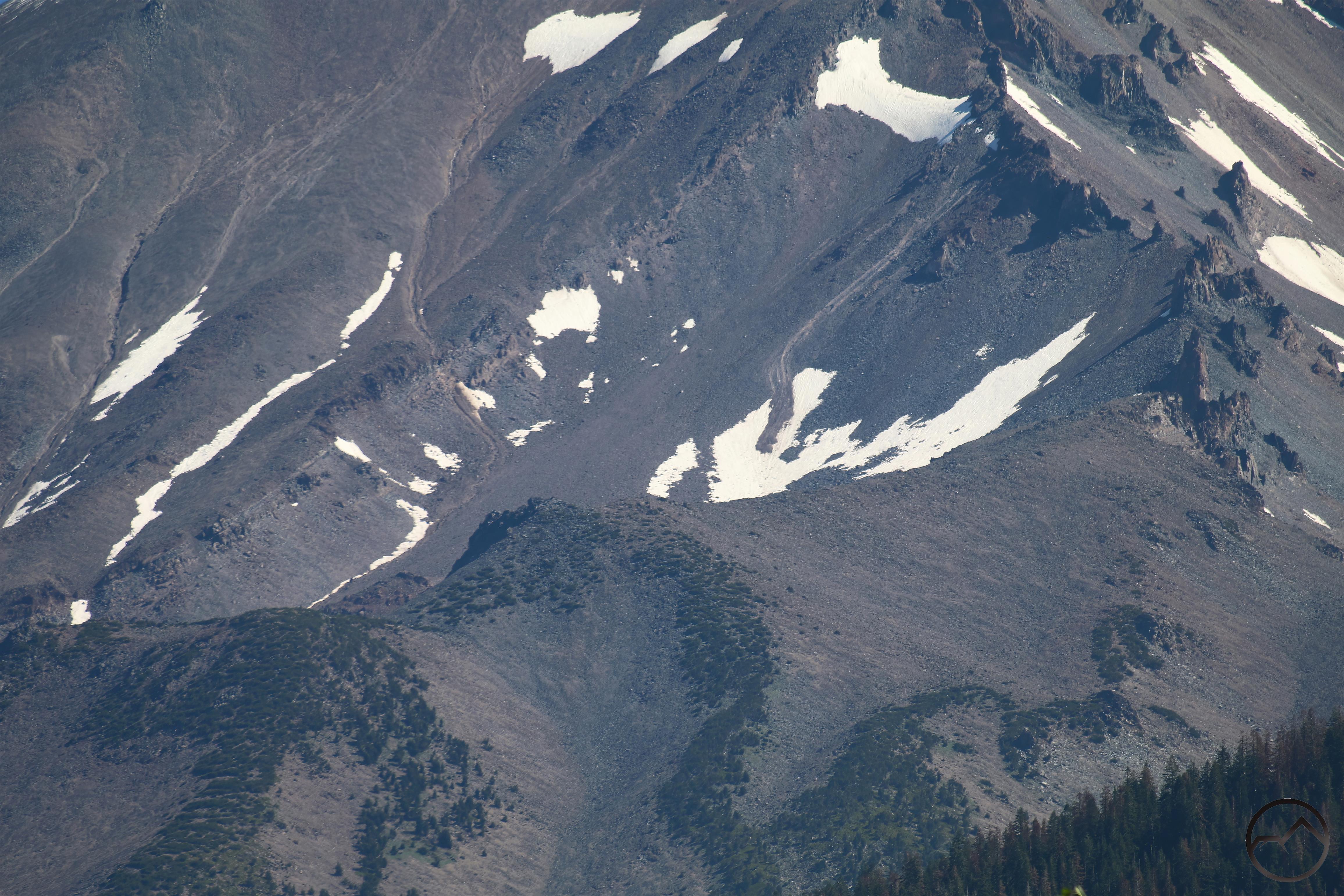
A large mudslide that flowed off the south flank of Shastina. 

While these are immediately obvious from down below, these are significant alterations to Mount Shasta’s appearance. It is difficult to apply scale to these changes but suffice to say, they are really big. I confess that I do not understand how these mudslides occurred at higher elevations even though the amount of precipitation was not especially heavy. The lower elevation flooding was the result of melting snow but such an explanation is inadequate for the higher events. I await an explanation from those far more knowledgeable than I.

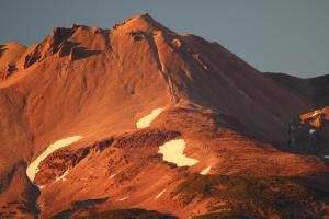
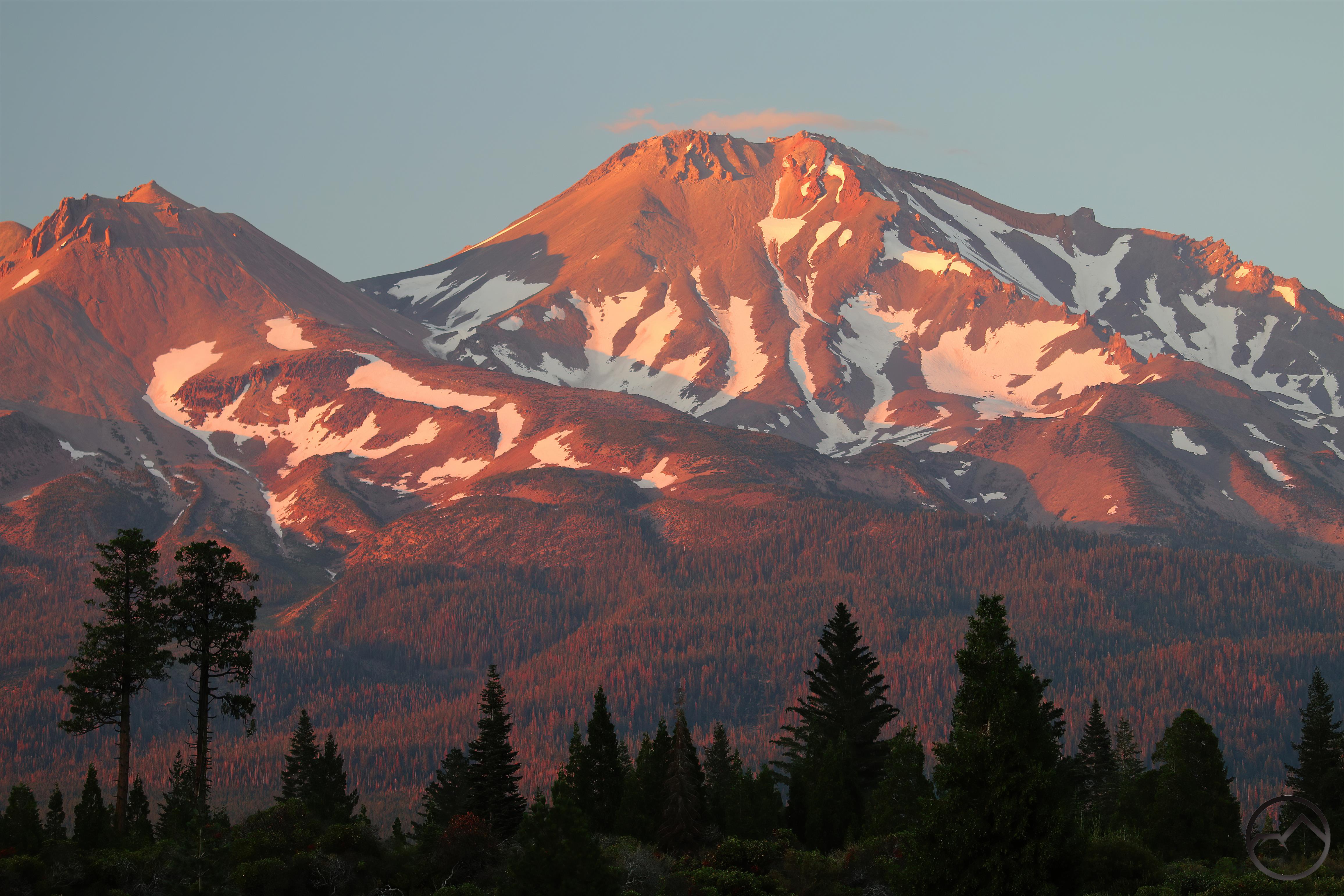
Fresh summer snow and new alpine mudslides are all bathed in alpenglow on Mount Shasta. 

In the end, this is another reminder that nature in general, and Mount Shasta in particular, is very dynamic. The mountain is constantly in flux, in ways both large and small. This time was a significant series of changes. Of course, it sill amazes me that I can say that Mount Shasta City was inundated with a mudslide that was caused by a hurricane. Strange but true.


Beauty…At A Price

Posted by bubbasuess on August 16, 2023
Posted in: Cascade Range, Hiking, Mount Shasta. 2 Comments

Another gorgeous thunderstorm sailed through the Mount Shasta area on Monday night. With the system brewing up what looked like another spectacular sunset, I headed back out into the Shasta Valley once again. Unlike previous storms, no rain fell in the valley and the lightning, though visible, was all south of Mount Shasta. What there was, however, was a tremendous amount of wind. It made for some rapidly changing conditions over the mountain and for some pretty tremendous cloud displays. It certainly was time well spent:

The light never really lit Mount Shasta up a lot but it definitely cast a fantastic glow across the sky. The clouds changed rapidly, going from large puffy storm clouds to higher, more diffuse and gauzy formations. Both caught the light wonderfully as the sun sank behind the Little Scott Mountains to the west.

The whole Shasta Valley was aglow, but the clouds were the highlight as terms of color. The beauty of the sunset was not alone in making an impression, however. The wind was formidable.

20230814_194723

20230814_194723

20230814_194434_1

20230814_194434_1

The tumbleweed came in waves, so it was hard to document it at its peak, but this videos give some idea of how powerful the wind was and how abundant the tumbleweed proved to be.

So ubiquitous was this western icon, bits of it even got hung up on my tripod. The Shasta Valley is known for being windy but sometimes it is easy to forget just how powerful it can be.

Unfortunately, the beauty that was put on display did come with a price. The lightning did start a number of small fires, particularly in the Klamath Mountains to the west. Currently the largest fire is the Head Fire, on the Scott River just south of its confluence with the Klamath River. It is about 4,000 acres and on the western side, is burning into areas that previously burned within the last 10 years. Hopefully that can help contain the fire and it doesn’t grow too much more.

There was more lightning this afternoon, much of it dry in nature. I even saw Black Butte struck by a large bolt. Sadly I was picking my daughter up from horse riding lessons and did not have my camera out. Thankfully, it seems no fires were were started by this latest storm. I hope that proves to be the case in the morning…

Shasta Valley Lightning Storm

Posted by bubbasuess on August 5, 2023
Posted in: Cascade Range, Hiking, Mount Shasta, Shasta Valley. 4 Comments

A small streak of lightning flashes over Mount Shasta.

It has been about a month since the last big thunderstorm broke loose over the Shasta Valley. Friday night saw another one pass spectacularly over the high desert north of Mount Shasta. Lenticular clouds have been my favorite event to capture for quite a while but these valley lightning storms have quickly climbed to my second favorite. I love the warm air, the swirling clouds, the odd light, the boom of the thunder and the flash of the lightning. The smell of the desert with the rain is lush and makes the experience one for all the senses, especially if you stand out in the rain.

In the middle of the valley, the latest storm broke open about 45 minutes before sunset. Hoping for a rainbow or some interesting light on Mount Shasta, the storm delivered neither, but was gorgeous nonetheless. At first Mount Shasta was filtered by the falling rain, visible as it strung down from the sky.

Soon the light broke through the clouds at the lowest angles, lighting up the fields and the low hills of the Shasta Valley. While not quite like the mountain lighting up, this was still a magnificent sight as the rain around me intensified.

To the southwest, Mount Eddy did manage to annex some of the setting sun’s light. The long ridge of the Klamath Mountains’ largest and highest peak was a dramatic skyline above the desert. The colored clouds announced the suns final descent from the sky as it sank below the horizon.

At the same time, a cloudy cauldron yawned over Mount Shasta. The storm slackened but then gathered its strength for another deluge. By the time the rain slowed again, the cauldron had sailed off to the west and dissipated. I wasn’t sure if the storm was letting up or if it was just another pause.

Though the cauldron was gone, the storm continued to spiral over the valley. As the light faded, the rain increased again, this time augmented by even more lightning than before. With the light nearly gone, I decided it was time to head out. I headed toward home, getting on I-5 and traveling south. Suddenly, I was out from under the storm and the rain came to an abrupt end.

Facing south, I could see the flashes of lightning reflected off of the hills of the Shasta Valley. I was compelled to stop at the Weed airport to look back at the storm. Flashes and streaks of lightning burst with quick regularity. It was a stunning end to a fantastic stormy sunset.

I hope we continue to get more of these storms…provided they drop lots of rain. We certainly don’t need their fiery offspring!

Warm Summer Sunsets

Posted by bubbasuess on July 25, 2023
Posted in: Cascade Range, Hiking, Mount Shasta, Shasta Valley, sunset. 2 Comments

As we near the end of July, we are moving into the heart of summer. It feels a long way away from the Long Winter but the impact of that epic season is still with us. Mount Shasta still has a substantial amount of snow on its western aspect, despite the high temperatures that have prevailed over the last few weeks. The wildflowers are profuse and the grass is higher than I have ever seen it in the valley. The forecast for the next week tops out in the mid 80’s so warm is the word, not hot, which is perfect for getting out and enjoying the high country.

I was out of action for a few weeks (taking boy scouts to summer camp etc.) but have now returned and been able to spend a few evenings out enjoying the sunset. The one negative about summer is that, absent a good thunderstorm, the sky around Mount Shasta can be a bit bare. However, every now and then a great sunset comes out of nowhere. Getting out and enjoying these is a real treat and a few days ago, my wife and I left the kids at home and went out into the Shasta Valley to watch the spectacle. It was magnificent.

Though the sky was full of clouds, none seemed to be catching any light while the mountain still clung to the last shades of alpenglow. However, once the light had faded on the mountain, the sky light up.

It was an awesome Shasta Valley sunset. I love the mountains’ high country but more and more I find myself longing to be out in the desert, gazing up at Mount Shasta’s glaciers. The contrast of permanent ice beyond the arid land is sublimely satisfying. The ring of peaks that stretch out from Mount Shasta renders a stunning horizon and the broken braids of the valley hills (post on this subject coming soon!) offer mystery and detail all at once.

A second sunset a couple days later seemed like it might have another array of clouds to catch the sunset’s light. I headed out to see what there might be to see.

I eventually found my way to one of my shamefully-easy-to-reach vistas which is right on the side of the road. It is ridiculously easy to reach and quite conspicuous but it is honestly the best spot from which to capture images of the mountain with the perspective from town. Of course, some of my friends drove by, spotted me, and gave me a justly deserved ribbing for being a blatant tourist. I deserve that but I hope I always look at the mountain with the wonder of someone who may be seeing for the first time and perhaps only time.

It is gratifying to see so much snow on the mountain this time of year. Here at the end of July Mount Shasta has nearly as much snow on it as it has had in June or even May in some recent years. The Long Winter persists at the higher elevations. Long may it last!

Of course, just as the light was getting good, the clouds decamped for parts unknown and I was left with just a few wisps around the summit. Though fleetingly frustrating, who can argue with still witnessing an andesite sunset? Certainly not I.

Sunset Dissipation

Posted by bubbasuess on July 7, 2023
Posted in: Cascade Range, Hiking, Mount Shasta, sunset. Leave a comment

An expansive thunderhead builds over Mount Shasta.

The day after Independence Day the Mount Shasta area experienced another round of spectacular thunderstorms. These were particularly intense in the Shasta Valley, to the north of the mountain. The next day excitedly threatened a similar event, with a massive cloud buildup, the sun being blocked by large clouds and a sprinkle of rain, albeit brief and not very hard. Nonetheless, as sunset approached, I was eager to head out and see what meteorological pyrotechnics might be offered up. Earlier in the day, I had already stopped to document the terrific thunderhead that had coalesced over Mount Shasta. If this cloud could sustain itself, there might be some epic fireworks over the mountain, rather than to the north over the valley. One could hope…

When I went out in the evening, I headed up toward Castle Lake. I could tell that the fantastic storm cloud from the afternoon had already diminished a lot. Still, the shape was intriguing and could possibly be part of a nice sunset, though the chance of the stormy one seemed to have passed. When I got to my perch, the clouds had diminished even more but were still pretty. It was a nice scene, especially this time of year, which often has clear skies when it gets hot. That certainly hasn’t been the case lately.

As the sun finally set and the light faded, so too did the clouds over the mountain. As they swirled in slow-motion, they seemingly evaporated into the ether, just as the alpenglow’s sunset alchemy changed them into a pink streak across the darkening sky. The storm that had seemed so beautifully ominous in the afternoon had dissipated at sunset. If only all such dissipation were so sublime…

Posts navigation

← Older Entries
Newer Entries →
    • Recent Posts

      • Winter Shows Up When It Will
      • January Rolled By With Mud, Then Very Dry
      • Mount Shasta 2025 – A Year In Images
      • Mount Shasta On Either Side Of Christmas
      • Adrift In An Ocean Of Fog
      • December Has Been Spectacular Thus Far Pt. II (A Magnificent Lenticular)
      • December Has Been Spectacular Thus Far Pt. I
      • Lenticular Interrupted
      • A Stormy Wave And A Truchas Sunset
      • Aurora Lenticularis
    • Enter your email address to follow Hike Mt Shasta and receive notifications of new posts by email.

    • Archives

      • February 2026
      • January 2026
      • December 2025
      • November 2025
      • October 2025
      • September 2025
      • August 2025
      • July 2025
      • June 2025
      • May 2025
      • April 2025
      • March 2025
      • February 2025
      • January 2025
      • December 2024
      • November 2024
      • October 2024
      • September 2024
      • August 2024
      • July 2024
      • June 2024
      • May 2024
      • April 2024
      • March 2024
      • February 2024
      • January 2024
      • December 2023
      • November 2023
      • October 2023
      • September 2023
      • August 2023
      • July 2023
      • June 2023
      • May 2023
      • April 2023
      • March 2023
      • February 2023
      • January 2023
      • December 2022
      • November 2022
      • October 2022
      • September 2022
      • August 2022
      • July 2022
      • June 2022
      • May 2022
      • April 2022
      • March 2022
      • February 2022
      • January 2022
      • December 2021
      • November 2021
      • October 2021
      • September 2021
      • August 2021
      • June 2021
      • May 2021
      • April 2021
      • March 2021
      • February 2021
      • January 2021
      • December 2020
      • November 2020
      • October 2020
      • September 2020
      • August 2020
      • July 2020
      • June 2020
      • May 2020
      • April 2020
      • March 2020
      • February 2020
      • January 2020
      • December 2019
      • November 2019
      • October 2019
      • September 2019
      • August 2019
      • July 2019
      • June 2019
      • May 2019
      • April 2019
      • March 2019
      • February 2019
      • January 2019
      • December 2018
      • November 2018
      • October 2018
      • September 2018
      • August 2018
      • July 2018
      • June 2018
      • May 2018
      • April 2018
      • March 2018
      • February 2018
      • January 2018
      • December 2017
      • November 2017
      • October 2017
      • September 2017
      • August 2017
      • July 2017
      • June 2017
      • May 2017
      • April 2017
      • March 2017
      • February 2017
      • January 2017
      • December 2016
      • November 2016
      • September 2016
      • August 2016
      • July 2016
      • June 2016
      • May 2016
      • April 2016
      • March 2016
      • February 2016
      • January 2016
      • December 2015
      • November 2015
      • September 2015
      • August 2015
      • July 2015
      • June 2015
      • May 2015
      • April 2015
      • March 2015
      • February 2015
      • January 2015
      • December 2014
      • November 2014
      • July 2014
      • June 2014
      • May 2014
      • April 2014
      • March 2014
      • February 2014
      • January 2014
      • December 2013
      • November 2013
      • October 2013
      • September 2013
      • August 2013
      • July 2013
      • June 2013
      • May 2013
      • April 2013
      • March 2013
      • February 2013
      • January 2013
    • Categories

      • Boy Scouts
      • Cascade Range
      • Castle Crags
      • Desert
      • Echo Point
      • Glaciers
      • Hiking
      • How things came to be…
      • Klamath Mountains
      • Konwakiton Outdoor Designs
      • Lakes
      • Lenticular Clouds
      • Maps
      • Marble Mountains
      • Meadows
      • Mount Eddy
      • Mount Shasta
      • Mount Shasta History
      • Napa County
      • Off Season Trails
      • Pacific Crest Trail
      • Peaks
      • Rivers
      • Rock Climbing
      • Scott Mountains
      • Seldom Seen
      • Shasta Valley
      • Sierra Nevada
      • Siskiyou Mountains
      • Sonoma County
      • Spring Trails
      • sunrise
      • sunset
      • Trinity Alps
      • Trinity Divide
      • Truchas Ridge
      • Uncategorized
      • Water
      • Waterfalls
      • Wilderness
      • Wildflowers
      • Wine Country
      • Winter Trails
      • Yosemite
    • Meta

      • Create account
      • Log in
      • Entries feed
      • Comments feed
      • WordPress.com
    • Copyright © 2013-2024 by Bubba Suess

      DISCLAIMER: Any use of the information contained in this site by any and all persons is done at their own risk. The operator of this site shall be held harmless from any and all alleged claims, demands, causes of action, liability, loss, damage and/or injury to property or persons whether brought by an individual or other entity. This indemnification applies, without limitation, to all actions by an individual or other entity as a result of their use of information contained in this site.

    Blog at WordPress.com.
    Hike Mt. Shasta
    Blog at WordPress.com.
    • Subscribe Subscribed
      • Hike Mt. Shasta
      • Join 983 other subscribers
      • Already have a WordPress.com account? Log in now.
      • Hike Mt. Shasta
      • Subscribe Subscribed
      • Sign up
      • Log in
      • Report this content
      • View site in Reader
      • Manage subscriptions
      • Collapse this bar
     

    Loading Comments...