Hike Mt. Shasta

Exploring the Mount Shasta Region

  • Home
  • Trails
    • Mount Shasta Trails
      • Brewer Creek Trail
      • Clear Creek Trail
      • Gray Butte Trail
      • Green Butte Ridge Trail
      • Horse Camp Trail
      • North Gate Trail
      • Old Ski Bowl Trail
      • Panther Meadow Trail
      • South Gate/Squaw Meadow Trail
      • Whitney Falls Trail
    • Trinity Divide Trails
      • Blue Divide Trail
      • Castle Lake Trail
      • Castle Lake Shore Trail
      • Cliff Lake Trail
      • Deadfall Lakes Trail
      • Gray Rock Lakes Trail
      • Gumboot Trail
      • Heart Lake Trail
      • Porcupine & Toad Lakes Via Pacific Crest Trail
      • Seven Lakes Basin Via Pacific Crest Trail
      • Sisson-Callahan Trail
      • Soapstone Trail
      • South Mumbo Scramble
      • Tamarack Lake Trail
      • Toad Lake Trail
    • Castle Crags Trails
      • Burstarse Falls Via Pacific Crest Trail
      • Castle Dome Trail
      • Flume Trail
      • Lower Castle Crags Via Pacific Crest Trail
      • Root Creek Trail
    • Scott Mountains Trails
      • Bluff Lake & Cement Bluff via Pacific Crest Trail
      • Caldwell Lakes Trail
      • China Mountain Scramble
      • Cory Peak and Bull Lake via Pacific Crest Trail
    • Cascade Crest
      • Ash Creek Butte Scramble
      • Goosenest Trail
      • Juanita Lake Trail
      • Orr Lake Trail
    • Mount Shasta City Area Trails
      • Black Butte Trail
      • Box Canyon Trail
      • Gateway Trail
      • Lake Siskiyou Trail
      • Mount Shasta City Short Trails
      • Ney Springs Canyon Trail
      • Spring Hill Trail
    • Shasta Valley Trails
      • Black Lava Trail
      • Haystack Trail
      • Lake Shastina Trail
      • Pluto Cave Trail
      • Trout Lake Trail
      • Yellow Butte Trail
    • Sacramento River Trails
      • Dunsmuir Trail
      • Hedge Creek Falls Trail
      • Sacramento River Trail
      • Sims History Trail
    • McCloud River Trails
      • Ash Camp To Ah-Di-Na Via Pacific Crest Trail
      • McCloud River Falls Trail
      • McCloud River Preserve Trail
      • Squaw Valley Creek Trail
      • McCloud River Trail: Algoma Camp to Nitwit Camp
      • McCloud River Trail: Nitwit Camp to Cattle Camp Swimming Hole
      • McCloud River Trail: Cattle Camp Swimming Hole to Camp 4
      • McCloud River Trail: Camp 4 to Upper McCloud Falls
      • McCloud River Trail: Pine Tree Hollow Loop
    • Trails Further Afield
      • Trinity Alps Trails
        • Bear Lakes Trail
        • Billys Peak Trail
        • Boulder Creek Lakes Trail
        • Boulder Lake Trail
        • Canyon Creek Trail
        • Caribou Lakes Trail
        • East Boulder Lake Loop
        • East Weaver Lake Trail
        • Four Lakes Loop
        • Granite Peak Trail
        • Grizzly Creek Trail
        • Gulch Lakes Loop
        • Hidden Lake Trail
        • South Fork Lakes Trail
        • Stoddard Lake Trail
        • Stoney Ridge Trail
        • Tangle Blue Lake Trail
      • Warner Mountains
        • Emerson Creek Trail
        • Highgrade Trail
        • Patterson Lake Via Warner Summit Trail
        • Pine Creek Trail
        • Squaw Peak Trail
  • Articles
    • Trails By Area
      • Mount Shasta
        • Vistas, Meadows And Waterfalls: Three Best Hikes On Mount Shasta
        • The End Of The Road: Three Hikes In The Old Ski Bowl Area
        • Two Trails From Bunny Flat
        • Three Trails On Mount Shasta’s East Side
        • Mount Shasta’s Hummingbirds
      • Trinity Divide
        • Great Lakes: Top Five Lake Basins In The Trinity Divide
        • The Headwaters Of The South Fork Of The Sacramento River
        • Neglected Headwaters: Two Lesser Lake Basins On The South Fork
        • Gumboot Saddle: Two Hikes On The PCT
        • Descent Into Mystery: The Sisson-Callahan Trail
        • Mumbo Basin – Overlooked On The West Side
        • The Headwaters Loop: A Proposed Backpacking Loop In The Trinity Divide
      • The McCloud River
        • The McCloud River Trail
      • Shasta Valley
        • Jewels In The Desert
      • Scott Mountains
        • Great Scott! Two Scott Mountains Hikes On The PCT
      • Trinity Alps
        • Carubou Lakes: Trinity Alps On A Grand Scale
        • Switchbacks To Heaven: The Trinity Alps’ Stoney Ridge Trail and Four Lakes Loop
        • Trinities In Proximity: Two Trinity Alps Trails With Easy Access From Mount Shasta
        • Trails in the Carter Meadows Area
        • Trinity Alps Views of Mount Shasta
        • The Psychological Value Of The Trinity Alps
    • Waterfalls
      • Three Waterfalls On Mount Shasta
      • McCloud River Waterfalls
      • Sacramento River Waterfalls
      • Trinity Divide Waterfalls
      • Trinity Alps Waterfalls
      • Avoiding A Dry Whitney Falls
    • Off Season Trails
      • Three Winter Hikes Near Mount Shasta City
      • Winter Hikes In Shasta Valley
      • Winter Hiking In The Shasta Valley Wildlife Refuge
      • Winter Hikes On The Sacramento River
      • Winter Hikes On The Lake Siskiyou Trail
      • Spring Hikes In The Castle Crags
      • Spring Hikes On the Upper McCloud
      • Spring Hikes On The Lower McCloud River
    • Points Of Interest
      • Mount Eddy: Overshadowed, Underrated
      • Black Butte: Hiding In Plain Sight
      • Castle Dome: Steadfast And Staggering
      • Mount Shasta Hoodoos
      • Sacramento Scrambling
      • The Shasta River
      • The Castle Creek Watershed
      • Mount Shasta East Side Glacier View
      • 5 Fantastic Mount Shasta Vistas
      • 5 Highest Peaks Around Mount Shasta
      • 5 Best Hikes On Creeks And Rivers
      • 5 Interesting Footbridges
      • Three Spectacular Drive-To Sunset Vistas
    • North State Geography
      • Introduction
      • Seven Major Regions
      • The California Cascades
      • Klamath Mountains Pt. I
      • Klamath Mountains Pt. II
      • The Great Canyons Of Mount Shasta
      • Mount Shasta, Timberline, And The Relative Size Of Cascade Volcanos
      • Four Eruption Cones Of Mount Shasta
      • Mount Shasta’s Medial Moraine
    • Northern California Review
      • North Table Mountain
      • Lakes Basin Recreation Area
      • Eastern Sierra Fall Color
      • Sonoma County
      • Central Sierra Nevada
      • Orland Buttes
    • Seldom Seen
      • Ash Creek Falls
      • Mud Creek Canyon
      • Lower Mud Creek Canyon
      • Diller Canyon
      • Lower Cascade Gulch
      • The Grey Rocks
      • Castle Creek
      • Upper Wagon Creek
      • Fawn Creek Canyon
      • Confluence of the Sacramento River and Castle Creek
      • Upper Klamath River Canyon
      • Hole In The Ground Geologic Area
      • Ash Creek Butte Fossil Rock Glacier
    • Mount Shasta History
      • Vantage Lost: The Everitt Memorial Vista
      • A Yosemite-Mount Shasta Connection
      • Whitney – What’s In A Name?
      • Mount Shasta Area and the 1838 Exploring Expedition
      • A 19th Century Engraving Of An Epic Mount Shasta Vista
      • Vintage 1907 Color Photos
      • A Misleading Painting
      • A Mysterious Painting
      • A Mysterious Painting Pt. II
      • Stereographic Mt. Shasta
      • Year One Of Hike Mt Shasta
      • Year Two Of Hike Mt Shasta
      • Year Three Of Hike Mt Shasta
      • Year Four Of Hike Mt Shasta
      • Year Five Of Hike Mt Shasta
      • Year Six Of Hike Mt Shasta
      • Year Seven Of Hike Mt Shasta
    • Image Galleries
      • Mount Shasta Trails Gallery
      • Mount Shasta Sunrise Gallery
      • Mount Shasta Sunset Gallery
      • Lenticular Cloud Gallery
      • Mount Shasta NON-Lenticular Clouds
      • Mount Shasta Reflection Gallery
      • Telephoto Gallery
      • Mount Shasta Area Fall Color
      • Castle Crags Gallery
      • Waterfalls Gallery
      • Trinity Divide Lakes Gallery
      • Mount Shasta Area Rivers Gallery
      • Shasta High Desert Gallery
      • Mount Shasta GIF Gallery
    • Random Notes
      • Revew: Three Mount Shasta Trail Maps
      • A Mount Eddy Wilderness?
      • New Land Additions For The Castle Crags
      • Book Plug: Mount Shasta Area Rock Climbing
      • Exile: How I Came To Love Wilderness
  • Mt. Shasta Trail Map
  • Blog
  • About/Contact
  • Links
  • Truchas Ridge

Thunder In The Valley

Posted by bubbasuess on July 5, 2023
Posted in: Cascade Range, Hiking, Mount Shasta. 3 Comments

While the temperatures have climbed since June ended, it seems we have not left the thunderstorms that dominated that month behind. The day after Independence Day started off hot and clear but the clouds began gathering around noon. However, unlike the last few days, these brewed a real slugger of a thunderstorm. Seeing the clouds and the sensing the impending deluge, I headed north into the Shasta Valley just before sunset.

The sky was already dark and rain could be seen pouring from the clouds. As I neared one of my normal sunset perches the sun began to sink behind the Little Scott Mountains. I quickly threw my camera up and captured the last vestige of light before it slipped behind the ridge completely.

The air glowed with the evening light as the rain fell harder.

Typical of these storms, there was a stark line between the turbulent weather and the more sedate conditions. From where I was, Mount Eddy looked tranquil to the south.

As I headed to one of my favorite spots for capturing Mount Shasta sunsets, the lightning crashed all around and a vivid rainbow burst out of the storm. I raced to where I could get a good view. Thankfully the rainbow sustained itself long enough to get a good shot of it.

By the time I switched to a wider angle lens, the rainbow had faded. I was able to get a vestige of it in the frame with Mount Shasta but it was gone shortly thereafter as the rain overtook my position and the storm intensified.

The storm was powerful. The rain fell with a pounding ferocity and the wind buffeted my car. I braved the flood and the constant lightning strikes to get a few shots of the storm as the color changed from orange to pink and purple. I was drenched.

The worst of the storm passed after about 10 minutes but it was a glorious 10 minutes. As the rain’s power eased, lightning continued to strike all around and the thunder boomed and the wind wailed. I lover the Shasta Valley in these kind of conditions.

Through all of this, Mount Shasta never got even a stitch of alpenglow on it. That seemed to be cast everywhere but on the mountain. In spite of this, it was a terrific sunset, particularly when experienced from within the heart of the storm. I hope we continue to get more of these!


Independence Day

Posted by bubbasuess on July 4, 2023
Posted in: Cascade Range, Hiking, Mount Shasta, Pacific Crest Trail. Tagged: Independence Day. 1 Comment

I love Independence Day. Obviously it is a day to reflect on our country’s history, the practical collision of Christian theology and Enlightenment principles and how that is relevant in our lives today. Certainly ideas that demand consideration and meditation. Here in Mount Shasta though, it is also the culmination of the busiest weekend of the year. With the run taking place on 4th, as well as the street fair, parade and other activities, it brings an incredible number of people into town. Consequently, my family tends to head toward lesser known destinations if we decide to head outside. This year it was hot (a stark contrast to last year’s snowy 4th of July!) so we hit the trail early and headed to Old Inspiration Point, a spectacular vista on an abandoned section of the Pacific Crest Trail. With a staggering 360 degree view, we gave thanks for our country (despite the trying times!) and rejoiced in the magnificent world we are blessed to live in. After dinner, I headed out for a quick Independence Day sunset and then we all went and closed the day out watching the fireworks over Lake Siskiyou. It was a great day!

Snow on the 4th of July!

HikeMtShasta kids with a great view of the Trinity Alps from Old Inspiration Point.

Old Inspiration Point view of Mount Shasta.

God bless America!

Independence Day sunset.

Ending the day with a bang. Porcupine Peak on the right.

A Strange And Beautiful June

Posted by bubbasuess on July 3, 2023
Posted in: Cascade Range, Hiking, Mount Shasta. 4 Comments

Thunderstorms and rainbows highlight a Mount Shasta sunset. 

June is over and Independence Day is nigh. The weather in June was…unexpected. In truth, it seemed like a month in the Rockies. Clear mornings, gathering clouds in the afternoon and a brief thunderstorm bringing a sudden deluge and then all fading into a glorious sunset. The one thing limiting the perfection was the fact that the glory in the sunset was more likely in the northwest rather than reflected on the slopes of Mount Shasta. The temperatures were cool, and at times even cold. A few nights dropped into the mid-30’s and the days were cool and comfortable. Fresh snow frequently graced the higher parts of Mount Shasta, causing memories of 2022’s unusual monthly snow storms to resurface. All of this persisted while fierce heat consumed much of the rest of the country seemed like the very air was aflame.

Now, with the passing of June the cool weather has melted away and hotter days prevail. Summer has finally come, but the memory of the unusual and beautiful June persist. As the heat melts away the last of the snow in the Trinity Divide, it is now high time to head up into the high country. The mountains beckon…

June, a beautiful month:

Thunderstorms showed up early in June and made things interesting from the outset.
Black Butte silhouetted against the fading light of a storm.

Alpenglow lights up Mount Shasta after an afternoon storm.
Clouds clear on a cool June evening.

Between the storms, Mount Shasta consumed by the turbulent weather.
A rainbow emerges from the sunset rain on Mount Shasta.

Spectacular sunrise on Echo Point.

Sunset looking north toward Oregon, beyond the edge of the storm.
A western sunset.

Fresh snow coats the higher parts of the mountain while a storm builds over Mount Shasta.
The storm breaks over Mount Shasta.

Alpenglow high.
Alpenglow low.

One of the last storms of the month subsides over Mount Shasta.
The 2nd to last sunset of June. Clouds nowhere to be seen.

The final sunrise of June. No storms in sight.
The final sunrise of June: still a lot of snow on the mountain.

Solstice Sunset

Posted by bubbasuess on June 22, 2023
Posted in: Cascade Range, Hiking, Mount Shasta, sunset. 1 Comment

Wednesday was the summer solstice, the longest day of the year and the first day of summer. It is a little ironic that the day that inaugurates the summer season is also a day that is so bittersweet. This stems from the fact that even as we move into the warmest part of the year, with the best weather up in the high country, we have begun the long, downward slide into short days and the cold winter. After the Long Winter, a shortened warm season doesn’t sound so appetizing. Nonetheless, the solstice arrived and passed and as it faded into the past, it faded with the latest sunset of the year.

The weather wasn’t really conducive to a great sunset but I headed out into the Shasta Valley to see what I could see and hoping it might be a beautiful setting of the sun. My first stop was near Edgewood, where a couple hundred Arabians make for an epic sight at the foot of the mountain. It’s hard to get more western than that! This was not my final stop, however, as this area tends to darken a lot before the mountain gets much more color than the warm afternoon light.


By the time I reached a good vantage of the mountain, the light had receded from the area where I took position but the hills to the south were still bathed in warm, low, light. A few clouds were forming in the sky but nothing exceptional was really going to mark the solstice sunset. Nothing exceptional except Mount Shasta, of course, which is magnificent even in a clear sky at midday.

Shadow finally fell on the valley floor but the mountain turned shades of pink and purple as the sun sank below the Little Scott Mountains to the west. Keen eyes could see the color on vestigial patches of fresh snow that had fallen a couple days before. The clouds had closed in a bit, giving the mountain a little more contrast against the drab sky. It was not the greatest sunset ever, or even particularly noteworthy in terms of beauty, but it was the solstice sunset and its timing is intriguing.

With summer now started, the snow is still deep, especially at high elevations. The weather has been surprisingly cool and wet too, with a fair amount rain coming from consistently appearing thunderstorms. This has meant the snow has lingered longer. Hopefully this trends continues through the rest of summer and we have a reprieve from the dangers this season has generated the last few years.

Off Trail On Azalea Creek

Posted by bubbasuess on June 18, 2023
Posted in: Cascade Range, Hiking, Mount Shasta, Rivers, Trinity Divide. 6 Comments

Azalea Creek cascades into the South Fork of the Sacramento River.

There are a lot of creeks in the Mount Shasta area that suffer the indignity of being nameless. This is particularly true in the Trinity Divide, where there are numerous creeks, many surprisingly large that have never had the dignity of proper appellation. Of course, the anonymity of these waterways usually equates to obscurity and that means that they almost never see more than a few feet treading their banks. This is just fine with me, as I feel that I have long ago left the trails of the Mount Shasta area and spend most of my time exploring the lesser known – or totally unknown – areas around the mountain.

One such creek is Azalea Creek. The name does not show up on any map but in the absence of any other creek by that name in the area this is a perfectly good candidate for that moniker. The banks of the creek are absolutely choked with azalea. Interestingly, the azalea’s companion is an abundance of the rare Port Orford cedar, one of the trees endemic to the Klamath Mountains and adjacent coastal areas in southern Oregon. It is a special combination of plant life in this narrow riparian corridor that is otherwise dominated by the normally more abundant denizens of the Trinity Divide.

I have been heading up into rarer waters lately, since the Long Winter has yielded to a seemingly equally long spring and the rivers and creeks are running vigorously. While I certainly want to share some footage of the sights produced by this special time of year, I also want to use these posts to document the conditions for posterity. Thanks for putting up with the excessive number of videos!

20230618_141901

20230618_141901

20230618_142206

20230618_142206

20230618_142651

20230618_142651

When we first reached Azalea Creek, we headed upstream for a while. Not surprisingly, Port Orford cedars and azaleas lined the bank. The water cascades over one rocky bench after another. One of these days I will really head upstream, which climbs up to hidden meadows and headwaters at over 6,000 feet, lying beneath the high peaks of the Castle Crags Wilderness.

20230618_144559

20230618_144559

20230618_144800

20230618_144800

20230618_150008

20230618_150008

For this trip, the goal was to follow this creek down the increasingly precipitous channel to its confluence with the Sacramento River. This is a delightful little trip, particularly when the water level is high. There is a great deal of payoff in terms of drama and beauty as the creek cascades over one small cataract after another.

20230618_150404

20230618_150404

20230618_150852

20230618_150852

Eventually the creek tumbles over some crags before finally meeting the South Fork of the Sacramento River. This part of the river is well below South Fork Road, which lies high above on a steep slope. Consequently, few people venture down to this stretch of the river. It is sublime meeting of smaller waters with the larger. The contrast between this wild section of river and the slow, wide behemoth I crossed as a kid in Rio Vista is fascinating. That was always the Sacramento River to me. Now, for my kids, the Sacramento is mean piece of water, not to be trifled with except in the fall, when its current and volume are gentler. It’s hard to believe they are one.

Beyond the Sacramento River, Mount Shasta can just barely seen, filtered through trees above the river. It is a reminder that the mountain still holds sway, even in these deep mountain canyons of a mountain range once removed from Mount Shasta itself. What a glorious corner of the world…

20230614_153533

20230614_153533

Mount Shasta Geography Articles

Posted by bubbasuess on June 17, 2023
Posted in: Cascade Range, Hiking, Mount Shasta. 2 Comments

The staggering maw of Mount Shasta’s Mud Creek Canyon.

It is hard for me to believe that I have been writing on Hike Mt Shasta for slightly over 10 years now. I started the site as a repository for all the trail descriptions I had written were to be located. That was accomplished within the first few months the site was online. I soon learned I had more to talk about than just the trails themselves and began focusing on blog posts about subjects related to Mount Shasta. These focused on weather, watersheds, history, connections to other places geography or geology. This last subject has always been among my favorites, though I have never written them with the frequency I would like.

The other day I was sifting through old articles I have wrote years ago, looking for ones I wrote on the changing conditions at the Sacramento River when I came across a few that I thought were particularly good or interesting. Since these are buried on in the dark recesses of Hike Mt Shasta, I reckon it’s time to give them a little light once again. It’s kind of a cheap post, since most of the leg work is done, but I think these deserve to remain out there in some sort of circulation!


The Four Eruption Cones Of Mount Shasta

There is truth to the observation that Mount Shasta is a single solitary cone. The naked eye certainly observes this, though the bulk of Shastina does give some indication that the geology is more complex than one might first think. The truth of the matter is that Mount Shasta is made up of 4 separate cones, all from distinct eruptive eras. Shastina is one of these but the main bulk of the mountain is composed of three more volcanic cones. Which ones are evident depends entirely on where one stands. From the south, all four cones can be observed clearly. From the east, however, only the largest and newest, Hotlum Cone, can be seen, giving Mount Shasta a very different appearance. This article has numerous annotated illustrations identifying the four cones and discussing their geology.


The Great Canyons Of Mount Shasta

New Coquette Falls pours into remote Bolam Creek Canyon.

In many ways, Mount Shasta is a mountain range unto itself. Compared to other nearby ranges, the solitary mountain has the size and bulk to rival, or even surpass some mountain groups. This comparison certainly holds true when considering the canyons that have been carved on Mount Shasta. There are 5 primary canyons: Diller Canyon, Whitney Creek, Bolam Creek, Ash Creek and Mud Creek. All are large and all have some similarities but each has their own distinct personalities. Whitney Creek Canyon is the most accessible, being the only one with a trail to the rim. However the 2021 Lava Fire burned part of it. The other 4 canyons are remote and require some off trail navigation to reach. All are spectacular destinations, the bonus being that within them there be waterfalls!


Mount Shasta, Timberline, And The Relative Size Of Cascade Volcanos

Oregon’s Mount Hood towers above the Muddy Fork of the Sandy River.

Something that has fascinated me for a long time is how the tree line changes from place to place. In the Colorado Rockies, tree line can be between 11,000-12,000 feet. In the Sierra Nevada is is around 9,500 feet. On Mount Shasta the tree line is roughly 1,000 feet lower still. Though not the determining factor, latitude plays a significant role in creating the circumstances that dictate the tree line’s elevation. Consequently, a mountain range that runs along a north-south axis over a significant distance will see widely varying elevations for tree line. Add to this set of circumstances the periodic punctuation of major peaks that tower over all their surrounding neighbors and an interesting question arises. What is the difference between the tree line elevation, and the volume of area above the tree line, of the major Cascade volcanos. In this article I tried to make some observations that might help lead to some kind of conclusion.

Conclusion

These are by no means the only articles I am pleased with, but they tend to hit sweet spots for me in my area of interest. At least in terms of geology. Perhaps I will next collect some articles on watersheds…

High Water Around The Mountain

Posted by bubbasuess on June 14, 2023
Posted in: Mount Shasta. 3 Comments

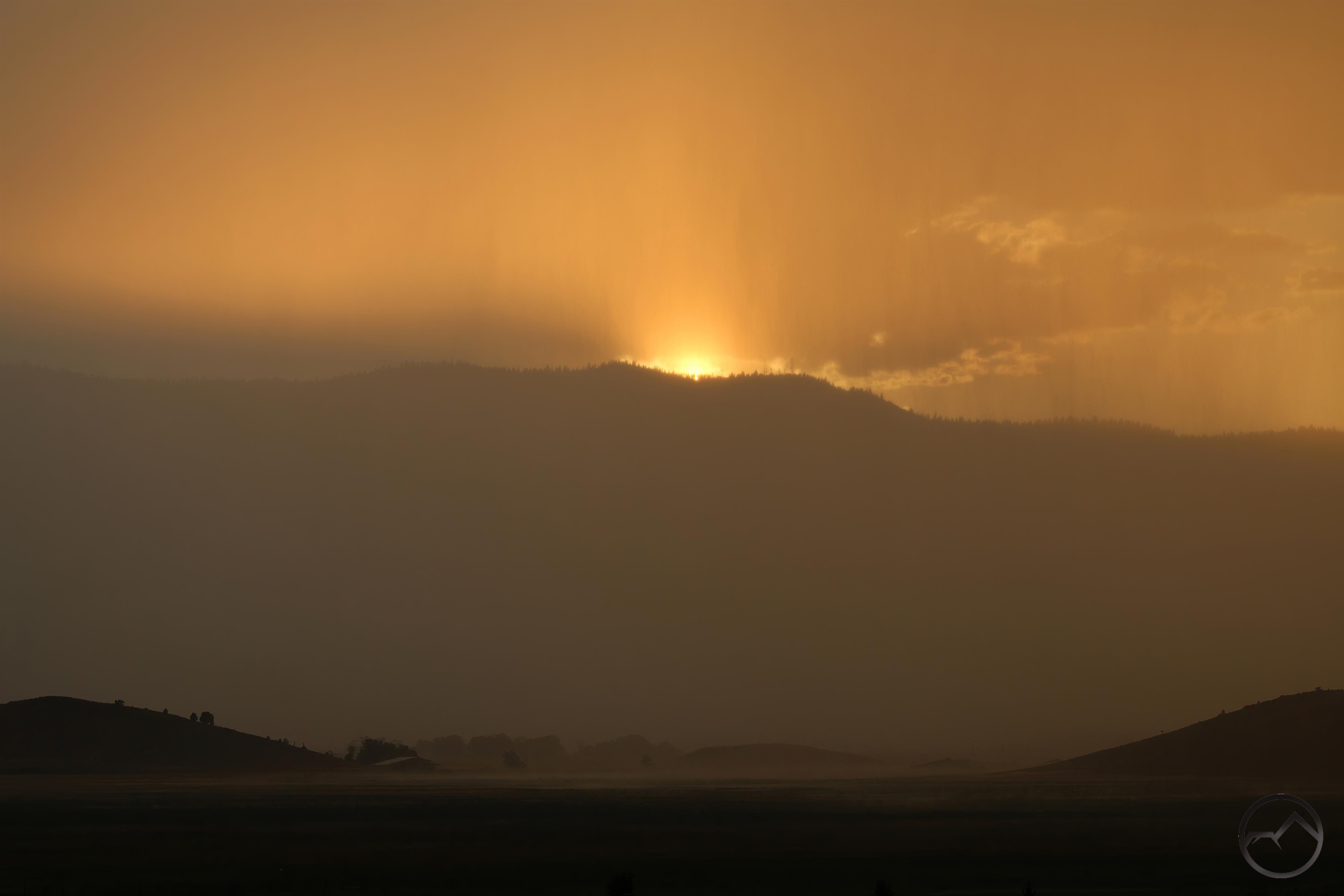
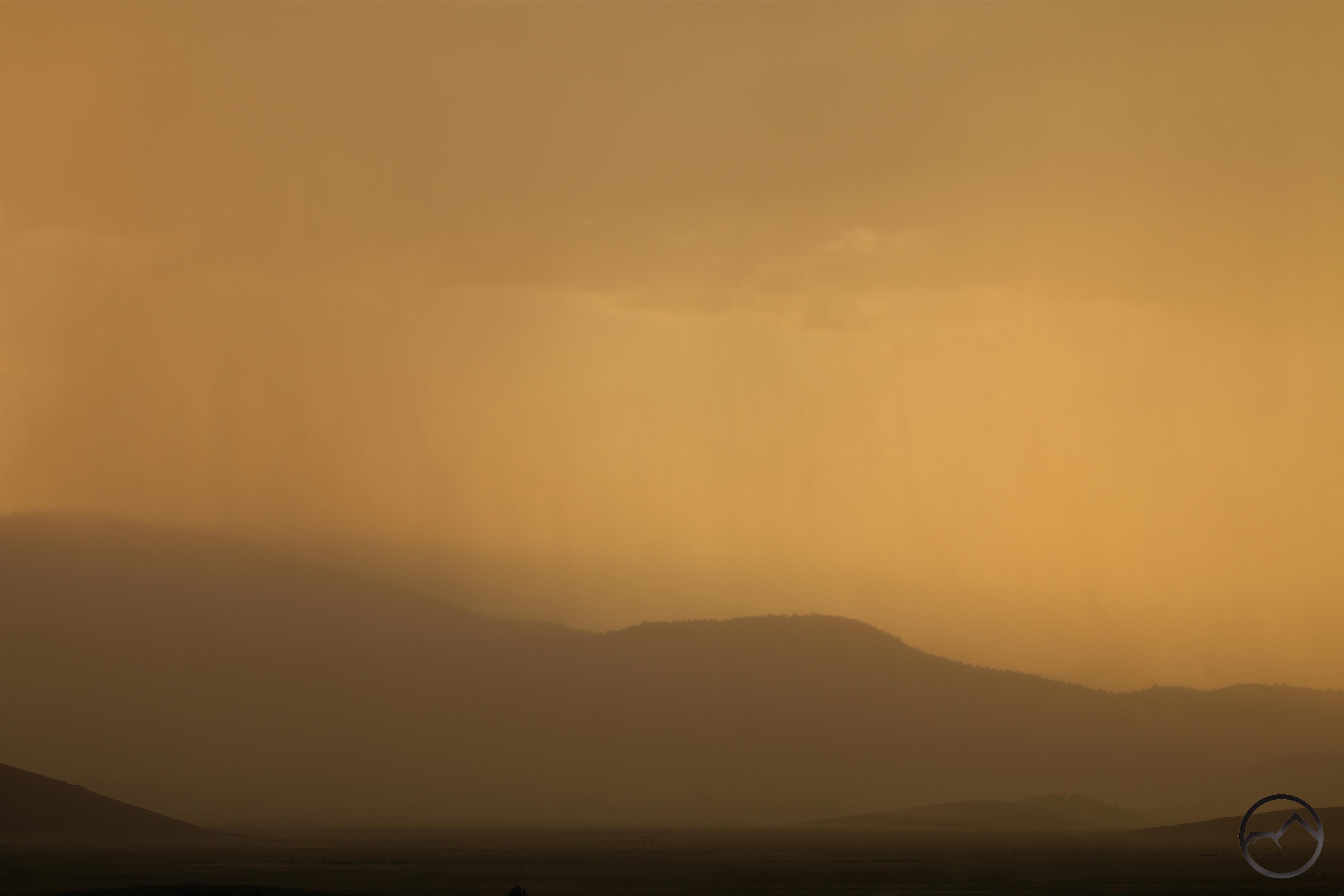
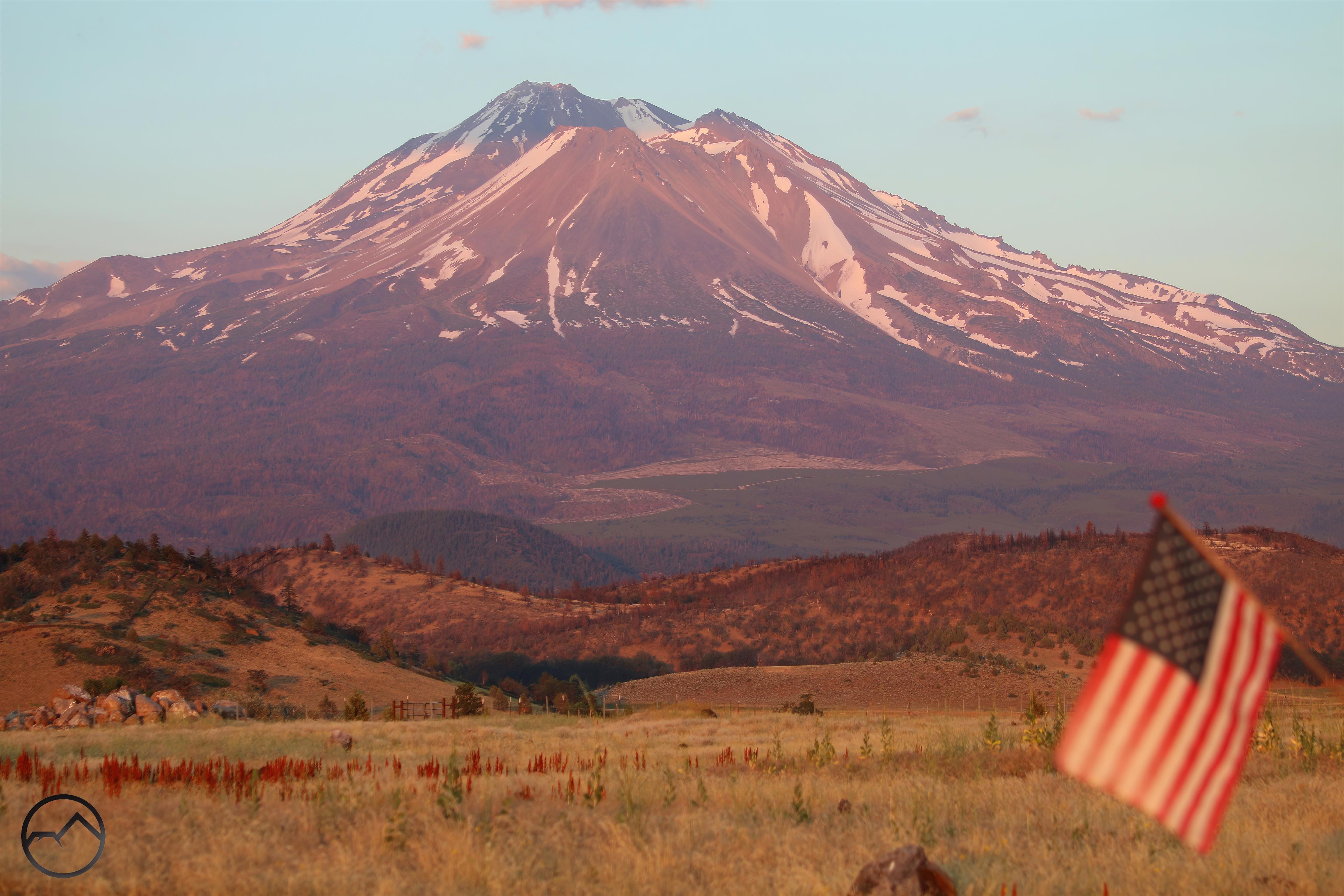
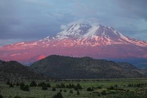
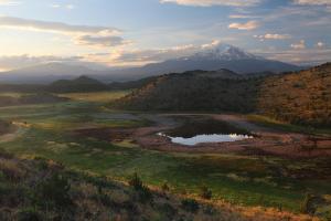
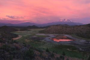
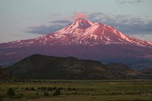
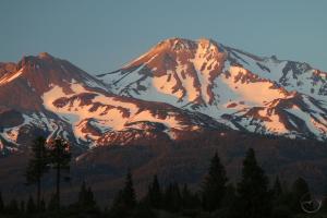
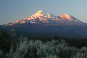
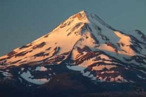
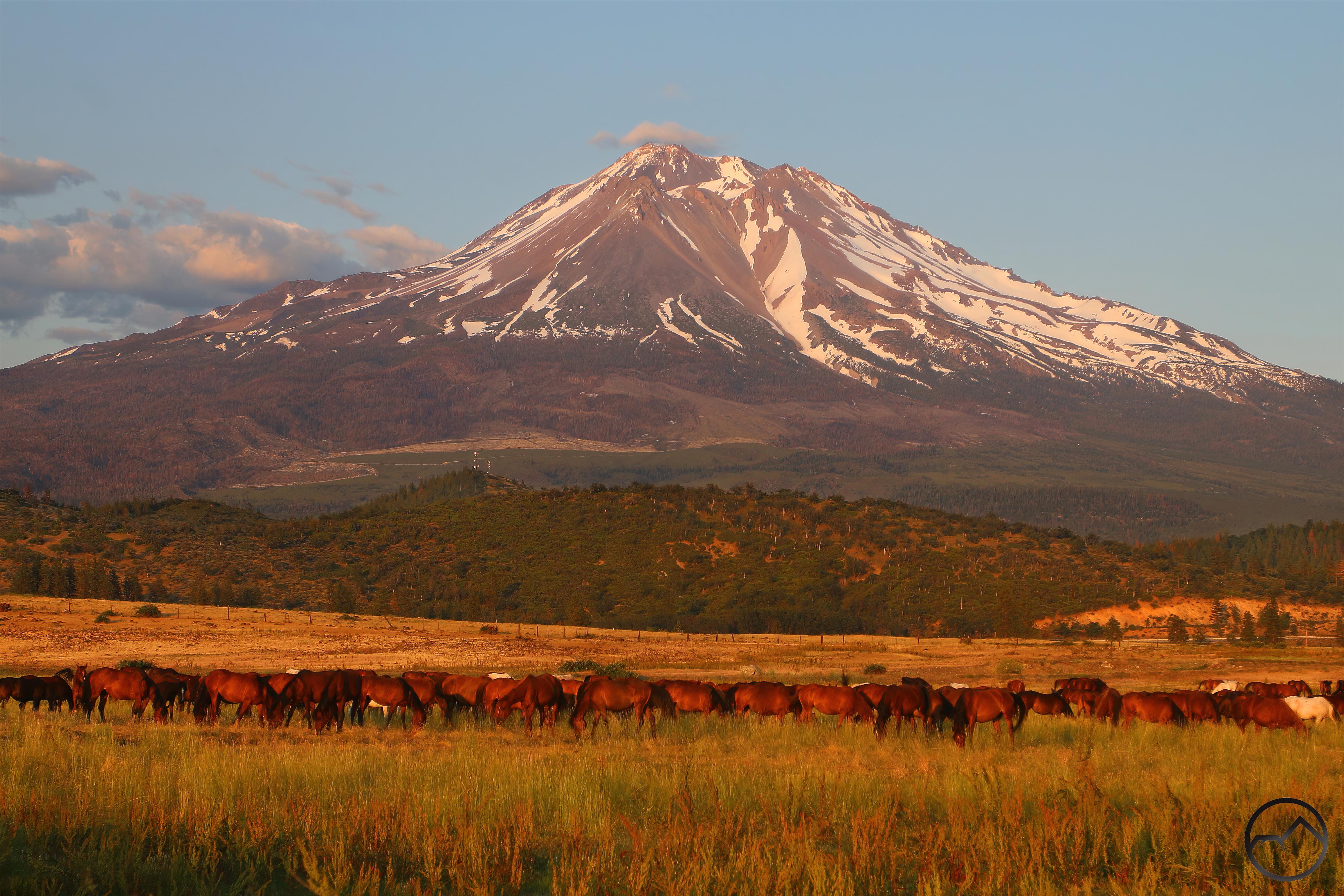
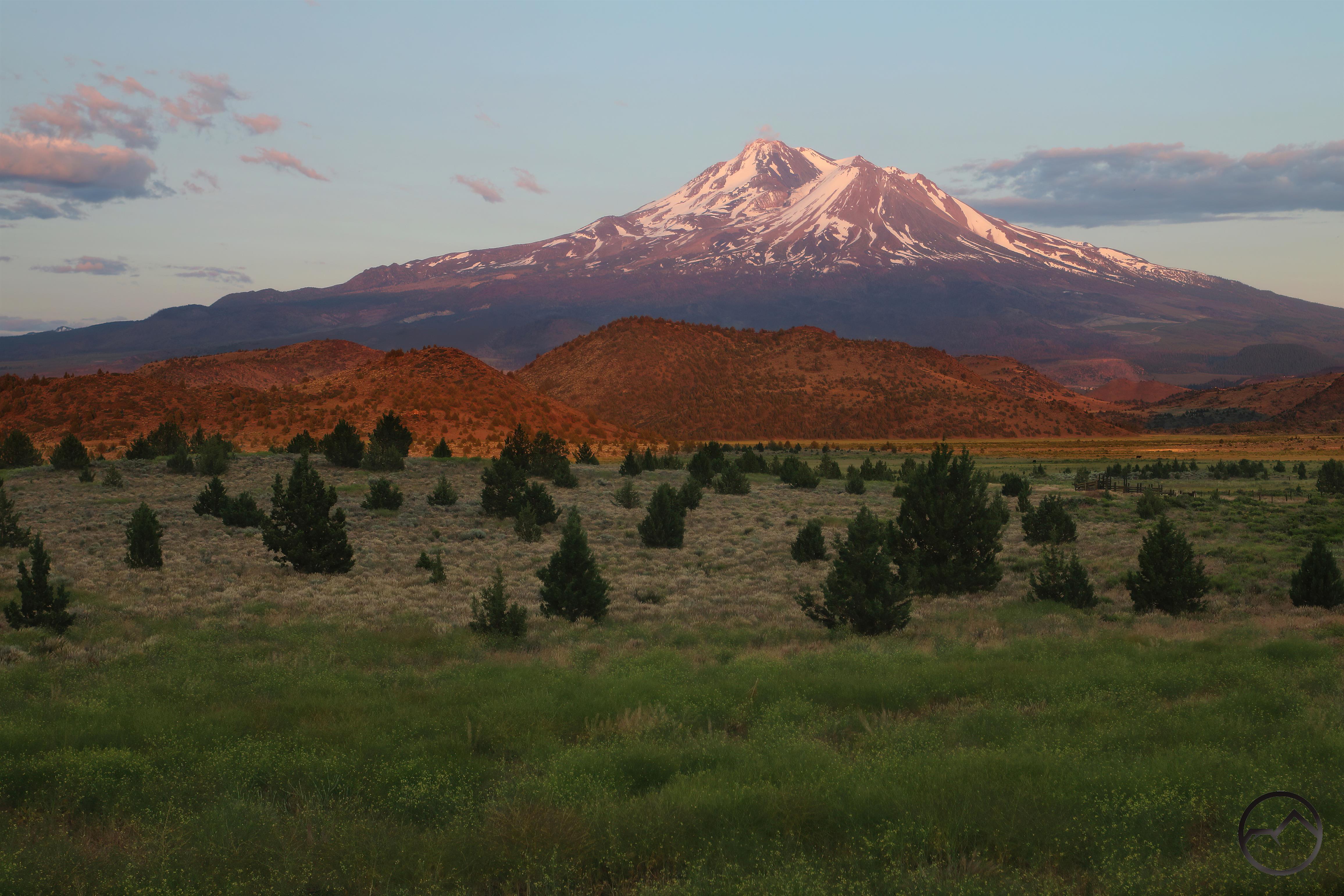
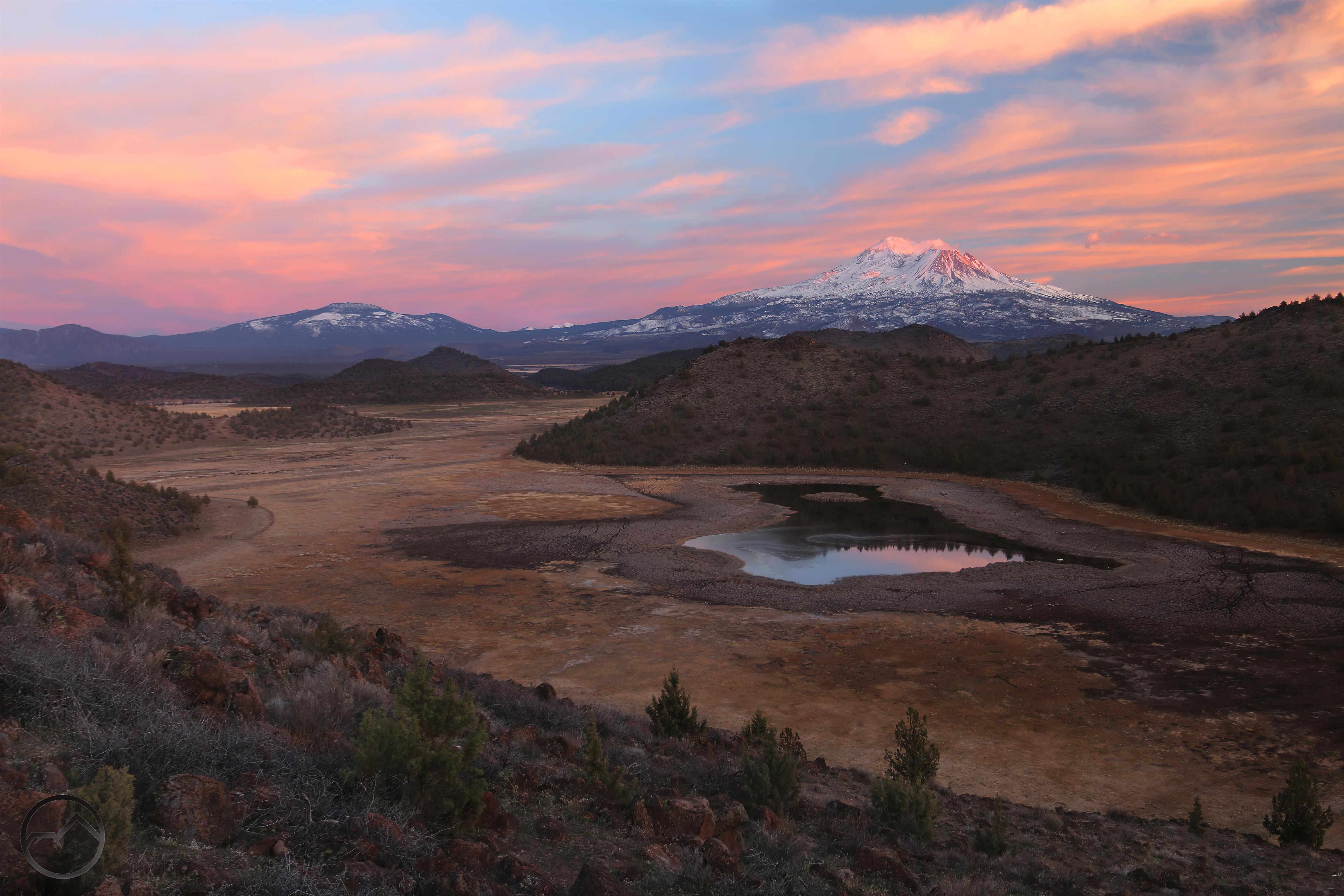
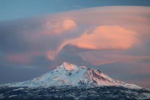
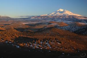
Fire in the sky, flame in the water on a Mount Shasta sunset.

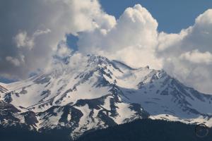
After the Long Winter, it follows that we have a long spring as well. This is certainly the case, as snow lingers even at lower elevations and the rivers and creeks are running very full as summer encroaches. Many of the lakes remain frozen as well. With beautiful warm weather (when not consumed by the persistent afternoon thunderstorms) and high water, this is a fantastic time to explore the region around Mount Shasta.

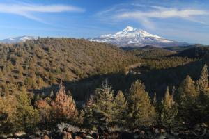
Over the last week, I have been collecting footage and images of some of the creeks and rivers to give an idea what the area looks like at this time. Needless to say, it is an glorious spring, with full, raging rivers, creeks that are surging through their remote and seldom seen canyons, and lakes filled to the brim. Obviously I can’t document all of them, but to give some indication of what is afoot out here, I have tried to document rivers and creeks in several different areas.

20230614_152008

20230614_152008

What better place to start than with the Sacramento River, the largest waterway in the Mount Shasta area. In this area the Klamath River is bigger than the Sacramento but it is just beyond the immediate Mount Shasta orbit so I am not counting it here. The river is swollen and full of fury. The North Fork of the Sacramento, the smallest of the three forks, is flowing powerfully into the main fork, which is wide and swift.

20230614_152459

20230614_152459

The Middle Fork of the Sacramento joins the South Fork nearly a mile and a half upstream from the confluence with the North Fork. Like its sibling, the Middle Fork is running strong, with a heavy flow pouring into South Fork, which is the primary headwaters stream of the Sacramento River.

20230607_155050

20230607_155050

20230614_154308

20230614_154308

The South Fork itself is much larger than the Middle and North Forks and is also flowing with great vigor. The source of the North Fork is a large complex of meadows and the source of the Middle Fork is a trio of lakes and a series of smaller meadows and springs. In contrast, the South Fork has 10 lakes, numerous smaller tarns and a large complex of meadows. It keeps the South Forks flow going even late in the summer of dry years. Right now, the river is charging through its rocky canyon and is a satisfying sight to behold.

20230614_153533

20230614_153533

20230614_154526

20230614_154526

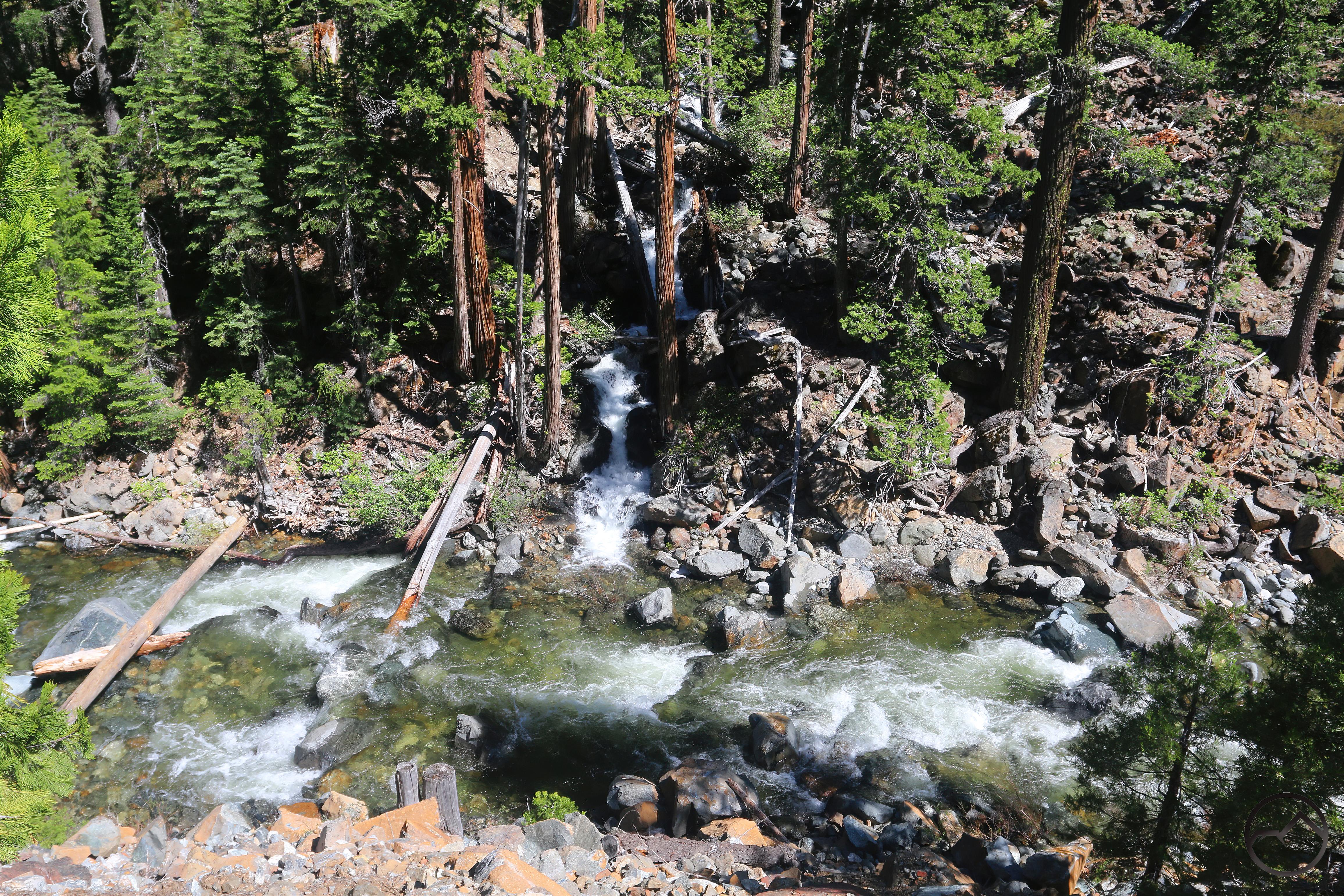
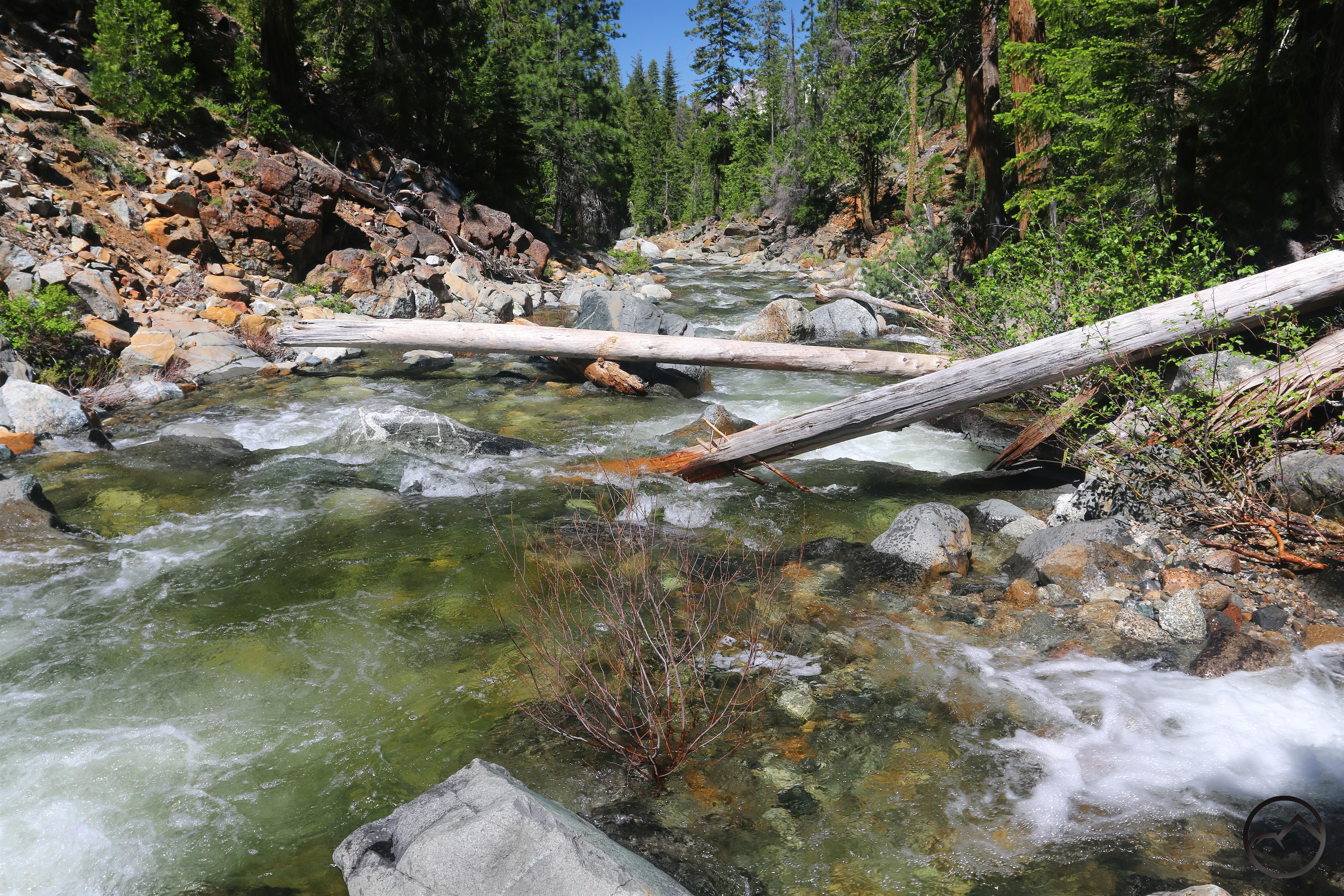
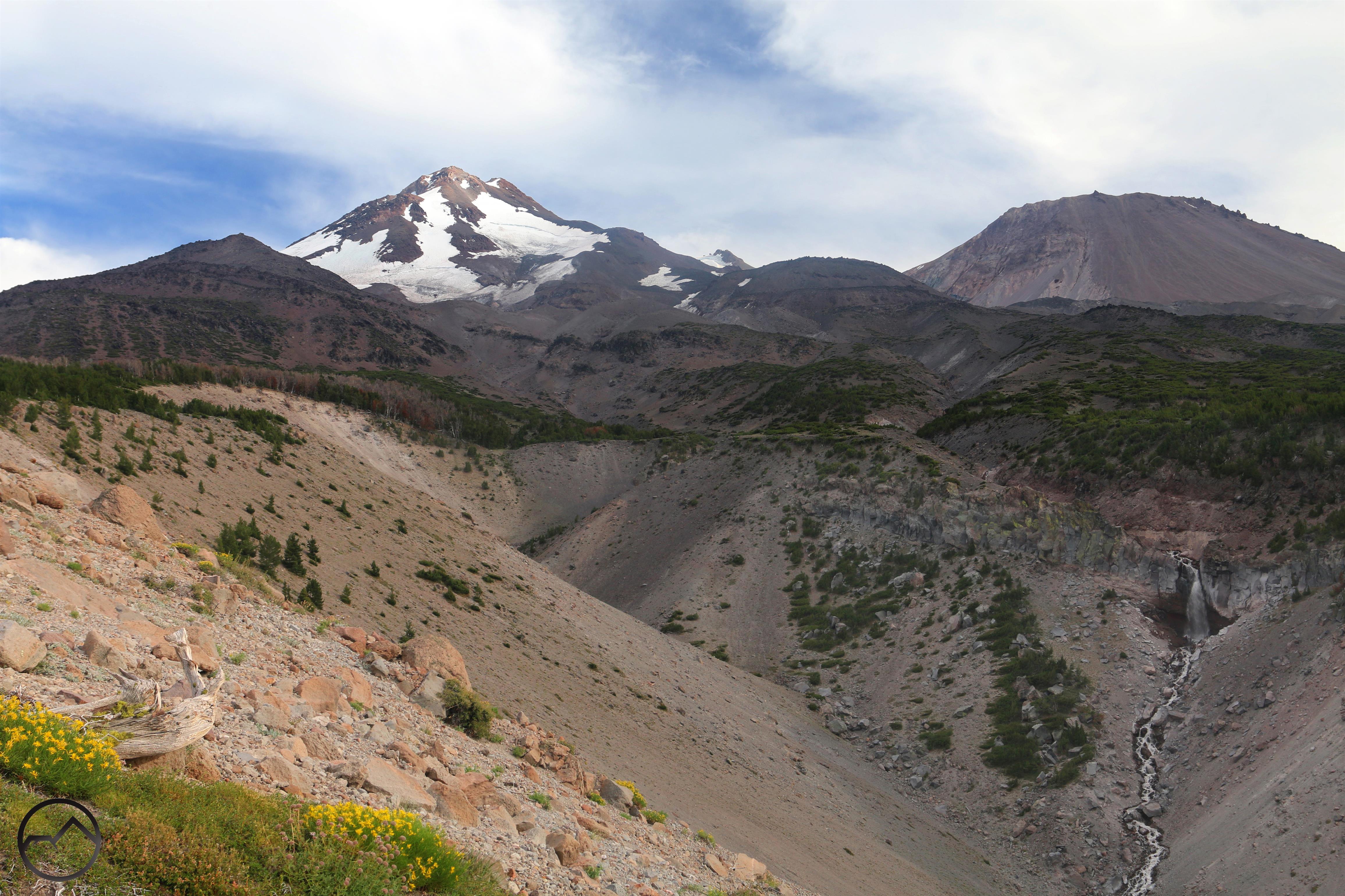
The South Fork has numerous secondary drainages that empty into the river. Some, like the lower one included in this pair, are from glacial lakes that occupy large basins. Others, like the upper one, are from smaller watersheds that fed by small patches of meadows and springs. Regardless of the source, these are all flowing with vigor right now.

20230611_150555

20230611_150555

20230611_144749

20230611_144749

20230611_145250

20230611_145250

The above creek is a major tributary of the South Fork of the Sacramento but is utterly unappreciated since the majority of its flow travels a deep canyon that few, if any hikers traverse. Those who do will find a large creek with delightful cascades and beautiful waterfalls from feeder creeks. The high water makes a trip down creeks like this a fantastic journey for those who love wild water.

20230611_163703

20230611_163703

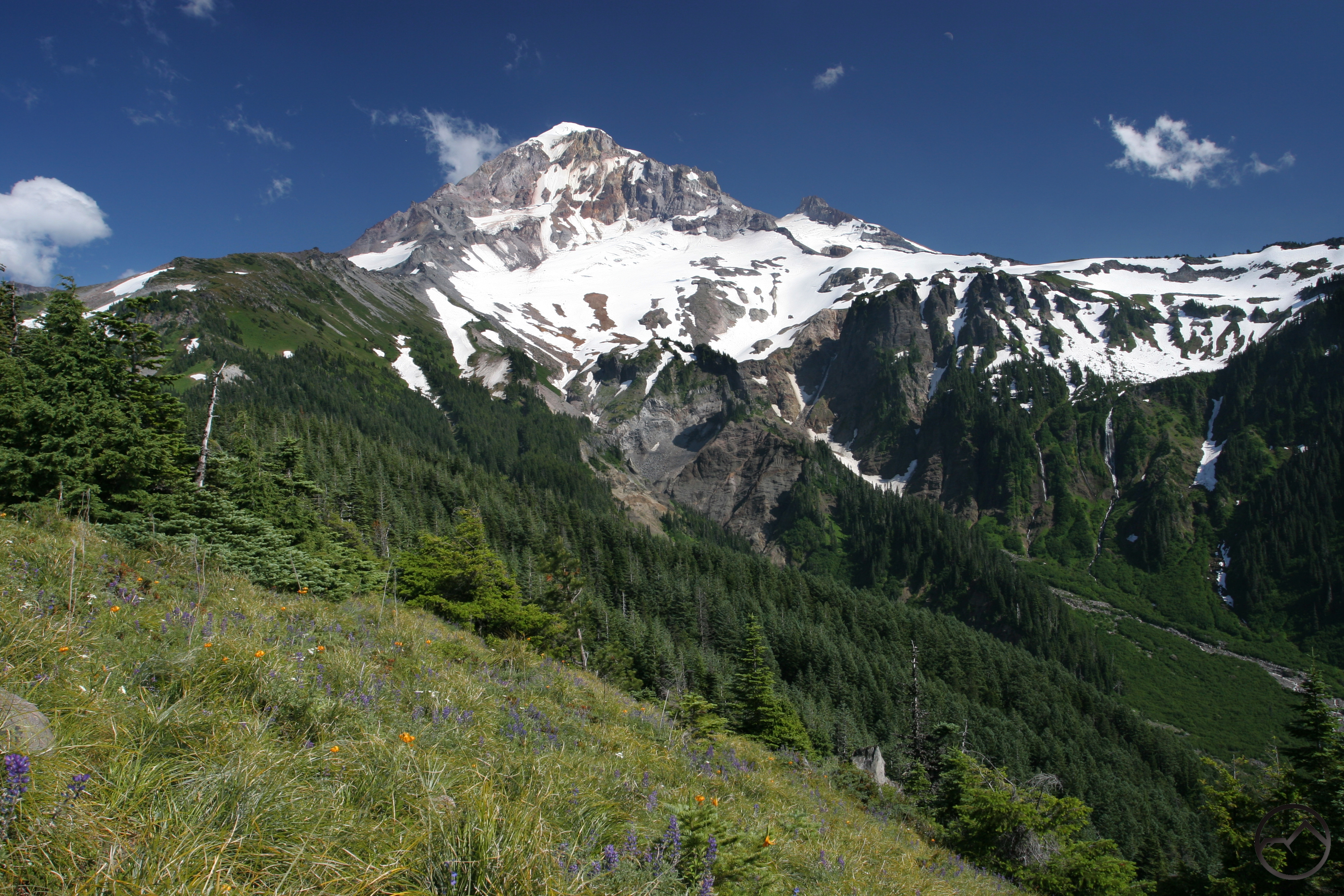
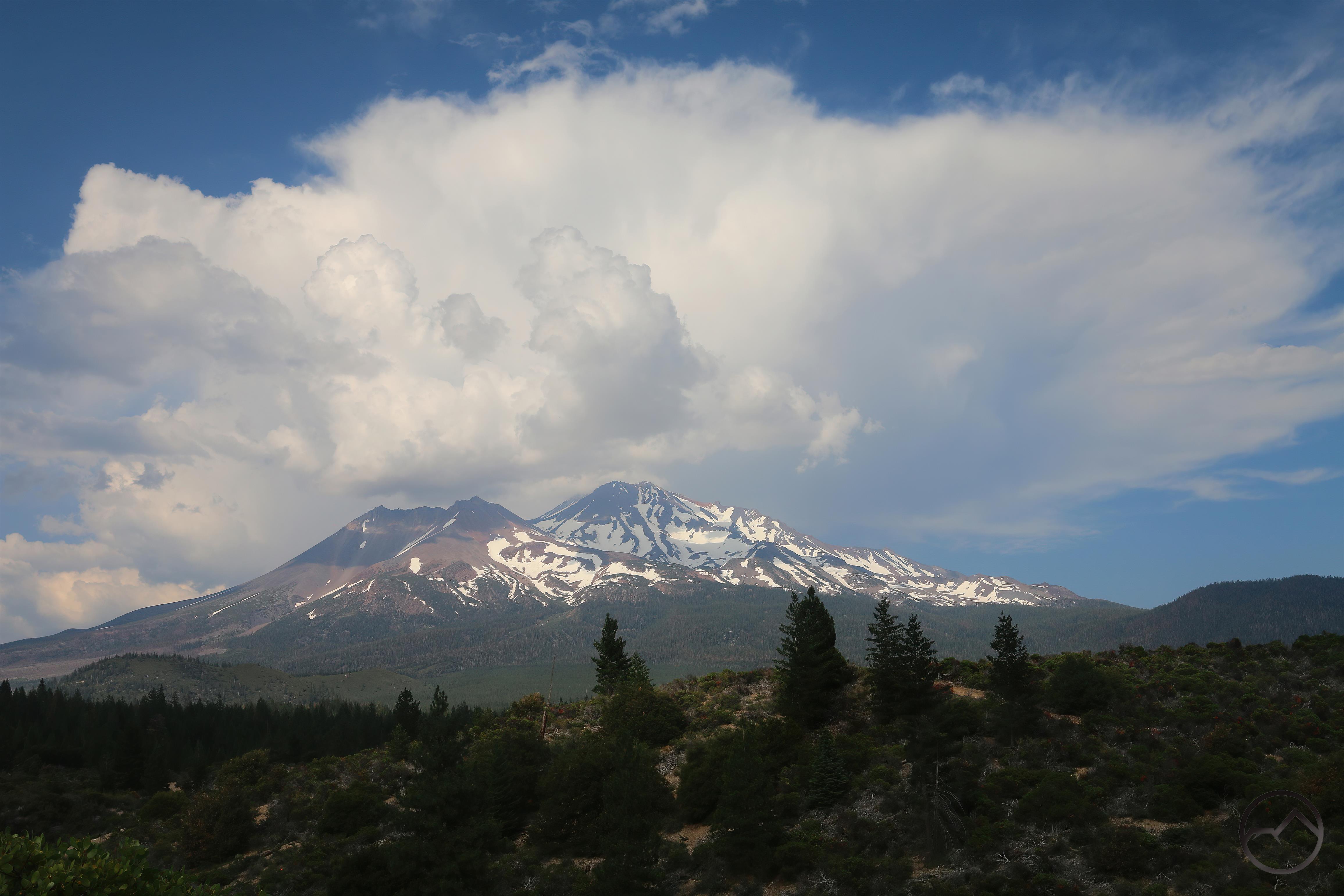
Higher up, snow still lingers in many places and though the grass is green, many plants are just emerging from their winter dormancy. Within a few weeks, wildflowers should begin erupting from these meadows.

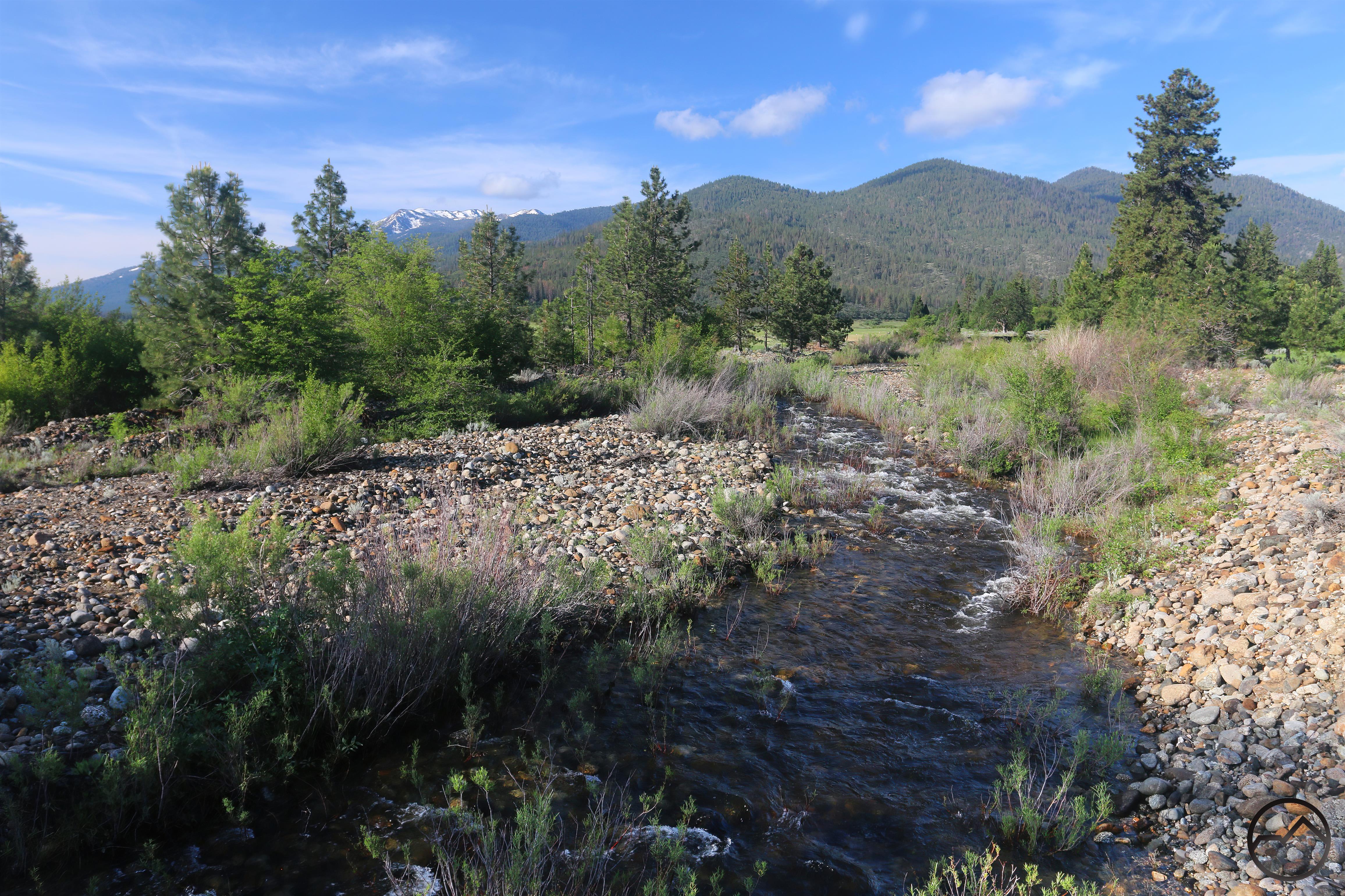
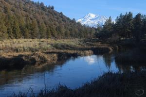
To the north, Parks Creek is one of the largest creeks to emerge from the Trinity Divide (or the Scott Mountains, depending on how the boundary between the ranges is parsed). Long ago, this was recognized as the North Fork of the Shasta River. It’s source is in the lakes and meadows of Caldwell Basin on China Mountain.

20230610_114122

20230610_114122

Right now, it too has strong flow as it leaps down its rocky channel through a deep, remote and nearly inaccessible canyon. Those few who venture down into this wild land will find a creek choked with Pacific yew trees. Though not uncommon along the region’s creeks and rivers, this number of yews lining the banks is as unusual as it is impressive.

20230613_145341

20230613_145341

20230613_150558

20230613_150558

This unnamed creek is a significant tributary of Parks Creek. The lower section of this anonymous waterway drops precipitously down to the confluence with Parks Creek. Like the other creeks in Northern California, it has great flow right now, making exploring its remote route down the mountain a joy.

20230612_120654

20230612_120654

The McCloud River, the second largest river in the immediate Mount Shasta area is running deep and urgently. With the foliage leafing out and the rhubarb flowering, this is a great time to hike any stretch of the 15 miles of the McCloud River Trail. Naturally the section along the falls gets the most attention but the rest of the trail is a delightful riverside path. Conditions can’t be better along it than right now.

20230612_124527

20230612_124527

20230612_124952

20230612_124952

Upper McCloud Falls is the most geologically complex of the river’s three cataracts. Just above the precipice, the river has cut a deep trough through the basalt. Potholes and alcoves abound and cause the water to churn as it races through the sluice. The water finally leaps off the cliff, crashes into a ledge and explodes into a fan as it pours into a deep pool. With water this high, the spectacle is particularly dramatic.

20230612_130530

20230612_130530

20230612_131049

20230612_131049

The highlight of the McCloud River is Middle Falls. Here the canyon is at its deepest, the river the widest and the falls the tallest. It is simply one of the best waterfalls in Northern California. From above the falls, the view of the canyon, river and distant peaks of the Trinity Divide is a classic mountain vista. The falls themselves need no further descriptors or superlatives.

20230429_073645

20230429_073645

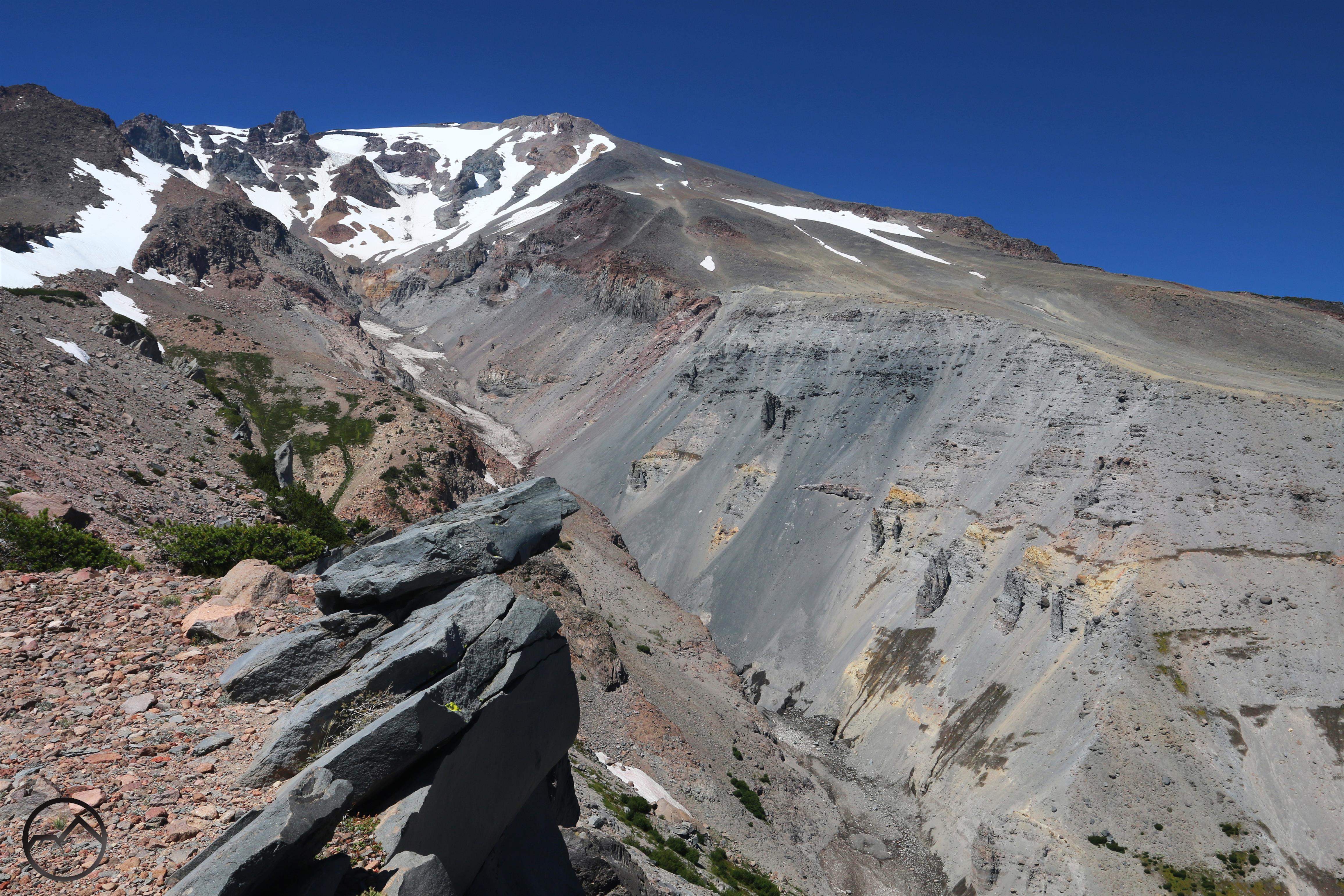
Even Mud Creek, one of the largest creeks to come off of Mount Shasta itself is running with force right now. True to its name, the water is chocolaty, choked with mud from the cinders and glacial till that makes up Mud Creek Canyon. The creek is currently carving a new channel for itself, having first filled its banks with debris then jumped the channel, flooded the forest and nearby meadows and is now digging back in along a new route. It has been a fascinating process to watch.

20230614_154937

20230614_154937

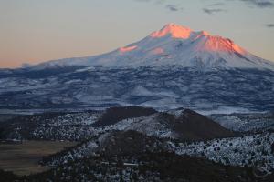
This really is a special time to be out exploring the area around Mount Shasta. Whether on trail or off, there is magic in the mountains and great beauty to behold.
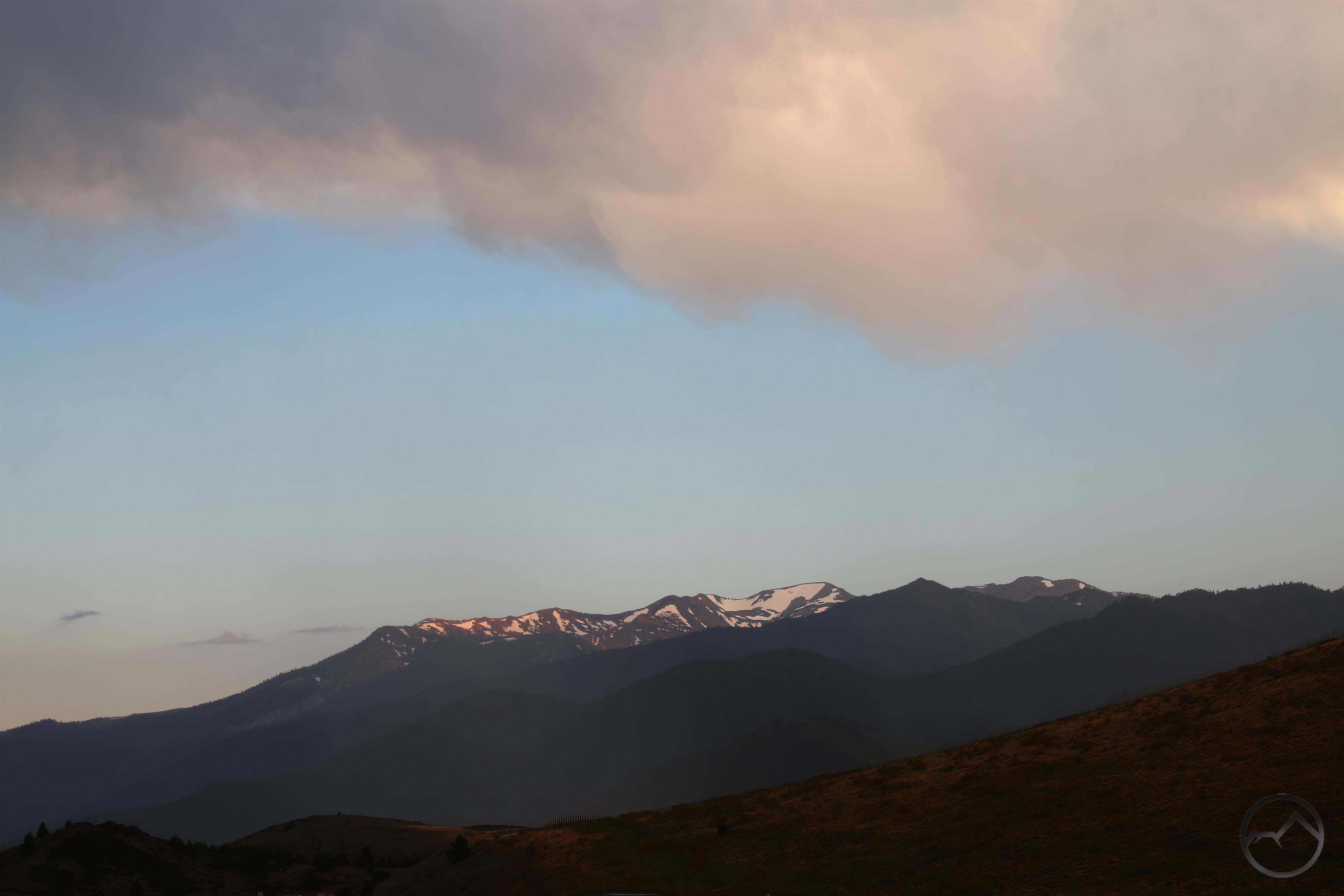
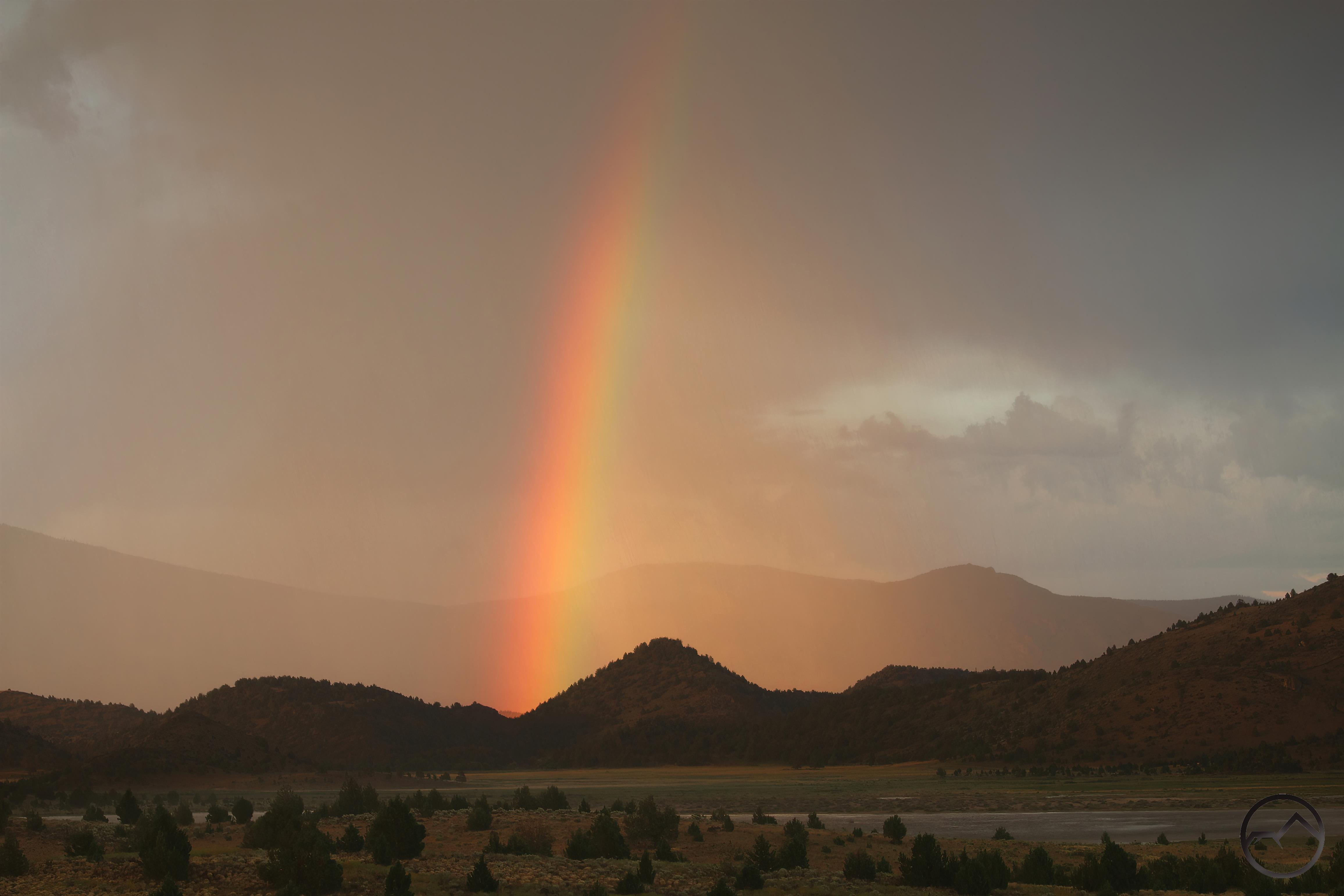
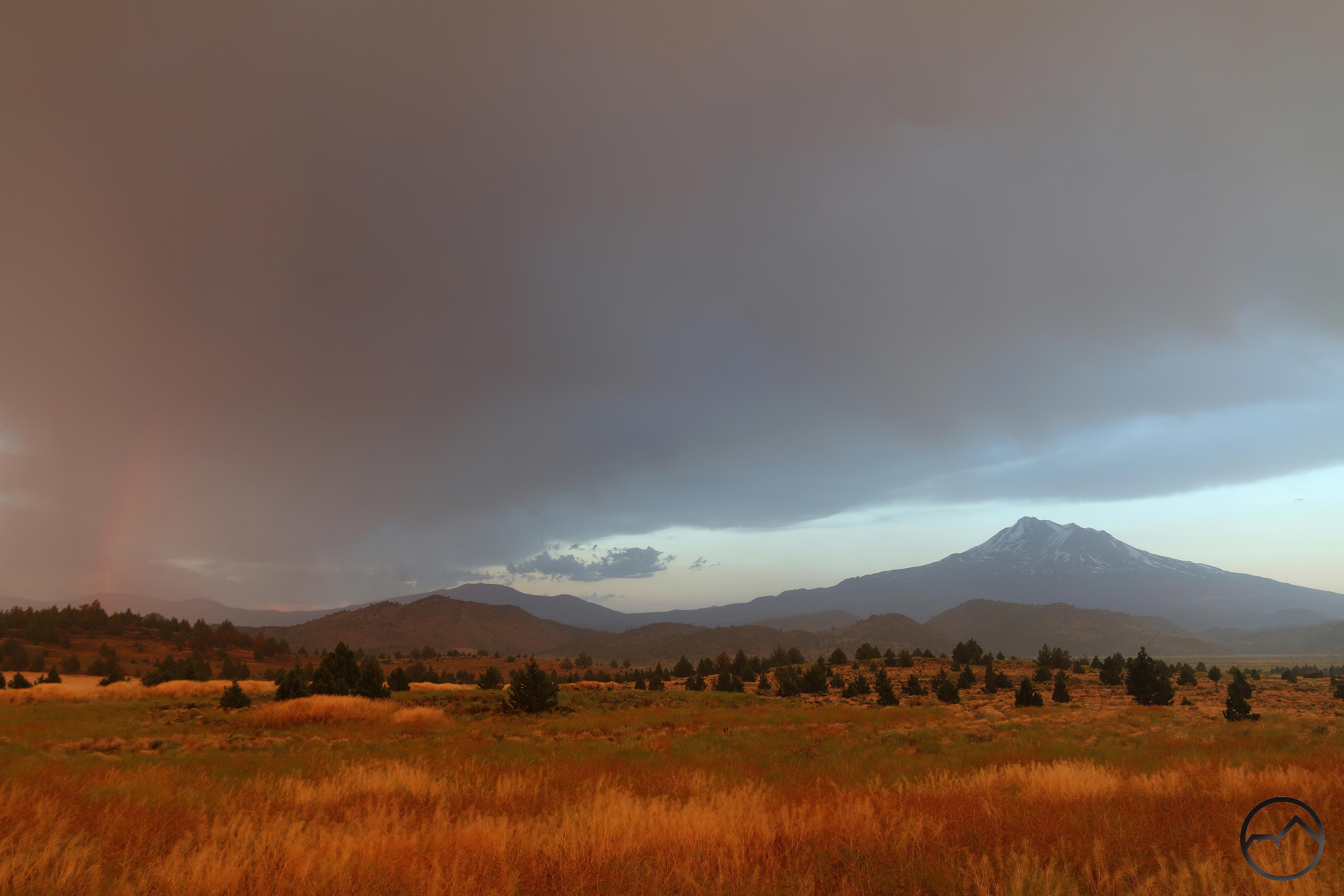
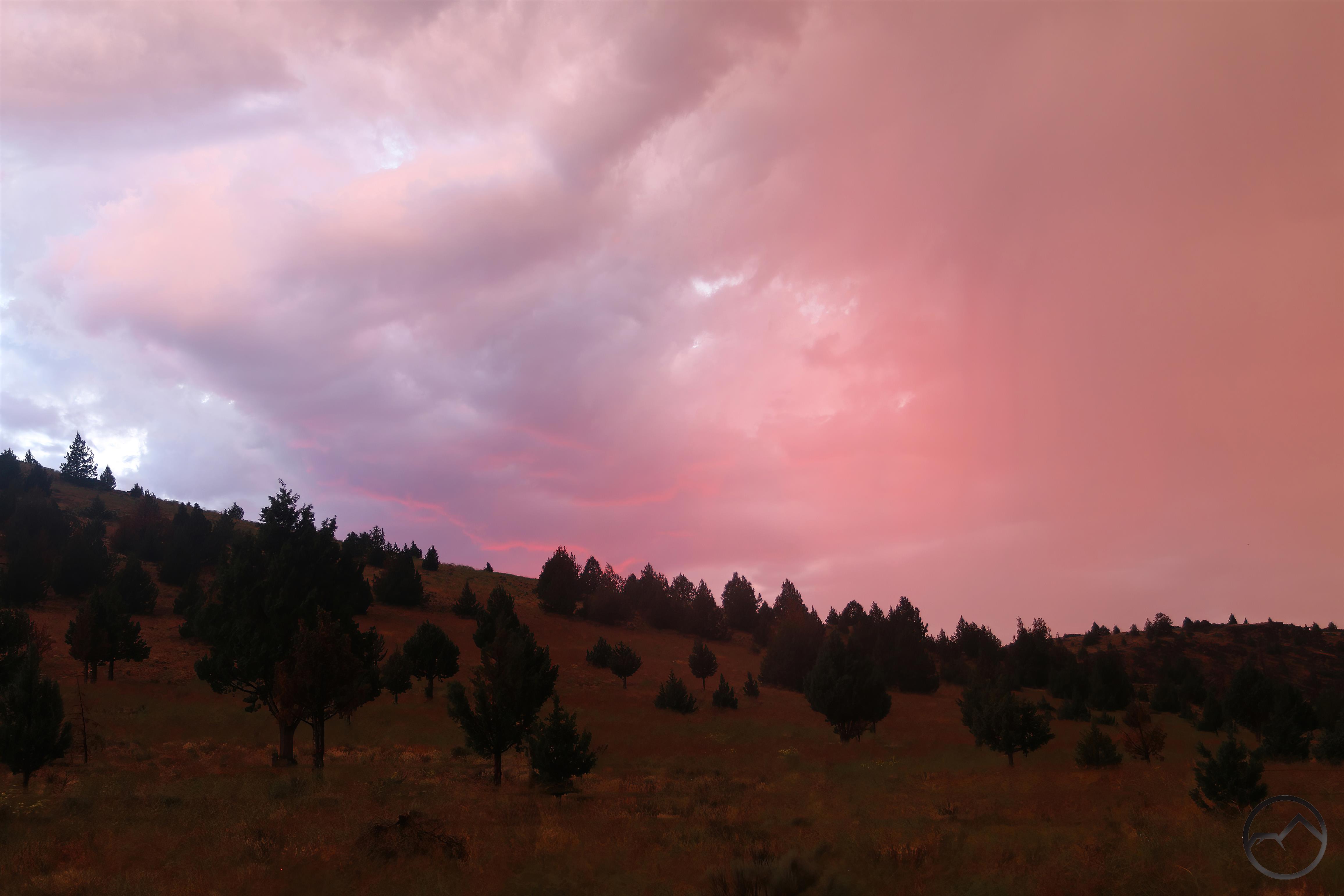
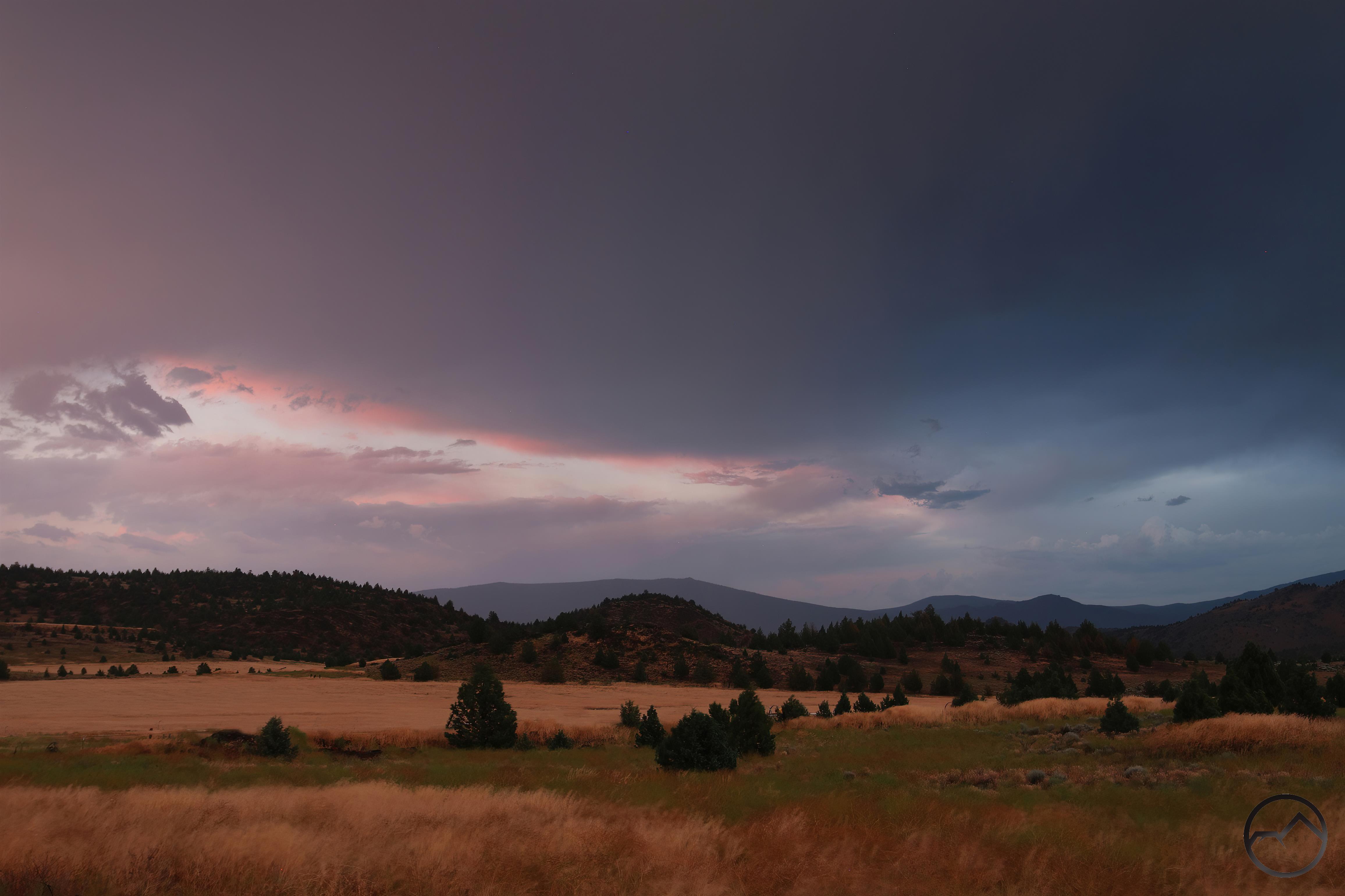
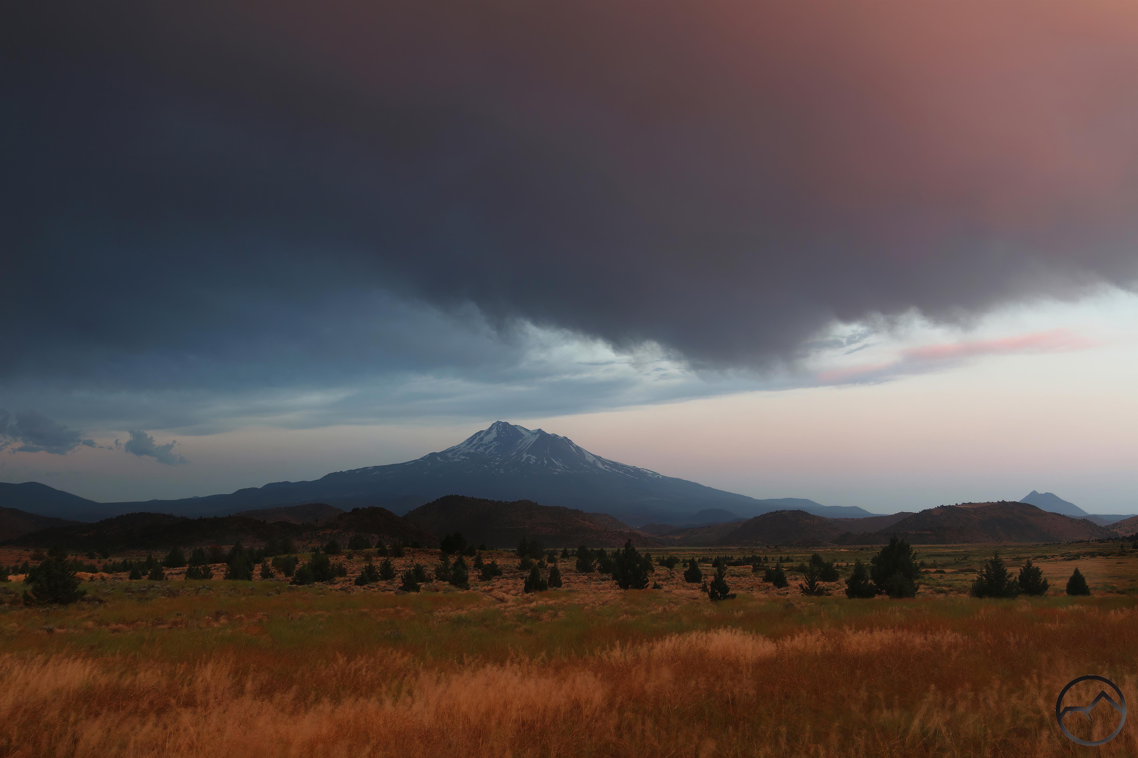
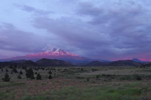
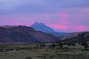
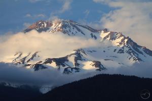
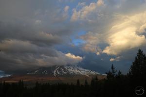
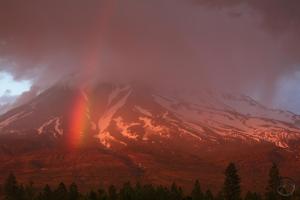
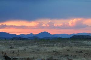
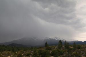
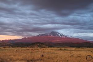
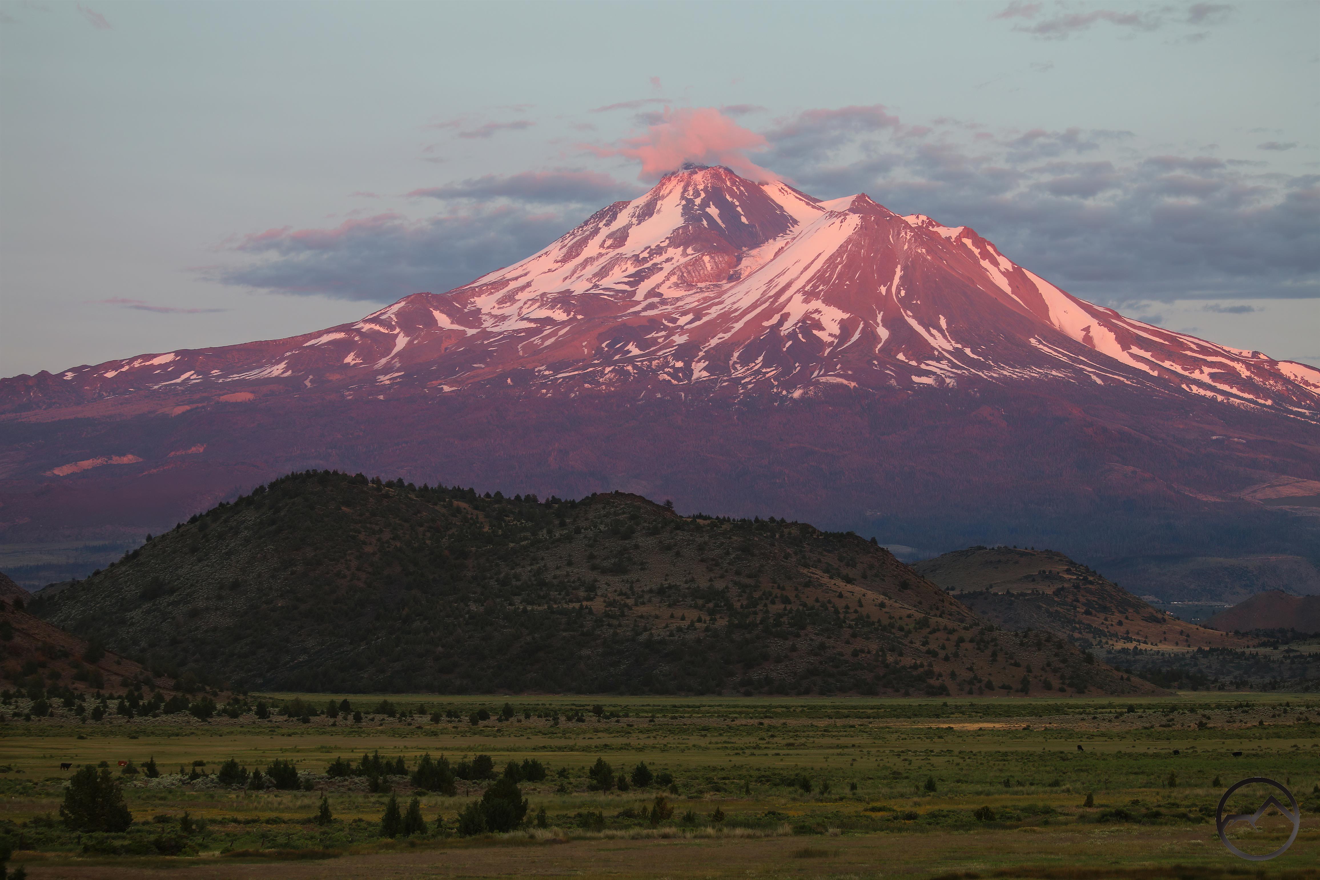
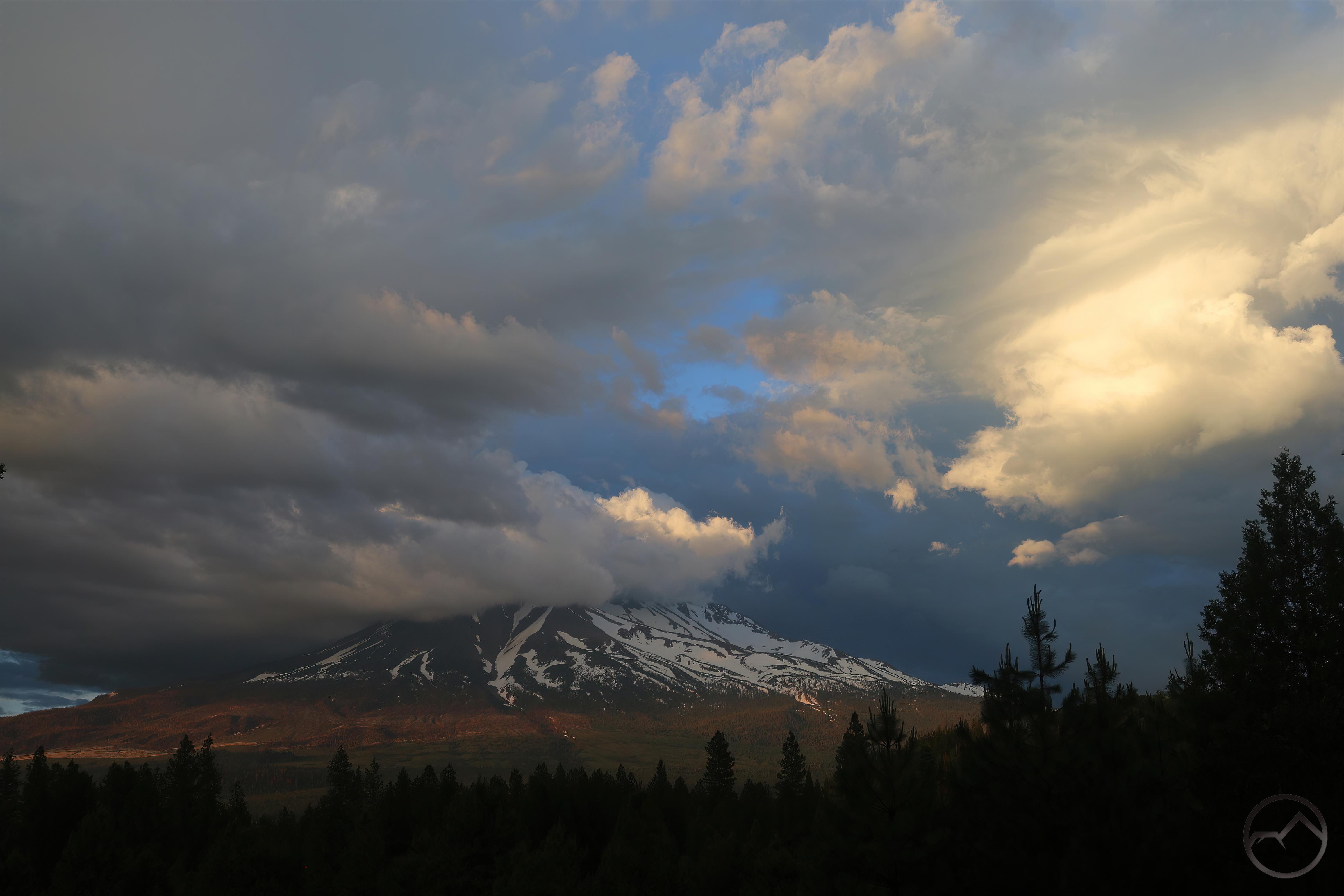
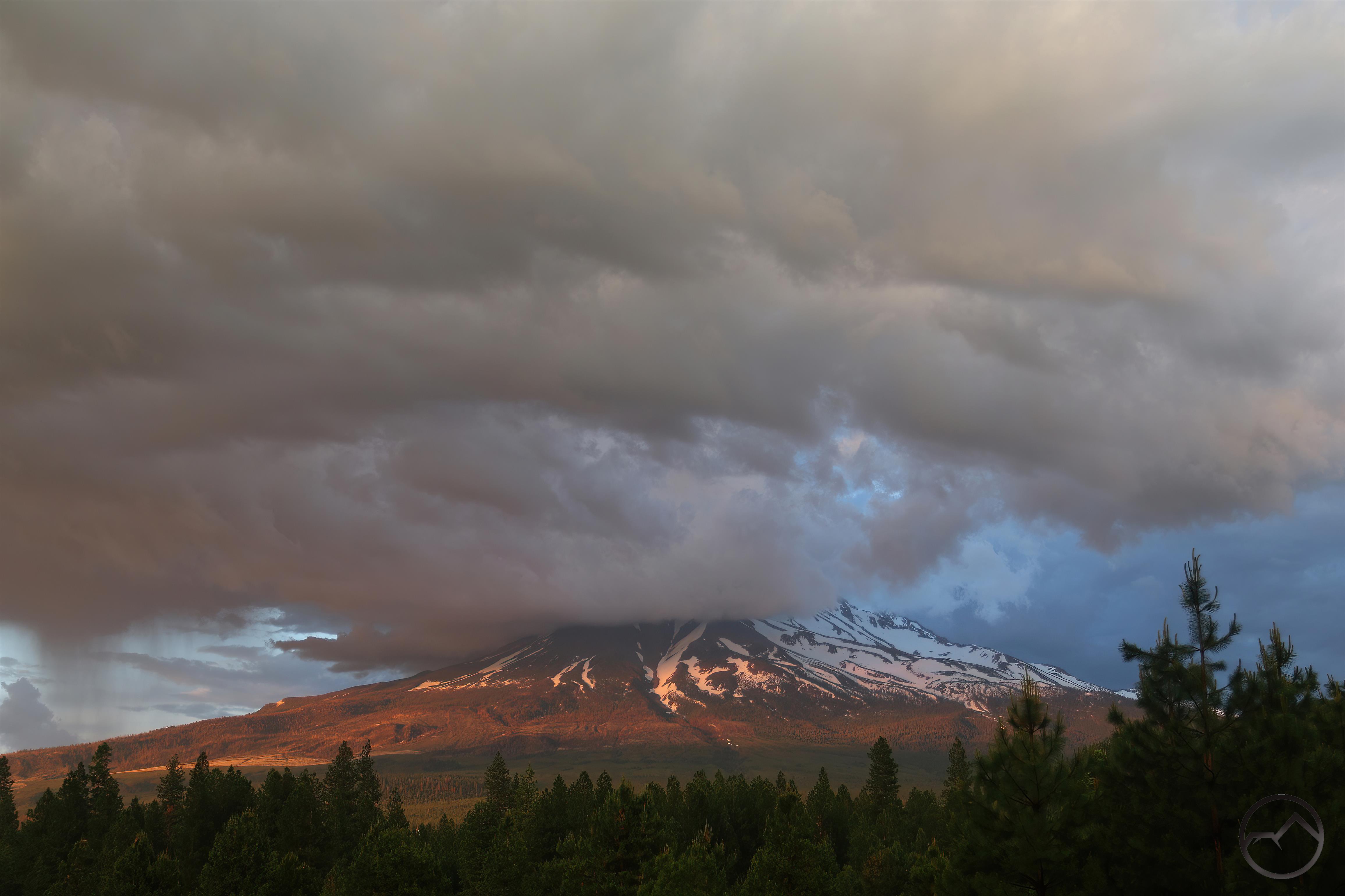
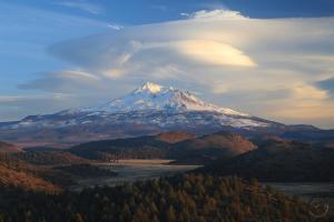
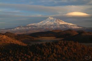
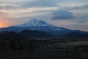
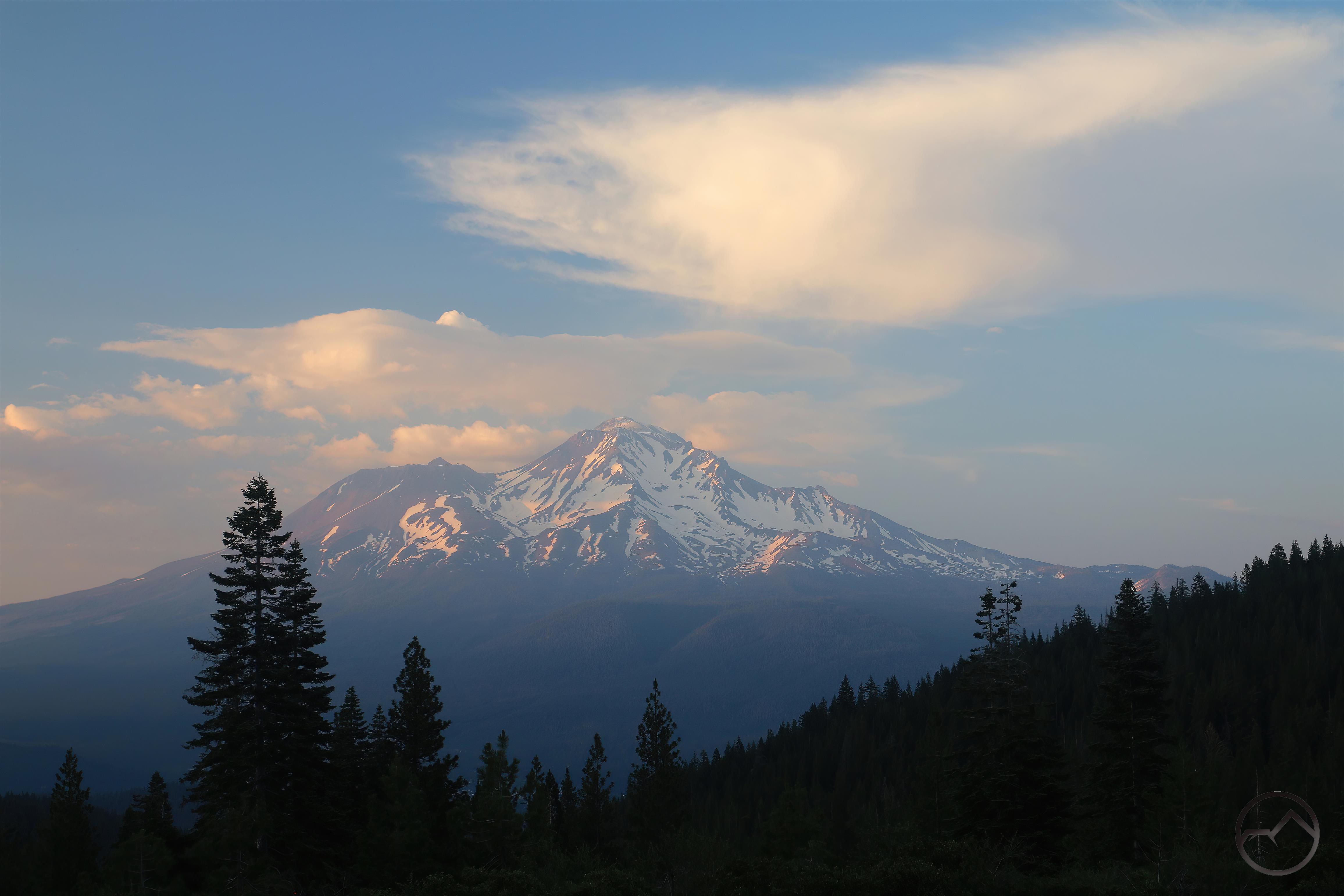
Thunderstorms Over Mount Shasta

Posted by bubbasuess on June 12, 2023
Posted in: Cascade Range, Hiking, Mount Shasta, Truchas Ridge. 4 Comments

The last couple of weeks have witnessed some unusual weather here in Mount Shasta. Each day has dawned with clear skies and cool temperatures. As the days have progressed, clouds have gradually gathered over Mount Shasta and Mount Eddy as the temperatures have climbed. Though never high (mostly in the upper 70’s to low 80’s), it has gotten just a hint of mugginess at times. Then, late in the afternoon, the thunder could be heard booming and a thunderstorm’s deluge would fall. It has seemed more like Rocky Mountain weather than what we typically have here in Northern California. Oddly, the sunsets have been fantastic to the northwest of Mount Shasta but the cloudy conditions have left the mountain itself in the flat absence of light.

Echo Point view of Mount Shasta rising above Parks Creek Valley and Echo Basin.

The clouds seemed to clear and a forecast the hinted the morning might have good conditions so I resolved to head out for a Sunday morning sunrise. This necessitated getting up at 4:30, since the sunrise is around 5:30 this time of year. I headed north to the Truchas Ridge and climbed up to Echo Point, which has a fantastic view of the lower Parks Creek vale. This time of year, the sun’s position in the far northeast of Mount Shasta makes this a great spot for a summer sunrise. I took up my position on the point and waited for the morning color to come. Frankly, it was lackluster, as too many clouds by Herd Peak filtered the light. However, as the sun rose above the mountains, the valley below was bathed in the warm morning glow. It was a glorious sight.

As has been the pattern, the clouds gathered in the afternoon and coalesced around Mount Shasta. The deluge that came was stronger than most over the last few weeks and I had nearly given up hope that there might be some kind of sunset on the mountain after the storm passed. Thankfully, I headed out anyway.

I had initially planned on heading into the Shasta Valley but stopped short when the clouds looked to have obscured the mountain from that direction. I stopped at a nearby vista that was west of Mount Shasta and quickly set up my camera, as there was a tall plume of cloud that was catching some great light. If this was all the sunset was to be, I was glad I had gone out.

The clouds quickly closed in and nearly smothered Mount Shasta. The tall plume of cloud had blown away and the sky was overcast. Still, light clung to the flanks of Mount Shasta so I resisted the temptation to pack up my camera and hung around for a few more minutes.

Suddenly, everything turned red and a vivid rainbow burst out of the ether in front of Mount Shasta. I had not anticipated this spectacle and at the moment I had my telephoto lens on, so I quickly snapped a few shots before switching to a wider angle lens.

The clouds around Mount Shasta began to lift and more of the mountain became visible. The rainbow persisted and grew, arcing high into the sky. Purple rain began to fall from the clouds, punctuated by flashes in the clouds and the boom of thunder. It was one of the most magical sunsets I have ever seen on Mount Shasta.

I expected the rainbow to be fleeting but it turned out to have great longevity. It lasted until all the light had faded from the sky. It did lose its blue, indigo and violet colors as the sun set, forming a reddish arc through the sky, which was lost in the already red glow of the clouds. The rain still fell, catching the evening light and made for a purply gauze hanging in the sky. This was unlike any sunset I had seen before. What a blessing…

The forecast no longer shows thunderstorms and indicates a return of more normal June weather. If Sunday’s sunset marked the end of the thunderstorms, it certainly closed out this odd weather with a terrific display.

February Was A Spectacular Month At Truchas Ridge

Posted by bubbasuess on June 6, 2023
Posted in: Cascade Range, Hiking, Mount Shasta, Truchas Ridge. 2 Comments

A tremendous sunset view from Echo Point.

I was going through images from this past winter and I was struck by how great the conditions were out at Truchas Ridge during February. Most of the month saw a lull in the stormy winter we had had, leaving skies filled with turbulent clouds and vivid colors rather than the massive storms that had sailed through the region. Add to that layers of snow both on the mountains and the northern aspects of the Shasta Valley’s entwined folds as well as pools of water adding reflected colors and it was a magical season out at the Ridge.

Conditions at the Ridge are radically different now. A significant trauma hit the area in April but the winter has paid its dividends, as the grass is now waist high. I have never seen it like that and it is shocking it can get that tall in the desert. The steady stream of thunderstorms we have had hasn’t helping either. I might need to hire some goats to shorten the grass.


Spring In Yosemite (Excessive Waterfall Footage)

Posted by bubbasuess on May 21, 2023
Posted in: Hiking, Mount Shasta, Sierra Nevada, Yosemite. 11 Comments

Yosemite Valley in vernal glory.

Before the Long Winter set in, my wife and I had reservations to camp in Yosemite. The last few times we had been there it had been summer or fall. It has been 6 years since we were there in the spring and we reckoned it was time for our kids to be there in high water once again. Little did we know that the winter would yield an epic snowpack and, consequently, a magnificent array of spring time waterfalls and awesomely swollen perennial waterfalls.

The scenes were so spectacular I was compelled to document many of the cataracts in both images and video. I hope this gives some sense of the magnitude of the conditions in Yosemite Valley as the prodigious thaw floods into Merced River.

Although Highway 120 is the quickest way into the park when coming from Mount Shasta, Big Oak Flat Road is currently closed due to road damage. This means we had to drive down to Merced and enter the park on Highway 140, the Yosemite All-Year Highway. This was the way I grew up driving into the park and I always loved driving along the river. As a kid I would scan the steep canyon walls for remnants of gold mines. When we reached El Portal, we knew we were on the edge of the park. Above the village was Chinquapin Falls, always the first waterfall to greet visitors to Yosemite. Usually diminutive, this spring it was an awesome harbinger of what lay ahead. More immediate to the traveler was the Merced River, which was a cauldron of white water.

20230515_133240

20230515_133240

In normal years, keen observers might notice a distinct waterfall on the south side of the river just after passing through the Arch Rock entrance. This fall, which is on Grouse Creek, was at times difficult to spot due to the small size of the watershed and the reduced flow for much of the year. This year it was a monster. The video does not do justice to the incredible rooster tails hurtling outward from the cliff.

Perhaps the least known officially named waterfall in Yosemite Valley, Wildcat Falls is typically hard to spot. This time, it has substantial flow. The short walk to the base was a lot of fun too.

20230513_085416

20230513_085416

Cascade Falls was the first true “Yosemite waterfall” I would observe as a kid. Everything before it was just playing around. Of course, the Cascades are bigger than the final drop (the best place to observe them is from the Rostrum on the south side of the Valley). However, that final drop is an awesome sight. This spring, it was a misty giant.

20230513_094507

20230513_094507

The upper part of Cascade Falls stood out dramatically from the side of the valley, with the Merced flowing far below.

Ribbon Falls, the tallest single drop in Yosemite Valley had a strong flow.

Located on the eastern flank of El Capitan, Horsetail Falls is an ephemeral waterfall that gets a fair amount of attention in February (while cool, there is only one firefall, in my mind). I have never seen it with this much flow in May. It was a neat sight, plunging off the sheer cliff high above the river.

Almost unnoticed above the famed Tunnel View vista point is Silver Strand Falls. While tall, it is almost totally unknown, overshadowed by the incredible vista of Yosemite Valley. This was the strongest flow I have ever seen for this fall. The snow visible at the top was indicative of how strong and sustained the falls are right now.

20230514_174216

20230514_174216

For being one of Yosemite Valley’s “big four” waterfalls, I feel that Bridalveil Falls is sometimes overlooked. Though it has a stronger flow late in the year than Yosemite Falls, its position at the west end of the valley tends to leave it isolated. Right now, the falls are stunning in their ferocity and majesty. Incidentally, in all my years of going to Yosemite, I have never associated redbud with the Valley. Each spring, this small plant blossoms with vivid purple flowers and it is a highlight of travel through Northern California’s lower elevations. This year, the redbud in Yosemite Valley was bright, blossoming throughout the valley and tossing bursts of color everywhere.

MVI_7601

MVI_7601

(No sound with this one) Power is not a word typically associated with Bridalveil Falls. The name comes from the tendency for the wind to blow the water in misty sheets away from its linear trajectory downward. Now, with the large watershed melting out, the falls are plunging with stunning might into the rocks below. They are creating the wind, not being blown by it.

20230515_103650

20230515_103650

Yosemite Falls was the obvious star of the trip. Ubiquitous from most places in the valley, it could be heard thundering down the cliffside from nearly everywhere. This view, from flooded Leidig Meadow, was a perfect introduction to the incredible sight of this waterfall nonpareil.

20230513_111700

20230513_111700

A slightly different view from near Sentinel Bridge offers a glimpse of Lower Yosemite Falls as well. The ancient apple tree was in full blossom!

20230515_113440

20230515_113440

The classic view from the approach to the lower falls could not be ignored. It is simply stupendous.

20230515_115059

20230515_115059

The fury of Lower Yosemite Falls was terrific. Mist, produced by the explosive impact of the waterfall on the rocks at the base (and a large rib of rock on the cliff) drenched hikers crossing the bridge downstream. With all the displaced air blasting the trees and the water in the air, it feels like a perpetual hurricane.

20230513_130404

20230513_130404

One of my favorite views of Yosemite Falls, a bit off the beaten path.

20230513_174012

20230513_174012

Two of my favorite waterfalls in Yosemite are at the east end of the valley. Pouring down the north side is Royal Arches Cascade. Typically “flowing” all year, it is often just a wet smear on the cliffs with just a trickle reaching the valley floor. This year, they were as full as I have ever seen them (outside of some massive thunderstorms). They add a lot drama to the already dramatic cliffs that feature the Royal Arches and crowned by North Dome.

20230513_161057

20230513_161057

The ledges near the base of Royal Arches Cascade are a favorite valley destination for my family. The chance to look straight up the sheer cliff is one not to be missed. With the falls roaring down the rock, it was an unforgettable sight.

20230513_165932

20230513_165932

The bottom of Royal Arches Cascade is usually not a place where one expects to find a sense of power and force. That is not the case now, as the water is crashing down the cliff and overwhelming the trail below.

20230515_092013

20230515_092013

Across the valley flows Staircase Falls, which tumbles down the cliffs below Glacier Point, eponymously named for the tiered route it takes. We hiked up to the base of the falls only to find that the heavy winter had loosened a lot of debris in the canyon at the head of the falls. Consequently, large softball-sized rocks were being hurtled off the top of the final tier of the waterfall. When we realized the danger we promptly vacated the area, leaving the magnificent view behind.

20230514_105020

20230514_105020

Following the Merced River up toward the Grand Staircase, where Vernal and Nevada Falls await, the river was a torrent as it crashed down its steep, rocky channel. Outside of Yosemite, much of the river’s course would be considered “waterfalls” but in Yosemite it is just steep whitewater. It is fearsome in its power through.

20230514_103140

20230514_103140

Near its confluence with the Merced River, Illilouette Creek was itself a swollen beast of a creek. This spring, it had more water in it than the Merced itself often boasts. Amazingly, though the channel documented here is the largest, it is only one of four distinct channels on the creek as it reaches the Merced. There was A LOT of water here.

20230514_161316

20230514_161316

Tearing down its rocky gorge, Illilouette Creek puts on quite a show. It pours over one cataract after another, never finding any rest until just before it hits the Merced. The thick plume of mist at the head of the canyon is being cast by Illiloutte Falls, one of the best, but most unappreciated, waterfalls in Yosemite. Though visible from the John Muir Trail and Sierra Point, it is really only appreciated fully from the Panorama Trail and that still has a lot of snow on it right now.

20230514_153920

20230514_153920

Continuing up the river, the first really good view of Vernal Falls comes above the bridge. The river is still a raging torrent and the falls show off its awesome power. Vernal’s lines are classic in dimension and proportion, rendering it, in many ways, an archetype of waterfall beauty.

20230514_151129

20230514_151129

A classic view of Vernal Falls from the Mist Trail. It is impossible to get a clear shot of the waterfall at this time because of the spray drenching the trail. It is bracing but glorious!

20230514_145320

20230514_145320

The view from the top of the falls gives a good perspective of what a thrilling route the Mist Trail is. Slung on the slopes above the river and alongside the thundering waterfall, it is one of those once-in-a-lifetime trails that must be hiked to truly be appreciated. Only once is never enough.

20230514_131949

20230514_131949

My favorite perspective on Vernal is from the view just below Clark Point. Elevated above the falls and facing it obliquely, its great lines are really stand out from this angle. However, though it is a beautiful in appearance, the thing that really sets Vernal and Nevada Falls apart is the fact that these magnificent waterfalls consist of the entire Merced River flowing over the precipice, not just a creek. The volume of water hurtling off the cliff is humbling and not just a little sobering. It is, however, stunning its beauty.

20230514_140005

20230514_140005

Between Vernal and Nevada is the Silver Apron. The water runs through a gap in the rocks and the slides down a long, smooth granite slab before landing the Emerald Pool. It is an unusual cascade at any time but now with the water so full, it takes on exciting proportions not otherwise present.

20230514_141644

20230514_141644

Further upstream and not quite as well appreciated is Nevada Falls. Though twice the height of Vernal, Nevada Falls’ location means it is not seen as much as its lower counterpart. It is, nonetheless, one of the most spectacular waterfalls in Yosemite. Nearly 600 feet high, the Merced races through a narrow chute before throwing itself off of the cliff with great urgency. Halfway to its rocky base, the sheer granite cliff angles outward slightly and the waterfall slams into the slope, bursting into a maelstrom of spray. At high water, the lower half of Nevada is nearly impossible to see. Even nearly a quarter mile downstream, the wind and mist in the air more closely resembles a thunderstorm than the result of a waterfall. Thus is the fury of Nevada Falls.

Yosemite Falls and Lehamite Falls (in cleft, far right), magnificent in spring.

It’s a remarkable time throughout Northern California, but Yosemite, set apart by its overabundance of waterfalls, is in a special condition right now. Though the images and video in this post fail to adequately convey the power, grace and overwhelming beauty of the scene, I hope they do at least give some glorious sense of what is going on there this spring, as the Long Winter melts out and over the granite cliffs of Yosemite.

Posts navigation

← Older Entries
Newer Entries →
    • Recent Posts

      • Winter Shows Up When It Will
      • January Rolled By With Mud, Then Very Dry
      • Mount Shasta 2025 – A Year In Images
      • Mount Shasta On Either Side Of Christmas
      • Adrift In An Ocean Of Fog
      • December Has Been Spectacular Thus Far Pt. II (A Magnificent Lenticular)
      • December Has Been Spectacular Thus Far Pt. I
      • Lenticular Interrupted
      • A Stormy Wave And A Truchas Sunset
      • Aurora Lenticularis
    • Enter your email address to follow Hike Mt Shasta and receive notifications of new posts by email.

    • Archives

      • February 2026
      • January 2026
      • December 2025
      • November 2025
      • October 2025
      • September 2025
      • August 2025
      • July 2025
      • June 2025
      • May 2025
      • April 2025
      • March 2025
      • February 2025
      • January 2025
      • December 2024
      • November 2024
      • October 2024
      • September 2024
      • August 2024
      • July 2024
      • June 2024
      • May 2024
      • April 2024
      • March 2024
      • February 2024
      • January 2024
      • December 2023
      • November 2023
      • October 2023
      • September 2023
      • August 2023
      • July 2023
      • June 2023
      • May 2023
      • April 2023
      • March 2023
      • February 2023
      • January 2023
      • December 2022
      • November 2022
      • October 2022
      • September 2022
      • August 2022
      • July 2022
      • June 2022
      • May 2022
      • April 2022
      • March 2022
      • February 2022
      • January 2022
      • December 2021
      • November 2021
      • October 2021
      • September 2021
      • August 2021
      • June 2021
      • May 2021
      • April 2021
      • March 2021
      • February 2021
      • January 2021
      • December 2020
      • November 2020
      • October 2020
      • September 2020
      • August 2020
      • July 2020
      • June 2020
      • May 2020
      • April 2020
      • March 2020
      • February 2020
      • January 2020
      • December 2019
      • November 2019
      • October 2019
      • September 2019
      • August 2019
      • July 2019
      • June 2019
      • May 2019
      • April 2019
      • March 2019
      • February 2019
      • January 2019
      • December 2018
      • November 2018
      • October 2018
      • September 2018
      • August 2018
      • July 2018
      • June 2018
      • May 2018
      • April 2018
      • March 2018
      • February 2018
      • January 2018
      • December 2017
      • November 2017
      • October 2017
      • September 2017
      • August 2017
      • July 2017
      • June 2017
      • May 2017
      • April 2017
      • March 2017
      • February 2017
      • January 2017
      • December 2016
      • November 2016
      • September 2016
      • August 2016
      • July 2016
      • June 2016
      • May 2016
      • April 2016
      • March 2016
      • February 2016
      • January 2016
      • December 2015
      • November 2015
      • September 2015
      • August 2015
      • July 2015
      • June 2015
      • May 2015
      • April 2015
      • March 2015
      • February 2015
      • January 2015
      • December 2014
      • November 2014
      • July 2014
      • June 2014
      • May 2014
      • April 2014
      • March 2014
      • February 2014
      • January 2014
      • December 2013
      • November 2013
      • October 2013
      • September 2013
      • August 2013
      • July 2013
      • June 2013
      • May 2013
      • April 2013
      • March 2013
      • February 2013
      • January 2013
    • Categories

      • Boy Scouts
      • Cascade Range
      • Castle Crags
      • Desert
      • Echo Point
      • Glaciers
      • Hiking
      • How things came to be…
      • Klamath Mountains
      • Konwakiton Outdoor Designs
      • Lakes
      • Lenticular Clouds
      • Maps
      • Marble Mountains
      • Meadows
      • Mount Eddy
      • Mount Shasta
      • Mount Shasta History
      • Napa County
      • Off Season Trails
      • Pacific Crest Trail
      • Peaks
      • Rivers
      • Rock Climbing
      • Scott Mountains
      • Seldom Seen
      • Shasta Valley
      • Sierra Nevada
      • Siskiyou Mountains
      • Sonoma County
      • Spring Trails
      • sunrise
      • sunset
      • Trinity Alps
      • Trinity Divide
      • Truchas Ridge
      • Uncategorized
      • Water
      • Waterfalls
      • Wilderness
      • Wildflowers
      • Wine Country
      • Winter Trails
      • Yosemite
    • Meta

      • Create account
      • Log in
      • Entries feed
      • Comments feed
      • WordPress.com
    • Copyright © 2013-2024 by Bubba Suess

      DISCLAIMER: Any use of the information contained in this site by any and all persons is done at their own risk. The operator of this site shall be held harmless from any and all alleged claims, demands, causes of action, liability, loss, damage and/or injury to property or persons whether brought by an individual or other entity. This indemnification applies, without limitation, to all actions by an individual or other entity as a result of their use of information contained in this site.

    Blog at WordPress.com.
    Hike Mt. Shasta
    Blog at WordPress.com.
    • Subscribe Subscribed
      • Hike Mt. Shasta
      • Join 983 other subscribers
      • Already have a WordPress.com account? Log in now.
      • Hike Mt. Shasta
      • Subscribe Subscribed
      • Sign up
      • Log in
      • Report this content
      • View site in Reader
      • Manage subscriptions
      • Collapse this bar
     

    Loading Comments...