
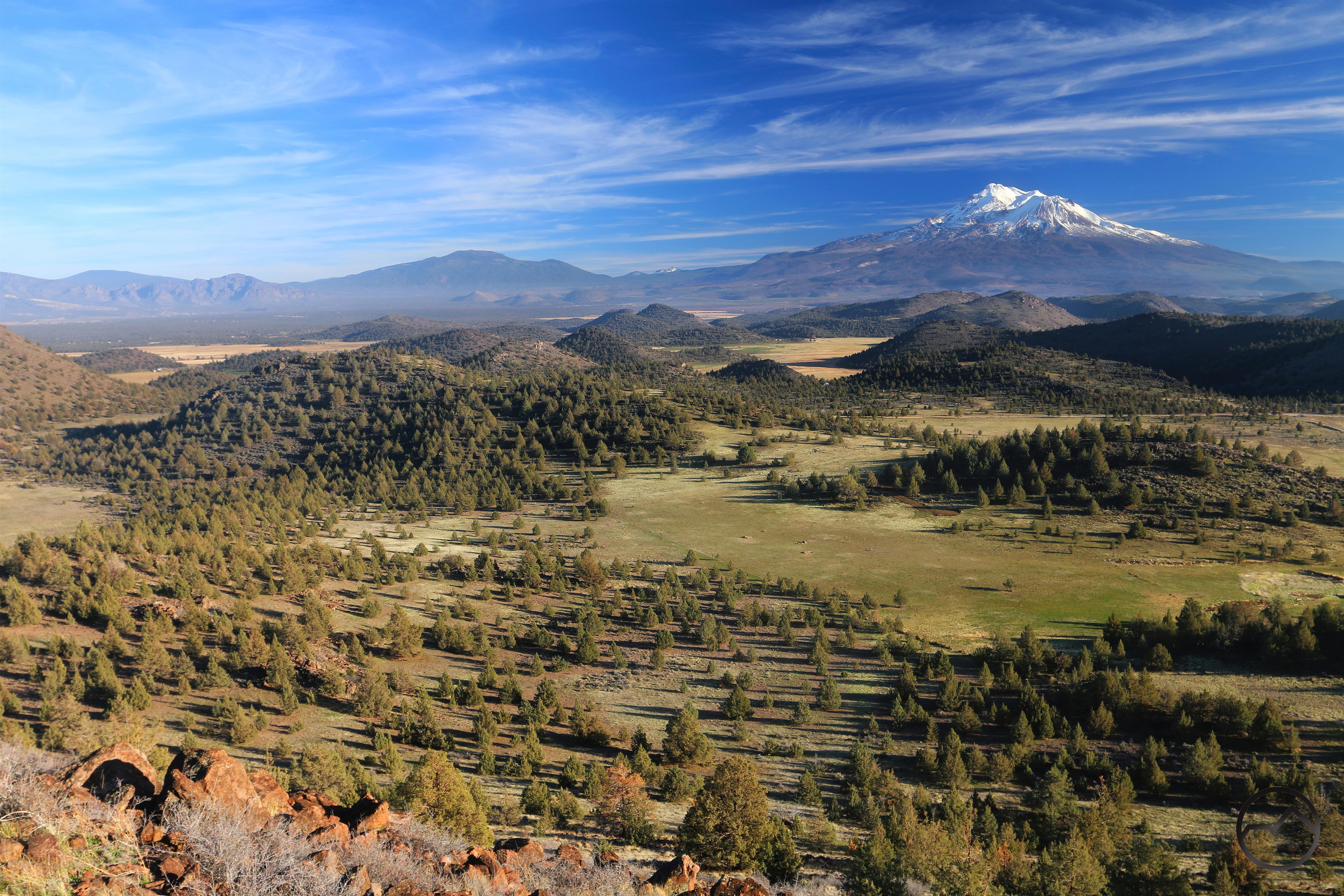
Looking south toward Mount Shasta from the summit of Cerro Pedernal.
The first of December was a surprisingly warm day that proved irresistible and I had to take the family outside for the afternoon. We headed back out to Truchas Ridge, with the plan to climb to the top of one of the nearby peaks. Our destination was our “backyard peak” which we have dubbed Cerro Pedernal, after the illustrious peak of New Mexico. Many of the landmarks around Truchas Ridge have been given monikers that hearken to some of my favorite destinations in the Land of Enchantment and this certainly fits the mold.
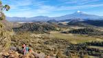
The hike to the summit is not difficult but there is not trail and requires some rock scrambling. As far as we are concerned, this is a feature, not a bug. The kids happily scrambled up large boulder piles, howled like coyotes and sought what they thought might make the best den in each of the rocky outcroppings. They thrive on trips like this.
-
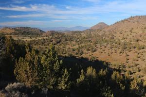
- Looking out out over the large basin to the east.
-
- On the summit of Cerro Pedernal. Not a bad backdrop to silhouette against!
-
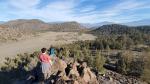
- The kids and an epic vista.
The day really could not have been more perfect. The ideal weather was only surpassed by the incredible vistas both during the hike up and from the summit of Cerro Pedernal. The 360 degree spectacle included every major mountain that rings the Shasta Valley, including prominent Oregon summits like Mount McLoughlin, Mount Ashland and Pilot Rock. Of course, Mount Shasta demands attention despite all the other landmarks that are visible. I have always had internal tension regarding whether I like the southern or northern views of the mountain best. The south has nice lines and the awesome crags of the Mud Creek basin. However, standing on the summit and looking at the north side of Mount Shasta, it is hard to think that this is not the most majestic of the mountain’s visages.
-
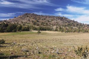
- Cerro Pedernal rises above the Tesuque Valley. The summit on the left bears a vague likeness (even if less pronounced) to its famous namesake in New Mexico..
-
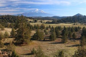
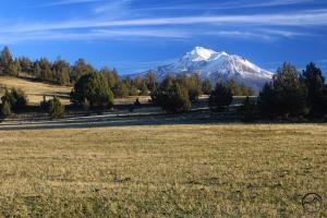
- Mount Shasta looms in the distance, beyond a fine specimen of juniper. The rain storms that passed through the area a few weeks ago turned the grass green once again.
-
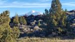
- Mount Ashland, 37 miles distant, comes into view for the first time above the entangled folds of the Shasta Valley.
-
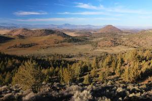
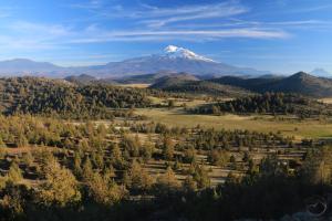
- Looking north from the northern rim of Cerro Pedernal. Numerous landmarks in California and Oregon are visible, including Mount McLoughlin, the highest peak in southern Oregon.
-

- The magnificent view south. It doesn’t get much better than this!
-
- A closer view of Mount Shasta from the summit. It surprisingly hard to distinguish areas burned by the Lava Fire from unburned forest.
-
- On the descent, Mount Shasta continues to preside majestically over the Shasta Valley. There are no bad views out here!
-
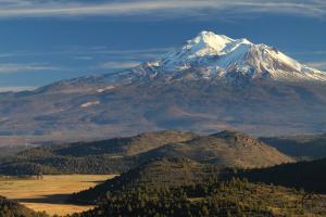
- Back in Tesuque Valley, Mount Shasta remains a regal presence beyond the grassy vega.
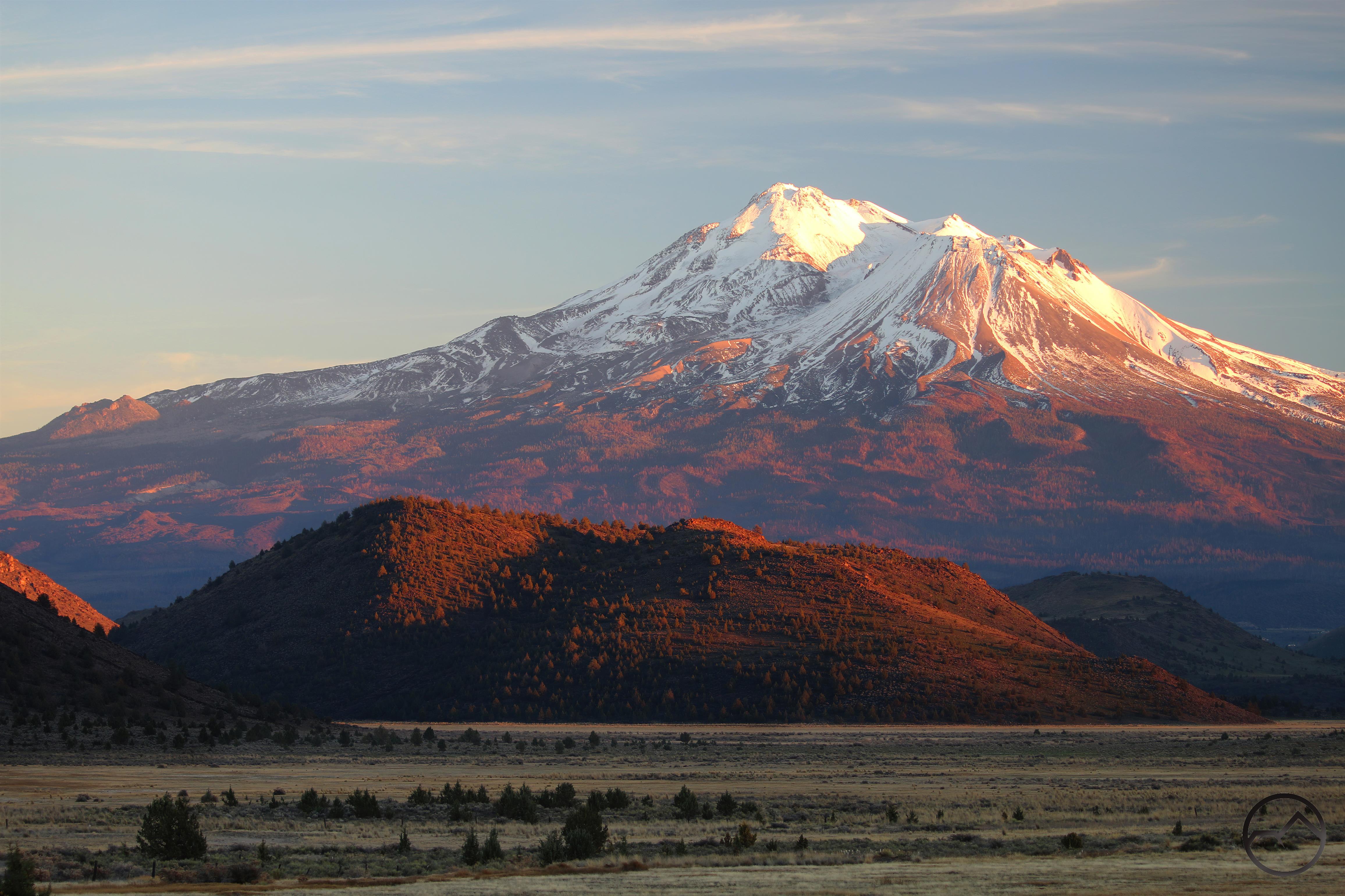
After tarrying on the summit for a while, we finally descended back down to Tesuque Valley. We wandered the ridge for a little while, checking out the recently fallen Quemado Tree and enjoying the lengthening shadows to the south. When we finally left, the sun was setting and alpenglow was beginning to make Mount Shasta radiate the warm, colorful glow. It was a must fulfilling end to an already glorious afternoon.

Just stunning.
Pingback: Mount Shasta’s First Big Storm Of Winter – Round 1 | Hike Mt. Shasta