Hike Mt. Shasta

Exploring the Mount Shasta Region

  • Home
  • Trails
    • Mount Shasta Trails
      • Brewer Creek Trail
      • Clear Creek Trail
      • Gray Butte Trail
      • Green Butte Ridge Trail
      • Horse Camp Trail
      • North Gate Trail
      • Old Ski Bowl Trail
      • Panther Meadow Trail
      • South Gate/Squaw Meadow Trail
      • Whitney Falls Trail
    • Trinity Divide Trails
      • Blue Divide Trail
      • Castle Lake Trail
      • Castle Lake Shore Trail
      • Cliff Lake Trail
      • Deadfall Lakes Trail
      • Gray Rock Lakes Trail
      • Gumboot Trail
      • Heart Lake Trail
      • Porcupine & Toad Lakes Via Pacific Crest Trail
      • Seven Lakes Basin Via Pacific Crest Trail
      • Sisson-Callahan Trail
      • Soapstone Trail
      • South Mumbo Scramble
      • Tamarack Lake Trail
      • Toad Lake Trail
    • Castle Crags Trails
      • Burstarse Falls Via Pacific Crest Trail
      • Castle Dome Trail
      • Flume Trail
      • Lower Castle Crags Via Pacific Crest Trail
      • Root Creek Trail
    • Scott Mountains Trails
      • Bluff Lake & Cement Bluff via Pacific Crest Trail
      • Caldwell Lakes Trail
      • China Mountain Scramble
      • Cory Peak and Bull Lake via Pacific Crest Trail
    • Cascade Crest
      • Ash Creek Butte Scramble
      • Goosenest Trail
      • Juanita Lake Trail
      • Orr Lake Trail
    • Mount Shasta City Area Trails
      • Black Butte Trail
      • Box Canyon Trail
      • Gateway Trail
      • Lake Siskiyou Trail
      • Mount Shasta City Short Trails
      • Ney Springs Canyon Trail
      • Spring Hill Trail
    • Shasta Valley Trails
      • Black Lava Trail
      • Haystack Trail
      • Lake Shastina Trail
      • Pluto Cave Trail
      • Trout Lake Trail
      • Yellow Butte Trail
    • Sacramento River Trails
      • Dunsmuir Trail
      • Hedge Creek Falls Trail
      • Sacramento River Trail
      • Sims History Trail
    • McCloud River Trails
      • Ash Camp To Ah-Di-Na Via Pacific Crest Trail
      • McCloud River Falls Trail
      • McCloud River Preserve Trail
      • Squaw Valley Creek Trail
      • McCloud River Trail: Algoma Camp to Nitwit Camp
      • McCloud River Trail: Nitwit Camp to Cattle Camp Swimming Hole
      • McCloud River Trail: Cattle Camp Swimming Hole to Camp 4
      • McCloud River Trail: Camp 4 to Upper McCloud Falls
      • McCloud River Trail: Pine Tree Hollow Loop
    • Trails Further Afield
      • Trinity Alps Trails
        • Bear Lakes Trail
        • Billys Peak Trail
        • Boulder Creek Lakes Trail
        • Boulder Lake Trail
        • Canyon Creek Trail
        • Caribou Lakes Trail
        • East Boulder Lake Loop
        • East Weaver Lake Trail
        • Four Lakes Loop
        • Granite Peak Trail
        • Grizzly Creek Trail
        • Gulch Lakes Loop
        • Hidden Lake Trail
        • South Fork Lakes Trail
        • Stoddard Lake Trail
        • Stoney Ridge Trail
        • Tangle Blue Lake Trail
      • Warner Mountains
        • Emerson Creek Trail
        • Highgrade Trail
        • Patterson Lake Via Warner Summit Trail
        • Pine Creek Trail
        • Squaw Peak Trail
  • Articles
    • Trails By Area
      • Mount Shasta
        • Vistas, Meadows And Waterfalls: Three Best Hikes On Mount Shasta
        • The End Of The Road: Three Hikes In The Old Ski Bowl Area
        • Two Trails From Bunny Flat
        • Three Trails On Mount Shasta’s East Side
        • Mount Shasta’s Hummingbirds
      • Trinity Divide
        • Great Lakes: Top Five Lake Basins In The Trinity Divide
        • The Headwaters Of The South Fork Of The Sacramento River
        • Neglected Headwaters: Two Lesser Lake Basins On The South Fork
        • Gumboot Saddle: Two Hikes On The PCT
        • Descent Into Mystery: The Sisson-Callahan Trail
        • Mumbo Basin – Overlooked On The West Side
        • The Headwaters Loop: A Proposed Backpacking Loop In The Trinity Divide
      • The McCloud River
        • The McCloud River Trail
      • Shasta Valley
        • Jewels In The Desert
      • Scott Mountains
        • Great Scott! Two Scott Mountains Hikes On The PCT
      • Trinity Alps
        • Carubou Lakes: Trinity Alps On A Grand Scale
        • Switchbacks To Heaven: The Trinity Alps’ Stoney Ridge Trail and Four Lakes Loop
        • Trinities In Proximity: Two Trinity Alps Trails With Easy Access From Mount Shasta
        • Trails in the Carter Meadows Area
        • Trinity Alps Views of Mount Shasta
        • The Psychological Value Of The Trinity Alps
    • Waterfalls
      • Three Waterfalls On Mount Shasta
      • McCloud River Waterfalls
      • Sacramento River Waterfalls
      • Trinity Divide Waterfalls
      • Trinity Alps Waterfalls
      • Avoiding A Dry Whitney Falls
    • Off Season Trails
      • Three Winter Hikes Near Mount Shasta City
      • Winter Hikes In Shasta Valley
      • Winter Hiking In The Shasta Valley Wildlife Refuge
      • Winter Hikes On The Sacramento River
      • Winter Hikes On The Lake Siskiyou Trail
      • Spring Hikes In The Castle Crags
      • Spring Hikes On the Upper McCloud
      • Spring Hikes On The Lower McCloud River
    • Points Of Interest
      • Mount Eddy: Overshadowed, Underrated
      • Black Butte: Hiding In Plain Sight
      • Castle Dome: Steadfast And Staggering
      • Mount Shasta Hoodoos
      • Sacramento Scrambling
      • The Shasta River
      • The Castle Creek Watershed
      • Mount Shasta East Side Glacier View
      • 5 Fantastic Mount Shasta Vistas
      • 5 Highest Peaks Around Mount Shasta
      • 5 Best Hikes On Creeks And Rivers
      • 5 Interesting Footbridges
      • Three Spectacular Drive-To Sunset Vistas
    • North State Geography
      • Introduction
      • Seven Major Regions
      • The California Cascades
      • Klamath Mountains Pt. I
      • Klamath Mountains Pt. II
      • The Great Canyons Of Mount Shasta
      • Mount Shasta, Timberline, And The Relative Size Of Cascade Volcanos
      • Four Eruption Cones Of Mount Shasta
      • Mount Shasta’s Medial Moraine
    • Northern California Review
      • North Table Mountain
      • Lakes Basin Recreation Area
      • Eastern Sierra Fall Color
      • Sonoma County
      • Central Sierra Nevada
      • Orland Buttes
    • Seldom Seen
      • Ash Creek Falls
      • Mud Creek Canyon
      • Lower Mud Creek Canyon
      • Diller Canyon
      • Lower Cascade Gulch
      • The Grey Rocks
      • Castle Creek
      • Upper Wagon Creek
      • Fawn Creek Canyon
      • Confluence of the Sacramento River and Castle Creek
      • Upper Klamath River Canyon
      • Hole In The Ground Geologic Area
      • Ash Creek Butte Fossil Rock Glacier
    • Mount Shasta History
      • Vantage Lost: The Everitt Memorial Vista
      • A Yosemite-Mount Shasta Connection
      • Whitney – What’s In A Name?
      • Mount Shasta Area and the 1838 Exploring Expedition
      • A 19th Century Engraving Of An Epic Mount Shasta Vista
      • Vintage 1907 Color Photos
      • A Misleading Painting
      • A Mysterious Painting
      • A Mysterious Painting Pt. II
      • Stereographic Mt. Shasta
      • Year One Of Hike Mt Shasta
      • Year Two Of Hike Mt Shasta
      • Year Three Of Hike Mt Shasta
      • Year Four Of Hike Mt Shasta
      • Year Five Of Hike Mt Shasta
      • Year Six Of Hike Mt Shasta
      • Year Seven Of Hike Mt Shasta
    • Image Galleries
      • Mount Shasta Trails Gallery
      • Mount Shasta Sunrise Gallery
      • Mount Shasta Sunset Gallery
      • Lenticular Cloud Gallery
      • Mount Shasta NON-Lenticular Clouds
      • Mount Shasta Reflection Gallery
      • Telephoto Gallery
      • Mount Shasta Area Fall Color
      • Castle Crags Gallery
      • Waterfalls Gallery
      • Trinity Divide Lakes Gallery
      • Mount Shasta Area Rivers Gallery
      • Shasta High Desert Gallery
      • Mount Shasta GIF Gallery
    • Random Notes
      • Revew: Three Mount Shasta Trail Maps
      • A Mount Eddy Wilderness?
      • New Land Additions For The Castle Crags
      • Book Plug: Mount Shasta Area Rock Climbing
      • Exile: How I Came To Love Wilderness
  • Mt. Shasta Trail Map
  • Blog
  • About/Contact
  • Links
  • Truchas Ridge

Northern California Review: Orland Buttes

Posted by bubbasuess on May 13, 2021
Posted in: Hiking, Mount Shasta. Tagged: Orland Buttes, Sacramento Valley. 2 Comments

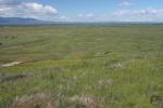
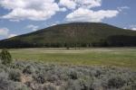
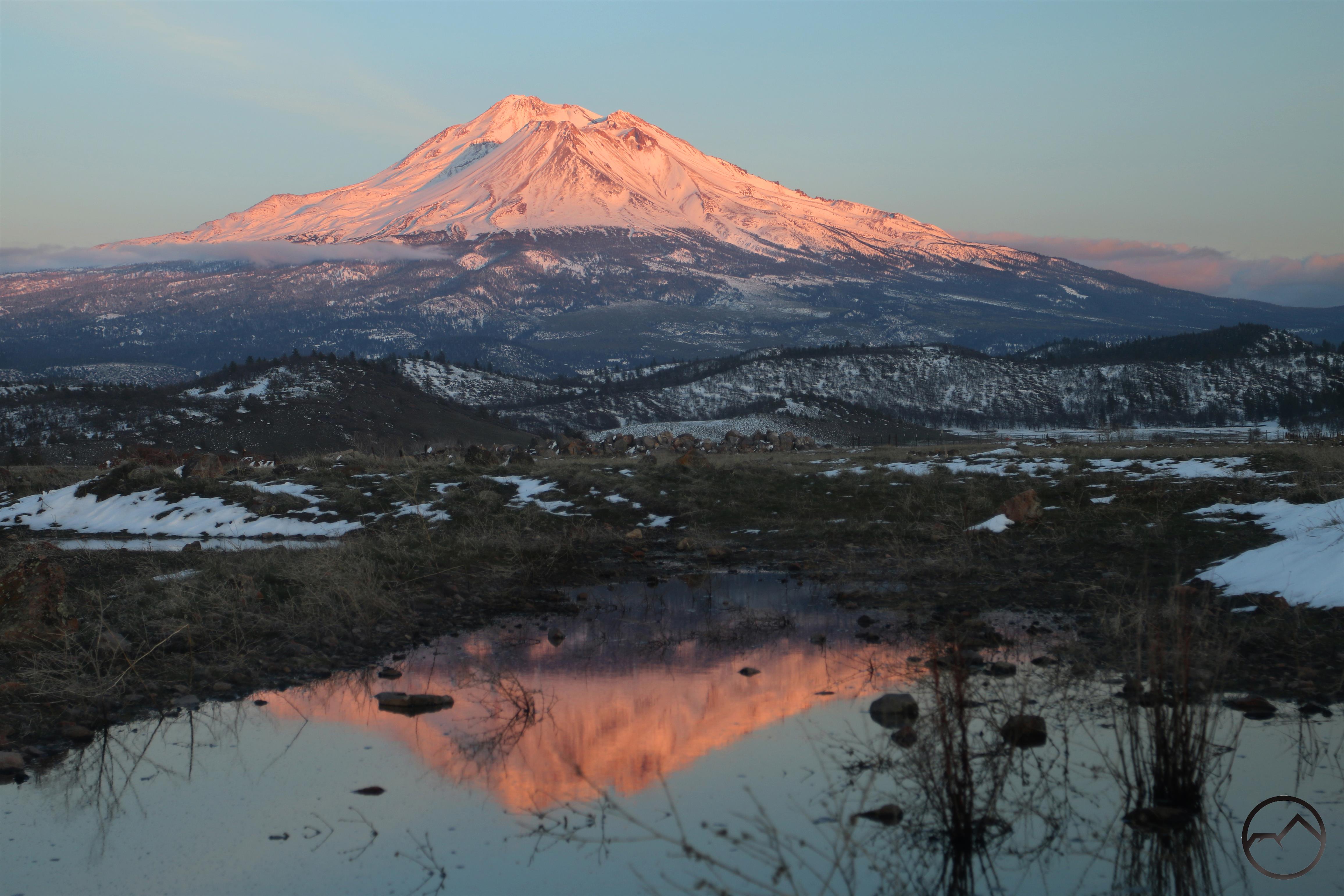
The Orland Buttes offer a rugged break from the exceedingly flat Sacramento Valley.

When driving along Interstate 5 through California’s Sacramento Valley, the landscape the freeway is unrelentingly flat. Only in the distance is the valley interrupted and mountains can be seen hemming in the flat land. Indeed, for 430 miles, the Great Central Valley of California (of which the Sacramento Valley is the norther third) there is, seemingly, only the solitary interruption of the Sutter Buttes, an old volcanic core often referred to as “the world’s smallest mountain range”. That will be the subject of another Northern California Review someday. However, the Sutter Buttes are not the only bit of topography in California’s great agricultural heartland.

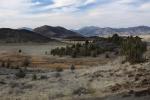
50 miles south of Redding, along the western edge of the valley is a little known formation named the Orland Buttes. The agricultural town of Orland, located along I-5 lies 7 miles to the east. The buttes are not tall, but they do offer an extensive, rocky series of outcroppings that break up the monotony of the valley. While speeding along on the freeway, they tend to blend in with the mountains of the coast range that rise to the west. Although they are often lost amidst the landscape, they remain an attractive and unusual feature that are worth exploring. Even better, much of the Orland Buttes lie on public land and are traversed via several interesting but little known trails, making them a good springtime hiking destination.

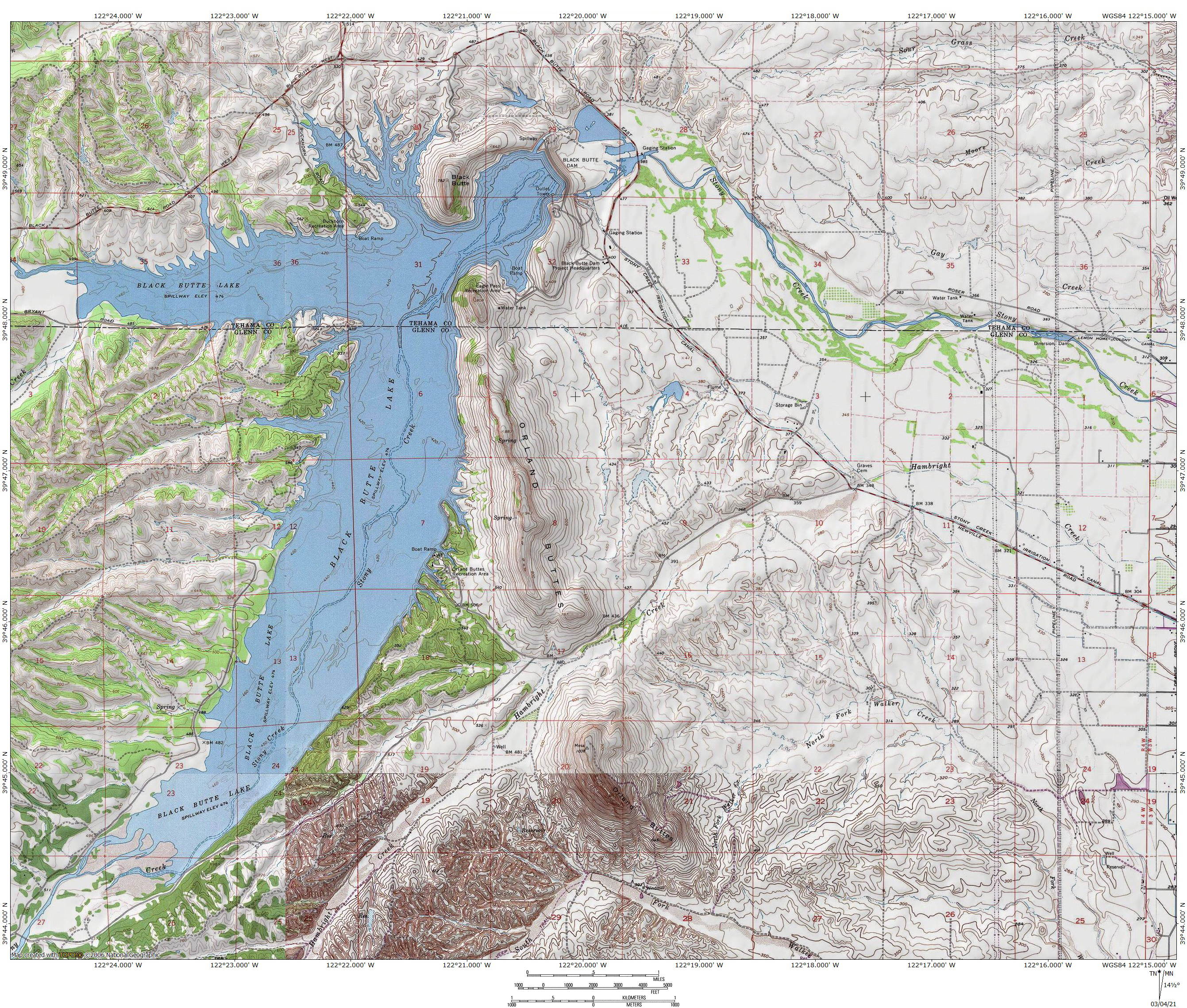
As noted, the Orland Buttes are located on the western side of the Sacramento Valley, roughly 50 miles south of Redding and 7 miles east of Orland. They suit on the edge of a transitional region, where the farms of the valley give way to the oak savannah that covers the Coast Range foothills. Further west, the valley floor begins to buckle and small ridges form along a north/south axis. However, the Buttes are distinct from this area, both in terms of geology and the physical space that separates them.

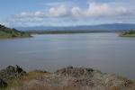
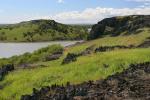
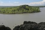
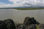
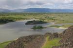
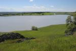
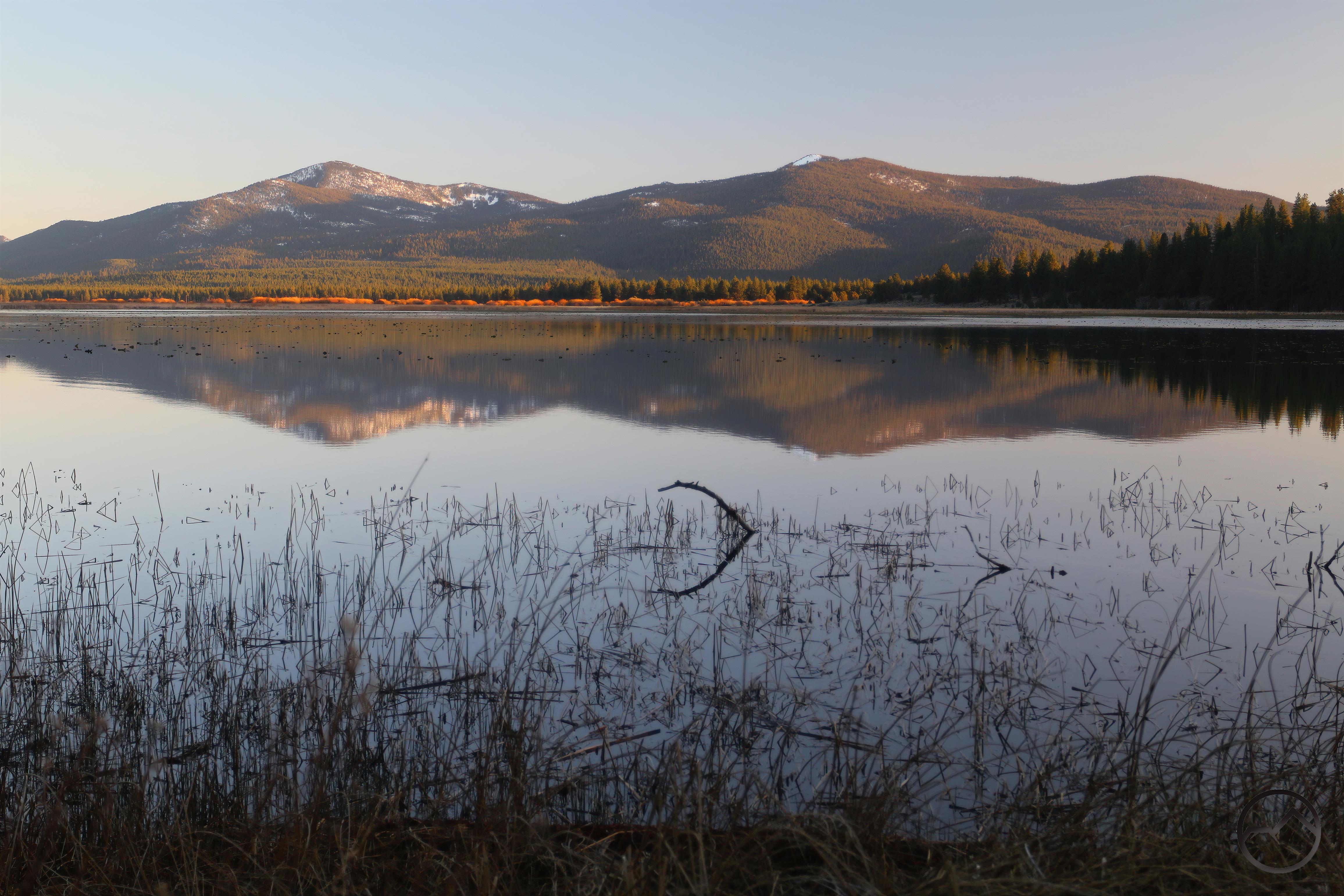
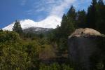
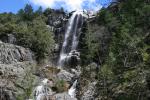
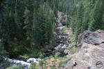
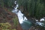
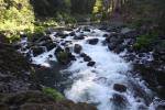
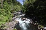
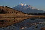
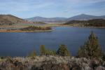
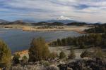
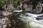
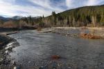
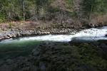
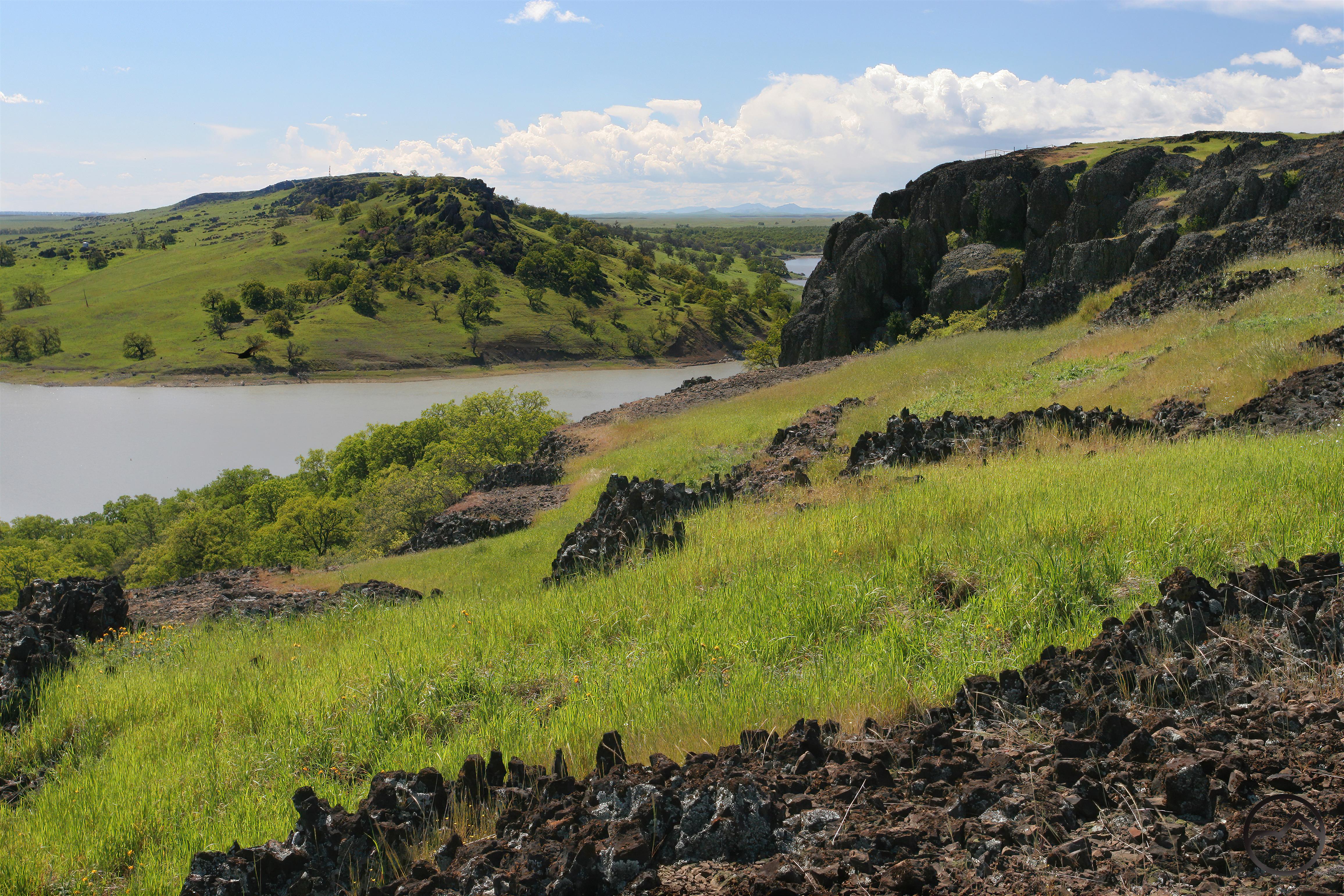
The area between the Buttes and the Coast Range foothills is now occupied by Black Butte Lake, an impounded reservoir on Stoney Creek. This creek begins high up on Snow Mountain, the Coast Range’s southernmost 7,000 foot peak. It flows roughly northeast, through rugged canyons and through the buckled ridges of the valley before reaching the Orland Buttes. A dam in Eagle Pass backs the water up and forms the lake. From there, the creek continues a short distance to the east before joining the mighty Sacramento River. It’s total journey is nearly 90 miles and drains an area of over 700 square miles. While the sight of Stony Creek passing between the ramparts of the Orland Buttes would have been a beautiful sight, especially in its spring fury, the truth is, Black Butte Lake is a beautiful addition to the Orland Buttes and does add a fair amount of interest to the area. The land around the lake, and therefore the Buttes themselves, is administered by the Bureau of Reclamation. This means that the land is open to the public and exploring the Buttes is welcome.


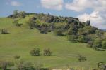
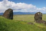
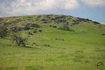
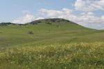
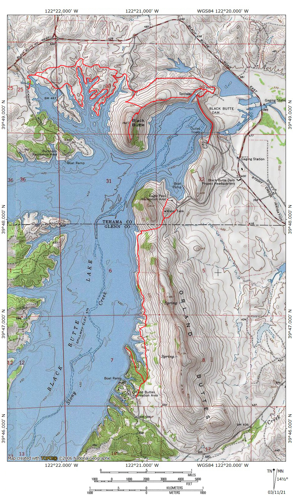
The Orland Buttes are broken up into three main formations. Anchoring the southern end is the Orland Butte, the largest and tallest of the three rock outcroppings. Rising 700 feet around the surrounding farmland, it is the most noticeable of the buttes from the freeway. Visible from far to the south as one drives north, it is a distinct landmark, if you are aware of its presence.

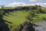
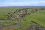
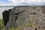
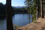
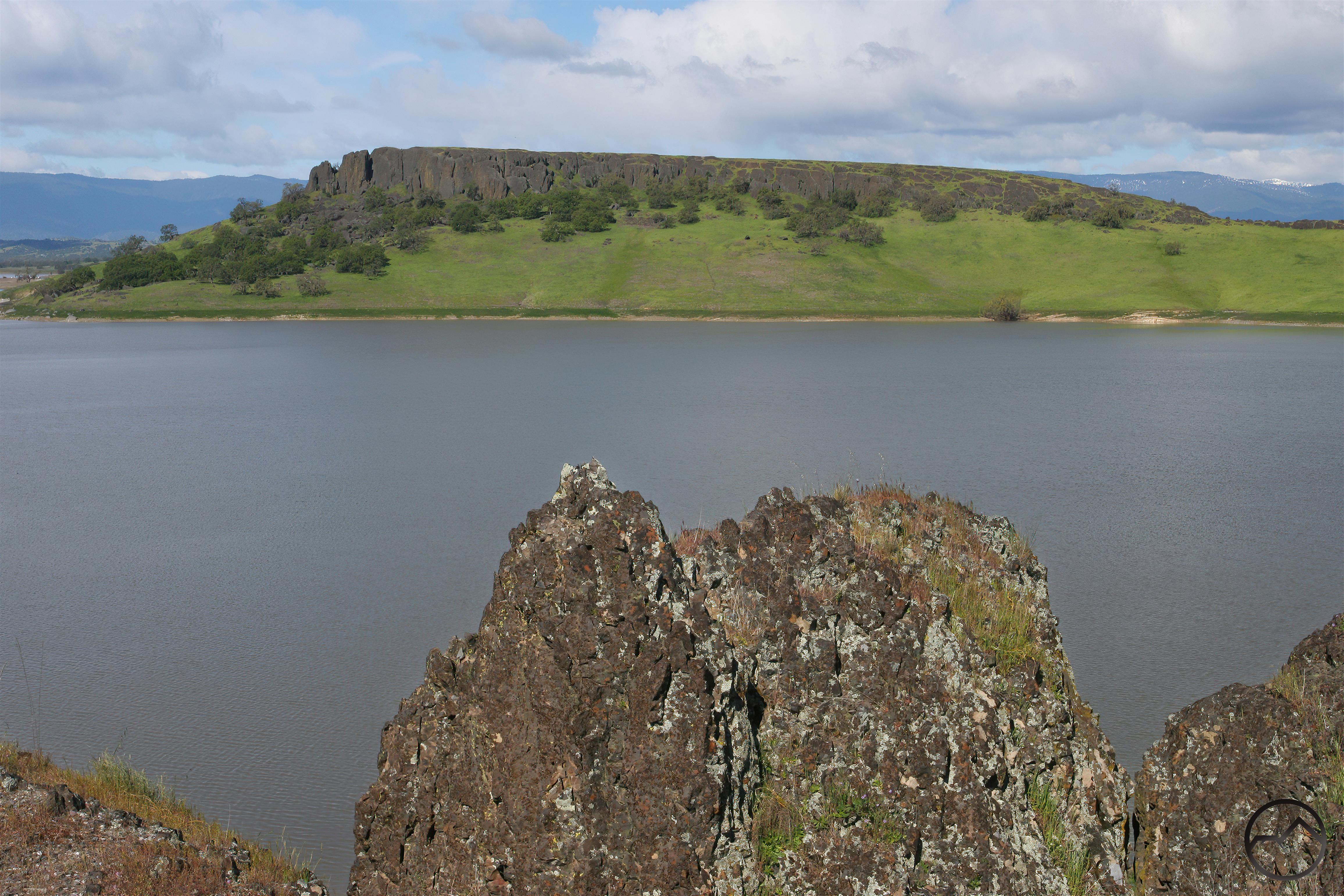
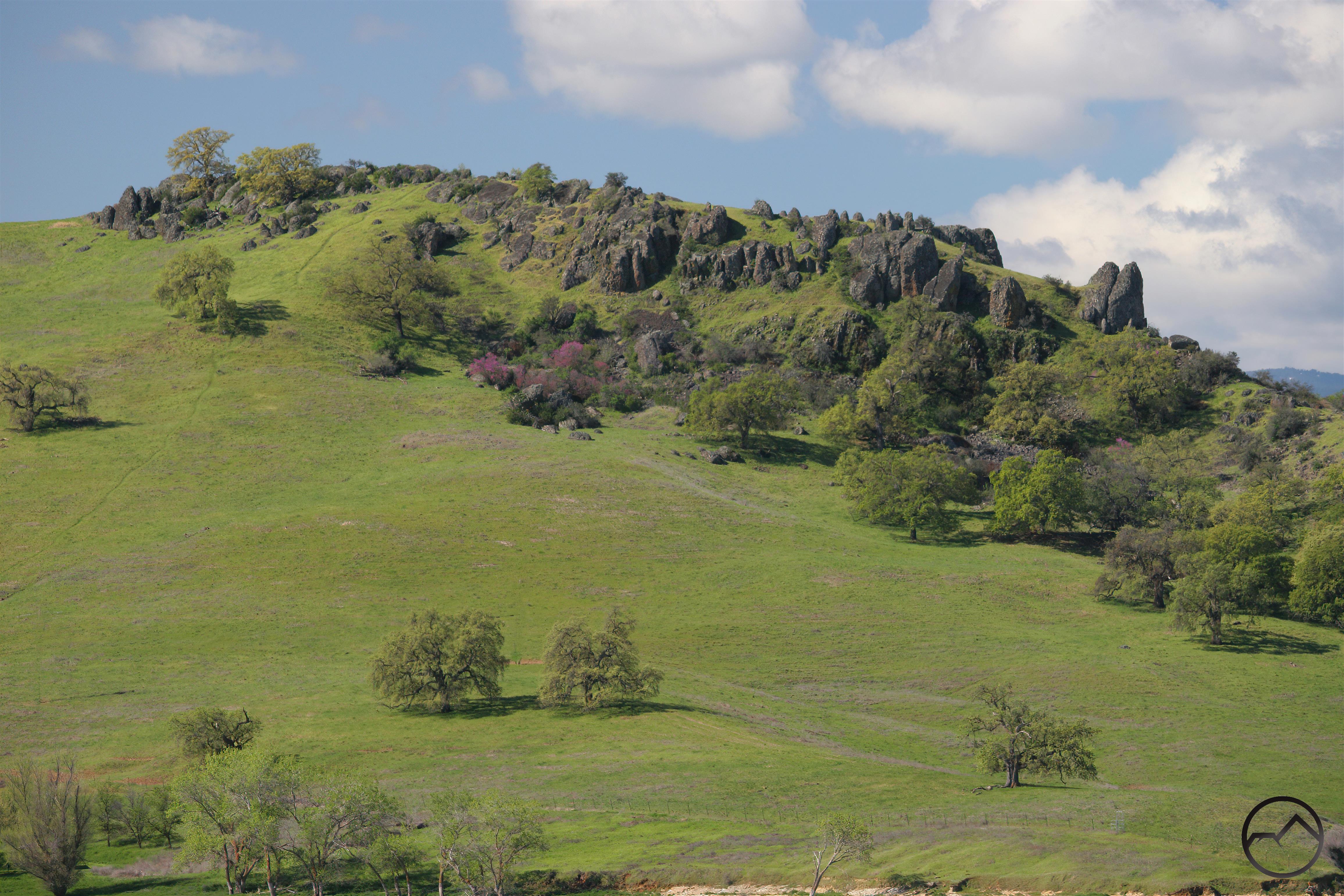
The central part of the Buttes is the longest, unbroken portion section of rock. This long ridge, called Eagle Ridge, is a nearly three mile long wall of basalt that, at its highest point, rises nearly 600 feet around the farms on its east side. The lake that occupies the area to the west, is 100 feet higher than the farmland, so the relief on the west side is a little less. Notably, Eagle Ridge is bookended by recreation areas at its northern and southern termini. Though the recreation areas are connected by one of the Orland Butte’s trails, these are primarily focuses on the lake and the aquatic activities that usually draws people to this destination. Some of the ridge is on private land but the western half is still with the land administered by the Bureau of Reclamation and can be explored legally.

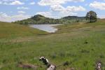
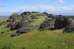
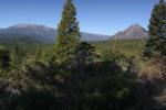
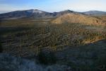
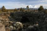
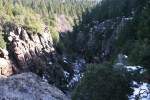
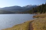
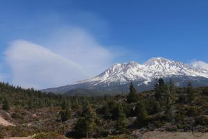
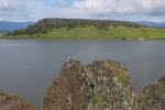
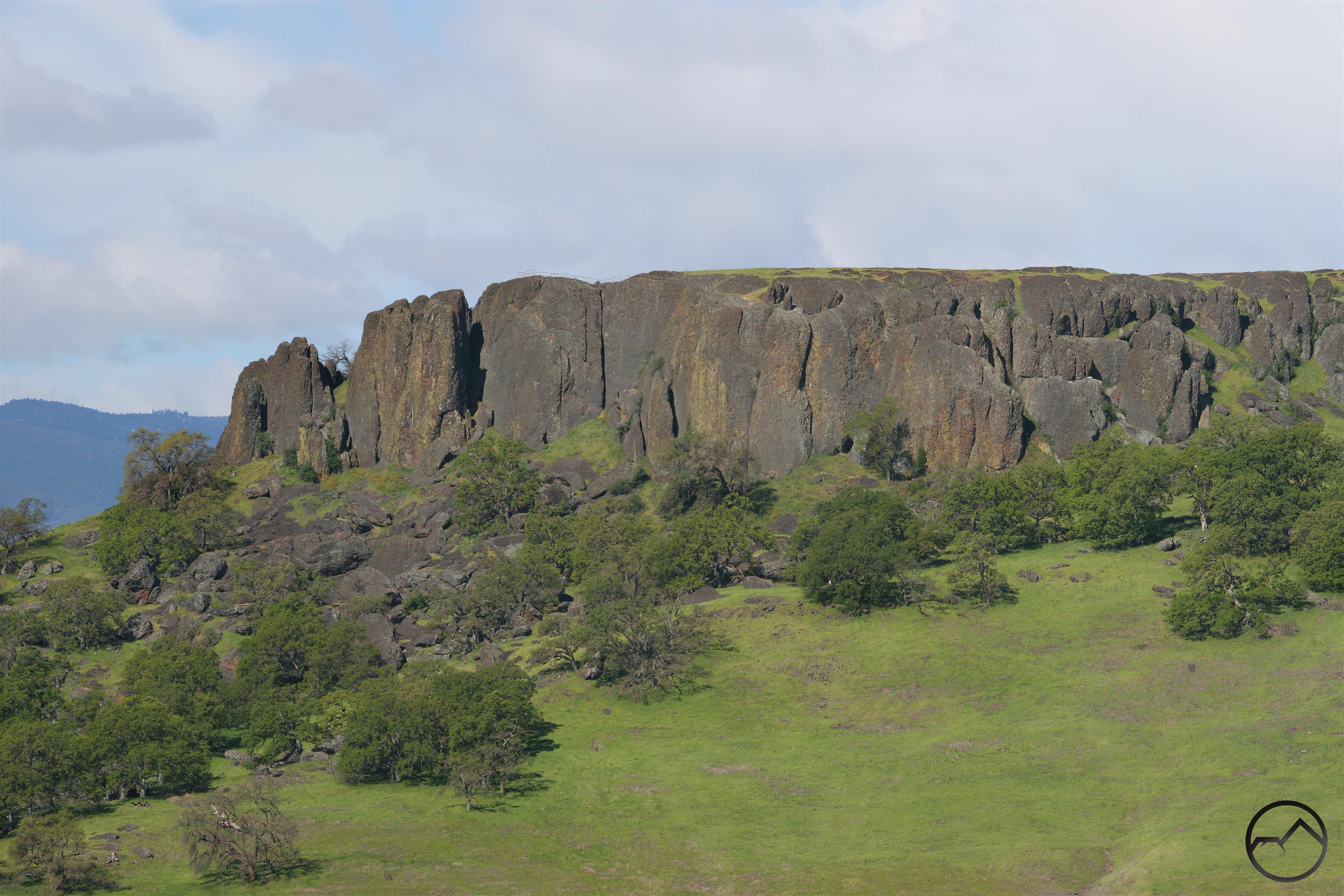
The northernmost of the three Orland Buttes is named Black Butte and it is both the smallest and most geologically interesting of the three buttes. While the other buttes have plenty of exposed rock, none have it such extensive and easily explored proportions as Black Butte. It is also the only one of the three Orland Buttes that is entirely on public land. Forming a crescent reaching to the northeast, it has extensive basalt outcroppings that form an impressive series of walls, giving it an elevated feeling high above the water. A lower section, arcing to the northeast does not have the impressive basalt walls but it has numerous outcroppings, making this an intriguing area to hike through.


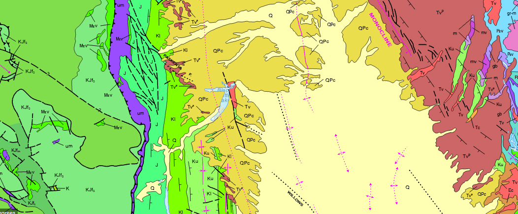
The geologic map of California begins to tell the tale of the Orland Buttes’ fascinating geology. Though there are a few isolated volcanic areas on the west side of the Sacramento Valley, the Orland Buttes are the only exposed basalt in the region. The other volcanic presence, which is very little, is of a completely different rock composition. This is indicated on the map by the color of the rock (it is identifiable next to Black Butte Lake), which indicates its volcanic origin but its distinction from the nearby volcanic extrusions.


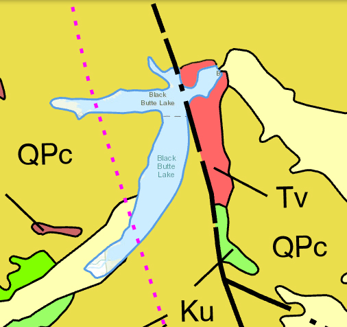
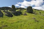
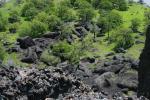
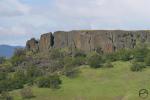
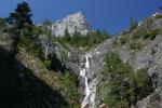
The formation of the Orland Buttes is quite unusual. It lies along a fault, and was likely, in some fashion, created by it. However, the type of basalt that composes the Buttes is part of a larger story, one that is both mysterious and fascinating and plays a larger part in the formation’s beauty. The Orland Buttes are composed of Lovejoy Basalt. This dense rock is particular to Northern California and is believed to have been produced by a volcanic vent near Susanville but flowed westward, covering a significant swath of the North State. It was subsequently eroded until only isolated islands of Lovejoy Basalt can be found. The Orland Buttes are the second furthest west and second most isolated occurrence of this rare rock type.


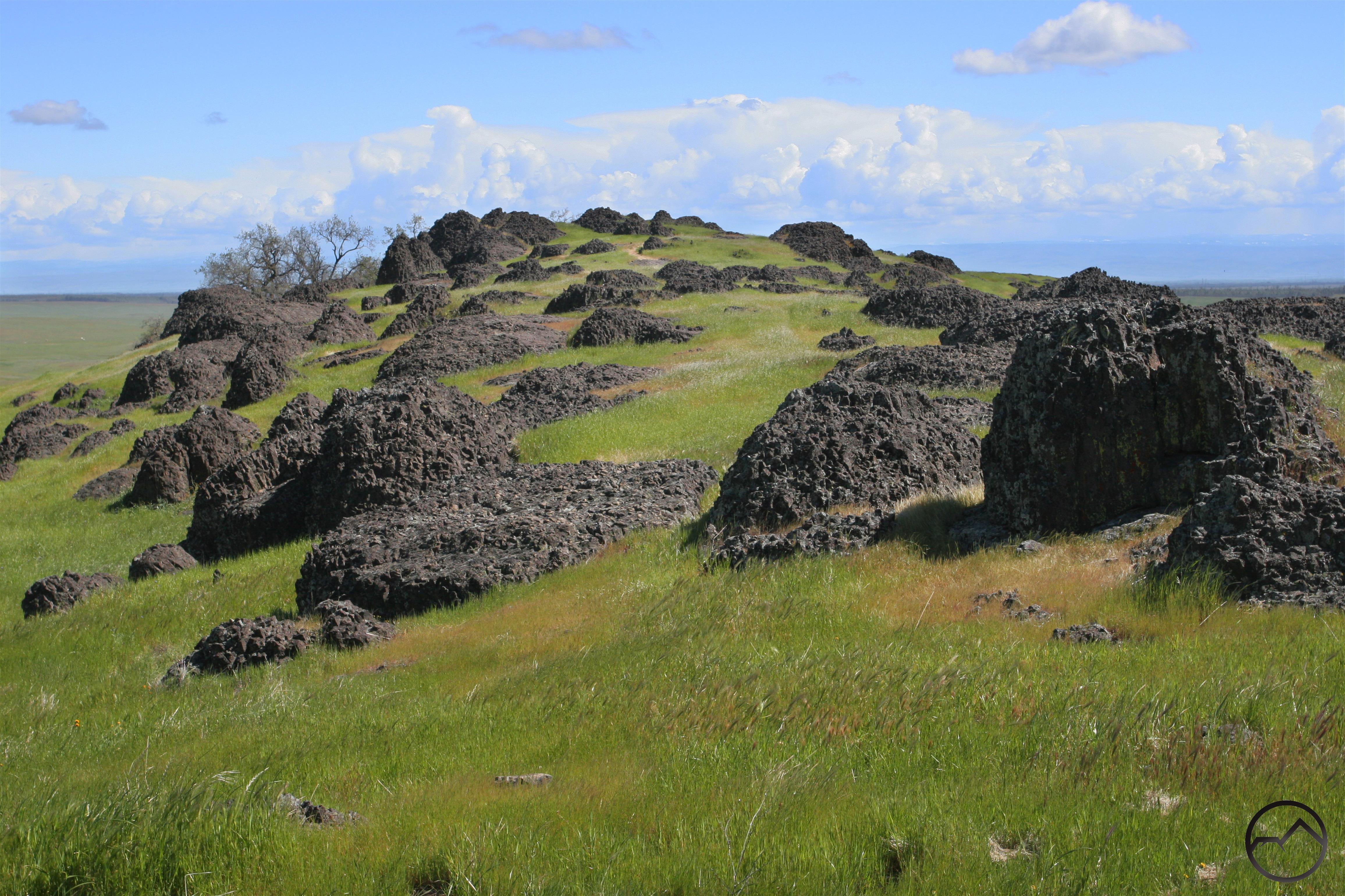
Lovejoy Basalt has a distinct appearance. It looks as though it is an agglomeration of chunks or blocks of rock. Blobs or blocks of rock seem to all be stuck together haphazardly. However, the chaotic appearance belies a solid strength, with the chunks welded together making the rock far more solid than it appears. It also make the appearance of the Orland Buttes very distinct, since this rock type can only be appreciated in a small handful of other places around Northern California. Indeed, the Orland Buttes are one of the easiest places at which to examine and enjoy the unique beauty of Lovejoy Basalt.


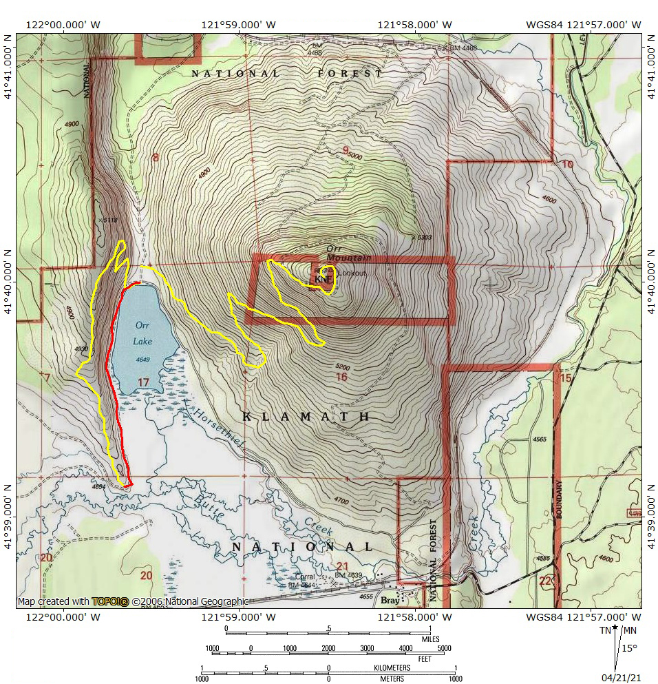
Examining and enjoying the beauty of the Orland Buttes is surprisingly easy to do. It is easy to get to off of I-5 and is served by a well-developed trail network. Three trails are spread throughout the area administered by the Bureau of Reclamation:

  • In the south is a trail the follows the narrow strip of land between Black Butte Lake and Eagle Ridge. It is about 2.5 miles long and offers opportunities to explore some of the crags along the ridge and some of the peninsulas that extend out into the lake.
  • At the northern end of the lake is a jumble of trails following the finger-like shoreline of the northernmost part of Black Butte Lake. This trail is furthest from the Buttes themselves but the formations are prominently visible, as is the looming presence of the Coast Range. Access to this trail is from the Buckhorn Campground or the Black Butte Trailhead.
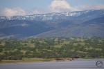
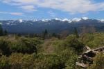
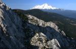
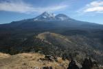
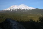
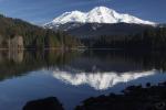
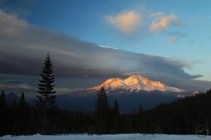
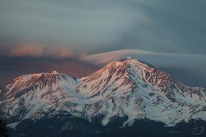
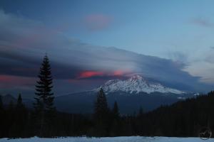
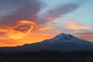
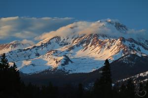
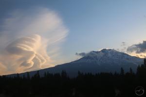
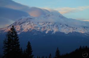
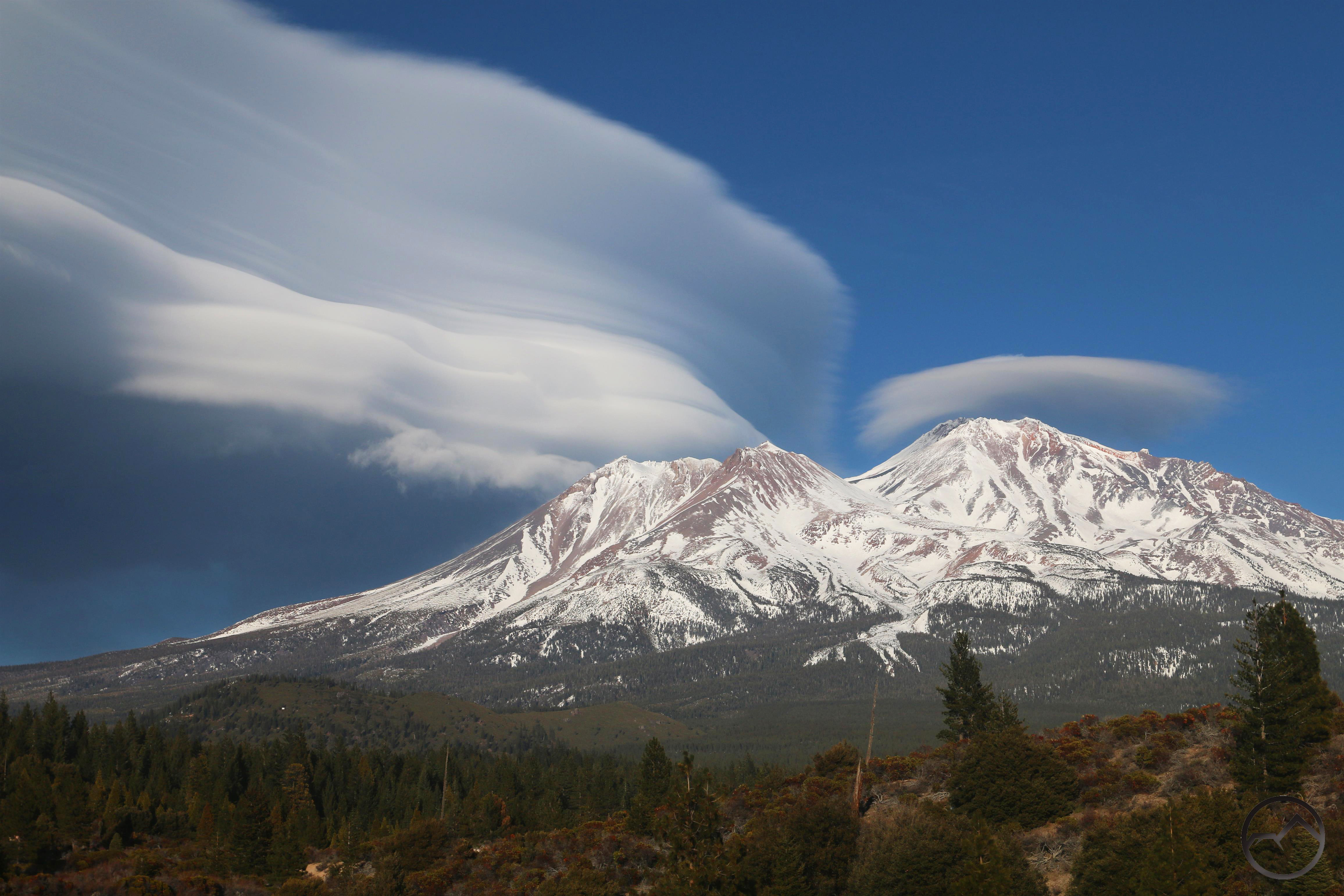
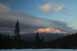
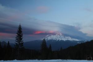
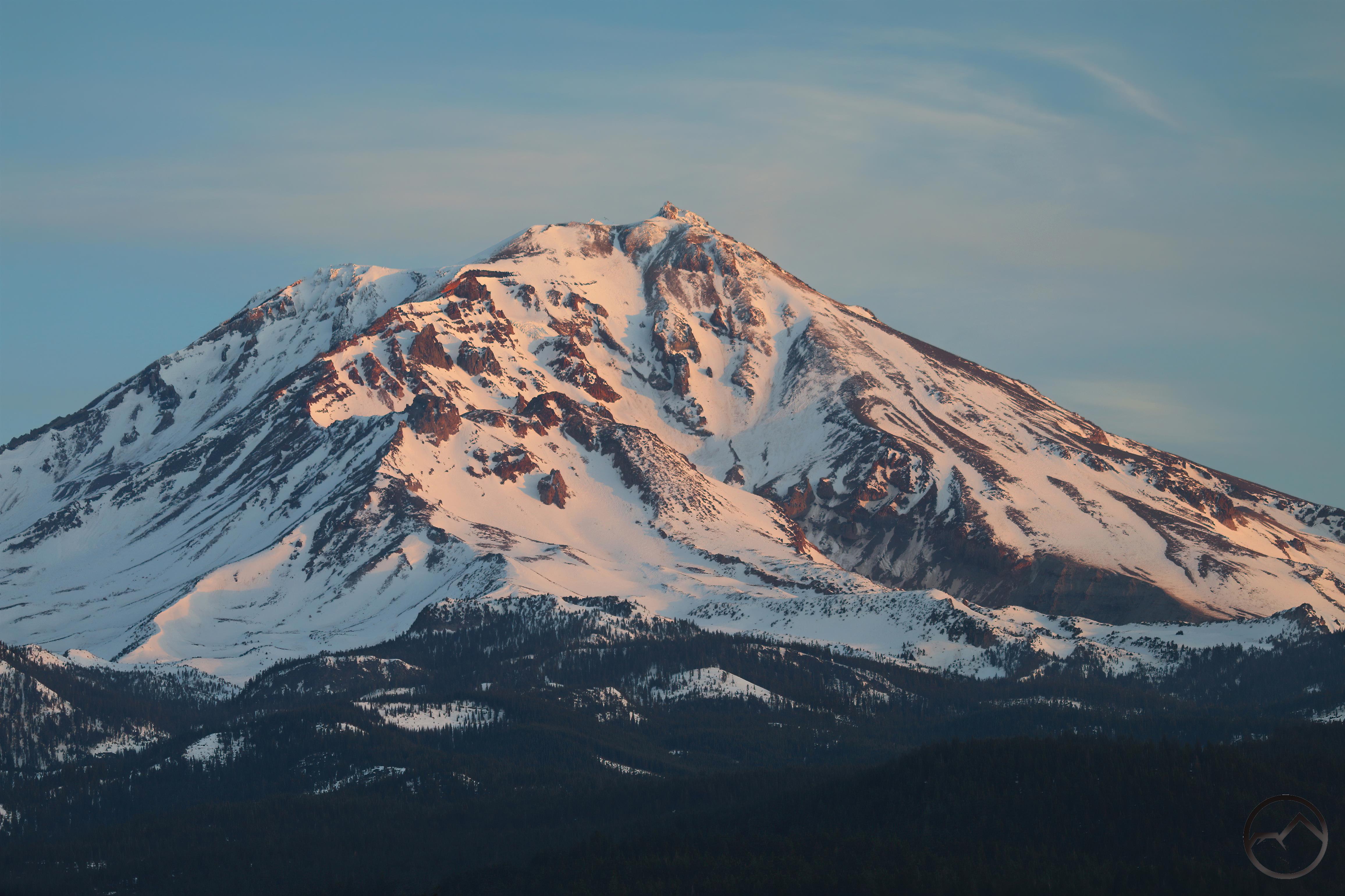
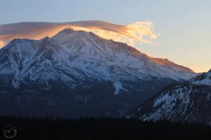
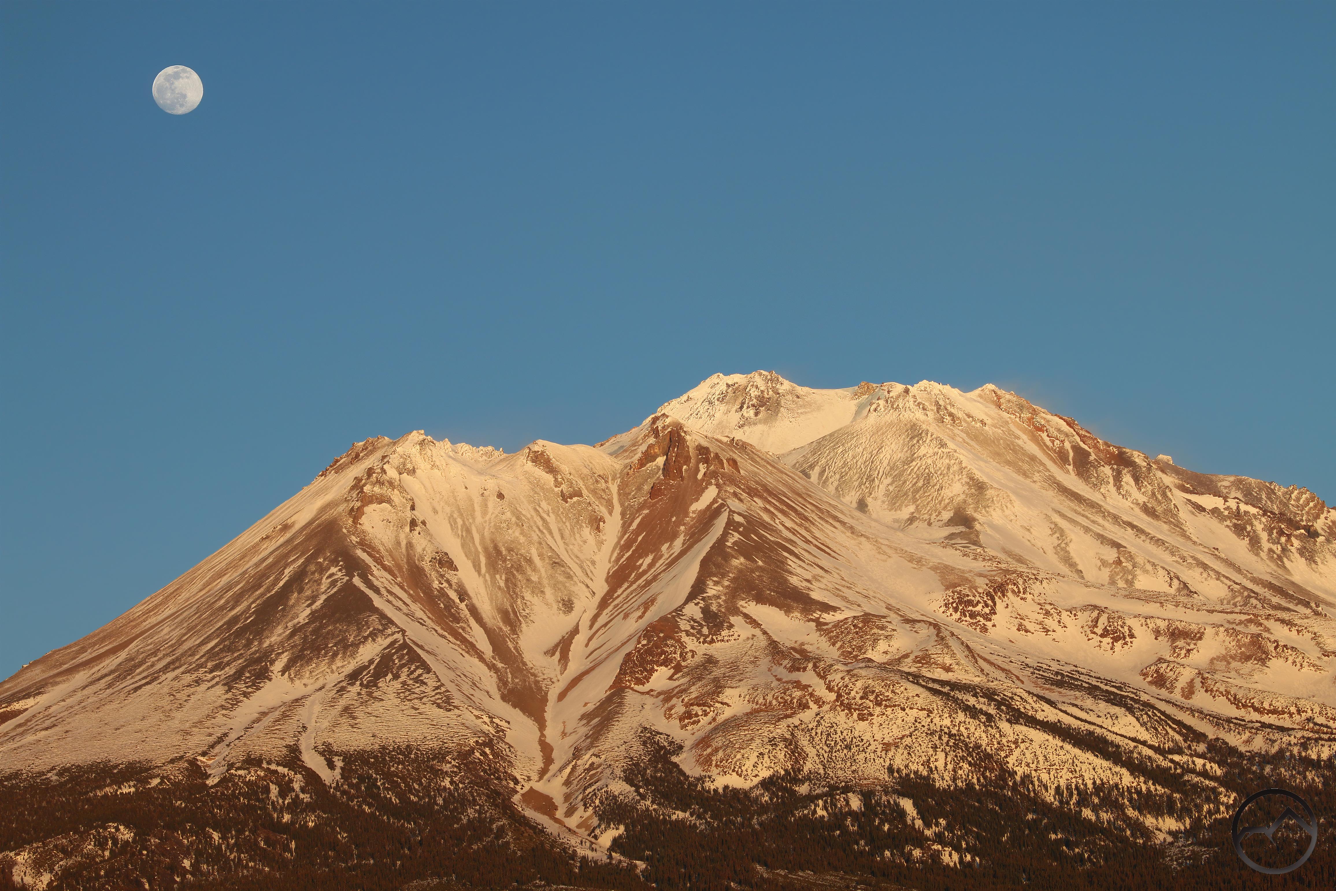
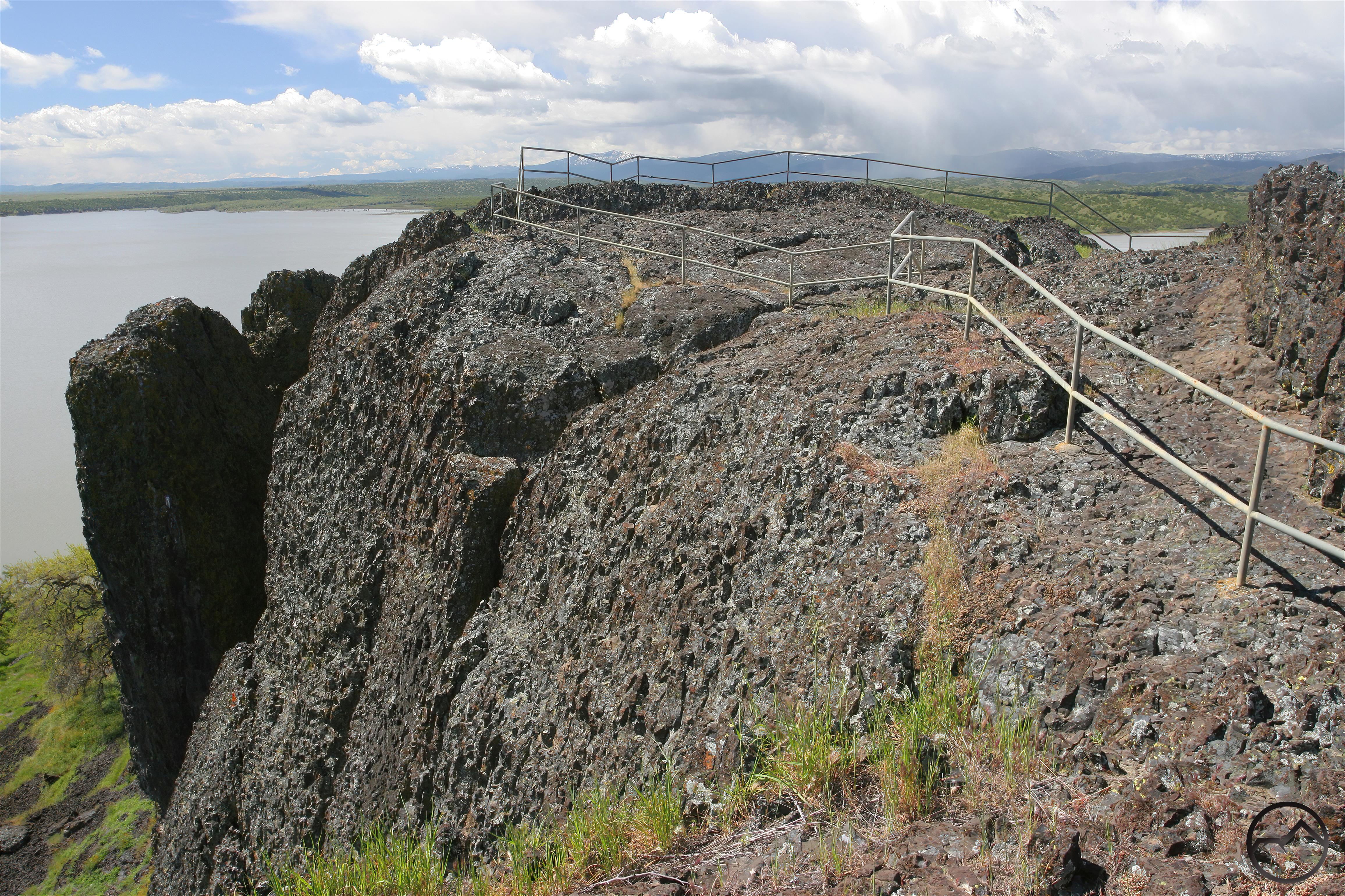
  • The best trail at the Orland Buttes is the one that ascends Black Butte. The hike features a 5 mile lollipop that begins at the Orland Buttes Vista next to the dam that forms the lake. It crosses the dam and ascends the northeast corner of Black Butte and then proceeds to follow the formation’s spine, weaving through Lovejoy Basalt outcroppings. It then crosses a narrow neck, where it intersects a trail coming up from the Black Butte Trailhead. From this point it climbs to the highest part of the Butte, composed of solid outcroppings of Lovejoy Basalt, where a railing marks the end of the trail and a spectacular view of much of Northern California, stretching from Mount Shasta to almost down to peaks that border the northern end of San Francisco Bay (well, where the Bay meats the Delta, at least). The Coast Range foothills, occasionally dotted by clusters of oaks and nearly wild and undeveloped in this area, add a richness to the view from the summit.  You can return the way you came or take a northern part of the loop and follow along the foot of Black Butte back to the dam.


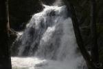
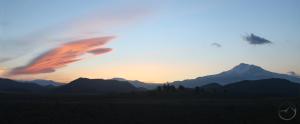
The Orland Buttes are not California’s grandest monument or its most well-known hiking destination. Yet, if a region has a destination like the Buttes as an obscure destination, it is richly blessed with natural beauty! When the mountains are covered in snow and inaccessible, the Orland Buttes are a perfect destination for a day of hiking. This is particularly true in spring, when the grass is lush and green, the lake is full and wildflowers abound. Then, hiking out onto the summit of Black Butte and observing the snow-covered mountains to the north, west and east, one feels like you have really seen and appreciated the Sacramento Valley anew, with a unique and unusual perspective on one of California’s most impressive natural features.

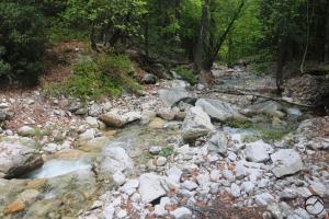
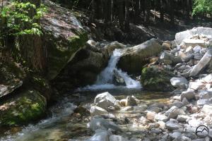
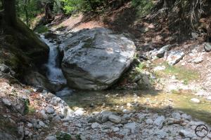
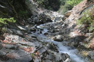
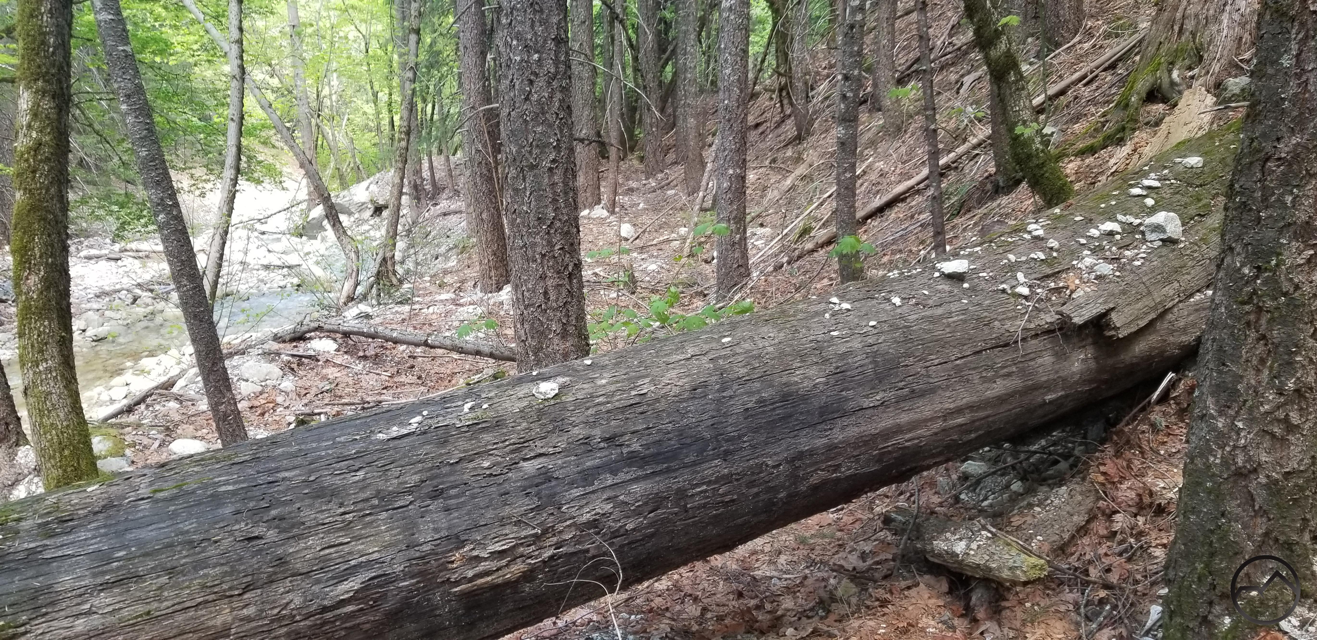
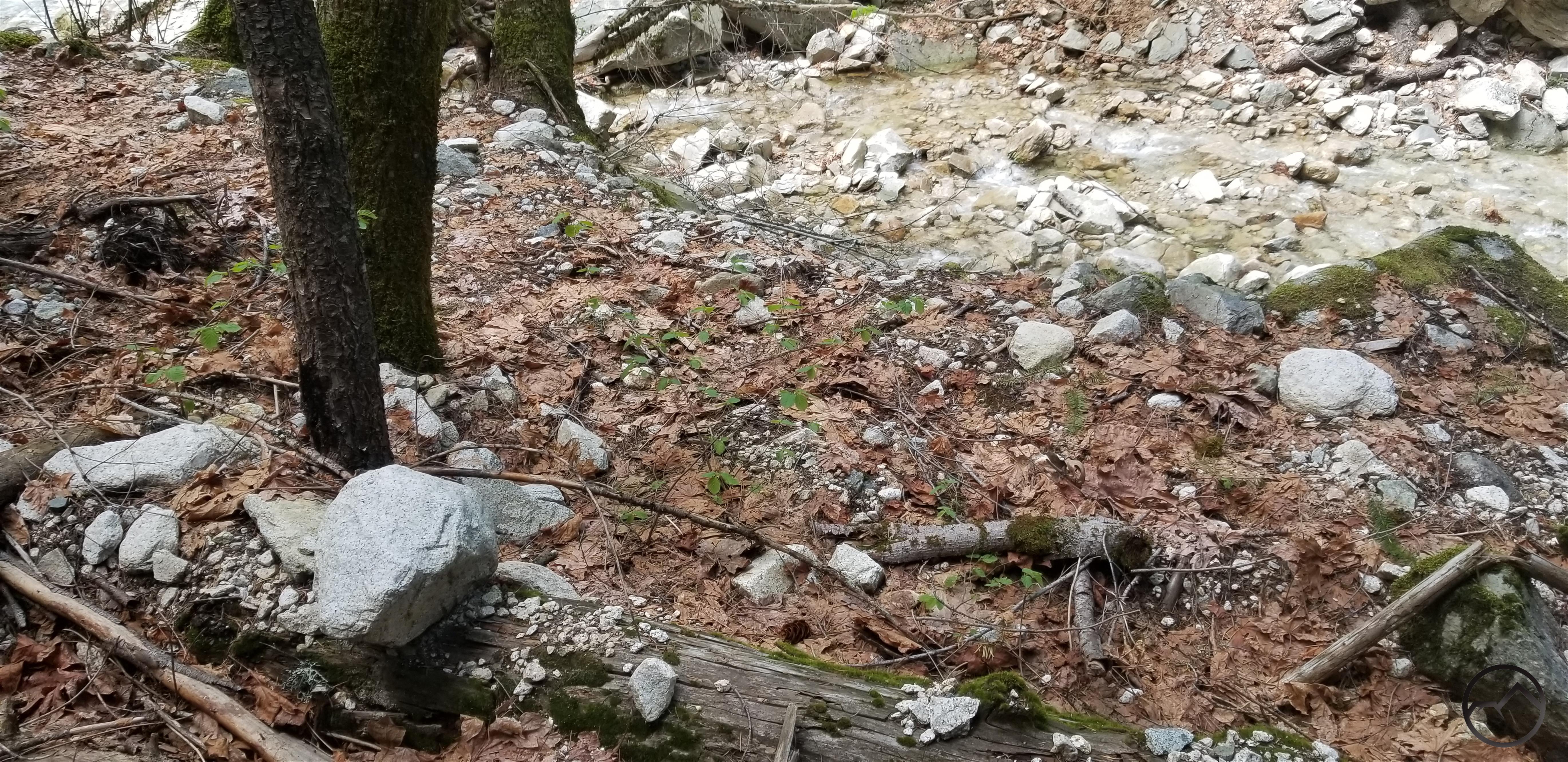
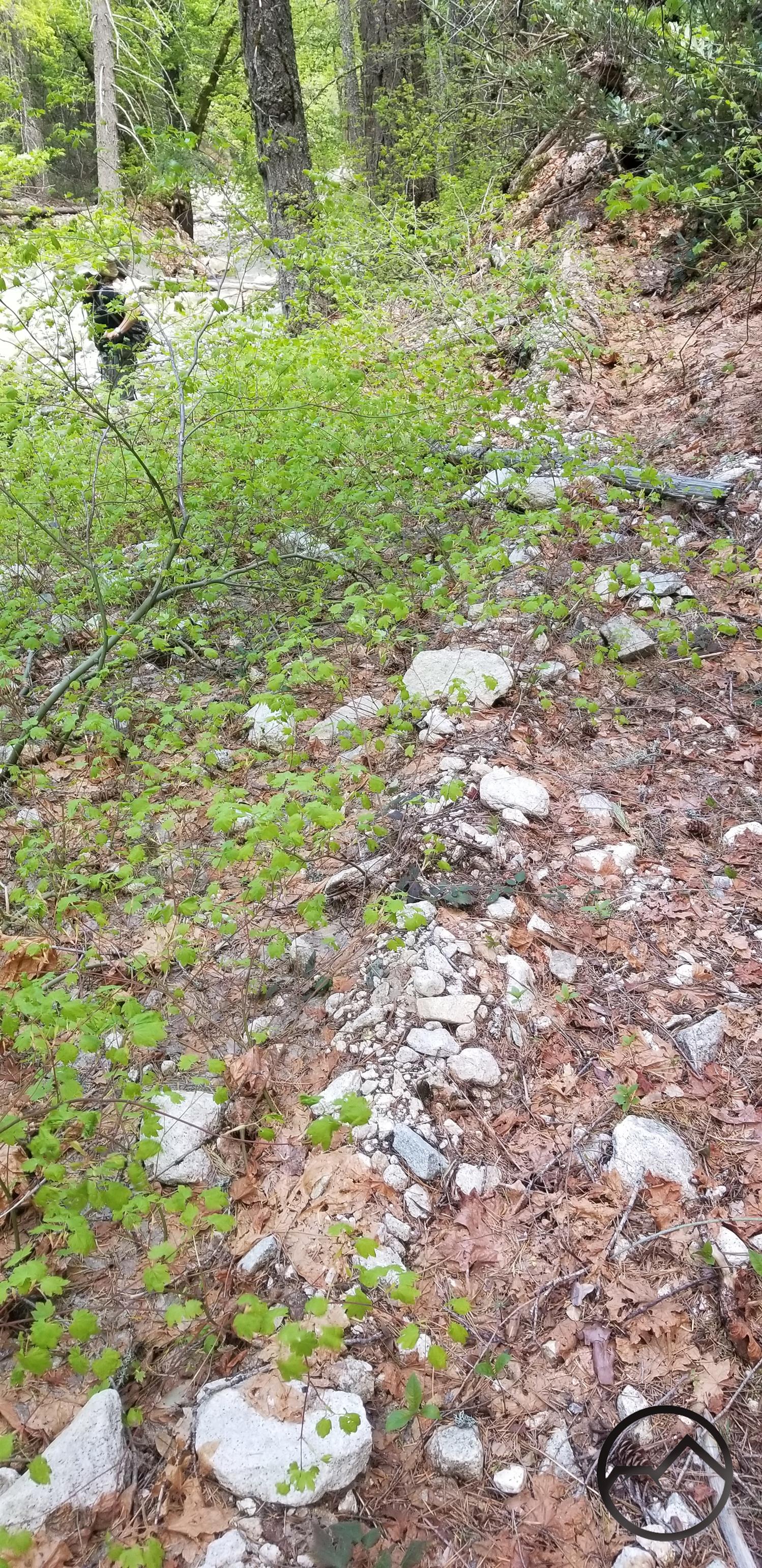
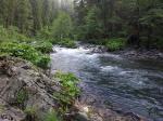
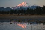
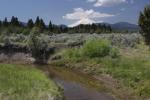
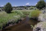
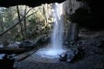
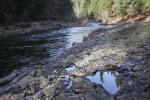
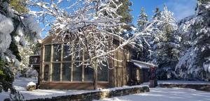
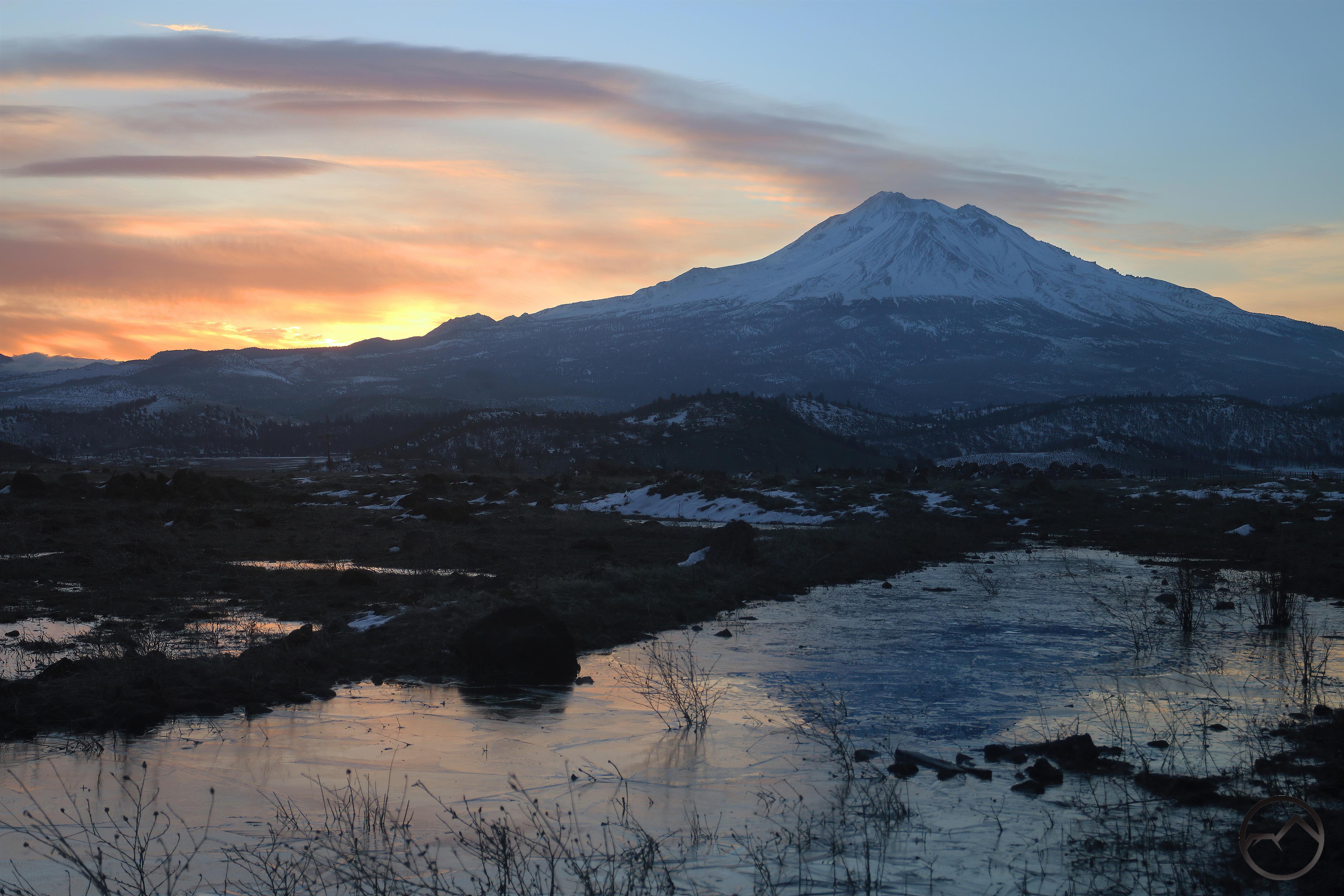
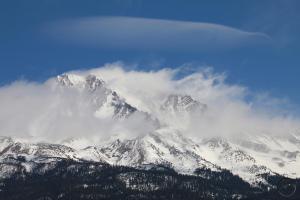
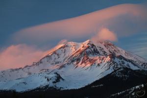
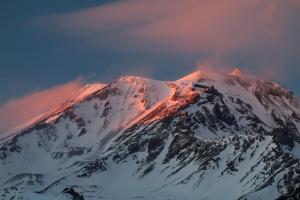
Orland Buttes Gallery (click to enlarge):

Black Butte Lake.


Fascinating Evidence Of A Deluge On A Creek

Posted by bubbasuess on May 7, 2021
Posted in: Cascade Range, Hiking, Mount Shasta, Trinity Divide, Waterfalls. 4 Comments

May is a month that I typically spend hunting for waterfalls. With the snow melting and the mountains opening up, yet the temperatures comfortable, it is the perfect season to track cataracts. It is surprising just how many creeks in the Trinity Divide are largely unexplored and unappreciated, especially when there is some pretty spectacular scenery waiting to be discovered. In many cases, though people have no doubt been there in the past, I often feel as if it has been a long while since anyone has set foot in these canyons and along these creeks. Such was the case recently, when a friend and I explored one of the Trinity Divide’s obscure waterways.

The creek in question was quite beautiful, flowing through primeval forest and choked with rocks of every imaginable size. Indeed, it was this rock that really caught our attention. At first something just seemed amiss but it soon came into focus that all the rocks were loose. They had not found a locked repose as riparian boulders typically do. Nonetheless, the creek was vigorous, wild and refreshing.

The creek flows through a beautiful channel filled with loose, white rock.
Small cataracts characterized much of the waterway.

The channel narrows and becomes rockier, but the loose rock persists.

Eventually it became obvious to us that the creek had endured a massive deluge at some point in the not-too-distant past. Not only were the rocks loose along the creek but we began to notice the same rocks higher up the banks and in places where it would seem the water wouldn’t typically flow. This soon became so pronounced that we could see rocks on logs well above the creek’s channel:

Rock deposited on a log high above the creekbed.

Moreover, this was not limited to small pebbles or larger, fist-sized rock. Indeed, larger boulders had also been left stranded high above the creek:

Boulders left beyond the creek’s typical high water line.

We surmised that the creek had experienced an incredible flashflood at some point not too long ago. However, what mystified us was that the rocks often appeared to have been left on top of the leaves and duff of the forest floor. We assumed that this normal forest detritus would have been scoured away by the torrential waters. This was seemingly not always the case and rocks were left on top of the “leaf layer”:

Rocks seen lined up on a log that was already buried beneath the leaves.

It remains a mystery exactly what happened along this creek and when it occurred. What is certain is that the creek is a beautiful waterway that does great credit to the Trinity Divide and the Mount Shasta area. And yes, there were waterfalls:

20210501_141747

20210501_141747

High Desert Oasis: A Mount Shasta Sunrise And Sunset At Orr Lake

Posted by bubbasuess on April 22, 2021
Posted in: Boy Scouts, Cascade Range, Hiking, Mount Shasta. Leave a comment

Last weekend I had the opportunity to take the Boy Scout troop out for a weekend of camping at Orr Lake. The lake is on the northeast side of Mount Shasta and, for my money, one of the nicest places to camp in the area. Though the environs are a mix of high desert and ponderosa forest, the area around the lake is surprisingly lush. In addition to large meadows and and the meandering flow of Butte Creek, Orr Lake itself is an oasis amidst the sage and juniper that surround it. Large ponderosa also grow amidst the volcanic rocks that crop up on the slopes of Orr Mountain and the ridge that rises above the west side of the lake. Above all of this rises the awesome, icy tower of Mount Shasta’s Hotlum Cone, the massive eruption cone that composes the mountain’s entire east side (and summit). It is a beautiful place with an awesome view and perfect for taking a bunch of boys on a spring camp out.

Of course, I had to take the opportunity to capture sunrises and sunsets, given that I am not out there too often during that time of day. The results were quite pleasing.


From our campsite, we could look out across the lake at Haight Mountain (left) and West Haight Mountain (right). They were good gauges for where the sun was and when it was time to head over to the east side of the lake where the view of Mount Shasta was a little better.


With Mount Shasta in view, and augmented with a nice band of cloud, the sunset was sublime. Just enough color was visible on Shastina and the Bolam Glacier that the shadow on the east side did not diminish the incredible beauty of the sunset. I always associate Orr Lake with sunrises but this sunset made me rethink that as the best time to view the mountain from this position!


In the morning I headed back to the east side and caught the mountain in all of its sunrise glory. The birds (which are ubiquitous at Orr Lake) were already up and active and were cacophonous. There was just enough wind to keep the reflection getting too clear but the bright color of the sunrise still looked great against the water.

Cascades, Mt. Shasta – April2021vid (1)

Cascades, Mt. Shasta – April2021vid (1)


A wispy layer of fog swept over the water, dramatically waving across the lake’s surface. It added a ghostly quality to the reflection that really embellished the spectacle.

The weekend was filled with a ton of fishing, as well as groups hiking to the summit of Orr Mountain as well as out to Butte Creek in the vast meadow south of the lake. Bird watching, especially of a pair of bald eagles occupying a nest near the lake, was also a welcome activity throughout the weekend. Plenty of other camp hijinks were afoot and a great time was had by all.

The red line is existing trail. Yellow lines are proposed routes.

Time spent camping at Orr Lake over the weekend set me to thinking about the recreational opportunities at the site. It is a place that is generally off the radar, as are most places in the Klamath National Forest’s Goosenest Ranger District. There is one trail, which leads from the group camp out toward Butte Creek. While cross country travel and road hiking are pretty easy, given the excellence of the location and quality of the campgrounds, I think the area could benefit from a few more trails. In particular, a route up the ridge on the west side of the lake, forming a loop with the Butte Creek trail would be fantastic. A well-graded trail up to the summit of Orr Mountain would also be a great addition to the area. Between those hikes, exploring the meadow and fishing or kayaking the lake, I think Orr Lake would be a first rate destination. As it is, it is already fantastic.

A Mount Shasta Pelican?

Posted by bubbasuess on March 28, 2021
Posted in: Cascade Range, Desert, Hiking, Mount Shasta. 4 Comments

Saturday was the nicest day of 2021 thus far. No doubt days will be getting better as we plunge into spring. The nice weather meant it was a moral imperative to get outside. The morning was spent tracking unnamed waterfalls in the Castle Crags but evening meandered into an unanticipated trip out to Trout Lake in the Shasta Valley. Though there were no clouds of any kind in the sky over Mount Shasta, I thought the high desert terrain and the (hopefully) still water of the lake might make for an interesting sunset.

When I arrived at the wildlife refuge I first went to check on Bass Lake, which was rather low. No doubt if the winter had received more precipitation it would have been full. I proceeded to Trout Lake, which was full. Though there are views of Mount Shasta from everywhere in the Shasta Valley, the vista from the Trout Lake parking lot is among the best and certainly ranks as one of the best drive-to vistas of Mount Shasta. As it turned out, there was no one there, which meant, since no one was at Bass Lake or any of the other parking areas along the route to Trout Lake, I was the only visitor in the refuge.

I set up my camera and enjoyed the changing light on Mount Shasta. As to be expected, there were a lot of birds around the lake, including geese, ducks, seagulls and the oddly-footed coots. However, one avian denizen stood out as it swam back and forth across the lake. A large white pelican and decided to take up residence in Trout Lake. Although I have seen pelicans many times at Orr Lake, I have never seen one in the Shasta Valley. I invariably associate pelicans with the sea, so seeing one happily swimming through a reflection of Mount Shasta, I find it unexpected and somewhat out of sorts.

The pelican seemed quite content swimming back and forth, from the east to the west and back again. Coots would periodically come and visit the large bird but other than these small encounters, the pelican was on its own. At first I was frustrated because its swimming marred the already imperfect reflections I was getting. However, after a few minutes I decided my perceived incongruence of seabird and Cascade volcanos made more interesting pictures anyway so I relented and allowed myself to enjoy it.

I must confess that I am not much of a wildlife guy. Unless it is a bison (for which I have an abiding appreciation), wildlife does not generate a lot of excitement for me. The geology is always my first interest and the flora is my second so birds are typically pretty far down on my interest totem pole. Yet, for some reason seeing the pelican turned out to make an ordinary, cloudless Mount Shasta sunset (still a magnificent thing!) much more appealing. Perhaps my interests are broadening!

As it turned out, the rest of the sunset was also beautiful, if devoid of the long-beaked seabird. The moon was full and some thing clouds to the east and west captured more of the sunset’s light, all of which was reflected on the still waters of Trout Lake. The entire Shasta Valley has turned green with the onset of spring, though it is still a little too early for the lupine to have sprouted. That is not too far off now. Things are looking up.


2021 Mount Shasta Spring Hiking Round Up

Posted by bubbasuess on March 27, 2021
Posted in: Cascade Range, Desert, Hiking, Mount Shasta, Off Season Trails, Spring Trails, Winter Trails. 1 Comment

A springtime sunset on Mount Shasta.

We are a week past the 2021 vernal equinox and moving right into spring. Though we will no doubt have some more precipitation (I sure hope!) for now we are blessed with a week’s worth of spectacular spring weather! It is prime time to head out and explore the low and mid-elevation trails around Mount Shasta. For me, that means it it peak time to dive into the Castle Crags and do some waterfall hunting. There are a lot of hidden jewels in that massive pile of rock.

Though the weather is perfect for hiking, the winter’s snow means we will have to wait a while longer before the high country trails are clear of snow. Thankfully the Mount Shasta area is blessed with an abundance of trails at lower elevations, which means that hiking and enjoying the fantastic scenery that surrounds us is in full swing. The best spots to explore this time of year are along the McCloud River and in the Castle Crags. Despite the lower elevation, they still offer great mountain experiences. The Gateway Trail is also a good option for spring hiking, with good views of the mountain and a sense of solitude in the near-town but remote backcountry of the trail. The high desert of the Shasta Valley is another great place to explore right now. Of course, all the other areas usually considered good winter destinations are also fantastic places to hike right now. Summer may be coming but the time to get out and hit the trail is now!

Spring Hiking On The Gateway Trail

Located just outside of Mount Shasta City, the Gateway Trail is an impressive and soon-to-be-expanding network of trails that wind their way through the wooded flanks of Mount Shasta. The first couple miles of the trail, however, are largely in the open, passing through rocky terrain that features great perspectives on the white mountain looming over 10,000 feet overhead. Once the trail plunges into the deep forest, numerous loop options exist, along with a few rocky outcroppings and some good vistas of Trinity Divide. Read more here.

A last view of Mount Shasta before heading into the forest.
The trail also features good perspectives on Mount Eddy and Black Butte.

Spring Hikes In The Castle Crags

The Castle Crags are one of the most majestic mountain features in California. However, their lower elevation means they are often accessible when higher terrain is still smothered in snow. Still, the granite spires and great rock walls stand shoulder to shoulder with some of the most rugged terrain in the state. Though best hiked in spring, when the creeks are gushing and the weather, especially on the south side where most trails are found, is perfect, the winter may still be a good time to get out and enjoy this gorgeous mountain playground. Read more here.

Spires of the Crags
Mount Shasta seen from the Castle Crags

Spring Hikes On The Upper McCloud River

The McCloud River is one of the great attractions of the Mount Shasta area. With great fishing, a trio a awesome waterfalls, and beautiful forest surroundings, it is a popular destination. The waterfall along the river is a great hike and ought to be considered during winter if the access road is open. However, the McCloud River Trail follows the river for 15 miles and any section of this makes a great hike as long as snow is not covering the ground. Read more here.

Basalt gorge on the McCloud River
The McCloud River downstream from Cattle Camp.
McCloud River from the top of Middle Falls
Middle McCloud Falls

Spring Hikes On The Lower McCloud

The Lower McCloud River sees far less activity than the upper section. Separted by Hearst property and the McCloud Reservoir, the two areas are strikingly different. The upper section flows through volcanic terrain while the lower part passes through an outlier of the Klamath Mountain. The terrain is very rugged and can be difficult access during winter. However, when it can be reached, solitude a beautiful scenery await! Read more here.

Large cataract on the McCloud River
The McCloud River from the PCT crossing.
In the McCloud River Canyon
Squaw Valley Creek Falls

Spring Hiking At Orr Lake

The area around Orr Lake is a mix of high desert and ponderosa pine forest, surrounding a large, lush meadow fed by remote Butte Creek. It’s higher in elevation than the high desert of the Shasta Valley, which means it is often not a good place to go in winter. However, in spring, it is ideal. The lake is full, the creek is running strong and Mount Shasta, visible beyond the lake, is white. Other than portions of the trail being closed at times for nesting birds, it is a great place to get outside in the months before summer. Read more here.

Sunrise at Orr Lake.
Mount Shasta rises above Butte Creek
The distant Goosenest seen from Butte Creek.
Orr Mountain seen beyond the Orr Lake meadow.

Spring Hikes In The Shasta Valley

North of Mount Shasta, the desert landscapes of the Shasta Valley offer a strikingly different environment than what is found along most trails in the region. The only conifers here are junipers and sagebrush is ubiquitous. For those that like the desert, the beauty of this area needs no explanation. For those less familiar, there is ample wildlife, beautiful rock formations and magnificent 360 degree views, crowned by some of the best views of Mount Shasta to be found anywhere. Read more here.

Mount Shasta rises above Yellow Butte
Herd Peak, Sheep Rock and Yellow Butte
Pluto Cave
Mount Shasta rises above Pluto Cave

Spring Hikes In The Shasta Valley Wildlife Refuge

At the northern end of the Shasta Valley lies a large parkland administered by the State of California. The Shasta Valley Wildlife Refuge was once a working ranch but is now a haven for a variety of wildlife, especially birds. It is also a refuge for hikers looking for incredible vistas. Though it can be closed at times during winter, there are still opportunities to explore it and once it is reopened completely, it is a place of great beauty, beckoning to be explored! Read more here.

Mount Shasta reflects in a pool by Steamboat Mountain.
Looking north toward the Siskiyous
The Cascade Crest seen from Trout Lake
Mount Shasta looms far beyond Trout Lake

Three Spring Trails Near Mount Shasta City

Mount Shasta City is blessed with a number of great paths within and just outside of its city limits. Three of the best are the Box Canyon, Ney Springs and Spring Hill Trail. These offer solitude, Mount Shasta Vistas, unique history, spectacular geography and even some excellent waterfalls. These all lie just minutes outside of town. Also, don’t forget that Mount Shasta City has some great short trails right in town! Read more here.

Box Canyon of the Sacramento River.
Inside the Box Canyon of the Sacramento
Faery Falls
Rocky Point on the Spring Hill Trail.

Spring Hikes On The Lake Siskiyou Trail

The Lake Siskiyou Trail is an incredible recreational resource just a couple minutes outside of Mount Shasta City. During the summer and fall, a loop trail encircles the lake. However, in winter the seasonal bridges over the Sacramento River are removed. While the loop can’t be hiked without fording the river (extremely dangerous after storms and during high runoff), several sections of the trail still make great out and back hikes. They feature beautiful forests, the lake itself and incredible views. Due to the relatively light winter, the bridges should be places over the Sacramento sooner rather than later this year. Read more here.

Mount Eddy at the Sacramento River inlet.
Hiking along South Shore
Views from North Shore.

Spring Hikes On The Sacramento River

Most people in California think of the Sacramento River as the wide, winding waterway that lazily flows through the Central Valley. Here just below the headwaters, however, it is a swiftly flowing mountain river. Deep in its canyon, the lower elevation means it is often free of snow and the trails are easily accessed. Hiking along the river in winter is a treat that offers a taste of wild mountains for minimal effort. Read more here.

Hedge Creek Falls
Behind Hedge Creek Falls
Rapids Along the River Trail.
Along the Sacramento River Trail.

The Winter Snowpack Thus Far In Mount Shasta

Posted by bubbasuess on March 17, 2021
Posted in: Boy Scouts, Cascade Range, Hiking, Mount Shasta. 6 Comments

Unusually snowy hills of the Shasta Valley lie beneath alpenglow-bathed Mount Shasta.

As we near the end of winter (at this point, I can’t wait!), it is worth considering the snowpack that has developed and how things look going into the warmer months. This can be done both anecdotally and with data and both are useful at this point. The water that falls here in the mountains at the far northern end of the state has considerable bearing on the water fortunes of the rest of California as well as helping prepare for the kind of fire season that may manifest. Both are critically important both locally and statewide.

I want to first address the data that is available at this time. According to the National Resource Conservation Service, which is part of the US Department of Agriculture, as of the beginning of March, the Mount Shasta area was at 88% of normal snowpack. This figure was averaged from the snowpack percentages of both the Upper Sacramento River and Klamath River watersheds.

Western watersheds and snowpack conditions. Mount Shasta marked with red dot.

That data is available on this map, which has a ton of resources and is worth exploring. Of those two watersheds, the Upper Sacramento is more pertinent to Mount Shasta, since the SNOTEL stations and California Cooperative Snow Survey sites that are in the Mount Shasta vicinity are located in this watershed. According to the map, the Upper Sacramento watershed was at 94% at the beginning of March. This area includes the western Trinity Divide, the southern half of Mount Shasta, the Sacramento River down to the Shasta Dam, the McCloud River watershed and the entire Pit River watershed, which notably contains the high country of the Warner Mountains.

The Upper Sacramento River, as per NRCS data, is marked in blue. Mount Shasta marked red.

This is encouraging data. The large storm we had in January went a long way towards establishing a quality snowpack. The area to the north and west, in the Klamath River watershed, is slightly less well off, with 82% of normal as of the beginning of March. This area contains the preponderance of the Klamath Mountains and the east side of the Cascades deep into Oregon, reaching just north of Crater Lake. Obviously this area is pretty diverse and the data for the whole region can be skewed by one area having more or less snow.

Here’s another way to look at the data (be sure to check this page out, which shows annual Snow Water Equivalent all the way back to 1981). Thus far, by mid-March, we are approaching the 30 year (1981-2010) median for water content of the snow that has fallen. We are still off about 2 inches of SWE from the median peak. Again, we are not really at average yet, but this winter has not been a total disaster. For example, the graph below shows this winter (black line) compared to the wretched drought years of 2014 (purple line) and 2015 (orange line).

Obviously we are doing significantly better than those severe drought years. While I would be happier if the winter had produced a deeper snowpack, it has certainly not been a bust and there is a good accumulation of snow. We still have two weeks of March (and rain/snow imminent as I write this) as well as a good chance for more precipitation in April. Naturally, I am ready for some warm spring weather (and Castle Crags exploration!) I won’t argue with more water padding the totals we have gotten thus far.

Though it does not seem to correlate with the data on the NRCS, the numbers according to the Mount Shasta Herald’s site paints a much starker picture. It states that downtown Mount Shasta has only received 12.67 inches. I am not certain what the annual average is but that seems low. In addition, the report lists Stouts Meadow, which is often one of the wettest places in Northern California and its 39.66 inches is lower than what other years have produced. Other areas look lower than normal as well, though none of the averages are cited.

While some of these numbers are pretty good, they don’t necessarily reconcile with the MSH’s numbers. The NRCS data looks good but the MSH numbers seems bleak. This leads to the anecdotal aspect of this snowpack assessment. It is my observation that the winter seems just about normal. With the big storm we had in January depositing a lot of snow in the mountains (especially the Trinity Divide, whereas Mount Shasta’s snow was seemingly blown off by some pretty violent winds), I suspect a good base was laid down. That was reflected with the NRCS numbers that only ran up to the beginning of March. Since then, we have had three notable weather systems pass through the area. Between the three storms, we have had a considerable amount of snow dropped. The accumulated depth (at least at my house) was upwards of three feet of snow. Consider these images from around my house and cabin:

March 6th
March 6th

March 10th
March 10th

March 15th
March 15th

March 15th

I don’t know if these images do the accumulation justice but it was a lot. In these cases, the snow dropped, settled, melted a little and then had more piled on. The last two storms in particular left over 2 feet between them. Between the lateness in the winter and the slight warming trend we had been enjoying, I had not mentally prepared myself for the amount of snow we got. Both of the latter storms required significant snow clearing.

In the middle of all that, I also managed to take the boy scout troop for which I am scoutmaster on the annual snow camping trip on Mount Shasta. I am grateful that I am able to get these guys out there, even when so many are missing out on so much of life due to virus conditions. Many of these boys would still be stuck at home without something like boy scouts giving them some great memories and experience. Thankfully, the snow is there too. Winter may be coming to an end, but there is still plenty of snow to enjoy for the time being!


To summarize what I have looked at here, according to the NRCS, at the beginning of March the Upper Sacramento and Klamath watersheds had 94% and 82% of normal snowpack, respectively. Since that time, three weather systems have dropped significant precipitation in the area. Consequently, I have to assume that, at the least, the Upper Sacramento watershed might be approaching 100% of normal snowpack as of mid-March. The Klamath, which was lagging, must have improved significantly and if it is not at 100% of normal must be near to it. The one caveat to this is that, for as much snow fell, it was fairly dry and did not have a big water content. Nonetheless, considering how much snow actually fell, it is a positive addition to the snowpack.

The winter may have started later than normal but once it got going, we have done pretty well. A good storm in December, a big one in January and some strong systems in March have helped build a decent snowpack that looks to be close to a normal winter’s accumulation. There is still room in the wet season to pad that out with more snow and rain too. This is good news for the Mount Shasta area and for California!

A frozen sunrise in the Shasta Valley.

Mount Shasta Was On A Roll This Week (Plus Fresh Snow)

Posted by bubbasuess on March 6, 2021
Posted in: Cascade Range, Hiking, Lenticular Clouds, Mount Shasta. 1 Comment

Alpenglow on Mount Shasta beneath a massive lenticular wave.

I have noted on a few occasions that the current lenticular season has been somewhat lackluster. Though there have been a few events scattered throughout the past several months there haven’t been any really massive formations, the kind the tend to punctuate the season and really make you stop and marvel when they do occur. That all changed this past week. In the first 5 days of March, beginning Monday, there were 3 excellent clouds. Though their quality did lessen as the week progressed, they all still far outperformed what had preceded them.

As if that weren’t enough, the storm they had all been prelude to swept through and dropped 4-5 inches of snow at my house. While we were all hoping for more, that is still a welcome burst of snow. The skies are clearing even now and whoever heads up to the ski park is in for a gorgeous bluebird day!

Monday

The first lenticular of the week was by far the most impressive. Large, stable and stretching across the sky, it was one the most massive cloud events over Mount Shasta I have seen. It’s beginning didn’t quite augur its true proportions but those were revealed rather swiftly and maintained an immense presence throughout the day. It ended up coalescing into a staggering wave, similar to those that form over the Sierra Nevada. At sunset, the cloud didn’t quite light up as I had hoped but Mount Shasta managed to catch the alpenglow and it was an utterly spectacular scene.


Thursday

A few days later Mount Shasta again generated another interesting formation. This time it was a large stack to the northeast of the summit. At dawn it highlighted a really fiery sky, though the upper half of the stack was left totally in the dark. Like the wave from Monday, it stuck around all day. However, by sunset, though still extant over Mount Shasta, it was thin and wispy, hardly noticeable or catching light. However, the cloud clinging to the summit of Mount Shasta added some interest and it was still a beautiful end to the day.


Friday

The final lenticular of the week was also a fine one but was positioned further away from Mount Shasta, making it a bit frustrating to photograph. Nonetheless, like its predecessors, it was stable enough to stick around all day, though it was most interesting first thing in the morning. By noon it had flattened out but managed tighten up again for sunset. Unfortunately it never really got any vivid light. In spite of this, it was another spectacular formation to end the week!


Saturday

And now we have some fresh snow, just in time to do a little camping on Mount Shasta!

Chasing A Titan: A Day With An Evolving Mount Shasta Lenticular

Posted by bubbasuess on March 3, 2021
Posted in: Cascade Range, Hiking, Lenticular Clouds, Mount Shasta. 1 Comment

A pair of lenticulars, one massive one a simple disk, hover over Mount Shasta.

Seemingly out of nowhere, a titanic lenticular event manifested over Mount Shasta on Monday, kicking off March with a bang. The sky was basically cloudless at sunrise but by mid-morning it was already getting interesting. Naturally I could not resist heading out and documenting the spectacle, which I did at various times during the day, trying to catch it in its many iterations painted across the sky.

It was obvious from the beginning that this was the big event I have been waiting months for. From the west side of Mount Shasta the clouds seem to stretch from the mountain itself west to Mount Eddy. At times it was a series of lenticular disks while at other times the individual clouds seemed to merge into a single band of wavy formations. However, it was only when traveling to the north that the full scope of the cloud could be appreciated, as it could be seen extending east beyond the Whaleback. It is difficult to gauge the scale of the cloud from a fixed spot low down on the ground but just the linear distance between Mount Eddy and Whaleback is approximately 22.5 miles. That’s a big lenticular!

Click to enlarge:

An early indication that big things were afoot, a sizable lenticular stack appeared over Mount Eddy. While this peak does occasionally get lenticulars, it is unusual for a formation this large to manifest here.


As the alpenglow increased on Mount Shasta, the lenticulars all combined into a great band, reminiscent of a Sierra Wave. The layers weren’t quite as defined as they had been just a few minutes before but it was still striking. A nice lens hovered above the summit of Mount Shasta as well.

Finally, after going dim for a few minutes, the final light of sunset hit the scene. I had hoped the entire cloud would light up but this more subtle sunset offered it own, subdued-yet-spectacular final moment before all the light went out.

The wave never quite lit up the way I had hoped but it was a spectacular end to a staggering day nonetheless. The mountain had good color at times and the alpenglow’s subtle illumination of the clouds was still gorgeous if not grand. The totality of the scene was grand enough and then some. I had hoped that a formation as large and durable as this one would still be manifest in the morning. Some form of lenticular was still visible in the moonlight well after midnight. However, with only the surging winds signaling its departure, the titanic formation dissipated into the night. When I headed out the next morning, hoping to capture a lenticular sunrise, there was not even a remnant of it. Such is the will of the mountain. It is unpredictable!

The massive lenticular having vanished , it was just another morning on Mount Shasta.

This was indeed the lenticular I had been waiting for all season. There have been plenty of formations for months but none ever really elevated themselves into the rarified company of the great events. This one did that. I don’t want to be greedy but I hope we get another before summer gets here!

Mount Shasta: Morning, Noon and Night

Posted by bubbasuess on February 27, 2021
Posted in: Cascade Range, Hiking, Lenticular Clouds, Mount Shasta. 3 Comments

A sunrise-lit lenticular seems to be grabbing for Shastarama Point.

Friday was another interesting day around Mount Shasta. Like the day before, the forecast called for partly cloudy skies, which meant that there was a chance something interesting might show up around the mountain. While the day before had been a bit of a disappointment since the promising morning gave way to an essentially cloudless day, Friday promised to offer something completely different. Indeed, the interesting weather persisted through the day and into the night. While the eventful conditions made for a frustrating day at the ski park (too windy for some of the chairlifts), it made for a pleasant day looking through the lens of my camera.

Click to enlarge:

While I considered heading over to McCloud for the sunrise, I knew I didn’t have time so instead I climbed up to the west. Though the mountain did not have any direct light on it, the lenticular was lit up nicely.
When the sun finally broke the horizon, the shape of the lenticular changed dramatically. It flattened out and lost the tendrils that had been its most distinctive feature. It was a beautiful morning nonetheless!

By noon the clouds around Mount Shasta got a lot more turbulent. The lenticular was still present but it had been reduced in size significantly. It remained the rest of the day but the other clouds around the mountain grew until Mount Shasta was completely obscured from the west.
At sunset, I had to head around to the south side in order to see the mountain. The lenticular was still hovering over the summit, though it had an odd, oblique position. The color on the mountain was crisp and pink and highlighted the west-facing crags beautifully.

Just as the alpenglow was fading, the clouds obscuring the summit cleared, revealing a final look at the top of Mount Shasta while still bathed in the warm light. A magnificent sunset indeed.
As I headed home, the moon popped up just above Mount Shasta’s Jack Flat. There was only a small gap between the ridge and a layer of cloud and the moon shone brightly through it. I was able to pull over and capture the scene before the moon climbed into the clouds. All in all, a satisfying evening!

Mount Shasta’s Show Fleeting But A Fine One (And Mount Eddy Too!)

Posted by bubbasuess on February 25, 2021
Posted in: Cascade Range, Hiking, Mount Eddy, Mount Shasta, Trinity Divide. Leave a comment

Though Wednesday proved to be clear-skied Thursday morning offered something altogether different. The forecast called for clouds in the morning. With that in mind, I headed out yet again, but I had slept longer than normal so I only had a few minutes to get to a vantage point before the color really set in. The destination was one only a few minutes from my house and it is a classic standby. I generally try to avoid this one these days but when time is short, it works in a pinch. This turned out to be a good morning to go there, since the color on Mount Shasta was good and the clouds were interesting but the real show was over Mount Eddy. This spot has a good perspective on both, which really paid off.


The summit of Mount Shasta was partially obscured in the clouds but the clouds themselves were quite nice. They soaked up the light of the rising sun in fine fashion. It was hard to distinguish but there was actually a bit of a lenticular in a higher layer of cloud. Though it would have been challenging to really appreciate from the north, the mountain also cast a nice sunrise shadow. Overall, a nice sunrise, but not one as grand as I had hoped.


While Mount Shasta lacked really interesting clouds, the peaks to the west were graced with lenticular-like clouds. Peak 7,869 was light up brightly by the morning light. Over the summit a stream of cloud coursed in layered urgency. It too was alight. This prominent peak is surprisingly nameless and I have come up with various names in the past but that will have to be the subject of another post. If you have a name for this peak, leave a comment. I would love to hear other ideas for this one.


Mount Eddy was the real star of the morning. Even though the eastern side of the mountain is not its best visage it is still higher and larger than anything to the west and the rugged, treeless upper flanks are still quite scenic. Thursday morning saw the mountain overshadowed by a layered lenticular that was highlighted by the sunrise glow. It was hard to get the entire scene into frame and the cloud extended well south of Mount Eddy but the best parts were captured and it ended up being one of the better cloud formations I have captured over that mountain.


Without warning, the color began to fade as the sun rose and the clouds blocked out the light. It grew really overcast before all the clouds blew away, leaving only a small lenticular over Mount Shasta. That too was gone before noon, leaving clear skies for the rest of the day. It was a short performance but it was a good one.


By evening the clouds had not made a return but, on the way home from renting some skis for my son, I saw the moon had risen over Mount Shasta. That was worth a stop to capture with the mountain starting to light up with alpenglow. Considering there were no clouds over the mountain, it was a nice way to end the day. We’ll see what tomorrow brings…

Posts navigation

← Older Entries
Newer Entries →
    • Recent Posts

      • Four Sunsets From Truchas Ridge
      • April Flew By…Again
      • Light In The Layers
      • Winter Shows Up When It Will
      • January Rolled By With Mud, Then Very Dry
      • Mount Shasta 2025 – A Year In Images
      • Mount Shasta On Either Side Of Christmas
      • Adrift In An Ocean Of Fog
      • December Has Been Spectacular Thus Far Pt. II (A Magnificent Lenticular)
      • December Has Been Spectacular Thus Far Pt. I
    • Enter your email address to follow Hike Mt Shasta and receive notifications of new posts by email.

    • Archives

      • May 2026
      • April 2026
      • March 2026
      • February 2026
      • January 2026
      • December 2025
      • November 2025
      • October 2025
      • September 2025
      • August 2025
      • July 2025
      • June 2025
      • May 2025
      • April 2025
      • March 2025
      • February 2025
      • January 2025
      • December 2024
      • November 2024
      • October 2024
      • September 2024
      • August 2024
      • July 2024
      • June 2024
      • May 2024
      • April 2024
      • March 2024
      • February 2024
      • January 2024
      • December 2023
      • November 2023
      • October 2023
      • September 2023
      • August 2023
      • July 2023
      • June 2023
      • May 2023
      • April 2023
      • March 2023
      • February 2023
      • January 2023
      • December 2022
      • November 2022
      • October 2022
      • September 2022
      • August 2022
      • July 2022
      • June 2022
      • May 2022
      • April 2022
      • March 2022
      • February 2022
      • January 2022
      • December 2021
      • November 2021
      • October 2021
      • September 2021
      • August 2021
      • June 2021
      • May 2021
      • April 2021
      • March 2021
      • February 2021
      • January 2021
      • December 2020
      • November 2020
      • October 2020
      • September 2020
      • August 2020
      • July 2020
      • June 2020
      • May 2020
      • April 2020
      • March 2020
      • February 2020
      • January 2020
      • December 2019
      • November 2019
      • October 2019
      • September 2019
      • August 2019
      • July 2019
      • June 2019
      • May 2019
      • April 2019
      • March 2019
      • February 2019
      • January 2019
      • December 2018
      • November 2018
      • October 2018
      • September 2018
      • August 2018
      • July 2018
      • June 2018
      • May 2018
      • April 2018
      • March 2018
      • February 2018
      • January 2018
      • December 2017
      • November 2017
      • October 2017
      • September 2017
      • August 2017
      • July 2017
      • June 2017
      • May 2017
      • April 2017
      • March 2017
      • February 2017
      • January 2017
      • December 2016
      • November 2016
      • September 2016
      • August 2016
      • July 2016
      • June 2016
      • May 2016
      • April 2016
      • March 2016
      • February 2016
      • January 2016
      • December 2015
      • November 2015
      • September 2015
      • August 2015
      • July 2015
      • June 2015
      • May 2015
      • April 2015
      • March 2015
      • February 2015
      • January 2015
      • December 2014
      • November 2014
      • July 2014
      • June 2014
      • May 2014
      • April 2014
      • March 2014
      • February 2014
      • January 2014
      • December 2013
      • November 2013
      • October 2013
      • September 2013
      • August 2013
      • July 2013
      • June 2013
      • May 2013
      • April 2013
      • March 2013
      • February 2013
      • January 2013
    • Categories

      • Boy Scouts
      • Cascade Range
      • Castle Crags
      • Desert
      • Echo Point
      • Glaciers
      • Hiking
      • How things came to be…
      • Klamath Mountains
      • Konwakiton Outdoor Designs
      • Lakes
      • Lenticular Clouds
      • Maps
      • Marble Mountains
      • Meadows
      • Mount Eddy
      • Mount Shasta
      • Mount Shasta History
      • Napa County
      • Off Season Trails
      • Pacific Crest Trail
      • Peaks
      • Rivers
      • Rock Climbing
      • Scott Mountains
      • Seldom Seen
      • Shasta Valley
      • Sierra Nevada
      • Siskiyou Mountains
      • Sonoma County
      • Spring Trails
      • sunrise
      • sunset
      • Trinity Alps
      • Trinity Divide
      • Truchas Ridge
      • Uncategorized
      • Water
      • Waterfalls
      • Wilderness
      • Wildflowers
      • Wine Country
      • Winter Trails
      • Yosemite
    • Meta

      • Create account
      • Log in
      • Entries feed
      • Comments feed
      • WordPress.com
    • Copyright © 2013-2024 by Bubba Suess

      DISCLAIMER: Any use of the information contained in this site by any and all persons is done at their own risk. The operator of this site shall be held harmless from any and all alleged claims, demands, causes of action, liability, loss, damage and/or injury to property or persons whether brought by an individual or other entity. This indemnification applies, without limitation, to all actions by an individual or other entity as a result of their use of information contained in this site.

    Blog at WordPress.com.
    Hike Mt. Shasta
    Blog at WordPress.com.
    • Subscribe Subscribed
      • Hike Mt. Shasta
      • Join 968 other subscribers
      • Already have a WordPress.com account? Log in now.
      • Hike Mt. Shasta
      • Subscribe Subscribed
      • Sign up
      • Log in
      • Report this content
      • View site in Reader
      • Manage subscriptions
      • Collapse this bar

    Loading Comments...