Hike Mt. Shasta

Exploring the Mount Shasta Region

  • Home
  • Trails
    • Mount Shasta Trails
      • Brewer Creek Trail
      • Clear Creek Trail
      • Gray Butte Trail
      • Green Butte Ridge Trail
      • Horse Camp Trail
      • North Gate Trail
      • Old Ski Bowl Trail
      • Panther Meadow Trail
      • South Gate/Squaw Meadow Trail
      • Whitney Falls Trail
    • Trinity Divide Trails
      • Blue Divide Trail
      • Castle Lake Trail
      • Castle Lake Shore Trail
      • Cliff Lake Trail
      • Deadfall Lakes Trail
      • Gray Rock Lakes Trail
      • Gumboot Trail
      • Heart Lake Trail
      • Porcupine & Toad Lakes Via Pacific Crest Trail
      • Seven Lakes Basin Via Pacific Crest Trail
      • Sisson-Callahan Trail
      • Soapstone Trail
      • South Mumbo Scramble
      • Tamarack Lake Trail
      • Toad Lake Trail
    • Castle Crags Trails
      • Burstarse Falls Via Pacific Crest Trail
      • Castle Dome Trail
      • Flume Trail
      • Lower Castle Crags Via Pacific Crest Trail
      • Root Creek Trail
    • Scott Mountains Trails
      • Bluff Lake & Cement Bluff via Pacific Crest Trail
      • Caldwell Lakes Trail
      • China Mountain Scramble
      • Cory Peak and Bull Lake via Pacific Crest Trail
    • Cascade Crest
      • Ash Creek Butte Scramble
      • Goosenest Trail
      • Juanita Lake Trail
      • Orr Lake Trail
    • Mount Shasta City Area Trails
      • Black Butte Trail
      • Box Canyon Trail
      • Gateway Trail
      • Lake Siskiyou Trail
      • Mount Shasta City Short Trails
      • Ney Springs Canyon Trail
      • Spring Hill Trail
    • Shasta Valley Trails
      • Black Lava Trail
      • Haystack Trail
      • Lake Shastina Trail
      • Pluto Cave Trail
      • Trout Lake Trail
      • Yellow Butte Trail
    • Sacramento River Trails
      • Dunsmuir Trail
      • Hedge Creek Falls Trail
      • Sacramento River Trail
      • Sims History Trail
    • McCloud River Trails
      • Ash Camp To Ah-Di-Na Via Pacific Crest Trail
      • McCloud River Falls Trail
      • McCloud River Preserve Trail
      • Squaw Valley Creek Trail
      • McCloud River Trail: Algoma Camp to Nitwit Camp
      • McCloud River Trail: Nitwit Camp to Cattle Camp Swimming Hole
      • McCloud River Trail: Cattle Camp Swimming Hole to Camp 4
      • McCloud River Trail: Camp 4 to Upper McCloud Falls
      • McCloud River Trail: Pine Tree Hollow Loop
    • Trails Further Afield
      • Trinity Alps Trails
        • Bear Lakes Trail
        • Billys Peak Trail
        • Boulder Creek Lakes Trail
        • Boulder Lake Trail
        • Canyon Creek Trail
        • Caribou Lakes Trail
        • East Boulder Lake Loop
        • East Weaver Lake Trail
        • Four Lakes Loop
        • Granite Peak Trail
        • Grizzly Creek Trail
        • Gulch Lakes Loop
        • Hidden Lake Trail
        • South Fork Lakes Trail
        • Stoddard Lake Trail
        • Stoney Ridge Trail
        • Tangle Blue Lake Trail
      • Warner Mountains
        • Emerson Creek Trail
        • Highgrade Trail
        • Patterson Lake Via Warner Summit Trail
        • Pine Creek Trail
        • Squaw Peak Trail
  • Articles
    • Trails By Area
      • Mount Shasta
        • Vistas, Meadows And Waterfalls: Three Best Hikes On Mount Shasta
        • The End Of The Road: Three Hikes In The Old Ski Bowl Area
        • Two Trails From Bunny Flat
        • Three Trails On Mount Shasta’s East Side
        • Mount Shasta’s Hummingbirds
      • Trinity Divide
        • Great Lakes: Top Five Lake Basins In The Trinity Divide
        • The Headwaters Of The South Fork Of The Sacramento River
        • Neglected Headwaters: Two Lesser Lake Basins On The South Fork
        • Gumboot Saddle: Two Hikes On The PCT
        • Descent Into Mystery: The Sisson-Callahan Trail
        • Mumbo Basin – Overlooked On The West Side
        • The Headwaters Loop: A Proposed Backpacking Loop In The Trinity Divide
      • The McCloud River
        • The McCloud River Trail
      • Shasta Valley
        • Jewels In The Desert
      • Scott Mountains
        • Great Scott! Two Scott Mountains Hikes On The PCT
      • Trinity Alps
        • Carubou Lakes: Trinity Alps On A Grand Scale
        • Switchbacks To Heaven: The Trinity Alps’ Stoney Ridge Trail and Four Lakes Loop
        • Trinities In Proximity: Two Trinity Alps Trails With Easy Access From Mount Shasta
        • Trails in the Carter Meadows Area
        • Trinity Alps Views of Mount Shasta
        • The Psychological Value Of The Trinity Alps
    • Waterfalls
      • Three Waterfalls On Mount Shasta
      • McCloud River Waterfalls
      • Sacramento River Waterfalls
      • Trinity Divide Waterfalls
      • Trinity Alps Waterfalls
      • Avoiding A Dry Whitney Falls
    • Off Season Trails
      • Three Winter Hikes Near Mount Shasta City
      • Winter Hikes In Shasta Valley
      • Winter Hiking In The Shasta Valley Wildlife Refuge
      • Winter Hikes On The Sacramento River
      • Winter Hikes On The Lake Siskiyou Trail
      • Spring Hikes In The Castle Crags
      • Spring Hikes On the Upper McCloud
      • Spring Hikes On The Lower McCloud River
    • Points Of Interest
      • Mount Eddy: Overshadowed, Underrated
      • Black Butte: Hiding In Plain Sight
      • Castle Dome: Steadfast And Staggering
      • Mount Shasta Hoodoos
      • Sacramento Scrambling
      • The Shasta River
      • The Castle Creek Watershed
      • Mount Shasta East Side Glacier View
      • 5 Fantastic Mount Shasta Vistas
      • 5 Highest Peaks Around Mount Shasta
      • 5 Best Hikes On Creeks And Rivers
      • 5 Interesting Footbridges
      • Three Spectacular Drive-To Sunset Vistas
    • North State Geography
      • Introduction
      • Seven Major Regions
      • The California Cascades
      • Klamath Mountains Pt. I
      • Klamath Mountains Pt. II
      • The Great Canyons Of Mount Shasta
      • Mount Shasta, Timberline, And The Relative Size Of Cascade Volcanos
      • Four Eruption Cones Of Mount Shasta
      • Mount Shasta’s Medial Moraine
    • Northern California Review
      • North Table Mountain
      • Lakes Basin Recreation Area
      • Eastern Sierra Fall Color
      • Sonoma County
      • Central Sierra Nevada
      • Orland Buttes
    • Seldom Seen
      • Ash Creek Falls
      • Mud Creek Canyon
      • Lower Mud Creek Canyon
      • Diller Canyon
      • Lower Cascade Gulch
      • The Grey Rocks
      • Castle Creek
      • Upper Wagon Creek
      • Fawn Creek Canyon
      • Confluence of the Sacramento River and Castle Creek
      • Upper Klamath River Canyon
      • Hole In The Ground Geologic Area
      • Ash Creek Butte Fossil Rock Glacier
    • Mount Shasta History
      • Vantage Lost: The Everitt Memorial Vista
      • A Yosemite-Mount Shasta Connection
      • Whitney – What’s In A Name?
      • Mount Shasta Area and the 1838 Exploring Expedition
      • A 19th Century Engraving Of An Epic Mount Shasta Vista
      • Vintage 1907 Color Photos
      • A Misleading Painting
      • A Mysterious Painting
      • A Mysterious Painting Pt. II
      • Stereographic Mt. Shasta
      • Year One Of Hike Mt Shasta
      • Year Two Of Hike Mt Shasta
      • Year Three Of Hike Mt Shasta
      • Year Four Of Hike Mt Shasta
      • Year Five Of Hike Mt Shasta
      • Year Six Of Hike Mt Shasta
      • Year Seven Of Hike Mt Shasta
    • Image Galleries
      • Mount Shasta Trails Gallery
      • Mount Shasta Sunrise Gallery
      • Mount Shasta Sunset Gallery
      • Lenticular Cloud Gallery
      • Mount Shasta NON-Lenticular Clouds
      • Mount Shasta Reflection Gallery
      • Telephoto Gallery
      • Mount Shasta Area Fall Color
      • Castle Crags Gallery
      • Waterfalls Gallery
      • Trinity Divide Lakes Gallery
      • Mount Shasta Area Rivers Gallery
      • Shasta High Desert Gallery
      • Mount Shasta GIF Gallery
    • Random Notes
      • Revew: Three Mount Shasta Trail Maps
      • A Mount Eddy Wilderness?
      • New Land Additions For The Castle Crags
      • Book Plug: Mount Shasta Area Rock Climbing
      • Exile: How I Came To Love Wilderness
  • Mt. Shasta Trail Map
  • Blog
  • About/Contact
  • Links
  • Truchas Ridge

Crags of Light And Crazy Clouds: A Few Days Around Mount Shasta

Posted by bubbasuess on February 10, 2021
Posted in: Cascade Range, Castle Crags, Hiking, Klamath Mountains, Lenticular Clouds, Mount Shasta. 3 Comments

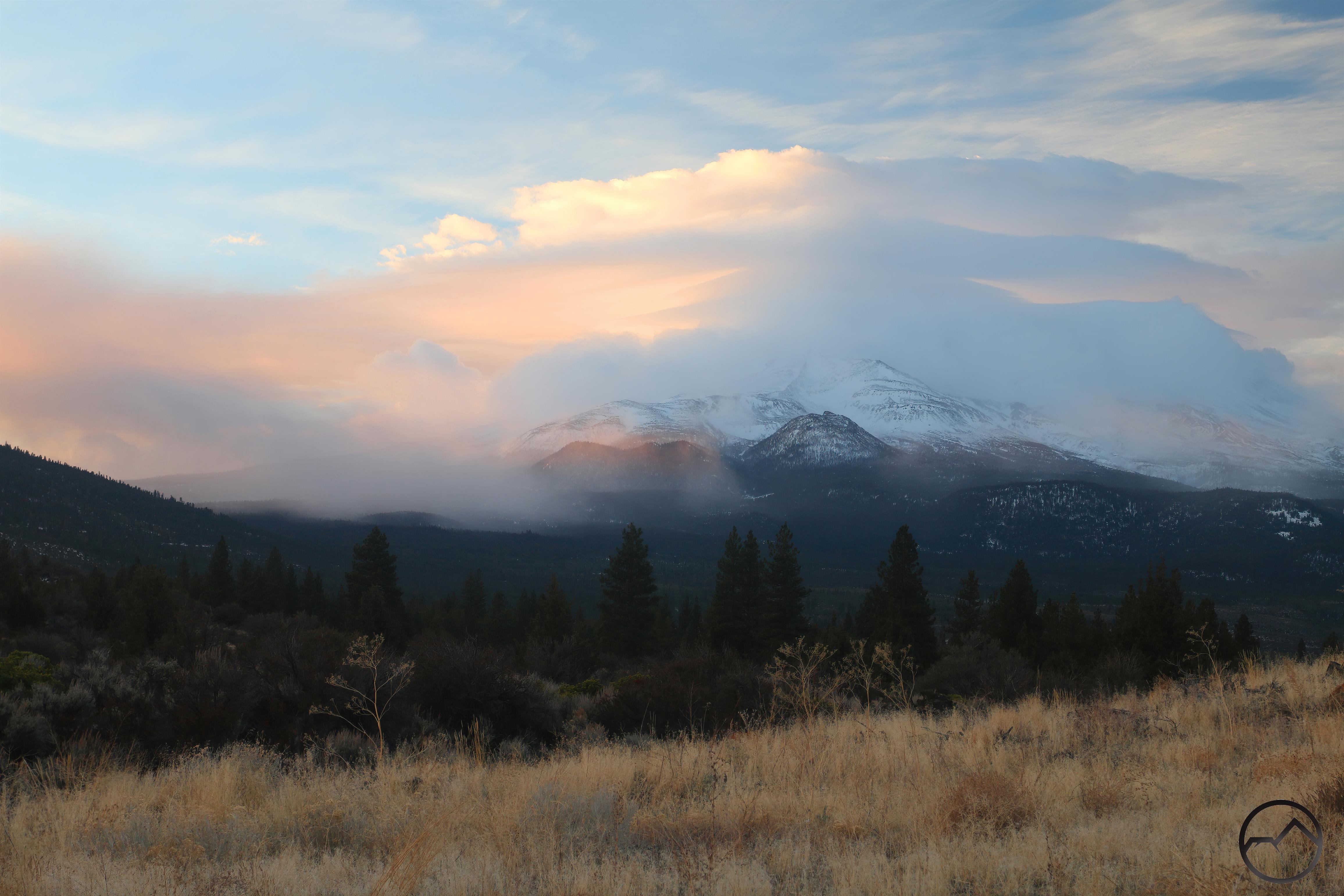
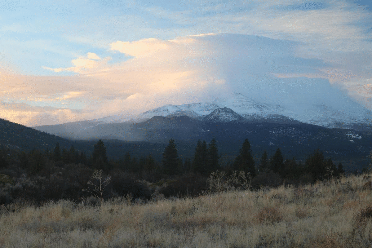
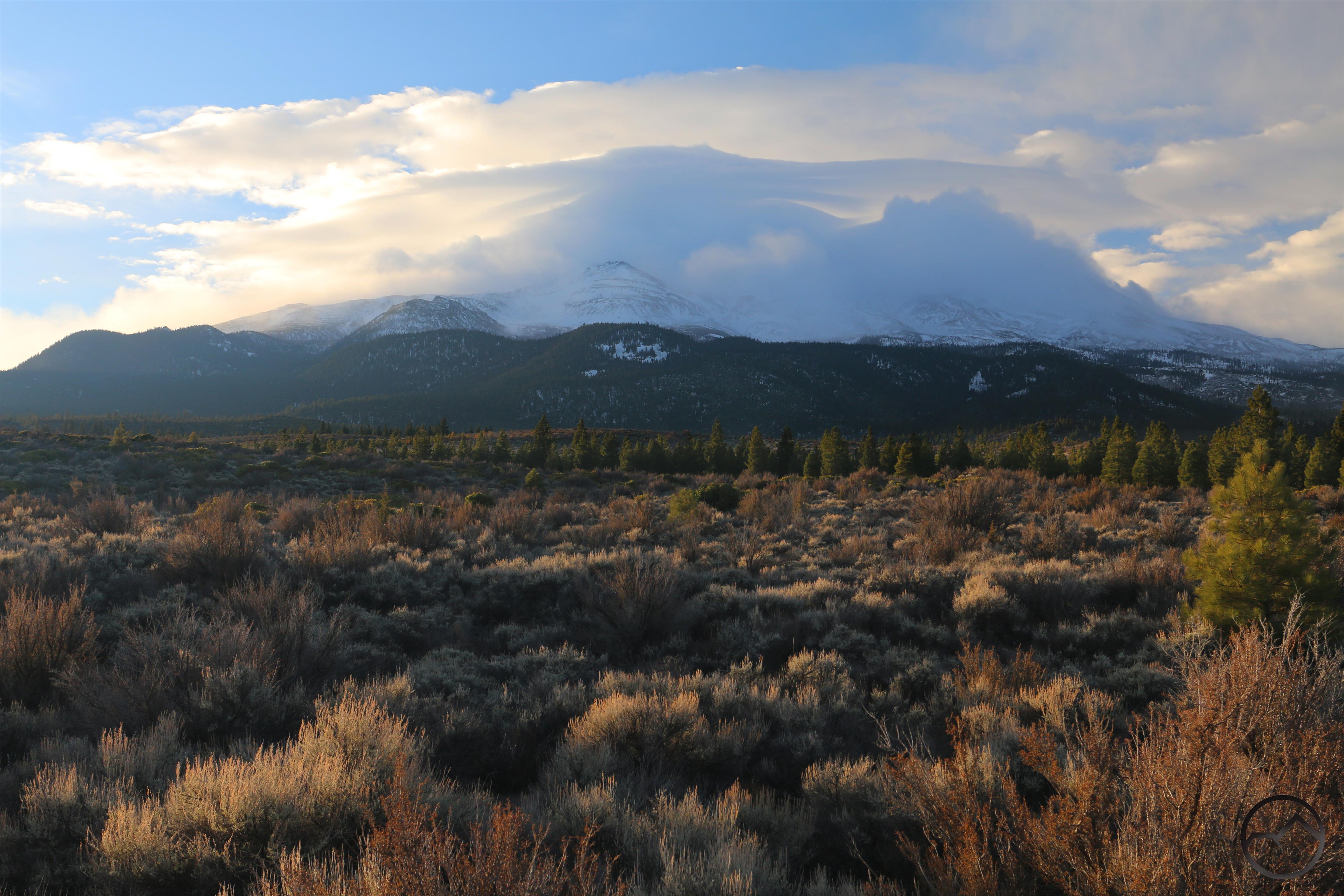
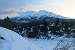
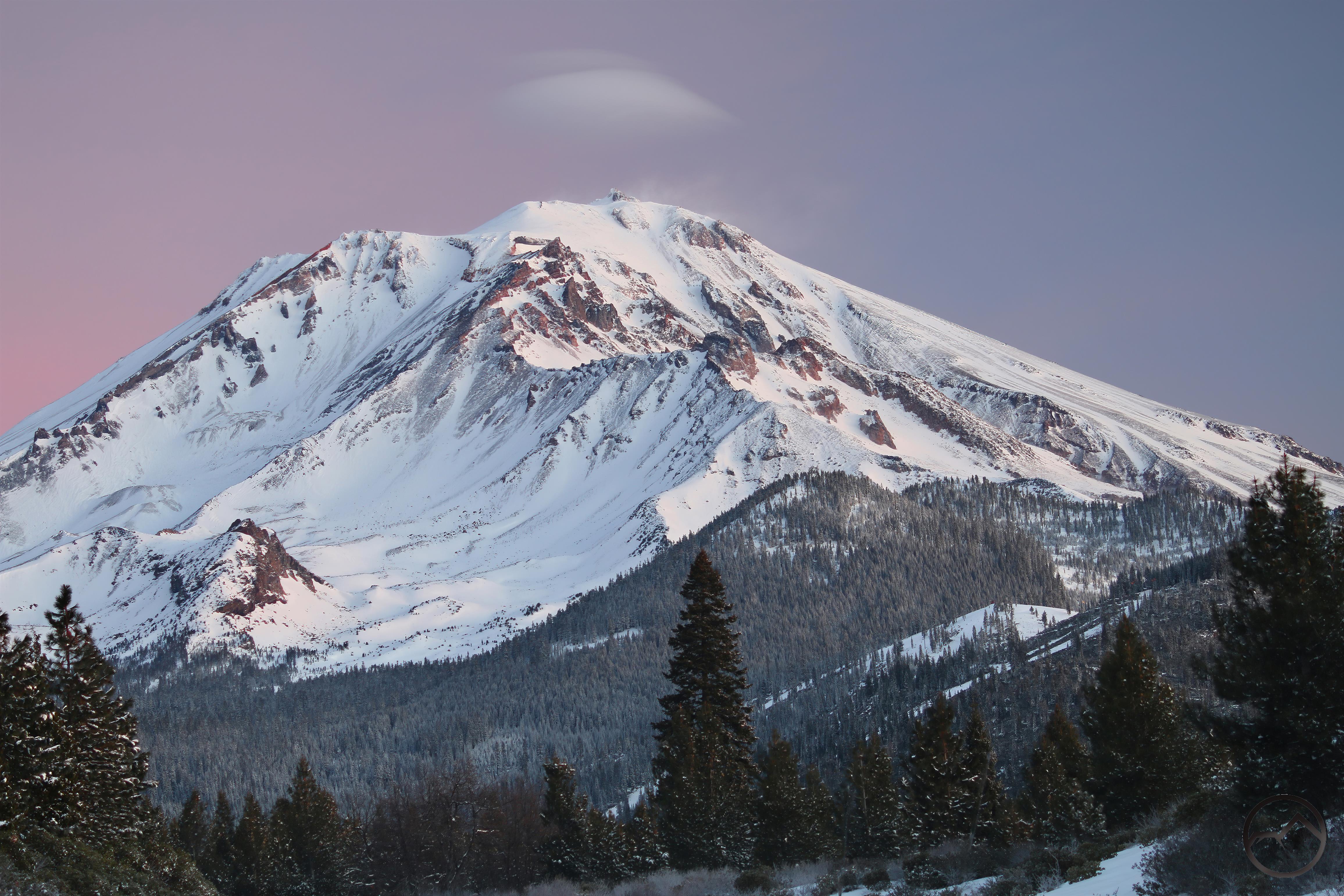
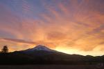
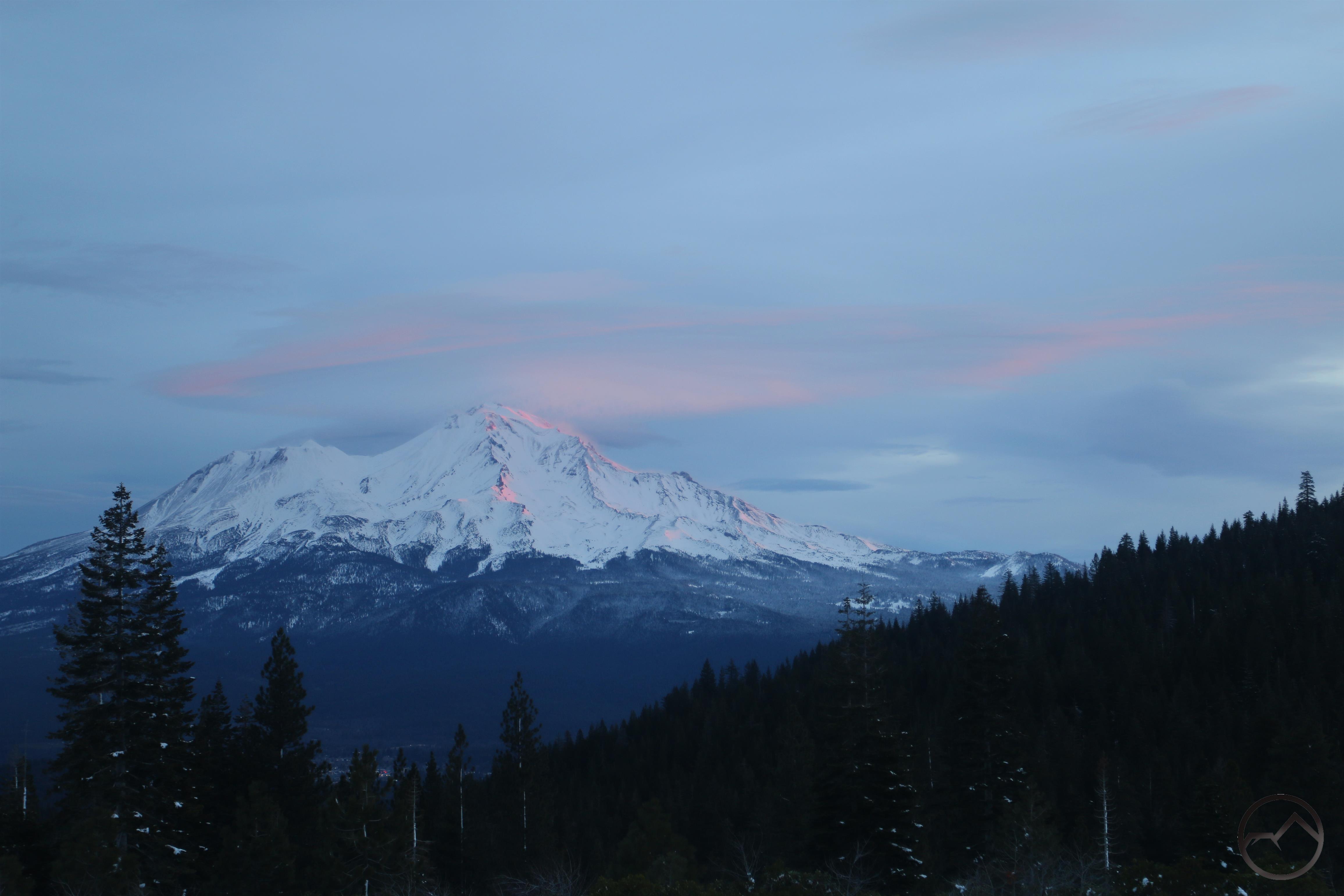
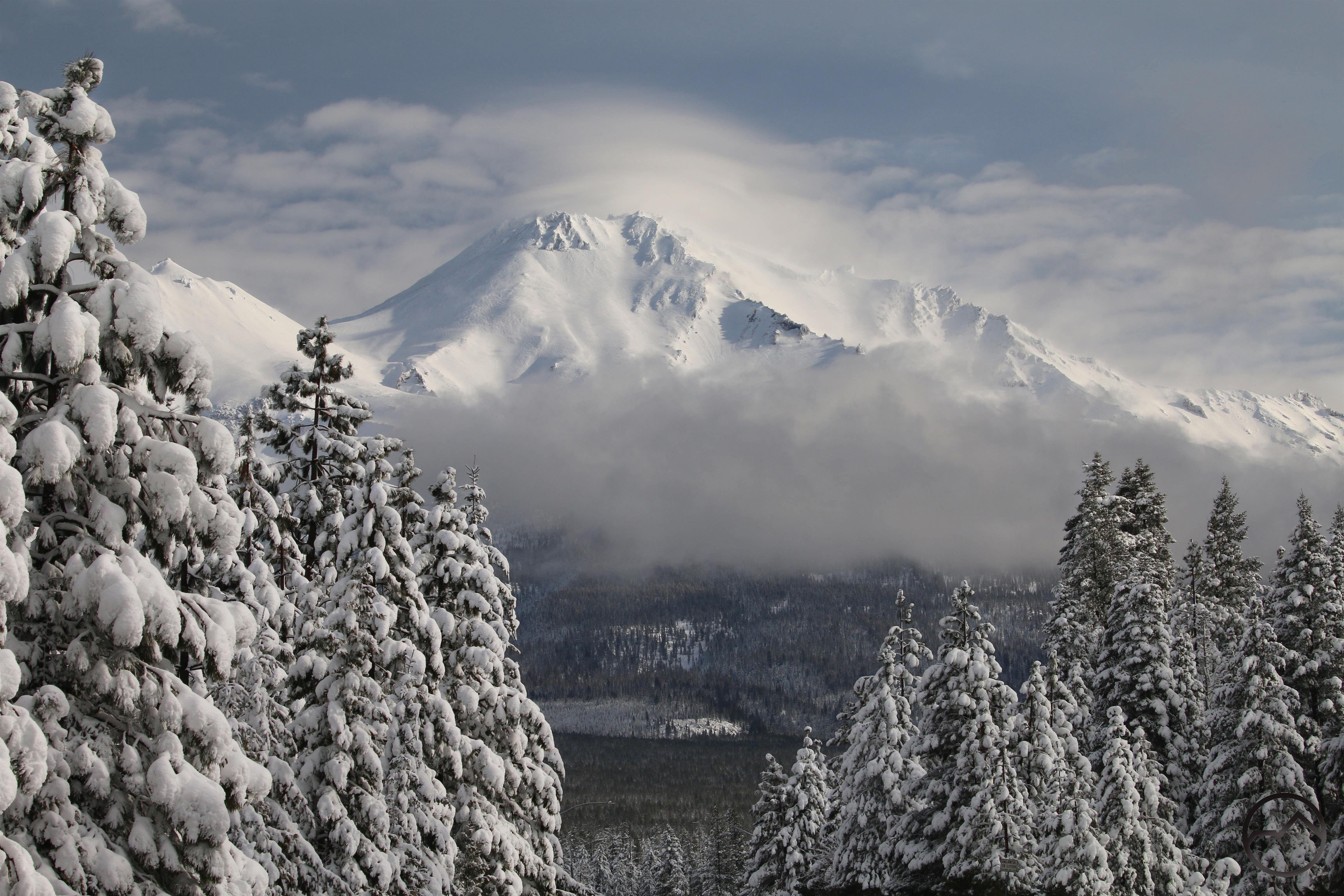
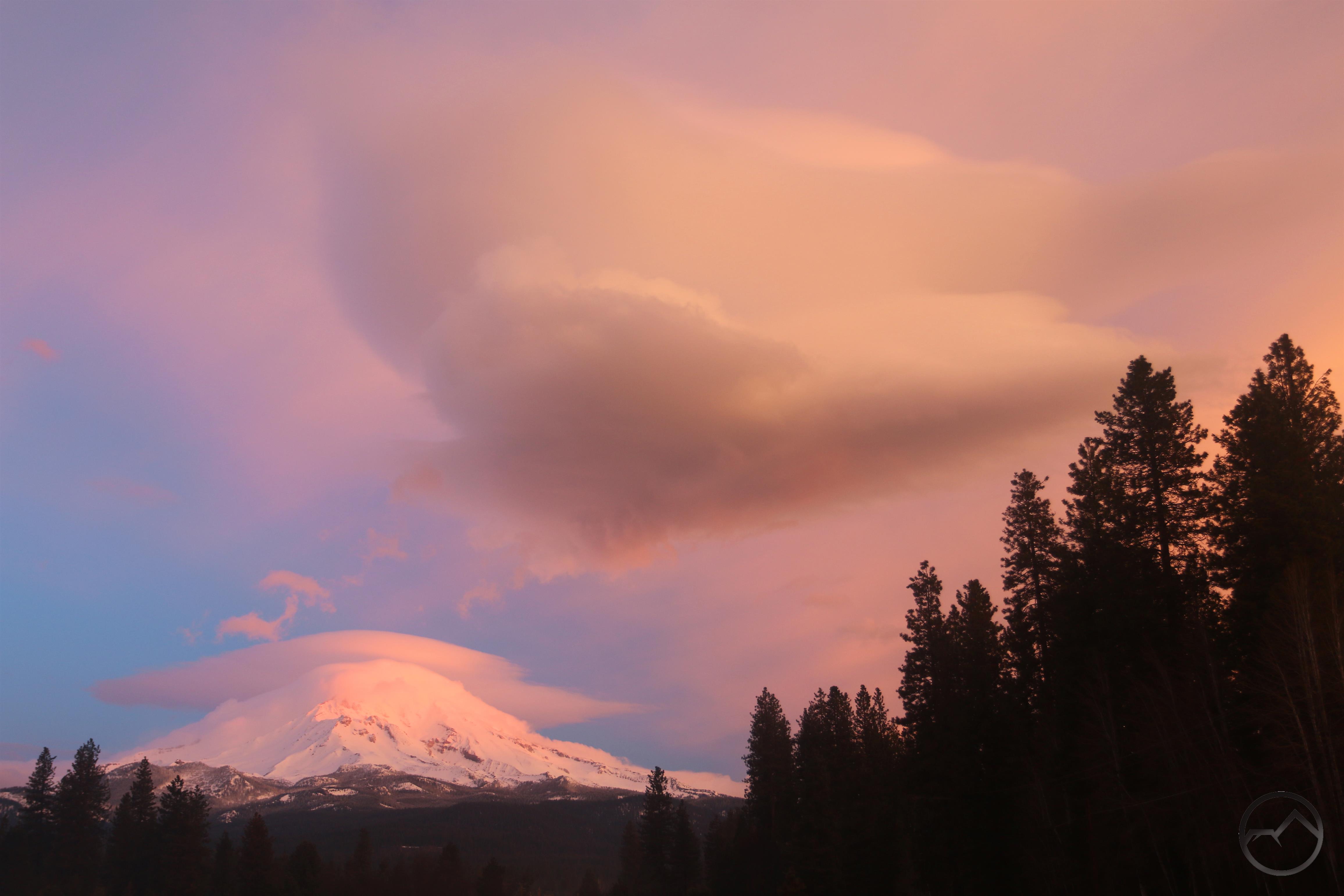
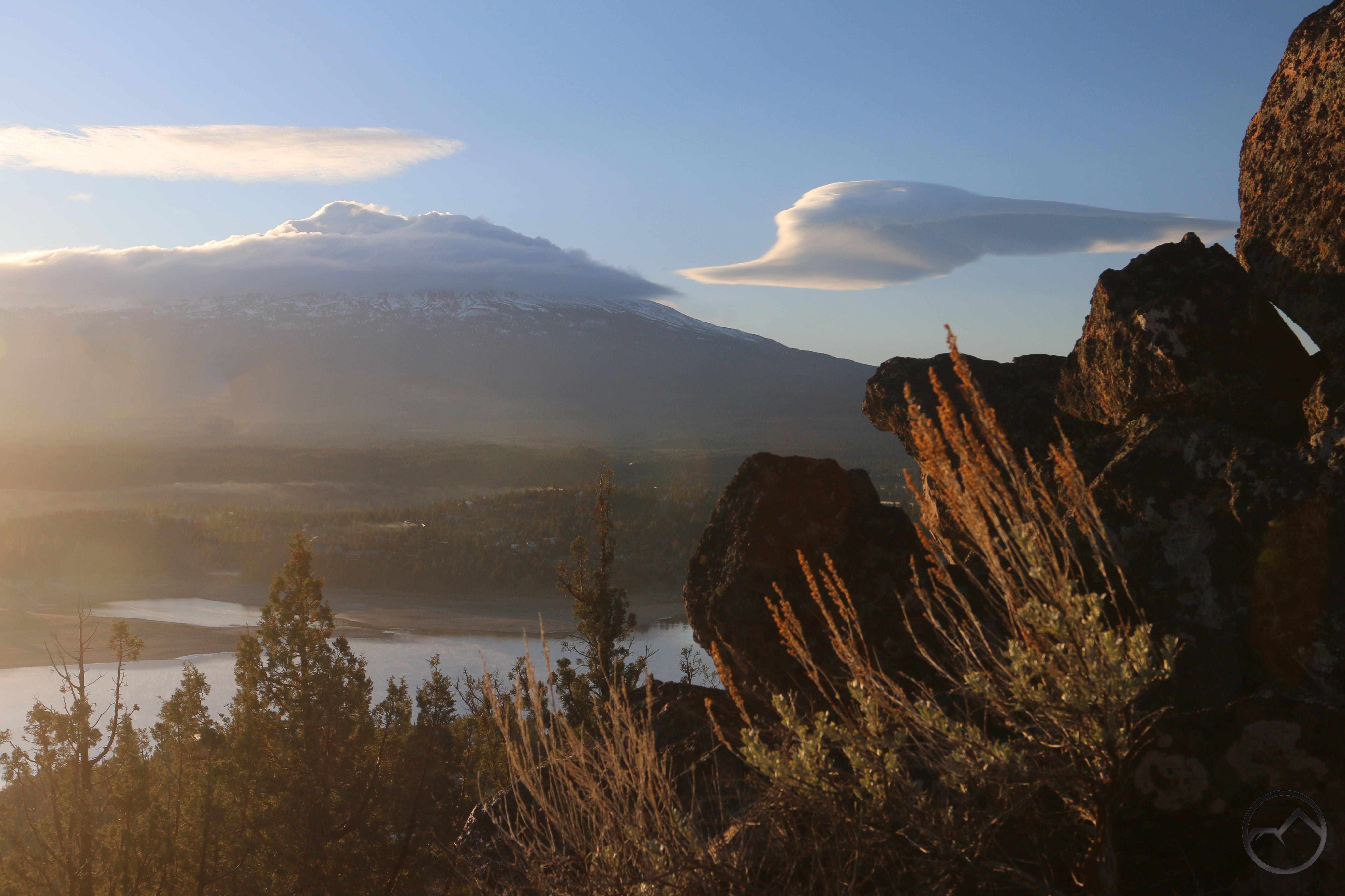
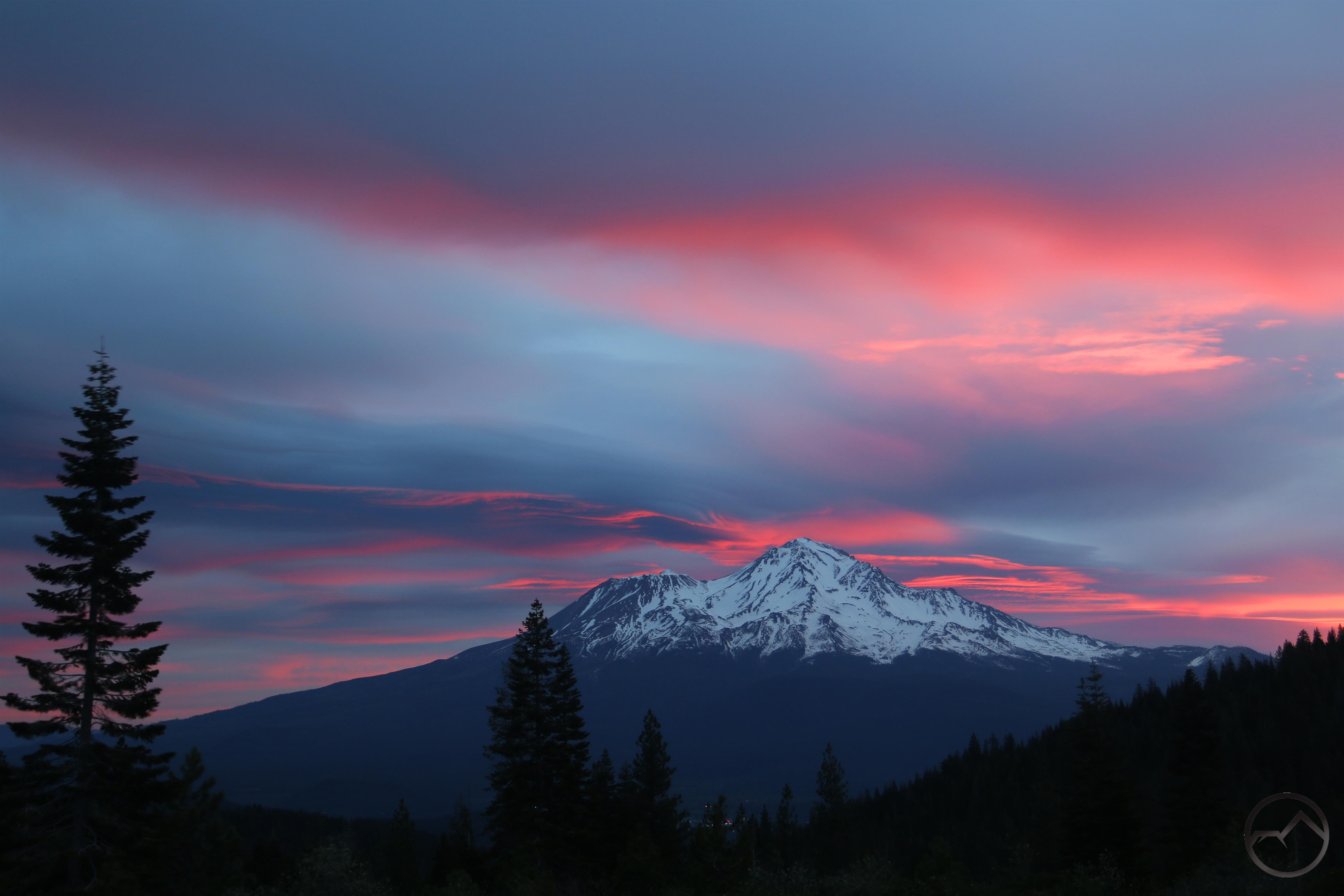
A trio of “lenticulish” clouds surround Mount Shasta on a cold and beautiful morning.

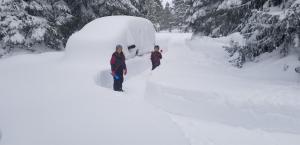
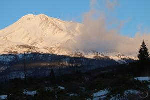
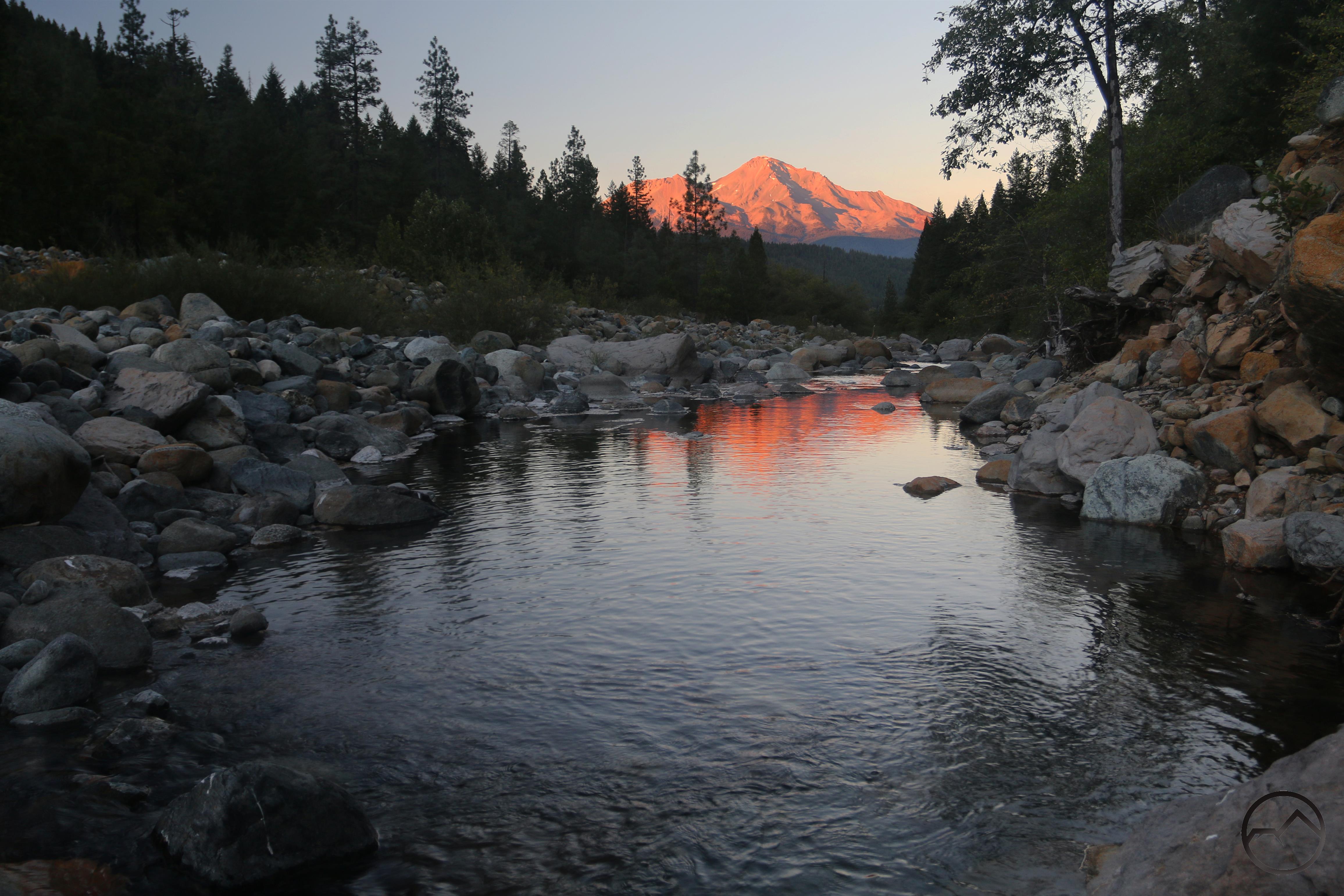
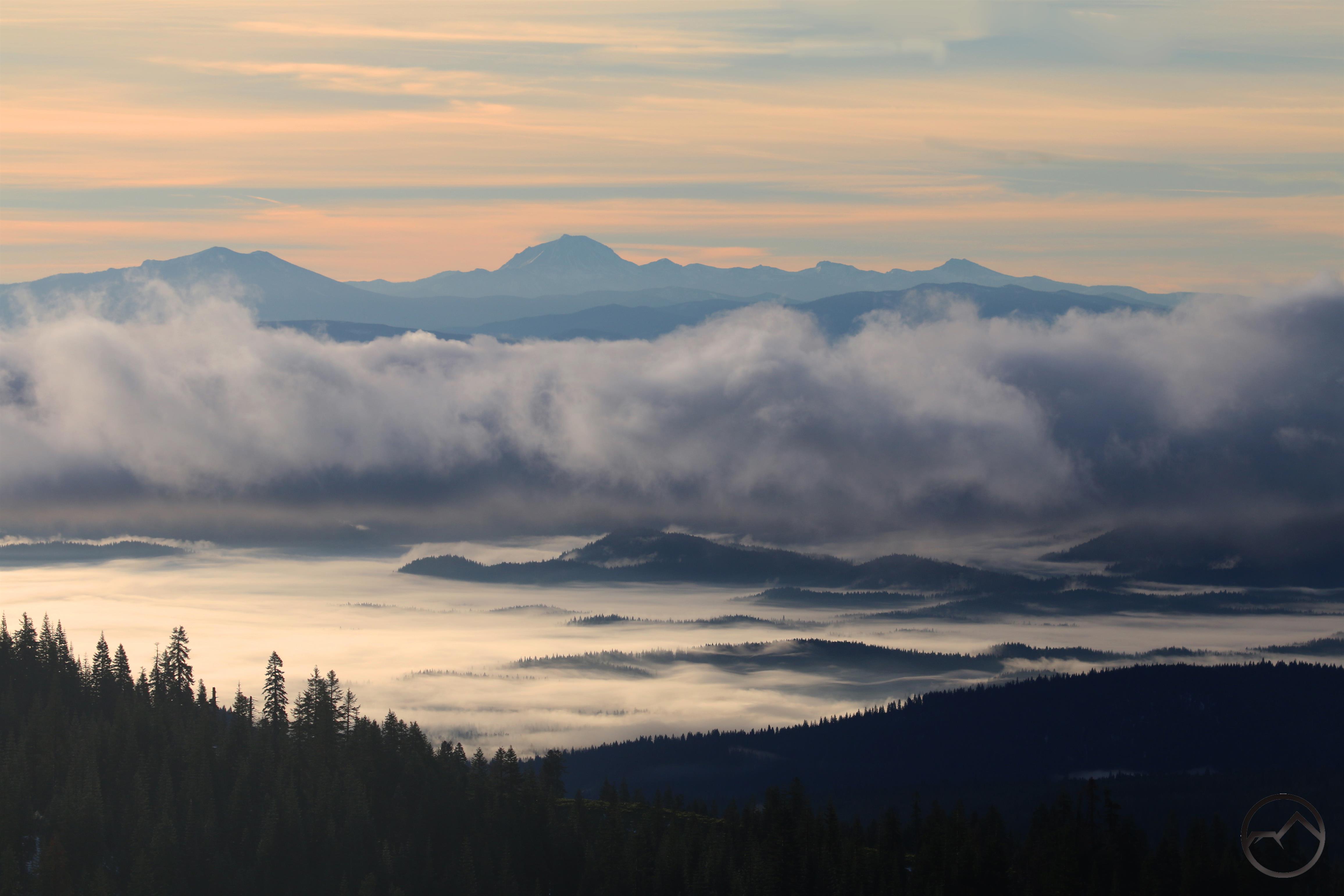
The last few days have been busy for me and I wasn’t able to get out during the weekend as much as I wanted to. However, I was at times able to get out on the margins and still catch some sunrises, sunsets and do a little investigation in anticipation of one of my spring exploration projects. I submit these images humbly, stating upfront that there is no consistent theme to all of these images other than to show conditions around Mount Shasta over the last few days.


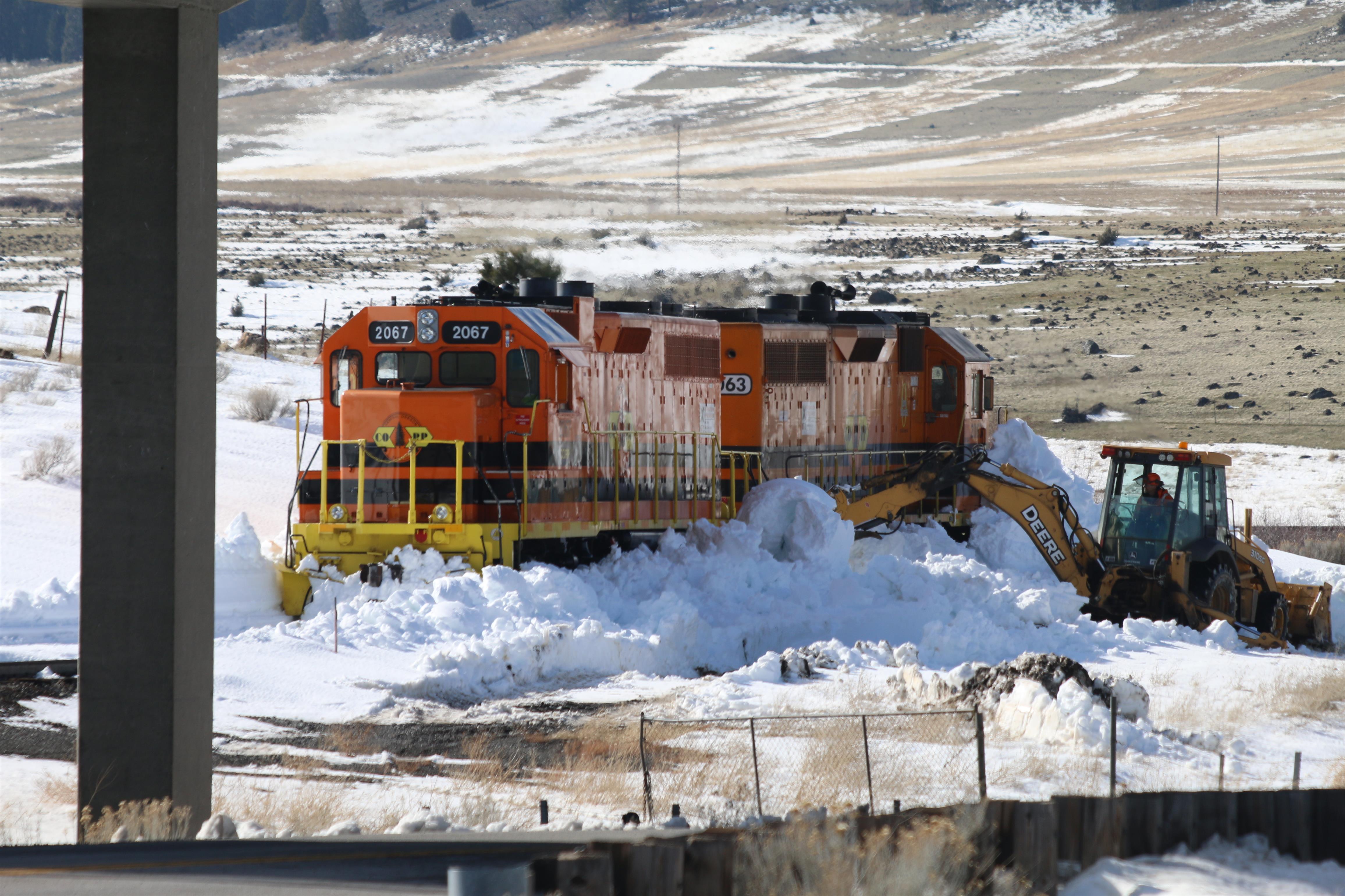
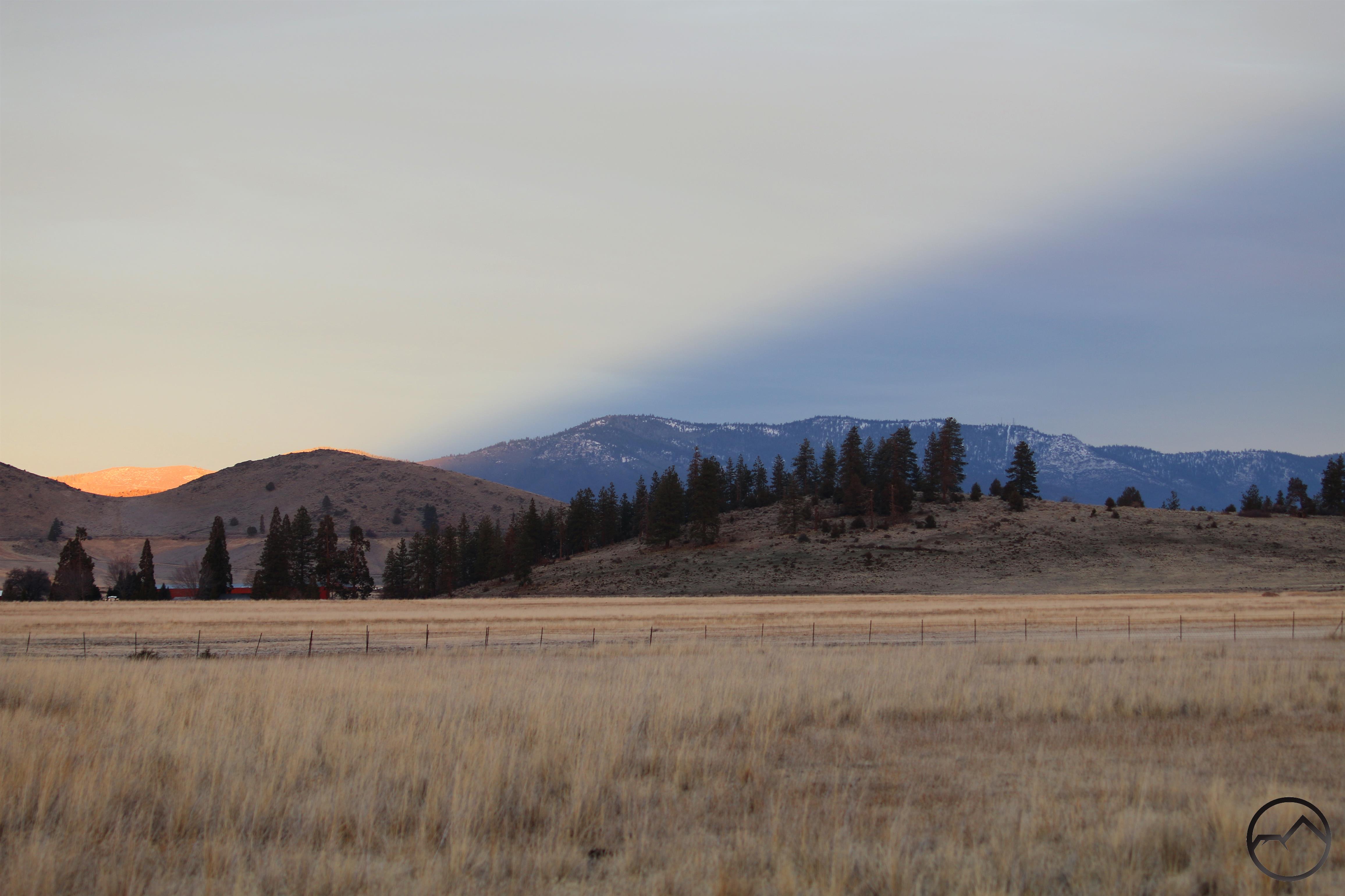
Firstly, I am quite pleased to find that the puddles in the Shasta Valley have finally returned! They were last present in the late winter and spring of 2019 but the weak winter a year later meant there were no puddles through 2020. Thankfully the hefty storm that sailed through in January of 2021 was sufficient to recharge the puddles and they seem to have some staying power for the time being. More precipitation will only serve to replenish the aquifer further and help them last deeper into the spring.


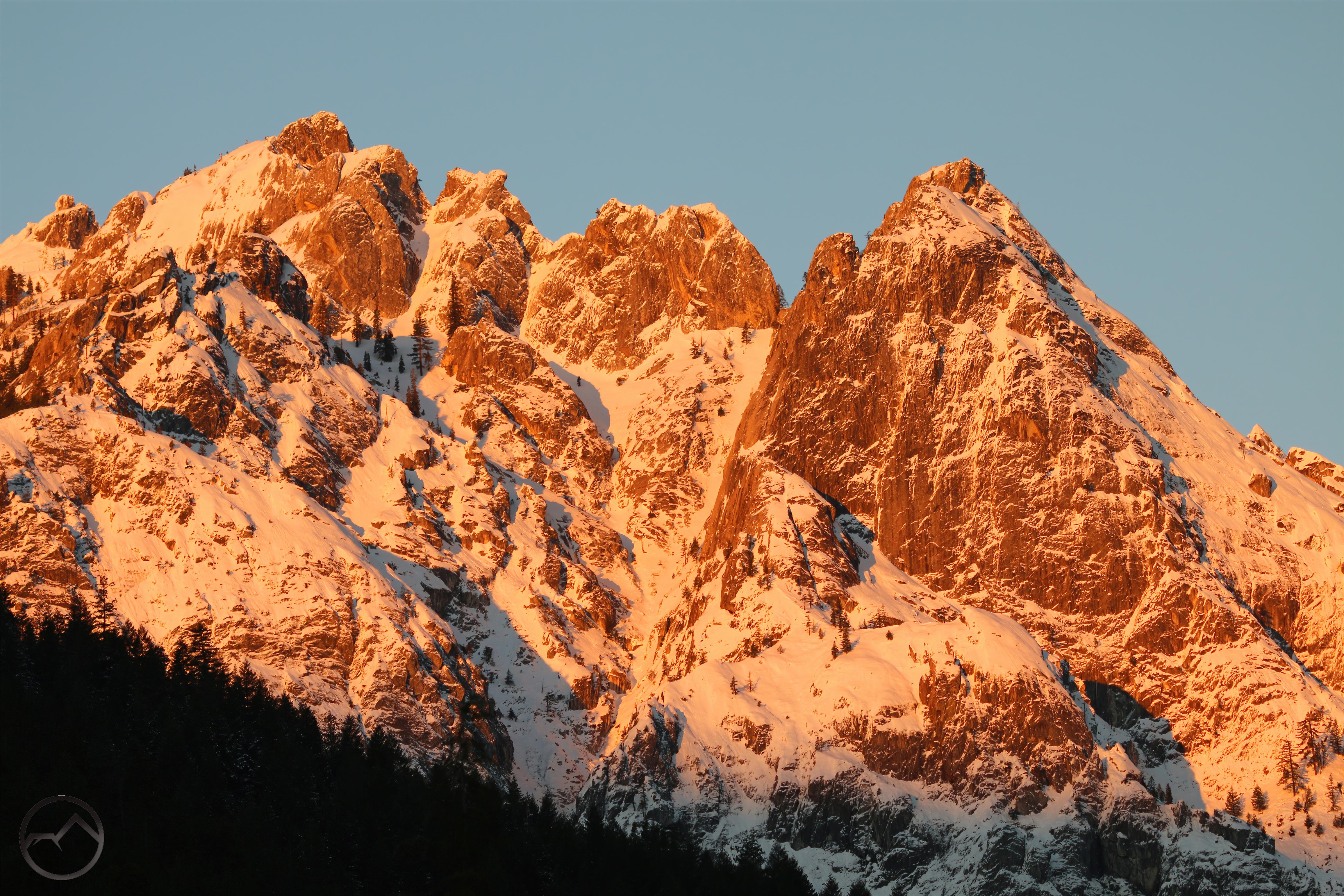
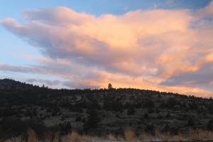
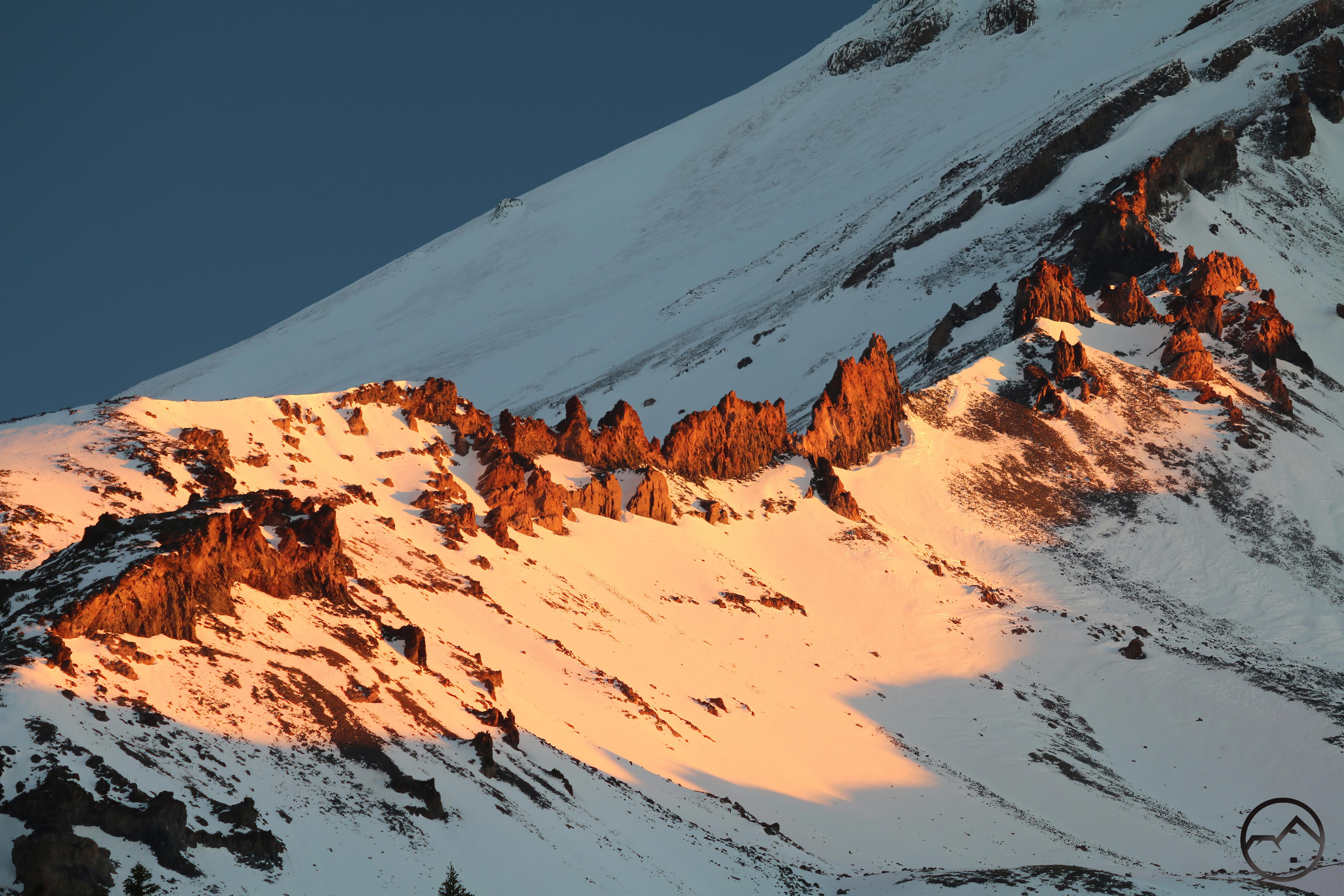
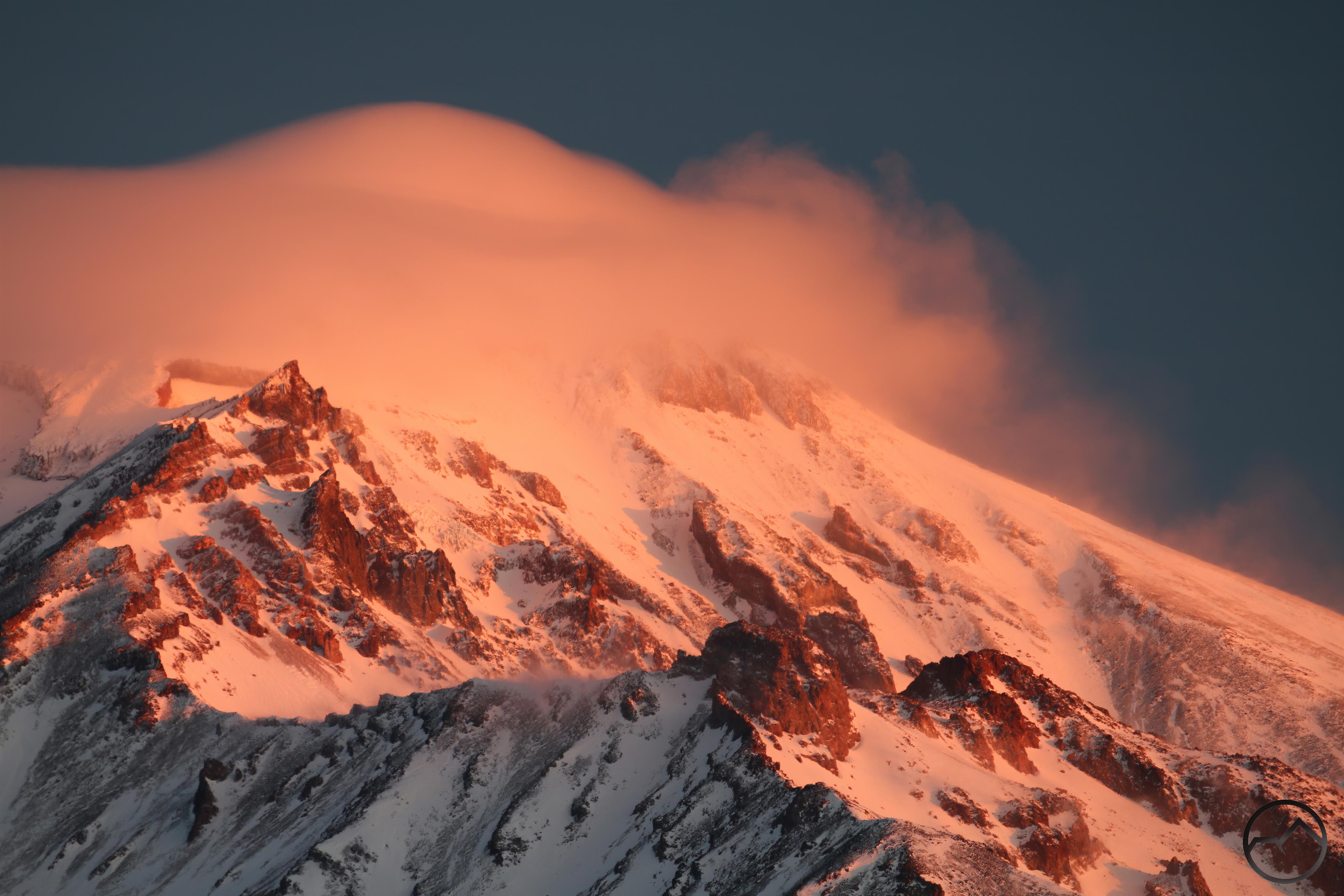
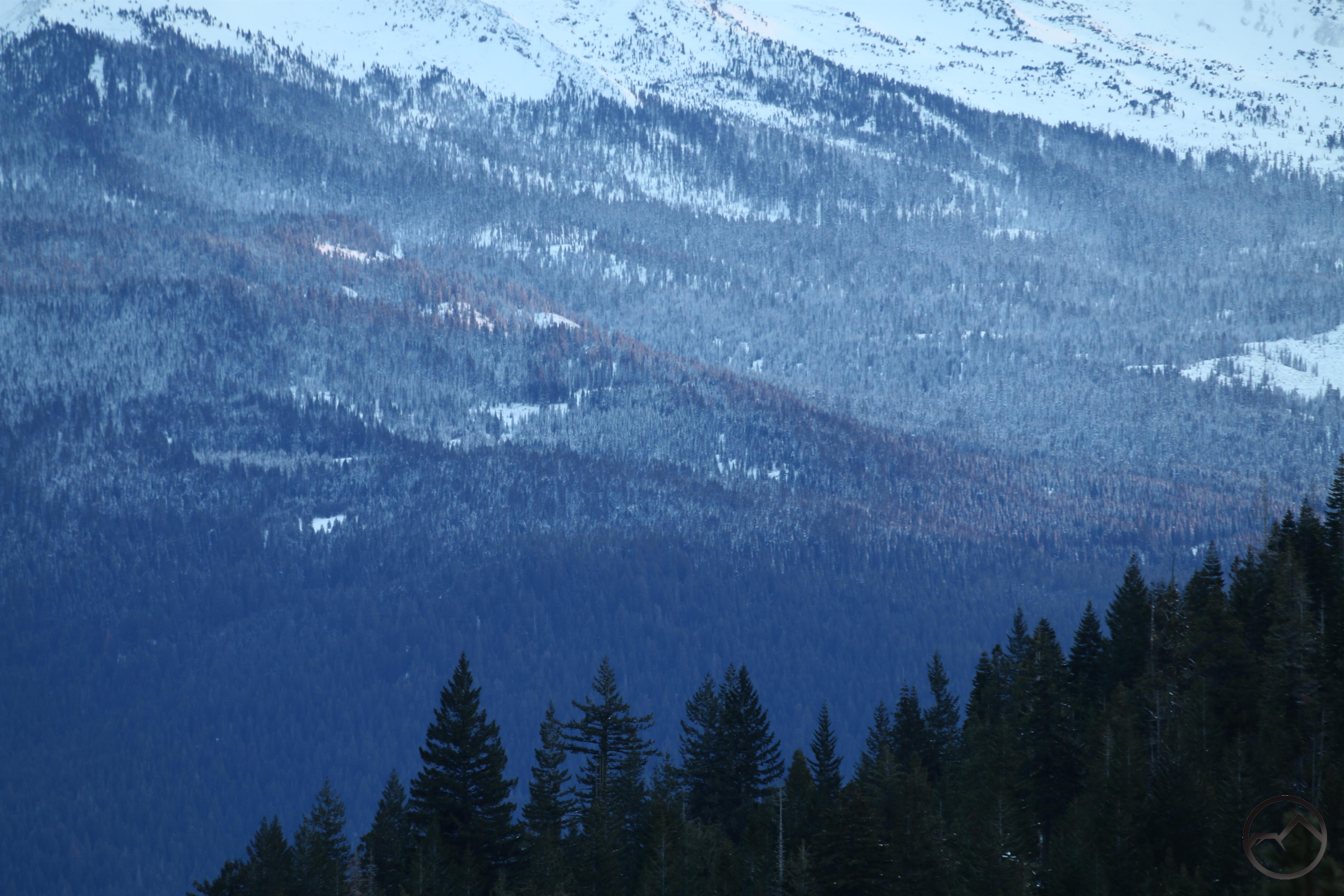
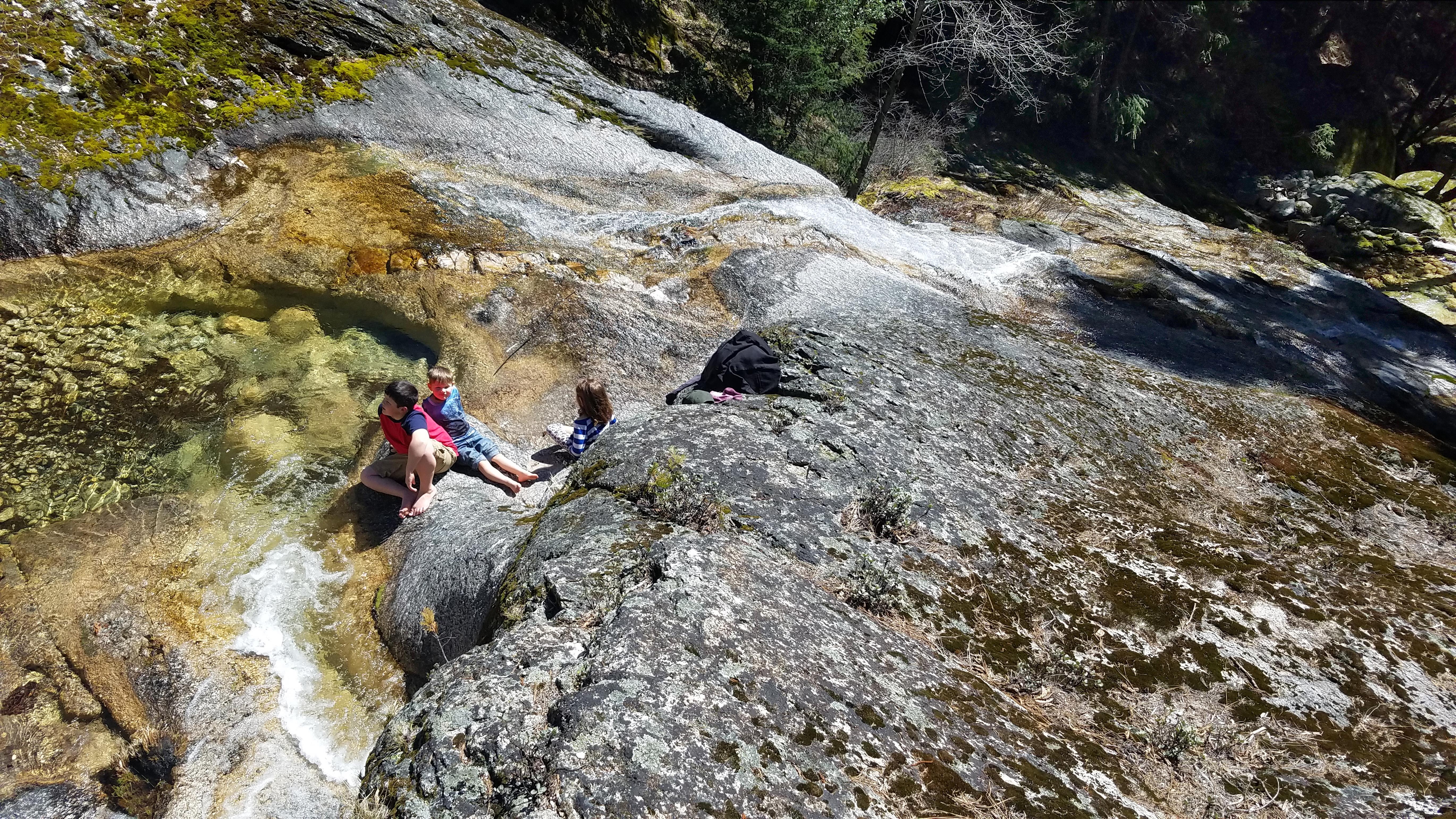
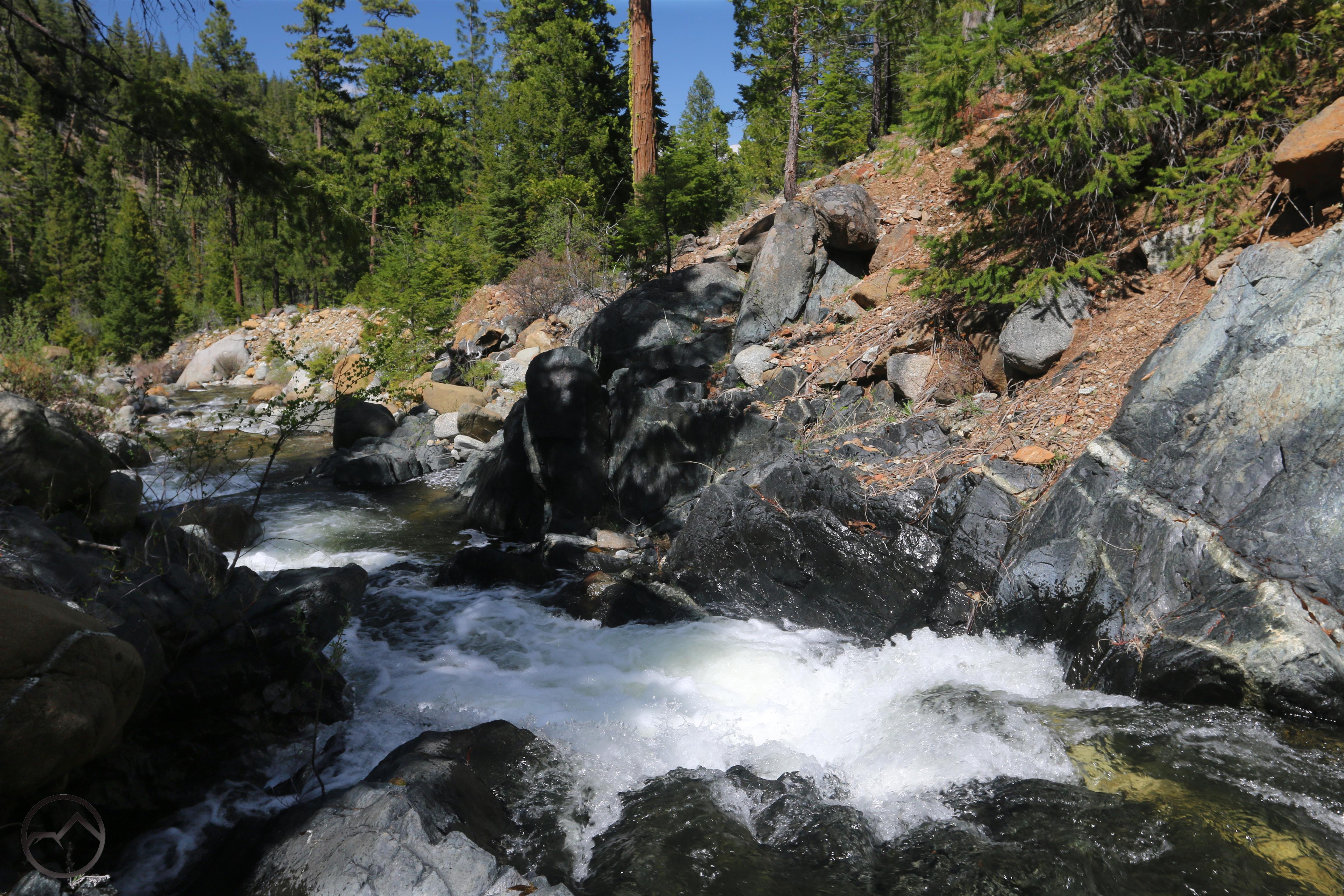
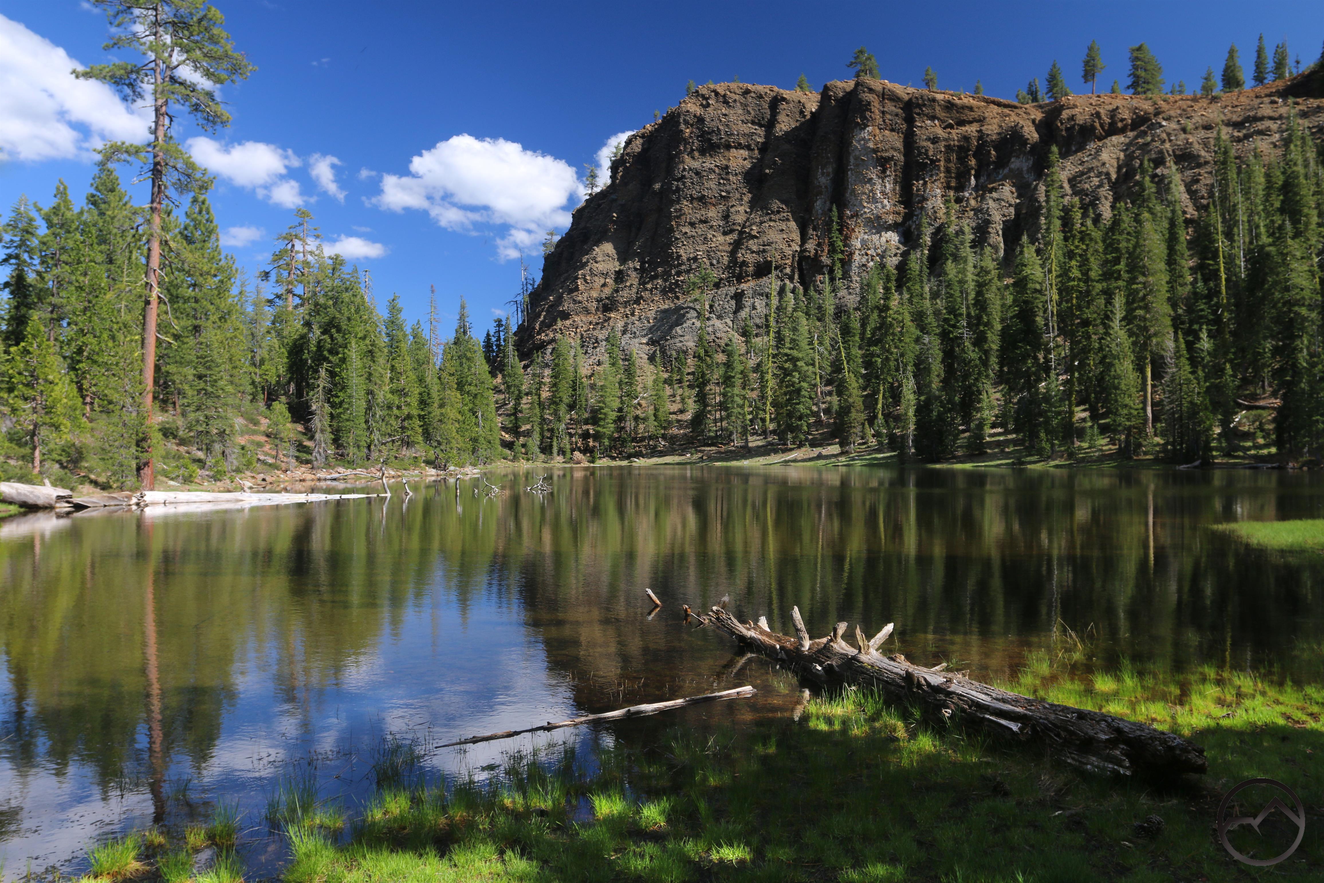
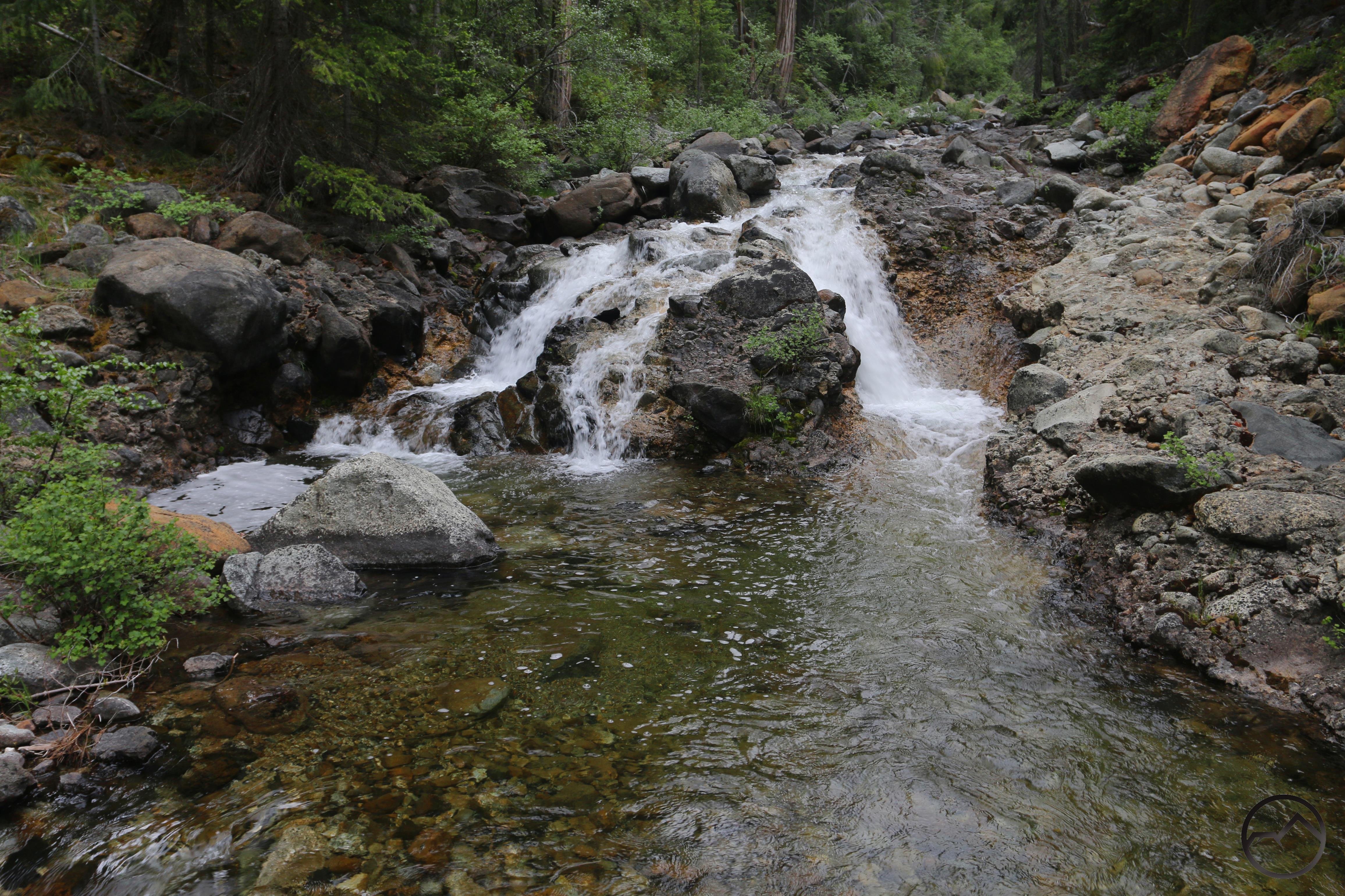
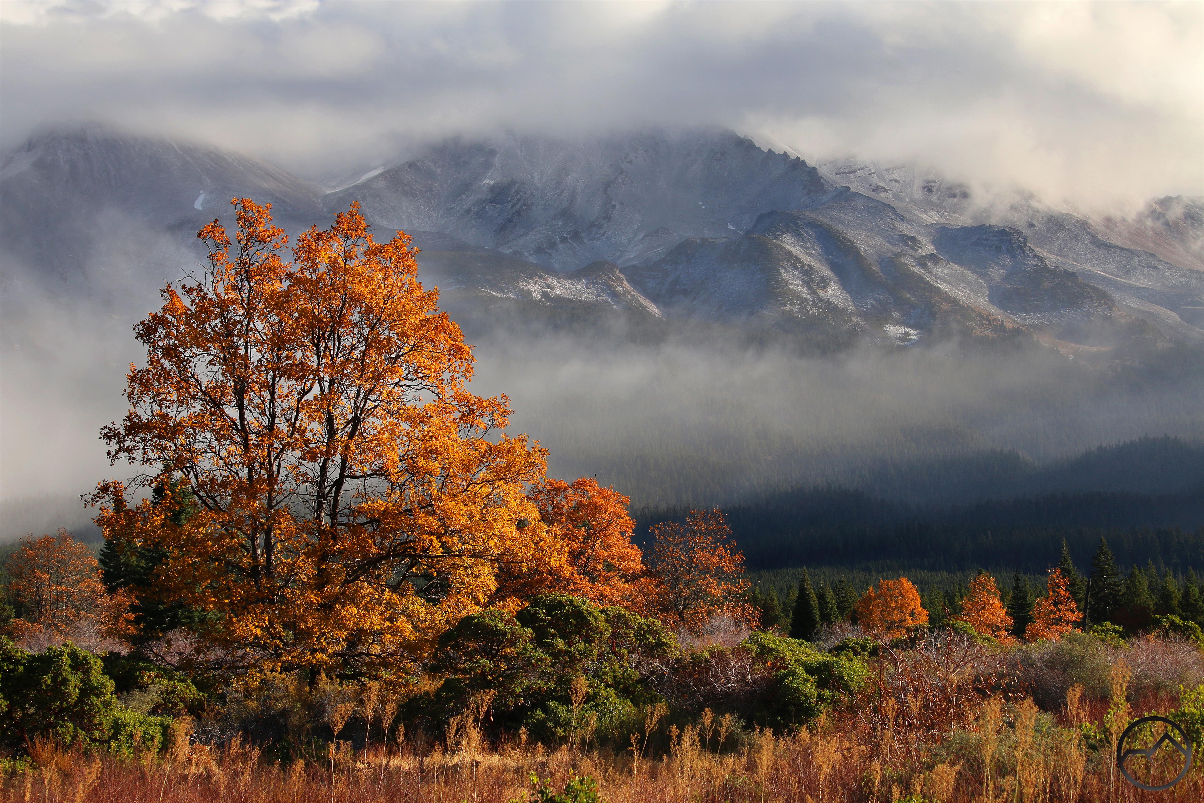
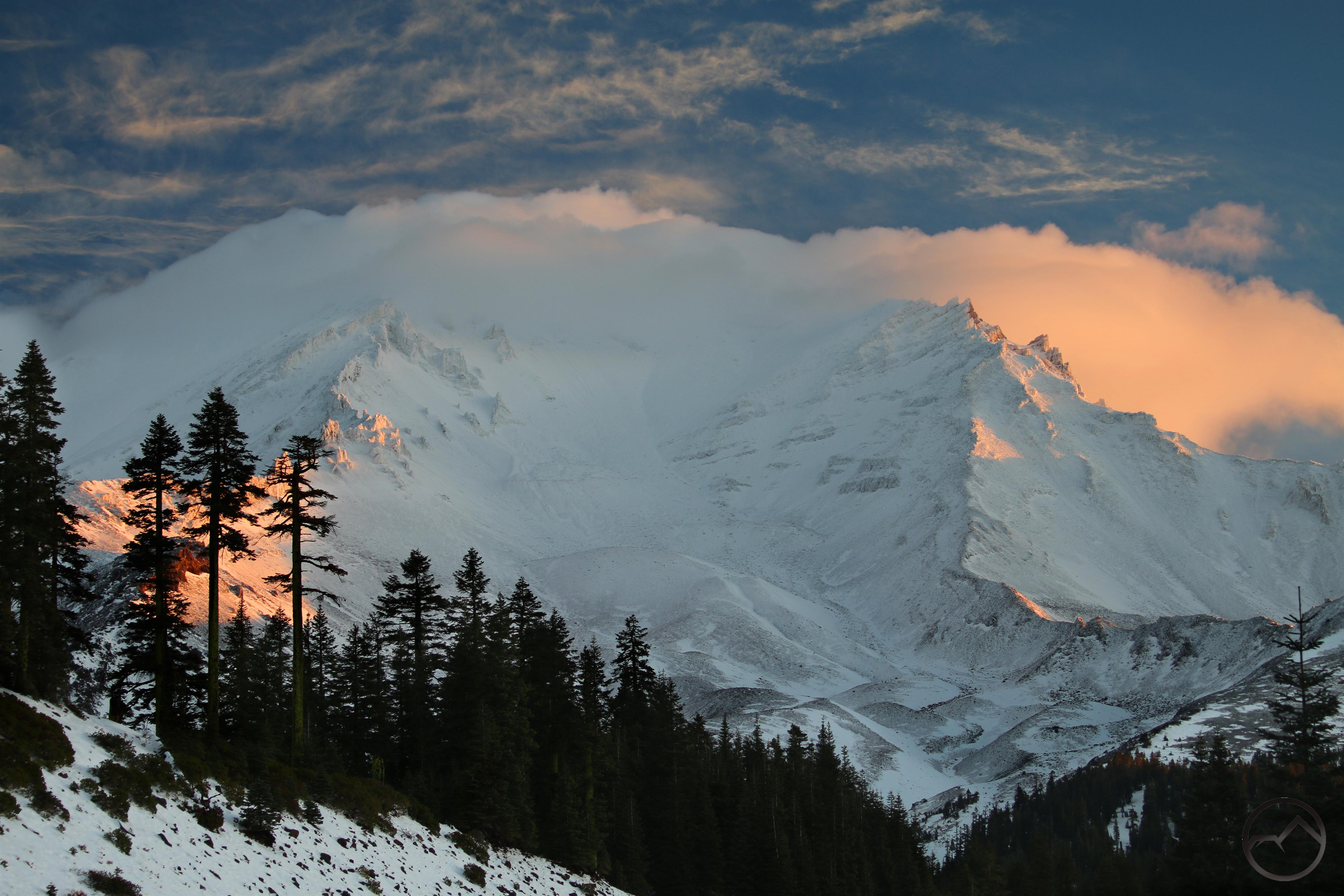
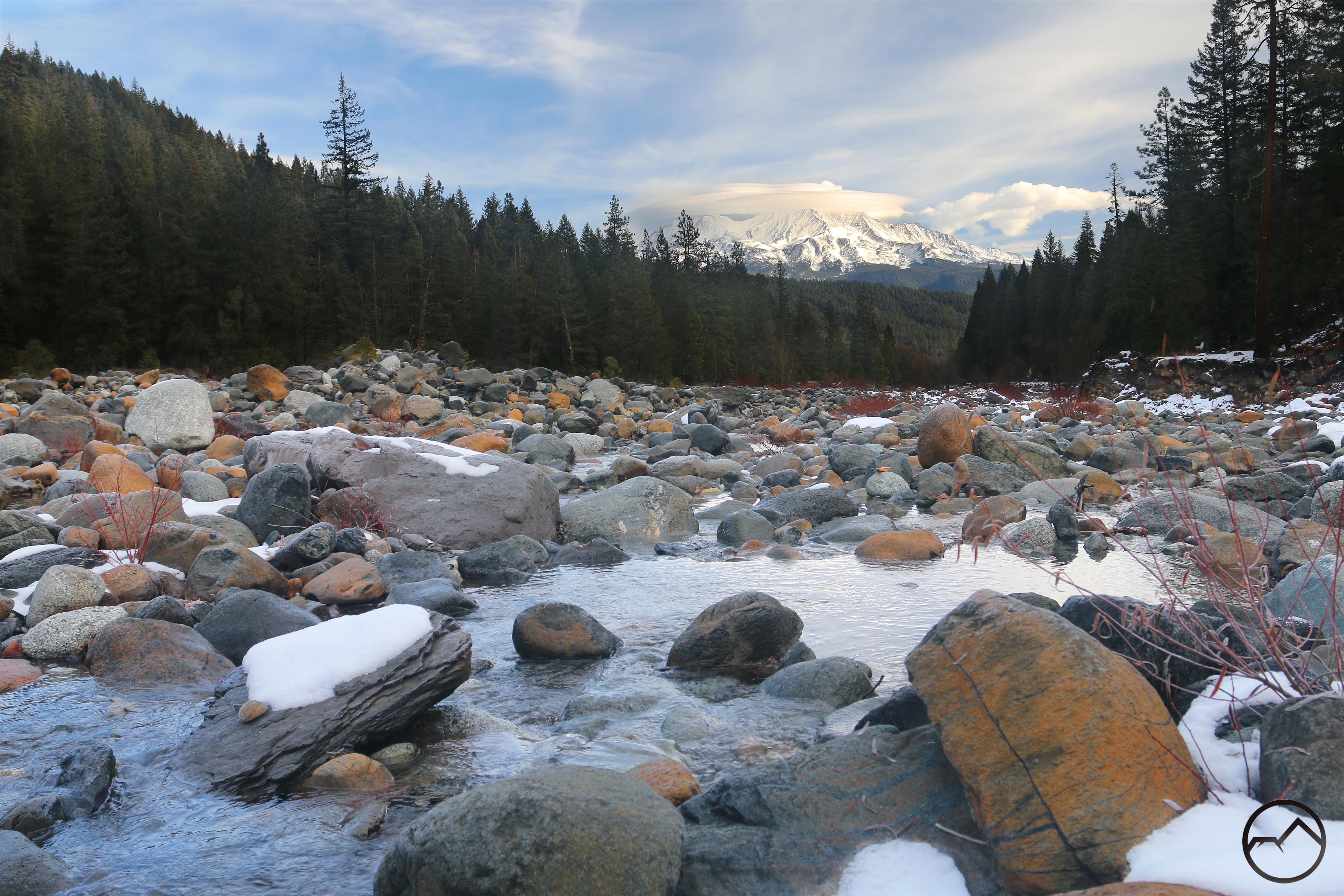
I have some significant explorations planned for this spring in the Little Castle Creek drainage. I have been doing some preliminary investigations to that end lately. On one early morning outing I was there in time for sunrise on the Castle Crags. This particular cliff it called Triple Top, and it towers 2,000 feet over Little Castle Creek. It still shocks me that such incredible features remain almost totally anonymous.

The crags mirror their distant cousins, the Sierra Nevada and reflect the light beautifully. John Muir said of the Sierra Nevada:

“Looking eastward from the summit of Pacheco Pass one shining morning, a landscape was displayed that after all my wanderings still appears as the most beautiful I have ever beheld. At my feet lay the Great Central Valley of California, level and flowery, like a lake of pure sunshine … And from the eastern boundary of this vast golden flower-bed rose the mighty Sierra, miles in height, and so gloriously colored and so radiant, it seemed not clothed with light but wholly composed of it, like the wall of some celestial city…. Then it seemed to me that the Sierra should be called, not the Nevada or Snowy Range, but the Range of Light. And after ten years of wandering and wondering in the heart of it, rejoicing in its glorious floods of light, the white beams of the morning streaming through the passes, the noonday radiance on the crystal rocks, the flush of the alpenglow, and the irised spray of countless waterfalls, it still seems above all others the Range of Light.”

It seems to me, given the granite composition of the Castle Crags and their similarity and distant familial connection to the Sierra, that they too may be called the Crags of Light. Or maybe I am being a little too dramatic. I don’t know.


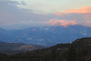
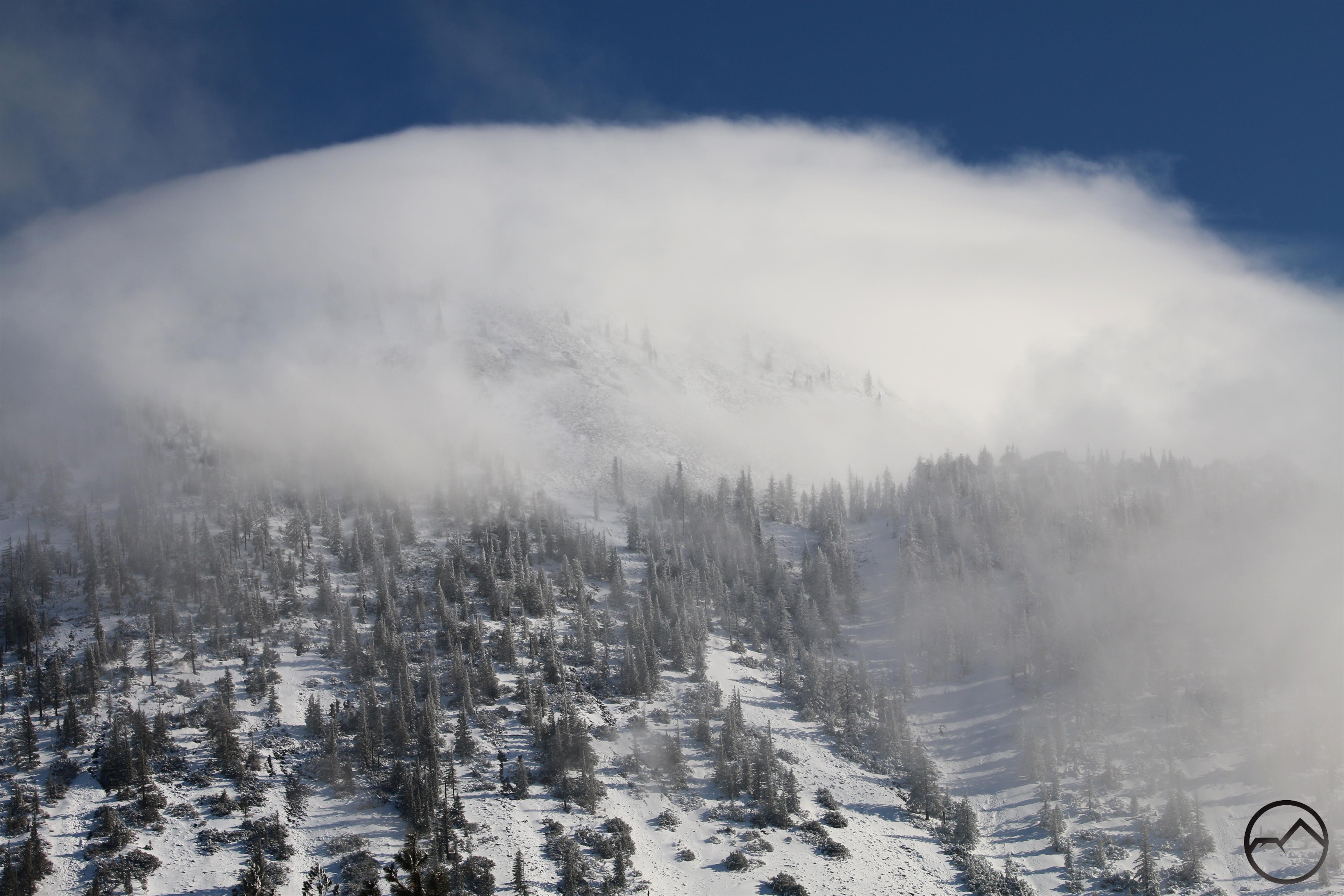
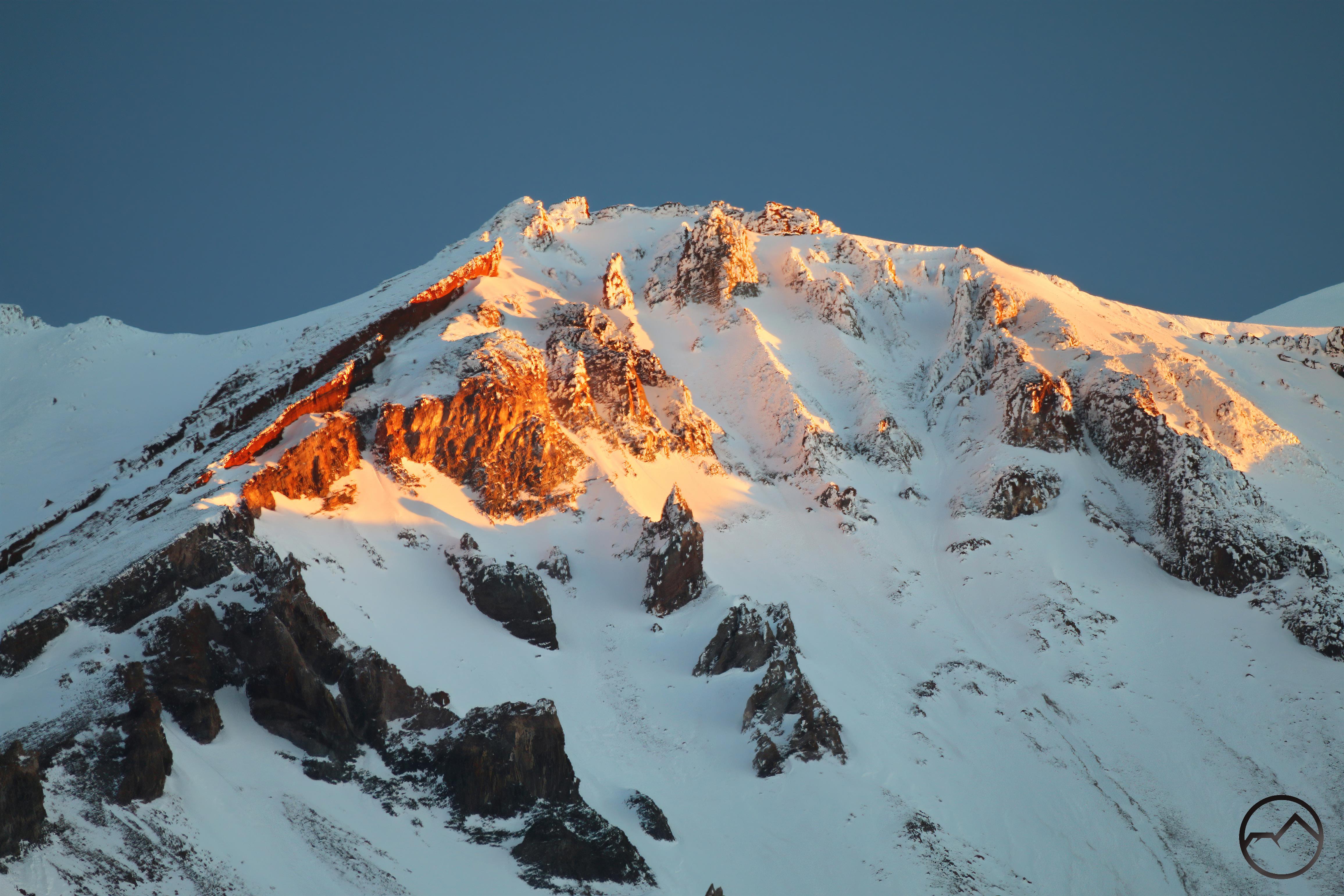
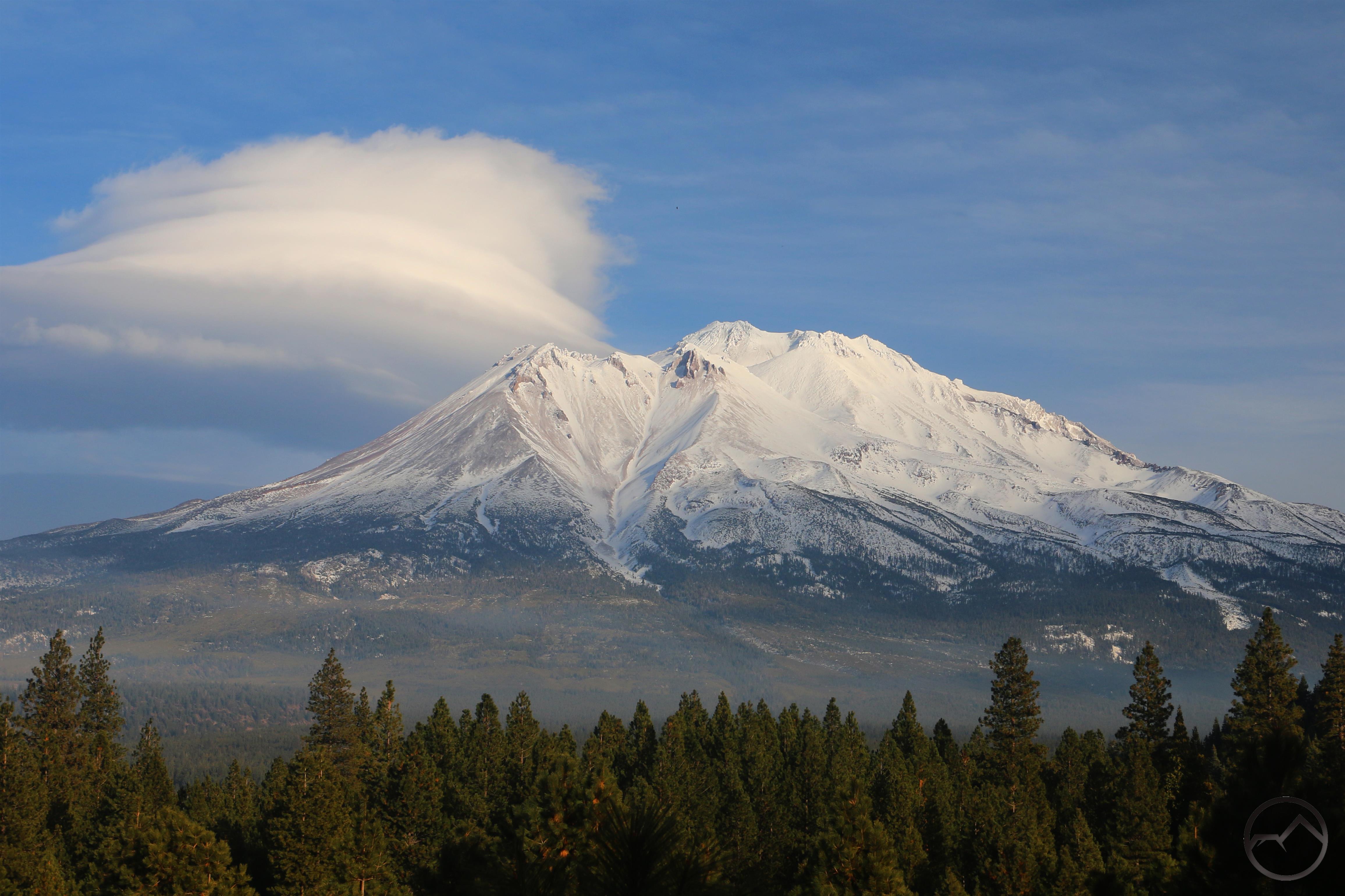
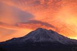
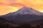
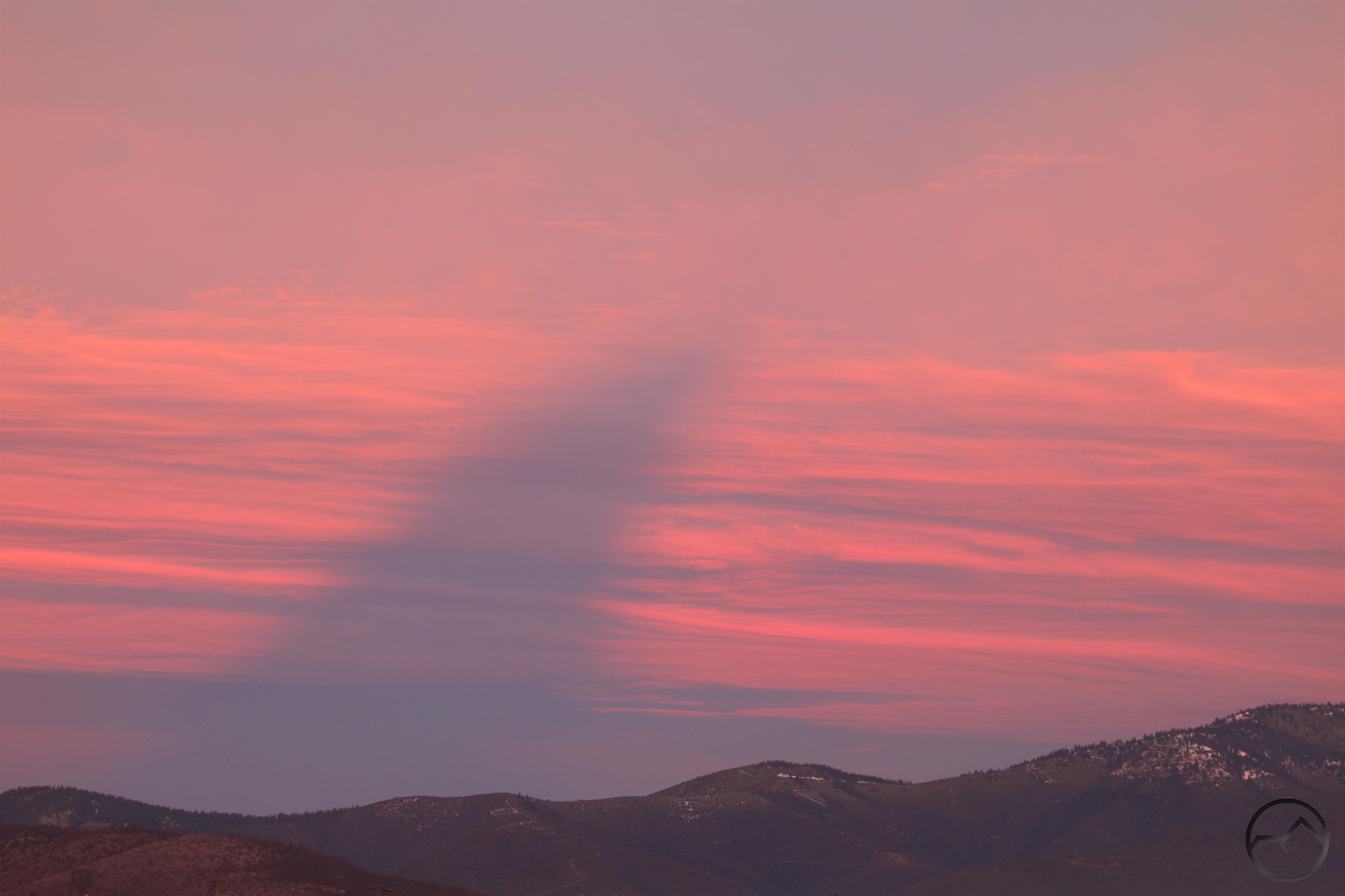
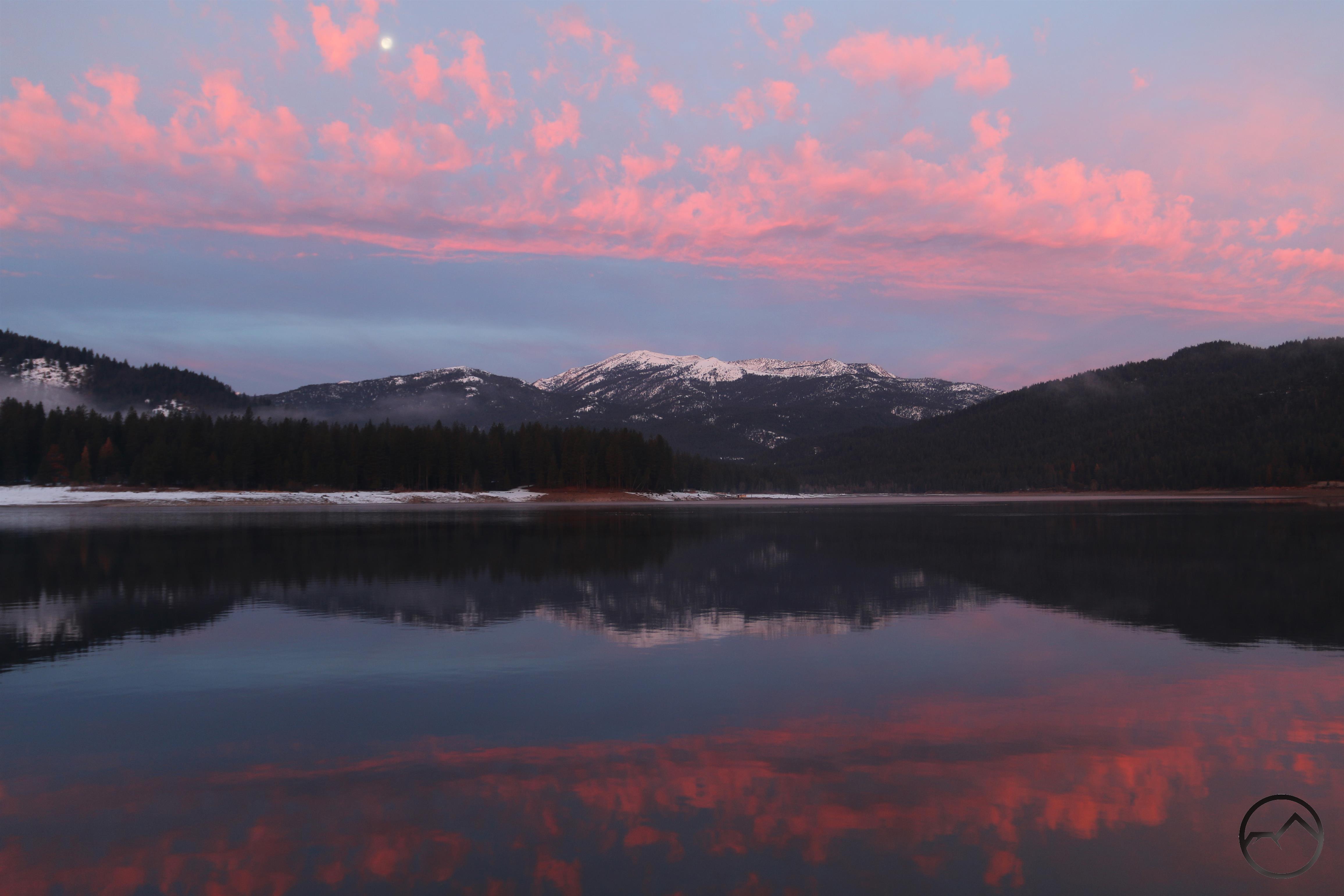
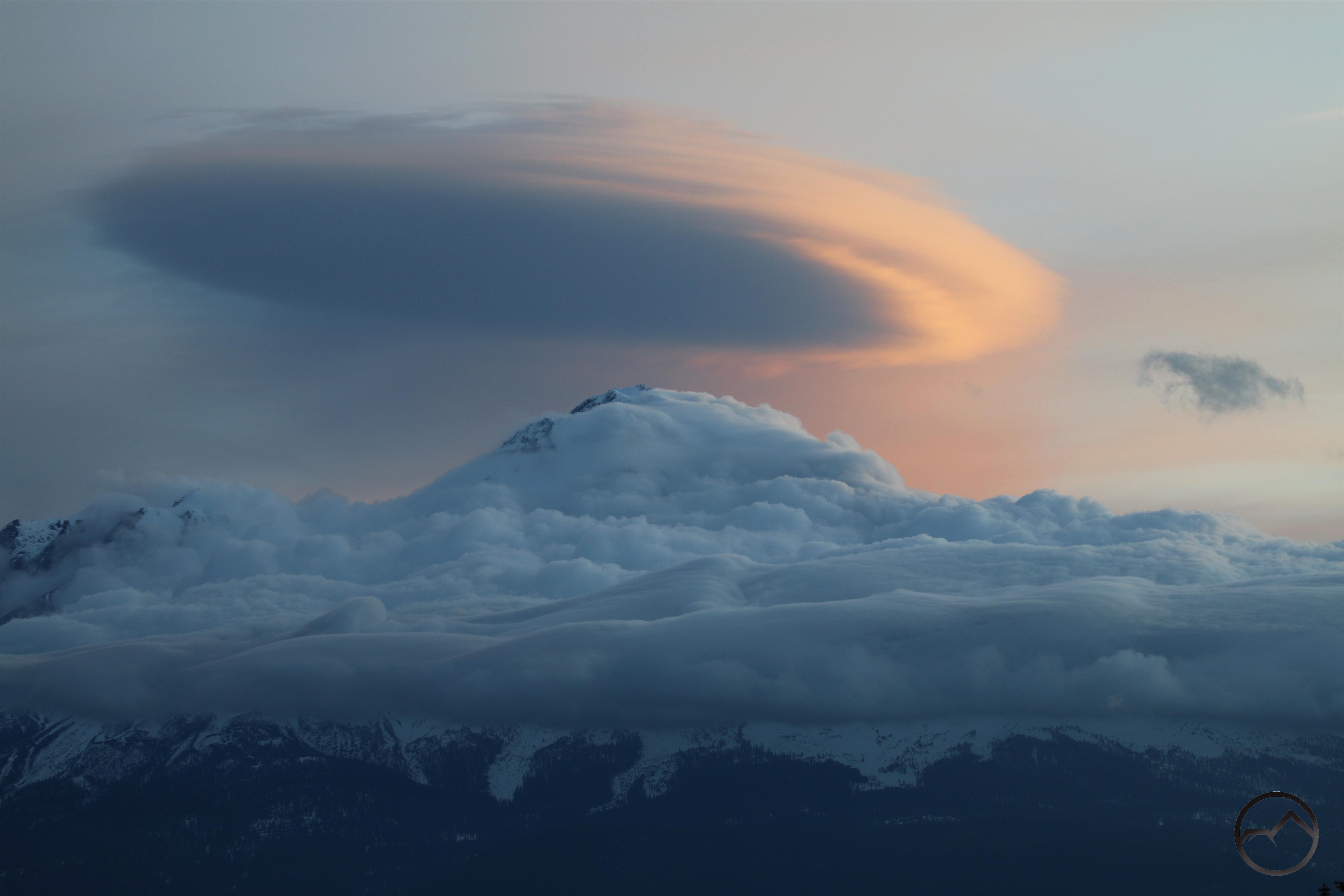
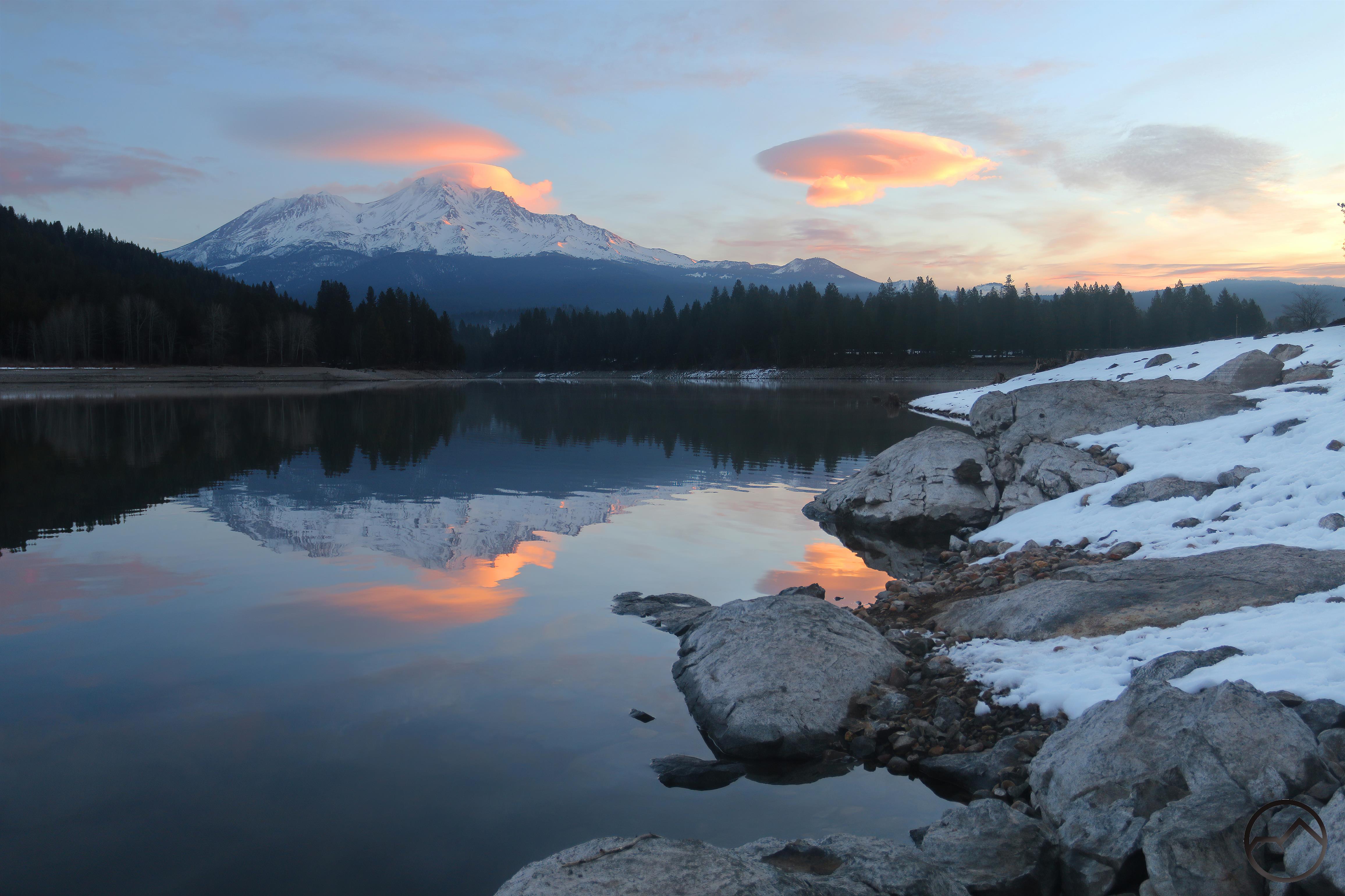
Given Monday’s weather, Tuesday morning looked auspicious for some lenticulars and, as I had guessed, there were some over Mount Shasta. Mornings are always frustrating this time of year because positions with the best light are often harder to get to due to snow. With Castle Lake Road still being plowed, Lake Siskiyou seemed the best vantage from which to appreciate the clouds at dawn. Fortunately the lake was somewhat still and a reflection was possible. Not perfect, by any stretch but enough to allow the color in the sky to be appreciated in the gently rippling water. While the scene was not epic, it was quietly beautiful and a satisfying encounter with the mountain.

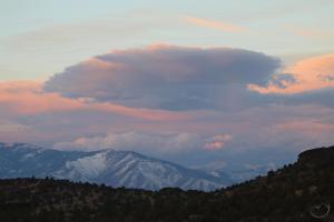
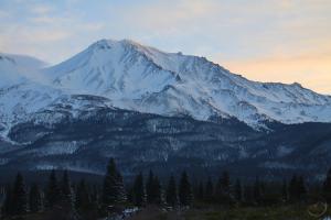
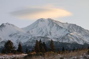
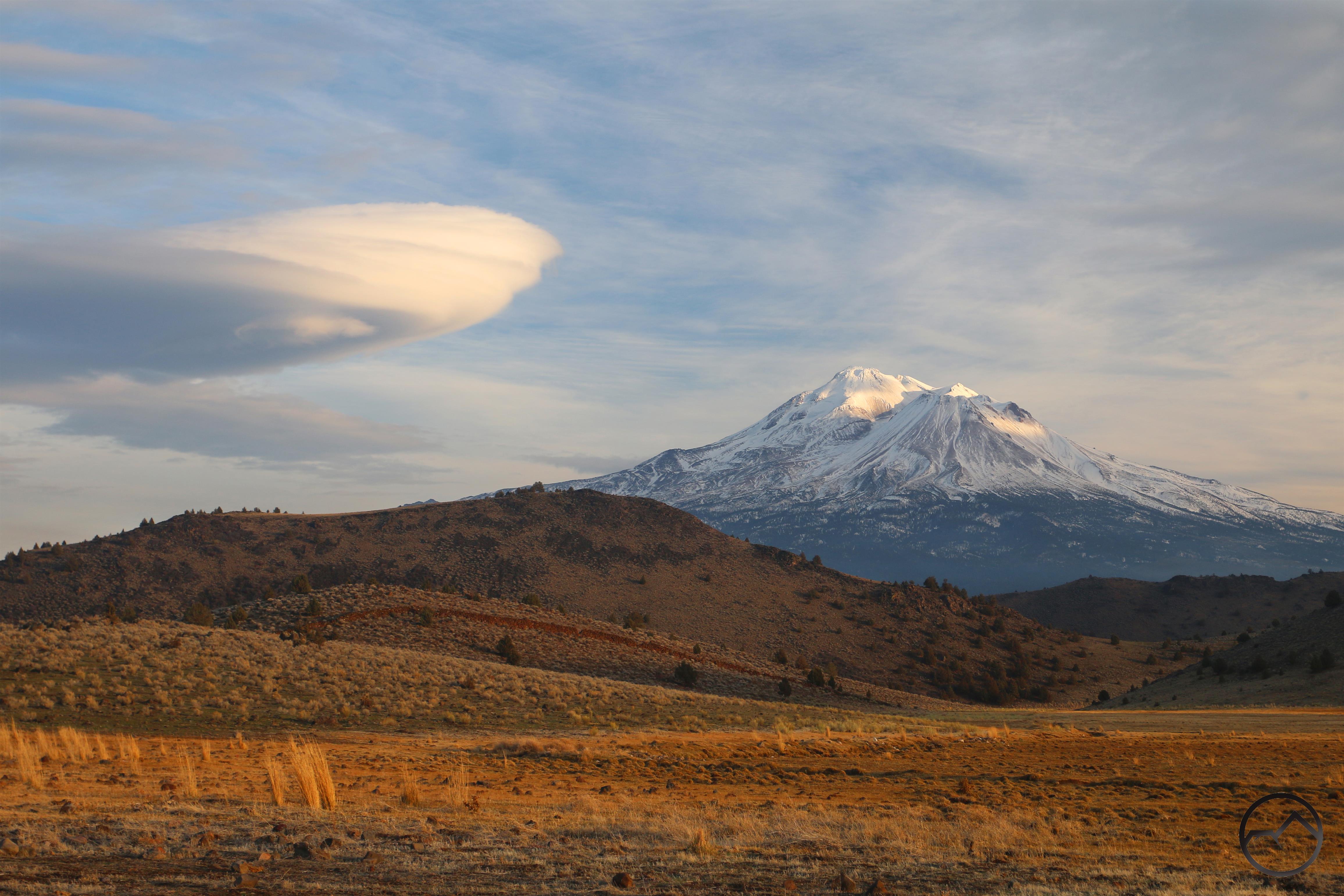
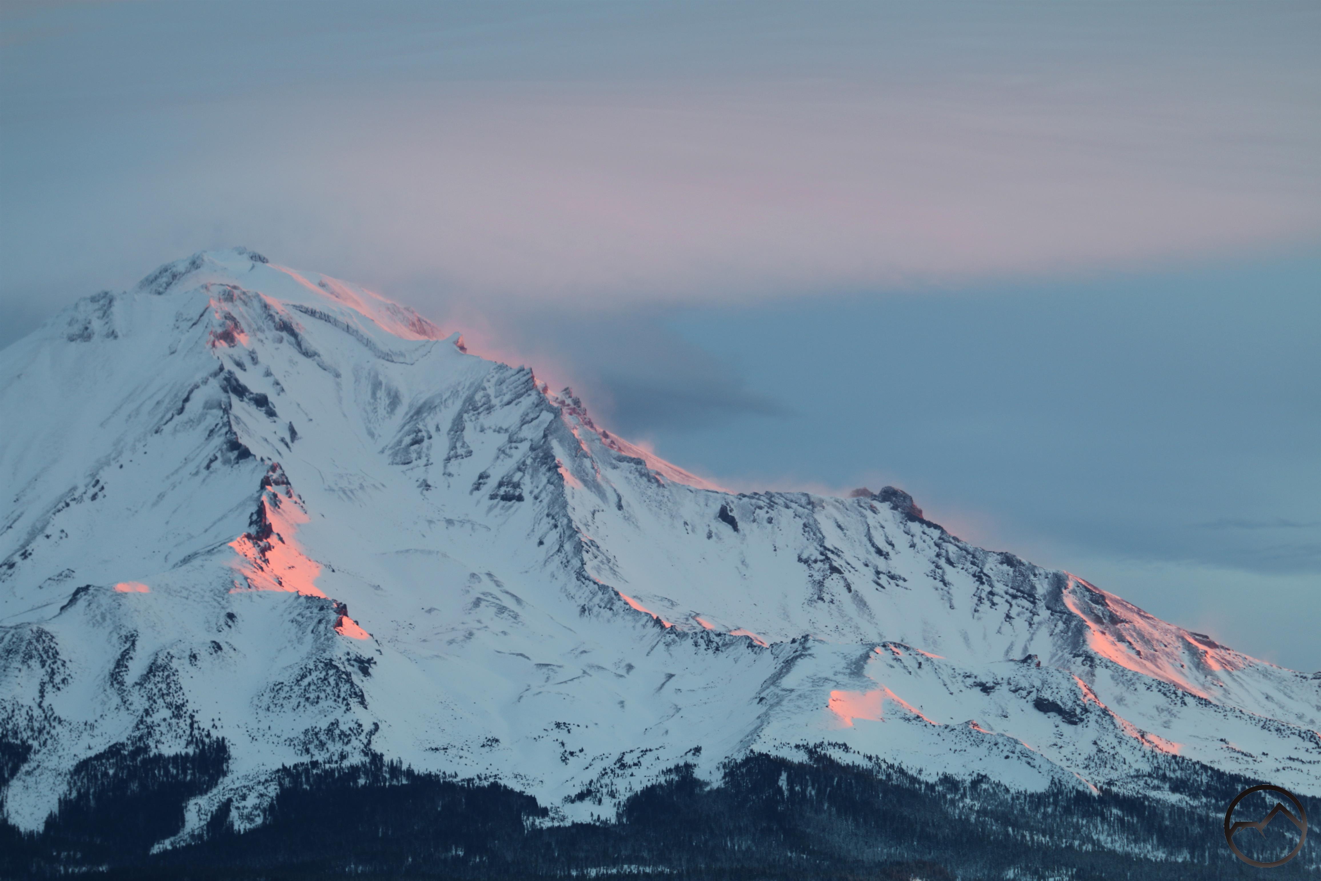
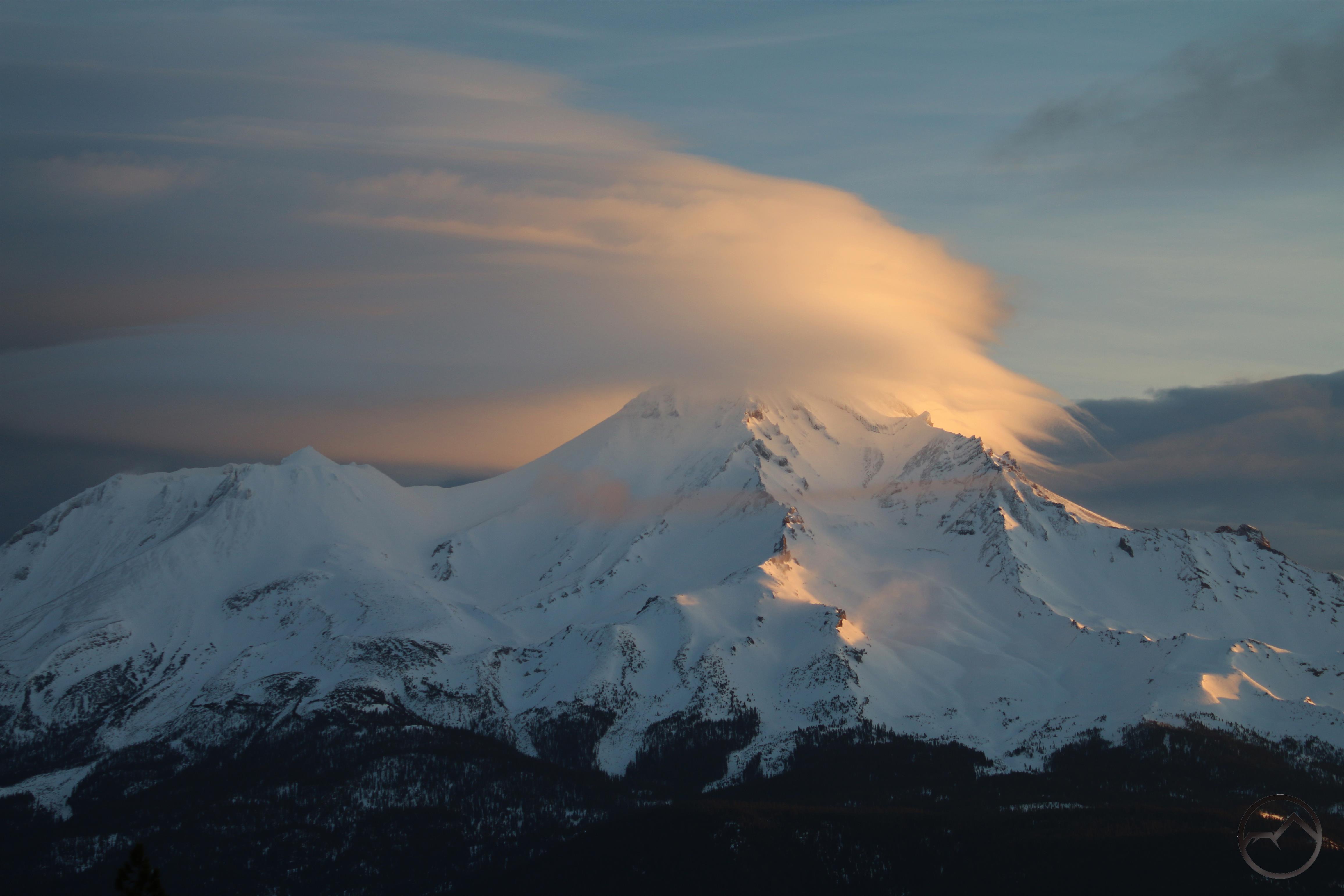
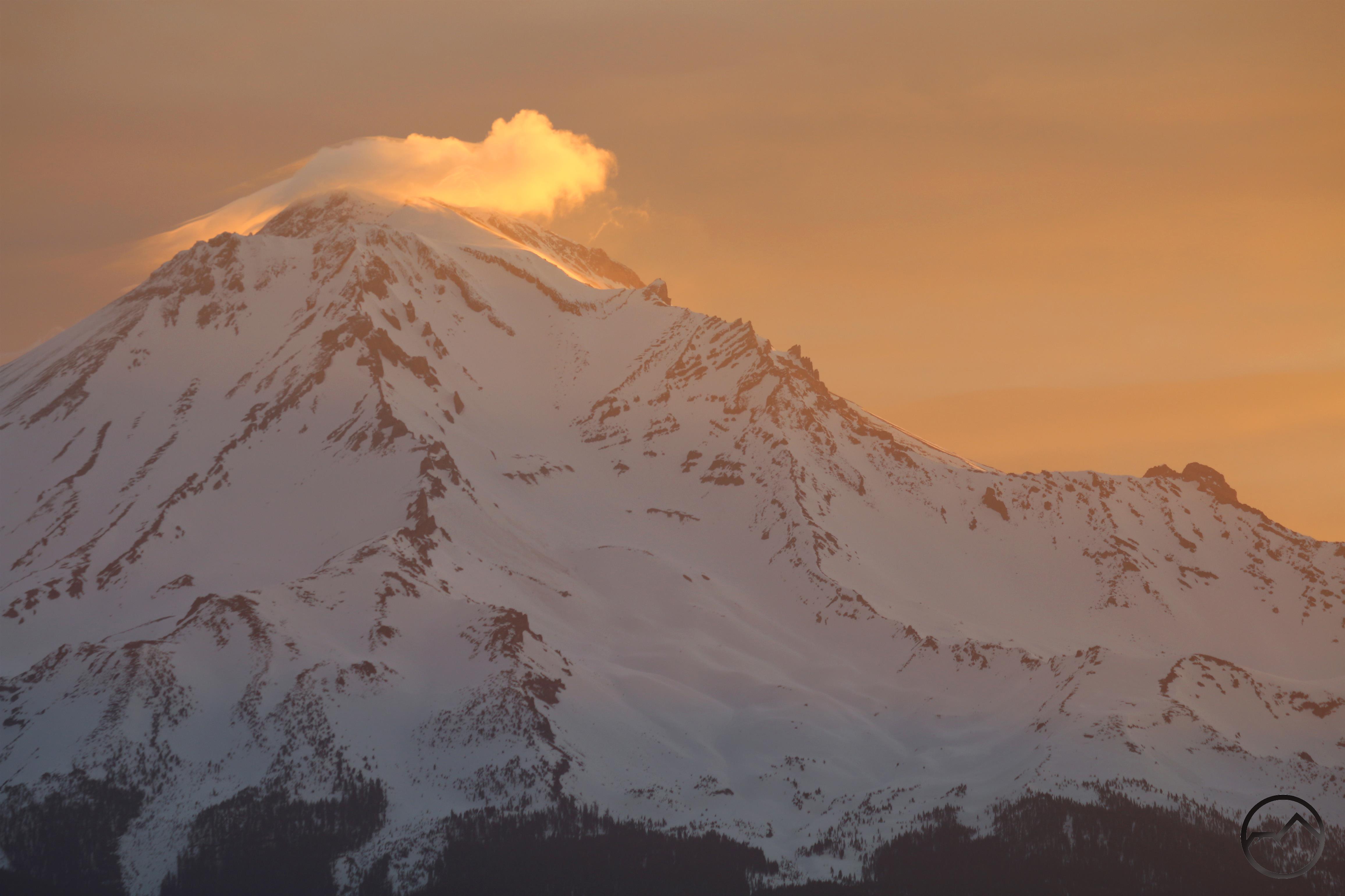
Looking closer to the sunrise on Tuesday morning.

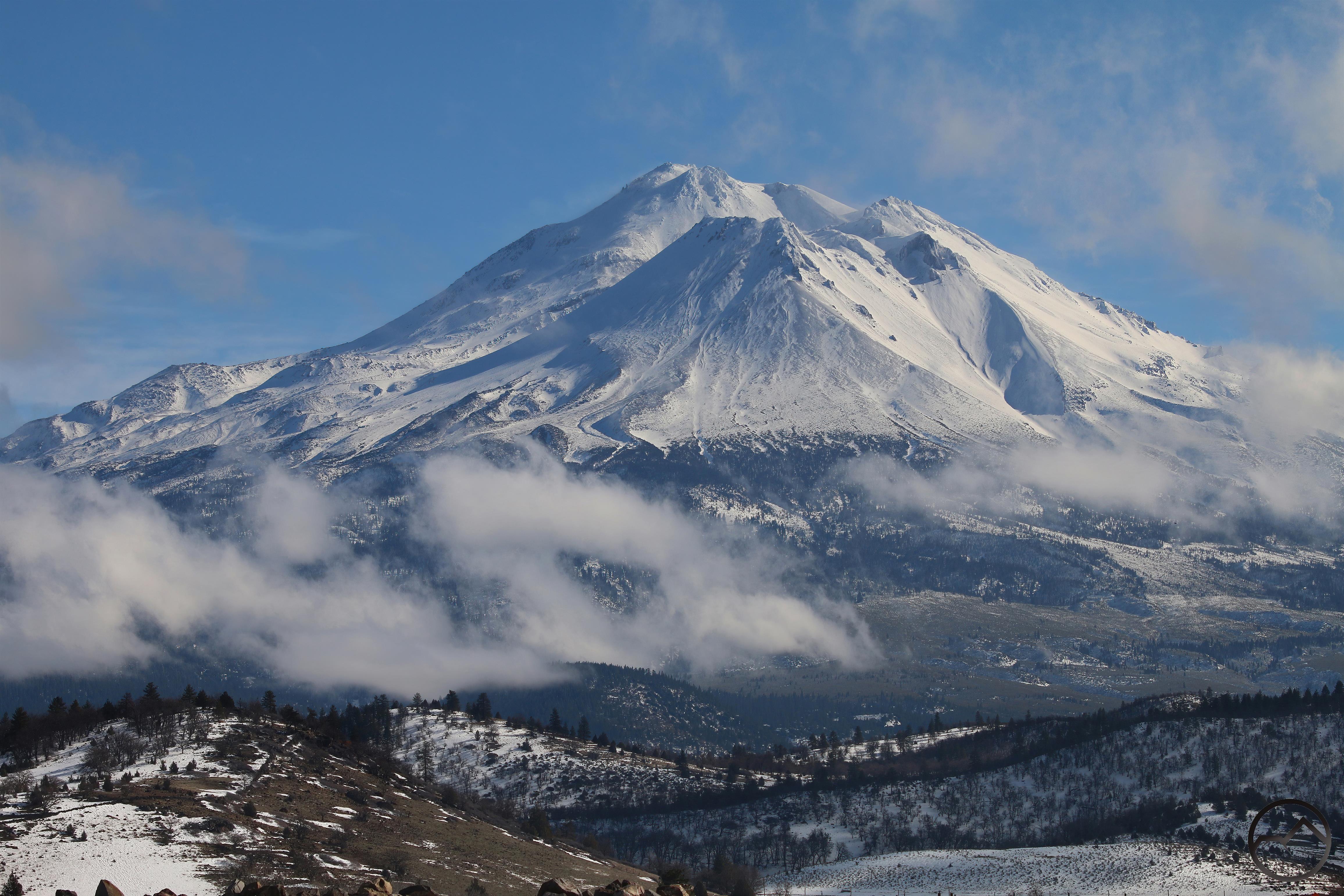
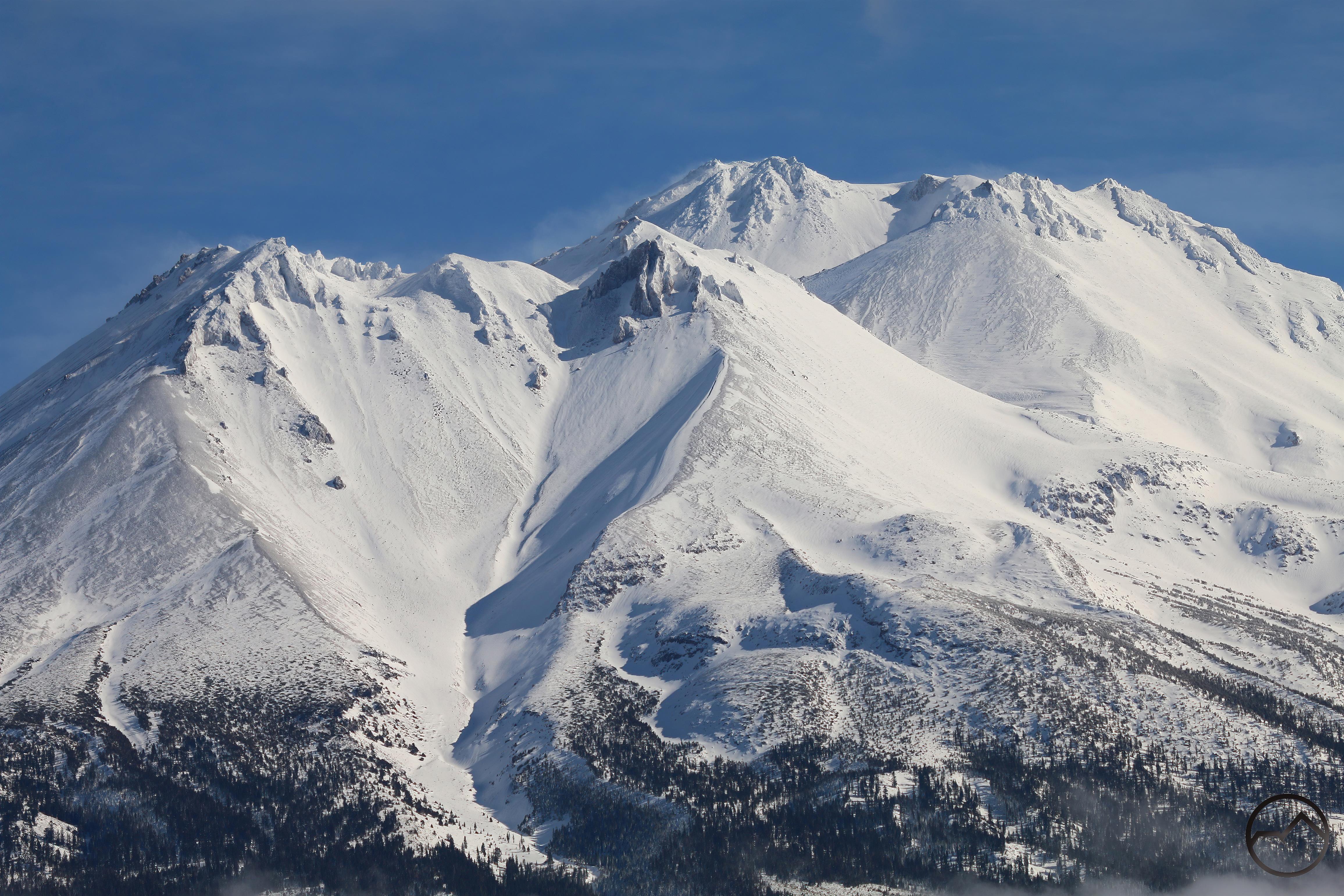
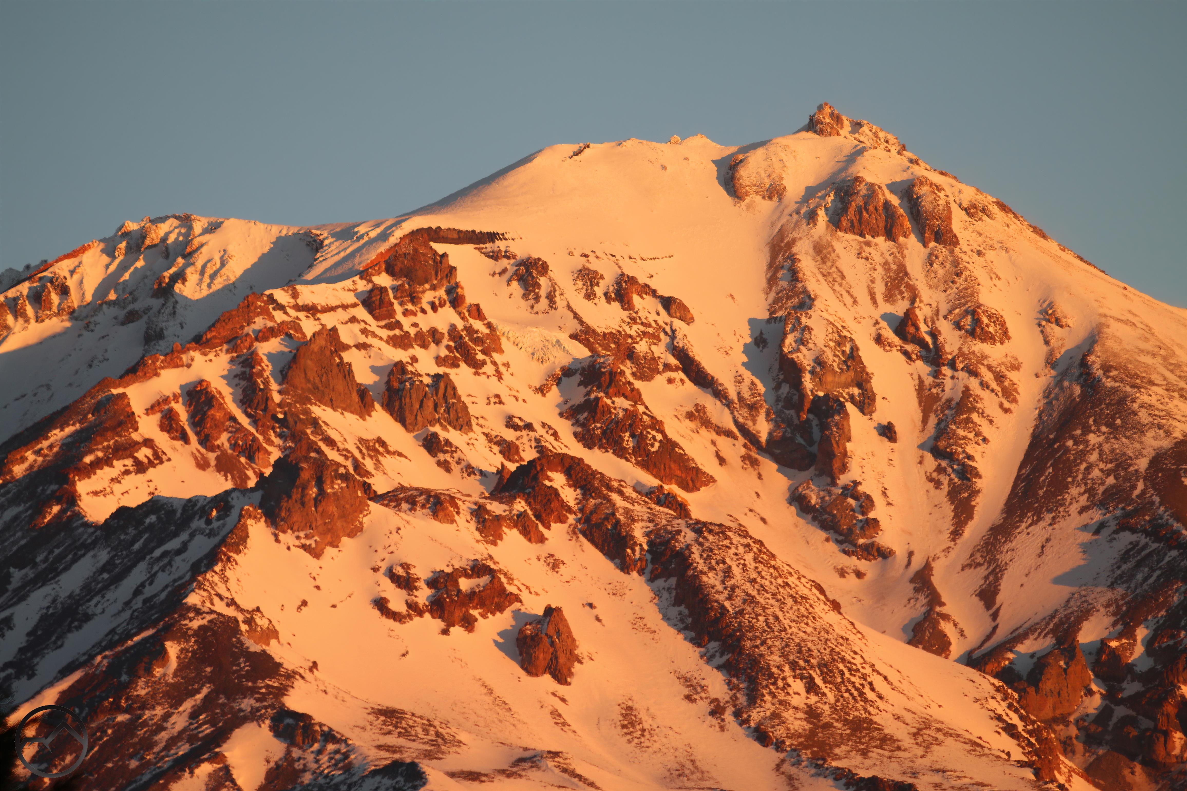
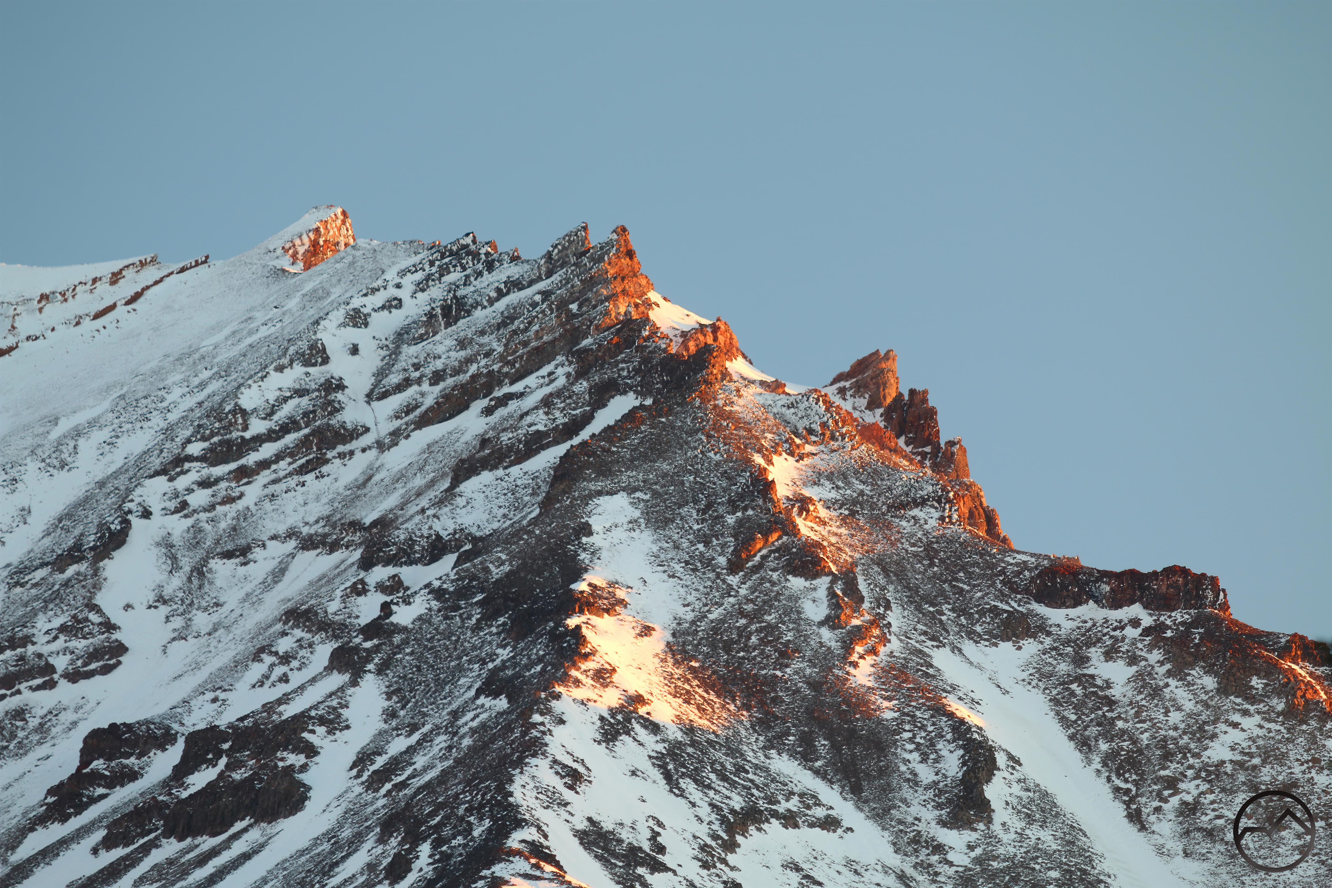
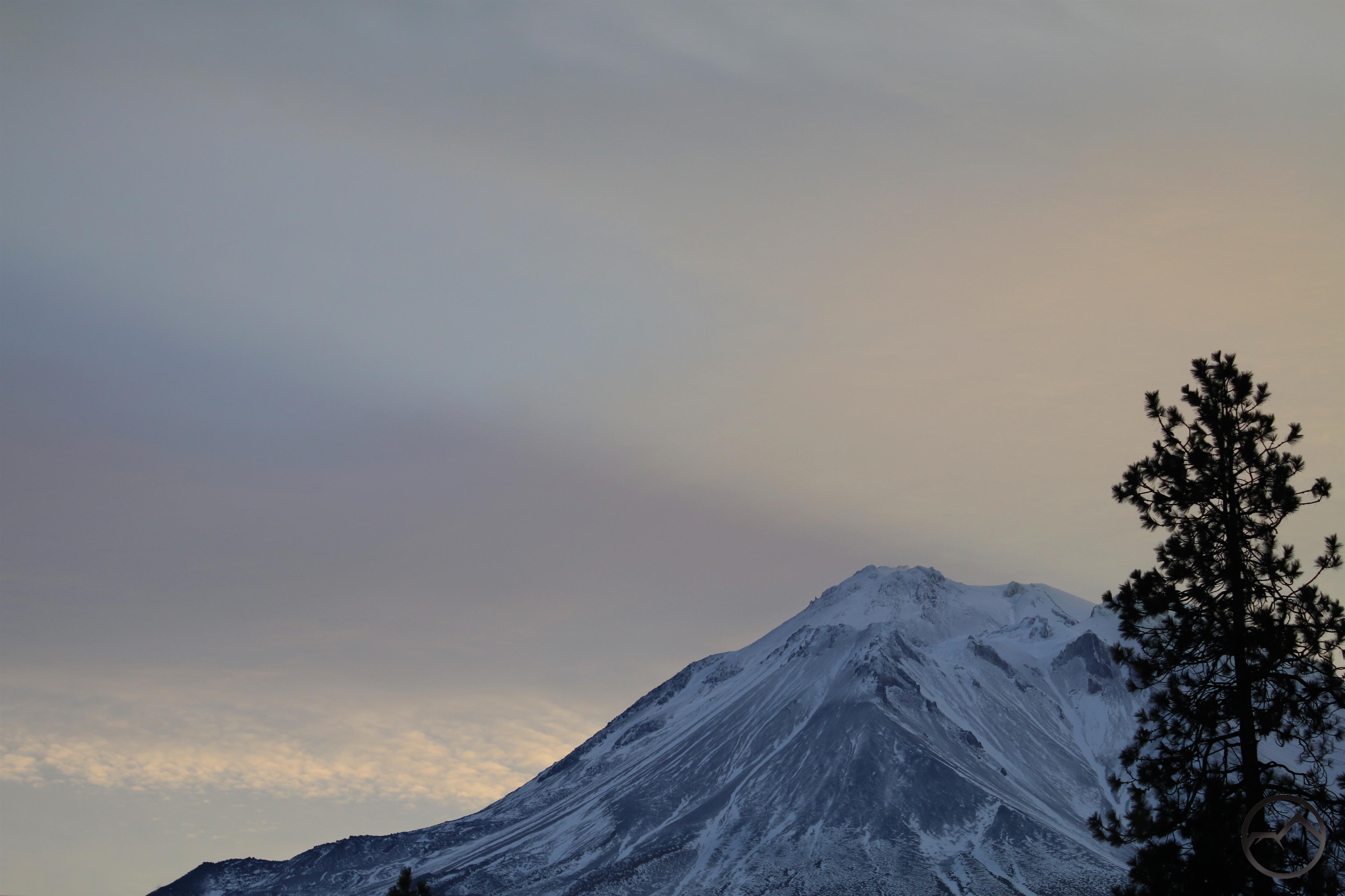
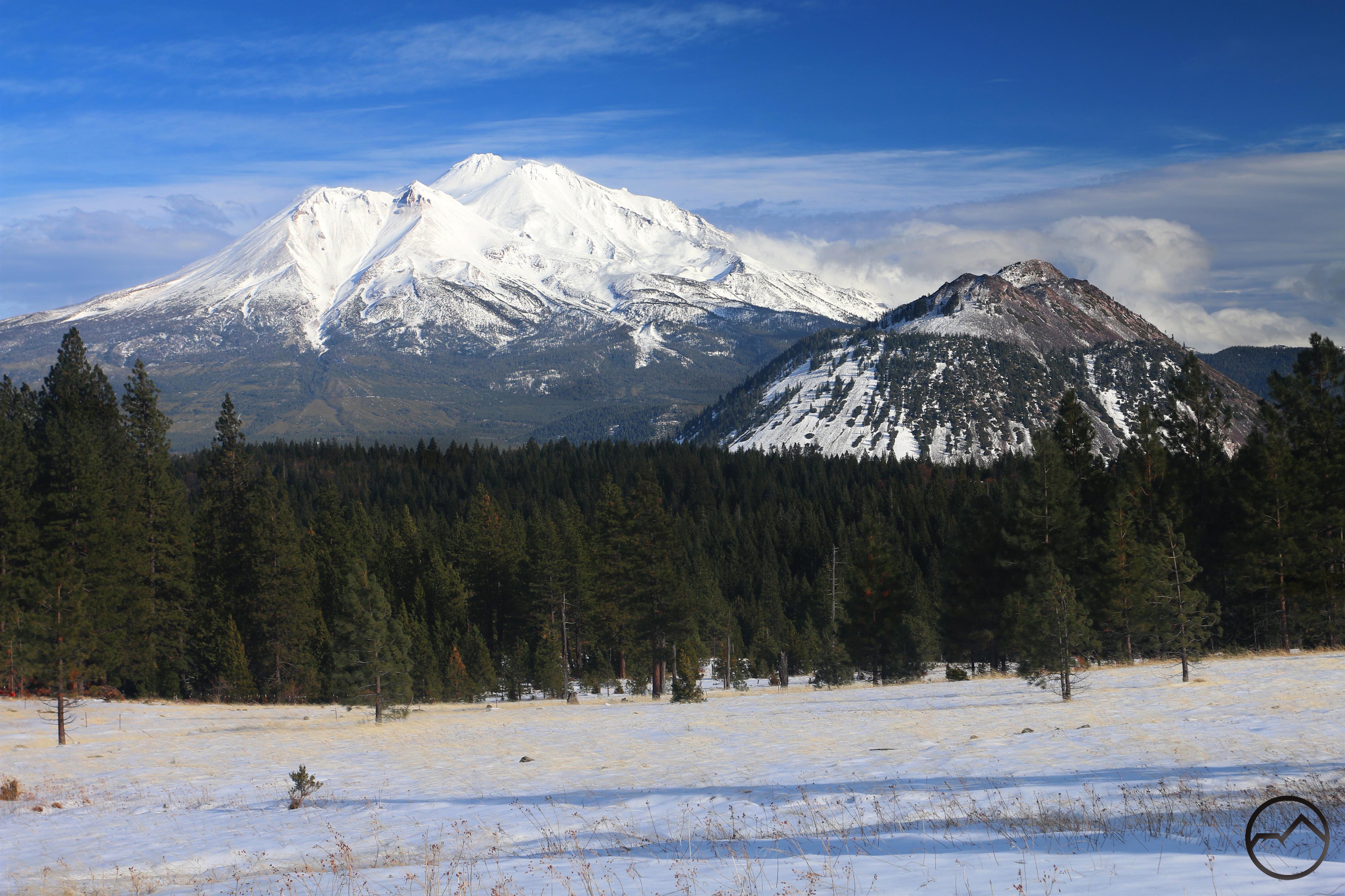
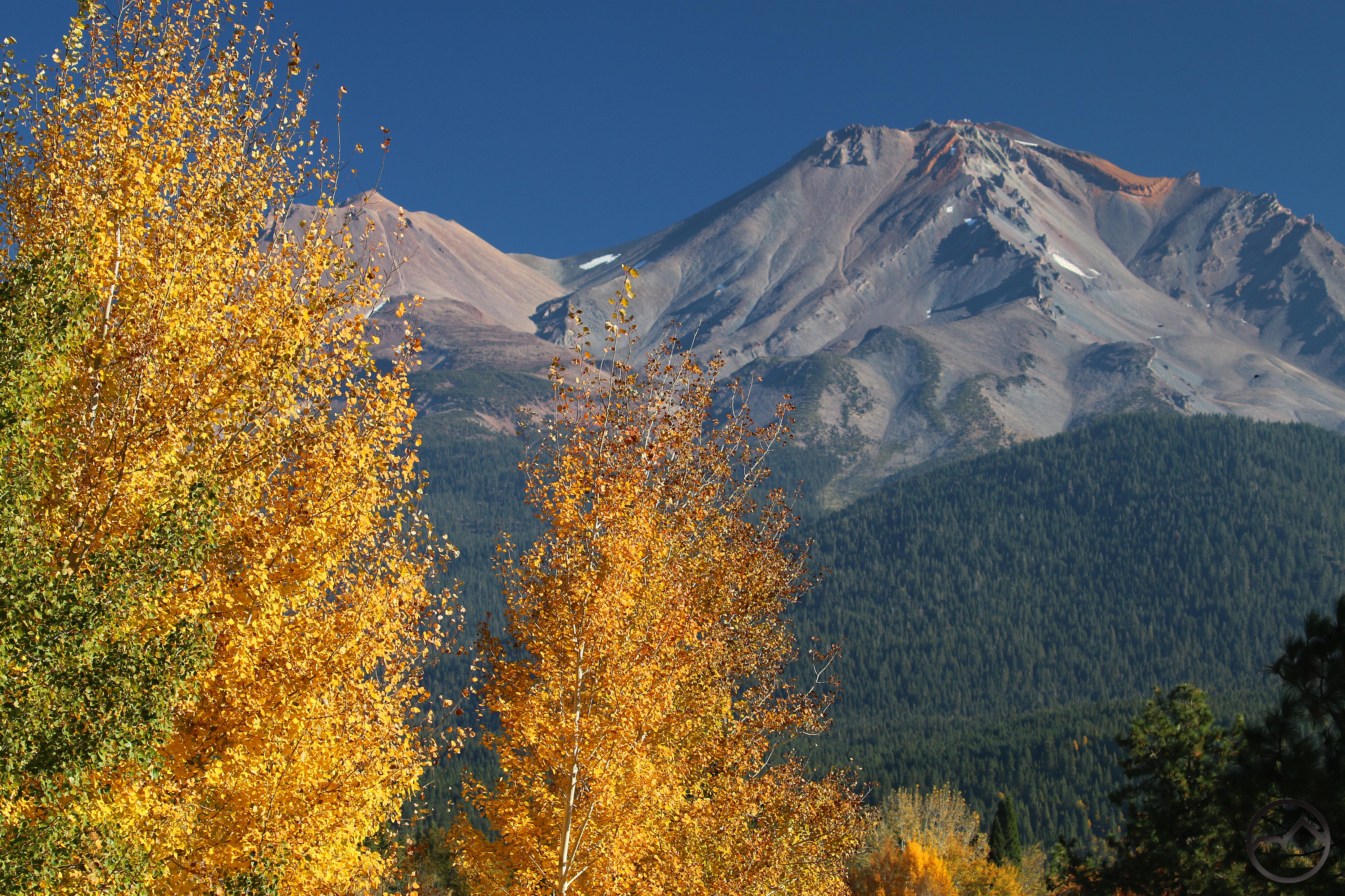
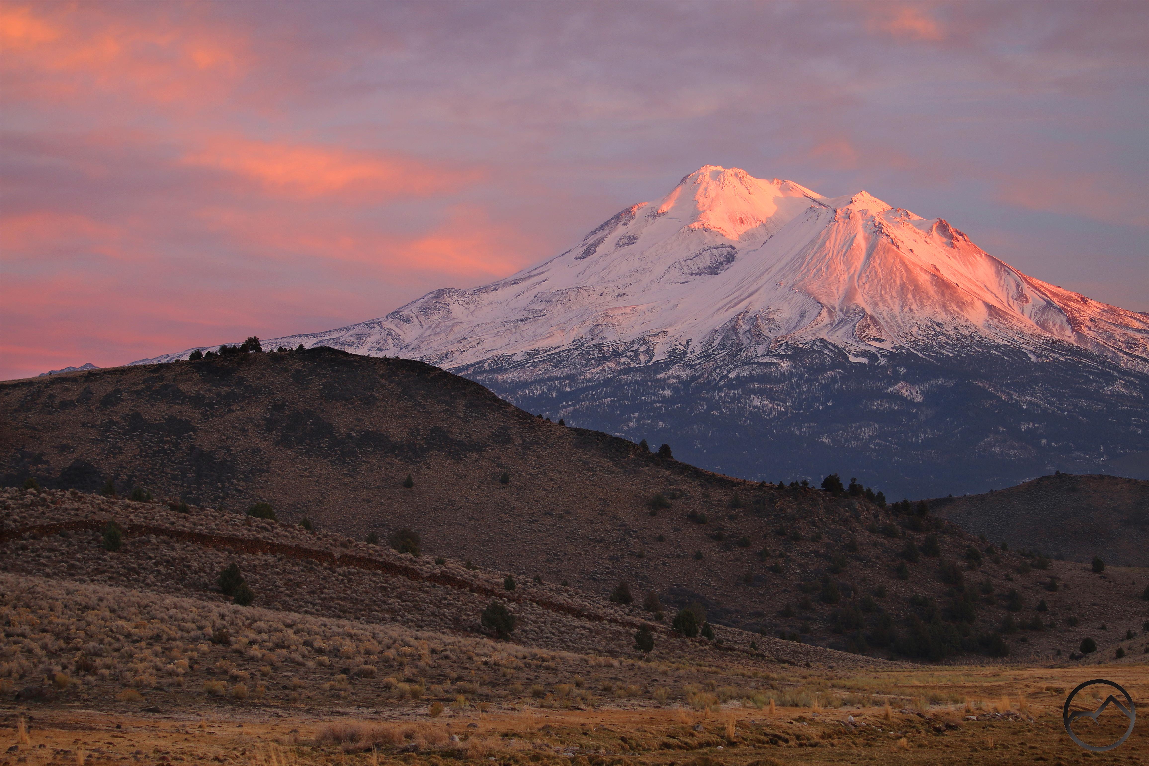
It is interesting that Mount Shasta still looks a bit bare at this time. We have had a fair amount of snow over the past month, yet the mountain’s ridges are all exposed as if it had only been lightly inundated. I think this state reflects the fact that all the snow that fell was very dry powder. It has accumulated a good pack in some places but on the more exposed terrain, the wind whipped it off of the mountain very quickly.

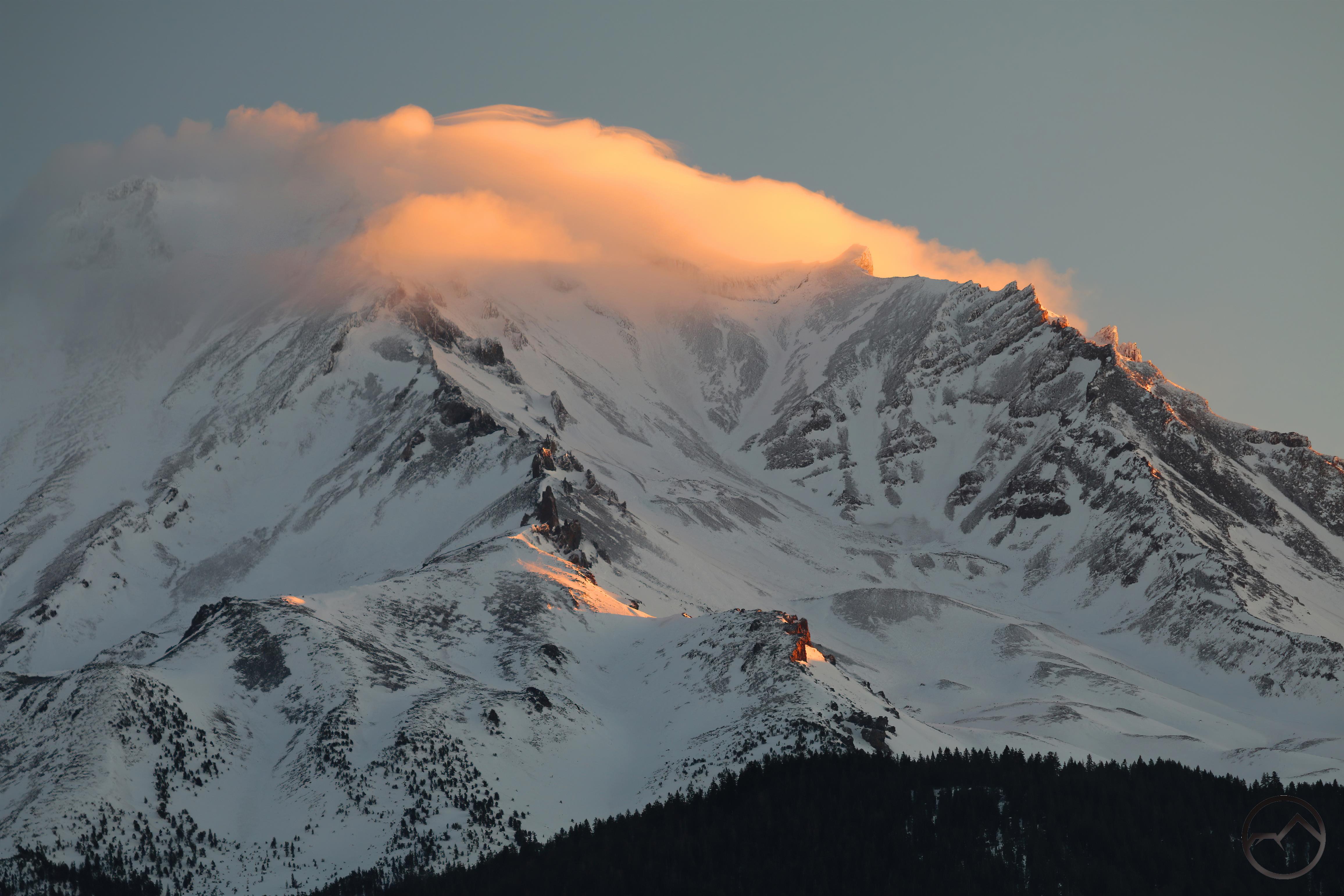
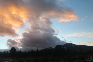
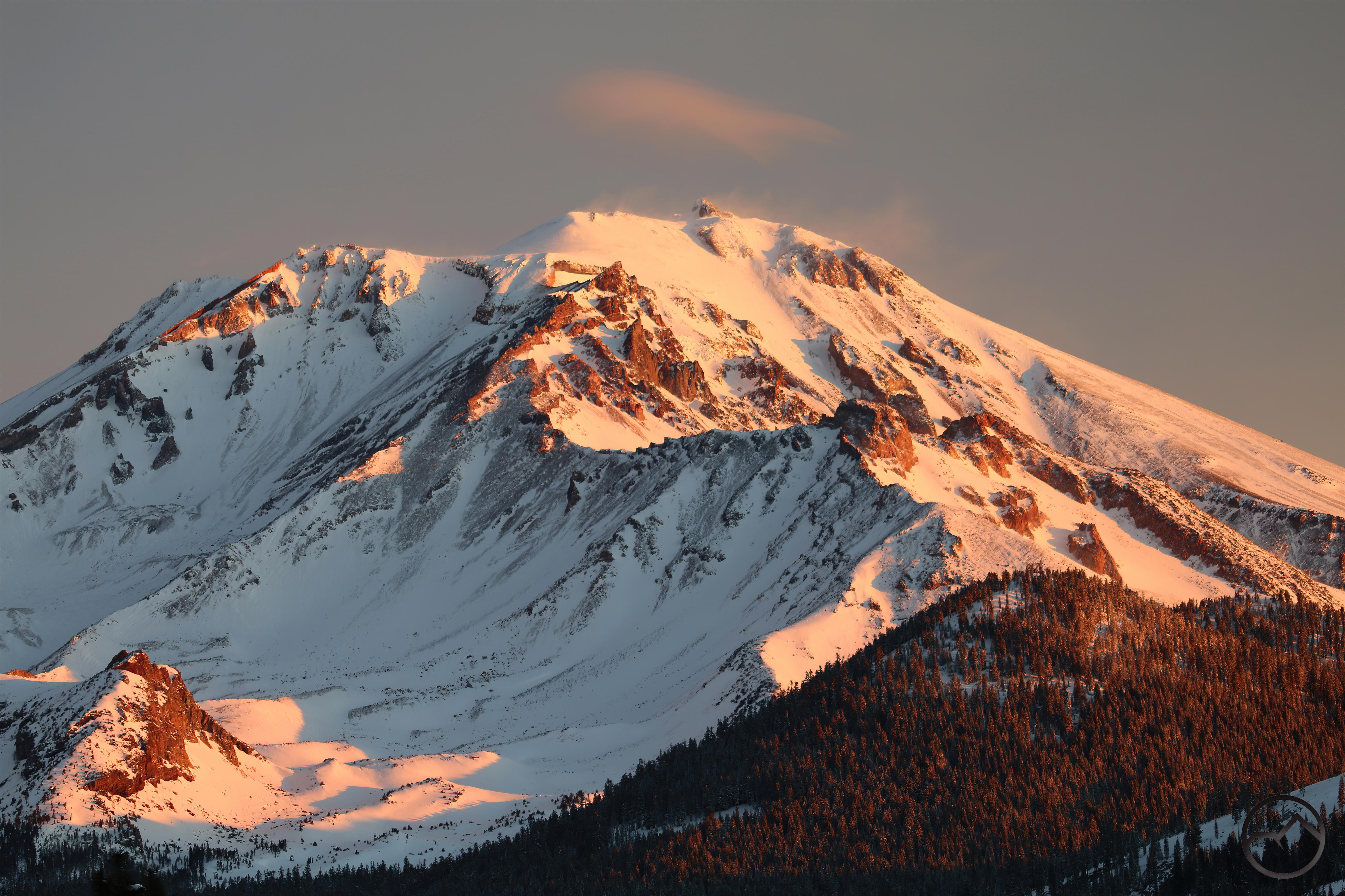
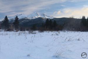
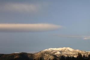
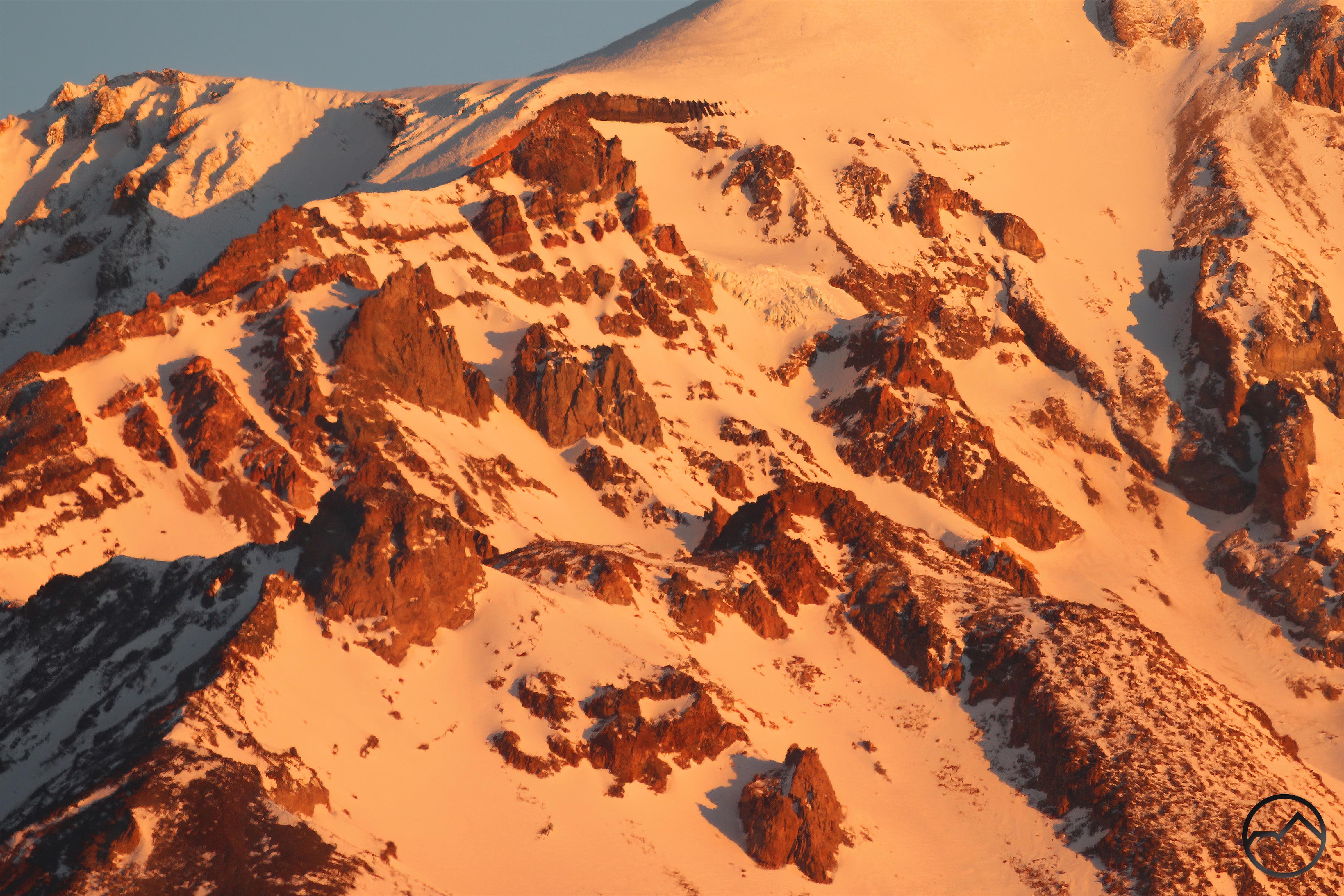
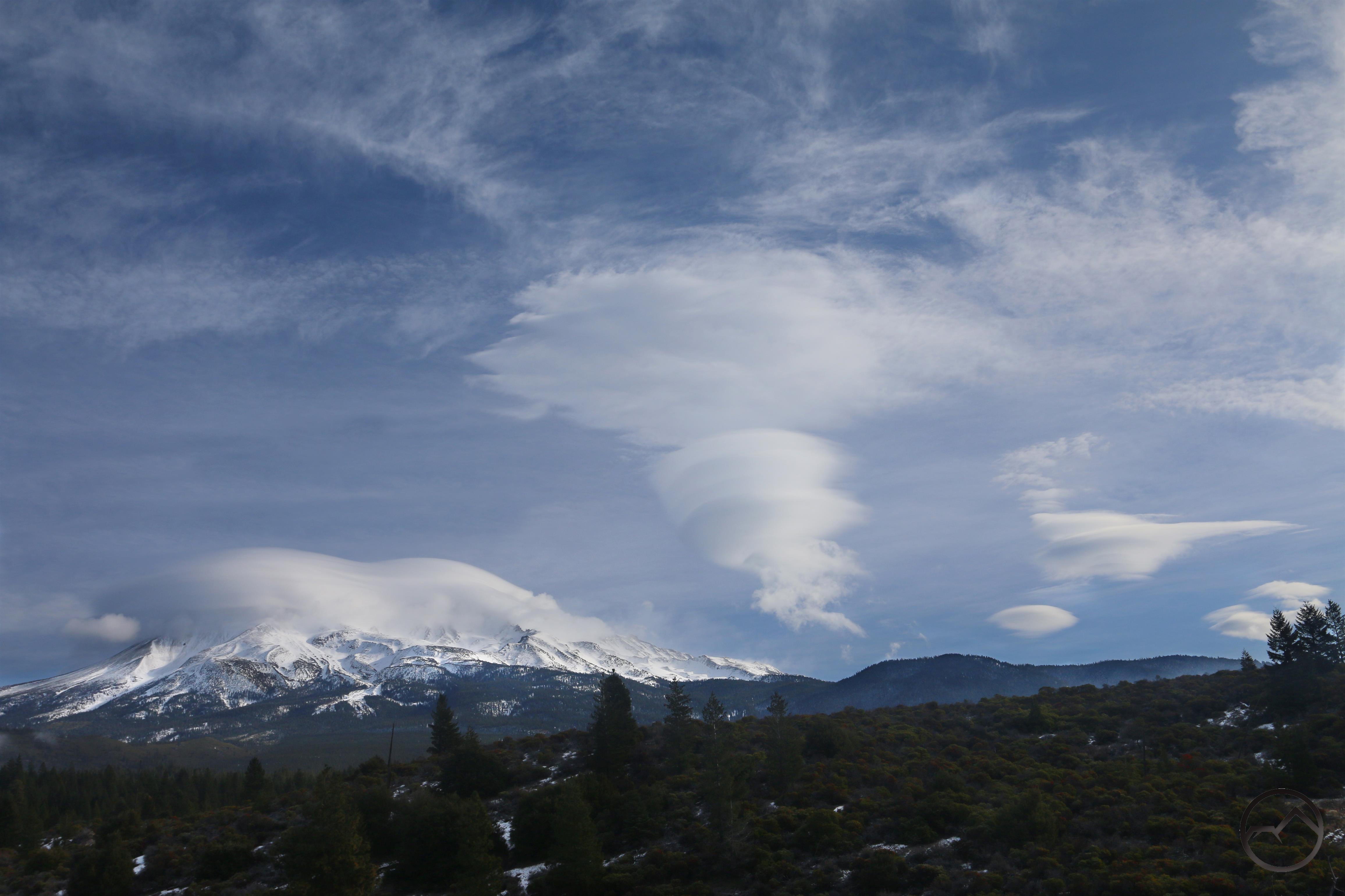
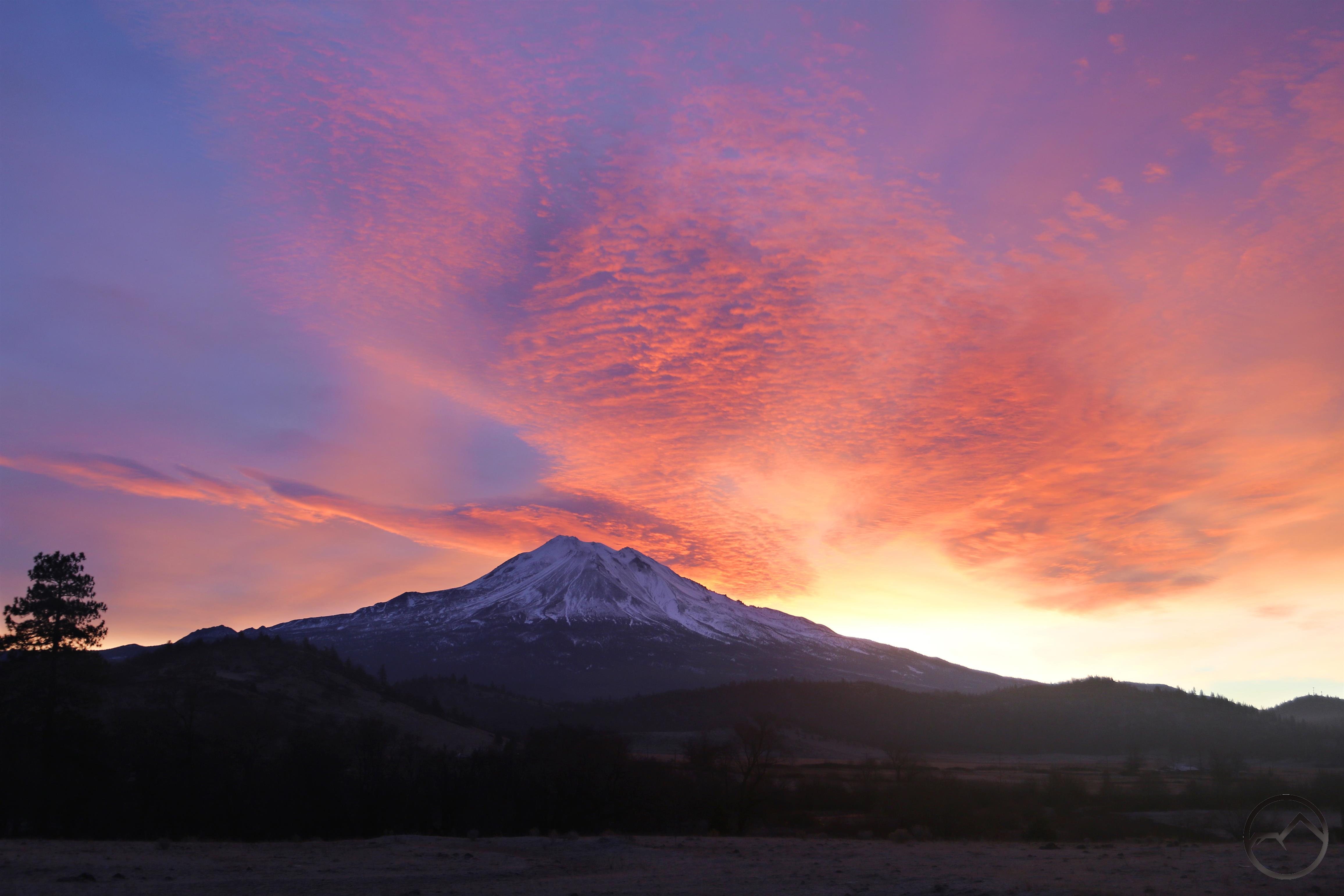
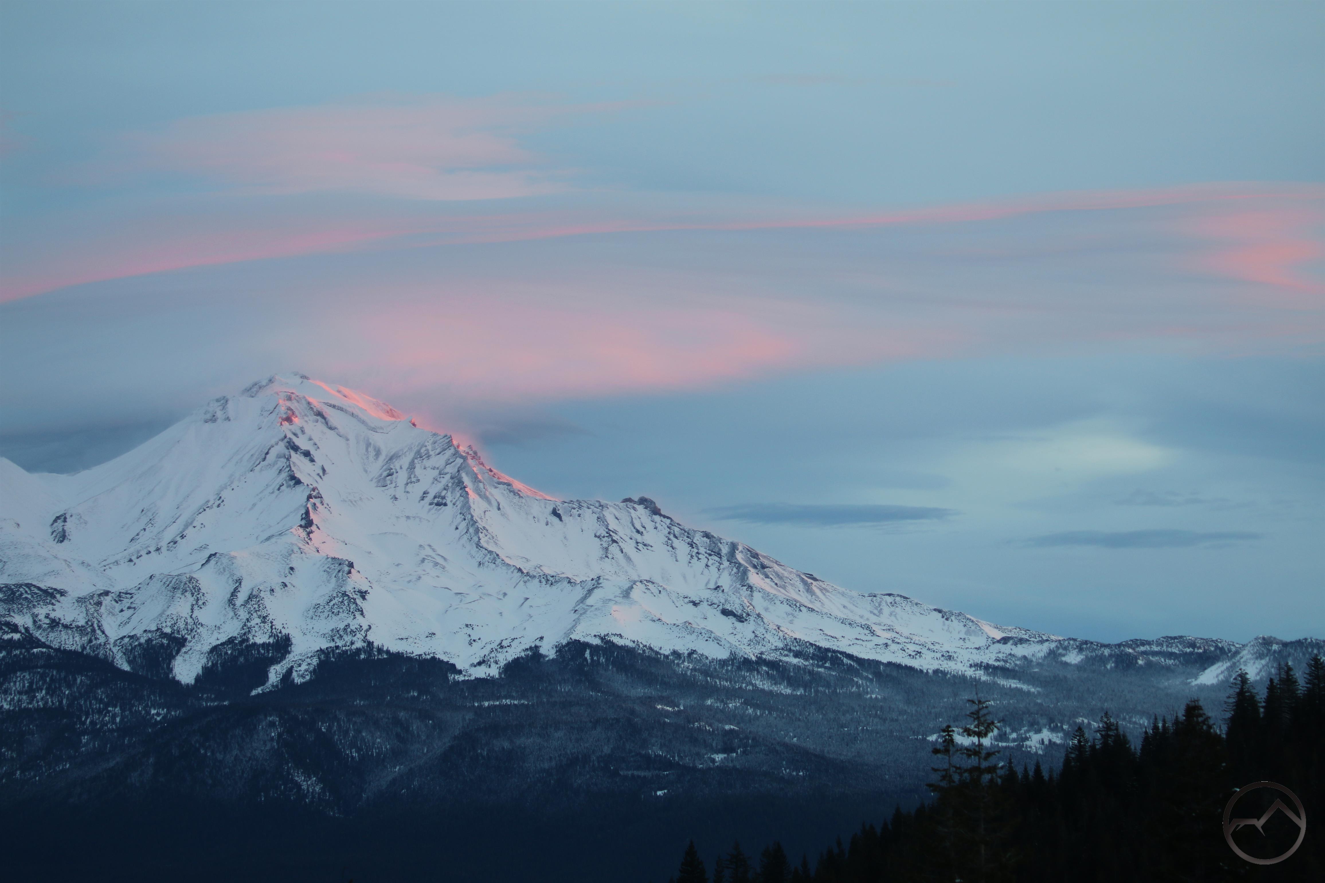
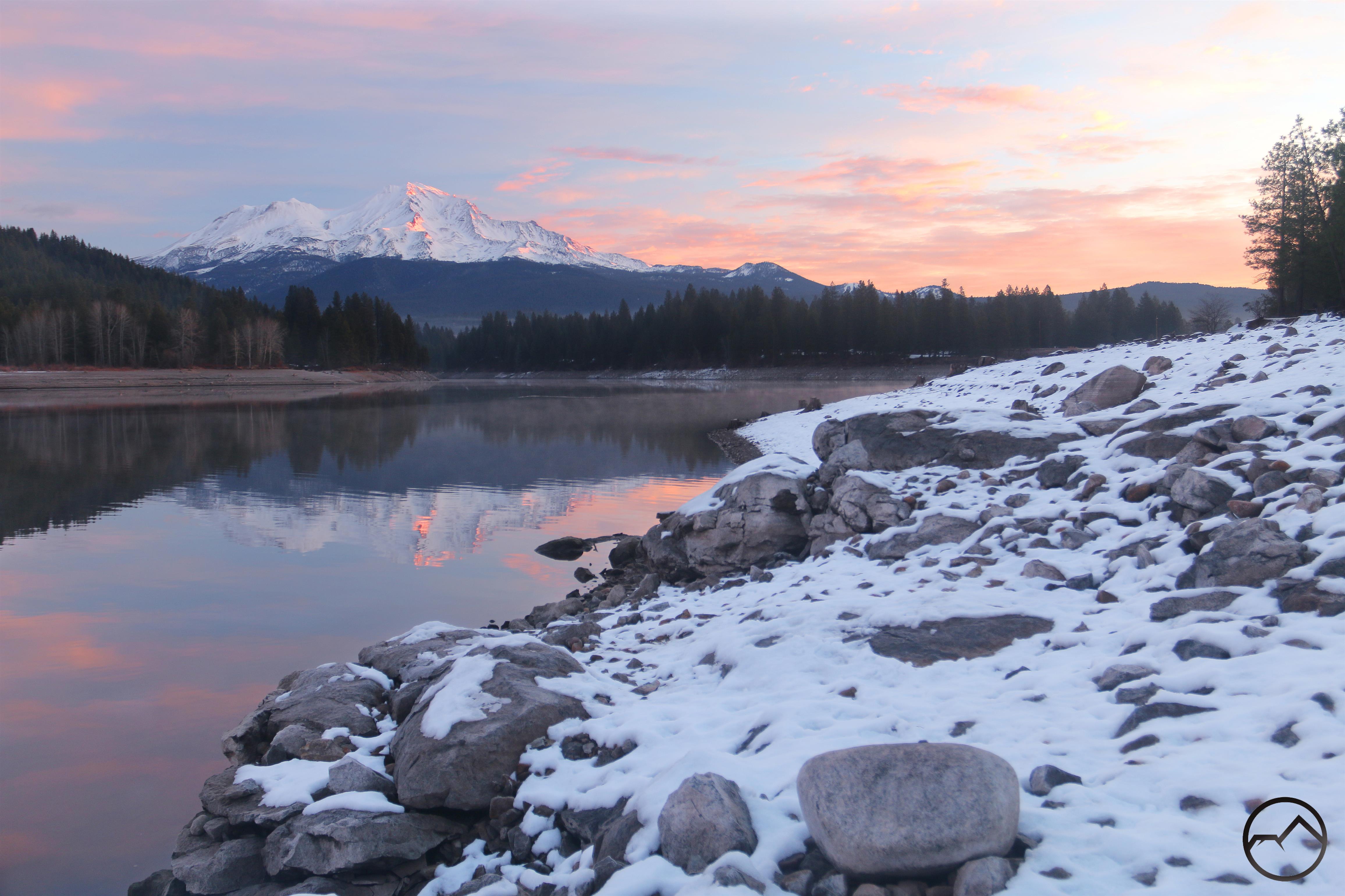
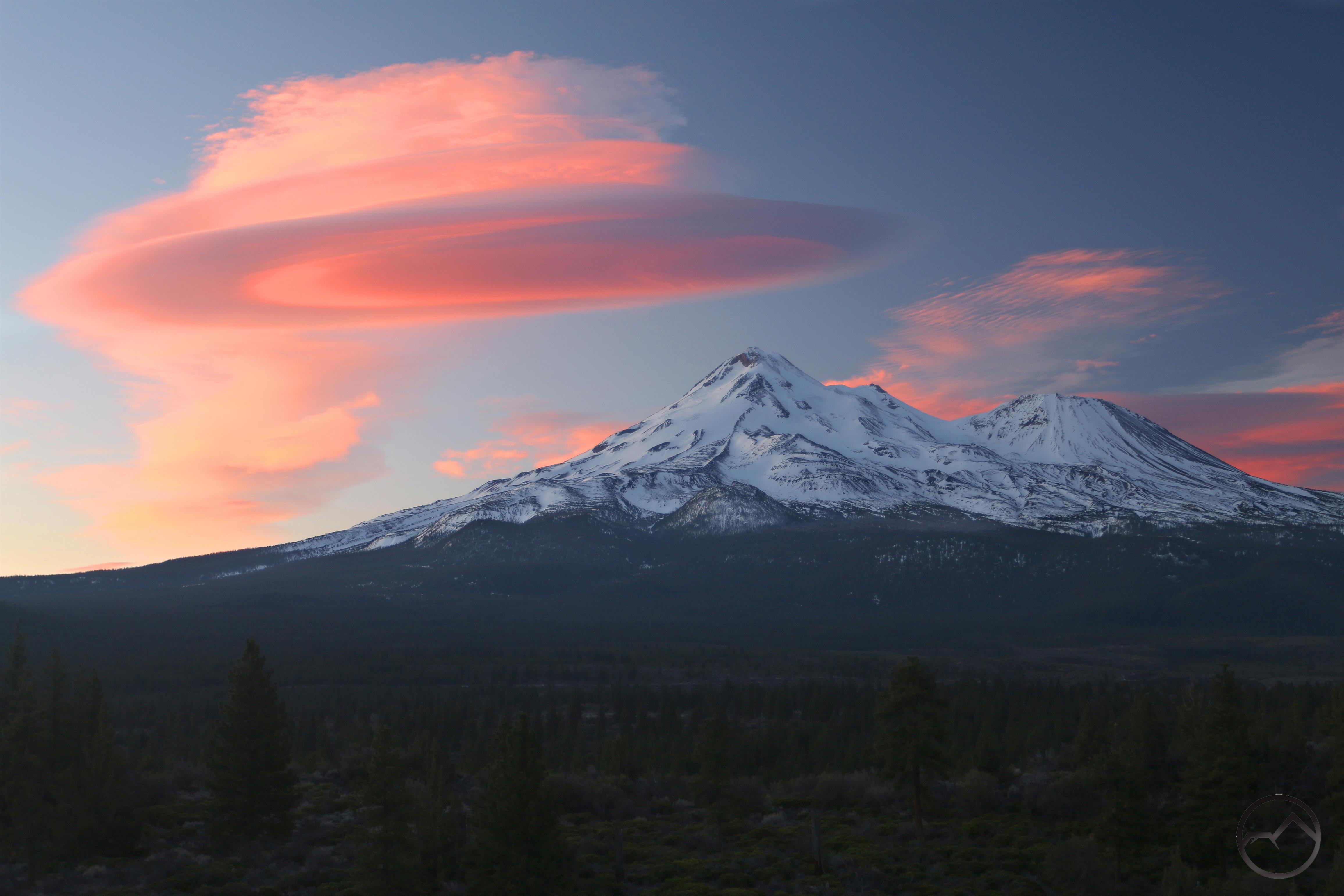
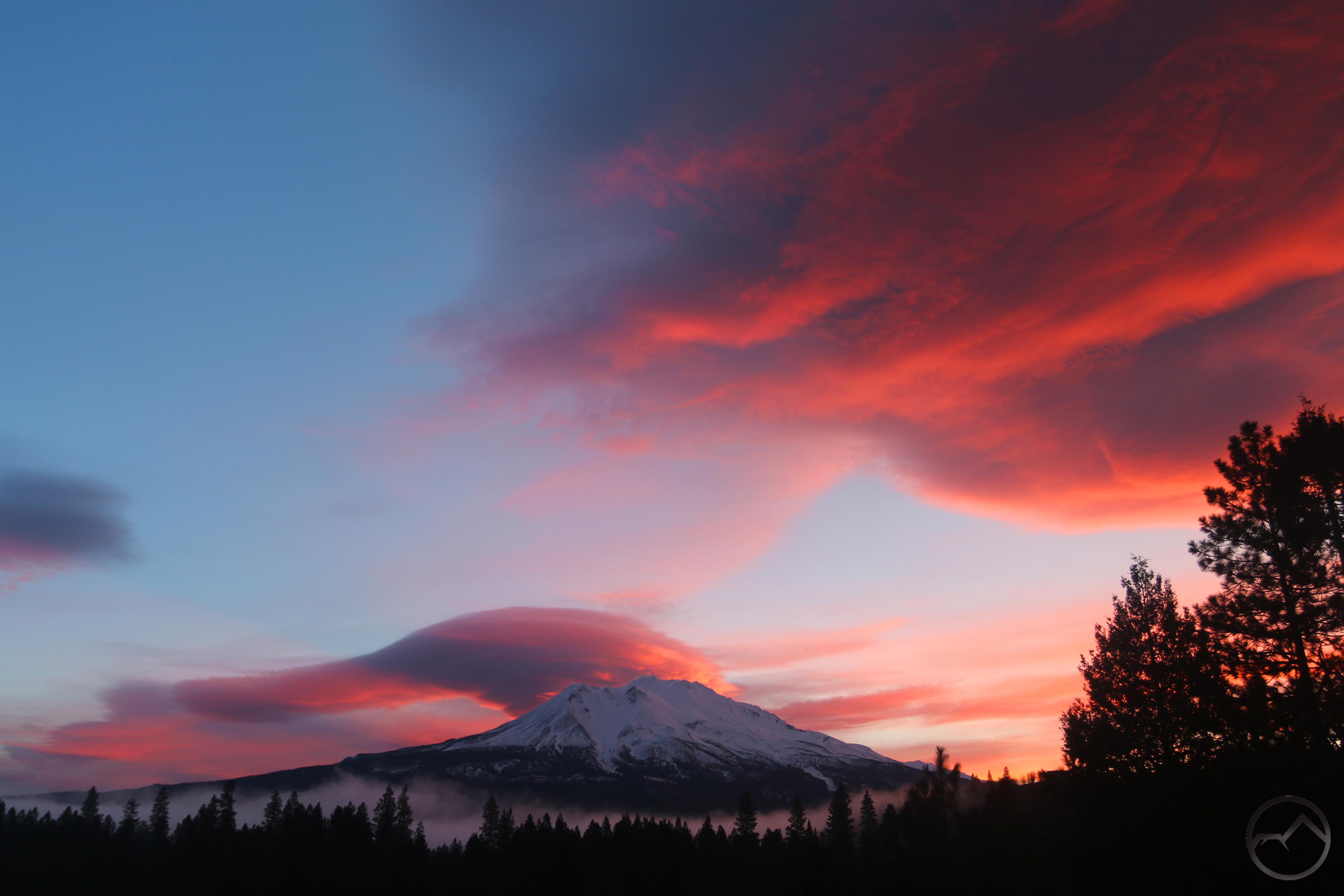
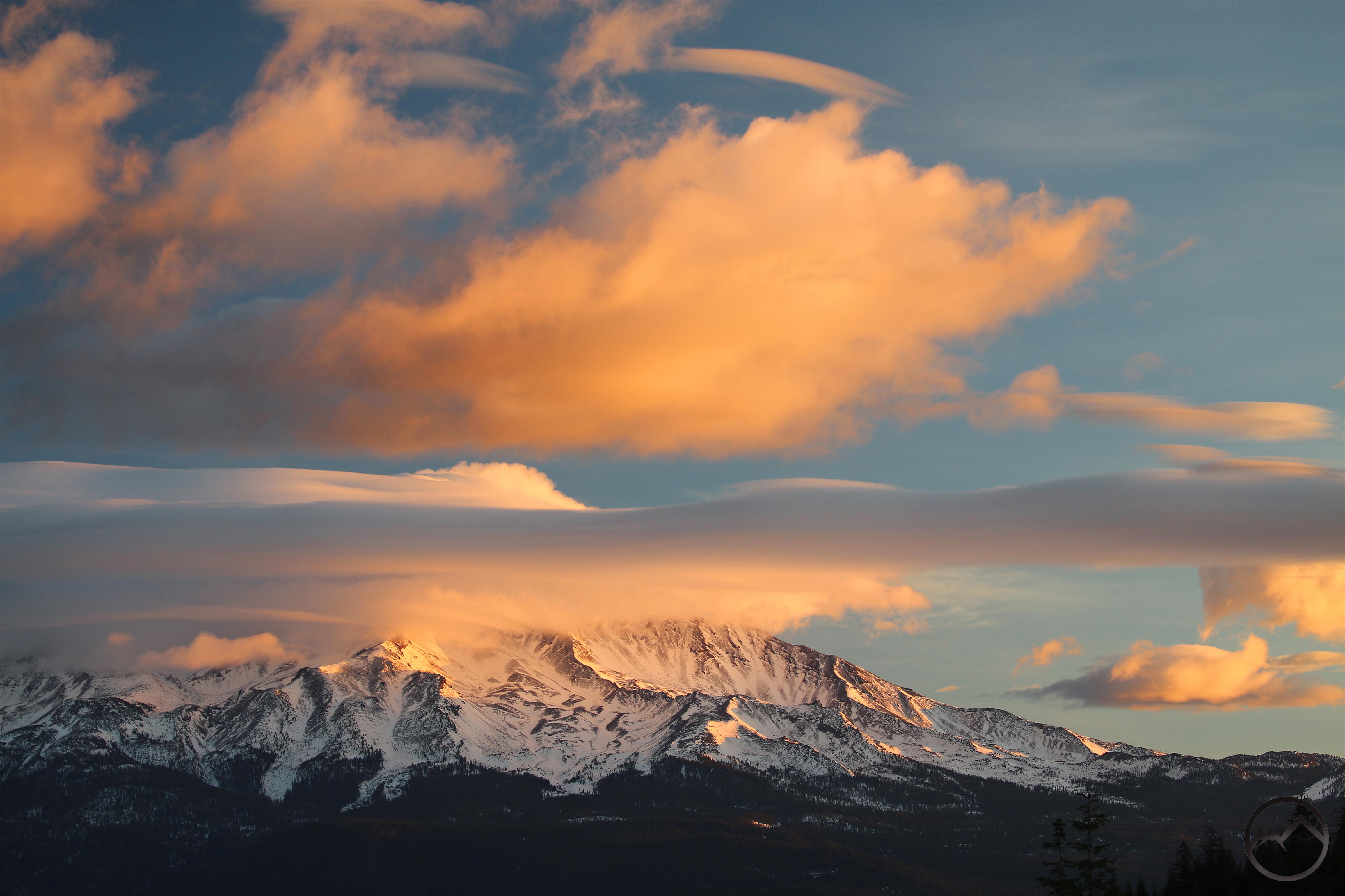
Sunrise on Wednesday morning.

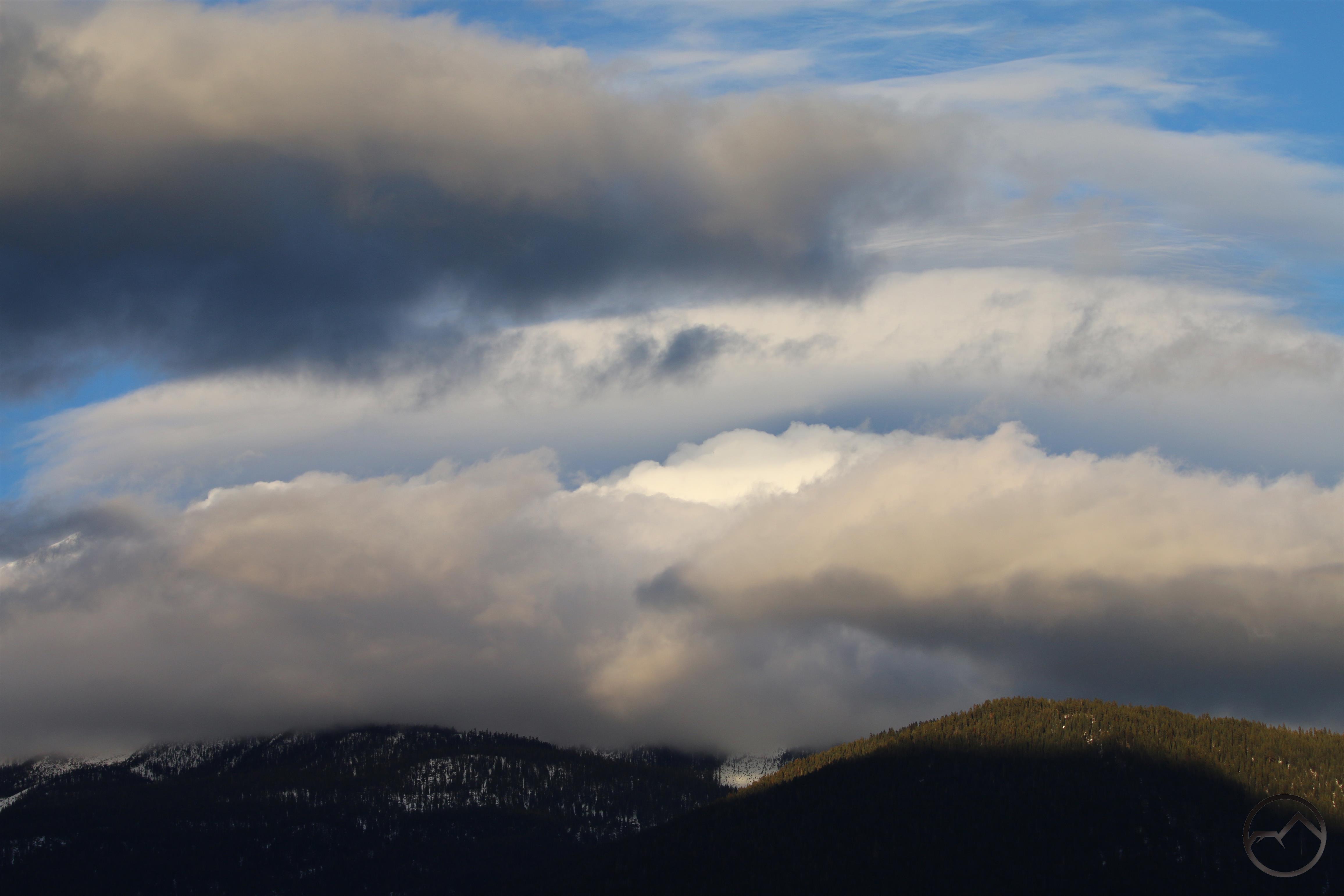
Wednesday morning brought another pretty sunrise. There were some vaguely “lenticulish” clouds around the mountain but by the time the sunlight brightened up the clouds, they had lost much of their definition. However, looking at the forecast for this evening, I am hopeful that something interesting may manifest.

As we are nearly a third of the way through February, I am eagerly anticipating March and the coming of spring. I have many places set to explore in the Castle Crags and that is the optimal time to get into those granite towers and explore the fountains and gardens that are hidden away in that jumble of spires. Until then, snowshoes and other winter sports (and some trips to Sonoma County and Prairie Creek Redwoods) will have to get me through the winter!

I really hope everyone is able to endure the rest of winter with warm hearts. The times we live in are deeply troubling but there is still much good in the world, great cause for hope, and spring draws nigh!

Lenticular Collapse On A Wild Morning (The Storm Of January 2021 Pt. III)

Posted by bubbasuess on February 1, 2021
Posted in: Cascade Range, Hiking, Lenticular Clouds, Mount Shasta. 1 Comment

Sunlight illuminates mist left over from a turbulent lenticular collapse.

Talk about one of your all-time storm fizzles. After the last wave of the dropped almost 3 feet of snow at my house, the next wave was supposed to leave another 2 feet or so. In reality, it has left little snow. It has rained significantly on Monday but this only accelerated the melting process of the snow that fell last week. With little forecasted for Tuesday and then sunshine after that, it appears that the last wave of the big storm has dissipated with a whimper. Consider that assessment the end of my reporting on the storm of January, 2021.

Wednesday
Monday

A lot of melting has already taken place!

Far more interesting was the sunrise I saw this morning. While everything from Black Butte south was cloudy, windy and generally stormy (though with little precipitation), in Mount Shasta’s rainshadow conditions were sublime. When I got up this morning I could see that it was clear north of the mountain and so I headed out, ultimately finding myself at the base of Sheep Rock. It was an absolutely stunning morning, spent in peaceful isolation. All I could hear was the breeze, a howling coyote and the sound of a distant train whistle. The clouds provided a magnificent performance in all directions.

Over the Whaleback.
Clouds high above Sheep Rock.

First light on China Mountain.
Interesting formations above Parks Peak.

Though they were silent, they were a joy to watch as they raced around the peaks surrounding the Shasta Valley, their shape in constant flux.

20210201_074434

20210201_074434

The clouds sailing over the Whaleback were lovely.

Despite the great scene all around the Shasta Valley, the most spectacular display was on Mount Shasta. When I arrived a lenticular cloud had seemingly collapsed into a misty wave. It washed down the northeastern flanks of the mountain, leaving a well formed lenticular still lingering on Mount Shasta. This process occurred a second time. The cloud seemed to gather, obscuring the lenticular and then collapsed again, once again washing down the northeastern slopes. I was ready this time and captured it as the mist flowed down the slopes.
I reckoned it might happen again and began taking images for a time lapse. Sure enough, the cloud gathered again and then washed down the mountain, leaving the lenticular revealed over Mount Shasta. It was a magnificent display to witness, let alone witness it thrice!

By the time the third iteration was done, the sun was up. I am not sure if that influenced the clouds behavior but it did not happen a fourth time. It was time to go. I silently said goodbye to the coyote, wherever it was and headed home. On the way I stopped and captured one more image of Mount Shasta with its messy lenticular from the road to Whitney Falls. After that, it was back to the stormy environs of home. I can’t wait for the remnants of the storm to pass and get a clear view of Mount Shasta once again. I am, however, thankful for all the snow. This isn’t such a bad winter after all!

The Storm Of January 2021, Part II

Posted by bubbasuess on January 29, 2021
Posted in: Cascade Range, Hiking, Mount Shasta. Leave a comment

Mount Shasta makes a brief appearance in between waves of the storm.

The first wave of the storm of January 2021 was predicted to drop 1-3 inches. It ended up leaving almost 7 inches at my house. Now the second wave has finally passed and it lived up to its expectations, delivering a deep layer of snow that was approaching 3 feet by the time it was all done. As always, these kinds of storms are a lot of work but they are a lot of fun too. The seemingly endless succession of snowflakes and the gradually rising snow around the house is magical to watch and, when finally unleashed, a winter paradise for the kids. Needless to say, this is the kind of snow we need to build up a deep snowpack, keep the river’s running strong all summer and fill up our reservoirs. Thank the Lord for the provision!

When added up, from Tuesday through Friday, this storm was forecasted to drop a heap of snow. Tuesday night alone was stated to drop “a foot or more”. It delivered, dumping an impressive 20 inches at my house. It proceeded to accumulate another foot or more beyond that over Wednesday and Thursday. Fortunately this was a dry, powdery snow so clearing it was not as big a deal as it would have been if it had been more of the “Sierra cement” that Northern California mountains are infamous for. I’ll take 3 feet of dry powder over a foot of wet cement any day. Not only is clearing it easier but the snow does not shear branches off trees as readily and knock the power out.

The yard stick was inserted into a slope. By the time it leveled off, the snow was easily 20 inches.

Typically, I like to use my backyard as a “measuring rod” to show the snow depth. Normally the yard is an unspoiled space that illustrates the rising level of the snow. I still intend to do so, but this year the yard was despoiled by my oldest son. He has now discovered snowshoes and tramped across the yard multiple times en route to the gully and the wilds that lie behind our house.

Sunday
Sunday

Tuesday
Wednesday

Wednesday
Thursday

My house is on the divide between the Sacramento and Klamath watersheds. This means we are higher up and more exposed to the weather. Consequently, we always get more snow than in town and certainly more than the area to the north, where the rainshadow of Mount Shasta has sway over the weather.

Early morning with 20 fresh inches on the ground.
They haven’t plowed the street yet!

The cabin looking good in the snow.
Working on the driveway.

Kids heading out for some fun!
Digging a snow cave.

On Friday the system finally passed and the sky cleared for a few hours. It was a good chance to get out and see how the storm had impacted the land at the foot of the mountain. Conditions were beautiful but things were a mess. Snow clearing activity continued at a brisk clip all over town. Big rigs that went off the freeway were being removed. There was even a train that got stuck in the snow that had to be rescued. All in the normal course of events for a storm like this, I guess.

Morning in downtown Mount Shasta.

Whoops! Not the only truck to tip over…

I’m not sure how it happened but the train definitely needed some help.

The mountains themselves were quite white, but it was surprising how bare some areas still were. This is because of the wind whipping the snow off of exposed slops. This is particularly true of Shastina. In spite of this, Mount Shasta is as white as it has been all winter and is finally getting a nice, deep snowpack in most areas.

Cloudy conditions on Black Butte.

Mount Shasta, looking white but with exposed ridges still shorn clear by the wind.

As I write this, the snow should start falling again soon and another 2 feet is predicted to fall between now and the end of Monday. Sunday night and Monday look to be the peak so be sure to get resupplied before then. I’ll post another update sometime after Monday with a final look at how this storm as worked out. Round 3 looks to be a fun one!

The Storm Of January 2021, Part I

Posted by bubbasuess on January 26, 2021
Posted in: Cascade Range, Hiking, Mount Shasta. 3 Comments

Sunrise on Mount Shasta on Tuesday morning.

Thus far, the winter of 2020-2021 has been fairly moderate, with little precipitation. We had a good snow on Christmas day but since then we have had minimal precipitation. That has all been changing, however. A massive storm has been rolling into the western United States, being pushed inward by an even more massive storm developing over eastern Russia and the northwestern Pacific. The first phase of the storm passed through the Mount Shasta area on Sunday. It was forecasted to drop 1-3 inches of snow. It turned out that it doubled that, leaving over 6 inches in its wake by Monday morning (granted, I live up on a pass, so we always get a little more snow than in town).

I haven’t written extensively about a storm for 4 years, since the huge storm we got back in January of 2017. According to the forecast, this developing storm does not look like it would rival that last bit one but it would still be the largest snow storm we have had since and pretty big in its own right. It’s big enough that I reckon I will follow the storm on this site like I have done in the past.

First, a bit of a before and after. I got the first picture after just a little snow had already fallen:

Sunday
Sunday

The storm rolled through on Sunday and we woke up Monday morning to see a lot more snow on the ground than we had anticipated. I headed out to document conditions around Mount Shasta. It was extremely windy so a lot of the trees had less snow on them than I would have thought. In spite of the very cold and windy weather, it was really beautiful out. The evening was clear, so I decided to stop and capture the sunset on Mount Shasta while I was heading to the gas station to fill up on gasoline for the snow blower. With a bigger storm coming in, I had hoped there would be a lenticular but there was not.

After the storm and just before dawn.
The snow was pure powder so the wind kept it from piling up on the exposed parts of Mount Shasta.

The wind was whipping fiercely in town.
Sunset was fairly typical. There was nothing to indicate the fury preparing to descend on us.

The forecast showed the area would only be partly cloudy around sunrise on Tuesday. With a big storm barreling down on us, I thought, finally, there must be a lenticular on Mount Shasta. It turned out I was correct, but it was not a very large or impressive one. Nonetheless, the sunrise was a beautiful one.

Mount Shasta, just before the morning light began to hit it.

By the time I got back into town, the cloud had grown quite a bit, though it was never a really impressive specimen. Far more interesting formations had taken shape over Mount Eddy as the lenticular on Mount Shasta grew.


Now, as I write this, the storm has been intensifying for hours. It continues to be really windy and the snow is pretty dry. It is supposed to dump a foot or more tonight with another nearly 2 feet Wednesday and Wednesday night. That should be fun. In the mean time, we can all be grateful that a good snowpack is being built up by this storm. Hopefully it will only be added to over the next couple months. The Lord knows we need it.

I will post again on how this storm ends up in a few days. Until then, stay safe and stay warm!

Palisades At Daybreak

Posted by bubbasuess on January 18, 2021
Posted in: Cascade Range, Hiking, Mount Shasta. 1 Comment

Sunrise on Mount Shasta’s Mud Creek Basin.

I will be among the first to proclaim that we need more snow. Halfway through January, we have not gotten that big winter storm that really builds up the snow pack and sets the mountains up for a good summer. With weather incoming next week, and two typically snowy months yet to come, I am not worried about how the winter is going at this point. It also leaves conditions on Mount Shasta that I find really appealing, from an aesthetic point of view.

In particular, I really like it when the mountain is white, but all the crags and spires are mostly snowless. This really highlights these towering features as well as the volcanic layers that compose parts of the mountain. The contrast of the white mountain with the rocky black feature jutting upward is quite spectacular and one of my favorite condition sets for images of the Mount Shasta.

The last two mornings have been almost featureless in the sky, with hardly a cloud to speak of. This has caused me to focus in on the finer details of the mountain and, nicely enough, the conditions have been particularly good for that. It is also of great benefit that most of Mount Shasta’s best crags are located on the west and south sides of the mountain, which are the sides most easily accessed from town. There are a few good rocky areas on the mountain’s northeast side, particularly along the Hotlum-Bolam Ridge and also around the summit of Shastina but the southern and western exposures are, by far, the most interesting when it comes to spires and similar formations. Notable formations include Shastarama Point, Thumb Rock, and Casaval Ridge. The entire expanse of the Mud Creek Basin is especially rugged territory, with dozens of nameless towers bursting from the ridges and loose volcanic debris. The main reason for this broken terrain is that they are part of the chaotic jumble where Mount Shasta’s four eruption cones meet. Read more about that here.

So, until more snow falls (which I think will be soon), I intend to enjoy Mount Shasta’s crags and the ragged visage they give the mountain.

Casaval Ridge is among the must rugged regions on Mount Shasta. The towering spires shoot upward from the ridge and make an incredibly, sawtooth-like image. This is a favorite winter-ascent route. The palisade of rock is easily visible from anywhere on the west side of Mount Shasta.


At the top of Avalanche Gulch, where the Red Banks and Casaval Ridge meet, there is a great collection of spires that mark the top of Misery Cone, one of Mount Shasta’s four eruption cones. This area is one of the few west-side points that catches the first light of dawn.


Thumb Rock is the highest of a collection of towers that line the top of Sargents Ridge. Though these too are prominently visible from the west side, they are really the back side of what is more dramatically exposed in Mud Creek Basin. These are some of the oldest crags on Mount Shasta, belonging to the Sargents Ridge eruption cone.


The east side of Sargents Ridge makes up half of Mud Creek Basin and it is one of the most spectacular corners of Mount Shasta. Filled with massive towers and enormous blocks of andesite protruding from the cinders and bedrock, it is a feast of visual detail. This area is best viewed from McCloud and contribute to that perspective being among the very best of Mount Shasta.


Two Magnificent Mount Shasta Lenticulars.

Posted by bubbasuess on January 10, 2021
Posted in: Cascade Range, Hiking, Lenticular Clouds, Mount Shasta. Leave a comment

A small lenticular covers the summit of Mount Shasta.

There has been some great lenticular theatrics in the sky over Mount Shasta the last few days. They have been strong, full-featured formations that are the kind of clouds lenticular hunters are always questing after. There were two notable events and interestingly, though not surprisingly, they both presaged a light snow that fell in the area. Between both storms, we got about three inches. Not too much, but enough to turn things white. Unfortunately, neither cloud had the strength to last until sunset. If they had, especially the formation that occurred on Saturday, they could have counted among the top tier of events I have observed.

Thursday:

There was not a notable formation on Mount Shasta on Thursday morning but by midday it had begun to gather strength. This particular cloud seemed quite robust and it held its form really well. Hovering just to the northeast of Mount Shasta, it made a dramatic companion to the mountain. I was excited for the sunset possibilities with this one.


Late in the afternoon it reached its crescendo, taking on a really fantastic form. However, by the time I got north of it, the cloud was already losing shape. It was still interesting, but it was obvious that it was not holding together the way I had hoped. Making matters even worse, a think bank of clouds to the west soon blotted out the sun completely and muted all the colors. Even though the lenticular held on, albeit in diminished form until dark, it turned out to be a lackluster sunset. Still, the sky had been graced with a great display and I was not too disappointed.

Friday had no unusual activity. The storm that passed through Thursday night basically broke up by afternoon and there were lots of clouds, but nothing to really catch my interest. That was not to be the case the following day.

Saturday:

Saturday morning started off with a small disk clinging to the summit of Mount Shasta. There were no other clouds in the sky. However, by the time I reached a southern position from which to observe the mountain and the light of the rising sun, a small wafer of a cloud had formed high overhead south of the summit. I pointed out to my son who had accompanied me and told him that it would likely turn into a lenticular. I’ve seen enough of these things to know when one is likely to form.


Sure enough, by late morning, it had expanded into an epic array of lenticulars scattered all over the sky south of Mount Shasta. The mountain itself was cloaked in a large dome of cloud that exhibited layers on the edges typical of a lenticular stack. It was a really spectacular display of clouds.

I was really hoping this one would hold on until sunset but, alas, it did not and was gone by early afternoon. Near sunset it seemed to try to gather a little steam and formed a weak disk east of Mount Shasta but it never came to anything. By the time the sun had set, it too was long gone.

In the end, I am still on the hunt for that grand sunset that comes along two or three times each winter. Neither of these lenticulars ended up being the one but they sure were a heap of fun to track and photograph. As always, I remain grateful for the opportunity to witness their beauty, regardless of whether or not they ended the way I wanted them to.

In The Shadow Of Aurora

Posted by bubbasuess on January 7, 2021
Posted in: Cascade Range, Hiking, Mount Shasta, sunrise. 7 Comments

The rising sun sets the sky over Mount Shasta aflame.

The sunrise on Wednesday was beautiful, but in a subdued and ethereal way. It never seemed to be able to gather enough light to itself and really glow. This was certainly not the case the following morning. This time, the sky over Mount Shasta seemed to be on fire, blazing across the dome of heaven. Thankfully, I was well-positioned to watch the spectacle. However, little did I know that, as spectacular as the sunrise was, it was only the first act in a magnificent show that highlighted just how grand Mount Shasta is.

As usual, I was up early and checked the conditions outside. The forecast had called for some clouds but when I surveyed the night sky, there was nothing visible. This changed rather quickly. As I headed north, I could see a couple of clouds starting to coalesce above the mountain. I went fairly deep into the Shasta Valley, intent on trying out a new spot I had espied a week or so ago. However, by the time I was near my destination, a thick fog had overtaken the valley and I could barely see 30 yards ahead of me, let along Mount Shasta to the south. I turned around and headed back to Edgewood, where the fog had not penetrated. Once there, I got to one of my usual spots and was ready just in time for the color to explode.


I love sunrises like this. The texture of the clouds and the way they catch the light reveals incredibly intricate structures that are often invisible under normal conditions. These clouds had so many different layers, it was hard to appreciate all at once. I had to scan the different areas to appreciate the textures. If particular note was the near-lenticulars that hovered around the summit of Mount Shasta. Before the color had burst into the sky, I was thinking these might firm up their shapes and actually be full-formed lenticulars. Instead, the clouds expanded and filled the sky. While lenticulars are always great, it was hard to be disappointed with this particular spectacle.
However, as I noted, this was not the only awe-inspiring sight this sunrise was to produce.


This morning witnessed a rare shadow-casting from Mount Shasta. It is normal for the mountain to have a shadow at sunrise (and sunset, of course but few are ever east of the mountain to appreciate it!) but it is far less common for the shadow to be cast onto the clouds in the distance. I have seen it a few other times but the conditions have to just right for the phenomenon to occur. Interestingly, I have generally observed this happing in January.

This particular shadow was cast over the Little Scott Mountains on the west side of the Shasta Valley. A dark tower seemed to be cut through the colorfully light clouds, jutting high above the landscape. It was obvious that this was the shadow from Mount Shasta. It shrank as the sun got higher but it was evident for quite a while.


As the sun rose, the position of the shadow relative the mountain was more obvious and soon it was visibly cast by the summit itself. This type of shadow I have seen on numerous occasions, but this one grew even more pronounced as the sun climbed higher.


Unlike other shadow-castings I have witnessed, the conditions for this morning lasted long enough to see the sky split in half. One portion was alight with morning glow, both in the sky and on the land. The other portion was darkened, falling in the shadow of the mountain. It was like watching an eclipse, scaled down to a mountain, but still tremendous in scope.

I appreciate the way Mount Shasta has discernable influence over the land around it. The shadows cast are but one example and, though grand, a fleeting and insignificant one. The rainshadow is similar in so many ways but it translate into far more concrete realities on the ground. The land is dry, the plants are different, and water is less abundant. People live differently in the rainshadow. Morning shadows don’t have that kind of impact on the physical realities we are confronted with but in our hearts and minds, this kind of shadow casting can still effect us, fill us with awe and appreciate the beauty that is in the world.

It reminds me of Malachi 4:2. When I see an event of such as this, I too want to skip about like a joyous calf.

A Ghostly Lenticular

Posted by bubbasuess on January 6, 2021
Posted in: Cascade Range, Hiking, Lenticular Clouds, Mount Shasta. 1 Comment

The morning light barely illuminates a lenticular over Mount Shasta.

The new year has started off with a real mixed bag of weather. A few days of rain and snow, a couple of days with some clearish skies. In other words, it’s winter. Between getting back to real life post-Christmas and getting some new projects underway, I have mostly kept indoors. However, there was enough “lenticulish” activity yesterday that I thought it might be worth heading out this morning to see what showed up over the mountain.

When I first got a clear view of the mountain, it looked like there was an impressive stack just east of the summit as well as some other disks elsewhere in the sky. I thought this might be the morning when I finally capture a really epic formation. I headed south, since that is where the best color tends to be this time of year but as the sky grew lighter two things became evident. First, the lenticular was already collapsing. Second, it was quite overcast. This can be either a great thing or miserable in terms of capturing good images of the mountain. In this case, the clouds were just a bit too low to allow good light through and I was soon confident it would not be a colorful sunrise.


In spite of this, just before the sun breached the horizon, a little color leaked through the dreary conditions and lit up just a few spots on Mount Shasta as well as giving a faint glow to the lenticular that hovered over the summit. Strangely enough, just the outer rim of a disk and the heart of the cloud near the summit were able to catch much light. For a brief moment, the remnant of the stack above the main disk also lit up as well.


The entire time the color was on the mountain, the lenticular had a wispy, ghostly appearance. It definitely had color, but the color was not strong and it lacked intensity. Still, in the softness of the weak glow and drab sky, the seen had an ethereal quality that I had to confess was pleasing, if in a something-still-missing way. Nonetheless, it was obvious that the light would be fleeting so I captured a few images before moving on my way and heading back home.


Just before I closed up my camera, I noticed a very weak glow on some snowy trees on the southwest flank of the mountain. As the sun climbed, the cloudy sky funneled the color onto the lower slopes, leaving the summit and other high points bleak. The glow was almost not worth documenting, but I did so anyway, as it is illustrative of how difficult it was for the light to fight through this morning.
The forecast for the next few days is for a continued mix of weather. Hopefully we will break out into either a sunny stretch or into some really snowy weather. Either would be fine with me at this point.

Around Mount Shasta On The First Day Of 2021

Posted by bubbasuess on January 2, 2021
Posted in: Cascade Range, Hiking, Mount Shasta. 2 Comments

The Mount Shasta area has a lot of weather rolling through and it may be a while before we see the mountain for a sustained period of time. Hopefully that means we get a good dose of snow. This being the case, I thought I would post a few images from New Year’s Day.


The day started off with a beautiful sunrise. I was initially planning on heading up to Castle Lake but when I saw how still the water on Lake Siskiyou was I decided to head there instead. The fresh snow on the shoreline makes the lake look a lot prettier when it is drawn down. This allowed  different framing than what I would normally do at the lake. There was little snow on the north shore since it gets a lot of sun but it is far less noticeable from across the lake.


Mount Shasta wasn’t the only one getting in on the sunrise. Mount Eddy, to the west, was also highlighted by fiery clouds lighting up the dark sky. Adding a little more drama was the moon, descending through the pink clouds. It all reflected beautifully on the still water, which was only rippled by the landing and taking off of birds. Overall it was a wonderfully scenic morning and a great way to start off the new year.

Midday the sky became quite overcast. While it did not obscure Mount Shasta it did make it appear to fade into a white, hazy sky. Fortunately the sky began to clear around 1:30.


The afternoon was gorgeous. The skies cleared but there was significant turbulence and cloud activity around Mount Shasta. Lenticulars formed briefly then collapsed, indicative of the changing weather systems. The view of Mount Shasta and Black Butte from the headwaters area of the Shasta River was excellent and a great way to spend the afternoon with my dad.


By sunset clouds had enveloped Mount Shasta. There were lenticulars above the mountain but it was difficult to see them through all the other activity in the sky. They presaged the rain and snow we will be getting for the next several days. I hope it is a good storm and the kickoff to a great three months of winter weather. Here’s hoping!

Mount Shasta 2020 – A Year In Images

Posted by bubbasuess on January 1, 2021
Posted in: Cascade Range, Hiking, Mount Shasta. 7 Comments


2020 is in the can and we move on to a new year with new challenges and new successes. I don’t need to go into the difficulties that were faced by our society this past year, as that is obvious to everyone. However, I almost don’t want to say it considering how hard things have been for so many, but this was a good year for my family and for that I am very, very grateful. Work continued uninterrupted, we all got outside a lot and there were practically no disruptions on the home front. It is difficult to express the degree of gratitude that I have for the blessings my family has been bestowed.

Here at the foot of Mount Shasta, life continued through its normal cycle. A fairly mild winter gave way to a gorgeous spring. The temperatures were warm, the precipitation was punctual but never overstayed its welcome and the sky was filled with strange and fabulous clouds. Sunrises and sunsets were sublime and I was sad to see spring fade into summer, which is unusual, as it is often my least favorite season here in Mount Shasta. Summer was beautiful and the smoke held off as much as was possible once the fires were going in earnest. Even then, this region was spared a major fire, which is a blessing beyond measure. Summer turned to autumn, which proved to be a strange one. The best season for lenticular clouds under normal conditions, this proved to be a low-frequency year and there were few sightings. The fall color also proved to be less than stellar due to the dry winter earlier in the year. However, once December began, the conditions around Mount Shasta improved and it proved to be one of the most beautiful months of the year.

In terms of activity, this proved to be a year of explorations. Tracking down lost and unknown waterfalls, ferreting out abandoned trails and exploring crags seldom seen were all activities throughout the year. Many new places were discovered, while a few old favorites were rediscovered. This proved to be all the more fortuitous since this year saw unprecedented visitation to the Mount Shasta area.

In total, a good year and one I am grateful for, despite the adversity. Thank you Lord!

Now, on the to the pictures!


January kicked off the year with some good snow and beautiful skies. The winter began early, dumping snow before Thanksgiving and continuing through December. After the new year began it seemed like the snow was going to continue in strength but about halfway through the month it started to peter out and it never really showed up in force again.


Epic lenticulars defined February. There were quality specimens throughout the month but several of them turned out to be notably spectacular. Snow fell occasionally but it was not an extremely wet month.


The dry weather systems continued into March. More interesting lenticulars graced Mount Shasta but this proved to be the last month with really consistent activity. Of course, this proved to be the last month where everybody acted normally too.


April was an unusual month. Society ground to a halt but we responded to that by going outside a lot. This was made all the easier because the weather warmed up considerably. We gravitated toward the Castle Crags, which really are the premier spring destination in the Mount Shasta area. The waterfalls, granite, balmy conditions and general “Sierra-ness” make it the perfect place to enjoy the outdoors this time of year.


May saw the last bit of interesting weather over Mount Shasta as well as the transition to greater exploration of the mountains and rivers west of the mountain. Many creeks were explored, lakes were accessed and the high country generally began to become a part of our lives again.


In typical fashion, June saw the high country fully opened and we took full advantage. Waterfalls and lakes, meadows and creeks and great views of Mount Shasta highlighted this time of the year.


July was the month of Neowise. Nights were spent tracking the comet while the days continued to be put to use enjoying the high country of Mount Shasta and the Trinity Divide. This was also the month my family took its annual trek to Yosemite, which was followed by an entire week of Yosemite related blog posts on Hike Mt Shasta.


The defining activity of August was the time spent up on Mount Shasta. Whether the Old Ski Bowl, the Brewer Creek area or the mysterious north side of Mount Shasta, there are always new delights to enjoy. The waterfalls and creeks on the mountain tend to get really full this time of year, since they are fed by glacial melt water and they make great destinations jumping-off points for exploration.


The smoke finally showed up in September. The lightning storm that passed through in August left many fires and the shadow cast by the smoke was dismal. Nonetheless we persevered and made it through.


Mount Shasta was very bare by October. The light winter left little snow on the mountain’s western aspect. Still, the trees began to change color and the temperatures moderated, bringing cooler conditions. Of course, the nice weather arrived just in time for my family to leave Mount Shasta and enjoy a trip to northern Arizona. A fantastic time was had by all!


Beauty began to creep back into the Mount Shasta area in November. Snow fell, once again painting the mountain white. Interesting clouds began to appear in the sky. The gorgeous weather meant that it was time to get outside as much as possible, before the winter snow once again began to fall.


December truly was one of the most beautiful months of the year around Mount Shasta. Lenticular clouds, colorful sunrises and sunsets and a light amount of snow all made it a gorgeous time of the year.

Now that December has eased into January, there is much to look forward to. New trails are being built, snow threatens to deepen and the mountain still strikes awe into the hearts that stop to appreciate it. I pray we all recognize the majesty and power to which Mount Shasta testifies and that 2021is a year of comforted hearts and hiking feet. I’ll see you on the trail!

Posts navigation

← Older Entries
Newer Entries →
    • Recent Posts

      • Winter Shows Up When It Will
      • January Rolled By With Mud, Then Very Dry
      • Mount Shasta 2025 – A Year In Images
      • Mount Shasta On Either Side Of Christmas
      • Adrift In An Ocean Of Fog
      • December Has Been Spectacular Thus Far Pt. II (A Magnificent Lenticular)
      • December Has Been Spectacular Thus Far Pt. I
      • Lenticular Interrupted
      • A Stormy Wave And A Truchas Sunset
      • Aurora Lenticularis
    • Enter your email address to follow Hike Mt Shasta and receive notifications of new posts by email.

    • Archives

      • February 2026
      • January 2026
      • December 2025
      • November 2025
      • October 2025
      • September 2025
      • August 2025
      • July 2025
      • June 2025
      • May 2025
      • April 2025
      • March 2025
      • February 2025
      • January 2025
      • December 2024
      • November 2024
      • October 2024
      • September 2024
      • August 2024
      • July 2024
      • June 2024
      • May 2024
      • April 2024
      • March 2024
      • February 2024
      • January 2024
      • December 2023
      • November 2023
      • October 2023
      • September 2023
      • August 2023
      • July 2023
      • June 2023
      • May 2023
      • April 2023
      • March 2023
      • February 2023
      • January 2023
      • December 2022
      • November 2022
      • October 2022
      • September 2022
      • August 2022
      • July 2022
      • June 2022
      • May 2022
      • April 2022
      • March 2022
      • February 2022
      • January 2022
      • December 2021
      • November 2021
      • October 2021
      • September 2021
      • August 2021
      • June 2021
      • May 2021
      • April 2021
      • March 2021
      • February 2021
      • January 2021
      • December 2020
      • November 2020
      • October 2020
      • September 2020
      • August 2020
      • July 2020
      • June 2020
      • May 2020
      • April 2020
      • March 2020
      • February 2020
      • January 2020
      • December 2019
      • November 2019
      • October 2019
      • September 2019
      • August 2019
      • July 2019
      • June 2019
      • May 2019
      • April 2019
      • March 2019
      • February 2019
      • January 2019
      • December 2018
      • November 2018
      • October 2018
      • September 2018
      • August 2018
      • July 2018
      • June 2018
      • May 2018
      • April 2018
      • March 2018
      • February 2018
      • January 2018
      • December 2017
      • November 2017
      • October 2017
      • September 2017
      • August 2017
      • July 2017
      • June 2017
      • May 2017
      • April 2017
      • March 2017
      • February 2017
      • January 2017
      • December 2016
      • November 2016
      • September 2016
      • August 2016
      • July 2016
      • June 2016
      • May 2016
      • April 2016
      • March 2016
      • February 2016
      • January 2016
      • December 2015
      • November 2015
      • September 2015
      • August 2015
      • July 2015
      • June 2015
      • May 2015
      • April 2015
      • March 2015
      • February 2015
      • January 2015
      • December 2014
      • November 2014
      • July 2014
      • June 2014
      • May 2014
      • April 2014
      • March 2014
      • February 2014
      • January 2014
      • December 2013
      • November 2013
      • October 2013
      • September 2013
      • August 2013
      • July 2013
      • June 2013
      • May 2013
      • April 2013
      • March 2013
      • February 2013
      • January 2013
    • Categories

      • Boy Scouts
      • Cascade Range
      • Castle Crags
      • Desert
      • Echo Point
      • Glaciers
      • Hiking
      • How things came to be…
      • Klamath Mountains
      • Konwakiton Outdoor Designs
      • Lakes
      • Lenticular Clouds
      • Maps
      • Marble Mountains
      • Meadows
      • Mount Eddy
      • Mount Shasta
      • Mount Shasta History
      • Napa County
      • Off Season Trails
      • Pacific Crest Trail
      • Peaks
      • Rivers
      • Rock Climbing
      • Scott Mountains
      • Seldom Seen
      • Shasta Valley
      • Sierra Nevada
      • Siskiyou Mountains
      • Sonoma County
      • Spring Trails
      • sunrise
      • sunset
      • Trinity Alps
      • Trinity Divide
      • Truchas Ridge
      • Uncategorized
      • Water
      • Waterfalls
      • Wilderness
      • Wildflowers
      • Wine Country
      • Winter Trails
      • Yosemite
    • Meta

      • Create account
      • Log in
      • Entries feed
      • Comments feed
      • WordPress.com
    • Copyright © 2013-2024 by Bubba Suess

      DISCLAIMER: Any use of the information contained in this site by any and all persons is done at their own risk. The operator of this site shall be held harmless from any and all alleged claims, demands, causes of action, liability, loss, damage and/or injury to property or persons whether brought by an individual or other entity. This indemnification applies, without limitation, to all actions by an individual or other entity as a result of their use of information contained in this site.

    Blog at WordPress.com.
    Hike Mt. Shasta
    Blog at WordPress.com.
    • Subscribe Subscribed
      • Hike Mt. Shasta
      • Join 983 other subscribers
      • Already have a WordPress.com account? Log in now.
      • Hike Mt. Shasta
      • Subscribe Subscribed
      • Sign up
      • Log in
      • Report this content
      • View site in Reader
      • Manage subscriptions
      • Collapse this bar
     

    Loading Comments...