Hike Mt. Shasta

Exploring the Mount Shasta Region

  • Home
  • Trails
    • Mount Shasta Trails
      • Brewer Creek Trail
      • Clear Creek Trail
      • Gray Butte Trail
      • Green Butte Ridge Trail
      • Horse Camp Trail
      • North Gate Trail
      • Old Ski Bowl Trail
      • Panther Meadow Trail
      • South Gate/Squaw Meadow Trail
      • Whitney Falls Trail
    • Trinity Divide Trails
      • Blue Divide Trail
      • Castle Lake Trail
      • Castle Lake Shore Trail
      • Cliff Lake Trail
      • Deadfall Lakes Trail
      • Gray Rock Lakes Trail
      • Gumboot Trail
      • Heart Lake Trail
      • Porcupine & Toad Lakes Via Pacific Crest Trail
      • Seven Lakes Basin Via Pacific Crest Trail
      • Sisson-Callahan Trail
      • Soapstone Trail
      • South Mumbo Scramble
      • Tamarack Lake Trail
      • Toad Lake Trail
    • Castle Crags Trails
      • Burstarse Falls Via Pacific Crest Trail
      • Castle Dome Trail
      • Flume Trail
      • Lower Castle Crags Via Pacific Crest Trail
      • Root Creek Trail
    • Scott Mountains Trails
      • Bluff Lake & Cement Bluff via Pacific Crest Trail
      • Caldwell Lakes Trail
      • China Mountain Scramble
      • Cory Peak and Bull Lake via Pacific Crest Trail
    • Cascade Crest
      • Ash Creek Butte Scramble
      • Goosenest Trail
      • Juanita Lake Trail
      • Orr Lake Trail
    • Mount Shasta City Area Trails
      • Black Butte Trail
      • Box Canyon Trail
      • Gateway Trail
      • Lake Siskiyou Trail
      • Mount Shasta City Short Trails
      • Ney Springs Canyon Trail
      • Spring Hill Trail
    • Shasta Valley Trails
      • Black Lava Trail
      • Haystack Trail
      • Lake Shastina Trail
      • Pluto Cave Trail
      • Trout Lake Trail
      • Yellow Butte Trail
    • Sacramento River Trails
      • Dunsmuir Trail
      • Hedge Creek Falls Trail
      • Sacramento River Trail
      • Sims History Trail
    • McCloud River Trails
      • Ash Camp To Ah-Di-Na Via Pacific Crest Trail
      • McCloud River Falls Trail
      • McCloud River Preserve Trail
      • Squaw Valley Creek Trail
      • McCloud River Trail: Algoma Camp to Nitwit Camp
      • McCloud River Trail: Nitwit Camp to Cattle Camp Swimming Hole
      • McCloud River Trail: Cattle Camp Swimming Hole to Camp 4
      • McCloud River Trail: Camp 4 to Upper McCloud Falls
      • McCloud River Trail: Pine Tree Hollow Loop
    • Trails Further Afield
      • Trinity Alps Trails
        • Bear Lakes Trail
        • Billys Peak Trail
        • Boulder Creek Lakes Trail
        • Boulder Lake Trail
        • Canyon Creek Trail
        • Caribou Lakes Trail
        • East Boulder Lake Loop
        • East Weaver Lake Trail
        • Four Lakes Loop
        • Granite Peak Trail
        • Grizzly Creek Trail
        • Gulch Lakes Loop
        • Hidden Lake Trail
        • South Fork Lakes Trail
        • Stoddard Lake Trail
        • Stoney Ridge Trail
        • Tangle Blue Lake Trail
      • Warner Mountains
        • Emerson Creek Trail
        • Highgrade Trail
        • Patterson Lake Via Warner Summit Trail
        • Pine Creek Trail
        • Squaw Peak Trail
  • Articles
    • Trails By Area
      • Mount Shasta
        • Vistas, Meadows And Waterfalls: Three Best Hikes On Mount Shasta
        • The End Of The Road: Three Hikes In The Old Ski Bowl Area
        • Two Trails From Bunny Flat
        • Three Trails On Mount Shasta’s East Side
        • Mount Shasta’s Hummingbirds
      • Trinity Divide
        • Great Lakes: Top Five Lake Basins In The Trinity Divide
        • The Headwaters Of The South Fork Of The Sacramento River
        • Neglected Headwaters: Two Lesser Lake Basins On The South Fork
        • Gumboot Saddle: Two Hikes On The PCT
        • Descent Into Mystery: The Sisson-Callahan Trail
        • Mumbo Basin – Overlooked On The West Side
        • The Headwaters Loop: A Proposed Backpacking Loop In The Trinity Divide
      • The McCloud River
        • The McCloud River Trail
      • Shasta Valley
        • Jewels In The Desert
      • Scott Mountains
        • Great Scott! Two Scott Mountains Hikes On The PCT
      • Trinity Alps
        • Carubou Lakes: Trinity Alps On A Grand Scale
        • Switchbacks To Heaven: The Trinity Alps’ Stoney Ridge Trail and Four Lakes Loop
        • Trinities In Proximity: Two Trinity Alps Trails With Easy Access From Mount Shasta
        • Trails in the Carter Meadows Area
        • Trinity Alps Views of Mount Shasta
        • The Psychological Value Of The Trinity Alps
    • Waterfalls
      • Three Waterfalls On Mount Shasta
      • McCloud River Waterfalls
      • Sacramento River Waterfalls
      • Trinity Divide Waterfalls
      • Trinity Alps Waterfalls
      • Avoiding A Dry Whitney Falls
    • Off Season Trails
      • Three Winter Hikes Near Mount Shasta City
      • Winter Hikes In Shasta Valley
      • Winter Hiking In The Shasta Valley Wildlife Refuge
      • Winter Hikes On The Sacramento River
      • Winter Hikes On The Lake Siskiyou Trail
      • Spring Hikes In The Castle Crags
      • Spring Hikes On the Upper McCloud
      • Spring Hikes On The Lower McCloud River
    • Points Of Interest
      • Mount Eddy: Overshadowed, Underrated
      • Black Butte: Hiding In Plain Sight
      • Castle Dome: Steadfast And Staggering
      • Mount Shasta Hoodoos
      • Sacramento Scrambling
      • The Shasta River
      • The Castle Creek Watershed
      • Mount Shasta East Side Glacier View
      • 5 Fantastic Mount Shasta Vistas
      • 5 Highest Peaks Around Mount Shasta
      • 5 Best Hikes On Creeks And Rivers
      • 5 Interesting Footbridges
      • Three Spectacular Drive-To Sunset Vistas
    • North State Geography
      • Introduction
      • Seven Major Regions
      • The California Cascades
      • Klamath Mountains Pt. I
      • Klamath Mountains Pt. II
      • The Great Canyons Of Mount Shasta
      • Mount Shasta, Timberline, And The Relative Size Of Cascade Volcanos
      • Four Eruption Cones Of Mount Shasta
      • Mount Shasta’s Medial Moraine
    • Northern California Review
      • North Table Mountain
      • Lakes Basin Recreation Area
      • Eastern Sierra Fall Color
      • Sonoma County
      • Central Sierra Nevada
      • Orland Buttes
    • Seldom Seen
      • Ash Creek Falls
      • Mud Creek Canyon
      • Lower Mud Creek Canyon
      • Diller Canyon
      • Lower Cascade Gulch
      • The Grey Rocks
      • Castle Creek
      • Upper Wagon Creek
      • Fawn Creek Canyon
      • Confluence of the Sacramento River and Castle Creek
      • Upper Klamath River Canyon
      • Hole In The Ground Geologic Area
      • Ash Creek Butte Fossil Rock Glacier
    • Mount Shasta History
      • Vantage Lost: The Everitt Memorial Vista
      • A Yosemite-Mount Shasta Connection
      • Whitney – What’s In A Name?
      • Mount Shasta Area and the 1838 Exploring Expedition
      • A 19th Century Engraving Of An Epic Mount Shasta Vista
      • Vintage 1907 Color Photos
      • A Misleading Painting
      • A Mysterious Painting
      • A Mysterious Painting Pt. II
      • Stereographic Mt. Shasta
      • Year One Of Hike Mt Shasta
      • Year Two Of Hike Mt Shasta
      • Year Three Of Hike Mt Shasta
      • Year Four Of Hike Mt Shasta
      • Year Five Of Hike Mt Shasta
      • Year Six Of Hike Mt Shasta
      • Year Seven Of Hike Mt Shasta
    • Image Galleries
      • Mount Shasta Trails Gallery
      • Mount Shasta Sunrise Gallery
      • Mount Shasta Sunset Gallery
      • Lenticular Cloud Gallery
      • Mount Shasta NON-Lenticular Clouds
      • Mount Shasta Reflection Gallery
      • Telephoto Gallery
      • Mount Shasta Area Fall Color
      • Castle Crags Gallery
      • Waterfalls Gallery
      • Trinity Divide Lakes Gallery
      • Mount Shasta Area Rivers Gallery
      • Shasta High Desert Gallery
      • Mount Shasta GIF Gallery
    • Random Notes
      • Revew: Three Mount Shasta Trail Maps
      • A Mount Eddy Wilderness?
      • New Land Additions For The Castle Crags
      • Book Plug: Mount Shasta Area Rock Climbing
      • Exile: How I Came To Love Wilderness
  • Mt. Shasta Trail Map
  • Blog
  • About/Contact
  • Links
  • Truchas Ridge

A Sign Of The Wild

Posted by bubbasuess on November 29, 2016
Posted in: Hiking, Mount Shasta, Wilderness. 5 Comments

wilderness-21-custom

Entry into the John Muir Wilderness at the mouth of Convict Canyon.

Although my new book is a guidebook, I did dwell on a few themes in an attempt to elevate it simply beyond a point by point hiking guide. I tried to tie the trails I selected together, giving them a something of a narrative and a greater purpose than simply being beautiful trails and exciting adventures, though they are those things as well. One of the themes that was built into the journey through Northern California was the idea of wilderness. One of the numerous criteria I had for the trails’ inclusion was that they travel through landscapes that were as wild as possible. Indeed, most of the trails in the book travel through designated wilderness areas, be they federal, state or even county lands.

On a simple level, this makes sense because hikes are often best when exploring nature in an untrammeled state. Consequently, many of the best hikes are going to be found in lands that are managed to retain their natural characteristics. However, I think that there is something that more important, something essential about wild lands that often escapes notice but makes a great deal when considered. Over the course of the next year, I am hoping to develop these concepts in a series of posts on the idea of wilderness and why it is so important in today’s society.

I wanted to kick the series off with something a little more simple. Over the years I have gathered a collection of the US Forest Service’s wilderness signs. These are found along trails as the paths enter a designated wilderness area. The documentation of these signs began back when I was in grad school in Texas. For four years I lived in the heart of the 4th largest urban area in the U.S. and whenever I was able to escape the city and get out into the mountains, passing these signs became a very welcome moment of escape. Of course, these are only for wilderness areas administered by the Forest Service. Wilderness areas are also maintained by the National Park Service, Bureau of Land Management and the U.S. Fish and Wildlife Service. These other agencies have their own way of marking wilderness boundaries but none are as aesthetically pleasing as those of the Forest Service.

It is my hope that this series will be as interesting to read I as I think it will be to write!

Click to enlarge:

Cascade Range
Cascade Range
Cascade Range
Cascade Range

Klamath Mountains
Klamath Mountains
Klamath Mountains
Klamath Mountains

Klamath Mountains
Northern Sierra Nevada

Mokelumne Wilderness
Central Sierra Nevada
Eastern Sierra Nevada

Eastern Sierra Nevada
John Muir Wilderness
Eastern Sierra Nevada

Western Sierra Nevada
Washington
Oregon

Oregon
Oregon
Idaho
Colorado

New Mexico
Gila Wilderness, New Mexico
New Mexico
Arizona

Mount Shasta Reflection Gallery

Posted by bubbasuess on November 18, 2016
Posted in: Hiking, Mount Shasta. 7 Comments

cascades-mt-shasta-nov2016-098-custom

Mount Shasta is an undeniably magnificent mountain that demands attention whenever it is in view. For something as large and overshadowing as Mount Shasta is, it is surprising how challenging it can be at times to properly frame and photograph. One of the most satisfying ways to capture the mountain is when it is reflecting in still waters. The majestic tower, doubled in the natural mirror, is an unforgettable sight. Reflections of the mountain are both easy to come by and difficult to find. They are most easily captured at Lake Siskiyou, where quick access and an overwhelming view of the mountain make getting a good reflection of the mountain an easy task. Other than that, finding a good spot to capture the mountain reflecting in calm water can be a real challenge, especially from the north and south. The east is nearly impossible. This gallery is intended to capture the reflections seen on HikeMtShasta and be an encouragement to get out and explore the areas around the mountain.

click to enlarge:


December


Sunrise at Orr Lake.


Mount Shasta reflects in a pool by Steamboat Mountain.


October

Book Update: Manuscript Submitted and Some Fall Color

Posted by bubbasuess on November 4, 2016
Posted in: Hiking, Mount Shasta, Sierra Nevada. Tagged: Fall Color, Siskiyou Wilderness. 2 Comments

sierra-nevada-south-hoover-wilderness-oct2016-118-custom

Fall color at the west end of Lundy Canyon reflects in a massive beaver pond.

OK, this is the final, final book update until we get close to the book’s release date. I doubt there will be many calls for updates as I slog through the editorial process. For everyone that has stuck with me this far, I appreciate the patience and the interest. After this post, I will east back into more Mount Shasta-specific topics, though I do hope to write a bit more on issues relating to hiking, mountains and wilderness on a broader plane than simply around Mount Shasta in the future.

All that having been said, I turned the manuscript in this past Monday. I am officially done writing the book. As noted, there is still a lengthy editorial phase to get through but the writing, the map annotation and all that kind of business is done. It is a huge weight off my shoulders. I had kind of gotten used to hitting the trail all the time, to being on some kind of journey, and of having the deadline always lurking in the back of my mind. Thankfully that is over! Getting back to neglected tasks here at the homestead is now my primary objective for the next couple months or so, until I get the edited copy back and have to make corrections and work on that kind of stuff.

So, despite it being a little past due, I wanted to include a few images of fall color from my hikes at the tail end of the hiking phase. Here in Mount Shasta there is still a lot of color lingering around town and it is a joy to just drive around in the crisp air, under the blue skies and look out at the yellow and red trees and the awesome white mountain. Fall is probably my favorite season, especially if there is a good rain to swell the otherwise sparse creeks and rivers. This year, with lots of trails left to hike in September, I began to run into fall color earlier than I normally do. The last big trip to the Sierra was on high-elevation trails and at areas above 10,000 feet the fall color was really setting in. After that, on the first day of October, I did a rainy hike to the Devil’s Punchbowl in the Siskiyou Wilderness. It was the final hike for the guide and the fall color was in fine form there. A couple of days later my wife and children all went back down to Mammoth to capture more of the fall color in the Eastern Sierra. California is not usually regarded as a great fall color destination but when you see pockets of vibrant color against amazing mountain scenes, it is unforgettable.

I’ll leave it at that and thank everyone once again for sticking with me through this journey!

Click to enlarge:

Fall color at Upper Chocolate Lake.
Lower Chocolate Lake

Bull Lake and Thompson Ridge
Lake Sabrina
South Fork Bishop Creek

Convict Lake
Fall color follows the path of Laurel Creek.
Devil’s Postpile

Lundy Canyon
Lundy Canyon with beaver dam
Lundy Canyon

Autumn color around the Devil’s Punchbowl.
Deep forests and fall color in the Siskiyou Wilderness.


5 Trails To Peaks Around Mount Shasta

Posted by bubbasuess on September 25, 2016
Posted in: Hiking, Mount Shasta. Tagged: Ash Creek Butte, Black Butte, Castle Peak, Goosenest, Mount Eddy. 3 Comments

Trinity Divide, Mt. Eddy - July2010 016 (Custom)

Mount Shasta is an awesome sight from Mount Eddy.

Driving into Mount Shasta City, there is a sign stating that the community is “more than a peak experience”. This is certainly true, but, to transfer that sentiment to a different context, it is also more than a single peak experience. There are many other mountains around Mount Shasta that deserve attention besides the awe-inspiring volcano itself. Some of these peaks are rugged and craggy, some are more rounded and subdued. Most them, whatever their shape and character, have great vistas and are fun climbs. Their accessibility ranges from remote and difficult to easy to climb and get to.  However, some of the peaks scattered around Mount Shasta are blessed to have trails leading to the summit, making them perfect for hikers looking to get an elevated perspective. Of course, since the paths lead to summits, they may not prove to be the easiest hikes, though they are generally not too challenging. Whatever your perception of their difficulty, the sight from the top is inarguably awesome and worth the effort to reach them.

5. Goosenest

One of the high peaks on the Cascade crest north of Mount Shasta, the Goosenest is an old volcano that boasts lava flows and a large crater at the top. The trail to the summit is not long, though it does get a little steep in some places. Though the trail passes through some excellent old growth Shasta red fir, it is also one of the few places to find the very rare Baker Cypress, a tree that only grows in small pockets in a few northern California counties and even more isolated pockets in Jackson and Josephine Counties in Oregon. The trail ascends the rim of the Goosenest’s crater en route to the top, where incredible vistas await. The view is particularly awesome for how it shows Mount Shasta bottling up the southern end of the Shasta Valley.

4. Black Butte

The hike up to Black Butte is one of the classic hikes of the Mount Shasta area. The trail was originally constructed to access a fire lookout that once occupied the summit. While the tower is long gone, the foundation still exists and it is easy to see why this was a good place to watch for fires. The mountain comes to a single pointy summit and there is a 360 degree panorama taking in all the mountains from Lassen Peak to the south to Mount McLoughlin to the north in Oregon. The climb up to the top has a few surprises along the way. The most notable is a canyon found on the peak’s north side. From below, Black Butte appears to be perfectly conical but one of the five eruptive episodes that created the mountain produced this talus-filled gully.

3. Ash Creek Butte

The first thing to note about the climb to the top of Ash Creek Butte is that there is not exactly a normal trail. What there is is some old logging skid trails and then a narrow use-path through open terrain to follow. The route is not hard to figure out and the skid trail and the faint path are more than enough to make the route obvious. That being said, this is an incredible hike to an incredible peak. Loaded with fascinating geology and tons of solitude, the peak is also blessed with one of the most unique perspectives of Mount Shasta. Situated on the great volcanos east side, this is one of the few vantage points where the giant secondary cone of Shastina is completely obscured. Consequently, Mount Shasta appears like a single, solitary cone, more typical of what one normally expects of a giant stratovolcano. It is an unforgettable sight.

2. Castle Peak

Though it seems unimpressive from town, this is one of the peaks prominently visible to the west of Mount Shasta City. On closer examination, Castle Peak is revealed to have rugged cliffs and a collection of excellent lakes tucked into basins around its flanks. Chief among these is superlative Castle Lake, one of the finest mountain lakes in the entire Klamath Mountains. Above that is beautiful Heart Lake, owner of one of the greatest Mount Shasta vistas. Of course, Heart Lake does not have a monopoly on great vantage points, since the summit of Castle Peak is one of the finest in the region. Stretching from the northernmost Sierra Nevada to Southern Oregon, the view is particularly awesome when gazing down on the Castle Crags, the chaotic jumble of peaks, towers and spires rising dramatically out of a descending ridgeline. Of course, Mount Shasta might catch your attention too.

1. Mount Eddy

The fact that Mount Eddy holds the number one spot on this list should come as no surprise. I have made no secret of my high opinion of this trail. It simply has the best combination of the factors that make a great hike. It passes through lush meadows, along rushing creek, through a gorgeous lake basin with numerous bodies of water and backed by dramatic technicolor cliffs and boasts the finest summit vista in the North State. It really is tough to beat. Worth noting is the presence of foxtail pines, a species that is only found around the Klamath Mountains but also hundreds of miles away in the southern reaches of the Sierra Nevada Mountains.

Book Update: The High Sierra (Final Progress Post!)

Posted by bubbasuess on September 24, 2016
Posted in: Hiking, Mount Shasta, Sierra Nevada. Tagged: Alabama Hills, John Muir Wilderness, Lassen Peak. 3 Comments

sierra-nevada-south-john-muir-wilderness-sept2016-563-custom

13,494 foot Mount Thompson makes dramatic backdrop above Blue Lake.

I got home a few days ago from my final trip down to the Sierra Nevada. I have now completed every trail in that range for the book and, aside from a few loose ends up here closer to home, I am essentially done hiking the trails for the new guide. I am glad to be done with the long trips, with being away from my family, with life on the road etc. Of course, I know in a few months I will have the traveling jones again and be thinking about where I want to head next.

This was an incredible trip. The focus was almost entirely on the eastern Sierra Nevada, in the high country of the John Muir Wilderness. Before I got there, I did stop off in Lassen on my way south and climb Lassen Peak. Of course I will have to include that volcanic ascent in the book, since it is such a classic hike. After that, I drove down to Mammoth and, the following day began my High Sierra foray. I ventured into the twisted, fascinating geology of Convict Creek. After that it was off to Bishop, where I did two trails in the Bishop Creek area. This is classic High Sierra terrain, with lots of granite, lakes and towering peaks over 13,000 feet. After that I made the climb up to Kearsarge Pass, with its unforgettable vista into the remote interior of Kings Canyon National Park. The next morning was spent hiking to arches in the Alabama Hills. While this area had not initially been intended for the book, I have decided to include it. It’s unique geology, high desert environment and utterly unforgettable view of the Sierra’s eastern escarpment demand inclusion.

It has been a privilege to be able to spend so much time in so many corners of this incredible state. I am sad the journey is drawing to an end but I will always be grateful to have had this opportunity. I hope that when the book comes out, it will be as beautiful as I anticipate, and will be a helpful guide to others exploring the natural majesty found in Northern California.

Since this was a shorter trip with so much awesome scenery, I am breaking with my past format and including two images per hike. I hope that does not put anyone out.

sierra-nevada-south-john-muir-wilderness-sept2016-008-custom

sierra-nevada-south-john-muir-wilderness-sept2016-032-custom

As stated previously, my first stop was not in the Sierra Nevada but in the Cascades. I had been putting off doing Lassen Peak in hopes my family could go with me but I was running out of time and it just made sense to get it done. Though the climb is relentless, this is a great trail. It has views all the way up, climbs above treeline quickly and has an incredible panorama from the summit. I would say that, along with Mount Eddy, this is one of the two best vistas in the North State. The amount of area visible from the top is amazing.

sierra-nevada-south-john-muir-wilderness-sept2016-191-custom

sierra-nevada-south-john-muir-wilderness-sept2016-219-custom

The hike through Convict Canyon is one of the most spectacular trails I have been on. It starts off at what might be the most scenic trailhead in the book (after Glacier Point and the Panorama Trail, of course). Convict Lake, backed by awesome Laurel Mountain and the wavy spires of the Sevehah Cliff is unforgettable. When I was there the fall color was just starting to set in. From that point, the trail follows Convict Creek up through the canyon all the way to Mildred Lake. The passage through the mountains is one loaded with bizarre geology. This corner of the High Sierra is not composed of the typical granite, instead being made of a vast array of metamorphic rock. It is twisted, bent and broken into fascinating shapes. In addition to the forms, the colors are bright and vibrant. Azure Mildred Lake is set in a large bowl at the foot of an expansive meadow. High peaks of the same unusual geology surround it. Unforgettable.

sierra-nevada-south-john-muir-wilderness-sept2016-480-custom

sierra-nevada-south-john-muir-wilderness-sept2016-541-custom

Sabrina Basin is, in many ways, the essence of the High Sierra. Tall peaks, lots of granite, stunted trees at the treeline, jagged peaks and water everywhere. This hike begins at beautiful Lake Sabrina, where the fall color was already well-established. It then makes a tough climb out of the lake’s bowl and up into the high country, where it arrives at spectacular Blue Lake. On they way up to the lake, there are great views of Emerson Peak, the red chaos of the Piute Crags and the distant White Mountains, the tallest range in the Great Basin. From Blue Lake, a traverse through beautiful terrain, past a few lakes, leads to a large basin where a few larger lakes are set below towering spires. Hungry Packer Lake, the end of this hike, maybe the most beautiful but they are all exceptional.

sierra-nevada-south-john-muir-wilderness-sept2016-630-custom

sierra-nevada-south-john-muir-wilderness-sept2016-700-custom

Near Lake Sabrina is South Lake, on a separate fork of Bishop Creek. Climbing above that lake leads to more staggering alpine scenery. The trail leads first to Long Lake, where more granite peaks form a magnificent backdrop behind the lake. From there, I climbed up to Ruwau Lake, which lies at the foot of the Inconsolable Range, a subrange of the Sierra Nevada. Higher up above the lake leads to staggering views of jagged 13,525 foot Cloudripper (probably my favorite mountain name!). The pass lay just below Chocolate Peak, a mountain composed of brown metamorphic rock. The fall color here was amazing. Below the pass were the terraced bowls of the three Chocolate Lakes, followed by beautiful Bull Lake. The trail passed all four before rejoining the main trail and heading back down to the trailhead. Awesome!

sierra-nevada-south-john-muir-wilderness-sept2016-736-custom

sierra-nevada-south-john-muir-wilderness-sept2016-747-custom

The trail up to Kearsarge Pass climbs at the most amazingly even grade. Yet up and up it goes. The climb is made much, much more palatable by the incredible scenery. Granite peaks surround the valley and five lakes add lushness to the surroundings. 13,595 foot University Peak towers overhead and looks as though the glaciers that carved its knife edge spires melted just the other day. After topping out at the 11,800 foot pass, an unforgettable scene unfolds. To the east is Big Pothole Lake, with its tormented tower rising from the water to a single, solitary slab of granite, backed by University Peak and the distant Inyo Mountains rising on the far side of the Owens Valley. To the west, the interior of Kings Canyon National spreads out below the pass, the very definition of vast. Lakes, pinnacles, towering peaks, meadows and vast high elevation forest all lie below.

sierra-nevada-south-john-muir-wilderness-sept2016-869-custom

sierra-nevada-south-john-muir-wilderness-sept2016-874-custom

The Alabama Hills are one of my favorite places. The weathered granite domes, high desert country and utterly stupendous view of the eastern ramparts of the Sierra Nevada make a perfect combination. The Sierra here is capped by 14,505 Mount Whitney, the highest point in the coterminous United States. It is the essence of mountain awesomeness. There are not a lot of official trails in the Alabama Hills but the opportunity for exploration is endless. The trail to the Mobius Arch is the most popular and deservedly so. The arch is awesome. However, there are over 400 arches in these hills and hunting them down is a very enjoyable business. What better way to end the book than exploring the granite domes and fins, locating these great features in the shadow of the Sierra’s highest peak?

Book Update: Sierra Nevada Spectacular (Almost Done!)

Posted by bubbasuess on August 26, 2016
Posted in: Hiking, Mount Shasta, Sierra Nevada. Leave a comment

Sierra Nevada South, John Muir Wilderness - Aug2016 679 (Custom)

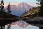
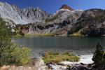
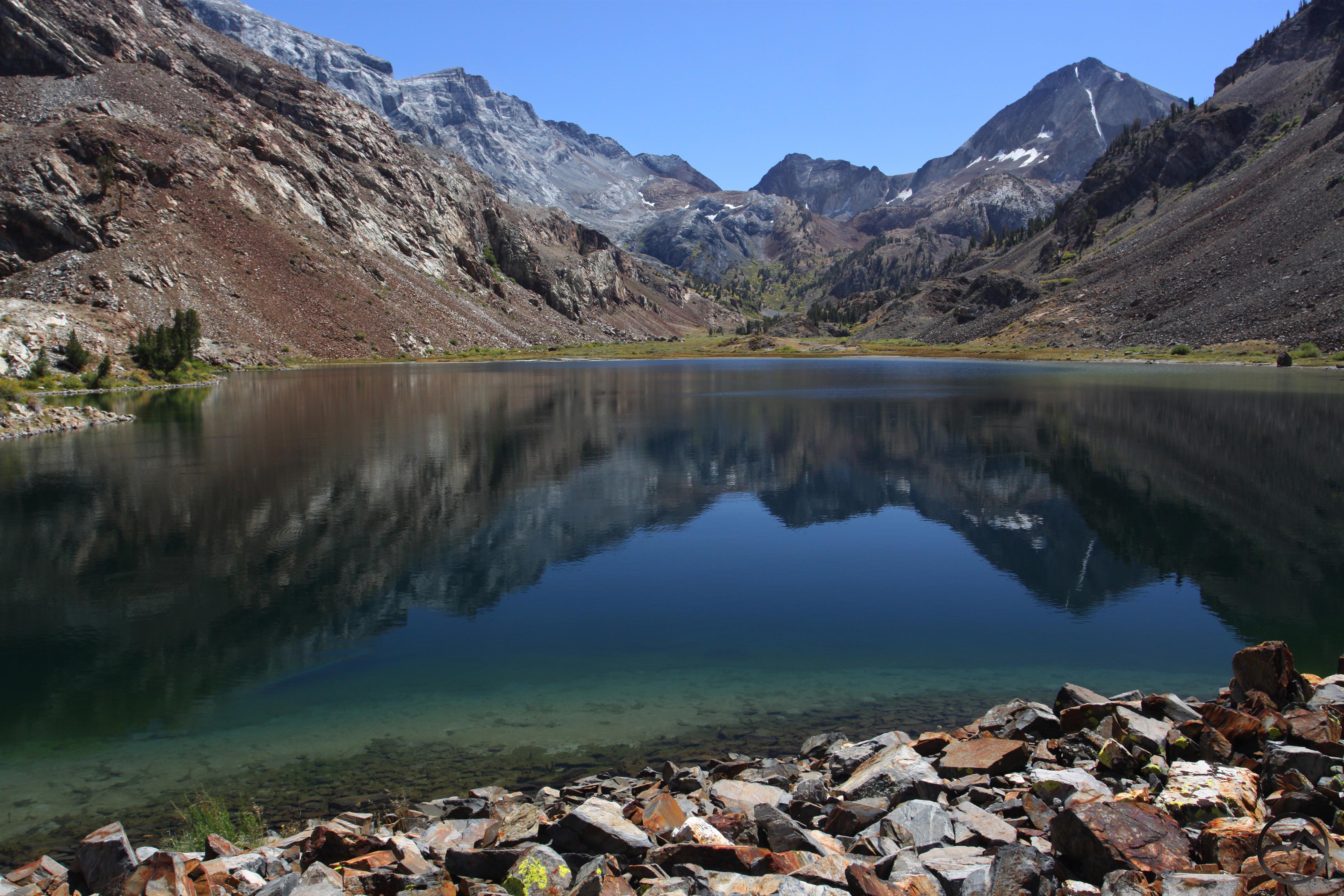
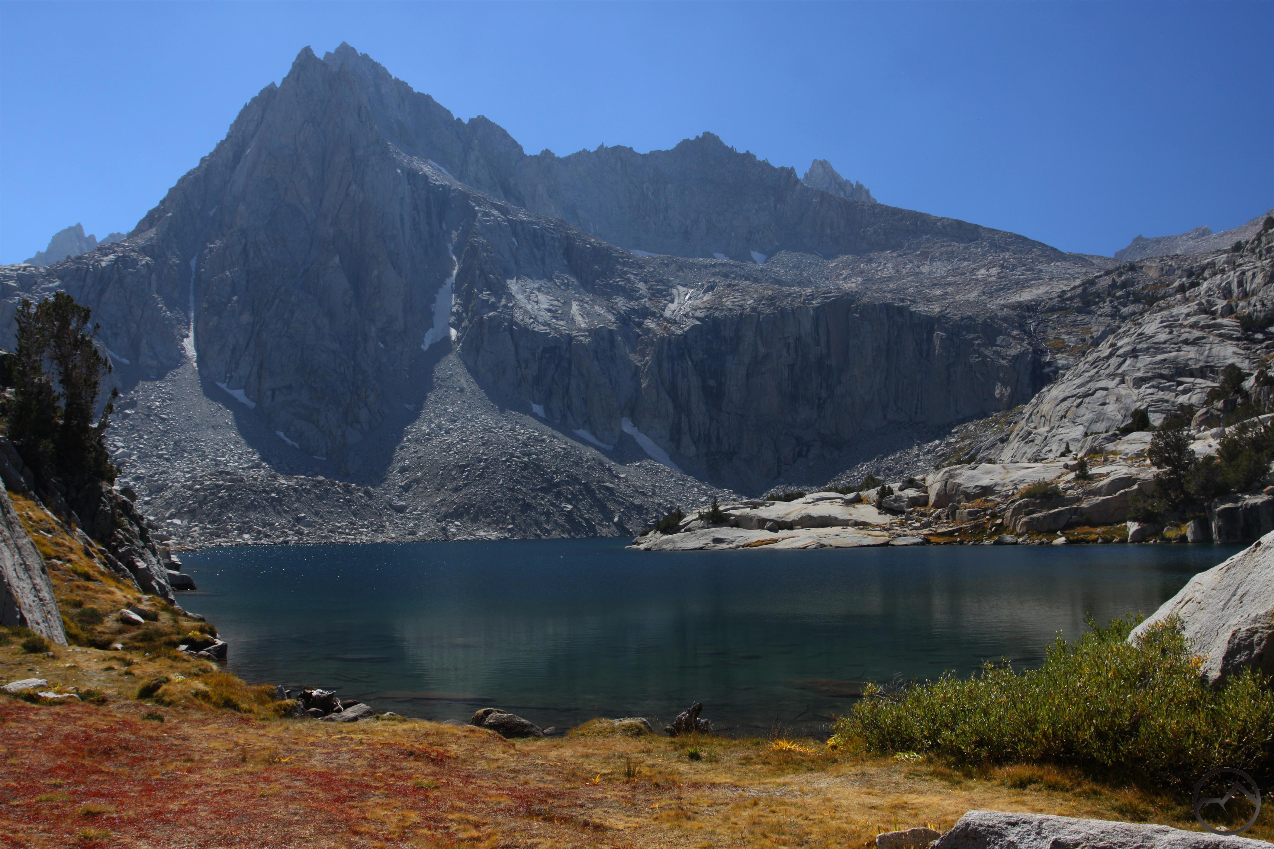
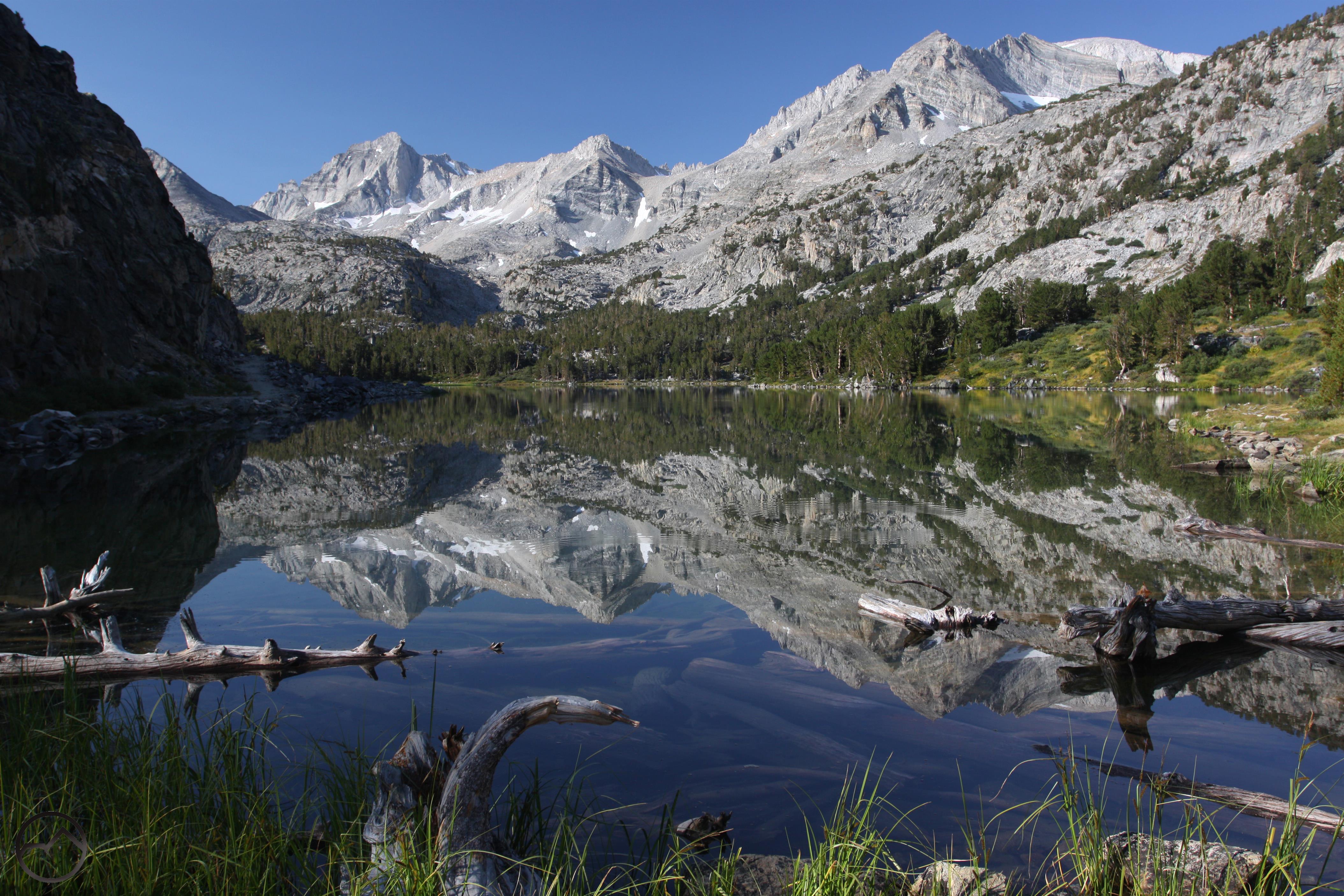
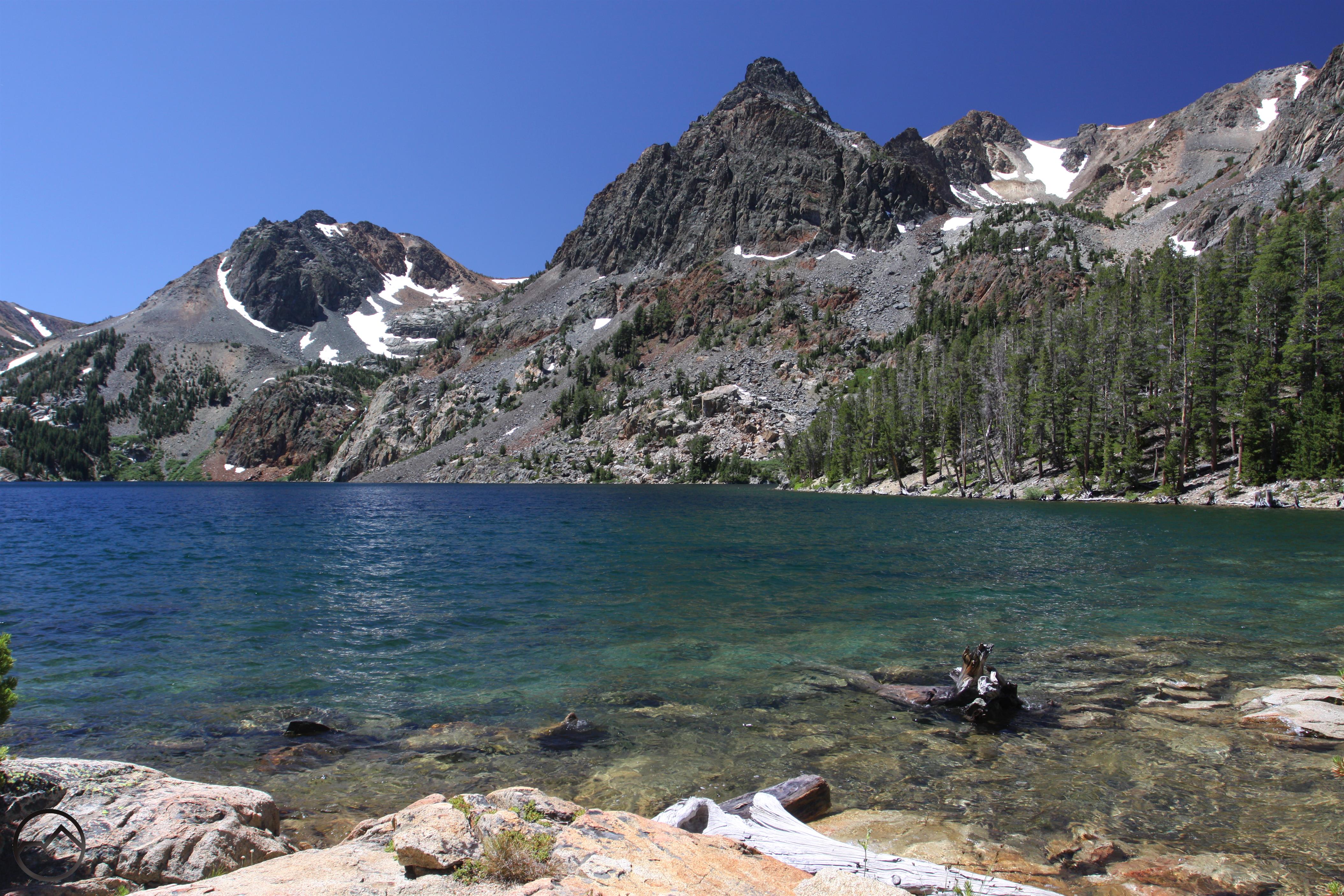
Bear Creek Spire and Mount Dade are a majestic backdrop in Long Lake in the Little Lakes Valley.

I got home from another stint down in the Sierra Nevada a few days ago. Like previous trips, this one was a long, hard journey. Unlike previous trips, my feet help up better this time and I was able to enjoy the hikes in a much higher degree of comfort. Aside from the state of my getaway sticks, this was my favorite trip so far in terms of destinations. The focus of this trip was on high elevation destinations in the central and southern part of the range. Many hikes had elevations over 10,000 and 11,000 feet. Such rarified air meant spectacular settings. This was certainly the case as I traveled through some of the Sierra’s most stunning settings. I certainly am grateful for the opportunity to explore this magnificent mountain range this summer.

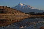
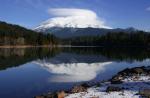
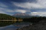
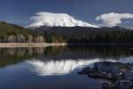
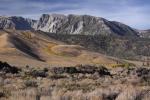
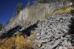
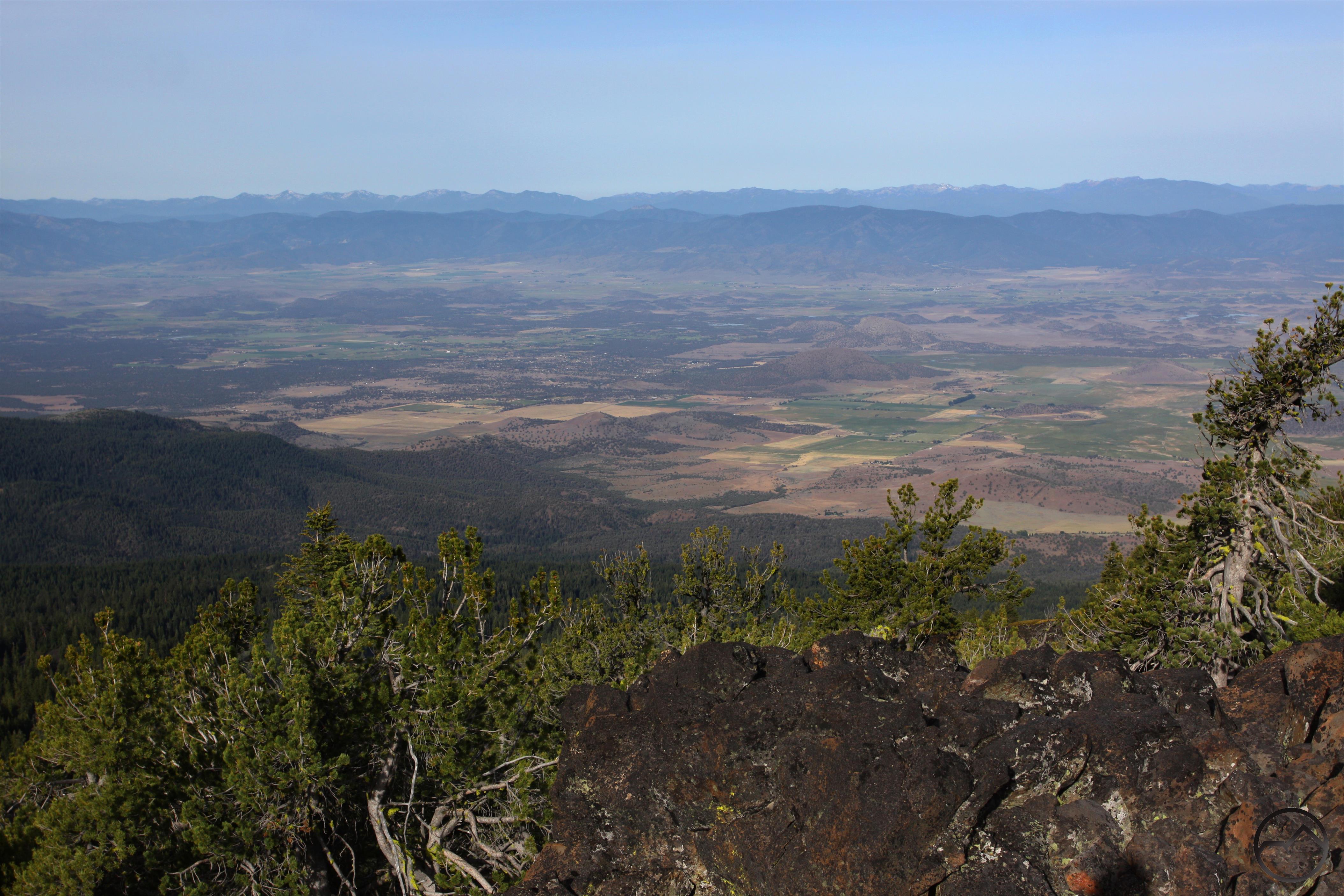
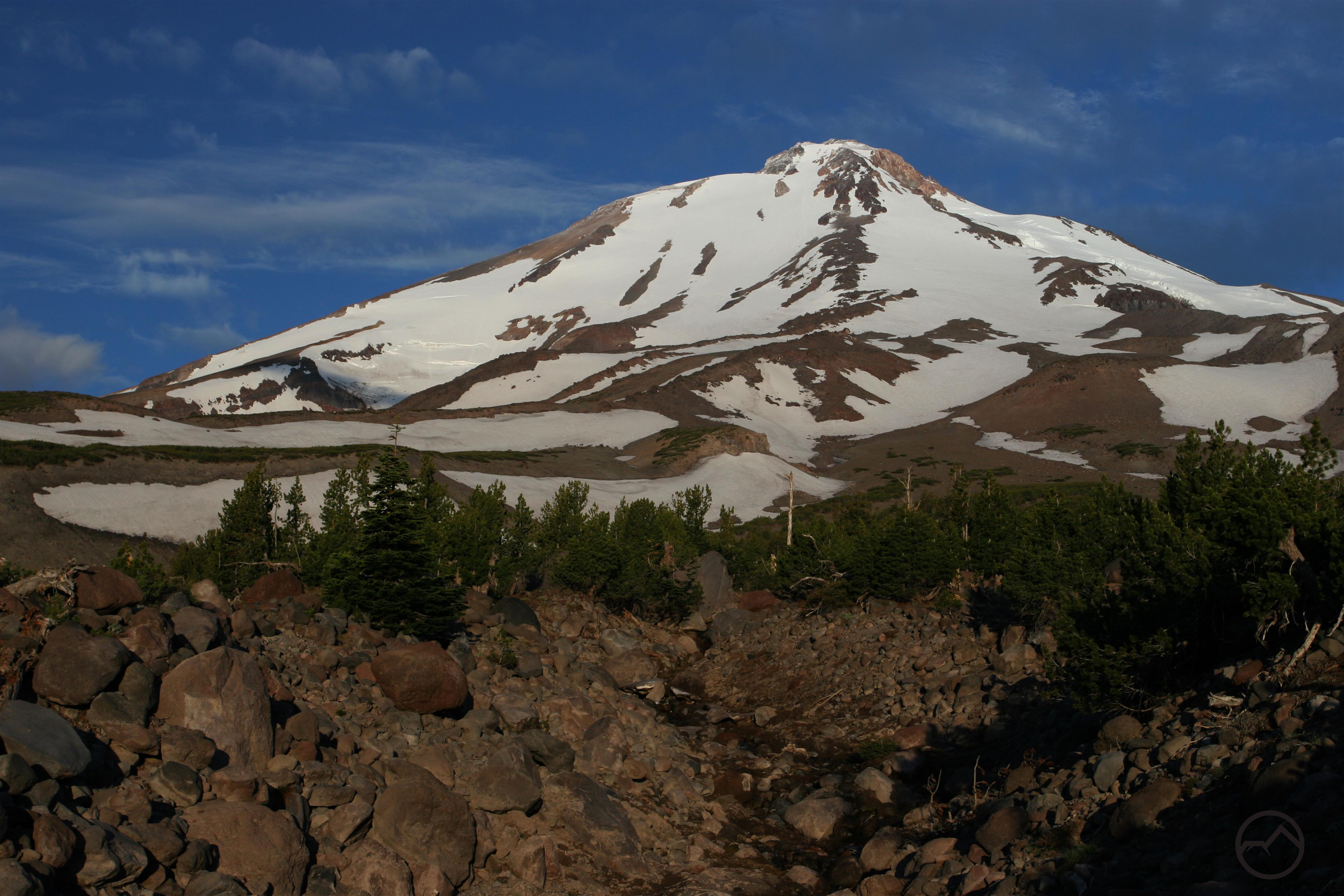
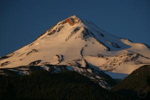
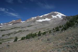
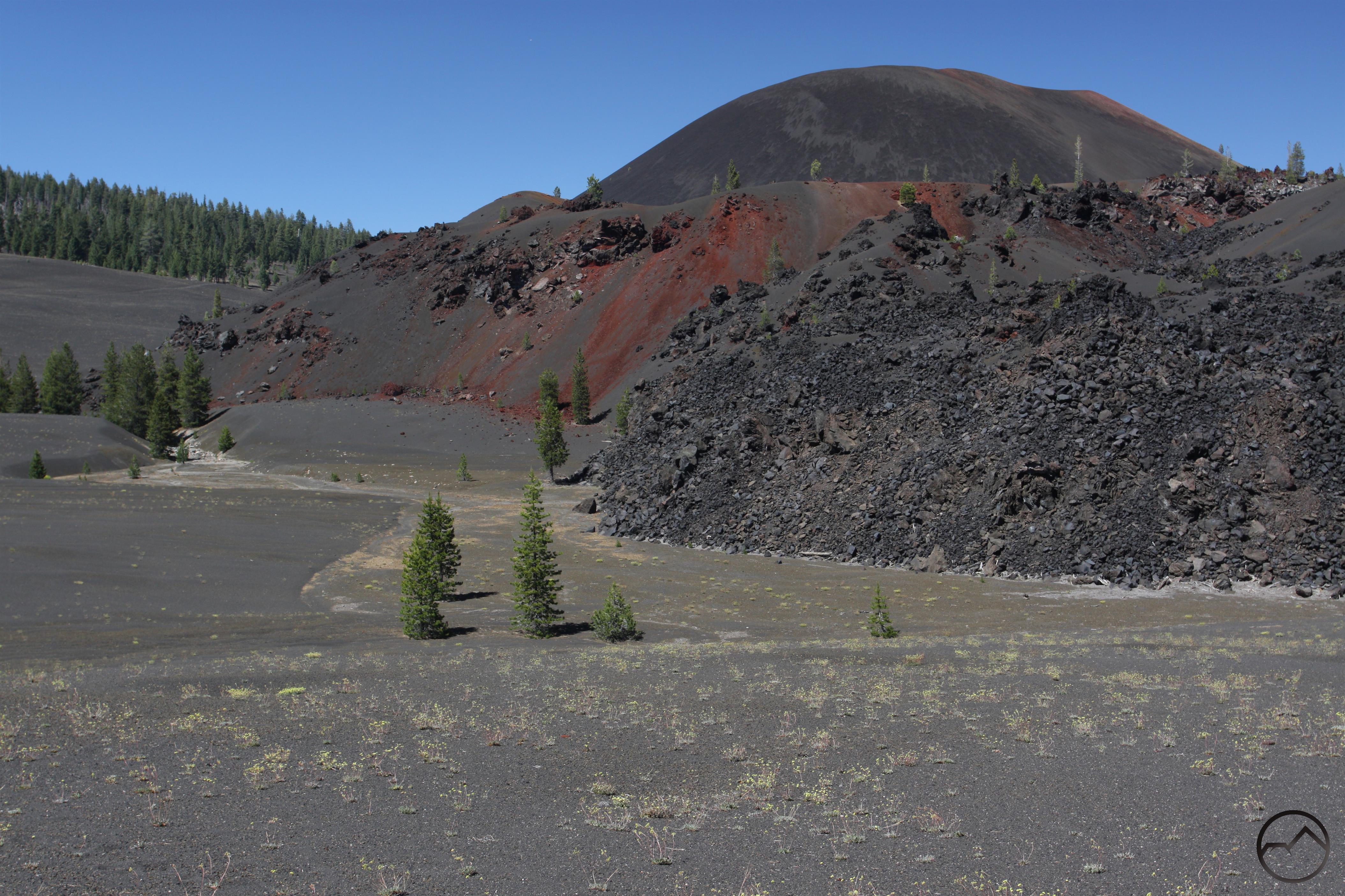
The trip began in the range’s central highlands. The northern part of the Sierra Nevada is much like the Klamath Mountains, with a mix of different rock types punctuated with large granite batholiths. The southern part of the range, the classic High Sierra, is a vast sea of stark, glaciated granite. The central part of the range is also dominated by granite expanses but these are frequently overlaid with volcanic rocks. Most of the highest peaks in this area are the remnants of old volcanos or lava flows. The juxtaposition of classic granite with the volcanic rocks creates an unusual appearance in contrast to other, more famous parts of the Sierra Nevada. After this I moved south, hiking trails in high country that rises west of the Sierra crest. It was from here that I finally swung around the southern end of the range and made my way up stunning Highway 395. From here I embarked on a series of incredible trips in the High Sierra. This is one of the most magnificent slices of mountain terrain found anywhere.

Sierra Nevada North, Ebbetts Pass - Aug2016 037 (Custom)

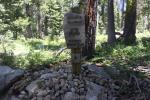
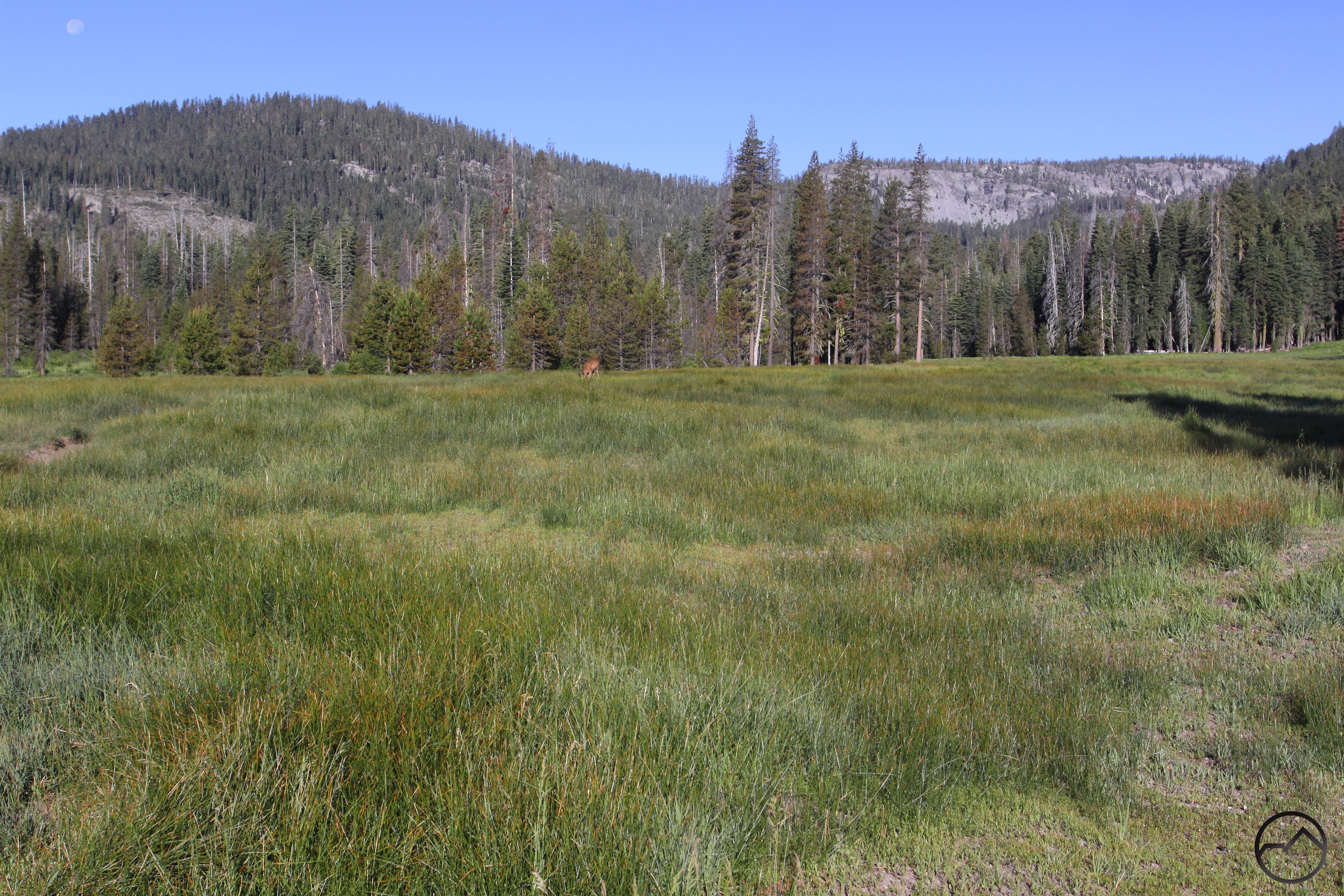
The first hike I did on this trip was along the PCT to Nobles Lake. The hike starts at 8,736 Ebbetts Pass. It travels through a series of small streams choked with wildflowers. These colorful plants are a striking contrast to the twisted, volcanic landscape. The poorer soil and eastern location mean this is a drier, more arid environment. Nonetheless, it is quite scenic with a series of peaks over 10,000 feet looming over the small lake. Views to the north toward the ragged summits of the eastern Mokelumne Wilderness.

Sierra Nevada North, Mokelumne Wilderness - Aug2016 088 (Custom)

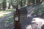
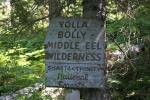
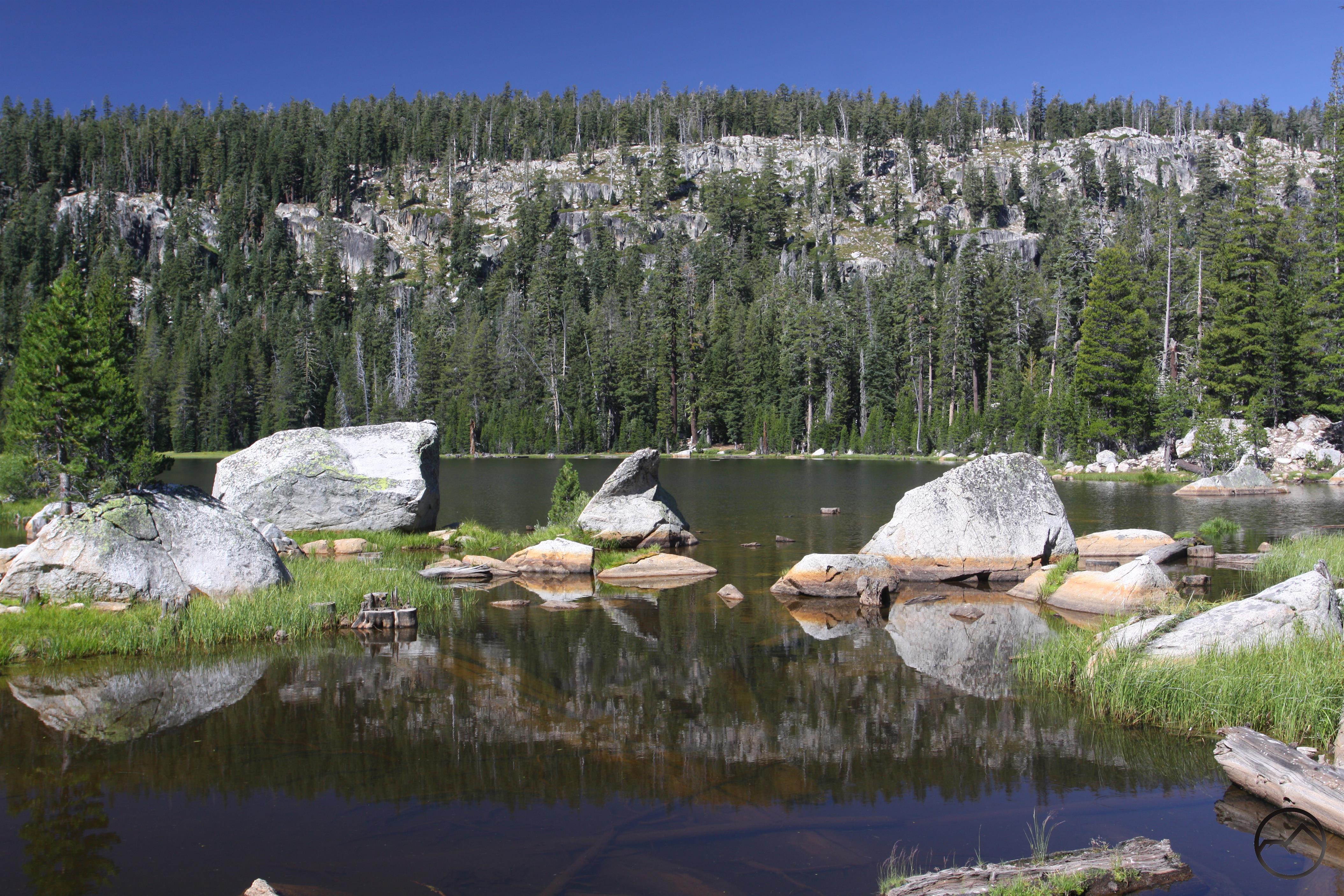
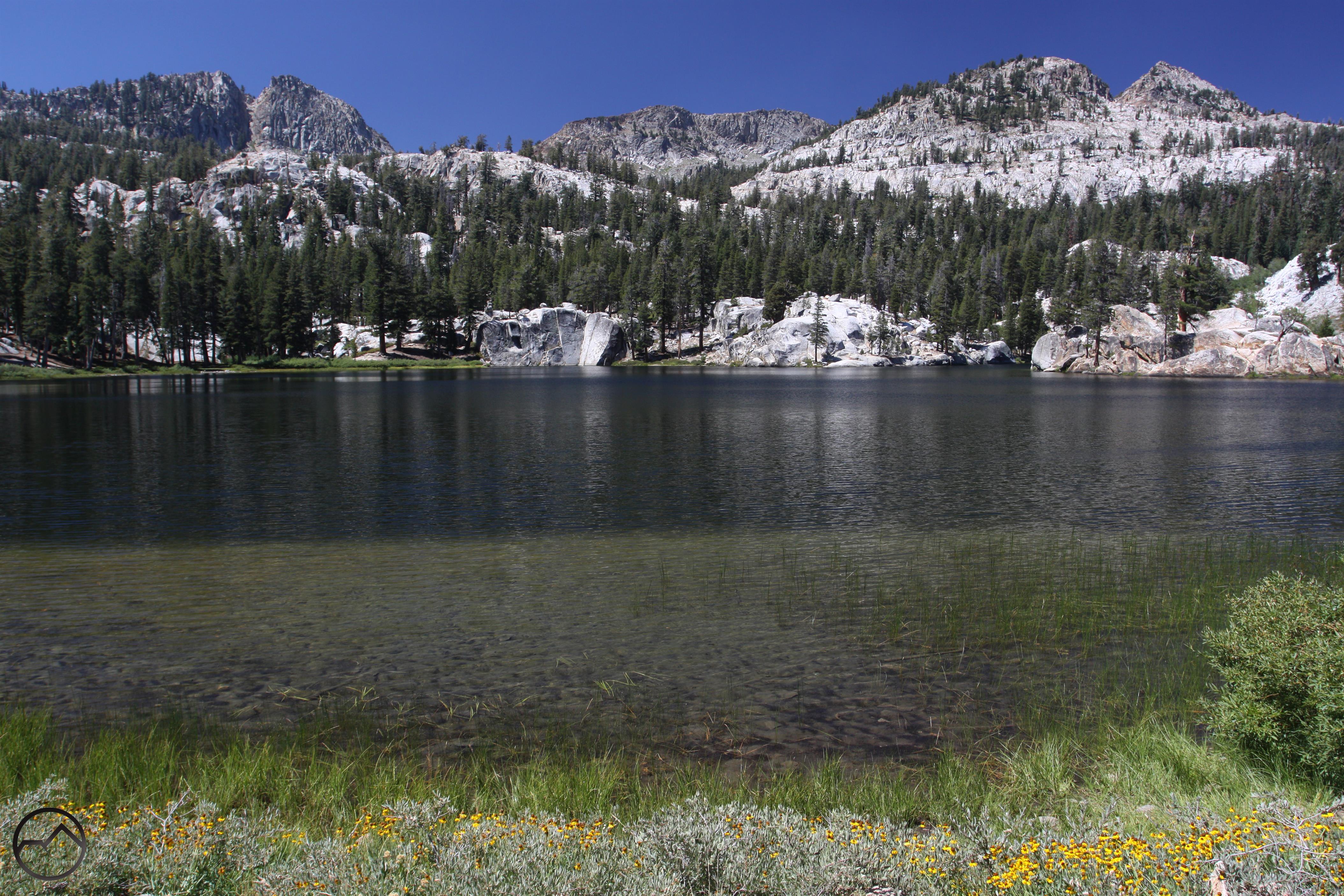
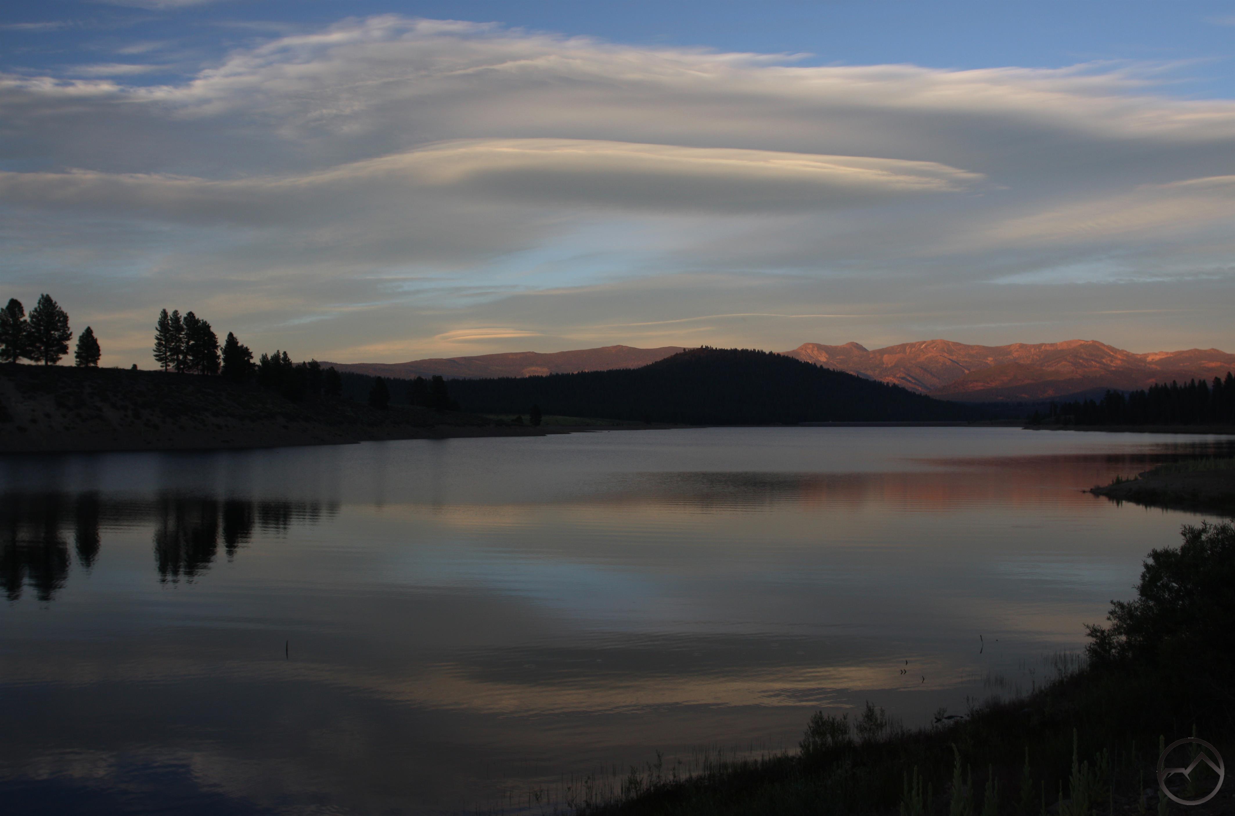
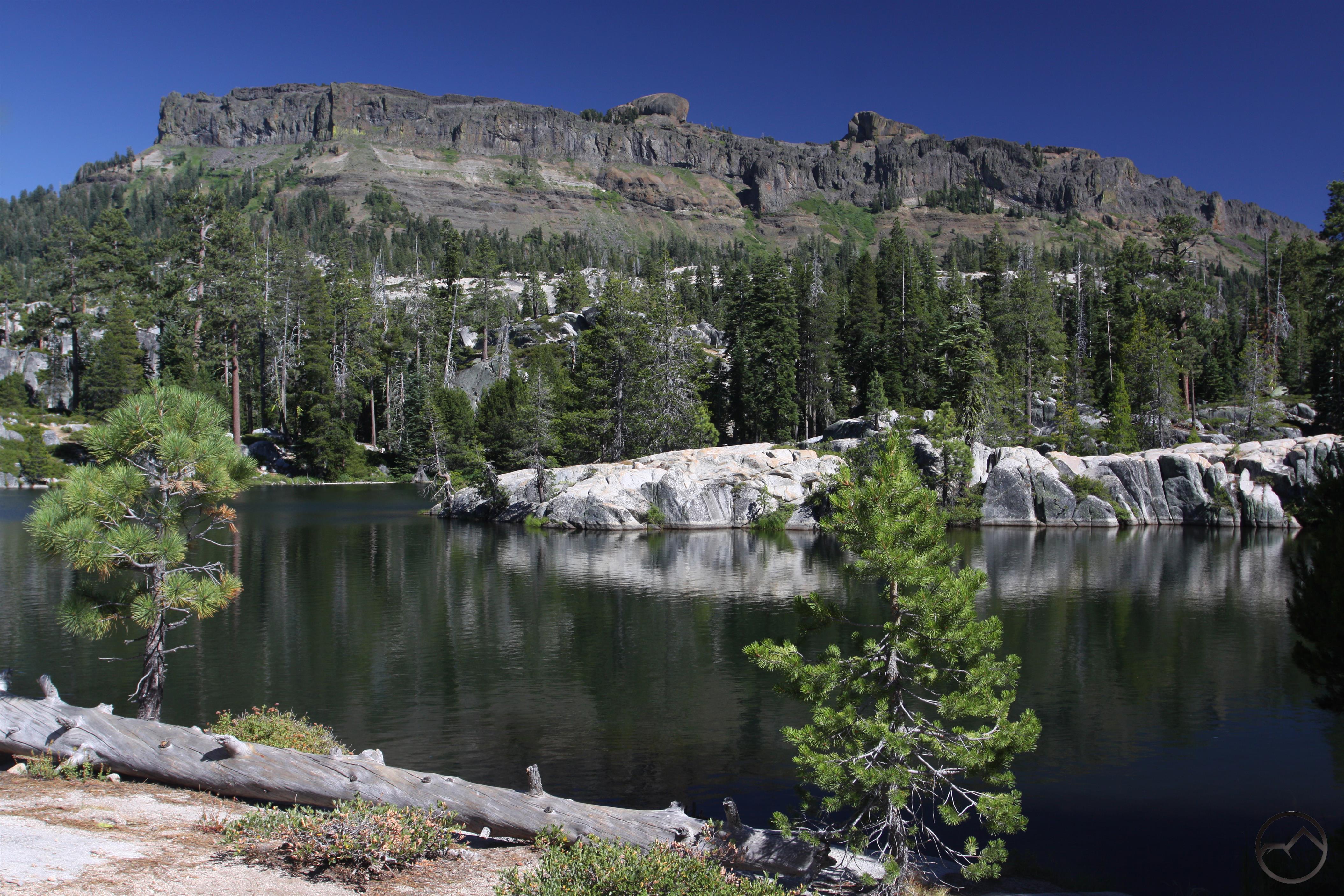
The next day I ventured into the southern end of the Mokelumne Wilderness. The trail was a lesser used route that leads to scenic Wheeler Lake. Most of the use this particular wilderness area receives is focused on the north side (understandably since it is gorgeous), leaving this area much less frequently traveled. The hike has a few views of the Mokelumne’s interior and a few meadows before arriving at the lake. Situated in a large granite bowl that is in turn surrounded by high volcanic ridges, it is a classic central Sierra Nevada landscape.

Sierra Nevada North, Carson-Iceberg Wilderness - Aug2016 121 (Custom)

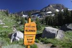
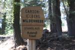
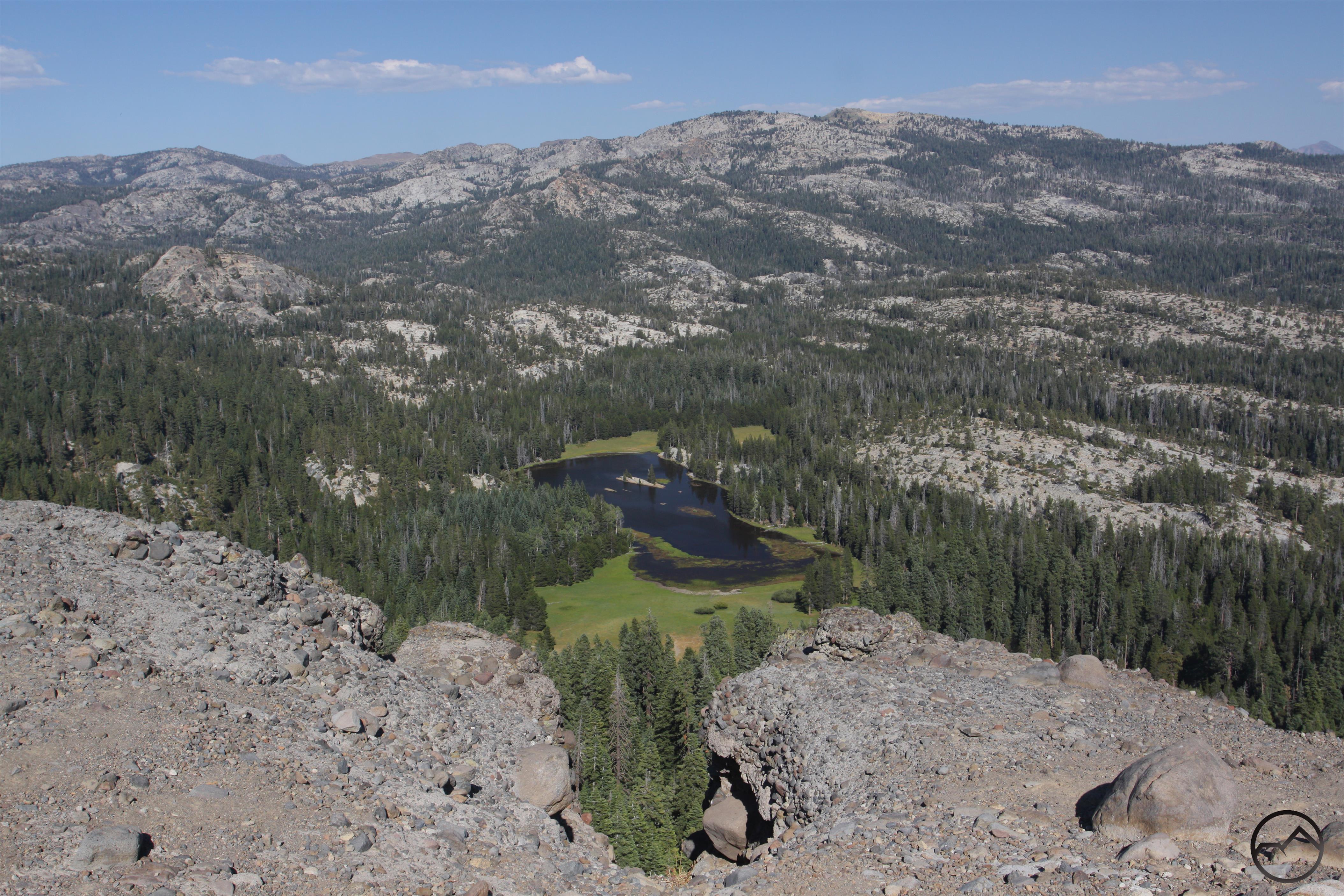
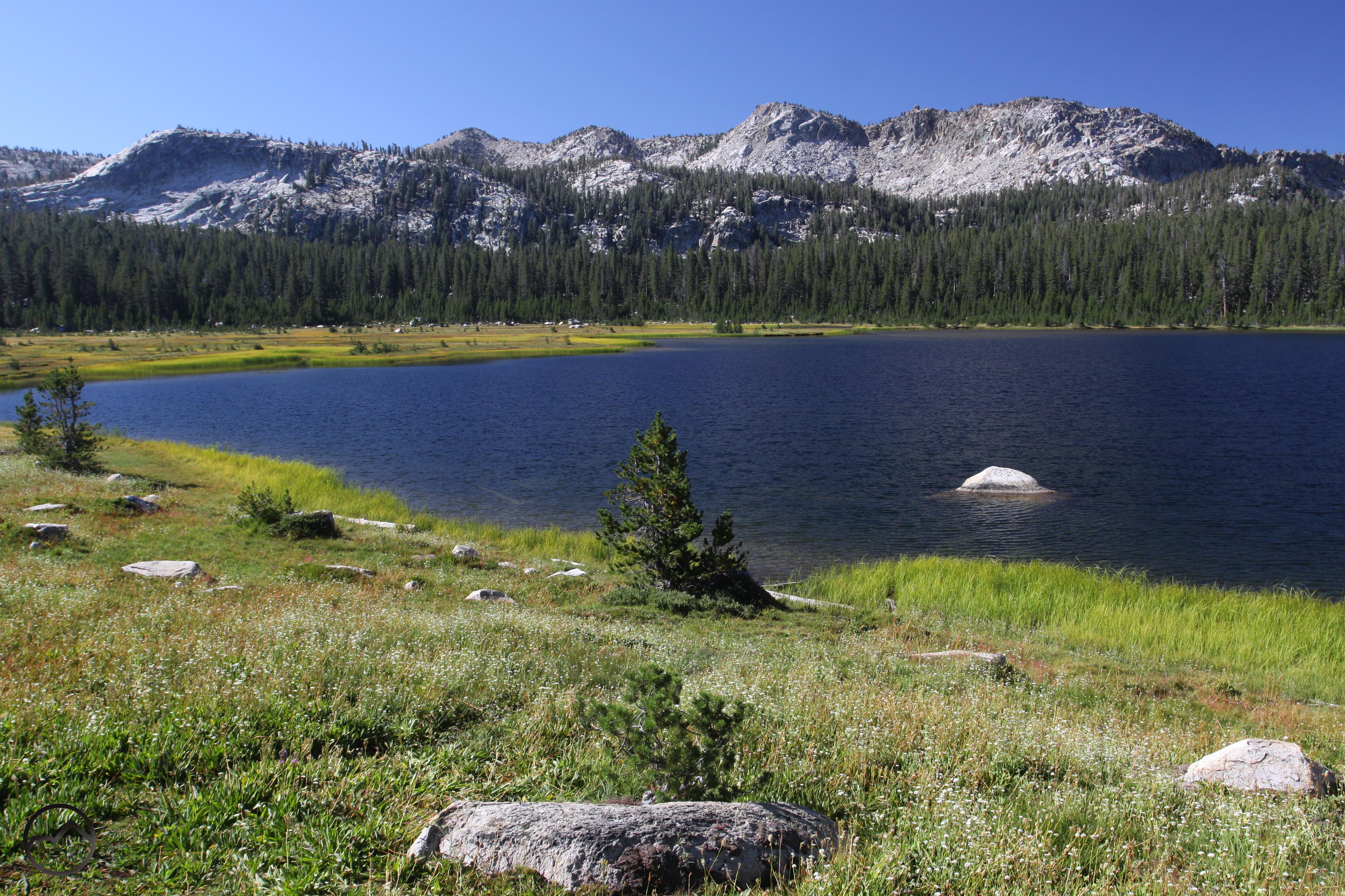
That afternoon I hiked a pair of shorter trails beginning at Lake Alpine. Both of these trips crossed over into the Carson-Iceberg Wilderness. The first went to shallow but pretty Duck Lake. This lake is found in lovely meadow amidst rolling granite bluffs. While gray Bull Run Peak rises to the east, the dark volcanic bulk of Inspiration Point looms immediately south of the lake. A few pioneer cabins provide some interesting history. The other hike ascends Inspiration Point for a fantastic view. From the summit much of the Mokelumne Wilderness is visible to the north while to the majority of the Carson-Iceberg Wilderness unfolds to the south. Especially prominent is the black ramparts of the Dardanelles.

Sierra Nevada South, Sonora Pass - Aug2016 200 (Custom)

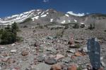
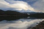
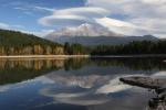
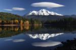
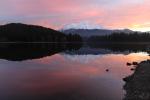
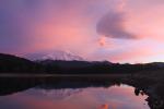
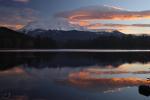
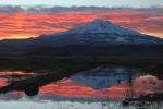
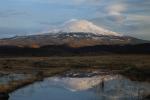
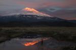
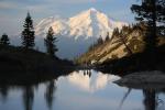
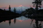
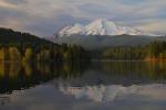
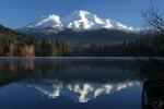
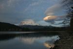
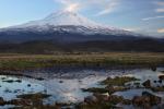
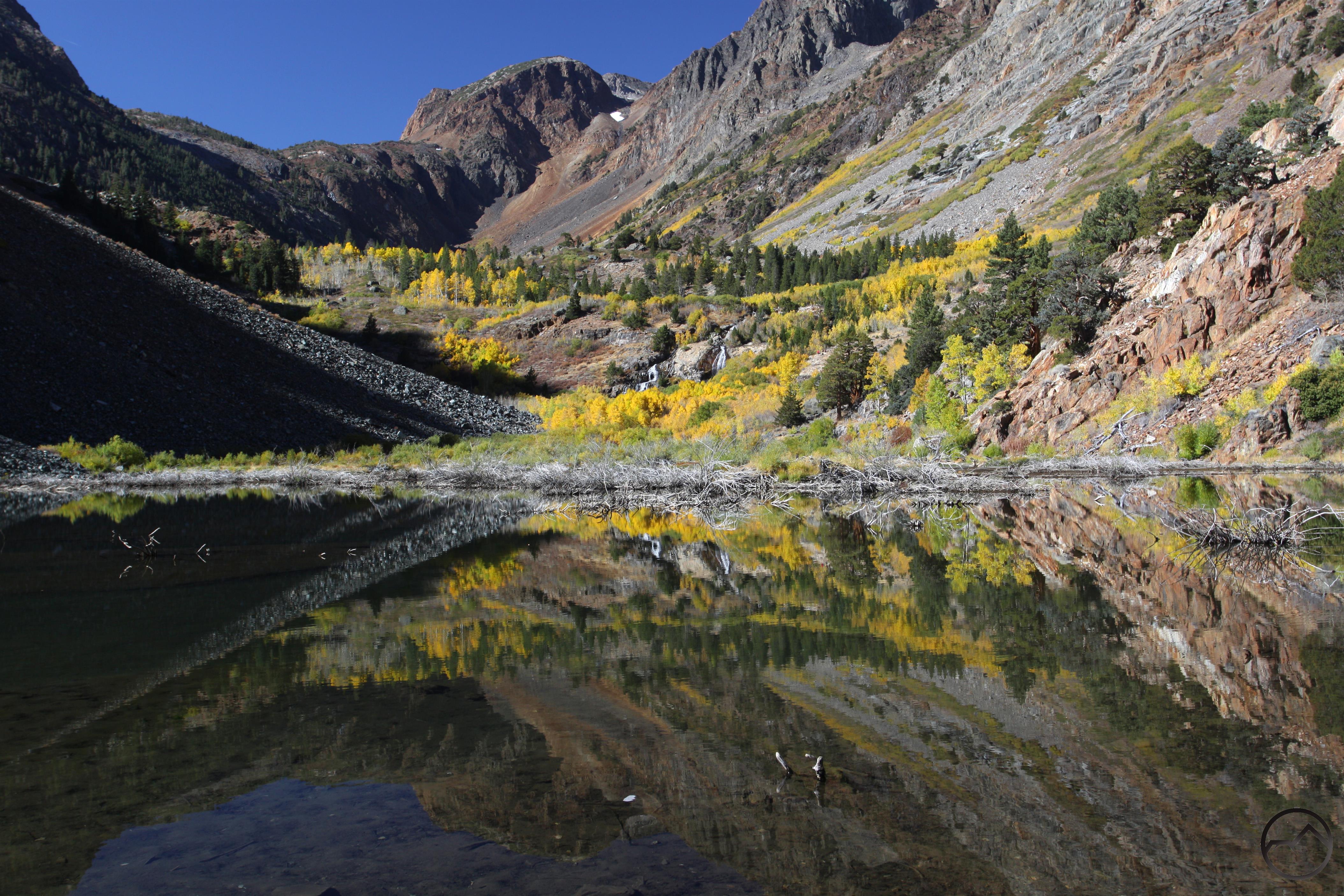
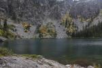
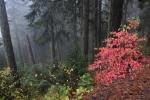
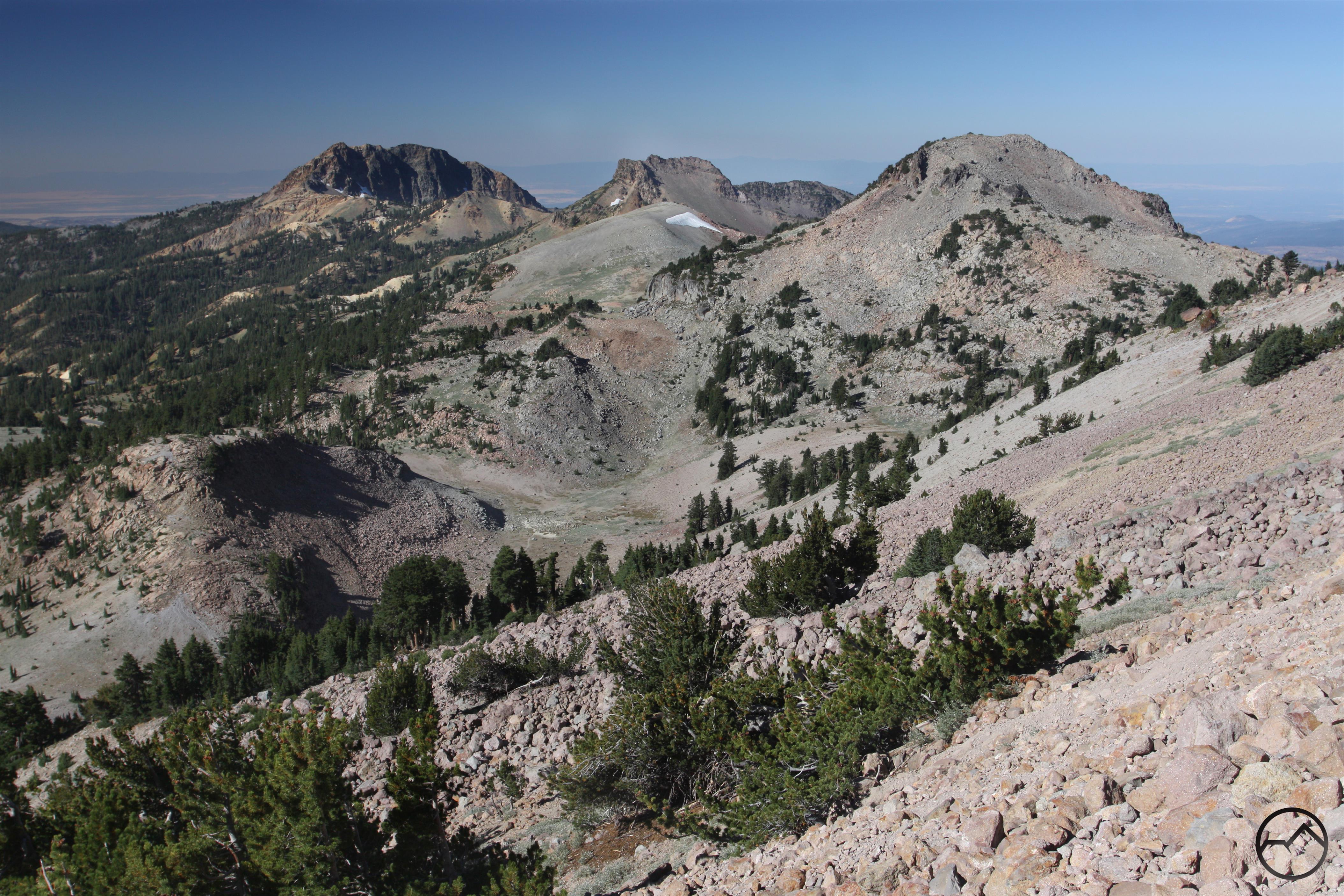
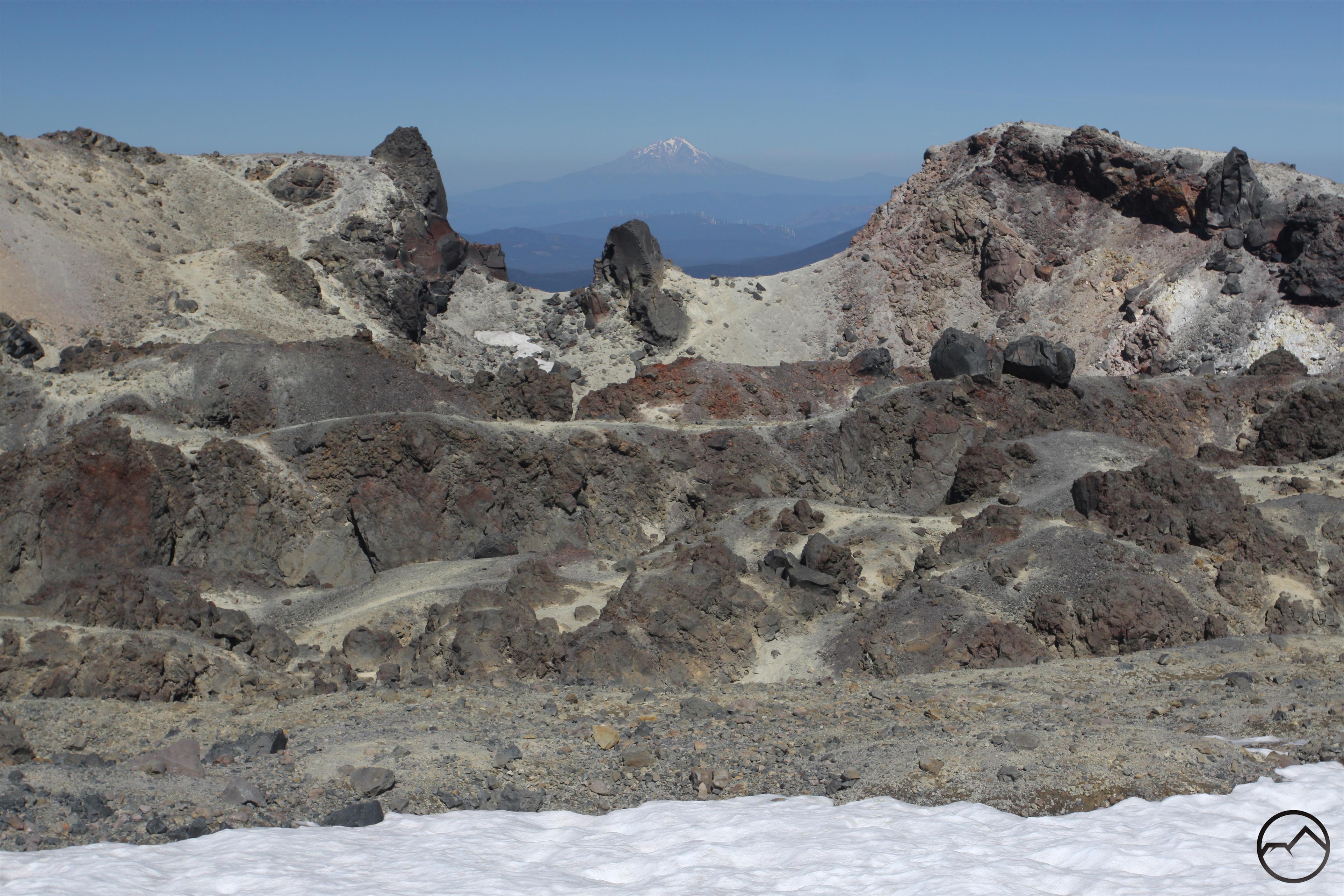
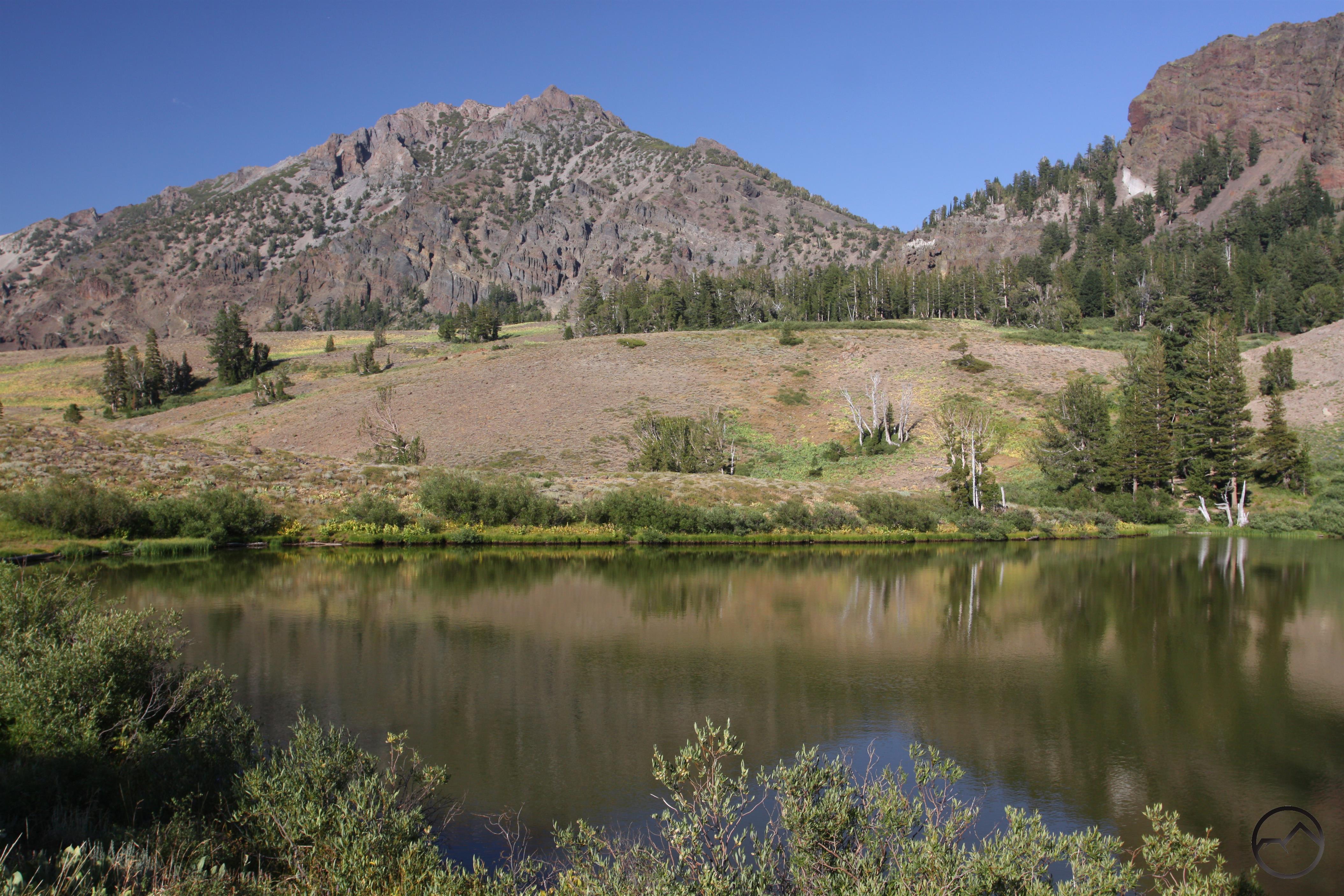
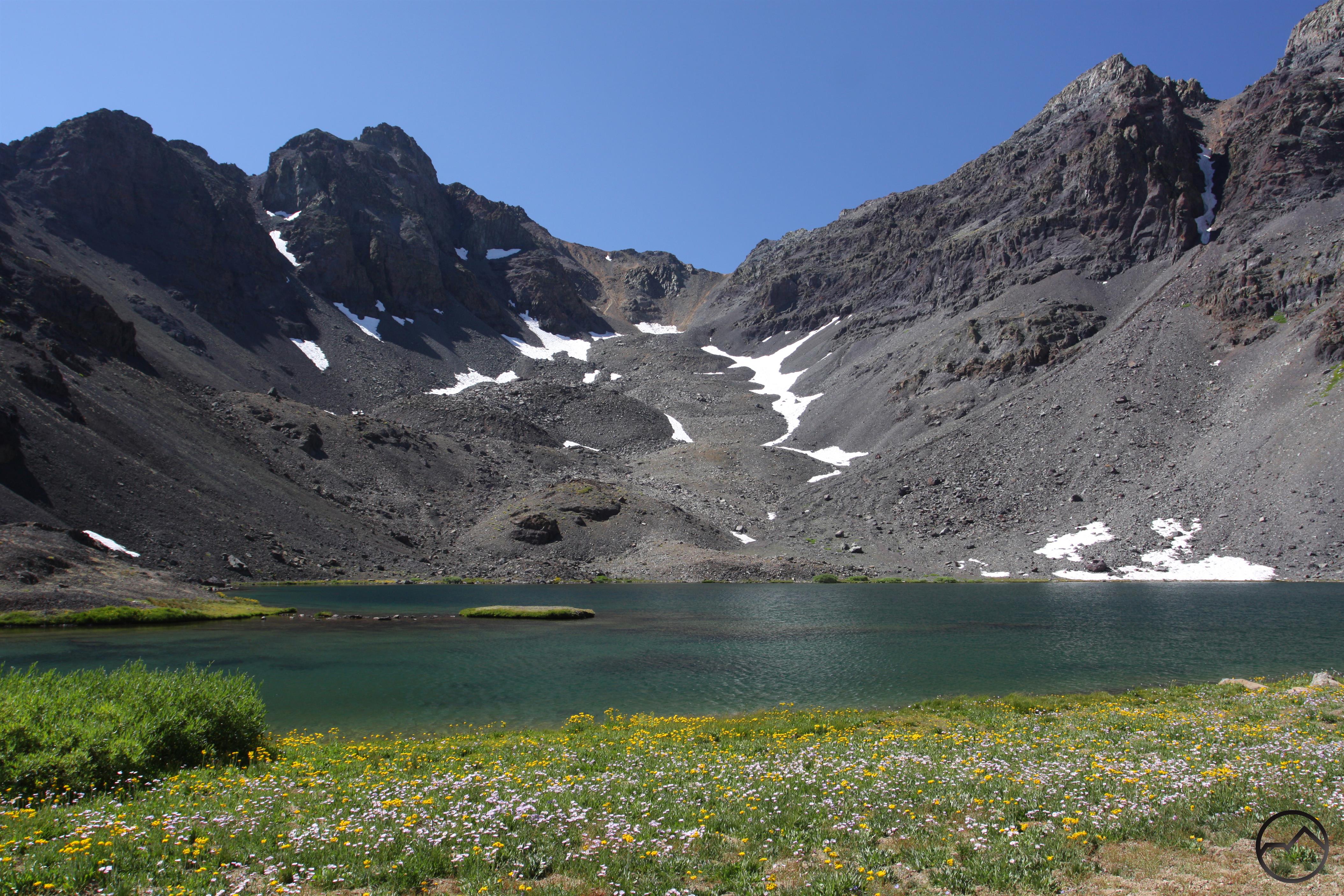
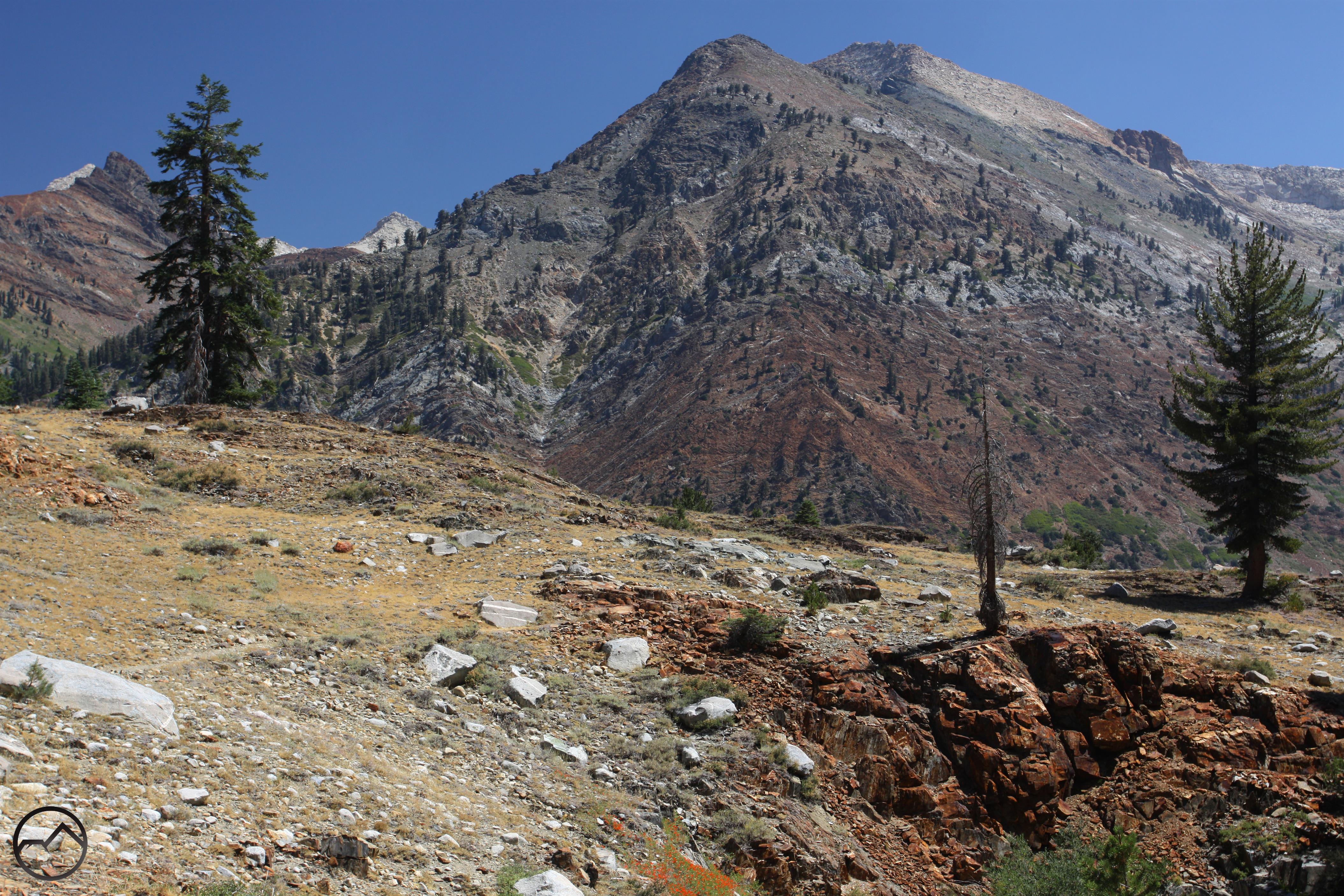
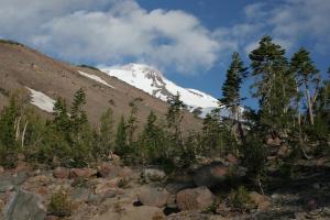
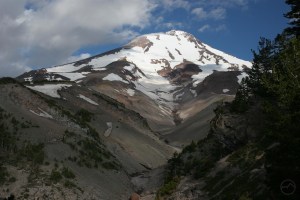
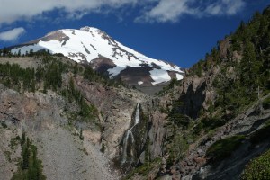
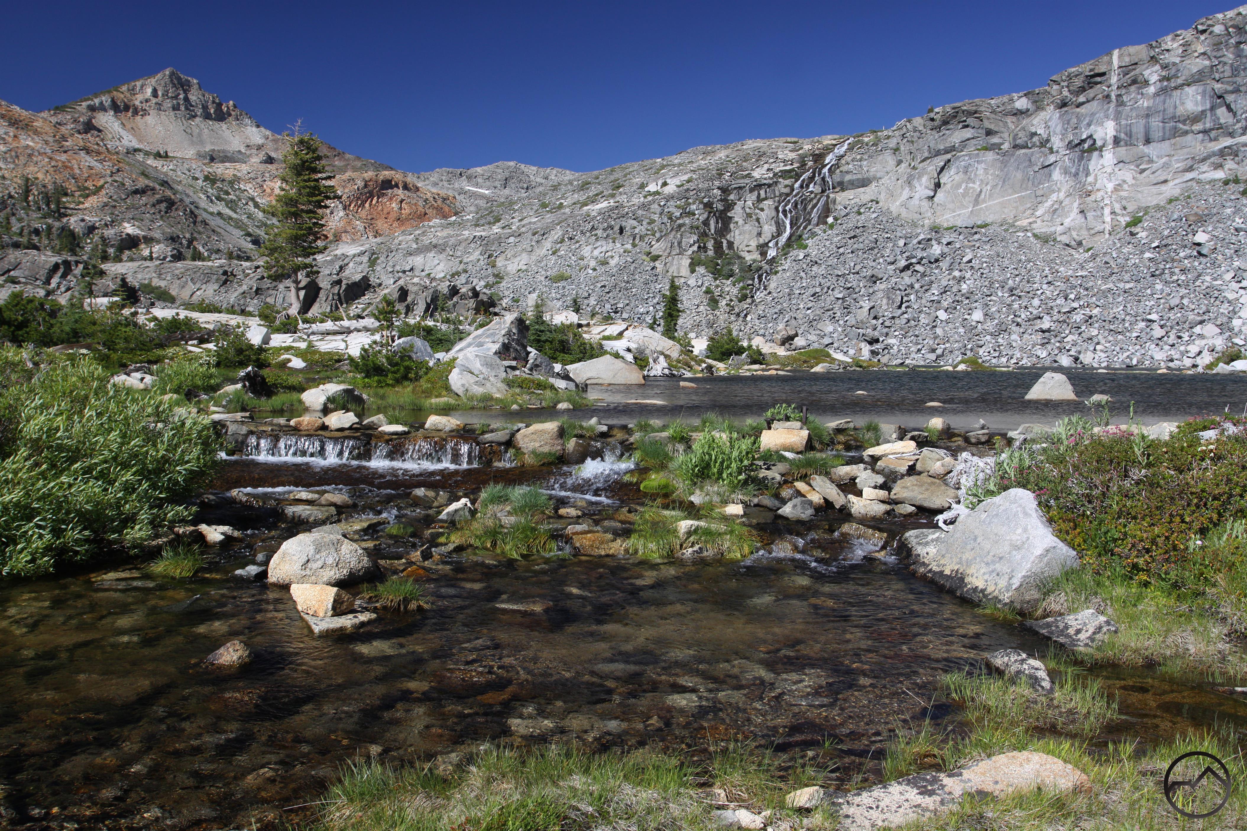
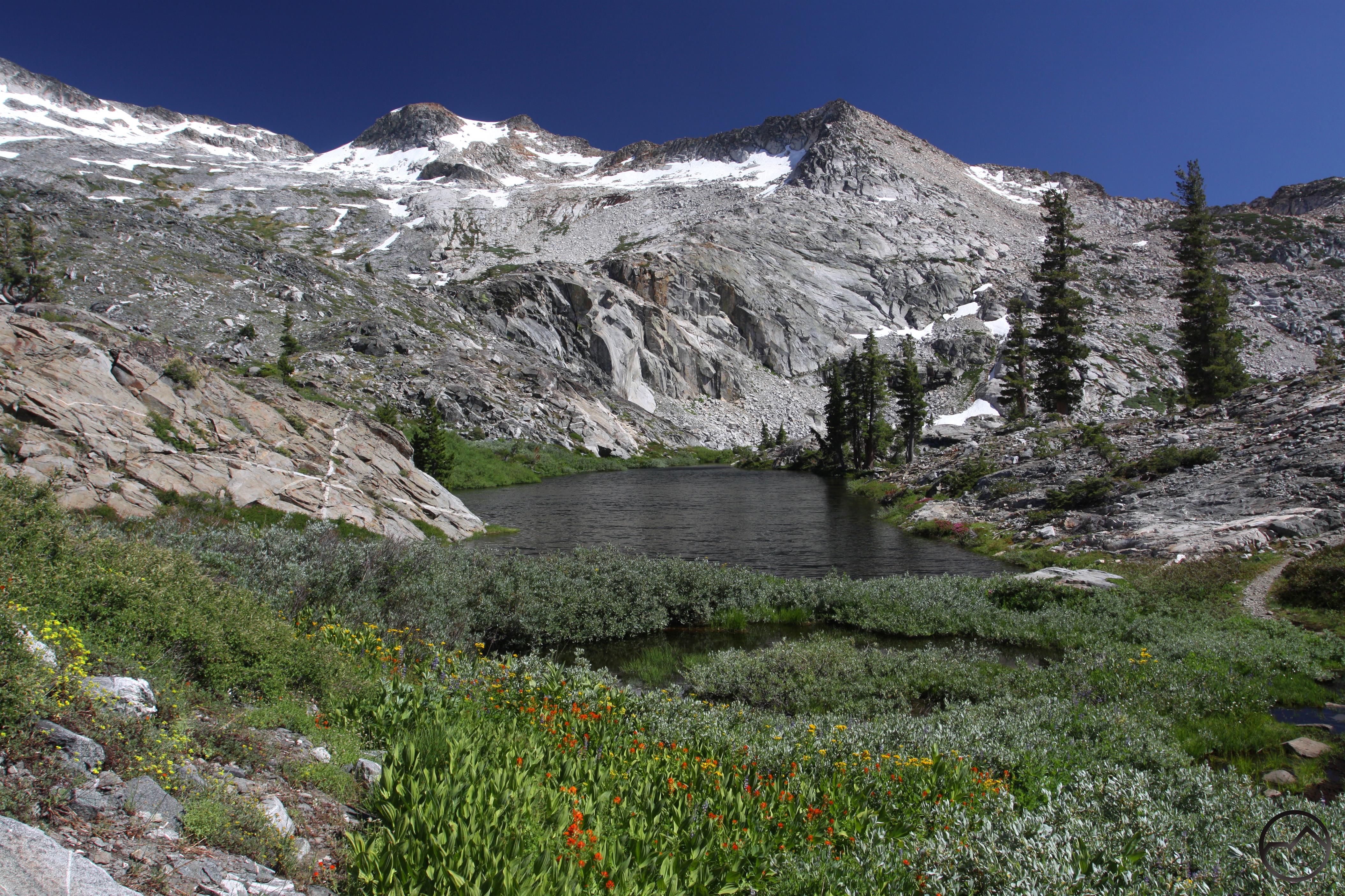
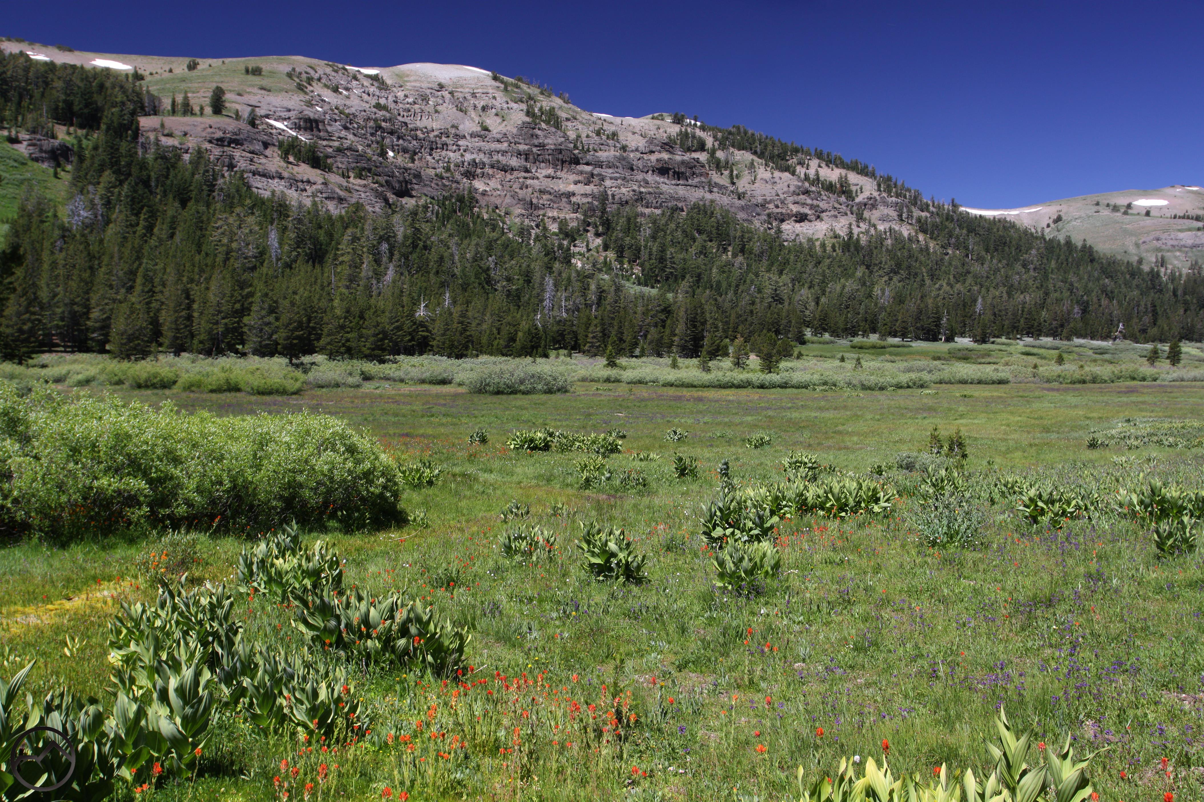
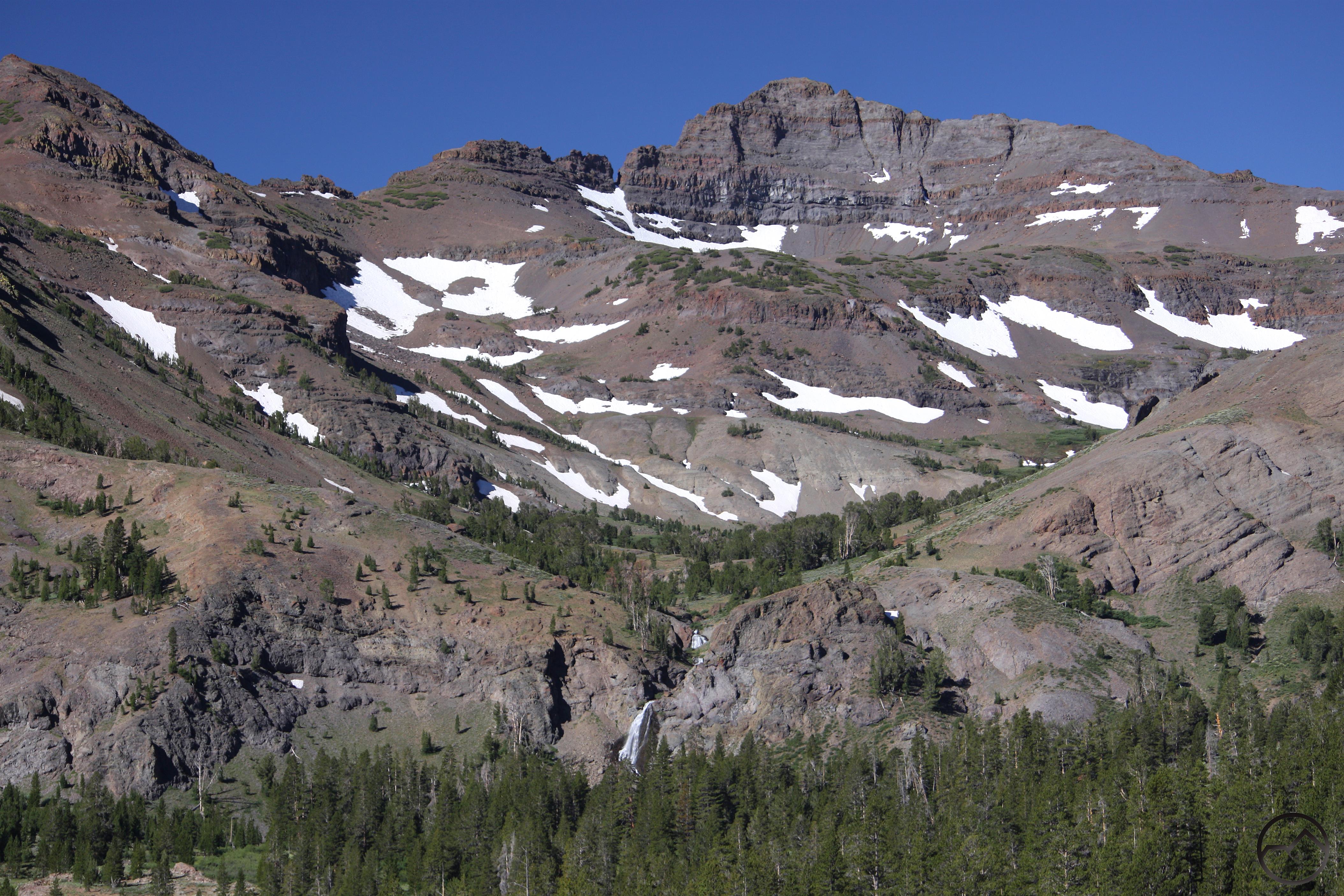
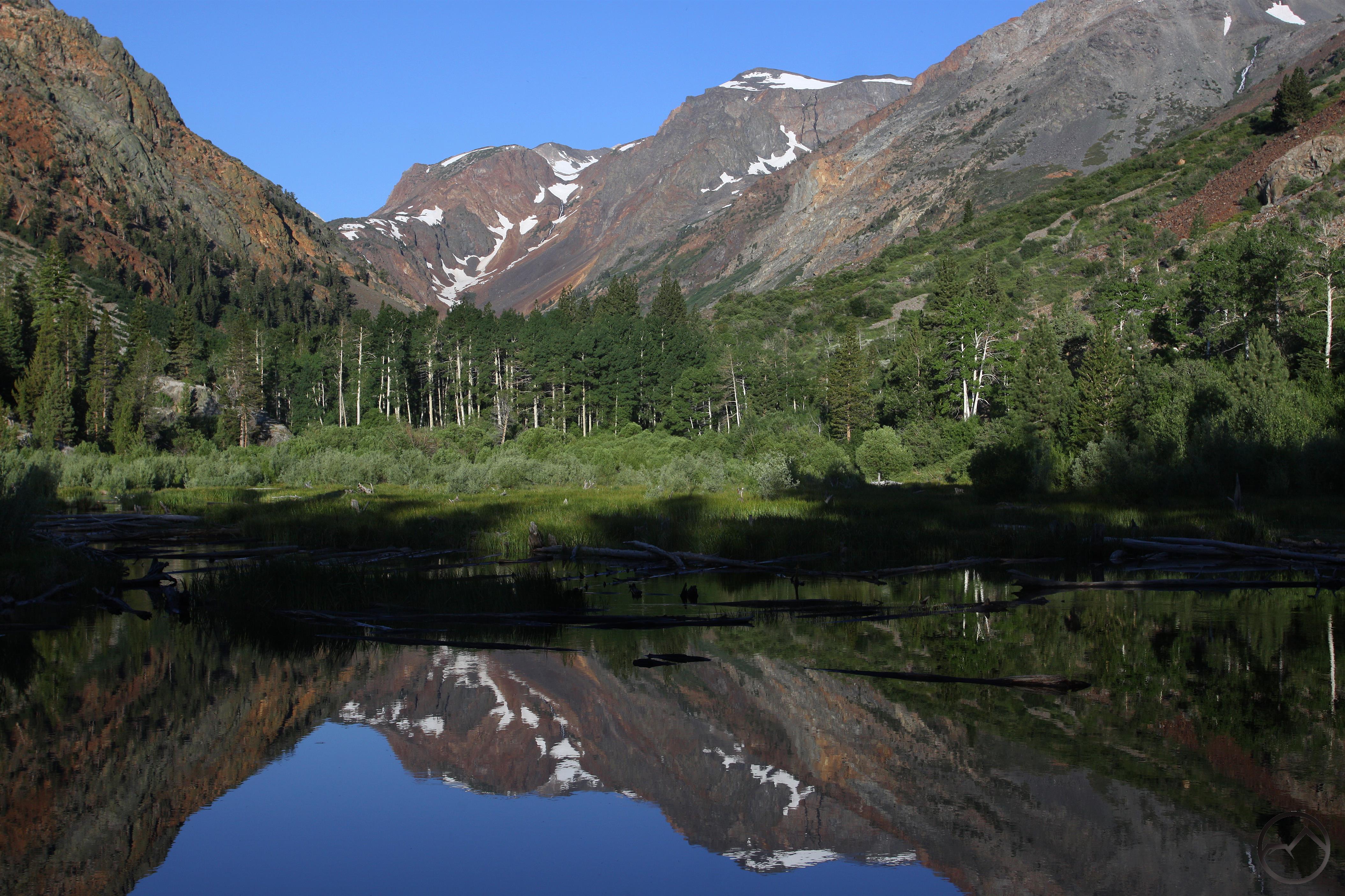
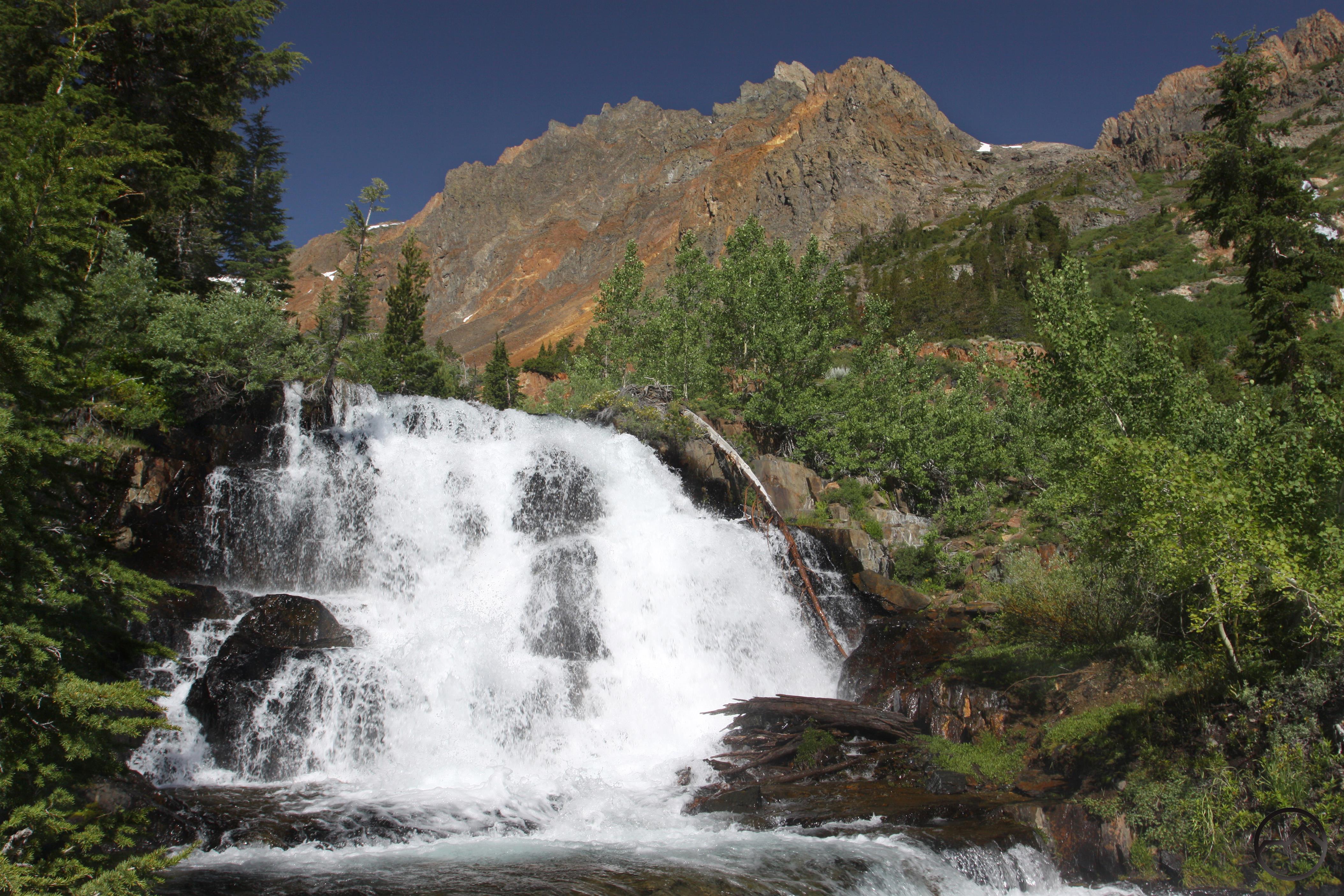
The next morning I drove up to Sonora Pass and hiked up to awesome Blue Lake. This is an area unlike any other part of the Sierra Nevada. Here the volcanic terrain climbs to much higher elevation that it does elsewhere in the central Sierra Nevada. Reaching elevations over 11,000 feet, this area is a beautiful mix of alpine scenery and barren rock. The trail climbs steeply up the canyon, staying close to a series of creeks and passing through a succession of meadows with a panoply of wildflowers. Arriving at Blue Lake, the trees have long since been left behind and there is nothing but rock, snow, azure water and blankets of colorful flowers.

Sierra Nevada South, Emigrant Wilderness - Aug2016 247 (Custom)

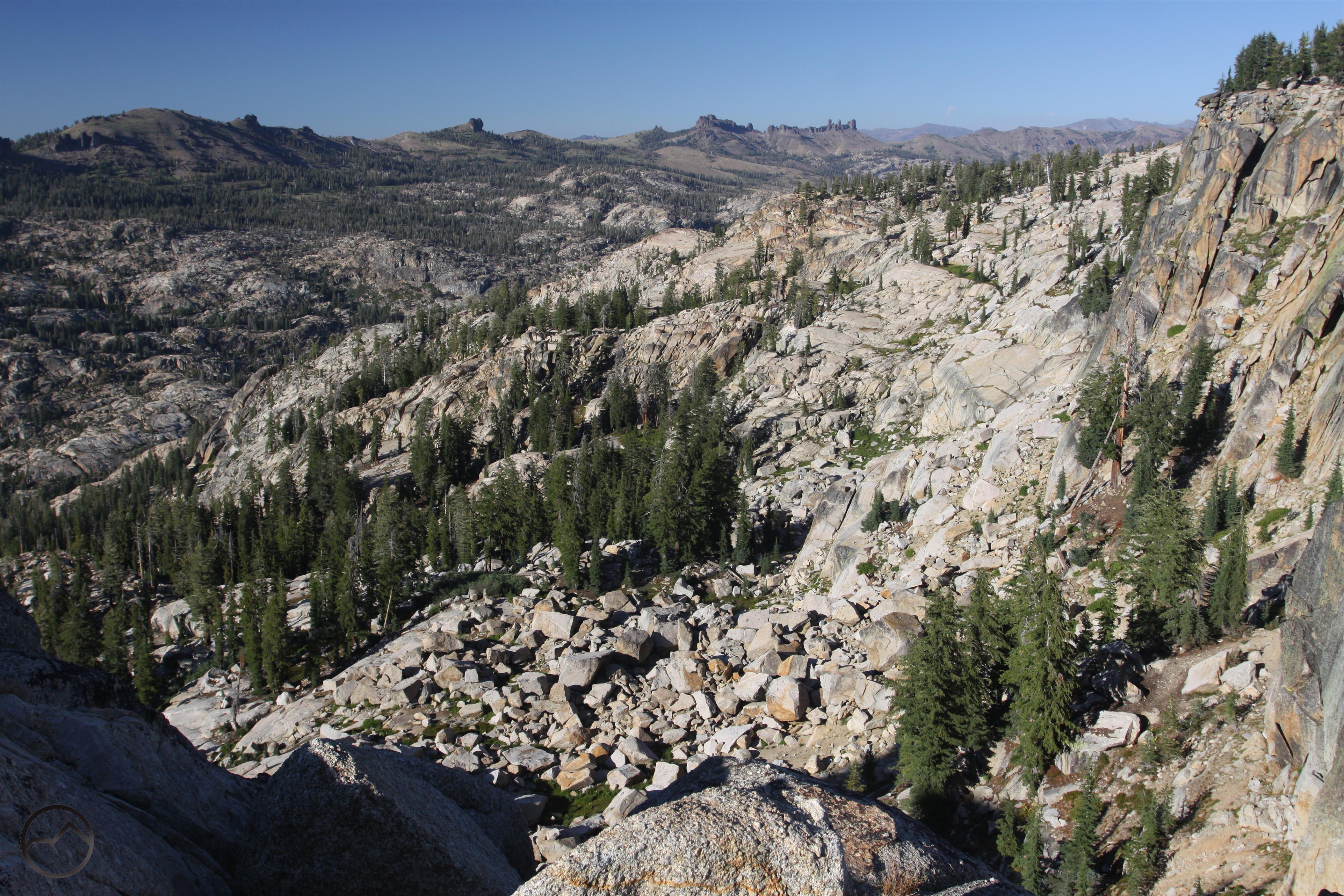
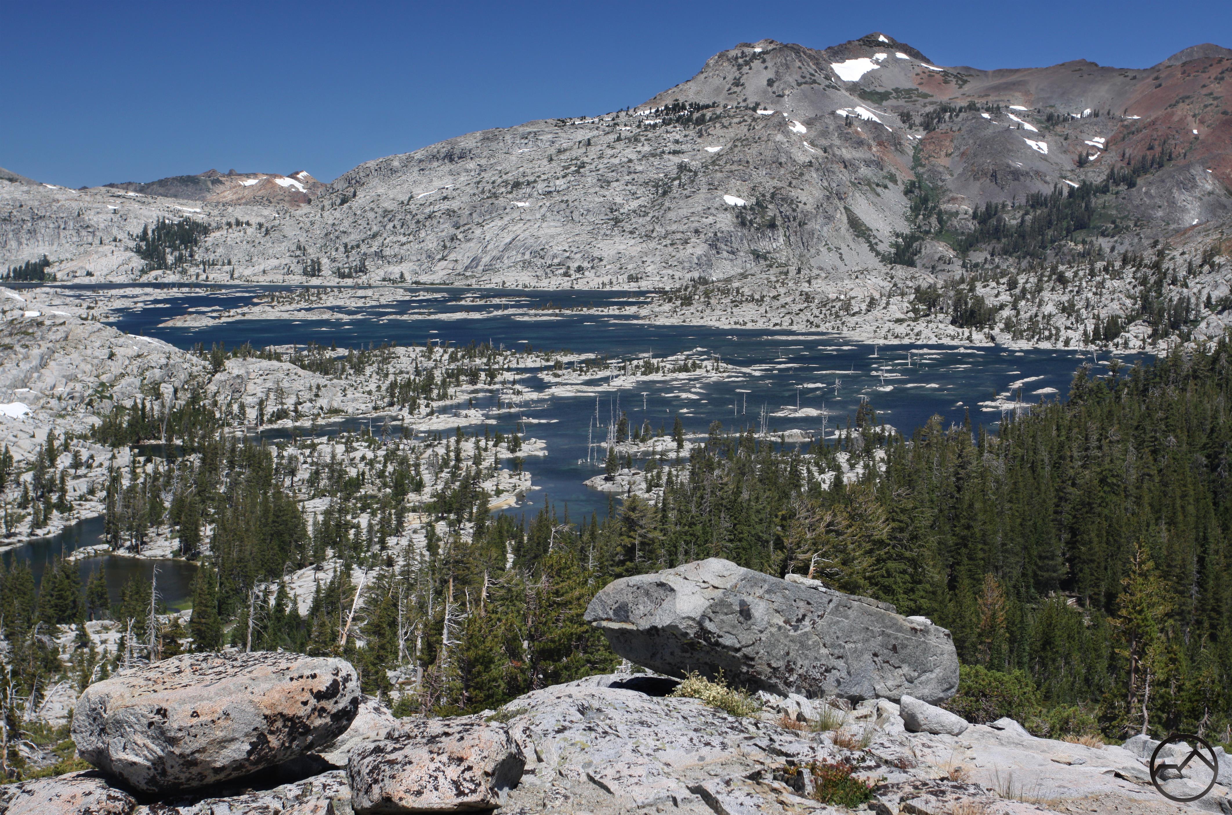
That afternoon I made my way further west and hiked into the Emigrant Wilderness. This area is not heavily used despite being what amounts to an extension of Yosemite. Loaded with lakes and primarily consisting of classic granite terrain, this area is a real gem. I hiked over the historic Burst Rock emigrant route (from the 19th century, hence the name) to both Powel and Chewing Gum Lakes. The former is in a shallow granite bowl and has interesting volcanic pinnacles lining the horizon. Worth noting, the northern Emigrant Wilderness is found at the point of transition where the stark white granite of the High Sierra meets the ruddy volcanic geography of the central Sierra. It is an unusual and attractive meeting. The second lake on the hike, Chewing Gum Lake, is situated in a meadow-filled valley lined by high granite cliffs.

Sierra Nevada South, Kaiser Wilderness - Aug2016 260 (Custom)

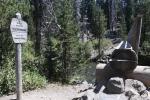
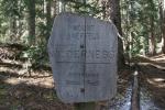
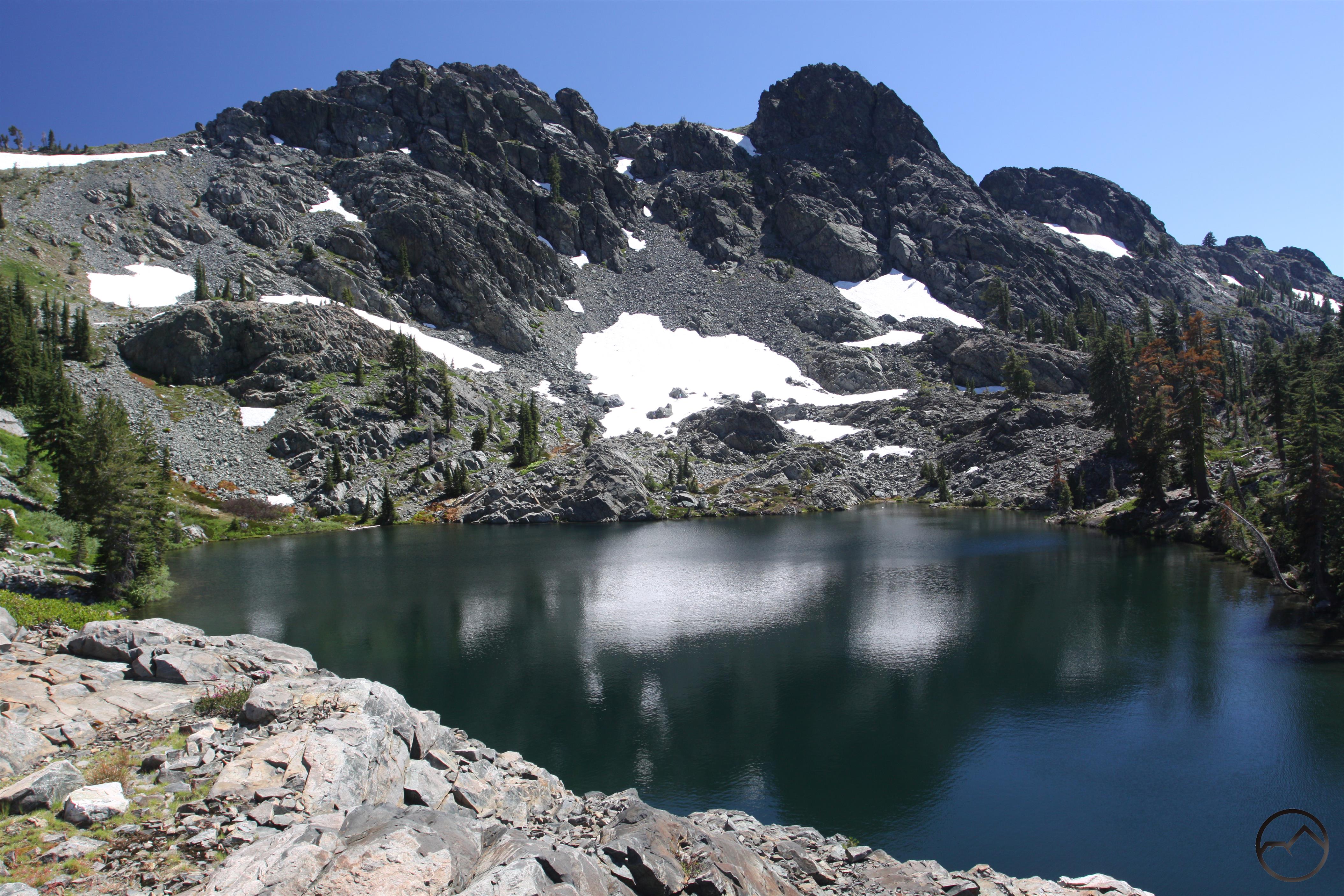
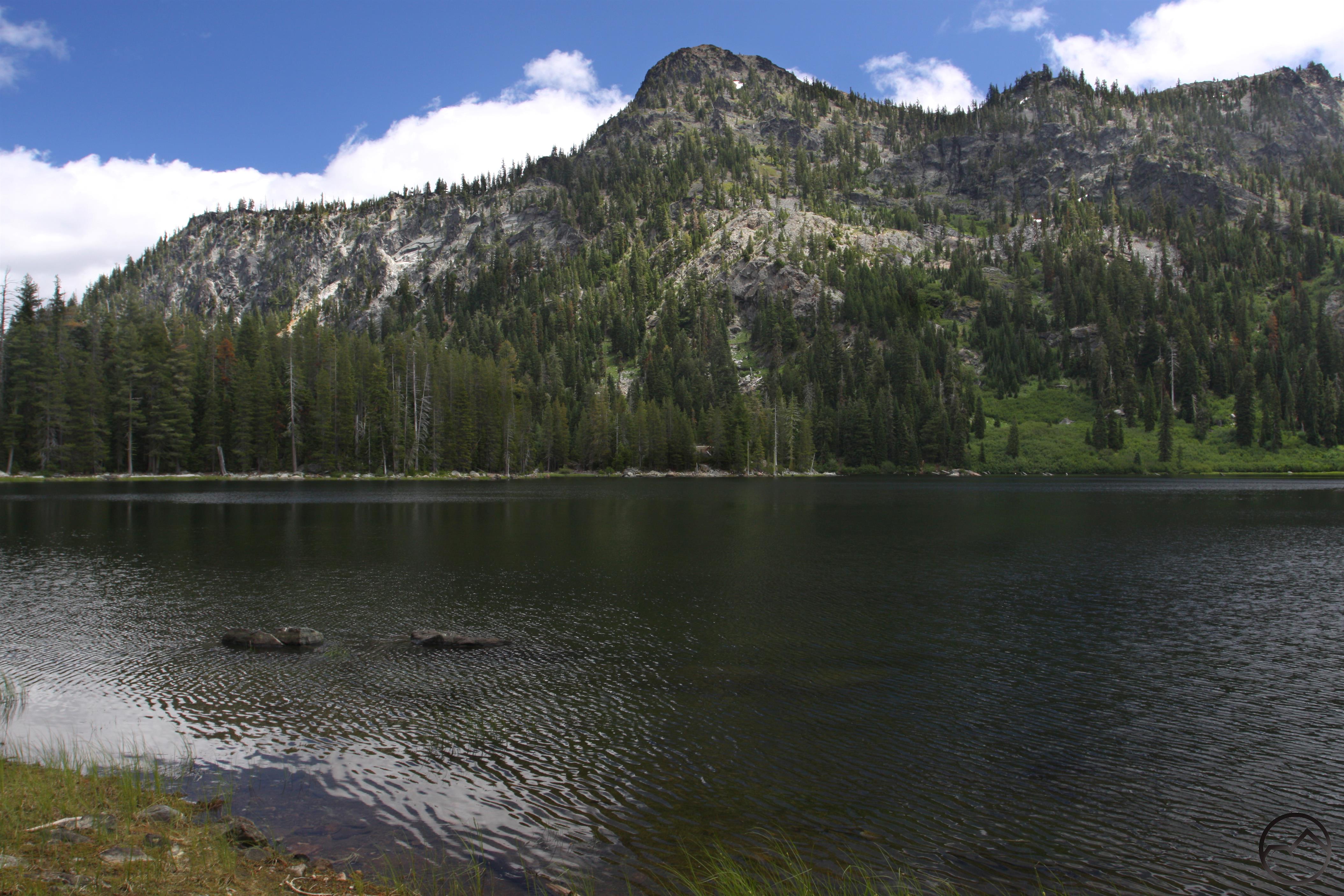
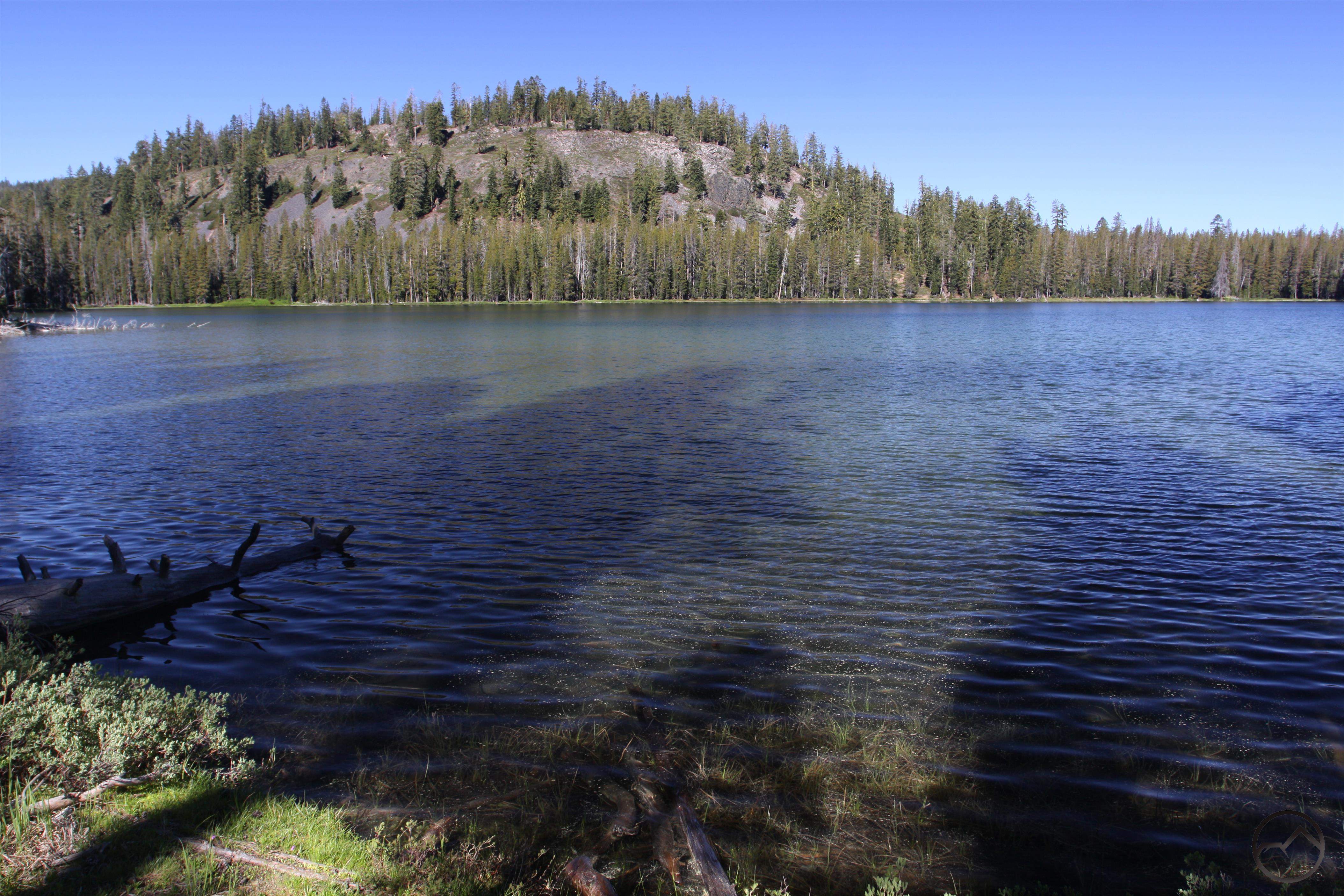
I finally left the central Sierra and made my way into the highlands that lie to the west of High Sierra. The first of these is the remote Kaiser Wilderness. Consisting of 10,000 foot peaks and almost two dozen lakes, this is compact mountain region. Numerous trails converge at the Twin Lakes and I hiked the one coming in from the north. This trail gets a little less use but is still quite pretty. It makes a few crossings of a raucous creek and passes some pretty cascades. Arriving at Upper Twin Lake, a number of peaks tower high above, forming a great backdrop to a very attractive lake. Lower Twin Lake, though not as majestic, is still very pretty. From there the trail loops around a meadow and boasts views of awesome Mounts Ritter and Banner in the Ansel Adams Wilderness to the north before returning to the trailhead.

Sierra Nevada South, Dinkey Lakes - Aug2016 287 (Custom)

The Dinkey Lakes were the goal of the next hike. The highlight of the Dinkey Lakes Wilderness, this area is a gentle landscape dotted with granite peaks, meadows and numerous lakes. Following Dinkey Creek from the hard-to-get-to trailhead, the path reaches a scenic standout at First Dinkey Lake. This lovely lake is surrounded by meadow and has great views of the Three Sisters. From there the trail loops past three more lakes, each with its own distinct character, before returning to the trailhead. This area may lake towering summits but its gentle beauty is wonderful.

Sierra Nevada South, Sequoia - Aug2016 396 (Custom)

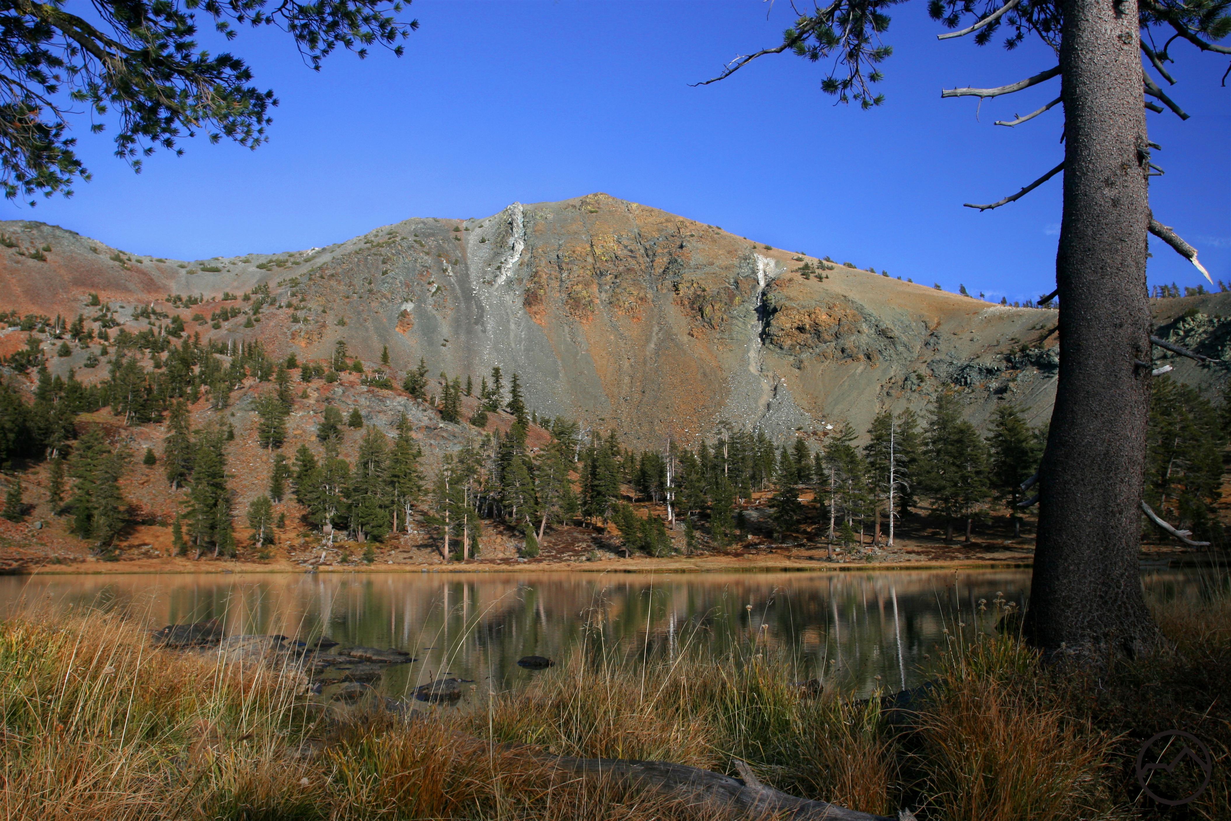
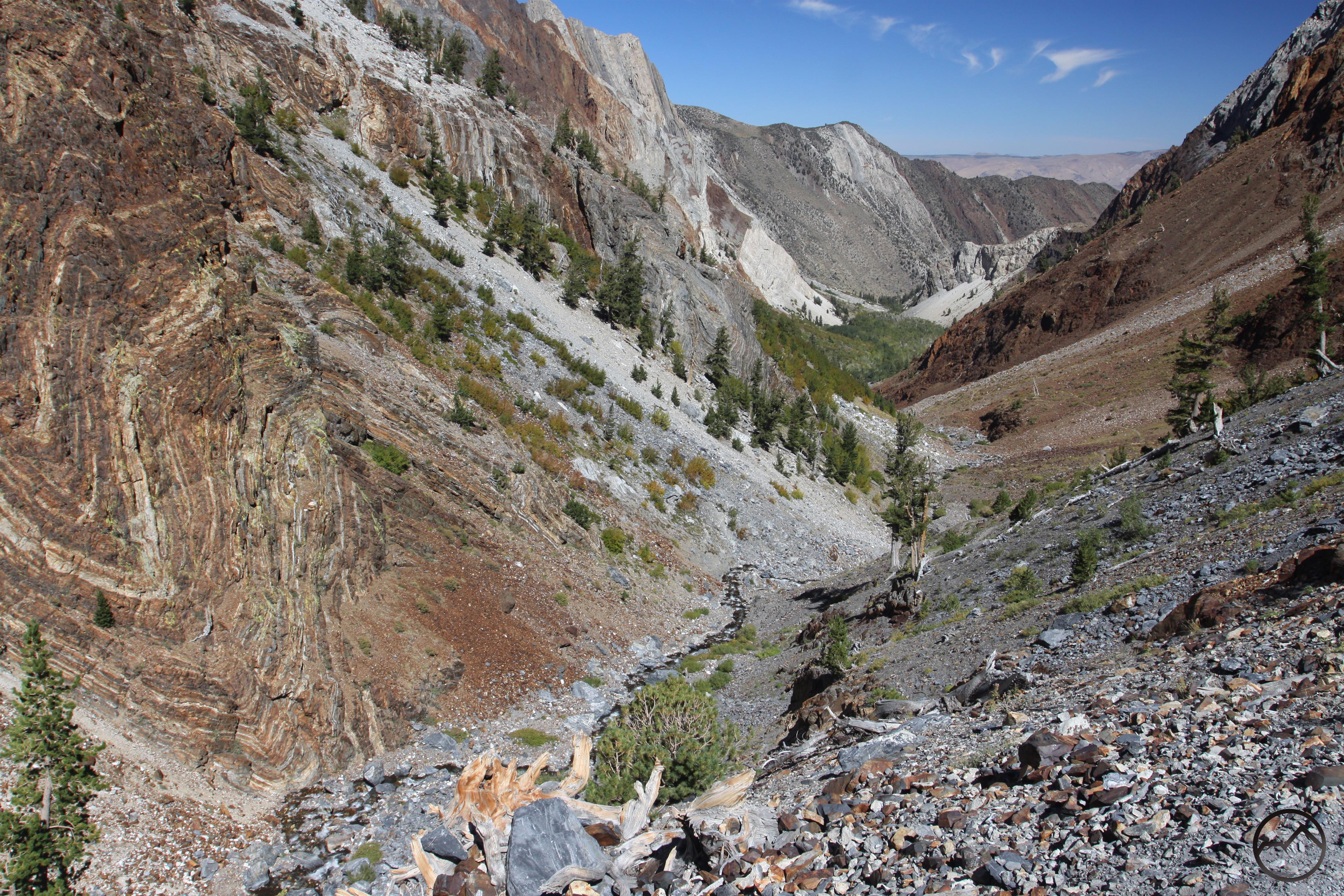
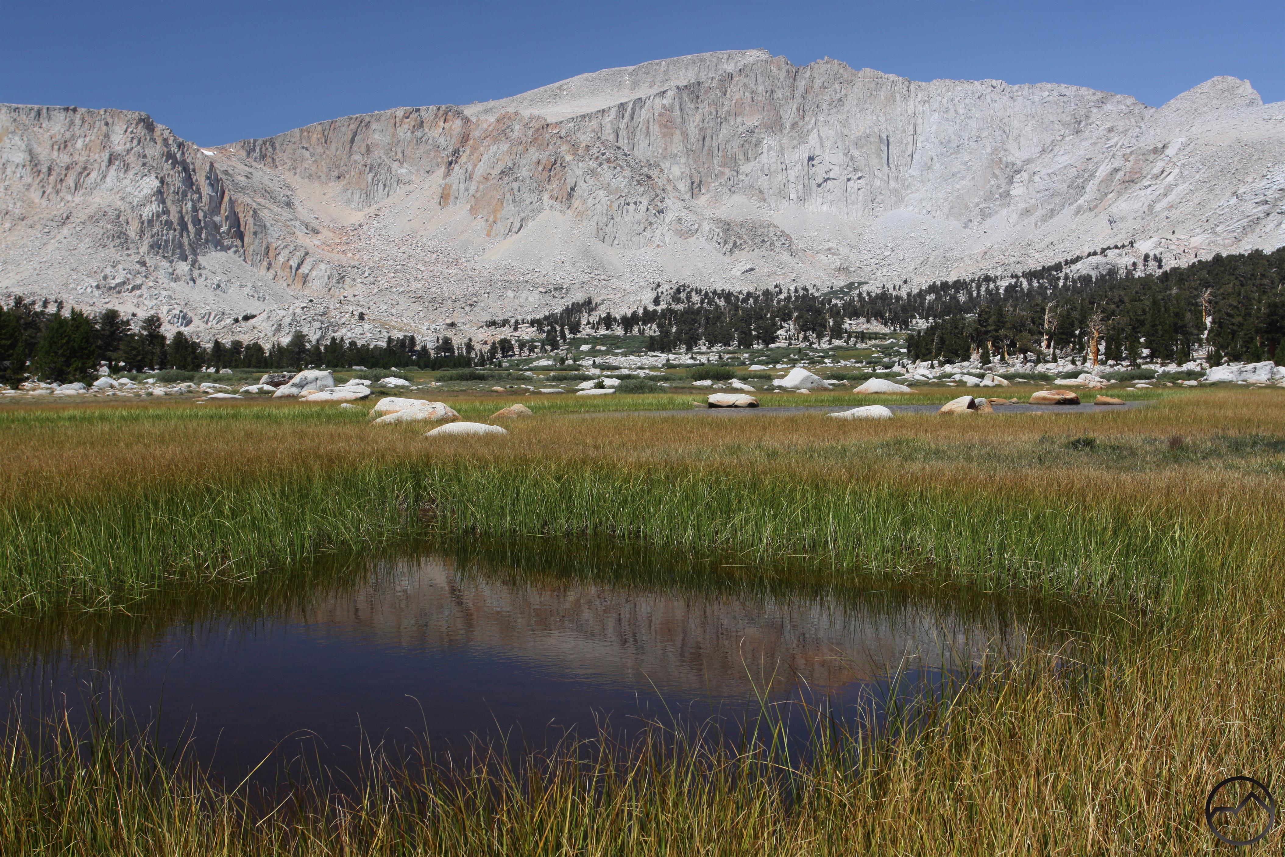
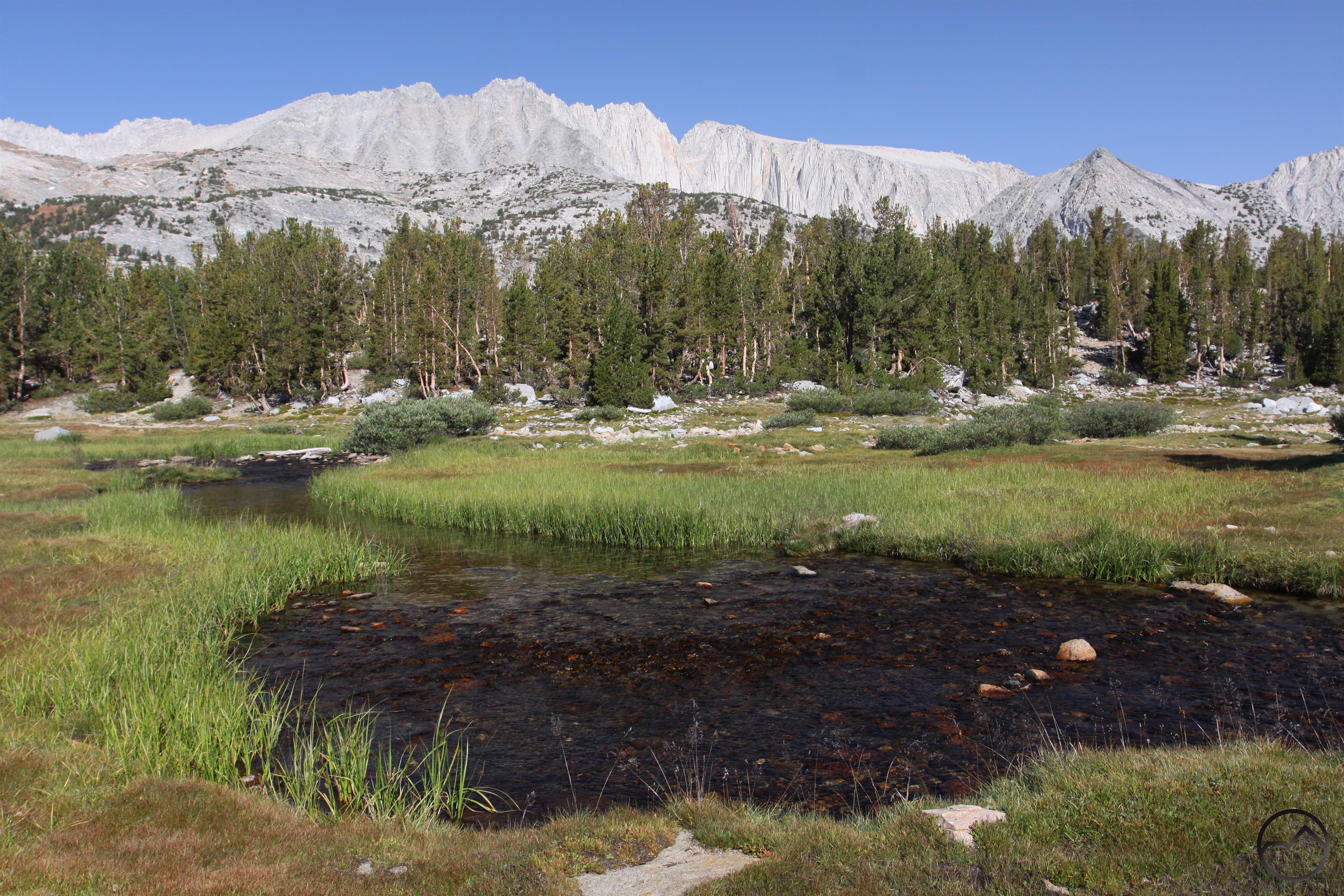
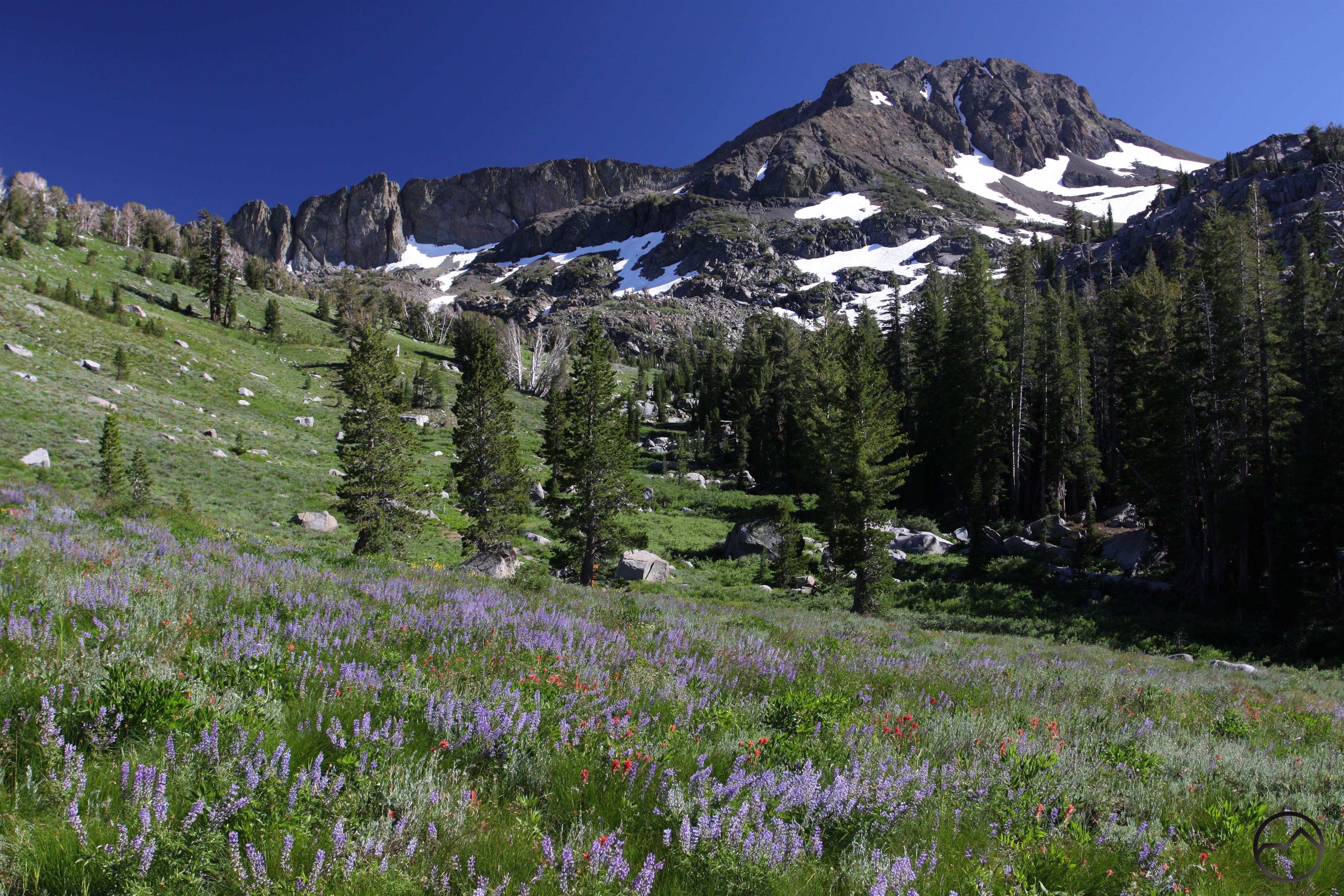
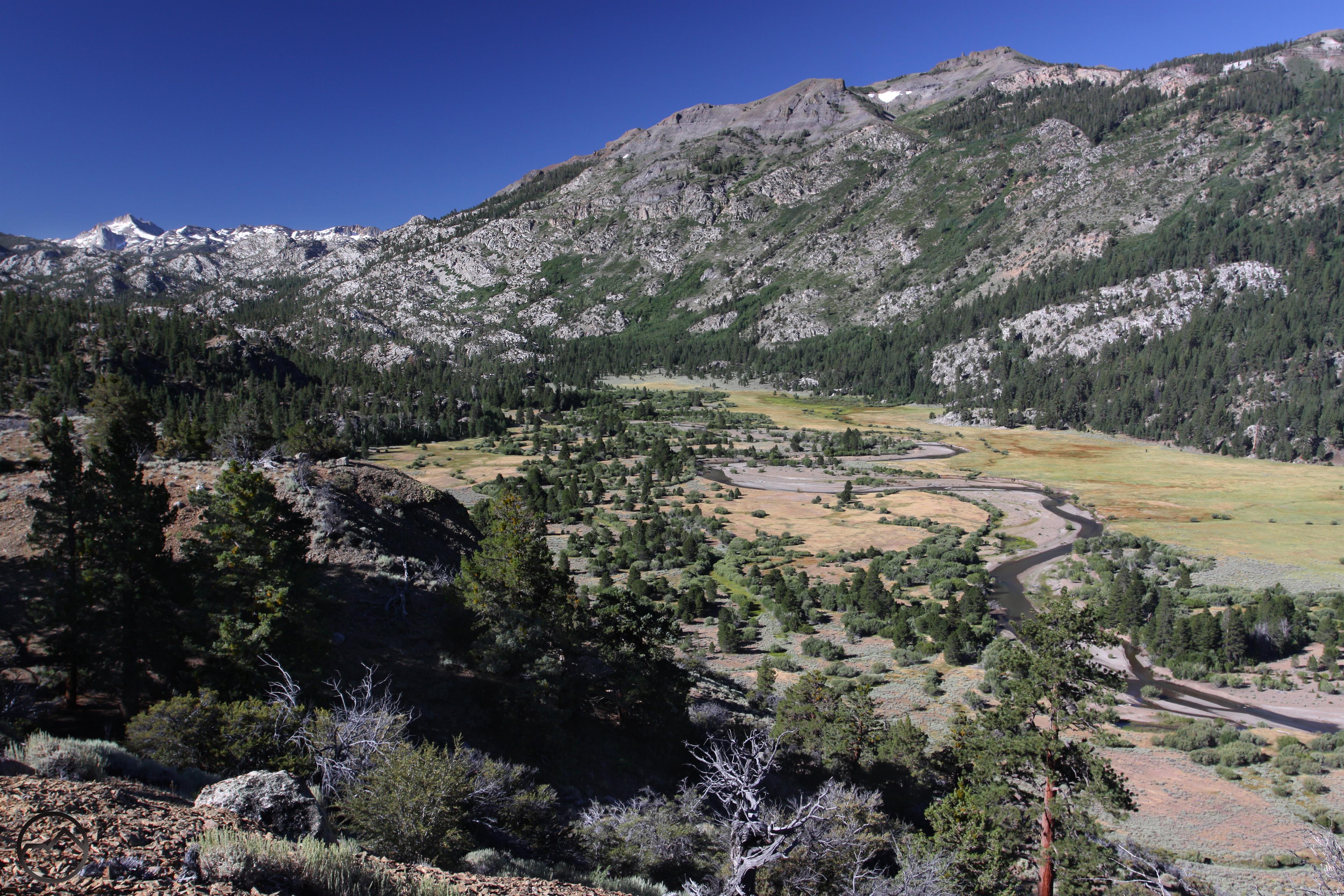
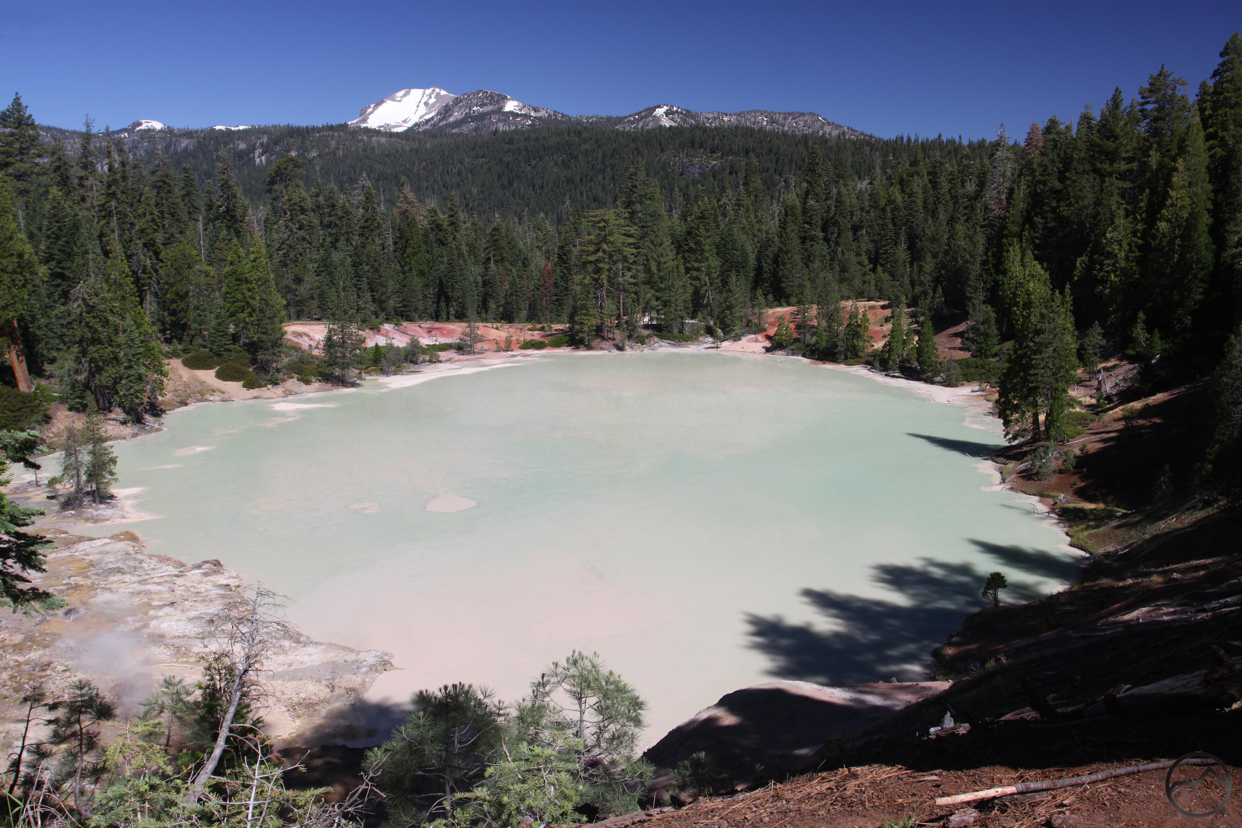
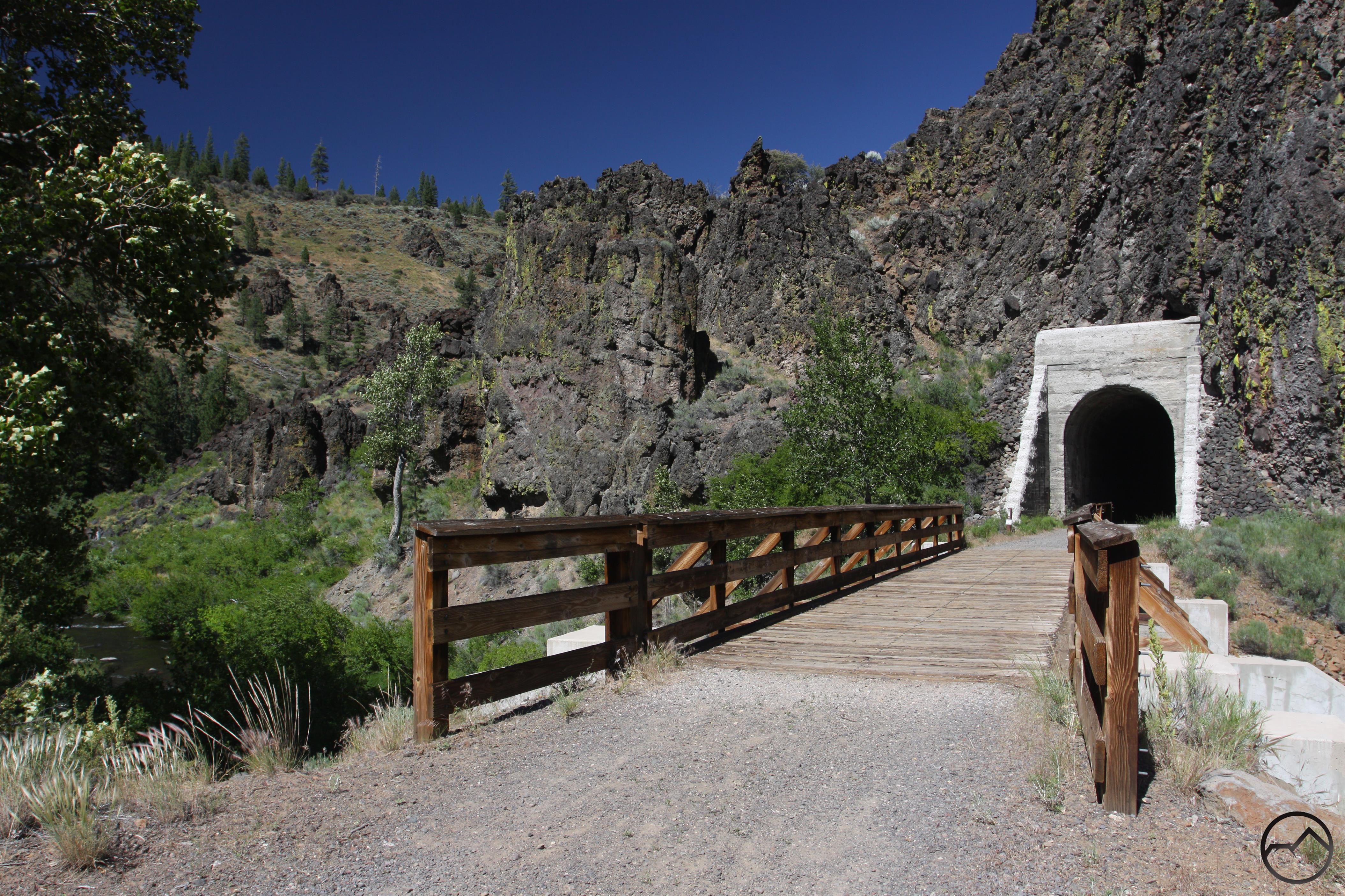
The next stop was Sequoia National Park’s isolated Mineral King. The drive into this beautiful mountain valley is notoriously curvy and it certainly lived up to its reputation. After finally arriving at the trailhead it was time to climb up to beautiful White Chief Basin. Initially following the East Fork of the Kaweah River, the trail then climbs up to the alpine basin where there is fascinating, historic mine. The climb up to White Chief Basin has excellent views of the the multi-colored peaks. The geology of the this area is very reminiscent of Colorado’s San Juan Mountains and like those illustrious peaks, this area was mined extensively.

Sierra Nevada South, Alabama Hills - Aug2016 483 (Custom)

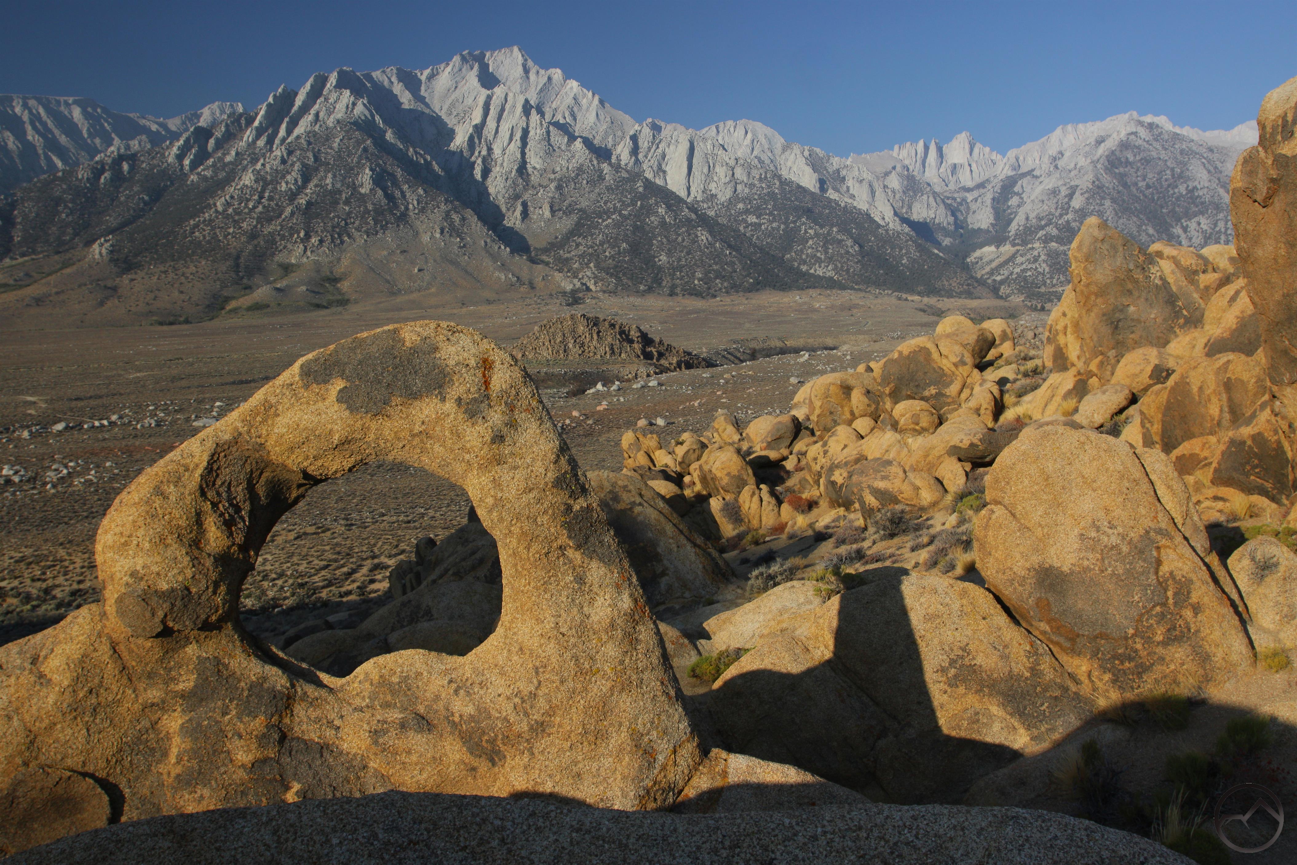
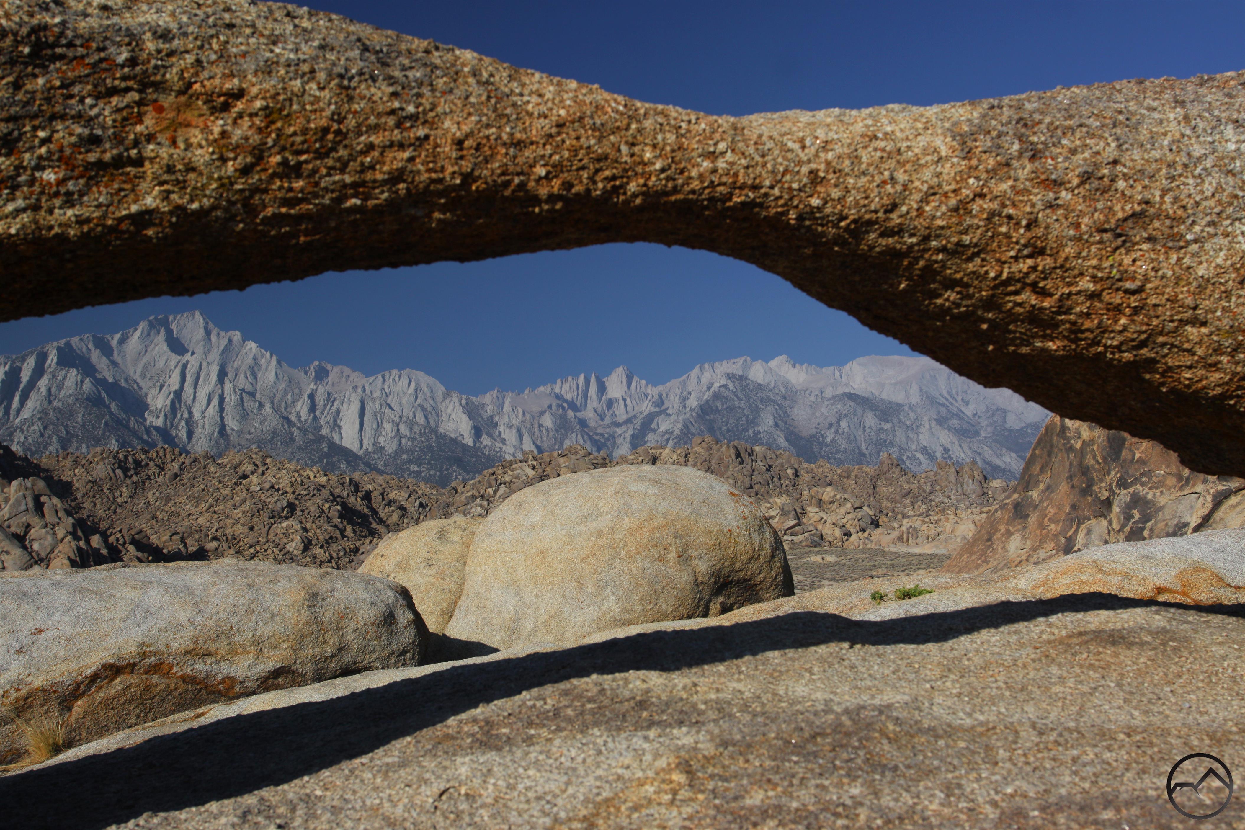
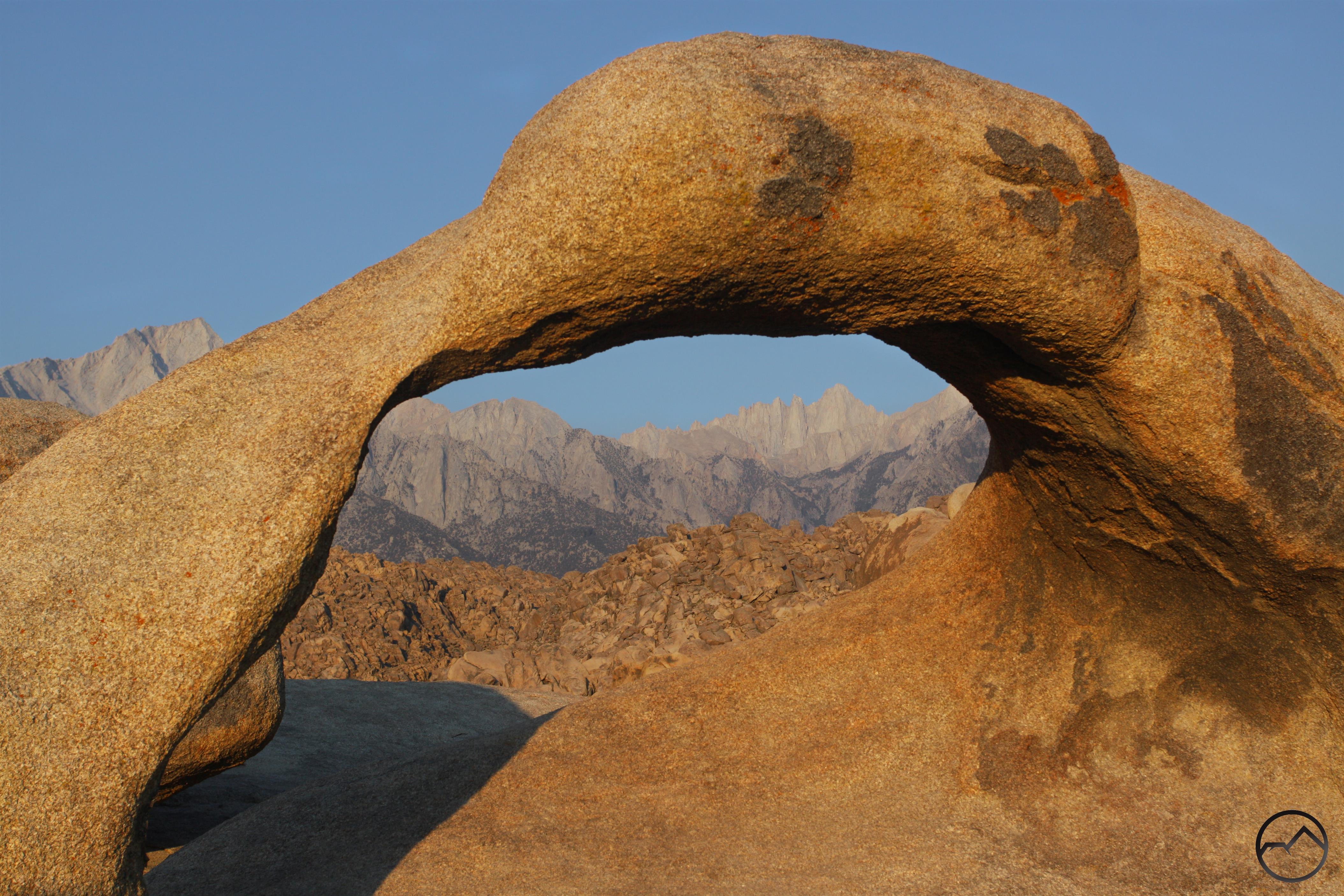
From Mineral King I headed south, crossed over the Tehachapi, and drove north to Lone Pine. The next morning I spent scrambling around the Alabama Hills. There are not too many sunrises better than watching the color change on Mount Whitney framed by the Mobius Arch. The Alabama Hills are a fantastic place to explore, hike and climb on the decaying granite boulders and peaks. The incredible escarpment of the Eastern Sierra is one of the best vistas you could hope for.

Sierra Nevada South, John Muir Wilderness - Aug2016 573 (Custom)

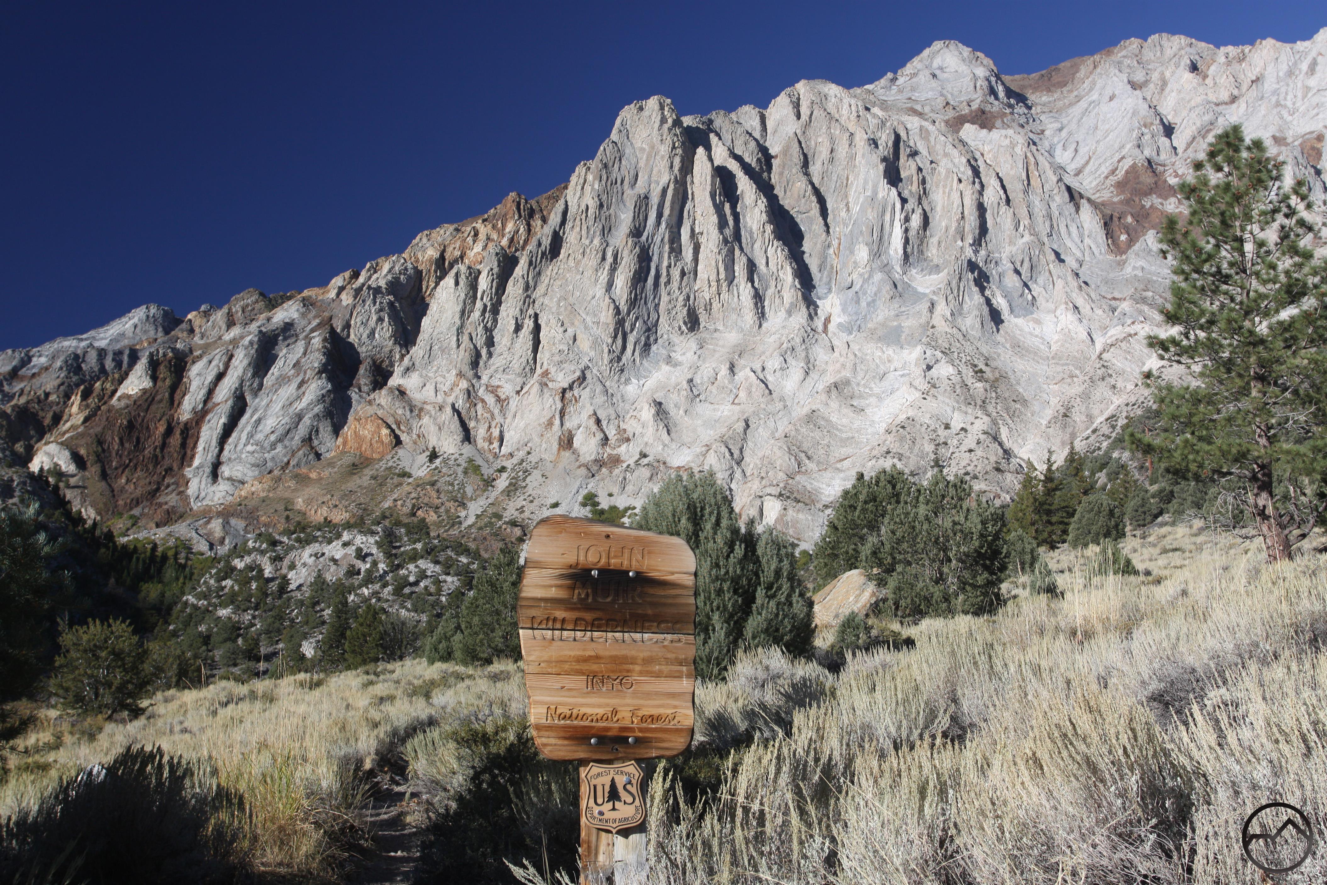
Later that day I drove up to Horseshoe Meadow and then hiked to the Cottonwood Lakes. These lakes, the southernmost redoubt of the epic John Muir Wilderness, are part of an unusual biodiversity complex. One of the original homes of the Golden Trout, the area is also blanketed with Foxtail Pines. Common in the southernmost Sierra Nevada, they are also, interestingly, only found 400 miles to the north in the Klamath Mountains. They are quite notable while hiking above the Deadfall Lakes en route to Mount Eddy. The Cottonwood Lakes themselves are spectacular and are made all the more so by the towering presence of Mount Langley, the southernmost of the Sierra Nevada’s mighty 14,000 foot peaks.

Sierra Nevada South, John Muir Wilderness - Aug2016 733 (Custom)

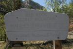
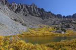
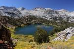
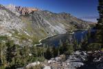
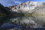
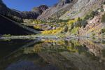
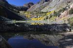
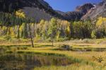
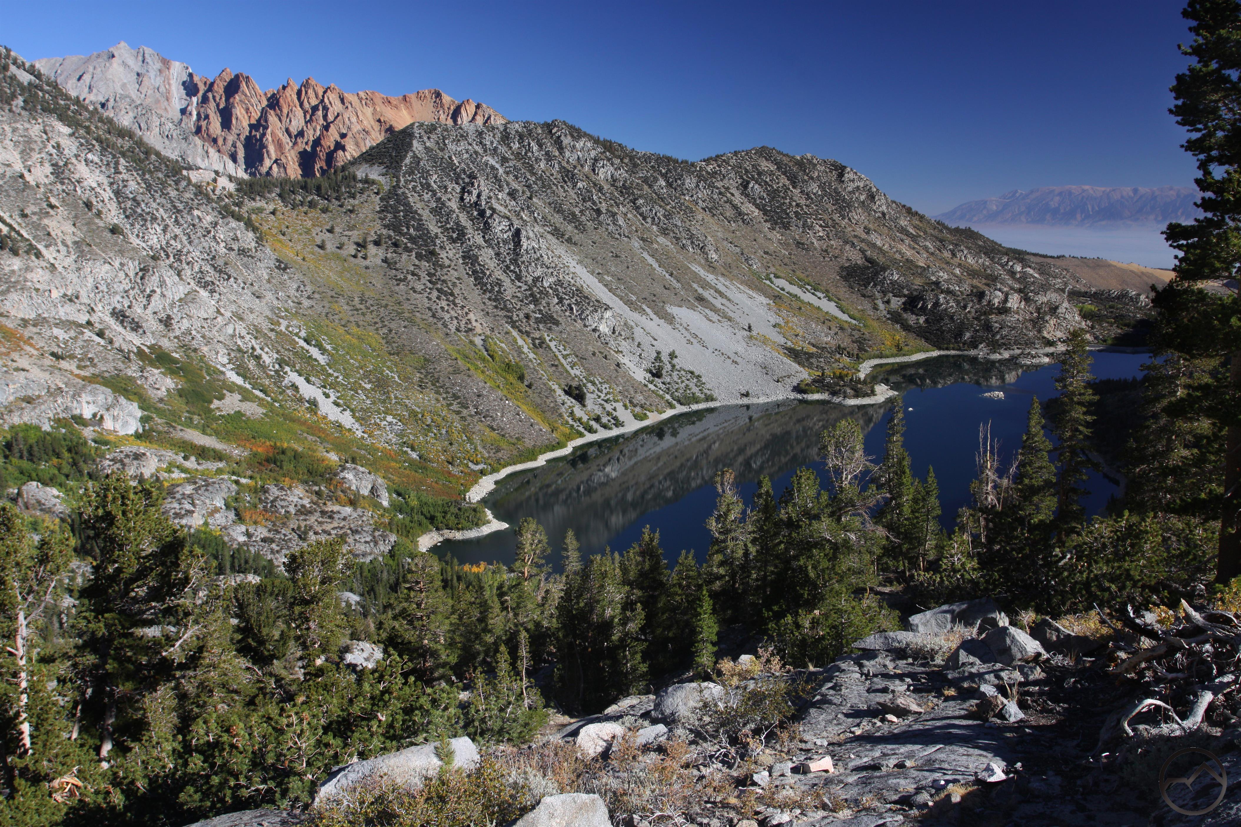
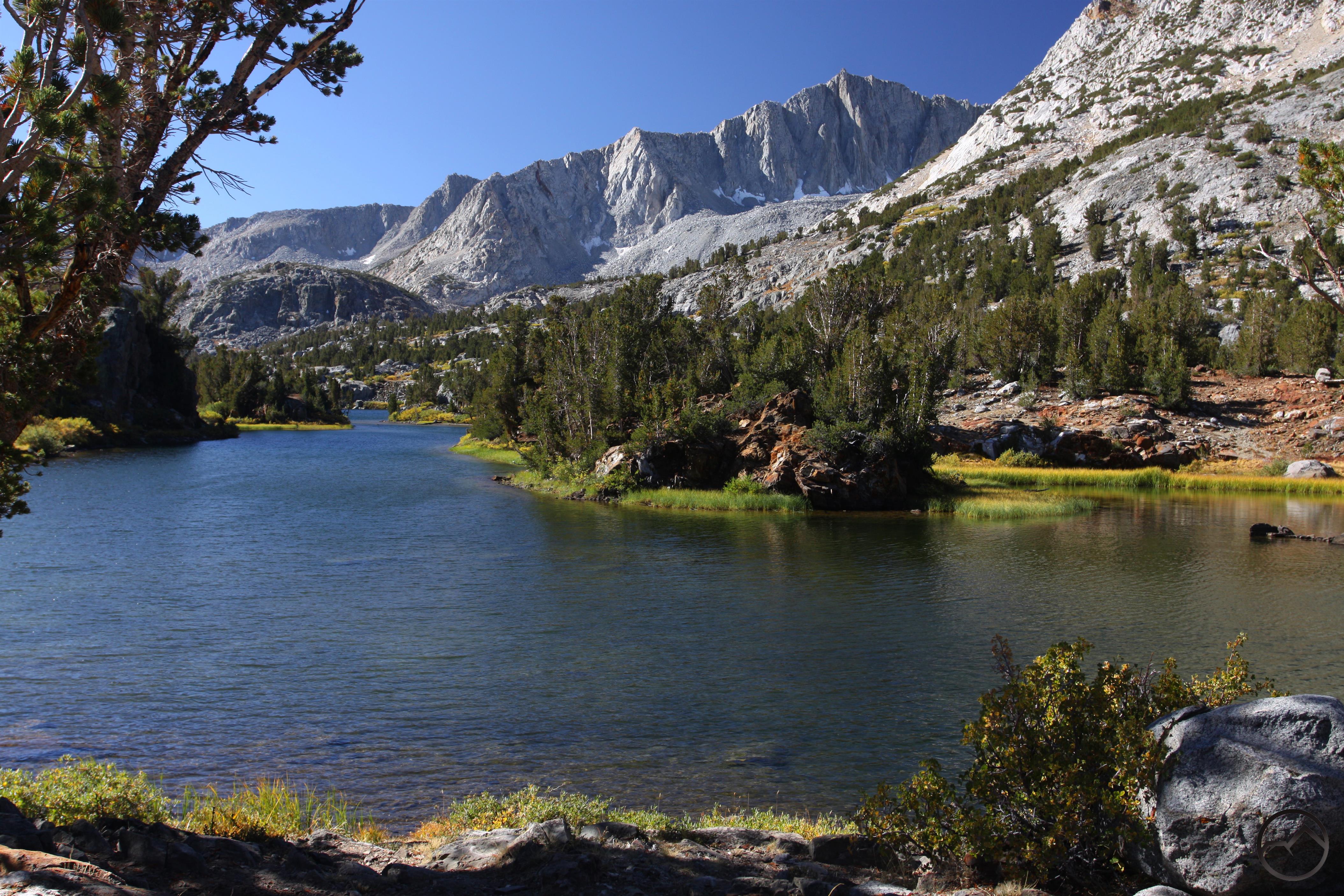
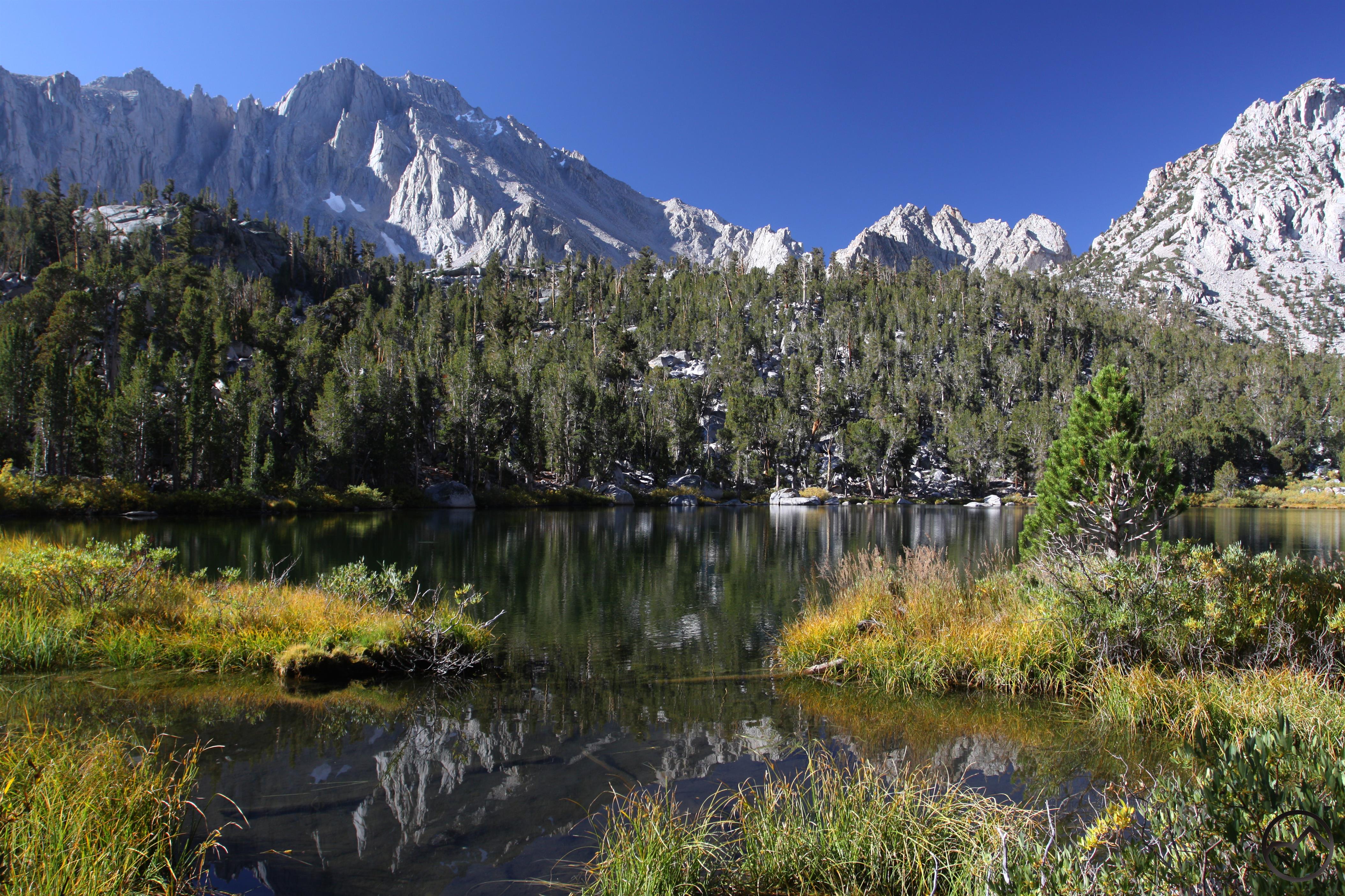
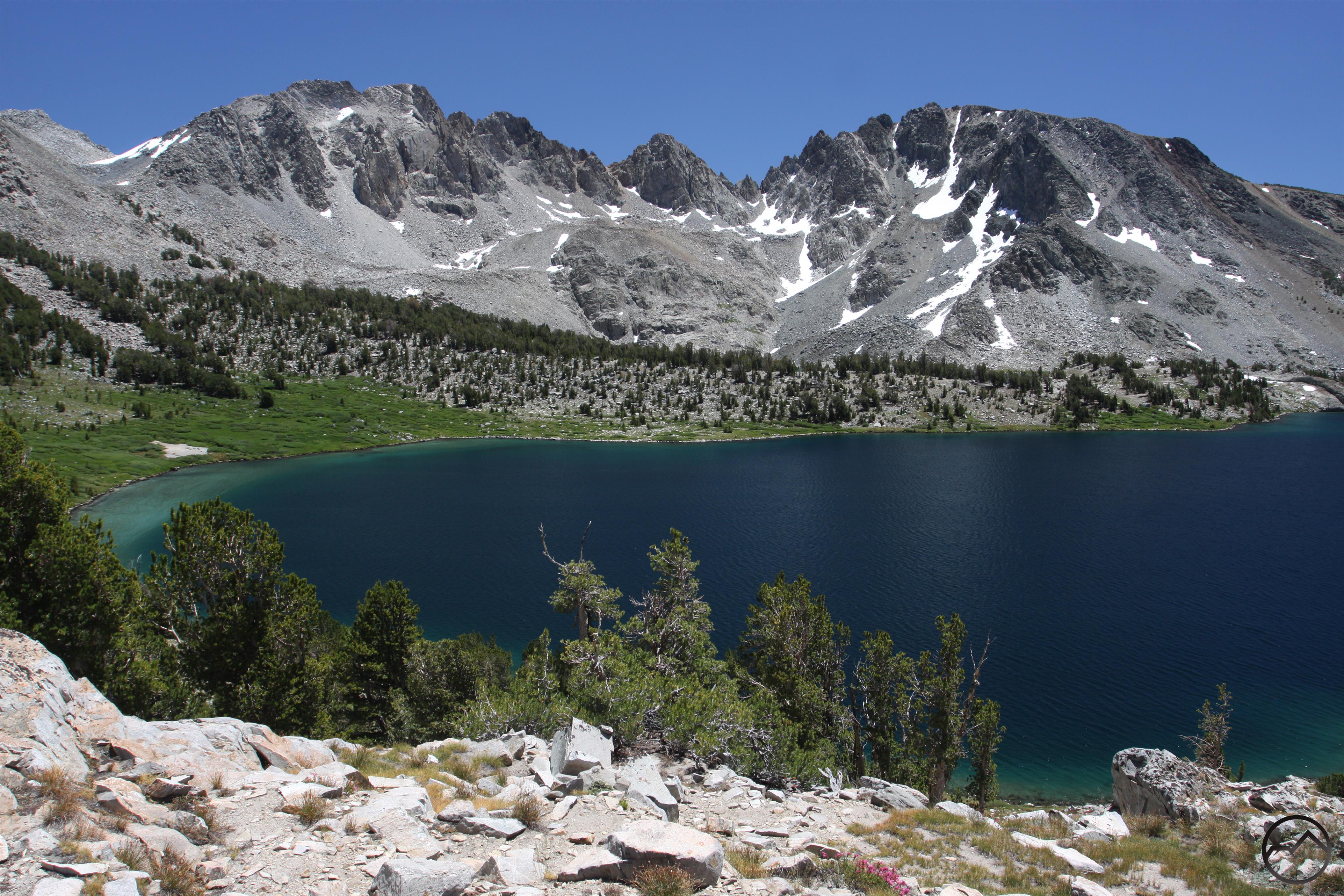
Next up was the utterly superlative Little Lakes Valley. This is simply one of the most amazing hikes around. With six named lakes and a number of smaller tarns, several large creeks, numerous lush meadows and an unforgettable series of serrated 13,000 foot peaks, this trail has it all and for very little price. Only 6 miles roundtrip and with just a few hundred feet of elevation gain, this is an easy hike with a massive scenic payoff. Of course, it is a popular trail but leaving early in the morning (when the light was the best) I had this paradise to myself.

Sierra Nevada South, Ansel Adams Wilderness - Aug2016 774 (Custom)

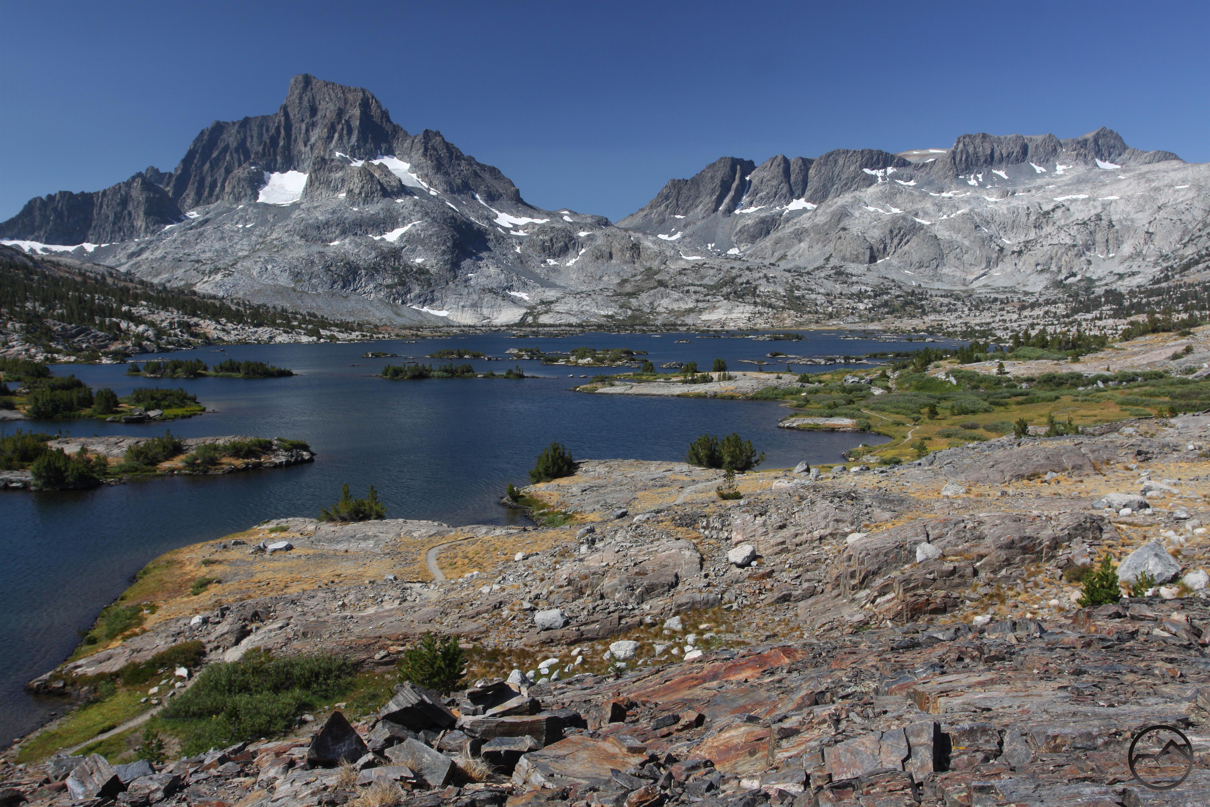
While the previous hike was easy, the next one was much harder. Fortunately, my awesome, awesome brother drove over from his home in Carmel to join me on this epic day. The destination was the Ansel Adams Wilderness’ Thousand Island Lake. We got an early start and followed the San Joaquin River all the way to the lake. This is one of the most iconic, staggering and beautiful places in California. From there we crossed over to equally spectacular Garnet Lake before dropping down to spectacular (yet again) Shadow Lake. Along the way, we had constant views of Mounts Ritter and Banner and evolving vistas of the striking Minarets. This was an epic, epic day.

Sierra Nevada South, Yosemite - Aug2016 896 (Custom)

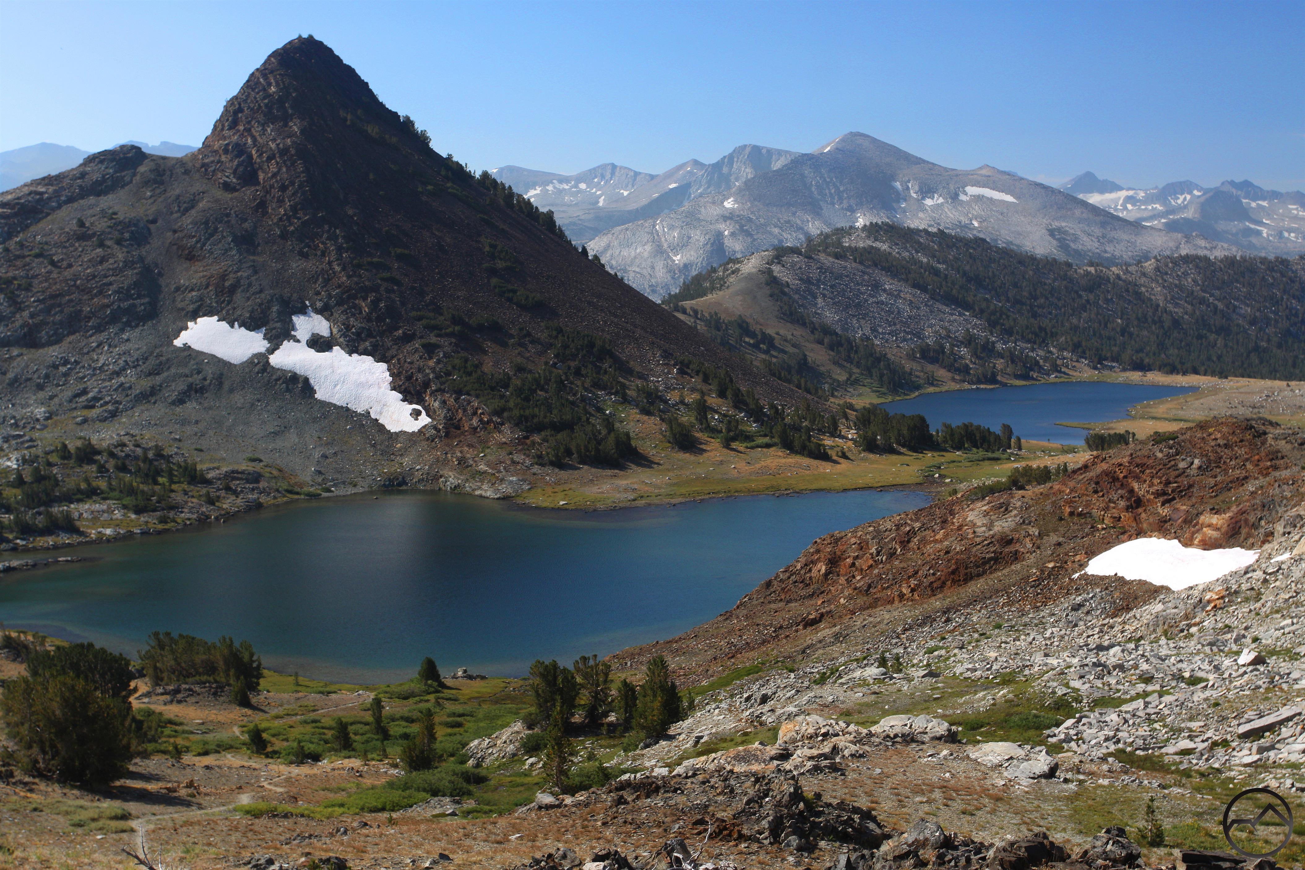
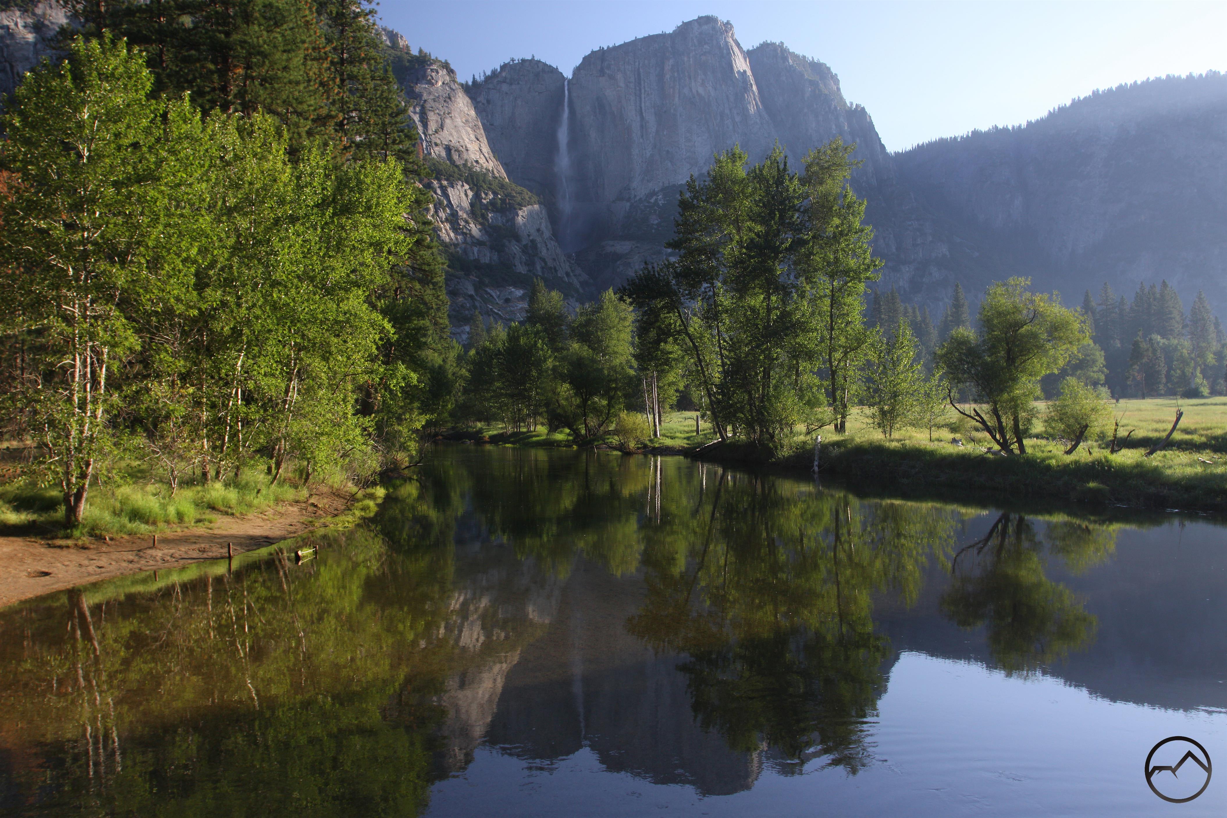
I closed out the trip with a hike through Yosemite’s Gaylor Lakes. My brother joined me on the trail again before he headed back home to his family. Though it has a stiff climb at the beginning, this is one of the most vista-packed trails you will find and with awe-inspiring views of Yosemite’s high country. Along the way the trip passes four very beautiful lakes and an old mine complete with old rock buildings. This hike may not be very well known but it is one of Yosemite’s best. It made a fitting conclusion to an unbelievably awesome trip.

With this trip done, I have one more trip south with just a handful of hikes in the High Sierra. With only a few trails left to hike, it is time to switch my focus on the manuscript (which is already a work in progress). I will have one more book update when I get back from my next trip but beyond that, this blog may go silent until the end of October, when my manuscript is due. Thanks for following along up to this point!

Three Trails On Mount Shasta’s East Side

Posted by bubbasuess on August 6, 2016
Posted in: Hiking, Mount Shasta. Tagged: Brewer Creek Trail, Clear Creek Trail, North Gate Trail. 1 Comment

Cascades, Mt Shasta, Brewer Creek - July2012 039 (Custom)

Mount Shasta rises majestically above the Brewer Creek Trail.

Most hikers on Mount Shasta visit the mountain via one of the trails the begin on Everitt Memorial Highway. The paved road, beginning right near downtown Mount Shasta City is the quick, easy way up to high elevation. It is a convenient and scenic way to get to some of the best trails on the mountain. Of the 10 trails that traverse the flanks of the volcano, 6 of them begin on this road. The remaining four are reached by way of dirt roads on the north and east side of Mount Shasta. The trail to Whitney Falls is the lone trail into the wilderness from the north. The remaining three trails all approach Mount Shasta from the long network of roads the pass beneath Mount Shasta’s east side. These trails are all remote, exceptionally scenic, and offer a wild experience on Mount Shasta, far from the regions where most hikers congregate. Further adding to the sense of remoteness, these trails are reached by dirt roads that, at times, can be pretty rough. Yet the rewards for making the journey out to these trails on the lonely east side is great. Here hikers enjoy awesome views of the largest glaciers in California and sweeping vistas of both the surrounding terrain and Mount Shasta itself. For those looking for solitude in a spectacular setting, these trails are not to be missed.

North Gate Trail

The northernmost of the three trails accessed from the east side, the North Gate Trail begins in a forest right on the edge of the Mount Shasta Wilderness. The path climbs up the mountain beneath forest canopy before finally traversing a ridge and breaking out above the treeline. From there, numerous options exist for some exploratory adventure. Hikers can follow use trails up the side of Mount Shasta near the Hotlum-Bolam Ridge. Is it possible to climb quite high along this route, following routes used by those headed to the summit. Another option is to head west crosscountry to Bolam Creek canyon and a chance to spot elusive Coquette Falls. For a simple day hike, a great option is to make the short scramble up to Point 8,852, the summit of one of the volcanic plugs that are found on the north side of the peak. From here there are expansive views that reach into Oregon while Mount Shasta itself looms high overhead.

click to enlarge:


North Gate
North Gate

North Gate
North Gate

Brewer Creek Trail

The most remote trail on Mount Shasta, the Brewer Creek Trail yields staggering glacier views, vistas of the mighty cone of Mount Shasta soaring high overhead and delicate ribbons of meadow clinging to the fragile banks of clear-running Brewer Creek. It is a lonely path but one packed with awesome scenery and the potential for on the most best off-trail hikes that leads to one of the most majestic vistas of Mount Shasta. The trail begins in a stunted forest just below treeline. The path zigzags through the short, windswept trees before leveling off and heading south along the flank of the mountain. The massive Hotlum (California’s largest glacier) and Wintun Glaciers hug the steep slopes of the mountain and make for a tremendous sight as the trail passes through sparse, volcanic terrain. In short order the path reaches the banks of Brewer Creek. Here there a delicate strips of grass along the rocky fringe of the creek. This spot has one of the best views of the mountain. The sound of the small creek dancing beneath such a magnificent peak is magical. From here a crosscountry scramble leads through barren volacnic terrain to the edge of Ash Creek Canyon. Here there is a phenomenal vista of gorgeous Ash Creek Falls plunging over a cliff while Mount Shasta looms in the distance. It is an unforgettable scene.

click to enlarge:

Brewer Creek

Brewer Creek
The classic V-shaped lower section of Ash Creek Canyon.

A view toward the summit of Mount Shasta, through the upper section of Ash Creek Canyon. Note the Wintun Glacier at the head of the canyon.
Mount Shasta and Ash Creek Falls.

Clear Creek Trail

The southernmost of the three trails on the east side of Mount Shasta, the Clear Creek Trail is also the closest to civilization. This is relative, of course and it still see far less traffic than the trails on Everitt Memorial Highway. This path also leads to the only non-technical route to the summit of Mount Shasta. Most of those who hike the trail are headed up the mountain. For hikers who make this journey, views of stupendous Mud Creek Canyon await, as well as a beautiful basin that unfolds beneath a series of gigantic volcanic spires and a pair of cluster of small glaciers. The trail ends at the serene Clear Creek Springs, where there are lush meadows. The trail initially climbs through old growth red fir forest but eventually begins a steady ascent along the east rim of Mud Creek Canyon. There are a few incredible views of the mountain high above the great chasm. Awesome Mud Creek Falls is also a highlight of this area. Eventually the trail climbs above the treeline and enters the vast bowl that lies beneath the Mud Creek, Konwakiton and Watkins Glaciers. Shastarama Point, Thumb Rock and Misery Hill all line the very dramatic horizon. At the meadow, a series of springs erupt from the ground. Where the water flows, there is a thread of lush, green life amidst the starkly barren, yet beautiful, volacnic basin.

click to enlarge:

The view from the east side across the widest section of Mud Creek Canyon.
A look up above Mud Creek Falls into the middle portion of Mud Creek Canyon.

Mud Creek Falls
Clear Creek

Clear Creek
Clear Creek

EastSideTrails (Custom)

Book Update: Sierra Nevada Sublime

Posted by bubbasuess on July 23, 2016
Posted in: Hiking, Mount Shasta, Sierra Nevada. 5 Comments

Sierra Nevada, July2016 181 (Custom)

The outlet of Upper Twin Lake in the Desolation Wilderness.

Over the last week and a half I was on the road, completing 12 more hikes for my new book. It was a long, hard but great 10 days. In some ways, this felt like the first really deep immersion into the Sierra. It is true that I took a long trip through the Sierra in June but most of those trails were in the lower elevations and not necessarily in the range’s high country. That does not make them any less “Sierra” or majestic, but the constant exposure to the higher elevations on this trip gave these trails a much different and more classic Sierra Nevada feel.

I began the trip in the part of the range that lies north of Interstate 80 and worked my way south. It was essentially a grand tour of the grandest of mountain ranges. Going south from the Cascades, the Sierra’s terrain is initially more subdued and it is not until south of the Feather River that really rugged, rocky country appears. This area consists of large, rocky islands amidst a vast sea of forest. South of I-80 I moved into the Lake Tahoe area and hiked more trails around the rim of the lake, in the Desolation Wilderness and the Dardanelles area. From here I skipped the central part of the range and went to the Mammoth area, since my brother and his family were camping down there. After hiking a couple of trails in the High Sierra, I returned to the central part of the range and hiked more trails before returning home. Even though I have two more trips planned for this summer, the majority of these are located in the High Sierra and, while these are utterly spectacular, they similar geologically and lack the diversity of the trails I hiked on this trip.

Sierra Nevada North, I-80 Reclands -  July2016 023 (Custom)

The first trail I completed on this trip was to Glacier Lake in the Sierra high country north of I-80. This region is filled with lakes and lots of rugged peaks but lacks any formal wilderness or recreation area designation. Nonetheless, there are a host of great trails, craggy mountains and beautiful lakes in this region. The path to Glacier Lake begins with fantastic, panoramic vistas and then travels across meadows and glaciated granite before arriving at the small lake set at the base of the brooding Black Buttes, one of the most impressive peaks in this part of the Sierra Nevada.

Sierra Nevada North, Sierra Buttes - July2016 063 (Custom)

Moving south through the Sierra from the Cascades, the Sierra Buttes is the first instance where travelers get an idea of the awesome mountain splendor that the Sierra Nevada is capable of. A towering, seemingly inaccessible jumble of crags and spires, the buttes are an astounding sight. Numerous lakes are scattered this mountain, the largest of which are the Sardine Lakes. The hike to the summit is one of California’s epic trail journeys. It is capped by an exhilarating climb up stairs mounted on the very edge of space to the the lookout tower mounted precariously at the summit. The northeast corner of the catwalk around the lookout tower extends out over the abyss, with the opportunity to look down, below your feet at the 1,000 foot drop to the rocks below.

Sierra Nevada North, Lake Tahoe, Prosser Lake - July2016 113 (Custom)

In these trip reports, I don’t deviate from the trails I hiked very often but the second night of the trip was so spectacular, I can’t resist mentioning it. I spent the night on the banks of the Prosser Reservoir, just north of Truckee. While there, I was treated to a gorgeous lenticular display. The image above was taken from my campsite. Not too shabby…

Sierra Nevada North, Lake Tahoe, Desolation Wilderness - July2016 161 copy (Custom)

When thinking of the Sierra Nevada, the thing that often comes to mind is granite. Though present in the northern part of the range, it is in the Desolation Wilderness’ Crystal Range that the promise of a vast, seemingly endless wilderness glacially polished granite is first fulfilled. The third hike I did on this trip was the Twin Lakes and Island Lake on the range’s west side. The trail crossed over expansive granite slabs and ran parallel to beautiful, cascading South Fork Silver Creek. Once at the lakes, a beautiful waterfall poured over the cliffs behind the twin lakes while delicate wildflower gardens, small ponds and lush meadows lined Island Lake.

Sierra Nevada, July2016 224 (Custom)

The highlight of the Desolation Wilderness is the spectacle of island studded Aloha Lake beneath the stark wall of the Crystal Range. It is a scene worth of the High Sierra that lies further south and a harbinger of the scale and marvel of what is to come. The hike there involves a water taxi across the Echo Lakes and a hike through the Tamarack Lake basin before descending through open forest and meadows. Once at Lake Aloha, there is a seemingly endless amount of exploration to be had, capped by a scramble up an unnamed dome where a magnificent panorama of the Desolation Valley can be had. A lollipop loop on the way back passes alongside lovely Lake of the Woods.

Sierra Nevada North, Mokelumne Wilderness July2016 248 (Custom)

As if hiking to Lake Aloha was not enough for a full day, in the afternoon, I made the loop through the awesome Round Top area in the Mokelumne Wilderness. Towering Round Top looms majestically over meadows with riotous wildflower displays. The trail loops past two excellent lakes while climbing just about to treeline. Views of the Carson Pass area and the northern end of the Mokelumne Wilderness were great. However, on the evening I was there, they were highlighted by another lenticular display, which seemed to manifesting in the same location from two nights prior.

Sierra Nevada North, Dardanelles Area - July2016 325 (Custom)

The following day was spent hiking through the volcanic lands of the Dardanelles Roadless Area, south of Lake Tahoe. This area is very different from what one would typically expect from the Sierra Nevada but it is utterly gorgeous. In many ways it is reminiscent of the Warner Mountains, in far northeast California. The trail crosses over a divide at Carson Pass and then follows the Upper Truckee River through a vast meadow with an exceptional wildflower extravaganza. This hike ended at Showers Lake, where the terrain began its transition to the granite more common to the north. Near the lake is a great view of Lake Tahoe.

Sierra Nevada, July2016 368 (Custom)

After so several days around Lake Tahoe, I finally headed to the High Sierra. My first stop was at the Green Lakes. This astounding collection of lakes is found in the central part of the Hoover Wilderness. Here many-colored cliffs tower over azure lakes. The scale of the mountains here is epic and the unusual geology of the rocks offer sharp contrast to much of the rest of the Sierra Nevada. This hike passed by 7 named lakes and numerous tarns, all the while passing beneath the impressive bulk of 12,374 foot Dunderberg Peak. This exceptional corner of the wilderness was very lonely and it was not until late in the day, as I neared camp that encountered anyone.

Sierra Nevada, July2016 425 (Custom)

After spending the night camped out with my brother and his family near Mammoth Lakes, I hiked over Duck Pass to Duck Lake. This is one of the largest backcountry lakes in the Sierra Nevada and it is classic High Sierra Terrain. The sense of vastness is highlighted by the monumental peaks and the vistas of mountains far distant lining the horizon. It is epic to say the least. To get to Duck Lake, hikers must pass several smaller lakes and ascend 10,800 Duck Pass. Thankfully, this was just a taste of the High Sierra and there will be many, many more like this on my next trip in August.

Sierra Nevada, July2016 448 (Custom)

Following that initial foray into the High Sierra I headed back north and spent the day hiking around beautiful Leavitt Meadow. Here the high desert meets the High Sierra. The terrain is very arid but the views of the stark white towers of northern Yosemite give the trail a very alpine quality. In addition to visiting three surprising lakes (given how dry this country is), the loop passes along the edge of Leavitt Meadow and comes into close contact with lovely West Walker River.

Sierra Nevada, July2016 527 (Custom)

The penultimate trail hiked on this trip was to Sword Lake, found in the Carson-Iceberg Wilderness. This is a less-frequented region in the central Sierra Nevada that consists of a vast granite area overlaid with dark volcanic rock. Few places yield up such a stunning visual example of these different rock types as do Sword Lake. The granite-lined shore is overshadowed by the presence of the dark, brooding Dardanelles (different from the similarly-named volcanic features near Lake Tahoe). The contrast between the dark brown rock and the white granite of Sword Lake’s shore is a visual treat.

Sierra Nevada, July2016 558 (Custom)

The final hike I did on this trip was through the volcanic high country of Sonora Pass to pretty Sardine Falls. This hike is an easy opportunity to explore this unusual part of the Sierra Nevada. Little, if any granite is to be found here and all the peaks are dark and foreboding. In many ways this area seems more like the Rocky Mountains than somewhere in California.

That sums up the trip. It was good, but my feet are sore. If you sent me a question or message during the last couple of weeks and I have not answered I apologize. I do appreciate the support and encouragement as a work on this new guidebook. Thanks much for sticking with me through all these non-Mount Shasta posts!

Quick Book Update: Yosemite And The Marble Mountains

Posted by bubbasuess on July 12, 2016
Posted in: Hiking, Mount Shasta, Sierra Nevada, Yosemite. Tagged: Marble Mountains. 2 Comments

Sierra Nevada South, Hoover Wilderness - July2016 005 (Custom)

The high walls of Lundy Canyon reflect in a beaver pond.

A week ago I got back from a quick trip to Yosemite with my wife and kids. This was the annual trip I take where I meet up with my family in the valley for a week of trails, traditions and lots of kids playing together. This year we could not muster a full week but it was still a good trip. Fortunately, I was able to get a couple of hikes in for the book. The first trail was completed before we got to Yosemite. While driving down Highway 395 from Mount Shasta, we camped in Lundy Canyon. This is one of my favorite places around Yosemite. The next morning I was joined by my wife and children for a hike up to some of Lundy Canyon’s beautiful waterfalls. Once we were set up in Yosemite Valley, I was able to hike the Panorama Trail, my favorite trail of all time. I was joined on this trip by my wife and my oldest son, who is 6.5. It was quite an accomplishment for him to complete the hike, which he did in great spirits and with much enthusiasm. Once we returned to Mount Shasta, I was able to slip away for a day and complete a quick hike to Summit, Cliff and Campbell Lakes in the Marble Mountains. This leaves only three trails left up in this area to complete. The balance of the hikes I have left are all in the Sierra Nevada.

Sierra Nevada South, Hoover Wilderness - July2016 063 (Custom)

As noted, the first hike I did on this trip was to Lundy Canyon, in the Hoover Wilderness. This trail, located in the eastern Sierra Nevada, is an easy hike but every step of the trail is packed with fantastic scenery. Unlike most trails in the Sierra, this was not through granite country. Instead, it travels in a deep, glaciated canyon composed of metamorphic rock. In many ways, this trail is reminiscent of the Colorado Rockies. It has the reddish metamorphic rock, lots of aspens and a high desert environment at its lower elevations. Aside from the epic canyon walls and lush aspen forests, this hike also has loads of waterfalls, verdant meadows and an amazing complex of beaver ponds. The latter is certainly not something California hikers are used to seeing. It is interesting to note that Lundy Canyon used to connect to the awesome 20 Lakes Basin. The trail used to climb up a series of precarious switchbacks that had been constructed into a talus filled chute. The hike through the canyon plus the loop through the basin used to total about 10.5 utterly spectacular miles. I had initially planned on including the loop in the book but I discovered that about 10 years ago (shows how long it has been since I was a frequent eastern Sierra hiker!) a rockslide wiped out much of the switchbacks. Even without the loop through the 20 Lakes Basin, Lundy Canyon remains a must do hike! You can see the effects of the slide below:

Pre-rockslide
Post-rockslide

Sierra Nevada South, Yosemite - July2016 105 (Custom)

I make no bones about the fact that Yosemite’s Panorama Trail is my favorite hike. Mile for mile and step for step, it has the most stunning scenery packed into a single hike. Epic High Sierra vistas, the opportunity to gaze down into the yawning chasm of Yosemite Valley, birds eye views of Yosemite, Vernal and Nevada Falls and up close views of the latter two and Illilouette Falls are just some of the highlights of this amazing hike. The views of Half Dome are nearly constant yet ever-changing. I will end my description there, but there is much more to add. For lots of images, you can find them in one of my earliest posts on the blog. The one drawback the trail has is that one must first get to the top of Glacier Point. Getting a ride from someone or taking a bus to the top are two of the three options. The third, and best, is to hike up. To do this, one must shuttle over to the lodge and then walk from there to the Four Mile Trail trailhead. I took the above image of Yosemite Falls while GPSing this section of the hike. Needless to say, it is not a comedown in terms of scenery. From there, hikers must climb the trail up to the top. This too, while hard in some places, has a moderate grade and ever-changing and spectacular views of Yosemite Valley. These, added to the ones on the Panorama Trail, constitute one long, utterly stupendous hike through America’s scenic crown jewel.

Klamath Mountains, Marble Mountains - July2016 097 (Custom)

After returning to Mount Shasta, normal life resumed for my family but I was able to get away for a single day to hike in the Marble Mountains. The Marbles are really a backpacker’s wilderness so picking a trail that is not too long but still packs in tons of scenery can be a bit challenge. The shortest good trail is to Paradise Lake, but that area is not necessarily the best representation of the area and it suffered some damage in the Happy Camp fire. Instead, I decided to include the lollipop to Summit, Cliff and Campbell Lakes. This hike, though on the long side for a day hike is 13 miles. Fortunately, the elevation gain is pretty gradual and there is a ton of scenery packed into it. Raucous Shackleford Creek keeps things interesting and lots of meadows highlight the early part of the trail. When the real high country begins it is a non-stop parade of mountain vistas, tall cliffs, deep lakes and overall beautiful alpine country.

Book Update: A Cascade Collection

Posted by bubbasuess on June 26, 2016
Posted in: Hiking, Mount Shasta. Tagged: Bizz Johnson Trail, Caribou Wilderness, Lassen Volcanic National Park. Leave a comment

Cascades, Lassen - June2016 121 (Custom)

Lassen Peak is a dramatic highlight of the view above Boiling Springs Lake.

Last week I was able to get away for a few days and knock out the majority of the trails I have left in the Cascades. I completed four trails in and around Lassen Volcanic National Park. Living at the foot of Mount Shasta like I do, it is often easy to forget that the Cascades are more extensive than my immediate area and that the Lassen region holds its own against other volcanic playgrounds quite ably. It certainly reminds the hiker how fresh and recent the volcanic activity has been and can be. Short of visiting Mount St. Helens, you will be hard pressed to see more recent indications of the forces that continue to shape these mountains. Indeed, the geothermal features around Lassen are very impressive and will feature as a real highlight in the upcoming book. The only Cascade trail that remains to be completed is the climb to the summit of Lassen Peak itself. There is still enough snow on the peak that I decided to attempt it later in the summer so that I could get a better track on the trail. Fortunately, that is close enough to where I live that it is a very easy day trip. I plan to take the family on that one. So, now that these are done, the only none-Sierra Nevada trails I have left are Lassen Peak and three more trails scattered around the Klamath Mountains. Look for more book updates in a week or so!

Cascades, Lassen - June2016 074 (Custom)

The first trail I completed on this trip was a 13 mile loop in the eastern, less traveled part of Lassen. In truth, this area, especially around the starkly beautiful Cinder Cone, is my favorite part of the park. There are no active geothermal features here but there is no lack of recent volcanism . The Fantastic Lava Beds and the Painted Dunes are spectacular and the view of Lassen Peak from the dunes and the summit of the Cinder Cone are probably my favorite. This loop boasts much more though, and includes lengthy passage along both Butte and Snag Lakes. The latter is deep in the backcountry and feels as remote as it is. Both lakes are lined by the bleak black rock of the Fantastic Lava Beds, giving them an unusual appearance in places. Meadows, creeks and cinder plains also highlight this great loop.

Cascades, Lassen - June2016 083 (Custom)

The next hike was through Lassen’s Warner Valley. This area boasts a high concentration of geothermal features, including the Devil’s Kitchen, the second largest geothermal area in the park, after the famed Bumpass Hell. A side trail also leads to Boiling Springs Lake, where the putrid water is fed by hissing hot springs. At both sites the smell of Hydrogen Sulfide is quite apparent. In addition to these volcanic features, the trail at times follows beautiful Warner Creek and passes through vast, lush meadows lined with rugged cliffs. There are also numerous springs bursting out of the ground along the trail.

Cascades, Susan River - June2016 017 (Custom)

I next hiked the Bizz Johnson Trail near Susanville. This is the only hike in my book that is a rails-to-trails conversion and it certainly must be one of the best such trails in the country. In total, the trail travels 26 miles from Susanville to Westwood, near Lake Almanor. For the book I am only including about 4.5 miles. This segment travels through the beautiful Susan River Canyon. The rock around the canyon is volcanic in origin and basalt and tuff are both abundant alongside the trail. The entire hike runs parallel to the Susan River and passes over several converted railroad bridges as well as two awesome tunnels hewn into the volcanic rock. Rather than simply following the trail back after turning around, I hiked the new South Side Trail, which crosses the river and follows it on the side opposite the Bizz Johnson Trail. This path is great single track and has many sections that have climbed high in the canyon, offering great views.

Casades, Caribou Wilderness - June2016 033 (Custom)

The last hike I was able to do on this trip was a scenic loop through the little-used Caribou Wilderness. This area borders the eastern end of Lassen Volcanic National Park. It is mostly composed of a high volcanic bench and dotted with dozens of beautiful lakes. While this area is not known for its scenic vistas, it has lovely forests, lots of volcanic rock features and more lakes and ponds than you can count. It also has deep solitude. I did not see a soul the entire time I was there.

Posts navigation

← Older Entries
Newer Entries →
    • Recent Posts

      • Winter Shows Up When It Will
      • January Rolled By With Mud, Then Very Dry
      • Mount Shasta 2025 – A Year In Images
      • Mount Shasta On Either Side Of Christmas
      • Adrift In An Ocean Of Fog
      • December Has Been Spectacular Thus Far Pt. II (A Magnificent Lenticular)
      • December Has Been Spectacular Thus Far Pt. I
      • Lenticular Interrupted
      • A Stormy Wave And A Truchas Sunset
      • Aurora Lenticularis
    • Enter your email address to follow Hike Mt Shasta and receive notifications of new posts by email.

    • Archives

      • February 2026
      • January 2026
      • December 2025
      • November 2025
      • October 2025
      • September 2025
      • August 2025
      • July 2025
      • June 2025
      • May 2025
      • April 2025
      • March 2025
      • February 2025
      • January 2025
      • December 2024
      • November 2024
      • October 2024
      • September 2024
      • August 2024
      • July 2024
      • June 2024
      • May 2024
      • April 2024
      • March 2024
      • February 2024
      • January 2024
      • December 2023
      • November 2023
      • October 2023
      • September 2023
      • August 2023
      • July 2023
      • June 2023
      • May 2023
      • April 2023
      • March 2023
      • February 2023
      • January 2023
      • December 2022
      • November 2022
      • October 2022
      • September 2022
      • August 2022
      • July 2022
      • June 2022
      • May 2022
      • April 2022
      • March 2022
      • February 2022
      • January 2022
      • December 2021
      • November 2021
      • October 2021
      • September 2021
      • August 2021
      • June 2021
      • May 2021
      • April 2021
      • March 2021
      • February 2021
      • January 2021
      • December 2020
      • November 2020
      • October 2020
      • September 2020
      • August 2020
      • July 2020
      • June 2020
      • May 2020
      • April 2020
      • March 2020
      • February 2020
      • January 2020
      • December 2019
      • November 2019
      • October 2019
      • September 2019
      • August 2019
      • July 2019
      • June 2019
      • May 2019
      • April 2019
      • March 2019
      • February 2019
      • January 2019
      • December 2018
      • November 2018
      • October 2018
      • September 2018
      • August 2018
      • July 2018
      • June 2018
      • May 2018
      • April 2018
      • March 2018
      • February 2018
      • January 2018
      • December 2017
      • November 2017
      • October 2017
      • September 2017
      • August 2017
      • July 2017
      • June 2017
      • May 2017
      • April 2017
      • March 2017
      • February 2017
      • January 2017
      • December 2016
      • November 2016
      • September 2016
      • August 2016
      • July 2016
      • June 2016
      • May 2016
      • April 2016
      • March 2016
      • February 2016
      • January 2016
      • December 2015
      • November 2015
      • September 2015
      • August 2015
      • July 2015
      • June 2015
      • May 2015
      • April 2015
      • March 2015
      • February 2015
      • January 2015
      • December 2014
      • November 2014
      • July 2014
      • June 2014
      • May 2014
      • April 2014
      • March 2014
      • February 2014
      • January 2014
      • December 2013
      • November 2013
      • October 2013
      • September 2013
      • August 2013
      • July 2013
      • June 2013
      • May 2013
      • April 2013
      • March 2013
      • February 2013
      • January 2013
    • Categories

      • Boy Scouts
      • Cascade Range
      • Castle Crags
      • Desert
      • Echo Point
      • Glaciers
      • Hiking
      • How things came to be…
      • Klamath Mountains
      • Konwakiton Outdoor Designs
      • Lakes
      • Lenticular Clouds
      • Maps
      • Marble Mountains
      • Meadows
      • Mount Eddy
      • Mount Shasta
      • Mount Shasta History
      • Napa County
      • Off Season Trails
      • Pacific Crest Trail
      • Peaks
      • Rivers
      • Rock Climbing
      • Scott Mountains
      • Seldom Seen
      • Shasta Valley
      • Sierra Nevada
      • Siskiyou Mountains
      • Sonoma County
      • Spring Trails
      • sunrise
      • sunset
      • Trinity Alps
      • Trinity Divide
      • Truchas Ridge
      • Uncategorized
      • Water
      • Waterfalls
      • Wilderness
      • Wildflowers
      • Wine Country
      • Winter Trails
      • Yosemite
    • Meta

      • Create account
      • Log in
      • Entries feed
      • Comments feed
      • WordPress.com
    • Copyright © 2013-2024 by Bubba Suess

      DISCLAIMER: Any use of the information contained in this site by any and all persons is done at their own risk. The operator of this site shall be held harmless from any and all alleged claims, demands, causes of action, liability, loss, damage and/or injury to property or persons whether brought by an individual or other entity. This indemnification applies, without limitation, to all actions by an individual or other entity as a result of their use of information contained in this site.

    Blog at WordPress.com.
    Hike Mt. Shasta
    Blog at WordPress.com.
    • Subscribe Subscribed
      • Hike Mt. Shasta
      • Join 985 other subscribers
      • Already have a WordPress.com account? Log in now.
      • Hike Mt. Shasta
      • Subscribe Subscribed
      • Sign up
      • Log in
      • Report this content
      • View site in Reader
      • Manage subscriptions
      • Collapse this bar
     

    Loading Comments...