Hike Mt. Shasta

Exploring the Mount Shasta Region

  • Home
  • Trails
    • Mount Shasta Trails
      • Brewer Creek Trail
      • Clear Creek Trail
      • Gray Butte Trail
      • Green Butte Ridge Trail
      • Horse Camp Trail
      • North Gate Trail
      • Old Ski Bowl Trail
      • Panther Meadow Trail
      • South Gate/Squaw Meadow Trail
      • Whitney Falls Trail
    • Trinity Divide Trails
      • Blue Divide Trail
      • Castle Lake Trail
      • Castle Lake Shore Trail
      • Cliff Lake Trail
      • Deadfall Lakes Trail
      • Gray Rock Lakes Trail
      • Gumboot Trail
      • Heart Lake Trail
      • Porcupine & Toad Lakes Via Pacific Crest Trail
      • Seven Lakes Basin Via Pacific Crest Trail
      • Sisson-Callahan Trail
      • Soapstone Trail
      • South Mumbo Scramble
      • Tamarack Lake Trail
      • Toad Lake Trail
    • Castle Crags Trails
      • Burstarse Falls Via Pacific Crest Trail
      • Castle Dome Trail
      • Flume Trail
      • Lower Castle Crags Via Pacific Crest Trail
      • Root Creek Trail
    • Scott Mountains Trails
      • Bluff Lake & Cement Bluff via Pacific Crest Trail
      • Caldwell Lakes Trail
      • China Mountain Scramble
      • Cory Peak and Bull Lake via Pacific Crest Trail
    • Cascade Crest
      • Ash Creek Butte Scramble
      • Goosenest Trail
      • Juanita Lake Trail
      • Orr Lake Trail
    • Mount Shasta City Area Trails
      • Black Butte Trail
      • Box Canyon Trail
      • Gateway Trail
      • Lake Siskiyou Trail
      • Mount Shasta City Short Trails
      • Ney Springs Canyon Trail
      • Spring Hill Trail
    • Shasta Valley Trails
      • Black Lava Trail
      • Haystack Trail
      • Lake Shastina Trail
      • Pluto Cave Trail
      • Trout Lake Trail
      • Yellow Butte Trail
    • Sacramento River Trails
      • Dunsmuir Trail
      • Hedge Creek Falls Trail
      • Sacramento River Trail
      • Sims History Trail
    • McCloud River Trails
      • Ash Camp To Ah-Di-Na Via Pacific Crest Trail
      • McCloud River Falls Trail
      • McCloud River Preserve Trail
      • Squaw Valley Creek Trail
      • McCloud River Trail: Algoma Camp to Nitwit Camp
      • McCloud River Trail: Nitwit Camp to Cattle Camp Swimming Hole
      • McCloud River Trail: Cattle Camp Swimming Hole to Camp 4
      • McCloud River Trail: Camp 4 to Upper McCloud Falls
      • McCloud River Trail: Pine Tree Hollow Loop
    • Trails Further Afield
      • Trinity Alps Trails
        • Bear Lakes Trail
        • Billys Peak Trail
        • Boulder Creek Lakes Trail
        • Boulder Lake Trail
        • Canyon Creek Trail
        • Caribou Lakes Trail
        • East Boulder Lake Loop
        • East Weaver Lake Trail
        • Four Lakes Loop
        • Granite Peak Trail
        • Grizzly Creek Trail
        • Gulch Lakes Loop
        • Hidden Lake Trail
        • South Fork Lakes Trail
        • Stoddard Lake Trail
        • Stoney Ridge Trail
        • Tangle Blue Lake Trail
      • Warner Mountains
        • Emerson Creek Trail
        • Highgrade Trail
        • Patterson Lake Via Warner Summit Trail
        • Pine Creek Trail
        • Squaw Peak Trail
  • Articles
    • Trails By Area
      • Mount Shasta
        • Vistas, Meadows And Waterfalls: Three Best Hikes On Mount Shasta
        • The End Of The Road: Three Hikes In The Old Ski Bowl Area
        • Two Trails From Bunny Flat
        • Three Trails On Mount Shasta’s East Side
        • Mount Shasta’s Hummingbirds
      • Trinity Divide
        • Great Lakes: Top Five Lake Basins In The Trinity Divide
        • The Headwaters Of The South Fork Of The Sacramento River
        • Neglected Headwaters: Two Lesser Lake Basins On The South Fork
        • Gumboot Saddle: Two Hikes On The PCT
        • Descent Into Mystery: The Sisson-Callahan Trail
        • Mumbo Basin – Overlooked On The West Side
        • The Headwaters Loop: A Proposed Backpacking Loop In The Trinity Divide
      • The McCloud River
        • The McCloud River Trail
      • Shasta Valley
        • Jewels In The Desert
      • Scott Mountains
        • Great Scott! Two Scott Mountains Hikes On The PCT
      • Trinity Alps
        • Carubou Lakes: Trinity Alps On A Grand Scale
        • Switchbacks To Heaven: The Trinity Alps’ Stoney Ridge Trail and Four Lakes Loop
        • Trinities In Proximity: Two Trinity Alps Trails With Easy Access From Mount Shasta
        • Trails in the Carter Meadows Area
        • Trinity Alps Views of Mount Shasta
        • The Psychological Value Of The Trinity Alps
    • Waterfalls
      • Three Waterfalls On Mount Shasta
      • McCloud River Waterfalls
      • Sacramento River Waterfalls
      • Trinity Divide Waterfalls
      • Trinity Alps Waterfalls
      • Avoiding A Dry Whitney Falls
    • Off Season Trails
      • Three Winter Hikes Near Mount Shasta City
      • Winter Hikes In Shasta Valley
      • Winter Hiking In The Shasta Valley Wildlife Refuge
      • Winter Hikes On The Sacramento River
      • Winter Hikes On The Lake Siskiyou Trail
      • Spring Hikes In The Castle Crags
      • Spring Hikes On the Upper McCloud
      • Spring Hikes On The Lower McCloud River
    • Points Of Interest
      • Mount Eddy: Overshadowed, Underrated
      • Black Butte: Hiding In Plain Sight
      • Castle Dome: Steadfast And Staggering
      • Mount Shasta Hoodoos
      • Sacramento Scrambling
      • The Shasta River
      • The Castle Creek Watershed
      • Mount Shasta East Side Glacier View
      • 5 Fantastic Mount Shasta Vistas
      • 5 Highest Peaks Around Mount Shasta
      • 5 Best Hikes On Creeks And Rivers
      • 5 Interesting Footbridges
      • Three Spectacular Drive-To Sunset Vistas
    • North State Geography
      • Introduction
      • Seven Major Regions
      • The California Cascades
      • Klamath Mountains Pt. I
      • Klamath Mountains Pt. II
      • The Great Canyons Of Mount Shasta
      • Mount Shasta, Timberline, And The Relative Size Of Cascade Volcanos
      • Four Eruption Cones Of Mount Shasta
      • Mount Shasta’s Medial Moraine
    • Northern California Review
      • North Table Mountain
      • Lakes Basin Recreation Area
      • Eastern Sierra Fall Color
      • Sonoma County
      • Central Sierra Nevada
      • Orland Buttes
    • Seldom Seen
      • Ash Creek Falls
      • Mud Creek Canyon
      • Lower Mud Creek Canyon
      • Diller Canyon
      • Lower Cascade Gulch
      • The Grey Rocks
      • Castle Creek
      • Upper Wagon Creek
      • Fawn Creek Canyon
      • Confluence of the Sacramento River and Castle Creek
      • Upper Klamath River Canyon
      • Hole In The Ground Geologic Area
      • Ash Creek Butte Fossil Rock Glacier
    • Mount Shasta History
      • Vantage Lost: The Everitt Memorial Vista
      • A Yosemite-Mount Shasta Connection
      • Whitney – What’s In A Name?
      • Mount Shasta Area and the 1838 Exploring Expedition
      • A 19th Century Engraving Of An Epic Mount Shasta Vista
      • Vintage 1907 Color Photos
      • A Misleading Painting
      • A Mysterious Painting
      • A Mysterious Painting Pt. II
      • Stereographic Mt. Shasta
      • Year One Of Hike Mt Shasta
      • Year Two Of Hike Mt Shasta
      • Year Three Of Hike Mt Shasta
      • Year Four Of Hike Mt Shasta
      • Year Five Of Hike Mt Shasta
      • Year Six Of Hike Mt Shasta
      • Year Seven Of Hike Mt Shasta
    • Image Galleries
      • Mount Shasta Trails Gallery
      • Mount Shasta Sunrise Gallery
      • Mount Shasta Sunset Gallery
      • Lenticular Cloud Gallery
      • Mount Shasta NON-Lenticular Clouds
      • Mount Shasta Reflection Gallery
      • Telephoto Gallery
      • Mount Shasta Area Fall Color
      • Castle Crags Gallery
      • Waterfalls Gallery
      • Trinity Divide Lakes Gallery
      • Mount Shasta Area Rivers Gallery
      • Shasta High Desert Gallery
      • Mount Shasta GIF Gallery
    • Random Notes
      • Revew: Three Mount Shasta Trail Maps
      • A Mount Eddy Wilderness?
      • New Land Additions For The Castle Crags
      • Book Plug: Mount Shasta Area Rock Climbing
      • Exile: How I Came To Love Wilderness
  • Mt. Shasta Trail Map
  • Blog
  • About/Contact
  • Links
  • Truchas Ridge

Seldom Seen: Diller Canyon

Posted by bubbasuess on March 23, 2014
Posted in: Hiking, Mount Shasta, Seldom Seen. Tagged: Diller Canyon, Shastina. 8 Comments
Cascades, Mt Shasta, Diller Canyon - March2014 034 (Custom)

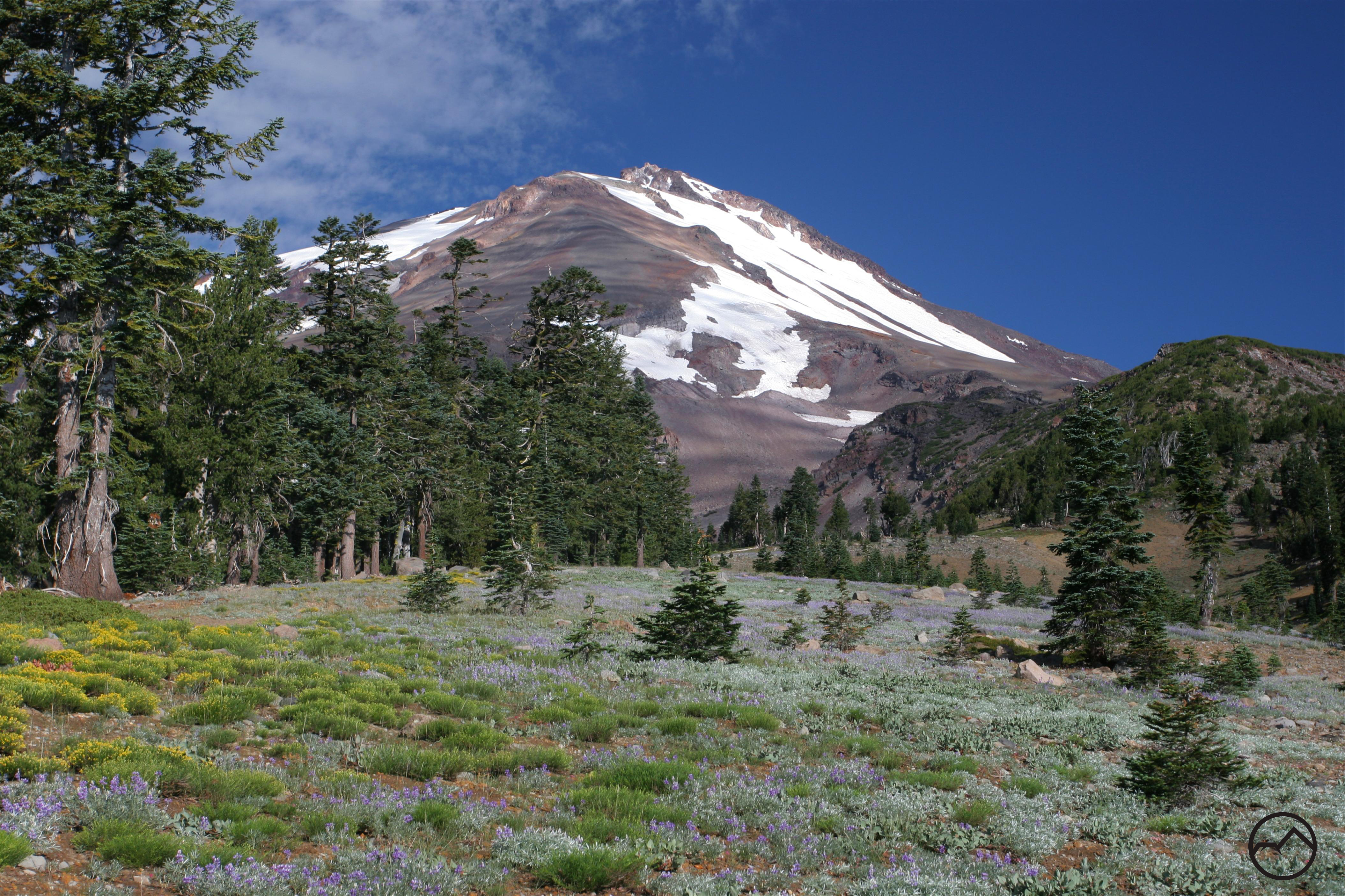
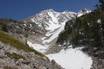
A spectacular view of Shastina from the heart of Diller Canyon.

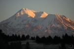
It is amazing how easy it can be to lose sight of just how big Mount Shasta is despite the mountain’s colossal size. Once one accepts Mount Shasta’s presence the sense of scale can quickly slip away and facts like its status as the largest peak in the contiguous 48 states or its ranking as one of the highest can be taken for granted. If it is possible to become complacent with Mount Shasta’s majesty, it is even easier to overlook Shastina. An enormous secondary cone that pushed its way out of Mount Shasta’s northwestern flank, Shastina is a mammoth peak in its own right. On its own, it is the third highest summit in the Cascades, only trailing behind Mounts Rainier and Shasta. Still, Shastina gets little recognition despite its tremendous proportion. Aside from its secondary position in relation to Mount Shasta, this is perhaps a result from the giant cone’s general lack of significant and recognizable features. The lone exception to its featurelessness is imposing Diller Canyon.

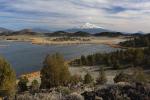
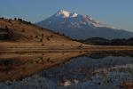
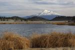
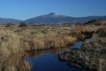
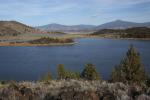
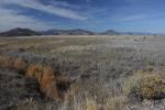
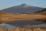
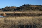
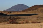
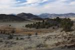
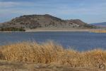
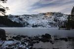
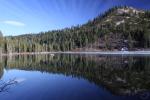
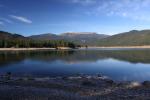
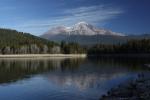
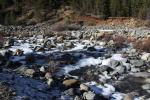
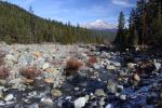
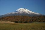
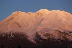
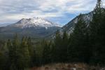
Three lowland views of Diller Canyon:


Diller Canyon is at once one of the most prominent features on Mount Shasta and one of the least appreciated. Among the largest and longest canyons on the mountain, Diller Canyon is a gaping gash on the side of otherwise unadorned Shastina. It is possibly the highest canyon as well. Beginning at about 12,000 feet, just below the summit of Shastina, the canyon drops away almost 8,000 feet in 4 miles. Most of the elevation loss occurs immediately below the summit as the slope of the mountain falls away precipitously. Diller Canyon is also the only major canyon on Mount Shasta that is visible from Interstate 5 as it passes along the western foot of the mountain. The canyon’s distinctive shape is easily discernible from the freeway. It seems like a massive wedge gouged out of the side of the conical peak. This is easily the most interesting aspect of Shastina. While it assuredly catches the eyes of drivers on the interstate, Diller Canyon remains an enigma to all but the most motivated explorers on Mount Shasta.

Cascades, Mt Shasta, Diller Canyon - March2014 014_edited-1 (Custom)

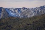
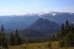
Looking west towards the Marble Mountains from the inner gully.

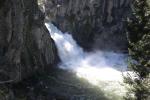
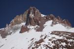
The canyon begins just below the volcanic cone’s summit, at the foot of three large crags. Nearly 0.5 miles across at the top, Diller Canyon narrows as it descends steeply down the west slope of Shastina. The canyon is actually composed of two sections. There is an outer canyon, which is the portion that is readily visible from afar, and there is an inner gully. The gully navigates a serpentine course through the heart canyon. Like most of the other canyons on Mount Shasta, its slopes are composed of loose ash and talus, making the gully’s walls very unstable. Water flows through the gully intermittently, though when its flow is strong is difficult to predict. If there is a large volume of snow lingering from a heavy winter and the days are hot, there is a decent chance some water will be in the creek. This is especially true along the central part of the canyon. Higher up it seems as though the water is funneled down through the porous rock and soil into the heart of the canyon. It then emerges from the loose scree filling the gully, races its way over a small waterfall and a pair of slick rock cascades and then once again subsides back beneath the surface. Finding running water through the entire length of the canyon is very rare. This is primarily due to the fact that the entirety of Diller Canyon is filled with volcanic detritus, mostly consisting of the aforementioned rock and ash.

Cascades, Mt Shasta, Diller Canyon - March2014 002_edited-2 (Custom)

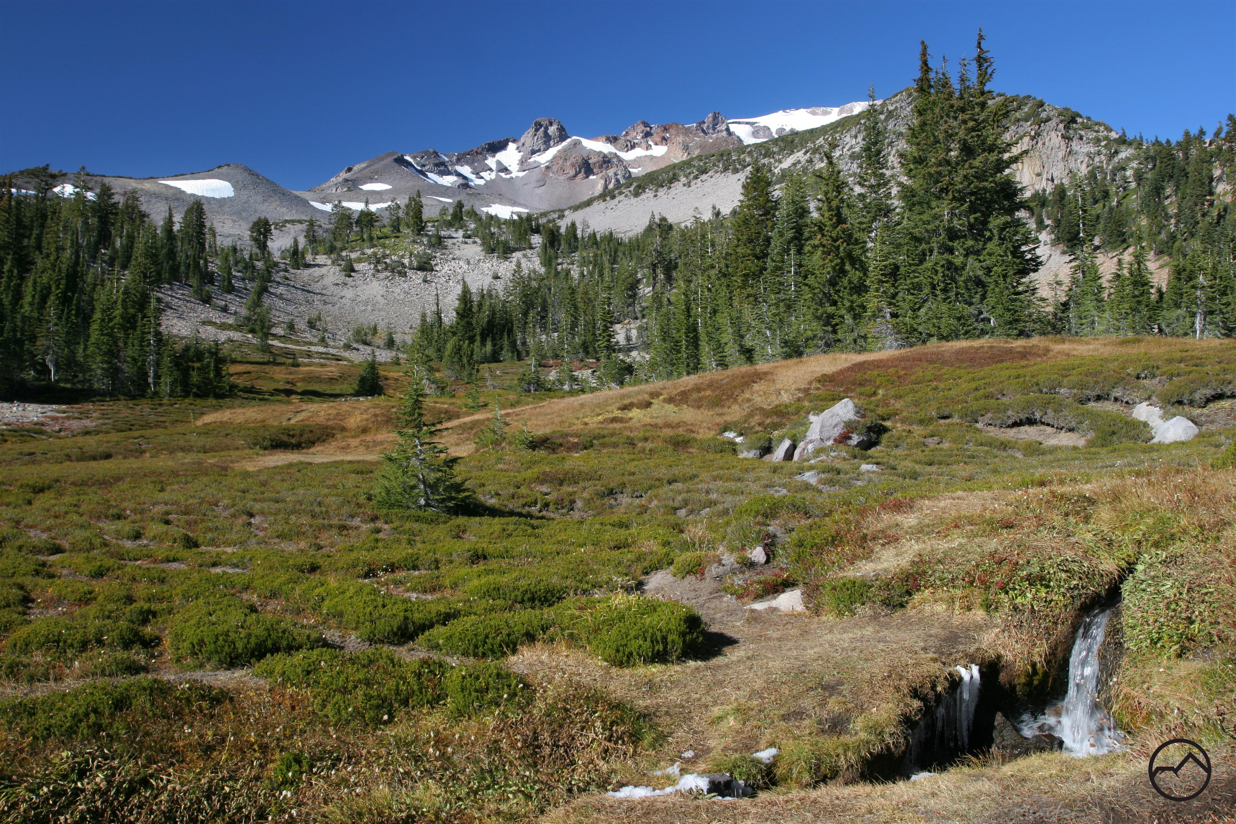
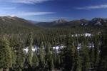
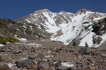
Excellent views from the approach.

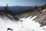
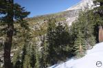
Despite its epic size and grandeur, Diller Canyon sees very little use. Most of the very few people who come to the canyon are backcountry skiers. This is usually done by climbing to the top of Shastina and then skiing down the long, treeless canyon. Indeed, from down below, the canyon looks like the largest and longest half-pipe in the world. If the skiers (few as they may be) are not present, Diller Canyon is essentially abandoned. This is a shame, considering how staggeringly spectacular the canyon is and how easy it is to get to. It is possible to drive on dirt roads fairly close to the chasm. The access roads are in pretty good shape and are easily passable by low-clearance vehicles. From there it is only a short hike on an abandoned dirt road. For the most part, the old road is more like a trail then something meant for vehicular travel. It is often narrow and the brush is encroaching on many stretches. When the road passes through some great red fir forests, it is quite faint, reducing its road-like qualities. It also boasts some truly spectacular views, particularly of Black Butte, the Trinity Divide and the Trinity Alps. Amazingly, instead of just ending at the canyon rim the road actually cuts into the canyon. Since the road maintains a level route across the steep canyon walls hikers do not even have to descend the steep slopes.

Cascades, Mt Shasta, Diller Canyon - March2014 017 (Custom)

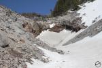
Inside awesome Diller Canyon.

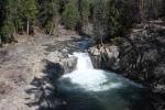
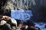
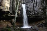
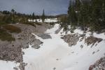
The very, very few who make this trek will find the road deposits them at the easy possible crossing of the inner gully. While most of its walls are high, loose and unstable, the old road ends near a large, black rock that protrudes from the gully. When water is flowing the rock sends the water over a scenic cascade. For hikers, the rock makes an extremely convenient place to cross. Incidentally, by following the bottom of the gully upstream from the black rock for about 100 yards, explorers will find a scenic 20 foot waterfall. This is the only significant waterfall in Diller Canyon. Though it is not a large or attractive as its cousins in Mount Shasta’s other canyons (Mud Creek Falls, Ash Creek Falls and Whitney Falls) it is still a very scenic spot that few ever set eyes on. Once across the inner gully, it is an easy scramble up a brushy slope to an incredible vista of the canyon. A seemingly limitless talus field extends upwards toward the summit of Shastina while sheer, rugged cliffs line the canyon, particularly on the north side. The great bulk of Shastina fills the horizon, reminding the lonely few who make it here that this is indeed the third highest volcano in the Cascades.

Why this old road was not converted into an official hiking trail when the Mount Shasta Wilderness was established in 1984 is a mystery. Other old roads that fell within the new wilderness boundary were converted into foot paths. Such a trail, leading to the tremendous views of Diller Canyon and the great potential for exploration, would no doubt be a popular destination if hikers knew about it. A Diller Canyon Trail would combine great views during the hike in with a spectacular destination. Still, official recognition, construction and maintenance are unlikely. Consequently Diller Canyon will remain an obvious but mysterious feature on Mount Shasta. Still, those who venture into the magnificent canyon will have the rare opportunity to enjoy a place that is seldom seen and to appreciate the unappreciated Shastina on its own strengths.

Diller Canyon Gallery:

A classic view up Diller Canyon
Inside the shallow inner gorge of Diller Canyon. Diller Canyon
Diller Canyon
Looking downcanyon, toward China Mountain, highpoint of the Scott Mountains.

The shallow inner gorge of Diller Canyon.
One of the small, seasonal waterfalls inside Diller Canyon. Here it is frozen for the winter.
The view north, across the canyon from the south rim.
Black Butte and Mount Eddy seen from Diller Canyon

As always, for those interested in learning the route to Diller Canyon, send me an email and I will give directions.

Off Season Trails: Winter Hiking In The Shasta Valley Wildlife Refuge

Posted by bubbasuess on March 21, 2014
Posted in: Desert, Hiking, Mount Shasta, Off Season Trails, Rivers, Spring Trails, Winter Trails. Tagged: Shasta Valley Wildlife Refuge. 17 Comments
Shasta Valley - Jan2011 014  (Custom)

Mount Shasta towers above the Shasta Valley Wildlife Refuge.

The Shasta Valley to the north of Mount Shasta is a starkly beautiful high desert region. Falling in Mount Shasta’s rainshadow, the valley’s dry environment is remarkably different from cool forests that surround the other sides of the massive volcano. It also differs from the higher, wooded areas in terms of public access. Where Mount Shasta and the surrounding mountains are all on public land and are open for recreation, only small pieces along the Shasta Valley’s southeastern fringe are open to the public. Consequently, most of the valley is off limits to hikers, which is particularly unfortunate in the winter and spring when the high desert environment means the potential for excellent, snow-free off season hiking. Fortunately, there is a single, lone exception to this situation. The Shasta Valley Wildlife Refuge, hidden in the northern end of the Shasta Valley, is a large 4,657 park administered by the California Department of Fish and Wildlife. Originally a ranch, the land has now been converted into a park that provides refuge to deer, coyotes, mountain lions and countless smaller mammals and birds. It is also a refuge for hikers eager to enjoy incredible views and warmer, drier lands during the colder parts of the year.

Shasta Valley - Jan2011 001  (Custom)

The Goosenest and the Little Shasta River.

If the wildlife refuge has one drawback with regards to hiking, it is the distinct lack of hiking trails. Officially, none exist within the park. Most infrastructure that currently exists is a remnant of the land’s other iteration as a ranch. There are gravel roads coursing through the park as well as older roads that resemble parallel single track trails. These older roads, when they are found, make great hiking paths. Irrigation channels, pumps and levees are still prevalent in the park as well. Some recreational amenities have been established, most notably the series of parking areas throughout the park. These implicitly encourage hikers to park and explore the refuge on foot. Unfortunately, a large part of the refuge, an area with some of the park’s most interesting terrain, is off limits to hikers in order to preserve the area specifically for wildlife. Despite this there are ample places to explore and incredible views to be in the rest of the refuge.

Cascades, Mt. Shasta - Feb2014 047 copy (Custom)

Amazing view of Mount Shasta and Trout Lake.

The most notable hike in the Shasta Valley Wildlife Refuge, and the one most resembling a traditional trail, is the Trout Lake Trail. This path follows first a series of levees, then a single track trail and finally a very old road that resembles a foot path far more than it does road. This hike hugs the west shore of surprisingly large Trout Lake, one of the refuge’s trio of small reservoirs known for their exceptional fishing. Trout Lake is also the most scenic of the three lakes. Mount Shasta towers majestically over the lake and is visible from most of the trail. In particular, the vista from the top of the west shore hill is one of the finest views of the mountain to be found anywhere. The contrast of the cool waters of Trout Lake contrasted by the arid high desert terrain and crowned by the glacier-clad volcano is tremendous.

Shasta Valley - Jan2011 017 (Custom)

Steamboat Mountain from a refuge road.

Though the Trout Lake Trail is the best hike in the refuge, it is by no means the only good option. If hikers are willing to hike the park’s roads there are several other interesting options for hiking. Most of the interesting sights are focused on three areas. The first is the Little Shasta River. This small river begins in the Little Shasta Meadow high in the Cascade Crest, on the slopes of Willow Creek Mountain. It flows west through an impressive canyon and eventually joins the Shasta River. The section of the Little Shasta River that passes through the wildlife refuge is the only section of the river that is publically accessible. While its waters are not swift moving as it flows through the park, it is still a refreshing sight to see the water making its way through the high desert. The second part of the refuge that will attract hikers is the Bass Lake area. It is possible to hike the lake’s entire shoreline. There is also a network of old, seldom used roads that connect Bass Lake to Trout Lake. These roads pass small volcanic hillocks, meadows and small ponds. The last part of the refuge to explore is the Steamboat Mountain area. Though the mountain itself is within the closed area, roads encircle the mountain and make for a great hiking loop. The views of the Cascade crest, including the Goosenest and Willow Creek Mountain are great on the north side of Steamboat Mountain. The road along the southern side of the mountain is tucked between Steamboat Mountain and Steamboat Lake, the park’s third reservoir. This part of the refuge in particular gets little use. While not focused on a single specific point, one other potentially good hiking opportunity would be to explore some of the many volcanic domes and hills that dot the refuge. A few of these have rugged, rocky jumbles of rocks on the top, giving them a turret-like appearance.

Cascades, Mt. Shasta - Jan2011 036 (Custom)

A refuge sunset on Mount Shasta.

Whichever area hikers decide to explore, they are in for a treat. The incredible spectacle of Mount Shasta looming above the arid land is fantastic and makes for awesome hiking. Even though the refuge lacks traditional hiking trails it is still a great destination for getting outside and enjoying nature even when the mountain trails are covered in snow or muddy. Even if visitors are not set on spending the day on foot, there are still many opportunities for nature lovers to enjoy themselves in the Shasta Valley Wildlife Refuge. Bird watchers will find much to appreciate and fishermen will appreciate the excellent fishing in the park’s lakes. Best of all, those blessed to enjoy a sunset at Trout Lake will experience one of the finest sunset views of Mount Shasta, complete with a reflection in the lake’s waters if the wind is not blowing. Considering how magnificent the view is and striking its landscape, it is crazy that the refuge remains fairly anonymous.

Shasta Valley Wildlife Refuge Gallery

Mount Shasta looms far beyond Trout Lake
Mount Shasta reflects in a pool by Steamboat Mountain.

The Cascade Crest seen from Trout Lake


Looking north toward the Siskiyous

Rivers From The Rains

Posted by bubbasuess on March 15, 2014
Posted in: Hiking, Mount Shasta, Rivers, Waterfalls. Leave a comment
Cascades, Mt. Shasta - March2014 016 (Custom)

Majestic Mount Shasta gazes down on the Sacramento River.

The lack of snow that has fallen has been the subject of much discussion this past winter. The first part of the winter was extremely dry and it has certainly caused much consternation up and down the state. Fortunately, February and the first part of March have seen a fair amount of rain. This translated to a fair amount of snowfall in the high country. The sustained precipitation also swelled the creeks and rivers so that they appear like they would during the spring thaw. This condition won’t last for as long as high water fed by the melting of snow but it is still nice to see the rivers running higher and the waterfalls thundering furiously. This is a great time to get out and enjoy the trails that follow the creeks and rivers as well as those blessed with waterfalls. Fortunately, most of these trails are at lower elevations so they are easily accessible this time of year. Even with the minimal snow we have received this year, there is still enough of the white stuff in the high country to make sticking to the lower trails worthwhile. Highlights of the trails that would have good displays of high water include the McCloud River Falls Trail, the Sacramento River Trail, the Hedge Creek Falls Trail, the Root Creek Trail and the PCT to Burstarse Falls.

Lower McCloud Falls
Middle McCloud Falls
Upper McCloud Falls
Hedge Creek Falls

The surging rivers are not the only highlight right now. As noted, the high country does have a fair amount of snow on it. This is the first time there has been an opportunity to offer some comparisons from previous years where the current state of the mountain has some snow on it.

March 2014

March 2013

March 2012

March 2011

Cascades, McCloud Falls - March2014 020 (Custom)

Swollen McCloud River just above Upper Falls.

It has been an unusual winter and unfortunately dry. That is going to have a terrible impact on many people throughout the state and around the country. Farmers won’t be able to irrigate and cities will have to institute water rationing. Swimming pools may even have to go dry. There is nothing to be done about this and all we are left with is to pray for more rain and snow and enjoy the high water while we have it. I hope that everyone can get out and hit the trails around Mount Shasta and enjoy the roaring rivers while they last.

Off Season Trails: Two Winter Hikes On The Lake Siskiyou Trail

Posted by bubbasuess on February 28, 2014
Posted in: Hiking, Lakes, Mount Shasta, Off Season Trails, Rivers. Tagged: Lake Siskiyou. 13 Comments

cascades-mt-shasta-feb2017-521-custom

Snowy Mount Eddy looks down on a very full Lake Siskiyou. 11Feb2017

Lake Siskiyou is one of the great recreational assets of the Mount Shasta area. Set in a broad, forested canyon, the lake is formed not only by the Sacramento River but also Wagon Creek and Cold Creek on the north and Castle Lake Creek and Scott Camp Creek to the south. While the lake itself is certainly an attractive body of water, the views from around the shore are what set it apart from other reservoirs. Sights seen from the lake include mighty Mount Eddy and the Eddy Range, Battle Rock (also known as Castle Spire, the highest point in the Castle Crags) and, of course, incomparable Mount Shasta. The view of the great mountain from Lake Siskiyou’s south shore is one of the finest to be had anywhere. In addition to be set in an exceptionally scenic location, the lake also offers exceptional recreational opportunities. Boating, fishing, camping and picnicking, are all offered at the lake. However, it is the trail that circumnavigates the lake that is the real highlight. Although the trail does not travel through particularly wild terrain, it serves up numerous interesting features and a continuous procession of fantastic views. When driving up to higher trailheads is not in order, a hike (or run or bike) on the Lake Siskiyou Trail is tough to beat.

Trinity Divide, Sacramento River - Feb2013 004 copy (Custom)

Winter at the Sacramento River inlet.

In addition to easy hiking, close proximity to town and great views, the Lake Siskiyou Trail has another great feature. The lake’s elevation is relatively low at 3,181 feet above sea level. Consequently, while it may get a fair amount of snow during the winter, the trail remains a viable hiking option for much of the winter. However, one there is one significant change to the trail’s condition during the winter. From November through April the pair of bridges that cross over the Sacramento just upstream from the river’s passage into Lake Siskiyou are removed. The bridges were intentionally constructed to be low impact and were thus not engineered to withstand the powerful water that surges down the river during the spring thaw. The pier supports for the bridges are permanent but the ability to remove the spans ensures their survival at high water. Unfortunately, unless hikers are prepared to ford the river (unless the water level is really high, this is a viable option for motivated hikers) it is not possible to complete the circumnavigation of the lake during the winter months when the bridges are removed.

Despite this set back, there are still two great winter hiking options available on the Lake Siskiyou Trail. Even though the loop is not possible, hikers are still able to enjoy treks along the sections of trail that cover the north shore and the south shore. Both trails offer great views of the lake and the surrounding mountains and the chance to hike along the lake and the creeks that feed into it. The two sections also cover most of the Lake Siskiyou Trail’s most interesting sections and cut out the parts that parallel W.A. Barr Road and pass through the Lake Siskiyou Resort. What is left may not be particularly wild but it is still a great option for hiking during the off season in winter and early spring.

Lake Siskiyou Trail: South Shore

Total Length: 4 miles

Cascades, Mt. Shasta - Feb2014 030 (Custom)

Mount Shasta highlights the view from the South Shore.

The best place to begin the hike along Lake Siskiyou’s south shore is to park in the large parking lot immediately north of the Box Canyon Dam. From there walk across the dam and pass through a clearing where large metal pipes and other items related to the dam may be strewn. The trail quickly comes to a signed fork in the trail. Staying left will continue on the main trail. Instead, go right on the alternate route and soon arrive at a large picnic area that has one of the finest views of Mount Shasta to be found anywhere. It is an incredible spot. At the west end of the picnic area, look for the alternate route continuing to the west. Here the trail stays very close to the lake (especially if the water level is high) as it passes through some attractive woods. The path eventually proceeds through some thick manzanita before it turns to the left and rejoins the main trail, which is basically a service road. This road winds its way around the pair of canyons containing Castle Lake Creek and Scott Camp Creek. Both creeks pass beneath South Shore Road via large culverts. The water pours out of each pipe into attractive pools before the creek continues onward toward the lake. Either creek makes a good destination for a day hike, though the area around the water can be heavily overgrown. On the far side of Castle Lake Creek the remnants of an old road lead down to where the creek meets the lake. Scott Camp Creek is the larger and more attractive of the two and some areas along the water are clear and easy to get to, making it the better of the two destinations.

Lake Siskiyou Trail: North Shore

Total Distance: 4.6 miles

Cascades, Mt. Shasta - Feb2014 008 (Custom)

The Wagon Creek Bridge on the North Shore section.

To begin a hike on Lake Siskiyou’s north shore, park at the lot located across from the entrance into the Mount Shasta resort. The trail initially stays very close to the road but, fortunately, is shielded by a thick hedge of trees. The sound of rushing water is soon audible. This marks the beginning of the descent into spring-fed Cold Creek’s narrow canyon. After crossing the culvert through which the creek passes under the road, the trail follows close by noisy Cold Creek. The water begins to fall well below the trail, which is now slung on the side of a cliff. The trail then emerges onto a narrow spit of land where the lake is present on both sides. At the end of the spit is the Wagon Creek Bridge, an impressive engineering feature. On the far side of the bridge the trail traverses a steep cliff before arriving at another parking lot. Beyond the parking lot, a large meadow flanks the trail. Some trees were recently cut down to allow for meadow restoration. The area looks a bit distressing now but the stumps are being ground out and native grasses replanted. After passing by the meadow the trail comes back into contact with the lake. Here hikers can stay on the main route or descend a short distance to follow the alternate route through large grassy sections with good views of the lake and Battle Rock. Passing through another large parking area that permits cars to drive down to the water’s edge, the main and alternate routes maintain a parallel course until meeting up again along the lake’s north shore. The path continues through the woods, staying close to the lake for a ways. Finally it makes a short drop down to the Sacramento River’s level. Here hikers can explore the river area or continue upstream on some unofficial use trails. Both are great options.

Lake Siskiyou

Off Season Trails: Three Trails Along The Sacramento River

Posted by bubbasuess on February 23, 2014
Posted in: Hiking, Mount Shasta, Mount Shasta History, Off Season Trails, Rivers, Trinity Divide, Waterfalls, Winter Trails. Tagged: Sacramento River. 11 Comments
Trinity Divide, Sacramento River - Feb2014 017 (Custom)

The Sacramento River passes alongside the Sacramento River Trail.

The Sacramento River is California’s longest and largest river. Even though it collects a substantial amount of water from the Sierra Nevada by means of several major rivers and innumerable smaller rivers and creeks, it is not a Sierra river itself. Instead it begins high in the Trinity Divide opposite the Strawberry Valley from Mount Shasta. Despite its beginnings at high elevation in the Trinity Divide, the Sacramento River does not spend much time in alpine territory. It quickly races out of the mountains and, after a brief stilling at Lake Siskiyou, it continues its descent down to Shasta Lake. Since most of its length is less than 3,000 feet elevation, the canyon bottom around the river receives considerably less snowfall than the higher regions. This presents an excellent opportunity for hikers during the winter. While the trails on Mount Shasta and in the Trinity Divide are usually smothered in snow the paths that access the Sacramento River are often pleasantly clear. This time in winter and spring is the perfect opportunity for hikers to get out and enjoy the trails that the river has to offer.

Cascades, Hedge Creek Falls - June2013 025a copy (Custom)

Mount Shasta peers down onto the Sacramento River.

Three trails currently exist along the Sacramento River: the Hedge Creek Falls Trail, the Sacramento River Trail, and the Sims History Trail. None of these trails are long so they are not great options for an all day excursion but what they lack in length they make up for in the numerous interesting features. All three trails provide varying degrees of access to the river and each yields varying perspectives on the nature of the river and its canyon is it flows south toward Shasta Lake. Between the three of them, hikers can enjoy a beautiful waterfall and raucous creek as it flows down into the Sacramento, a swinging bridge over the river and a trailside creek that hugs the riverbank and crosses numerous small creeks, and a path that explores a historic steel bridge and CCC camp and offers the opportunity to scramble over open, rocky banks while the river roars past. For those needing a mountain fix in the midst of winter, these are all great options to get outside and enjoy the Sacramento River, one of the great features of the Mount Shasta area.

Hedge Creek Falls Trail

Cascades, Hedge Creek Falls - March2013 053_edited-1 (Custom)

Hedge Creek Falls.

Adjacent to and easily accessed off of Interstate 5, the short Hedge Creek Falls Trail seems a world away from the speeding cars and loud trucks on the freeway. It quickly descends down into Hedge Creek’s canyon and the sounds and sights of the interstate disappear immediately. Hikers are left with an easy descent down to Hedge Creek Falls, a beautiful waterfall that spills out of deeply gouged notch in a hanging columnar basal cliff. A highlight of the trail is the routing behind the waterfall, through a cave beneath the columnar basalt. In the coldest depths of winter a gorgeous collection of ice crystals form where the falls crash down into a pool. From the falls the trail continues to descend, this time just above Hedge Creek which proceeds to crash over several smaller but still scenic cataracts. The trail finally at a great vista of Mount Shasta looming high over the Sacramento River as it runs noisily through its deep canyon. For those who want more of the river an unofficial use trail continues down to the confluence of Hedge Creek and the river.

Sacramento River Trail

Trinity Divide, Sacramento River - March2013 069 (Custom)

Rapids along the Sacramento River Trail.

Offering the longest and best exposure to the Sacramento River of any of the three trails that provide access to it, the Sacramento is also the longest trail along the river. Offering a surprising amount of excitement, the trail begins by passing through a narrow tunnel beneath the railroad tracks and then proceeds to cross the Sacramento on a swinging suspension bridge. From there the trail heads east along the bank of the river for about a mile. It starts high above the water but gradually descends until it roughly at the river’s level. Along the way the trail passes several yew and Port Orford cedars, both fairly rare trees that greatly enhance the botanical features of the trail. Once arriving at the river’s level the banks shift from rocky, tree lined banks to exposed bedrock that creates many narrow rapids. Small side channels also form in the naked rock and either produce small cataracts at high water or tidepool-like pockets of water amidst the rugged rock. After crossing several streams, some of which are substantial, the trail finally ends along the river. Here there is an off-trail scramble to an unusual set of columnar basalt set above the river.

Sims History Trail

Trinity Divide, Sacramento River - Feb2013 039 copy (Custom)

The old bridge crosses the Sacramento River.

Not quite out of Mount Shasta’s orbit, the Sims History Trail is a bit far to travel from Mount Shasta just to hike the short trail (unless fishing is involved). Still, for those heading north or south along Interstate 5, it is certainly worth the time to stop and stretch the legs. For those who do stop, the trail offers very scenic opportunity to enjoy both the Sacramento River and significant amount of early 20th century history. The official part of the trail parallels the river for a while before turning inland and passing ruins from a 1930’s era CCC camp. The most notable relic from this time period is the large steel bridge at the trailhead, which can be combined with the modern road bridge to make a short but nice little loop. More ambitious hikers can continue beyond the history trail on a faint use trail that leads to a rocky riverbank where the Sacramento tumbles over some nice rapids. This section of the river beckons hikers to explore further, particularly downstream, where the Sacramento enters a shallow but very rocky little gorge.

Breaking Down The North State: Seven Major Regions

Posted by bubbasuess on February 19, 2014
Posted in: Desert, Hiking, Klamath Mountains, Lakes, Mount Shasta, Rivers, Sierra Nevada. 10 Comments
Cascades, Mt. Shasta - Feb2014 127 (Custom)

Mount Shasta: forged by fire, carved by ice. The giant volcano lies at the heart of the North State.

The first post in the series can be found here.

The northernmost reaches of California can be broken up into seven basic regions: the Cascade Range, the Klamath Mountains, the Coast Range, the Sacramento Valley, the Sierra Nevada, the Modoc Plateau and Warner Mountains and the Great Basin. Of these seven districts, the Klamath Mountains and the Cascades constitute the heart of the North State. This is not to say that areas like the Sierra Nevada and Great Basin are insignificant but rather that their geographic stories properly belong in a different tale and they only lurk around the fringes of the North State. Any discussion of the North State’s geography must necessarily focus on the Cascades and the Klamaths. Not only do these two mountain ranges encompass the preponderance of the region’s terrain, they also include the most populated areas (as small as they are), the main lines of transportation and most of the outdoor regions enjoyed by recreationalists. Though this series will give appropriate attention to the other areas, the majority of it will naturally focus on the pair of mighty ranges that generally characterize the North State.

Regional Overview Map- Labeled (Custom)

Cascade Range

Cascades, Lassen - May2012 022 (Custom)

Classic Cascades terrain around Lassen Peak.

Constituting the central spine of the North State, the Cascade Range is the most prominent and recognizable part of the area. Topped by the famous towers of Mount Shasta and Lassen Peak, the Cascades are a volcanic mountain range exhibiting classic fire-forged features and punctuated by towering volcanoes. Stretching from the north shore of Lake Almanor northward to the Oregon border (and beyond, extending all the way into Canada), the Cascades can be divided into two general areas. The southernmost section is usually referred to as the Lassen Cascade. Centered on Lassen Volcanic National Park, the Lassen Cascade includes high peaks, dozens of alpine lakes, vast lava flows, clear running streams and numerous shield volcanoes and cinder cones. The northern half of the Cascade Range in California is typically deemed the Shasta Cascade. Mount Shasta dominates this mountain province in a way that few mountains overshadow the areas that surround them. So absolute is the great mountain’s dominance that many people would have difficulty naming other features. Nonetheless, high volcanic peaks line the Cascade crest, indicating the geologic activity that shaped the region. Aside from Mount Shasta, the most notable landmark is the Medicine Lake Caldera, one of the two largest volcanoes in the Cascades (the other being the Newberry Caldera near Bend). Although the Cascades are extensive, they are not extremely wild. Five wilderness areas totaling around one hundred and fifty thousand acres form pockets of wild land amidst a sea of forests that have experienced logging operations at one time or another. Despite the encroaching development, the Cascades are remote enough in relation to the rest of California that they still retain a sense of deep isolation.

Klamath Mountains

Marble Mountains, Marble Valley - August2007 023 (Custom)

The Marble Rim is hidden deep in the Klamath Mountains.

California’s northwest bulwark, the Klamath Mountains are perhaps the state’s greatest unknown mountain range. Counting the portion that extends north into Oregon, the Klamaths are over two hundred miles long and over eighty miles wide at the range’s widest point. Outside of the Sierra Nevada and the vast deserts of the Death Valley region, the Klamath Mountains are the wildest corner of California. Boasting eight wilderness areas totaling over one million acres, these mountains are some of the most primeval, rugged and spectacular to be found anywhere in the western U.S. Numerous powerful, free-flowing rivers drain the Klamath Mountains. A sense of vastness and separation pervades the Klamaths due to the limited access, scant human population and the air of mystery that hovers over the range. Indeed, the Klamath Mountains are the epicenter of Bigfoot sightings. Yet, all of this only embellishes the greatest component of the Klamath’s sense of mystery. Simply put, for most people this corner of California is a giant blank spot on their mental map. If they consider the region at all, it generally appears as a great area of nothing between the coast and Interstate 5. What they are missing is a mountain range that is blessed with tremendous beauty, rivaled by few other alpine provinces in the state. Soaring peaks and cliffs, deep canyons, high waterfalls, mighty rivers, expansive forests, cold lakes and verdant meadows are ubiquitous in the Klamath Mountains. However, not only is the range exceptionally scenic but it is also the most diverse mountain range in California. Composed of an incredible variety of rock types including granite, marble, greenstone, gneiss, serpentine, peridotite and many others, the range’s visual appearance can change dramatically in very short distances. The Klamath’s flora is also unusual and diverse. It is noted for its impressive number of endemic species and varieties of trees that are hundreds of miles beyond their normal ranges. Thankfully, there are extensive networks of trails throughout the Klamaths that provides access to many of the most scenic and spectacular features. Exceptional journeys of a couple of weeks or more are possible in many parts of the Klamath Mountains.

Modoc Plateau and the Warner Mountains

Cascades, Harmony Weekend - Nov06 036 (Custom)

The Pit River drains the Modoc Plateau.

Extending east from the Cascades, the Modoc Plateau and the Warner Mountains continue the volcanism exhibited by the Cascades but do so in a more subdued fashion. Lava flows and ancient cinder cones are common in many parts of the area, most notably in Lava Beds National Monument, where there are excellent examples of both features. The plateau is not a single, level region as the name indicates. Instead, it is a large area of low, rounded mountain ranges punctuated by large, rounded, flat bottomed valleys. Uniting the region is the passage of the Pit River, which begins on the western slopes of the mighty Warner Mountains and drains westward, ultimately joining the waters of the Sacramento and McCloud Rivers at Shasta Lake. While the Cascades form the western boundary of the Modoc Plateau, the Warner Mountains do so to the east. These are among the least known and wildest mountains in California. Though they are volcanic, they are not volcanoes. Instead they were formed the way the Sierra Nevada and the mountains of the Great Basin were formed, through the pushing upward of giant faults. This activity has exposed numerous successive lava flows and layers of tuff (compressed volcanic ash). The Modoc Plateau is lightly populated but much of the area is involved with ranching and agriculture. Only two wilderness areas are found here. One, at the Lava Beds, protects the lava flows, cinder cones and lava caves. The other encompasses the highest reaches of the Warner Mountains. This is a stunning region of great beauty and can be explored by a well-developed but lightly used trail network.

The Great Basin

Warner Mountains - July2008 222 copy (Custom)

Looking east into the Great Basin from the Warner Mountains.

Lapping at the feet of the Warner Mountains and the Sierra Nevada, the Great Basin is the largest of the four great American deserts (the others being the Mojave, Sonoran and Chihuahuan). It includes a significant portion of southeastern Oregon and encompasses most of the states of Nevada and Utah. Portions of it lie within California, generally along the margins of the eastern fringe of the state. It typically begins at the eastern foot of Sierra Nevada and mountainous areas to the north including the Warner Mountains. The desert gets its name because it is a large endorheic basin where none of the water that falls in the region has access to the sea. Some sizable rivers flow into the basin but are unable to breech the encircling mountains and ultimately dissipate in large, marshy sinks. The geography of the Great Basin is characterized as the “basin and range” province. This is to say that it is composed of a seemingly interminable series of narrow, north-to-south trending mountain ranges separated by long, dry basins. While the basins exhibit the environment one typically expects from a desert, many of the mountain ranges are high enough to support and alpine environment. The most notable examples of this are Steens Mountain in Oregon and the Ruby and Snake Ranges in Nevada. Only small pockets of the Great Basin are present in the North State but it is an overwhelming presence to the east and necessitates inclusion in the general picture of the region’s geography.

The Sierra Nevada

Sierra Nevada, Feather Falls - Mar2008 023 (Custom)

Feather Falls, a mighty Sierra Nevada waterfall.

California’s largest and mightiest mountain range is justly described in a long list of superlatives. Soaring, serrated peaks, deeply incised river canyons, massive granite domes, gargantuan sequoias and an unbelievable array of mighty waterfalls compose the common perception of this mountain range. It stretches over four hundred miles from its junction with the Tehachapi Mountains in Southern California to the Mountain Meadows Valley, home of Lake Almanor, where the range quietly meets the Cascade Range. While most of the Sierra Nevada is a visually stunning panoply of jagged alpine wilderness, the northernmost section, the area germane to a survey of North State geography, is much more subdued. Instead of immense expanses of naked rock, the northern Sierra is cloaked in vast forests and punctuated by occasional rocky areas. Despite the restrained nature of this area, it retains elements of classic Sierra Nevada environments. Large granite domes can still be found, deep canyons with tall granite cliffs still cut into the mountains and large waterfalls still thunder impressively. One need only observe these features to know that, though more hushed in general, the great beauty of the Sierra Nevada is still present in its northernmost reaches.

The Sacramento Valley

North Coast Range, Orland Buttes - April2011 024 (Custom)

The Orland Buttes provide great views of the Sacramento Valley.

The northern half of California’s mighty Central Valley, the Sacramento Valley is surrounded on three sides by the North Coast Range, the Klamath Mountains and the Sierra Nevada. Mighty rivers and countless large creeks and streams race out of the encircling mountains and funnel water into the Sacramento River, California’s largest and longest. The Sacramento itself begins in the Trinity Divide, near Mount Shasta and in the heart of the North State. The river flows south through the Klamath Mountains and enters the Sacramento Valley near Redding. From there it winds its way south, collecting water from the North Coast Range and Sierra Nevada. Major watersheds in the North Coast Range include Stone Creek, which begins on Snow Mountain and Cache Creek, which drains Clear Lake (the latter being the closest whitewater to the Bay Area). Significant watersheds in the Sierra Nevada include the enormous Feather River, the Yuba River and the American River, all of which begin high on the Sierra crest. A small but notable portion of the southern Cascades also drains directly into the Sacramento River, particularly Mill Creek, which begins on the southern flanks of Lassen Peak. This tremendous waterway eventually flows into the Delta and hence into San Francisco Bay. Most of the valley is flat and given over agriculture. Despite this, there are a couple of surprisingly rugged uplands. The highest is the Sutter Buttes, the remnants of an ancient volcano. The other area is the Orland Buttes which are a series of volcanic domes and dikes. Most of the Sutter Buttes are privately owned, though the state of California has purchased a sizable parcel of land with the intention of creating a state park. The Orland Buttes surround the Black Butte Reservoir and much of the area is administered by the Bureau of Reclamation. Some fantastic trails with great views wind their way through the Buttes.

The Coast Range

North Coast Range, Snow Mountain - Sept2006 017 (Custom)

Snow Mountain summit view of Signal Peak.

California’s extensive coast line is flanked by a long series of mountains that extend from their junction with the Transverse Range near the Cuyama Valley northward, past San Francisco Bay, and ultimately into Oregon. The range is divided into two halves separated by the great breech of San Francisco Bay and the Sacramento Delta. The northern half of the coastal mountains is referred to as the North Coast Range. This region is home to the towering coast redwoods, vast conifer forests, extensive oak savannah and numerous large rivers. There is also a fairly large highland area that includes high peaks that barely reach into the alpine zone. In general, the North Coast Range is divided between to areas: a lower set of mountains pushed up against the coast that are heavily forested and the higher, more rugged mountains that form the crest and eastern perimeter of the range. The western, lower half of the North Coast Range is home to the redwoods and also includes the Lost Coast, where the King Range (a sub range of the North Coast) is dramatically pushed up against the sea. The higher, eastern portion includes the remote Yolla Bolly Wilderness (a part of which also includes the southernmost section of the Klamath Mountains) and the Snow Mountain Wilderness. The Yolla Bollies are home to South Yolla Bolly Mountain (also referred to as Mount Linn) which exceeds eight thousand feet and is the highest point in the North Coast Range. The Snow Mountain Wilderness is centered on enormous Snow Mountain, the southernmost peak in the range to climb above seven thousand feet. South of Snow Mountain the range is generally lower in elevation but includes gigantic Clear Lake (the largest freshwater lake entirely in California), the Mayacama Mountains and the famous California Wine Country. The southernmost section of the range is capped by Mount Tamalpais and spectacular Point Reyes.

‘Twixt Two Ranges

Trinity Divide, Seven Lakes Basin - June2008 055 copy (Custom)

Mount Eddy and Mount Shasta: highest points of the Klamaths and the Cascades.

While the seven regions make up the entirety of the North State, at heart, the region is highlighted by the dramatic tension between the Klamath Mountains and the Cascade Range. Though they come within only a few miles of each other near Mount Shasta, their environments could not be more different. The striking and often stark volcanic landscape of the Cascades is in marked contrast to the incredibly diverse alpine landscapes of the Klamath Mountains. It is amazing that two dramatically different mountain areas could stand so close to each other yet be shaped by such different forces and exhibit such different characters. One of the great blessings of being able to explore these areas is the opportunity to appreciate the staggering diversity and the truly spectacular beauty.

Breaking Down The North State: A Geography Primer

Posted by bubbasuess on February 18, 2014
Posted in: Hiking, Klamath Mountains, Mount Shasta, Rivers, Sierra Nevada, Wilderness. 7 Comments
Cascades, Mt. Shasta - Jan2014 008 (Custom)

Sunrise view from of Lassen peak, a giant of the Cascade Range, from the flanks of Mount Shasta.

California’s North State is one of the wildest, most rugged and most spectacular regions in a state that has no shortage of magnificent mountain wilderness areas and exceptional scenery. Despite the cornucopia of spectacular landscapes, the region often seems to be overlooked by the public at large. The reasons for the lack of awareness of what the North State has to offer is rooted in many things, among them is the distance from population centers in the rest of the state. This may not be a bad thing since it leaves the communities low key and the trails uncrowded. Still, one wonders if, at least in part, the northernmost part of California has escaped attention because, to some degree, it is shrouded in mystery. This is the land of Bigfoot and Lemurians and people who want to be left alone. Yet it is also one of the most complicated geologic knots in California. There is no doubt that the complex geography has contributed mightily to the regions relative anonymity.

Trinity Alps, Canyon Creek II - May2007 058 copy (Custom)

Sawtooth Peak in the Trinity Alps.

The complicated geography of the North State is exacerbated by the lack of a systematic taxonomy of the mountain ranges and other areas. Several determinants have contributed to this confusing condition. Perhaps chief among these causes is the general lack of clear delineation between mountain provinces. There are few clean breaks between ranges and regions. This is worsened by the tendency for subranges to overshadow the larger geographic context. An example of this is the Trinity Alps prominence has obscured the fact that the massive Trinities are really a part of the much larger Klamath Mountains. Obviously Mount Shasta eclipses everything else. Yet, in the shadow of these mighty mountains lie other ranges and areas that have remained under the radar, drawing only the attention of the few who seek to utilize their resources. So overlooked are some of these mountain areas that they have escaped appellation and remain anonymous in the truest sense of the word. Lacking even names, these areas have generally escaped taxonomy in all but the broadest terms.

For those who enjoy the natural wonders of the North State, it is not necessary to have a comprehensive knowledge of the regions geography. Nonetheless, for those who are interested in understanding that which they enjoy in general and geography in particular, it is useful to try to untangle the incredible complexity that is the uppermost portion of California. This is a daunting endeavor, for the breadth and width of the North State is vast and amount of geography that demands attention is immense. Still, it is a worthwhile task.

It should be noted that the forth coming series on North State geography is sourced from both printed resources and my own observations. There is a paucity of written material for this area and what there is, is often inaccessible. I have a tendency to seek after clear demarcation and organized categories. That is a state that is impossible to attain but one I will toil after nonetheless. Also, there are many cases where I am, by necessity, making seemingly arbitrary decisions about the scope or inclusion of areas in broader geographic contexts. I am trying to make the most sense of a confusing area and I readily admit that geology could prove me wrong. In spite of these limitations, I think that identifying and sorting out the North State’s complicated geography can be a helpful effort.

Chapters:

1. Seven Major Regions

2. The California Cascades

3. The Klamath Mountains Pt. I

4. The Klamath Mountains Pt. II

More to come!

Regional Overview Map- Labeled (Custom)

Year One of Hike Mt Shasta

Posted by bubbasuess on January 30, 2014
Posted in: Hiking, Klamath Mountains, Lakes, Meadows, Mount Eddy, Mount Shasta, Rivers, Trinity Alps, Trinity Divide, Waterfalls, Wilderness. 5 Comments
Cascades, Mt. Shasta - Dec2012 060 copy (Custom)

Shasta Valley view of lenticular clouds coalescing on Mount Shasta. The first image posted on Hike Mt Shasta.

Today marks the one year anniversary of Hike Mt Shasta. It is not much of a milestone for a blog this small but it is still worth pointing out the passage of time since this modest endeavor’s launch. It is my sincere hope that for those who have found their way to this site it has been useful and edifying. For the folks spending time here and exploring this region’s magnificent landscape, it is my intention to provide accurate information along with helpful, attractive images. For the readers who are not hiking here, I have tried to convey a sense of the area’s great beauty and provide the opportunity to explore it vicariously through the written word. To all who have offered suggestions and other feedback, you have my thanks.

However, the focus should always stay on the great mountain itself and the lands that surround it. It is to imbibe deeply from this incredible place that we have all arrived it this site, one way or another. To that end, I wish to mark the anniversary of the site by highlighting some of my favorite trails and blog posts. Thanks again for reading Hike Mt Shasta!

Favorite Trails:

Cascades, Mt Shasta, Brewer Creek - July2012 099 (Custom)Brewer Creek Trail: Traversing the lonely east side of Mount Shasta, this spectacular trail dishes up stunning views of a seldom seen side of the mountain. Highlights of the perspective include the massive Hotlum Glacier and the impressive Wintun Glacier. The Brewer Creek area itself is a magnificent, fragile alpine garden with incredible views of Mount Shasta to the west and underrated Ash Creek Butte to the east. A cross country scramble to the south leads to spectacular Ash Creek Falls, the tallest and most attractive waterfall on the mountain. This is one of California’s great waterfalls, though it is little known. A perfect view of the 330 foot waterfall plunging into deep Ash Creek Canyon is crowned by Mount Shasta’s mighty cone. This is reputed to have been John Muir’s favorite vista on Mount Shasta and it is easy to see why.

Cascades, Mt Shasta, Clear Creek - Aug2012 091 (Custom)Clear Creek Trail: Climbing steadily along the rim of massive Mud Creek Canyon, the Clear Creek Trail is a fantastically scenic path. Early on in the journey comes a monumental view that peers into the depths of the canyon, revealing awesome Mud Creek Falls, Mount Shasta’s largest cataract. The mighty waterfall is dwarfed by the epic scale of the canyon surrounding it. The vista also boasts a perspective of the Clear Creek Cascades. Higher up, the trail passes through great fields of lupine and rabbit brush before climbing above the treeline into the gargantuan basin above Mud Creek Canyon. Here the great turrets of the primordial heart of Mount Shasta tower overhead, marching inexorably towards the mountain’s soaring summit. In contrast to the barren, ashy wasteland, the verdant and wildflower choked Clear Creek Springs makes a tremendous destination.

Cascades, Mt Shasta, Squaw Meadow - Nov2011 073 (Custom)South Gate/Squaw Meadow Trail: Probably the finest hike on Mount Shasta and one of the most stunning trails to be found anywhere, this hike has it all. Great loop options and unrelentingly spectacular views along the entire route, this trail is simply amazing. The strikingly austere volcanic beauty of the mountain alternates with wonderful old growth red fir and hemlock groves. Gray Butte, Red Butte and Sargents Ridge all loom above various sections of the trail and the descent into the Old Ski Bowl has jaw-dropping views of the Trinity Divide and the distant Trinity Alps. Still, it is the meadow itself that is the star of this trail. Lush grass and wildflowers are stark contrast against the volcanic ash, pumice and talus. The gushing springs provide numerous watery channels through the garden, highlighted by a 150 cascade separating the upper and lower meadow. For the ambitious, an off-trail route leads to the west rim of awesome Mud Creek Canyon. Here one gets a sense that the mountain still lives as rocks fall into the chaotic depths, grand hoodoos hint at a fiery past and Konwokiton Falls flows below the eponymously named glacier.

Trinity Divide, Mt. Eddy - Oct2008 006 (Custom)Deadfall Lakes Trail: A classic mountain trail climbing up to the summit of Mount Eddy and the finest view in the North State. Weaving through lush Deadfall Meadow and passing by the gorgeous Deadfall Lakes (the upper lake is the best!), the trail ultimately makes the ascent up the seemingly interminable switchbacks that lead to the top of the peak. With each turn of the trail the view improves, eventually revealing the glory of Mount Shasta as hikers make the final steps to the top. Complementing the view of the huge volcano is a 360 degree view of all the mountains in the region including the Trinity Divide, Trinity Alps, Marble Mountains, Siskiyous, Yolla Bollies, the Cascade Crest to the north and the Lassen Peak area to the south. Many southern Oregon peaks are visible too, including Mount Ashland, Pilot Rock, Soda Mountain, Mount McLoughlin, Browns Mountain and the Mountain Lakes massif. Simply put, it is incredible.

Sisson-Callahan (7)Sisson-Callahan Trail: A rarely hiked trail, and one of the longest in the Mount Shasta area, the Sisson-Callahan Trail is, in some ways, more a journey than a hike. Accessed via a couple miles on the Pacific Crest Trail and passing the beautiful Deadfall Lakes, the alpine splendor at the beginning of the trail obscures the trail’s true nature. The steep descent down the flanks of Mount Eddy into the canyon of the North Fork of the Sacramento introduces hikers to the canyon that will ultimately lead them all the way to the main fork of California’s largest and longest river. Along the way, the route passes lush meadows, rocky crags, deep gorges and and a seemingly endless succession of small cascades on the North Fork. The deep isolation and great beauty of the area endow the trail with an air of lostness in the best sense of the word.

Trinity Alps, Grizzly Lake - June2013 052 copy (Custom)Grizzly Creek Trail: A difficult trail with tremendous payoff, the Grizzly Creek Trail is one of the classics of the Trinity Alps. Simply put, the Grizzly Lake complex, with its attendant peak, glacier, lake, waterfall and meadow is, for my money, the most beautiful spot in the North State (well, maybe it is tied with Ash Creek Falls, but this may well surpass even that!). Grizzly Lake, surrounded by sheer cliffs and capped with craggy Thompson Peak and the Thompson Glacier, is stunning and one of the finest alpine lakes in California. Grizzly Falls is a legendary, hard-to-reach waterfall that lives up to its fabled status. Pouring directly out of the lake, it free falls and then cascades hundred of feet down to Grizzly meadows. From there, the azure waters meander gracefully through the thick grass and great views before heading off on its raucous, cataract laden journey to its confluence with the North Fork of the Trinity River.

Warner Mountains - July2008 159 (Custom)Patterson Lake Via Warner Summit Trail: Tucked away in the northeasternmost corner of California, the Warner Mountains are one of the state’s best kept secrets. Boasting fantastic cliffs and views, lush meadows, unusual flora and one of the great mountain lakes of the region, the Warners are tough to beat when it comes to scenic, lonely backpacking. The indisputable highlight is majestic Patterson Lake. Boasting strange cliffs soaring out of the water and surrounded by massive displays of wildflowers, Patterson Lake is an absolutely first rate destination. Add to that nearby views of Owl Creek Basin and hikers are blessed with one of the most scenic areas in California. Though there are a few ways to get to Patterson Lake, the Warner Summit Trail from Pepperdine Camp is the best (though the Pine Creek Trail is fantastic too). The trail has constant, excellent views in all directions and passes small but very scenic Cottonwood Lake. Connect this route to the Squaw Peak Trail for a top-notch loop.

The following are some of my favorite blog posts from the past year:

Seldom Seen: Mud Creek Canyon

Seldom Seen: Hole In The Ground Geologic Area

Five Fantastic Mount Shasta Views

Switchbacks To Heaven: The Trinity Alps’ Stoney Ridge Trail and Four Lakes Loop

Mount Shasta Area Waterfall: Three Falls On The Mountain

Great Lakes: Top Lake Basins In The Trinity Divide

Thanks again for reading Hike Mt Shasta. I hope that it encourages everyone to get out and explore the trails wherever we are but especially those in the Mount Shasta area!

Midwinter Snow Assessment on Mount Shasta

Posted by bubbasuess on January 27, 2014
Posted in: Hiking, Mount Shasta. 2 Comments
Cascades, Mt. Shasta - Jan2014 023 (Custom)

Sunrise on a naked Mount Shasta.

As this post is being written the sky is darkening and the clouds gathering, preparing the way for some much needed precipitation. Deep into winter with hardly a drop of rain or snow, talk of drought has been on everyone’s lips. I am under no illusions that the coming storms will be large or sustained but I do believe that it is a harbinger of a shift in the larger weather patterns. I have reminded folks a few times recently about the winter of 2010-2011. In that season there was a strong storm right before Thanksgiving that dropped a few feet of snow. After that, December and January saw hardly a drop of rain or snow and the temperatures were high like they have been this year. The only reason there was no panic or talk of drought was because the previous winter had produced some epic storms and all the reservoirs were filled to capacity. February of that winter brought an average amount of snowfall. March arrived and midway through the month an epic storm passed through, dropping 9 feet over four days. The first night of the storm alone saw half of that total come down. It was a tremendous amount of precipitation. Needless to say, a prior winter’s events will determine the present but it is a at least an admonishment that there is a lot of winter yet and we could still receive the sustaining provision that we need.

Having said that, it is unsettling to look at Mount Shasta right now and see just how naked it is. The days have been fairly warm lately so what little ice is left on the mountain has been dwindling even further. What is left is generally wind-packed in gullies and other protected areas. Typically, at this point in a normal winter the mountain is blindingly white. Hopefully it will be again soon. Still, whether the coming rains prove to be the beginning of a long-term change in the weather or not, this has been a unique winter with unusual opportunities to hike the high country at this time of the year. Still, as much as I thrive on getting out and exploring the wilderness, the world thrives when it is well-watered. The following links show just how far behind the previous years we are. Let hope we catch up!

2014

2013

2012

2011  Note: This is the winter that saw almost no precipitation in December and January. The mountain is white largely on the strength of the storm that came through at the end of November.

Low Snow Hiking Around Mount Shasta

Posted by bubbasuess on January 24, 2014
Posted in: Hiking, Lakes, Mount Shasta, Rivers, Trinity Divide. 8 Comments
Cascades, Mt. Shasta - Jan2014 029 (Custom)

Good hiking around Castle Lake.

This winter has proven to be an unusual one thus far. I had planned on focusing the blog on winter hiking and related subject matter. When the first snow fell back at the beginning of December it was assumed that that would be end of hiking in the high country, since surely more snow would be coming soon. Instead, we have had one of the driest winters on record so far. Rather than feeling frustration because the snow has blocked access to most of the Trinity Divide and other high mountains, thoughts now turn to our need for water and how to handle the drought conditions over the coming summer. One trip over the Pit River Bridge on I-5 will dispel any optimism that our water resources are in adequate condition. Shasta Lake looks more like its ante-impoundment canyon than the largest reservoir in California. In the face of conditions like that, winter access to favorite hiking destinations seems like a trivial matter. Still, if we are to endure a drought, we ought to find some profit in the midst of our plight. The high places in the Trinity Divide are still easily accessible, the skies are clear, and the temperatures are warm for this time of year. We should take advantage of the opportunity while it lasts.

Cascades, Mt. Shasta - Jan2014 083_edited-1 (Custom)

Good hiking around Castle Lake.

If one is willing to brave lower temperatures, the high country trails are still in fantastic condition for this time of year. One of the most convenient options for hiking at the higher elevation is the mountains that loom above Lake Siskiyou. In terms of access, this means the Castle Lake area and the trails reached by means of South Fork Road. A total of 9 trails begin in these two areas and reach diverse destinations, many of which include alpine lakes. There are 3 trails around Castle Lake and 6 along the South Fork Road. Of course, there are numerous hiking options around Lake Siskiyou but since they are options more appropriate to normal winter conditions, it is better to avail ourselves the unusual access of the higher trails. It should be noted that reaching the upper section of South Fork Canyon may require a 4×4 or AWD vehicle. Some snow and ice persist on the road and could be a problem for a car with two wheel drive. Still, the conditions are good and access easy with the right vehicle.

While I have not driven the dirt roads that lead to the trailheads for the Gray Rock Lakes and the Soapstone Trail, all the other trails along the South Fork and Castle Lake areas are easily reached off of paved roads. I have taken a couple of trips to this area with my kids over the last week in order to investigate the conditions. I was surprised by how clear things generally were at the higher elevations. Even the Trinity Alps, visible from Gumboot Saddle, were quite free of snow. I was impressed with how much water was flowing in the Sacramento River and many of the creeks. Still, it was discouraging to see how little water was in Lake Siskiyou. It is a reminder that even though there is decent flow, the water level is still terribly low.

Castle Lake after a light snow. Most of this is gone now.
Clouds highlight Castle Lake.

A bare Mount Eddy above a very low Lake Siskiyou.
Mount Shasta reflects in low Lake Siskiyou, down over 30 feet from high water.
Thick ice encrusts the still swift moving Sacramento River.

Atypical winter conditions along the Sacramento River.
A peak into the Trinity Alps’ Bear Lake cirque reveals little snow.

One of the interesting benefits of the current weather situation is the opportunity to observe the higher elevations at cold temperatures but lacking the mantle of snow that typically smothers everything at this time of year. The lakes are either completely or partially frozen. The seeps, normally wet and mossy spots on the ground or hanging on steep slopes are now clusters of giant icicles. Pockets of snow still cling to shady portions of the cliffs that tower over the lakes. Even the Sacramento River and the creeks are covered with thick sheets of ice. It gives the running water an unusual appearance when it presses against the underside of the ice or emerges raucously from beneath the sheets.

All things considered, we are in urgent need of rain and snow but we might as well enjoy the circumstances while they last. Get out and experience the unusual conditions now. I am confident that February and March will bring some much needed relief and go a long way towards pushing us back to normal. We have seen this happen before.

Posts navigation

← Older Entries
Newer Entries →
    • Recent Posts

      • Winter Shows Up When It Will
      • January Rolled By With Mud, Then Very Dry
      • Mount Shasta 2025 – A Year In Images
      • Mount Shasta On Either Side Of Christmas
      • Adrift In An Ocean Of Fog
      • December Has Been Spectacular Thus Far Pt. II (A Magnificent Lenticular)
      • December Has Been Spectacular Thus Far Pt. I
      • Lenticular Interrupted
      • A Stormy Wave And A Truchas Sunset
      • Aurora Lenticularis
    • Enter your email address to follow Hike Mt Shasta and receive notifications of new posts by email.

    • Archives

      • February 2026
      • January 2026
      • December 2025
      • November 2025
      • October 2025
      • September 2025
      • August 2025
      • July 2025
      • June 2025
      • May 2025
      • April 2025
      • March 2025
      • February 2025
      • January 2025
      • December 2024
      • November 2024
      • October 2024
      • September 2024
      • August 2024
      • July 2024
      • June 2024
      • May 2024
      • April 2024
      • March 2024
      • February 2024
      • January 2024
      • December 2023
      • November 2023
      • October 2023
      • September 2023
      • August 2023
      • July 2023
      • June 2023
      • May 2023
      • April 2023
      • March 2023
      • February 2023
      • January 2023
      • December 2022
      • November 2022
      • October 2022
      • September 2022
      • August 2022
      • July 2022
      • June 2022
      • May 2022
      • April 2022
      • March 2022
      • February 2022
      • January 2022
      • December 2021
      • November 2021
      • October 2021
      • September 2021
      • August 2021
      • June 2021
      • May 2021
      • April 2021
      • March 2021
      • February 2021
      • January 2021
      • December 2020
      • November 2020
      • October 2020
      • September 2020
      • August 2020
      • July 2020
      • June 2020
      • May 2020
      • April 2020
      • March 2020
      • February 2020
      • January 2020
      • December 2019
      • November 2019
      • October 2019
      • September 2019
      • August 2019
      • July 2019
      • June 2019
      • May 2019
      • April 2019
      • March 2019
      • February 2019
      • January 2019
      • December 2018
      • November 2018
      • October 2018
      • September 2018
      • August 2018
      • July 2018
      • June 2018
      • May 2018
      • April 2018
      • March 2018
      • February 2018
      • January 2018
      • December 2017
      • November 2017
      • October 2017
      • September 2017
      • August 2017
      • July 2017
      • June 2017
      • May 2017
      • April 2017
      • March 2017
      • February 2017
      • January 2017
      • December 2016
      • November 2016
      • September 2016
      • August 2016
      • July 2016
      • June 2016
      • May 2016
      • April 2016
      • March 2016
      • February 2016
      • January 2016
      • December 2015
      • November 2015
      • September 2015
      • August 2015
      • July 2015
      • June 2015
      • May 2015
      • April 2015
      • March 2015
      • February 2015
      • January 2015
      • December 2014
      • November 2014
      • July 2014
      • June 2014
      • May 2014
      • April 2014
      • March 2014
      • February 2014
      • January 2014
      • December 2013
      • November 2013
      • October 2013
      • September 2013
      • August 2013
      • July 2013
      • June 2013
      • May 2013
      • April 2013
      • March 2013
      • February 2013
      • January 2013
    • Categories

      • Boy Scouts
      • Cascade Range
      • Castle Crags
      • Desert
      • Echo Point
      • Glaciers
      • Hiking
      • How things came to be…
      • Klamath Mountains
      • Konwakiton Outdoor Designs
      • Lakes
      • Lenticular Clouds
      • Maps
      • Marble Mountains
      • Meadows
      • Mount Eddy
      • Mount Shasta
      • Mount Shasta History
      • Napa County
      • Off Season Trails
      • Pacific Crest Trail
      • Peaks
      • Rivers
      • Rock Climbing
      • Scott Mountains
      • Seldom Seen
      • Shasta Valley
      • Sierra Nevada
      • Siskiyou Mountains
      • Sonoma County
      • Spring Trails
      • sunrise
      • sunset
      • Trinity Alps
      • Trinity Divide
      • Truchas Ridge
      • Uncategorized
      • Water
      • Waterfalls
      • Wilderness
      • Wildflowers
      • Wine Country
      • Winter Trails
      • Yosemite
    • Meta

      • Create account
      • Log in
      • Entries feed
      • Comments feed
      • WordPress.com
    • Copyright © 2013-2024 by Bubba Suess

      DISCLAIMER: Any use of the information contained in this site by any and all persons is done at their own risk. The operator of this site shall be held harmless from any and all alleged claims, demands, causes of action, liability, loss, damage and/or injury to property or persons whether brought by an individual or other entity. This indemnification applies, without limitation, to all actions by an individual or other entity as a result of their use of information contained in this site.

    Blog at WordPress.com.
    Hike Mt. Shasta
    Blog at WordPress.com.
    • Subscribe Subscribed
      • Hike Mt. Shasta
      • Join 985 other subscribers
      • Already have a WordPress.com account? Log in now.
      • Hike Mt. Shasta
      • Subscribe Subscribed
      • Sign up
      • Log in
      • Report this content
      • View site in Reader
      • Manage subscriptions
      • Collapse this bar
     

    Loading Comments...