Hike Mt. Shasta

Exploring the Mount Shasta Region

  • Home
  • Trails
    • Mount Shasta Trails
      • Brewer Creek Trail
      • Clear Creek Trail
      • Gray Butte Trail
      • Green Butte Ridge Trail
      • Horse Camp Trail
      • North Gate Trail
      • Old Ski Bowl Trail
      • Panther Meadow Trail
      • South Gate/Squaw Meadow Trail
      • Whitney Falls Trail
    • Trinity Divide Trails
      • Blue Divide Trail
      • Castle Lake Trail
      • Castle Lake Shore Trail
      • Cliff Lake Trail
      • Deadfall Lakes Trail
      • Gray Rock Lakes Trail
      • Gumboot Trail
      • Heart Lake Trail
      • Porcupine & Toad Lakes Via Pacific Crest Trail
      • Seven Lakes Basin Via Pacific Crest Trail
      • Sisson-Callahan Trail
      • Soapstone Trail
      • South Mumbo Scramble
      • Tamarack Lake Trail
      • Toad Lake Trail
    • Castle Crags Trails
      • Burstarse Falls Via Pacific Crest Trail
      • Castle Dome Trail
      • Flume Trail
      • Lower Castle Crags Via Pacific Crest Trail
      • Root Creek Trail
    • Scott Mountains Trails
      • Bluff Lake & Cement Bluff via Pacific Crest Trail
      • Caldwell Lakes Trail
      • China Mountain Scramble
      • Cory Peak and Bull Lake via Pacific Crest Trail
    • Cascade Crest
      • Ash Creek Butte Scramble
      • Goosenest Trail
      • Juanita Lake Trail
      • Orr Lake Trail
    • Mount Shasta City Area Trails
      • Black Butte Trail
      • Box Canyon Trail
      • Gateway Trail
      • Lake Siskiyou Trail
      • Mount Shasta City Short Trails
      • Ney Springs Canyon Trail
      • Spring Hill Trail
    • Shasta Valley Trails
      • Black Lava Trail
      • Haystack Trail
      • Lake Shastina Trail
      • Pluto Cave Trail
      • Trout Lake Trail
      • Yellow Butte Trail
    • Sacramento River Trails
      • Dunsmuir Trail
      • Hedge Creek Falls Trail
      • Sacramento River Trail
      • Sims History Trail
    • McCloud River Trails
      • Ash Camp To Ah-Di-Na Via Pacific Crest Trail
      • McCloud River Falls Trail
      • McCloud River Preserve Trail
      • Squaw Valley Creek Trail
      • McCloud River Trail: Algoma Camp to Nitwit Camp
      • McCloud River Trail: Nitwit Camp to Cattle Camp Swimming Hole
      • McCloud River Trail: Cattle Camp Swimming Hole to Camp 4
      • McCloud River Trail: Camp 4 to Upper McCloud Falls
      • McCloud River Trail: Pine Tree Hollow Loop
    • Trails Further Afield
      • Trinity Alps Trails
        • Bear Lakes Trail
        • Billys Peak Trail
        • Boulder Creek Lakes Trail
        • Boulder Lake Trail
        • Canyon Creek Trail
        • Caribou Lakes Trail
        • East Boulder Lake Loop
        • East Weaver Lake Trail
        • Four Lakes Loop
        • Granite Peak Trail
        • Grizzly Creek Trail
        • Gulch Lakes Loop
        • Hidden Lake Trail
        • South Fork Lakes Trail
        • Stoddard Lake Trail
        • Stoney Ridge Trail
        • Tangle Blue Lake Trail
      • Warner Mountains
        • Emerson Creek Trail
        • Highgrade Trail
        • Patterson Lake Via Warner Summit Trail
        • Pine Creek Trail
        • Squaw Peak Trail
  • Articles
    • Trails By Area
      • Mount Shasta
        • Vistas, Meadows And Waterfalls: Three Best Hikes On Mount Shasta
        • The End Of The Road: Three Hikes In The Old Ski Bowl Area
        • Two Trails From Bunny Flat
        • Three Trails On Mount Shasta’s East Side
        • Mount Shasta’s Hummingbirds
      • Trinity Divide
        • Great Lakes: Top Five Lake Basins In The Trinity Divide
        • The Headwaters Of The South Fork Of The Sacramento River
        • Neglected Headwaters: Two Lesser Lake Basins On The South Fork
        • Gumboot Saddle: Two Hikes On The PCT
        • Descent Into Mystery: The Sisson-Callahan Trail
        • Mumbo Basin – Overlooked On The West Side
        • The Headwaters Loop: A Proposed Backpacking Loop In The Trinity Divide
      • The McCloud River
        • The McCloud River Trail
      • Shasta Valley
        • Jewels In The Desert
      • Scott Mountains
        • Great Scott! Two Scott Mountains Hikes On The PCT
      • Trinity Alps
        • Carubou Lakes: Trinity Alps On A Grand Scale
        • Switchbacks To Heaven: The Trinity Alps’ Stoney Ridge Trail and Four Lakes Loop
        • Trinities In Proximity: Two Trinity Alps Trails With Easy Access From Mount Shasta
        • Trails in the Carter Meadows Area
        • Trinity Alps Views of Mount Shasta
        • The Psychological Value Of The Trinity Alps
    • Waterfalls
      • Three Waterfalls On Mount Shasta
      • McCloud River Waterfalls
      • Sacramento River Waterfalls
      • Trinity Divide Waterfalls
      • Trinity Alps Waterfalls
      • Avoiding A Dry Whitney Falls
    • Off Season Trails
      • Three Winter Hikes Near Mount Shasta City
      • Winter Hikes In Shasta Valley
      • Winter Hiking In The Shasta Valley Wildlife Refuge
      • Winter Hikes On The Sacramento River
      • Winter Hikes On The Lake Siskiyou Trail
      • Spring Hikes In The Castle Crags
      • Spring Hikes On the Upper McCloud
      • Spring Hikes On The Lower McCloud River
    • Points Of Interest
      • Mount Eddy: Overshadowed, Underrated
      • Black Butte: Hiding In Plain Sight
      • Castle Dome: Steadfast And Staggering
      • Mount Shasta Hoodoos
      • Sacramento Scrambling
      • The Shasta River
      • The Castle Creek Watershed
      • Mount Shasta East Side Glacier View
      • 5 Fantastic Mount Shasta Vistas
      • 5 Highest Peaks Around Mount Shasta
      • 5 Best Hikes On Creeks And Rivers
      • 5 Interesting Footbridges
      • Three Spectacular Drive-To Sunset Vistas
    • North State Geography
      • Introduction
      • Seven Major Regions
      • The California Cascades
      • Klamath Mountains Pt. I
      • Klamath Mountains Pt. II
      • The Great Canyons Of Mount Shasta
      • Mount Shasta, Timberline, And The Relative Size Of Cascade Volcanos
      • Four Eruption Cones Of Mount Shasta
      • Mount Shasta’s Medial Moraine
    • Northern California Review
      • North Table Mountain
      • Lakes Basin Recreation Area
      • Eastern Sierra Fall Color
      • Sonoma County
      • Central Sierra Nevada
      • Orland Buttes
    • Seldom Seen
      • Ash Creek Falls
      • Mud Creek Canyon
      • Lower Mud Creek Canyon
      • Diller Canyon
      • Lower Cascade Gulch
      • The Grey Rocks
      • Castle Creek
      • Upper Wagon Creek
      • Fawn Creek Canyon
      • Confluence of the Sacramento River and Castle Creek
      • Upper Klamath River Canyon
      • Hole In The Ground Geologic Area
      • Ash Creek Butte Fossil Rock Glacier
    • Mount Shasta History
      • Vantage Lost: The Everitt Memorial Vista
      • A Yosemite-Mount Shasta Connection
      • Whitney – What’s In A Name?
      • Mount Shasta Area and the 1838 Exploring Expedition
      • A 19th Century Engraving Of An Epic Mount Shasta Vista
      • Vintage 1907 Color Photos
      • A Misleading Painting
      • A Mysterious Painting
      • A Mysterious Painting Pt. II
      • Stereographic Mt. Shasta
      • Year One Of Hike Mt Shasta
      • Year Two Of Hike Mt Shasta
      • Year Three Of Hike Mt Shasta
      • Year Four Of Hike Mt Shasta
      • Year Five Of Hike Mt Shasta
      • Year Six Of Hike Mt Shasta
      • Year Seven Of Hike Mt Shasta
    • Image Galleries
      • Mount Shasta Trails Gallery
      • Mount Shasta Sunrise Gallery
      • Mount Shasta Sunset Gallery
      • Lenticular Cloud Gallery
      • Mount Shasta NON-Lenticular Clouds
      • Mount Shasta Reflection Gallery
      • Telephoto Gallery
      • Mount Shasta Area Fall Color
      • Castle Crags Gallery
      • Waterfalls Gallery
      • Trinity Divide Lakes Gallery
      • Mount Shasta Area Rivers Gallery
      • Shasta High Desert Gallery
      • Mount Shasta GIF Gallery
    • Random Notes
      • Revew: Three Mount Shasta Trail Maps
      • A Mount Eddy Wilderness?
      • New Land Additions For The Castle Crags
      • Book Plug: Mount Shasta Area Rock Climbing
      • Exile: How I Came To Love Wilderness
  • Mt. Shasta Trail Map
  • Blog
  • About/Contact
  • Links
  • Truchas Ridge

Mount Shasta Area Waterfalls: McCloud River Waterfalls

Posted by bubbasuess on August 27, 2013
Posted in: Hiking, Mount Shasta, Rivers, Waterfalls. Tagged: Lower McCloud Falls, McCloud River, Middle McCloud Falls, Mount Shasta, Squaw Valley Creek Falls, Upper McCloud Falls. 7 Comments
Cascades, McCloud River 008 (Custom)

Middle McCloud Falls.

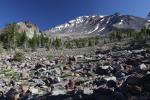
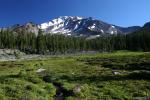
While it is natural for discussion of waterfalls in the Mount Shasta area to cast its first gaze on the cataracts on the great mountain itself, any further conversation must immediately turn to the three waterfalls on the McCloud River. Middle McCloud Falls is one of California’s top tier falls. Combined with Middle Falls’ upper and lower siblings, the falls of the McCloud River offer an exceptional waterfall experience. The great virtue of these waterfalls, the attribute that sets them apart from many of the other waterfalls in California, is the fact that it is not just a creek pouring over a rocky lip but the full fury of a large river hurtling itself over the edge. Outside of Yosemite, there are few waterfalls in the state that can make this claim. Further adding to the beauty of these waterfalls is the remarkably different character each exhibits. Tying all them together with a hike on the McCloud River Falls Trail affords hikers the chance to enjoy each of the three diverse cataracts from a relaxing and extremely scenic trail. Though this hike is not difficult, it is one of the scenic highlights of a visit to the Mount Shasta area.

Lower McCloud Falls

Cascades, McCloud River 003 (Custom)

Lower McCloud Falls.

Most people who hike the McCloud River Falls Trail begin the trip at the picnic area just below Lower Falls. There is a great vista of the falls from the picnic area. The smallest and most subtle of the three falls, Lower Falls is perhaps the most enjoyed of the trio of McCloud Cataracts. Above the falls the McCloud River flows for a short distance through exposed volcanic bedrock. It appears as though a giant bite was taken out of the bedrock, causing the river to thunder down into the resulting cavity. The hardened bedrock that lines the rim above the falls offers warm places to stretch out and soak up the sun after folks have taken a leap into the deep, roiling pool at the base of the falls. The proximity to the picnic area means that these features are easily accessed and often enjoyed. For those fortunate enough to view the falls during the rush of high water during the spring thaw, Lower Falls changes its demeanor, widening its channel considerably and pouring over a significant amount of the bedrock rim above the pool.

Middle McCloud Falls

Cascades, McCloud River 004 (Custom)

Middle McCloud Falls.

Tall, wide and ferocious, the thundering curtain that is Middle Falls is one of California’s first rate waterfalls. About 100 feet across and 50 feet high, the McCloud River spills like a surging white tapestry over a lip of hard basalt. Easily the largest waterfall in the Mount Shasta area, Middle Falls is also one of the most subtly dramatic. With a waterfall this powerful, it is easy to overlook the smaller things that are the fall’s highlights. As the river goes over the edge it breaks up into numerous individual streams pouring into the large pool at its base. There is a seemingly random alternation between streams that free fall into the pool and streams that crash into hard rock in mid-fall and explode into white spray before making a final plunge. This imparts the sense that Middle McCloud Falls is in fact a competition between numerous small cataracts, each vying for a hiker’s attention. The falls are also broken up in the middle by a large rock rib that runs along the fall’s entire height. The half of the falls that are on the south side of the rib is a little shorter, falling into a small, subsidiary pool and then cascading down a large pile of rock into the river’s main pool. It is an exquisite and intricate arrangement. All of this added together, along with the large volume of the McCloud River, make the Middle Falls one of the top waterfalls in the Mount Shasta area and beyond.

Upper McCloud Falls

Cascades, McCloud River 024 (Custom)

Upper McCloud Falls.

A strong case can be made that Upper McCloud Falls is the most unusual of the three falls on the McCloud River. Though not as tall as the Middle Falls, it is considerably higher than the Lower Falls. Like its Lower sibling, Upper Falls is formed where hard volcanic bedrock has had a large bite taken out of it, leaving a deep pool in the resulting cavity. However, unlike Lower Falls, Upper Falls has worn a deep trough through the bedrock precipice. Consequently, the McCloud River shoots through an increasingly deep and narrow chasm before leaping over the cliff. About a third of the way down the river hammers into a large stone bulge and then leaps outward again in a broad sheet before crashing into pool at its base. Although the falls are certainly impressive, it is perhaps more interesting to gaze down at the river as it rockets through the narrow channel just before going over the edge. It is an exciting spectacle to behold.

Other Waterfalls in the McCloud Area

Cascades, Squaw Valley Creek - June2013 064 copy (Custom)

Squaw Valley Creek Falls.

There are a few other notable waterfalls in the greater McCloud area. Not too far downstream from Lower McCloud Falls are the amazing Big Springs of the McCloud. Here large springs erupt along 0.25 miles of the river, falling 15 to 20 feet into the McCloud. It is a staggering site seeing so much water emerging from the cliffs along the river. Unfortunately this phenomenal waterfall is on private property and only visible while kayaking down the McCloud River. The other most notable cataract in the McCloud area is Squaw Valley Creek Falls. Though it is certainly less exciting than the trio of waterfalls on the McCloud River, the small waterfall on Squaw Valley Creek is still an extremely pretty little cataract. The hike to these falls on the Squaw Valley Creek Trail is well worth the effort, both for the waterfall but also for the wild and beautiful creek itself.

Mount Shasta Area Waterfalls: Avoiding A Dry Whitney Falls

Posted by bubbasuess on August 17, 2013
Posted in: Hiking, Mount Shasta, Waterfalls, Wilderness. Tagged: Mount Shasta, Whitney Falls. 5 Comments
Cascades, Mt Shasta, Whitney Falls - July2012 037 copy (Custom)

Whitney Falls.

As noted here, Whitney Falls is one of the prettier waterfalls on Mount Shasta. Its feathery plunge into a narrow grotto is as graceful as it is striking. The 200 foot waterfall seems particularly out of place set against the black, jagged flows of lava and loose volcanic ash that surround it. Though some of the other waterfalls on Mount Shasta rank higher in beauty and power, Whitney Falls remains the most heralded waterfall on Mount Shasta. At a minimum, this has been case in guide books for nearly three decades and possibly much longer than that. This is probably the case because the waterfall is at the end of the most easily accessed Mount Shasta trail that is not on the Everitt Memorial Highway. The dirt road to the trailhead is fairly short (about 4 miles) and in reasonable condition (though it is beginning to degrade considerably). The trail to the falls is also one of the easier routes on the mountain, without considerable elevation gain or length. Unfortunately the trail has been officially condemned by the Forest Service as a result of damage it sustained from a glacial outburst in 1997. While it is easily hiked, like the road to the trailhead, the path is in disrepair and gets worse each year. Consequently and paradoxically, the Whitney Falls experience is both blessed with relatively quick access but fraught with increasingly poor access conditions.

Whitney Falls - May2007 003_edited-1 (Custom)

A frustratingly dry Whitney Falls in late May.

The biggest challenge confronted by those who seek after Whitney Falls is not related to access. The biggest obstacle to seeing the falls is the falls themselves. More specifically, the issue is the flow going over the waterfall. It is possible for someone to make the drive to the trailhead, hike the trail to the falls’ vista point and find nothing going over the cliff. It is an incredibly frustrating experience to make the journey to the falls only to find them dry. Given the degrading nature of the trail, the hot, lower elevation of the trail and the lack of views of Mount Shasta from the current route (there used to be great views of Mount Shasta but the route that included them is getting increasingly overgrown and the new, hiker-created use trail bypasses this section of the trail), this is not the best trail for hiking on Mount Shasta if the falls are dry.

Cascades, Mt. Shasta,Whitney Creek - Aug2013 008_edited-1 (Custom)

Mount Shasta looks down on Whitney Creek, near Hwy. 97.

Adding further aggravation to the other challenges presented by the Whitney Falls Trail, one prominent guidebook suggests hikers head to the falls early in the season of they want to see Whitney Falls, presumably because of the author assumed water would be in Whitney Creek during the spring thaw. Sadly, this is poor advice, since it is likely to lead hikers to a dry chasm and no waterfall. While one might think that the thaw would produce enough water to swell Whitney Creek, in truth it is the later-summer melting of the Whitney Glacier that supplies the water that pours over Whitney Falls. Consequently, plan on hiking this trail in the afternoon in late July or August. The rule of thumb is not to make the trip if no water is flowing in Whitney Creek when it crosses under Highway 97. If there is a good flow at that point then hikers can be assured that there will be some water going over Whitney Falls. If this is the case, then make the journey to the falls. It is a beautiful spot with a beautiful waterfall and amazing views to the north and west and a memorable place to relax on a summer evening.

Though I don’t keep constant tabs on the flow in Whitney Creek, I do pay attention when I pass over it on Highway 97. If someone is interested in making the hike to the falls, feel free to shoot me an email and I will let you know if I am aware of water in Whitney Creek.

Mount Shasta Area Waterfalls: Three Falls On The Mountain

Posted by bubbasuess on August 16, 2013
Posted in: Hiking, Mount Shasta, Seldom Seen, Waterfalls, Wilderness. Tagged: Ash Creek Falls, Mount Shasta, Mud Creek Falls, Waterfalls, Whitney Falls. 4 Comments
Cascades, Mt Shasta, Clear Creek - Aug2012 143 copy (Custom)

Mud Creek Falls.

Though not many people recognize it as such, the North State is California’s finest destinations for waterfalls, outside of the Sierra Nevada. Obviously that is a significant exception, but if one took Yosemite out of the equation, the North State may even exceed the Sierra Nevada in terms of waterfalls of exceptional beauty. That is, of course, a claim that is highly subjective and open to debate. What remains objective and beyond dispute is that there are indeed numerous majestic, spectacular, and powerful waterfalls in the region. The waterfalls are generally found in two areas. In the east there are numerous cataracts in the Cascade Range, primarily found in the mountains surrounding the Mount Shasta and Lassen Peak, the range’s two great volcanos. In the west, the Klamath Mountains are home to dozens of great waterfalls. Particularly notable are the giants that populate the Trinity Alps. Though these areas are home to a high concentration of stupendous cataracts, there are many, many more scattered throughout the entire North State and they beckon to be discovered and explored.

Cascades, Mt Shasta, Whitney Falls - July2012 037 copy (Custom)

Whitney Falls.

The Mount Shasta area in particular has an abundance of great waterfalls. The massive mountain itself has some of the most stunning falls in California. Three in particular, Ash Creek, Mud Creek, and Whitney Falls are excellent. Each of the three has their virtues. Ash Creek Falls is the most beautiful. Mud Creek Falls, nearly as beautiful is the largest in terms of volume. Lastly, Whitney Falls, though neither as beautiful nor as large, is the easiest to get to. Each of these waterfalls is accessed by extremely scenic hikes that pass through strikingly different areas. The environments traveled by these routes range from barren volcanic basins above the treeline to deep, old growth forest to lower elevation chaparral. The one uniting feature that all of these trails share, aside from the fact that they all lead to great waterfalls, is that they are all graced with exceptional views of Mount Shasta. One other feature makes these waterfalls unique among the waterfalls in California. This is that, not only are the falls on Mount Shasta but the best vantages of the cataracts all include great views of the monumental mountain as well. Thus waterfalls that are already excellent are enhanced immeasurably because they are included in views that are elevated to staggering proportions.

The three aforementioned waterfalls are not the only cataracts on Mount Shasta nor are they the only ones in the wider Mount Shasta area. The rivers surrounding the mountain and the Trinity Divide to the west have their own wonderful waterfalls. These other falls on Mount Shasta, both named and unnamed, deserve a blog post of their own, as do the other waterfalls in the greater Mount Shasta region.

Cascades, Mt Shasta, Whitney Falls - July2012 064 (Custom)

Whitney Falls, Mount Shasta and Shastina.

3. Whitney Falls
Although Whitney Falls is not the best waterfall on Mount Shasta, it is easily the falls that receives the most visitors. There are two reasons for this. First, it is heavily trumpeted in both hiking guides and waterfall guides. Second, of the three best waterfalls on the volcano, it is the most easily accessible. The road to the trailhead is relatively short and easy to follow and the route to the waterfall is reasonably short and not very strenuous. It is somewhat exasperating that the waterfall is heralded as much as it is because there are some major drawbacks to this waterfall. Among the problems is the trail to the vista’s increasingly poor condition. A large glacial outburst in 1997 wiped out much of the trail and the trailhead. The Forest Service has declined to repair the damage and so some parts of the trail has devolved to little more than a deer trail in some places. Second and more important, its flow is frustratingly unpredictable. It is not uncommon for hikers to make the journey to the vista only to find nothing flowing.

Despite these drawbacks, Whitney Falls is a very beautiful waterfall. Graceful and wispy, the falls shoot through a narrow trough and pour 200 feet into a craggy basin. Though the trough at the top of the falls is narrow, the water widens out into a perfectly linear plunge. It is unfortunate that the bottom of the waterfall is not visible from the vantage point but Whitney Creek can be observed emerging from around a bend a little further downstream. Despite being partially obscured, the area around the bottom of the falls is obviously lush, testimony to the power of water in this barren environment. Evidence of extensive lava flows is visible above the top of Whitney Falls and along large sections of the canyon downstream. Black, jagged lava makes a stunning contrast to the white water dancing over the ragged cliff. Above this all, the tips of Mount Shasta and Shastina just peek out from over a ridge above the falls, presiding majestically over the great mountain’s volcanic domain.

2. Mud Creek Falls

Cascades, Mt Shasta, Clear Creek - Aug2012 028 (Custom)

Mud Creek Falls, Mud Creek Canyon and Mount Shasta.

Mud Creek Falls is one of the most spectacular waterfalls in California. Fed by both glaciers and springs, it has the highest volume by far of any of the falls on Mount Shasta. Where Whitney Falls is full of grace, Mud Creek is full of fury. The high volume of water erupts over the edge of a band of hard, erosion resistant rock and thunders down into a narrow chasm. The bulk of the water flowing over the falls plunges downward in a classic, linear waterfall while a smaller, yet still significant, amount spreads out in a lacy series of cascades bouncing down the face of the rocky cliff. It is a tremendous sight and worthy of far more attention than the waterfall receives. Perhaps Mud Creek Falls languishes in relative obscurity because it is nearly overshadowed by the epic scope of its surroundings. Tucked into the bottom of 1,500 foot deep Mud Creek Canyon, the falls are dwarfed by the tremendous size of the canyon. Mud Creek Canyon itself appears diminutive when compared to the mighty cone of Mount Shasta, which rises overhead. Volcanic spire after spire march up Sargents Ridge, casting their shadows deep into the canyon. Near the summit, the Konwakiton Glacier clings to the mountain’s rocky slopes. Melt water from the glacier is the initial source of Mud Creek. The entire scene, taken as a whole, is mesmerizing and it is easy to see why such a magnificent waterfall as Mud Creek Falls is lost amidst the grandeur of the mountain.

Perhaps the biggest drawback to Mud Creek Falls is the difficult access necessary to reach it. Most who observe the waterfall do so from the Clear Creek Trail, which hugs the east rim of Mud Creek Canyon. The difficulty is that it is about 1 mile away from the falls. Even despite this distance, the falls are an impressive sight and are still audible from across the canyon. Though far away, this vantage is still a satisfying place from which to view Mud Creek Falls, given the much larger and truly awe-inspiring scene. For those intent on reaching the waterfall, there is a difficult cross-country route from the Clear Creek Springs at the end of the Clear Creek Trail. This route descends down the steep side of Mud Creek Canyon to the falls. Rappelling the band of cliffs alongside the falls is popular with the very, very few who make it that far.

1. Ash Creek Falls

Cascades, Mt Shasta, Brewer Creek - July2012 099 (Custom)

Ash Creek Falls and Mount Shasta.

By far the prettiest waterfall on Mount Shasta, Ash Creek Falls is one of the finest falls in California. Set in the deep cleft of Ash Creek Canyon, the waterfall make a tremendous scene as it pours over the cliff in a powerful freefall, then hits a hard rocky bulge and explodes into a profusion of silky showers. High above, Mount Shasta and the gargantuan Wintun Glacier hold sway on the horizon. This 330 foot high waterfall combines the power of Mud Creek Falls with the grace of Whitney Falls. It does not have the volume of the former, though it has does have a significant amount of water and far more than flows through latter. In short, it is the best combination of grace and power. These attributes, combined with the incredible arrangement of Ash Creek Canyon, the enormous glacier and the awesome bulk of Mount Shasta make the view of Ash Creek Falls one of the most magnificent sights on Mount Shasta or anywhere in California, for that matter. The overall setting of Mud Creek Falls may be a bit grander but where that view makes the falls seem smaller, the view of Ash Creek Falls seems constructed to maximize the waterfall’s beauty.

Amazingly, this waterfall has been left off the most popular guide for waterfalls in California. So much the better, for those who want to enjoy this incredible sight by themselves. Omission from a guidebook is not the only reason for Ash Creek Falls’ light visitation. It is also at the end of a cross-country route that begins at the terminus of the Brewer Creek Trail, the most isolated and lightly used trail on Mount Shasta. From the end of the trail (a worthy and spectacular hike in its own right), the route leads across the open, barren volcanic slopes of the mountain, across a deep, dry gully and down a very steep slope to a vista point that is only 0.25 miles from the falls. For those who want a close look, there is a route that leads down to the top of the waterfall and beyond, to the far side of the canyon, though the views are not as good from that side. This area can also be reached from the Cold Springs area. However one gets to Ash Creek Falls, it is an image that is impossible to forget.

Descent Into Mystery: The Sisson-Callahan Trail

Posted by bubbasuess on August 7, 2013
Posted in: Hiking, Klamath Mountains, Lakes, Meadows, Mount Eddy, Mount Shasta, Mount Shasta History, Pacific Crest Trail, Rivers, Seldom Seen, Trinity Divide, Wilderness. Tagged: Deadfall Lakes, Mount Eddy, Mount Shasta, Pacific Crest Trail, Sacramento River, Sisson-Callahan Trail, Trinity Divide. 3 Comments
Sisson-Callahan (11)

The North Fork Of The Sacramento River Descends Into The Unknown.

Few trails in the Mount Shasta area have the aura of mystery that surrounds the Sisson-Callahan Trail (SCT). At one level it is something of an enigma on account of its extremely light use. Compounding this, there is a general paucity of information on the trail. Hikers looking for beta on the trip are bound to be stymied (until they stumble upon the SCT page on Hikemtshasta, of course) and must commit to the long trail with little preparation but a few brief descriptions, some of which are inaccurate, and a map of the trail. Yet, the lack of good information on the trail and the fact that the SCT is nearly forsaken by hikers is not the only reason for the enigmatic cloud that seems to hover over the trail. The very course the path charts imbues it with a sense of secrecy. The trail begins in the open, sunny heights of the Deadfall Lakes Basin and then descends into, to borrow Joaquin Miller’s description of the woods around Mount Shasta, the great black forest of California. It is a passage from height and light into depth and dark. But it is a grand and varied journey.

Sisson-Callahan (3)

Mount Eddy reigns high above the Deadfall Basin.

Perhaps the SCT is cast in obscurity in part because its more distant, higher trailhead is inaccessible by car. One must hike a few miles on the Pacific Crest Trail in order to reach the western terminus of the SCT. This section of the PCT is generally not obscured by trees and is bathed in light, with far reaching vistas of the Trinity Alps and the cardinal crest of the Scott Mountains. Upon arrival at the beginning of the SCT on the outskirts of Deadfall Basin, the crimson cliffs begin to encircle the trail, wildflowers greet hikers merrily and the lakes wait to refresh trail-worn. The multi-hued tower of Mount Eddy, characterized by a tall, ragged cliff, oversees this wonderful mountain fastness with a brooding presence. From the glorious vantage at Upper Deadfall Lake, the SCT makes a swift climb to the rim of the basin. Hikers bound to follow the SCT are joined here by those heading to the summit of Mount Eddy, so the path is not a forsaken one. However, at the crest of the basin’s rim, the Deadfall Lakes Trail turns left, and continues to the summit of the mountain while the SCT is truly the road less traveled. Those who choose this path now begin the great descent into a seemingly unknown land.

Sisson-Callahan (7)

The North Fork flows through the meadow complex.

After having climbed out of the Deadfall Lakes Basin, the nature of the SCT changes immediately. What was once a broad, well-traveled trail becomes a narrow, lightly used path. Though the condition of the trail is the first inkling that the SCT has now become a journey into an enigma, it is quickly accompanied by a loss of grand vistas. Though the Castle Crags, the Trinity Divide and the Lassen area are visible briefly, the clarity afforded by the first few steps of the descent is lost to the marvelous trees. These ancient denizens of the North Fork of the Sacramento River’s canyon are large, lovely and unusual, especially the out-of-place foxtail pines. As the trail nears the bottom of the canyon, it turns east and enters a fantastic meadow populated by clusters of lodgepole pine. Unlike earlier meadows and grassy areas, the views from this collection of meadows are clouded by the presence of countless trees. Still, light filters through and the area can be sunny and the red flanks of Mount Eddy are visible at times. As one continues to the east, the trail passes in and out of meadows, through the trees and stays very close to the path’s now constant companion, the North Fork of the Sacramento. As the canyon deepens, the forest grows thicker and views are eaten away, the river remains constant, a guide through the heart of the great black forest that waits ahead.

Sisson-Callahan (15)

The North Fork leads through the dense forest.

Finally, the last vestiges of the meadow are consumed by the forest and the river, once a playful stream laughing its way through grassy banks, transforms into a racing, crashing river. It cascades over boulders and fallen trees, only standing still long enough to gather itself in pools below cataracts before surging over more boulders. The forest itself has finally pressed in, closing off all but the immediate channel of the river. The views are gone and all that remains to link the hiker to the world beyond the dense woods is the river itself. Still, the forest has a deep, primeval beauty, even though it casts a pall of mystery over the canyon. There are hidden sites around this canyon but an accurate understanding of the area is necessary to be able to pierce the wall of trees and find them. Eventually, even the beauty of the forest is worn away and the final leg of the hike is a long push down to the North Fork trailhead. At the very end, the woods finally recede, pushed back as the river widens. The light returns and hikers are refreshed by the crossing of the river as they make the final steps to the end of the journey.

Sisson-Callahan (14)

Light on the river.

The SCT is a beautiful trail but it is shrouded in enigma. Little has been written and few claim to have made the whole journey. Those that have completed it passed through some of the most isolated country in the Mount Shasta area. Still, it is a wonderfully diverse trip, made the more dramatic by the unknown quality the trail has. It is many things with many pretty sights but at its heart, it is a descent into mystery. That is perhaps the trail’s greatest attribute. The land is beautiful, rugged and wild but the attraction of the unknown enhances these attributes. Though well plotted by cartographers, it is a dark spot on most hiker’s map, despite lacking formal wilderness designation. Perhaps in the near future, this trail will traverse an area protected in its primitive state so that those who seek a land seldom seen will be assured that the SCT retains its secretive allure.

Sisson-Callahan Trail

Trinities In Proximity: Two Trinity Alps Trails With Easy Access From Mount Shasta

Posted by bubbasuess on July 26, 2013
Posted in: Hiking, Klamath Mountains, Lakes, Meadows, Mount Shasta, Rivers, Trinity Alps, Wilderness. Tagged: Big Bear Lake, Little Bear Lake, Mount Shasta, Tangle Blue Lake, Trinity Alps, Trinity River. 1 Comment
Trinity Alps, Bear Lakes - June2013 041 copy (Custom)

Big Bear Lake in the Trinity Alps.

The Mount Shasta area is blessed with an overabundance of great hiking options, both on Mount Shasta itself and in the mountains and river canyons that immediately surround it. Many may not feel the need to venture beyond this amazingly beautiful area and it is easy to understand why. However, for those with the bug to explore a little further there are several incredible mountain ranges just outside Mount Shasta’s vicinity. The largest and most spectacular of these other ranges are the Trinity Alps. Soaring granite towers, clear lakes, roaring rivers and massive waterfalls are all found in a vast wilderness that exceeds 500,000 acres. Indeed, by most standards, this is Northstate’s premier wilderness area. No other mountain region in California, north of the Sierra Nevada, offers the chance to disappear for weeks on end without retracing steps and covering the same ground. The Trinities boast hundreds of miles of trail, all of which are scenic and are usually spectacular. Unfortunately, it is the very vastness of the Trinity Alps that makes them a difficult place for day hikers to explore. Most of the best trails require an overnight trip or longer in order to reach the destination, let alone have the time to appreciate it.

Trinity Alps, Tangle Blue Lake - July2013 101 copy (Custom)

The Trinity River, on the drive from Mount Shasta.

Fortunately, the two trails closest to Mount Shasta are easily done as day hikes, though they make good overnight destinations too. Of all the many trails in the Trinity Alps, the Bear Lakes and Tangle Blue Lake Trails are the most easily accessed from Mount Shasta. The trailheads for both trails are only a one hour drive from Mount Shasta City. For comparison, it takes about an hour to reach the Clear Creek and Brewer Creek trailheads on the east side of Mount Shasta. Both of those require miles of driving on dirt roads. In contrast, the Bear Lake Trail is possibly the most accessible of all Trinity Alps trailheads, with only a few hundred yards of dirt road. The Tangle Blue Lake Trail only requires 3.5 miles dirt road. The drive itself is incredibly scenic, climbing over Parks Creek Pass by Mount Eddy, where amazing views of the Trinity Alps unfold to the west, before following the Trinity River from its headwaters all the way down to where the river meets Highway 3. It is so scenic that the drive is worth doing for its own sake and boasts numerous hiking and camping opportunities along the way.

Trinity Alps, Bear Lakes - June2013 082_edited-1 (Custom)

Mount Shasta viewed from the Bear Lakes Basin.

The trails themselves lead to premier destinations. The Bear Lakes Trail is the grander of the two, leading to a massive granite basin. Two cirques are tucked away at the back end of the basin, each containing a lake. Big Bear Lake is one of the largest in the Trinity Alps. Though smaller, Little Bear Lake may exceed its larger sibling is scenic qualities. Just below Big Bear Lake is a large series of open, granite slabs over which tumbles Bear Creek in a series of refreshing cascades. Like much of the Trinity Alps, the whole area is very reminiscent of the granite terrain in the Sierra Nevada. Tangle Blue Lake is a bit more subdued but is exceptionally scenic nonetheless. Rather than the stark beauty of the granite cliffs and large, deep lakes, the Tangle Blue area is filled with refreshing meadows and springs. Large granite cliffs are still present, especially at the south end of the lake, but it is complimentary to the lake, rather than the massive cliffs at the Bear Lakes, which tend to overpower the scene. Of course, the trail into Tangle Blue Lake is shorter and easier, so one does not have to work as hard in getting there. Either way, both lakes are classic Trinity Alps lakes and make great day trips from Mount Shasta.

Bear Lakes Trail

Trinity Alps, Bear Lakes - June2013 067 copy (Custom)

Little Bear Lake.

Alone among the trails in the Trinity Alps, the Bear Lake Trail travels alongside the main branch of the Trinity River. From the trailhead, the path loops down to the river and crosses over Bear Creek before climbing up the gully on the far side of the creek. From there the trail makes a few swithbacks and begins a steady ascent up the Bear Creek drainage, running parallel to the creek for a mile. After crossing a bridge over the creek near some pretty waterfalls, the trail begins a long series of switchbacks up a ridge that runs between Bear Creek and an unnamed tributary. Eventually the trail straightens out and continues to follow Bear Creek again. After crossing some clearings caused by avalanches and passing through some small meadows clinging to the side of the canyon, the route emerges into the open granite basin that contains Big Bear Lake. Alongside the trail, the creek cascades over open, granite slabs. Mount Shasta looms far to the east. The path finally ends near the creek’s outlet at the east end of Big Bear Lake. The 1,300 foot granite cliffs surrounding the lake are magnificent. Returning to the slabs, a cross-country route leads to lovely Little Bear Lake and the underappreciated Wee Bear Lake. Both are worthy of the effort to reach them.

Tangle Blue Lake

Tangle Blue Lake (7) (Custom)

Tangle Blue Lake.

The hike to Tangle Blue Lake stays in close proximity to Tangle Blue Creek for the duration of the hike into the lake. The first portion of the hike follows an old road with numerous opportunities to scramble down to the creek and enjoy the cool, clear water. Eventually the road fades out and the route becomes single track. After passing a small meadow the trail crosses the creek and makes a gradual climb uphill to a crossing of Marshy Creek, which originates in Big Marshy Lake, located 1,000 feet higher up the canyon wall from where the trail is. Beyond the crossing the Tangle Blue Lake Trail enters a large, lovely meadow where the granite towers above the lake become visible for the first time. After crossing the creek again, a short, final climb leads to another meadow and Tangle Blue Lake. Granite cliffs form an inspiring backdrop behind the lake, which is ringed with verdant meadows.

Parks Creek Road_edited-1

The driving route from Mount Shasta to the trailheads for the Bear Lakes and Tangle Blue Lake Trails.

Vistas, Meadows, And Waterfalls: Three Best Hikes On Mount Shasta

Posted by bubbasuess on July 22, 2013
Posted in: Hiking, Meadows, Mount Shasta, Waterfalls, Wilderness. Tagged: Ash Creek Falls, Brewer Creek, Clear Creek, Mount Shasta, Mud Creek Canyon, Mud Creek Falls, Panther Meadow, Red Butte, South Gate Meadow, Squaw Meadow. 9 Comments
Cascades, Mt Shasta, Brewer Creek - July2012 099 (Custom)

Mount Shasta and Ash Creek Falls.

It is undeniable that Mount Shasta is the polestar of the northstate’s geography. It is roughly at the geographic center of the region and is also centrally located between the Klamath Mountains and the Modoc Plateau, near the crest of the Cascade Range that cuts across the state’s north/south axis. Obviously location is not the extent of the explanation for Mount Shasta’s gravitational pull on the surrounding area. It is simply a massive, spectacular mountain of epic proportions that stands over a mile above the next tallest peak. Such incredible size and beauty naturally offers great hiking opportunities and Mount Shasta does not disappoint when it comes to great trails. There are 9 established trails on Mount Shasta (of course, there are numerous other unofficial hiking routes) and all of them are very scenic.

Cascades, Mt Shasta, Clear Creek - Aug2012 099 copy (Custom)

Glacier-clad Mount Shasta above the Clear Creek Trail.

It goes without saying that all of the trails on Mount Shasta offer amazing scenery and are worth hiking. Whether one is looking for meadows, glaciers, waterfalls, far-reaching views, great views of Mount Shasta itself, solitude, or adventure, the trails on the solitary volcano will supply all of these things and satisfy the thirst for the opportunity to enjoy one of nature’s finest achievements. While all the trails are great, there are three that I find rise above the others. Each of them must have diverse, spectacular scenery, the opportunity for lots of cross-country exploration and lead to premier destinations on Mount Shasta. Furthermore, I have an additional set of qualifications a trail must meet in order to rank high on my personal list. Most importantly, a trail has to have running water somewhere along it, preferably in the form of a waterfall. Other important considerations are consistent views (as opposed to being under constant forest canopy) and lots of rock or cliffs along the trail.

Cascades, Mt Shasta, Squaw Meadow - Oct2012 032 (Custom)

The large cataract flows through the middle of Squaw Meadow.

Most of these elements are present on nearly all of Mount Shasta’s trails to some degree but three trails have these qualities in abundance. Consequently, these are my three favorite trails on the mountain and the three trails I would most recommend to hikers in search of the optimal Mount Shasta hiking experience. These trails are the Clear Creek Trail, the Brewer Creek Trail and the Squaw Meadow Trail. All of these hikes have exceptional views, both of Mount Shasta and the surrounding region. They all have running water and fall and waterfalls in one form or another. Moreover, they all boast beautiful meadows of varying size (though in the case of the Brewer Creek Trail, it is just a narrow margin of grassy meadow along the banks of the creek). None of the trails are hard, rising and falling at a reasonable grade. Lastly, of all the trails on Mount Shasta, these three trails have the best cross-country destinations. If I had to rate these three trails against each other, I would say Clear Creek comes in third, Brewer Creek second and Squaw Meadow would be the top choice. This was not easy for me to determine because each trail is exceptional.

3. Clear Creek Trail

Cascades, Mt Shasta, Clear Creek - Aug2012 028 (Custom)

Astounding view of Mount Shasta and Mud Creek Canyon.

Climbing Mount Shasta’s southeastern slopes, the Clear Creek Trail offers an incredible abundance of superlatives. Essentially a steady ascent along the rim of massive Mud Creek Canyon, the first two-thirds of the trail offers excellent wildflowers and staggering views into the gargantuan canyon, the largest on Mount Shasta. Powerful Mud Creek Falls, dwarfed by the canyon through which it flows, is a highlight. Clear Creek itself tumbles over a long series of cataracts as it rushes to its confluence with Mud Creek. The mighty cone of Mount Shasta dominates the scene overhead. Eventually the trail reaches treeline and enters a massive basin over which hang the Mud Creek, Konwakiton and Watkins Glaciers. A large complex of springs constitutes the headwaters of Clear Creek and creates a series of lovely meadows. Off-trail exploring leads down to Mud Creek Falls, lower Clear Creek or up to the summit of Mount Shasta.

2. Brewer Creek Trail

Cascades, Mt Shasta, Brewer Creek - July2012 039 (Custom)

Mount Shasta and its glaciers high above Brewer Creek.

The lonely Brewer Creek Trail is the only path that explores the vast, isolated expanse of Mount Shasta’s eastern flank. The views of Mount Shasta are simply stunning, possibly the best of any single trail on Mount Shasta. This particular perspective of Shasta has a bit of a grander feel than most because the Wintun and Hotlum Glaciers (Mount Shasta and California’s 3rd and 1st largest) are very prominent, with their attendant bergscherunds, icefalls and crevasses. The trail eventually ends at small but beautiful and clear-running Brewer Creek, where the small fringe of meadow and diminutive cataracts create a lush environment seemingly out of place in the barren volcanic landscape. Those looking for more adventure and make the off-trail trip to gorgeous Ash Creek Falls. The creek is outflow from the Wintun Glacier and passes through a starkly beautiful canyon before pouring 330 feet over a lip of hard, erosion-resistant rock. Mount Shasta, presiding overhead makes the scene utterly unforgettable. Views of the southernmost Cascade, including Lassen Peak are just icing on the cake. Ash Creek Falls is my personal favorite spot on Mount Shasta.

1. Squaw Meadow Trail

Squaw Meadow

Squaw Meadow

Perhaps the most diverse trail on Mount Shasta, the trail to Squaw Meadow provides the rare opportunity to enjoy a loop on Mount Shasta. Beginning in lovely Panther Meadow, the trail climbs through excellent old-growth red fir forest before breaking out into incredibly barren volcanic terrain with great views of Mount Shasta and Red Butte. A side trail leads to the summit of Gray Butte and incredible views while a cross-country route makes a great circumnavigation of Red Butte. After passing through the Gate, a narrow gap between Sargents Ridge and Red Butte, the trail eventually arrives at the bottom of Squaw Meadow, the largest meadow on Mount Shasta. It is a stunning view with Shastarama Point dominating the horizon beyond the meadow. A massive 100 foot cataract divides the lower section of the meadow from the upper section and the headwaters springs. Views to the south from the upper meadow include the southern Cascades and Lassen Peak. Numerous cross-country routes provide lots of interesting exploration. The best is to head east from the meadow to the rim of Mud Creek Canyon where one can observe Konwakiton Falls. On the return trip, the loop breaks away just after passing through the gate and climbs through small Hummingbird Meadow to a ridge above the Old Ski Bowl. More excellent views of Mount Shasta are abundant, as is the spectacular vista to the west, including the Trinity Divide and the serrated peaks of the Trinity Alps. The trail then descends through the Old Ski Bowl and then drops down to Panther Meadow, completing the spectacular loop.

Low Snow On Mount Shasta

Posted by bubbasuess on July 16, 2013
Posted in: Hiking, Mount Shasta, Mount Shasta History. Tagged: Mount Shasta, Zeitcam. 8 Comments
Cascades, Black Butte - July2013 011 (Custom)

Mount Shasta on 16July2013.

Like so many other places in the western United States, the Mount Shasta area had a fairly light winter in terms of snow fall. Last winter was below average but still significantly heavier than it was this year. However, the two winters prior to that, in 2011 ans 2010 were both extremely heavy winters. Both of them boasted large storms that dropped copious amounts of snow. The storm of 2010 in particular was both heavy and wet. The result was the downing of several trees which consequently knocked the power out for the entire community for days. Before these storms the winter of 2009 was a bit below average, though the two prior to that were well below. The weather is remarkably volatile from one year to the next. As a resident, it is nice to have mild weather in terms of snow removal as well as early springs, which means we can get up into the high country sooner. This year things were accessible in May. A couple of years ago, it was not until around the 4th of July that we first got up to the crest of the Trinity Divide. Still, for the overall health of the region, after a couple light winters, one must feel some urgency for an average or heavy winter.

I put together a few time lapse videos of Mount Shasta from the last few years. They are all dated from July 15th. The difference in snow level is stunning.

2010

2011

2012

2013

This year certainly is low, but there have been lower years. The winter of 2007 was lower and was then followed a couple years later by epic winters. The climate is always in flux and snow levels have always fluctuated from year to year. At some point the pendulum will swing the other way and we will have another epic storm and another winter with heavy snowfall. This year though, get out now if you want a chance to hike with any snow on the ground on Mount Shasta. Of course, you could always head to the mountain’s north and east side where the glaciers are growing…

The End Of The Road: Four Hikes In The Old Ski Bowl Area

Posted by bubbasuess on July 6, 2013
Posted in: Hiking, Mount Shasta, Mount Shasta History, Wilderness. Tagged: Everitt Memorial Highway, Gray Butte, Mount Shasta, Old Ski Bowl, Panther Meadow, South Gate Meadow, Squaw Meadow. 12 Comments
Cascades, Mt Shasta, Old Ski Bowl - Sept2012 035 (Custom)

Sunset at the Old Ski Bowl.

The Everitt Memorial Highway climbs its way up the southern flank of Mount Shasta, ultimately reaching an elevation just over 7,800 feet. It is one of the highest paved roads in California and, among roads in the Northstate, second only to Highway 89’s ascent of the southern slope of Lassen Peak. The road was initially paved so that it could provide access to the Ski Park that was built during the 1950’s in what is now known as the Old Ski Bowl. Skiing operations continued until 1978 when an avalanche wiped out the park. Less than a decade later, the ski park reopened at a new location on the mountain, lower in elevation and without the danger of avalanches. The road up to the Old Ski Bowl remained and continued to be used by those who loved Mount Shasta. This came as no surprise since the Everitt Memorial Highway continued to provide quick access to the stark beauty of the Old Ski Bowl and the nearby serenity of verdant Panther Meadows even if the ski park was gone. Much of the year, the Everitt Memorial Highway only goes as far as Bunny Flat, a somewhat level clearing on Mount Shasta that is at about 7,000 feet. During winter the road is only plowed this far up the mountain. However, once the snows have melted, the gate closing the road is opened and it is possible to continue driving a couple more miles up Mount Shasta to both Panther Meadow and the Old Ski Bowl. Though the two destinations are separated by nearly 1 mile of road, it is a tightly switchbacking, steeply climbing mile, meaning that they are closer than the mileage indicates. They are also connected by a short, easy trail. Moreover, it is possible to gaze down on Panther Meadow from the Old Ski Bowl. Consequently, though they are two very different destinations, the bowl and the meadow form one large use-complex. Indeed, in the summer and fall months, this area sees the most concentrated use on the mountain.

807108 copy (Custom)

Mount Shasta looms above Panther Meadow.

A perennial favorite of hikers, strollers and seekers of all kinds, Panther Meadow is by far the most easily accessed garden on Mount Shasta. It is an easy stroll of only a few yards from the parking area before one is deposited on the edge of a lush, well-watered meadow. Wildflowers abound and small streams course through the grass. The water originates from the Panther Springs at the north end of the meadow. Looking to the north, the great cone of Mount Shasta seems to float above the meadow. To the east, the sheer silver walls of Gray Butte mark the horizon. It is, by any standard, a very beautiful location. Such beauty does not go unnoticed and though it is never crowded, Panther Meadow is rarely bereft of visitors. This is exacerbated by the presence of a Forest Service campground immediately adjacent to the meadow.

The Old Ski Bowl from the parking area.

Literally the end of the road, the Old Ski Bowl is a spectacular destination on Mount Shasta. For those with limitations that prevent them from exploring the mountain on foot, the Old Ski Bowl offers an opportunity to get a taste of what the mountain’s hinterland is like. Nearly at treeline, the bowl is a stunning, barren basin set between Green Butte Ridge and Sargents Ridge. Green Butte, Shastarama Point, Thumb Rock and the area just below the summit of Mount Shasta (the actual summit is just out of sight) all preside in lofty isolation above the parking area at the end of the road. To the south, views of the Castle Crags, Grey Rocks, the Trinity Divide and the jagged horizon of the Trinity Alps give visitors a sense of the great elevation they have achieved. Like at Panther Meadow, Gray Butte is also a presence at the Old Ski Bowl. Whether sunrise, a daytime picnic or a glorious sunset, the Old Ski Bowl is a fantastic destination for a quick Mount Shasta fix.

Cascades, Mt Shasta, Squaw Meadow - Oct2012 032 (Custom)

Squaw Meadow.

The south side of Mount Shasta is naturally the busiest part of the mountain. This is understandable considering the paved access to the high country and the incredibly convenient location of the Everitt Memorial Highway. The road begins right in town, next to the high school. It is only minutes away from Interstate 5. Six trails, which is over half of the trails on Mount Shasta, begin on the road. Two start at Bunny Flat, two, the Gray Butte and Panther Meadow Trails, at Panther Meadow and one, the Old Ski Bowl Trail, at the Old Ski Bowl. A final hike to Squaw Meadow (in this hiker’s opinion, the finest on Mount Shasta) has trailheads at both Panther Meadow and the Old Ski Bowl. The two trailheads plus the use of the Panther Meadow Trail allows this hike to be done as a loop.

Panther Meadow Trail

Panther Meadow view of the Castle Crags.

Panther Meadow view of the Castle Crags.

Located next to the popular Panther Meadow campground, Mount Shasta’s most famous garden is one of the most scenic spots on the mountain. With awesome views of the summit and other landmarks including Green Butte, Shastarama Point, Thumb Rock and Casaval Ridge, the trail is an easy opportunity to enjoy the spectacular scenery as well as the serene setting. The southern half of the meadow sees more traffic than its northern counterpart. This is due to its proximity to the campground, the passage of the trail to Gray Butte and Squaw Meadow and some people lack of awareness that there is another part of the meadow. The short Panther Meadow Trail climbs from the campground along the edge of the lower meadow before entering a dense glade of hemlock. From there it follows the spring-fed creek upward until emerging at the edge of the lush upper meadow. The trail splits and makes a loop around this area, with a short spur to the spring. Excellent views of the Castle Crags and Trinity Divide add to the already wonderful views of Mount Shasta.


Gray Butte Trail

Cascades, Mt Shasta, Gray Butte - Sept2012 016 (Custom)

Mount Shasta viewed from the summit of Gray Butte.

The climb to the summit of Gray Butte is the shortest trail on Mount Shasta. In such a spectacular location short by no means necessitates a boring hike. The trail initially passes through Panther Meadow and then climbs through a glorious Red Fir forest. Numerous large, old-growth firs populate the area, as do lots of large boulders that make fun scrambling opportunities for kids. The trail climbs to a pass between Gray Butte and a rocky, unnamed ridge. Here the trail separates, with the eastward path leading to Squaw Meadow and the southward trail continuing to Gray Butte. Beyond the junction the Gray Butte Trail passes through an excellent hemlock forest as it skirts the east side of the butte. Below the trail a valley separates Gray Butte from its more remote and impressive cousin, Red Butte. Eventually the trail swings around and heads north up a ridge to the summit of Gray Butte, a spot known as Artist’s Point. From here a grand view of Mount Shasta and much of Northern California’s greatest mountains unfolds.


Cascades, Mt Shasta, Old Ski Bowl - Sept2012 021 (Custom)

The upper reaches of the Old Ski Bowl.

Old Ski Bowl Trail The trail climbing into the heart of the Old Ski Bowl was once the access road that serviced the chairlift and other aspects of the now gone ski park’s infrastructure. Now it makes a great hike up into Mount Shasta’s barren volcanic hinterland. The addition of a few connecting use trails and some additional old service roads has made this trail into a loop. It begins climbing immediately, swinging to the east side of the bowl. It then begins a long traverse to the west, seemingly headed for the base of giant Green Butte. It soon becomes apparent that Green Butte is harder to reach than previously appeared and that there is a hidden valley on the north side of the lightning rod-like peak. The Old Ski Bowl Trail begins to encounter ruins and relics from the ski park in the area. The trail continues to wind its way north, toward an obvious bench where the last few krummholtz trees hug the bench’s rim. Atop the bench is a large complex of concrete and steel ruins, remnants of the top of the ski park’s chairlift. Beyond this point the trail climbs into a vast screefield below Thumb Rock, where the trail eventually peters out. On the way back down, near the base of Green Butte, the obvious loop option splits off of the main route and heads south toward the parking area. In addition to great views of Green Butte, the trail passes a small, lush spring, the only water of consequence found in the Old Ski Bowl (there are some other seeps but they never have running water).


South Gate/Squaw Meadow Trail

South Gate Meadow

Possibly the finest hiking on Mount Shasta, the trail to South Gate/Squaw Meadow (see the trail description for details on the name) has everything one would expect from a premier trail on a premier volcano. Excellent views of Mount Shasta and distant mountains, old-growth forests, volcanic wastelands, lush meadows, abundant water and cascades, lots of room for spectacular off-trail exploration and even a sense of deep isolation are found on this hike. Beginning at Panther Meadow, the trail climbs to the junction where the Gray Butte Trail heads up to the butte’s summit. From here the Squaw Meadow Trail dips down to a barren valley and skirts the base of Red Butte. After passing through South Gate (a narrow gap between Red Butte and Sargents Ridge), the trail passes through more old-growth before depositing hikers at the bottom of the meadow. Lots of running water, originating from numerous springs, runs through channels cut into the lush grasses. Halfway between the trail and the top of the meadow, the water runs over a 100 foot high, increasingly vertical cascade. Great views of Mount Shasta are to be had, especially from the bottom of the meadow. An off-trail scramble leads to the rim of massive Mud Creek Canyon and a view of Konwakiton Glacier and Falls. After passing through South Gate on the trip back, turn west at a junction in order to follow the loop option. Beyond the junction, the route climbs through Hummingbird Meadow to a pass overlooking the Old Ski Bowl. Proceed down through the bowl to the Old Ski Bowl trailhead. An unofficial but obvious trail departs the east end of the parking area and completes the loop by connecting to the Panther Meadow Trail. The scenery and views are magnificent for the entire hike.


Old Ski Bowl

Review: Three Mount Shasta Trail Maps

Posted by bubbasuess on June 24, 2013
Posted in: Hiking, Maps, Mount Shasta, Wilderness. Tagged: Mount Shasta. 2 Comments
Cascades, Mt Shasta, Northgate - June2012 067 (Custom)

Mount Shasta from Plug 8,852 near the North Gate Trail, which is subject to repeated inaccuracies on trail maps.

I am not a gear junkie and product reviews are not something I plan on including on Hikemtshasta.com. I am, however, a map fiend and I enjoy studying maps whenever possible. On a hiking site like this one, maps are an essential feature. They provide a visual guide to complement the written descriptions of trails. Every trail presented on Hikemtshasta.com is accompanied by an illustrated trail map. However, it is likely that visitors will acquire one of the maps that have been professionally published and are for sale on Amazon.com, in stores and from the U.S. Forest Service. Mount Shasta is an obvious candidate for a good trail map. The trails on the mountain are exceptionally scenic and attract hikers from all over the world. There are, in fact, at least three maps that illustrate the trails on the mountain. Unfortunately, each of the three maps has significant inaccuracies or omits trails that should be documented on the map. Three publishers are responsible for the maps: the Wilderness Press, Thomas Harrison Maps, and the United States Forest Service. Though some of the errors and omissions are the same between the different maps, each one has peculiarities all their own. It is surprising, especially on the map produced by the Forest Service, that these errors were made.

The trails on Mount Shasta are generally straight forward. It is not essential to carry a map while hiking on the mountain. Between being well-signed with obvious trails and many of the routes being simple out-and-back affairs, a map is somewhat superfluous. However, it certainly does not hurt to have one and it is helpful to acquaint oneself with the geography. Maps are more helpful while attempting cross-country trips to places like Ash Creek Falls. So, though they are not absolutely necessary, trail maps are useful and it is worthwhile to evaluate what the three Mount Shasta trail maps got right and where they erred.

Wilderness Press Map

Wilderness Press

Both the Whitney Falls and North Gate Trails are depicted inaccurately.

This is probably the most widely distributed of the Mount Shasta trail maps. This is due, at least in part, to the fact that aside from being generally available in stores by itself, the map is also included with the Wilderness Press’ “Mt. Shasta Book”, which is considered the definitive book on hiking around and climbing on Mount Shasta. One would think, considering the general quality of products released by this publisher, that this map would be a good resource for exploring Mount Shasta. Unfortunately this is not the case. The Wilderness Press Map is by far the worst of the three maps. One of the biggest complaints is the map’s chaotic appearance. In addition to trails, the map illustrates climbing routes, skiing routes, the circumnavigation route, and roads both paved and unpaved around the periphery of the wilderness. Making matters more complicated, the colors used to indicate the hiking, climbing and skiing routes are all different shades of red. It is very, very cluttered. Exacerbating the problematic appearance further, the map seems to be shaded relief, but the shading is on steroids and follows no discernible metric. Rather than giving the map a three-dimensional look, it just ends up looking splotchy. The appearance, however, is not the biggest problem with this map. The map is riddled with errors when it comes to marking the trails on the mountain. The only trails that are reasonably accurate are the Horse Camp and the Brewer Creek Trails. The Squaw Meadow Trail is acceptable but is only loosely accurate. The other trails, especially the North Gate Trail, are completely inaccurate, following an old routing that has not been used for well over a decade. Trails are also illustrated that do not really exist. When the wilderness was established in 1984, some old roads were truncated and the sections that now fell within the wilderness were officially listed as trails. No maintenance has been done on these in the 30 years since and almost none lead to interesting destinations, yet they appear as trails on the map. This is unnecessarily misleading. Between the various trail inaccuracies and the chaotic look, this trail is practically worthless to a hiker, other than to give the broadest of impressions as to where things are at. The only piece of useful information on the map is the approximate location of the circumnavigation route around the mountain.

Tom Harrison Map

Thomas Harrison

Note the great depiction of the trails along the Everitt Memorial Highway.

This is by far the best map illustrating Mount Shasta’s trails that is generally available. As with all Tom Harrison Maps, the map resembles the USGS Topo maps and has a clean, understated look that still retains a tremendous amount of information. Doing away with the skiing routes present on the previous map, this edition only documents the hiking and climbing routes. The latter is indicated by understated lines of black dots. The trails are denoted with red dashes. Again, as with all Tom Harrison maps, mileage is indicated between points, providing some very helpful data. Another great feature of this map is the generally accurate representation of the trails. One gets the feeling that someone from the cartographers actually went out and hiked many of the trails in order to ensure the map’s accuracy. Quite notably, all the trails beginning on Everitt Memorial Highway (the only paved road climbing Mount Shasta and the most heavily used part of the mountain) are quite accurate. This includes the Old Ski Bowl Trail, which consists of a rather confusing network of old roads that once serviced the now vanished Ski Park. Alone among the three maps, the Tom Harrison edition accurately depicts the new route of the North Gate Trail. The map is also a convenient size when open (far more convenient than the other two maps), folds up nicely for the pocket, and is printed on waterproof plastic. The biggest drawbacks for this map are some minor inaccuracies on the Clear Creek Trail (switchbacks in the trail’s first mile omitted) and the Gray Butte Trail (map shows the trail ending at communication towers rather than the butte’s summit). Also, while the other maps depict the Whitney Falls Trail inaccurately, this map omits it completely. This may due to the fact that the Forest Service no longer maintains the route.

U.S. Forest Service Map

US Forest Service

Washed out and lacking shaded relief, this map once again depicts the Whitney Falls and North Gate Trails incorrectly.

The Forest Service produces a series of trails-illustrated maps for all of the wilderness areas within a national forest. They are usually printed on waterproof plastic and are generally accurate. One of the biggest drawbacks is their invariably large size (the Trinity Alps Wilderness map is ridiculous; it is essentially a waterproof tablecloth!) and the Mount Shasta Wilderness map is no exception. By far the largest map of the three, its size unfortunately does not  mean that there is more detail. In fact, this is the least detailed map of the three, mostly because it is strictly topographical and has no shaded relief. This gives the map a vague, washed-out appearance. These drawbacks aside, the map is reasonably accurate. It lacks the trail detail of the Tom Harrison map but generally avoids getting things wrong. One notable exception is the North Gate Trail, which, like the Wilderness Press map, shows the trail following its old route up the mountain. Considering that this is produced by the same agency that rerouted and maintains the trail, this is just sloppy. Other errors include very out-of-date condition of the Whitney Falls Trail and the Gray Butte Trail. It does, along of the three maps, accurately depict the switchbacks at the beginning of the Clear Creek Trail. Another drawback is that the map seems to go out of its way to show trails that are not there or are old roads that are now listed as trails but are generally not used by hikers. This just adds confusion and hopefully won’t send an unobservant hiker crashing into the woods to find a trail that is isn’t there. If, by chance a trail was found, it likely wouldn’t take them anywhere. One nice bonus this map does offer is the inclusion of a map of the Castle Crags Wilderness on the reverse side.

In the end, the only map that I would recommend folks use for hiking on Mount Shasta is the Tom Harrison edition. The Wilderness Press map is awful and the Forest Service Map, while reasonably accurate (but not more than the Tom Harrison map), is too large and too washed-out looking. If a trip to the hiking trails on Mount Shasta is in the works, it is best to take the Tom Harrison map. Of course, it is worthwhile to reference the map produced by this site to plan your trip. All of the trails were hiked in the summer of 2012 and careful notes were made in order to represent the trails with reasonable accuracy on the maps. In addition to being significantly more accurate or complete than the three published maps, the Hikemtshasta.com Mount Shasta trail map is also the only one that is comprehensive. It is the only map that shows all the trails in their accurate form as well as unofficial trails and off-trail routes to places like Ash Creek Falls.

Switchbacks To Heaven: The Trinity Alps’ Stoney Ridge Trail And Four Lakes Loop

Posted by bubbasuess on June 22, 2013
Posted in: Hiking, Klamath Mountains, Lakes, Trinity Alps, Wilderness. Tagged: Four Lakes Loop, Stoney Ridge Trail, Trinity Alps. 13 Comments
Four Lakes Loop (9) (Custom)

Diamond Lake and the Trinity Alps, on the Four Lakes Loop.

The Four Lakes Loop is one of the finest trails in the Trinity Alps, showing off its quartet of beautiful lakes with graceful confidence. Of course, the Four Lakes Loop is not the amazing trail it is only because of its lakes but also its perfect arrangement of stone and meadow, forest and cliff, peak and basin. It offers up all of these delights and then boasts some of the most magnificent views in Northern California. All of the features are arranged in ideal fashion as though the trail was designed to be a backcountry themed ride at an amusement park. Each turn of the trail reveals a new attraction, be it creek, canyon, peak, meadow, lake and cliff. All of the tremendous scenery of the Four Lakes Loop is had for surprisingly little effort. It is a roller coaster trail, climbing into and out of four lake basins slung on the flanks of granite Siligo Peak, but the grade is never steep and the effort is moderated by the constantly staggering vistas.

Trinity Alps, Four Lakes Loop - June2007 086 copy (Custom)

Middle Peak, near Echo Lake on the Stoney Ridge Trail.

Unlike most of the trails in the Trinity Alps, the Four Lakes Loop is not accessible directly via a trailhead on the outskirts of the Trinity Alps Wilderness. Instead, it is necessary to backpack into the loop area and set up a basecamp. The distance from civilization is part of the Loop’s charm. It is accessed by four different trails, each of which connects to a number of other locations. Two trails, the Deer Creek Trail and the Granite Lake Trail are only useful if connecting the Loop to longer trips through the Trinity Alps. The Deer Creek Trail joins the Stuart Fork Trail so a trip to Emerald and Sapphire Lakes can also be joined to the Four Lakes Loop. The same can be said for the Granite Lake Trail, which forms a nice loop with the trail through Bear Basin. A steep series of switchbacks drop down into the Deer Creek Meadows where they link up to the lowest point on the Four Lakes Loop. Both of these trails are not very useful for reaching the Loop directly. To do that, it is necessary to hike the Long Canyon or Stoney Ridge Trails. Long Canyon is the shortest route and very scenic but it is steep and, as scenic as it is, it misses the numerous highlights through which the Stoney Ridge Trail passes. It is this last route that is the ideal route by which to access the Four Lakes Loop.

Trinity Alps, Four Lakes Loop - June2007 044 copy (Custom)

Four Lakes Loop area from the Stoney Ridge Trail.

The Stoney Ridge Trail is a case-study in delayed gratification. A long series of switchbacks tests the patience of backpackers as they climb through dense forest up toward Stonewall Pass. Beyond the pass they are rewarded for their efforts with alpine paradise. The trail passes through meadows, over creeks and passes wonderful Echo Lake, which makes a great basecamp from which to hike the Four Lakes Loop. As if the immediate surroundings were not beautiful enough, far-ranging views abound on the Stoney Ridge Trail. Once atop Stonewall Pass, every step of the trail brings new sights and vistas, all of which combine to make the ideal route to access the Four Lakes Loop.

Stoney Ridge Trail

Trinity Alps, Four Lakes Loop - June2007 085 copy (Custom)

Red Mountain and Van Matre Meadow on the Stoney Ridge Trail.

Afflicting hikers with 57 switchbacks at the outset of the trail should be enough to purge all but the dedicated from this stairway to alpine paradise. Staying under the forest canopy for much of the climb, the trial finally breaks out of the cover at Red Mountain Meadows, just prior to climbing Stonewall Pass. Beyond the pass, the route continues through lush Van Matre Meadows before climbing up to beautiful Echo Lake, which has both a spectacular rocky basin and an incredible view into the heart of the Trinity Alps. Beyond Echo Lake the trail surmounts Little Stonewall Pass and then drops down through peak-rimmed Siligo Meadows. One final climb above the meadow to Deer Creek Pass brings an end to the Stoney Ridge Trail and the beginning of the Four Lakes Loop.

Four Lakes Loop

Four Lakes Loop (7) (Custom)

Luella Lake, Seven Up Peak and Dolomite Ridge.

Starting at Deer Creek Pass, where the two typical access trails (Stoney Ridge and Long Canyon Trails) meet, the Loop traverses the upper portion of Deer Lake’s cirque. A short climb over a pass brings views of blue Summit Lake, the largest of the four lakes that surround Siligo Peak. There is also a short route leading to the summit of Siligo Peak and great views. A little further brings another set of switchbacks dropping down toward elegant Diamond Lake and one of the greatest views of the Trinity Alps, as the white towers of the Canyon Creek area loom beyond Diamond Lake and the canyon of the Stuart Fork of the Trinity River. Another climb up switchbacks yields views of delicate, azure Luella Lake. Beyond the lake, Seven Up Peak and Dolomite Ridge hover above the grassy expanse of Deer Creek Meadow. From the meadow the long climb up to Deer Lake and Deer Creek Pass begins but its difficulty is mitigated by tumultuous Deer Creek and the views of the granite giants on either side of the trail. Once back on Deer Creek Pass, the Loop is done, but the wonders of the Stoney Ridge Trail still await the return home.

TOPO!map_edited-21

Posts navigation

← Older Entries
Newer Entries →
    • Recent Posts

      • Winter Shows Up When It Will
      • January Rolled By With Mud, Then Very Dry
      • Mount Shasta 2025 – A Year In Images
      • Mount Shasta On Either Side Of Christmas
      • Adrift In An Ocean Of Fog
      • December Has Been Spectacular Thus Far Pt. II (A Magnificent Lenticular)
      • December Has Been Spectacular Thus Far Pt. I
      • Lenticular Interrupted
      • A Stormy Wave And A Truchas Sunset
      • Aurora Lenticularis
    • Enter your email address to follow Hike Mt Shasta and receive notifications of new posts by email.

    • Archives

      • February 2026
      • January 2026
      • December 2025
      • November 2025
      • October 2025
      • September 2025
      • August 2025
      • July 2025
      • June 2025
      • May 2025
      • April 2025
      • March 2025
      • February 2025
      • January 2025
      • December 2024
      • November 2024
      • October 2024
      • September 2024
      • August 2024
      • July 2024
      • June 2024
      • May 2024
      • April 2024
      • March 2024
      • February 2024
      • January 2024
      • December 2023
      • November 2023
      • October 2023
      • September 2023
      • August 2023
      • July 2023
      • June 2023
      • May 2023
      • April 2023
      • March 2023
      • February 2023
      • January 2023
      • December 2022
      • November 2022
      • October 2022
      • September 2022
      • August 2022
      • July 2022
      • June 2022
      • May 2022
      • April 2022
      • March 2022
      • February 2022
      • January 2022
      • December 2021
      • November 2021
      • October 2021
      • September 2021
      • August 2021
      • June 2021
      • May 2021
      • April 2021
      • March 2021
      • February 2021
      • January 2021
      • December 2020
      • November 2020
      • October 2020
      • September 2020
      • August 2020
      • July 2020
      • June 2020
      • May 2020
      • April 2020
      • March 2020
      • February 2020
      • January 2020
      • December 2019
      • November 2019
      • October 2019
      • September 2019
      • August 2019
      • July 2019
      • June 2019
      • May 2019
      • April 2019
      • March 2019
      • February 2019
      • January 2019
      • December 2018
      • November 2018
      • October 2018
      • September 2018
      • August 2018
      • July 2018
      • June 2018
      • May 2018
      • April 2018
      • March 2018
      • February 2018
      • January 2018
      • December 2017
      • November 2017
      • October 2017
      • September 2017
      • August 2017
      • July 2017
      • June 2017
      • May 2017
      • April 2017
      • March 2017
      • February 2017
      • January 2017
      • December 2016
      • November 2016
      • September 2016
      • August 2016
      • July 2016
      • June 2016
      • May 2016
      • April 2016
      • March 2016
      • February 2016
      • January 2016
      • December 2015
      • November 2015
      • September 2015
      • August 2015
      • July 2015
      • June 2015
      • May 2015
      • April 2015
      • March 2015
      • February 2015
      • January 2015
      • December 2014
      • November 2014
      • July 2014
      • June 2014
      • May 2014
      • April 2014
      • March 2014
      • February 2014
      • January 2014
      • December 2013
      • November 2013
      • October 2013
      • September 2013
      • August 2013
      • July 2013
      • June 2013
      • May 2013
      • April 2013
      • March 2013
      • February 2013
      • January 2013
    • Categories

      • Boy Scouts
      • Cascade Range
      • Castle Crags
      • Desert
      • Echo Point
      • Glaciers
      • Hiking
      • How things came to be…
      • Klamath Mountains
      • Konwakiton Outdoor Designs
      • Lakes
      • Lenticular Clouds
      • Maps
      • Marble Mountains
      • Meadows
      • Mount Eddy
      • Mount Shasta
      • Mount Shasta History
      • Napa County
      • Off Season Trails
      • Pacific Crest Trail
      • Peaks
      • Rivers
      • Rock Climbing
      • Scott Mountains
      • Seldom Seen
      • Shasta Valley
      • Sierra Nevada
      • Siskiyou Mountains
      • Sonoma County
      • Spring Trails
      • sunrise
      • sunset
      • Trinity Alps
      • Trinity Divide
      • Truchas Ridge
      • Uncategorized
      • Water
      • Waterfalls
      • Wilderness
      • Wildflowers
      • Wine Country
      • Winter Trails
      • Yosemite
    • Meta

      • Create account
      • Log in
      • Entries feed
      • Comments feed
      • WordPress.com
    • Copyright © 2013-2024 by Bubba Suess

      DISCLAIMER: Any use of the information contained in this site by any and all persons is done at their own risk. The operator of this site shall be held harmless from any and all alleged claims, demands, causes of action, liability, loss, damage and/or injury to property or persons whether brought by an individual or other entity. This indemnification applies, without limitation, to all actions by an individual or other entity as a result of their use of information contained in this site.

    Blog at WordPress.com.
    Hike Mt. Shasta
    Blog at WordPress.com.
    • Subscribe Subscribed
      • Hike Mt. Shasta
      • Join 985 other subscribers
      • Already have a WordPress.com account? Log in now.
      • Hike Mt. Shasta
      • Subscribe Subscribed
      • Sign up
      • Log in
      • Report this content
      • View site in Reader
      • Manage subscriptions
      • Collapse this bar
     

    Loading Comments...