Hike Mt. Shasta

Exploring the Mount Shasta Region

  • Home
  • Trails
    • Mount Shasta Trails
      • Brewer Creek Trail
      • Clear Creek Trail
      • Gray Butte Trail
      • Green Butte Ridge Trail
      • Horse Camp Trail
      • North Gate Trail
      • Old Ski Bowl Trail
      • Panther Meadow Trail
      • South Gate/Squaw Meadow Trail
      • Whitney Falls Trail
    • Trinity Divide Trails
      • Blue Divide Trail
      • Castle Lake Trail
      • Castle Lake Shore Trail
      • Cliff Lake Trail
      • Deadfall Lakes Trail
      • Gray Rock Lakes Trail
      • Gumboot Trail
      • Heart Lake Trail
      • Porcupine & Toad Lakes Via Pacific Crest Trail
      • Seven Lakes Basin Via Pacific Crest Trail
      • Sisson-Callahan Trail
      • Soapstone Trail
      • South Mumbo Scramble
      • Tamarack Lake Trail
      • Toad Lake Trail
    • Castle Crags Trails
      • Burstarse Falls Via Pacific Crest Trail
      • Castle Dome Trail
      • Flume Trail
      • Lower Castle Crags Via Pacific Crest Trail
      • Root Creek Trail
    • Scott Mountains Trails
      • Bluff Lake & Cement Bluff via Pacific Crest Trail
      • Caldwell Lakes Trail
      • China Mountain Scramble
      • Cory Peak and Bull Lake via Pacific Crest Trail
    • Cascade Crest
      • Ash Creek Butte Scramble
      • Goosenest Trail
      • Juanita Lake Trail
      • Orr Lake Trail
    • Mount Shasta City Area Trails
      • Black Butte Trail
      • Box Canyon Trail
      • Gateway Trail
      • Lake Siskiyou Trail
      • Mount Shasta City Short Trails
      • Ney Springs Canyon Trail
      • Spring Hill Trail
    • Shasta Valley Trails
      • Black Lava Trail
      • Haystack Trail
      • Lake Shastina Trail
      • Pluto Cave Trail
      • Trout Lake Trail
      • Yellow Butte Trail
    • Sacramento River Trails
      • Dunsmuir Trail
      • Hedge Creek Falls Trail
      • Sacramento River Trail
      • Sims History Trail
    • McCloud River Trails
      • Ash Camp To Ah-Di-Na Via Pacific Crest Trail
      • McCloud River Falls Trail
      • McCloud River Preserve Trail
      • Squaw Valley Creek Trail
      • McCloud River Trail: Algoma Camp to Nitwit Camp
      • McCloud River Trail: Nitwit Camp to Cattle Camp Swimming Hole
      • McCloud River Trail: Cattle Camp Swimming Hole to Camp 4
      • McCloud River Trail: Camp 4 to Upper McCloud Falls
      • McCloud River Trail: Pine Tree Hollow Loop
    • Trails Further Afield
      • Trinity Alps Trails
        • Bear Lakes Trail
        • Billys Peak Trail
        • Boulder Creek Lakes Trail
        • Boulder Lake Trail
        • Canyon Creek Trail
        • Caribou Lakes Trail
        • East Boulder Lake Loop
        • East Weaver Lake Trail
        • Four Lakes Loop
        • Granite Peak Trail
        • Grizzly Creek Trail
        • Gulch Lakes Loop
        • Hidden Lake Trail
        • South Fork Lakes Trail
        • Stoddard Lake Trail
        • Stoney Ridge Trail
        • Tangle Blue Lake Trail
      • Warner Mountains
        • Emerson Creek Trail
        • Highgrade Trail
        • Patterson Lake Via Warner Summit Trail
        • Pine Creek Trail
        • Squaw Peak Trail
  • Articles
    • Trails By Area
      • Mount Shasta
        • Vistas, Meadows And Waterfalls: Three Best Hikes On Mount Shasta
        • The End Of The Road: Three Hikes In The Old Ski Bowl Area
        • Two Trails From Bunny Flat
        • Three Trails On Mount Shasta’s East Side
        • Mount Shasta’s Hummingbirds
      • Trinity Divide
        • Great Lakes: Top Five Lake Basins In The Trinity Divide
        • The Headwaters Of The South Fork Of The Sacramento River
        • Neglected Headwaters: Two Lesser Lake Basins On The South Fork
        • Gumboot Saddle: Two Hikes On The PCT
        • Descent Into Mystery: The Sisson-Callahan Trail
        • Mumbo Basin – Overlooked On The West Side
        • The Headwaters Loop: A Proposed Backpacking Loop In The Trinity Divide
      • The McCloud River
        • The McCloud River Trail
      • Shasta Valley
        • Jewels In The Desert
      • Scott Mountains
        • Great Scott! Two Scott Mountains Hikes On The PCT
      • Trinity Alps
        • Carubou Lakes: Trinity Alps On A Grand Scale
        • Switchbacks To Heaven: The Trinity Alps’ Stoney Ridge Trail and Four Lakes Loop
        • Trinities In Proximity: Two Trinity Alps Trails With Easy Access From Mount Shasta
        • Trails in the Carter Meadows Area
        • Trinity Alps Views of Mount Shasta
        • The Psychological Value Of The Trinity Alps
    • Waterfalls
      • Three Waterfalls On Mount Shasta
      • McCloud River Waterfalls
      • Sacramento River Waterfalls
      • Trinity Divide Waterfalls
      • Trinity Alps Waterfalls
      • Avoiding A Dry Whitney Falls
    • Off Season Trails
      • Three Winter Hikes Near Mount Shasta City
      • Winter Hikes In Shasta Valley
      • Winter Hiking In The Shasta Valley Wildlife Refuge
      • Winter Hikes On The Sacramento River
      • Winter Hikes On The Lake Siskiyou Trail
      • Spring Hikes In The Castle Crags
      • Spring Hikes On the Upper McCloud
      • Spring Hikes On The Lower McCloud River
    • Points Of Interest
      • Mount Eddy: Overshadowed, Underrated
      • Black Butte: Hiding In Plain Sight
      • Castle Dome: Steadfast And Staggering
      • Mount Shasta Hoodoos
      • Sacramento Scrambling
      • The Shasta River
      • The Castle Creek Watershed
      • Mount Shasta East Side Glacier View
      • 5 Fantastic Mount Shasta Vistas
      • 5 Highest Peaks Around Mount Shasta
      • 5 Best Hikes On Creeks And Rivers
      • 5 Interesting Footbridges
      • Three Spectacular Drive-To Sunset Vistas
    • North State Geography
      • Introduction
      • Seven Major Regions
      • The California Cascades
      • Klamath Mountains Pt. I
      • Klamath Mountains Pt. II
      • The Great Canyons Of Mount Shasta
      • Mount Shasta, Timberline, And The Relative Size Of Cascade Volcanos
      • Four Eruption Cones Of Mount Shasta
      • Mount Shasta’s Medial Moraine
    • Northern California Review
      • North Table Mountain
      • Lakes Basin Recreation Area
      • Eastern Sierra Fall Color
      • Sonoma County
      • Central Sierra Nevada
      • Orland Buttes
    • Seldom Seen
      • Ash Creek Falls
      • Mud Creek Canyon
      • Lower Mud Creek Canyon
      • Diller Canyon
      • Lower Cascade Gulch
      • The Grey Rocks
      • Castle Creek
      • Upper Wagon Creek
      • Fawn Creek Canyon
      • Confluence of the Sacramento River and Castle Creek
      • Upper Klamath River Canyon
      • Hole In The Ground Geologic Area
      • Ash Creek Butte Fossil Rock Glacier
    • Mount Shasta History
      • Vantage Lost: The Everitt Memorial Vista
      • A Yosemite-Mount Shasta Connection
      • Whitney – What’s In A Name?
      • Mount Shasta Area and the 1838 Exploring Expedition
      • A 19th Century Engraving Of An Epic Mount Shasta Vista
      • Vintage 1907 Color Photos
      • A Misleading Painting
      • A Mysterious Painting
      • A Mysterious Painting Pt. II
      • Stereographic Mt. Shasta
      • Year One Of Hike Mt Shasta
      • Year Two Of Hike Mt Shasta
      • Year Three Of Hike Mt Shasta
      • Year Four Of Hike Mt Shasta
      • Year Five Of Hike Mt Shasta
      • Year Six Of Hike Mt Shasta
      • Year Seven Of Hike Mt Shasta
    • Image Galleries
      • Mount Shasta Trails Gallery
      • Mount Shasta Sunrise Gallery
      • Mount Shasta Sunset Gallery
      • Lenticular Cloud Gallery
      • Mount Shasta NON-Lenticular Clouds
      • Mount Shasta Reflection Gallery
      • Telephoto Gallery
      • Mount Shasta Area Fall Color
      • Castle Crags Gallery
      • Waterfalls Gallery
      • Trinity Divide Lakes Gallery
      • Mount Shasta Area Rivers Gallery
      • Shasta High Desert Gallery
      • Mount Shasta GIF Gallery
    • Random Notes
      • Revew: Three Mount Shasta Trail Maps
      • A Mount Eddy Wilderness?
      • New Land Additions For The Castle Crags
      • Book Plug: Mount Shasta Area Rock Climbing
      • Exile: How I Came To Love Wilderness
  • Mt. Shasta Trail Map
  • Blog
  • About/Contact
  • Links
  • Truchas Ridge

Another Spring Afternoon At Survey Creek

Posted by bubbasuess on May 29, 2022
Posted in: Hiking, Mount Shasta. Leave a comment

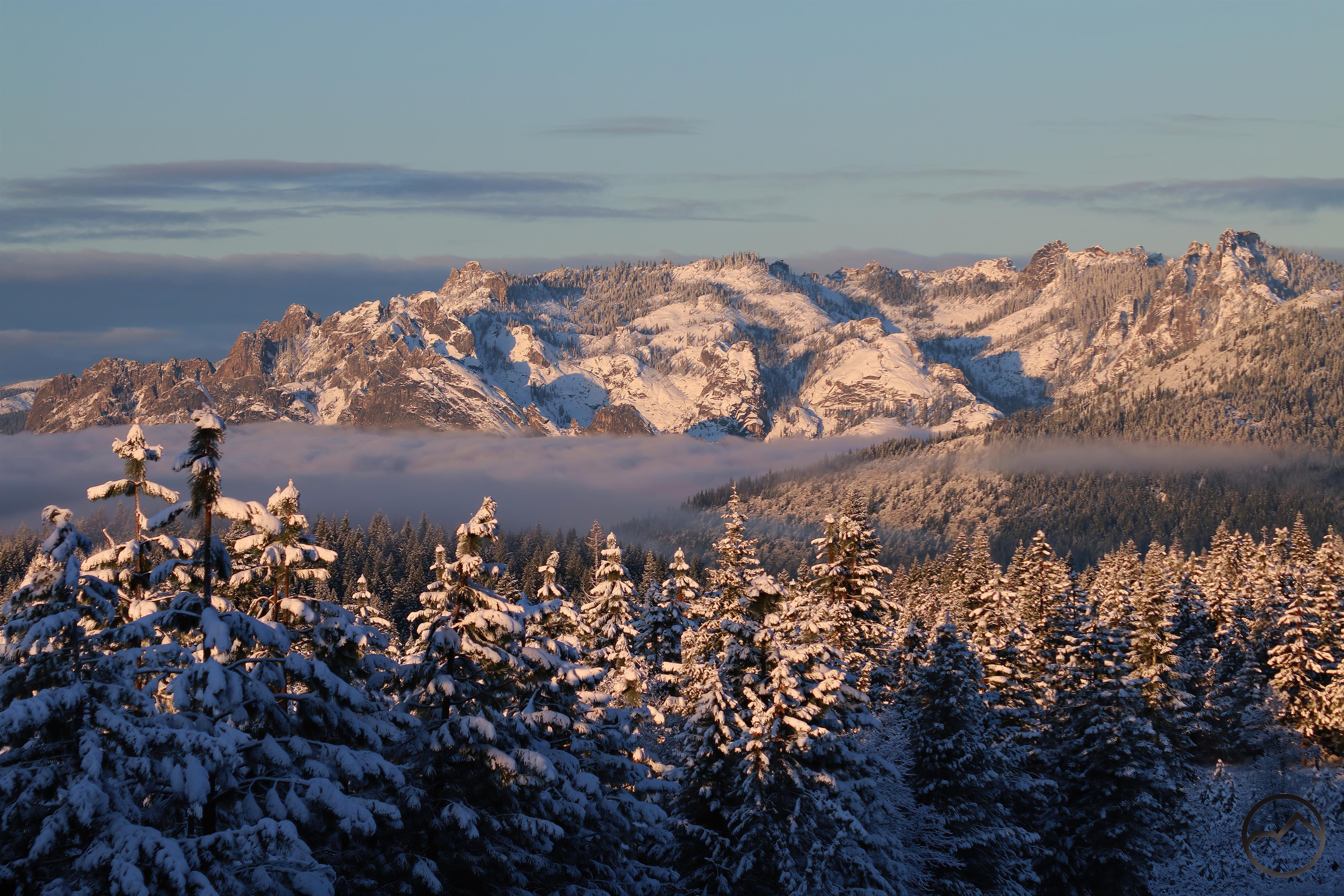
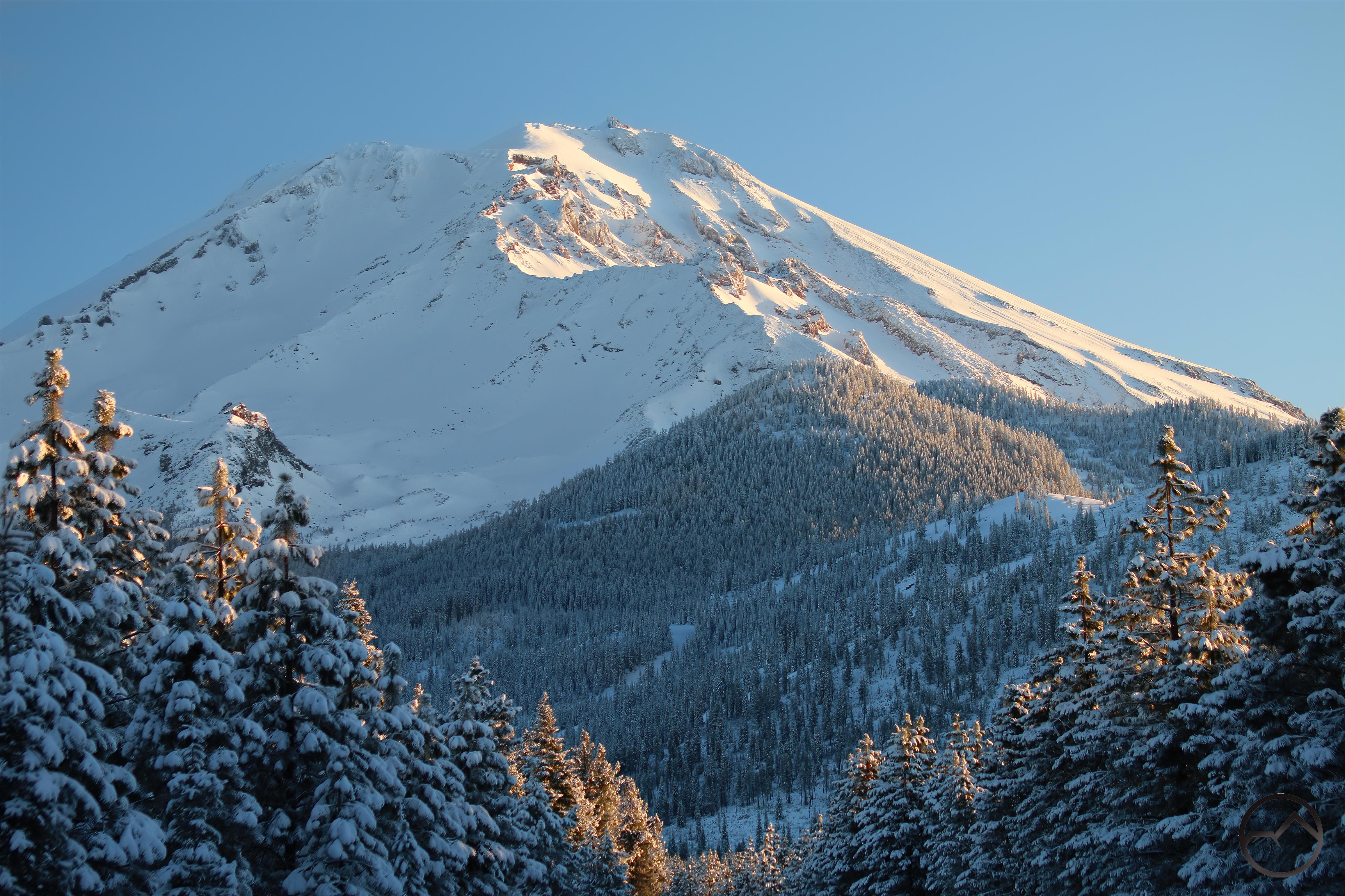
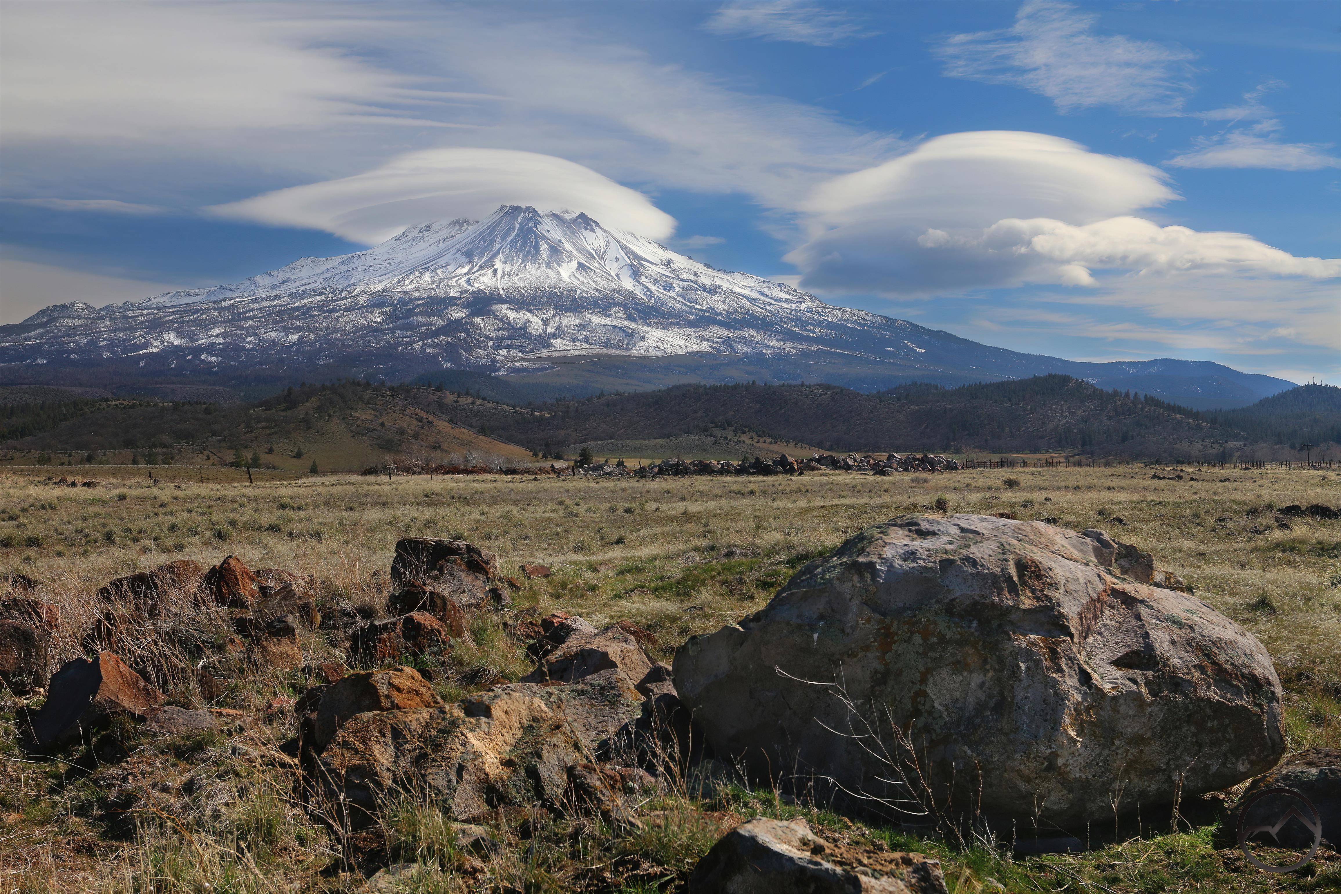
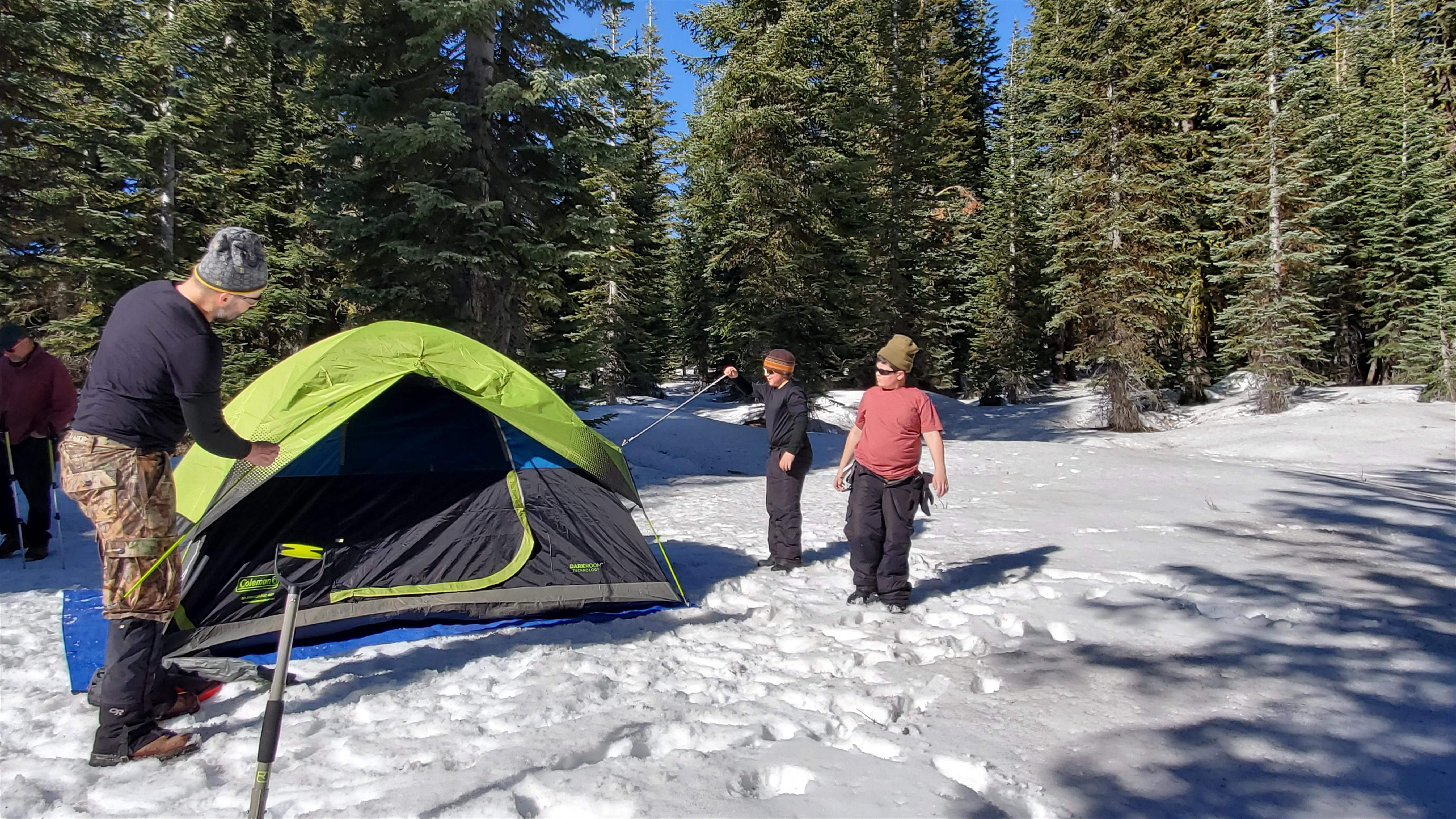
Here in Mount Shasta, my family tends to have a stratified hiking program. In the winter, we hike at the lowest elevations, mostly in the Shasta Valley, along the Sacramento River and around town at places like Lake Siskiyou. In the summer, we head high into the mountains where the lakes and mountain tops beckon. In the spring, however, we head to numerous places hidden at the mid-elevations in the mountains where there are few trails. Indeed, most of what we enjoy are cross country outings in these parts and they are some of our favorite hikes of the year. While we are always looking for new ones to explore, some are classics to which we return again and again. Chief among these is the hike along Survey Creek.

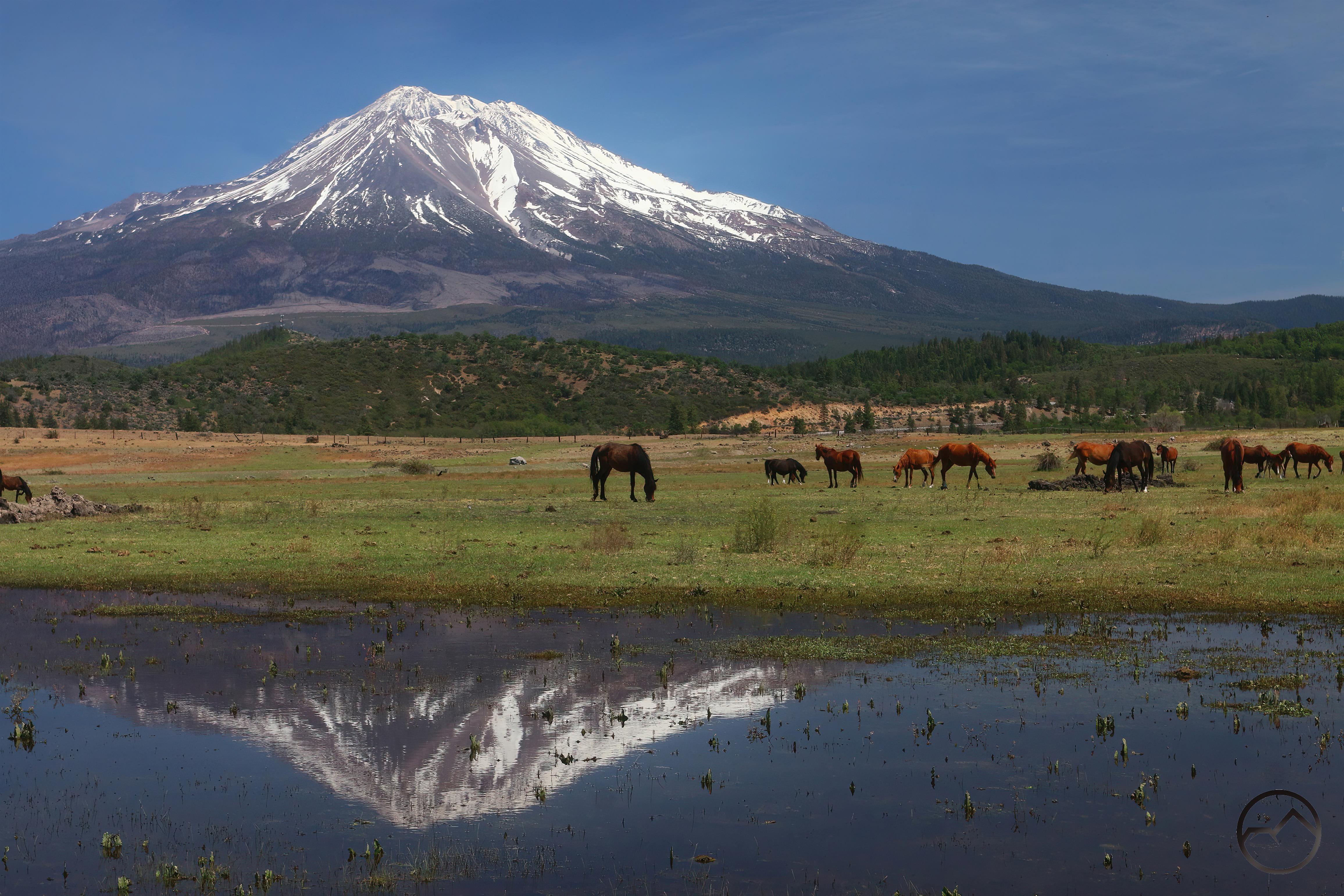
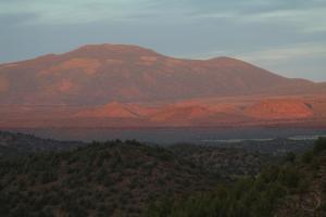
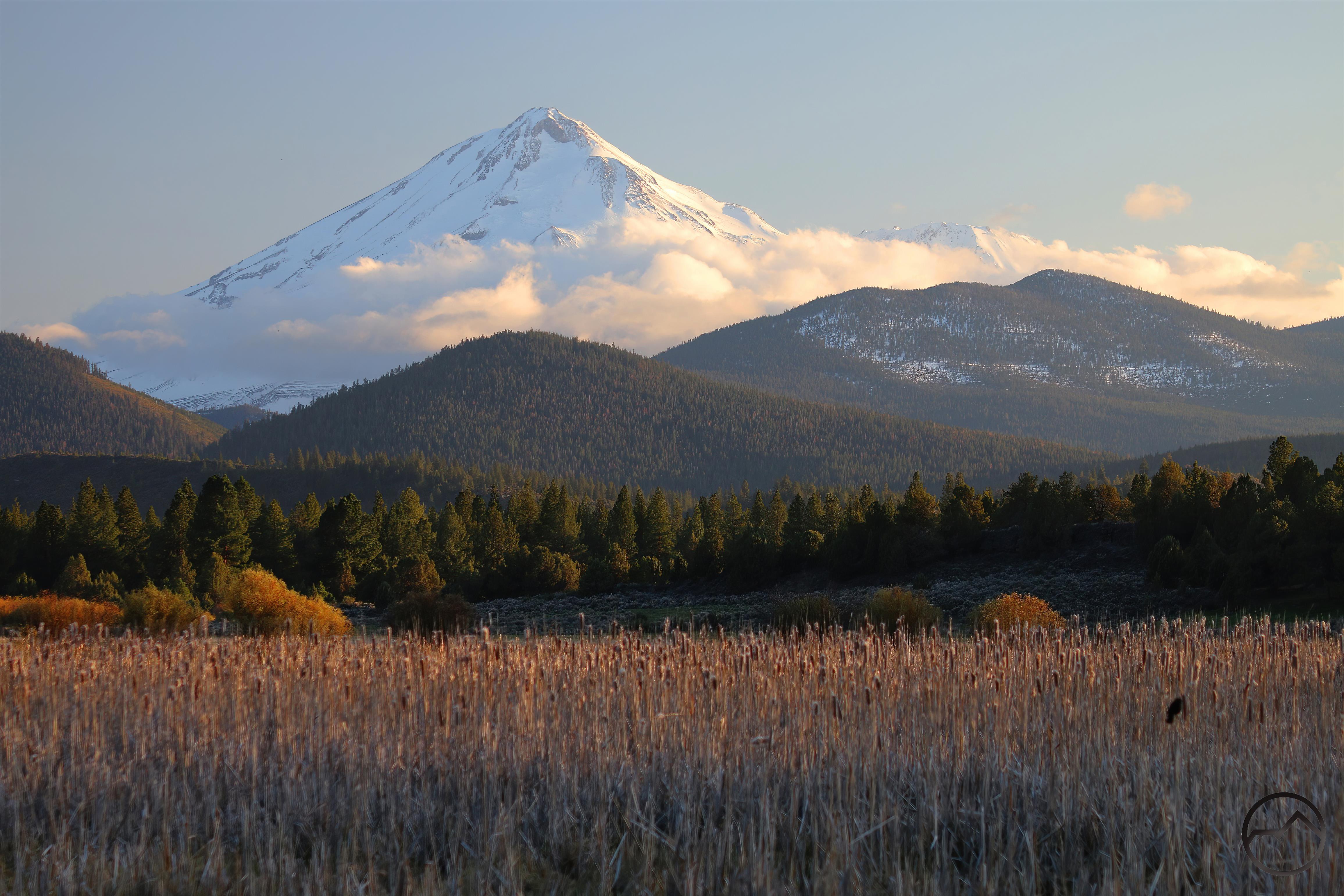
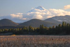
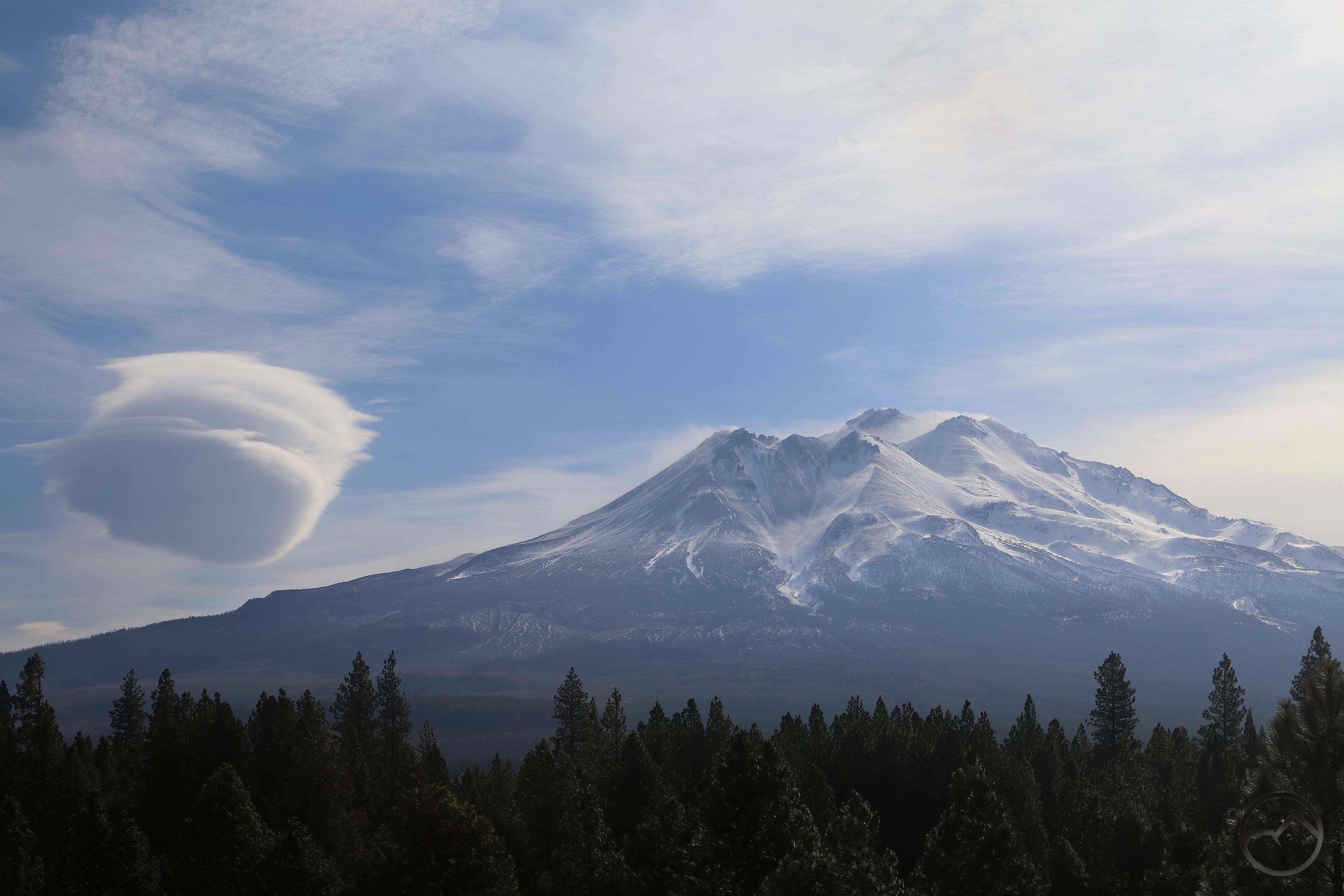
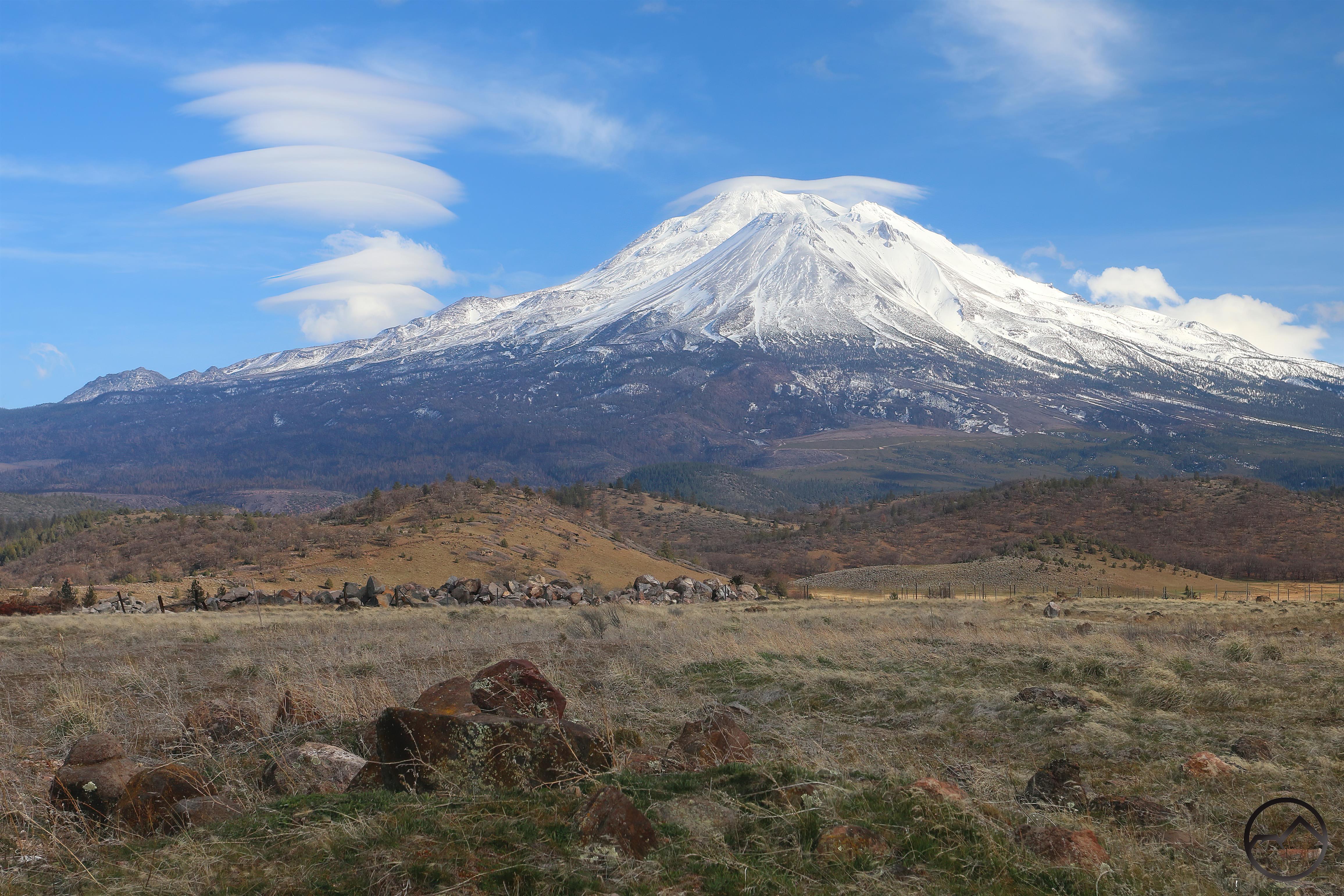
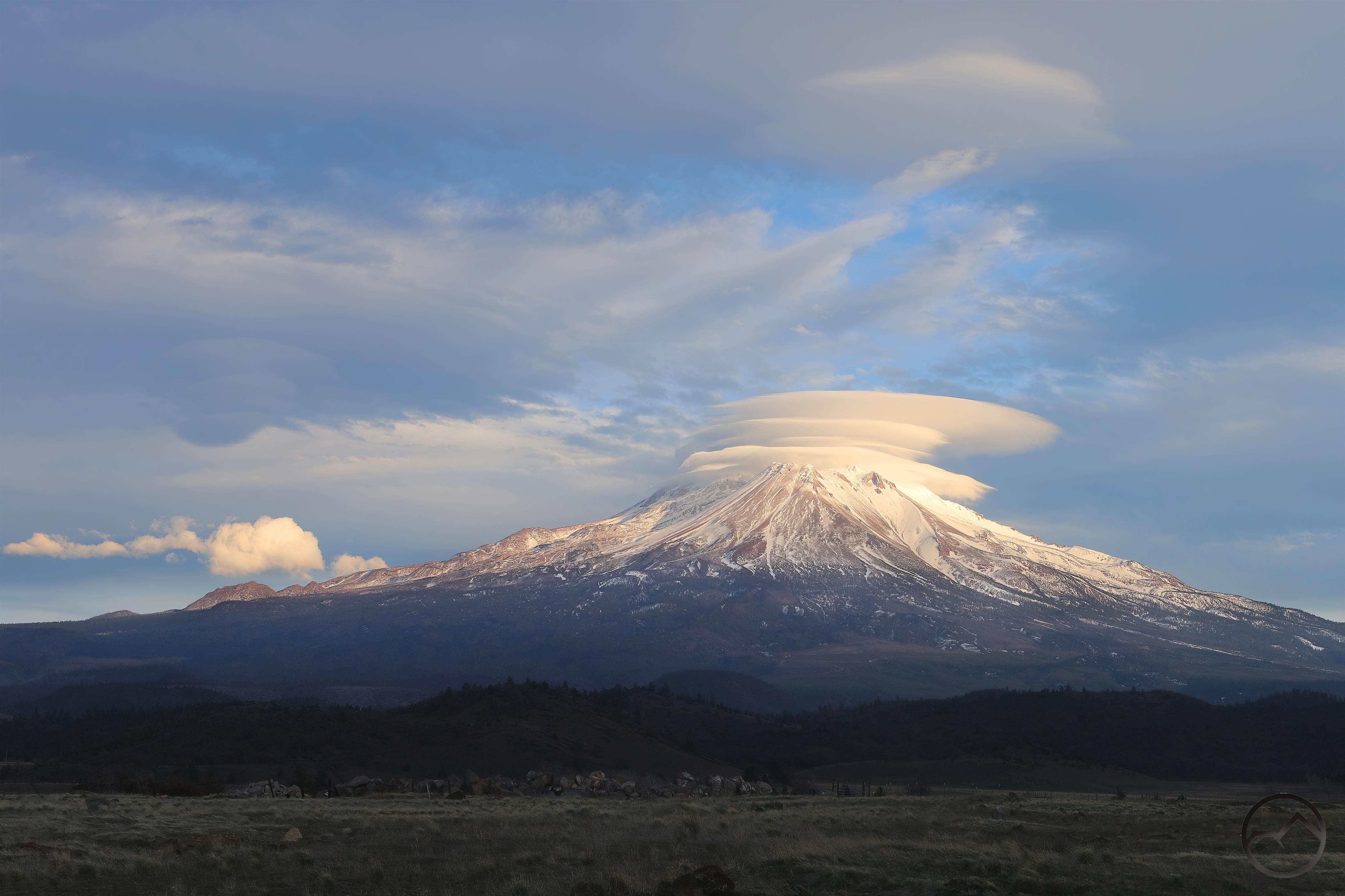
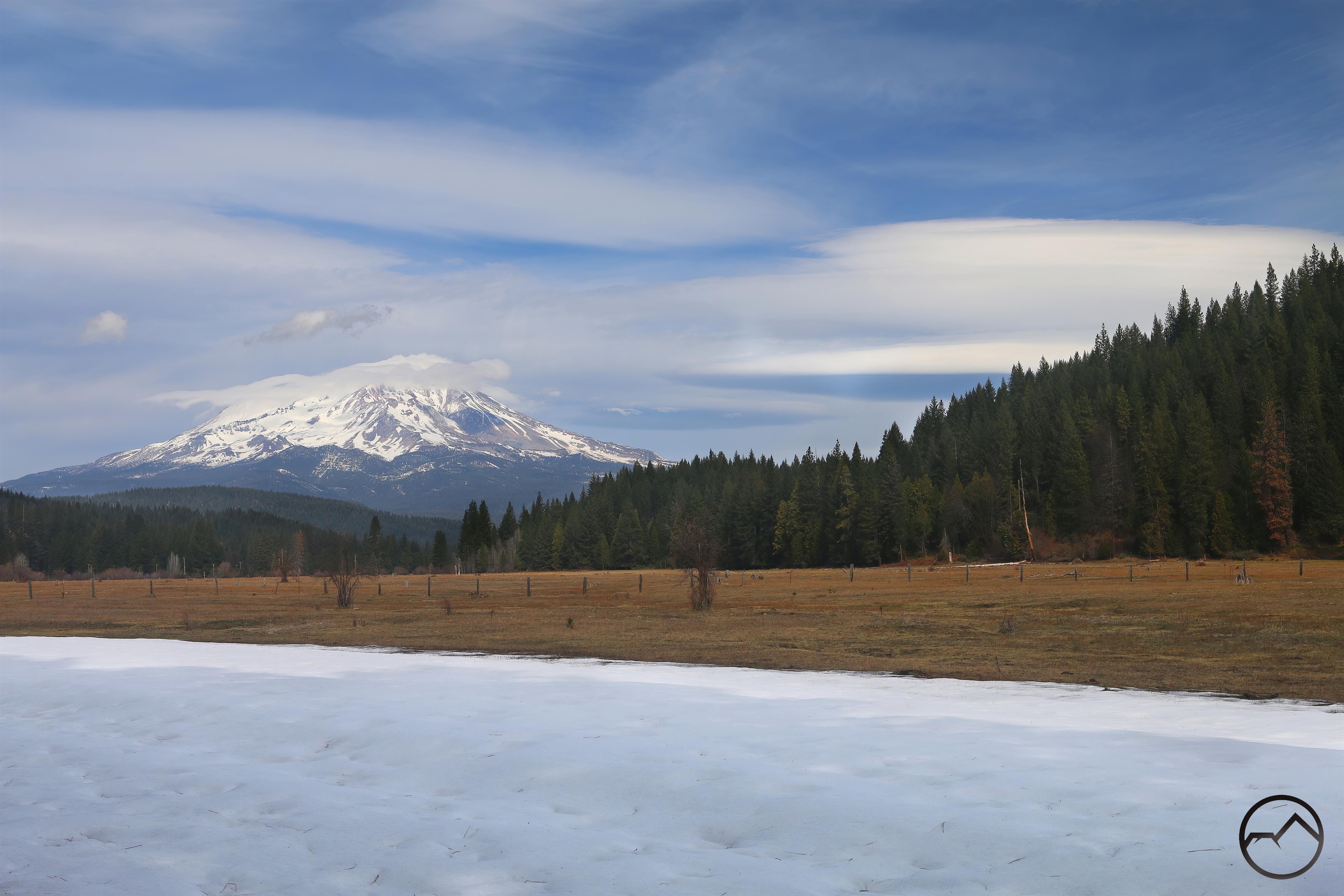
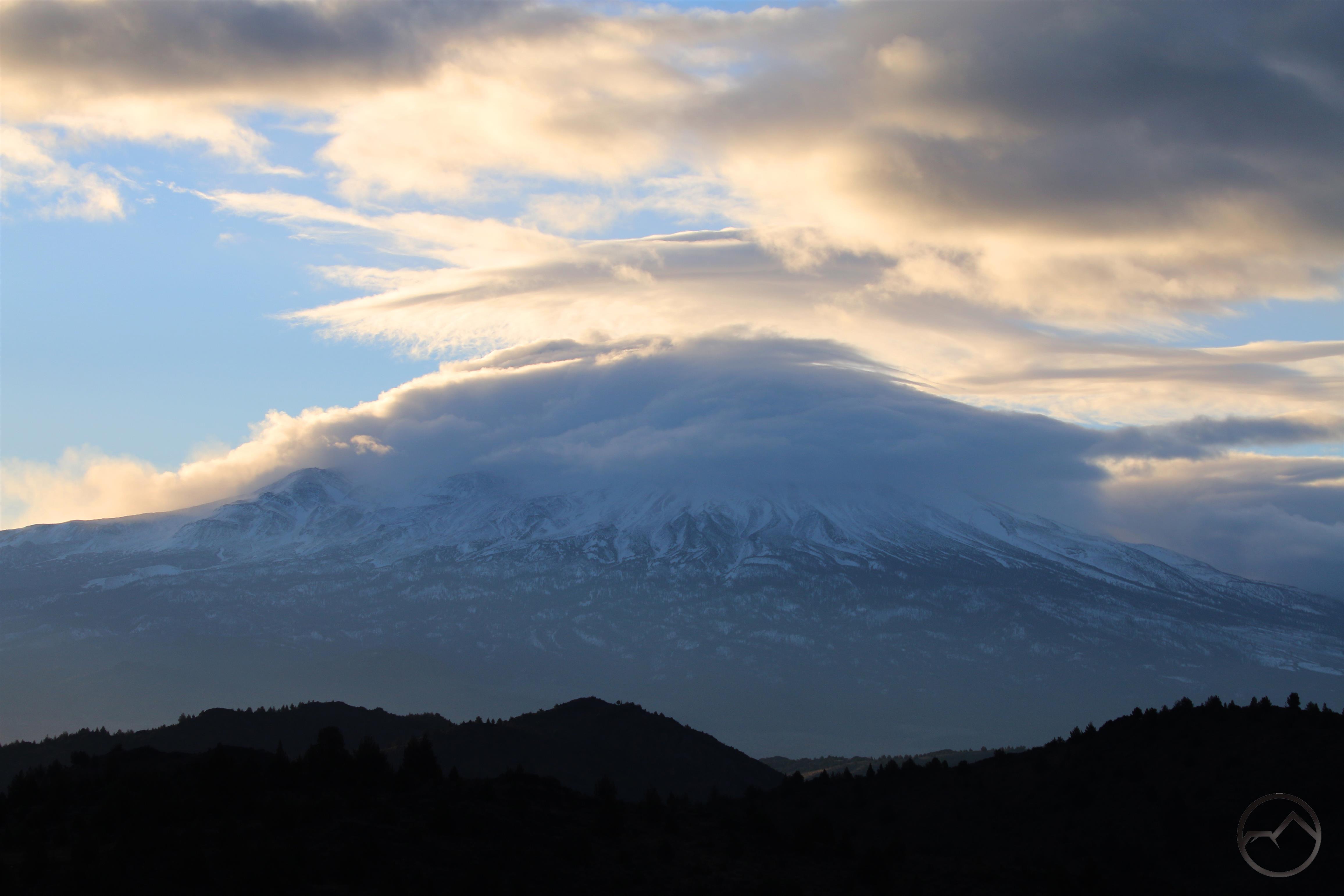
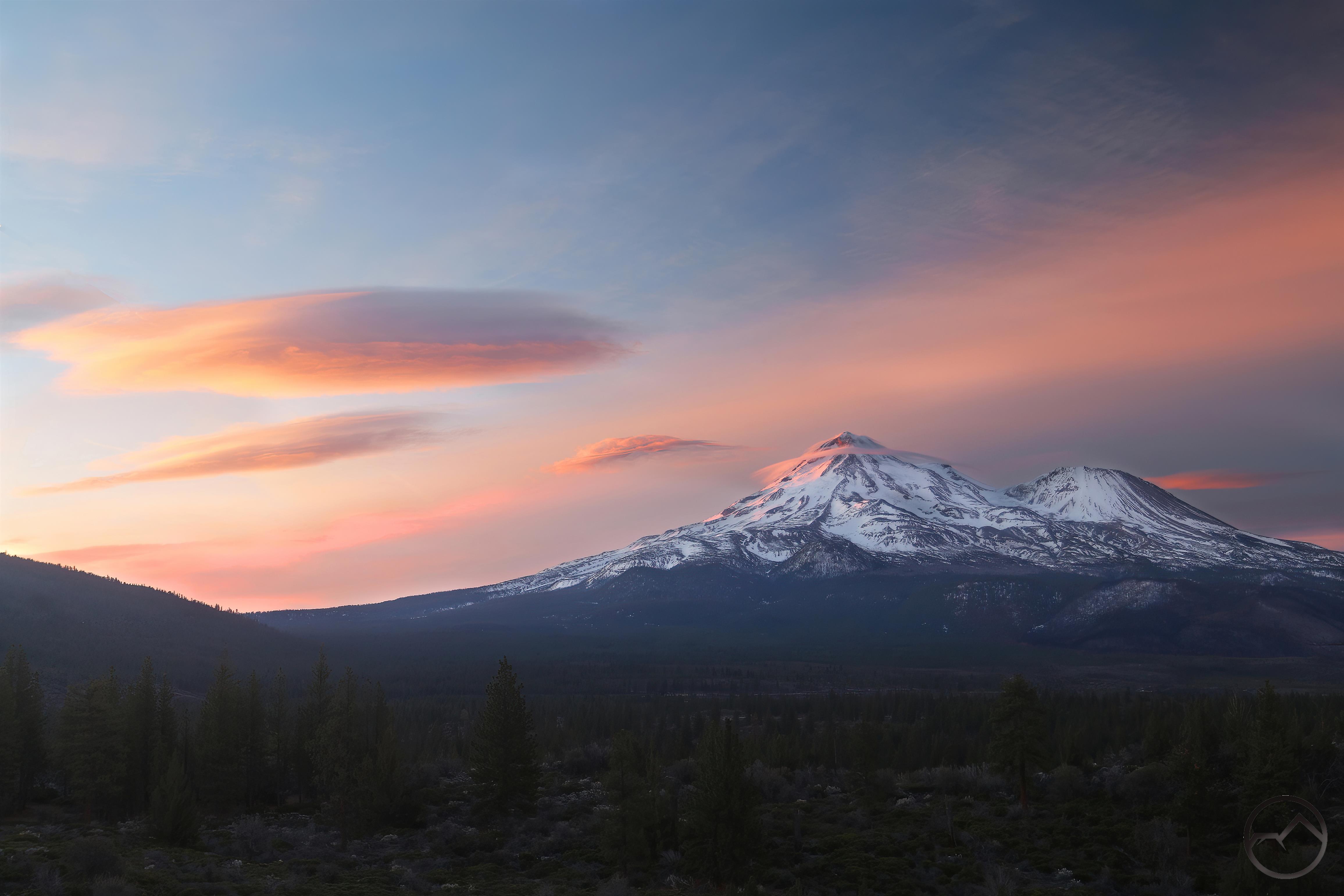
Western idyll: Mount Shasta rises over a lush field and a herd of Arabian horses.

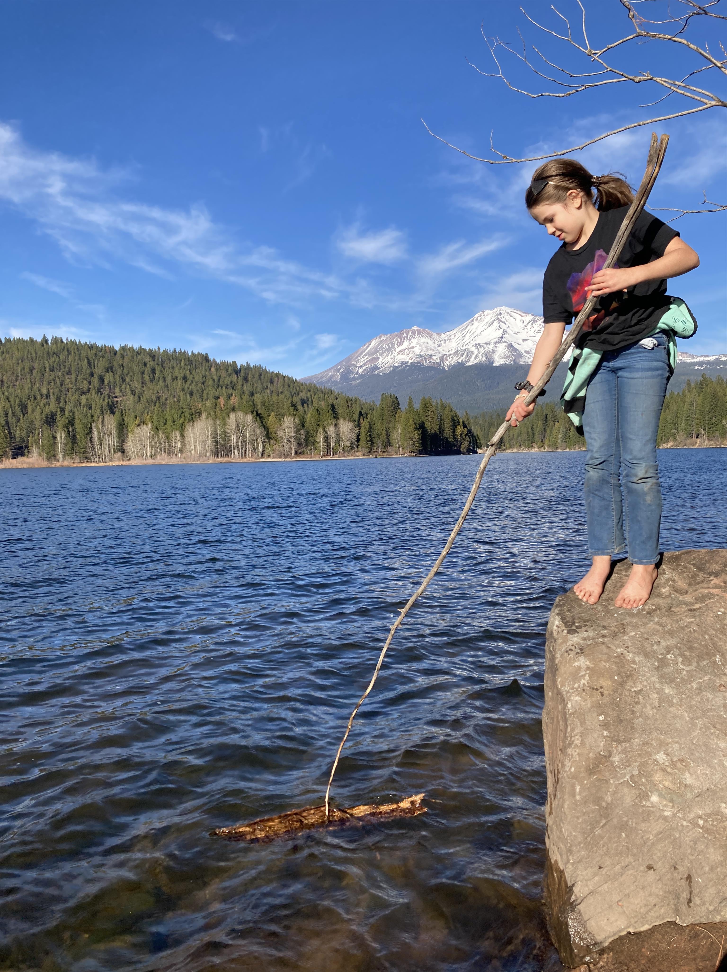
This year, prior to going to the creek, we had to take my daughter to see the Arabians that live at the very southern edge of the Shasta Valley. She is a horse-junkie of the first order and these are her favorite horses. I only mention this because the unexpected puddle gave me a great reflection of Mount Shasta looming above the field were some of the horses were grazing. All I could think of that scene was “the west is the best”!

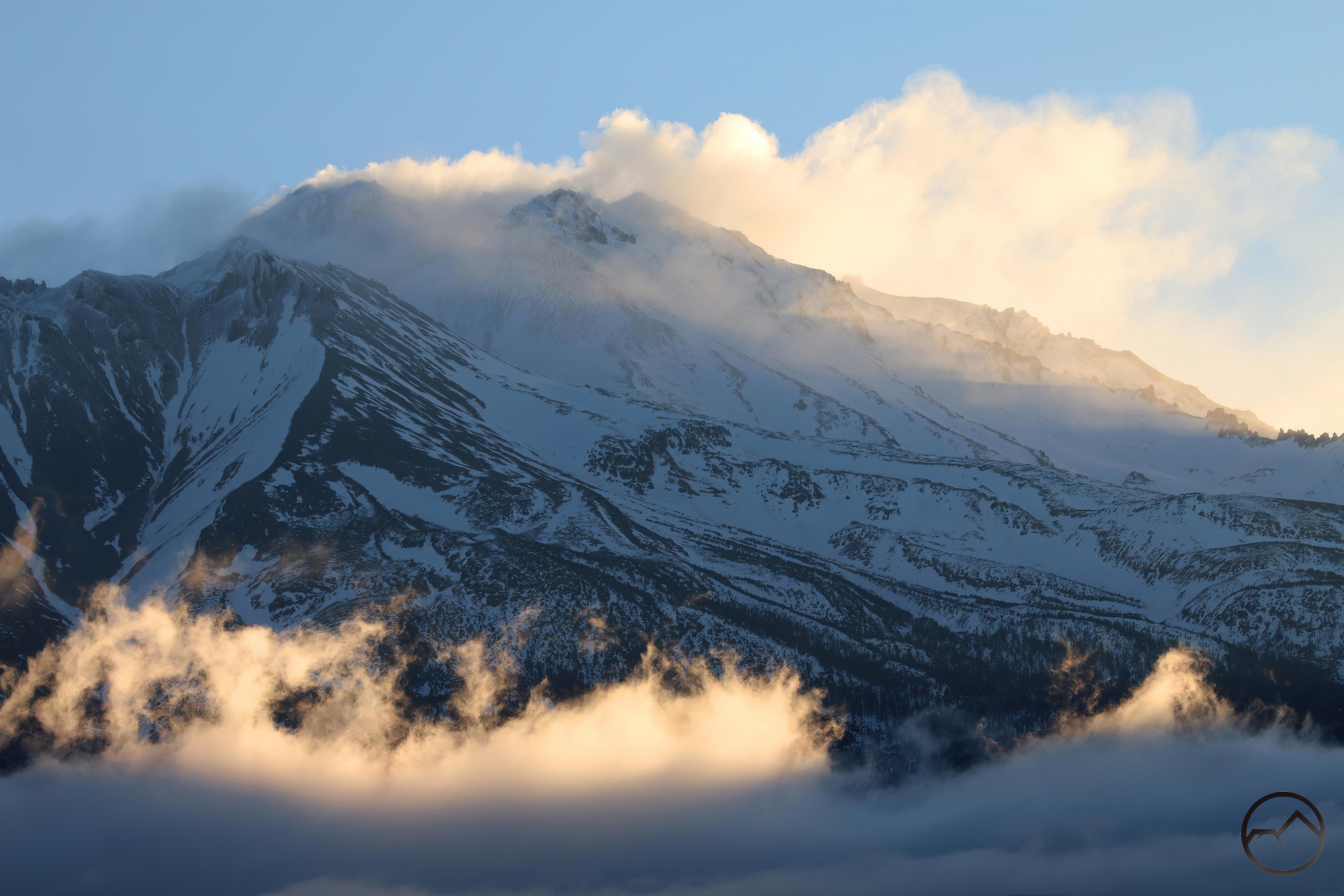
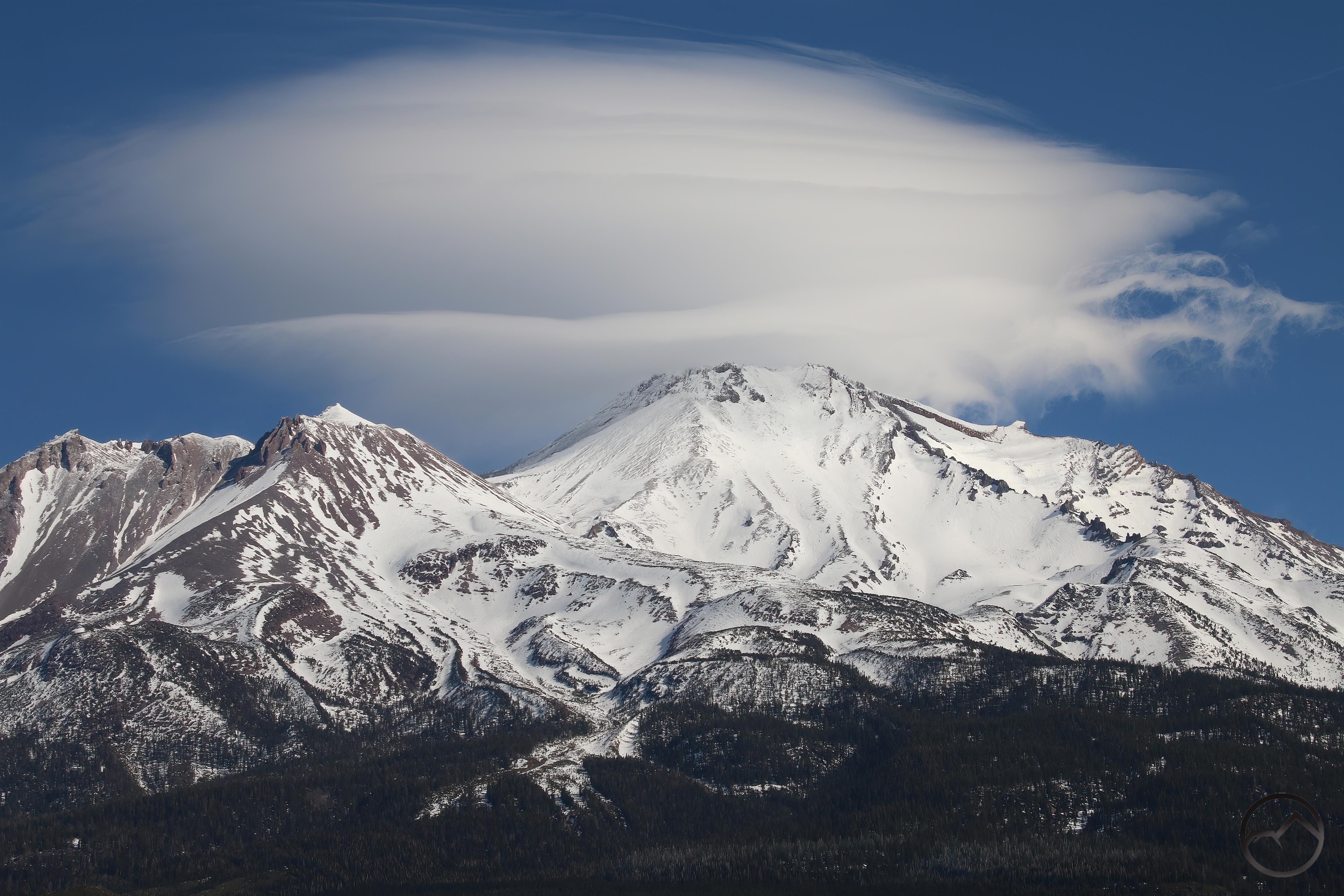
Back to Survey Creek, the thing we like about this hike is how it combines all the best elements of a trip into one tight, incredibly enjoyable package. This hike has waterfalls, rock scrambling, lush meadows, solitude, ample room for exploration and a great view of Mount Shasta. Could you need anything else?

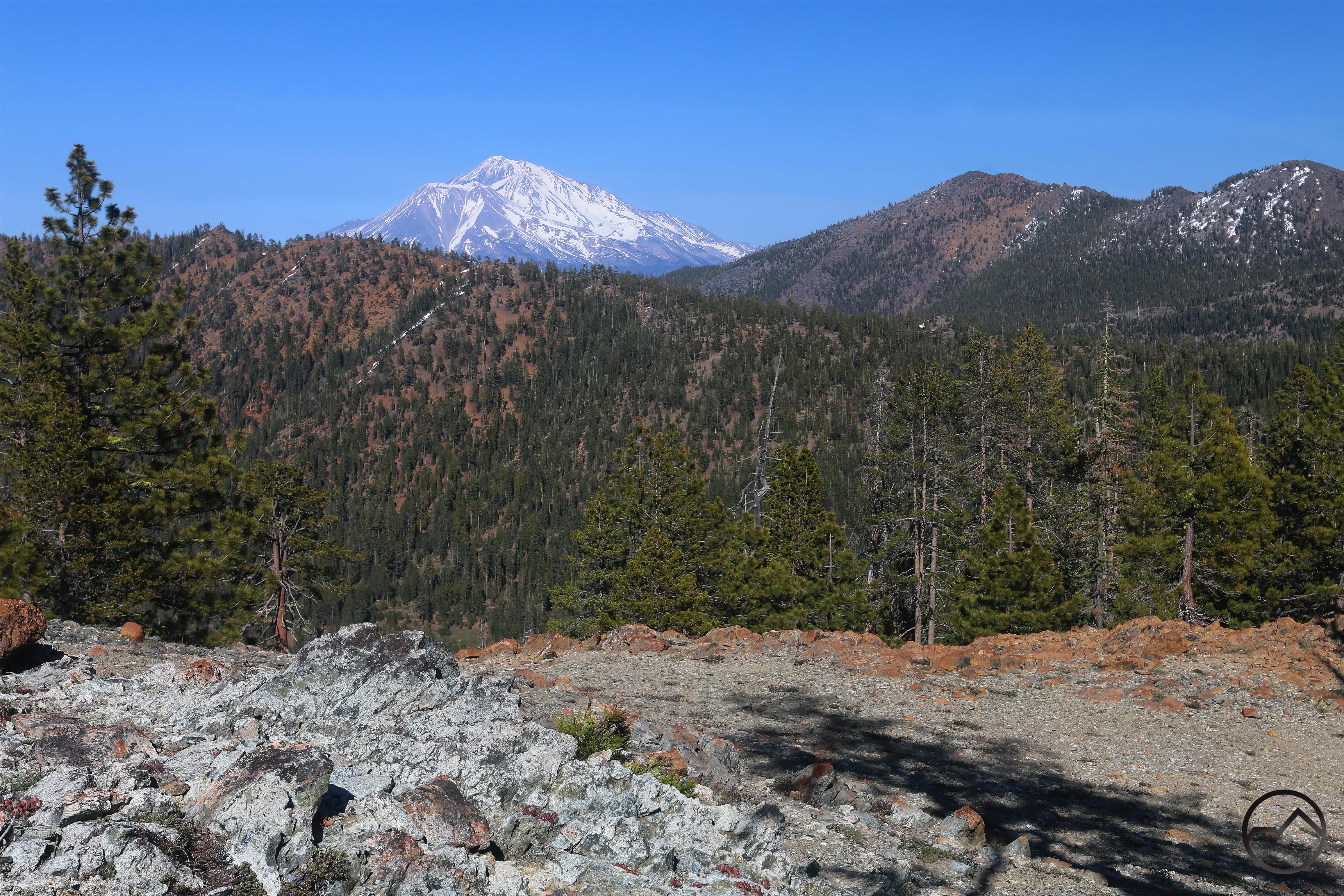
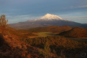
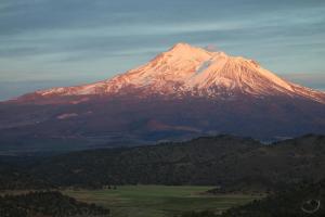
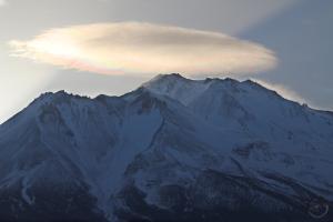
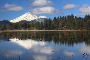
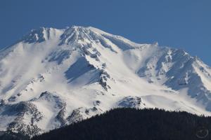
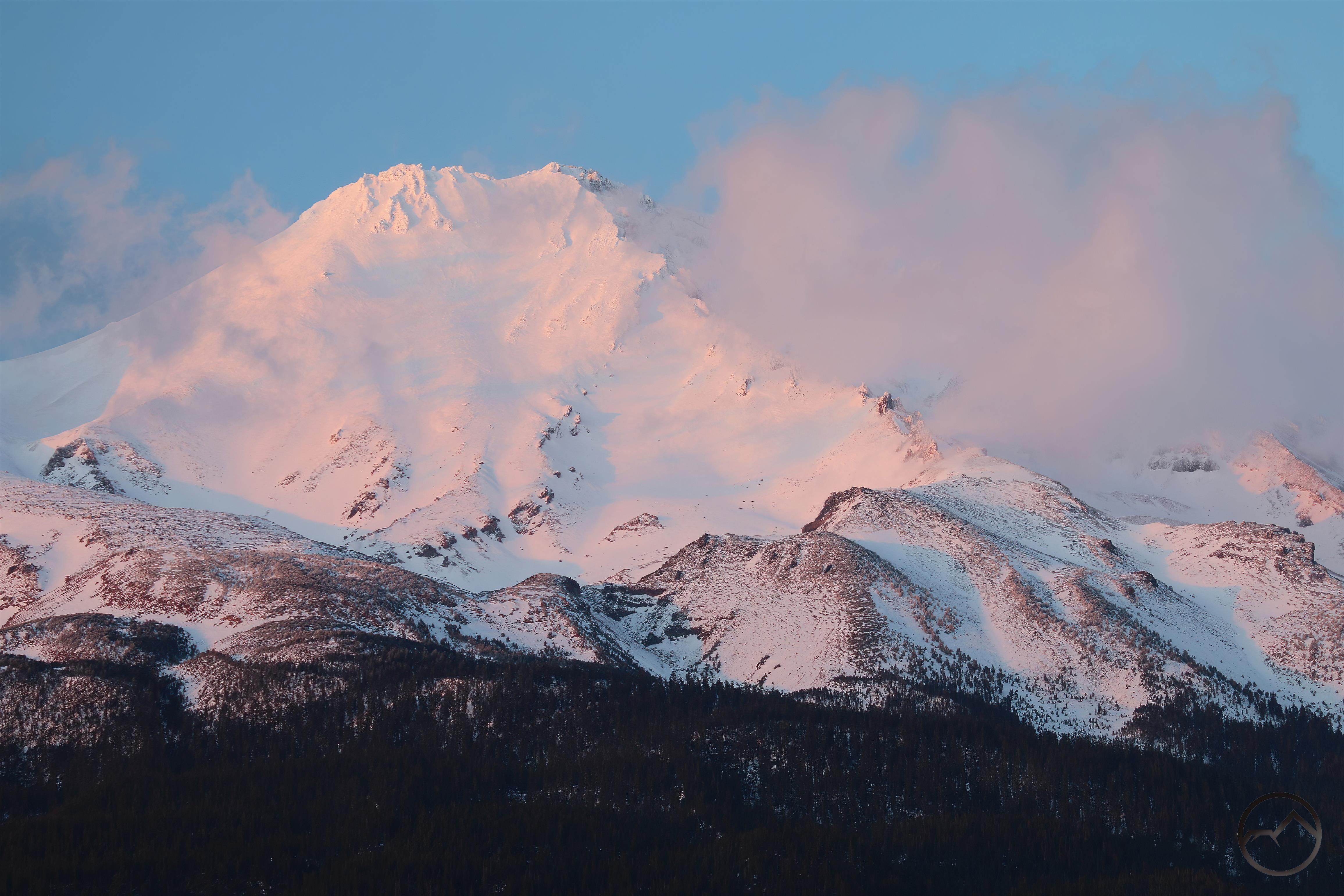
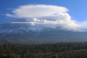
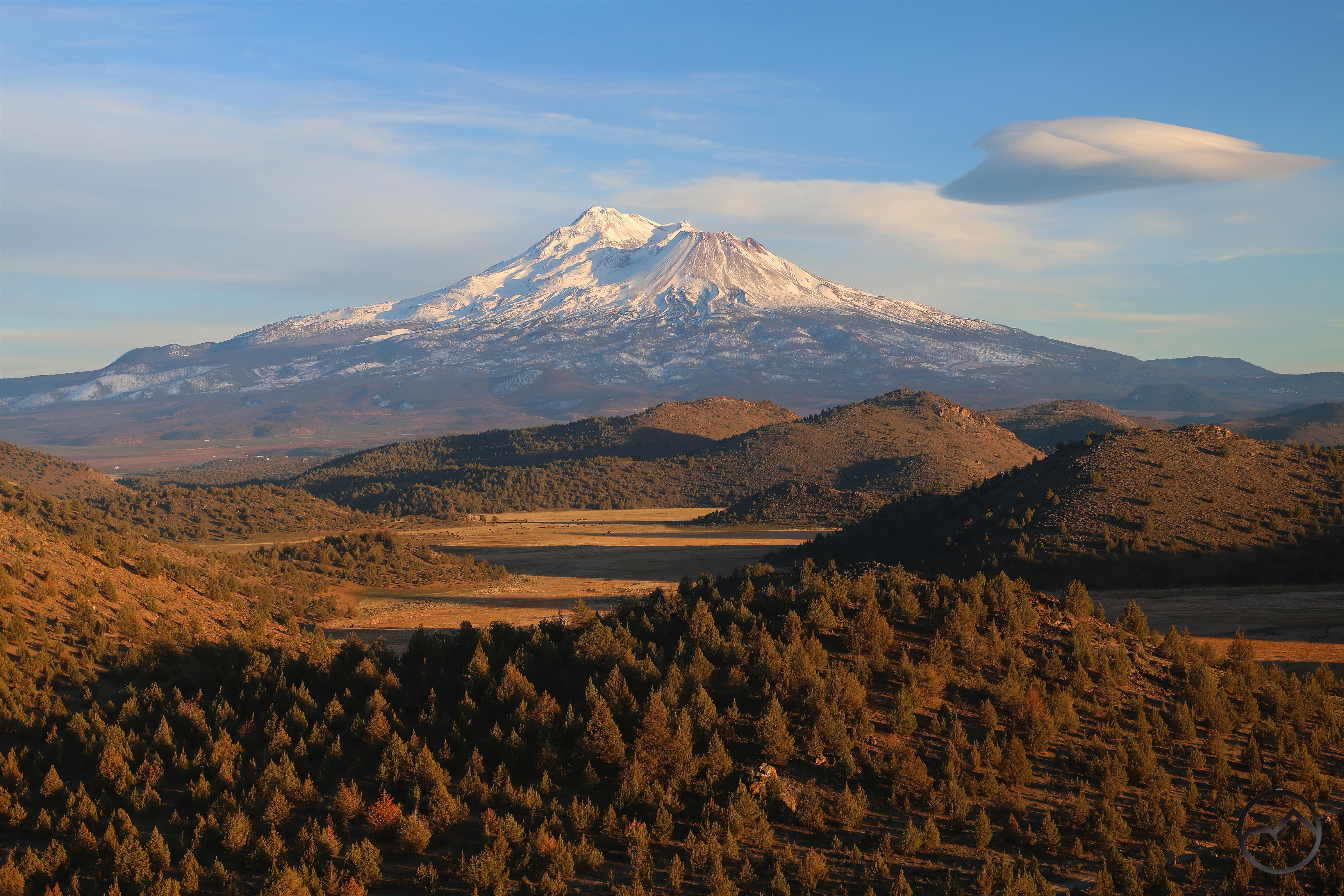
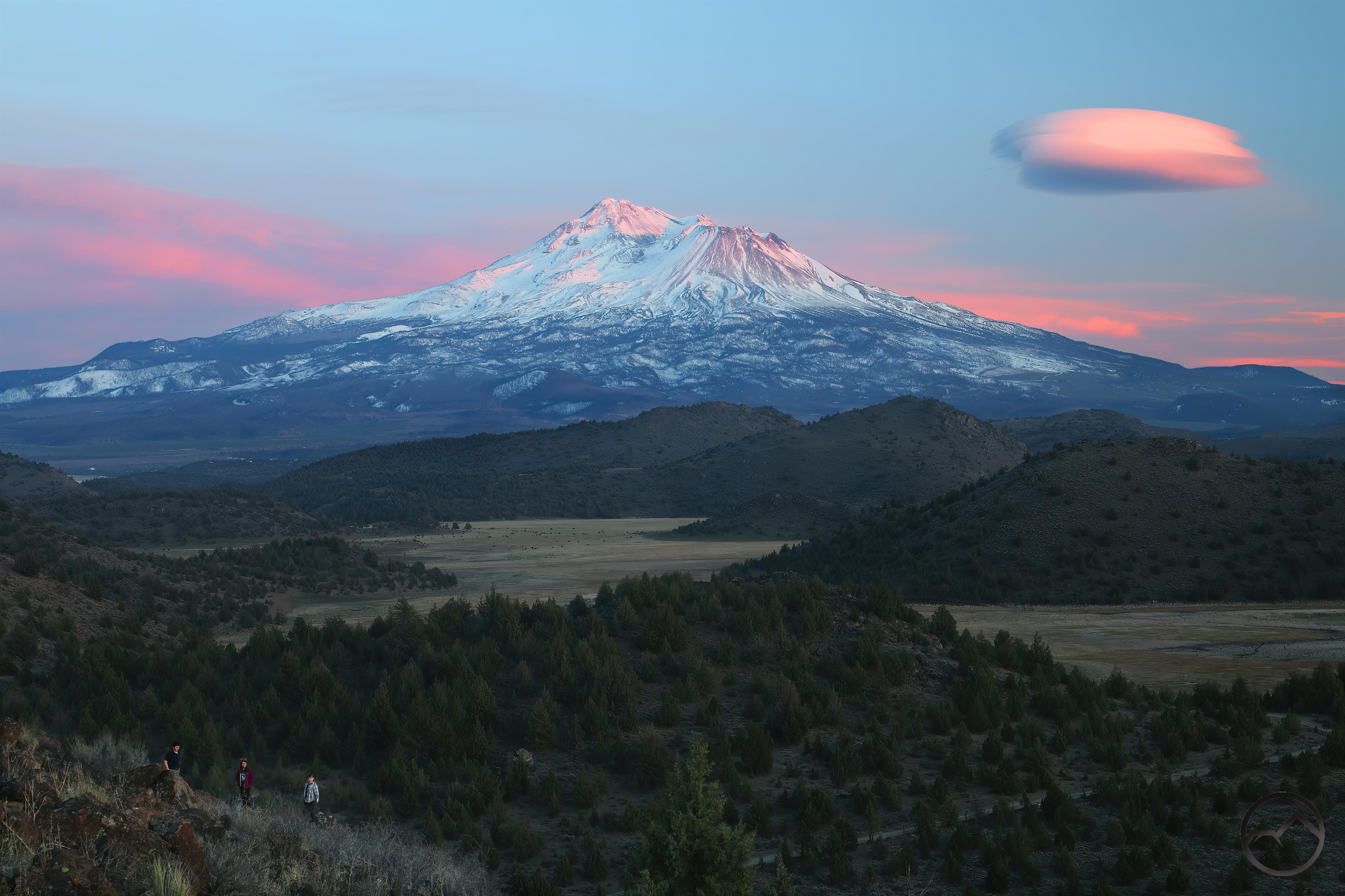
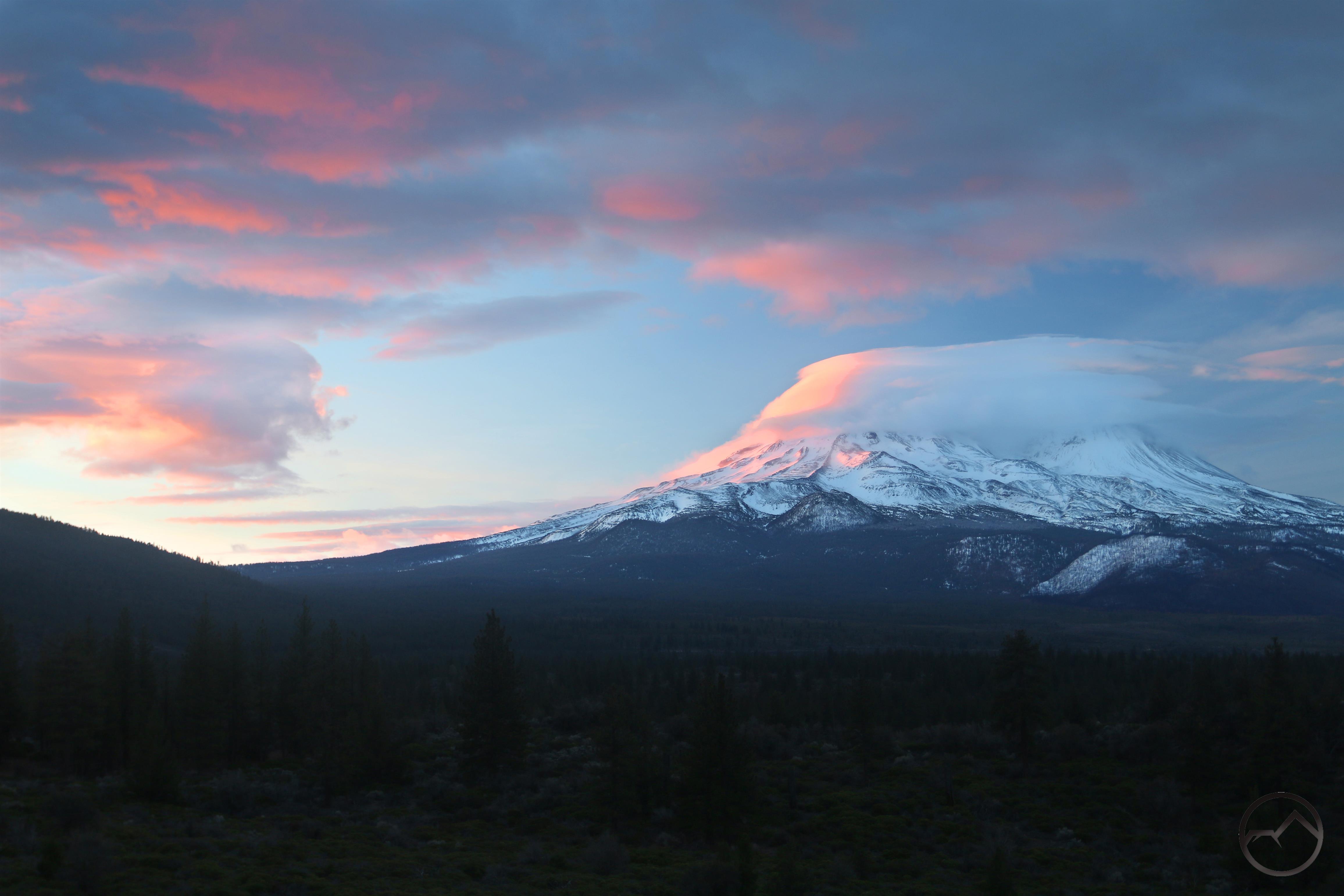
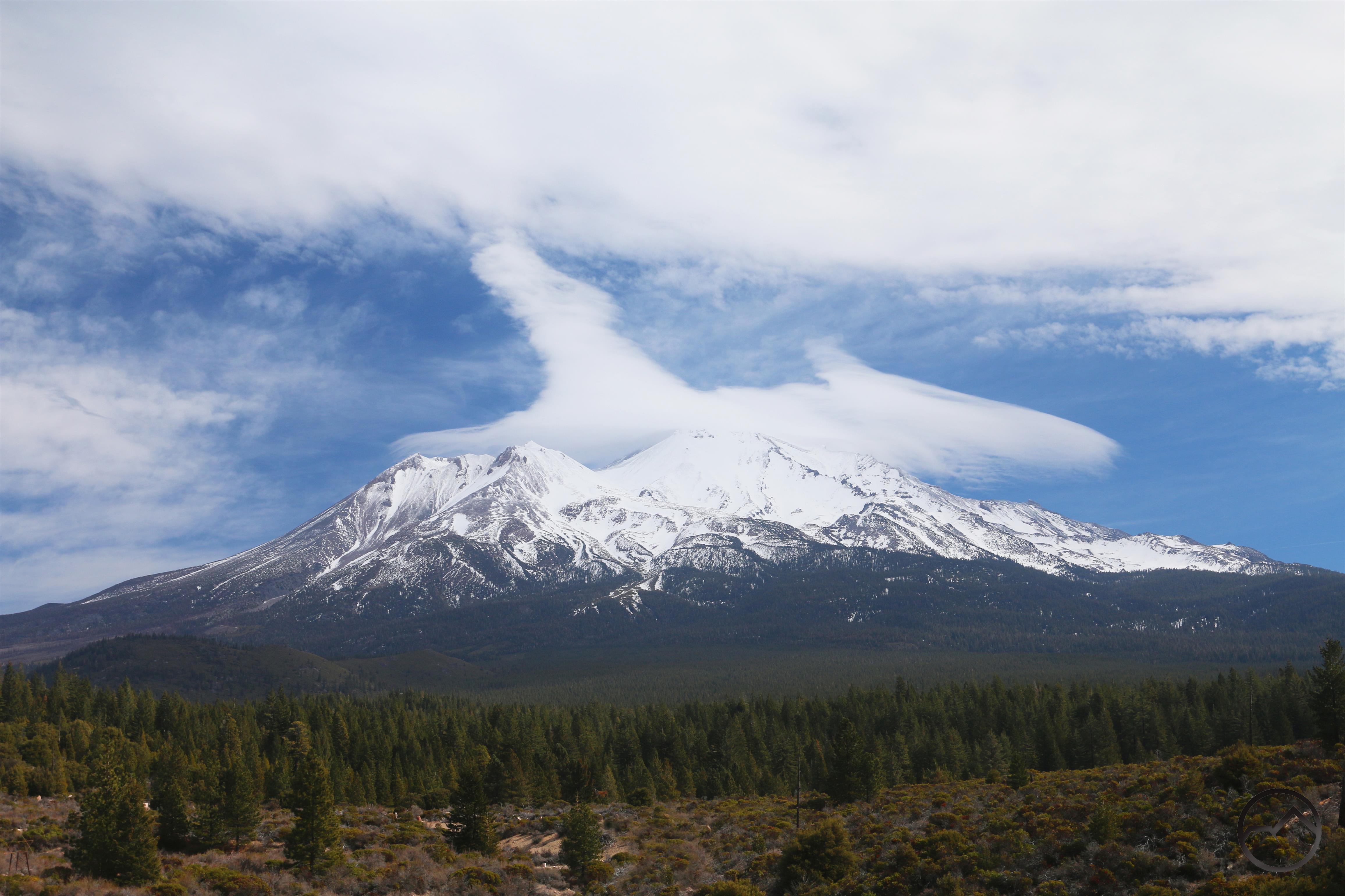
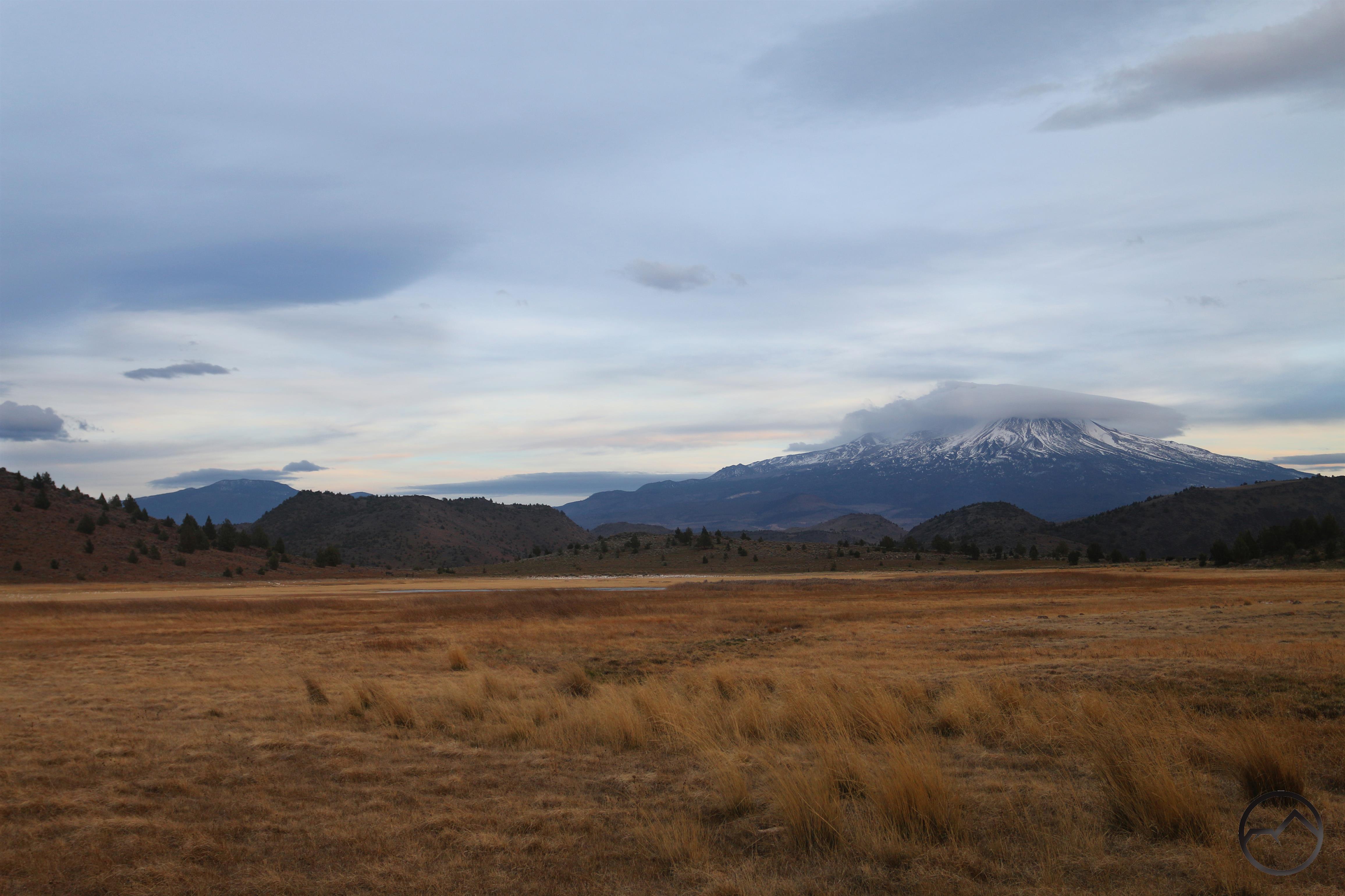
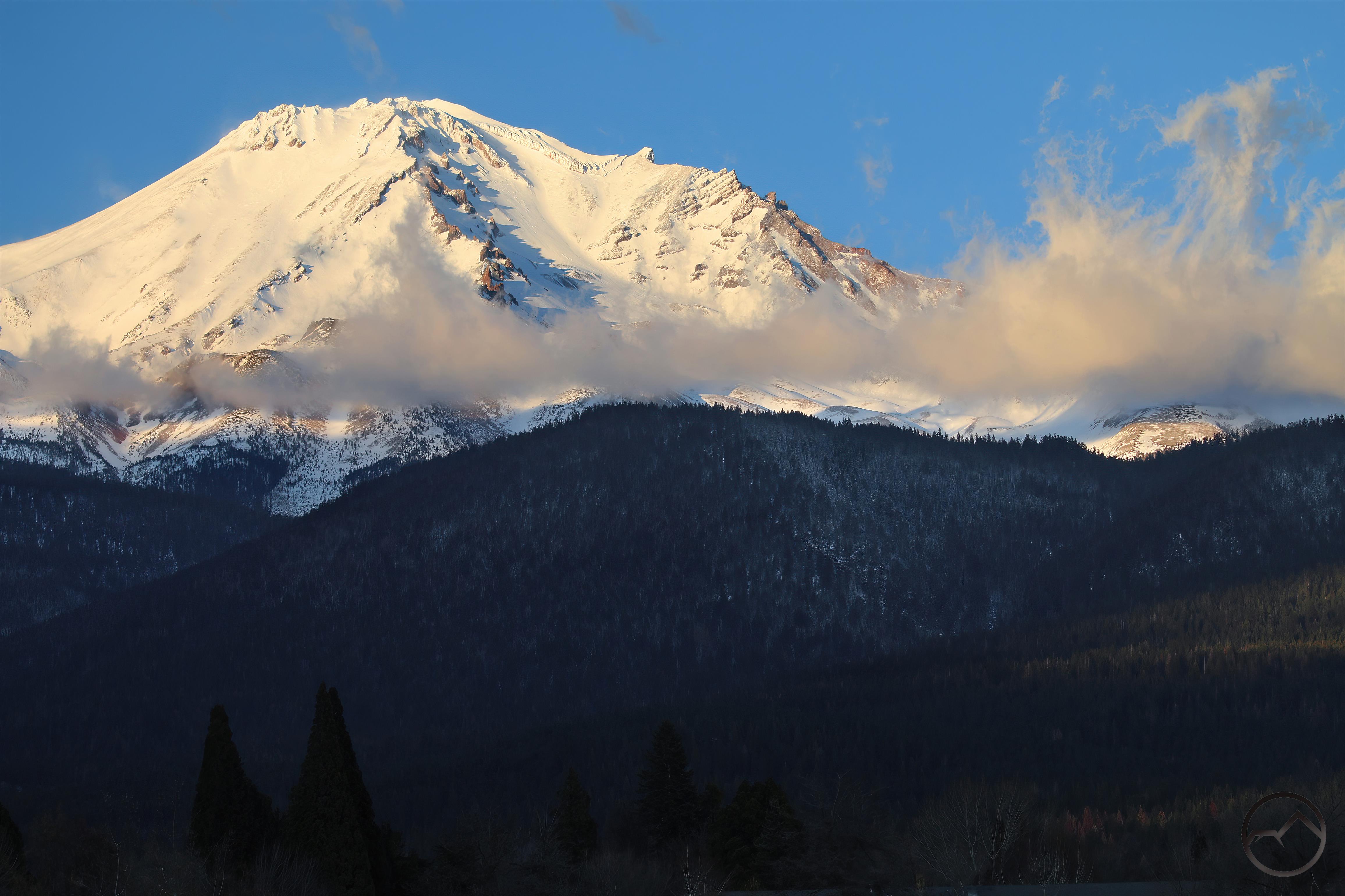
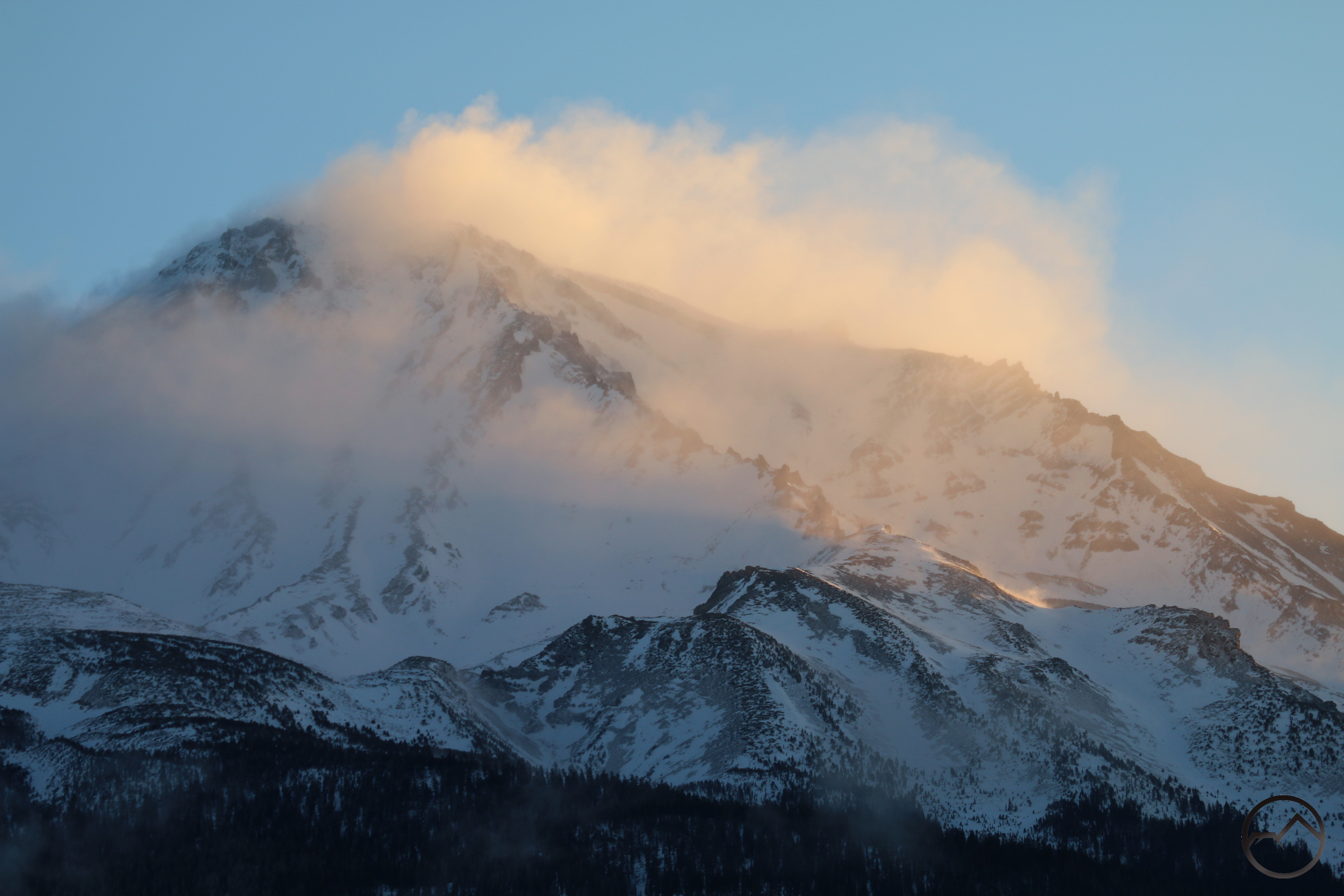
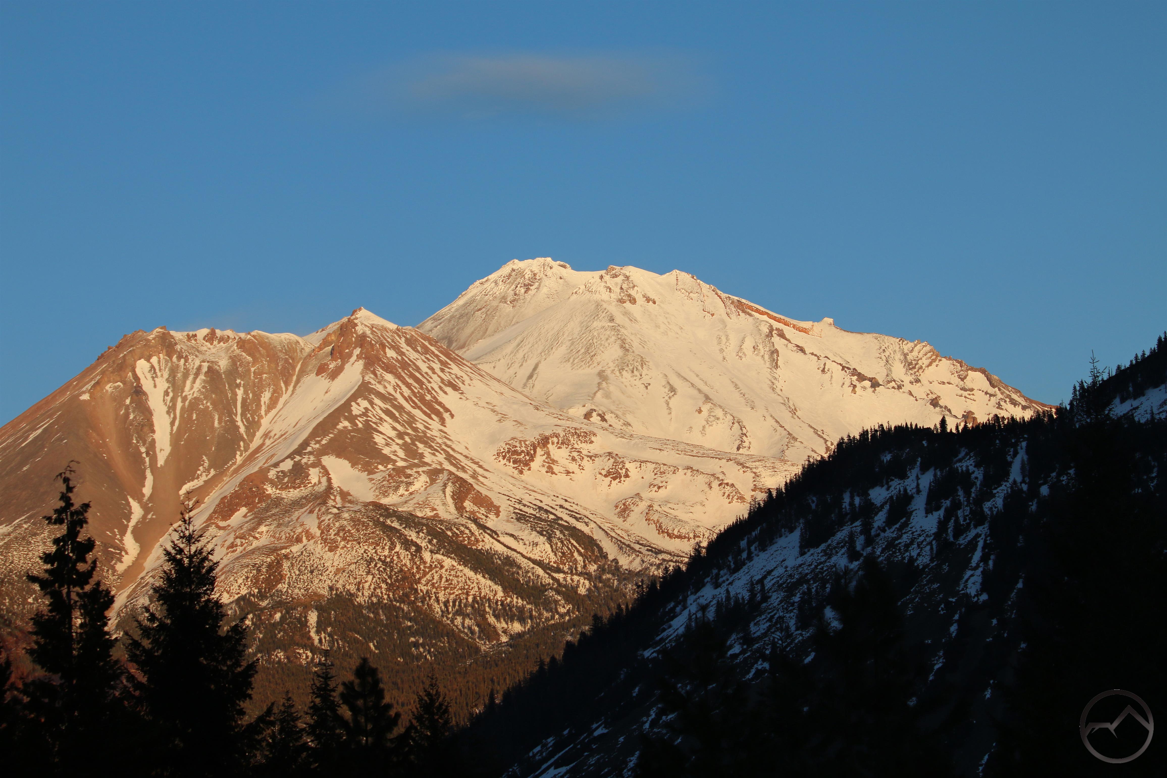
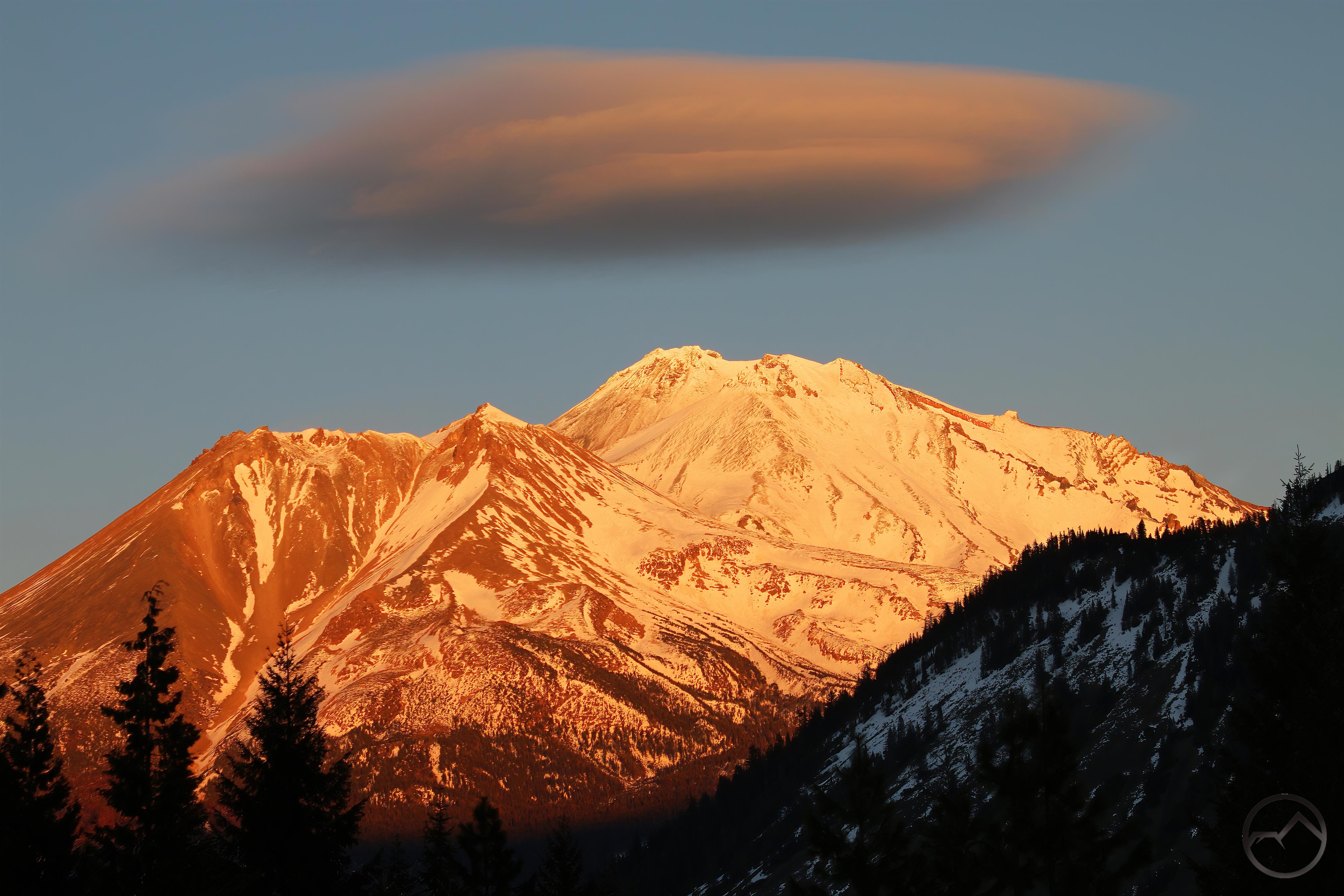
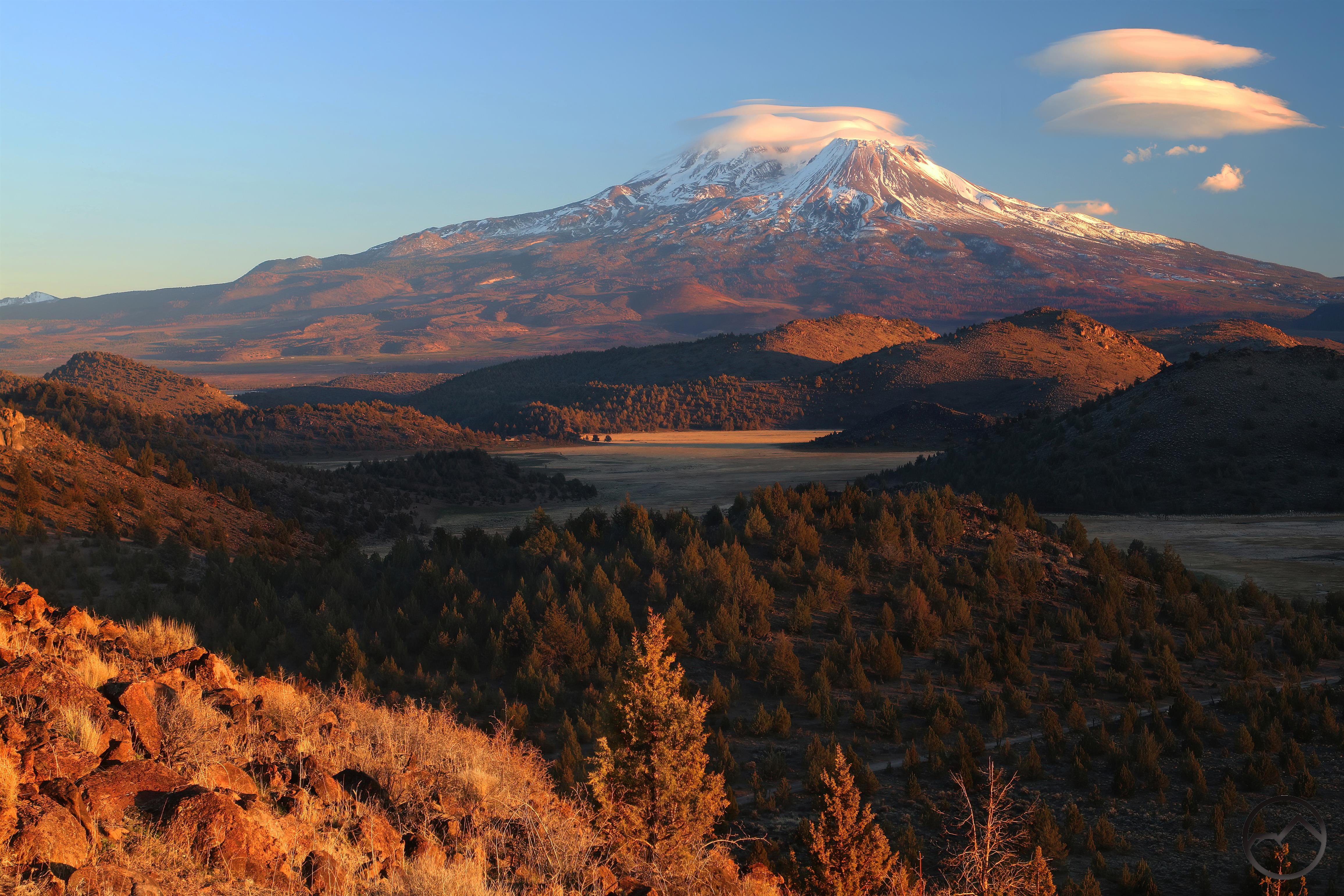
Mount Shasta, visible from Survey Point.

We typically climb the first few hundred feet along the crashing creek but then veer off and climb up the rocks to Survey Point, where get a great view of Mount Shasta. The rocks here are serpentine and peridotite. Not only are they striking visually but they are the tackiest rock I have ever been on. You can go up steeper grades on this rock than even granite or sandstone.

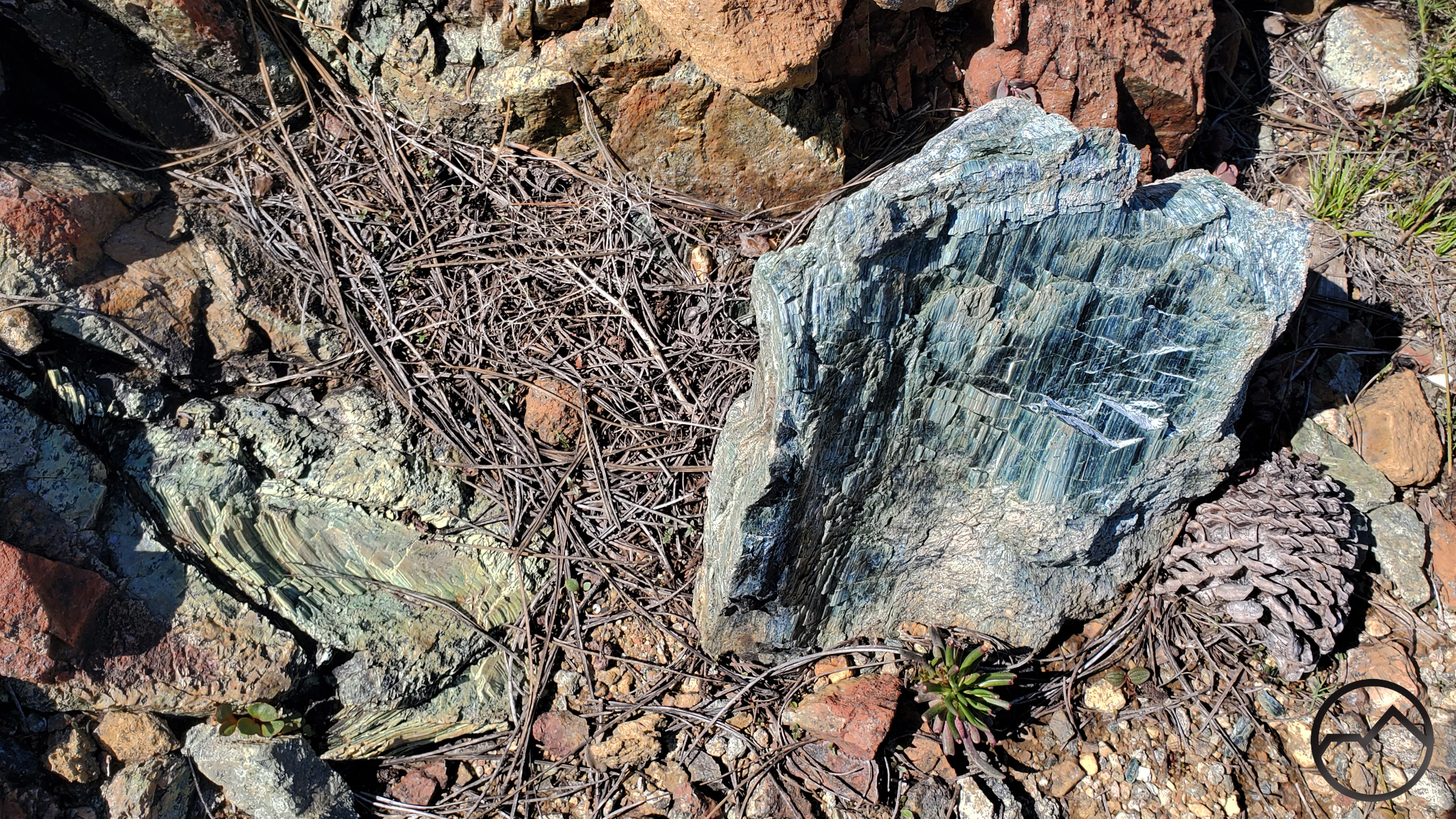
A chunk of serpentine amidst peridotite.

What makes this area unusual is how the peridotite is not broken up but is one giant slab of rock. Most places around here it is manifest as a pile of talus. The serpentine runs through it in large, beautiful veins. Climbing up the rock is one of my kids’ favorite part of the hike.


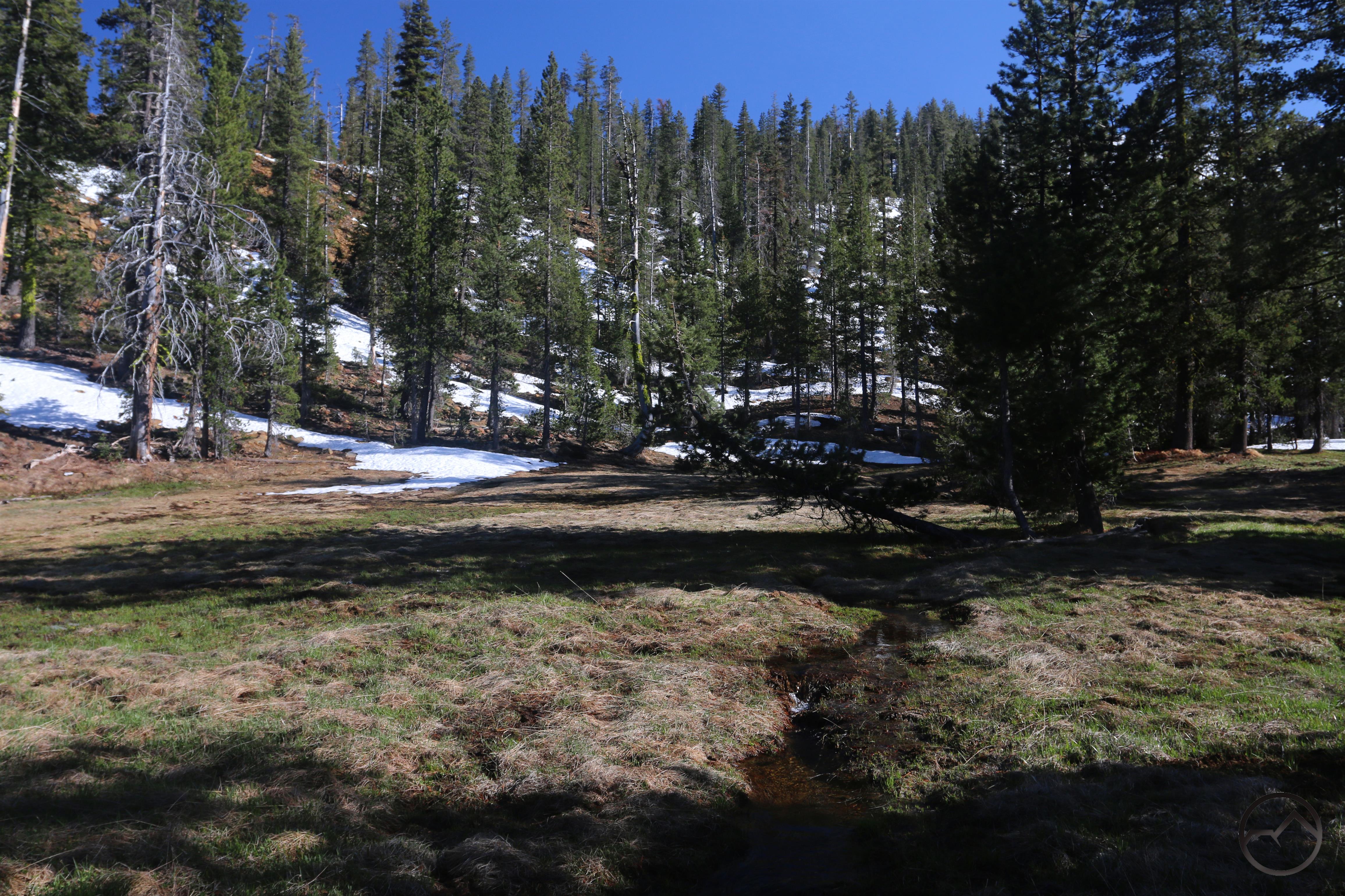
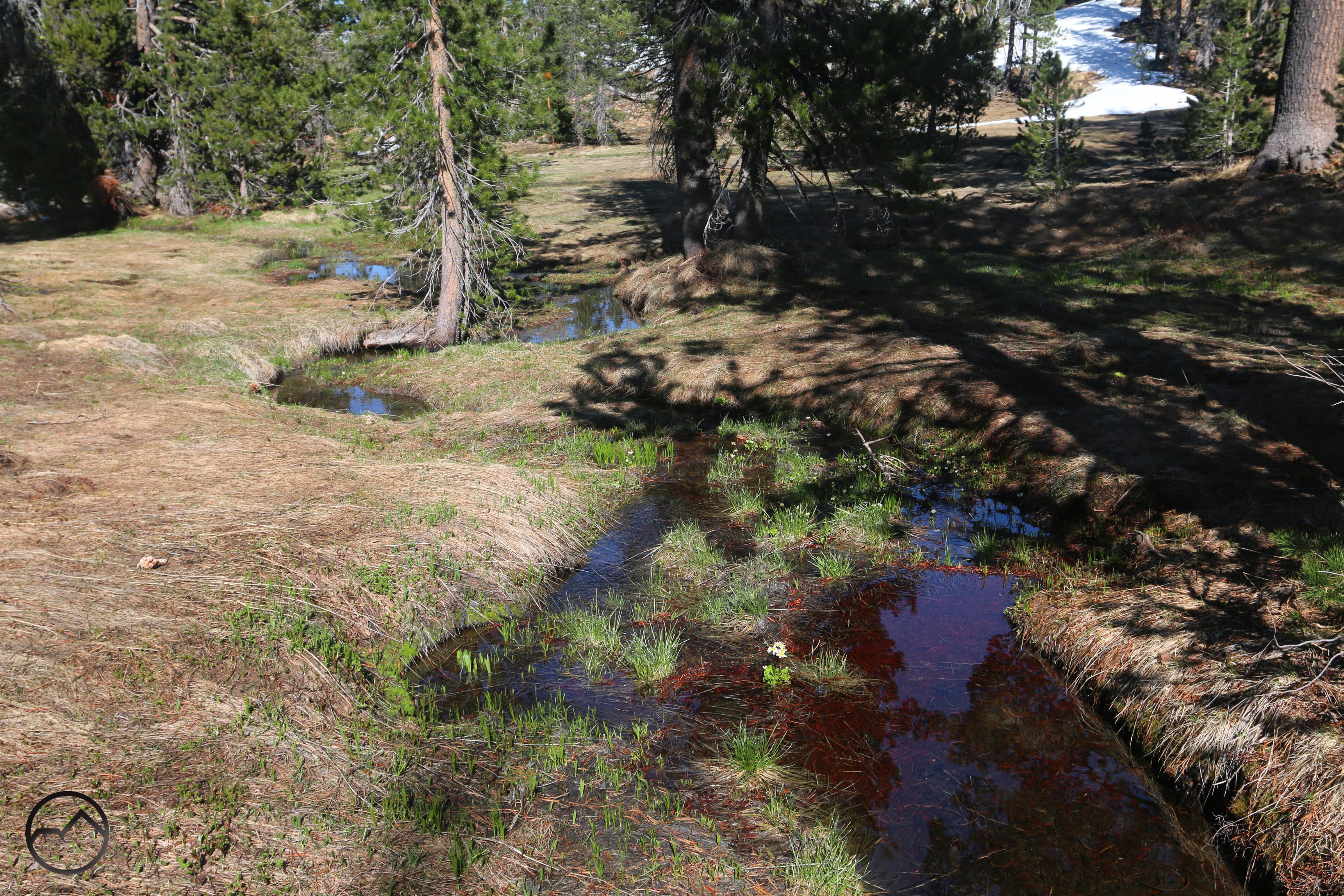
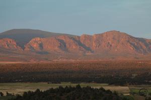
From Survey Point, we drop down to the meadow, which is enveloped in a large amphitheater. The meadow is filled with darlingtonia and numerous spring fed streams winding through the lush grass. It isn’t large, but it is beautiful and there are very, very few signs anyone has ever been there.


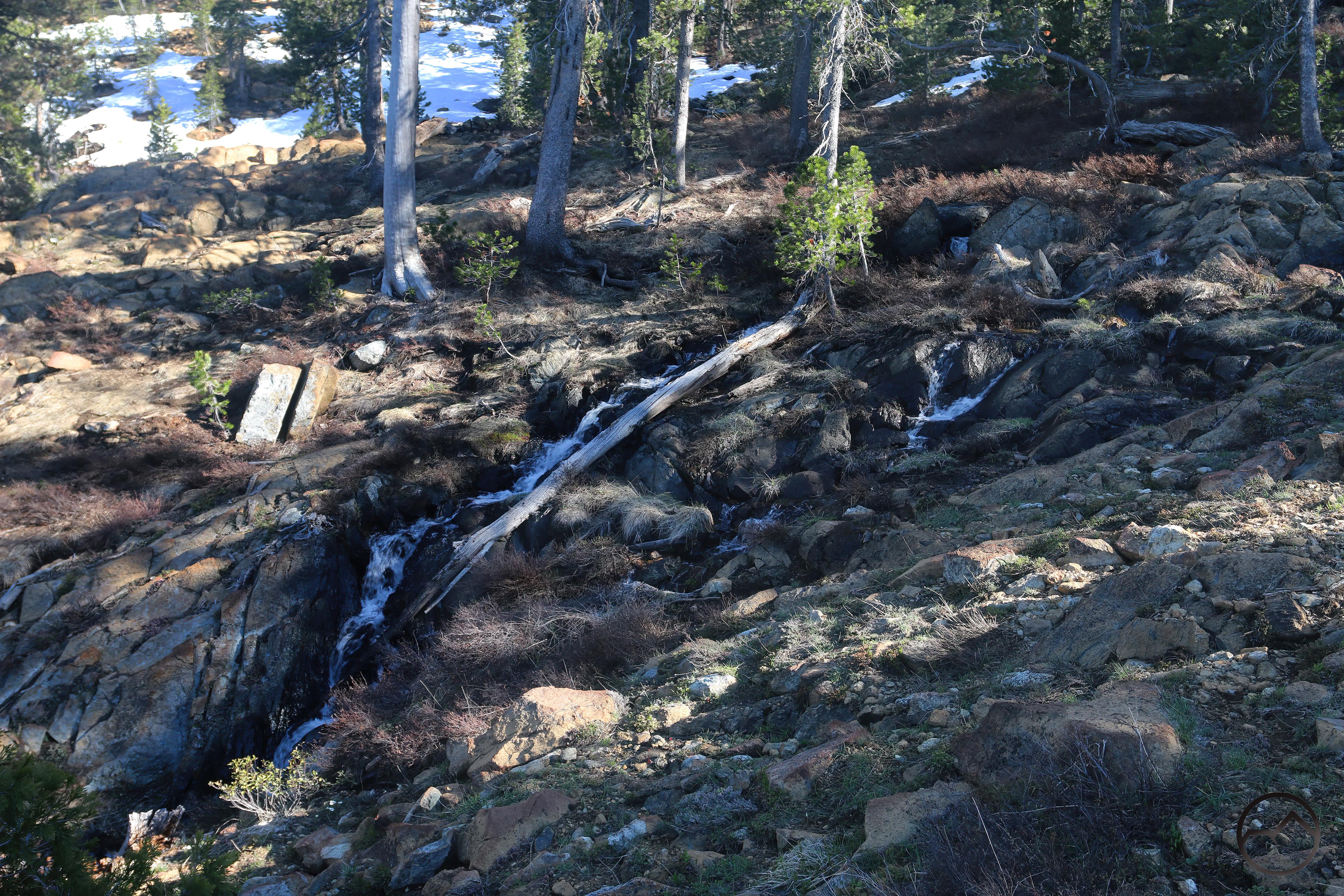
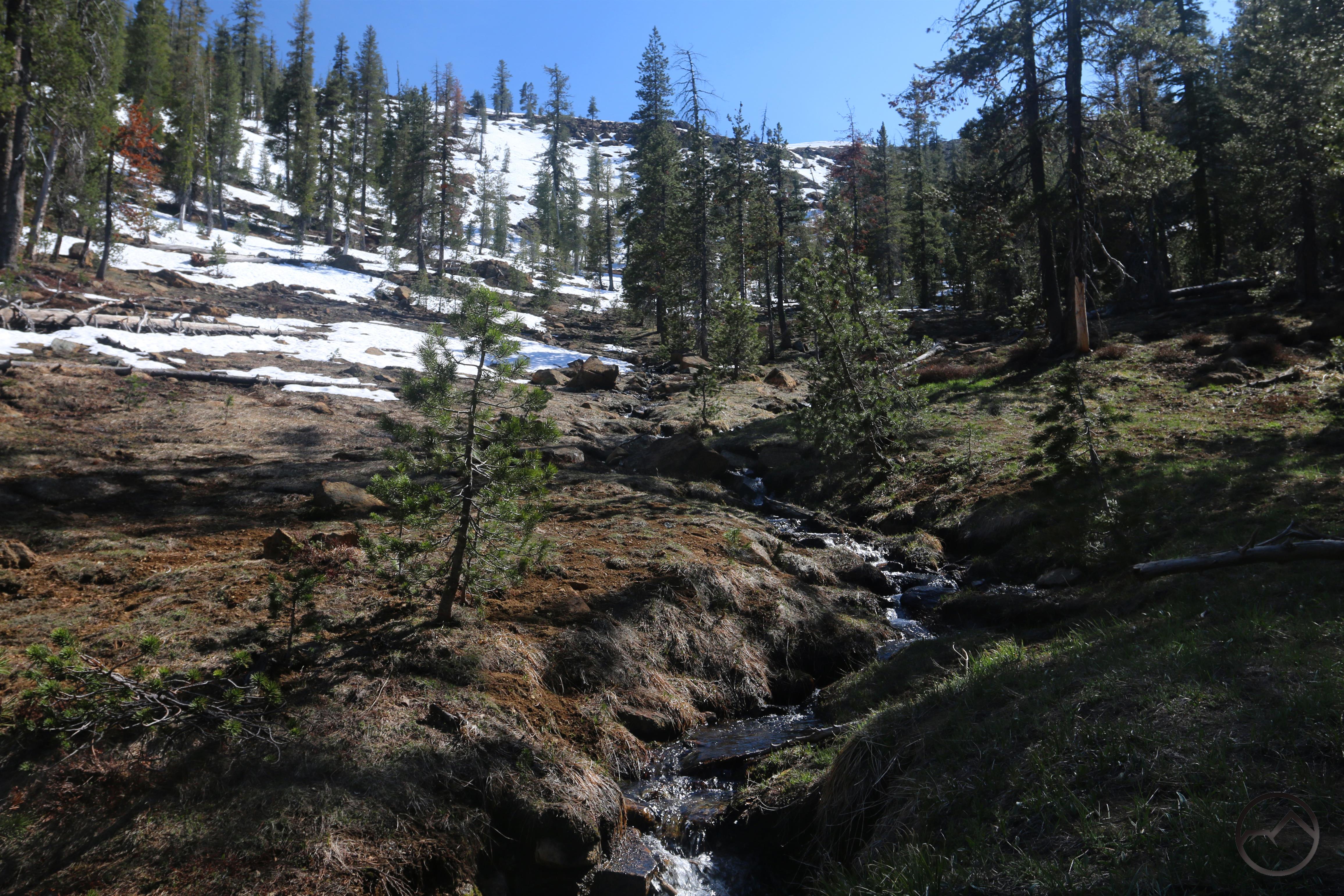
After lingering in the meadow for a while, we head back. Rather than scrambling down the rocks, this time we follow Survey Creek. All the small streams in the valley combine into one channel and as it leaves the meadow it enters a rocky channel through which it cascades a few hundred feet.

20220523_174555

20220523_174555


20220523_174918

20220523_174918


20220523_175338

20220523_175338


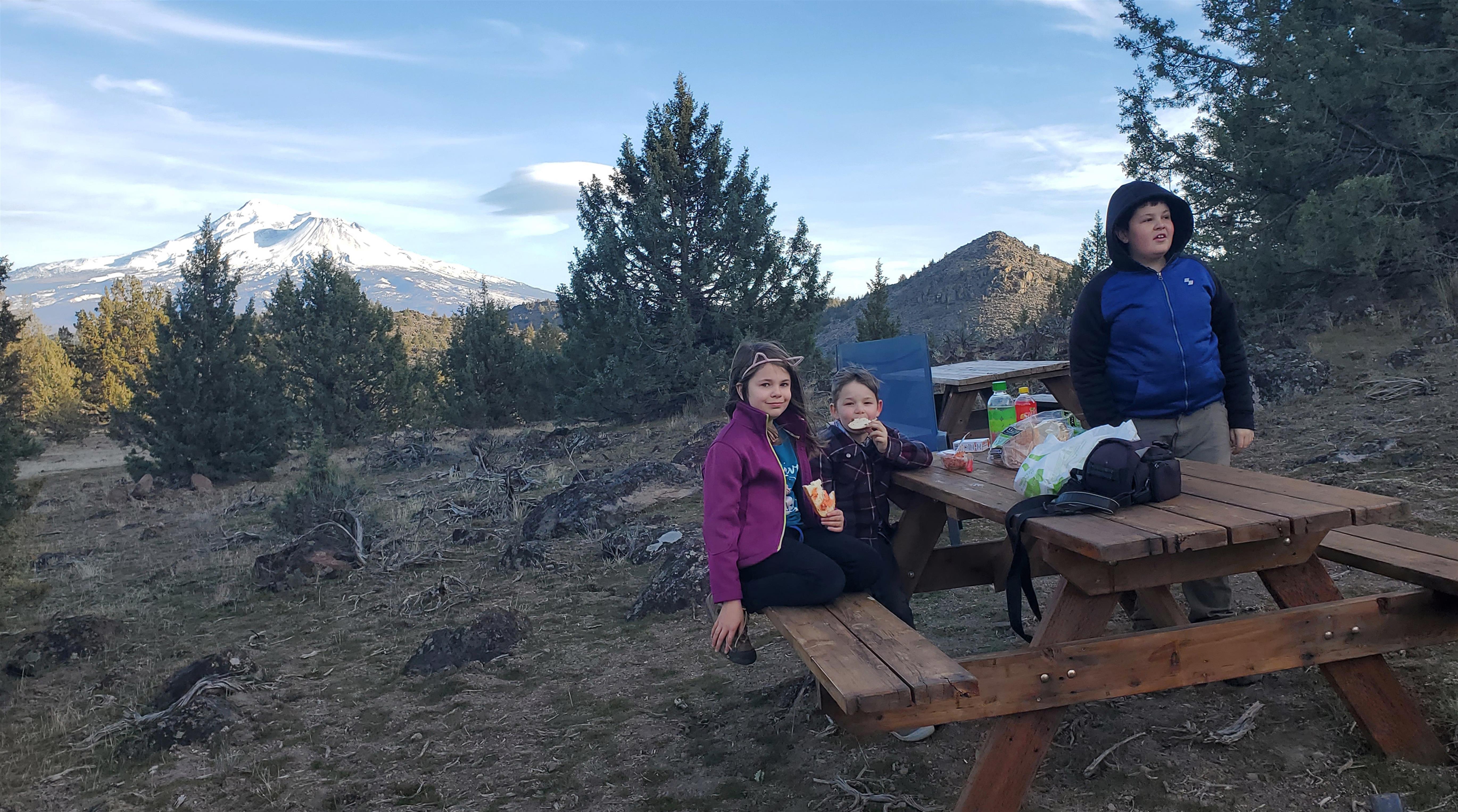
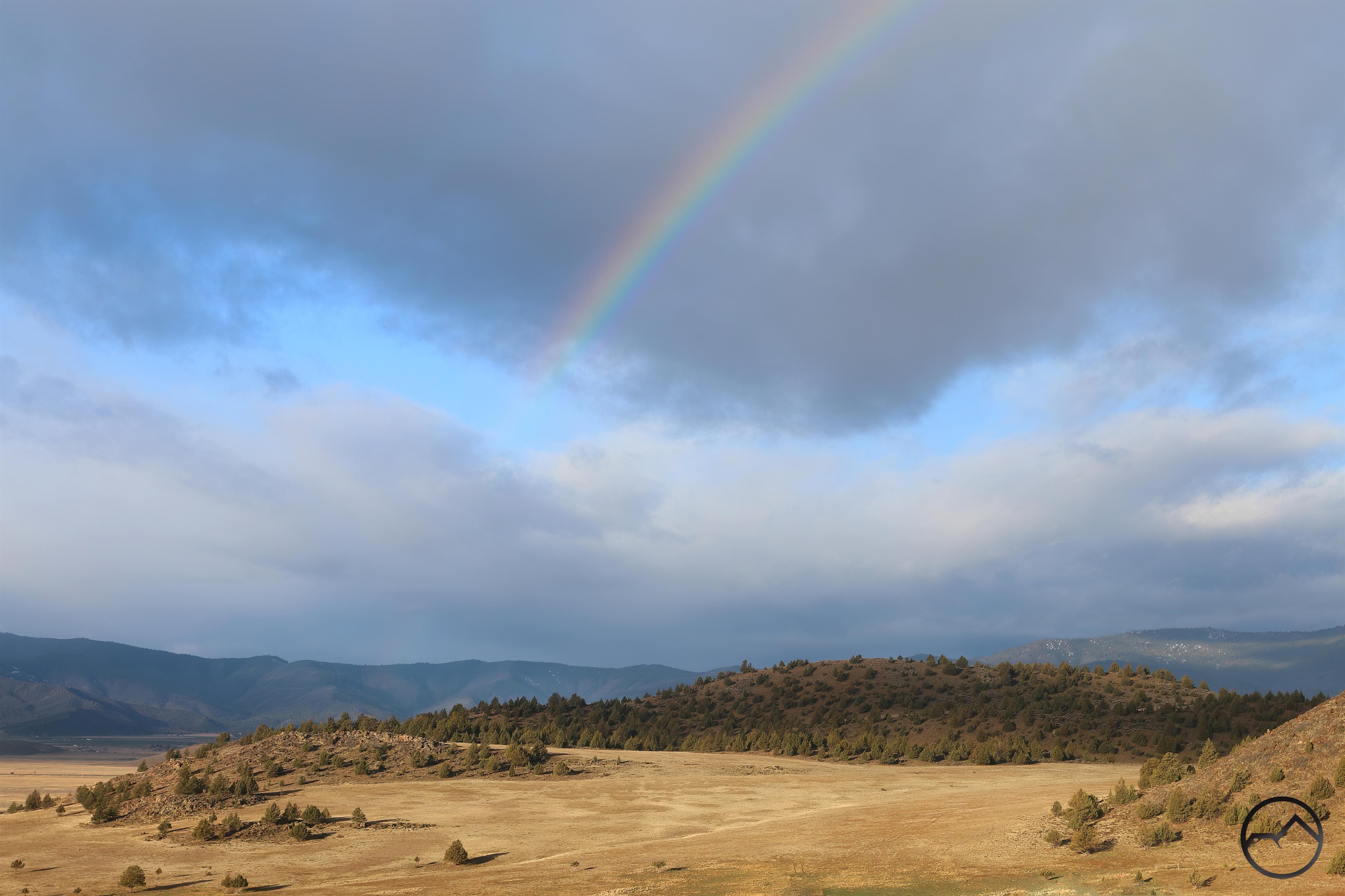
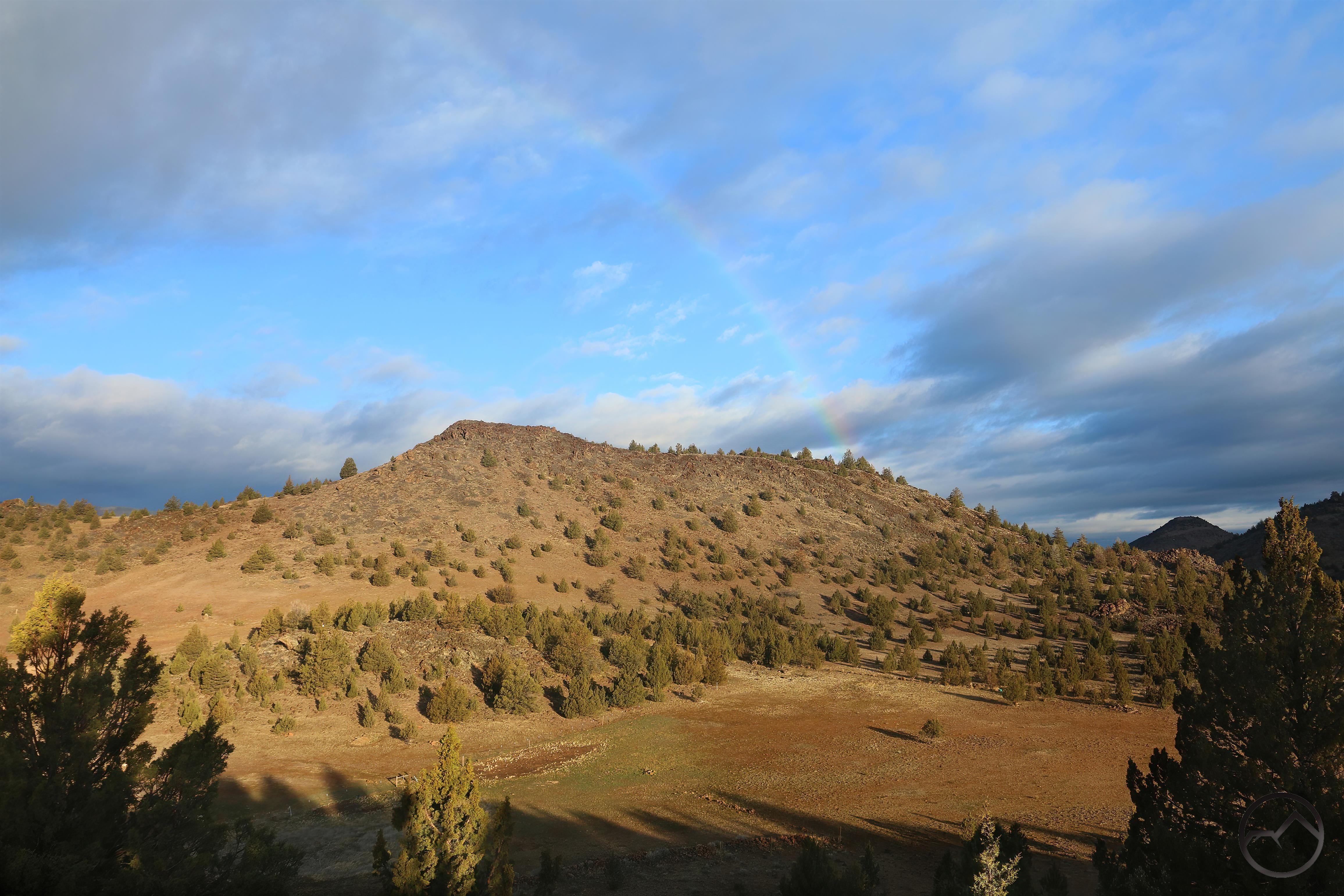
We normally hike this in April but this year our April was extremely busy so we did not make it until mid-May. The water was a little lower but still quite beautiful.

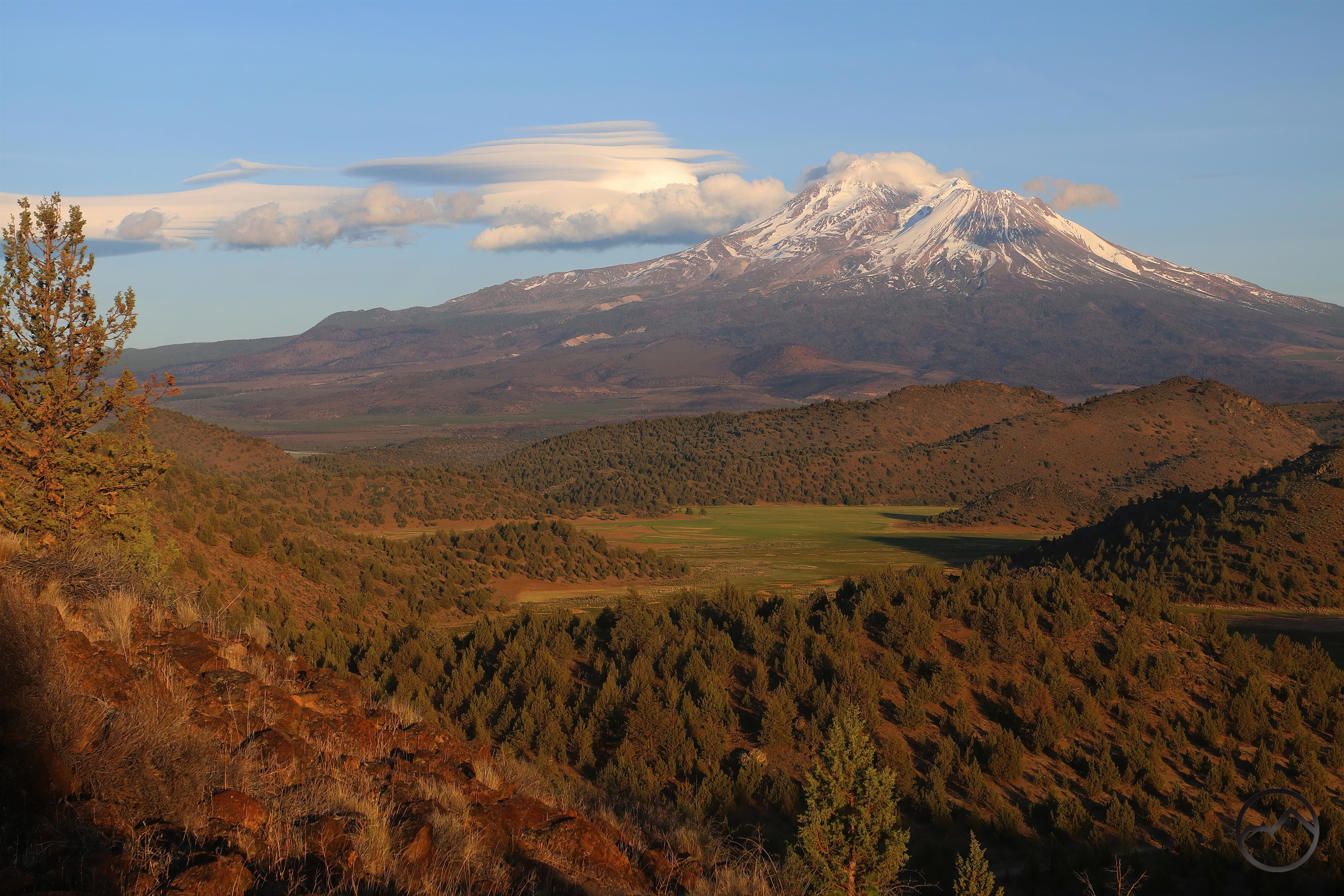
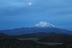
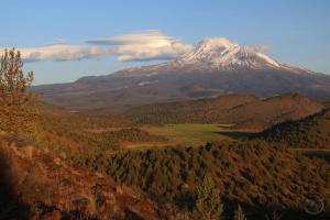
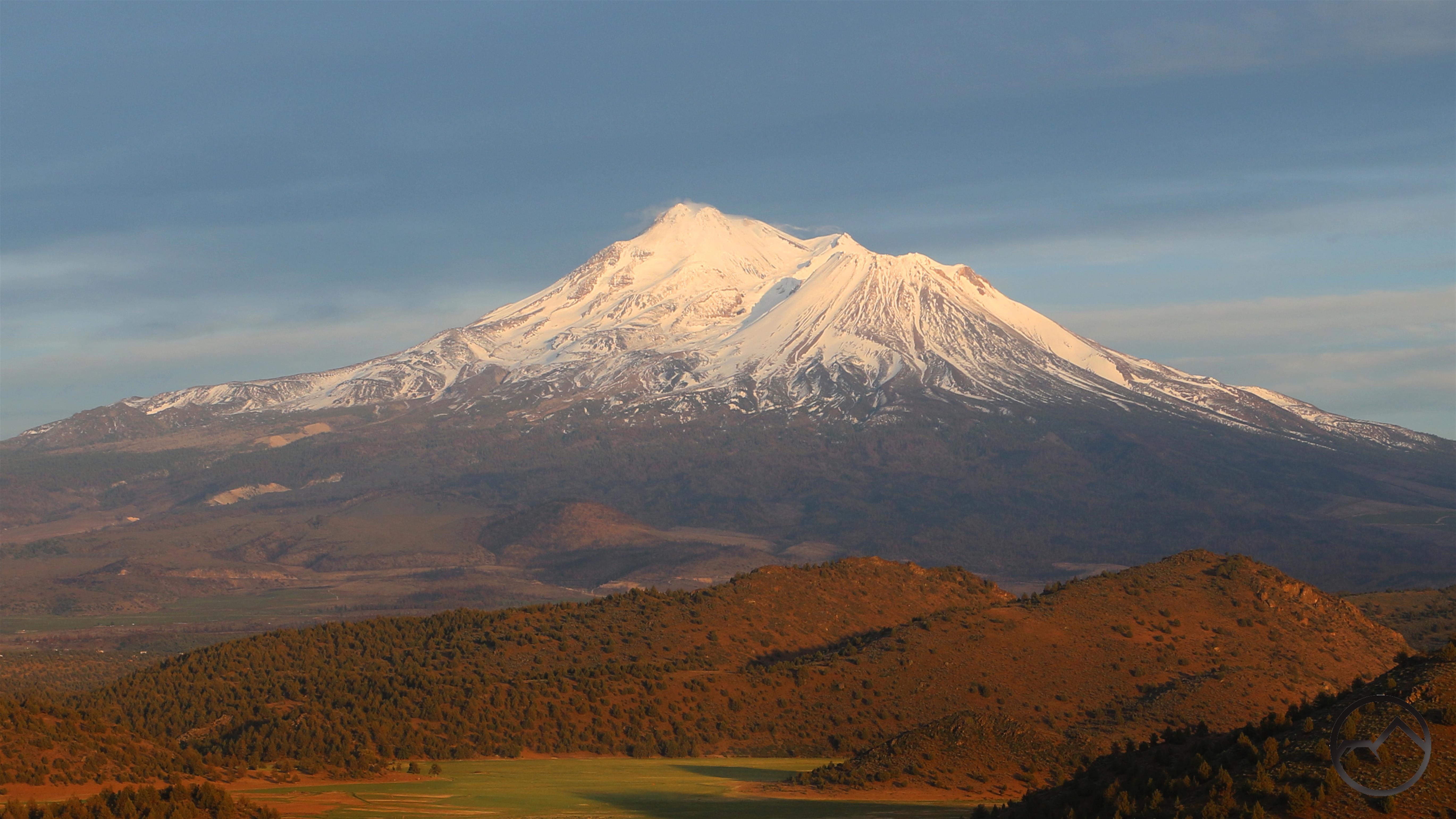
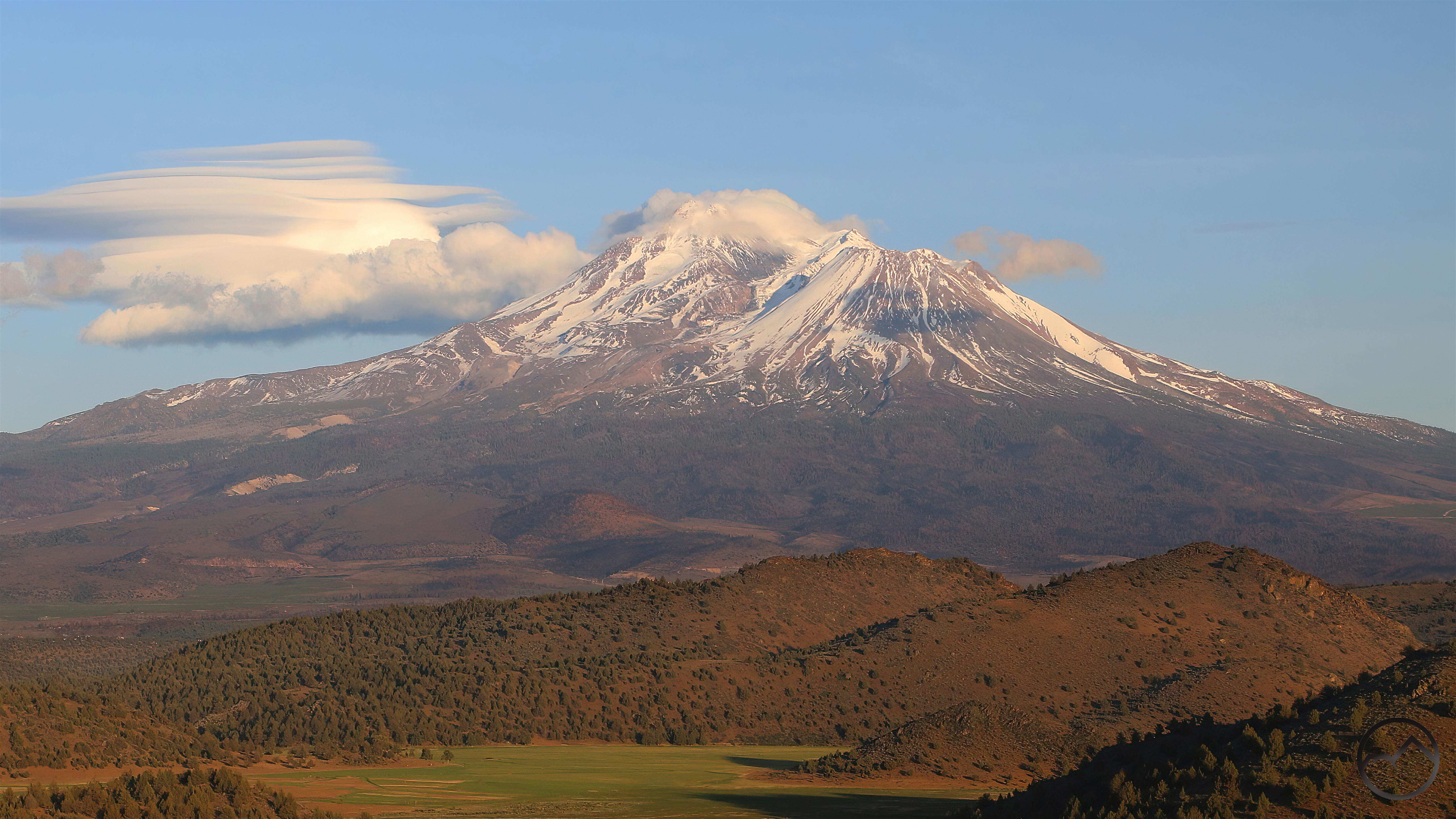
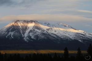
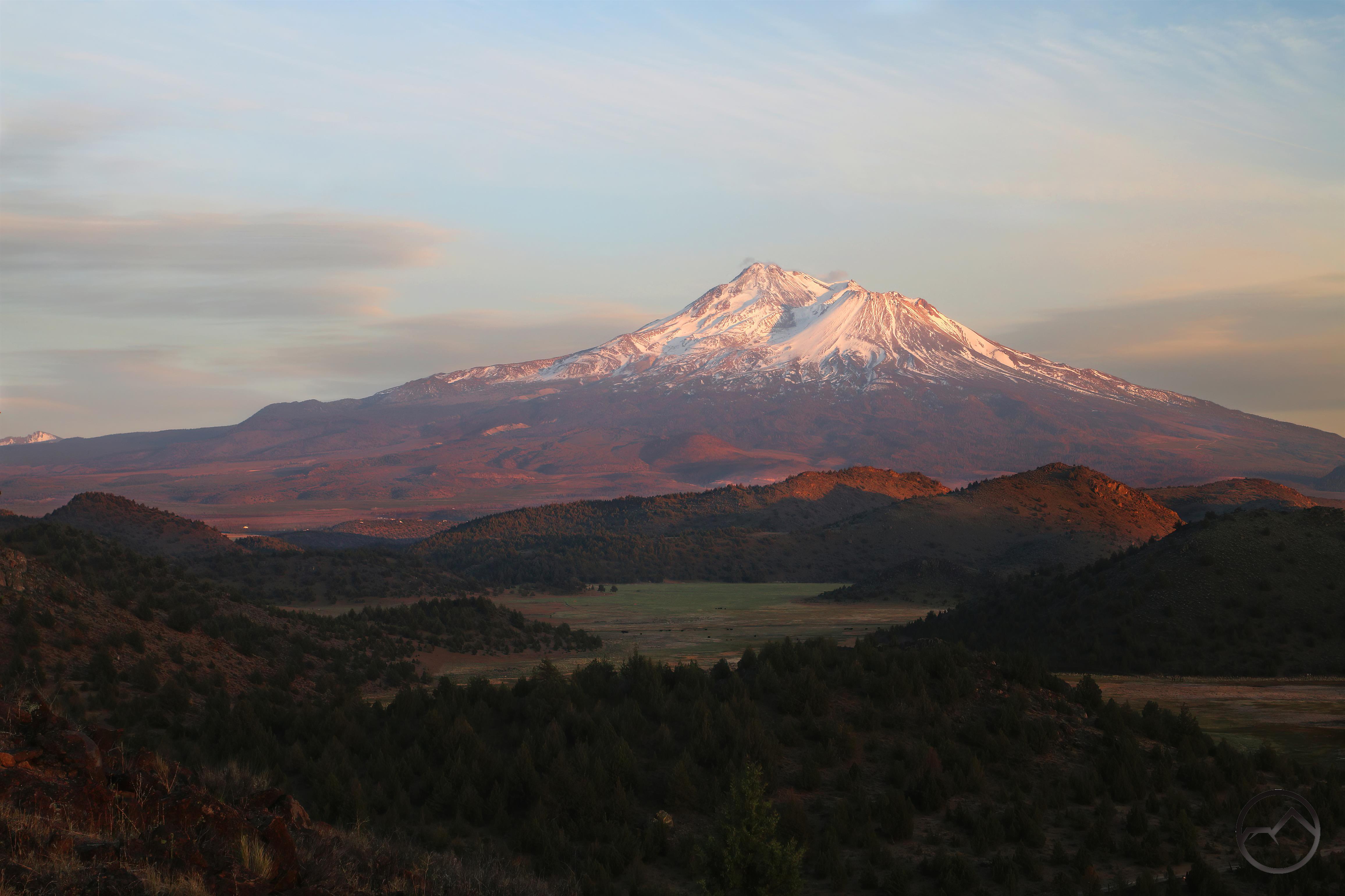
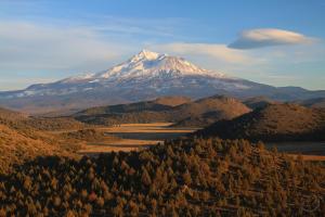
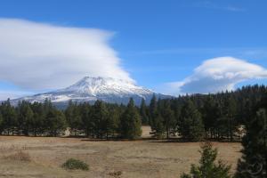
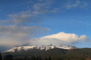
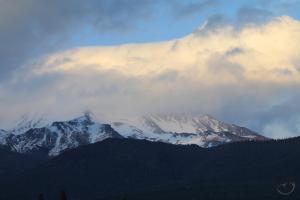
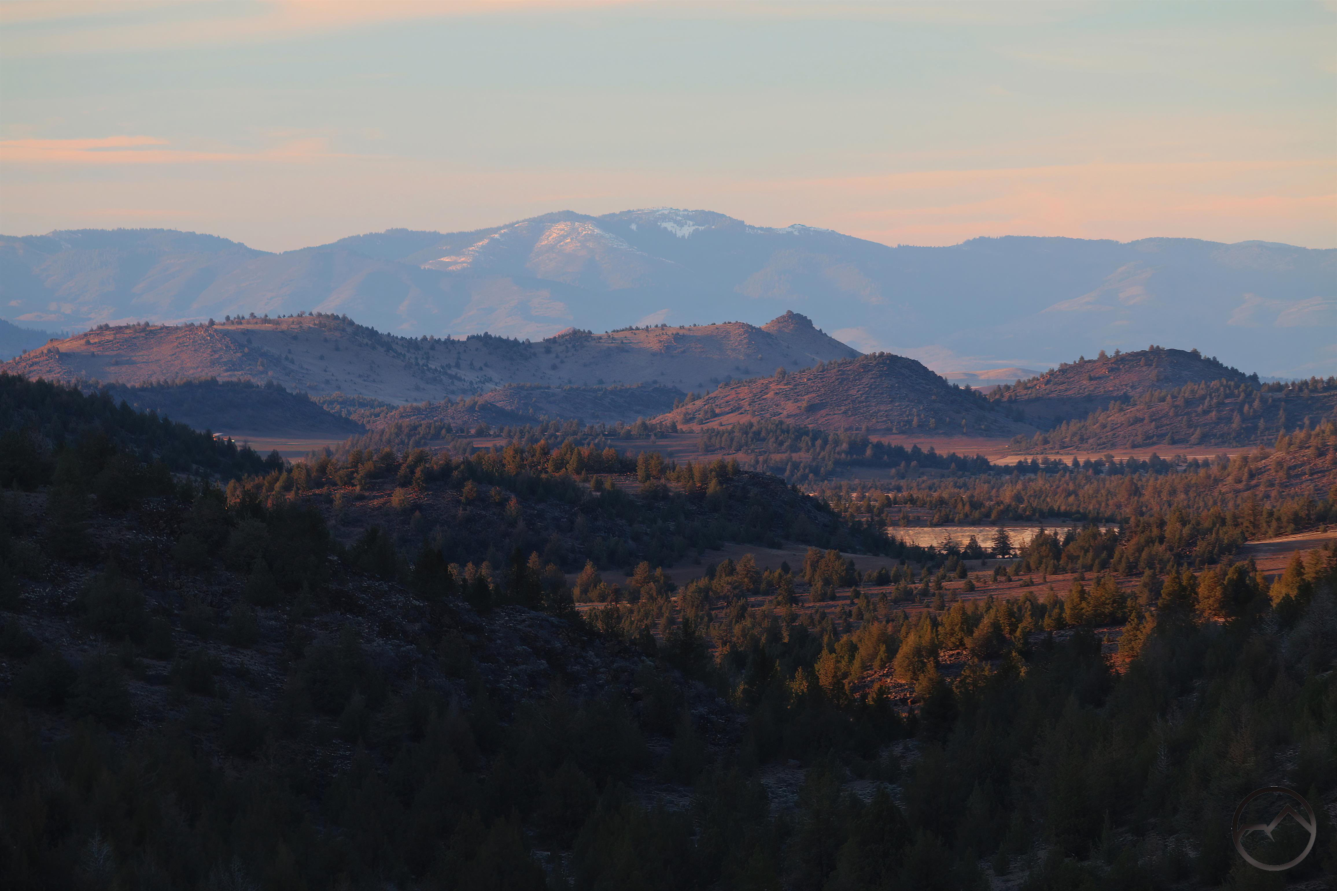
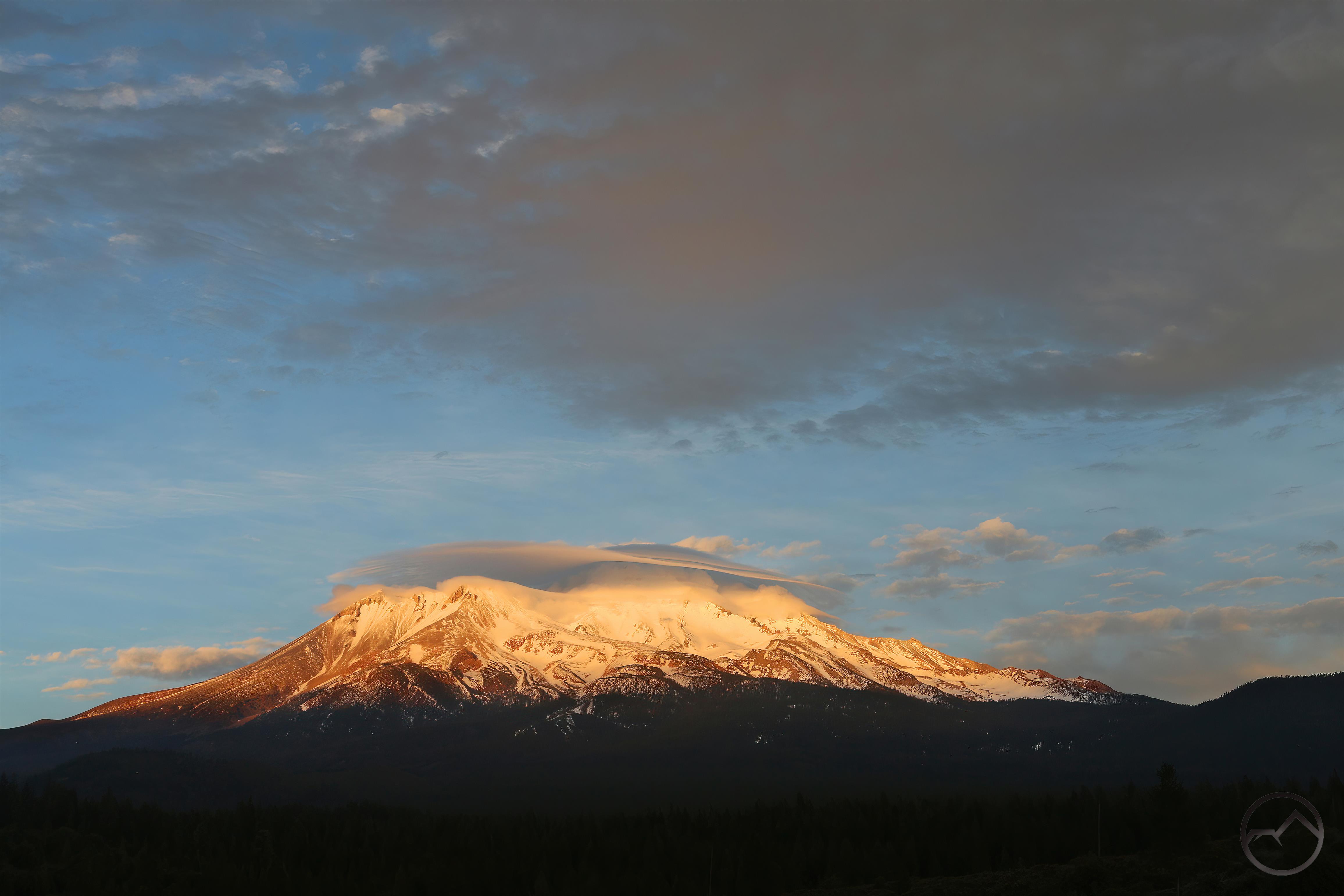
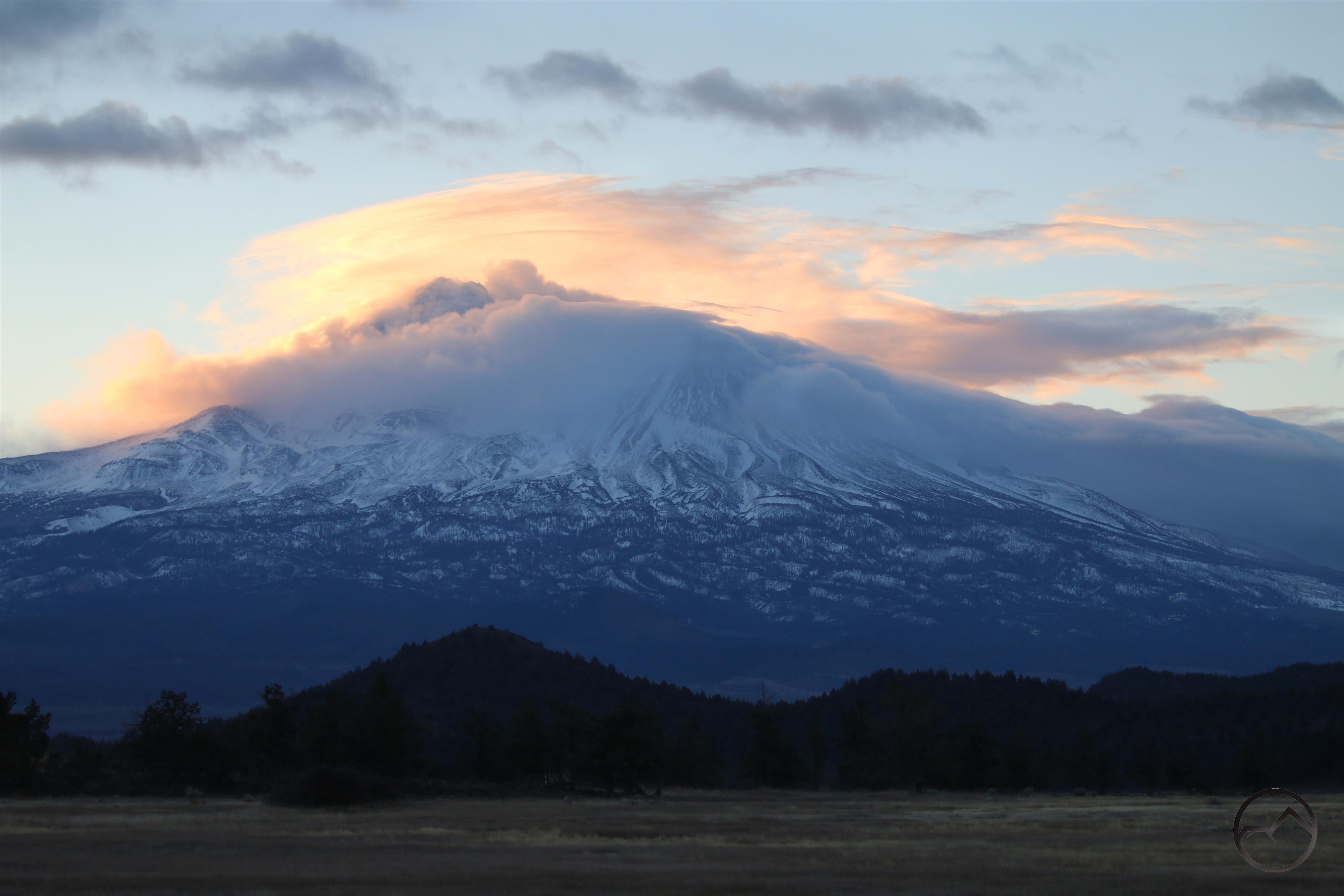
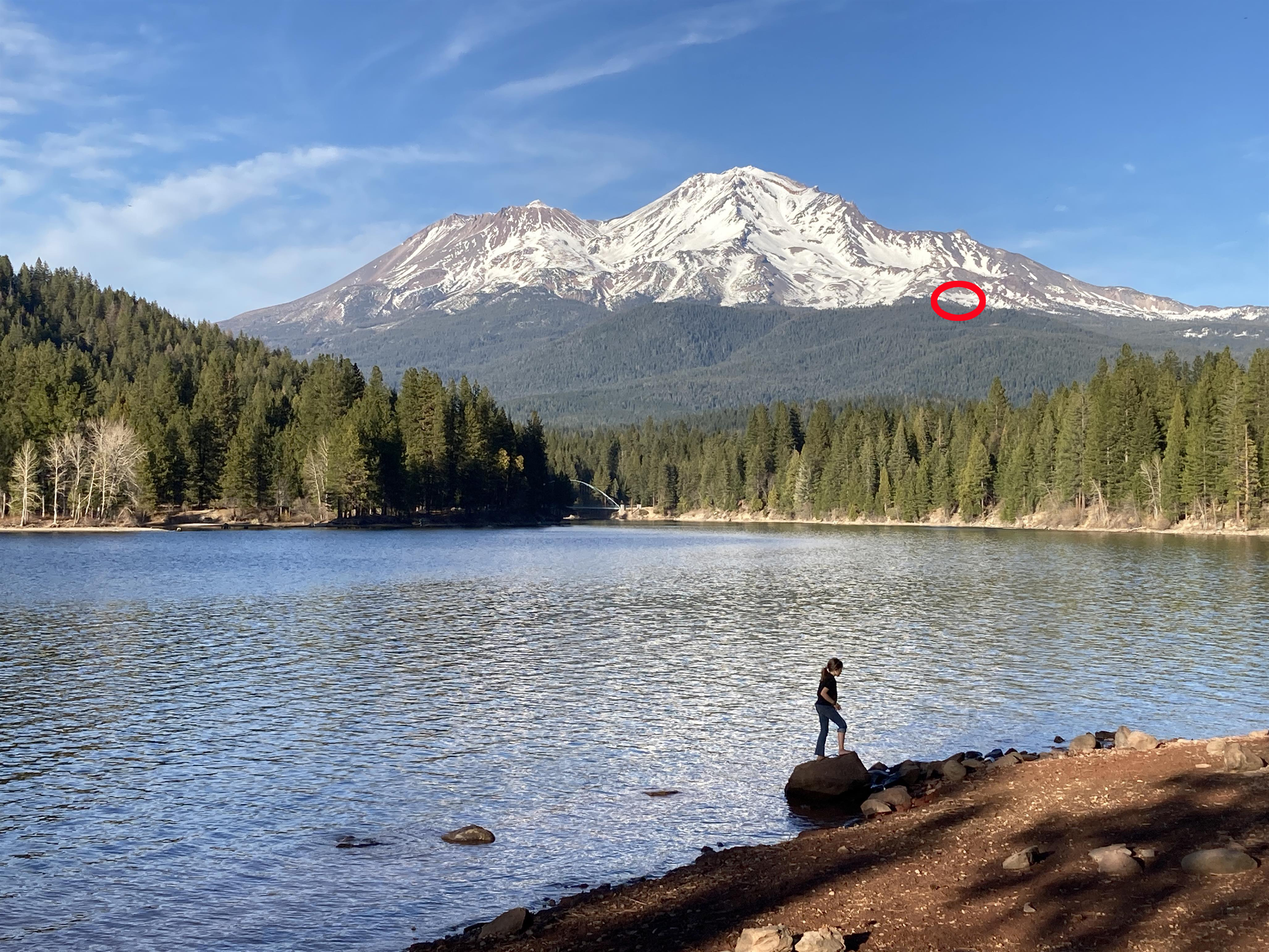
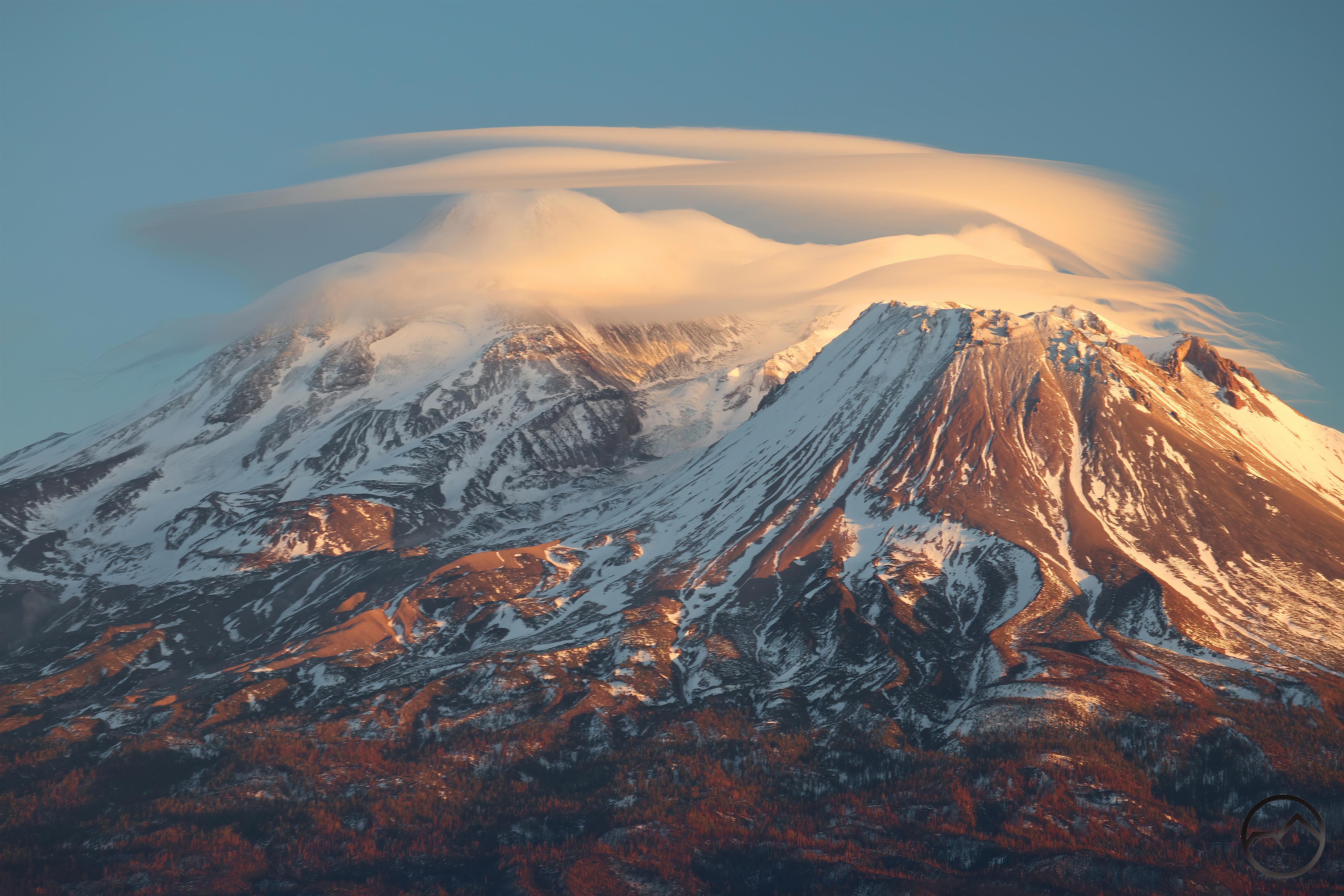
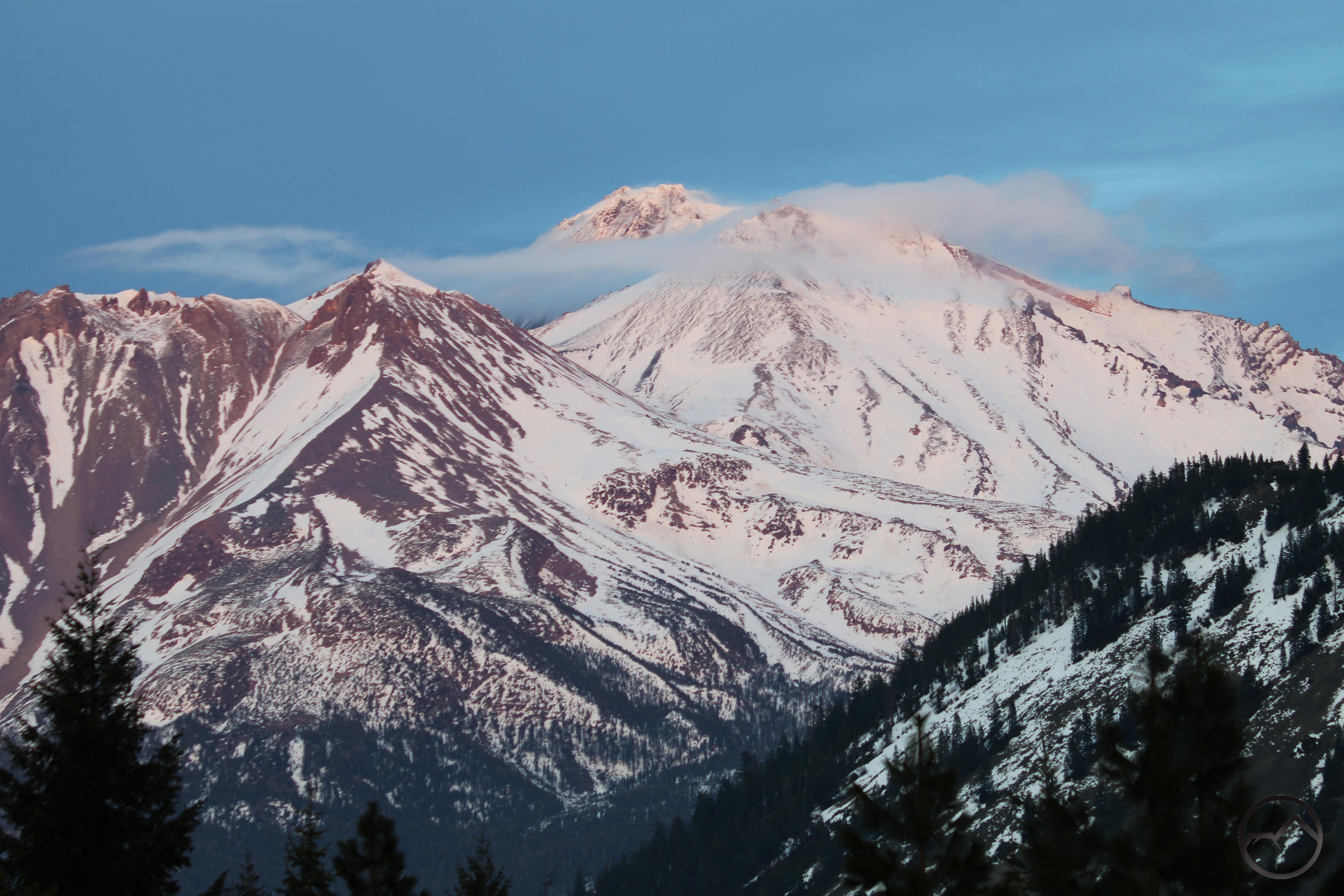
The trip did provide an interesting perspective on the snowpack on Mount Shasta. From Survey Point, we could see the mountain clearly and compared to 2021, it has much more snow on it than it did last year. It is still not a great snowpack but it is definitely an improvement!

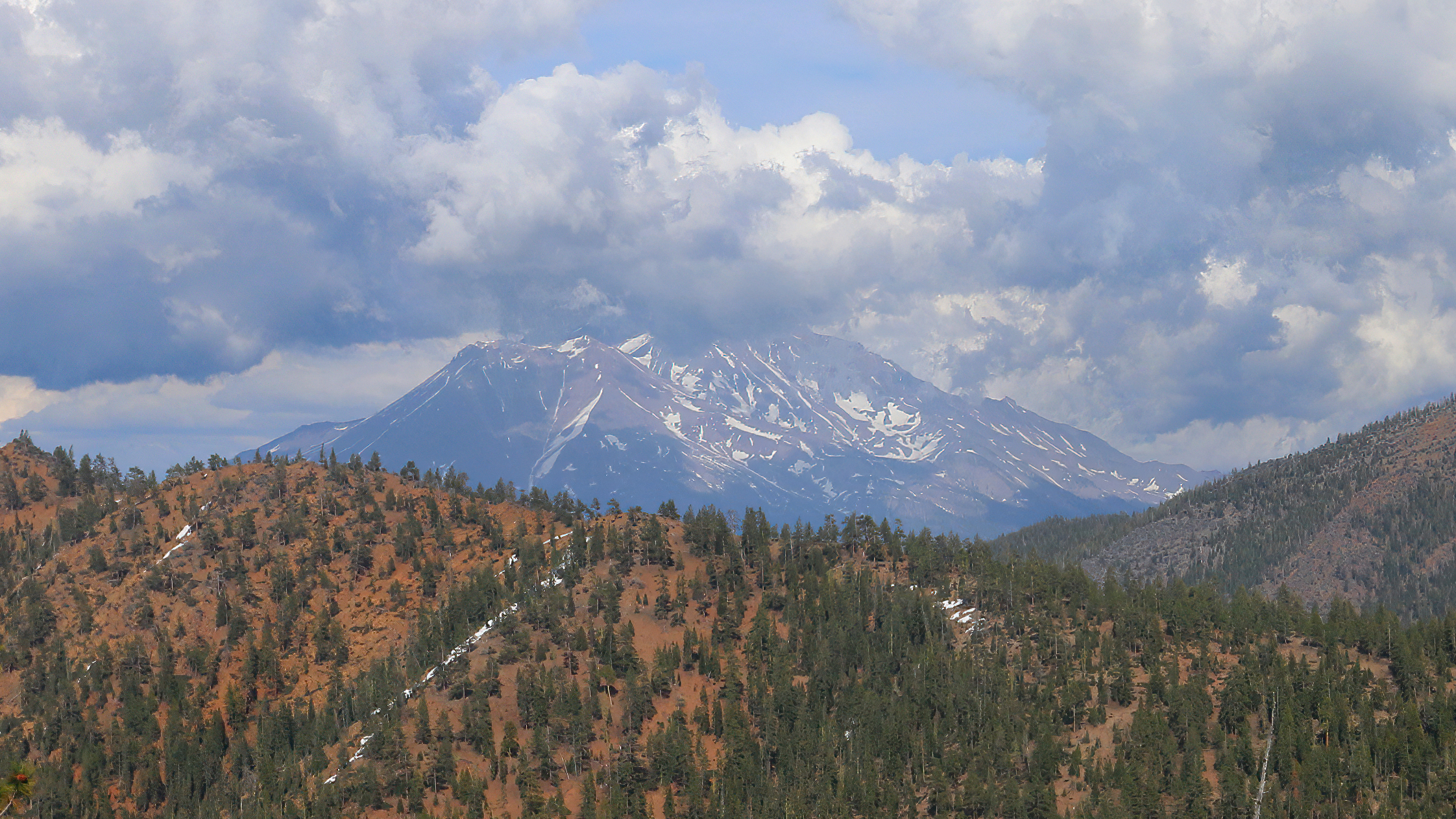
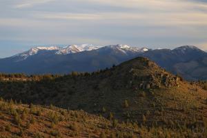
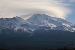
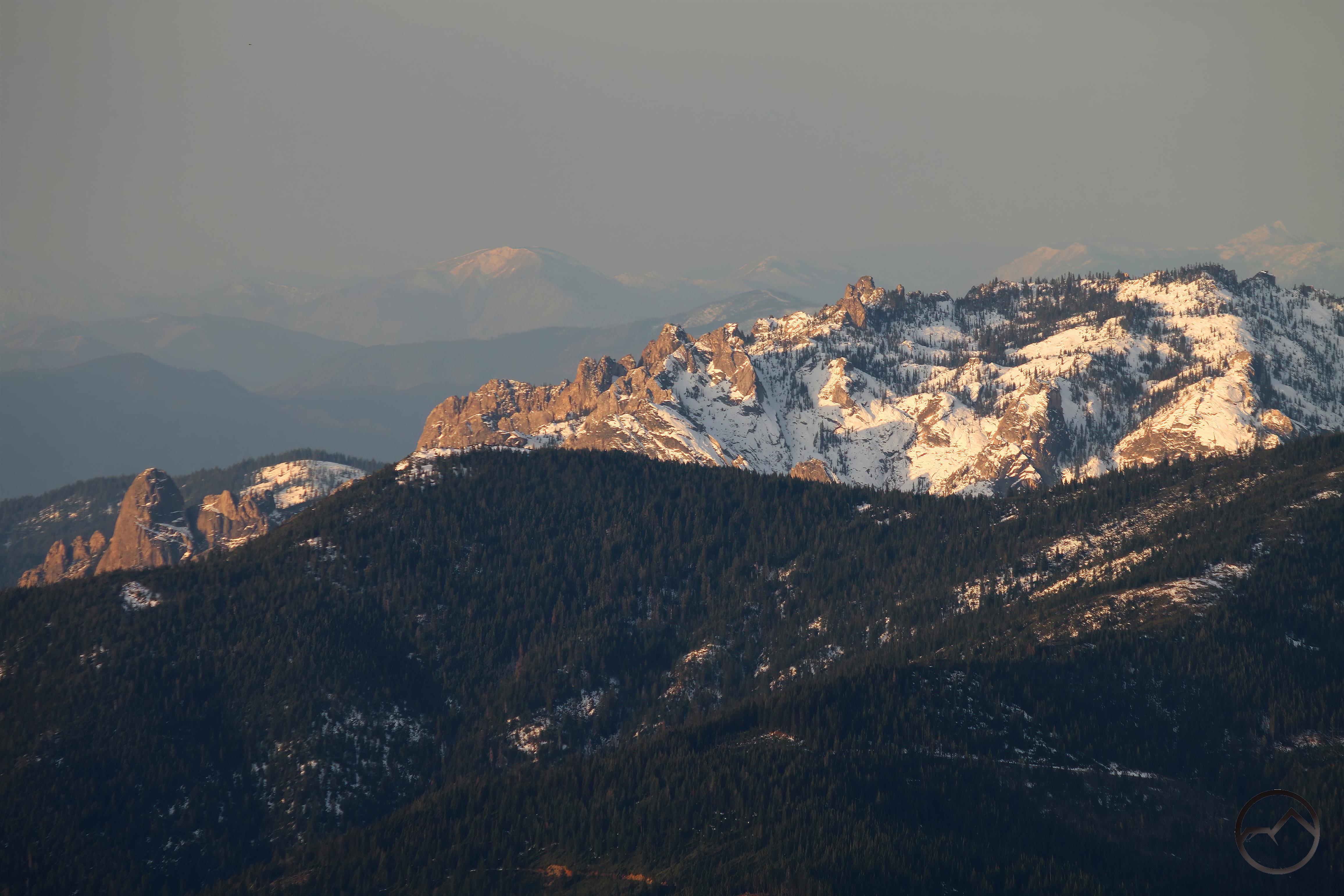
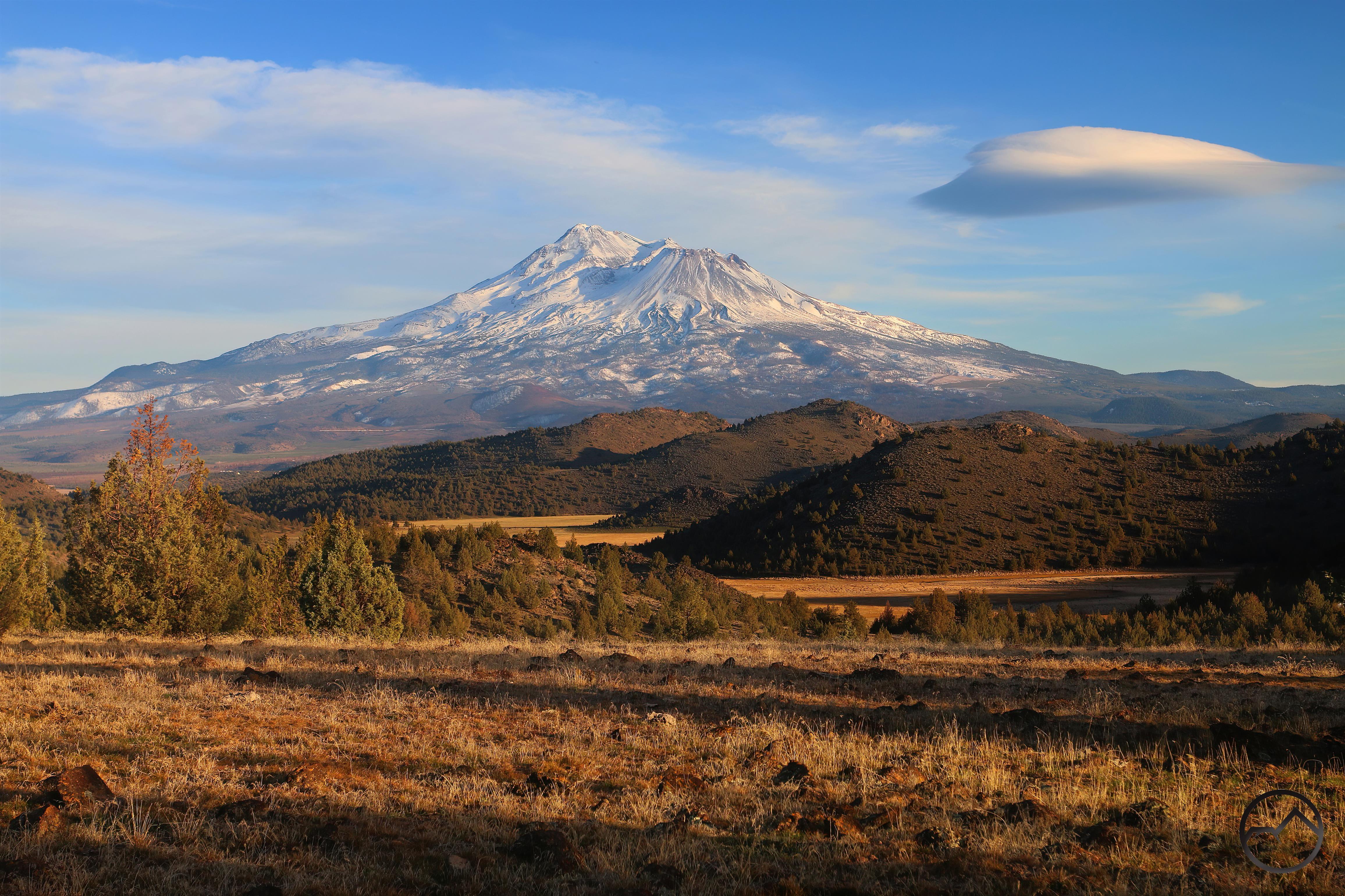
Mount Shasta from Survey Point May 2021.

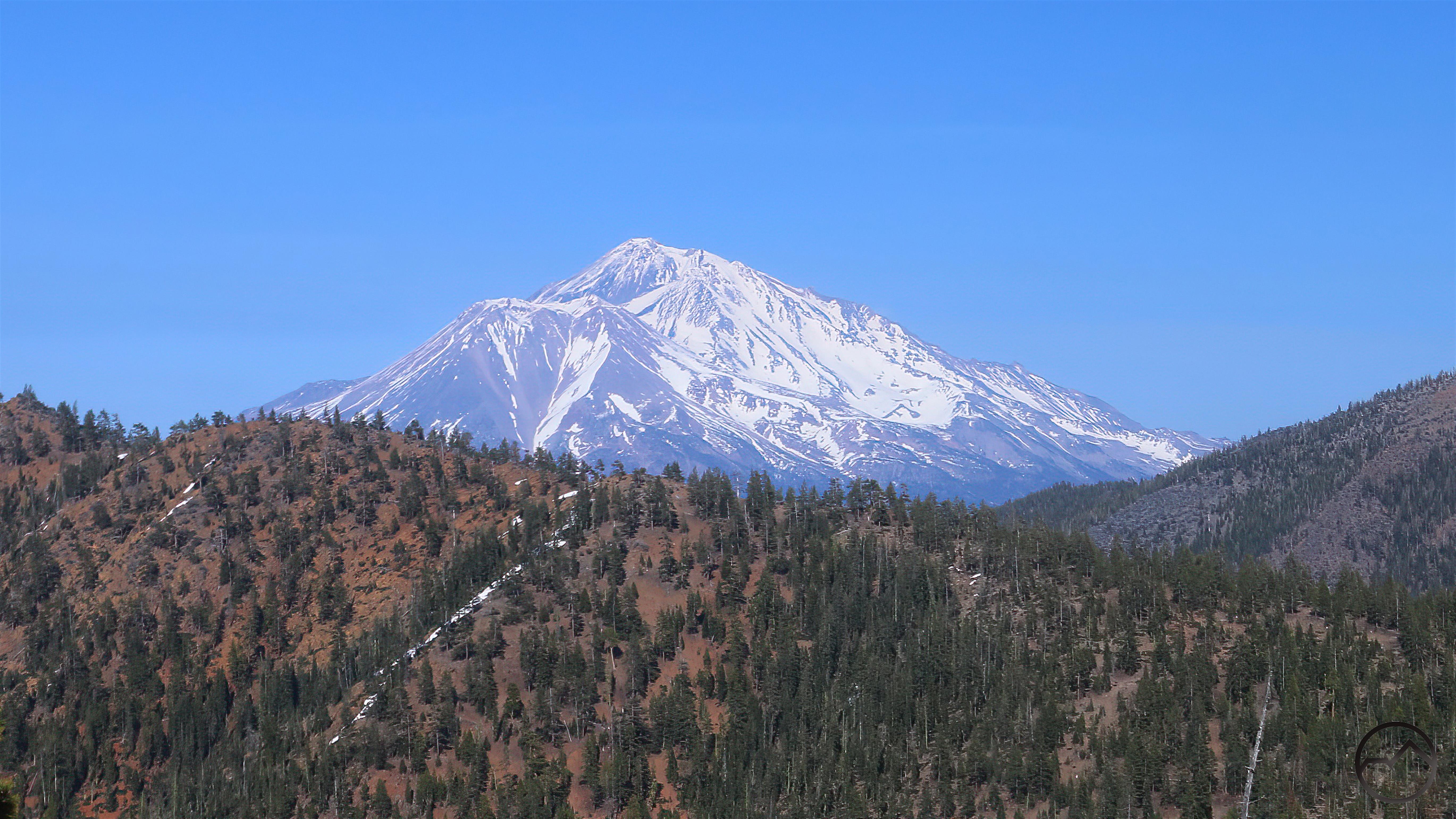
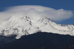
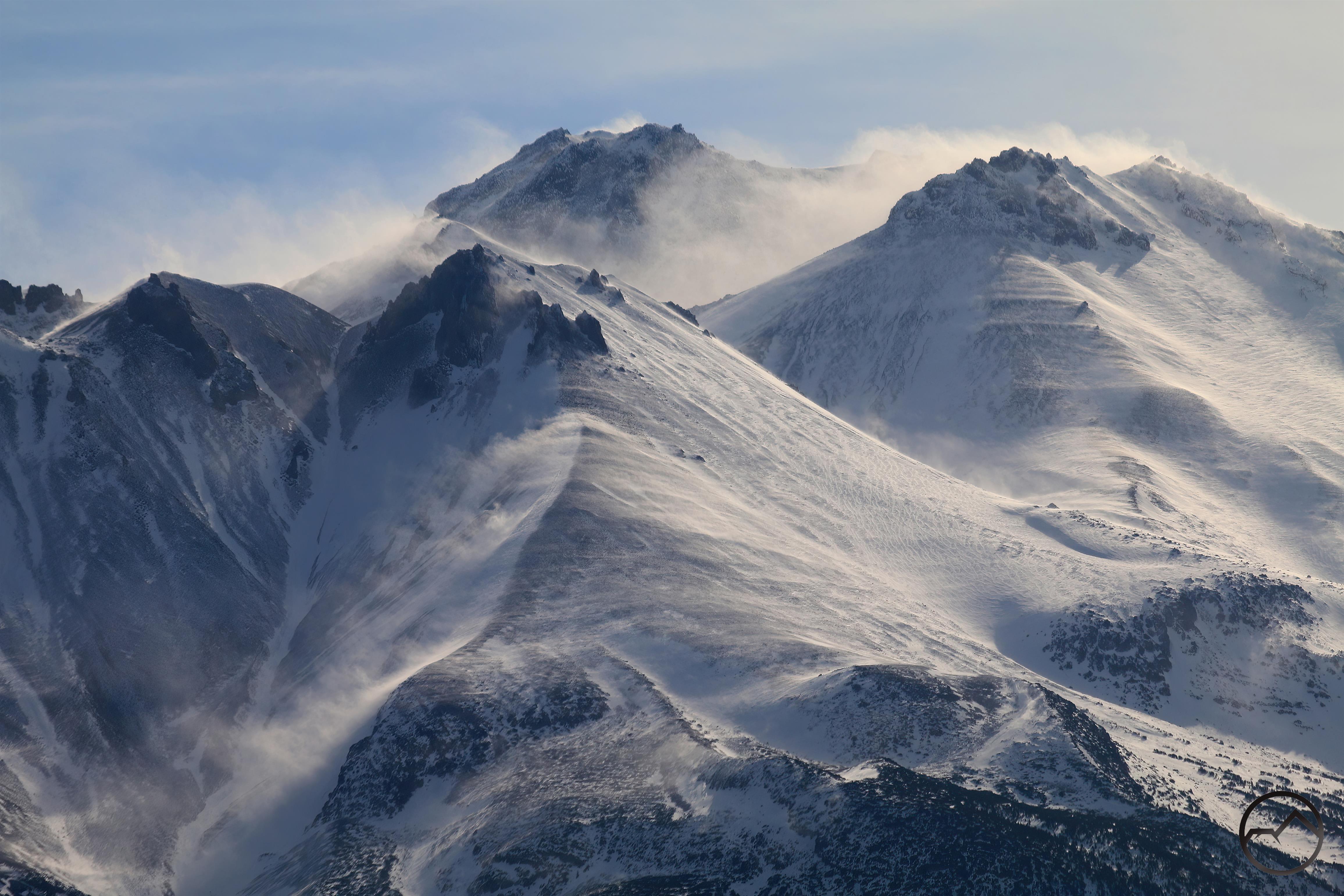
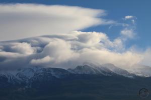
Mount Shasta from Survey Point May 2022.

Two Sunsets At Truchas Ridge

Posted by bubbasuess on May 21, 2022
Posted in: Cascade Range, Hiking, Lenticular Clouds, Mount Shasta, Shasta Valley, Truchas Ridge. 2 Comments

A lenticular cloud hovers next to the cloud-capped summit of Mount Shasta.

Last week I was finally able to get out to Truchas Ridge and work on some trail construction. We want to keep it as natural as possible and cross country travel is easy there but I still want a few trails to lead through some of the highlights. In particular, my wife and I want a trail that runs from the base camp at Puerto Nambe to the collection of vistas at the east end of the ridge, Artist, Panorama and Pecos Points. The hardest part of this project was building a path up a 20 foot talus slope that consisted of large boulders. After a couple days’ work, I was rather pleased with the rock stairway I had constructed. The steps are stable and don’t stand out against the rest of the talus. All in all, not a bad job.

While out there working, I was able to catch two sunsets on Mount Shasta. The views are spectacular and these turned out to be spectacular sunsets, the latter of the two in particular.

May
Mount Eddy’s broad massif rises above the hills of the Shasta Valley.

Alpenglow baths the awesome crags of Sheep Rock.
Evening light highlights the Whaleback. I liked how the shadow ended at the burn line from last year’s Lava Fire.

Alpenglow illuminates Mount Shasta. None the clouds lit up but the mountain’s glow was great on its own.
The moon rises high above Mount Shasta. It was obscured by clouds until this moment, when it emerged from behind the clouds.

Three days later, I returned to the ridge to work on the trail and fix one of the gates. When I was done working, I hiked out to Artist’s Point again, this time joined by a friend. We enjoyed another excellent sunset. As an unexpected treat, this time Mount Shasta and the entire Shasta Valley was graced with several lenticular clouds. It was awesome!

The top of the lenticular lit up with alpenglow but the rest of the stack was unlit. Nonetheless, a beautiful scene.

Looking west towards China Mountain, a nice lenticular stack lies somewhere over the Trinity Alps.
Looking north from Pecos Point, prominent peaks including Pilot Rock, Black Mountain and Soda Mountain are all visible.

With all the light faded, lenticulars were still observable all around the Shasta Valley. These clouds were arranged above Mount Eddy.

With the light gone, I made my way back to my jeep at Puerto Nambe. Dusk is one of the prettiest times on the ridge. Typically, a light breeze picks up and the coyotes start to howl. It’s magnificent.

One interesting thing from this trip was how obvious the spring snow’s melting was. The first sunset was on a largely white mountain. All the precipitation from April and early May made Mount Shasta look a hopeful white.

Three days of temperatures in the 70’s made short work of the light layer of snow.

There is still a fair amount of snow on the mountain above 9,000 feet. Still, it should be much, much deeper than it is. Despite its auspicious start, this was not a great winter. In spite of the dry conditions, I hope this will be a good summer. May the Lord make it so!

Around Mount Shasta (Where Did The Time Go?!)

Posted by bubbasuess on May 21, 2022
Posted in: Boy Scouts, Lenticular Clouds, Mount Shasta. 2 Comments

Mount Shasta looms majestically over Orr Lake.

Holy kinarsey, where did the time go? The past two months have been exceedingly busy between business, kids and other challenges. I had originally intended to post these shots of Mount Shasta in the latter part of April and early May. At the time the area was experiencing a fair amount of precipitation, giving the snowpack a most welcome but barest of cushions against the summer heat. Enough snow fell at the lower elevations that it felt like the mountain had been reset. Though gladly accepted, it really wasn’t enough to offset the dry January, February and March. We are thankful nonetheless!

The precipitation did make for some beautiful scenes around the mountain. Before moving into summer, I wanted to clear my docket and put up the last few pictures of the white mountain during spring.

During the storms, there were a few small lenticulars. One had some great cloud cloud iridescence at sunrise.
A lenticular gives indication that the weather patterns are changing and precipitation is incoming.

Another look at the constantly changing lenticular and the deeper snowpack the spring weather had left on Mount Shasta.
At sunset, the clouds were closing in on Mount Shasta but some cool streaks of light sliced across the mountain’s flanks.

On the last weekend in April/first weekend in May, I took the Boy Scouts camping at Orr Lake. Sunset there was gorgeous!
Though it initially looked like the mountain would be covered by clouds, it managed to clear just as the sun was setting, yielding a spectacular evening vista.

Morning, on the other hand, was very frustrating, as the clouds would not budge from the mountain. The lower flanks were visible and reflected in the water but the entirety mountain was obscured.
By late morning the clouds had cleared, revealing Mount Shasta’s glorious icy tower jutting high over all the other peaks in the area. Orr Lake was still calm enough for a reflection, though a warm breeze was picking up. The birds were abundant and loud!

In the midst of the last round of precipitation, Mount Shasta cleared long enough to capture a spectacular sunset. Though not quite a lenticular, the clouds were pretty cool.
Mount Shasta after the storms had cleared. Though the snow wasn’t deep, it look almost midwinter on the mountain.

Now, as we approach Memorial Day, the summer weather can begin in earnest. No doubt Mount Shasta will be bare by July but that is a lot better than last year! Now if we can just keep the fires at bay…

Regarding Mount Shasta’s Weather This April

Posted by bubbasuess on April 22, 2022
Posted in: Cascade Range, Hiking, Mount Shasta. 2 Comments

Fresh, late April snow blankets Mount Shasta.

It goes without saying that this winter was a disappointment in terms of precipitation. The fall was excellent, with good rains in October and ample snow in December. The month nearly exceeded records for snowfall in many parts of Northern California. However, a few days into January the precipitation came to a screeching halt and the rest of the month was unusually warm and dry. February and March weren’t much better, with only short bursts of light rain or snow punctuating the otherwise dry months. Then April arrived and the month has once again seen significant precipitation. Here in Mount Shasta, the month’s normal amount of precipitation fell in a week and the weather kept right on coming. A couple of feet or more of snow fell on Mount Shasta, adding to the snow that remained from December’s storms. While by no means a solution to the poor winter, it is a relief nonetheless to get this much water this late in the wet season.

Hopefully we get more rain and snow in May but whether we do or not, the recent weather has added to the mountain’s beauty.

At the beginning of the month, Mount Shasta still had a fair amount of snow but nearly all of it was left over from the storms that passed through in December. The warm weather had depleted the snowpack significantly but the mountain’s upper areas still looked white.

While the first round of storms mostly fell as rain throughout the area, the higher levels of Mount Shasta got a new layer of snow. Many areas noted that up to 10 inches fell. This was enough to make the upper crags on the mountain midwinter white. It was a refreshing sight to say the least.

The snow fell at lower elevations too. Shaded areas, like the north side of the Castle Crags, were able to retain a fair amount of snow. This will all melt soon and flow into Little Castle Creek and some awesome, mysterious waterfalls hidden away in the canyon. Other falls in the Crags will flow with renewed life for a while. These are omens of good May hiking to come!

The next round of weather was heralded by fierce winds. The wind whipped across Mount Shasta, sheering the snow off of the slopes. Protruding crags cut into the blowing snow, creating streaming contrails of snow. It was a really dramatic scene.

MVI_0268

MVI_0268

This video gives a bit of an idea how much was going on on Mount Shasta. The contrails really highlighted the violent conditions up there.

Latter, the coming storm was presaged by the presence of a nice lenticular stack. It always amazes me how these clouds form when the weather is changing. Mount Shasta is like a giant weathervane, indicating what the systems are doing and where they are going. In this case, the cloud lasted a little longer before dark clouds overtook the region. Rain and snow soon began to fall and lasted for a few days. It was marvelous.

The storm left deeper layers of snow all over the Mount Shasta area. The snow line seemed to be around 4,000 or so feet and there were several inches built up. In some places it seemed well over a foot of snow from the last few days. This is all good for the forests and rivers that lie downstream.

Mount Shasta itself looked magnificent in the fresh snow. The towering mountain once again resembled Joaquin Miller’s great white tower thrust upward into the sky.

The forecast once again calls for sunshine for the next several days but the temperatures will generally be cooler, allowing the snow to linger for a while, hopefully until more snow comes and adds even more belated depth to the snowpack. Even if this is not the case, the amount we have received is a blessing and one for which I am deeply grateful!


Tracking Last Week’s Lenticular Over Mount Shasta

Posted by bubbasuess on March 12, 2022
Posted in: Cascade Range, Hiking, Lenticular Clouds, Mount Shasta. Leave a comment

A pair of awesome lenticular formations grace mighty Mount Shasta.

Early this past week there were a series of connected lenticular formations on and around Mount Shasta. It began Monday afternoon, peaked around the middle of Tuesday and was then over late Wednesday morning. The symmetry of the event extended beyond its timing too. What began as a disk hovering to the southwest of Mount Shasta grew until that disk was complimented by a large formation over the mountain’s summit on Tuesday. The disk then faded and by Wednesday only the cloud over the summit was left. The first half of the entire spectacle was brilliant, with beautiful colors and clean attractive lines on the clouds. This too peaked on Tuesday and the latter half of the event was not as clean as the former. Nonetheless, taken as a whole, it was one of the better lenticulars of the season. Indeed, late morning Tuesday may have lacked dramatic lighting but in terms of pure formation, it was the best lenticular so far this winter. Hopefully there will be more as precipitation moves back into the area!

Click to enlarge:

Early in the day on Monday, there were not many clouds in the sky. However, by early afternoon, a large disk began to hover to the southwest of Mount Shasta. At times, it had nice wings, but it still seemed to be taking shape as the sun began to set.
March

After the awesome sunset the night before, I decided to head out early Tuesday morning. The lenticular from the night before was still there, off to the southwest of Mount Shasta. Overnight it had lost much of its definition. This unfortunate turn of events was compounded by the rest of the clouds blocking out the light to the east as the sun came up.
What disappointment there was early was washed away by the late morning explosion of the lenticular. Not only was the disk from the night before growing into an excellent specimen but a new, awesome stack had grown over the summit of Mount Shasta.

Not long after, the summit stack began to grow at a rapid rate and began to cover much of the sky to the north. The cloud to the southwest was still present, but not growing like the one over the mountain.
By sunset, the cloud over the summit had overtaken the horizon to the north, meaning there would be no views of the mountain from the Shasta Valley. Nonetheless, the cloud over the summit continued to try to gather the strength to manifest one more burst of clouding building. Little disks kept forming over the billowing mass but then collapsing.

The clouds blocking the view from the north meant that there would be good perspective from which to capture the southwestern cloud in close proximity to Mount Shasta. Still, it was present, though it seemed to be losing strength and definition.
By the time the sun sank behind the Trinity Divide, the show was generally over. The clouds to the north were overtaking Mount Shasta itself, the summit cloud had given up its definition and the southwestern cloud, which was the first of this episode to manifest, was gone.

Wednesday morning, the sky was once again clear, except for a large formation that clung to Mount Shasta above the treeline. Lenticulars are always frustrating when the obscure the mountain but it was such an interesting collection I had to head out and capture it anyway.
Though Mount Shasta could not be seen , this particular events had a lot of drama, with the clouds roiling in layers, braiding around each other while they surged over the mountain, then dissipating as the moisture-laden air reached warmer areas. It was quite a show. However, by midday, the cloud was gone and this particular series of clouds were gone.

Kids Don’t Appreciate Awesome Sunsets! (Plus Some Neat Things In The Sky)

Posted by bubbasuess on March 8, 2022
Posted in: Cascade Range, Hiking, Mount Shasta, Truchas Ridge. Leave a comment

A sleek lenticular hovers to the southwest of Mount Shasta.

With slightly warmer temperatures and a nice lenticular developing near Mount Shasta, my wife and I decided to haul the brood out to Truchas Ridge for a picnic dinner. While we normally eat Chicken a la Nas or frito pies when we were out there, this was a quicker operation and this time we feasted on apples and cheese and frenchbread.


The kids were happy to be out there again and after eating, the younger ones ran off to gallop around Tesuque Valley. I headed out to Artist Point ahead of everyone else. While walking the length of the ridge, I paused to check on the Quemado Tree, which was struck by lightning back in May. While much of the tree was killed in the blast or the ensuing fire, some of it was still clinging to life. I really hope the tree survives.


There are many places along the ridge between the basecamp and Artist Point where there are excellent views of Mount Shasta. Normally I pass by these but on this day I felt compelled to stop and capture an image of the mountain and the cloud with the long shadows of nearby trees cutting across the grassy flat in the foreground. It was fantastic scene. Some people have suggested this as a campsite, and while certainly a good spot, I think the other locations I have selected will work even better.


I got to Artist Point and set my camera up. There was still a lot of time before the sunset, so a continued on the 50 yards further to the east to the spot we call Panorama Point. It’s a pretty spectacular location in its own right, though I think the framing is slightly better at Artist Point. On this occasion, the view was stunning as always, but augmented by the awesome clouds in the sky and the light from the low sun. It’s a magnificent spectacle to behold.


While waiting for the sun to sink even lower, I made my way a few yards to the north, where the vista opens up and you can look all the way to Oregon. Nearby Steamboat Mountain in the Shasta Valley Wildlife Refuge is prominently visible, as is the snowy dome of Soda Mountain, which is the highest point of the Cascade-Siskiyou National Monument. The land to the left of the peak, while in the national monument, is also encompassed in the Soda Mountain Wilderness.


By this point, my wife and kids arrived at the vista. The three kids promptly scampered over to a large cluster of crags, where they engaged in some game involving spies, coyotes and clonetroopers. They yammered happily, scrambling on the rocks and nearly oblivious to the scene unfolding behind them. Against their will, I got them to stand still so I could capture a shot of them. By this time, the mountain had been given over to the alpenglow and the clouds, both the vast band to the south and the lenticular, were also glowing pink in the last vestiges of the day.


Even after the sunlight had forsaken Mount Shasta and the peak was left a ghostly white, the sky was still filled with color. Artist Point indeed! While the lenticular was still holding its form, a secondary cloud had taken shape a little further west. While this too turned pink, the rest of the clouds in the sky, which are further away from our vantage point, began to turn shades of purple. My wife and watched the show together. The only sounds were our kids and the gentle wind blowing through the trees. It was sublime.


We finally hiked back to basecamp in the fading light. We hoped into the car and headed down the hill. On our way out to the main road, I had to stop and capture a shot of the Goosenest . A large wave lenticular had formed over it. There wasn’t much light left but I was able to still capture a shot of the peak with the impressive cloud over it. After this, the darkness fell upon the land and we headed home, glowing from yet another magnificent spectacle at Truchas Ridge.


The next day, the sky was filled with awesome clouds, seemingly in every direction. Whether east over Goosenest,  south over the Castle Crags or west, above the Trinity Divide, there were lenticulars, waves and other strange formations. It was quite a spectacle!

Naturally, the best clouds were present over Mount Shasta. Not only was there a lenticular stack over the summit of the mountain but the large disk that had been there the previous night continued to hover to the southwest. These clouds combined, as well as all the other pyrotechnics in the sky, made for one of the most memorable meteorological performances I have seen for quite a while.


Mount Shasta: A Slow Burn To Snow

Posted by bubbasuess on March 5, 2022
Posted in: Mount Shasta. Leave a comment

A lenticular cloud on Mount Shasta catches the last of the alpenglow.

The past week has seen a gradual progression of changing weather systems. The result was a slow burn of lenticular and lenticular-like formations developing over Mount Shasta over the course of several days. The change in systems finally resulted in rain and a little snow, the first significant amount we have gotten since the beginning of January. It was not much, and far too little but it was nice to know the winter hadn’t completely forgotten us and might still send something our way.


Things got off to an interesting start last Sunday, at the end of February. As the day closed out, an impressive lenticular stack developed over Mount Shasta. Other clouds moved in, obscuring it at sunset but it was still an awesome sight while it was still visible.


The following morning, I headed out, hoping the lenticular from the previous evening would still be there. Indeed it was, though it continued to be obscured by other clouds. The little lenticular that had coalesced over the summit of Mount Shasta had grown overnight and now covered much of the area above treeline.


In the evening, the clouds had grown. The formation over the summit had tightened up into an impressive series of layers. Meanwhile, the stack that had been present the previous evening was still present, though it was in the mountain’s shadow and never managed to get any light on it. It was still a marvelous spectacle.


The next morning I headed over to Lake Siskiyou for the sunrise. There was still formations right on Mount Shasta and also higher above and the northeast. Neither was a crisp in formation as I would have liked but they would still have made an interesting image reflecting in the still water. However, just as the color was getting good, it suddenly died out, the sun having passed behind clouds beyond the eastern horizon.


By the middle of the day, the large cloud to the northeast had gone but the one on the summit persisted and was in a state of constant flux. It seemed to be perpetually stretching and contracting like so much sticky taffy. I can only imagine the conditions and forces that cause something like that to manifest and yet lack any kid of stability. Whatever the cause, it is always a joy to watch.


By sunset, the cloud had become a bit more stable and looked awesome sitting right on the top of Mount Shasta. However, it was only part of the larger spectacle of the sunset. Many other clouds populated the sky and the mountain was aglow with the light of the setting sun. Below the lenticular on the summit of the mountain, puffy clouds flowed down the icy flanks, seeming to manifest from beneath the lenticular’s shroud.


The cloud had started on Sunday and had had two very different but spectacular manifestations on Monday and Tuesday. Any hopes of the three-peat were dashed the next morning. Elements of the previous performances were present but everything lacked focus and definition. With rain forecasted for Thursday, it seemed as though the storm itself was moving in and overpowering the lenticular that was its herald.


However, by midday, it seemed there may yet be hope for a climatic cloud display before the precipitation arrived. The clouds on the mountain were interesting but the real star was once again the cloud to the northeast. It had swelled to considerable size, dwarfing Mount Shasta. This was a truly tremendous lenticular and the thought of getting in a shot with the mountain all aglow had me excited for the sunset yet again.


It was not meant to be. The slow burn through the previous days had teased me into hoping something truly amazing might be in store before the rain came. It never manifested, being in the end just overcast with a few hints of the lenticulars that had persisted over the last few days. However, as in many things, the journey was the real joy, not the destination itself. Watching the mountain through all of its meteorological, perspective and illumination variations is never something to tire of. Indeed, each view is a testimony to the greatness of Creation.

It really did snow in March!

The snow ultimately did come, living 3 inches or so. It wasn’t much, but everything helps. I am still hopeful (with some reason to believe this will be the case) that the spring will be unusually wet. We need it.


Saturday evening, the clouds finally cleared and Mount Shasta was once again visible, presiding over its demesnes. With the fresh snow, little as it was, I can’t wait to get up north again, to climb out to Pecos Point or Cerro Pedernal and see the peaks around the Shasta Valley covered in snow, building to a crescendo in Mount Shasta, the icy tower that rules over all around it.

A Blustery Morning At Truchas Ridge

Posted by bubbasuess on February 27, 2022
Posted in: Cascade Range, Hiking, Mount Shasta, Truchas Ridge. 1 Comment

Life has been hectic the last few weeks, as we have been getting our new animal hospital, Ponderosa Veterinary Clinic, off the ground. While it is great to be nearly overwhelmed with new clients, we haven’t had time to hear outside for more than a walk through the forest around our house. Fortunately, I managed to get out this morning for a sunrise and some much needed solitude. It just happened to be a blustery morning, as the weather system is starting to change and precipitation, which is desperately needed, is finally starting to come back to the area. This made for some great morning scenery.

Mount Shasta itself was partially covered by clouds and only partially visible. There were some interesting, nearly lenticulish clouds south of the summit. These managed to catch some of the light from the sunrise and made the scene a little more interesting. While the clouds flowed over the mountain, the gentle but steady breeze and the birds were coming to life, alerting everyone that the day had begun.

I climbed up to the top of Jemez Hill and took in the vista to the east. The sun had risen but was obscured by clouds, casting beams down in odd directions. Large plumes of dust were being blown off of the flanks of Mount Shasta. The dust is a consequence of last summer’s Lava Fire. Without the vegetation covering the sandy lower slopes, a lot of particulate can be kicked up into the air. Although it is an unfortunate result of the fire, I must confess that it does have a certain foreboding beauty.

Turning to look south from the vista on Jemez Hill, Mount Shasta dominates the southern viewshed. The mountain remained covered by clouds but the lenticular-like cloud over the summit continued to circulate. The cloud constantly changed shape as the wind pushed the formation around.

Suddenly, to the west a rainbow burst out of the clouds. This was the second time this morning that a rainbow was visible in this area. The first time I had not managed to get up to the top of Jemez Hill in time to capture it. This time I was in position and was able to get a view of it over the arid, high desert landscape.

The rainbow arced from west to north. I ran to a vista on the north side of Jemez Hill, where I could see the rainbow coming down over Cerro Pedernal and Tesuque Valley. I was able to capture an image before the color had dissipated. While the other scenes had been beautiful, something about capturing a rainbow over Pedernal was particularly gratifying.

I headed home after the rainbow disappeared but the breezy morning spent on the ridge, watching the sun work its sunrise magic on Mount Shasta and the rest of the Shasta Valley had been quite satisfying. The weather continued to fluctuate the rest of the day. Eventually we headed up to the clinic in the afternoon, to do a final test on the dental equipment before putting it to use during the week.

On the way north, Mount Shasta was graced by a beautiful lenticular stack. I stopped and captured some pictures of it before we went on our way. I was grateful I did, as the clouds grew and overwhelmed Mount Shasta, a portent of the changing weather system. I am hopefully that we are moving back into wetter weather and we will have a miracle March!


A Dramatic Mount Shasta Contrast

Posted by bubbasuess on February 20, 2022
Posted in: Boy Scouts, Cascade Range, Hiking, Mount Shasta. 3 Comments

Snow blowing off of Mount Shasta catches the light of the rising sun.

Well, it has been a disappointingly dry February so far. I had expected January to be warm and dry but was hopeful that precipitation would move back by the end of the month. Though we got a light dusting, a few days ago, it has been dry other than that. Now we are left hoping for a miracle March.

Despite that, many good things have been happening. At the beginning of last week, my wife and I opened Ponderosa Veterinary Clinic in Yreka and things went very well. We were slammed with business and are booking up very fast. The opening consumed all our time last week but we were thankful that my parents were in town to watch our kids, who we hardly saw for several days. However, with the work week over, Saturday my wife and were able to reclaim our offspring. We were not able to do it together though. I headed up onto Mount Shasta with my son’s boy scout troop for their annual snow camp. Meanwhile, my wife stayed down in the lowlands and took our younger kids to Lake Siskiyou for an afternoon of playing in the water and mud.

When we got back together and compared notes, I was struck by the contrast in the two experiences, though only a few miles apart. My son and I were camping in snow, digging snow kitchens, sledding and the like while my wife watched our other kids, barefoot and in short sleeves and shorts, “fishing” and climbing around on the lake shore.

On Mount Shasta:

At Lake Siskiyou:

There are not too many places where such different experiences can be had just a few miles apart. In 20 minutes or so, I could have driven down the mountain and to Lake Siskiyou, stripped off my boots and snow pants, and could have been lounging in the sun on the edge of the lake, looking back up at the spot where my son was trying to build an igloo. Mount Shasta is a strange and wonderful place!

The red circle shows the location where her brother was camping at the moment she was on the rock. 

So now we wait for the precipitation. I am optimistic we will have some good storms in the near future. The winter started off great and I suspect it will end with a bang. In the mean time, I will probably be getting out a little less than I normally do, since I will still be doing work at the animal hospital. When I do get out, I am hoping to do some trail work at Truchas Ridge. More on that as it happens!


There’s Been Something Going On Above Mount Shasta Over The Last Few Days

Posted by bubbasuess on February 5, 2022
Posted in: Cascade Range, Hiking, Lenticular Clouds, Mount Shasta, Truchas Ridge. 8 Comments

The last few days have witnessed some interesting and beautiful atmospheric conditions over Mount Shasta. I have been swamped getting work done for the new business my wife and I are starting up but early mornings and pockets of time in the afternoon have let me get out and document the colors and conditions on the mountain. I am thankful for that, as it has given me some moments of quiet in the midst of the craziness that has taken over our lives.


Things kicked off on Tuesday afternoon. The day had been largely uneventful in the sky over the mountain but late in the day the barest whisper of a cloud formation manifested. I thought I had best get to a vantage point quickly, so headed up to one behind my house. When I got there the sun was setting but the cloud had nearly dissipated. Perhaps this was going to be nothing after all.


Suddenly, as the color on the mountain intensified as the sun was well below the horizon, the cloud burst into a tight stack of disks. It was amazing how quickly this formation amplified itself and I was glad I had lingered to capture its awesome growth. This gave me confidence that there was gong to be a good show in the morning!


Often times, when a lenticular is late in developing or growing after the sun sets, it will linger through the night and put on a spectacular show in the morning. Since the lenticular on Tuesday was so late in forming, I thought I had better head out early on Wednesday. Though I was out well before sunrise, there was no lenticular and the sunrise, though beautiful as always, was not unusual in any way. However, as I was heading home the winds kicked up and clouds started to billow off of Mount Shasta, catching the morning light. No lenticular in sight, but it was awesome nonetheless.


My anticipation was met later in the morning. A large cloud manifested over Mount Shasta and, of course, I needed to head out to capture it. The cloud was in a constant state of flux, flattening, inflating, expanding, contrasting. I could post 100 pictures here and they would all look like a different cloud over the mountain.


The cloud persisted throughout the day and, as sunset neared, I reckoned I ought to head out to Truchas Ridge. By the time I got there, the cloud had shrunk considerably, forming a little cap around the summit of Mount Shasta.


However, while the cloud over the mountain had contracted, to small satellite clouds had expanded. These lay to the south of Mount Shasta and hovered magnificently over the great mountain. I hiked out to Artist Point and watched the sun go down while my kids played climbed on rocks and made their own fun, seemingly oblivious to the glory that was before them. What is one more Mount Shasta sunset to kids? It is everyday life to them and they know no different!


The satellite lenticulars maintained their integrity through the night. By morning they had shifted somewhat, but they were still there. Before the dawn, I had decided to head the Mount Shasta’s northeast side. Mornings are better from McCloud but the position of the clouds meant the northeast would be the place to be for a good show. I was not disappointed, as the sky glowed, the disks burned and Mount Shasta, crowned with a small lenticular, was a steadfast anchor to the incredible scene.


The large lenticulars lingered through the morning on Thursday but by noon they had gone, leaving wisps over Mount Shasta. The sunset lacked enough interest to break me away from the obligations that I had. However, the predawn hours looked interesting on Friday, so I thought it best to head out once again. As the sun climbed to the horizon the sky hummed with color, and it proved to be yet another beautiful morning around the mountain.


Friday had unsettled weather all day and, in the end, the sunset lacked punch. I headed back to the spot behind my house to capture the lest vestiges of activity over the mountain. During the night the weather system that had brought all the activity in the sky moved on, leaving nothing over the mountain as I write this Saturday morning.


We find ourselves, once again, in a strange place midwinter. There has been no precipitation since 5 days into January and now we are 5 days into February. There is no precipitation in the forecast and temperatures are warming. In spite of this, the snow from our snowy December has frozen and lingers. My kids have not been deterred and enjoy the conditions, such as they are. I remain optimistic that precipitation will come and lots of it and by April we will be longing for clear skies and dry weather. Lord may it be so!

Posts navigation

← Older Entries
Newer Entries →
    • Recent Posts

      • Winter Shows Up When It Will
      • January Rolled By With Mud, Then Very Dry
      • Mount Shasta 2025 – A Year In Images
      • Mount Shasta On Either Side Of Christmas
      • Adrift In An Ocean Of Fog
      • December Has Been Spectacular Thus Far Pt. II (A Magnificent Lenticular)
      • December Has Been Spectacular Thus Far Pt. I
      • Lenticular Interrupted
      • A Stormy Wave And A Truchas Sunset
      • Aurora Lenticularis
    • Enter your email address to follow Hike Mt Shasta and receive notifications of new posts by email.

    • Archives

      • February 2026
      • January 2026
      • December 2025
      • November 2025
      • October 2025
      • September 2025
      • August 2025
      • July 2025
      • June 2025
      • May 2025
      • April 2025
      • March 2025
      • February 2025
      • January 2025
      • December 2024
      • November 2024
      • October 2024
      • September 2024
      • August 2024
      • July 2024
      • June 2024
      • May 2024
      • April 2024
      • March 2024
      • February 2024
      • January 2024
      • December 2023
      • November 2023
      • October 2023
      • September 2023
      • August 2023
      • July 2023
      • June 2023
      • May 2023
      • April 2023
      • March 2023
      • February 2023
      • January 2023
      • December 2022
      • November 2022
      • October 2022
      • September 2022
      • August 2022
      • July 2022
      • June 2022
      • May 2022
      • April 2022
      • March 2022
      • February 2022
      • January 2022
      • December 2021
      • November 2021
      • October 2021
      • September 2021
      • August 2021
      • June 2021
      • May 2021
      • April 2021
      • March 2021
      • February 2021
      • January 2021
      • December 2020
      • November 2020
      • October 2020
      • September 2020
      • August 2020
      • July 2020
      • June 2020
      • May 2020
      • April 2020
      • March 2020
      • February 2020
      • January 2020
      • December 2019
      • November 2019
      • October 2019
      • September 2019
      • August 2019
      • July 2019
      • June 2019
      • May 2019
      • April 2019
      • March 2019
      • February 2019
      • January 2019
      • December 2018
      • November 2018
      • October 2018
      • September 2018
      • August 2018
      • July 2018
      • June 2018
      • May 2018
      • April 2018
      • March 2018
      • February 2018
      • January 2018
      • December 2017
      • November 2017
      • October 2017
      • September 2017
      • August 2017
      • July 2017
      • June 2017
      • May 2017
      • April 2017
      • March 2017
      • February 2017
      • January 2017
      • December 2016
      • November 2016
      • September 2016
      • August 2016
      • July 2016
      • June 2016
      • May 2016
      • April 2016
      • March 2016
      • February 2016
      • January 2016
      • December 2015
      • November 2015
      • September 2015
      • August 2015
      • July 2015
      • June 2015
      • May 2015
      • April 2015
      • March 2015
      • February 2015
      • January 2015
      • December 2014
      • November 2014
      • July 2014
      • June 2014
      • May 2014
      • April 2014
      • March 2014
      • February 2014
      • January 2014
      • December 2013
      • November 2013
      • October 2013
      • September 2013
      • August 2013
      • July 2013
      • June 2013
      • May 2013
      • April 2013
      • March 2013
      • February 2013
      • January 2013
    • Categories

      • Boy Scouts
      • Cascade Range
      • Castle Crags
      • Desert
      • Echo Point
      • Glaciers
      • Hiking
      • How things came to be…
      • Klamath Mountains
      • Konwakiton Outdoor Designs
      • Lakes
      • Lenticular Clouds
      • Maps
      • Marble Mountains
      • Meadows
      • Mount Eddy
      • Mount Shasta
      • Mount Shasta History
      • Napa County
      • Off Season Trails
      • Pacific Crest Trail
      • Peaks
      • Rivers
      • Rock Climbing
      • Scott Mountains
      • Seldom Seen
      • Shasta Valley
      • Sierra Nevada
      • Siskiyou Mountains
      • Sonoma County
      • Spring Trails
      • sunrise
      • sunset
      • Trinity Alps
      • Trinity Divide
      • Truchas Ridge
      • Uncategorized
      • Water
      • Waterfalls
      • Wilderness
      • Wildflowers
      • Wine Country
      • Winter Trails
      • Yosemite
    • Meta

      • Create account
      • Log in
      • Entries feed
      • Comments feed
      • WordPress.com
    • Copyright © 2013-2024 by Bubba Suess

      DISCLAIMER: Any use of the information contained in this site by any and all persons is done at their own risk. The operator of this site shall be held harmless from any and all alleged claims, demands, causes of action, liability, loss, damage and/or injury to property or persons whether brought by an individual or other entity. This indemnification applies, without limitation, to all actions by an individual or other entity as a result of their use of information contained in this site.

    Blog at WordPress.com.
    Hike Mt. Shasta
    Blog at WordPress.com.
    • Subscribe Subscribed
      • Hike Mt. Shasta
      • Join 983 other subscribers
      • Already have a WordPress.com account? Log in now.
      • Hike Mt. Shasta
      • Subscribe Subscribed
      • Sign up
      • Log in
      • Report this content
      • View site in Reader
      • Manage subscriptions
      • Collapse this bar
     

    Loading Comments...