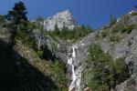
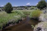
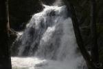
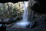
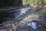
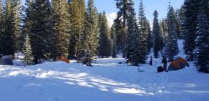
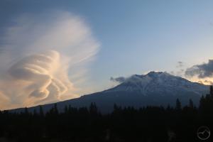
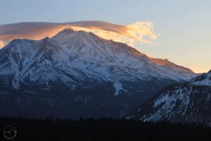
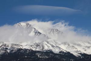
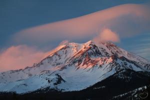
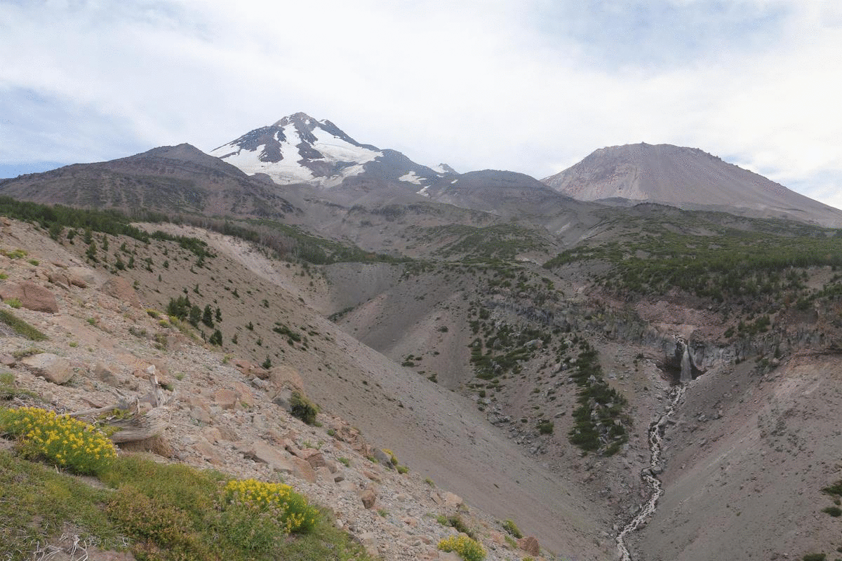
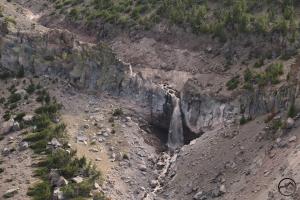
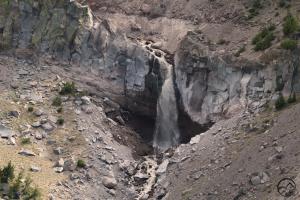
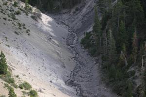
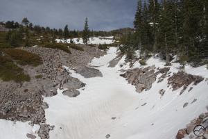
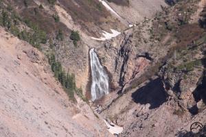
Mount Shasta’s Ash Creek Falls pours into the lower half of Ash Creek Canyon.
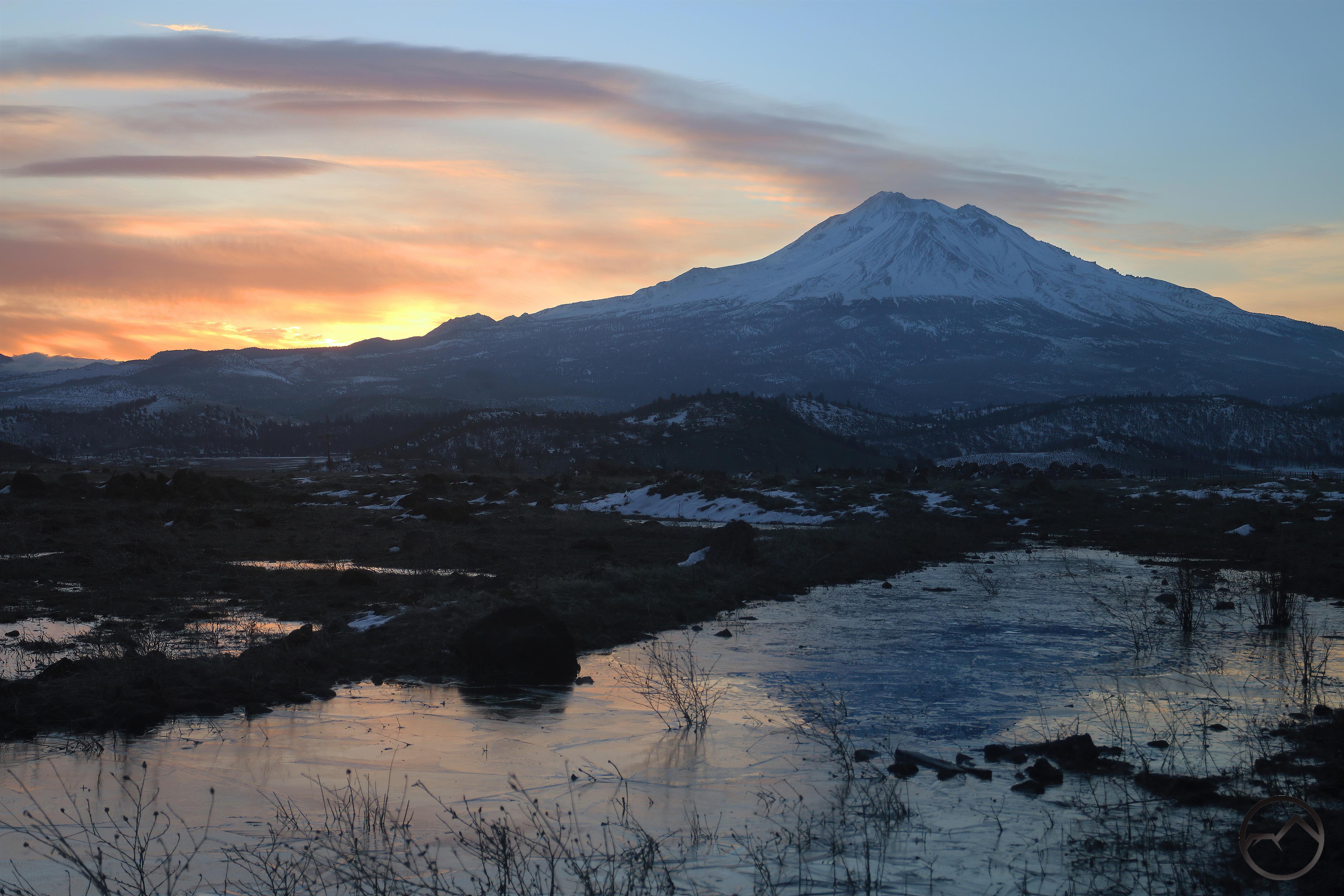
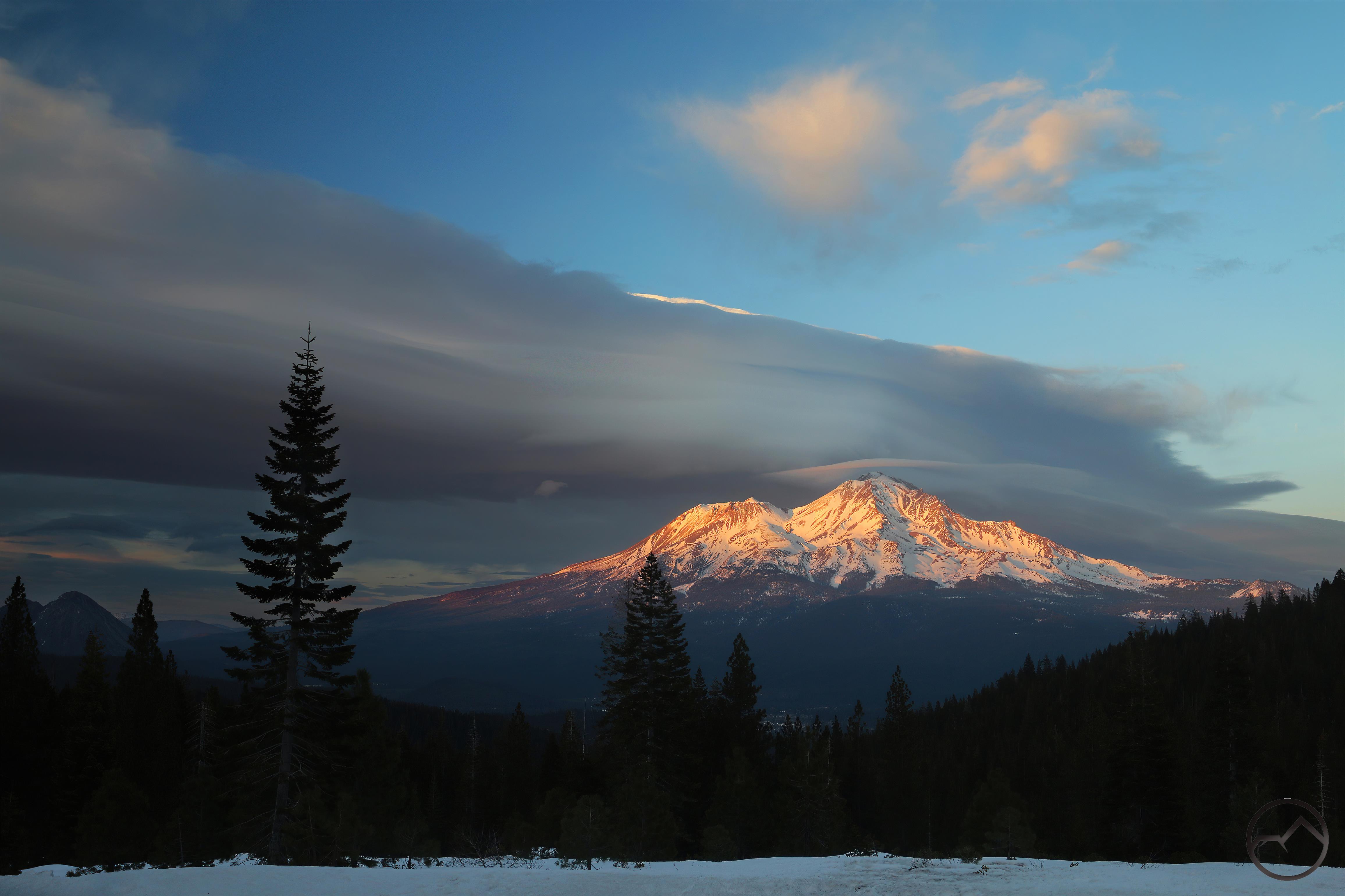
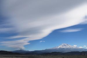
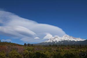
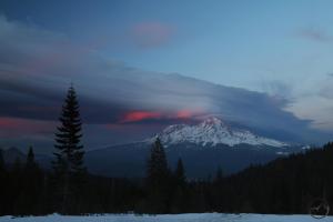
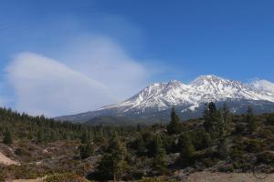
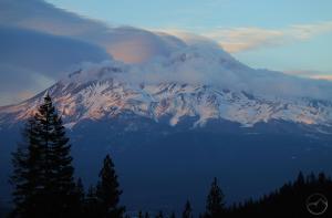
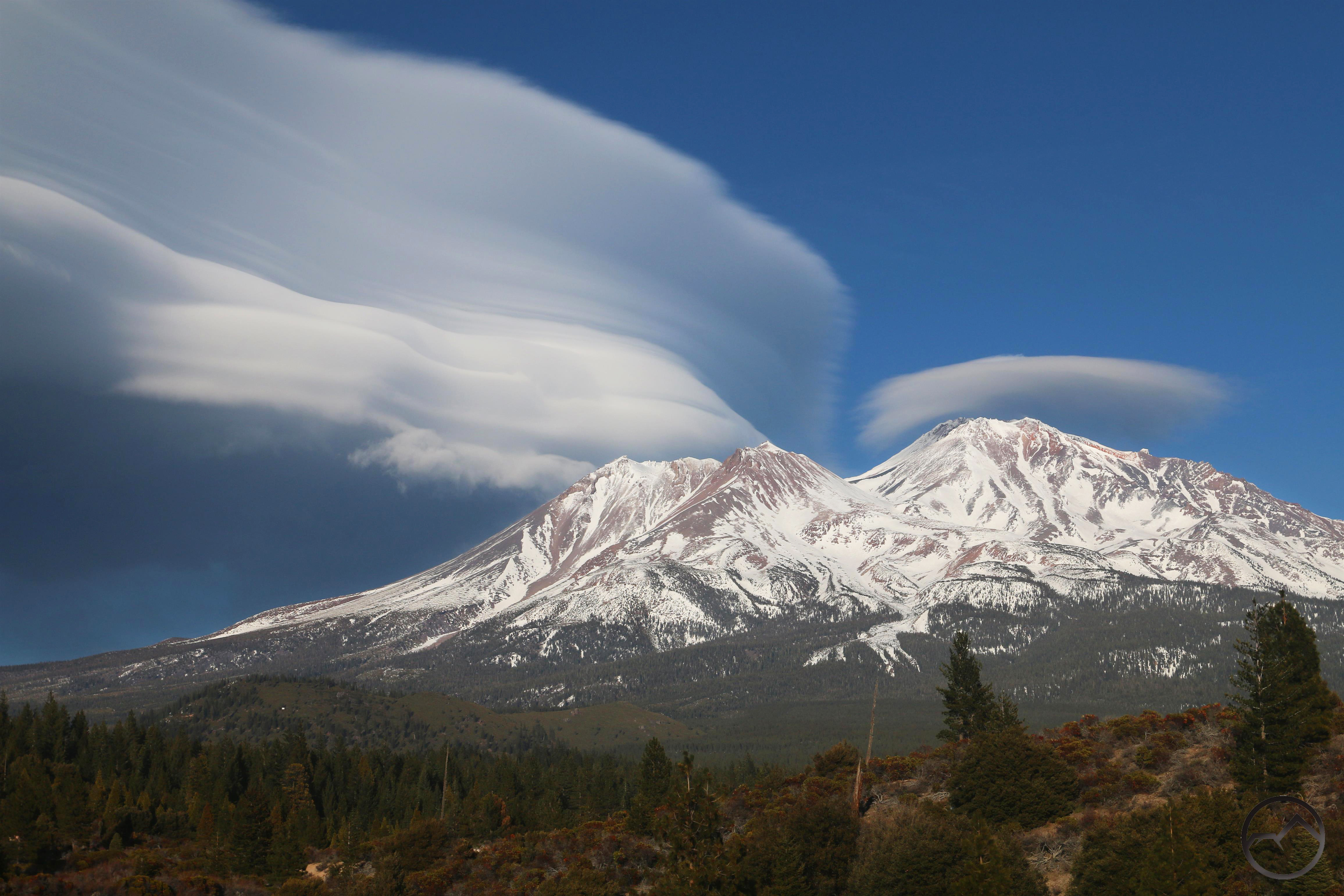
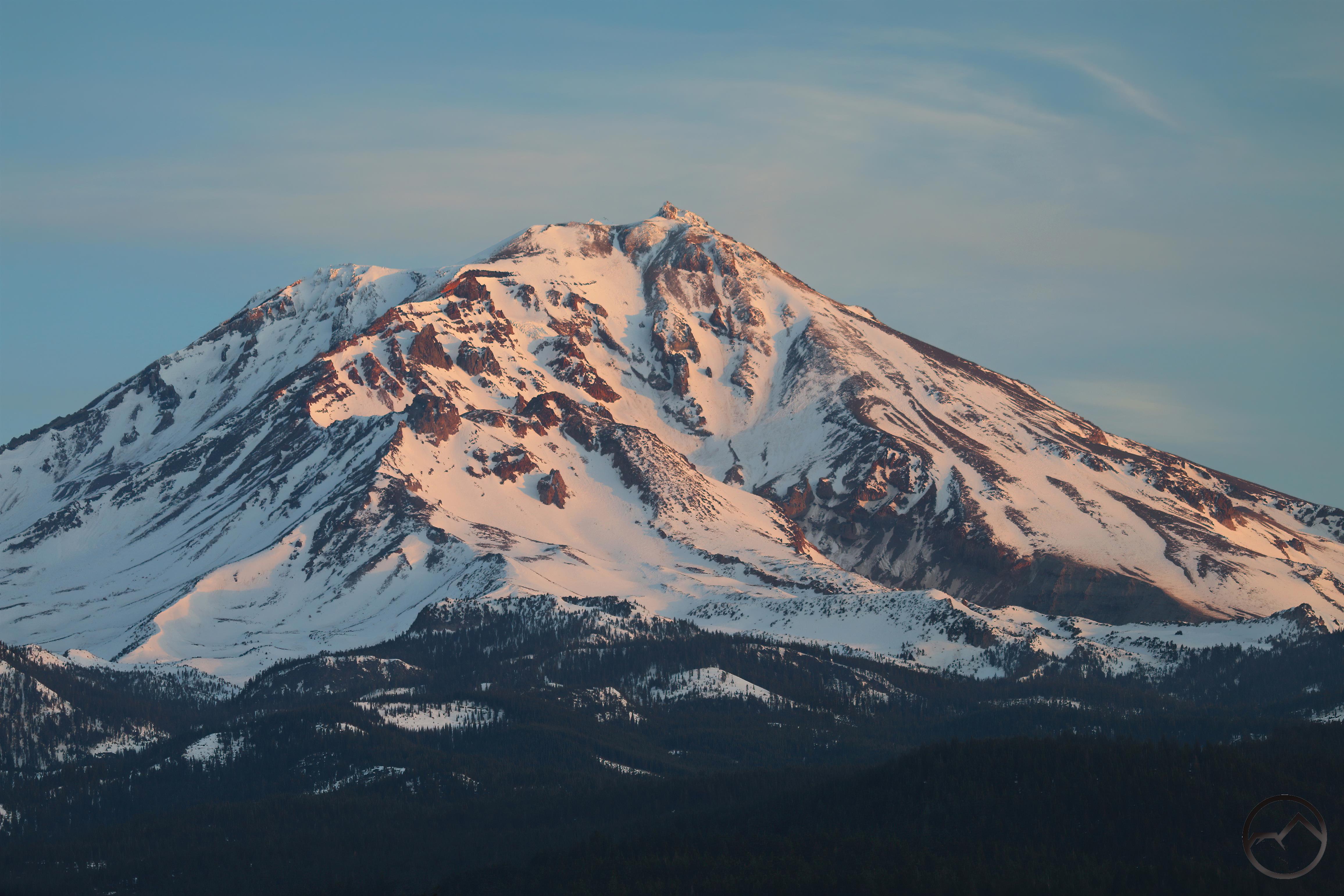
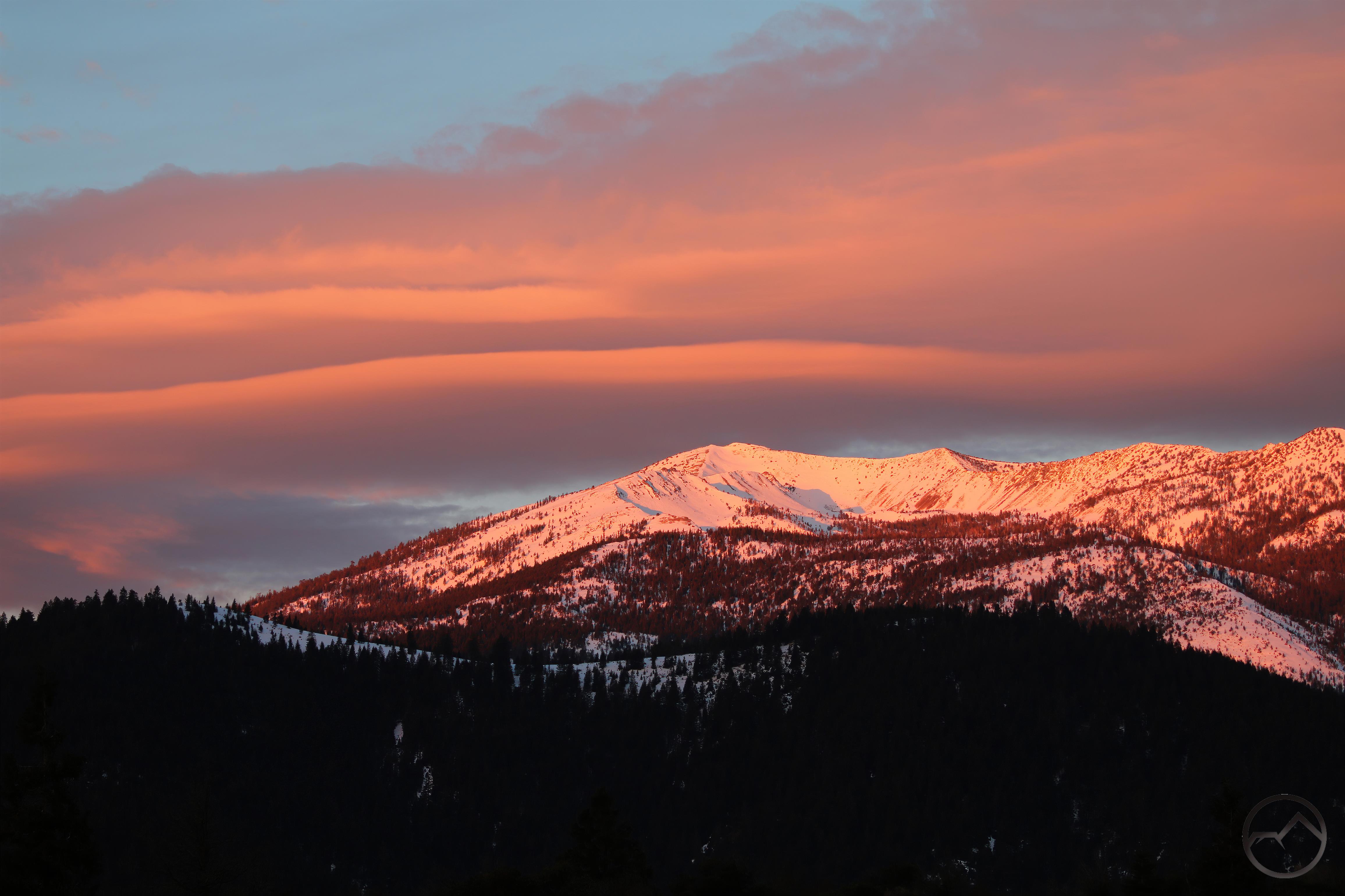
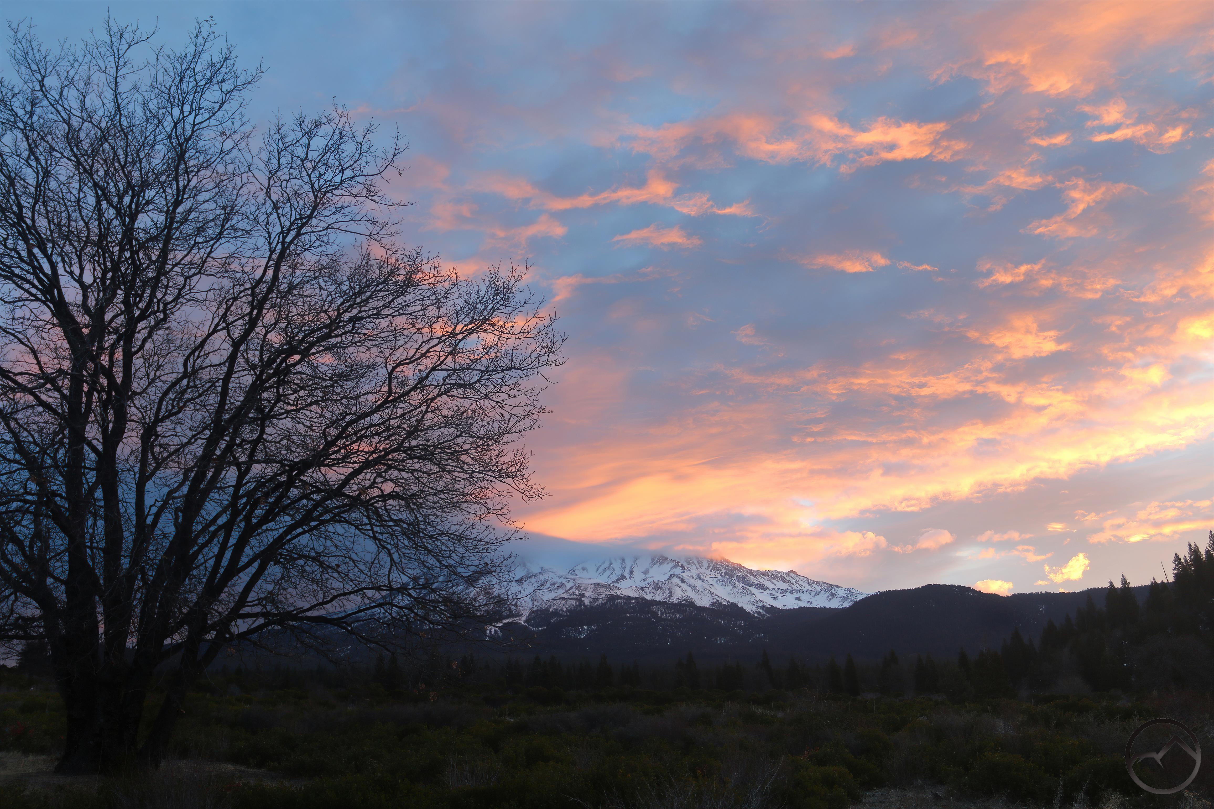
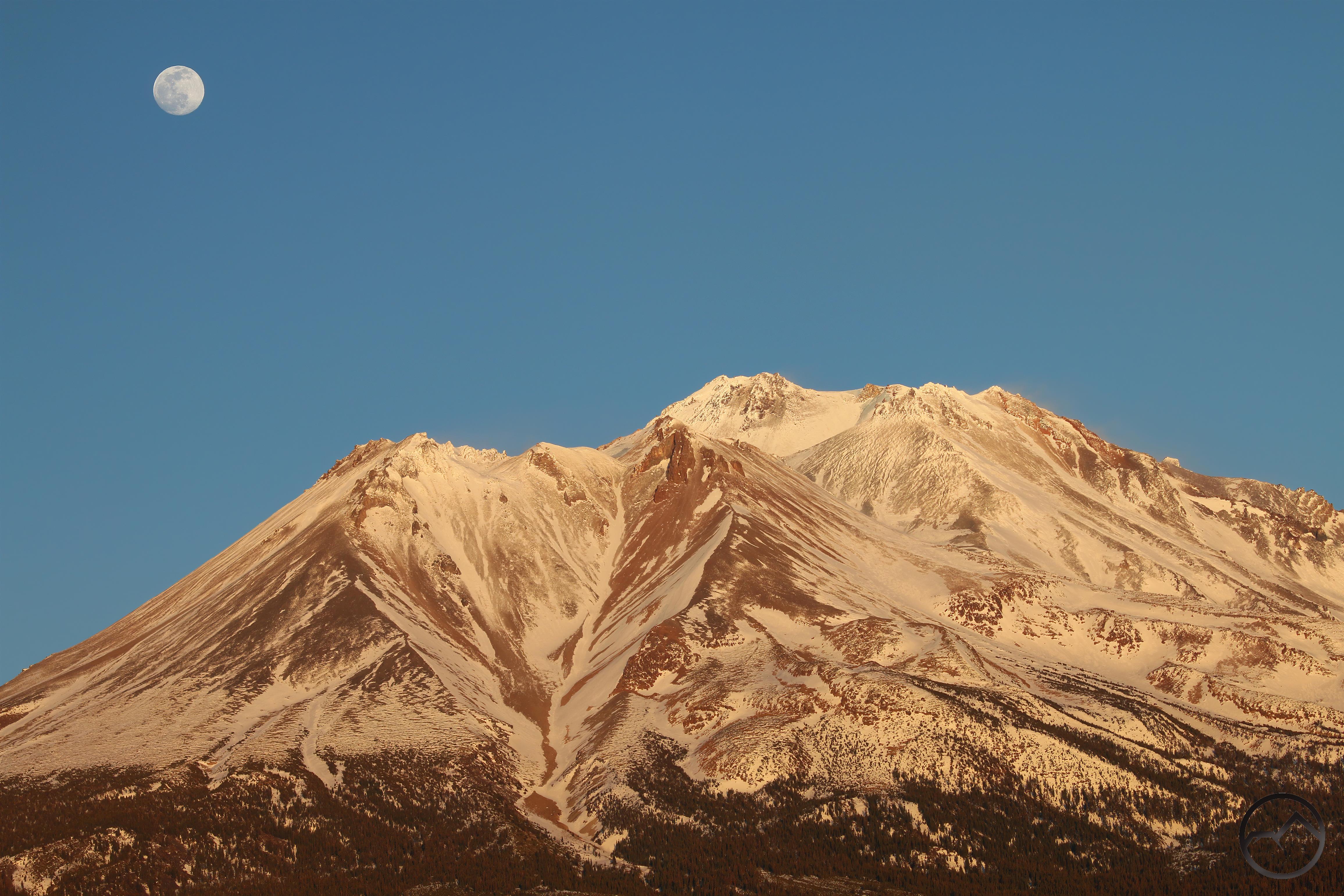
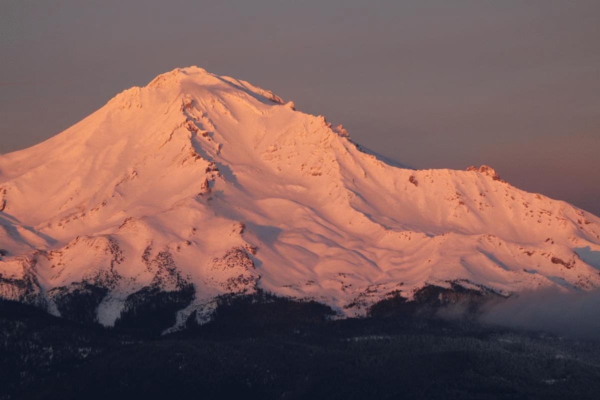
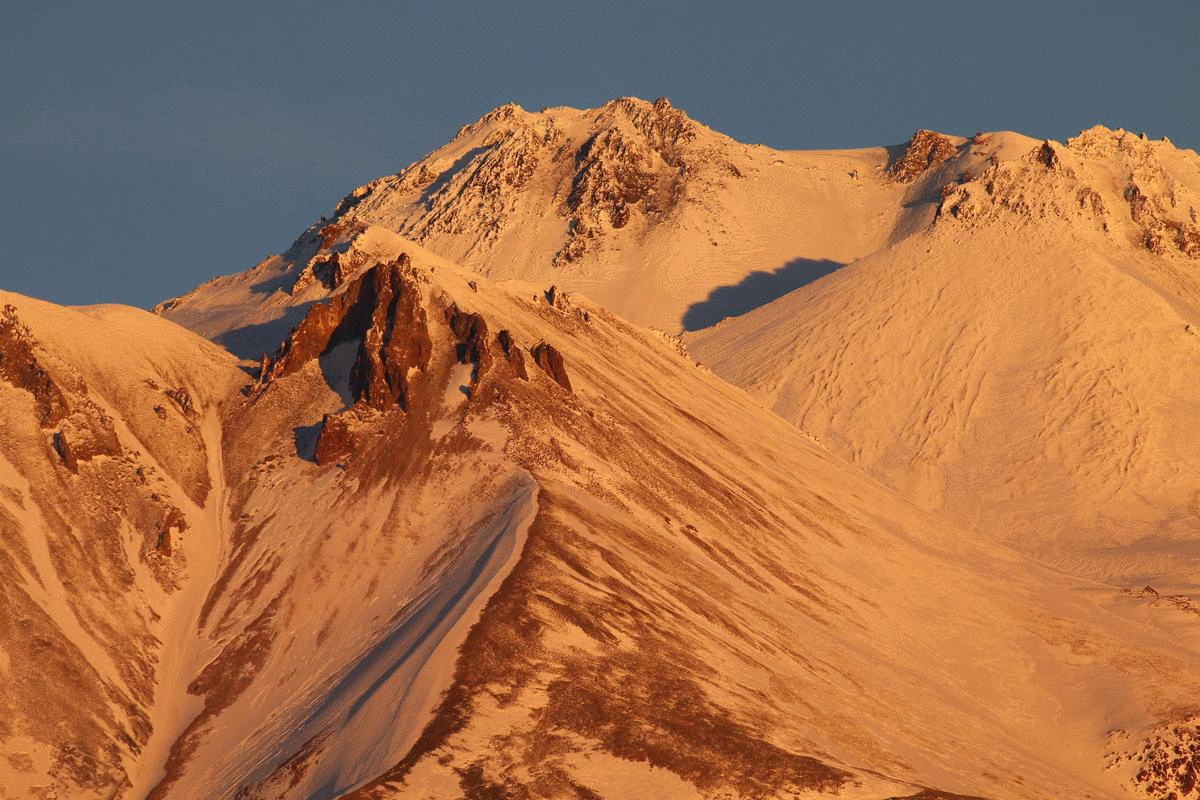
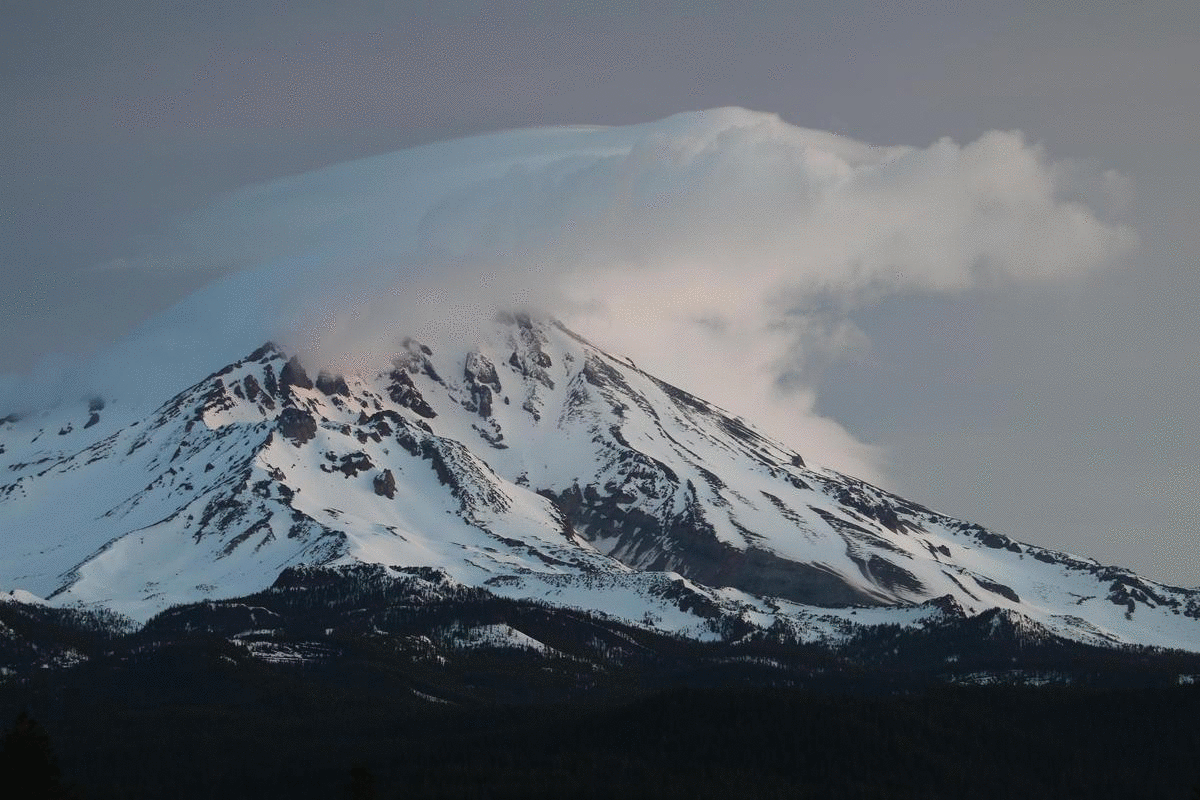
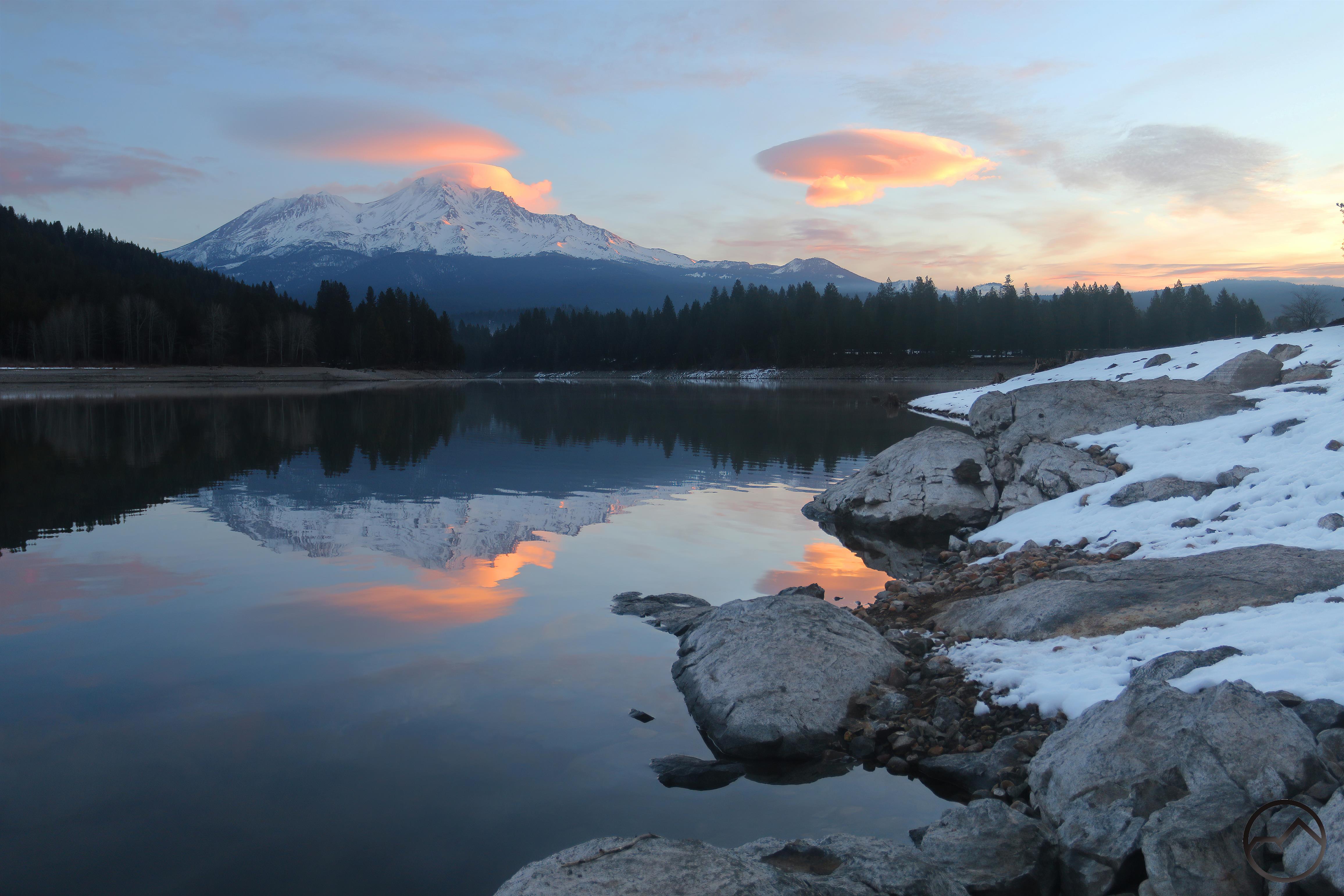
Mount Shasta is justly known as a towering, glacier-clad volcano, standing in grand isolation high above all the other peaks in the region. Tall and isolated, it can be seen from over 150 miles distant, looming high above California’s Central Valley. It is a destination for hikers and mountaineers, both seeking grand vistas and incredible beauty, which they find in abundance. However, one of Mount Shasta’s most spectacular features is usually overlooked but offers stunning scenery for those who seek them out.
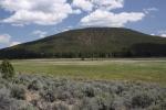
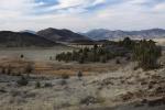
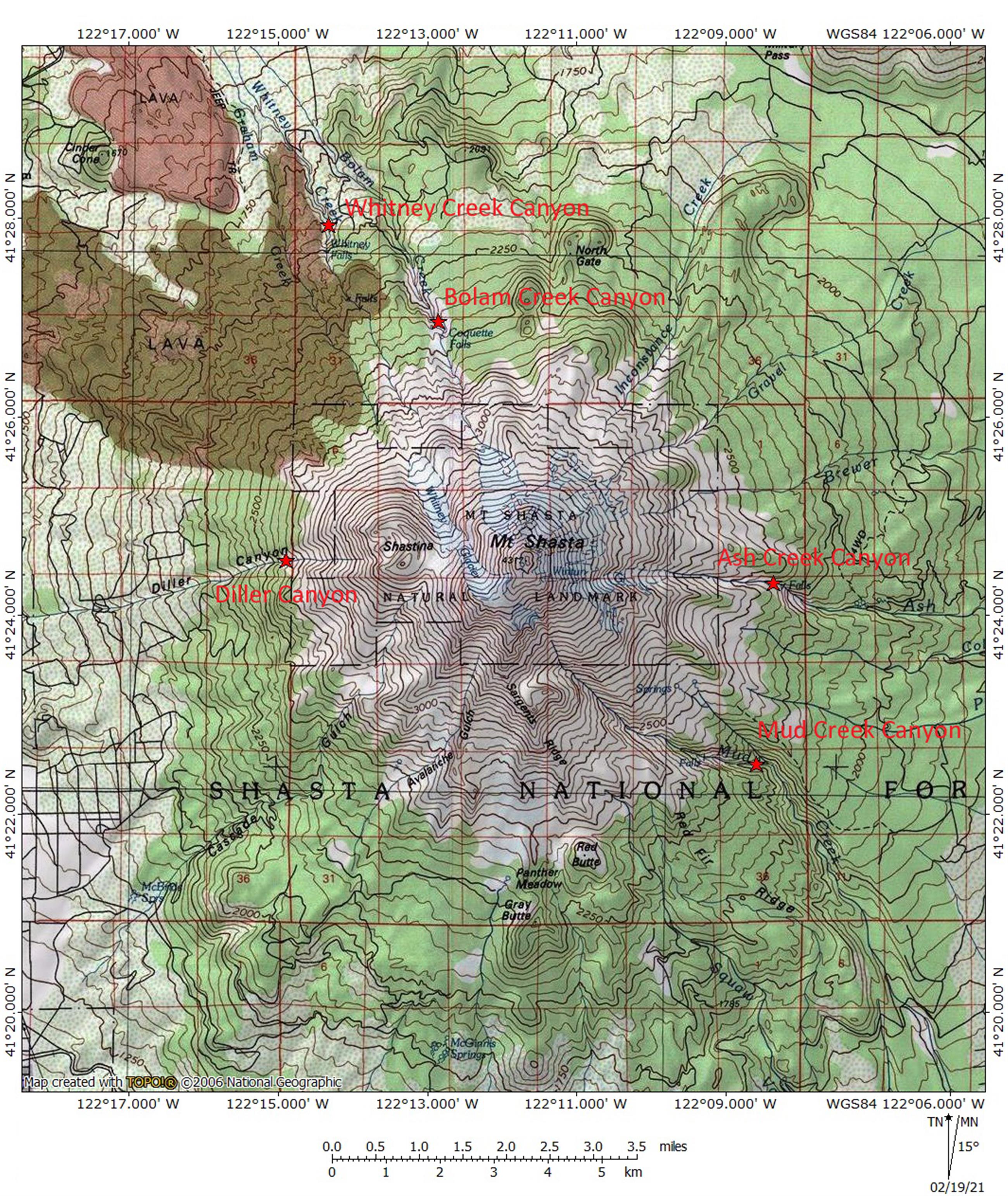
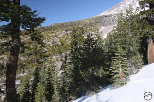
There are many canyons running down the flanks of Mount Shasta but 5 stand out above all the rest in terms of size and beauty. These are Bolam Creek Canyon, Whitney Creek Canyon, Diller Canyon, Mud Creek Canyon and Ash Creek Canyon. These five are wider, deeper and and generally more massive than any of the others. It should also come as no surprise that 4 of the 5 of these house the largest waterfalls on Mount Shasta. Exploring them offers incredible hiking, great adventure and beauty that is rarely equaled in this part of California.
In many ways, the canyons are similar geologically but their perspectives on Mount Shasta, the waterfalls in them, their size and scale all combine to give each one a unique appearance. Each is worthy of exploration, both on the mountain and also here on this website. The following is a brief review of the 5 major canyons that grace the flanks of Mount Shasta.
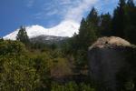
Bolam Creek Canyon

A gorgeous view of the upper portion of Bolam Creek Canyon.
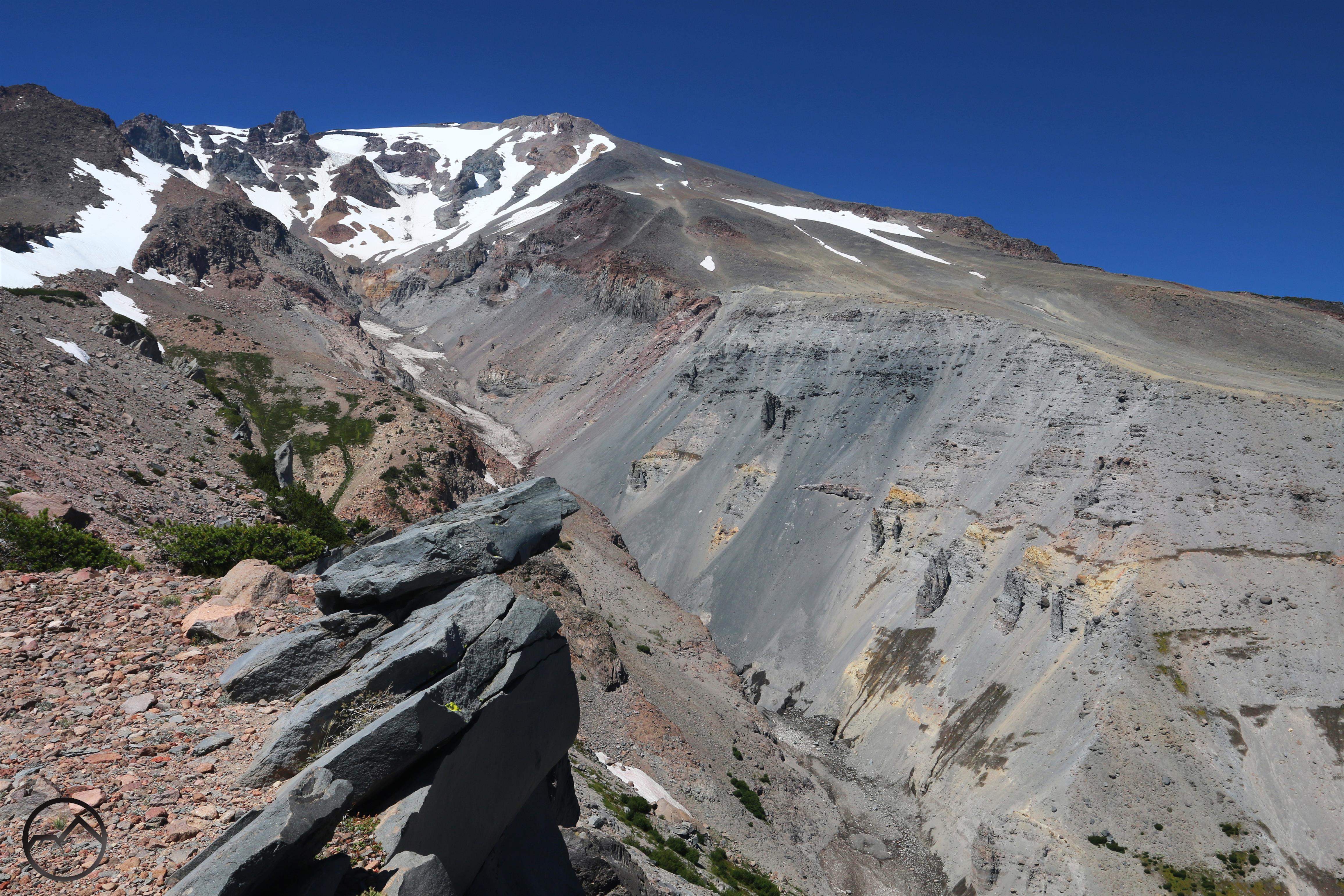
Though most of the canyons on Mount Shasta suffer from some level of obscurity, Bolam Creek Canyon is perhaps the most obscure. The causes for this are many, but I think the two most important reasons are the fact that it is located on the edge of Mount Shasta’s east side, which is the most isolated and least visited side of Mount Shasta. This is compounded by the fact that there are no trails accessing the canyon. The North Gate Trail does pass within a mile of the trail but nearly all the hikers on that route are headed toward the summit, not a sandy off trail jaunt through a maze of white bark pine snags.
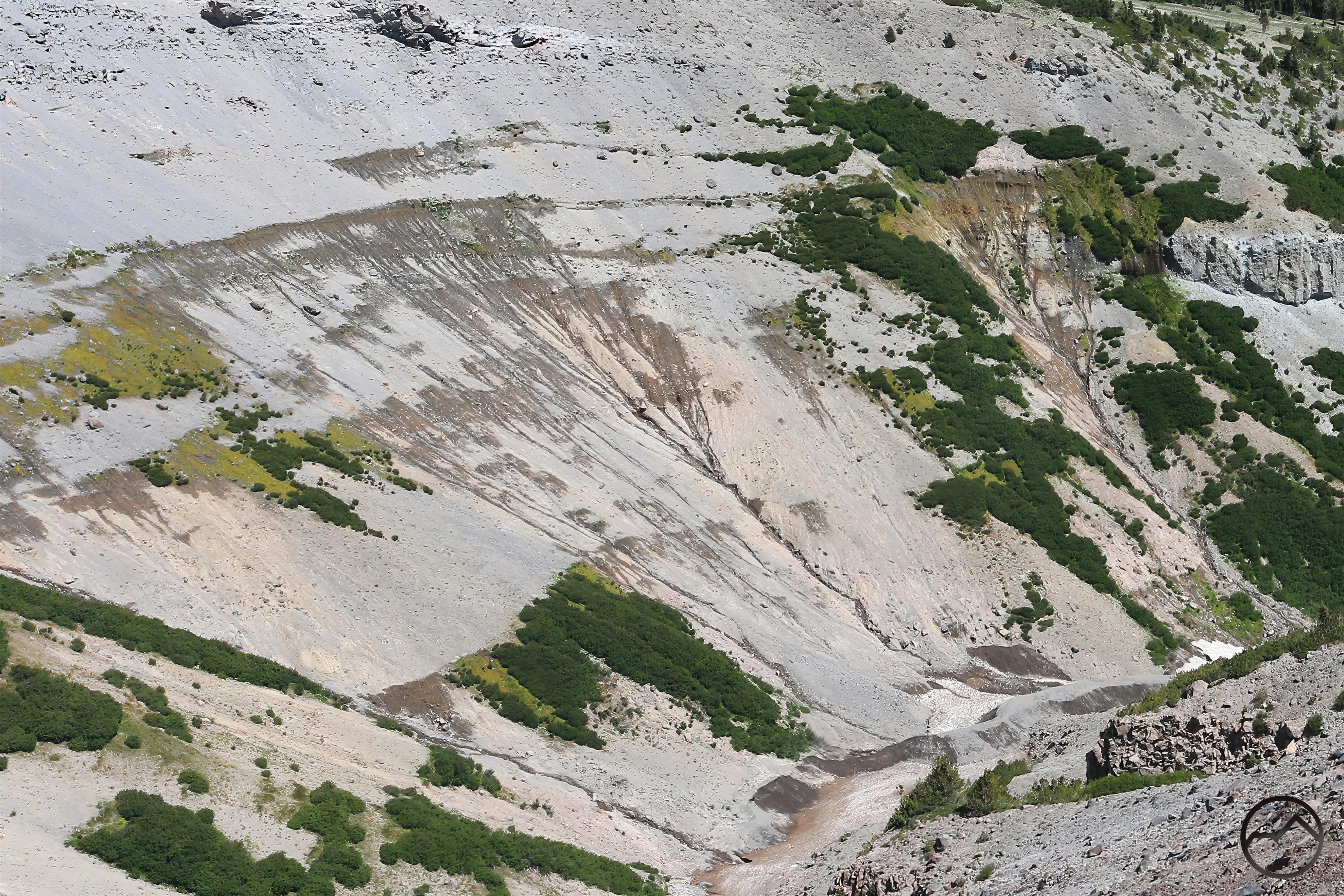
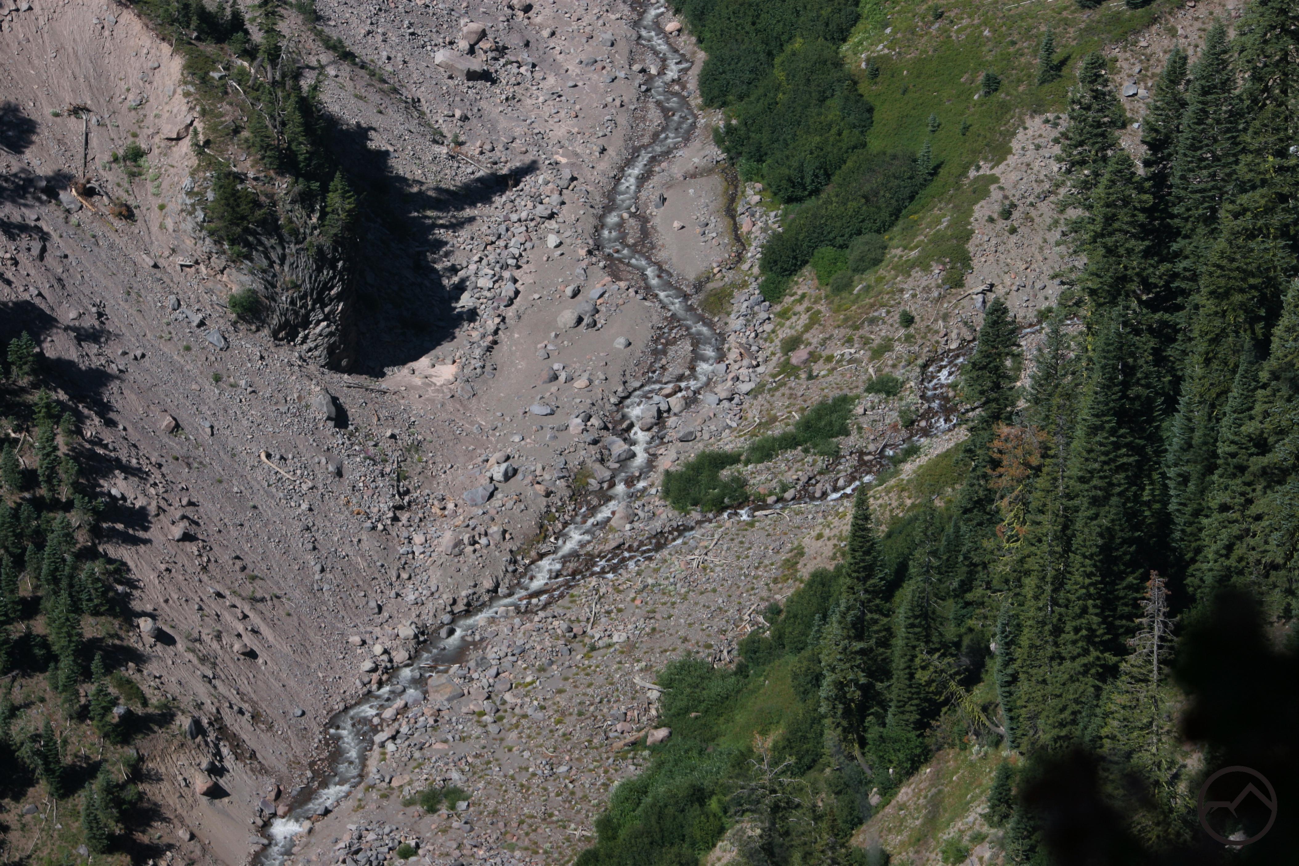
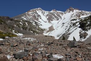
What winds up being lost in the mists of anonymity is one of the most magnificent scenes on Mount Shasta. Bolam Creek Canyon boasts fantastic views of Mount Shasta’s alpine heights along with one of the mountain’s finest waterfalls. The canyon itself is about 400-500 feet deep. Like most of the canyons on Mount Shasta, the walls of Bolam Creek Canyon are loose layers composed of sand, ash, cinders and other volcanic detritus. They tend to be V-shaped, obviously unexcavated by glaciers. However, like most of the canyons, once again, they are not disconnected from the glaciers on Mount Shasta. The Bolam Glacier, visible high overhead, releases its meltwater to feed Bolam Creek. The creek flows through the canyon, entering it by plunging over a cliff in a beautiful waterfall before cascading steeply into the depths of the canyon.
The waterfall in particular deserves a brief note. The canyon was once the home of Coquette Falls, which was the primary route by which the meltwater from the Bolam Glacier flowed into the canyon. The current location of the falls was only a seasonal cataract. However, sometime between 2006 and 2010 (probably closer to the latter) there was a significant outburst from the glacier that blocked up Bolam Creek’s original channel. This caused the flow to reroute to its current configuration and the full volume of the glacier’s meltwater to flow over the new waterfall. Consequently, Coquette Falls dried up. The new waterfall is sometimes called Bolam Creek Falls but I am eager to break away from the somewhat mundane names that dominate Mount Shasta’s waterfalls. I think something along the lines of New Coquette Falls is more interesting and memorable.
-
-
New Coquette Falls. Note the band of erosion resistant rock that has caused the falls to form.
-
-
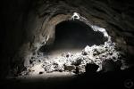
Peering down into the depths of Bolam Creek Canyon.
-
-
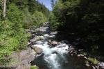
A glance downstream into the inaccessible depths of the canyon. The loose walls make travel into the canyon difficult.
-
-
A closer view of the falls.
-
-
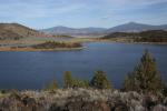
Looking south into the Shasta Valley from the canyon rim.
-

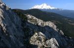
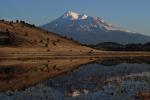
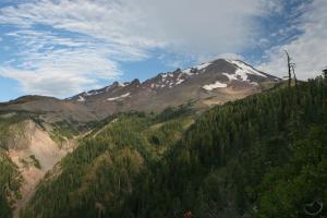
Whitney Creek Canyon
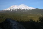
Mount Shasta and Shastina peek out above Whitney Falls and Whitney Creek Canyon.
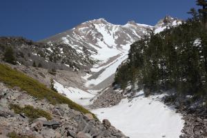
Whitney Creek Canyon is the smallest of Mount Shasta’s canyon. Carved by Whitney Creek, like nearby Bolam Creek, this waterway typically only flows in the heat of the summer, when the glaciers melt and the runoff flows swiftly off the mountain. Though shorter and shallower than Bolam Creek Canyon, they nonetheless exhibit similar characteristics. Both have sandy, sloped canyon walls with little rock extruding from the walls. Like its neighbor, the real highlight of Whitney Creek Canyon is the presence of Whitney Falls. Like all the major waterfalls on Mount Shasta, it is formed when the creek hits a band of erosion resistant rock. The water then plunges 200 feet into an isolated amphitheater. Whitney Falls is the most easily accessed of the waterfalls on the mountain, making it a popular hiking destination. However, it is important to watch whether there is water in Whitney Creek as is passes under Highway 97. If there is no water present, then it is unlikely that there is water flowing over the falls.
The cross-section of the Graham Lava Flow.
One feature unique to Whitney Creek Canyon is its proximity to the Graham Lave Flow. This means that the dark, craggy lava lines the western rim of the canyon. Not only does this give an unusual look to the canyon and enhance the wildness of the area, but it also reveals some fascinating geology. Downstream from Whitney Falls the creek has carved a course that, at one time, passed beneath the edge of the lava flow. Over time this area was undercut by the water and collapsed. Now it is possible to see the sandy layers beneath lava as well as the broken edges of where the lava gave way into the canyon. It is basically a giant cross-section view of a fresh lava flow. There may be other places to observe the internal structure of lava flows like this but if there are, this is still likely one of the easiest to get to.
The dark lava extends above Whitney Falls as well but the creek has only carved a shallow channel through this area. Consequently, the falls lie at the head of the canyon, not within it.
-

-
The summit of Mount Shasta and the broad north face of Shastina are seen above Whitney Falls and the head of Whitney Creek Canyon.
-
-
A closer view of Shastina and Whitney Falls
-
-
-
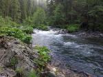
Whitney Creek flows through the isolated and difficult-to-reach depths of Whitney Creek Canyon.
-
-
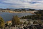
The Shasta Valley spreads out to the north of Whitney Creek Canyon.
-
-
The large undercut of the Graham Lava Flow, which creates a cross-section view of the flow.
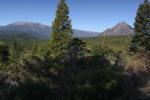
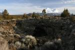
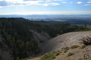
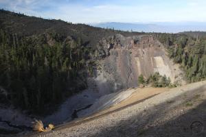
Diller Canyon

Looking up into the massive V-shaped upper portion of Diller Canyon.
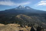
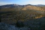
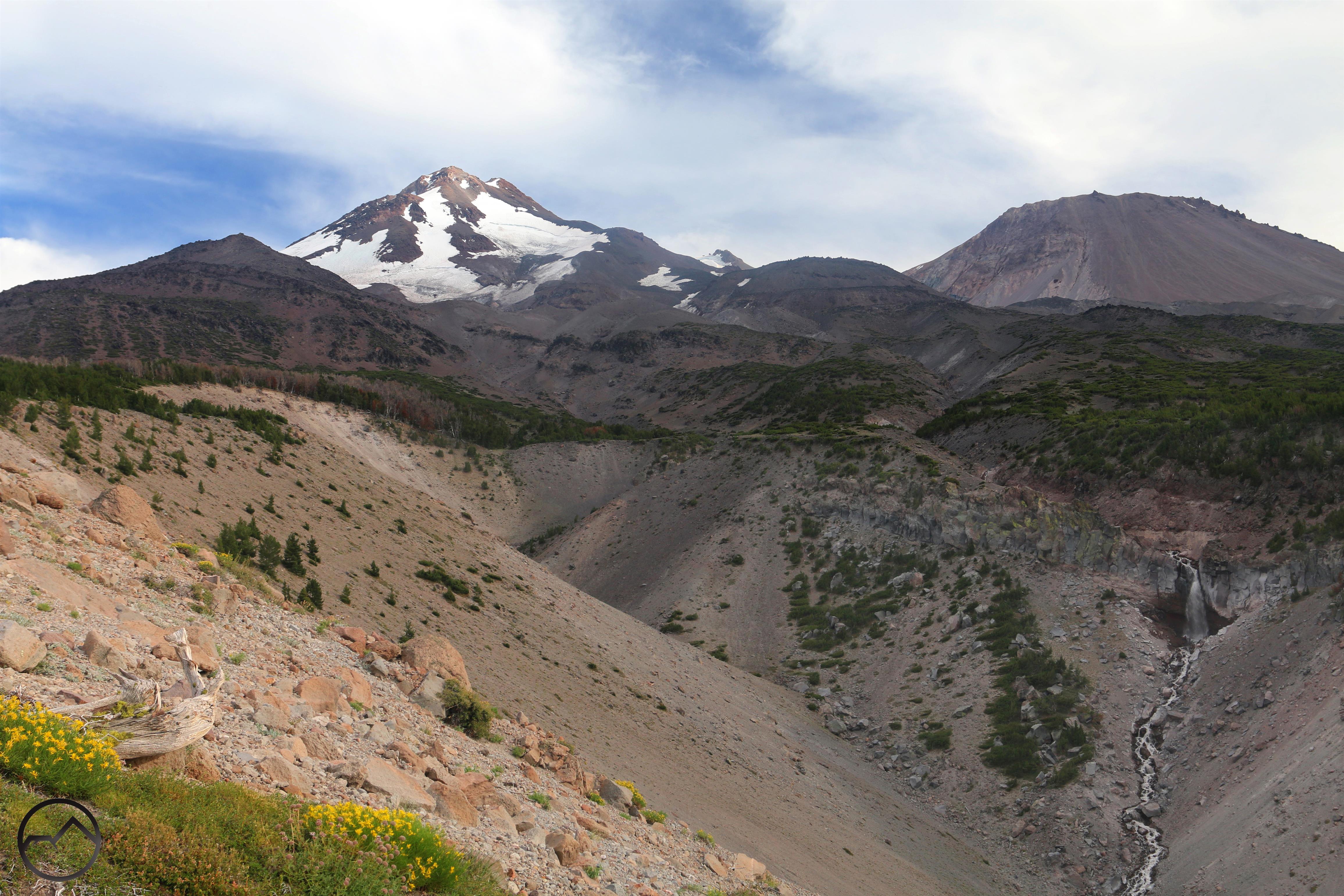
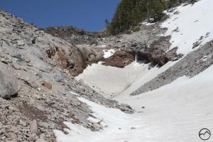
Unusual in many respects, Diller Canyon is an outlier among the other chasms on Mount Shasta. Most notably, it is the only canyon on Shastina, Mount Shasta’s large satellite cone. It is also extends much further than most canyons on the mountain. It begins at the edge of Shastina’s eruption crater at nearly 11,500 feet and descends all the way down to approximately 5,000 feet. It is a single, linear chute from top to bottom. It is also the only one of the 5 canyons that does not have a significant waterfall in it. There are a couple of small cataracts (15-20 feet high) but that is all.
The upper reaches of Diller Canyon at sunset.
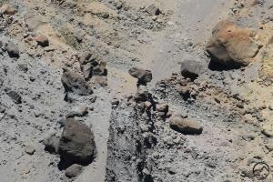
It’s character is different from the other canyons on Mount Shasta too. The other four canyons were formed by glacial runoff eroding their way through the loose ash and cinders that make up the lower flanks of Mount Shasta. Though Shastina does have a similar composition in some areas, Diller Canyon has glaciers and, consequently, no significant creek flowing through it (there is a small one during the spring thaw) but the canyon itself is much rockier than the other four. This is evident both in the presence of significant quantities of loose rocks but also in the rocky outcroppings that line the canyon rim. All of this combines to give Diller Canyon a far different appearance than the other canyons on Mount Shasta.
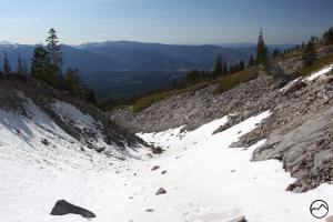
Diller Canyon is, by far, the most visible canyon on Mount Shasta. Prominently seen from much of the west side of Mount Shasta, the canyon has a distinct v-shape at its highest elevations but narrows down to a linear chute at its mid to lower elevations. Though many people don’t recognize Diller Canyon by name, it is among the most recognizable landmarks on the mountain.
-
-
A classic view up Diller Canyon
-
-
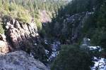
Inside the shallow inner gorge of Diller Canyon. Diller Canyon
-
-
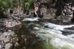
One of the small, seasonal waterfalls inside Diller Canyon. Here it is frozen for the winter.
-
-
Looking downcanyon, toward China Mountain, highpoint of the Scott Mountains.
-
-
The shallow inner gorge of Diller Canyon.
-
-
The view north, across the canyon from the south rim.
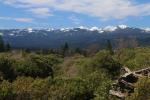
Mud Creek Canyon

A staggering view of the massive, hoodoo-lined upper portion of Mud Creek Canyon.
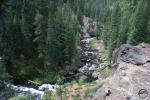
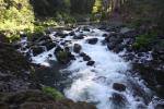
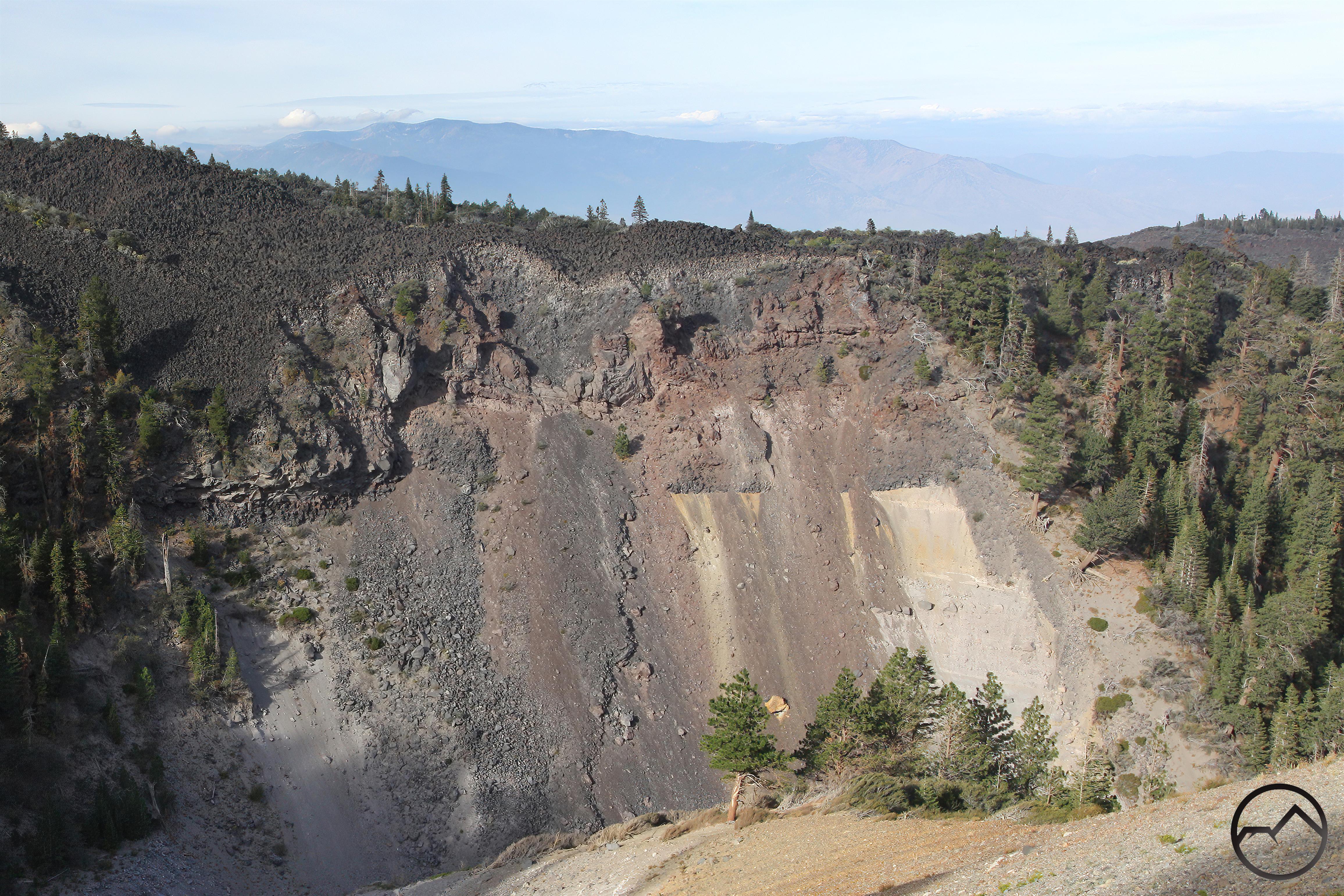
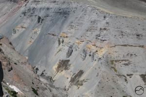
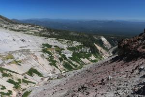
Mud Creek Canyon is simply one of the most spectacular features, not just on Mount Shasta, but in all of Northern California. Longer, larger and deeper than all the other canyons on the mountain, it is a natural titan of staggering proportions. Reaching up to 1,500 feet deep in some place (averaging about 1,100 to 800 feet for much of its course) and extending over 6 miles down the flanks of Mount Shasta, it is a colossal gap that literally cuts into the heart of Mount Shasta. The head of Mud Creek Canyon is formed in massive Mud Creek Basin, the oldest exposed part of Mount Shasta. Here one will find what is likely the most complicated and chaotic geology on the mountain, where 3 of the mountain’s 4 major eruption cones meet. It is a twisted, colorful landscape that is capped by the small (in relation to the four major glaciers on Mount Shasta) Konwakiton Glacier. This is the source of Mud Creek, which flows through the length of the canyon and is the largest stream coming off of Mount Shasta.

Springs and meadows emerge from between the strata.
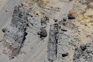
As noted, the geology of Mud Creek Canyon is fabulously complex. Not only do 3 eruption cones (each representing a different epoch of Mount Shasta’s activity) meet here but the landscape has been both scoured by glaciers and continuously eroded. A look up into Mud Creek Basin reveals a seemingly unending series of layers broken, uplifted and twisted, forming a jumbled collection of spires and crags. This is also the most colorful corner of Mount Shasta, with a variety of exposed rock types all exhibiting different hues of red, purple, orange, yellow and gray. Below the upper basin, Mud Creek Canyon resembles the other canyons on the mountain (excepting Diller Canyon) in its composition. It is formed of loose ash and cinders, with the addition of sporadic large rocks punctuating the canyon walls. The canyon is still seeking its angle of repose and the sound of rocks clattering down the steep walls is common. Like the other canyons, but on a much grander scale, the loose aggregate of Mud Creek Canyon is divided into strata. Between many of these water flows through the layers. Where the canyon has cut away the strata, the water flows out into the open. Some are marked by large wet spots while others are the source of verdant meadows clinging to the side of the canyon walls. It is a fascinating and majestic spectacle.
Telephoto view of Camel Rock from over a mile away.
One of Mud Creek Canyon’s most interesting features is the presence of large hoodoos. Such formations are not uncommon is volcanic geology but Mud Creek Canyon has some notably large and prominent ones. Unfortunately, these are only viewed from certain angles since the canyon itself is fairly remote and one must climb out onto the rim in order to observe them. The hoodoos are located on the walls of the upper canyon, but below the expanse of Mud Creek Basin. Though the base of the hoodoos seems stable, the upper portions of the towers appear to evolve rapidly. At time they feature balances rocks and just a couple years later, these rocks have toppled. Though many of them are quite interesting, one in particular stands out, which I have dubbed “Camel Rock”. This tower is not a traditional hoodoo but the remnants of one that has now collapsed. In its place stands a narrow neck of rock with a large, flat boulder balanced precariously on top. It is so named because it resembles New Mexico’s famed rock of the same name. It is hard to assess just how large the rock is but I think 30 – 40 feet high is not unrealistic. It is likely to topple at any time given the rapid rate at which the walls of Mud Creek Canyon evolve.
Lastly, Mud Creek Canyon features the highest concentration of large waterfalls on Mount Shasta. Two in particular are well over 100 feet high but the lower canyon also has a few large waterfalls that are over 25 feet in height. While these are beautiful and worthy destinations of exploration, it is the upper two falls that are the pinnacle of waterfall beauty in Mud Creek Canyon. The highest falls, Konwakiton Falls, pours out of Mud Creek Basin into the uppermost reaches of the canyon. At times parts of the falls are obscured by piles of debris. Sometimes the debris is flushed away by heavy runoff. The other waterfall is Mud Creek Falls, one of the classic falls on Mount Shasta and a contender for the mountain’s most beautiful.

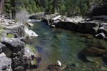
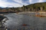
The confluence of Mud and Clear Creeks.
The sheer size of the canyon distinguishes it from the rest of the canyons on Mount Shasta. It also has far more distinct sections than the other canyons. The uppermost canyon is high, treeless and filled with giant hoodoos. Below that, the canyons deepens and doubles in width. It is through here that the extensive collections of springs burst from the stratified canyon walls. This section ends at Mud Creek Falls. Below the falls the canyons widens yet again, as Mud Creek is here joined by Clear Creek. This is the only major confluence of creeks in the depths of one of Mount Shasta’s canyons. Beyond the confluence, Mud Creek Canyon narrows, but still maintains a depth of around 800 feet. A few more notable waterfalls punctuate the creek.
All these features taken together, and given the massive scale of the canyon and its wild character, Mud Creek is easily one of the most scenic waterways in Northern California.
-
-
The massive upper section of Mud Creek Canyon.
-
-
Konwakiton Falls
-
-
Hoodoos lining the upper canyon.
-
-
Camel Rock
-
-
The middle, wider section of Mud Creek Canyon. Note the water seeping from the exposed strate.
-
-
A look up above Mud Creek Falls into the middle portion of Mud Creek Canyon.
-
-
The view from the east side across the widest section of Mud Creek Canyon.
-
-
A similar view of the canyon in early summer.
-

-
The confluence of Mud and Clear Creeks.
-
-
Mud Creek Falls
-
-
Mount Shasta peeks out above the lowest section of Mud Creek Canyon.
-
-
The lowest of the large waterfalls on Mud Creek Canyon.
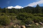
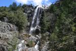
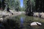
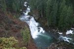
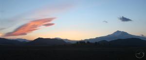
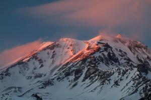
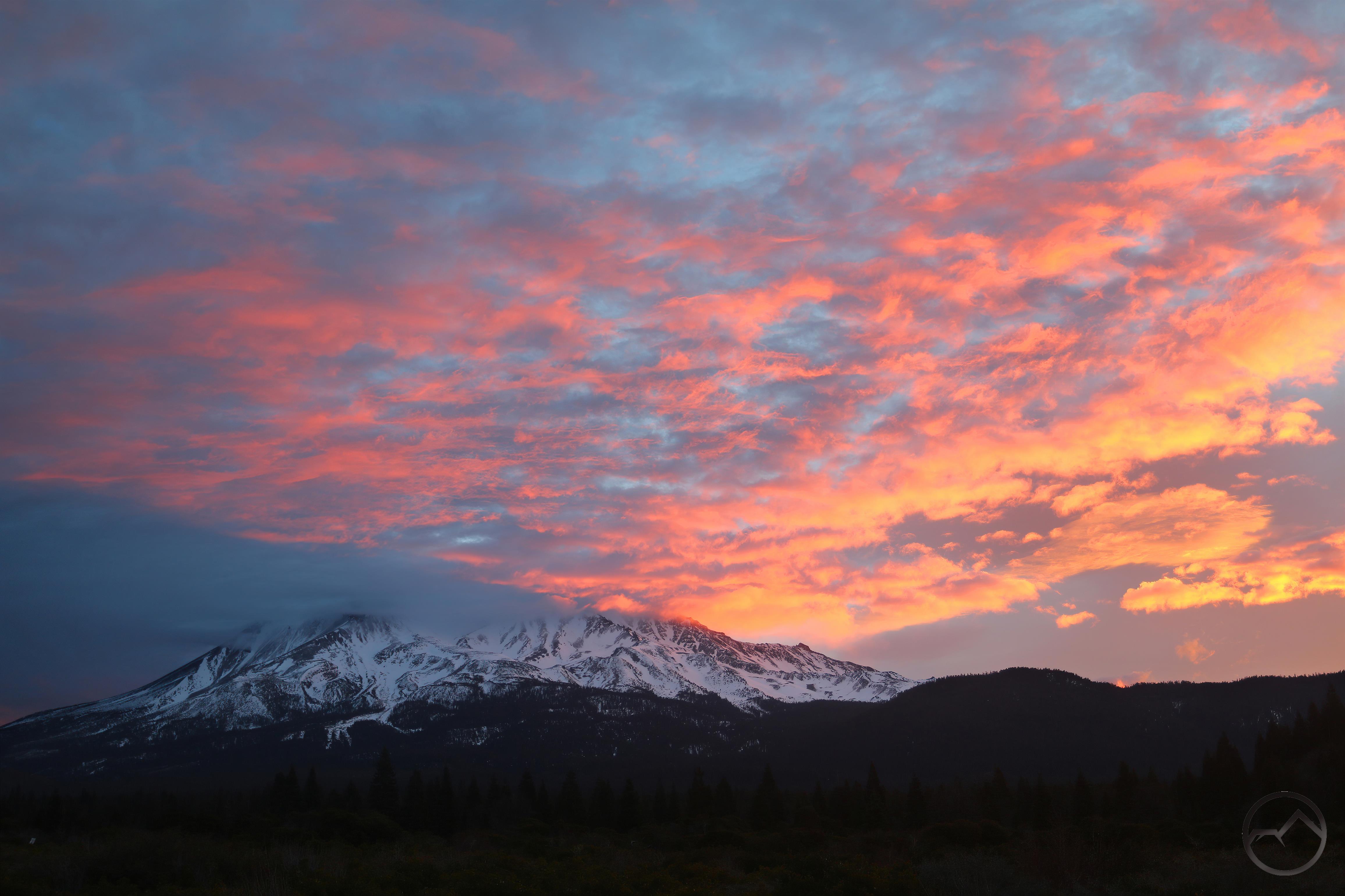
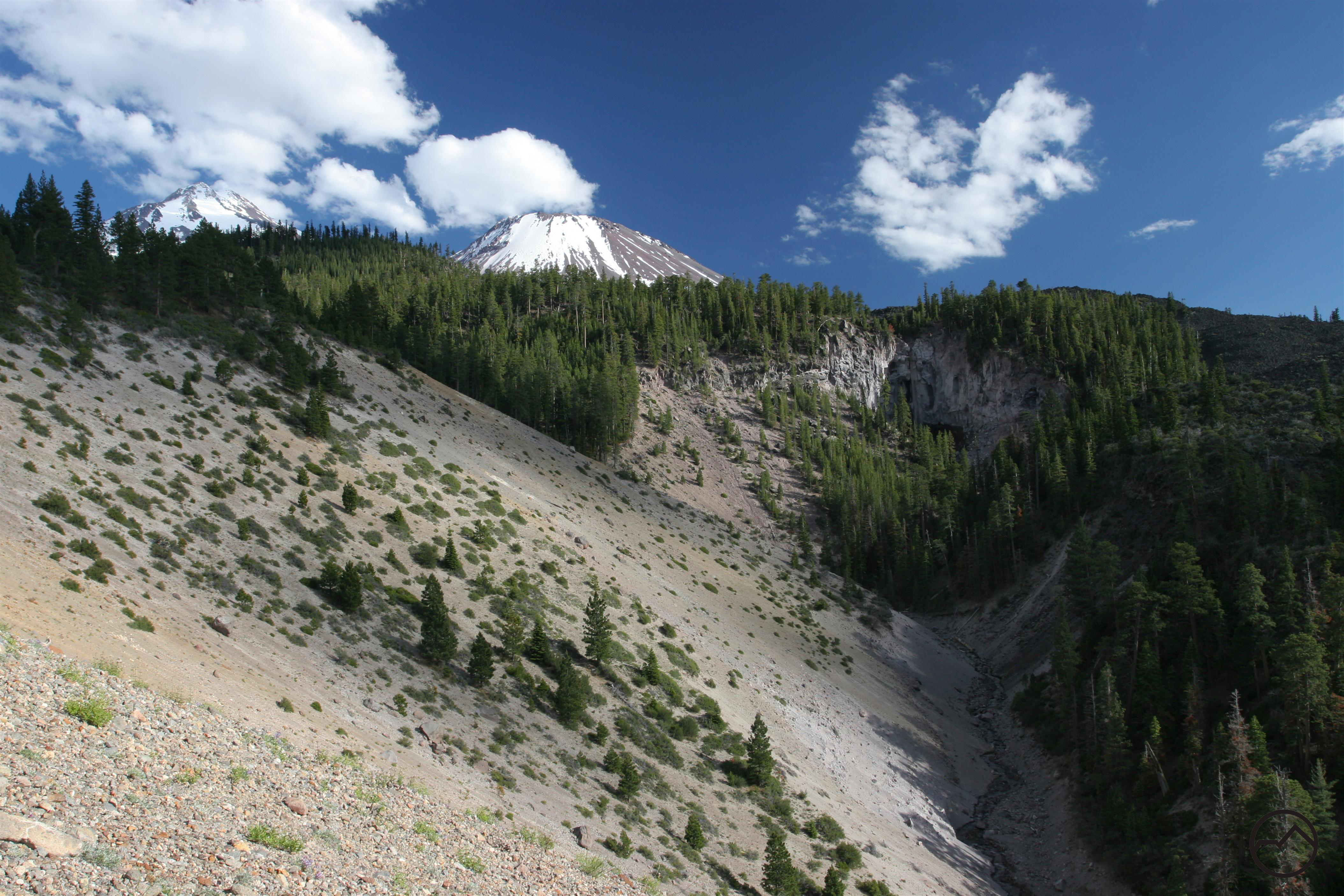
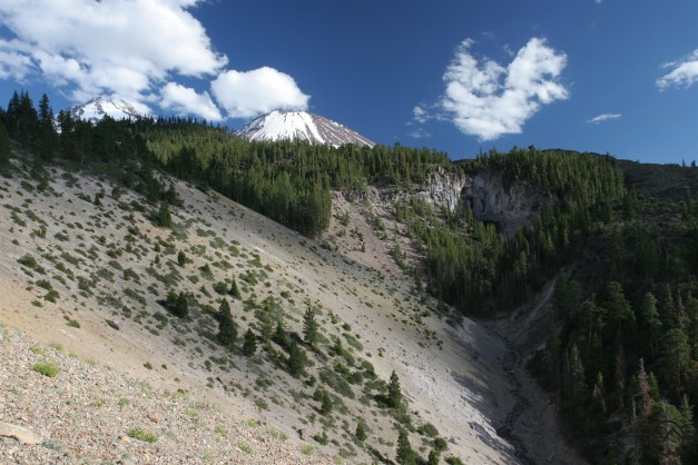
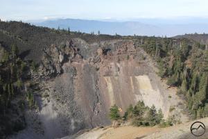
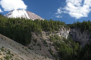
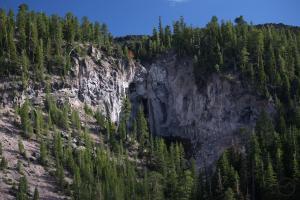
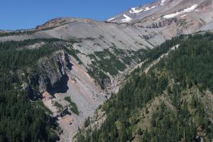
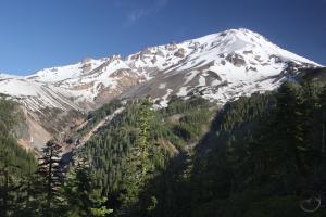
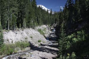
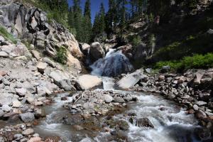
Ash Creek Canyon

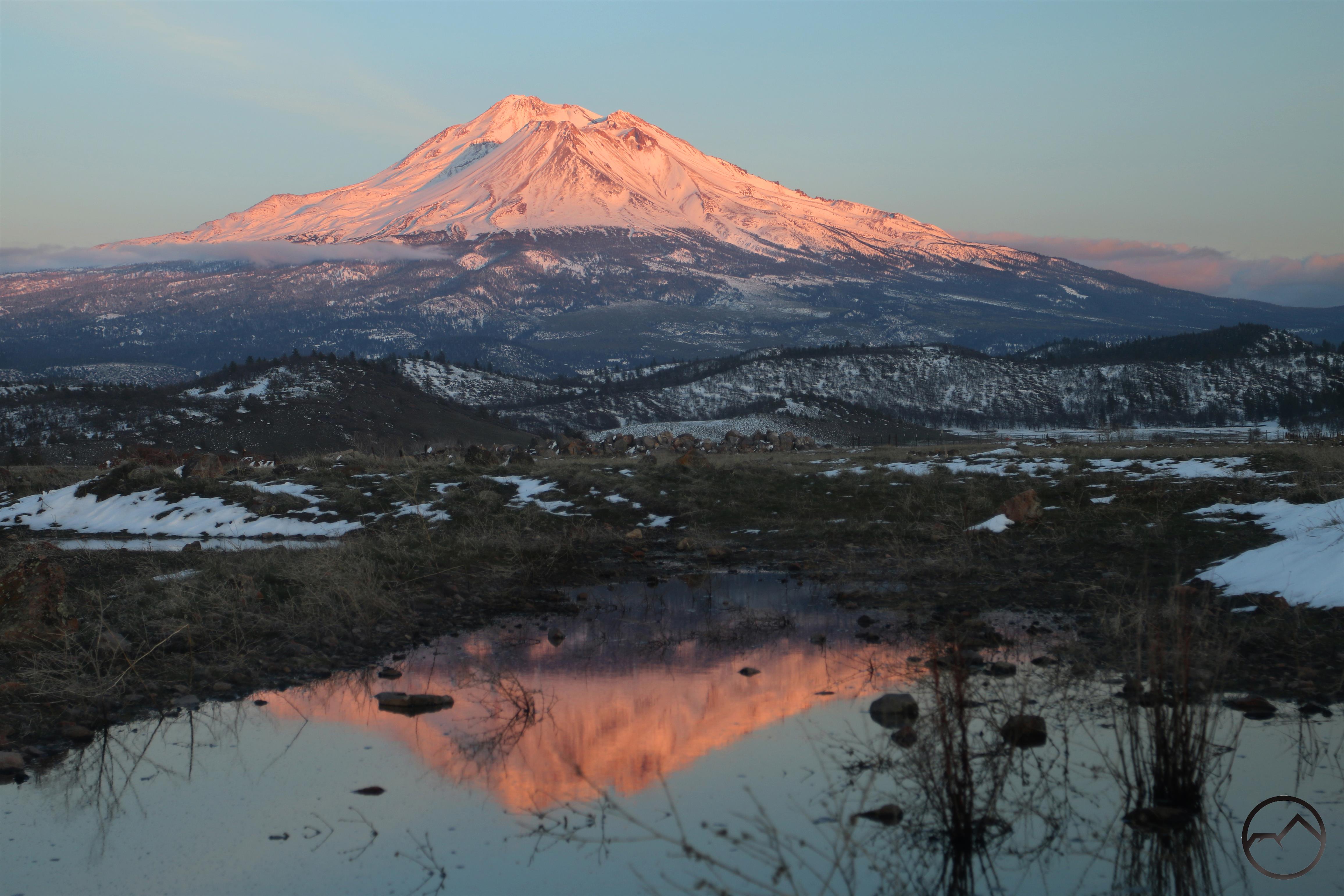
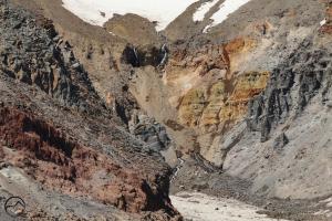
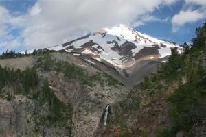
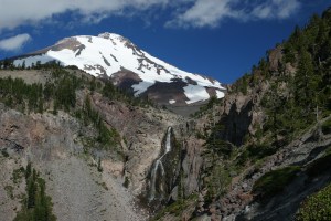
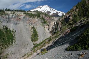
Spectacular Ash Creek Falls, the highest waterfall on Mount Shasta.
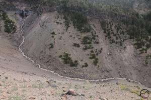
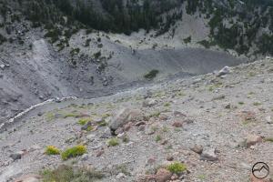
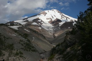
Ash Creek Canyon is located on the remote east side of Mount Shasta. Long and deep, it is the second largest canyon on the mountain. Though it is not the equal of nearby Mud Creek Canyon, the canyon carved by Ash Creek remains one of the most spectacular features on Mount Shasta. It boasts many excellent features. Chief among them is awesome Ash Creek Falls, which is the tallest, and likely the most beautiful, waterfall on the mountain. At about 350 feet high, it is a glorious sight, with Mount Shasta looming majestically behind it. The waterfall divides the canyon into two distinct sections. The lower, v-shaped section resembles most of the other canyons on the mountain. The upper section has a similar composition, consisting of ash and cinders, but is larger, wider and, most significantly, graced with the massive sheet of ice that is the Wintun Glacier. This is the third largest glacier in California (after the nearby Hotlum and Whitney Glaciers on Mount Shasta’s northeast and north side).
The canyon consists of two parts. The upper part is largely above tree line and is occupied by the Wintun Glacier at its highest reaches. The walls of the canyon are sand and cinder like the other canyons on Mount Shasta but the lack of trees and the presence of the glacier give it a distinct, wild feel that is altogether different from the other canyons on the mountain. The transition from the upper to lower canyon is Ash Creek Falls. Below the waterfall the canyon is more like the other canyons on the north side of the mountain. The trees crowd the canyon rim and the walls are steeply sloped loose cinders and rocks. However, here on the wetter, east side of Mount Shasta, the forest is much, much thicker and in some places consists of old growth Shasta red firs.
All these features make Ash Creek Canyon one of the more beautiful spots on Mount Shasta. Taken together, the canyon of Ash Creek deserves far more renown that it gets, even with its superlative waterfall.
-
-
A view toward the summit of Mount Shasta, through the upper section of Ash Creek Canyon. Note the Wintun Glacier at the head of the canyon.
-
-
The upper part of Ash Creek Falls is visible at the transition from the upper and lower canyon.
-
-
Mount Shasta and Ash Creek Falls.
-
-
A wider view showing the scale of the width of Ash Creek Canyon.
-
-
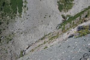
Gazing down into the nearly accessible interior of Ash Creek Canyon.
-
-
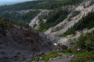
The classic V-shaped lower section of Ash Creek Canyon.