Hike Mt. Shasta

Exploring the Mount Shasta Region

  • Home
  • Trails
    • Mount Shasta Trails
      • Brewer Creek Trail
      • Clear Creek Trail
      • Gray Butte Trail
      • Green Butte Ridge Trail
      • Horse Camp Trail
      • North Gate Trail
      • Old Ski Bowl Trail
      • Panther Meadow Trail
      • South Gate/Squaw Meadow Trail
      • Whitney Falls Trail
    • Trinity Divide Trails
      • Blue Divide Trail
      • Castle Lake Trail
      • Castle Lake Shore Trail
      • Cliff Lake Trail
      • Deadfall Lakes Trail
      • Gray Rock Lakes Trail
      • Gumboot Trail
      • Heart Lake Trail
      • Porcupine & Toad Lakes Via Pacific Crest Trail
      • Seven Lakes Basin Via Pacific Crest Trail
      • Sisson-Callahan Trail
      • Soapstone Trail
      • South Mumbo Scramble
      • Tamarack Lake Trail
      • Toad Lake Trail
    • Castle Crags Trails
      • Burstarse Falls Via Pacific Crest Trail
      • Castle Dome Trail
      • Flume Trail
      • Lower Castle Crags Via Pacific Crest Trail
      • Root Creek Trail
    • Scott Mountains Trails
      • Bluff Lake & Cement Bluff via Pacific Crest Trail
      • Caldwell Lakes Trail
      • China Mountain Scramble
      • Cory Peak and Bull Lake via Pacific Crest Trail
    • Cascade Crest
      • Ash Creek Butte Scramble
      • Goosenest Trail
      • Juanita Lake Trail
      • Orr Lake Trail
    • Mount Shasta City Area Trails
      • Black Butte Trail
      • Box Canyon Trail
      • Gateway Trail
      • Lake Siskiyou Trail
      • Mount Shasta City Short Trails
      • Ney Springs Canyon Trail
      • Spring Hill Trail
    • Shasta Valley Trails
      • Black Lava Trail
      • Haystack Trail
      • Lake Shastina Trail
      • Pluto Cave Trail
      • Trout Lake Trail
      • Yellow Butte Trail
    • Sacramento River Trails
      • Dunsmuir Trail
      • Hedge Creek Falls Trail
      • Sacramento River Trail
      • Sims History Trail
    • McCloud River Trails
      • Ash Camp To Ah-Di-Na Via Pacific Crest Trail
      • McCloud River Falls Trail
      • McCloud River Preserve Trail
      • Squaw Valley Creek Trail
      • McCloud River Trail: Algoma Camp to Nitwit Camp
      • McCloud River Trail: Nitwit Camp to Cattle Camp Swimming Hole
      • McCloud River Trail: Cattle Camp Swimming Hole to Camp 4
      • McCloud River Trail: Camp 4 to Upper McCloud Falls
      • McCloud River Trail: Pine Tree Hollow Loop
    • Trails Further Afield
      • Trinity Alps Trails
        • Bear Lakes Trail
        • Billys Peak Trail
        • Boulder Creek Lakes Trail
        • Boulder Lake Trail
        • Canyon Creek Trail
        • Caribou Lakes Trail
        • East Boulder Lake Loop
        • East Weaver Lake Trail
        • Four Lakes Loop
        • Granite Peak Trail
        • Grizzly Creek Trail
        • Gulch Lakes Loop
        • Hidden Lake Trail
        • South Fork Lakes Trail
        • Stoddard Lake Trail
        • Stoney Ridge Trail
        • Tangle Blue Lake Trail
      • Warner Mountains
        • Emerson Creek Trail
        • Highgrade Trail
        • Patterson Lake Via Warner Summit Trail
        • Pine Creek Trail
        • Squaw Peak Trail
  • Articles
    • Trails By Area
      • Mount Shasta
        • Vistas, Meadows And Waterfalls: Three Best Hikes On Mount Shasta
        • The End Of The Road: Three Hikes In The Old Ski Bowl Area
        • Two Trails From Bunny Flat
        • Three Trails On Mount Shasta’s East Side
        • Mount Shasta’s Hummingbirds
      • Trinity Divide
        • Great Lakes: Top Five Lake Basins In The Trinity Divide
        • The Headwaters Of The South Fork Of The Sacramento River
        • Neglected Headwaters: Two Lesser Lake Basins On The South Fork
        • Gumboot Saddle: Two Hikes On The PCT
        • Descent Into Mystery: The Sisson-Callahan Trail
        • Mumbo Basin – Overlooked On The West Side
        • The Headwaters Loop: A Proposed Backpacking Loop In The Trinity Divide
      • The McCloud River
        • The McCloud River Trail
      • Shasta Valley
        • Jewels In The Desert
      • Scott Mountains
        • Great Scott! Two Scott Mountains Hikes On The PCT
      • Trinity Alps
        • Carubou Lakes: Trinity Alps On A Grand Scale
        • Switchbacks To Heaven: The Trinity Alps’ Stoney Ridge Trail and Four Lakes Loop
        • Trinities In Proximity: Two Trinity Alps Trails With Easy Access From Mount Shasta
        • Trails in the Carter Meadows Area
        • Trinity Alps Views of Mount Shasta
        • The Psychological Value Of The Trinity Alps
    • Waterfalls
      • Three Waterfalls On Mount Shasta
      • McCloud River Waterfalls
      • Sacramento River Waterfalls
      • Trinity Divide Waterfalls
      • Trinity Alps Waterfalls
      • Avoiding A Dry Whitney Falls
    • Off Season Trails
      • Three Winter Hikes Near Mount Shasta City
      • Winter Hikes In Shasta Valley
      • Winter Hiking In The Shasta Valley Wildlife Refuge
      • Winter Hikes On The Sacramento River
      • Winter Hikes On The Lake Siskiyou Trail
      • Spring Hikes In The Castle Crags
      • Spring Hikes On the Upper McCloud
      • Spring Hikes On The Lower McCloud River
    • Points Of Interest
      • Mount Eddy: Overshadowed, Underrated
      • Black Butte: Hiding In Plain Sight
      • Castle Dome: Steadfast And Staggering
      • Mount Shasta Hoodoos
      • Sacramento Scrambling
      • The Shasta River
      • The Castle Creek Watershed
      • Mount Shasta East Side Glacier View
      • 5 Fantastic Mount Shasta Vistas
      • 5 Highest Peaks Around Mount Shasta
      • 5 Best Hikes On Creeks And Rivers
      • 5 Interesting Footbridges
      • Three Spectacular Drive-To Sunset Vistas
    • North State Geography
      • Introduction
      • Seven Major Regions
      • The California Cascades
      • Klamath Mountains Pt. I
      • Klamath Mountains Pt. II
      • The Great Canyons Of Mount Shasta
      • Mount Shasta, Timberline, And The Relative Size Of Cascade Volcanos
      • Four Eruption Cones Of Mount Shasta
      • Mount Shasta’s Medial Moraine
    • Northern California Review
      • North Table Mountain
      • Lakes Basin Recreation Area
      • Eastern Sierra Fall Color
      • Sonoma County
      • Central Sierra Nevada
      • Orland Buttes
    • Seldom Seen
      • Ash Creek Falls
      • Mud Creek Canyon
      • Lower Mud Creek Canyon
      • Diller Canyon
      • Lower Cascade Gulch
      • The Grey Rocks
      • Castle Creek
      • Upper Wagon Creek
      • Fawn Creek Canyon
      • Confluence of the Sacramento River and Castle Creek
      • Upper Klamath River Canyon
      • Hole In The Ground Geologic Area
      • Ash Creek Butte Fossil Rock Glacier
    • Mount Shasta History
      • Vantage Lost: The Everitt Memorial Vista
      • A Yosemite-Mount Shasta Connection
      • Whitney – What’s In A Name?
      • Mount Shasta Area and the 1838 Exploring Expedition
      • A 19th Century Engraving Of An Epic Mount Shasta Vista
      • Vintage 1907 Color Photos
      • A Misleading Painting
      • A Mysterious Painting
      • A Mysterious Painting Pt. II
      • Stereographic Mt. Shasta
      • Year One Of Hike Mt Shasta
      • Year Two Of Hike Mt Shasta
      • Year Three Of Hike Mt Shasta
      • Year Four Of Hike Mt Shasta
      • Year Five Of Hike Mt Shasta
      • Year Six Of Hike Mt Shasta
      • Year Seven Of Hike Mt Shasta
    • Image Galleries
      • Mount Shasta Trails Gallery
      • Mount Shasta Sunrise Gallery
      • Mount Shasta Sunset Gallery
      • Lenticular Cloud Gallery
      • Mount Shasta NON-Lenticular Clouds
      • Mount Shasta Reflection Gallery
      • Telephoto Gallery
      • Mount Shasta Area Fall Color
      • Castle Crags Gallery
      • Waterfalls Gallery
      • Trinity Divide Lakes Gallery
      • Mount Shasta Area Rivers Gallery
      • Shasta High Desert Gallery
      • Mount Shasta GIF Gallery
    • Random Notes
      • Revew: Three Mount Shasta Trail Maps
      • A Mount Eddy Wilderness?
      • New Land Additions For The Castle Crags
      • Book Plug: Mount Shasta Area Rock Climbing
      • Exile: How I Came To Love Wilderness
  • Mt. Shasta Trail Map
  • Blog
  • About/Contact
  • Links
  • Truchas Ridge

A Turbulent, Fascinating Phenomenon On Mount Shasta

Posted by bubbasuess on January 3, 2019
Posted in: Cascade Range, Hiking, Lenticular Clouds, Mount Shasta. Leave a comment


The darker it got, the more definition the lenticular took on. It remained a striking spectacle.

A lenticular cloud floats above a large wave over Mount Shasta.

Last Sunday featured an excellent lenticular display on Mount Shasta. The day started with nary a cloud in the sky but by midday it had become overcast and a very large stack of disks had manifested over the Mountain. Near sunset, the overcast skies had cleared, though a large bank of clouds still threatened just north of Mount Shasta. Unfortunately the large stack had gone but in its place a large wave had formed and seemed to be blowing off of the summit. In spite of the lenticular’s disappearance, I decided to stick around and document the spectacle.

The wave extended from just north of the summit to the south, reaching well past Shastarama Point. This gives it a linear distance of nearly 3 miles. The cloud undulated majestically in place, the far end seeming to fray and then disappear.

Though I was disappointed the circular clouds were gone, the wave had an elegant beauty of its own and I was glad to have been able to witness and enjoy it. However, without warning as the sun began to set, a disk suddenly emerged out of nowhere. It was a very welcome addition to an already interesting sunset.

The disk remained static for a while all the time the wave continued to surge amidst the obviously turbulent air around Mount Shasta. The stable disk and the chaotic wave were a striking contrast. However, after a few minutes in this state, something unusual took place. The large, frayed end of the wave broke free from the rest of the formation. This on its own was not odd but the south end of the disk suddenly broke away from the main cloud and stayed with the frayed cloud as it drifted further south.


I have seen waves over Mount Shasta before and I have seen plenty of lenticular disks. They are obviously related in terms of the turbulence in the air and the wind currents. However, I assumed this was just a general connection. I have never seen the two linked in such terrific fashion. It seems apparent that, though one looks stable and one looks chaotic, the two are linked by some invisible but very strong connection.

Evident in the above sequence is the fact that the cloud and it small satellite disk eventually dissipated as they drifted south. The primary disk and wave remained, continuing to regenerate through the fluctuating currents.

There was no great consequence to this small but noteworthy and interesting event. I share it to illustrate the awesome and, in some ways unknowable, power that Mount Shasta has on the environment around it. Though general phenomena repeat, it is always different and filled with great mystery and beauty. It awakens the sense within us that there is something much greater than ourselves out there.

The eventually set but the wave and the disk continued into the darkness. It was the last great display of 2018.

Towers At Sunset And An Almost Lenticular

Posted by bubbasuess on January 2, 2019
Posted in: Cascade Range, Hiking, Lenticular Clouds, Mount Shasta. 1 Comment

The summits of Mount Shasta and Shastina bathed in alpenglow. 

Sometimes even when things don’t quite pan out, Mount Shasta still presents some overwhelming beauty. This was certainly the case this evening. With no really interesting clouds manifesting all day, just before sunset some nice disks started to coalesce above the mountain. I loaded the kids into the car and headed to the nearest easy-to-get-to spot near my house. I unleashed them on their “forts” they have made in some bushes and I watched the sunset from my camera. The kids know the drill and love going with dad to take pictures.

Unfortunately, the clouds, though scenic, ended up dissipating before ever really getting going. I note them only because I am a bit obsessive about them. Hopefully I am not the only one who appreciates them.

The clouds gone but myself in position to photograph the sunset, I loaded on my new lens and shot some close ups of Mount Shasta’s awesome towers. Though I have never really dabbled in time lapse, I did make a few GIFS the other day to illustrate an upcoming post I have in the works (I posted a practice I thought it might be interesting to Facebook. See it here if you are interested). Since the clouds were gone, I thought it might be interesting if I were a little more deliberate in taking images for that purpose. It turned out rather interesting, in my opinion:

With the new lens I was gifted, I can capture more of the drama and detail of Mount Shasta’s terrain. A lot of these features are really under-appreciated by most save avid climbers. I aim to appreciate them now! This perspective really contrasts the summits of Shastina and Mount Shasta, which is nearly 2,000 feet higher. The uppermost head of the Whitney Glacier is visible from this perspective as well, just below the almost snowless triangle of rock in the upper right. The large tower at the head of Diller Canyon has always been a favorite of mine. I look forward to exploring it more!

I still have a couple of posts I want to get up from the end of the year but they will keep for a day or two more. For now, another grand moment around Mount Shasta!

Mount Shasta 2018: A Year In Images

Posted by bubbasuess on January 1, 2019
Posted in: Cascade Range, Hiking, Mount Shasta. 8 Comments

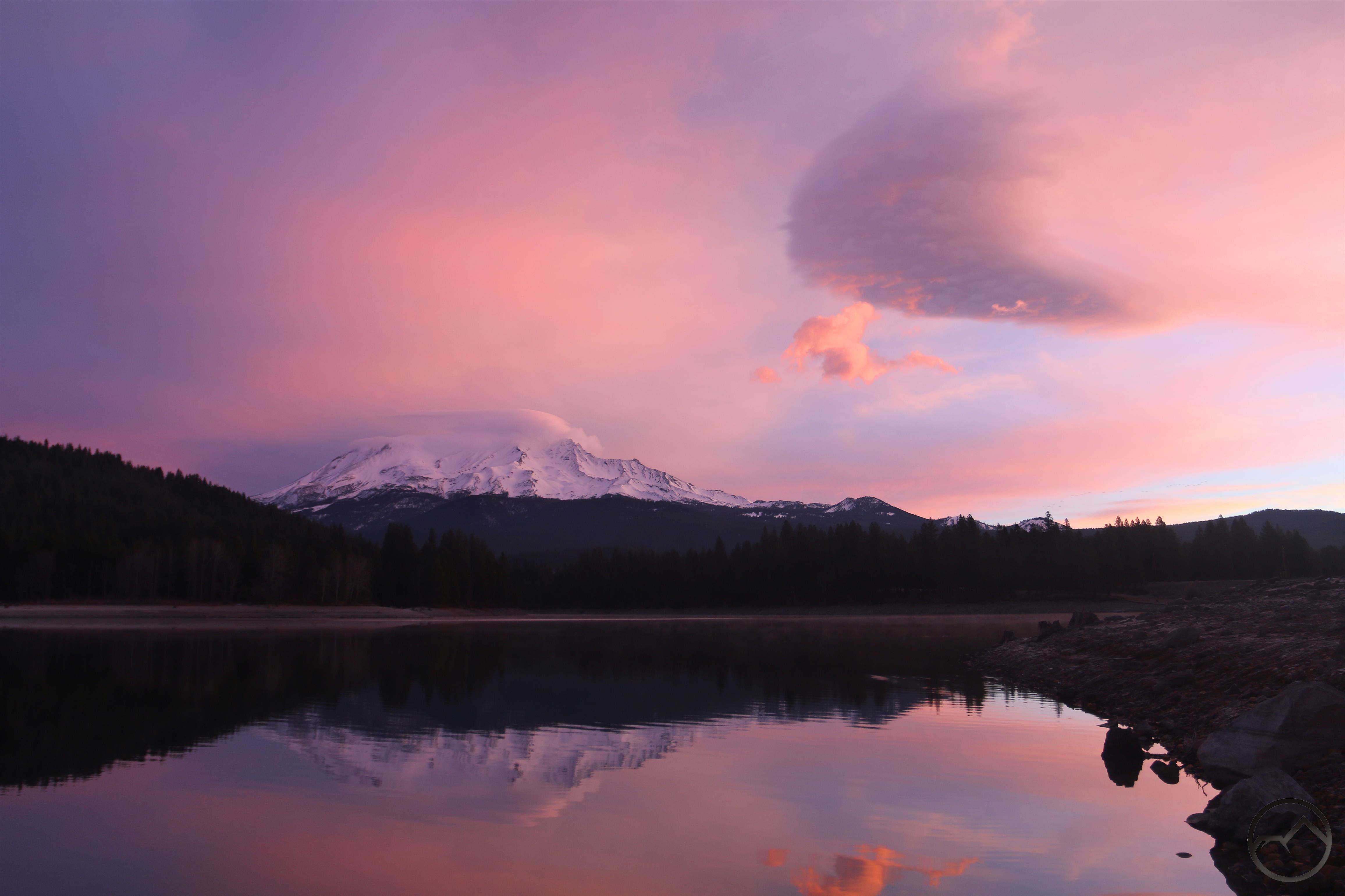
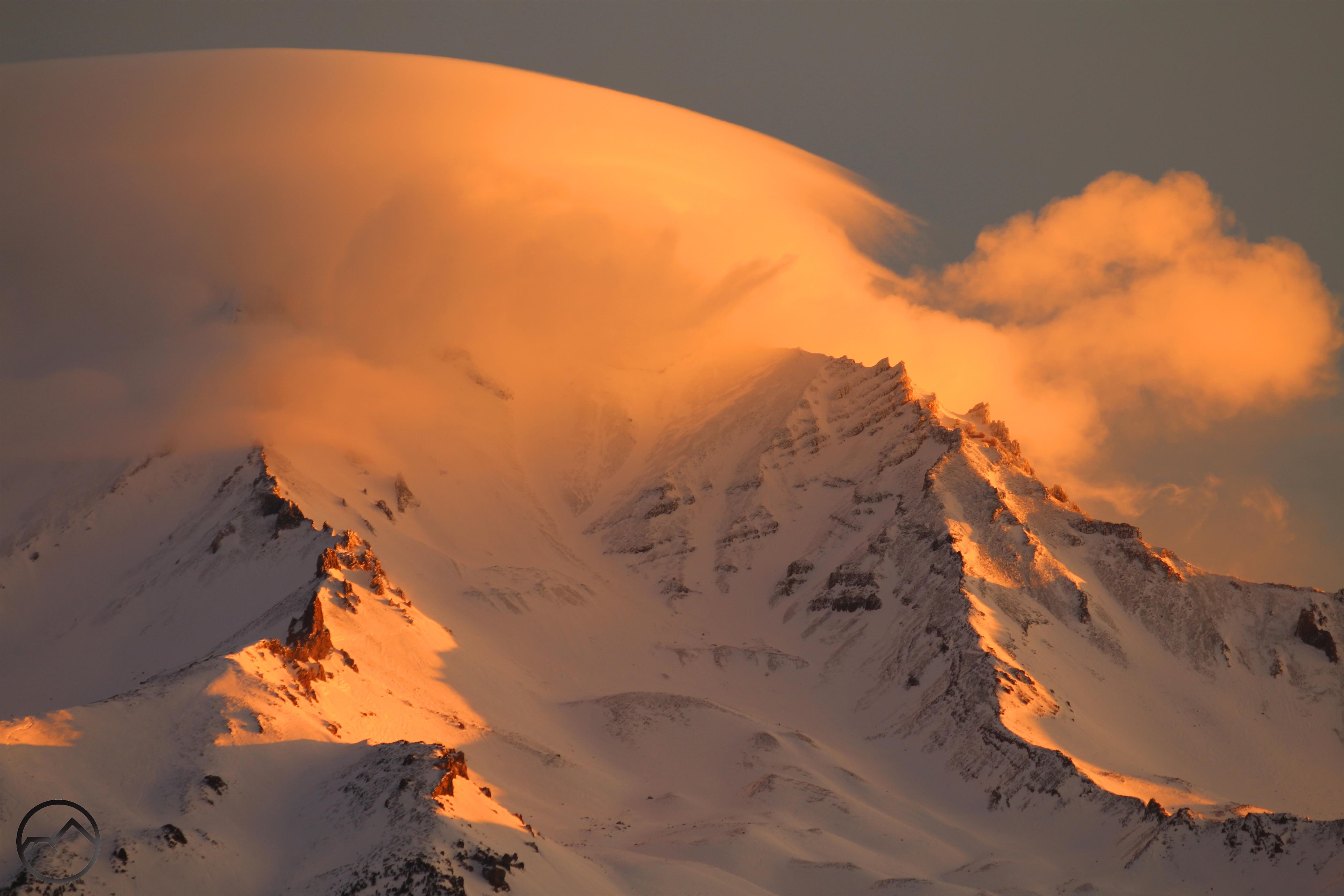
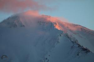
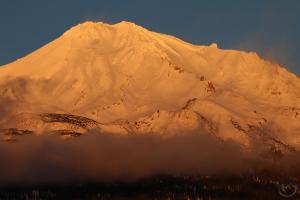
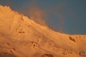
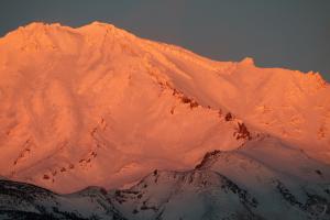
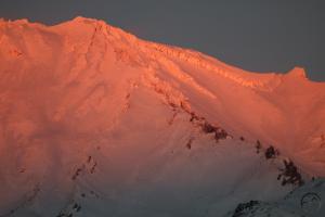
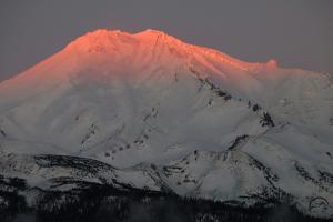
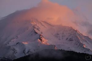
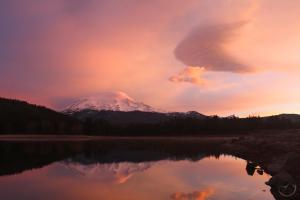
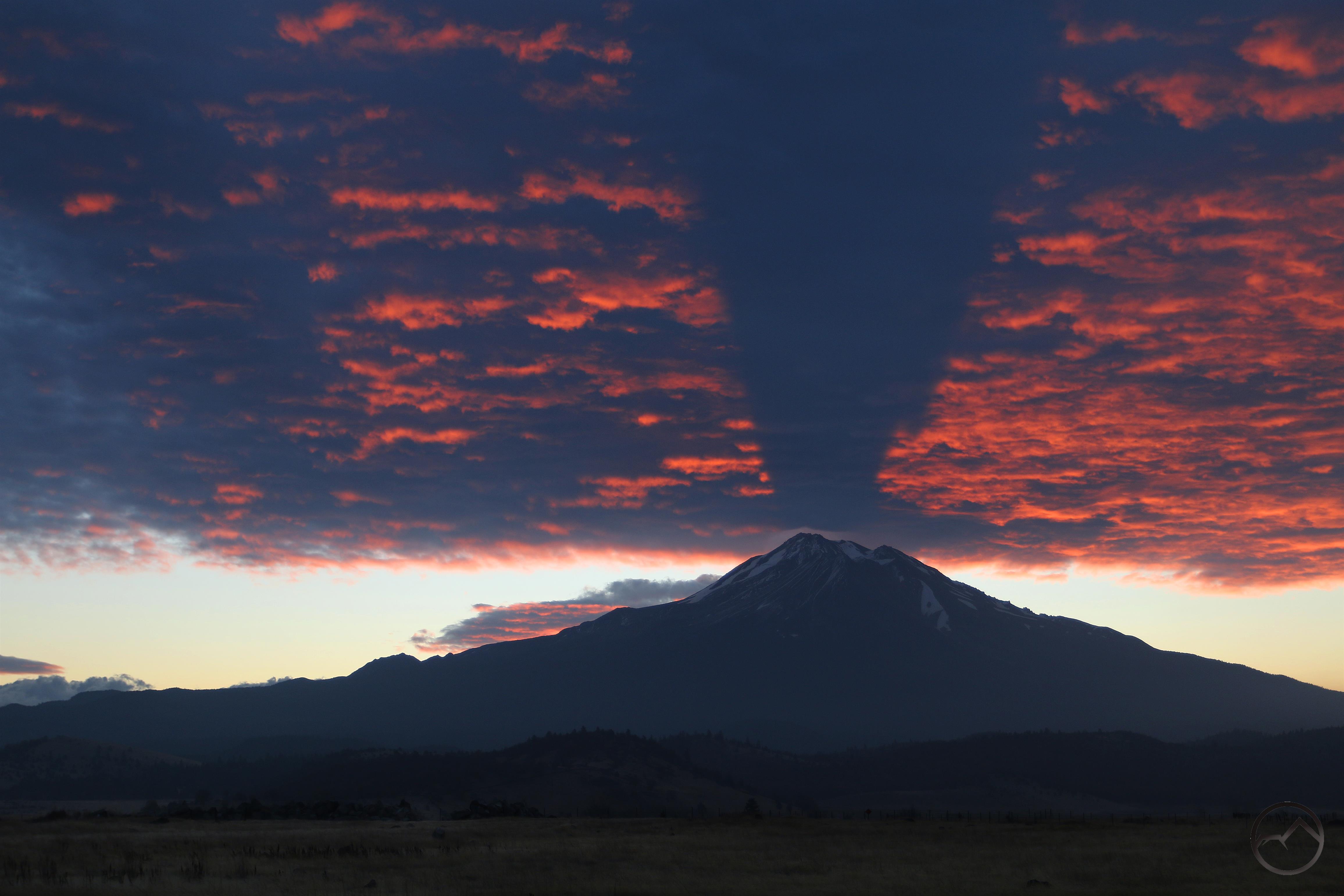
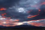
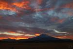
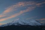
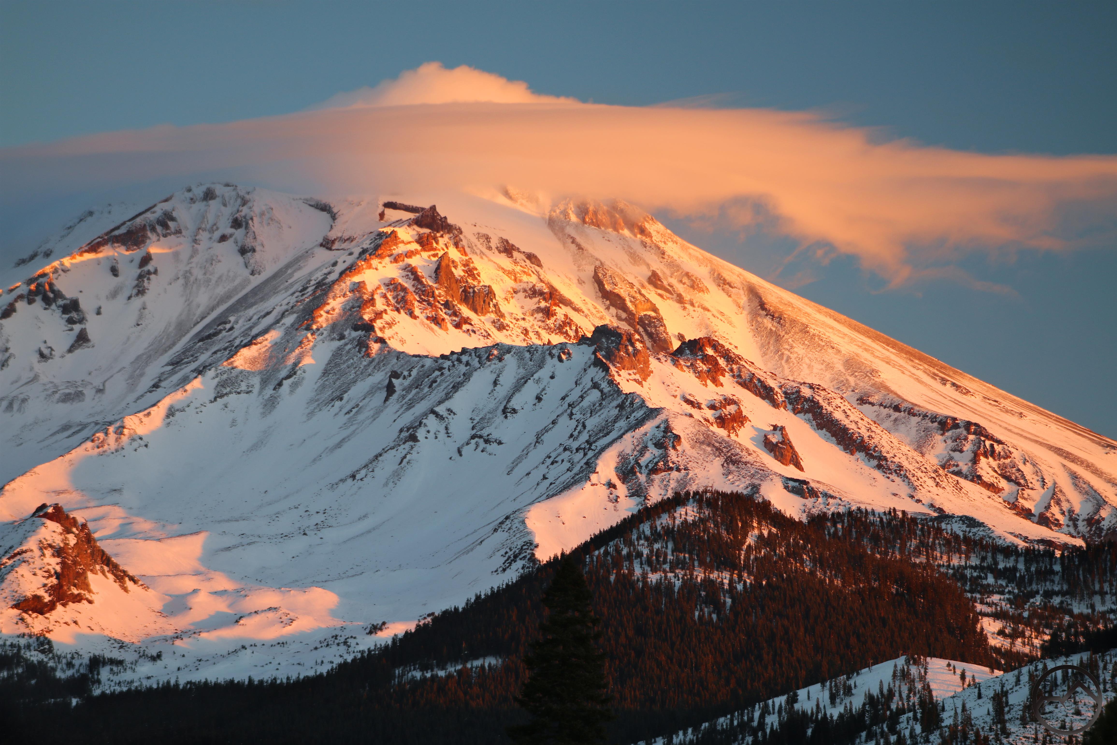
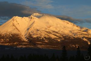
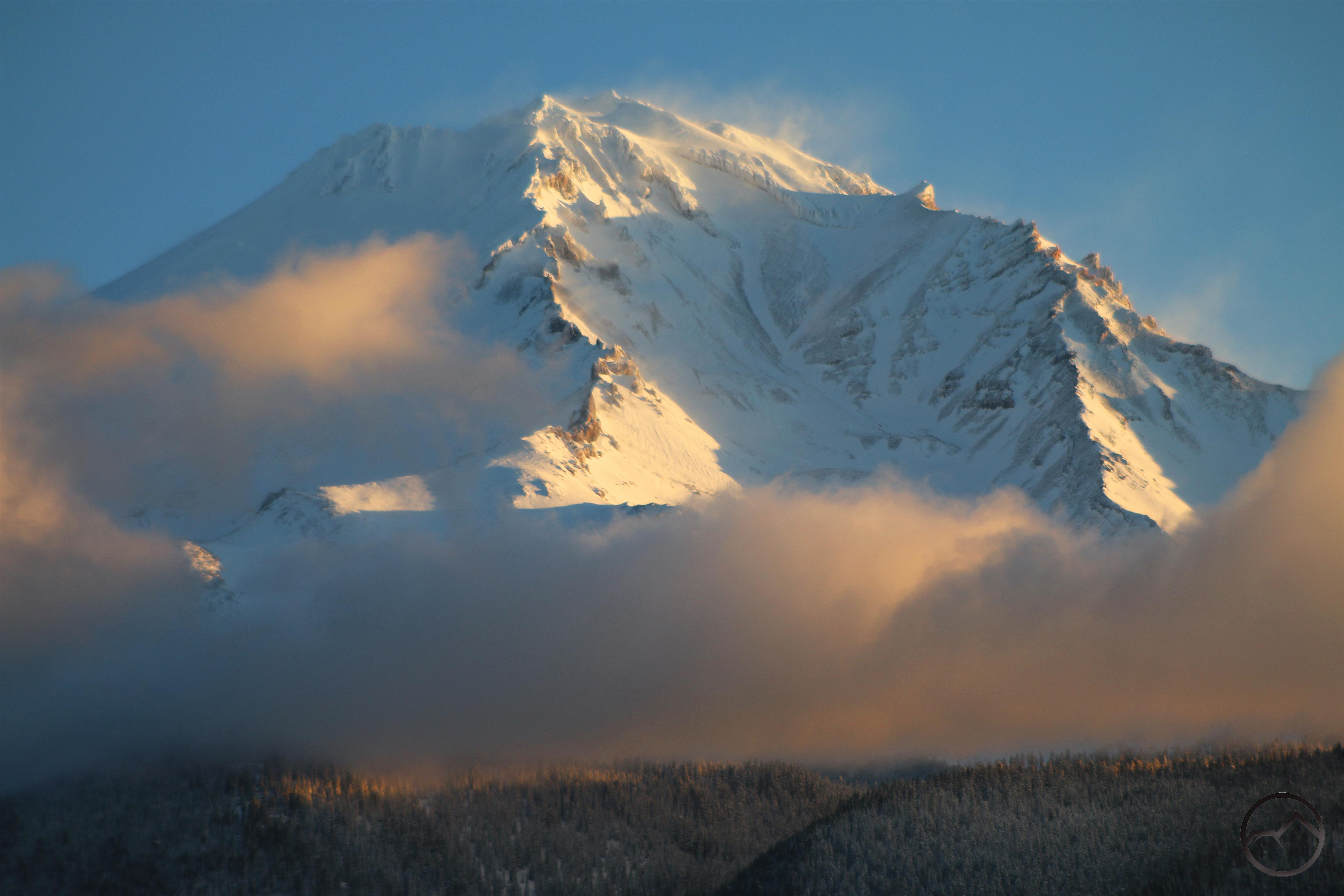
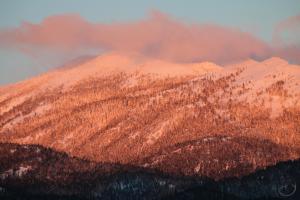
The atmosphere around Mount Shasta seems to glow on a gorgeous December morning.

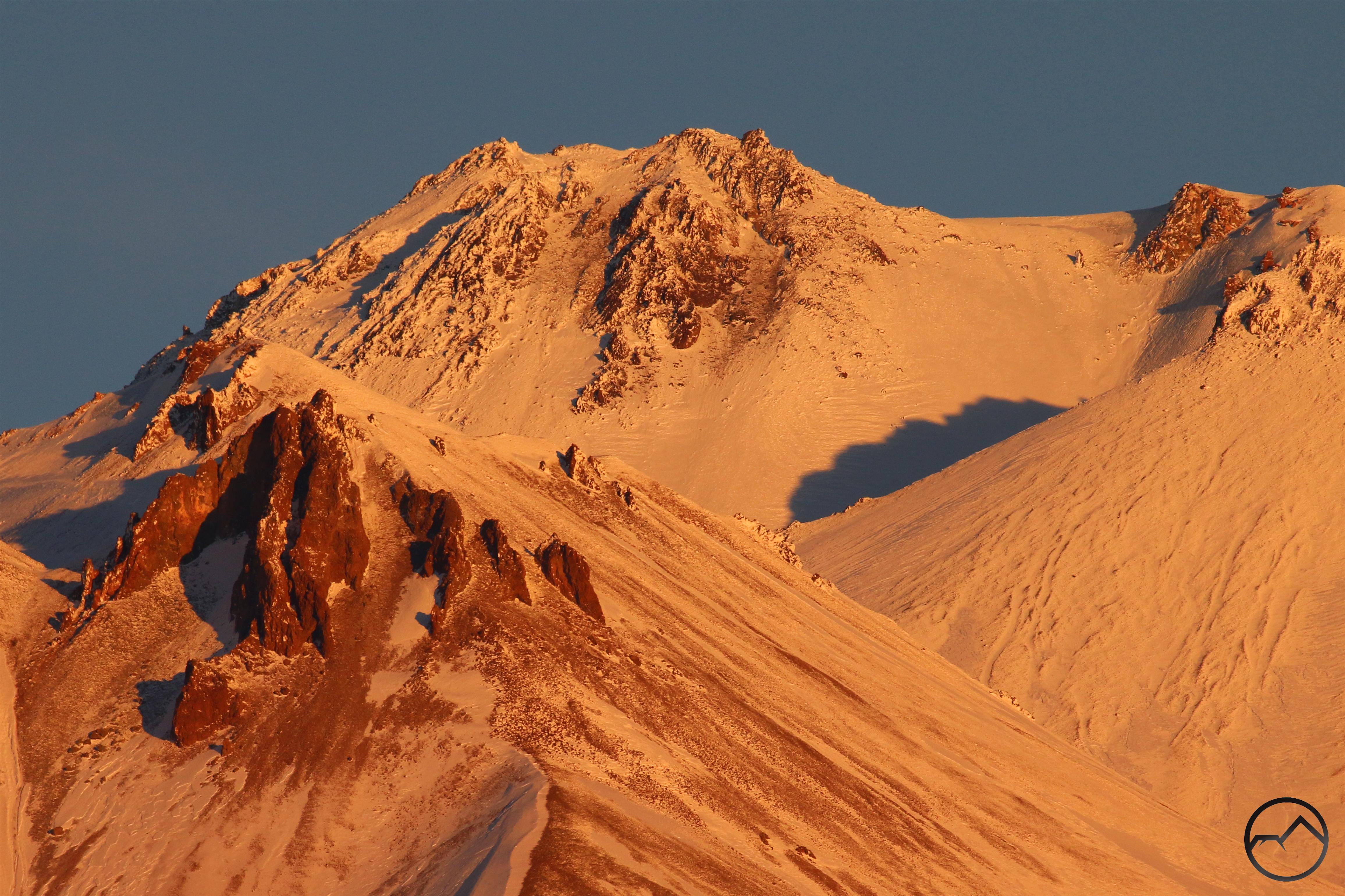
Here in Mount Shasta, the year of our Lord 2018 was another beautiful circuit around the sun. The mountain remained much as it always is, massive, imposing and reigning over the landscape in splendid isolation. It continues to be one of the most beautiful landmarks in the region, just as it has throughout recorded history and beyond. Yet, in the air around the mountain, 2018 saw some of the most spectacular scenes and most tragic events. This past year was among the most beautiful I can remember in terms of lights, clouds and conditions. I captured more lenticular events than any other year past, in addition to plenty of tremendous sunrises and sunsets. Yet, for all the beauty, the fires in Northern California cast a gloomy pall over the mountain. We were left living in a land with no shadows, the smoke obscuring the light and darkening spirits. Nonetheless we persevered and we now have another year to look forward to. May it be a blessed one.

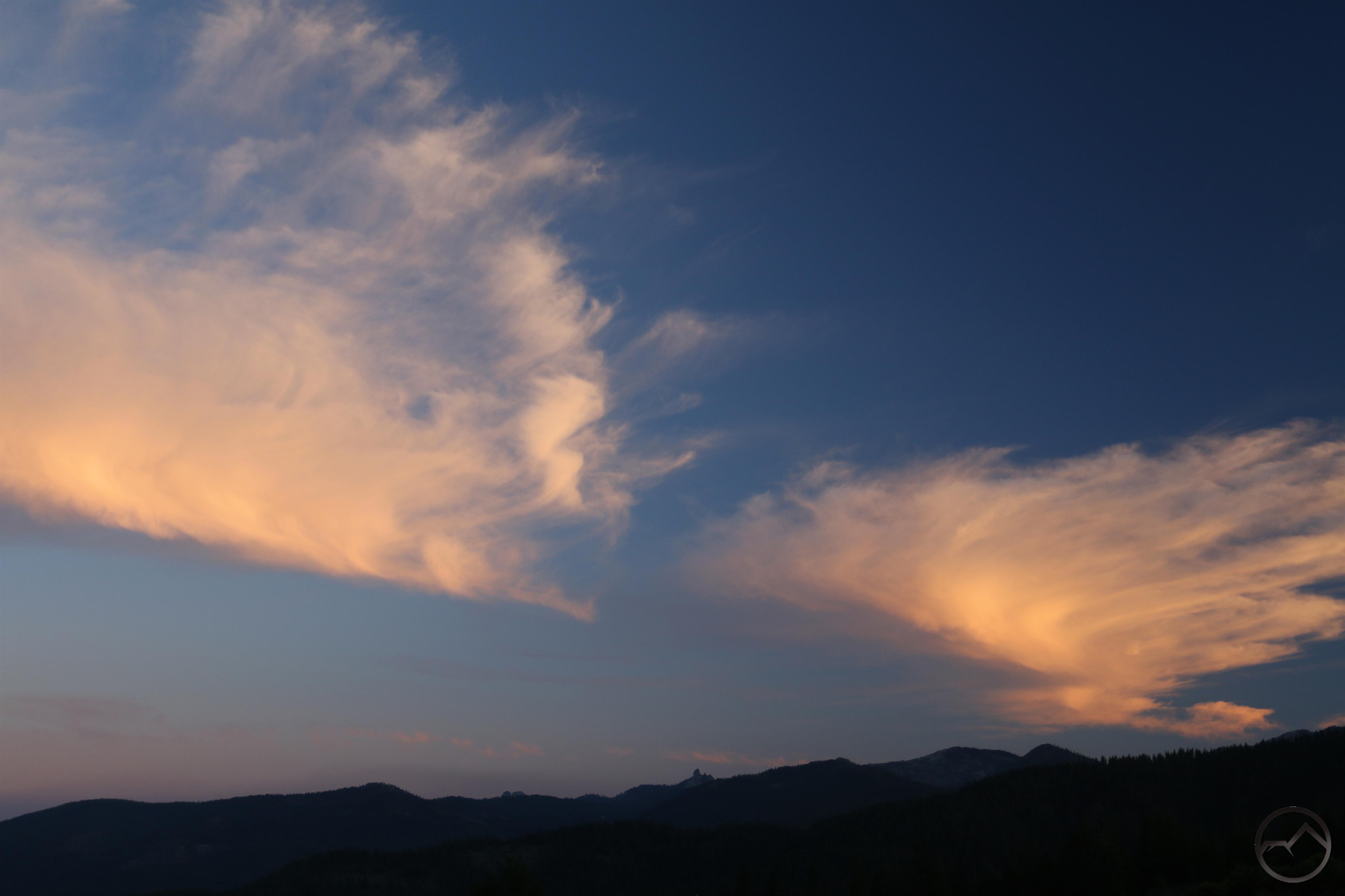
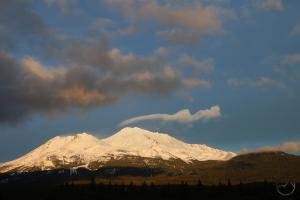
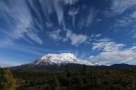
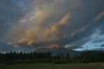
January started the year off with some wonderful cloud activity. It was cold but not too much snow had fallen. Nonetheless, the mountain cast its spell on the weather and there were many beautiful comes and goings of the sun, and a few lenticulars to enjoy. We waited for snow but enjoyed what there was.

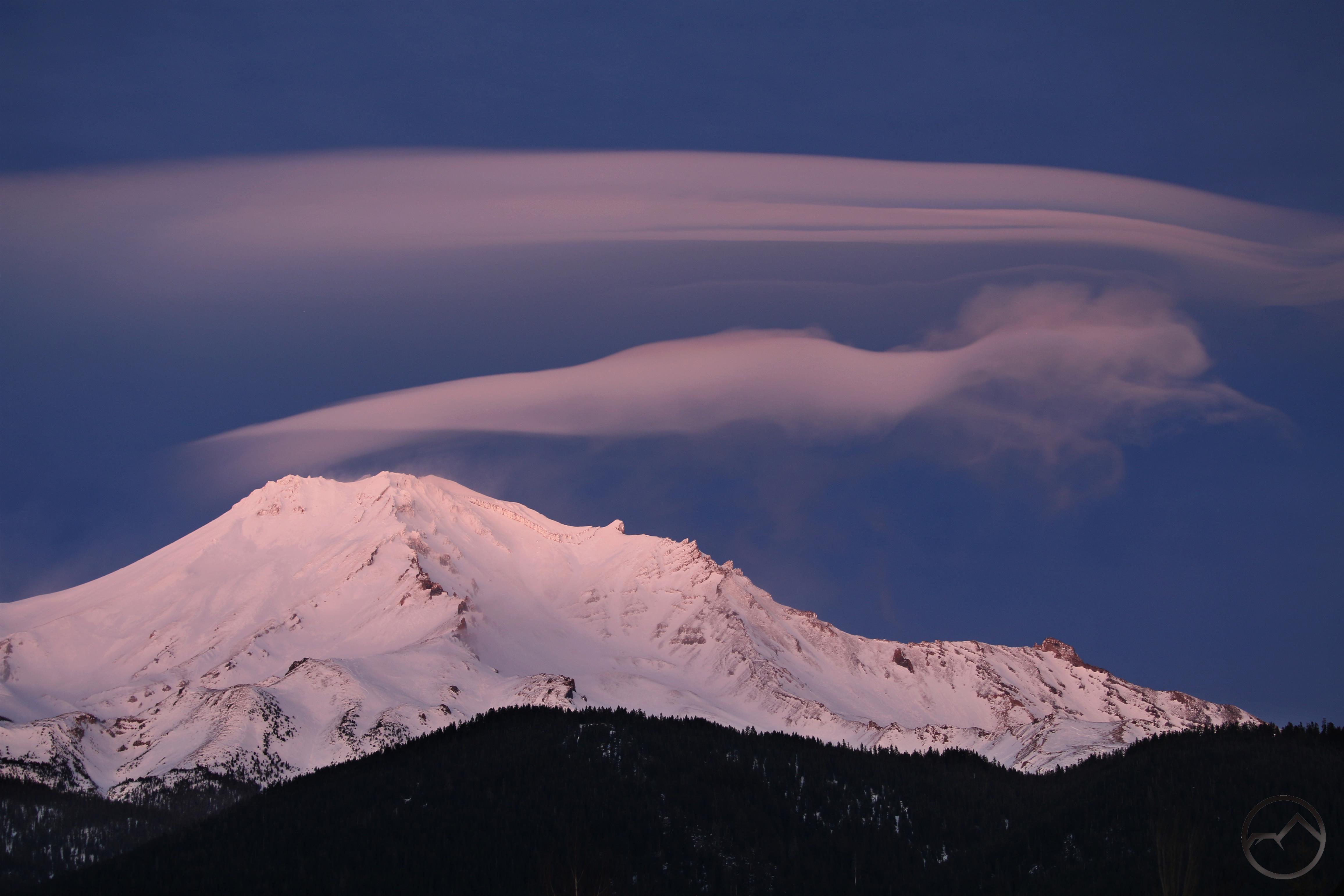
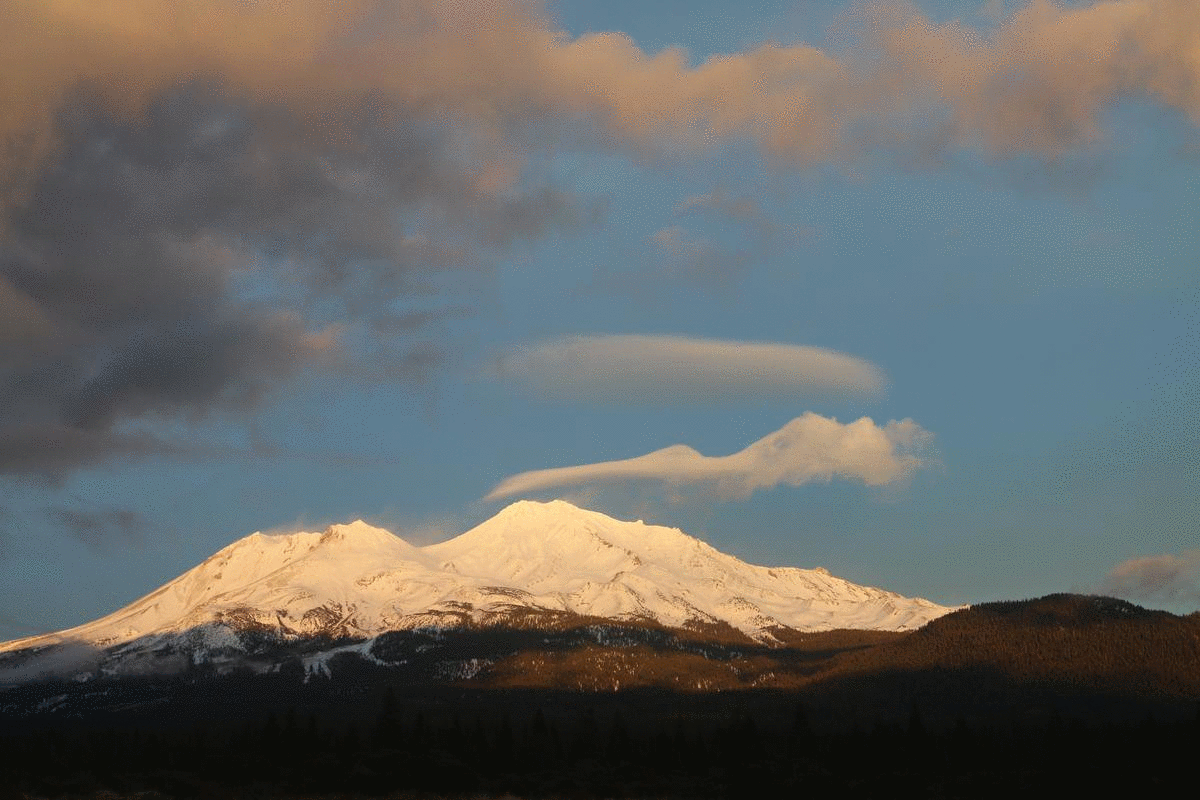
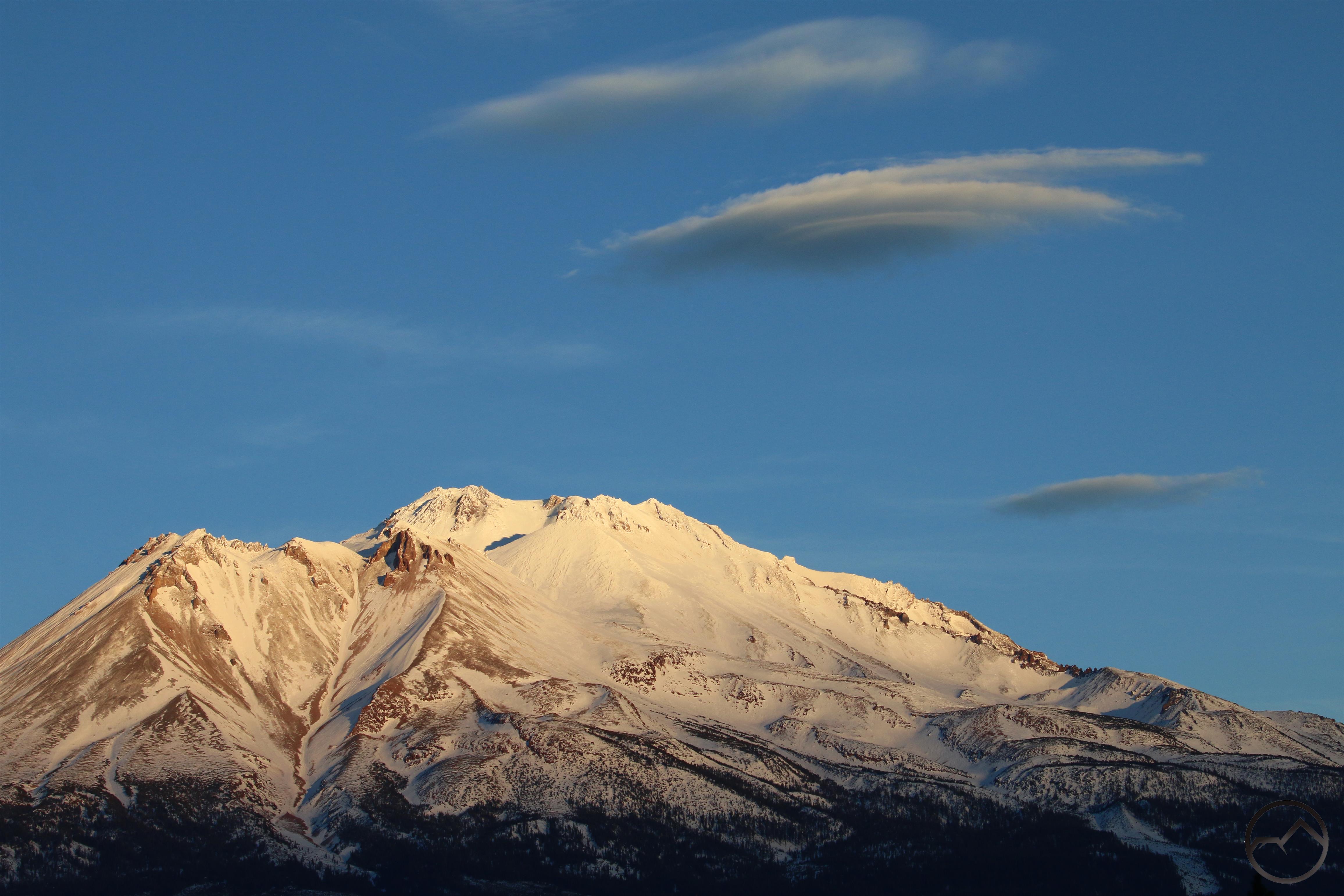
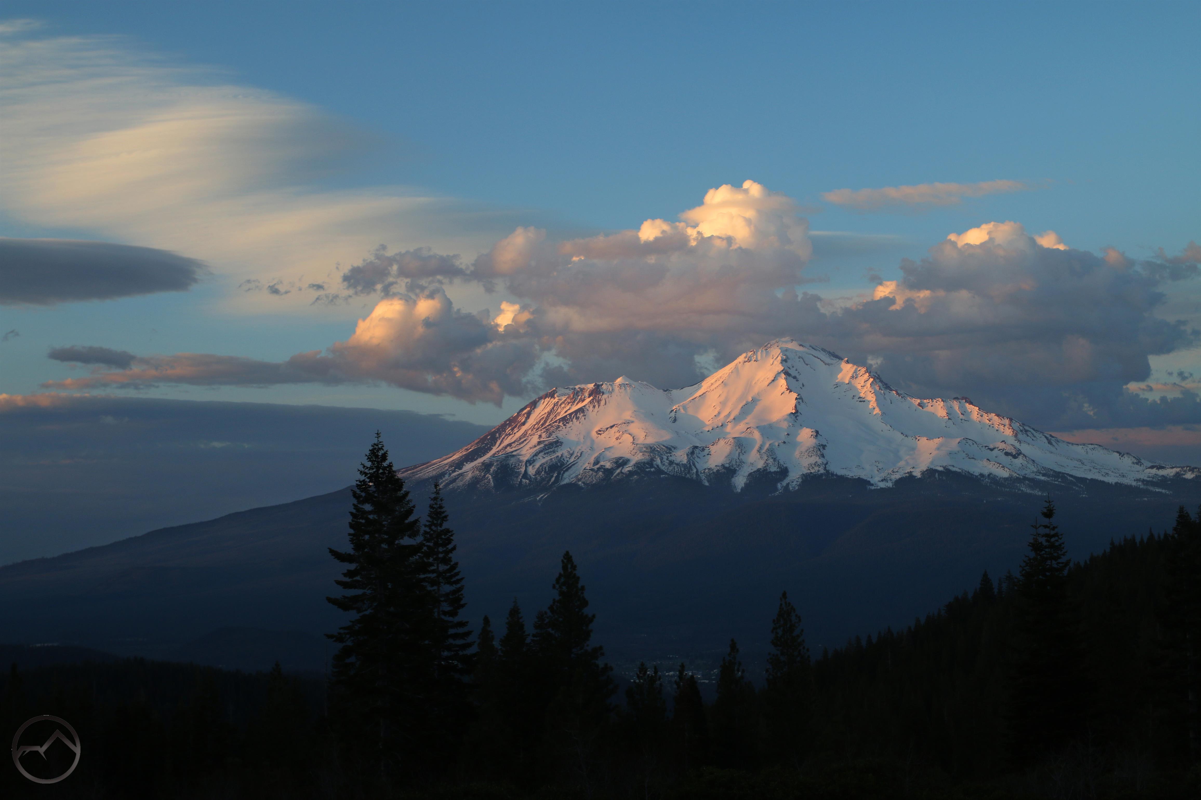
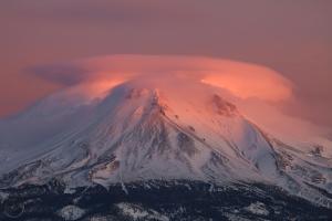
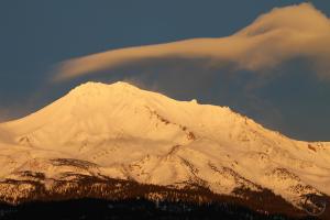
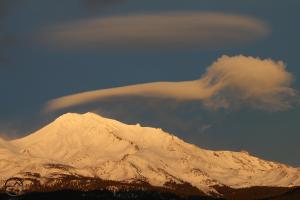
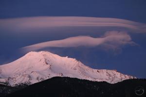
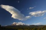
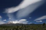
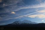
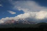
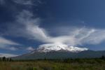
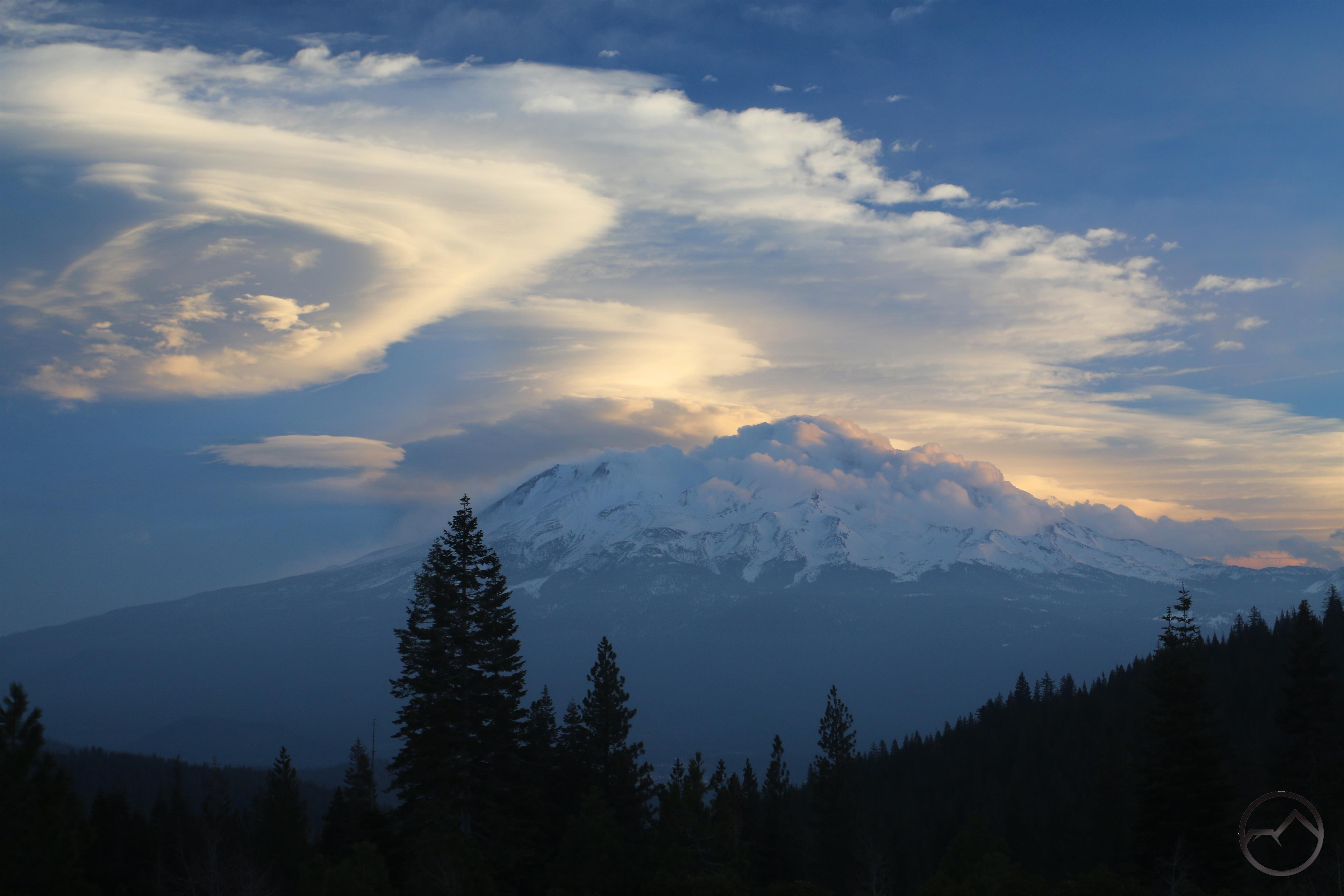
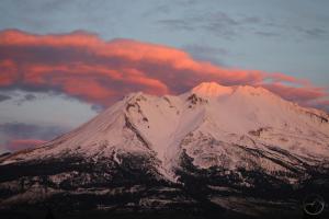
Simply stated, I think February saw the highest concentration of epic lenticular displays that I can recall. It wasn’t just that there were a lot of events but the ones that did occur were particularly memorable. Things remained cold and some snow fell but not as much as we would have wanted.

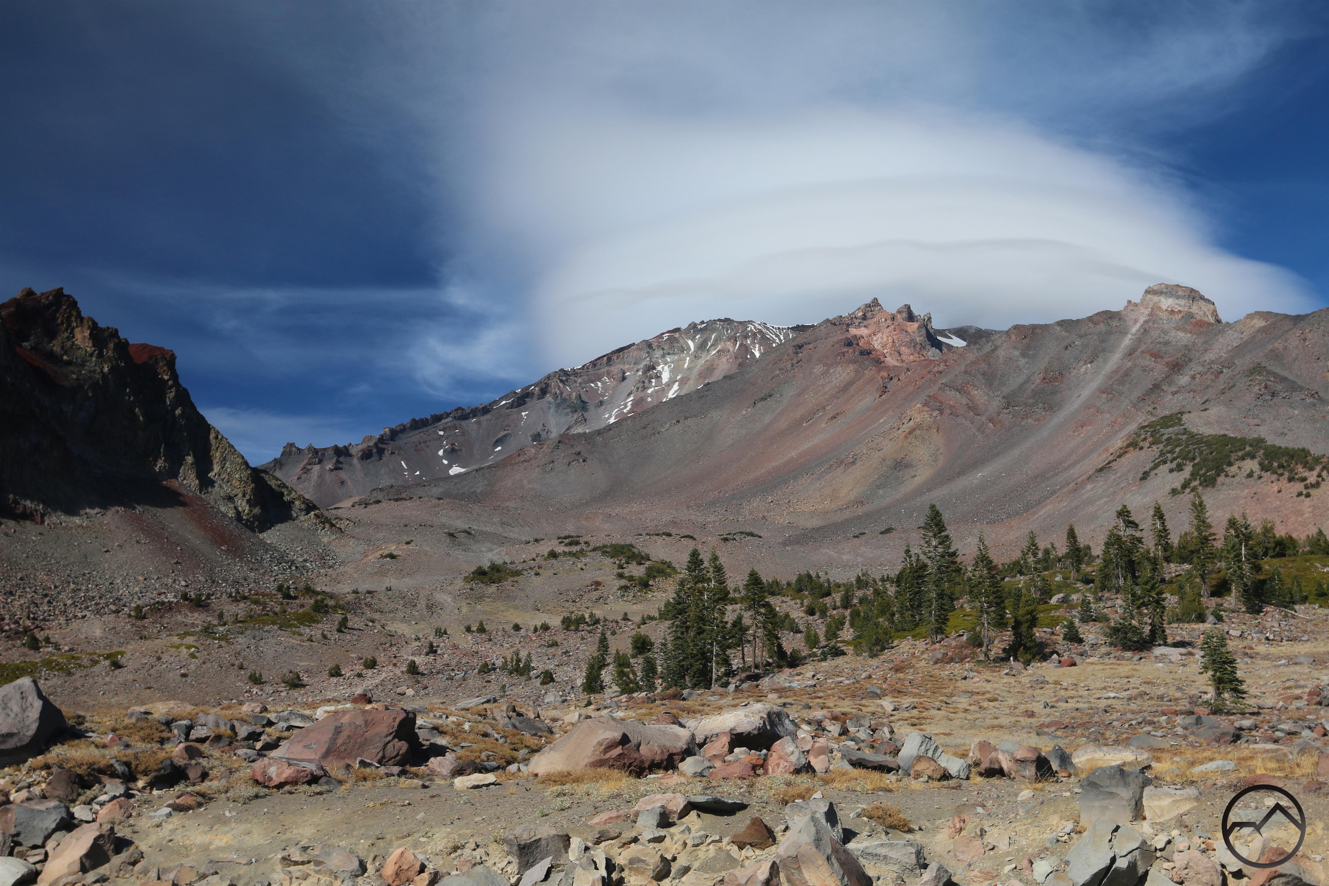
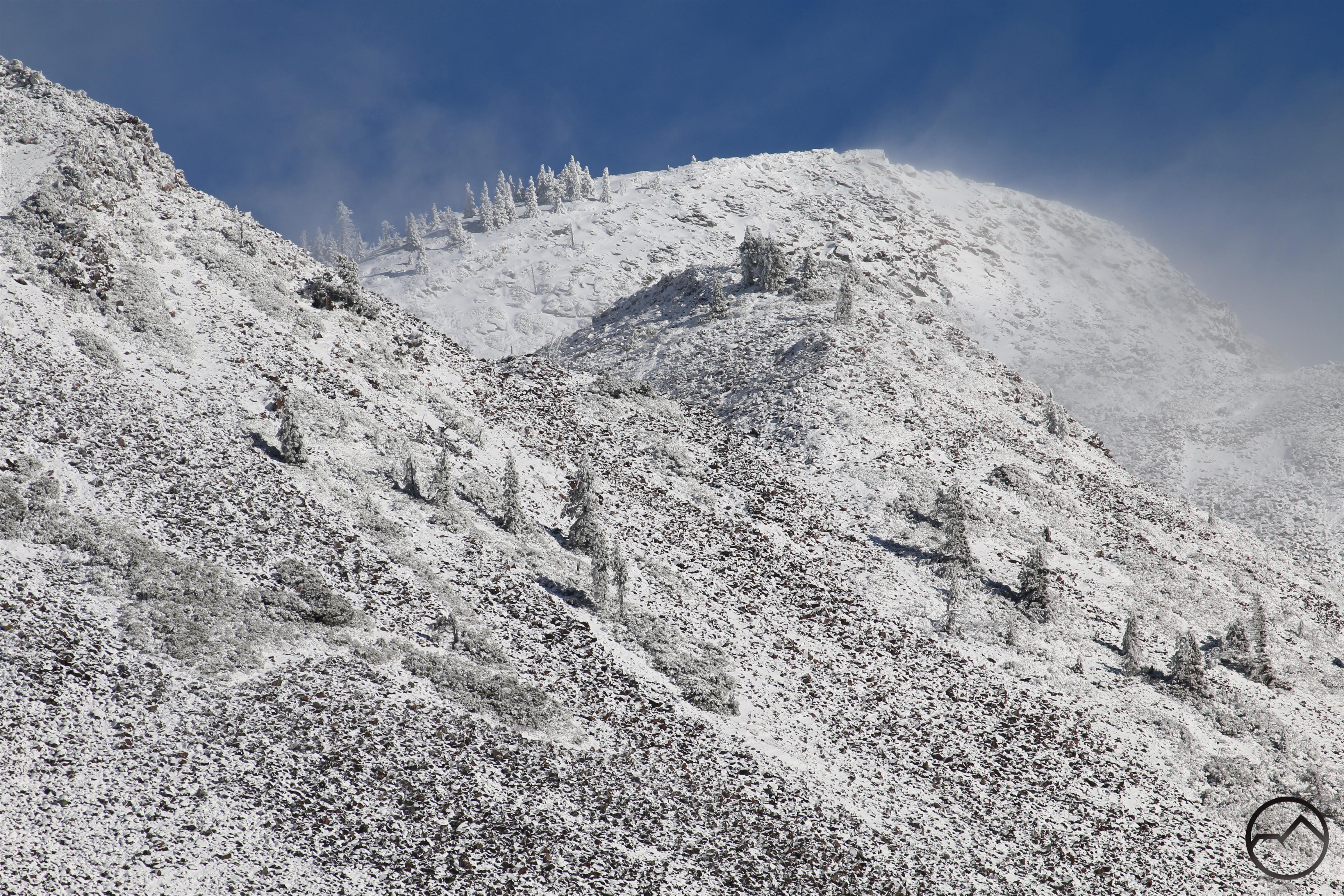
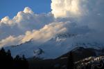
Though late in the winter, March finally brought a large amount of snow to the Mount Shasta area. It was not an enormous deluge but it was enough to not call the winter a bust and it helped us limp through the coming summer. It was a welcome presence just before the spring and did set up some frigid outdoor fun.

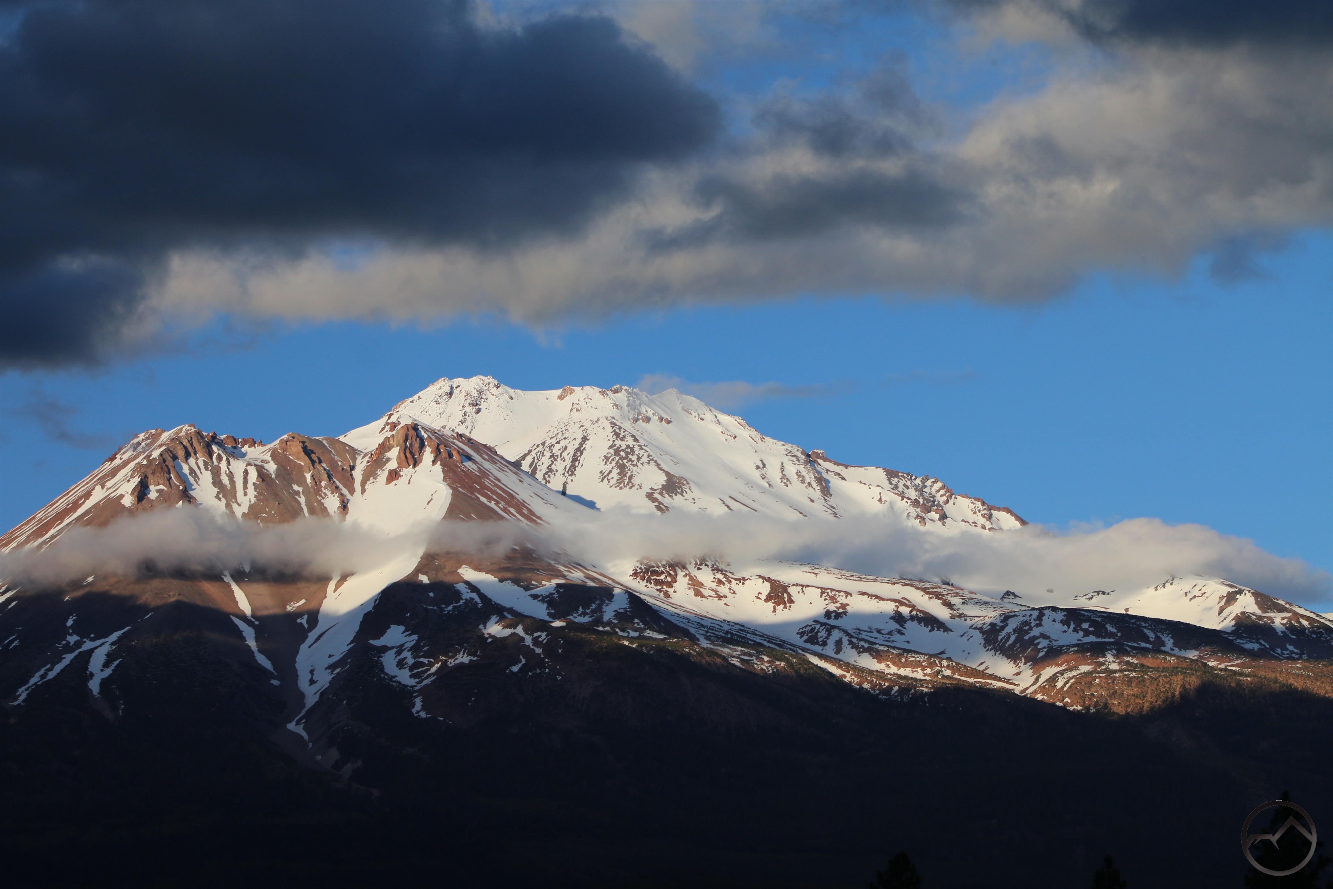
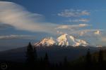
April was a beautiful month in Mount Shasta this year. The snow was gone off the low country but the higher peaks were blanketed in snow. The temperatures were warming and it was time to start emerging from winter’s hibernation. Though Mount Shasta looked notably snowy, it was obvious that the snow was not as deep as we would want it was going to be an interesting summer.

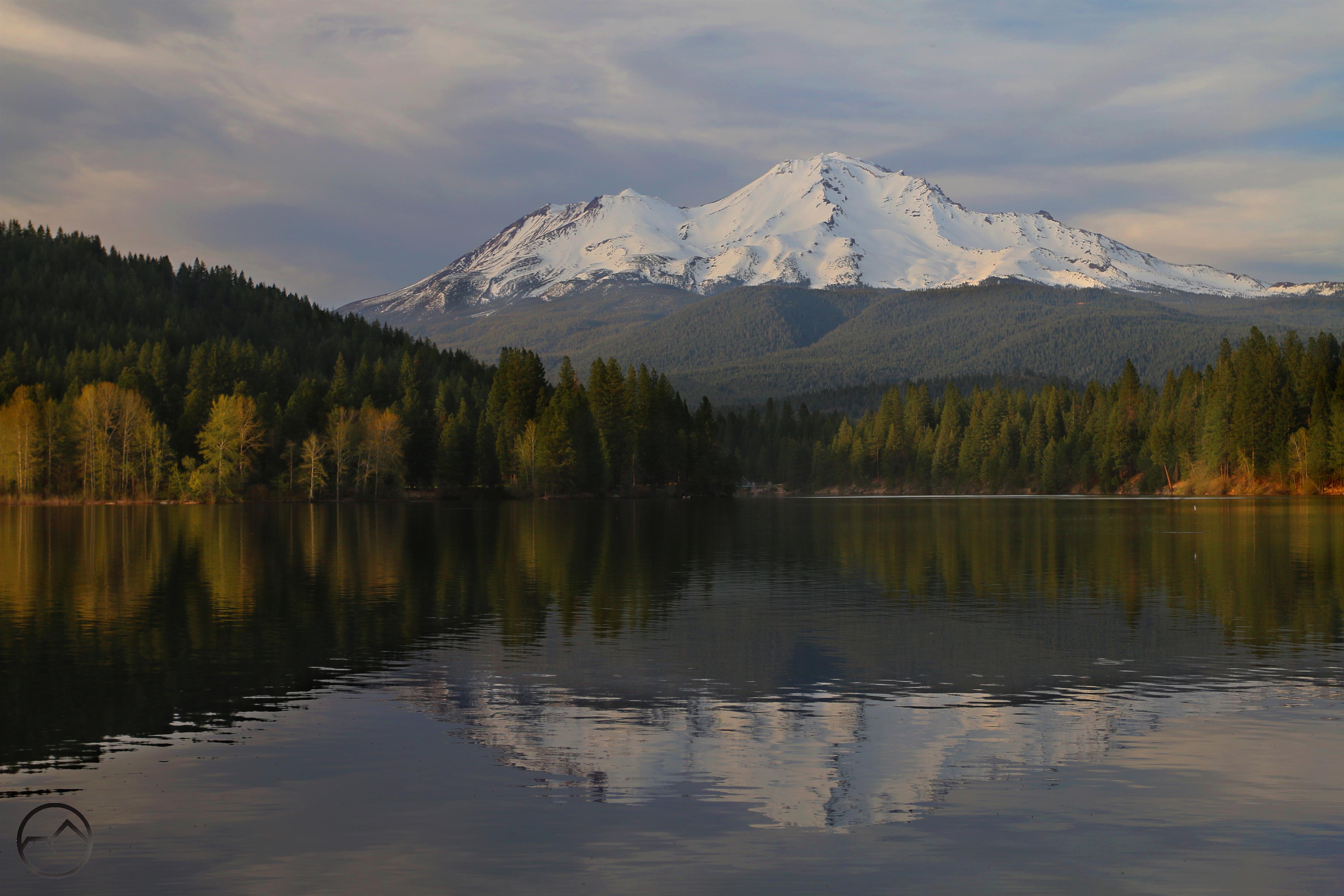
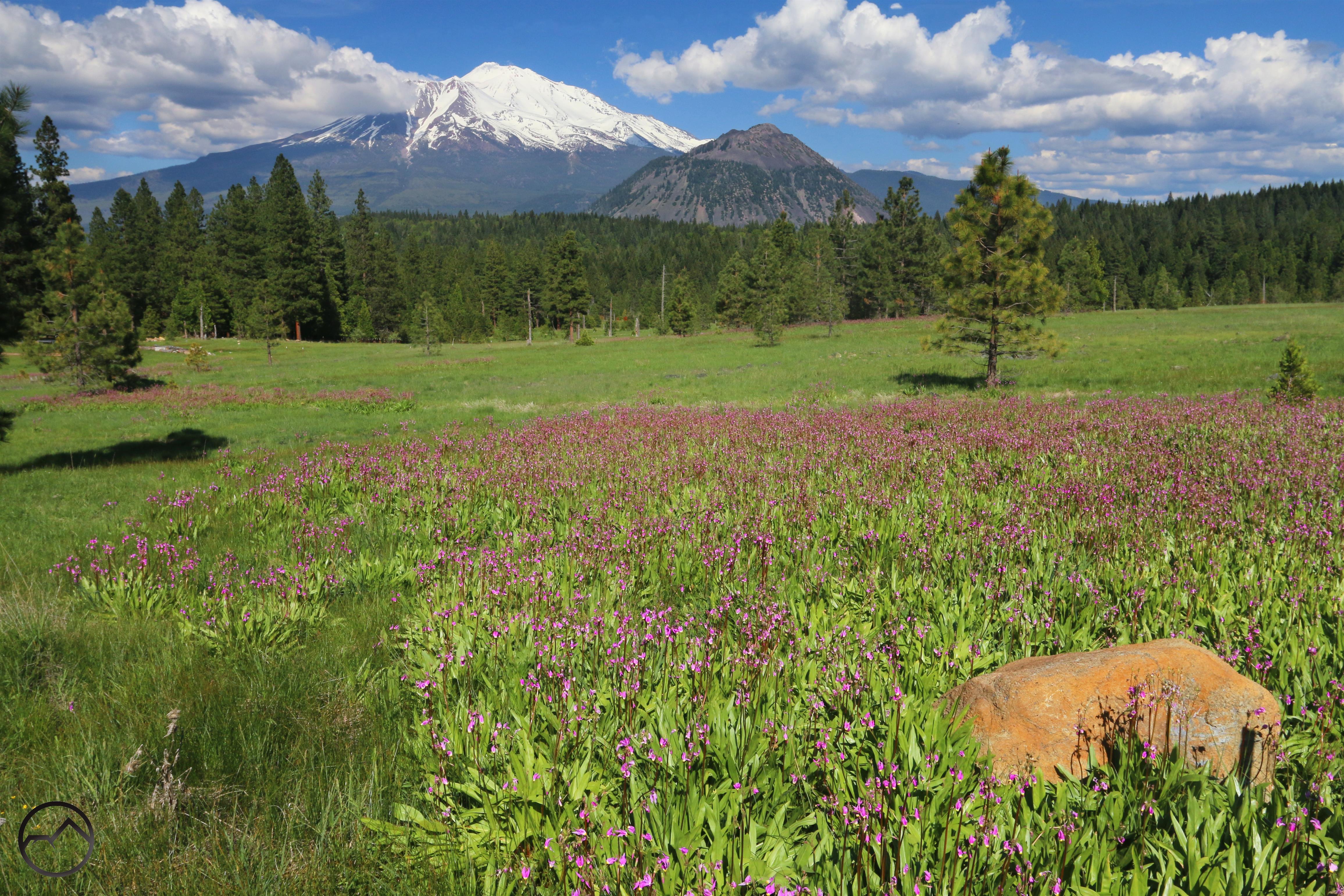
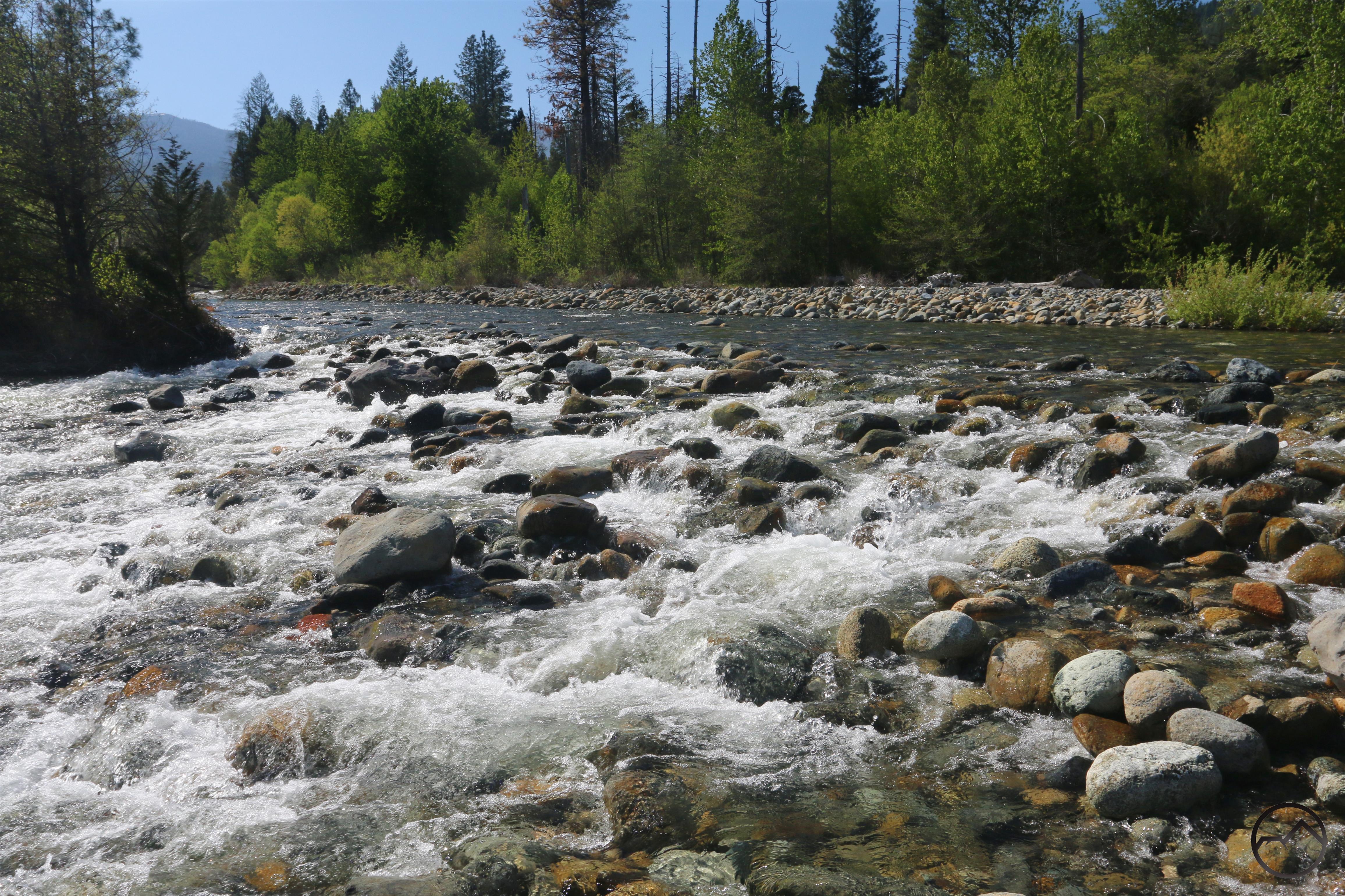
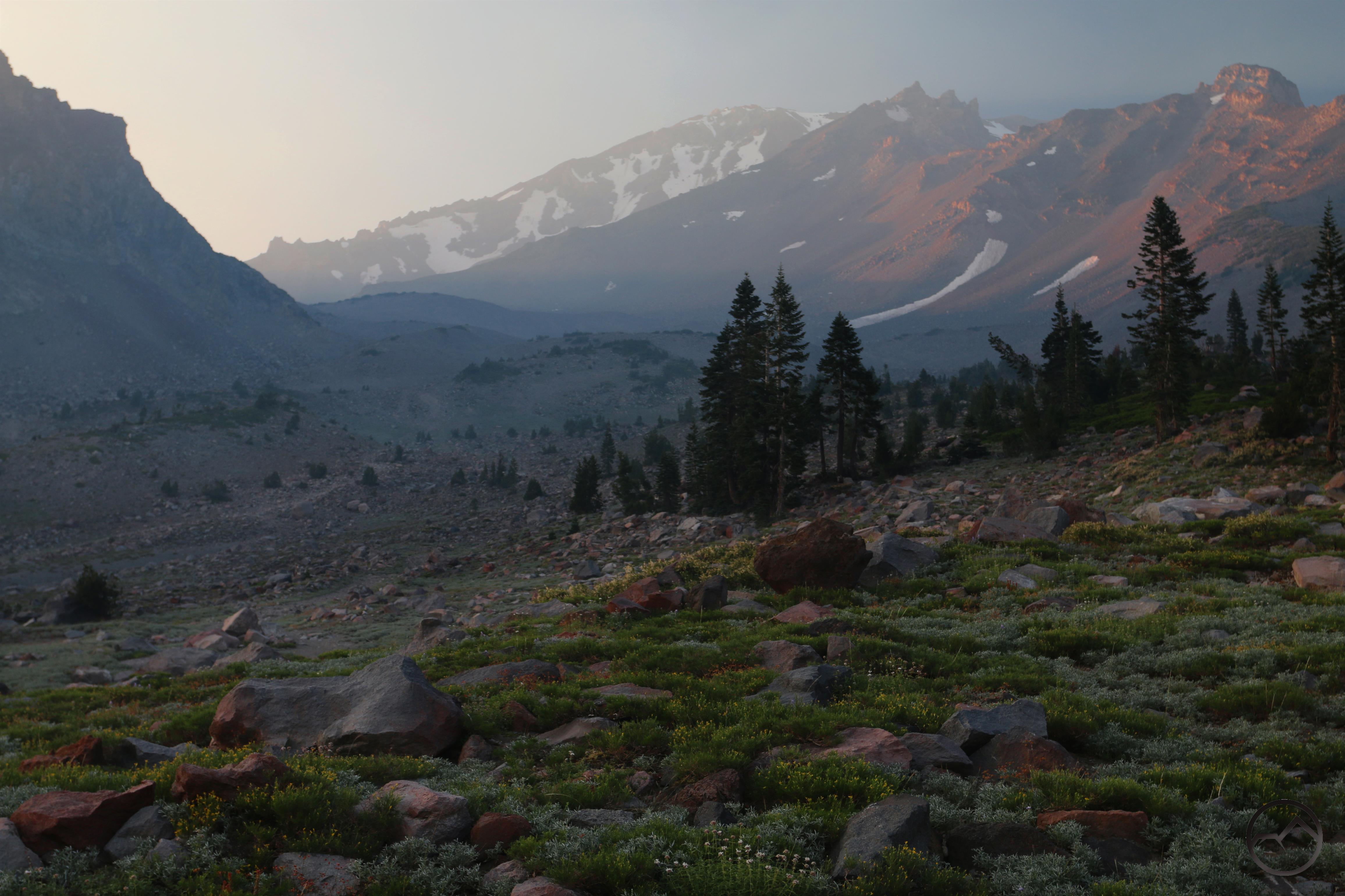
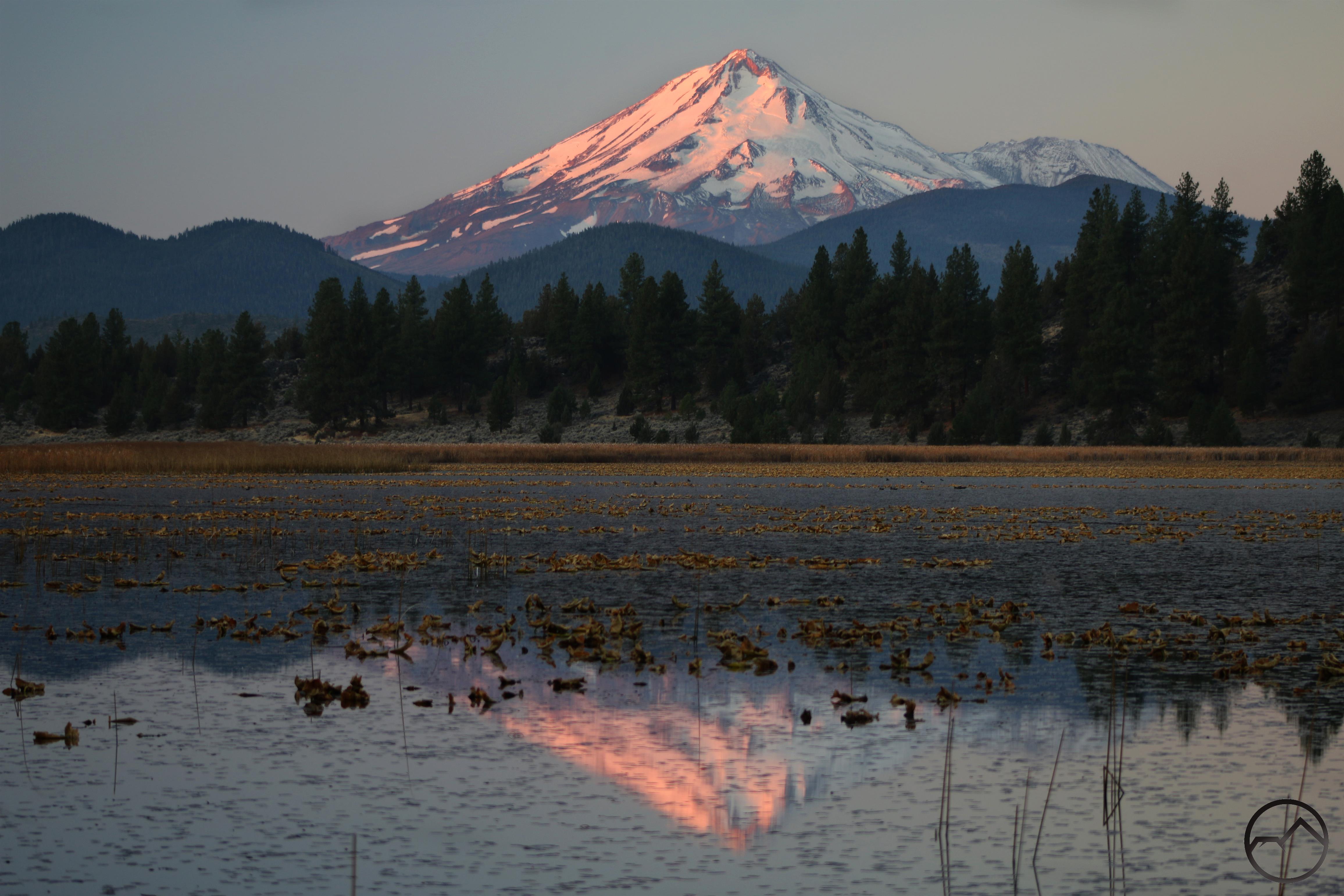
The thaw was in full force through May. The snow was melting quickly and the rivers were full and furious. The wildflowers were out by the legion and life was good in Mount Shasta. The time to start hiking in the high country was just about upon us, with many trails opening up. It was easy to be optimistic about the summer.

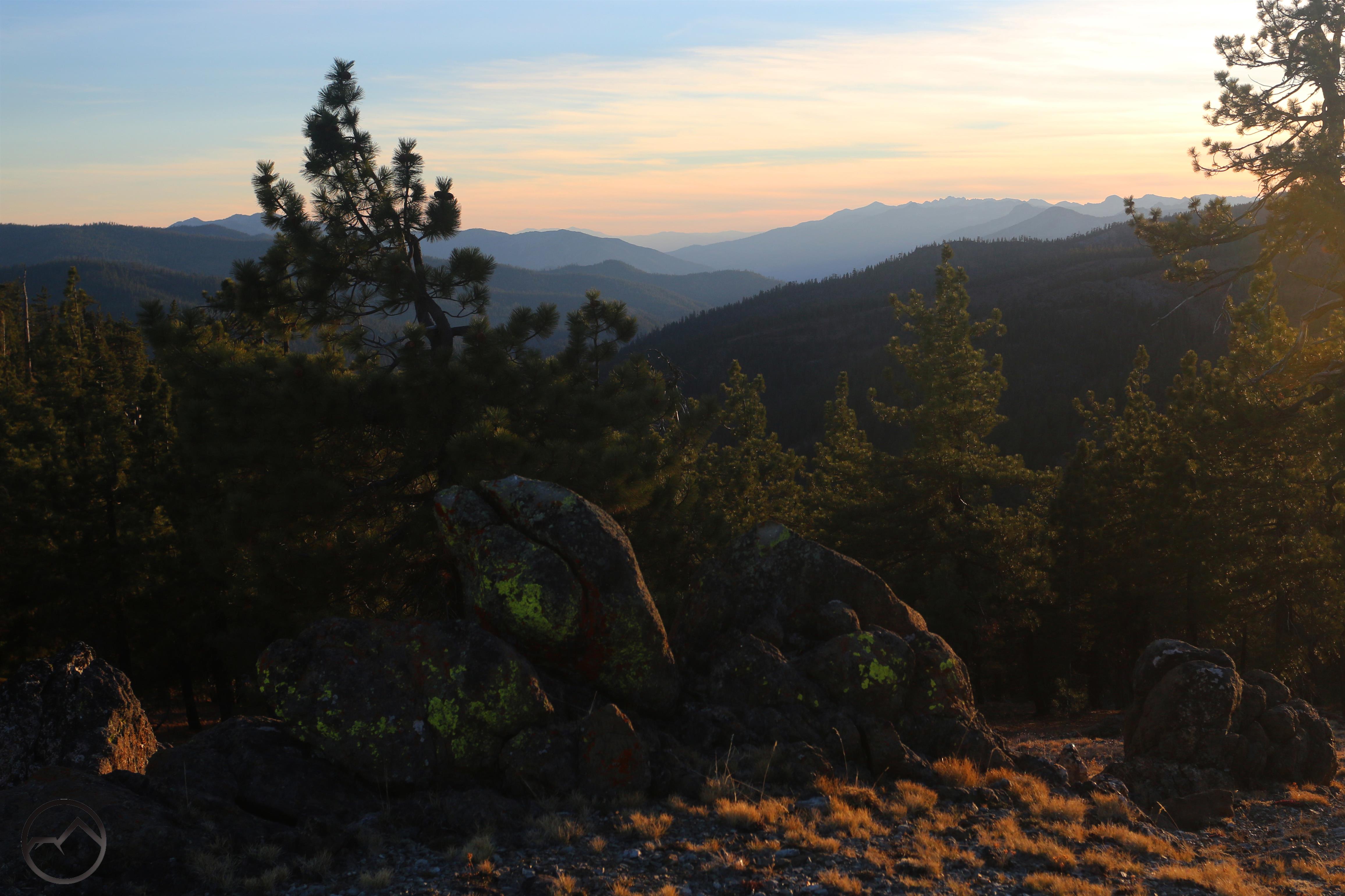
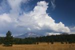
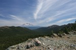
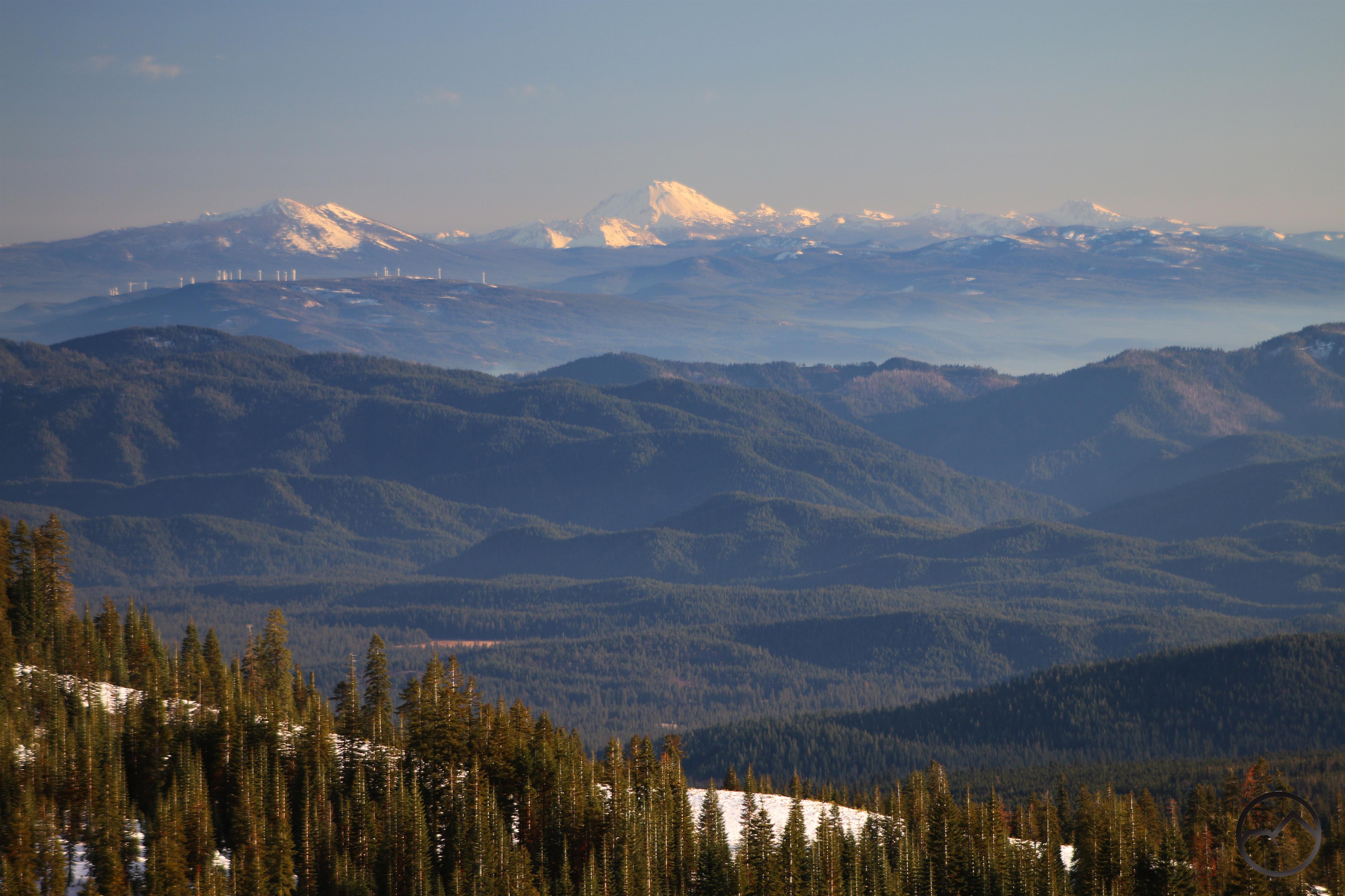
As we approached the midpoint of the year in Mount Shasta, summer was in full effect. The trails in the Trinity Divide were open, the high country was largely accessible and the conditions for being outside and enjoying the scenic bounty we have here was nearly optimal. Mount Shasta still hand a good amount of snow on it, though this was now melting rapidly. The skies did not disappoint either, though, oddly enough, my images of June show an unusual number of interesting clouds and sunsets over the Trinity Divide rather than Mount Shasta. That made for a beautiful change of pace!

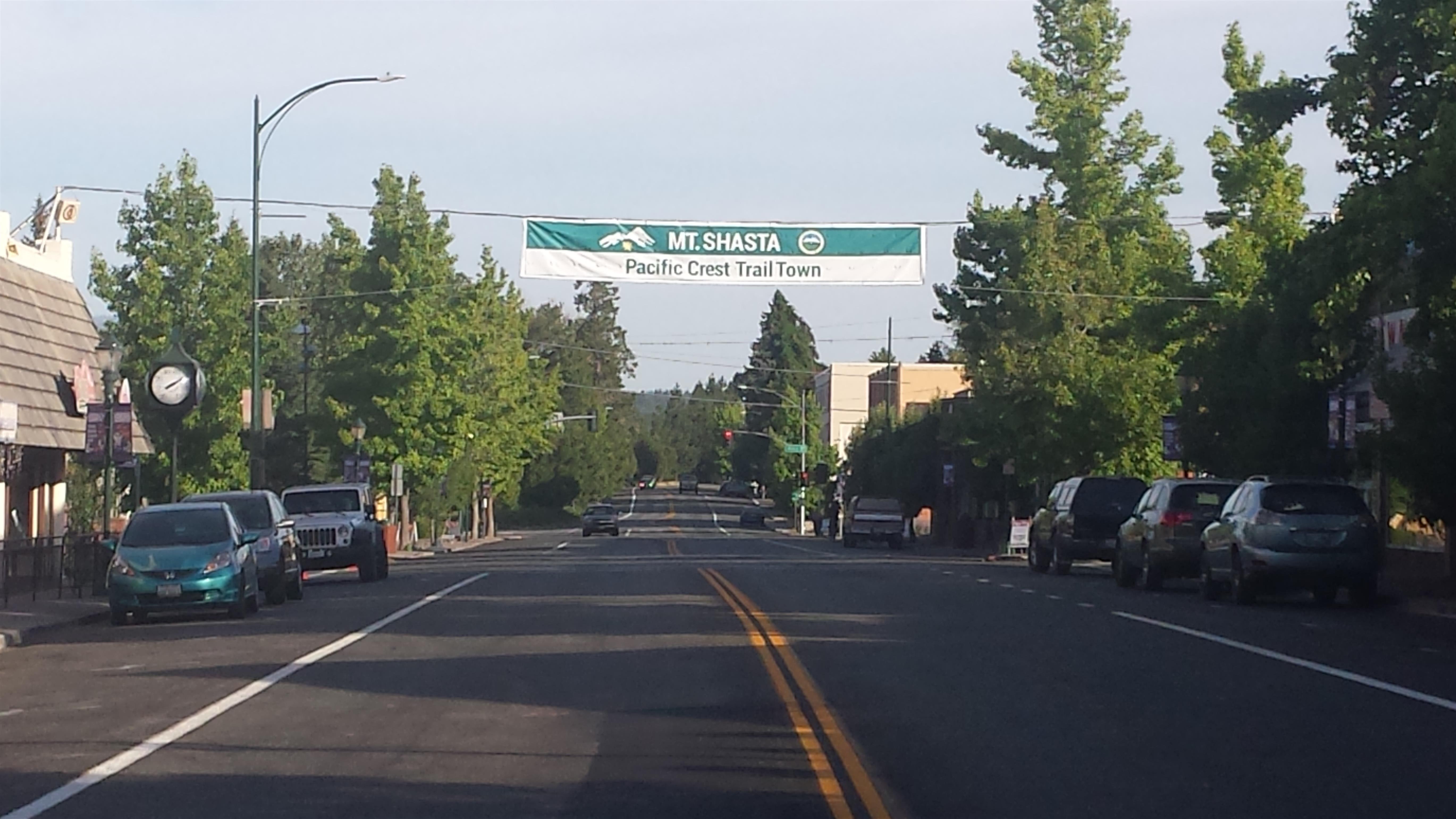
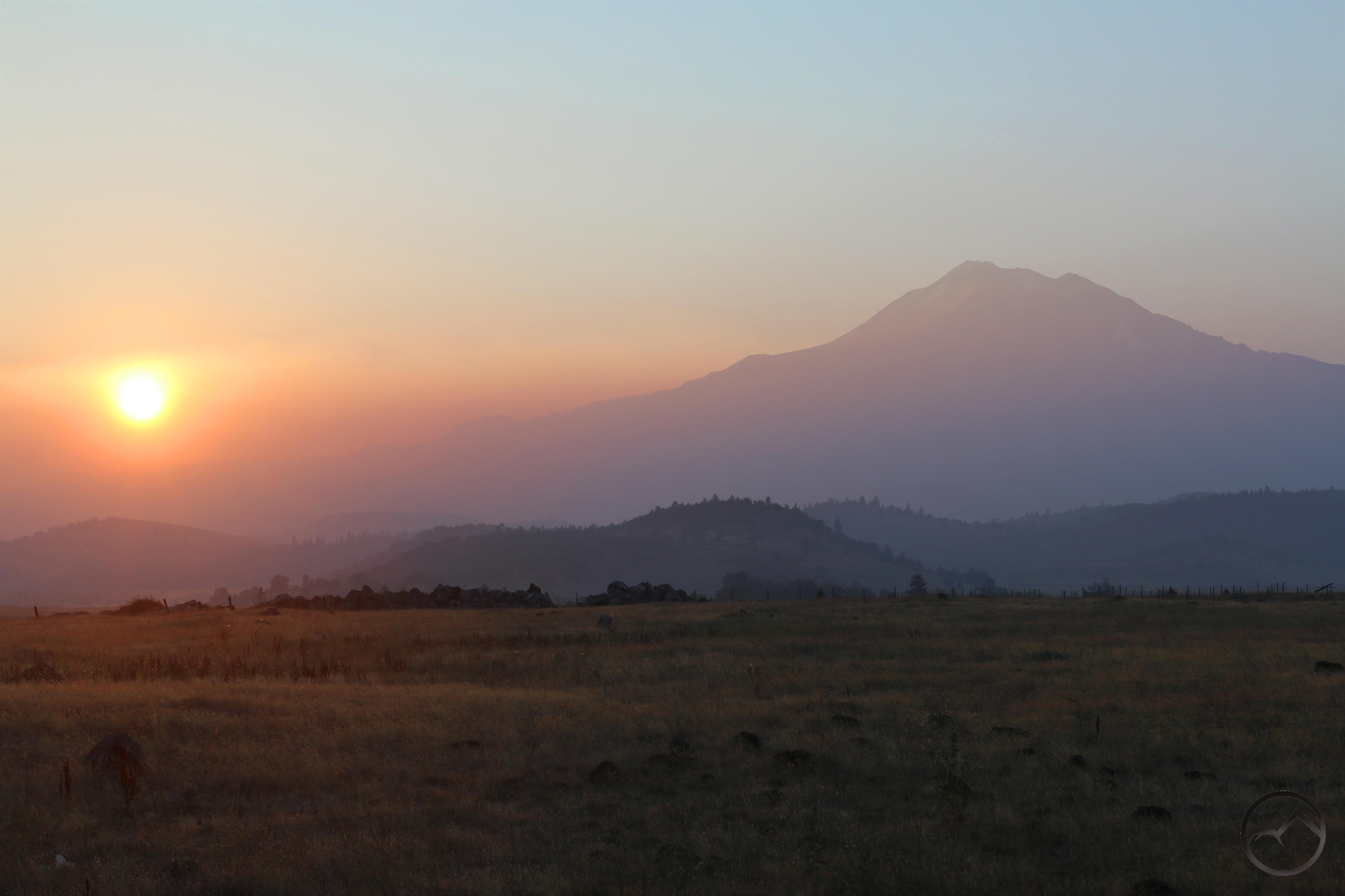
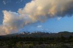
It was in July that the year started to take an ominous turn. It began in the usual, beautiful fashion of a Mount Shasta summer. The Old Ski Bowl opened up, the temperatures in the high country were ideal and the air was clear. Mount Shasta celebrated its installation as the inaugural Pacific Crest Trail Trailtown (a fantastic event!) and all seemed well. Yet up to the north, the Klamathon Fire burned, sending drifts of smoke to the south. It was not too much but it was the unfortunate augury of what lay ahead. Right at the end of July the Carr Fire erupted. Little did we know how dark a turn this would be.

The Carr Fire dominated the month of August and the smoke seemed to never go away. The heart of summer was lost to the funereal mantle of vaporized trees and houses. It was a lost month.

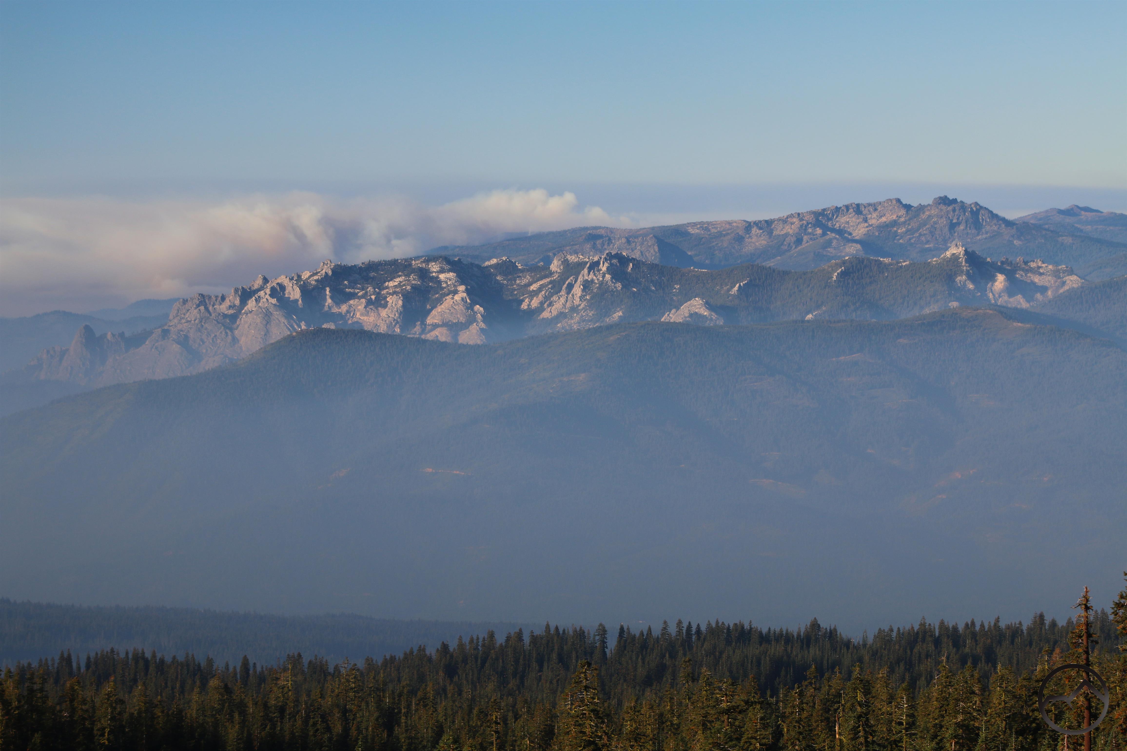
September saw the winding down of the Carr Fire just in time for the Hirz and Delta Fires to spring up in strikingly suspicious circumstances. These fires were closer to Mount Shasta and continued the long journey through the land with no shadows. Fortunately, it was possible to drive up onto Mount Shasta and, often times, climbing all the way to the Old Ski Bowl meant that the air was above most of the smoke and clearer. It was even possible to enjoy some of nature’s beauty in the midst of the horrible fire season. Thankfully, by the end of September, all the fires were winding down and things seemed like they may be returning to normal. It was just in time to start enjoying the rapidly approaching fall. Leaves were already starting to turn and the rabbit brush was brightening.

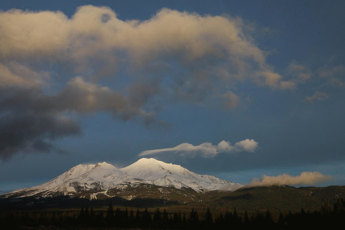
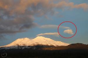
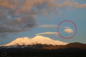
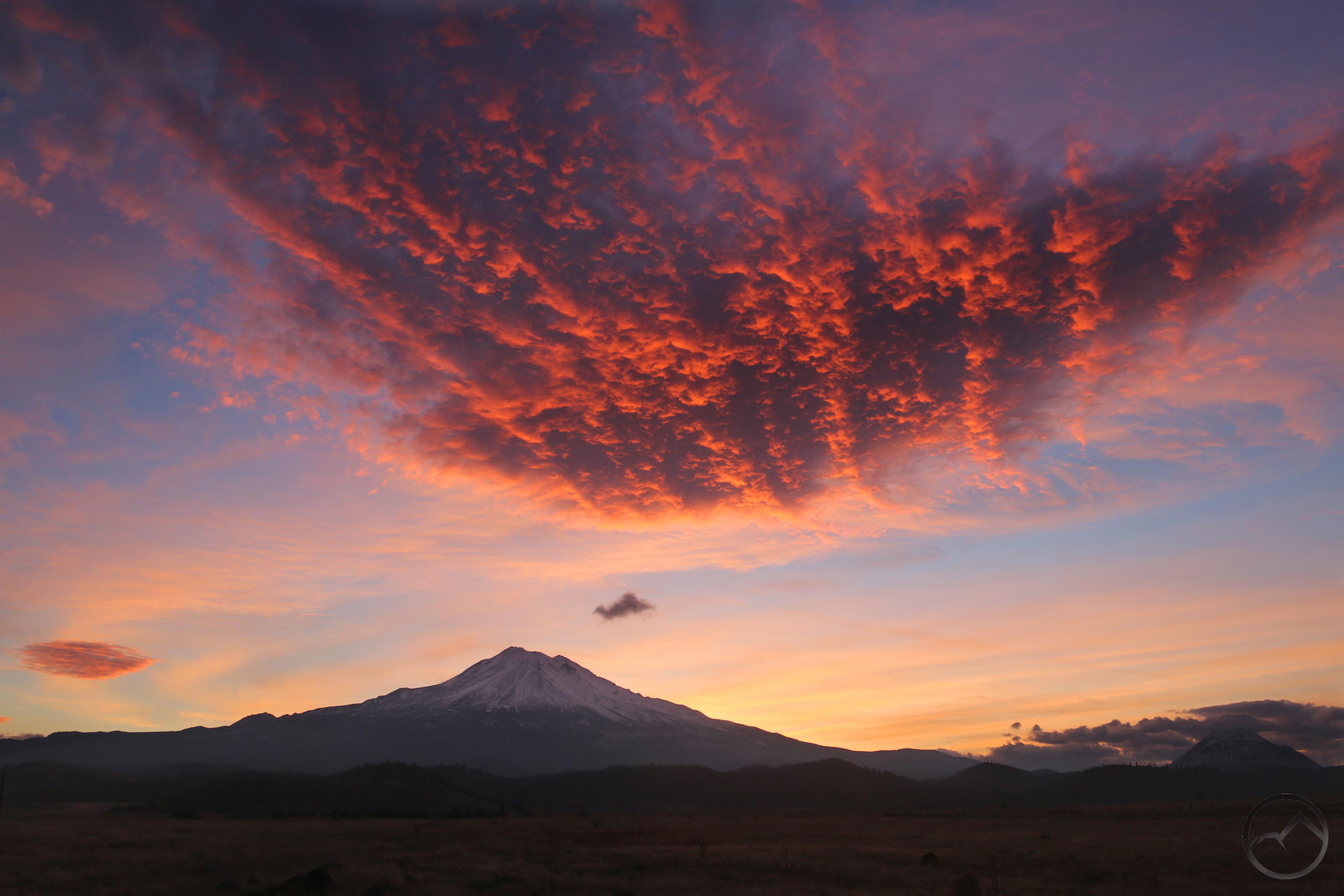
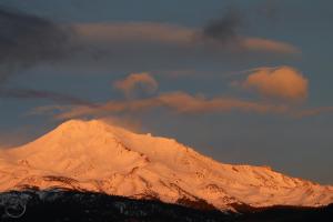
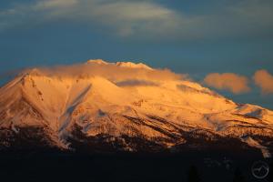
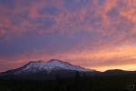
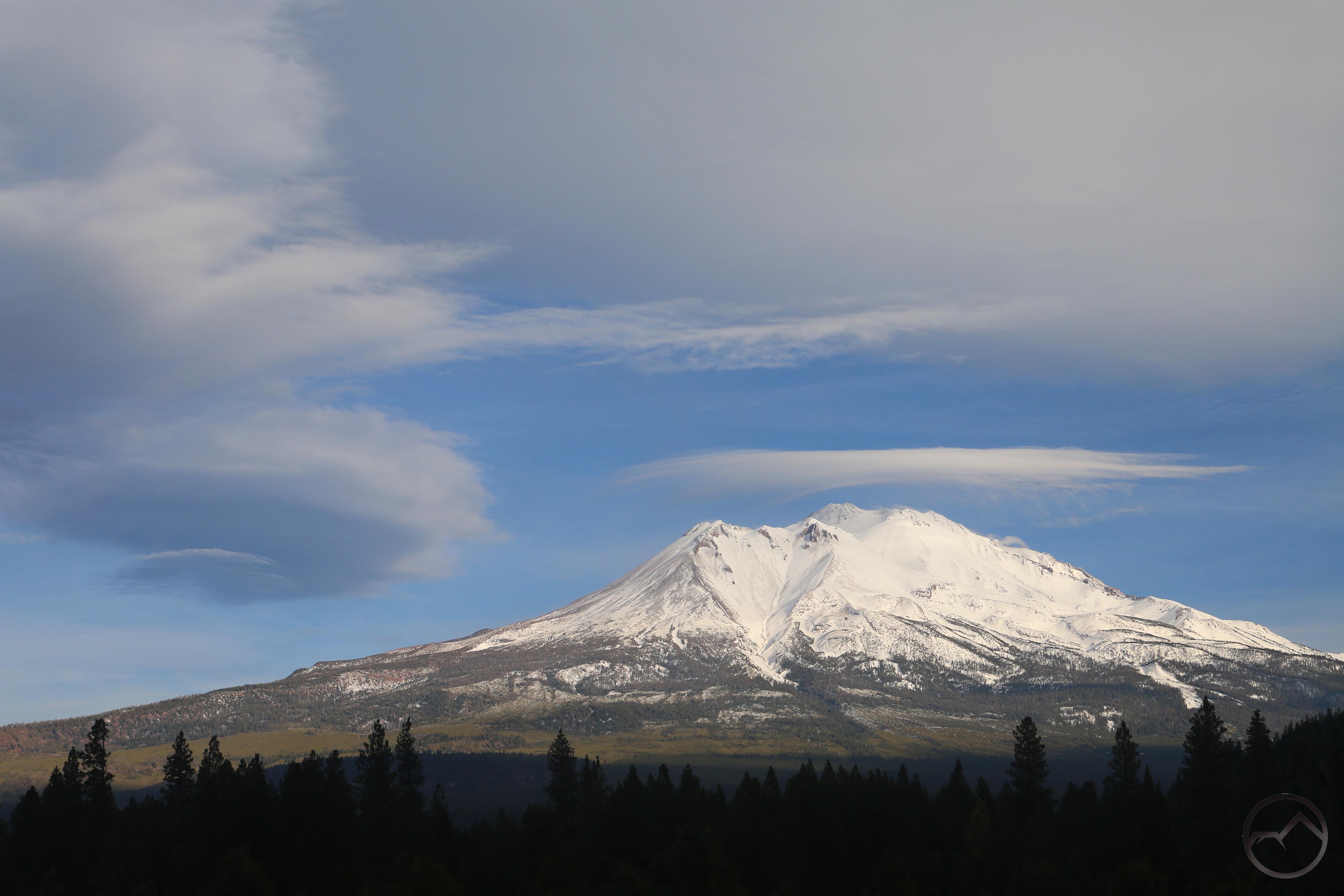
After the horrible conditions that dominated in August and September, October was a welcome return to the spectacular norm. Fall was in full swing, the air was clear and temperatures were just about perfect. Lenticulars had returned as well, heralding the changing of the season. The only disappointment was that this was not a great year for fall color. There was some good spots here and there but it was not an overwhelming year for yellow, red and orange trees. Still, after the smoke we had endured, it was good just to have the conditions we were enjoying!

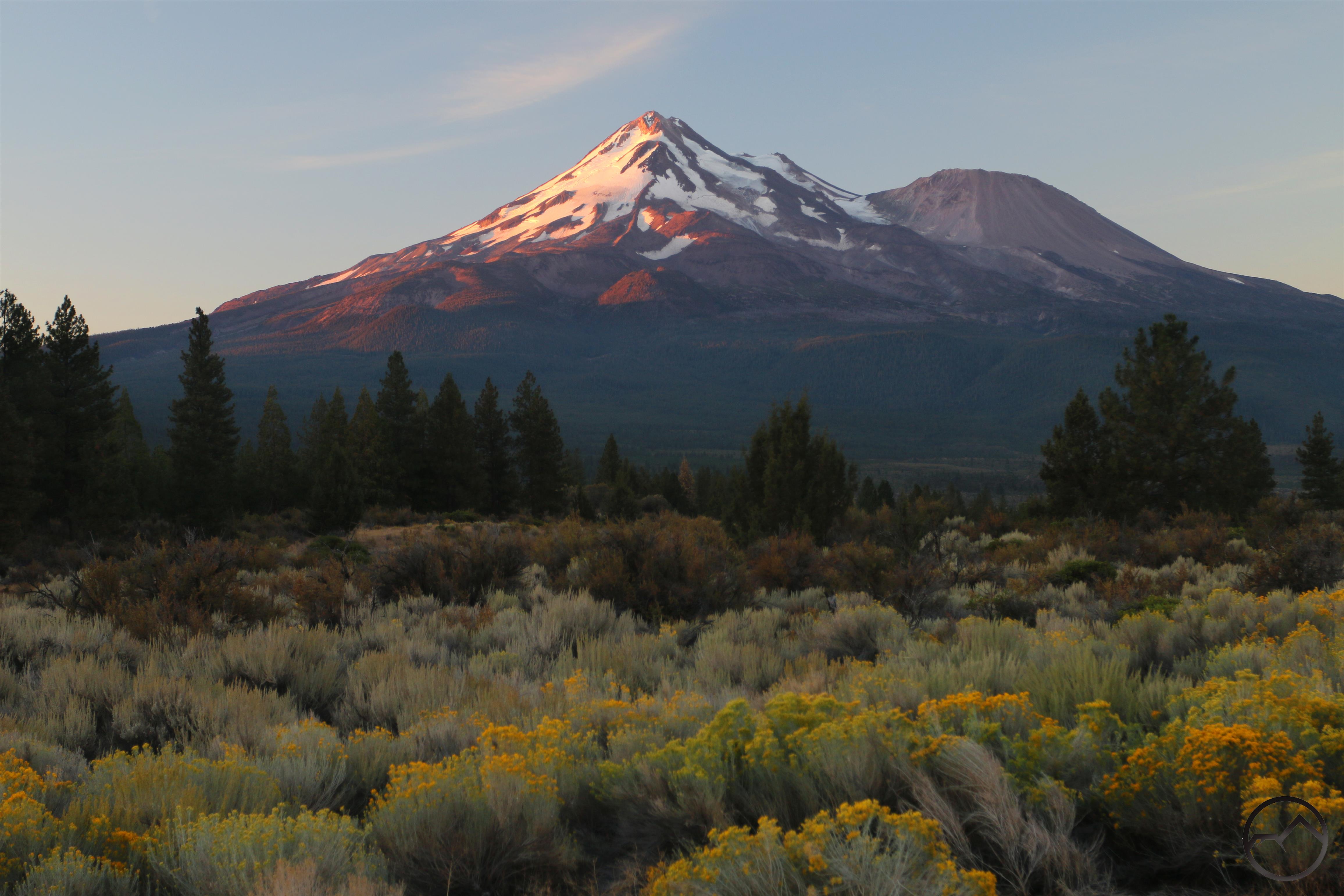
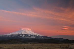
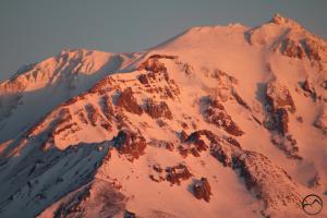
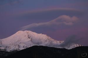
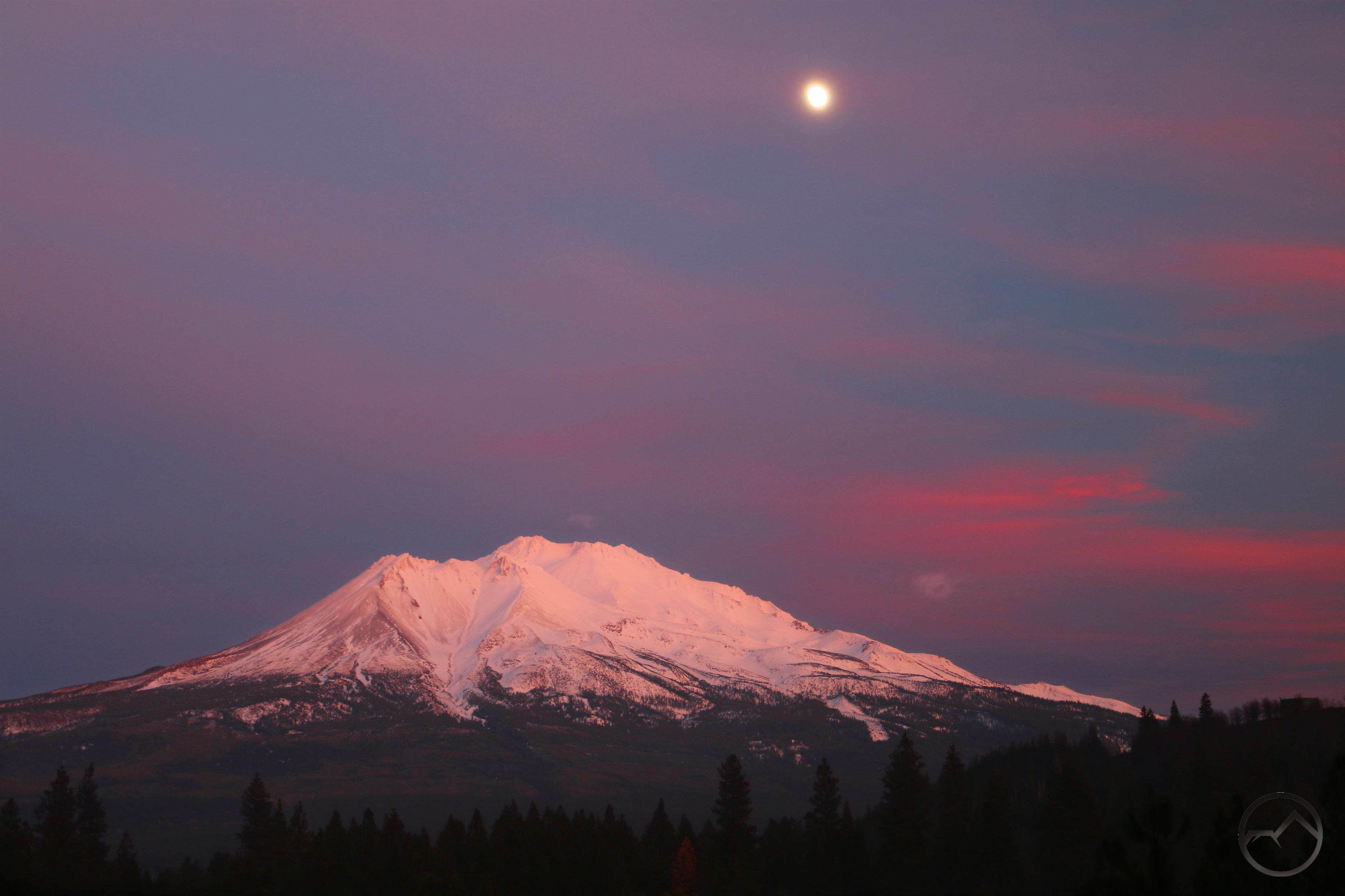
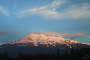
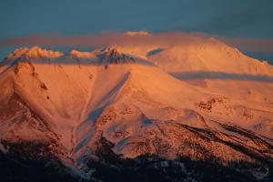
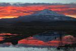
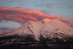
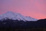
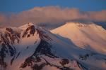
November was a beautiful month in Mount Shasta. It started off with beautiful conditions in the high country, affording a last few opportunities to enjoy the trails in the mountains. Mount Shasta received a new coating of snow and the sunrises and sunsets improved as the mountain grew whiter. The only thing that marred it was the knowledge of all the suffering in Paradise caused by the Camp Fire. Yet, even in this, Mount Shasta was spared more smoke, since the winds blew it to the southwest, away from this area.

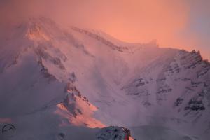
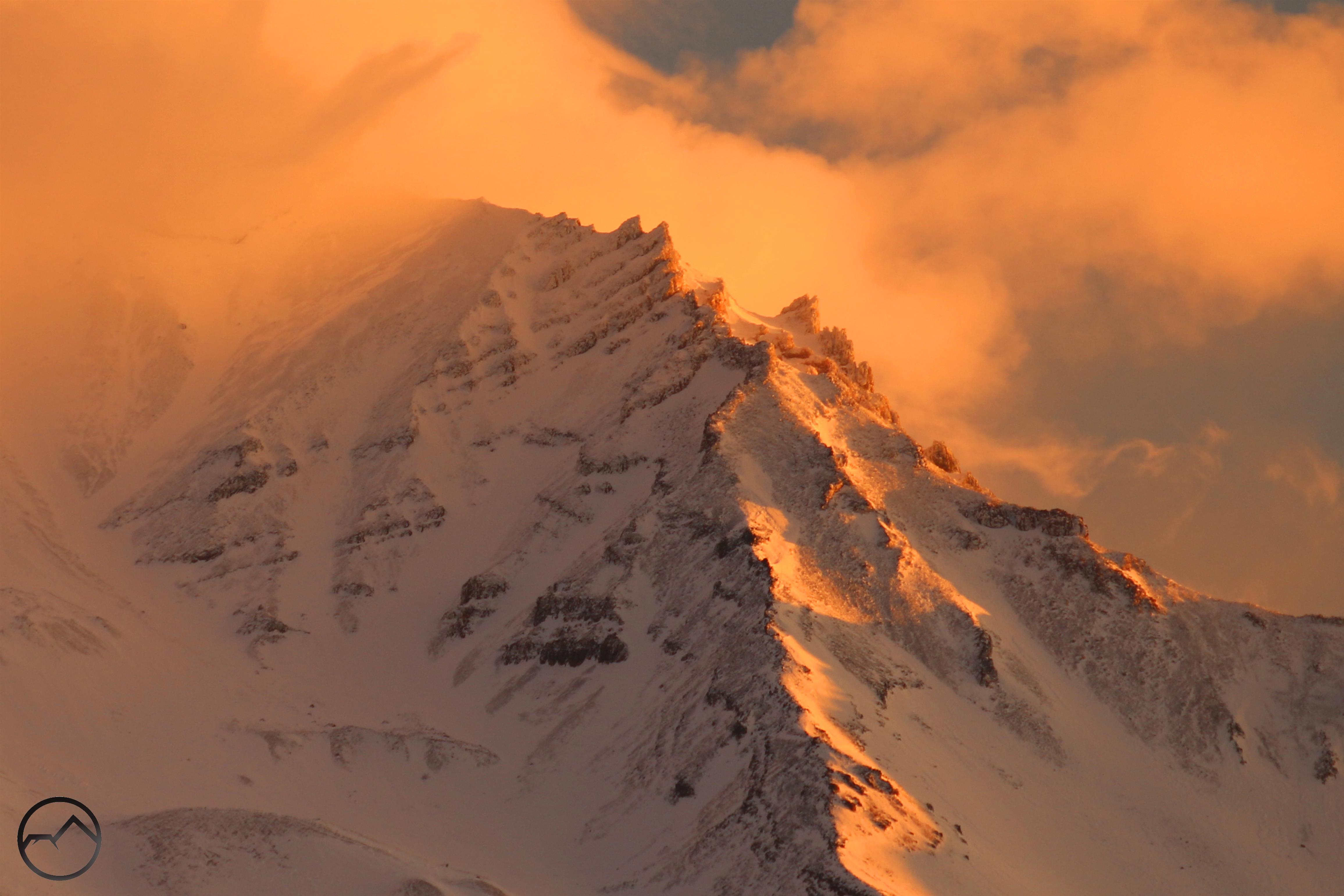
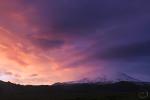
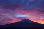
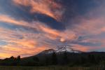
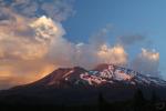
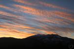
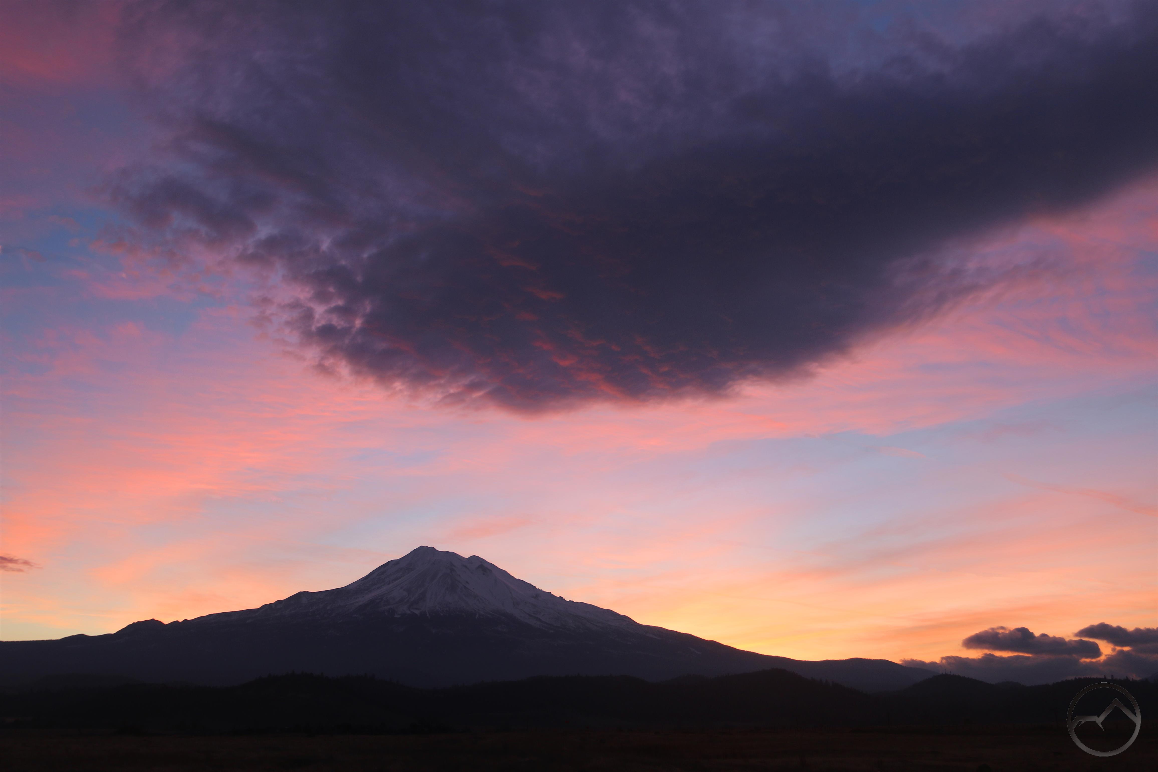
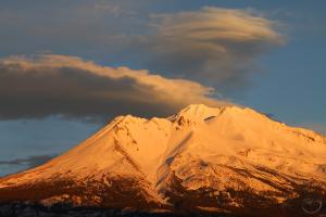
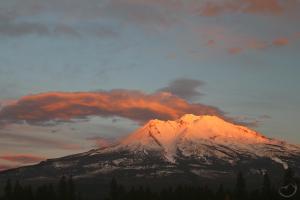
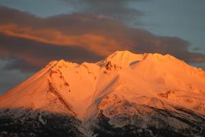
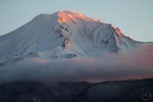
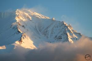
December, simply put, was one of the most spectacular months around Mount Shasta that I can remember. Awesome clouds, beautiful sunrises and sunsets and a rapid succession of memorable and scenic events. It has been a blast documenting all of it for the past few weeks. I could go on but I think December will get its own post in the near future!

2018 has been a year of great highs and lows. The fires marred much of the summer but the community rallied, the firefighters were tough and fought hard and we endured. May next year be a better one in that regard. Yet, despite all the destruction, it was still a wonderful year here at the foot of the mountain. I pray everyone recognizes the gift we have, in the midst of all the difficulties.

Happy New Year to everyone reading Hike Mt Shasta! Let’s have a blessed 2019!

A Spectacular Week Around Mount Shasta

Posted by bubbasuess on December 31, 2018
Posted in: Cascade Range, Hiking, Lenticular Clouds, Mount Shasta. Leave a comment

A stunning lenticular cloud coalesces around the summit of Mount Shasta. 

Christmas is nearly a week behind us and it has been a fun week of heading out on a few early mornings and some beautiful afternoons to capture the sunrises and sunsets. This was made all the more satisfying because I got to try out the new zoom lens that my amazing wife blessed me with for Christmas. My old lens was nearly worthless in a variety of ways and my wife finally decided to put it out of its misery and she gifted me a significant upgrade. I am most grateful and was glad to put it to good use. I have already captured a number of images that allow me to see detail heretofore unimaginable with the old sad lens.

Below is an example of how much better my new lens is. Compare the image with those found on this post from October, describing my wife and son’s assent of Black Butte. Click on the image to enlarge it and really get a sense of the detail.

The image was taken from my front yard. The old lookout tower foundation is clearly visible. The snow and rime ice on the trees shows up with excellent clarity. It is like a whole new world has been opened up.

I quickly put the new lens to good use and captured some awesome color from some sunrises and sunsets:

This was not an especially amazing sunrise but it was the first opportunity I had to get out and use the new lens. The clarity and crispness of the image is far greater than I had the ability to do previously.

It was extremely cold and windy around the mountain. While watching the sun set, geysers of wind-blasted snow kept erupting off of Sargents Ridge. It was an exciting sight.


Friday night was when things tarted to get really interesting. A lenticular had been threatening to form over the mountain all day but in the evening it started to gain a lot of definition. I headed north to the Shasta Valley and was extremely pleased that I did. The stack of disks on the mountain had been joined by a nice pair of lens shaped clouds floating off to the west of Mount Shasta. The sky burned as the sun set and the entire scene was magnificent.

December

Satisfied, I headed home, though I had a suspicion that the next morning would yield another spectacular image. The air just felt like Mount Shasta wasn’t done putting on a show. I made sure to be up early in order to maximize the potential lenticular display. I had originally planned on heading for the perch up near Castle Lake but as I drove past Lake Siskiyou I saw the water was still. It has been a long time since I have gotten a decent reflection there and I could not resist heading down to the water. I am glad I did!

December

I initially like the one on the right better but now I am leaning toward the earlier image, on the left.

The image at the top of this post was taken at the same time. I am amazed at how much detail on Mount Shasta I was able to capture even though I was 10.5 miles away. Every aspect of this sun rise was fantastic!

Although a single, large lenticular had formed south of Mount Shasta that afternoon, I decided to forgo trying to capture it at sunset, as I had lots of family still at my house and I we were having a merry time. Nonetheless, the next morning on Sunday, I once again headed out to capture the sunset. This time I headed over to McCloud and enjoyed the sun light illuminating all the crags of the Mud Creek Basin. This is the best perspective on sunrise!


The day eventually got overcast and a large stack of lenticulars once again formed over Mount Shasta. I determined to set out around sunset and see if there was enough light to capture the clouds in their glory. However, by the time I was in a position to photograph the mountain, conditions had changed considerably. It was still glorious.

Though not the large set of disks, the single current of cloud was quite elegant and beautiful.


December

With the late-forming lenticular lingering late into the night, I thought there might be a chance for another big display this morning. I headed out extra early only to find there were no clouds on Mount Shasta. However, as I was about to get on the freeway in Weed, I saw a MASSIVE meteor descend through the sky to the southwest. It lit the sky up and I could see the smoke plumes in its contrail. It was 6:50 AM and I have no idea where it hit but it was big. After seeing that and all the grandeur storming around Mount Shasta for the last week, I feel very small.

A Break In The Storm And A Mount Shasta Moonrise

Posted by bubbasuess on December 19, 2018
Posted in: Cascade Range, Hiking, Mount Shasta. Leave a comment

Sunset moonrise over Mount Shasta. 

The rainy weather of the last few days broke last night and it was nice a clear today. Mount Shasta looks beautiful in a mantle of fresh snow. I got up early this morning to see if there was an interesting sunrise and, although the mountain was visible, the sky was totally clear, rendering the sunrise beautiful but photographically it was not compelling. By this evening there were more clouds to catch the light, making the sunset more enticing. As an added bonus the moon was rising above the mountain. The clouds and color were noteworthy enough to post here. I hope y’all appreciate the view as much as I did.

It has not escaped my notice that all I have posted about this month has been sunrises and sunsets. I hope to get myself back on track and spend more time writing about the mountains and trails soon. I had a handful of lengthy posts I had been planning on during the summer but the smoke killed all of that, I never got around to it and now I have been in a bit of a writing rut. I will be back on track soon I hope and starting putting up some more interesting articles, not just eye candy.

That being said, looking at the forecast, it sure looks like we have a chance for a white Christmas…at least a little snow on Christmas Day itself. It would be wonderful if that would happen. If that is the case, I will try to post some pictures here. Until then, Merry Christmas!

Click to enlarge:


Mount Shasta NON-Lenticualar Cloud Gallery

Posted by bubbasuess on December 15, 2018
Posted in: Cascade Range, Hiking, Mount Shasta. Tagged: Clouds. Leave a comment

As the sun rises, Mount Shasta cast a massive shadow on the clouds above.

Anyone who has followed this site for a while knows about my preoccupation with lenticular clouds. These unique clouds are one of Mount Shasta’s great features. However, while they are magnificent, it is not proper to highlight them at the expense of some of the other awesome cloud events that are not lenticular in nature. Indeed, Mount Shasta’s great size has long been known to influence the weather around it and, as if often the case, it makes for some interesting meteorological events. These, couple with the light from the rising and setting sun and the mountains own intrinsic beauty, can make for a truly spectacular spectacle. It is here in this gallery that I hope to highlight these other events.

Click to enlarge:


A Spectacular Sunrise Is Followed By A Spectacular Sunset…Just Not On Mount Shasta

Posted by bubbasuess on December 13, 2018
Posted in: Cascade Range, Hiking, Lenticular Clouds. Tagged: Black Butte, Mount Eddy. Leave a comment

A small lenticular cloud highlights a glorious Mount Shasta sunrise. 

On the cusp of a big change in weather systems, Mount Shasta often manifests its fantastic lenticular clouds. This morning was no different, a small lenticular halo crowning the mountain’s summit. I popped up to a good vantage point and captured a few images as the sun came up. It was a fantastic morning.

I was hopeful that the excellent sunrise would give way to an equally excellent sunset. My desire for this was made stronger by the fact that rain and snow are moving in for the better part of the next week and the chance to see the mountain would be gone for a while. My hope seemed to be rewarded as great cloud patterns continued to pass overhead all day.

Continuing what is threatening to become a weekly ritual, I headed up to Bunny Flat with my two sons while my daughter was in her dance class. The conditions were beautiful, with deep snow, blue sky and far-reaching vistas. The view south toward Lassen Peak was particularly great. The whole time we were up there, the interesting clouds continued to fly over Mount Shasta. I was very optimistic of a spectacular sunset.

We headed down the mountain and picked my daughter up. I then hauled the kids to an easy vista from which to document the sunset. Almost instantly the clouds departed from over Mount Shasta. While the mountain remains a tremendous sight, especially at sunset, no matter what the cloud situation is, I was nonetheless deflated by the clearing skies. The light was beautiful but the accent in the sky was absent.

However, although the lackluster clouds had lessened the anticipated sunset, they had not done so elsewhere. To the north above Black Butte there were some beautiful clouds catching the light of the fading sun. Even more sublime was the staggering formations above Mount Eddy. The long clouds arced overhead, seeming to follow the dome of heaven’s contours. It was one of the most impressive Mount Eddy sunsets I have witnessed.

Mount Shasta: awesome but disappointing nonetheless.

I was naturally disappointed such a special vision had not occurred over Mount Shasta but on further reflection, I reckoned it was right and appropriate for Mount Shasta to be lessened a bit and for its smaller siblings, Black Butte and Mount Eddy to receive their special due. As I have noted, they are overlooked and underrated, despite hiding in plain sight.


Update:

The sunset over the mountain may have been dissappointing but the next morning was epic!

Surprise! Awesome Clouds Produce Wet Weather

Posted by bubbasuess on December 10, 2018
Posted in: Cascade Range, Hiking, Lenticular Clouds, Mount Shasta. Leave a comment

As is so often the case, spectacular cloud formations around Mount Shasta often end up bringing rain and snow. The clouds present at yesterday’s tremendous sunrise proved true to this observation. The mountain is so tall and so massive that its impact on the weather is difficult to predict, other than to accept that Mount Shasta has a hold on the climate systems in this area. Other than the unpredictable nature of this, the other important surety is that it the mountain’s interaction with the weather is often majestic.

This certainly proved to be the case yesterday. When I awoke, I was not optimistic that it would be a particularly memorable morning. The sky was seemingly clear. However, as I headed north, I could discern an interesting collection of clouds in the darkness. North seemed like the direction to go and, sure enough, as the sunrise color started to set in, I knew that had been wrong earlier and that it was destined to be a tremendous start to the day.

The rising sun set the sky on fire and the dark cluster of clouds caught fire in terrific fashion. The wind howled through the valley and it was cold, but I was thrilled by the awesome meteorological show to which I was witness.

I stayed as long as the color was vivid. As it faded I packed up my camera and headed home. When I arrived 15 minutes later the sky had filled with hazy clouds and the distinctive cloud had faded. However the wind kept up, the clouds swirled throughout the day. With evening rain in the forecast, I knew there was a chance that something interesting might still manifest around the mountain. I headed down to one of my closest vista points and was not disappointed. A couple of loosely formed disks hovered to the northeast of Mount Shasta. At the same time a small but dramatic lenticular wave directly above Mount Shasta. It was not the greatest lenticular formations I have witnessed but it was a memorable display nonetheless.

I had considered the possibility that these would clouds would present at sunset but they were in constant fluctuation and seemed to herald a sudden shift in the weather. I decided not to wait for sunset and headed home. This proved to be wise. Within 45 minutes the sky had filled with clouds and it was raining hard. The days drama in the skies was over but I was glad to have the precipitation, especially knowing this meant more snow at higher elevations.

This time of year can be frustrating because so many high trails are covered in snow, but when it comes to capturing the grandeur of Mount Shasta, this is tough to beat.

A Lenticular Near Miss Still Yields A Tremendous Sunset

Posted by bubbasuess on December 7, 2018
Posted in: Cascade Range, Hiking, Lenticular Clouds, Mount Shasta. 1 Comment

A lenticular tries to form above Mount Shasta. It would dissipate moments later. 

Looking at the forecast a few days ago, I knew that the weather systems passing through the area meant there would be a decent chance of a lenticular making an appearance. The spectacle didn’t seem too likely this morning, with hazy skies and uninteresting clouds surrounding the area. However, shortly after noon there seemed to be something trying to take shape to the south of Mount Shasta. At the time I was taking my junior high outdoor education class to the Squaw Valley Creek Trail and wasn’t in a really good position to stop and capture it. As we headed back toward Mount Shasta the cloud had morphed, taking on a strange, avian appearance. The whole formation seemed very unstable.

With the cloud off to the south, I reckoned the best perspective might be to the north. When we arrived at one of my favorite spots the cloud had altered its appearance yet again, this time looking something like a volcanic eruption billowing from the summit of Mount Shasta. I set my camera and began snapping images while my kids played in the bushes, oblivious as usual to the dramatic pyrotechnics playing out on the slopes of Mount Shasta. While watching the show, a small lenticular stack suddenly tried to form over the mountain. As quickly as it formed it collapsed into wispy remnants.

The large billow remained however and continued to capture the shifting light. It was a beautiful display and just the kind of scene I have been waiting for. It has seemed like a long while since I have had a chance to capture anything really memorable. This didn’t quite rise to the level of a really noteworthy lenticular but it was one of those sunsets that will be hard to put out of mind and will remain with me for quite a while. I am grateful to have been a witness.

Click to enlarge:

December


Just Some Pictures Of Another Sunrise On Mount Shasta

Posted by bubbasuess on December 2, 2018
Posted in: Cascade Range, Hiking, Mount Shasta. Leave a comment

Clouds speed past Mount Shasta as the morning light highlights the mountains western ridges.

I don’t have much to say with this post, other than to express my gladness that we have returned to the season when nearly any sunrise where the mountain is visible features some spectacular spectacle. It could be clouds racing past the mountain, the low light reflecting on the icy slopes, fresh snow blowing off the high points or unusual cloud formations. The short days mean easy access to sunrise and sunset. It is great time for enjoying the mountain from afar, provided no storm clouds obscure it.

This morning I took my son down to Lake Siskiyou, where the 25 degrees felt a lot colder than it was. I was disappointed that the lake was not still but the clouds made for interesting close ups on the upper reaches of the Mount Shasta (I really need a better zoom lens!). Most of the places to the north were blocked by clouds and further east also looked to be clouded in. Despite the lack of reflection, this seemed like a good option. That turned out to be the case and the low trajectory of the sun meant the color lingered for far longer than it normally does. My son, of course, was busy chunking the clay on the receded shoreline, more interested in the mess he was making than the grandeur around him.

There is a lot more precipitation coming soon. Enjoy the clear sky and white mountain while you can!


Posts navigation

← Older Entries
Newer Entries →
    • Recent Posts

      • Winter Shows Up When It Will
      • January Rolled By With Mud, Then Very Dry
      • Mount Shasta 2025 – A Year In Images
      • Mount Shasta On Either Side Of Christmas
      • Adrift In An Ocean Of Fog
      • December Has Been Spectacular Thus Far Pt. II (A Magnificent Lenticular)
      • December Has Been Spectacular Thus Far Pt. I
      • Lenticular Interrupted
      • A Stormy Wave And A Truchas Sunset
      • Aurora Lenticularis
    • Enter your email address to follow Hike Mt Shasta and receive notifications of new posts by email.

    • Archives

      • February 2026
      • January 2026
      • December 2025
      • November 2025
      • October 2025
      • September 2025
      • August 2025
      • July 2025
      • June 2025
      • May 2025
      • April 2025
      • March 2025
      • February 2025
      • January 2025
      • December 2024
      • November 2024
      • October 2024
      • September 2024
      • August 2024
      • July 2024
      • June 2024
      • May 2024
      • April 2024
      • March 2024
      • February 2024
      • January 2024
      • December 2023
      • November 2023
      • October 2023
      • September 2023
      • August 2023
      • July 2023
      • June 2023
      • May 2023
      • April 2023
      • March 2023
      • February 2023
      • January 2023
      • December 2022
      • November 2022
      • October 2022
      • September 2022
      • August 2022
      • July 2022
      • June 2022
      • May 2022
      • April 2022
      • March 2022
      • February 2022
      • January 2022
      • December 2021
      • November 2021
      • October 2021
      • September 2021
      • August 2021
      • June 2021
      • May 2021
      • April 2021
      • March 2021
      • February 2021
      • January 2021
      • December 2020
      • November 2020
      • October 2020
      • September 2020
      • August 2020
      • July 2020
      • June 2020
      • May 2020
      • April 2020
      • March 2020
      • February 2020
      • January 2020
      • December 2019
      • November 2019
      • October 2019
      • September 2019
      • August 2019
      • July 2019
      • June 2019
      • May 2019
      • April 2019
      • March 2019
      • February 2019
      • January 2019
      • December 2018
      • November 2018
      • October 2018
      • September 2018
      • August 2018
      • July 2018
      • June 2018
      • May 2018
      • April 2018
      • March 2018
      • February 2018
      • January 2018
      • December 2017
      • November 2017
      • October 2017
      • September 2017
      • August 2017
      • July 2017
      • June 2017
      • May 2017
      • April 2017
      • March 2017
      • February 2017
      • January 2017
      • December 2016
      • November 2016
      • September 2016
      • August 2016
      • July 2016
      • June 2016
      • May 2016
      • April 2016
      • March 2016
      • February 2016
      • January 2016
      • December 2015
      • November 2015
      • September 2015
      • August 2015
      • July 2015
      • June 2015
      • May 2015
      • April 2015
      • March 2015
      • February 2015
      • January 2015
      • December 2014
      • November 2014
      • July 2014
      • June 2014
      • May 2014
      • April 2014
      • March 2014
      • February 2014
      • January 2014
      • December 2013
      • November 2013
      • October 2013
      • September 2013
      • August 2013
      • July 2013
      • June 2013
      • May 2013
      • April 2013
      • March 2013
      • February 2013
      • January 2013
    • Categories

      • Boy Scouts
      • Cascade Range
      • Castle Crags
      • Desert
      • Echo Point
      • Glaciers
      • Hiking
      • How things came to be…
      • Klamath Mountains
      • Konwakiton Outdoor Designs
      • Lakes
      • Lenticular Clouds
      • Maps
      • Marble Mountains
      • Meadows
      • Mount Eddy
      • Mount Shasta
      • Mount Shasta History
      • Napa County
      • Off Season Trails
      • Pacific Crest Trail
      • Peaks
      • Rivers
      • Rock Climbing
      • Scott Mountains
      • Seldom Seen
      • Shasta Valley
      • Sierra Nevada
      • Siskiyou Mountains
      • Sonoma County
      • Spring Trails
      • sunrise
      • sunset
      • Trinity Alps
      • Trinity Divide
      • Truchas Ridge
      • Uncategorized
      • Water
      • Waterfalls
      • Wilderness
      • Wildflowers
      • Wine Country
      • Winter Trails
      • Yosemite
    • Meta

      • Create account
      • Log in
      • Entries feed
      • Comments feed
      • WordPress.com
    • Copyright © 2013-2024 by Bubba Suess

      DISCLAIMER: Any use of the information contained in this site by any and all persons is done at their own risk. The operator of this site shall be held harmless from any and all alleged claims, demands, causes of action, liability, loss, damage and/or injury to property or persons whether brought by an individual or other entity. This indemnification applies, without limitation, to all actions by an individual or other entity as a result of their use of information contained in this site.

    Blog at WordPress.com.
    Hike Mt. Shasta
    Blog at WordPress.com.
    • Subscribe Subscribed
      • Hike Mt. Shasta
      • Join 983 other subscribers
      • Already have a WordPress.com account? Log in now.
      • Hike Mt. Shasta
      • Subscribe Subscribed
      • Sign up
      • Log in
      • Report this content
      • View site in Reader
      • Manage subscriptions
      • Collapse this bar
     

    Loading Comments...