Hike Mt. Shasta

Exploring the Mount Shasta Region

  • Home
  • Trails
    • Mount Shasta Trails
      • Brewer Creek Trail
      • Clear Creek Trail
      • Gray Butte Trail
      • Green Butte Ridge Trail
      • Horse Camp Trail
      • North Gate Trail
      • Old Ski Bowl Trail
      • Panther Meadow Trail
      • South Gate/Squaw Meadow Trail
      • Whitney Falls Trail
    • Trinity Divide Trails
      • Blue Divide Trail
      • Castle Lake Trail
      • Castle Lake Shore Trail
      • Cliff Lake Trail
      • Deadfall Lakes Trail
      • Gray Rock Lakes Trail
      • Gumboot Trail
      • Heart Lake Trail
      • Porcupine & Toad Lakes Via Pacific Crest Trail
      • Seven Lakes Basin Via Pacific Crest Trail
      • Sisson-Callahan Trail
      • Soapstone Trail
      • South Mumbo Scramble
      • Tamarack Lake Trail
      • Toad Lake Trail
    • Castle Crags Trails
      • Burstarse Falls Via Pacific Crest Trail
      • Castle Dome Trail
      • Flume Trail
      • Lower Castle Crags Via Pacific Crest Trail
      • Root Creek Trail
    • Scott Mountains Trails
      • Bluff Lake & Cement Bluff via Pacific Crest Trail
      • Caldwell Lakes Trail
      • China Mountain Scramble
      • Cory Peak and Bull Lake via Pacific Crest Trail
    • Cascade Crest
      • Ash Creek Butte Scramble
      • Goosenest Trail
      • Juanita Lake Trail
      • Orr Lake Trail
    • Mount Shasta City Area Trails
      • Black Butte Trail
      • Box Canyon Trail
      • Gateway Trail
      • Lake Siskiyou Trail
      • Mount Shasta City Short Trails
      • Ney Springs Canyon Trail
      • Spring Hill Trail
    • Shasta Valley Trails
      • Black Lava Trail
      • Haystack Trail
      • Lake Shastina Trail
      • Pluto Cave Trail
      • Trout Lake Trail
      • Yellow Butte Trail
    • Sacramento River Trails
      • Dunsmuir Trail
      • Hedge Creek Falls Trail
      • Sacramento River Trail
      • Sims History Trail
    • McCloud River Trails
      • Ash Camp To Ah-Di-Na Via Pacific Crest Trail
      • McCloud River Falls Trail
      • McCloud River Preserve Trail
      • Squaw Valley Creek Trail
      • McCloud River Trail: Algoma Camp to Nitwit Camp
      • McCloud River Trail: Nitwit Camp to Cattle Camp Swimming Hole
      • McCloud River Trail: Cattle Camp Swimming Hole to Camp 4
      • McCloud River Trail: Camp 4 to Upper McCloud Falls
      • McCloud River Trail: Pine Tree Hollow Loop
    • Trails Further Afield
      • Trinity Alps Trails
        • Bear Lakes Trail
        • Billys Peak Trail
        • Boulder Creek Lakes Trail
        • Boulder Lake Trail
        • Canyon Creek Trail
        • Caribou Lakes Trail
        • East Boulder Lake Loop
        • East Weaver Lake Trail
        • Four Lakes Loop
        • Granite Peak Trail
        • Grizzly Creek Trail
        • Gulch Lakes Loop
        • Hidden Lake Trail
        • South Fork Lakes Trail
        • Stoddard Lake Trail
        • Stoney Ridge Trail
        • Tangle Blue Lake Trail
      • Warner Mountains
        • Emerson Creek Trail
        • Highgrade Trail
        • Patterson Lake Via Warner Summit Trail
        • Pine Creek Trail
        • Squaw Peak Trail
  • Articles
    • Trails By Area
      • Mount Shasta
        • Vistas, Meadows And Waterfalls: Three Best Hikes On Mount Shasta
        • The End Of The Road: Three Hikes In The Old Ski Bowl Area
        • Two Trails From Bunny Flat
        • Three Trails On Mount Shasta’s East Side
        • Mount Shasta’s Hummingbirds
      • Trinity Divide
        • Great Lakes: Top Five Lake Basins In The Trinity Divide
        • The Headwaters Of The South Fork Of The Sacramento River
        • Neglected Headwaters: Two Lesser Lake Basins On The South Fork
        • Gumboot Saddle: Two Hikes On The PCT
        • Descent Into Mystery: The Sisson-Callahan Trail
        • Mumbo Basin – Overlooked On The West Side
        • The Headwaters Loop: A Proposed Backpacking Loop In The Trinity Divide
      • The McCloud River
        • The McCloud River Trail
      • Shasta Valley
        • Jewels In The Desert
      • Scott Mountains
        • Great Scott! Two Scott Mountains Hikes On The PCT
      • Trinity Alps
        • Carubou Lakes: Trinity Alps On A Grand Scale
        • Switchbacks To Heaven: The Trinity Alps’ Stoney Ridge Trail and Four Lakes Loop
        • Trinities In Proximity: Two Trinity Alps Trails With Easy Access From Mount Shasta
        • Trails in the Carter Meadows Area
        • Trinity Alps Views of Mount Shasta
        • The Psychological Value Of The Trinity Alps
    • Waterfalls
      • Three Waterfalls On Mount Shasta
      • McCloud River Waterfalls
      • Sacramento River Waterfalls
      • Trinity Divide Waterfalls
      • Trinity Alps Waterfalls
      • Avoiding A Dry Whitney Falls
    • Off Season Trails
      • Three Winter Hikes Near Mount Shasta City
      • Winter Hikes In Shasta Valley
      • Winter Hiking In The Shasta Valley Wildlife Refuge
      • Winter Hikes On The Sacramento River
      • Winter Hikes On The Lake Siskiyou Trail
      • Spring Hikes In The Castle Crags
      • Spring Hikes On the Upper McCloud
      • Spring Hikes On The Lower McCloud River
    • Points Of Interest
      • Mount Eddy: Overshadowed, Underrated
      • Black Butte: Hiding In Plain Sight
      • Castle Dome: Steadfast And Staggering
      • Mount Shasta Hoodoos
      • Sacramento Scrambling
      • The Shasta River
      • The Castle Creek Watershed
      • Mount Shasta East Side Glacier View
      • 5 Fantastic Mount Shasta Vistas
      • 5 Highest Peaks Around Mount Shasta
      • 5 Best Hikes On Creeks And Rivers
      • 5 Interesting Footbridges
      • Three Spectacular Drive-To Sunset Vistas
    • North State Geography
      • Introduction
      • Seven Major Regions
      • The California Cascades
      • Klamath Mountains Pt. I
      • Klamath Mountains Pt. II
      • The Great Canyons Of Mount Shasta
      • Mount Shasta, Timberline, And The Relative Size Of Cascade Volcanos
      • Four Eruption Cones Of Mount Shasta
      • Mount Shasta’s Medial Moraine
    • Northern California Review
      • North Table Mountain
      • Lakes Basin Recreation Area
      • Eastern Sierra Fall Color
      • Sonoma County
      • Central Sierra Nevada
      • Orland Buttes
    • Seldom Seen
      • Ash Creek Falls
      • Mud Creek Canyon
      • Lower Mud Creek Canyon
      • Diller Canyon
      • Lower Cascade Gulch
      • The Grey Rocks
      • Castle Creek
      • Upper Wagon Creek
      • Fawn Creek Canyon
      • Confluence of the Sacramento River and Castle Creek
      • Upper Klamath River Canyon
      • Hole In The Ground Geologic Area
      • Ash Creek Butte Fossil Rock Glacier
    • Mount Shasta History
      • Vantage Lost: The Everitt Memorial Vista
      • A Yosemite-Mount Shasta Connection
      • Whitney – What’s In A Name?
      • Mount Shasta Area and the 1838 Exploring Expedition
      • A 19th Century Engraving Of An Epic Mount Shasta Vista
      • Vintage 1907 Color Photos
      • A Misleading Painting
      • A Mysterious Painting
      • A Mysterious Painting Pt. II
      • Stereographic Mt. Shasta
      • Year One Of Hike Mt Shasta
      • Year Two Of Hike Mt Shasta
      • Year Three Of Hike Mt Shasta
      • Year Four Of Hike Mt Shasta
      • Year Five Of Hike Mt Shasta
      • Year Six Of Hike Mt Shasta
      • Year Seven Of Hike Mt Shasta
    • Image Galleries
      • Mount Shasta Trails Gallery
      • Mount Shasta Sunrise Gallery
      • Mount Shasta Sunset Gallery
      • Lenticular Cloud Gallery
      • Mount Shasta NON-Lenticular Clouds
      • Mount Shasta Reflection Gallery
      • Telephoto Gallery
      • Mount Shasta Area Fall Color
      • Castle Crags Gallery
      • Waterfalls Gallery
      • Trinity Divide Lakes Gallery
      • Mount Shasta Area Rivers Gallery
      • Shasta High Desert Gallery
      • Mount Shasta GIF Gallery
    • Random Notes
      • Revew: Three Mount Shasta Trail Maps
      • A Mount Eddy Wilderness?
      • New Land Additions For The Castle Crags
      • Book Plug: Mount Shasta Area Rock Climbing
      • Exile: How I Came To Love Wilderness
  • Mt. Shasta Trail Map
  • Blog
  • About/Contact
  • Links
  • Truchas Ridge

Waves And Wind On A March Mount Shasta Morning

Posted by bubbasuess on March 12, 2018
Posted in: Boy Scouts, Cascade Range, Hiking, Lenticular Clouds, Mount Shasta. 1 Comment

Thin, swift-moving waves indicate changing weather systems.

My two most favorite sounds are running water over rocks (preferably slabs of granite) and the lonely wind early in the morning high in the mountains. The former naturally comes from my many trips to the Sierra when I was young. Of the latter, the first time I remember that wind really resonating me was early in the morning near Apache Springs at Philmont Scout Ranch in New Mexico, when I was a Boy Scout. Ever since then, I have wanted to get up early and sit somewhere with a great view and let the wind blow around me.

Cloudless afternoon at Lake Siskiyou.

This morning was very much like that experience back in Philmont. I have been in a real rut lately, only photographing Mount Shasta from 3 easy to get to places near my house. I have been neglecting some of my other preferred locations and all of my less-than-easy-to-get-to spots. This morning I sought to change that and got up early, while it was still very dark. I headed out to one of my less-frequented locations and set my self up to watch the sunrise light on Mount Shasta. The day before had been gorgeous and there was not a cloud in the sky. The same held true when I first headed out this morning. Though there had been almost no clouds when I arrived, frustratingly, the clouds quickly rolled in and partially obscured my view, right when the mountain was really lighting up. I got a few shots of color on Mount Shasta, but what really caught my eye was a wave-like cloud that kept forming and reforming.

The light having faded, I head back toward home. I stopped to admire the fantastic clouds and color on the Castle Crags, as well as the beautiful conditions above the Trinity Divide. The Little Castle Lake area had some particularly awesome cloud waves overhead. There even appeared to be a small lenticular forming above Mount Eddy. It was a striking, beautiful morning. However, the spectacle was far from over.

After taking a few shots of the aforementioned peaks, I headed home. As I did, I noticed the wave I had seen early had grown and turned into a series of fast-flying clouds that were racing past Mount Shasta. The wispy wave grew as it moved until a stunning complex of wavy clouds began to encroach on Mount Shasta. It was a magnificent sight, and a great way to cap off a beautiful morning. Of course, as is so often the case, this kind of cloud activity on Mount Shasta is often a harbinger of bad weather. Right now, the forecast is calling for 2 solid weeks of rain and snow. Come on spring!

Click to enlarge:

The clouds obscure the sunrise.
The wave appears above Mount Shasta.

The Castle Crags alight at sunrise.
Large waves above the Little Castle Lake Basin.

Porcupine Peak and the Middle Fork Canyon.
A small lenticular above Mount Eddy.


A Quick Look At Mount Shasta’s Northern River Conditions

Posted by bubbasuess on March 10, 2018
Posted in: Cascade Range, Hiking, Mount Shasta, Rivers, Uncategorized. Leave a comment

Mount Shasta, before the storm.

As noted in the image above, the storm was heralded by some near-lenticular clouds. These clouds frequently indicate the coming of a storm. The subsequent weather system that moved through the area yielded a fair amount of precipitation and we have endured a week of soggy, rainy weather here in Mount Shasta. While the water is welcome, it is generally not the most pleasant while in the midst of it. It’s right at the point where it is too cold to just head out and do something fun but not cold enough to snow. Fortunately, we are nearing the end of winter and warmer temperatures are coming, even if they have not yet arrived.

Yesterday I had some business in the Shasta Valley and used that as an opportunity to check in on the Shasta River. While not nearly as large as the nearby Sacramento or Klamath Rivers, the sight of the Shasta River running through the high desert of the Shasta Valley is always a pleasing sight to my eye. Many places along its course remind me of parts of New Mexico I frequented while I attended gradschool in Texas. I tend to have three areas I like to check out. One is at the point where water the water was diverted to the Yreka Ditch, and then another downstream from where water is diverted from Parks Creek into the Shasta River. The third spot I like to examine is on Parks Creek, once water has been diverted over to the Shasta River.

Shasta River
Shasta River

Shasta River
Parks Creek

Upstream from the Yreka Ditch diversion, the Shasta River had pretty good flow. However, further downstream and beyond the point where water is added after being diverted from Parks Creek, the Shasta River had decent flow, but it looks more anemic than I anticipated. Parks Creek itself did not have very much water it. Considering the warm rain we have been having, I expected more water . This last storm definitely seemed to break at the southern side of Mount Shasta and the rainshadow was making itself known on the north side. Very little snow fell north of Weed. I think that the lack of runoff at this point is due to the low temperatures in the mountains, so snow has been falling at higher elevations and the warmer rain here in the low areas. If that is the case, it bodes better for summer.

The snow certainly is melting rapidly at my house. I am higher up than Mount Shasta City and the difference is striking. The snow is almost entirely gone in town but I still have a bit where I live.

Backyard midway through the storm.
Backyard this morning.

Though there seems to be more wet weather coming, this weekend seems especially nice, with warmer temps and sun. Sunday looks to be a great day to get outside. I may have more on that tomorrow morning.

The cloud on Mount Shasta this morning really wanted to be a lenticular, but couldn’t quite muster the strength to do so.

Finally! Some Real Snow In Mount Shasta

Posted by bubbasuess on March 3, 2018
Posted in: Hiking, Mount Shasta. 1 Comment

Evening sunlight illuminates Mount Shasta after a winter storm.

After a remarkably dry winter, a real snow storm finally rolled through the Mount Shasta area. Up until now, we have gotten a little rain and a little snow, but no big systems really dropped much of the white stuff. Nonetheless, as many know, March tends to be one of the months with the most significant snowfall around here. I have been saying that I would not really be panicking about the winter unless we got through March without a big storm. Thankfully the winter finally produced. As I noted, I returned to Mount Shasta from Sonoma County to find several inches of snow on the ground. This was followed a few days later by a significant storm that dropped a couple feet of snow at my house.

My front yard during a brief break in the storm. 

This was easily the biggest storm since the big one that hit in January of 2017. That storm dumped several feet and compared to that, this was only a moderate amount of precipitation. Nonetheless, during what has been shaping up to be another drought winter, the copious snow was welcome indeed, even if it meant pulling out the blower and clearing off my copious driveways, as well as those that access the cabin. My kids were more than eager to get outside and play. Digging seems to be their activity of choice for some reason, though my older son loves to stand in the snow being ejected from my snowblower. Go figure.

Backyard before the storm.
Backyard midway through the storm.

While the storm was significant, it really did not compare to the big one from last year. That one nearly overwhelmed the roads and was a tremendous amount of work to dig out of. This one really needed two passes with the snowblower and that was about it. For comparison, here is a shot from last year’s snowmageddon and one from a similar spot this year:

Midway through storm, 2017
End of storm, 2017
Midway through storm, 2018

Obviously, the volume does not compare. I am grateful for what we have received regardless. Going through a winter without at least one big storm would mean a miserable snow pack during the summer. It is not great now, but at least there is actually a snow pack. The drought winters of 2013 and 2014 were horribly dry and this has easily blown past those and builds on the recovery of last year’s excellent winter. Even in town, the activity seems to be buzzing. The ski park is open and businesses that serve the outdoor community are busy. Winter is really here in Mount Shasta and just in time too, since spring will be upon us in short order.

After being in Sonoma County for a week and then coming back to storms, it was great to finally see Mount Shasta again as the storm broke. The mountain is laden with snow and was just beginning to pick up some color as the sun began to set. Shadows were cast and disappeared and clouds rolled by in the fading light. It was magnificent as always.


The Psychological Value Of The Trinity Alps’ Presence

Posted by bubbasuess on March 3, 2018
Posted in: Hiking, Klamath Mountains, Mount Shasta, Trinity Alps, Trinity Divide, Wilderness. 1 Comment

Looking down on Emerald and Sapphire Lakes and the craggy heart of the Trinity Alps.

One of the things I appreciate about living in Mount Shasta is the great and diverse expanses of mountains that seem to stretch out in all directions. Mount Shasta itself is massive and beyond it to the east are the Cascades, an unpopulated, seemingly unending array of mountains, valleys and ridges that extend eastward toward Nevada. Yet, as beautiful and fascinating as this area is, it is to the west that my thoughts most often turn. Immediately west of Mount Shasta is the criminally underrated Trinity Divide. Rugged and scenic, the Divide is a fantastic mountain backyard for those living at the foot of Mount Shasta. But it is further west, on the others side of these mountains, that the real jewel of the North State’s mountain ranges is found. Just west of the Trinity Divide are the sublime Trinity Alps.

The Trinity Alps are one of the largest subranges of the Klamath Mountains, a range that extends from the North Yolla Bollies, west of Red Bluff, all the way into Oregon, terminating north of Grants Pass. Though there are many spectacular corners of the Klamaths, it is the Trinity Alps that ultimately claims the crown as the grandest slice of alpine scenery. Here vast stretches of granite peaks, towering peaks, tall waterfalls, deep canyons unusual geology all combine to create a stunning mountain paradise.

Highway 299 is deep within the fog covered Trinity River Canyon.

To say these mountains are vast is an understatement. Nowhere else in the North State is there a wild land that covers so a great a territory as the Trinity Alps. The formal wilderness boundary encompasses 525,627 acres. It is the second largest wilderness administered by the US Forest Service in California (surpassed only by the gargantuan John Muir Wilderness. The Trinities are often erroneously cited as the second largest wilderness in California, but this is not the case, as several wilderness areas administered by the National Park Service surpass it, including Yosemite, Sequoia-Kings Canyon and Death Valley.) The actual size of the Trinities is somewhat larger and can be defined as being the area that lies in the center of a circle of paved roads that surround. Highway 3 marks the eastern boundary, Highway 299 dileneates the south, Highway 96 hems in the western side and the Cecilville-Callahan Road marks the northern extent.

The Trinity Alps lie at the center of a ring of remote highways and roads.

The scale and scope of this awesome cluster of mountains offers people in the Mount Shasta area the best of both worlds. To our east we have the great, icy heights of Mount Shasta to explore and enjoy. Yet to the west, we are blessed with a staggering mountain fastness, vast and wild beckoning  us to venture into it and explore.

To put the wildness of this region into perspective, I like to make the point that, heading slightly southwest from Mount Shasta, there are only two paved roads between the area at the foot of the mountain and the coastal areas that surround Highway 101. The two roads, Highway 3 and Highway 96 are crossed at the eastern and western sides of the Trinities. The area in between them is wild, roadless and rugged. There are a few dirt roads permeating the Trinity Divide and the narrow strip of the Coast Range, but paved roads, the great mark of civilization, is an endangered species. Two paved roads between Mount Shasta and the coast, a distance of nearly 100 miles. There are few places in California, let alone elsewhere in the West, were such a great distance can be traveled and a paucity of paved roads will be found (or not found, as it may be).

I find these facts comforting. The knowledge that a great, untrammeled, spectacular wilderness lying “just over the mountain” from the Mount Shasta area means that there always possibility. It means there are adventures close at hand that may take unknown courses and create memories unexpected. It means there is a frontier just around the corner, where the future can be made and life can be simplified. Americans have always been a people of the frontier. It is in our national DNA. For over a century, it was manifest by pioneers moving out beyond the confines of civilization, to exist within the wilderness. When the west was won, the frontier was reduced but our geography ensured that there were pockets of land left to be explored. Some of these are vast, others small, but all hold value in remaining wild.

We now venture beyond the frontier, into the wild lands for a host of reasons, but all can be distilled down, I think, into the idea that there is something greater than we are and we have a need to find our place within that. Even if we do not enter the Trinity Alps or any other wilderness, their presence alone is important. It means the frontier is still there and the wilderness is still wild. Edward Abbey noted that “wilderness is not a luxury, but a necessity of the human spirit”. While he and I are in complete opposition metaphysically, there is agreement that there is essential value in the natural world, that the primal landscape is necessary for people, as it gives a glimpse, even if opaque, of Eden and our home. To me, that is what the Trinity Alps offer. The fact that, our backyard is a vast, beautiful paradise uncorrupted and waiting to be explored is something for which to give thanks. Let us be grateful for the Trinity Alps.

A few vistas of the Trinities that, I hope, give some sense of the scale of this mountain range (click to enlarge):

Diamond Lake

Gulch Lakes Loop

Klamath Mountains


Deer Lake


Bear Lakes Trail
Bear Lakes Trail

Stoddard Lake Trail
Stoddard Lake Trail

East Boulder Lake Loop


Mount Shasta Through 10 Remarkable Weeks

Posted by bubbasuess on February 28, 2018
Posted in: Hiking, Lenticular Clouds, Mount Shasta. Leave a comment

Awesome lenticulars form above Mount Shasta in December2017.

When I gave my presentations down in Sonoma, I included a lengthy Power Point with tons of pictures of the trails in the Wine Country and beyond. After covering the local trails, I transitioned from discussing Napa and Sonoma Counties to introducing Mount Shasta. To do this, I included 13 images of the mountain that had been taken over the previous 9 weeks. It included a stunning array of cloud formations, sunrises and sunsets. Indeed, the last 2.5 months have seen a high concentration of spectacular lenticulars and the wintry conditions (despite the lack of snow down low) have made for some gorgeous scenes as the white mountain was illuminated by the rising and setting sun. Looking back through my collections of previous years images, I have not found a time where I observed a similar number of events. Obviously I have missed many great clouds, sunrises and sunsets, but I maintain that mid-December to the end of February saw an unusually high concentration of photogenic conditions.


On top of the incredible sequence of spectacles on Mount Shasta, we were also fortunate to witness a magnificent lunar eclipse. It sure has been a terrific 2.5 months!


Catching Up In Mount Shasta

Posted by bubbasuess on February 27, 2018
Posted in: Boy Scouts, Hiking, Mount Shasta, Sonoma County, Wine Country. Leave a comment

An interesting clouds flirts with becoming a lenticular.

So, after a brief absence, I am back. For the last week, I have been down in Sonoma County tying up a number of loose ends. The reason for the trip was fourfold. First, I spoke at the Sonoma Rotary on Wednesday. I was invited to speak about trails in the Wine Country. This was the first time I have ever been invited to speaking engagement and was a lot of fun. I had another speaking engagement that evening, where, in addition to discussing Wine Country trails, I was able to branch out and talk about Mount Shasta and some other lesser known parts of California. Frankly, it was a lot of fun talking about these awesome areas and I would love to do more events like these. The second reason for the trip down was to attend the Boy Scouts’ Northern California Commissioner College. This was a fascinating training event for adult leaders and I learned quite a bit.

The third reason for heading south was to help my parents with several projects around their new house. As I wrote earlier, my folks lost their home in the devastating Tubbs Fire back in October. Amazingly, within 2 months they had purchased a new home and moved in in January. The house is only 2 years old and had everything they were hoping to find. It is an amazing blessing that they are able to get settled so quickly after losing everything.

The view of Taylor Mountain from the front porch of the new house.

I also had time to head back to the old house, which was stunningly different from the last time I had been there. When I last went by the old place, it was Thanksgiving, dumping rain and everything was an ashy ruin. In the intervening time, the Army Corp of Engineers went through the area and cleaned up all the burned out homes. The area, while in some ways still familiar, does not feel like home anymore. The images below are not from the exact same spot but they are pretty close. Both are looking northwest from the driveway.

Mid October
Late February

Since I was going to be down there for a few days, I brought my kids down and was then joined by my wife, who is also from Sonoma County. Time was spent at the coast as well as some of our old haunts around Santa Rosa. It was great to be back amongst our roots. Though are children are all Siskiyou County kids, we really want them to have a connection to Sonoma County as well and try to foster that whenever we are able.

So, after 6 days down there, we returned home to Mount Shasta and were pleased to discover we a little over 6 inches of snow at our house! There was not nearly as much in town, but we are higher up and catch a lot of precipitation. It really felt like winter finally decided to show up for real!

My backyard after the storm. It’s not like last year but we’re thankful for it!

As I drove around Mount Shasta today, it was capped by some unusual looking clouds and there were some wispy little lentuculars to the south. Alas, they did not survive long enough to be there at sunset. They likely were ushering in another storm system which should arrive tomorrow. Looking at the forecast, it looks like there is a lot more precipitation on the way. It may be that here at the end of February, we may finally start to catch up to where we should be after such a dry winter. If this storm turns out to be anything like the forecast says (upwards of 2 feet possible, though I doubt its close to that!) I’ll put up a post on its progress. What would this site be if I did not blog about the weather?! I’ll close this little update with some shots of Black Butte and Mount Shasta from this evening. We may not see them for a while as these storms role through…

The Castle Creek Watershed: A Premier Outdoor Destination (Or At Least It Could Be)

Posted by bubbasuess on February 17, 2018
Posted in: Castle Crags, Hiking, Mount Shasta, Seldom Seen. 4 Comments

A seldom seen vista of Mount Shasta, the Castle Creek drainage and the Castle Crags.

I started this post off this morning with the intention of highlighting the three Seldom Seen articles I have written that covered areas around the Castle Crags. As I wrote, a spark of an idea kept tugging at the corner of my mind until, after considering it for a little while, I scrapped my post and decided to shift the emphasis. The three areas I have written about already are the Grey Rocks, Castle Creek and the confluence of Castle Creek and the Sacramento River. These are all located in the Castle Creek watershed, which is located on the south side of the Castle Crags. As the nature of the Seldom Seen posts suggests, these areas are not heavily trafficked. This is also the case with the entire Castle Creek watershed taken as a whole. The lone exception to this is the lower flanks of the Castle Crags themselves, where Castle Crags State Park and the Pacific Crest Trail attract visitors. Beyond these pockets of activity, the entire watershed is left abandoned, with only rock climbers, motivated history buffs and some dedicated explorers and peak baggers enjoying what the area has to offer.

The Grey Rocks loom high above Castle Creek.

Yet the Castle Creek watershed is easily one of the most spectacular destinations in Northern California. Almost everything nature lovers could want is found here: soaring granite cliffs and needle-like spires, a large, powerful creek, numerous waterfalls, isolated mountain peaks, expansive vistas, crystalline alpine lakes, lush meadows, deep forests and fascinating historical sites. More than that, the area is arranged in a compact, easy-to-access valley with a paved road climbing to the higher elevations. In short, this could be an incredible recreation resource, if the conditions aligned to make it thus.

The range of activities in the Castle Creek watershed are immense. Rock climbing and hiking are the obvious premier activities, but there is potential for kayaking, sightseeing and exploring as well. It is amazing how undeveloped this area actually is. Few trails have pushed out beyond the wooded slopes of the Castle Crags. The Grey Rocks, Flume Creek Ridge, the upper areas of the Crags as well as Castle Creek itself all remain untapped, spectacular destinations, unvisited by maintained trails. The road that travels through the watershed offers opportunities for a variety of trailheads and for hikes for people unable to explore cross country or take longer and harder hikes, which is what most of the trails in this area currently consist of. Note this map of the watershed:

Red = watershed boundary, Blue = Castle Creek, Yellow = Pacific Crest Trail

Orange = other trails in watershed

An utterly isolated basin in the Castle Creek watershed.

Though the watershed is easily the largest tributary of this upper section of the Sacramento River and it boasts many superlative landmarks, there are relatively few trails capitalizing on the beauty of the area. Naturally the Castle Crags are going to attract attention, but even there the paucity of trails is surprising and disappointing. There is an amazing number of trails waiting to be built, all of which lead to gorgeous destinations. The Grey Rocks are completely untapped, Flume Creek Ridge has incredible views, the waterfalls on the South Fork of Castle Creek are very hard to reach, the main stem of Castle Creek itself is trailless, the historic Ruby Pearl Mine is all but abandoned and many great perches at the base of the Castle Crags cliffs’ are left only to climbers. Even more destinations besides these await to be enjoyed.

Castle Crags from the PCT.

Despite the terrific natural beauty, if the Castle Creek watershed were to ever be developed as a recreation destination, significant barriers would need to be overcome. The most significant is the patchwork of landownership that has broken up the watershed. Shasta-Trinity National Forest, Castle Crags State Park and numerous private land owners all own substantial portions of the Castle Creek area. This results in fragmentation of land management philosophies, public access and an overall vision for the resource. If all the land was brought under one administration or a cooperative management plan was developed between stakeholders, it would be possible to see more preservation and recreation development take place. Personally, I would love to see the state park handed over to the Forest Service and a Castle Crags Recreation Area developed. That way silly incidents like the Rush Creek ADA status might have been avoided.

Naturally, there are those who are quite happy with the undeveloped state of the Castle Creek watershed and would oppose any such changes as have been mentioned here. I confess that a part of me concurs. Nonetheless, I think that, in general, more access and more trails is always a good thing. Creating opportunities for people to enjoy the amazing scenery and the sublime land that we are blessed with will encourage them to work to preserve it and other areas. If developed, a premier destination like the Castle Creek watershed would only help the local economy as well. It would serve as a fantastic southern counterweight to the Gateway expansion. It is unlikely that anything at all will change in the Castle Creek watershed, but for those motivated to get out and explore, one of the most spectacular landscapes in Northern California awaits. It stands alongside Mount Shasta itself and the many other stunning regions in the most stunning state.

Some perspectives of the Castle Creek watershed (click to enlarge):

South Fork headwaters
PCT view of Seven Lakes Basin.
Castle Crags from the PCT, near the Soapstone Trail

The confluence of the Sacramento and Castle Creek. Castle Dome on the far right.
Spires of the Crags
Castle Crags from the PCT.

Cliffs of the Crags
Castle Crags from the PCT.
Gazing up at Battle Rock.

The Grey Rocks above Castle Creek
Castle Creek
Castle Creek

Lower Burstarse Falls

The back side of Castle Dome (far right) is visible from the summit of the Grey Rocks.
Winter view of the south summit.
Winter view of the north summit.

isolated basin in the Castle Creek watershed.
Mount Shasta from the Grey Rocks.
South Summit and Whalan Lake.

The Crags peek over the rim of the Seven Lakes Basin.
The Grey Rocks rise above Castle Creek Valley.


Gateway Trail Phase II Proposal Review

Posted by bubbasuess on February 12, 2018
Posted in: Cascade Range, Hiking, Mount Shasta. Tagged: Gateway Trail. 7 Comments

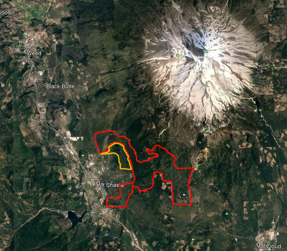
A very approximate rendering of the area covered by the proposed expansion of the Gateway Trail.

On Monday, January 29th, the US Forest Service hosted an informational meeting at the Mount Shasta City Park. The subject of the meeting was the proposed expansion of the Gateway Trail. Located on the southwestern flank of Mount Shasta, the Gateway Trail is an 11 mile network of mixed-use trails that wind through lower elevation areas just outside of Mount Shasta City. Developed by a collection of different groups that include hikers, mountain bikers and government agencies, the trail system has been a popular addition to the recreational opportunities in the Mount Shasta area. Though it is enjoyed by hikers and other users, the Gateway Trail has been particularly embraced by mountain bikers. Having a multi-season, trail network that offers a series of loop possibilities in beautiful and varied terrain so close to town has begun to put Mount Shasta on the mountain biking map. When completed, the Gateway Trail Phase II expansion will solidify Mount Shasta as a premier mountain biking destination.

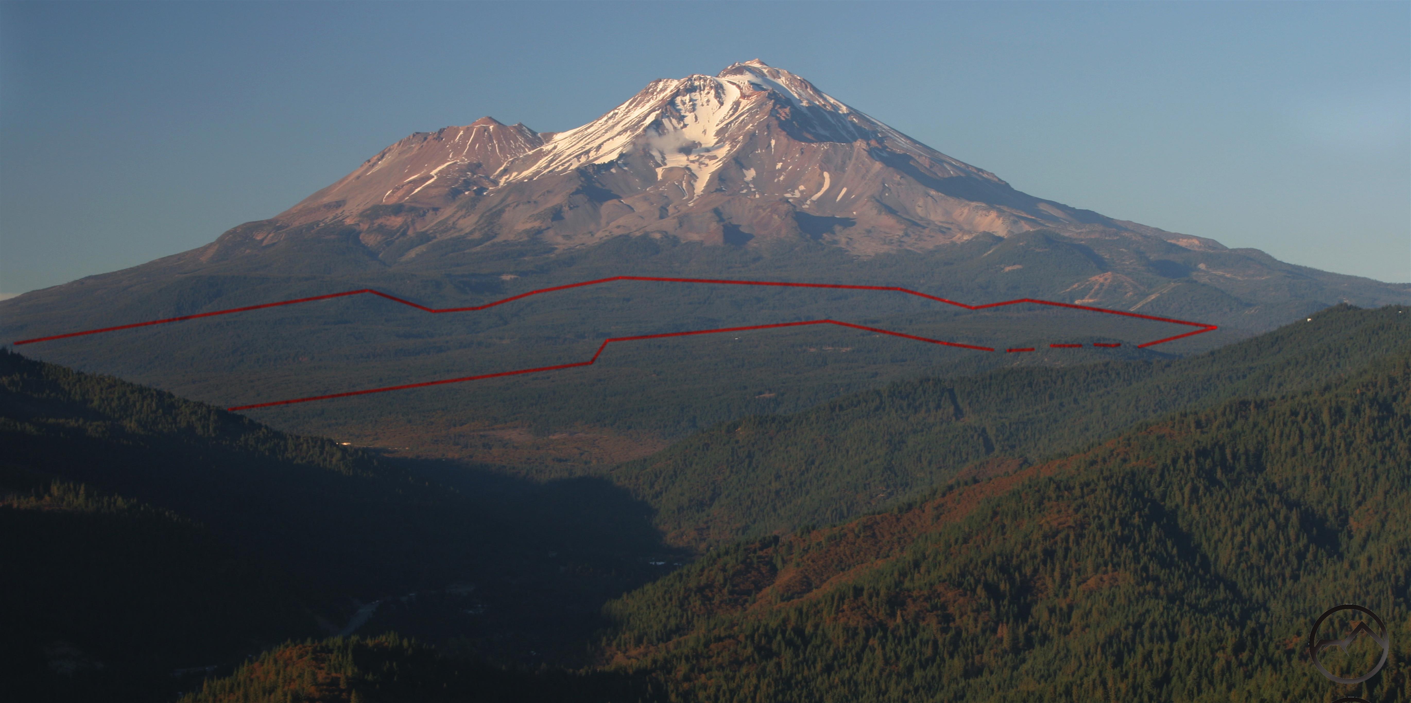
The expansion is ambitious. In addition to the original 11 miles of existing trails, it will increase the system by 47.5 miles, bringing the total to 58.5 miles. As the miles would indicate, this new phase of development will cover an extensive area on the lower flanks of Mount Shasta. The terrain here is varied. There are creeks and springs, hills and large flat areas, gullies, rock outcroppings, and forests, both natural and plantations. And, any many parts of the trail, there are views that include the upper slopes of Mount Shasta, the Strawberry Valley and the high peaks of the Trinity Divide. In short, the proposed expansion involves beautiful scenery and miles and miles of trail from which to explore it.

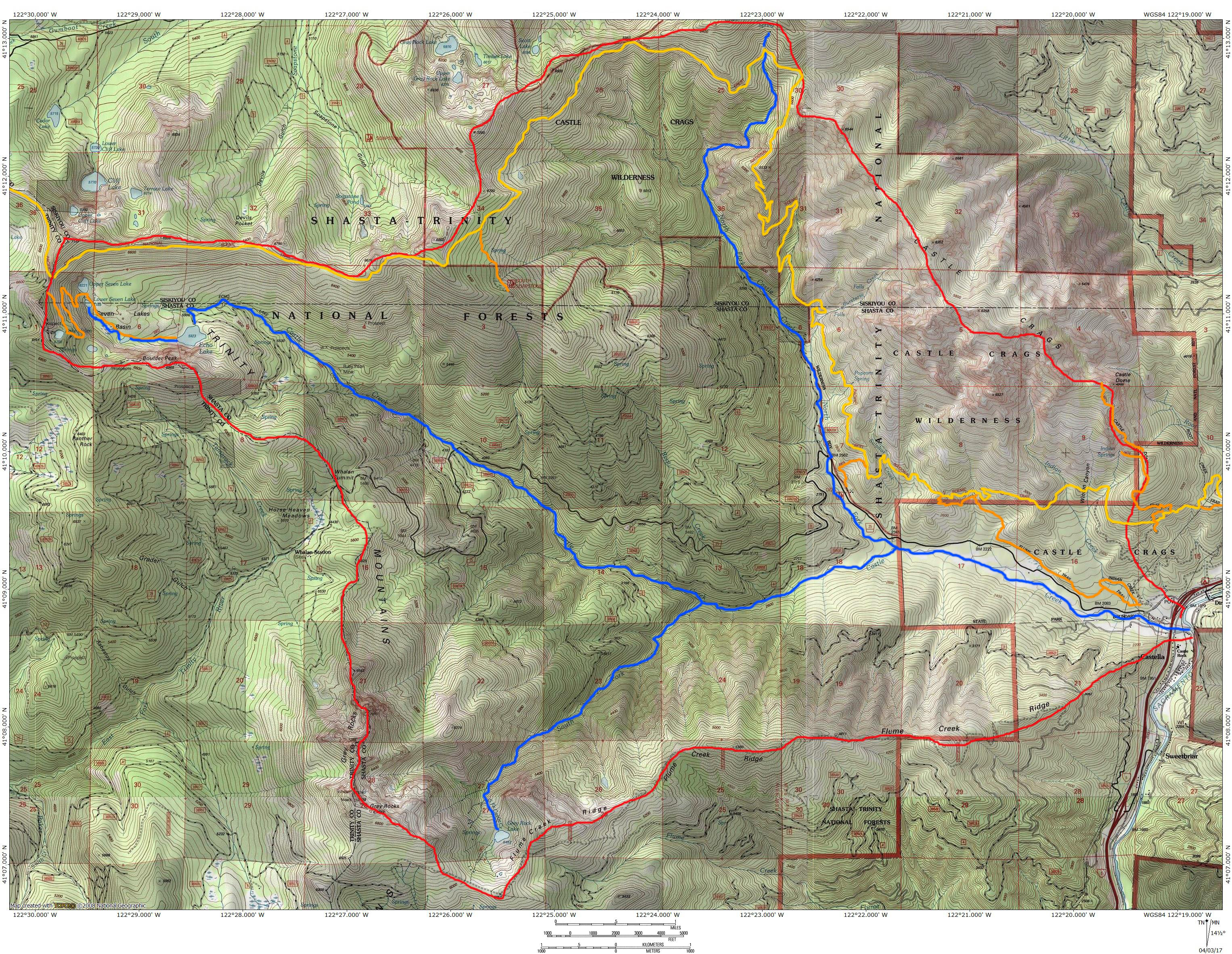
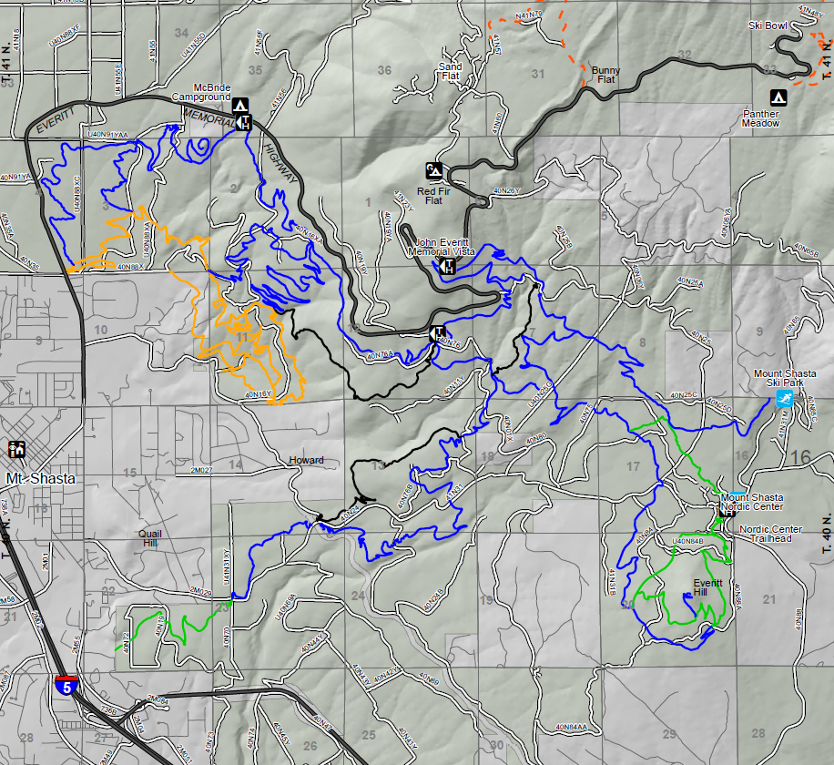
At the meeting, the Forest Service provided a number of maps to show where the trails will be located. Based on those, I drew a rough sketch to give a broader view of where the Gateway Phase II will be located. Please excuse the crudity of the model:

Existing Gateway area is marked yellow. Phase II expansion area is red.

Phase II expansion is ambitious and exciting.

The majority of the trails in the expansion will be mixed-use, available for hikers, equestrians and mountain bikers. Though all these groups are welcome, the last is the true target for most of the project. Several trails are included in the proposal to ease flow of bikers in certain loops, provide for multiple levels of biking difficulty and to provide a variety of terrain types. While this particular form of trail use is in primary focus, there are still plenty of opportunities for other users like hikers to get out and enjoy what this new trail system will offer.

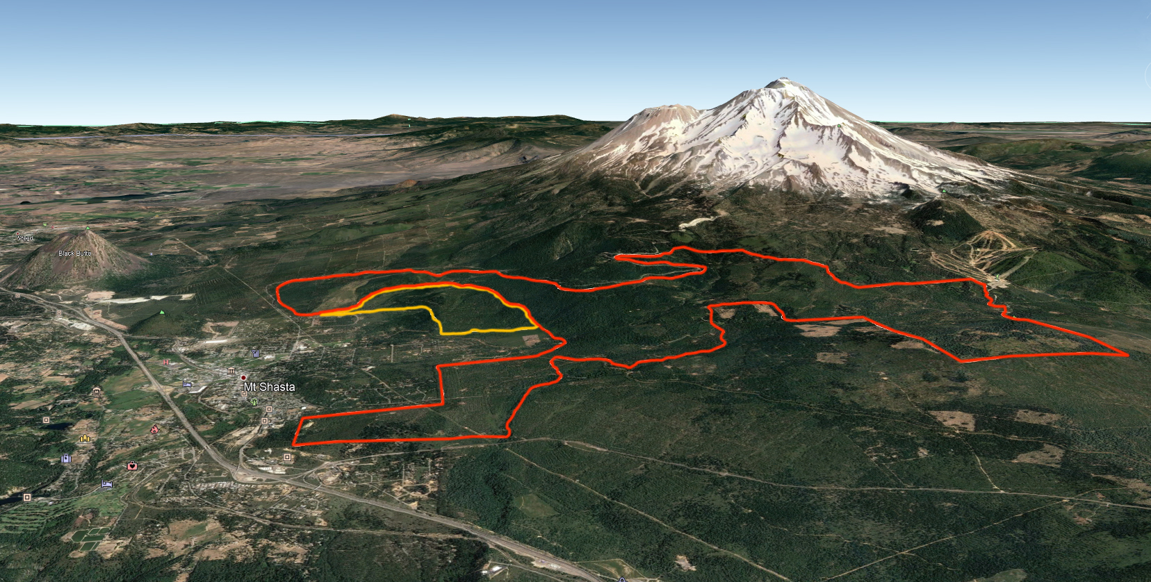
Existing trails are gold. Black, blue and green are proposed trails.

A short study of the proposed trail network, as well as corresponding topographic maps, reveals a well thought out series of routes that are both environmentally sensitive and maximizes the best features of the terrain. Wherever possible, the trails avoid dirt roads. However, when crossing ravines, gullies or small canyons, the trails briefly rejoin roads to utilize existing bridges. They then quickly dive back into undeveloped terrain. The map also reveals another excellent feature included in the project: 4 new trailheads in addition to the existing one on Everitt Memorial Highway. Three of the new ones will be higher up on the highway, at McBride Springs, Ten Gallon Plantation and at the Everitt Memorial Vista. This last is an already existing access point that is quite underutilized due to the forest overgrowth. The fourth trailhead is to be developed at the Nordic Center on the Ski Park Highway. The trails also connect to the Ski Park itself, which could also function as a trailhead. Additionally, another trailhead is planned at the south end of Mount Shasta City, near the old mill site. However, the this would be on city property and is, thus, not a part of the Forest Service project.

Another huge feature of this plan is the expansion of the McBride Spring Campground. This site is already heavily utilized and the plan is to double or nearly triple its capacity. The planned McBride trailhead would be directly across the street from the campground and would make a fantastic basecamp from which to explore this vast trail complex.

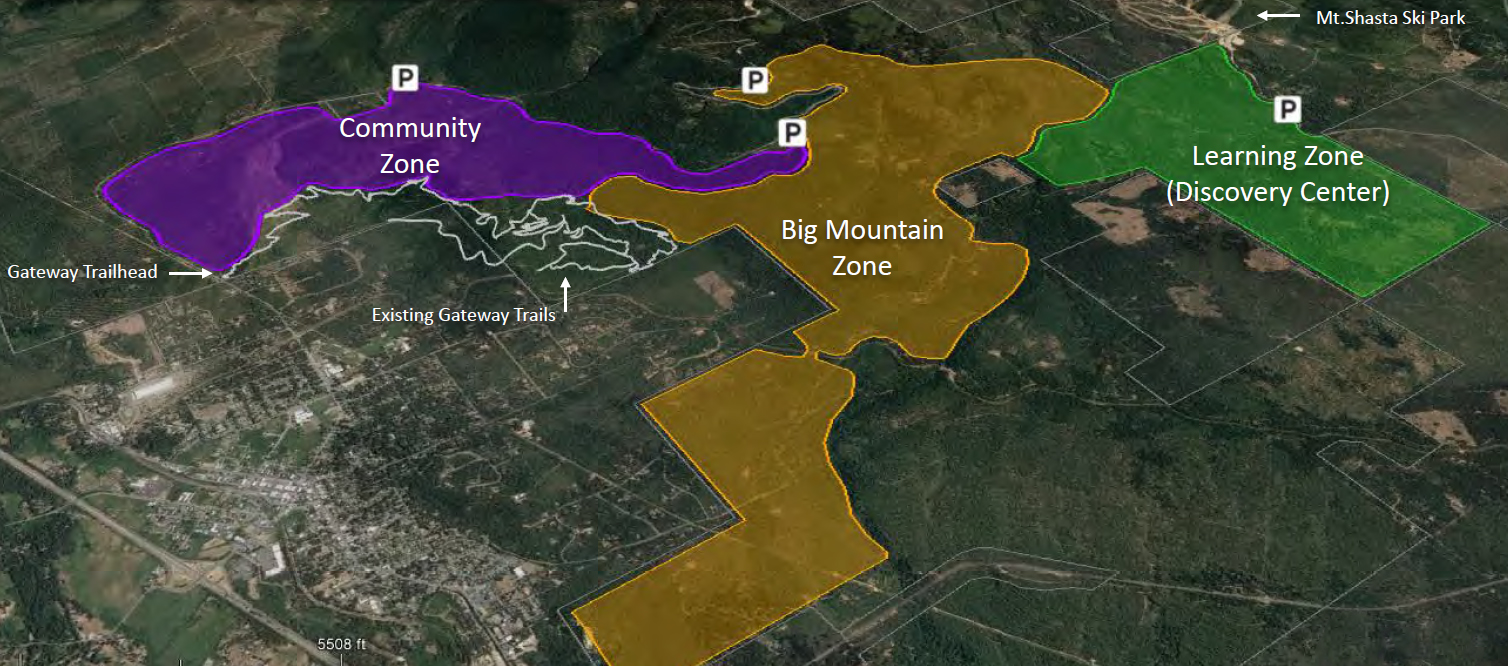
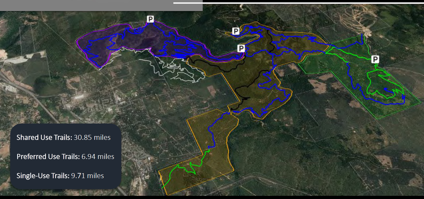
The entirety of the Phase II expansion is broken up into 3 sections (see above map). They have been dubbed the Community Zone, the Big Mountain Zone and the Learning Zone (with the possible renaming as the Discovery Center). Each of these areas has a different emphasis on use. I have broken out some of the slides from the presentation. A summary of each area as well as the proposed trails are present on each.

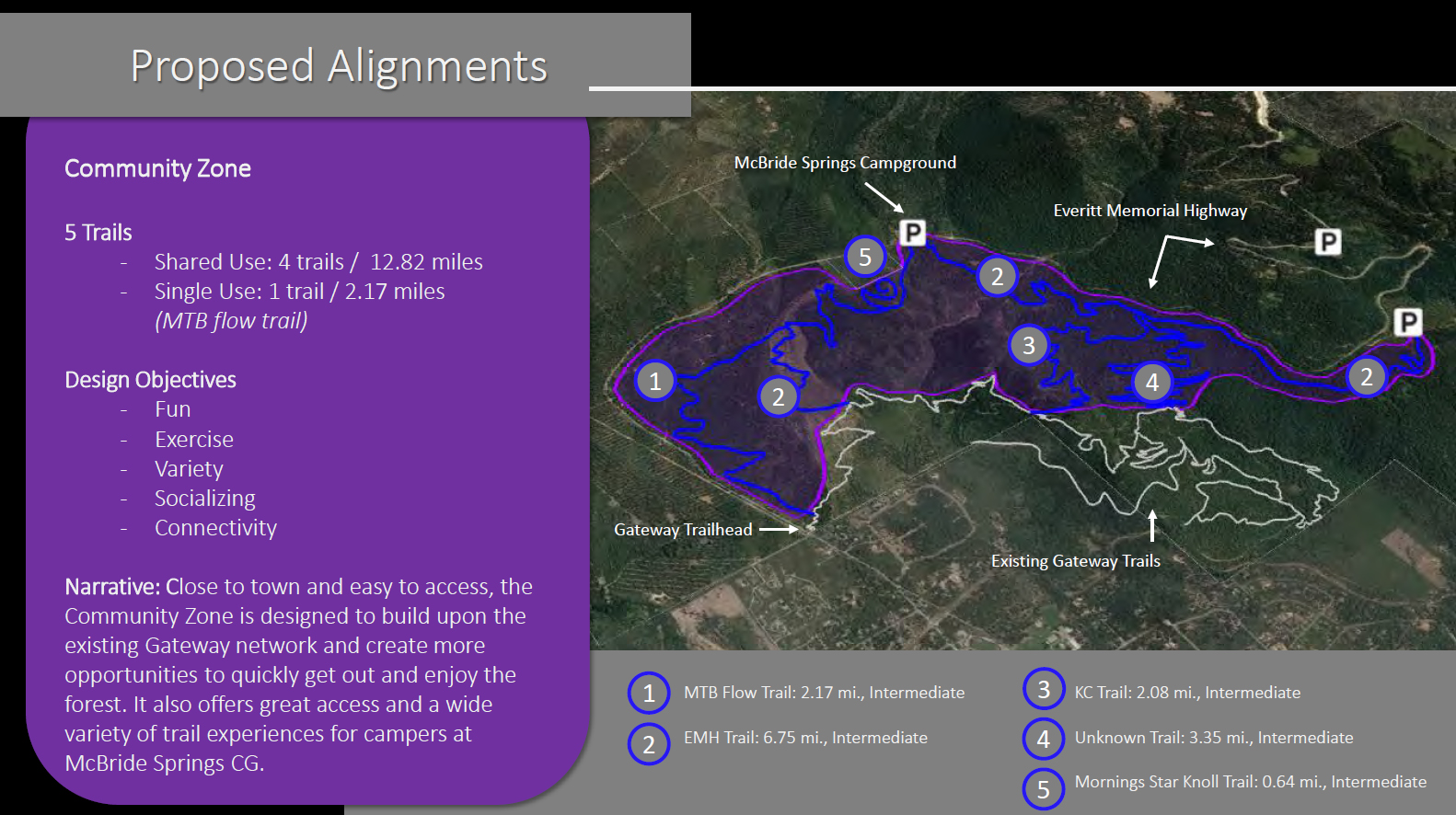
The Community Zone is so named because it is close to town but also because this is the place most likely to be used by a wide community of recreators. The anticipation is that the paths here will be used heavily by both hikers and bikers. It is, in many ways, an expansion of the already existing Gateway Trail network. This fills in a lot of unused areas and more than doubles the miles of trails available here. It also explores some interesting features like Morning Star Knoll (aka Rooster Rock) and the lower reaches of Cascade Gulch. It also has some pretty grand vistas of Mount Shasta itself. This section alone would be an incredible trail addition to the Mount Shasta area.

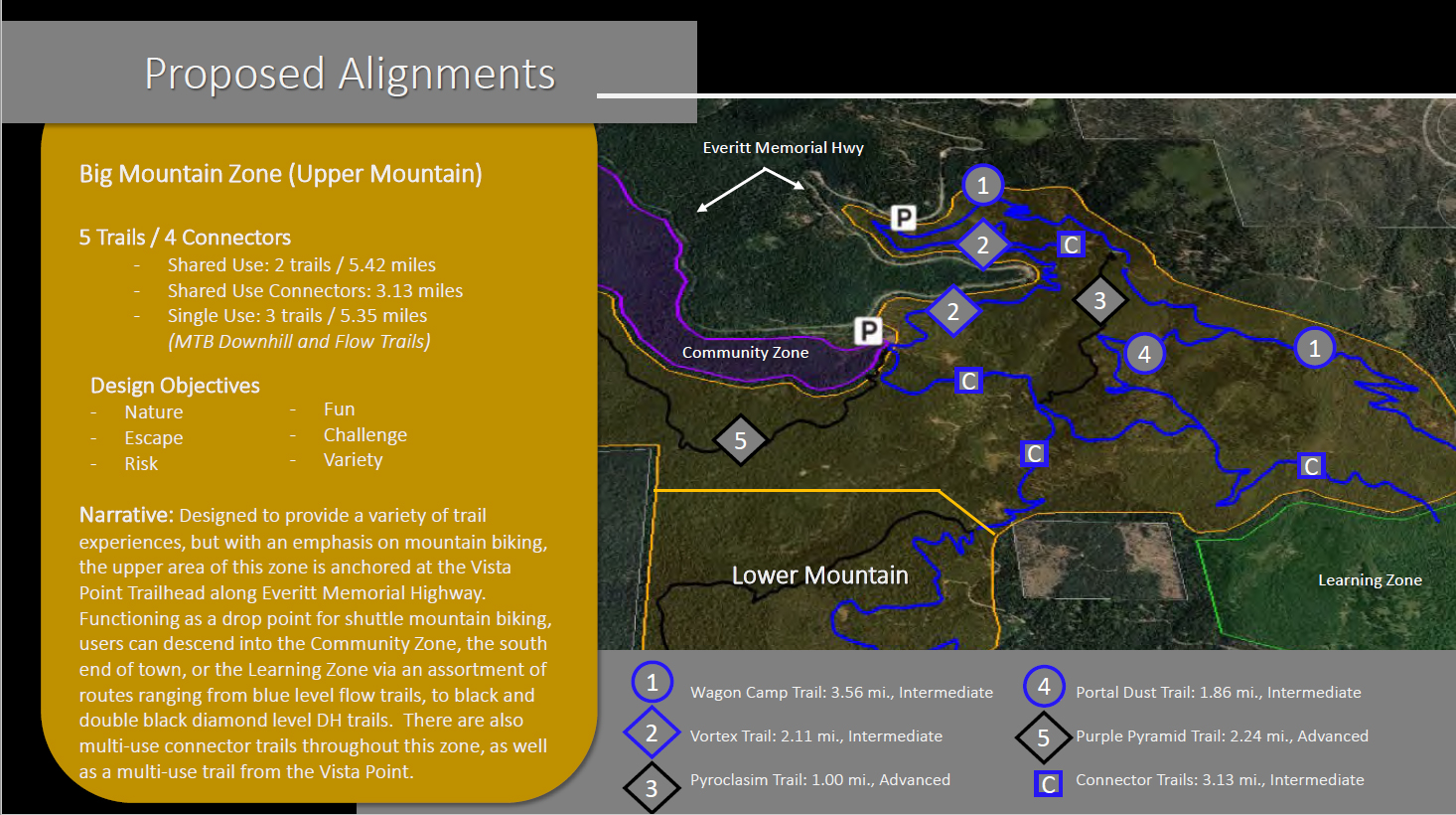
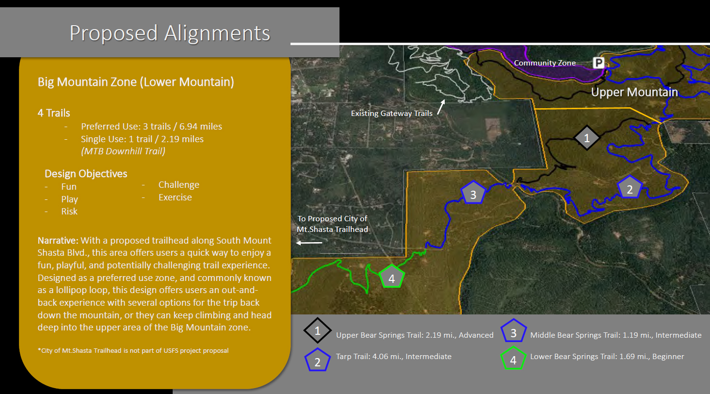
The Big Mountain area is broken into upper and lower sections. Taken together, these areas are envisioned as the most heavily used by mountain bikers. Consequently, much of their design has this use specifically in mind. This is not to say that hikers can’t or won’t venture into this area, but there simply won’t be as much to offer that use here. The Upper section of the Big Mountain Zone would be accessed via the Everitt Memorial Vista and from the planned Ten Gallon Plantation trailhead. This area explores steep terrain, would have difficult trails and travels rarely visited parts of Mount Shasta.

In some ways, this is the most fascinating part of the Phase II expansion. Accessed via trails in the Upper Big Mountain Zone as well as the planned trailhead at the southern end of Mount Shasta City, this is trail network would explore some pretty remote areas. The possibility of hiking or biking this as a lollipop, as well as access from the south end of town present some intriguing adventures.

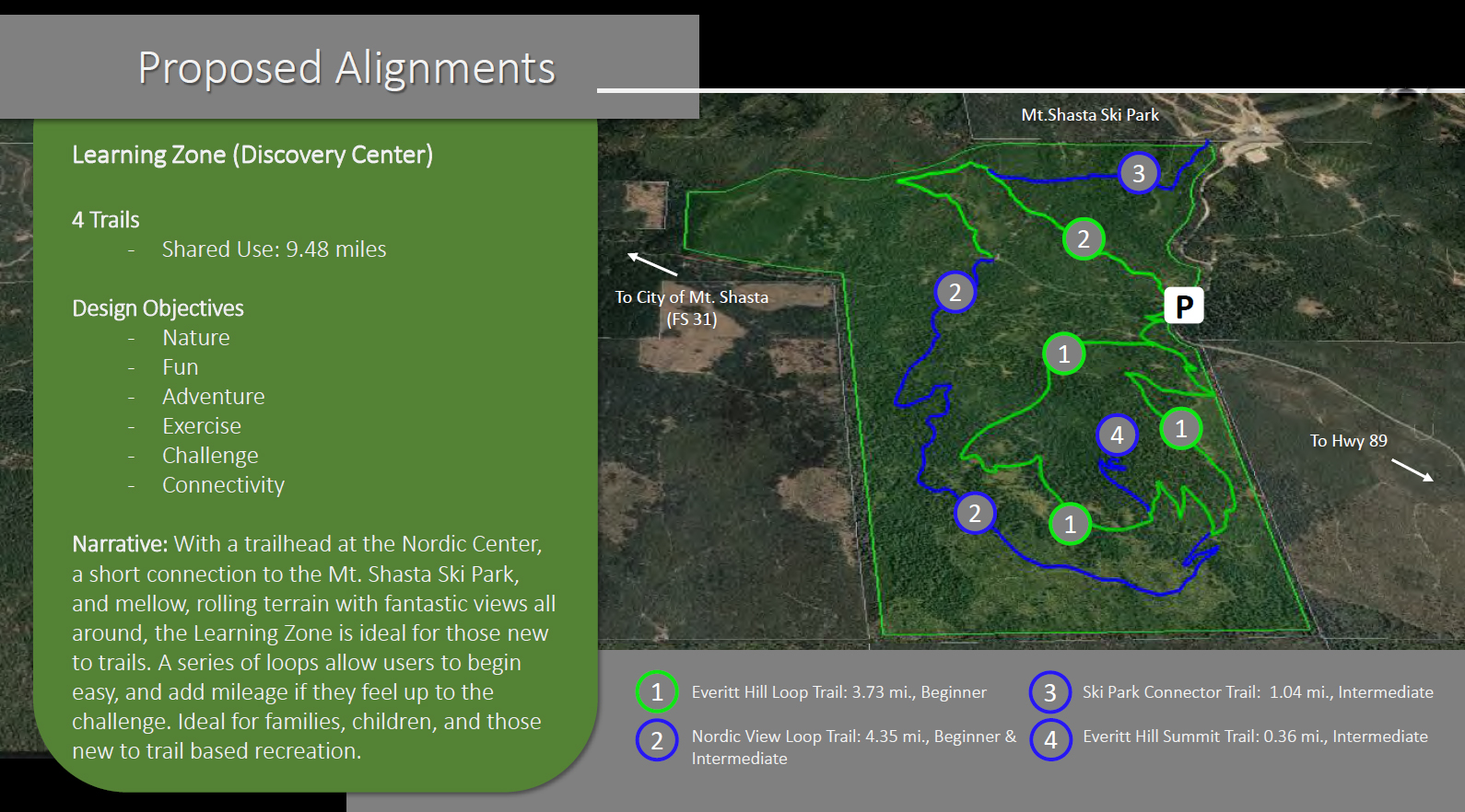
The final section of the Gateway Phase II expansion is the Learning Zone. This area is located just west of Ski Park Highway and around the large, rounded summit of Everitt Hill. The routes basically connect the Nordic Center to a series of trails that explore the flanks and summit of the hill. Trails also connect to the nearby Ski Park. All the trails in this area are easier and are therefore lend themselves more to beginner and lower intermediate use. This is an area where families with small kids would thrive on the trails. Its proximity to McCloud would also be a huge asset for that community, allowing people to access the entire network from the east, rather than through Mount Shasta City.

The scope and nature of this project is impressive. When completed, this will be an incredible resource for all of southern Siskiyou County. Although already a destination for outdoor enthusiasts, this trail network will likely significantly increase the number of people coming to this area to enjoy the recreational opportunities. For locals, who already have an abundance of riches when it comes to trails and things to do in the outdoors, this will be an over-the-top opportunity that will change the nature of hiking and biking in Mount Shasta. It is exciting to contemplate all the possibilities. All those who have been involved in the planning are to be highly commended!

So where do things stand now? It is my understanding that a significant amount of the funding has already been obtained but more most be secured going forward. For now, the Forest Service is going through the EIR and NEPA (I really dislike NEPA). This will likely take a year or so to complete. When that is done, assuming the findings are appropriate, construction of the whole network and the trailheads is expected to take 3 years. Realistically, this is likely to be done around 2022 or 2023. I imagine, though, that it is possible that one of the zones could be completed in 2 years time and folks are riding and hiking trails by sometime in 2020 (pure speculation on my part).

I initially thought about including a pros & cons section in this review but, honestly, I don’t think there are any significant drawbacks to this project. What issues there are tend to be more subjective in nature. Some folks might not like the increase of people coming from out of town to enjoy the trails. Other might not like informal trails being decommissioned. There can be complaints around numerous points of the project but overall, this is a well thought out and exciting opportunity for Mount Shasta. I, for one, am excited to explore the new trails as they are constructed.

That being said, I do have a few suggestions that I think would significantly enhance the Gateway Phase II expansion:

  • The additions to the McBride Springs Campground are essential, but I think they may not be enough. I think increasing the enlargement would be helpful. However, an even better option would be to build an all new campground a little northwest of the current campground. This would be in plantation land but could host a lot more campers. A trail could connect the campgrounds and would facilitate campers accessing the McBride trailhead across the road. As it is now, with such great access to the network, the additions to the current campground could be quickly outpaced by the number of mountain bikers wanting to camp and then hit the trail.
  • It would also be a neat feature to include one or two backcountry campgrounds. This could be placed at the upper end of the Lower Big Mountain Zone (as well as other spots) and allow mountain bikers or hikers to camp in remote areas while enjoying the trails. The lower elevation of these areas would also mean that early season overnighters would be possible right outside of town.
  • As noted there are a lot trails specifically designed for mountain bikers. I have no problem with this for a variety of reasons. However even just a couple of hiker-only trails would be a nice feature. One particularly good option would be to have a path travel the length of Cascade Gulch in the Community Zone. This would allow hikers to make a great loop and would include a beautiful, interesting area to the hike. Of course, bikers who ride the informal trail through there might object…
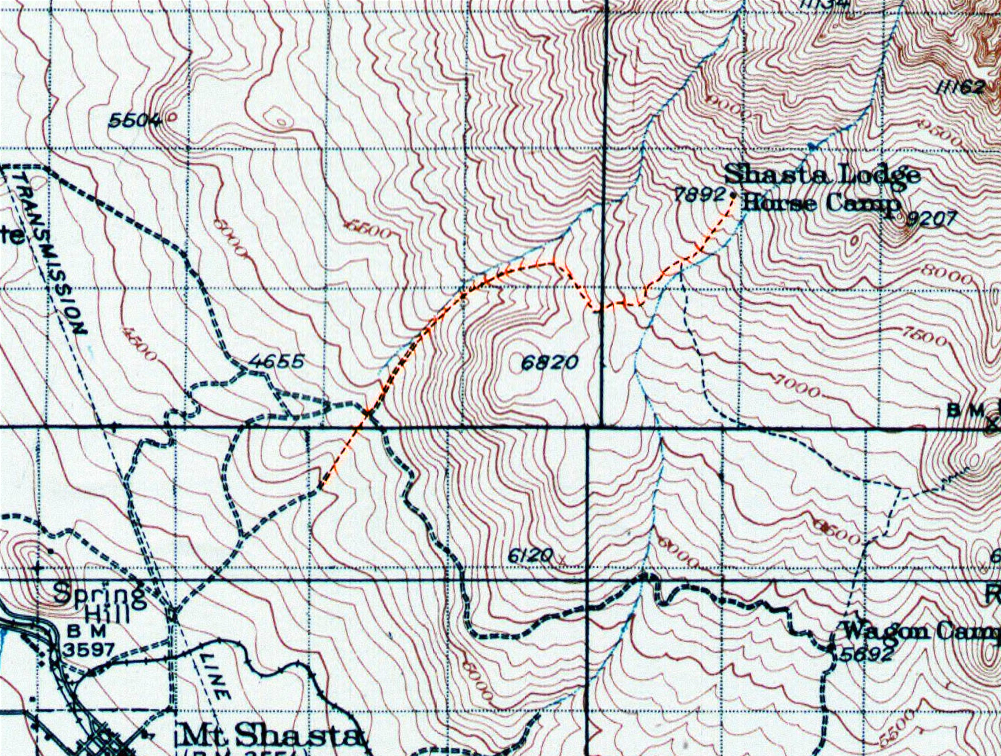
  • In a similar vein, there has been some discussion of incorporating the South Sisson Trail into the Gateway Phase II expansion. This route was the original trail by which climbers would ascend from Mount Shasta City to Horse Camp and then to the summit beyond. This trail was abandoned after the construction and paving of the Everitt Memorial Highway. However, much of the trail was still extant. It remained dormant until motivated hikers have improved the trail and it can once again be hiked up to connect to the Sand Flat trailhead and then on to Horse Camp.

The South Sisson Trail, highlighted on the 1935 USGS topo map for Mount Shasta.

What is proposed now is including the already (unofficially) restored trail in the EIR and NEPA process and then including it in the Phase II expansion as an official part of the trail network on Mount Shasta. I am completely in favor of this. This would effectively link the entire Gateway network, as well as the town of Mount Shasta City, to many of the trails that lie high up at the treeline. My proposed (and also unofficially constructed) addition of a trail connecting Bunny Flat with the Old Ski Bowl would further link the whole area. It would be an incredible set of trails, of true national park caliber scope and scenery!

In summary, I think the Gateway Phase II expansion project is an incredible addition to the Mount Shasta area. It will benefit the community though an increase in tourism and will likely put the area “on the map” as far as mountain biking goes. Even if no new hiker-specific trails are constructed, it will serve to shift mountain biking use off of trails like the Sisson-Callahan and McCloud River Trails and onto the Gateway network. For hikers, it still holds some excellent opportunities to enjoy the lower slopes of Mount Shasta.

For those looking to comment on this project, Comments can be emailed to comments-pacificsw-shasta-trinity-mtshasta-mccloud@fs.fed.us

I am also very interested to see everyone’s thoughts on this project. Please feel free to leave comments on this review!

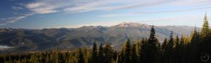
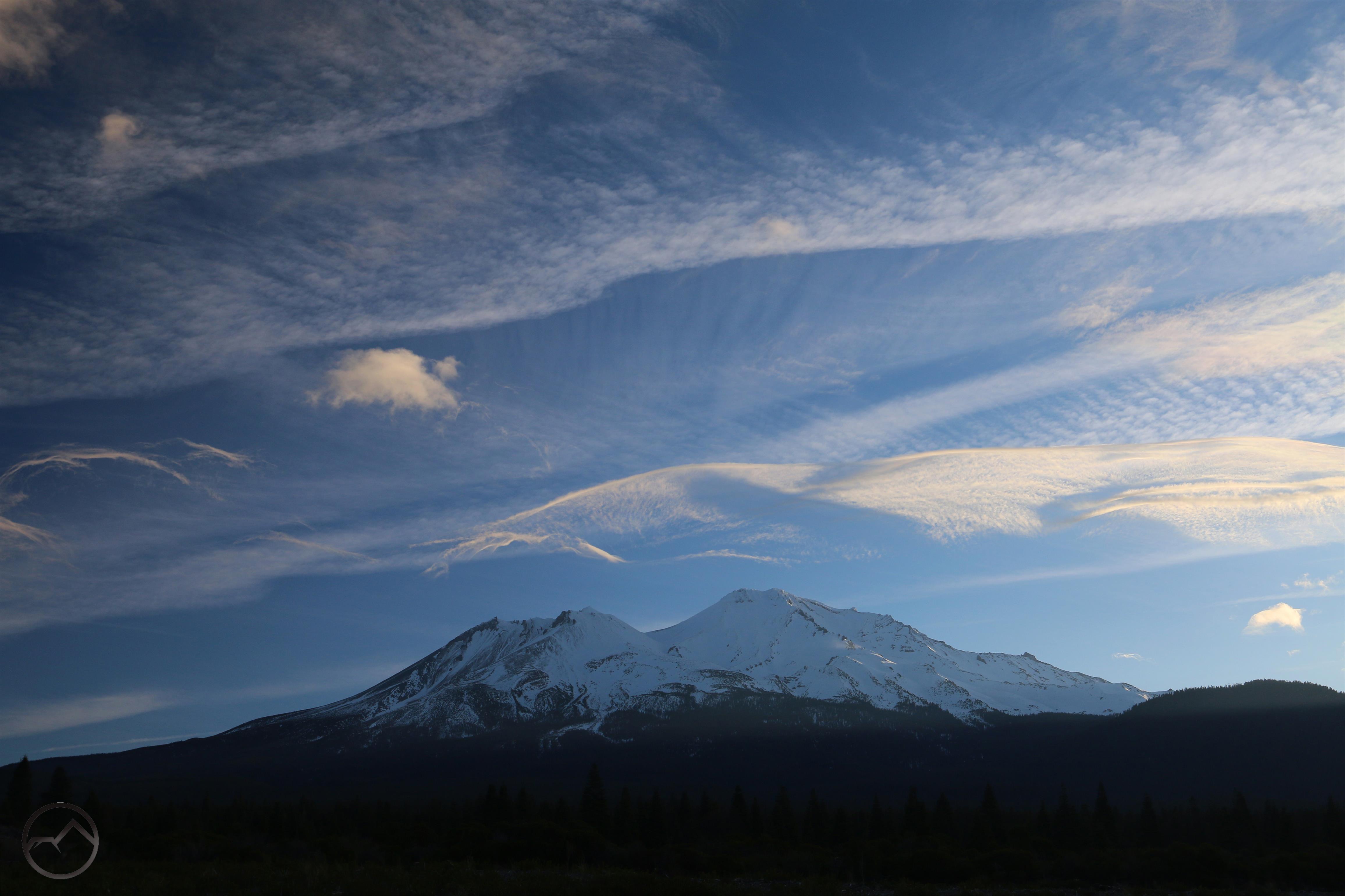
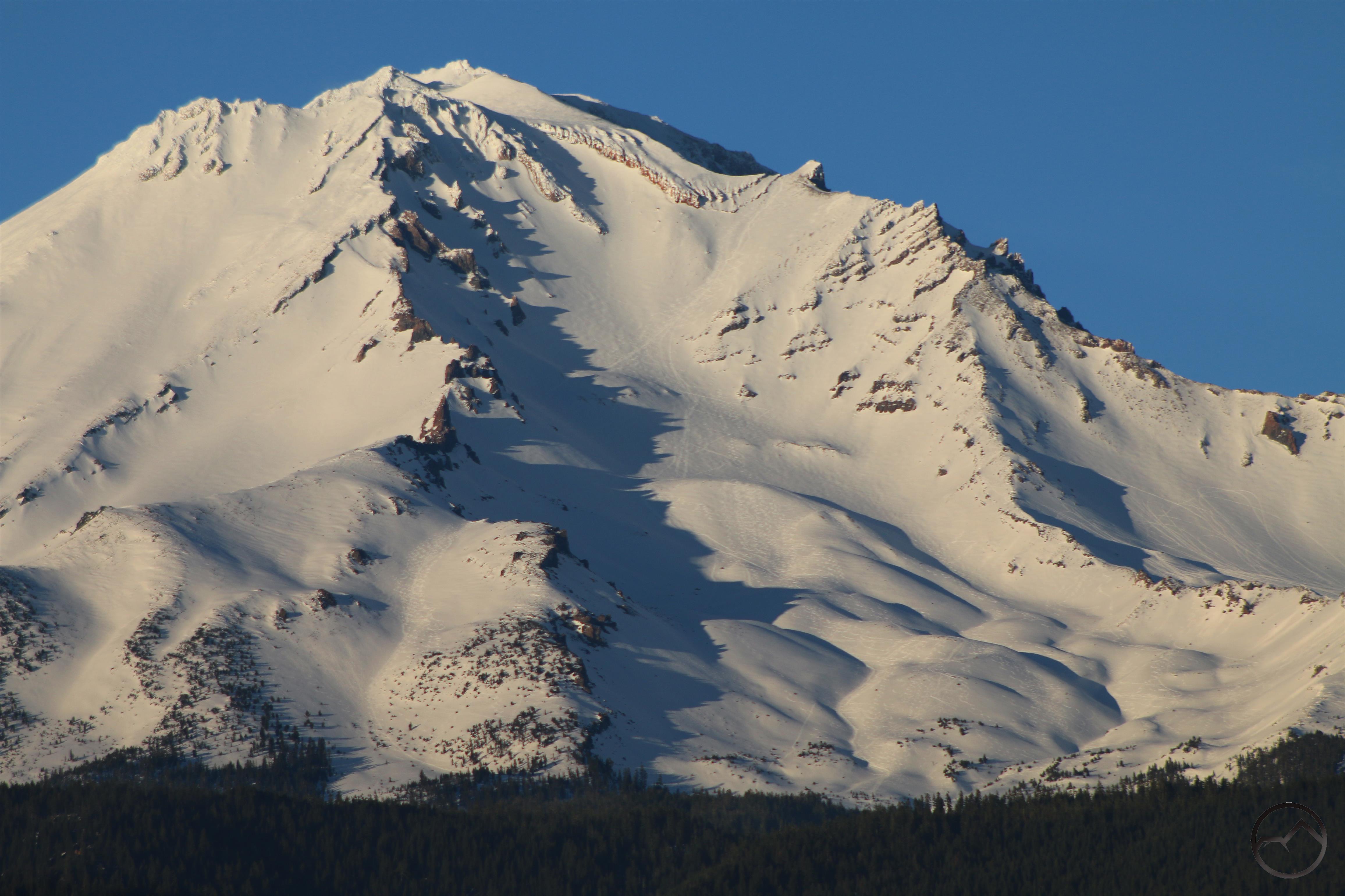
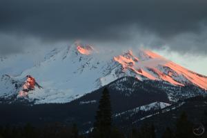
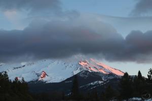
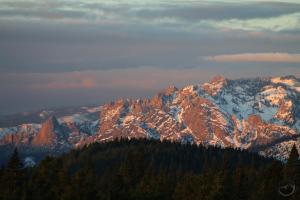
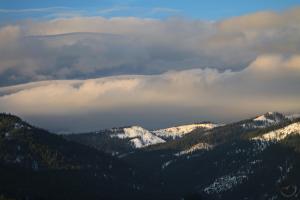
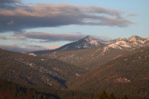
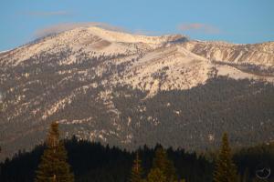
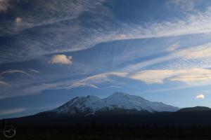
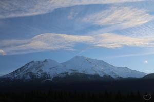
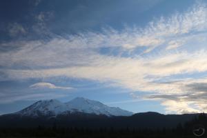
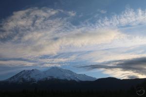
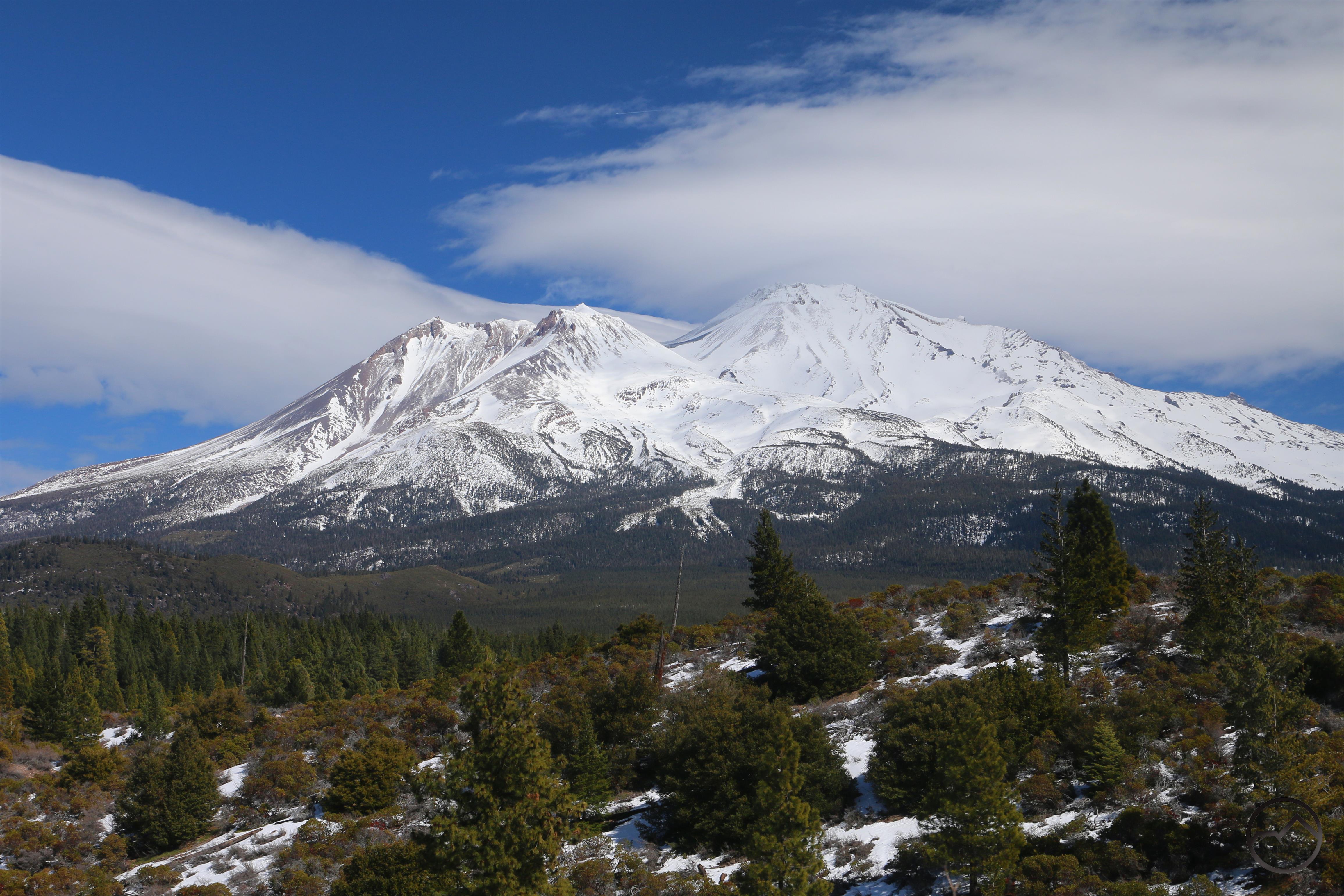
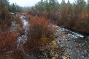
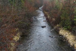
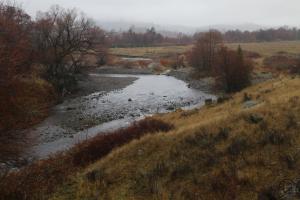
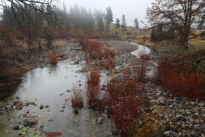
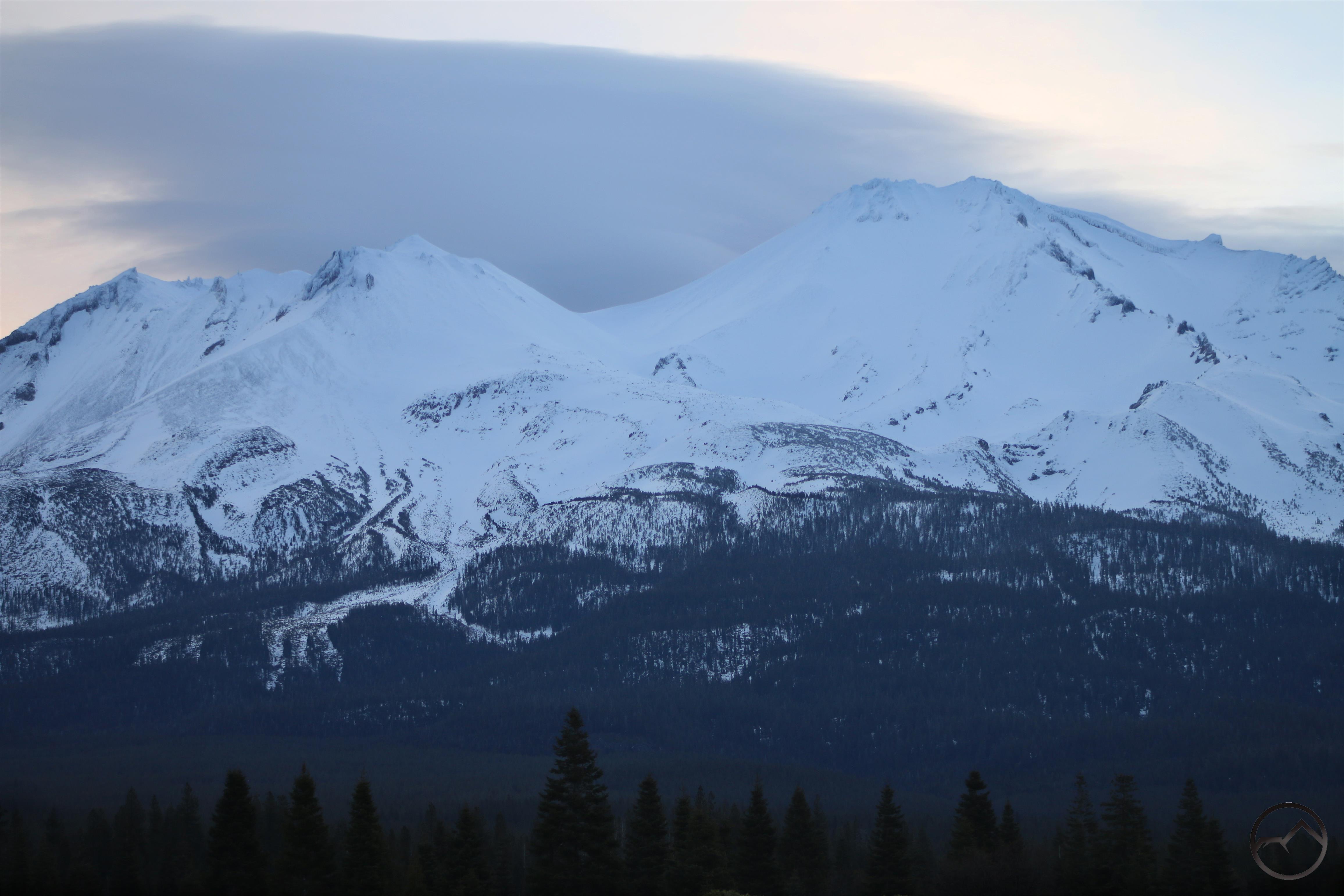
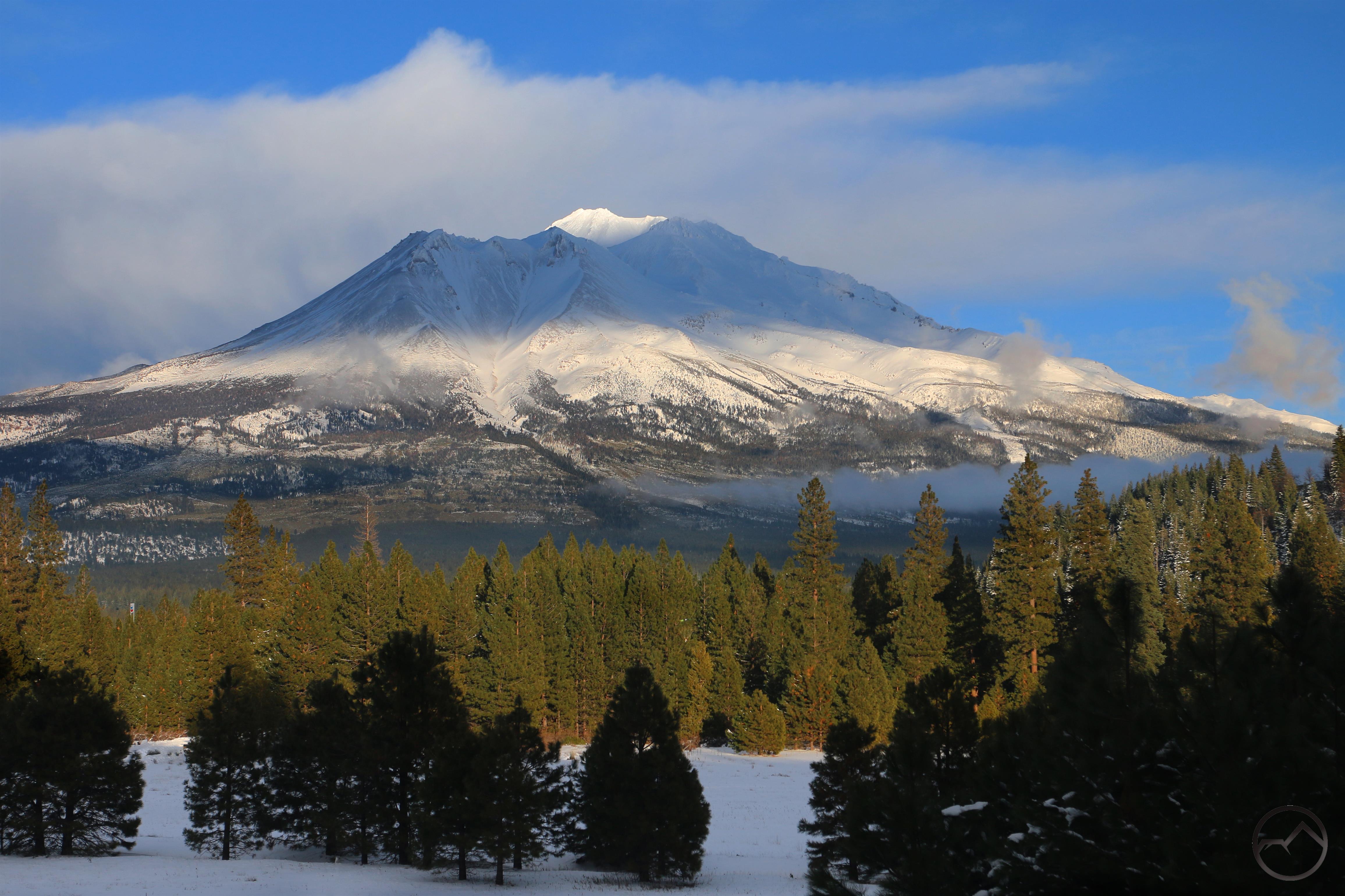
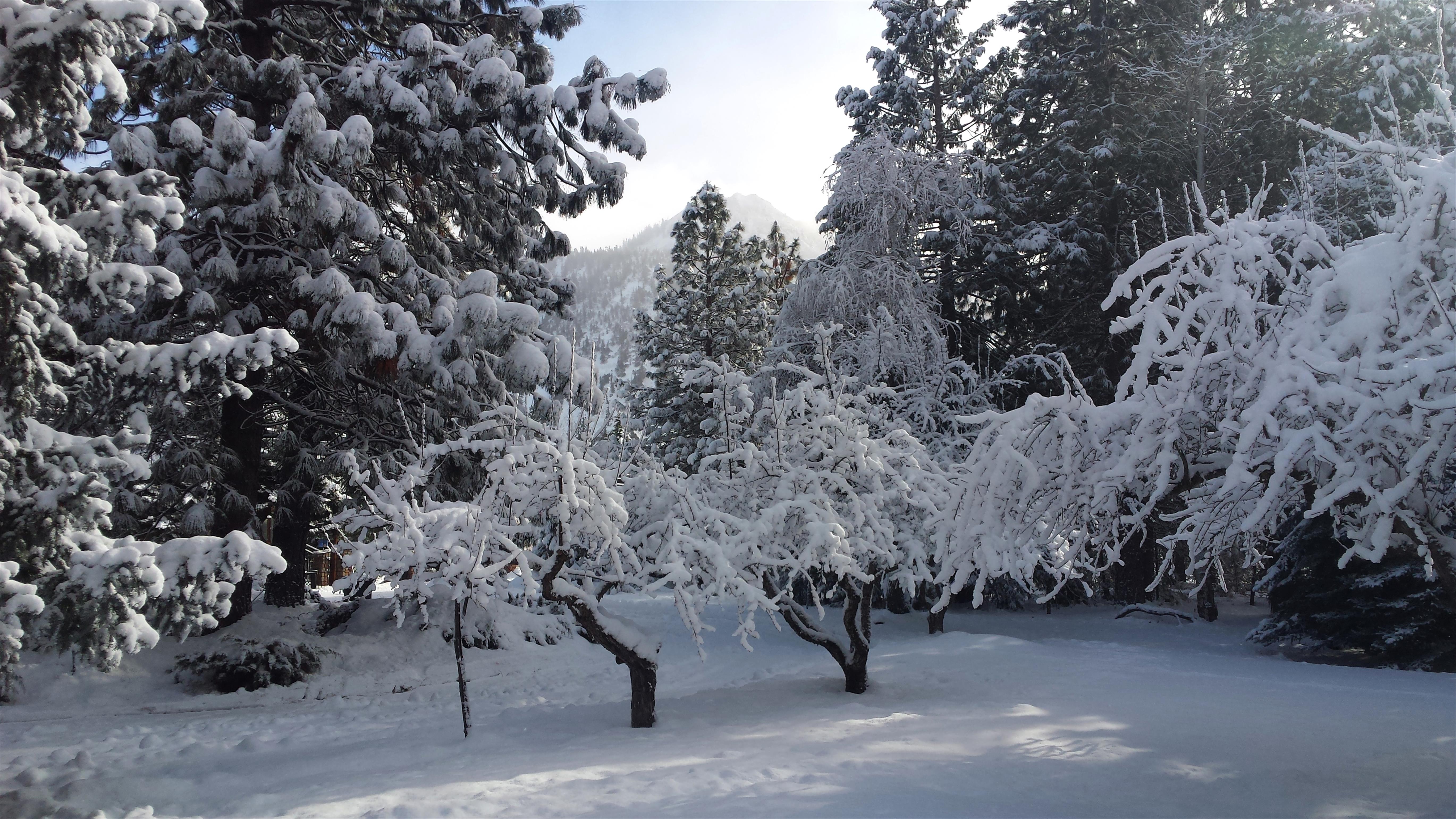
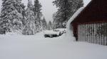
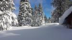
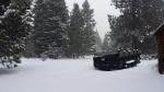
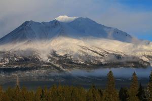
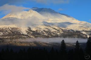
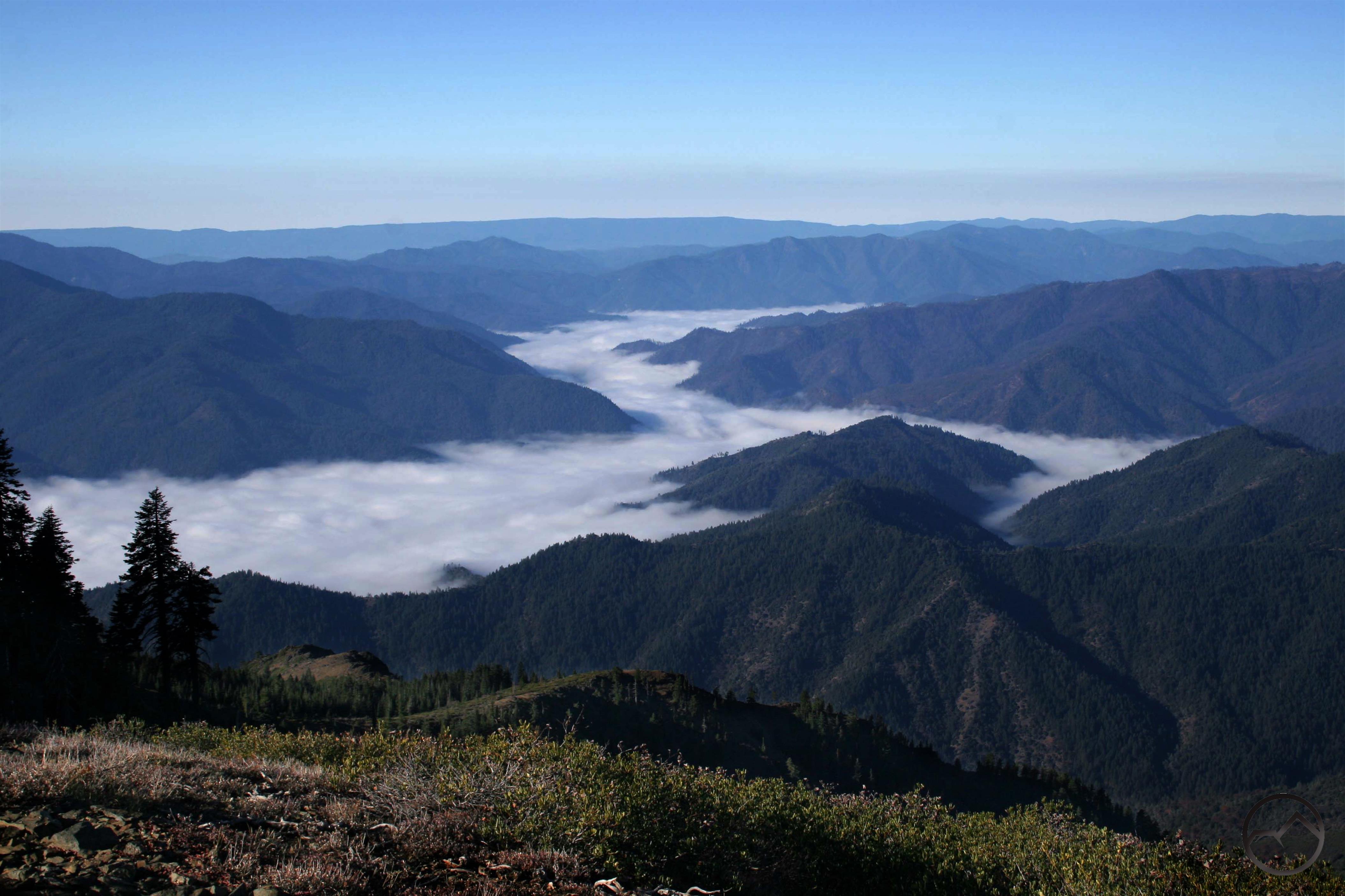
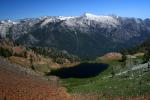
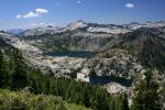
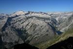
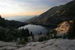
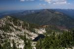
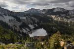
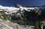
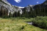
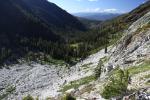
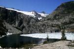
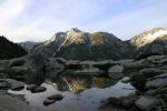
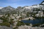
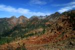
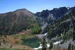
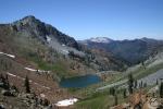
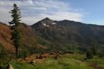
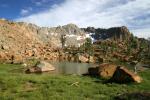
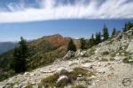
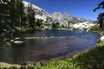
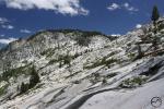
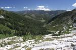
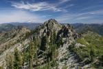
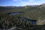
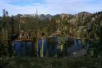
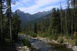
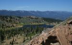
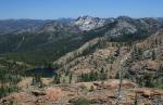
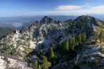
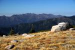
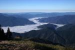
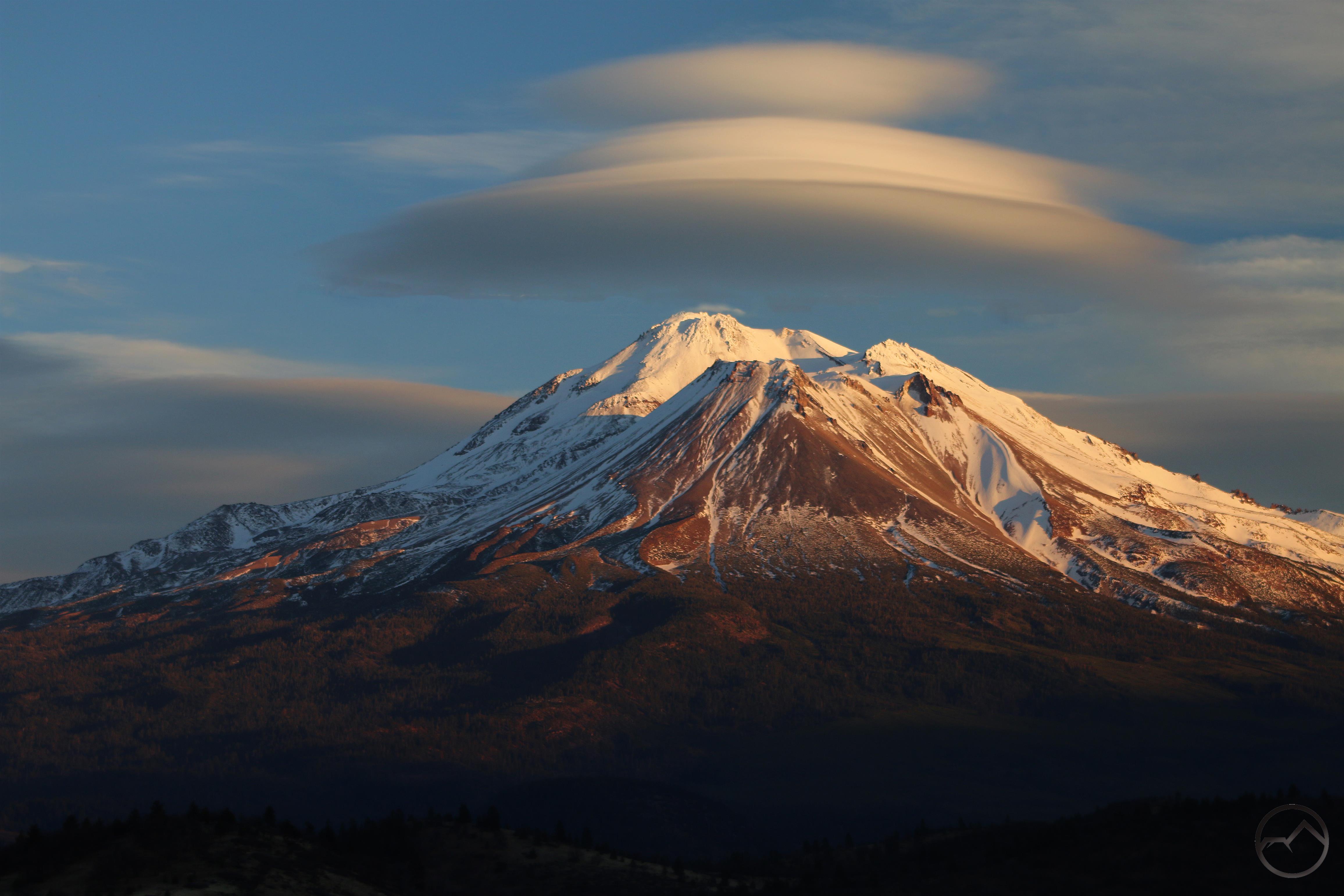
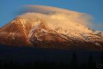
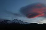
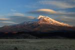
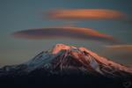
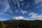
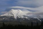
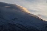
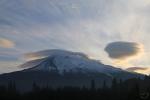
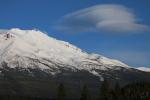
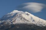
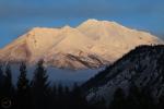
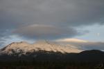
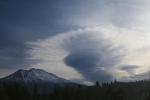
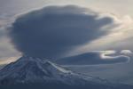
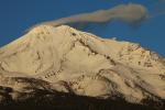
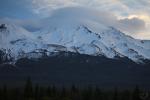
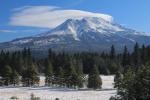
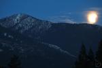
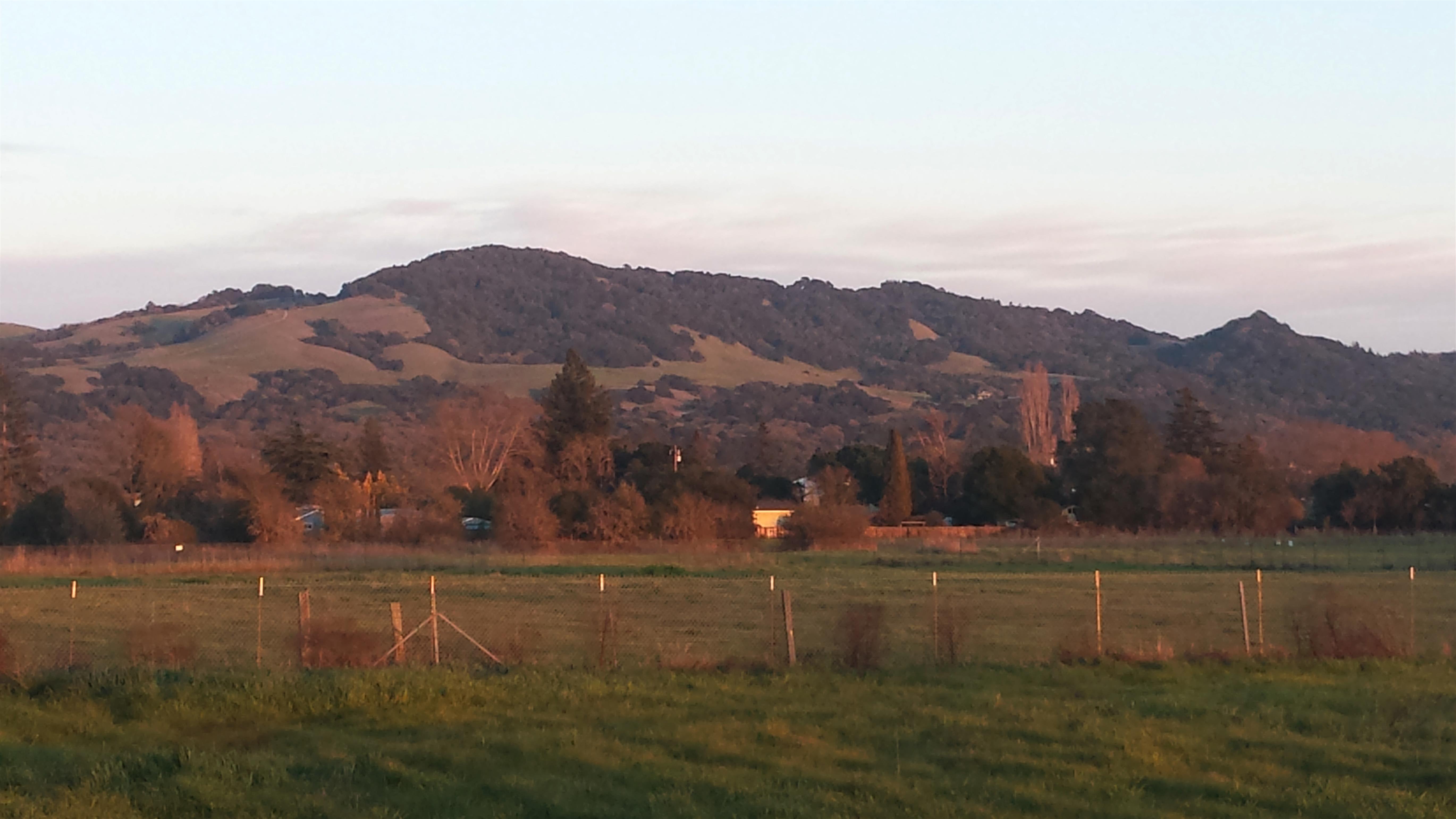
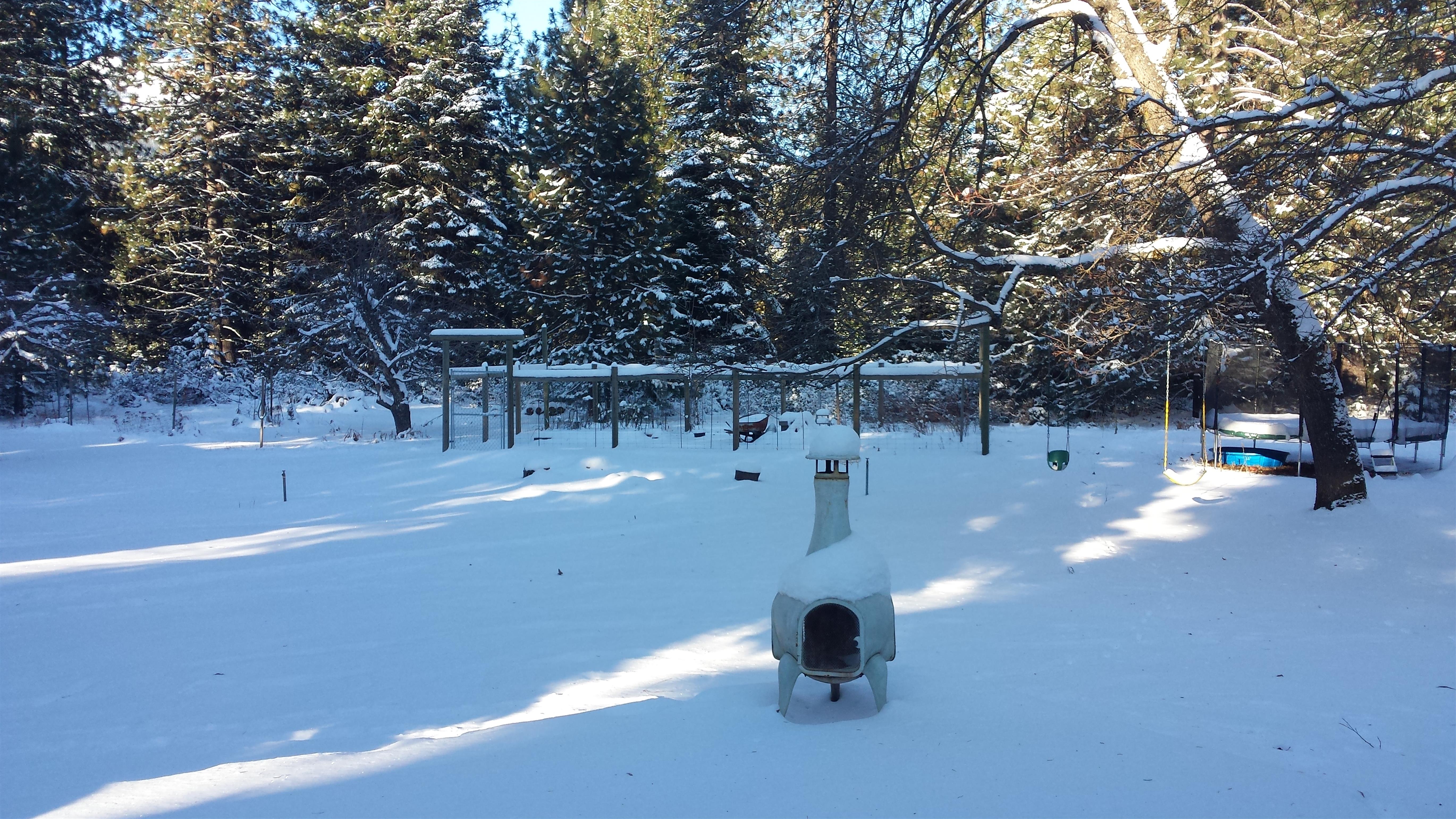
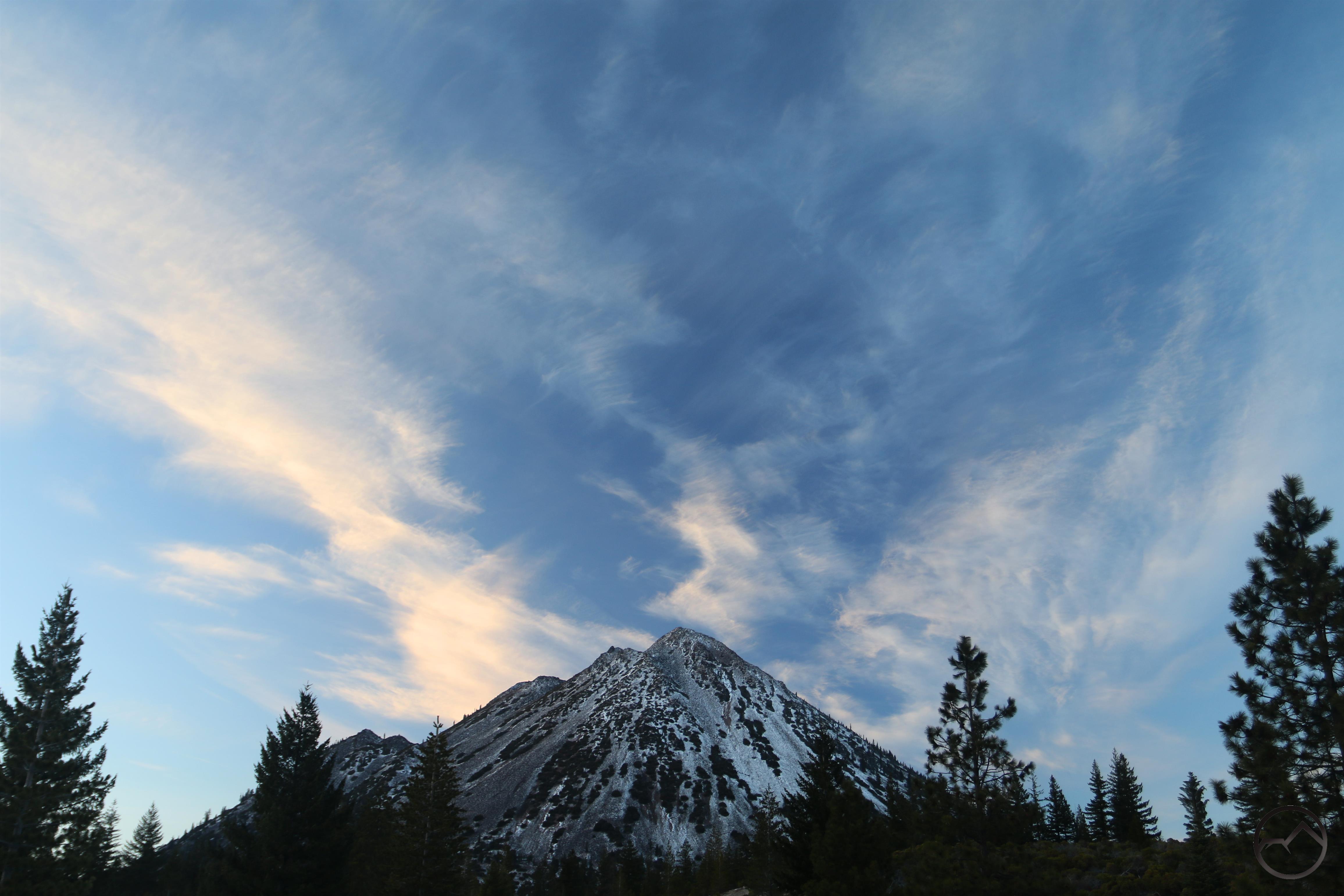
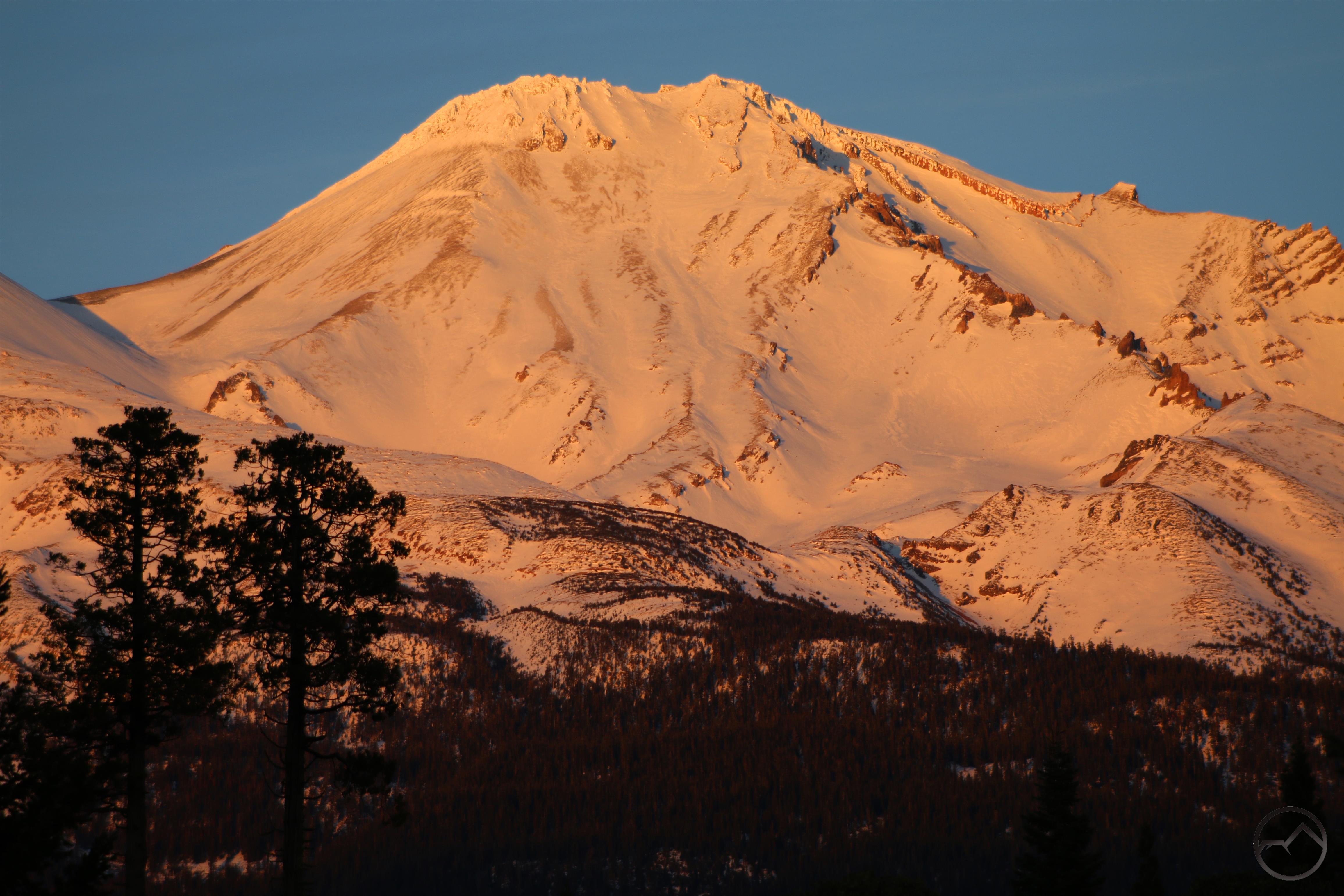
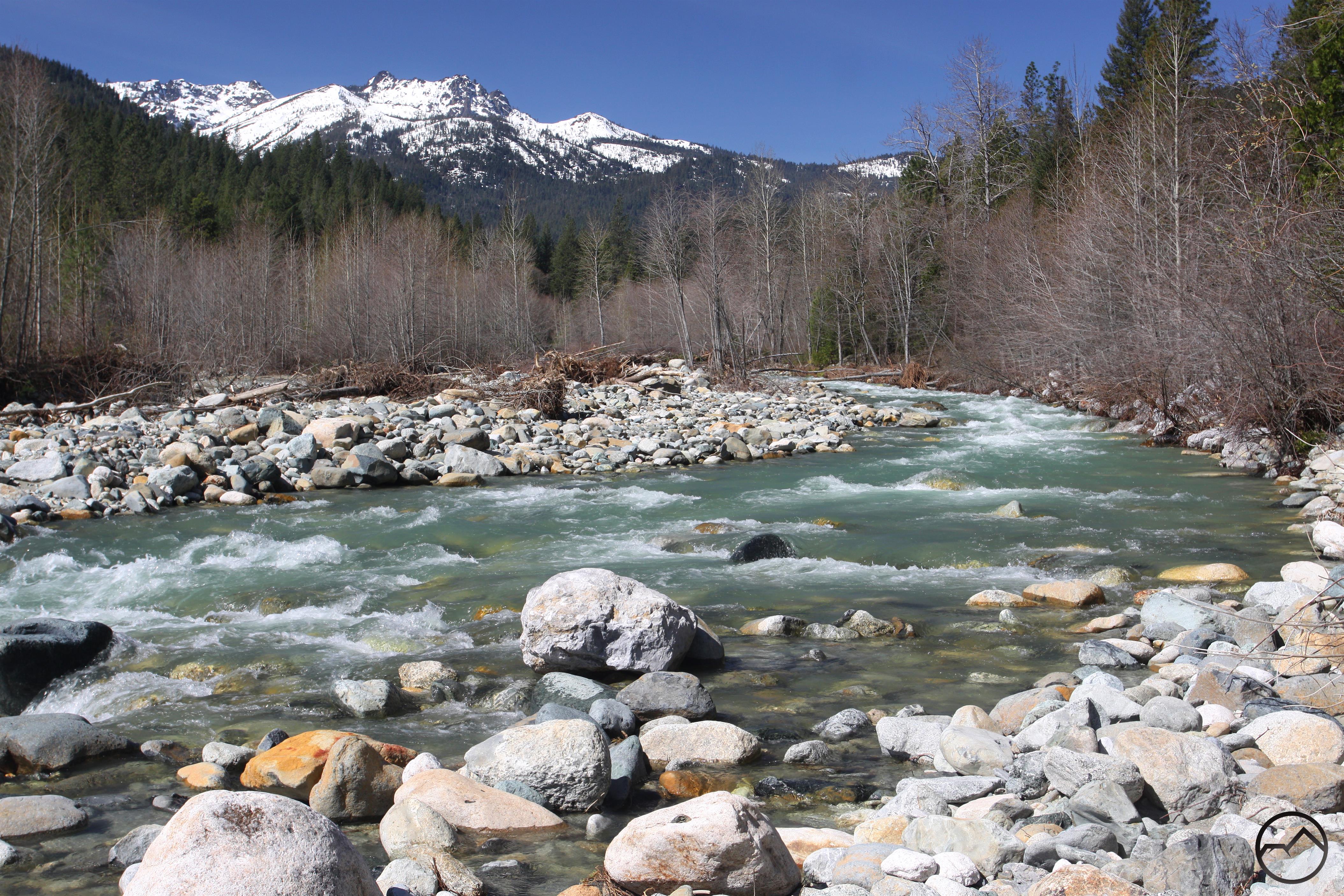
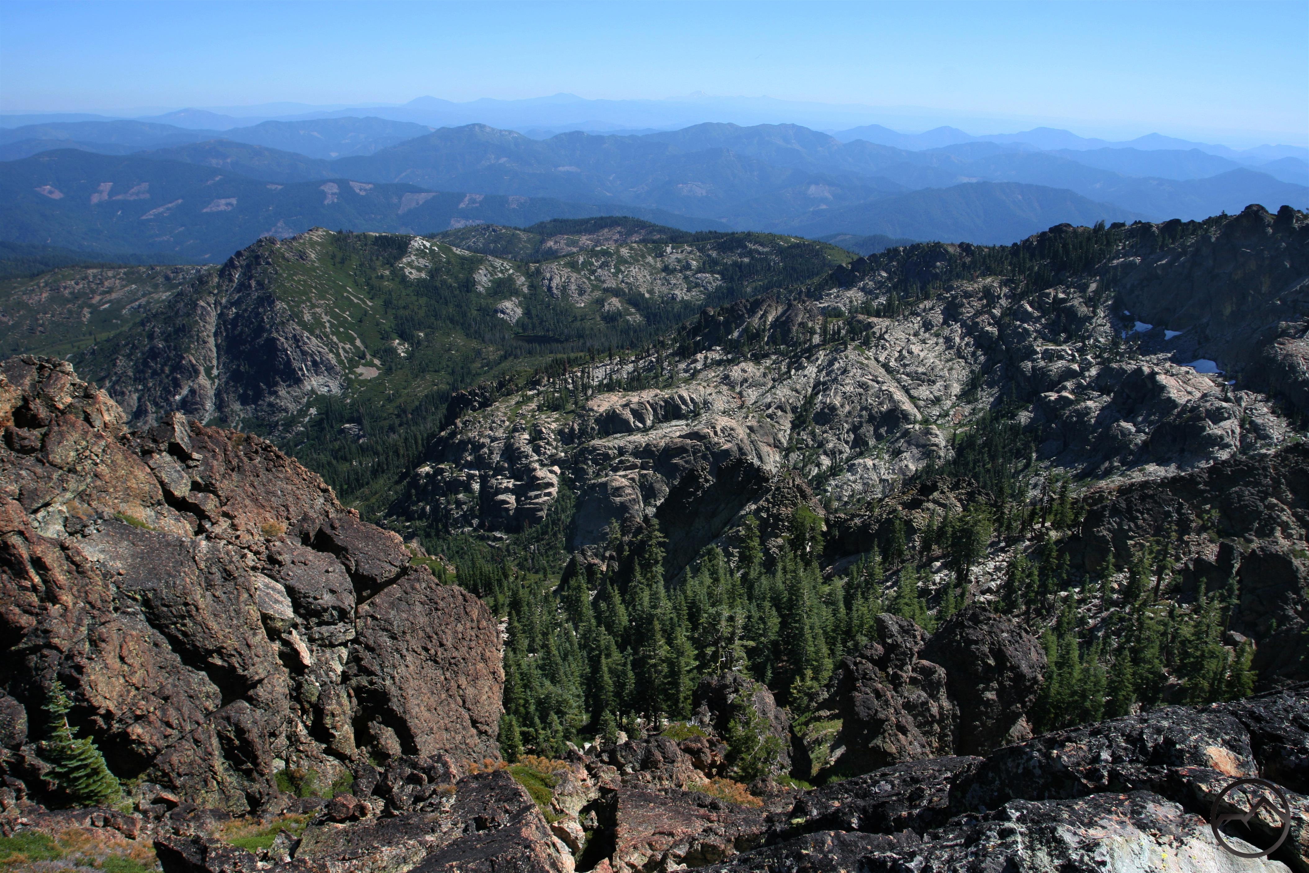
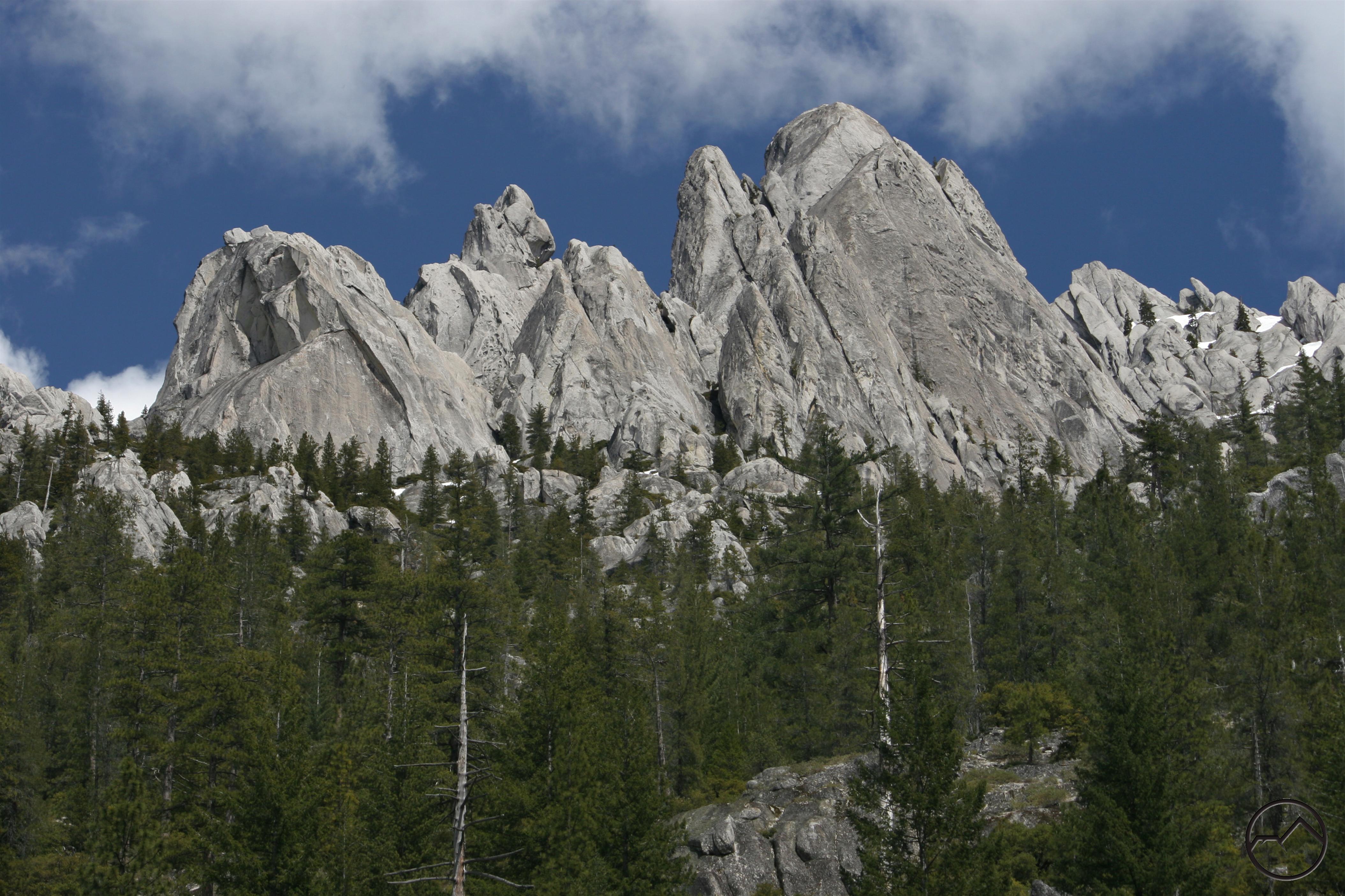
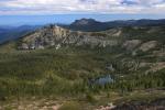
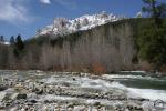
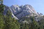
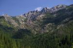
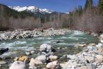
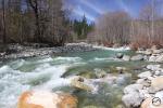
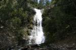
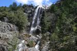
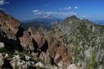
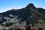
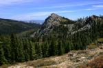
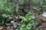
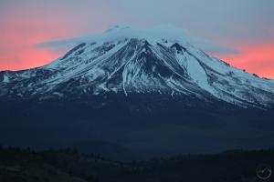
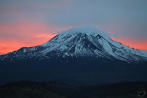
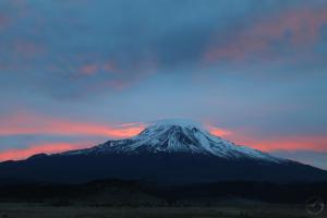
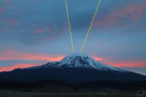
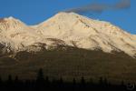
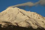
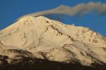
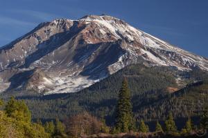
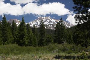
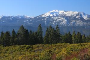
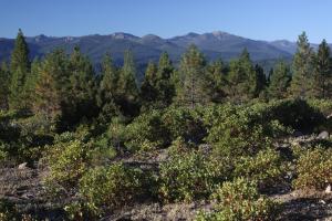
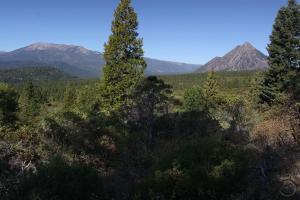
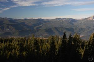
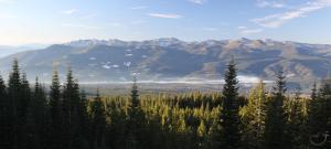
Lastly, I want to close with a few images of vistas found around the proposed areas of the Phase II expansion. It is exciting to contemplate…

Click to enlarge:


The trail also features good perspectives on Mount Eddy and Black Butte.


An Unusual Mount Shasta Sunrise, With Shadows And Clouds

Posted by bubbasuess on February 11, 2018
Posted in: Cascade Range, Hiking, Lenticular Clouds, Mount Shasta. 3 Comments

Dawn’s light illuminates the fringes of a Mount Shasta lenticular.

I was up early prepping some material for a class I am teaching at church, as well as putting the finishing touches on my Gateway Trail Phase II review, when I noticed the clouds where of such a nature and position to produce a sunrise shadow. These are among my favorite phenomena. I hopped in the car and headed north, which is usually the best orientation from which to enjoy the shadows. Little did I know that the mountain also boasted a nice lenticular crown. I raced to one of my easy-to-get-to spots and and set up my camera as the morning light really began to hit the clouds.

As I endured the frigid morning (the car said 23) I watched the color get more intense and light up the clouds above Mount Shasta. Soon the edges of the lenticular itself were glowing. It was a gorgeous sight, which I enjoyed in the solitude of the dawn. The lenticular began as a classic disk, but as the color intensified, it lost some of its well-defined edges as it expanded. Nonetheless, the change in shape was not disappointing as it retained a pleasing form and the summit of Mount Shasta just poked through the cloud and caught the morning light.

In the midst of this, the sun finally reached a position where its light was cast at the angle necessary to create a shadow. Frustratingly, there were no clouds positioned immediately above Mount Shasta, so the shadow was not as readily observed. However, there were clouds higher up for the shadow to manifest. This, coupled with the lenticular, was an awesome sight and made for a truly beautiful morning. However, the cloud cover was thicker than ideal and the sun’s light was quickly obscured before the full sky was illuminated and the colors were lost. I was glad to have seen the fleeting event.

Click to enlarge:


We may not be getting much snow, but there sure has been a lot of spectacular activity around the mountain lately!

So This Happened In Mount Shasta

Posted by bubbasuess on February 9, 2018
Posted in: Cascade Range, Hiking, Lenticular Clouds, Mount Shasta. 3 Comments

Incredible lenticular stacks form near Mount Shasta.

Once again, Mount Shasta was up to its tricks, disrupting changing weather systems and causing massive lenticular displays to form overhead. As the autumn and winter have unfolded, what started off as a slow lenticular season has suddenly turned in a really remarkable series of lenticular displays. Those of February 9th will certainly rate among the more exciting and elaborate collection of clouds I have seen around Mount Shasta. The form of the clouds was in constant flux but for much of the day, the disks grew in multiple stacks just south of the mountain. If there was anything to complain about in the midst of such a singular and staggering display it was that the lenticulars cast their shadow on Mount Shasta, rendering the mountain dark amidst harsh, glaring light. Nonetheless, the spectacular nature of the clouds demanded I stop numerous times during the day to capture their awesome nature.

I have two lengthy posts in the works, so I will keep this one short and put up the pictures. I think they speak for themselves.

Click to enlarge:

Early in the day, the clouds were already awesome.

As the sun set, the single cloud above the summit still exhibited minor lenticular traits.

Alpenglow and the final, fluctuating form.
A beautiful sunset on Mount Shasta.

Posts navigation

← Older Entries
Newer Entries →
    • Recent Posts

      • Winter Shows Up When It Will
      • January Rolled By With Mud, Then Very Dry
      • Mount Shasta 2025 – A Year In Images
      • Mount Shasta On Either Side Of Christmas
      • Adrift In An Ocean Of Fog
      • December Has Been Spectacular Thus Far Pt. II (A Magnificent Lenticular)
      • December Has Been Spectacular Thus Far Pt. I
      • Lenticular Interrupted
      • A Stormy Wave And A Truchas Sunset
      • Aurora Lenticularis
    • Enter your email address to follow Hike Mt Shasta and receive notifications of new posts by email.

    • Archives

      • February 2026
      • January 2026
      • December 2025
      • November 2025
      • October 2025
      • September 2025
      • August 2025
      • July 2025
      • June 2025
      • May 2025
      • April 2025
      • March 2025
      • February 2025
      • January 2025
      • December 2024
      • November 2024
      • October 2024
      • September 2024
      • August 2024
      • July 2024
      • June 2024
      • May 2024
      • April 2024
      • March 2024
      • February 2024
      • January 2024
      • December 2023
      • November 2023
      • October 2023
      • September 2023
      • August 2023
      • July 2023
      • June 2023
      • May 2023
      • April 2023
      • March 2023
      • February 2023
      • January 2023
      • December 2022
      • November 2022
      • October 2022
      • September 2022
      • August 2022
      • July 2022
      • June 2022
      • May 2022
      • April 2022
      • March 2022
      • February 2022
      • January 2022
      • December 2021
      • November 2021
      • October 2021
      • September 2021
      • August 2021
      • June 2021
      • May 2021
      • April 2021
      • March 2021
      • February 2021
      • January 2021
      • December 2020
      • November 2020
      • October 2020
      • September 2020
      • August 2020
      • July 2020
      • June 2020
      • May 2020
      • April 2020
      • March 2020
      • February 2020
      • January 2020
      • December 2019
      • November 2019
      • October 2019
      • September 2019
      • August 2019
      • July 2019
      • June 2019
      • May 2019
      • April 2019
      • March 2019
      • February 2019
      • January 2019
      • December 2018
      • November 2018
      • October 2018
      • September 2018
      • August 2018
      • July 2018
      • June 2018
      • May 2018
      • April 2018
      • March 2018
      • February 2018
      • January 2018
      • December 2017
      • November 2017
      • October 2017
      • September 2017
      • August 2017
      • July 2017
      • June 2017
      • May 2017
      • April 2017
      • March 2017
      • February 2017
      • January 2017
      • December 2016
      • November 2016
      • September 2016
      • August 2016
      • July 2016
      • June 2016
      • May 2016
      • April 2016
      • March 2016
      • February 2016
      • January 2016
      • December 2015
      • November 2015
      • September 2015
      • August 2015
      • July 2015
      • June 2015
      • May 2015
      • April 2015
      • March 2015
      • February 2015
      • January 2015
      • December 2014
      • November 2014
      • July 2014
      • June 2014
      • May 2014
      • April 2014
      • March 2014
      • February 2014
      • January 2014
      • December 2013
      • November 2013
      • October 2013
      • September 2013
      • August 2013
      • July 2013
      • June 2013
      • May 2013
      • April 2013
      • March 2013
      • February 2013
      • January 2013
    • Categories

      • Boy Scouts
      • Cascade Range
      • Castle Crags
      • Desert
      • Echo Point
      • Glaciers
      • Hiking
      • How things came to be…
      • Klamath Mountains
      • Konwakiton Outdoor Designs
      • Lakes
      • Lenticular Clouds
      • Maps
      • Marble Mountains
      • Meadows
      • Mount Eddy
      • Mount Shasta
      • Mount Shasta History
      • Napa County
      • Off Season Trails
      • Pacific Crest Trail
      • Peaks
      • Rivers
      • Rock Climbing
      • Scott Mountains
      • Seldom Seen
      • Shasta Valley
      • Sierra Nevada
      • Siskiyou Mountains
      • Sonoma County
      • Spring Trails
      • sunrise
      • sunset
      • Trinity Alps
      • Trinity Divide
      • Truchas Ridge
      • Uncategorized
      • Water
      • Waterfalls
      • Wilderness
      • Wildflowers
      • Wine Country
      • Winter Trails
      • Yosemite
    • Meta

      • Create account
      • Log in
      • Entries feed
      • Comments feed
      • WordPress.com
    • Copyright © 2013-2024 by Bubba Suess

      DISCLAIMER: Any use of the information contained in this site by any and all persons is done at their own risk. The operator of this site shall be held harmless from any and all alleged claims, demands, causes of action, liability, loss, damage and/or injury to property or persons whether brought by an individual or other entity. This indemnification applies, without limitation, to all actions by an individual or other entity as a result of their use of information contained in this site.

    Blog at WordPress.com.
    Hike Mt. Shasta
    Blog at WordPress.com.
    • Subscribe Subscribed
      • Hike Mt. Shasta
      • Join 983 other subscribers
      • Already have a WordPress.com account? Log in now.
      • Hike Mt. Shasta
      • Subscribe Subscribed
      • Sign up
      • Log in
      • Report this content
      • View site in Reader
      • Manage subscriptions
      • Collapse this bar
     

    Loading Comments...