Hike Mt. Shasta

Exploring the Mount Shasta Region

  • Home
  • Trails
    • Mount Shasta Trails
      • Brewer Creek Trail
      • Clear Creek Trail
      • Gray Butte Trail
      • Green Butte Ridge Trail
      • Horse Camp Trail
      • North Gate Trail
      • Old Ski Bowl Trail
      • Panther Meadow Trail
      • South Gate/Squaw Meadow Trail
      • Whitney Falls Trail
    • Trinity Divide Trails
      • Blue Divide Trail
      • Castle Lake Trail
      • Castle Lake Shore Trail
      • Cliff Lake Trail
      • Deadfall Lakes Trail
      • Gray Rock Lakes Trail
      • Gumboot Trail
      • Heart Lake Trail
      • Porcupine & Toad Lakes Via Pacific Crest Trail
      • Seven Lakes Basin Via Pacific Crest Trail
      • Sisson-Callahan Trail
      • Soapstone Trail
      • South Mumbo Scramble
      • Tamarack Lake Trail
      • Toad Lake Trail
    • Castle Crags Trails
      • Burstarse Falls Via Pacific Crest Trail
      • Castle Dome Trail
      • Flume Trail
      • Lower Castle Crags Via Pacific Crest Trail
      • Root Creek Trail
    • Scott Mountains Trails
      • Bluff Lake & Cement Bluff via Pacific Crest Trail
      • Caldwell Lakes Trail
      • China Mountain Scramble
      • Cory Peak and Bull Lake via Pacific Crest Trail
    • Cascade Crest
      • Ash Creek Butte Scramble
      • Goosenest Trail
      • Juanita Lake Trail
      • Orr Lake Trail
    • Mount Shasta City Area Trails
      • Black Butte Trail
      • Box Canyon Trail
      • Gateway Trail
      • Lake Siskiyou Trail
      • Mount Shasta City Short Trails
      • Ney Springs Canyon Trail
      • Spring Hill Trail
    • Shasta Valley Trails
      • Black Lava Trail
      • Haystack Trail
      • Lake Shastina Trail
      • Pluto Cave Trail
      • Trout Lake Trail
      • Yellow Butte Trail
    • Sacramento River Trails
      • Dunsmuir Trail
      • Hedge Creek Falls Trail
      • Sacramento River Trail
      • Sims History Trail
    • McCloud River Trails
      • Ash Camp To Ah-Di-Na Via Pacific Crest Trail
      • McCloud River Falls Trail
      • McCloud River Preserve Trail
      • Squaw Valley Creek Trail
      • McCloud River Trail: Algoma Camp to Nitwit Camp
      • McCloud River Trail: Nitwit Camp to Cattle Camp Swimming Hole
      • McCloud River Trail: Cattle Camp Swimming Hole to Camp 4
      • McCloud River Trail: Camp 4 to Upper McCloud Falls
      • McCloud River Trail: Pine Tree Hollow Loop
    • Trails Further Afield
      • Trinity Alps Trails
        • Bear Lakes Trail
        • Billys Peak Trail
        • Boulder Creek Lakes Trail
        • Boulder Lake Trail
        • Canyon Creek Trail
        • Caribou Lakes Trail
        • East Boulder Lake Loop
        • East Weaver Lake Trail
        • Four Lakes Loop
        • Granite Peak Trail
        • Grizzly Creek Trail
        • Gulch Lakes Loop
        • Hidden Lake Trail
        • South Fork Lakes Trail
        • Stoddard Lake Trail
        • Stoney Ridge Trail
        • Tangle Blue Lake Trail
      • Warner Mountains
        • Emerson Creek Trail
        • Highgrade Trail
        • Patterson Lake Via Warner Summit Trail
        • Pine Creek Trail
        • Squaw Peak Trail
  • Articles
    • Trails By Area
      • Mount Shasta
        • Vistas, Meadows And Waterfalls: Three Best Hikes On Mount Shasta
        • The End Of The Road: Three Hikes In The Old Ski Bowl Area
        • Two Trails From Bunny Flat
        • Three Trails On Mount Shasta’s East Side
        • Mount Shasta’s Hummingbirds
      • Trinity Divide
        • Great Lakes: Top Five Lake Basins In The Trinity Divide
        • The Headwaters Of The South Fork Of The Sacramento River
        • Neglected Headwaters: Two Lesser Lake Basins On The South Fork
        • Gumboot Saddle: Two Hikes On The PCT
        • Descent Into Mystery: The Sisson-Callahan Trail
        • Mumbo Basin – Overlooked On The West Side
        • The Headwaters Loop: A Proposed Backpacking Loop In The Trinity Divide
      • The McCloud River
        • The McCloud River Trail
      • Shasta Valley
        • Jewels In The Desert
      • Scott Mountains
        • Great Scott! Two Scott Mountains Hikes On The PCT
      • Trinity Alps
        • Carubou Lakes: Trinity Alps On A Grand Scale
        • Switchbacks To Heaven: The Trinity Alps’ Stoney Ridge Trail and Four Lakes Loop
        • Trinities In Proximity: Two Trinity Alps Trails With Easy Access From Mount Shasta
        • Trails in the Carter Meadows Area
        • Trinity Alps Views of Mount Shasta
        • The Psychological Value Of The Trinity Alps
    • Waterfalls
      • Three Waterfalls On Mount Shasta
      • McCloud River Waterfalls
      • Sacramento River Waterfalls
      • Trinity Divide Waterfalls
      • Trinity Alps Waterfalls
      • Avoiding A Dry Whitney Falls
    • Off Season Trails
      • Three Winter Hikes Near Mount Shasta City
      • Winter Hikes In Shasta Valley
      • Winter Hiking In The Shasta Valley Wildlife Refuge
      • Winter Hikes On The Sacramento River
      • Winter Hikes On The Lake Siskiyou Trail
      • Spring Hikes In The Castle Crags
      • Spring Hikes On the Upper McCloud
      • Spring Hikes On The Lower McCloud River
    • Points Of Interest
      • Mount Eddy: Overshadowed, Underrated
      • Black Butte: Hiding In Plain Sight
      • Castle Dome: Steadfast And Staggering
      • Mount Shasta Hoodoos
      • Sacramento Scrambling
      • The Shasta River
      • The Castle Creek Watershed
      • Mount Shasta East Side Glacier View
      • 5 Fantastic Mount Shasta Vistas
      • 5 Highest Peaks Around Mount Shasta
      • 5 Best Hikes On Creeks And Rivers
      • 5 Interesting Footbridges
      • Three Spectacular Drive-To Sunset Vistas
    • North State Geography
      • Introduction
      • Seven Major Regions
      • The California Cascades
      • Klamath Mountains Pt. I
      • Klamath Mountains Pt. II
      • The Great Canyons Of Mount Shasta
      • Mount Shasta, Timberline, And The Relative Size Of Cascade Volcanos
      • Four Eruption Cones Of Mount Shasta
      • Mount Shasta’s Medial Moraine
    • Northern California Review
      • North Table Mountain
      • Lakes Basin Recreation Area
      • Eastern Sierra Fall Color
      • Sonoma County
      • Central Sierra Nevada
      • Orland Buttes
    • Seldom Seen
      • Ash Creek Falls
      • Mud Creek Canyon
      • Lower Mud Creek Canyon
      • Diller Canyon
      • Lower Cascade Gulch
      • The Grey Rocks
      • Castle Creek
      • Upper Wagon Creek
      • Fawn Creek Canyon
      • Confluence of the Sacramento River and Castle Creek
      • Upper Klamath River Canyon
      • Hole In The Ground Geologic Area
      • Ash Creek Butte Fossil Rock Glacier
    • Mount Shasta History
      • Vantage Lost: The Everitt Memorial Vista
      • A Yosemite-Mount Shasta Connection
      • Whitney – What’s In A Name?
      • Mount Shasta Area and the 1838 Exploring Expedition
      • A 19th Century Engraving Of An Epic Mount Shasta Vista
      • Vintage 1907 Color Photos
      • A Misleading Painting
      • A Mysterious Painting
      • A Mysterious Painting Pt. II
      • Stereographic Mt. Shasta
      • Year One Of Hike Mt Shasta
      • Year Two Of Hike Mt Shasta
      • Year Three Of Hike Mt Shasta
      • Year Four Of Hike Mt Shasta
      • Year Five Of Hike Mt Shasta
      • Year Six Of Hike Mt Shasta
      • Year Seven Of Hike Mt Shasta
    • Image Galleries
      • Mount Shasta Trails Gallery
      • Mount Shasta Sunrise Gallery
      • Mount Shasta Sunset Gallery
      • Lenticular Cloud Gallery
      • Mount Shasta NON-Lenticular Clouds
      • Mount Shasta Reflection Gallery
      • Telephoto Gallery
      • Mount Shasta Area Fall Color
      • Castle Crags Gallery
      • Waterfalls Gallery
      • Trinity Divide Lakes Gallery
      • Mount Shasta Area Rivers Gallery
      • Shasta High Desert Gallery
      • Mount Shasta GIF Gallery
    • Random Notes
      • Revew: Three Mount Shasta Trail Maps
      • A Mount Eddy Wilderness?
      • New Land Additions For The Castle Crags
      • Book Plug: Mount Shasta Area Rock Climbing
      • Exile: How I Came To Love Wilderness
  • Mt. Shasta Trail Map
  • Blog
  • About/Contact
  • Links
  • Truchas Ridge

Lake Siskiyou Seasonal Bridge Installed

Posted by bubbasuess on June 25, 2016
Posted in: Hiking, Lakes, Mount Shasta. Tagged: Lake Siskiyou. 1 Comment

Trinity Divide, Lake Siskiyou - June2016 021 (Custom)

This post is a bit overdue, but I am only getting to it now because I have been gone so much over the last month working on my new book that I have a bit of a backlog of posts. The last time I posted to the blog, I highlighted a new section of the Lake Siskiyou Trail that had been completed by the Mount Shasta Trails Association. Now I can follow it up and note that the seasonal bridges across the Sacramento River at the lake’s inlet have been installed and the loop around the lake is complete. This presents the new opportunity to circumnavigate the lake, staying near the water the entire time and enjoying the peaceful new addition along with all the other great parts of the trail. This really is a gem of a trail and a huge asset to the Mount Shasta area.

When I popped over to the lake to check on the conditions, I was surprised with how much debris had accumulated around the river. Snags, root balls and other forest detritus littered the rocky floodplain. Aside from all the debris, a couple of other things are worth noting. The bridge over the south channel has not been installed. The the river dammed during high water a couple winters ago and the channel and it is now dry. It is easily crossable on foot and the old foundations are still present, marking the spot where the bridge was crossed the river. Also, wood and rock have been used to demarcate the trail across the inlet area’s rocky terrain. This is the case from the south channel all the way to the bridge over the north channel. However, once across the bridge there is no discernable trail and it is necessary to find the bridge over the secondary channel hidden in the lush riparian vegetation. It is not a big deal, it requires a little heads up.

It is interesting to note that the river is still up to its old tricks regarding its seemingly constant channel-changing. I most recently related this activity here and here. In the past, the water’s path was once consistent enough that the trail was built in permanent fashion. It has now, over the last couple of years, proven to be extremely flexible in which way the water flows and any permanent trail route seems unrealistic since channel has  been altered significantly the last couple of winters. The bridge is located in roughly the same spot it was last year but where there was once a shallow gully through the rocks has been deepened considerably. If some of the debris along the banks was removed it would make a wonderful swimming hole. The river has also decided to make use of two paths, where earlier this year it flowed only through the primary one. I was surprised by how much of the water was running underground, disappearing beneath the rocky floodplain. It will be fascinating to see how the Sacramento continues to alter the land over the next winter.

Click to enlarge:

Looking north across the bridge.
Looking south across the bridge.
The new swimming hole adjacent to the bridge.
Site of the former south channel bridge.

Part of the river is siphoned off into an alternative channel.
A significant portion of the river runs underground.
The river is winnowed down to a narrow channel.

New Section of Lake Siskiyou Trail Open To Hikers

Posted by bubbasuess on June 19, 2016
Posted in: Hiking, Lakes, Mount Shasta. Tagged: Lake Siskiyou. 5 Comments

Trinity Divide, Lake Siskiyou - June2016 018  (Custom)

The Lake Siskiyou Trail, possibly the most popular trail in the Mount Shasta area, is already a great hiking resource. It boasts beautiful scenery, neat trail engineering, a gentle grade throughout and easy access all the way around the lake. Yet, thanks to the tireless efforts of the Mount Shasta Trails Association, the trail has been significantly improved in the last couple of months. For most of the trail’s circumnavigation of Lake Siskiyou, it has open views and stays within sight of the water. If it does veer away from the lakeshore, it often passes through pleasant forest or meadow. The one really unpleasant section of the trail was the stretch from the Box Canyon Dam parking area to the Lake Siskiyou Resort parking area. This part of the loop is immediately adjacent to W.A. Barr Road. The car traffic and the development of the Mount Shasta Resort has always been a big distraction and is quite jarring compared to the rest of the trail (even accounting for the section of the hike through the Lake Siskiyou Resort, which also has a lot of activity, but the camp atmosphere permeates the area and is not nearly as bad as along the road). Thankfully, a new section of trail has been completed that hugs the edge of the lake and bypasses all the development and activity along W.A. Barr. This is a huge addition to the Lake Siskiyou Trail. Instead of the most unpleasant part of the loop, it is now one of the prettiest, with views of the lake, the Castle Crags, Gray Rock Dome, Porcupine Peak, Mount Eddy, the Wagon Creek Bridge and Mount Shasta. All of this is had from a gentle trail that stays well away from the road. Car traffic has now been replaced by the sounds of ducks and people enjoying the water. The asphalt trail exposed to the sun has now been supplanted by a shaded path. All in all, it is excellent.

The new path can be accessed from either the Box Canyon Dam parking area or the Mount Shasta Resort parking area. At the latter, the trail is at the east end of the parking area, just a few yards from the map kiosk. At the former, the look for the restroom at the midpoint of the parking area. The trail heads down to the lake from there. The old section along the road was about 0.4 miles between parking areas. The new addition is about 0.6, but much, much nicer.

lake-siskiyou

The new section is added in blue.

In the past, the two best segment hikes on Lake Siskiyou were the north and south shore sections of the trail. With the addition of the portion, a third, equally beautiful option has been created. Beginning at the Box Canyon Dam, hike the new section of the trail along the lake to the resort parking area. From there, pick up the traditional route, swinging around into the shallow canyon of Cold Creek. Proceed along the Cold Creek arm of Lake Siskiyou on a trail slung on a steep slope. Cross the Wagon Creek Bridge and continue to the trailhead at meadow and kids lagoon. From there you can either turn around or make a nice loop through the meadow before heading back to the trailhead. In terms of scenery and interesting trail routing, this section of trail has as much or more than the two aforementioned segment hikes. Come winter, when the high country is buried in snow and there are fewer available hikes, this is a huge and very scenic addition.

A special thanks must be made to all the volunteers at the Mount Shasta Trails Association. There hard work in both the planning and implementation as well as the labor of actual trail building as made this and many other areas a reality.

This pictures aren’t great, but they do give a sense of the scenery the new trail offers. Click to enlarge:


Diving Deep Into The Sierra Nevada

Posted by bubbasuess on June 11, 2016
Posted in: Hiking, Mount Shasta, Sierra Nevada, Yosemite. Tagged: Kings Canyon National Park, Lake Tahoe, Sequoia National Park. 4 Comments

Sierra Nevada North, Lakes Basin - June2016 042_edited-1 (Custom)

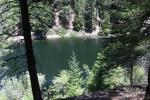
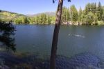
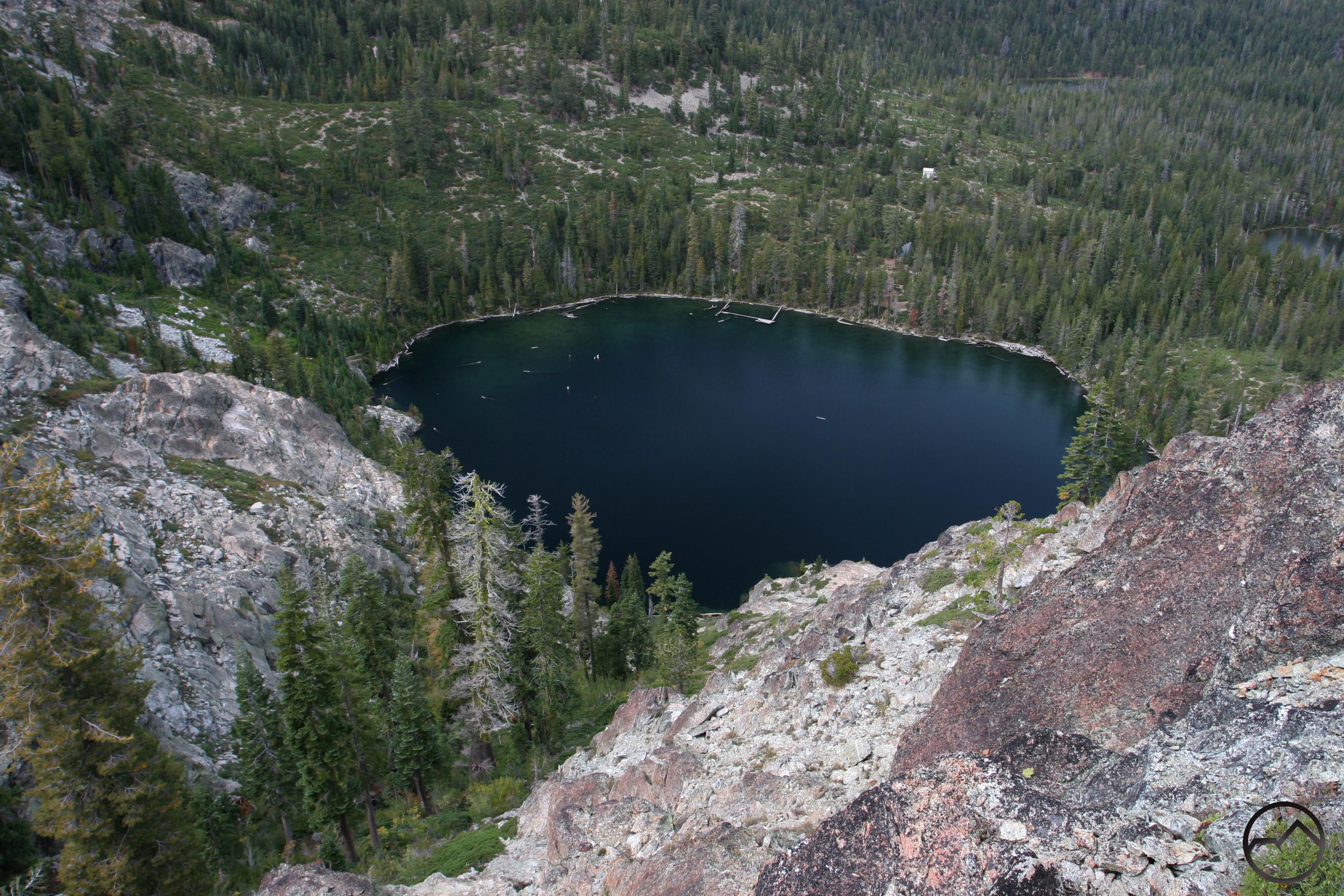
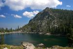
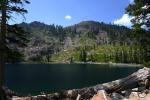
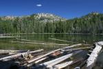
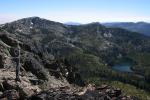
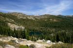
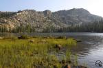
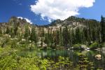
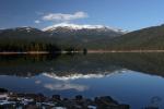
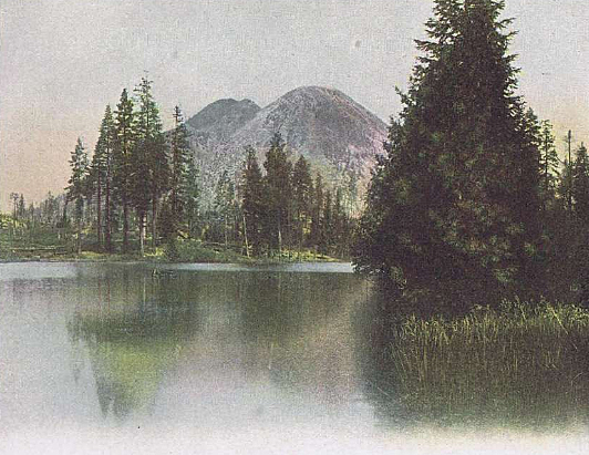
Long Lake in the Lakes Basin Recreation Area.

At the beginning of June, I left for a week of hiking in the Sierra for my new book. It was early enough that snow was still an issue at higher elevations so I had to string together a series of hikes that were low enough that I could GPS the trails without any trouble. The end result was a journey through California’s largest mountain range almost from top to bottom. I began in Sequoia National Park and ended in the Bucks Lake Wilderness, which is in the Feather River region, almost at the northern end of the range. I managed to get 10 trails completed, which will no doubt contribute to my success in terms of meeting my self-imposed deadline for getting the trails completed. It is hard to pick highlights when nearly every trail is simply awesome. Whether it is waterfalls or alpine lakes, massive canyons and cliffs or lush forests, the scale of the Sierra Nevada is one best described with superlatives.

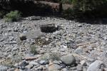
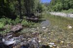
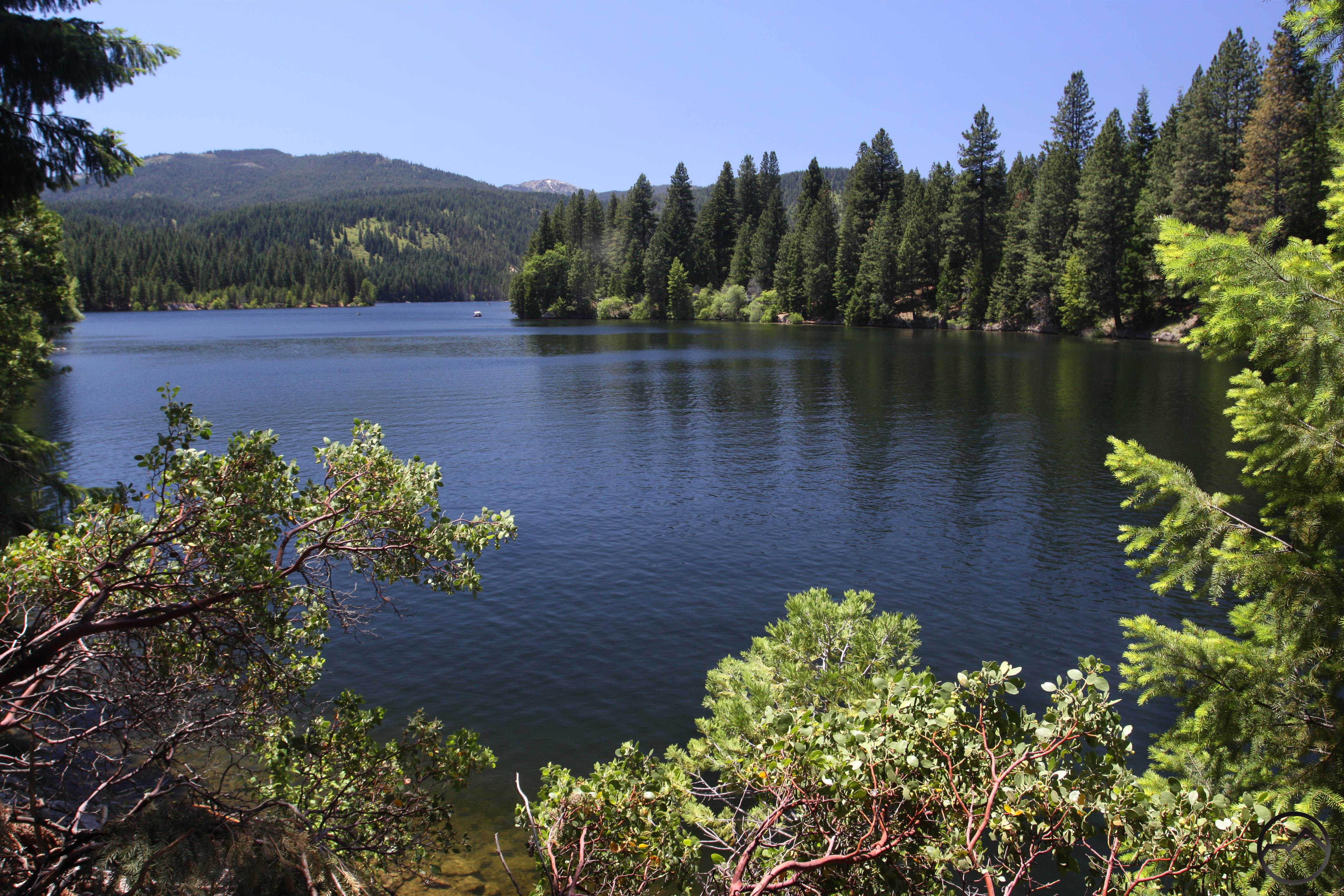
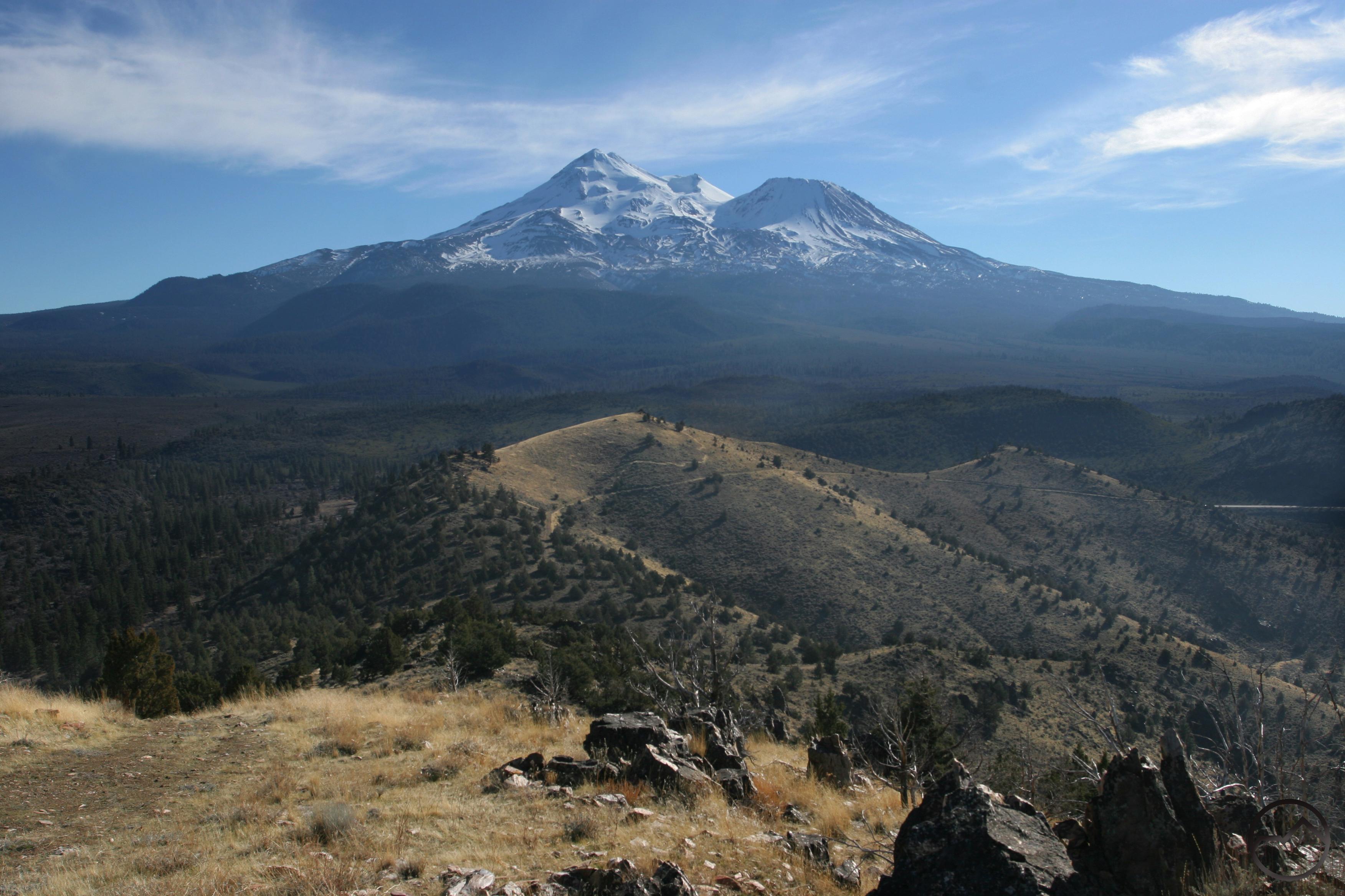
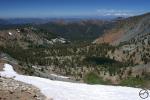
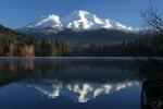
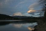
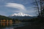
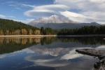
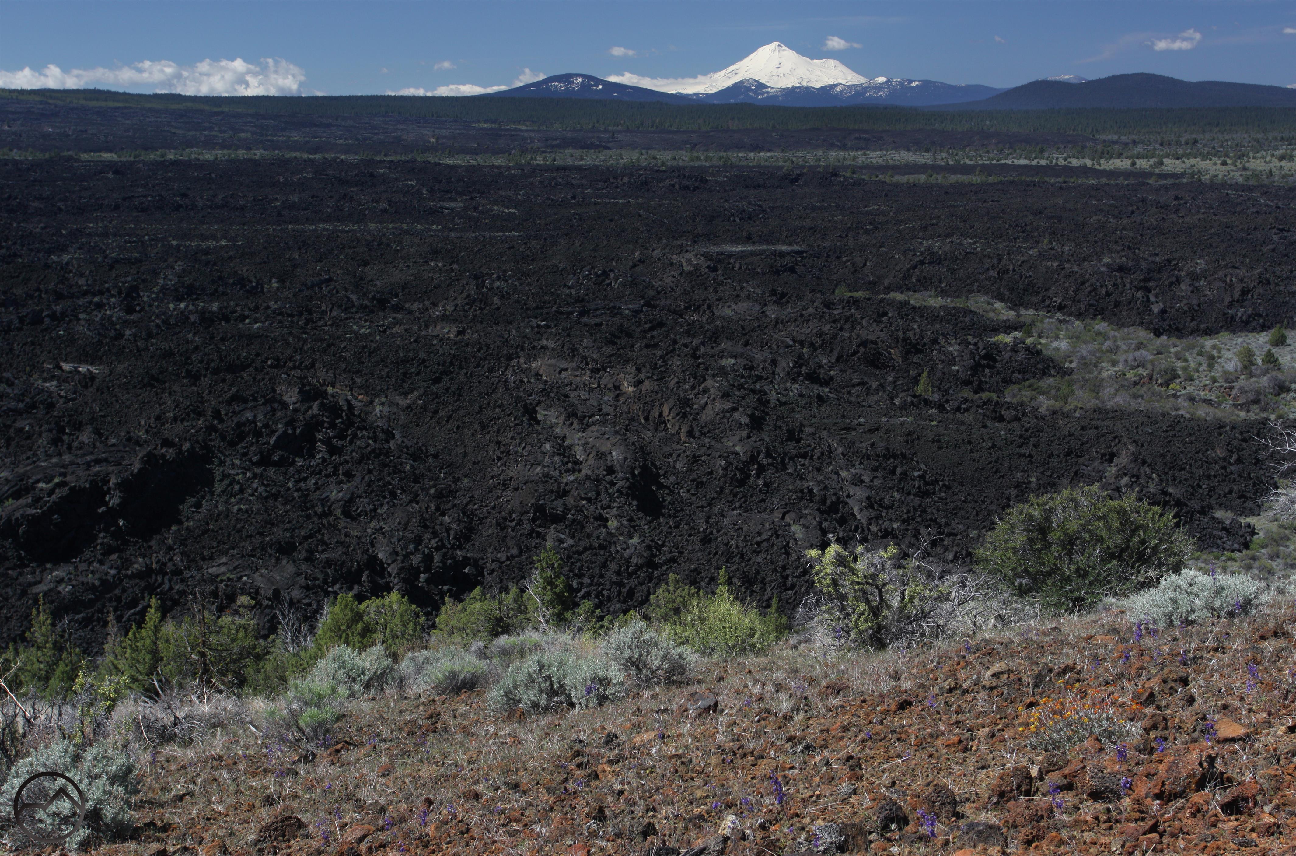
Surveying the impact of the drought on the range was both encouraging and discouraging. At the southern end of the range, the tree mortality was staggering, as almost all the conifers between about 4,000 and 5,500 feet have died. It is heartbreaking to drive through the mountains and seeing vast, dead forests. The tree mortality reached the southern edge of Yosemite, though it was obvious by that point that the effects were not as bad there and though some trees were casualties, their number was not great. North of Yosemite, there seemed to be no sign of any abnormal tree mortality. The encouraging part was the amount of snow I saw everywhere. It far exceeded the snow reports I had seen. Not only was there a lot of snow, but reservoirs that had not been full in years were overflowing. It isn’t just Shasta Lake that benefitted from a good winter.

I still have a lot of trails to finish, but I feel better after having gotten a big chunk of them done!

Sierra Nevada South, Kings Canyon - June2016 082 copy (Custom)

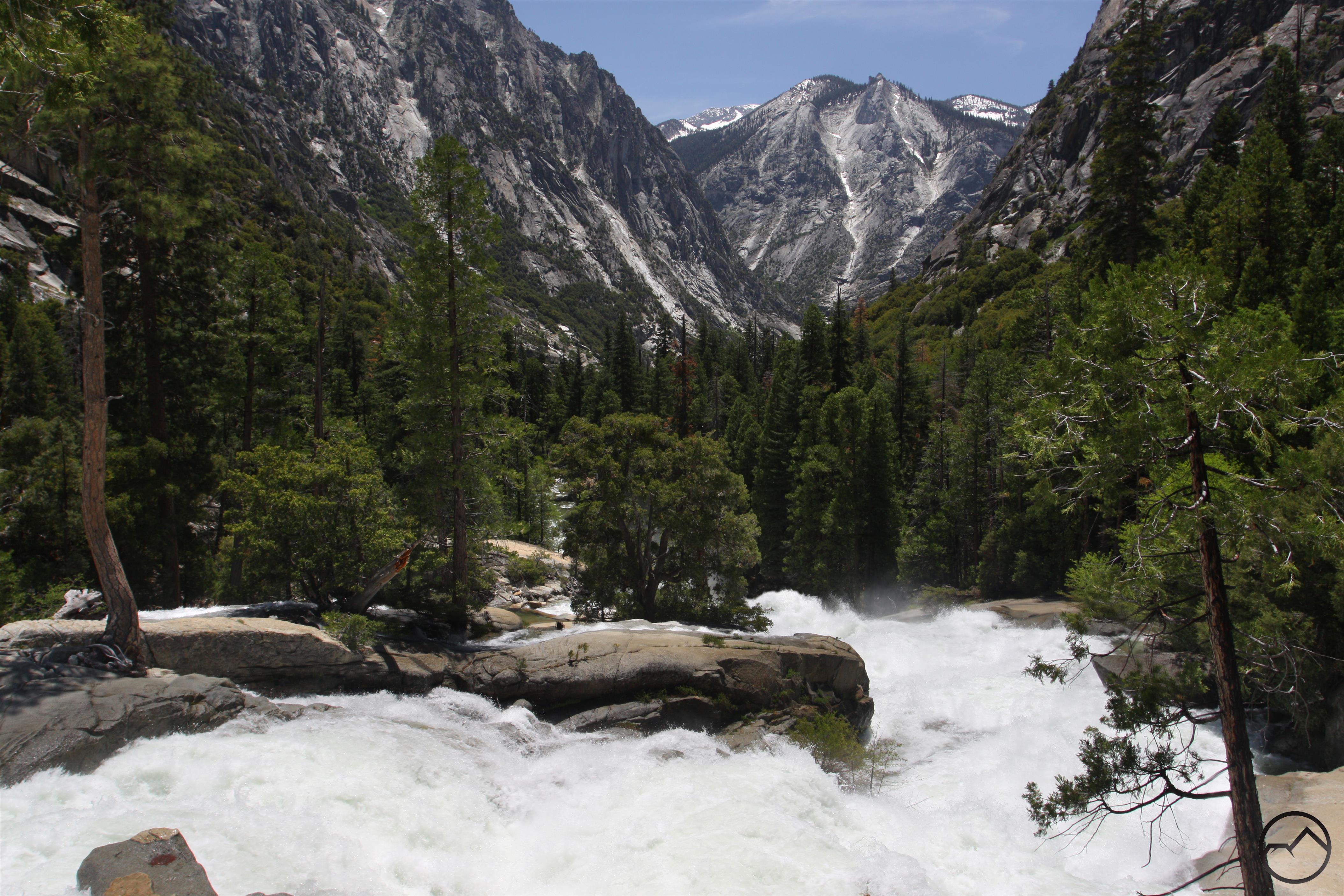
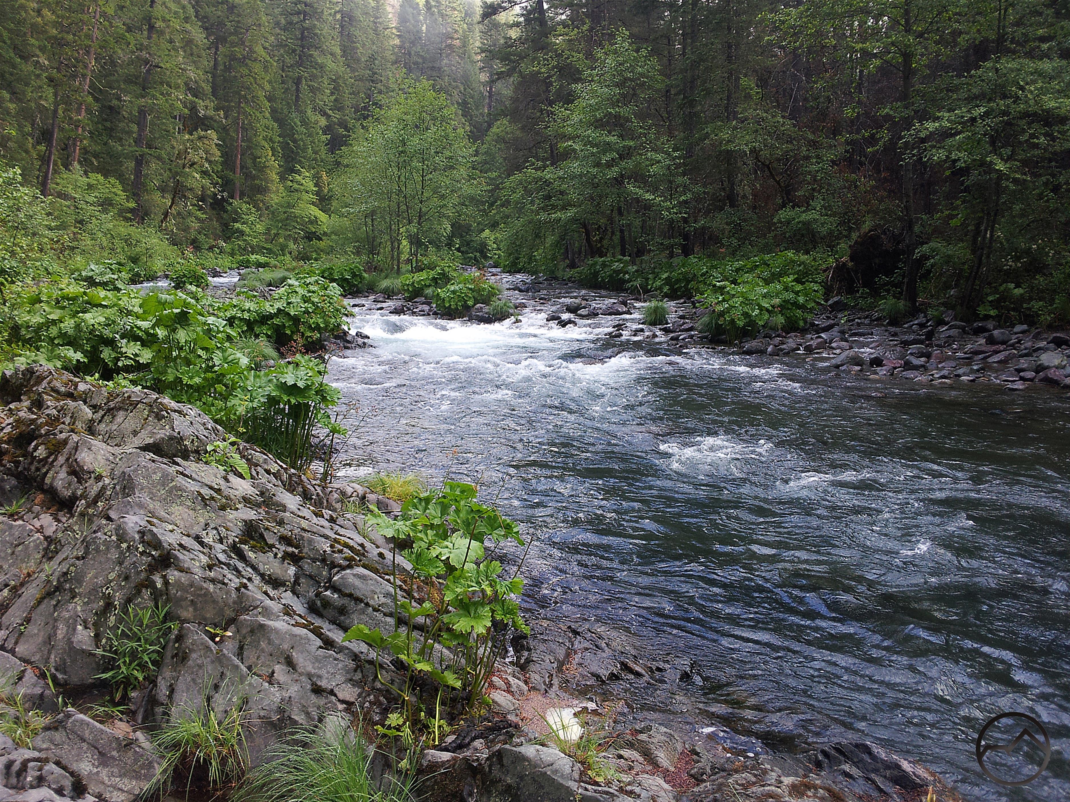
The first trail I completed was the hike to Mist Falls in Kings Canyon National Park. This magnificent hike is in many ways a counterpart to Yosemite’s famed Mist Trail. It certainly has the mist, the massive river and the steep granite cliffs. The Kings River was swollen by all the melting snow, which made it a fearsome sight. Mist Falls itself, a 50 cataract on the Kings River, was angry and powerful and beautiful. Whether hiking directly along the river or through forested benches with views of the soaring canyon, this trail was just right for starting off the Sierra adventure.

Sierra Nevada South, Sequoia - June2016 034 copy (Custom)

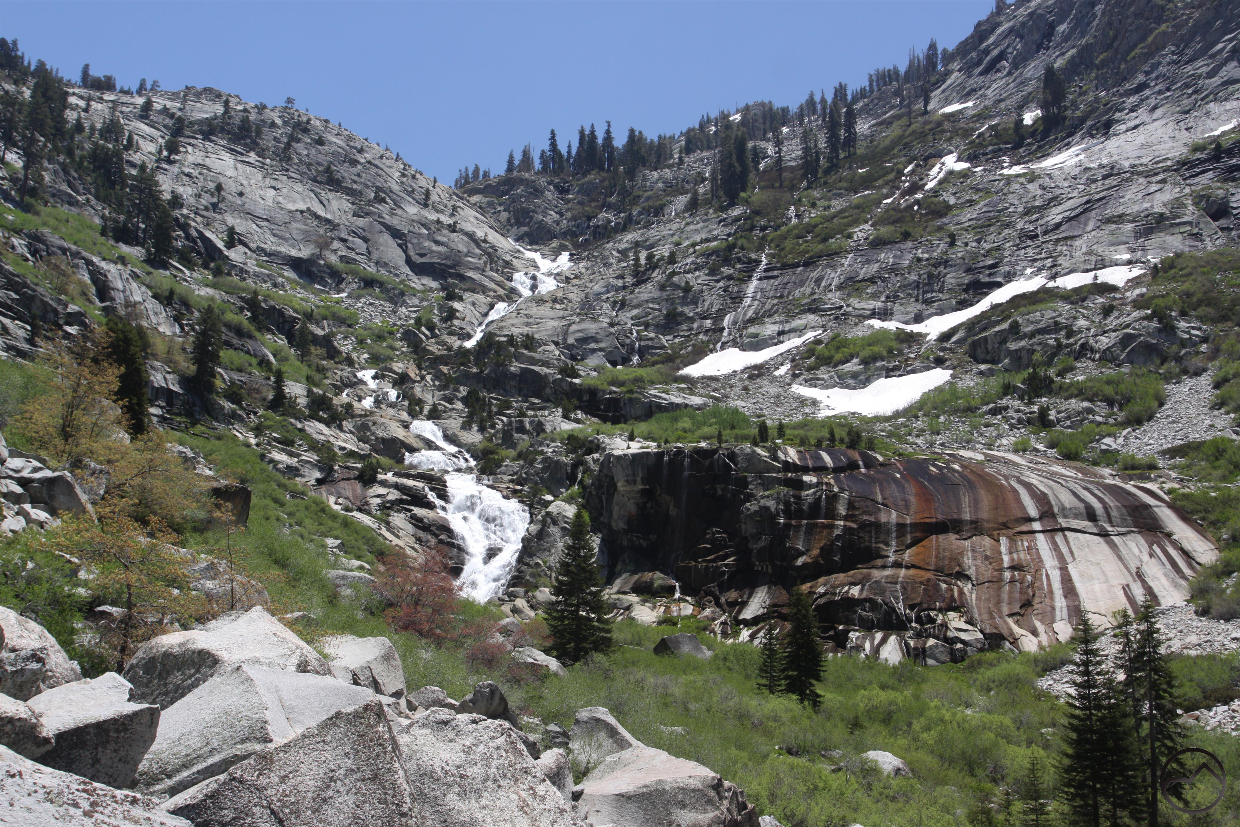
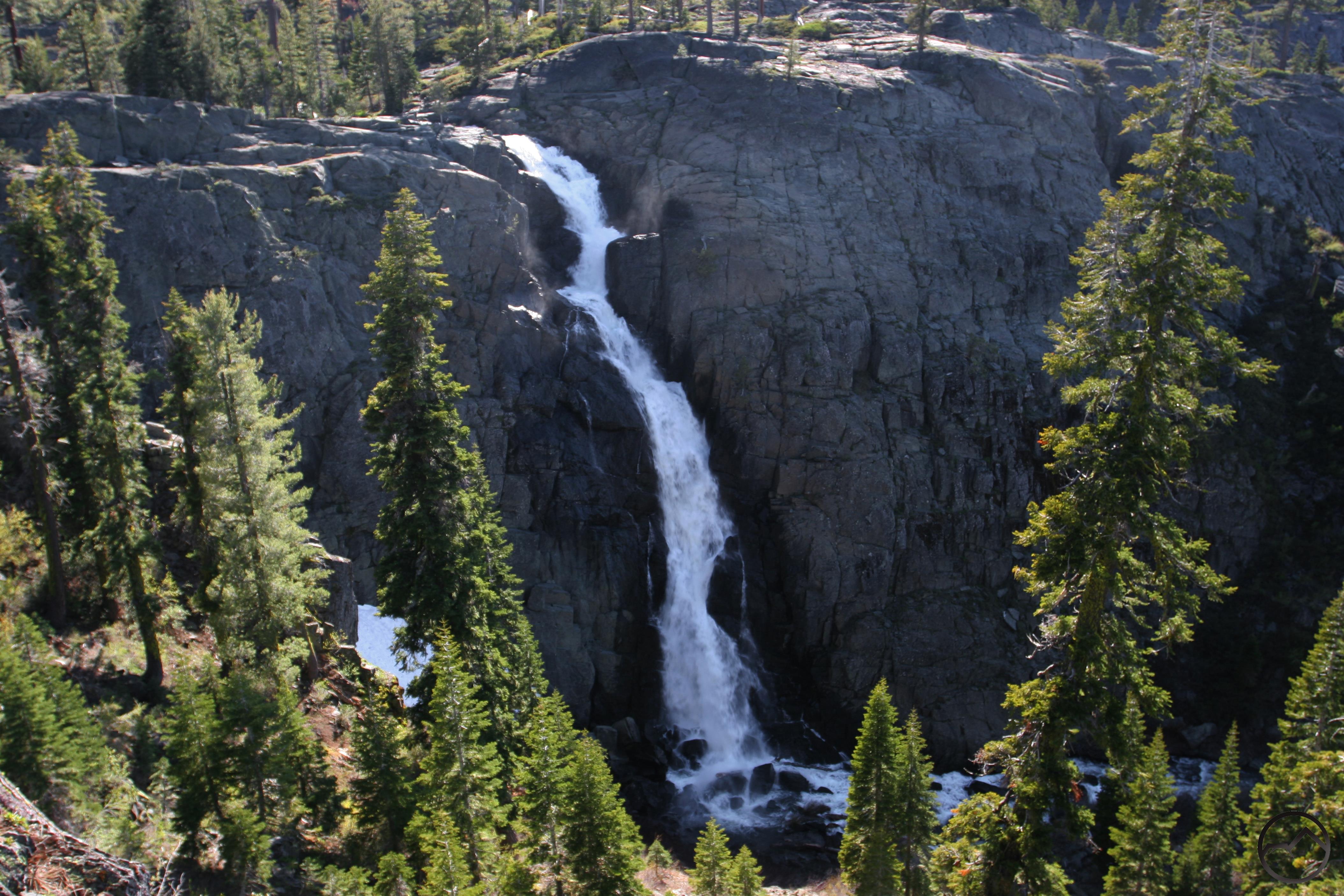
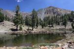
The next hike was an easy one through Tokopah Valley in Sequoia National Park. The popular path follows the Marble Fork of the Kaweah River. Though the forest was initially dense enough to obscure the views of the valley, the river was delightful, cascading over numerous small waterfalls as it raced over large, rocky benches. The trail eventually emerged from the forest and the grand vista of the east end of Tokopah Valley was overwhelming. The granite cliffs soared 1,500 feet overhead and at the far end, where the canyon closed in, the Marble Fork raged 1,000 feet down the canyon walls. Named Tokopah Falls, this waterfall is the tallest in the Sequoia-Kings Canyon area. It certainly is spectacular.

Sierra Nevada, Sequoia - June2016 097_edited-1 (Custom)

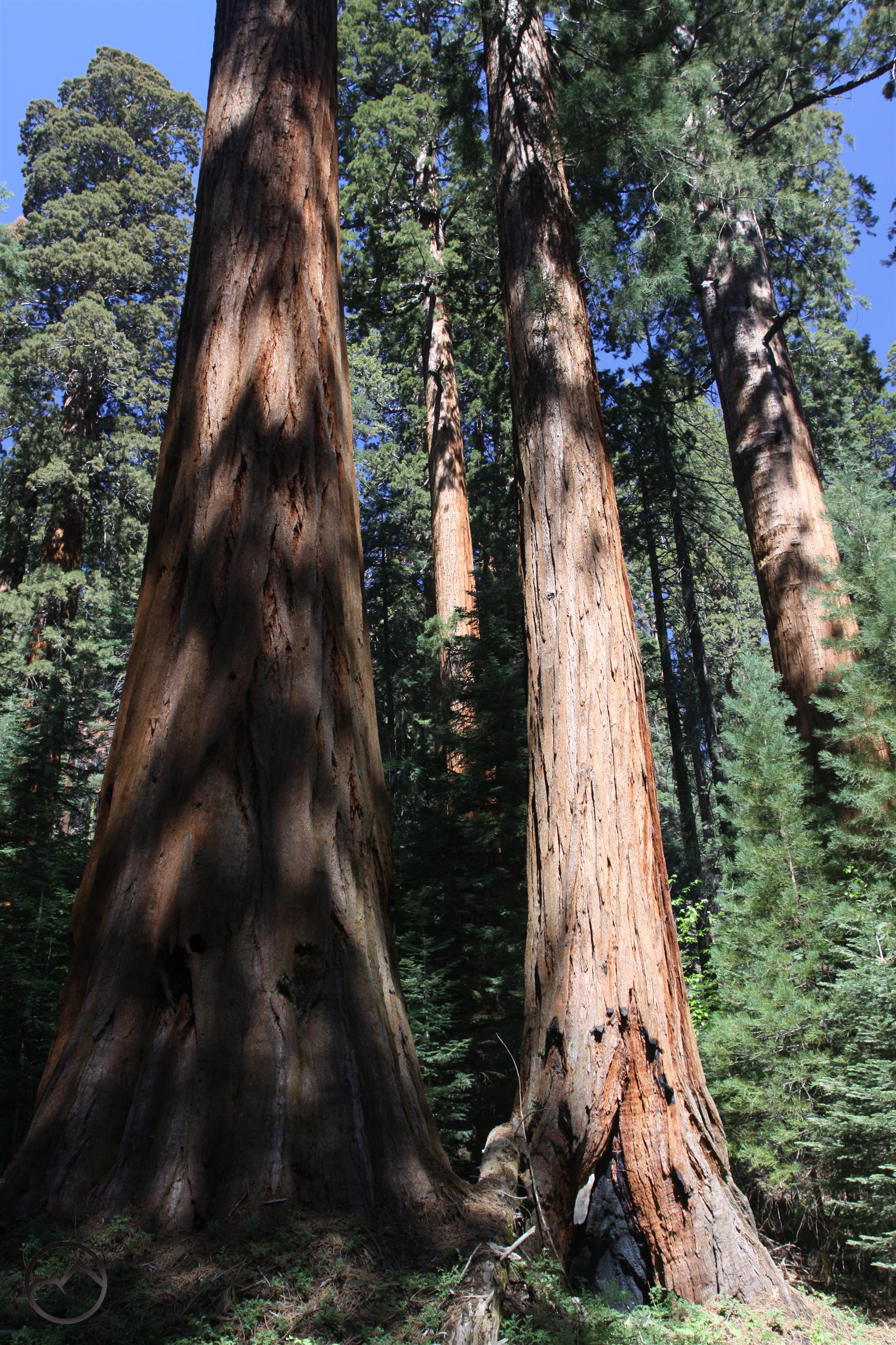
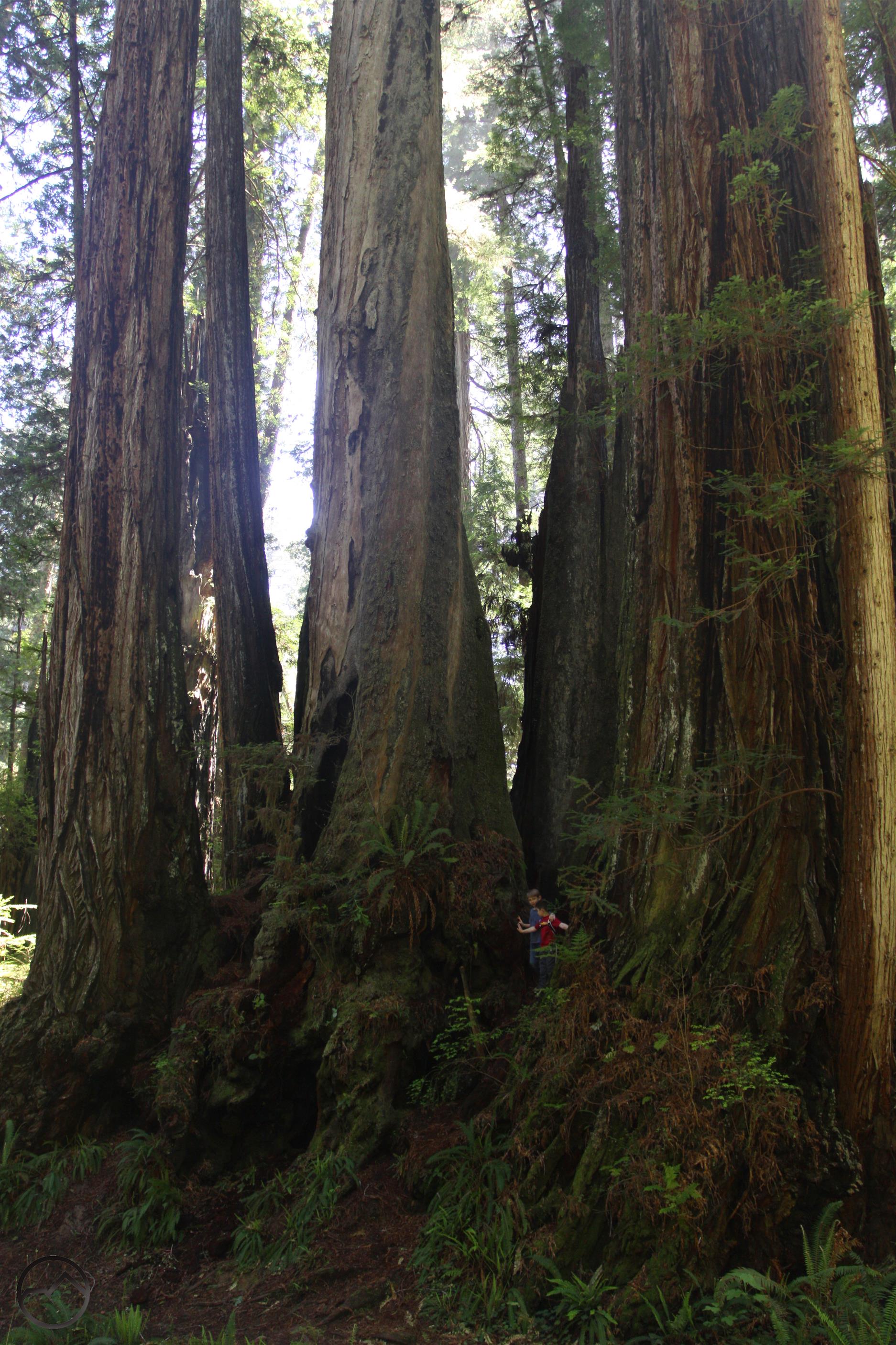
The next day I managed to get two trails done. The first was in Kings Canyon’s Redwood Mountain area. This trail passes through the largest unbroken grove of Giant Sequoias in California (which obviously means the world, since they are only in California). The massive trees lined the trail for mile after mile, each one seemingly more impressive than the next. While there are none as large as the great General Trees (Grant and Sherman), this grove is essentially in a wilderness setting with no crowds. Indeed, there are few hikers here at all and the silence of the trees was incredible.

Sierra Nevada South, Jennie Lakes Wilderness - June2016 115 copy (Custom)

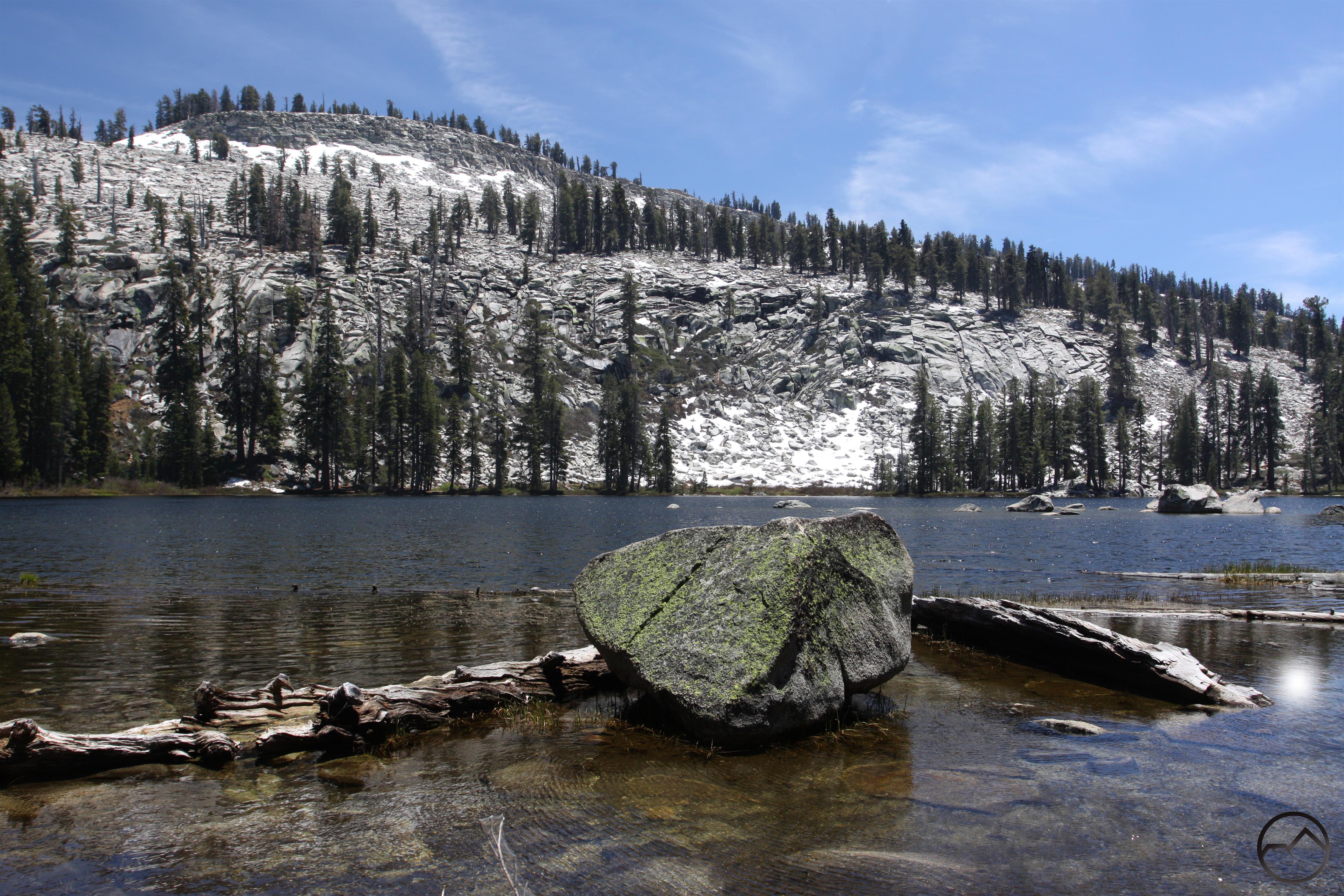
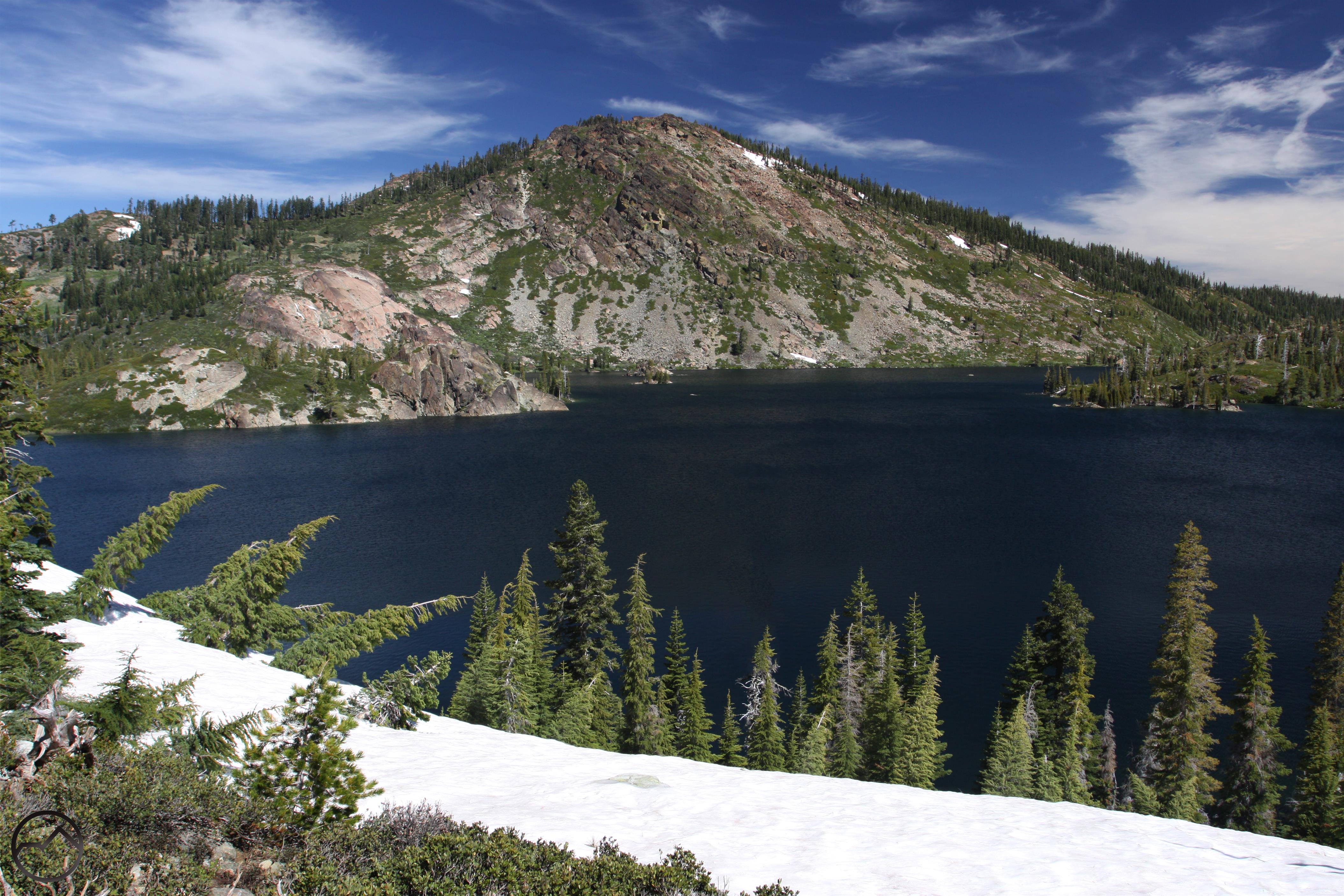
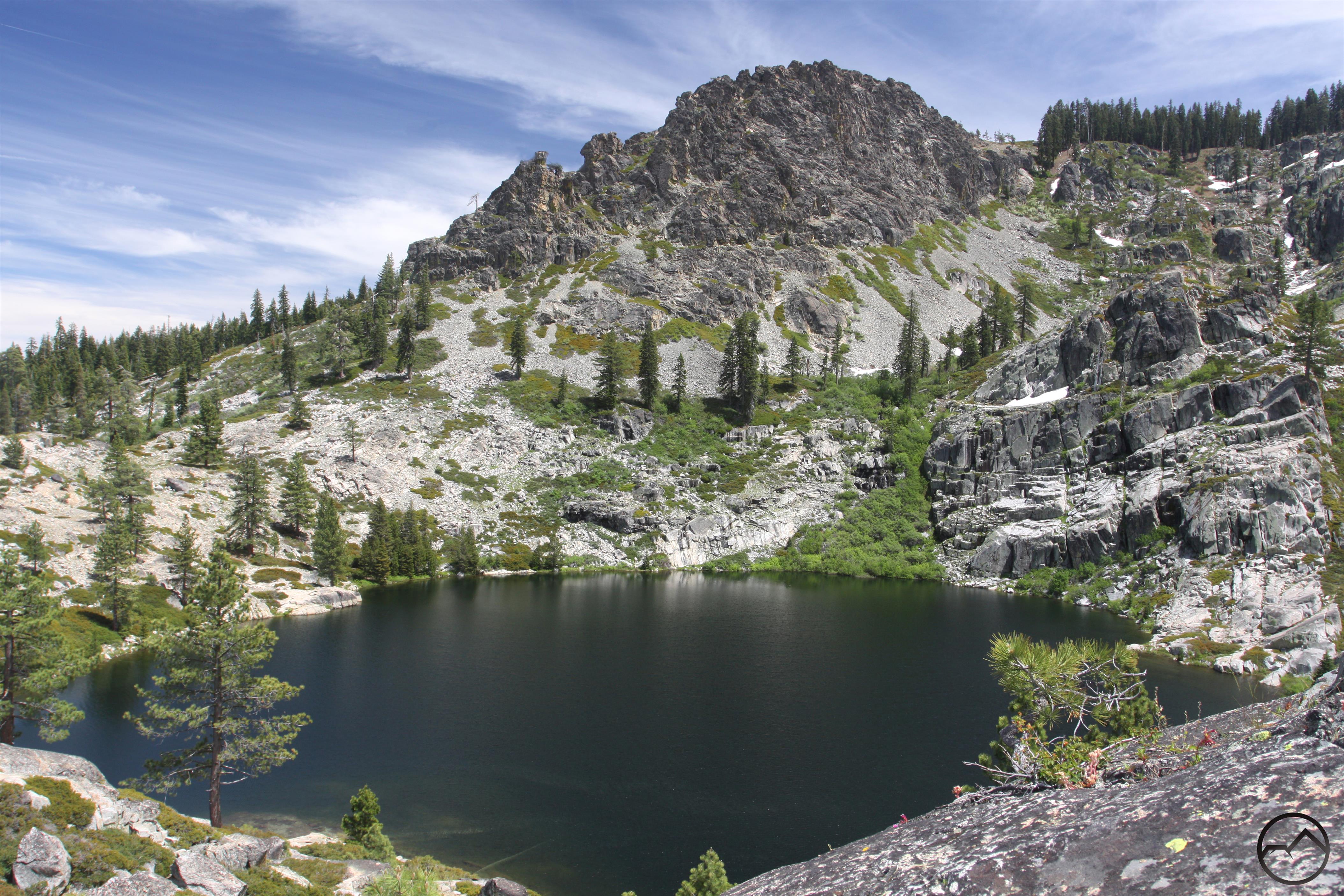
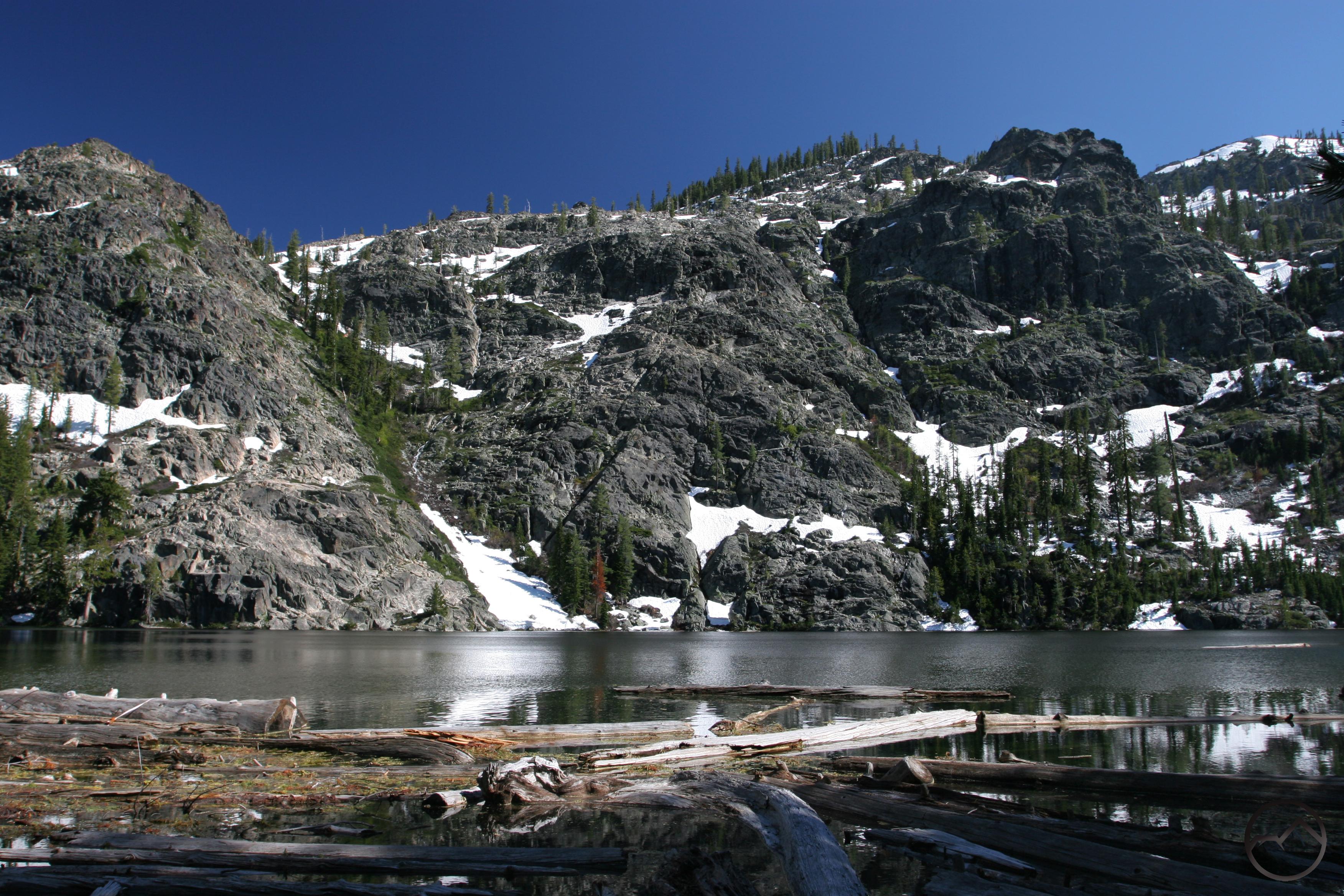
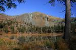
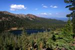
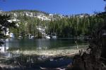
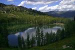
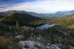
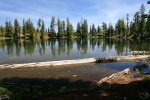
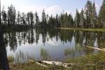
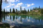
Afterward, I spent the afternoon hiking up to Weaver Lake, a beautiful alpine lake beneath a granite cliff. Located at the terminus of the Great Western Divide, this small lake is an easy hike and a great introduction to the terrain of the Divide. It is found in the Jennie Lakes Wilderness, a small body of wild land tucked away between Sequoia and Kings Canyon National Parks. Along the way to the lake there are numerous creek crossings, boulder fields and views of distant Sierra peaks that are in the 12,000 and 13,000 foot range.

Sierra Nevada South, Yosemite - June2016 086 copy (Custom)

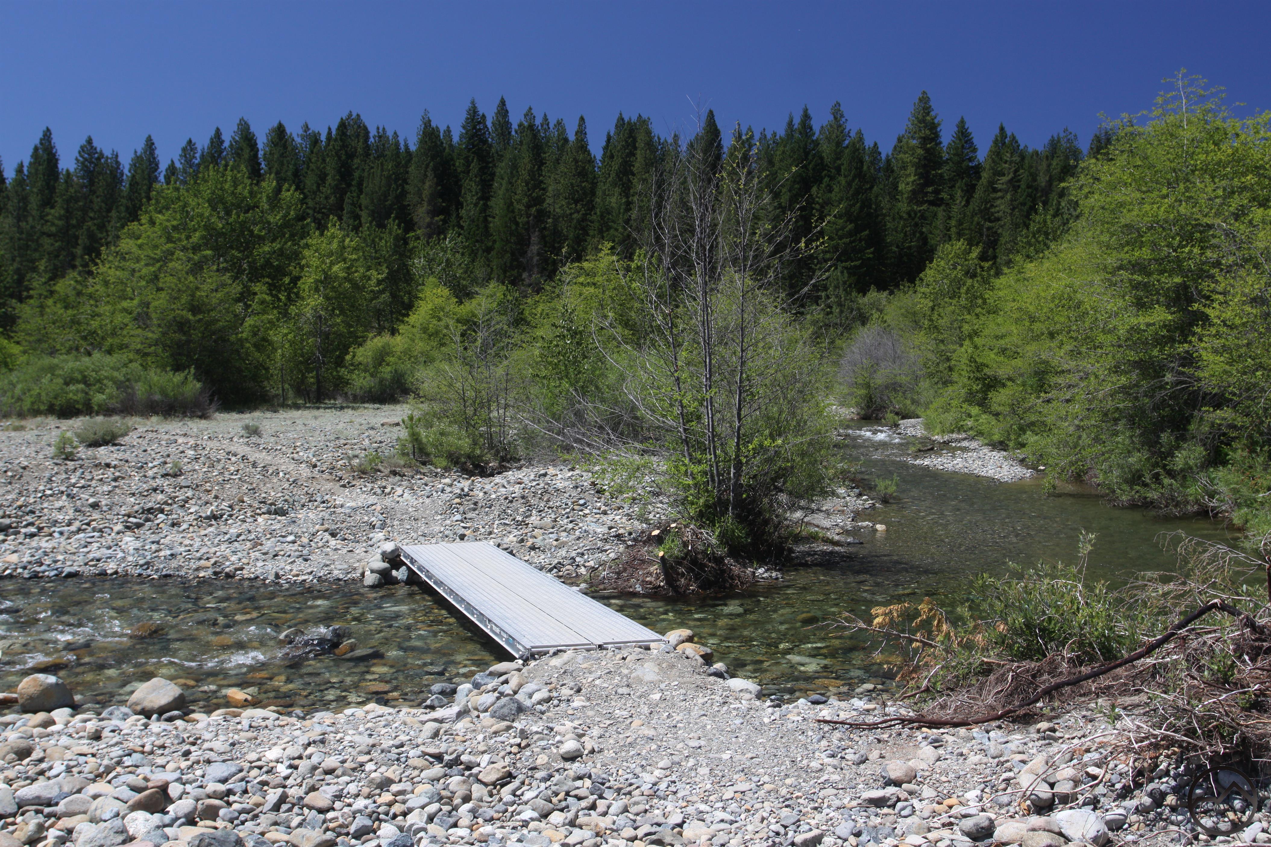
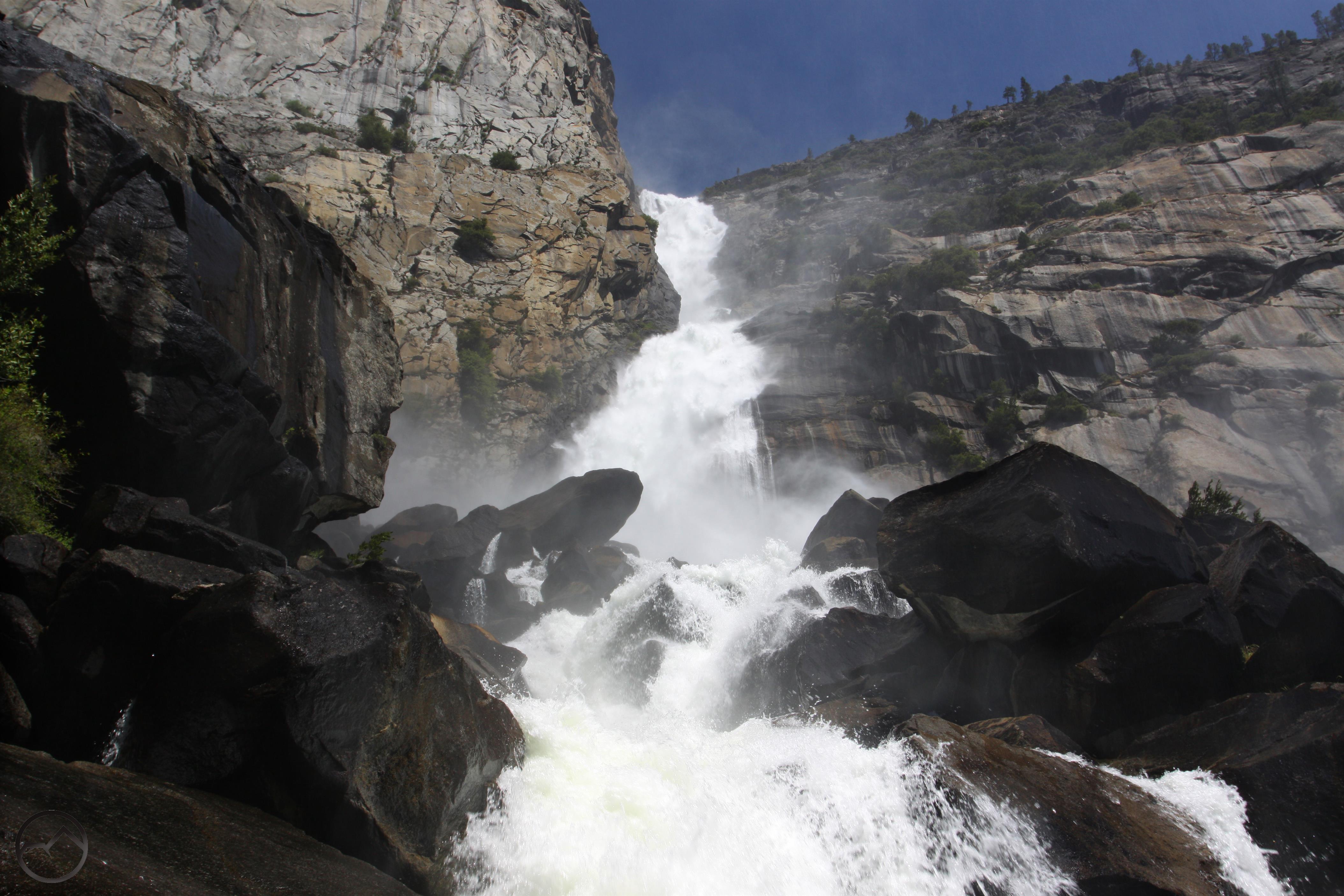
After leaving the Sequoia-Kings Canyon area I headed north to Yosemite. While there, I hiked the trail along the north shore of the Hetch Hetchy Reservoir. Although the lake can be discouraging by its mere presence, it is still a spectacular area. This was made all the more so by the high water in the valley’s waterfalls. Slender Tueeulala Falls had very strong flow, forestalling its eventual drying up by several months. Wapama Falls was simply incredible. The waterfall is surely the most underrated of all of Yosemite’s waterfalls. Nearly 1,000 feet high, it has a massive volume of water. It pours off the mountain in two tiers before exploding on a vast talus slope composed of house-sized boulders. It splits into several large channels as it pours through the rocks. I was soaked as I crossed the network of bridges that traverse the talus field.

Sierra Nevada North, Lake Tahoe - June2016 054 copy (Custom)

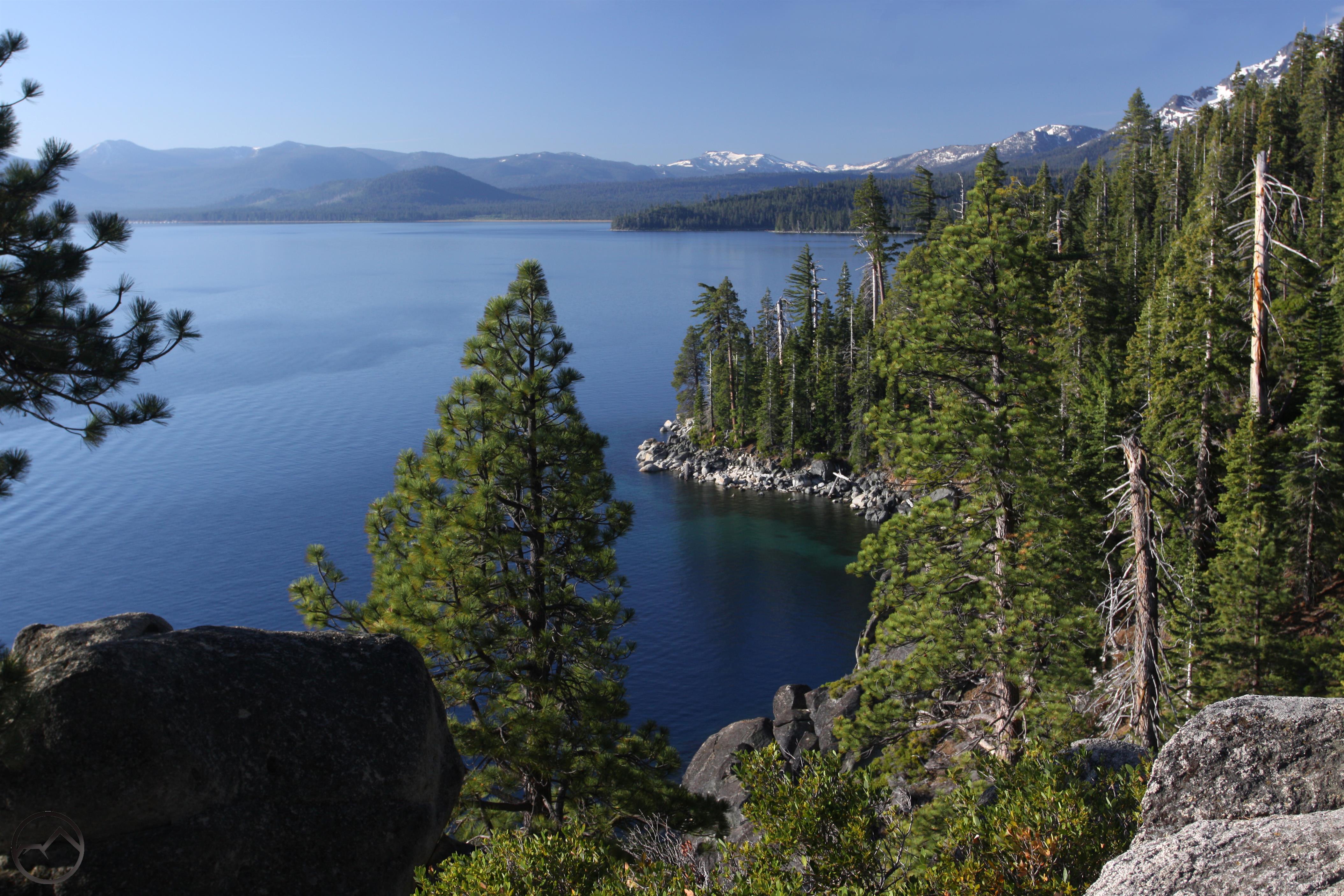
I then headed north to Lake Tahoe as I notched more trails low enough not to have a lot of snow on them. Lake Tahoe’s Rubicon Trail certainly fit that bill. This gorgeous trail follows 5 miles of the lake’s shoreline through what is essentially a wilderness setting. There are far-reaching views across the lake, neat trail-routing along granite cliffs, and great vistas of snowcapped peaks. The trail ends at scenic Vikingsholm, where a short trail leads up to Eagle Falls, a great conclusion to a spectacular hike.

Sierra Nevada North, Lake Tahoe - June2016 148 copy (Custom)

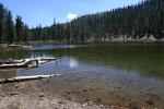
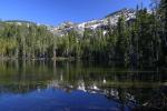
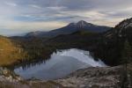
Next up was a trip into the Granite Chief Wilderness. The hike up to Five Lakes had a stiff climb but that was ameliorated by the beautiful scenery. Located on a divide between Squaw Valley and Alpine Meadows ski areas, the trail climbs through a variety of different rock types. They created a colorful scene with red granite smashed up a against gray granite and black intrusions of volcanic rock punctuating the scene. The Fives Lake were partially snowbound, but still accessible.  They certainly were scenic and made a great destination on a hot day.

Sierra Nevada North, Frazier Falls- June2010 056 copy (Custom)

After racking up two hikes in the Lake Tahoe area, I raced up to Feather River Country. As the sun began to set, I quickly hiked the short, easy trail to Frazier Falls. This impressive waterfall is 176 feet high and is among the prettier waterfalls in the area. The falls pours over the lip of the cliff and then cascades to the ground in a few, nearly indistinguishable tiers. The trail is short and accessible to wheelchairs. The hike passes through pine and fir forest, through rocky gullies and even has a nice complement of aspen trees. I want the book to include trails with a range of difficulties and this one may just rate as the easiest, but it by no means lacks great scenery.

Sierra Nevada North, Lakes Basin - June2016 074 copy (Custom)

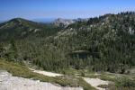
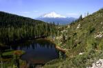
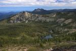
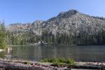
The last day of my trip saw two more hikes completed. The first was at the magnificent Lakes Basin Recreation Area. This stupendous area has, as its name implies, a number of alpine lakes. There is a well-developed trail network here, accessing numerous scenic areas. The loop I choose circled Long Lake, one of the largest in the basin, but also passed by 8 other alpine lakes. The rocky basin was perfect for hiking and the lakes were complemented with meadows, waterfalls and views of the surrounding mountains. This area is not unknown but it still seems like a bit of a sleeper, with a lot more to offer than one might expect from an area this far north.

Sierra Nevada North, Bucks Lake Wilderness - June2016 102 copy (Custom)

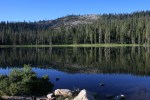
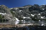
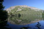
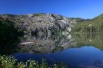
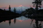
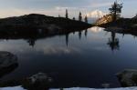
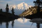
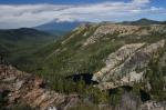
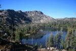
The last hike, as I noted, was through the Bucks Lake Wilderness, from Silver Lake to Gold Lake. This is the Sierra’s last big gasp of granite high country. Not too well known, it offers plenty of solitude to go along with the gorgeous scenery. The views from the trail include Lassen Peak and the Sierra Buttes as well as constantly changing perspectives of the massive granite cirque basin that contains Gold Lake. Once the trail arrives at the lake, one is in alpine heaven, with steep rocky cliffs, cascading streams flowing into the lake and the dark, brooding mass of Spanish Peak looming overhead. It was a great end to a great trip.

Three Spectacular Drive-To Sunset Vistas

Posted by bubbasuess on May 30, 2016
Posted in: Hiking, Mount Shasta. Tagged: sunset. 4 Comments

One of the great things about Mount Shasta is its tremendous relief. It towers around 10,000 feet above the surrounding landscape, a single, prominent tower, alone in its lofty isolation. Not only is it the highest peak in the region by a pretty large margin, its prominence is enhanced by the fact that it is surrounded by valleys on three sides. The Shasta Valley on the north, the Strawberry Valley on the west and the McCloud Flats on the south all combine to accentuate the mountain’s great height, since there are no foothills to obscure the immediacy of Mount Shasta’s rise. Consequently, the mountain is easy to view from almost every direction. Indeed, one can hardly go anywhere without the giant volcano’s brooding presence. This makes enjoying the mountain easy, since it seems like a constant companion and one hardly has to go out-of-the-way to view it. That being said, there are several superlative sites that offer great views of the mountain with a bit of a twist from the ordinary perspective one gets while driving through town or through the valleys. Even better, there are many good places to enjoy the mountain that do not require a hike to get to. Simply drive up, hope out of the car and take in the incredible beauty of Mount Shasta. While many of these are great all day, sunset is perhaps the best time to take advantage of the spots. It is a real treat to be able to take advantage of the quick access to a magnificent view as the sun goes down and alpenglow takes hold of Mount Shasta. As Teddy Roosevelt said, “I consider the evening twilight on Mount Shasta one of the grandest sights I have ever witnessed.”

For the purposes of the list, I have excluded vistas along the Everitt Memorial Highway, since they are either closed off much of the year or conditions can, at times, block access. They can also be quite busy.

Spring Hill Road

The great cone of Mount Shasta is nearly ubiquitous wherever you go in Mount Shasta City. Nonetheless, it remains difficult to get a good view of the mountain without any man-made features interfering. Whether signs, power lines, or homes, something unnatural always seems to be interfering. For simple enjoyment of the mountain, these are not big obstacles but if you are trying to photograph the peak or simply attempting a contemplative moment as the sun sets and the mountain is aflame in pink and orange the intrusion of man-made objects is frustrating. Fortunately, all one has to do is drive north of town on Spring Hill Road to find an incredible spot where Mount Shasta is in full view and only the vast expanse of forest lies between you and great volcano. The proximity of the freeway can be a bit annoying at times but I have found it is easy to quickly tune it out and focus on what demands attention.

Shasta Valley Wildlife Refuge

Cascades, Mt. Shasta - Jan2011 036 (Custom)Mount Shasta is an almost overwhelming presence in the Shasta Valley. At times, it seems like a list of places in the Shasta Valley where you can’t see Mount Shasta might be more interesting in useful. No matter where you drive, the alpine pyramid seems to be towering to the south, its great bulk in harmonic balance with Shastina, its great subordinate volcanic peak. Indeed, the view from the north is particularly pleasing since the two peaks seemed to have worked out how to appear together in magnificent fashion. However, while there is no shortage of places to see the mountain from the valley, there are not many places where one can easily park and enjoy the view from a natural setting. Enter the Shasta Valley Wildlife Refuge. Operated by the state of California, it is an island of undeveloped land in the sea of the Shasta Valley’s agricultural production. It is an awesome spot, loaded with high desert charm and boasting a staggering view of the great mountain. While the views are great from many places in the refuge, head to the Trout Lake trailhead to enjoy the sunset from an optimal setting.

Castle Lake Road

One of the most spectacular vistas of Mount Shasta is the view from Heart Lake. The mountain’s reflection in the diminutive lake is unforgettable and during sunset it is nearly unbeatable. However, it is not a good spot for a quick trip up since it requires a hike. That fact should not be a deterrent from making the trip up to Heart Lake but sometimes it is just not going to work. When this is the case, there is a great spot one mile before the end of the road at Castle Lake to pull off into a gravel pullout and enjoy a truly outstanding view of Mount Shasta. Though it does not have the symmetry and beauty of Heart Lake, it is an amazing vista in its own right. Instead of the cliffs and lake, one can enjoy a perspective of the mountain that includes the entire rise of the mountain. At sunset, the lights of Mount Shasta City are visible far below while the summit of the mountain is lit by the setting sun. The aspect that makes this vista particularly memorable is its higher elevation. It the additional 1,500 feet above town gives a different appearance to the mountain, the top of Mount Shasta taking on more definition when compared to adjacent Shastina. From here the mountain’s relief is striking. A evening spent here appreciating the lightshow of the setting sun is a great exclamation point to time spent around Mount Shasta.

Three More Uncrowded Hikes For Memorial Weekend

Posted by bubbasuess on May 29, 2016
Posted in: Hiking, Mount Shasta. Leave a comment

Trinity Divide, Cliff Lake - July2011 015 copy (Custom)

It has been absolutely perfect so far this weekend up here in Mount Shasta. The weather has been warm but not hot and the skies have been clear. While there are a lot of people here for the weekend, the area offers so many diverse activities, it has not seemed too busy…unless you go up to Bunny Flat or Castle Lake. The former in particular has been a zoo since the weather, along with the snow conditions, have been perfect for climbing Mount Shasta. Horse Camp and Helen Lake resemble large fraternity parties more than alpine camps. Plenty of folks are doing things besides climbing the mountain. Some are paddling on Lake Siskiyou or Castle Lake, others are enjoying the beach and awesome view at the Lake Siskiyou Resort. Some of the trails, especially along the McCloud River Falls Trail and Heart Lake have plenty of hikers but that leaves many others with no one or only a handful of enthusiasts enjoying them. Even though we aren’t at full access to all the trailheads quite yet, the Mount Shasta area is still blessed with an abundance of opportunities to enjoy the beauty and find some solitude.

McCloud River Preserve Trail

2013-05-28 07.30.28_edited-1 (Custom)While the trail along the McCloud River’s trio of waterfalls gets plenty of use, other stretches of trail along the river see little traffic. The most remote is the section of trail accessed through the Nature Conservancy’s McCloud River Preserve. This is the last section of the McCloud River accessible to the public, before the river enters a string of private fishing clubs. The preserve is located deep in the remote section of mountains that are a southeastern outlier of the vast Klamath Mountains. Unlike the more popular sections of the McCloud River, the geology here is not volcanic but sedimentary, uplifted marine rocks that have been carved into a deep, heavily forested canyon. The river is large and swift, cascading over a constant series of boulders, creating riffles and small cataracts. It is a beautiful and remote setting. TO reach this trail it is necessary to drive over a long dirt road which, while bumpy at times, is passable by low clearance vehicles. Trailhead parking is limited.

Yellow Butte

699294 copy (Custom)The only one of Mount Shasta’s color-themed buttes located on the mountain’s north side, Yellow Butte is a great high desert hike. The trail starts right off of Highway 97 climbs up the flanks of the appropriately named butte’s flanks to the summit. The name presumably comes from distinctive gold grass blanketing the little peak. Other prominent points are more ruddy and covered with juniper and sage, while Yellow Butte is free of these and remains surprisingly yellow all year. It does, however, have exceptional lupine displays. While we have passed there prime there are still flowers on the peak and it makes an exceptional afternoon hike. The views of the Shasta Valley are fantastic, with the nearby Haystack a highlight of the early hike and Sheeprock, the Goosenest and the Whaleback coming into view later. Of course, the views of Mount Shasta are awesome and nearly constant for much of the trail. The culmination is the 360 degree view from the top of Yellow Butte, perfect for an afternoon or sunset vista.

Cliff Lake

The headwaters of the might Sacramento River, California’s largest and longest river, is the wonderful Cliff Lake. The large lake is is tucked away in secluded Cedar Basin, so named because it contains the largest collection of high elevation Port Orford Cedars. These trees only grow in the Klamath Mountains and the Klamath’s related offshoots in Oregon. Watch out for their blue-green cedar leaves. Cedar Basin is also home to 5 lakes and several unnamed tarns. Cliff Lake is the largest and most beautiful but Cedar Lake, Lower Cliff Lake, Upper Cliff Lake and Terrace Lake are all beautiful in their own right. Cliff Lake gets its name from the massive, nearly vertical, cliff rising out of the lake’s waters and climbing 1,500 feet to the summit of Peak 7,149 (which I unofficially dubbed “Many Lakes Mountain” since a total of 14 lakes lie at its feet in three different cirque basins). All but Upper Cliff Lake are easy to reach. To get to Upper Cliff Lake requires a difficult rock scramble from Terrace Lake, since it is tucked away on a rocky bench halfway up the cliff. This is one of the best lakes in the Trinity Divide and it is a treat to be able to hike it without many other hikers. At the lake, be sure to stay on the east side of the outlet, since a private inholding, along with cabins, is found on the west side.

Trinity Divide Lakes Gallery

Posted by bubbasuess on May 28, 2016
Posted in: Hiking, Lakes, Mount Shasta. Leave a comment

The Trinity Divide is the long band of mountains that line the valley west of Mount Shasta. Unlike the great volcano, which belongs to the volcanic Cascade Range, the Divide is the eastern fringe of the vast Klamath Mountains. This rugged region is geologically distinct from the Cascades. A drifting cousin of the Sierra Nevada, here there is a profusion of granite and ultramaphic rocks. Visually, it is obvious that they are different from Mount Shasta. Fortunately, the difference is more than just visual. The Trinity Divide’s geology also means there is an abundance of gorgeous alpine lakes. Where the rock on Mount Shasta is porous and allows water to soak into the vast aquifers beneath the surface, the denser rocks of the Divide naturally hold the water on the surface, allowing lakes to form in large cirques that have been excavated by ancient glaciers. Many of these lakes are backed by craggy, soaring cliffs, adding a great deal of drama and beauty to the crystal waters. A substantial number of the trails in the Trinity Divide lead to these lakes, making them easy to explore and appreciate!

Mount Eddy and Upper Deadfall Lake
Deadfall Lakes Basin
An unnamed lake in Deadfall Basin.

Porcupine Lake
Newly acquired peaks behind Porcupine Lake
Toad Lake from the PCT junction.

Gumboot Lake
Upper Gumboot Lake
Mumbo Lake

Cliff Lake
Cliff Lake
Terrace Lake

Lower Cliff Lake
Gray Rock Lakes Basin
Gray Rock Lake

Gray Rock Lake
Upper Gray Rock Lake
Scott Camp Lake

Castle Lake
Castle Lake


Little Castle Lake
Cliff Lakes
PCT view of Seven Lakes Basin.

Upper Seven Lake
Helen Lake

Tamarack Lake
Tamarack Lake
Upper Twin Lake

Cerulean Pool and the Grey Rocks
Cerulean Lake
South Fork headwaters


Lake Siskiyou

Help Support Hike Mt Shasta…Buy The Book!

Posted by bubbasuess on May 28, 2016
Posted in: Hiking, Mount Shasta. 2 Comments

Mount Shasta Cover Demo

Whether up here in Mount Shasta or elsewhere in this great land, it is my desire that everyone is out having a great weekend. In the midst of all the remembrance (what the weekend is really for), family time and outdoor activities, I hope that Hike Mt Shasta has contributed in some small way to your enjoyment. I know for some it has contributed directly in helping to plan a trip or a hike or indirectly, while for others it has been keeping you connected to Mount Shasta and the surrounding region even if you live far away. It is not my normal practice to plug my book on the area so deliberately (though some tell me I should) but I reckon this is a good opportunity to mention it. That said, if you have not purchased my hiking guide on Mount Shasta, doing so would be much appreciated! It has many of the same great features as my site, with lots of color images, great maps and all sorts of little details that help plan a day on the trail. You can also carry it with you on the trail, which you can’t do with the website! When I wrote the book, my intention was to deliver quality, up to date information on the trails but to also provide a read that was more interesting than just point to point in instructions and would enable readers to visit Mount Shasta vicariously.

If you already have the book, I really appreciate it! If you have not acquired it, you can do so by clicking here. Also, if you live in the Wine Country (Napa and Sonoma Counties) or plan to visit there, I have written a hiking guide for that region. It has all the same features as the Mount Shasta guide! You can get that book here.

I truly appreciate all the feedback I have gotten on the website and the book. It is always valued. Again, I hope you have a great time outside this weekend and for the rest of the summer!


Three Awesome Hikes For Memorial Weekend

Posted by bubbasuess on May 27, 2016
Posted in: Hiking, Mount Shasta, Uncategorized. Leave a comment

Cascades, Mt. Shasta - April2015 100 (Custom)

Memorial Weekend is definitely one of the more popular weekends in the mountains around the U.S. and this is true in Mount Shasta. Many of the more popular trails get a lot busier as all the vacationers get out and enjoy the great weather and the amazing beauty of the region. Some of the trails, like the McCloud River Trail and the path up to Heart Lake, can get particularly busy. Thankfully, this is relative, and these paths don’t seem that crowded compared to popular trails in the Sierra Nevada or around the Bay Area. Still, for those looking to get off the beaten path and enjoy a great hike without much company, the Mount Shasta area has plenty to offer.

Castle Crags Traverse

Trinity Divide, Castle Crags - March2014 004 (Custom)Spring is a great time to hike the Castle Crags. They are still a good option in the summer but the trails there can get hotter than many of the other trails in the area when temperatures climb. Memorial Day weekend lies right on the cusp of the good Crags hiking season and when the heat makes them a little uncomfortable. That being said, the traverse of the Castle Crags lower flanks is a great trail to do this weekend if a shuttle can be arranged. It is almost entirely downhill and crosses many cool streams. It is early enough in the year that the streams still have strong flow. The clear water rushing through granite boulders is a delightful scene on a long hike. The trail crosses no less 6 creeks between the Dog Trail intersection and the PCT trailhead at Soda Creek. In addition to the creeks, there are some great views of the Crags’ soaring towers, the Castle Creek Valley and the enigmatic Grey Rocks. Since this requires a shuttle, this section of the PCT does not see a lot of heavy use, even on a holiday weekend.

Trout Lake

Cascades, Mt. Shasta - Feb2014 047 copy (Custom)The Shasta Valley is fantastic in spring. the grass is green and flowers are blooming everywhere. Of course, the stunning view of Mount Shasta’s north side is an incredible sight from nearly everywhere in the valley. While there are not many trails that explore the largely agricultural region, there are a few good ones scattered about. One of the best is the Trout Lake Trail in the remote Shasta Valley Wildlife Refuge. Memorial Day weekend is not the peak of the Refuge’s spring glory but there is still enough green and a few flowers left to hint at the passing season. Nonetheless, the high desert landscape, beautiful lake and incredible 360 degree views make a fantastic place for a hike. Though the Trout Lake Trail is not long, there is plenty of room to explore. In addition to the trails alongside the lake, consider following the old ranch roads from the trailhead to Bass Lake as one option for some investigation. Whether checking out new routes or staying on the main path by Trout Lake, the views are tremendous.

Gumboot Lake

Trinity Divide, Gumboot Lake - June2009 006 copyThe high country is really starting to open up in the Trinity Divide but vestiges of the winter snow still lingers, blocking access to some of the trailheads and covering patches of trails in some places. However, the road up to Gumboot Lake is wide open, which means that the Gumboot Trail beckons. This is not a popular or well known path, since it is really just a connector to the PCT but when combined with a section of that trail, especially to the south, it takes on a whole new identity. The PCT has incredible views of Mount Shasta, the canyon of the South Fork of the Sacramento and the Trinity Alps. Many of the craggiest and prettiest part of the Trinities are visible from this part of the trail and some of the peaks, like Billys Peak and Billys Peak Lookout are only a dozen miles away and very prominent. This is not to say that Gumboot Lake and Upper Gumboot Lake are without their charms. The grass fringe ringing the lakes is green and lush, the outlet creek is flowing and a little snow still clings to the cliffs of Gumboot Point. All in all, this is a great taste of high country adventures to come over the rest of the summer.

Vintage Color Photos Of Mount Shasta From 1907

Posted by bubbasuess on May 20, 2016
Posted in: Hiking, Mount Shasta, Mount Shasta History. 5 Comments

SPVintage

I have been meaning to post this for the last couple of weeks but working on my book has kept from doing so. The SF Chronicle posted a collections of colorized photos taken to promote the Southern Pacific’s rail line from Los Angeles to Portland. Of the 115 or so images 7 them are of the Mount Shasta area. Skip to images 85-92 to view the Mount Shasta area images. They are a fine gateway into the history of this region (and California and Oregon in general) and make for intriguing discussion pieces. While this is not exactly hiking related, I find historical documents like this intriguing for a few reasons. It is interesting to try to determine what has and has not changed. It is also useful for picking up clues to places that people once frequented that are not longer “on the map”. Spots like Summit Lake and the Ruby Pearl Mine are places that I have been alerted to through historical documents that are no longer “advertised” anymore.

Some of their locations are obvious, such as Mossbrae Falls and Shasta Springs Resort. Other locations are a little less specific. Of the two shots of Mount Shasta, one is probably from near Sisson’s Lodge, which was located near the museum and fish hatchery while the second is presumably from the climb up to Castle Lake. The shot of Black Butte, notably referred to as Muir’s Peak (click here for more on John Muir’s connection to Mount Shasta), is more enigmatic. The shape of the peak indicates a westerly perspective. However, it is definitely not the view from Mills Meadow. The only realistic possibilities for where that image could have been taken from are a springtime, flooded Kaiser Meadow (I think this is possible but unlikely) or possibly Abrams Lake (without the RV park). Interestingly, both are right along the rail line. If anyone can identify this spot, I would love to know where exactly it is!

SPVintage3

I tend to be a sucker for this kind of thing and I am always on the lookout for interesting Mount Shasta artifacts. This is a pretty cool collection that gives us a glimpse of how things used to be and how the land has resisted change.


Chipping Away At The New Book In May

Posted by bubbasuess on May 16, 2016
Posted in: Hiking, Mount Shasta, Sierra Nevada, Uncategorized. Tagged: Lava Beds, Redwoods, Sacramento River, San Joaquin River. 9 Comments
My son and his cousin explore some giant redwoods.

My son and his cousin explore some giant redwoods.

See the first two posts on the trails in my new book project here and here. 

With the high country in the Sierra Nevada, Cascades and Klamaths still covered in snow, May was the month to pick off some scattered low elevation trails around the state. At the beginning of the month I was able to pop over to the Redwood Coast and claim two spectacular trails in the Redwoods. Following that, day trips accounted for a trail in the Klamath Basin and one on the edge of California’s great Central Valley. Lastly, a family wedding down in Exeter (near Visalia) gave me the opportunity to finish a trail in the Sierra Nevada’s southern foothills. I was really glad to get this one done before the wildflowers went away and the summer heat moved in. Even though I caught this one in mid-May, it stilled turned into something of a personal saga (fortunately, all ended well).  Now the preparation begins for the real summer work. Next month I will be heading off to Sequoia and Kings Canyon, as well as some other scattered spots around the southern Sierra. It should be a great start to the summer!

Coast Range North, Redwoods - May 2016 153 (Custom)The James Irvine Trail in Prairie Creek Redwoods State Park is one of the finest redwood hikes around. If it is not done as a shuttle hike, it can be pretty long, but the hike includes incredible old growth trees in a wild setting and the turn-around point is at awesome Fern Canyon and Gold Bluffs Beach. For a complete redwood experience, this hike is tough to beat.

Fern Falls (Custom)The second hike I picked for the Redwood Coast is the Boy Scout Tree Trail. In Del Norte County’s Jedediah Smith Redwoods State Park, this is another incredible redwood hike that feature exceptional old growth trees, including the mighty Boy Scout Tree, one of the most immense redwoods in the region. The trail ends at lovely Fern Falls.

Cascades, Lava Beds - May2016 045 (Custom)

I can’t leave out the Lava Beds. While this is not exactly a hiker’s park, there are some really nice trails with high desert scenery and great views of Mount Shasta, vast lava flows and many landmarks in southern Oregon.

Cascades, Iron Canyon - May2016 048_edited-1 (Custom)

The trail to the Sacramento River and Iron Canyon is not too well known but it is a pretty hike with some excellent views of the mountains ringing the north end of the Central Valley. The dramatic vista of the river’s passage through the canyon highlights its transition from a mountain river to the lazy, winding giant that flows south through the valley to the Delta.

Sierra Nevada, San Joaquin River - May2016 020a (Custom)

The San Joaquin is California’s other great river that composes the network of waterways that feed the Delta and San Francisco Bay. Along the way, it collects the waters of the Merced, Tuolumne, Stanislaus, Mokelumne and Cosumnes Rivers. During years of heavy precipitation, the mighty Kings River even joins the San Joaquin. The hike down to the San Joaquin River Gorge passes through awesome wildflowers en route to a bridge that crosses the rugged granite gorge. From there the trail makes a loop to the top of a high ridge with fantastic views of the surrounding area.

The next post will finally see some classic Sierra Nevada scenery!

Posts navigation

← Older Entries
Newer Entries →
    • Recent Posts

      • Winter Shows Up When It Will
      • January Rolled By With Mud, Then Very Dry
      • Mount Shasta 2025 – A Year In Images
      • Mount Shasta On Either Side Of Christmas
      • Adrift In An Ocean Of Fog
      • December Has Been Spectacular Thus Far Pt. II (A Magnificent Lenticular)
      • December Has Been Spectacular Thus Far Pt. I
      • Lenticular Interrupted
      • A Stormy Wave And A Truchas Sunset
      • Aurora Lenticularis
    • Enter your email address to follow Hike Mt Shasta and receive notifications of new posts by email.

    • Archives

      • February 2026
      • January 2026
      • December 2025
      • November 2025
      • October 2025
      • September 2025
      • August 2025
      • July 2025
      • June 2025
      • May 2025
      • April 2025
      • March 2025
      • February 2025
      • January 2025
      • December 2024
      • November 2024
      • October 2024
      • September 2024
      • August 2024
      • July 2024
      • June 2024
      • May 2024
      • April 2024
      • March 2024
      • February 2024
      • January 2024
      • December 2023
      • November 2023
      • October 2023
      • September 2023
      • August 2023
      • July 2023
      • June 2023
      • May 2023
      • April 2023
      • March 2023
      • February 2023
      • January 2023
      • December 2022
      • November 2022
      • October 2022
      • September 2022
      • August 2022
      • July 2022
      • June 2022
      • May 2022
      • April 2022
      • March 2022
      • February 2022
      • January 2022
      • December 2021
      • November 2021
      • October 2021
      • September 2021
      • August 2021
      • June 2021
      • May 2021
      • April 2021
      • March 2021
      • February 2021
      • January 2021
      • December 2020
      • November 2020
      • October 2020
      • September 2020
      • August 2020
      • July 2020
      • June 2020
      • May 2020
      • April 2020
      • March 2020
      • February 2020
      • January 2020
      • December 2019
      • November 2019
      • October 2019
      • September 2019
      • August 2019
      • July 2019
      • June 2019
      • May 2019
      • April 2019
      • March 2019
      • February 2019
      • January 2019
      • December 2018
      • November 2018
      • October 2018
      • September 2018
      • August 2018
      • July 2018
      • June 2018
      • May 2018
      • April 2018
      • March 2018
      • February 2018
      • January 2018
      • December 2017
      • November 2017
      • October 2017
      • September 2017
      • August 2017
      • July 2017
      • June 2017
      • May 2017
      • April 2017
      • March 2017
      • February 2017
      • January 2017
      • December 2016
      • November 2016
      • September 2016
      • August 2016
      • July 2016
      • June 2016
      • May 2016
      • April 2016
      • March 2016
      • February 2016
      • January 2016
      • December 2015
      • November 2015
      • September 2015
      • August 2015
      • July 2015
      • June 2015
      • May 2015
      • April 2015
      • March 2015
      • February 2015
      • January 2015
      • December 2014
      • November 2014
      • July 2014
      • June 2014
      • May 2014
      • April 2014
      • March 2014
      • February 2014
      • January 2014
      • December 2013
      • November 2013
      • October 2013
      • September 2013
      • August 2013
      • July 2013
      • June 2013
      • May 2013
      • April 2013
      • March 2013
      • February 2013
      • January 2013
    • Categories

      • Boy Scouts
      • Cascade Range
      • Castle Crags
      • Desert
      • Echo Point
      • Glaciers
      • Hiking
      • How things came to be…
      • Klamath Mountains
      • Konwakiton Outdoor Designs
      • Lakes
      • Lenticular Clouds
      • Maps
      • Marble Mountains
      • Meadows
      • Mount Eddy
      • Mount Shasta
      • Mount Shasta History
      • Napa County
      • Off Season Trails
      • Pacific Crest Trail
      • Peaks
      • Rivers
      • Rock Climbing
      • Scott Mountains
      • Seldom Seen
      • Shasta Valley
      • Sierra Nevada
      • Siskiyou Mountains
      • Sonoma County
      • Spring Trails
      • sunrise
      • sunset
      • Trinity Alps
      • Trinity Divide
      • Truchas Ridge
      • Uncategorized
      • Water
      • Waterfalls
      • Wilderness
      • Wildflowers
      • Wine Country
      • Winter Trails
      • Yosemite
    • Meta

      • Create account
      • Log in
      • Entries feed
      • Comments feed
      • WordPress.com
    • Copyright © 2013-2024 by Bubba Suess

      DISCLAIMER: Any use of the information contained in this site by any and all persons is done at their own risk. The operator of this site shall be held harmless from any and all alleged claims, demands, causes of action, liability, loss, damage and/or injury to property or persons whether brought by an individual or other entity. This indemnification applies, without limitation, to all actions by an individual or other entity as a result of their use of information contained in this site.

    Blog at WordPress.com.
    Hike Mt. Shasta
    Blog at WordPress.com.
    • Subscribe Subscribed
      • Hike Mt. Shasta
      • Join 985 other subscribers
      • Already have a WordPress.com account? Log in now.
      • Hike Mt. Shasta
      • Subscribe Subscribed
      • Sign up
      • Log in
      • Report this content
      • View site in Reader
      • Manage subscriptions
      • Collapse this bar
     

    Loading Comments...