
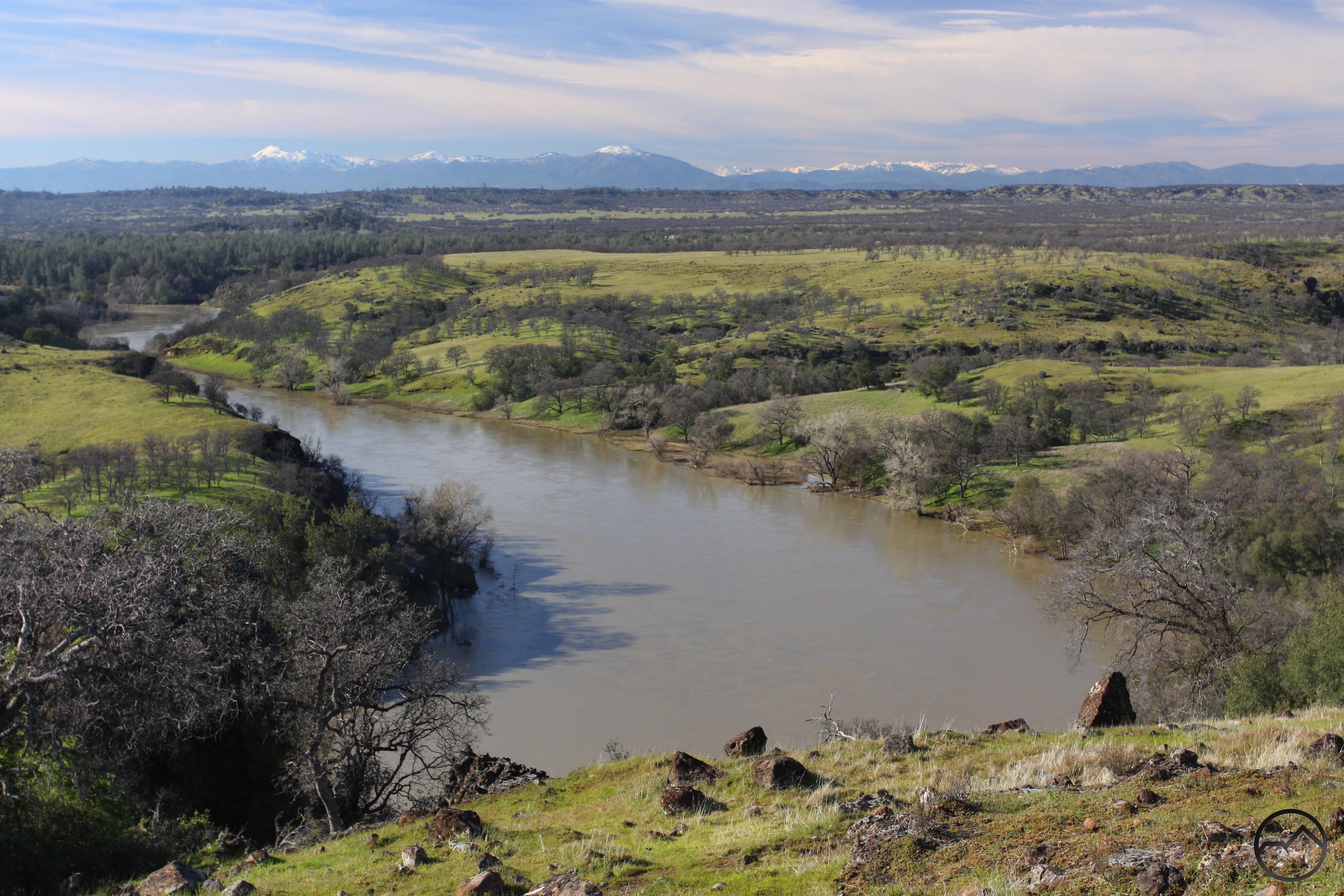
Bully Choop, Shasta Bally and the Trinity Alps line the horizon above a very full Sacramento River.
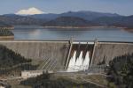
The winter of 2016/2017 has certainly been a wild one so far (see images here, here, here, here and here). Things kicked off with a utterly soaking October and has hardly let up since then. After the rain that came down during the fall, winter arrived in full force in January and has absolutely inundated California with rain and snow. After years of horrific drought, the sudden arrival of so much water has been a shock to both the psyche and the infrastructure. Where a couple of years ago the reservoirs were at 40-year lows, they are now so full as to pose threats to hundreds of thousands of people. The dangers aside, it is absolutely mind-boggling to drive around the Sacramento Valley and see so much water in the river, in the fields and in the gushing through the creeks. If you have not yet and you are able, I would strongly recommend heading over to the Shasta Dam and see the spectacle of the water being dumped out of Shasta Lake as fast as it can be. It is spectacular.
Click to enlarge:
This winter will have a noticable impact on hikers. Some will be positive, some negative. On the positive side, water will flow strongly throughout the summer and there will be lots of snow on the mountains throughout the high country. On the negative side of the equation, access will be a challenge, one which will manifest in a few different ways. Simply put, access to higher elevations will have to wait until much later than normal as the deep snow pack takes longer to melt. It will be a particularly interesting summer for those attempting the Pacific Crest Trail. For perspective on the snow level, check out this little webcam shot from Glacier Point:
Access is also going to be impaired due to road damage. Many roads, like CA 299 and Dinkey Creek Road have been damaged by the amount of water that has been inundating the state. However, no road damage is as dramatic as the rockslide that has blocked off the road into Whitney Portal, where the trailhead to Mount Whitney is found:
It may have been obvious from past posts, but one of my favorite subjects is water management and water policy in the western United States. The half of the country that lies west of the 100th meridian is utterly dependent on sound management of the shockingly scarce resource and it has impact on far-reaching aspects of our lives. This ranges from the fundamental need for water to drink to agriculture to how we recreate and use the land. Everything is touched by water policy. I would encourage everyone to read Cadillac Desert. I don’t agree with all of the author’s conclusions but it remains the best book I have seen on water in the western U.S. Not only is a fascinating account, but it will inform us as citizens as to the critical water issues we face. Frankly, Sacramento in particular has failed us in regards to water management and I think voters need to hold them to account. Water issues don’t seem to ever make it into the public discussion around election time as an essential topic but I think between the drought and the infrastructure issues this winter, we can’t avoid the topic any longer. This is made all the more pressing as the state’s population grows, putting more strain on the already strained system.
Enough of politics though. What I really wanted to do with this post is include some of the incredible footage of the rivers and dams from the past couple months. Nothing really puts an exclamation point on this winter like the stunning sights that have been put on display. I want to focus on some of my favorites from the Northern California Rivers. Skip to the end to see some really incredible footage from the Oroville Dam’s spillway clean up that has been posted by DWR the last couple of days. The scale of the engineering and logistical challenges are staggering!
The Yuba:
The American River:
Scenes Along the Sacramento River:
Lake Berryessa (Putah Creek):
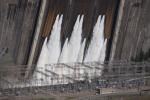
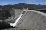
Feather River (Oroville Dam):

Central Texas went through something very similar the past few years. Worst drought in my lifetime from about 2010-2014 and then a year straight of rain, minus a couple summer months. Lake Travis was at almost its lowest recorded level and it was actually getting to the point where we were worried about running out of water (Austin’s population just keeps growing). The lake has now been full for two years, but that drought certainly made people wake up and it was indeed a heavy topic of conversation among city and state government agencies and especially during election season.
I know the drought you speak of. My best friend is from Brady and they were mighty worried about what was going on. I also remember him griping about all the rain too, even though it was desperately needed. The big difference, as I see it, is that Texas is not beholden by groups like the Sierra Club and other activist organizations. This dramatically increases the likelihood of solutions to water issues being implemented. Here in California, the state government is utterly in the thrall of these kind of groups. Indeed, they have become part of the very warp and woof of Sacramento and they are an absolute impedence to any progress being made. Take the Oroville issue. When the crisis occured, it was revealed that the Sierra Club and other groups had urged the state to armor the area beneath the spillway with concrete (because that area was recognized as a potential weakness by pretty much everyone). They made it sound like the DWR did not care and nothing was done. The truth is that DWR recognized the problem but wanted to install gates on the emergency spillway so they could control the flow and thereby mitigate erosion issues. The Sierra Club opposed this because that created the potential, in extreme weather situations, for a certain amount of upstream river canyon to be inundated (I am guessing it would be around 15 feet of elevation, however far back into the canyons that would reach). Therefore, they argued for no gates but the precautionary armor. This created a stalemate, nothing was done and here we are. I figure in Texas groups like that would not wield enough clout to utterly derail a public safety issue like what is faced at Oroville. Maybe I am wrong on that, but would guess that I am not.
Now, I think the body of my work on this website would make it obvious that I care deeply not just about the natural land but the retention of its wild character. That is, however, balanced by the recognition that people need water and we have to find a solution that balances those two things. So far, in the last 35 years or so of California history, that has been a nearly impossible balance to achieve.
Great captures. Thank you for the article and for sharing great photos in your posts.
The concrete in the Oroville spillway looks paper-thin compared to the depth and ferocity of the erosion caused by what was “supposed” to be a flow within design limits. Ha! We always seem to forget that Nature bats last!
It really does. It is an amazingly simple structure. To be fair, thought, if the original collapse had not happen, it probably could handle the capacity it was rated for. The area above the original collapsed section seems to be handling things just fine. Nonetheless, water is the universal solvent and will find a way to undermine just about anything given the chance.