Hike Mt. Shasta

Exploring the Mount Shasta Region

  • Home
  • Trails
    • Mount Shasta Trails
      • Brewer Creek Trail
      • Clear Creek Trail
      • Gray Butte Trail
      • Green Butte Ridge Trail
      • Horse Camp Trail
      • North Gate Trail
      • Old Ski Bowl Trail
      • Panther Meadow Trail
      • South Gate/Squaw Meadow Trail
      • Whitney Falls Trail
    • Trinity Divide Trails
      • Blue Divide Trail
      • Castle Lake Trail
      • Castle Lake Shore Trail
      • Cliff Lake Trail
      • Deadfall Lakes Trail
      • Gray Rock Lakes Trail
      • Gumboot Trail
      • Heart Lake Trail
      • Porcupine & Toad Lakes Via Pacific Crest Trail
      • Seven Lakes Basin Via Pacific Crest Trail
      • Sisson-Callahan Trail
      • Soapstone Trail
      • South Mumbo Scramble
      • Tamarack Lake Trail
      • Toad Lake Trail
    • Castle Crags Trails
      • Burstarse Falls Via Pacific Crest Trail
      • Castle Dome Trail
      • Flume Trail
      • Lower Castle Crags Via Pacific Crest Trail
      • Root Creek Trail
    • Scott Mountains Trails
      • Bluff Lake & Cement Bluff via Pacific Crest Trail
      • Caldwell Lakes Trail
      • China Mountain Scramble
      • Cory Peak and Bull Lake via Pacific Crest Trail
    • Cascade Crest
      • Ash Creek Butte Scramble
      • Goosenest Trail
      • Juanita Lake Trail
      • Orr Lake Trail
    • Mount Shasta City Area Trails
      • Black Butte Trail
      • Box Canyon Trail
      • Gateway Trail
      • Lake Siskiyou Trail
      • Mount Shasta City Short Trails
      • Ney Springs Canyon Trail
      • Spring Hill Trail
    • Shasta Valley Trails
      • Black Lava Trail
      • Haystack Trail
      • Lake Shastina Trail
      • Pluto Cave Trail
      • Trout Lake Trail
      • Yellow Butte Trail
    • Sacramento River Trails
      • Dunsmuir Trail
      • Hedge Creek Falls Trail
      • Sacramento River Trail
      • Sims History Trail
    • McCloud River Trails
      • Ash Camp To Ah-Di-Na Via Pacific Crest Trail
      • McCloud River Falls Trail
      • McCloud River Preserve Trail
      • Squaw Valley Creek Trail
      • McCloud River Trail: Algoma Camp to Nitwit Camp
      • McCloud River Trail: Nitwit Camp to Cattle Camp Swimming Hole
      • McCloud River Trail: Cattle Camp Swimming Hole to Camp 4
      • McCloud River Trail: Camp 4 to Upper McCloud Falls
      • McCloud River Trail: Pine Tree Hollow Loop
    • Trails Further Afield
      • Trinity Alps Trails
        • Bear Lakes Trail
        • Billys Peak Trail
        • Boulder Creek Lakes Trail
        • Boulder Lake Trail
        • Canyon Creek Trail
        • Caribou Lakes Trail
        • East Boulder Lake Loop
        • East Weaver Lake Trail
        • Four Lakes Loop
        • Granite Peak Trail
        • Grizzly Creek Trail
        • Gulch Lakes Loop
        • Hidden Lake Trail
        • South Fork Lakes Trail
        • Stoddard Lake Trail
        • Stoney Ridge Trail
        • Tangle Blue Lake Trail
      • Warner Mountains
        • Emerson Creek Trail
        • Highgrade Trail
        • Patterson Lake Via Warner Summit Trail
        • Pine Creek Trail
        • Squaw Peak Trail
  • Articles
    • Trails By Area
      • Mount Shasta
        • Vistas, Meadows And Waterfalls: Three Best Hikes On Mount Shasta
        • The End Of The Road: Three Hikes In The Old Ski Bowl Area
        • Two Trails From Bunny Flat
        • Three Trails On Mount Shasta’s East Side
        • Mount Shasta’s Hummingbirds
      • Trinity Divide
        • Great Lakes: Top Five Lake Basins In The Trinity Divide
        • The Headwaters Of The South Fork Of The Sacramento River
        • Neglected Headwaters: Two Lesser Lake Basins On The South Fork
        • Gumboot Saddle: Two Hikes On The PCT
        • Descent Into Mystery: The Sisson-Callahan Trail
        • Mumbo Basin – Overlooked On The West Side
        • The Headwaters Loop: A Proposed Backpacking Loop In The Trinity Divide
      • The McCloud River
        • The McCloud River Trail
      • Shasta Valley
        • Jewels In The Desert
      • Scott Mountains
        • Great Scott! Two Scott Mountains Hikes On The PCT
      • Trinity Alps
        • Carubou Lakes: Trinity Alps On A Grand Scale
        • Switchbacks To Heaven: The Trinity Alps’ Stoney Ridge Trail and Four Lakes Loop
        • Trinities In Proximity: Two Trinity Alps Trails With Easy Access From Mount Shasta
        • Trails in the Carter Meadows Area
        • Trinity Alps Views of Mount Shasta
        • The Psychological Value Of The Trinity Alps
    • Waterfalls
      • Three Waterfalls On Mount Shasta
      • McCloud River Waterfalls
      • Sacramento River Waterfalls
      • Trinity Divide Waterfalls
      • Trinity Alps Waterfalls
      • Avoiding A Dry Whitney Falls
    • Off Season Trails
      • Three Winter Hikes Near Mount Shasta City
      • Winter Hikes In Shasta Valley
      • Winter Hiking In The Shasta Valley Wildlife Refuge
      • Winter Hikes On The Sacramento River
      • Winter Hikes On The Lake Siskiyou Trail
      • Spring Hikes In The Castle Crags
      • Spring Hikes On the Upper McCloud
      • Spring Hikes On The Lower McCloud River
    • Points Of Interest
      • Mount Eddy: Overshadowed, Underrated
      • Black Butte: Hiding In Plain Sight
      • Castle Dome: Steadfast And Staggering
      • Mount Shasta Hoodoos
      • Sacramento Scrambling
      • The Shasta River
      • The Castle Creek Watershed
      • Mount Shasta East Side Glacier View
      • 5 Fantastic Mount Shasta Vistas
      • 5 Highest Peaks Around Mount Shasta
      • 5 Best Hikes On Creeks And Rivers
      • 5 Interesting Footbridges
      • Three Spectacular Drive-To Sunset Vistas
    • North State Geography
      • Introduction
      • Seven Major Regions
      • The California Cascades
      • Klamath Mountains Pt. I
      • Klamath Mountains Pt. II
      • The Great Canyons Of Mount Shasta
      • Mount Shasta, Timberline, And The Relative Size Of Cascade Volcanos
      • Four Eruption Cones Of Mount Shasta
      • Mount Shasta’s Medial Moraine
    • Northern California Review
      • North Table Mountain
      • Lakes Basin Recreation Area
      • Eastern Sierra Fall Color
      • Sonoma County
      • Central Sierra Nevada
      • Orland Buttes
    • Seldom Seen
      • Ash Creek Falls
      • Mud Creek Canyon
      • Lower Mud Creek Canyon
      • Diller Canyon
      • Lower Cascade Gulch
      • The Grey Rocks
      • Castle Creek
      • Upper Wagon Creek
      • Fawn Creek Canyon
      • Confluence of the Sacramento River and Castle Creek
      • Upper Klamath River Canyon
      • Hole In The Ground Geologic Area
      • Ash Creek Butte Fossil Rock Glacier
    • Mount Shasta History
      • Vantage Lost: The Everitt Memorial Vista
      • A Yosemite-Mount Shasta Connection
      • Whitney – What’s In A Name?
      • Mount Shasta Area and the 1838 Exploring Expedition
      • A 19th Century Engraving Of An Epic Mount Shasta Vista
      • Vintage 1907 Color Photos
      • A Misleading Painting
      • A Mysterious Painting
      • A Mysterious Painting Pt. II
      • Stereographic Mt. Shasta
      • Year One Of Hike Mt Shasta
      • Year Two Of Hike Mt Shasta
      • Year Three Of Hike Mt Shasta
      • Year Four Of Hike Mt Shasta
      • Year Five Of Hike Mt Shasta
      • Year Six Of Hike Mt Shasta
      • Year Seven Of Hike Mt Shasta
    • Image Galleries
      • Mount Shasta Trails Gallery
      • Mount Shasta Sunrise Gallery
      • Mount Shasta Sunset Gallery
      • Lenticular Cloud Gallery
      • Mount Shasta NON-Lenticular Clouds
      • Mount Shasta Reflection Gallery
      • Telephoto Gallery
      • Mount Shasta Area Fall Color
      • Castle Crags Gallery
      • Waterfalls Gallery
      • Trinity Divide Lakes Gallery
      • Mount Shasta Area Rivers Gallery
      • Shasta High Desert Gallery
      • Mount Shasta GIF Gallery
    • Random Notes
      • Revew: Three Mount Shasta Trail Maps
      • A Mount Eddy Wilderness?
      • New Land Additions For The Castle Crags
      • Book Plug: Mount Shasta Area Rock Climbing
      • Exile: How I Came To Love Wilderness
  • Mt. Shasta Trail Map
  • Blog
  • About/Contact
  • Links
  • Truchas Ridge

An Aerial View Of Mount Shasta Through The Smoke (And A Few Other Places Too)

Posted by bubbasuess on August 8, 2018
Posted in: Cascade Range, Hiking, Mount Shasta. Tagged: Carr Fire, Texas, Wade Bowen. 9 Comments

For my birthday, my wonderful wife sent me off to Texas for a few days to hang out with my best friend for a few days. He has been my best friend for 16 years but, since we finished school in 2006 and I came back to California from Texas, I have only seen him 6 times. We talk all the time, but distance keeps us from spending time with each other. Not only did she send me out there, she bought tickets to one of my favorite Texas country stars. Needless to say, my friend and I were both excited for a weekend of no work, no kids, lots of barbecue and music and time hanging out together.

The one drawback was I had to fly out to Dallas first and I am not a fan of flying. The way I have coped with this is by sitting by the window and trying to figure out where we are by the landmarks visible below. This trip was no different, though the smoke and a bunch of storm clouds did obscure the view of a good portion of the trip. However, what I did see, especially in our local area, was quite interesting. Hopefully it is interesting enough to endure a few pictures of Texas too…

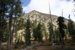
I flew out of Medford, which was even smokier than it was here in Mount Shasta. However, shortly after takeoff I spotted Mount McLoughlin poking up from the top of the smoke. At 9,493 feet, it was a good barometer for how high the smoke layer extended.

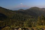
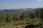
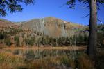
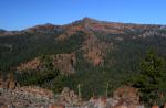
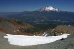
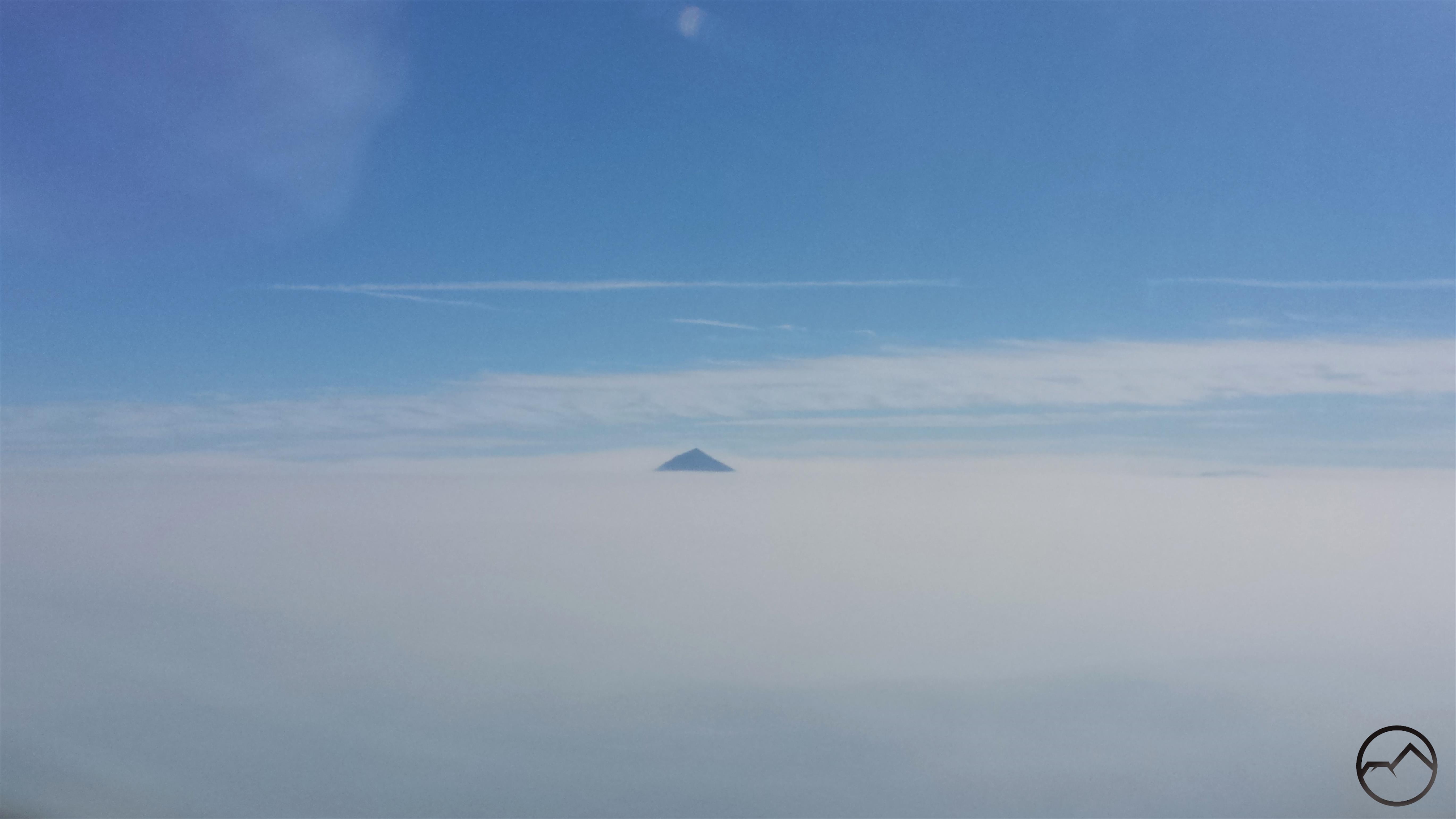
After flying over the Marble Mountains and Russian Wilderness, I finally had a good perspective on Mount Shasta. Several thousand feet of the mountain rose high above the smoke. It seemed like an island of clarity amidst a sea of chaos. Several other landmarks were visible, including the Whaleback, China Mountain, Mount Eddy and Porcupine Peak. The visibility, such as it was, of much of the Trinity Divide was evidence that the smoke was actually a bit better than it was in southern Oregon. It was good to see the mountain after its obscurity in the smoke for several days.

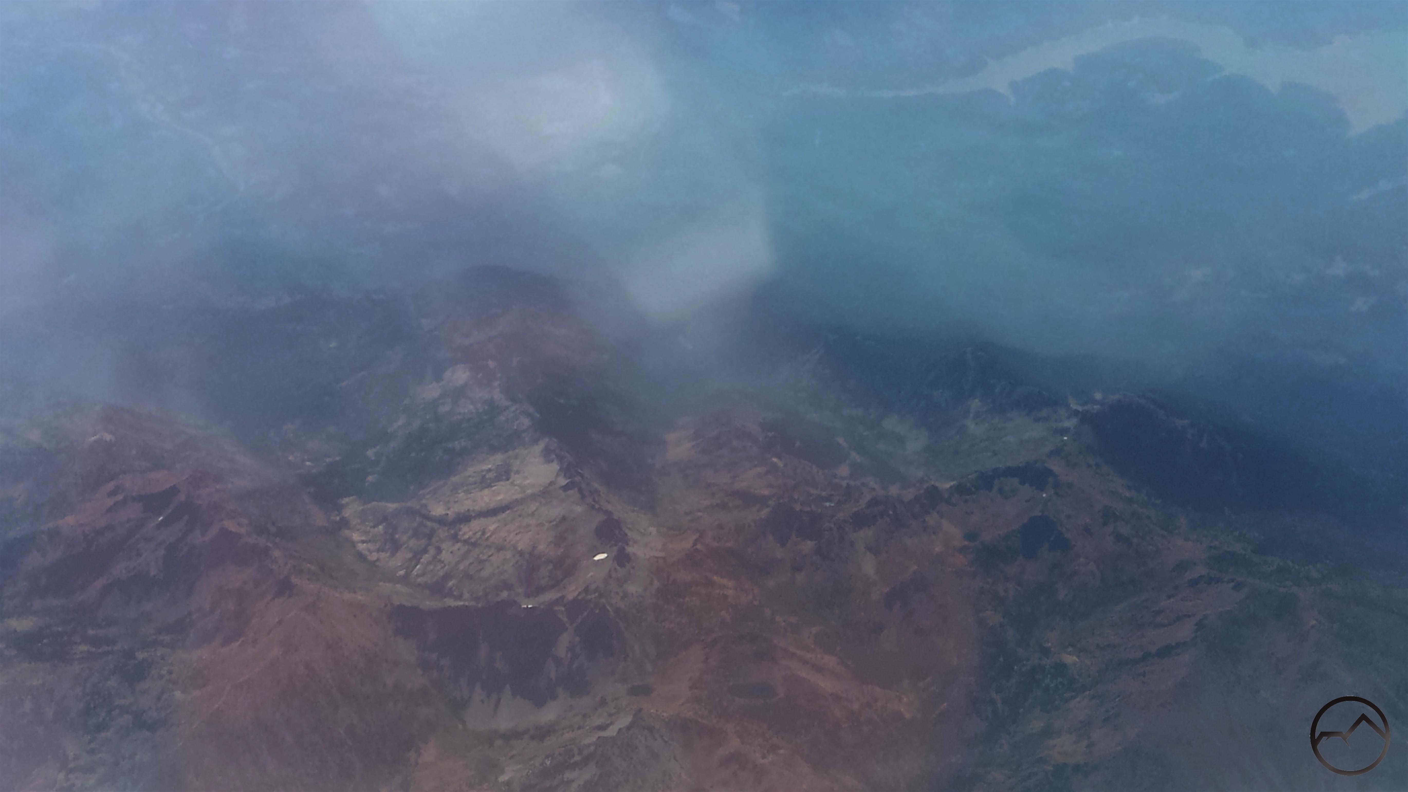
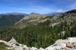
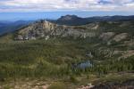
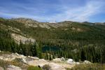
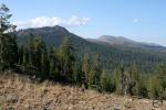
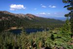
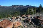
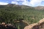
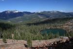
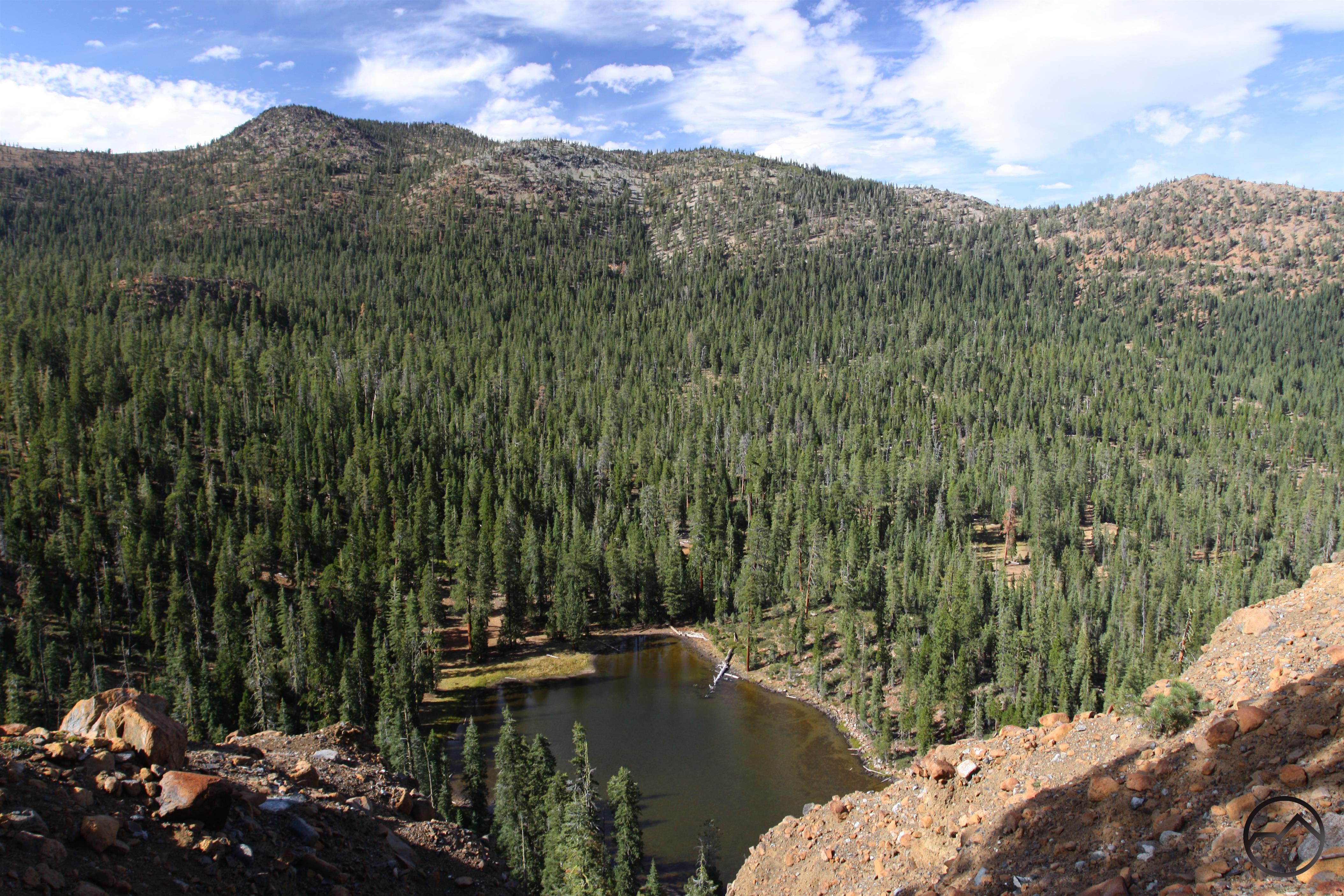
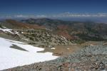
Next up was the Trinity Alps. These were surprisingly smoke free, which is remarkable considering how close they are to the Carr Fire. The area visible in this image includes Granite Lake and Gibson Peak near center and Siligo Peak with Deer and Summit Lakes in the center bottom. Middle Peak and Echo Lake are further to the right. Trinity Lake can be seen in the upper right hand corner.

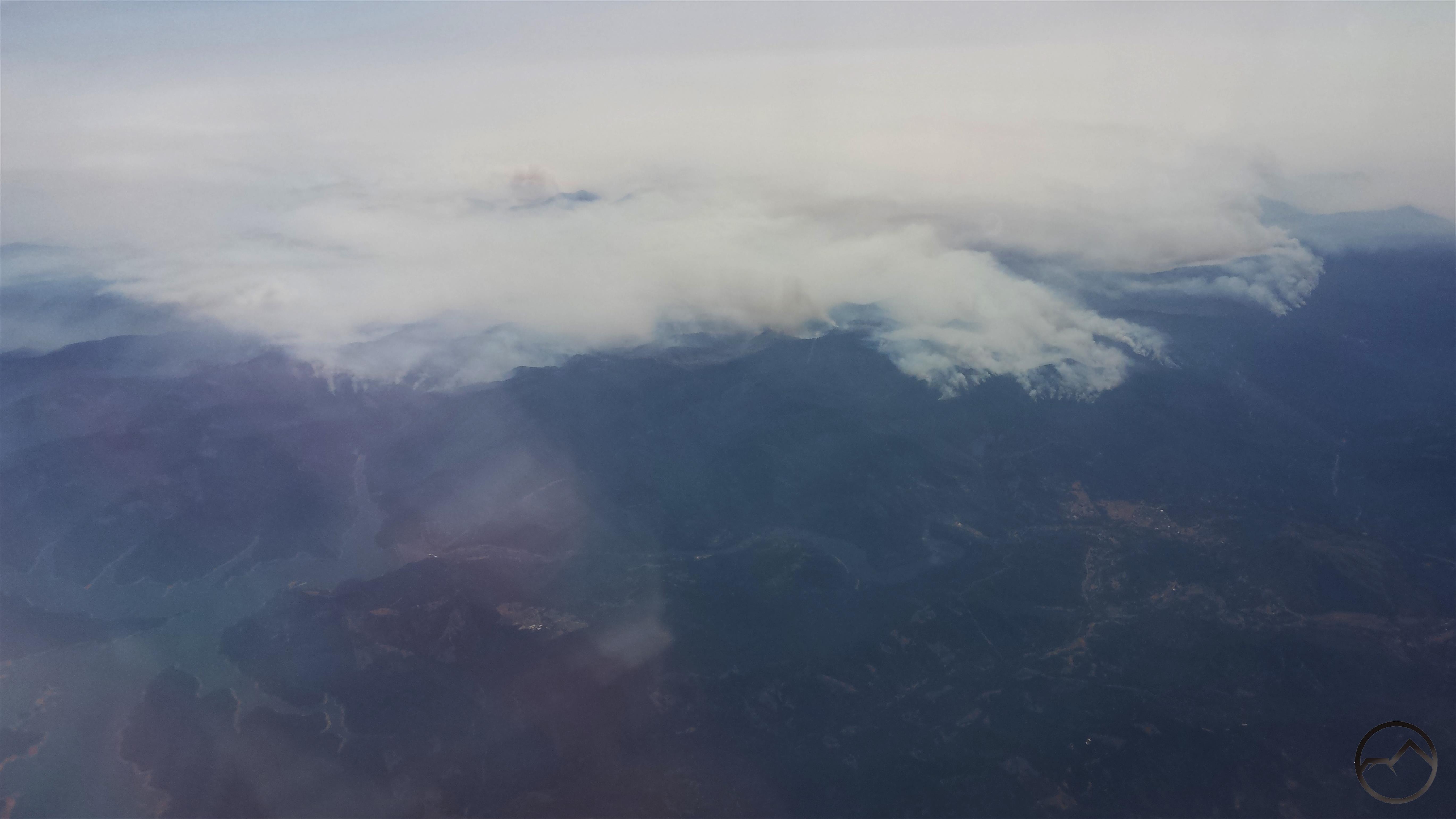
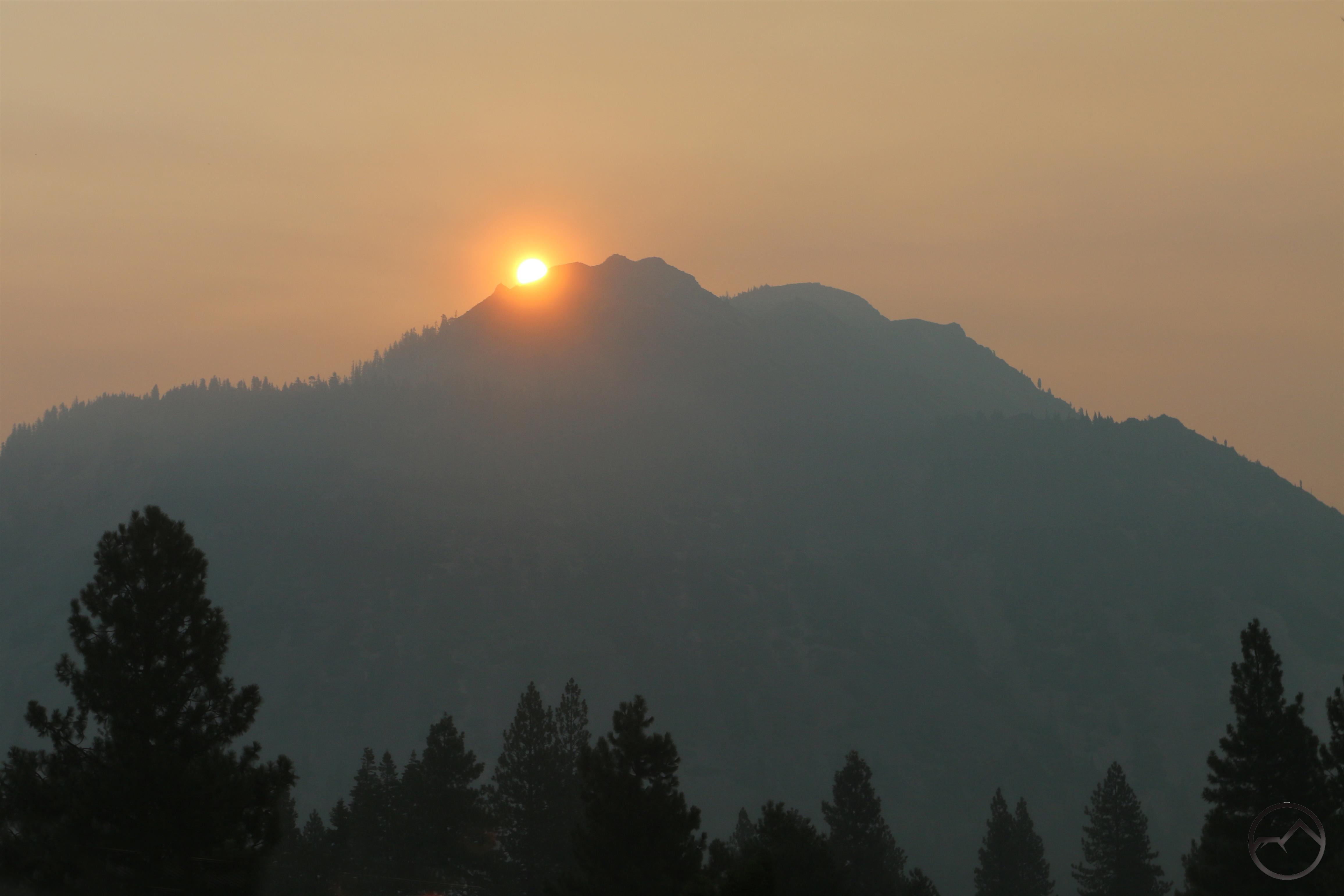
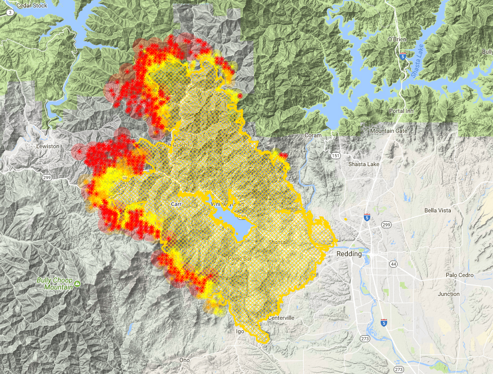
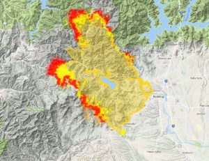
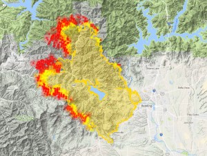
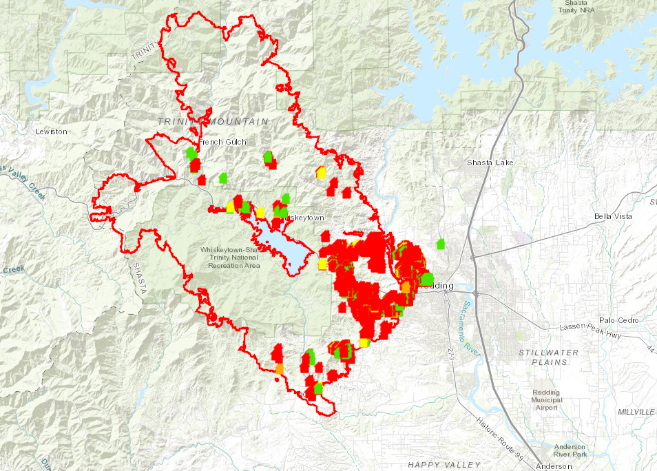
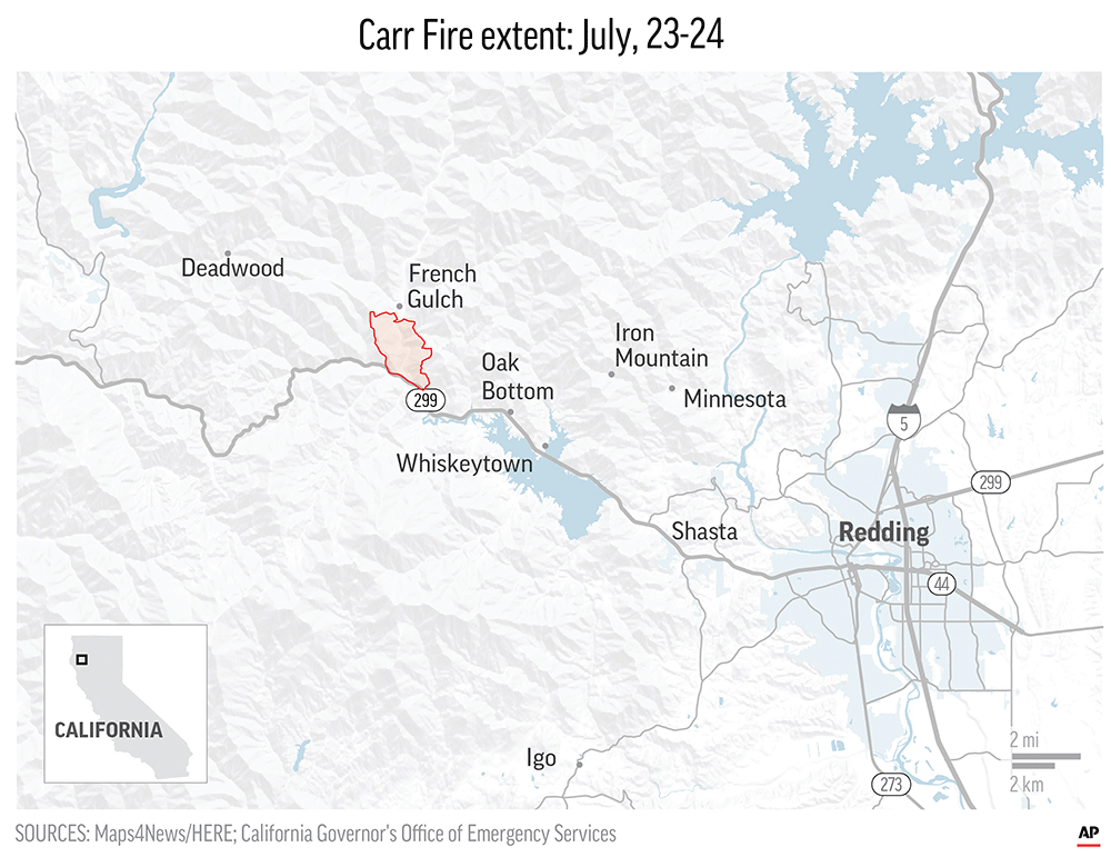
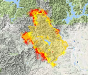
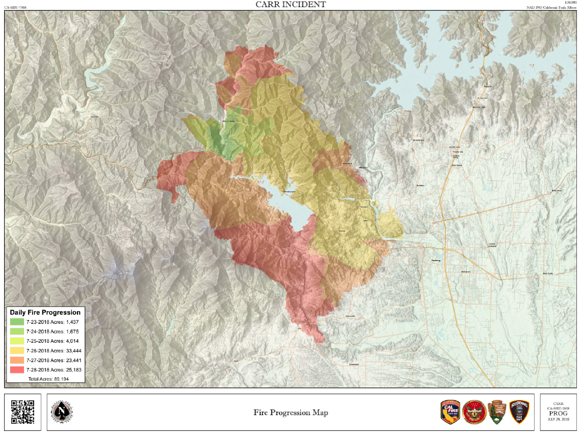
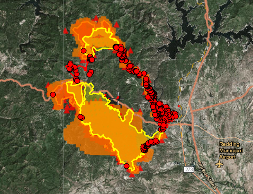
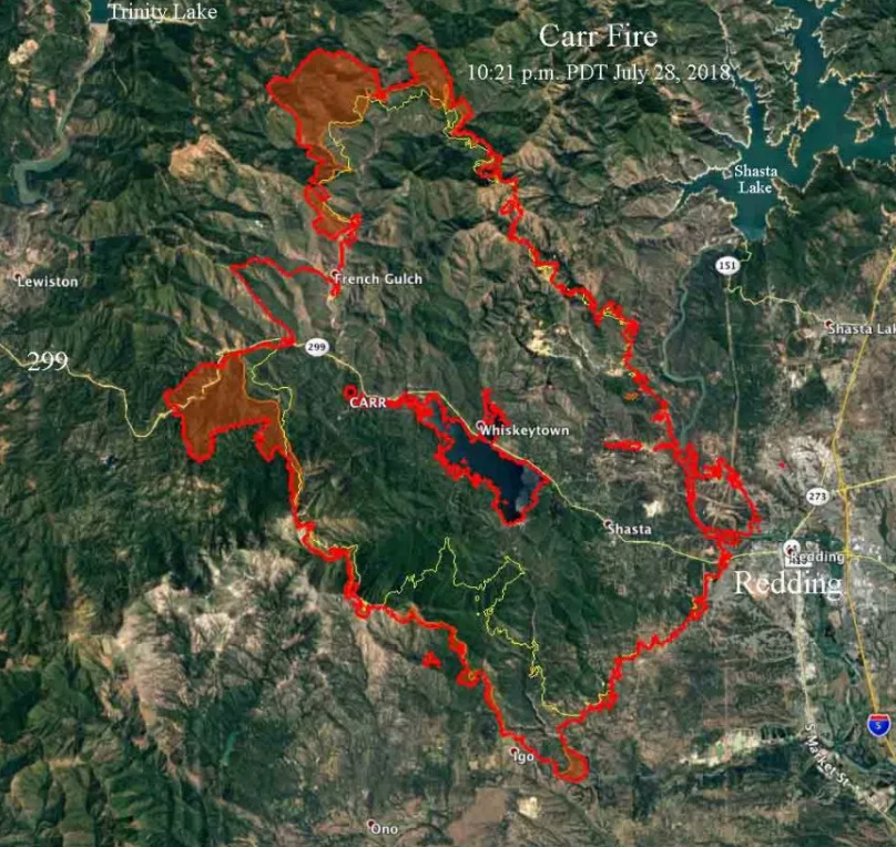
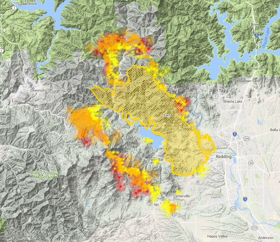
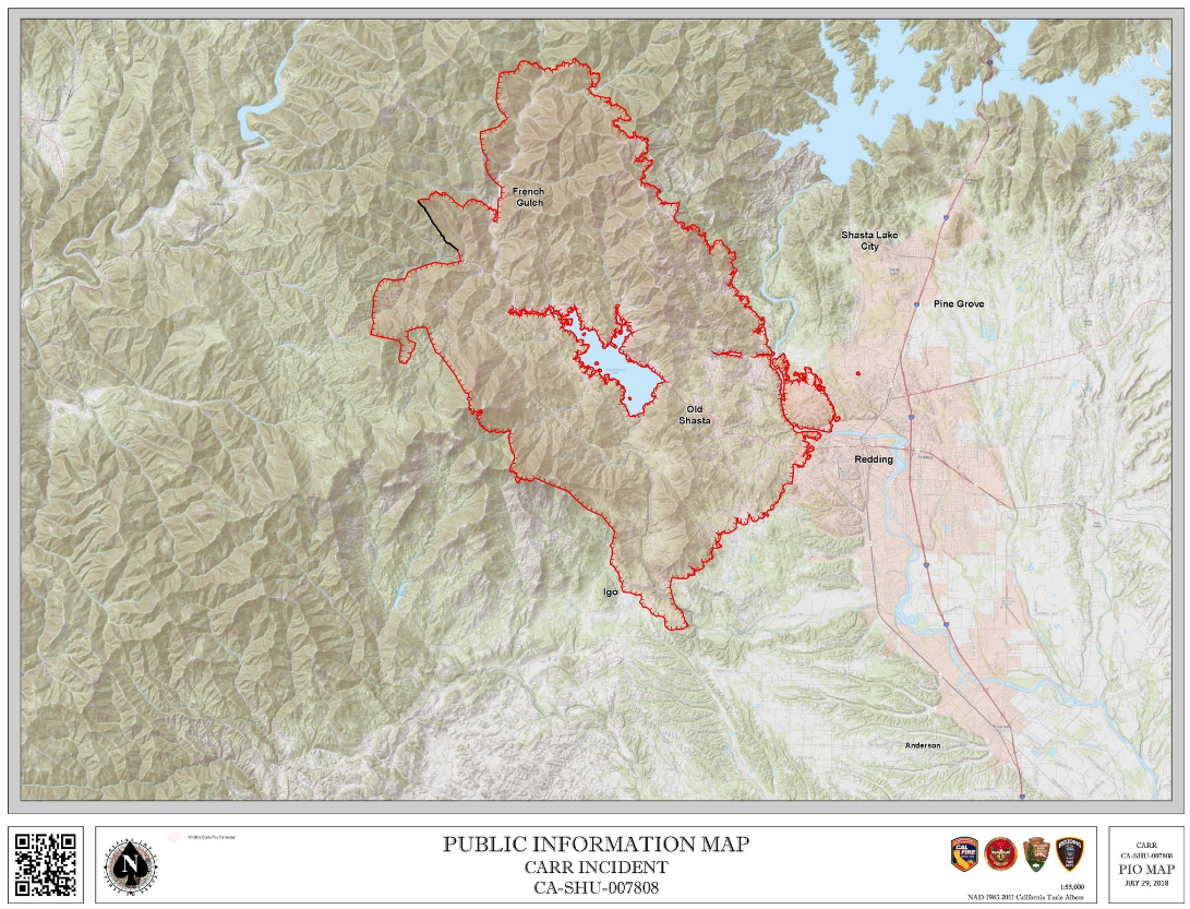
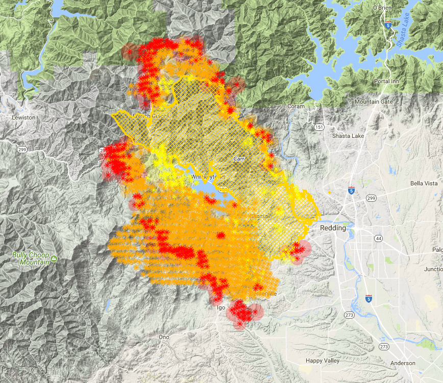
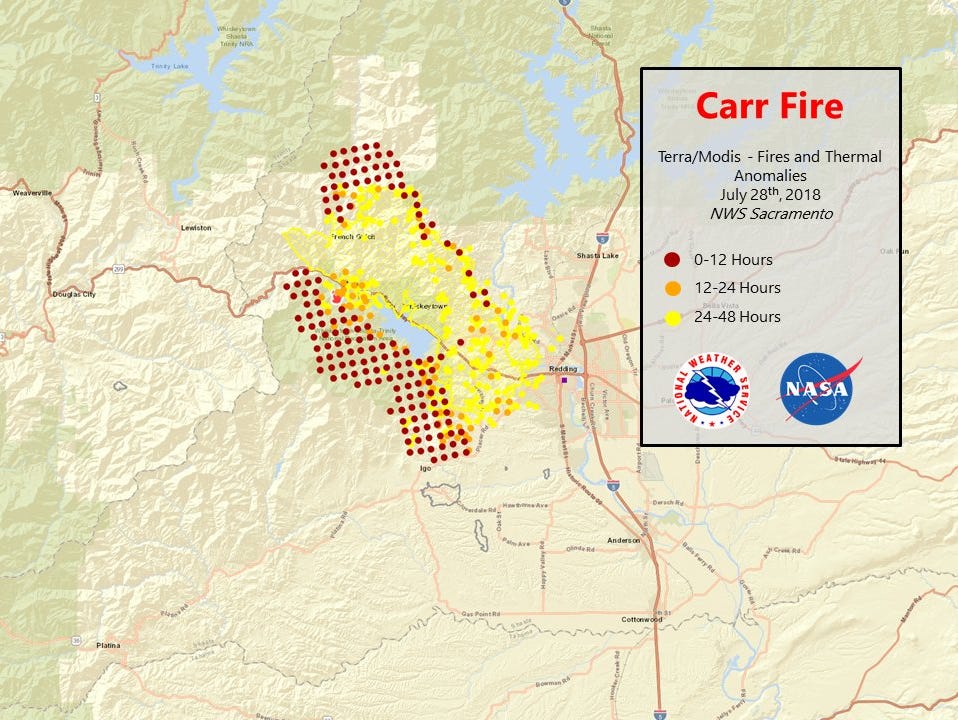
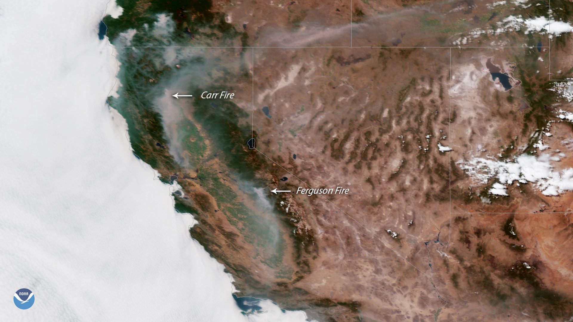
Shortly after the Trinity Alps, the plane flew past the Carr Fire. Here the western edge of the fire can be seen burning down toward Trinity Lake and the town of Lewiston. I could see planes diving low and dropping clouds of red retardant on the fire. It was a pretty dramatic sight.

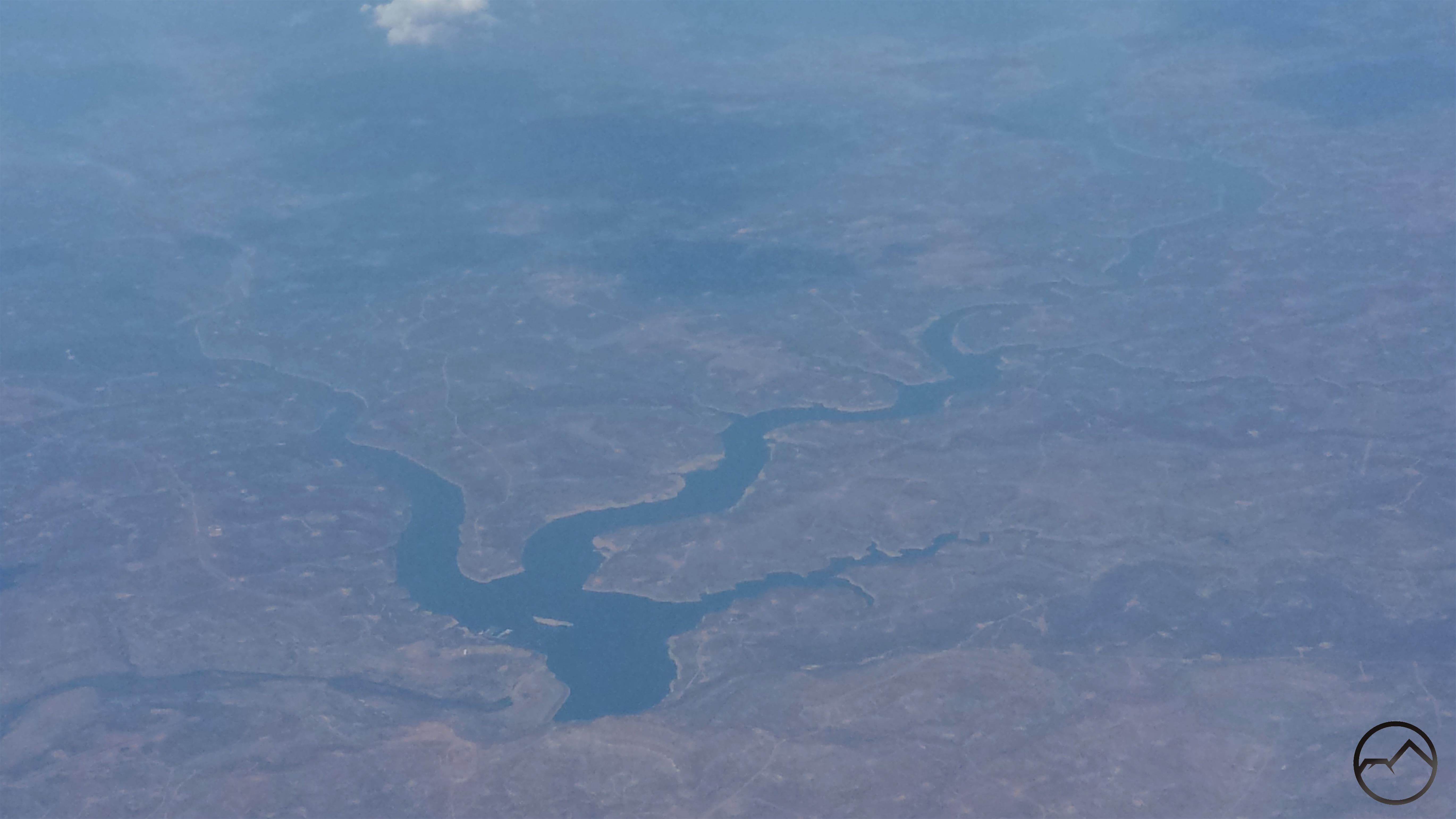
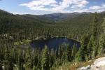
Once we left San Francisco, the smoke and clouds quickly closed in, making for a really bumpy flight. When things cleared up, the first landmark I was able to make out was Navajo Lake, which is near the Four Corner. The lake, formed by impounding the San Juan River, is mostly in New Mexico, though the upper most part of the reservoir extends into southern Oklahoma.

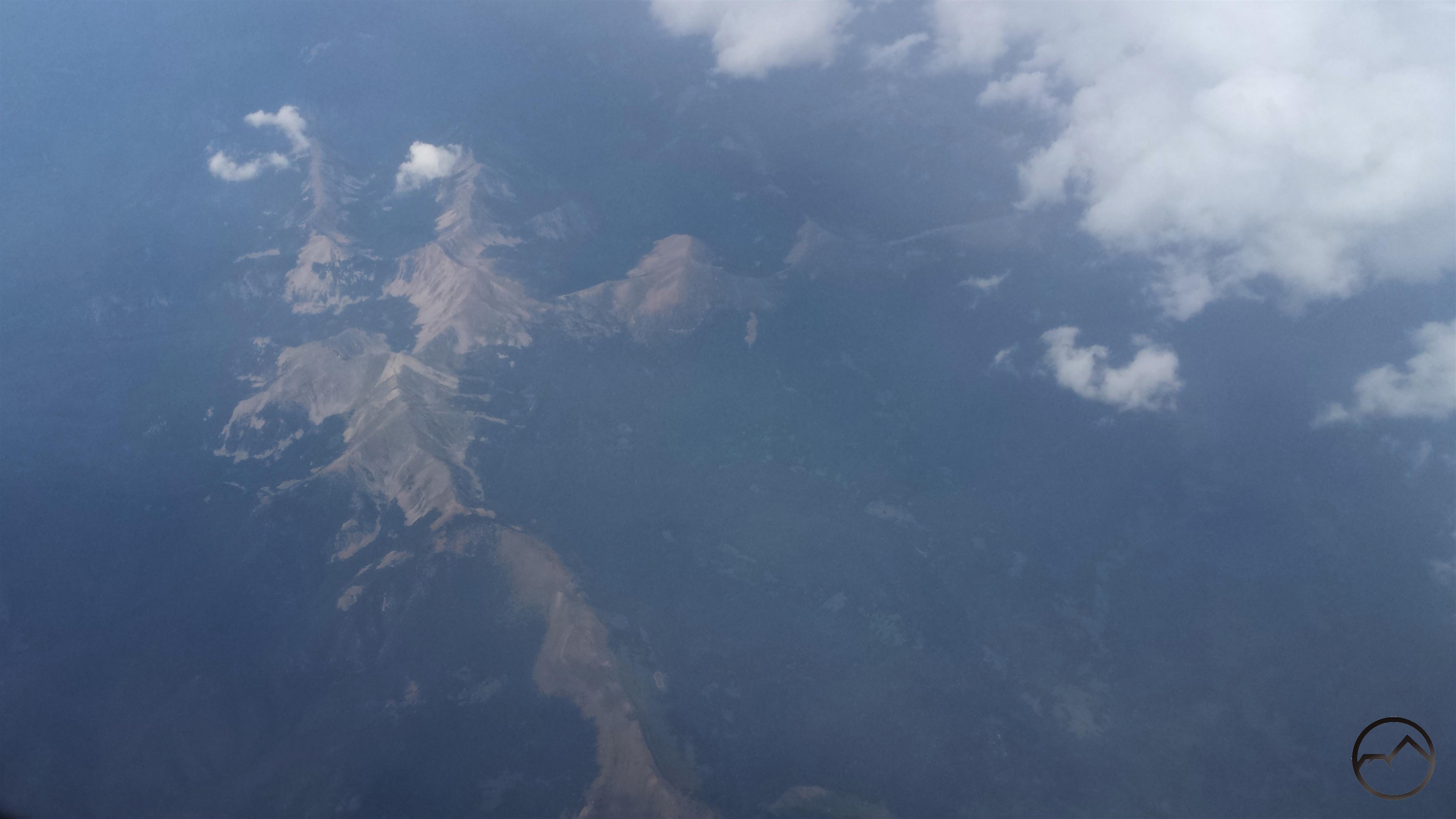
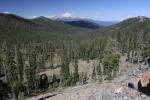
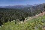
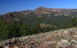
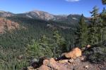
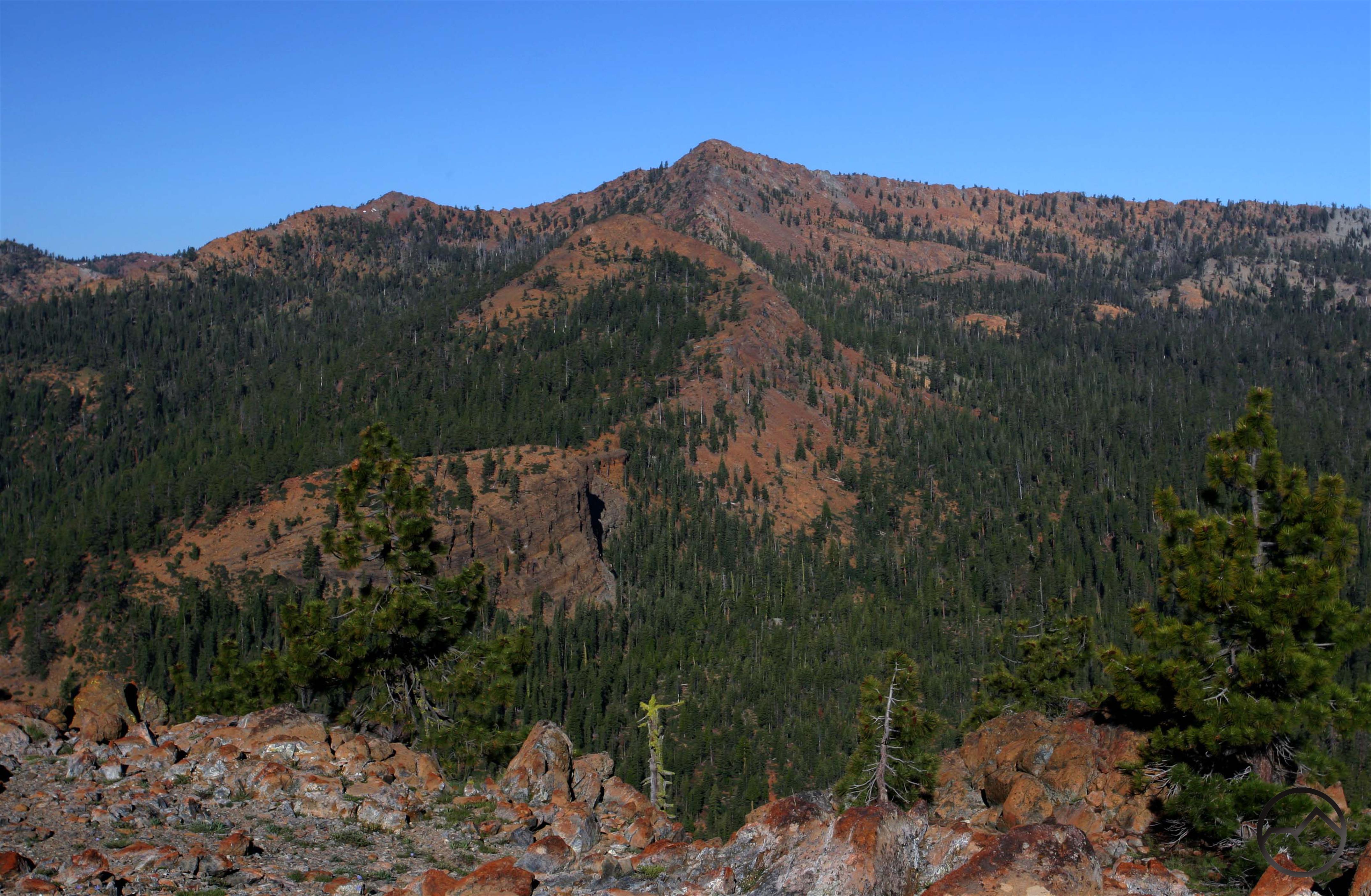
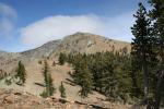
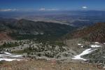
Next up was the Truchas Peaks, the 2nd highest collection of peaks in New Mexico and the southernmost 13,000 foot mountains in the Rockies. These towering summits lie in the heart of the Pecos Wilderness, one of the great wildlands of the Southwest. The darker ridge running vertically at the bottom of the image is the Trailriders Wall. It is probably my favorite spot in New Mexico. If you ever get a chance to explore this area, I strongly encourage it.

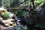
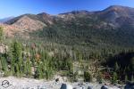
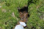
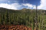
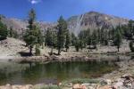
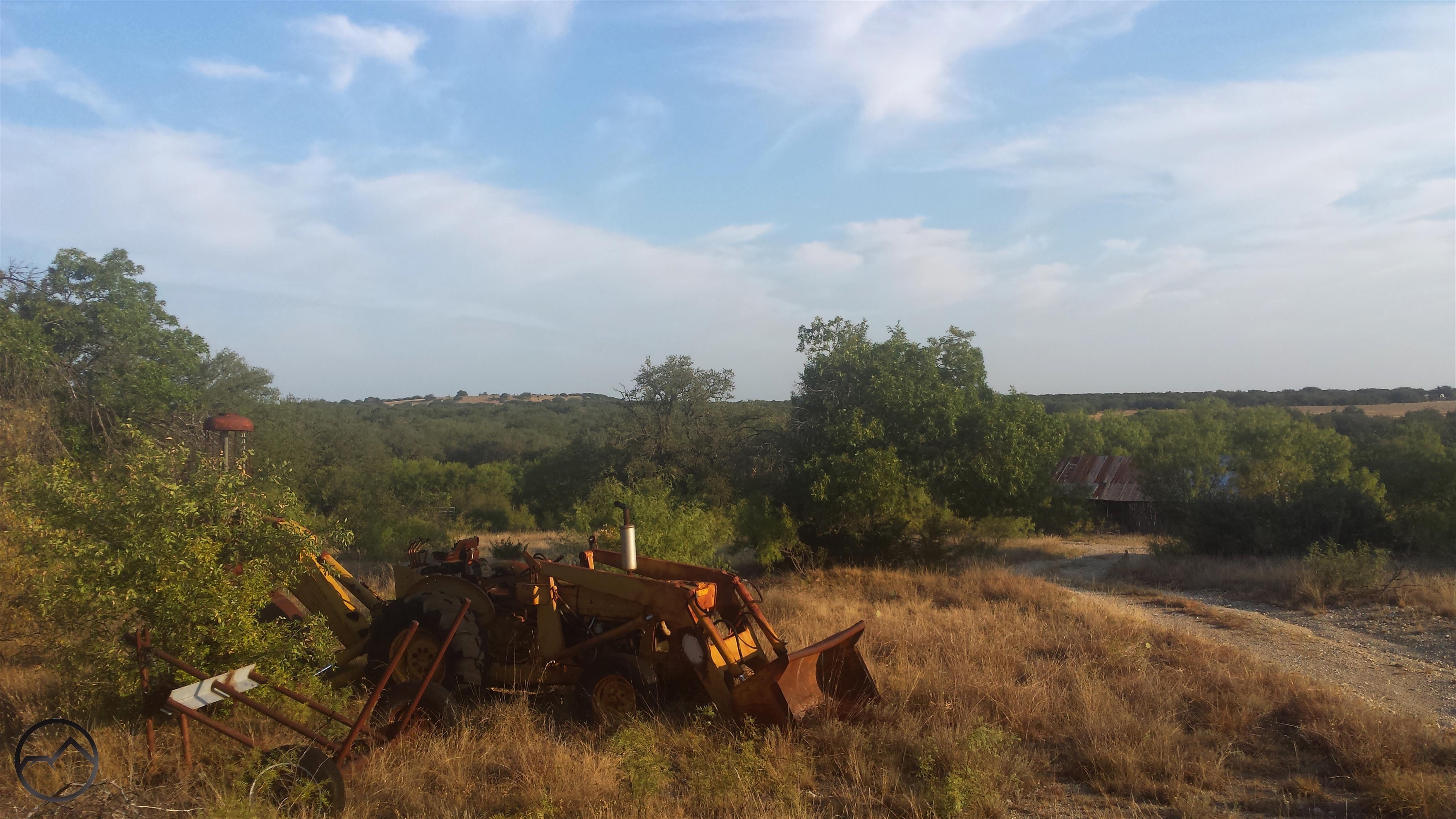
I finally landed in Dallas where my friend picked me up. I hung out that evening and I met his kids for the first time. The next morning we took a lap around our old campus and then headed south into central Texas, to the Hill Country, where he has a ranch. We spent the rest of the day shooting and driving around the old roads that wind around the property, which is several hundred acres in size. I spent a lot of time down there when we were in school together and it was a place with a lot of great memories.

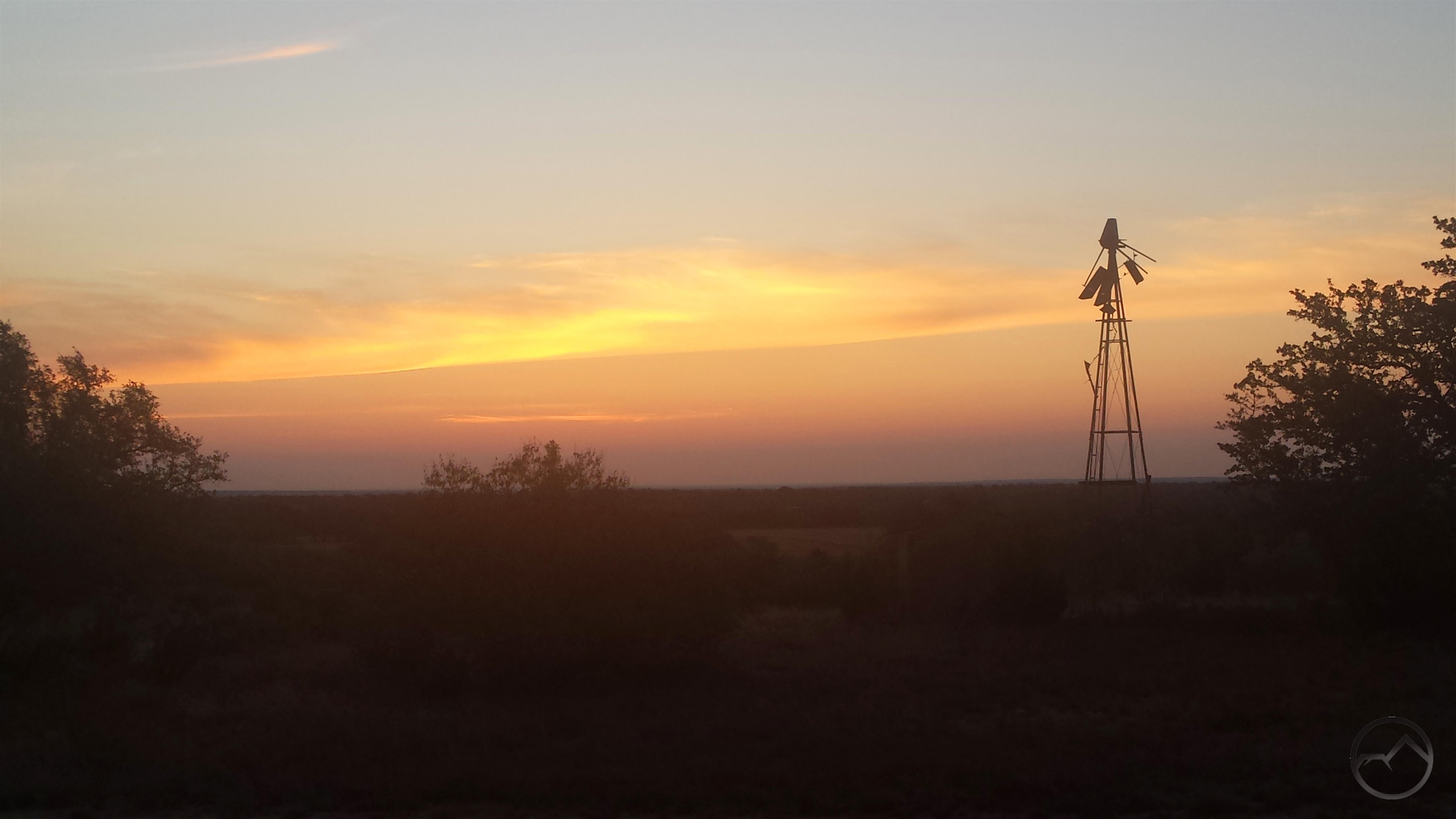
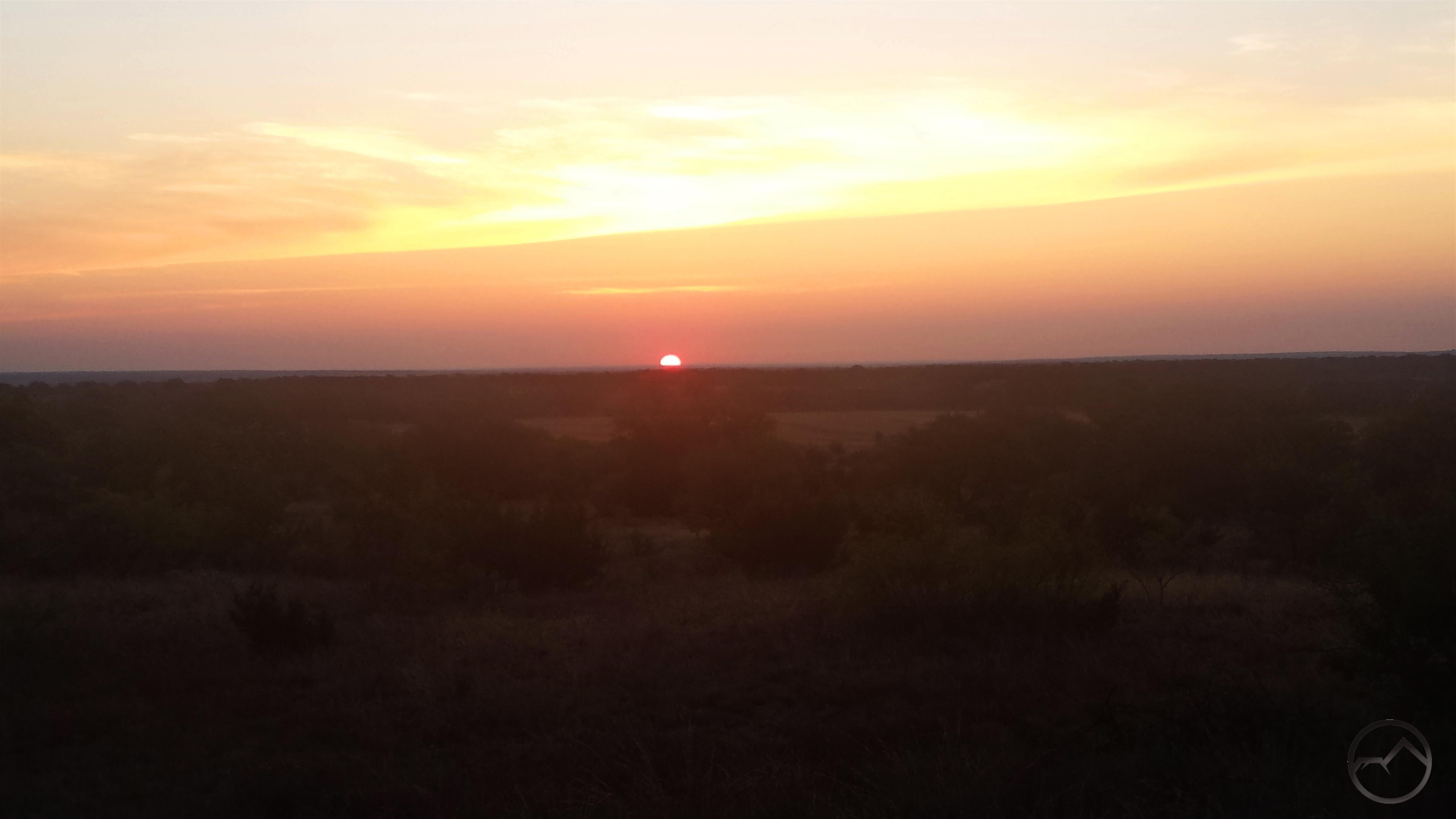
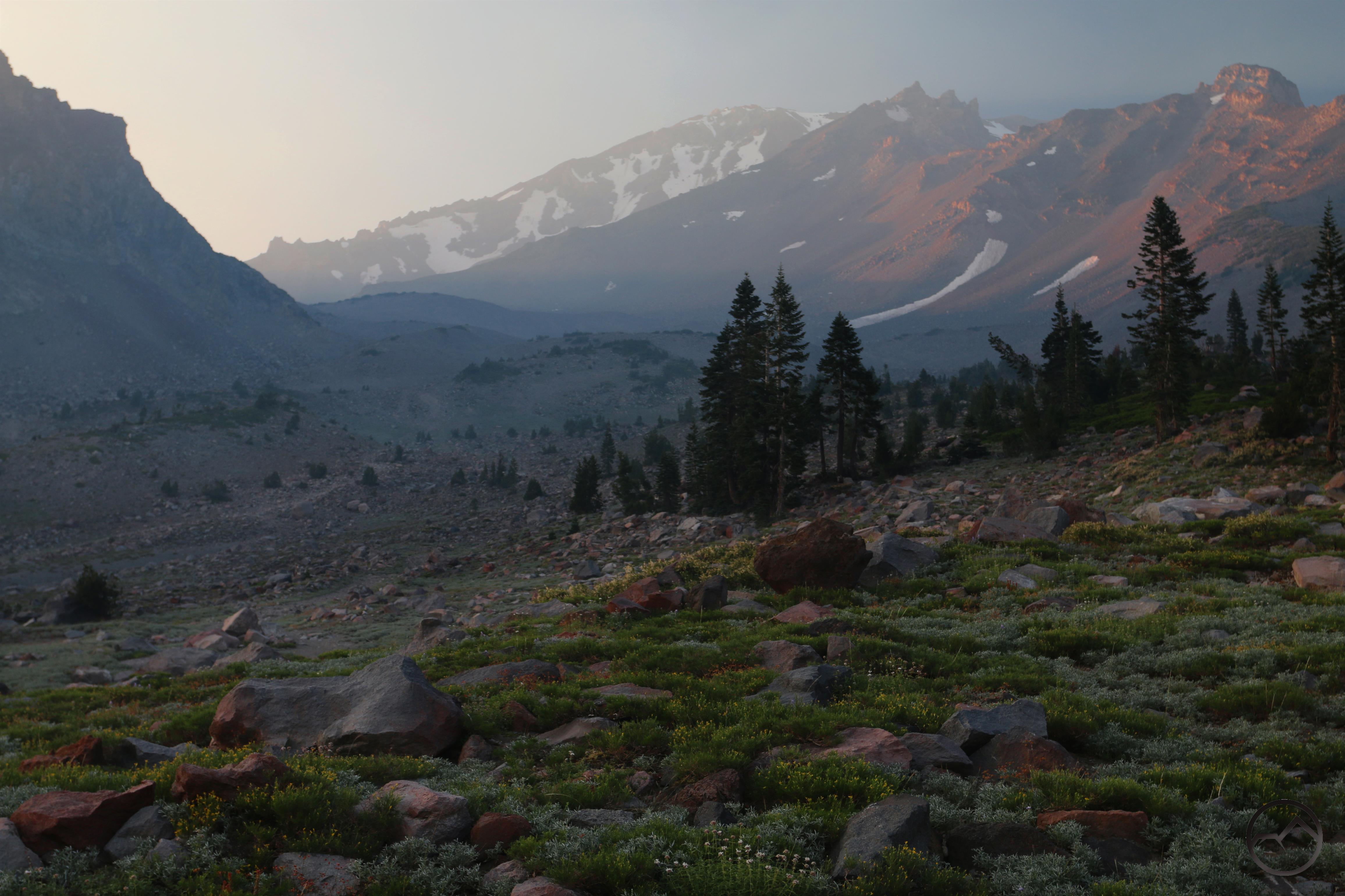
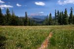
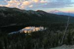
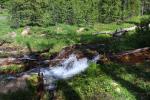
When I first moved to Texas, I had different perceptions of beauty in the natural world. My time there broadened my sense of what what beauty was, where to find it, and how to appreciate it. Naturally I prefer mountains and other such environments but it was good to get back into a land more subtle and be reminded of the value of the great scenic palette we have in this country. The sunrise we watched from the bluff was particularly magnificent.

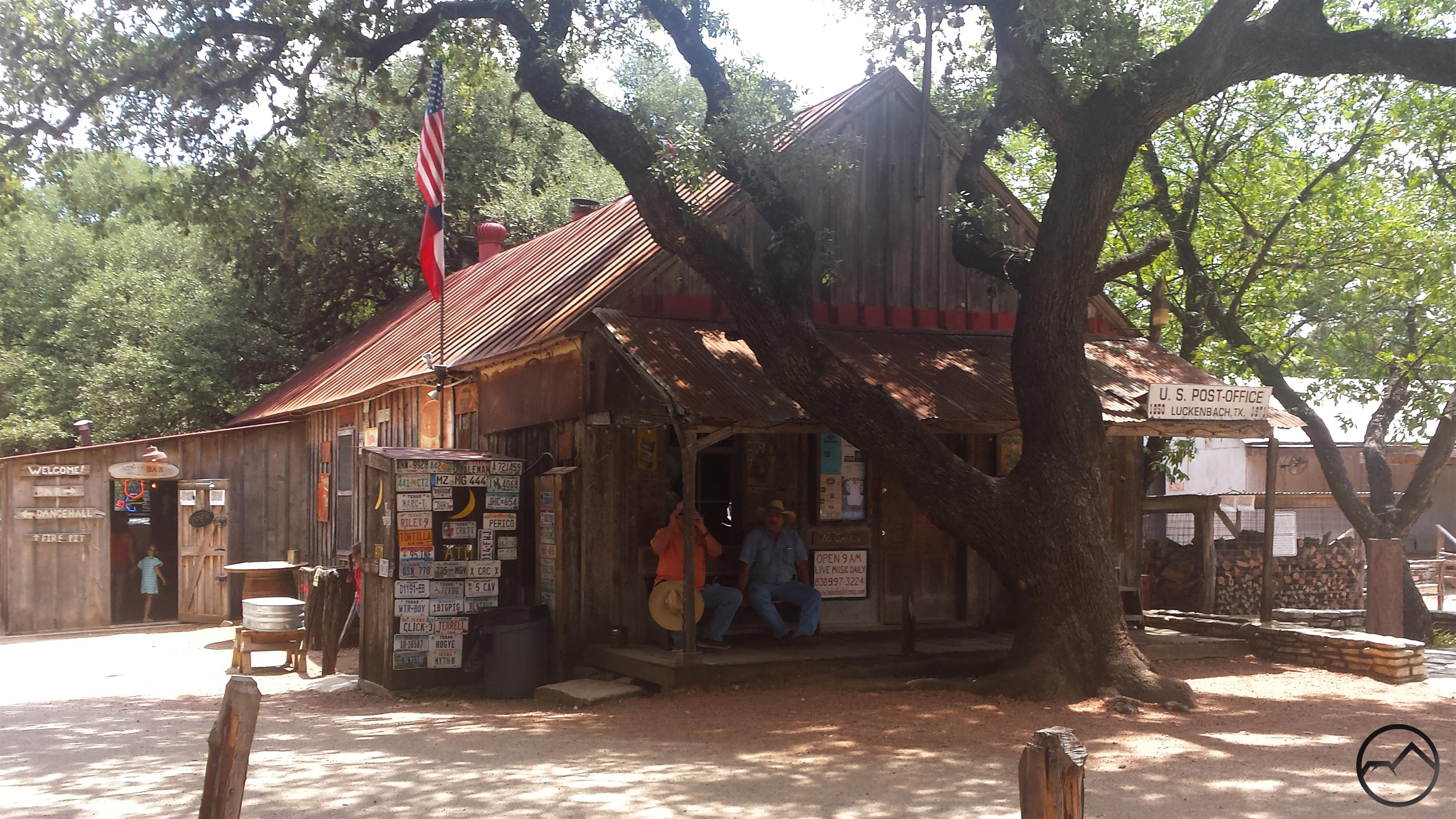
After leaving the ranch, we headed to Lockhart, Texas, where we planned to feast on BBQ for lunch. On the way, we went through Luckenbach, which is, though a bit of a tourist trap now, still sort of the center of the Texas country music scene (Gruene Hall is the real heart of Texas country, of course). Once in Lockhart we had lunch at all three of the great barbecue places, Blacks, Kreuz Market and Smitty’s. All were amazing but Kreuz was far and away the best. If anyone is in that area and likes BBQ, stopping and having some brisket is a moral imperative.

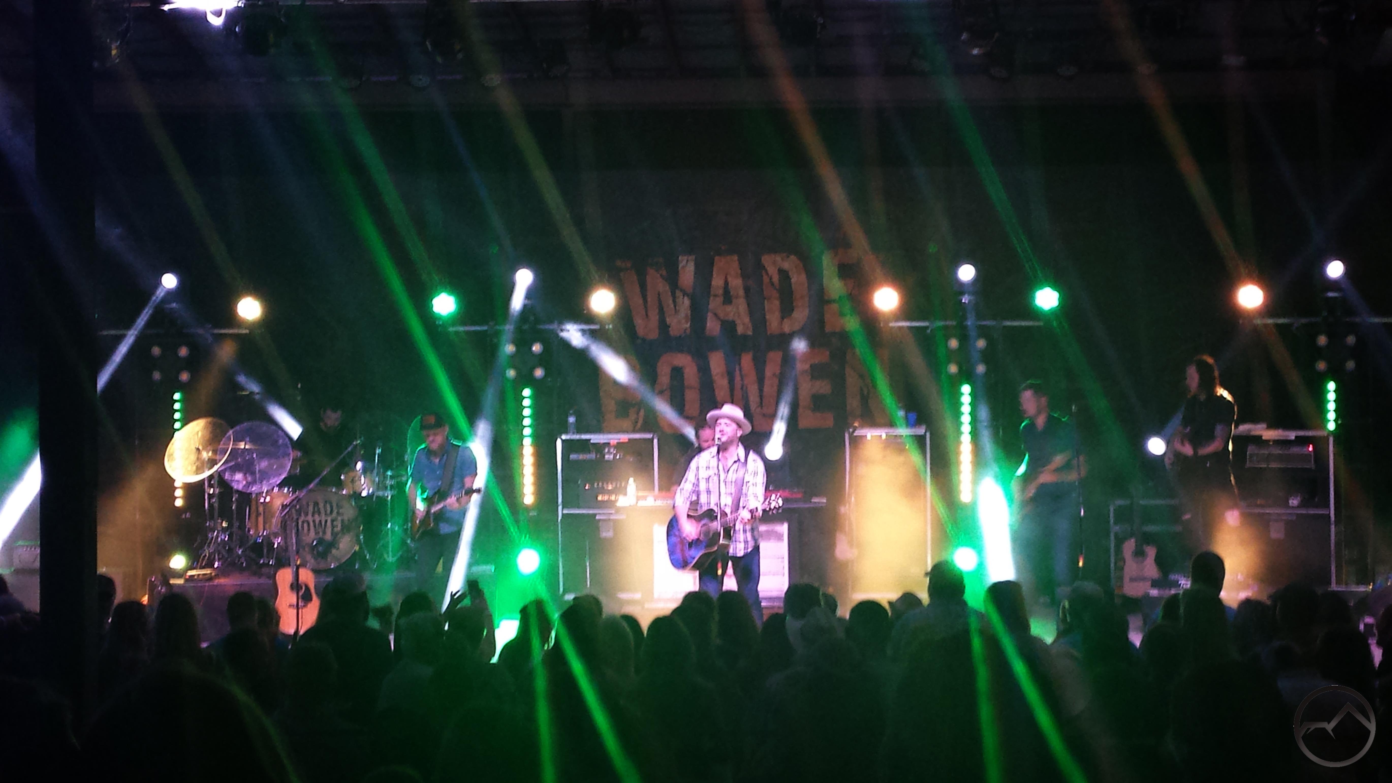
That night, we went to New Braunfels and watched Wade Bowen. It was a fantastic show. In my assessment, he is the top of the heap in the current Texas music scene. A few samples, if anyone is interested, can be found here, here and here. After that, it was one more day to hang out with my friend, head back up to Dallas and get ready to leave the next morning. It was a quick but great trip.

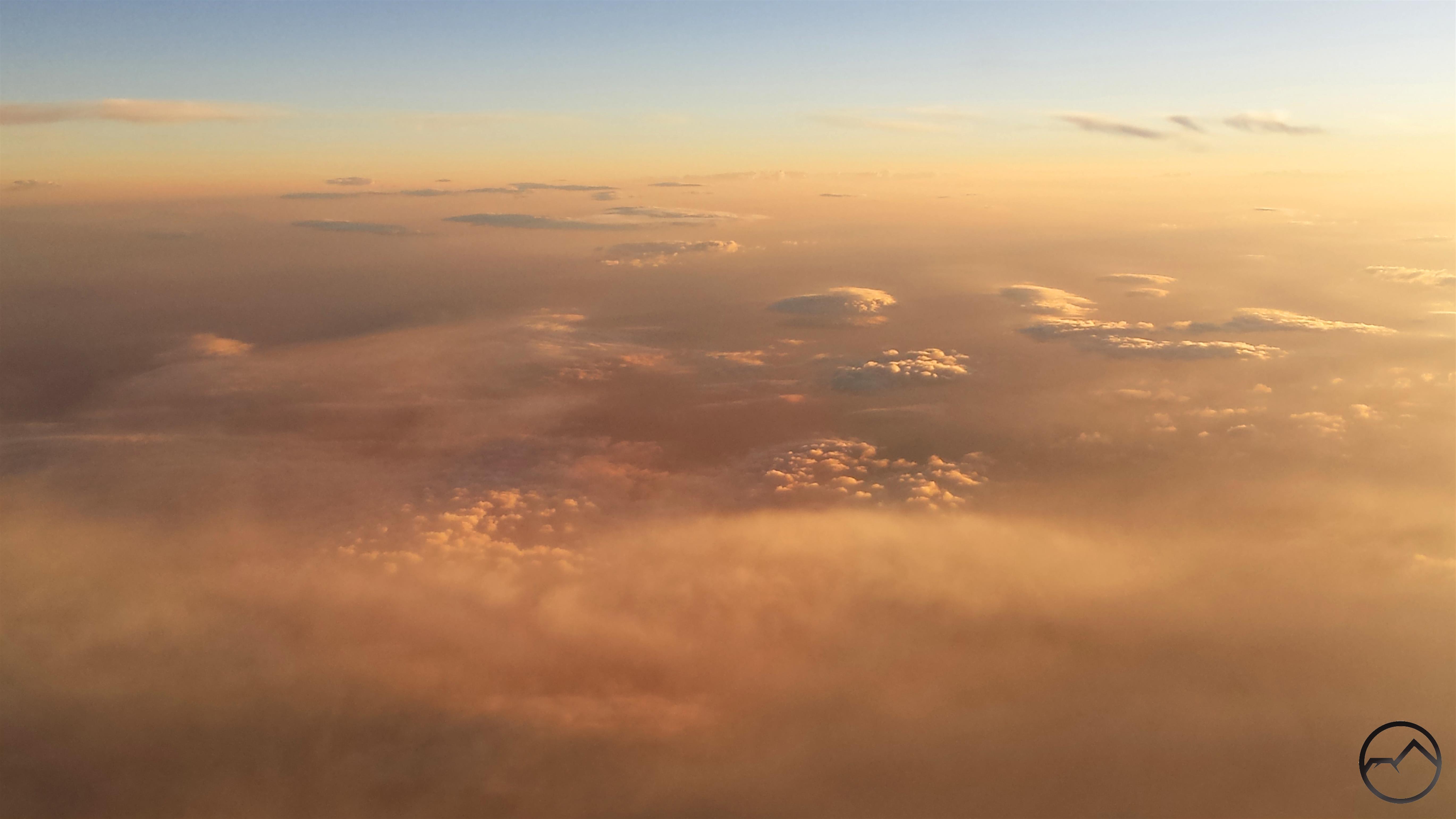
My predawn flight let me watch the sunrise from the air. It was magnificent. However, smoke covered much of the Southwest. It began halfway between Dallas and the New Mexico border an continued, for varying degrees, all the way to San Francisco Bay, where it came to an abrupt halt on the eastern edge of the Bay. San Francisco was crystal clear.

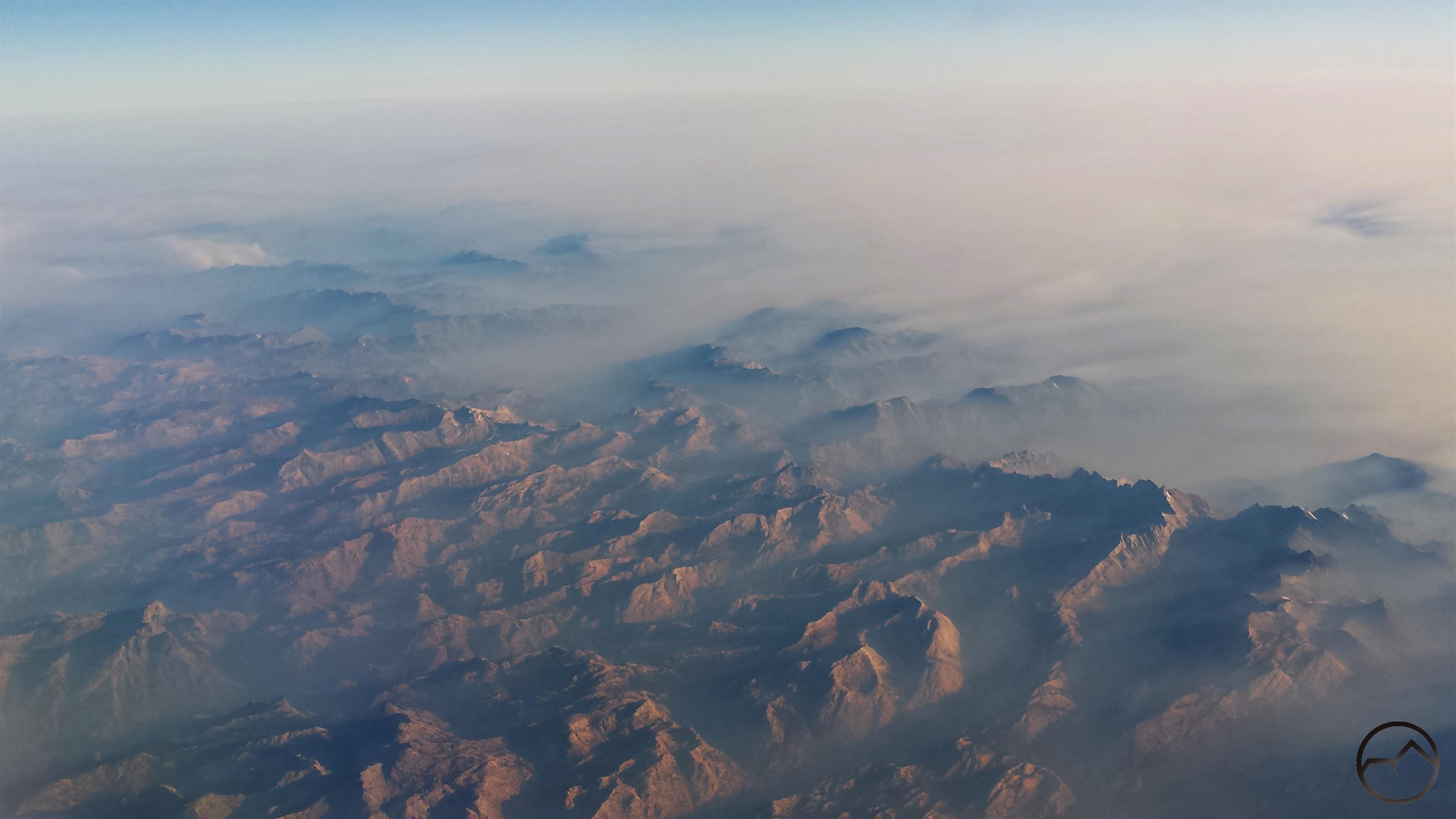
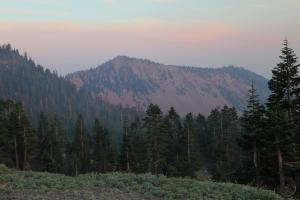
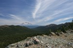
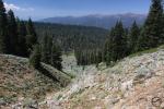
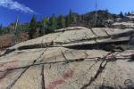
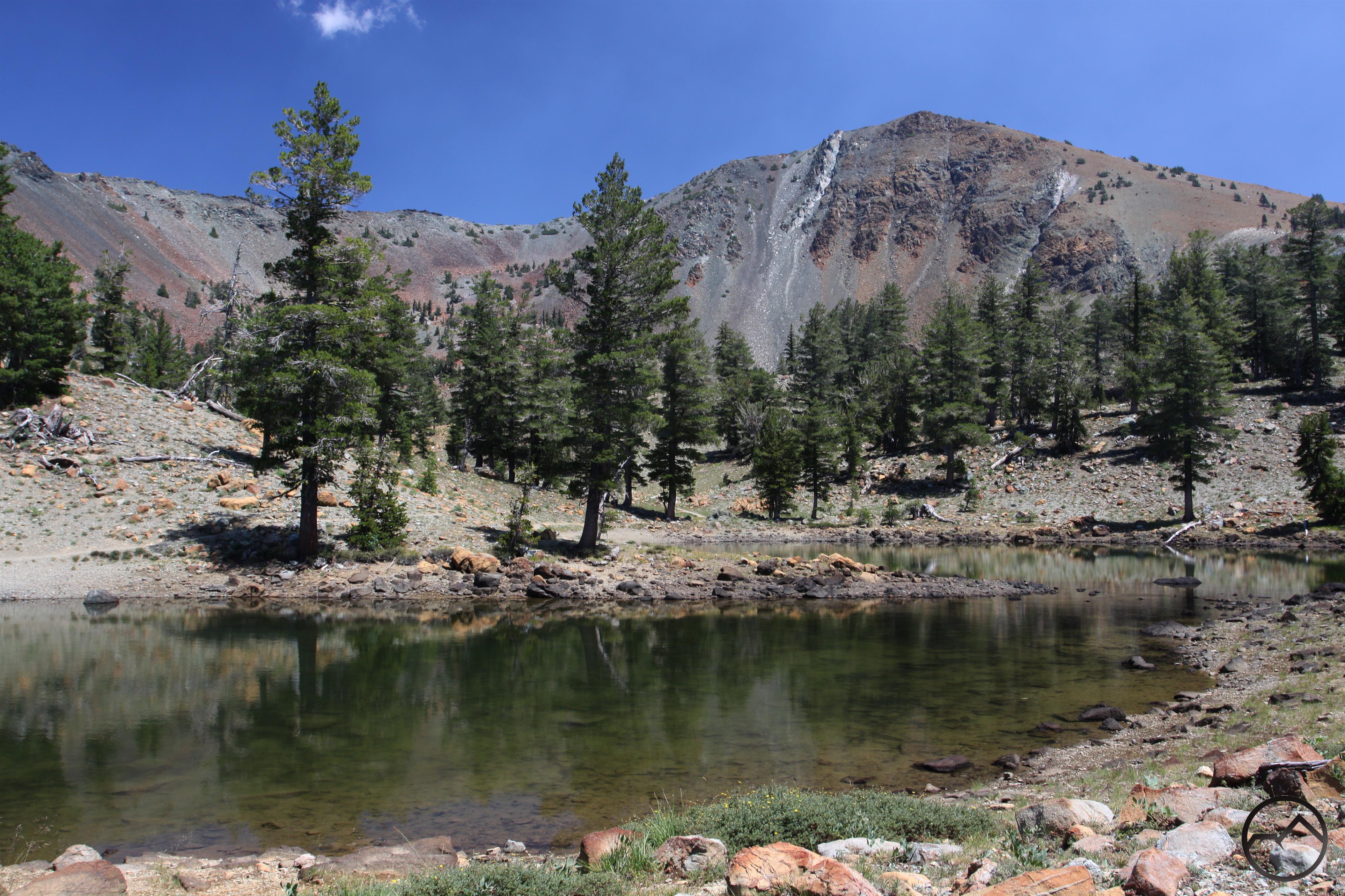
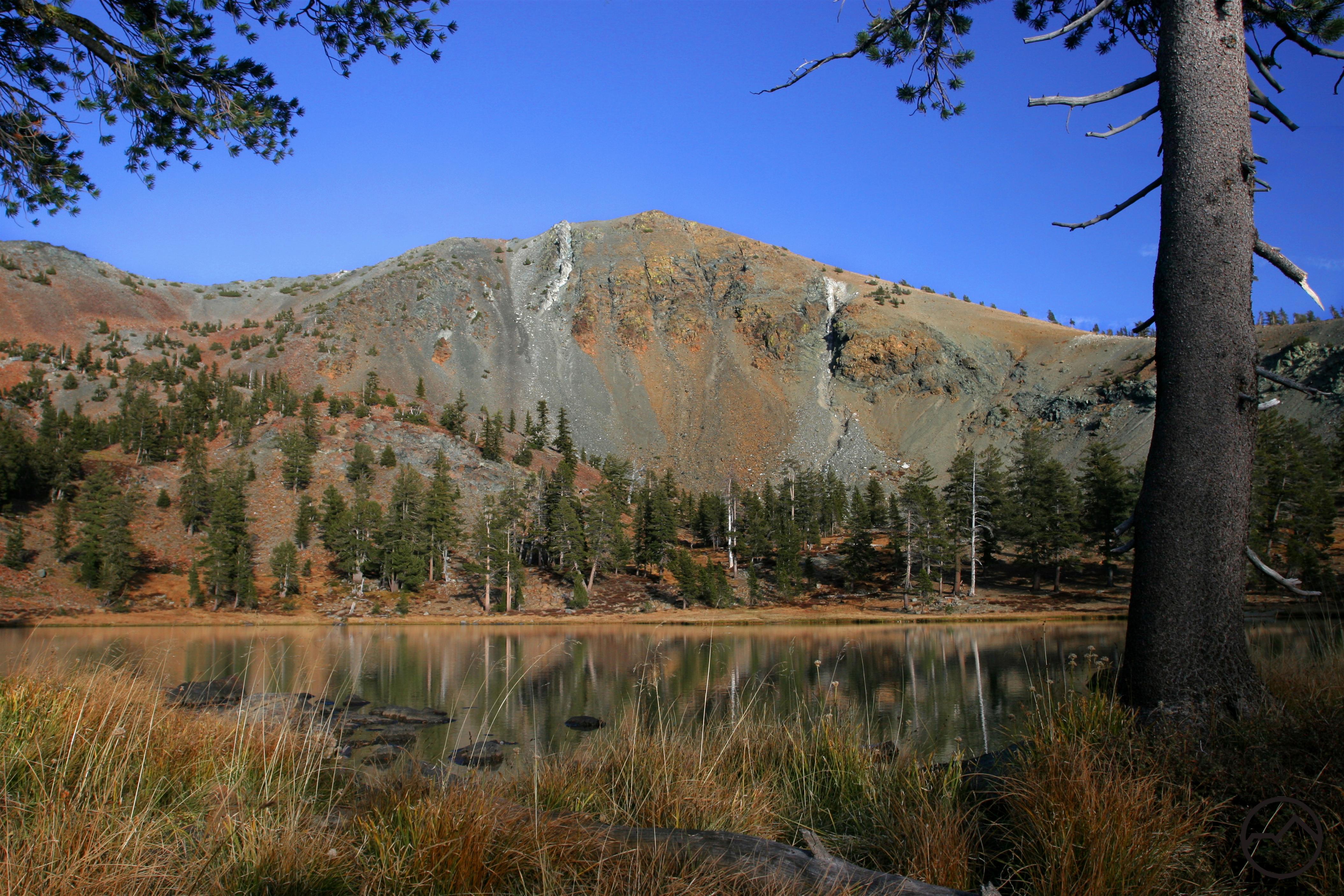
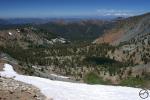
Near the end of the flight, we made a dramatic crossing of the Sierra Nevada. The bulk of the smoke covering the Great Basin was held back by the mighty mountain range. The morning light, mixed with the thin smoke over the Sierra turned the range pink. Range of Light indeed. Special credit to anyone who recognizes where this is. There are a number of good clues if anyone is a real geography nut and wants to figure it out.

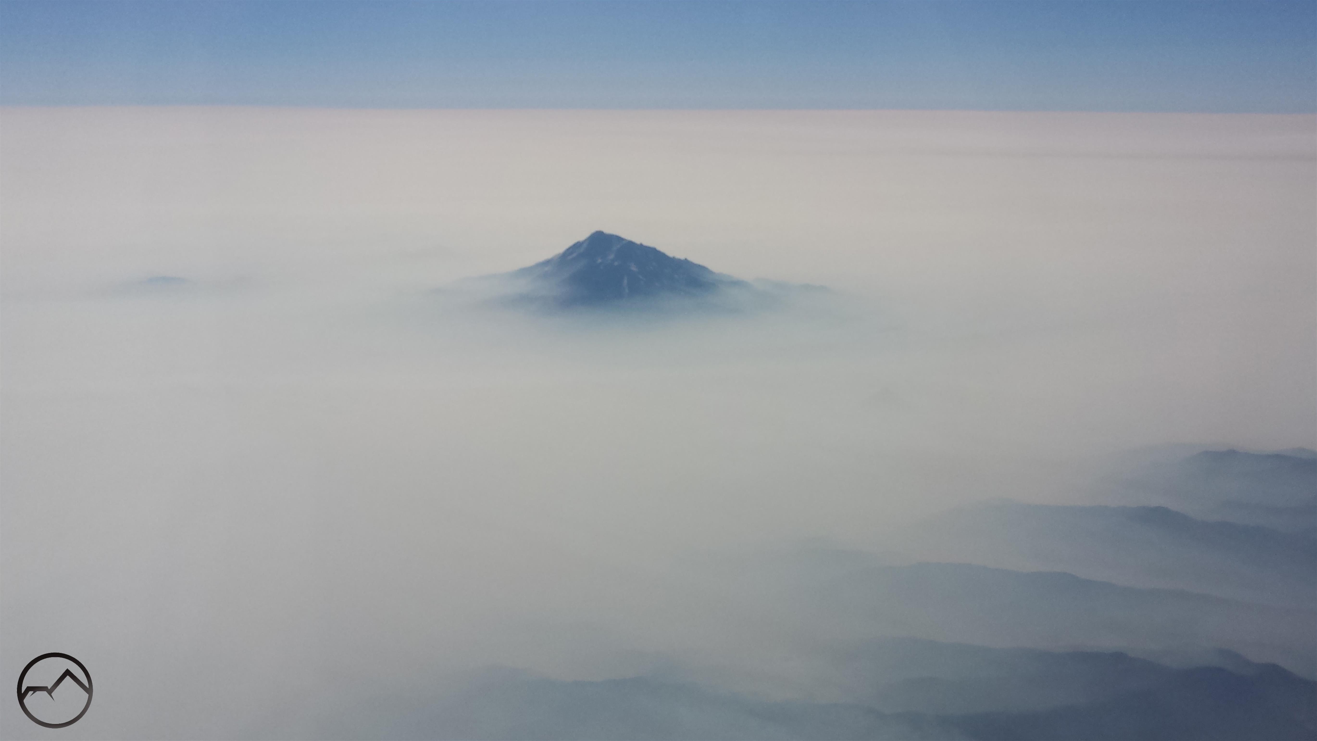
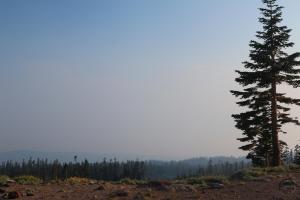
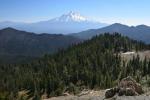
The smoke was really thick all over California, but once again, Mount Shasta rises above it. I sure will be glad when this all blows away. Though it is small consolation, this stuff is everywhere, from Texas to California, so it is not like we are particularly afflicted.

I just want to offer a special thanks to my amazing wife for such a fantastic and selfless birthday gift. I am blessed beyond words.

Carr Fire Maps (Tuesday)

Posted by bubbasuess on July 31, 2018
Posted in: Cascade Range, Hiking, Mount Shasta. Tagged: Carr Fire, Redding. 1 Comment

Tuesday morning sunrise in smoky skies above Black Butte.

I know I said yesterday was the last time I was going to post some maps from the Carr Fire. However, I came across a few more helpful maps that I reckoned might be helpful if shared. These will definitely be the last ones, since I am heading to Texas to go on a BBQ and country music odyssey with my best friend. That said, to the maps:

Live map

Destroyed structure map

The fire’s growth has slowed significantly. It has now surpassed 100,000 acres but it is also 25% contained. Here is how it looked at 8:30 AM on Tuesday:

Compare this morning with yesterday morning:

7:00 AM Monday
8:30 AM Tuesday

Another helpful map I found shows structures damaged by the fire. This map is in the process of being updated, so it is not yet exhaustive. It has much more detail when examined in the online version.

Lastly, here is a really helpful gif that illustrates the fire’s expansion. The explosion on Thursday is very reminiscent of what happened in Sonoma County with the Tubbs Fire.

Hopefully all the maps have helped. Keep praying the fire will burn itself out soon and the smoke will blow away. Lord willing!

Carr Fire Maps (Monday)

Posted by bubbasuess on July 30, 2018
Posted in: Cascade Range, Hiking, Klamath Mountains, Mount Shasta. Tagged: Carr Fire, Redding. 2 Comments

Black Butte is barely visible from my front yard on a smoky Monday morning.

Today is day 5 since the Carr Fire really blew up and sent a firestorm down into Redding. The fire started actually started a week ago but no one foresaw the way the conflagration would erupt and slow into populated areas like it did. Fortunately, the lines established in Redding have held for the three days and the fire’s eastward advance has been halted. Even better, it seems to have been halted in the south around Igo and also the growth has been significantly slowed at Buckhorn Summit, though it looks like the flames will probably reach the shore of Trinity Lake. The fire is now at 17% containment and growing. I think the corner has been turned. Unless something changes and things get worse again, this is my last collection of maps that I am going to post. I am heading to Texas in a couple of days anyway, so I am going to be offline for a while. Let us pray we are nearing the end of this fire. Then the rebuilding starts. I hope some lessons can be learned from the aftermath down in Sonoma County. I have a lot of thoughts on that.

Live map 1

Live map 2

As noted, the growth of the fire has slowed significantly. Rather than doubling in size each day from Wednesday to Saturday, it only grew around 6% on Sunday and containment has been increasing. The real hotspots now are at Buckhorn Summit and in the north, approaching Trinity Lake. The real effort now is to keep the fire out of Trinity County. Here is how things look as off 7:00 AM this morning:

There are still some hotspots on the south and east but it looks like the danger is past for Redding and the surrounding communities. There is even mention of evacuees returning home soon.

For what it is worth, here is a comparison of the fire’s position from about 8:30 last night with this morning:

8:30 PM Sunday
7:00 AM Monday

Also, I think the map below is really helpful in seeing the progression of the fire. It is only current up to about Sunday morning, but it shows the major evolutions of the fire:

Sadly, Whiskeytown Lake looks like is in the center of a fire donut. Cue Johnny Cash. It is evident that nearly 100% of the Whiskeytown National Recreation Area burned. That is a lot of visitor center, marina, campgrounds, trails, etc. that are lost. I was even wondering if there is an archived version of the audio of JFK’s speech that he gave at the opening of the park. It was used as part of one of the displays and I am guessing it burned. Hopefully it can be replaced. It will be interesting to see how the National Park Service responds to this disaster.


Carr Fire Maps (Sunday)

Posted by bubbasuess on July 29, 2018
Posted in: Cascade Range, Hiking, Mount Shasta. Tagged: Carr Fire, Redding. 4 Comments

Looking south from the Old Ski Bowl on Mount Shasta into a wall of smoke.

Yesterday things were relatively clear here in Mount Shasta, as evidenced by a beautiful evening at the Old Ski Bowl. The winds have evidently shifted because the smoke is thick up here this morning. I have been checking on the fire’s progress this morning and it seems that the advance of the fire continues to slow. I want to issue a caveat on two points though. First, I may simply be reading the data incorrectly. Second, there is a red flag warning issued for this afternoon down in Redding because it is supposed to be hot and windy. This means the even if the fire has slowed, it can still be whipped up into a firestorm again. Let’s pray that does not happen.

Live map 1

Live map 2

Checking on the fire conditions last night, it showed the fire slowing its advance considerably. The lines holding it back in Redding continued to hold, but the focus of threat had now shifted north and, even more urgently, south to the town of Igo. This small community was held in a salient, with fire lines being set on three sides. This morning, it appears that this is still the case, with no significant fire movement in the last several hours around Igo. Compare maps from 10:00 PM Saturday and 6:00 AM Sunday:

10:00 PM Saturday
6:00 AM Sunday

Update: The heat has already intensified significantly between 6:00 AM and 8:00 AM. Note the difference:

6:00 AM Sunday
8:00 AM Sunday

Note that now, the fire’s most intense points are to the west and north, though it does not look as intense as it did last night. Nonetheless, evacuations have been ordered for parts of Lewiston and Douglas City in Trinity County. Compared to the land around Igo, which is rather flat and not densely vegetated, the terrain heading west is very rugged, with dense woods and chaparral. Fire lines are much harder to cut and hold.

These other maps confirm these conditions:

I haven’t been able to find out what the red dots mean, but the area and intensity of the fire is evident.

The newest areas on the map show small advance near Igo but more to the west and north.

I am praying the lines at Buckhorn Summit hold. If the fire jumps that, it is a straight shot down to the heart of Trinity County.

The blood moon event occurred Friday night but we still had one last night due to the smoke.

Update: I definitely could be reading this map wrong and is not my intent to spread rumors or incorrect information. That said, this map looks like the fire is easing its intensity. It certainly does not show much fire growth. I really hope this is the case!

Update: This map is a few hours old but it gives a good look at the full extent of the where the fire has burned.

Above The Smoke (Almost) And A Fire Update.

Posted by bubbasuess on July 28, 2018
Posted in: Cascade Range, Hiking, Mount Shasta. Tagged: Carr Fire, Redding. 1 Comment

A smoky sunset on Mount Shasta. 

With the Carr Fire continuing to expand, I was anticipating the sky to be smoky around Mount Shasta. Surprisingly, the smoke was pretty thin and the sky blue. The hike to Cliff Lake with the Cub Scouts was a lot of fun.

Since the smoke was relatively (emphasis on the relatively) sparse, I took my family up for a picnic dinner at the Old Ski Bowl. We figured thin smoke would get thinner and the temperatures were bound to be cooler. This proved to be the case and the conditions were quite nice. However, there was a wall of smoke to the south, obscuring almost everything from view. Mount Eddy and Porcupine Peak were visible but only through a very thick haze. Everything else to the south was obscured by an utterly impenetrable wall of smoke. My kids had a great time scrambling on the rocks, oblivious to the ongoing ordeal continuing to the south. I almost felt guilty enjoying the moment.


The smoke was visible above Gray Butte.

Clear skies were visible to the west.
The smoke caused some unusual light to be cast on Mount Shasta at sunset.

If you are looking to escape the smoke, heading up onto Mount Shasta or the Trinity Divide appears to be a good option.

As far as what the fire did today, it seems to have slowed its advance to some degree. The live map shows some advance to the south, but the firefighters look to be making a strong stand at what I would call the Igo Salient. The small community is threatened on three sides but the backfires lit earlier today will hopefully keep the main part of the fire at bay.

The Carr Fire as of 10:00 PM

Hopefully the significant decrease in the red area is indicative of the fire activity decreasing somewhat. I would imagine that the gentler terrain, less dense vegetation and more road access will make containing the fire much easier in the south. We’ll know tomorrow morning. Keep praying.

Carr Fire Maps (Saturday)

Posted by bubbasuess on July 28, 2018
Posted in: Cascade Range, Hiking, Klamath Mountains, Mount Shasta. Tagged: Carr Fire, Redding. 6 Comments

A massive, lenticular-laden pyrocumulus clouds builds above the Carr Fire. Source.

It seemed my last post rounding up maps showing the current conditions for the Carr Fire was helpful. Consequently, I am starting another one to continue monitoring the fire’s progress.

Live map

So, as far as I can tell, the lines in west Redding have held and the fire has not been able to push further into the city. However, the fire continues to expand both to the north and, more significantly, to the south. This is unfortunate, since it means a lot of beautiful terrain in Whiskeytown is going to burn. Better this than the city, but it is still sad.

As the map itself notes in the key, the red dots indicate the fire is moving south. Evacuations orders for Igo and Ono have been ordered. According to the map, the threat to Igo looks imminent. Fortunately, the terrain really levels out south of Igo and there is a lot more road access to the area and less dense vegetation so cutting in some fire lines down there to contain the fire might be a lot easier.

The movement of the fire is confirmed on the live map, which I captured at 7:15:

It looks like the fire is overtaking Shasta Bally, which is unfortunate. At the very least, Whiskeytown is going to have to be rebuilt from the bottom up, which is to say nothing of the hundreds of homes already lost.

For those of us not in the immediate fire zone, here is a look at what the smoke has been looking like:

Strangely enough, it isn’t too smoky out right now, here in Mount Shasta. This is good, since I am leading the Cub Scouts on a hike to Cliff Lake this morning. The smoke is thin right now and I think we will be high enough to not have much around at all up there. It is thankfully cool too, so the hike should be a good one for the kids.

I will check back in later today with some more map updates. Pray the fire lines in Redding hold and for all the people holding them!


Some Current (Friday Morning) Maps Of The Carr Fire

Posted by bubbasuess on July 27, 2018
Posted in: Cascade Range, Hiking, Mount Shasta. Tagged: Carr Fire, Redding. 4 Comments

Not a blood moon yet, but red from the fire in Redding. I stayed up following the fire and captured some images of the moon around 2:30, when things in Redding seemed the worst. 

The fire in Redding is devastating. The city remains under threat and several homes and other buildings have been consumed by the flames. Thankfully it seems that the city’s doom that seemed inevitable last night did not in fact happen. The fire is close to the downtown area and many neighborhoods but so far it seems to have held back from the densest parts of town. This is good, since in the light, the full weight of the firefighting efforts can now be brought to bear on the conflagration.

Update: Here is a really good continuously updated map of the fire.

It has been frustrating this morning, trying to get a handle on where the flames are at. I finally found a good map showing the extent of where the fire has burned up until now. Hopefully this helps:

This fire shows the full 44,000 acres of the Carr fire. The Oak Bottom area at Whiskeytown is completely destroyed. Most dangerous of all is the fire’s encroachment on Redding. The towns of Keswick and Shasta are withing the fireline, as well as numerous semi-densely populated areas. Unfortunately the historic buildings at Shasta State Historic Park have burned. Hopefully the brick structures will still be standing.

Here is a map showing the fire activity closer to Redding:

Obviously some populated areas are heavily impacted by the fire. Along with homes, the prettiest section of the Sacramento River Trail has burned. Some homes along Harlan, just west of Caldwell Park have burned. As of this morning, three homes along the rim of the Sacramento River Canyon just west of Shasta High School also burned. Fortunately, the rest of that neighborhood was saved. That seems to be the line being held by firefighters at this point. Hopefully none of this information is out of date and things have gotten worse.

Last night seemed like a bad replay of what happened in Sonoma and Napa Counties last October. My parents lost their home in that fire. It is a frightening reminder that it can happen here in Mount Shasta too. I am praying that it doesn’t. I am praying for Redding too.

Update: Here is a new map showing areas burned today:

Update: I love lenticular clouds, but not like this:

Found here.

Update: This seems to have been the current position of the fire as of 8:45 PM. It looks like they have been able to hold the line at Keswick Lake and Quartz Hill on the east side of the Sacramento River. On the west side, the line at Lake Mary looks like it is holding for now but the fire has spread further to the south. It is supposed to be windy tonight and hot tomorrow. This is a critical moment for Redding. Psalm 121.

Pacific Crest Trail / Mount Shasta Trail Town Kick Off Today!

Posted by bubbasuess on July 21, 2018
Posted in: Cascade Range, Hiking, Klamath Mountains, Lakes, Mount Shasta, Pacific Crest Trail, Rivers. Leave a comment

Today is the kick off festival for the Pacific Crest Trail Association’s Trail Town program and it is taking place here in Mount Shasta. We are fortunate to have been the very first community along the PCT to be selected for recognition as a Trail Town. There will be an event downtown today with lots of displays and exhibits. Even better, there will be lots of people getting together over their love for the PCT and hiking in general. It should be a great event!

I will be there too with a booth. I will be selling copies of my books, PCT shirts and also putting on a knot tying exhibit.

I hope everyone has enjoyed the PCT Spotlight I developed over the course of the last week. Each Spotlight focused on a different section of the PCT near Mount Shasta that featured gorgeous scenery and spectacular destinations. We really are fortunate that this most spectacular trail in the world passes by Mount Shasta and our local mountains enhance the trail’s beauty.

The five trails I focused on are:

The McCloud River from Ash Camp to Ah-Di-Na

Burstarse Falls

Porcupine and Toad Lakes

Deadfall Basin

The Cement Bluff and Bluff Lake

A Pacific Crest Trail Gallery

The McCloud River from the PCT crossing.
Large cataract on the McCloud River
Squaw Valley Creek
PCT bridge over Squaw Valley Creek

Castle Crags from the PCT.
Cliffs of the Crags
The Grey Rocks rise above Castle Creek Valley.

One of the smaller waterfalls on Burstarse Creek.
Lower Burstarse Falls
Castle Crags from the PCT, near the Soapstone Trail

Mount Shasta from the PCT, near the Soapstone Trail
Mount Shasta and Mount Eddy from the PCT above Seven Lakes Basin.
PCT view of Seven Lakes Basin.
Upper Seven Lake

Picayune Lake
Fawn Creek Canyon from the PCT.
Porcupine Peak and Mount Eddy.

Meadow along the PCT.
The Castle Crags Wilderness from the PCT
Porcupine Lake
Toad Lake from the PCT junction.

“Foxtail Basin” beneath Mount Eddy.
The Scott Mountains from the PCT.
A gorgeous spring alongside the PCT.

Looking down on Deadfall Meadow.
Deadfall Basin along the PCT.
Mount Eddy and Upper Deadfall Lake
China Mountain above High Camp Basin

High Camp Basin below the PCT.
Mount Shasta seen from the ridge above the PCT.
High Camp Basin below the PCT.
Natural graffiti along the trail.

China Mountain and High Camp Basin.
Bluff Lake
Bluff Lake and High Camp Basin

Mount Eddy from the Cement Bluff.
The Cement Bluff above Bluff Lake.
View east from summit of Cory Peak
Bull Lake along the PCT.

PCT Spotlight – Cement Bluff

Posted by bubbasuess on July 20, 2018
Posted in: Cascade Range, Hiking, Klamath Mountains, Lakes, Mount Shasta, Pacific Crest Trail, Scott Mountains, Water. 1 Comment

The Cement Bluff is a fascinating presence above Bluff Lake.

The final PCT Spotlight focuses on a beautiful section of trail that travels from Parks Creek Pass to the Cement Bluff. This part of the PCT sees significantly fewer day hikers than the other portions featured in this blog series, despite beginning at the popular Parks Creek trailhead. This is probably due to the obscurity of the Cement Bluff and small Bluff Lake, which lies at the foot of the odd formation.

High Camp Basin below the PCT.

The hike to the Cement Bluff is the first section of the PCT to pass through the Scott Mountains, leaving the Trinity Divide behind at Parks Creek Pass. Though it is about 10 miles round trip from the trailhead to the Cement Bluff and back, it is a remarkably easy trip due to the level grade of the trail. The path makes a sweeping arc around High Camp Basin. This large bowl, along with adjacent Deadfall Basin, is the headwaters of the mighty Trinity River, which flows west for 165 miles to its confluence with the Klamath Mountains. Along the arc of the PCT, the trail passes through mostly open terrain, revealing many excellent views of the remote Scott Mountains. The destination for the hike is the fascinating Cement Bluff formation and small Bluff Lake. The Cement Bluff rises 300 feet over the lake. Its exposed cliff is composed of numerous boulders, both massive and small accreted together. It is a beautiful and unusual site.

Bluff Lake and High Camp Basin

This portion of the PCT is great for hikers willing to make the push all the way to the Cement Bluff. The views of High Camp Basin and China Mountain are excellent throughout. There is also a rarely seen but great perspective on Mount Eddy and Deadfall Basin from the top of the Cement Bluff. For hikers willing to do a little off-trail scrambling there is also a really good perspective on Mount Shasta from the ridge above the trail on the east side of High Camp Basin. If there is a real drawback to this hike, it is the lack of a maintained route descending from the PCT down to Bluff Lake. There is an obvious, established path descending down to the lake but it is steep and not a lot of fun climbing back up. Nonetheless, it is worth the effort to get to the small lake. It is beautiful in its own right but the view of the Cement Bluff’s strange cliff is one of the more unique settings in the Mount Shasta area and one not many people get to enjoy.

High Camp Basin below the PCT.
Mount Shasta seen from the ridge above the PCT.

Forest along the trail.
Cliffs line the rim of the basin, above the PCT.
Natural graffiti along the trail.

China Mountain and High Camp Basin.
Mount Eddy from the Cement Bluff.

Bluff Lake
Bluff Lake and High Camp Basin
The Cement Bluff above Bluff Lake.

PCT Spotlight – Deadfall Basin

Posted by bubbasuess on July 19, 2018
Posted in: Cascade Range, Hiking, Klamath Mountains, Lakes, Meadows, Mount Eddy, Mount Shasta, Pacific Crest Trail, Trinity Divide. Tagged: Deadfall Basin. 1 Comment

An unnamed lake below Mount Eddy in Deadfall Basin.

For the fourth installment of the PCT Spotlight, it is imperative to feature the hike to Deadfall Basin. This section of trail ranks in the upper echelon of Mount Shasta Trails, alongside other area classics like Heart Lake, Black Butte, and South Gate Meadow. The reasons for its renown are many and include excellent views, lush meadows, gorgeous mountain lakes and the chance to ascend Mount Eddy, where astounding summit vistas await.

The Scott Mountains from the PCT.

The hike on the PCT to Deadfall Basin is an easy journey. The trail maintains a very gentle, steady grade for a few miles before arriving at the edge of the basin. However, despite the ease in getting there, it is one of the prettiest trails around. This part of the PCT is graced with numerous springs, which result in some extremely lush patches of meadow. Wildflowers are accordingly abundant. The trail also boasts many excellent views, most notably of the Scott Mountains, which lie to the west on the far side of the Trinity River. Once in Deadfall Basin, cliffs rise dramatically overhead and numerous lakes dot the landscape. Most notable are Lower, Middle and Upper Deadfall Lakes. From the upper lake, a trail continues on to the summit of Mount Eddy, which looms prominently over the basin.

Mount Eddy and Upper Deadfall Lake

This is a great section of the PCT. For hikers making the entire journey, this is the final portion of a roadless section that stretches north from Gumboot Saddle to Parks Creek Pass (the trailhead for the hike to Deadfall Basin). Most hikers, however, will hike south from Parks Creek and enter the basin from the north. Whether coming from the north or south, Mount Eddy has featured prominently from the trail for quite some time. Despite this, it is also when in Deadfall Basin that Mount Eddy presents its most inspiring visage. Here the mountain, the tallest in the entire Klamath Mountains, rises dramatically to a single point, showing off its multi-colored geology in spectacular fashion.

Mount Shasta and the Cascades seen from Mount Eddy.

Though not a part of the PCT itself, the hike to the top of Mount Eddy deserves special mention here. After hiking through Deadfall Basin, a trail climbs up to the mountain’s summit. The view from this point is probably the most spectacular in the North State. The area it encompasses is immense, stretching from Lassen Peak in the south to deep into Oregon in the north. All around the peak are the numerous ranges of the Klamath Mountains, all of which are visible from the summit. Most prominent, though is the magnificent bulk of Mount Shasta, which lies only a few miles to the east, dominating everything.

The Scott Mountains from the PCT.
Looking down on Deadfall Meadow.
A small waterfall below the PCT.

A gorgeous spring alongside the PCT.
The trail crosses a lively stream.
Deadfall Basin along the PCT.

An unnamed lake in Deadfall Basin.
Mount Eddy and Upper Deadfall Lake
Foxtail pines on Mount Eddy.

Deadfall Lakes Basin
North from Mount Eddy

The heart of the Klamath Knot.
Looking down on the Trinity Divide from Mount Eddy.

Posts navigation

← Older Entries
Newer Entries →
    • Recent Posts

      • Winter Shows Up When It Will
      • January Rolled By With Mud, Then Very Dry
      • Mount Shasta 2025 – A Year In Images
      • Mount Shasta On Either Side Of Christmas
      • Adrift In An Ocean Of Fog
      • December Has Been Spectacular Thus Far Pt. II (A Magnificent Lenticular)
      • December Has Been Spectacular Thus Far Pt. I
      • Lenticular Interrupted
      • A Stormy Wave And A Truchas Sunset
      • Aurora Lenticularis
    • Enter your email address to follow Hike Mt Shasta and receive notifications of new posts by email.

    • Archives

      • February 2026
      • January 2026
      • December 2025
      • November 2025
      • October 2025
      • September 2025
      • August 2025
      • July 2025
      • June 2025
      • May 2025
      • April 2025
      • March 2025
      • February 2025
      • January 2025
      • December 2024
      • November 2024
      • October 2024
      • September 2024
      • August 2024
      • July 2024
      • June 2024
      • May 2024
      • April 2024
      • March 2024
      • February 2024
      • January 2024
      • December 2023
      • November 2023
      • October 2023
      • September 2023
      • August 2023
      • July 2023
      • June 2023
      • May 2023
      • April 2023
      • March 2023
      • February 2023
      • January 2023
      • December 2022
      • November 2022
      • October 2022
      • September 2022
      • August 2022
      • July 2022
      • June 2022
      • May 2022
      • April 2022
      • March 2022
      • February 2022
      • January 2022
      • December 2021
      • November 2021
      • October 2021
      • September 2021
      • August 2021
      • June 2021
      • May 2021
      • April 2021
      • March 2021
      • February 2021
      • January 2021
      • December 2020
      • November 2020
      • October 2020
      • September 2020
      • August 2020
      • July 2020
      • June 2020
      • May 2020
      • April 2020
      • March 2020
      • February 2020
      • January 2020
      • December 2019
      • November 2019
      • October 2019
      • September 2019
      • August 2019
      • July 2019
      • June 2019
      • May 2019
      • April 2019
      • March 2019
      • February 2019
      • January 2019
      • December 2018
      • November 2018
      • October 2018
      • September 2018
      • August 2018
      • July 2018
      • June 2018
      • May 2018
      • April 2018
      • March 2018
      • February 2018
      • January 2018
      • December 2017
      • November 2017
      • October 2017
      • September 2017
      • August 2017
      • July 2017
      • June 2017
      • May 2017
      • April 2017
      • March 2017
      • February 2017
      • January 2017
      • December 2016
      • November 2016
      • September 2016
      • August 2016
      • July 2016
      • June 2016
      • May 2016
      • April 2016
      • March 2016
      • February 2016
      • January 2016
      • December 2015
      • November 2015
      • September 2015
      • August 2015
      • July 2015
      • June 2015
      • May 2015
      • April 2015
      • March 2015
      • February 2015
      • January 2015
      • December 2014
      • November 2014
      • July 2014
      • June 2014
      • May 2014
      • April 2014
      • March 2014
      • February 2014
      • January 2014
      • December 2013
      • November 2013
      • October 2013
      • September 2013
      • August 2013
      • July 2013
      • June 2013
      • May 2013
      • April 2013
      • March 2013
      • February 2013
      • January 2013
    • Categories

      • Boy Scouts
      • Cascade Range
      • Castle Crags
      • Desert
      • Echo Point
      • Glaciers
      • Hiking
      • How things came to be…
      • Klamath Mountains
      • Konwakiton Outdoor Designs
      • Lakes
      • Lenticular Clouds
      • Maps
      • Marble Mountains
      • Meadows
      • Mount Eddy
      • Mount Shasta
      • Mount Shasta History
      • Napa County
      • Off Season Trails
      • Pacific Crest Trail
      • Peaks
      • Rivers
      • Rock Climbing
      • Scott Mountains
      • Seldom Seen
      • Shasta Valley
      • Sierra Nevada
      • Siskiyou Mountains
      • Sonoma County
      • Spring Trails
      • sunrise
      • sunset
      • Trinity Alps
      • Trinity Divide
      • Truchas Ridge
      • Uncategorized
      • Water
      • Waterfalls
      • Wilderness
      • Wildflowers
      • Wine Country
      • Winter Trails
      • Yosemite
    • Meta

      • Create account
      • Log in
      • Entries feed
      • Comments feed
      • WordPress.com
    • Copyright © 2013-2024 by Bubba Suess

      DISCLAIMER: Any use of the information contained in this site by any and all persons is done at their own risk. The operator of this site shall be held harmless from any and all alleged claims, demands, causes of action, liability, loss, damage and/or injury to property or persons whether brought by an individual or other entity. This indemnification applies, without limitation, to all actions by an individual or other entity as a result of their use of information contained in this site.

    Blog at WordPress.com.
    Hike Mt. Shasta
    Blog at WordPress.com.
    • Subscribe Subscribed
      • Hike Mt. Shasta
      • Join 983 other subscribers
      • Already have a WordPress.com account? Log in now.
      • Hike Mt. Shasta
      • Subscribe Subscribed
      • Sign up
      • Log in
      • Report this content
      • View site in Reader
      • Manage subscriptions
      • Collapse this bar
     

    Loading Comments...