Hike Mt. Shasta

Exploring the Mount Shasta Region

  • Home
  • Trails
    • Mount Shasta Trails
      • Brewer Creek Trail
      • Clear Creek Trail
      • Gray Butte Trail
      • Green Butte Ridge Trail
      • Horse Camp Trail
      • North Gate Trail
      • Old Ski Bowl Trail
      • Panther Meadow Trail
      • South Gate/Squaw Meadow Trail
      • Whitney Falls Trail
    • Trinity Divide Trails
      • Blue Divide Trail
      • Castle Lake Trail
      • Castle Lake Shore Trail
      • Cliff Lake Trail
      • Deadfall Lakes Trail
      • Gray Rock Lakes Trail
      • Gumboot Trail
      • Heart Lake Trail
      • Porcupine & Toad Lakes Via Pacific Crest Trail
      • Seven Lakes Basin Via Pacific Crest Trail
      • Sisson-Callahan Trail
      • Soapstone Trail
      • South Mumbo Scramble
      • Tamarack Lake Trail
      • Toad Lake Trail
    • Castle Crags Trails
      • Burstarse Falls Via Pacific Crest Trail
      • Castle Dome Trail
      • Flume Trail
      • Lower Castle Crags Via Pacific Crest Trail
      • Root Creek Trail
    • Scott Mountains Trails
      • Bluff Lake & Cement Bluff via Pacific Crest Trail
      • Caldwell Lakes Trail
      • China Mountain Scramble
      • Cory Peak and Bull Lake via Pacific Crest Trail
    • Cascade Crest
      • Ash Creek Butte Scramble
      • Goosenest Trail
      • Juanita Lake Trail
      • Orr Lake Trail
    • Mount Shasta City Area Trails
      • Black Butte Trail
      • Box Canyon Trail
      • Gateway Trail
      • Lake Siskiyou Trail
      • Mount Shasta City Short Trails
      • Ney Springs Canyon Trail
      • Spring Hill Trail
    • Shasta Valley Trails
      • Black Lava Trail
      • Haystack Trail
      • Lake Shastina Trail
      • Pluto Cave Trail
      • Trout Lake Trail
      • Yellow Butte Trail
    • Sacramento River Trails
      • Dunsmuir Trail
      • Hedge Creek Falls Trail
      • Sacramento River Trail
      • Sims History Trail
    • McCloud River Trails
      • Ash Camp To Ah-Di-Na Via Pacific Crest Trail
      • McCloud River Falls Trail
      • McCloud River Preserve Trail
      • Squaw Valley Creek Trail
      • McCloud River Trail: Algoma Camp to Nitwit Camp
      • McCloud River Trail: Nitwit Camp to Cattle Camp Swimming Hole
      • McCloud River Trail: Cattle Camp Swimming Hole to Camp 4
      • McCloud River Trail: Camp 4 to Upper McCloud Falls
      • McCloud River Trail: Pine Tree Hollow Loop
    • Trails Further Afield
      • Trinity Alps Trails
        • Bear Lakes Trail
        • Billys Peak Trail
        • Boulder Creek Lakes Trail
        • Boulder Lake Trail
        • Canyon Creek Trail
        • Caribou Lakes Trail
        • East Boulder Lake Loop
        • East Weaver Lake Trail
        • Four Lakes Loop
        • Granite Peak Trail
        • Grizzly Creek Trail
        • Gulch Lakes Loop
        • Hidden Lake Trail
        • South Fork Lakes Trail
        • Stoddard Lake Trail
        • Stoney Ridge Trail
        • Tangle Blue Lake Trail
      • Warner Mountains
        • Emerson Creek Trail
        • Highgrade Trail
        • Patterson Lake Via Warner Summit Trail
        • Pine Creek Trail
        • Squaw Peak Trail
  • Articles
    • Trails By Area
      • Mount Shasta
        • Vistas, Meadows And Waterfalls: Three Best Hikes On Mount Shasta
        • The End Of The Road: Three Hikes In The Old Ski Bowl Area
        • Two Trails From Bunny Flat
        • Three Trails On Mount Shasta’s East Side
        • Mount Shasta’s Hummingbirds
      • Trinity Divide
        • Great Lakes: Top Five Lake Basins In The Trinity Divide
        • The Headwaters Of The South Fork Of The Sacramento River
        • Neglected Headwaters: Two Lesser Lake Basins On The South Fork
        • Gumboot Saddle: Two Hikes On The PCT
        • Descent Into Mystery: The Sisson-Callahan Trail
        • Mumbo Basin – Overlooked On The West Side
        • The Headwaters Loop: A Proposed Backpacking Loop In The Trinity Divide
      • The McCloud River
        • The McCloud River Trail
      • Shasta Valley
        • Jewels In The Desert
      • Scott Mountains
        • Great Scott! Two Scott Mountains Hikes On The PCT
      • Trinity Alps
        • Carubou Lakes: Trinity Alps On A Grand Scale
        • Switchbacks To Heaven: The Trinity Alps’ Stoney Ridge Trail and Four Lakes Loop
        • Trinities In Proximity: Two Trinity Alps Trails With Easy Access From Mount Shasta
        • Trails in the Carter Meadows Area
        • Trinity Alps Views of Mount Shasta
        • The Psychological Value Of The Trinity Alps
    • Waterfalls
      • Three Waterfalls On Mount Shasta
      • McCloud River Waterfalls
      • Sacramento River Waterfalls
      • Trinity Divide Waterfalls
      • Trinity Alps Waterfalls
      • Avoiding A Dry Whitney Falls
    • Off Season Trails
      • Three Winter Hikes Near Mount Shasta City
      • Winter Hikes In Shasta Valley
      • Winter Hiking In The Shasta Valley Wildlife Refuge
      • Winter Hikes On The Sacramento River
      • Winter Hikes On The Lake Siskiyou Trail
      • Spring Hikes In The Castle Crags
      • Spring Hikes On the Upper McCloud
      • Spring Hikes On The Lower McCloud River
    • Points Of Interest
      • Mount Eddy: Overshadowed, Underrated
      • Black Butte: Hiding In Plain Sight
      • Castle Dome: Steadfast And Staggering
      • Mount Shasta Hoodoos
      • Sacramento Scrambling
      • The Shasta River
      • The Castle Creek Watershed
      • Mount Shasta East Side Glacier View
      • 5 Fantastic Mount Shasta Vistas
      • 5 Highest Peaks Around Mount Shasta
      • 5 Best Hikes On Creeks And Rivers
      • 5 Interesting Footbridges
      • Three Spectacular Drive-To Sunset Vistas
    • North State Geography
      • Introduction
      • Seven Major Regions
      • The California Cascades
      • Klamath Mountains Pt. I
      • Klamath Mountains Pt. II
      • The Great Canyons Of Mount Shasta
      • Mount Shasta, Timberline, And The Relative Size Of Cascade Volcanos
      • Four Eruption Cones Of Mount Shasta
      • Mount Shasta’s Medial Moraine
    • Northern California Review
      • North Table Mountain
      • Lakes Basin Recreation Area
      • Eastern Sierra Fall Color
      • Sonoma County
      • Central Sierra Nevada
      • Orland Buttes
    • Seldom Seen
      • Ash Creek Falls
      • Mud Creek Canyon
      • Lower Mud Creek Canyon
      • Diller Canyon
      • Lower Cascade Gulch
      • The Grey Rocks
      • Castle Creek
      • Upper Wagon Creek
      • Fawn Creek Canyon
      • Confluence of the Sacramento River and Castle Creek
      • Upper Klamath River Canyon
      • Hole In The Ground Geologic Area
      • Ash Creek Butte Fossil Rock Glacier
    • Mount Shasta History
      • Vantage Lost: The Everitt Memorial Vista
      • A Yosemite-Mount Shasta Connection
      • Whitney – What’s In A Name?
      • Mount Shasta Area and the 1838 Exploring Expedition
      • A 19th Century Engraving Of An Epic Mount Shasta Vista
      • Vintage 1907 Color Photos
      • A Misleading Painting
      • A Mysterious Painting
      • A Mysterious Painting Pt. II
      • Stereographic Mt. Shasta
      • Year One Of Hike Mt Shasta
      • Year Two Of Hike Mt Shasta
      • Year Three Of Hike Mt Shasta
      • Year Four Of Hike Mt Shasta
      • Year Five Of Hike Mt Shasta
      • Year Six Of Hike Mt Shasta
      • Year Seven Of Hike Mt Shasta
    • Image Galleries
      • Mount Shasta Trails Gallery
      • Mount Shasta Sunrise Gallery
      • Mount Shasta Sunset Gallery
      • Lenticular Cloud Gallery
      • Mount Shasta NON-Lenticular Clouds
      • Mount Shasta Reflection Gallery
      • Telephoto Gallery
      • Mount Shasta Area Fall Color
      • Castle Crags Gallery
      • Waterfalls Gallery
      • Trinity Divide Lakes Gallery
      • Mount Shasta Area Rivers Gallery
      • Shasta High Desert Gallery
      • Mount Shasta GIF Gallery
    • Random Notes
      • Revew: Three Mount Shasta Trail Maps
      • A Mount Eddy Wilderness?
      • New Land Additions For The Castle Crags
      • Book Plug: Mount Shasta Area Rock Climbing
      • Exile: How I Came To Love Wilderness
  • Mt. Shasta Trail Map
  • Blog
  • About/Contact
  • Links
  • Truchas Ridge

New Book To Be Released July 1st

Posted by bubbasuess on June 1, 2017
Posted in: Cascade Range, Hiking, Mount Shasta, Sierra Nevada. Tagged: Hiking Northern California. 2 Comments

I want to announce that my latest book “Hiking Northern California” will be officially released one month from today. The book covers 80 of the best hikes in the northern 2/3’s of California. This includes the north and central coasts, the Klamath Mountains, Cascade Range and the Sierra Nevada. I even sneaked a couple of trails in the Sacramento Valley into the book! It’s not intended to be an exhaustive hiking guide like my Mount Shasta book, but rather a primer on the best trails in each of the 9 regions the book covers. No matter where you are headed in Northern California, there is going to be a great trail in the book that will be within striking distance.

This is a beautiful book. With subject matter like Northern California, it would be hard for it not to be. However, there are nearly 250 full color images in the book, so it is loaded with great visuals that draw at some of the best of what this part of the country looks like. With subject matter like Big Sur, Mount Shasta and Yosemite among many other locations, it is going to look great with such an abundance of images. Another great feature of the book is the addition of full-color topographic maps. The maps in previous books published by Falcon Guides were certainly good. Indeed, they were above average as far as hiking guide maps go. The new maps, however, are excellent. Anyone hiking any of the trails in this guide will not need to take additional maps, since the topos are embedded in the book.

Frankly, I think the book is so attractive, it works just as well as a coffee table book as it does a hiking guide. There are so many pictures in the book, many covering obscure and rarely seen destinations, that anyone unfamiliar with Northern California is going to get a pretty good idea how beautiful the northern part of the Golden State is. It was also my purpose that those who have never set out on a trail in Northern California would be able to read the book and experience the beauty vicariously through word and image. I hope it inspires people to come out here and experience this magnificent corner of the world.

I’ll have a little more to say in a month, when the book is released. For now, I also want to mention that I have built an Amazon store for HikeMtShasta. There is a link to it on the right side of the menu bar. In addition to pre-ordering my new book (or buying my Mount Shasta and Wine Country guides!) it has lots of other useful hiking guides, books on the history of Mount Shasta and other books that a recommend. I hope you will peruse the store and support this site. I really appreciate everyone reading HikeMtShasta and picking up my books. I hope you enjoy the new one!

Yosemite Waterfalls Indicative Of California’s Heavy Snowpack

Posted by bubbasuess on May 31, 2017
Posted in: Hiking, Mount Shasta, Sierra Nevada, Water, Waterfalls, Yosemite. 5 Comments

Yosemite Falls thunders down the north side of Yosemite Valley.

As June becomes imminent, the state of the snowpack across California becomes clearer. June is often the month when flows in the rivers around the state level off after the spring thaw and begin the gradual dwindling into their autumn trickles. From the Kern to the Sacramento, this is definitely not the case in 2017. Snow remains abundant at higher elevations and the increasing temperatures ensure that it is melting at a steady clip. Nonetheless, there is still deep snow in the high country and it will take a significant amount of time for it to melt out. This means the rivers, creeks and waterfalls of Northern California will remain strong and vigorous for the duration of the summer.

Memorial weekend took me to Yosemite for a wedding. Though I did not have a lot of time and was limited in my opportunities to get out by my three young kids, we had an excellent time wandering the valley and checking out the magnificent waterfalls. All of the smaller, seasonal waterfalls were flowing strongly, heightening the beauty of the already incomparable valley. The main waterfalls were also swollen and awe-inspiring. While our pre-wedding visit to the valley was great and there were surprisingly few people in the park, our post wedding foray was an eye-opening immersion into just what the crowds can be like at the park. I have been going there frequently my entire life and never experienced such a thing. Even forewarned, it was still shocking. Thankfully Mount Shasta never gets that way.

Obviously, Yosemite is not the normal beat for HikeMtShasta, but, as I have established in the past, there is a strong link between the beloved national park and Mount Shasta through John Muir. Furthermore, water has been a central theme on this blog and there are few more poetic and beautiful ways to illustrate how deep the snowpack is than to display waterfalls in Yosemite.

Click to enlarge:

Royal Arches Cascade

Yosemite Falls

Sentinel Falls

Ribbon Falls


Since this is a Mount Shasta website, it certainly is fitting to include one shot of the great mountain. I captured this one a day before heading down to Yosemite. The fact that the falls are flowing at all indicates just how much snow there is to melt up here. High water indeed!

Three Mountains And A River

Posted by bubbasuess on May 19, 2017
Posted in: Castle Crags, Hiking, Mount Eddy, Mount Shasta, Rivers, Water. Tagged: Sacramento River. 3 Comments

Mount Eddy peeks through the trees at a vigorous stretch of the Sacramento River.

I have been writing a lot lately about the Sacramento River’s activity near the Lake Siskiyou inlet. In large measure this is a result of my fascination with the history of water in the western United States (if you haven’t read Cadillac Desert, you really should). The Sacramento River is one of the linchpins of the hydrologic infrastructure in California as well as the state’s largest and longest river. Yet it is often overlooked that this most critical piece in the Golden State’s puzzle begins here in the Mount Shasta area. Indeed, though many people enjoy Lake Siskiyou or fish the river, we often forget what a powerful and important presence the river is in this area. Strangely enough, despite its relatively short length, it is often the McCloud River, with its excellent waterfalls, that is often thought of as the river of the Mount Shasta area.

Though there are probably several reasons why the Sacramento River is not appreciated as it ought to be (almost no trails along it!), I think one of the most significant is the fact that the river is perpetually overshadowed by the large mountains that rise above it. The Castle Crags, Mount Eddy and Mount Shasta all command attention and respect and the Sacramento, lacking waterfalls and its box canyon damed up, does not boast many notable features (we really need a trail to Mossbrae Falls!) to attract people to it. It is thus ironic that the Sacramento River offers some of the best views of the three most notable mountains that rise above it. It is a remarkable showcase of the amazing topography that lies at the source of California’s most important river. This, perhaps, is the river’s iconic feature but it has managed to somehow go unnoticed. This needs to be rectified.

The Castle Crags can often be hard to view from afar but the Sacramento River has spectacular vistas of the granite spires.

Mount Eddy, on whose slopes the North Fork of the Sacramento is born, is often best viewed from the Sacramento River.

Mount Shasta can be viewed from almost anywhere but the kinetic fury of the Sacramento River adds a marvelous dimension to the massive mountain. 

It continues to amaze me that there is only one developed trail that runs parallel to the Sacramento River. As these images reveal, there are numerous magnificent views of the mountains around the river waiting to be explored, discovered and enjoyed. In my last post, I brought up the possibility of extending the Lake Siskiyou Trail upstream, following the river on both sides and then crossing it by means of a permanent bridge. This would open up some of the most scenic sections of the river to hikers. It would also facilitate more exploration and rock scrambling as people explored the numerous channels the river splits into once the three forks have all combined. There is a lot of memories and beauty waiting to be appreciated along that section of the Sacramento River.

Click to enlarge:


More Damage To Lake Siskiyou Trail

Posted by bubbasuess on May 15, 2017
Posted in: Hiking, Mount Shasta, Water. Tagged: Lake Siskiyou, Lake Siskiyou Trail, Sacramento River. 4 Comments

The Sacramento River continues to erode its banks and alter the landscape.

The Lake Siskiyou Trail can’t seem to catch a break. Ever since the Sacramento River bottled up its south channel a few years ago, the inlet area where the river flows into Lake Siskiyou has gone through an annual process of erosion, soil displacement and a general alteration of the landscape. Although it is fascinating to watch the river shape the land around it, the continual changes to the inlet area has had an adverse effect on the trail. Over the last three years more and more of the pathway, as well as the gabions that support seasonal bridges, have washed away into Lake Siskiyou. The winter of 2016/2017 was no different from the previous winters. More and more of the river’s inlet area was washed away as torrential rain and melting snow flooded the Sacramento River, causing it to yet again wash more rock and earth away.

Though I have been to both the northern and southern channels this spring, I had not had a chance to cross the now flowing south channel(it has not flowed for the last two years, since it was blocked up during a flood and beginning the entire erosion process) since I had previously visited with my kids. For Mother’s Day, we decided to head back down to the south channel and let the kids play in the water, explore the wildflower-filled meadows and play in the wood forts that have been constructed at the edge of the forest. This afforded my the opportunity to cross the south channel and go examine exactly what changes occurred there.

The Lake Siskiyou Trail ends abruptly at a cutbank.

What I found was not shocking but it was impressive nonetheless. During the winter the river washed yet more land away and now flows into Lake Siskiyou by means of a seemingly perpetually deepening gully cut into the loose rock and soil of the floodplain. Entrance into the gully is now marked by a beautiful stair-step cataract. Not much of the gully was there last year, having been carved out by this winter’s torrential flows. The trail was washed out in two places. The first spot saw the trail just fade away at the edge of the lake. To pick up the extant trail required crossing a narrow isthmus of land that was only 1.5 feet wide. From there it is possible to pick the trail back up and follow it for about 30 yards before it abruptly ends at the 3 foot high cut bank. Below the unstable ledge the Sacramento River flows vigorously.

This whole area has changed considerably over the last few years. Examine the satellite images to see where the land has been washed away. Pay special attention to the river’s location, the trail and bridges as well as the location of the trees:

2013
2015
2016

These maps highlight the areas that have been washed away:

The blue highlights indicate the areas washed out in the winter of 2016/2017.

The following map shows the route of the Lake Siskiyou Trail as well as the areas that have been impacted by flooding. An alternate route for the trail is also suggested:

The yellow line is original rerouted trail circa 2016. The pink segment has been lost. Red marks an alternate route for a new trail. The path avoids the lake and the unstable parts of the inlet. 

Unfortunately, rerouting the Lake Siskiyou Trail is likely not to be a permanent solution to the constantly changing conditions at the inlet. Half the original trail has been washed away and the cutbank that has developed on the north channel will make it harder to place the seasonal bridge. Long term, I think the solution will be to extend the trail west along the Sacramento River for another 0.75 miles and then construct permanent foot bridge across the river. This would have several benefits. First, it would make the loop around the lake passable all year, rather than when the seasonal bridges can be placed. This would also lift the constant threat of the trail being washed out. Second, it would open up a new trail experience, one that would highlight one of the prettiest stretches of the Sacramento River. I think folks would hike that section by itself, not just for the sections by the lake. It would also present the opportunity to build a new trailhead along South Fork Road. Extending the trail upstream would also move things that much closer to connecting the Lake Siskiyou Trail to the Sisson-Callahan Trail. This would close one of the missing segments of my proposed Headwaters Loop. This proposal is due to get its own article soon.

For further discussion of the changed conditions at the inlet, scroll through the enlarged images and see how the trail has been washed away:

Where the seasonal bridge once stood there is now a nice cataract.
Looking toward Lake Siskiyou.
The river now loses about 3 feet where the bridge once spanned the water.

Note how the trail has been washed away at the cutbank.
The Lake Siskiyou Trail ends abruptly at a cutbank.
The trail once passed close to the new shoreline.

Only a narrow isthmus of land allows passage between the lake and a deep pool of water.
A secondary stream flows parallel to the north channel.
The secondary flow rejoins the north channel.

Storm clouds brew over Lake Siskiyou.


Sacramento River Inlet Follow Up

Posted by bubbasuess on May 9, 2017
Posted in: Hiking, Mount Shasta, Rivers, Water. Tagged: Sacramento River. 2 Comments

The Sacramento River fans out over its flood plain at the Lake Siskiyou inlet.

After yesterday’s post on the ever-changing conditions where the Sacramento River flows into Lake Siskiyou, I decided to pop back over and check out the conditions at the north channel. To recap, over the last few winters, the river has begun to reshape its path at a rapid rate. Prior to the winter of 2014/2015, the river had maintained a relatively stable course. The area was unchanged enough that construction on the Lake Siskiyou Trail was completed at the inlet. A trail and two sets of gabions for seasonal bridges were installed. The bridges crossed the river’s two channels that entered the lake. However, despite being a drought winter, sometime during one of the storms of 2014/2015, the river dammed up the southern (which was the primary) channel and shifted the entirety of its flow into the north channel. Unaccustomed to the volume of water now flowing through that area, the land gave way and much of the surface area around the north channel was scoured and washed away during high water over the next two years.

Click to enlarge and see the changes over the last few years:

2013
2016
2017

Now the barrier that impeded flow into the south channel has been breached and after two years there is water flowing through it again. It is not nearly as much as contained in the north channel but it is not an insignificant level of water. The area along what is now the Sacramento’s main stem as it flows into the lake is still being altered by the heavy water. Most specifically, the area once traveled by the Lake Siskiyou Trail after crossing the north channel has been washed away. Most of the damage was done last winter but as the river surges past an aggregate-filled cutbank it is obvious that the process of erosion is by no means complete. It is likely that the route of the trail will continue to change over the next few winters as the land it travels is washed into the lake.

Another noteworthy change is to the small creek that hikers encountered prior to reaching the rocky flood plain along the river. At one time this was a fairly large creek that required a substantial (but movable) bridge to be placed over it. The first flood to come through washed it away but it was hauled back into position. The bridge has now been washed away again. However, during the process of flooding, much of the creeks waterway has been filled with sediment and the bridge is more rendered somewhat unnecessary at this point. Somewhere upstream the flow in the creek has been diverted and the amount of water flowing through is not nearly what it was in the recent past. It will be interesting to see how this area changes during subsequent floods.

Long term, I think the best option for the Lake Siskiyou Trail would be to extend the route upstream from the inlet 0.6 mile to where the river is pinched by the walls of its canyon into a narrower channel than in other areas. It would be possible to build a bridge here that would be high enough to avoid flood waters. Just as important, the steeper canyon walls would facilitate the construction of a trail that would also avoid impact from higher river water. Even better, a further 0.5 miles of new trail past the bridge would connect the Lake Siskiyou Trail to the Sisson-Callahan Trail, linking important pieces of my proposed Headwaters Loop. I think I will reconnoiter the site I think would work and put up a post on it in the near future.

Click to enlarge images of the Sacramento’s north channel at the inlet:

2017


The Sacramento River Is Up To Its Old Tricks Again

Posted by bubbasuess on May 8, 2017
Posted in: Hiking, Mount Shasta, Rivers, Water. Tagged: Sacramento River. 4 Comments

Mount Eddy is visible above a strongly flowing south channel at the Lake Siskiyou inlet.

Since the beginning of 2015, I have been documenting the changes that have occurred at the Sacramento River’s inlet into Lake Siskiyou. For many years the Sacramento River divided itself into a northern and southern channel at it flowed into the impounded Lake Siskiyou. Of the two, the southern tended to have the larger volume of water. However, during one heavy rain in the midst of the drought winter of 2014/2015, the river blocked up the southern channel at the inlet and forced all the water into the northern channel. See some of the posts that documented this process here, here and here. Most importantly, I found that the southern channel remained dry, even when the river volume was relatively dry. This was the case last year as well.

However, we have had heavy precipitation all winter and the volume water in the river has been particularly high. At times it was downright scary how much water flowed into Lake Siskiyou. It should come as no surprise then, that the Sacramento River managed to open its southern channel back up and it now has a significant amount of water flowing through it. When the channel originally ran dry, the bridge that spanned it was left in place on the gabions. It was subsequently removed, though the gabions remained in place, of course. Unless hikers want to get their feet wet, it will now be necessary for the bridge to be reinstalled.

Click to enlarge:

South channel, April 2015
South channel, May 2017

Note the amount of snow on Mount Eddy. The drought winter left little even at high elevations.

Even if the bridges were installed on the south channel, the loop around Lake Siskiyou is still incomplete. The north channel, now the dominant route for the Sacramento River, still has a very heavy flow and it would be difficult to place the bridge over the channel. The river is wide and deep and also has a couple of smaller subsidiary channels that also have a strong flow. The difficulty is exacerbated by the fact that the original gabions were destroyed when the river first altered its course and the location of the new bridge has shifted with each winter’s heavy flow. It is premature to ascertain where the new bridge or bridges will have to be located. The water need to drop quite a bit before the loop can be completed once again. For those look to attempt the loop without the bridges, fording the water in the south channel is not difficult but trying to do so at the north channel is ill-advised right now. What the Lake Siskiyou Trail needs is a permanent bridge over the main channel prior to reaching the inlet. That is the subject of another post…

For the time being, the south channel has water in it once again, which is nice. For those who know the back way into the inlet from South Fork Road, it is a great place to take kids and let them play in the water. The section of the trail heading east along the south shore of the lake is also quite nice right now, before people doing the loop and campers from the Lake Siskiyou Resort have there way with it. Right now it feels quite isolated.

Click to enlarge:

South channel, May 2017


It is also worth noting that the Sacramento River has been altering the landscape along its course at places other than the Lake Siskiyou inlet. I have not explored the Box Canyon yet (which no doubt got hammered when the lake went over the spillway during the winter) but I did note that the confluence of Castle Creek and the Sacramento has been altered as well. For the last several years, the creek reached the river six or so feet higher than the Sacramento. It cascaded down the rocky embankment in order to join the swift flowing river. Just prior to the confluence the Sacramento River separated into two channels around an island. Castle Creek joined in just as these two channels rejoined. Now all the rock at this point has been cleared out and the creek cascades down to the river as it meets one of the two channels, not the recombined stem of the river. It has somewhat diminished the great view but remains an awesome spot nonetheless.

The confluence of the Sacramento and Castle Creek. Castle Dome on the far right.
April 2017

Despite the way the river has impacted the land around it, now is a great time to visit the Sacramento. It isn’t the best time to hit swimming holes or let kids play in the water. However, it is right now, as the temperatures increase and the snow melts, that the river takes on the full character of a real mountain river. It flows powerfully and swiftly, racing through rocky flood plains and deep canyons. The Mount Shasta area is fortunate to have such a fantastic waterway.

Mount Shasta Landmark Locator: South Side

Posted by bubbasuess on May 3, 2017
Posted in: Hiking, Mount Shasta. 6 Comments

While not as iconic as the western and northern sides of Mount Shasta, the southern perspective is one of its most beautiful. Though Shastina is visible, the mountain appears to have a somewhat symmetrical appearance and has a certain degree of balance and proportion that is lacking from other sides, especially from the west. There is also a significant amount of fascinating geology exposed on the south side of Mount Shasta. Three glaciers, the Mud Creek,  Konwakiton and Watkins Glaciers are all found on the upper slopes of the south side. They may not be as massive and magnificent as the ones on the north and east sides but they are still quite impressive, especially by California glacier standards. Numerous towers, most notably Thumb Rock and Shastarama Point add a lot of ruggedness to the volcano’s appearance as well. However, it is perhaps Mud Creek that is the most dominant feature on the south side. It may be hard to pick out at first but once it is located, it cannot be avoided. Nonetheless, it is not just the canyon, but the overall arrangement of all these features that makes the view of Mount Shasta’s southern flanks so appealing.

View north side locator here.

View west side locator here.

Click on both images to enlarge them:

The following image has more detail for the heart of the mountain:

Seldom Seen: Castle Creek

Posted by bubbasuess on April 29, 2017
Posted in: Castle Crags, Hiking, Mount Shasta, Rivers, Seldom Seen, Trinity Divide, Water. Tagged: Castle Creek. 5 Comments

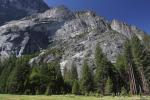
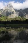
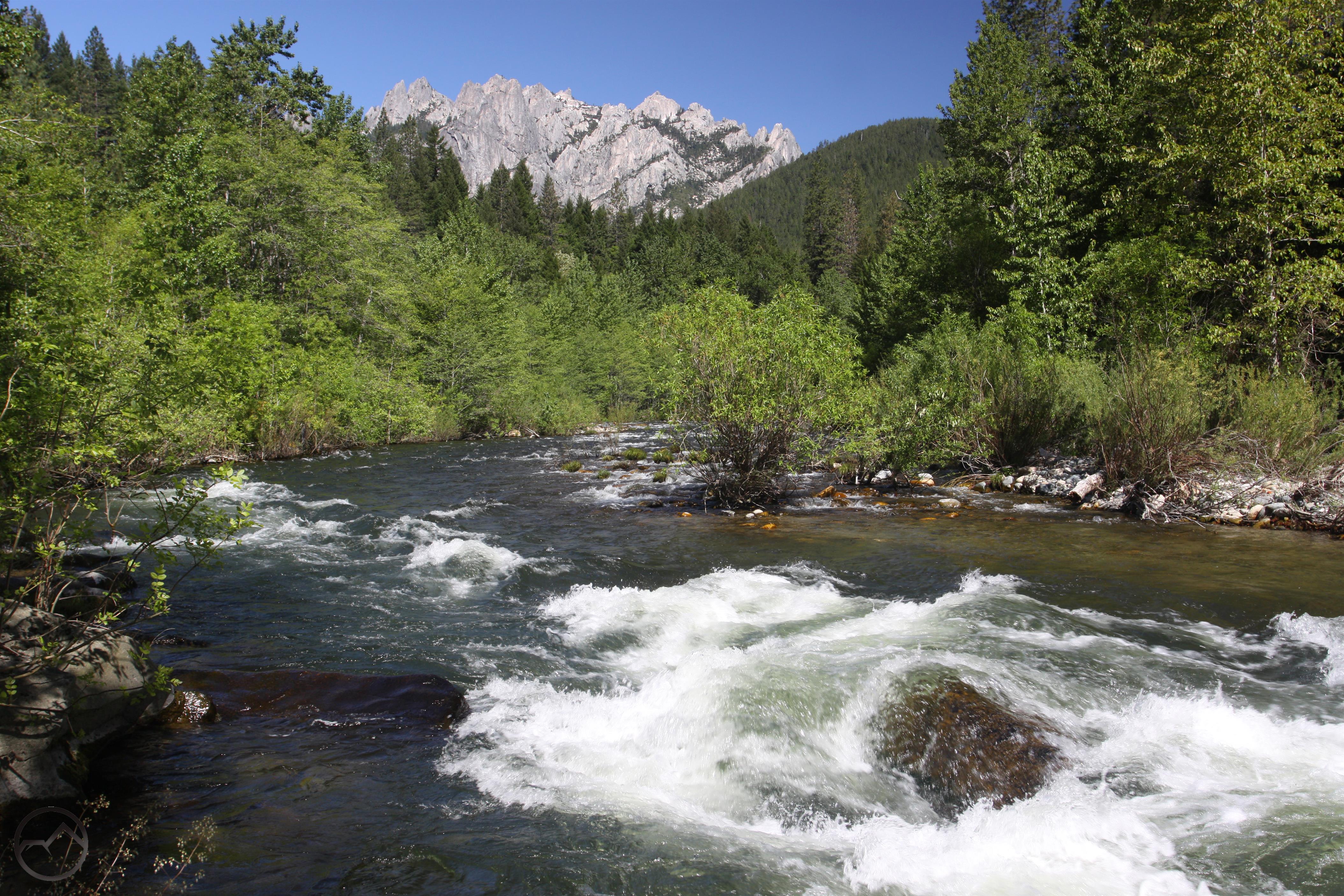
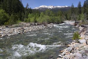
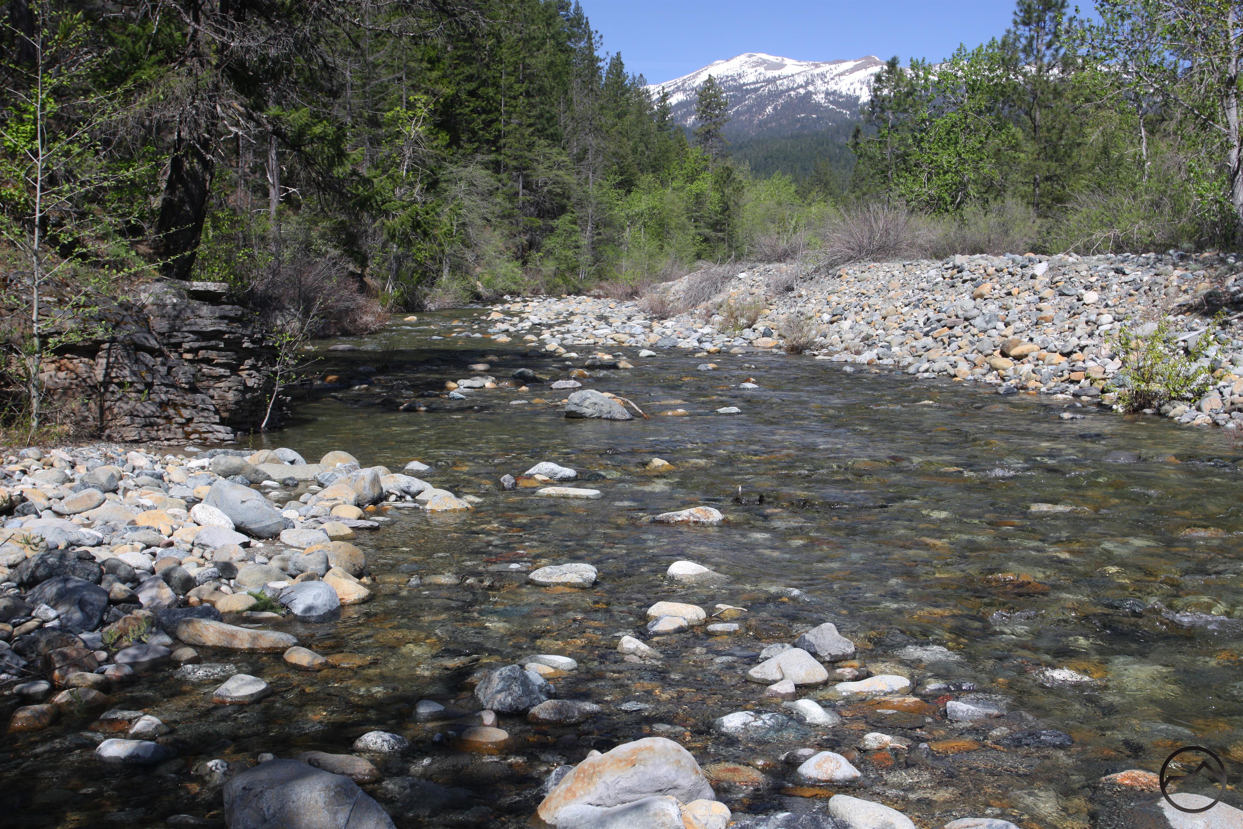
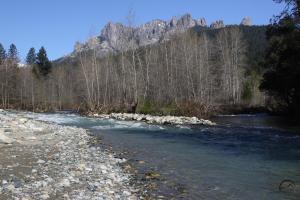
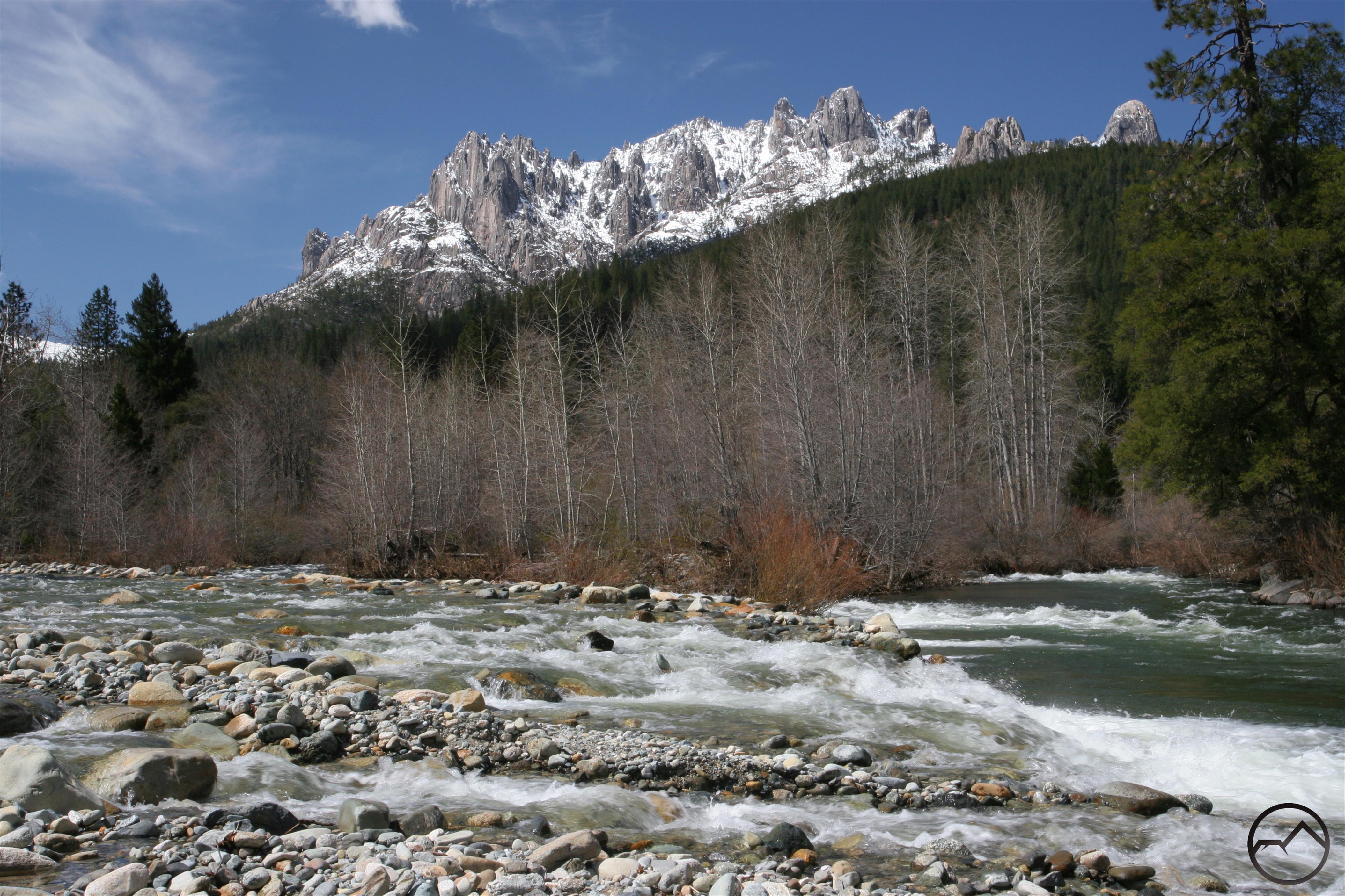
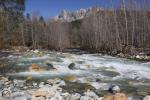
The snowy crags of the Grey Rocks gaze down on lively Castle Creek.

Running swiftly through a wide valley flanked by magnificently rugged mountain towers, Castle Creek is easily one of the most scenic waterways in the Mount Shasta area. After the first rank of the area’s three rivers, it is quite possible that Castle Creek is the most scenic creek in the area. Beginning in three basins high in the southern Trinity Divide, the three forks flow steeply down rarely visited mountain canyons until they join together in the valley that lies beneath the watchful gaze of the mighty Castle Crags and the mysterious Grey Rocks (also seldom seen!). With a large and powerful flow and its beautiful valley, Castle Creek is a beautiful mountain gem that is seldom seen but waiting to be discovered.

It might seem unusual that such a prominent landmark and one that passes so close to civilization would be considered “seldom seen”. In the case of Castle Creek, this certainly seems to be the case. Despite its proximity to the interstate and Castle Crags State Park, the creek remains a fairly unappreciated landmark in the Mount Shasta area. Aside from a fleeting and unheralded crossing on I-5, most people come into contact with Castle Creek while driving on Forest Road 25, which passes along the base of the Castle Crags. The creek is visible from a few places along the road but is hardly a feature of the drive. It is simply passed by on the way somewhere else.  The state of anonymity experienced by Castle Creek is most likely due to the fact that there are no trails along its course. To experience the creek, one has to be prepared for some bushwhacking and a lot of scrambling on rocks.

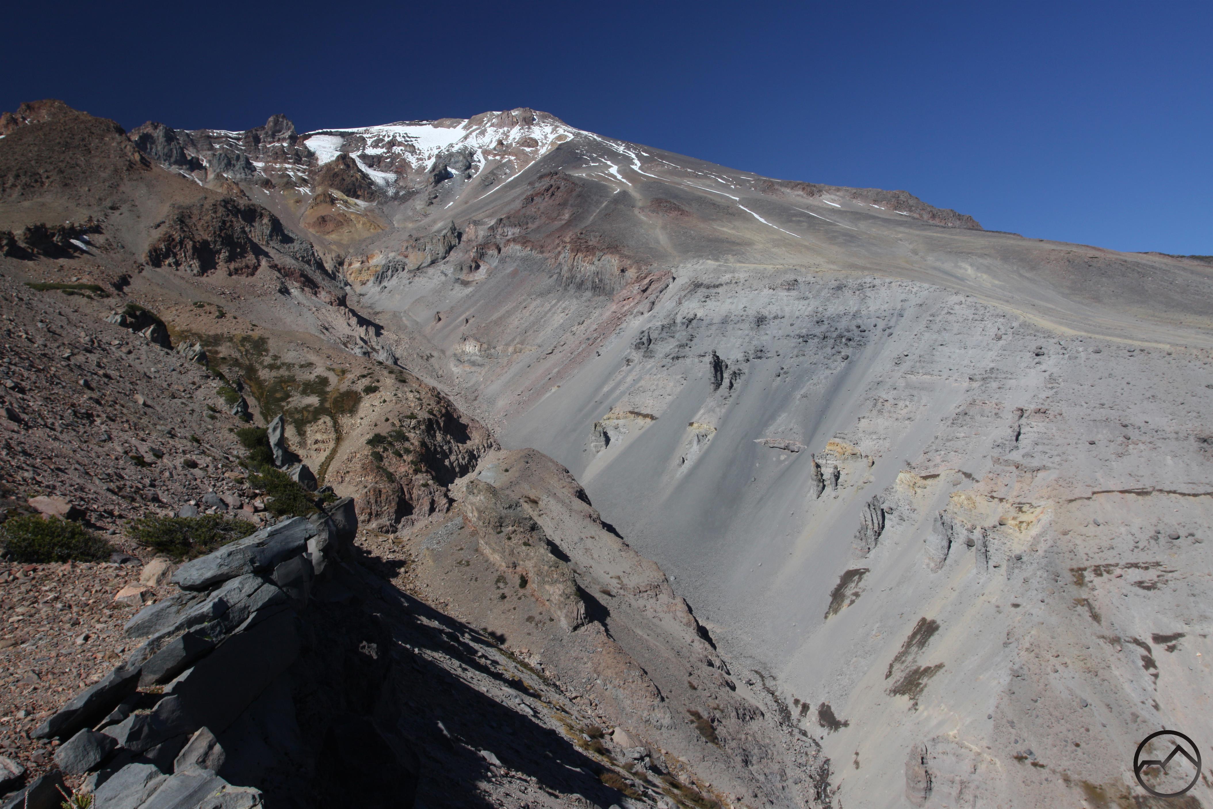
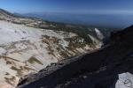
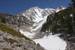
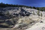
Castle Creek Headwaters:

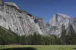
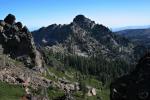
Castle Crags from the PCT, near the Soapstone Trail
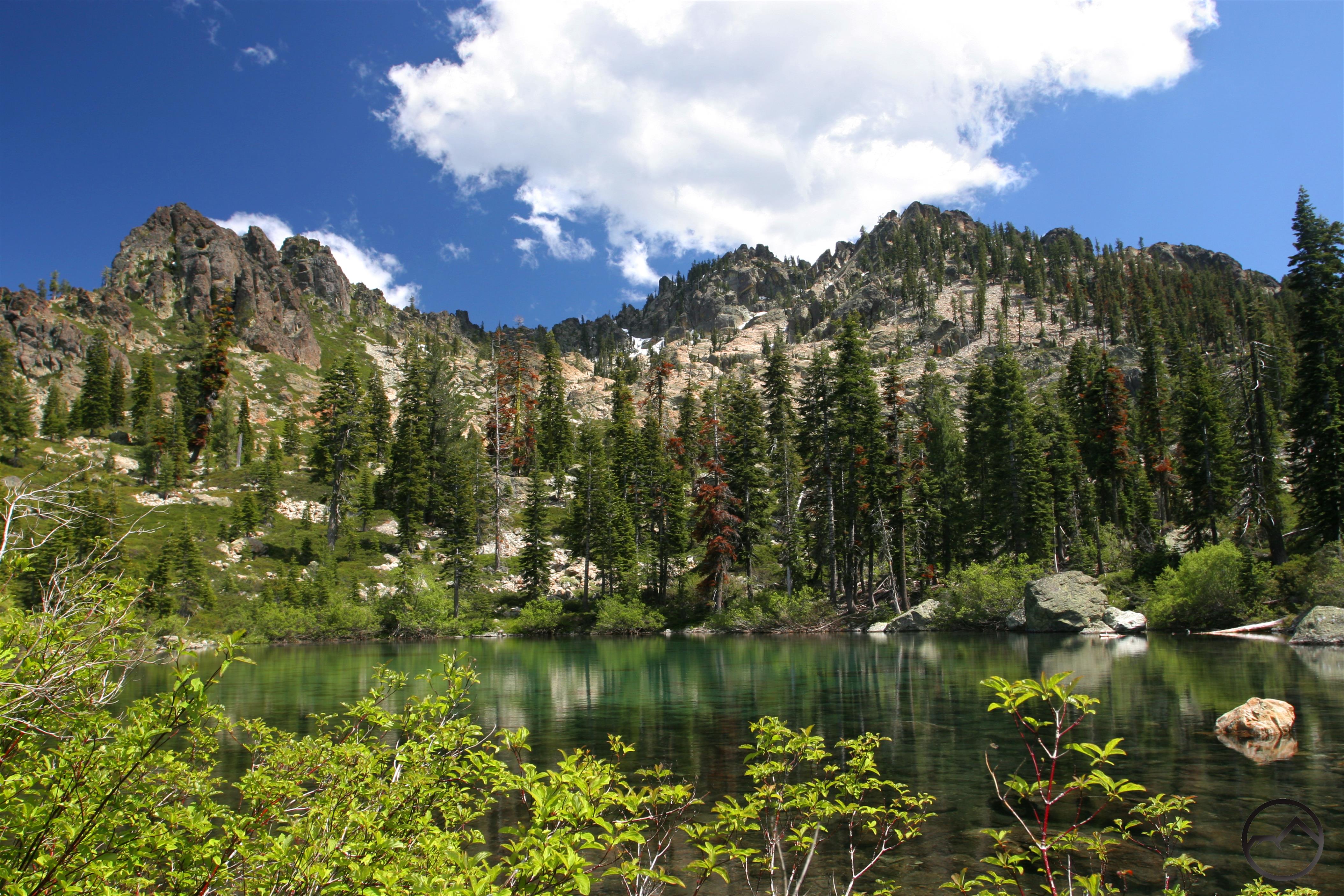
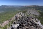
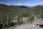
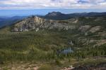
PCT view of Seven Lakes Basin.
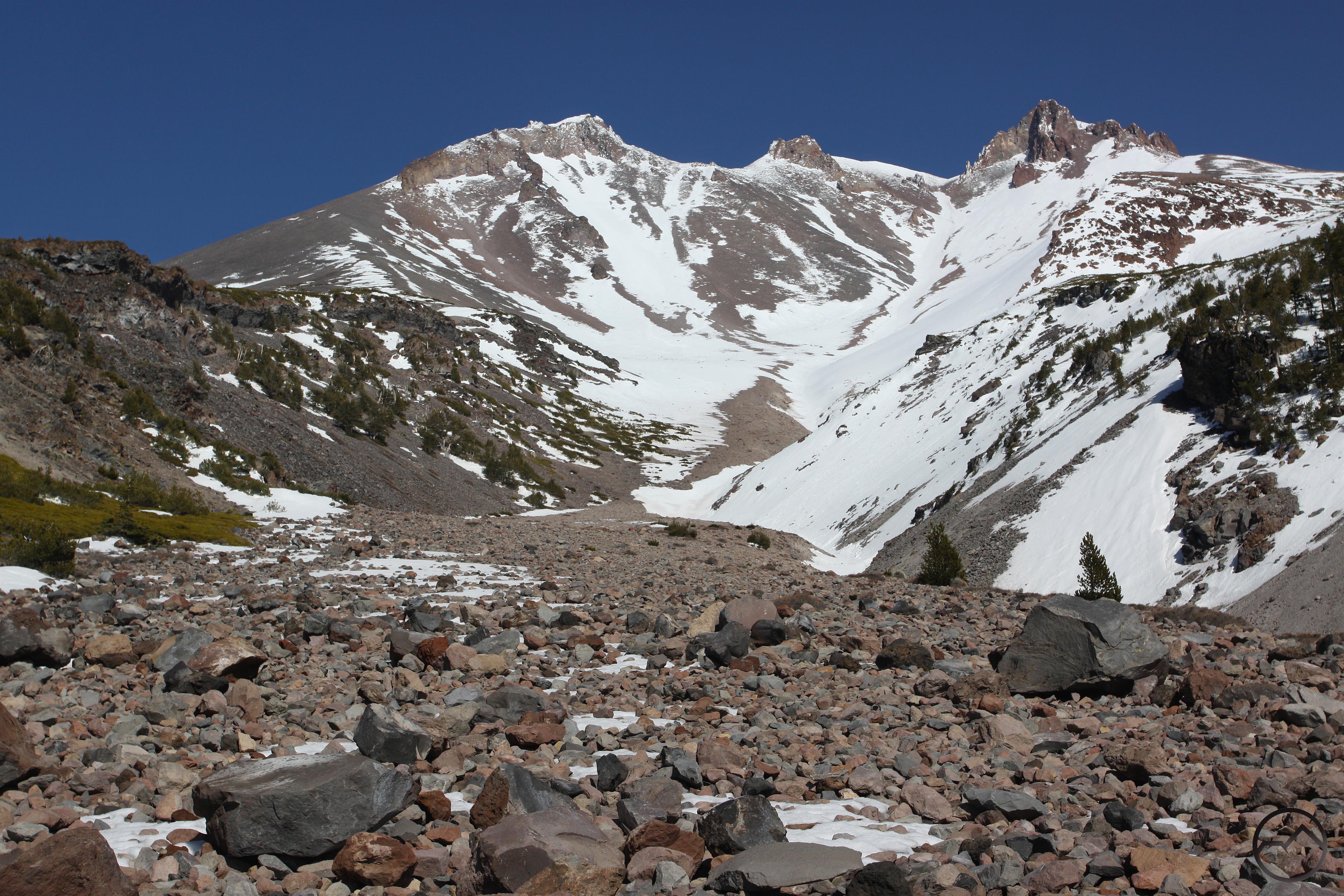
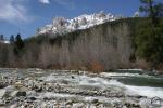
South Fork headwaters


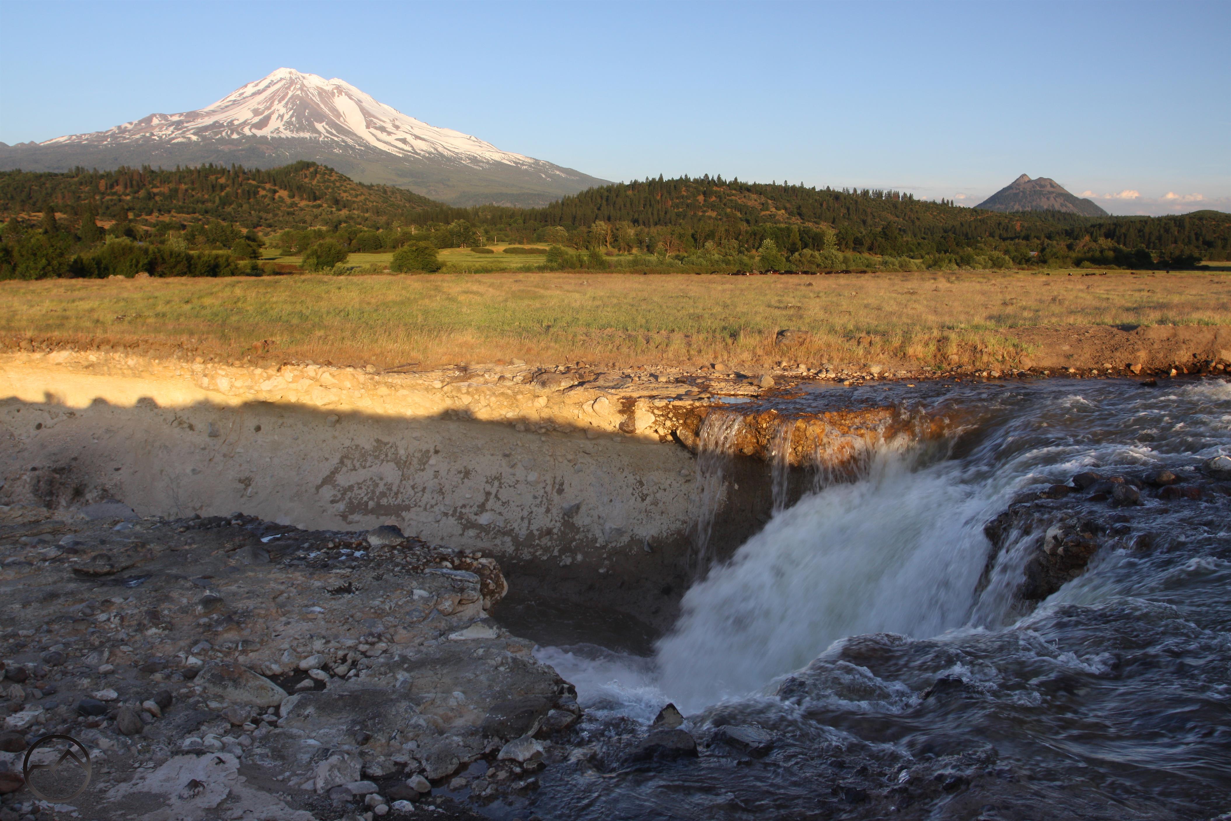
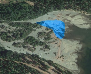
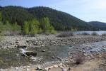
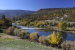
Castle Crags from the confluence of the Sacramento River and Castle Creek

Castle Creek is the largest tributary of the Sacramento River between the river’s headwaters and its inundation at Shasta Lake. The headwaters of Castle Creek are also among the highest of the Sacramento’s feeder streams. Three forks of the creek flow down to combine into the large and fast-flowing main stem. The North Fork begins in a large basin at the head of the Castle Crags. There are no lakes in this steep-sloped bowl but there are a few springs and meadows that provide a sustaining flow later in the summer. The Middle Fork is the longest of Castle Creek’s three branches and begins in the beautiful Seven Lakes Basin. The South Fork, the most enigmatic of the three, rises in a very seldom seen basin on the east side of the Grey Rocks. This basin includes Grey Rock Lake and a few smaller unnamed lakes. The confluence of Castle Creek and the Sacramento has already been addressed in this series but it is worth noting that it is a place of great beauty and easily one of the most picturesque spots in the Mount Shasta region.

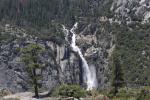
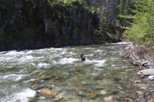
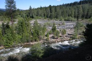
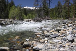
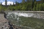
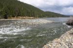
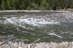
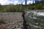
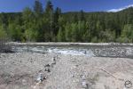
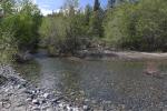
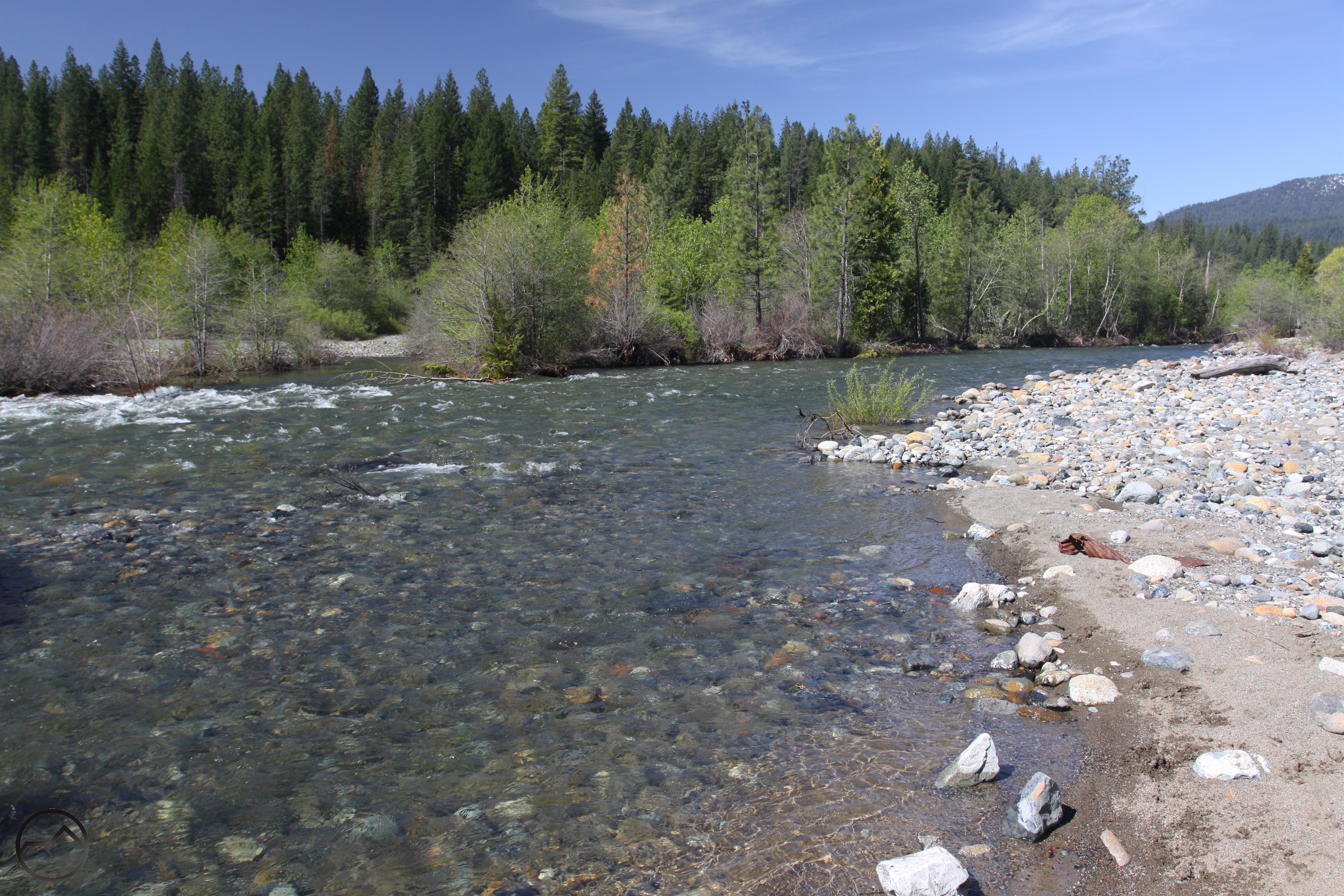
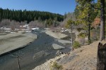
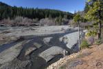
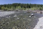
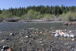
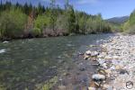
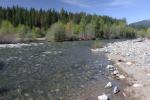
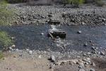
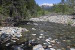
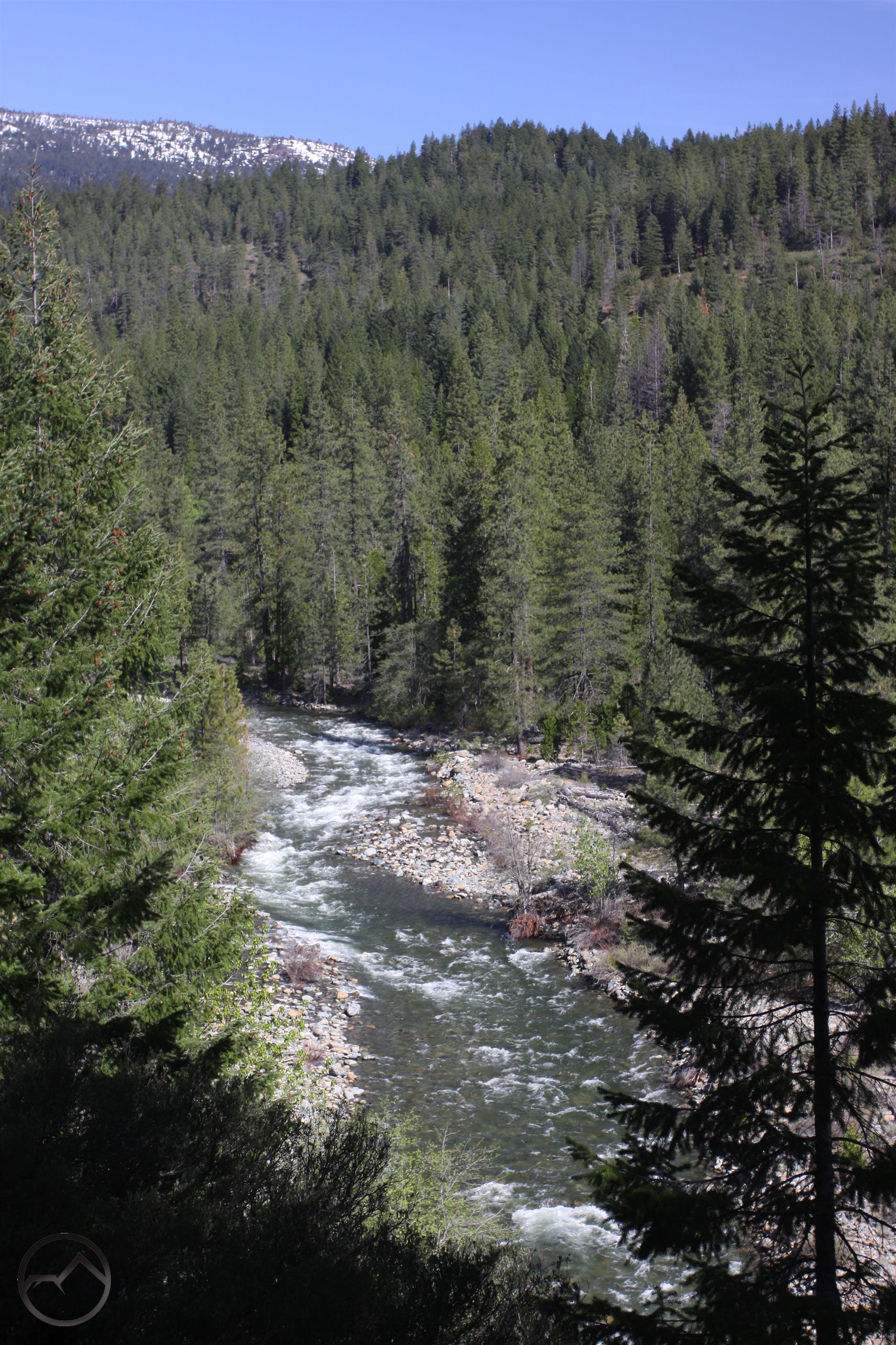
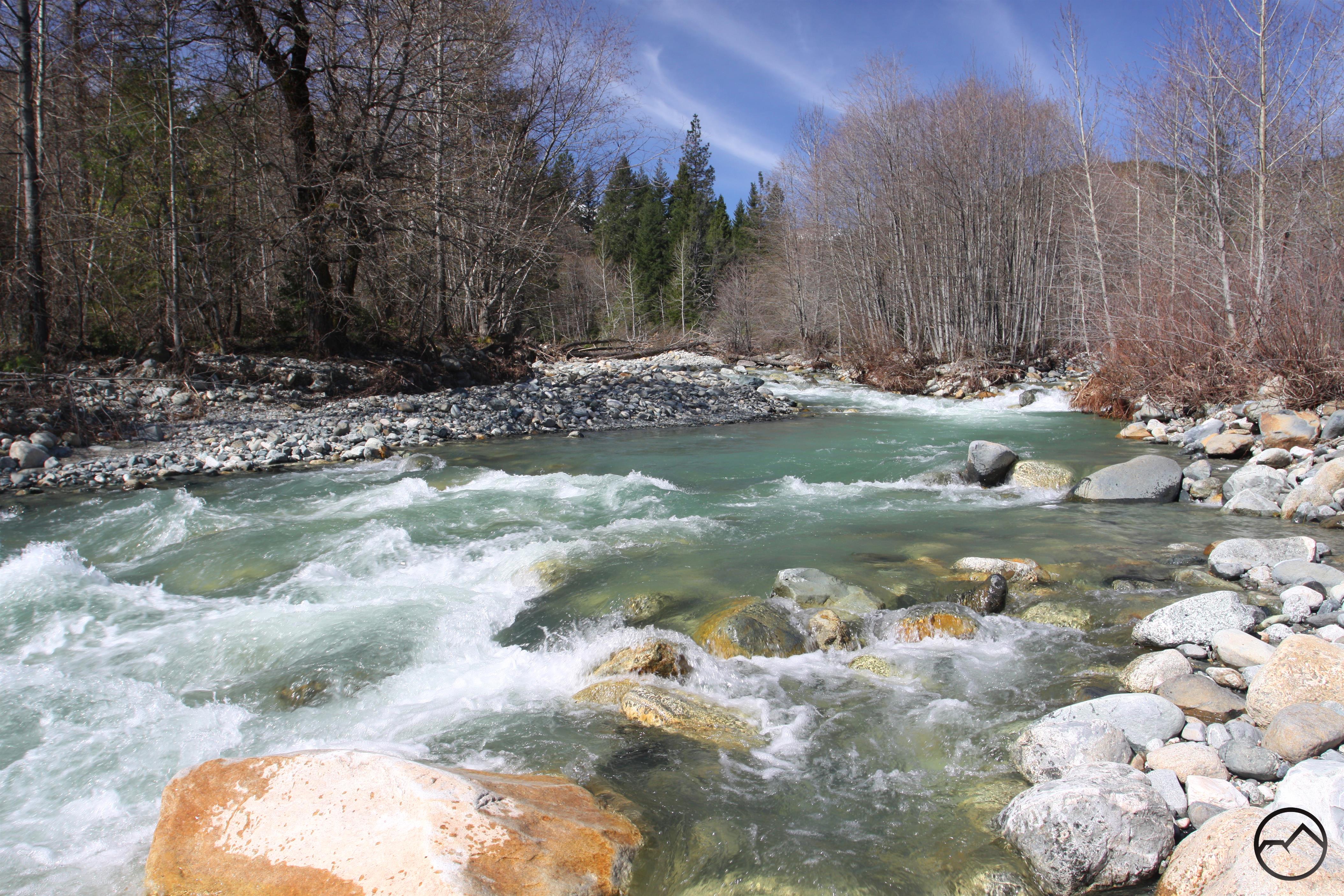
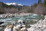
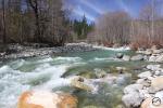
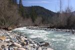
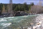
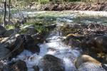
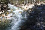
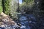
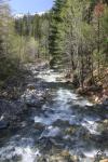
The three forks tumble down their respective canyons in a steep and vigorous descent to the valley floor. The confluence of the three forks is in fairly rapid succession to the main stem of Castle Creek which is birthed fairly rapidly. Once all three forks combine, Castle Creek only flows for a little less than 3 miles before joining the Sacramento River but it is a remarkable and beautiful 3 miles. The creek is wide, with a rocky creekbed. Large granite boulders are strewn about, offering lots of visual interest and rock scrambling opportunities. In spring, when the water flow is high, the creek has a beautiful turquoise hue.

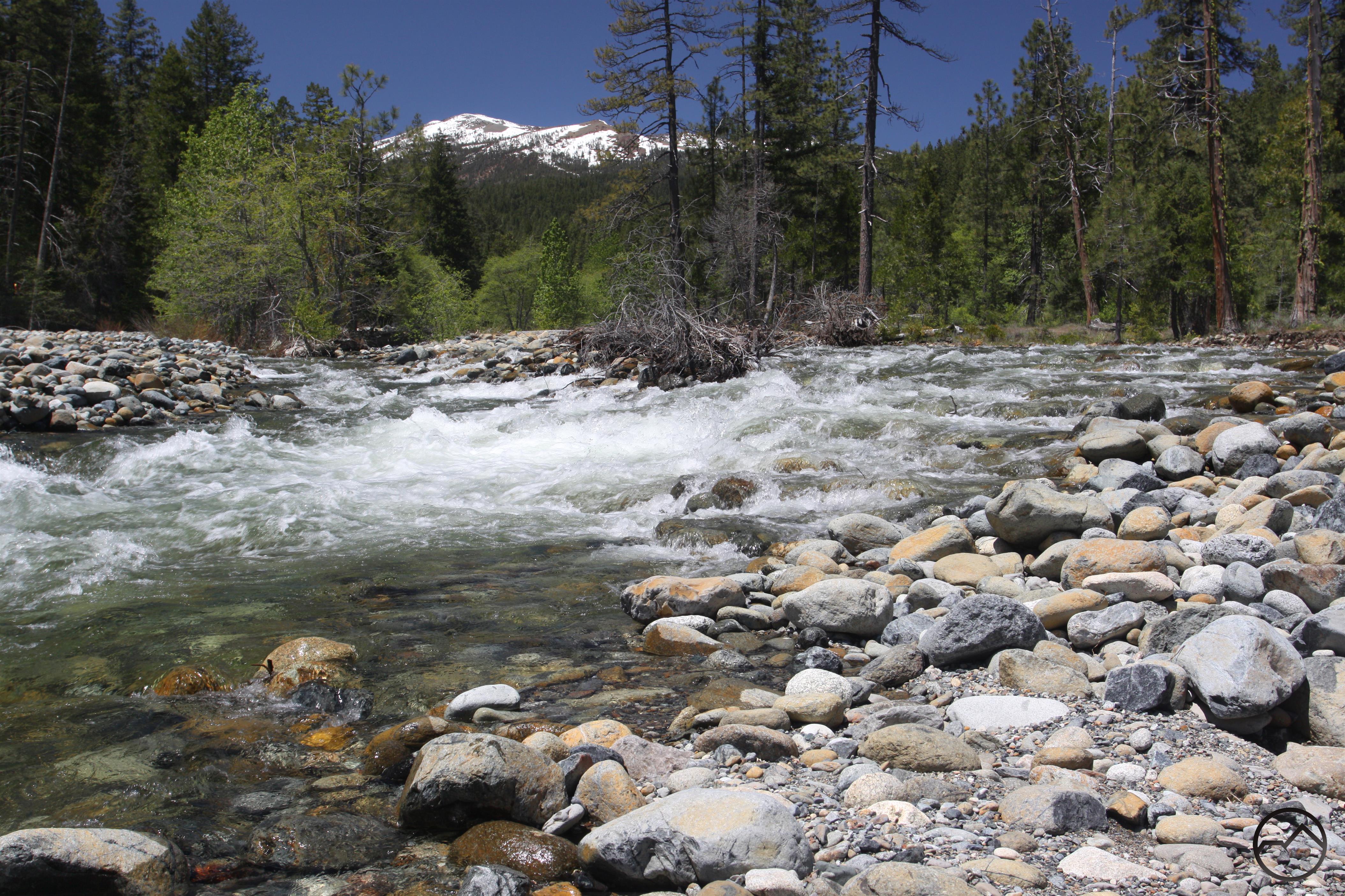
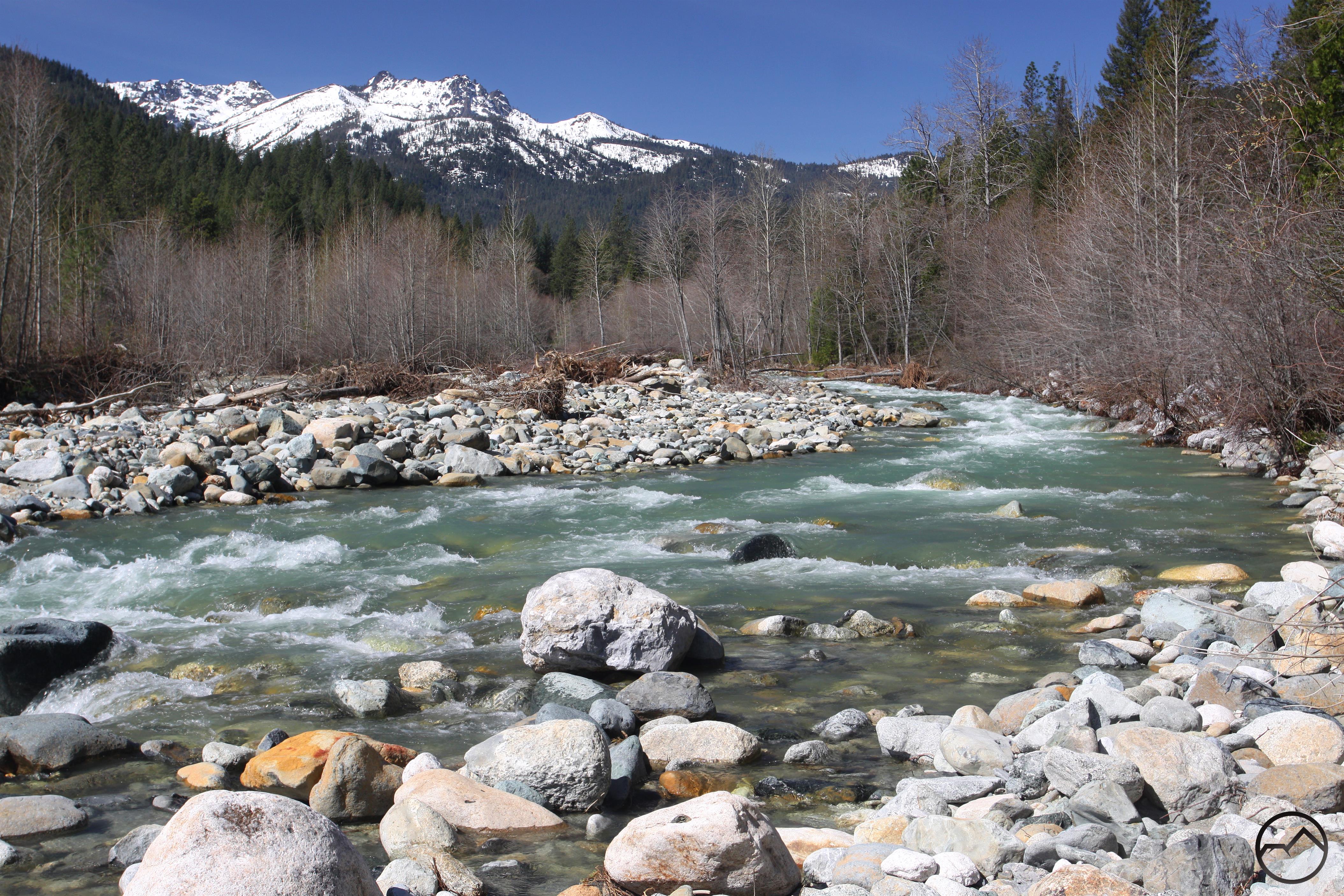
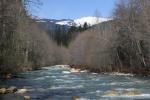
The Grey Rocks rise above Castle Creek Valley.

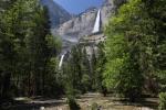
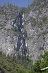
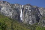
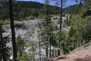
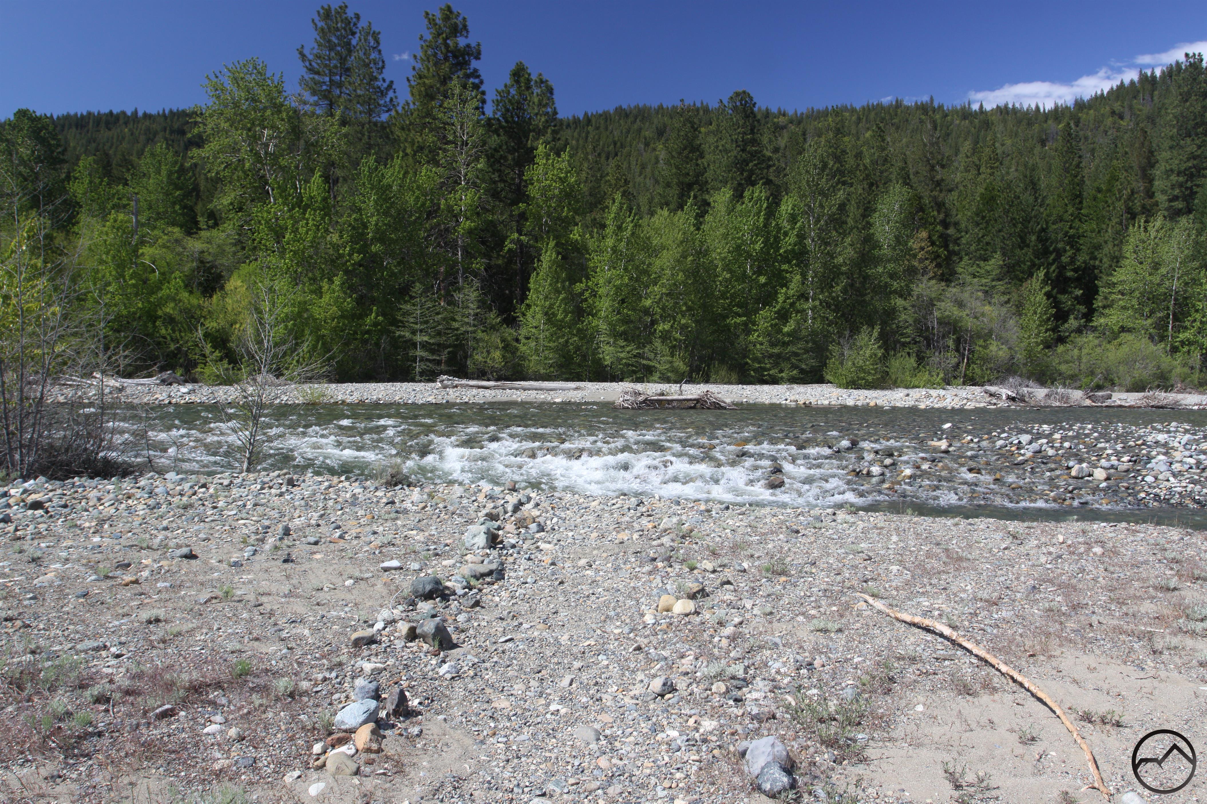
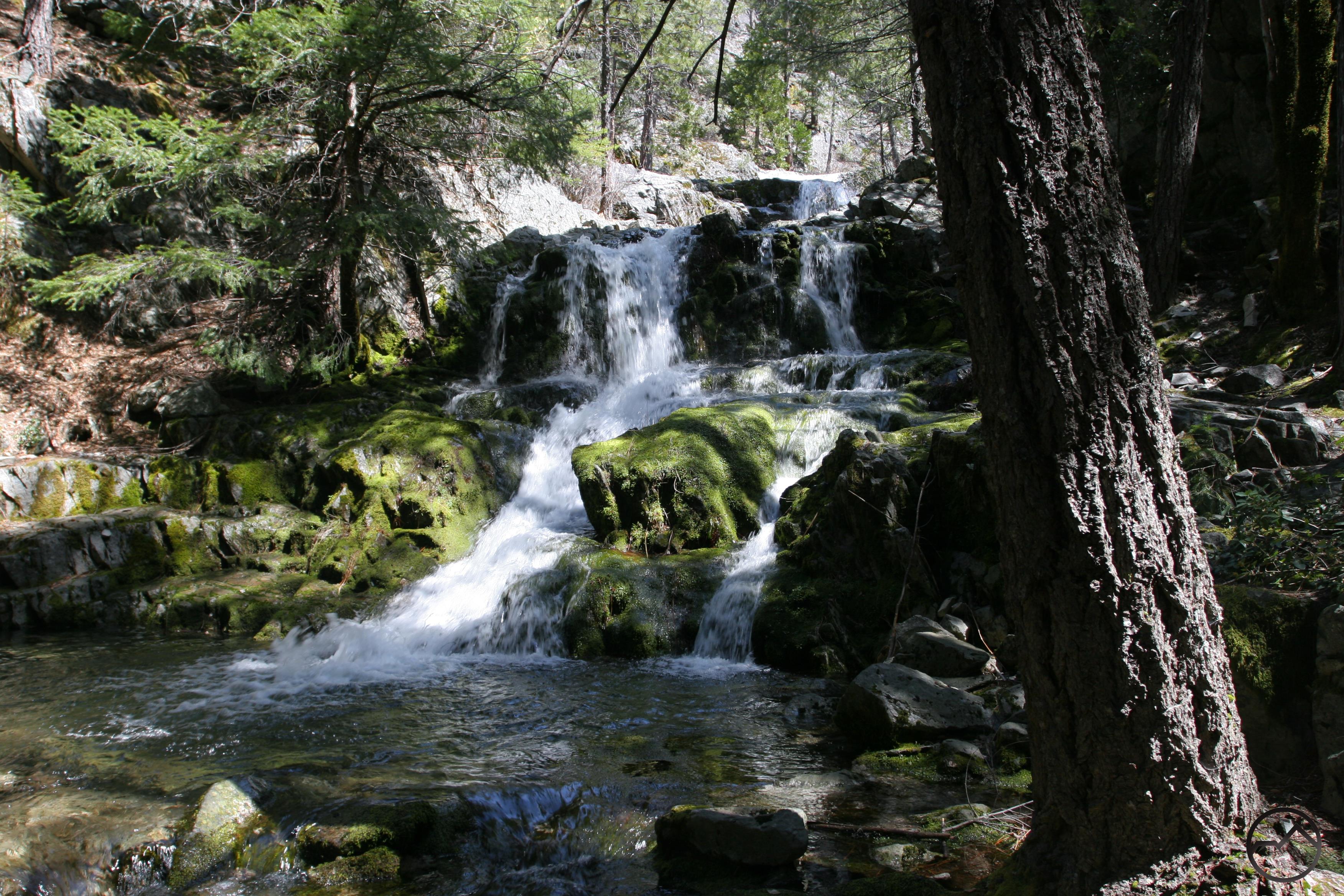
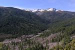
The most prominent landmark easily visible from the creek are the Grey Rocks, the tall, craggy turrets that are the dominant peaks of the southern Trinity Divide. The stunning Castle Crags are often frustratingly obscured from the creek, though the tops of the granite spires are still visible at times. The floor of the valley is rocky with patches of pine, cedar and oak occasionally broken up by small meadows. Several smaller creeks flow into Castle Creek, most of them originating in the Castle Crags. The most prominent of these are Indian, Dump, Sulphur and Burstarse. The latter two are notable for having excellent waterfalls or lovely cascades over granite slabs. The south side of Castle Creek’s valley is bounded by long Flume Creek Ridge. Not much water flows off of this forested wall, but in spring when it is covered in snow, it is a pretty sight.

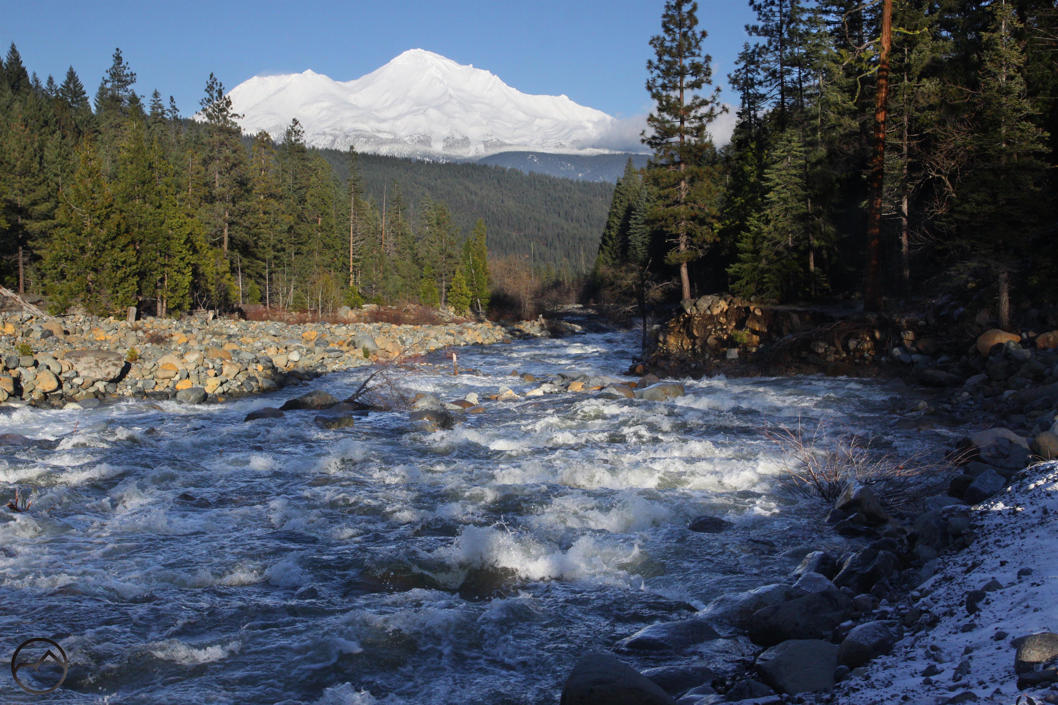
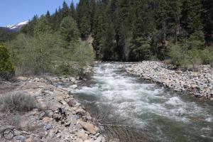
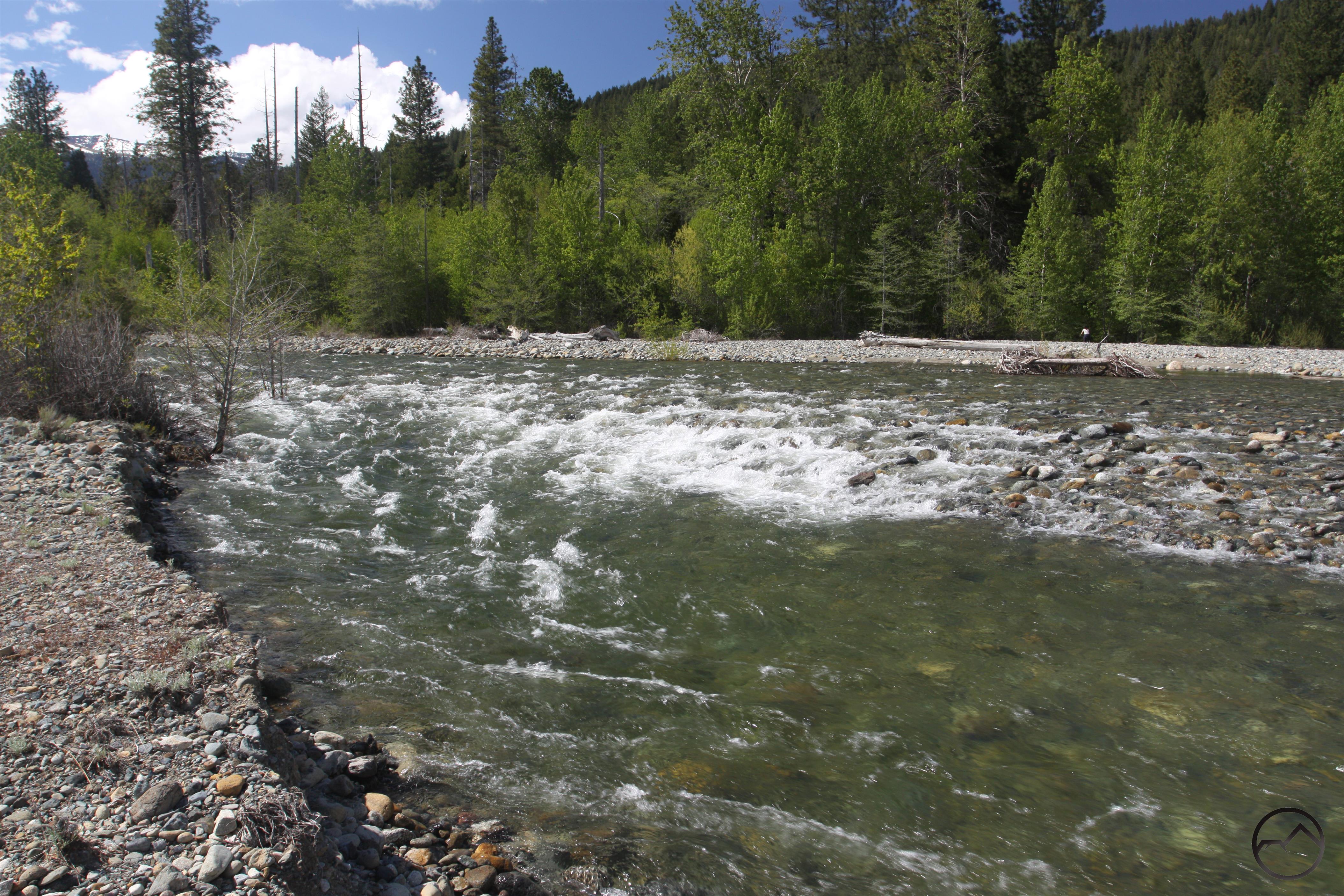
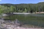
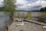
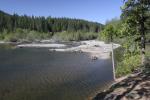
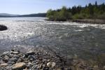
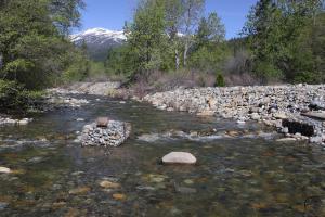
Spring is the best time to visit Castle Creek. The tall, snow covered peaks, blue water and strong flow make it a gorgeous sight. This is especially tree for folks who, after a long winter, are eager to get back up into the mountains. The creek is not high but the setting and rugged mountains make it feel like it is much higher in elevation than it is. Indeed, despite having a paved coming alongside, when you are on the creekbank, it feels like you could be 50 miles from the nearest road, gazing at mountain stream in a deep wilderness.

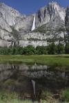
One of the smaller waterfalls on Burstarse Creek.

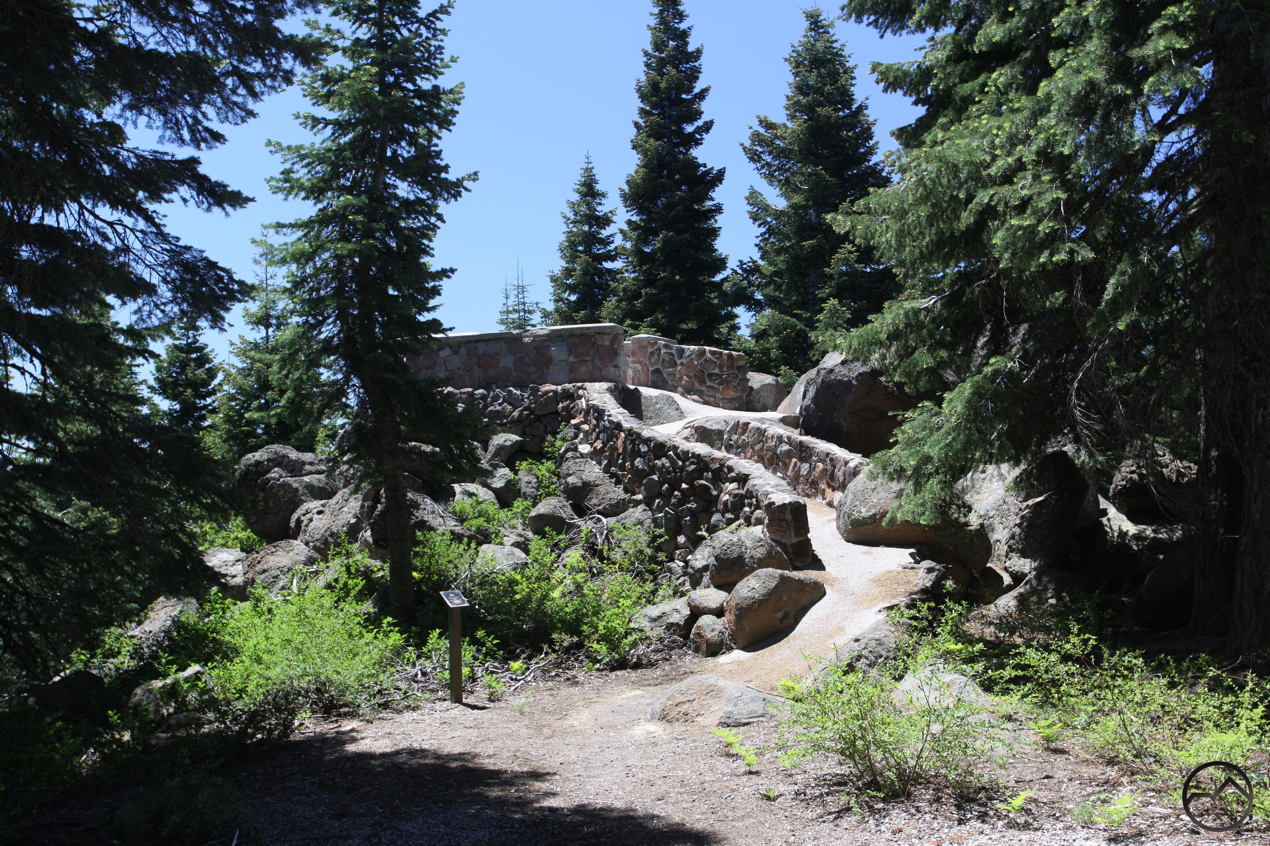
If you do choose to explore Castle Creek, be prepared for a primitive experience. It is easy to get to, but access is almost entirely of the bushwhacking variety. However, there are a few trails nearby and some other recreational amenities. The Pacific Crest Trail traverses the flanks of the Castle Crags high above the creek. Views of the valley are possible from a few places on the trail. The PCT can also be used to reach the beautiful waterfalls on Burstarse Creek. The Flume Trail also travels within earshot of Castle Creek and also features an impressive overlook of Castle Creek’s valley. Castle Crags State Park also has a small walk-in campground not far from the creek. There are also several primitive campsites along the water at the west end of the valley.

A Castle Creek Gallery (click to enlarge):

The Grey Rocks above Castle Creek
The Castle Crags rise above Castle Creek and the Sacramento River.
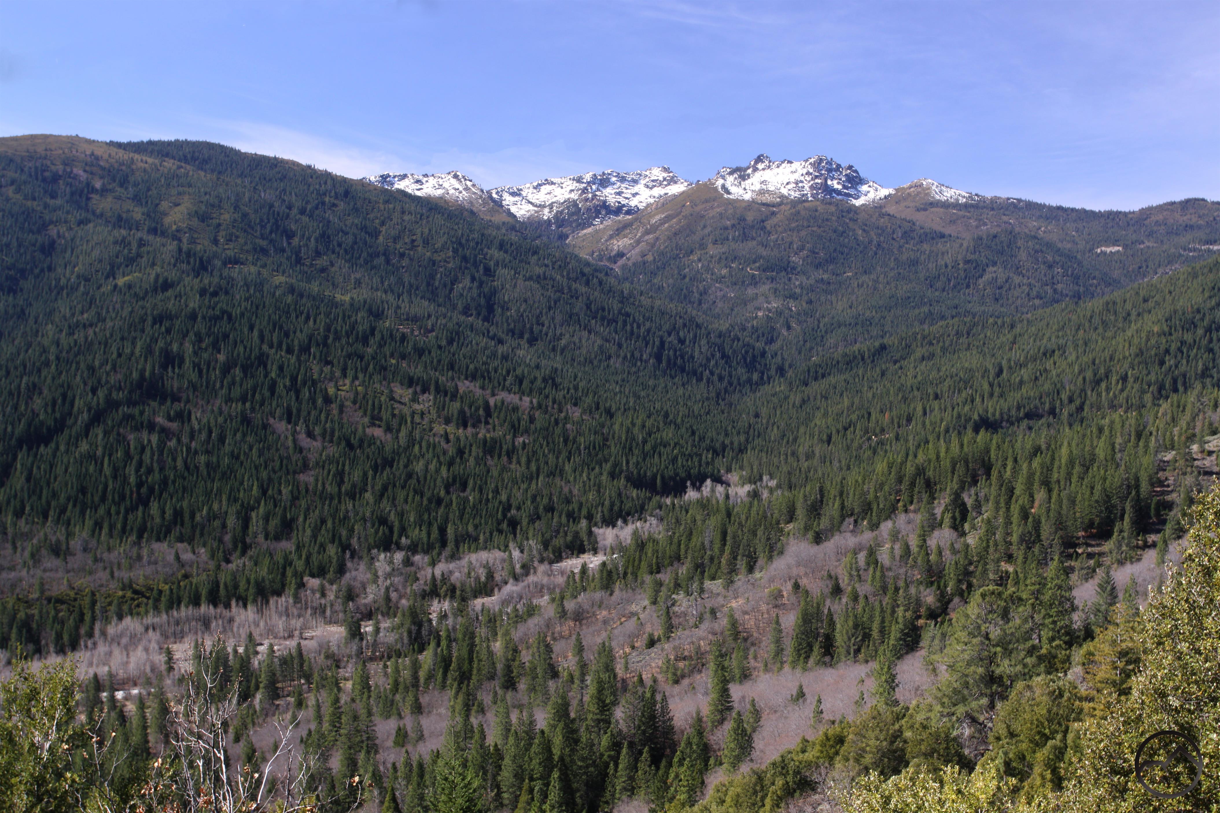
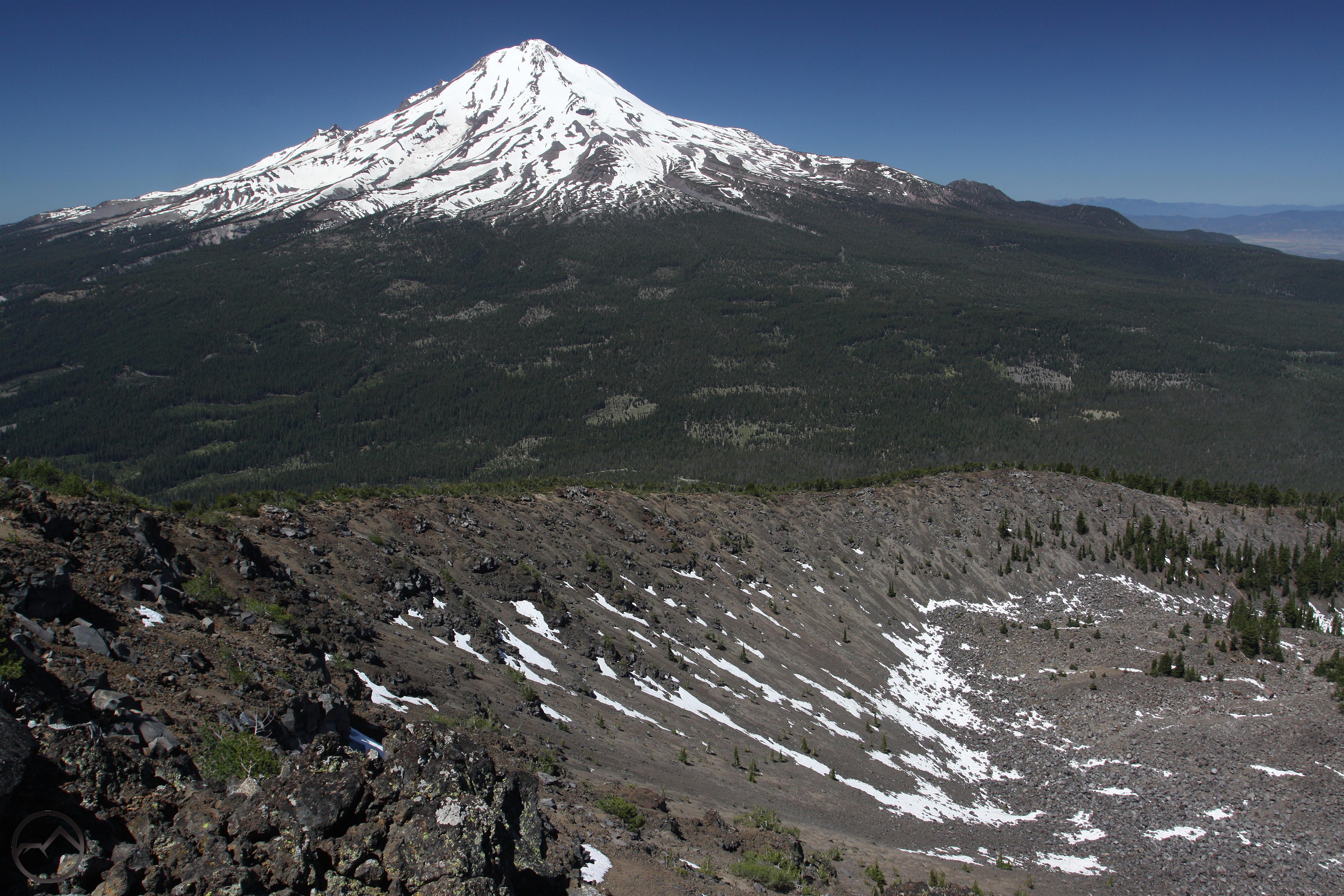
Soapstone Peak is visible from Castle Creek.

Castle Creek
Castle Creek
Castle Creek

Castle Creek
Sulphur Creek flows into Castle Creek.
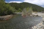
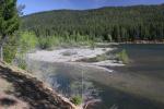
Castle Creek winds through a wooded island.

Castle Creek Valley
Castle Creek
Castle Creek

Castle Creek Watershed:

A Mount Shasta “Seldom Seen” Round Up

Posted by bubbasuess on April 27, 2017
Posted in: Cascade Range, Hiking, Mount Shasta, Seldom Seen, Trinity Divide. 3 Comments

Mud Creek Canyon on the south side of Mount Shasta.

In all the writing I do, the subject that generates the most personal interest for me is writing on places that offer incredible scenery but are not known by many people. It has always amazed me at how many places fit into the category. They are often just as spectacular as popular destinations but just lack notoriety. This is true across the board, no matter how popular a place is, whether it is Yosemite or here in Mount Shasta. It was to cover these kinds of places that I started my “Seldom Seen” series shortly after the launch of Hike Mt Shasta. These articles highlight special places but don’t offer instructions on how to get there. For those motivated enough to want to see them for themselves, there are enough clues included that will allow a journey of discovery to take place.

Unfortunately, the work on my books has stymied the production of new Seldom Seen articles the last couple of years. My newest book is set for release in about a month and I don’t have a new project immediately on the docket which means that I will have the summer to get back to exploring the Mount Shasta area and writing more extensively on this area. I have a few different ideas in mind on what I want to focus on, but one of the chief endeavors will be adding 3 or 4 more Seldom Seen articles. With that in mind, I wanted to pull all of the previous articles together and highlight the special places I have written about already.

Areas On Mount Shasta:

The fact that there is a relative paucity of hiking trails on Mount Shasta, it is a source of continual surprise that there are some first-rate destinations on the mountain that have trails leading right to them in the form of old, decommissioned roads, yet they remain almost completely unknown. Other locations are a little harder to get to but are still reasonably accessible locations. In all cases they are absolutely beautiful and worthy of appreciation.

Ash Creek Falls

Mud Creek Canyon

Lower Mud Creek Canyon

Diller Canyon

Areas In The Cascade Range:

Aside from Mount Shasta, the rest of the Cascade Range in the area east of the mountain is something of a mystery. There are not many developed trails and practically no well known destinations. This is probably due to the fact that much of this area is a forgotten ranger district of the Klamath National Forest (the bulk of which lies to the west in the Klamath Mountains) and has been heavily impacted by timber companies. That does not mean that there are no worthy places, however. Indeed, some of the most beautiful terrain in the Mount Shasta area is found here and those hikers who explore this area will find that some particularly spectacular vistas and geology await.

Ash Creek Butte Fossil Rock Glacier

Hole In The Ground Geologic Area

Upper Klamath River Canyon

Areas In The Trinity Divide:

In some ways, the potential for seldom seen destinations is at its greatest in the Trinity Divide. The combination of a large area, complex geology and a patchwork of private and public lands has led to numerous, excellent sites dropping off the radar and avoiding appreciation by most hikers. Indeed, this area is full of spectacular features that are just begging to be appreciated. The Castle Crags offers a lifetime of exploration and discovery. The southern Trinity Divide has almost literally no trails yet features many lakes and mysterious, craggy peaks. The canyons of the Sacramento and the Eddy Range also feature magnificent scenery yet if it lies off the crest of the range it remains almost completely unappreciated. And that says nothing of the Scott Mountains just to the north…

The Grey Rocks

Upper Wagon Creek

Fawn Creek Canyon

Confluence Of The Sacramento River And Castle Creek

Castle Creek

A Seldom Seen Gallery (click to enlarge):

Mount Shasta and Ash Creek Falls.
Mud Creek Canyon
The lowest of the large waterfalls on Mud Creek Canyon.

Inside the shallow inner gorge of Diller Canyon. Diller Canyon
Looking down on the large hoodoo on Ash Creek Butte.
The Hole In The Ground Geologic Area

The south summit of the Grey Rocks.
Wagon Creek Falls

Fawn Creek Canyon from the PCT.
The confluence of the Sacramento and Castle Creek. Castle Dome on the far right.
The Grey Rocks above Castle Creek

Vintage Mount Shasta Posts Collection

Posted by bubbasuess on April 23, 2017
Posted in: Hiking, Mount Shasta, Mount Shasta History. 2 Comments

A small section of the 1935 topographic map.

A friend of mine recently gave me a large collection of vintage maps of Mount Shasta and Siskiyou County. While the terrain has not changed, the names and cartographic techniques certainly have. Of course, it is nearly a moral imperative that I put up some articles on these maps and examine how things have changed since the 1860’s (rough date of the first map). It will be a fascinating journey through how much the names, perceptions, and human imprint on the land has changed. However, this is not the post I begin that series. Instead, rummaging through all the vintage maps has gotten me thinking of some of the posts I have written about historic objects I have come across. I am captivated by these artifacts and think they provide some context for the time spent out of doors. Indeed, I believe that hiking in the wilds is as close as we can get to time travel since we can immerse ourselves in a place that is unchanged since people hundred or even a thousand years ago occupied the same place.

Most of the posts I have written on Mount Shasta history have focused on old art and images of the mountain. These can be captivating views into how older generations perceived the mountain and the surrounding landscape. It is my hope that by collecting these posts in one place that you will find them interesting and consider those who have gone before us when exploring the beauty of the Mount Shasta area. I’d encourage you to follow the links to get more detail on each image and piece of art.

In this post I examined a 19th century engraving of Mount Shasta by Thomas Moran. It depicts a spectacular view of Mount Shasta from Mud Creek Canyon. Though some of the features are very exaggerated in their proportions, it is still a fairly accurate portrayal of Mount Shasta and the canyon. It even features Mud Creek Falls, one of my personal favorite features on the mountain. In the post I included a breakdown of what each landmark is and how is corresponds to what can be seen from the Clear Creek Trail.

 The two posts (Part 1 and Part 2) that were done on this painting were the 2nd and 3rd posts I wrote when I first started Hike Mt Shasta. My mom found this painting in a thrift store down in Santa Rosa. The back has a label by a professional artist and this identified it as being Mount Shasta. Though it obviously bears no resemblance to the mountain at first glance, I still recognized the perspective depicted in the painting. Naturally I had to find out more about the painting and this necessitated a trip to the College of the Siskiyous library and working with some local Mount Shasta art aficionados to figure out how old the painting actually is.

In a more recent article, I linked to a collection of early 20th century photos produced as promotional material for the Southern Pacific Railroad. The images were colorized, which almost made them look like drawings or paintings. Nonetheless, they were an interesting look back at what the railroad pushed in terms of tourism for the area over 100 years ago.

The most recent article I have written on this subject was on an incredible collection of stereographic images of the Mount Shasta area. This was a very diverse group of pictures that preserved various perspectives on the mountain, long gone historic sites, and the towns around the mountain. This collection also finally helped solve the mystery of where some unusual pictures of Black Butte had been taken (the subject of a forthcoming post).


The last post I wanted to put up does not quite fit in with the rest but is worth mentioning. It concerns a somewhat forgotten vista point and monument on Mount Shasta. Though it is prominently identified on the Everitt Memorial Highway, the vista and monument don’t see too much traffic anymore since the forest has encroached on the vista and the view is no longer what it once was. Built to memorialize John Everitt, the Shasta National Forest supervisor who died near there fighting a fire in 1935.

Posts navigation

← Older Entries
Newer Entries →
    • Recent Posts

      • Winter Shows Up When It Will
      • January Rolled By With Mud, Then Very Dry
      • Mount Shasta 2025 – A Year In Images
      • Mount Shasta On Either Side Of Christmas
      • Adrift In An Ocean Of Fog
      • December Has Been Spectacular Thus Far Pt. II (A Magnificent Lenticular)
      • December Has Been Spectacular Thus Far Pt. I
      • Lenticular Interrupted
      • A Stormy Wave And A Truchas Sunset
      • Aurora Lenticularis
    • Enter your email address to follow Hike Mt Shasta and receive notifications of new posts by email.

    • Archives

      • February 2026
      • January 2026
      • December 2025
      • November 2025
      • October 2025
      • September 2025
      • August 2025
      • July 2025
      • June 2025
      • May 2025
      • April 2025
      • March 2025
      • February 2025
      • January 2025
      • December 2024
      • November 2024
      • October 2024
      • September 2024
      • August 2024
      • July 2024
      • June 2024
      • May 2024
      • April 2024
      • March 2024
      • February 2024
      • January 2024
      • December 2023
      • November 2023
      • October 2023
      • September 2023
      • August 2023
      • July 2023
      • June 2023
      • May 2023
      • April 2023
      • March 2023
      • February 2023
      • January 2023
      • December 2022
      • November 2022
      • October 2022
      • September 2022
      • August 2022
      • July 2022
      • June 2022
      • May 2022
      • April 2022
      • March 2022
      • February 2022
      • January 2022
      • December 2021
      • November 2021
      • October 2021
      • September 2021
      • August 2021
      • June 2021
      • May 2021
      • April 2021
      • March 2021
      • February 2021
      • January 2021
      • December 2020
      • November 2020
      • October 2020
      • September 2020
      • August 2020
      • July 2020
      • June 2020
      • May 2020
      • April 2020
      • March 2020
      • February 2020
      • January 2020
      • December 2019
      • November 2019
      • October 2019
      • September 2019
      • August 2019
      • July 2019
      • June 2019
      • May 2019
      • April 2019
      • March 2019
      • February 2019
      • January 2019
      • December 2018
      • November 2018
      • October 2018
      • September 2018
      • August 2018
      • July 2018
      • June 2018
      • May 2018
      • April 2018
      • March 2018
      • February 2018
      • January 2018
      • December 2017
      • November 2017
      • October 2017
      • September 2017
      • August 2017
      • July 2017
      • June 2017
      • May 2017
      • April 2017
      • March 2017
      • February 2017
      • January 2017
      • December 2016
      • November 2016
      • September 2016
      • August 2016
      • July 2016
      • June 2016
      • May 2016
      • April 2016
      • March 2016
      • February 2016
      • January 2016
      • December 2015
      • November 2015
      • September 2015
      • August 2015
      • July 2015
      • June 2015
      • May 2015
      • April 2015
      • March 2015
      • February 2015
      • January 2015
      • December 2014
      • November 2014
      • July 2014
      • June 2014
      • May 2014
      • April 2014
      • March 2014
      • February 2014
      • January 2014
      • December 2013
      • November 2013
      • October 2013
      • September 2013
      • August 2013
      • July 2013
      • June 2013
      • May 2013
      • April 2013
      • March 2013
      • February 2013
      • January 2013
    • Categories

      • Boy Scouts
      • Cascade Range
      • Castle Crags
      • Desert
      • Echo Point
      • Glaciers
      • Hiking
      • How things came to be…
      • Klamath Mountains
      • Konwakiton Outdoor Designs
      • Lakes
      • Lenticular Clouds
      • Maps
      • Marble Mountains
      • Meadows
      • Mount Eddy
      • Mount Shasta
      • Mount Shasta History
      • Napa County
      • Off Season Trails
      • Pacific Crest Trail
      • Peaks
      • Rivers
      • Rock Climbing
      • Scott Mountains
      • Seldom Seen
      • Shasta Valley
      • Sierra Nevada
      • Siskiyou Mountains
      • Sonoma County
      • Spring Trails
      • sunrise
      • sunset
      • Trinity Alps
      • Trinity Divide
      • Truchas Ridge
      • Uncategorized
      • Water
      • Waterfalls
      • Wilderness
      • Wildflowers
      • Wine Country
      • Winter Trails
      • Yosemite
    • Meta

      • Create account
      • Log in
      • Entries feed
      • Comments feed
      • WordPress.com
    • Copyright © 2013-2024 by Bubba Suess

      DISCLAIMER: Any use of the information contained in this site by any and all persons is done at their own risk. The operator of this site shall be held harmless from any and all alleged claims, demands, causes of action, liability, loss, damage and/or injury to property or persons whether brought by an individual or other entity. This indemnification applies, without limitation, to all actions by an individual or other entity as a result of their use of information contained in this site.

    Blog at WordPress.com.
    Hike Mt. Shasta
    Blog at WordPress.com.
    • Subscribe Subscribed
      • Hike Mt. Shasta
      • Join 985 other subscribers
      • Already have a WordPress.com account? Log in now.
      • Hike Mt. Shasta
      • Subscribe Subscribed
      • Sign up
      • Log in
      • Report this content
      • View site in Reader
      • Manage subscriptions
      • Collapse this bar
     

    Loading Comments...