Hike Mt. Shasta

Exploring the Mount Shasta Region

  • Home
  • Trails
    • Mount Shasta Trails
      • Brewer Creek Trail
      • Clear Creek Trail
      • Gray Butte Trail
      • Green Butte Ridge Trail
      • Horse Camp Trail
      • North Gate Trail
      • Old Ski Bowl Trail
      • Panther Meadow Trail
      • South Gate/Squaw Meadow Trail
      • Whitney Falls Trail
    • Trinity Divide Trails
      • Blue Divide Trail
      • Castle Lake Trail
      • Castle Lake Shore Trail
      • Cliff Lake Trail
      • Deadfall Lakes Trail
      • Gray Rock Lakes Trail
      • Gumboot Trail
      • Heart Lake Trail
      • Porcupine & Toad Lakes Via Pacific Crest Trail
      • Seven Lakes Basin Via Pacific Crest Trail
      • Sisson-Callahan Trail
      • Soapstone Trail
      • South Mumbo Scramble
      • Tamarack Lake Trail
      • Toad Lake Trail
    • Castle Crags Trails
      • Burstarse Falls Via Pacific Crest Trail
      • Castle Dome Trail
      • Flume Trail
      • Lower Castle Crags Via Pacific Crest Trail
      • Root Creek Trail
    • Scott Mountains Trails
      • Bluff Lake & Cement Bluff via Pacific Crest Trail
      • Caldwell Lakes Trail
      • China Mountain Scramble
      • Cory Peak and Bull Lake via Pacific Crest Trail
    • Cascade Crest
      • Ash Creek Butte Scramble
      • Goosenest Trail
      • Juanita Lake Trail
      • Orr Lake Trail
    • Mount Shasta City Area Trails
      • Black Butte Trail
      • Box Canyon Trail
      • Gateway Trail
      • Lake Siskiyou Trail
      • Mount Shasta City Short Trails
      • Ney Springs Canyon Trail
      • Spring Hill Trail
    • Shasta Valley Trails
      • Black Lava Trail
      • Haystack Trail
      • Lake Shastina Trail
      • Pluto Cave Trail
      • Trout Lake Trail
      • Yellow Butte Trail
    • Sacramento River Trails
      • Dunsmuir Trail
      • Hedge Creek Falls Trail
      • Sacramento River Trail
      • Sims History Trail
    • McCloud River Trails
      • Ash Camp To Ah-Di-Na Via Pacific Crest Trail
      • McCloud River Falls Trail
      • McCloud River Preserve Trail
      • Squaw Valley Creek Trail
      • McCloud River Trail: Algoma Camp to Nitwit Camp
      • McCloud River Trail: Nitwit Camp to Cattle Camp Swimming Hole
      • McCloud River Trail: Cattle Camp Swimming Hole to Camp 4
      • McCloud River Trail: Camp 4 to Upper McCloud Falls
      • McCloud River Trail: Pine Tree Hollow Loop
    • Trails Further Afield
      • Trinity Alps Trails
        • Bear Lakes Trail
        • Billys Peak Trail
        • Boulder Creek Lakes Trail
        • Boulder Lake Trail
        • Canyon Creek Trail
        • Caribou Lakes Trail
        • East Boulder Lake Loop
        • East Weaver Lake Trail
        • Four Lakes Loop
        • Granite Peak Trail
        • Grizzly Creek Trail
        • Gulch Lakes Loop
        • Hidden Lake Trail
        • South Fork Lakes Trail
        • Stoddard Lake Trail
        • Stoney Ridge Trail
        • Tangle Blue Lake Trail
      • Warner Mountains
        • Emerson Creek Trail
        • Highgrade Trail
        • Patterson Lake Via Warner Summit Trail
        • Pine Creek Trail
        • Squaw Peak Trail
  • Articles
    • Trails By Area
      • Mount Shasta
        • Vistas, Meadows And Waterfalls: Three Best Hikes On Mount Shasta
        • The End Of The Road: Three Hikes In The Old Ski Bowl Area
        • Two Trails From Bunny Flat
        • Three Trails On Mount Shasta’s East Side
        • Mount Shasta’s Hummingbirds
      • Trinity Divide
        • Great Lakes: Top Five Lake Basins In The Trinity Divide
        • The Headwaters Of The South Fork Of The Sacramento River
        • Neglected Headwaters: Two Lesser Lake Basins On The South Fork
        • Gumboot Saddle: Two Hikes On The PCT
        • Descent Into Mystery: The Sisson-Callahan Trail
        • Mumbo Basin – Overlooked On The West Side
        • The Headwaters Loop: A Proposed Backpacking Loop In The Trinity Divide
      • The McCloud River
        • The McCloud River Trail
      • Shasta Valley
        • Jewels In The Desert
      • Scott Mountains
        • Great Scott! Two Scott Mountains Hikes On The PCT
      • Trinity Alps
        • Carubou Lakes: Trinity Alps On A Grand Scale
        • Switchbacks To Heaven: The Trinity Alps’ Stoney Ridge Trail and Four Lakes Loop
        • Trinities In Proximity: Two Trinity Alps Trails With Easy Access From Mount Shasta
        • Trails in the Carter Meadows Area
        • Trinity Alps Views of Mount Shasta
        • The Psychological Value Of The Trinity Alps
    • Waterfalls
      • Three Waterfalls On Mount Shasta
      • McCloud River Waterfalls
      • Sacramento River Waterfalls
      • Trinity Divide Waterfalls
      • Trinity Alps Waterfalls
      • Avoiding A Dry Whitney Falls
    • Off Season Trails
      • Three Winter Hikes Near Mount Shasta City
      • Winter Hikes In Shasta Valley
      • Winter Hiking In The Shasta Valley Wildlife Refuge
      • Winter Hikes On The Sacramento River
      • Winter Hikes On The Lake Siskiyou Trail
      • Spring Hikes In The Castle Crags
      • Spring Hikes On the Upper McCloud
      • Spring Hikes On The Lower McCloud River
    • Points Of Interest
      • Mount Eddy: Overshadowed, Underrated
      • Black Butte: Hiding In Plain Sight
      • Castle Dome: Steadfast And Staggering
      • Mount Shasta Hoodoos
      • Sacramento Scrambling
      • The Shasta River
      • The Castle Creek Watershed
      • Mount Shasta East Side Glacier View
      • 5 Fantastic Mount Shasta Vistas
      • 5 Highest Peaks Around Mount Shasta
      • 5 Best Hikes On Creeks And Rivers
      • 5 Interesting Footbridges
      • Three Spectacular Drive-To Sunset Vistas
    • North State Geography
      • Introduction
      • Seven Major Regions
      • The California Cascades
      • Klamath Mountains Pt. I
      • Klamath Mountains Pt. II
      • The Great Canyons Of Mount Shasta
      • Mount Shasta, Timberline, And The Relative Size Of Cascade Volcanos
      • Four Eruption Cones Of Mount Shasta
      • Mount Shasta’s Medial Moraine
    • Northern California Review
      • North Table Mountain
      • Lakes Basin Recreation Area
      • Eastern Sierra Fall Color
      • Sonoma County
      • Central Sierra Nevada
      • Orland Buttes
    • Seldom Seen
      • Ash Creek Falls
      • Mud Creek Canyon
      • Lower Mud Creek Canyon
      • Diller Canyon
      • Lower Cascade Gulch
      • The Grey Rocks
      • Castle Creek
      • Upper Wagon Creek
      • Fawn Creek Canyon
      • Confluence of the Sacramento River and Castle Creek
      • Upper Klamath River Canyon
      • Hole In The Ground Geologic Area
      • Ash Creek Butte Fossil Rock Glacier
    • Mount Shasta History
      • Vantage Lost: The Everitt Memorial Vista
      • A Yosemite-Mount Shasta Connection
      • Whitney – What’s In A Name?
      • Mount Shasta Area and the 1838 Exploring Expedition
      • A 19th Century Engraving Of An Epic Mount Shasta Vista
      • Vintage 1907 Color Photos
      • A Misleading Painting
      • A Mysterious Painting
      • A Mysterious Painting Pt. II
      • Stereographic Mt. Shasta
      • Year One Of Hike Mt Shasta
      • Year Two Of Hike Mt Shasta
      • Year Three Of Hike Mt Shasta
      • Year Four Of Hike Mt Shasta
      • Year Five Of Hike Mt Shasta
      • Year Six Of Hike Mt Shasta
      • Year Seven Of Hike Mt Shasta
    • Image Galleries
      • Mount Shasta Trails Gallery
      • Mount Shasta Sunrise Gallery
      • Mount Shasta Sunset Gallery
      • Lenticular Cloud Gallery
      • Mount Shasta NON-Lenticular Clouds
      • Mount Shasta Reflection Gallery
      • Telephoto Gallery
      • Mount Shasta Area Fall Color
      • Castle Crags Gallery
      • Waterfalls Gallery
      • Trinity Divide Lakes Gallery
      • Mount Shasta Area Rivers Gallery
      • Shasta High Desert Gallery
      • Mount Shasta GIF Gallery
    • Random Notes
      • Revew: Three Mount Shasta Trail Maps
      • A Mount Eddy Wilderness?
      • New Land Additions For The Castle Crags
      • Book Plug: Mount Shasta Area Rock Climbing
      • Exile: How I Came To Love Wilderness
  • Mt. Shasta Trail Map
  • Blog
  • About/Contact
  • Links
  • Truchas Ridge

A 19th Century Engraving Of An Epic Mount Shasta Vista

Posted by bubbasuess on January 3, 2015
Posted in: Hiking, Mount Shasta, Mount Shasta History. Tagged: Thomas Moran. 3 Comments

Cascades, Mt Shasta, Clear Creek - Aug2012 028 (Custom)

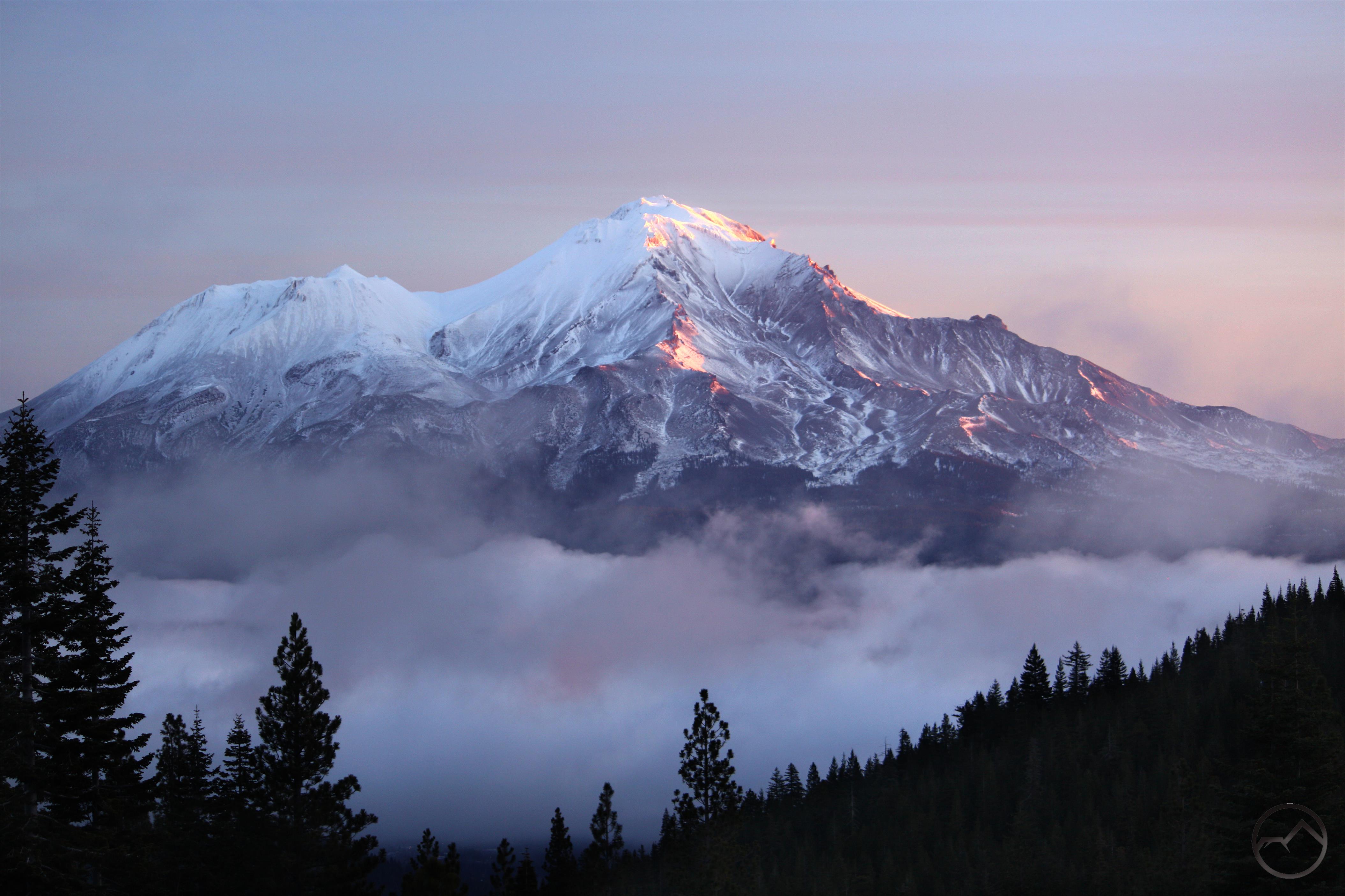
I really enjoy 19th century and early 20th century artistic depictions of the American West. This naturally spills over to a particular fascination with works that portray Mount Shasta. My interest was heightened after doing research on an old painting of Mount Shasta that I acquired from my mother (read about that journey here and here). The best place to go for a collection of paintings, sketches and engravings of the Mount Shasta area is the fantastic book Sudden and Solitary by William Miesse. I have enjoyed this book for the last few years, after being inspired to purchase it when visiting the Turtle Bay museum’s exhibit on the art of Mount Shasta a few years ago. The display has since been closed but most of the works present at the exhibit are included in the book.

wm-tm1
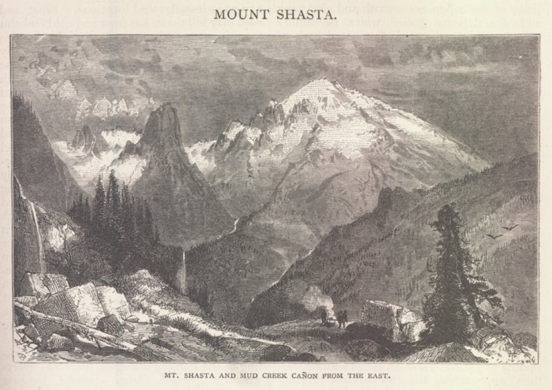
While there are many beautiful and historically interesting works depicting Mount Shasta, one of my absolute favorites is an engraving by Thomas Moran. He, along with Albert Bierstadt, is the preeminent 19th century painter of western landscapes. Moran and Bierstadt’s works were integral in inspiring public appreciation of the great beauty of the lands to the west and moved the public to support the preservation of these incredible places. Their paintings hang in many prestigious museums and are even located in the White House. Both artists have major peaks named after them as well. Mount Bierstadt in Colorado is one of that state’s elite 14ers. Mount Moran in Grand Teton National Park in Wyoming is among the most dramatic peaks in the storied range, second only to the Grand Teton itself. While both painters are well known as oil painters, Moran also worked with engravings. Specifically, the engravings were created as magazine illustrations. Moran would often make engravings of places he had not been based on sketches other people created. This is in stark contrast to his paintings, for which Moran personally joined expeditions into remote areas in order to document the landscape. In interpreting the sketches of other people, it is natural for things to become exaggerated or emphasis placed on the wrong feature on a mountain. This is the same practice that caused my painting of Mount Shasta to be almost unrecognizable.

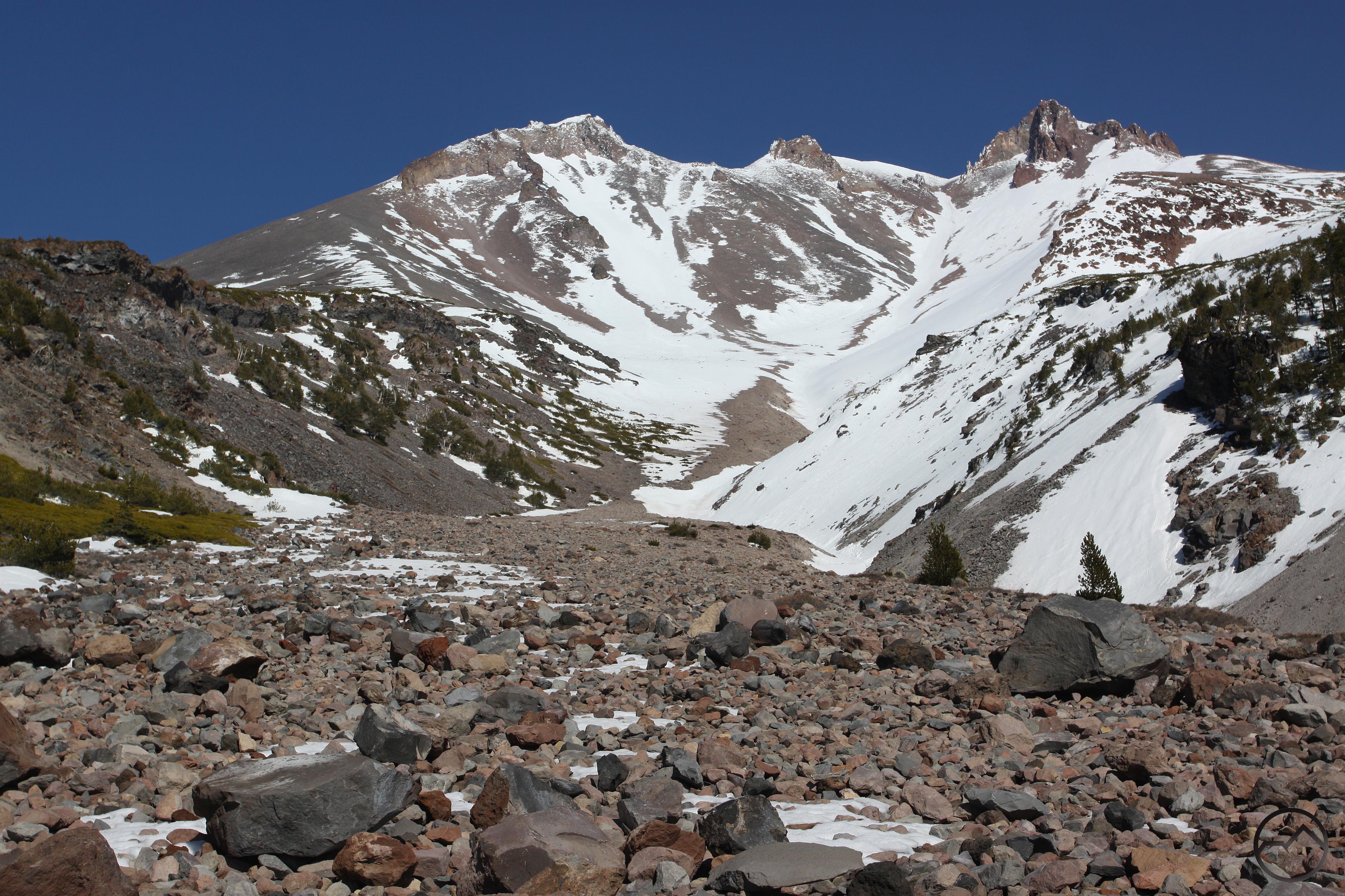
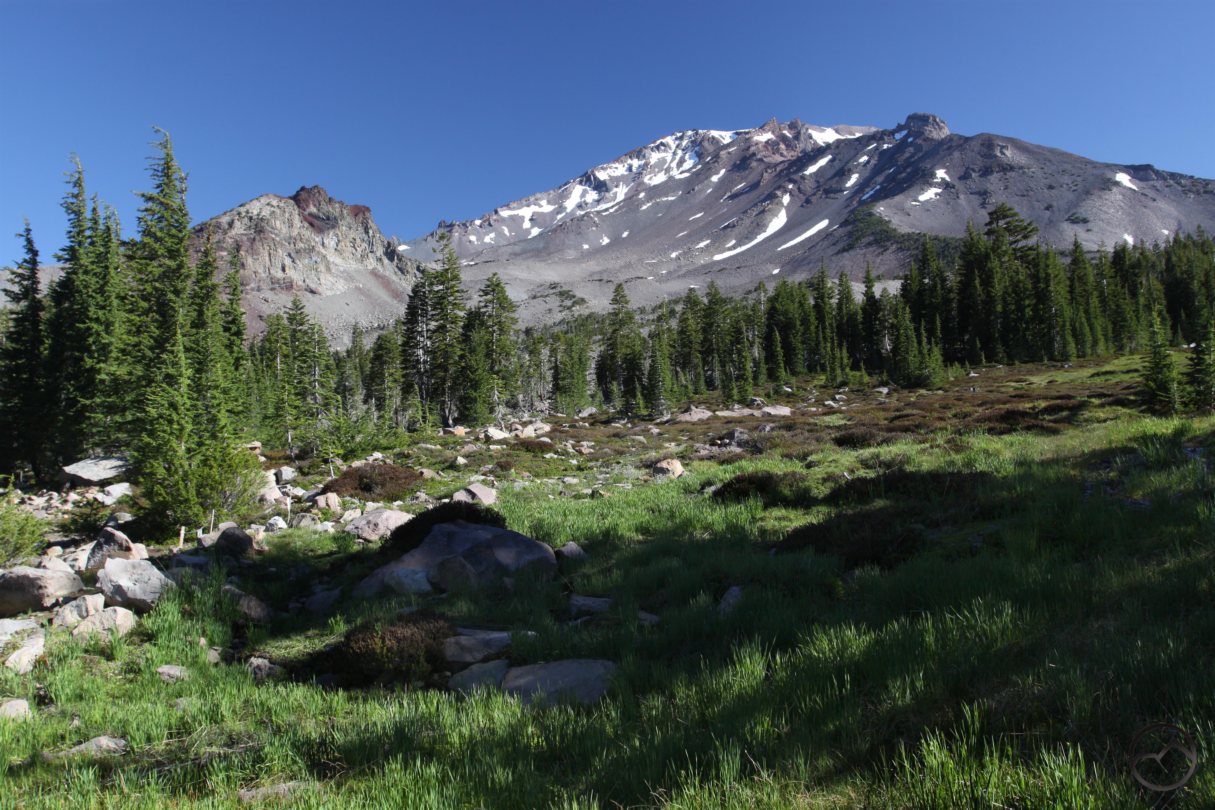
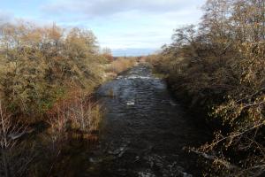
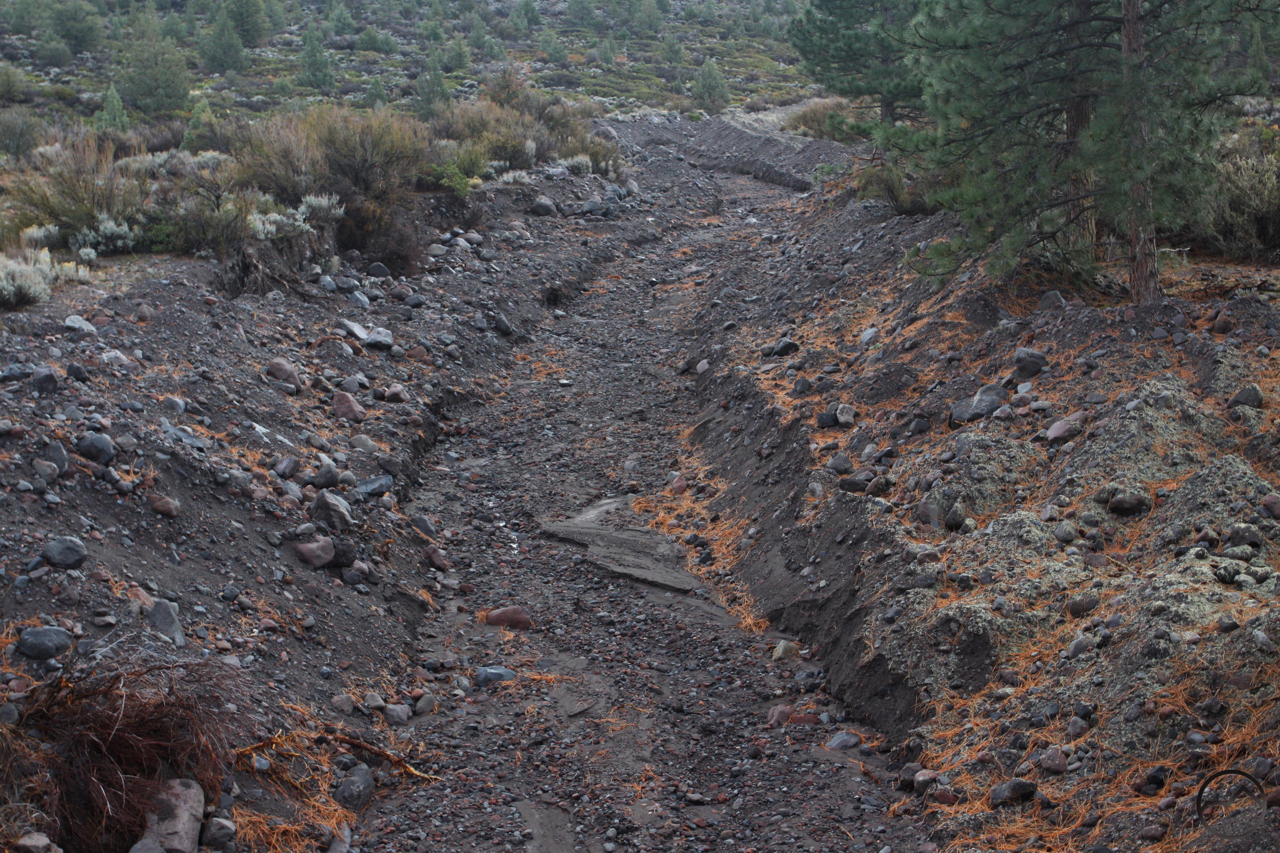
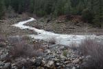
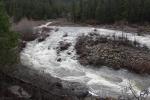
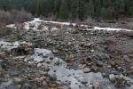
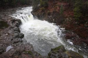
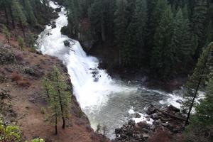
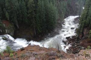
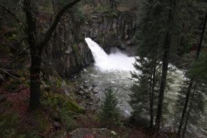
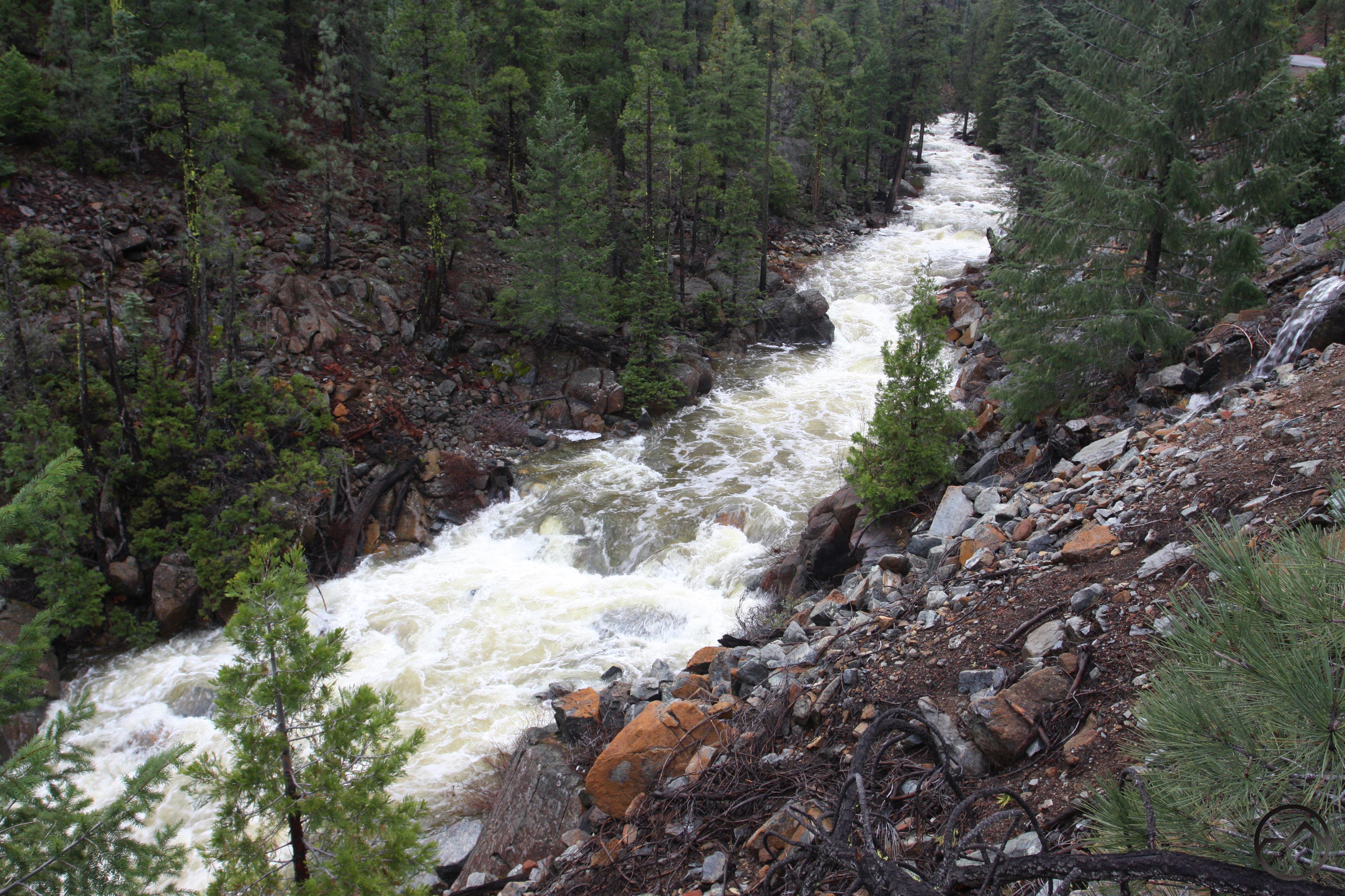
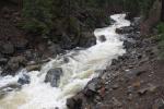
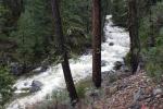
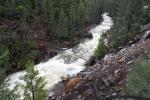
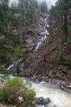
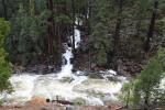
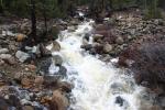
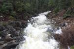
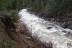
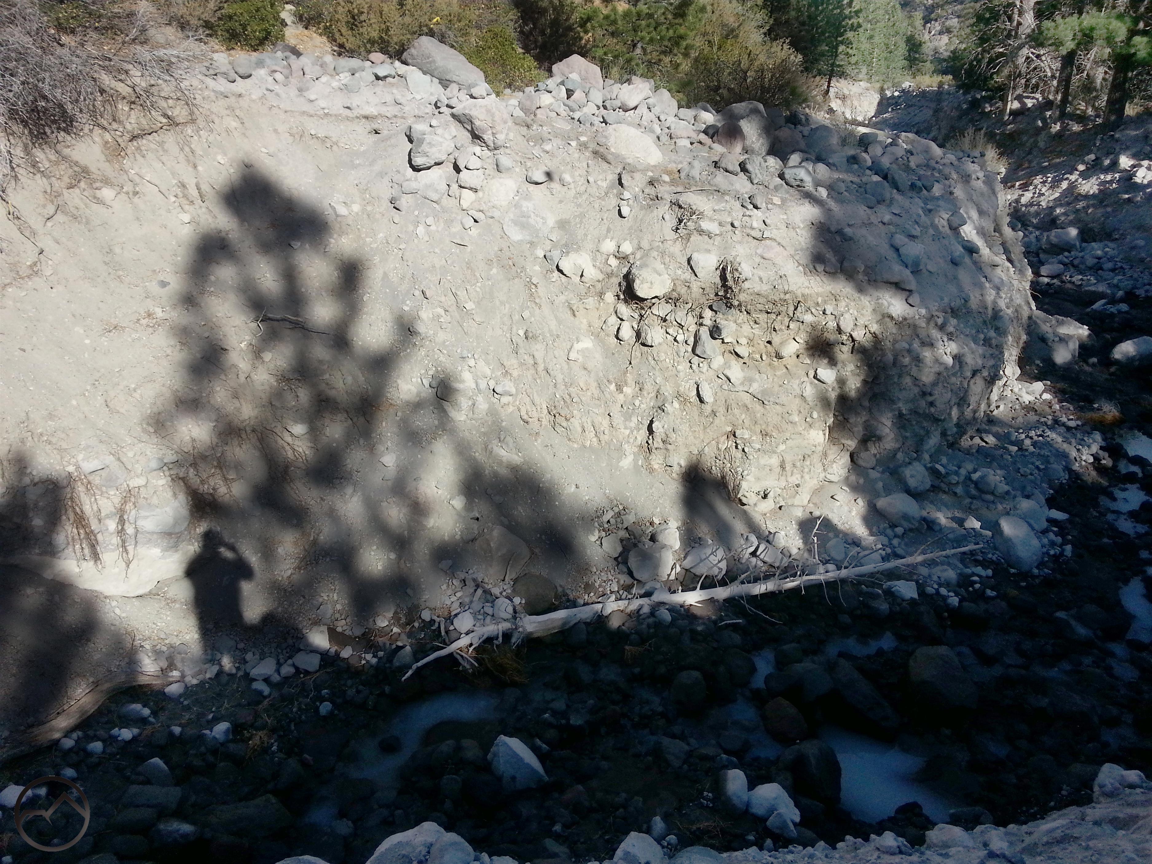
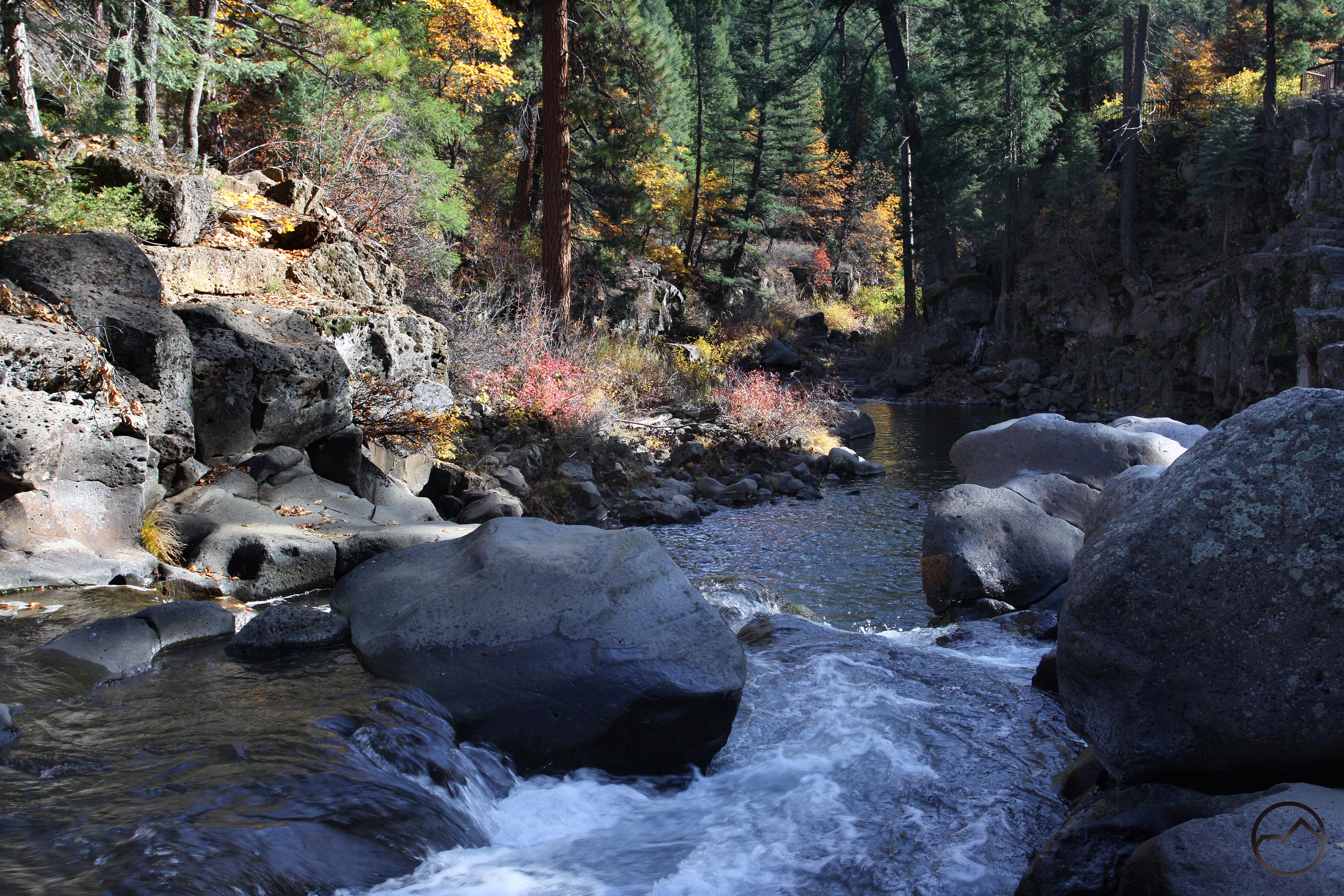
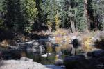
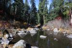
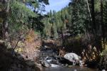
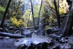
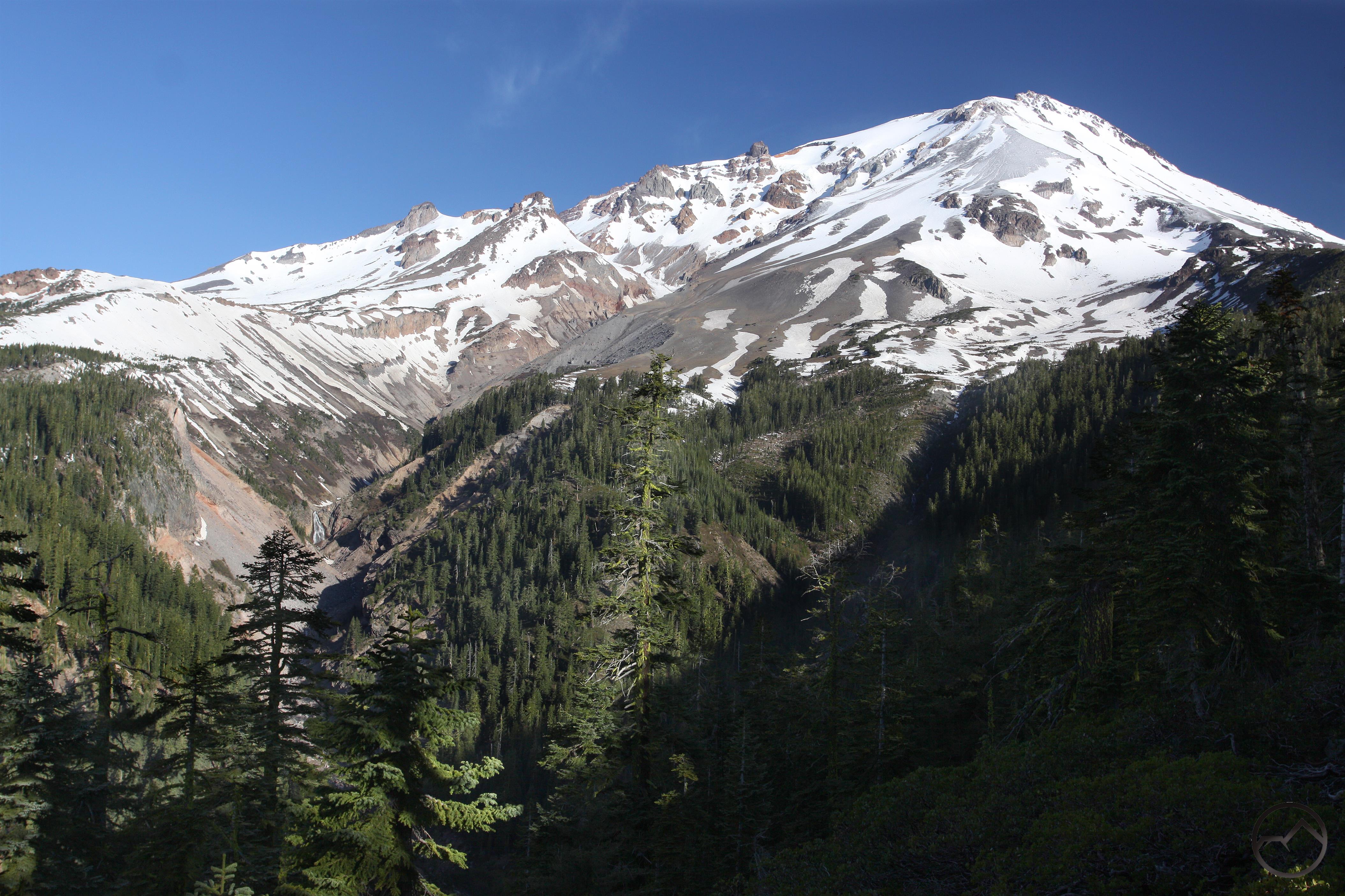
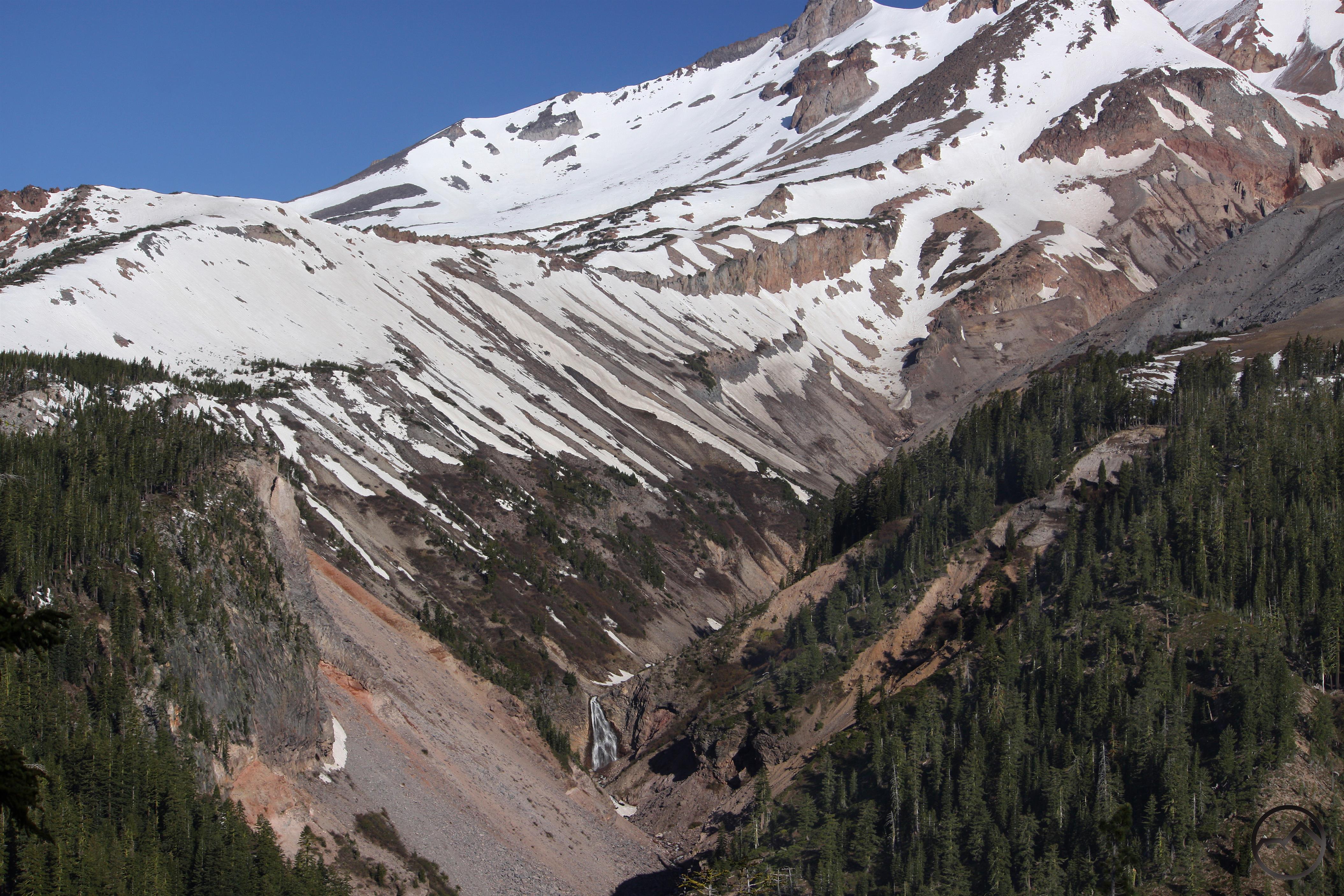
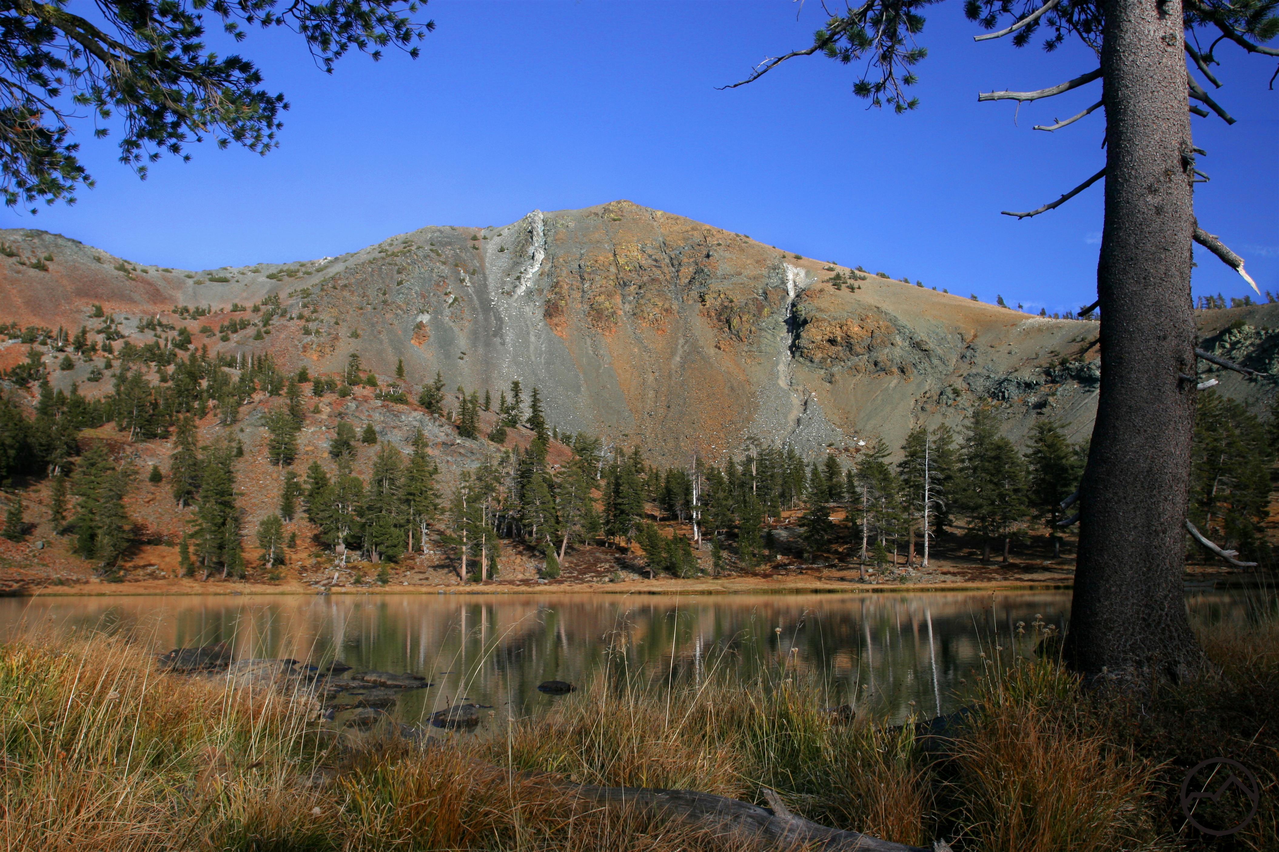
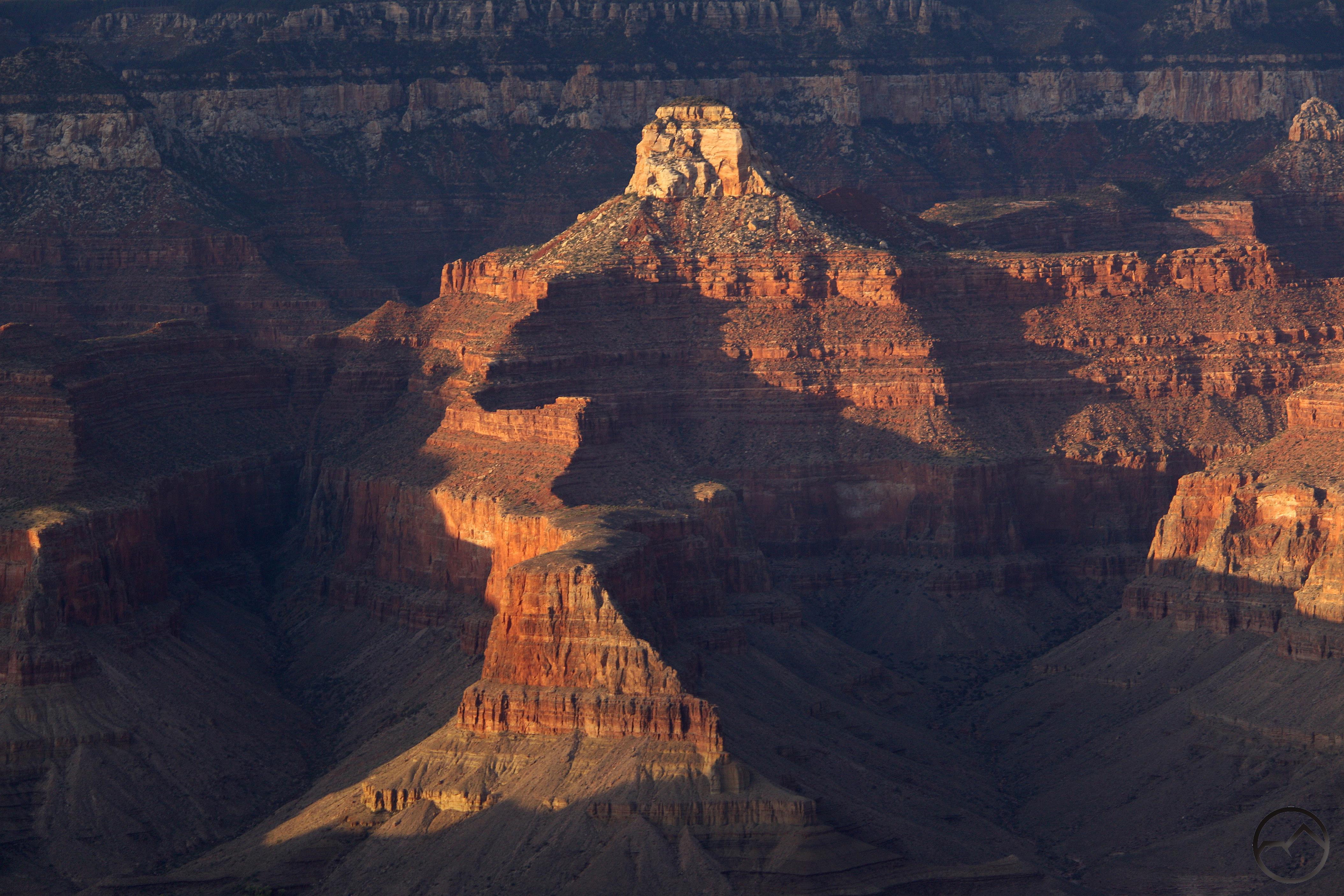
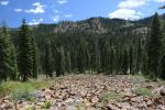
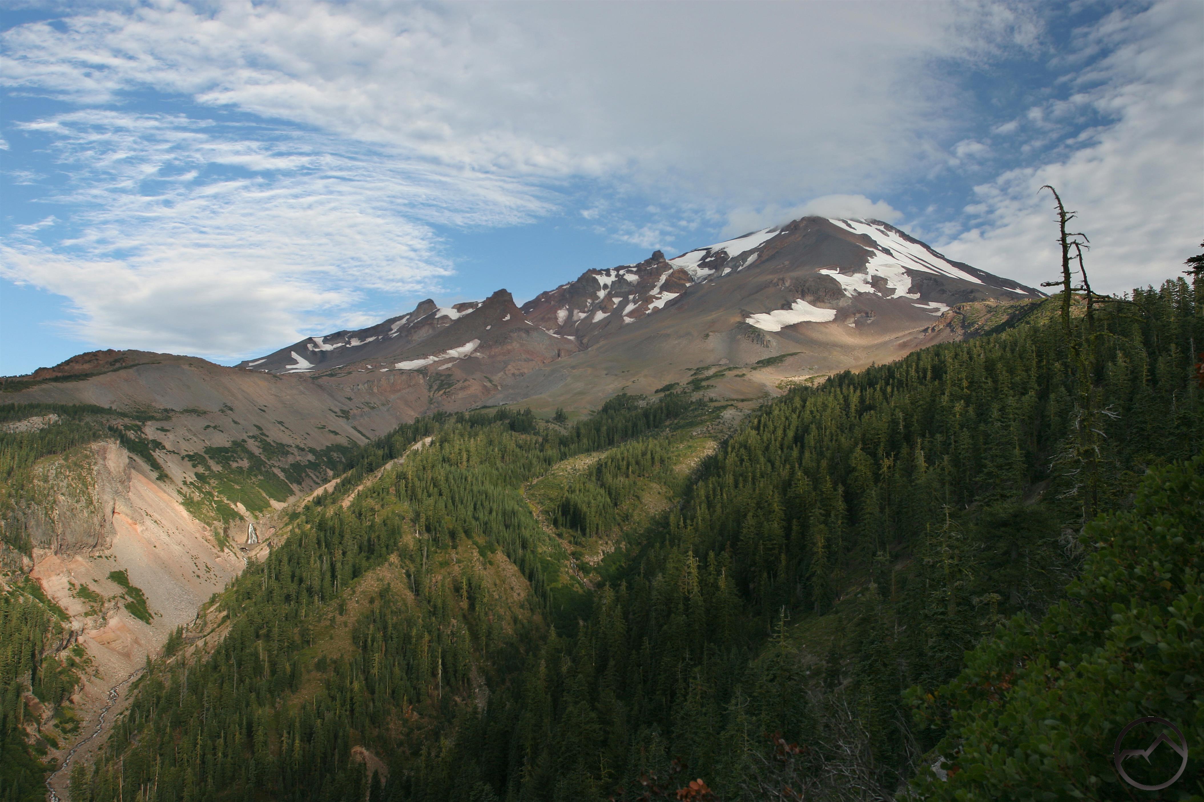
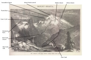
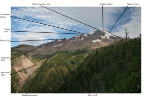
In the case of my favorite engraving by Moran, the scene being depicted is Mud Creek Canyon. It is not exaggerated so much that it is unrecognizable but it is certainly distorted enough that someone unfamiliar with Mount Shasta should be forgiven for not recognizing the great mountain. This is further obfuscated by the fact that the engraving is showing a fairly unappreciated perspective on the mountain (albeit an absolutely spectacular one and one of my personal favorites). It does seem as though the view is from the west side of Mud Creek canyon but all the same features are visible from the east side, which is the location of the Clear Creek Trail. While the scene is not proportioned correctly, it is amazing just how many landmarks are present:


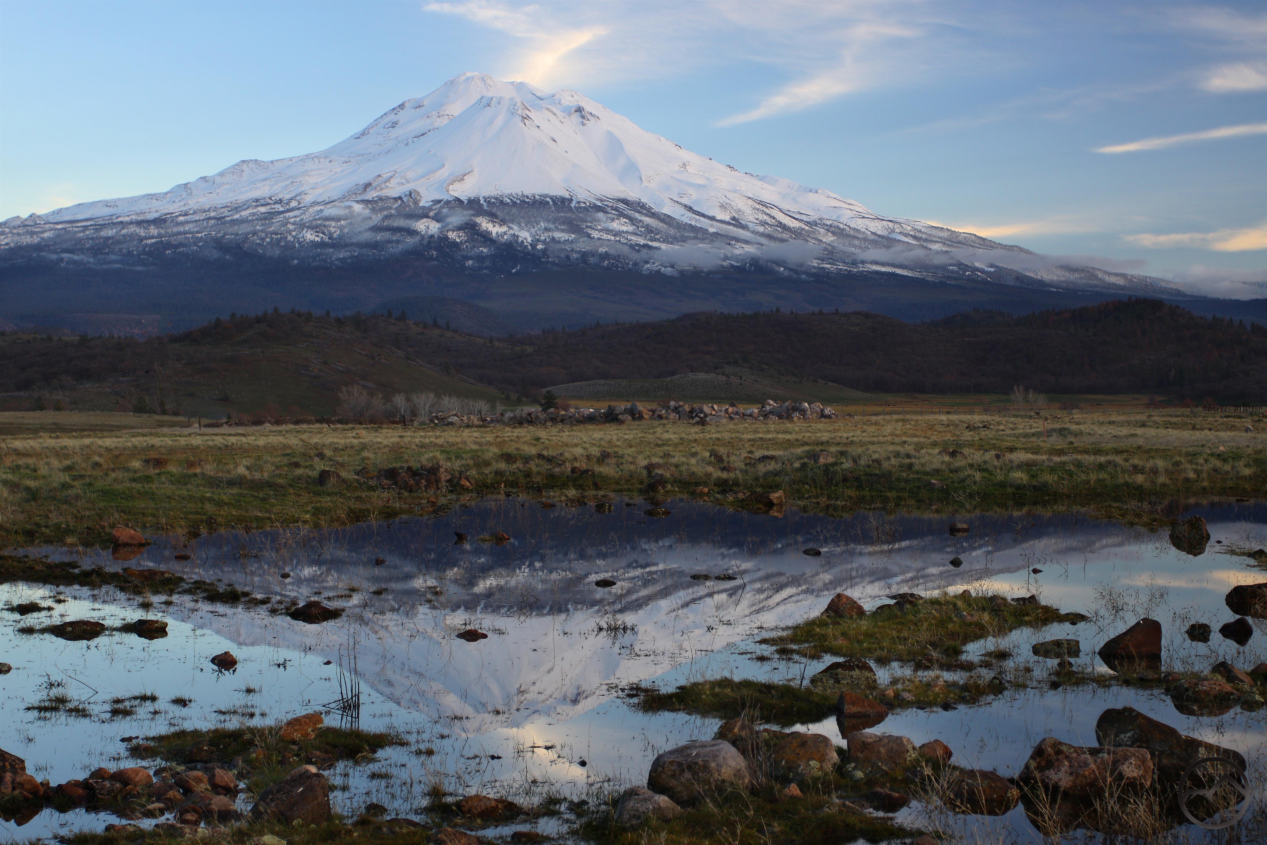
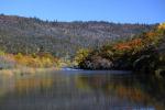
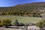
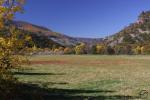
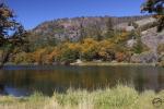
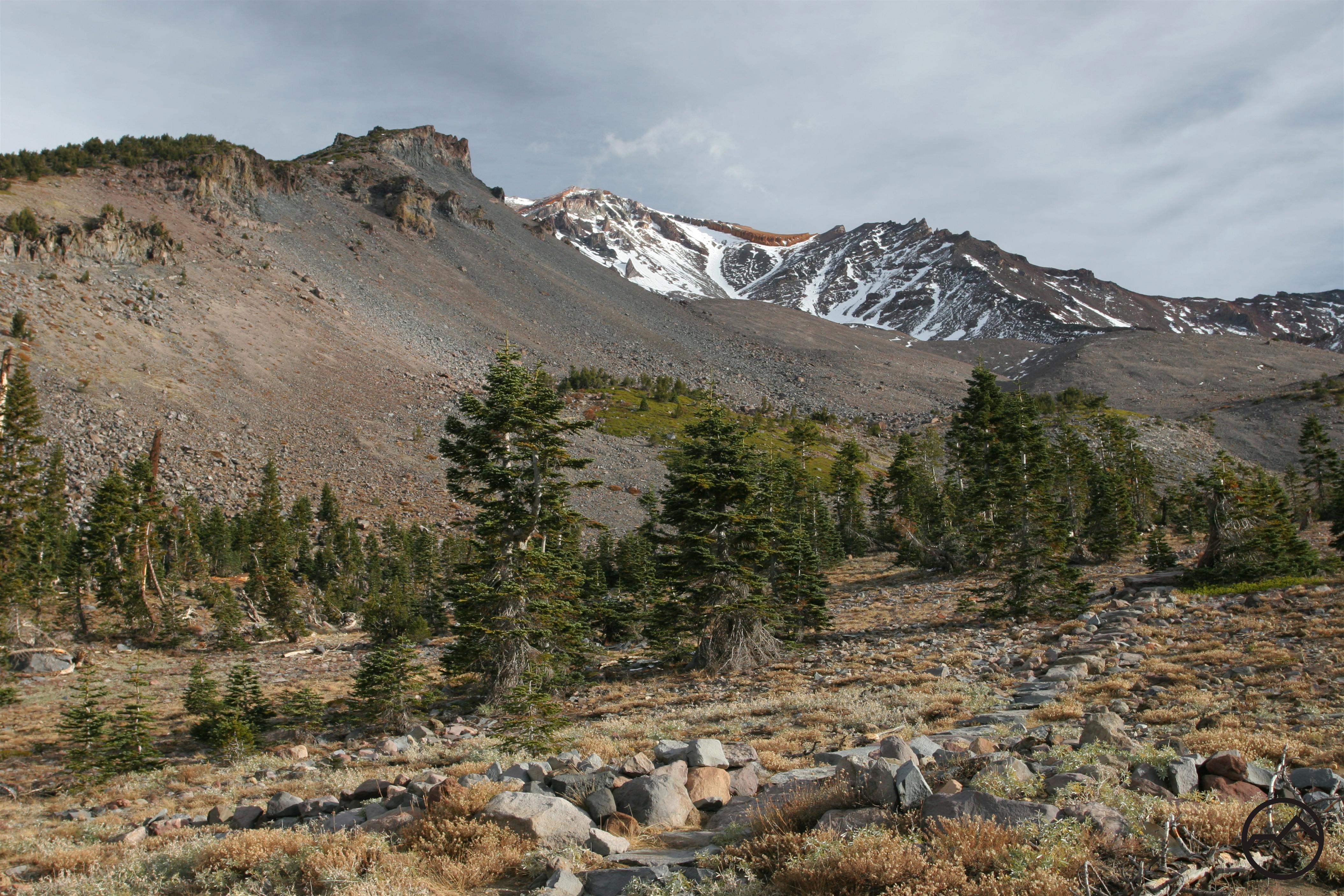
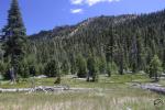
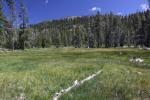
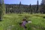
Most early depictions of Mount Shasta portray the mountain from down below as the artist gazed up at its icy heights. An early work made on the mountain is certainly unusual (another similarity with my painting, which is also made from on Mount Shasta). Nonetheless, it is an epic and inspiring view. I hope that more folks will head up onto the Clear Creek Trail and climb up to the spectacular vista of Mount Shasta. This view of the great volcano is not famous or iconic but it is so grand, so magnificent, so packed with rugged grandeur, that it certainly deserves to be one of the iconic images of the American West.

Mount Shasta 2014: A Year In Images

Posted by bubbasuess on December 31, 2014
Posted in: Hiking, Mount Shasta. 11 Comments
Early morning on Mount Shasta after another dusting of snow.

Mount Shasta in January 2014.

The year of our Lord 2014 was an exciting year for Hike Mt Shasta. Most of the year was spent working on a pair of books that are set to be published in a couple of months (more on this at the appropriate time). These books were a direct result of the success of the website and opened doors for more writing opportunities. Still, as always, the focus remains on the mountain and the incredible region that surrounds it. It is my hope that everyone had a successful year, profited in their endeavors and was able to get outside and enjoy the natural world. Like last year, I think it is appropriate to look back at all the variety throughout the year:

Cascades, Mt. Shasta - Jan2014 039 (Custom)

January: The drought left Mount Shasta without much snow cover for much of the winter. Despite this, the mountain still yielded spectacular sunrises.

Cascades, Mt. Shasta - Jan2014 008 (Custom)January (redux): OK, I know I already posted an image for January but this shot of Lassen Peak from the flanks of Mount Shasta was one of my favorite images from last year. I could not resist including it here, especially since I completely missed a month later in the year.

Cascades, Mt. Shasta - Feb2014 127 (Custom)

February: Winter is a great time to explore the lava flows, tubes and high desert terrain on the north side of Mount Shasta. The drier climate leaves a lot of terrain open for adventures.

Cascades, Mt Shasta, Diller Canyon - March2014 034 (Custom)

March: The drought winter meant that a lot of high country destinations were still within reach. The hike into Diller Canyon is a fairly unknown route with spectacular views and easy access from Mount Shasta City.

Klamath Mountains, Shasta River - April2014 002 copy (Custom)

April: The Shasta River Canyon is a great place for an adventure during the spring when snow still makes the high country harder to reach. The canyon is rugged and surprisingly wild with very little intrusion from the outside world.

Cascades, McCloud River - May2014 020 (Custom)

May: Spring is my favorite time to enjoy rivers in the mountain. The melting snow swells the volume of water and the powerful torrents are exhilarating. In the Mount Shasta area, the McCloud River, with its famed waterfalls and deep canyon are a fantastic place to appreciate the water’s surging energy.

Cascades, Mt Shasta, Mud Creek - June2014 080 (Custom)

June: As summer approaches, hidden places on the mountain get easier to reach. This unnamed waterfall lies deep in Mud Creek Canyon and sees very, very few visitors.

North Coast Range, Wine Country - July2014 020 (Custom)

July: The mountain finally opens up as the road to the Old Ski Bowl is cleared and access to the higher trailheads is available. Hikers can finally enjoy the mountain’s alpine wonderland in places like Panther Meadow.

August: ?????? I spent most of August in Sonoma and Napa Counties and did not take a single picture of anything in the Mount Shasta region!

Cascades, Mt. Shasta - Sept2014 032 (Custom)

September: As summer begins to fade into autumn, the weather changes are often accompanied by spectacular lenticular cloud displays. In 2014 Mount Shasta may have lost all of its snow (except the glaciers, of course) but the clouds did not relent and it was still a spectacular sight.

Cascades, Mt. Shasta - Oct2014 086 (Custom)

October: Fall brought evermore elaborate and astounding cloud displays.

Cascades, Mt. Shasta - Nov2014 008 (Custom)

November: Mount Shasta was finally restored to its snowy glory.

Cascades, Mt. Shasta - Dec2014 044 (Custom)

December: The year ended with an awesome series of storms that left the mountains smothered in snow. The return of water to the Shasta Valley heralded the return of the opportunity to capture reflections of the north side of Mount Shasta.

Lastly, it would not be right to conclude a retrospective of 2014 without mentioning our impressive house guest. We have had a spectacular buck hanging out around our house for the last few months. Even though we will no doubt see his offspring running around in the summer of 2015, it is possible we will never have a fellow staying with us as magnificent as this guy:

Trinity Divide, Sacramento River - Dec2014 014 (Custom)

I hope everyone has a blessed 2015!

2015 Winter Hiking Round Up

Posted by bubbasuess on December 27, 2014
Posted in: Desert, Hiking, Mount Shasta, Off Season Trails, Rivers, Spring Trails, Winter Trails. 2 Comments

Cascades, Pluto's Cave - March2013 144 copy (Custom)

After a very dry 2014, the month of December gave us some much needed precipitation. While it was mostly rain in the low areas around Mount Shasta, the snows have finally descended on the high country. Despite the drop in temperature, this does not mean that hiking is no longer a viable activity in the area. On the contrary, there are several fantastic trails that can be hiked this time of year. With the weather looking sunny for the next week before more rain (or hopefully snow) moves in, this is a great time to review the trails that are generally accessible when the white stuff has smothered the alpine trails.

Mount Shasta City Area Trails

Around Mount Shasta City, there are many trails that offer either great views or the opportunity to enjoy one of the area’s fantastic natural spectacles. Obviously Mount Shasta and the surrounding peaks will naturally draw attention, but the Sacramento River and many of its tributaries also offer fantastic hiking with rugged, beautiful and often historic scenery. These trails are incredibly convenient and are located either right on the edge town or just a couple minutes outside of the community. For convenience, scenery ease of hiking, these are tough to beat.

Three Winter Hikes Near Mount Shasta City

Two Winter Hikes On The Lake Siskiyou Trail

Short Trails In Mount Shasta City

Shasta Valley Trails

Falling as it does in the rainshadow of Mount Shasta, the Shasta Valley is an obvious destination for hiking in the winter. With less precipitation, it is unlikely for any of the trails to be covered in snow for more than a couple of days after a major storm. This is a great blessing for hikers looking to get outside in the wintertime. The juniper and sagebrush flats are punctuated by lava flows and small volcanic domes. While the terrain is interesting and a great change of pace from the pine and fir forests that are ubiquitous in other parts of the region, it is the epic views of Mount Shasta’s glacier clad north face that is the highlight of these trails.

Winter Hiking In The Shasta Valley

Winter Hiking In the Shasta Valley Wildlife Refuge

Sacramento River Trails

The Sacramento River lies low enough that it often escapes the worst of the winter snows, leaving the trails available to hikers looking for some beautiful riparian scenery. Though there are not many trails along the river, and those that there are are not long, the trails are still good options for winter outings and can fill the void many of us need for natural settings until other, high trails become available.

Three Trails Along The Sacramento River

Castle Crags Trails

Although many of the trails in the Castle Crags are high enough to get substantial snow, they are often still available during the winter. This is especially true of some of the paths that wind through the Crags’ lowest reaches. Some judgement should be exercised when considering a winter hike in the Castle Crags. Admittedly, these are hikes that are optimal in the spring rather than winter. Nonetheless, these should not be completely avoided in the winter.

Spring Hiking In The Castle Crags

McCloud River Trails

Like the Castle Crags, the McCloud River is high enough that it can get enough snow to make winter hiking unrealistic. However, much of the winter the trails can still be accessible and the river, especially its three waterfalls, should not be avoided. This can also make an epic snowshoe trip!

McCloud River Trails


I hope that everybody had a great Christmas and that 2015 is a fantastic year for all of us. Thanks for reading HikeMtShasta.com!

Rivers Reflect Storm’s Fury

Posted by bubbasuess on December 12, 2014
Posted in: Mount Shasta, Rivers. Tagged: Lake Siskiyou, McCloud River, Parks Creek, Sacramento River, Shasta River, Whitney Creek. 3 Comments

McCloud RIver (2) (Custom)The heavy rains of the last few days swelled the creeks and rivers all over Northern California and the Mount Shasta area was no different. I had gone out on December 11th to see everything in the midst of the storm and it was truly a sight to behold. Creeks that are  normally small trickles were incredibly large and angry torrents. The rivers were enormous and awe-inspiring. Unfortunately, I for got my camera and did not document the fury of the storm-fed monsters. Setting out to rectify the omission from the day before, I packed up my kids and my camera and headed out in my jeep to see what the rivers looked like. The water had already subsided but everything was still incredibly full. After such a bad winter last year, it is gratifying to see so much water.

Our first stop was to check out Parks Creek in the Shasta Valley. Normally, this is just a small stream. The day before it had been an incredible, adobe colored nightmare of raging water. There was half as much water in it the day after the storm but it was still very, very full:


After that we hopped over to the Shasta River. Like Park’s Creek it was not as large as it had been the day before but it was still large, furious river:


We then headed over to Whitney Creek. I was thinking about the recent damage to the Whitney Falls Trail and how this much water in the creek would only make things much, much worse. I was unprepared for what I found there:

Shasta Valley (5) (Custom)After that, the kids and I drove over to Lake Siskiyou. The lake was full and thundering over the spillway at the top of the dam. It was an inspiring sight:


I took the two kids on the Box Canyon Trail, hoping to get some more views of the wild river surging through the canyon but little feet have their limitations. We still had a lot of fun scrambling on the rocks and checking out route down to the river, which was way to dangerous to attempt with 5 and 2 year-olds. We then hiked back out to the trailhead, and drove up to the river before it reaches Lake Siskiyou. It was also very impressive:


It was lunchtime, but the day would not be complete without a quick trip over to the McCloud River. We headed over and, surprisingly, were the only ones there at any of the three falls. With all the water I would have thought that more people would have been out to enjoy the powerful waterfalls. We all climbed out of the jeep and went out to enjoy the waterfalls all to ourselves. Of course, the rocks and dirt were for more interesting to my son (5) and the pictures of trout on the interpretive displays were way more captivating to my daughter (2) than any of the waterfalls. Still, I was glad to enjoy spectacle with them:

Lower McCloud Falls

Upper McCloud Falls

After such a horrible drought, it has been a great way to start the winter.

Recent Storm Leaves the River Raging

Posted by bubbasuess on December 8, 2014
Posted in: Mount Shasta, Rivers. Tagged: Sacramento River. 1 Comment

Trinity Divide, Sacramento River - Dec2014 030 copy (Custom)

We are fortunate to be receiving all the rain we have been getting. During a recent trip up the South Fork of the Sacramento River to get a Christmas Tree, I paused to take some images of the river in all of its rain-swollen glory. The river was wild and powerful. Lake Siskiyou is filling up fast. Let’s hope things continue this way and Lake Shasta can do the same.


Cascade on the South Fork of the Sacramento


Whitney Falls Trail Washed Out

Posted by bubbasuess on November 16, 2014
Posted in: Mount Shasta. Tagged: Whitney Falls. 21 Comments

Cascades, Mt Shasta, Whitney Falls - July2012 037 copy (Custom)

The trail to Whitney Falls has consistently been the most popular trail on Mount Shasta that does not begin on the Everitt Memorial Highway. Compared to the other backcountry trailheads, it has a short and simple drive that is easy to reach off of the highway. It is a beautiful hike through remote territory and ends at an incredible overlook near awesome Whitney Falls. It is no wonder the trail is one of the most frequently listed trails in hiking and waterfall guides. Unfortunately the trail has suffered significantly since it was first damaged in a major glacial outburst debris flow in 1997. The Forest Service effectively condemned the trail and went unmaintained for nearly two decades. Hikers still wanted to reach the falls and a series of use trails were beaten into the loose volcanic soil. It was not until earlier this year that the Mount Shasta Trails Association worked hard to reestablish the trail and make it a functional, easy-to-follow route again. Their efforts were much appreciated and it seemed that the Whitney Falls Trail was going to be restored to its former condition. While much of the original path on the west side of Bolam Cree was retained, the new trail crossed over the creek and traveled on the east side before recrossing and continuing on the west.

Ironically, no sooner had it been rebuilt that there was a major flow of some type through Bolam Creek that wiped out the critical first crossing point. Where the original crossing required a six foot descent down a sloping grade to the creek it would now take a 12 to 15 foot drop down a sheer, loose, boulder-filled wall. This is not only completely unrealistic, but also a dangerous move to attempt. The second crossing survived the heavy flow thanks to a series of large boulders in the creek bed that buttressed the walls of the creek’s channel. For those looking to hike the Whitney Falls Trail now, an alternate route has been established. It crosses the creek much earlier than before, and travels through Bolam Creek’s channel for extended periods of time before climbing up onto the east side and making its way to the still extant second crossing. This route is poorly marked and quite dangerous in high water situations. It is completely unrealistic as a long term route for the trail.

The crossing in pre-washout condition. Note the circled rocks for reference.

The crossing in pre-washout condition. Note the circled rocks for reference. The channel is not too deep and the walls have a gentle slopes, making it easier to climb. This is not a great shot of the crossing but it is the best I have before the conditions were altered.

Bolam CreekII (Custom)

Here is a view of the crossing after the washout. Different perspective but taken from the same spot. Note the circled rocks for reference.

Bolam Creek (Custom)

The crossing from the opposite side. Obviously this is not a viable option for the trail anymore. The walls of the channel are loose and unclimbable.

Thankfully, there is another option for restoring the Whitney Falls Trail. The original route of the trail (view it here) followed the current path but at the point where the new route made the crossing over Bolam Creek, the trail climbed above the channel and traveled along the high, brush covered divide between Bolam and Whitney Creeks. This route had staggering views of Mount Shasta. The views were unique among the trails on the mountain since it takes in the awesome north side and includes the Bolam and Whitney Glaciers. Now the path has been abandoned and much of the route is getting choked with overgrowth. However, the way is still easily discernible and would not require too much work to make it passable and enjoyable again. Even better, realigning the trail along this original route would make any crossings of Bolam Creek’s unstable channel unnecessary. I hiked this route back in 2007 and it was generally easy going in most places. I hiked it again back in September and it was in pretty rough shape and really overgrown. The last 7 years have not been kind to the original Whitney Falls Trail.

It should be noted that even though the creek crossing is gone and the original trail is overgrown, there is still a relatively easy goat trail to follow that stays on the west side of Bolam Creek and connects the sites of the first and second crossings. If the sides of the creek channel were more stable, this would make the obvious location for a new trail but the loose soil makes this a temporary route at best. The original trail, high above the creek, is still the best option for a long term route.

I am thinking that it would be a great project to get some folks with loppers out to the trail next spring and cut back the growth that has encroached on the trail. A few people, some loppers and a little motivation would be all it would take to restore the Whitney Falls Trail and make it one of the prime routes on Mount Shasta it has always been. Would anyone be interested in helping in this endeavor?

Autumn On The Rivers

Posted by bubbasuess on November 9, 2014
Posted in: Mount Shasta. Tagged: Fall Color, Klamath River, McCloud River, Mount Shasta, Sacramento River. 3 Comments
Fall color on the McCloud River views from the top of Lower Falls

Fall color on the McCloud River viewed from the top of Lower Falls

While the fall color in Mount Shasta is not as grand as the east coast or parts of the Rocky Mountains, it is still very dramatic. Indeed, this is one of the most beautiful time s of the year up here in the North State. The color is not found high on Mount Shasta or amongst the tall peaks of the Trinity Divide. Instead, it is focused in the lower elevation areas, including the Strawberry Valley and the along the southern fringe of the Shasta Valley near Weed. The best places to enjoy the fall color from the trail are along the region’s creeks and rivers. Here the riparian environment is loaded with a variety of trees and shrubs that have wonderful displays of color in the fall. The trails are focused around the McCloud and Sacramento Rivers, though there are a few paths on other creeks that feed into the rivers as well.

Even though the spring thaw is perhaps the most dramatic and awe-inspiring time to visit the rivers, fall is no doubt the prettiest time of the year. Their water level is lower, but the rivers have a friendly and intimate sense about them and the power of the surging spring water is replaced by the palette of colors that surround the waters. The delicate leaves, slowly falling from the trees compliment the running rivers. In some ways, given the profusion of conifers throughout the area, the quality of the fall color can often come as a surprise. The McCloud and Sacramento Rivers enjoy great displays of the autumn spectacle and the fall is one of the best opportunities to appreciate these great rivers from the trail. Yet it must be mentioned that the best color may actually belong to the Klamath River at the north end of the Shasta Valley. There are no trails along this river but those motivated to see the large river in its incredible canyon and dazzling color will not be disappointed.

McCloud River

Pine Tree Hollow Loop

Sacramento River

Mossbrae Falls

Klamath River


Five High Country Hikes To Enjoy This Weekend

Posted by bubbasuess on November 8, 2014
Posted in: Mount Shasta. Tagged: Black Butte, Clear Creek, Horse Camp, Mount Eddy, Seven Lakes Basin. Leave a comment
Cascades, Mt. Shasta, Mud Creek - June2014 002 (Custom)

Mount Shasta from the Clear Creek Trail

With the warm weather expected over the weekend, the next few days will be a wonderful opportunity to get outside and enjoy the mountains one last time before the cold weather really begins to set in. However, with the road past Bunny Flat closed, there is sometimes a sense that the season has passed and the high country is now out of reach. While this may be true for the trails that begin up at the Old Ski Bowl, there are still plenty of fantastic high country trails that are waiting to be enjoyed. Some of the higher elevation may have some snow on the ground but in most places, there isn’t much more than a very thin layer of ice. Despite the lateness of the season, there is still a tremendous diversity of high country trails to hike. Whether on Mount Shasta or in the Trinity Divide, there is still time to get out and enjoy the Mount Shasta region’s incredible scenery! The following are five great options for excellent high country hiking this weekend.

Cascades, Black Butte - July2013 018_edited-1 (Custom)

The view north from the Black Butte Trail

5. Black Butte

The giant volcanic cone of Black Butte is prominently visible throughout much of the Mount Shasta area. At 6,358, it is not among the tallest peaks around the great mountain but it does have a tremendous amount of relief, towering over 2,000 feet above surrounding area. It would be a major landmark in its own right if it were not for the obvious and overshadowing presence of Mount Shasta. Hiking to the summit of Black Butte is often impossible in the winter, when snow covers the trail and the exposure is very dangerous. Making matters worse, the snow lingers on the trail for a long time because of the route’s location on the peak’s north side. Right now the way is clear and this is a great time to enjoy the hike’s incredible views.

833172 copy (Custom)

Olbermann’s Causeway, near Horse Camp

4. Horse Camp

While the last stretch of the Everitt Memorial Highway may be closed, it is still easy to drive quickly to high elevation at Bunny Flat. From here, you can hike either the Green Butte Ridge Trail or the short path to Horse Camp. The latter is preferable at this point because Green Butte does have some snow on it. Horse Camp, on the other hand, is below the current snow line and is reached quickly. From there you have numerous options for climbing higher. While the hikers headed to Helen Lake and Hidden Valley must contend with some of the white stuff, there is plenty of room to explore the lower areas of Avalanche Gulch without having to deal with any snow.

Trinity Divide, Many Lakes Mountain - June2012 065 copy (Custom)

The Seven Lakes Basin

3. Seven Lakes Basin

This is one of the best trips in the Mount Shasta area and it is still a great option even though we are moving into the cold season. The hike follows the Pacific Crest Trail along the top of the Trinity Divide, with fantastic views in all directions. The vista is particularly awesome to the west, where the sawtooth towers of the Trinity Alps form a spectacular horizon. Not to be outdone by the western vista, the view to the east is utterly dominated by Mount Shasta. After a couple of easy miles on the PCT, the view of the Seven Lakes Basin unfolds beneath the trail. Many of the lakes are visible from here and the towering cliffs, Boulder Peak and the brooding Grey Rocks make a memorable scene. Hikers can continue further and visit Helen Lake or descend down into the basin to explore the rest of the lakes.

Cascades, Mt Shasta, Clear Creek - June2014 022 (Custom)

Mud Creek Canyon from the Clear Creek Trail

2. Clear Creek Trail

The journey on the Clear Creek Trail is one of the most spectacular trails in California. Even though there may be some snow higher up near the springs, the lower section is still an awesome trail with some of the best views of Mount Shasta, Mud Creek Canyon and Mud Creek Falls. The trip starts in old growth red fir forests and climbs onto the east rim of Mud Creek Canyon where there are epic views. Higher up the trail climbs into a large basin containing the headwaters springs of Clear Creek. The Konwakiton, Watkins and Wintun Glaciers all cling to the cliffs above the basin. Volcanic spires loom high overhead, marching inexorably toward Mount Shasta’s summit. While there may be a bit of snow in the basin right now, the odds are good that the going will still be easy.

Trinity Divide, Mt. Eddy - Oct2008 006 (Custom)

Mount Eddy and Upper Deadfall Lake

1. Mount Eddy and the Deadfall Lakes

Often overlooked because of Mount Shasta, Mount Eddy is a tremendous mountain in its own right. The view from the summit is among the finest in Northern California and certainly the best north of Lake Tahoe. There is just a thin layer of snow near the summit and the rest of the trail is generally clear. With Mount Shasta white and the way clear to the top, now is a fantastic time to climb to the view. If that were not enough, the hike passes through awesome Deadfall Basin, where the trio of lakes is an incredible destination on their own. Just hiking to the lakes is a fantastic high country trip; perfect the warm weather this weekend. While the summit of Mount Eddy may be a bit too much for little legs, the hike to the lakes via the PCT is a great outing for kids.

What Happened To The Blog?!

Posted by bubbasuess on November 7, 2014
Posted in: Uncategorized. 10 Comments

As some of you may have noticed, there has not been a new post on the blog for four months. Up until July, I had given myself the goal of adding at least four posts per month. I think I got two done in July but nothing has been posted since the 5th of July. So what happened? I had two book manuscripts (more on those in the near future) pending and time simply was too short to continue posting things on the site. I tried to keep up with the Facebook page, but even that got neglected after a while. Most of July and August was spent out in the field finishing up the research necessary for the books and September was a blur completing the manuscripts. The first was due at the beginning of October and the second was due two weeks later. Once both manuscripts were submitted, my dad and I took a roadtrip out to Dallas, TX. It was a mix of business and pleasure and a great trip. So, even though the editing process has commenced for the manuscripts, I now have time to resume the blog, if anyone still cares to read it. I hope to have a more substantive post up by the end of the day.

Just for fun, here are a few images I took from the roadtrip to Texas. These aren’t particularly great and they were all taken from the side of the road, but it sure is a testimony to how spectacular driving through the western U.S. is.

Aspens line the East Fork of Lamoille Creek.

Aspens line the East Fork of Lamoille Creek.

The sun lights the summit of Mount Fitzgerald in the Ruby Mountain.

The sun lights the summit of Mount Fitzgerald in the Ruby Mountains.

Utah, Moab, Fisher Towers - Oct2014 086 copy (Custom)

The Colorado River reflects the mighty Fisher Towers and the snow capped La Sal Mountains.

Incredible fall color highlights the view of Mount Sneffels.

Incredible fall color highlights the view of Mount Sneffels.

Another view of fall color below the towering Sneffels Range.

Another view of fall color below the towering Sneffels Range.

Wheeler Peak, the highest point in New Mexico.

Wheeler Peak, the highest point in New Mexico.

Arizona, Petrified Forest - Oct2014 119 copy (Custom)

Pilot Rock, in the Painted Desert.

Sunset on Buddha Temple.

Sunset on Buddha Temple.

Seldom Seen: Fawn Creek Canyon

Posted by bubbasuess on July 5, 2014
Posted in: Hiking, Meadows, Mount Shasta, Seldom Seen, Trinity Divide. 7 Comments
Trinity Divide, Fawn Creek Canyon - June2014 075 (Custom)

Fawn Creek Canyon from the canyon headwall.

One of the many interesting geographic features of the Mount Shasta area is the headwaters of the Sacramento River. The largest and longest river in California, the Sacramento is a dominant presence throughout much of Northern California. The river meanders through the Sacramento Valley, passing through cities and towns, irrigating vast farmlands and providing recreation and habitat for people and wildlife. While the Sacramento River far from obscure, it is generally overlooked that the Mount Shasta area is where the river’s headwaters are located. Beginning high up in the Trinity Divide, the river is divided into the three forks, each claiming a somewhat different character. The North Fork is the most remote and begins in an extensive complex of meadows. The spongy soil holds water like a sponge and slowly releases the liquid, giving rise to the river. The Middle Fork also has a few small meadows but is also sourced from a small group of lakes at the head of its canyon. The South Fork is much greater in scale. The river claims 10 named lakes near its source scattered through three lake basins as well as the large lakeless Soapstone Basin as its headwaters. The three lake basins see their share of hikers, though by many standards they are lightly used. Soapstone Basin, though nearly forgotten by most, does have a maintained trail leading through it that connects to the nearby Pacific Crest Trail. However, there is another part of the South Fork’s headwaters that goes completely under the radar. Fawn Creek Canyon is almost completely overlooked and is utterly anonymous to all but a few devotees of the Trinity Divide.

Trinity Divide, Fawn Creek Canyon - June2014 052 (Custom)

The upper meadow in Fawn Creek Canyon.

Located just north of the South Fork of the Sacramento River, Fawn Creek Canyon is a lonely mountain valley. Sandwiched between White Ridge to the North and Bear Ridge to the south, the canyon is blanketed in an excellent forest of lodgepole pine. Neither ridge is exceptionally rugged but they do claim some craggy protrusions breaking through the forest. The lowest part of the canyon is narrow and rugged as it approaches the South Fork. Fawn Creek tumbles down a series of small cataracts as it speeds through this section. The upper portion of the canyon takes on a much different appearance. Exhibiting the classic u-shaped form of valleys that have experienced the passage of large glaciers, it is easy to imagine a large sheet of ice gouging at rocky protrusion and leaving a uniform landscape in its wake. Although there are no lakes in Fawn Creek Canyon (often the remnants of glaciers) there is still a large complex of meadows in the upper section. The meadow is broken up into three sections. The lowest of the three is the least extensive and is intruded by numerous trees. The middle meadow is very attractive and has some nice views of rocky points along the rim of Bear Ridge. The upper meadow is by far the nicest. It is incredibly lush and it is possible to observe Fawn Creek developing as small spring-fed streams combine and begin the journey down to the South Fork. The upper meadow is hemmed in by the headwall of Fawn Creek Canyon, which, while not particularly craggy, is still a scenic sight from the lush grasses. Add to this mix some great wildflower displays in the meadows and Fawn Creek Canyon can be an idyllic mountain hiding place.

Trinity Divide, Fawn Creek Canyon - June2014 026 (Custom)

The middle meadow area.

Access to Fawn Creek Canyon is not difficult. A road climbs up from the South Fork and passes the lower two meadow areas before stopping short of the final, upper meadow. The obscurity of the canyon is protected in large measure by the obscurity of the road and the numerous other attractions in the South Fork area. The road finally ends near the middle meadow at a large turnaround. The road actually continues beyond the turnaround but it has been condemned and quickly decays to an unpassable state. Nonetheless, the old road makes a convenient trail to hike up to the upper meadow. Though the road crosses a few wet spring areas, it stays a fair distance away from Fawn Creek. Nonetheless, the road and creek do approach each other as the meadow approaches and after a short cross-country jaunt, the meadow unfolds beautifully at the head of the canyon. Few people make it up this far into Fawn Creek Canyon and it makes a wonderful place to pitch a tent and enjoy a remote, wild and serene meadow.

If there is any drawback to Fawn Creek Canyon, it is the lack of great views. There are no great views of Mount Shasta or Mount Eddy. The best way to get a sense of the canyon is to climb up to the top of the headwall where the PCT traverses the west end of the canyon. From there both White Ridge and Bear Ridge extend eastward and Mount Shasta looms majestically above everything. This view can also be accessed via the PCT from the Gumboot trailhead. From there, hikers can drop down into the canyon and enjoy the upper meadow before climbing back out of the canyon and returning to the trailhead.

Fawn Creek Canyon Gallery

Fawn Creek Canyon from the PCT.


As always, if anyone is curious about details in getting to these places, feel free to send me an email.

Posts navigation

← Older Entries
Newer Entries →
    • Recent Posts

      • Winter Shows Up When It Will
      • January Rolled By With Mud, Then Very Dry
      • Mount Shasta 2025 – A Year In Images
      • Mount Shasta On Either Side Of Christmas
      • Adrift In An Ocean Of Fog
      • December Has Been Spectacular Thus Far Pt. II (A Magnificent Lenticular)
      • December Has Been Spectacular Thus Far Pt. I
      • Lenticular Interrupted
      • A Stormy Wave And A Truchas Sunset
      • Aurora Lenticularis
    • Enter your email address to follow Hike Mt Shasta and receive notifications of new posts by email.

    • Archives

      • February 2026
      • January 2026
      • December 2025
      • November 2025
      • October 2025
      • September 2025
      • August 2025
      • July 2025
      • June 2025
      • May 2025
      • April 2025
      • March 2025
      • February 2025
      • January 2025
      • December 2024
      • November 2024
      • October 2024
      • September 2024
      • August 2024
      • July 2024
      • June 2024
      • May 2024
      • April 2024
      • March 2024
      • February 2024
      • January 2024
      • December 2023
      • November 2023
      • October 2023
      • September 2023
      • August 2023
      • July 2023
      • June 2023
      • May 2023
      • April 2023
      • March 2023
      • February 2023
      • January 2023
      • December 2022
      • November 2022
      • October 2022
      • September 2022
      • August 2022
      • July 2022
      • June 2022
      • May 2022
      • April 2022
      • March 2022
      • February 2022
      • January 2022
      • December 2021
      • November 2021
      • October 2021
      • September 2021
      • August 2021
      • June 2021
      • May 2021
      • April 2021
      • March 2021
      • February 2021
      • January 2021
      • December 2020
      • November 2020
      • October 2020
      • September 2020
      • August 2020
      • July 2020
      • June 2020
      • May 2020
      • April 2020
      • March 2020
      • February 2020
      • January 2020
      • December 2019
      • November 2019
      • October 2019
      • September 2019
      • August 2019
      • July 2019
      • June 2019
      • May 2019
      • April 2019
      • March 2019
      • February 2019
      • January 2019
      • December 2018
      • November 2018
      • October 2018
      • September 2018
      • August 2018
      • July 2018
      • June 2018
      • May 2018
      • April 2018
      • March 2018
      • February 2018
      • January 2018
      • December 2017
      • November 2017
      • October 2017
      • September 2017
      • August 2017
      • July 2017
      • June 2017
      • May 2017
      • April 2017
      • March 2017
      • February 2017
      • January 2017
      • December 2016
      • November 2016
      • September 2016
      • August 2016
      • July 2016
      • June 2016
      • May 2016
      • April 2016
      • March 2016
      • February 2016
      • January 2016
      • December 2015
      • November 2015
      • September 2015
      • August 2015
      • July 2015
      • June 2015
      • May 2015
      • April 2015
      • March 2015
      • February 2015
      • January 2015
      • December 2014
      • November 2014
      • July 2014
      • June 2014
      • May 2014
      • April 2014
      • March 2014
      • February 2014
      • January 2014
      • December 2013
      • November 2013
      • October 2013
      • September 2013
      • August 2013
      • July 2013
      • June 2013
      • May 2013
      • April 2013
      • March 2013
      • February 2013
      • January 2013
    • Categories

      • Boy Scouts
      • Cascade Range
      • Castle Crags
      • Desert
      • Echo Point
      • Glaciers
      • Hiking
      • How things came to be…
      • Klamath Mountains
      • Konwakiton Outdoor Designs
      • Lakes
      • Lenticular Clouds
      • Maps
      • Marble Mountains
      • Meadows
      • Mount Eddy
      • Mount Shasta
      • Mount Shasta History
      • Napa County
      • Off Season Trails
      • Pacific Crest Trail
      • Peaks
      • Rivers
      • Rock Climbing
      • Scott Mountains
      • Seldom Seen
      • Shasta Valley
      • Sierra Nevada
      • Siskiyou Mountains
      • Sonoma County
      • Spring Trails
      • sunrise
      • sunset
      • Trinity Alps
      • Trinity Divide
      • Truchas Ridge
      • Uncategorized
      • Water
      • Waterfalls
      • Wilderness
      • Wildflowers
      • Wine Country
      • Winter Trails
      • Yosemite
    • Meta

      • Create account
      • Log in
      • Entries feed
      • Comments feed
      • WordPress.com
    • Copyright © 2013-2024 by Bubba Suess

      DISCLAIMER: Any use of the information contained in this site by any and all persons is done at their own risk. The operator of this site shall be held harmless from any and all alleged claims, demands, causes of action, liability, loss, damage and/or injury to property or persons whether brought by an individual or other entity. This indemnification applies, without limitation, to all actions by an individual or other entity as a result of their use of information contained in this site.

    Blog at WordPress.com.
    Hike Mt. Shasta
    Blog at WordPress.com.
    • Subscribe Subscribed
      • Hike Mt. Shasta
      • Join 985 other subscribers
      • Already have a WordPress.com account? Log in now.
      • Hike Mt. Shasta
      • Subscribe Subscribed
      • Sign up
      • Log in
      • Report this content
      • View site in Reader
      • Manage subscriptions
      • Collapse this bar
     

    Loading Comments...