Hike Mt. Shasta

Exploring the Mount Shasta Region

  • Home
  • Trails
    • Mount Shasta Trails
      • Brewer Creek Trail
      • Clear Creek Trail
      • Gray Butte Trail
      • Green Butte Ridge Trail
      • Horse Camp Trail
      • North Gate Trail
      • Old Ski Bowl Trail
      • Panther Meadow Trail
      • South Gate/Squaw Meadow Trail
      • Whitney Falls Trail
    • Trinity Divide Trails
      • Blue Divide Trail
      • Castle Lake Trail
      • Castle Lake Shore Trail
      • Cliff Lake Trail
      • Deadfall Lakes Trail
      • Gray Rock Lakes Trail
      • Gumboot Trail
      • Heart Lake Trail
      • Porcupine & Toad Lakes Via Pacific Crest Trail
      • Seven Lakes Basin Via Pacific Crest Trail
      • Sisson-Callahan Trail
      • Soapstone Trail
      • South Mumbo Scramble
      • Tamarack Lake Trail
      • Toad Lake Trail
    • Castle Crags Trails
      • Burstarse Falls Via Pacific Crest Trail
      • Castle Dome Trail
      • Flume Trail
      • Lower Castle Crags Via Pacific Crest Trail
      • Root Creek Trail
    • Scott Mountains Trails
      • Bluff Lake & Cement Bluff via Pacific Crest Trail
      • Caldwell Lakes Trail
      • China Mountain Scramble
      • Cory Peak and Bull Lake via Pacific Crest Trail
    • Cascade Crest
      • Ash Creek Butte Scramble
      • Goosenest Trail
      • Juanita Lake Trail
      • Orr Lake Trail
    • Mount Shasta City Area Trails
      • Black Butte Trail
      • Box Canyon Trail
      • Gateway Trail
      • Lake Siskiyou Trail
      • Mount Shasta City Short Trails
      • Ney Springs Canyon Trail
      • Spring Hill Trail
    • Shasta Valley Trails
      • Black Lava Trail
      • Haystack Trail
      • Lake Shastina Trail
      • Pluto Cave Trail
      • Trout Lake Trail
      • Yellow Butte Trail
    • Sacramento River Trails
      • Dunsmuir Trail
      • Hedge Creek Falls Trail
      • Sacramento River Trail
      • Sims History Trail
    • McCloud River Trails
      • Ash Camp To Ah-Di-Na Via Pacific Crest Trail
      • McCloud River Falls Trail
      • McCloud River Preserve Trail
      • Squaw Valley Creek Trail
      • McCloud River Trail: Algoma Camp to Nitwit Camp
      • McCloud River Trail: Nitwit Camp to Cattle Camp Swimming Hole
      • McCloud River Trail: Cattle Camp Swimming Hole to Camp 4
      • McCloud River Trail: Camp 4 to Upper McCloud Falls
      • McCloud River Trail: Pine Tree Hollow Loop
    • Trails Further Afield
      • Trinity Alps Trails
        • Bear Lakes Trail
        • Billys Peak Trail
        • Boulder Creek Lakes Trail
        • Boulder Lake Trail
        • Canyon Creek Trail
        • Caribou Lakes Trail
        • East Boulder Lake Loop
        • East Weaver Lake Trail
        • Four Lakes Loop
        • Granite Peak Trail
        • Grizzly Creek Trail
        • Gulch Lakes Loop
        • Hidden Lake Trail
        • South Fork Lakes Trail
        • Stoddard Lake Trail
        • Stoney Ridge Trail
        • Tangle Blue Lake Trail
      • Warner Mountains
        • Emerson Creek Trail
        • Highgrade Trail
        • Patterson Lake Via Warner Summit Trail
        • Pine Creek Trail
        • Squaw Peak Trail
  • Articles
    • Trails By Area
      • Mount Shasta
        • Vistas, Meadows And Waterfalls: Three Best Hikes On Mount Shasta
        • The End Of The Road: Three Hikes In The Old Ski Bowl Area
        • Two Trails From Bunny Flat
        • Three Trails On Mount Shasta’s East Side
        • Mount Shasta’s Hummingbirds
      • Trinity Divide
        • Great Lakes: Top Five Lake Basins In The Trinity Divide
        • The Headwaters Of The South Fork Of The Sacramento River
        • Neglected Headwaters: Two Lesser Lake Basins On The South Fork
        • Gumboot Saddle: Two Hikes On The PCT
        • Descent Into Mystery: The Sisson-Callahan Trail
        • Mumbo Basin – Overlooked On The West Side
        • The Headwaters Loop: A Proposed Backpacking Loop In The Trinity Divide
      • The McCloud River
        • The McCloud River Trail
      • Shasta Valley
        • Jewels In The Desert
      • Scott Mountains
        • Great Scott! Two Scott Mountains Hikes On The PCT
      • Trinity Alps
        • Carubou Lakes: Trinity Alps On A Grand Scale
        • Switchbacks To Heaven: The Trinity Alps’ Stoney Ridge Trail and Four Lakes Loop
        • Trinities In Proximity: Two Trinity Alps Trails With Easy Access From Mount Shasta
        • Trails in the Carter Meadows Area
        • Trinity Alps Views of Mount Shasta
        • The Psychological Value Of The Trinity Alps
    • Waterfalls
      • Three Waterfalls On Mount Shasta
      • McCloud River Waterfalls
      • Sacramento River Waterfalls
      • Trinity Divide Waterfalls
      • Trinity Alps Waterfalls
      • Avoiding A Dry Whitney Falls
    • Off Season Trails
      • Three Winter Hikes Near Mount Shasta City
      • Winter Hikes In Shasta Valley
      • Winter Hiking In The Shasta Valley Wildlife Refuge
      • Winter Hikes On The Sacramento River
      • Winter Hikes On The Lake Siskiyou Trail
      • Spring Hikes In The Castle Crags
      • Spring Hikes On the Upper McCloud
      • Spring Hikes On The Lower McCloud River
    • Points Of Interest
      • Mount Eddy: Overshadowed, Underrated
      • Black Butte: Hiding In Plain Sight
      • Castle Dome: Steadfast And Staggering
      • Mount Shasta Hoodoos
      • Sacramento Scrambling
      • The Shasta River
      • The Castle Creek Watershed
      • Mount Shasta East Side Glacier View
      • 5 Fantastic Mount Shasta Vistas
      • 5 Highest Peaks Around Mount Shasta
      • 5 Best Hikes On Creeks And Rivers
      • 5 Interesting Footbridges
      • Three Spectacular Drive-To Sunset Vistas
    • North State Geography
      • Introduction
      • Seven Major Regions
      • The California Cascades
      • Klamath Mountains Pt. I
      • Klamath Mountains Pt. II
      • The Great Canyons Of Mount Shasta
      • Mount Shasta, Timberline, And The Relative Size Of Cascade Volcanos
      • Four Eruption Cones Of Mount Shasta
      • Mount Shasta’s Medial Moraine
    • Northern California Review
      • North Table Mountain
      • Lakes Basin Recreation Area
      • Eastern Sierra Fall Color
      • Sonoma County
      • Central Sierra Nevada
      • Orland Buttes
    • Seldom Seen
      • Ash Creek Falls
      • Mud Creek Canyon
      • Lower Mud Creek Canyon
      • Diller Canyon
      • Lower Cascade Gulch
      • The Grey Rocks
      • Castle Creek
      • Upper Wagon Creek
      • Fawn Creek Canyon
      • Confluence of the Sacramento River and Castle Creek
      • Upper Klamath River Canyon
      • Hole In The Ground Geologic Area
      • Ash Creek Butte Fossil Rock Glacier
    • Mount Shasta History
      • Vantage Lost: The Everitt Memorial Vista
      • A Yosemite-Mount Shasta Connection
      • Whitney – What’s In A Name?
      • Mount Shasta Area and the 1838 Exploring Expedition
      • A 19th Century Engraving Of An Epic Mount Shasta Vista
      • Vintage 1907 Color Photos
      • A Misleading Painting
      • A Mysterious Painting
      • A Mysterious Painting Pt. II
      • Stereographic Mt. Shasta
      • Year One Of Hike Mt Shasta
      • Year Two Of Hike Mt Shasta
      • Year Three Of Hike Mt Shasta
      • Year Four Of Hike Mt Shasta
      • Year Five Of Hike Mt Shasta
      • Year Six Of Hike Mt Shasta
      • Year Seven Of Hike Mt Shasta
    • Image Galleries
      • Mount Shasta Trails Gallery
      • Mount Shasta Sunrise Gallery
      • Mount Shasta Sunset Gallery
      • Lenticular Cloud Gallery
      • Mount Shasta NON-Lenticular Clouds
      • Mount Shasta Reflection Gallery
      • Telephoto Gallery
      • Mount Shasta Area Fall Color
      • Castle Crags Gallery
      • Waterfalls Gallery
      • Trinity Divide Lakes Gallery
      • Mount Shasta Area Rivers Gallery
      • Shasta High Desert Gallery
      • Mount Shasta GIF Gallery
    • Random Notes
      • Revew: Three Mount Shasta Trail Maps
      • A Mount Eddy Wilderness?
      • New Land Additions For The Castle Crags
      • Book Plug: Mount Shasta Area Rock Climbing
      • Exile: How I Came To Love Wilderness
  • Mt. Shasta Trail Map
  • Blog
  • About/Contact
  • Links
  • Truchas Ridge

Vantage Lost: The Everitt Memorial Vista

Posted by bubbasuess on January 22, 2014
Posted in: Hiking, Mount Shasta, Mount Shasta History, Trinity Divide. Tagged: Everitt Memorial Highway, John Everitt Memorial Vista. 12 Comments
Trinity Divide - December2013 007 copy (Custom)

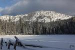
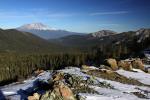
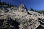
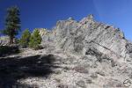
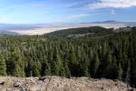
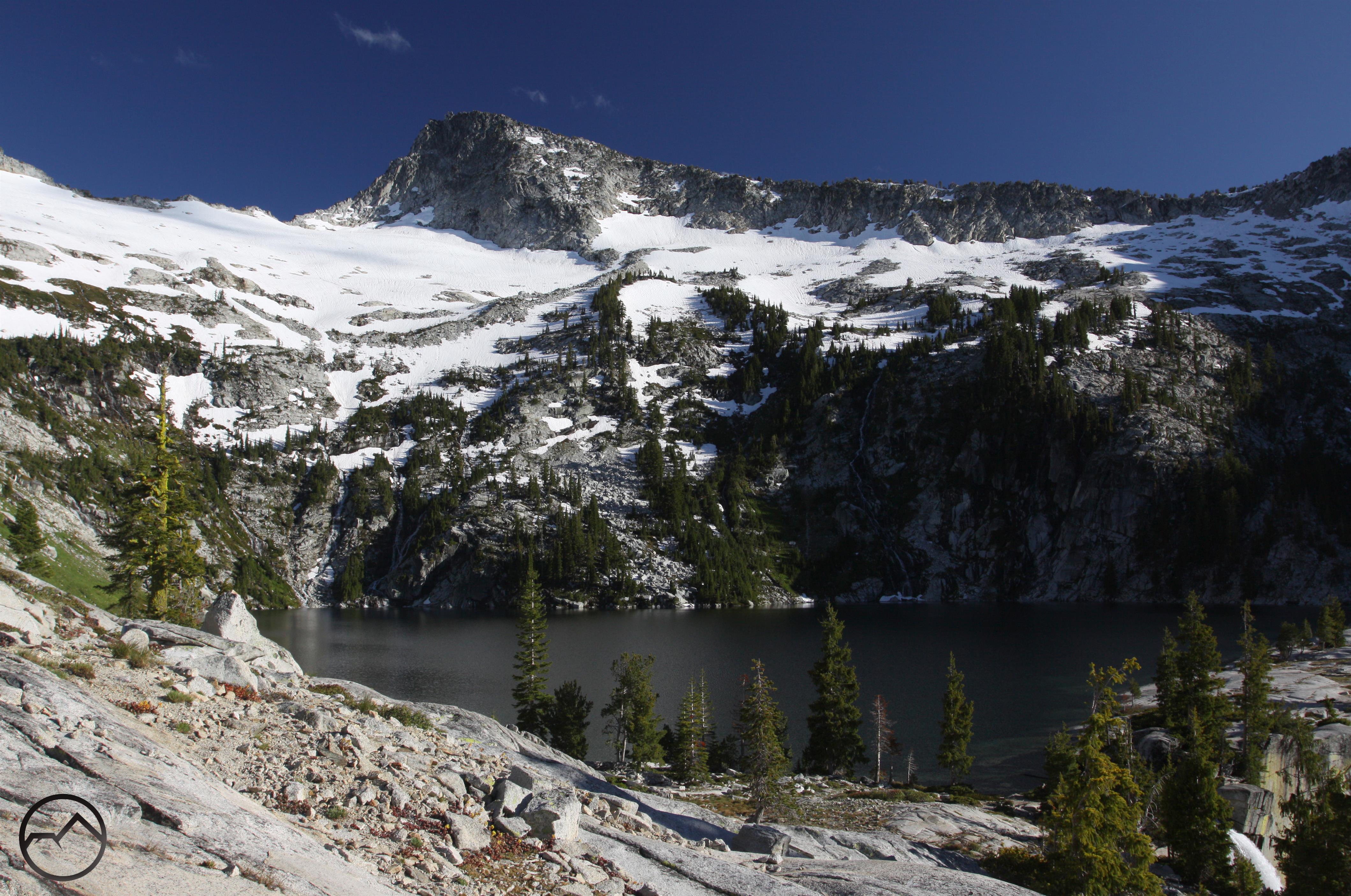
A great view of the canyons of the South, Middle and North Fork of the Sacramento River in the Trinity Divide.

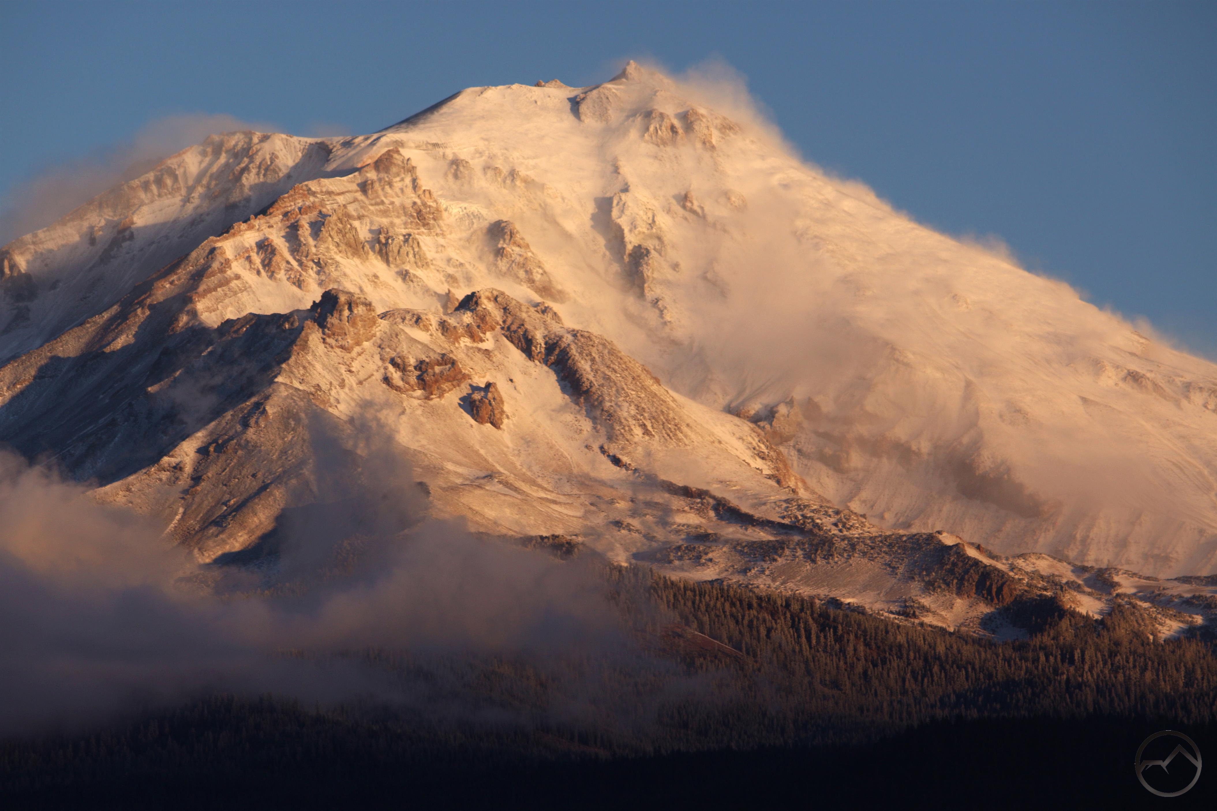
Tremendous views of surrounding mountains are one of the great joys of hiking on Mount Shasta.  The far-reaching panoramas are abundant along every trail on the mountain. This is, in large measure, a result of the incredible amount of terrain that lies above the timberline. Most of the trails on the mountain travel across barren slopes where the trees are scarce. It is easy to appreciate the landscape when the forest does not obstruct the view. For those not setting out on the trails, great views are still within reach, especially when driving the final section of the Everitt Memorial Highway from just past Red Fir Flat to the road’s end at the Old Ski Bowl. Here drivers and picnickers are blessed with astounding views of Mount Shasta itself as well as the opportunity to take in much of the area to the south, including Lassen Peak. From the Old Ski Bowl, the views are even better and include most of the Trinity Divide and even the higher peaks of the distant Trinity Alps. These incredible spots are well known and easy to access. Yet there is another vantage point that offers stunning panoramic views stretching from the Lassen area in a wide arc to the northwest all the way to China Mountain at the nexus of the Trinity Divide and the Scott Mountains. This vantage point, the John Everitt Memorial Vista, was once a significant attraction on Mount Shasta. Now it is a nearly lost and forgotten relic, hidden amongst the dense forest of Mount Shasta’s southwestern flank.

Trinity Divide - December2013 010 copy (Custom)

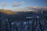
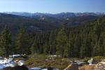
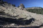
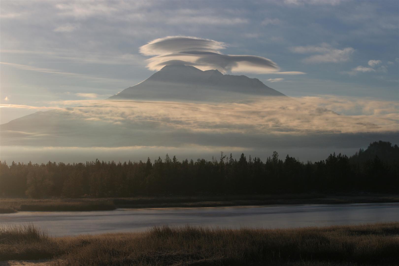
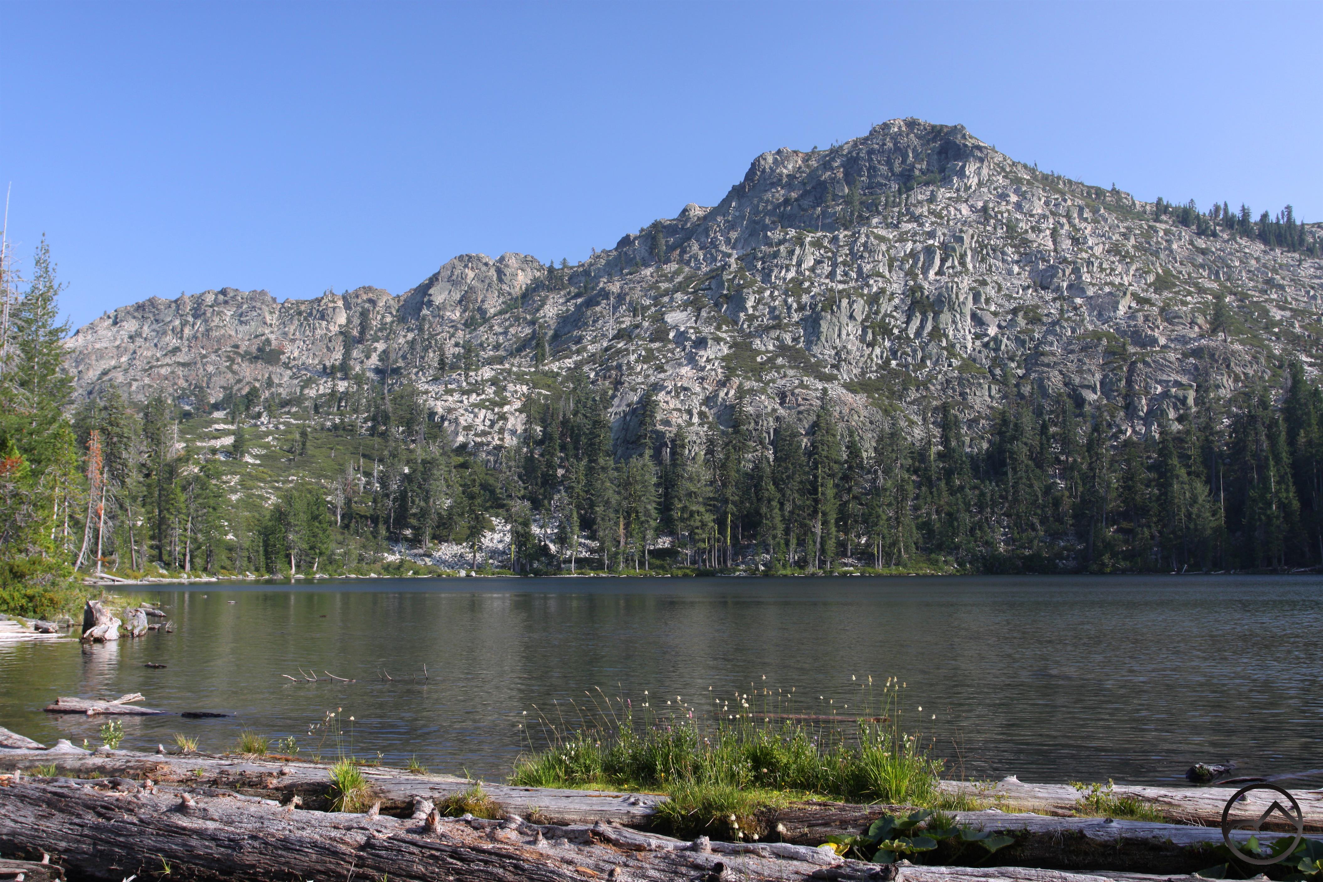
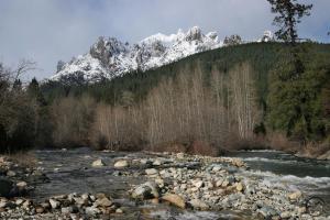
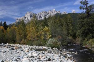
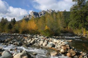
A view of the southern Trinity Divide, including the Castle Crags and the Grey Rocks, from near the Everitt Memorial Vista.

The vista and the road that accesses it are named after John S. Everitt. He was the forest supervisor for the Shasta National Forest who died while fighting the Bear Springs Fire in 1935. At the time, the Shasta National Forest was a single entity, unlike now, when it is part of the Shasta-Trinity National Forest. After being founded in 1905 as the Shasta Forest Reserve, it was merged with the Trinity National Forest into its modern incarnation in 1954. The headquarters for the Shasta National Forest was located at the current ranger district offices in Mount Shasta City. It was here that John Everitt ran the administration of the lands on and around Mount Shasta. He was a part of the second generation of foresters that followed on the heels of forestry pioneers like Gifford Pinchot, the first head of the Nation Forest Service. Everitt was a graduate of the College of Forestry at Cornell, the first academic school of forestry in the U.S. He was undoubtedly influenced by the conservation ethic of men like Theodore Roosevelt and Pinchot, who were at the forefront of the forestry movement (amazingly, forestry was a new discipline in the early 20th century, as managing the forests of the U.S. became a concern in the face of increasing development across the country).

Prior to his arrival in Mount Shasta, Everitt had worked for the Forest Service in the Lassen, Plumas and Stanislaus National Forests, as well as a stint in Southern California’s San Bernardino National Forest. He was appointed the head of the Shasta National Forest early in 1935. When the fire erupted on the southern slopes of Mount Shasta Everitt was quick to lead the effort to contain the fire. At the time, the Forest Service was still heavily influenced by the leadership of William Greeley who, as the head of the Forest Service, had made fire suppression the agency’s primary mission (in large measure a legacy of the Firestorm of 1910). Naturally, a fire on Mount Shasta was a significant concern to Everitt and the rest of the Forest Service. One afternoon during the firefight, Everitt set out alone to scout the fire. The winds shifted quickly and he was ultimately trapped and killed by the flames. He was the first forest supervisor killed in defense of his charge.

Cascades, Mt. Shasta - June2013 002 copy (Custom)

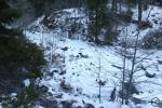
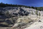
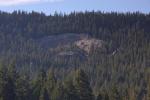
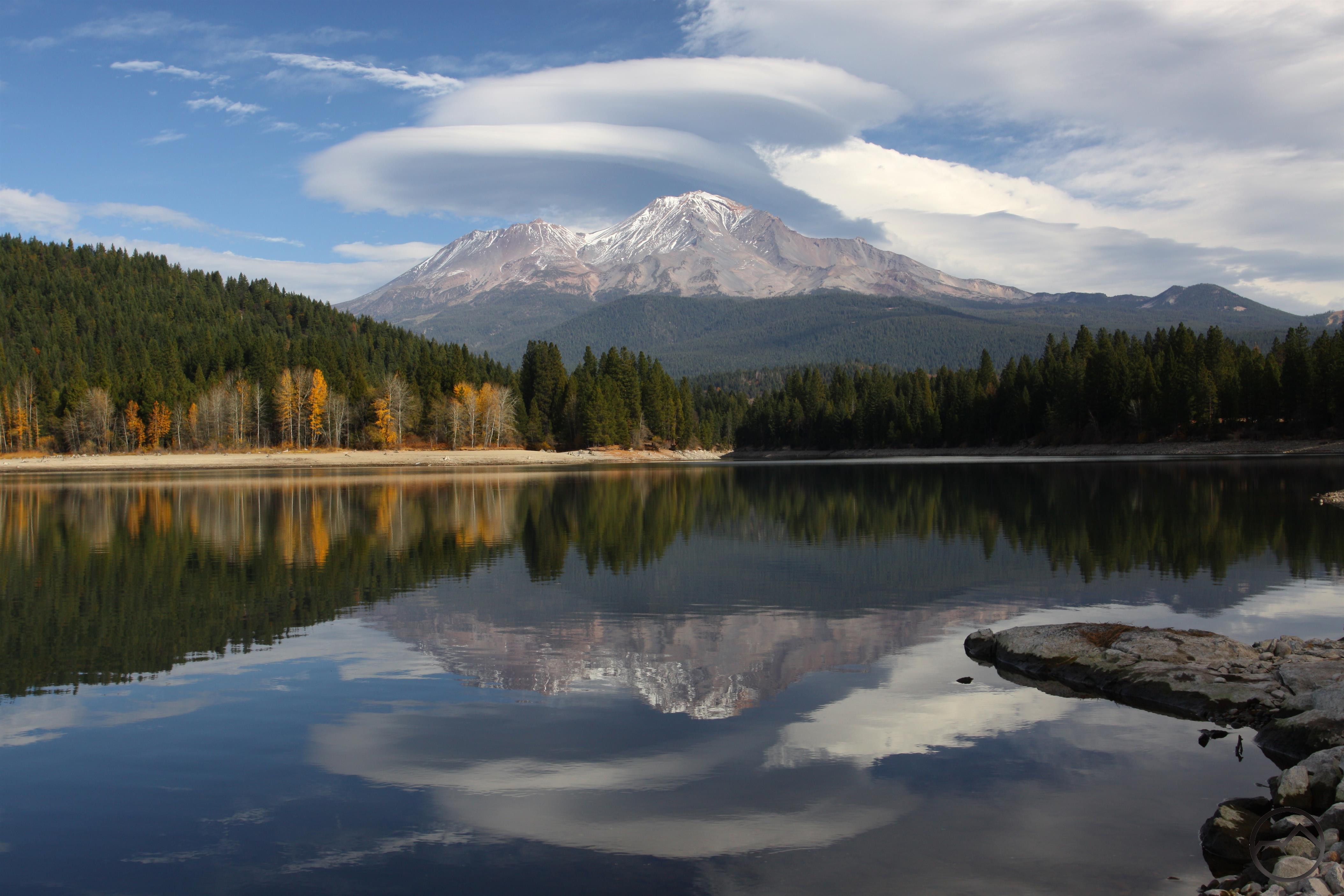
The observation deck at the Everitt Memorial Vista.

Today the Everitt Memorial Highway and the John Everitt Memorial Vista bear his name in tribute to his sacrifice on the slopes of Mount Shasta. The highway (OK, it is really just a paved road but compared to the rough dirt roads that climb the flanks of Mount Shasta, it really is a highway to the higher elevation) used extensively throughout the year. People refer to the Everitt Memorial Highway on a regular basis but few know the tale of the man for whom it is named. Sadly, the vista, located near the place where John Everitt lost his life, is all but forgotten. This is in large measure a result of the Forest Service’s decision at some point many years ago to not cut the trees around the observation deck. They have grown to the point that the view is all but gone. Only Lassen Peak far to the south is visible. The Trinity Divide, the Trinity Alps and the Strawberry Valley (the large valley between the Cascades and the Klamath Mountains where Mount Shasta City is located) are all lost to the trees. That this site was not preserved is unfortunate. It is a great resource for the community and could provide a wonderful introduction to the region for those who are unfamiliar with it. Located below Bunny Flat, it has the bonus of being accessible all year since the road is plowed throughout winter. The infrastructure at the site is great. There is a paved road down to the circular parking area and a rest room. A short nature trail loops through the surrounding forest and leads to both the observation deck and the ruins of an old ski shelter that was once a part of a series of winter shelters that led to Mount Shasta’s higher elevation. The observation deck itself is an impressive structure, reminiscent of edifices one would expect to find in national parks. It is a shame that the view from this great spot has been lost.

Trinity Divide - December2013 001 copy (Custom)

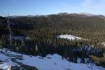
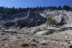
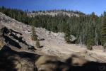
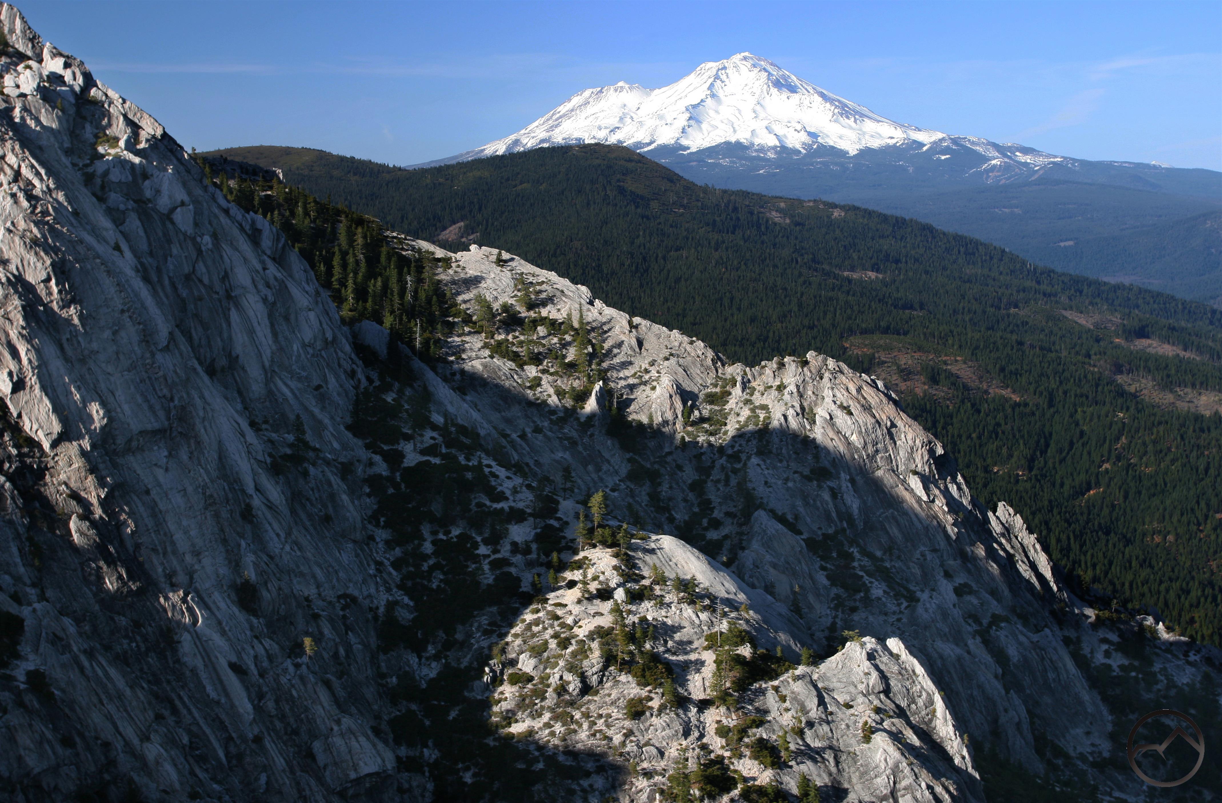
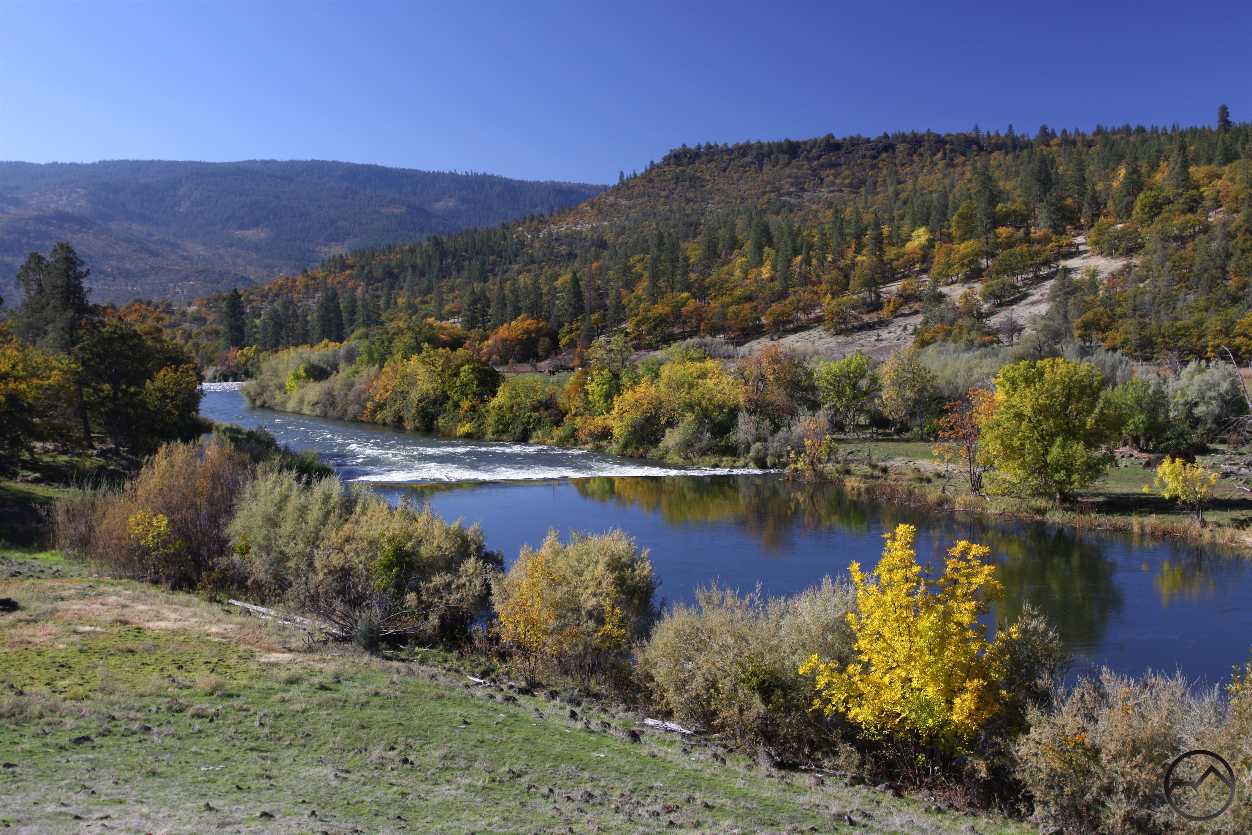
An awesome view of Mount Eddy and the northern Trinity Divide from near the Everitt Memorial Vista.

In a recent conversation with a Forest Service member, it was revealed that plans are being made to harvest the trees around the vista and restore the view from the observation deck. There is no timetable for this action yet but this is the first step toward resurrecting this great attraction on the slopes of Mount Shasta and while there is a desire for restoration, efforts to do so hampered by lack of funds. Hopefully this area will one day be restored and folks can once again enjoy the picnic area and stroll to the awesome vista to appreciate the incredible mountains of the Mount Shasta region. Even now, with the view still obscured, the vista is worth visiting. It is a good place to enjoy Mount Shasta’s lower forests, its history and to ponder the sacrifice of those who have paid a price to preserve our heritage. To get there, drive 8.4 miles from the intersection of the Everitt Memorial Highway and Rockfellow (the beginning of the highway, near the high school). There is no sign but there is a paved driveway and a guard rail marking the spot. There is a fantastic view of the Trinity Divide and Strawberry Valley from the junction of the highway and the vista’s driveway. It gives a sense of the incredible view this site once provided and hopefully will in the future.

Everitt Vista

Mount Shasta: Still Waiting For Winter

Posted by bubbasuess on January 11, 2014
Posted in: Hiking, Mount Shasta, Trinity Divide. 8 Comments
Cascades, Mt. Shasta - Jan2014 039 (Custom)

Sunrise on Mount Shasta at the dawn of 2014.

Mount Shasta, the great beacon of the southern Cascade Range, has been unusually bare thus far this winter. It is odd to have crossed over into a new year and still see the mountain looking as if it were mid-autumn, when all the previous winter’s snow has been burned off by the summer sun and the naked rock yearning for winter to return and smother it the snow’s embrace once again. Yet, as we near the mid-point of January, Mount Shasta still waits for winter’s touch. To be sure, a couple of storms have rolled through and sprinkled the mountain white a few times. In fact, Mount Shasta got its first healthy dose of snow back in September. Every month since has seen the mountain covered in a thin mantle of powdery ice only to see it blasted clean by the howling winter wind.

Of course, if Mount Shasta has not been graced by winter’s snow, then it goes without saying that the surrounding mountains have little to show for the cold season. The great forests, deep lakes and towering cliffs of the Trinity Divide all show evidence of the biting cold but lack the snowy cloak that usually comes with winter. This condition should naturally give us pause as we consider the ramifications for the coming year and our use of water resources. A lack of snow and rain now means scarcity further down the road. To be specific, Northern California is currently below 20% of the average snow pack for this time of the year. That translates to a thin patina of snow in some places and bare ground everywhere else. According to the Department of Water Resources, if the current snow pack were to persist throughout the rest of winter, farmers would only receive 5% of their requested water allotment. Already stories have percolated north of fields lying fallow and groves of trees, rendered unsustainable by the prospect of drought, being ripped up. It is strange, living in one place and gazing at a naked volcano and thinking that the lack of snow on the mountain impacts farmers hundreds of miles away and consumers of their crops even further still.

Cascades, Mt. Shasta - Jan2014 028 (Custom)

Mount Shasta sports plenty of clouds but the snow is still lacking.

Needless to say, this was not how I anticipated starting Hike Mt Shasta’s blog for 2014. Among the themes I had planned on developing over the winter was a continuation of my series on off season trails and some thoughts on the distinctives of aridity. For the time being at least, the former is not necessary and the latter might seem a bit extraneous. So, while I am confident that winter will arrive and water conditions will improve considerably, those of us who enjoy hitting the trail might as well reap the benefits of the heretofore dry winter. Typically mid-January is a time when the high country is generally unreachable. The roads to the trailheads are unplowed and many, many more miles would be added to the journey. Of course, snowshoeing and cross country skiing are options and quite enjoyable. Still, they do not usually permit one to reach the finer destinations high up in the Trinity Divide. Now things are different. If one does not mind colder temperatures (and even that is not as bad as it often is this time of year, with highs in the upper 50’s), then nearly every trail in the area can be accessed. Right now presents the rare opportunity to hike into lakes that one normally only sees in the summer and fall months. Their frozen surface lacks the clear reflection one expects from a still summer morning but it is still a stunning sight to see the glistening ice covering their frigid waters.

As noted previously, most of the roads are still open. Nearly everything in the Trinity Divide can be accessed, either off of South Fork Road, Parks Creek Pass, or the road in the Castle Creek drainage that climbs up to Horsethief Meadows. The most notable road closure is the Everitt Memorial Highway beyond Bunny Flat. The county closes that section of the road at the beginning of November regardless of the snow conditions. This means that the trails originating from the Old Ski Bowl and Panther Meadows trailheads are inaccessible. Still, for those who want to explore Mount Shasta, the trails departing from Bunny Flat trails departing from Bunny Flat are prime destinations. The other trailheads on Mount Shasta are accessed via remote dirt roads and their conditions are uncertain. Be careful while exploring these areas this time of year. Icy conditions can persist in shady areas and this can be a serious challenge while descending steep downhill sections (I learned this the other day when my jeep slid down an ice encrusted road north of Mount Shasta). Despite these unknown quantities and the colder temperatures, I hope everyone is able to get out and enjoy the trails around Mount Shasta a little more before winter’s fury finally falls upon us!

UPDATE: I published this post shortly after midnight in the early morning of January 11th. At 6:30 I left to try to take some more dawn images of Mount Shasta. There were stars visible when I left. By 7:00 it was raining hard. The storm is only supposed to last for a day but it is a start. Let’s hope more comes soon!

Mount Shasta 2013: A Year In Images

Posted by bubbasuess on December 31, 2013
Posted in: Castle Crags, Hiking, Klamath Mountains, Lakes, Mount Shasta, Rivers, Trinity Alps, Trinity Divide, Waterfalls. 12 Comments
Trinity Divide, Castle Lake - December2013 023 (Custom)

Mount Shasta at year’s end: still waiting for the snow.

The year of our Lord 2013 was the first year for Hike Mt Shasta and it proved to be a great start. Hopefully the site encouraged a lot of people to get out and explore the amazing landscapes of the greater Mount Shasta area. This part of California is blessed with tremendous diversity and incredible beauty. Rather than try to offer the best images of 2013 or list of highlights, I thought it would more interesting to focus on the wonderful variety throughout the year.

Cascades, Mt. Shasta - Dec2012 060 (Large)
January: OK, this image is actually from New Year’s Eve in 2012, but I grandfathered it into 2013. I love the view of Mount Shasta from the Shasta Valley. Add a fantastic lenticular cloud and it can’t get much better.

Cascades, Hedge Creek Falls - March2013 053_edited-1 (Custom)
February: Hedge Creek Falls is best in winter and spring, especially when the high country is covered in snow. This is a great hike for kids or if just pressed for time.

Cascades, Pluto's Cave - March2013 144 copy (Custom)
March: The temperature in Pluto’s Cave is the same throughout the year, which is great during the freezing temperatures of winter. The high desert above the cave also makes for interesting winter hiking.

Trinity Divide, Castle Crags - April2013 091_edited-1 (Custom)
April: With warmer temperatures and the snow usually clear at the lower elevations, the Castle Crags offers fantastic spring hiking. The waterfalls are graced with strong flow and the views of icy Mount Shasta are fantastic.

Cascades, McCloud River 008 (Custom)
May: Spring is a great time to take advantage of the excellent trail along the McCloud River. This area has an air about it that hints at higher country but is quite accessible in the spring.

Trinity Alps, Grizzly Lake - June2013 112 copy (Custom)
June: Just across the Trinity Divide from Mount Shasta lie the Trinity Alps, the North State’s largest wilderness. It also happens to be one of the most spectacular mountain regions in the country. June is often the perfect time to explore the Trinties. The snow is melting, the creeks are full, and cascades abound on the rugged peaks and canyons.

Trinity Divide, Tamarack Lake - July2013 010 copy (Custom)
July: It is often easy to take the stunning lakes of the Trinity Divide for granted. It is a shame many of these jewels get overlooked. For those who explore them, craggy cliffs and abundant wildflowers await.

Trinity Divide, Soapstone Basin - August2013 034_edited-1 (Custom)
August: The eighth month of the year is often hot and smokey and August 2013 was no different. Even so, there many opportunities to hit the trail and enjoy the spectacular scenery.

Cascades, Mt. Shasta - Sept2013 005 copy (Custom)
September: Even though it is still summer, September delivered a decent snow on Mount Shasta. It did not last, but it was satisfying to see the mountain cloaked in white again.

Klamath River - Oct2013 019 copy (Custom)
October: Autumn colors are abundant in the Mount Shasta area. One of the best and loneliest places to enjoy the colors is in the Klamath River Canyon.

Cascades, Mt. Shasta - Nov2013 003 (Custom)
November: The coming of the cold season means November typically has great lenticular cloud displays. 2013 was no exception.

Cascades, Mt. Shasta - Dec2013 029 (Custom)
December: The last month of 2013 started off with freezing temperatures and some snow, which always makes for beautiful conditions on Mount Shasta. The heavy winds stripped the mountain bare again and we are still waiting for more snow…

I hope everyone is able to get out more in 2014 and explore new trails and enjoy old favorites!

A Misleading Painting

Posted by bubbasuess on December 28, 2013
Posted in: Castle Crags, Hiking, Mount Shasta, Mount Shasta History, Rivers. 7 Comments
Trinity Divide, Castle Crags - Oct2009 021 (Custom)

Autumn at the confluence of the Sacramento River and Castle Creek.

Having written about the confluence of the Sacramento River and Castle Creek, I thought it worth mentioning how I found that particular spot. It is not a particularly secret spot but neither is it advertised or is visitation encouraged. Still, it remains one of my favorite spots in the Mount Shasta area. It is certainly my favorite spot along the Sacramento River below Lake Siskiyou. However, as much as I love the confluence, I will always think of it with a hint of disappointment. This is not because there is anything intrinsically disappointing about it. On the contrary, it has all the great features one could hope for in a mountain idyll: roaring river, crashing creek, noisy cataract, expansive boulder field and a soaring and infinitely complex cluster of granite spires.

20131223_101339

The painting at the Forest Service office.

My first journey to the confluence began at the Forest Service’s Mount Shasta District office. The building was once the headquarters for the Shasta National Forest before said forest was combined with the Trinity National Forest to form the Shasta-Trinity. Following the merger the headquarters was moved down to Redding and the facilities in Mount Shasta were downgraded in status. Still, a few of the trappings from the days when more authority inhabited the walls of the district office remain. Chief among these is a fantastic three-dimensional map of the Shasta National Forest. It gives a great sense of the scale and geography of the mountains in this area. Anyone who has not checked it out ought to do so. While enjoying the map a few years ago a painting near the map caught my eye. What was depicted in the painting was a scene of alpine glory that would be difficult to surpass. At the bottom was what was obviously the Sacramento River. Above the river rose the gray towers of the Castle Crags. The perspective appeared to be similar to what one sees above the gas station at Castella but with the obvious location along the river. The painting also included Castle Dome, thrusting up from the forested ridges to the right of the main bulk of the Crags. Crowning this incredible scene was the wintery-white cone of Mount Shasta. The arrangement of the river, the Castle Crags and Mount Shasta was incredible. How could such an amazing site not be the subject of countless images? I thought that this HAD to be one of the finest vistas anywhere and I was set on ferreting out this amazing view.

Cascades, Mt. Shasta - Oct2013 007 copy (Custom)

The Castle Crags from the confluence.

I began cruising by jeep and foot many sections of the Sacramento River. I ultimately covered most of the accessible areas between Dunsmuir and Sweetbriar. I had originally thought the vista must be located around Castella due to its similarity to the perspective of the Crags from the Castella gas station. I made a quick spin through the village but I did not immediately see anything that seemed like it was what appeared in the painting. After venturing further away from Castella both to the north and the south, I finally returned, convinced once again that that had to be the area. I passed through again, this time on foot. It was at this point that I observed the confluence of the Sacramento and Castle Creek for the first time. It is not immediately evident from the road but it is not hard to find either. As I stood there admiring the view, the pieces began to fall into place. The river, the Crags, Castle Dome, were all in the right spot. The expanse of boulders and even a crooked ponderosa pine arcing over the Sacramento River were present. Everything was arranged as one would expect after closely examining the painting. Everything but Mount Shasta. It quickly became apparent that the scene depicted in the painting was an artist’s flight of fancy. The painter had found an incredible view of the Castle Crags and simply painted Mount Shasta over it. The painting that inspired me to search for this vantage point turned out to be a fake the entire time. Though I was disappointed, I quickly readjusted my priorities and swiftly came to appreciate the confluence on its own merits. It may not be the superlative vista I had hoped, it is still a stupendous view of some of the North States most important landmarks.

It is worth noting that the trail map (I reviewed all the Mount Shasta trail maps here) the produced by the Forest Service uses the painting on its cover. It is customary for Forest Service wilderness maps to include and image of the wilderness on the front fold. The Mount Shasta and Castle Crags Wilderness map deviates from this trend. Instead, the front fold of the map is adorned with a portion of the painting. It includes both Mount Shasta and Castle Dome presiding over the Sacramento River. While the painting, and consequently the cover of the map, is quite misleading, it is still one of the most spectacular views in the area.

Scan0007_edited-1

The bogus image on the Forest Service map.

Seldom Seen: Confluence of the Sacramento River and Castle Creek

Posted by bubbasuess on December 23, 2013
Posted in: Castle Crags, Hiking, Mount Shasta, Seldom Seen, Trinity Divide. Tagged: Castle Crags, Castle Creek, Mount Shasta, Sacramento River. 12 Comments
Trinity Divide, Castle Crags - April2012 023 copy (Custom)

The spring thaw swells Castle Creek and the Sacramento River.

Few mountains in Northern California have the stark and sudden contrast from its surroundings as the Castle Crags. Erupting from the vast forests of the Sacramento River Canyon, the ramparts and towers of the Castle Crags are spectacular by any metric. Yet, despite their incredible geography and stunning appearance, it is often difficult to find good vistas from which to observe them. Certain points in Castella and few vantages from within Castle Crags State Park offer good places to view the granite splendor. Unfortunately these generally lack a certain elan, since they are basically just large breaks in the forest canopy. Conversely, there are several great places such as the Girard Ridge Lookout and Castle Peak, that permit the dedicated to enjoy staggering views of the Crags but they require hikes or long drives. While they are certainly worth the effort, if time is at a premium then they require more investment than may be realistic. However, there is one spot that is easy to reach that offers a truly spectacular view of the Castle Crags. Within earshot of I-5 and requiring only a short walk on a paved road, the confluence of the Sacramento River and Castle Creek may be the finest view of the Crags’ granite chaos. It is a source of continued amazement that such an incredible perspective on one of the Northern California’s most spectacular formations remains so seldom seen.

Trinity Divide, Castle Crags - Oct2009 021 (Custom)

Fall at the confluence.

Although there are several great places to see the Crags, I am convinced that the confluence of Castle Creek and the Sacramento River is the best. At the outset, this view is a variation on the classic aspect most people see from Castella. The great knot of soaring granite towers and massive cliffs are all present including Battle Mountain and Mount Hubris. Six-Toed Rock and Castle Dome are also easy to identify. However, what makes the confluence viewpoint excellent is the presence of so much water, a resource that is often hard to appreciate in the Crags. At the confluence the Sacramento narrows a bit and runs very deep. Small rapids upstream and downstream from the confluence add interest to the location. Castle Creek, on the other hand, runs through a rocky channel with room to spread out and splits into a few different troughs en route to joining California’s longest and largest river. It should be noted that Castle Creek is not an insignificant stream. It is possibly the largest tributary of the Upper Sacramento River. It has a large watershed that includes the Seven Lakes Basin and the hidden lakes tucked away in the mysterious Grey Rocks. The real highlight of these two waterways is where they meet. Castle Creeks is 4 or 5 feet higher than the Sacramento so at the confluence the creek tumbles over a short but broad cascade in order to contribute its waters to the river. Over all of this presides the majestic Castle Crags. Though seldom seen, the view from the confluence of Castle Creek and the Sacramento River is magnificent and not easily forgotten.

The confluence does not require a long hike or walk. Due to its ease of access, it works much better as a place to sit, relax and read or to have a picnic or other such time with friends and family. It is also possible to swim in the river here though obviously great care should be taken if doing so. It should be noted that access to this spot passes through a residential area so respect for those who live in the area is due. Still, despite the residential setting passed through to get to the confluence, once there the road and homes fade away and all one can see is the glory of granite turrets, rushing rivers, and the great expanse of wonderful river rock. It may be seldom seen but it is stupendous nonetheless.

As always, if anyone is curious about details in getting to the confluence, feel free to send me an email and I will give directions.

Four seasons at the confluence:

Winter at the confluence. Castle Dome on the far right.
The confluence of the Sacramento and Castle Creek. Castle Dome on the far right.

Summer at the confluence. Castle Dome on the far right.

New Land Additions for the Castle Crags

Posted by bubbasuess on December 21, 2013
Posted in: Castle Crags, Hiking, Mount Shasta, Rock Climbing, Trinity Divide, Wilderness. 2 Comments
Cascades, Mt. Shasta - Nov2013 079_edited-2 (Custom)

The sunrise illuminates a significant portion of the newly acquired portions of the Castle Crags.

The great jumble of granite spires known as the Castle Crags is one of the most easily recognized landmarks in the Mount Shasta area. Aside from the unrivaled cone of the great mountain itself, the Crags are the region’s most rugged and spectacular landscape. They are also among the areas most remote. Even though the Pacific Crest Trail and the Castle Dome Trail, one of the most popular paths in the North State travel through the Castle Crags, the fact remains that the vast majority of this tremendous cluster of towers and domes is left utterly untracked by all save the most hearty and intrepid. The remoteness is in large measure a consequence of the Crags geography, which makes trail construction extremely difficult. Needless to say, the lack of trails is not an indication of a lack of fantastic scenery or destinations to explore. On the contrary, for those who do venture into the Castle Crags amazing sights await.

Castle Peak - Nov 007  (Custom)

Looking at some of the new areas (left and below the spire).

Most of the Castle Crags falls under the administration of the Shasta-Trinity National Forest. The preponderance of this area is within the Castle Crags Wilderness, an administrative designation that protects against development. It may come as a surprise to many, but almost none of the Castle Crags actually falls within Castle Crags State Park. Instead, the park forms a girdle around the most easily reached sections of the Crags and essentially charges admission to hike to National Forest property. However, not all of the Castle Crags were open to the public. Two significant sections remained in private ownership by the Roseburg Resources Company. These two sections (a section being a measurement of land that is one square mile and contains 640 acres) are located on the rarely travelled north side of the Castle Crags and contain towering granite cliffs and spires as well as a significant portion of the Little Castle Creek drainage. Few traveled out this way, the majority of whom were dedicated rock climbers who sought out the towering walls for epic wilderness climbs.

It was in the effort to ensure access for climbers that the Access Fund, an organization established to promote and maintain access to climbing areas, got involved with the effort to acquire these two gorgeous sections. Negotiations with Roseburg have been completed and a deal reached for the transfer of the two sections to a private trust with the ultimate intent to transfer the land to the Forest Service. This is a commendable achievement by all involved. The new land finally brings the entirety of the Castle Crags under unified management. This may lead to the land being added to the Castle Crags Wilderness at some future date. However, only Congress has the authority to take this action so it will be a while before any formal action is taken. In spite of this, the Forest Service will probably manage the area as a de facto wilderness area. Still, this area has fantastic recreational potential. Obviously rock climbers are the first to benefit, as are those ambitious enough to explore the canyons that penetrate the Crags’ north side. Hikers will no doubt foray into the area, whether there are trails or not. One potential addition to the area is a trail that climbs the Little Castle Creek canyon and links up with the Pacific Crest Trail. Such a trail would go a long way to creating a loop that would form a magnificent backpacking loop. No formal proposal for such a trail exists and many hurdles would await if the project were attempted but the idea has merit.

Castle Crags Wilderness 3 (Custom)

Map shows the extent of the Castle Crags Wilderness and the Castle Crags State Park. The new additions are marked in yellow.

The acquisition of these portions of the Castle Crags is a major accomplishment. Accolades must be given to the Access Fund and Roseburg, as well as to private citizens. Grover Shipman in particular, whose excellent book “Mt Shasta Area Rock Climbing – A Climber’s Guide to Siskiyou County” has raised awareness of the scenic and recreational potential locked away in these two sections, contributed to this successful deal. It is a win for everyone who appreciates the stunning beauty of the Castle Crags

Winter’s First Dance

Posted by bubbasuess on December 13, 2013
Posted in: Hiking, Lakes, Mount Shasta, Trinity Divide. Tagged: Mount Shasta, Sacramento River, South Fork Canyon. 3 Comments
Cascades, Mt. Shasta - Dec2013 031_edited-1 (Custom)

Frigid sunset on Mount Shasta.

Last week finally saw winter’s return to the Mount Shasta area. Cold temperatures had been around for a while but the snow had not yet set in. It seemed as though autumn was fighting to maintain its dominance until Christmas at which time it would finally allow winter to assert itself over the region. Obviously this was not to be the case and the week after Thanksgiving saw the arrival of snowy conditions for the first time.

Cascades, Mt. Shasta - Dec2013 038 (Custom)

Windy sunrise on Mount Shasta.

The initial onslaught was a short burst of rain. Not surprisingly this translated into a thin layer of snow on Mount Shasta. While it may rain everywhere else around Mount Shasta, the giant volcano’s tremendous height yields colder temperatures and, consequently, snow when none has fallen elsewhere. This was not the first time the mountain has been cloaked in white this fall but like all the other times, the winds picked up and the ice was blasted off of peak. It would take a stronger storm with more precipitation to successfully cover the mountain with a healthy layer of snow. While the wind strips the mountain clean again, and it would be a miserable place to be in those conditions, it still creates wonderful images from down below. Looking up at the mountain when it seems that it is shrouded by what seems to be a wispy cloud and realizing that it is snowy being hurtled through the air by fierce winds always makes me want to stop and pull out my camera. If the conditions are highlighted by sunrise or sunset, so much the better!

Cascades, Mt. Shasta - Dec2013 012(Custom)

Mount Shasta gazes down on the frozen Sacramento River.

Immediately after the first storm, the temperatures plummeted. Day time highs ranged from lower 10’s to lower 20’s. At night it got down to around zero in some places, including my house. I live outside of town at a higher elevation so we are always colder (and snowier) than weather reports for Mount Shasta City. The frozen temperatures were actually enjoyable and made for some beautifully unusual conditions, especially along the Sacramento River. This area is one of my favorite spots around Mount Shasta. The broad, rocky channel of the river makes a great foreground below Mount Shasta. The rushing river and the multi-colored boulders are always visually appealing when contrasted against the great heights of the mountain. In the freezing weather, the river was given a new personality. Rather than the swift river one normally finds, the Sacramento was burdened with a thick layer of shimmering ice. The crystalline flow stood in stark opposition to orange, red and gray boulders dotting the river’s channel. Adding to the surreal setting, the river could still be heard running beneath the ice. In a few places the living water emerged into the sunlight, only to once again be swallowed up by the frozen crust.

Snow finally did arrive for the first time in the valleys. We got about 6 to 8 inches around the house. This is just about the perfect level of snow since it covers everything and really FEELS like it has snowed but it is not so deep that it requires a lot of work to manage. It also makes dresses the mountains in their winter attire without cutting off access to many of the trailheads. Of course, it is necessary to have a 4×4 to reach some of these spots but it is nothing like the big storms where several feet of unplowed snow build up on the mountain roads and access is much more difficult. The snow also came at the perfect time to head out to the woods to get Christmas Trees. While we have a few spots where there a lot of good trees in areas that need to be thinned, the best of them was still accessible across the divide from the South Fork Canyon. The Trinity Divide was particularly beautiful beneath the freshly fallen snow. The frozen lakes, snow-laden trees and icy river were invigorating.

Many Lakes Mountain rises above frozen Mumbo Lake.
The sun sets on the frozen Gumboot Lakes and the South Fork Canyon
Massive icicles form on a seep next to the snow-covered Sacramento River.

Unfortunately the snowy conditions did not last. A few days after the storm, the winds returned and the temperatures rose a little above freezing. I returned to the South Fork to hike the PCT. While there was plenty of snow on the ground, I was amazed at how quickly the trees and south-facing peaks and ridges had shed their mantle of ice. I hiked out through the snow to Gumboot Point. This is one of the best view points in the Mount Shasta area and it is amazing just how easy it is to bet to. From this vantage I could look out at the Trinity Alps, the Scott Mountains, the Trinity Divide and magnificent Mount Shasta. Looking about at all of these mountains, I was surprised just how much the snow had already receded. Mount Shasta in particular had been scoured clean by the wind and was already the semi-naked mountain that it has been for the last few months. While disappointed that it had not lingered as long as I would have liked, I was still grateful for the opportunity to behold such a magnificent vantage so soon after the storm.

The Scott Mountains, Mount Eddy, Porcupine Peak and the Gumboot Lakes.
Mount Shasta and the South Fork Canyon.
The Trinity Alps.

As I drove home, I stopped again at one of my favorite spots along the Sacramento River to enjoy the afternoon light on Mount Shasta. Some of the ice had melted off of the river but there was still plenty of frozen spots to add a lot of interest. Now the ice was mixed with the snow that covered the boulders that litter the Sacramento’s channel. As I packed up to finish the trip home, I thought about how winter may inhibit hiking opportunities, but it does highlight the beauty of this spectacular region.

Trinity Divide, South Fork - December2013 034_edited-2 (Custom)

Mount Shasta and the snowy Sacramento River.

The Headwaters Loop: A Proposed Backpacking Loop In The Trinity Divide

Posted by bubbasuess on November 26, 2013
Posted in: Hiking, Klamath Mountains, Mount Shasta, Pacific Crest Trail, Rivers, Trinity Divide. Tagged: Castle Crags, Castle Lake, Deadfall Lakes, Gumboot, Heart Lake, Lake Siskiyou, Mount Eddy, Porcupine Lake, Sacramento River, Seven Lakes Basin, Sisson-Callahan Trail. 9 Comments
Trinity Divide, Many Lakes Mountain - June2012 048  copy (Custom)

Mount Shasta stands regally beyond the Cliff Lakes, the headwaters of the South Fork of the Sacramento River.

The Sacramento River is California’s longest and largest river. It draws its water from more than five major mountain ranges: The North Coast Range, the Klamath Mountains, the Cascade Range, the Warner Mountains and the enormous Sierra Nevada. Out of this vast territory, the place where the Sacramento River first rises up and begins its journey to San Francisco Bay is in the Trinity Divide (not to be confused with the nearby Trinity Alps). This is the highest subrange of the Klamath Mountains. It is in the Trinity Divide that the North, Middle and South Forks of the Sacramento emerge from extensive meadows and alpine lakes and flow through rugged canyons to combine their waters to form California’s greatest river. The Trinity Divide, though by no means a well-known mountain range, is one of the prettiest and most diverse ranges in Northern California. Mount Eddy and the Deadfall Basin, Porcupine Lake, the Seven Lakes Basin, the Castle Crags and the Castle Lake area are all incredibly scenic areas, most of which are blessed with incredible views of mighty Mount Shasta. Though most of these areas lack formal wilderness designation, they are all still primeval lands both wild and rugged.

While studying the Trinity Divide on a map a couple of months ago, I was amazed how much of an incredible backpacking loop is composed of pre-existing trails. By combining existing sections of the Pacific Crest Trail, the Sisson-Callahan Trail and the Lake Siskiyou Trail 85% of a giant loop already exists. In other words, 34 miles of what would ultimately amount to an approximately 40 mile loop already exists. That such a spectacularly epic loop is nearly in existence already but remains unexploited is surprising. Considering the length, remoteness yet ease of access and absolutely magnificent scenery, this loop could be a major draw for the Mount Shasta area. It could easily become a destination trail, attracting backpackers from other parts of California and out of state to come and enjoy a sublime loop through great terrain and nearly constant stupendous views. The significance of the trail’s relationship to the genesis of California’s largest and longest river should not be underestimated either.

This slideshow requires JavaScript.

Views from sections of the Headwaters Loop

The loop would presumably begin at Lake Siskiyou and head west up the Sacramento for nearly two miles. At the confluence with the North Fork of the Sacramento, the route would begin climbing up the Sisson-Callahan Trail. This trail ascends the length of the North Fork through a rugged and wild canyon to a sprawling meadow complex in the shadow of Mount Eddy. From there the trail climbs steeply up the flank of Mount Eddy to the divide between the Deadfall Basin and the North Fork Canyon. This is the only rigorous climb of the entire loop. After a quick side trip up to the staggering views at the summit of Mount Eddy (for my money, the finest vista in Northern California), the trail drops down through gorgeous Deadfall Basin, passing the stunning lakes as it heads down to its junction with the Pacific Crest Trail. Once on the PCT the loop heads south along the spine of the Trinity Divide. Views of Mount Shasta, the Trinity Alps and the Divide itself are incredible. Highlights along the way include Toad and Porcupine Lakes, the latter nestled in a stunning granite cirque at the foot of pyramidal Porcupine Peak. From there it is a few easy miles through excellent scenery to Gumboot Saddle.

Beyond Gumboot, the trail continues south a little further, still graced with amazing views, until it reaches another saddle between the Mumbo Basin and the Seven Lakes Basin. The larger Seven Lakes Basin is an easy side trip. The PCT then turns east and begins its long descent down the great central rib of the Trinity Divide that culminates in tremendous fashion at the Castle Crags. Views from this section of the trail continue to amaze and now include the Seven Lakes Basin far below the trail, the ragged Grey Rocks, the Castle Crags and Lassen Peak and the southernmost Cascades far to the east. As the trail proceeds eastward, the views of the Castle Crags continue to get better and better until it is an overwhelming presence. After traversing the headwaters basin of the North Fork of Castle Creek, a use trail leads over the shoulder of Castle Peak and into the Castle Lake Basin. Here backpackers can enjoy the splendid view of Mount Shasta from Heart Lake. It is then time to make the final descent down to Lake Siskiyou, completing the loop.

Headwaters Loop (Custom)

The Headwaters Loop. The dotted lines indicate places where there is no trail or road.

Only two sections of this proposed loop have not been constructed. The most significant portion is the leg descending from Castle Lake down to Lake Siskiyou. This consists of approximately 4.5 miles. The precise length would depend on which of the numerous routes the trail could take. There is currently an old road running down the east side of Castle Lake Creek and this would likely be incorporated into the trail until it intersected the road from Lake Siskiyou up to Castle Lake. From there a number of possibilities open up. Probably the most difficult to construct but by far the most scenic option would be to route the trail through the canyon carved by Scott Camp Creek. Currently trailless, few venture into this canyon which has some surprisingly rugged cliffs. The other lacuna in the loop is from Lake Siskiyou’s inlet up the Sacramento River to the confluence with the North Fork. Several use trails already exist along some of this section and one of them could easily be absorbed into the loop. Extending the path along the Sacramento River to the North Fork would complete the loop. Due to the scenic qualities of the river in this area, this section of trail would probably become popular with hikers who are not looking to hike the circuit around the Sacramento’s headwaters but would just want to enjoy a beautiful and scenic trail.

I plan on exploring some of the areas where there are gaps in the headwaters loop and I will post some thoughts and images along with my assessments regarding the best option for filling in these missing portions of the epic loop around the Sacramento River headwaters loop. Does this loop look interesting to anyone else? Any feedback is appreciated!

Seldom Seen: Hole In The Ground Geologic Area

Posted by bubbasuess on November 23, 2013
Posted in: Desert, Hiking, Mount Shasta, Seldom Seen. Tagged: Cascade Range, Hole In The Ground, Mount Shasta. 16 Comments
Cascades, Hole-In-The-Ground (3)

The Hole In The Ground.

Though it is not obvious from most vantage points, Mount Shasta is not actually on the crest of the Cascades as the range travels from the Lassen region northward into Oregon. The actual crest of the Cascades lies just to the east of the great mountain, running through the area dominated by peaks such as Ash Creek Butte, the Whaleback, the Goosenest and Willow Creek Mountain. Ironically, the truly classic Cascade landscapes are most apparent around the outliers like Mount Shasta, which lies to the west and the Medicine Lake area, which lies well to the east of the crest. Of course, many of the high peaks along the central spine of the range exhibit plenty of volcanic features but for the most part, the core of the range consists of a long series of wooded peaks and ridgelines. Hidden away in these seemingly interminable forested mountains on the east side of the Willow Creek Mountain lies one of the most unique, mysterious and utterly unknown volcanic features to be found in Northern California. The Hole In The Ground Geologic Area, despite its stark and unusual beauty, has managed to stay completely off the radar and rarely sees any visitation. Needless to say, lack of awareness or popularity among the interested public does not necessarily translate into a lack of great beauty and interest.

Cascades, Hole-In-The-Ground (4)

The central tower of the Hole In The Ground.

All of this begs the obvious question: what is the Hole In The Ground? The answer to that question is at once easy to describe and yet totally elusive. The formation itself is obviously volcanic in origin. Set in the midst of the great sea of green that is the northern most section of the California Cascades, the Hole In The Ground appears to look like an obliquely angled crater. This is particularly true when viewed from afar and must be the genesis of the formation’s name. When viewed up close, it does not resemble a hole in anyway. On the contrary, it appears to be an exceptionally rugged, rocky amphitheater set against a steep and heavily forested ridge. Dominating the entire formation is an oddly sculpted rock tower that is about 75 feet high. Though its genesis is uncertain, it is strikingly similar to the volcanic necks found throughout the Rio Puerco Valley in New Mexico (though those towers are much larger than the one in the Hold In The Ground). Behind the tower are a series of rocky walls that hem in the formation. Radiating out from the tower are beautifully arid badlands. This aspect of the Hole In The Ground seems particularly out of place compared to the lush forest that surrounds this bizarre feature. Amazingly, a small series of springs emerge immediately adjacent to the badlands. Though often only a trickle, the mossy seeps producing the water stand in stunning contrast to the barren landscape of the rest of the Hole In The Ground formation.

Cascades, Hole-In-The-Ground (7)

The barren beauty of the Hole In The Ground.

Still, the question regarding the formation of this beautiful anomaly lingers. Just how did this striking and strange volcanic feature come to be? What little information on the Hole In The Ground comes through the Forest Service. Surprisingly, the Forest Service implies that the creation of the Hole In The Ground is a mystery. They do believe that the original foundation comes from successive lava flows at some point in the past. It is suggested that this particular spot had lava with a different chemical makeup that made the cooled lava more susceptible to decay. It is also claimed that the Hole In The Ground experienced significant mud slides that helped contribute to both the current shape of the formation and to its being revealed in the general. Once the lava was exposed, it is believed that erosion and other mechanical actions like freezing and unfreezing of water shaped the area into its present form. Whether or not that answer is satisfying, the experience of being there is magnificent. The tremendously unusual nature of the place enhances its beauty tremendously.

Cascades, Hole-In-The-Ground (2)

View of the Butte Valley from the Hole In The Ground.

Indicative of its anonymity, visiting the Hole In The Ground is an utterly primitive experience. Though it is not hard to get to, one must know precisely where to go because there is no signage alerting adventurers they have arrived at the formation. One must park along a seemingly random dirt road and bushwhack through the forest before reaching the outskirts of the formation. Hiking around the Hole In The Ground should be done cautiously due to the fragility and sensitivity of the badlands and other geologic features. Still, for those who do venture into this fascinating area, the experience has many rewards. The Hole In The Ground itself is tremendously beautiful and has a strong sense of mystery running through it. Great views of Butte Valley and southern Oregon during the hike in and some rarely visited meadows add to the enjoyment of exploring this unusual area.

As always, if anyone is curious about details in getting to the Hole In The Ground, feel free to send me an email.

The Hole In The Ground Geologic Area


Fresh Snow On Mount Shasta

Posted by bubbasuess on November 21, 2013
Posted in: Hiking, Mount Shasta, Mount Shasta History. 13 Comments
Cascades, Mt. Shasta - Nov2013 004_edited-2 (Custom)

New snow on Mount Shasta.

When the weather has been as dry as it has, I think it is useful to continue comparing the historic snow levels on Mount Shasta. It has been nearly two months since the last time I posted a snow update. The last snow post came on the heels of a pretty good storm that dumped a fair amount of snow on Mount Shasta. Though much of it melted off, a fair amount stuck around, especially on the north and east sides of Mount Shasta. The last two days have seen some precipitation and I anticipated a good pile of snow on the mountain. I was a bit surprised this morning when I observed that it was not nearly as thick a blanket of snow as I had expected. It must have been windy because it seemed that all the spots that usually accumulate were swept clean of all but a light dusting of snow. Still, Mount Shasta was glorious this morning, even if the snow was not as much as I had thought it would be.

Cascades, Mt. Shasta - Nov2013 009 copy (Custom)

Fresh snow on Mount Eddy.

Needless to say, we need a lot more snow and rain. Shasta Lake is only about 39% capacity at the time. I have not seen it that low since the summer of 2008. It stayed at low capacity for a year, filling up only slightly during the winter of 2009. The following winter in 2010 saw some epic storms and the lake filled up swiftly. The lake level has remained high for a long time after that. Though the water in Shasta Lake comes from as far away as the Warner Mountains and corners of southern Oregon around Lakeview, the lake obviously relies heavily on the snowfall in the Mount Shasta area. Both the Trinity Divide and the underground aquifers that surround the mountain supply much of the water that ends up in the lake. The Trinity Divide got a fair amount of snow from this last storm too. The snow level only went down to about 6,000 feet but everything above that appears to have gotten a good dose of the white stuff. However, it does look as though it is not too deep and for those not deterred by hiking through a bit of snow, it does not look too deep to keep folks away from some cool winter hikes. Take advantage of the opportunity to hit these areas now because winter’s fury has yet to land on the Mount Shasta area with its full might.

As always, here is some historical perspective on the snow on Mount Shasta for this day over the last few years:

2013

2012

2011 (good luck with this one!)

2010

There is still time to hit some of the higher trails before things are inevitably smothered in snow. Even if the high country and a little snow are not what one is looking for, some of the lower trails like the McCloud River Trail, Sacramento River Trail or the trails in the Castle Crags are great options right now, if you are willing to bundle up and brave the cold!

Cascades, Mt. Shasta - Nov2013 006 copy (Custom)

Mount Shasta and new snow in morning glow.

Posts navigation

← Older Entries
Newer Entries →
    • Recent Posts

      • Winter Shows Up When It Will
      • January Rolled By With Mud, Then Very Dry
      • Mount Shasta 2025 – A Year In Images
      • Mount Shasta On Either Side Of Christmas
      • Adrift In An Ocean Of Fog
      • December Has Been Spectacular Thus Far Pt. II (A Magnificent Lenticular)
      • December Has Been Spectacular Thus Far Pt. I
      • Lenticular Interrupted
      • A Stormy Wave And A Truchas Sunset
      • Aurora Lenticularis
    • Enter your email address to follow Hike Mt Shasta and receive notifications of new posts by email.

    • Archives

      • February 2026
      • January 2026
      • December 2025
      • November 2025
      • October 2025
      • September 2025
      • August 2025
      • July 2025
      • June 2025
      • May 2025
      • April 2025
      • March 2025
      • February 2025
      • January 2025
      • December 2024
      • November 2024
      • October 2024
      • September 2024
      • August 2024
      • July 2024
      • June 2024
      • May 2024
      • April 2024
      • March 2024
      • February 2024
      • January 2024
      • December 2023
      • November 2023
      • October 2023
      • September 2023
      • August 2023
      • July 2023
      • June 2023
      • May 2023
      • April 2023
      • March 2023
      • February 2023
      • January 2023
      • December 2022
      • November 2022
      • October 2022
      • September 2022
      • August 2022
      • July 2022
      • June 2022
      • May 2022
      • April 2022
      • March 2022
      • February 2022
      • January 2022
      • December 2021
      • November 2021
      • October 2021
      • September 2021
      • August 2021
      • June 2021
      • May 2021
      • April 2021
      • March 2021
      • February 2021
      • January 2021
      • December 2020
      • November 2020
      • October 2020
      • September 2020
      • August 2020
      • July 2020
      • June 2020
      • May 2020
      • April 2020
      • March 2020
      • February 2020
      • January 2020
      • December 2019
      • November 2019
      • October 2019
      • September 2019
      • August 2019
      • July 2019
      • June 2019
      • May 2019
      • April 2019
      • March 2019
      • February 2019
      • January 2019
      • December 2018
      • November 2018
      • October 2018
      • September 2018
      • August 2018
      • July 2018
      • June 2018
      • May 2018
      • April 2018
      • March 2018
      • February 2018
      • January 2018
      • December 2017
      • November 2017
      • October 2017
      • September 2017
      • August 2017
      • July 2017
      • June 2017
      • May 2017
      • April 2017
      • March 2017
      • February 2017
      • January 2017
      • December 2016
      • November 2016
      • September 2016
      • August 2016
      • July 2016
      • June 2016
      • May 2016
      • April 2016
      • March 2016
      • February 2016
      • January 2016
      • December 2015
      • November 2015
      • September 2015
      • August 2015
      • July 2015
      • June 2015
      • May 2015
      • April 2015
      • March 2015
      • February 2015
      • January 2015
      • December 2014
      • November 2014
      • July 2014
      • June 2014
      • May 2014
      • April 2014
      • March 2014
      • February 2014
      • January 2014
      • December 2013
      • November 2013
      • October 2013
      • September 2013
      • August 2013
      • July 2013
      • June 2013
      • May 2013
      • April 2013
      • March 2013
      • February 2013
      • January 2013
    • Categories

      • Boy Scouts
      • Cascade Range
      • Castle Crags
      • Desert
      • Echo Point
      • Glaciers
      • Hiking
      • How things came to be…
      • Klamath Mountains
      • Konwakiton Outdoor Designs
      • Lakes
      • Lenticular Clouds
      • Maps
      • Marble Mountains
      • Meadows
      • Mount Eddy
      • Mount Shasta
      • Mount Shasta History
      • Napa County
      • Off Season Trails
      • Pacific Crest Trail
      • Peaks
      • Rivers
      • Rock Climbing
      • Scott Mountains
      • Seldom Seen
      • Shasta Valley
      • Sierra Nevada
      • Siskiyou Mountains
      • Sonoma County
      • Spring Trails
      • sunrise
      • sunset
      • Trinity Alps
      • Trinity Divide
      • Truchas Ridge
      • Uncategorized
      • Water
      • Waterfalls
      • Wilderness
      • Wildflowers
      • Wine Country
      • Winter Trails
      • Yosemite
    • Meta

      • Create account
      • Log in
      • Entries feed
      • Comments feed
      • WordPress.com
    • Copyright © 2013-2024 by Bubba Suess

      DISCLAIMER: Any use of the information contained in this site by any and all persons is done at their own risk. The operator of this site shall be held harmless from any and all alleged claims, demands, causes of action, liability, loss, damage and/or injury to property or persons whether brought by an individual or other entity. This indemnification applies, without limitation, to all actions by an individual or other entity as a result of their use of information contained in this site.

    Blog at WordPress.com.
    Hike Mt. Shasta
    Blog at WordPress.com.
    • Subscribe Subscribed
      • Hike Mt. Shasta
      • Join 985 other subscribers
      • Already have a WordPress.com account? Log in now.
      • Hike Mt. Shasta
      • Subscribe Subscribed
      • Sign up
      • Log in
      • Report this content
      • View site in Reader
      • Manage subscriptions
      • Collapse this bar
     

    Loading Comments...