Hike Mt. Shasta

Exploring the Mount Shasta Region

  • Home
  • Trails
    • Mount Shasta Trails
      • Brewer Creek Trail
      • Clear Creek Trail
      • Gray Butte Trail
      • Green Butte Ridge Trail
      • Horse Camp Trail
      • North Gate Trail
      • Old Ski Bowl Trail
      • Panther Meadow Trail
      • South Gate/Squaw Meadow Trail
      • Whitney Falls Trail
    • Trinity Divide Trails
      • Blue Divide Trail
      • Castle Lake Trail
      • Castle Lake Shore Trail
      • Cliff Lake Trail
      • Deadfall Lakes Trail
      • Gray Rock Lakes Trail
      • Gumboot Trail
      • Heart Lake Trail
      • Porcupine & Toad Lakes Via Pacific Crest Trail
      • Seven Lakes Basin Via Pacific Crest Trail
      • Sisson-Callahan Trail
      • Soapstone Trail
      • South Mumbo Scramble
      • Tamarack Lake Trail
      • Toad Lake Trail
    • Castle Crags Trails
      • Burstarse Falls Via Pacific Crest Trail
      • Castle Dome Trail
      • Flume Trail
      • Lower Castle Crags Via Pacific Crest Trail
      • Root Creek Trail
    • Scott Mountains Trails
      • Bluff Lake & Cement Bluff via Pacific Crest Trail
      • Caldwell Lakes Trail
      • China Mountain Scramble
      • Cory Peak and Bull Lake via Pacific Crest Trail
    • Cascade Crest
      • Ash Creek Butte Scramble
      • Goosenest Trail
      • Juanita Lake Trail
      • Orr Lake Trail
    • Mount Shasta City Area Trails
      • Black Butte Trail
      • Box Canyon Trail
      • Gateway Trail
      • Lake Siskiyou Trail
      • Mount Shasta City Short Trails
      • Ney Springs Canyon Trail
      • Spring Hill Trail
    • Shasta Valley Trails
      • Black Lava Trail
      • Haystack Trail
      • Lake Shastina Trail
      • Pluto Cave Trail
      • Trout Lake Trail
      • Yellow Butte Trail
    • Sacramento River Trails
      • Dunsmuir Trail
      • Hedge Creek Falls Trail
      • Sacramento River Trail
      • Sims History Trail
    • McCloud River Trails
      • Ash Camp To Ah-Di-Na Via Pacific Crest Trail
      • McCloud River Falls Trail
      • McCloud River Preserve Trail
      • Squaw Valley Creek Trail
      • McCloud River Trail: Algoma Camp to Nitwit Camp
      • McCloud River Trail: Nitwit Camp to Cattle Camp Swimming Hole
      • McCloud River Trail: Cattle Camp Swimming Hole to Camp 4
      • McCloud River Trail: Camp 4 to Upper McCloud Falls
      • McCloud River Trail: Pine Tree Hollow Loop
    • Trails Further Afield
      • Trinity Alps Trails
        • Bear Lakes Trail
        • Billys Peak Trail
        • Boulder Creek Lakes Trail
        • Boulder Lake Trail
        • Canyon Creek Trail
        • Caribou Lakes Trail
        • East Boulder Lake Loop
        • East Weaver Lake Trail
        • Four Lakes Loop
        • Granite Peak Trail
        • Grizzly Creek Trail
        • Gulch Lakes Loop
        • Hidden Lake Trail
        • South Fork Lakes Trail
        • Stoddard Lake Trail
        • Stoney Ridge Trail
        • Tangle Blue Lake Trail
      • Warner Mountains
        • Emerson Creek Trail
        • Highgrade Trail
        • Patterson Lake Via Warner Summit Trail
        • Pine Creek Trail
        • Squaw Peak Trail
  • Articles
    • Trails By Area
      • Mount Shasta
        • Vistas, Meadows And Waterfalls: Three Best Hikes On Mount Shasta
        • The End Of The Road: Three Hikes In The Old Ski Bowl Area
        • Two Trails From Bunny Flat
        • Three Trails On Mount Shasta’s East Side
        • Mount Shasta’s Hummingbirds
      • Trinity Divide
        • Great Lakes: Top Five Lake Basins In The Trinity Divide
        • The Headwaters Of The South Fork Of The Sacramento River
        • Neglected Headwaters: Two Lesser Lake Basins On The South Fork
        • Gumboot Saddle: Two Hikes On The PCT
        • Descent Into Mystery: The Sisson-Callahan Trail
        • Mumbo Basin – Overlooked On The West Side
        • The Headwaters Loop: A Proposed Backpacking Loop In The Trinity Divide
      • The McCloud River
        • The McCloud River Trail
      • Shasta Valley
        • Jewels In The Desert
      • Scott Mountains
        • Great Scott! Two Scott Mountains Hikes On The PCT
      • Trinity Alps
        • Carubou Lakes: Trinity Alps On A Grand Scale
        • Switchbacks To Heaven: The Trinity Alps’ Stoney Ridge Trail and Four Lakes Loop
        • Trinities In Proximity: Two Trinity Alps Trails With Easy Access From Mount Shasta
        • Trails in the Carter Meadows Area
        • Trinity Alps Views of Mount Shasta
        • The Psychological Value Of The Trinity Alps
    • Waterfalls
      • Three Waterfalls On Mount Shasta
      • McCloud River Waterfalls
      • Sacramento River Waterfalls
      • Trinity Divide Waterfalls
      • Trinity Alps Waterfalls
      • Avoiding A Dry Whitney Falls
    • Off Season Trails
      • Three Winter Hikes Near Mount Shasta City
      • Winter Hikes In Shasta Valley
      • Winter Hiking In The Shasta Valley Wildlife Refuge
      • Winter Hikes On The Sacramento River
      • Winter Hikes On The Lake Siskiyou Trail
      • Spring Hikes In The Castle Crags
      • Spring Hikes On the Upper McCloud
      • Spring Hikes On The Lower McCloud River
    • Points Of Interest
      • Mount Eddy: Overshadowed, Underrated
      • Black Butte: Hiding In Plain Sight
      • Castle Dome: Steadfast And Staggering
      • Mount Shasta Hoodoos
      • Sacramento Scrambling
      • The Shasta River
      • The Castle Creek Watershed
      • Mount Shasta East Side Glacier View
      • 5 Fantastic Mount Shasta Vistas
      • 5 Highest Peaks Around Mount Shasta
      • 5 Best Hikes On Creeks And Rivers
      • 5 Interesting Footbridges
      • Three Spectacular Drive-To Sunset Vistas
    • North State Geography
      • Introduction
      • Seven Major Regions
      • The California Cascades
      • Klamath Mountains Pt. I
      • Klamath Mountains Pt. II
      • The Great Canyons Of Mount Shasta
      • Mount Shasta, Timberline, And The Relative Size Of Cascade Volcanos
      • Four Eruption Cones Of Mount Shasta
      • Mount Shasta’s Medial Moraine
    • Northern California Review
      • North Table Mountain
      • Lakes Basin Recreation Area
      • Eastern Sierra Fall Color
      • Sonoma County
      • Central Sierra Nevada
      • Orland Buttes
    • Seldom Seen
      • Ash Creek Falls
      • Mud Creek Canyon
      • Lower Mud Creek Canyon
      • Diller Canyon
      • Lower Cascade Gulch
      • The Grey Rocks
      • Castle Creek
      • Upper Wagon Creek
      • Fawn Creek Canyon
      • Confluence of the Sacramento River and Castle Creek
      • Upper Klamath River Canyon
      • Hole In The Ground Geologic Area
      • Ash Creek Butte Fossil Rock Glacier
    • Mount Shasta History
      • Vantage Lost: The Everitt Memorial Vista
      • A Yosemite-Mount Shasta Connection
      • Whitney – What’s In A Name?
      • Mount Shasta Area and the 1838 Exploring Expedition
      • A 19th Century Engraving Of An Epic Mount Shasta Vista
      • Vintage 1907 Color Photos
      • A Misleading Painting
      • A Mysterious Painting
      • A Mysterious Painting Pt. II
      • Stereographic Mt. Shasta
      • Year One Of Hike Mt Shasta
      • Year Two Of Hike Mt Shasta
      • Year Three Of Hike Mt Shasta
      • Year Four Of Hike Mt Shasta
      • Year Five Of Hike Mt Shasta
      • Year Six Of Hike Mt Shasta
      • Year Seven Of Hike Mt Shasta
    • Image Galleries
      • Mount Shasta Trails Gallery
      • Mount Shasta Sunrise Gallery
      • Mount Shasta Sunset Gallery
      • Lenticular Cloud Gallery
      • Mount Shasta NON-Lenticular Clouds
      • Mount Shasta Reflection Gallery
      • Telephoto Gallery
      • Mount Shasta Area Fall Color
      • Castle Crags Gallery
      • Waterfalls Gallery
      • Trinity Divide Lakes Gallery
      • Mount Shasta Area Rivers Gallery
      • Shasta High Desert Gallery
      • Mount Shasta GIF Gallery
    • Random Notes
      • Revew: Three Mount Shasta Trail Maps
      • A Mount Eddy Wilderness?
      • New Land Additions For The Castle Crags
      • Book Plug: Mount Shasta Area Rock Climbing
      • Exile: How I Came To Love Wilderness
  • Mt. Shasta Trail Map
  • Blog
  • About/Contact
  • Links
  • Truchas Ridge

A Perfect Fall Day In Mount Shasta

Posted by bubbasuess on November 17, 2022
Posted in: Cascade Range, Hiking, Mount Shasta, Truchas Ridge. 3 Comments

Thursday was a perfect one here in Mount Shasta, at least in terms of how things looked. To be truly perfect, it needed to be about 20 degrees warmer and had a lenticular on the mountain. Aside from that though, it really was perfect. A beautiful sunrise, warm autumn light, fall color (though it is starting to fade on some trees) and a spectacular sunset. I could get used to this kind of day (except, I wouldn’t want to, since it is better being extraordinary rather than ordinary)!

The day started with a sunrise viewed from up in the Shasta Valley. Coyotes trotted across the fields while I was waiting for the sun to com up. The light was awesome, though the picture didn’t really turn out as well as I had hoped. After the light faded a bit, the mountain cast cool shadows across the sky, one of my favorite Mount Shasta phenomena.

The morning had great light when the sun was not filtered through clouds. The early snow storm we got has brought an odd mix of white contrasting against the fall leaves that are both covering the snow and still on the trees. I have not seen this mix at my house before.

In town, there are a lot of trees with good color, though many have already peaked. The bright leaves always make a striking foreground to the white mountain and blue sky. Today was an exemplar of such a sight. I couldn’t help stopping and capturing a few images of Mount Shasta with the fall color and I am glad I didn’t try to resist.

In the afternoon, I took some friends out to Truchas Ridge. The white mountain was glorious and the clouds offered some interesting variation in the sky. Though cold, it was invigorating. While talking and waiting for the sun to set, the kids ran around hooting and howling and scrambling on the rocks, seemingly oblivious to the cold.

When sunset finally came, it was magnificent. It was a fitting end to a gorgeous day!

I have 3 more substantive posts brewing and I was really hoping to get one done before posting more “current conditions” type posts but today was too beautiful to pass up.

Mount Shasta Winter Arrived Early

Posted by bubbasuess on November 10, 2022
Posted in: Cascade Range, Hiking, Mount Shasta. 5 Comments

Cloud enshrouded Mount Shasta on the morning the storm began.

The last few days of October were great autumn days. Suddenly, on the 1st of November, we got an unexpected snow storm that dropped 4-5 inches. This was an unusually large amount of snow for this time of year and it came with no warning, since only rain was in the forecast. A few glorious days followed, with a white mountain and glowing fall leaves. However, more rain and possibly some snow was in the forecast. I was expecting Mount Shasta to be even whiter than it the first snow had made it but when the weather finally arrived, I (and all of nature) was unprepared for what showed up.

Mount Eddy partially hidden by clouds it light up by the rising sun.
Duzel Rock and the Little Scott Mountains are glazed with snow that fell on the first day of November.

The morning the storm was slated to arrive, I headed out to the east side of Mount Shasta. Everything was purified white with snow and at sunrise everything glowed marvelously in pink light. Mount Shasta presaged the storm by gathering a dense cap of cloud over its upper flanks so it was largely hidden. Nonetheless, the glow was grand and magical and made for an exhilarating sunrise. I even got a nice shot of one of my favorite junipers, which is located on a rocky prominence, contrasted against the fiery sky.

A loan juniper greets Aurora.

By the time I left, the clouds were moving in and the storm was on its way. It rained all day, but never particularly hard until the evening. Then, during the night it really started to snow. By morning, it turned out to be far more than anticipated. We measured 10 inches around 7 AM!

Before the big storm, with snow from the first day of November.
The morning after the storm smothered us with 10 inches.

Only a few days into November, we woke up to a midwinter scene! Some snow was expected but nearly a foot was very unexpected.

It continued to snow throughout the day, eventually adding another 5 inches so that we had about 15 inches at my house. This would have been a pretty good midwinter storm but for it to come right at the beginning of November, in the heart of autumn was pretty impressive. I have seen a few storms like this around Thanksgiving but never just a few days after Halloween.


Of course, this kind of weather does not come without a price. The early storm didn’t just catch people off guard. It also caught all the trees off guard. Since October was so warm, we didn’t get a lot of fall color in that month this year. This means that most of the trees were just starting to get their fall color and a significant number were still green. Leaves on trees means more surface area for snow to accumulate which means significantly more weight and strain on the branches. Many simply gave up and snapped. I had a few come down at my house but in town the damage was heavy, with broken limbs ubiquitous on the sides of the streets. Even a few large trees were toppled over at their roots.

An entire tree in my backyard tipped over at the roots from the massive snow load in 2010.

I have not seen this kind of storm damage around town since the great storm of January 2010, when feet (and I mean feet!) of snow came down in a matter of days and broke limbs and toppled trees everywhere. It was the biggest and most damaging storm I have ever seen. This most recent snowfall was nothing like the quantity that fell then but the presence of the leaves on the trees made for a lot of damage.

A frigidly warm sunrise on Mount Shasta’s sunrise. 

In the end, Mount Shasta finally got a really nice blanket of snow on it, rendering the mountain white once and for all for the winter. I hope this early snowfall is an auspicious start to the winter season. I love fall, but I don’t think were getting much of it this year. We kind of had a long summer and are jumping right into winter. The way we need water, I don’t think I will be complaining!

Another beautiful Friday morning on Mount Shasta.

Autumn Perfection In Mount Shasta

Posted by bubbasuess on November 4, 2022
Posted in: Cascade Range, Hiking, Mount Shasta. 6 Comments

Sunset sets a fire in the sky above Mount Shasta.

After being delayed through a pleasant but somewhat meteorologically boring October, Autumn has arrived at its full vigor here in Mount Shasta. November 1st brought unexpected snow and cold temperatures. The sudden cold brought the trees to their senses and their leaves to the point of finally turning color. Though there wasn’t any precipitation the last couple of days, it has remained interesting in the sky. All in all, it has been a welcome and overdue change to fall and from sunrise to sunset, it has been absolutely glorious the last couple of days.

A quick look at conditions give some idea of just how spectacular it has been:

Fresh snow blows off the upper flanks of Mount Shasta. 

Hints of a lenticular cling to Mount Shasta’s summit.

I wasn’t sure which of these was better:

One has better color and light, the other better framing. Either way, having some gold aspens in the same frame as Mount Shasta is always a welcome autumn treat. There aren’t many aspens at this elevation, unfortunately. Thankfully these are easy to get to and usually have pretty good color.

The moon is waxing gibbous and was unlooked for but a welcome addition to the evening.

A spectacular sunset and moonrise on Mount Shasta. 

The forecast is calling for rain and snow over the next few days. November really began suddenly but has continued to bless us. I am hopefully optimistic this will continue and we will have a great winter!

Mount Shasta’s Surprise From The Skies

Posted by bubbasuess on November 1, 2022
Posted in: Cascade Range, Hiking, Mount Shasta. Leave a comment

Alpenglow illuminates a freshly snow-covered Mount Shasta. 

October flew by here in Mount Shasta and the month was generally warm and dry. Though pleasant, the month did not bring much snow for the mountain or relief for the dry conditions that have prevailed over the region for a while now. Thankfully, a short storm passed through the area and left a little snow on Mount Shasta, most of which was melted off within a few days.

One of the last sunrises of October 2022 on Mount Shasta reveals a little fresh snow.

It wasn’t much but at least October could account for some snow on the mountain. It was nearly a miss but at the end of the month, it could still be said that it snowed on Mount Shasta in October. The month came to an end auspiciously, for there appeared to be a sustained period of rain at the beginning of November. This appeared to be the case on the morning of the 1st, with rain coming down steadily. However, by mid-morning, the rain suddenly turned to snow. This was unexpected and, at first, I thought it was going to be brief but the snow continued until several inches had built up.

My backyard in fall: green leaves, yellow leaves, green grass and snow.

The snow took everyone by surprise but I was certainly grateful for this help that came unlooked for. With many more days of precipitation in the forecast, it seems like we might be getting a solid start to what I hope will be a very good winter. One can only pray.

Castle Spire (aka Battle Rock) rises above clouds settling in the Little Castle Creek drainage.

The snow was pretty thick down to about 3,000 feet. It seemed to have made it as far north as Edgewood and Lake Shastina too. This was a pretty impressive amount of snow for what was supposed to be some rain. May it continue for months to come!


Alpenglow fades on Mount Shasta’s fresh layer of November snow.

Autumn Finally Showed Up In Mount Shasta

Posted by bubbasuess on October 24, 2022
Posted in: Cascade Range, Hiking, Mount Shasta. 3 Comments

October has turned out to be a fairly pleasant month, with nice temperatures and plenty of sunshine…just the thing you don’t want when trying to get a good photographic start to autumn. What you want, at least before the nice weather, is a storm or two to shoot through the area. The storms fill the sky with drama, leave the mountain white and the colder temperature get the trees’ leaves changing color. None of this  occurred and it seemed like summer’s last days continued to stretch long and longer into the month. I began to wonder if it would even precipitate at all this month, which would break any chances of the record I have been keeping an eye on.

Those fears were finally put to rest over the weekend and a storm finally arrived and along with it, significantly lower temperatures. It was great. Fall has finally arrived. I will miss the nice weather but I love the meteorological pyrotechnics, the white mountain, the golden leaves and the feeling of the ebb of the year too much to miss it too much. I am glad to finally be in autumn.

A day before the storm, Mount Shasta still had small pockets of snow from September’s storm clinging to clefts high on the mountain.

Halfway through the storm, the clouds rolled back a bit and it was obvious that Mount Shasta finally got some snow!

Sunrise lights up the clouds on Mount Shasta, another stately dawn on the lonely mountain.

In truth, the storm was not big and the snow just a dusting but with the lower temps, it is not going away anytime soon. There is more precipitation on the way too, so it looks like fall really did finally show up! Here’s to the coming winter. May it be a good one!

Old Ski Bowl Sunset With September Snow

Posted by bubbasuess on September 30, 2022
Posted in: Cascade Range, Hiking, Mount Shasta. 13 Comments

The Old Ski Bowl on Mount Shasta, with a light glaze of fresh, late summer snow.

I have found that writing posts on here has been a bit of a challenge in recent years. When I first started the site, I wrote extensively about the trails, the geography and many hidden things in the area. Over time though, my philosophy has changed significantly and I find that I wrote less and less about hidden places around Mount Shasta and then nearly not at all. The internet is to dangerous and too untrustworthy to entrust those places yet undiscovered. Nonetheless, I love writing about the mountain. With such a diminished palette of grist for my writing, I feel that I have often become a weather reporter, just commenting on the current conditions. It is with this in mind, that I offer up, yet another post of such an ilk, and yet, despite its unoriginal and repetitive nature, I still enjoy sending it out into the digital universe, if for no other reason than to document Mount Shasta’s grandeur, beauty and call to those who seek such things.

Before proceeding to such a written endeavor, I do want to say that I am rededicating myself, so much as possible, to writing some original content about Mount Shasta, the region’s geography and history and a sprinkling of philosophy. I hope that all such will be, in some way, related to hiking and enjoying this incredible area.

With that said, I want to report the conditions from this past Saturday, which was roughly a week after the preponderance of the snow fell on the mountain. The lowest, thinnest strata had already melted off but the higher elevations still had a fair amount left, clinging to rocks and crags and hiding in the shady nooks the are ubiquitous on the mountain. My mother-in-law was visiting and so we took her up to the Old Ski Bowl, which I was amazed to learn, we had never done before. After enjoying a picnic dinner, the kids scrambled up on the rocks while I wondered to a somewhat more isolated spot to photograph the sunset light on the mountain while it still had some snow. I was glad to have the opportunity to do so, for it proved to be another beautiful Mount Shasta sunset.

As the sun set, the light disappeared off of the Old Ski Bowl itself but continued to linger on Sargents Ridge. Shastarama Point and the crags below Thumb Rock (which I tend to call The Fingers). The snow was sparser than it had been the day before but still provided a nice white canvas for the light to dance on.

“The Fingers”, which are just below Thumb Rock (not visible).

Shastarama Point

The various crags, as well as the numerous rock strata that make up Sargents Ridge, glowed warmly as the light began to fade away. The alpenglow enhanced the already red rock, deepening the color significantly.

Looking away from the mountain, I normally find myself drawn to the view south, where the entwined ridges lining the canyon of the Sacramento River for a pleasing array that lead the eye to distant mountains to the south (namely Shasta Bally, Bully Choop and the high peaks of the Yolla Bolly Mountains). However, this night, the conditions were such that I was more impressed with the view west, where the high crags of the Trinity Alps formed a jagged horizon against the orange sky.

As the final bit of light faded from the sky, the sun had sunk low enough for Mount Eddy to cast faint shadows into the colorful sky. It was a great end to a beautiful sunset. More than that, it was a reminder that even a mundane evening with my family can still lead to exceptional sights.

Mount Shasta Sunrise And Sunset On The Autumnal Equinox

Posted by bubbasuess on September 23, 2022
Posted in: Cascade Range, Desert, Hiking, Mount Shasta, Truchas Ridge. 1 Comment

Late evening light cradles newly snow covered Mount Shasta.

With the end-of-summer storms having now passed, the skies cleared just in time to welcome autumn officially. The autumnal equinox is the first day of fall and in 2022, it happened to be the first day of clear skies after a rain storm that last for 4 or 5 days. With Mount Shasta powdery white again, it seemed like a glorious way to usher in the most beautiful season of the year (in my opinion, at least).

With the conditions excellent, I decided to head out early in the morning to catch the autumn’s first sunrise. There are three good perspectives for sunrise on Mount Shasta. The first is from the northeast, over near Sheep Rock and Herd Peak. This area catches the morning light nicely on the Hotlum Glacier, which happens to be the largest glacier in California. This side is one of my favorites. The next option is from the summit of Ash Creek Butte. From here, one gets a most unique perspective on the mountain, since Shastina is not visible and Mount Shasta appears as one, massive, solitary cone. However, I have only caught this view of sunrise once and one does not just wake up and head there on a whim. The last perspective is from the south and southeast, which is on the McCloud side of the mountain. This is a particularly impressive view, since the Mud Creek basin on the mountain has towering crags and spectacular texture. When snow is on the mountain it highlights the crags in magnificent fashion.

I opted to head toward the southern side of Mount Shasta, where the crags would be highlighted by the fresh snow. I was not disappointed, as the conditions were terrific. The glow of the rising sun set the snow and the rock aflame. Winds whipped up snow devils on the side of the mountain and just the smallest of clouds clung to the summit. It was a grand way to greet the coming of autumn!

In the evening, my wife and I took friends of ours out to the high desert at Truchas Ridge for dinner and sunset. After eating, we hiked out to Pecos Point for the sunset, getting there just in time for the color to soak into Mount Shasta. The sky was cloudless now, a change from all the storms that had just come through. With no clouds, the mountain took center stage and the sunset was gorgeous. The air was warm and still and our kids scrambled on the cliffs of Pecos Point, happily howling, hoping for a coyote to return the call. It was a great start to autumn.

UPDATE:

It’s been almost a week since the bulk of the snow fell on Mount Shasta. Much has melted off but a lot still lingers on the upper elevations, mostly above 10,000 feet. It is a great time to head up to the Old Ski Bowl, since the snow offers a great, late-season contrast against the dryness of the ski bowl. There, the lupine has faded and it has settled into the end-of-summer conditions that presage the coming rains of fall. Though there is no more precipitation in the forecast, cooler temperatures will stretch what snow there is a little longer. Hopefully October will bring a storm soon!

Late September Snow On Mount Shasta

Posted by bubbasuess on September 22, 2022
Posted in: Cascade Range, Hiking, Mount Shasta. 6 Comments

Mount Shasta is white once again.

In a month that opened with fire and smoke, it is gratifying to see it approaching its end with rain and snow. That is exactly how it has been this September in Mount Shasta. The Mill and Mountain fires sprang up just a few days into summer’s final month and within a week, they seemed to be out. However, the Mountain Fire, egged on by powerful winds, jumped the containment lines and erupted into another dangerous conflagration. It was not a great run through the first half of the month.

Thankfully, the fires were eventually quelled and conditions improved considerably. The air finally cleared and things returned to something approaching normal:

From the west, Mount Shasta was almost entirely free of snow.

From the northeast, some of Mount Shasta’s glaciers were visible. Many features, including bergschrunds, crevasses and seracs could all be seen since no snow obscured them.

Then an amazing thing happened: the temperatures dropped and a wave of wet weather rolled through the region. Rain poured down in great quantities and, with colder temperatures prevailing, a fair amount of snow fell on Mount Shasta. A little snow even fell on Mount Eddy! Overnight, the conditions on the mountain looked quite different!

It looks like winter but it’s still summer!

The change was dramatic, to say the least. Although a bare Mount Shasta has its own beauty, particularly the warm red glow it gives off during sunset, it was marvelous to see the mountain returned to its wintery white glory.


This was not a light dusting of snow, as I have seen fall in past late September storms. This was a real midwinter style storm, leaving several inches of snow on the mountain. At higher elevations, one would have thought it December or January, rather than the final days of summer.

The temperatures were low, but not low enough to bring much snow anywhere other than Mount Eddy. Though it snowed down to a 1,000 feet or so below the summit, it was just a light dusting and most melted off quickly. I was only able to capture the last remnants of it near the top of the mountain.

Clouds continued to sweep over the area and rain fell sporadically after the first, heaviest wave came through. More rain fell, augmenting the snow higher up on the mountain. The entire affair culminated with a glorious thunderstorm and a great, though brief, deluge. Now the weather is turning warmer again and it looks like autumn is going to make a magnificent appearance. Rabbit brush is blooming, some trees are starting to turn color and the mountain is white, at least for a time. If nothing else, it is keeping the snow streak alive for another month.

All in all, fall is arriving and it is a great time to be in Mount Shasta.

Full Moon Fire

Posted by bubbasuess on September 12, 2022
Posted in: Cascade Range, Hiking, Mount Shasta, Truchas Ridge. Tagged: Mountain Fire. 4 Comments

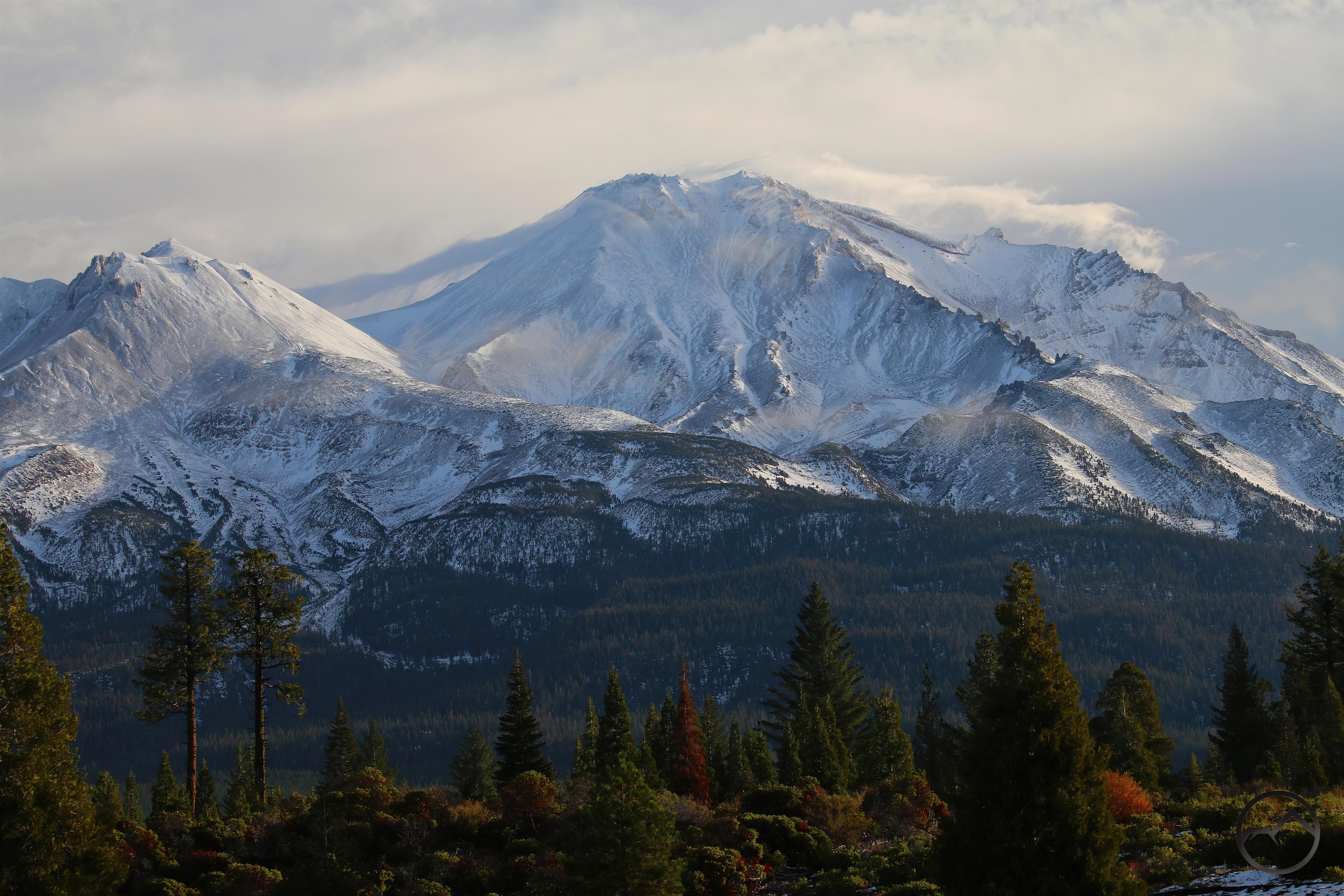
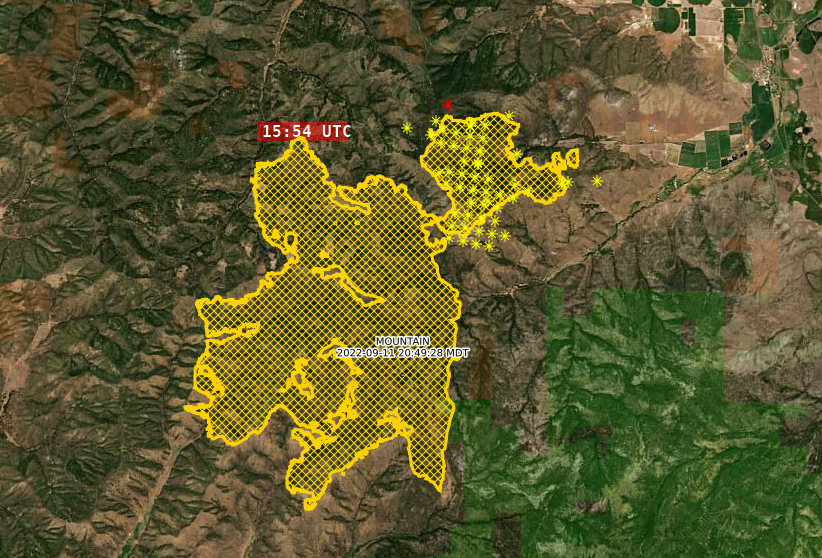
Of course, as soon as I post an encouraging follow up to my original article on the Mill and Mountain Fires, the latter jumps its containment lines and flares up again in a big way. After its ignition, the Mountain Fire had been attacked effectively by firefighters and within a few days it had grown to what seemed it maximum extent. The majority of the fire had been contained, its heat signatures had gone cold and little smoke was produced in the places where it still smoldered. All in all, it seemed like the threat had passed.

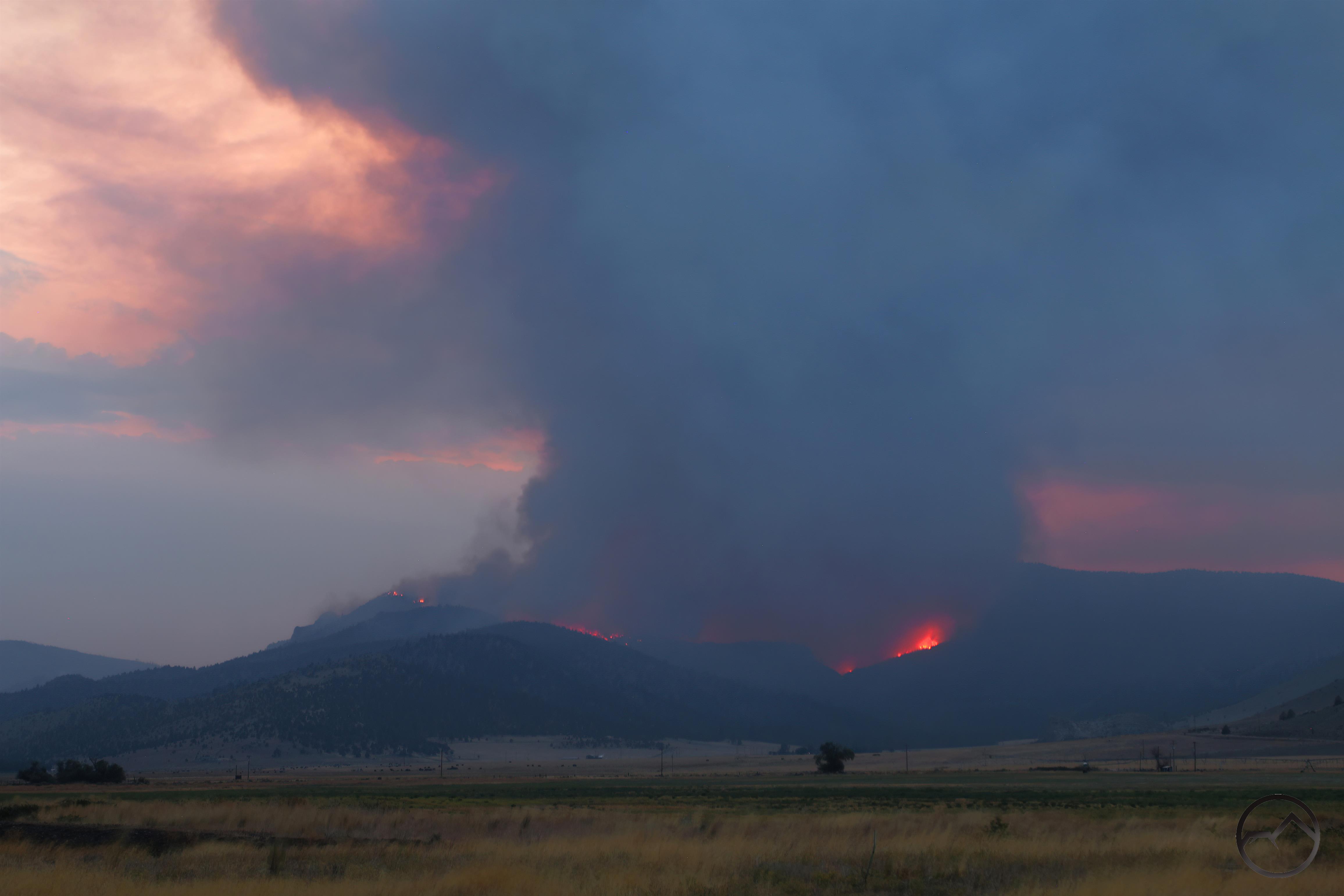
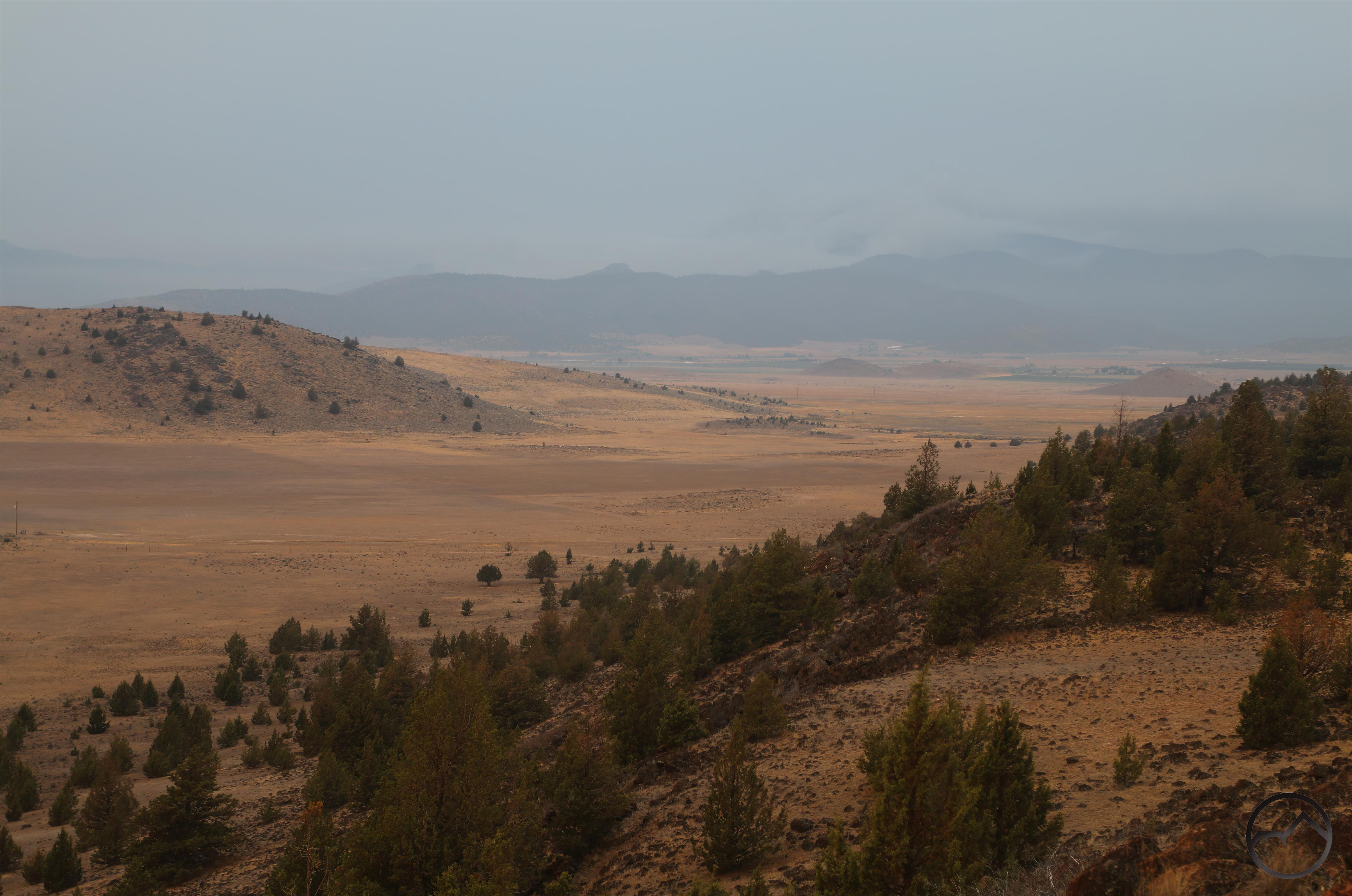
That all changed on Saturday. The area was experiencing a fair amount of wind, evidence of the changing weather systems. The wind kicked up the fire, propelled it over the containment line and into fresh, unburned terrain. This terrain was closer to the town of Gazelle and the surrounding farms than the fire had been at any point previous.

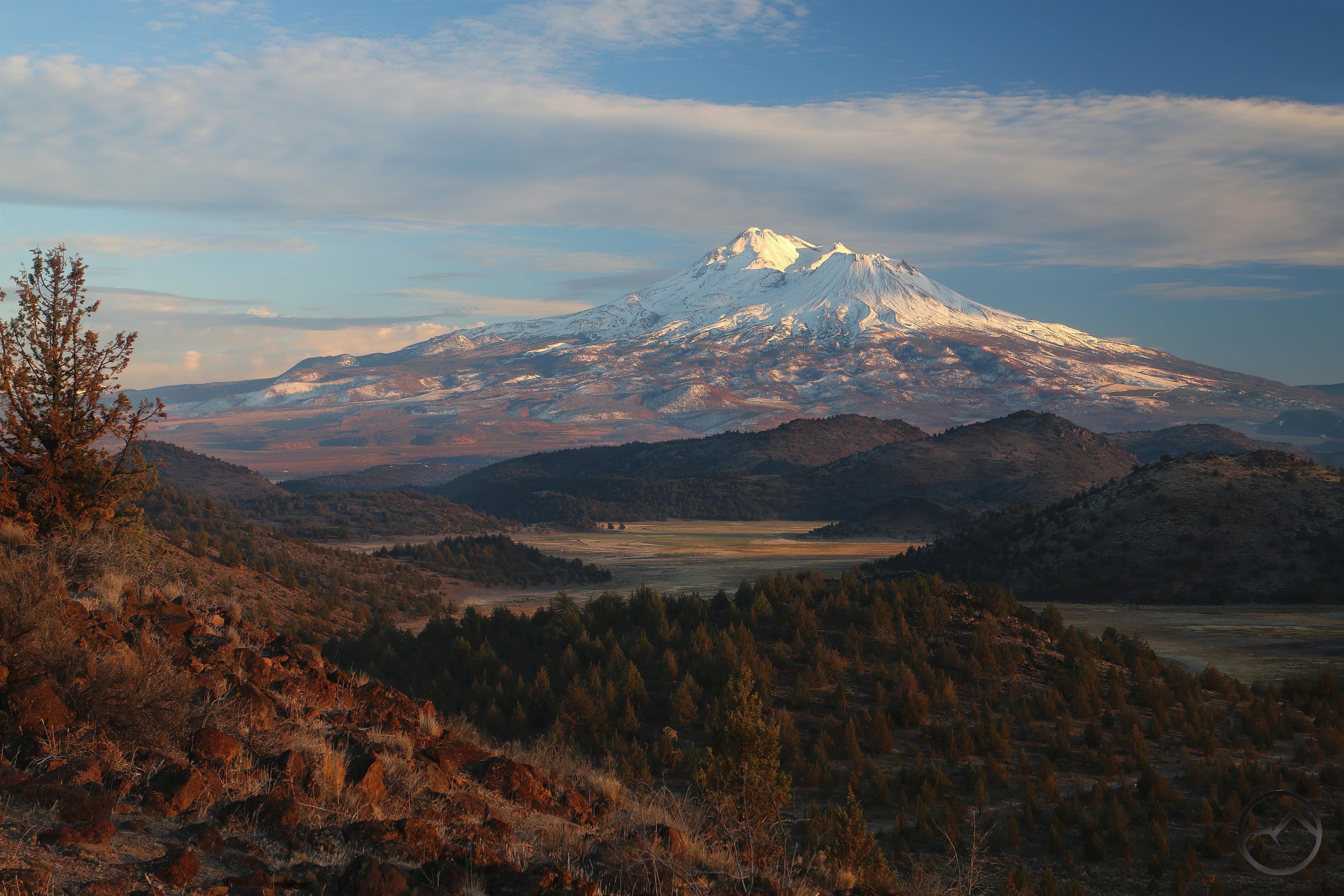
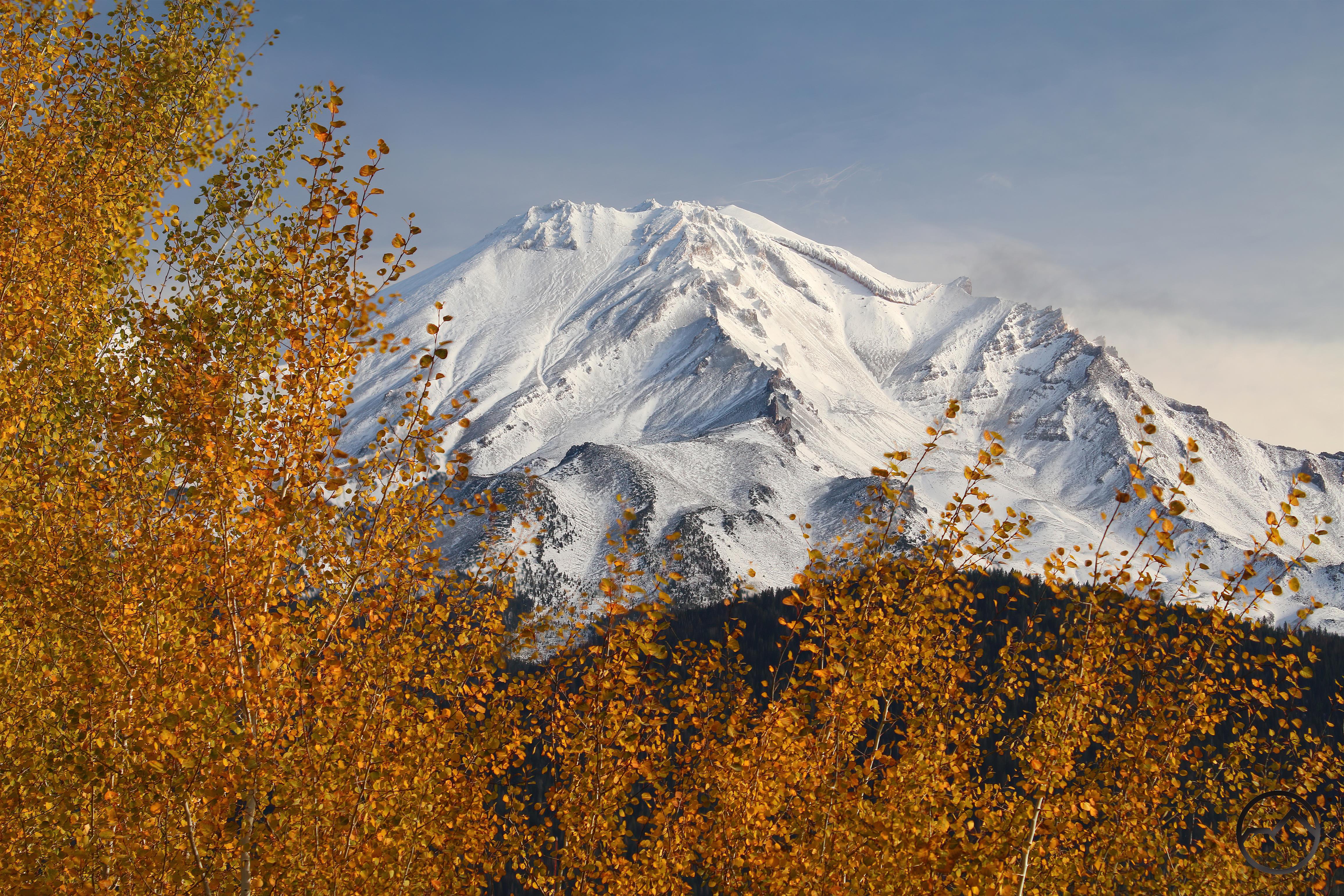
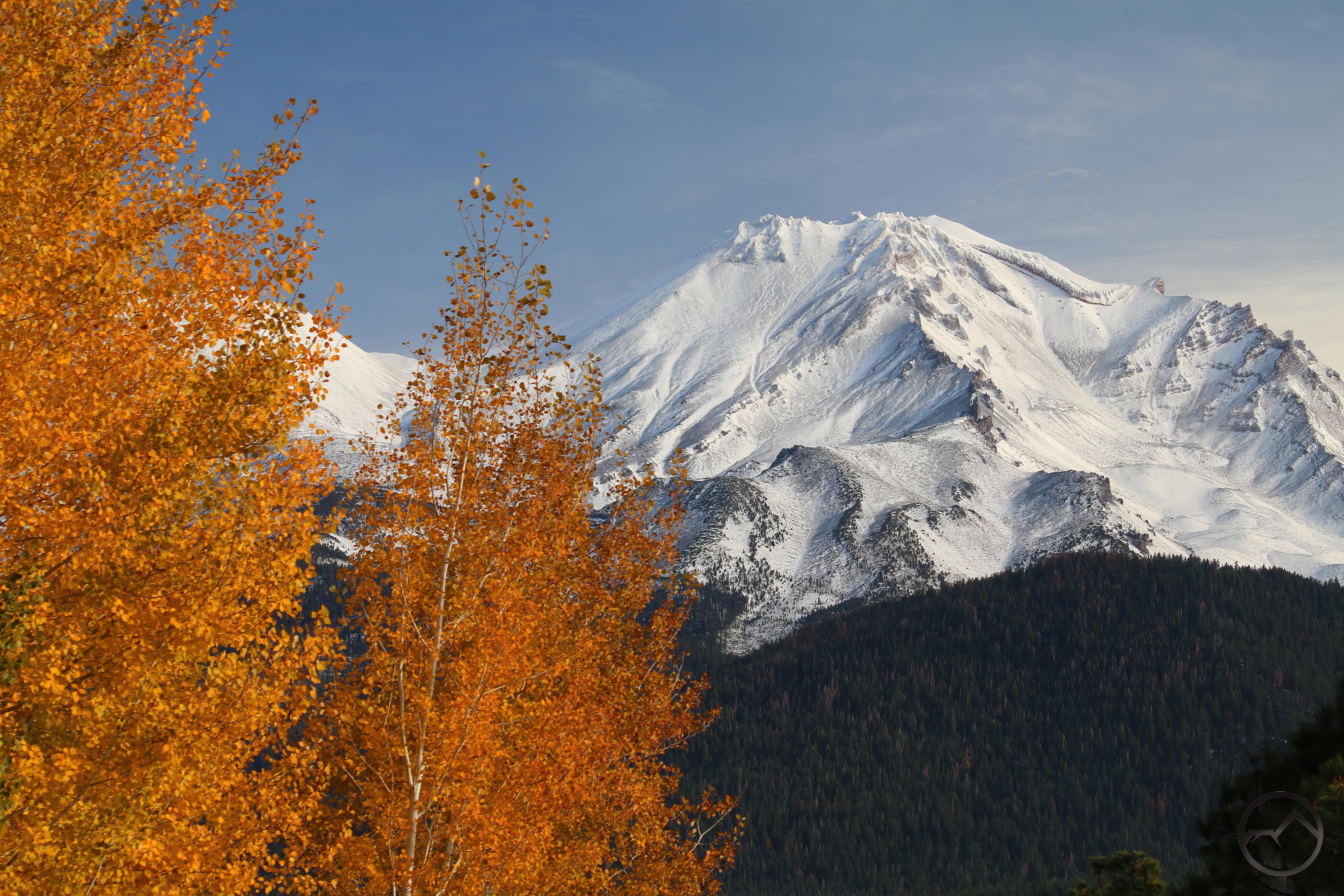
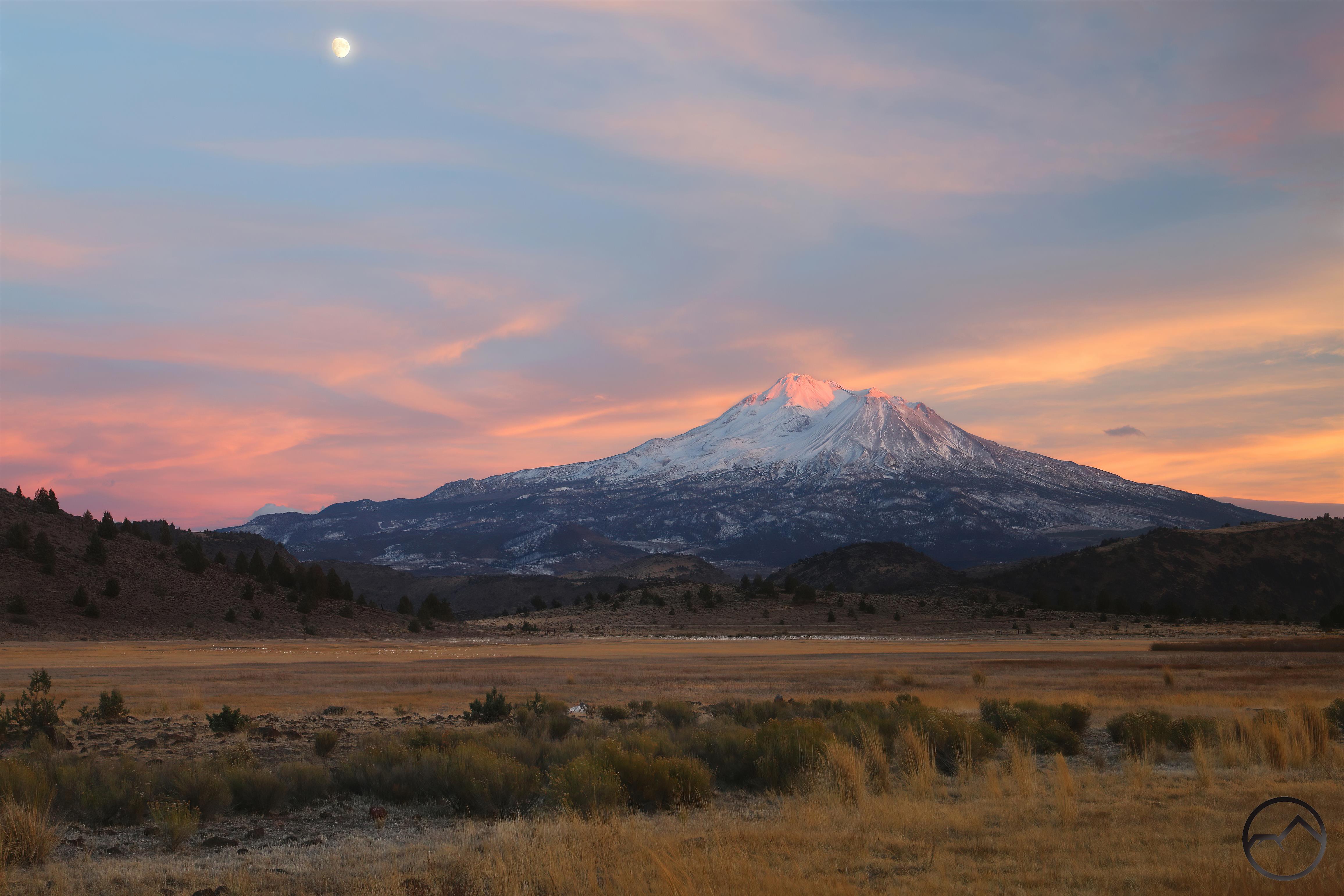
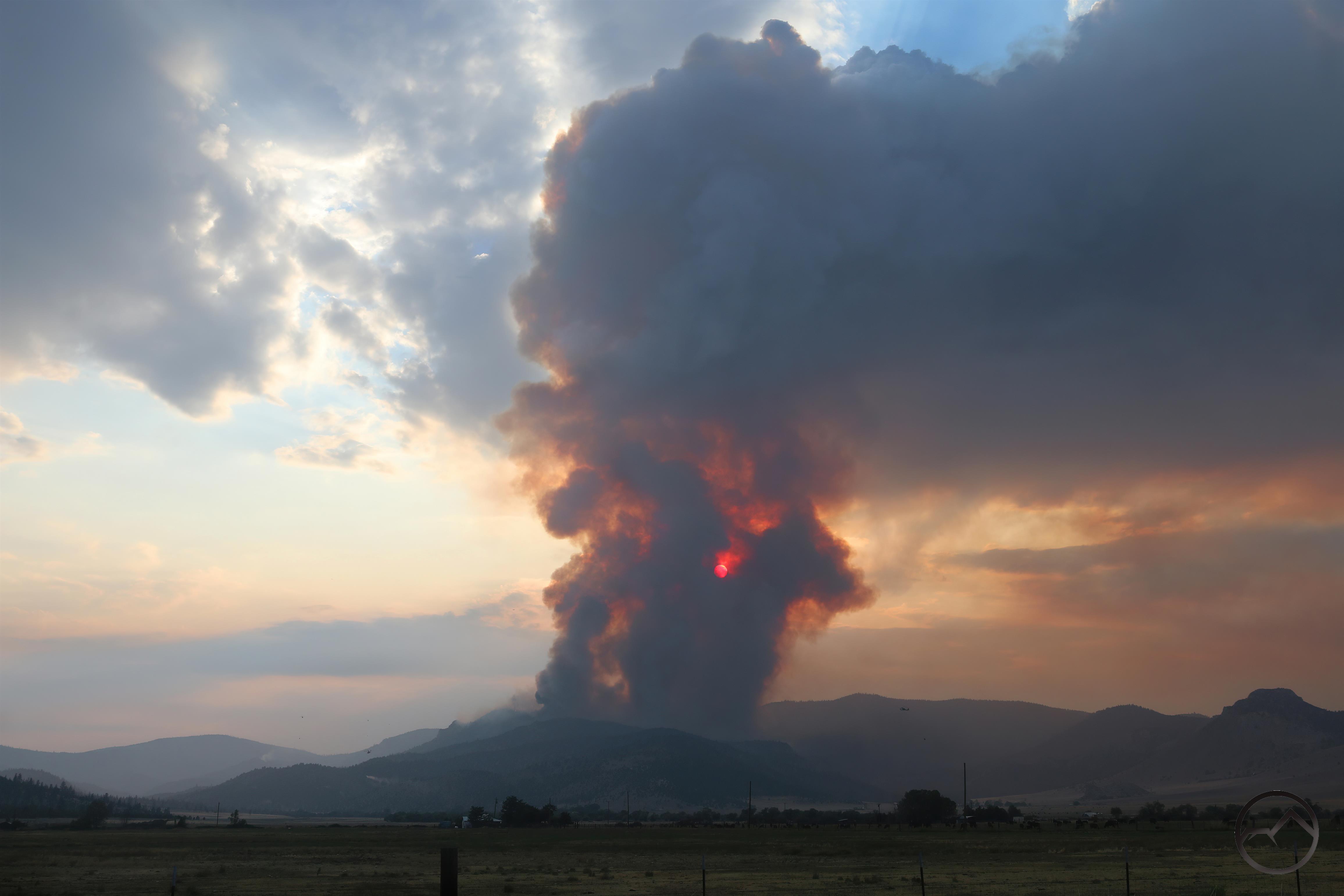
As it happened, I had planned on being out that way that evening anyway. It was a full moon and the best position to be in to capture the moon rising over Mount Shasta that sunset was at the south end of the Shasta Valley. I had planned on taking up a position on Stewart Springs Road. However, the sight of the large pyrocumulus rising up from the fire caused me to change plans and I headed up Old 99 a bit to see what was going on with the fire. I found a place where I was safely off that road, which had a lot of traffic on, with firefighters from all over the area racing to attack the flames.

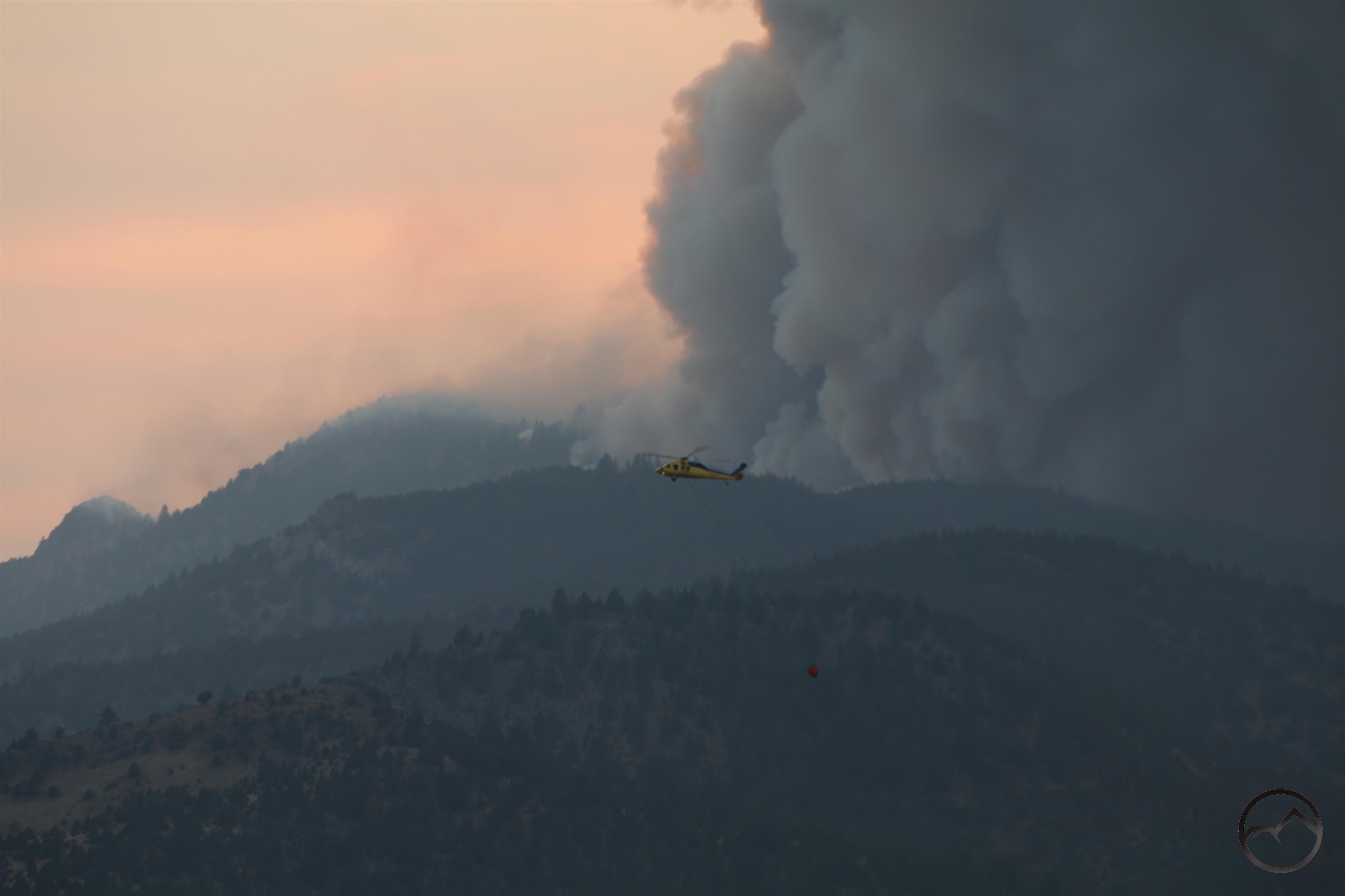
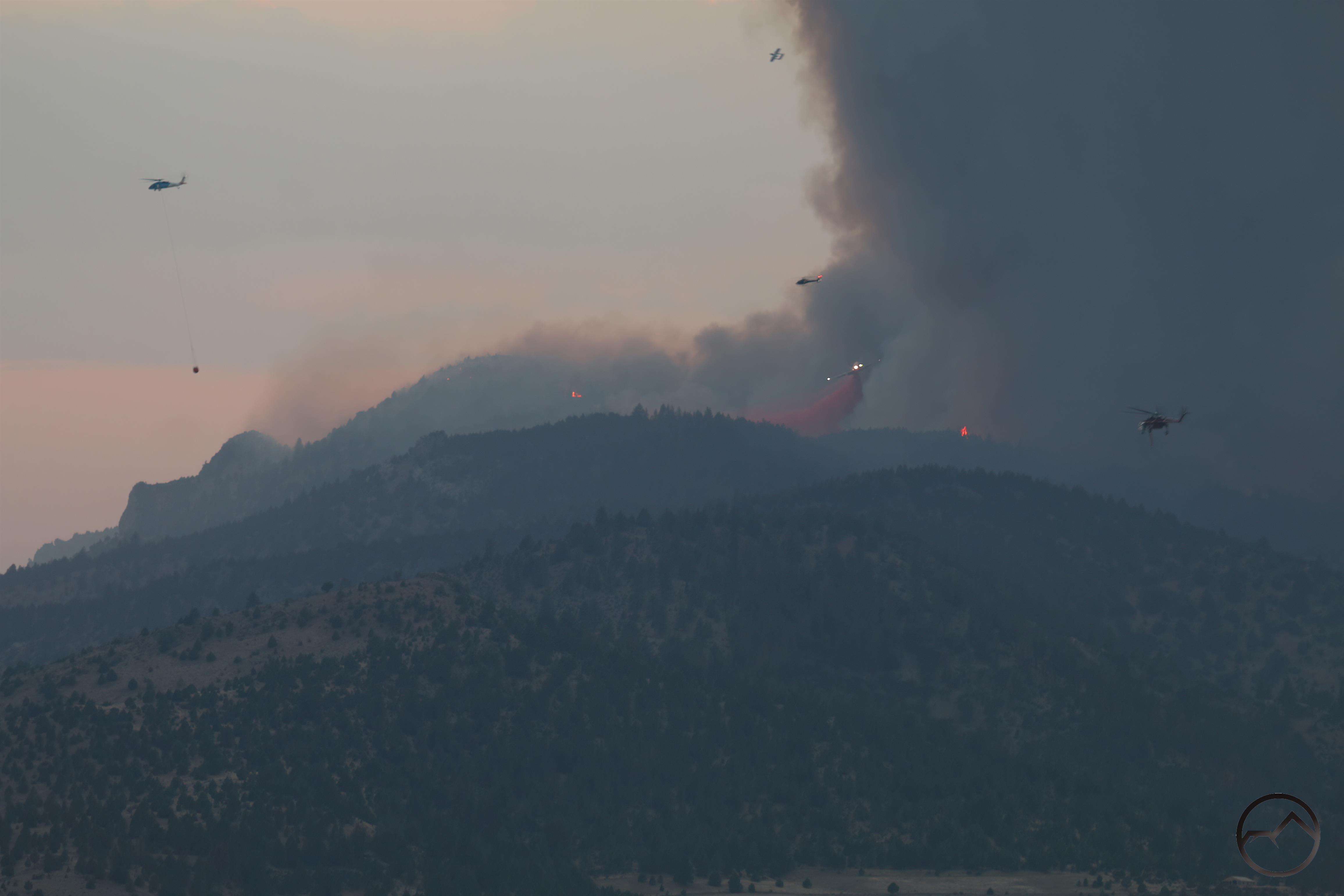
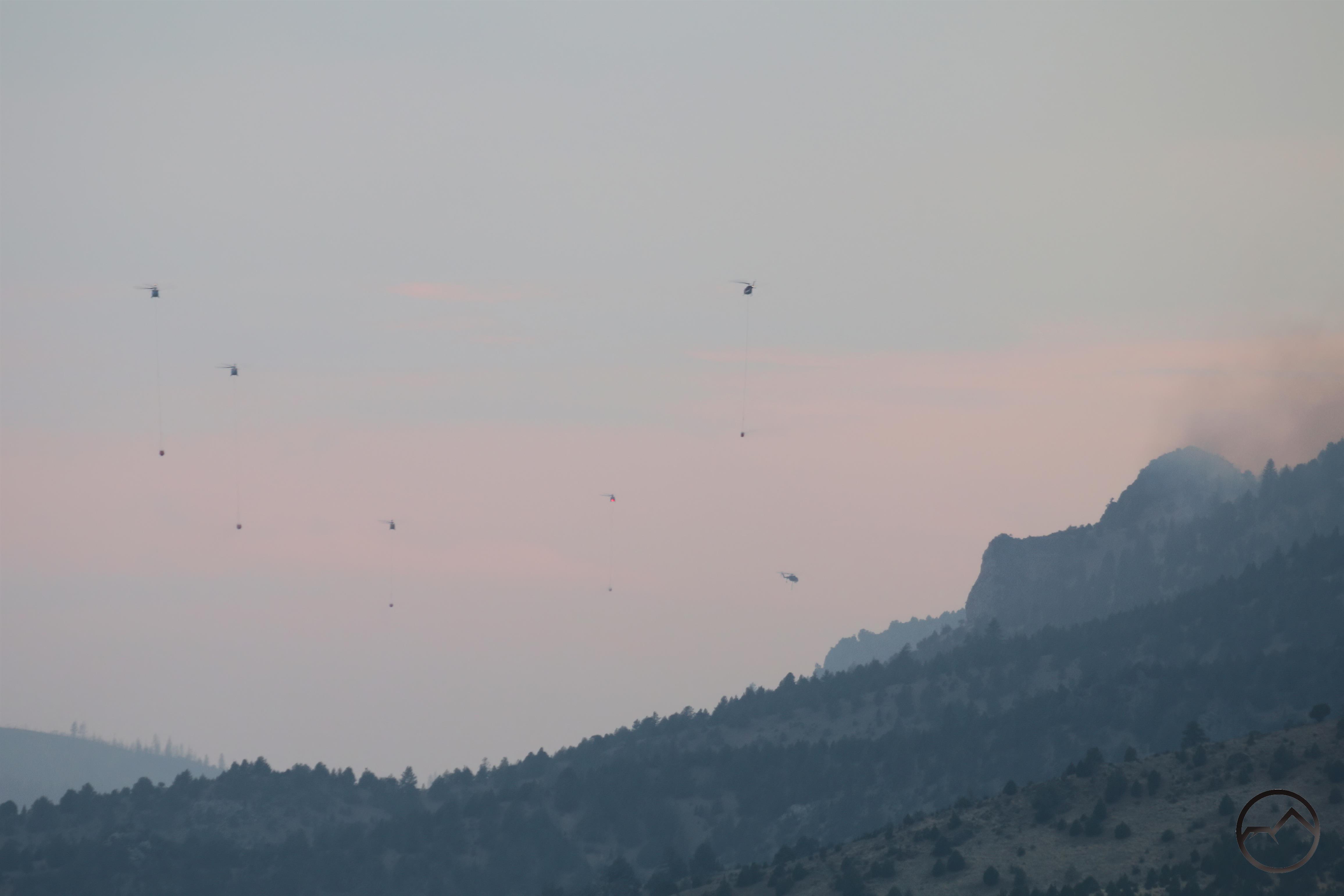
The fire was immediately evident and the column of smoke rose dramatically over the hills. The area hummed with activity, as at least 7 helicopters made sortie after sortie dumping their buckets on the fire, refilling their buckets in a nearby pond and heading back to the fire. From my position on Old 99, I was close enough to get rained on by the overflow from the full buckets if the helicopters swung a little wide to the east from the ponds. Meanwhile, a VLAT and spotter plan arrived and proceeded to make 8 passes, dropping retardant in areas to establish a perimeter for the fire.

The flurry of activity in the area was complimented by the fire crews heading up Gazelle Callahan Road and into Mack Gulch to attack on the ground. All of the firefighting efforts were as exciting as watching the fire itself. I tip my hat to the pilots and the ground crews.

I took a lot of images from the fire and it was hard to narrow it down to the collection I did, so please forgive the overabundance of images from this event! I will provide short commentary for them.

A lot of these pictures should be enlarged, to see some of the detail of what was going on.

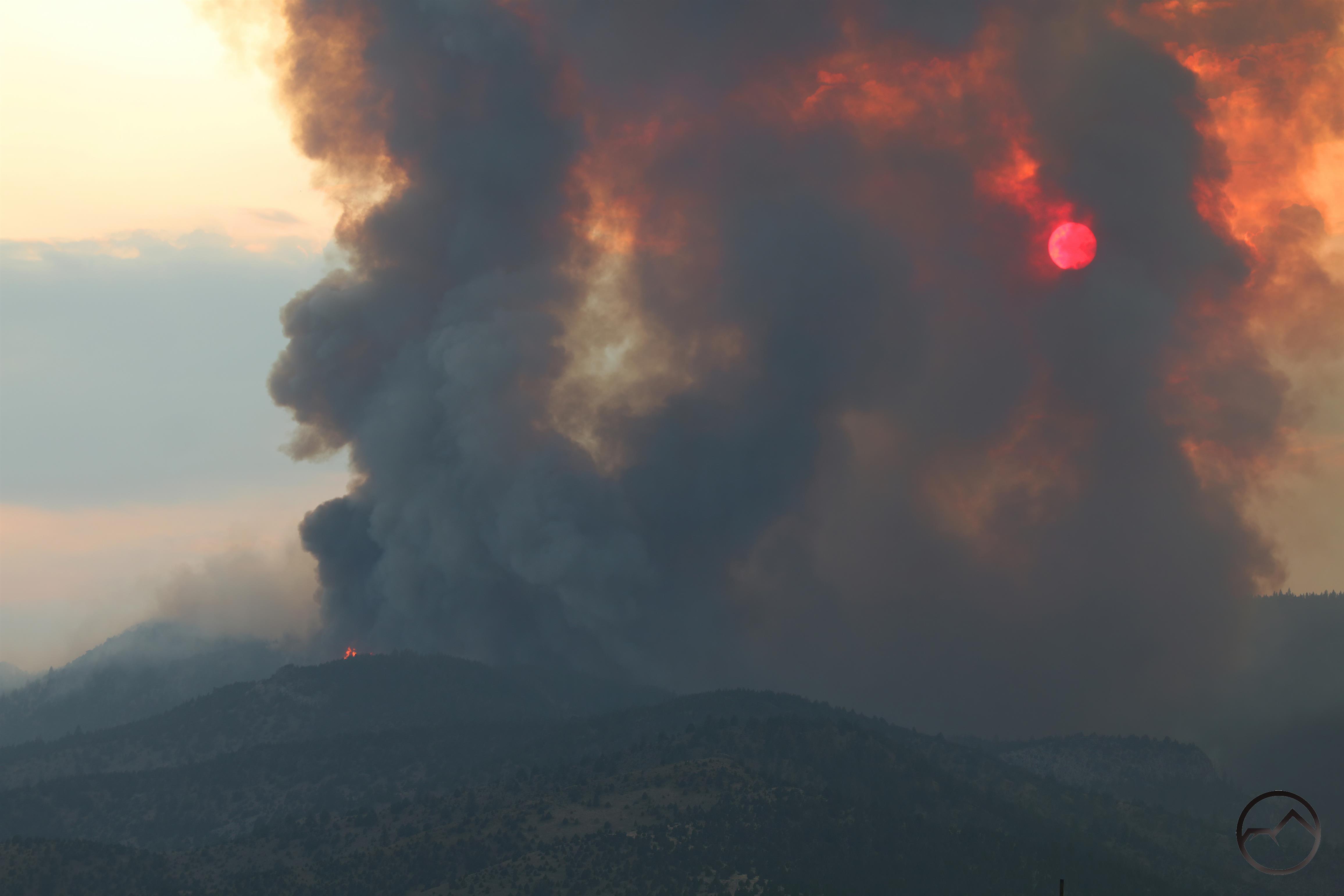
When I arrived on the scene, the sun was setting behind the column of smoke, giving it an eerie feeling.

A helicopter takes off as the sun peeks through the Mountain Fire’s smoke.

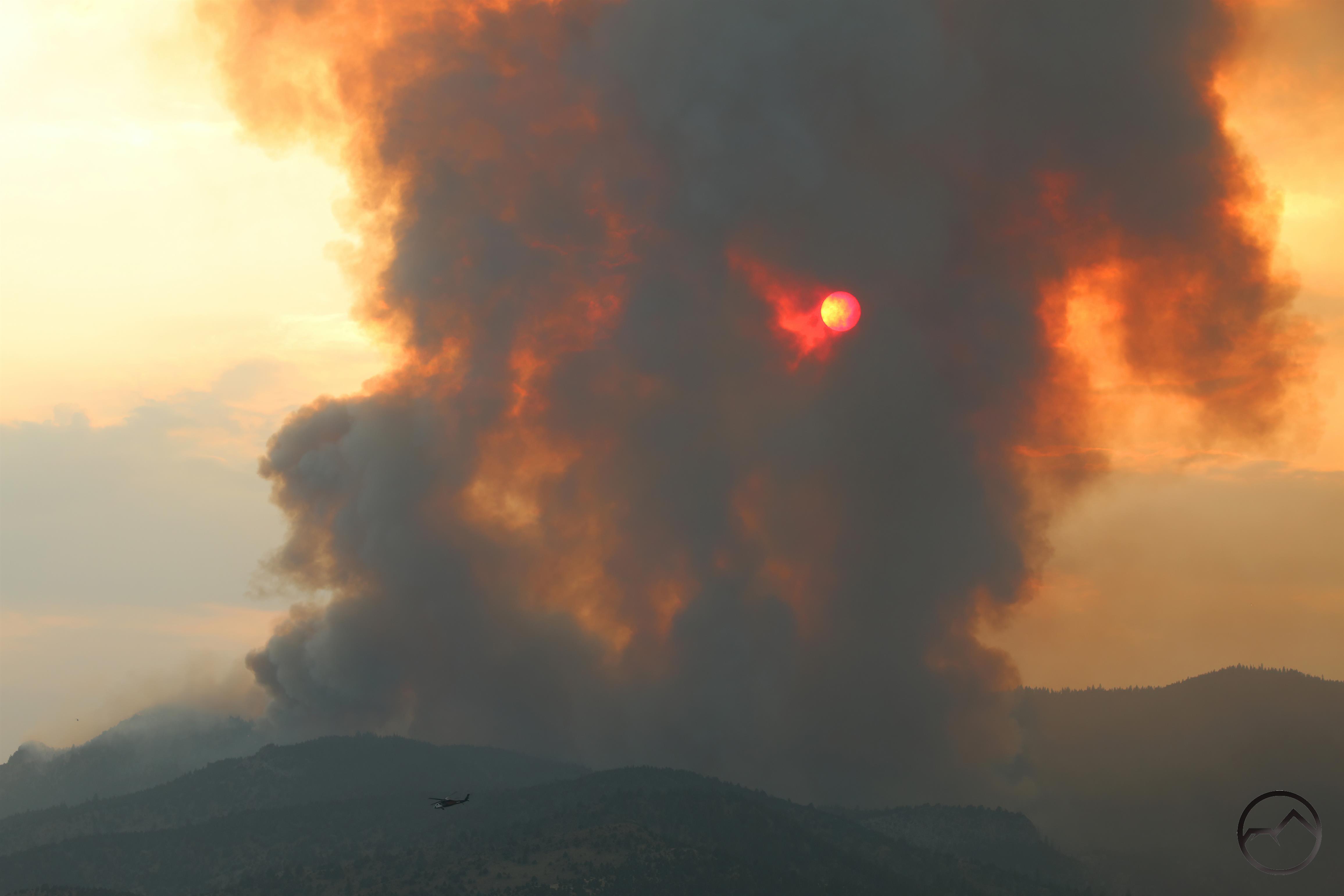
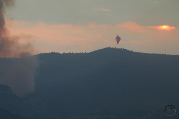
A geyser of flame bursts over the hill’s horizon as the sun sinks into the smoke. Enlarge this one and see the helicopter about to drop water on the flame.

Another view of the column of smoke and the setting sun.

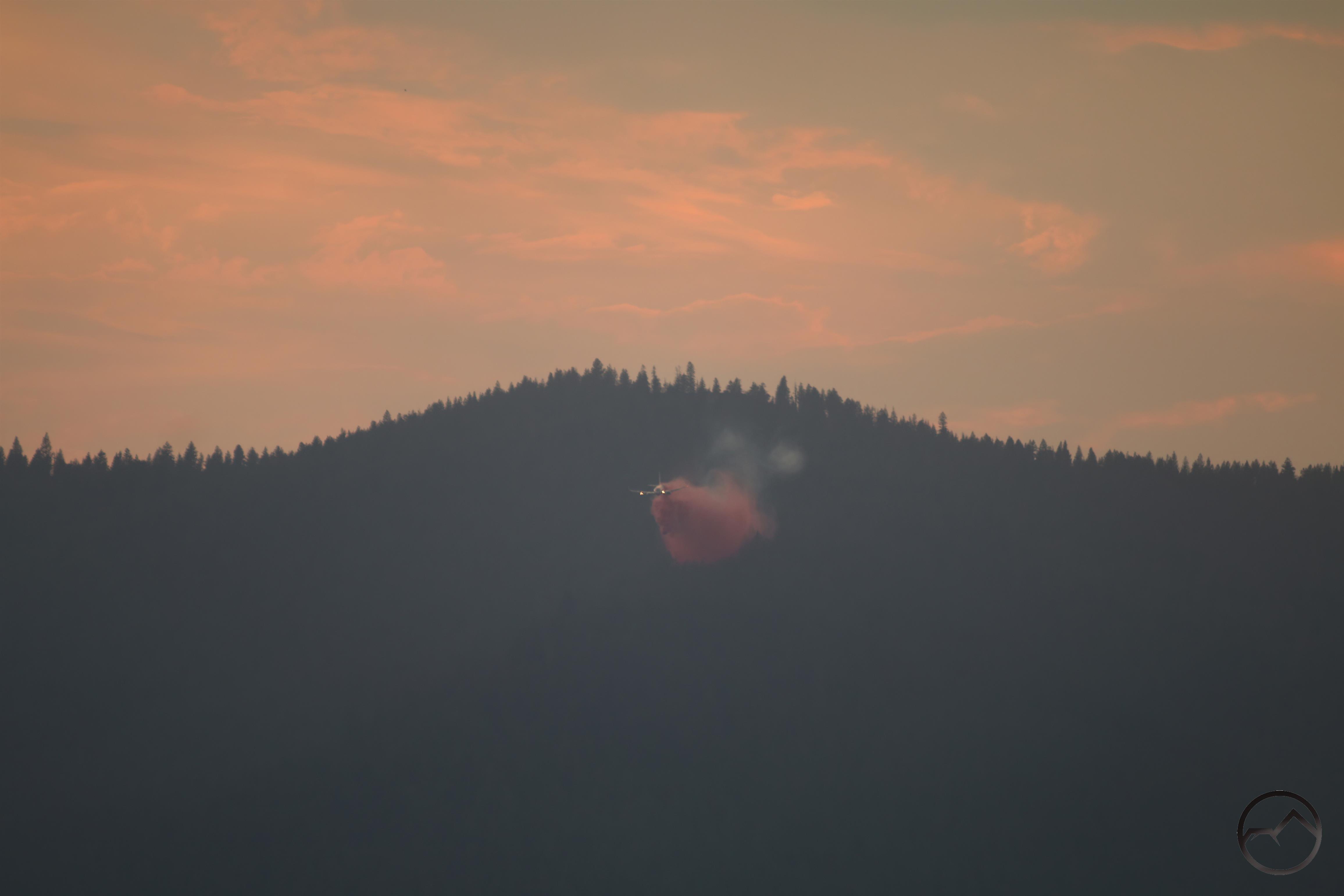
The second of 8 retardant drops from the 737 VLAT.

The third run from the VLAT. I watched its first run but did not have the camera trained on it so missed capturing it. This particular plane is on lone from New South Wales, Australia.

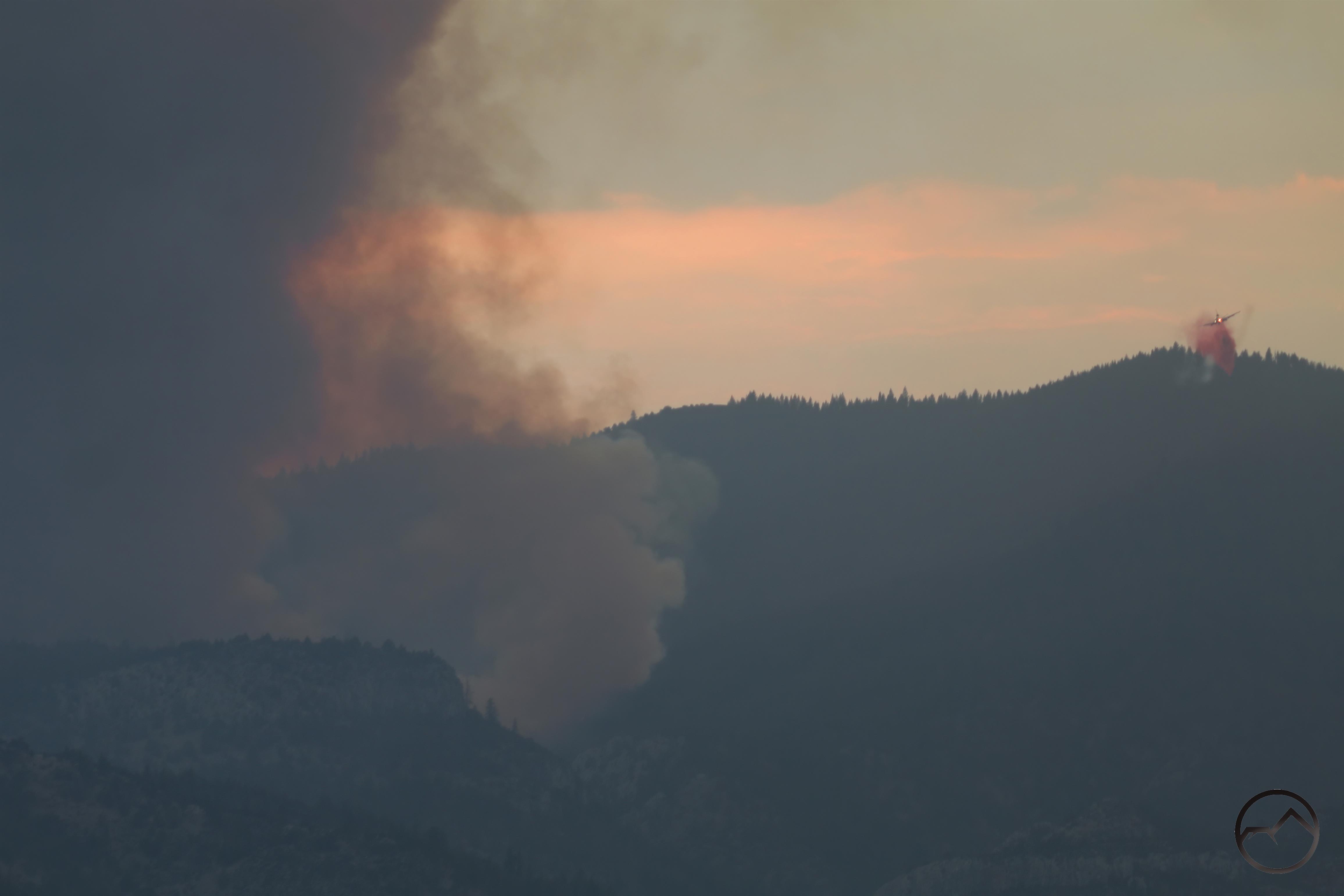
The smoke and alpenglow sky is a dramatic backdrop for a helicopter heading back to refill its bucket.

Flying past the fires.

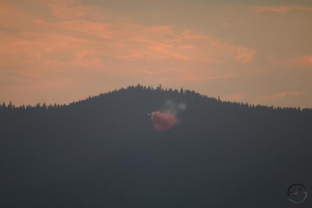
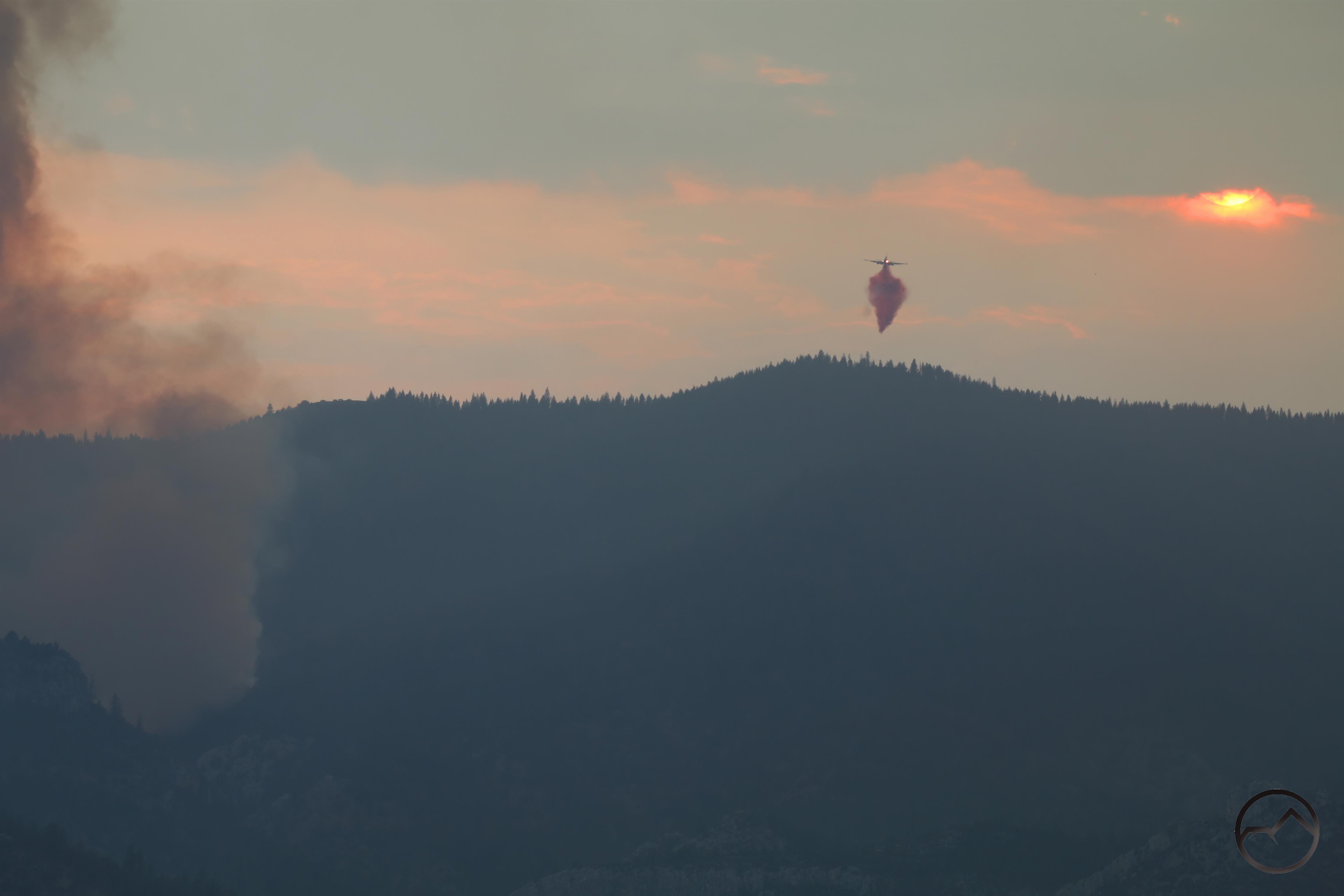
The fourth run of the VLAT. The thin white smoke above the pink retardant is the contrail left by the spotter plane. The spotter marks the location for the retardant and the VLAT pilot follows after and makes the drop.

The sun is barely visible through the smoke and clouds just before it sets behind the mountains. This was a dramatic, and really memorable sight.

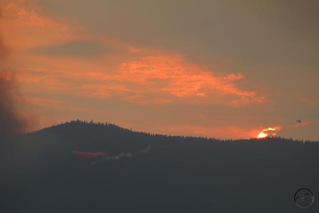
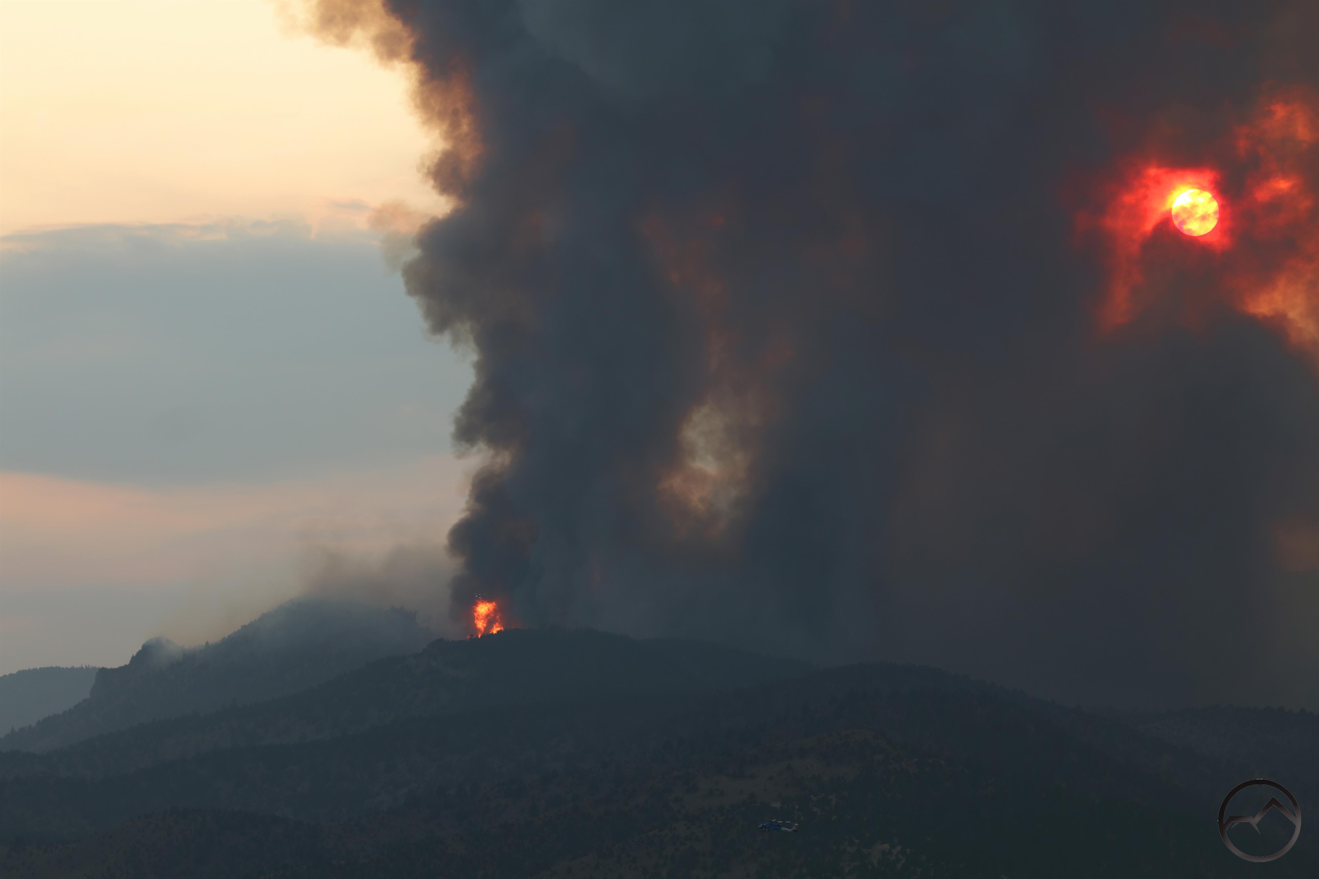
The VLAT made its fifth run as the sun sank below the horizon. Note the small spotter plane just above the sun. That’s an NAR OV-10 Bronco. As noted in the picture, these planes have a twin boom configuration.

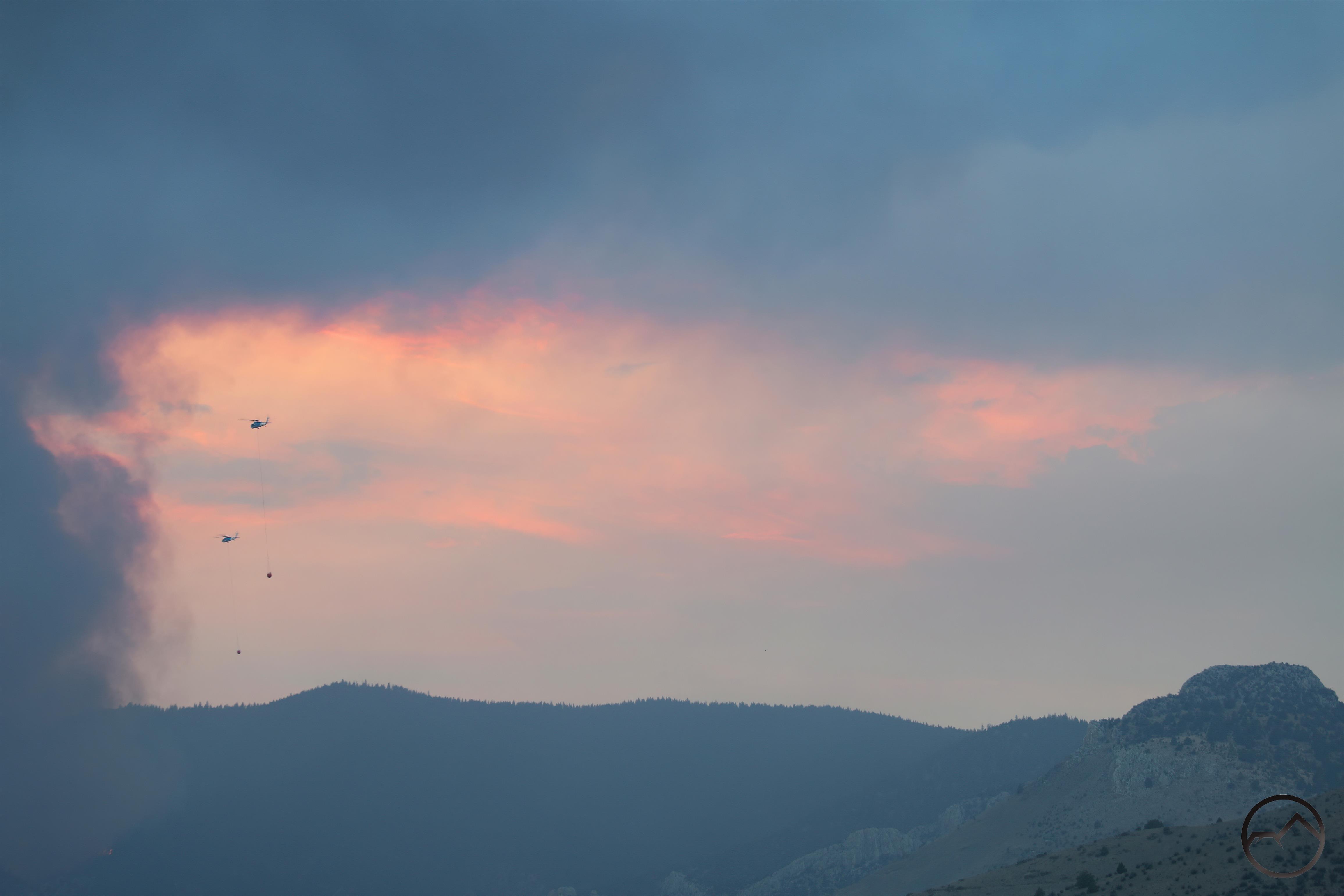
Two helicopters head into the maelstrom. Bonnet Rock is in the lower left.

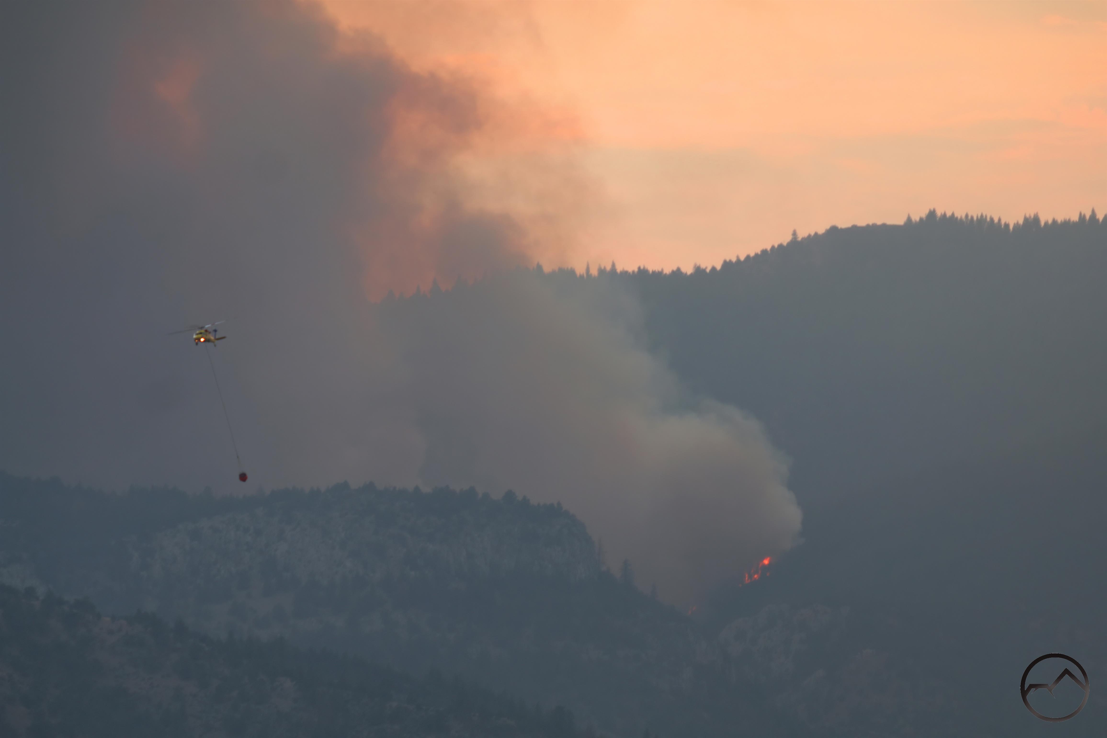
The VLAT changed the location of the drop after its fifth run. Its sixth run was on the south side of the fire and I missed it, not expecting the change. I was ready for the seventh though and captured this shot as the plane dropped the load amidst a number of helicopters working the flames with water. Note the spotter plane at the top, on the edge of the smoke plume. All of these guys are really impressive pilots!

Watching this particular scene felt like I had been transported into the film “Apocalypse Now”. It was hard not to hear “Ride of the Valkyries” in my mind while watching these 6 helicopters head toward the fire at the same time. A very different war…

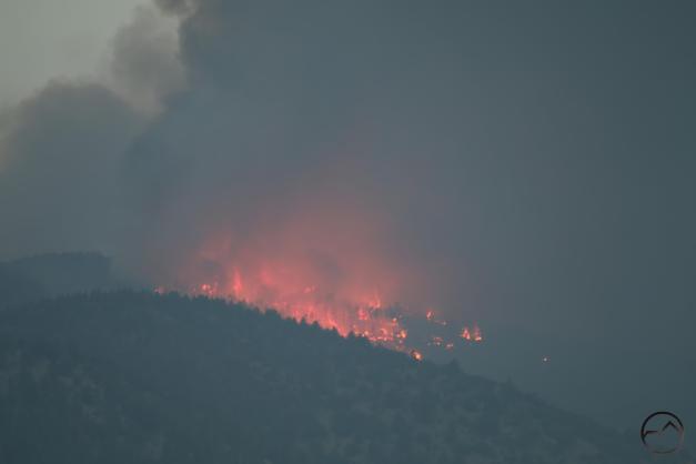
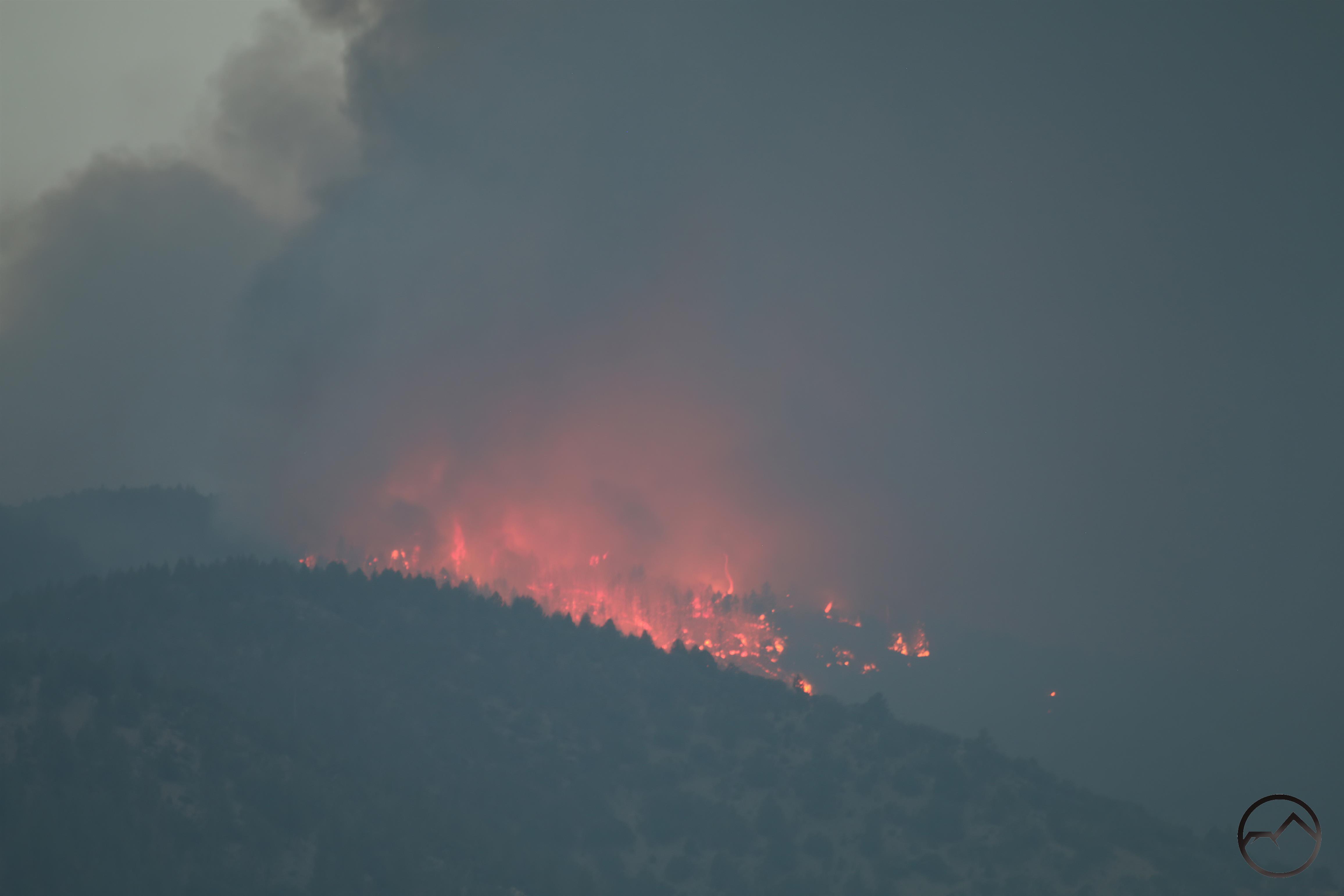
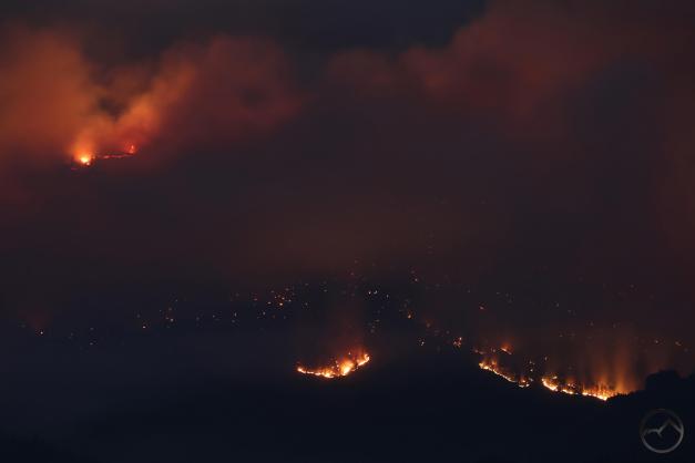
A closer look at one of the burning areas. A close examination on the right side of the fire while reveal a fire cyclone. Those are really intense conditions!

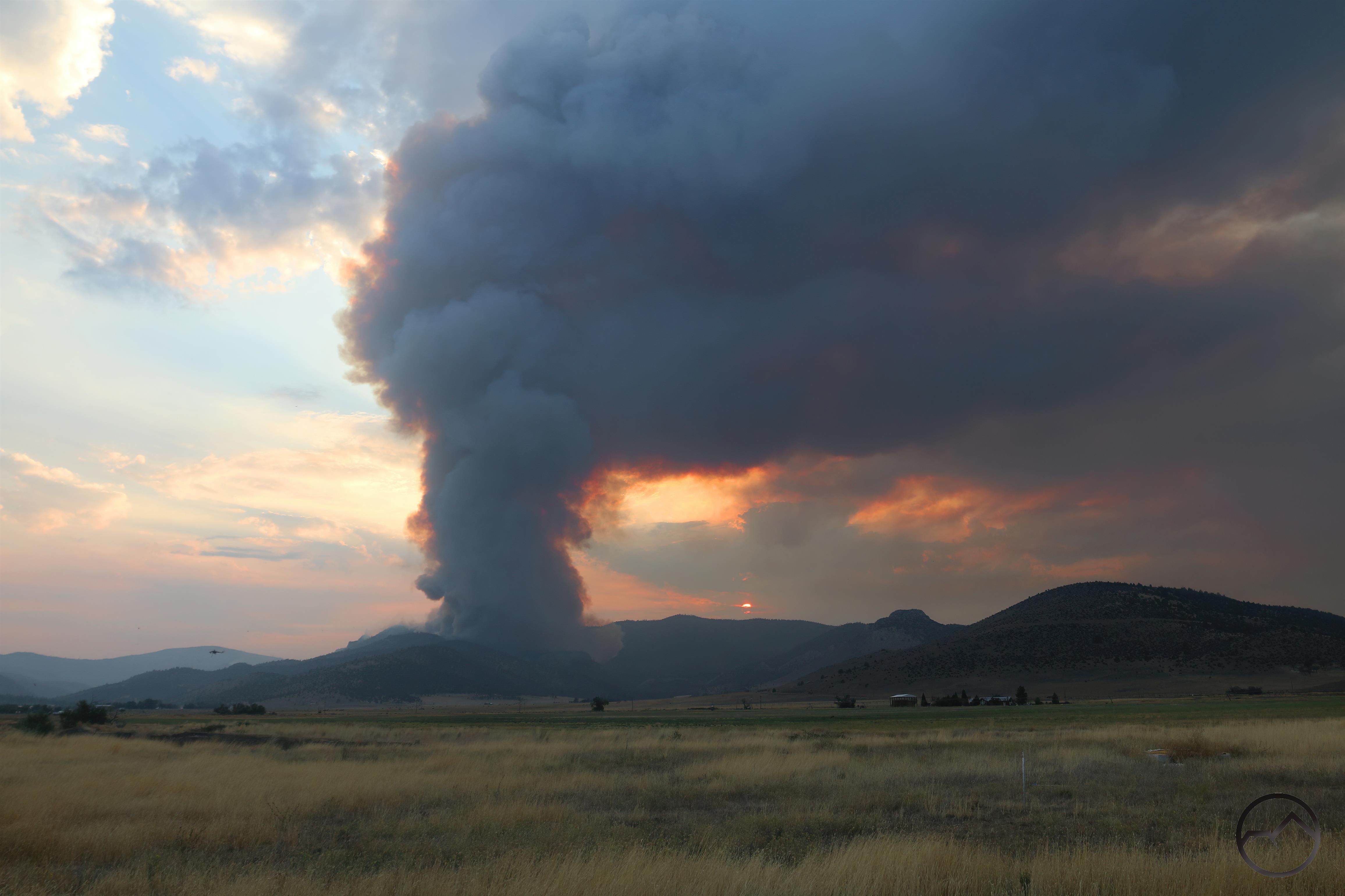
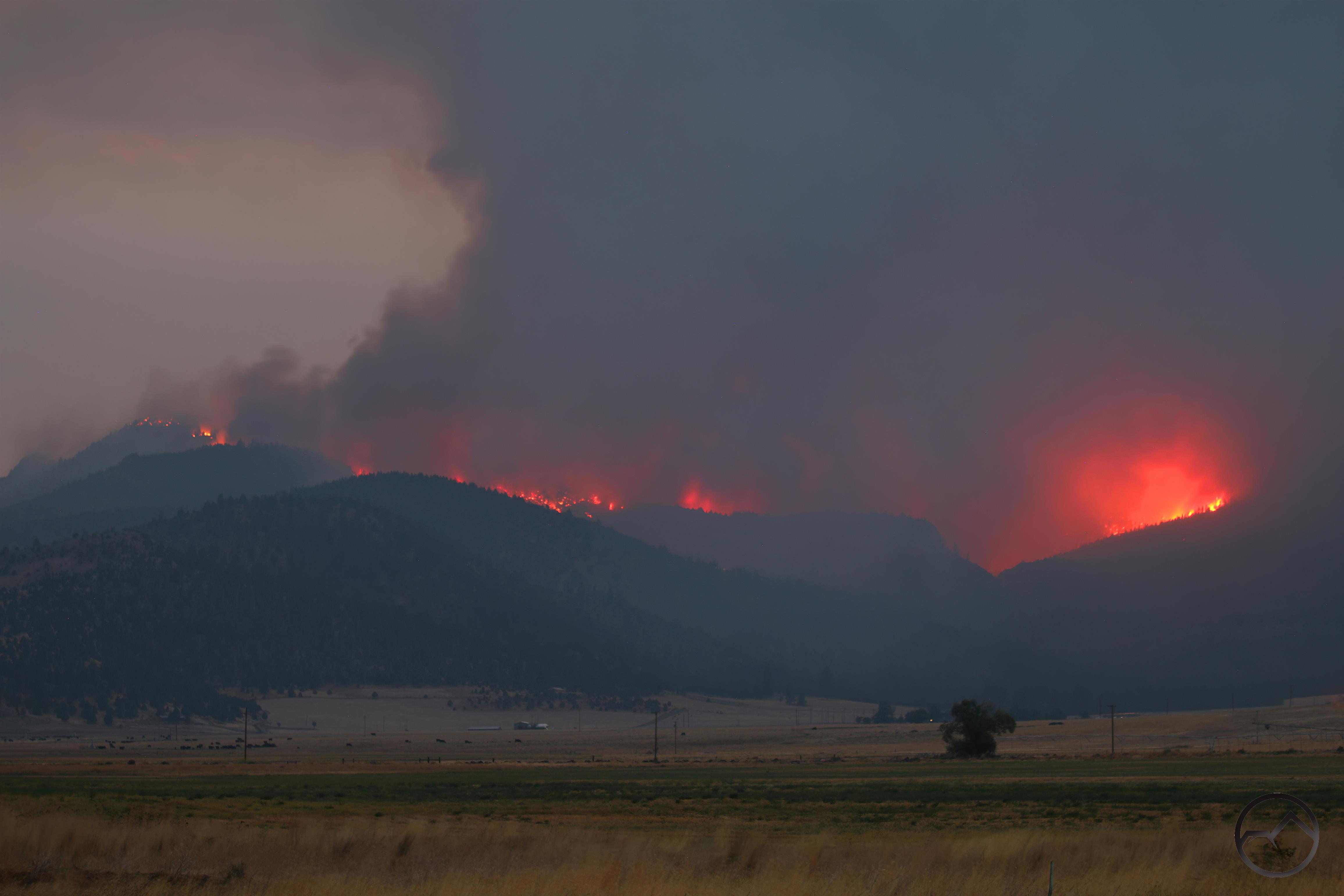
By the time dark began to descend, it was obvious the fire had grown considerably. From a few small flames when I arrived to a massive wall of fire, it had gotten fearsome as it crept eastward toward Gazelle.

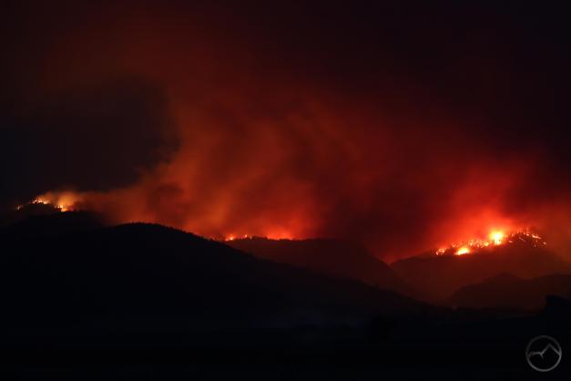
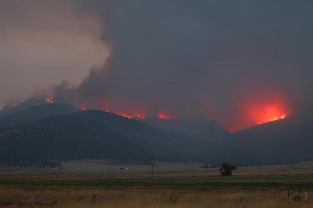
It the dark, the fury of the fire was evident and terrible.

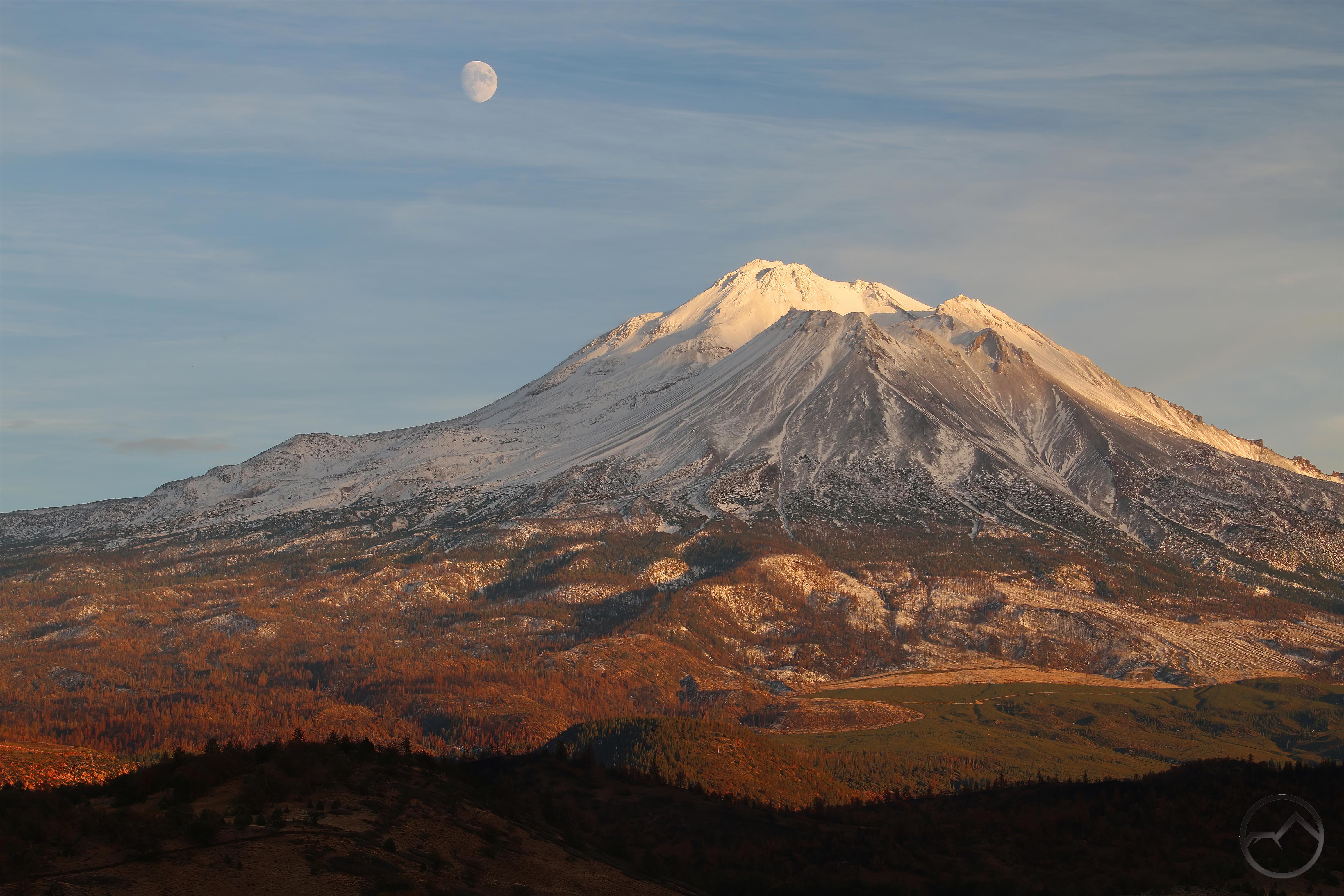
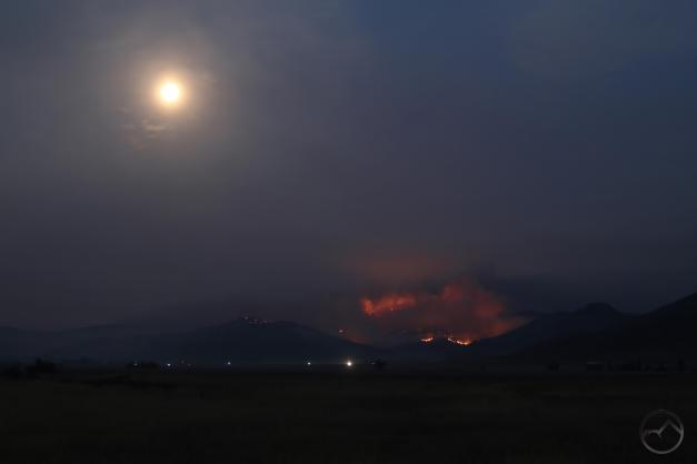
In the midst of the firestorm, I happened to look behind me and suddenly realized there was supposed to be a full moon. I could see it just beginning to breach the horizon near Mount Shasta. It was not where I had planned on being but here it was and I could still get Mount Shasta in the same frame, if only as a silhouette. The smoke caused the moon to glow red. It was a shocking and surreal sight. After this, I decided to head home but planned on coming back out in the morning to check the fire’s status.

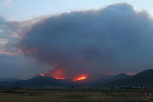
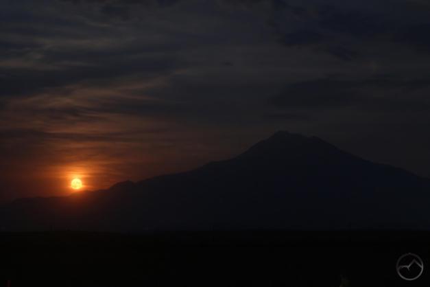
I returned my spot on Old 99 early in the morning. The fire still burned, putting off a haunting red glow in the dark of night. As fate would have it, however, the full moon I had watched rise a few hours earlier was now in a position to set near the fire. Strange sights indeed.

The fire itself had moved into new territory but its overall intensity was not what it had been the previous night. Hopefully its ferocity would continue to abate.

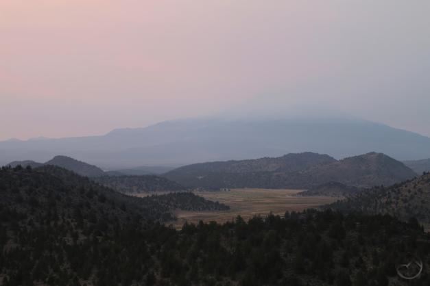
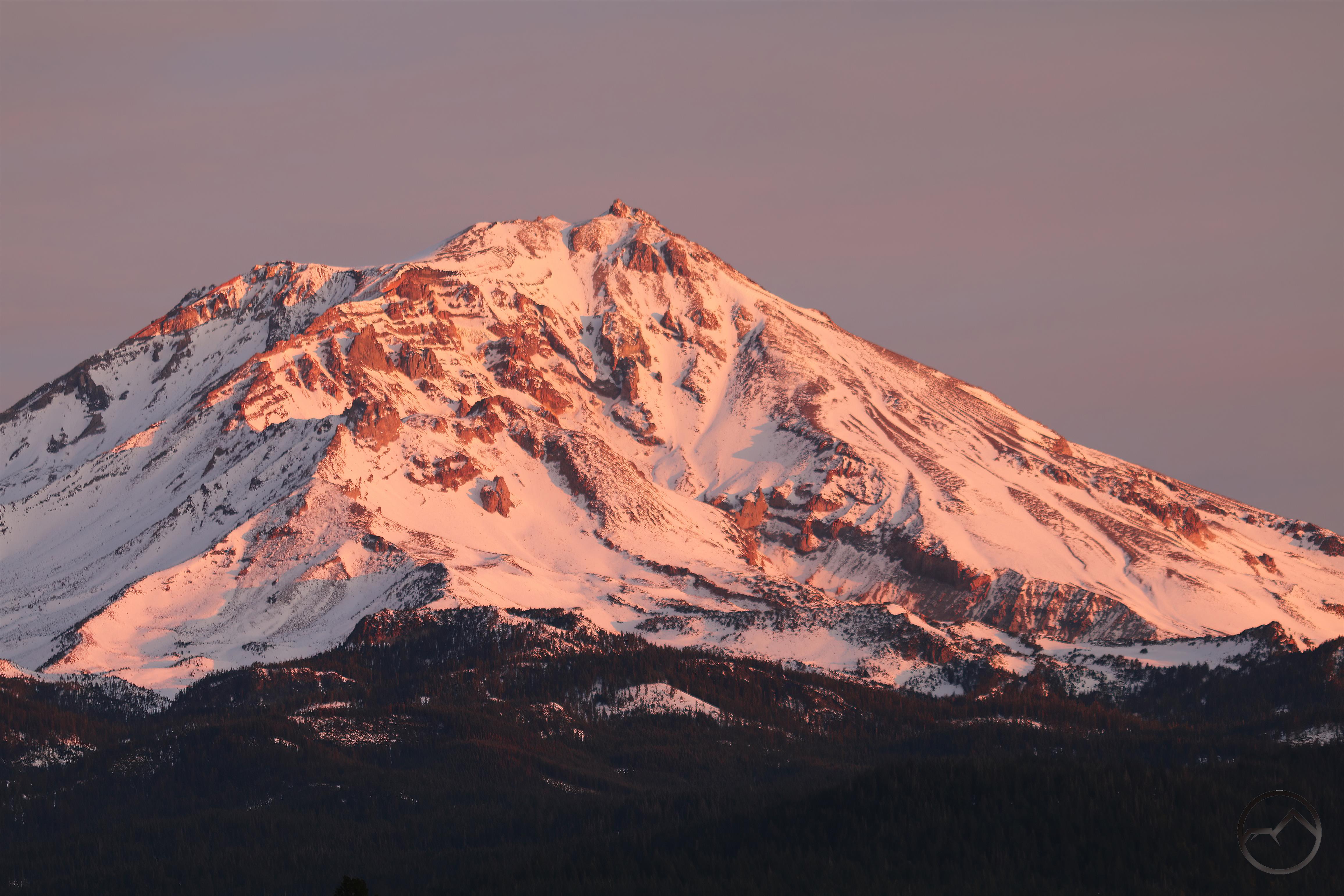
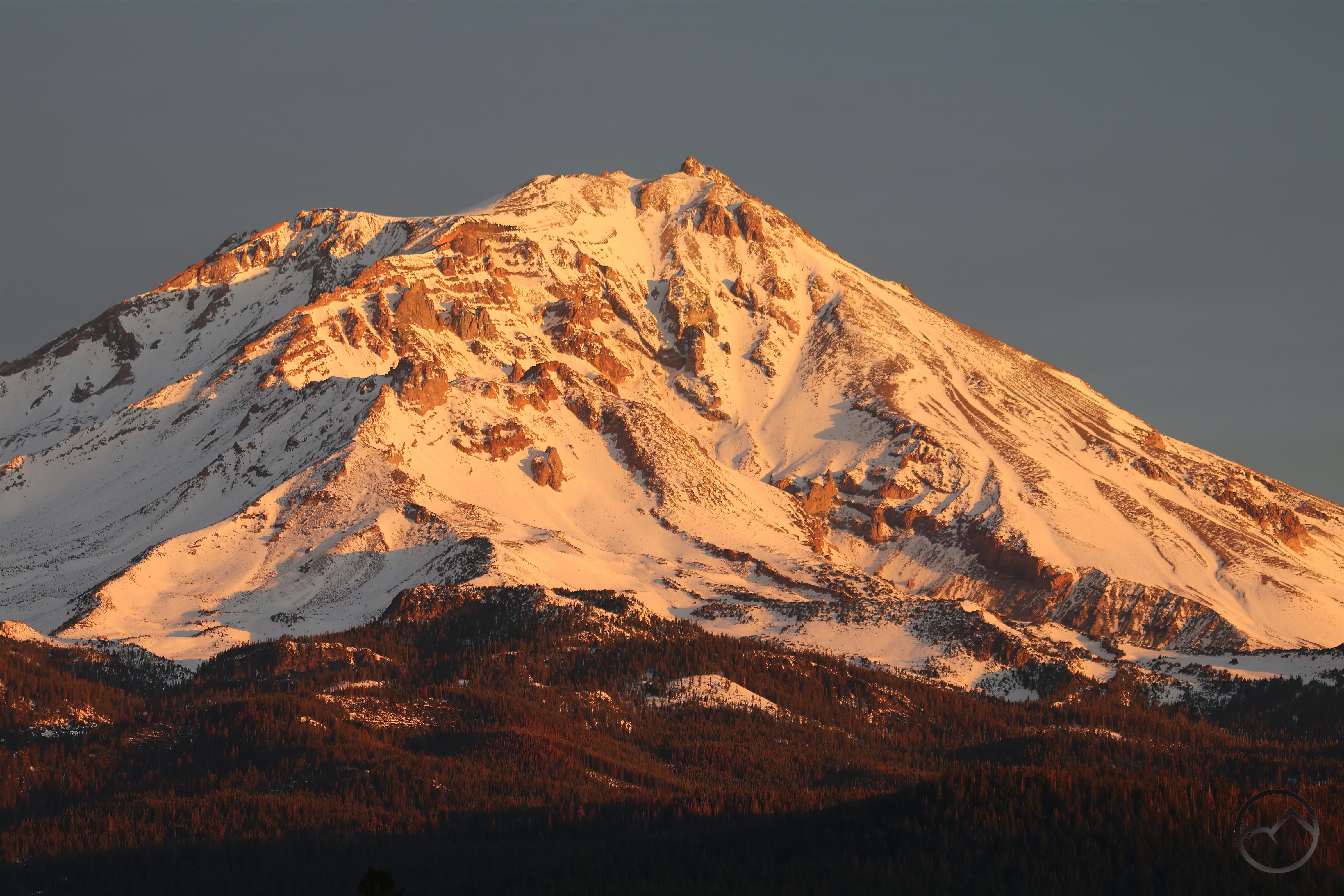
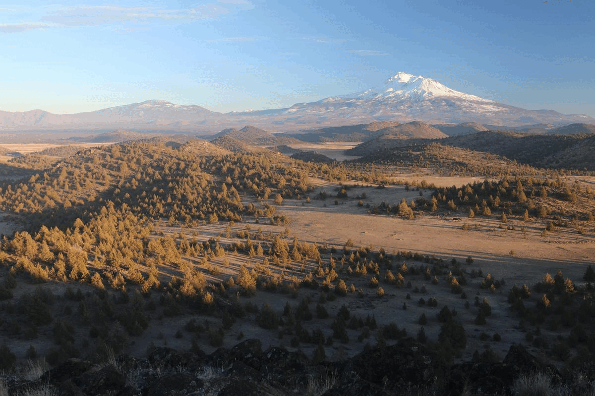
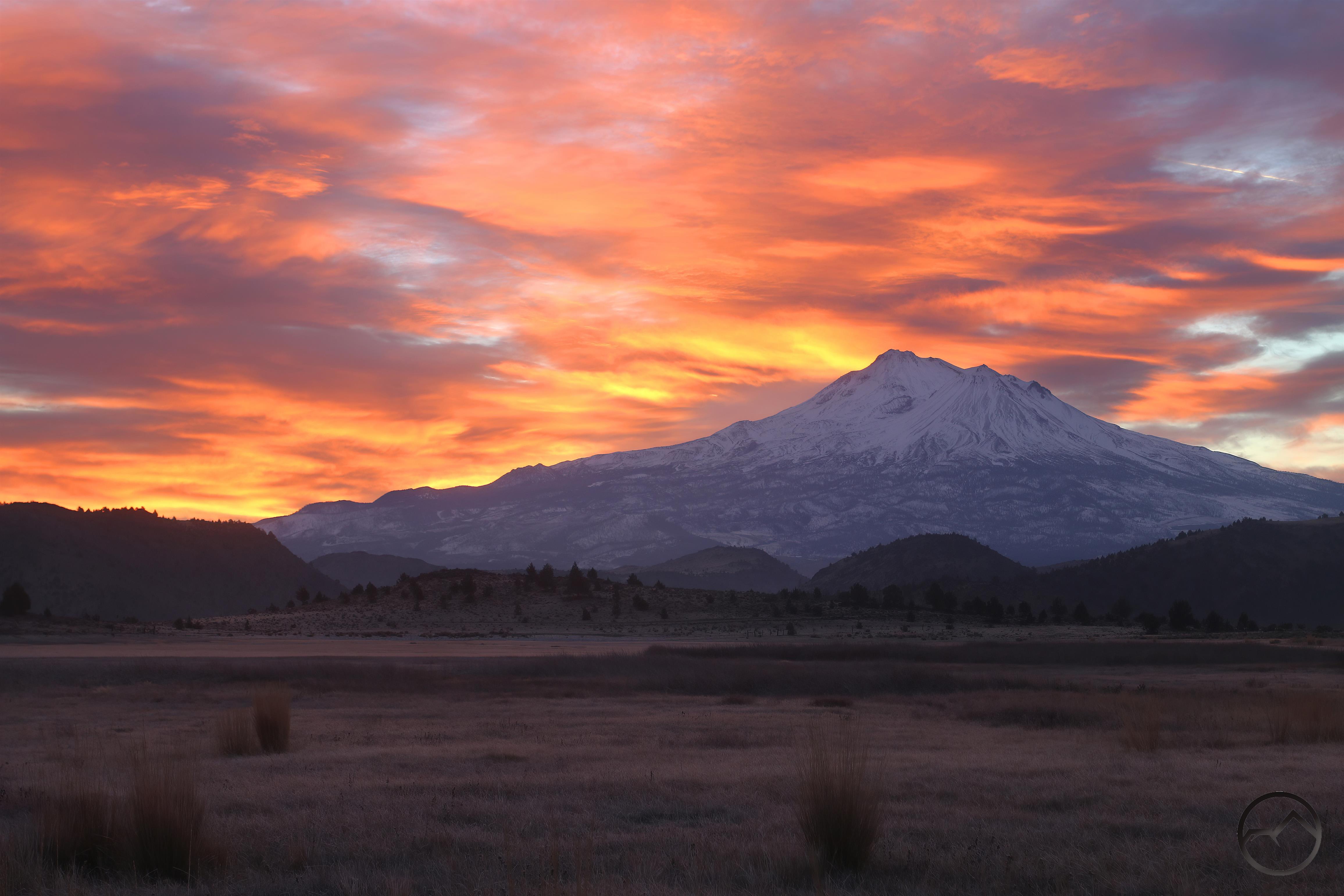
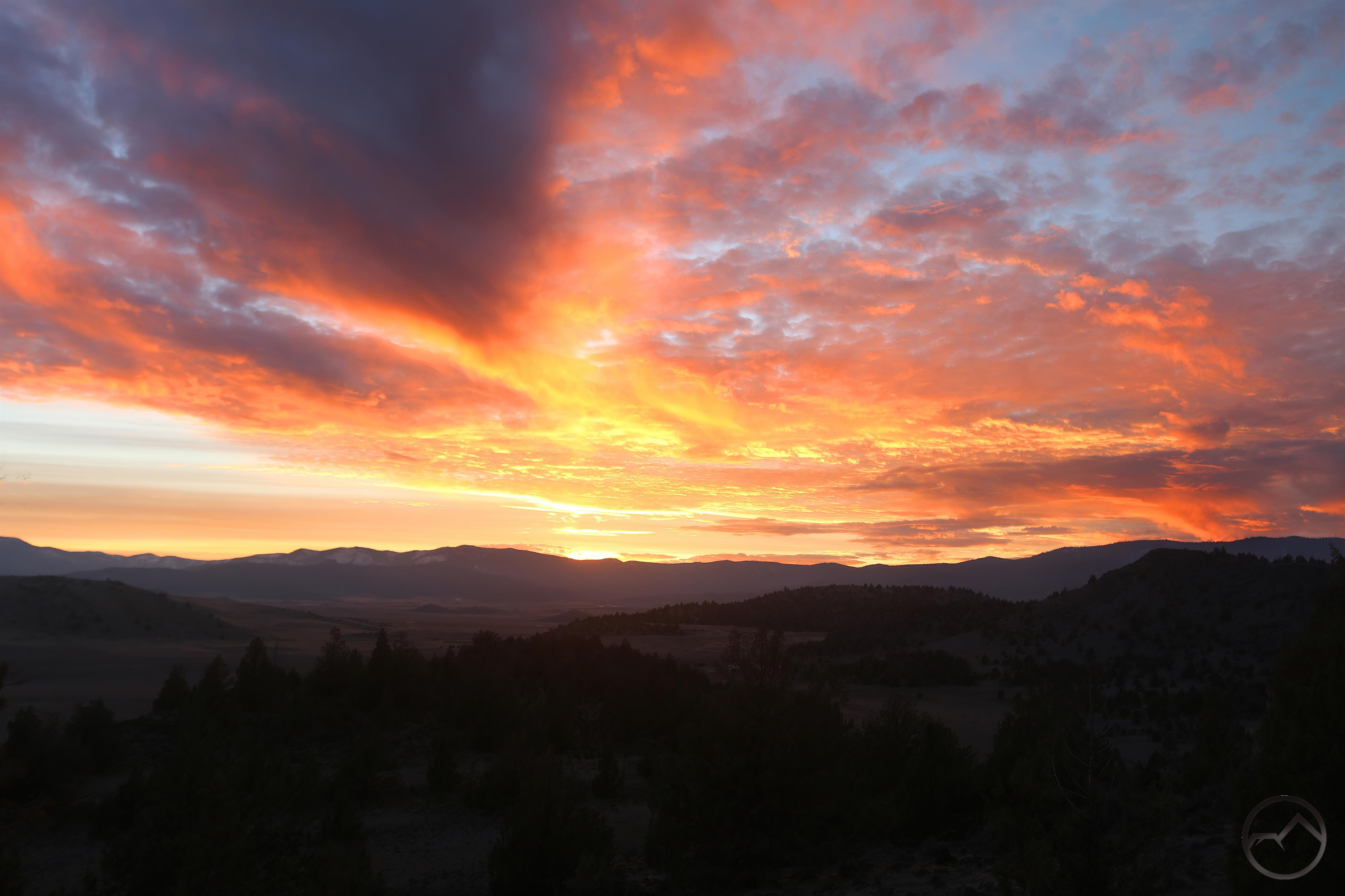
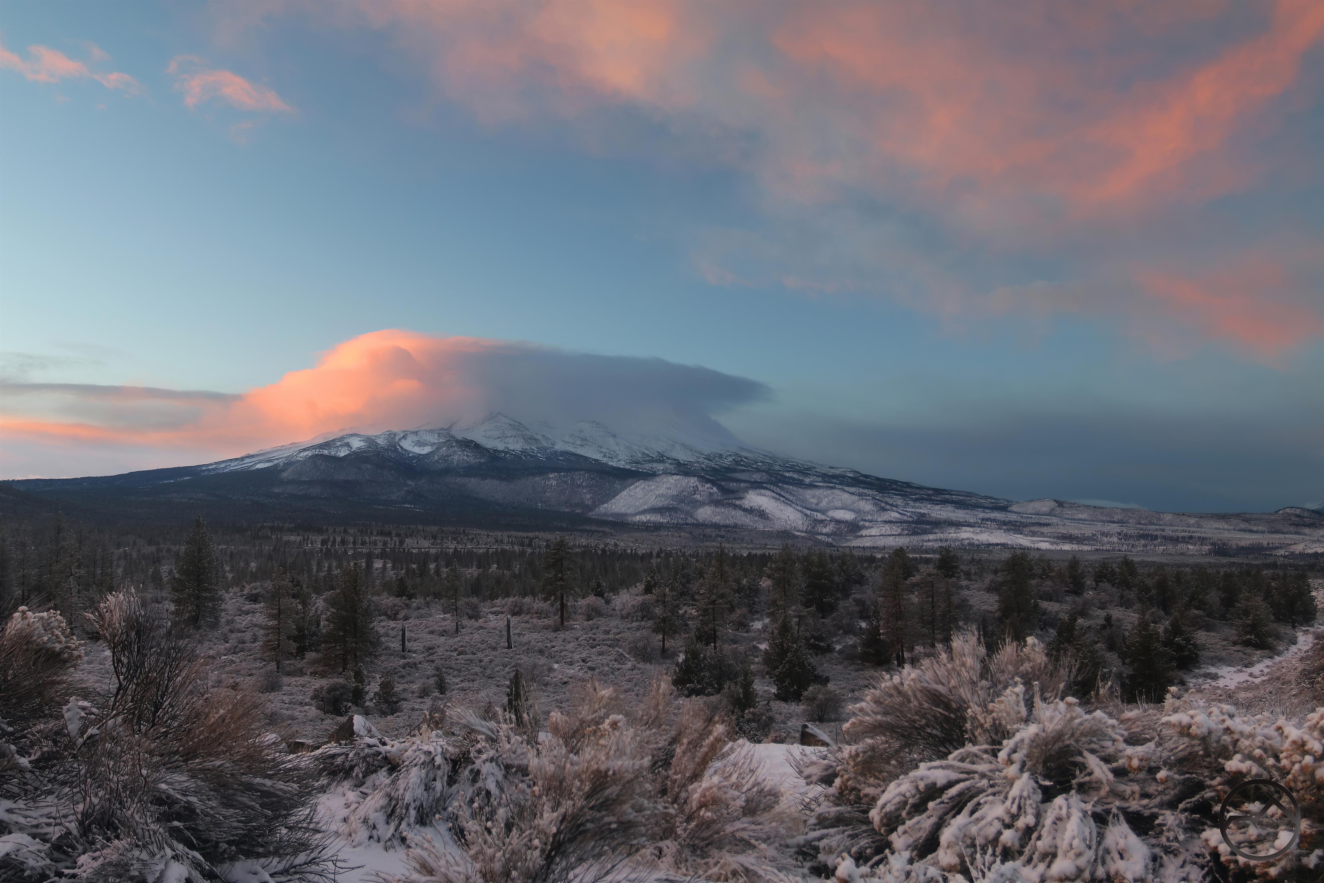
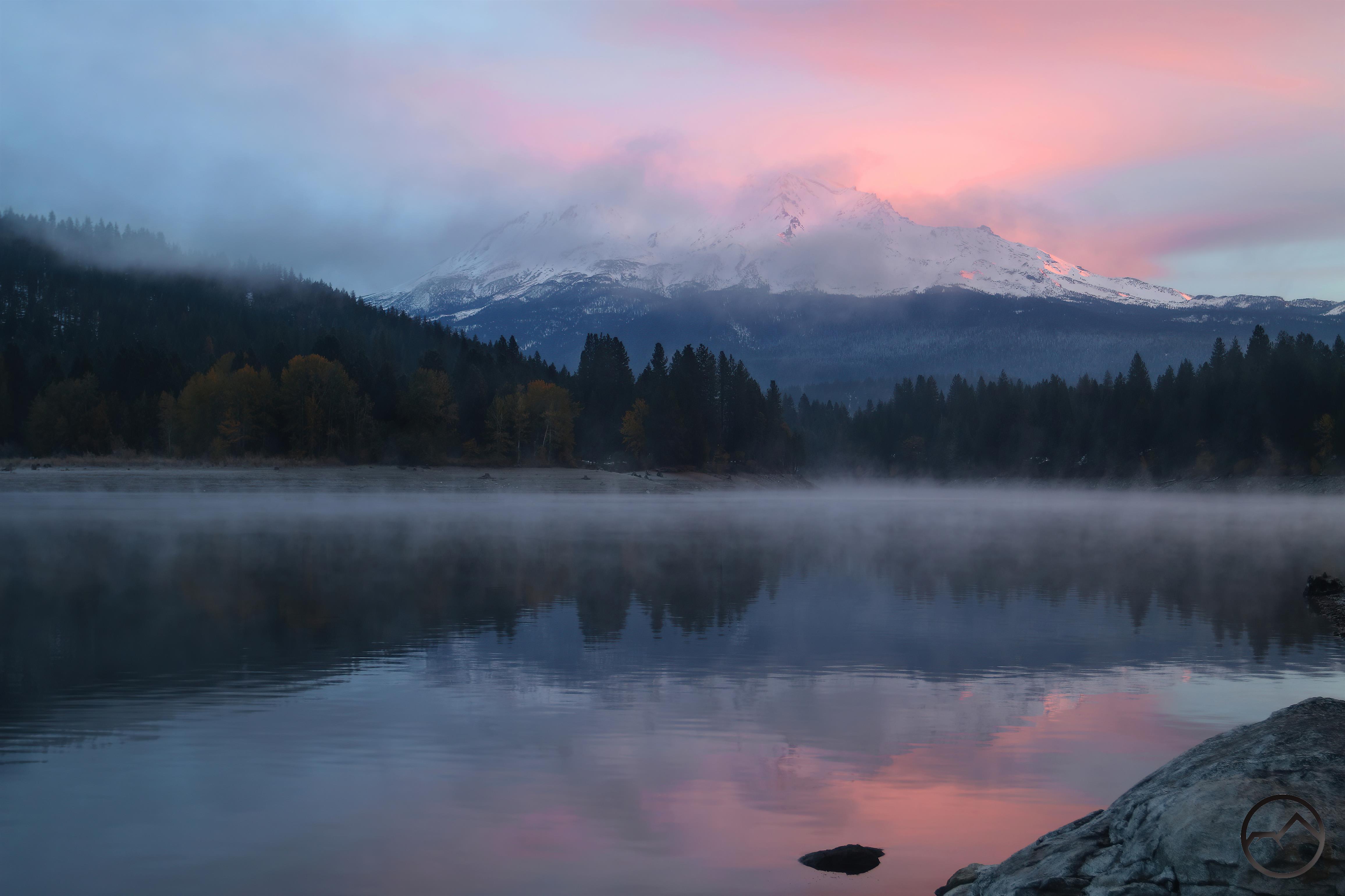
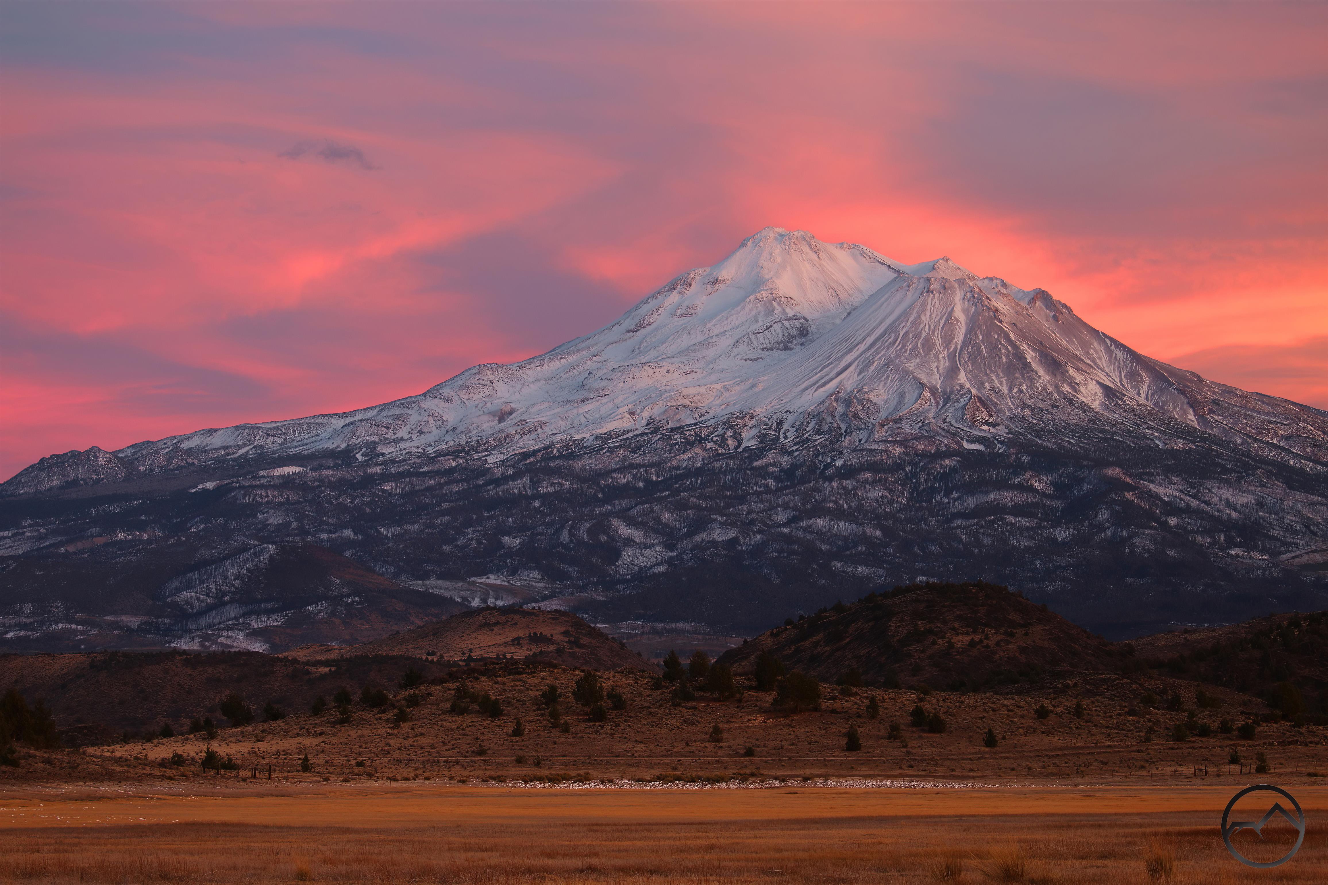
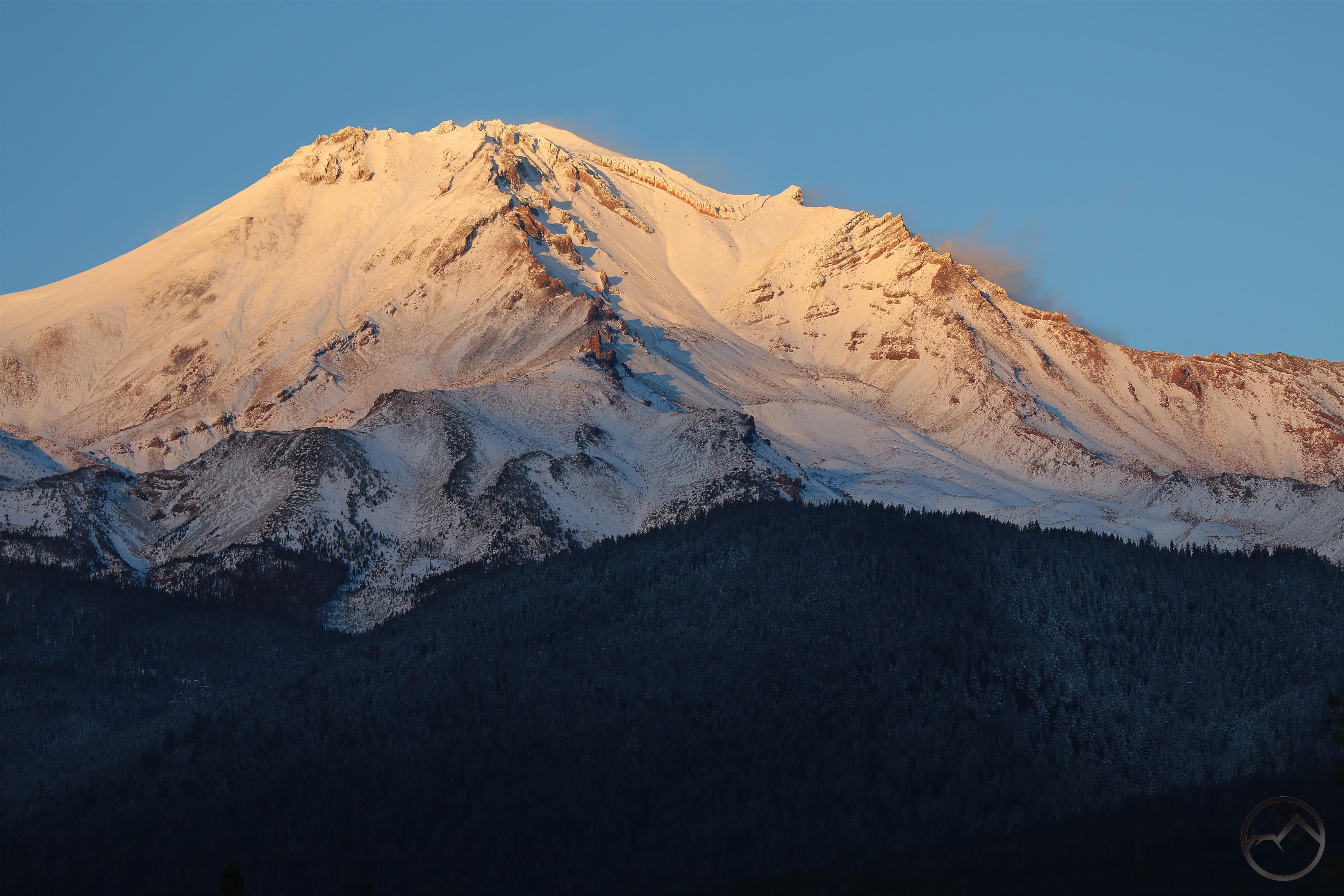
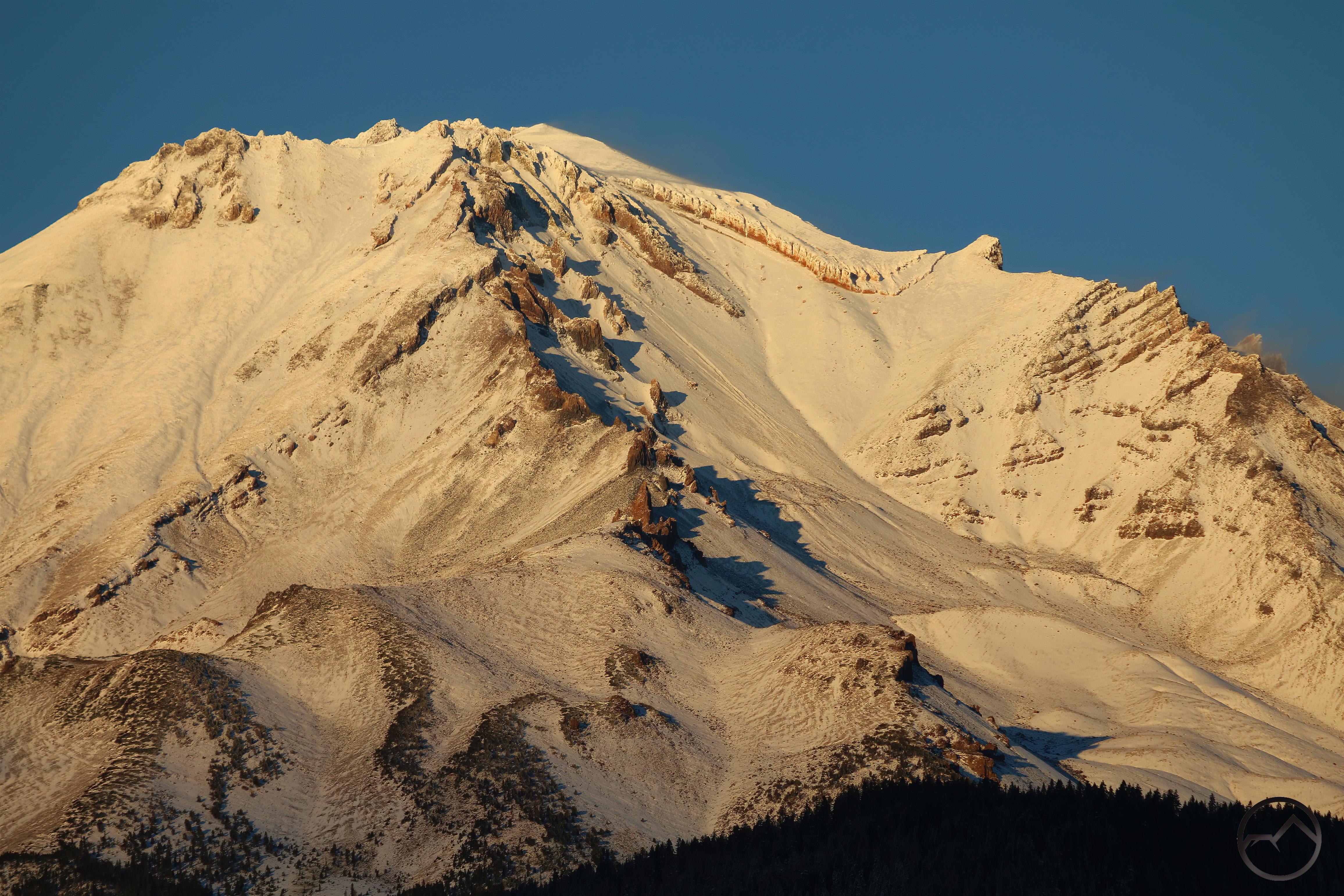
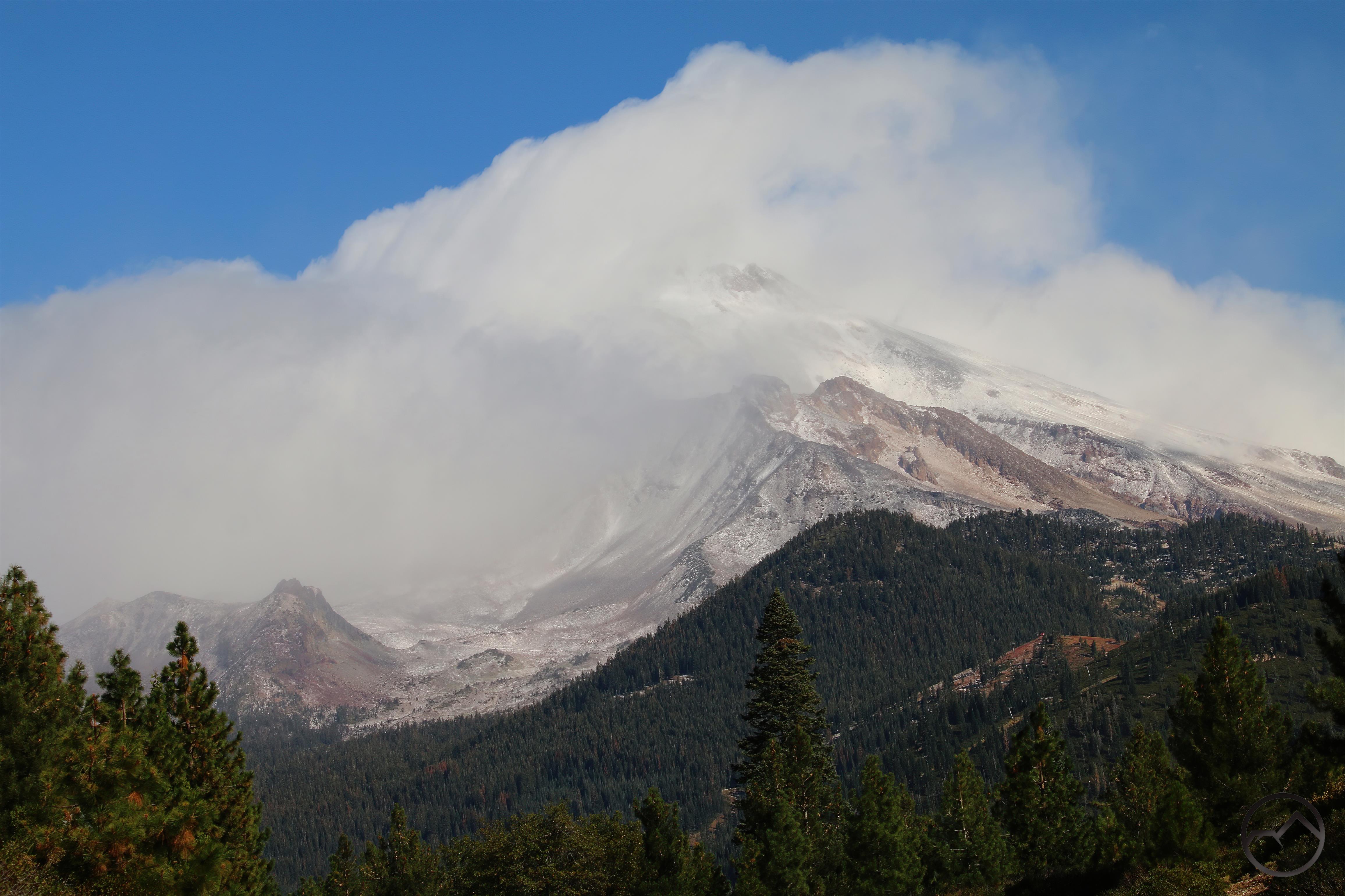
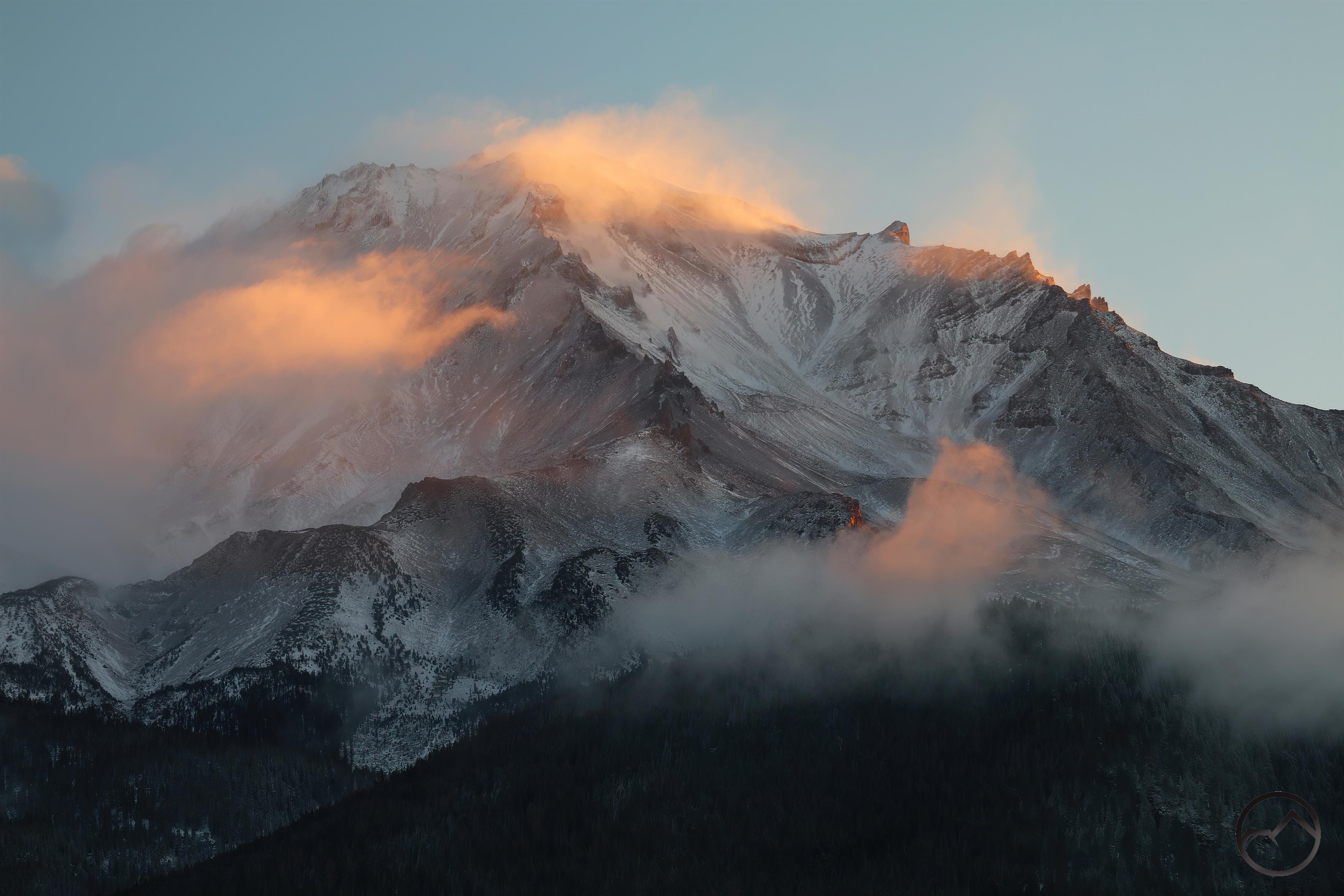
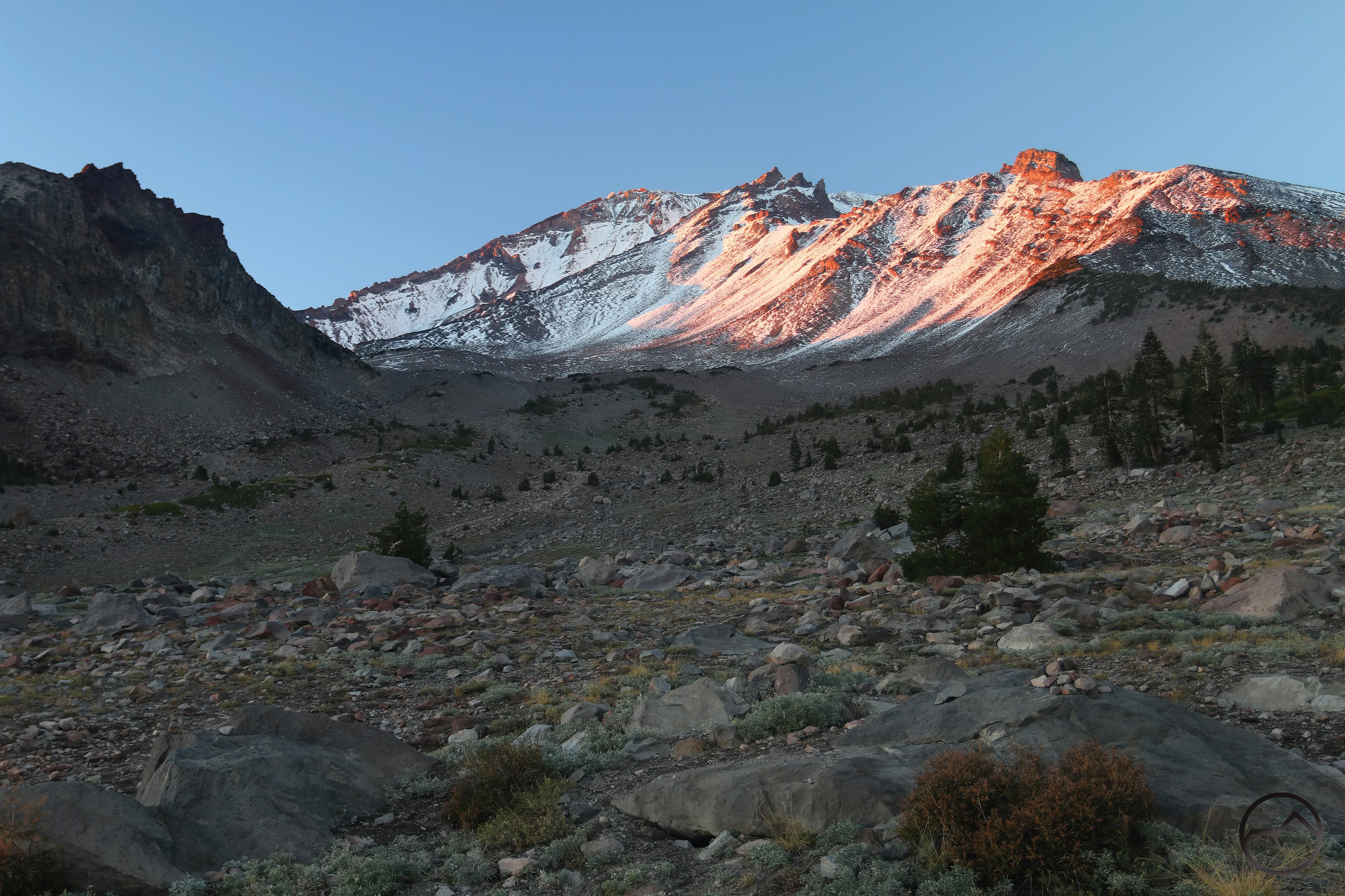
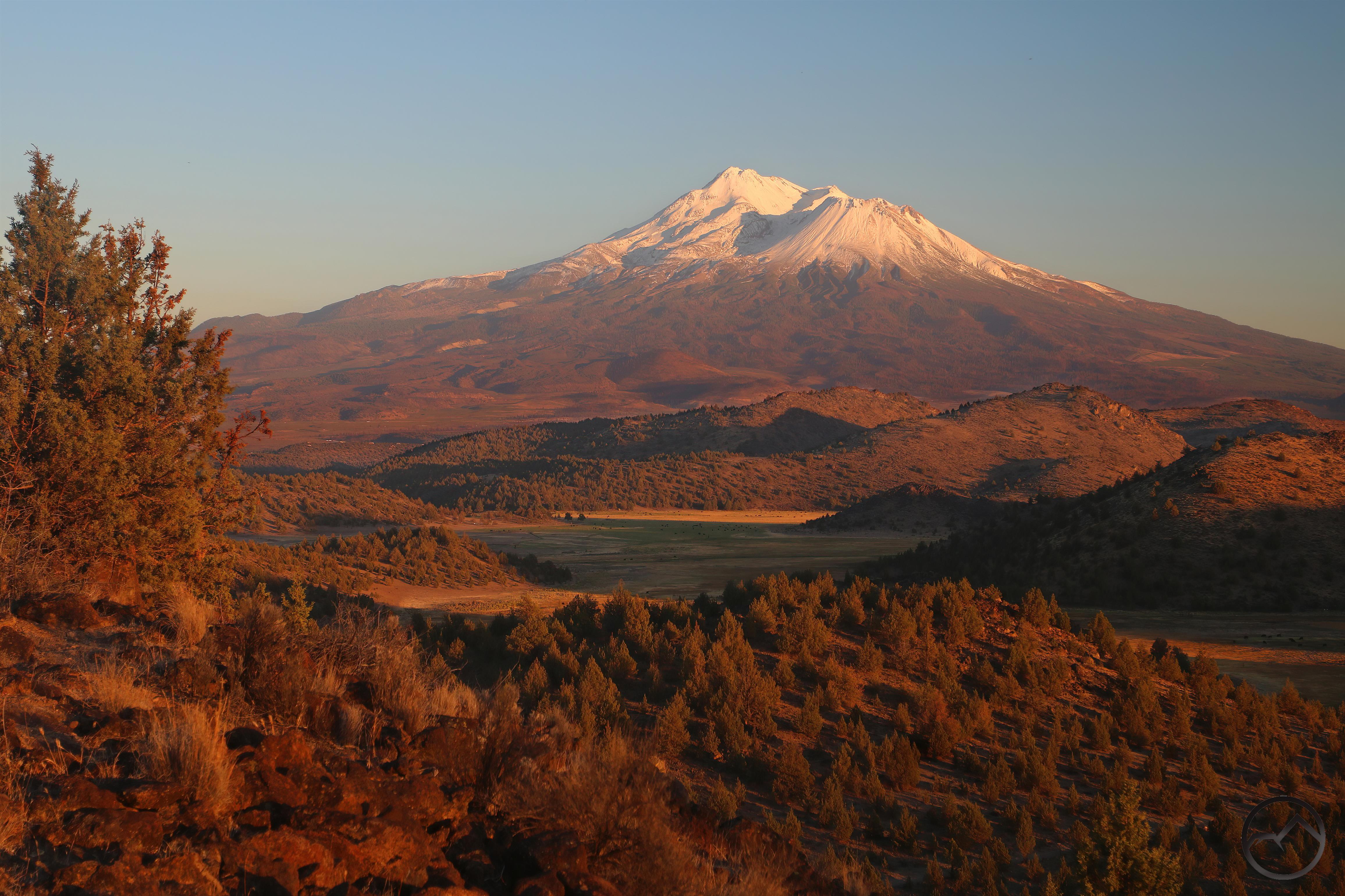
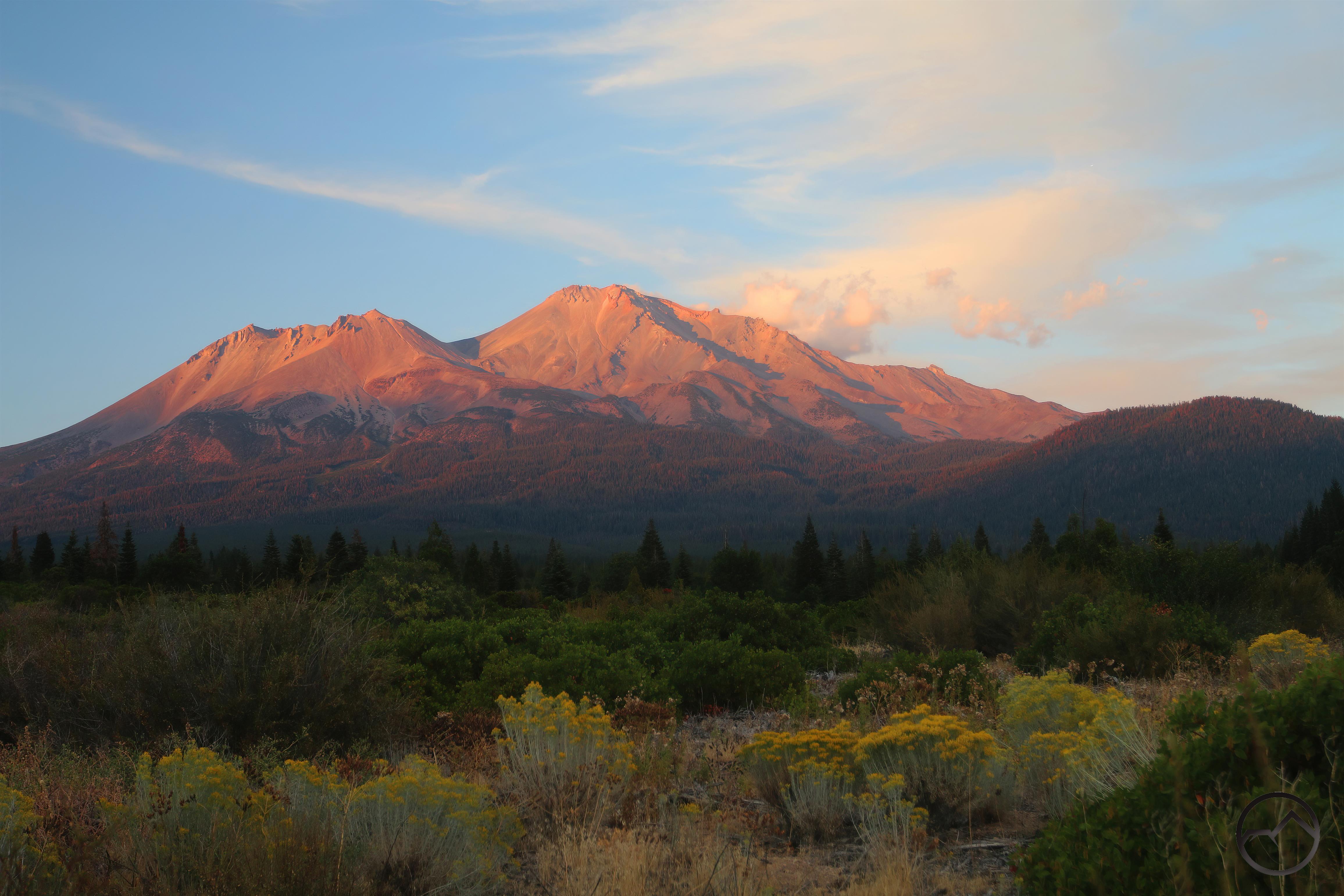
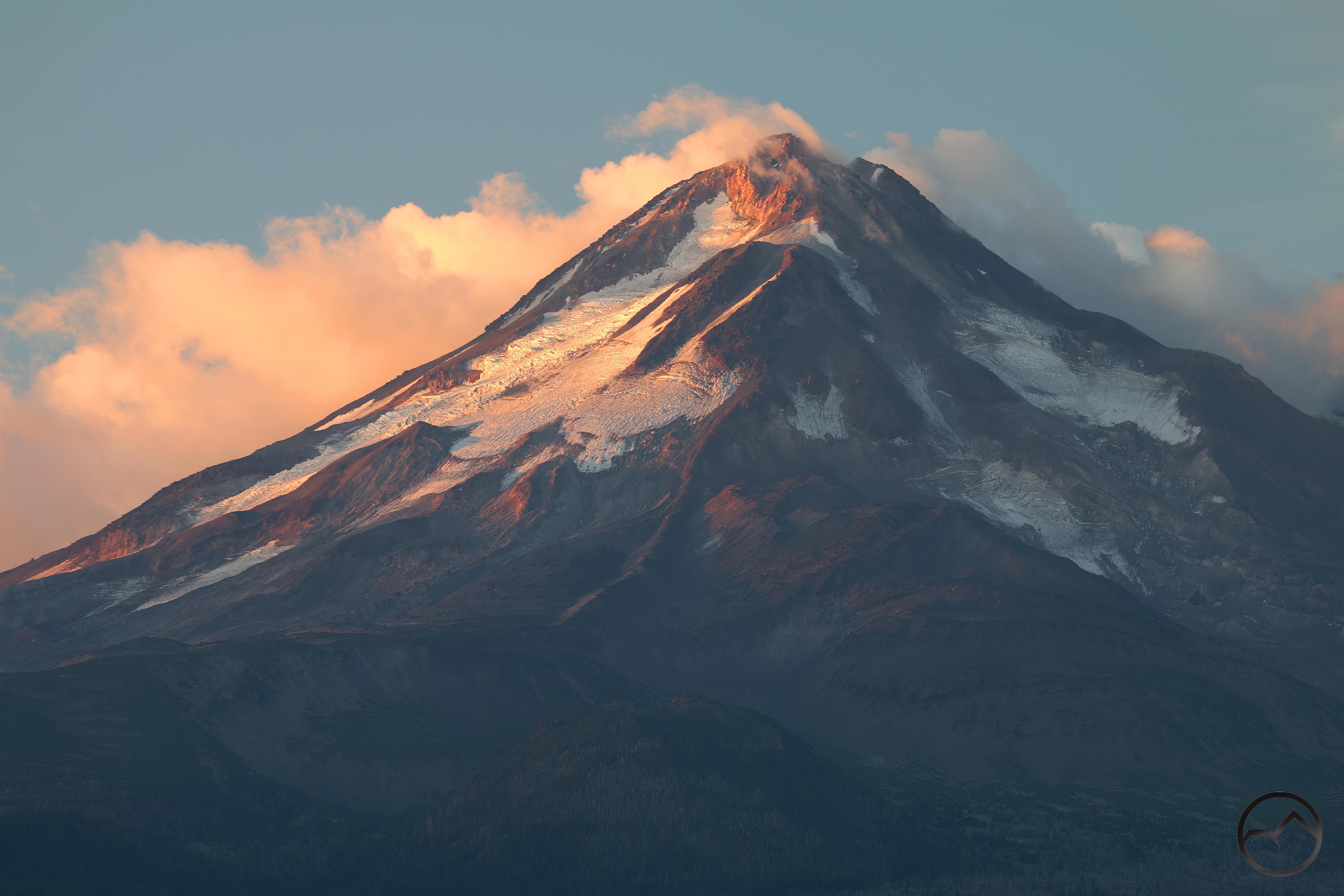
As it grew lighter, I decided to head over to Truchas Ridge to watch the sunrise. Unfortunately the area was fairly smoky so, while the sky was colorful, Mount Shasta was not very visible.

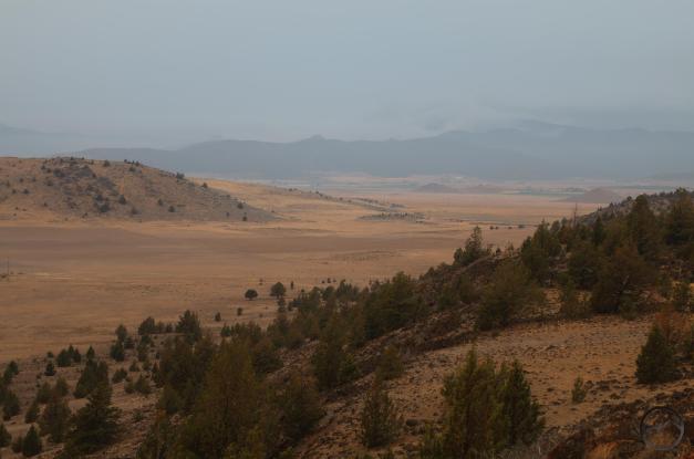
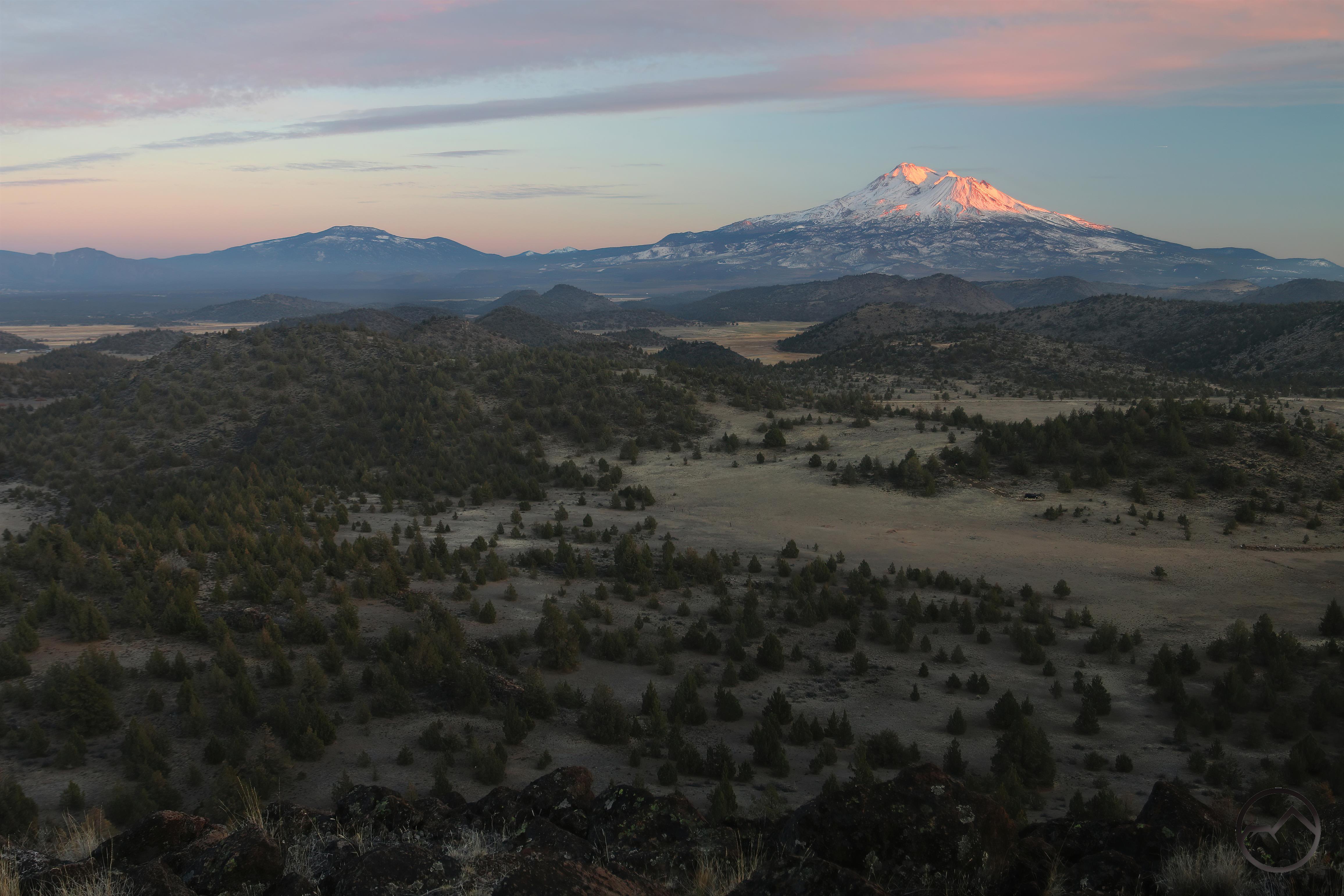
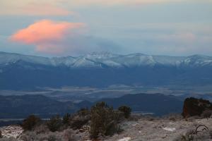
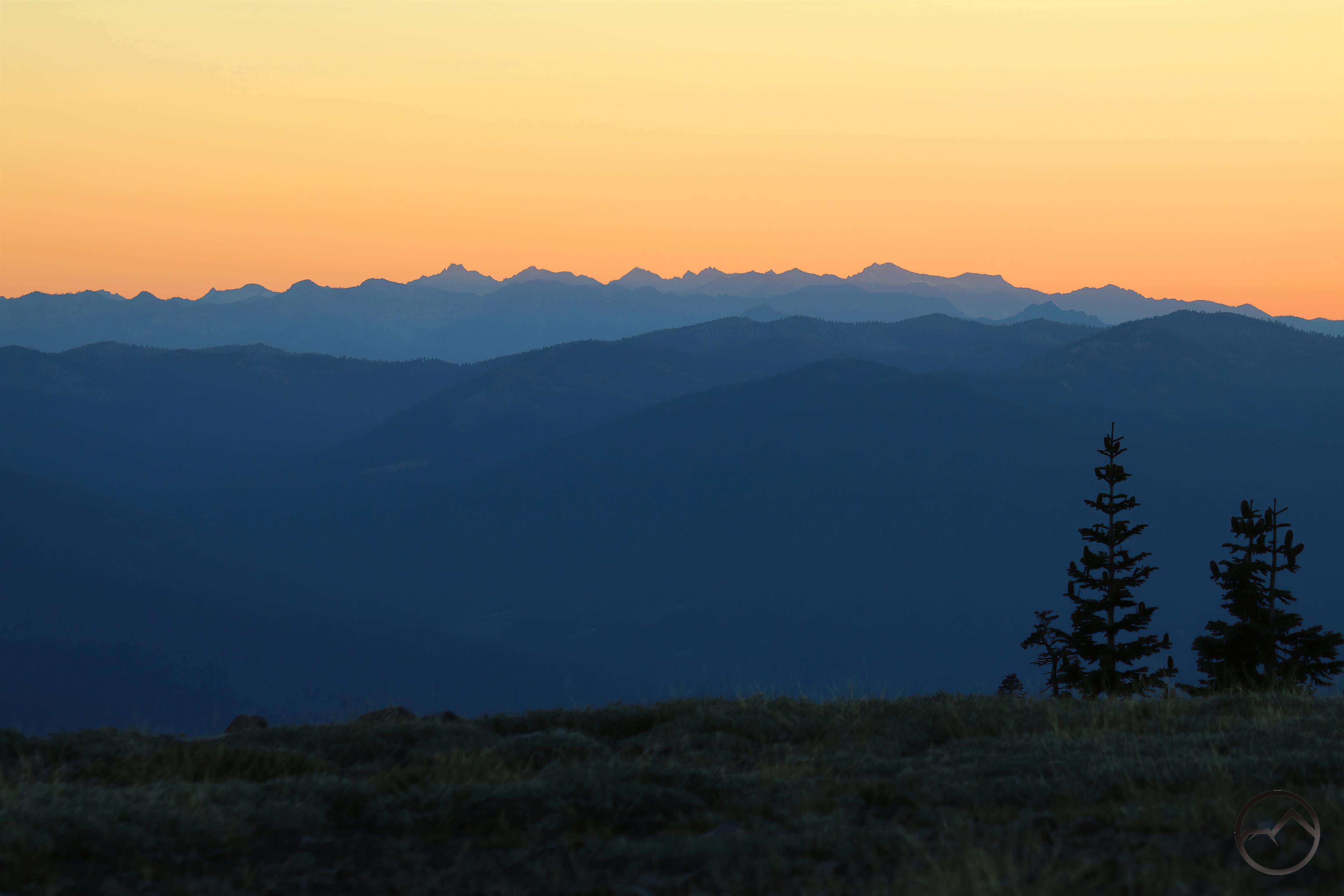
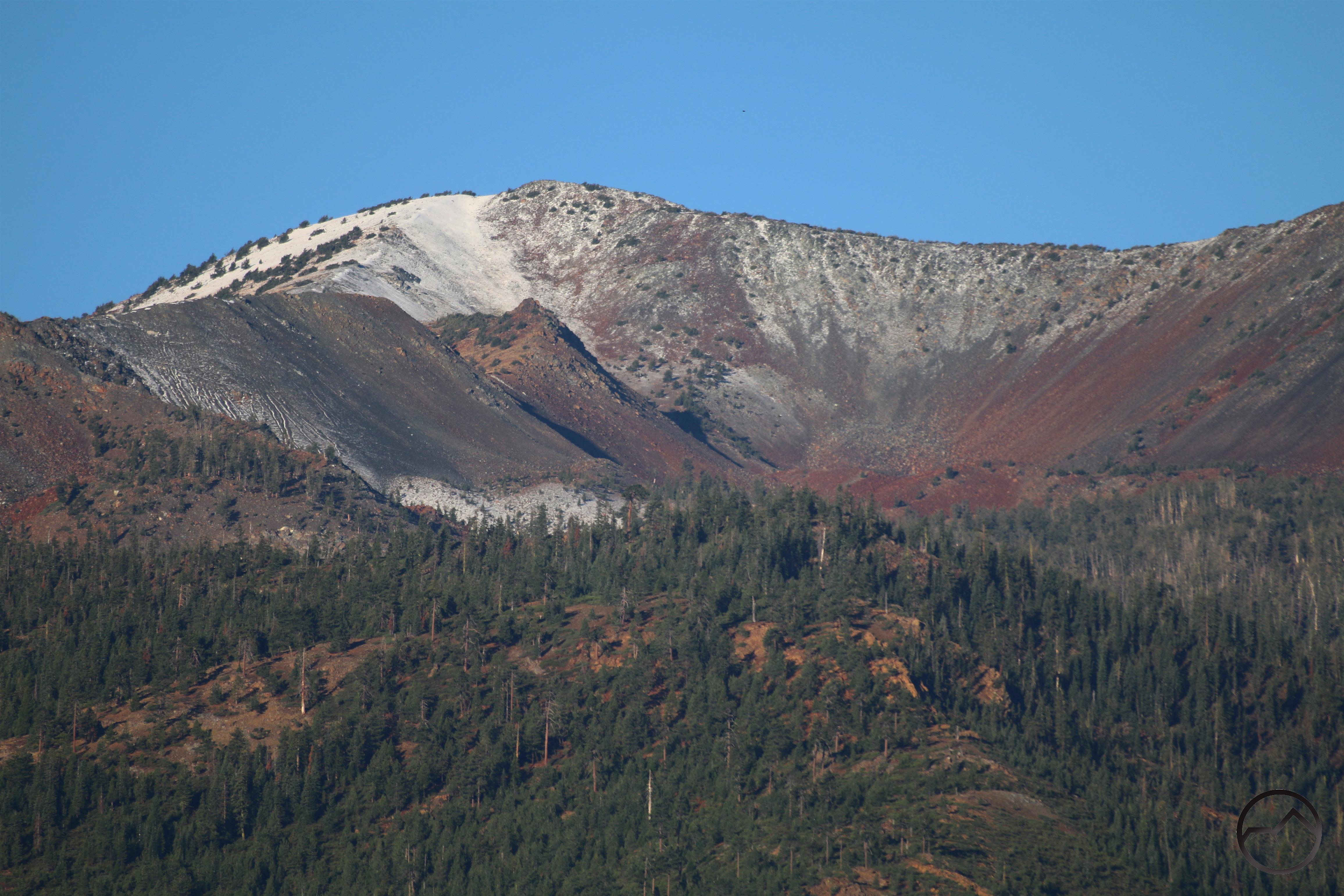
Looking back west toward the fire, no flames were visible and the smoke hung low to the ground, mostly collecting the gulches near the burning area. This was good, since it meant the wind was not driving the fire like it had the day before.

The efforts to contain the fire have continued, with ground crews and air attack persisting through Sunday and into Monday. In the end, it is unfortunate that the fire broke containment but the efforts to corral the beast were swift, unrelenting, and hopefully successful. I, however, will refrain from any further prognostication about where the fire is out or not, since I have given the “all clear” twice and brought disaster with each call.

Following Up On The Fires Around Mount Shasta

Posted by bubbasuess on September 9, 2022
Posted in: Cascade Range, Hiking, Mount Shasta. 4 Comments

Smoky haze at sunset leaves Mount Shasta a purple silhouette. 

It’s been a week since the Mill and Mountain Fires began. Thankfully, it has been a fairly staid week, with little growth from either fire. For the preponderance of the week, the air quality was such that one could be forgiven for even forgetting that there a fire in the neighborhood. For this we should all be profoundly grateful.

A recap: Friday, around noon, the Mill Fire brook out at the mill in Weed. It quickly swept north, burning through neighborhoods and into the grass and oak covered hills that lie at the margins of the Shasta Valley. Firefighters pounced on the fire in earnest and though it burned into the Lake Shastina community, it was held there. By nightfall, the ultimate boundaries of the fire had been achieved and it would not grow anymore.

Meanwhile, later that afternoon a second conflagration was sparked along Gazelle Callahan Road. Dubbed the Mountain Fire, it too sent a large plume upward, mirroring the plume from the Mill Fire. This fire, however, was burning in generally unpopulated territory, but had plenty of fuel to consume. It seemed to be of dubious origins.

After that Friday night, the Mill Fire was essentially over but the Mountain Fire continued to burn in the mountains on the western edge of the Shasta Valley. However, it never seemed to expand very much after its rapid expansion the first night. Sunday evening, I headed out to Truchas Ridge to continue some ongoing work there but I took the time to observe the smoky conditions and see what could be seen of the fire:

Mount Shasta catches the last bit of light through the smoky haze.
China Mountain is barely visible through the smoke.

Surprisingly small smoke plumes from the Mountain Fire indicate light activity.
Mount Shasta appears out of the smoke above the Shasta Valley.

Overall, I was surprised with how little smoke was billowing up out of the Mountain Fire. Though the valley was filled with smoke, there was little actually being produced by the fire. It seemed that the fire’s fury had faded and was starting to moderate.


By Tuesday morning much of the smoke had cleared out of the valley. Some haze still lingered, but it was mostly focused over the site of the Mill Fire. Though the fire was essentially out, enough still smoldered that a pall still hung over where the fire had happened.

Meanwhile, the Mountain Fire was continuing its slow stall in activity. Smoke still hung over the area, but it had hardly filtered down to the Shasta Valley and no large plumes were visible against the blue sky at this time. It really did seem to be slowing down.

At the Weed airport, the entire facility had been converted into a helibase. There were nearly two dozen aircraft based there, with all their support teams as well. Offices and command facilities had been brought in and located right on the airfield. It was an impressive operation.

Click on this panorama and enlarge it to see some of the large firefighting helicopters at the base.

By Wednesday morning, the conditions were getting cloudy, with a little bit of rain and some lightning. It was still hot, but the weather seemed to continue holding the fire in check.

A dramatic sight over the Mountain Fire. 

Looking up at the Mountain Fire, storm clouds brewed at sunrise. Smoke still hung over the area, but it seemed a light rain was falling over the fire area. Though there were a few drops in the valley, there wasn’t much in the flatlands. It was almost enough to make me think no rain was falling, however, I spotted rainbows over the mountains, which confirmed that rain was, indeed, falling.

I wasn’t able to catch the rainbows over Mountain Fire area but I did catch one over Mount Eddy.

Wednesday continued to be overcast, with dramatic clouds over all the mountains throughout the day. While still hot, it never felt overbearing and was pleasant throughout the afternoon. Evening proved to be spectacular.

Clouds incoming at sunrise.
Clouds outgoing at sunset.

The clouds, which had been present all day, finally thinned and formed a glorious crown over Mount Shasta. For having almost snow on the west side, the mountain still presented a proud, purplish glow at sunset. The sunset was such that it made one forget about the fire completely, if only for a few minutes.


The next couple days were still hot, but the Mountain Fire seemed to be done growing. It has not grown in days and is, at the time of this writing, 55% contained. Lord willing, this will hold.

The Mill and Mountain Fires in relation to Mount Shasta (east) and the Scott Valley (west).

Temperatures into next week will moderate significantly, as we seem to be sliding into some glorious autumn weather. There is even a chance of precipitation next week. May it be so!

Posts navigation

← Older Entries
Newer Entries →
    • Recent Posts

      • Winter Shows Up When It Will
      • January Rolled By With Mud, Then Very Dry
      • Mount Shasta 2025 – A Year In Images
      • Mount Shasta On Either Side Of Christmas
      • Adrift In An Ocean Of Fog
      • December Has Been Spectacular Thus Far Pt. II (A Magnificent Lenticular)
      • December Has Been Spectacular Thus Far Pt. I
      • Lenticular Interrupted
      • A Stormy Wave And A Truchas Sunset
      • Aurora Lenticularis
    • Enter your email address to follow Hike Mt Shasta and receive notifications of new posts by email.

    • Archives

      • February 2026
      • January 2026
      • December 2025
      • November 2025
      • October 2025
      • September 2025
      • August 2025
      • July 2025
      • June 2025
      • May 2025
      • April 2025
      • March 2025
      • February 2025
      • January 2025
      • December 2024
      • November 2024
      • October 2024
      • September 2024
      • August 2024
      • July 2024
      • June 2024
      • May 2024
      • April 2024
      • March 2024
      • February 2024
      • January 2024
      • December 2023
      • November 2023
      • October 2023
      • September 2023
      • August 2023
      • July 2023
      • June 2023
      • May 2023
      • April 2023
      • March 2023
      • February 2023
      • January 2023
      • December 2022
      • November 2022
      • October 2022
      • September 2022
      • August 2022
      • July 2022
      • June 2022
      • May 2022
      • April 2022
      • March 2022
      • February 2022
      • January 2022
      • December 2021
      • November 2021
      • October 2021
      • September 2021
      • August 2021
      • June 2021
      • May 2021
      • April 2021
      • March 2021
      • February 2021
      • January 2021
      • December 2020
      • November 2020
      • October 2020
      • September 2020
      • August 2020
      • July 2020
      • June 2020
      • May 2020
      • April 2020
      • March 2020
      • February 2020
      • January 2020
      • December 2019
      • November 2019
      • October 2019
      • September 2019
      • August 2019
      • July 2019
      • June 2019
      • May 2019
      • April 2019
      • March 2019
      • February 2019
      • January 2019
      • December 2018
      • November 2018
      • October 2018
      • September 2018
      • August 2018
      • July 2018
      • June 2018
      • May 2018
      • April 2018
      • March 2018
      • February 2018
      • January 2018
      • December 2017
      • November 2017
      • October 2017
      • September 2017
      • August 2017
      • July 2017
      • June 2017
      • May 2017
      • April 2017
      • March 2017
      • February 2017
      • January 2017
      • December 2016
      • November 2016
      • September 2016
      • August 2016
      • July 2016
      • June 2016
      • May 2016
      • April 2016
      • March 2016
      • February 2016
      • January 2016
      • December 2015
      • November 2015
      • September 2015
      • August 2015
      • July 2015
      • June 2015
      • May 2015
      • April 2015
      • March 2015
      • February 2015
      • January 2015
      • December 2014
      • November 2014
      • July 2014
      • June 2014
      • May 2014
      • April 2014
      • March 2014
      • February 2014
      • January 2014
      • December 2013
      • November 2013
      • October 2013
      • September 2013
      • August 2013
      • July 2013
      • June 2013
      • May 2013
      • April 2013
      • March 2013
      • February 2013
      • January 2013
    • Categories

      • Boy Scouts
      • Cascade Range
      • Castle Crags
      • Desert
      • Echo Point
      • Glaciers
      • Hiking
      • How things came to be…
      • Klamath Mountains
      • Konwakiton Outdoor Designs
      • Lakes
      • Lenticular Clouds
      • Maps
      • Marble Mountains
      • Meadows
      • Mount Eddy
      • Mount Shasta
      • Mount Shasta History
      • Napa County
      • Off Season Trails
      • Pacific Crest Trail
      • Peaks
      • Rivers
      • Rock Climbing
      • Scott Mountains
      • Seldom Seen
      • Shasta Valley
      • Sierra Nevada
      • Siskiyou Mountains
      • Sonoma County
      • Spring Trails
      • sunrise
      • sunset
      • Trinity Alps
      • Trinity Divide
      • Truchas Ridge
      • Uncategorized
      • Water
      • Waterfalls
      • Wilderness
      • Wildflowers
      • Wine Country
      • Winter Trails
      • Yosemite
    • Meta

      • Create account
      • Log in
      • Entries feed
      • Comments feed
      • WordPress.com
    • Copyright © 2013-2024 by Bubba Suess

      DISCLAIMER: Any use of the information contained in this site by any and all persons is done at their own risk. The operator of this site shall be held harmless from any and all alleged claims, demands, causes of action, liability, loss, damage and/or injury to property or persons whether brought by an individual or other entity. This indemnification applies, without limitation, to all actions by an individual or other entity as a result of their use of information contained in this site.

    Blog at WordPress.com.
    Hike Mt. Shasta
    Blog at WordPress.com.
    • Subscribe Subscribed
      • Hike Mt. Shasta
      • Join 983 other subscribers
      • Already have a WordPress.com account? Log in now.
      • Hike Mt. Shasta
      • Subscribe Subscribed
      • Sign up
      • Log in
      • Report this content
      • View site in Reader
      • Manage subscriptions
      • Collapse this bar
     

    Loading Comments...