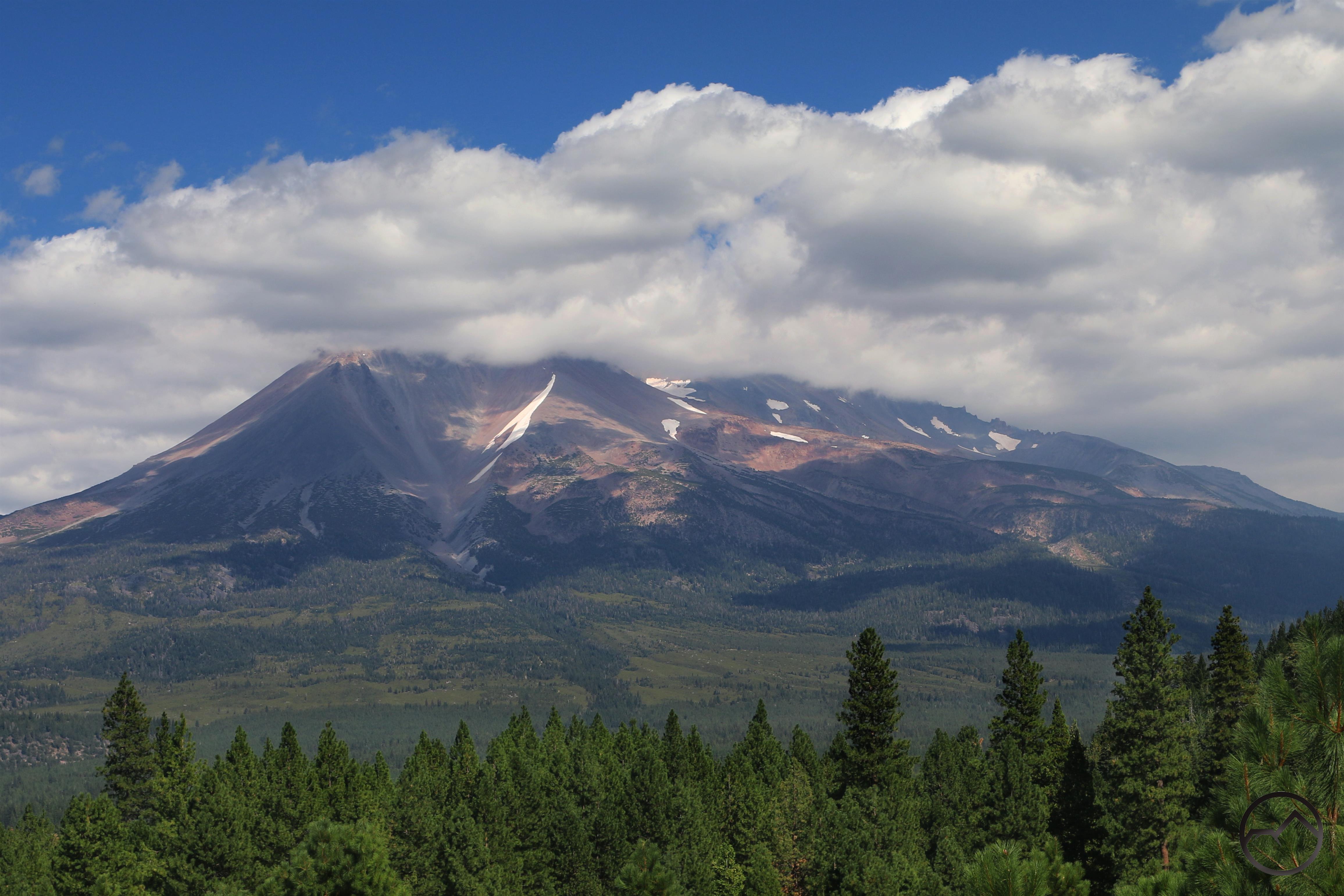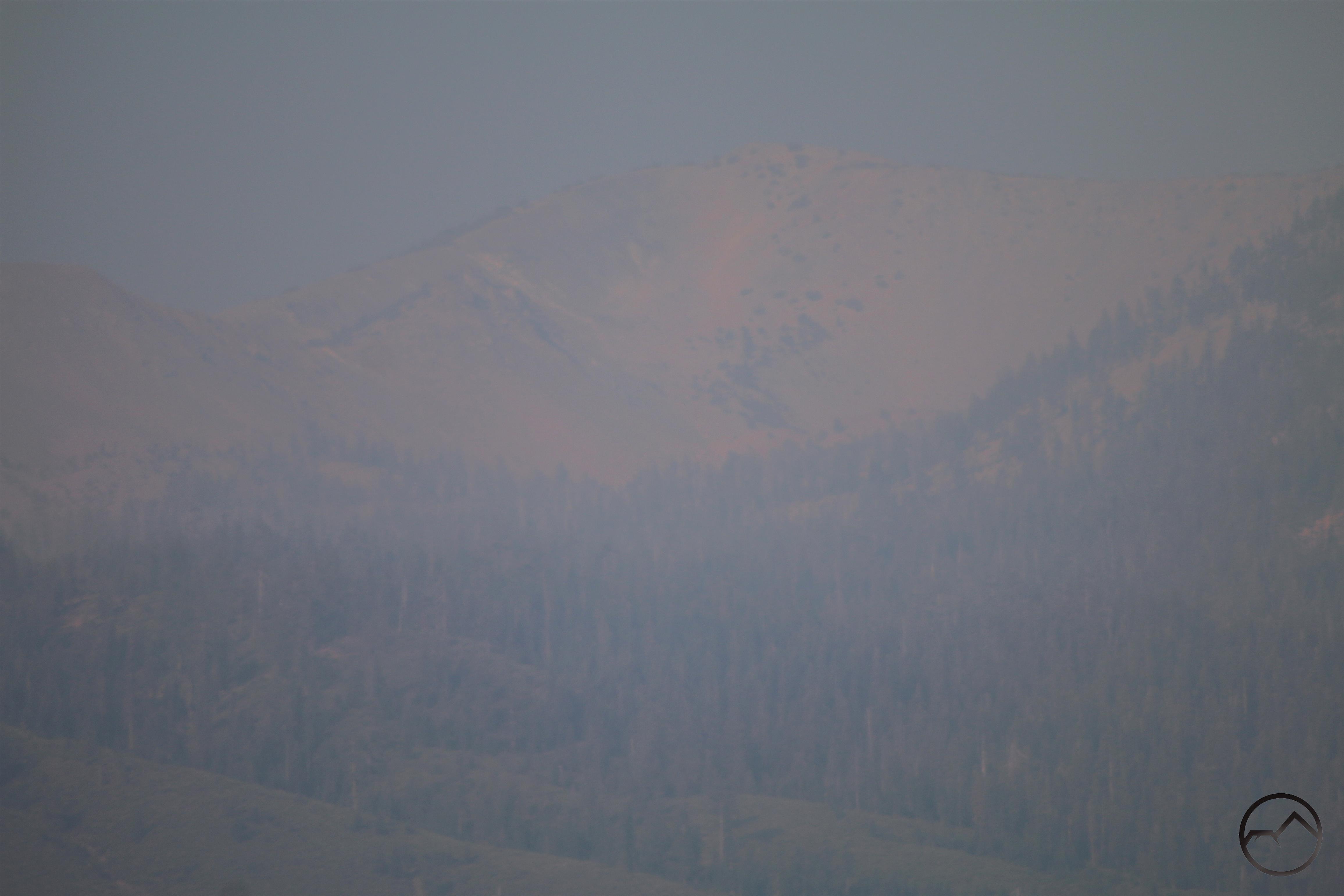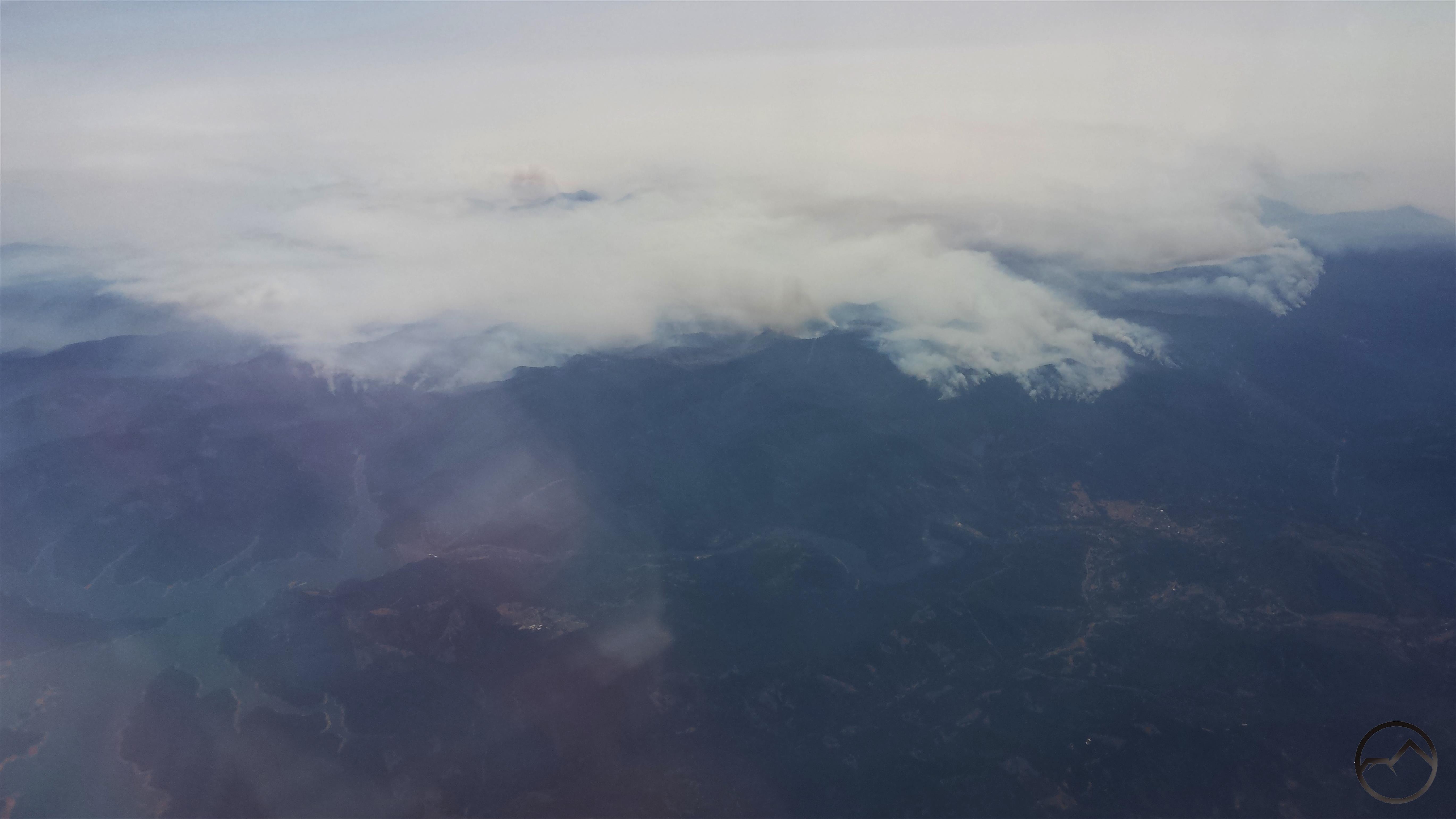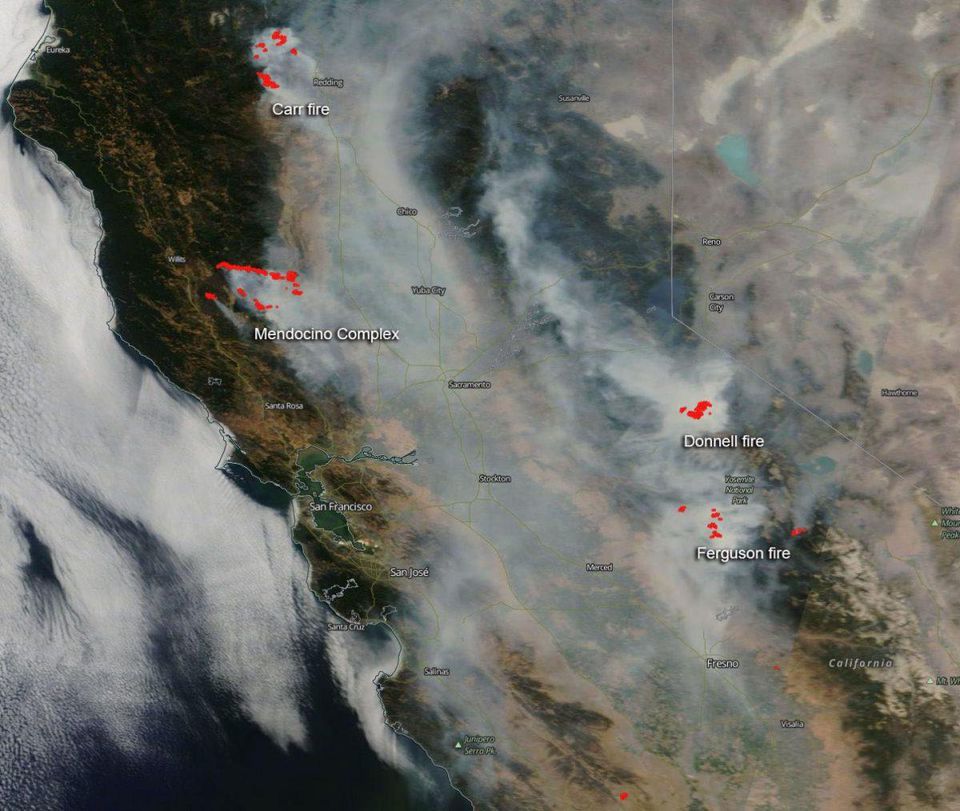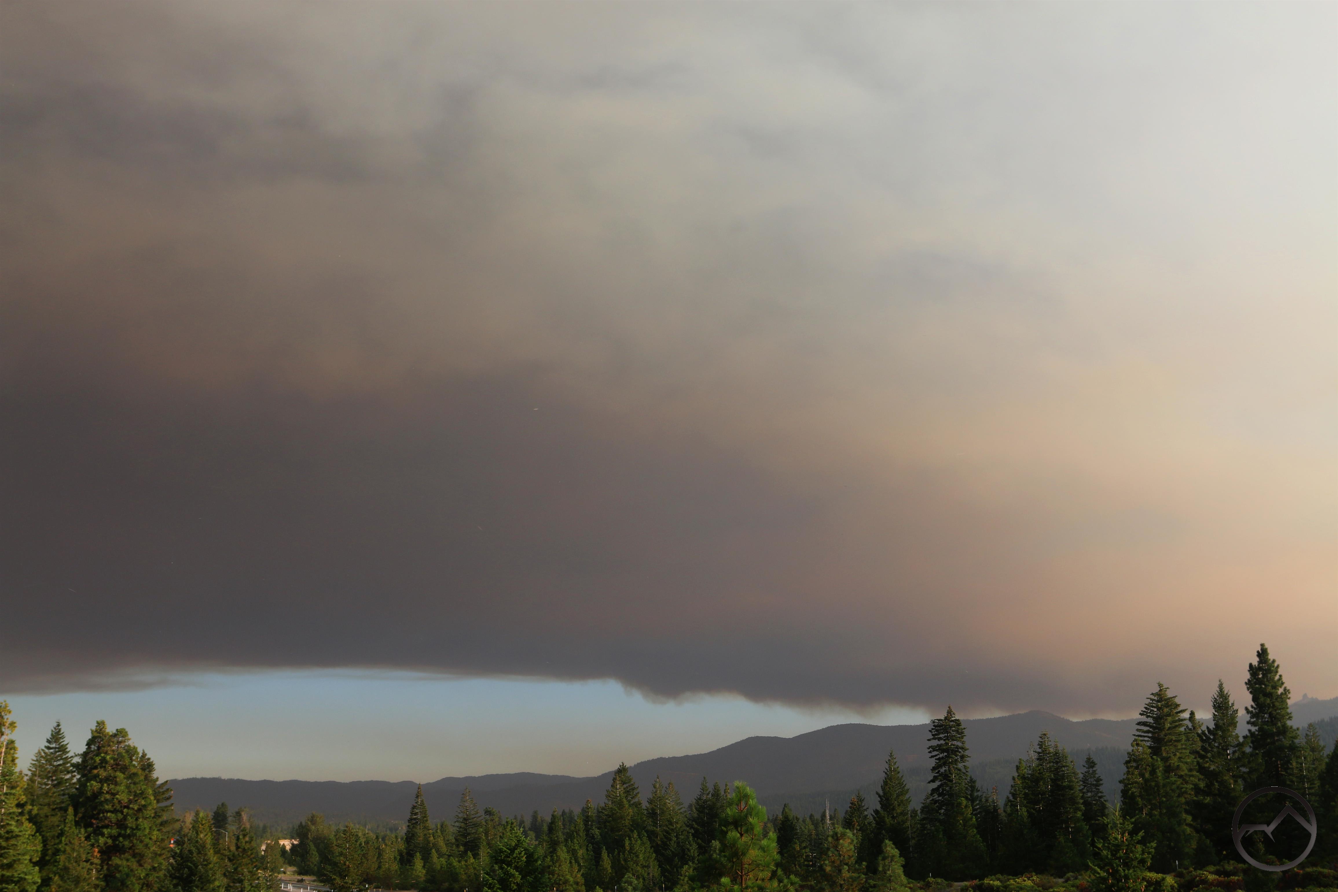
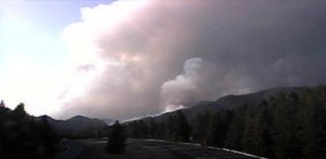
Thick smoke blocks the sky near Mount Shasta.
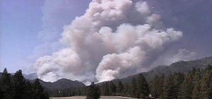
Well, this is dreadful. Just when the Hirz Fire was winding down and it felt like we were turning a corner we now have another nasty conflagration. The Delta Fire exploded just after noon today. The fire has already grown to over 2,000 acres and looks to expand overnight. Firefighters are doing what they can tonight but it will have to wait until tomorrow before the air attack can resume tomorrow. (Update: as of 7:00 AM Thursday, the fire has grown to over 15,000 acres.)
The fire started at the Vollmers/Delta exit on I-5. Inciweb indicates the fire was first reported at 12:51 PM. As it turns out my parents were driving back to Sonoma County from Mount Shasta and passed the fire in what have been just moments after it got a lot bigger. My dad called me at 1:08 PM to tell me what he had seen and that fire crews were already en route to the conflagration. He said the fire was already fully engaged and had plumes of both yellow smoke and black smoke. I would imagine that I-5 was closed down pretty shortly after that. I am really grateful they made it through.
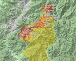
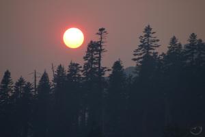
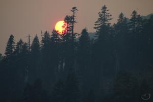
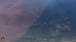
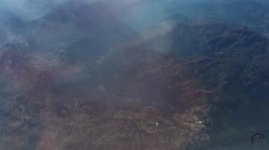
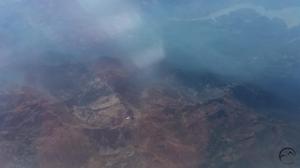
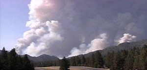
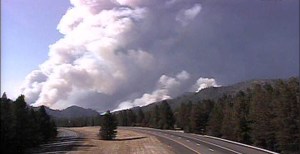
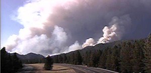
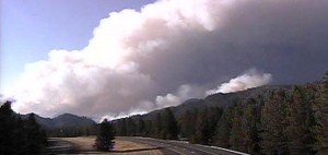
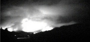
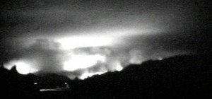
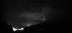
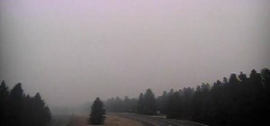
Here is a progression of images of the fire expanding I pulled from the Lakehead Caltrans webcam (updated to include images from Wednesday night and Thursday morning):
-
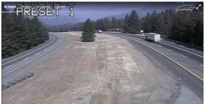
- 10:53 AM
-
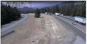
- 1:25 PM
-
- 3:37 PM
-
- 3:45 PM
-
- 4:16 PM
-
- 5:00 PM
-
- 5:30 PM
-
- 6:45 PM
-
- 11:00 PM
-
- 1:00 AM Thursday
-
- 3:00 AM
-
- 7:00 AM
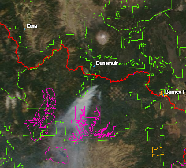
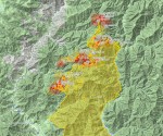
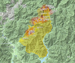
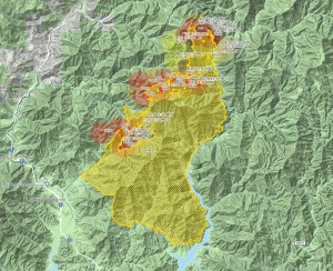
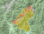
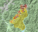
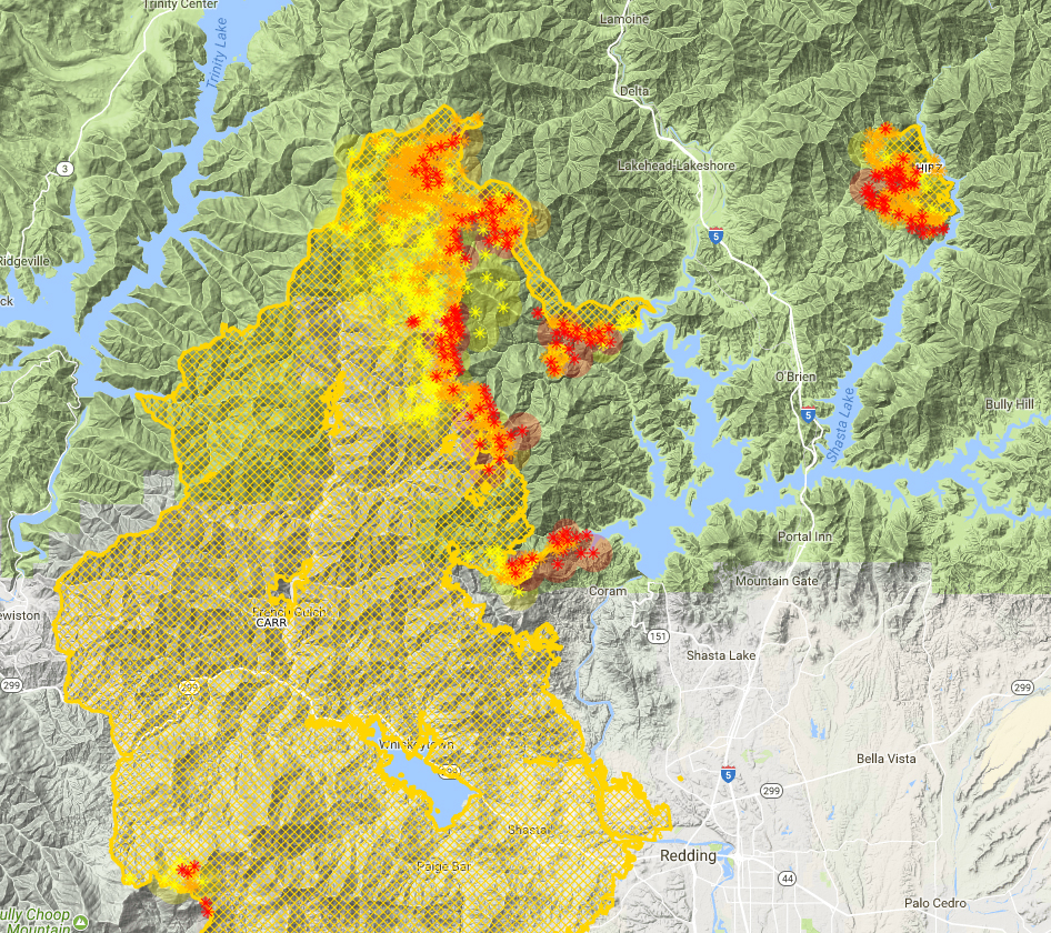
As is evident from the webcam, the fire exploded pretty rapidly. Here is what is covered thus far:
-
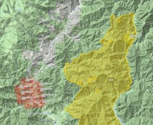
- 5:30 PM
-
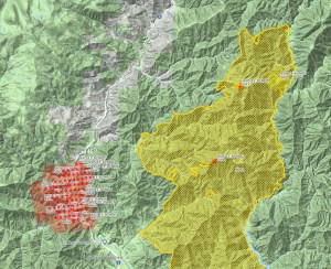
- 6:45 PM
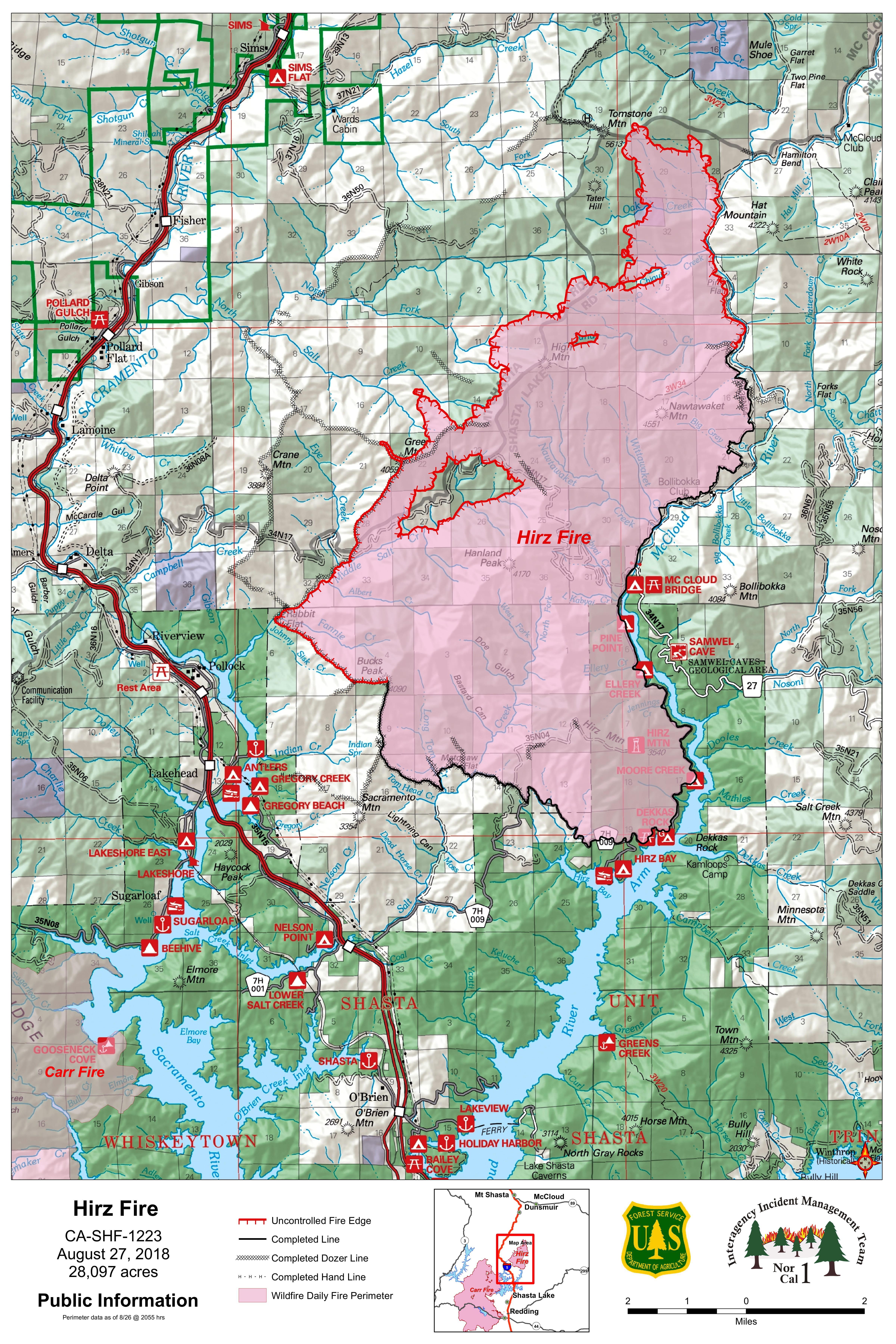
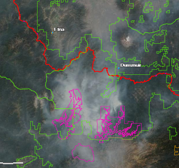
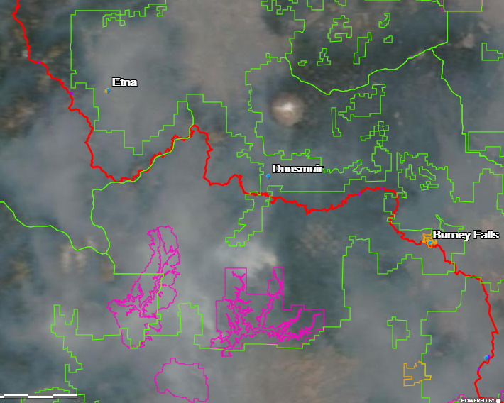
This is pure speculation on my part but looking at those maps, I would imagine the firefighting efforts will be focused primarily along the I-5 corridor, trying to protect structures along the freeway and in Lakehead. Efforts are likely to occur to the west as well. It seems to me that they would allow the fire to burn uncontrolled to the east so that it will run into the Hirz Fire line, which would act as a containment line.
Evacuations are in place for both Lakehead and the entire I-5 corridor from the point of the fire all the way north to the Shasta County line, which is just north of Castella. Granting that Castella is a long way from the fire, it is good that they are playing this one safe with the evacuations. Unfortunately, it is also an indication of how serious this fire is.
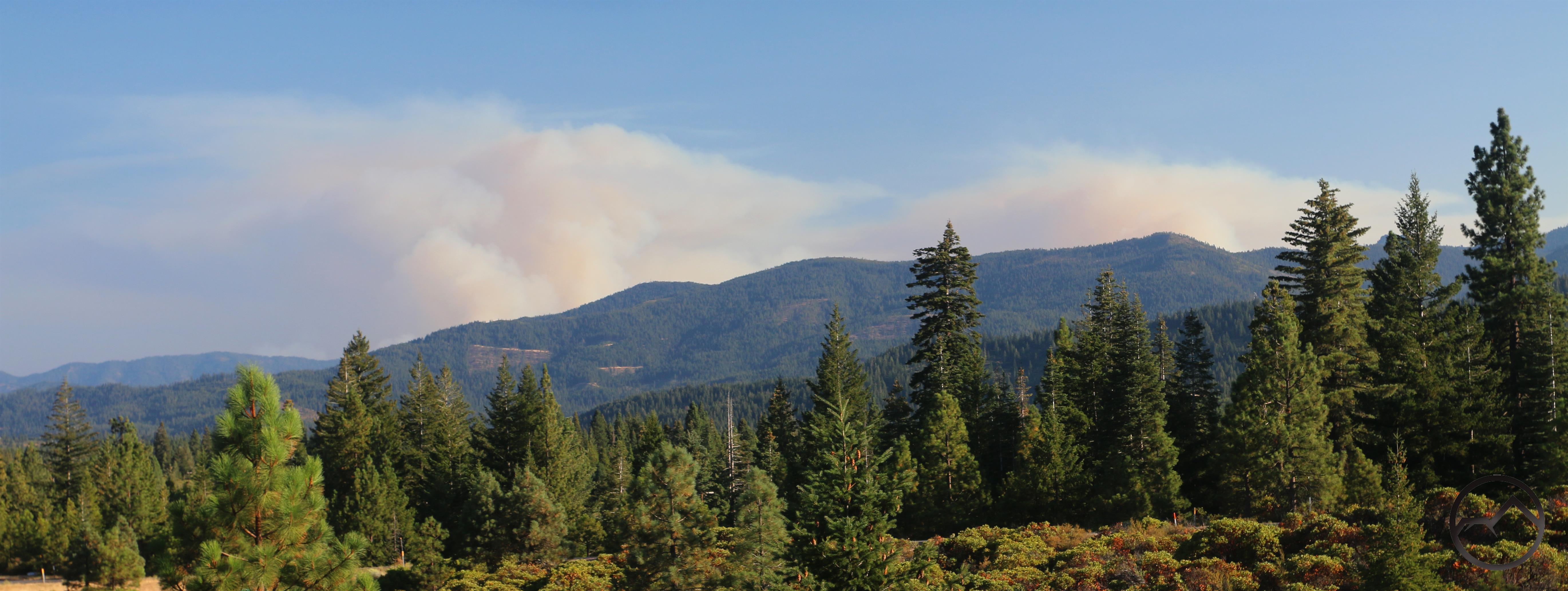
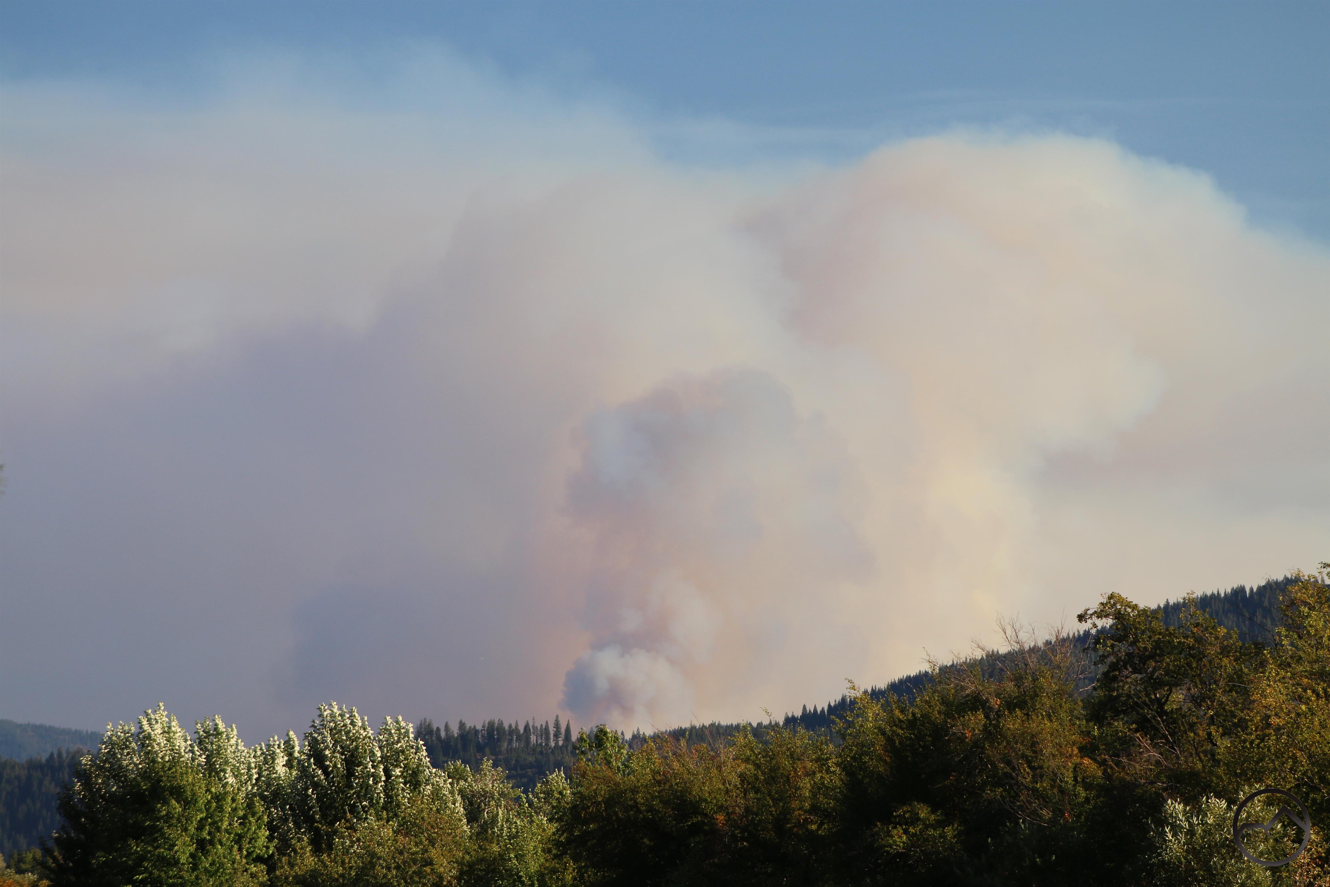
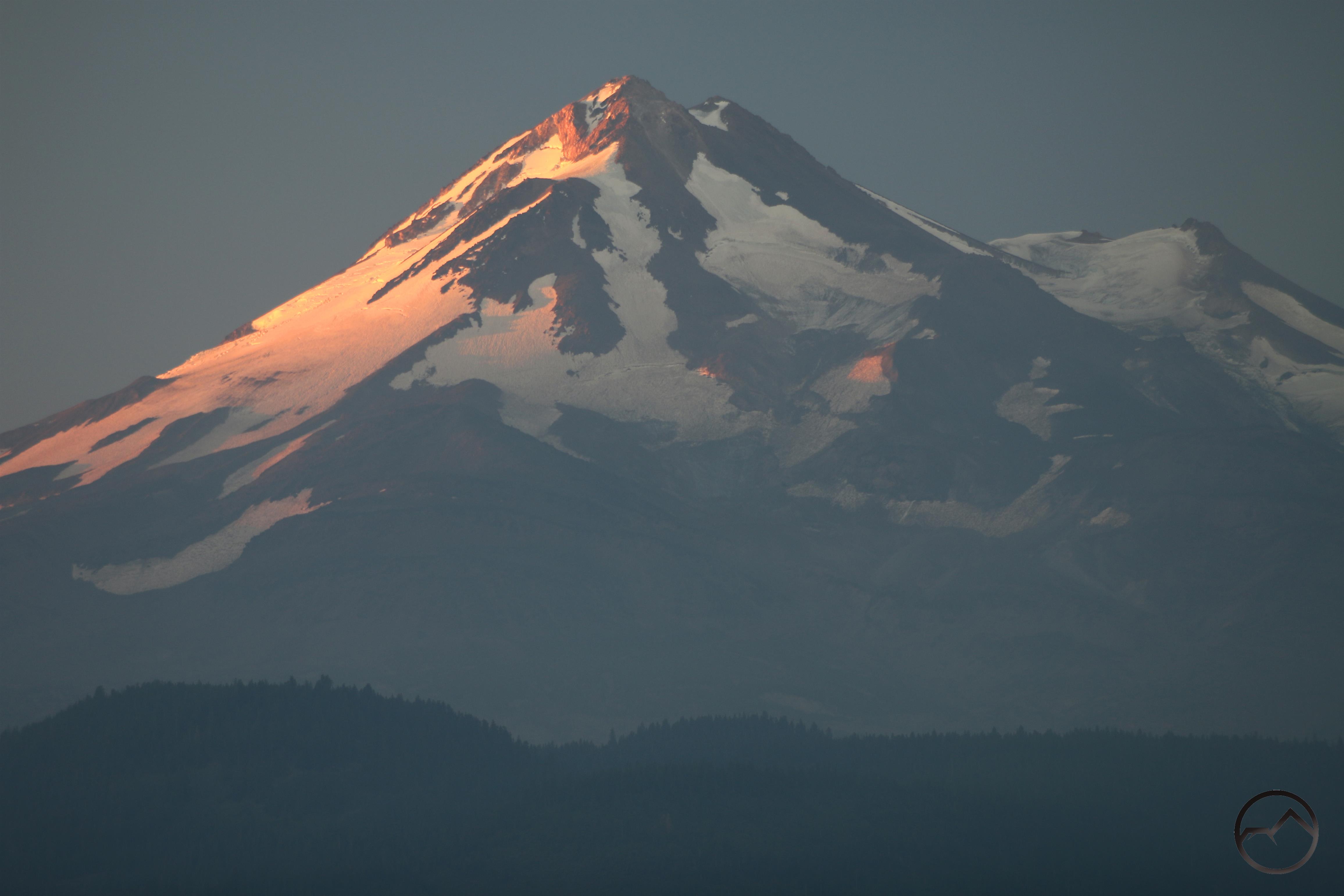
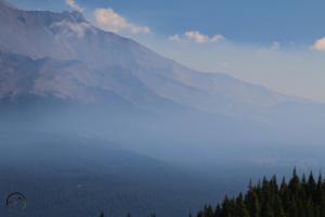
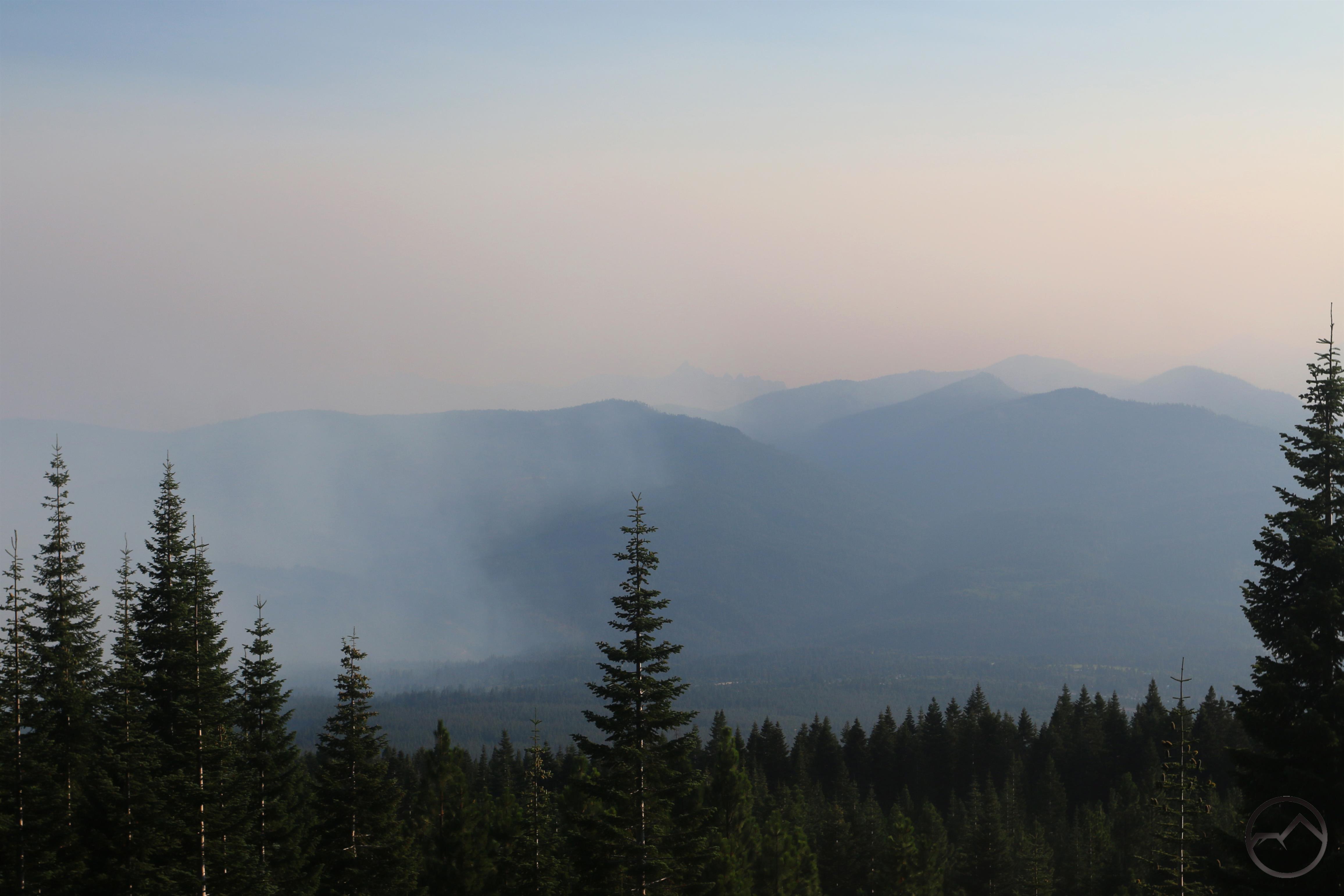
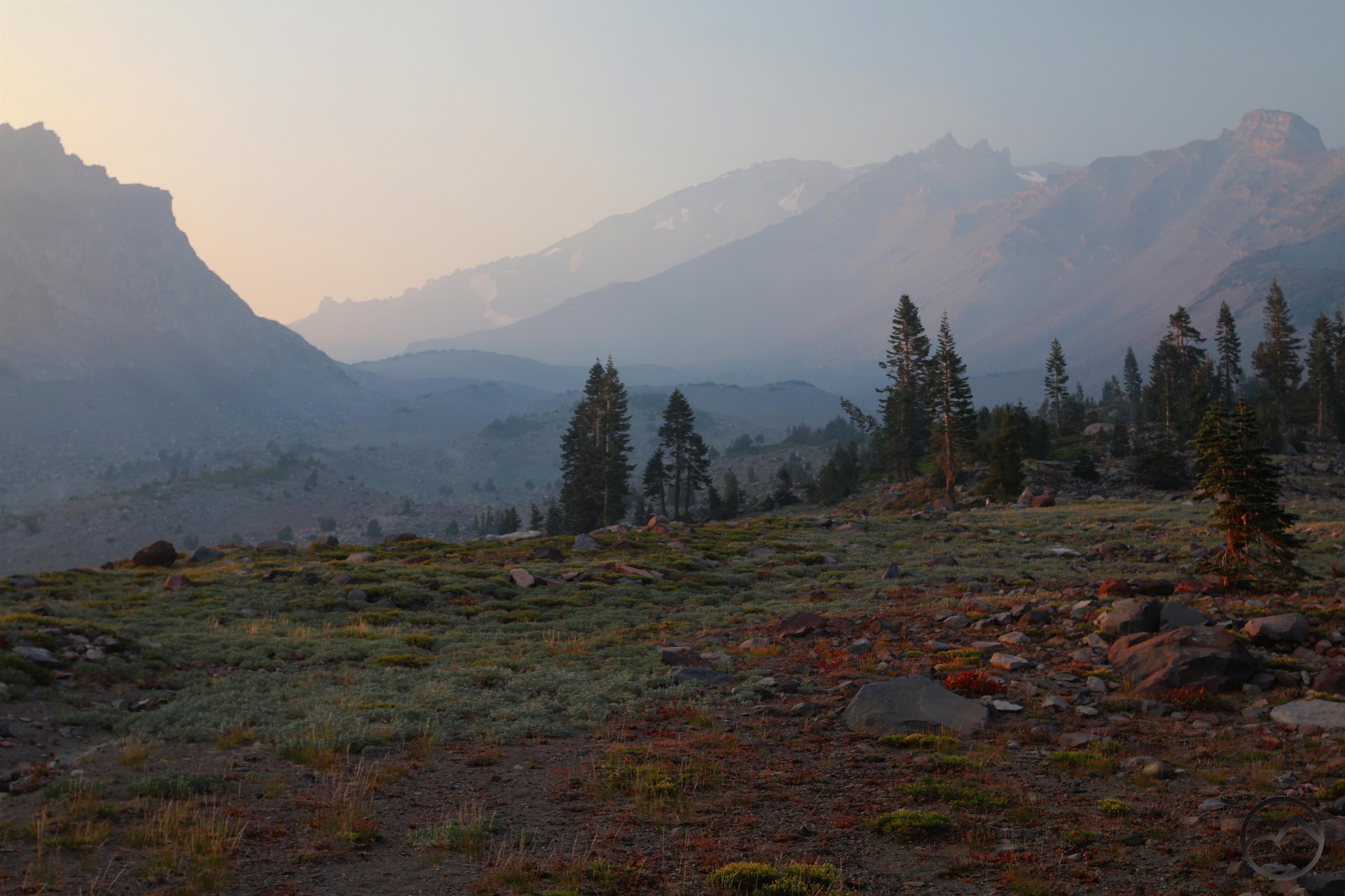
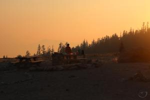
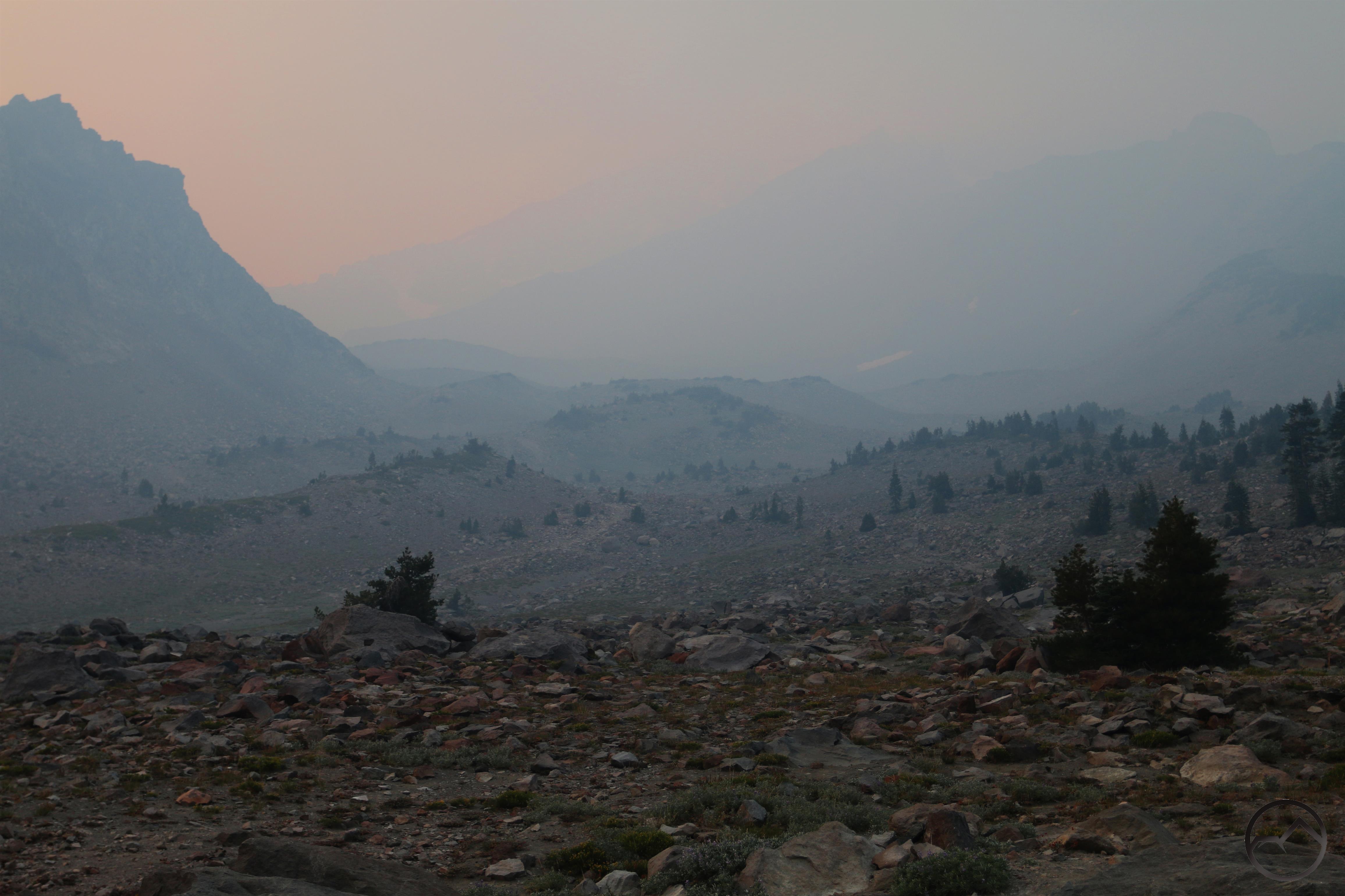
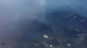
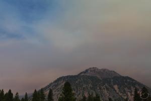
Here in Mount Shasta, it got really smoky, really fast. Thick, dark smoke moved in with great alacrity, appearing to travel in a northeasterly direction and obscuring Mount Shasta:
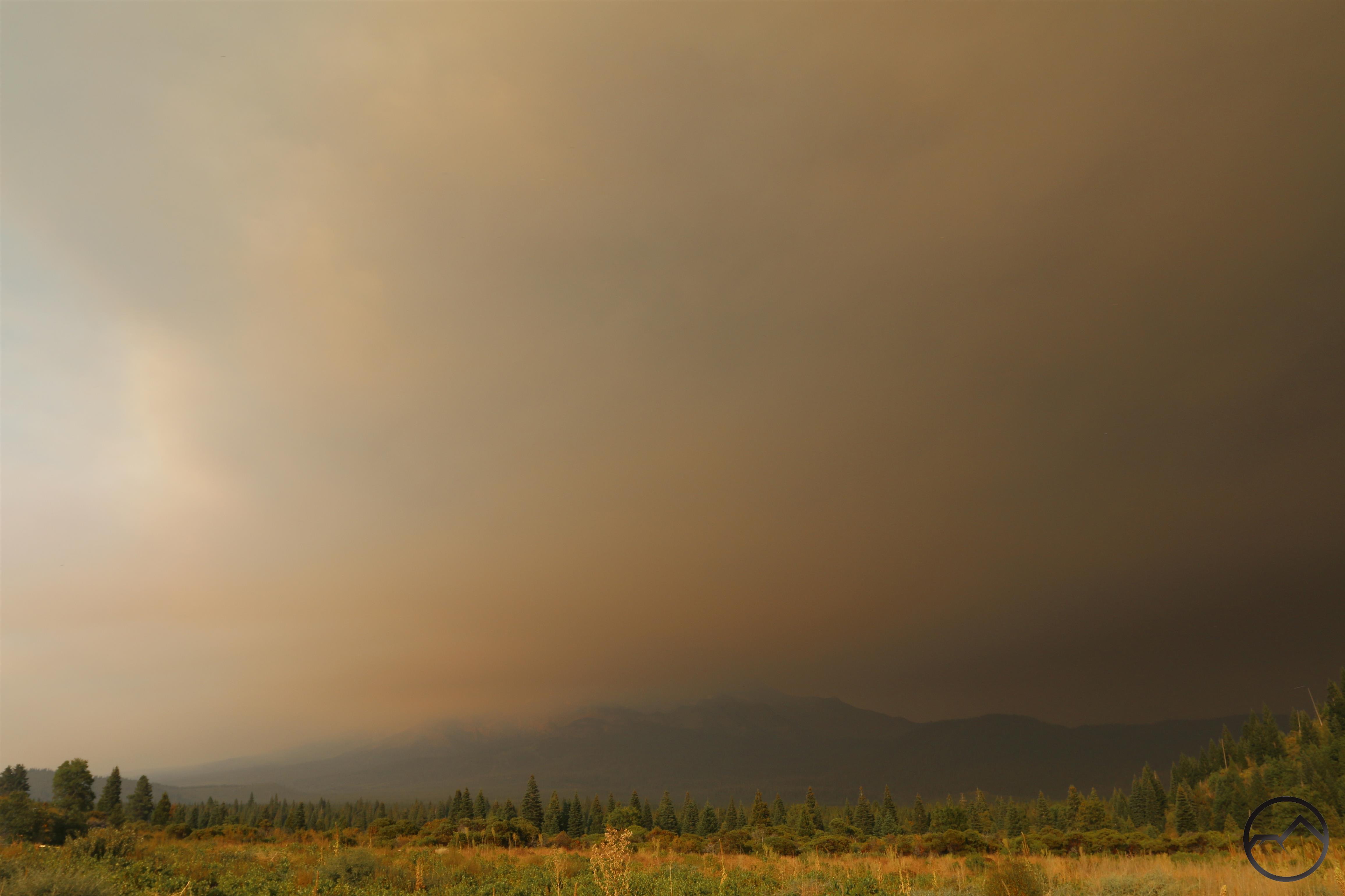
Mount Shasta is lost amidst the airborne detritus of the Delta Fire.
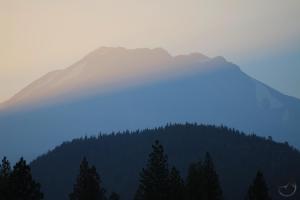
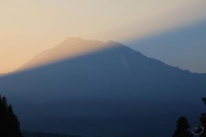
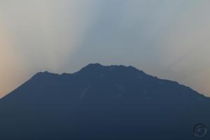
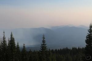
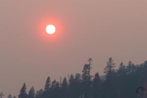
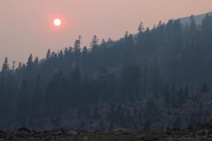
From my house, the view of Black Butte was an odd midday spectacle:
-
- Smoke moving in.
-
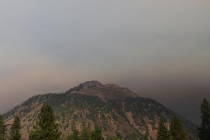
- The sky darkens.
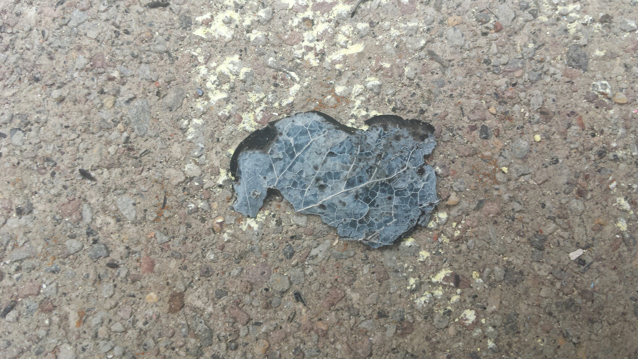
An ashen leaf landed on my driveway.
As if the fast-growing fire were not disconcerting enough, ash rained down out of the sky. Most of it was small particulate but some definitely used to be grass. There were even a few leaves and larger pieces of identifiable debris. Though these were not fire hazards at this point, it certainly raises the specter of spot fires closer to the Delta Fire where airborne matter may still have more heat in it. Over all, this gave the afternoon a prevailing sense of dread. Talking to my wife while she was at working, the feeling there was the same, with everyone feeling very ill at ease because of this fire. While I shared the sentiment, I thought it strange that everyone felt this way since the Delta Fire was still much further away than the Hirz Fire had gotten.
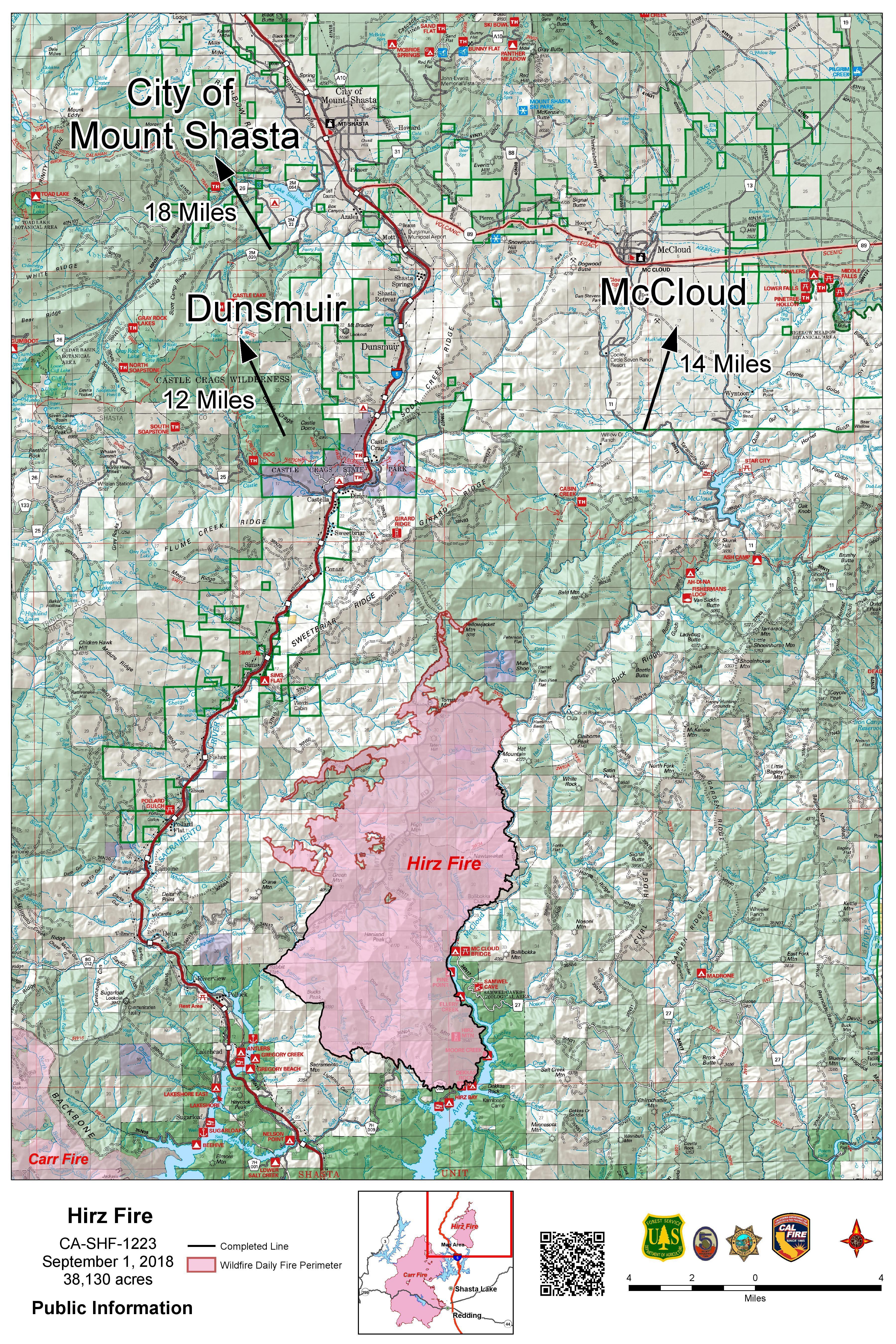
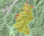
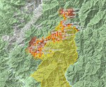
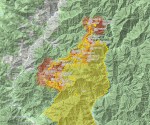
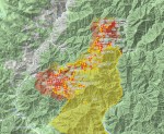
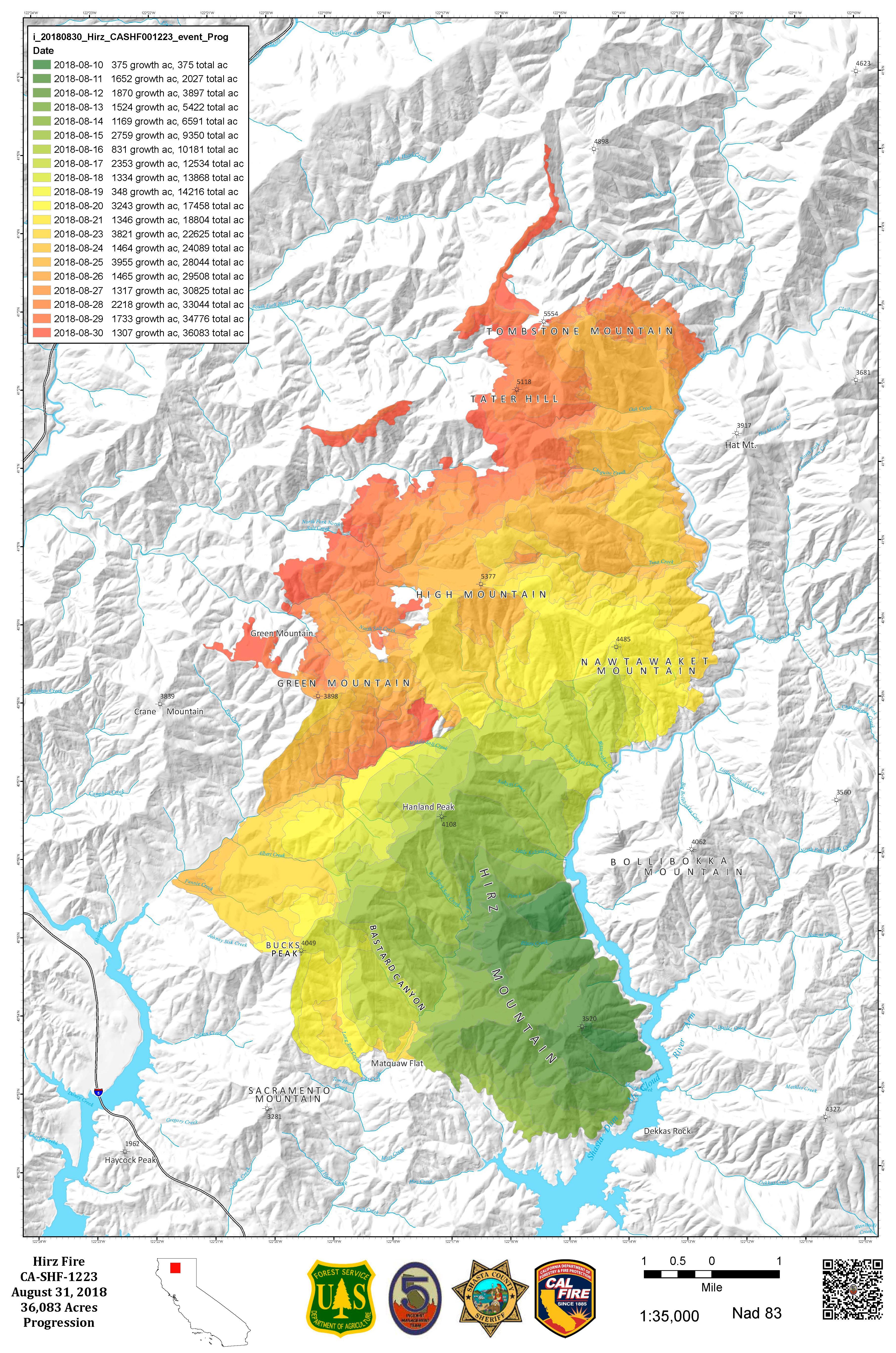
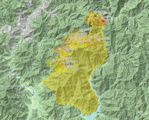
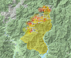
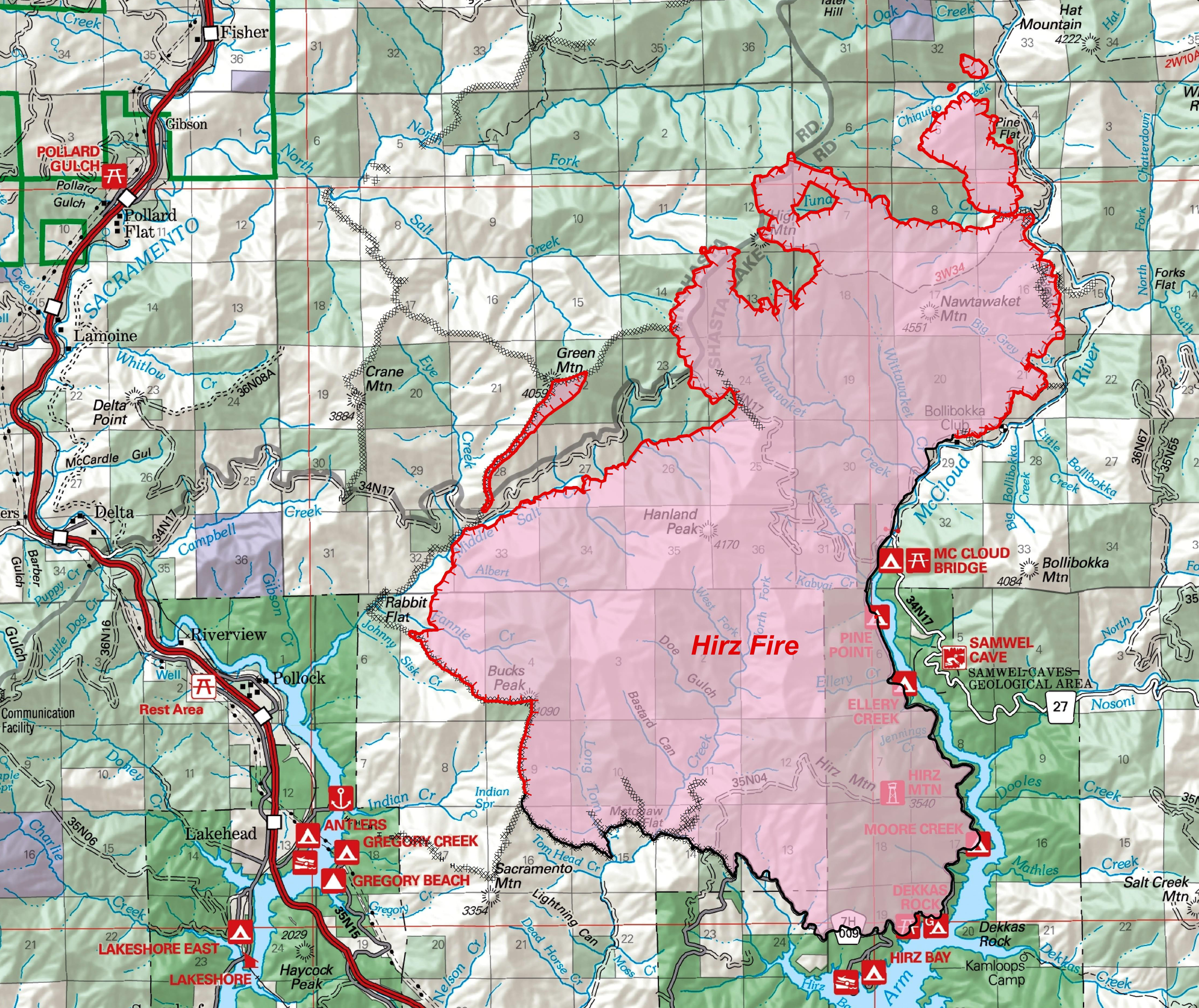
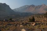
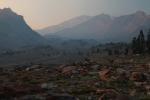
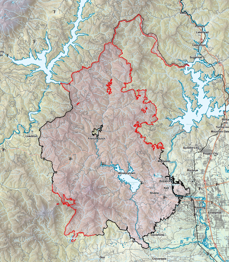
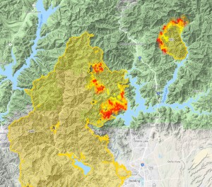
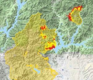
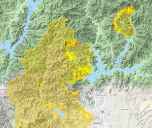
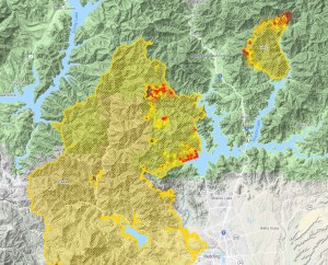
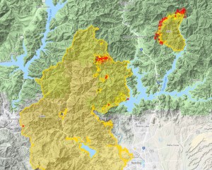
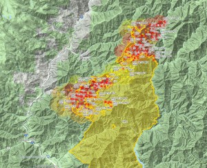
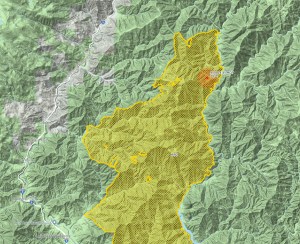
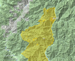
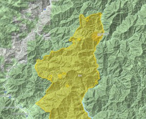
Incidentally, I had been stockpiling heat maps from the last phases of the Hirz Fire to illustrate the fire’s final period of intense burning, before it had been captured by containment lines. I had hoped to write a post on the final days of that fire but unfortunately, the crisis had shifted to the much more dangerous Delta Fire. Nonetheless, here is the last major part of the Hirz Fire:
-
- Sept 2 2:00PM
-
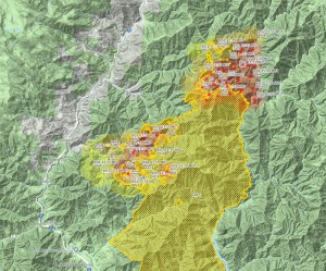
- Sept 2 6:00PM
-
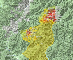
- Sept 3 9:30 AM
-
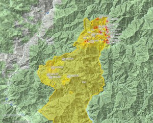
- Sept 3 8:30 PM
-
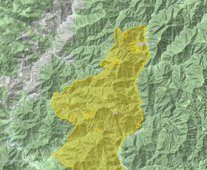
- Sept 4 2:00 PM
-
- Sept 4 10:00 PM
-
- Sept 5 7:00 AM
-
- Sept 5 2:00 PM
With the containment lines cut in on the north and northwest as well as a natural fire break formed by Squaw Valley Creek, the Hirz Fire has essentially burned into itself and is going to smolder for a while before finally going out. Thank goodness. Now let’s get the Delta Fire whipped. No one go starting any more fires.