Hike Mt. Shasta

Exploring the Mount Shasta Region

  • Home
  • Trails
    • Mount Shasta Trails
      • Brewer Creek Trail
      • Clear Creek Trail
      • Gray Butte Trail
      • Green Butte Ridge Trail
      • Horse Camp Trail
      • North Gate Trail
      • Old Ski Bowl Trail
      • Panther Meadow Trail
      • South Gate/Squaw Meadow Trail
      • Whitney Falls Trail
    • Trinity Divide Trails
      • Blue Divide Trail
      • Castle Lake Trail
      • Castle Lake Shore Trail
      • Cliff Lake Trail
      • Deadfall Lakes Trail
      • Gray Rock Lakes Trail
      • Gumboot Trail
      • Heart Lake Trail
      • Porcupine & Toad Lakes Via Pacific Crest Trail
      • Seven Lakes Basin Via Pacific Crest Trail
      • Sisson-Callahan Trail
      • Soapstone Trail
      • South Mumbo Scramble
      • Tamarack Lake Trail
      • Toad Lake Trail
    • Castle Crags Trails
      • Burstarse Falls Via Pacific Crest Trail
      • Castle Dome Trail
      • Flume Trail
      • Lower Castle Crags Via Pacific Crest Trail
      • Root Creek Trail
    • Scott Mountains Trails
      • Bluff Lake & Cement Bluff via Pacific Crest Trail
      • Caldwell Lakes Trail
      • China Mountain Scramble
      • Cory Peak and Bull Lake via Pacific Crest Trail
    • Cascade Crest
      • Ash Creek Butte Scramble
      • Goosenest Trail
      • Juanita Lake Trail
      • Orr Lake Trail
    • Mount Shasta City Area Trails
      • Black Butte Trail
      • Box Canyon Trail
      • Gateway Trail
      • Lake Siskiyou Trail
      • Mount Shasta City Short Trails
      • Ney Springs Canyon Trail
      • Spring Hill Trail
    • Shasta Valley Trails
      • Black Lava Trail
      • Haystack Trail
      • Lake Shastina Trail
      • Pluto Cave Trail
      • Trout Lake Trail
      • Yellow Butte Trail
    • Sacramento River Trails
      • Dunsmuir Trail
      • Hedge Creek Falls Trail
      • Sacramento River Trail
      • Sims History Trail
    • McCloud River Trails
      • Ash Camp To Ah-Di-Na Via Pacific Crest Trail
      • McCloud River Falls Trail
      • McCloud River Preserve Trail
      • Squaw Valley Creek Trail
      • McCloud River Trail: Algoma Camp to Nitwit Camp
      • McCloud River Trail: Nitwit Camp to Cattle Camp Swimming Hole
      • McCloud River Trail: Cattle Camp Swimming Hole to Camp 4
      • McCloud River Trail: Camp 4 to Upper McCloud Falls
      • McCloud River Trail: Pine Tree Hollow Loop
    • Trails Further Afield
      • Trinity Alps Trails
        • Bear Lakes Trail
        • Billys Peak Trail
        • Boulder Creek Lakes Trail
        • Boulder Lake Trail
        • Canyon Creek Trail
        • Caribou Lakes Trail
        • East Boulder Lake Loop
        • East Weaver Lake Trail
        • Four Lakes Loop
        • Granite Peak Trail
        • Grizzly Creek Trail
        • Gulch Lakes Loop
        • Hidden Lake Trail
        • South Fork Lakes Trail
        • Stoddard Lake Trail
        • Stoney Ridge Trail
        • Tangle Blue Lake Trail
      • Warner Mountains
        • Emerson Creek Trail
        • Highgrade Trail
        • Patterson Lake Via Warner Summit Trail
        • Pine Creek Trail
        • Squaw Peak Trail
  • Articles
    • Trails By Area
      • Mount Shasta
        • Vistas, Meadows And Waterfalls: Three Best Hikes On Mount Shasta
        • The End Of The Road: Three Hikes In The Old Ski Bowl Area
        • Two Trails From Bunny Flat
        • Three Trails On Mount Shasta’s East Side
        • Mount Shasta’s Hummingbirds
      • Trinity Divide
        • Great Lakes: Top Five Lake Basins In The Trinity Divide
        • The Headwaters Of The South Fork Of The Sacramento River
        • Neglected Headwaters: Two Lesser Lake Basins On The South Fork
        • Gumboot Saddle: Two Hikes On The PCT
        • Descent Into Mystery: The Sisson-Callahan Trail
        • Mumbo Basin – Overlooked On The West Side
        • The Headwaters Loop: A Proposed Backpacking Loop In The Trinity Divide
      • The McCloud River
        • The McCloud River Trail
      • Shasta Valley
        • Jewels In The Desert
      • Scott Mountains
        • Great Scott! Two Scott Mountains Hikes On The PCT
      • Trinity Alps
        • Carubou Lakes: Trinity Alps On A Grand Scale
        • Switchbacks To Heaven: The Trinity Alps’ Stoney Ridge Trail and Four Lakes Loop
        • Trinities In Proximity: Two Trinity Alps Trails With Easy Access From Mount Shasta
        • Trails in the Carter Meadows Area
        • Trinity Alps Views of Mount Shasta
        • The Psychological Value Of The Trinity Alps
    • Waterfalls
      • Three Waterfalls On Mount Shasta
      • McCloud River Waterfalls
      • Sacramento River Waterfalls
      • Trinity Divide Waterfalls
      • Trinity Alps Waterfalls
      • Avoiding A Dry Whitney Falls
    • Off Season Trails
      • Three Winter Hikes Near Mount Shasta City
      • Winter Hikes In Shasta Valley
      • Winter Hiking In The Shasta Valley Wildlife Refuge
      • Winter Hikes On The Sacramento River
      • Winter Hikes On The Lake Siskiyou Trail
      • Spring Hikes In The Castle Crags
      • Spring Hikes On the Upper McCloud
      • Spring Hikes On The Lower McCloud River
    • Points Of Interest
      • Mount Eddy: Overshadowed, Underrated
      • Black Butte: Hiding In Plain Sight
      • Castle Dome: Steadfast And Staggering
      • Mount Shasta Hoodoos
      • Sacramento Scrambling
      • The Shasta River
      • The Castle Creek Watershed
      • Mount Shasta East Side Glacier View
      • 5 Fantastic Mount Shasta Vistas
      • 5 Highest Peaks Around Mount Shasta
      • 5 Best Hikes On Creeks And Rivers
      • 5 Interesting Footbridges
      • Three Spectacular Drive-To Sunset Vistas
    • North State Geography
      • Introduction
      • Seven Major Regions
      • The California Cascades
      • Klamath Mountains Pt. I
      • Klamath Mountains Pt. II
      • The Great Canyons Of Mount Shasta
      • Mount Shasta, Timberline, And The Relative Size Of Cascade Volcanos
      • Four Eruption Cones Of Mount Shasta
      • Mount Shasta’s Medial Moraine
    • Northern California Review
      • North Table Mountain
      • Lakes Basin Recreation Area
      • Eastern Sierra Fall Color
      • Sonoma County
      • Central Sierra Nevada
      • Orland Buttes
    • Seldom Seen
      • Ash Creek Falls
      • Mud Creek Canyon
      • Lower Mud Creek Canyon
      • Diller Canyon
      • Lower Cascade Gulch
      • The Grey Rocks
      • Castle Creek
      • Upper Wagon Creek
      • Fawn Creek Canyon
      • Confluence of the Sacramento River and Castle Creek
      • Upper Klamath River Canyon
      • Hole In The Ground Geologic Area
      • Ash Creek Butte Fossil Rock Glacier
    • Mount Shasta History
      • Vantage Lost: The Everitt Memorial Vista
      • A Yosemite-Mount Shasta Connection
      • Whitney – What’s In A Name?
      • Mount Shasta Area and the 1838 Exploring Expedition
      • A 19th Century Engraving Of An Epic Mount Shasta Vista
      • Vintage 1907 Color Photos
      • A Misleading Painting
      • A Mysterious Painting
      • A Mysterious Painting Pt. II
      • Stereographic Mt. Shasta
      • Year One Of Hike Mt Shasta
      • Year Two Of Hike Mt Shasta
      • Year Three Of Hike Mt Shasta
      • Year Four Of Hike Mt Shasta
      • Year Five Of Hike Mt Shasta
      • Year Six Of Hike Mt Shasta
      • Year Seven Of Hike Mt Shasta
    • Image Galleries
      • Mount Shasta Trails Gallery
      • Mount Shasta Sunrise Gallery
      • Mount Shasta Sunset Gallery
      • Lenticular Cloud Gallery
      • Mount Shasta NON-Lenticular Clouds
      • Mount Shasta Reflection Gallery
      • Telephoto Gallery
      • Mount Shasta Area Fall Color
      • Castle Crags Gallery
      • Waterfalls Gallery
      • Trinity Divide Lakes Gallery
      • Mount Shasta Area Rivers Gallery
      • Shasta High Desert Gallery
      • Mount Shasta GIF Gallery
    • Random Notes
      • Revew: Three Mount Shasta Trail Maps
      • A Mount Eddy Wilderness?
      • New Land Additions For The Castle Crags
      • Book Plug: Mount Shasta Area Rock Climbing
      • Exile: How I Came To Love Wilderness
  • Mt. Shasta Trail Map
  • Blog
  • About/Contact
  • Links
  • Truchas Ridge

Mount Shasta 2017: A Year In Images

Posted by bubbasuess on December 31, 2017
Posted in: Cascade Range, Hiking, Lenticular Clouds, Mount Shasta. 3 Comments

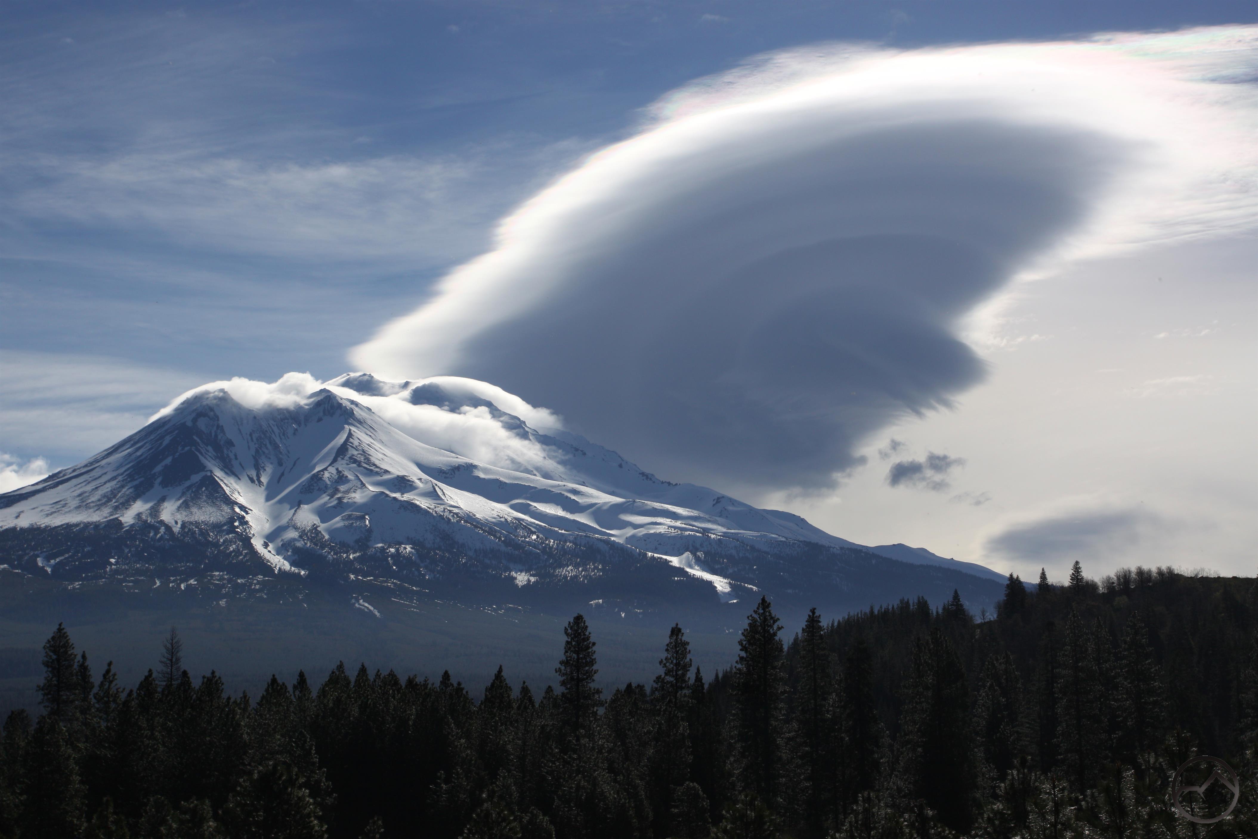
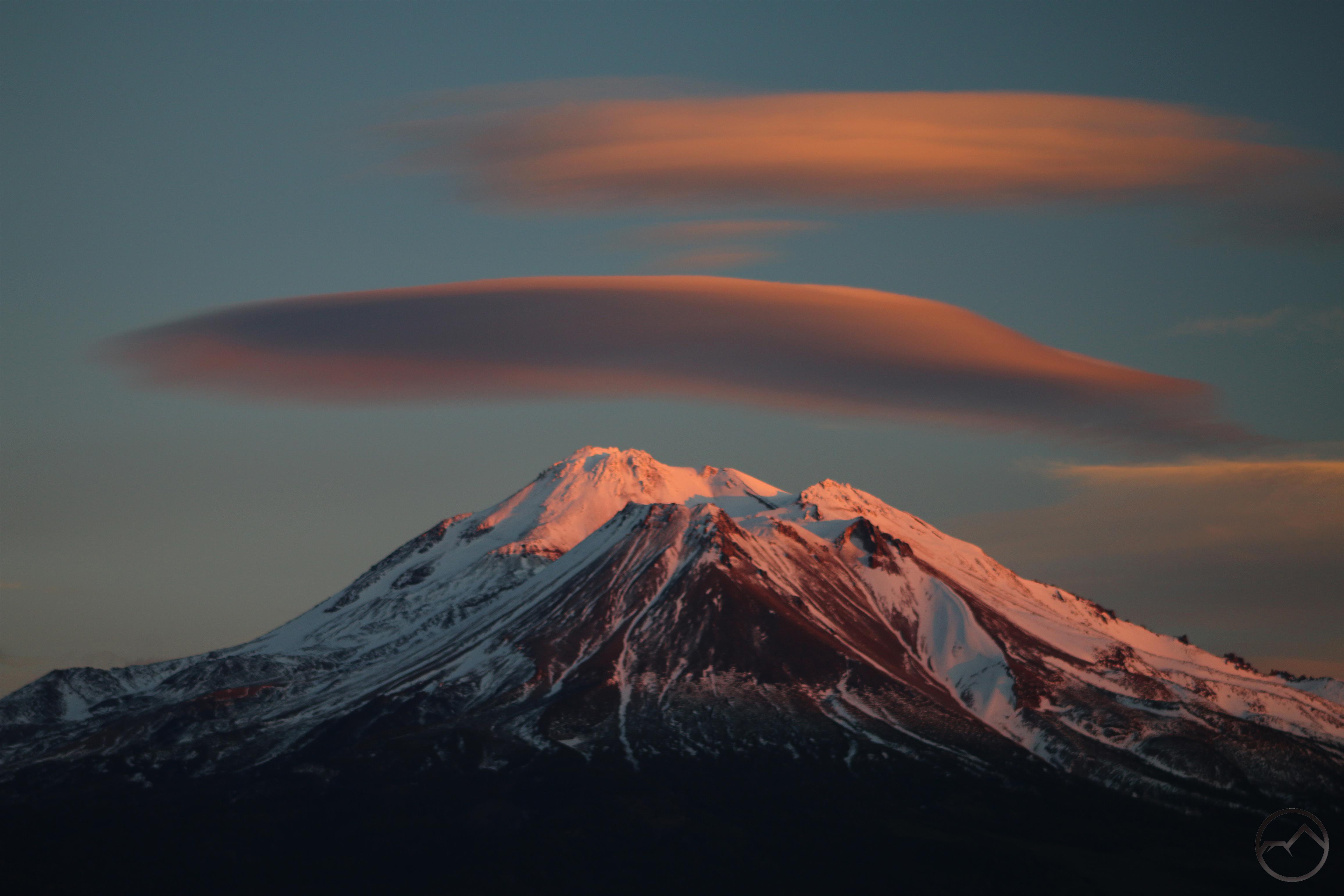
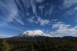
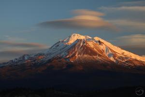
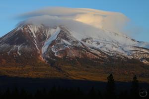
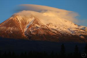
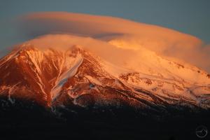
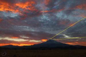
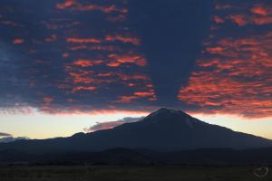
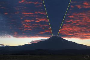
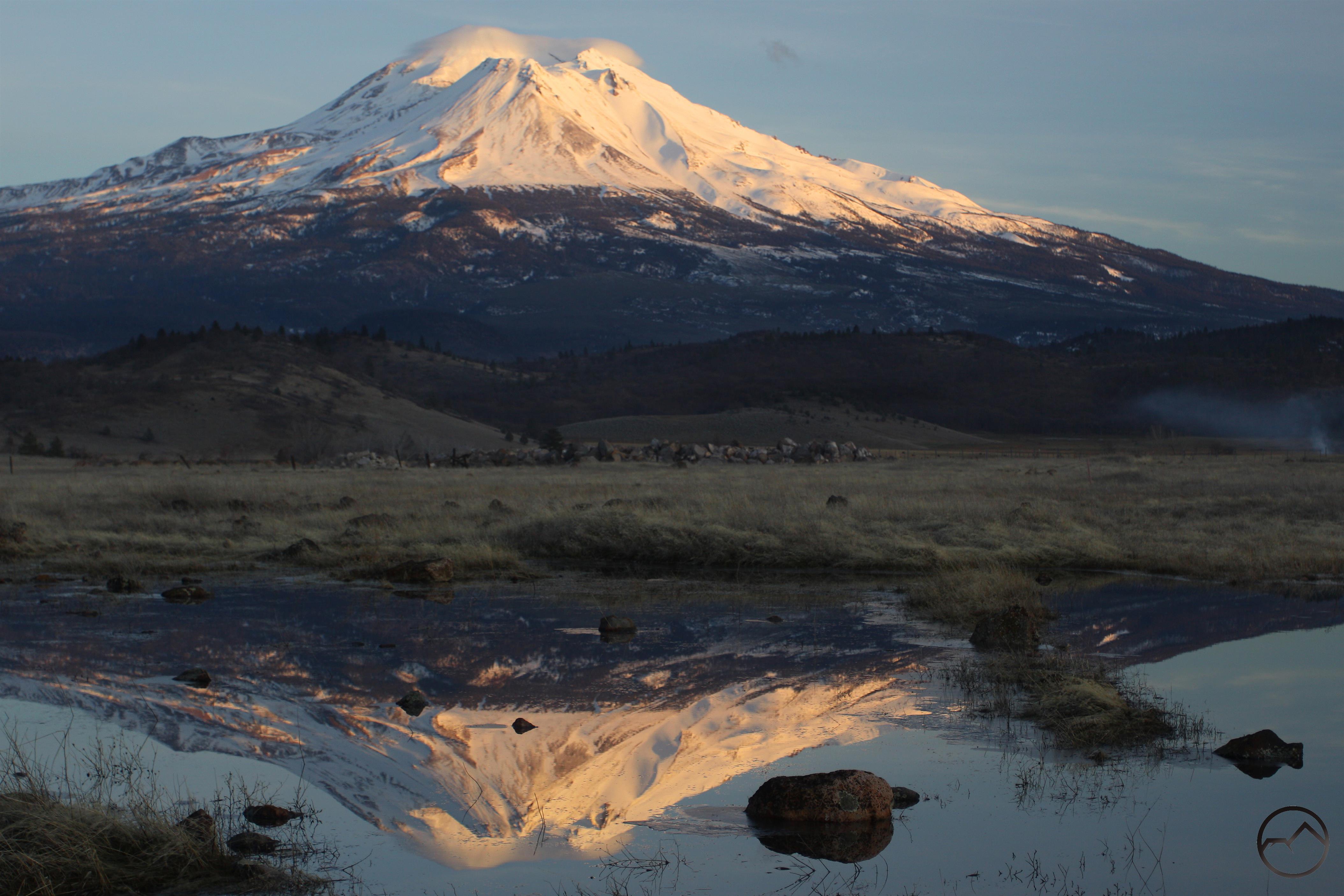
An incredible lenticular formation crowns Mount Shasta in March 2017.

The year of our Lord 2017 was, as many on the Pacific Crest Trail dubbed it, the year of ice and fire. The year saw a fantastic winter with a deep snowpack turn into a gorgeous summer. The summer, despite the ample water supply, was unfortunately given over to fire. Great conflagrations rage all over the western United States, consuming larges swaths of forest and iconic landmarks like the Columbia River Gorge. The human toll was large too, as firestorms in California ripped through populated areas. It was tragic. Fortunately, those of us here in Mount Shasta did suffer the depredations of the flames. Here’s praying we never do, though it continues to remind us to be vigilant.

Unlike 2016, I was home throughout the year, rather than traipsing around California hiking trails in preparation for a new book. This means I was able to capture the area in images every month. I hope seeing the region in all of its various seasons and phases encourages those who have not visited the Mount Shasta area to come up and enjoy it in 2018. For those who have experienced the area, I hope we are all able to appreciate the blessing this area is in the coming years!

Thanks for following Hike Mt Shasta! It has been an honor to write about this spectacular area for as long as I have been and I appreciate all the readers that have stuck with me. I really hope this endeavor has been helpful!

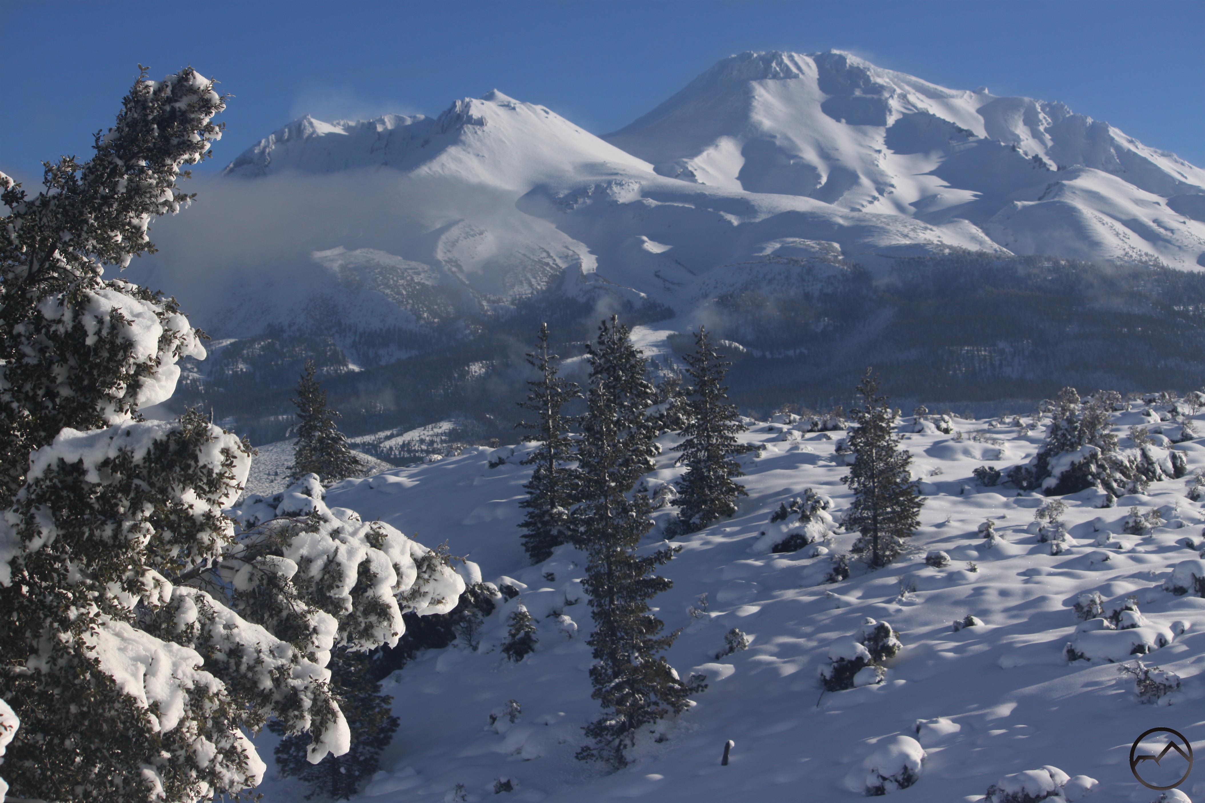
January 2017 started off with a bang. The largest storm to come through the Mount Shasta area since march of 2011 swept through and dump nearly 6 feet of snow over the course of 3-4 days. After years of drought, it was a fantastic way to start off the new year! See images of the storm here, here, here and here.

The following month saw small storms continue to roll through but much of it was dumped as rain, so the massive amounts of snow from the previous month began to melt in earnest. Winter fever had already begun to set in and I found myself heading up into the Shasta Valley to enjoy a little aridity and sunshine.

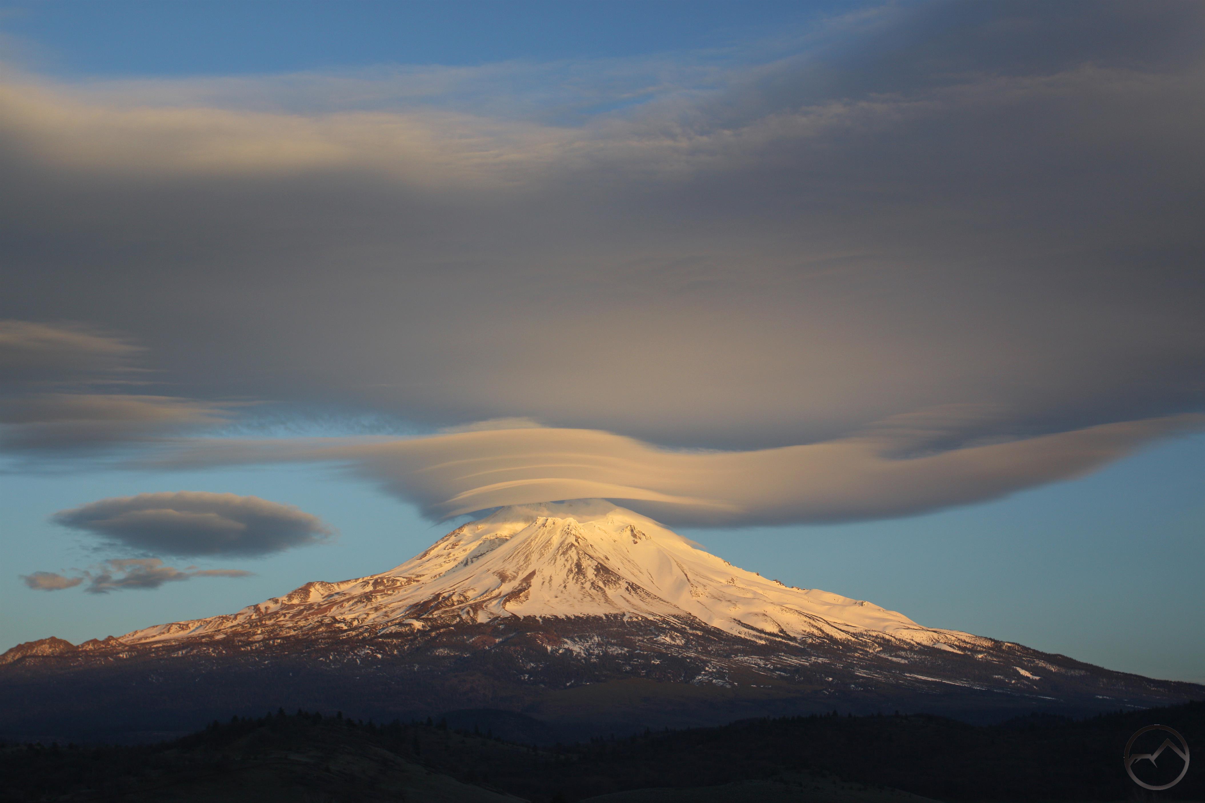
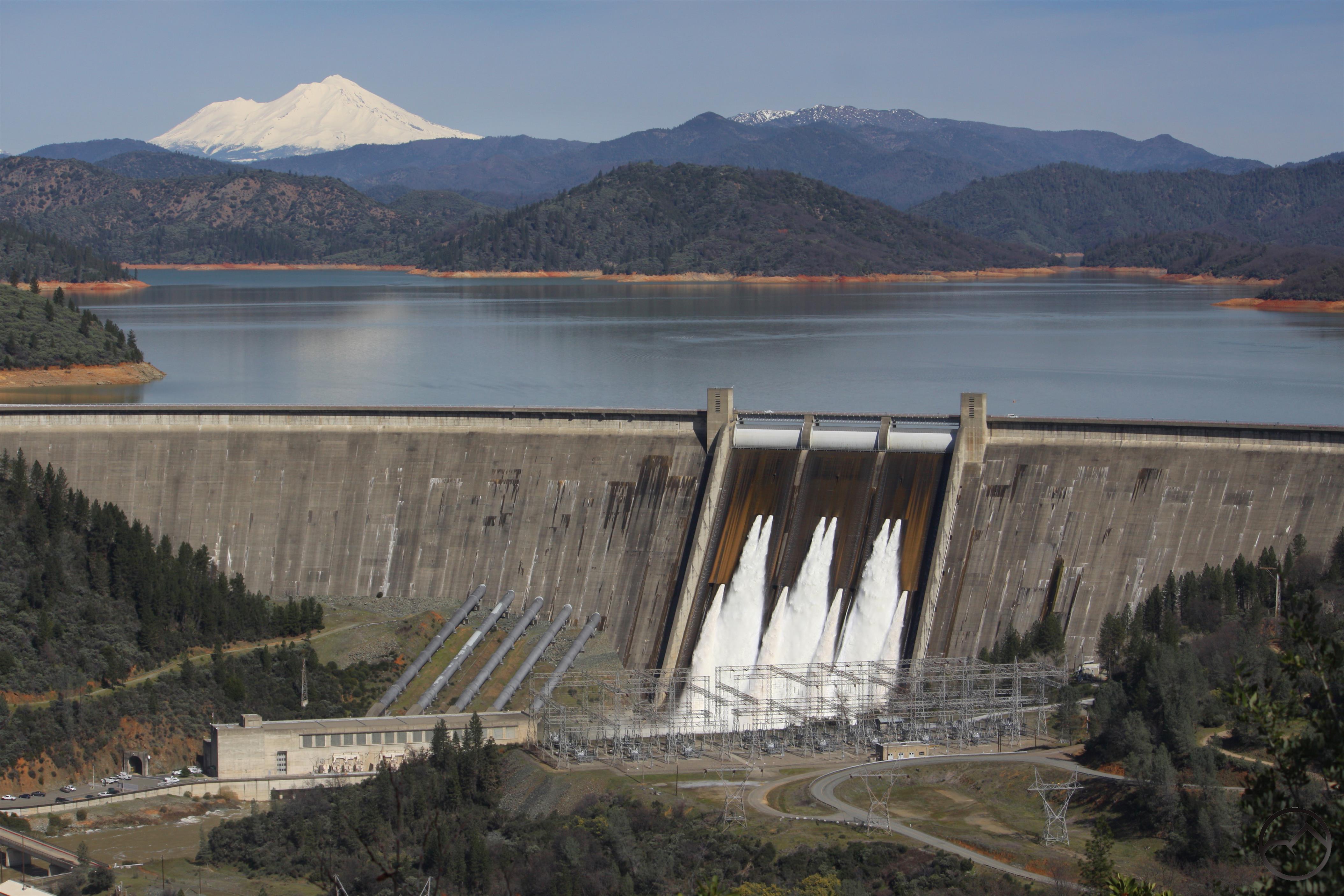
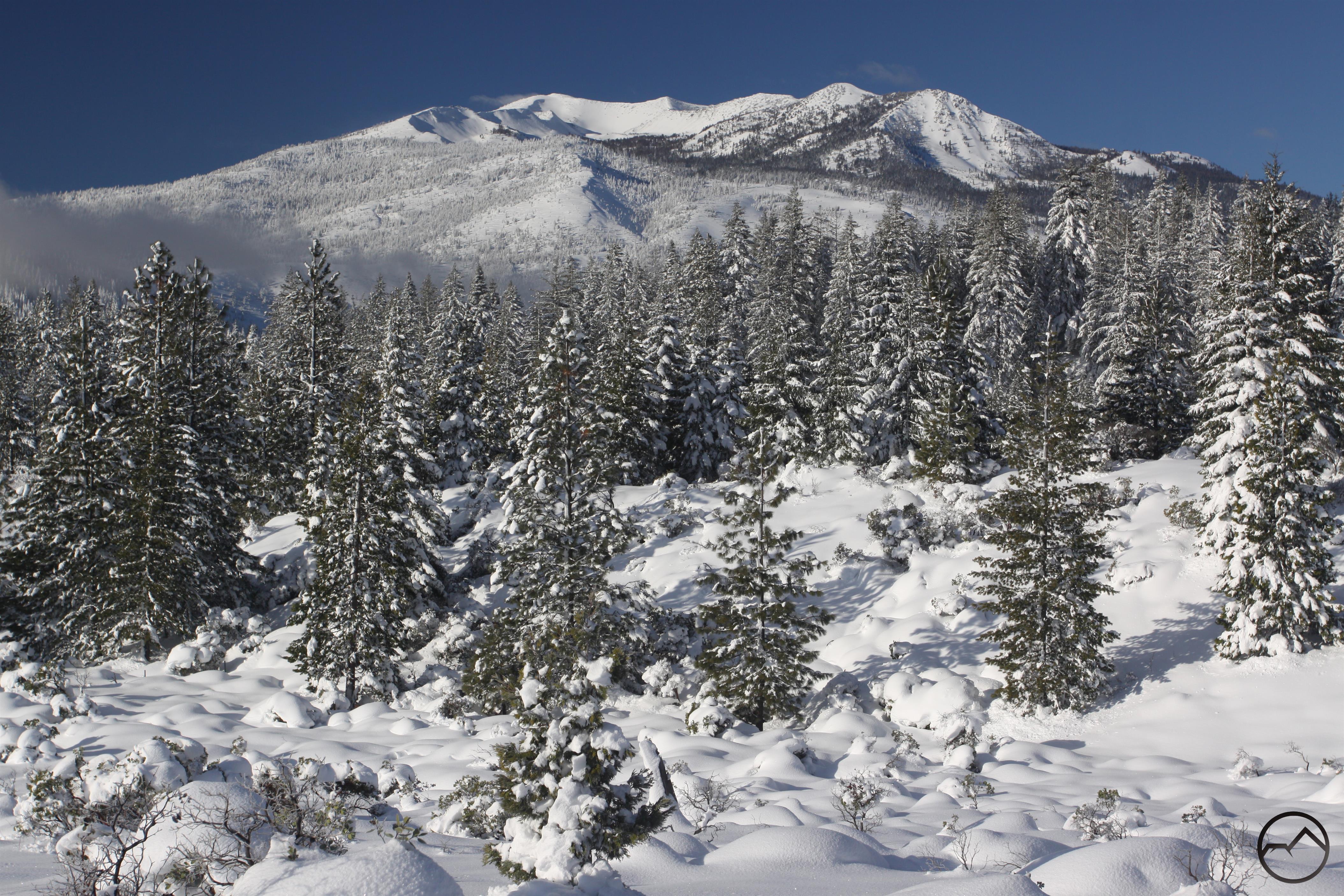
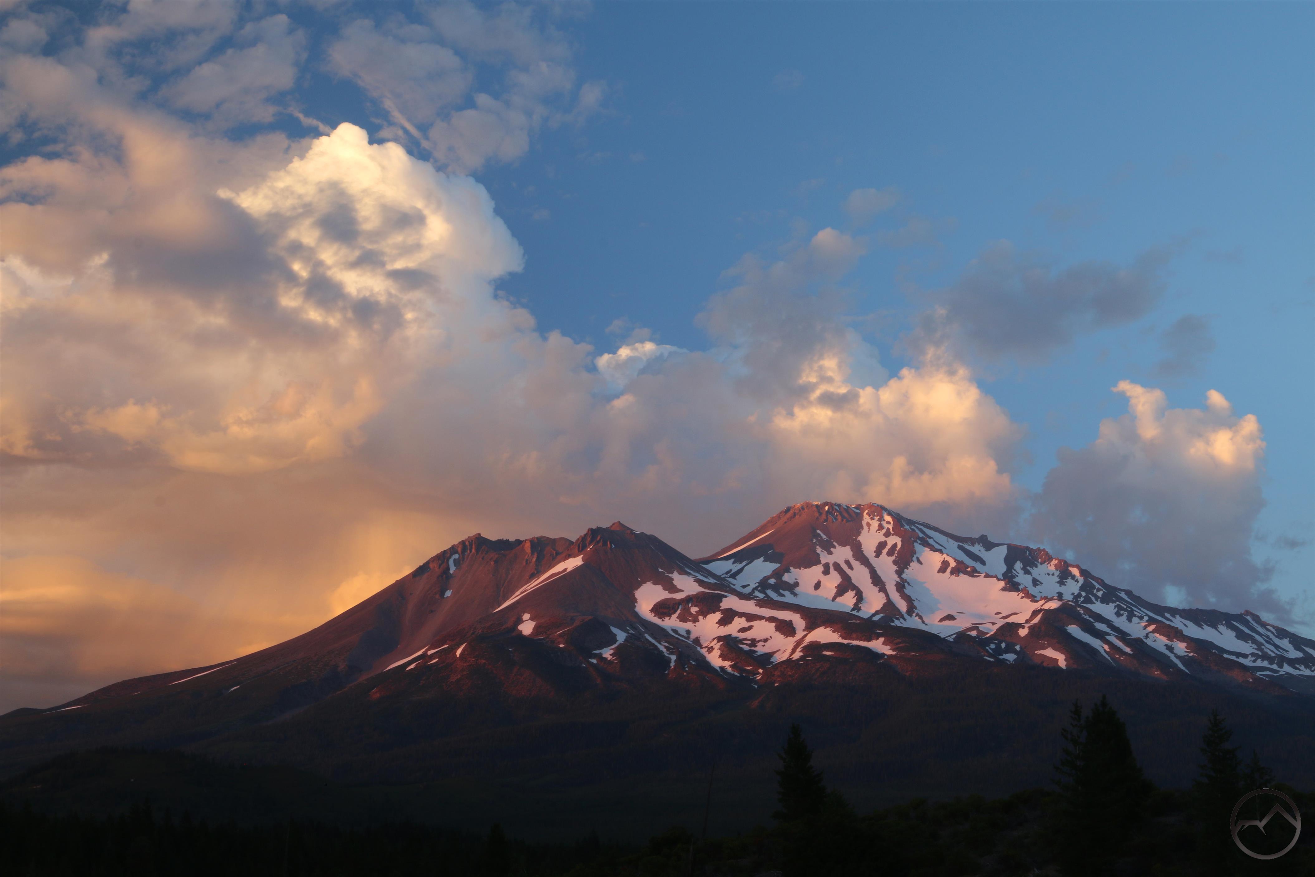
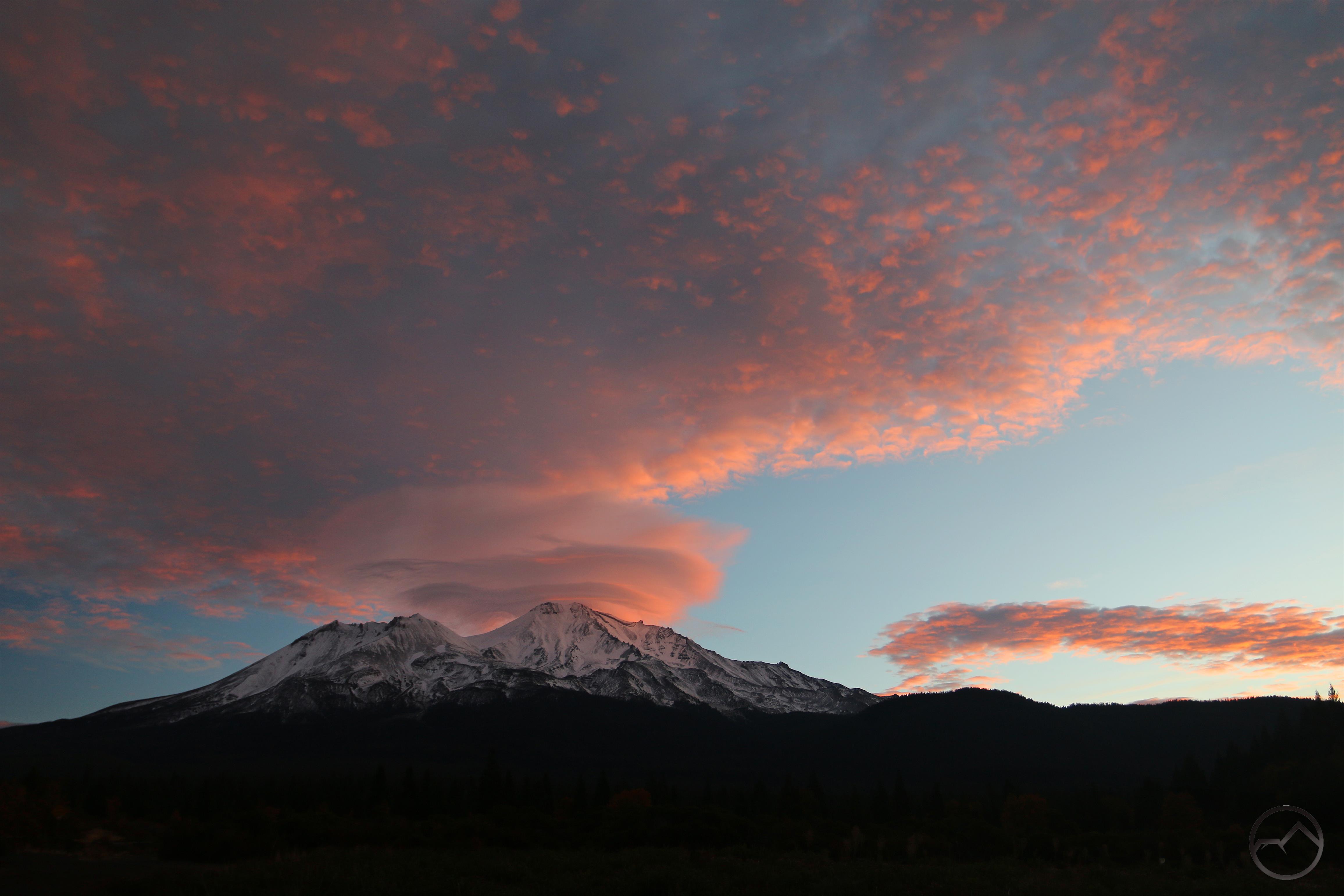
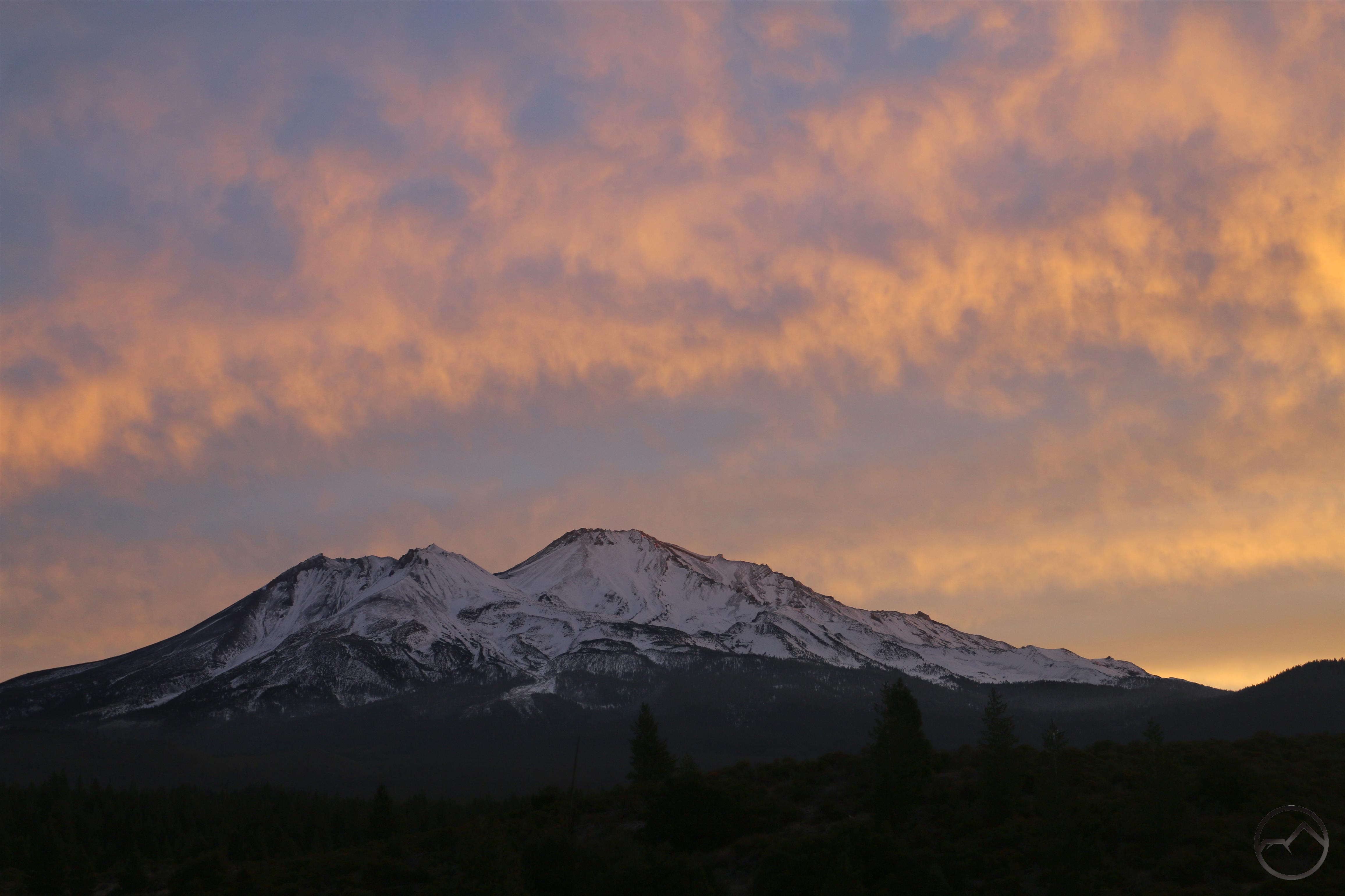
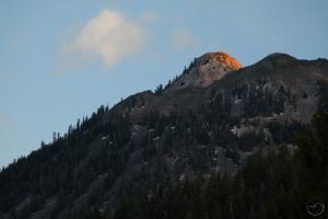
March brought one of the best lenticular displays I have seen in a long time, as well as some warmer weather. While it wasn’t quite fair to say the thaw had arrived, by the end of the month most of the snow from January had disappeared, all of it running off to swell the historically low Shasta Lake. A rare full release from the dam was underway to make room for all the water that would soon pour into the lake as the snowy mountains thawed out.

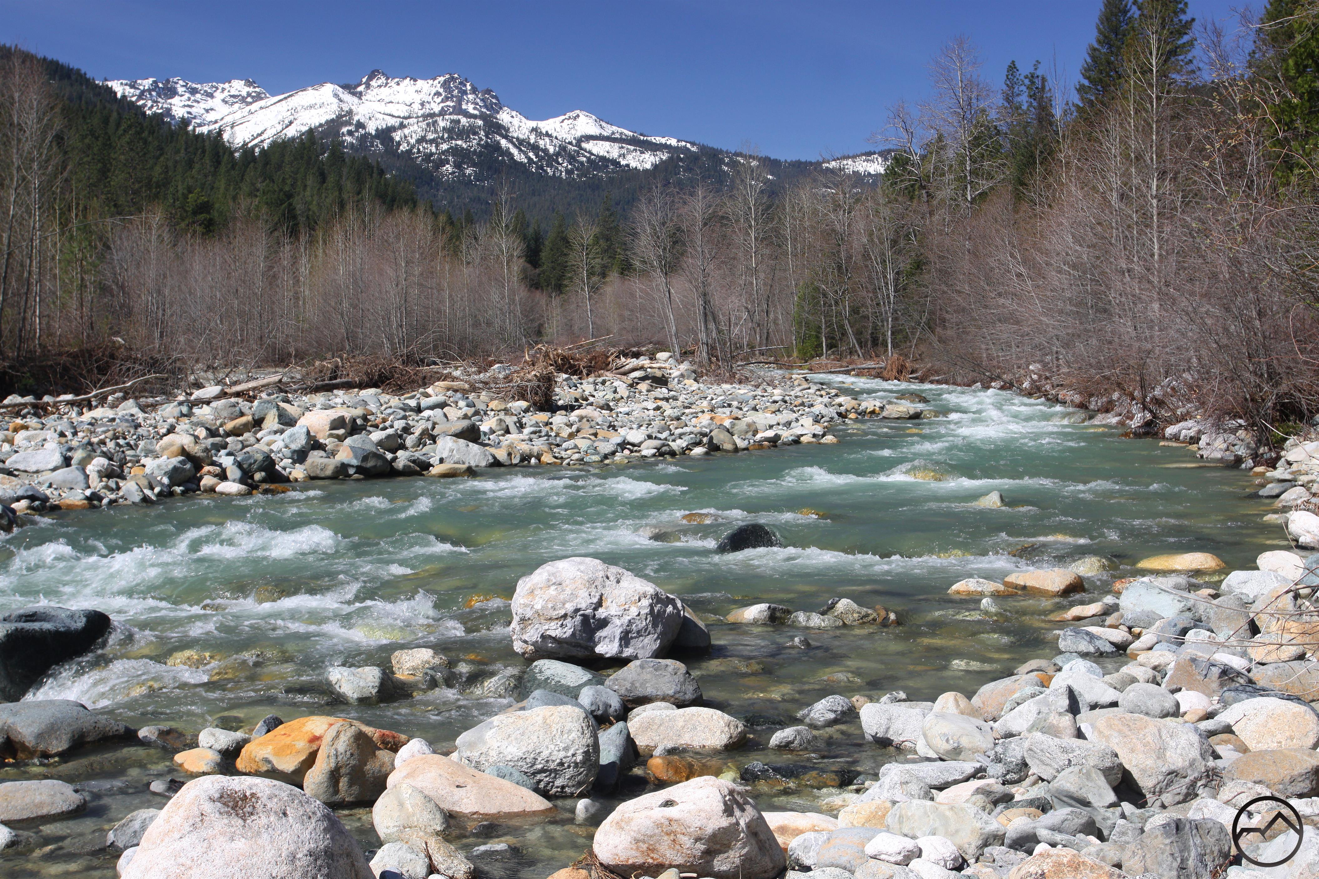
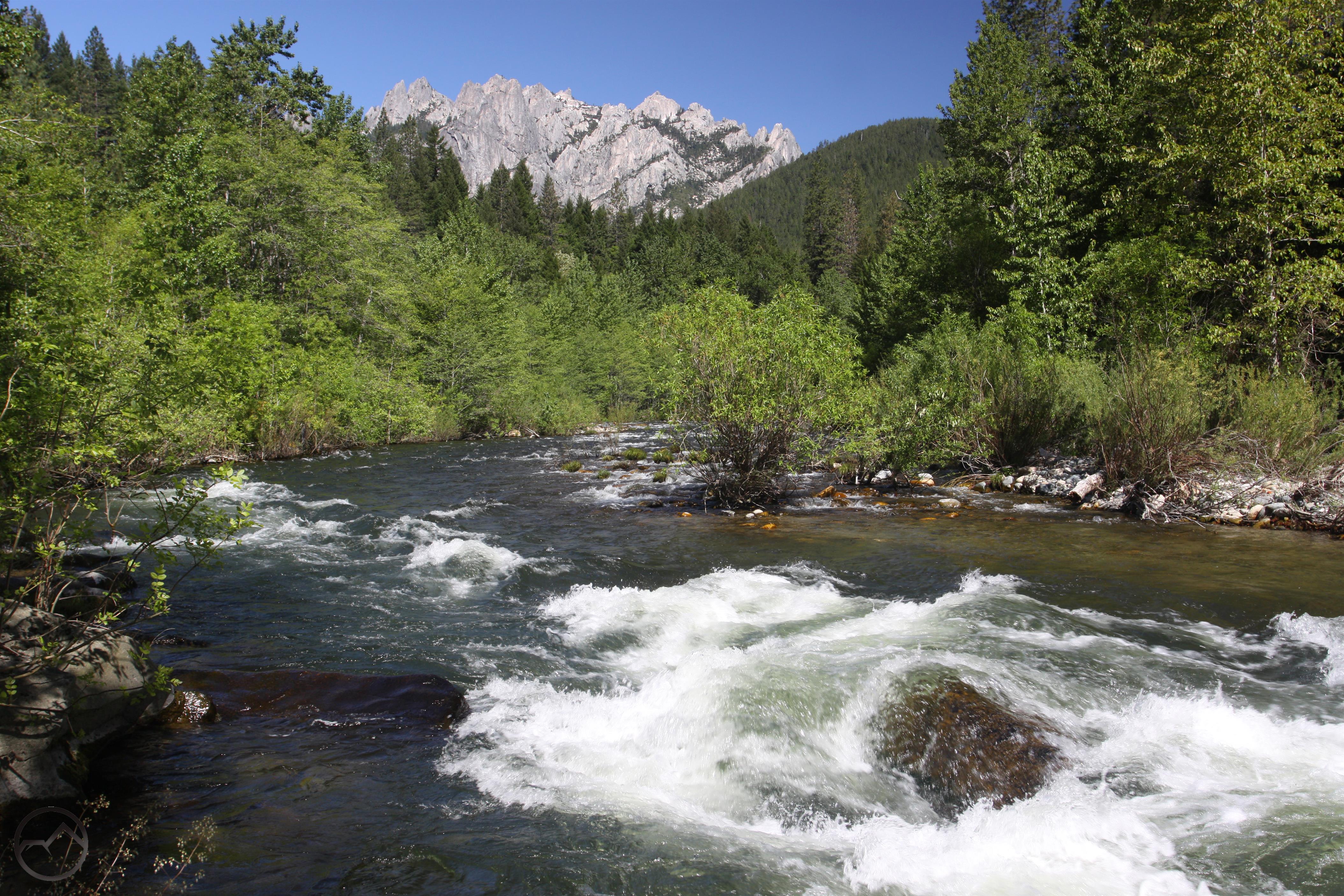
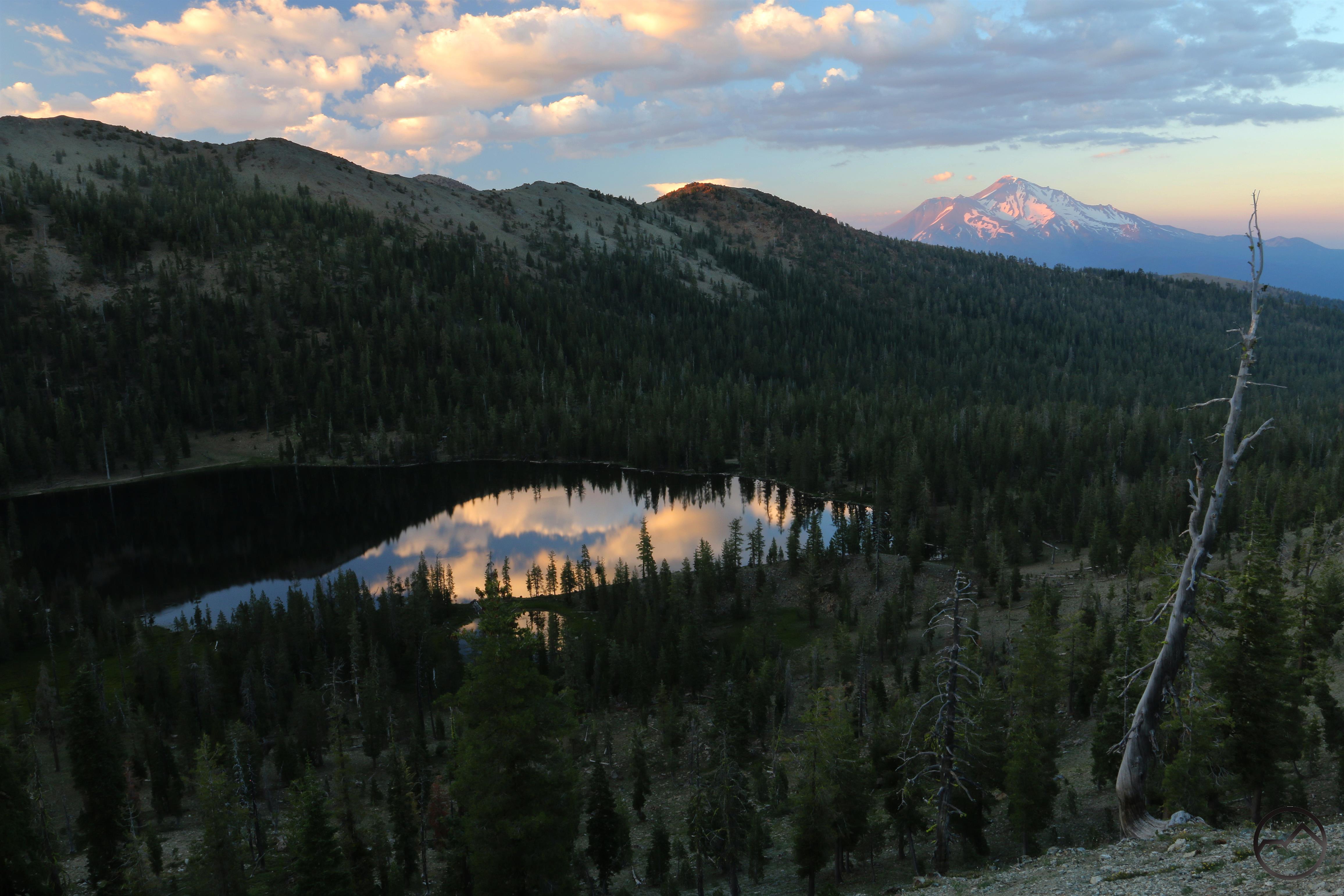
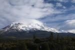
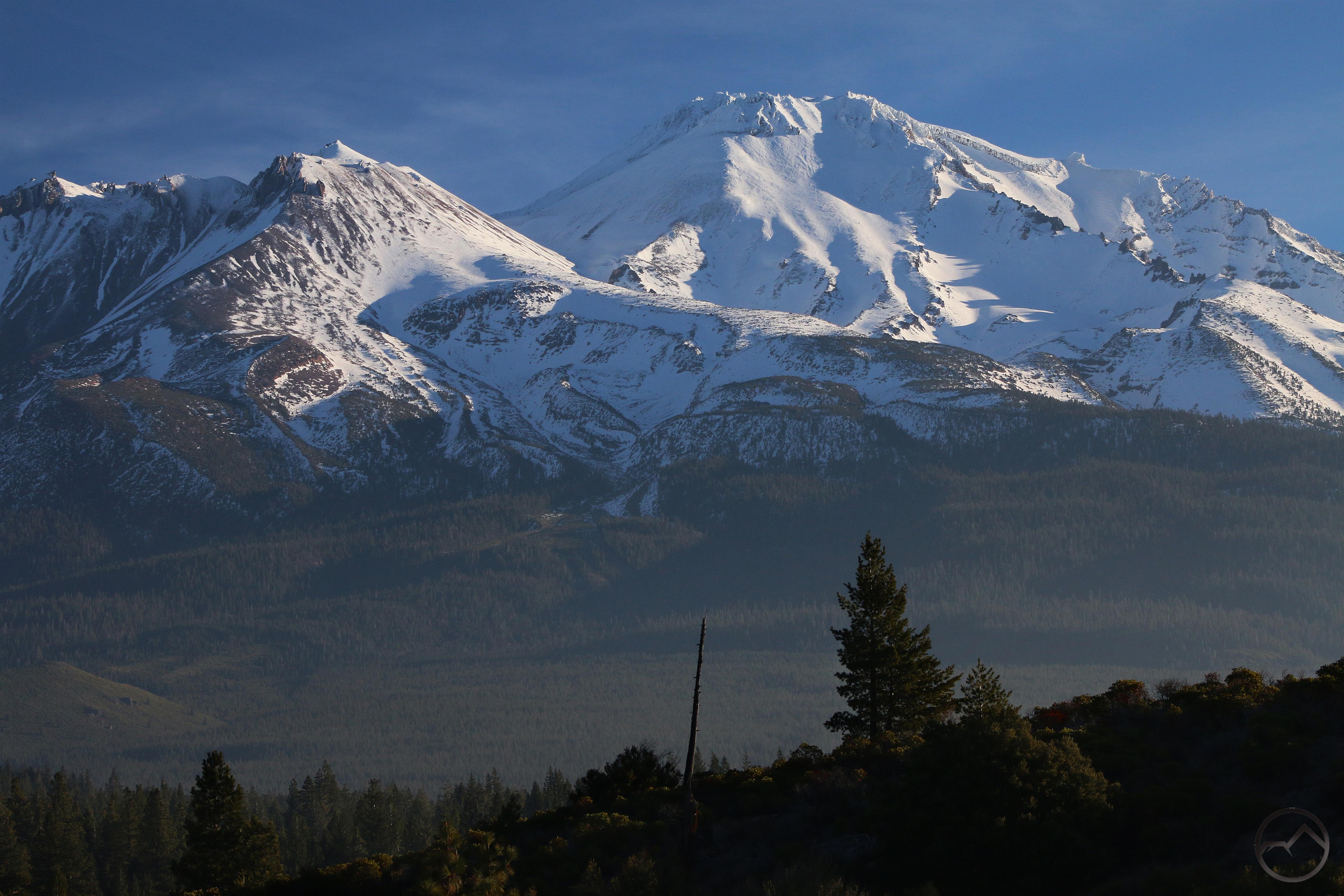
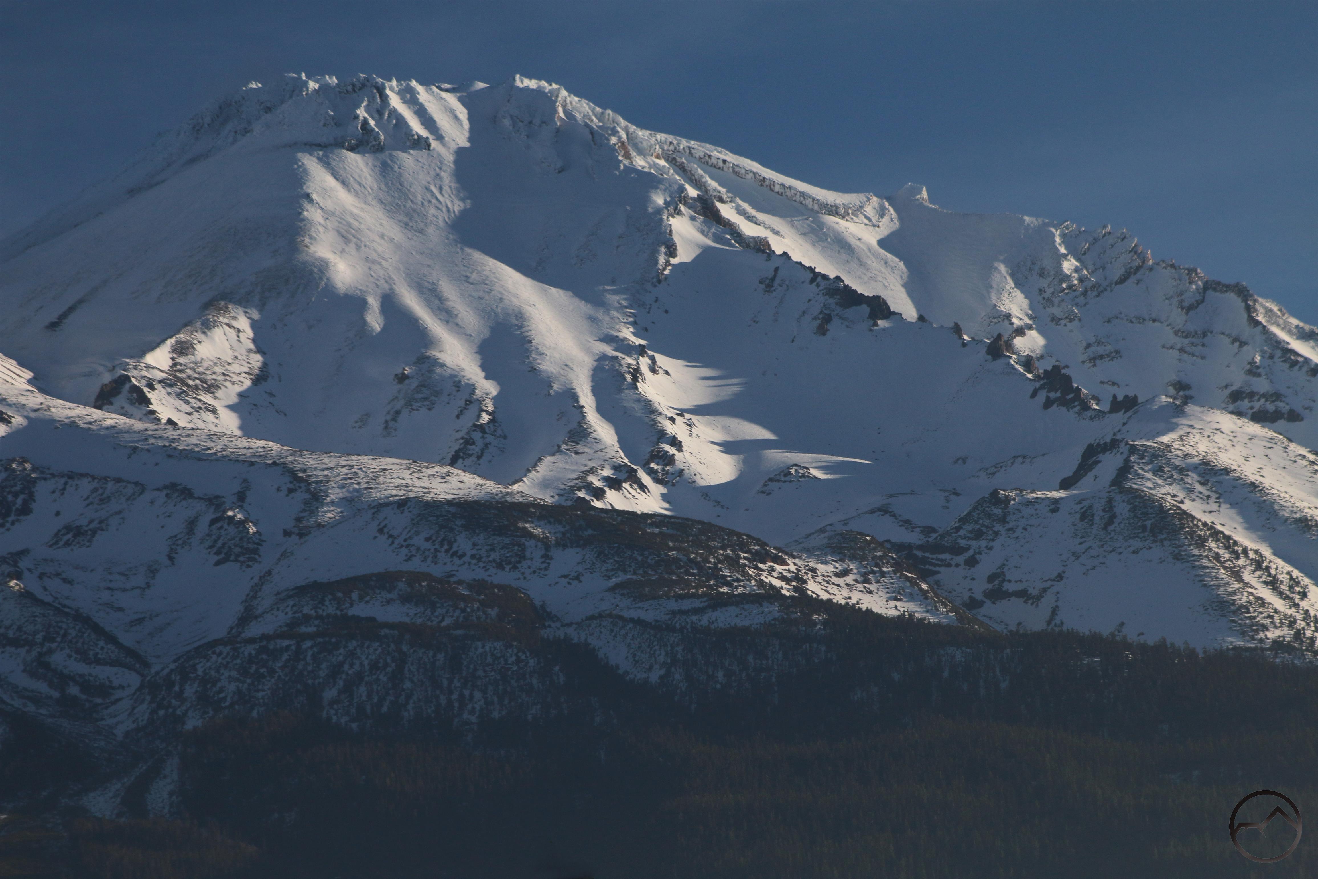
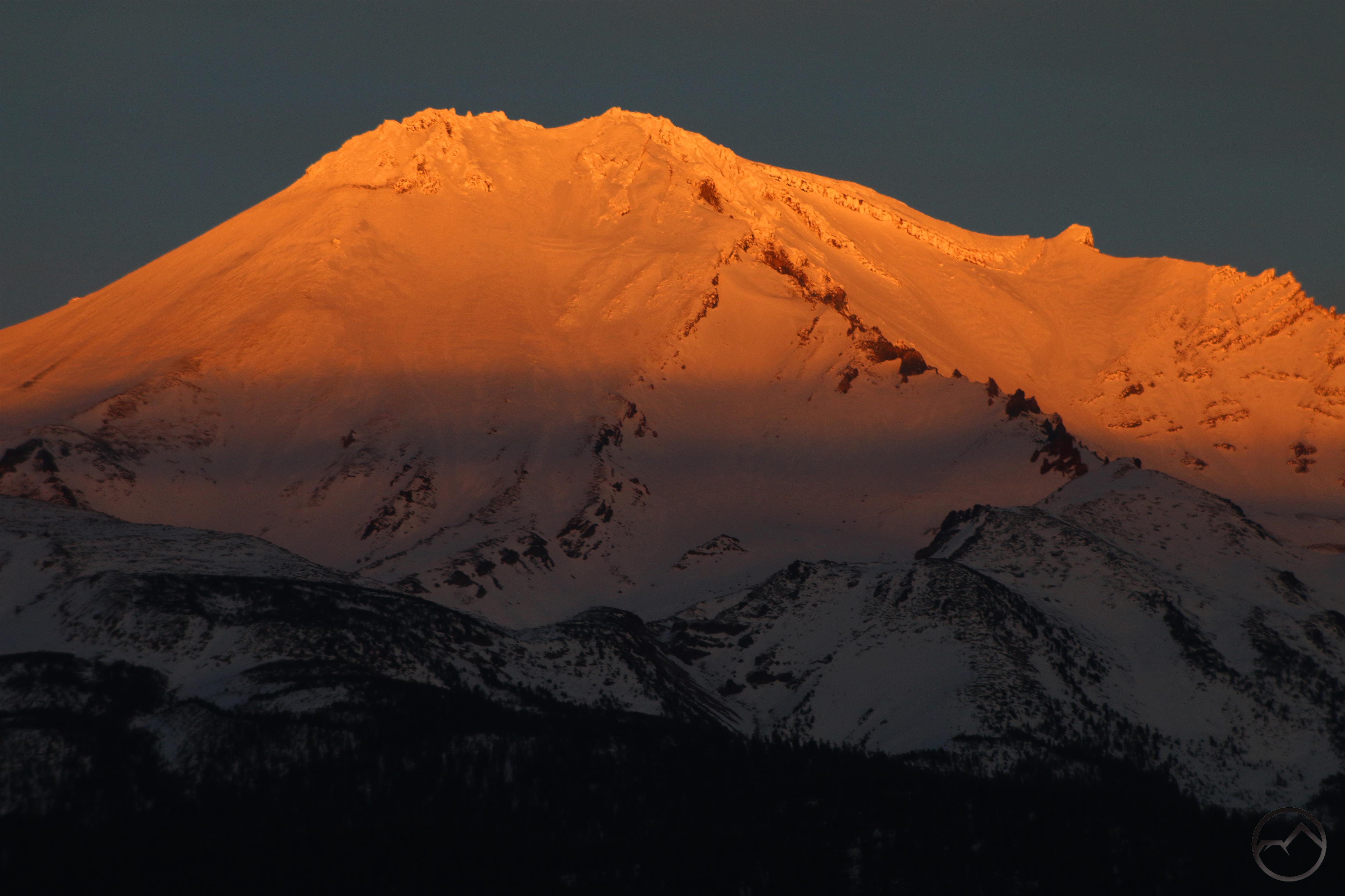
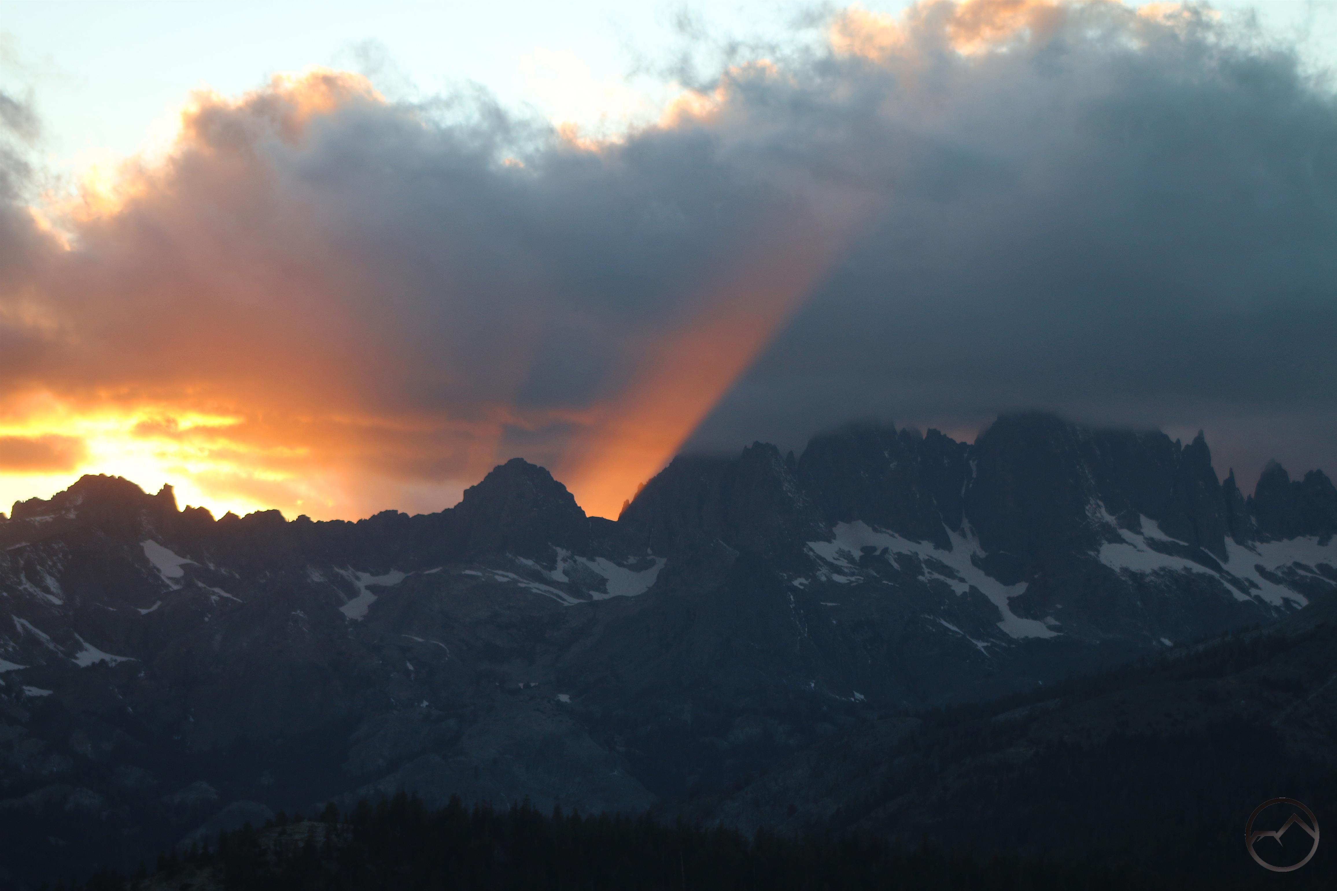
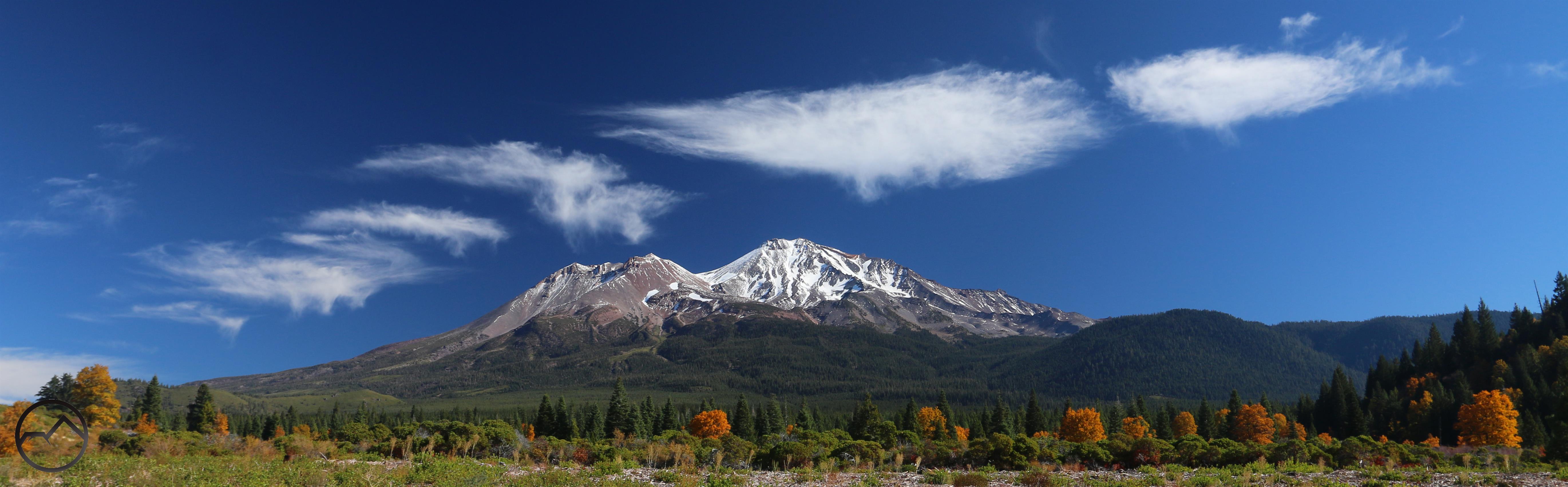
The thaw really did begin in April. The temperatures climbed until it was almost possible to say it was warm! The creeks and rivers were swollen with runoff. This time of year is particularly pretty in the lower elevations, when all the peaks are still covered in snow and the water is furious. Of course, Mount Shasta always remains the beacon, drawing the eye to it no matter what other spectacle is taking place within its domain.

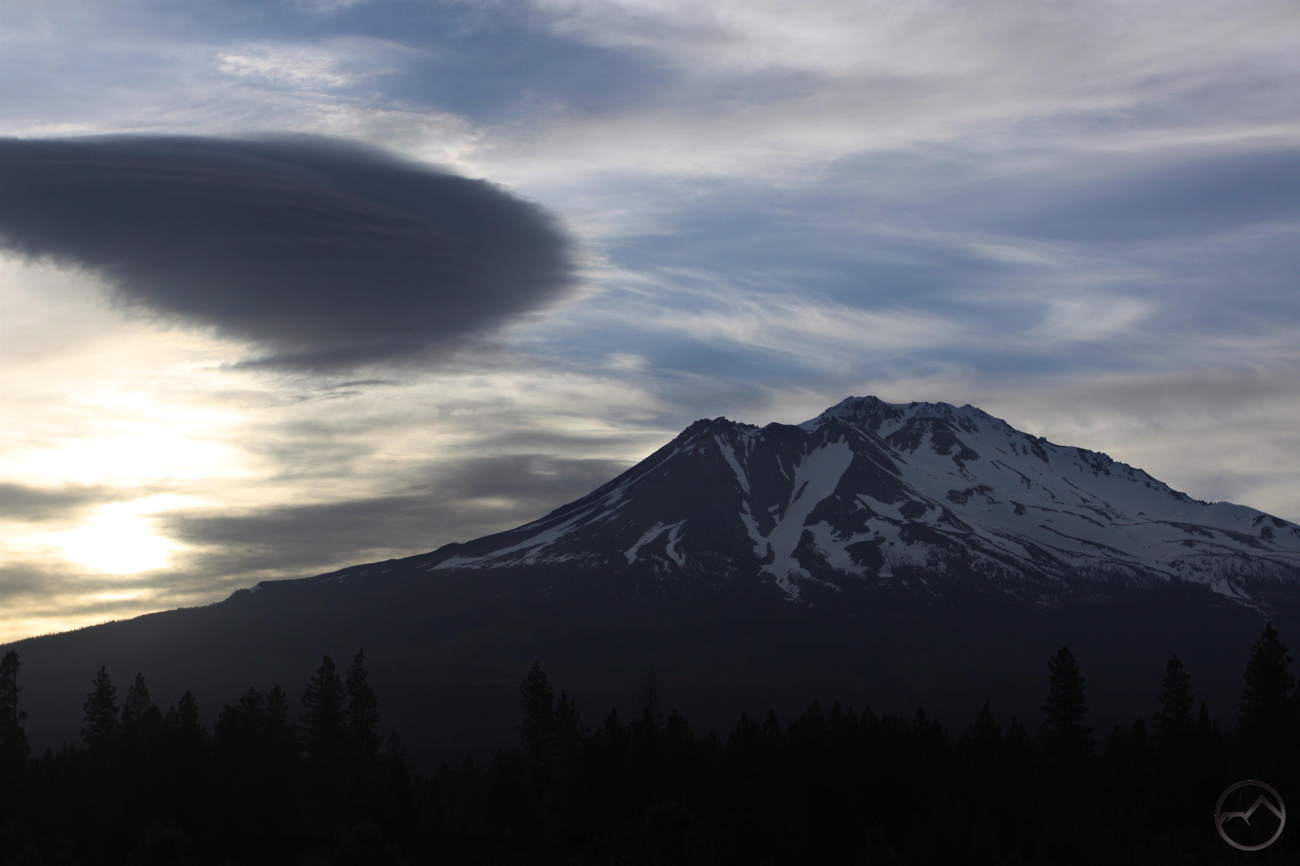
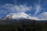
While Mount Shasta offered a few interesting lenticular clouds in May, it was spring that dominated the month. Not only did the rivers continue to swell with melting snow, the trees finally leaved out in great multitudes. It was time to start thinking about heading up into the high country in earnest.

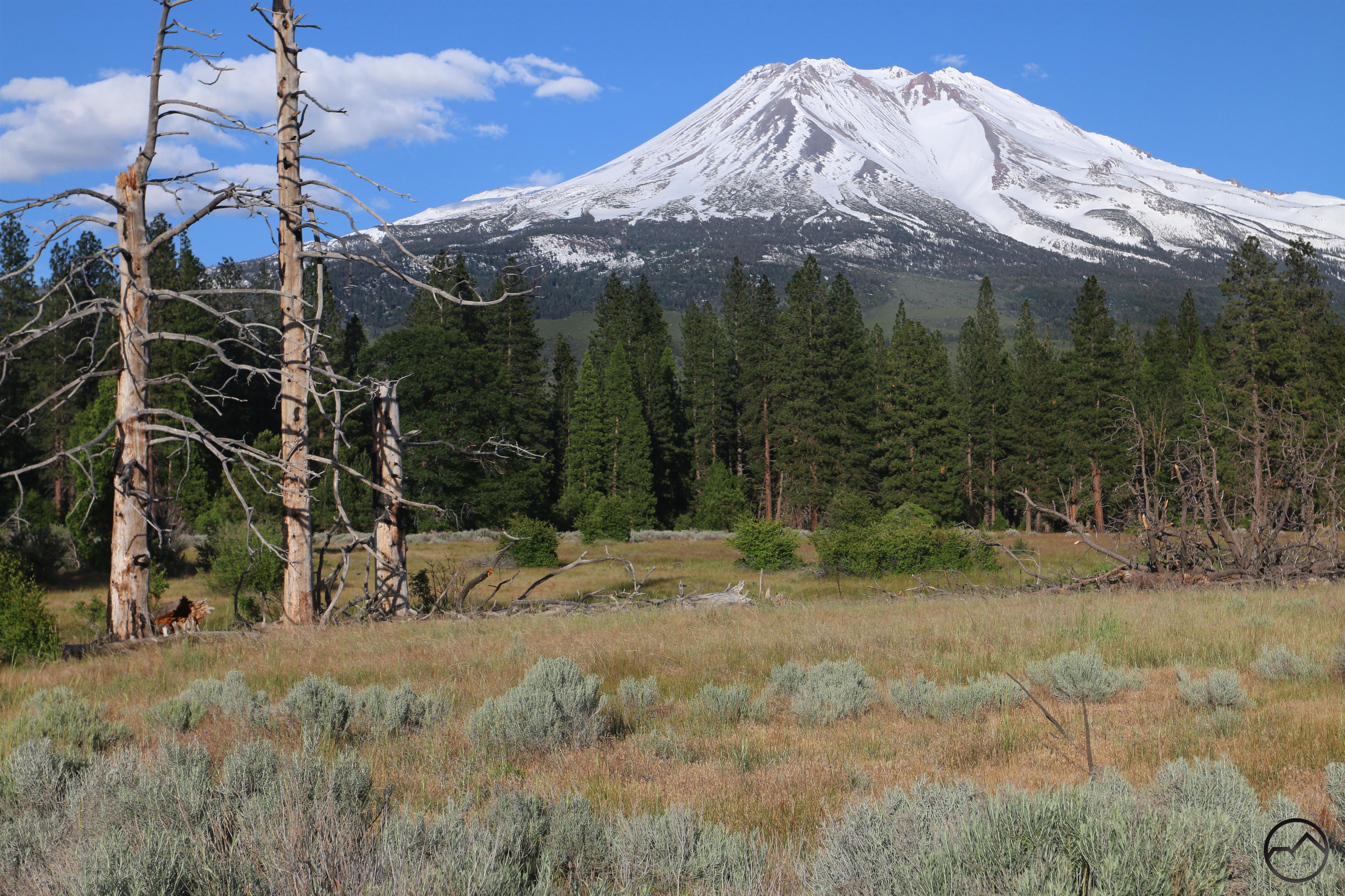
The month of June had an inauspicious start for Hike Mt Shasta. My trusty old camera that I had used to photograph all the images for three books died. Above are the last image with the old camera and the first with my new replacement. As is evident from the images, Mount Shasta was still blanketed in snow but the high country in the Trinity Divide really opened up and it was time to head into the mountains! This month also saw Hike Mt Shasta hit a major milestone, crossing the million hit mark for the first time.

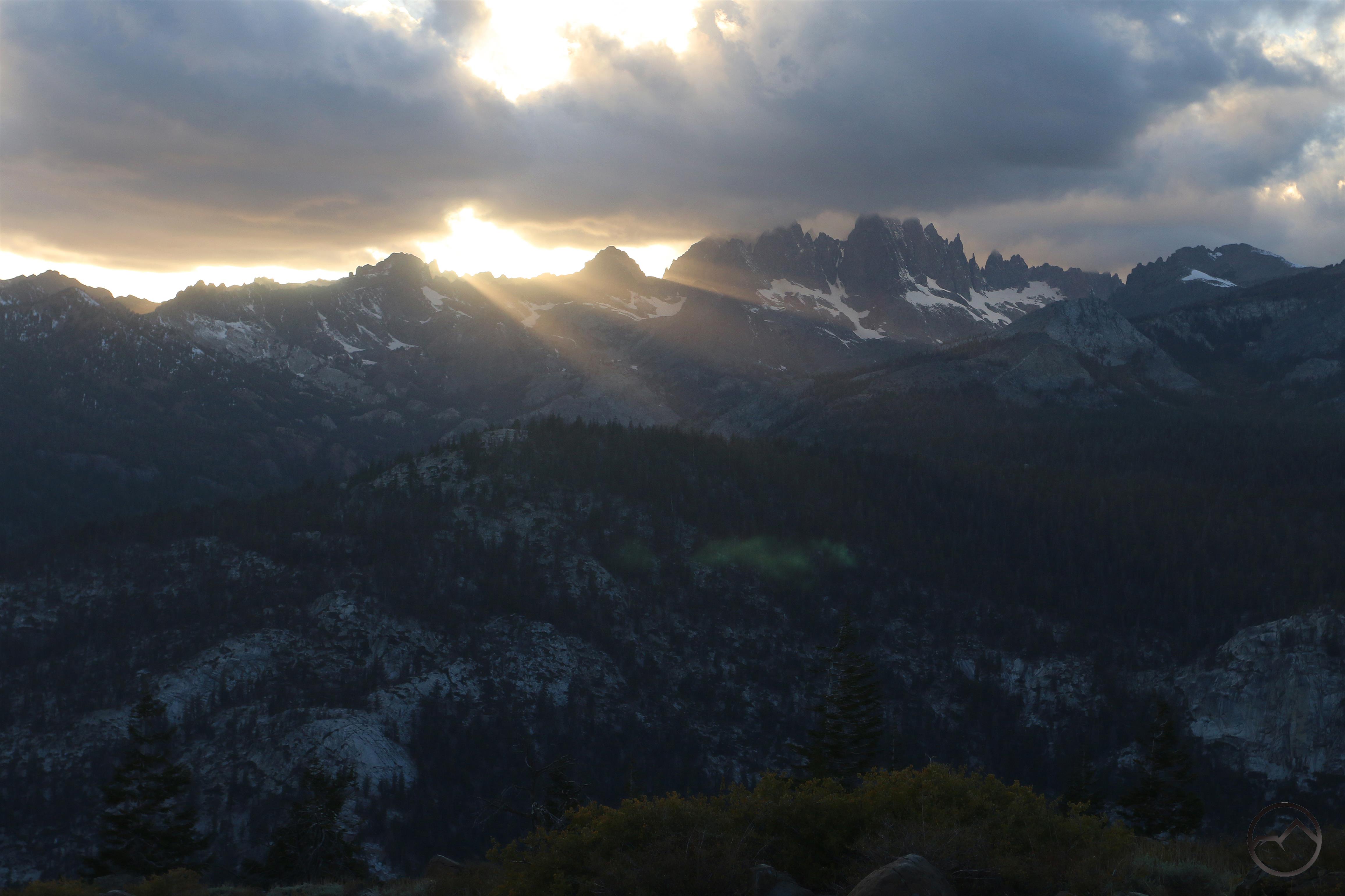
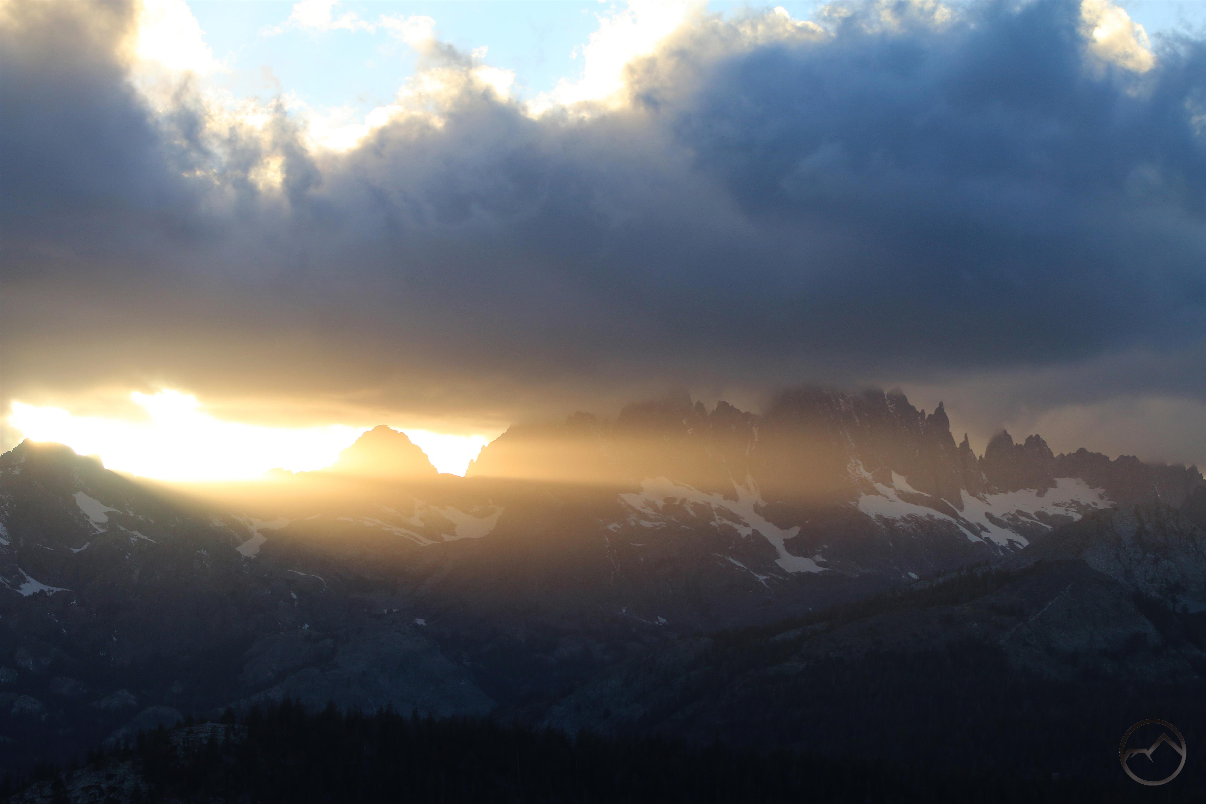
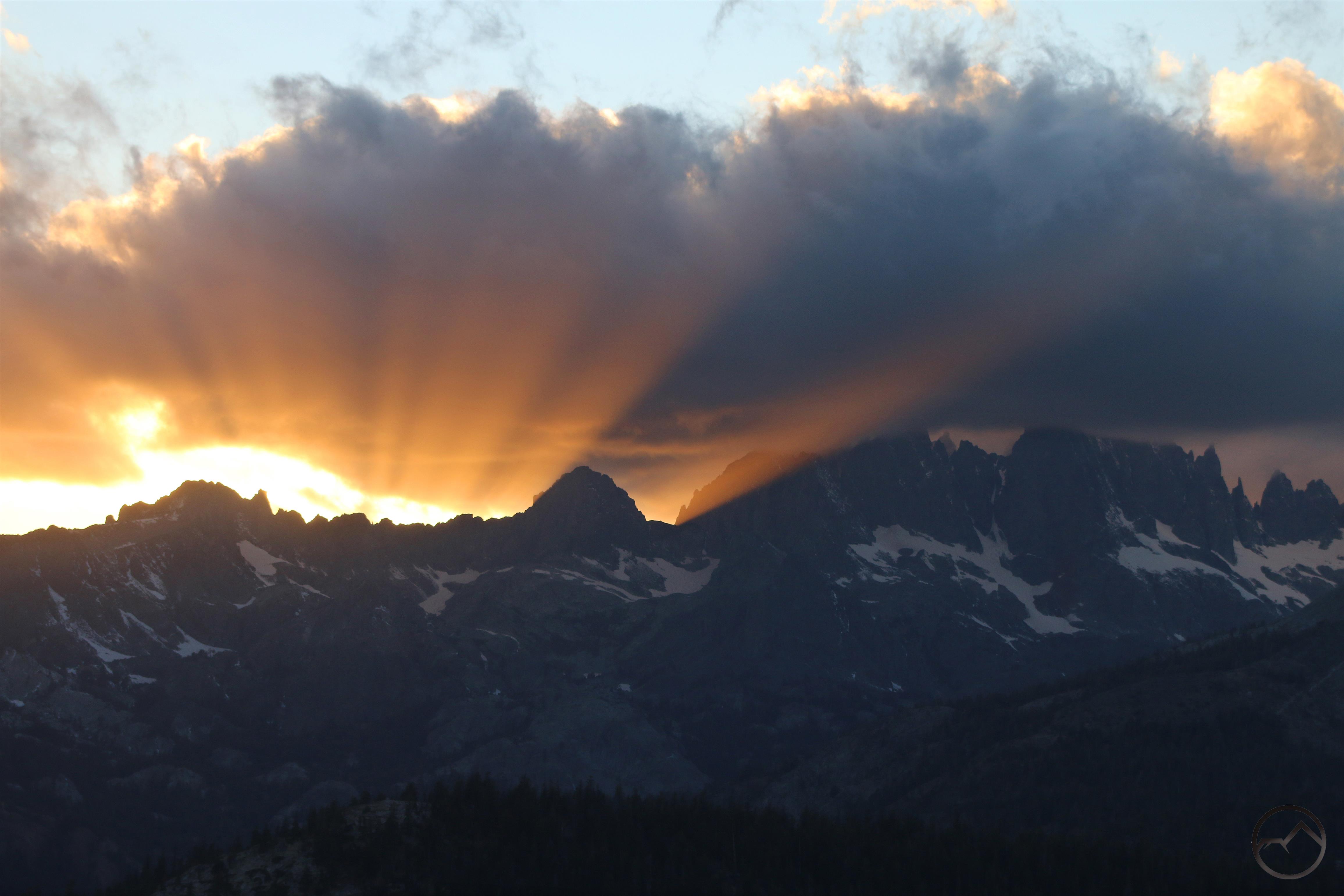
July was a glorious month. With the exception of the trails beginning at the Old Ski Bowl on Mount Shasta, all the paths in the area were open and the high country hiking season was in full swing. Sunsets were spectacular weather down in the valley or up on the crest of the Trinity Divide. This was also the month my latest book, my opus, was released. If you have not purchased it, please do so!

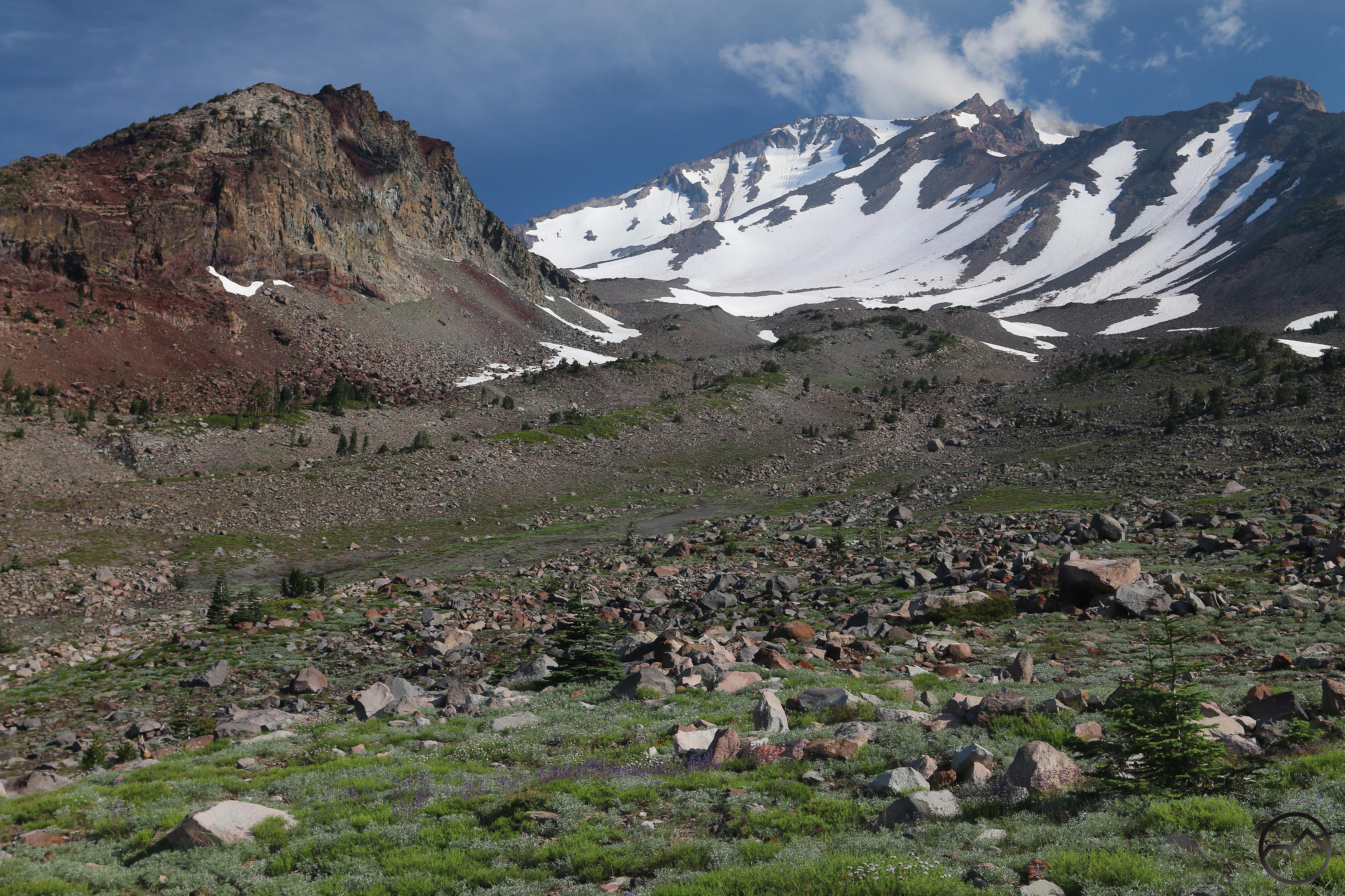
Summer progressed nicely at the beginning of August and the massive pile of snow finally melted off at the Old Ski Bowl, revealing a gloriously lush area at the end of the road. The scene was complete with tons of wildflowers and even a small waterfall. However, the summer of fire also got kicked off and the smoke eventually moved in, making much of the month miserable.

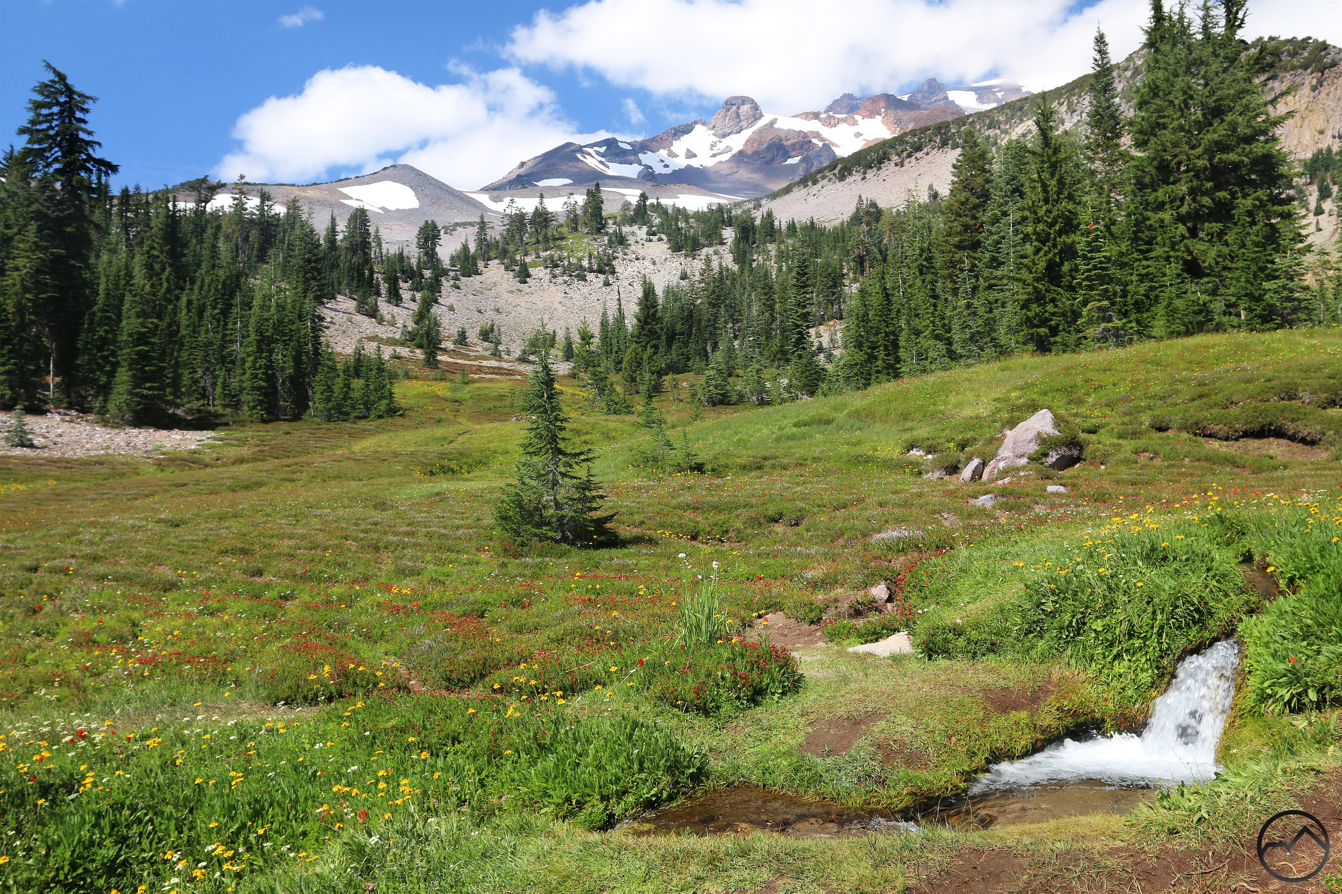
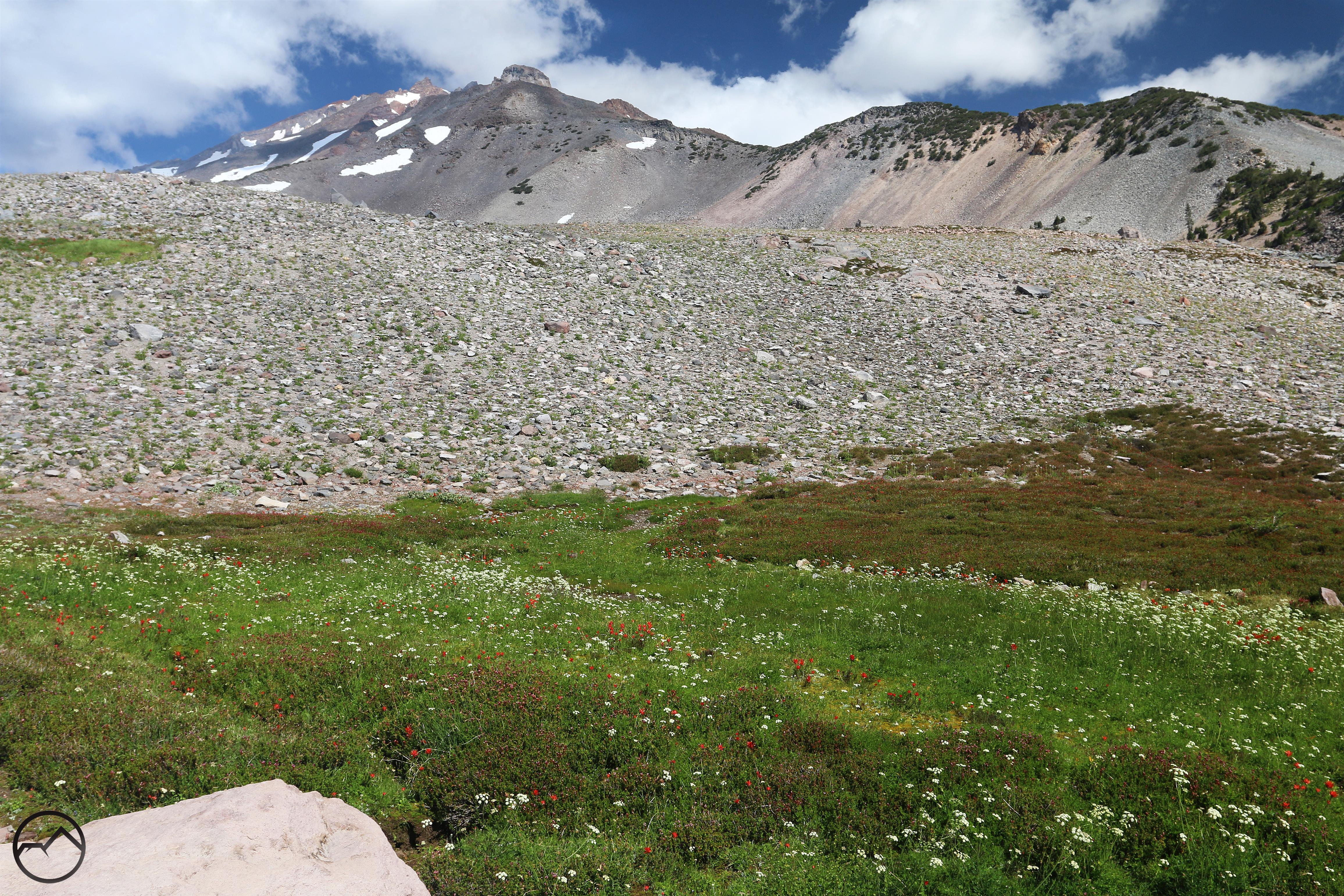
The smoke cleared for a good chunk of September and it was time to head up to South Gate Meadow on Mount Shasta. This featured and incredibly prolific wildflower riot pretty much anywhere there was enough snowmelt or springs to support life. It was great to finally get to the meadow and imbibe the water and the beauty!

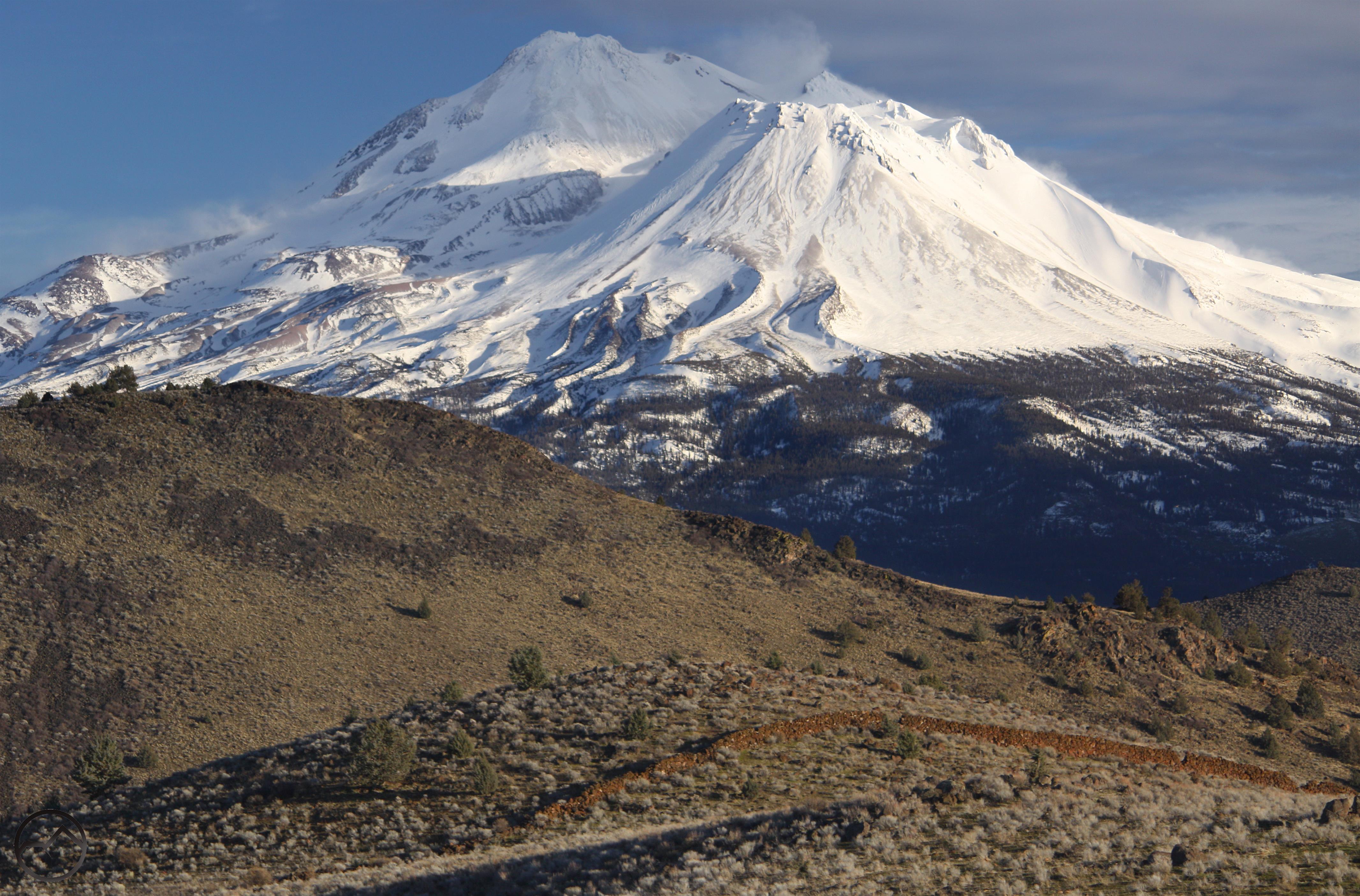
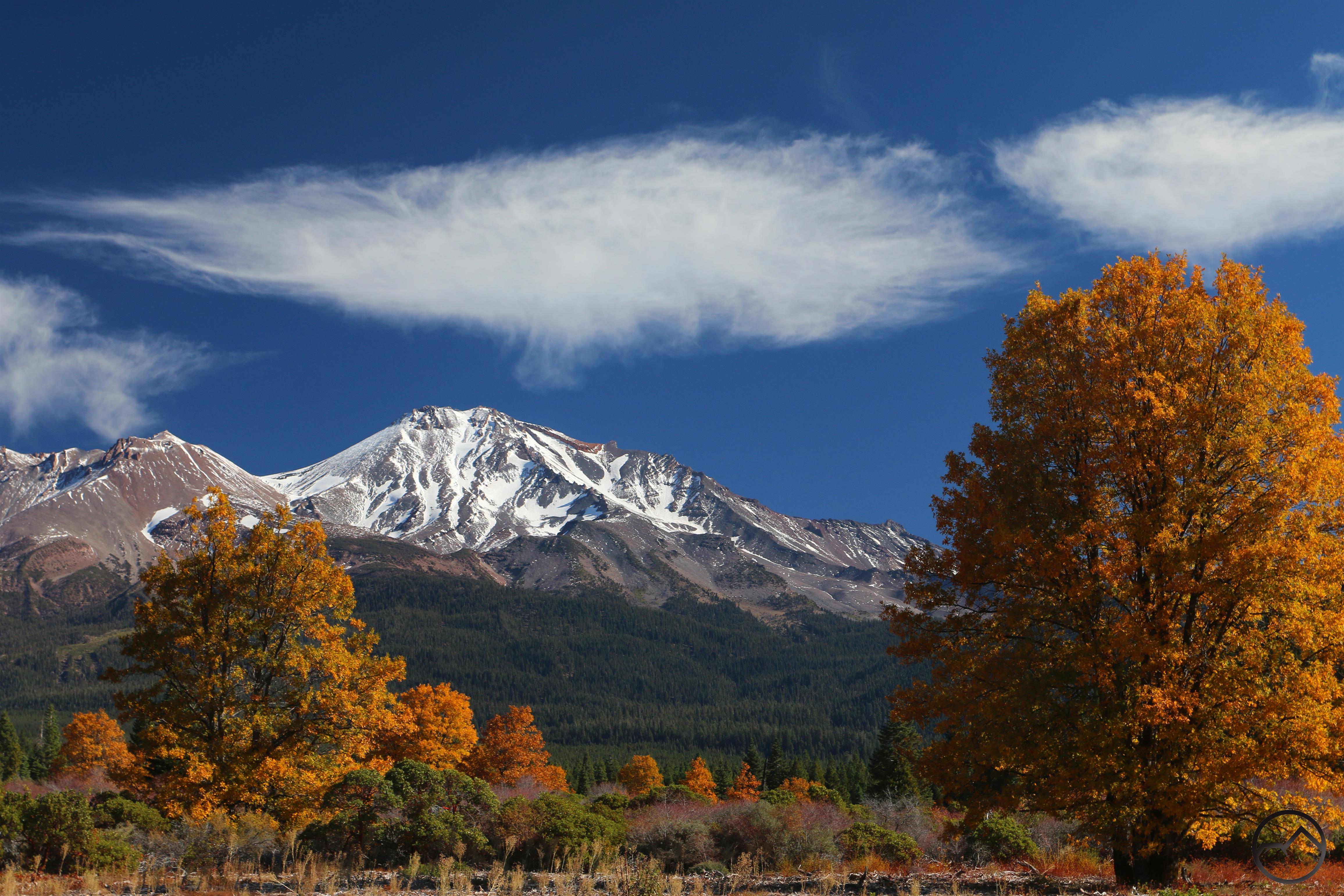
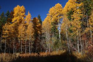
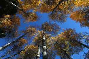
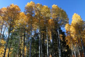
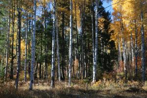
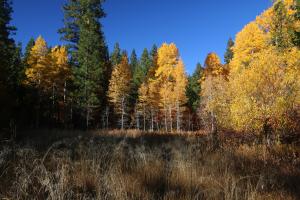
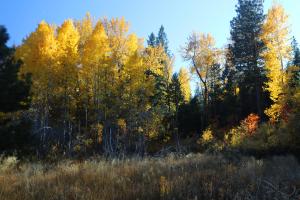
Autumn set in in fine form as October arrived. The fall color was magnificent and the onset of lenticular season brought some spectacular sights. Unfortunately, the month was marred by the fires down in the Wine Country. My parent’s home, the home I grew up in, was lost in the fires.

As the year approached its end, Mount Shasta remained the center of attention, ever-present, gazing down on the changing seasons and lives being lived with detached equanimity. The sun rose and set and the mountain magnified each one.

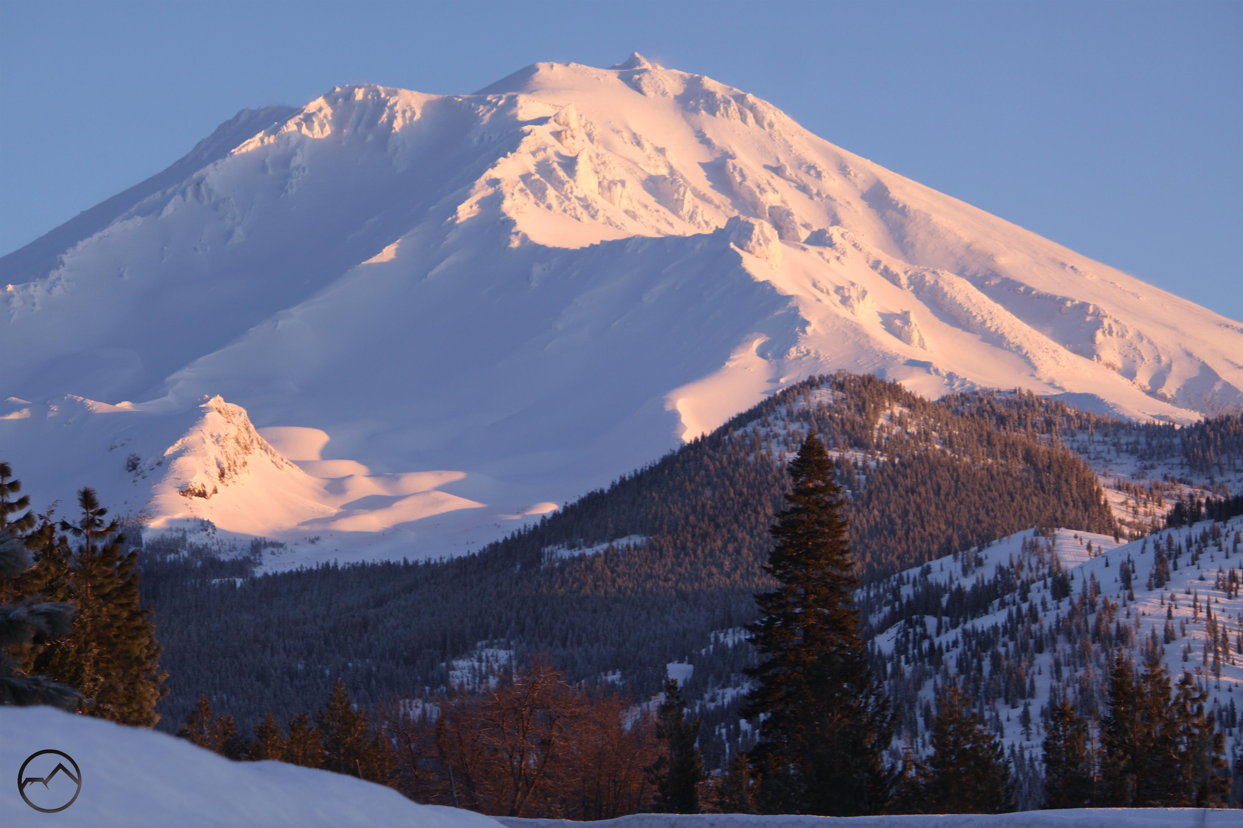
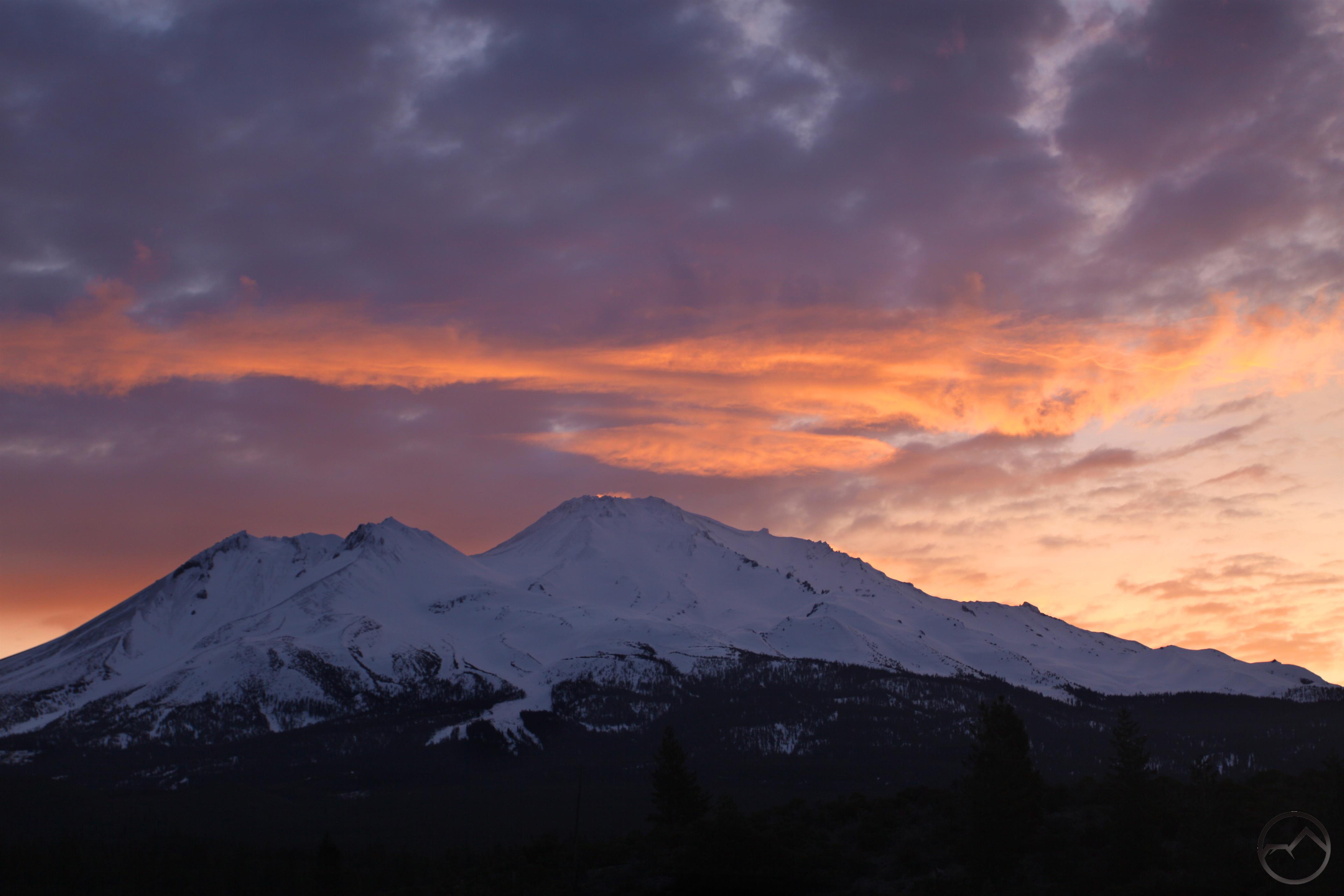
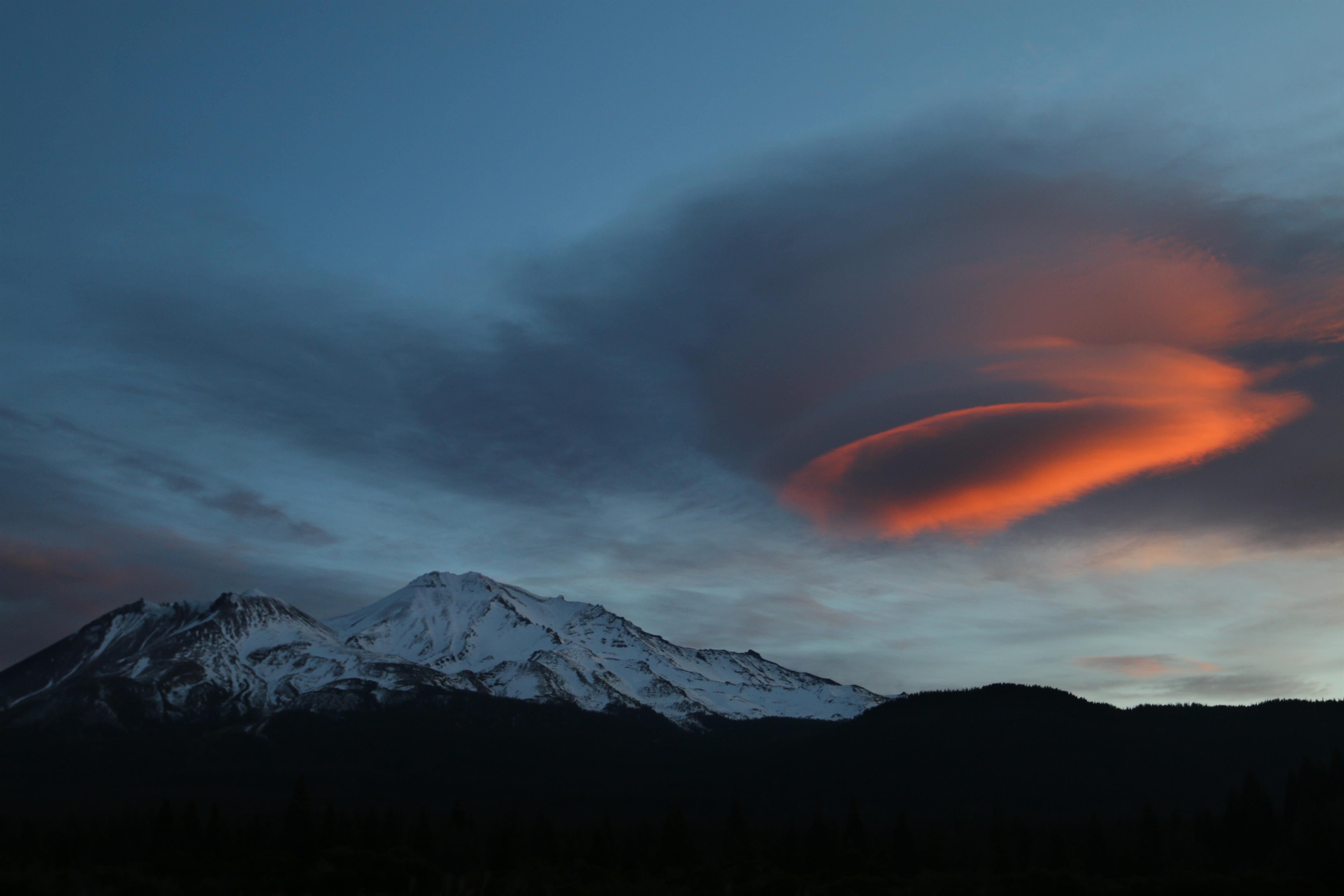
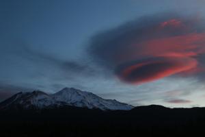
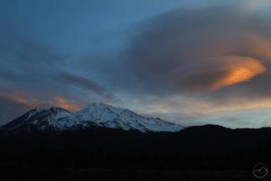
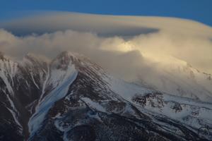
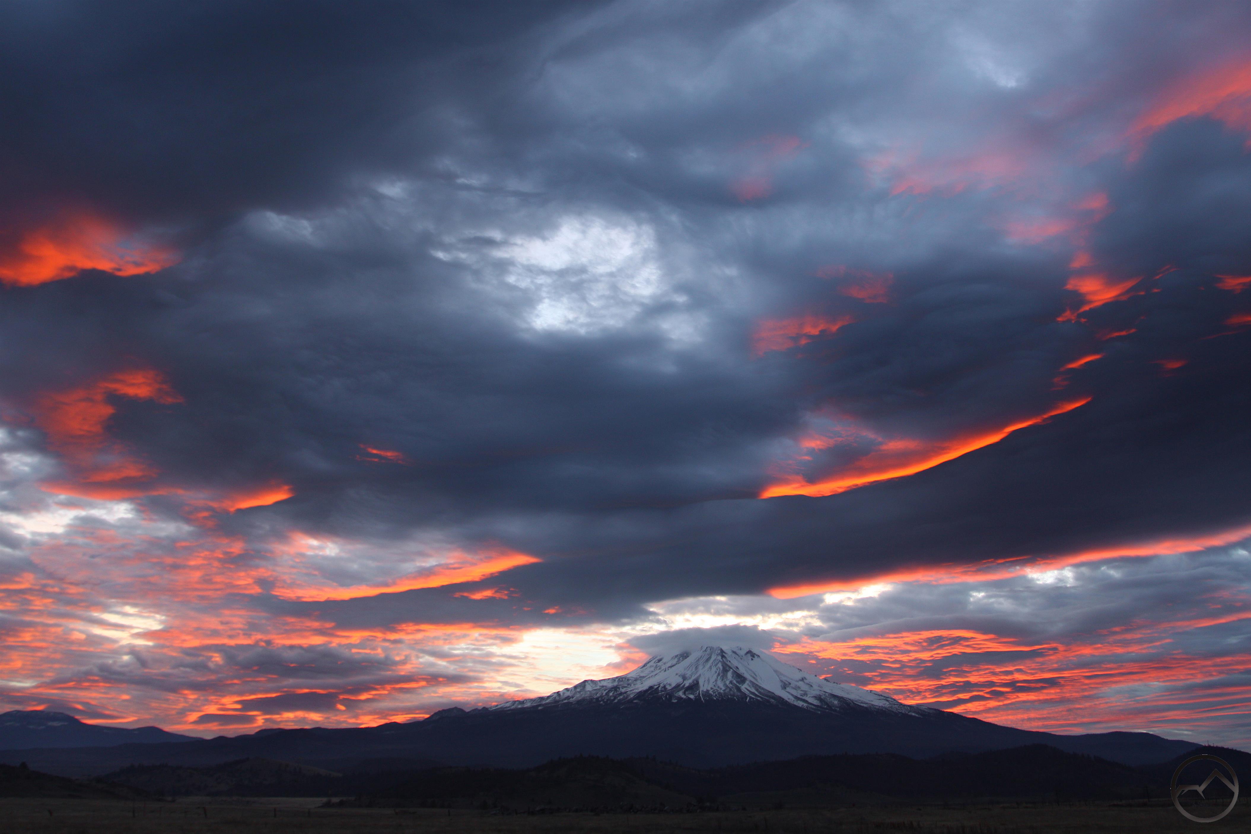
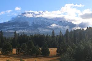
December has been a beautiful month. Some of the most memorable lenticular events and cloud displays I have ever seen have occurred in the last few weeks. The late fall and winter has not seen much snow yet but we remain hopeful the new year will bring new storms.

2017 has been a year of great highs and lows. The fires in the Wine Country have been devastating on multiple levels but the year, on the whole, has been a good one. The release of my latest book has been a proud moment for me. I really hope everyone enjoys reading it, finds beauty in the images it contains and most importantly, hikes all the trails it describes. The amount of beauty it points to is truly astounding.

Happy New Year to everyone reading Hike Mt Shasta! Let’s have a blessed 2018!

Mount Shasta And A Many-Textured Sky

Posted by bubbasuess on December 24, 2017
Posted in: Cascade Range, Hiking, Lenticular Clouds, Mount Shasta. 1 Comment

An amazing array of clouds soar past Mount Shasta (enlarge this one to see the texture detail).

Not all of the unusual cloud formations that manifest around Mount Shasta are lenticulars. Odd or strangely formed clouds occur anywhere but somehow Mount Shasta seems to attract more than its share of those too. Yesterday (Christmas Eve eve) was a prime example of this phenomenon. The sky was filled an incredible collection clouds, some sitting right on the mountain, some hovering nearby and others flying high overhead. It was a stunning meteorological panoply. I counted at least 10 and possibly more different textured clouds in the skies around Mount Shasta. In truth, I have never seen a sky filled with so many diverse formations. It is not a sight I will soon forget.

I had originally stopped to photograph the small lenticular that had formed on the summit. It was a nice cloud but not particularly noteworthy. However, it is hard for me to at least photograph it for documentary purposes. When I stopped, the clouds hung thick just above the mountain and the little lenticular began to lose its shape. I put my camera away and headed into town. On my way home I noted the clouds began breaking up and by the time I got to one of my spots, the low clouds had gone and the sky was filled with with a great many types of formations. They ranged from wispy to billowy to the small lenticular-like cloud still clinging to the summit of Mount Shasta. It was a truly stunning sight. Amazingly, the highest clouds were moving quickly and the scene was constantly changing. In the space of a few minutes clouds high above Black Butte had moved above Mount Shasta. The force of those air currents is amazing!

The whole event was a terrific sight to behold. It almost seemed like a bit of a pre-Christmas present for this Mount Shasta cloud aficionado. The change was swift but watching the heavens put on a show like that is an incredible treat. These kind of weather related events make the colder, snowy months when many of the trails are inaccessible a lot easier to handle!

Here you can see the development of the clouds as the skies around Mount Shasta cleared (click to enlarge):


Again, I appreciate everyone’s patience as I wax about the weather. I may put up a Christmas post tommorrow and then, after some year-end stuff, I will be back to writing about hiking…unless Mount Shasta goes and puts on another epic show!

As The Sun Rises, So Does It Set – Another Mount Shasta Lenticular Spectacle

Posted by bubbasuess on December 18, 2017
Posted in: Cascade Range, Hiking, Lenticular Clouds, Mount Shasta. 6 Comments

A large lenticular cloud overshadows Mount Shasta.

After this morning’s meteorological fireworks above Mount Shasta, the lenticular cloud hung around all day. Though its shape changed constantly, it was a fixture in the sky just south of the mountain. When sunset was approaching, I headed north into the Shasta Valley in the hopes of catching the lenticular filled with alpenglow. I was not disappointed, being treated to one of the more interesting cloud displays so far this fall. The formation continued to grow, collapse and rise again the entire time I was photographing it. This meant I got a very unusual set of images, capturing the mountain with a variety of shapes hovering above it. Taken with this morning, this was easily the best day for lenticular clouds in 2017, excepting only the magnificent St, Patrick’s Day spectacular. I am glad to have been able to catch morning and evening. What an incredible mountain we get to enjoy!

Click to enlarge:


I know that I have a tendency to write posts whenever the weather gets interesting. However, it is not my intent that this be a meteorological blog. Thanks to everyone for putting up with my continued fascination with lenticular clouds. I may put up one more post around Christmas and then after that the usual end-of-the-year wrap up stuff. Amazingly, the 5 year anniversary of the founding of this site is also approaching. In between all that, I promise to get my annual off-season winter trail round up published. I have a few goodies on the Shasta Valley in the works too, as well as another installment in my Northern California geography series. In the meantime, thanks for your patience and Merry Christmas!

A Stunning Dawn Pyrotechnic Display Above Mount Shasta

Posted by bubbasuess on December 18, 2017
Posted in: Cascade Range, Hiking, Lenticular Clouds, Mount Shasta. 3 Comments

A dawn lenticular looms above Mount Shasta.

I knew as soon as I was up this morning that there was a large lenticular cloud above Mount Shasta and that I was going to head out and photograph it. As a bonus, I was up early enough that I could get to one of my less frequented hike-to vistas in order to get a great shot of the mountain with the large cloud above it. However, as I was preparing to leave, my early-rising son was up and wanting to go. Unfortunately, he is currently on crutches with a broken leg so, not wanting to disappoint him (especially after he missed the hike with his Cub Scout pack) I went to my usual drive-to destination. It turned out this was not such a bad thing, since it had a good perspective on what turned out to be a pretty impressive cloud.

It is unnecessary to wax long on the cloud’s excellence. Suffice to say, I would rate it among the best so far this fall. The cloud was large, had multiple disk layers that were in constant flux. Early on it looked like a giant red blood cell but eventually took on a more stacked appearance. Toward the end, one corner of the disk started to develop an unusual grid-like pattern that caught the light in an unusual way.

As always, I am fascinated by the way Mount Shasta always changes the environment around it. The mountain remains the same (sort of, since it is still taking shape, but that’s another story) but the clouds that it creates and the way the light highlights these unusual features gives those of us who love these natural wonders a constantly changing visual feast.

I arranged the images in the gallery below in chronological order, revealing the way the cloud changed in the short amount of time I was there with my camera.

Click to enlarge:


A December Lenticular

Posted by bubbasuess on December 16, 2017
Posted in: Boy Scouts, Cascade Range, Hiking, Lenticular Clouds, Mount Shasta. Leave a comment

Mount Shasta and a lenticular cloud are light in alpenglow.

After a dreary, overcast day yesterday, Mount Shasta was graced with a sunny, windy, chilly day and a swirling lenticular cloud above the mountain. I failed to photograph it a couple of times during the day, as I was one of the leaders taking our local Cub Scout Pack on a hike down in Castella, on the excellent Sacramento River Trail. That trail is perfectly proportioned for Cub Scouts: easy length, interesting trail engineering, lots of rocks to climb on, a beautiful river and an exciting crossing of the Sacramento on a suspension bridge! I have always hoped this trail would eventually be incorporated into the Pacific Crest Trail. It has a much more interesting and intimate relationship with the Sacramento than the current route, which just crosses the river on a road.

Since I was busy and did not pause long enough to get a satisfactory image of the lenticular, a made sure to head out at sunset to capture it. It is striking (though not surprising) how much the cloud changed during the day. By the time I was able to head out, the cloud had gone from a nice pancake stack covering the higher reaches of the mountain, it had risen up and hung just above the summit. I went to one of my favorite quick-access spots and set my camera up. Along with the epic view of Mount Shasta, this particular spot has a nice view of Black Butte. The final bits of sunlight on the summit of the butte can be seen, alerting an observer to the fact that alpenglow is about to drench the great mountain. It was a grand sight, which I enjoyed from behind my tripod. As I did, my two older kids, seemingly oblivious to the spectacle, played happily in the nearby brush.


We are definitely in the thick of the lenticular season. I hope we get more as we head toward Christmas. Even if this was the last one of the year, I am grateful to have watched the sun set on it!

Click to enlarge:


Sometimes The Mountain Just Seems Really Big…

Posted by bubbasuess on December 14, 2017
Posted in: Cascade Range, Hiking, Mount Shasta. 2 Comments

Thursday morning sunshine on Mount Shasta.

At times, while living at the foot of Mount Shasta, it is possible to lose sight of just how big the mountain is. It never fails to impress, and it is rare that I see it and don’t pause, for even just half a moment, and marvel at the sight of the grand volcano. Yet, in spite of never tiring of it, the eminence and immensity can be lost in the hustle and bustle of life.

Today was different. While driving home from the animal hospital, the morning light was coming at the mountain horizontally, casting lots of great shadows on Mount Shasta’s snowy flanks. The great black forests that lie below the treeline were alight and seemed to glow. The scene was compelling and I quickly yielded, stopped, and captured some images. The mountain just seems to hang there, filling the view with a totality that few mountain ranges, let alone individual peaks, seem to be able to replicate. Of course, Mount Shasta is not like other mountains and is truly a singularly massive peak. As I discussed in this article (if you have not read the article, I strongly encourage you to do so!), Mount Rainier is the closest peer to Mount Shasta. Despite being a couple hundred feet higher, its diameter at 6,000 feet elevation is nearly 4 miles less than that of Mount Shasta at the same elevation. That difference is greater than the entire diameter of several other major Cascade volcanoes like Mount St. Helens and Mount McLoughlin.

Winter is a great time to enjoy the spectacle that is Mount Shasta. The snow creates a magnificent canvas for the sunlight, shadows and alpenglow to paint the great mountain. It is now, when the icy tower sits in splendid isolation above the surrounding peaks, which themselves are monumental peaks that are cut off from all but the most intrepid by winter’s snow. Summer’s view of the mountain, while humbling, is a different experience. The melting snow swells the fountains that flow from within the mountain and the best views shift to the flank, gardens and trails of Mount Shasta. Yet it is the great white cone that remains the iconic view of the mountain. Despite the cold, enjoy the staggering scene!

Thankful (For A Sunset A Couple Months Old)

Posted by bubbasuess on November 23, 2017
Posted in: Boy Scouts, Hiking, Mount Shasta, Sierra Nevada. Tagged: Thanksgiving. 5 Comments

I have not been able to post in a while, the result of a combination of things including lots of fire related work on behalf of my parents and a full immersion back into Boy Scouts now that my oldest son has started Cub Scouts. I am already a den leader, assistant Cubmaster and working with several district level committees (I plan on writing on Boy Scouts soon and its role in the founding of this site soon), so the level of activity has been high and it has interfered with my blogging.

Now it is Thanksgiving Day, and I feel moved to at least say something, for I am grateful for many, many things. Chief among them is my family. I have an amazing wife and three great kids. My parents are alive and well and soon to be in a new house. The fire may have taken most of our family history and other valuables, but that is insignificant compared to their well-being. I am thankful for my brother and his family and the honorable way they have served and continue to serve our country. I am thankful for our nation, in spite of its many ailments, it is still the greatest place in the world to live. It is a land filled with many people of good will and it is overflowing with great natural beauty.

I am thankful that God has put me here and given me the many opportunities I have been blessed with.

Now, I have been thinking back of the many images I have captured this year and the ones I keep coming back to was the majestic sunset I witnessed at the Minarets in October. That was possibly the most spectacular sunset I have ever had the good fortune to see. I hope everyone else will have a like opportunity, if they have not already. I also pray that everyone has a blessed Thanksgiving Day. Thank you for continuing to read HikeMtShasta!


Shadow Of The Mountain

Posted by bubbasuess on November 3, 2017
Posted in: Cascade Range, Hiking, Mount Shasta. 3 Comments

Mount Shasta casts a large shadow during a dramatic sunrise.

A couple of days ago I captured a magnificent sunrise at Mount Shasta. On this particular instance I timed it right and managed to document one of the (somewhat) rare occurrences when Mount Shasta casts its shadow onto the cloudy and brightly lit morning sky. The conditions for this event have to be perfectly aligned for the spectacle to manifest. First (perhaps obviously), it can only occur at sunrise. Second, there must be clouds in the sky yet the horizon must be clear enough of the rising sun’s light to come through relatively unfiltered. Third, it only happens when the sun is below the horizon, which is low enough that the mountain’s shadow is cast upward onto the clouds. Lastly, it would seem, for some reason, that this phenomenon happens only in the fall. Though this is not a scientifically conclusive statement, the only times I have ever seen it happen have been this time of year. Perhaps it has something to do with the seasonal angle of the rising sun.

All the times I have witnessed this event, the skies have been colored magnificently. The beauty of the rising sun over Mount Shasta, the brightly illuminated clouds, and the dark mass of the mountain itself all combine to make stupendous scene. The presence of the mountain’s shadow being projected onto the clouds only heightened an already incredible showcase of nature’s glory.

In my experience, these sunrise shadows are less common than the lenticulars that often happen this time of year. However, both are majestic and unique and make getting up early in the morning a worthwhile sacrifice (if it is indeed such). To stand in the windswept expanse of the Shasta Valley’s high desert and watch the fiery light glow in the heavens while the spectacular mountain parts the photons is an unforgettable experience.

I added a gallery of some of the sunrise shadows I have observed. I added in lines to delineate the shadow in order to make it easier to discern. Hopefully this will motivate someone to get up and head out and try to see this unforgettable sight themselves!

Click to enlarge:


Autumn In Mount Shasta (Aspens!)

Posted by bubbasuess on October 24, 2017
Posted in: Cascade Range, Hiking, Mount Shasta. 9 Comments

Brilliant fall color contrasts against the snowy heights of Mount Shasta.

The weather here in Mount Shasta has been utterly perfect. All the elements of the ideal autumn conditions have been in place: cool and crisp mornings, warm balmy days, gorgeous fall color and unusual lenticular clouds. Indeed, this has been one of the prettiest Mount Shasta autumns in quite a while. This is particularly so compared to last October. That season began with a great week at the beginning of the month but was then overrun by an uninterrupted stretch of rain that pushed deep into November. By the time the rain ended, it ended only to give way to snow. With California over the proverbial barrel from the drought, such an unpleasant fall was a welcome necessity. With water conditions having consequently improved, this October is proving to be about as good as one could hope.

As I noted in a previous blog post, this is one of peak periods for awesome lenticular clouds. However, it was nearly three weeks into October before the mountain yielded up one of its fabled cloud formations and when it finally did, it was a magnificent spectacle. As the sun came up, layers of billowy disks were stacked above Mount Shasta. Higher up in the heavens wispy clouds stretched out across the sky’s dome. The light of the dawn light all these clouds up into a dazzling display of atmospheric pyrotechnics. It was easily the mountain’s best lenticular display since last St. Patrick’s Day! With a week left in October, we can only hope that more lenticulars lie ahead. Thankfully, November has also proven to be a fertile month for these spectacular clouds.

The fall color is also at its peak right now. There are many trees around Mount Shasta that have great color, though many in town are not native. Those that do occur naturally with showy colors include oaks, willows, aspens and cottonwoods. The oaks are particularly abundant and are particularly vivid north of Mount Shasta City, around Spring Hill and further north heading into Weed. Truthfully, the entire drive from the Sacramento River canyon all the way to Ashland in Oregon is absolutely stunning right now. Aspens aren’t numerous in this area but one of the largest groves I know of is right by my house. In the midst of the grove is a lovely little meadow. My wife and I have taken our kids there a few times over the last few weeks, enjoying the excellent weather in the beautiful setting. The color on these trees has finally reached its apex. It is a magnificent sight, lessened ever so slightly only by the knowledge that the peak of color means the leaves will soon be lost and winter will be upon us. For now, it is glorious.

Click to enlarge:


The warm weather is set to continue for a little while longer. It is hard to overstate how perfect things are right now. If at all possible, get outside and enjoy it while we can. It is especially worth noting that there is only a week left of access up to the Old Ski Bowl. November 1st is the traditional date for the gate at Bunny Flat to be closed, thus ending the driving access to that incredible spot. Of course, motivated hikers can get up there on foot anyway, but the chance for families and the like to get up there will be done. Wherever you go, be blessed in these idyllic conditions!

White Mountain Once Again!

Posted by bubbasuess on October 20, 2017
Posted in: Cascade Range, Hiking, Mount Shasta. 3 Comments

Fresh snow blankets Mount Shasta.

Just a quick note to point out that last night’s rain left the mountain with a nice, fresh layer of snow. The high peaks of the Trinity Divide are also laden with snow. It looks like the snow level is down to about 5,000-5,500 feet. The mountain had a nice snow layer well into June but the summer heat melted it out from July to September. Even though there has been a fair amount of snow for this time in October, it is nice to see it white once again.


Next week is supposed to be extremely nice, possibly even perfect fall weather with temperatures in the mid 70’s. This is an excellent opportunity to get out before the cold winter weather hits in force. An added bonus is the fantastic fall color that is all over town. Outside of town, the oaks are starting to look particularly nice and it is a great time to hike up on Spring Hill or on Eagle Ridge over in Weed. Anywhere along water is also a good bet for color. Wherever you go, enjoy this chance to get out and hike. It may be the last warm one for a while!

The aspen grove near my house is approaching its peak color.

Posts navigation

← Older Entries
Newer Entries →
    • Recent Posts

      • Winter Shows Up When It Will
      • January Rolled By With Mud, Then Very Dry
      • Mount Shasta 2025 – A Year In Images
      • Mount Shasta On Either Side Of Christmas
      • Adrift In An Ocean Of Fog
      • December Has Been Spectacular Thus Far Pt. II (A Magnificent Lenticular)
      • December Has Been Spectacular Thus Far Pt. I
      • Lenticular Interrupted
      • A Stormy Wave And A Truchas Sunset
      • Aurora Lenticularis
    • Enter your email address to follow Hike Mt Shasta and receive notifications of new posts by email.

    • Archives

      • February 2026
      • January 2026
      • December 2025
      • November 2025
      • October 2025
      • September 2025
      • August 2025
      • July 2025
      • June 2025
      • May 2025
      • April 2025
      • March 2025
      • February 2025
      • January 2025
      • December 2024
      • November 2024
      • October 2024
      • September 2024
      • August 2024
      • July 2024
      • June 2024
      • May 2024
      • April 2024
      • March 2024
      • February 2024
      • January 2024
      • December 2023
      • November 2023
      • October 2023
      • September 2023
      • August 2023
      • July 2023
      • June 2023
      • May 2023
      • April 2023
      • March 2023
      • February 2023
      • January 2023
      • December 2022
      • November 2022
      • October 2022
      • September 2022
      • August 2022
      • July 2022
      • June 2022
      • May 2022
      • April 2022
      • March 2022
      • February 2022
      • January 2022
      • December 2021
      • November 2021
      • October 2021
      • September 2021
      • August 2021
      • June 2021
      • May 2021
      • April 2021
      • March 2021
      • February 2021
      • January 2021
      • December 2020
      • November 2020
      • October 2020
      • September 2020
      • August 2020
      • July 2020
      • June 2020
      • May 2020
      • April 2020
      • March 2020
      • February 2020
      • January 2020
      • December 2019
      • November 2019
      • October 2019
      • September 2019
      • August 2019
      • July 2019
      • June 2019
      • May 2019
      • April 2019
      • March 2019
      • February 2019
      • January 2019
      • December 2018
      • November 2018
      • October 2018
      • September 2018
      • August 2018
      • July 2018
      • June 2018
      • May 2018
      • April 2018
      • March 2018
      • February 2018
      • January 2018
      • December 2017
      • November 2017
      • October 2017
      • September 2017
      • August 2017
      • July 2017
      • June 2017
      • May 2017
      • April 2017
      • March 2017
      • February 2017
      • January 2017
      • December 2016
      • November 2016
      • September 2016
      • August 2016
      • July 2016
      • June 2016
      • May 2016
      • April 2016
      • March 2016
      • February 2016
      • January 2016
      • December 2015
      • November 2015
      • September 2015
      • August 2015
      • July 2015
      • June 2015
      • May 2015
      • April 2015
      • March 2015
      • February 2015
      • January 2015
      • December 2014
      • November 2014
      • July 2014
      • June 2014
      • May 2014
      • April 2014
      • March 2014
      • February 2014
      • January 2014
      • December 2013
      • November 2013
      • October 2013
      • September 2013
      • August 2013
      • July 2013
      • June 2013
      • May 2013
      • April 2013
      • March 2013
      • February 2013
      • January 2013
    • Categories

      • Boy Scouts
      • Cascade Range
      • Castle Crags
      • Desert
      • Echo Point
      • Glaciers
      • Hiking
      • How things came to be…
      • Klamath Mountains
      • Konwakiton Outdoor Designs
      • Lakes
      • Lenticular Clouds
      • Maps
      • Marble Mountains
      • Meadows
      • Mount Eddy
      • Mount Shasta
      • Mount Shasta History
      • Napa County
      • Off Season Trails
      • Pacific Crest Trail
      • Peaks
      • Rivers
      • Rock Climbing
      • Scott Mountains
      • Seldom Seen
      • Shasta Valley
      • Sierra Nevada
      • Siskiyou Mountains
      • Sonoma County
      • Spring Trails
      • sunrise
      • sunset
      • Trinity Alps
      • Trinity Divide
      • Truchas Ridge
      • Uncategorized
      • Water
      • Waterfalls
      • Wilderness
      • Wildflowers
      • Wine Country
      • Winter Trails
      • Yosemite
    • Meta

      • Create account
      • Log in
      • Entries feed
      • Comments feed
      • WordPress.com
    • Copyright © 2013-2024 by Bubba Suess

      DISCLAIMER: Any use of the information contained in this site by any and all persons is done at their own risk. The operator of this site shall be held harmless from any and all alleged claims, demands, causes of action, liability, loss, damage and/or injury to property or persons whether brought by an individual or other entity. This indemnification applies, without limitation, to all actions by an individual or other entity as a result of their use of information contained in this site.

    Blog at WordPress.com.
    Hike Mt. Shasta
    Blog at WordPress.com.
    • Subscribe Subscribed
      • Hike Mt. Shasta
      • Join 983 other subscribers
      • Already have a WordPress.com account? Log in now.
      • Hike Mt. Shasta
      • Subscribe Subscribed
      • Sign up
      • Log in
      • Report this content
      • View site in Reader
      • Manage subscriptions
      • Collapse this bar
     

    Loading Comments...