Hike Mt. Shasta

Exploring the Mount Shasta Region

  • Home
  • Trails
    • Mount Shasta Trails
      • Brewer Creek Trail
      • Clear Creek Trail
      • Gray Butte Trail
      • Green Butte Ridge Trail
      • Horse Camp Trail
      • North Gate Trail
      • Old Ski Bowl Trail
      • Panther Meadow Trail
      • South Gate/Squaw Meadow Trail
      • Whitney Falls Trail
    • Trinity Divide Trails
      • Blue Divide Trail
      • Castle Lake Trail
      • Castle Lake Shore Trail
      • Cliff Lake Trail
      • Deadfall Lakes Trail
      • Gray Rock Lakes Trail
      • Gumboot Trail
      • Heart Lake Trail
      • Porcupine & Toad Lakes Via Pacific Crest Trail
      • Seven Lakes Basin Via Pacific Crest Trail
      • Sisson-Callahan Trail
      • Soapstone Trail
      • South Mumbo Scramble
      • Tamarack Lake Trail
      • Toad Lake Trail
    • Castle Crags Trails
      • Burstarse Falls Via Pacific Crest Trail
      • Castle Dome Trail
      • Flume Trail
      • Lower Castle Crags Via Pacific Crest Trail
      • Root Creek Trail
    • Scott Mountains Trails
      • Bluff Lake & Cement Bluff via Pacific Crest Trail
      • Caldwell Lakes Trail
      • China Mountain Scramble
      • Cory Peak and Bull Lake via Pacific Crest Trail
    • Cascade Crest
      • Ash Creek Butte Scramble
      • Goosenest Trail
      • Juanita Lake Trail
      • Orr Lake Trail
    • Mount Shasta City Area Trails
      • Black Butte Trail
      • Box Canyon Trail
      • Gateway Trail
      • Lake Siskiyou Trail
      • Mount Shasta City Short Trails
      • Ney Springs Canyon Trail
      • Spring Hill Trail
    • Shasta Valley Trails
      • Black Lava Trail
      • Haystack Trail
      • Lake Shastina Trail
      • Pluto Cave Trail
      • Trout Lake Trail
      • Yellow Butte Trail
    • Sacramento River Trails
      • Dunsmuir Trail
      • Hedge Creek Falls Trail
      • Sacramento River Trail
      • Sims History Trail
    • McCloud River Trails
      • Ash Camp To Ah-Di-Na Via Pacific Crest Trail
      • McCloud River Falls Trail
      • McCloud River Preserve Trail
      • Squaw Valley Creek Trail
      • McCloud River Trail: Algoma Camp to Nitwit Camp
      • McCloud River Trail: Nitwit Camp to Cattle Camp Swimming Hole
      • McCloud River Trail: Cattle Camp Swimming Hole to Camp 4
      • McCloud River Trail: Camp 4 to Upper McCloud Falls
      • McCloud River Trail: Pine Tree Hollow Loop
    • Trails Further Afield
      • Trinity Alps Trails
        • Bear Lakes Trail
        • Billys Peak Trail
        • Boulder Creek Lakes Trail
        • Boulder Lake Trail
        • Canyon Creek Trail
        • Caribou Lakes Trail
        • East Boulder Lake Loop
        • East Weaver Lake Trail
        • Four Lakes Loop
        • Granite Peak Trail
        • Grizzly Creek Trail
        • Gulch Lakes Loop
        • Hidden Lake Trail
        • South Fork Lakes Trail
        • Stoddard Lake Trail
        • Stoney Ridge Trail
        • Tangle Blue Lake Trail
      • Warner Mountains
        • Emerson Creek Trail
        • Highgrade Trail
        • Patterson Lake Via Warner Summit Trail
        • Pine Creek Trail
        • Squaw Peak Trail
  • Articles
    • Trails By Area
      • Mount Shasta
        • Vistas, Meadows And Waterfalls: Three Best Hikes On Mount Shasta
        • The End Of The Road: Three Hikes In The Old Ski Bowl Area
        • Two Trails From Bunny Flat
        • Three Trails On Mount Shasta’s East Side
        • Mount Shasta’s Hummingbirds
      • Trinity Divide
        • Great Lakes: Top Five Lake Basins In The Trinity Divide
        • The Headwaters Of The South Fork Of The Sacramento River
        • Neglected Headwaters: Two Lesser Lake Basins On The South Fork
        • Gumboot Saddle: Two Hikes On The PCT
        • Descent Into Mystery: The Sisson-Callahan Trail
        • Mumbo Basin – Overlooked On The West Side
        • The Headwaters Loop: A Proposed Backpacking Loop In The Trinity Divide
      • The McCloud River
        • The McCloud River Trail
      • Shasta Valley
        • Jewels In The Desert
      • Scott Mountains
        • Great Scott! Two Scott Mountains Hikes On The PCT
      • Trinity Alps
        • Carubou Lakes: Trinity Alps On A Grand Scale
        • Switchbacks To Heaven: The Trinity Alps’ Stoney Ridge Trail and Four Lakes Loop
        • Trinities In Proximity: Two Trinity Alps Trails With Easy Access From Mount Shasta
        • Trails in the Carter Meadows Area
        • Trinity Alps Views of Mount Shasta
        • The Psychological Value Of The Trinity Alps
    • Waterfalls
      • Three Waterfalls On Mount Shasta
      • McCloud River Waterfalls
      • Sacramento River Waterfalls
      • Trinity Divide Waterfalls
      • Trinity Alps Waterfalls
      • Avoiding A Dry Whitney Falls
    • Off Season Trails
      • Three Winter Hikes Near Mount Shasta City
      • Winter Hikes In Shasta Valley
      • Winter Hiking In The Shasta Valley Wildlife Refuge
      • Winter Hikes On The Sacramento River
      • Winter Hikes On The Lake Siskiyou Trail
      • Spring Hikes In The Castle Crags
      • Spring Hikes On the Upper McCloud
      • Spring Hikes On The Lower McCloud River
    • Points Of Interest
      • Mount Eddy: Overshadowed, Underrated
      • Black Butte: Hiding In Plain Sight
      • Castle Dome: Steadfast And Staggering
      • Mount Shasta Hoodoos
      • Sacramento Scrambling
      • The Shasta River
      • The Castle Creek Watershed
      • Mount Shasta East Side Glacier View
      • 5 Fantastic Mount Shasta Vistas
      • 5 Highest Peaks Around Mount Shasta
      • 5 Best Hikes On Creeks And Rivers
      • 5 Interesting Footbridges
      • Three Spectacular Drive-To Sunset Vistas
    • North State Geography
      • Introduction
      • Seven Major Regions
      • The California Cascades
      • Klamath Mountains Pt. I
      • Klamath Mountains Pt. II
      • The Great Canyons Of Mount Shasta
      • Mount Shasta, Timberline, And The Relative Size Of Cascade Volcanos
      • Four Eruption Cones Of Mount Shasta
      • Mount Shasta’s Medial Moraine
    • Northern California Review
      • North Table Mountain
      • Lakes Basin Recreation Area
      • Eastern Sierra Fall Color
      • Sonoma County
      • Central Sierra Nevada
      • Orland Buttes
    • Seldom Seen
      • Ash Creek Falls
      • Mud Creek Canyon
      • Lower Mud Creek Canyon
      • Diller Canyon
      • Lower Cascade Gulch
      • The Grey Rocks
      • Castle Creek
      • Upper Wagon Creek
      • Fawn Creek Canyon
      • Confluence of the Sacramento River and Castle Creek
      • Upper Klamath River Canyon
      • Hole In The Ground Geologic Area
      • Ash Creek Butte Fossil Rock Glacier
    • Mount Shasta History
      • Vantage Lost: The Everitt Memorial Vista
      • A Yosemite-Mount Shasta Connection
      • Whitney – What’s In A Name?
      • Mount Shasta Area and the 1838 Exploring Expedition
      • A 19th Century Engraving Of An Epic Mount Shasta Vista
      • Vintage 1907 Color Photos
      • A Misleading Painting
      • A Mysterious Painting
      • A Mysterious Painting Pt. II
      • Stereographic Mt. Shasta
      • Year One Of Hike Mt Shasta
      • Year Two Of Hike Mt Shasta
      • Year Three Of Hike Mt Shasta
      • Year Four Of Hike Mt Shasta
      • Year Five Of Hike Mt Shasta
      • Year Six Of Hike Mt Shasta
      • Year Seven Of Hike Mt Shasta
    • Image Galleries
      • Mount Shasta Trails Gallery
      • Mount Shasta Sunrise Gallery
      • Mount Shasta Sunset Gallery
      • Lenticular Cloud Gallery
      • Mount Shasta NON-Lenticular Clouds
      • Mount Shasta Reflection Gallery
      • Telephoto Gallery
      • Mount Shasta Area Fall Color
      • Castle Crags Gallery
      • Waterfalls Gallery
      • Trinity Divide Lakes Gallery
      • Mount Shasta Area Rivers Gallery
      • Shasta High Desert Gallery
      • Mount Shasta GIF Gallery
    • Random Notes
      • Revew: Three Mount Shasta Trail Maps
      • A Mount Eddy Wilderness?
      • New Land Additions For The Castle Crags
      • Book Plug: Mount Shasta Area Rock Climbing
      • Exile: How I Came To Love Wilderness
  • Mt. Shasta Trail Map
  • Blog
  • About/Contact
  • Links
  • Truchas Ridge

The First Real Snowfall In Mount Shasta…And Just In Time

Posted by bubbasuess on December 1, 2018
Posted in: Cascade Range, Hiking, Mount Shasta. 2 Comments

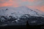
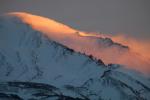
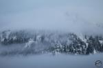
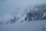
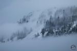
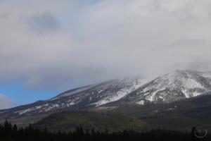
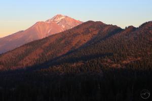
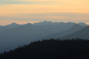
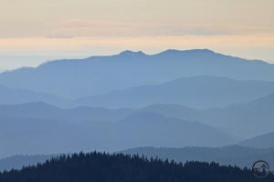
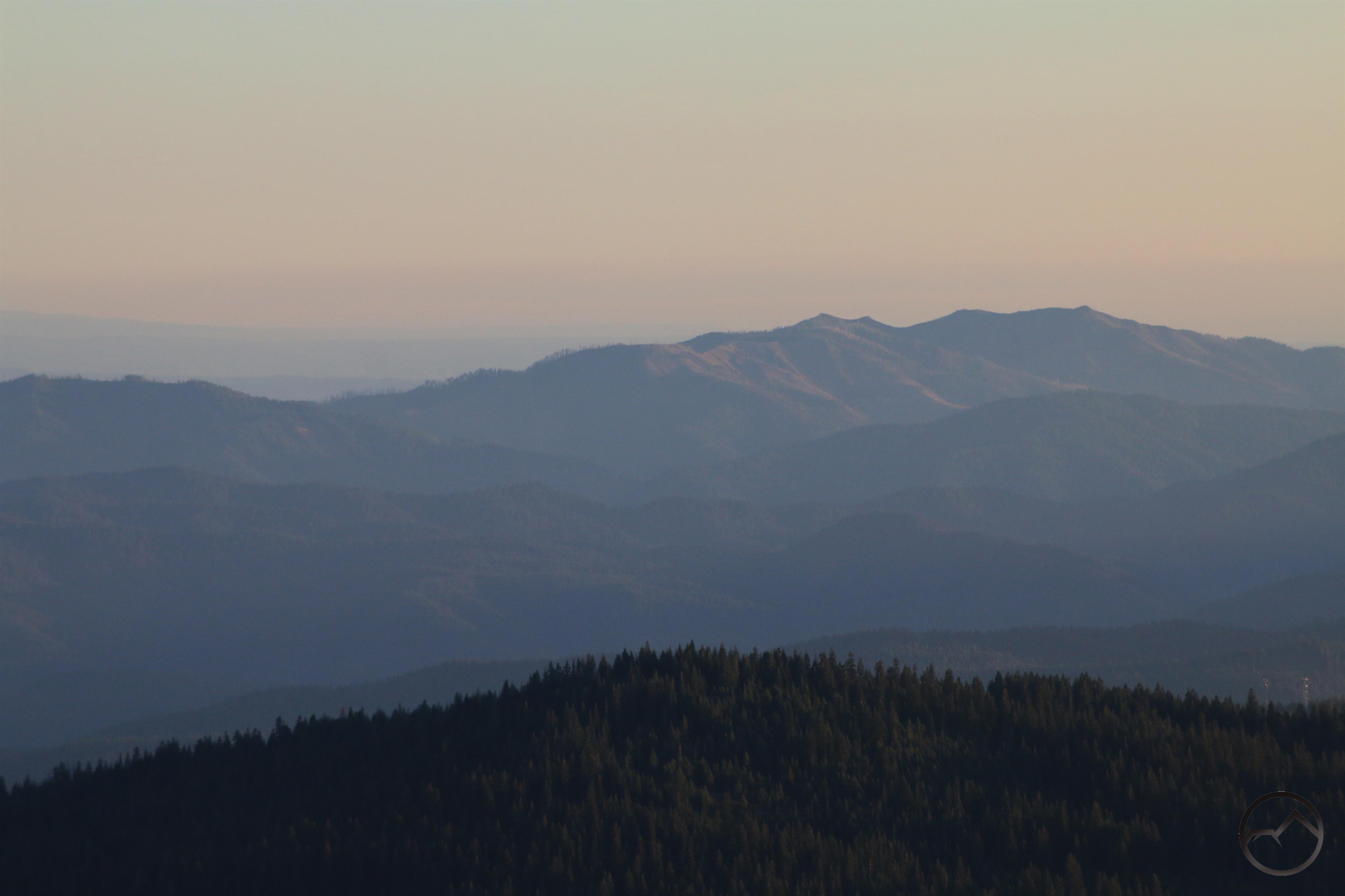
Morning light illuminates the clouds on the far side of Black Butte. 

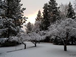
We finally got some real snow last night. The first day of December began white and wintry. I am not sure how much snow fell in town but up at my place we got close to three inches. Naturally, my kids went berserk at the sight. That coupled with the start of their advent calendars meant it was a festive morning at the Suess household.


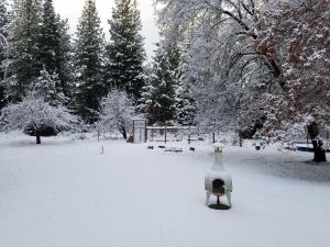
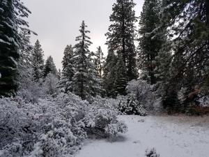
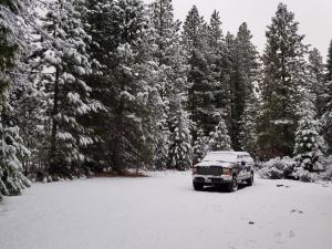
With the forecast predicting a lot more precipitation over the next few weeks, December is shaping up to be a pretty white month. It seems the chances of a white Christmas look pretty decent. Another benefit is the likelihood of the Mount Shasta Ski Park having a really good season this year. At the very least, they should be able to open soon and have a solid month of precipitation to build on. Lord willing, we will get a lot more snow and have a great winter.

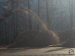
Thankfully, this snow came right at the right time. Yesterday while taking my outdoor education class out to Lake Shastina to hike, we spotted two large plumes of smoke coming out of the Dale Creek canyon. These were large and ominous and seemed larger than just a normal debris burn. They also looked higher up, higher than any of the properties in the Hammond Ranch area, which lie along the lower stretches of Dale Creek. These were ultimately revealed to be controlled burns but they still felt much larger. Things got really disconcerting at night. The forecasted snow had not yet arrived and looking up onto the north flank of Mount Eddy, above Dale Creek and in the same area where the large plumes had emerged during the day, large flames were visible to the naked eye.

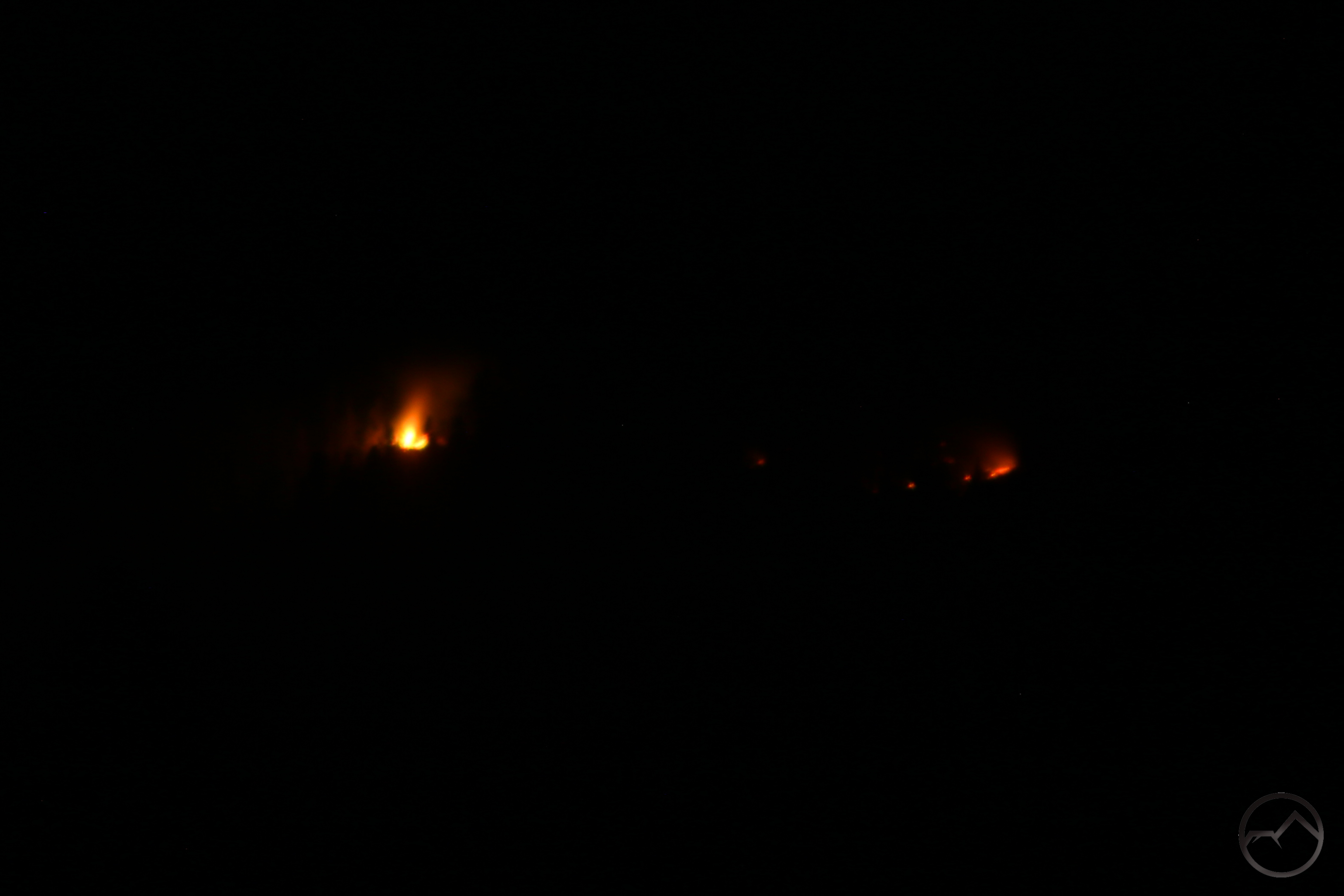
Accompanied by one of my best friends, I went out and set my camera up near the intersection of Summit and Deetz. From here there was an unobstructed view of the flames. To get a meaningful image, I really had to zoom in but the image really does not have the foreboding feel that the sight of large flames on the side of the mountain has. These flames were only 4 miles from my house. Naturally, after all the destruction wrought by fires over the last years, this left me with an uneasy feeling. Thankfully, the snow came and the flames were no doubt extinguished. I love summer and fall but I have never been so grateful that they have passed. Come on winter!

A November Sunrise On Mount Shasta

Posted by bubbasuess on November 30, 2018
Posted in: Cascade Range, Hiking, Mount Shasta. 1 Comment

The rising sun sets the clouds around Mount Shasta aglow.

This morning was the final sunrise of November 2018 and it was magnificent. The forecast had indicated that there would be a chance that the storm would clear so I made sure to be ready to go before sunrise and head to one of the nearby spots that I like to capture images of the mountain from. I had my oldest son with me as well. He, like his dad, is an early riser and loves going out in the morning with his old man to watch these incredible events.

When we arrived at my chosen spot the color was just starting to deepen and get really vivid. One of my favorite morning configurations was present on the mountain, the clouds filling Avalanche Gulch and then capturing all the warm light from the rising sun. This really sets the monuments around the rim of the gully apart, highlighting their massiveness and their jagged features. This morning was no different and Thumb Rock, Sargents Ridge and Casaval Ridge were all quite striking in contrast to the glowing canyon beneath them.

It really is encouraging to see the mountain truly white again. This was a great year in many ways but the fires and smoke leave an ominous feeling, portending future destruction in some unfortunate, and as yet unknown, location. Nonetheless, the mountain endures, the snows have come and beauty still abounds, and with it hope. I am grateful to be a witness to it.

Click to enlarge:


I almost forgot to mention that the morning light was hitting Mount Eddy too! That mountain is overshadowed and underrated but it deserves recognition too!

The Ghost Trees Of Black Butte

Posted by bubbasuess on November 29, 2018
Posted in: Cascade Range, Hiking, Mount Shasta. Tagged: Black Butte. Leave a comment

Clouds roll past trees clinging to the steep flank of Black Butte.

After a lull in the storm system that has been passing through Northern California, the precipitation returned with some vigor today. What started off as rain this morning eventually turned to snow. While not a heavy dump, there was enough for barely a quarter of an inch to accumulate at my house. It was certainly enough to set my kids off into a wintry frenzy. This afternoon the precepitation came to a halt again. Though the clouds around Mount Shasta never cleared away, they did lift high enough to get a good view of the drama swirling around the upper reaches of Black Butte.

Lately I have been really interested in watching clouds passing through the trees on Black Butte. The vapor drifting through the trees, obscuring and revealing them, is a fascinating spectacle. The conditions where this is particularly interesting have been unusually frequent the last few weeks and I have been unable to resist trying to document the show. Thursday afternoon proved to be an unusually scenic display and I was, naturally, on hand to document it.


While there were a number of interesting scenes where breaks in the clouds highlighted various spots on the mountain, the northwest corner has an especially memorable presentation. The clouds wafted through and around the trees in a slow, steady parade. The pale tendrils of cloud made the trees appear like apparitions on the side of the mountain.


In same ways the images do not do justice to the odd serenity with which the clouds slip past Black Butte. Perhaps a video might give a better sense of the scene:

Hidden in plain sight high up on the steep flanks of Black Butte, these trees don’t often draw the eye of admirers. However, when they are enhanced by the passing clouds, they are an event of slow, subtle beauty that demand observance. When shrouded by the storm clouds, these trees are given a ghostly appearance, one that is donned more frequently than their counterparts on other mountains. This is due to the unique position of Black Butte, occupying a middle point between two giant mountains. The next time a storm is clearing or the clouds are a whorl around the summit of Black Butte, look above and watch for the Ghost Trees of Black Butte.


Checking In On The Rivers And The Mountain During The Storm

Posted by bubbasuess on November 29, 2018
Posted in: Cascade Range, Hiking, Mount Shasta, Rivers. Tagged: Sacramento River, Shasta River. 2 Comments

An evening break in the storm reveals a snowy Mount Shasta. 

It has been precipitating off and on for nearly a week now. This prompted me to get out and check up on the state of the rivers, the snow on Mount Shasta and other results from the storms. Though the water level in the rivers has definitely increased, I was surprised by the lack of a significant torrent. With daily precipitation in the forecast, which includes a lot of snow higher up, I imagine the volume of the river will increase once the ground gets really saturated and more water is forced to run off during heavy rains. For now though, I am glad to see the rivers fuller and the mountains whiter. After a long dry spell that spelled the doom of Paradise and severely damaged other communities, it is reassuring to see the wet, fire-preventing precipitation arrive in a sustained way.

Below is a gallery of images showing the conditions at the Sacramento River, the Shasta River and from afar on Mount Shasta. Things are definitely moving int he right direction. Now we just want more snow!

Click to enlarge:

At the confluence between the main fork of the Sacramento and the North Fork.
The main fork of the Sacramento River.

While here, I took my kids down to the river and they played on the rocks for a while. This is a spot we go to frequently. It has good access, tons of rocks and a swimming hole.
This is on the main fork of the Sacramento and features one of the best views of Mount Shasta. Not today however.

This view is just below the confluence of the South and Middle Forks.
The confluence of the Middle Fork and the South Fork.

The confluence of the Middle Fork and the South Fork.
In the canyon of the South Fork of the Sacramento River.

With rising water levels, the river pours through a short cascade.
This is one of the more impressive cascades along the South Fork.

The canyon is very rocky in some spots and the rising water level in the river adds a lot of drama.
When viewed from the west, Mount Shasta was still covered by the storm. However, it looked like it was breaking on the north side.

Heading to the north, I could see the storm had come to a halt at the edge of the Shasta Valley.
Mount Shasta rose higher than the storm did, showing off its new blanket of snow.

The Shasta River has a strong flow.
In the distance, the storm can be seen stopping at the edge of the Shasta Valley.

Overall, things are looking pretty good. Now is a great time to take a hike along one of the trails that follows a creek or river.

A Little More On The Wilderness Aesthetic Here In Mount Shasta

Posted by bubbasuess on November 21, 2018
Posted in: Cascade Range, Hiking, Mount Shasta, Wilderness. Tagged: Squaw Valley Creek. Leave a comment

I had another encounter with a variation on the Forest Service’s wilderness aesthetic. This time, however, it was not a wilderness sign and it was not in a wilderness area. It was a pleasing encounter nonetheless. On Monday I took my three kids for a hike on the Squaw Valley Creek trail. Even though the fall color was long since gone, the creek had plenty of water in it and the trail was delightful. My kids had a ball climbing on the rocks around the junction with the Pacific Crest Trail too.


On the hike, the path along Squaw Valley Creek quickly intersects the Pacific Crest Trail. The two continue together a short distance before the PCT peels off and heads to the west, beginning its climb up to the top of Girard Ridge and then down to the Sacramento River. Trail signs naturally populate these junctions and as we hiked past something about them struck on at my subconscious. However, with three kids to shepherd, I did not dwell on it for long.

We hiked along the creek for a while but we did not make it to the waterfall before my youngest started to expire. I needed to conserve his energy for the hike out. On our return, we passed the pair of junctions it the note of familiarity struck at me again, but this time I had a moment of instant recognition. The signs appear thus:


Note how they have the same roughly-hewn pentagonal shape as the signs marking entrance into a wilderness area, only these have been rotated 90 degrees. The similarities went even further. The familiarity that had nudged at my mind as we hiked by the first time I now saw in my minds eye with greater clarity. The signs along the PCT and Squaw Valley Creek were essentially the same as the wilderness sign indicating arrival at the boundary to the Kaiser Wilderness in the Sierra Nevada. That sign was a little smaller than these signs but was oriented the same way. It also had the same time of rustic beveling along the edges.


I think it is interesting that the aesthetic for trail signs has permeated beyond the wilderness signs and is now found along trails serving a different function and not within a wilderness area. This is certainly not a bad development, since the aesthetic is pleasing to the eye and is always a welcome sight on a hike. I am glad to recognize it wherever I find it!

Delta Fire Damage – Scenes From The Sacramento River Canyon

Posted by bubbasuess on November 17, 2018
Posted in: Cascade Range, Hiking, Klamath Mountains, Mount Shasta. Tagged: Delta Fire. Leave a comment

Though nearly everything else burned, a little fall color clings to the banks of the Sacramento River.

On Friday I had to drive down to Redding early in the morning to take care of some business. Once done, I had the opportunity to drive back up to Mount Shasta at my leisure. This afforded me the opportunity to pause along I-5 and take stock of the damage done by the Delta Fire in greater detail than I have had the chance to do thus far. What I saw was supremely interesting, both in terms of the damage caused by the fire and the efforts to begin the area’s healing process that were well underway.

With regards to the damage caused by the fire, in some ways it does not seem so extensive. The burned scar extends for about 8 miles along I-5, from Delta to the Gibson exit. Within this burned area there are large patches of trees that escaped the flames and are now green oasis amidst a sea of red, orange and brown. Where the fire did consume the forest, it still does not seem very extensive. However, this is only because the vast areas that were burned are hidden further to the east and west, hidden by the low ridges that run parallel to the river. Back in these drainages, there are tens of thousands of acres that have been burned. In spite of the hidden damage, there are areas along the freeway that have been utterly devastated. Forests of black snags line the hillsides, stark evidence of what the fires will do.

There is an intense amount of activity in the areas along the freeway. Major logging operations seemed to have commenced as soon as the fire was contained. The burned trees are being cleared out swiftly. Most of the easily observed activity is happening along the freeway. Trees are being cut, many are being chipped and the mulch is being spread liberally along the hillsides, embankments and elsewhere along the freeway. Larger trees are being harvested, no doubt for commercial use. Higher up above the river, more logging operations are visible, though it is a little harder to track the activity deep in the canyons that spur off the main trough of the Sacramento River. No doubt erosion is a chief concern as we head into winter.

The most encouraging thing that I saw was the number of structures that were saved from the flames. Homes were still standing, each surrounded by a small island of green trees. Around them the flames had swarmed but the firefighters made a valiant stand amidst the storm. Most heartening was the old station at Pollard Flat, which is back in business and a hub of activity as loggers and other recovery workers enjoy its vittles. Behind the restaurant was a striking indication of how close the whole operation came to destruction. The fence stretching from the station down towards the river had been burned as the flames approached the building. However, efforts were made to save Pollard Flat and, though the fence was initially burned, as it neared the building it seemed as if nothing had happened.

It will be a few years before we see what the canyon will look like for the next decade or so. The new normal is already taking shape. Let us pray that this is the last big fire we have in this area.

Delta Fire Gallery (click to enlarge):


About That Sunset View Of The Trinity Alps

Posted by bubbasuess on November 15, 2018
Posted in: Cascade Range, Hiking, Klamath Mountains, Mount Shasta, Peaks, Scott Mountains, Trinity Alps, Trinity Divide, Wilderness. Tagged: Mountain Lakes Wilderness, Southern Oregon. Leave a comment

The Trinity Alps from our sunset vista.

In my last post, I included a few images that captured the view of the Trinity Alps from our vantage point above the Pacific Crest Trail. The vast mountain range lies just west of the Trinity Divide and, in many ways, forms the great wilderness backyard for the Mount Shasta area. Knowing that this vast alpine paradise lies so close is a comforting thought when even the mountains around Mount Shasta seem insufficient to escape into. Their presence also enhances the local hikes. The horizon for many trails on Mount Shasta and along the crest of the Trinity Divide feature fantastic vistas of the dragontooth-like horizon formed by the many jagged spires and towers of the Trinity Alps.

This, of course, makes me think of all the different adventures that await in the Trinities. The area is so expansive that it almost runs together, making each area difficult to distinguish from the others. It was this that caused me to make a locator for the view from our hike:

A great deal of area falls within this viewshed. The area marked “N” is the Bear Lake Basin (actually the basin containing Little Bear Lake, but it is a smaller part of the larger whole). It lies about 14 miles away from our sunset vista. In contrast, the peak marked “I” is Monument Peak, which is an impressive 42 miles to the south. The whole area in between is all part of the massive Trinity Alps Wilderness. The 15 peaks (and 1 lake basin) identified here compose one of the more scenic portions of the Trinity Alps. Miles of trails course through this area and there are at least 14 lake basins visible here and a few dozen lakes contained therein. Some of these are among the most beautiful spots in all of Northern California.

For those unfamiliar with this large mountain area, it may come as a surprise that this area is actually only the southeast corner of the Trinity Alps. There is far more wilderness in these mountains than is visible from this vantage point. The crest of the Scott Mountain, extending west from where we were hiking blocks out the majority of the range. To give some perspective, I made a locator that includes the same area, but from the perspective hikers enjoy from the top of Mount Eddy. This view encompasses the entire eastern half of the Trinity Alps and includes the spectacular granite heart of the range as well as the western half of the Scott Mountains, which lies within the Trinity Alps Wilderness.

That is a magnificent block of alpine wildlands. We are blessed to have such an incredible wilderness resource to enjoy so close to Mount Shasta. In the summer, when Parks Creek Road is open, the closest trailheads lie less than an hour drive away from town. Anyone who has been fortunate enough to explore these mountains know what a blessing they are.

Of course, such an examination of the view to the south demands an analysis of the view north as well. From our vista above the PCT we could see numerous landmarks, most of which were in Oregon. The furthest away was Rustler Peak, which lay 88 miles away. Just south of that is the Fuji-like tower of Mount McLoughlin, the highest peak in Southern Oregon. One particularly interesting feature was the highlands of the Mountain Lakes Wilderness. From our vantage it appeared a nondescript ridge but that area certainly offers more than you might guess when looking at it from the outside. The interesting terrain is within a large caldera where rugged cliffs and numerous alpine lakes await hikers.

All in all, that is quite a bit of terrain taken in from one vantage point. The viewshed extends 120 miles from north to south. That is not too bad for a very short, easy hike. The trail leads through beautiful terrain and is suitable for kids under 4 to hike! What is not to love about that?!


One Last Sunset From The Trinity Divide

Posted by bubbasuess on November 13, 2018
Posted in: Cascade Range, Hiking, Klamath Mountains, Mount Shasta, Trinity Divide. Leave a comment

Sunset view of Mount Shasta from the divide between the Trinity River and the Shasta River.

Last night I took my family up onto the Pacific Crest Trail for one last hike in the high country before the snow comes. With rain (and high elevation snow) in the forecast one week from now, it seems unlikely I will get my whole family out on a hike in the mountains again. The shorter days meant that we had the opportunity to get out and up in the Trinity Divide for a reasonably timed sunset. We headed to the Parks Creek Trailhead and hit the trail in the midst of the low-angle afternoon sunlight. It was glorious. With gobs of rocks to climb and far-reaching views, it is a wonderful section of trail and one that is easy to do for families with younger children. You really can’t go wrong here.

High Camp Basin.
Wildcat on the prowl.
My family on the trail with the Trinity Alps in the distance.

The sun was setting as we reached our destination, which was a low saddle just off the trail where fantastic vistas open up to the east, west and north. From here you can see much of the Trinity Alps, Mount Shasta, most of the Shasta Valley and deep into Oregon, crowned by the heights of Mount McLoughlin, southern Oregon’s highest peak. It is a fantastic vista and shockingly easy to get to. It really is one of the best kid-friendly hikes in the high country around Mount Shasta.

Looking down on the hills of the Shasta Valley.
Shadow moves across the town of Weed.

The view north, across in the Shasta Valley and into Oregon, where the pyramid of Mt. McLoughlin dominates.
Mount Shasta and rises beyond an unnamed peak.

A closer view of Mount Shasta.
The Trinity Alps from our sunset vista.

Though the sun had set, we could see the Trinity Alps the whole way back.
A closer view of the Trinities.

We made it from our house to our vista point and back to our house in about 4 hours. This included a leisurely hiking pace and time to climb on rocks and watch the sunset. That kind of turn around time is one of the great things about the Mount Shasta area. Whether you live here or are just visiting, you can enjoy spectacular little outings with minimal time investment but offering the kind of scenery that makes lifelong memories.

While not our last hike of the year, it is more than likely to be the last time my wife and I get all three of our kids on the trail higher up in the mountains. If this proves to be the case, it was a great way to finish the alpine hiking season.

Also, I just want to commend all those involved in bringing about the installation of the new bathrooms at the Parks Creek Trailhead. The rock work is an especially nice touch. Much needed and well done!


Backyard Flag Retirement

Posted by bubbasuess on November 12, 2018
Posted in: Boy Scouts, Hiking, Mount Shasta. Tagged: Veterans Day. 3 Comments

In the nearly 6 years that Hike Mt Shasta has been on line, I have never posted a post on Veterans Day but this year is a bit different. Speaking broadly, the 100th anniversary of the end of the First World War is worthy of note no matter what the normal subject of a website. The death of the old world and the violent birth of the new was a singular event thus far in human history and we are all living in the wake of that incredible and incredibly bloody event. The other reason I am moved to mark this day is that, in recognition of Veterans Day, my son’s Cub Scout pack held a flag retirement ceremony in my backyard.

It was a great, multi-generational event, with a veteran joining us and the boys mixing effortlessly with him and the other adult scout leaders. When the time came for the ceremony, all the Cub Scouts were appropriately reverent, recognizing the solemnity of the event. We retired nearly a dozen flags, each one having been folded respectfully and placed in the flames for honorable retirement.


I am glad that these kids are able to participate in this and other important civic duties by being in the Cub Scouts. I only wish we had had more in our pack, so more kids would be learning these critical lessons and having these invaluable experiences. Hopefully more will join our pack!

After the fire died down, a few of the leaders and I sifted through the ashes and removed all the flag’s grommets. It has been a tradition in some Boy Scout units to collect these and hang them together on the troop’s flag so that they continue service honorably. Some are kept for personal carry as well. I have had one for 30 years in my Boy Scout uniform. I am honored to be able to pass this tradition on to the next generation. Hopefully these will be carried proudly for decades to come.

…And Now The Camp Fire

Posted by bubbasuess on November 9, 2018
Posted in: Cascade Range, Hiking, Mount Shasta. Tagged: Camp Fire. 5 Comments


I haven’t got much to say about the Camp Fire. Part of me is shocked but part of me is completely jaded. After writing about the fires all summer, it seemed we had finally turned the corner only to have this happen. After the Boles, Valley, Tubbs and CarrHirzDelta Fires, it seems like we should not be surprised that a fire would finally rise up and consume an entire town.

I headed up onto Mount Shasta today to see if I could catch a glimpse of the fire from higher up. The Old Ski Bowl may be closed off but the section of the road between Red Fir Flat and Bunny Flat still offers great views to the south. The view today was smoky, much as it was throughout the summer. This time there was a large plume rising above the haze, complemented by a dark pillow of smoke that kept changing shape. It was strangely peaceful but the knowledge of what was going on was sobering.

Looking south to the large plume rising from the Camp Fire.
Lassen through the smoke.

Evening view to the south.

Here in Mount Shasta, the air was clear and everything was normal. I went back up this evening to see how it looked. Oddly enough, the air quality to the south had improved considerably. There was much less haze in the mountains south of Mount Shasta. The large plume rising up from the fire was also missing. This was encouraging, indicative of the fire’s slowing pace. Of course, just because it has slowed does not mean it is not dangerous. I am praying for Butte County, hoping that the fire grinds to a halt and the precipitation forecasted soon comes sooner than expected.

Even as I looked to the south, Mount Shasta remained as majestic and beautiful as ever.

As I write this, the fire has burned 90,000 acres and burned 6,500 homes and 260 commercial buildings. This will no doubt increase. It is like the Tubbs Fire all over again.

I have two thoughts regarding things that must be done to help prevent this from occurring again. First, we need to start burying our power lines. I am sure there are some that need to be hung but wherever possible, we need to put them in the ground. The Tubbs Fire and, most likely the Camp Fires were caused by down power lines. It won’t eliminate all risk but I think it will be a worthwhile endeavor.

Second is something that can be done closer to home. I think Siskiyou County needs to make it possible to dump brush and tree debris for free. This was done briefly after the great storm of January 2010 and it made cleaning up after that storm much more feasible. Now it will help incentivize clearing overgrown properties like mine. I recently received pictures taken 50 year ago of our cabin that is across the street from my house. It was essentially in a meadow with little vegetation but with far-reaching views. Now it is choked with trees. I intend to start clearing things out, clearing things out far beyond what Cal Fire has asked of us in the past (we have always gotten a perfect bill of health from Cal Fire, but the cabin has been dinged to have stuff cleaned up). I think making tree and brush debris easily disposed of would be a worthy investment from the county.

The Camp Fire is tragic. I pray it does not happen here in Mount Shasta or anywhere else. I know conditions are not good but I will remain hopeful that this was just a really, really bad year for fires.

Posts navigation

← Older Entries
Newer Entries →
    • Recent Posts

      • Winter Shows Up When It Will
      • January Rolled By With Mud, Then Very Dry
      • Mount Shasta 2025 – A Year In Images
      • Mount Shasta On Either Side Of Christmas
      • Adrift In An Ocean Of Fog
      • December Has Been Spectacular Thus Far Pt. II (A Magnificent Lenticular)
      • December Has Been Spectacular Thus Far Pt. I
      • Lenticular Interrupted
      • A Stormy Wave And A Truchas Sunset
      • Aurora Lenticularis
    • Enter your email address to follow Hike Mt Shasta and receive notifications of new posts by email.

    • Archives

      • February 2026
      • January 2026
      • December 2025
      • November 2025
      • October 2025
      • September 2025
      • August 2025
      • July 2025
      • June 2025
      • May 2025
      • April 2025
      • March 2025
      • February 2025
      • January 2025
      • December 2024
      • November 2024
      • October 2024
      • September 2024
      • August 2024
      • July 2024
      • June 2024
      • May 2024
      • April 2024
      • March 2024
      • February 2024
      • January 2024
      • December 2023
      • November 2023
      • October 2023
      • September 2023
      • August 2023
      • July 2023
      • June 2023
      • May 2023
      • April 2023
      • March 2023
      • February 2023
      • January 2023
      • December 2022
      • November 2022
      • October 2022
      • September 2022
      • August 2022
      • July 2022
      • June 2022
      • May 2022
      • April 2022
      • March 2022
      • February 2022
      • January 2022
      • December 2021
      • November 2021
      • October 2021
      • September 2021
      • August 2021
      • June 2021
      • May 2021
      • April 2021
      • March 2021
      • February 2021
      • January 2021
      • December 2020
      • November 2020
      • October 2020
      • September 2020
      • August 2020
      • July 2020
      • June 2020
      • May 2020
      • April 2020
      • March 2020
      • February 2020
      • January 2020
      • December 2019
      • November 2019
      • October 2019
      • September 2019
      • August 2019
      • July 2019
      • June 2019
      • May 2019
      • April 2019
      • March 2019
      • February 2019
      • January 2019
      • December 2018
      • November 2018
      • October 2018
      • September 2018
      • August 2018
      • July 2018
      • June 2018
      • May 2018
      • April 2018
      • March 2018
      • February 2018
      • January 2018
      • December 2017
      • November 2017
      • October 2017
      • September 2017
      • August 2017
      • July 2017
      • June 2017
      • May 2017
      • April 2017
      • March 2017
      • February 2017
      • January 2017
      • December 2016
      • November 2016
      • September 2016
      • August 2016
      • July 2016
      • June 2016
      • May 2016
      • April 2016
      • March 2016
      • February 2016
      • January 2016
      • December 2015
      • November 2015
      • September 2015
      • August 2015
      • July 2015
      • June 2015
      • May 2015
      • April 2015
      • March 2015
      • February 2015
      • January 2015
      • December 2014
      • November 2014
      • July 2014
      • June 2014
      • May 2014
      • April 2014
      • March 2014
      • February 2014
      • January 2014
      • December 2013
      • November 2013
      • October 2013
      • September 2013
      • August 2013
      • July 2013
      • June 2013
      • May 2013
      • April 2013
      • March 2013
      • February 2013
      • January 2013
    • Categories

      • Boy Scouts
      • Cascade Range
      • Castle Crags
      • Desert
      • Echo Point
      • Glaciers
      • Hiking
      • How things came to be…
      • Klamath Mountains
      • Konwakiton Outdoor Designs
      • Lakes
      • Lenticular Clouds
      • Maps
      • Marble Mountains
      • Meadows
      • Mount Eddy
      • Mount Shasta
      • Mount Shasta History
      • Napa County
      • Off Season Trails
      • Pacific Crest Trail
      • Peaks
      • Rivers
      • Rock Climbing
      • Scott Mountains
      • Seldom Seen
      • Shasta Valley
      • Sierra Nevada
      • Siskiyou Mountains
      • Sonoma County
      • Spring Trails
      • sunrise
      • sunset
      • Trinity Alps
      • Trinity Divide
      • Truchas Ridge
      • Uncategorized
      • Water
      • Waterfalls
      • Wilderness
      • Wildflowers
      • Wine Country
      • Winter Trails
      • Yosemite
    • Meta

      • Create account
      • Log in
      • Entries feed
      • Comments feed
      • WordPress.com
    • Copyright © 2013-2024 by Bubba Suess

      DISCLAIMER: Any use of the information contained in this site by any and all persons is done at their own risk. The operator of this site shall be held harmless from any and all alleged claims, demands, causes of action, liability, loss, damage and/or injury to property or persons whether brought by an individual or other entity. This indemnification applies, without limitation, to all actions by an individual or other entity as a result of their use of information contained in this site.

    Blog at WordPress.com.
    Hike Mt. Shasta
    Blog at WordPress.com.
    • Subscribe Subscribed
      • Hike Mt. Shasta
      • Join 983 other subscribers
      • Already have a WordPress.com account? Log in now.
      • Hike Mt. Shasta
      • Subscribe Subscribed
      • Sign up
      • Log in
      • Report this content
      • View site in Reader
      • Manage subscriptions
      • Collapse this bar
     

    Loading Comments...