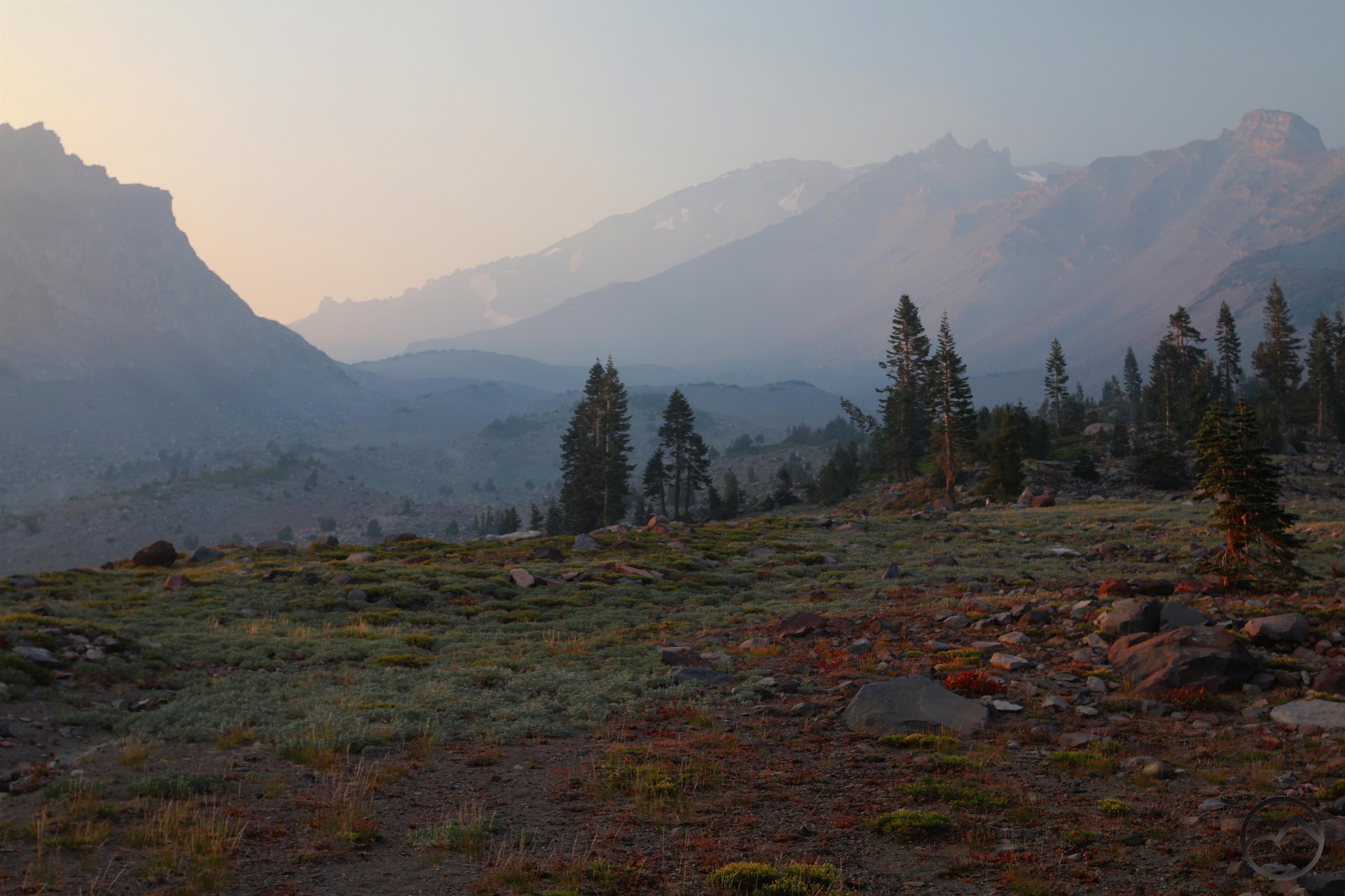
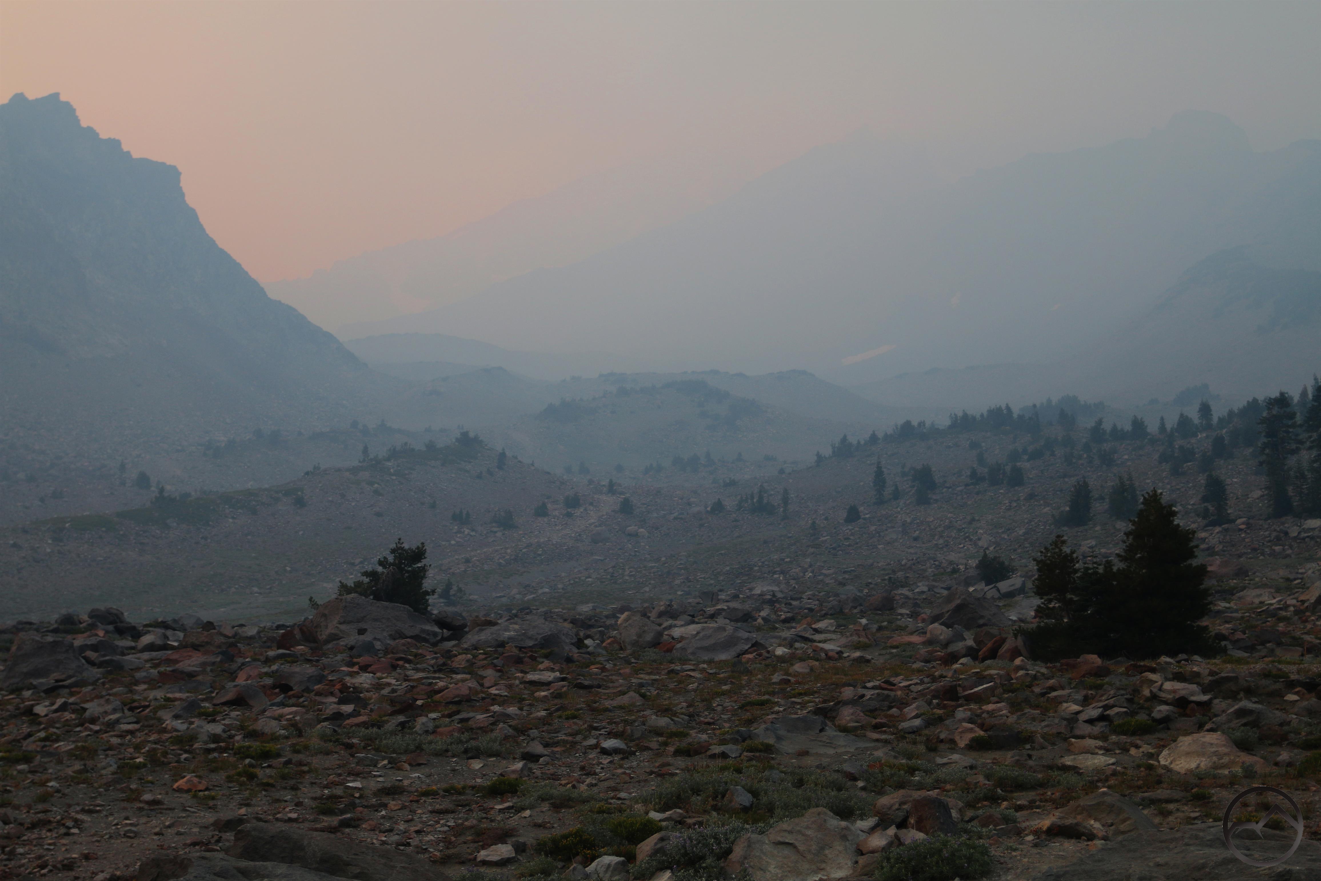
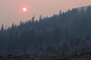
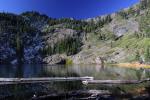
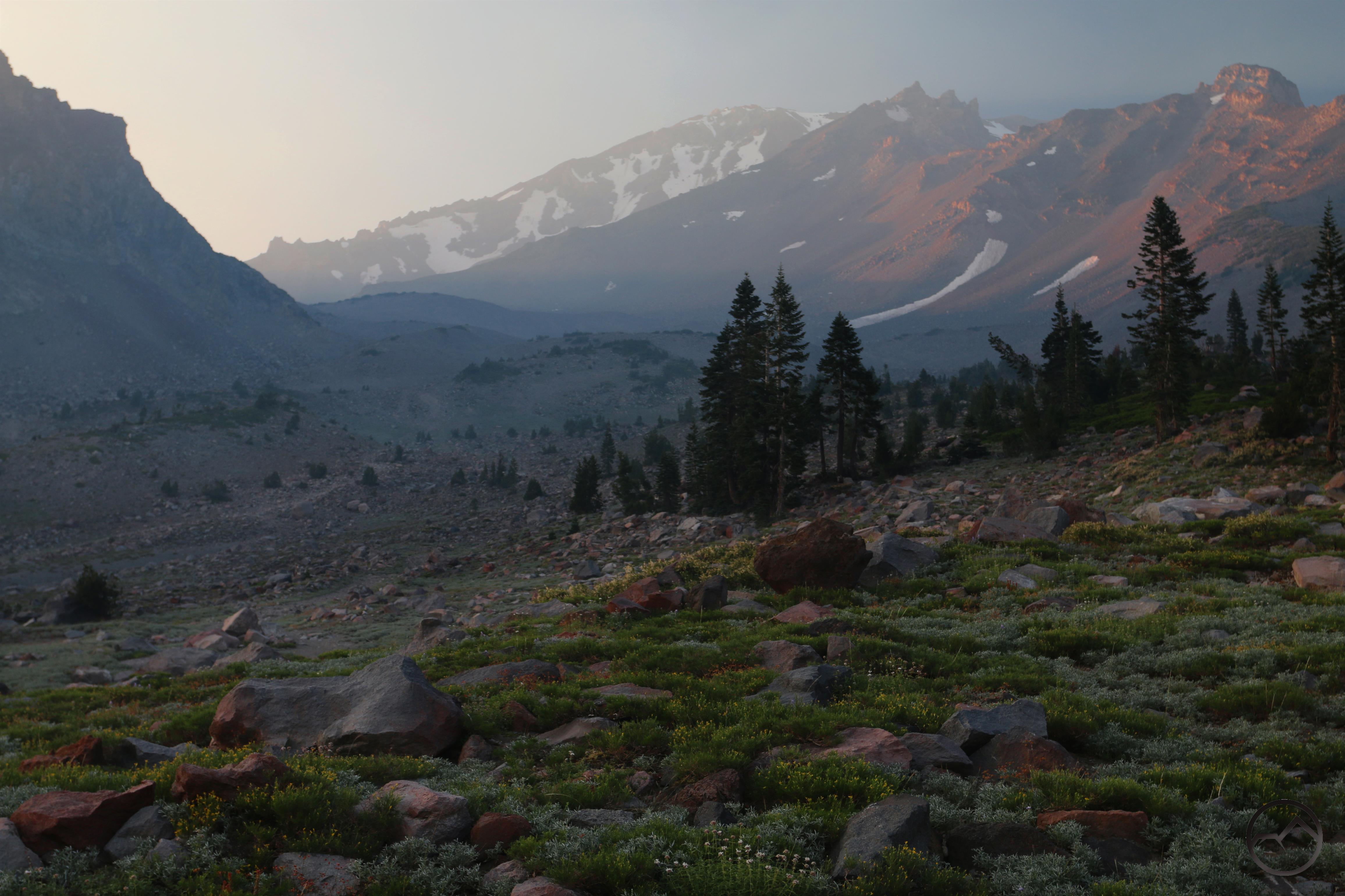
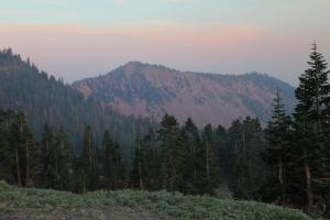
It started off clear at the Old Ski Bowl but grew smokier as the sun set.
Monday proved to be the nicest day we’ve had in the last month here in Mount Shasta. The sky was blue, the breeze cool and the temperatures weren’t too high. Mostly, however, it was the fact that we had blue sky. There was almost no smoke at all. It was actually a bit jarring to look up and see Mount Eddy, Black Butte and the great blue canopy above it all. Though we had not planned to have another picnic dinner, my wife and I decided to take our kids out and enjoy the beautiful conditions. We initially intended to head over to Castle Lake. However, when we got to Lake Siskiyou, we could see a thick layer of smoke creeping up from the south and engulfing the Castle Lake basin. Lake Siskiyou also looked very busy and we figured Castle Lake would be no different. We turned around and headed up to the Old Ski Bowl, which looked to be as clear of smoke as it had the rest of the day.
When we passed the Everitt Memorial Vista, we stopped and captured some images of the smoke dramatically creeping north, slowly inching toward town. It was a very eerie sight.
Above Lake Siskiyou the smoke pours through the canyons of the Sacramento River.
We continued up to the Old Ski Bowl and where we were able to see the smoke drift inexorably northward. Soon the Strawberry Valley was once again choked with the nasty stuff. We were grateful to be above it.
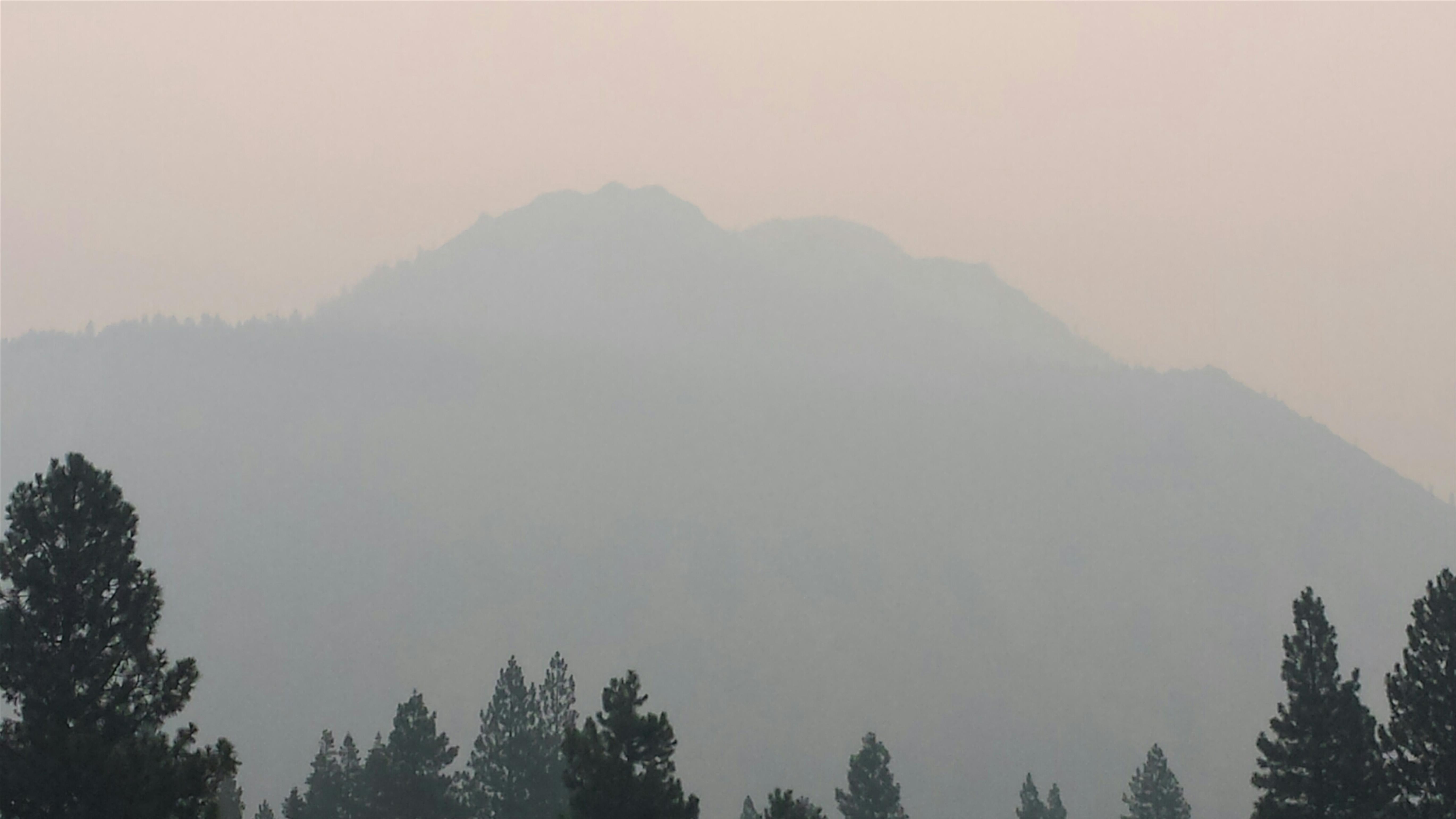
However, we were not completely above the smoke. Looking north toward the summit of Mount Shasta, we could see the smoke slowly obscure the mountain’s great crags. It went from clear and beautiful to smoky very quickly:
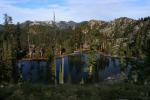
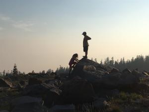
In spite of the slight haziness that appeared at the Old Ski Bowl, it was obvious that it was far worse in the valley below. We ate our dinner and the kids ran off to climb on rocks. My wife and I enjoyed the setting and were grateful our kids could have these kinds of experiences. Though a few people arrived and left while we were at the bowl, we were generally the only people at the Old Ski Bowl. This shocked me, since we figured a lot of people would have headed up the mountain since the air quality was really good and the weather nice. Shockingly, we essentially had the place to ourselves.
My beautiful wife enjoys the view from our picnic table.
My two older kids are complete goofs.
Hummingbird Ridge is turned red by smoke, not alpenglow.
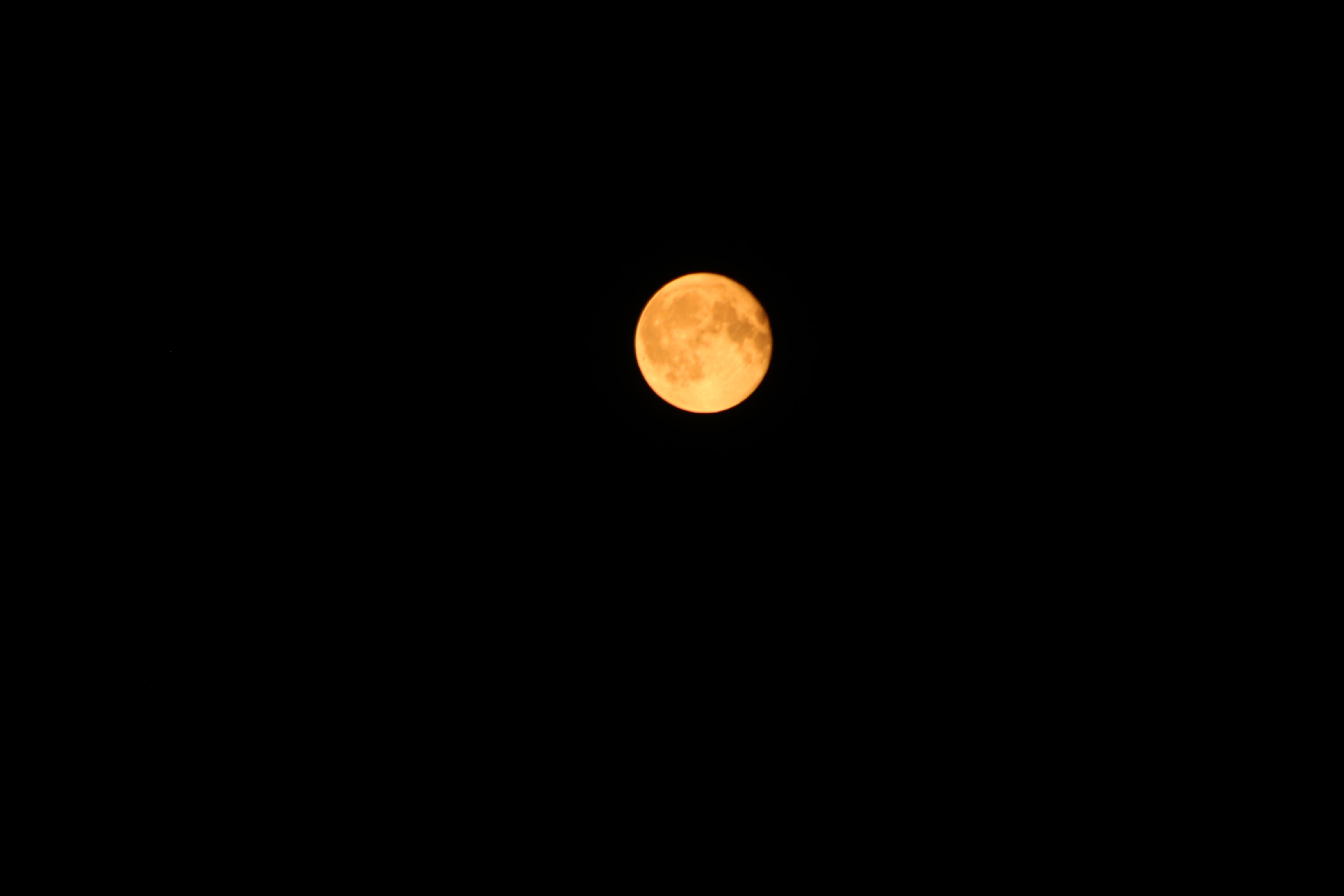
The moon rises above Gray Butte and the smoke.
The Carr Fire is essentially contained at this point and is not throwing as much crud into the air anymore. That trend should continue. Now we have the Hirz Fire to contend with. Thankfully it is not nearly as large as the Carr Fire and is not producing the amount of smoke as its massive neighbor has done. We also have some smoke rolling in from other regions. Fortunately I think we are past the worse of the smoke (certainly praying that’s the case) and can get back outside and enjoy all the trails that wind through this region. If nothing else we can keep enjoying the Old Ski Bowl.
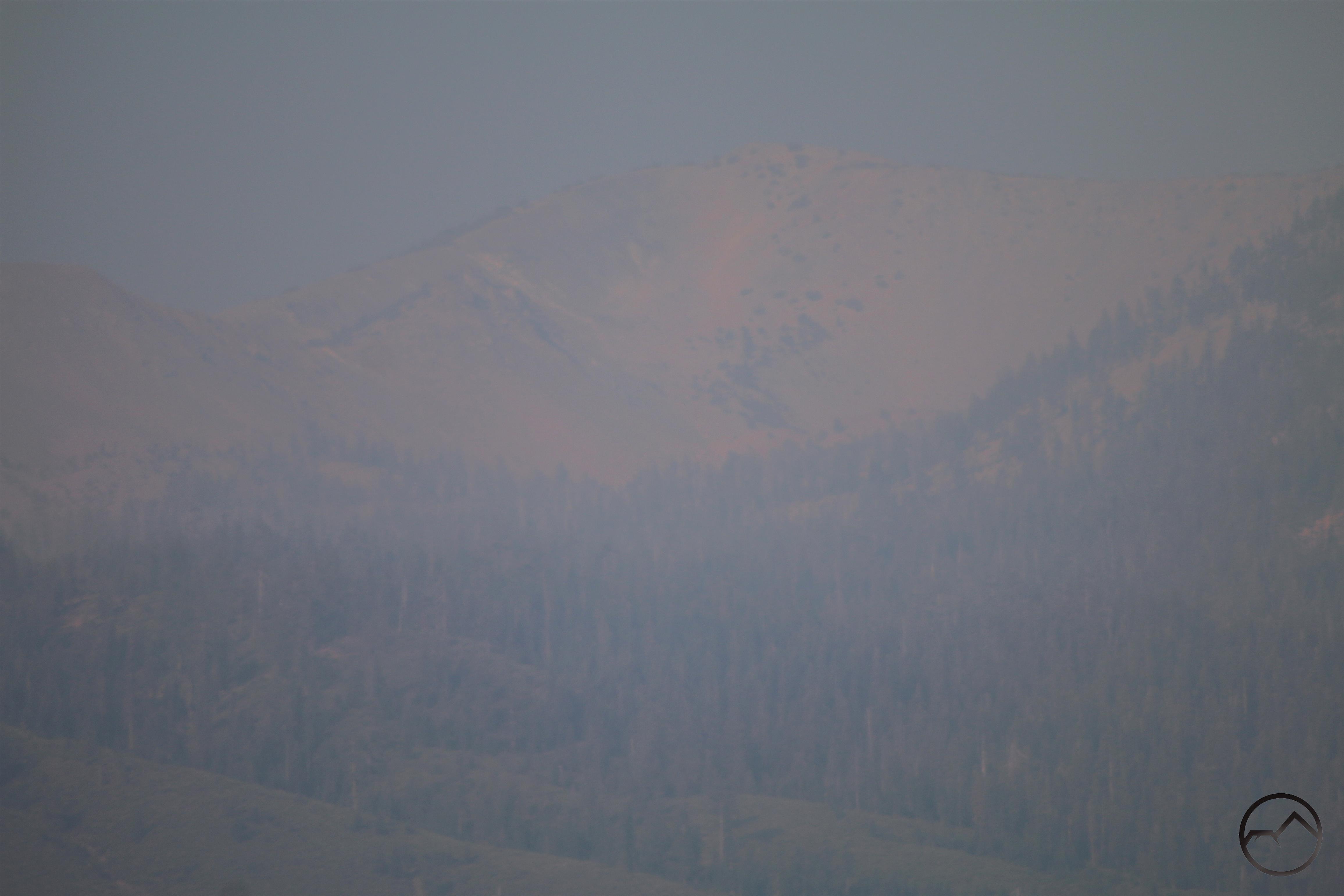
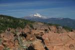
Mount Eddy is the lone mountain still visible through the smoke.
Well….you can sort of see the summit of Mount Eddy through the smoke.
It has almost seemed like a wasted month here in Mount Shasta. The Carr Fire has continued to burn, the Hirz Fire has sprung up right next door to it and grown to over 12,000 acres. Worst of all, the smoke has been think, nasty and nearly ubiquitous. However, the last week has seen a slight weakening of this pattern. There have been short stints of clarity as the winds shifted and drove the smoke out of the valley, if only briefly. Thursday was the brightest spot, as the air quality improved to the point that Mount Shasta was a clearly visible as it normally should be. This seemed like the first time that had happened in a month. However, even that bright moment was fleeting and the pall of smoke encroached once again, shrouding everything around us so that, even from the Abrams Lake overpass, Black Butte could not be seen. Disgusting.
The Pacific Crest Trail Association has a useful tool that puts up a satellite image of the entire PCT each day. This is a great tool for comparing the conditions. Here are the images for August 17th and 18th:
August 17: The smoke covers the Strawberry Valley. Note that the Trinity Alps are clear.
August 18: More smoke covers the entire region. The Strawberry Valley is really socked in.
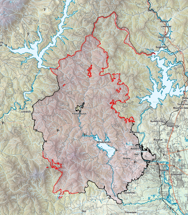
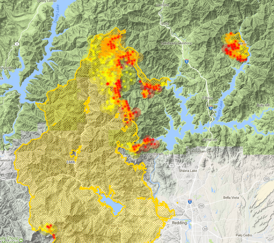
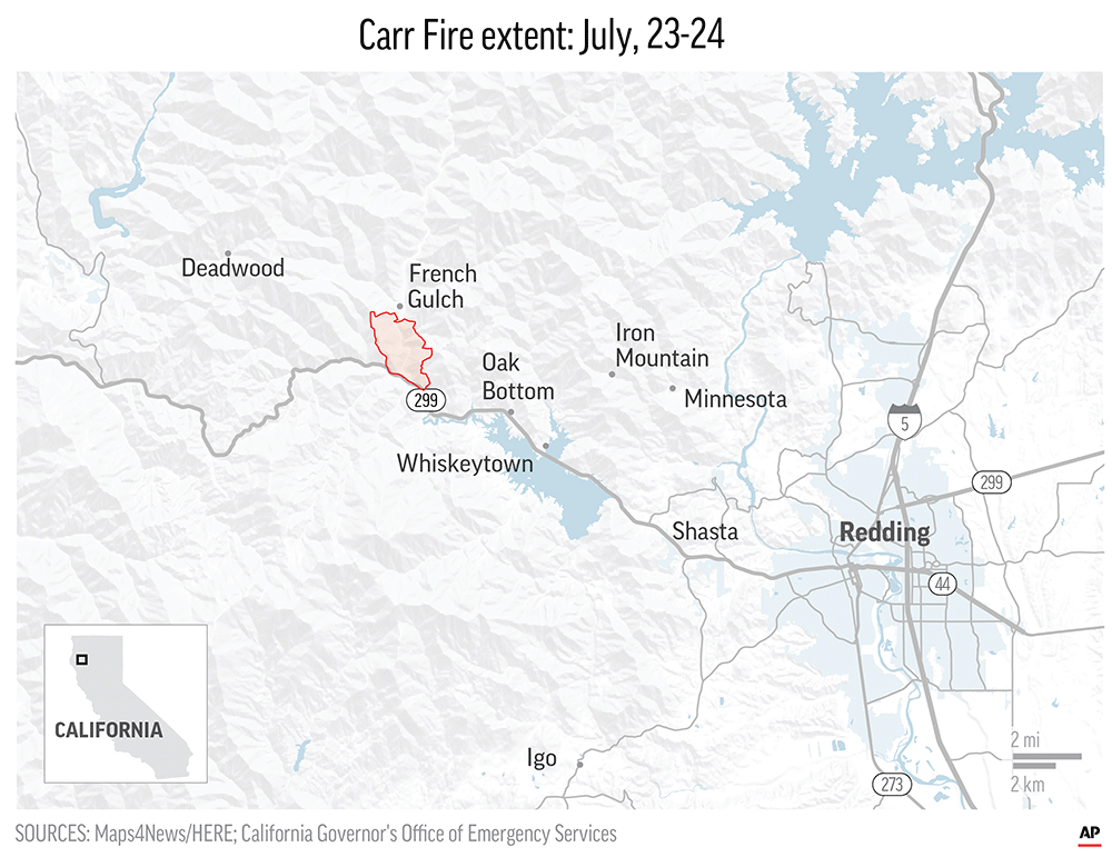
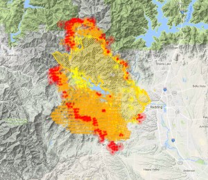
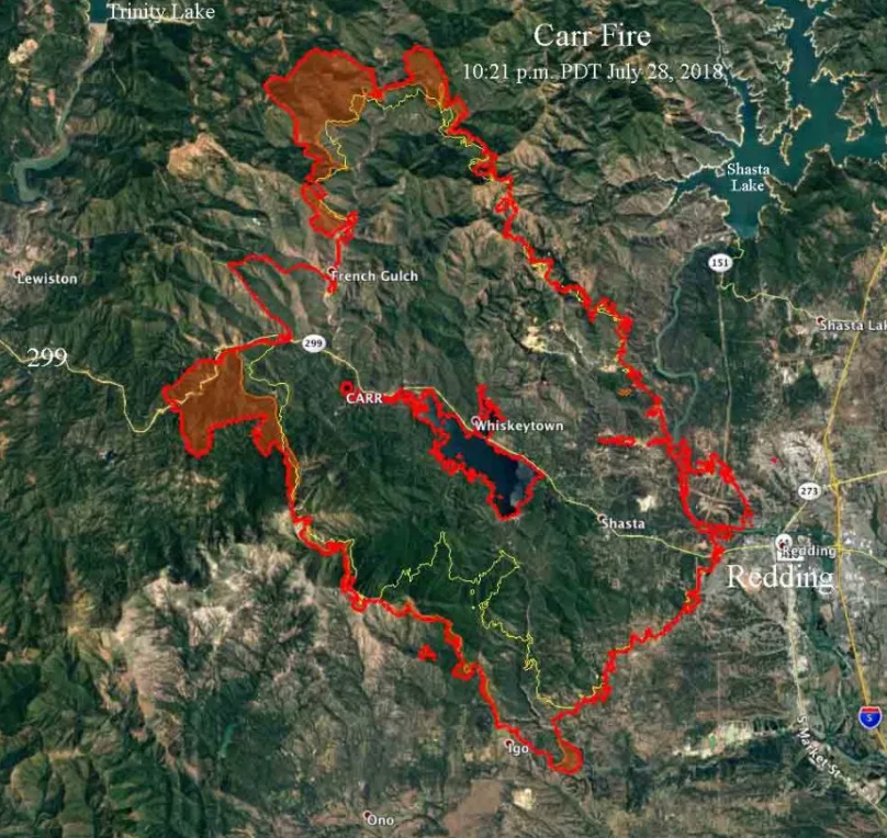
However, I believe that we are nearing the end of this ordeal. I have continued to follow the progress of the Carr Fire via CalTopo and it has been remarkable watching the fire burn itself out. The most optimistic event in this has been the seeming total success of the fire line that was cut in north of the Carr Fire over a week ago. This line started at Shasta Lake near Lakehead and climbed up Backbone Ridge all the way to Damnation Pass. From there is swept west past the very remote Clear Creek campground and then south along the crest of the Trinity Mountains. Here is how the fire looked little over a week ago:
The firebreak is the thin crescent of fire extending from the top of the Carr Fire all the way to Shasta Lake.
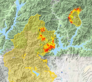
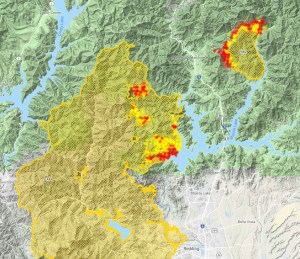
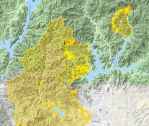
If my calculations are close to correct, that fire break is about 18 miles long. It basically bottles the fire up inside the Clear Creek watershed and forcing the fire down to the edge of Shasta Lake. If the fire break held, the plan was for the fire to consumer everything from the crest of the Trinity Mountains down to the lake, at which point it would essentially burn itself out. As planned, this is exactly what happened. Note the progression of the fire on this series of maps:
August 12
August 17 10PM
August 18 8:30 AM
August 18 3:30 PM
August 18 6PM
August 19 7AM
It is obvious from this progression that the fire is essentially burning itself out. It has consumed everything all the way down to the shore of Shasta Lake. There is nowhere left for the fire to go and there is nothing left to burn. Now it is just a smoldering mess and we can just wait for the smoke to eventually blow away. Of course, what this map also reveals is the growth of the nearby Hirz Fire. It is now putting out a significant amount of smoke of its own so we still have that to contend with. However, I hope that the knowledge that we are near the end of the Carr Fire is encouraging.
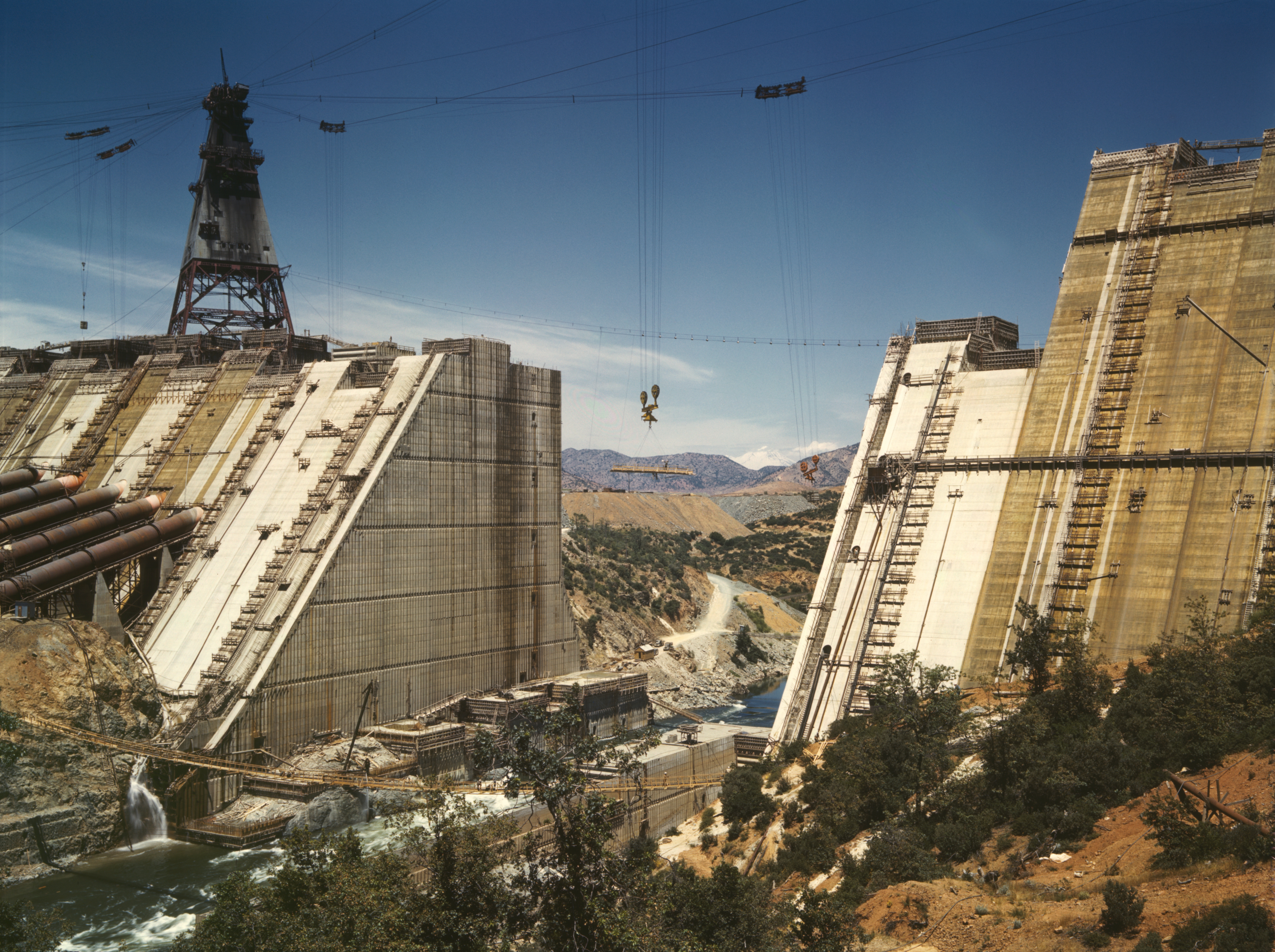
All we are left with then is the charred mountains that hem in the northwest corner of the great Central Valley. In some ways, it brings that area full circle. Much of those hills had been rendered bare by mining operations and other activities at the turn of the century. When the Shasta Dam was built, there was little vegetation on the surrounding mountains. We have returned to similar circumstances and get to watch nature heal all over again. Hopefully the air will be the first thing to clean up and soon.
Note the bare mountains in the distance through the gap in the dam. They are bare once again.
Meager alpenglow illuminates the thick blanket of smoke on Mount Shasta.
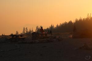
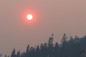
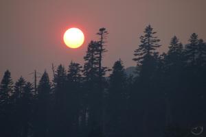
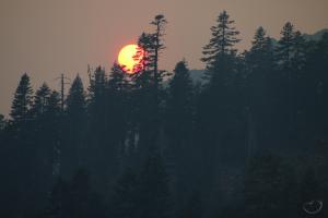
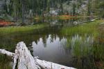
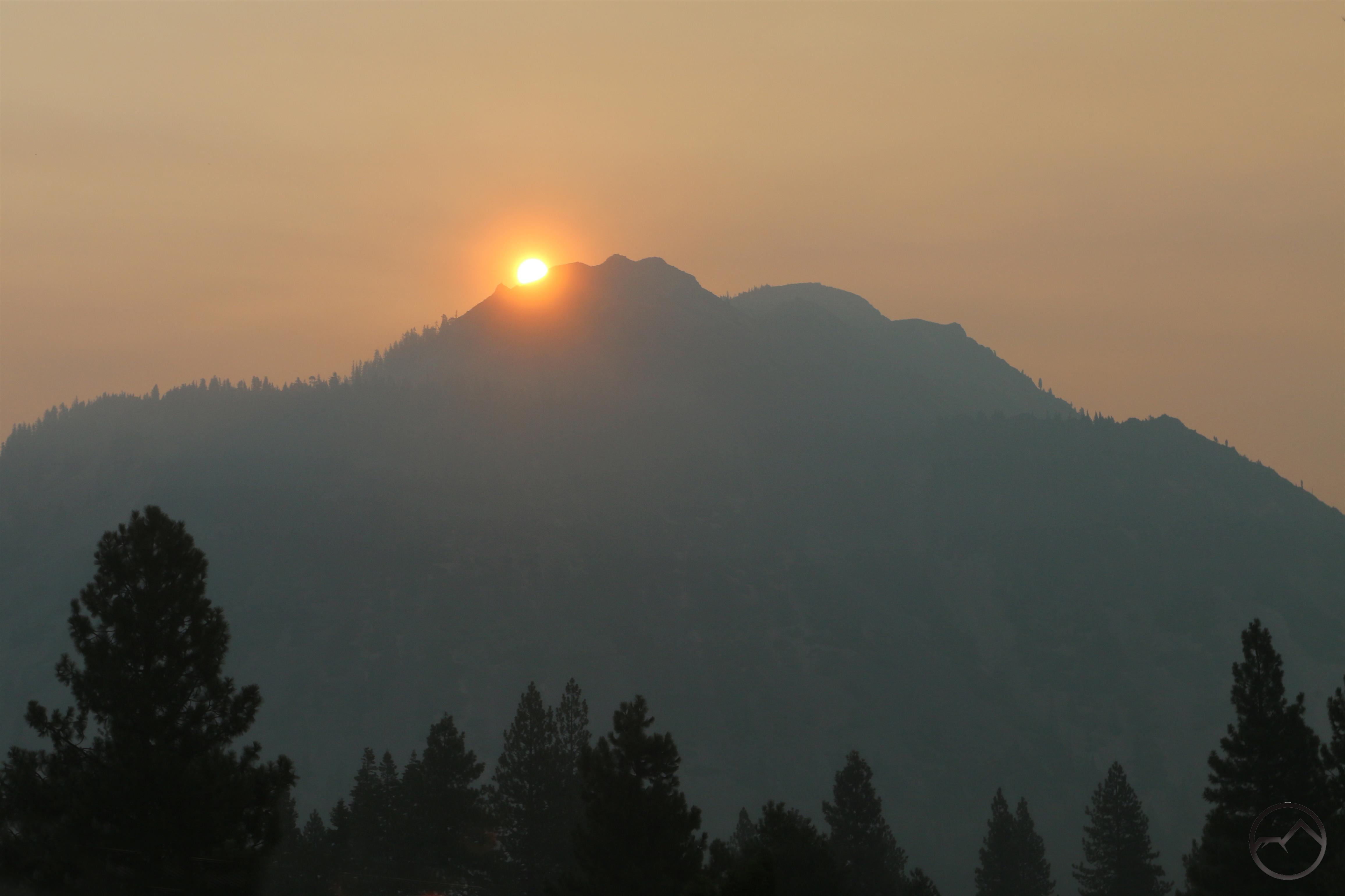
The last couple of days had somewhat better air quality in Mount Shasta despite the still-burning Carr Fire as well as the addition of the newly ignited Hirz Fire. Nonetheless, the smoke poured back into the area around the mountain with a vengeance today. In spite of this, my family and I went up to the Old Ski Bowl to have a picnic dinner. No doubt due to the smoke, the entire mountain from Bunny Flat to the end of the road was strangely empty of activity. It made our dinner strangely eerie. While my kids played on the rocks, my wife and I watched the sun set amidst the smoke. Oddly enough, we spotted someone descending past the sun on a parachute. After this, I managed to capture a few images of the smoky but gorgeous sunset. At least some beauty can be found midst the terrible conditions.
Click to enlarge:
Note the parachute!
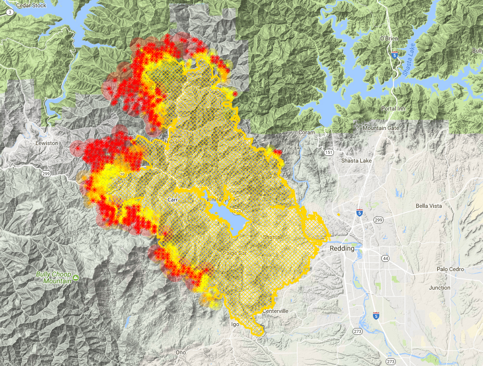
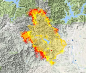
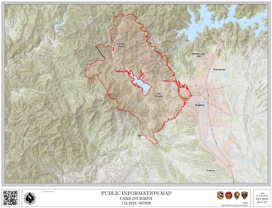
Everyone is eager for the smoke to clear out. Hopefully the end is in sight. A quick glance at the Carr Fire incident map from 10 August reveals a well-established fire line hemming in the conflagration’s northern advance.
The long line at the top of the map indicates the fire line that has been established. I imagine that the plan is to let the fire burn up the Clear Creek watershed and then get contained within the lines. Everything below the line will like get consumed by the flames but the fire will have been effectively bottled up. The live map, as of 12:30 AM indicates that this is the case:
Note how the valley below the fire break is filling up but, for the most part, the fire has not advanced past this rallying point. Hopefully the fire line will hold and this will spell the ultimate end of the Carr Fire. Unfortunately, as is evident from the map, the new Hirz Fire has sprung up along the McCloud arm of Shasta Lake. Let’s pray this fire is brought to heel swiftly. Either way, it feels like, at long last, we are nearing the end of this ordeal. Lord willing.
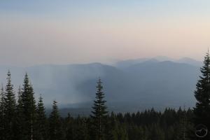
Thick smoke surrounds Mount Shasta but gets thinner as one moves west (bottom of image).
Before I write anything else, I want to preface by saying that, at this point, the smoke is so pervasive that it can really show up anywhere. I am not an expert on these matters and I am only offering a suggestion based on empirical observation. I really don’t want anyone to head off and expect clear skies only for them to be smoky.
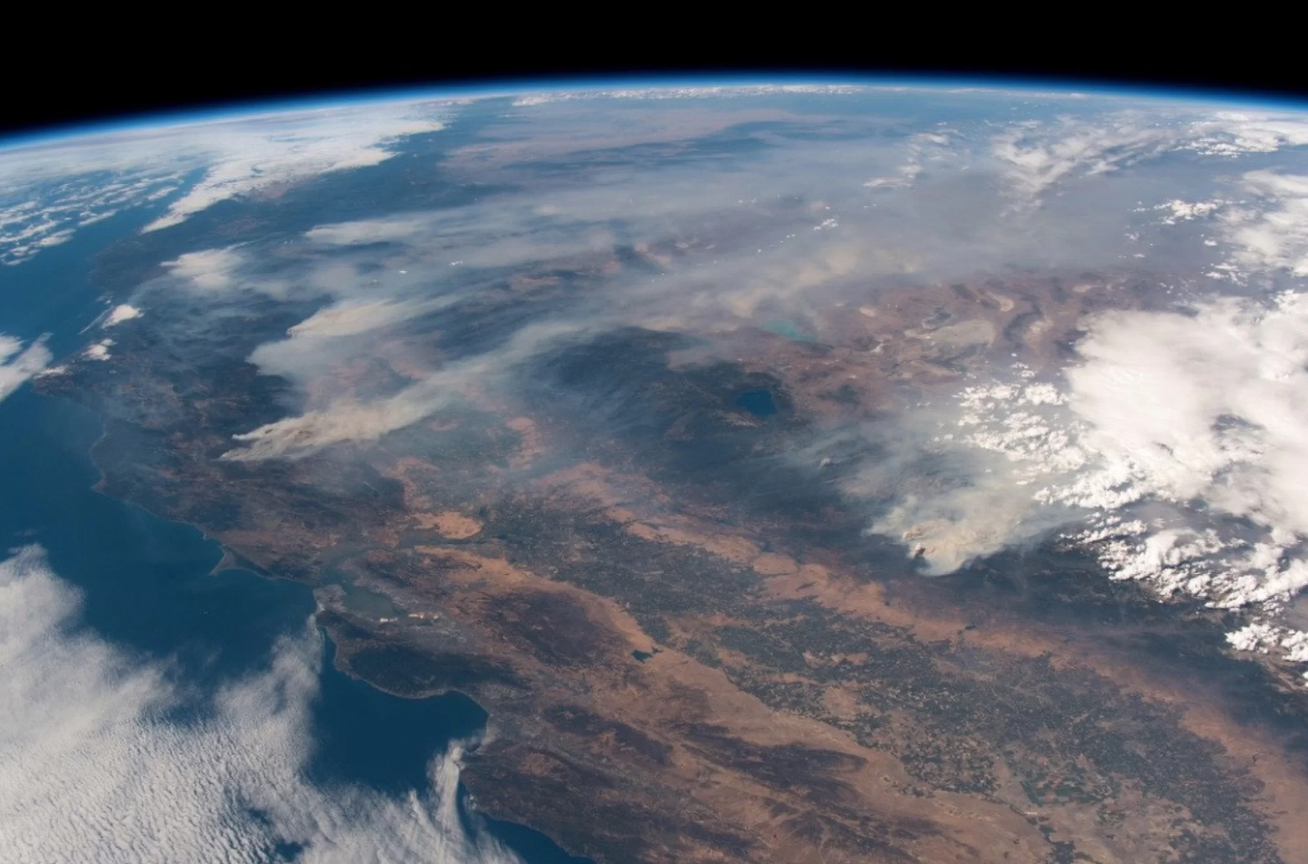
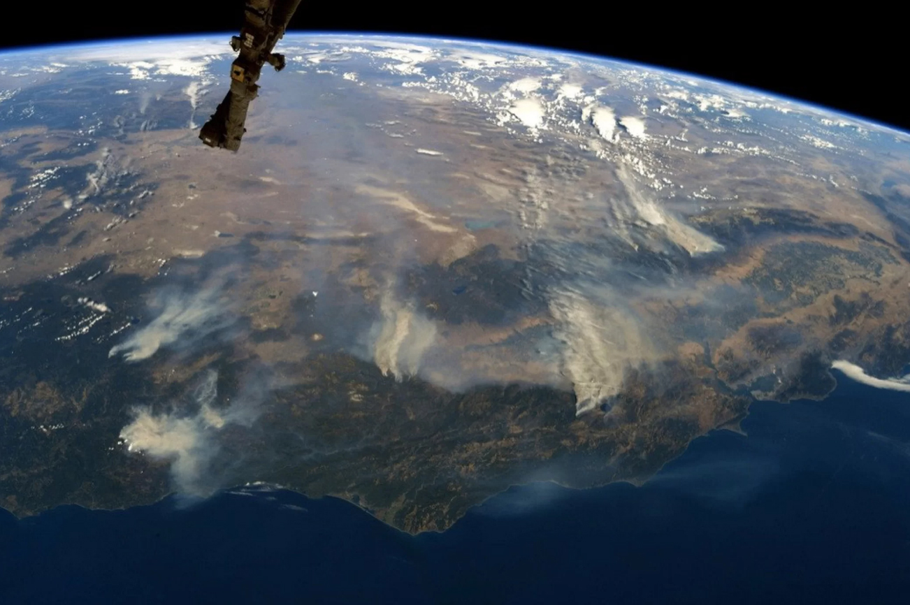
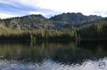
That admonition being made, I wanted to point out something I have noticed occurring consistently since the beginning of August. While the smoke in Mount Shasta has been the worst it has been in the 11 years I have lived here, I have observed that the smoke tends to blow northeast from the Carr Fire, flooding into the area and filling the valleys that lie around the foot of Mount Shasta. However, I first noticed on August 2nd, as I flew from Medford to San Francisco, that the Trinity Alps were surprisingly clear of smoke. There was a slight haze over them but, for the most part, they were remarkably free of the thick pall that hung over the Mount Shasta area. In truth, the clear air extended from the Russian Wilderness, just north of the Trinity Alps, all the way down to San Francisco. It seemed as though the air currents pushing in from the coast moved the smoke inland on a regular basis.
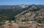
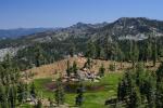
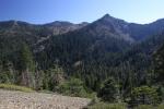
Duck Lake in the Russian Wilderness
Long Gulch and Trail Gulch Lakes in the Trinity Alps.
The Swift Creek drainage, with Ward and Horseshoe Lakes.
Gibson Peak and Stonewall Pass areas.
This conformed to what I would speculate is a natural flow of area from the coastal mountains to the inland areas. It also fit with what I observed while flying over the Carr Fire. All the smoke on the western edge of the fire was blowing inland:
Though the Trinity Alps were immediately adjacent to this area, they were pretty smoke free due to their westerly position.
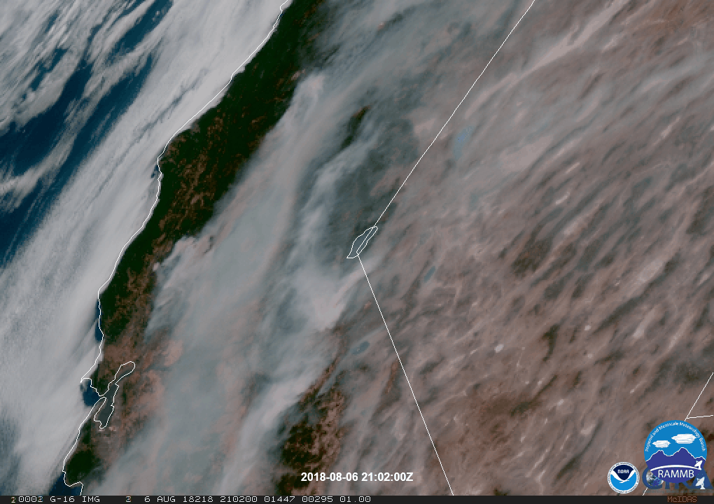
This prompted me to start looking at more satellite smoke imagery. What I found (not a scientific search!) showed a consistently eastward flow of the smoke and the Trinity Alps left relatively smoke free. Here are a few of the images I found:
On this image, note the small white crescent immediately above and left of the Carr Fire. That is the granite block that forms Canyon Creek. Note how it and the mountains immediately east (the “Red Trinities”) don’t have much haze over them. Image from August 7th.
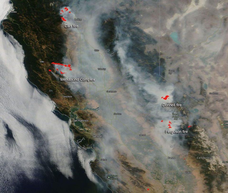
This image shows both the Mendocino Fire and the Carr Fire on the left side. While there is a little haze immediately northwest of the Carr Fire, it has noticeably better air quality than the Mount Shasta area. Image from August 3rd.
Here the Carr Fire is near the center. Mount Shasta is also visible. While it is clearer around the mountain, it is still obviously hazy. Also note the two fire burning in southern Oregon. Their smoke seems to trend to the southeast, still missing the Trinity Alps. Image from August 6th.
Unfortunately, as this time lapse shows, the smoke does, at times penetrate into the Trinity Alps region. However, while the smoke is present, it is still thinner than the thick clouds of smoke that seem to have coalesced around Mount Shasta. To those “taking my advice”, consider this image from August 8th fair warning that nowhere is totally impervious to the smoke.
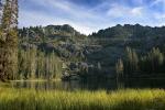
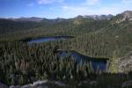
So, if one accepts that there is a reasonable chance of enjoying the Trinity Alps with good air quality, the question then remains where to go? Most of the Trinity Alps is a backpacker’s wilderness. Fortunately for those of us here in Mount Shasta, the northeast corner of the range has the highest concentration of good dayhikes. An additional bonus is that a number of these shorter hikes are reasonably graded and not excessively steep like many of the trails that make the Trinity Alps notorious.
The following trails are all reasonable dayhikes and easily accessed via Parks Creek Pass from Mount Shasta:
Perhaps as a little encouragement, here is a gallery of images from all the aforementioned trails. If you head out to the Trinity Alps, good luck and clear skies!
For my birthday, my wonderful wife sent me off to Texas for a few days to hang out with my best friend for a few days. He has been my best friend for 16 years but, since we finished school in 2006 and I came back to California from Texas, I have only seen him 6 times. We talk all the time, but distance keeps us from spending time with each other. Not only did she send me out there, she bought tickets to one of my favorite Texas country stars. Needless to say, my friend and I were both excited for a weekend of no work, no kids, lots of barbecue and music and time hanging out together.
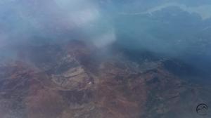
The one drawback was I had to fly out to Dallas first and I am not a fan of flying. The way I have coped with this is by sitting by the window and trying to figure out where we are by the landmarks visible below. This trip was no different, though the smoke and a bunch of storm clouds did obscure the view of a good portion of the trip. However, what I did see, especially in our local area, was quite interesting. Hopefully it is interesting enough to endure a few pictures of Texas too…
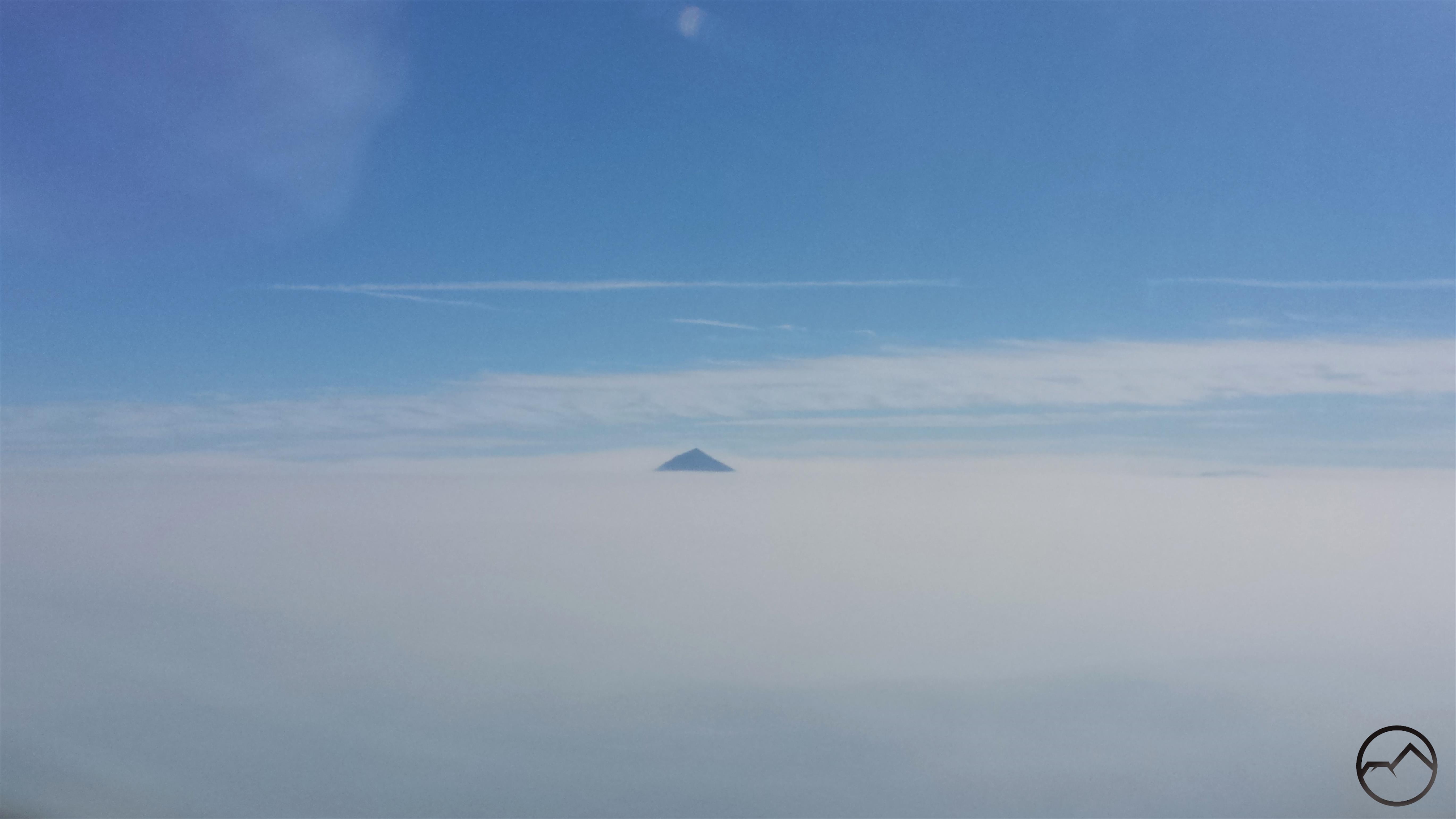
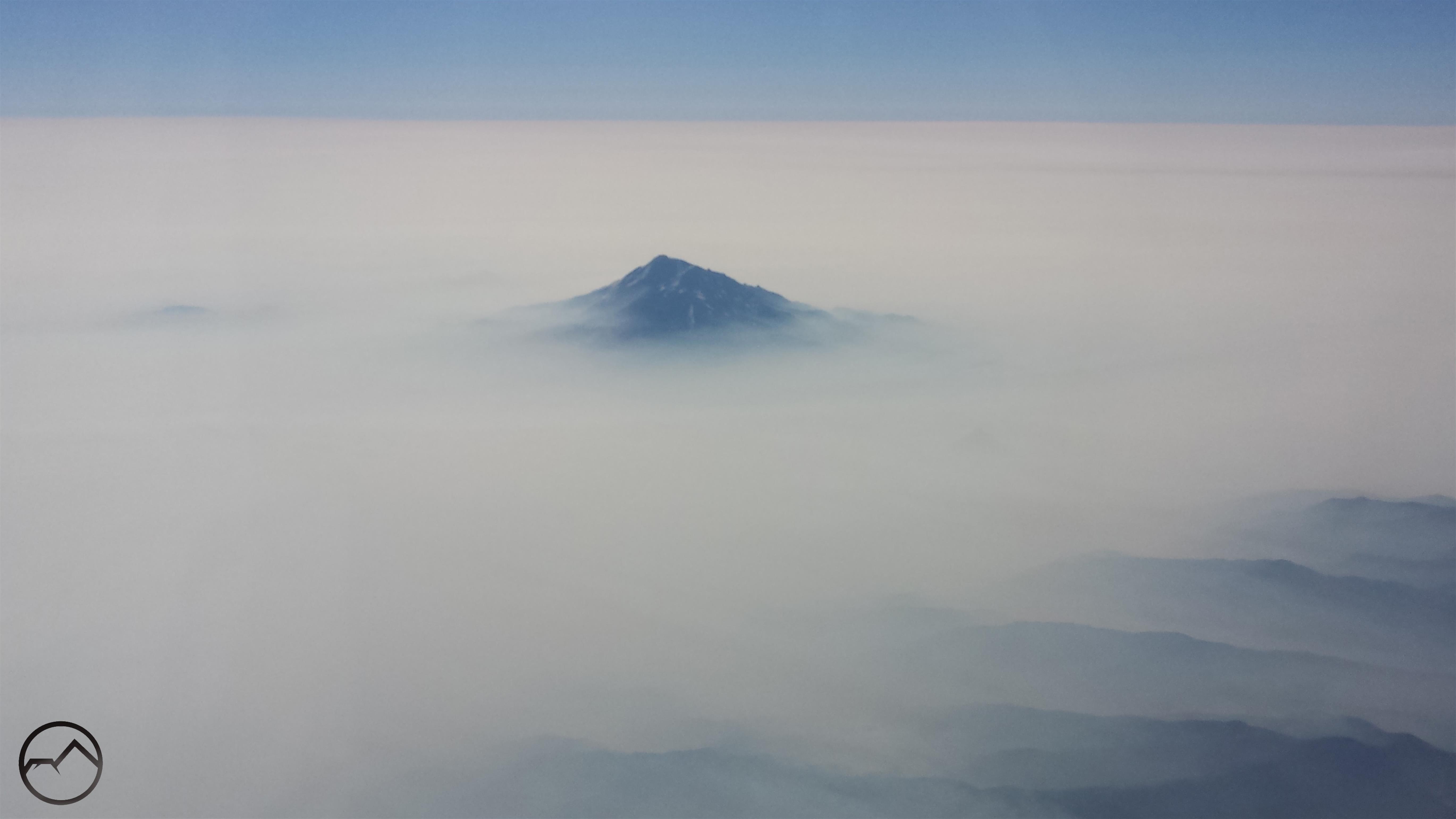
I flew out of Medford, which was even smokier than it was here in Mount Shasta. However, shortly after takeoff I spotted Mount McLoughlin poking up from the top of the smoke. At 9,493 feet, it was a good barometer for how high the smoke layer extended.
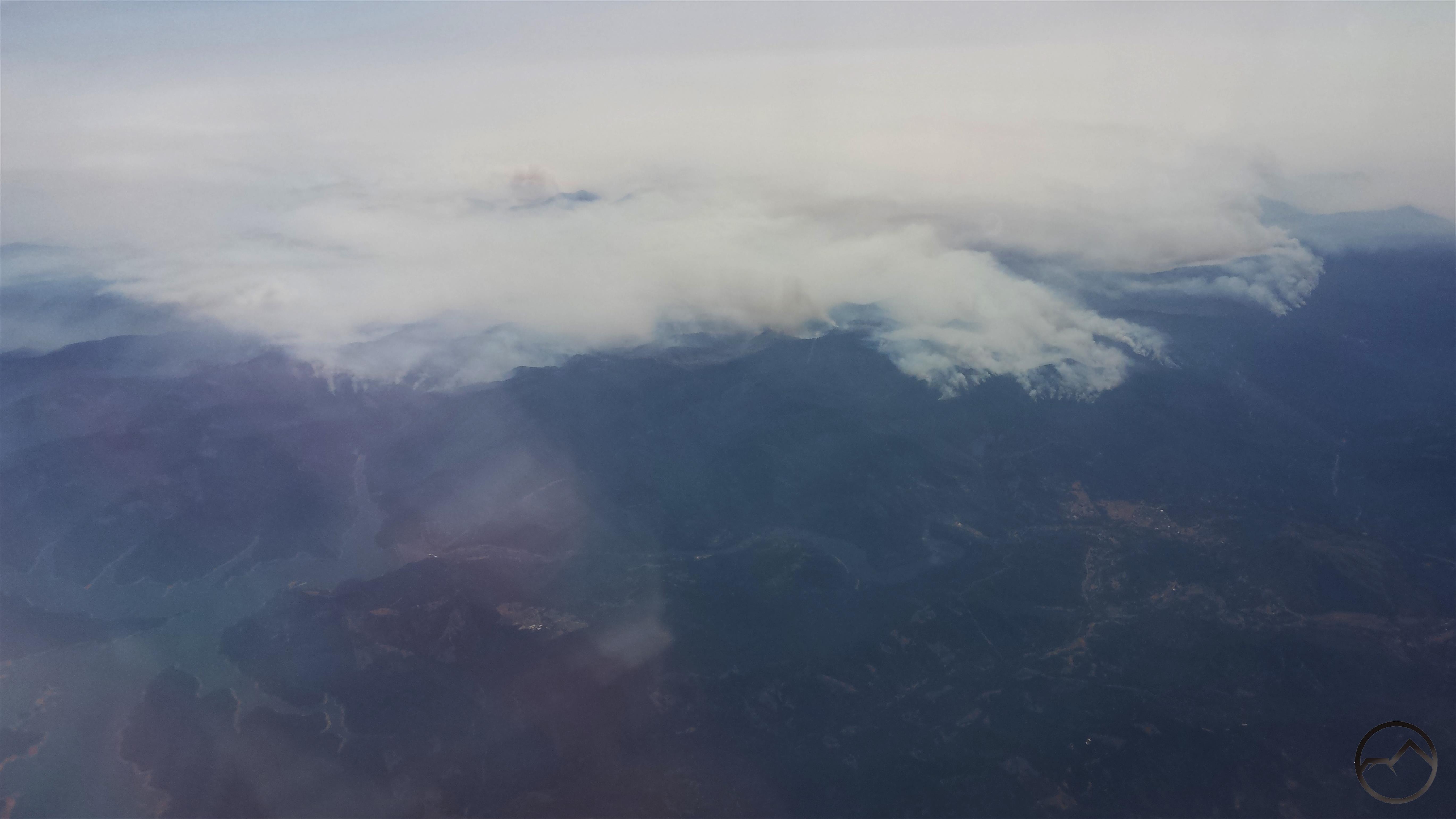
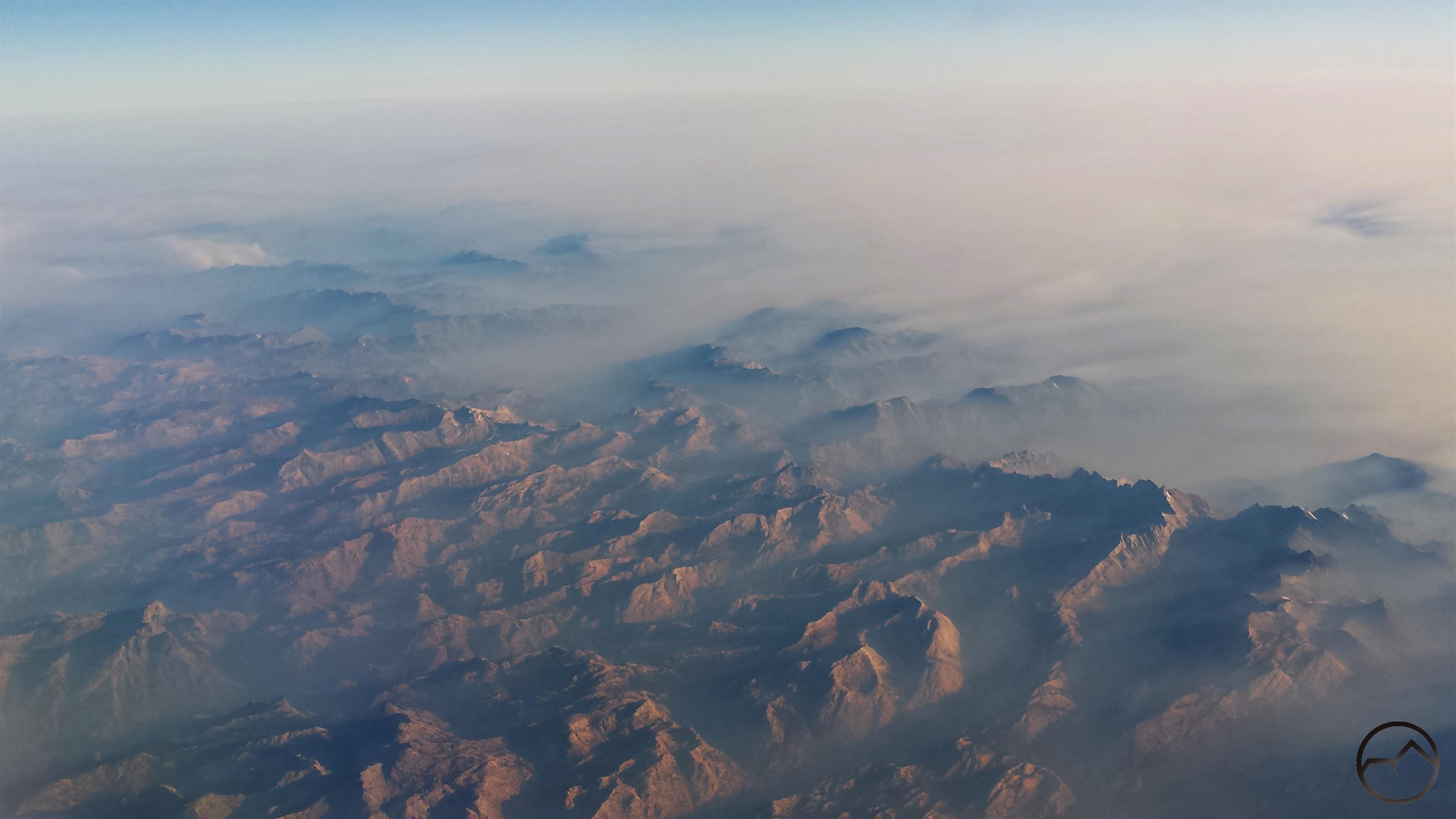
After flying over the Marble Mountains and Russian Wilderness, I finally had a good perspective on Mount Shasta. Several thousand feet of the mountain rose high above the smoke. It seemed like an island of clarity amidst a sea of chaos. Several other landmarks were visible, including the Whaleback, China Mountain, Mount Eddy and Porcupine Peak. The visibility, such as it was, of much of the Trinity Divide was evidence that the smoke was actually a bit better than it was in southern Oregon. It was good to see the mountain after its obscurity in the smoke for several days.
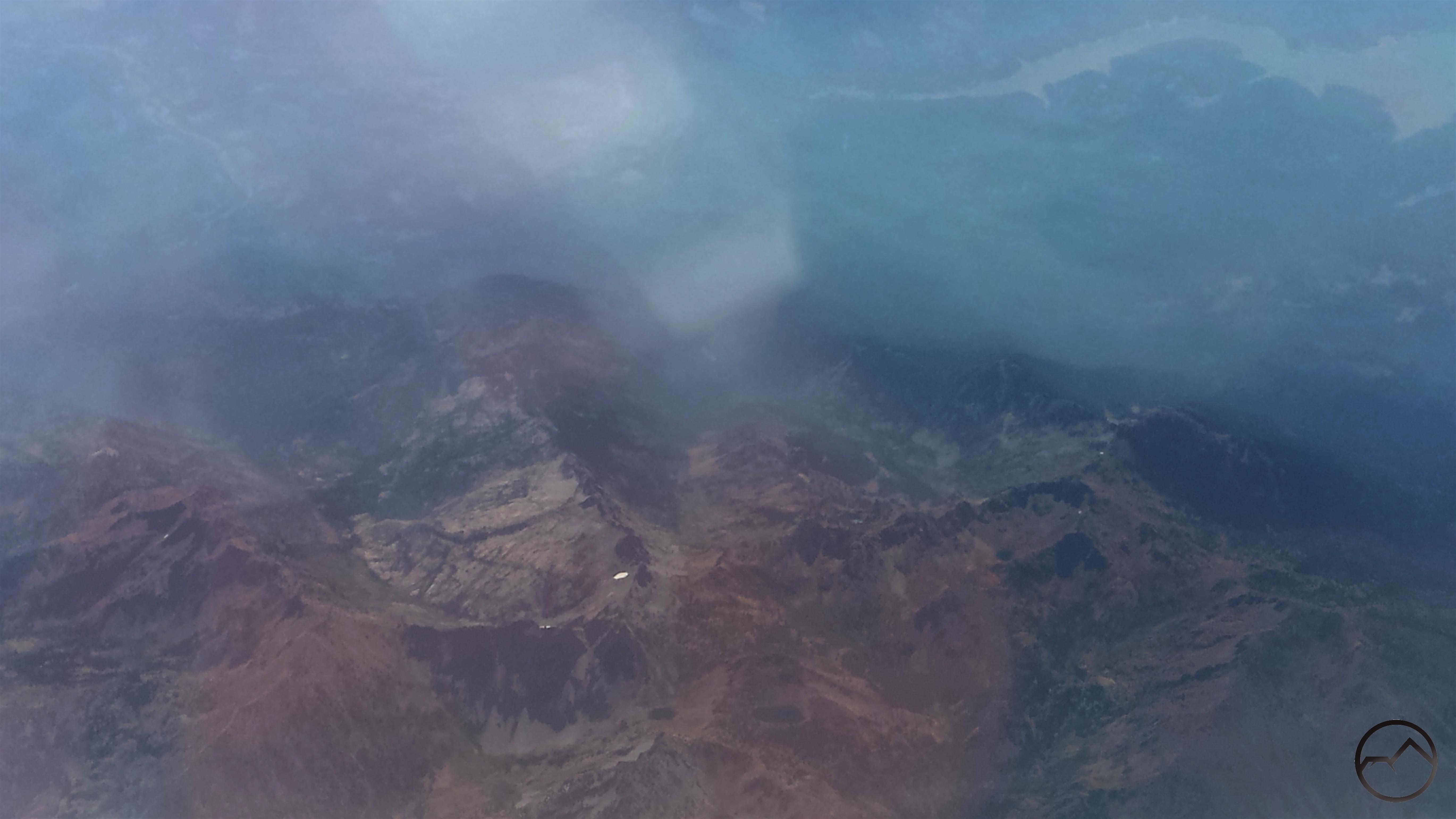
Next up was the Trinity Alps. These were surprisingly smoke free, which is remarkable considering how close they are to the Carr Fire. The area visible in this image includes Granite Lake and Gibson Peak near center and Siligo Peak with Deer and Summit Lakes in the center bottom. Middle Peak and Echo Lake are further to the right. Trinity Lake can be seen in the upper right hand corner.
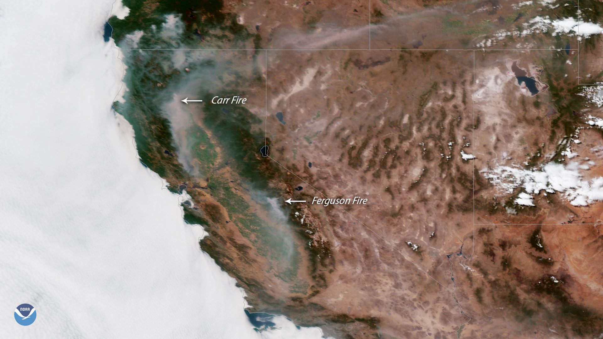
Shortly after the Trinity Alps, the plane flew past the Carr Fire. Here the western edge of the fire can be seen burning down toward Trinity Lake and the town of Lewiston. I could see planes diving low and dropping clouds of red retardant on the fire. It was a pretty dramatic sight.
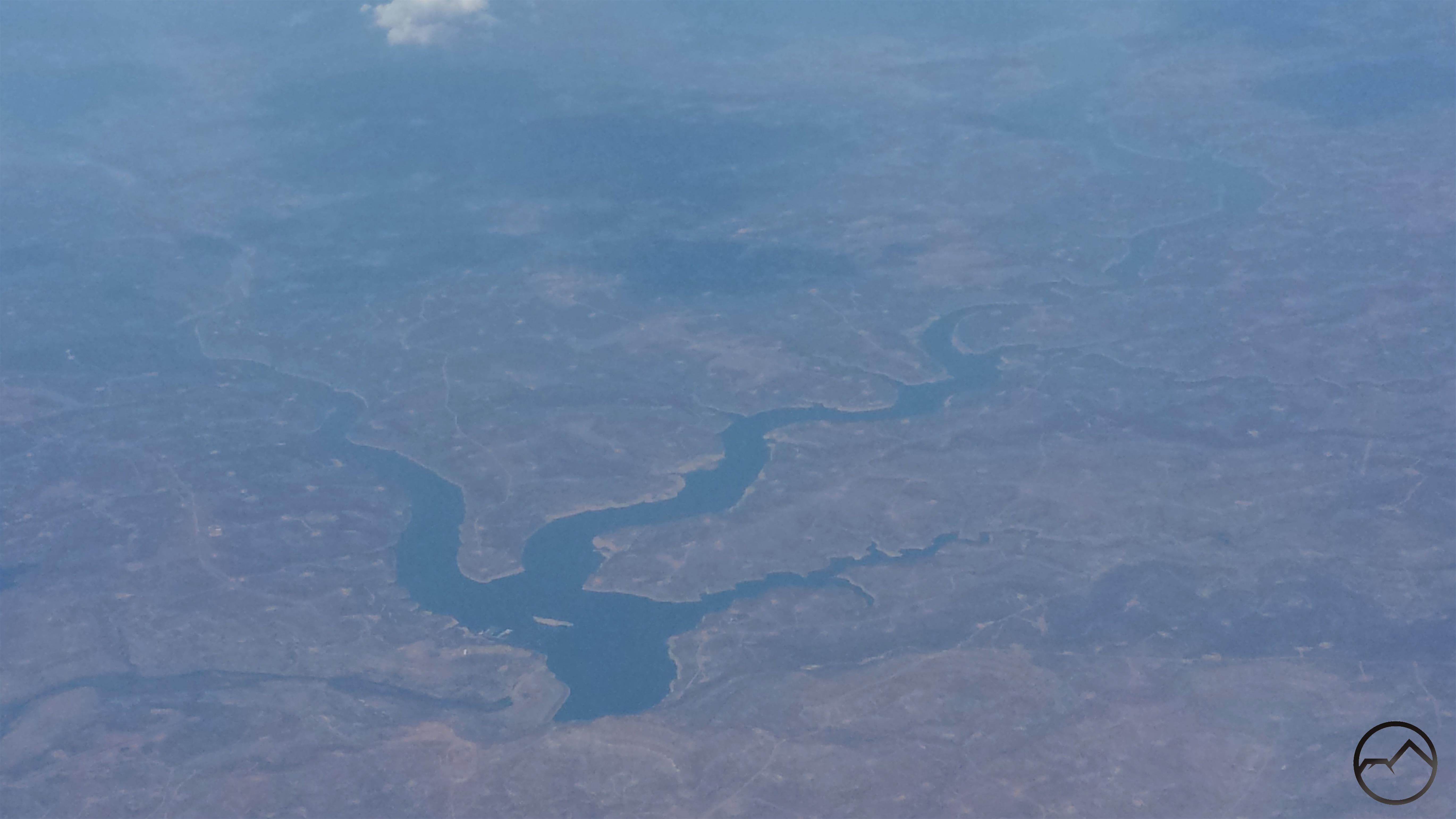
Once we left San Francisco, the smoke and clouds quickly closed in, making for a really bumpy flight. When things cleared up, the first landmark I was able to make out was Navajo Lake, which is near the Four Corner. The lake, formed by impounding the San Juan River, is mostly in New Mexico, though the upper most part of the reservoir extends into southern Oklahoma.
Next up was the Truchas Peaks, the 2nd highest collection of peaks in New Mexico and the southernmost 13,000 foot mountains in the Rockies. These towering summits lie in the heart of the Pecos Wilderness, one of the great wildlands of the Southwest. The darker ridge running vertically at the bottom of the image is the Trailriders Wall. It is probably my favorite spot in New Mexico. If you ever get a chance to explore this area, I strongly encourage it.
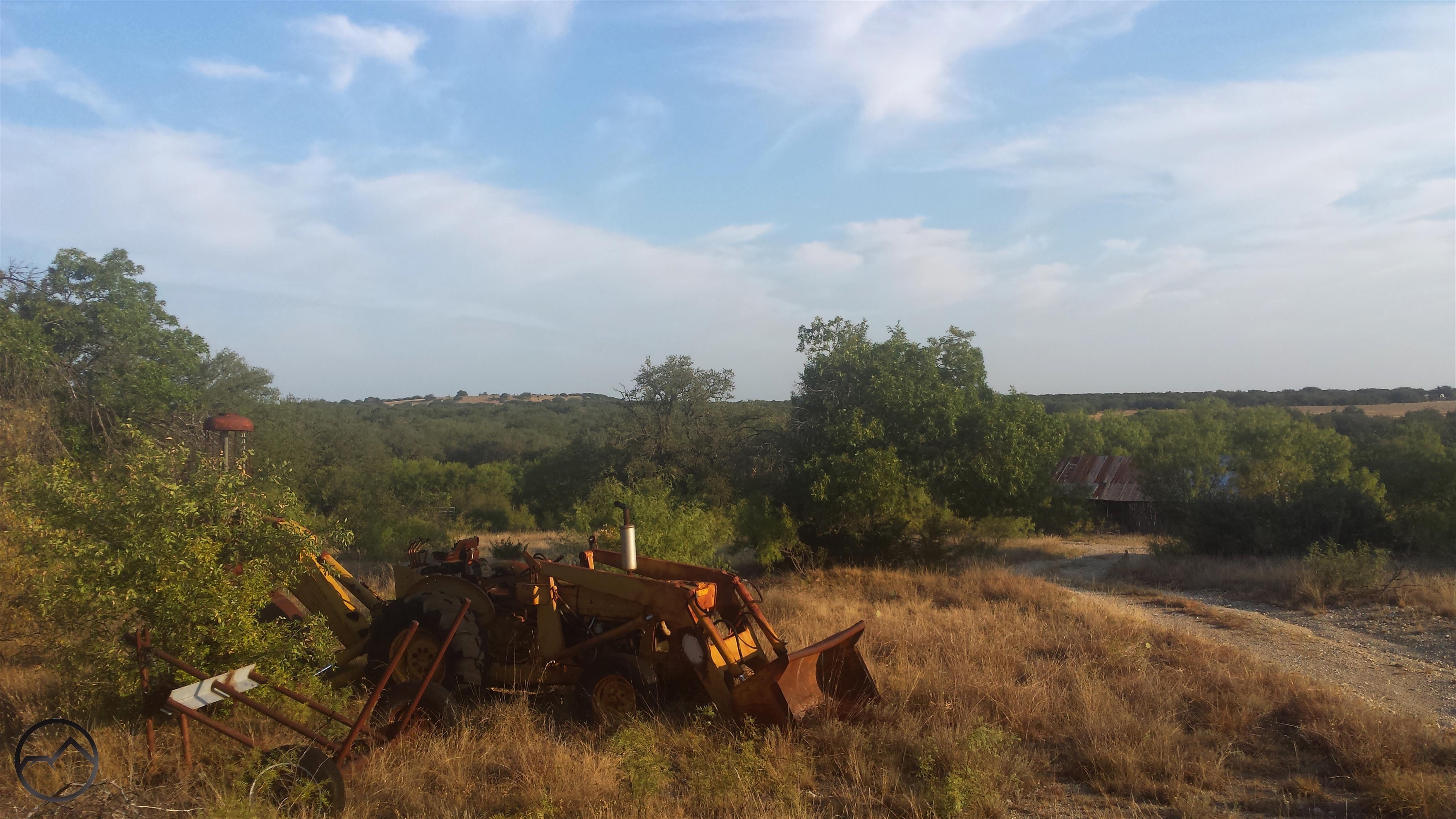
I finally landed in Dallas where my friend picked me up. I hung out that evening and I met his kids for the first time. The next morning we took a lap around our old campus and then headed south into central Texas, to the Hill Country, where he has a ranch. We spent the rest of the day shooting and driving around the old roads that wind around the property, which is several hundred acres in size. I spent a lot of time down there when we were in school together and it was a place with a lot of great memories.
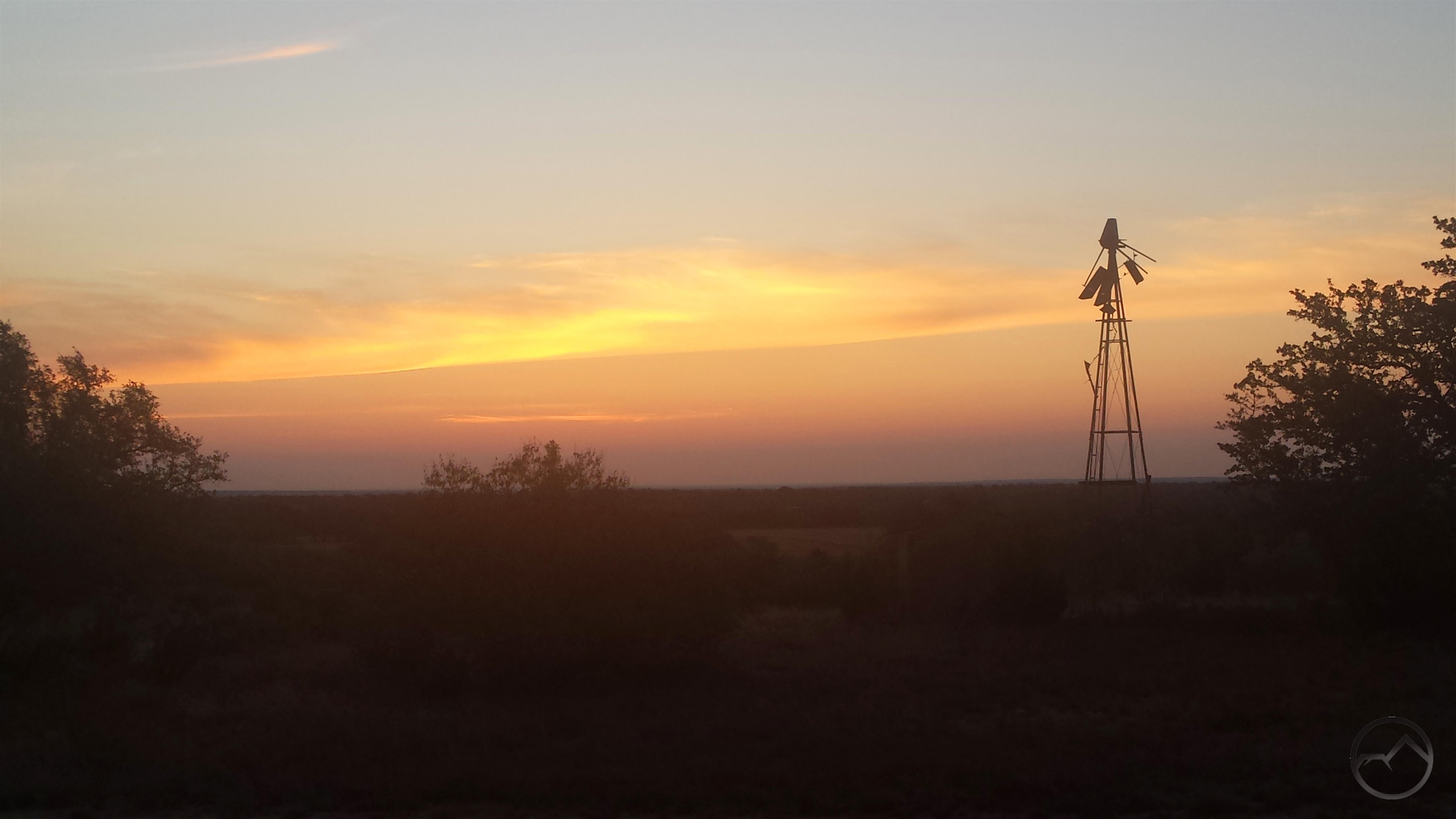
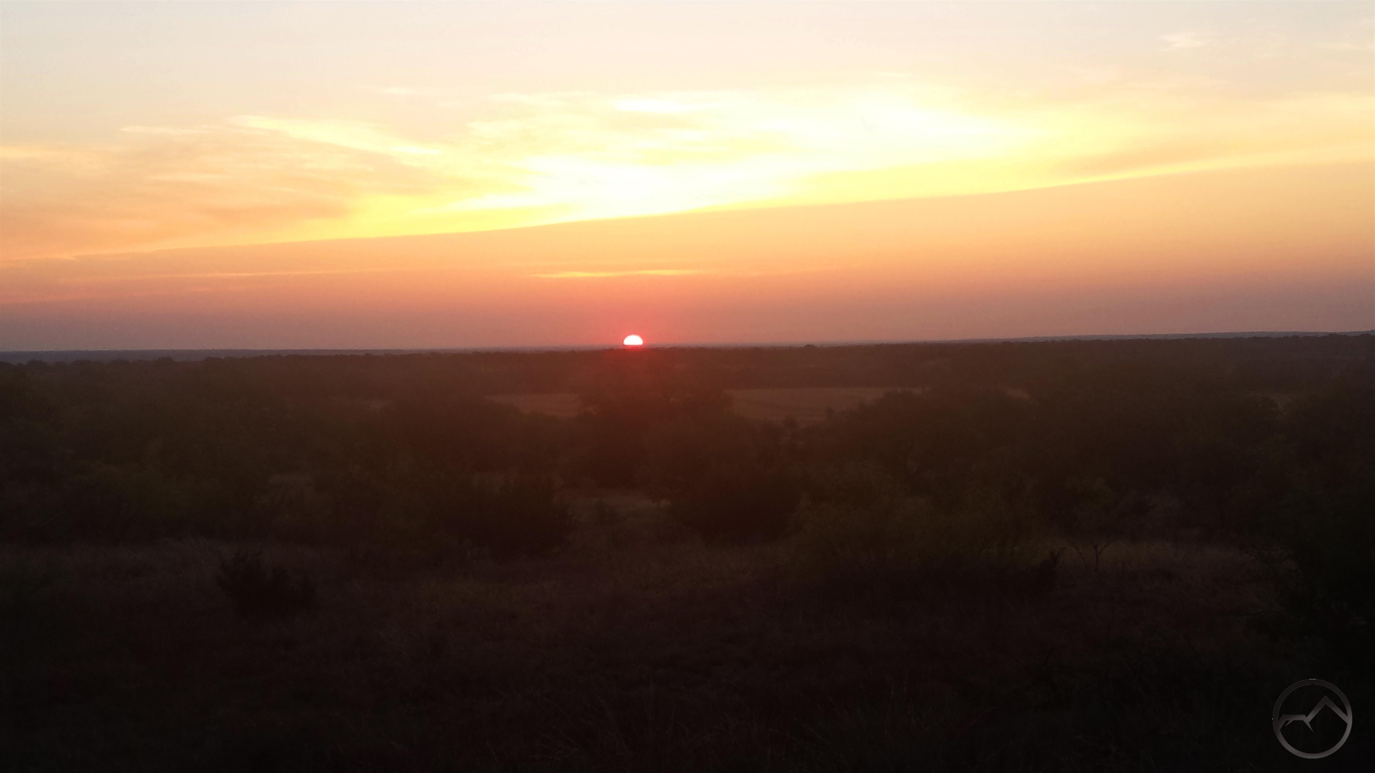
When I first moved to Texas, I had different perceptions of beauty in the natural world. My time there broadened my sense of what what beauty was, where to find it, and how to appreciate it. Naturally I prefer mountains and other such environments but it was good to get back into a land more subtle and be reminded of the value of the great scenic palette we have in this country. The sunrise we watched from the bluff was particularly magnificent.
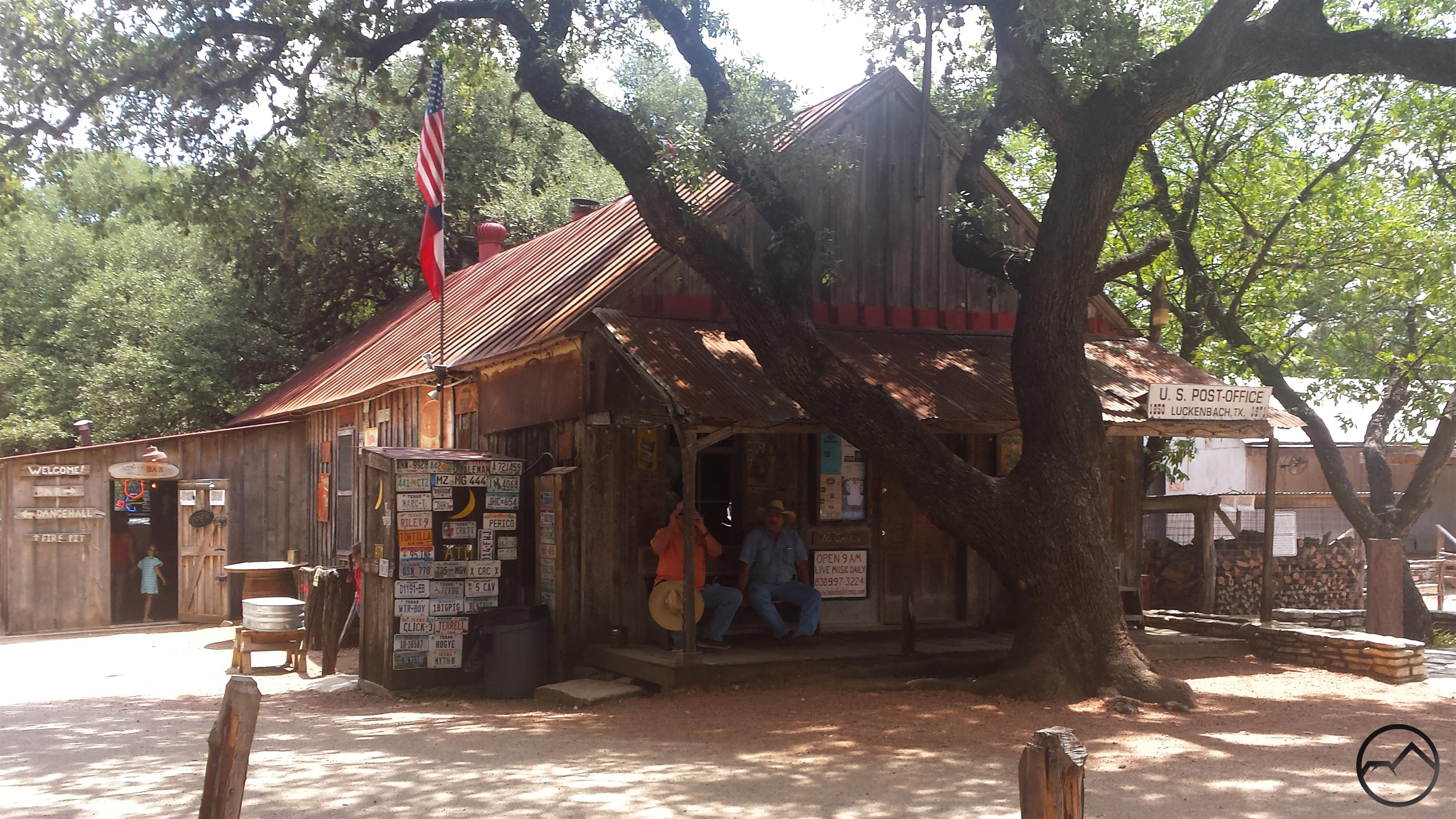
After leaving the ranch, we headed to Lockhart, Texas, where we planned to feast on BBQ for lunch. On the way, we went through Luckenbach, which is, though a bit of a tourist trap now, still sort of the center of the Texas country music scene (Gruene Hall is the real heart of Texas country, of course). Once in Lockhart we had lunch at all three of the great barbecue places, Blacks, Kreuz Market and Smitty’s. All were amazing but Kreuz was far and away the best. If anyone is in that area and likes BBQ, stopping and having some brisket is a moral imperative.
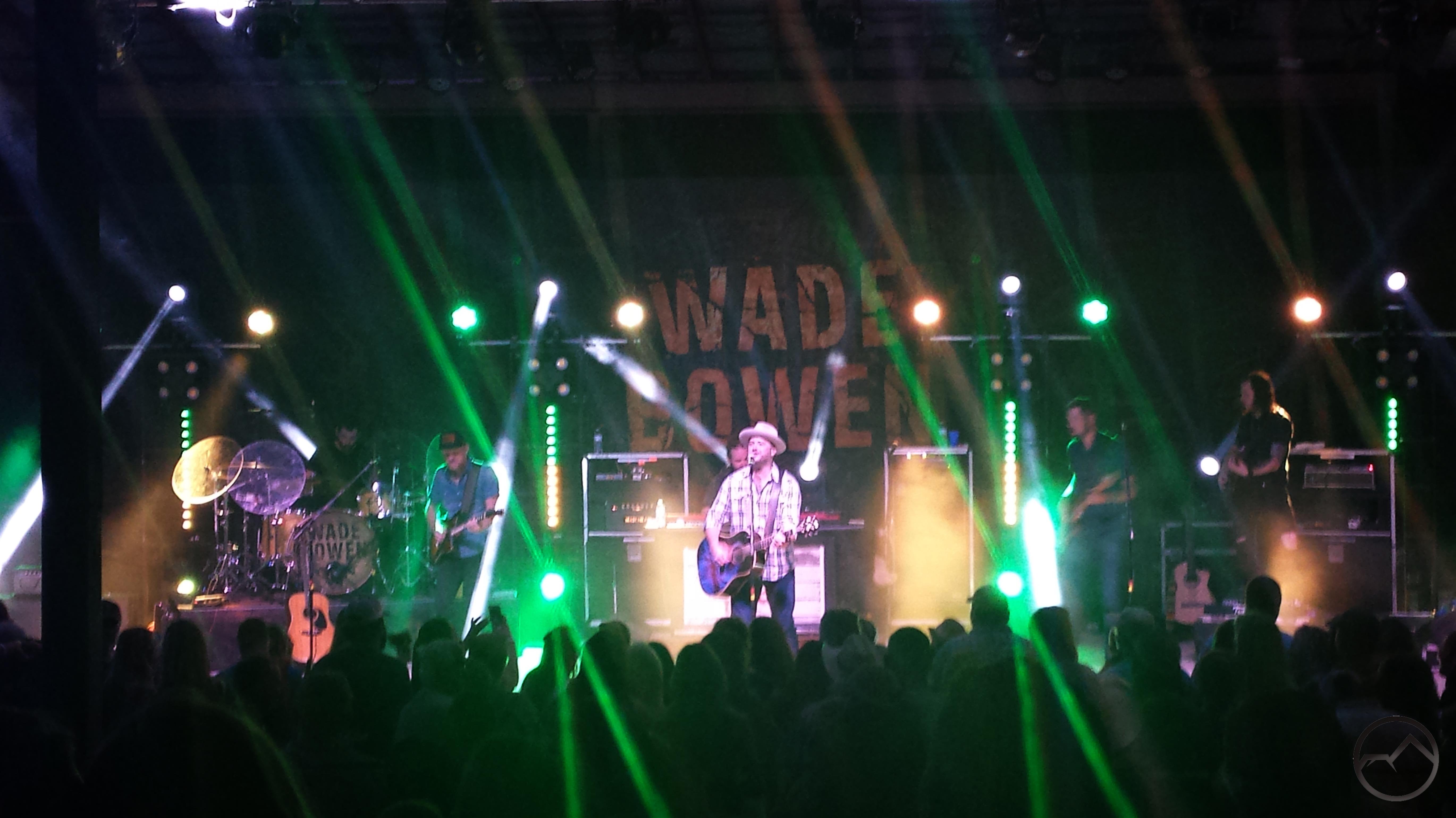
That night, we went to New Braunfels and watched Wade Bowen. It was a fantastic show. In my assessment, he is the top of the heap in the current Texas music scene. A few samples, if anyone is interested, can be found here, here and here. After that, it was one more day to hang out with my friend, head back up to Dallas and get ready to leave the next morning. It was a quick but great trip.
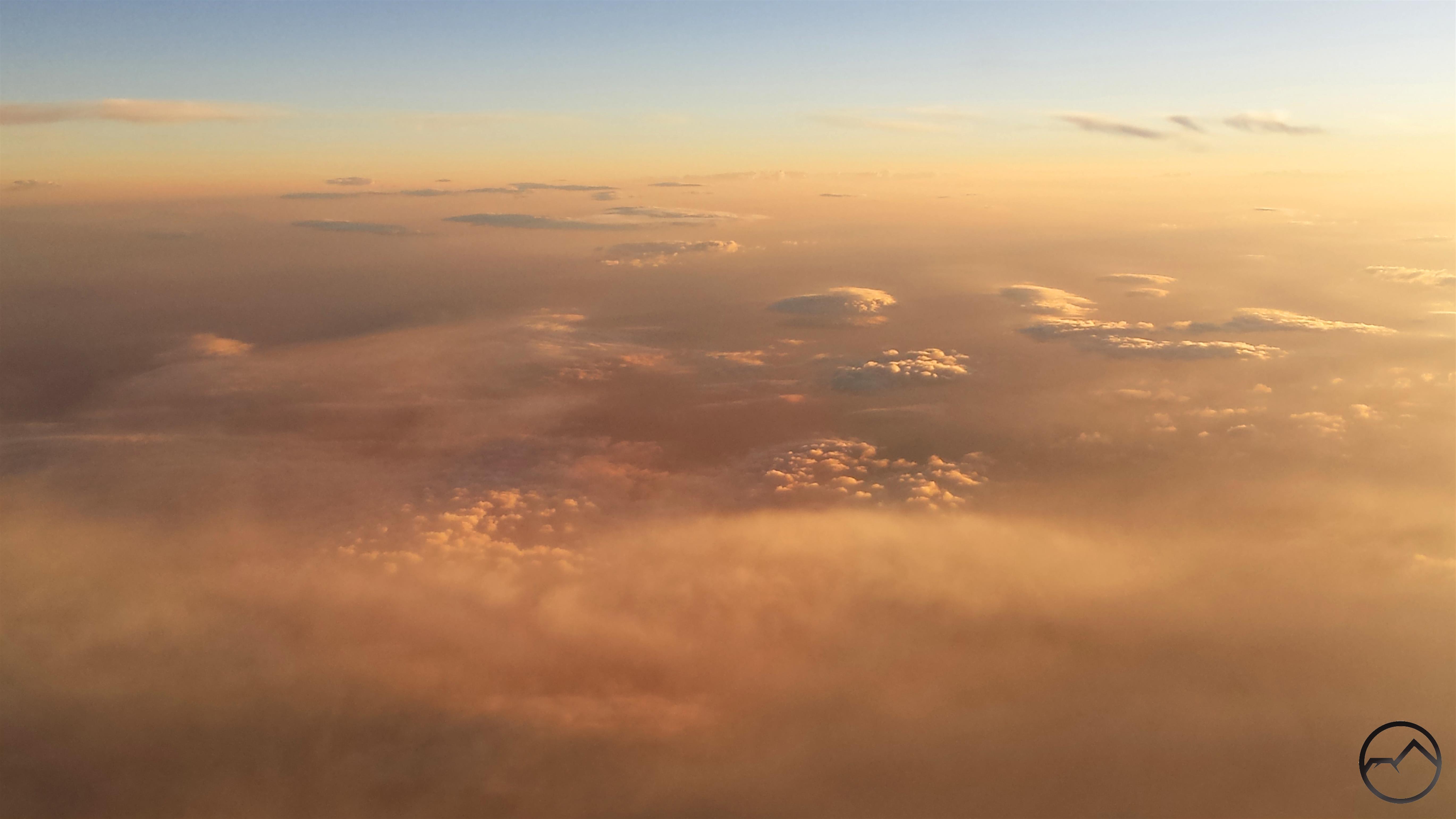
My predawn flight let me watch the sunrise from the air. It was magnificent. However, smoke covered much of the Southwest. It began halfway between Dallas and the New Mexico border an continued, for varying degrees, all the way to San Francisco Bay, where it came to an abrupt halt on the eastern edge of the Bay. San Francisco was crystal clear.
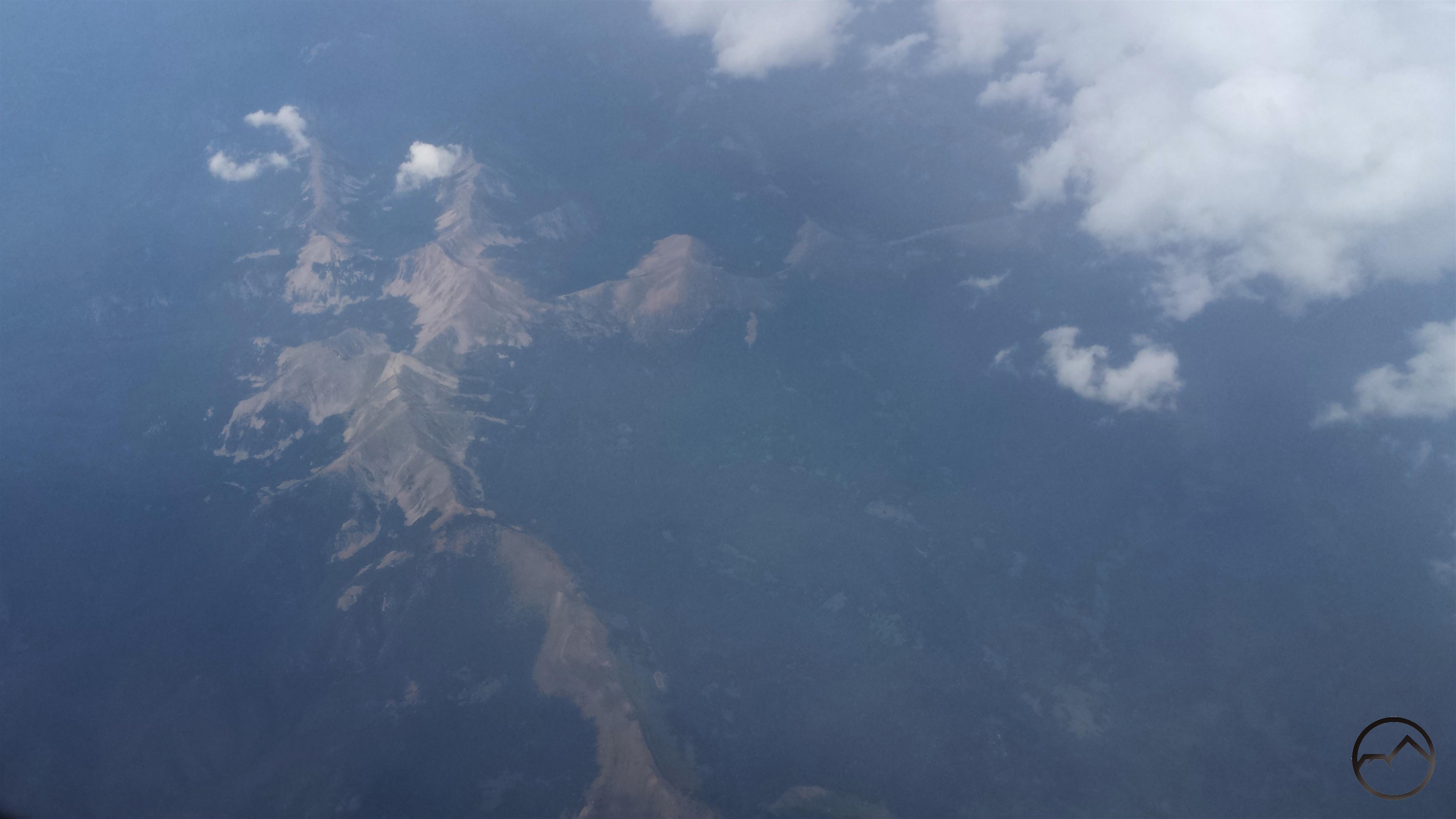
Near the end of the flight, we made a dramatic crossing of the Sierra Nevada. The bulk of the smoke covering the Great Basin was held back by the mighty mountain range. The morning light, mixed with the thin smoke over the Sierra turned the range pink. Range of Light indeed. Special credit to anyone who recognizes where this is. There are a number of good clues if anyone is a real geography nut and wants to figure it out.
The smoke was really thick all over California, but once again, Mount Shasta rises above it. I sure will be glad when this all blows away. Though it is small consolation, this stuff is everywhere, from Texas to California, so it is not like we are particularly afflicted.
I just want to offer a special thanks to my amazing wife for such a fantastic and selfless birthday gift. I am blessed beyond words.
Tuesday morning sunrise in smoky skies above Black Butte.
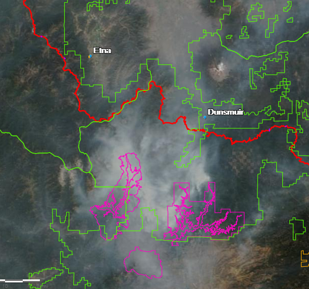
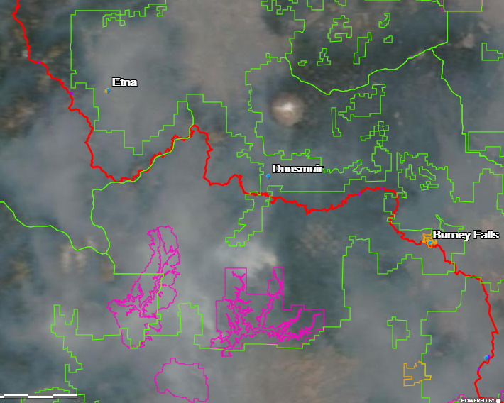
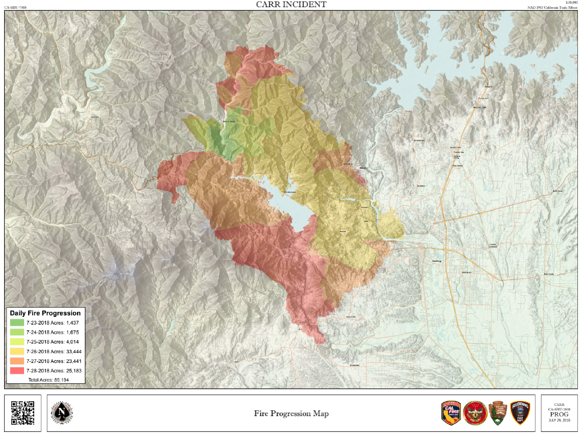
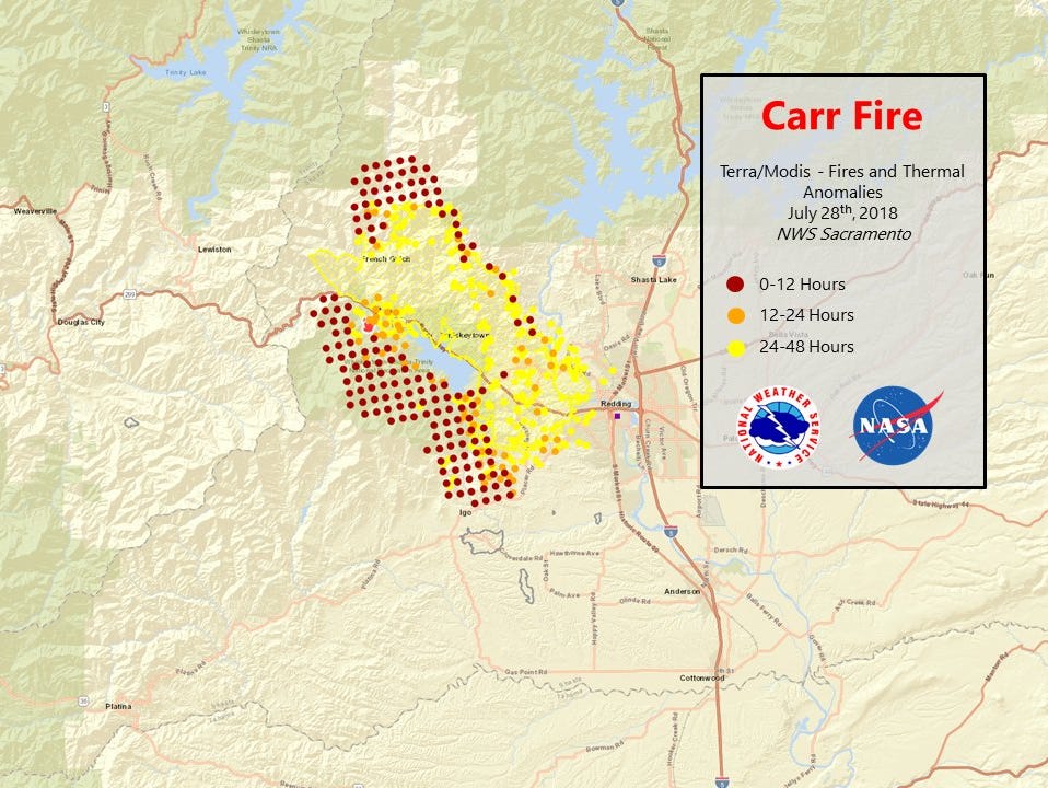
I know I said yesterday was the last time I was going to post some maps from the Carr Fire. However, I came across a few more helpful maps that I reckoned might be helpful if shared. These will definitely be the last ones, since I am heading to Texas to go on a BBQ and country music odyssey with my best friend. That said, to the maps:
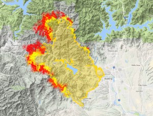
The fire’s growth has slowed significantly. It has now surpassed 100,000 acres but it is also 25% contained. Here is how it looked at 8:30 AM on Tuesday:
Compare this morning with yesterday morning:
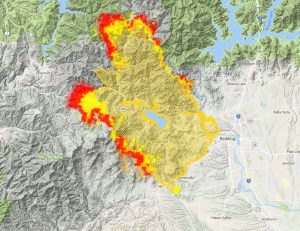
7:00 AM Monday
8:30 AM Tuesday
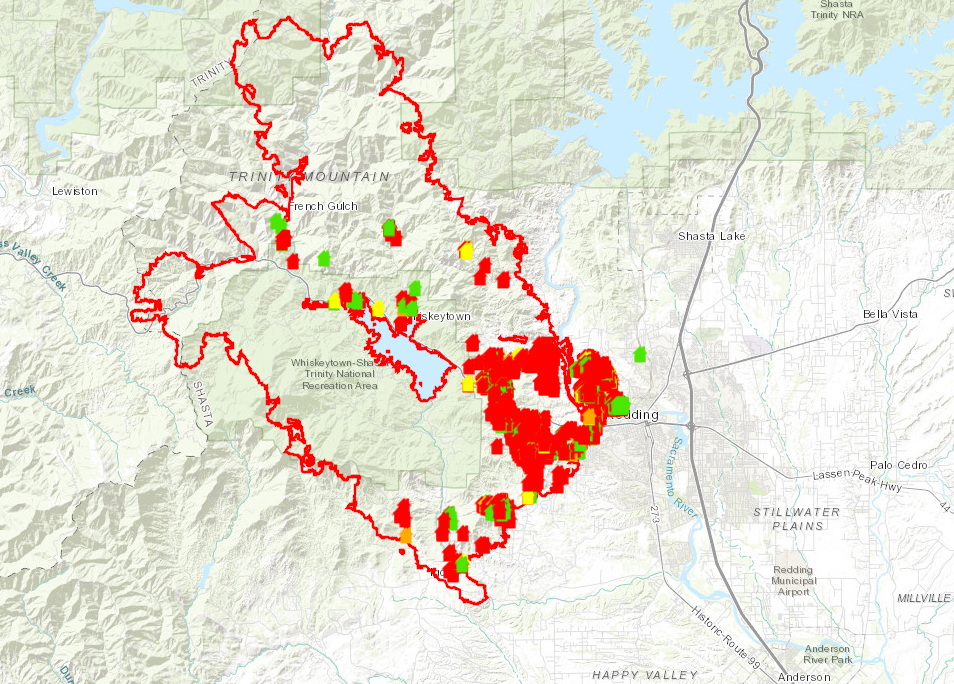
Another helpful map I found shows structures damaged by the fire. This map is in the process of being updated, so it is not yet exhaustive. It has much more detail when examined in the online version.
Lastly, here is a really helpful gif that illustrates the fire’s expansion. The explosion on Thursday is very reminiscent of what happened in Sonoma County with the Tubbs Fire.
Hopefully all the maps have helped. Keep praying the fire will burn itself out soon and the smoke will blow away. Lord willing!
Black Butte is barely visible from my front yard on a smoky Monday morning.
Today is day 5 since the Carr Fire really blew up and sent a firestorm down into Redding. The fire started actually started a week ago but no one foresaw the way the conflagration would erupt and slow into populated areas like it did. Fortunately, the lines established in Redding have held for the three days and the fire’s eastward advance has been halted. Even better, it seems to have been halted in the south around Igo and also the growth has been significantly slowed at Buckhorn Summit, though it looks like the flames will probably reach the shore of Trinity Lake. The fire is now at 17% containment and growing. I think the corner has been turned. Unless something changes and things get worse again, this is my last collection of maps that I am going to post. I am heading to Texas in a couple of days anyway, so I am going to be offline for a while. Let us pray we are nearing the end of this fire. Then the rebuilding starts. I hope some lessons can be learned from the aftermath down in Sonoma County. I have a lot of thoughts on that.
As noted, the growth of the fire has slowed significantly. Rather than doubling in size each day from Wednesday to Saturday, it only grew around 6% on Sunday and containment has been increasing. The real hotspots now are at Buckhorn Summit and in the north, approaching Trinity Lake. The real effort now is to keep the fire out of Trinity County. Here is how things look as off 7:00 AM this morning:
There are still some hotspots on the south and east but it looks like the danger is past for Redding and the surrounding communities. There is even mention of evacuees returning home soon.
For what it is worth, here is a comparison of the fire’s position from about 8:30 last night with this morning:
8:30 PM Sunday
7:00 AM Monday
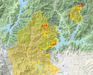
Also, I think the map below is really helpful in seeing the progression of the fire. It is only current up to about Sunday morning, but it shows the major evolutions of the fire:
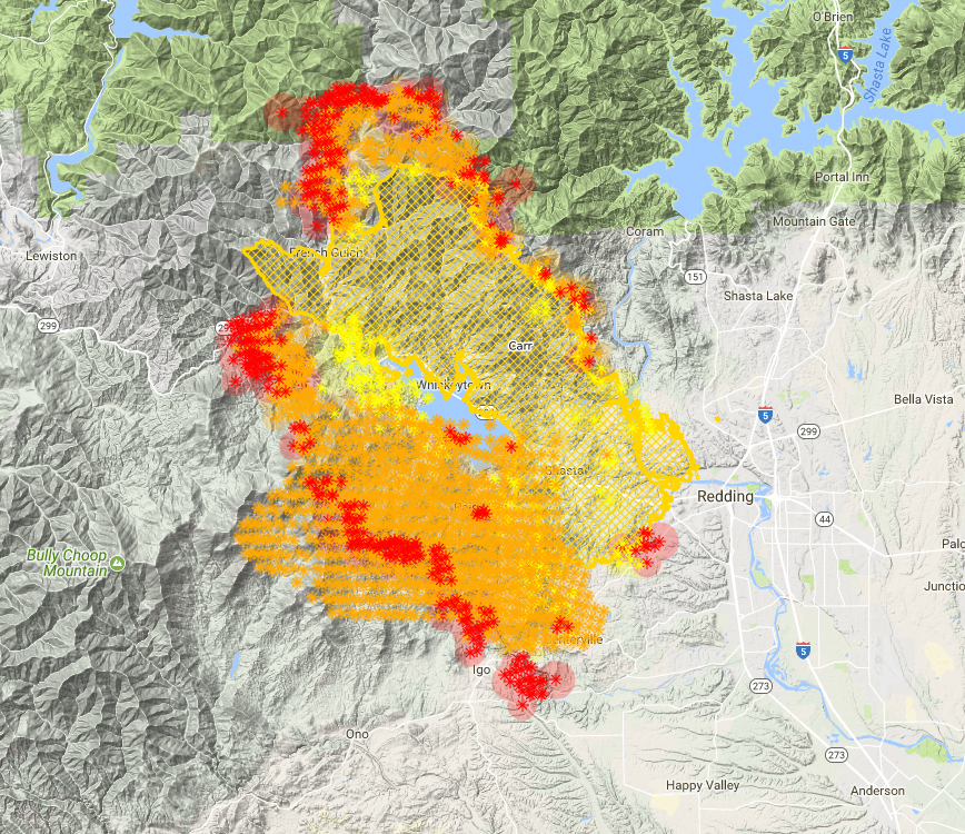
Sadly, Whiskeytown Lake looks like is in the center of a fire donut. Cue Johnny Cash. It is evident that nearly 100% of the Whiskeytown National Recreation Area burned. That is a lot of visitor center, marina, campgrounds, trails, etc. that are lost. I was even wondering if there is an archived version of the audio of JFK’s speech that he gave at the opening of the park. It was used as part of one of the displays and I am guessing it burned. Hopefully it can be replaced. It will be interesting to see how the National Park Service responds to this disaster.
Looking south from the Old Ski Bowl on Mount Shasta into a wall of smoke.
Yesterday things were relatively clear here in Mount Shasta, as evidenced by a beautiful evening at the Old Ski Bowl. The winds have evidently shifted because the smoke is thick up here this morning. I have been checking on the fire’s progress this morning and it seems that the advance of the fire continues to slow. I want to issue a caveat on two points though. First, I may simply be reading the data incorrectly. Second, there is a red flag warning issued for this afternoon down in Redding because it is supposed to be hot and windy. This means the even if the fire has slowed, it can still be whipped up into a firestorm again. Let’s pray that does not happen.
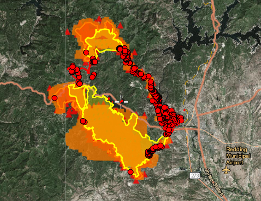
Checking on the fire conditions last night, it showed the fire slowing its advance considerably. The lines holding it back in Redding continued to hold, but the focus of threat had now shifted north and, even more urgently, south to the town of Igo. This small community was held in a salient, with fire lines being set on three sides. This morning, it appears that this is still the case, with no significant fire movement in the last several hours around Igo. Compare maps from 10:00 PM Saturday and 6:00 AM Sunday:
10:00 PM Saturday
6:00 AM Sunday
Update: The heat has already intensified significantly between 6:00 AM and 8:00 AM. Note the difference:
6:00 AM Sunday
8:00 AM Sunday
Note that now, the fire’s most intense points are to the west and north, though it does not look as intense as it did last night. Nonetheless, evacuations have been ordered for parts of Lewiston and Douglas City in Trinity County. Compared to the land around Igo, which is rather flat and not densely vegetated, the terrain heading west is very rugged, with dense woods and chaparral. Fire lines are much harder to cut and hold.
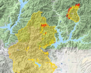
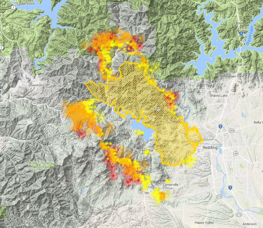
These other maps confirm these conditions:
I haven’t been able to find out what the red dots mean, but the area and intensity of the fire is evident.
The newest areas on the map show small advance near Igo but more to the west and north.
I am praying the lines at Buckhorn Summit hold. If the fire jumps that, it is a straight shot down to the heart of Trinity County.
The blood moon event occurred Friday night but we still had one last night due to the smoke.
Update: I definitely could be reading this map wrong and is not my intent to spread rumors or incorrect information. That said, this map looks like the fire is easing its intensity. It certainly does not show much fire growth. I really hope this is the case!
Update: This map is a few hours old but it gives a good look at the full extent of the where the fire has burned.
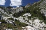
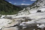
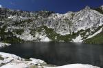
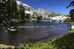
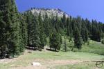
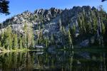
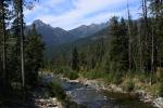
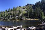
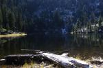
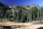
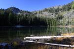
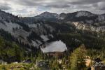
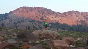
With the Carr Fire continuing to expand, I was anticipating the sky to be smoky around Mount Shasta. Surprisingly, the smoke was pretty thin and the sky blue. The hike to Cliff Lake with the Cub Scouts was a lot of fun.
Since the smoke was relatively (emphasis on the relatively) sparse, I took my family up for a picnic dinner at the Old Ski Bowl. We figured thin smoke would get thinner and the temperatures were bound to be cooler. This proved to be the case and the conditions were quite nice. However, there was a wall of smoke to the south, obscuring almost everything from view. Mount Eddy and Porcupine Peak were visible but only through a very thick haze. Everything else to the south was obscured by an utterly impenetrable wall of smoke. My kids had a great time scrambling on the rocks, oblivious to the ongoing ordeal continuing to the south. I almost felt guilty enjoying the moment.
The smoke was visible above Gray Butte.
Clear skies were visible to the west.
The smoke caused some unusual light to be cast on Mount Shasta at sunset.
If you are looking to escape the smoke, heading up onto Mount Shasta or the Trinity Divide appears to be a good option.
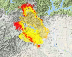
As far as what the fire did today, it seems to have slowed its advance to some degree. The live map shows some advance to the south, but the firefighters look to be making a strong stand at what I would call the Igo Salient. The small community is threatened on three sides but the backfires lit earlier today will hopefully keep the main part of the fire at bay.
The Carr Fire as of 10:00 PM
Hopefully the significant decrease in the red area is indicative of the fire activity decreasing somewhat. I would imagine that the gentler terrain, less dense vegetation and more road access will make containing the fire much easier in the south. We’ll know tomorrow morning. Keep praying.
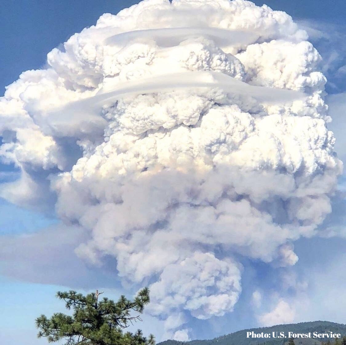
A massive, lenticular-laden pyrocumulus clouds builds above the Carr Fire. Source.
It seemed my last post rounding up maps showing the current conditions for the Carr Fire was helpful. Consequently, I am starting another one to continue monitoring the fire’s progress.
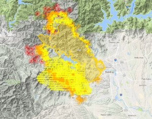
So, as far as I can tell, the lines in west Redding have held and the fire has not been able to push further into the city. However, the fire continues to expand both to the north and, more significantly, to the south. This is unfortunate, since it means a lot of beautiful terrain in Whiskeytown is going to burn. Better this than the city, but it is still sad.
As the map itself notes in the key, the red dots indicate the fire is moving south. Evacuations orders for Igo and Ono have been ordered. According to the map, the threat to Igo looks imminent. Fortunately, the terrain really levels out south of Igo and there is a lot more road access to the area and less dense vegetation so cutting in some fire lines down there to contain the fire might be a lot easier.
The movement of the fire is confirmed on the live map, which I captured at 7:15:
It looks like the fire is overtaking Shasta Bally, which is unfortunate. At the very least, Whiskeytown is going to have to be rebuilt from the bottom up, which is to say nothing of the hundreds of homes already lost.
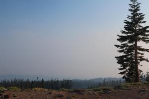
For those of us not in the immediate fire zone, here is a look at what the smoke has been looking like:
Strangely enough, it isn’t too smoky out right now, here in Mount Shasta. This is good, since I am leading the Cub Scouts on a hike to Cliff Lake this morning. The smoke is thin right now and I think we will be high enough to not have much around at all up there. It is thankfully cool too, so the hike should be a good one for the kids.
I will check back in later today with some more map updates. Pray the fire lines in Redding hold and for all the people holding them!
DISCLAIMER: Any use of the information contained in this site by any and all persons is done at their own risk. The operator of this site shall be held harmless from any and all alleged claims, demands, causes of action, liability, loss, damage and/or injury to property or persons whether brought by an individual or other entity. This indemnification applies, without limitation, to all actions by an individual or other entity as a result of their use of information contained in this site.